Here’s the release from the Southeastern Colorado Water Conservancy District (Chris Woodka):
The Southeastern Colorado Water Conservancy District applauded state approval of a $100 million financing package for the Arkansas Valley Conduit that will allow construction to begin in the near future.
The Colorado General Assembly passed the annual Colorado Water Conservation project bill which contains the funding earlier this month, and Governor Jared Polis signed the bill into law on Monday.
“The Arkansas Valley Conduit will be a lifeline for the Lower Arkansas Valley for generations to come,” said Bill Long, President of the Southeastern District. “Governor Polis, the General Assembly and the CWCB have all shown vision and foresight with this support of the AVC. This goes beyond just financing a pipeline, because really it’s an investment to assure clean drinking water for the future.”
Long also noted the strong bipartisan support the AVC enjoys from the entire Colorado congressional delegation, and noted in particular the leadership of Senators Cory Gardner and Michael Bennet, and Congressmen Scott Tipton and Ken Buck.
“I want to thank the CWCB board and staff for including this funding in their annual bill, and express our sincere gratitude to the legislators from the Arkansas Basin for their leadership and support,” said Kevin Karney, chairman of the District’s AVC committee. “The recognition by the State of Colorado of the benefit of partnering with the Bureau of Reclamation on this project is an enormous boost.”
The AVC is estimated to cost between $564 million and $610 million to complete over a 15-year period. The $100 million in state funding would include $90 million in loans and $10 million in grants over the life of the project. When complete, the AVC will provide clean drinking water to 50,000 people in 40 communities.
The AVC had received funding since 2010 to prepare for construction of the 130-mile pipeline which will deliver a safe drinking water supply to the Lower Arkansas Valley. In February of this year, the Bureau of Reclamation announced that $28 million of FY ’20 funding was being directed to the conduit, in an effort to move from planning and design into construction. An additional $8 million has been requested for FY ’21 and is under consideration by Congress.
“The unanimous approval of this funding package by the CWCB board last November was the absolute catalyst for an improved federal funding picture,” said Southeastern District Executive Director Jim Broderick. “Colorado, like other Western states, recognizes developing a strong partnership with Reclamation allows us to overcome water quality and water supply challenges in rural areas.”
Arkansas Valley Conduit “A Path Forward” November 22, 2019 via Southeastern.
As one adventure ends, a Denver Water employee embarks on a new one under the stars of the Milky Way. The post Completing the bucket list, one reservoir at a time appeared first on News on TAP.
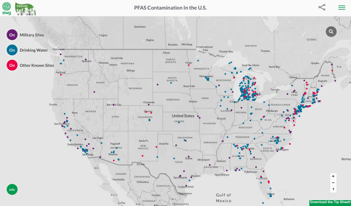
While neighbors of Peterson Air Force Base and the Air Force Academy are still dealing with the effects of chemicals in firefighting foam that got into the environment, Gov. Jared Polis was in Colorado Springs on Monday to sign bills into law that establishes when and how PFAS can be used.
PFAS, or perfluoroalkyl and polyfluoroalkyl substances, has been linked to detrimental health effects when found in groundwater. The PFAS family of compounds been deemed “forever chemicals” because they do not break down in the environment.
They were created to make products like Scotchgard and Teflon and are used on military installments and airports in firefighting foam.
Until today there were little to no regulations of the dangerous chemicals in Colorado.
The new laws establish testing and use procedures for PFAS; and it also orders the solid and hazardous waste commission to create rules for facilities, fire departments, or others who want to use or store PFAS. The law also prohibits the use of class B firefighting foam that contains PFAS in certain aircraft hangars starting in 2023.
A $25 fee for every petroleum load that enters the state will also go into effect. The money collected will fund PFAS in Colorado…
In the meantime, it’s possible Colorado could create its own limits for the chemicals in drinking water, as other states have.
Gov. Jared Polis held five bill-signing ceremonies Monday, June 29, across Colorado for 14 bills. Topics ranged from employee benefits to education to grants, but several stuck out as directed at rural and mountain communities like Summit County…
The Rural Economic Development Initiative Grant Program, is more wide-reaching. The Colorado Legislature site says the grants would be for projects that create new jobs, specifically for “projects that create diversity and resiliency in the local economies of rural communities.” These jobs can be created through a new employer or the expansion of an existing employer, including local governments and organizations or individuals working in partnership with a local government.
“The Rural Economic Development Initiative is critical to helping rural communities with less than 20,000 people plan and invest in local projects to create jobs and economic opportunity,” Polis said at the press conference…
Polis also signed conservation bills Monday, including the Colorado Water Conservation Board Construction Fund Project. The bill provides funding for certain projects, such as the Colorado water loss control initiative or the watershed restoration program.
Summit County Commissioner Karn Stiegelmeier described the bill as “complicated but collaborative” and focused on a lot of big-picture projects. She added that some of these projects will impact Summit County, including one piece of the bill that designates funds to snowmaking.
Now that the money is allocated, Stiegelmeier said there are lots of “projects on the ground” that could receive funding. She said the county has applied for funding through its Open Space & Trails department before and that the Blue River Integrated Management Plan and the Swan River Reclamation Project have received funding.
Polis signed the following bills Monday, June 29:
House bill 20-1119: State Government Regulation of Perfluoroalkyl and Polyfluoroalkyl Substances
Senate bill 20-026: Workers’ Compensation for Audible Psychological Trauma
SB20-057: Fire Prevention and Control Employee Benefits
HB20-1184: Sunset Colorado Seed Act
SB20-002: Rural Economic Development Initiative Grant Program
SB20-030: Consumer Protections for Utility Customers
HB20-1229: Peace Officers Standards and Training Board Scholarship Rural and Small Law Enforcement
SB20-003: State Parks Improvement Appropriation
HB20-1403: Colorado Water Conservation Board Construction Fund Project
SB20-201: Species Conservation Trust Fund Projects
HB20-1366: Higher Education Funding Model
HB20-1109: Tax Credit Employer Contributions to Employee 529s
SB20-095: Middle School Students Concurrent Enrollment Information
HB20-1424: Social Equity Licensees in Regulated Marijuana
Here’s the release from Colorado Parks and Wildlife (Bill Vogrin):
In a sun-soaked open space flanked by 9,633-foot Fishers Peak, Gov. Jared Polis signed into law Monday a bill that provides $1 million to support Colorado Parks and Wildlife’s development of Colorado’s next state park.
As state and local officials looked on, Gov. Jared Polis on Monday signed into law Senate Bill 3, which provides $1 million to Colorado Parks and Wildlife to develop the 19,200 acres surrounding Fishers Peak near Trinidad in Colorado’s next state park. Photo courtesy Colorado Parks and Wildlife / Bill Vogrin
Polis called the funding critical toward achieving his goal of CPW opening the 19,200-acre park to the public as the 42 state park.
The governor also called the next state park an economic engine that will drive the economy of Trinidad and the region as he signed Senate Bill 3 in front of a small group of lawmakers and dignitaries including Dan Gibbs, Executive Director, Department of Natural Resources, and CPW Director Dan Prenzlow.
“This is a big day because developing our 42nd state park is not as simple as opening the gates and inviting the public,” Prenzlow said. “CPW parks staff, wildlife and aquatic biologists, engineers, wildlife managers and all our partners are deep into the process of transforming this former ranch into a showplace for all who might want to recreate here.
“CPW staff is committed to meeting the governor’s challenge to open this park by 2021 by accelerating the designing and construction of state parks from a multi-year process down to a single year. This funding will help us expedite the process. I’m confident when we finally open these gates, the public will be thrilled at the park that will greet them.”
Gibbs and Prenzlow were joined by Representatives Daneya Esgar and Perry Will, local government and business officials from Trinidad and Las Animas County as well as leaders of CPW’s non-profit partners The Nature Conservancy (TNC), The Trust for Public Land (TPL) and Great Outdoors Colorado (GOCO), each playing a critical role in the purchase of the Fishers Peak property.
“We could not have gotten this far without the hard work of our partners from GOCO, the City of Trinidad, TNC and TPL,” Prenzlow said. “Nor could this happen without our partners in the Legislature and in the hunting and fishing communities who provided millions in revenue from hunting and fishing license sales.”
In February 2019, CPW partnered with the City of Trinidad, TNC, TPL and GOCO to purchase the mostly undeveloped property, prized for its variety of habitat, wildlife and the linkage it provides between grasslands to the east with foothills and mountains to the west.
On April 2, the partners signed over ownership of the property to CPW and the agency, with its partners, immediately ramped up master-planning efforts to create a park that will protect the natural treasures and wildlife found there while welcoming visitors, including hunters, hikers, mountain bikers, wildlife watchers and other outdoor enthusiasts.
For months, biologists have been combing the property to inventory the flora and fauna. Among their discoveries was the presence of the endangered New Mexico meadow jumping mouse. In 2014, the mouse was listed as an endangered species by the U.S. Fish and Wildlife Service due to loss of habitat and low population numbers.
Bird surveys continue and are going well; biologists believe they have found a potential golden eagle nest as well as a nesting pair of peregrine falcons. They also report owl sightings.
Herptile surveys have found an unusual lizard species, a variable skink, making the property likely the only state park with this species.
Biologists have also deployed dozens of trail cameras across the property to study everything moving on the ground. There’s even coordinated weed-mapping underway with experts studying plants to formulate the appropriate seed mixture to use when landscaping areas of the park.
The information gathered will then be combined with research into the archaeological and cultural history of the property. Next comes the public process as planners gather input to set management goals for the property and design recreation areas that include roads, parking lots, restrooms, picnic areas, trails and wildlife-viewing areas for the public to enjoy.
In recent weeks, crews have begun grading and laying gravel on a new access road and parking lot.
Installing vault toilets is expected to be completed in the coming days. To stay informed on continuing progress of the park, please sign up to receive CPW eNews emails or visit cpw.state.co.us.
The property remains closed to public access.
Gov. Jared Polis handed to State Rep. Daneya Esgar, a Pueblo Democrat, a pen he used to sign Senate Bill 3 into law, providing $1 million for CPW to continue the work of transforming the Fishers Peak property into the next state park. Esgar was a key sponsor of the bill. Photo credit: Bill Vogrin/Colorado Parks and Wildlife
Here’s the release from the First Street Foundation:
Graphic credit: First Street Foundation
BACKGROUND
A new national report from the First Street Foundation provides a comprehensive national analysis of the state of flood risk in the continental U.S. The findings are the result of the First Street Foundation’s new Flood Model, a high precision, climate adjusted model that assesses flood risk at the individual property level today and into the future. These results are being made publicly available for the first time through a new tool, Flood Factor™, a free online source of high-quality probabilistic flood risk information.
The model represents the culmination of years of research and development made possible by building upon existing knowledge and peer reviewed scientific applications regularly used in the identification of flood risk. This effort was undertaken with the goal of making flood risk transparent, easy to understand, informative, and available to all. The model was produced in partnership with researchers and hydrologists from Fathom, Rhodium Group, and leading researchers from the country’s top academic institutions.
Houston, Texas: 3m resolution, 1 in 100 annual flood risk or 1% for the year 2020. Graphic credit: First Street Foundation
Significantly, the model allows for an understanding of risk from any type of flooding event, including fluvial (riverine), pluvial (rainfall), storm surge, and tidal sources, and addresses the reality that these sources have been, and continue to be, impacted in different ways by changing environmental factors. First Street Foundation’s modeling process has integrated those factors directly into the final risk statistics. In doing so, the model evaluates flooding from multiple risk sources (fluvial, pluvial, surge, and tidal) while also integrating current and future environmental considerations, all at the property level.
The full report consists of a high-level methodological overview, national summary and state-by-state analysis of the lower 48 United States and D.C., with a focus on providing insight into new findings around flood risk, adaptation, and how changing environmental factors impact future flood risk. The risk identified by the First Street Foundation Flood Model highlights significant variations within and across regions, states, and cities in the U.S. Most relevant for this report is the uneven risk identified across and within these localities, and the regular deviations in identified risk when examining properties located in FEMA’s Special Flood Hazard Areas (SFHA).
NATIONAL OVERVIEW
Key Finding:Many more American homes and businesses are at risk of severe flooding than previously understood.
At the national level, the First Street Foundation Flood Model identifies around 1.7 times the number of properties as having substantial risk* compared to the FEMA 1-in-100 SFHA designation. This equates to a total of 14.6 million properties across the country at substantial risk, of which 5.9 million properties and property owners are currently unaware of or underestimating the risk they face because they are not identified as being within the SFHA zone.
Graphic credit: First Street Foundation
Washington D.C. (438%), Utah (419%), Wyoming (325%), Montana (311%), and Idaho (290%) show the greatest difference between the First Street Foundation Flood Model estimates and FEMA SFHA designation, due mainly to First Street’s nationwide coverage while FEMA’s mapping in some of these locations is not yet complete.
There are locations where First Street estimates risk is less than that designated by the FEMA SFHA, and while there are differences in this deviation county-by-county and city-by-city, at a state-wide level Arizona, New Jersey, and Louisiana are the only states that show a lower count of properties currently with substantial risk in the First Street model in comparison to the FEMA SFHA. However, when adjusting for future environmental changes, in Arizona, additional properties fall into that risk categorization. In Louisiana, after adjusting for sea level rise that approaches or exceeds protective levee heights, the deviation shifts as the First Street methods uncover an additional 332,700 properties with substantial risk by the year 2050, in turn showing 248,800 more properties with substantial risk than FEMA defines currently. Similarly in New Jersey, adjusting for environmental changes shifts the First Street estimate from 8,100 fewer properties currently at substantial risk than FEMA, to identify73,600 more properties at substantial risk in 2050 than current FEMA estimates.
Graphic credit: First Street Foundation
While the aforementioned states show the biggest deviation between First Street and FEMA in terms of the number of properties facing significant risk, the First Street Foundation Flood Model also calculates the number of properties facing any risk** of flooding. When looking at this broader level of risk, which is beyond the FEMA SFHA definition, the data identifies 23.5 million properties in the U.S. as at-risk over the next 30 years. Of these properties, 3.6 million were categorized as facing almost certain risk, with a 99% chance of flooding at least once over the next 30 years.
Graphic credit: First Street Foundation
At a more granular level, the results shed light on the unevenness in which changing environmental factors will impact regions of the country differently, and prove the need to incorporate more localized data at a property level in order to fully understand flood risk. Viewing risk at a summarized city, county or state level looks very different than the property-level data Flood Factor will deliver. A property’s Flood Factor is an indicator of its comprehensive flood risk, ranging from 1–10. Properties with higher Flood Factors are either more likely to flood, more likely to experience high floods, or both.
USES & IMPLICATIONS: NOW AND INTO THE FUTURE
The availability of the First Street national property-level data enables a wide range of adaptation and policy efforts, including making it possible for individuals, as well as industry and government leaders to:
Understand the risks associated with their property and take active steps to mitigate them.
The real estate, mortgage, insurance, and investment communities to have a consistent property-level dataset to judge the severity and value of the risk associated with the properties in their portfolio.
Federal, state, and local governments to have a new tool for informed policymaking to guide public investment towards adaptations to reduce the risk and build resilience to flooding.
Additionally, First Street has created the First Street Foundation Flood Lab, a collection of academic and industry researchers who will drill into our data to derive the information necessary to further our understanding of flood risk, its consequences, and possible solutions.
These experts represent a wide swath of disciplines, including finance, economics, public policy, risk management, hydrology and engineering who will examine the implications of flood risk data on the mortgage industry, coastal communities, government policy, the National Flood Insurance Program, housing market, low-income and disadvantaged communities, and other related topics. Enabled by data sharing agreements among the data providers and participants, the insights generated by the Flood Lab researchers will enable the data to be applied more rapidly and to greatest effect.
Great flood Denver May 19, 1864 via the Library of Congress. Photo credit George Wakely.
FromThe New York Times (Christopher Flavelle, Denise Lu, Veronica Penney, Nadja Popovich and John Schwartz):
Across much of the United States, the flood risk is far greater than government estimates show, new calculations suggest, exposing millions of people to a hidden threat — and one that will only grow as climate change worsens.
That new calculation, which takes into account sea-level rise, rainfall and flooding along smaller creeks not mapped federally, estimates that 14.6 million properties are at risk from what experts call a 100-year flood, far more than the 8.7 million properties shown on federal government flood maps. A 100-year flood is one with a 1 percent chance of striking in any given year.
The federal government’s flood maps guide where and how to build, whether homeowners should buy flood insurance, and how much risk mortgage lenders take on. If the new estimates are broadly accurate, it would mean that homeowners, builders, banks, insurers and government officials nationwide have been making decisions with information that understates their true physical and financial risks.
Numerous cities nationwide — as diverse as Fort Lauderdale, Fla., Buffalo, N.Y., and Chattanooga, Tenn. — show the startling gap in the risks. In Chicago alone, 75,000 properties have a previously undisclosed flood risk. And minority communities often face a bigger share of hidden risk…
Federal flood maps, managed by the Federal Emergency Management Agency, have long drawn concerns that they underestimate flood risk. Part of the problem is keeping the maps up to date, which is not only costly and labor intensive, but further complicated as climate change has worsened the dangers.
In addition, FEMA’s maps aren’t designed to account for flooding caused by intense rainfall, a growing problem as the atmosphere warms.
When FEMA does issue updated maps, politicians and homeowners often object, hoping to avoid higher federal flood insurance rates. “You can’t appeal your rate. You can only fight your map,” said Roy Wright, who ran the National Flood Insurance Program until 2018. “It turns it into house-by-house combat.”
[…]
The First Street Foundation created its flood model, called Flood Factor, using federal elevation and rainfall data, and coastal flooding estimates from hurricanes. The foundation then checked its results against a national database of flood claims and historic flood paths.
Overall, the results, which cover the contiguous United States — including areas the government hasn’t yet mapped for flooding, and places where the federal maps are decades old — show a vast increase in risk compared with official estimates. Many inland areas, including swaths of Appalachia and numerous major cities, saw big jumps.
However, there are exceptions, particularly along the Mississippi River and the Gulf Coast, where the government has more thoroughly studied and planned for floods. There, the federal maps show more buildings at risk than the new model suggests.
First Street said that in some areas, including small municipalities, the model may overestimate flood risk because it doesn’t capture every local flood-protection measure, such as pumps or catchment basins.
Releases from the Aspinall Unit will be decreased to 1650 cfs on Tuesday, June 30th. Releases are being adjusted to maintain flows near the baseflow target in the lower Gunnison River. The June 15th runoff forecast for Blue Mesa Reservoir predicts 59% of average for April-July inflows.
Flows in the lower Gunnison River are currently above the baseflow target of 1050 cfs. River flows are expected to stay at levels above the baseflow target after the release decrease has arrived at the Whitewater gage.
Pursuant to the Aspinall Unit Operations Record of Decision (ROD), the baseflow target in the lower Gunnison River, as measured at the Whitewater gage, is 1050 cfs for June through August.
Currently, Gunnison Tunnel diversions are 1050 cfs and flows in the Gunnison River through the Black Canyon are around 750 cfs. After this release change Gunnison Tunnel diversions will still be around 1050 cfs and flows in the Gunnison River through the Black Canyon will be around 650 cfs. Current flow information is obtained from provisional data that may undergo revision subsequent to review.
Looking downstream from Chasm View, Painted Wall on right. Photo credit: NPS\Lisa Lynch
Update: From email from Reclamation (Susan Novak Behery):
In response to decreasing flows in the San Juan River Basin, and a dry weather forecast, the Bureau of Reclamation has scheduled an increase in the release from Navajo Dam from 600 cubic feet per second (cfs) to 800 cfs on Wednesday, July 1st starting at 4:00 AM. Releases are made for the authorized purposes of the Navajo Unit, and to attempt to maintain a target base flow through the endangered fish critical habitat reach of the San Juan River (Farmington to Lake Powell).
The San Juan River Basin Recovery Implementation Program has recommended base flows as close to 500 cfs as possible for the summer of 2020. This is within their normal recommended range of 500 to 1,000 cfs. The target base flow is calculated as the weekly average of gaged flows throughout the critical habitat area from Farmington to Lake Powell.
From email from Reclamation (Susan Novak Behery):
In response to decreasing flows in the San Juan River Basin, and a dry weather forecast, the Bureau of Reclamation has scheduled an increase in the release from Navajo Dam from 500 cubic feet per second (cfs) to 600 cfs on Tuesday, June 30th starting at 4:00 AM. Releases are made for the authorized purposes of the Navajo Unit, and to attempt to maintain a target base flow through the endangered fish critical habitat reach of the San Juan River (Farmington to Lake Powell).
The San Juan River Basin Recovery Implementation Program recommends a target base flow of between 500 cfs and 1,000 cfs through the critical habitat area. The target base flow is calculated as the weekly average of gaged flows throughout the critical habitat area from Farmington to Lake Powell.
A kayaker makes her way down the San Juan River, which delivers water from Colorado, New Mexico and Utah to Lake Powell. Photo credit: Brent Gardner-Smith/Aspen Journalism
Palisade needs to decommission its aging wastewater lagoons and a new study shows piping the town’s waste to the Clifton Sanitation District’s wastewater treatment plant is the most cost effective.
The Palisade Sewer Study looked at several options for treating Palisade’s wastewater, Town Administrator Janet Hawkinson said. The two main options were to build a new treatment plant in Palisade or send the waste to Clifton.
“What the city found is that (piping to Clifton) is financially better for the town,” Hawkinson said. “It’s about half the price to take a line to Clifton versus us building our own treatment plant and then decommissioning our lagoons.”
A brand new plant would cost around $15 million, Hawkinson said, while utilizing Clifton’s existing facility would cost around $7 million. Decommissioning the lagoons will cost around $3 million, she said and will have to be done under either plan, as they will not be able to meet water treatment guidelines…
Town staff are beginning to research grant opportunities to pay for design and engineering work on the project, which Hawkinson said would cost around $500,000. She said the Department of Agriculture has some grants available and that the town was looking into other funding sources as well.
Palisade is just east of Grand Junction and lies in a fertile valley between the Colorado River and Mt. Garfield which is the formation in the picture. They’ve grown wonderful peaches here for many years and have recently added grape vineyards such as the one in the picture. By inkknife_2000 (7.5 million views +) – https://www.flickr.com/photos/23155134@N06/15301560980/, CC BY-SA 2.0,
The Research Brief is a short take about interesting academic work.
With the advent of an infectious disease outbreak, epidemiologists and public health officials quickly try to forecast deaths and infections using complex computer models. But with a brand new virus like the one that causes COVID-19, these estimates are complicated by a dearth of credible information on symptoms, contagion and those who are most at risk.
My team at the Goldenson Center for Actuarial Research has developed a free, user-friendly computer model that has a different goal. It demonstrates how infections and deaths progress on a daily basis over a three-month period depending on how people behave in response to the outbreak. This model allows the public to input data that demonstrate how changes in safety measures in their communities, including wearing face covering and social distancing, can significantly impact the spread of this virus and mortality rates.
Our Goldenson Center COVID-19 model uses a hypothetical 1,000-person population and calculates outcomes using three types of information: the initial number of infections, social distancing, and personal protection measures that include wearing masks, frequent hand-washing and staying quarantined if exhibiting COVID-19 symptoms. Our model then uses this initial information to project on a daily basis the cumulative infections and deaths over a three-month period. It’s not based on actual disease data and is designed to demonstrate the effects of safety measures, rather than make specific predictions.
This simple actuarial model uses general guidelines, rather than data and assumptions about COVID-19 specifically, to simulate the effect of safety protocols. Here, a hypothetical group of 100 infected people out of a population of 1,000, with 10% observing good safety protocols, leads to hundreds of infections and deaths after three months. Goldenson Center at the University of Connecticut, Author provided This simulation shows the effect on the same hypothetical group of 100 infected people out of a group of 1,000 where 80% of people wear masks and practice social distancing, which slows the infection rate to almost zero after two months. Goldenson Center for Actuarial Research, CC BY-NC-ND
Why it matters
By inputting different assumptions, people can see how their community’s personal actions can change the course of this pandemic – and how poor protocols can trigger exponential spread of the virus.
For example, let’s assume that 100 people are infected out of a population of 1,000, with one in 10 wearing masks, keeping appropriate distance and quarantining if necessary. The model shows that 30 days later, the virus would have killed 156 people. After three months, the death toll reaches 460 – with 510 now infected.
However, our model shows that if half the population practices safe protocols, infections after 90 days drop to 293 and deaths drop even more dramatically, to 149 – about one-third of the lives lost under looser measures.
The main takeaway is that safety measures that are within our control have significant impact – and ignoring those protocols can have dire consequences.
If a state opens up and maintains safety measures for at least three months, the virus will be contained and possibly eliminated. On the other hand, if a state opens up too soon and its residents ignore safety protocols, there could be an exponential increase in COVID-19 deaths within months. It’s important for the public to realize that spread of the virus is impacted only by personal behavior.
What’s next?
Our model shows that there must be continued emphasis on maintaining necessary safety measures as we relax shelter-in-place rules and get people back to work. Practicing common-sense social distancing, wearing masks in public and quarantining when necessary is a small inconvenience for a limited amount of time – that will contain the devastation of this virus and ensure that our economy is restored.