From Steamboat Today (Blythe Terrell):
Catherine Carson, also of the Routt County Democrats, said she was pleased to hear about [John] Hickenlooper’s efforts to promote water conservation in Denver.

From Steamboat Today (Blythe Terrell):
Catherine Carson, also of the Routt County Democrats, said she was pleased to hear about [John] Hickenlooper’s efforts to promote water conservation in Denver.

From The Pueblo Chieftain (Chris Woodka):
The complaint is often heard that urban dwellers should give up there bluegrass lawns and golf courses, parks and other public spaces should look like they belong in a semi-arid environment. Some argue that it could be a new supply for municipalities that are looking for ways to provide water for a population that is expected to double in the next 40 years.
“Cities can create new supplies through reuse and conservation,” said George Sibley, on behalf of the Gunnison Basin Roundtable. He called excessive use of water a “bad habit” that should be corrected as more people move to the state.
In 2008, the state’s cities collectively used a little more than 1 million acre-feet. Reducing use by 40 percent of those levels could supply 400,000 acre-feet. That would go a long way in meeting future demands. In fact, if 40 percent reductions stayed in place over time, and were applied time and time again, the demand in 2050 could be met with current supplies. That could keep cities from raiding agricultural water supplies, which total about 11.5 million acre-feet in diversions annually.
More IBCC — Basin Roundtables coverage here.

From The Pueblo Chieftain (Chris Woodka):
Colorado Springs, Security and Fountain are seeking contracts for excess-capacity storage in Lake Pueblo and conveyance through the dam. Colorado Springs also wants a contract to exchange water, through a paper trade, from Pueblo to Turquoise or Twin Lakes.

From email from Reclamation (Kara Lamb):
We have seen inflows into Ruedi drop a little more over the weekend. As a result, this morning we curtailed releases by 50 cfs to 700 cfs. With the Rocky Fork now running at about 40 cfs, the gage at Ruedi Dam on the Fryingpan River should read around 740 cfs.
More Fryingpan-Arkansas coverage here.
From the Cortez Journal (Steve Grazier):
About 100 water professionals, farmers, state lawmakers and local residents got a taste this week of the Colorado Foundation for Water Education’s annual River Basin Tour along the Dolores and San Juan rivers to catch up on watershed restoration, water management and planning. Thursday during the Southwest Basin Tour, attendees toured the Ute Farm & Ranch in Towaoc to learn about tribal water use. They explored the Anasazi Heritage Center, visited McPhee Reservoir and stopped in the town of Dolores to take in some sights of the Dolores River…
Some topics during Thursday’s tour included agricultural and environmental water uses and water law, [Crystal Korrey, director of state affairs for the Colorado Farm Bureau] said.
Chuck Wanner, a co-founder of the Dolores River Dialogue, discussed some facts and statistics pertaining to the Lower Dolores River. River water can be leased on a short- and long-term basis for in-stream purposes such as fishing and rafting, he said. The DRD study stretches from McPhee dam to where the Dolores River meets the Colorado River in Moab, Utah, Wanner said.
Thursday’s speakers included State Sen. Bruce Whitehead, D-Hesperus; Mark Varien, of Crow Canyon Archaeological Center; Mike Preston, general manager of the Dolores Water Conservancy District; Colorado State Engineer Dick Wolfe; John Porter, of the Southwestern Water Conservation District; and Meghan Maloney, of San Juan Citizens’ Alliance. Additional speakers were Marsha Porter-Norton, facilitator for the Lower Dolores Plan Working Group; Peter Mueller, of The Nature Conservancy; Jim White, of the Colorado Division of Wildlife; and Wanner.
More education coverage here.

From the Englewood Herald (Tom Munds):
Utilities Director Stu Fonda said the project to include UV disinfection in the water treatment process is necessary in order to comply with newly enacted federal water purification standards. “The new standards require all water treatment plants have UV systems in place to eliminate the cryptosporidium in the water by 2013 ,” Fonda said. “Our current system meet federal standards for cryptosporidium and frankly, if it wasn’t for the new regulations, we probably wouldn’t be adding the UV to our system.” He did say the UV system might make a slight improvement in water taste and odor because the ultraviolet light reduces the amount of chemical disinfectant used in the water.
More water treatment coverage here.
From the La Junta Tribune-Democrat (Bette McFarren):
The new tank at 14th and Smithland is seventy-six feet in diameter and twenty-four feet high. it will go on line after being tested on Friday. The other new tank, at the airport, is forty feet tall and thirty feet in diameter. It is already on line. The existing newer tank, the one that used to have the big tiger on it, holds a million gallons and will continue to be in service. City Manager Rick Klein explained where we got the money for the new tanks: it is a loan of 1.85 million dollars at zero percent interest through the American Recovery and Reinvestment Act, a federal program.
More infrastructure coverage here.
From The Grand Junction Daily Sentinel (Gary Harmon):
…a group that includes ranchers, environmental organizations, local government officials and others…has been studying the Colorado, Dolores and Gunnison rivers and some of their tributaries for more than a year and faced a Friday deadline to complete recommendations to the Grand Junction Field Office of the Bureau of Land Management. The office is in the process of revising its resource management plan, a task it takes up once every two decades. It is to release a draft environmental impact statement in a year and complete the process by the end of 2012…
Existing laws and policies already do much to leave the river in its current condition, the stakeholders decided. In outlining its position, the stakeholders group asked that the entire question be reopened if Congress doesn’t act by 2015.
Consensus on the Colorado evaporated, though, when the group considered whether East, West and Ute creeks and the north fork of West Creek should be considered suitable for wilderness designation. Landowners opposed recommending that any of the creeks be recommended as suitable for recognition as wild and scenic, but Ute Creek in particular presents an opportunity for a “custom-crafted” designation, Smith said. The four-mile stretch of creek could become overwhelmed by visitors lured there by the recognition that the creek is suitable for designation, rancher Dori Van Loan said. And they would most likely be disappointed, she said. Though parts of the creek are inaccessible, the lower section can be reached with relative ease, Van Loan said. “Anybody can go there,” Van Loan said. “It’s just that nobody goes there twice.”
The north fork of West Creek “is a suitable river,” Jason Wedemeyer of the Colorado Environmental Coalition said. Recognizing the creeks as suitable for designation doesn’t mean the bureau would have the resources to manage it as such, said Richard Connell of the Mesa County Farm Bureau. Without agreement within the stakeholders group, the various individuals and organizations will take their own positions on the streams. The stakeholders group also asked that a separate study be made on the Dolores River as it runs from Gateway to Utah.
From The Grand Junction Daily Sentinel (Wayne Gustaveson):
Lake Powell rose 4 feet since last week’s report seven days ago. Daily inflow is currently near 74,000 acre feet per day.
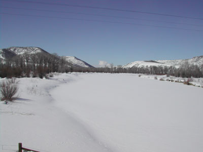
From Steamboat Today (Nicole Inglis):
Weather Service hydrologist Bryon Lawrence said the 9.9-feet crest height [for the Yampa River] measured Wednesday morning is likely the highest the Craig area will see. It will be the third highest peak crest in 25 years. The average peak crest is 7.8 feet. “It looks like this will be the peak,” he said. “But, we expect flows to remain quite high on the Yampa River for the next few days.”[…]
At a measurement station where the Yampa crosses Colorado Highway 13, the river hit 11,575 cubic feet per second, which Lawrence said is likely the peak discharge for the year. The average peak flow for the last 25 years is 8,400.
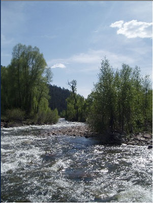
From the Pagosa Sun (Chuck McGuire):
According to the United States Geological Survey, the San Juan River through Pagosa Springs peaked at more than 2,900 cubic feet per second (cfs) around midnight, May 30. Peak flows quickly fell to about 1,650 cfs by late last Thursday, but rose again with the onset of unseasonably warm weather over the past weekend. By late Sunday night, the river rose to more than 2,400 cfs…
The Natural Resources Conservation Service (NRCS) attributes the state’s sudden high water to rapid runoff brought on by warm, dry weather across Colorado. By June 1, in fact, the statewide snowpack had fallen to just 53 percent of average, after measuring 78 percent of average a month earlier. In the combined San Juan, Animas, Dolores basin, the June 1 snowpack measured just 19 percent of average — by far the lowest in the state. According to NRCS State Conservationist Allen Green, southern Colorado experienced the greatest snowpack decline through May. “A general lack of precipitation since early April has decreased the outlook for runoff in the southwestern corner of Colorado,” Green said in an NRCS monthly snowpack report. “What appeared to be an excellent runoff season back in mid-winter has deteriorated into a below average runoff season in the Animas, Dolores and San Miguel rivers.”[…]
Statewide, the June 1 reservoir storage was listed as 110 percent of average, with only the Rio Grande basin showing somewhat less than 100 percent of average storage. Thankfully, the combined San Juan, Animas, Dolores basin tops the list at 115 percent of average. The Gunnison, Colorado and Yampa basins were only slightly lower.
From the Summit Daily News (Robert Allen):
“Depending on conditions in the South Platte Basin in the next couple of days, the utility may have to reduce the flows through or shut off Robert’s tunnel to avoid wasting water it cannot use and remain in compliance with the Blue River Decree,” according to a Denver Water press release. The utility may only move water through the tunnel to meet demands of the South Platte. The Blue River below the dam on Thursday was flowing at 1,700 cubic feet per second at a gauge height of 3.5 feet. “We work to keep flows coming out of Dillon Reservoir to 1,800 cfs or less to help prevent flooding, but there’s only so much we can do to help manage the high flows Mother Nature is throwing at us this year,” Denver Water raw water supply manager Bob Steger said in the press release.
From the Summit County Citizen’s Voice:
In a press release, Denver Water again said that inflows to the reservoir were significantly higher than expected the past few days. The standard source for predicting flows called for a maximum inflow of about 1.300 cubic feet per second, but the actual flows peaked at slightly above 2,000 cfs, said Bob Steger, manager of raw water resources…
Denver Water has to balance variables of weather and customer water needs while operating its system to comply with the Blue River Decree, which says the utility only can take water from the West Slope for use on the East Slope when there is a need for it. Dillon Reservoir began spilling May 24. This past Sunday, Denver Water began running water through the Roberts Tunnel to fill up its South Platte Reservoir storage — space created when a river call for the South Platte Basin was placed on June 4. By starting the tunnel, the amount of water flowing out of Dillon Reservoir to the Blue River was reduced. Depending on conditions in the South Platte Basin in the next couple of days, the utility may have to reduce the flows through or shut off Roberts Tunnel to avoid wasting water it cannot use and remain in compliance with the Blue River Decree. That could bring renewed high flows downstream of the reservoir, especially if forecast rain storms materialize.
The utility also has been operating the discharge gates at Dillon Reservoir to manage the amount of water that goes downstream. This operation depends on the amount of water coming into the reservoir.
Denver Water has been monitoring the reservoir outflow multiple times a day and at night to make decisions about how much water to release through the discharge gates. The goal is to keep the total outflow below 1,800 cfs; whether or not this goal can be met depends on the amount of water going into the reservoir and how much water is needed to supplement the utility’s South Platte supplies.
From the Glenwood Springs Post Indenpendent:
Flood waters in some parts of Vail earlier this week exceeded 100-year-flows, the Federal Emergency Management Agency says…Public safety responders continue to remain on high alert in the event water levels rise following [June 6] record flows of 2,350 cubic feet per second on Gore Creek at the Red Sandstone/Eagle River Water & Sanitation District monitoring station.
From The Denver Post (Bruce Finley):
Facing flooding from fast-melting snow, Summit County authorities — normally wary of letting water be taken across the Continental Divide — are now urging Denver Water to draw all it can out of an overflowing Dillon Reservoir. But while the metro area’s water utility was pumping through a transmountain tunnel to accommodate the request, water managers warned that reservoirs on the eastern side of the Divide also are full. The use of Denver’s tunnel as a safety valve technically may violate a river compact that lets Denver divert water only for a “beneficial use.” While water attorneys pondered the point, the withdrawals from Dillon have been happening all week…
The only way to do that now is by diverting more water through the 10-foot-3-inch-diameter Roberts tunnel — which runs from Dillon Reservoir 23.3 miles under mountains to the eastern side of the Continental Divide. The diversions brought immediate relief. Water levels below the reservoir dam along the Blue River on Thursday decreased slightly to 1,700 cubic feet per second, down from 1,800 cfs earlier this week — the limit above which flooding is likely…
Diversions to Denver started [June 6]. The water is run through the tunnel down the North Fork of the South Platte River to the Strontia Springs and Chatfield reservoirs. Water lawyers were pondering whether the diversion is allowed under what is known as the Blue River Decree. Denver Water officials argued that it meets the test of “beneficial use” because the water eventually will help meet needs of 1.3 million metro-area customers — with the extra benefit of some flood control. “It is not a decreed right that we have . . . to take water through the tunnel for flood control. Our right is to take water through the tunnel for use by customers. That’s where we get into a little bit of a rub. We’re certainly willing to do things to help out here,” said David Little, Denver Water’s director of planning.
From the Fort Collins Coloradoan (Molly Armbrister):
Fort Collins received just under an inch of rain during the day Friday and overnight, according to the official Fort Collins weather station on the CSU campus.
From the La Junta Tribune-Democrat
According to the National Weather Service website, flood stage is considered to be 10 ft. At this point, minor agricultural flooding is expected. The last observed value of the level of the river was at 10:15 this morning and was at 9.56 ft. Since the level was below 10 ft, the flood warning is no longer in affect [for Otero County]. The river level is expected to continue to drop to below 9 ft. by tommorrow morning.
From The Grand Junction Daily Sentinel (Dave Buchanan):
The USDA National Resources Conservation Service estimated the Colorado River basin snowpack at 57 percent of average on June 1, and many observers didn’t think Ruedi would fill this year. But a blast of hot weather starting June 5 sent the upper Fryingpan surging, going from less than 500 cfs on June 4 to more than 1,900 cfs on June 7. It receded from that high but even late Thursday the gauges above Ruedi were reading 970 cfs. That surge surprised many long-time snowpack watchers, said Bureau of Reclamation spokesperson Kara Lamb. “We didn’t think Ruedi would even fill this year and it filled in five days,” Lamb said Thursday.
Here’s an update from email from Reclamation (Kara Lamb):
Rain has added to the high snowmelt inflows we have been seeing into Green Mountain Reservoir for the past several days. As a result, we have once again bumped up releases from the dam. As of early this morning, there should be about 2400 cfs in the Lower Blue River below Green Mountain Dam.
From email from Reclamation (Kara Lamb):
As projected, releases from Olympus Dam to the Big Thompson did increase to 1000 cfs shortly after lunch [on Saturday]. We have now bumped up to around 1070 cfs. Those in Estes Park will notice we have opened all five gates at the dam to provide a consistent release over the dam. We anticipate holding at 1070 cfs through [Saturday] and into [Sunday].
More Colorado-Big Thompson Project coverage here.