Steve Held of Broadus, Montana, comes from a long line of ranchers going back to the late 1800s.
Held: “We do love the lifestyle. People who do it for a living have to love it, but it’s not because it’s easy or beautiful.”
He says ranching is tough. And the warming climate is making it even harder.
As temperatures rise, winter snowpack is shrinking – which reduces water supplies in the spring and summer.
Held recalls that when he was growing up …
Held: “We would get a snow around Christmas that would last until the end of March. The snow would melt off … come running down the creeks and the hills and fill up all of our ponds, and that’s what we relied on for water. It doesn’t happen anymore.”
And more intense storms, floods, and wildfires have put his cattle in danger and caused expensive damage to the ranch.
Held says it’s no mystery what’s happening. Scientists have been warning about climate change for decades, so he says it should not be a partisan issue.
Held: “And it’s absolutely shameful that politics have turned this into a kicking ball. And the people who are suffering are the people on the land.”
So Held wants people from all walks of life to come together, acknowledge the danger of climate change, and take action.
Scott Hummer worked for the Colorado Department of Water Resources for many years so he has witnessed many ups and downs for the rivers in northern Colorado. Here are some low flow photos from a recent road trip. First up Stagecoach Reservoir and the Yampa River.
The confluence of the Blue River (L) and Muddy Creek (R) April 22, 2026. Photo credit: Scott Hummer
Streamgage above Stagecoach Reservoir April 22, 2026. Photo credit: Scott HummerStreamgage above Stagecoach Reservoir April 22, 2026. Photo credit: Scott HummerThe inlet to Stagecoach Reservoir April 22, 2026. Photo credit: Scott HummerStagecoach Reservoir April 22, 2026. Photo credit: Scott HummerYampa River inflow to Stagecoach Reservoir April 22, 2026. Photo credit: Scott Hummer
The North Platte River April 22, 2026. Photo credit: Scott Hummer
The North Platte River April 22, 2026. Photo credit: Scott HummerThe North Platte River April 22, 2026. Photo credit: Scott Hummer
Scott Hummer at the inlet to Stagecoach Reservoir July 22, 2021 when I was bumming up and down the Yampa River.
Yampa River Basin via Wikimedia.
Map of the North Platte River drainage basin, a tributary of the Platte River, in the central US. Made using USGS National Map and NASA SRTM data. By Shannon1 – Own work, CC BY-SA 4.0, https://commons.wikimedia.org/w/index.php?curid=79266632
Federal Water Tap is a weekly digest spotting trends in U.S. government water policy. To get more water news, follow Circle of Blue on Twitter and sign up for our newsletter.
The Rundown
South Dakota representatives introduce three bills to authorize feasibility studies for regional water supply projects, including two Missouri River diversions.
BLM revises its publication date for a final environmental assessment of a proposed groundwater pipeline in southwest Utah.
White House advisory group recommends changes to FEMA’s disaster response.
USGS researchers assess a less-toxic means of controlling a non-native, ecologically-damaging reed in the Great Lakes.
And lastly, a federal financial oversight board’s annual report notes that the Trump administration removed climate-risk guidance for large financial institutions.
“The associated mission drift can also lend itself to political ends, such as excessive focus on climate risk and the effective debanking of certain industries. Collectively, this increases distraction and compliance costs while impeding responsible lending and risk-taking.” – Excerpt from the Financial Stability Oversight Council’s 2025 annual report. The council, established after the 2007-09 financial crisis, oversees the nation’s banking system. The report argues that the council should focus on “material financial risks” instead of things like climate risk. Last year, the Trump administration retracted federal climate-risk guidance that applied to financial institutions with more than $100 billion in assets, saying it was “distracting.”
By the Numbers
11: Features that the departments of Agriculture, Commerce, and Interior should incorporate into their agreements with tribes that would strengthen tribal co-management of land and waters, according to a Government Accountability Office report. The features include clear definition of roles and goals, dispute resolution, and accountability. The three agencies signed a joint order in 2022 to collaborate with tribes on natural resources management.
News Briefs
Water Bills in Congress Representatives in the western states introduced several water-supply bills in the last week.
South Dakota’s delegation introduced a trio of bills in the House and Senate that would require the Interior Department to study the feasibility of new or expanded rural water supply projects in that state and its neighbors. One study, authorized at $10 million, regards a potential diversion of Missouri River water to the growing Rapid City area. This bill failed in the previous Congress. Another bill is to study a potential Missouri River diversion to a separate regional water system in eastern South Dakota, Iowa, and Minnesota. Still another bill is to study an expansion of the Lewis and Clark rural water system, which extends into Iowa and Minnesota and has been under construction for more than two decades.
Rep. David Schweikert (R-AZ) is seeking to protect his state in the tussle over the Colorado River. His bill would require proportional cutbacks among Arizona, California, and Nevada, instead of relying on the Supreme Court’s decreed rights, which do not favor Arizona.
Sen. Ruben Gallego (D-AZ) introduced a bill to establish a $15 million per year grant program for “natural water retention and release” projects that hold water in aquifers and floodplains.
Studies and Reports
Proposed FEMA Changes A White House advisory group is preparing to recommend an overhaul in how FEMA distributes post-disaster aid, according to Politico’s E&E News.
A draft of the plan would shift post-disaster funding to a “parametric” model – paying out based on thresholds like river height and wind speed – rather than the current one that is derived from estimated loss and damage.
The change would prioritize speed over precision, disaster aid experts told the news site.
Great Lakes Phragmites Fight Phragmites is a reedy, non-native wetland plant that has grown into dense, ecologically-damaging clusters along Great Lakes shorelines.
Weedkillers are a common management strategy, but U.S. Geological Survey researchers contributed to a study that assessed a less toxic alternative.
They found that “cut-to-drown” – cutting phragmites stems below water – was an effective way of “drowning the plant and depleting its stored resources.”
On the Radar
Senate Cybersecurity Hearing On February 4, the Senate Committee on Environment and Public Works will hold a hearing on cybersecurity for America’s water infrastructure systems. Witnesses include a researcher and water utility representatives.
Southwest Utah Groundwater Pipeline The Bureau of Land Management now expects to publish a final environmental impact statement for the Pine Valley Water Supply Project on February 27, 2026.
The initial publication date of November 2025 was delayed due to the government shutdown.
The project is a 70-mile pipeline to pump 15,000 acre-feet of water per year from wells in Beaver County to customers in neighboring Iron County.
The 31 national monuments designated since the Clinton administration, which could be downsized as the Trump administration pushes to open more public lands to extractive industries, safeguard clean water for millions of Americans, according to a new analysis from the Center for American Progress.
Using geospatial data to quantify the miles of rivers and watersheds within the studied national monument boundaries, as well as the number of users who depend on that water, the report found that the water supplies for more than 13 million Americans are directly provided by watersheds within or downstream of these national monuments. About 83% of the water passing through these public lands has no other protection besides the monument designations, it found.
National monuments protect more than 21,000 miles of waterways across the U.S., nearly twice as much waterway mileage as the National Wild and Scenic Rivers System, the analysis also determined.
The report comes as the Trump administration weighs downsizing or revoking the designation of some national monuments.
In March, the Trump administration announced it would eliminate California’s Chuckwalla and Sáttítla Highlands national monuments before removing language from a White House fact sheet announcing that decision. The following month, The Washington Postreported that the administration was considering downsizing or eliminating six national monuments, and in June, the U.S. Department of Justice issued an opinion that the president has the power to rescind national monument designations, backtracking on a decades-old determination on the matter.
Stone and evening light, Bears Ears National Monument, Utah. Jonathan P. Thompson photo.
During Trump’s last term, Bears Ears and Grand Staircase-Escalante national monuments, established by the Obama and Clinton administrations, respectively, were shrunk to fractions of their original sizes, but they were restored by President Joe Biden after he took office.
If national monuments are downsized or eliminated, the areas surrounding a waterway will lose protections from extractive industries, including oil and gas drilling, mining and grazing. Contamination from those industries could seep into streams and, in turn, rivers. Those industries also use water, sometimes vast amounts in arid regions, further reducing the supply that flows to nearby communities. (In certain cases, some mining and grazing are already permitted on national monument lands, but the activities are limited in scale and more regulated than they are outside the monuments.)
“Landscapes and waterways go hand in hand,” said Drew McConville, a senior fellow for conservation policy at the Center for American Progress and a co-author of the report. “The clean water depends on what comes into them from natural lands … Just protecting the wet stuff itself doesn’t guarantee that you’re keeping [water] clean and durable.”
The portion of historically marginalized communities living within the watersheds of the national monuments is greater than the average for watersheds nationally, it found. Twenty-three of the monuments studied are also found in regions expected to face water shortages due to climate change in the coming decades, making the arid regions downstream even drier.
Grand Staircase-Escalante National Monument, for example, protects 2,517 miles of waterways, according to the analysis, and nearly 90% of the watersheds within the monument are expected to see declines in their water levels. The monument straddles the Upper and Lower Colorado River Basins, with the Paria and Escalante rivers flowing within its boundaries and Lake Powell, the nation’s second-largest reservoir, just to its south.
The monument is often thought of as a sparse, arid region, which it is, said Jackie Grant, the executive director of Grand Staircase Escalante Partners, a nonprofit focused on protecting the monument that has spent $11 million to protect the Escalante River watershed and all its tributaries. It remains vital to the Colorado River System, which millions of people in the Southwest rely on. Grand Staircase-Escalante helps slow water from the Paunsaugunt Plateau in Bryce Canyon National Park, much of which starts as snowpack in the park before melting and flowing downstream.
“People don’t think of water when they think of Grand Staircase-Escalante National Monument,” Grant said. “So when we can bring this view of water and how important it is to the protection of the monument, it helps us put another building block in our case for supporting the monument, because not only is it important for the animals, the native plants, the geology and the paleontology, water plays a huge role in the monument, and the monument protects the water itself.”
The Antiquities Act of 1906 was signed into law by Theodore Roosevelt, for “… the protection of objects of historic and scientific interest” through the designation of national monuments by the President and Congress. National monuments are one of the types of specially-designated areas that make up the BLM’s National Conservation Lands. Some of the earliest national monuments included Devils Tower, the Grand Canyon, and Death Valley. They were initially protected by the War Department, then later by the National Park Service. More recently, the BLM and other Federal agencies have retained stewardship responsibilities for national monuments on public lands. In fact, the BLM manages more acres of national monuments in the continental U. S. than any other agency. This includes the largest land-based national monument, the Grand Staircase-Escalante National Monument in Utah featured here. National monuments under the BLM’s stewardship have yielded numerous scientific discoveries, ranging from fossils of previously unknown dinosaurs to new theories about prehistoric cultures. They provide places to view some of America’s darkest night skies, most unique wildlife, and treasured archaeological resources. In total, twenty BLM-managed national monuments, covering over five million acres, are found throughout the western U. S. and offer endless opportunities for discovery. Photos and description by Bob Wick, BLM.
Stretching across 1.87 million acres of public land, Grand Staircase-Escalante National Monument is one of the country’s most expansive national monuments, protecting scores of wildlife as well as archeological resources in southern Utah. But a nine-billion-ton coal deposit is buried in the center of the monument along with deposits of minerals, including uranium and nickel. The Trump administration has long touted boosting the country’s coal production, and has established a pro-mining agenda this year.
“It’d be very easy to contaminate either one of those rivers if mining were to take place in the center section of the monument,” Grant said.
Margaret Walls, a senior fellow at Resources for the Future who has studied national monuments but was not part of this study, said national monuments are designated to protect cultural or historical landmarks, and it can be forgotten that they can also serve purposes like safeguarding water. Though she noted that even if monument protections are loosened, the areas remain federal lands, and their changes in status do not guarantee they will be developed.
“We don’t protect waterways the way we do land,” Walls said, “we’re going to get those water benefits by protecting the land.”
Created by Imgur user Fejetlenfej , a geographer and GIS analyst with a ‘lifelong passion for beautiful maps.’ It highlights the massive expanse of river basins across the country – in particular, those which feed the Mississippi River, in pink.
A beaver in the Lamar River. (Neal Herbert/National Park Service)
Click the link to read the article on the WyoFile website (Christine Peterson):
October 29, 2025
My rubber boots squelched as I grabbed another 5-gallon bucket full of mud from a Wyoming Game and Fish Department herpetology technician. We performed an awkward handoff before I dumped the mud on the ground in front of my sinking boots. The squelching continued as I used my boots to mash the fresh mud up against willow branches woven among 4-inch-wide posts rammed in a streambed.
Our little team, the herpetology technician, a Trout Unlimited project manager and another volunteer like me, were finishing up the first in a series of nearly a dozen fake beaver dams on a creek on the west side of the Snowy Range Mountains in southeast Wyoming. They’re technically called beaver dam analogues — since with their complex patterns of sticks and mud, they’re supposed to imitate real beaver dams. Although I’m not sure my noisy rubber boots really compare to the efficacy of the beaver tail.
The dams’ purpose, as the name implies, is to slow streamflow, lightly flooding banks and providing the water more time to seep into the ground.
If we’re lucky, a family of beavers will come along and make this analogue their home, even tearing out our handiwork to construct something they like better that’s more permanent and sturdier. Beavers are, after all, professional furry engineers, who perfected their craft over millennia.
A Wyoming Game and Fish Department herpetology technician pushes willow branches through posts in the South Fork of Lake Creek in the Snowy Range. The willow branches help create a beaver dam analogue, meant to slow water flow and replenish the water table. (Christine Peterson)
Our fake beaver dams aren’t meant to last forever. They’ll be maintained annually for about five years (unless real beavers take over earlier), but the result when established in the right place can be remarkable, restoring and rejuvenating wetlands, replenishing the water table, keeping water higher up in systems longer in the year, and providing habitat for everything from insects, frogs and toads to elk and moose, and yes, even beavers.
Stream restoration experts like Steve Gale, the Wyoming Game and Fish Department’s aquatic habitat biologist, can and do extoll the benefits of beavers and beaver dams. And while the rest of us standing in the stream bed see their utility, we also agreed with Gale when he said: “Who doesn’t want to play in the water with mud and sticks?”
Bigger than just beavers
Before European settlers streamed onto this continent, bringing an insatiable demand for beaver pelts, the rodents lived in streams, creeks and rivers almost everywhere. They dammed any flowing water they could find and had a hand in shaping large swaths of the nation.
While beavers can be a nuisance, falling ancient cottonwoods in parched areas and flooding creeks and irrigation ditches, they’re also one of the best examples of ecosystem engineers, Gale said, and their services have been missed. Without beavers and beaver dams, rivers run faster and cut down into the soil, they wash away sediment and move water faster from headwater states like Wyoming to other states downstream.
So now watershed managers are turning to contraptions like the ones a team of nearly 20, including Game and Fish employees and volunteers from all over the state, helped build in mid-September.
Two specialists with the Wyoming Game and Fish Department weave willow branches between posts in one of 11 beaver dam analogues built in mid-September. (Christine Peterson)
We stood on the banks of the South Fork of Lake Creek in the Pennock Wildlife Habitat Management Area and listened to Gale walk us through the process. In the last few decades, the South Fork of Lake Creek had cut deeper and deeper into the earth, ultimately sinking lower than the floodplain and as a result offering little water to surrounding vegetation. When runoff hit each spring, the water rushed down as plants sat parched on the banks.
“We lost riparian habitat and riparian width, which is important for calving areas,” he said. “We’re doing this work primarily for the deer, elk and moose.”
Beavers had been reintroduced here before, but even the industrious rodents had a hard time building dams and ponds deep enough to keep them alive and safe through winter.
We were here to help, hopefully. We would spend the bulk of the day pounding posts made from trees across the width of the creek over a quarter-mile-long stretch and then weaving bendy willow branches through the posts. After building a wall of willows, we would use buckets of mud and sod to fill in the cracks. With any luck, water would begin backing up almost immediately, eventually filling and slowly trickling over the tops.
Life or death
As beaver dam analogues become increasingly popular, biologists with state agencies and nonprofits are teaming up to place them in streams across the landscape.
Austin Quynn, the Trout Unlimited project manager helping direct our team, worked with groups of youth corps members over the last couple summers building, maintaining and repairing hundreds of analogues on a stream called Muddy Creek southwest of Rawlinsto help habitat for four native fish species: flannelmouth and bluehead suckers, roundtail chubs and Colorado River cutthroat. Last summer, beavers came from miles downstream and tore out dozens of analogues in one stretch. He sounded amused that his work was destroyed, because in its place, they’d built a massive dam that must have been what the beavers wanted and needed.
A finished beaver dam analogue stretches across a section of the South Fork of Lake Creek in the west side of the Snowy Range. Mud and woven willow branches help slow water, keeping the creek from becoming too incised and restoring wetlands. (Christine Peterson)
Some of the dams blew out from spring runoff, scouring the creek bed of sediment and leaving behind gravel that cutthroat trout could use for spawning.
Deep pools created by the analogues — and eventually beavers themselves — also offer fish refuge from the heat on mid-summer days.
On the east side of the Snowy Range, Wendy Estes-Zumpf, Game and Fish’s herpetological coordinator, and others built eight analogues in a creek which contains one of the last boreal toad populations in southeast Wyoming. It had been a stronghold for the creatures, but in the absence of beavers, the creek became incised, leaving little wetland habitat for toads to breed and survive.
A few seasons after Estes-Zumpf’s team erected the fake beaver dams, boreal toad populations have started to come back. She counted as few as four toads on past spring surveys and found almost 30 this spring including multiple age classes.
Beaver dam analogues aren’t a silver bullet for a drought-stricken West, Gale said, but for some species and some creeks, they could be the difference between life and death.
During June, much of the region experienced above average temperatures and below average precipitation. Record low precipitation fell across parts of northern Utah and southwestern Wyoming while much above average precipitation was observed in southern Utah and southwestern Colorado. As of July 1, seasonal snowmelt was completed with many mountain locations melting out 1-2 weeks earlier than average. Seasonal streamflow volume forecasts remained below to much below normal with the inflow to Lake Powell forecasted to be 42% of average. Regional coverage of drought expanded significantly from 53% in early June to 63% on July 1, driven largely by expansion of drought in Utah. Drought conditions are likely to persist or worsen as NOAA seasonal forecasts suggest above average regional temperatures and below average precipitation for Wyoming during July to September.
Above average June precipitation was observed in southern Utah, eastern Wyoming and the majority of Colorado. Much of Utah and Wyoming and northwestern Colorado received below average precipitation during June. Parts of southern Colorado and southern Utah received twice the average June rainfall while some locations in northern Utah and southwestern Wyoming observed record low June rainfall totals. Average June rainfall is typically low in the Intermountain West and areas of southern Utah and southwestern Colorado with 150-400% of average June rainfall observed total rainfall amounts of 1-2 inches.
June temperatures were above average for much of Colorado, Utah and Wyoming, except for eastern Colorado and Wyoming where temperatures were up to two degrees below average. The warmest temperatures were observed in Utah, northwestern Colorado, and western Wyoming where June average temperatures were in the top 10% of all observations since 1895.
As of July 1st, snowpack was melted out across the region and snowmelt occurred earlier than average across all basins except the Tongue River Basin in northern Wyoming. In Colorado, snowmelt occurred only a few days early in the Arkansas and South Platte River Basins, around a week early in the Animas, Colorado Headwaters, Dolores, Gunnison and Yampa River Basins, two weeks early in the San Juan River Basin and nearly four weeks early in the Rio Grande River Basin. In Utah, snowmelt was only a few days early in the Bear River Basin, 1-2 weeks early in the northern Utah, Price, Sevier and Virgin River Basins and 24 days early in the Escalante River Basin. In Wyoming, snowmelt occurred earlier than average in all basins except the Tongue River Basin, with the Belle Fouche, Cheyenne and Snake River Basins melting out 2-3 weeks early.
Regional drought coverage expanded from 53% in early June to 63% as of July 1 with all of Utah and about half of Colorado and Wyoming experiencing drought. Extreme (D3) drought conditions expanded in western Colorado but were removed from southwestern Utah and southeastern Wyoming where above average June precipitation was observed. Drought worsened by one to two classes in northern Utah and southwestern Wyoming, but drought conditions improved in portions of eastern and southern Colorado and southern Utah. In eastern Wyoming, drought conditions improved by one to three drought classes.
West Drought Monitor map July 8, 2025.
Seasonal streamflow volume forecasts remained below to much below average with the final forecasts of the year ranging from 33% of average for Utah’s Bear and Virgin River Basins to 86% of average in Wyoming’s Shoshone and Yellowstone River Basins. For nearly all regional river basins, streamflow volume forecasts significantly decreased from April 1 to June or July 1. The evolution of the Yampa River seasonal streamflow forecast exemplifies a pattern seen across the Intermountain West. After a near average winter snowpack, the April 1 forecast indicated an average seasonal streamflow volume, but by July 1, the Yampa River forecast declined to only 51% of average. Much below streamflow volume forecasts (<60% of average) were issued for the Colorado Headwaters, Dolores, San Juan and Yampa River Basins in Colorado, the Bear, Duchesne, Green, San Juan, Sevier, Virgin and Weber River Basins in Utah, and the Green, North Platte and Powder River Basins in Wyoming. The inflow forecast for Lake Powell was a paltry 42% of average on July 1.
ENSO neutral conditions currently exist in the eastern Pacific Ocean and remain most likely throughout the forecast period. The NOAA seasonal precipitation forecast for July-September suggests an increased probability of below average precipitation for Wyoming and northeastern Colorado. The seasonal temperature forecast suggests a high probability of above average temperatures for the entire region.
Public lands are the birthright of every American. One of the great privileges of living in this country is the ability to access hundreds of millions of acres to enjoy the great outdoors — all for free.
People care about and use public lands for many reasons. From hunters and anglers to miners and ranchers, hikers and mountain bikers—there is something for almost everyone on public lands. But what if you live in a city and never set foot on public lands? Why care about them then?
Log Meadow, California | Maiya Greenwood
Not everyone hunts, fishes, mines, ranches, hikes, or bikes; but everyone, truly everyone, depends on clean water. The big secret about public lands is that they are arguably the country’s single biggest clean water provider. According to the US Forest Service, National Forests are the largest source of municipal water supply in the nation, serving over 60 million people in 3,400 communities across 33 states. Many of the country’s largest urban areas, including Los Angeles, Portland, Denver, and Atlanta receive a significant portion of their water supply from national forests.
Healthy forests and grasslands perform many of the functions of traditional water infrastructure. They store water, filter pollutants, and transport clean water to downstream communities. And they do it naturally — essentially for free. When rivers are damaged from land uses on public lands, we all pay the price — literally; we all pay more in taxes and utility bills to clean up the water.
What happens on the public’s land also happens to the public’s water. The importance of managing public lands for the benefit of public water is so fundamental, it has been a pillar of public lands management agencies’ missions since their inception over a century ago. For example, The Organic Act of 1897[1] that created the US Forest Service stated:
Yellowstone park workers help search for a lost hiker on Eagle Peak in 2024. (Cam Sholly/Yellowstone National Park)
Click the link to read the article on the WyoFile.com website (Angus M. Thuermer Jr.):
April 22, 2025
Oilfield executive takes charge of consolidating workforce of 70,000 at national parks, BLM, Fish and Wildlife Service.
Five days into the Trump administration’s DOGE takeover of the Department of Interior’s policy, management and budget, Yellowstone National Park staffing is “higher than last year,” an Interior Department spokesperson in Washington, D.C. said Monday.
Yellowstone Park confirmed the increase. “Going into this year, we should have a total of 769 NPS employees,” park spokeswoman Linda Veress said in an email, up from 748 last year. During the park’s record year for visitation in 2021, the park’s workforce numbered 693 permanent and seasonal workers.
“We had an outstanding opening weekend, and it was great to see everyone enjoying the park,” Yellowstone Park Superintendent Cam Sholly said in an email Monday. “The plow crews are working hard to clear the remainder of the park’s roads from snow, and we are on schedule for our normal sequenced opening in the upcoming weeks, including the Beartooth Highway.”
After personally greeting the season’s first visitors at the West Entrance on Friday, Sholly reported the opening weekend drew 8,324 vehicles from there and the North Entrance at Mammoth, the only two entrances that have opened so far. That’s an increase of more than 11% from last year and put the weekend rush, unofficially Sholly said, at 21,642.
The staffing and opening weekend updates came as Secretary of the Interior Doug Burgum put an oilfield executive in charge of “consolidation, unification and optimization of administrative functions” at the 70,000-person agency last week. Burgum, earlier this year, named Tyler Hassen as assistant secretary for policy, management and budget. Now Hassen will oversee Burgum’s consolidation order as the Trump administration’s DOGE plan to shrink the size of the federal government advances.
Burgum’s appointment of Hassen and the consolidation order sparked worries in the conservation community, including at the Center for Western Priorities. The Denver-based nonpartisan conservation and advocacy organization accused the secretary of abdicating his responsibilities by not reserving any authority over firings or requiring any reporting by Hassen.
“If Doug Burgum doesn’t want this job, he should quit now,” said Jennifer Rokala, executive director of Western Priorities. “Instead, it looks like Burgum plans to sit by the fire eating warm cookies while Elon Musk’s lackeys dismantle our national parks and public lands,” she said in a statement.
“Warm cookies” refers to a report in The Atlantic that Burgum’s chief of staff told political appointees to learn to bake cookies for their boss.
But potential visitors to the world’s first national park need not worry, said J. Elizabeth Peace, a spokesperson at Burgum’s office.
“Visitors can expect the same great service they had in years past,” Peace wrote in an email Monday. “[I]n some National Parks, like at Yellowstone National Park, staffing numbers are higher than last year.”
Peace made her reassurances as regional business owners fret over the upcoming tourism season in Yellowstone, at neighboring Grand Teton and across Wyoming. Overseas traveler numbers to the U.S. dropped 11.6% in March after Trump tariffs, tariff threats, indiscriminate DOGE firings, resignations and economic turmoil battered expectations.
Oilman
The order Burgum issued Thursday gives Hassen, now an assistant secretary, authority over the department’s Working Capital Fund, an office that in 2023 provided $119 million for department functions. Hassen will be able to rewrite manuals outlining employee responsibilities and may transfer funds, programs, records and property, according to the order.
Burgum’s order described his actions as furthering Trump’s February initiative for “implementing the president’s ‘Department of Government Efficiency’ workforce optimization.”
In addition to great service at national parks, Bureau of Land Management lands in Wyoming remain welcoming, Peace wrote. “Visitors to BLM-managed public lands can expect continued access and service across recreation sites, trails and campgrounds,” her email reads. “We are implementing necessary reforms to ensure fiscal responsibility, operational efficiency and government accountability.”
Burgum and DOGE’s “unification effort” will accelerate technology, enhance the mission to preserve parks and historic sites, serve Native American tribes and manage department holdings in Wyoming, Burgum’s order states. All told, the Department of the Interior manages 2.34 million acres of national park system lands, 18.4 million acres of BLM property and 70,000 acres of Fish and Wildlife Service reserves in the state.
In Wyoming, Interior-managed land accounts for a third of the state’s area or about 21 million acres.
Hassen, a Deerfield Academy prep and Princeton grad, was CEO of Basin Energy, a Houston-based international oilfield services company, according to his LinkedIn profile. Before that, he worked for Wenzel Downhole Tools, Basin Power, and served as chairman of the associate board of the nonprofit Cancer Research Institute in New York. He was an associate involved in global energy investment banking at Morgan Stanley in New York and London from 2005-2008, according to his profile.
He emerged on the DOGE scene after the Los Angeles fires in January when President Trump said California Gov. Gavin Newsom compounded the firefighting problem by not diverting water to southern California. Critics said DOGE conflated agricultural diversions, needs of the endangered Sacramento-San Joaquin Estuary delta smelt and firefighting.
Unqualified?
Western Priorities said DOGE efforts assign inexpert people to inappropriate positions.
“Since Elon Musk is now effectively in charge of America’s public lands, it’s up to Congress and the American people to stand up and demand oversight,” Rokala’s statement reads. “DOGE’s unelected bureaucrats in Washington have no idea how to staff a park, a wildlife refuge, or a campground. They have no idea how to manage a forest or prepare for fires in the wildland-urban interface. But Doug Burgum just gave DOGE free rein over all of that.”
A complex system of pipes, tunnels and canals carries water around the Western U.S., like this one in Colorado’s Fraser Valley. However, policy experts say a cross-country pipeline wouldn’t make sense for political, financial and engineering reasons. Ted Wood/The Water Desk
Click the link to read the article on the KUNC website (Alex Hager):
September 30, 2024
This story is part of a series on water myths and misconceptions in the West, produced by KUNC, The Colorado Sun, Aspen Journalism, Fresh Water News and The Water Desk at the University of Colorado Boulder. KUNC’s coverage of the Colorado River is supported by the Walton Family Foundation.
The Colorado River is a lifeline for about 40 million people across the Southwest. It supplies major cities like Los Angeles, Phoenix, and Denver and a multibillion-dollar agriculture industry that puts food on tables across the nation. But it doesn’t have enough water to meet current demands.
Policymakers are struggling to rein in demand on the river, which has been shrinking at the hands of climate change. The region needs to fix that gap between supply and demand, and there’s no obvious way to do it quickly.
But one tantalizingly simple solution keeps coming up. The West doesn’t have enough water, but the East has it in abundance. So, why don’t we just fix the Colorado River crisis by piping in water from the East?
This proposed pipeline divert water from the Atchafalaya River in Louisiana through Louisiana, Texas, New Mexico, Arizona and up to the Glen Canyon Dam. Credit: Don Siefkes
The answer is complicated, but experts say it boils down to this: It doesn’t make sense to build a giant East-to-West water pipeline anytime soon for three reasons — politics, engineering, and money.
Political headwinds
If the West’s leaders wanted to take some water from the East, who would they even ask? Right now, there’s no national water agency that could oversee that kind of deal.
“I would argue that there aren’t many entities with the authority across the country to do this,” said Beaux Jones, president and CEO of The Water Institute in New Orleans. “I don’t know that the regulatory framework currently exists.”
Water is often managed using a messy patchwork of different government agencies and laws. The Colorado River is managed through a fragile web of agreements between cities, states, farm districts, native tribes and the federal government. Even though they’re all pulling from the same water supply, there’s no central Colorado River government agency.
A similarly complex system applies to many watersheds in the East. Even if a single city or state in the Western U.S. seriously wanted to build a pipeline from the East, it’s not even clear who they’d meet with to ask for water from a different area. And there’s no single federal agency that could sign off on such a deal and make sure it doesn’t harm people or the environment.
Colorado Water Conservation Board Executive Director and commissioner to the Upper Colorado River Commission Becky Mitchell, center, speaks on a panel with representatives of each of the seven basin states at the annual Colorado River Water Users Association conference in Las Vegas Thursday, December 15, 2022. The UCRC released additional details of a water conservation program this week.
CREDIT: HEATHER SACKETT/ASPEN JOURNALISM
Any serious effort to pull new water in from the East to the Southwest would likely touch some part of the Mississippi River basin. It’s a sprawling network of smaller rivers that covers 31 different states, from Montana to Pennsylvania.
It’s a busy river with a lot of uses. And while its shortages aren’t as severe as dry times in the West, the Mississippi River basin goes through its own droughts. So even if, someday, the governments of the East and West set up a formal way to negotiate a water transfer, the cities, farms, boaters and wildlife advocates to the east might not be willing to share.
“The very nature of there being sufficient availability of water in the Mississippi River Basin to, in a large scale way, export that water,” Jones said. “I think there are many people on the ground within the Mississippi River basin that would fundamentally disagree with that.”
Engineering limits
There are countless examples of large pipelines and canals moving liquids around the U.S. at this very moment. The longest existing today is the Colonial Pipeline, which carries gasoline from Houston to northern New Jersey through 5,500 miles of pipe.
So if we have the engineering capacity to do that, could we build similar infrastructure for water? In theory, yes. But it would have to be much larger than existing pipes for oil and gas.
“It takes so much more water to supply a city than it takes gasoline,” said John Fleck, a water policy professor at the University of New Mexico. “So the size of the pipe or the canal has to be a lot bigger, has to be much wider, has to cover a lot more ground.”
Because that pipeline or canal would be so big, it is more likely to ruffle some feathers along the way. Fleck suggested that landowners in its path, including local governments, could push back on a giant new piece of infrastructure running through their properties and mire any pipeline project in regulatory red tape.
Phoenix, Los Angeles, Denver and Salt Lake City wouldn’t look like they do today without giant water-moving systems, like this pipe that is part of the Central Arizona Project. Experts say all of the feasible water pipelines have already been built, and a system to carry water in from the East is too difficult to be worth building. Photo credit: Central Arizona Project
All that said, a pipeline is still physically possible. There is perhaps no better argument for an East-West water transfer than the fact that the Western U.S. is already crisscrossed by multiple huge pipes and canals that carry water across long distances.
The West as we know it today wouldn’t exist without that kind of infrastructure. Much of Colorado’s population only has water due to a series of underground tunnels that bring water across the Rocky Mountains. Phoenix and Tucson have been able to welcome new residents in the middle of the desert with the help of a 336-mile canal that carries water from the Colorado River. Los Angeles, Albuquerque and Salt Lake City would not be the cities they are today without similarly ambitious water delivery systems built decades ago.
The existence of those water-moving projects isn’t proof that we should build a new, even bigger water pipeline from the East, Fleck said. In fact, he pointed to those systems as proof that we shouldn’t.
“All the feasible ones have largely been done, and the ones that are left are the ones that weren’t done because they just turned out not to be feasible,” he said.
Money problems
Even in a world where the West’s leaders could find a willing water seller, get the right permits and put shovels in dirt, experts say an East-to-West water pipeline would simply be too expensive.
Any solution to the Colorado River crisis will require massive amounts of public spending. The federal government alone has thrown billions of dollars at the problem in just the past few years. But water economists and other policy experts say a cross-country pipeline isn’t the most efficient use of taxpayer dollars.
Stacks of hay bales sit beside an irrigation canal in California’s Imperial Valley on June 20, 2023. Experts say there are more cost-effective ways to fix the Colorado River crisis than building a cross-country canal, like paying farmers to pause growing thirsty crops such as alfalfa. Alex Hager/KUNC
Kathleen Ferris, former director of the Arizona Department of Water resources, pointed to two ongoing efforts that might be a more cost-effective way to help correct the region’s supply-demand imbalance. One involves paying farmers to pause growing on their fields, freeing up water to bolster the region’s beleaguered reservoirs. Another uses expensive, high-tech filtration systems to turn wastewater directly back into drinking water.
“Sometimes I feel like people don’t want to do the heavy lifting,” said Ferris, who is now a water policy researcher at Arizona State University. “Instead, they want to just find the next water supply and be done with it and have somebody else pay for it.”
Ultimately, she said, those kinds of programs already have momentum and cost less money than an East-to-West water pipeline.
“Why don’t we do the things that we know are possible and that are within our jurisdiction first,” Ferris said, “Before we go looking for some kind of a grand proposal that we don’t have any reason to believe at the moment could succeed.”
Pipe dreams becoming reality
Piping in water from outside of the Colorado River basin, for all of its challenges, is a tempting enough idea that the federal government has given it a serious look.
In 2012, a Bureau of Reclamation report analyzed ways to bring new water into the Colorado River Basin, including importing piped water from adjacent states.
The study concluded that strategy was not worth the money and effort.
“It just isn’t the time yet,” said Terry Fulp, a retired Reclamation official who helped write the study. “We felt that there were other things we could be doing in the basin, particularly in the Lower Basin, that would relieve the pressure.”
This map from the Bureau of Reclamation’s 2012 “Colorado River Basin Water Supply and Demand Study” shows places where water could theoretically be imported. One of the report’s authors said now “isn’t the time” to pipe water in from the East. Credit: U.S. Bureau of Reclamation
Fulp said the study was a worthwhile endeavor, and that the idea of importing water from the East might make sense down the road. The scale of the challenge posed by the Colorado River crisis, he said, will take some big thinking, “on the order of the thinking when we built the Hoover Dam.”
“It’s one of those possible solutions that should always stay, if not forefront on the table, somewhere on the table, so that you don’t lose sight of it,” Fulp said.
Despite the fact that many Colorado River experts have cast doubt on the feasibility of a cross-country water pipeline, even some sitting state officials say it deserves more research. Chuck Podolak, director of the Water Infrastructure Finance Authority of Arizona said the idea deserves “serious attention.”
“We understand that every option is hard, every option is expensive, every option has political hurdles, every option is a daunting engineering task,” he said. “Right now, we’re in a let’s-look-at-everything mode with eyes wide open.”
Arizona and other states around the region, with their eyes on continued growth, are already looking at ways to stretch out the water they already have using technology. Terry Fulp said those efforts may need to expend past the spendy and ambitious engineering projects that are already helping facilitate that growth.
“It’ll be the time someday, if we want the Southwest to continue to grow the way it’s been growing,” he said. “There’s only so much water in the basin.”
Federal environmental officials have rejected a request by Aethon Energy to pump Moneta Divide oilfield wastewater into the Madison aquifer, saying the deep reservoir could be used for drinking water, especially by tribal nations on the Wind River Indian Reservation.
The Wyoming Oil and Gas Conservation Commission in November 2020 approved wastewater disposal into the 15,000-foot deep well, but the U.S. Environmental Protection Agency said last week the state’s decision did not align with federal rules.
Aethon’s plan does not support a finding “that the aquifer cannot now and will not in the future serve as a source of drinking water,” the EPA wrote in a 20-page record of decision. Aethon argued, and the Wyoming commission agreed 4-1, that the underground Madison formation was too deep and remote to be used for drinking water.
The EPA relied on the Safe Drinking Water Act as the authority under which to protect the aquifer. It also cited climate, environmental justice and tribal interests in its decision, pointing to the nearby Wind River Indian Reservation as a community that could use the water.
“The significance of that is the EPA finally didn’t wimp out on us,” said Wes Martel, a member of the Wind River Water Resources Control Board. “We’re just glad they now have some people in place following up on their Indian policy.”
The Eastern Shoshone and Northern Arapaho Tribes “foresee increased reliance on groundwater for drinking water purposes and anticipate needing to access deeper aquifers, such as the Madison aquifer, as the climate changes and water resources grow scarcer,” the EPA wrote in a 94-page analysis of tribal interests. The agency cited historic cultural and spiritual ties to the land and water and tribes’ status as sovereign nations in its decision.
“We have to make sure our future generations have a reliable source of clean water,” Martel said. “Our reservation, this is all we have left. We’ve got to do our best to protect it.”
The Powder River Basin Resource Council, along with the Wyoming Outdoor Council and others, has spent years monitoring discharge reports and industry permits and was vital in challenging pollution threats, Martel said.
The EPA understood that science, and the law did not support Aethon’s request, said Shannon Anderson, organizing director and staff attorney with the resource council. “They recognized the value of our groundwater resources and the need to protect those into the future,” she said, hailing the decision.
Vast quantities of water
Aethon must find a way to dispose of produced water — a brine pumped from energy wells to release gas and oil — as it expands the Moneta Divide field by 4,500 wells. The U.S. Bureau of Land Management authorized that expansion in 2020, leaving the question of water disposal to Wyoming, which has authority over surface and underground water quality under overarching federal standards.
Aethon must find a way to dispose of the equivalent of 120 Olympic-sized swimming pools full of produced water a day to expand the field. Aethon and Burlington Resources, a co-producer at Moneta, could generate $182 million a year in federal royalties, $87.5 million a year in Wyoming severance taxes and $106 million annually in County Ad Valorem taxes from the expansion.
An elk skull adorns a fencepost near the Eastern Shoshone’s buffalo management land on the Wind River Indian Reservation. (Katie Klingsporn/WyoFile)
But Aethon has violated state permits that allow it to pump some produced water into Alkali and Badwater creeks that flow into Boysen Reservoir, a drinking water source for the town of Thermopolis. Wyoming’s Department of Environmental Quality has notified the Dallas-based investment company of its infraction and has required Aethon to reduce the salinity of surface discharges this year.
The DEQ this year listed the two creeks as “impaired” and unable to sustain aquatic life. Underground injection of wastewater into the Madison was to be a new component of the disposal program.
The EPA cited climate change, drought, increasing temperatures and use of reservation surface water by others as some of the reasons to preserve the Madison aquifer.
“Removing the existing statutory and regulatory protections for a potential source of high-quality drinking water for the rural and overburdened communities in Fremont County and on the WRIR would further exacerbate existing inequities particularly with respect to historic and ongoing adverse and cumulative impacts to water resources and community health,” the EPA wrote.
“Thus, equity and environmental justice considerations, which include Tribal interest considerations, support maintaining the existing [Safe Drinking Water Act] protections that apply to the aquifers consistent with Congressional intent to protect both current and potential future sources of drinking water,” EPA documents state.
Neither Aethon nor a representative of the Oil and Gas Conservation Commission responded immediately to a request for comment Wednesday. But WyoFile received this response from Tom Kropatsch, oil and gas supervisor for the Wyoming Oil and Gas Conservation Commission, shortly after publication:
“We do not agree with EPA’s decision on this application. We are still reviewing their decision and the information utilized by EPA in support of their decision. Much of this information was not part of the original application or a part of the record. EPA did not follow the standard procedure of allowing the WOGCC and the applicant to review and respond to the additional information they had available prior to making their final decision. EPA evaluated data that differs in its geographic, geologic, engineering, and other technical information. EPA also inappropriately related the proposed injection location to other areas of the state. Since the data EPA reviewed does not accurately reflect the conditions at the location of the proposed disposal well it is not appropriate to rely on it for a decision on this application. The WOGCC is reviewing EPA’s decision and weighing its options for further action.”
Ceremonial shovels mark the location of the Innovation Center coal refinery field demonstration project north of Gillette on Sept. 2, 2022. It will be co-located with Atlas Carbon’s facility that produces activated carbon products. (Dustin Bleizeffer/WyoFile)
Biden administration’s suite of coal pollution rules a win for climate and health, advocates say, but a major blow to one of Wyoming’s bedrock economic drivers.
Gov. Mark Gordon has promised to sue over a new suite of federal rules that most observers agree will hasten the U.S. thermal coal industry’s trajectory toward extinction — an existential threat to many Wyoming communities and one of the state’s main economic drivers.
The U.S. Environmental Protection Agency on Thursday issued four “final” rules aimed at drastically cutting coal pollution, including a mandate that existing coal-fired power plants cut or capture 90% of their planet-warming carbon dioxide emissions by 2032 or convert to natural gas or close altogether. The agency’s other rules set timelines for significant cuts to smokestack emissions of mercury and other toxic metals, polluted wastewater from coal power plants and more stringent standards for coal ash disposal.
The “power plant” rules make good on President Joe Biden’s promise to address human-caused climate change, according to the EPA. The actions are also intended to help curtail illness and premature deaths from coal pollution while providing a clear regulatory framework for utilities to shift to renewable sources of energy.
The agency also noted that it consulted with coal-reliant utilities about their existing plans regarding coal facilities and crafted the implementation schedules to allow for planning that avoids electrical power supply issues.
Gov. Mark Gordon and U.S. Environmental Protection Agency Administrator Michael Regan held a joint press conference at the University of Wyoming on August 9, 2023. (Dustin Bleizeffer/WyoFile)
“By developing these standards in a clear, transparent, inclusive manner, EPA is cutting pollution while ensuring that power companies can make smart investments and continue to deliver reliable electricity for all Americans,” EPA Administrator Michael S. Regan said in a prepared statement.
Coal proponents in Wyoming are furious.
This graph shows the globally averaged monthly mean carbon dioxide abundance measured at the Global Monitoring Laboratory’s global network of air sampling sites since 1980. Data are still preliminary, pending recalibrations of reference gases and other quality control checks. Credit: NOAA GML
While the rules target coal-fueled power plants, they also put Wyoming coal mines on notice: Their already waning U.S. customer base has an expiration date.
“It is clear the only goal envisioned by these rules released by the Environmental Protection Agency today is the end of coal communities in Wyoming,” Gordon said in a prepared statement Thursday. “EPA has weaponized the fear of climate change into a crushing set of rules that will result in an unreliable electric grid, unaffordable electricity and thousands of lost jobs.”
The Wyoming Mining Association also discounted climate change as an excuse to attack the coal industry.
“Wyoming is once again the sacrificial lamb on the altar of the climate change cult,” the association’s Executive Director Travis Deti said.
The rules
The carbon dioxide emissions rule applies to coal-fired power plants as well as new natural gas-fired facilities, requiring them to prevent at least 90% of greenhouse gasses from entering the atmosphere.
“Existing coal-fired power plants are the largest source of [greenhouse gas] from the power sector,” the EPA stated in the rule. “New natural gas-fired combustion turbines are some of the largest new sources of [greenhouse gas] being built today, and these final standards will ensure that they are constructed to minimize their [greenhouse gas] emissions.”
The rule updating Mercury and Air Toxics Standards tightens emissions by about 70%, an especially significant reduction for plants that burn lignite — a lower-value coal than Wyoming’s subbituminous product — according to the agency.
Wyoming remains the nation’s largest coal producer, although production has plummeted by nearly half since 2008, with companies shipping some 237 million tons in 2023, according to the Wyoming State Geological Survey. More than 90% of coal mined in the state is sold to power plants in the U.S., which is why it’s often referred to as “thermal coal” — unlike “metallurgic coal” that is sold to steel manufacturers.
Wyoming coal production has decreased by nearly half since 2008. (University of Wyoming)
Coal mining contributed some $650 million in taxes, royalties and fees to the state in 2019 and employed more than 5,000 workers, according to the Wyoming Mining Association.
The vast majority of coal mining occurs in the Powder River Basin in the northeast corner of the state, while several communities host nearby coal-fired power plants: Gillette, Glenrock, Wheatland, Kemmerer and Rock Springs.
Although Wyoming has experienced declines in both coal production and coal-fired power, the industry still serves as a major economic backbone for the state — and a significant source of government revenue. The potential loss of coal-fired power facilities is an especially daunting prospect for nearby communities.
Those communities have wrestled with the knowledge of potential plant closures for a long time already, and the EPA’s new rules only serve to clarify that potential reality, said Robert Godby, associate professor at the University of Wyoming’s Economics Department.
“It really just kind of steepens the glide path to what we all knew was happening anyway,” he told WyoFile on Friday.
Explosive materials are loaded into a “blast hole” at a coal mine. (Dyno Nobel)
The new rules are likely to be challenged in court, not only by Wyoming, but also by other coal-reliant states, Godby said. Politics will also continue to play a role — particularly if a Republican wins the presidential election this year. He noted, however, that former President Donald Trump was not able to make good on a promise to turn around the coal industry’s decline.
Regardless, utilities are under increasing pressure to make long-term investment decisions in a quickly changing energy environment, and the EPA’s actions this week diminish the likelihood that they’ll find the regulatory certainty needed to invest in coal-fueled power.
“It makes it more likely they’re going to retire [coal plants] and announce firm dates,” Godby said. “That’s going to create more certainty for the communities that are affected.”
Meantime, Gordon, who has touted technologies to reduce carbon dioxide from coal power plants, has vowed to fight the rules.
“These rules are a travesty, and their effects are devastating,” Gordon said. “I have directed the Wyoming Attorney General to engage with and lead a coalition of states to challenge the power plant emissions rule, and we are prepared to apply our litigation strategy to the oncoming wave of federal regulatory actions that threaten Wyoming.”
The University of Wyoming’s School of Energy Resources, and its partners, are advancing multiple CO2 capture and sequestration demonstration projects at Basin Electric’s Dry Fork Station north of Gillette, seen here on Sept. 2, 2022. (Dustin Bleizeffer/WyoFile)
Missouri lawmakers say water has almost always been plentiful in their state, giving no reason to think twice about a concept known as riparian rights — the idea that, if you own the land, you have broad freedoms to use its water. But that could change under a bill advancing quickly in a state legislature that is normally sharply divided. The measure would largely forbid the export of water across state lines without a permit, even though there is no evidence that is happening on any large scale.
Just the specter of water scarcity is inspiring bipartisan support. Besides persistent drought in parts of the state and plummeting Mississippi River levels in recent months and years, lawmakers are wary of the West, and the chance that thirsty communities facing dwindling water supplies will look east for lakes and rivers to tap…
“They’re not being real responsible,” state Rep. Jamie Burger (R), one of the bill’s lead sponsors, said of states like California and Arizona. “We feel like we need to be responsible in Missouri and protect what we have.”
If passed, the new limits would be the latest domino to fall as climate change makes droughts more frequent and intense across huge swaths of the United States, and threatens to exhaust water supplies in some parts of the West within the foreseeable future. States including Oklahoma, Iowa and Nebraska already have similar safeguards on water exports in place, while a compact among Great Lakes states has largely banned exports beyond the limits of their watershed since 2008.
Wyoming Department of Environmental Quality acknowledges years of built-up pollution from Moneta Divide field but has no plan to remove black sludge 6 feet deep
Two creeks tainted by decades of dumping from Moneta Divide oilfield drillers are officially “impaired” and unable to sustain aquatic life, state regulators say in a new report.
Parts of Alkali and Badwater creeks in Fremont County are polluted to the point they don’t meet standards for drinking, consumption of resident fish or sustaining aquatic life, a report by the Wyoming Department of Environmental Quality states. The agency listed 40.8 miles of the creeks as impaired in a biannual report required by the U.S. Environmental Protection Agency.
The project is being developed by Aethon Energy Management and Burlington Resources Oil and Gas Company. Aethon Energy Management and its partner RedBird Capital Partners acquired the Moneta Divide assets from Encana Oil and Gas in May 2015. The environment impact assessment (EIA) process of the Moneta Divide field was commenced in 2011, while the final environmental impact statement (EIS) and resource management plan (RMP) for the project were released in February 2020. Photo credit: NS Energy
Parts of the creeks are polluted by oilfield discharges, including hydrogen sulfide, ammonia and chloride. The industrial activity is responsible for low levels of oxygen in the water, turbidity and a black sludge that critics say is up to 6 feet deep.
Arsenic also is present, but state monitoring couldn’t determine its origin.
The report catalogs pollution downstream of discharge points where produced water — effluent from natural gas and oil production — flows from the 327,645-acre energy field operated mainly by Aethon Energy Operating in Fremont and Natrona counties.
The “impaired” listings are a good thing that set the table for action, said Jill Morrison, who works on the pollution issue for the conservation group Powder River Basin Resource Council. But the listing comes only after years of badgering an agency that now should look to clean up the creeks.
“What we are saying is ‘thank you’ for stepping up to address these issues,” Morrison said. “We wish it was done sooner. You’ve got enforcement power; what steps are you taking to make Aethon clean this up?”
Wyoming rivers map via Geology.com
Environmental stewards
The DEQ issued a revised permit to the private Dallas company in 2020 allowing it to discharge oilfield waste into Alkali Creek, which flows into Badwater Creek and the Boysen Reservoir, a source of drinking water for the town of Thermopolis. The permit calls for monitoring and testing, among other things.
About a year ago, however, the DEQ sent the company a letter of violation for “reoccurring exceedances” of water quality standards for sulfide, barium, radium and temperature. That’s a violation of the Wyoming Environmental Quality Act, state rules and regulations, and the permit itself.
The April 28 letter states that the DEQ hopes to resolve the violation through “conference and conciliation.” DEQ wants Aethon “to show good faith efforts toward resolving the problem and to prevent the need for more formal enforcement action by this office.”
The alleged kid-glove treatment rankles Powder River’s Morrison. “They trade, back and forth, nice conversations and nothing happens,” she said.
An Aethon pump jack in the Moneta Divide oil and gas field east of Shoshoni. (Angus M. Thuermer Jr./WyoFile)
DEQ asked Aethon for a response within 30 days. WyoFile requested on March 6 that the agency provide a copy of Aethon’s response but had not received it by publication time. Aethon typically does not respond to media questions regarding regulatory enforcement and did not answer a recent request for comment.
The 2020 permit also requires Aethon to dramatically reduce the amount of chloride — salty water — it pumps onto the landscape. DEQ said the company is preparing to meet a late-summer deadline for that standard.
“Aethon continues to diligently work toward resuming treatment of effluent using the Neptune reverse osmosis treatment plant,” DEQ said in an email, “in accordance with the established chloride compliance schedule.”
Aethon’s website says the company has a “commitment to protect the environment and our people [and] operate responsibly.” The company is a “steward of the environment,” the website states.
Black sludge
The DEQ’s “impaired” listing addresses surface water in the two creeks through what’s known as a draft Integrated 305 (b) report. It is open for comments through March 25.
But there’s another issue that rankles critics, including the Wyoming Outdoor Council and the Powder River group — black sludge.
DEQ surveys of the creeks revealed “bottom deposits” containing mineral deposits, iron sulfides and dissolved solids, all contributing to low oxygen levels that kill aquatic life. After a phone conference with DEQ in February, Powder River’s Morrison said she learned that the bottom deposit of black sludge extends for about three miles and is from 6 inches to 6 feet deep.
A retired University of Wyoming professor who worked with the Powder River group analyzing Aethon’s permit called the sediments “totally loaded.” Harold Bergman said “that contaminated sediment will be leaching out contaminants into Boysen Reservoir for decades to come.”
He and Joe Meyer, a retired chemist who also worked with the conservation group, wrote that DEQ’s Aethon permit did not require enough testing for deleterious substances, did not consider what impact the mix of substances together has on aquatic life, and allowed as much as five times the proper amount of dissolved solids to flow out of the oilfield.
“You would not have that black gunk sediment if it weren’t for the Aethon discharge,” Meyer said.
A report of monitoring between 2019-’22 shows that aluminum exceeded discharge standards up to 17% of the time. Other than that, there’s still a question of what else is in the sludge.
This image of Alkali Creek shows flows downstream of the Frenchie Draw oil and gas field discharge point in October 2021, according to the image title. The Powder River Basin Resource Council obtained this and other public records through a request to Wyoming DEQ. (DEQ)
“We don’t know about individual organic chemicals,” Meyer said. Reports only mention “the gross measures of organic compounds,” he said.
“That doesn’t tell us about individual chemicals,” Meyer said. How much, if any, BTEX chemicals — Benzene, Toluene, Ethylbenzene and Xylenes that are harmful to humans — are in the sludge “we have no way of knowing.”
He stopped short of accusing DEQ of avoiding the question. For now, “they just wanted to get an overview analysis,” he said.
DEQ said it has a plan for the sludge. “DEQ’s Water Quality Division is monitoring any sediment flow in lower Badwater Creek to determine if there are any sediments that may mobilize towards Boysen Lake,” an agency official said in an email.
For Morrison, “the big question is what DEQ is going to require Aethon to do to clean up this mess,” she wrote in an email. Meyer and Bergman say simply dredging up the sludge is likely too dangerous because such an operation would dislodge substances and send them downstream. A more complex plan would be needed, they said.
Morrison criticized what she sees as the DEQ’s priorities. “They’re not putting the health and safety of these streams’ water quality, fish and downstream water users above the interests and profits of Aethon.”
A motorboat on Yellowstone Lake. (NPS/Diane Renkin)
Click the link to read the article on the WyoFile website (Angus M. Thuermer Jr.):
March 12, 2024
To protect the headwaters of three major Western rivers from invasive, troublesome mussels, Yellowstone National Park wants to require larger boats to undergo a 30-day “dry time” before launching.
New rules up for comment also would ban any boat that’s once been contaminated by invasive Dreissena zebra or quagga mussels, regardless of decontamination cleaning.
The proposal builds on existing rules, including inspection of all watercraft, designed to protect Yellowstone and downstream waters from the fingernail-sized freshwater bivalves that cling to hard structures like boat hulls, docks and irrigation headgates. The proposal would help protect the ecological integrity of Yellowstone Park and the Yellowstone, Missouri and Snake rivers downstream in Idaho, Montana and Wyoming.
Map of the Snake River watershed, USA. Intended to replace older File:SnakeRiverNicerMap.jpg. Created using public domain USGS National Map data. By Shannon1 – Own work, CC BY-SA 4.0, https://commons.wikimedia.org/w/index.php?curid=62294242
Under the proposed rules, boats with inboard, inboard/outboard and inboard jet motors — as well as sailboats — would have to be dried under a certified program for 30 days before launch. “Large, complex, trailered watercraft pose the highest risk of transporting and introducing invasive mussels … because they are difficult to inspect and less likely to … be fully decontaminated,” the park said in a release.
Manual cleaning is not 100% effective, the park said.
Mussels were recently discovered in waters within a day’s drive of Yellowstone, including the first found in the Columbia/Snake drainage last year near Twin Falls, Idaho. The year before, mussels showed up in Pactola Reservoir, South Dakota, not far from Wyoming’s eastern state line.
People can comment online through April 5 or to Yellowstone Center for Resources, Attn: AIS Proposed Changes, PO Box 168, Yellowstone National Park, WY 82190.
Spreading threat
The zebra mussel is native to the Black, Caspian, and Azov Seas and the quagga also comes from that area of Europe. They have infected the Midwest and lower Colorado River drainage.
Zebra Mussels in Lake Ontario. (John Manier/USGS)
They could threaten Yellowstone cutthroat trout, a species the park has spent more than two decades restoring. The mussels can also be destructive to water and power infrastructure, according to the U.S. Department of Interior. There are no known ways to eradicate the mussels. Any invasion would be expensive to mitigate.
Motor- and sailboats falling under the new rule would be inspected and sealed to a trailer for the 30-day dry period. Seals from Yellowstone National Park, Idaho State Department of Agriculture, Montana Fish, Wildlife, and Parks and Wyoming Game & Fish Department would be honored.
Once-infected boats would be banned because of the possibility they could, even if cleaned, cause a false detection during routine DNA monitoring and consequently waste resources.
Quantifying the interconnected impacts of climate change and irrigation on surface water flows is critical for the proactive management of our water resources and the ecosystem services they provide. Changes in streamflow across the Western U.S. have generally been attributed to an aridifying climate, but in many basins flows can also be highly impacted by irrigation. We developed a 35-year dataset consisting of streamflow, climate, irrigated area, and crop water use to quantify the effects of both climate change and irrigation water use on streamflow across 221 basins in the Colorado, Columbia, and Missouri River systems. We demonstrate that flows have been altered beyond observed climate-related changes and that many of these changes are attributable to irrigation. Further, our results indicate that increases in irrigation water use have occurred over much of the study area, a finding that contradicts government-reported irrigation statistics. Increases in crop consumption have enhanced fall and winter flows in some portions of the Upper Missouri and northern Columbia River basins, and have exacerbated climate change-induced flow declines in parts of the Colorado basin. We classify each basin’s water resources sustainability in terms of flow and irrigation trends and link irrigation-induced flow changes to irrigation infrastructure modernization and differences in basin physiographic setting. These results provide a basis for determining where modern irrigation systems benefit basin water supply, and where less efficient systems contribute to return flows and relieve ecological stress.
Map of the Columbia River watershed with the Columbia River highlighted. By Kmusser – self-made, based on USGS and Digital Chart of the World data., CC BY-SA 3.0, https://commons.wikimedia.org/w/index.php?curid=3844725Map of the Colorado River drainage basin, created using USGS data. By Shannon1 Creative Commons Attribution-Share Alike 4.0
Click the link to read the release on the USGS website:
Measuring streamflow is critical for assessing the health and status of river systems. One of the longest continuous records of streamflow is just north of Yellowstone National Park, at Corwin Springs!
Sources/Usage: Public Domain.
Map of SNOTEL snowpack telemetry sites (blue dots) and streamgages (red dots) in and around Yellowstone National Park.
Yellowstone Caldera Chronicles is a weekly column written by scientists and collaborators of the Yellowstone Volcano Observatory. This week’s contribution is from Blaine McCleskey, research chemist with the U.S. Geological Survey.
John Wesley Powell, the second Director of the U.S. Geological Survey (USGS) from 1881 to 1894 and explorer of the Colorado River and Grand Canyon, recognized that water availability was a significant challenge in the western United States. During Powell’s USGS tenure, systematic inventorying of streams and their flows in the USA began in earnest.
In January 1889, the first USGS streamgage was established along the Rio Grande near Embudo, New Mexico. Streamgages typically contain equipment to continuously measure the rate and volume of streamflow. Streamgages in the western USA are particularly challenging to install and maintain because the river stage (or height) and flow can vary greatly between the dry months (late summer-winter) and periods of snowmelt, and in many cases the riverbeds are soft and unstable. The equipment and techniques developed at the Embudo gage site became the foundation of USGS streamgaging methods. Since the establishment of the Embudo gage site, there has been a consistent increase in the number of established gages in the United States.
Currently, the U.S. Geological Survey measures discharge at approximately 8,500 sites across the United States. Most of the streamflow data are delivered in near real-time via the USGS National Water Dashboard(https://dashboard.waterdata.usgs.gov/app/nwd/en/?region=lower48&aoi=default). These flow data are used for planning, forecasting, and warning about floods and droughts; managing water rights and transboundary water issues; operating waterways for power production and navigation; monitoring environmental conditions to protect aquatic habitats; describing impacts to streamflow from changing land and water uses; assessing water quality and regulating pollutant discharges; determining if streams are safe for recreational activities; designing reservoirs, roads, bridges, drinking water and wastewater facilities; and many scientific investigations. Users of these data include water, utility, environmental, and transportation managers. More than 880 million requests for streamflow or water level information were fulfilled during the 2020 water year (which runs from October 1 to September 30 of the following year)!
There are currently 15 streamgages in and around Yellowstone that are used to monitor hydrothermal activityfrom the more than 10,000 thermal features, manage water supplies, and that are used to prepare for and investigate the impacts of floods.
Hydrograph showing discharge in cubic feet per second for Corwin Springs streamgage site on the Yellowstone River, MT, spanning 1889-2023. The spike in 2022 is from the June floods of that year. Sources/Usage: Public Domain.
While the Embudo streamgage site in New Mexico was the first USGS gage site, the gage on the Yellowstone River at Corwin Springs, just north of the national park boundary, is nearly as old! Daily average discharge at the site was first reported on August 1, 1889 and continued through October 31, 1893. Discharge measurements started again in 1910 and continue today. The discharge record at Yellowstone River at Corwin Springs is one of the longest in the United States! The hydrograph, which plots the level of stream flow over time, from the site appears to be saw-toothed, with the peaks generally representing higher flows in the spring as a result of snowmelt.
Sources/Usage: Public Domain.
Plot of specific conductance, discharge, and temperature measured at the Yellowstone River at Corwin Springs, Montana, during early-mid 2023. The anomalous spikes in temperature and specific conductance on May 23, 2023, are thought to be when a large sand and bar was deposited at the site. May 23 is also the peak flow in 2023.
The highest instantaneous discharge measured at the Corwin Springs’ gage was during the June 2022 flood, when the maximum discharge was determined to be 54,700 cubic feet per second (CFS) (1,549 cubic meters per second), compared to a median peak during snowmelt of 12,000 CFS (340 cubic meters per second). The June 2022 flood is estimated to be a 500-year flood event, meaning that an event like this is likely to occur only once in 500 years.
The gage house at Corwin Springs narrowly escaped serious damage from the 2022 flood, as the streambank about 164 feet (50 meters) downstream eroded away. However, the gage did not emerge completely unscathed. During the flood, monitoring equipment was washed away and the streambed changed its shape. In addition, the site continues to see changes to the bank and stream bed after the flood. During the 2023 spring high-flow runoff, a large unconsolidated sand and gravel bar migrated downstream and was deposited on top of the newly installed monitoring equipment at the gage! Approximately 2–3 feet (60–90 centimeters) of debris was deposited along the bank covering the piping that housed scientific monitoring equipment. The new gravel bar was probably deposited at the site on May 23, 2023, which corresponds to the highest flow in 2023, based on anomalous temperature and specific conductance measurements.
Streamgage site and profiling tool on the Yellowstone River at Corwin Springs, Montana. The gage house narrowly avoided damage during the June 2022 flood, which eroded the downstream bank. The river profiling instrument helps to map the river bottom to assess streamflow rates and conditions. USGS photo by Mike Poland, July 31, 2023. Sources/Usage: Public Domain.
Clearly the riverbeds and banks are still unstable as a result of the June 2022 flood! But the Corwin Spring gage keeps on measuring, continuing one of the longest continuous records of stream flow in the United States!
Kelsee Hurshman, harmful cyanobacteria program coordinator for the Wyoming Department of Environmental Quality, lunges to grab a sample of potentially toxic water from a cove of Upper Brooks Lake in September 2023. Seasonal blooms of dense algae plague the small subalpine watershed that’s butted up against the Continental Divide. (Mike Koshmrl/WyoFile)
SHOSHONE NATIONAL FOREST—Kelsee Hurshman stepped carefully into the shallows of subalpine Upper Brooks Lake high in the Absaroka Range.
The lake bottom was muck, and the water looked nasty — pea soup colored, with a bunch of floating thingies. The green, detritus-filled cove was nothing a healthy person would think of drinking from, but a thirsty dog probably wouldn’t hesitate. And this is just what the Wyoming Department of Environmental Quality employee from Cheyenne was looking for.
The 9,100-foot-high backcountry basin has a history of harmful cyanobacterial — commonly called blue-green algae — blooms. Officials advised the public of a bloom, starting on Aug. 24. Wading in about a month later, Hurshman sought to see if the water contained enough cyanobacteria-associated toxins to warrant an additional advisory.
“I’m collecting a few different samples,” said Hurshman, DEQ’s harmful cyanobacteria coordinator. Quickly and quietly, she bottled up the algae-choked water.
The remnants of a potentially toxic cyanobacteria bloom linger in a cove of Upper Brooks Lake in September 2023. (Mike Koshmrl/WyoFile)
It was Sept. 20, and Hurshman was sampling with a couple DEQ colleagues and Shoshone National Forest hydrologist Gwen Gerber. The team logged the species of cyanobacteria present, where it was in the water column (the surface) and its color (green).
Over the course of the day, they’d hike by all the named lakes in the small watershed pressed up against the Continental Divide: first, Brooks Lake, then Upper Brooks, Rainbow and Lower and Upper Jade lakes.
Rimmed by Sublette Peak, the Breccia Cliffs and the Pinnacle Buttes, the stunning chain of lakes lies entirely in the national forest. They are remote, usually free from human presence and appear pristine. At a glance, one would never associate these picture-postcard-worthy high-altitude lakes with contamination. Yet they are dogged by nutrient problems and cyanobacteria blooms.
“All of the named lakes have had blooms over advisory levels,” Gerber said, “and two of them have had toxins over advisory levels.”
Many unknowns
A mysterious environmental influence — or combination of factors — is believed to be triggering the blooms. There are theories, but DEQ employee Ron Steg, who leads the agency’s Lander office, is clear: There’s no saying exactly why cyanobacteria are striking this area every summer.
“This particular watershed, the geology is high in phosphate,” Steg said. “It could be atmospheric deposition. We don’t know, and that’s why we are studying this.”
Shoshone National Forest hydrologist Gwen Gerber and Wyoming Department of Environmental Quality staffers Kelsee Hurshman, Ron Steg and Jillian Scott check out the shoreline of Brooks Lake Creek just below the outflow from Upper Brooks Lake. Although the water flows through a remote, wild, high-altitude landscape, the watershed is plagued by potentially harmful algal blooms. (Mike Koshmrl/WyoFile)
The DEQ is specifically examining what’s going on in the Brooks Lake watershed in detail because its 234-acre namesake lake has struggled with algal blooms that, on the worst occasions, have been implicated in fish kills so severe that fish went belly up miles downstream in the Wind River. Since 2018, Brooks Lake has occupied a slot on the Wyoming DEQ’s “impaired list.” At one time, fingers were pointed at Brooks Lake Lodge and its formerly surface-discharging sewage lagoon, but problems with nutrients and cyanobacterial blooms higher in the watershed have led to a more holistic investigation.
The Brooks Lake watershed, however, isn’t the only place in Wyoming where people and their pets are finding harmful cyanobacteria blooms in unlikely places.
Late last October, the Wyoming Department of Health issued a recreation advisory for the Wind River after a 10-pound puppy died within minutes of drinking flowing river water near the Upper Wind River Campground. Campers be forewarned: there are fall 2023 cyanobacteria toxin advisories in place for both the upper and lower Wind River campgrounds, plus in the Wind River immediately below Boysen Reservoir and two areas in the reservoir itself.
“It sounded like the animal wasn’t taken to the vet because the dog died so quickly,” Lindsay Patterson, DEQ’s surface water quality standards coordinator, said of the 2022 puppy death.
A species of cyanobacteria that resembles grass clippings floats in the water near the Brooks Lake boat ramp in September 2023. (Mike Koshmrl/WyoFile)
Those types of fast-acting cyanobacteria dog deaths can happen when canines ingest chunks of “mat-forming blooms.” Water quality specialists don’t know if one of the harmful mats came off Boysen Reservoir, flowed past the dam and stayed intact enough to still be deadly when the puppy encountered it a mile downstream, or if the mat formed in the Wind River itself.
Late summer and early fall are typically when cyanobacterial blooms are most likely to occur, but that’s not always the case.
In December of 2021, ice fisherman augering through a frozen-over Keyhole Reservoir came into a blue-green algae bloom. Three months later DEQ officials were still able to sample cyanobacteria in densities that exceeded the recreational standard.
“We went back and looked at the satellite imagery from before and it looked really, really bad,” Hurshman said. “We suspect it may have persisted.”
Then there’s the backcountry. Cyanobacteria blooms are often associated with abundances of nutrients, like fertilizer from agriculture, and warm water typically found at lower elevations. So why are blooms showing up in places like Togwotee Pass?
Shoshone National Forest hydrologist Gwen Gerber leads Wyoming Department of Environmental Quality staffers Kelsee Hurshman, Ron Steg and Jillian Scott past Brooks Lake on the hike to Upper Brooks Lake, part of a years-long investigation into nutrient imbalances and seasonal algal blooms that plague the high-elevation watershed. (Mike Koshmrl/WyoFile)
Dawn Buehler, chairwoman of the Kansas Water Authority, presides over a meeting Wednesday in Colby. The authority voted to adopt language saying Kansas should not deplete the Ogallala Aquifer. (Allison Kite/Kansas Reflector)
COLBY [December 15, 2022] — Kansas should scrap its de facto policy of draining the Ogallala Aquifer, a state board decided Wednesday.
Instead, the board said, the Kansas government should take steps to stop the decline of the aquifer and save it for future generations.
“It has taken decades for this to be said formally in writing by an official state body,” said Connie Owen, director of the Kansas Water Office. “… This is nothing less than historic.”
Saving the water source that supports Western Kansas’ economy and communities may seem like an obvious stance to take, but for about 70 years, the state’s policies and management decisions have reflected the idea that eventually, the Ogallala would dry up, said Earl Lewis, Kansas’ chief engineer.
The Kansas Water Authority, which is made up of agricultural and industrial water users and utilities, wants to chart a new course. It voted almost unanimously Wednesday to recommend that the state scrap the policy of “planned depletion.”
“It’s time to deal with this while we still have some choices,” said John Bailey, a member of the Kansas Water Authority from Pittsburg. “If we don’t, we’re going to find ourselves in a very bad situation.”
Ogallala Aquifer. Credit: Big Pivots
The Ogallala Aquifer, one of the world’s largest underground sources of fresh water, stretches across parts of eight states from South Dakota to Texas. After World War II farmers started pumping water from it to irrigate crops in arid western Kansas, establishing the region as a booming farming economy. For decades, the water was used with little thought of ensuring enough remained for future generations.
Draining the aquifer would fundamentally change life in western Kansas. Farm properties would lose their value if there’s no water to grow a crop. Families could lose their livelihoods and communities could disappear.
But while it’s widely accepted that the Ogallala is essential to western Kansas, Kansas Water Authority chairwoman Dawn Buehler said many farmers have been waiting on the government to tell them it’s time to do something.
“We’ve heard that over and over from people — that, ‘Well, you know, we’re not at a dangerous zone yet because they’ll let us know when it’s time,’ ” Buehler said.
She continued: “I think the importance of today was saying, ‘It’s time.’ ”
Kansas Geological Survey at the University of Kansas is embarking on a two-year study of playas that hold water during wet periods in Scott County and elsewhere to better understand their role in recharge of the underground Ogallala aquifer. (Bill Johnson/Kansas Geological Survey)
A vote to change course
The Kansas Water Authority, which meets roughly every two months in different locations around the state, voted Wednesday to place language in the body’s annual report to the governor and legislature saying the “policy of planned depletion of the Ogallala Aquifer is no longer in the best interest of the state of Kansas.”
The report will also recommend the state create a formal process to establish goals and actions to “halt the decline of the Ogallala Aquifer while promoting flexible and innovative management within a timeframe that achieves agricultural productivity, thriving economies and vibrant communities — now and for future generations of Kansans.”
It had wide support among the authority members.
“My opinion of this is that it should have been done 15 years ago or 20,” said Lynn Goossen, a farmer from Colby who serves on the Kansas Water Authority and the board of the groundwater management district in northwest Kansas.
Goossen said there are parts of Kansas where the aquifer still has abundant water left but that people are “sticking their heads in the sand” rather than saving it.
Kansas Aqueduct route via Circle of Blue
Some water users have pursued a longshot idea to draw water from the Missouri River via an aqueduct to southwest Kansas. They trucked 6,000 gallons of water from northeast Kansas across the state as a “proof of concept.”
The goal to “halt” the decline of the aquifer gave pause to one member of the authority who asked that the statement instead say officials should “address” the decline of the aquifer.
Randy Hayzlett, a farmer and rancher from Lakin who serves on the authority, was the lone vote against the language, though the subsequent vote to send the full annual report to policymakers was unanimous.
Hayzlett said he couldn’t support establishing the goal without details about what it would mean to “halt” the decline of the aquifer.
“That’s a pretty strong word, and it’s going to affect a lot of people,” he said.
Hayzlett said he wanted to do everything possible to remedy the decline of the Ogallala but didn’t want to throw a word out there without a plan to achieve it.
“Is it going to halt declining the aquifer? Is it going to halt the economy of western Kansas?” he said. “Just what’s it going to put a cap on and then how are we going to get there?”
Lewis said Kansas has talked about the issue of the Ogallala Aquifer for 50 years. If authority members wait for a plan, he said, they’ll get bogged down in the details.
“What you’re doing is really setting a course,” Lewis said. “You’re saying, ‘I want to go in that direction. … I don’t know how I’m going to get there and it’s going to take a lot of us working together to get there.’ ”
Probably the most feasible option for bringing water from the Mississippi River basin would be to transfer water from Lake Sakakawea, a huge lake on the Missouri River in North Dakota, to the middle Rio Grande. The distance from Lake Sakakawea to the middle Rio Grande is approximately 1,000 miles. More importantly, it’s located at an elevation of 1,800 feet above sea level which greatly reduces pumping requirements.
A recent study done by the New Mexico Bureau of Geology and Mineral Resources suggests that water supply in the middle Rio Grande will decrease by about 30% over the next 50 years. That deficiency is approximately 300,000 acre-feet per year…Transferring 300,000 acre-feet of water from the Missouri River during six months of high flow each year, requires a flow of 830 cubic feet per second, similar to today’s flow in the Rio Grande at Albuquerque. This is far too much water for a pipe – it requires a canal 25 feet wide and eight feet deep. To pump this water, 650,000 horsepower or 500 megawatts of power will be needed. This is roughly half the power generated by a single unit at a nuclear power plant…
Transporting water from North Dakota to New Mexico would involve a canal that passes through or near seven states; North Dakota, Montana, South Dakota, Wyoming, Colorado, Kansas, and Oklahoma. Bringing water from Louisiana to the Colorado River will require passing through or near Louisiana, Texas, Oklahoma, New Mexico, Arizona, and Utah. Each of these states face serious water shortages. It is inconceivable to imagine that each of them won’t demand a proportionate share of water passing over or near their lands.
We must recognize that multistate interbasin transfers quickly become impractical when factoring in the water demands for all participants. The volumes of water in the Missouri River, Atchafalaya River and other North American rivers are large, but they are nowhere near sufficient to meet the demands of the arid West. We simply need to learn to live with what we’ve got, accept the fact that future shortages are inevitable, and then manage this most precious resource wisely and equitably.
Bruce Thomson, Ph.D., P.E., is a research professor in the Department of Civil, Construction and Environmental Engineering and in the Water Resources Program at the University of New Mexico.
This summer, as seven states and Mexico push to meet a Tuesday [August 16, 2022] deadline to agree on plans to shore up the Colorado River and its shriveling reservoirs, retired engineer Don Siefkes of San Leandro, California, wrote a letter to The Desert Sun with what he said was a solution to the West’s water woes: build an aqueduct from the Old River Control Structure to Lake Powell, 1,489 miles west, to refill the Colorado River system with Mississippi River water.
“Citizens of Louisiana and Mississippi south of the Old River Control Structure don’t need all that water. All it does is cause flooding and massive tax expenditures to repair and strengthen dikes,” wrote Siefkes.”New Orleans has a problem with that much water anyway, so let’s divert 250,000 gallons/second to Lake Powell, which currently has a shortage of 5.5 trillion gallons. This would take 254 days to fill.”
[…]
Engineers said the pipeline idea is technically feasible. But water expertssaid it would likely take at least 30 years to clear legal hurdles to such a plan. And biologists and environmental attorneys said New Orleans and the Louisiana coast, along with the interior swamplands, need every drop of muddy Mississippi water. The massive river, with tributaries from Montana to Ohio, is a national artery for shipping goods out to sea. And contrary to Siefkes’ claims, experts said, the silty river flows provide sediment critical to shore up the rapidly disappearing Louisiana coast and barrier islands chewed to bits by hurricanes and sea rise. Scientists estimate a football field’s worth of Louisiana coast is lost every 60 to 90 minutes. Major projects to restore the coast and save brown pelicans and other endangered species are now underway, and Mississippi sediment delivery is at the heart of them…
Nonetheless, Siefkes’ trans-basin pipeline proposal went viral, receiving nearly half a million views. It’s one of dozens of letters the paper has received proposing or vehemently opposing schemes to fix the crashing Colorado River system, which provides water to nearly 40 million people and farms in seven western states. Fueled by Google and other search engines, more than 3.2 million people have read the letters, an unprecedented number for the regional publication’s opinion content…
The bigger obstacles are fiscal, legal, environmental and most of all, political.
“The engineering is feasible. Absolutely. You could build a pipeline from the Mississippi or Missouri Rivers. Would it be expensive? Yes. Do we have the political will? Absolutely not,” said Meena Westford, executive director of Colorado River resource policy for the Metropolitan Water District of Southern California. “I think that societally, we want to be more flexible. We want to have more sustainable infrastructure. So moving water that far away to supplement the Colorado River, I don’t think is viable. But it’s doable. You could do it.”
In fact, she and others noted, many such ideas have been studied since the 1940s. Most recently, in 2012, the U.S. Bureau of Reclamation produced a report laying out a potentially grim future for the Colorado River, and had experts evaluate 14 big ideas commonly touted as potential solutions. The concepts fell into a few large categories: pipe Mississippi or Missouri River water to the eastern side of the Rockies or to Lake Powell on the Arizona-Utah border, bring icebergs in bags, on container ships or via trucks to Southern California, pump water from the Columbia River in the Pacific Northwest to California via a subterranean pipeline on the floor of the Pacific Ocean, or replenish the headwaters of the Green River, the main stem of the Colorado River, with water from tributaries.
Missouri River Reuse Project via The New York Times
Photo of the Lower Yellowstone Fish Passage Project via USBR.
Click the link to read the release on the Reclamation website (Brittany Jones):
The Bureau of Reclamation will continue its celebration of its 120th Anniversary with a ribbon cutting ceremony for the completion of the Lower Yellowstone Intake Diversion Dam Fish Passage Project on July 26, 2022. The U.S. Army Corps of Engineers will co-host the ribbon cutting ceremony located on Joe’s Island near Glendive, Montana.
The U.S. Department of the Interior’s Assistant Secretary for Water and Science Tanya Trujillo, the Bureau of Reclamation’s Commissioner Camille Calimlim Touton, U.S. Army Corps of Engineer’s Northwestern Division Commander Colonel Geoff Van Epps and the Omaha District Commander Colonel Mark Himes will attend the ceremony to commemorate Reclamation’s 120th year of providing water to the West and to celebrate the success of this, three-year, $44 million fish bypass construction project. The success of the project is due, in part, to the joint efforts and contributions of the U.S. Army Corps of Engineers and Bureau of Reclamation to improve the fish passage structure for the endangered pallid sturgeon and other native species around the Lower Yellowstone Intake Diversion Dam.
Construction on the fish bypass channel began in April 2019 and was completed with the removal of the cofferdam on April 9, 2022. The 2.1-mile-long channel was constructed as part of the Lower Yellowstone Intake Diversion Dam Fish Passage Project that was designed to address fish passage concerns associated with the diversion dam.
President Biden’s Bipartisan Infrastructure Law makes a $200 million investment in the National Fish Passage Program over the next five years to conserve fish habitat and advance projects like this one.
“We are excited to celebrate the success of this interagency project and recognize Reclamation’s major contributions to reclaiming America’s 17 Western states over the last 120 years,” said Brent Esplin, Missouri Basin and Arkansas-Rio Grande-Texas Regional Director. “In addition to bolstering conservation efforts of the prehistoric pallid sturgeon, Reclamation is committed to continuing the effective operation of the Lower Yellowstone Project for local irrigators who help feed the nation.”
Pallid sturgeon
In 1990, the pallid sturgeon was listed as endangered by the U.S. Fish and Wildlife Service under the Endangered Species Act. The U.S. Army Corps of Engineers, the U.S. Fish and Wildlife Service, and the Bureau of Reclamation worked in partnership to determine the effects of the Lower Yellowstone Project on the endangered species. Two primary issues were identified; fish entrainment into the Lower Yellowstone Irrigation District’s main irrigation canal and fish not being able to successfully pass over the Intake Diversion Dam to upstream spawning reaches. A new screened canal headworks structure was completed in 2012 that addressed the fish entrainment issue. The new weir in conjunction with the completed fish bypass channel will provide passage for the endangered fish and open approximately 165 river miles of potential spawning and larval drift habitat in the Yellowstone River.
While this portion of the project is complete, construction in the area is ongoing. The contractor, Ames Construction Inc., is still actively working on Joe’s Island to restore construction roads back to natural vegetation. The contractor will rehabilitate sections of Road 551, located off State Highway 16, and Canal Road, both on the north side of the Yellowstone River at Intake, Montana. Joe’s Island is expected to remain closed through the Fall of 2022 when all construction related activities will be complete.
“This is a momentous occasion more than ten years in the making,” said Col. Geoff Van Epps, commander of the U.S. Army Corps of Engineers, Northwestern Division. “The collaboration on this project presented unique challenges and opportunities to meet conservation and recovery responsibilities under the Endangered Species Act while continuing to serve the needs of stakeholders that use the river. The professionalism and mutual respect of all involved provided a healthy, dynamic work climate in which to operate to achieve common goals and objectives.”
The Lower Yellowstone Project is a 58,000-acre irrigation project located in eastern Montana and western North Dakota. The project is operated and maintained by the Lower Yellowstone Irrigation District Board of Control under contract with Reclamation. The project includes the intake diversion dam, a screened headworks structure, 71 miles of main canal, 225 miles of laterals and 118 miles of drains, three pumping plants on the main canal, four supplemental pumps on the Yellowstone River and one supplemental pump on the Missouri River.
Media representatives interested in attending the ceremony should RSVP to Brittany Jones at (406) 247-7611 or bjones@usbr.gov, no later than Friday, July 22. For media unable to attend, photos, videos and a news release will be available following the ceremony.
Yellowstone National Park’s Northeast Entrance Road washed out near Soda Butte Picnic Area on June 13, 2022. (National Park Service)
Click the link to read the article on the WyoFile website (Mike Koshmrl):
Unprecedented precipitation and flooding clobbered Yellowstone National Park starting Sunday, destroying bridges, making roads impassable, stranding scores of people and wreaking untold havoc on infrastructure within Northwest Wyoming’s tourism engine. The scope of the damage prompted park officials to close all park entrances Monday.
A U.S. Geological Survey gauge on the Lamar River near the Tower Ranger Station tells the tale of the remarkable weather event. The tributary to the Yellowstone River on Monday topped 18,000 cubic feet of water per second, which surpassed the previous daily record by nearly 50%. The Lamar rose so high that its peak water level, 17 feet over the riverbed, surpassed the gauge’s “operational limit” by 2 feet, and the water level was 5 feet higher than during any other time in 82 years of record keeping.
“It’s down to 15.5 feet right now, so at least it’s coming down,” National Weather Service meteorologist Jason Straub said Monday morning.
The weather calamity comes on the heels of an exceptionally dry winter, Natural Resources Conservation Service hydrologist Eric Larsen said. There was a record-low April 1 snowpack in the Yellowstone River headwaters, but that snow stuck around because of a wet, cool spring. Sunday and Monday’s torrential rains melted much of that snow, and the combined precipitation overwhelmed the waterways coursing through and surrounding the park.
“All the streamflows that would have been running over the last month, it’s all coming off right now, quickly,” Larsen said.
The Lamar River’s historic June 2022 flows eroded away the Northeast Entrance Road, which connects Yellowstone National Park headquarters in Mammoth Hot Springs with Silver Gate and Cooke City, Montana. (Yellowstone National Park)
Flows are setting new hydrological high-water records in the Yellowstone River headwaters and well downstream into Montana.
“The Corwin Springs gauge on the Yellowstone, which is just upstream of my house, hit like 52,000 CFS, which is way higher than it’s ever been before,” Larsen said.
“It wiped out the Carbella bridge,” he said of the raging Yellowstone River.
Infrastructure in Yellowstone took such a beating that the National Park Service took the extraordinary step of shutting down all entrances into the park midmorning Monday. Park gates won’t open to inbound traffic Tuesday or Wednesday, officials announced in a press release.
“Due to record flooding events in the park and more precipitation in the forecast, we have made the decision to close Yellowstone to all inbound visitation,” Superintendent Cam Sholly said in a statement. “We will not know the timing of the park’s reopening until flood waters subside and we’re able to assess the damage throughout the park. It is likely that the northern loop will be closed for a substantial amount of time.”
The community of Gardiner, Montana — home to many Yellowstone headquarters staffers — was “currently isolated,” as of Sholly’s midday statement: “We are working with the county and State of Montana to provide necessary support to residents, who are currently without water and power in some areas.”
A footbridge across the Gardner River along the Rescue Creek Trail was totally destroyed by the flooding event in Yellowstone National Park on June 13, 2022 (Yellowstone National Park)
Evacuations took place within the park and in locations just outside.
The Cooke City-Silver Gate Volunteer Fire Department reported that there was “major flooding” in those two neighboring communities and that the Bannock Bridge in Cooke City is “gone.”
Silvergate was evacuated at 3 a.m. Monday, a host for the Beartooth Cafe told WyoFile.
There were also overnight evacuations in the Roosevelt area, according to Yellowstone visitors who posted online.
Yellowstone’s southern loop fared better initially, but was still being evacuated over the course of Monday, Sholly said in the statement. That’s due, he said, to “predictions of higher flood levels” and “concerns with water and wastewater systems.”
The rain that fell in Yellowstone Sunday and Monday sailed past daily records, Straub said. A rain gauge on the Gibbon River near Norris Junction tallied 1.63 inches of precipitation by 9 a.m. Tuesday. A site on the north side of Yellowstone Lake recorded up 1.75 inches, beating the old daily record, 0.43 inches, by more than 400%, he said.
“Single day observations over an inch are very rare,” Straub said. “We were already getting snowmelt, and add this 1 to 2 inches of rainfall and it started flowing fast into the valleys.”
Northwest Wyoming was forecasting “periodic showers” into Tuesday, he said. Those rains could drop “a tenth or two-tenths” of precipitation at a time, but should abate by Tuesday evening.
In the meantime, Straud cautioned area travelers to make good choices.
“Keep away from any flooded roads,” he said, “and don’t go around barriers.”
It’s all but assured there will be longer-term impacts to commerce and business in Yellowstone, said Mike Keller, general manager for the park’s largest concessionaire, Xanterra.
“The road between Mammoth and Gardiner is pretty much gone in several places,” Keller said. “It’s completely eroded, plus into the hillside beyond. There are some roads in this park that are not going to reopen for a period of time.”
All of Xanterra’s guests in the park are in the process of being evacuated. Employees, for now, are being allowed to stay.
“We’ve closed everything in the park through Thursday night,” Keller said Monday afternoon. “We’re hoping to start opening things back up Friday, but the rivers still haven’t peaked yet.”
MIKE KOSHMRL
Mike Koshmrl reports from Jackson on state politics and Wyoming’s natural resources. Prior to joining WyoFile, he spent nearly a decade covering the Greater Yellowstone Ecosystem’s wild places and creatures.
WyoFile is an independent nonprofit news organization focused on Wyoming people, places and policy.
Severe flooding due to unprecedented heavy rain on snow is forcing the closure and evacuation of Yellowstone National Park.
Mudslides, rockslides and flooding are wiping out roads and bridges across the region.
The Kortez dam below Seminoe Reservoir is a crucial part of a seven-reservoir water storage system on the North Platte River in Wyoming. (Dustin Bleizeffer/WyoFile)
Click the link to read the article on the WyoFile website (Dustin Bleizeffer):
April is typically when thousands of irrigators on the North Platte River — particularly along its tributaries — begin to divert spring runoff onto hayfields and crops, kicking off what they hope will be a productive growing season. Today, however, those with junior water rights are under new orders to curtail those critical early springtime diversions — a rare scenario that could prove costly for many farmers and ranchers in the state.
“When the water is coming, you’ve got one shot at it,” Upper North Platte Water Users Association Chairman Chris Williams said. Watching spring runoff flow downstream without tapping it is counterintuitive and frustrating for any ag producer, he added. “It has the potential to dry acres up.”
The “call,” or order, to restrict water diversions among North Platte River users with junior rights was initiated by the U.S. Bureau of Reclamation during the first week of April. The order, which is enforced by the Wyoming State Engineer’s Office, is set to expire at the end of the month. Water rights are prioritized based on a “first in time, first in right” doctrine. Those who gain rights to use water first have “senior” rights over those who gain water rights after them.
It’s unlikely the BOR will recommend extending the call, even if hydrological conditions and forecasts for the seven-reservoir North Platte River water storage system do not improve, according to Lyle Myler, acting manager for the Wyoming Area Office of the Bureau of Reclamation.
Ice crusts over the banks of the North Platte River near Casper in December 2021. (Dustin Bleizeffer/WyoFile)
“Our hope is that the curtailment of [junior] water rights will allow us to receive our share that’s allotted to us under our 1904 water rights, or as much as we can get,” Myler said.
Water users with junior rights on the Tongue River and its tributaries in northeast Wyoming are also on notice for similar, legally enforceable water conservation measures, following a call from Montana. Though no actual water diversion curtailment orders have resulted so far, those users will remain on notice until Montana officials remove the call, according to the Wyoming State Engineer’s Office.
‘Calls’ and climate
A call on a river or drainage system is a legal mechanism to order water conservation actions to help ensure minimum, legally required flows to users with senior rights to divert water — typically for irrigation. It can also apply to groundwater wells that pump from a drainage for municipal or industrial uses. In the event of a potential water shortage, those with junior rights can be ordered to forgo diverting water to help ensure that senior-rights holders downstream get their full allotment.
The BOR and water management authorities in Wyoming and Montana all cited low snowpack, persistent drought conditions and forecasts for lower-than-average precipitation for initiating the water conservation measures and notices.
“The Tongue River Basin has been experiencing drought conditions over the past year with below average winter snowpack and streamflow conditions,” according to an April 7 statement from the Wyoming SEO. “The North Platte River system has experienced multiple years of drought resulting in low reservoir storage carryover.”
Wyoming angler Jeff Streeter’s shadow casts over the shallow flow of the Encampment River — a tributary to the North Platte River — July 21, 2021. (Dustin Bleizeffer/WyoFile)
The conditions are consistent with climate trends that have pushed the statewide annual mean temperature upward by 2.2 degrees Fahrenheit from 1920 to 2020, according to National Oceanic and Atmospheric Administration data. The climate trend is also altering hydrological conditions in the state, such as lower snowpack and an earlier spring runoff season.
Despite current conditions and forecasts for lower-than-normal precipitation, however, it’s too early to know what spring may have in store, Wyoming State Engineer Brandon Gebhart said. If heavy spring snow and rain events do materialize, it could negate the need to curtail water diversions, he added.
The climate conditions contributing to the calls in Wyoming are likely to continue to force water managers to cooperate on conservation measures throughout the West, according to Utah Rivers Council Executive Director Zachary Frankel.
Clouds threaten rain over Pathfinder Reservoir, July 2019. (Dustin Bleizeffer/WyoFile)
“As our precipitation shifts from snow to rain, it is causing havoc on our water supplies, and that’s going to continue in coming years and decades,” Frankel said. “Although some climate model runs show increased precipitation — meaning more rain — it’s not likely to increase our total water supplies because of additional challenges from decreased soil moisture and a range of other challenges on the water demand side.”
Mandates
The BOR initiated the call on the North Platte River during the first week of April based on measurements and forecasts that indicate the seven-reservoir storage system might fill to only 950,000 acre-feet of water during this year’s “water season.” That’s below the Modified North Platte Decree’s call-triggering minimum of 1.1 million acre feet. The order applies to those with post 1904 water rights from the Wyoming-Colorado border to Guernsey Reservoir.
The Tongue River cascades over boulders near Dayton, September 2020. (Maggie Mullen/WyoFile)
In a separate action, the Montana Department of Natural Resources and Conservation issued a call on the Tongue River and its tributaries in Wyoming on April 1. The call is necessary to ensure that the Tongue River Reservoir in Montana fills this summer, and to otherwise hold Wyoming to account for legal obligations under the Yellowstone River Compact, according to Montana NRC Commissioner Anna Pakenham Stevenson.
Gebhart responded by notifying those with post-1950 water rights — junior rights — on the Tongue River and its tributaries that they may be ordered to curtail diversions at some point this summer. However, Gebhart and the agency’s Division II management that oversees the Tongue River drainage took issue with Montana’s initial assertions regarding forecasts for flows in the Tongue River.
Although both states acknowledged critical “data gaps,” the water storage and snowpack assessments initially cited by Montana should never have resulted in a call on the Tongue River, according to Gebhart. At the time, snowpack measurements for the drainage area measured more than 90% of the annual average. On April 19, it increased to 99%, according to a Natural Resources Conservation Service report.
Montana issued similar calls on the Tongue River in 2015 and 2016 based on more dire assessments than those cited this year, Gebhart said. But no orders to limit water diversions were necessary in response to either of those calls.
For now, both Wyoming and Montana continue to measure snowpack, water volumes and forecasts in the Tongue and greater Yellowstone River systems — hopeful that it might not be necessary to order irrigators to curtail normal irrigation practices, Gebhart said.
Dustin Bleizeffer is a Report for America Corps member covering energy and climate at WyoFile. He has worked as a coal miner, an oilfield mechanic, and for 22 years as a statewide reporter and editor primarily covering the energy industry in Wyoming. He served as MIT Environmental Solutions Initiative Journalism Fellow, John S. Knight Journalism Fellow at Stanford, communications director for Wyoming Outdoor Council and WyoFile editor-in-chief. He lives in Casper. You can reach him at (307) 267-3327, dustin@wyofile.com and follow him on Twitter @DBleizeffer.
Click the link to read the release on the Reclamation website (Peter Soeth):
The Bureau of Reclamation announced today that 17 Tribes in eight states will receive $3 million to support water management projects. The Native American Affairs Technical Assistance to Tribes Program supports Tribes through projects including water need studies, water quality data collection and assessments, and water measurement studies.
“Reclamation is committed to working with Tribes and Tribal organizations as they develop, manage and protect their water resources,” said Acting Commissioner David Palumbo. “This funding will help Tribes and Tribal Nations as they address the long-term drought and meet their critical water needs.”
This program provides Tribes financial assistance to implement projects to support their water management projects. This investment will complement the funding provided by Bipartisan Infrastructure Law’s investments to support Tribal communities and ensure they have the resources they need to bolster climate resilience and develop their water resources.
The Native American Affairs Technical Assistance Program is one part of how Reclamation is responding to drought and climate change across the West as part of the White House Interagency Drought Relief Working Group, part of the National Climate Task Force created by President Biden’s Executive Order on Tackling the Climate Crisis at Home and Abroad. The working group, chaired by the Departments of the Interior and Agriculture, is working to build upon existing resources and coordinate across the federal government, working in partnership with state, local, and Tribal governments to address the needs of communities suffering from drought-related impacts.
Projects
The funding will be provided to the Tribes as grants or cooperative agreements. The projects selected are:
Fort McDowell Pumping System Replacement, $200,000 (Arizona)
Fort Mojave Tribe Irrigation Pump Replacement, $200,000 (Arizona)
San Carlos Apache Water Metering Project, $200,000 (Arizona)
Big Valley Band Planning for Water Recycling/Reuse, $199,563 (California)
Nebraska Rivers Shown on the Map: Beaver Creek, Big Blue River, Calamus River, Dismal River, Elkhorn River, Frenchman Creek, Little Blue River, Lodgepole Creek, Logan Creek, Loup River, Medicine Creek, Middle Loup River, Missouri River, Niobrara River, North Fork Big Nemaha River, North Loup River, North Platte River, Platte River, Republican River, Shell Creek, South Loup River, South Platte River, White River and Wood River. Nebraska Lakes Shown on the Map: Harlan County Lake, Hugh Butler Lake, Lake McConaughy, Lewis and Clark Lake and Merritt Reservoir. Map credit: Geology.com
Leaders from Nebraska’s irrigation and natural resources districts cast the plan as a crucial step to preserve as much of the state’s water supply as possible. Republican Gov. Pete Ricketts identified it as a top priority, arguing that not moving forward would eventually cost Nebraska billions as farms, cities and other water users struggle with shortages…
Tom Riley, director of the Nebraska Department of Natural Resources, said cutbacks on the river would force water regulators to release more water from Lake McConaughy, a major reservoir of the North Platte River, which converges with the South Platte River to form the Platte River.
Riley said the reduced flows would also affect power generation in the state, force farmers to retire productive farmland and hurt municipal water supplies within the river basin. Nebraska also relies on the river at some of its public power stations, including a coal-powered facility that uses water for cooling…
Elizabeth Elliott, director of Lincoln’s Transportation and Utilities agency, said Lincoln relies on the Platte River to supplement the water it draws from wells. She said water from the South Platte River provides about 7% of the city’s water…
The South Platte River Basin is shaded in yellow. Source: Tom Cech, One World One Water Center, Metropolitan State University of Denver.
John Winkler, general manager of the Omaha-based Papio-Missouri River Natural Resources District, said reducing the river flows would cut into the water supply in his area, which is a part the Platte River basin. Winkler said construction costs will rise quickly with inflation the longer the state waits to approve the project…
Speaker of the Legislature Mike Hilgers, who introduced the bill on the governor’s behalf, said forging ahead with the canal could help Nebraska “put the strongest foot forward” in any negotiations. But he said the canal proposal wasn’t intended as a bargaining chip and argued the state ought to move forward with the project.
Electric power generation from the Missouri River’s six upstream dams fell below average in 2021, forcing the federal agency that sells the power to buy electricity on the open market to fulfill contracts — a cost that may ultimately be passed on to ratepayers in a half-dozen states.
The U.S. Army Corps of Engineers manages dams and reservoirs along the 2,341-mile river. Mike Swenson, a Corps engineer in Omaha, Nebraska, said Thursday that energy production from the dams in the Dakotas, Montana and Nebraska was below average because water was kept in reservoirs to make up for drought conditions.
Energy production totaled 8.6 billion kilowatts of electricity in 2021, down from 10.1 billion kilowatts in 2020. A billion kilowatt-hours of power is enough to supply about 86,000 homes for a year.
The dams have generated an average of about 9.4 billion kilowatt-hours of electricity since 1967, including a high of 14.6 billion kilowatts in 1997. During the driest years this century, power plant output dwindled below 5 billion kilowatt-hours in 2007 and 2008, the Corps said.
The agency bought $18 million of electricity on the open market in fiscal 2021 that ended Sept. 30, data show.
The cost to individual ratepayers likely would be minimal, Meiman said.
Purchasing power to fulfill contracts is not unusual. The Western Area Power Administration has spent $1.5 billion since 2000 to fulfill contracts due to shallow river levels caused by drought, Meiman said.
Oahe Dam near Pierre, South Dakota, which holds Lake Oahe, and Garrison Dam, which creates Lake Sakakawea in North Dakota, are typically the biggest power producers in the Missouri River system.
Swenson said Oahe Dam generated 2.4 billion kilowatt-hours last year, down from the long-term average of 2.7 kilowatt-hours. Garrison Dam generated 2 billion kilowatt-hours of electricity last year, down from long-term average of 2.3 billion kilowatt-hours, he said.
The Corps is charged with finding a balance between upstream states, which want water held in reservoirs to support fish reproduction and recreation, and downstream states, which want more water released from the dams, mainly to support barge traffic…
The water storage level of the six upstream reservoirs is about 48 million acre-feet at present, or about 15% below the ideal level, Swenson said.
Jill Morrison of the Powder River Basin Resource Council and rancher Kenny Clabaugh discuss the impacts of coal-bed methane gas on ranching operations in the Powder River Basin in 2006. (Dustin Bleizeffer/WyoFile)
The coal-bed methane gas boom that dotted northeast Wyoming with rigs and workers in the 2000s and left a legacy of bankruptcies and orphaned wells will also have lingering impacts on groundwater for up to 144 years, according to a new study by the Wyoming State Geological Survey.
Some sandstone aquifers in the Powder River Basin have declined by more than 100 feet due to the industry’s preferred method of pumping large volumes of water from coal seams to release the microbial-formed coal-bed methane gas, according the study, “Groundwater Level Recovery in the Sandstones of the Lower Tertiary Aquifer System of the Powder River Basin, Wyoming.”
The industry has pumped about 1 million acre-feet of water from coal seams since 2001 and discharged it onto the surface, partially depleting coal aquifers as well as associated sandstone aquifers. That’s enough water to fill Alcova Reservoir to maximum capacity more than five times.
“The calculated times of recovery, which vary from 20-144 years with a mean value of 52 years, probably represent best-case estimates because the calculations assume that environmental and hydrological conditions will largely remain unchanged from those of the last decade,” the study states.
This map depicts the location of 39 Bureau of Land Management sandstone and coal seam monitoring well sites in the Powder River Basin of Wyoming. (U.S. Geological Survey)
“Furthermore,” the study continues, “slowing recovery rates commonly observed in some coal seam aquifers may impede the return to predevelopment water levels in the proximal sandstones.”
The most severely drawn down aquifers are within 20 miles of the Powder River, both north and south of Interstate 90, study co-author Karl Taboga said. That’s also the area where much of the remaining active coal-bed methane wells are located. While the geographic coverage of the monitoring wells used to measure water tables is limited, it’s believed the industry’s impact to aquifers elsewhere in the Powder River Basin is less severe.
“It appears to be localized,” Taboga said. “In a couple of cases, a little farther east in the Powder River, you may have a site that has a significant groundwater decline, but five or six miles away you have another site where you’re not seeing a significant decline.”
Ongoing groundwater monitoring in the Powder River Basin provides “a unique opportunity to study long-term groundwater changes,” State Geologist and WSGA Director Erin Campbell said in a press statement. “Understanding how subsurface systems relate to groundwater recovery allow us to best plan future development.”
But there are perhaps even more critical lessons to learn, according to longtime critics of the industry’s dewatering practice.
“The big question is: Will we learn the lesson that we live in a high desert and pumping and dumping and wasting water is the height of greed and ignorance?” the Powder River Basin Resource Council’s former Executive Director Jill Morrison said.
Landowner group: The state was warned
The massive dewatering of groundwater resources has been a point of contention since the beginning of the coal-bed methane gas play in the Powder River Basin in the mid-1990s. In some cases, it sapped water from wells used for livestock and drinking water for homes. While the practice of discharging the water on the surface provided new stock watering ponds for ranchers, it also flooded critical grazing areas and loaded the surface with salts, wreaking havoc on native grasses.
The Sheridan-based landowner advocacy group Powder River Basin Resource Council pressured the state to minimize pumping groundwater and discharging it on the surface. Instead, it urged the state to insist on forcing operators to reinject the water “in a staged fashion.”
Most coal-bed methane wells bring up large volumes of water along with the methane. This 2006 photo shows a water-discharge facility on a Johnson County ranch near the Powder River. (Dustin Bleizeffer/WyoFile)
But the state didn’t take any actions to limit groundwater pumping and surface discharge until 2007 as the development began to decline.
There’s no agenda. WyoFile aims to provide you with the tools to make informed decisions by producing independent, unbiased reporting that is free and accessible to all. Donate today to help keep Wyoming empowered and informed.
“These aquifers took eons to establish and [coal-bed methane] development has significantly dewatered them in less than two decades,” Morrison said Wednesday, adding that she is “not at all surprised” by the report’s findings. “You can’t pump this gigantic volume of water out of aquifers that took eons to be created, and then expect that it’s going to regenerate.”
The diminished aquifers and long-term recovery rates represent potentially higher costs for rural landowners and agricultural operations to access groundwater, as well as municipalities that might rely on groundwater resources in the future, Morrison said.
Many in the Powder River Basin have already felt those types of impacts, Morrison added.
Diagram of a coal-bed methane well. (Wyoming State Geological Survey)
“The state said industry is responsible and they just have to drill you another water well that’s deeper,” Morrison said. “But that didn’t solve the problem because that [deeper] water isn’t as good, it costs more to pump and they didn’t pay for the extra electricity charges.”
For years, hydrologists have speculated at the potential rate that both coal and sandstone aquifers might replenish. Early estimates included a rate of 1 inch per year, Morrison said. The new WSGS study estimates a faster rate and notes that recovery rates will vary widely depending on geology.
“Typically, groundwater levels in the affected sandstone aquifers briefly rise by several feet for a few months after [coal-bed methane gas] production ceases,” according to the study. “But this rapid recovery frequently decreases to one foot or less annually after a year or two.”
Recharge and climate change
Climate change may also play a significant role in the rate of aquifer recovery in the Powder River Basin.
The WSGS study notes that its estimated recovery rates “represent best-case estimates because the calculations assume that environmental and hydrological conditions will largely remain unchanged from those of the last decade.”
But Wyoming’s precipitation and snowmelt dynamics are quickly changing due to human-caused climate change, according to National Oceanic and Atmospheric Administration data. While much of Wyoming could see more overall precipitation, less of it will come in the form of snow that drives annual springtime melt.
However, since 2000, the Powder and Tongue River Basins have experienced their longest and deepest droughts compared to the last 100 years, based on the Palmer Drought Severity Index, University of Wyoming Department of Geology and Geophysics professor J.J. Shinker said.
“The increase in temperatures coincides with prolonged and deepening regional drought conditions and the trend of increasing temperatures (globally and regionally) is likely to continue well into the projected recovery timeframe,” Shinker told WyoFile via email.
Wyoming’s evolving climate conditions make it extremely difficult to predict aquifer recharge cycles, Shinker said.
WyoFile is an independent nonprofit news organization focused on Wyoming people, places and policy.
Yellowstone Caldera Chronicles is a weekly column written by scientists and collaborators of the Yellowstone Volcano Observatory. This week’s contribution is from Michael Poland, geophysicist with the U.S. Geological Survey and Scientist-in-Charge of the Yellowstone Volcano Observatory.
The Buffalo Soldiers of the 25th Infantry Regiment Bicycle Corps pose on Minerva Terrace, Mammoth Hot Springs, Yellowstone National Park. Pvt. John Findley, front left, was the primary bicycle mechanic for the unit, and so carried a heavy toolbox attached to his handlebars. Photo by F. Jay Haynes, 1896. Montana Historical Society Research Center, Haynes Foundation Photograph Collection, H-3614. Used with permission from the Montana Historical Society.
Bicycles as a means of military transport in the U.S. Army was suggested by Lt. James Moss, an officer in the 25th Infantry, following the example of some European armies. Bicycles offered several advantages over horses—they didn’t require food or water, didn’t make as much noise, and could be repaired if they broke down. His proposal to test the concept was approved by Army leadership, so Lt. Moss began training volunteers from the 25th Infantry Regiment.
The Buffalo Soldiers of the 25th Infantry Regiment Bicycle Corps walk their cycles up Minerva Terrace, Mammoth Hot Springs, Yellowstone National Park. Photo by F. Jay Haynes, 1896. Montana Historical Society Research Center, Haynes Foundation Photograph Collection, H-3615. Used with permission from the Montana Historical Society.
The Bicycle Corps pedaled into action for the first time in early August 1896, starting with a four-day, 126-mile ride in the vicinity of Missoula, Montana. This might not sound spectacular, given that Ironman Triathlon bicycle legs cover about the same distance, but remember, this was 1896. The roads were not paved, and the one-speed bicycles, custom built by A.G. Spalding & Co. of Chicopee Falls, Massachusetts, each weighted over 30 pounds. Importantly, unlike the Ironman, the soldiers also had to carry food, utensils, weapons, ammunition, clothes, repair parts and tools, bedrolls, and tents—well over 100 pounds all told!
After a few days of rest, the Bicycle Corps began their next expedition on August 15—to Yellowstone National Park and Fort Yellowstone, a journey of over 300 miles that took just over 8 days.
After 2 days of rest and reprovisioning at Fort Yellowstone, the Corps set out on a tour of the Park on August 25, stopping at Lower Geyser Basin, Upper Geyser Basin (where they observed Old Faithful, Giantess, and Castle Geysers all erupting at the same time), West Thumb, and the Grand Canyon of the Yellowstone and its waterfalls, returning to Mammoth Hot Springs on August 29. After 2 additional days of rest, during which the iconic photo and several others were taken, the soldiers headed back to Fort Missoula, riding in on September 8—a total journey of nearly 800 miles.
As part of his official report, Lt. Moss recorded that the trip through Yellowstone included 132 miles completed in 19 hours of actual bicycling. The slowest pace was between Upper Geyser Basin and West Thumb, when the soldiers had to cross the Continental Divide—twice! The fastest time was between Fort Yellowstone and Norris Geyser Basin.
The Buffalo Soldiers of the 25th Infantry Regiment Bicycle Corps ride on an inactive portion of Minerva Terrace, Mammoth Hot Springs, Yellowstone National Park. Photo by F. Jay Haynes, 1896. Montana Historical Society Research Center, Haynes Foundation Photograph Collection, H-3616. Used with permission from the Montana Historical Society.Ft. Missoula, Montana. Yellowstone National Park.” 25th Infantry. October 7, 1896 [August 1896 per Moss’s diary]
Although there are no records of what the soldiers themselves thought, Lt. Moss recorded that “The soldiers were delighted with the trip…thought the sights grand…and seemed to be in the best of spirits the whole time.” Moss also remarked on “the moral effect of the seething water, the roaring of the geysers and the sulphuric fumes.”
Even the Yellowstone journey was just a warmup. In 1897, Moss organized 20 soldiers of the 25th Infantry on a 40-day, 1,900-mile ride from Fort Missoula to St. Louis. A planned ride to San Francisco the following year was canceled owing to the outbreak of the Spanish-American War, and the 25th Infantry was deployed to the Philippines.
Although never based in Yellowstone National Park, Buffalo Soldiers had a profound and lasting impact on the early national parks. Serving under perhaps the first Black officer, Charles Young, they were rangers and interpreters in places like Yosemite and Sequoia National Parks, helping tourists and even blazing trails—for example, to the summit of Mount Whitney.
The next time you drive—or cycle!—around Yellowstone National Park, think of the challenging conditions that faced the intrepid Buffalo Soldier bicyclists of the 25th Infantry Regiment, who completed a tour of the park after riding from Missoula and carrying their own provisions, spare parts, and equipment. And the challenges were not purely physical and logistical—of course, they also faced discrimination and were paid less than their white counterparts. But wherever they went, the men of the 25th distinguished themselves, with one Montana newspaper editor remarking, “The prejudice against the…soldiers seems to be without foundation for if the 25th Infantry is an example of the [Black] regiments there is no exaggeration in the statement that there are no better troops in the service.”
The 8 cyclists of the Yellowstone expedition were Sgt. Dalbert P. Green, Cpl. John G. Williams, Pvt. John Findley, Pvt. Frank L. Johnson, Pvt. William Proctor, Pvt. William Haynes, Pvt. Elwood Forman, and Musician William W. Brown.
For more information on the exploits of the 25th Infantry Regiment Bicycle Corps, see:
[1] Following the Civil War, Congress passed legislation to reorganize the military and included these regiments of Afro-Americans, many of whom were among the approximately 180,000 African Americans who previously served in the Union Army. From 1867 to the early 1890s, these regiments served at a variety of posts in the southwestern United States and the Great Plains regions. It was from one of these regiments, the 10th Cavalry, that the nickname Buffalo Soldier was born. Indigenous tribes of the American plains who fought against these soldiers allegedly referred to the black cavalry troops as “buffalo soldiers” because of their dark, curly hair, which resembled a bison’s coat, and because of their fierce nature of fighting. The nickname soon became synonymous with all African-American regiments formed in 1866.
Drought isn’t a new thing in the West, but right now, much of the region is gripped in a historic drought. An unusually dry year coupled with record-breaking heat waves has strained water resources in the West this year. In fact, water levels are so low that the Bureau of Reclamation declared a water shortage on the Colorado River basin for the first time ever in mid-August. There are a lot of ideas for how to relieve the drought and ease its impacts—some more feasible than others. But when you think about water in the West, you have to think about scarcity too.
“You’re really thinking about, well, why is it scarce? Is it too little supply? Or is it too much demand? And in the case of water, it’s both, right?” said Jason Shogren, an economist at the University of Wyoming (UW). “You have a drought, and that is going to restrict the supply of water. And you have an increase in demand because people are moving more and more to the Rocky Mountain region, moving more and more to the west coast.”
And as Shogren pointed out, a lot of people move to the West and expect to keep parts of their lifestyles from where they came from, like lawns of lush green grass. But those require a lot of water. And Shogren said we have to think about all the different demands.
“And since we have a lot of demand for water in Southern California, Phoenix, Las Vegas. We have a lot of demand for water in agriculture production, whether it’s crops, or whether it’s nuts, or whether it’s wine,” he said. “And on the supply side, the question is, ‘Who gets what water? And why?'”
He added property rights over water are different by state and deciding how water rights are allocated and how they can be used gets tricky fast…
And with climate change intensifying extreme weather like droughts and flooding, there’s one potential solution that would help solve both problems. Dr. Tom Minckley said it involves moving water.
Missouri River Reuse Project via The New York Times
“We could say, ‘Oh, well, the western states are in drought. So we could take water from, say, the Mississippi or the Missouri River, and when it floods, we could capture that floodwater, and then basically return it to the head of the watershed,'” he said.
Dr. Minckley is a Professor in the Department of Geology and Geophysics at the University of Wyoming. He studies water in the West and how it’s managed. He said piping water from a flooded place to a place in drought is an idea that’s becoming much more popular. State governments already transfer water between some states in the west…
But because of Wyoming’s high elevation, moving water here from almost anywhere else would mean fighting gravity. It would require a lot of energy because water is actually quite heavy. Not to mention the logistics of where a pipeline would even go and how much it would cost – water is valued by the acre-foot.
“On average, it’s about $2,000 per acre-foot. And some of the Colorado River water in the state of Colorado is running for $85,000 an acre-foot. So, like, there’s these crazy, really big numbers out there,” said Minckley. “And the question is if we start moving water from where it is to where we want it to be, how do we pay for it?”
The idea has been researched and despite its growing popularity, the Bureau of Reclamation found its implementation highly unlikely because of the cost and logistics.
Cloud-seeding graphic via Science Matters
Another idea that’s been floated is cloud seeding…
[Bart] Geerts said farming communities in the High Plains have financially supported seeding operations in thunderstorms for decades, but it can be really hard to prove that kind of seeding actually worked. But, he said it is a lot easier to demonstrate that it worked when they seed winter clouds. Which can be more useful in the High Plains anyway.
Because there’s natural variability between the years, you can’t pinpoint exactly how much more snowfall there was due to seeding and they work with averages. Geerts said a common belief is that cloud seeding keeps moisture from falling in other places where it’s needed.
“It’s really not understood. There is that possibility but in general, these wintertime clouds are not very efficient,” he said. “Essentially water vapor condenses, you extract it, make it into snow, and thereby you reduce the downstream amount of water vapor to some extent. But that amount is so, so small, so insignificant compared to the total water vapor content.”
But Geerts added on the flip side of that, some of the seeding materials may float downwind and increase snowfall on the next mountain range.
“So it can work either way. We don’t really have an answer,” he said.
It seems like a lot of ideas and conversations about this topic end with that – “we don’t really have an answer.” But as droughts intensify, driven by climate change, those conversations continue to happen. And some may lead to more viable solutions.
A new report details global warming’s impact on Yellowstone Park, changes that have begun to fundamentally alter its famed ecosystem and threaten everything from its forests to Old Faithful geyser. Such troubling shifts are occurring in national parks across the U.S. West.
In 1872, when Yellowstone was designated as the first national park in the United States, Congress decreed that it be “reserved and withdrawn from settlement, occupancy, and sale and … set apart as a public park or pleasuring ground for the benefit and enjoyment of the people.” Yet today, Yellowstone — which stretches 3,472 square miles across Montana, Wyoming and Idaho — is facing a threat that no national park designation can protect against: rising temperatures.
Since 1950, the iconic park has experienced a host of changes caused by human-driven global warming, including decreased snowpack, shorter winters and longer summers, and a growing risk of wildfires. These changes, as well as projected changes as the planet continues to warm this century, are laid out in a just-released climate assessment that was years in the making. The report examines the impacts of climate change not only in the park, but also in the Greater Yellowstone Ecosystem — an area 10 times the size of the park itself.
The climate assessment says that temperatures in the park are now as high or higher as during any period in the last 20,000 years and are very likely the warmest in the past 800,000 years. Since 1950, Yellowstone has experienced an average temperature increase of 2.3 degrees Fahrenheit, with the most pronounced warming taking place at elevations above 5,000 feet.
The Greater Yellowstone Ecosystem. NASA EARTH OBSERVATORY MAP BY JOSHUA STEVENS, USING DATA FROM THE NATIONAL PARK SERVICE AND THE U.S. FISH AND WILDLIFE SERVICE via Yale 360
Today, the report says, Yellowstone’s spring thaw starts several weeks sooner, and peak annual stream runoff is eight days earlier than in 1950. The region’s agricultural growing season is nearly two weeks longer than it was 70 years ago. Since 1950, snowfall has declined in the Greater Yellowstone Area in January and March by 53 percent and 43 percent respectively, and snowfall in September has virtually disappeared, dropping by 96 percent. Annual snowfall has declined by nearly two feet since 1950.
Because of steady warming, precipitation that once fell as snow now increasingly comes as rain. Annual precipitation could increase by 9 to 15 percent by the end of the century, the assessment says. But with snowpack decreasing and temperatures and evaporation increasing, future conditions are expected to be drier, stressing vegetation and increasing the risk of wildfires. Extreme weather is already more common, and blazes like Yellowstone’s massive 1988 fires — which burned 800,000 acres — are a growing seasonal worry.
The assessment’s future projections are even bleaker. If heat-trapping emissions are not reduced, towns and cities in the Greater Yellowstone Area — including Bozeman, Montana and Jackson, Pinedale, and Cody, Wyoming — could experience 40 to 60 more days per year when temperatures exceed 90 degrees F. And under current greenhouse gas emissions scenarios, temperatures in the Greater Yellowstone Area could increase by 5 to 10 degrees F by 2100, causing upheaval in the ecosystem, including shifts in forest composition.
At the heart of the issues facing the Greater Yellowstone Area is water, and the report warns that communities around the park — including ranchers, farmers, businesses and homeowners — must devise plans to deal with the growing prospect of drought, declining snowpack and seasonal shifts in water availability.
“Climate is going to challenge our economies and the health of all people who live here,” said Cathy Whitlock, a Montana State University paleoclimatologist and co-author of the report. She hopes “to engage residents and political leaders about local consequences and develop lists of habitats most at-risk and the specific indicators of human health that need to be studied,” like the connection between the increase in wildfires and respiratory illness. Sounding the alarm isn’t new, but the authors of the Yellowstone report hope their approach, and the body of evidence presented, will convince those skeptical about climate change to accept that it’s real and intensifying.
The report describes a scenario that is now all too common across the American West and in the region’s renowned national parks, from Grand Canyon in Arizona, to Zion in Utah, to Olympic in Washington state. Record warming and extreme drought mean there is not enough fall and winter moisture, leading to steadily declining mountain snowpack. Many iconic venues may soon lose the very features they were named for. Most striking is Glacier National Park in Montana, where, since the late 19th century, the number of the park’s glaciers has declined from 150 to 26. The remaining glaciers are expected to disappear this century.
In Joshua Tree National Park in California’s Mojave Desert, extreme heat — coupled with a prolonged drought — has wreaked havoc on the eponymous species. Because of drought and wildfire, the park is poised to lose 80 percent of its renowned Joshua trees by 2070.
Swaths of Rocky Mountain National Park in Colorado have suffered massive die-offs of white pine and spruce as warming-related bark-beetle infestations have killed an estimated 834 million trees across the state. And in Yosemite National Park in California, the rate of warming has doubled since 1950 to 3.4 degrees F per century. Yosemite is experiencing 88 more frost-free days than it did in 1907. The park’s snowpack is dwindling. Its remnant glaciers are fast disappearing. And wildfires are becoming more common. In 2018, the park was closed for several weeks because of dense smoke from a fire on its border. The National Park Service says that temperatures could soar by 6.7 to 10.3 degrees F from 2000 to 2100, with profound impacts on the Yosemite ecosystem.
Yellowstone River. Snowpack in the Yellowstone area is melting earlier, leading to a decline in summer streamflows. JACOB W. FRANK / NATIONAL PARK SERVICE via Yale 360
The Yellowstone assessment paints a detailed portrait of the past, present and future impacts of climate-related changes.
“This is one of the first ecosystem-scale climate assessments of its kind,” said co-author Charles Drimal, water program coordinator for the Greater Yellowstone Coalition. “It sets a benchmark for how the climate has changed since the 1950s and what we are likely to experience 40 to 60 years from now in terms of temperature, precipitation, stream flow, growing season and snowpack.” Researchers from the U.S. Geological Survey, Montana State University and the University of Wyoming were the lead scientists on the report.
The report’s study of snowpack and its link to water offer the biggest takeaways for Westerners who might question how or why they’re impacted. Rocky Mountain snowmelt provides between 60 to 80 percent of streamflow in the West, and hotter temperatures mean reduced snowfall and less water for cities as far afield as Los Angeles. For the millions of people living in cities across the West, many of whom are reliant on runoff from the snowpack in the Rocky Mountains, these trends jeopardize already insufficient supplies. The dangers are starkly evident this summer, as years of drought and soaring temperatures have left the West facing a perilous wildfire season and water shortages, from Colorado to California.
“All that snow becomes water that goes into the three major watersheds of the West — some of it goes as far as L.A. — and that comes together in the southern edge of Yellowstone National Park,” said Bryan Shuman, a report co-author and geologist at the University of Wyoming. “Looking at projections going forward, that snowpack disappears.”
Wyoming rivers map via Geology.com
The Yellowstone, Snake and Green rivers all have headwaters in the Greater Yellowstone Area, feeding major tributaries for the Missouri, Columbia and Colorado rivers that are vital for agriculture, recreation, energy production and homes. Regional agriculture — potatoes, hay, alfalfa — and cattle ranching depend on late-season irrigation, and less snow and more rain equals less water in hot summer months.
Then there are the rapidly growing tourism and hospitality industries that rely on Yellowstone’s world-class rivers and ski areas for angling and black diamond runs. Fishing is now regularly restricted because of high water temperatures that stress fish.
“Even mineral and energy resource extraction need to be part of this discussion,” said Whitlock, referring to Wyoming’s oil and gas industry, heavily reliant on large amounts of water. Industry may be the slowest to evolve, but it’s among the most at-risk, she said.
Many locals do quietly acknowledge the reality of what’s happening, she said, but community buy-in remains tough in this culture war hotspot, where many farmers and ranchers have long opposed government land intervention.
The land in the Greater Yellowstone Area, comprising 34,000 square miles, is among the last, largely intact temperate ecosystems in the United States and includes two national parks (Grand Teton in Wyoming is the other), five national forests, and half a dozen tribal nations. It’s also home to 10,000 hydrothermal features, including 500 geysers. Recent research has shown that in periods of extreme heat and drought, geysers such as Yellowstone’s renowned Old Faithful have shut down entirely.
The current conditions do have some historical precedent. In the last 10,000 years, Yellowstone has experienced periods of dryness equal to or greater than present, said Whitlock.
Electric Peak in Yellowstone National Park. Snowfall in the Yellowstone region has declined as a result of climate change. NEAL HERBERT / NATIONAL PARK SERVICE via Yale 360
“That’s a lens to look at the past,” said Shuman, who once trekked the 3,000-mile Continental Divide Trail to get a sense of the land. “If you add just a few degrees, you fundamentally alter things. When you walk across these high mountains, you can see they used to be covered in glaciers. It’s like walking in the ruins of Ancient Rome. That Ice Age world was only 5- to 7-degrees F colder than the pre-industrial era.”
“The water in those mountains is the water supply of the West and it’s drying up,” said Shuman.
In Yellowstone, the threat to human health and livelihoods may be the strongest incentive to take steps to soften the blows from climate change.
“Water is the thing everyone is most concerned about, and in general, people are receptive,” said Shuman. “Our economic future depends on adjusting.”
Just how the residents of the Greater Yellowstone Area will adapt is an open question, but researchers say that acknowledging the myriad problems that are now daily realities for many, from ranchers to anglers, is the first step toward a productive dialogue.
As the West experiences a growth surge, Cam Sholly, Yellowstone National Park’s superintendent, writes in the report that “the strength of local and regional economies” hangs in the balance if no steps are taken to rein in global warming.
Said Whitlock of Montana State, “When you think about the temperature curve that looks like a hockey stick, my parents pretty much lived on the flat part of the curve, I’m on the base, and my grandkids are going to be on the steep part. Our trajectory depends on what we do about greenhouse gases now. By 2040, 2050, we can flatten the curve. But the business-as-usual trajectory, 10 to 11 degrees of warming in Yellowstone and much of the West — what we do in the next decade is critical.”
The Greater Yellowstone Area includes both Yellowstone and Grand Teton national parks, as well as surrounding national forests and federal land. National Park Service
Grand Prismatic Spring Yellowstone National Park. Photo credit: Pixabay via NOAA
In Yellowstone National Park. Photo credit: Pixabay via NOAA
Yellowstone Falls photo credit Abby Howe via the Department of Interior.
Snow melts near the Continental Divide in the Bridger Wilderness Area in Wyoming, part of the Greater Yellowstone Area. Bryan Shuman/University of Wyoming, CC BY-ND
When you picture Yellowstone National Park and its neighbor, Grand Teton, the snowcapped peaks and Old Faithful Geyser almost certainly come to mind. Climate change threatens all of these iconic scenes, and its impact reaches far beyond the parks’ borders.
A new assessment of climate change in the two national parks and surrounding forests and ranchland warns of the potential for significant changes as the region continues to heat up.
The Greater Yellowstone Area includes both Yellowstone and Grand Teton national parks, as well as surrounding national forests and federal land. National Park Service
Since 1950, average temperatures in the Greater Yellowstone Area have risen 2.3 degrees Fahrenheit (1.3 C), and potentially more importantly, the region has lost a quarter of its annual snowfall. With the region projected to warm 5-6 F by 2061-2080, compared with the average from 1986-2005, and by as much as 10-11 F by the end of the century, the high country around Yellowstone is poised to lose its snow altogether.
The loss of snow there has repercussions for a vast range of ecosystems and wildlife, as well as cities and farms downstream that rely on rivers that start in these mountains.
Broad impact on wildlife and ecosystems
The Greater Yellowstone Area comprises 22 million acres in northwest Wyoming and portions of Montana and Idaho. In addition to geysers and hot springs, it’s home to the southernmost range of grizzly bear populations in North America and some of the longest intact wildlife migrations, including the seasonal traverses of elk, pronghorn, mule deer and bison.
The area also represents the one point where the three major river basins of the western U.S. converge. The rivers of the Snake-Columbia basin, Green-Colorado basin, and Missouri River Basin all begin as snow on the Continental Divide as it weaves across Yellowstone’s peaks and plateaus.
Less water in rivers can harm cutthroat trout, which grizzly bears and other wildlife rely on for food. Karen Bleier/AFP via Getty Images
How climate change alters the Greater Yellowstone Area is, therefore, a question with implications far beyond the impact on Yellowstone’s declining cutthroat trout population and disruptions to the food supplies critical for the region’s recovering grizzly population. By altering the water supply, it also shapes the fate of major Western reservoirs and their dependent cities and farms hundreds of miles downstream.
A group of scientists led by Cathy Whitlock from Montana State University, Steve Hostetler of the U.S. Geological Survey and myself at the University of Wyoming partnered with local organizations, including the Greater Yellowstone Coalition, to launch the climate assessment.
We wanted to create a common baseline for discussion among the region’s many voices, from the Indigenous nations who have lived in these landscapes for over 10,000 years to the federal agencies mandated to care for the region’s public lands. What information would ranchers and outfitters, skiers and energy producers need to know to begin planning for the future?
Elk in the Greater Yellowstone Area could be affected by changes in the availability and quality of plants they eat along their migration routes. Changes to the elk population would in turn have an impact on grizzlies, wolves, and other parts of the food chain. Bryan Shuman/University of Wyoming
Shifting from snow to rain
Standing at the University of Wyoming-National Park Service Research Station and looking up at the snow on the Grand Teton, over 13,000 feet above sea level, I cannot help but think that the transition away from snow is the most striking outcome that the assessment anticipates – and the most dire.
Today the average winter snowline – the level where almost all winter precipitation falls as snow – is at an elevation of about 6,000 feet. By the end of the century, warming is forecast to raise it to at least 10,000 feet, the top of Jackson Hole’s famous ski areas.
The climate assessment uses projections of future climates based on a scenario that assumes countries substantially reduce their greenhouse gas emissions. When we looked at scenarios in which global emissions continue at a high rate instead, the differences by the end of century compared with today became stark. Not even the highest peaks would regularly receive snow.
In interviews with people across the region, nearly everyone agreed that the challenge ahead is directly connected to water. As a member of one of the regional tribes noted, “Water is a big concern for everybody.”
As temperature has risen over the past seven decades, snowfall has declined, and peak streamflow shifted earlier in the year across the Greater Yellowstone Area. 2021 Greater Yellowstone Climate Assessment, CC BY-ND
Precipitation may increase slightly as the region warms, but less of it will fall as snow. More of it will fall in spring and autumn, while summers will become drier than they have been, our assessment found.
The timing of the spring runoff, when winter snow melts and feeds into streams and rivers, has already shifted ahead by about eight days since 1950. The shift means a longer, drier late summer when drought can turn the landscape brown – or black as the wildfire season becomes longer and hotter.
The outcomes will affect wildlife migrations dependent on the “green wave” of new leaves that rises up the mountain slopes each spring. Low streamflow and warm water in late summer will threaten the survival of coldwater fisheries, like the Yellowstone cutthroat trout, and Yellowstone’s unique species like the western glacier stonefly, which depends on the meltwater from mountain glaciers.
Temperatures are projected to rise in the Greater Yellowstone Area in the coming decades. The chart shows two potential scenarios, based on different projections of what global warming might look like in the future – RCP 8.5, if greenhouse gas emissions continue at a high rate; and RCP 4.5, if countries take substantial steps to slow climate change. The temperatures are compared with the 1900-2005 average. 2021 Greater Yellowstone Climate Assessment
Preparing for a warming future
These outcomes will vary somewhat from location to location, but no area will be untouched.
We hope the climate assessment will help communities anticipate the complex impacts ahead and start planning for the future.
As the report indicates, that future will depend on choices made now and in the coming years. Federal and state policy choices will determine whether the world will see optimistic scenarios or scenarios where adaption becomes more difficult. The Yellowstone region, one of the coldest parts of the U.S., will face changes, but actions now can help avoid the worst. High-elevation mountain towns like Jackson, Wyoming, which today rarely experience 90 F, may face a couple of weeks of such heat by the end of the century – or they may face two months of it, depending in large part on those decisions.
The assessment underscores the need for discussion. What choices do we want to make?
A controversial water dispute in Laramie County that got held up last year because of the pandemic will see its day in court June 9-11 in Cheyenne.
17 ranch families are pushing back on a permit application by three members of the Lerwick family to drill eight high-pressure wells north of Cheyenne. These wells would appropriate 1.6 billion gallons of ground water from the Ogallala Aquifer, a water source that’s already gone dry in several other Western states.
Attorney Reba Epler owns a ranch in the area and said this case is crucial for establishing a more modern approach to water management in Wyoming…
The wells would use 4700-acre feet of water or the equivalent used by a town of about 10,000 people. Epler said her dad remembers fishing on some creeks that no longer flow in the area. Most local creeks have gone dry.
Wyoming rivers map via Geology.com
“Horse Creek is probably the last flowing creek in Laramie County,” Epler said. “And that creek sustains so much agriculture and so much wildlife, so many birds and fish and it is quite a magnificent creek and it is sustained by the base flow of the groundwater from the Ogallala Aquifer.”
Epler said granting permits on these wells would endanger Horse Creek.
The Ogallala aquifer, also referred to as the High Plains aquifer. Source: National Oceanic and Atmospheric Adminstration
Click here to read the report. Here are the key points:
Extreme Summer Heat Amplifies Impacts of the Northern Plains Drought
Drought conditions continue to persist across the Missouri River Basin, most severely affecting North Dakota, South Dakota, Montana, and Wyoming. Excessively early summer heat is now an added concern on top of the dry conditions that have been an issue since the fall of 2020. Record-high temperatures dominated the Northern Plains from June 3-5, with 100+°F temperatures in areas of Montana, North Dakota, and South Dakota.
Drought impacts in the areas with extreme to exceptional drought are affecting many sectors through increased wildfire activity, decreased livestock forage and water availability, increased livestock heat-stress, reduced rural water supply and quality, reduced recreation and tourism, increased mental stress, decreased air quality, and ecological impacts due to reduced water levels. The recent extreme heat made drought impacts worse by increasing fire risk, inhibiting plant growth, and enabling harmful algae blooms.
In the short-term, extreme summer heat is expected to return from June 18-24, with the peak of the heat occurring on June 18-22 when temperatures could reach the upper 90s°F to low 100s°F. Beyond the upcoming extreme heat, NOAA’s summer outlook (June-August) for the Northern Plains is currently leaning towards above-normal temperatures and below-normal precipitation for much of the region throughout the rest of this summer.
The extreme summer heat will continue to worsen drought issues by further increasing fire risk, limiting water supply for livestock and societal uses, intensifying water quality issues, and continuing to cause stress on farmers, ranchers, recreationists, vulnerable or disadvantaged populations, and others affected by the drought.
Here’s the release from Farmers.gov (Joanna Pope):
Nebraska isn’t known as a destination for celebrities, but for wildlife enthusiasts and birdwatchers, Nebraska had a visit from a few “A-list” celebrities recently – just in time for American Wetlands Month.
Haven for Migrating Birds
Trumbull Basin, a wetland located in Adams County in central Nebraska, was graced with the presence of four Whooping Cranes who stopped at the wetland during their migration north.
The Whooping Crane is one of the world’s most endangered species. There are currently just over 800 of these birds on earth.
Trumbull Basin, the wetland where these rare birds called home for 11 days, is in the heart of a unique geographic area known as the Rainwater Basin.
Four Whooping Cranes recently stopped at Trumbull Basin during their migration north. Photo courtesy of David Baasch and the Crane Trust via Farmers.gov
The Rainwater Basin is a complex of wetlands covering portions of south-central Nebraska. The area is also part of the migration route known as the Central Flyway. In spring, birds that have wintered on the Gulf Coast and across Texas and Mexico funnel into this 150-mile-wide area over central Nebraska that contains thousands of wetlands.
The wetlands provide habitat for migrating birds. Despite being critical to migrating and local wildlife species, the Rainwater Basin wetlands have been greatly reduced from their historic numbers.
Restoring the Basin
USDA’s Natural Resources Conservation Service in Nebraska works closely with the Rainwater Basin Joint Venture, a non-government organization that works with landowners who voluntarily restore wetlands on their land. The Rainwater Basin Joint Venture, in cooperation with NRCS, helped restore the Trumbull Basin wetland.
“Seeing Whooping Cranes use one of the wetlands that a group of Nebraska landowners worked so hard to restore is extremely exciting and also really gratifying,” said Andy Bishop, coordinator for the Rainwater Basin Joint Venture.
Landowners Frank Hill, Larry Rouse, Don Cox, and Leo Pavelka worked with NRCS Resource Conservationist Ken Franzen and other partner agencies to help restore the large wetland near Trumbull, Nebraska. Photo taken in 2004 by Joanna Pope, NRCS.
At 465 acres Trumbull Basin is one of the largest privately owned wetlands in the Rainwater Basin. This wetland was restored through the former Wetlands Reserve Program, a voluntary NRCS conservation program that helped landowners protect, restore, and enhance wetlands on their property. Landowners can do this now with Wetland Reserve Easements through the Agricultural Conservation Easement Program. Across the country, more than 5 million acres have been enrolled in easements.
When this project was initiated back in the late 1990s, there were five landowners who each owned a portion of Trumbull Basin. Initially this project started with the goal to better manage irrigation water to improve cropping potential, but the landowners soon realized there wasn’t much they could do to improve the area’s cropping capability. The alternative to farming such a wet area was to work with NRCS to restore the wetland through WRP.
“Our programs are a great tool for farmers to explore when a piece of their operation isn’t meeting their needs, and they want to find a different way to manage their land,” said Jeff Vander Wilt, acting state conservationist for NRCS in Nebraska. “In the case of Trumbull Basin, this resulted in converting poorly producing cropland into critical habitat for one of the world’s most endangered species.”
The Rainwater Basin Joint Venture worked with landowners Don and Shanda Cox on a large wetland restoration project just north of Hastings, Nebraska. Photo taken in 2011 by Joanna Pope, NRCS.
An Ideal Wetland Habitat
Restoration was an incremental process beginning in 1999, with the last tract enrolled into WRP in 2006. Thanks to the landowners working with conservation agencies, including NRCS, the Rainwater Basin Joint Venture, Nebraska Game and Parks, and the U.S. Fish and Wildlife Service, Trumbull Basin was restored.
The restoration required removing 66,000 cubic yards of sediment from the wetland, filling a large concentration pit, and removing nearly 1.5 miles of berms surrounding the wetland. This work restored how the wetland originally functioned in the landscape, by allowing water to flow back into the wetland where it could provide habitat, prevent flooding, improve water quality, and recharge ground water.
The continued management of Trumbull Basin has helped maintain this site as ideal wetland habitat for migrating birds. Photo courtesy of David Baasch and the Crane Trust.
Since the wetland was restored, additional steps have been taken to ensure it continues to function. A management plan was developed that included grazing, prescribed burns, herbicide treatments, and tree cutting. The continued management of Trumbull Basin has helped maintain this site as ideal wetland habitat.
“Seeing wildlife use this wetland 15 years after it was first restored is extremely rewarding,” said Andy. “It shows we’re doing something right by helping landowners create and manage the type of habitat these extremely rare animals need to make their long journey.”
Abstract
In the Southwest and Central Plains of Western North America, climate change is expected to increase drought severity in the coming decades. These regions nevertheless experienced extended Medieval-era droughts that were more persistent than any historical event, providing crucial targets in the paleoclimate record for benchmarking the severity of future drought risks. We use an empirical drought reconstruction and three soil moisture metrics from 17 state-of-the-art general circulation models to show that these models project significantly drier conditions in the later half of the 21st century compared to the 20th century and earlier paleoclimatic intervals. This desiccation is consistent across most of the models and moisture balance variables, indicating a coherent and robust drying response to warming despite the diversity of models and metrics analyzed. Notably, future drought risk will likely exceed even the driest centuries of the Medieval Climate Anomaly (1100–1300 CE) in both moderate (RCP 4.5) and high (RCP 8.5) future emissions scenarios, leading to unprecedented drought conditions during the last millennium.
INTRODUCTION
Millennial-length hydroclimate reconstructions over Western North America (1–4) feature notable periods of extensive and persistent Medieval-era droughts. Such “megadrought” events exceeded the duration of any drought observed during the historical record and had profound impacts on regional societies and ecosystems (2, 5, 6). These past droughts illustrate the relatively narrow view of hydroclimate variability captured by the observational record, even as recent extreme events (7–9) highlighted concerns that global warming may be contributing to contemporary droughts (10, 11) and will amplify drought severity in the future (11–15). A comprehensive understanding of global warming and 21st century drought therefore requires placing projected hydroclimate trends within the context of drought variability over much longer time scales (16, 17). This would also allow us to establish the potential risk (that is, likelihood of occurrence) of future conditions matching or exceeding the severest droughts of the last millennium.
Quantitatively comparing 21st century drought projections from general circulation models (GCMs) to the paleo-record is nevertheless a significant technical challenge. Most GCMs provide soil moisture diagnostics, but their land surface models often vary widely in terms of parameterizations and complexity (for example, soil layering and vegetation). There are few large-scale soil moisture measurements that can be easily compared to modeled soil moisture, and none for intervals longer than the satellite record. Instead, drought is typically monitored in the real world using offline models or indices that can be estimated from more widely measured data, such as temperature and precipitation.
One common metric is the Palmer Drought Severity Index (PDSI) (18), widely used for drought monitoring and as a target variable for proxy-based reconstructions (1, 2). PDSI is a locally normalized index of soil moisture availability, calculated from the balance of moisture supply (precipitation) and demand (evapotranspiration). Because PDSI is normalized on the basis of local average moisture conditions, it can be used to compare variability and trends in drought across regions. Average moisture conditions (relative to a defined baseline) are denoted by PDSI = 0; negative PDSI values indicate drier than average conditions (droughts), and positive PDSI values indicate wetter than normal conditions (pluvials). PDSI is easily calculated from GCMs using variables from the atmosphere portion of the model (for example, precipitation, temperature, and humidity) and can be compared directly to observations. However, whereas recent work has demonstrated that PDSI is able to accurately reflect the surface moisture balance in GCMs (19), other studies have highlighted concerns that PDSI may overestimate 21st century drying because of its relatively simple soil moisture accounting and lack of direct CO2 effects that are expected to reduce evaporative losses (12, 20, 21). We circumvent these concerns by using a more physically based version of PDSI (13) (based on the Penman-Monteith potential evapotranspiration formulation) in conjunction with soil moisture from the GCMs to demonstrate robust drought responses to climate change in the Central Plains (105°W–92°W, 32°N–46°N) and the Southwest (125°W–105°W, 32°N–41°N) regions of Western North America.
RESULTS
We calculate summer season [June-July-August (JJA)] PDSI and integrated soil moisture from the surface to ~30-cm (SM-30cm) and ~2- to 3-m (SM-2m) depths from 17 GCMs (tables S1 and S2) in phase 5 of the Coupled Model Intercomparison Project (CMIP5) database (22). We focus our analyses and presentation on the RCP 8.5 “business-as-usual” high emissions scenario, designed to yield an approximate top-of-atmosphere radiative imbalance of +8.5 W m−2 by 2100. We also conduct the same analyses for a more moderate emissions scenario (RCP 4.5).
Over the calibration interval (1931–1990), the PDSI distributions from the models are statistically indistinguishable from the North American Drought Atlas (NADA) (two-sided Kolmogorov-Smirnov test, p ≥ 0.05), although there are some significant deviations in some models during other historical intervals. North American drought variability during the historical period in both models and observations is driven primarily by ocean-atmosphere teleconnections, internal variability in the climate system that is likely to not be either consistent across models or congruent in time between the observations and models, and so such disagreements are unsurprising. In the multimodel mean, all three moisture balance metrics show markedly consistent drying during the later half of the 21st century (2050–2099) (Fig. 1; see figs. S1 to S4 for individual models). Drying in the Southwest is more severe (RCP 8.5: PDSI = −2.31, SM-30cm = −2.08, SM-2m = −2.98) than that over the Central Plains (RCP 8.5: PDSI = −1.89, SM-30cm = −1.20, SM-2m = −1.17). In both regions, the consistent cross-model drying trends are driven primarily by the forced response to increased greenhouse gas concentrations (13), rather than by any fundamental shift in ocean-atmosphere dynamics [indeed, there is a wide disparity across models regarding the strength and fidelity of the simulated teleconnections over North America (23)]. In the Southwest, this forcing manifests as both a reduction in cold season precipitation (24) and an increase in potential evapotranspiration (that is, evaporative demand increases in a warmer atmosphere) (13, 25) acting in concert to reduce soil moisture. Even though cold season precipitation is actually expected to increase over parts of California in our Southwest region (24, 26), the increase in evaporative demand is still sufficient to drive a net reduction in soil moisture. Over the Central Plains, precipitation responses during the spring and summer seasons (the main seasons of moisture supply) are less consistent across models, and the drying is driven primarily by the increased evaporative demand. Indeed, this increase in potential evapotranspiration is one of the dominant drivers of global drought trends in the late 21st century, and previous work with the CMIP5 archive demonstrated that the increased evaporative demand is likely to be sufficient to overcome precipitation increases in many regions (13). In the more moderate emissions scenario (RCP 4.5), both the Southwest (RCP 4.5: PDSI = −1.49, SM-30cm = −1.63, SM-2m = −2.39) and Central Plains (RCP 4.5: PDSI = −1.21, SM-30cm = −0.89, SM-2m = −1.17) still experience significant, although more modest, drying into the future, as expected (fig. S5).
Fig. 1 Top: Multimodel mean summer (JJA) PDSI and standardized soil moisture (SM-30cm and SM-2m) over North America for 2050–2099 from 17 CMIP5 model projections using the RCP 8.5 emissions scenario. SM-30cm and SM-2m are standardized to the same mean and variance as the model PDSI over the calibration interval fromthe associated historical scenario (1931–1990). Dashed boxes represent the regions of interest: the Central Plains (105°W–92°W, 32°N–46°N) and the Southwest (125°W–105°W, 32°N–41°N). Bottom: Regional average time series of the summer season moisture balance metrics from the NADA and CMIP5models. The observational NADA PDSI series (brown) is smoothed using a 50-year loess spline to emphasize the low-frequency variability in the paleo-record. Model time series (PDSI, SM-30cm, and SM-2m) are the multimodel means averaged across the 17 CMIP5models, and the gray shaded area is the multimodel interquartile range for model PDSI.
In both regions, the model-derived PDSI closely tracks the two soil moisture metrics (figs. S6 and S7), correlating significantly for most models and model intervals (figs. S8 and S9). Over the historical simulation, average model correlations (Pearson’s r) between PDSI and SM-30cm are +0.86 and +0.85 for the Central Plains and Southwest, respectively. Correlations weaken very slightly for PDSI and SM-2m: +0.84 (Central Plains) and +0.83 (Southwest). The correlations remain strong into the 21st century, even as PDSI and the soil moisture variables occasionally diverge in terms of long-term trends. There is no evidence, however, for systematic differences between the PDSI and modeled soil moisture across the model ensemble. For example, whereas the PDSI trends are drier than the soil moisture condition over the Southwest in the ACCESS1-0 model, PDSI is actually less dry than the soil moisture in the MIROC-ESM and NorESM1-M simulations over the same region (fig. S7). These outlier observations, showing no consistent bias, in conjunction with the fact that the overall comparison between PDSI and modeled soil moisture is markedly consistent, provide mutually consistent support for the characterization of surface moisture balance by these metrics in the model projections.
For estimates of observed drought variability over the last millennium (1000–2005), we use data from the NADA, a tree-ring based reconstruction of JJA PDSI. Comparisons between the NADA and model moisture are shown in the bottom panels of Fig. 1. In the NADA, both the Central Plains (Fig. 2) and Southwest (Fig. 3) are drier during the Medieval megadrought interval (1100–1300 CE) than either the Little Ice Age (1501–1849) or historical periods (1850–2005). For nearly all models, the 21st century projections under the RCP 8.5 scenario reveal dramatic shifts toward drier conditions. Most models (indicated with a red dot) are significantly drier (one-sided Kolmogorov-Smirnov test, p ≤ 0.05) in the latter part of the 21st century (2050–2099) than during their modeled historical intervals (1850–2005). Strikingly, shifts in projected drying are similarly significant in most models when measured against the driest and most extreme megadrought period of the NADA from 1100 to 1300 CE (gray dots). Results are similar for the more moderate RCP 4.5 emissions scenario (figs. S10 and S11), which still indicates widespread drying, albeit at a reduced magnitude for many models. Although there is some spread across the models and metrics, only two models project wetter conditions in RCP 8.5. In the Central Plains, SM-2m is wetter in ACCESS1-3, with little change in SM-30cm and slightly wetter conditions in PDSI. In the Southwest, CanESM2 projects markedly wetter SM-2m conditions; PDSI in the same model is slightly wetter, whereas SM-30cm is significantly drier.
Fig. 2 Interquartile range of PDSI and soil moisture from the NADA and CMIP5 GCMs, calculated over various time intervals for the Central Plains. The groups of three stacked bars at the top of each column are from the NADA PDSI: 1100–1300 (the time of the Medieval-era megadroughts, brown), 1501–1849 (the Little Ice Age, blue), and 1850–2005 (the historical period, green). Purple and red bars are for the modeled historical period (1850–2005) and late 21st century (2050–2099) period, respectively. Red dots indicate model 21st century drought projections that are significantly drier than the model simulated historical periods. Gray dots indicate model 21st century drought projections that are significantly drier than the Medieval-era megadrought period in the NADA.
When the RCP 8.5 multimodel ensemble is pooled together (Fig. 4), projected changes in the Central Plains and Southwest (2050–2099 CE) for all three moisture balance metrics are significantly drier compared to both the modern model interval (1850–2005 CE) and 1100–1300 CE in the NADA (one-sided Kolmogorov-Smirnov test, p ≤ 0.05). In the case of SM-2m in the Southwest, the density function is somewhat flattened, with an elongated right (wet) tail. This distortion arises from the disproportionate contribution to the density function from the wetting in the five CanESM2 ensemble members. Even with this contribution, however, the SM-2m drying in the multimodel ensemble is still significant. Results are nearly identical for the pooled RCP 4.5 multimodel ensemble (fig. S12), which still indicates a significantly drier late 21st century compared to either the historical interval or Medieval megadrought period.
Fig. 3 Same as Fig. 2, but for the Southwest.
Fig. 4 Kernel density functions of PDSI, SM-30cm, and SM-2m for the Central Plains and Southwest, calculated from the NADA and the GCMs. The NADA distribution (brown shading) is from 1100–1300 CE, the timing of the medieval megadroughts. Blue lines represent model distributions calculated from all years from all models pooled over the historical scenario (1850–2005 CE). Red lines are for all model years pooled from the RCP 8.5 scenario (2050–2099 CE).
With this shift in the full hydroclimate distribution, the risk of decadal or multidecadal drought occurrences increases substantially. We calculated the risk (17) of decadal or multidecadal drought occurrences for two periods in our multimodel ensemble: 1950–2000 and 2050–2099 (Fig. 5). During the historical period, the risk of a multidecadal megadrought is quite small: <12% for both regions and all moisture metrics. Under RCP 8.5, however, there is ≥80% chance of a multidecadal drought during 2050–2099 for PDSI and SM-30cm in the Central Plains and for all three moisture metrics in the Southwest. Drought risk is reduced slightly in RCP 4.5 (fig. S13), with largest reductions in multidecadal drought risk over the Central Plains. Ultimately, the consistency of our results suggests an exceptionally high risk of a multidecadal megadrought occurring over the Central Plains and Southwest regions during the late 21st century, a level of aridity exceeding even the persistent megadroughts that characterized the Medieval era.
Fig. 5 Risk (percent chance of occurrence) of decadal (11-year) andmultidecadal (35-year) drought, calculated from the multimodel ensemble for PDSI, SM-30cm, and SM-2m. Risk calculations are conducted for two separate model intervals: 1950–2000 (historical scenario) and 2050–2099 (RCP 8.5). Results for the Central Plains are in the top row, and those for the Southwest are in the bottom row.
DISCUSSION
Within the body of literature investigating North American hydroclimate, analyses of drought variability in the historical and paleoclimate records are often separate from discussions of global warming–induced changes in future hydroclimate. This disconnection has traditionally made it difficult to place future drought projections within the context of observed and reconstructed natural hydroclimate variability. Here, we have demonstrated that the mean state of drought in the late 21st century over the Central Plains and Southwest will likely exceed even the most severe megadrought periods of the Medieval era in both high and moderate future emissions scenarios, representing an unprecedented fundamental climate shift with respect to the last millennium. Notably, the drying in our assessment is robust across models and moisture balance metrics. Our analysis thus contrasts sharply with the recent emphasis on uncertainty about drought projections for these regions (21, 27), including the most recent Intergovernmental Panel on Climate Change assessment report (28).
Our results point to a remarkably drier future that falls far outside the contemporary experience of natural and human systems in Western North America, conditions that may present a substantial challenge to adaptation. Human populations in this region, and their associated water resources demands, have been increasing rapidly in recent decades, and these trends are expected to continue for years to come (29). Future droughts will occur in a significantly warmer world with higher temperatures than recent historical events, conditions that are likely to be a major added stress on both natural ecosystems (30) and agriculture (31). And, perhaps most importantly for adaptation, recent years have witnessed the widespread depletion of nonrenewable groundwater reservoirs (32, 33), resources that have allowed people to mitigate the impacts of naturally occurring droughts. In some cases, these losses have even exceeded the capacity of Lake Mead and Lake Powell, the two major surface reservoirs in the region (34, 35). Combined with the likelihood of a much drier future and increased demand, the loss of groundwater and higher temperatures will likely exacerbate the impacts of future droughts, presenting a major adaptation challenge for managing ecological and anthropogenic water needs in the region.
MATERIALS AND METHODS
Estimates of drought variability over the historical period and the last millennium used the latest version of the NADA (1), a tree ring–based reconstruction of summer season (JJA) PDSI. All statistics were based on regional PDSI averages over the Central Plains (105°W–92°W, 32°N–46°N) and the Southwest (125°W–105°W, 32°N–41°N). We restricted our analysis to 1000–2005 CE; before 1000 CE, the quality of the reconstruction in these regions declines.
The 21st century drought projections used output from GCM simulations in the CMIP5 database (22) (table S1). All models represent one or more continuous ensemble members from the historical (1850–2005 CE) and RCP 4.5 (15 models available) and 8.5 (17 models available) emissions scenarios (2006–2099 CE). We used the same methodology as in (13) to calculate model PDSI for the full interval (1850–2099 CE), using the Penman-Monteith formulation of potential evapotranspiration. The baseline period for calibrating and standardizing the model PDSI anomalies was 1931–1990 CE, the same baseline period as the NADA PDSI. Negative model PDSI values therefore indicate drier conditions than the average for 1931–1990.
To augment the model PDSI calculations and comparisons with observed drought variability in the NADA, we also calculated standardized soil moisture metrics from the GCMs for two depths: ~30 cm (SM-30cm) and ~2 to 3 m (SM-2m) (table S2). For these soil moisture metrics, the total soil moisture from the surface was integrated to these depths and averaged over JJA. At each grid cell, we then standardized SM-30cm and SM-2m to match the same mean and interannual SD for the model PDSI over 1931–1990. This allows for direct comparison of variability and trends between model PDSI and model soil moisture and between the model metrics (PDSI, SM-30cm, and SM-2m) and the NADA (PDSI) while still independently preserving any low-frequency variability or trends in the soil moisture that may be distinct from the PDSI calculation. The soil moisture standardization does not impose any artificial constraints that would force the three metrics to agree in terms of variability or future trends, allowing SM-30cm and SM-2m to be used as indicators of drought largely independent of PDSI.
Risk of decadal and multidecadal megadrought occurrence in the multimodel ensemble is estimated from 1000 Monte Carlo realizations of each moisture balance metric (PDSI, SM-30cm, and SM-2m), as in (17). This method entails estimating the mean and SD of a given drought index (for example, PDSI or soil moisture) over a reference period (1901–2000), then subtracting that mean and SD from the full record (1850–2100) to produce a modified z score. The differences between the reference mean and SD are then used to conduct (white noise) Monte Carlo simulations of the future (2050–2100) to emulate the statistics of that era. The fraction of Monte Carlo realizations exhibiting a decadal or multidecadal drought are then calculated from each Monte Carlo simulation of each experiment in both regions considered here. Finally, these risks from each model are averaged together to yield the overall risk estimates reported here. Additional details on the methodology can be found in (17).
UPPLEMENTARY MATERIALS
Supplementary material for this article is available at http://advances.sciencemag.org/cgi/ content/full/1/1/e1400082/DC1
Fig. S1. For the individual models, ensemble mean soil moisture balance (PDSI, SM-30cm, and SM-2m) for 2050–2099: ACCESS1.0, ACCESS1.3, BCC-CSM1.1, and CanESM2.
Fig. S2. Same as fig. S1, but for CCSM4, CESM1-BGC, CESM-CAM5, and CNRM-CM5.
Fig. S3. Same as fig. S1, but for GFDL-CM3, GFDL-ESM2G, GFDL-ESM2M, and GISS-E2-R.
Fig. S4. Same as fig. S1, but for INMCM4.0,MIROC-ESM, MIROC-ESM-CHEM, NorESM1-M, and NorESM1-ME models.
Fig. S5. Same as Fig. 1, but for the RCP 4.5 scenario.
Fig. S6. Regional average moisture balance time series (historical + RCP 8.5) from the first ensemble member of each model over the Central Plains.
Fig. S7. Same as fig. S6, but for the Southwest.
Fig. S8. Pearson’s correlation coefficients for three time intervals from the models over the Central Plains: PDSI versus SM-30cm, PDSI versus SM-2m, and SM-30cm versus SM-2m.
Fig. S9. Same as fig. S8, but for the Southwest.
Fig. S10. Same as Fig. 2, but for the RCP 4.5 scenario.
Fig. S11. Same as Fig. 3, but for the RCP 4.5 scenario.
Fig. S12. Same as Fig. 4, but for the RCP 4.5 scenario.
Fig. S13. Same as Fig. 5, but for the RCP 4.5 scenario.
Table S1. Continuous model ensembles from the CMIP5 experiments (1850–2099, historical + RCP8.5 scenario) used in this analysis, including the modeling center or group that supplied the output, the number of ensemble members, and the approximate spatial resolution.
Table S2. The number of soil layers integrated for our CMIP5 soil moisture metrics (SM-30cm and SM-2m), and the approximate depth of the bottom soil layer.
This is an open-access article distributed under the terms of the Creative Commons Attribution-NonCommercial license, which permits use, distribution, and reproduction in any medium, so long as the resultant use is not for commercial advantage and provided the original work is properly cited.
Wyoming’s Powder, Bighorn and North Platte rivers serve as headwaters of the Missouri River. They begin as trickles in the mountains and rush down into bottomlands as they gain volume. Once, all three ran full with a buffet of warm- and cool-water fish, from the prehistoric, armor-plated shovelnose sturgeon to the shimmery goldeye.
That’s where their similarities end.
Today, the Powder River remains one of the longest free-flowing rivers in the West. The Bighorn River has several dams, but still retains some of its native species. The North Platte River, on the other hand, has been fundamentally altered. What pollution didn’t kill was largely extirpated by dams and irrigation projects…
It’s no surprise then, that the uninterrupted Powder River still retains the same suite of native fish as it had millennia ago. Sauger, plains minnow, sturgeon chub and many other species swim in its waters. The North Platte, meanwhile, transformed slowly over the course of the mid-to-late 1900s into a thriving cold-water fishery with trophy brown and rainbow trout.
But biologists see a future where at least some of those native fish can be restored not only to the Bighorn River, where species have been lost or are struggling, but also to the lower stretches of the North Platte…
Sauger once ran up and down the North Platte River in such abundance that historical records show they were a major food source for soldiers stationed at Fort Laramie. Sauger are a bit smaller than their nonnative but more popular cousin the walleye, and have telltale black spots on their dorsal fins, said David Zafft, the Wyoming Game and Fish Department’s fisheries management coordinator…
But where sauger struggled in the Platte, they held on in the undammed and relatively untouched Powder River. They can also be found in sections of the Wind River, and have maintained strongholds in the Bighorn River — the same stream by a different name — largely downstream of Worland…
If you wondered what a swimming dinosaur might have resembled, take a look at the shovelnose sturgeon.
The ancient fish is covered in armored plates and has a giant forked tail and long nose used to scoot sand away from river bottoms to find food. Wyoming’s state record is only 10 pounds — big but not notable for a fish in the state — but that record catch measured an impressive 44 inches long…
Unfortunately, the shovelnose sturgeon went the same way as the sauger in the North Platte River. It needs long expanses of uninterrupted running water to spawn and survive, something the Platte lacked once it was developed into a series of reservoirs.
They are doing well in the Powder River, but were largely extirpated from the Bighorn River until reintroduction efforts in the mid-90s, Zafft said. Shovelnose sturgeon were stocked almost every year between 1996 and 2020, when the final batch poured in…
One of the largest channel catfish recorded in the state in its native range came from a fish survey in Glendo Reservoir. Biologists estimated it weighed between 25 and 30 pounds, but an exact measurement proved impossible because it was too big for the scale.
Channel catfish are often associated with southern states, but they were also abundant in the Platte, Powder and Bighorn. Like the others, channel catfish were gone from the Platte by the mid-1900s, but unlike other species, they are now thriving in places like Glendo Reservoir, Zafft said.
There, fisheries biologists have been stocking about 20,000 a year, with another 8,000 stocked in the North Platte River above Glendo. These catfish are not completely the original, though. Native channel catfish are part of a harder-to-obtain northern strain, and biologists have been reintroducing a southern strain imported from Arkansas.
Channel catfish are still sustainably reproducing in the Bighorn and Powder rivers, and are, according to Zafft, one of the state’s “most underutilized game fish.”
[…]
Hiodon alosoides Goldeye. Photo credit: USGS
Goldeye
Somewhere in the slow-moving expanses of the Powder River near the Montana border is a nongame fish that looks like a herring.
The goldeye — a member of the mooneye family — has a compressed body, keeled belly and giant eyes.
They’re not classified as game fish, but they’re aggressive and “fight like crazy,” said Zafft. They also grow to be up to 15 inches long.
They’re gone now from the North Platte, and likely won’t be reintroduced. Biologists say they couldn’t naturally reproduce anymore because of the system of dams and reservoirs.
But goldeye are another fish that still thrives in the strange Powder River system.
Average temperatures are rising in the Greater Yellowstone Area, resulting in less snow, earlier runoff and major economic implications in the western headwaters region, according to a newly released climate study. The changes threaten to upset traditional land uses and commerce for a region that has seen its population more than double in the past 50 years.
“Temperature increases will bring warmer days and nights, warmer winters, and hotter summers in the coming decades,” according to the draft climate and water assessment for the region. “These warmer conditions will affect water supplies, natural and managed ecosystems, economies, and human and community well-being in the [Greater Yellowstone Area].”
It’s the first major climate assessment to focus on the Greater Yellowstone Region, which the National Park Service describes as “one of the largest nearly intact temperate-zone ecosystems on Earth.” The region is the ancestral home to more than a dozen Native American tribes, a diversity of wildlife, hydrothermal features and, of course, the nation’s first national park.
According to the study:
Average temperatures are projected to increase 0.31°F per decade.
Snowpack is shrinking between 5,000 and 7,000 feet of elevation.
Drier conditions will make the region more prone to fire.
Mature whitebark pine trees are dying off.
The region is more prone to invasive species outbreaks.
Changes in the timing and rate of snowmelt are affecting fish spawning and the health of aquatic systems.
Changes in grassland habitats are altering bison migratory patterns.
Rising temperatures are affecting food availability for songbirds.
The assessment has implications for a large portion of Wyoming beyond the borders of Yellowstone National Park and the Greater Yellowstone Region, said Bryan Shuman, director of the University of Wyoming-National Park Service Research Center at the AMK Ranch in Grand Teton National Park, a lead author of the report.
Audubon works to protect wildlife like birds and their habitats.
As part of an agreement between Nebraska, Colorado, and Kansas, this water transfer would help meet the state’s delivery obligations within the Republican River Compact.
But over the years, water from the Platte River has heavily been used by municipalities and agriculture.
This has led to the compact being short on water deliveries for quite some time.
The state also has an agreement with other neighboring states to balance this overused water supply through the Endangered Species Act, which began about 30 years after the river compact, and through the Platte River Recovery Implementation Program that aims to add water back to the river…
A diversion of the already short water supply to the Republican could create a ripple effect.
“Overall, taking water from one basin that is already water short and transferring it to another basin that’s water short.. that doesn’t really give us a long term solution. It doesn’t provide certainty for water users and it potentially has ecological impacts for both river basins,” said Mosier.
Taddicken said almost 70% of the water from the Platte River is gone before it even makes it to Nebraska and an interbasin transfer would heavily impact the its supply.
“This water removed from the Platte actually leaves the basin which is a real problem. Moving water around irrigation canals and things like that, eventually a lot of that water seeps back into the groundwater and back to the Platte River. This kind of a transfer takes it out completely,” said Taddicken.
He said farmers in the Platte River Valley should be really concerned if the transfer goes through…
Streamflow also helps to create multiple channels and varying depths which attract many wildlife species, especially birds.
Sandhill Cranes in flight via Colorado Parks and Wildlife
“Sandhill cranes, whooping cranes, piping plovers and other birds.. they use those sand bars for protection. That’s where they like to nest and roost, so that’s really important. Stream flow makes that happen,” stated Mosier, “there’s also an important connection between streams on the Platte River and wetlands. Those wetlands are where a lot of birds and other wildlife find their protein sources.”
Taddicken said we’ve made a lot of compromises for wildlife already as the width of the Platte River has slowly declined and vegetation has taken over where the waters don’t extend.
The impact then extends its reach to the economy, with less sandhill cranes coming to the area that could impact tourists traveling to Central Nebraska.
Invasive species making their way into Kansas is also a concern.
Back in 2018, former Kansas Governor Jeff Colyer wrote a letter objecting to the transfer due to the risk of invasive species.
The Platte River is formed in western Nebraska east of the city of North Platte, Nebraska by the confluence of the North Platte and the South Platte Rivers, which both arise from snowmelt in the eastern Rockies east of the Continental Divide. Map via Wikimedia.
A new report shows extreme drought throughout the Bighorn Mountains.
The latest data from the University of Nebraska’s National Drought Mitigation Center shows most of Wyoming is experiencing some level of drought. That ranges from moderate drought in the south and some eastern parts of the state to severe drought in the central region.
Interim Director of the Wyoming Water Resources Data System and State Climate Office Tony Bergantino said there is extreme drought in Sheridan, Johnson, Natrona, Washakie and Hot Springs counties.
“Precipitation pretty much just turned off. We had high winds and warm temperatures that just got things going dry really quick. Reports of soil moisture being really depleted up there,” Bergantino said of the factors that contributed to the drought.
Bergantino said that extreme drought is the highest level the state has seen since October 2018. According to the Drought Monitor, the impacts of D3, or extreme drought, is inadequate surface water for ranching and farming and a poor snow pack.
Bergantino said one of the first fires of the season occurred in Johnson County and there have been subsequent fires in the area. The snowpack had looked good early in the year and into May, but the weather shifted.
Even if rain does pick back up, it won’t be enough to reverse the damage, he said…
He said the agriculture industry will be the most impacted by the drought. The west and northwestern parts of the state are the only areas showing no signs of drought, and Bergantino said that’s because of precipitation they had early on.
US Drought Monitor one week change map ending July 28, 2020.
Click here to read the report. Here’s the abstract:
Across the Upper Missouri River Basin, the recent drought of 2000 to 2010, known as the “turn-of-the-century drought,” was likely more severe than any in the instrumental record including the Dust Bowl drought. However, until now, adequate proxy records needed to better understand this event with regard to long-term variability have been lacking. Here we examine 1,200 y of streamflow from a network of 17 new tree-ring–based reconstructions for gages across the upper Missouri basin and an independent reconstruction of warm-season regional temperature in order to place the recent drought in a long-term climate context. We find that temperature has increasingly influenced the severity of drought events by decreasing runoff efficiency in the basin since the late 20th century (1980s) onward. The occurrence of extreme heat, higher evapotranspiration, and associated low-flow conditions across the basin has increased substantially over the 20th and 21st centuries, and recent warming aligns with increasing drought severities that rival or exceed any estimated over the last 12 centuries. Future warming is anticipated to cause increasingly severe droughts by enhancing water deficits that could prove challenging for water management.
In much of the western United States (hereafter “the West”), water demand (i.e., the combination of atmospheric demands, ecological requirements, and consumptive use) is approaching or has exceeded supply, making the threat of future drought an increasing concern for water managers. Prolonged drought can disrupt agricultural systems and economies, challenge river system control and navigation, and complicate management of sensitive ecological resources. Recently, ample evidence has emerged to suggest that the severity of several regional 21st-century droughts has exceeded the severity of historical drought events; these recent extreme droughts include the 2011 to 2016 California drought and the 2000 to 2015 drought in the Colorado River basin.
Conspicuously absent thus far from investigations of recent droughts has been the Missouri River, the longest river in North America draining the largest independent river basin in the United States. Similar to California and the Upper Colorado River Basin, parts of the early 21st century have been remarkably dry across the Upper Missouri River Basin (UMRB). In fact, our assessment of streamflow for the UMRB suggests that the widespread drought period of 2000 to 2010, termed the “turn-of-the-century drought” by Cook et al., was a period of observationally unprecedented and sustained hydrologic drought likely surpassing even the drought of the Dust Bowl period.
Northern Hemisphere summer temperatures are now likely higher than they have been in the last 1,200 y, and the unique combination of recent anomalously high temperatures and severe droughts across much of the West has led numerous researchers to revisit the role of temperature in changing the timing and efficiency of runoff in the new millennium. Evidence suggests that across much of the West atmospheric moisture demands due to warming are reducing the effectiveness of precipitation in generating streamflow and ultimately surface-water supplies.
The waters of the Upper Missouri River originate predominantly in the Rocky Mountains of Montana, Wyoming, and Colorado, where high-elevation catchments capture and store large volumes of water as winter snowpack that are later released as spring and early summer snowmelt. This mountain water is an important component of the total annual flow of the Missouri, accounting for roughly 30% of the annual discharge delivered to the Mississippi River on average, but ranging between 14% to more than 50% from year to year, most of which is delivered during the critical warm-season months (May through September). Across much of the UMRB, cool-season (October through May) precipitation stored as winter snowpack has historically been the primary driver of streamflow, with observed April 1 snow-water equivalent (SWE) usually accounting for at least half of the variability in observed streamflow from the primary headwaters regions. However, since the 1950s, warming spring temperatures have increasingly driven regional snowpack declines that have intensified since the 1980s. By 2006, these declines amounted to a low snowpack anomaly of unusual severity relative to the last 800 y and spanned the snow-dominated watersheds of the interior West. A recent reassessment of snowpack declines across the West by Mote et al. suggests continued temperature-driven snowpack declines through 2016 totaling a volumetric storage loss of between 25 and 50 km3, which is comparable to the storage capacity of Lake Mead, the United States’ largest reservoir.
Here we examine the extended record (ca. 800 to 2010 CE) of streamflow and the influence of temperature on drought through the Medieval Climate Anomaly, with a focus on the recent turn-of-the-century drought in the UMRB. The role of increasing temperature on streamflow and basin-wide drought is examined in the UMRB over the last 1,200 y by analyzing a basin-wide composite streamflow record developed from a network of 17 tree-ring–based reconstructions of streamflow for major gages in the UMRB (Fig. 1) and an independent runoff-season (March through August) regional temperature reconstruction. We also explore the hydrologic implications (e.g., drought severity and spatial extent) and climatic drivers (temperature and precipitation) of the observed changes in streamflow across the UMRB and characterize shifts in the likelihood of extreme flow levels and reductions in runoff efficiency across the basin.
The Missouri River Basin and its subregions. The location of the Missouri River Basin within the continental United States (gray watershed, upper right) and the location of the five hydrologically distinct subregions (colored watersheds) that define the UMRB. Reconstructed gages used to develop the estimate of basin-wide mean annual streamflow are shown as triangles. FromThe Washington Post (Darryl Fears):
For the first decade of the century, the Upper Missouri River Basin was the driest it’s been in 1,200 years, even more parched than during the disastrous Dust Bowl of the 1930s, a new study says.
The drop in water level at the mouth of the Missouri — the country’s longest river — was due to rising temperatures linked to climate change that reduced the amount of snowfall in the Rocky Mountains in Montana and North Dakota, scientists found.
The basin has continued to experience droughts this decade — in 2012, 2013 and 2017 — but their severity in comparison with historic drought is unknown. The “Turn-Of-The-Century Drought” study, published Monday in the Proceedings of the National Academy of Sciences, focused only on the 10 years after 2000.
“In terms of the most severe flow deficits, the driest years of the Turn-Of-The-Century-Drought in the [Upper Missouri River Basin] appear unmatched over the last 1,200 years,” the study said. “Only a single event in the late 13th century rivaled the greatest deficits of this most recent event.”
Researchers familiar with drought of this magnitude in the dry Southwest were surprised to find it in the Midwest…
“These findings show that the upper Missouri Basin is reflecting some of the same changes that we see elsewhere across North America, including the increased occurrence of hot drought” that’s more severe than usual, [Erika] Wise said.
The study is the latest to show how human-influenced climate change threatens to reshape the landscape by making naturally occurring drought far more severe.
Click here to read the newsletter. Here’s an excerpt:
HPRCC Staff Conduct Climate Summary Workshop for Tribes in the Region
As part of a Bureau of Indian Affairs-funded tribal resilience project, HPRCC staff developed and conducted the “Lower Missouri River Tribes Resilience Training Climate Summary Workshop” in mid-March for tribal environmental professionals from nine tribes in EPA Region 7: Iowa Tribe of Kansas and Nebraska, Kickapoo Tribe in Kansas, Omaha Tribe of Nebraska, Ponca Tribe of Nebraska, Prairie Band Potawatomi Nation, Sac and Fox Nation of Missouri in Kansas and Nebraska, Sac and Fox Tribe of the Mississippi in Iowa, Santee Sioux Tribe of Nebraska, and Winnebago Tribe of Nebraska. The workshop was one in a series of workshops that are part of a larger project aiming to increase tribal resilience to climate change and extremes. While the workshop was supposed to take place on the Winnebago Reservation in Sloan, IA, the workshop ended up being conducted remotely via Zoom due to the COVID-19 pandemic.
The workshop began with a series of presentations that introduced participants to basic climate concepts, the climate of the region, including trends and projections, and the process for creating a climate summary. Much of the rest of the workshop was hands-on, as participants had the opportunity to explore tools and obtain data on general climate conditions, drought and vegetation, stream- flow and snowpack, and climate outlooks.
In June, a small team of PBT interns set out for the highest point in the Platte Basin watershed.
We had big intentions of catching 5-star media to fill in cracks for the Grays Peak scene in the upcoming PBT documentary featuring Mike and Pete’s 55-day, 1,300-mile journey across the watershed.
Grays and Torreys, Dillon Reservoir May 2017. Photo credit Greg Hobbs.
Grays Peak is the highest point in the Platte Basin watershed. The mountain, located west of Denver in the Front Range of Colorado, is ranked as the tenth-highest summit of the Rocky Mountains of North America. With the top reaching an elevation of 14,278 feet, it may be considered to some as quite a commitment to reach the top.
The beginning of the trip went as intended. We had the car loaded with all of our equipment and prepared a schedule that would allow us enough time to focus on what we needed to do, or so we thought.
After incidents of altitude sickness, a split hiking boot, bird invasions, and a major bear spray accident, we all accepted our humorous situation of what the trip turned into. We came back with quite the story for the rest of the PBT team. Nevertheless, we agreed the trip had been a successful one and after arriving back in Lincoln, made the best out of what we managed to capture.
The Platte River is formed in western Nebraska east of the city of North Platte, Nebraska by the confluence of the North Platte and the South Platte Rivers, which both arise from snowmelt in the eastern Rockies east of the Continental Divide. Map via Wikimedia.
A year after flooding battered the Missouri River’s levee system, inundating towns and farmland and causing multiple closures to the nation’s interstate highway system, early forecasts warn that more of the same could be on the way: above-normal rainfall, greater than normal spring runoff. A USA TODAY Network analysis delves into records of an aging system of nearly a thousand levees where nobody knows how many were damaged last year or how many were repaired…
The forecast is a veritable index of meteorological plagues: above-normal rainfall; greater than normal spring runoff; thoroughly saturated soils; and an aging system of nearly a thousand levees where nobody knows how many were damaged last year and in previous floods or how many were repaired.
The 855 levee systems throughout the Missouri River basin protect at least half a million people and more than $92 billion in property. Yet a USA TODAY Network analysis of Army Corps of Engineers’ records found at least 144 levee systems haven’t been fully repaired and that only 231 show an inspection date.
Of those, nearly half were rated “unacceptable,” which means something could prevent the levee from performing as intended or a serious deficiency was not corrected. Only 3.5% were deemed acceptable; the rest were found to be “minimally acceptable.”
U.S. levee systems map via the U.S. Army Corps of Engineers. Click on the map to go to the interactive website.
Only 231 of the levee systems show any inspection date. For 38, the most recent inspection date was more than five years ago.
In the Army Corps’ Kansas City district, for example, about 70 projects, spanning 119 levees that requested repair assistance, are eligible for funding, but that doesn’t mean they’ll be ready if the waters rise like they did last year.
“Some of them have been repaired, but from a total system perspective, I don’t think any of them are whole,” said Jud Kneuvean, the district’s chief of emergency management, who expects full levee rehabilitation and repair to take at least another year.
In the meantime, the extent and impacts of flooding will depend on when and where the rain falls…
The 2,300-mile Missouri River begins in southwestern Montana, where the Gallatin, Madison and Jefferson rivers converge near the community of Three Forks, before gathering water from 10 states and parts of two Canadian provinces to become the “Big Muddy,” North America’s longest river.
In recent years, more rainfall has been pouring into the Missouri River basin, raising questions about whether climate change is bringing worsening floods more often. Data from the National Oceanic and Atmospheric Administration dating back to 1895 shows record-setting rainfalls in the area occurring more often. Last year, for example, was the wettest on record in North Dakota, South Dakota and Minnesota.
All that water adds to the challenge faced by Corps policymakers, who juggle sometimes conflicting priorities that include maintaining navigation; managing the reservoir system to prevent flooding; providing farmers with irrigation and hydropower; protecting endangered species; and preserving recreational opportunities.
While the priority is protecting human life and safety, the Corps’ decision-making sometimes puts special interest groups at odds, and the agency remains embroiled in controversy over whether the engineering of the river exacerbates flooding.
Things came to a head last year when a bomb cyclone in March melted all the snow in Nebraska and Iowa at once and dumped tremendous rain, swelling not just the Missouri, but the Elkhorn, Platte, James and Big Sioux rivers.
The Niobrara River in Nebraska breached the Spencer Dam on March 14, sending a wall of water downstream and into the Gavins Point reservoir near Yankton, South Dakota. At the peak, water flowed into the reservoir at 180,000 cubic feet per second — nine times more than the normal average for March. Meanwhile water was coursing into the rivers downstream of the dam and the effects of all that water were felt in nearly every community downstream.
Two other big rain events occurred in May and September. When the Corps’ Kansas City district deactivated its emergency operations center in December, it had been open for 279 days, the longest period on record…
Construction of the higher levee is in the administrative and planning stages, with actual construction activity set for fall.
Most of the Missouri’s levees fall into one of two categories: either federally built and locally operated or locally built and operated. The Corps inspects — and helps pay to repair — only the levees maintained to federal standards that participate in the federal flood program.
That exception means no one has a full list of damaged levees still in need of repair.
The number of levees that aren’t regularly inspected doesn’t surprise Neal Grigg, an engineering professor at Colorado State University who chaired a Corps-appointed review panel after 2011 flooding.
In an ideal management system, every levee “would be under the responsibility of some authority that was responsible and had enough money and good management capability to do that,” Grigg said.
But that’s not realistic, he added, noting that the Corps has tried through a task force to get some organization to the levee systems along the river, but it’s problematic, in part, because there are so many conflicting interests.
A host of agencies are cooperating to repair levees, but the progress is slow, said Missouri farmer Morris Heitman, who serves on the Missouri River Flood Task Force Levee Repair Working Group.
In addition to the Corps, the Federal Emergency Management Agency, the state of Missouri, the USDA Natural Resources Conservation Service and a large number of local levee districts all work to repair levees.
“We’re trying to dance with different agencies,” Heitman told the University of Missouri Extension. “All these agencies have their own requirements and parameters, and we’re trying to coordinate those to build a secure system against the river.”
Fixes to the 144 levee systems listed in disrepair in the Corps’ Omaha and Kansas City districts are in various stages of completion, and some aren’t expected to be done for more than a year.
In the Omaha district that includes Nebraska and Iowa, “pretty much all of the levees were damaged in one way or another,” said the corps’ Matt Krajewski.
While almost all of the district’s levees that qualify for federal aid have been restored to pre-2019 flood heights, Krajewski said they don’t offer the same level of “risk reduction” because they need final touches such as sod cover and drainage structures to protect against erosion. The Corps hopes to complete those repairs this summer.
In the meantime, the Corps is working to prepare its flood storage capacity by releasing more water than normal from its dams.
“We’re being really aggressive with our releases and trying to maintain our full flood storage,” said Eileen Williamson, a Corps spokeswoman for the Northwestern region.
But the projections for spring runoff don’t look good and may limit how much the Corps can do.
In February, the runoff was twice the normal average, said Kevin Grode, with the Corps’ Missouri River Basin Water Management district.
The James River, a tributary that flows out of South Dakota, has experienced flooding since March 13 last year and that flooding is forecast to continue. Moderate flooding is expected along the Big and Little Sioux Rivers in South Dakota and Iowa, and possibly in Montana’s Milk River basin. A risk of minor to moderate flooding is forecast from Nebraska City to the river’s confluence with the Mississippi in St. Louis.
But it’s not just the spring runoff that’s a problem, Grode said. The forecast also calls for “above average runoff for every month in 2020.”
John Remus, chief of the Corps’ Missouri River Water Management Division, said during a March briefing that if those projections are realized, “the 2020 runoff will be the ninth highest runoff in 122 years of record keeping.”
In March, a three-man team with Montana’s Helena-Lewis and Clark National Forest set off on horseback for a 35-mile, five-day journey into the wild North Fork of the Sun River, a tributary of the Missouri River.
They rode horses for the first 12 miles. When they reached a foot of snow, they switched to skis and took turns breaking trail.
Greeted by a half inch of new snow each morning, higher and higher they skied, encountering snow depths of 19 inches, then 2 feet, 9 inches and finally, 3 feet, 3 inches.
Karl Wetlaufer (NRCS), explaining the use of a Federal Snow Sampler, SnowEx, February 17, 2017.
At each elevation, aluminum tubes with non-stick coating were stuck into the snow to collect core samples used to measure the depth and water content of the snowpack.
“The numbers are used for everything from dam control along the Missouri River to regulating the locks on the barges of the Mississippi,” said Ian Bardwell, the forest’s wilderness and trails manager, who led the snow survey expedition. “It just depends on what level you are looking at it from.”
As of Wednesday, mountain snowpack in the Missouri River basin in Montana was 112% of normal, said Lucas Zukiewicz, a water supply specialist with the Department of Agriculture’s Natural Resources Conservation Service in Montana.
In 2018, Montana’s April snowpack was 150% of normal, then 7 to 9 inches of rain over six days drenched the Rocky Mountain Front, inundating communities in its shadow. The Corps was forced to release water from the Fort Peck Dam spillway, a rarity, as a result of surging flows. Had that same thing happened last year, flooding in states downstream would have been even worse.
“With the way things are changing with our climate,” said Arin Peters, a senior hydrologist for the National Weather Service in Great Falls, Montana, “it’s probably a matter of time before something combines to create a big catastrophe downstream.”
Yet for this year, there may be some good news downstream from the Montana snowpack, at the Gavins Point Dam in Yankton.
Gavins Point is what’s known as a reregulation dam, its purpose to even the Missouri’s flow from the reservoirs upstream. Because Gavins Point wasn’t designed to hold floodwater, its gates had to be opened last year, sending a surge downstream after Nebraska and parts of South Dakota were hit with rain and the bomb cyclone.
In November and December, Gavins Point was still releasing water at a rate of 80,000 cubic feet per second — more than five times the average flow, and something that had never happened before, said Tom Curran, the dam’s project manager.
The good news? Releasing all that water through the winter left the mainstem dam system drained to its multipurpose zone, where it has capacity to absorb runoff while also fulfilling its other functions, including recreation and downstream barge traffic.
Created by Imgur user Fejetlenfej , a geographer and GIS analyst with a ‘lifelong passion for beautiful maps,’ it highlights the massive expanse of river basins across the country – in particular, those which feed the Mississippi River, in pink.
Here’s the release from Colorado State University (Jennifer Dimas):
The 2020 Ogallala Aquifer Summit will take place in Amarillo, Texas, from March 31 to April 1, bringing together water management leaders from all eight Ogallala region states: Colorado, Kansas, New Mexico, Nebraska, Oklahoma, Texas, South Dakota and Wyoming. The dynamic, interactive event will focus on encouraging exchange among participants about innovative programs and effective approaches to addressing the region’s significant water-related challenges.
“Tackling Tough Question” is the theme of the event. Workshops and speakers will share and compare responses to questions such as: “What is the value of groundwater to current and future generations?” and “How do locally led actions aimed at addressing water challenges have larger-scale impact?”
“The summit provides a unique opportunity to strengthen collaborations among a diverse range of water-focused stakeholders,” said summit co-chair Meagan Schipanski, an associate professor in the Department of Soil and Crop Sciences at CSU. “Exploring where we have common vision and identifying innovative concepts or practices already being implemented can catalyze additional actions with potential to benefit the aquifer and Ogallala region communities over the short and long term.”
Schipanski co-directs the Ogallala Water Coordinated Agriculture Project (CAP) with Colorado Water Center director and summit co-chair Reagan Waskom, who is also a faculty member in Soil and Crop Sciences. The Ogallala Water CAP, supported by the U.S. Department of Agriculture’s National Institute of Food and Agriculture, has a multi-disciplinary team of 70 people based at 10 institutions in six Ogallala-region states. They are all engaged in collaborative research and outreach for sustaining agriculture and ecosystems in the region.
Some Ogallala Water CAP research and outreach results will be shared at the 2020 Ogallala Summit. The Ogallala Water CAP has led the coordination of the event, in partnership with colleagues at Texas A&M AgriLife, the Kansas Water Office, and the USDA-Agricultural Research Service-funded Ogallala Aquifer Program, with additional support provided by many individuals and organizations from the eight Ogallala states.
The 2020 Summit will highlight several activities and outcomes inspired by or expanded as a result of the 2018 Ogallala Summit. Participants will include producers; irrigation company and commodity group representatives; students and academics; local and state policy makers; groundwater management district leaders; crop consultants; agricultural lenders; state and federal agency staff; and others, including new and returning summit participants.
“Water conservation technologies are helpful, and we need more of them, but human decision-making is the real key to conserving the Ogallala,” said Brent Auvermann, center director at Texas A&M AgriLife Research – Amarillo. “The emergence of voluntary associations among agricultural water users to reduce groundwater use is an encouraging step, and we need to learn from those associations’ experiences with regard to what works, and what doesn’t, and what possibilities exist that don’t require expanding the regulatory state.”
The summit will take place over two half-days, starting at 11 a.m. Central Time (10 a.m. MDT) on Tuesday, March 31 and concluding the next day on Wednesday, April 1 at 2:30 p.m. The event includes a casual evening social on the evening of March 31 that will feature screening of a portion of the film “Rising Water,” by Nebraska filmmaker Becky McMillen, followed by a panel discussion on effective agricultural water-related communications.
Visit the 2020 Ogallala summit webpage to see a detailed agenda, lodging info, and to access online registration. Pre-registration is required, and space is limited. The registration deadline is Saturday, March 21 at midnight Central Time (11 p.m. MDT).
This event is open to credentialed members of the media. Please RSVP to Katie.ingels@kwo.ks.gov or amy.kremen@colostate.edu
The Ogallala aquifer, also referred to as the High Plains aquifer. Source: National Oceanic and Atmospheric Adminstration
Here’s the release from the Kansas Water Office (Katie Patterson-Ingels, Amy Kremen):
8-State Conversation to Highlight Actions & Programs Benefitting the Aquifer, Ag, and Ogallala communities
The 2020 Ogallala Aquifer Summit will take place in Amarillo, Texas, from March 31 to April 1, bringing together water management leaders from all eight Ogallala region states: Colorado, Kansas, New Mexico, Nebraska, Oklahoma, Texas, South Dakota and Wyoming. The dynamic, interactive event will focus on encouraging exchange among participants about innovative programs and effective approaches being implemented to address the region’s significant water-related challenges.
“Tackling Tough Questions,” is the theme of the event. Workshops and speakers share and compare responses to questions such as: “What is the value of groundwater to current and future generations” and “how do locally-led actions aimed at addressing water challenges have larger-scale impact?”
“The summit provides a unique opportunity to strengthen collaborations among a diverse range of water-focused stakeholders,” said summit co-chair Meagan Schipanski, an associate professor in the Department of Soil and Crop Sciences at CSU. “Exploring where we have common vision and identifying innovative concepts or practices already being implemented can catalyze additional actions with potential to benefit the aquifer and Ogallala region communities over the short- and long-term.”
Schipanski co-directs the Ogallala Water Coordinated Agriculture Project (CAP) with Colorado Water Center director and summit co-chair Reagan Waskom, who is also a faculty member in Soil and Crop Sciences. The Ogallala Water CAP, supported by the U.S. Department of Agriculture’s National Institute of Food and Agriculture, has a multi-disciplinary team of 70 people based at 10 institutions in 6 Ogallala-region states, engaged in collaborative research and outreach aimed at sustaining agriculture and ecosystems in the region.
Some Ogallala Water CAP research and outreach results will be shared at the 2020 Ogallala Summit. The Ogallala Water CAP has led the coordination of this event, in partnership with colleagues at Texas A&M AgriLife, the Kansas Water Office, and the USDA-Agricultural Research Service-funded Ogallala Aquifer Program, with additional support provided by many other individuals and organizations from the eight Ogallala states.
The 2020 Summit will highlight several activities and outcomes inspired by or expanded as a result of the 2018 Ogallala Summit. Participants will include producers, irrigation company and commodity group representatives, students and academics, local and state policy makers, groundwater management district leaders, crop consultants, agricultural lenders, state and federal agency staff, and others, including new and returning summit participants.
“Water conservation technologies are helpful, and we need more of them, but human decision-making is the real key to conserving the Ogallala,” said Brent Auvermann, Center Director at Texas A&M AgriLife Research – Amarillo. “The emergence of voluntary associations among agricultural water users to reduce ground water use is an encouraging step, and we need to learn from those associations’ experiences with regard to what works, and what doesn’t, and what possibilities exist that don’t require expanding the regulatory state.”
The summit will take place over two half-days, starting at 11:00 a.m. Central Time on Tuesday, March 31 and concluding the next day on Wednesday, April 1 at 2:30 p.m. The event includes a casual evening social on the evening of March 31 that will feature screening of a portion of the film “Rising Water,” by Nebraska filmmaker Becky McMillen, followed by a panel discussion on effective agricultural water-related communications.
Visit the 2020 Ogallala summit webpage to see a detailed agenda, lodging info, and to access online registration. Pre-registration is required, and space is limited. The registration deadline is Saturday, March 21 at midnight Central Time.
This event is open to credentialed members of the media. Please RSVP to Katie.ingels@kwo.ks.gov or amy.kremen@colostate.edu.
Ogallala Aquifer. This map shows changes in Ogallala water levels from the period before the aquifer was tapped to 2015. Declining levels appear in red and orange, and rising levels appear in shades of blue. The darker the color, the greater the change. Gray indicates no significant change. Although water levels have actually risen in some areas, especially Nebraska, water levels are mostly in decline, namely from Kansas southward. Image credit: National Climate Assessment 2018
Crops need water. And in the central United States, the increasing scarcity of water resources is becoming a threat to the nation’s food production.
Tsvetan Tsvetanov, assistant professor of economics at the University of Kansas, has analyzed a pilot program intended to conserve water in the agriculture-dependent region. His article “The Effectiveness of a Water Right Retirement Program at Conserving Water,” co-written with fellow KU economics professor Dietrich Earnhart, is published in the current issue of Land Economics.
“Residential water use is mostly problematic in California, and not so much here in Kansas. However, people don’t realize that residential use is tiny compared to agricultural use,” Tsvetanov said.
“I don’t want to discourage efforts to conserve water use among residential households. But if we want to really make a difference, it’s the agricultural sector that needs to change its practices.”
That’s the impetus behind the Kansas Water Right Transition Assistance Program (WTAP).
“If you’re a farmer, you need water to irrigate. If you don’t irrigate, you don’t get to sell your crops, and you lose money. So the state says if you reduce the amount of water you use, it’s actually going to pay you. So it’s essentially compensating you to irrigate less,” he said.
But this is not a day-to-day solution. The state recompenses farmers to permanently retire their water rights. The five-year pilot program that began in 2008 offers up to $2,000 for every acre-foot retired.
This benefits the High Plains Aquifer, the world’s largest freshwater aquifer system, which is located beneath much of the Great Plains. Around 21 million acre-feet of water is withdrawn from this system, primarily for agricultural purposes.
Tsvetanov and Earnhart’s work distinguishes the effectiveness between two target areas: creek sub-basins and high-priority areas. Their study (which is the first to directly estimate the effects of water right retirement) found WTAP resulted in no reduction of usage in the creek areas but substantial reduction in the high-priority areas.
“Our first thought was, ‘That’s not what we expected,’” Tsvetanov said.
“The creeks are the geographic majority of what’s being covered by the policy. The high-priority areas are called that for a reason — they’ve been struggling for many years. Our best guess is that farmers there were more primed to respond to the policy because there is awareness things are not looking good, and something needs to be done. So as soon as a policy became available which compensated them for the reduction of water use, they were quicker to take advantage of it.”
Of the eight states sitting atop the High Plains Aquifer, Texas is the worst in terms of water depletion volume. However, Kansas suffers from the fastest rate of depletion during the past half-century.
“Things are quite dire,” Tsvetanov said. “The western part of Kansas is more arid, so they don’t get as much precipitation as we do here in the east. Something needs to change in the long run, and this is just the first step.”
Tsvetanov initially was studying solar adoption while doing his postdoctoral work at Yale University in Connecticut. When visiting KU for a job interview, he assumed the sunny quality of the Wheat State would be a great fit for his research. He soon realized that few policies incentivized the adoption of solar.
“At that point, I thought, ‘I can’t really adapt solar research to the state of Kansas because there’s not much going on here.’ And then I started getting more interested in water scarcity because this truly is a big local issue,” he said.
A native of Bulgaria who was raised in India (as a member of a diplomat’s family), Tsvetanov is now in his fifth year at KU. He studies energy and environmental economics, specifically how individual household choices factor into energy efficiency and renewable resources.
The state of Kansas spent $2.9 million in the half decade that the WTAP pilot program ran. Roughly 6,000 acre-feet of water rights were permanently retired.
“Maybe it’s a start, but it’s not something you would expect to stabilize the depletion,” Tsvetanov said. “This is just a drop in the bucket. Essentially what we need is some alternative source of income for those people living out there, aside from irrigation-intensive agriculture.”
The U.S. Fish and Wildlife Service, in coordination with the Platte River Recovery Implementation Program, plans to release water from Lake McConaughy to benefit downstream habitat used by threatened and endangered species.
Releases will start Monday and may continue through March 15…
USFWS, PRRIP and Central Nebraska Public Power and Irrigation District staff will coordinate the releases, monitor weather and runoff conditions, and be prepared to scale back or end releases if required to minimize the risk of exceeding flood stage.
Current expectations include:
Environmental account water traveling down the North Platte channel below Lake McConaughy will be increased by approximately 300 cubic feet per second to 700 cfs.
– The river will remain well below the designated flood stage of 6 feet at the city of North Platte.
– Flows downstream of North Platte are expected to be significantly below flood stage.
– Flows at Grand Island should be approximately 700 cfs, or less than 6 inches higher than current flows.
– In the Overton to Grand Island stretch, the river stage is expected to be less than 1 foot above normal levels for this time of year.
Click here to download the paper. Here’s the executive summary:
The Northern High Plains aquifer underlies about 93,000 square miles of Colorado, Kansas, Nebraska, South Dakota, and Wyoming and is the largest subregion of the nationally important High Plains aquifer. Irrigation, primarily using groundwater, has supported agricultural production since before 1940, resulting in nearly $50 billion in sales in 2012. In 2010, the High Plains aquifer had the largest groundwater withdrawals of any major aquifer system in the United States. Nearly one-half of those withdrawals were from the Northern High Plains aquifer, which has little hydrologic interaction with parts of the aquifer farther south. Land-surface elevation ranges from more than 7,400 feet (ft) near the western edge to less than 1,100 ft near the eastern edge. Major stream primarily flow west to east and include the Big Blue River, Elkhorn River, Loup River, Niobrara River, Republican River and Platte River with its two forks—the North Platte River and South Platte River. Population in the Northern High Plain aquifer area is sparse with only 2 cities having a population greater than 30,000.
Droughts across much of the area from 2001 to 2007, combined with recent (2004–18) legislation, have heightened concerns regarding future groundwater availability and highlighted the need for science-based water-resource management. Groundwater models with the capability to provide forecasts of groundwater availability and related stream base flows from the Northern High Plains aquifer were published recently (2016) and were used to analyze groundwater availability. Stream base flows are generally the dominant component of total streamflow in the Northern High Plains aquifer, and total streamflows or shortages thereof define conjunctive management triggers, at least in Nebraska. Groundwater availability was evaluated through comparison of aquifer-scale water budgets compared for periods before and after major groundwater development and across selected future forecasts. Groundwater-level declines and the forecast amount of groundwater in storage in the aquifer also were examined.
Major Findings
Aquifer losses to irrigation withdrawals increased greatly from 1940 to 2009 and were the largest average 2000–9 outflow (49 percent of total).
Basin to basin groundwater flows were not a large part of basin water budgets.
Development of irrigated land and associated withdrawals were not uniform across the Northern High Plains aquifer, and different parts of the Northern High Plains aquifer responded differently to agricultural development.
For the Northern High Plains aquifer, areas with high recharge and low evapotranspiration had the most streamflow, and most streams only remove water from the aquifer.
Results of a baseline future forecast indicated that groundwater levels declined overall, indicating an overdraft of the aquifer when climate was about average and agricultural development was held at the same state as 2009.
Results of two human stresses future forecasts indicated that increases of 13 percent or 23 percent in agricultural development, mostly near areas of previous development, caused increases in groundwater pumping of 8 percent or 11 percent, and resulted in continued groundwater-level declines, at rates 0.3 or 0.5 million acre-feet per year larger than the baseline forecast.
Results of environmental stresses forecasts (generated from two downscalings of global climate model outputs) compared with the baseline forecast indicated that even though annual precipitation was nearly the same, differences in temperature and a redistribution of precipitation from the spring to the growing season (from about May 1 through September 30), created a large (12–15 percent) decrease in recharge to the aquifer.
For the two environmental stresses forecasts, temperature and precipitation were distributed about the same among basins of the Northern High Plains aquifer, but the amounts were different.
Citation
Peterson, S.M., Traylor, J.P., and Guira, M., 2020, Groundwater availability of the Northern High Plains aquifer in Colorado, Kansas, Nebraska, South Dakota, and Wyoming: U.S. Geological Survey Professional Paper 1864, 57 p., https://doi.org/10.3133/pp1864.


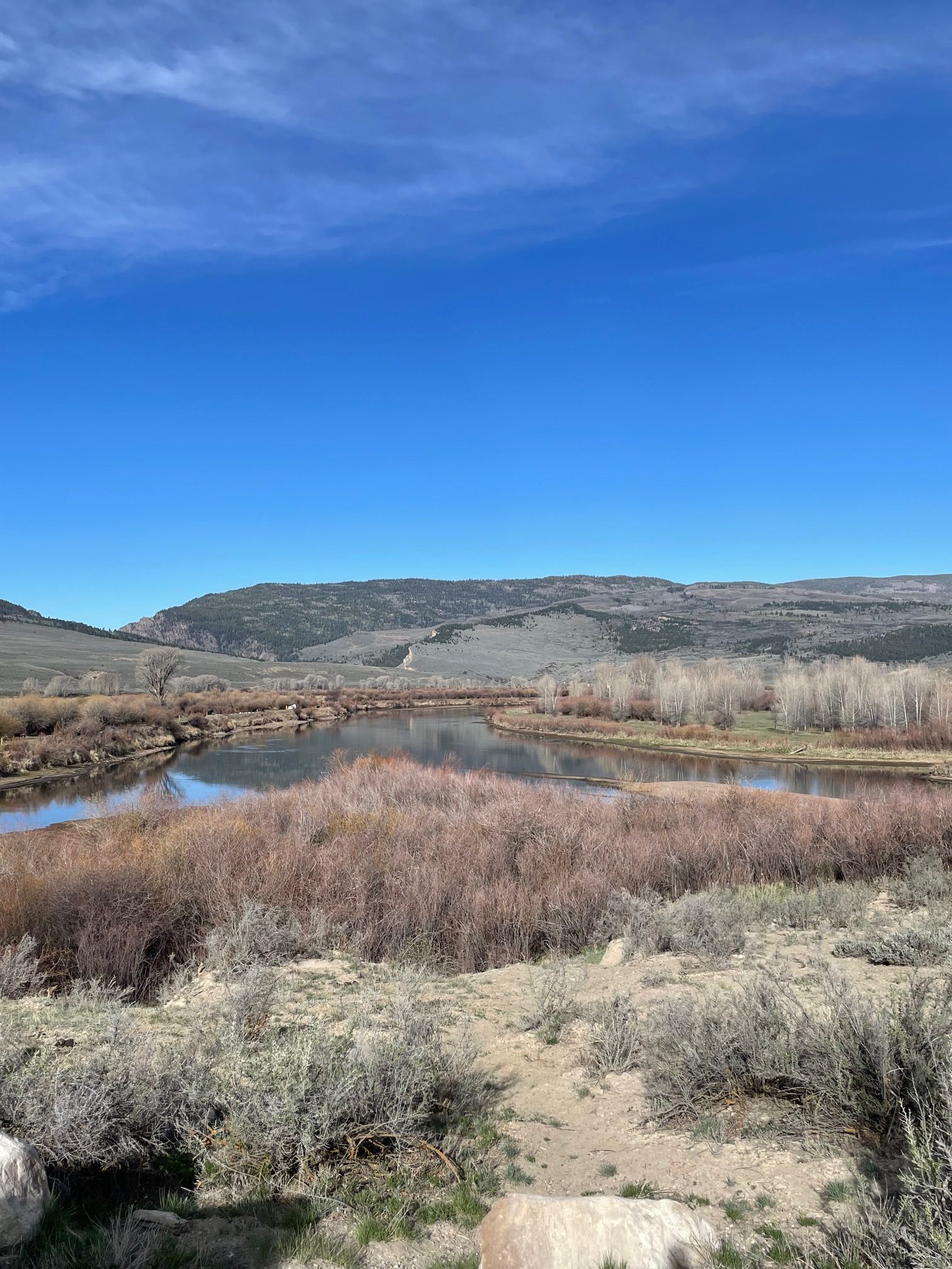
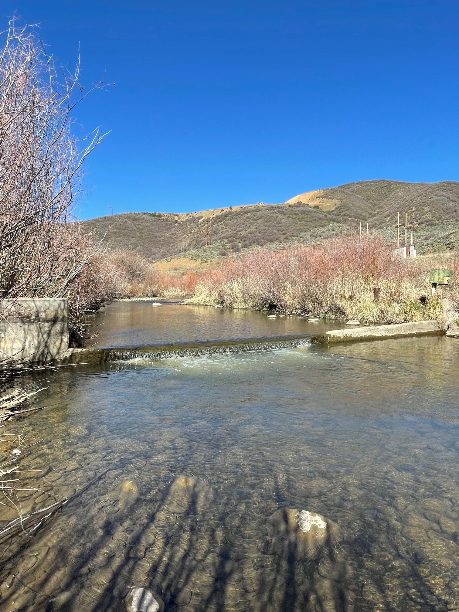
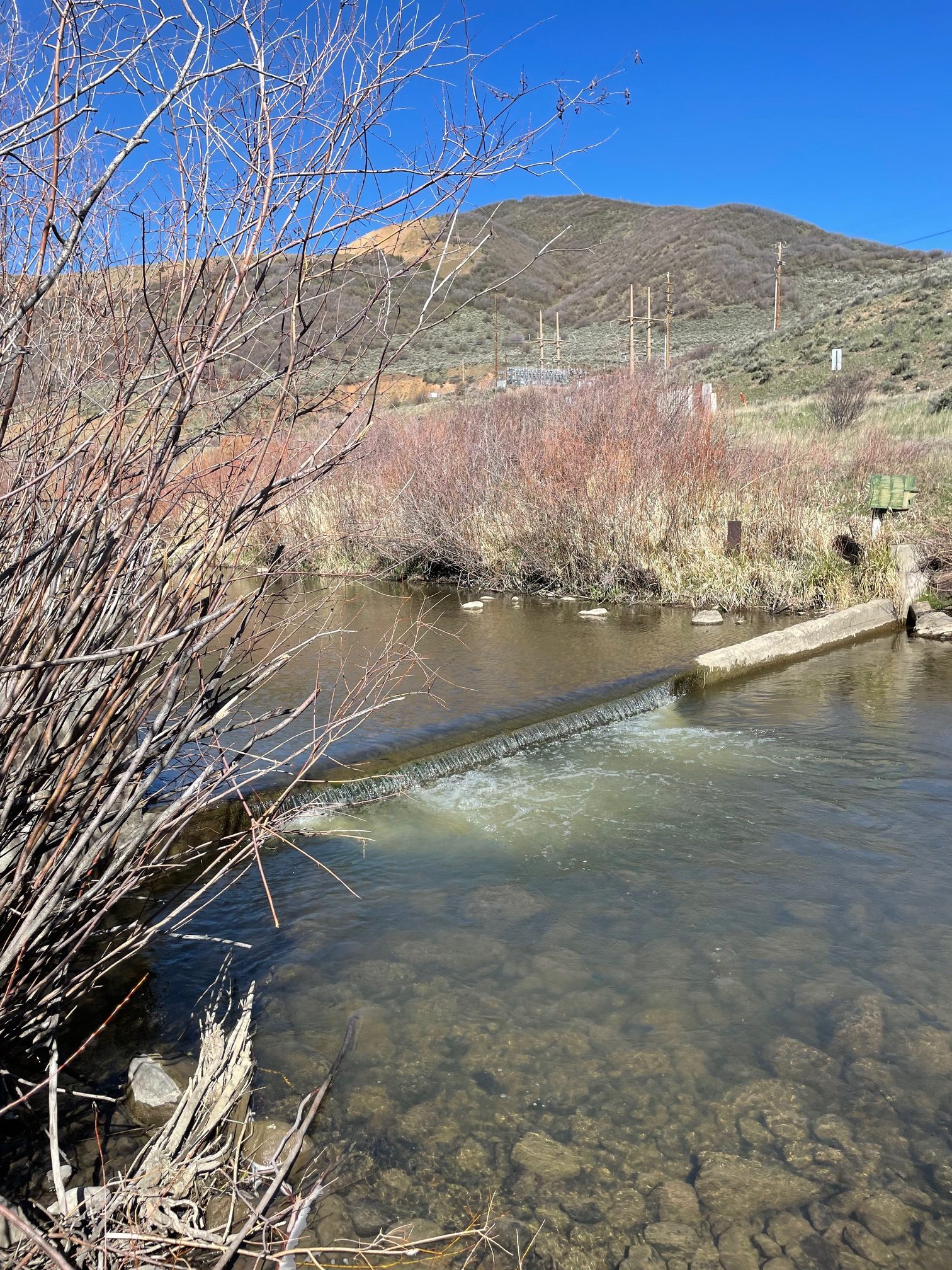
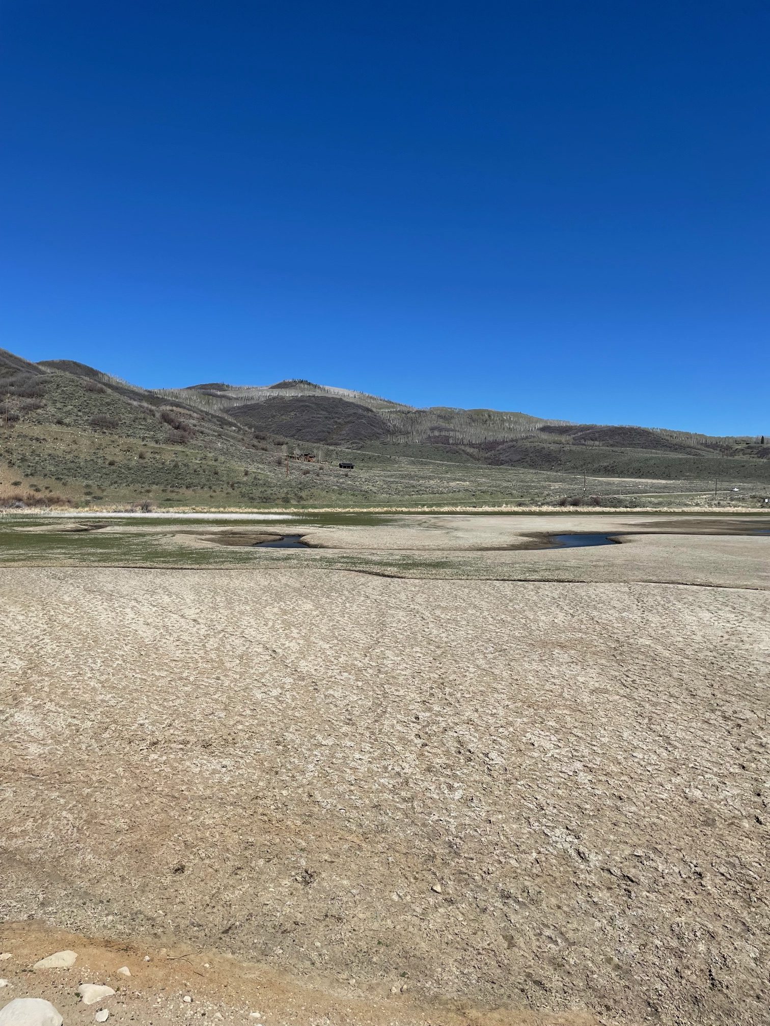
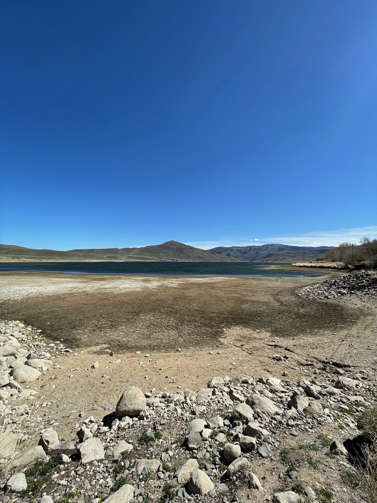
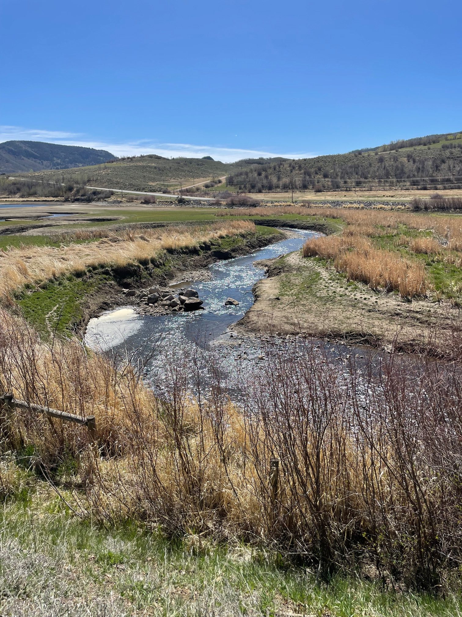
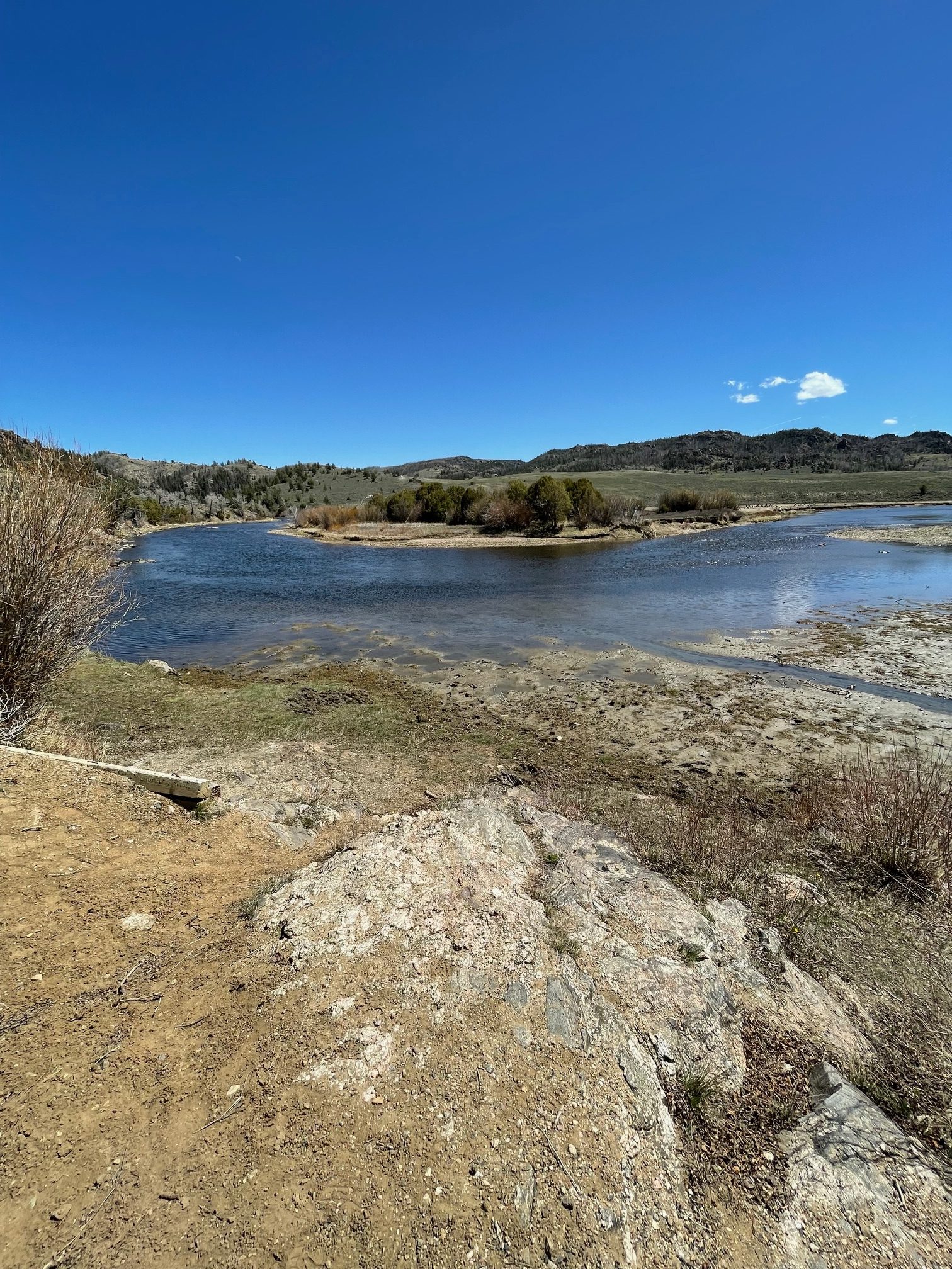
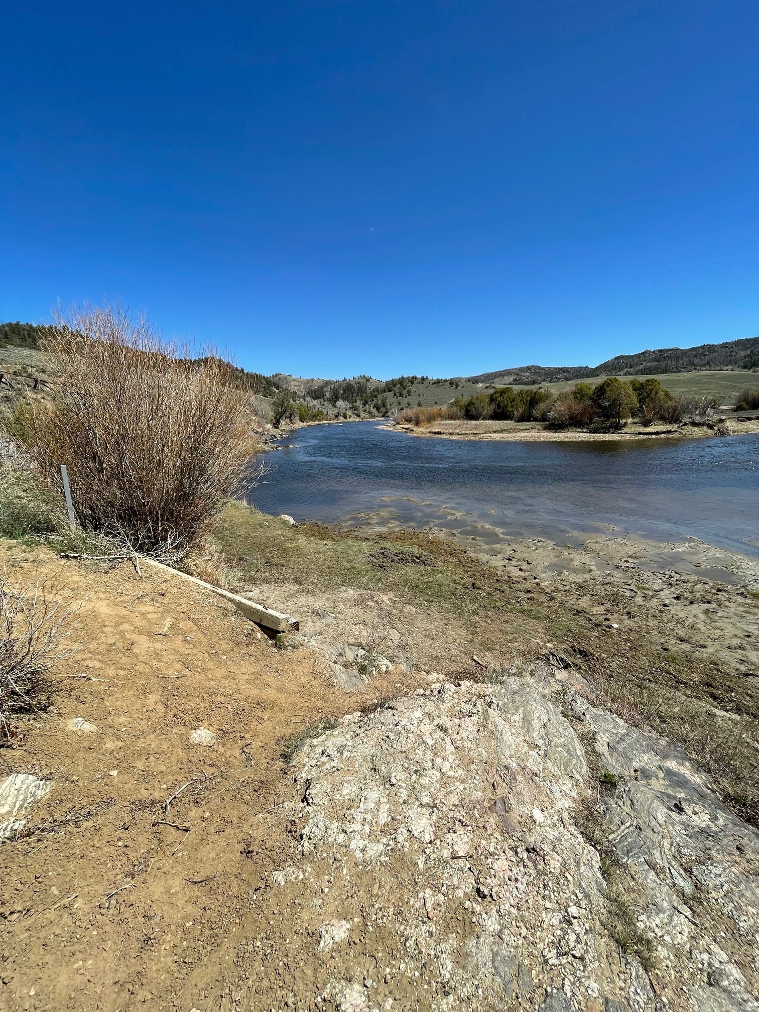
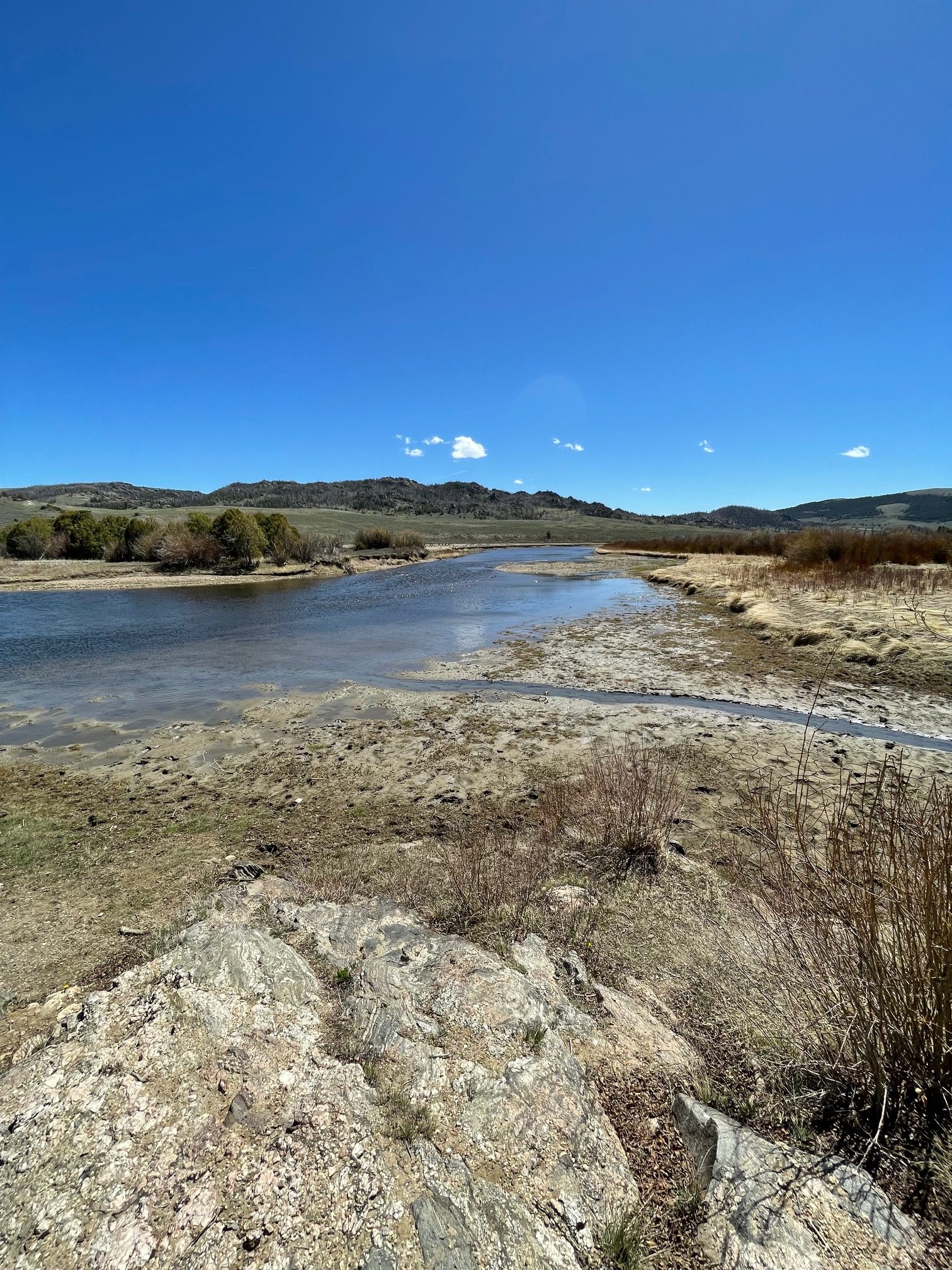
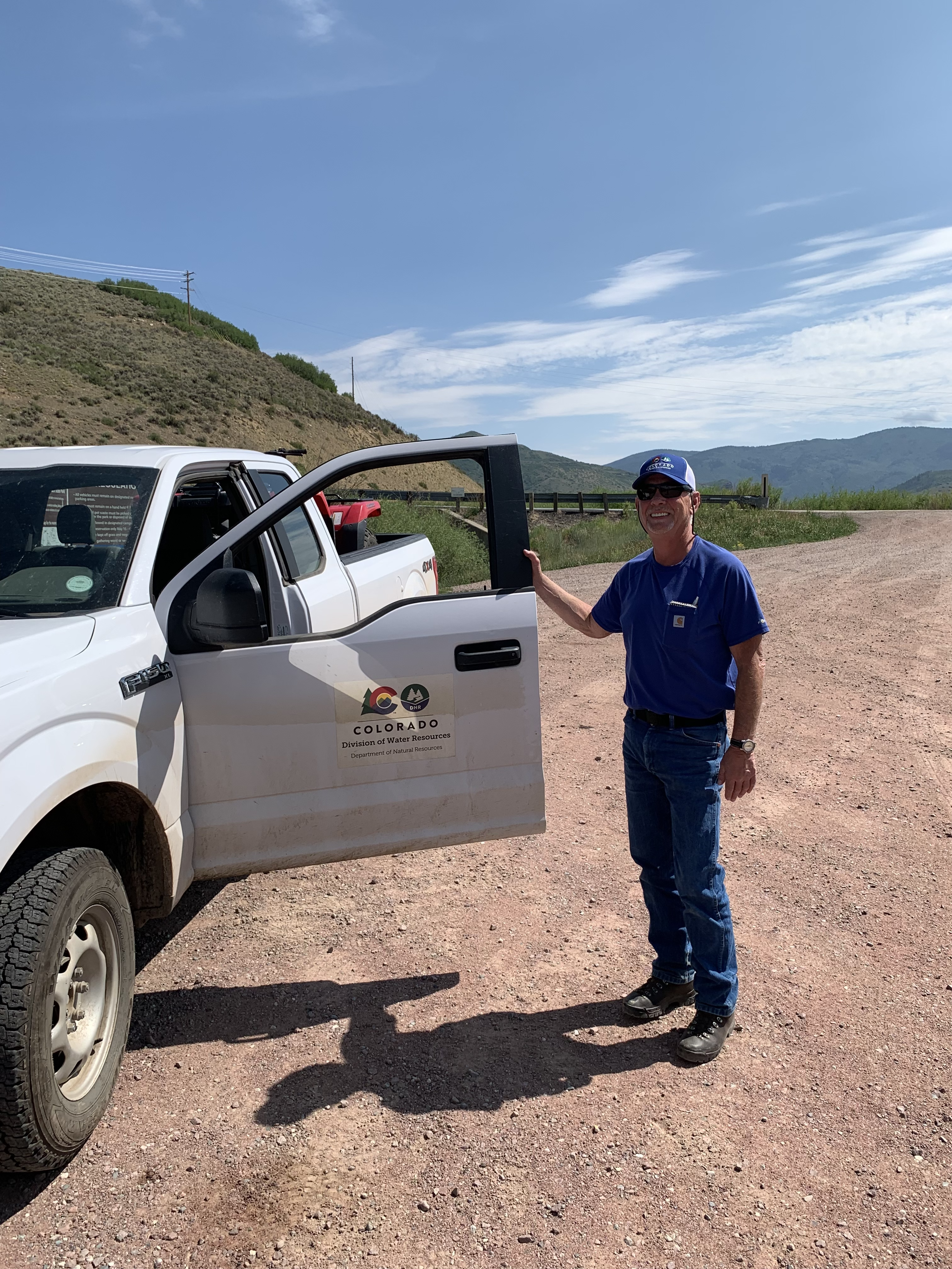


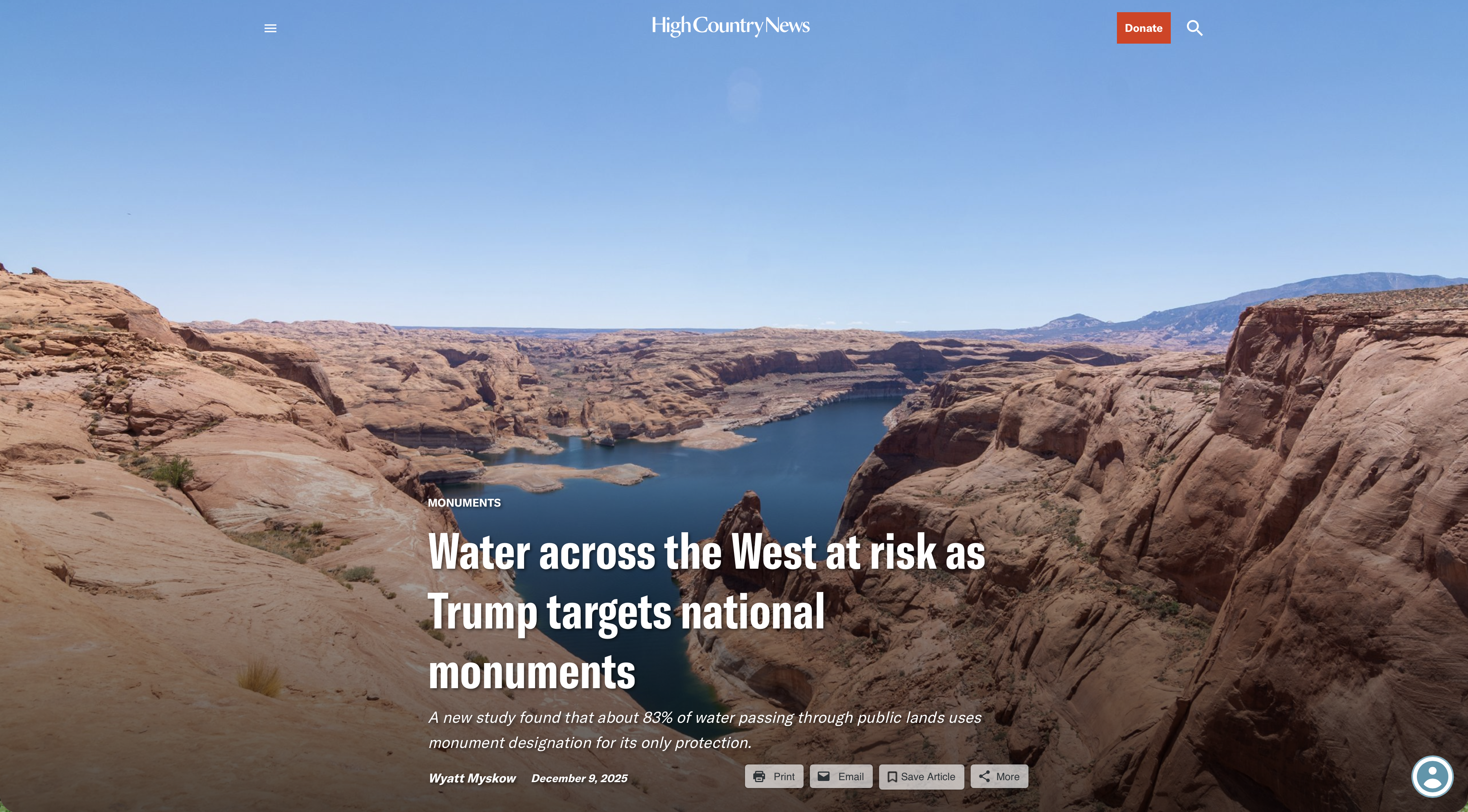

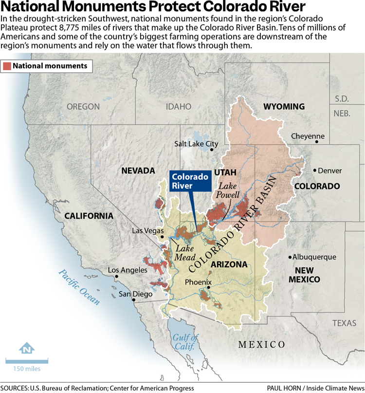


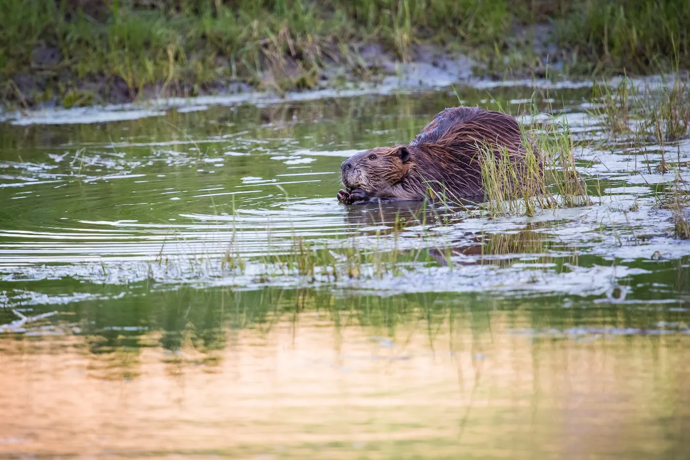
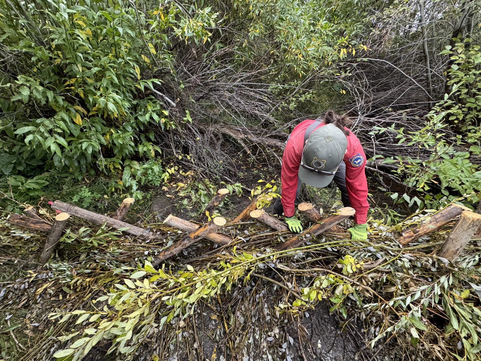
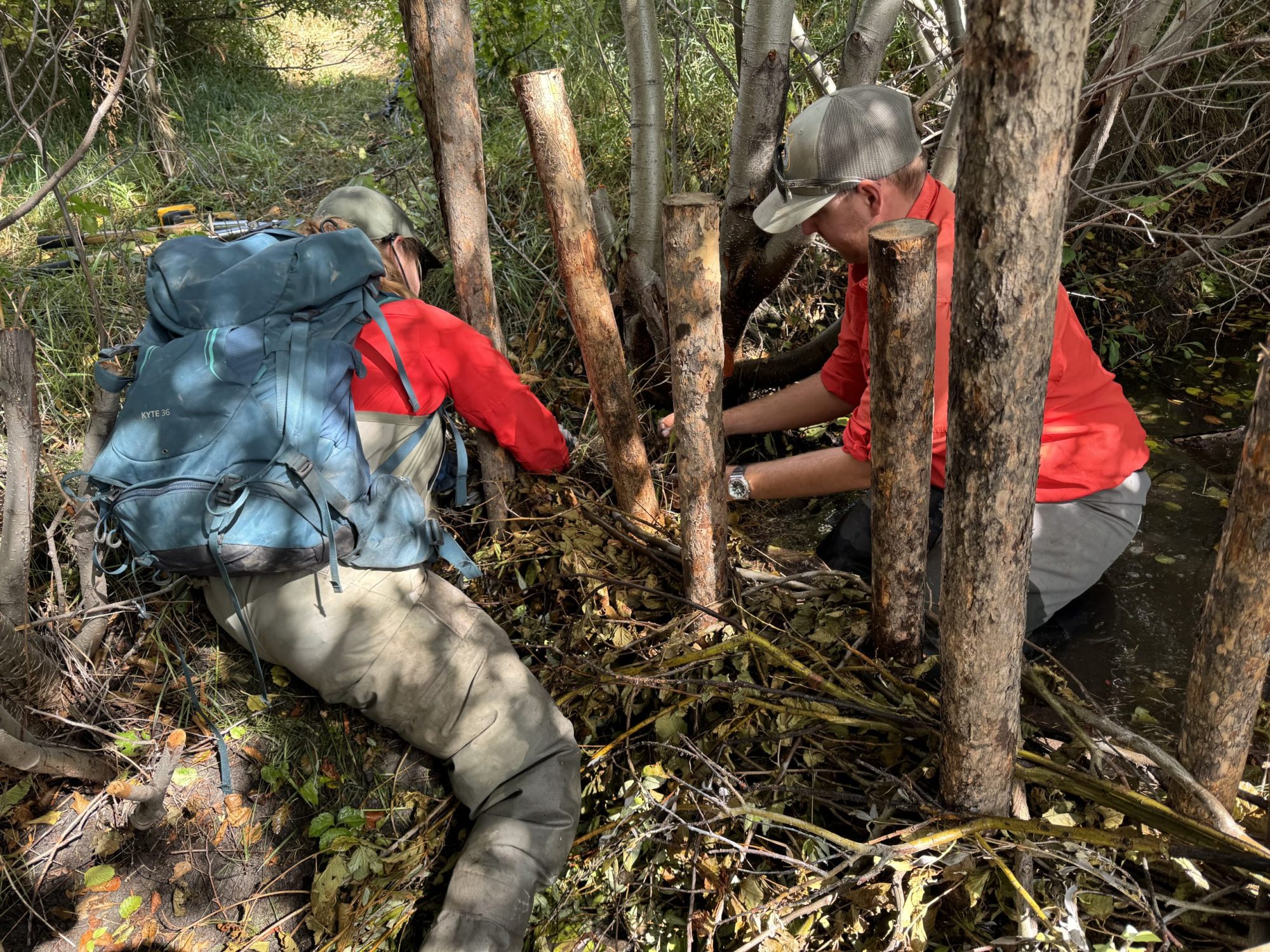


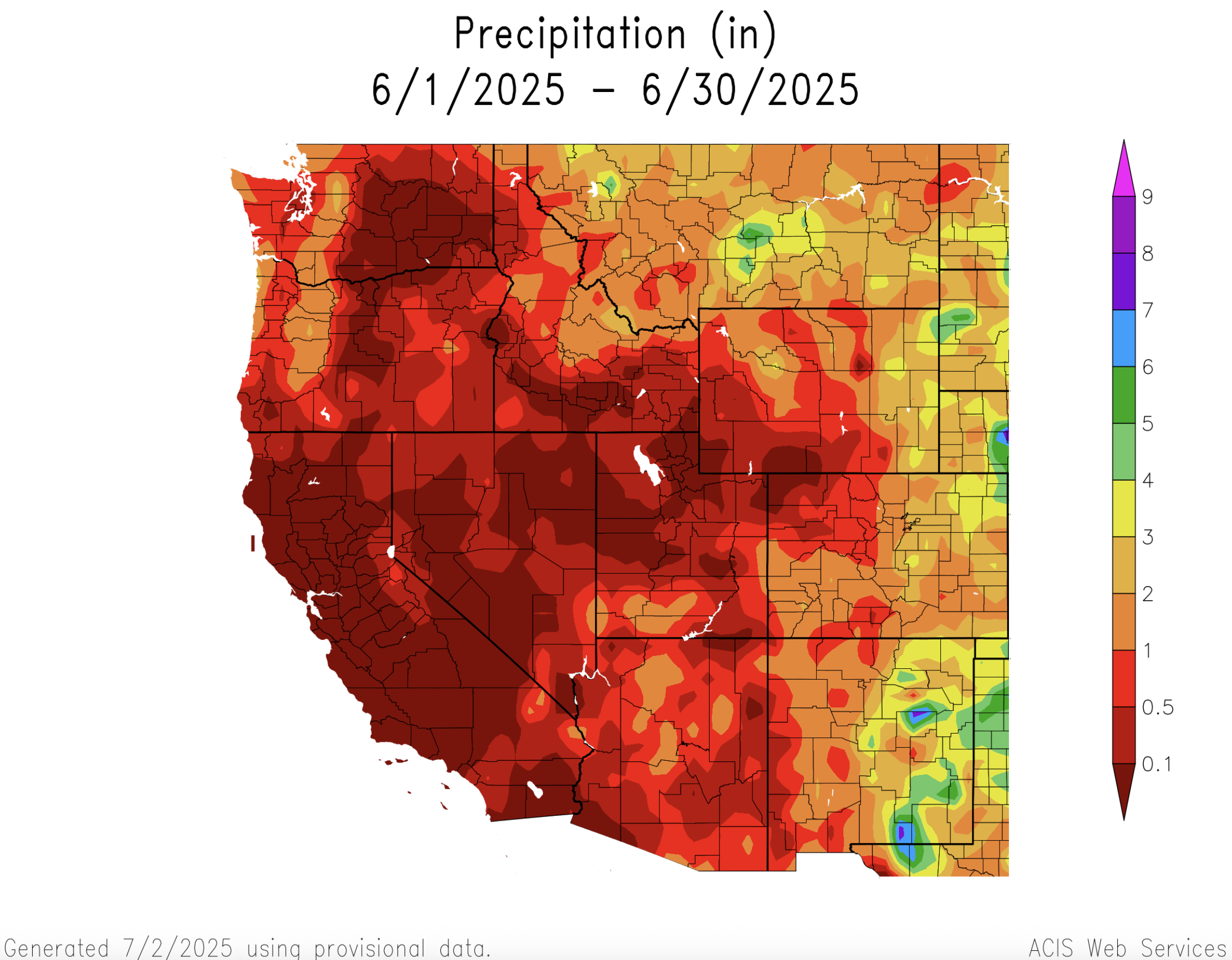
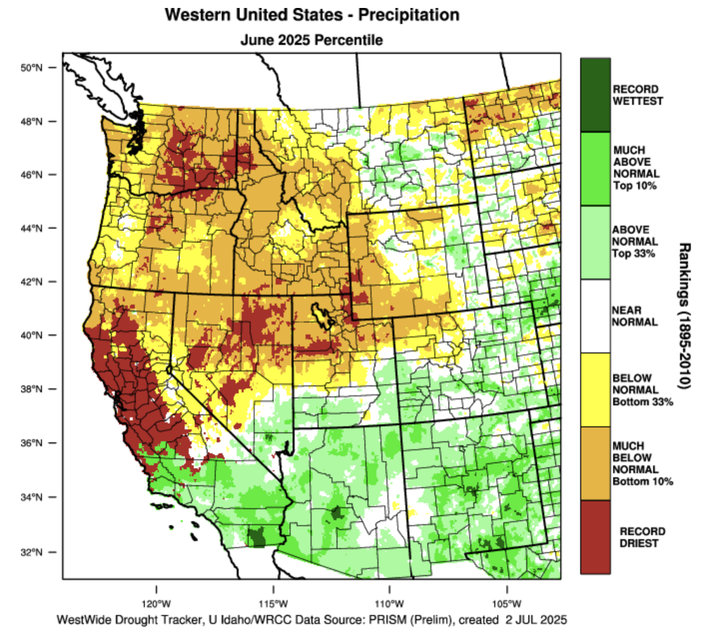
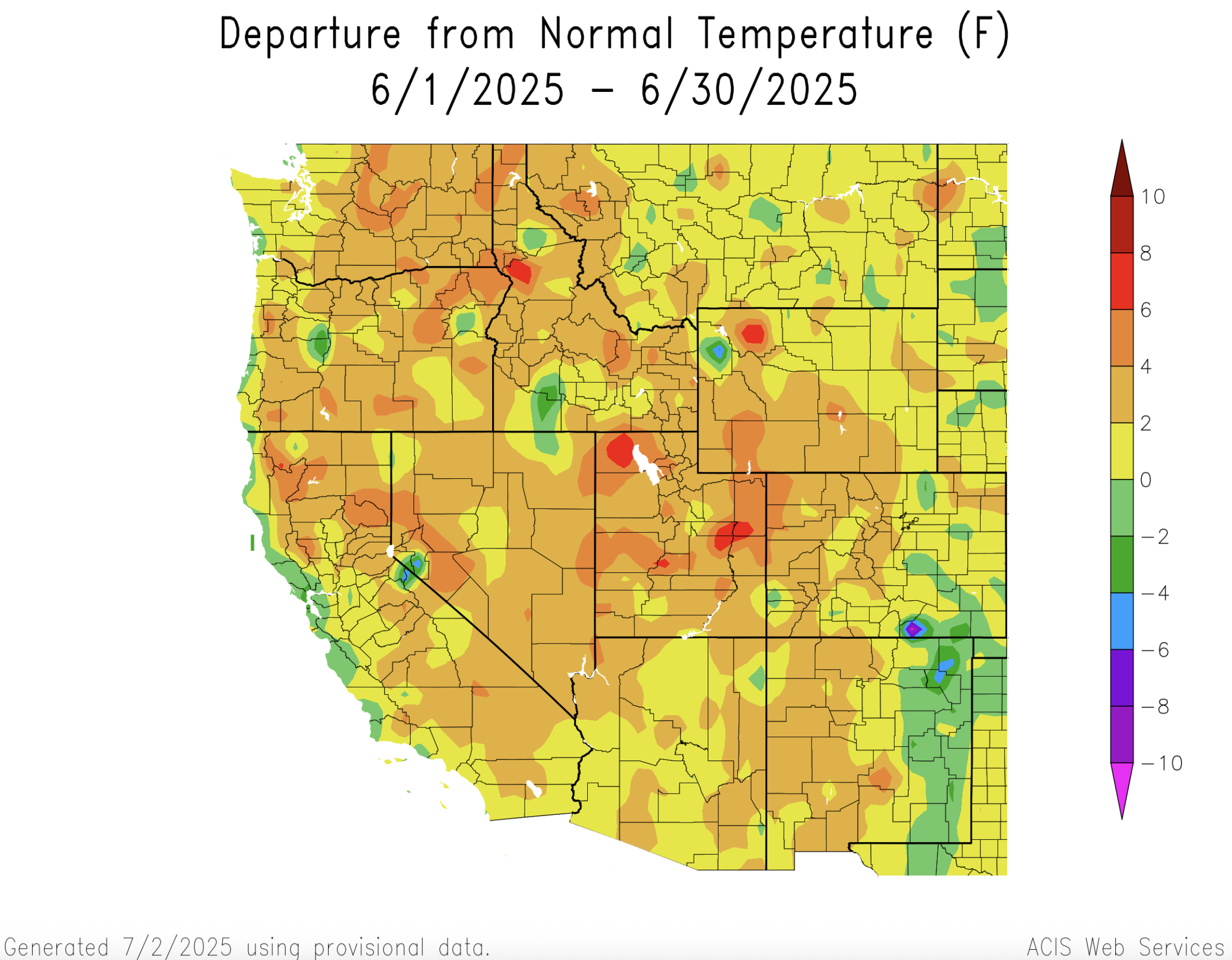
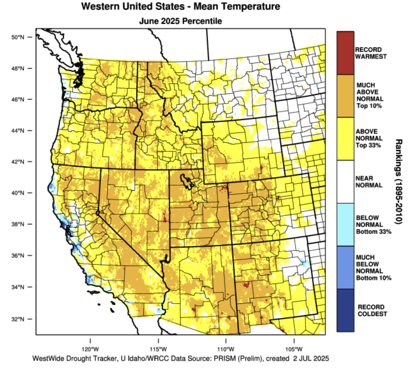
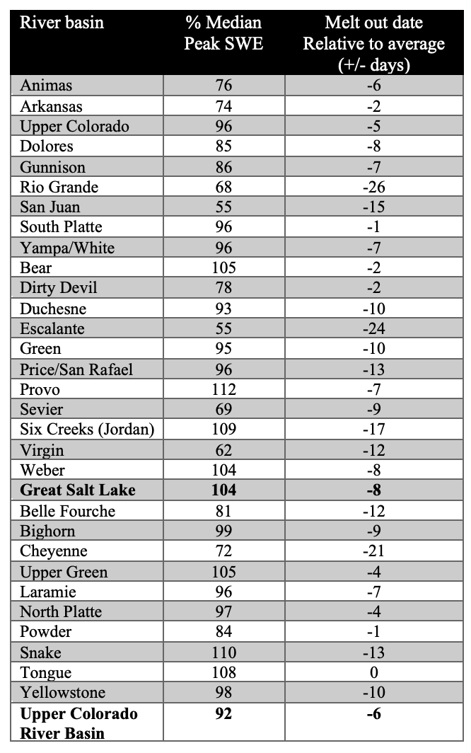
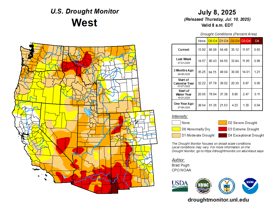
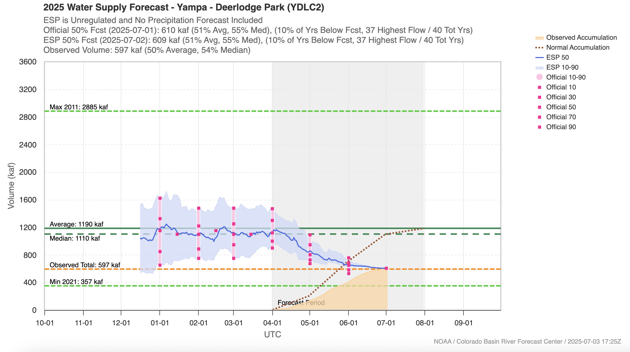

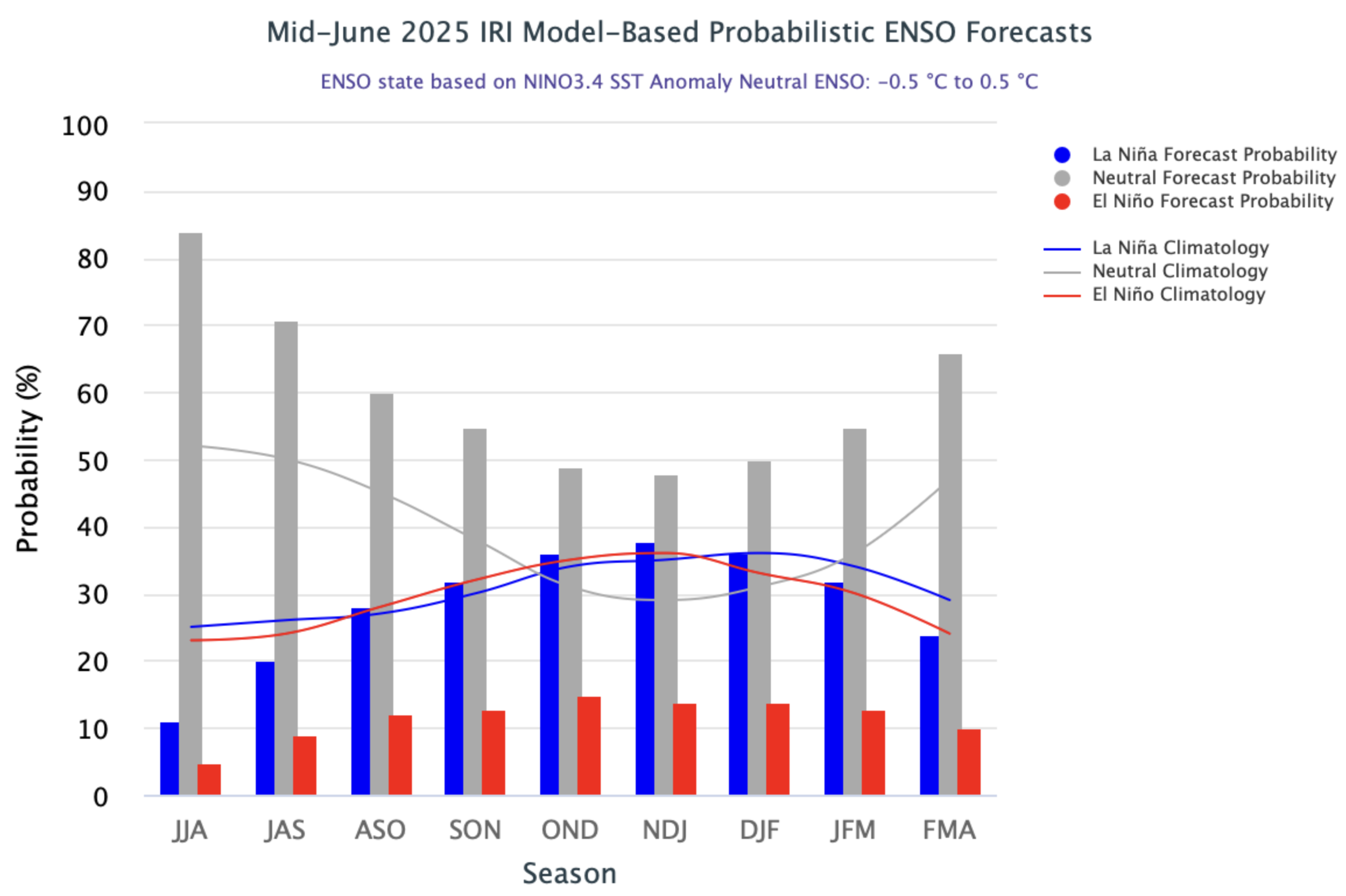
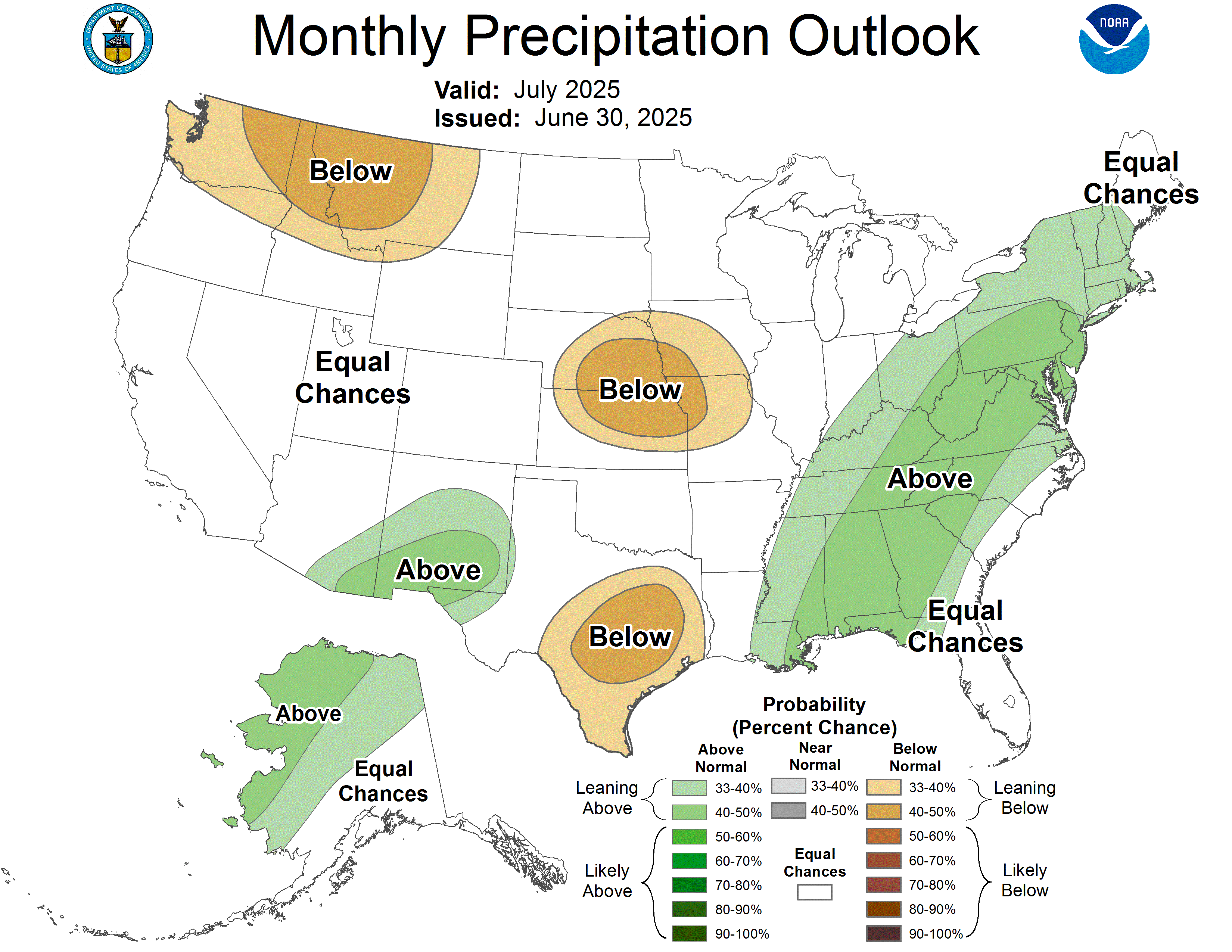
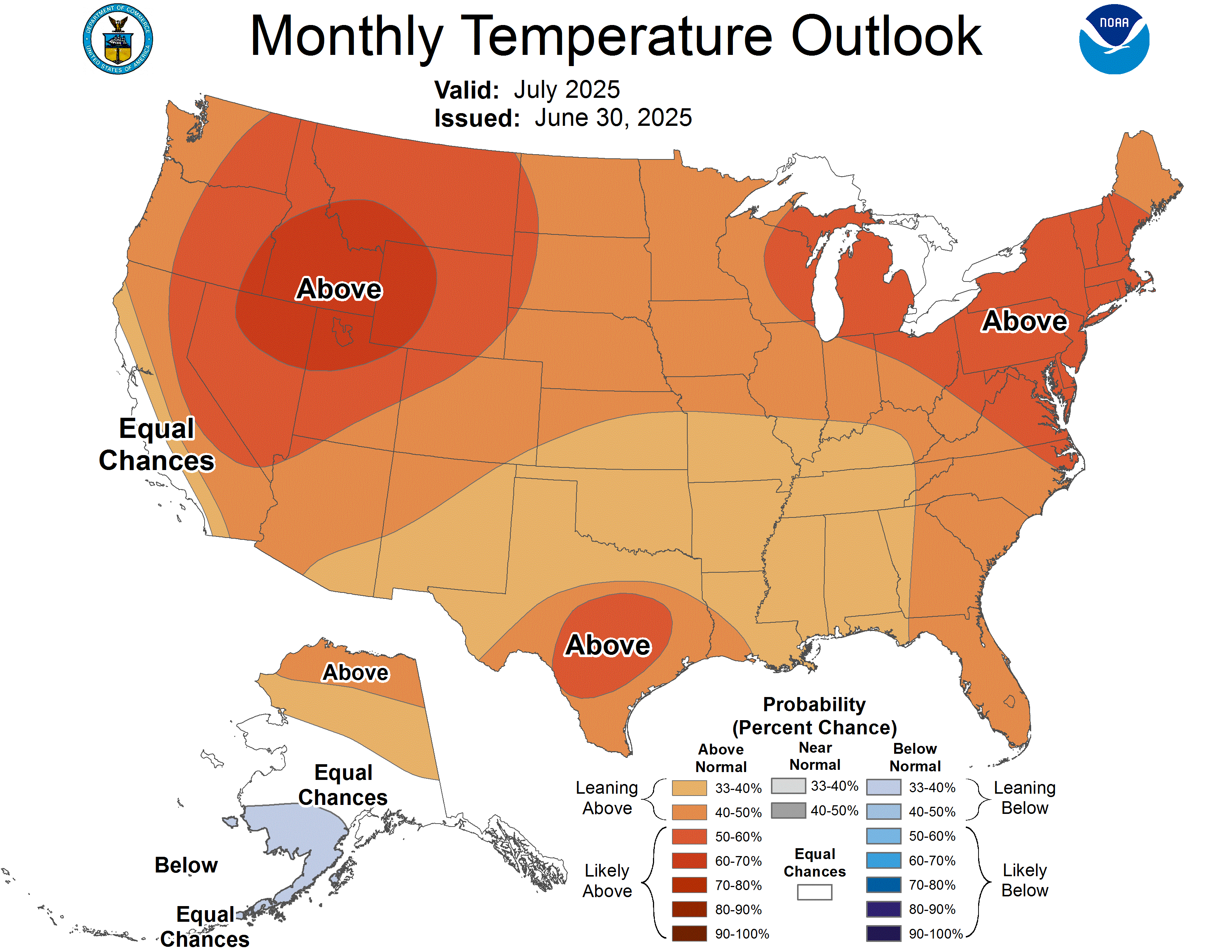
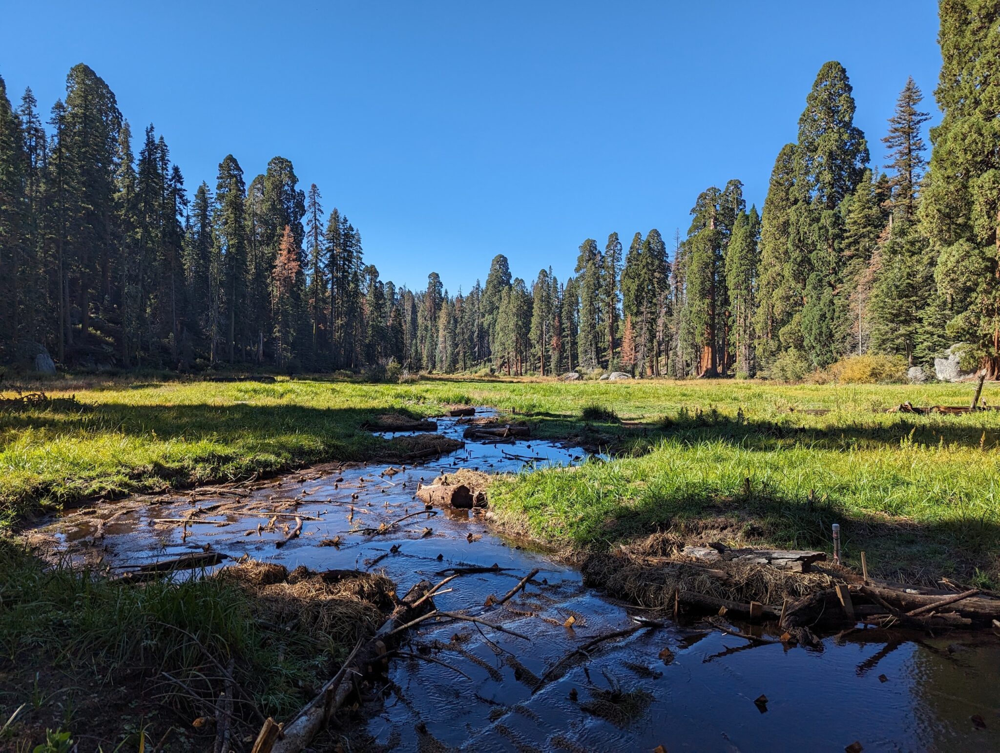

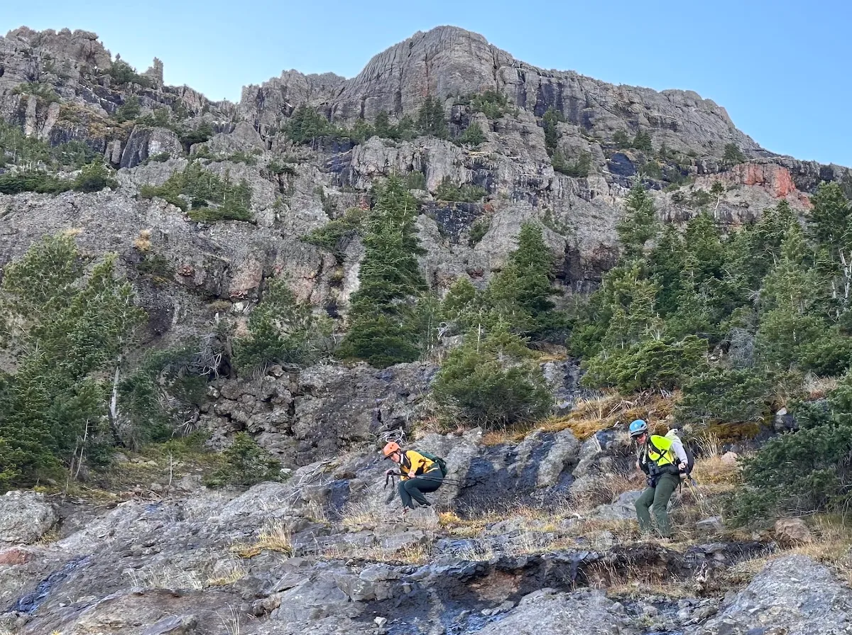

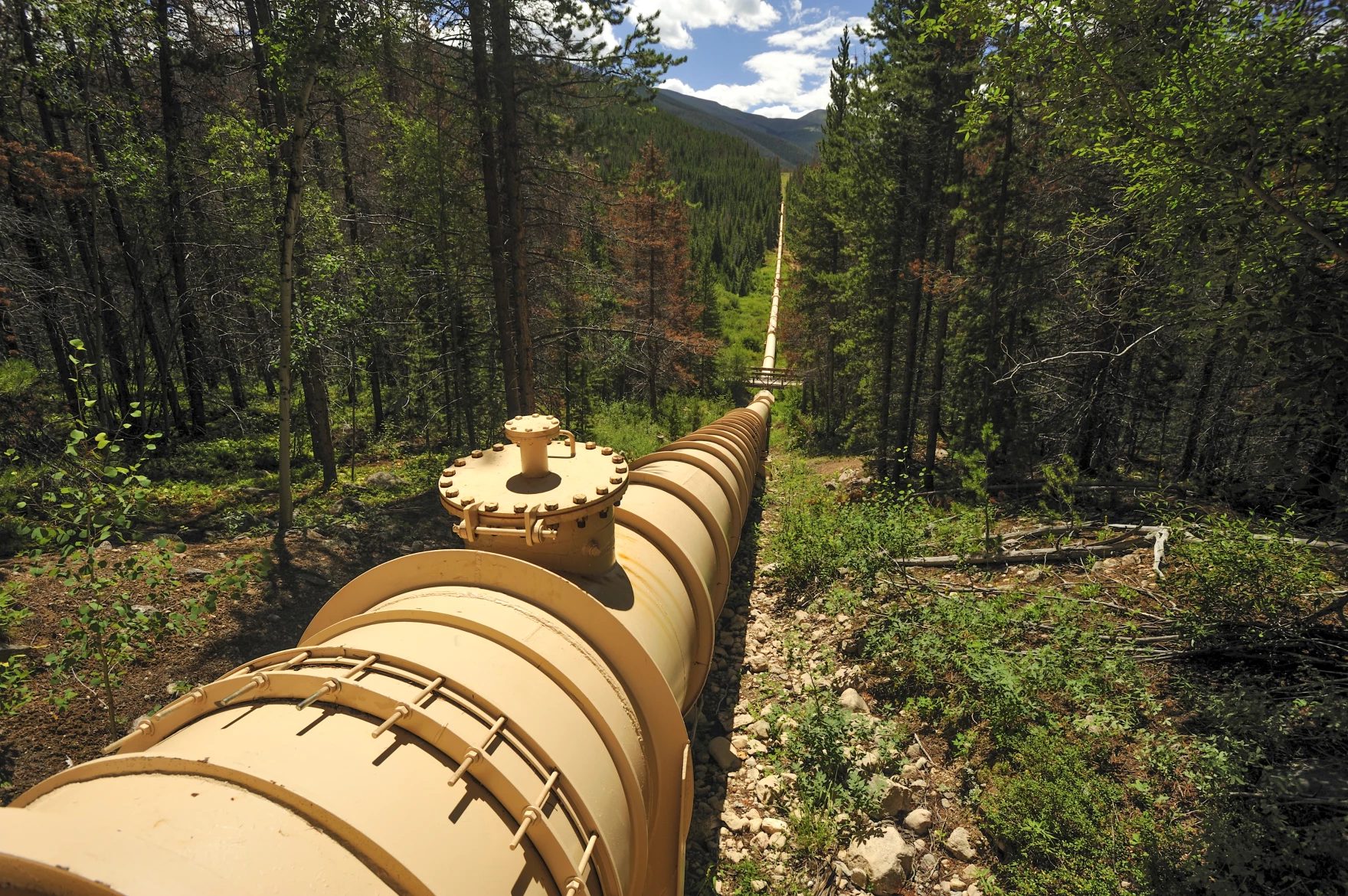
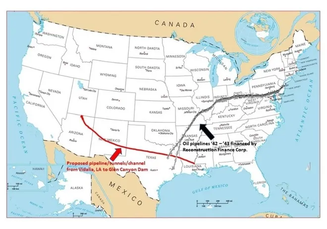

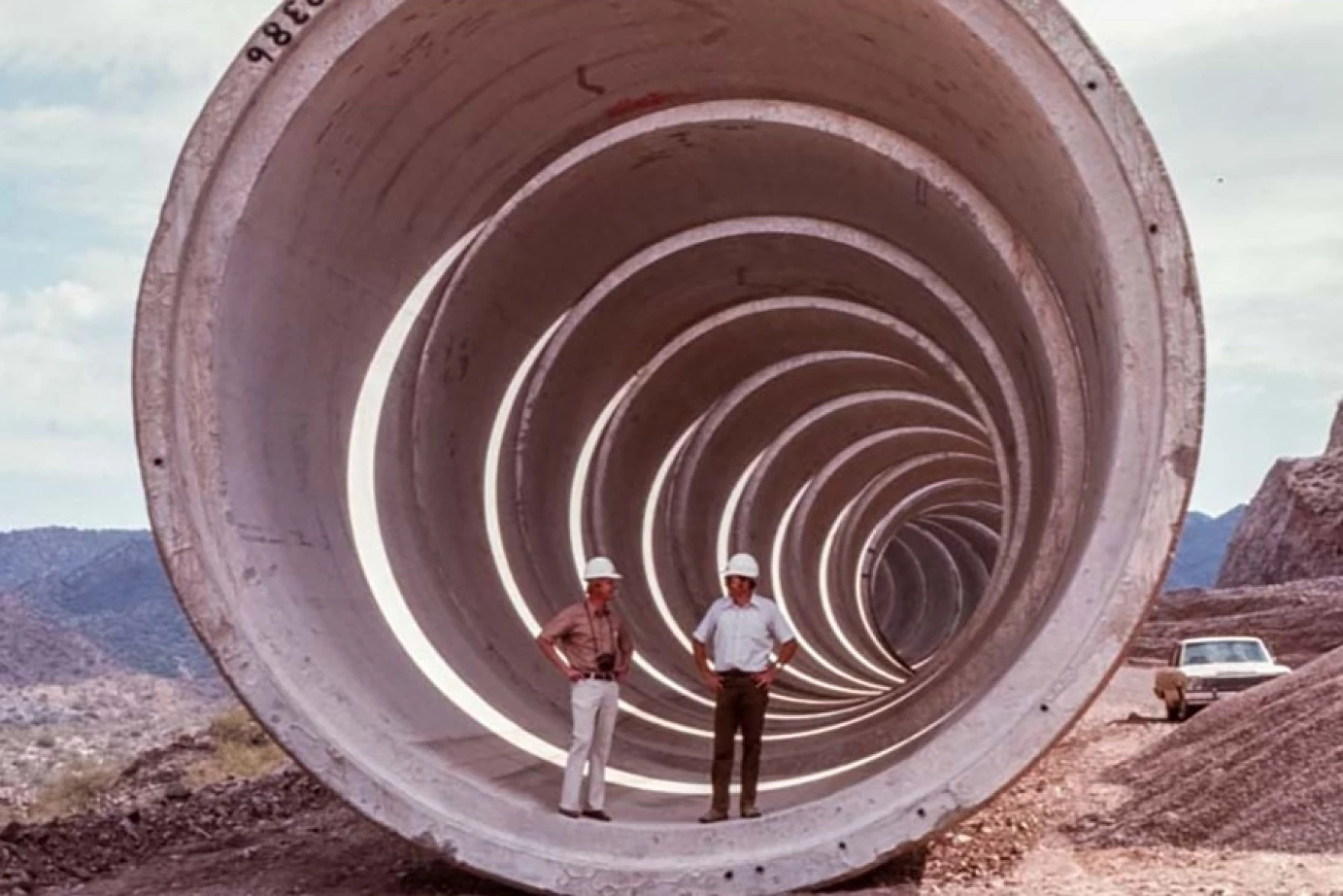
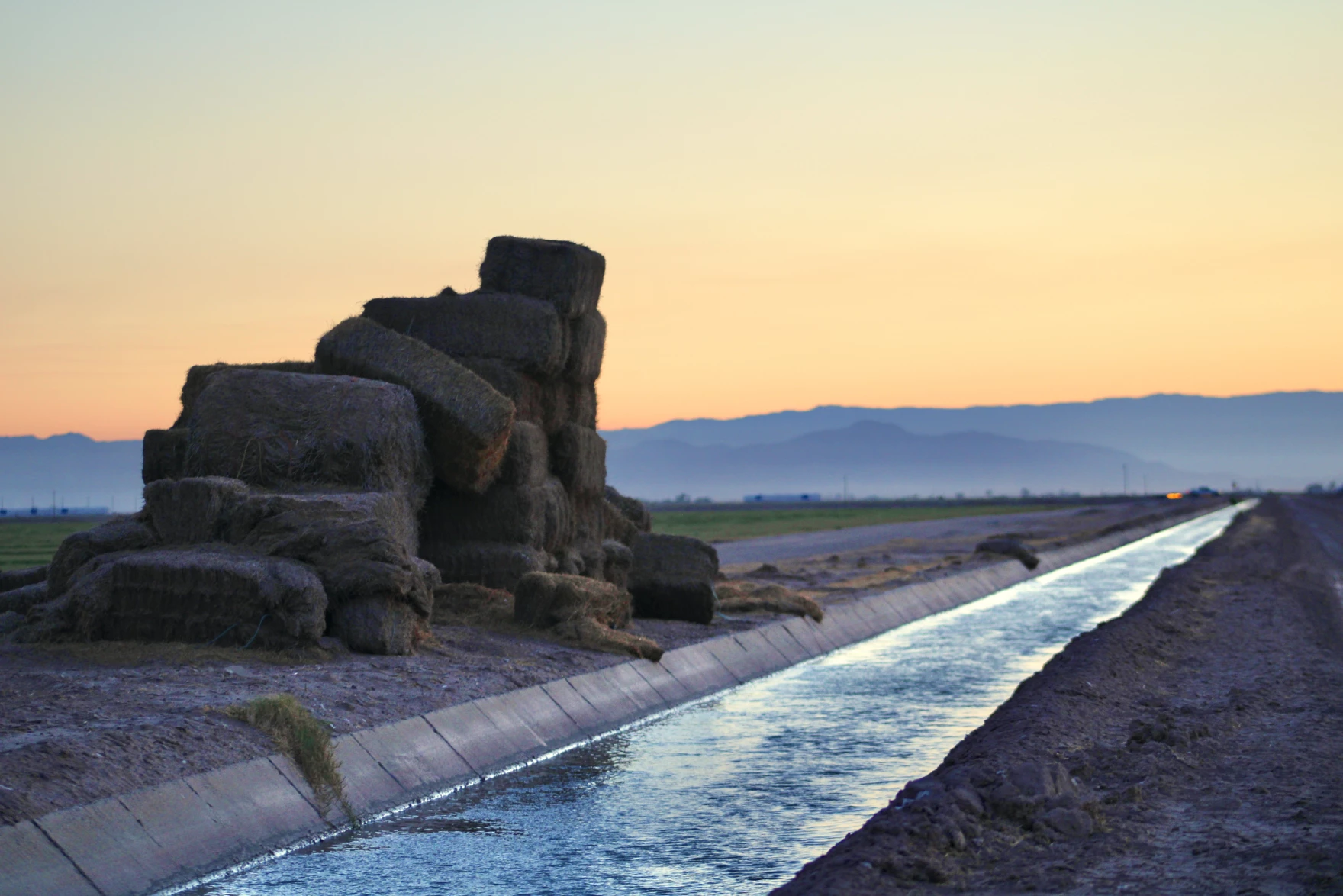


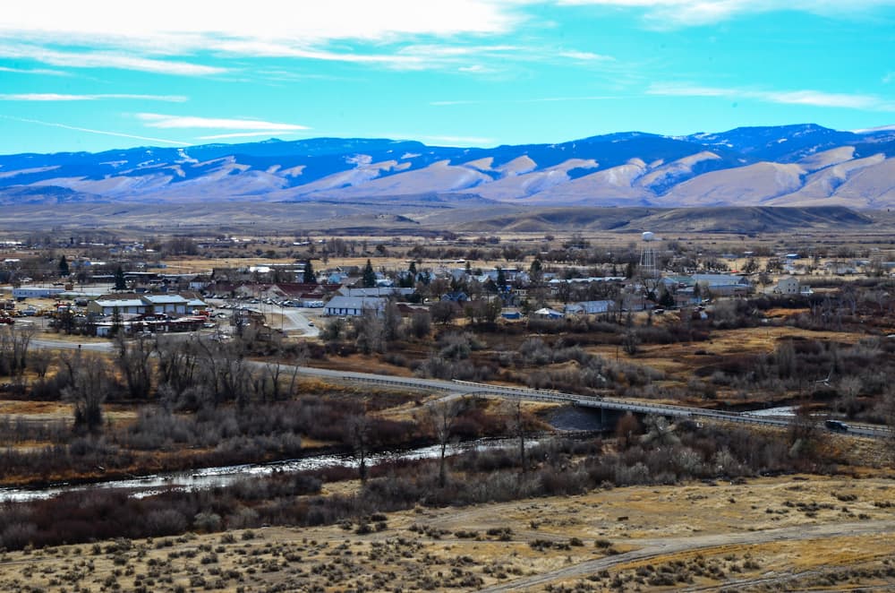

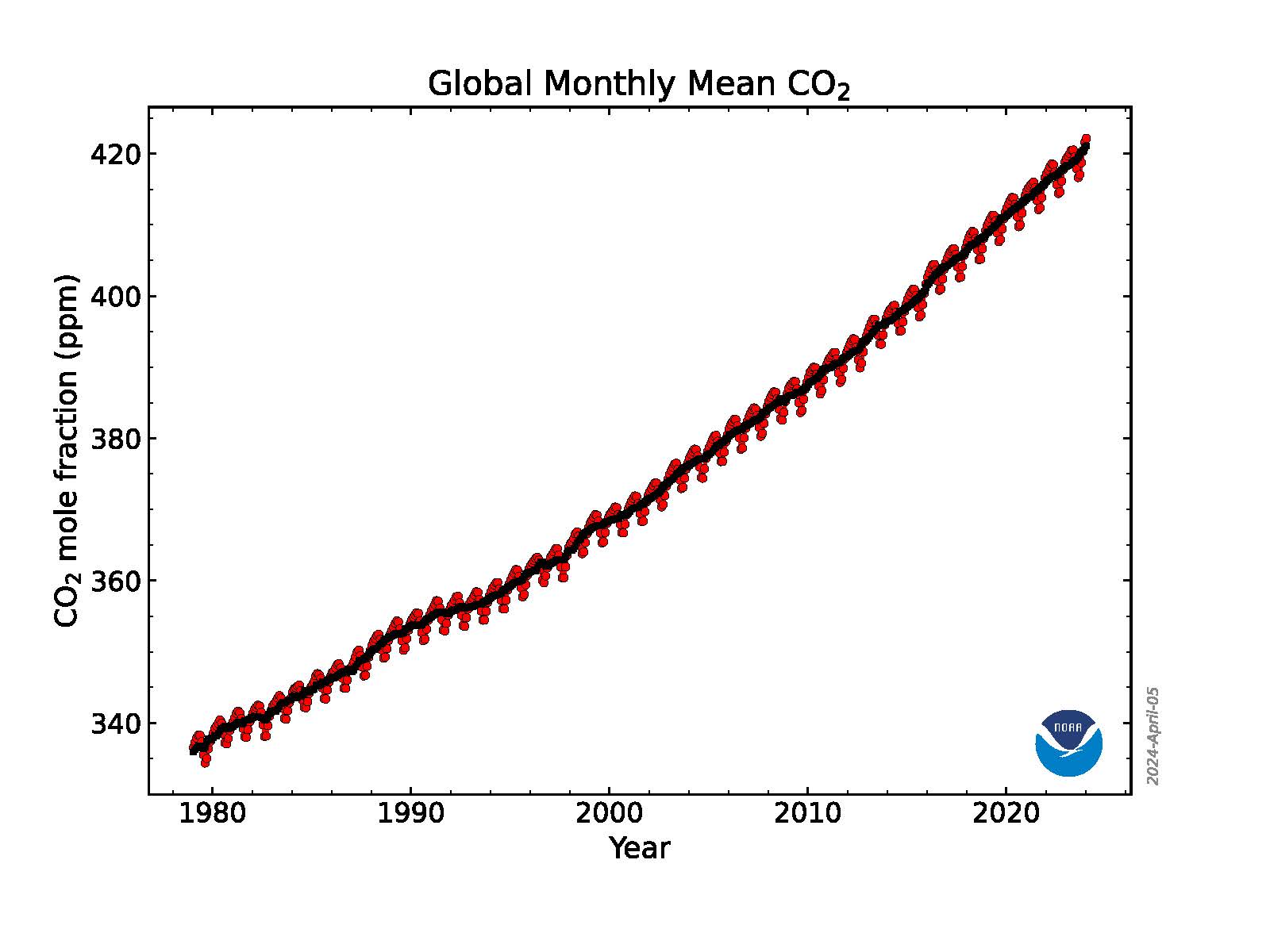
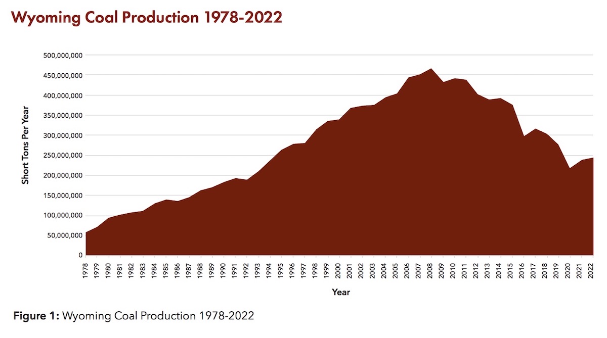
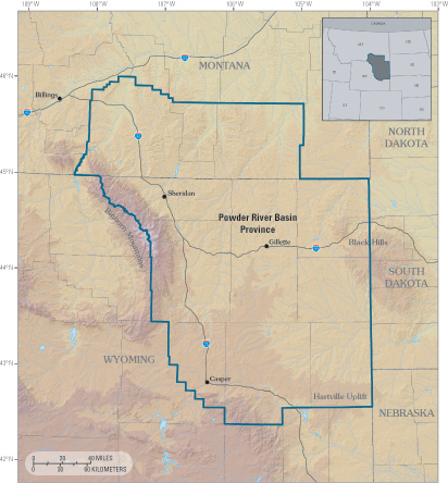
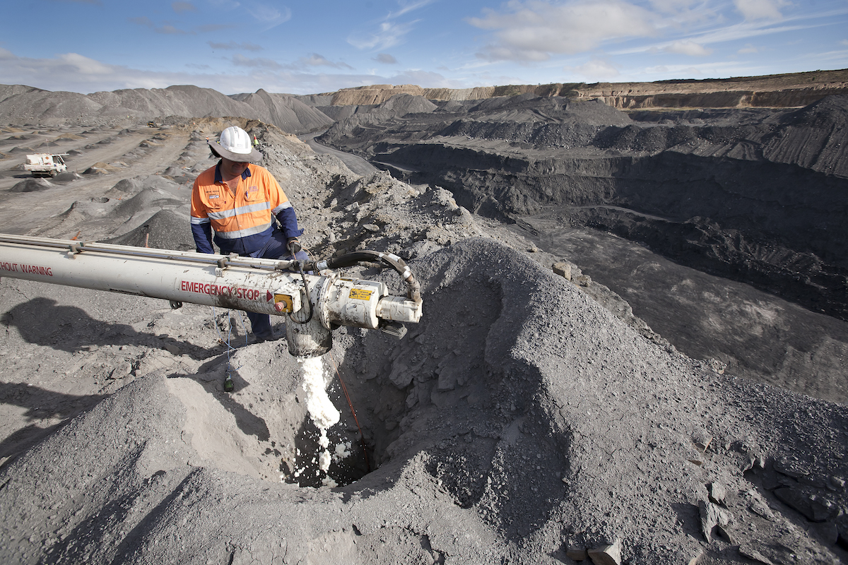
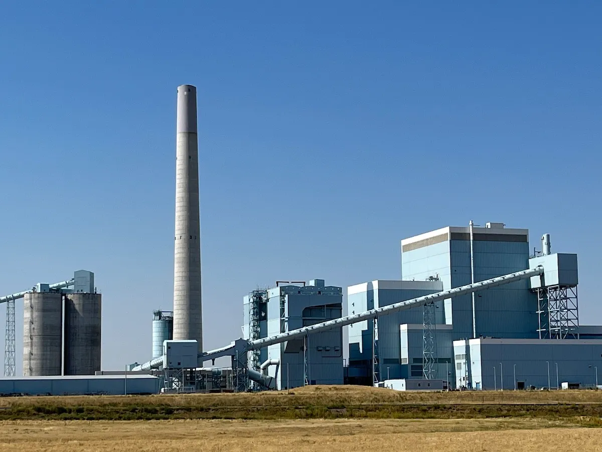


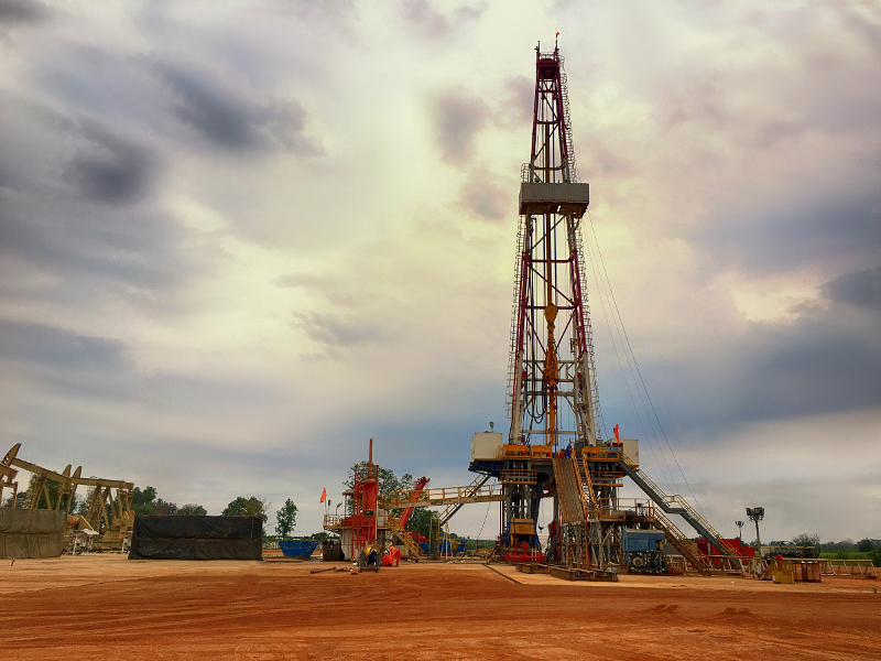

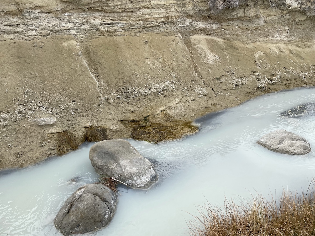
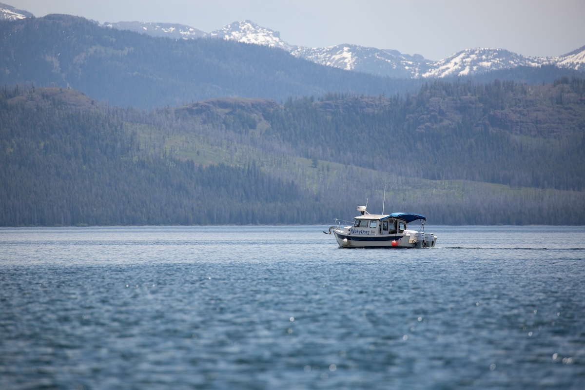

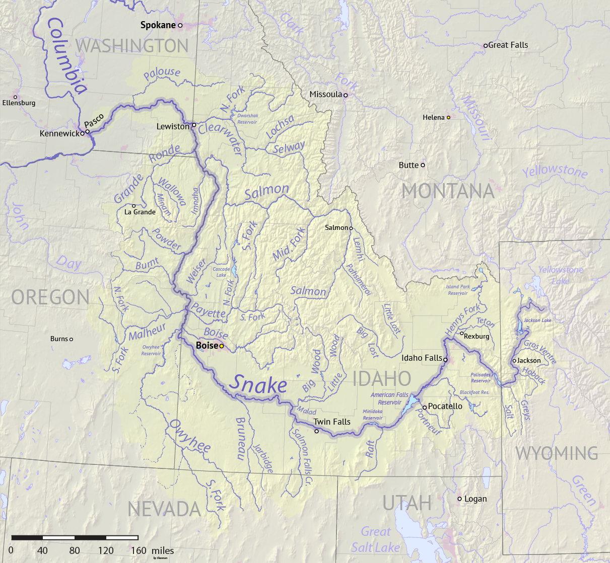
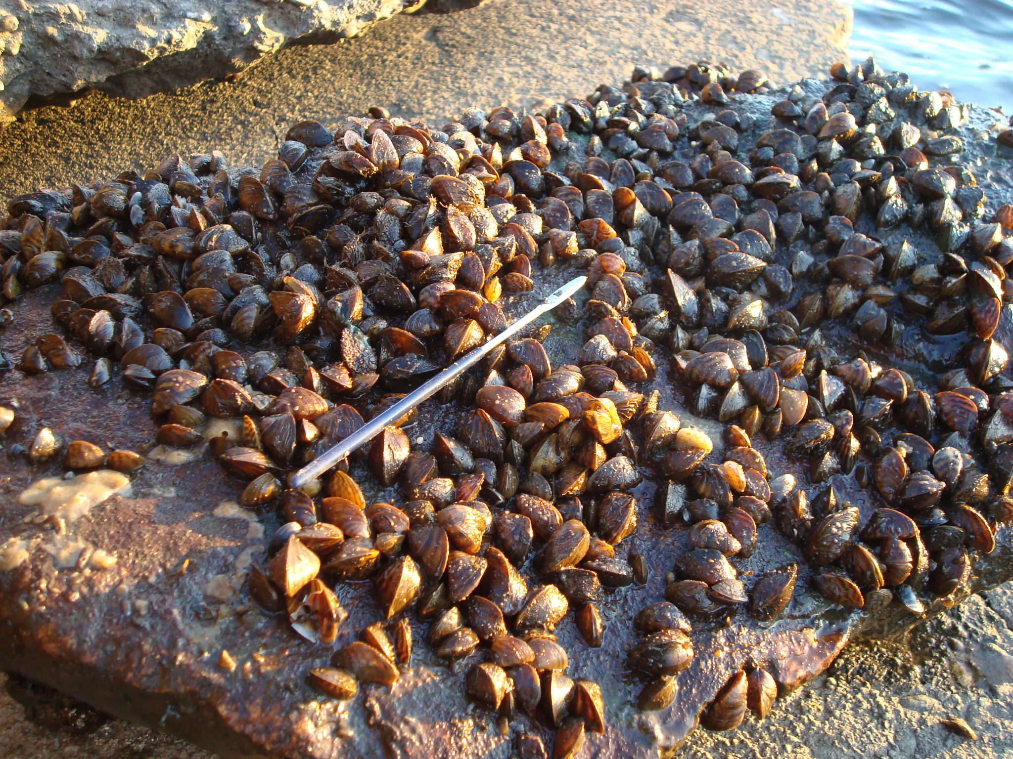
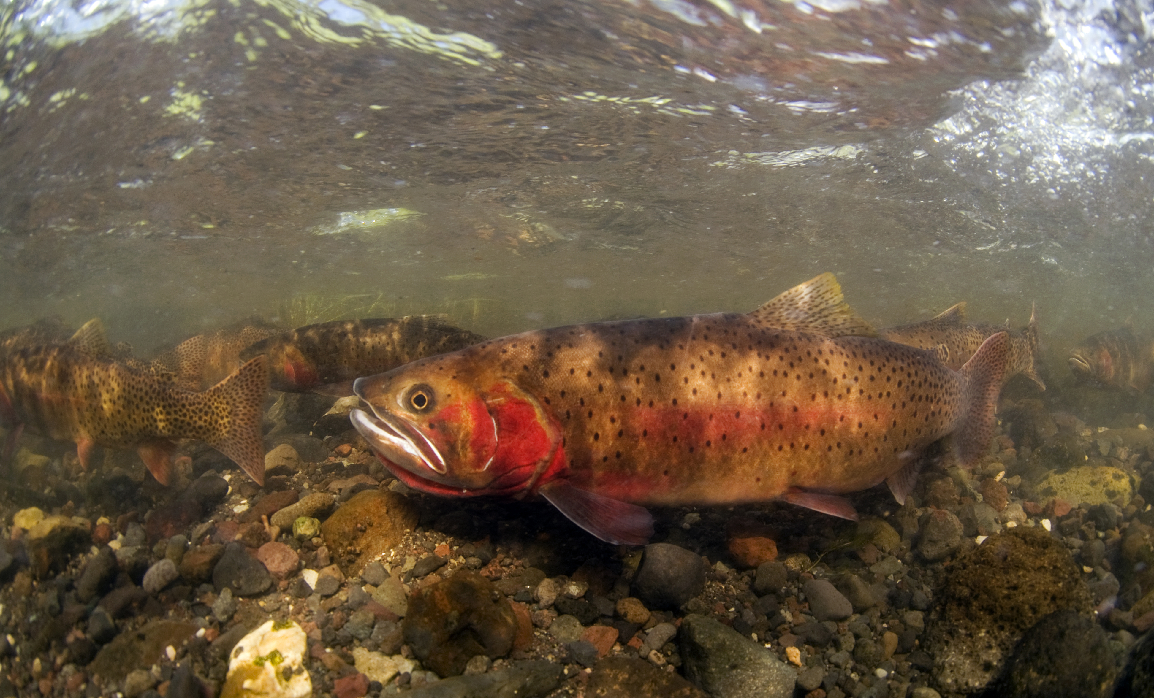

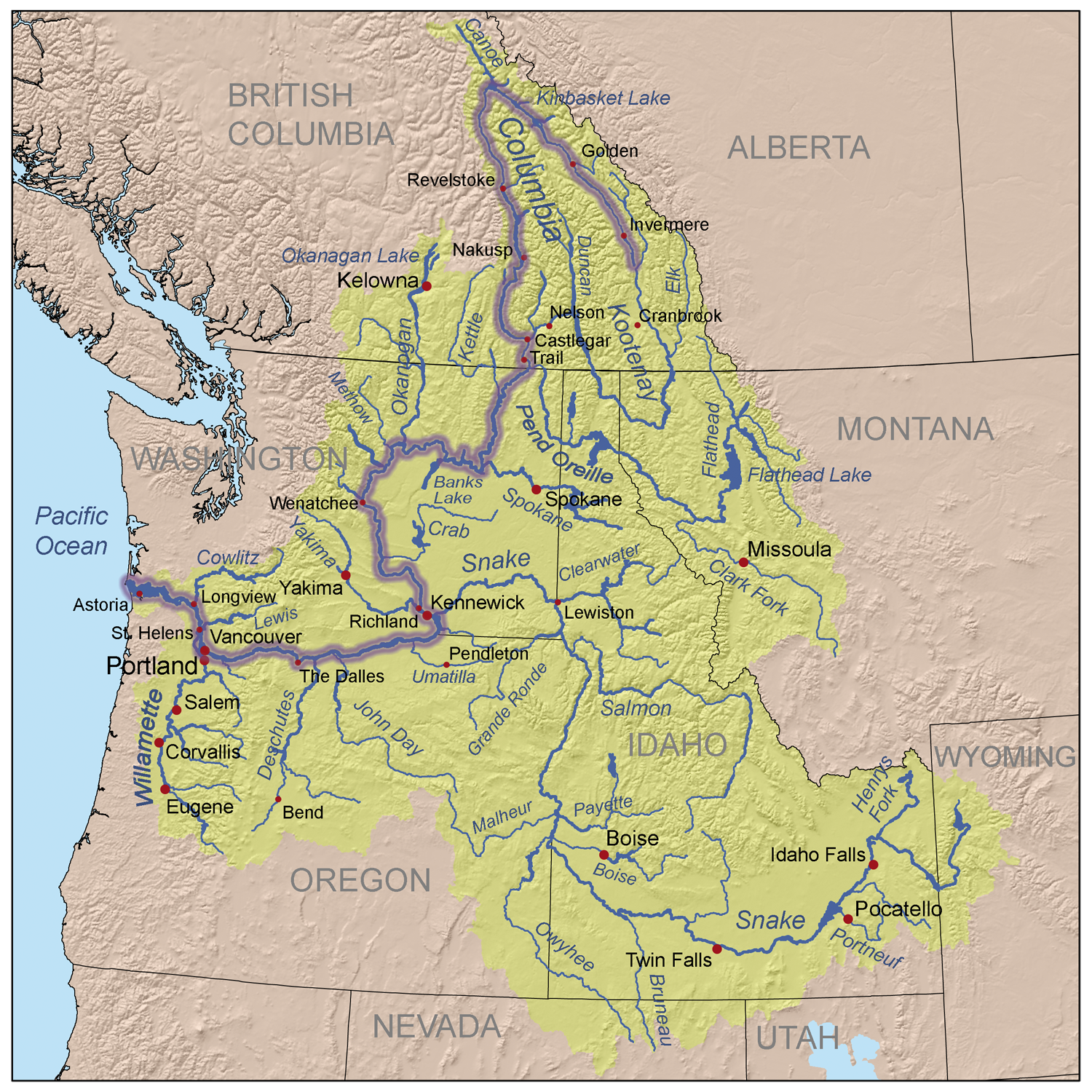


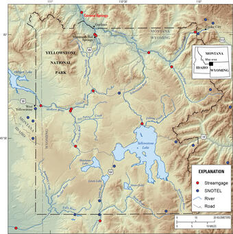
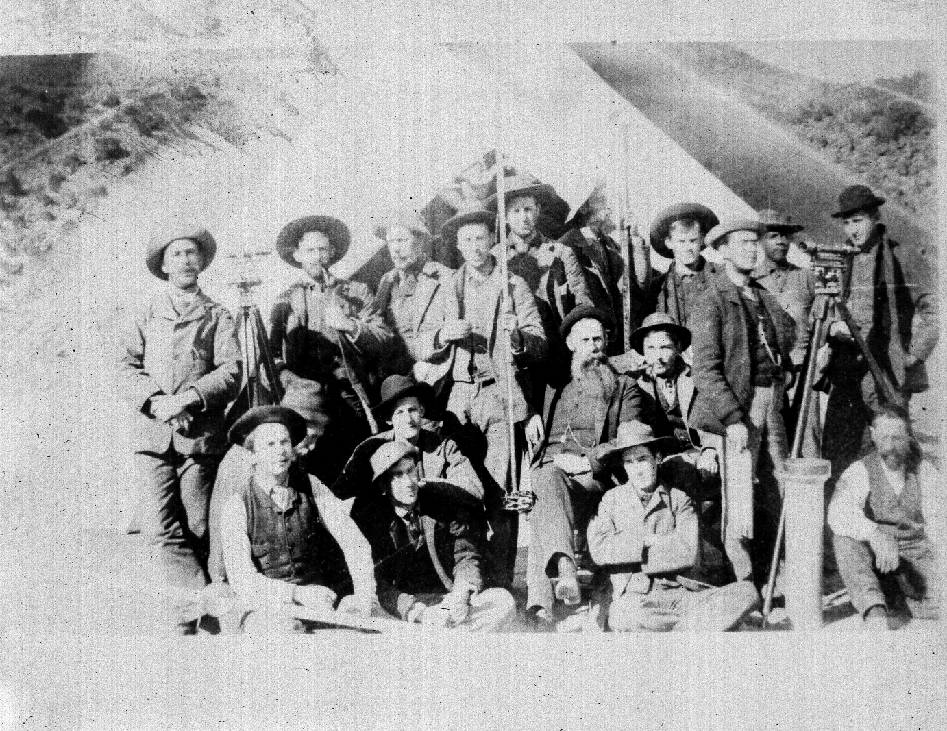
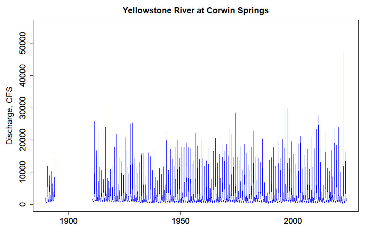
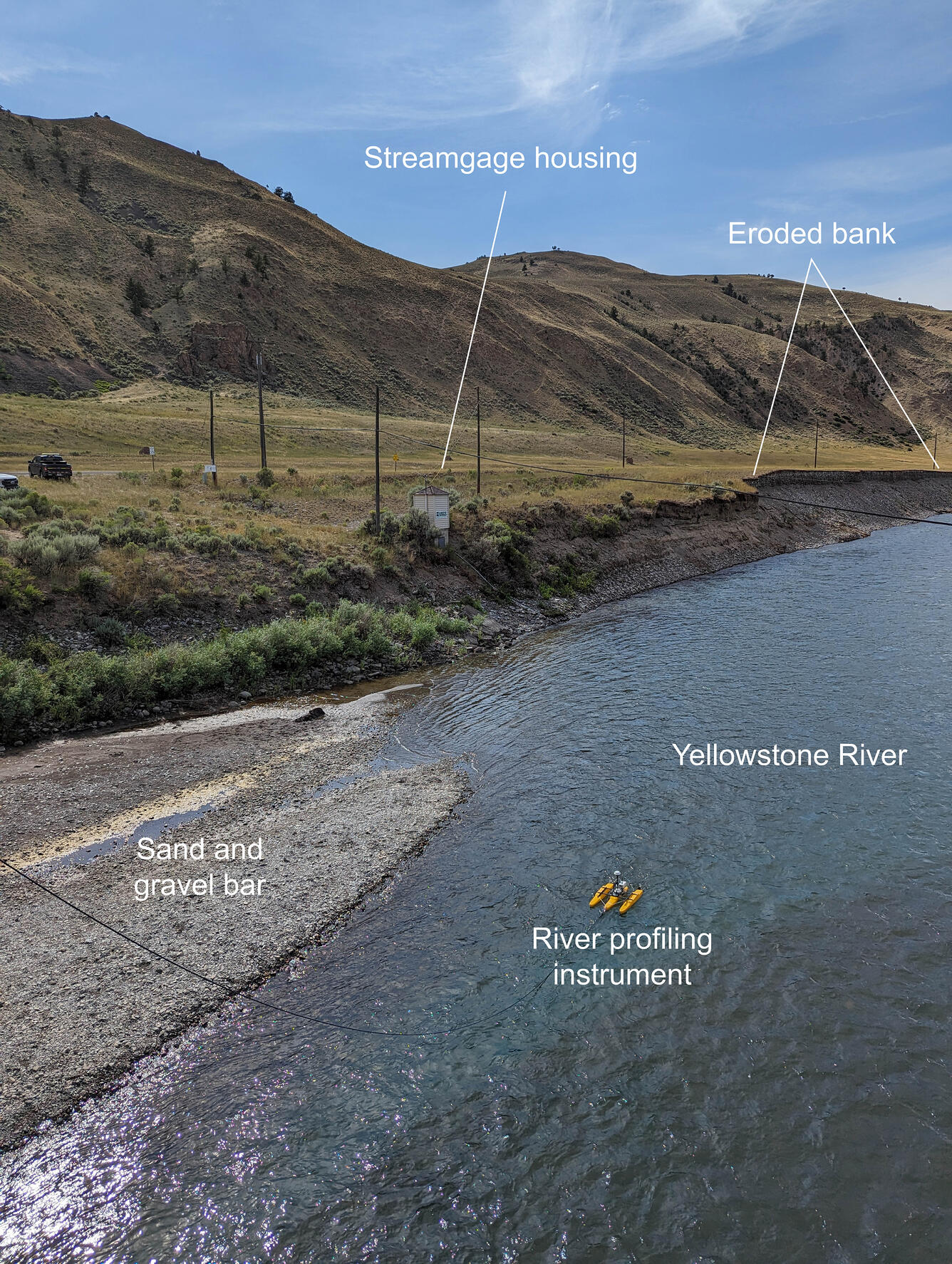
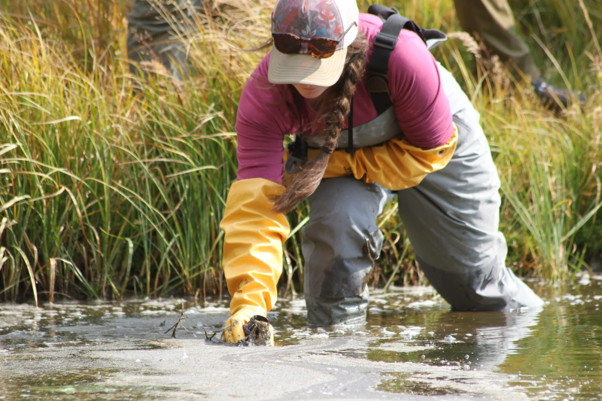

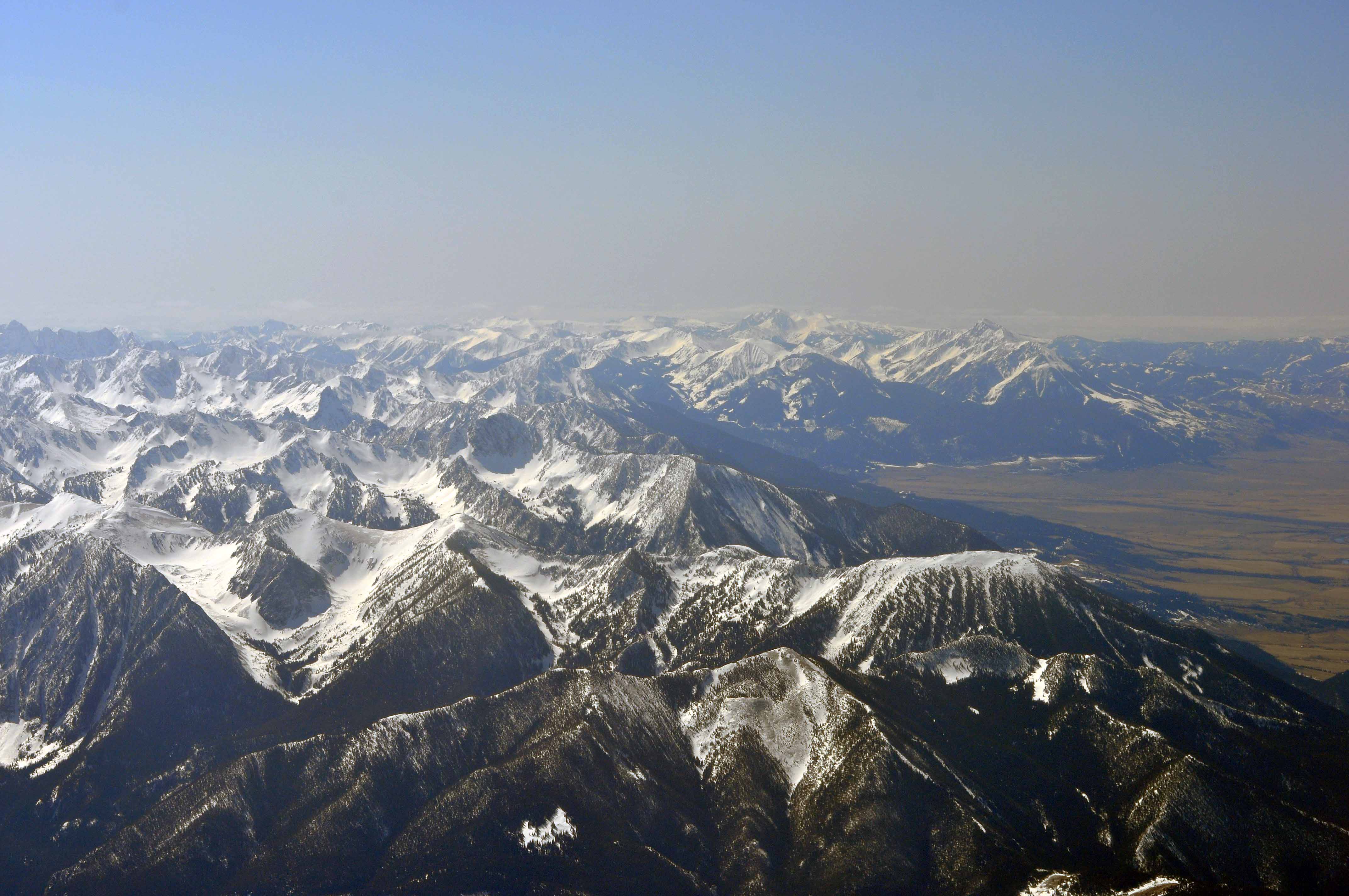


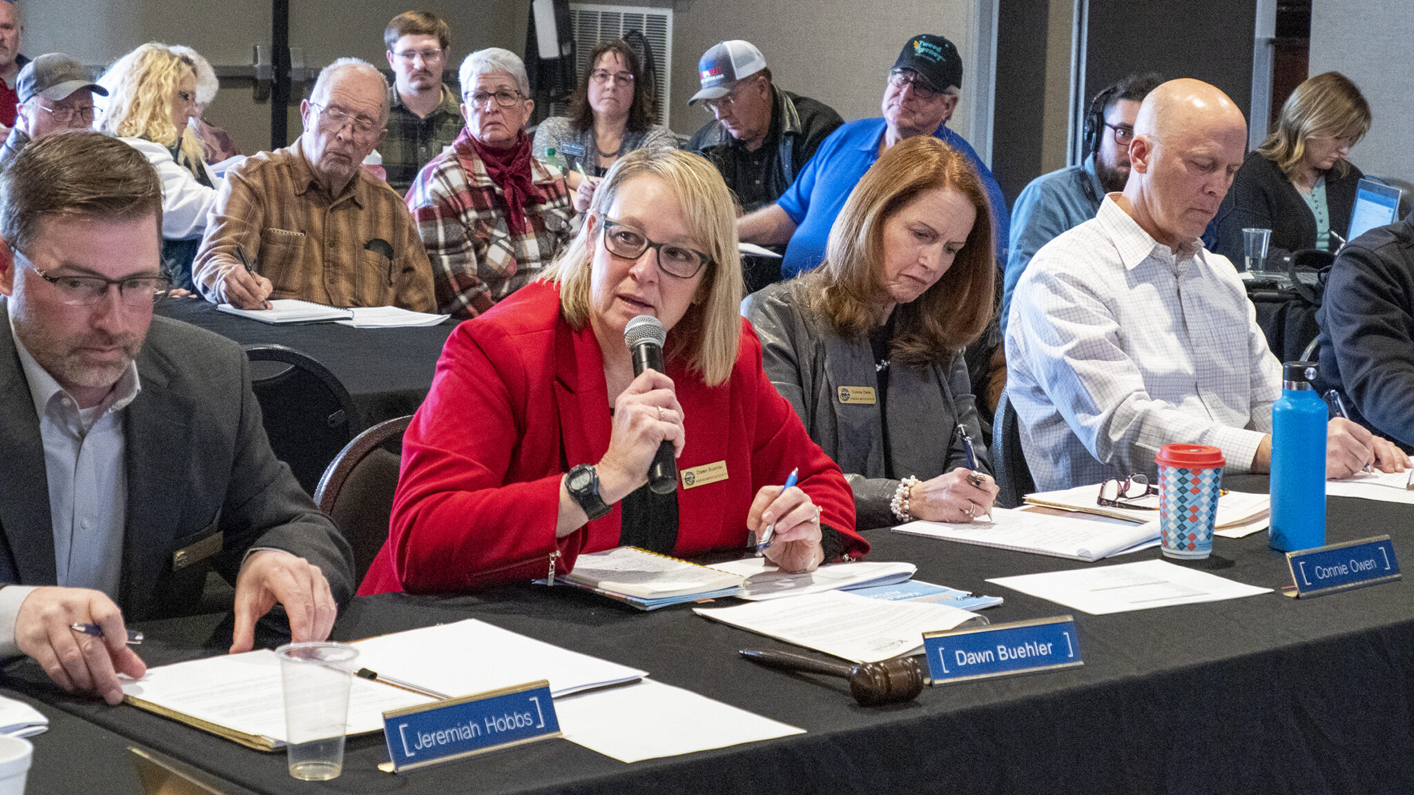

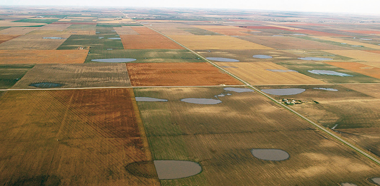


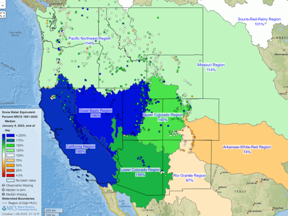

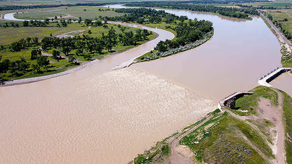

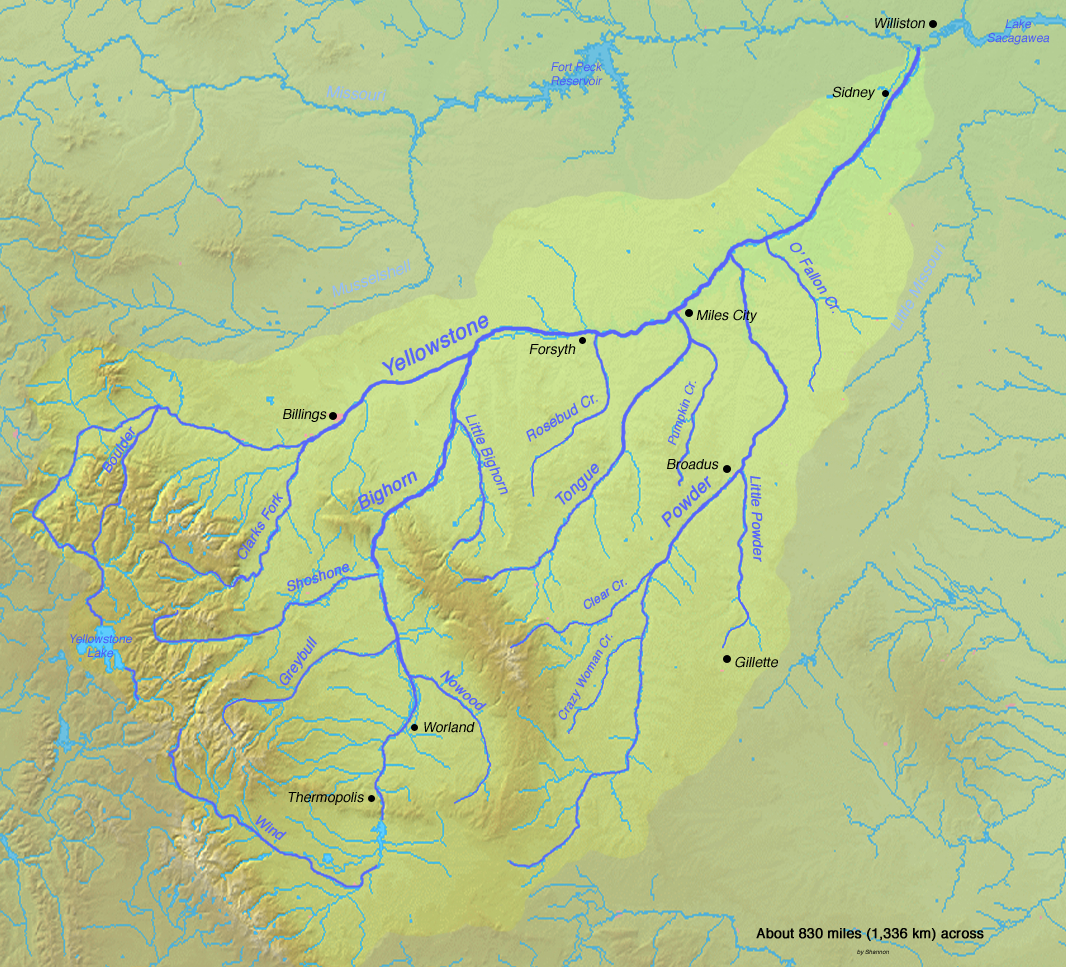
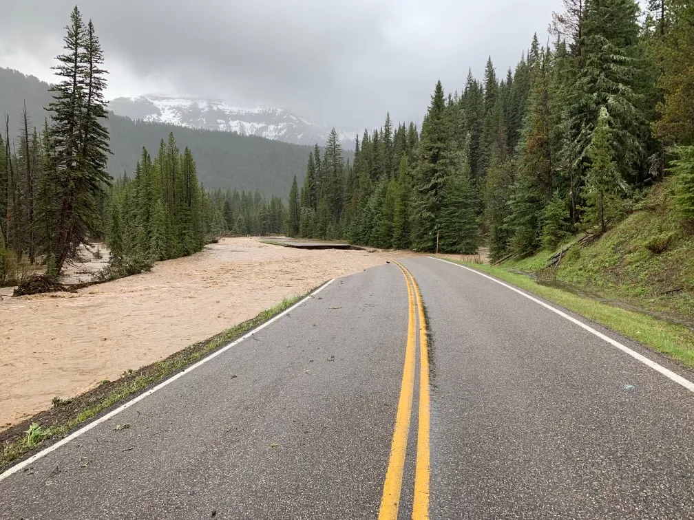
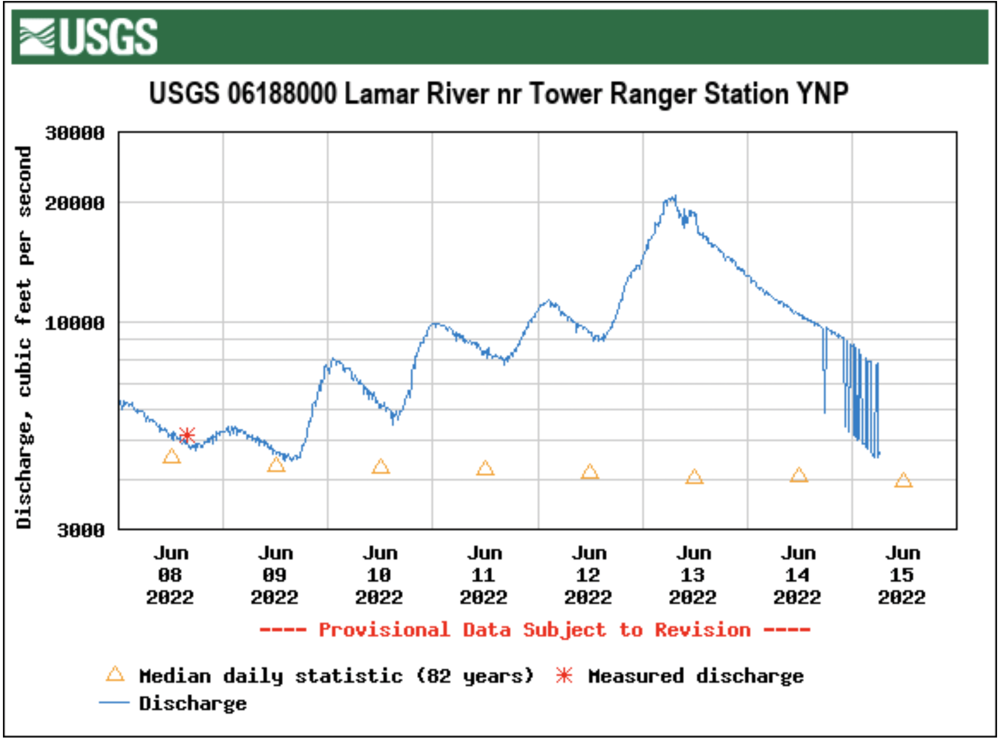
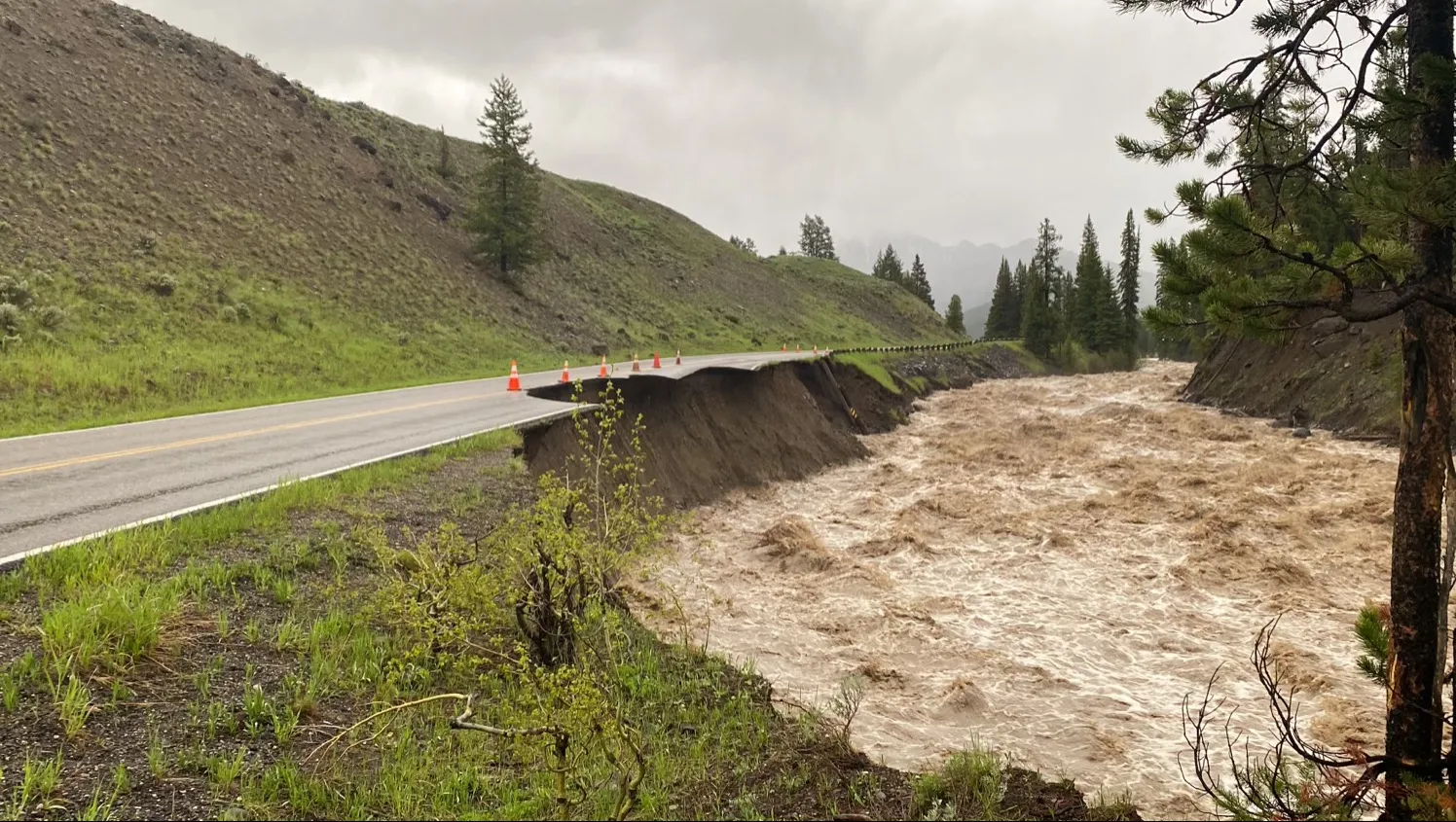
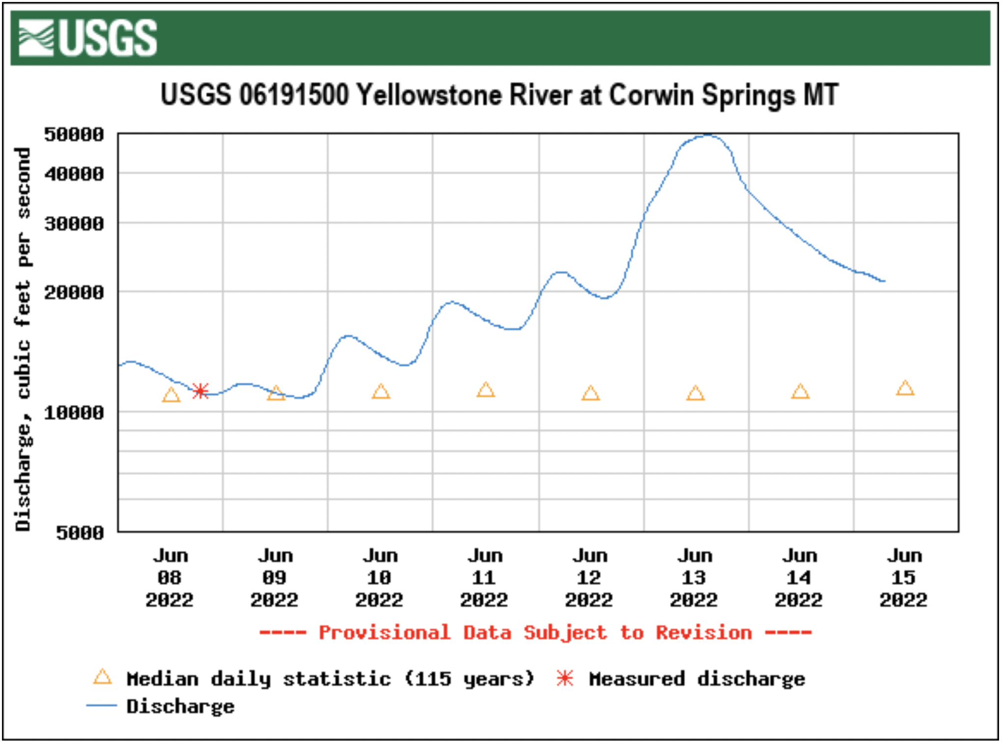
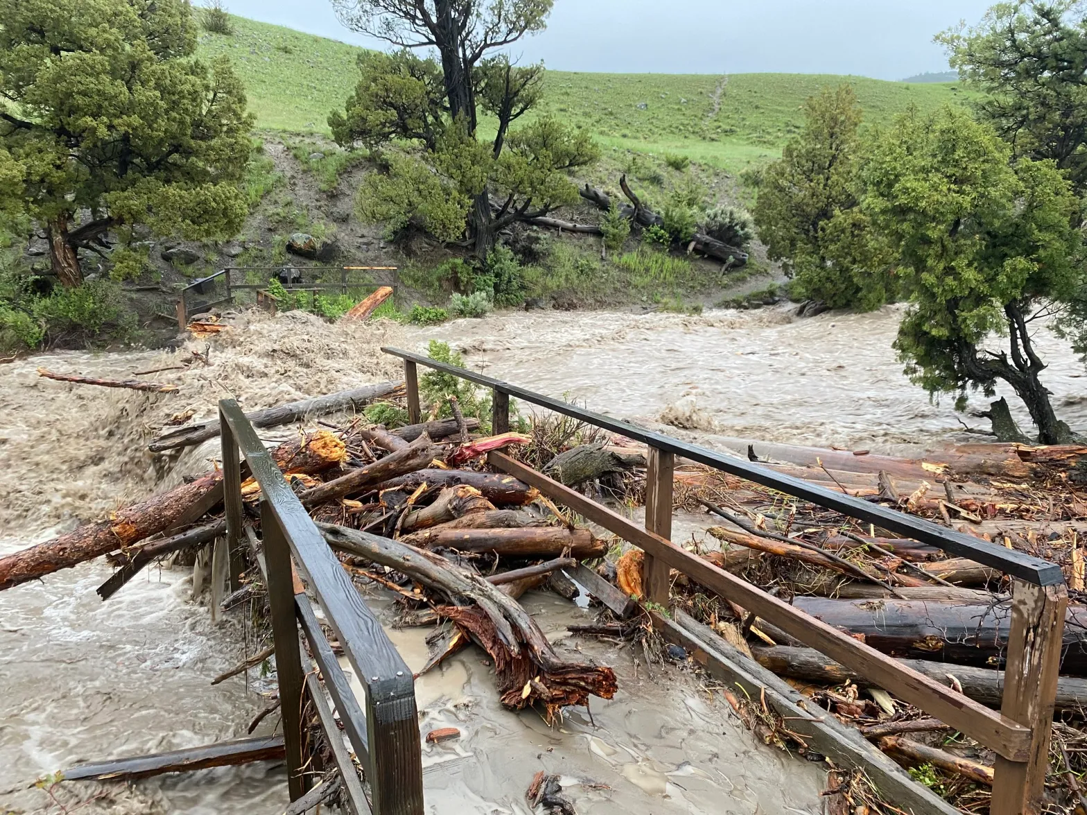

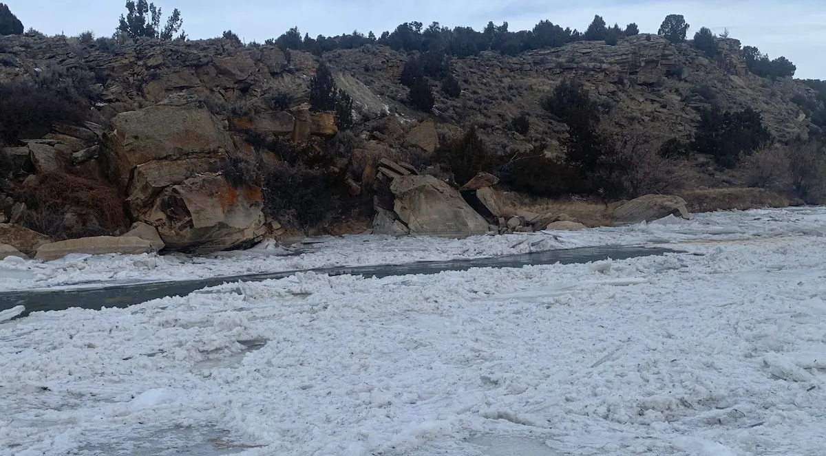


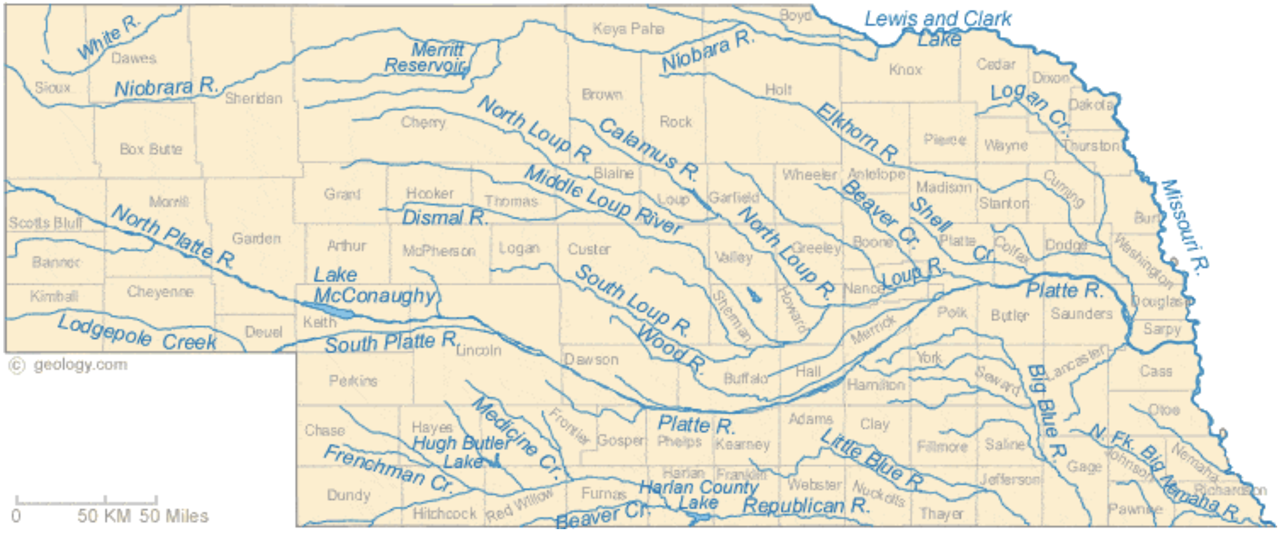

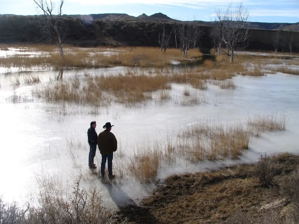


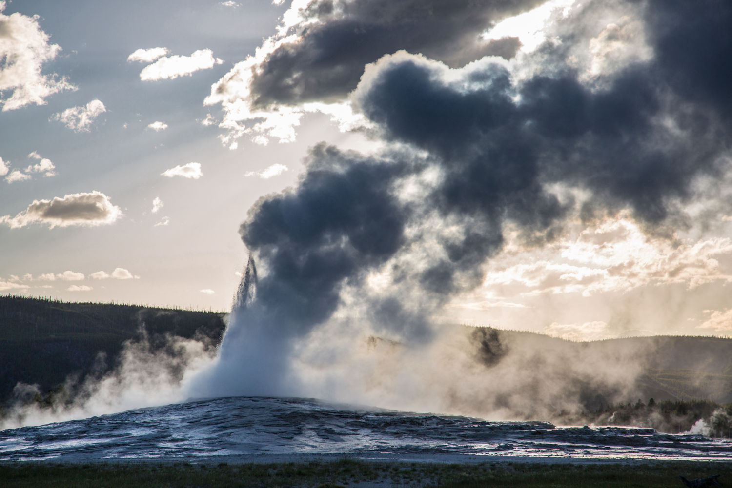
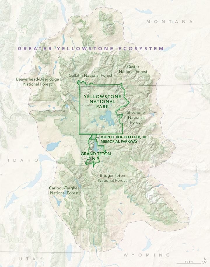
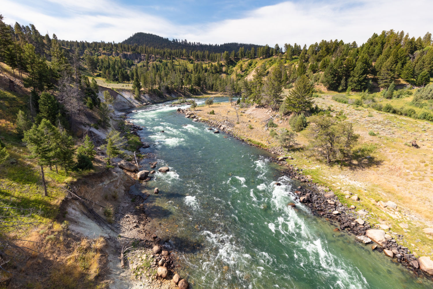
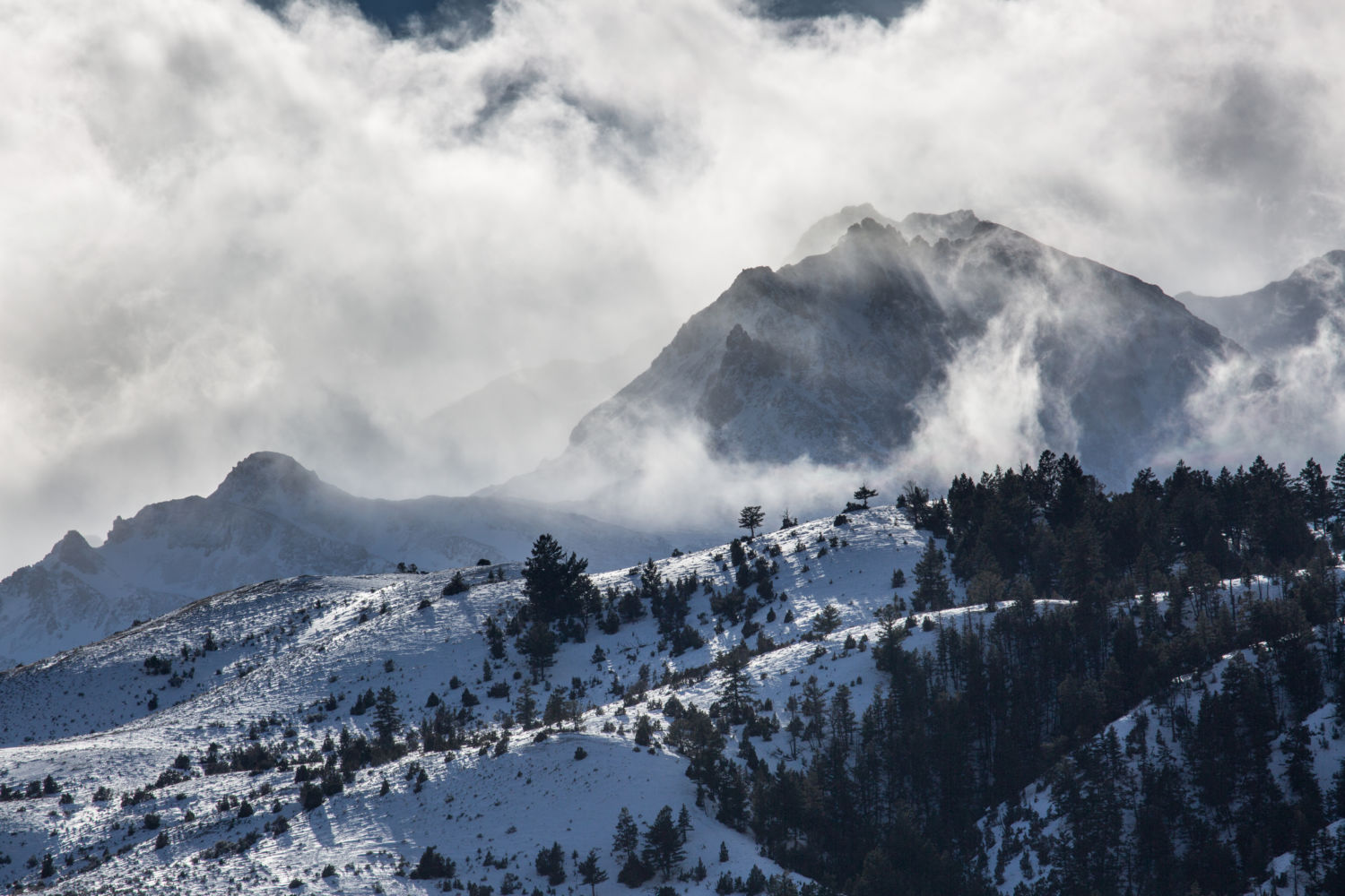


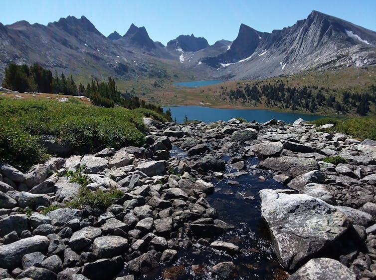
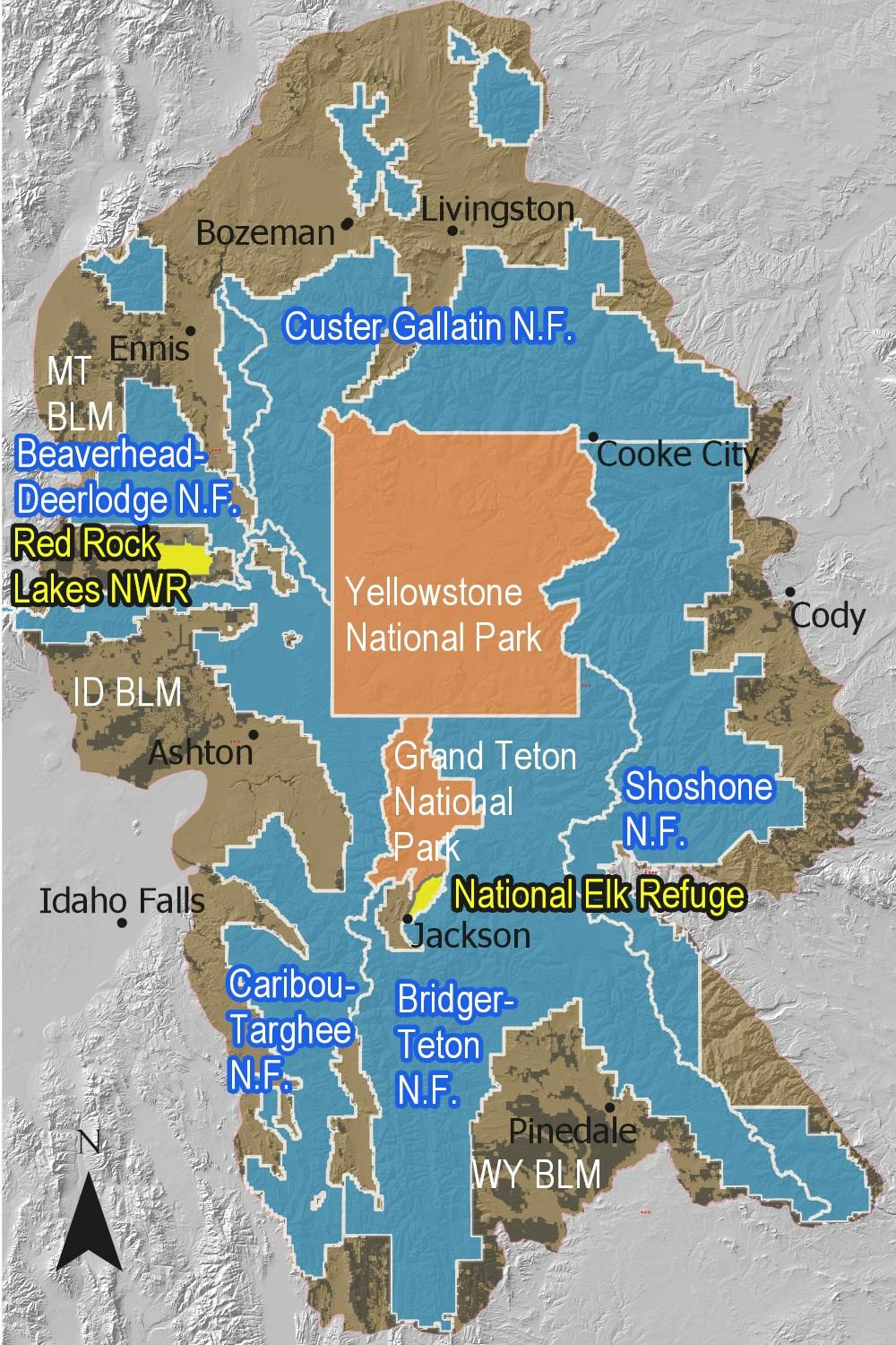
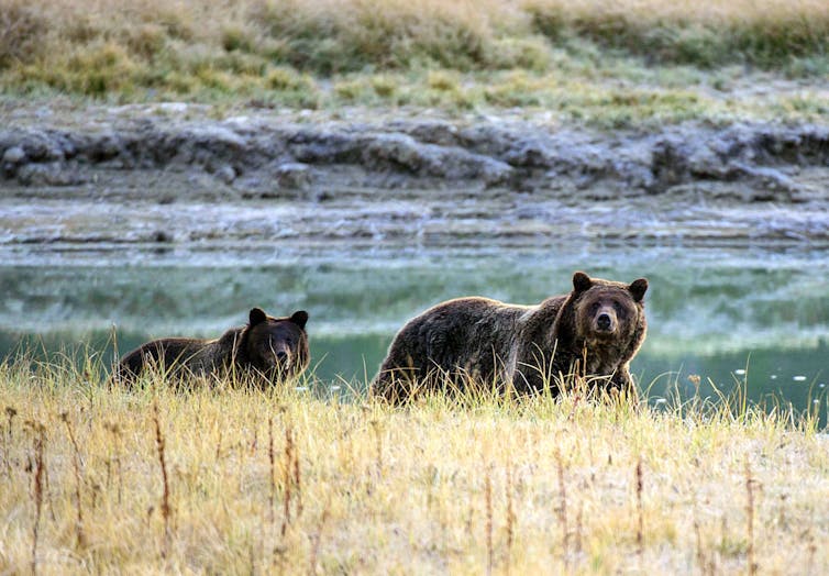
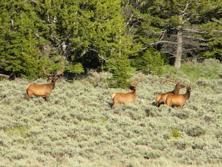
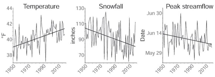
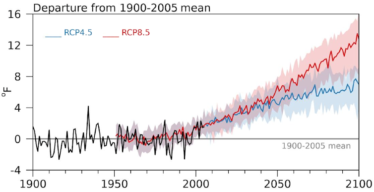


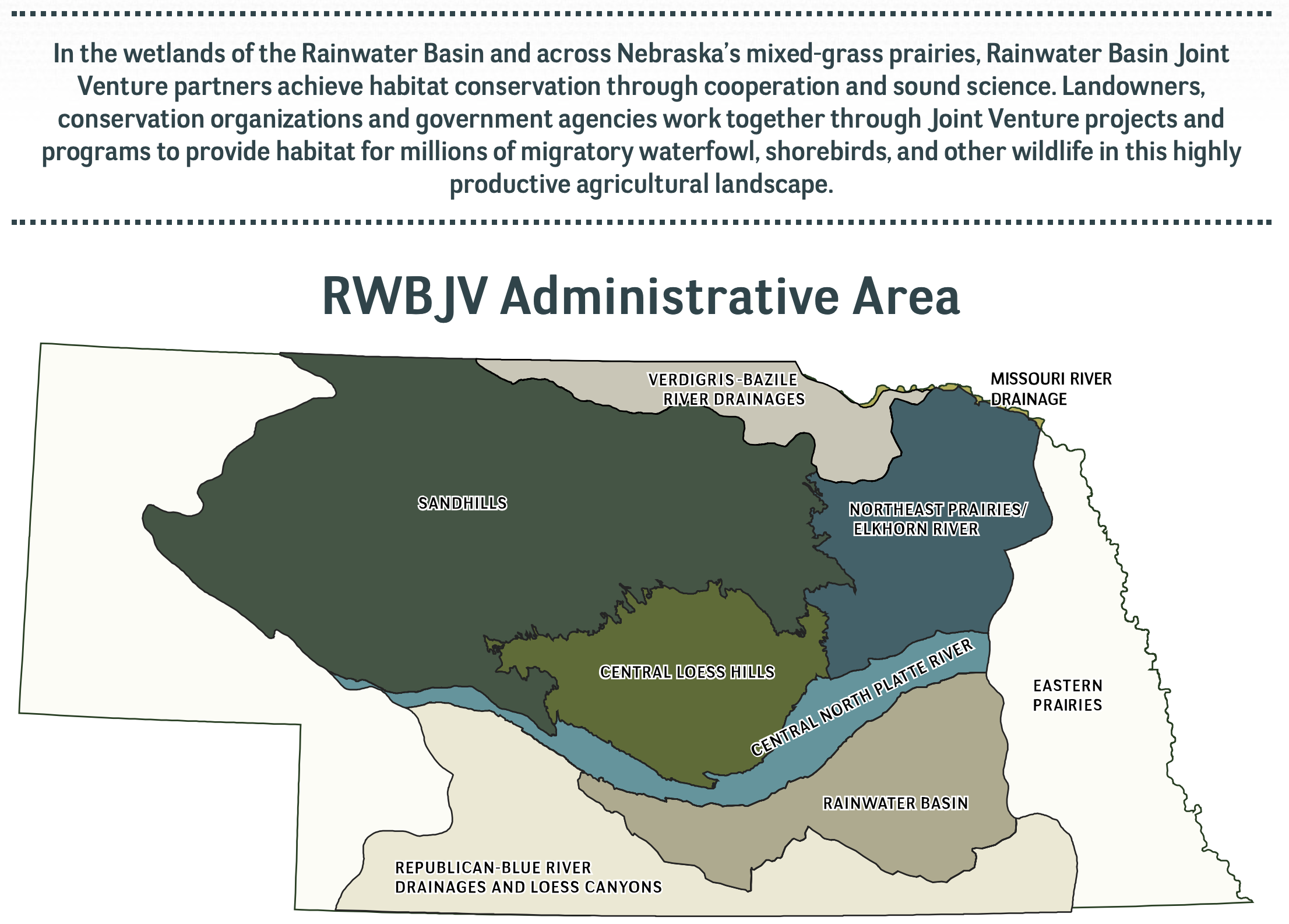


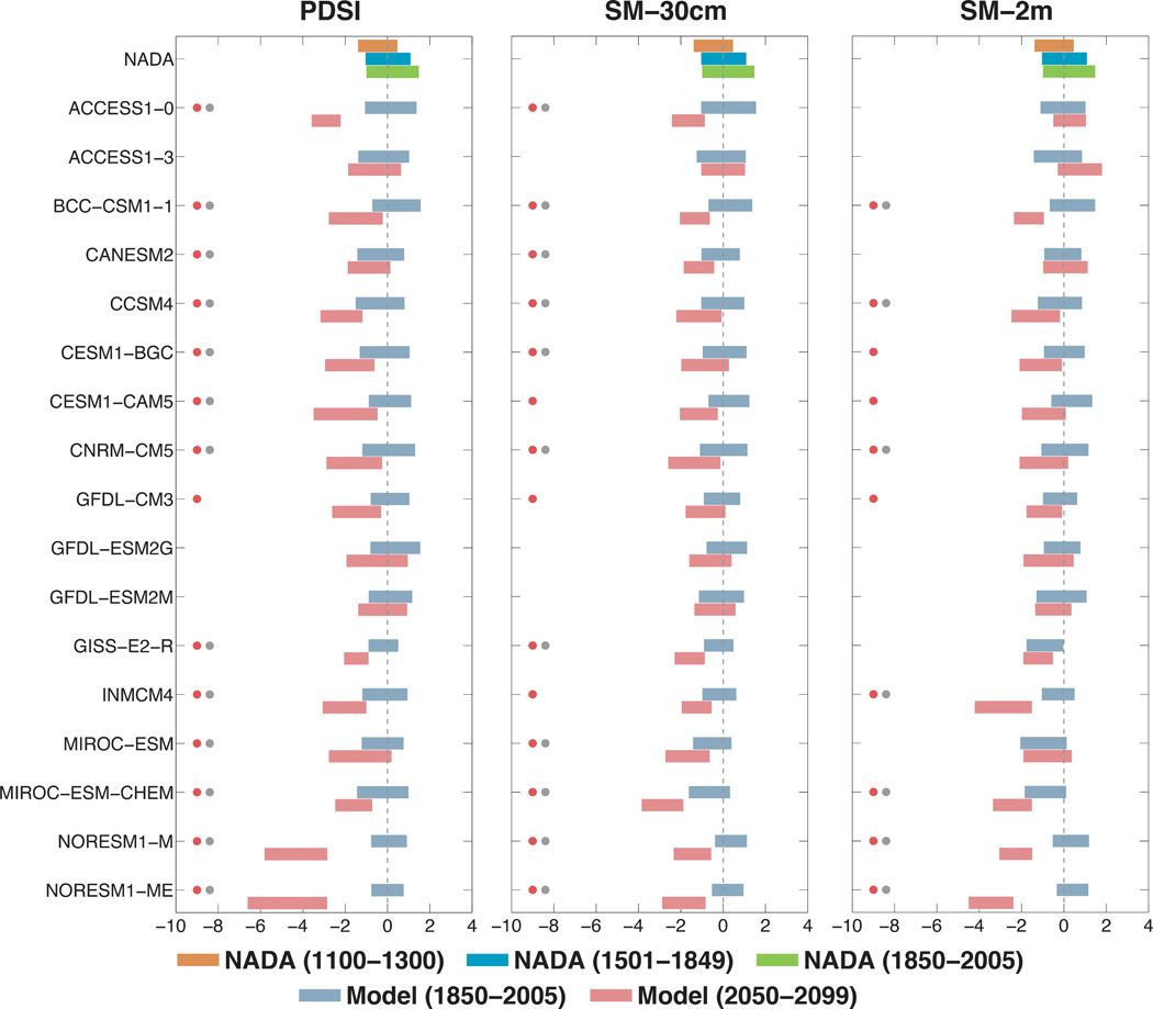
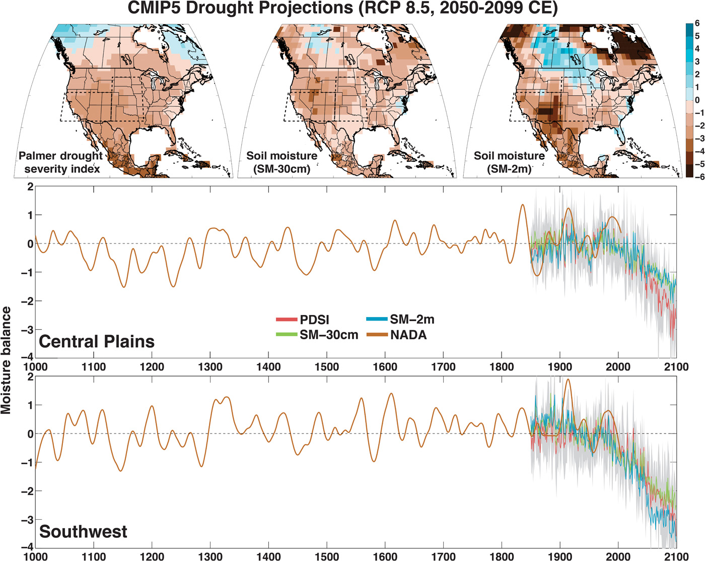


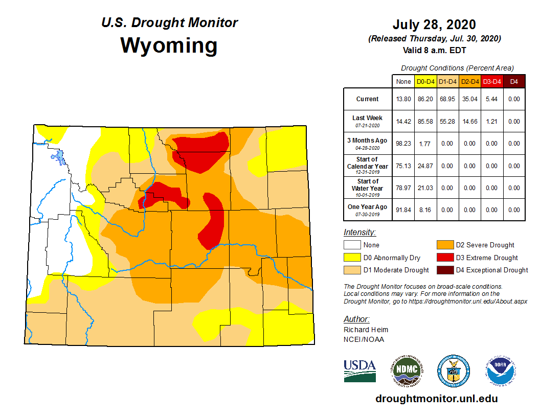
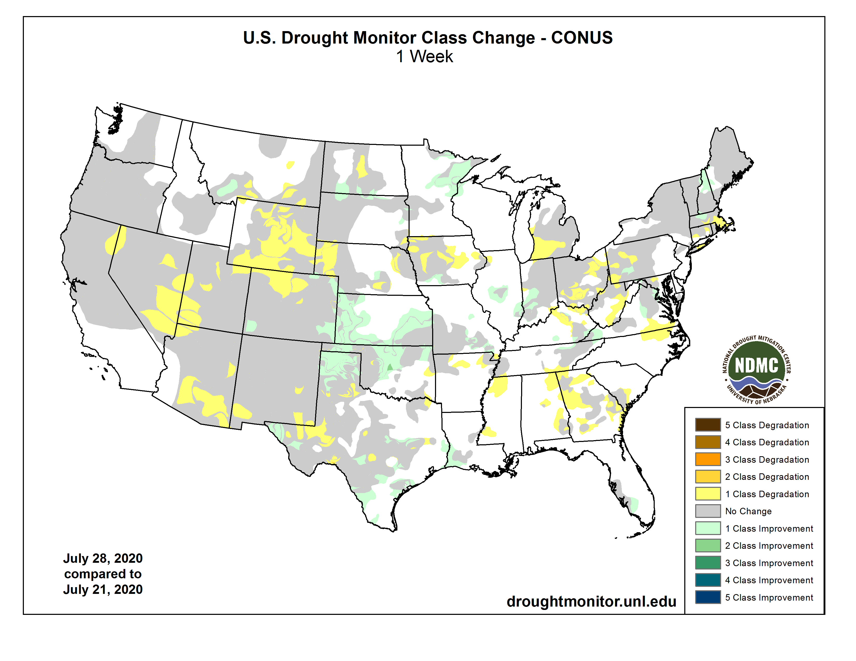
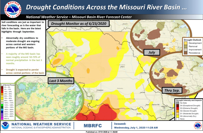

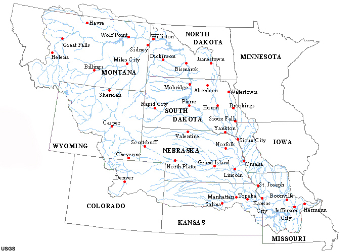


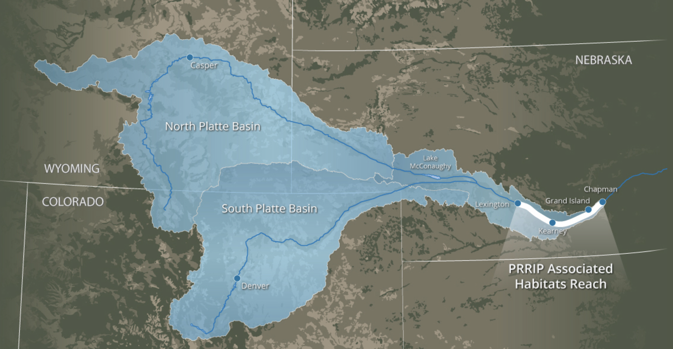
