Montezuma County declares drought disaster — The #Cortez Journal #SanJuanRiver #DoloresRiver #ColoradoRiver #COriver #aridification

Montezuma Valley

From The Cortez Journal (Jim Mimiaga):

State and federal programs offer drought assistance, emergency loans

The order passed by the Montezuma County Board of County Commissioners on June 1 says the purpose “is to activate the response and recovery aspects of any and all applicable local and interjurisdictional disaster emergency plans, and to authorize the furnishing of aid and assistance under such plans.”

Recent winters in Southwest Colorado have seen below-average snowpack, and a lack of monsoonal rains has depleted soil moisture. The lack of precipitation has left reservoirs unfilled this year, a devastating impact for the agricultural economy…

La Plata Mountains from the Great Sage Plain with historical Montezuma County apple orchard in the foreground.

McPhee Reservoir irrigators will receive just 5% to 10% of their normal allocation this year, leaving thousands of acres fallow.

Montezuma County has only had one good snow season (2018-19) in the past four years and has had dry summers, said Peter Goble, drought specialist with the Colorado Climate Center, during a meeting with county officials…

The disaster status opens up emergency assistance programs from county, state and federal agencies. It also helps the Dolores Water Conservancy District receive drought assistance from the Bureau of Reclamation, which owns the infrastructure of McPhee Reservoir and its canals.

In May, the U.S. Department of Agriculture designated 63 Colorado counties primary natural disaster areas because of the severe drought conditions.

Emergency loans are available for producers. The loans can be used to replace equipment or livestock, reorganize the farm operation and refinance certain debts.

Colorado State University Agriculture Extension provides education and connects farmers and ranchers with resources for drought management and assistance, said Greg Felsen, Montezuma County director and extension agent.

The forecast for a summer monsoon is not favorable for Southwest Colorado, according to the National Weather Service.

Dry conditions are predicted for June, July and August, according to the National Weather Service meteorologist Megan Stackhouse.

Mcphee Reservoir

New septic system rules for Montezuma County

Septic system

From The Cortez Journal (Jim Mimiaga):

New septic system regulations under the Montezuma County Health Department kicked in Jan. 1.

Under the Transfer of Title program, when a residential or commercial property meets certain criteria, an inspection of its on-site wastewater septic system will take place when the property is being sold, and repairs or replacement may be required.

The new rules are intended to prevent pollution from failing septic systems and protect the public and water resources, said Melissa Mathews, environmental health specialist for the health department.

The criteria triggering a septic system inspection when a title is transfered include: Structures older than 1974 that do not have a on-site waste water permit; properties that had a permit issued 20 years ago or longer; properties that have a higher level treatment system; properties that have had a previous septic system failure; properties that have a valid septic permit but no structure.

Down ‘The River Of Lost Souls’ With Jonathan Thompson — Colorado Public Radio

From Colorado Public Radio (Nathan Heffel). Click through to listen to the interview:

A new book puts the Gold King Mine spill within the long history of mining and pollution in Southwest Colorado.

Jonathan Thompson will be at the Book Bar tonight. I wonder if Denver is a bit of a shock to his system even though he’s a sixth-generation Coloradan?

I am so happy to finally get to finally meet Jonathan. His new book, River of Lost Souls, is an important read. Understanding the industrialization of our state over the years will help us chart a less destructive course.

I loved the passages where Jonathan reminisces about spending time around the Four Corners and in the San Juans. He transports you to those times in your life spent next to the river or exploring what sights the land has to offer. He connects you to the Four Corners in a way that only a son of the San Juans could.

Cement Creek aerial photo — Jonathan Thompson via Twitter

Southwestern Water Conservation District board shuffled

San Juan wildflowers.

From The Durango Herald (Jessica Pace):

Board President John Porter and Vice President Steve Fearn, representatives of Montezuma and San Juan counties, respectively, were voted off the board by commissioners in their respective counties.

Fearn, a prominent longtime coordinator of the Animas River Stakeholders Group, has represented San Juan County on the water conservation board since 1990 and served as vice president since 2007.

But San Juan County commissioners said Fearn’s representation no longer reflects county values, which have changed significantly since Silverton’s mining days to include more recreational interests with respect to water, county attorney Paul Sunderland said…

Commissioners voted to appoint Charlie Smith, part-time Silverton resident and eight-year general manager of the Lake Durango Water Authority, as Fearn’s replacement.

“Commissioners thought Charlie Smith would better represent San Juan County,” Sunderland said. “He has a lot of water expertise, and he’s probably more in tune with the wants of the current board. Historically, San Juan County has been largely dominated by mining interests, and Steve Fearn is very much associated with those interests, but the board’s interests have shifted more toward recreation.”

The fact that the state of New Mexico named Fearn in a lawsuit as a “potentially responsible party” for mine pollution in the Gladstone area was noted in the county’s decision, Sunderland said.

“It’s definitely something we’re aware of, given his ownership interests around Gladstone,” he said…

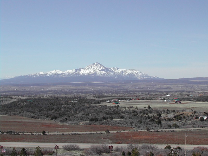
The board consists of nine members representing Archuleta, Dolores, Hinsdale, La Plata, Mineral, Montezuma, Montrose, San Juan and San Miguel counties. Board directors can serve an unlimited number of three-year terms.

“I want to make sure the county’s views are represented,” Smith told The Durango Herald. “I have an understanding of their water rights, and a lot of work needs to be done to secure those rights and make sure the uses align with what the county envisions.”

Montezuma County commissioners selected Don Schwindt to replace Porter, who was general manager of the Dolores Water Conservancy District for 22 years and a Southwestern board director for 26.

Schwindt is a director on the Dolores Water Conservancy District board and a critic of the Dolores National Conservation Area, a controversial proposal in Montezuma County to congressionally protect land and water along the lower Dolores…

Porter thinks the proposal, criticized by Montezuma County commissioners, influenced his removal. Under Porter’s leadership, Southwestern Water Conservation District contributed funds to hire a water attorney to rewrite draft National Conservation Area legislation, which Porter thinks was perceived as support for the bill.

“I perceived the funding as an effort so everyone involved knew all the problems, the facts on both sides and could intelligently make a decision,” Porter said. “I think Southwestern’s involvement was perceived by others that we were very much in favor of the NCA legislation. That had something to do with it, and the fact that I’m 80-plus, and my 26 years on the board.”

Montezuma County Commissioner Larry Suckla said the commission chose Schwindt because of his water knowledge, and the conservation area proposal did not play a part in the decision.

“Don has shown ways that he would save water and retain water for farmers and ranchers,” Suckla said. “John Porter is an icon for Montezuma County. He was involved in the management of the lake (McPhee Reservoir), and all the benefits the county has received from that is because of the work he did, but it felt like it was time for new eyes.”

When Porter joined the board in 1990, he said water storage and dam construction were the district’s primary focus, including such projects as Lake Nighthorse. But gradually, the focus broadened to consider recreational water use and water quality.

Porter refers to his tenure as a career highlight, and said the importance of inter-basin relations and dialogue will only increase as time goes on, water supply dwindles and population grows.

“You’re asking someone who’s biased, but I’ve always felt that the Southwestern board tried its very best to represent all interests,” Porter said. “True, the majority of the members, including myself, were and still are agriculture-oriented. Yet to me, as Colorado’s population grows, it’s inevitable that our water supply will be drying up agriculture. And that’s not in our best interest, but I don’t see a way of satisfying municipal needs that we’re going to have without drying up some ag use. Irrigation takes a lot of water, and just that amount converted to municipal use will take care of a lot of families in an urban situation.”

McElmo Flume Overlook dedication Dec. 5 — Cortez Journal

Triad Western Constructors restored the foundation McElmo Flume historical site. The structure was stabilized with new concrete footers and the metal was restored. A pullout off U.S. Highway 160 east of Cortez allows travelers to view a piece of pioneer history. Photo credit the Cortez Journal.

From Montezuma County via The Cortez Journal:

Trail of the Ancients National Scenic Byway, Montezuma County and the Colorado Department of Transportation will host a dedication of the McElmo Flume Overlook at 11 a.m. on Monday, Dec. 5.

Transportation to the site is by shuttle bus from the Montezuma County Fairgrounds.

Visitors are asked to park north of the indoor arena no later than 10:45 a.m. on Dec. 5, to meet the bus. RSVP’s to James Dietrich (970)565-7402, jdietrich@co.montezuma.co.us, for planning purposes, please.

A local landmark from the last century, the flume can now be seen from viewing platform at a new highway rest stop off U.S. Highway 160 east of Cortez. The turnout includes informational panels about water and irrigation in our county.

There will be numerous speakers at the dedication. Susan Thomas, of the Trail of the Ancients Byway, will give welcoming remarks; Terry Knight of the Ute Mountain Historic Preservation Office, will conduct a blessing of the site; Les Nunn, of the Montezuma Valley Irrigation Co. (retired), and Linda Towle, of the Cortez Historic Preservation board, will tell the history of local irrigation; Mike Preston, of the Dolores Water Conservancy District, will tell the modern irrigation story; and James Dietrich, federal lands coordinator for Montezuma County, will discuss the next preservation steps for the 125-year irrigation structure.

The many sponsors of the McElmo Flume Project include: Ballantine Family Fund, Colorado State Historical Fund, Colorado Department of Transportation, Federal Highway Administration, Mesa Verde Country, Montezuma County, Montezuma County Historical Society, Southwestern Water Conservation District, Southwest Basin Roundtable, Trail of the Ancients Scenic Byway, and the Ute Mountain Ute Indian Tribe.

Front Range apple cideries buy up juice from Montezuma County — The Cortez Journal

La Plata Mountains from the Great Sage Plain

From The Cortez Journal (Jim Mimiaga):

Local apples were once again pressed into juice for market during a successful pilot project held in a Lebanon orchard last month.

The event, sponsored by the Montezuma Orchard Restoration Project, processed 800 bushels of apples gathered from local orchards.

“It went really well, we generated 2,200 gallons of raw juice that was sold to hard cider makers,” said MORP manager Nina Williams.

The group is studying the feasibility of using a mobile pressing unit to process apples from the many forgotten local orchards that otherwise let the fruit go to waste.

They were awarded a $42,400 planning grant from the U.S. Department of Agriculture to test the idea.

For two days in October, Northwest Mobile Juicing, out of Montana, set up in the Russell apple orchard in Lebanon. The unit can press, pasteurize, and package the juice for market.

For the pilot, the raw juice could only be sold to hard cider companies for fermentation. Additional permits are needed to sell pasteurized apple juice.

“We proved we can get if off the trees for sale to the hard cider market,” Williams said. “If the demand is there we can work through the regulations to sell local juice as well.”

Several orchard owners realized some profits from the project, and were paid 10 cents per pound for apples still on the tree.

A dedicated crew of twenty MORP volunteers spend 300 hours picking the apples in the weeks prior to the pressing. In all, nine apple orchard owners were paid $3,500 for their apples.

One local cider maker and four from Boulder and Denver bought the raw juice. A semi-truck was loaded with the juice for a night run to Front Range cideries.

“They were impressed with the quality,” Williams said. “The juice was a blend of local heritage apple varieties.”

Apple mash produced was hauled off by local livestock owners for feed.

MORP said they broke even on the trial run, and are studying how best to set up a local pressing facility.

“We learned that there is a lot of labor and infrastructure involved besides just the pressing equipment,” Williams said.

Commercial apple operations require warehouses, shipping docks, refrigerated cold storage to store apples, and heavy equipment such as trucks and forklifts.

MORP has been documenting once popular heritage apple varieties from the days when the area was a thriving fruit market more than 100 years ago.

They have brought many of them back to life through careful grafting and propagation techniques, and are encouraging local farmers to plant heritage apple orchards.

“Our big goals is to bring back this genetic diversity to keep heritage apples from going extinct, and to get it so people can have these trees again,” said MORP orchardist Jude Schuenemeyer. “Trees that worked here for over 100 years are really well adapted to this place.”

A recent victory for MORP was the rediscovery of the rare Colorado orange apple in a Cañon City orchard in 2012. For the last several years, local orchardists have been grafting and cultivating this near-extinct apple known for its fine flavor, hardiness, storage qualities, and cider-making potential.

There are dozens of abandoned apple orchards in the county that still produce a good crop, but have a limited market. The juice market is seen as ideal because the apples do not have to be perfect and the ones that fall on the ground can be used as well.

“One of our goals is to get local orchards back in shape by hosting workshops this winter on pruning and orchard management,” Williams said.

For more information go to http://www.montezumaorchard.org

Water line construction starting up in Cortez — The Cortez Journal

Water infrastructure as sidewalk art

From The Cortez Journal (Jacob Klopfenstein):

Water line construction and drainage improvement work will begin in Cortez after the Labor Day weekend, Public Works director Phil Johnson said Thursday.

About 3,900 feet of 6- and 8-inch waterline will be installed, as well as 245 feet of 12-inch storm drain line, valves, fire hydrants and other infrastructure items. Construction will start this week and is expected to continue until the end of October.

The affected areas are Henry Street from Main Street to Montezuma Avenue, Montezuma Avenue from Henry Street to Sligo Street and S. Market Street from Seventh Street to 10 Street. Storm drain work along Edith Street also will begin.

At their meeting Aug. 9, Cortez City Council members awarded a $496,774 contract for the project to D&L Construction of Cortez, which had the lowest of five bids, according to city documents.

Historic McElmo flume awarded final funding — The Cortez Journal

McElmo Creek Flume via the Cortez Journal

From The Cortez Journal (Jim Mimiaga):

A recently constructed interpretive pullout off U.S. Highway 160 east of Cortez showcases the wooden irrigation flume, which was built in the 1890s to deliver water to the Ute Mountain tribe and pioneer farms.

The restoration grant requires a $60,000 match, and a fundraising effort is underway. Once that is raised, the flume’s main wooden trough structure will be repaired and restored, completing the multiyear project.

“Right now, people will stop at the interpretive pull-off and see that the flume needs repair, and that is what this grant will be paying for,” Towle said, adding that as much original wood as possible will be used in the restoration.

Repairing the foundation was the priority. In 2014, a $123,000 state historical grant was awarded to the county to rebuild the foundation and stabilize the structure to withstand flows in McElmo Creek. That foundation work was completed in February.

The paved highway pullout, parking lot, interpretive panels, information, kiosk, sidewalk and flume overlook were made possible by $250,000 in funding allocated by the National Scenic Byways Program in 2013.

The historic flume is an agricultural artifact that symbolizes the beginning of the city of Cortez and surrounding communities, Towle said.

“Cortez would not be here without these first irrigation systems,” she said. “It is important for visitors coming through to learn the story about how the efforts of early farmers and ranchers grew the town and got us to where we are today.”

Final interpretive panels on water history are still being created for the flume overlook. Also a regional tourism map will be installed at the kiosk highlighting local attractions.

Throughout the project, contributions have been made by many agencies and organizations, including Montezuma County, Southwestern Water Conservation District, Southwest Roundtable, Montezuma Valley Irrigation Company, Dolores Water Conservancy District, and the Ute Mountain Tribe. The Colorado State Historical grants awarded for the project are derived from a portion of gambling revenues in Cripple Creek, Central City, and Black Hawk.

Montezuma County: Four States Agricultural Forum recap

La Plata Mountains from the Great Sage Plain

From The Durango Herald (Jacob Klopfenstein):

The Yellow Jacket project’s lead researcher, Abdel Berrada, spoke last week at the Four States Agricultural Expo at Montezuma County Fairgrounds.

The research center received almost $250,000 from a grant to fund the study, which examines how cover crops can improve soil quality for dryland farmers.

Although Berrada said he and other researchers have a long way to go before they find out what works in the region, he told a crowd of about 25 people that cover crops can increase organic matter in the soil, suppress weeds and prevent erosion.

“Cover crops make sense,” Berrada said. “We’re looking at factors to see what works best for the area.”

As part of the study, five farmers in southwestern Colorado and southeastern Utah are administering plots of cover crops such as yellow clover, winter peas and others.

After three years, researchers hope to quantify the effects of cover crops on ground moisture, soil health and weed control, Berrada said. Another goal of the project is to determine which cover crops are most profitable. Those goals will help determine if cover crops can enhance the sustainability of farming in Southwest Colorado and southeast Utah.

Colorado State University Dolores County Extension director Gus Westerman said researchers will collect a second round of data in the next year. They’ll use data collected at the end of the three years to compare the effects of cover crops in the region with results from other areas, he said.

Westerman said more people in the industry are becoming aware of water issues.

But the study runs for only three years, and Westerman said that’s a short time in terms of soil science. He said the project hopes to extend the grant to get more time for study.

CSU Extension West Region Specialist John Rizza said there hasn’t been much research on cover crops in the region to date. Few studies have been done to examine which cover crops are most successful for dryland farmers, he said.

Rizza and Westerman said the level of interest in cover crops is increasing regionally. More farmers are participating and it’s now easier to show people how they work, Rizza said.

“We’re getting good momentum,” he said.

Cortez: Solids from county jail causing back ups

Wastewater lift station

From the Cortez Journal (Tobie Baker) via The Durango Herald:

Montezuma County inmates are under suspicion, but not for unlawful activity.

Cortez Sanitation District officials suspect that inmates at the 104-bed Montezuma County Jail are flushing items in their jail cells, plugging a pumping station or contaminating the wastewater-treatment facility.

“We get a ton of Ramen noodle packages,” CSD manager Tim Krebs told board members at a monthly meeting last week.

Krebs initially relayed his concerns to CSD board members in December, reporting that plastics and other debris from the detention center had been an ongoing problem.

Vici Pierce, detention captain at the Montezuma County jail, confirmed that inmates were allowed to purchase Ramon noodles from the commissary, but said she was unaware of any sanitation district complaints until notified by The Journal.

“Garbage bags are provided in each unit, and inmates are instructed to use them for the disposal of their trash items,” Pierce said.

Several years ago, a garbage grinder was installed in the jail’s sewer system to help alleviate improper trash disposal.

According to Krebs, that grinder pump on Driscoll Street failed, and after it was repaired recently, sanitation officials started to observe bits of plastic in the district’s treatment facility on South Broadway about four miles south.

Krebs said the grinder pump was recently taken offline at the district’s request to help staff determine whether the inflow of debris could be minimalized.

“The smaller plastics have disappeared in parts of the plant, but now larger plastics are filling up the bar screen at the lift station,” Krebs said.

Krebs said sanitation crews now make two trips per day to the district’s north pumping station to manually clear a screen that captures the plastics. Officials indicated the screen was routinely plugged when crews responded.

McElmo Flume restoration project update

From the Cortez Journal (Jim Mimiaga):

“It could take a year or longer for construction to be completed,” once bids are approved, said county planner James Dietrich.

The roadside attraction will have an entrance and egress road, parking lot, sidewalks, information kiosk and a handicap-accessible trail to an overlook of the flume, built in 1890.

Two grants are helping to pay for the project.

A $253,000 grant from the Federal Highways Administration was awarded to the Trails of the Ancients Scenic Byway, a section of which includes U.S. 160 that goes by the flume.

The Colorado State Historic Fund provided a $123,840 grant to restore the flume foundation.

Several groups chipped in for a $41,280 match, including Montezuma County, Southwest Water Conservancy District, Ballantine Family Fund, Montezuma County Historical Society and Southwest Roundtable.

The flume is the last of 104 built in the area from 1890 to 1920. It delivered irrigation water south of Cortez and to the Ute Mountain Tribe.

McElmo Creek Flume via the Cortez Journal

Cortez plans to install 3,000 smart water meters this summer

Wireless meter reading explained

From The Cortez Journal (Jessica Gonzalez):

Funding is in place for the City of Cortez to embark on a $1.2 million replacement of more than 3,000 manually read water meters with automated meters.

Mayor Karen Sheek and City Council approved loan and grant funds from the Colorado Water Conservation Board at the April 14 council meeting.

Through this project, the city intends to replace its current meters with automated meter readers, which use radios to collect data via a drive-by or a fixed-base receiver on every metered account in the city’s system.

The project is being funded through $250,000 in grants from the CWCB and the Department of Local Affairs, $350,000 from the city’s fund balance and $850,000 loan from the CWCB. Once bids are opened in mid-May, there will be a more precise picture of exactly how much the city will need to borrow via loan funding, said Phil Johnson, director of Public Works. It’s likely to be less than the $850,000 total…

The Public Works Department contends that the replacement project will bring the water meter system into the future with more streamlined billing and data management. It also says that it encourages conservation by providing users with more accurate water-consumption information…

After the bid period in mid-May, work is expected to begin early summer. The entire system is expected to be on automatic meters by October…

The Public Works Department will be providing regular updates on the project on the City of Cortez website, he noted, but stressed that it’s a necessary change in a time where water conservation is crucial.

“It’s a step into the future going to help us run our operation more effectively and it’s an efficient tool to help Cortez save water,” he said.

More infrastructure coverage here.

Lake Nighthorse: “This water would really help our future” — Manuel Heart

Lake Nighthorse via the USBR

From The Durango Herald (Mary Shinn):

The Durango City Council signed a resolution Tuesday supporting the delivery of water from Lake Nighthorse to the Ute Mountain Ute Tribe.

“This water would really help our future,” Chairman Manuel Heart said.

The resolution stemmed from a series of recent meetings between city officials and the tribe about the potential recreational use of Lake Nighthorse, City Manager Ron LeBlanc said.

The city likely will send the resolution to Colorado’s U.S. senators and House members to help support the tribe as it seeks funding for infrastructure to deliver water.

Lake Nighthorse was built to provide Native American tribes, including the Southern Ute Indian Tribe, the Navajo Nation and the Ute Mountain Ute Tribe, with water they are entitled to receive, said Justyn Hoch, a spokeswoman for the Bureau of Reclamation.

The Ute Mountain Ute Tribe has water rights to about 31 percent of the water stored in the lake, but Congress has not funded infrastructure to bring it to the reservation, she said.

Congress has funded a pipeline to the Navajo Nation, which is nearing completion. It will deliver water to the Shiprock area. In addition, the Southern Utes could access water from Lake Nighthorse by releasing it back into the Animas and taking it out of a river diversion, she said.

However, the infrastructure for the Ute Mountain Utes was dropped from federal legislation in 2000, Heart said.

The tribal leadership already has met with U.S. Rep. Scott Tipton, R.-Cortez, and has plans to meet with U.S. Sen. Cory Gardner, R.-Colorado, this year to talk about the need to fund a delivery system.

The additional water would allow for greater economic development on the reservation, Heart said. The reservation covers about 600,000 acres southwest of Cortez and has one of the largest farms in Montezuma County.

Ute Mountain Ute Councilor Regina Lopez-Whiteskunk also voiced her appreciation of the resolution because the reservation currently has limited water resources. While securing water delivery is a priority for the tribe, she expects it to be years before the tribe receives an appropriation.

More Animas-La Plata Project coverage here.

Cortez rates going up

Cortez early 1900s via Crow Canyon Archaeological Center

From the Cortez Journal (Tobie Baker):

Public works officials said a “slight” rate adjustment was needed next year to keep up with the rising cost of infrastructure repairs, treatment chemicals and capital expenditures. Water rates will increase 5 percent in 2015.

The measure means a resident with a ¾-inch water meter, which includes the first 1,000 gallons, would pay $16.30 per month in 2015, an increase of 80 cents per month over current rates.

Rates for water usage over 1,000 gallons will also rise next year, from $2.10 to $2.20, and so will fees for the commercial water dock, increasing in 2015 from $12 for 1,000 gallons to $12.50.

The city will also raise its current tap fee of $3,800 to $3,900, starting Jan. 1.

The city’s 2015 water enterprise fund will receive more than $4.1 million in appropriations, which includes nearly $730,000 for personnel services, $670,000 for commodities and $1.85 million for capital projects.

More infrastructure coverage here.

Localized climate change contributed to ancient depopulation — Washington State University

From Washington State University (Eric Sorensen):

Washington State University researchers have detailed the role of localized climate change in one of the great mysteries of North American archaeology: the depopulation of southwest Colorado by ancestral Pueblo people in the late 1200s.

In the process, they address one of the mysteries of modern-day climate change: How will humans react?

Writing in Nature Communications, WSU archaeologist Tim Kohler and post-doctoral researcher Kyle Bocinsky use tree-ring data, the growth requirements of traditional maize crops and a suite of computer programs to make a finely scaled map of ideal Southwest growing regions for the past 2,000 years.

Their data paint a narrative of some 40,000 people leaving the Mesa Verde area of southwest Colorado as drought plagued the niche in which they grew maize, their main food source. Meanwhile, the Pajarito Plateau of the northern Rio Grande saw a large population spike.

The plateau “also happens to be the place where you would want to move if you were doing rain-fed maize agriculture, the same type of agriculture that people practiced for centuries up in southwest Colorado,” said Bocinsky, who built the data-crunching programs while earning a WSU Ph.D. with support from a National Science Foundation graduate research fellowship.

People try to ‘keep on keeping on’

The dramatic changes in the Southwest took place near the end of the Medieval Warm Period, the warmest in the Northern Hemisphere for the last 2,000 years. The period had a smaller temperature change than we’re seeing now, and its impact on the Southwest is unclear. But it is clear the Southwest went through a major change.

“At a very local scale, people have been dealing with climate fluctuations of several degrees centigrade throughout history,” said Bocinsky. “So we need to understand how people deal with these local changes to generate predictions and help guide us in dealing with more widespread changes of that nature.”

Bocinsky, the paper’s lead author, said the study is particularly significant for modern-day subsistence farmers of maize, or corn, the world’s largest food staple.

“People are generally going to try and find ways to keep on keeping on, to do what they’ve been doing before changing their technological strategy,” he said. “That was something extremely interesting to me out of this project.”

Tree rings yield precipitation, temperature info

To get a more granular look at the changing climate of the Southwest, Bocinsky and Kohler used more than 200 tree-ring chronologies, which use the annual rings of ancient trees to reconstruct the area’s climate patterns over time. Pines at lower elevations will have their growth limited by rainfall, making their rings good indicators of precipitation. High-elevation trees get good rain but are susceptible to cold, making them good indicators of temperature.

The shifting patterns of rainfall and temperature let Bocinsky and Kohler isolate to a few square kilometers the areas that would receive just under a foot of rainfall a year, the minimum needed for ancestral maize varieties still farmed by contemporary Pueblo people.

The area in what is now southwest Colorado’s Mesa Verde National Park ended up being one of the best places to grow maize, with good conditions more than 90 percent of the time. The Pajarito Plateau ended up being highly suitable as well, with slopes that would shed cold air and precipitation levels suited to rain-fed agriculture.

Large disparities in small areas

Such big climate differences in such a small area illustrates how some areas could be hit harder than others by the extremes of global climate change, said Bocinsky. He said it is telling that, when the Pueblo people moved, they moved to where they could preserve their farming techniques. He said that could be important to keep in mind as farmers, particularly subsistence farmers on marginal lands, face localized climate impacts in the future.

“When we are looking for ways to alleviate human suffering, we should keep in mind that people are going to be looking for places to move where they can keep doing their type of maize agriculture, keep growing the same type of wheat or rice in the same ways,” he said. “It’s when those niches really start shrinking on the landscape that we start having a major problem, because you’ve got a lot of people who are used to doing something in one way and they can no longer do it that way.”

Durango: McElmo flume presentation planned (Saturday)

McElmo Creek Flume via the Cortez Journal

From the Cortez Journal:

The public is invited to a “Saturday Seminar” at the Animas Museum on Saturday, July 19 at 1 p.m.

Linda Towle will present “Saving the McElmo Creek Flume: Water History of the Montezuma Valley.”

Towle is chairman of the Cortez Historic Preservation Board. The Animas Museum is at 3065 W. 2nd Ave. Information: 259-2402.

More San Juan River Basin coverage here.

Montezuma County settles on BLM Canyons of the Ancients water court case

laplatasfromroadt

From the Cortez Journal (Jim Mimiaga):

Montezuma County has bowed out of a complex water dispute on Canyons of the Ancients National Monument, but negotiated stipulations on water use for Yellow Jacket Creek.

In 2009, the monument purchased an inholding – the 4,500-acre Wallace Ranch – for $3.3 million. The property came with a conditional water right of 5.25 cubic feet per second from the intermittent desert stream.

The county, along with Southwest Colorado Landowners Association and Water Rights Montezuma, opposed a routine water-court procedure by the BLM regarding the due diligence on eventual use of the water rights.

“When the BLM acquires conditional water rights, they file for a six-year diligence period, an internal process that gives us time to determine how the water will potentially be used,” said Roy Smith, a BLM water specialist…

The county has been critical of the monument buying private inholdings, fearing it will diminish historic ranching opportunities in that area.

Commissioner Keenan Ertel argued that Article 1, Section 8, of the U.S. Constitution requires the state legislature to approve federal purchase of private property. Permission was not granted by the state, and BLM officials do not believe it is necessary.

The BLM filed a request for summary judgment on the case May 30, which asks the Durango water court judge Greg Lyman to rule in favor of the BLM because the objectors’ legal dispute is presented in the wrong court venue. The decision is pending, and if denied would trigger a trial.

The BLM argues due-diligence procedures have narrow parameters in water court and that those specific facts are not disputed in the case. Special Assistant U.S. Attorney Kristen Guerriero states claims of objectors are irrelevant in water court.

“Specifically, opposers assert Constitutional claims alleging that the United States does not have authority to purchase property own water rights in any state,” writes Kristen Guerrieo, Special Assistant U.S. Attorney. “These are not claims that challenge the validity of BLM’s diligence activities, but rather reflect Opposers’ desire to utilize the Water Court proceeding to advance other objectives.”

Montezuma County officials want water use out of Yellow Jacket creek to be decided on sooner than within the 6-year period requested by the BLM.

“They need to have a plan on what they will do with that water,” said commissioner Ertel.

Montezuma County attorney John Baxter told the commissioners the stipulation agreement drops them as official objectors in the BLM request for the six year diligence period on the Yellow Jacket water rights. But they will still have a say on how the water should be used when the BLM seeks absolute status of those water rights.

“Whether we win or not, they still have to go through us when they perfect the rights,” he said. “The BLM wants to kick the can down the road,” on deciding how to use the water.

The stipulation agreement states that when Yellow Jacket water rights are converted from conditional to absolute they can only be used for public recreation, BLM housing facilities, fire suppression, irrigation use, and livestock use. It further stipulates the water cannot be used to grow crops, that what is not used be available for downstream users, and that the BLM does not file applications to convert the water to instream flow uses or for uses on other properties.

Remaining objectors in the case, Southwest Colorado Landowners Association and Water Rights Montezuma, have until June 24 to respond to the request for summary judgement filed by the BLM.

More water law coverage here.

Montezuma County: Non-hazardous waste from the Red Arrow Mill to local landfill?

Red Arrow Mill site Mancos via The Durango Herald

From the Cortez Journal (Mary Shinn):

The Montezuma County landfill has taken a proactive measure to help save taxpayers any unnecessary expense when disposing of nonhazardous waste from the Red Arrow mill in Mancos.

Landfill manager Deb Barton recently requested clarification from the U.S. Environmental Protection Agency about accepting any non-hazardous waste from the federal Superfund site. Acting as a concerned citizen, Barton said she sought the clarification in order to help lower waste disposal transportation costs associated with the cleanup effort.

“Why pay an extra 50, 60 or 70 miles of transportation when we’re basically 20 miles from Mancos?” she asked. “If this will reduce the cost to taxpayers, isn’t that my responsibility as a citizen?”

“The EPA is going to tear down everything at the mill, and they would like to keep any non-hazardous material as close as possible,” she said.

After an environmental investigation by state authorities, the EPA issued a temporary 60-day permit for the landfill on Feb. 28. Barton said state and federal laws prohibit the landfill from accepting anything but non-hazardous and non-liquid waste only.

“We’ve been certified to meet EPA standards,” said Barton. “Does that mean they can bring the material to me willy-nilly? No. They have to prove that it is non-hazardous.”

Barton said a certified EPA lab report stating the waste was not hazardous would have to be produced before receiving any non-hazardous waste from Red Arrow. Any mercury tainted waste from the milling site must be less than 0.2 parts per million, and any lead or arsenic polluted material must be less than 5 parts per million, she said.

“The EPA will test everything that comes out of the milling site, because they don’t want another Superfund site along the way,” Barton said. “The EPA would not allow any waste to come that doesn’t meet their standards, so I’m not going to screw the pooch either.”

Because of the EPA lab results, Barton said she remained confident that no hazardous material would ever enter the local landfill. She added that nearby archeological sites, ranchers and ordinary citizens also have nothing to fear.

“If the waste doesn’t have that EPA lab report, then it will be going someplace else,” Barton said. “I’m not going to take any hazardous material.”

More Montezuma County coverage here.

Cortez: Rate hikes cost sanitation district board incumbents their elected jobs

sleepingutemountainapril2005

From the Cortez Journal (Toby Baker):

All three challengers to the Cortez Sanitation District were elected Tuesday, forcing both incumbents out of office.

Unofficial results for Tuesday’s mail-in ballot election reveal that board president Dave Waters and board member David Kimble were removed from office. They received 394 and 367 votes, respectively.

Challengers Ryan Griglak, Tim Robinson and Ray Fox received 590, 695 and 704 votes, respectively. They will serve four-year terms.

Reached via telephone Tuesday evening, The Cortez Journal broke the news to Fox.

“I’m pleased,” he said immediately. “Obviously, I wanted to get on the board.”

Fox said he was also happy to hear that Griglak and Robinson would be joining him on the board, adding that they all face a learning curve.

“I’m looking forward to the challenge,” Fox said. “Hopefully we can move things in the right direction.”

Attempts to reach Griglak and Robinson for comment were unsuccessful Tuesday evening.

The total number of ballots mailed versus cast was also immediately unavailable.

More San Juan River Basin coverage here.

Tougher floodplain rules for Montezuma County

La Plata Mountains from the Great Sage Plain

From the Cortez Journal (Jim Mimiaga):

New floodplain regulations were implemented in Montezuma County Jan. 13 to comply with higher standards established by the Colorado Water Conservation Board.

Colorado adopted rules to provide increased floodplain management standards in order to help communities prepare, plan for, respond to, and mitigate the effects of future flood damage.

The main change for the county, explained community services director James Dietrich, will be for critical facilities. If in a designated flood plain, those structures must now be built 2 feet above the base-flood elevation instead of the previous 1-foot standard.

Critical facilities include hospitals, schools, nursing homes, daycare facilities, power stations, and government/public buildings.

Building regulations for non-critical facilities in the floodplain did not change from the 1-foot over the base-flood elevation. Also, there were no changes to the county floodplain boundaries.

More Montezuma County coverage here.

Montezuma County: The State Historical Society ponies up $125,000 for restoration of the McElmo Flume

McElmo Creek Flume via the Cortez Journal

From the Cortez Journal (Jim Mimiaga):

The State Historical Society announced this week it has awarded Montezuma County, which owns the Flume, $125,000 to restore and stabilize the foundation of the unique structure…

A $40,000 local match is required, and $17,500 has been raised, $15,000 from the Southwest Water Conservation Board, and $2,500 from Montezuma county.

“There is about $23,000 outstanding so we need more fundraising efforts in the next 3 to 4 months,” Towle said, adding that the State Historical Society is flexible on their deadline “as long as we are making progress.”

The grant money and matching funds will be used to repair braces on the south end of the structure. Old concrete will be removed from steel supports to repair corrosion and new concrete will be poured. The area will be graded and contoured so the flume rests on stable ground.

Once the match is raised, the project will go through a county competitive bid process.

The McElmo Flume No. 6 operated up until the mid-1990s, explained John Porter, president of the Southwestern Water Conservation Board. The old water delivery line was replaced by the Towaoc Canal and underground piping of the Dolores Project.

Fifteen years ago, a flash flood damaged a portion of the flume and undermined the foundation…

The flume system has a long and somewhat tumultuous history in the Montezuma Valley, he said.

In the late 1800s, the federal government gave the land to private companies who developed irrigation systems for new farms that spurred the city of Cortez. Once water was delivered, the irrigation companies sold the land to recoup their construction costs…

The flume is on the National Register of Historic Places and is adjacent to Highway 160, part of the Trail of the Ancients Scenic Byway. The organization has been awarded a $252,631 grant from the Federal Byways Program to construct a pullout and interpretive panels about the flume…

“It’s a symbol of the heritage of this valley,” Porter said. “Irrigation is what brought the population here, so it ought to be preserved.”

More San Juan Basin coverage here.

The McElmo Flume restoration project scores $15,000 from Southwestern Water

McElmo Creek Flume via the Cortez Journal

From the Cortez Journal (Jim Mimiaga):

The McElmo Flume restoration project gained some traction recently when the Southwestern Water Conservation District board agreed to contribute $15,000 in matching funds pending approval of a grant.

Montezuma County has applied for a $122,700 grant from the Colorado State Historic Fund to repair the flume’s foundation.

If approved in February, a 25 percent match of $41,000 is required by May.

The county has agreed to pitch in $2,500 toward the match if awarded the funds.

“We’re looking for another $24,000 in matching funds if the grant is approved,” said Linda Towle, a historic-site advocate and volunteer. “We will continue our fundraising efforts.”

Built in the 1880s, the wooden flume was a marvel of engineering, delivering water to Towaoc and area ranches. It operated until 1992 but was replaced by the concrete canals of the McPhee Project and has since fallen into disrepair.

More San Juan Basin coverage here and here.

Cortez: Some sewer rates skyrocket

Cortez early 1900s via Crow Canyon Archaeological Center

From the Cortez Journal (Tobie Baker):

Cortez City Manager Shane Hale said municipal leaders have been meeting with CSD officials to fully understand the impacts new rates would have on city facilities.

“Preliminarily, it looks as though the majority of city buildings will be assessed with exorbitant increases, ranging from four to eight times what the city currently pays for this service,” Hale said.

The most dramatic increases will be felt at the recreation center, where the sewer rates would increase from an average of $93 per month to $762 per month. City Hall, Cortez Police Department, municipal pool and city service center are all projected to see rates increase four-fold.

“From our standpoint, these increases are excessive,” Hale said.

Current sewer rates for the city and other businesses are based on actual metered water usage. City Hall currently uses 3,000 to 4,000 gallons per month of water, approximately half what a single family home is presumed to use.

“The bill for City Hall will go from $29 a month to a proposed $116 per month, or four times what a single family home pays,” Hale said.

Taxpayers would be responsible for picking up the city sewer tab, with total annual municipal sewer collections increasing from $27,600 in 2013 to $52,500 in 2014, according to CSD budget forecasts.

CSD’s new proposed sewer fees would be billed starting Jan. 1. Commercial and municipal rates would be determined based on six different classifications, with a majority of the new rates based on square footage. Hotel charges, however, are linked to the number of units, the hospital is related to the number of beds, and schools and day cares are subject to student capacity. And new rates for the Cortez Journal will be determined based on the number of employees.

CSD officials have indicated that each business type is awarded a Single Family Equivalency (SFE) ratio based on American Water Works Association guidelines. The SFE ratio is then multiplied by the square footage, number of employees or number of beds, for example, which is then multiplied by $30 to determine the business’s monthly sewer rate.

According to CSD budget figures, annual sewer collections from area schools are also expected to nearly double starting next year. CSD officials project the school district’s annual rates will increase from $19,200 in 2013 to $37,920 in 2014…

New residential sewer rates, including single-family residences, duplexes, apartments and mobile homes, contain a flat $30 monthly sewer fee without regard to the number of occupants.

Under the new rate structure, a 10,000-square-foot warehouse would pay $12 per month for sewer; a 1,000-square-foot beauty salon, $51 per month; a 200-seat movie theater, $18 per month; a 5,000-square-foot nursing home, $216 per month; a five-bay self-serve car wash and a 25-space RV park with full hookups, $300 per month; a 5,000-square-foot restaurant or bar, $364.50 per month; a 50-unit hotel with restaurant, $1,035 per month; a 50-unit hotel without a restaurant, $720 per month; and a 1,000-square-foot laundry mat, $357 per month.

More wastewater coverage here and here.

State hopes to recover the $49,000 it spent stabilizing the illegal Red Arrow mill site in Mancos

Red Arrow Mill site Mancos via The Durango Herald

From The Durango Herald (Joe Hanel) via the Cortez Journal:

The state spent more than $49,000 to stabilize mercury-tainted material at an illegal gold mill in Mancos. Now the state mining board wants Red Arrow Gold Corp. to repay the money, and it moved Wednesday to revoke the company’s mining permit.

Red Arrow owner Craig Liukko did not attend Wednesday’s hearing in Denver, but in letters to regulators, he blamed the problems on a former business partner and a receiver appointed by a bankruptcy court, who has controlled access to Red Arrow’s property since April.

The state excavated and isolated soil at the mill, and it isn’t currently presenting a hazard, said Loretta Pineda, director of the Division of Reclamation, Mining and Safety…

More mercury remains to be removed from the Out West mine north of U.S. Highway 160, mining inspectors said. Pineda’s division is working with the U.S. Environmental Protection Agency on a permanent cleanup. And she still does not know the degree of pollution the mill produced in the past. The EPA is testing samples to figure out if there was a past risk, Pineda said…

On Wednesday, the Mined Land Reclamation Board found Red Arrow in violation of its order from August to clean up the site and pay a $100,000 fine. The board increased the fine to $285,000, increased Red Arrow’s bond and started the procedure to revoke Red Arrow’s mining permit in the next two months.

As part of the cleanup, the state removed mill tailings from a nearby pasture and the Western Excelsior aspen mill, across the street from the Red Arrow operation. Western Excelsior officials thought they were getting sand to patch holes in their lot, said Kyle Hanson, a manager at the aspen mill. The state did a good job of removing the mill tailings, he said…

The mining division spent its entire emergency fund on the initial cleanup, Pineda said. State officials want Red Arrow to repay them…

The Mined Land Reclamation Board also cracked down Wednesday on another Red Arrow property, the Freda mine west of Silverton. Both portals at the mine have collapsed, and stormwater berms have failed, allowing tainted water an tailings to flow off the site toward Ruby Creek, said Wally Erickson, an inspector for the Division of Reclamation, Mining and Safety. The board fined Red Arrow $2,500 for the violations at the Silverton mine.

More water pollution coverage here.

Montezuma County is being asked to apply for a Colorado State Historic Fund Grant for the McElmo Flume

McElmo Creek Flume -- Photo / Cortez Journal
McElmo Creek Flume — Photo / Cortez Journal

From the Cortez Journal (Jim Mimiaga):

Built in the 1880s, the flume was a marvel of engineering, delivering water to Towaoc and area ranches. It operated until 1992, but was replaced by the concrete canals of the McPhee Project and has since fallen into disrepair.

But buffing it up is seen as good for tourism and also for preserving history.

When driving through towns while on vacation, people look for pullouts featuring historic landmarks, interpretive sites and viewpoints.

The McElmo Flume, off of U.S. Highway 160 near the fairgrounds, has that potential. The Colorado Department of Transportation sees its value.

CDOT has committed to constructing a paved pullout and parking lot at the flume. The $250,000 project is being paid for by the National Scenic Byway Program as part of the Trails of the Ancients tourism loop. The interpretive site will feature a sidewalk to a viewpoint overlooking the flume and may go in next summer. Stone walls, education panels and an informational kiosk also will be built.

“But as it is right now when people walk to the overlook it is not much too look at, so we are seeking funding to restore and stabilize this piece of local history long term,” said Linda Towle, a historic site advocate and volunteer. “It reverted back to county ownership, so they must be the grant applicant for the restoration.”

The county agreed on Monday, Sept. 16 to chip in $2,500 toward the renovation. The grant-application deadline for the $122,700 to repair the foundation and steel supports is Oct. 1.

Giving visitors a chance to slow down, pull over and learn of the region’s innovative past is good for tourism and shows respect for previous generations, Towle said.

“It was the first water source to Towaoc, and shows a lot of ingenuity. It needs stabilization or it will fall over,” she said. “Everyone wants the top fixed, but we have to fix the bottom structure first so it will stay standing permanently.”

More San Juan River Basin coverage here and here.

Drought news: Jackson Gulch Reservoir at lowest level in 10 years #CODrought

jacksongulchoctober2012.jpg

From The Mancos Times (Jeanne Archambeault):

…according to the [Mancos Water Conservancy District] who keeps track of precipitation each year, there was slightly less this year than in 2002. There was a total of 12.39 inches in the 2011/12 winter, and 12.98 inches in 2002. In the last 10 years, they were the two lowest precipitation years. The highest was 2005 with 23.22 inches…

At the moment, the level of the Jackson Gulch Reservoir is “just shy of 15 percent,” [superintendent Gary Kennedy] said. The average for the shutdown, which was Sept. 20 this year, is usually 40 percent. “We let the water out of the reservoir about a month early,” he said.

Kennedy is adamant about the fact that without the reservoir being here in the Mancos Valley, the Mancos River would have been dry in June and the town would have had to take water from the river. The next step, he said, is for the town to lease water.

Drought news: Mancos area residents are being asked to reduce water usage due to #WeberFire #CODrought

weberfiremancos.jpg

From the Cortez Journal (Kimberly Benedict):

In an announcement posted on the Montezuma County Sheriff’s website, Mancos Rural Water Company asked Mancos-area residents to back off of water usage in the area as the Weber Fire battle continues. “Mancos Rural Water Company does not have enough domestic water to serve the tremendous amount of water that area residents are using to soak down the areas around their homes,” the announcement states. “If you live anywhere in the Mancos Rural Water District in the quarter due west to due north of Mancos, there is no immediate need to water down your house and the immediate vicinity. Don’t do this unless you have been given pre-evacuation notice. Leave some drinking water for others on the system.”

Mancos Rural Water manager Brandon Bell said the concern was prompted by the realization that the rural water system was not created to deal with crisis like the Weber Fire. “Our main problem is that our system was just not designed with the capacity for fire protection,” Bell said. “We’ve had a lot of homes running sprinklers and watering down their property day and night and we are just not able to keep up with the demand on our system.”

Water for the Mancos Rural Water system is an allocation from Jackson Reservoir, located northwest of the small community. Following a drier-than-normal winter and a hotter-than-normal spring, the reservoir entered the summer months less than full, which means resources were strained before a greater demand was added to the system.

More Montezuma County coverage here and here.

Cortez: Water rates going up January 1

sleepingutemountainapril2005

From the Cortez Journal (Reid Wright):

For the water fund, [City Public Works director Jack Nickerson] asked for a 25 cent increase in the residential base rate for water service from $13.50 to $13.75 per month. A 10 cent increase is proposed to the additional usage rate from $1.65 per 1,000 gallons to $1.75. He said the increase is necessary to keep up with the rising costs of water treatment chemicals and replacement projects. He cited the recently completed South Broadway waterline replacement project costing approximately $700,000 and approximately $25,000 still needed for water tank repairs.

More infrastructure coverage here.

Restoration: An objective for the Mancos Conservation District is to achieve a greater balance between ranching and healthy ecosystems and especially water

mancosrivermontezumacountyconservationdistricts.jpg

Here’s an in-depth look at restoration and conservation efforts in the Mancos River watershed from Jeanne Archambeault writing for The Mancos Times via The Durango Herald. From the article:

There are many organizations in Mancos that have a direct influence on the river, the watershed that surrounds it and the condition and health of the river itself. The Mancos Conservation District is concerned with the river water and soil that is moved by the water.

The Mancos Valley Watershed Project was started in 2005 by the Mancos Valley Watershed Group, formed because of a need to conserve soil and water in the Mancos River. Integral partners of the watershed project are the Natural Resources Conservation Service, the Mancos Conservation District (formerly the Mancos Soil Conservation District) and the town of Mancos. The project also has brought together riverfront landowners, farmers, ranchers, environmentalists, irrigation companies, recreationalists and community members to address a number of goals.

Goals include improving fishing along the river, reducing the loading of dissolved copper from the east fork, working with irrigators and irrigation companies and landowners along the river to rebuild and restore functioning of the diversion systems, and improving the riparian ecosystem and in-stream flows through the summer…

The Mancos River supplies water to the town of Mancos and outlying residents, to ranchlands and farms for irrigation, to Mesa Verde National Park, and the Ute Mountain Ute Indian Tribe and its agricultural interests. It also provides essential habitat for wildlife.

Ann Oliver is the watershed project manager contracted by the MCD. She has been instrumental in bringing interested parties together.

Russell Klatt, conservation technician for the project, also serves the landowners in the Mancos Watershed. Klatt designs the way the river is going to flow, and Keith Duncan Construction helps him move the rocks and do the work. “The large boulders in the water block and divert the water to where you want it to go,” Klatt said…

The project is a further positive step toward the MCD’s objective of achieving a greater balance between ranching and healthy ecosystems and especially our water.

The MCD also offers workshops and classes throughout the year, all free to the public, on such subjects as irrigation-water management, weeds and rangeland.

More Mancos River watershed coverage here and here.

The Dolores Water Conservancy district reaches the half-century mark November 20

mcpheereservoiroverlook.jpg

Here’s a report from Shannon Livick writing for the Cortez Journal. Click through for the photos of construction of the tunnel that brings water from the Dolores River watershed into Montezuma and Dolores counties in the San Juan basin. Here’s an excerpt:

The Dolores Water Conservancy District will host a 50th anniversary of the formation of the district and the 25th anniversary of water deliveries to farms and towns from McPhee Reservoir at the Dolores Community Center with a barbecue dinner at noon, followed by a brief recognition ceremony.

The star of the show will be McPhee Reservoir, a project that some say was more than 100 years in the making. “They have been talking about the McPhee dam site since the 1900s,” said Mike Preston, general manager of the Dolores Water Conservancy District. It has been said that the McPhee Reservoir site was seen as so ideal for a reservoir that President Teddy Roosevelt chose the site for the dam in 1906 during a hunting trip here.

“The Dolores Water Conservancy District was formed to try to get the dam built,” Preston said. The project was authorized in 1968 and the project began in 1977, after voters in Montezuma and Dolores counties within the Dolores Water Conservancy District approved a repayment contract by a unheard of 95 percent favorable vote. The McPhee Dam project cost an estimated $403 million…

The project doubled the amount of irrigated acreage in the area and gives the towns a 100-year supply of water. “This water project is something most communities would die for,” Preston said.

Since the water started to be delivered 25 years ago, the number of irrigated acres in Montezuma and Dolores counties has gone up from 35,000 irrigated acres to 70,000, some of those as far away as south of Towaoc…

The $403 million project also saw the construction of the $11.6 million Dolores tunnel that was dug underneath the landscape for more than one mile. It also saw the construction of pumping plants, numerous canals and two major recreation areas named McPhee and House Creek. It also saw the flooding of the old lumber town, McPhee, and countless archaeology sites, bringing in archaeologists from around the world who excavated the areas. Those artifacts are housed in the Anasazi Heritage Center, also built as part of this project.

More coverage from Reid Wright writing for the Cortez Journal. From the article:

According to information from the Dolores Water Conservancy District, an average of 351,000 acre feet of water flows into the McPhee Reservoir annually. Not including spring spillover, an average of 31,798 acre feet of water is released down the Lower Dolores River.

With a storage capacity of 381,000 acre feet of water, the project essentially doubled the amount of irrigated land in the area and extended the irrigation season for most farmers by nearly three months to mid October — allowing farmers to produce substantially more.

With current crop values, Mike Preston, DWCD general manager, estimates Dolores Project lands will generate $20 million in income for the area this year.

More coverage from Kimberly Benedict writing for the Cortez Journal. From the article:

Beyond the obvious recreation benefits of the reservoir, the Dolores Project also provided recreation opportunities through the creation of Joe Rowell Park in Dolores and enhanced flows on the Lower Dolores River, below the McPhee dam.

“The other thing that McPhee provided, is a means of managing the flows below the reservoir,” said Dolores Water Conservation District General Manager Mike Preston. “Usually we were in drought early and the flows would trail off. But now, those flows are managed to provide rafting flows in and around Memorial Day and so on. It gave us the ability to manage recreation opportunities in regards to recreational boating.”

The flows from the reservoir into the Lower Dolores also provide additional fishing opportunities, particularly for those interested in fly fishing.

Additionally, the presence of the reservoir has benefited wildlife. Three native fish species call the Lower Dolores home, including the flannelmouth sucker, the bluehead sucker and the roundtail chub. All three benefit from the managed flows from the reservoir, according to a report from the Lower Dolores Working Group. And according to the bureau of reclamation’s website, land acquired and managed for wildlife conservation has provided habitat for a variety of wildlife species.

More coverage from Kimberly Benedict writing for the Cortez Journal. From the article:

“The Anasazi Heritage Center was built by the (U.S.) Bureau of Reclamation as a repository for the artifacts gathered during the DAP,” said center Manager Marietta Eaton. “The Heritage Center is here because of the DAP, and that in and of itself is full of ramifications for the area.”

The Heritage Center’s creation was a unique aspect of the Dolores Archaeological Program. Most archaeological programs see collected artifacts shipped to larger repositories, often far from the actual sites. The creation of a local repository allowed the local community to retain a sense of ownership of their history.

“The fact that the Bureau of Reclamation saw the importance of a local repository is significant,” said Tracy Murphy, assistant curator at the center. “With the presence of the center, the artifacts and research are here for the people of this area.”

More coverage from Dale Shrull writing for the Cortez Journal. From the article:

Finding a good water storage solution for Montezuma County was discussed as far back as the 1880s. Today, looking at the massive McPhee Reservoir, it’s impossible to comprehend a lack of water. But [John Porter] remembers. The 78-year-old Lewis native spent 23 years as the Dolores Water Conservancy general manager, retiring in 2002. “Everyone was looking for more water but there was never enough,” he says. “Every time there was a drought, all people would talk about was we need a dependable supply of water…

Even though a dam on the Dolores was thought to be the solution, Porter wasn’t surprised it took so long to complete. “Anything you do with water, it takes time. There’s regular time and there’s water time. Water time goes very slow,” he says…

As early as 1884, plans were made and projects developed to take water from the Dolores, Porter explains. A tunnel was bored and canals were used to get water to the south, while the Great Cut Dike and canals were developed to flow water to the west. And they sucked the river nearly dry. “Back then, the Dolores River was basically a dry river during the summer,” Porter says. To store water in the early days, three small reservoirs were dug: Groundhog, Totten and Narraguinnep…

Remnants of old wooden flumes, which were used to transport water around the region, can still be spotted around the area. Most of the Montezuma Valley Irrigation Company canal system are still used today, Porter says…

Porter says he thinks the water rights of the Ute Mountain tribe helped save the project. The tribe needed water and made the argument that future development was dependent on water from the Dolores Project.

More McPhee Reservoir coverage here and here.

The Ute Mountain Ute Indian Tribe is taking over water quality monitoring on their reservation

sleepingutemountainapril2005.jpg

Here’s the release from the Environmental Protection Agency (George Parrish/Richard Mylott/Colin Larrick/Scott Clow):

The U.S. Environmental Protection Agency (EPA) has approved the Water Quality Standards for the Ute Mountain Ute Tribe with Reservation lands in Colorado, New Mexico and Utah. The Tribe submitted its Water Quality Standards to EPA earlier this year for review and an approval determination under the Clean Water Act. The Tribe’s standards will be implemented for all Clean Water Act purposes, including issuing and enforcing discharge permits for Reservation surface waters.

Water Quality Standards are the cornerstone of State and Tribal water quality management programs established under the Clean Water Act. These standards define the goals for specific waterbodies by designating their uses, setting criteria to protect those uses, and establishing provisions such as anti-degradation policies to protect waterbodies from pollutants.

The Ute Mountain Ute received program authority from EPA for Water Quality Standards in 2005, and submitted their standards in 2011. EPA has determined that the Tribe’s standards are consistent with the requirements of the Clean Water Act. The approved standards will be used by the Tribe to assess the health of aquatic ecosystems, identify water quality problems, and target and prioritize remediation and restoration projects.

EPA’s approval of the Tribe’s Water Quality Standards is the latest step forward for a tribal water quality program that has been working to protect Reservation waters for over 20 years. The Tribe is currently working collaboratively with surrounding states and federal agencies on a broad range of water quality issues. These include recovery efforts for endangered aquatic species, reducing pollution from mining, irrigated agriculture and livestock, and protecting culturally significant resources.

Out of 46 tribes nationally that have received the authority to establish Water Quality Standards, the Ute Mountain Ute becomes the 37th tribe with EPA-approved standards.

The Ute Mountain Ute Indian Reservation includes lands in southwestern Colorado, northwestern New Mexico and southeastern Utah, straddling much of the arid four corners area. Major Reservation waterbodies include the San Juan and Mancos Rivers, and McElmo Creek. The Reservation’s population includes approximately 2,100 enrolled members and its largest community, Towaoc, Colo., serves as the Tribal Government seat. The local economy consists mainly of ranching and farming, oil and gas production, and a tourism trade showcasing western landscapes, natural history and cultural sites.

The Tribe maintains a copy of its Water Quality Standards on its website: http://www.utemountainuteenvironmental.org/index.cfm/water-quality/surface-water/surface-water-quality-standards/

The Tribal Environmental Program website: http://www.utemountainuteenvironmental.org/

For more information on Water Quality Standards and the Clean Water Act visit: http://water.epa.gov/scitech/swguidance/standards/index.cfm

More coverage from The Durango Herald:

The newly approved rules will be used for issuing and enforcing discharge permits for surface waters on the Ute Mountain Ute reservation, which straddles three states and much of the Four Corners. They also will protect specific water bodies, including McElmo Creek and the San Juan and Mancos rivers, on the reservation.

The move is the latest in the tribe’s 20-year effort to protect its reservation waters, and officials said it is among other crucial collaborations to protect endangered species, reduce mining pollution, provide irrigation and protect water resources.

More San Juan River basin coverage here and here.

McPhee Reservoir water year 2011 report: The Dolores Water Conservancy District’s 50th anniversary celebration will be November 12 in Dolores

mcpheereservoiroverlook.jpg

From the Cortez Journal (Reid Wright):

“We’re in as good of shape as we have ever been,” [Dolores Water Conservancy District] Manager Mike Preston said. “We had 63 percent of active capacity in the reservoir. And that means that we’re carrying a good supply for next year.”

After a relatively dry winter, spring precipitation arrived later than usual, resulting in a full reservoir and prolonged dam spill for recreational boating on the Lower Dolores River. After the spill, a hot and dry summer resulted in heavy irrigation, Preston said, which was alleviated at the end of the irrigation season by fall storms.

As of Wednesday, the McPhee Reservoir stood at an elevation of 6,903.6 feet with an active capacity of 145,045 acre feet of water. The reservoir has a 229,182 acre foot maximum active capacity…

Meanwhile, the U.S. Bureau of Reclamation released the September-end status of Jackson Gulch Jackson Gulch reservoir, which serves Mancos and the surrounding area, at a live content of 3,938 acre-feet with a 9,977 acre-feet maximum capacity and a 4,576 acre-feet average (1971-2000) end-of-month content. At Jackson Gulch, a daily maximum/minimum of 43/0 cubic-feet-per second was released into the Mancos River, and 29 acre-feet were released for municipal purposes.

This year marks DWCD’s 50th year in operation. The public is invited to a celebration scheduled for 12 p.m. Nov. 12 at the Dolores Community Center, 400 Riverside Avenue in Dolores. Call 565-7562 to RSVP.

More Dolores River watershed coverage here and here.

Dolores River watershed: Montezuma Valley Irrigation shareholders decline the opportunity to lease water for lower Dolores River conservation efforts

A picture named doloresrivercanyon.jpg

From the Cortez Journal (Reid Wright):

Stockholders turned out in droves, lining up out the door of the Lewis-Arriola Community Center. A total of 19,566 votes were cast, with 6,052, or 31 percent, votes for the proposed agreement and 13,514, or 69 percent, votes against…

MVI General Manager Don Magnuson told the stockholders before the vote the money could be used to encase MVI canals in pipe – thus reducing the amount of water lost to leaks. Prime candidates were the Garnett Ridge, Goodland Lateral, Big Corkscew, Lower Corkscrew and Lower Arickaree canals. A previous irrigation pipe project saves an estimated 1,500 acre-feet in water annually, Magnuson said. “We’ve got a lot of canals out there that need major work,” he said.

Magnuson told shareholders the impact on their water claims could range from no impact – since shareholders often do not use their entire allocation in a year – to two acre-inches per share annually, even in a time of drought. But after the drought of 2002, which left reservoir levels precariously low, MVIC shareholders – comprising mostly farmers and ranchers – expressed a reluctance to part with their water during a May 5 meeting. They also feared any revenues gained from the agreement would be lost to bureaucracy or loan debt.

The company holds senior water rights in McPhee, Narraguinnep and Groundhog reservoirs, and manages irrigation water for much of Montezuma and Dolores counties.

More Dolores River watershed coverage here.

Cortez: Watering restrictions start May 15

A picture named watersprinkler.jpg

From the Cortez Journal

Watering restrictions are enforced between May 15 and Sept. 15 each year. During this time, watering of yards is not allowed between the hours of 10 a.m. and 5 p.m…

The city recommends using alternative grass types such as fescues, wheat grasses, and blue grama rather than Kentucky bluegrass. They require less water and are easier to maintain. Your local garden center can give you more information on the best grass for your property.

More conservation coverage here.

Montezuma County water history

A picture named montezumatunnelsteelarches.jpg

Here’s an in-depth look at the history of water projects in Montezuma County, from Reid Wright writing for the Cortez Journal. Click through and read the whole thing. Here’s an excerpt:

The town of Cortez was first founded in December of 1886 near Mitchell Springs by officials of the Montezuma Valley Water Supply Company, led by James W. Hanna. “It was not enough water at that time,” [Montezuma Valley Irrigation Company President Randy Carver] said. “As a matter of fact, a barrel of water at that time was 50 cents.”

The officials filed a claim for 1300 cubic feet per second of water from the Dolores River, which they planned to deliver through a tunnel to irrigate 200,000 acres and provide water for an expected Cortez population of 50,000. “The plan was particularly optimistic,” Carver said.

Work began in 1887 on a 5,400 foot long tunnel to bring water from the Dolores River into the Montezuma Valley basin, Carver said. Although railroad tunnels would be built in the coming decades, it was unusual at that time for tunnels to be built for water. “This was a very significant project in the United States,” Carver said. “It was considered one of the greatest irrigation enterprises.” The tunnel was not lined and after repeated cave-ins in 1863 and 1864, steel arches were installed to shore up the sandstone.

The first feasibility study on the [McPhee dam and reservoir] was completed in 1942 by the U.S. Bureau of Reclamation, according to information on the agency’s Web site. However, Congress would not authorize the project until 1968 and would not allocate funding for the project until 1976. The project came under fire from President Jimmy Carter, who placed it on a “hit list” of 19 Western water projects up for funding cuts. Ultimately, Carter relented due largely to a 1908 U.S. Supreme Court ruling that required the government to provide water to the Ute Mountain Ute Tribe in exchange for large tracts of land previously relented by the tribe, Ground was broken on the project in September of 1977 and would endure numerous technical setbacks as well as threats of funding loss. Three people died in accidents related to construction of the project.

The McPhee Dam and Great Cut Dike were completed in 1984 at a cost of more than $99.5 million and the new Dolores Tunnel was completed in 1985 at a cost of more than $12 million. Tens of millions were spent on pump stations, canals and hydroelectric power plants. With the irrigation system, the Dolores Project now provides an annual average of 90,900 acre feet of water to Montezuma County, Dolores County and the Ute Mountain Ute Reservation. It generates an annual average of more than 36.5 kilowatt-hours of electricity, the reclamation Web site states.

More Montezuma County coverage here and here.

USGS: Characterization of Hydrology and Salinity in the Dolores Project Area, McElmo Creek Region, Southwest Colorado, Water Years 1978—2006

A picture named mcpheereservoiroverlook.jpg

Here’s the abstract from the report [Richards, R.J., and Leib, K.J., 2011, Characterization of hydrology and salinity in the Dolores project area, McElmo Creek Region, southwest Colorado, 1978—2006: U.S. Geological Survey Scientific Investigations Report 2010–5218, 38 p.].

Increasing salinity loading in the Colorado River has become a major concern for agricultural and municipal water supplies. The Colorado Salinity Control Act was implemented in 1974 to protect and enhance the quality of water in the Colorado River Basin. The U.S. Geological Survey, in cooperation with the Bureau of Reclamation and the Colorado River Salinity Control Forum, summarized salinity reductions in the McElmo Creek basin in southwest Colorado as a result of salinity-control modifications and flow-regime changes that result from the Dolores Project, which consists of the construction of McPhee reservoir on the Dolores River and salinity control modifications along the irrigation water delivery system.

Flow-adjusted salinity trends using S-LOADEST estimations for a streamgage on McElmo Creek (site 1), that represents outflow from the basin, indicates a decrease in salinity load by 39,800 tons from water year 1978 through water year 2006, which is an average decrease of 1,370 tons per year for the 29-year period. Annual-load calculations for a streamgage on Mud Creek (site 6), that represents outflow from a tributary basin, indicate a decrease of 7,300 tons from water year 1982 through water year 2006, which is an average decrease of 292 tons per year for the 25-year period. The streamgage Dolores River at Dolores, CO (site 17) was chosen to represent a background site that is not affected by the Dolores Project. Annual load calculations for site 17 estimated a decrease of about 8,600 tons from water year 1978 through water year 2006, which is an average decrease of 297 tons per year for the 29-year period. The trend in salinity load at site 17 was considered to be representative of a natural trend in the region.

Typically, salinity concentrations at outflow sites decreased from the pre-Dolores Project period (water years 1978—1984) to the post-Dolores Project period (water years 2000—2006). The median salinity concentration for site 1 (main basin outflow) decreased from 2,210 milligrams per liter per day in the preperiod to 2,110 milligrams per liter per day in the postperiod. The median salinity concentration for site 6 (tributary outflow) increased from 3,370 milligrams per liter per day in the preperiod to 3,710 milligrams per liter per day in the postperiod. Salinity concentrations typically increased at inflow sites from the preperiod to the postperiod. Salinity concentrations increased from 178 milligrams per liter per day during the preperiod at Main Canal #1 (site 16) to 227 milligrams per liter per day during the postperiod at the Dolores Tunnel Outlet near Dolores, CO (site 15).

Calculation of the historical flow regime in McElmo Creek was done using a water-budget analysis of the basin. During water years 2000—2006, an estimated 845,000 acre-feet of water was consumed by crops and did not return to the creek as streamflow. The remaining 76,000 acre-feet, or 10,900 acre-feet per year for the 7-year postperiod, was assumed to represent a historical flow condition. The historical flow of 10,900 acre-feet per year is equivalent to 15.1 cubic feet per second.

Average total dissolved solids concentrations for water in each type of sedimentary rock were used to estimate natural salinity loads. Most surface-water sites used to fit the criteria needed to achieve a natural TDS concentration were springs. An average spring TDS value for sandstones geology in the basin was 350 milligrams per liter, and the average value for Mancos Shale geology was 4,000 milligrams per liter. The natural salinity loads in McElmo Creek were estimated to be 29,100 tons per year, which is 43 percent of the salinity load that was calculated for the postperiod.

More San Juan River basin coverage here. More Dolores River watershed coverage here.

Montezuma County: Don Magnuson takes the reins at the Montezuma Valley Irrigation Company

A picture named montezumatunnelentrance.jpg

From the Cortez Journal (Reid Wright):

Formerly of Eaton, Colo., Magnuson served as superintendant of The New Cache La Poudre Irrigating Co. north of Greeley…

Magnuson said he had a huge learning curve to learn about local irrigation system, which differs from the Cache La Poudre. “They’re exactly alike and completely different,” he said…

MVIC oversees a vast network of reservoirs, canals and irrigation pipelines responsible for providing water to a majority of Montezuma County. “Without MVIC we would have no Cortez,” [MVIC President Randy Carver] said.

More Montezuma County coverage here.

Montezuma County: Goodman point connects to Montezuma County Water

A picture named littlecone.jpg

From the Cortez Journal (Reid Wright):

The recent water service to the rural area concludes a 30-year saga by residents to provide water for themselves when no one else would provide it for them. The group eventually founded the non profit Goodman Point Water Association in August of 2006, successfully securing $300,000 worth of grants…

The project required the construction of more than 11 miles of pipeline, a pump station and a 54,000 gallon storage tank, Bauer said. He expects the project to come in 10 percent under budget…

Berry said the total price tag of the project will likely fall between $700,000 and $800,000.

More infrastructure coverage here.

Cortez micro-hydroelectric plant update

A picture named microhydroelectricplant.jpg

From the Cortez Journal (Reid Wright):

The aim of the facility is to utilize energy from a McPhee Reservoir pipeline from which Cortez draws its drinking water to be sold to local power companies.

It is estimated that there are up to 5,000 megawatts of untapped small-scale electricity in the U.S., Nickerson said.

The Cortez facility has been operational since May 1. Workers are installing a filter to better harmonize the facility’s electricity with the public power grid, Nickerson said. In addition, dampening devices are being installed to muffle noise generated by the facility, which is located near the city water treatment plant off County Road N.

Although the project will not turn a profit for another 20 years, it is designed to last 100 years, Nickerson said. Water flows through the generator before entering the water treatment plant. The generator is lubricated monthly using food-grade vegetable oil to prevent drinking water contamination. The generator belt is checked annually, and the bearings are replaced every 10 years at a cost of $100,000.

“We designed this for very little maintenance,” [Cortez Public Works Director Jack Nickerson] said…

The facility is monitored remotely from the water treatment plant, where city workers are already on duty.

More hydroelectric coverage here and here.

Energy policy — hydroelectric: Uncompaghre River hydroelectric plant update

A picture named microhydroelectricplant.jpg

From The Durango Telegraph (Allen Best):

The electrical production will be relatively small, 22 kilowatts, but enough to power the pumps used to circulate water at the nearby Ouray Hot Springs Pool. It is, in the eyes of Bob Risch, the mayor of Ouray, a start of what he hopes to see more broadly – not just in Ouray, but across the San Juans and beyond. “A bunch of small facilities like this can add up to a significant contribution,” says Risch, an astronomy teacher now retired in Ouray, where he was born and raised…

With access to seed money through the federal stimulus program, many small governments and some individuals have been taking a new look at small hydro across the Colorado Rockies and more broadly across the West. A forum held in Ouray during June drew 100 people, and a similar session held in Durango recently attracted 50 participants.

The potential is great. In a broad-brushed survey conducted several years ago, the Idaho National Laboratory concluded that 1,800 megawatts of electricity could be produced within Colorado without invading wilderness, roadless or other sensitive areas. This compares with the 1,500 megawatts output from the proposed Desert Rock coal-fired plant in New Mexico. More selectively, Colorado energy officials did a quick study of 100 sites, with potential for 100 megawatts – without building new dams, they hasten to add.

Congress has also started paying attention. A subcommittee of the House Natural Resources Committee held a hearing in July to find out what the federal government could do to expedite development of what Grace F. Napolitano, chairwoman of the subcommittee, characterized as low-hanging fruit. “Small hydropower is not the sole answer to generating enough renewable energy to meet our future needs, but it should be an important part of the solution,” she said in an opening statement…

A small hydro installation in Cortez had been identified as feasible even 20 years ago. But federal money administered through the Governor’s Energy Office recently tipped the scale. The project harnesses the power of water flowing year round in a canal from McPhee Reservoir to the town’s water-treatment plant. The unit produces 240 kilowatts of electricity, more than enough to operate the water-treatment plant and enough to feed back into the electrical grid. The extra power is sold to Empire Electric…

Silverton, too, may get a small hydro plant. There, the San Juan County Historical Society has received $140,000 in grant funding and hopes for another $50,000 to build a generating plant at its Mayflower Mill, located two miles east of Silverton. Even with the low flows of fall and winter, production would more than pay group’s $500 to $600 monthly electrical bills for the historical society’s museum in Silverton. “This is huge for our little old historical society,” says Beverly Rich, the president. “We don’t get any other subsidies or tax moneys.”

More hydroelectric coverage here and here.

Montezuma County: Tamarisk control update

A picture named tamariskleafbeetlesatwork

From the Cortez Journal (Melinda Green):

The beetle is working in McElmo Canyon, stripping the leaves from tamarisks, then flying away to another stand of tamarisks. The beetles may return when the tamarisk grows more leaves, until in three to four years, the tree dies, Miles said. That gives time to revegetate with more desirable plants.

However, in June, the U.S. Department of Agriculture ended its program of releasing the beetles in 13 states, including Colorado. The move came after the Center for Biological Diversity and the Maricopa Audubon Society sued, saying that release of the beetle in southern Utah in 2006 had destroyed tamarisk trees containing endangered southwestern willow flycatcher nests. When tamarisks crowded out the native willow preferred by the flycatcher, the bird moved to tamarisk trees, Miles said. He believes a better strategy would be to reintroduce the willow in areas where the beetles have killed the tamarisk. The beetles already released continue to thrive and help with tamarisk control, he said.

With an estimated 9,000 acres of tamarisk in Montezuma County in 2005, organizers have been successful in slowing its progress, Miles says. “We’ve definitely made progress (controlling the tamarisk locally),” he said. “You don’t see much around McPhee Lake. We treated (chemically) 200 acres in 2005 above McPhee. We’re helping keep tamarisk out of 50,000 to 60,000 acres of agricultural land in the county, spread through irrigation water. The Conservation District, National Resource Conservation Service, private agencies, and state agencies spent half a million dollars here in the last seven years.”

Work was also done on the upper reaches of McElmo Creek and the Hawkins Preserve. In addition, Miles said the Mancos Conservation District and the Ute Mountain Ute Tribe have been working to control tamarisk on the Mancos River.

“We’re working on revegetation projects with landowners to find the best way to get appropriate plants back in,” he said. “Most of the time there’s enough native seed source to come back in. Nature abhors a vacuum, so if we take out one noxious weed, we don’t want another noxious one to come in.”

More tamarisk control coverage here and here.

Montezuma County: Verde Fest August 20

A picture named roadteasttolaplatas032004

Betty Janes writes in the comments:

It’s a FREE family event and everyone’s welcome. This year Verde Fest is on Saturday, August 21 in Cortez City Park. We also have a free talk on Permaculture on Thursday, Aug. 19 in the Mancos Public Library and a workshop on water harvesting on Friday, Aug. 20. More details can be found on http://www.m-can.org [Montezuma Climate Action Network].

More San Juan River Basin coverage here. More Dolores River watershed coverage here.

Montezuma Land Conservancy awarded accredited status from the Land Trust Accreditation Commission

A picture named wastewatertreatmentwtext.jpg

Here’s the release from the Montezuma Land Conservancy:

The Land Trust Accreditation Commission, an independent program of the Land Trust Alliance, announced today that Montezuma Land Conservancy has been awarded accredited status.

“Accredited land trusts meet national quality standards for protecting important natural places and working lands forever,” said Commission Executive Director Tammara Van Ryn. “The accreditation seal lets the public know that the accredited land trust has undergone an extensive, external review of the governance and management of its organization and the systems and policies it uses to protect land.”

“Montezuma Land Conservancy’s accredited status demonstrates our commitment to permanent land conservation,” said David Nichols, Executive Director “The rigorous accreditation process has both certified the quality of our past work and aided us in continuing to improve the quality of our current conservation work. It has also helped us to ensure, to an even greater extent than before, the permanence of all the conservation easements we hold.”

Montezuma Land Conservancy is a local non-profit organization founded in 1998. It exists to permanently protect important open lands – in partnership with landowners – in order to conserve agricultural, natural, and scenic open space resources in Montezuma and Dolores Counties. Since its inception, the conservancy has partnered in the creation of 58 conservation easements protecting over 17,000 acres in the two counties.

Montezuma Land Conservancy was one of 11 land trusts awarded accreditation this March. These land trusts join 82 other land trusts from across the country that have been awarded accreditation since the fall of 2008. Accredited land trusts are able to display a seal indicating to the public that they meet national standards for excellence, uphold the public trust and ensure that conservation efforts are permanent. The seal is a mark of distinction in land conservation.

The Land Trust Accreditation Commission, based in Saratoga Springs, N.Y., awards the accreditation seal to community institutions that meet national quality standards for protecting important natural places and working lands forever. The Commission, an independent program of the Land Trust Alliance established in 2006, is governed by a volunteer board of diverse land conservation and nonprofit management experts from around the country. The Alliance, of which Montezuma Land Conservancy is a member, is a national conservation group based in Washington, D.C. that works to save the places people love by strengthening conservation throughout America.

Nichols concluded, “Achieving the right to use the accreditation seal provides tangible assurance to our members, easement donors, and financial contributors that the trust and financial support they have invested in the Montezuma Land Conservancy has not been misplaced.”

Conservation easements are voluntary legal agreements that landowners use to protect important agricultural land, wildlife habitat, and scenic open space by limiting subdivision and residential development. Lands remain in private ownership and management, and public access is not granted. Financial benefits can include reduction in state, federal, and estate taxes and continued agricultural property tax status. In certain cases, landowners may receive cash for protecting their land. For more information, contact the Montezuma Land Conservancy at 565-1664 or info@montezumalandconservancy.org

Thanks to the Cortez Journal for the heads up.

More conservation easements coverage here and here.

Montezuma/Dolores County: Bureau of Land Management files for water rights in the Canyons of the Ancients National Monument

A picture named canyonsoftheancients.jpg

From the Cortez Journal (Kimberly Benedict):

Montezuma Valley Irrigation Co., Montezuma County and Dolores County have filed letters of opposition to the application of water rights by the BLM for access to 13 springs within the monument.

The bureau maintains that use of the springs will support monument management purposes and is water already in use but the rights have not yet been clarified. “In the presidential proclamation that created the monument, two of the purposes that were identified were providing wildlife habitat and continuing historic grazing operations,” said Roy Smith, BLM water rights coordinator for Colorado. “The springs are already used for those purposes and we are seeking water court confirmation of those uses.”[…]

Among other concerns held by MVIC is the hesitation over whether or not return flows will ever be involved. “BLM is claiming that they are filing these water rights to protect the water for livestock, yet at the same time, they say they are never going to demand return flows coming from the irrigators to keep those springs alive,” Siscoe said. “It doesn’t make sense.”

At the heart of the debate is the concern for livestock that graze the monument as well as additional water rights. “The water could be used for riparian restoration and used for wildlife,” said Montezuma County Federal Lands Coordinator James Dietrich. “But then that’s a concern that it is a nonconsumptive use which leaves the water to run downstream. “Consumptive water use in the state is a really big deal. We are a use-it-or-lose-it state. That is where a lot of these issues come into play. If you are running water down stream you may not be able to get it back at all.”[…]

For the three parties involved in the opposition, the arguments boil down to the singular issue of individual rights. “It is about protecting private property rights,” said MVIC President Randy Carver…

The next step in the process is a review of the springs in question by the Colorado Division of Water Resources. A consultation report will then be sent to the water court. Eventually, a proposed water rights decree will be put before the water court for consideration and approval. Representatives from both sides believe the issue will be easily resolved, although there is some resentment regarding the methods the BLM used to seek the water rights.

More San Juan Basin coverage here and here.

USDA announces drought relief for Montezuma, Dolores, Mesa and San Miguel counties ag producers

A picture named usdroughtmonitor02012010

From the Cortez Journal (Kimberly Benedict):

The U.S. Department of Agriculture announced Feb. 1 that the two counties, along with Mesa, Montrose and San Miguel counties, were granted disaster designation as a result of crop damage due to drought. Fremont County was also granted the designation due to frost and freezing temperatures.

The Western Slope experienced a wet spring that turned into a very dry summer in 2009, according to a statement from the state department of agriculture. As a result of the dramatic shift in moisture levels, various crops in the listed counties were damaged to an extent that warranted disaster designation. The designation was made in recognition of the hardships faced by producers in the midst of adverse conditions, whether drought or frost…

The official designation opens up opportunities for area producers to secure low interest emergency loans and other federal funding, according to Paul White, executive director of the Montezuma County Farm Service Agency. “This designation releases disaster assistance immediately through emergency loans administered by FSA,” White said. “For those producers who had crop insurance or Noninsured Assistance Program coverage on crops, they will be allowed to sign up for the Supplemental Revenue Assistance Payment Program.”[…]

To qualify for assistance funding, producers must suffer at least a 10 percent production loss to at least one crop of economic significance due to natural disaster…

For more information, contact the Montezuma County Farm Service Agency at 565-8879.

More Montezuma County coverage here.

Piping ditches

A picture named ultrasonicflowmeter.jpg

Here’s what Montezuma Valley Irrigation Company did on the Mary Lateral, from Gerald W. Knudsen, P.E. writing for Environmental Protection. From the article:

The pipe system has 45 branches off the main supply line, which ranges from 12 to 36 inches in diameter and from 30 to 50 pounds-per-square-inch high density polyethylene (HDPE). The turnout pipes that serve each shareholder are also HDPE with a transition to polyvinyl chloride. Turnout pipe diameters range from 4 to 8 inches. Each branch turnout is supplied with an ultrasonic flow meter and two butterfly valves. The meter measures the amount of water passing through the turnout. MVIC controls the first butterfly valve, setting flows according to the number of shares of water allocated The shareholder uses the second butterfly valve to shut off or reduce water volume. Each meter is either solar or battery powered.

On older parts of the system, MVIC is using impeller flow meters that require annual maintenance and are subject to plugging. To reduce maintenance and eliminate plugging problems, the team decided to use a non-intrusive flow meter.

More infrastructure coverage here.

Cortez: 2010 budget includes funding microhydroelectric plant

A picture named microhydroelectricplant.jpg

From the Cortez Journal (Steve Grazier):

Additionally, Cortez plans to complete construction of a micro-hydroelectric plant at its water treatment plant. Construction of the hydroelectric plant is funded by a $500,000 grant and approximately $1.4 million in loan funds.

More hydroelectric coverage here and here.

Cortez: New sanitation district rates take hold

A picture named waterfromtap.jpg

From the Cortez Journal (Steve Grazier):

[District Manager Jay Conner] said business and multi-unit users will still pay $27 per month for thousands of gallons of flushing water. However, the $27 rate nets customers 3,000 gallons a month instead of the previous 10,000 gallons. Customers using more than 3,000 gallons will be charged an additional $3.50 per 1,000 gallons. Multi-unit and commercial users receiving a rate increase typically consist of Cortez’s downtown businesses, mobile-home park residents and apartment building tenants, Conner said.

The sanitation district manager cited various reasons for the rate increase, which affects about 1,100 multi-unit users and 283 commercial businesses in and near Cortez. “Our sewer lines are needing some repair,” Conner said. “The cost of billing, fuel and materials have also gone up.” Conner added that the Cortez Sanitation District has more than 100,000 feet of clay-tile sewer lines being replaced in and around the city. About 80,000 feet of asbestos-concrete lines are also in need of replacement.

Residential customers of the sanitation district are also on tap for a rate hike, Conner said. The monthly charge of $27 per household is targeted for an additional $3 in January 2010.

The sanitation district board is scheduled to vote on the issue at its Dec. 14 regular meeting, Conner said. Residential and commercial sanitation customers last received fee hikes in December 2008.

More Montezuma County coverage here.

$1.75 million for Jackson Gulch Rehabilitation Project funding passes U.S. Senate

A picture named jacksongulchreservoir.jpg

From the Cortez Journal (Kimberly Benedict):

Jackson Gulch Reservoir supplies water to the town of Mancos, the Mancos Water Conservancy District, and the Mancos Rural Water Company. The reservoir is also the sole source of municipal water for Mesa Verde National Park. Jackson Gulch has been in the middle of rehabilitation for approximately six years, and the project is not cheap, according to Gary Kennedy, superintendent of the Mancos Water District. “We started this process about six years ago,” Kennedy said. “We came up with a price tag of a little over $6 million at the time, we ended up with a total price of $8.2 million and today it is even higher.” The primary goal of the project is infrastructure repair. Construction began on Jackson Gulch in 1941, and time has left the project in desperate need of additional work. “We have earthen sections that need to be rebuilt or realigned,” Kennedy said. “They need to be lined with some kind of sealing material so they won’t leak. We have approximately 30 per cent loss in the canals. Flow capacity is 2/3 of what it should be. If we can get that back up where it is designed to be, basically we can have a brand new canal system put back in.”[…]

While this year’s appropriation, which Jackson Gulch should receive next May, makes it easier for the project to continue to obtain federal funds, each year is a new process. “With this first appropriations, it makes it an ongoing funded project,” Kennedy said. “That makes it easier to get funded in the future.”

The Jackson Gulch Project is one of the first Bureau of Reclamation projects in the West to find funding through appropriations, according to Kennedy, but the appropriation sets the stage for more federal money to flow into other water projects.

More Jackson Gulch Reservoir coverage here.

Summit Ridge Water District to consolidate with Montezuma Water District?

A picture named mcpheespillway.jpg

From the Cortez Journal (Kimberly Benedict):

The Summit Ridge Water District board of directors will hold a public meeting on Tuesday, Oct. 20, to discuss a proposed consolidation with Montezuma Water Company. The possible consolidation comes at a point when the Summit board believes the two organizations have become redundant. “The board feels as though the district has outlived its usefulness,” said board member Mark Tuttle. “We’ve accomplished what was necessary in the beginning.” The water district, created about twenty years ago, currently serves 540 active taps and has roughly 630 members, according to Tuttle. The district’s original purpose was to provide water to the Summit Ridge area, a task larger companies did not find appealing.

More Montezuma County coverage here.