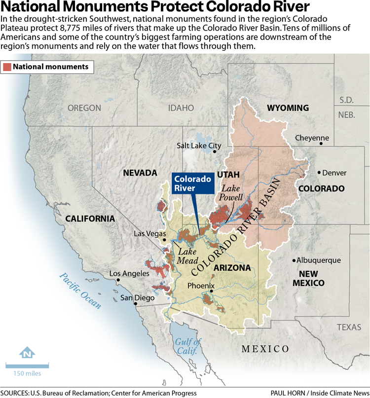
October 28, 2025
Editor’s note: Last week I had the pleasure of speaking at the San Juan Citizens’ Alliance celebration of 50 years of the Weminuche Wilderness, Colorado’s largest wilderness area at nearly 500,000 acres. Congress passed the legislation establishing the Weminuche in 1975, and it now covers some of the most spectacular landscape in the nation. This is an adapted version of the talk I gave (with a lot fewer umms and uhhs in it).
As I’m sure you all are aware, our public lands have been under attack for a while now, but especially in the last nine months, from both the Trump administration and from the Republican-dominated Congress.
This all out assault has given me many reasons to worry about the fate of some of my favorite places. I have worried about Sen. Mike Lee, the MAGA adherent from Utah, selling off Animas Mountain or Jumbo Mountain to the housing developers; I have fretted about Trump shrinking or eliminating Bears Ears, Grand Staircase-Escalante, or Ancestral Footprints of the Grand Canyon national monuments and opening them to the latest uranium mining rush; and I worry that regulatory rollbacks and the administration’s “energy dominance” agenda will make the San Juan Basin and the Greater Chaco Region more vulnerable to a potential new natural gas boom driven by data center demand for more and more power.
But one place I haven’t worried (as much) about being attacked by the GOP and Trump is the Weminuche Wilderness. That’s not because I think Trump or Lee are above messing with wilderness areas. They aren’t. In fact, just this week they opened the Arctic National Wildlife Refuge up to oil and gas leasing. Still, the Wilderness Act is one of the few major environmental laws these guys haven’t gone after directly — at least so far.
But more than that, the reason I feel the Weminuche is less vulnerable to MAGA attacks is because I am confident that even the most die-hard anti-environmentalist sorts understand that an attack on the Weminuche would be an attack on this region and its identity. The Weminuche has simply become ingrained in the collective psyche of southwest Colorado and beyond. If the feds were to try to open it to logging or drilling or mining or any other sort of development, there would be a widespread, deep revolt from this entire region, even from many a Trump voter.
In part, that’s because of how special the place is, with or without a wilderness designation. But it also has to do with the way the wilderness was established, and the widespread local support it ultimately garnered.
Not long after the Wilderness Act of 1964 was signed into law, federal and state agencies and residents of southwestern Colorado began talking about establishing a wilderness area in the remote San Juan Mountains. Areas such as the Silverton Caldera had been heavily mined, and no longer qualified for wilderness designation (even if the mining industry and local communities would have allowed it).
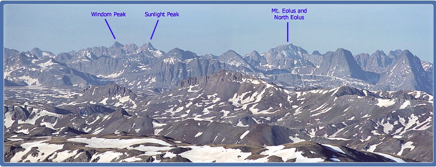
But the heart of the San Juans in and around the Needle and Grenadier ranges certainly fit the bill. In 1859, Macomb expedition geologist J.S. Newberry described the San Juans as a “thousand interlocking spurs and narrow valleys, [which] form a labyrinth whose extent and intricacy will at present defy all attempts at detailed topographical analysis. Among these are precipices, ornamented with imitations of columns, arches, and pilasters, which form some of the grandest specimens of nature’s Gothic architecture I have ever beheld. When viewed from some nearer point they must be even awful in their sublimity.”
“Awful” might be a bit harsh, but sublime? Indeed. That this should become a wilderness must have seemed like a no-brainer.
Nevertheless, the process to designate the Weminuche was no slam dunk. It took a half decade of wrangling and debate and boundary adjustments and congressional committee sausage-making. What to me is most remarkable, however, looking back on the process from our current, politically polarized era, is that the debates were not partisan. And even though there were differing opinions on where the boundaries should be drawn or even whether there should be any wilderness at all, the conversation was just that: a conversation, and a civil one at that.
Proposals were forwarded by the Forest Service and the Colorado Game & Fish Department. Meanwhile, the Citizens for the Weminuche Wilderness — made up of local advocates, ranchers, scientists, business people, and academics — came up with its own proposed boundaries.
My father chronicled some of the back and forth in an insert he put together and edited for the Durango Herald in 1969 called “The Wilderness Question.” It includes his editorials and news stories, but also opinion pieces from a variety of residents.
Looking back, it is a truly striking document. First off, there’s the fact that the Forest Service’s original proposal would have excluded Chicago Basin — now considered the heart of the wilderness area and a Mecca for backpackers and peak-baggers (and their attendant impacts) — and the City Reservoir trail and surrounding areas. They were left out, in part, because there were hundreds of mining claims in those areas, and the mining industry remained interested in them, despite their remoteness and difficult access.
The citizens group, however, was having none of that, and demanded that both areas be included in the wilderness area. Carving these areas out would be like cutting the soul from the place. Ranchers weighed in, as well. James Cole, who was described as a “prominent Basin rancher,” wrote this for the Herald supplement: “The La Plata County Cattlemen are in favor of the proposed Weminuche Wilderness Area … We would like to see Weminuche Creek and Chicago Basin, which the forest service would like to exclude, included in the Wilderness Area.”
It may seem odd, today, to see a livestock operators’ group advocating for morewilderness than even the feds wanted, but it makes a lot of sense. Not only are many ranchers conservation-minded, but their operations were unlikely to be affected by wilderness designation, since grazing is allowed in wilderness areas. It’s actually far stranger to see southeastern Utah ranchers become some of the most zealous opponents of Bears Ears National Monument, since its establishment didn’t ban or restrict current grazing allotments.
Fred Kroeger, a lifelong Republican1 and local water buffalo, who for years pushed for the construction of the Animas-La Plata water project, supported wilderness designation because it would protect the region’s water. (My grandparents, who were Animas Valley farmers and Republicans also supported the designation).
John Zink was a rancher, businessman, fisherman, and hunter and member of the citizens’ committee. In the Herald supplement he wrote that the proposed Weminuche Wilderness, “offers outdoor lovers an opportunity to support another sound conservation practice.”
He continued:
“For me it won’t be many years until slowed feet and dimmed eyes make the south 40 the logical place to hunt, and when the time comes, I expect to enjoy it. But a new and younger generation of outdoor lovers will then be climbing the peaks and wading the icy streams. I ask all outdoor enthusiasts to support the proposed Weminuche Wilderness Area, so each new generation may enjoy it much as it was when Chief Weminuche led his braves across this fabled land.”
That’s not to say everyone was in favor of the citizens’ proposal, but opposition was almost always on pragmatic, not political or ideological grounds. Probably the most strident opposing opinion piece in the Herald supplement came from an engineer at the Dixilyn Mine outside of Silverton, who didn’t want his industry shut out of any potentially mineralized areas, including Chicago Basin. Less than two decades later, the mining industry would be all but gone from the San Juans — and it had nothing to do with wilderness areas or other environmental protections.
John Zink’s son, Ed, who would go on to become a prominent businessman, pillar of the community, and the driving force establishing Durango as a cycling hub, asked that some areas, including the trail to City Reservoir, be excluded from the wilderness to accommodate the rights of “riders of machines.” He was talking about motorbikes back then, but would later focus more on mountain bikes. Zink, a staunch Republican, was undoubtedly bummed when the City Reservoir trail was included in the wilderness area, per the citizens’ proposal.
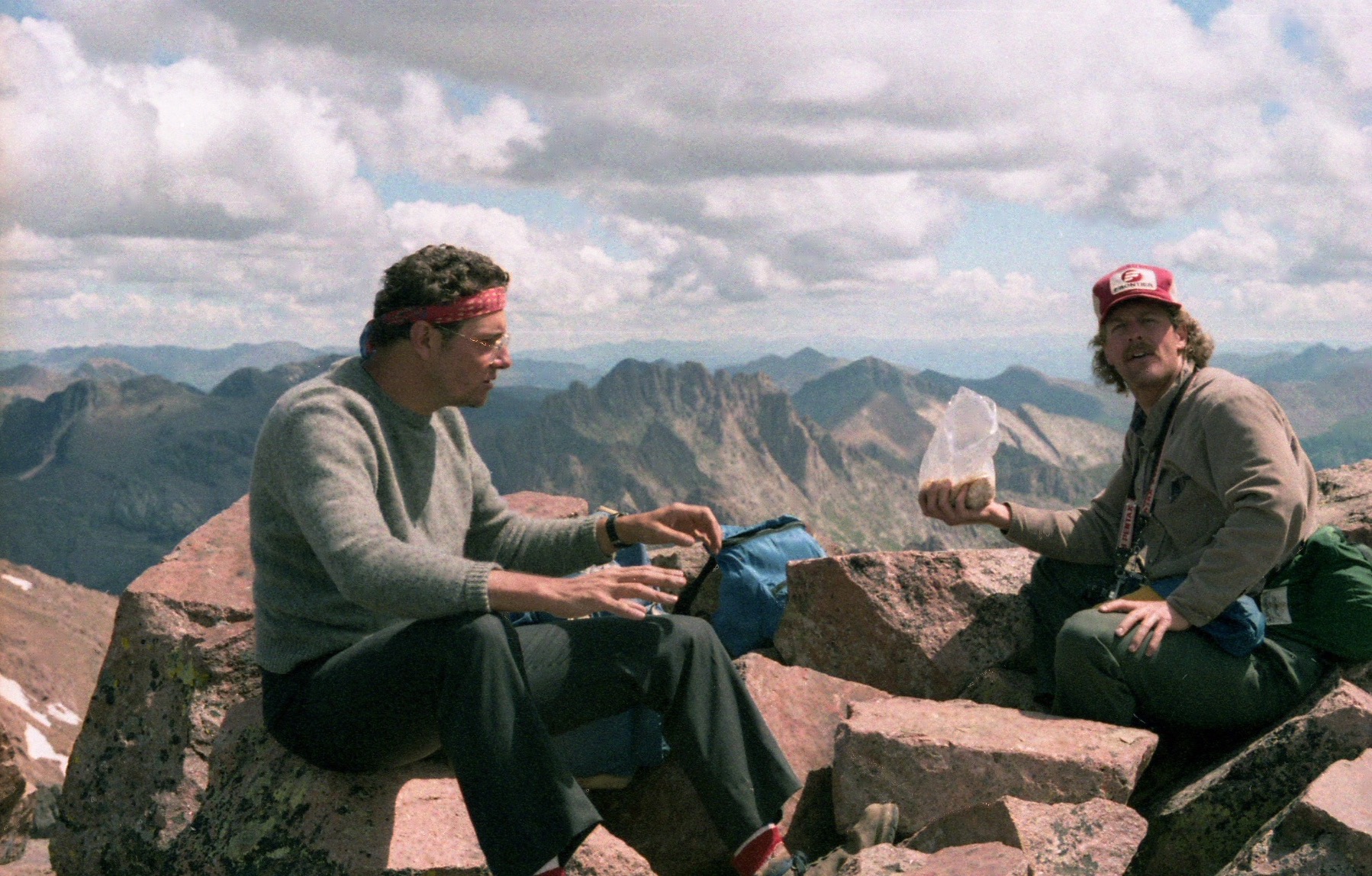
Nevertheless, a few years later, when I was about eight years old, I went on one of my earliest backpacking trips up the trail with Zink (who was my dad’s cousin), along with his sons Tim and Brian, nephew Johnny, and my dad and my brother. We hiked for hours without seeing anyone else — and without hearing the buzz of any motorized vehicles. Ed didn’t seem to miss his motorcycle one bit, nor did he or other motorized groups file lawsuits to try to block or shrink the wilderness, as is common practice today.
Ed would later be instrumental in establishing the Hermosa Creek wilderness area north of Durango, a compromise bill that left Hermosa Creek trail open to mountain bikes and motorbikes. Again, he worked from a pragmatic mindset: He wanted to protect the watershed from which his irrigation and drinking water came, and the forests that sustained game and wildlife, while also retaining recreational access.
When Congress finally passed the bill establishing the Weminuche, it went with the citizens’ group proposal and then some, designating 405,000 acres of federal land as a wilderness area and including Chicago Basin and City Reservoir. The Weminuche Wilderness was expanded in 1980 and again in 1993.
In the years since, public lands protection and conservation have become more and more politicized, along with just about everything else. The pragmatism of the 1970s has been abandoned in favor of ideology; public lands, somehow, have become a pawn in the culture wars. I’m sure both parties share some of the blame, but judging from their actions of late, the MAGA Republicans have become the staunchly anti-public lands conservation party — and bear absolutely no resemblance to the old school Republicans who fought for wilderness designation 50 years ago. Hell, for that matter, some Republican politicians don’t even resemble their selves from just a couple of decades ago.


