Report: Insights Gained on Agricultural #Water #Conservation for Water Security in the Upper #ColoradoRiver Basin — Hutchins Water Center #COriver #aridification

Photo from http://trmurf.com/about/

Click the link to read the report on the Hutchins Water Center website (Hannah Holm). Here’s the introduction:

A series of hot, dry years in the Upper Colorado River Basin has led to increasing concern about the security of water supplies at region-wide and local scales for the following purposes and sectors:

• Maintaining compact compliance and preventing Lake Powell’s water level from dropping too low to generate power.
• Maintaining agricultural production and the vitality of rural communities.
• Maintaining municipal and industrial water security.
• Maintaining river ecosystems.

Without a strategic, collaborative approach to addressing these issues, there is a risk that individual entities will act independently to secure their water supplies against climate and legal uncertainties. This could lead to more permanent transfers from agriculture, with detrimental impacts on rural communities and unpredictable impacts on river ecosystems.

Over the past several years, there have been numerous explorations into new approaches to meeting community and environmental needs in the Upper Basin, including deliberate, temporary, and compensated reductions in water use in order to help balance supply and demand in the Colorado River system, share water supplies between agriculture and cities, and aid troubled streams.

This report distills insights from these explorations that can help illuminate how such deliberate, temporary reductions in water use could play a role in:

• Enhancing long-term water security for farms, municipalities, industries and rivers in the Upper Basin (upstream objectives).
• Compact compliance and protection of power generation capacity in Lake Powell (downstream objectives).

In this report, the term “strategic conservation” will be used to describe these deliberate reductions in water use to meet specific goals.

The insights covered in this report focus on the following topics:

• Water user interest
• Agronomic impacts of reducing water use
• Monitoring and verification of saved water
• Shepherding and conveyance of conserved water
• Pricing considerations
• Environmental considerations
• Additional considerations

For each topic, key insights and remaining uncertainties are highlighted and illustrative research, experiences and resources are described. Links to documentation are provided wherever possible.

The latest “E-Newsletter” is hot off the presses from the Hutchins #Water Center

Colorado River “Beginnings”. Photo: Brent Gardner-Smith/Aspen Journalism

Click the link to read the newsletter on the Hutchins Water Center website. Here’s an excerpt:

NEW REPORTS

The Hutchins Water Center recently completed two reports: Insights Gained on Agricultural Water Conservation for Water Security in the Upper Colorado River Basin distills insights from recent studies and experiences related to using strategic agricultural water conservation in order to help balance supply and demand in the Colorado River system, share water supplies, and aid troubled streams. The other report, Grand Valley Water Workforce Needs & Related Opportunities at Colorado Mesa University, summarizes local water workforce skill and knowledge needs and outlines how current CMU offerings respond, as well as opportunities for improvement.

The latest E-Newsletter is hot off the presses from the Hutchins Water Center #ColoradoRiver #COriver #aridification

January 2022 percent of normal precipitation. Credit: Colorado Basin River Forecast Center

Click here to read the newsletter. Here’s an excerpt:

SNOWPACK DIMINISHES

A dry January has brought a decrease to the spring water supply outlook for the Upper Colorado River Basin. The February 3 Colorado Basin River Forecast Center Water Supply Forecast Discussion has details.

The latest E-Newsletter is hot off the presses from the Hutchins Water Center #snowpack

Colorado snowpack basin-filled map January 12, 2022 via the NRCS.

Click here to read the newsletter. Here’s an excerpt:

IT SNOWED!

After a very dry November, a series of December storms significantly boosted the Colorado Basin snowpack. The January 6 Colorado Basin River Forecast Center Water Supply Forecast Discussion has details. It also notes that fall soil moisture levels, which affect runoff efficiency, were better in 2021 than in 2020, although still below average.

Westwide SNOTEL basin-filled map January 13, 2022 via the NRCS.

Essay: Hot Wind Over Cool Water — The Corner Post #GreenRiver #ColoradoRiver #COriver #aridification

From the My Public Lands Magazine, Summer 2014: “Midnight Mustang” While camping overnight on a solo rafting trip down Utah’s aptly-named “Desolation Canyon,” BLM River Ranger Mick Krussow has a midnight rendezvous with a wild mustang… story by Mick Krussow, BLM Utah illustration by Matt Christenson, BLM Oregon Read the story: http://on.doi.gov/1n1pepx. By Bureau of Land Management – My Public Lands Magazine, Summer 2014, Public Domain, https://commons.wikimedia.org/w/index.php?curid=42090064

From The Corner Post (Hannah Holm):

A thin haze appeared in the afternoon between our rubber boats and distant fins of burnt-orange rock, while a hot wind touched our faces, hands—any skin not taking refuge beneath cool, wet cloth. Later, the haze thickened, mixed with cirrus clouds and gave the golden-hour light a reddish tint.

The river still rushed by, and vibrant leaves in our camp’s young cottonwood gallery fluttered above me. The voice of the yellow-breasted chat that had berated us from cliff walls echoed in my mind, along with the scent of sage and sumac from a lunchtime visit to petroglyphs up a tributary canyon. I was fully immersed in this place, Desolation Canyon on the Green River in eastern Utah. No internet, no phone reception, no news or other distractions. Just the river, the canyon, and my companions on this week-long writing retreat.

But the sky’s tint and the hot wind hinted at what was happening outside the sheltering canyon walls. Record-breaking heat and nearby wildfires, starting early this year. The river itself gave more clues, to those who knew how to recognize them. Low flows and tame rapids, in June. A bear and cub were by the river when they should have been finding forage at higher elevations. We followed a long, irregular stripe of mineral crust punctuated by half-dead clumps of grass on the eastern wall. An extended seep that wasn’t seeping, the ghosts of hanging gardens.

Colorado Basin River Forecast Center Drought Monitor Map September 21, 2021.

Extended drought—or more accurately, aridification—is making its mark on the landscape and on people’s lives. News that I didn’t read during those days on the river was about ever shrinking forecast inflows into Lake Powell and how the states that share the Colorado River might manage reduced water supplies within a legal framework based on imagined bounty.

I write about these things, too, but on the river, I was trying to find words beyond my habitual short-hand to describe our hydrology and water policy developments. For over ten years, I’ve been learning and communicating about how people built an unbalanced system in the Colorado River Basin, constructing the plumbing for demands to exceed supplies, and how we can worm our way out of the worst consequences of that fundamental problem for fish and farms. I still think that matters, and I still think we have options.

But the river showed me that the transformation in our landscape is bigger than that, beyond the reach of our tinkering. Even far from ditches and diversions, seeps go dry and forage for bears thins out. We can micromanage irrigation water to get the most from every drop, clean up toilet water to a pristine state, and adjust reservoir releases to help endangered fish. We can pay farmers to fallow fields. But we can’t pay the hot wind to stop taking water from the sage, the sumac and the dirt. There’s no negotiating on this point, and no escape, not even in one of the most remote canyons in the lower 48.

Aridification carries a heavier emotional weight when I see it on the land than when I read papers about it or watch presentations in windowless conference rooms. It’s hard to see things change, irrevocably. To walk through a sick forest and know that it won’t grow back the same. To know that going away from people and the things we’ve built can’t actually take me back to a less damaged state of nature.

Since that trip down Desolation Canyon, back home in Grand Junction, Colorado, the temperatures have eased from the 100s into the 90s, and the summer rains we’ve missed for a couple of years have come back. It’s a welcome respite, and the dwarf ash and pinyon pines I see on my trail runs look perkier than they have in ages. I know these rains aren’t enough to reverse the harsh trend we’re in, but they lift my spirits and give all living things a break, a chance to gather strength before facing the next onslaught of hot wind.

We can’t turn back the clock and we can’t run away, but we can gather strength from an unexpected storm. We can diligently tinker where tinkering can work. And we can dip cloth into cool water, feel it dribble across our skin, and listen to the birds as we drift down the river.

New Report on Interstate Water Compact Lessons for #Colorado — Colorado Mesa University

From Colorado Mesa University (Kelsey Coleman):

Hannah Holm, the director of the Hutchins Water Center at Colorado Mesa University co-wrote a Colorado River study in collaboration with Kelsea MacIlroy and The Nature Conservancy

As a headwaters state, Colorado has many interstate compacts that set rules for how the state must share the rivers that originate within its borders with downstream states. On several of these rivers, water users have had to modify their water use to meet compact requirements. That day may be coming for the Colorado River. A new report explores what Colorado River water users can learn from experiences with compact administration on other rivers.

The new report, “Lessons Learned from Colorado Experiences with Interstate Compact Administration,” utilizes interviews with water users and experts who experienced compact compliance measures in the Arkansas, Rio Grande and Republican River Basins to distill lessons that may be useful for Colorado Basin water users.

Interviewees warned against relying on courts to rule in Colorado’s favor in compact cases or on optimistic estimates of water availability. They also described how communities have developed their own, proactive measures to promote compact compliance and address other water supply challenges in ways that have fewer negative impacts than externally imposed mandates. Necessary conditions for doing so include an ability to work well together, precise water-use measurement and initiating action well in advance of a court order. On a more technical front, interviewees emphasized how accurate measurement of all water use was necessary for enhanced water management, as well as making the Colorado’s case for its own water use in discussions with other states.

This study was conducted by Kelsea MacIlroy, co-written by Hannah Holm and funded by The Nature Conservancy. MacIlroy is a PhD candidate in sociology from Colorado State University and the principal of MacIlroy Research and Consulting, LLC. Hannah Holm directs the Hutchins Water Center at Colorado Mesa University.

The report was presented at the Colorado Water Congress Summer Conference in Steamboat Springs on August 24, 2021, and will be presented at the September Colorado Water Conservation Board meeting.

“Across Colorado and the West, communities are experiencing greater frequency and extent of drought leading to increased variability in streamflows. As water managers grapple with the consequences of changing water supplies, there is great value in looking toward neighboring communities for lessons learned,” Heather Dutton, manager of the San Luis Valley Water Conservation District and the Rio Grande Basin’s representative to the Colorado Water Conservation Board said. “The report detailing “Lessons Learned from Colorado Experiences with Interstate Compact Administration” relies on voices of water users and administrators to detail personal and regional experiences including what has gone well and where they would do things differently if given the chance. While the focus of the report is on compact administration, the lessons learned touch on broader water management topics and highlight how communities are better off when stakeholders are working toward a common goal. Therefore, I feel this report is a must read for all Coloradoans that care about our collective water future.”

Alex Funk, agriculture and rural resiliency policy specialist for the Interstate, Federal, and Water Information Section at the Colorado Water Conservation Board also commented on the recent report.

“The stories shared in this report highlight the value of proactive dialogue and actions on water management challenges ranging from climate change to compact compliance.,” Funk said. “Collaborative, proactive actions and solutions give local communities and water users more agency and opportunities to adapt to changing conditions in ways that provide long-term benefits for all water users.”

Ralph Parshall squats next to the flume he designed at the Bellevue Hydrology Lab using water from the Cache la Poudre River. 1946. Photo Credit: Water Resource Archive, Colorado State University, via Legacy Water News.

On the question of water measurement, John McClow, general counsel for the Upper Gunnison River Water Conservancy District said, “A valuable takeaway from the report is recognizing the importance of accurate measurement. That is a good lesson for Colorado River water users as the State Engineer commences measurement rule making.”

The full report can be found at coloradomesa.edu/water-center/compact-stories.

The latest E-Newsletter is hot off the presses from the Hutchins Water Center #ColoradoRiver #COriver #aridification

Colorado River “Beginnings”. Photo: Brent Gardner-Smith/Aspen Journalism

Click here to read the newsletter. Here’s an excerpt:

SHORTAGE DECLARATION

The Bureau of Reclamation has declared the first-ever official shortage for the lower Colorado River basin, which requires delivery cuts to Arizona, Nevada and Mexico under the 2007 Interim Guidelines for operating Lakes Mead and Powell. The determination was made in response to the Mead elevation projected in the August 24-month Study. This Fact Sheet by the Bureau explains how the declaration was made, how much deliveries will be reduced and details about drought response operations. Under the shortage, Arizona will lose about 18% of its Colorado River supplies, the largest cut. This Central Arizona Project page has details on how the cuts will be allocated and how the state is responding.

#Vail-area #snowpack still lags behind historic median levels — The Vail Daily #runoff

From The Vail Daily (Scott Miller):

The massive storm that hit Colorado’s Front Range over the weekend didn’t do much to aid the local snowpack. And that snowpack continues to lag behind the 30-year median.

According to the latest numbers from U.S. Department of Agriculture’s measurement sites at Vail, Copper Mountain and Fremont Pass, the snowpack, as measured in “snow water equivalent,” is 90% or less of the 30-year median. Copper Mountain is the closest measurement site to Vail Pass, and Fremont Pass is the closest measurement site to the headwaters of the Eagle River. Vail Mountain’s measurement is the lowest of the three, at 76% of the 30-year median…

This season’s accumulation at Vail has already passed the peak snowpack recorded in 2011-2012, the lowest year on record. Snowpack is near or past the peaks recorded in the lowest years on record at Copper Mountain and Fremont Pass…

More heat, more evaporation
Hannah Holm of the Ruth Powell Hutchins Water Center at Colorado Mesa University said early snowmelt also exposes bare ground, which heats up more easily than snow. More heat means more evaporation, which also means less water flowing into streams.

And those dry years have become more and more frequent. Diane Johnson, the communications and public affairs manager for the Eagle River Water & Sanitation District, noted that three of the four lowest snow years on record have come in the past decade.

“We’re not just responding to a one-year drought,” Johnson said, adding that people in the water supply business are calling this 20-year drought cycle a “millennium drought.”

Johnson added that simple snowpack measurements are only part of a fairly complex equation for water supplies.

As Holm noted, it’s important how quickly snow melts in the spring. Johnson said that one of the lowest snow years on record, 2001-2002, had the benefit of a cool spring to keep the limited snowpack on hillsides.

#ColoradoRiver managers turn eyes to new #LakePowell-#LakeMead deal — The #GrandJunction Daily Sentinel #COriver #aridification

From The Grand Junction Daily Sentinel (Dennis Webb):

A 2007 deal creating guidelines governing how Lake Powell and Lake Mead are operated in coordination isn’t scheduled to expire until 2026. But water officials in Colorado River Basin states are already beginning to talk about the renegotiations that will be undertaken to decide what succeeds the 2007 criteria.

“I think the guidelines have been a big success,” John Entsminger, general manager of the Southern Nevada Water Authority, said Wednesday during the 10th annual Upper Colorado River Basin Water Forum. The forum is put on by Colorado Mesa University’s Ruth Powell Hutchins Water Center and this year is taking place online due to the pandemic.

The 2007 criteria dictate how much water must be released each year from Powell into Mead, in an effort to equalize water levels in the two reservoirs. The criteria are important to Colorado and other states in the Upper Colorado River Basin because those states rely on Powell water storage for meeting long-term delivery obligations to downstream states based on a 1922 interstate compact.

Amy Haas, executive director of the Upper Colorado River Commission, which represents Upper Basin states, said she thinks the 2007 guidelines have reduced the “safe yield” of water for the Upper Basin. Even with low inflows into Powell, the guidelines resulted in releases of 9 million acre-feet a year of water from Powell every year from 2015-19, compared to the 8.3 million acre-feet negotiated average minimum objective, she said.

Entsminger called that a simplistic analysis that cherry-picks data. He says his entity’s modeling indicates that under the 2007 criteria there is more water in Powell and less in Mead than otherwise would have been the case.

Tom Buschatzke, director of the Arizona Department of Water Resources, said that with the guidelines in places, Powell water levels largely have remained around 50% of capacity “through some horrendously dry years” and only three or four years of above-average inflows.

The criteria encourage water conservation and provide rules for determining water shortages and reducing water use by Arizona and Nevada.

Entsminger said the 2007 agreement increased cooperation and communication among states in the river basin, provided certainty by operating the two reservoirs together, and headed off litigation only two years after states were close to going to the Supreme Court over river water issues…

Those states are evaluating the possibility of demand management measures to temporarily curtail agricultural, municipal and other use during droughts. The goal is to bolster Powell levels with water that could be reserved for compact delivery obligations. But Haas said it’s important to assess the risk of curtailment of Upper Basin uses occurring as well. Such a curtailment has never happened.

Fire and water connect the West — Hannah Holm

Here’s a guest column from Hannah Holm that’s running in The Grand Junction Daily Sentinel:

Lately, I’ve been savoring clear skies like never before. My appreciation was magnified by days of feeling trapped in the smoke from California fires, even as our own Pine Gulch Fire calmed down. Meanwhile, friends and family in Washington and Oregon are choking on airborne soup thicker than anything we’ve had to deal with this summer.

I feel vaguely guilty that the same weather system that finally brought us rain, cooler temperatures and clear air earlier this month also fanned the heartbreakingly destructive flames farther west. We share the air, and that gives us in western Colorado a direct, tangible connection to the fate of West Coast forests and fires.

Water connects us, too, even if the connections aren’t as immediate and visible as wildfire smoke. Most of the water that flows into the Colorado River comes from Colorado’s mountains, so a bad snow year (or decade, or two) for us means less water for the 40ish million people that depend on the river, from Denver to Phoenix, Los Angeles and Mexico. Likewise, more snow in California’s Sierra Nevada Mountains and the eastern side of the Rockies reduces the draw on the river by giving Los Angeles and Denver more source water closer to home. Conservation actions in those cities benefit the river, and the whole river community, for the same reason.

Downstream conditions affect the headwaters in other ways, too, as desiccated, beat-up rangeland in the Four Corners area sends dust to the mountains that melts the snowpack earlier and reduces the amount of water that runs off into our streams.

Food also connects us, and food is very directly connected to water. If you like to eat salad in January, you need to keep water flowing to the Southern California farms that produce it.

Firefighters on the march: The Pine Gulch Fire, smoke of which shown here, was started by alighting strike on July 31, 2020, approximately 18 miles north of Grand Junction, Colorado. According to InciWeb, as of August 27 2020, the Pine Gulch Fire became the largest wildfire in Colorado State history, surpassing Hayman Fire that burned near Colorado Springs in the summer of 2002. Photo credit: Bureau of Land Mangement-Colorado, via InciWeb and National Interagency Fire Center.

To bring us back to where we started, fire and water are also connected, just as both fire and water connect far-flung communities. When the Pine Gulch Fire was at its most active, incident managers reported that the moisture content of the vegetation in the fire area was less than what you would typically find in a (perfectly flammable) piece of paper. That was a direct consequence of the same high temperatures and precipitation deficit that have diminished our streamflows and runoff into Lake Powell. Post-fire, we can expect ash and naked soil to run off into waterways, fouling fish habitat and drinking water intakes.

All of these connections are important to keep in mind as the states that share the Colorado River prepare to embark on a new round of negotiations over how to manage it. Representatives from all the states will face pressure to focus narrowly on enabling local water users to secure access to as much of the shrinking river as they can. That’s fair enough — no one wants to diminish their own future just to be the nice guy. But over the long term, it will help all of us to pursue actions that benefit the Colorado River system as a whole. That includes reducing the greenhouse gas emissions that are warming the atmosphere and intensifying both drought and wildfire.

Hannah Holm coordinates the Hutchins Water Center at Colorado Mesa University, which promotes research, education and dialogue to address the water issues facing the Upper Colorado River Basin. Support for Hutchins Water Center articles is provided by a grant from the Walton Family Foundation. Learn more about the center at http://www.coloradomesa.edu/water-center.

Hutchins Water Center: Upper #ColoradoRiver Basin #Water Forum, November 4-5, 2020 #COriver #aridification

Colorado River “Beginnings”. Photo: Brent Gardner-Smith/Aspen Journalism

Click here for all the inside skinny:

10th Annual Upper Colorado River Basin (virtual) Water Forum:
Coming to Terms with Limits and Uncertainty
November 4-5, 2020
An On-Line Gathering

Highlights
Keynote: Navajo Nation President Jonathan Nez
Panels of Upper and Lower Basin State and Tribal Leaders`
Multi-State Ag Producers’ Roundtable

DRAFT PROGRAM
REGISTER/SPONSOR HERE

Many thanks to these early-bird sponsors:
Four Corners Water Center a Fort Lewis College, Strategic by Nature, Chevron,
Laurian Unnevehr and the Walton Family Foundation!

The latest “E-Newsletter” is hot off the presses from the Hutchins Water Center #ColoradoRiver #COriver #aridification

Current Situation: Successful firing operations occurred on Spruce Ridge yesterday. There was some lightning reported Monday afternoon, as well as strong outflow winds causing fire activity to pick up in several areas within the perimeter of the fire. Containment of the fire has increased to 44 percent.
CDOT reopened the I-70 corridor for through traffic from Gypsum to Glenwood Springs, urging drivers to use extreme caution while driving in this corridor as fire crews are still using the road to access the fire. The interstate is open to through traffic only, and there will likely be periodic closures due to mudslides and other events. No stopping is allowed, and rest areas are closed. Reduced speed limits are also in place. A flare up at mile marker 126.5 yesterday evening, temporarily closed the highway, while helicopter’s utilized buckets to drop water.

Click here to read the newsletter. Here’s an excerpt:

FIRE AND WATER

The Grizzly Creek Fire has incinerated dessicated vegetation on the steep canyon walls on both sides of the Colorado River in Glenwood Canyon, engulfing the usual intakes for the domestic water supply for the City of Glenwood Springs. This Colorado Sun article discusses the potential long-term impacts on the river.

The latest “E-Newsletter” is hot off the presses from the Hutchins #Water Center #DirtyWaterRule

Click here to read the newsletter. Here’s an excerpt:

NARROW WOTUS ON HOLD IN CO

The adoption of narrower Clean Water Act protections for streams and wetlands is currently blocked in Colorado, as a result of a court ruling on the state’s challenge to the new federal rule. Details are in this Bloomberg Law report.

These wetlands, located on a 150-acre parcel in the Homestake Creek valley that Homestake Partners bought in 2018, would be inundated if Whitney Reservoir is constructed. The Forest Service received more than 500 comments, the majority in opposition to, test drilling associated with the project and the reservoir project itself. Photo credit: Heather Sackett/Aspen Journalism

Powell Inflow Forecast Drops — Hutchins Water Center @WaterCenterCMU #ColoradoRiver #COriver #aridification

Click here to read the latest “E-Newsletter” from the Hutchins Water Center. Here’s an excerpt:

POWELL INFLOW FORECAST DROPS

The latest Colorado Basin River Forecast Center Water Supply Forecast Discussion

(May 17) projects April – July unregulated inflows into Lake Powell to be 61% of average, down from 74% of average forecast on April 17. Other spring reservoir inflow forecasts in the discussion include Fontenelle (88% average), Flaming Gorge (84% of average), Blue Mesa Reservoir (59% of average), McPhee Reservoir (35% of average), and Navajo Reservoir (50% of average). All forecasts are lower than last month, in some cases significantly lower.

(May 17) projects April – July unregulated inflows into Lake Powell to be 61% of average, down from 74% of average forecast on April 17. Other spring reservoir inflow forecasts in the discussion include Fontenelle (88% average), Flaming Gorge (84% of average), Blue Mesa Reservoir (59% of average), McPhee Reservoir (35% of average), and Navajo Reservoir (50% of average). All forecasts are lower than last month, in some cases significantly lower.

For information on what the forecast means for the water supply and reservoir operations in the Colorado and Gunnison basins in Colorado, you can review video and access presentation slides from the Mesa County State of the River webinar hosted by the Colorado River District and Hutchins Water Center, as well as the District’s other State of the River webinars.

Virtual Mesa State of the River, May 20, 2020 #ColoradoRiver #COriver #aridification

Click here for all the inside skinny.

#ColoradoRiver keeps flowing — so do concerns about its future — The Grand Junction Daily Sentinel #COriver #aridification #COWaterPlan

Palisade is just east of Grand Junction and lies in a fertile valley between the Colorado River and Mt. Garfield which is the formation in the picture. They’ve grown wonderful peaches here for many years and have recently added grape vineyards such as the one in the picture. By inkknife_2000 (7.5 million views +) – https://www.flickr.com/photos/23155134@N06/15301560980/, CC BY-SA 2.0,

Here’s a guest column from Hannah Holm that’s running in The Grand Junction Daily Sentinel:

It seems like the pandemic has soaked up most of the newsprint lately, but even now, when so much has come to a standstill, our rivers keep flowing. As Jim Pokrandt pointed out in a recent op-ed, our canals have started flowing, too, as Grand Valley farmers begin the annual ritual of putting water on the land to reap a harvest, and an income, later in the year.

Another annual ritual, monitoring the forecasts for how much spring snowmelt will flow down the rivers, has also begun. This year, we have an above-average snowpack in the mountains that feed the Colorado River, but below-average runoff into Lake Powell is expected. Parched soils from last year’s dry summer are expected to soak up much of the water before it can make it into the river.

If that forecast proves accurate, it will mark the 15th time in 20 years in which runoff into Lake Powell has been below average. This is one more piece of data to support the conclusion that the Colorado River is shrinking. Coming to terms with this fact is the central challenge facing all who depend on the Colorado River — about 40 million people throughout the Southwest.

A shrinking river is a particularly hard to adapt to when it is already being completely used up — the Colorado River rarely reaches the sea any more, and its major reservoirs are less than half full. So how, and what, are we doing? Here’s a rundown of a few things that are happening.

Downstream, California, Arizona and Nevada agreed to a detailed schedule of water delivery cuts triggered by different water levels in Lake Mead. This is the first year they are taking reduced deliveries.

Here in Colorado, along with Wyoming, Utah and New Mexico, water leaders are continuing to study “demand management:” paying water users to temporarily leave some of the water they are entitled to in the river. State-sponsored work groups on demand management are hashing out technical details on financing, legal issues, how to measure saved water, and the potential economic and environmental impacts of different approaches. You can learn more about these discussions here: https://cwcb.colorado.gov/demand-management.

In related efforts, scientists and ranchers are about to start working together in Grand County to figure out what happens to high-elevation hay fields if you take a pause on irrigating them. This will help ranchers determine whether they might want to participate in demand management or not. Other studies are also looking at the potential impacts on communities of reductions in irrigated agriculture.

Scientists are also working hard to refine their tools for understanding and forecasting water supplies. A new report from Western Water Assessment at CU-Boulder synthesizes information from nearly 800 studies and reports on Colorado River Basin science and hydrology. If you are interested, you can check it out at https://wwa.colorado.edu/.

So far, we’re mostly studying different options for cutting back our water use from the Colorado River, without many people actually having to do it yet. But if current trends continue, which long-term projections indicate that they will, that day will come.

Any change is hard, and abrupt change is especially hard. Abrupt change without data is terrifying, as we’ve recently learned. The good thing about the troubling situation on the Colorado River is that we don’t have to suffer the terror of change without data. The bad thing about the situation on the Colorado River is that we can’t study our way out of actually having to do something about it — sooner or later. [ed. emphasis mine]

Hannah Holm coordinates the Hutchins Water Center at Colorado Mesa University, which promotes research, education and dialogue to address the water issues facing the Upper Colorado River Basin. Support for Hutchins Water Center articles is provided by a grant from the Walton Family Foundation. You can learn more about the center at http://www.coloradomesa.edu/water-center.

Hayfield message to President Obama 2011 via Protect the Flows

Rocky Mountain PBS hosts ‘Water week’ @rmpbs

Farview Reservoir Mesa Verde NP

Here’s the release from Rocky Mountain PBS (Hillary Daniels):

Rocky Mountain PBS Announces “Water Week” – A Collaboration of Communities Throughout Colorado to Elevate Conversations on Water

Rocky Mountain PBS (RMPBS) will bring Colorado-based organizations and communities together during “Water Week” in an effort to provide resources and information to a broad statewide audience by convening conversations to share the diverse perspectives of Coloradans with respect to water.

“Water Week” features unique, historical and informational programming on RMPBS, along with digital resources, and events in communities across Colorado designed to connect experts, environmentalists and businesses to all who see water as an essential part of Colorado’s past and its future.

“One year ago, RMPBS organized a statewide listening tour and engaged local advisory committees to better understand which topics are most important to their communities,” states Amanda Mountain, President & CEO for Rocky Mountain Public Media. “Water repeatedly surfaced as both an historic and contemporary issue, which led us to invest in programming and partnerships to continue these conversations around this critical topic.”

Colorado’s statewide water plan prescribes that conversations about water play a role in shaping our shared future in the state and in the broader West. We asked over 40 water experts to provide feedback to RMPBS about how public media can engage those who are not otherwise actively involved in the topic, as well as how best to expand the number of perspectives represented on public media.

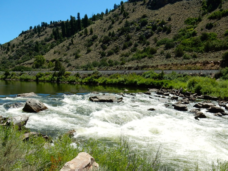
“I think we’re going to see a much longer period of aridity and therefore, incredibly creative thinking that’s going to have to come about,” said Andy Mueller, General Manager for the Colorado River Water Conservation District. “It doesn’t spell the end of civilization in the southwestern United States. What it means though is our civilization’s going to have to transform.”

“Water Week” festivities begin with a variety of RMPBS hosted events across Colorado that are free to local communities including:

• February 25 at 6:00pm in Colorado Springs at ALMAGRE Venue + Bar
• February 25 at 6:00pm in Gunnison at Western Colorado University
• February 26 at 5:30pm in Grand Junction at Eureka! McConnell Science Museum
• February 26 at 6:00pm in Durango at Fort Lewis College
• February 26 at 5:30pm in Montrose at History Colorado Ute Indian Museum
• February 26 at 6:30pm in Pueblo where at Walter’s Brewery & Taproom
• February 27 at 6:00pm in Denver/Littleton at Sterling Ranch Community Center
• February 28 at 5:00pm in Durango at the Powerhouse Science Center

All “Water Week” event details for local communities can be found at http://www.RMPBS.org/events/WaterWeek.

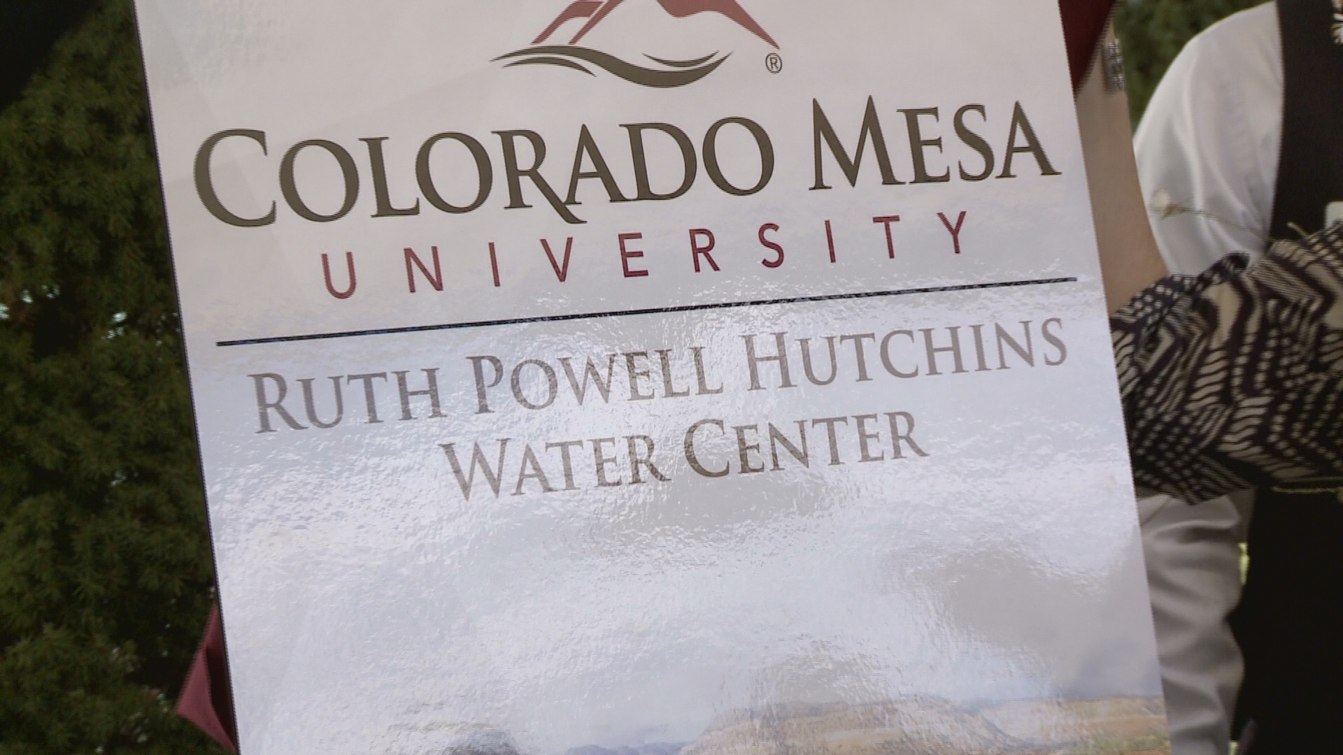
“Water Week” programming on RMPBS begins on February 27th at 7pm with a new episode of Colorado Experience entitled “Western Water & Power”. This program visits the history of Western arid lands could provide. “Whiskey is for drinking and water is for fighting,” de scribes the urgent struggle every generation of Coloradans faces to control this fleeting but precious resource — creating hydrodynamic history through structures that can propel water to run uphill toward money and power. This episode is produced in partnership with Colorado Mesa University.

Immediately following at 8pm, Colorado Experience: “Living West – Water” will explore what happened to the Ancestral Pueblo people of Mesa Verde and Goodman Point. After settling in
southwest Colorado for over 700 years, the ancestral Pueblo people suddenly left their cliff dwellings and spring-side kivas, leaving behind a variety of archaeological treasures. In this episode, historians and archaeologists discuss the possibility that this drastic move was caused by a devasting drought in the southwest region. Discover the similarities in historic conditions – and what the disappearance of water might mean for the state of Colorado today.

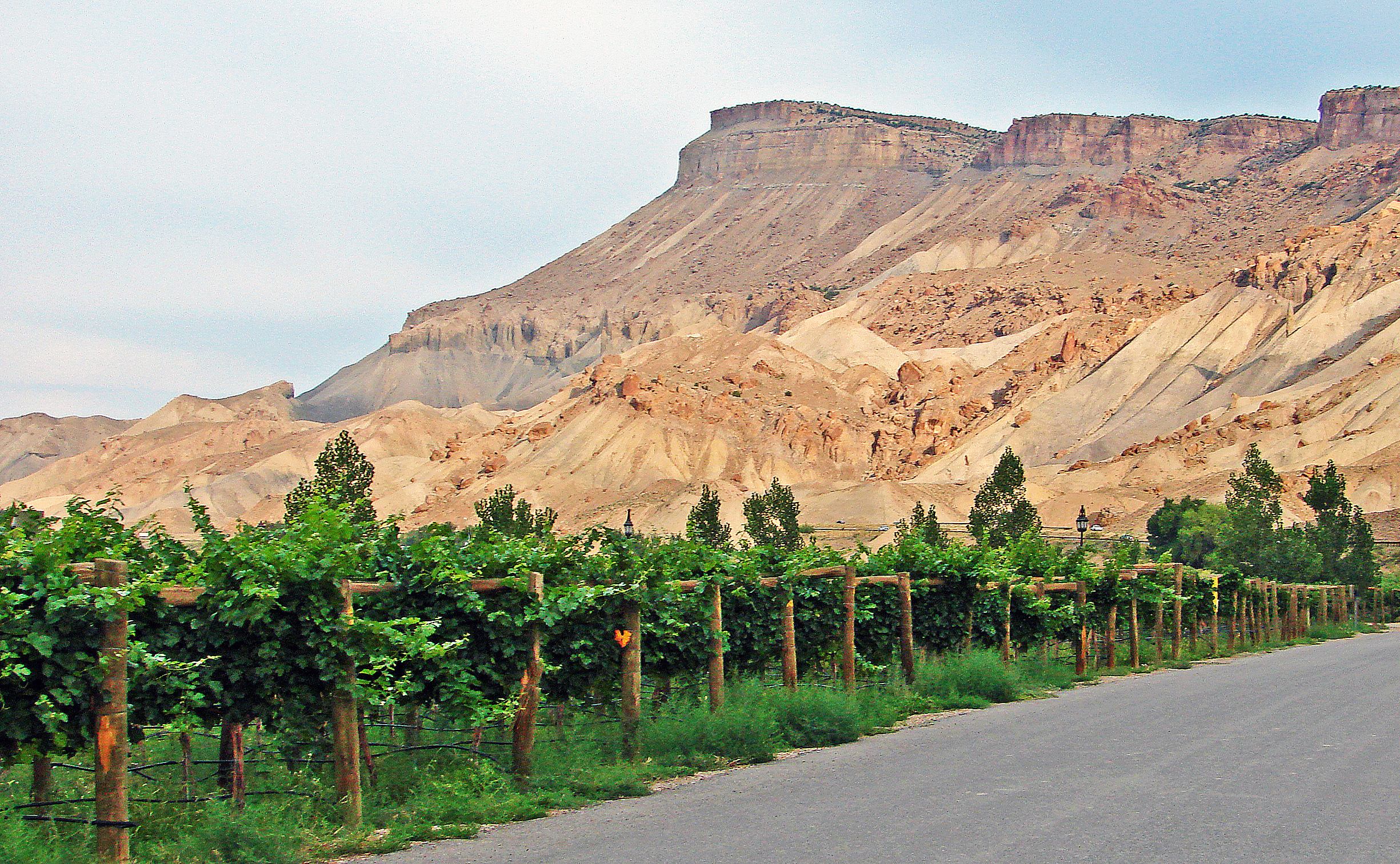
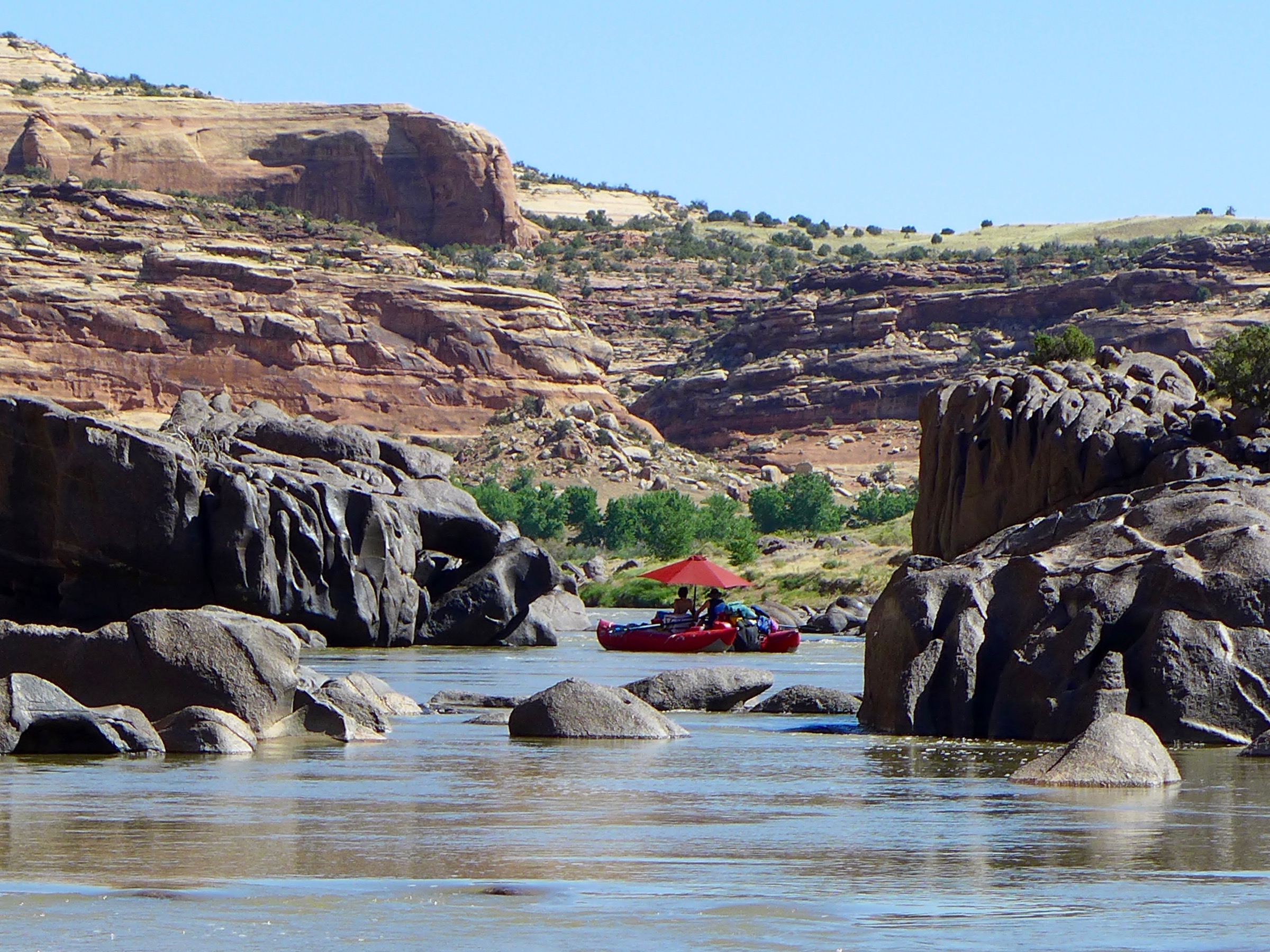
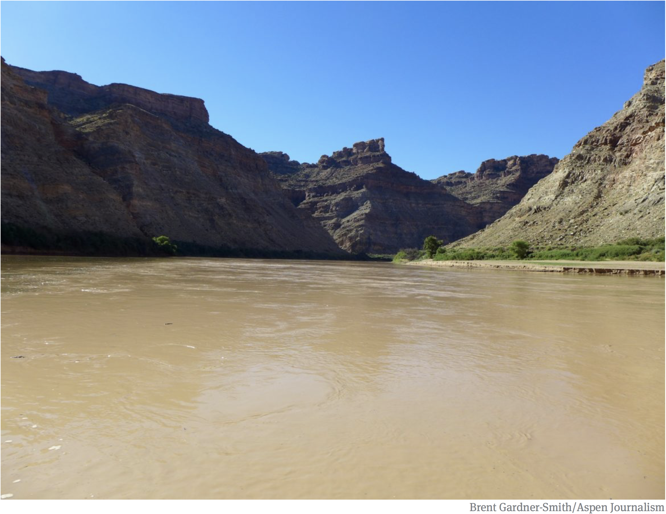
Continuing at 8:30 pm, Confluence tells the story of The Colorado River, which runs through the Western Slope, shaping both the landscape of the American Southwest and the people living near its waters. Confluence follows an up-and-coming indie folk band as they traverse this endangered river system, documenting its places and people through original music.

“Water Week” concludes its programming with “Arkansas River: From Leadville to Lamar” airing at 9:30pm. This program explores the economic and social importance of the river basin including its recreational, municipal, and agricultural value. By the year 2050, the population of Colorado is expected to double, but future growth and economic development hinges on a dependable water supply. In response, the state has developed a plan that will meet the needs of all water users. On RMPBS, come discover why the Arkansas River basin is an important part of that new water plan.

Across the state, RMPBS will be celebrating water week with events. These events will take place in Colorado Springs, Gunnison, Pueblo, Grand Junction, Durango, Montrose, and Denver. Colorado Office of Film, Television & Media will have their water event on February 25 at Western State Colorado University at the University Center Theatre at 6 pm in Gunnison as part of the Colorado Experience Roadshow.

In Colorado Springs, RMPBS will be hosting their event at Almagre Venue + Bar on February 26 at 6pm and will have whiskey tastings.

At Walter’s Brewery & Taproom, there will be a sneak peak of Colorado Experience: “Western Water & Power” while sampling different types of beers. This event will take place on February 26 at 6:30 pm.

In Grand Junction, RMPBS will be hosting their event at Eureka! McConnell Science Museum on February 26 at 5:30 pm. Attendees will get to mingle with local water partners, catch a short preview of Colorado Experience: “Western Water & Power”, and enjoy whiskey and beer tasting.

RMPBS will also be in Durango at Fort Lewis College on February 26 at 6 pm. Attendees will get to watch the full screening of Colorado Experience: “Western Water & Power” with an academic panel afterwards.

Colorado Film Commission will be hosting a screening of Colorado Experience: “Western Water and Power” with a Q&A afterwards on February 26 at 5:30 pm at Ute Indian Museum in Montrose.

In Denver, RMPBS will be hosting an event at Sterling Ranch in Littleton on February 27 at 6 pm. While there, attendees will get to enjoy the full episode of Colorado Experience: “Western Water and Power” with beer tasting and information from local water businesses and organizations.

RMPBS will be hosting another event in Durango on February 28 at 5 pm at the Powerhouse Science Center. At the event, attendees will get to watch the full episode of Colorado Experience: “Western Water and Power” while they enjoy beer tasting and engage with local water businesses and organizations.

RMPBS wishes to thank all the local community and statewide partners in supporting our mission of strengthening our civic fabric and convening important conversations that impact our state including Colorado River District, Ute Water District, Peach Street Distillers, Ska Brewing, Business for Water Stewardship, Audubon Rockies, and Sterling Ranch.

For more information regarding “Water Week,” to RSVP to events, access resources, and learn how to get involved, visit the Rocky Mountain Public Media website at: http://rmpbs.org/events/WaterWeek .

#GrandJunction: “It’s Water Course time.” Three Evening Seminar Series on #Hydrology, #COWater Law, #Snow Science, #CloudSeeding, #ForestHealth & #WaterQuality Feb 11, 18 & 25 — Hutchins Water Center

Click here for all the inside skinny.

The latest “E-Newsletter” is hot off the presses from the Hutchins Water Center

Click here to read the newsletter. Here’s an excerpt:

SNOWPACK ABOVE RUNOFF FORECAST

Official forecasts for spring runoff into Upper Colorado Basin reservoirs are below average, despite an above-average snowpack. This is due to low soil moisture resulting from a dry summer and fall. Details are in this forecast discussion from the Colorado Basin River Forecasting Center.

The latest “E-Newsletter” is hot off the presses from the Hutchins Water Center

Click here to read the newsletter. Here’s an excerpt:

MODELING THE COLORADO RIVER
A new white paper on present and future strategies for modeling the Colorado River has been released by Utah State University’s Center for Colorado River Studies. Learn more here.

On #ColoradoRiver, challenges and solutions go beyond compact — Hannah Holm @WaterCenterCMU #COriver #aridification

The Crystal River in August 2018 was running at 8 cfs near the state fish hatchery. Two conservation districts are hoping to get state funding for a study about water supply replacement plans for several subdivisions in the Crystal River Valley. Photo credit: Heather Sackett via Aspen Journalism

From The Grand Junction Daily Sentinel (Hannah Holm):

Our rivers are shrinking, populations are rising, and many rural communities are suffering from drought and economic dislocation.

Urban water use is declining, despite population growth, and communities are transforming their rivers from utilitarian conveyances into playgrounds and economic development engines.

Farmers and conservation organizations are partnering to help fish, and scientists are developing better forecasting tools, which will help everyone plan better for whatever quantity of water is coming their way.

All these statements are true, and they were among the messages delivered by speakers at the Upper Colorado River Basin Water Forum at Colorado Mesa University on Nov. 13-14.

As reported by the Grand Junction Daily Sentinel and KUNC, participants were warned that the Upper Basin States of Colorado, Utah, New Mexico and Wyoming are at risk of getting into trouble with the terms of the 1922 Compact between the states that share the Colorado River. A “demand management” program to compensate water users for voluntary, temporary cuts in their Colorado River water use is the most commonly discussed “insurance policy” for managing this risk. The upper basin states are studying the feasibility of this option now.

The risk of failing to meet downstream obligations, and therefore facing mandatory, uncompensated water use cuts, is real. However, as other speakers at the forum demonstrated, our regional water challenges go far beyond compact compliance, and state officials aren’t the only ones with the capacity to take action.

Mcphee Reservoir

Even without compact trouble, many agricultural communities are regularly short of water, because the mountains don’t always catch enough snow for the fields we want to irrigate. The Ute Mountain Farm and Ranch Enterprise, which operates southwest of Cortez, and irrigates with water from the Dolores Project, often gets less than their full supply. Enterprise managers respond by adjusting their crop plans in accordance with spring supply forecasts and employing highly efficient sprinkler technology. They also run a mill to add value to their corn crops, which brings more dollars per drop to the tribe, as well as more employment opportunities.

Urban communities have also responded to water stress with leak detection programs, pricing strategies and consumer education that have significantly dropped per capita consumption – with a big assist from more efficient toilets and appliances. New technologies and policies for cleaning up sewage to potable standards, individuals’ choices to install water-thrifty landscapes, and denser development patterns offer the promise of further stretching supplies.

Decker Fire October 2019. Photo credit: Greg Hobbs

Wildfires have been getting fiercer, as a result of beetle kill, hot and dry climate conditions and years of suppression that let fuels build up. Most of our rivers originate in high mountain forests, and when those forests burn hot and intense, subsequent storms can wash fish-choking ash and sediment into streams and foul up water diversion infrastructure. Speakers from southwest Colorado discussed how federal, state and local groups, including private sector forest product firms, are working together to improve forest health and resilience through thinning and prescribed fire, as well as by educating property owners on creating defensible spaces around buildings.

At the same time as our rivers have begun shrinking (on average), we’ve started expecting more from them: in addition to supplying water to our taps and fields, we want them to continue to nurture native fish and provide us with enjoyable boating experiences. Speakers working in the Price River watershed in Utah described how conservation organizations have built relationships with local farmers and brought resources to the table to improve how diversions, ditches and reservoirs serve all these interests.

The examples above demonstrate that those of us who care about the Colorado River, its tributaries and its communities don’t have to limit ourselves to wringing our hands over the seemingly intractable challenge of balancing supply and demand on the Colorado River and sit passively by, hoping that state, federal and tribal leaders will find a good fix. Getting involved in those discussions is good, but so is getting to know your neighbors on your local stream, learning how water works in your community, and finding ways to work together on whatever your particular challenges are. In addressing those challenges, you might even end up contributing to basin-wide solutions.

Colorado Mesa University

Hannah Holm coordinates the Hutchins Water Center at Colorado Mesa University, which promotes research, education and dialogue to address the water issues facing the Upper Colorado River Basin. Support for Hutchins Water Center articles is provided by a grant from the Walton Family Foundation. You can learn more about the center at http://www.coloradomesa.edu/water-center.

Upper #ColoradoRiver Basin Water Forum Day 1 recap #COriver #aridification @WaterCenterCMU

In 1922, Federal and State representatives met for the Colorado River Compact Commission in Santa Fe, New Mexico. Among the attendees were Arthur P. Davis, Director of Reclamation Service, and Herbert Hoover, who at the time, was the Secretary of Commerce. Photo taken November 24, 1922. USBR photo.

From The Grand Junction Daily Sentinel (Dennis Webb):

Demand management “is a form of insurance,” Anne Castle said at the ninth annual Upper Colorado River Basin Water Forum, which continues today and is presented by CMU’s Ruth Powell Hutchins Water Center…

Castle and John Fleck, director of the University of New Mexico Water Resources Program, recently released a report evaluating the risk of future curtailment of river water use in Upper Colorado River Basin states under a 1922 river basin compact. The report discusses the concept of working to take an insurance-based approach to address the risk of curtailment.

“As with any form of risk, you can insure against it,” Castle said…

Earlier this year, Congress approved legislation allowing implementation of drought contingency agreements involving both Upper and Lower basin states. The agreements are aimed at helping keep water levels in Lake Powell and Lake Mead from falling so low as to jeopardize hydropower production and force water supply reductions. In the Upper Basin, an agreement allows in part for any water conserved by possible demand management programs to be stored in a separate account in Lake Powell to protect the reservoir’s water levels.

Colorado and other Upper Basin states since have begun exploring the possibility of pursuing demand management programs. Becky Mitchell, director of the Colorado Water Conservation Board, said at Wednesday’s forum that in Colorado, nearly 100 members of work groups have been meeting as the state begins “to investigate just the feasibility of that program.”

Colorado is looking into issues surrounding the idea of a possible program involving temporary, compensated, voluntary reductions in use by agricultural and other water users.

Castle said demand management is complex and “not an easy solution but it does give us the opportunity to plan and we can hedge our bets a little bit.”

[…]

Castle said a legal question surrounds whether the 1922 [Colorado River Compact] requirement not to deplete water means a requirement to deliver it.

If it only means don’t deplete, the Upper Basin is fine as as long as it doesn’t use more than 7.5 million acre feet a year under the 1922 compact, she said. But if it must deliver that much, it bears all the risk of climate change and reduced river flows in future years, she said…

Meanwhile, climate scientists have projected a 20 to 30% reduction in the river’s flows by mid-century, and a 35 to 55% drop by the end of the century…

She said demand management would have costs, including payments to water users and secondary impacts. Some on the Western Slope want to ensure that temporary cutbacks in use aren’t borne disproportionately by agricultural users, harming rural economies.

Castle said the costs of curtailment need to be considered as well, and those costs could be greater, could last longer and potentially can’t be planned for.

Curtailment would particularly affect municipal transmountain diversions of Colorado River water to the Front Range, because those generally involve more junior water rights.

But Castle and Fleck note in a white-paper, summary version of their report, “While that might sound superficially attractive to West Slope agricultural interests, such a prospect could motivate affected municipal water providers to buy or lease pre-Compact West Slope irrigation water rights, possibly in substantial volume. Although these would almost certainly be market-based, arms-length transactions, the resulting economic impact could be geographically concentrated and tremendously disruptive to commodity supply chains and rural communities.”

[…]

The full report may be found at https://papers.ssrn.com/sol3/papers.cfm?abstract_id=3483654. The white paper is available at https://www.getches-wilkinsoncenter.cu.law/wpcontent/uploads/2019/11/Summary-of-Risk-Assessment-White-Paper.pdf.

Photo credit: Maricopa County, Arizona

From KUNC (Luke Runyon):

Declining flows could force Southwest water managers to confront long-standing legal uncertainties, and threaten the water security of Upper Basin states of Colorado, Wyoming, Utah and New Mexico.

A new paper by Anne Castle at the University of Colorado-Boulder and John Fleck at the University of New Mexico identified many risks facing the basin. These risks need to be addressed in order to avoid disaster for the Colorado River, a water source relied on by more than 40 million people in the southwestern U.S. and Mexico, the paper’s authors wrote. (Some of Castle’s work receives funding from the Walton Family Foundation, which also supports KUNC’s Colorado River coverage).

Reclamation’s forecast for Lake Mead elevations using both the full hydrologic record from 1906 to 2017 and the stress test hydrology.

Much of the risk lies in the relationship between the river’s two basins. Ambiguity exists in the language of the river’s foundational document, the Colorado River Compact. That agreement’s language remains unclear on whether Upper Basin states, where the Colorado River originates, are legally obligated to deliver a certain amount of water over a 10-year period to those in the Lower Basin: Arizona, California, and Nevada.

According to that document, each basin is entitled to 7.5 million acre-feet of water, with the Lower Basin given the ability to call for its water if it wasn’t receiving its full entitlement. That call could result in a cascade of curtailments in the Upper Basin, where cities and farmers with newer water rights would be shut off to meet those downstream obligations. That’s a future scenario water managers need to acknowledge and plan for, Castle argues…

Back in the early 2000s the Colorado River basin saw one of its driest periods on record. Castle and Fleck’s analysis suggests that if that the dry period from 2001 to 2007 were to repeat, within a few years the river’s biggest reservoirs would decline so rapidly that the threat of a Lower Basin call would become much more real.

In the long term, Castle said, the risk grows even higher. Layer on climate change models, which project that the river will likely experience significant declines in coming decades, and “things get pretty serious pretty quickly,” Castle said.

Much like the calculation of whether or not to buy insurance to hedge against a catastrophic or costly loss of home, car or health, Castle said the Upper Basin states need to fully explore what kinds of risks they’re facing when it comes to water supplies from the Colorado River.

The latest “E-Newsletter” is hot off the presses from the Hutchins Water Center

Click here to read the newsletter. Here’s an excerpt:

CO DEMAND MANAGEMENT GROUPS
The state-led work groups investigating feasibility and technical issues related to a potential program to trim upper basin demands on the Colorado River are continuing to meet. You can find the schedule of upcoming meetings and reports from past meetings here.

The latest “E-Newsletter” is hot off the presses from the Hutchins Water Center

Click here to read the newsletter. Here’s an excerpt:

RIVER DISTRICT SEMINAR TALKS
The Colorado River District’s annual seminar drew a big crowd and featured speakers with provocative ideas, like a “grand bargain” to cap upper basin uses in exchange for lifting the threat of a compact call by the lower basin. You can access video of the talks and the slides presented here.

Click here to view the Twitter storm from the seminar.

Registration is open for the “Upper #ColoradoRiver Basin Water Forum” Nov 13-14, 2019 @WaterCenterCMU #COriver #aridification

Click here for all the inside skinny and to register:

Local communities work on river plans — Hannah Holm #ColoradoRiver #COriver #aridification @WaterCenterCMU

The Colorado River originates in Rocky Mountain Natonal Park and soon descends into the bucolic loveliness of Middle Park. Photo/Allen Best

From the Hutchins Water Center (Hannah Holm) via The Grand Junction Daily Sentinel:

In late August, I had the good fortune to float down the Colorado River from Silt to Rifle on a bright, sunny day, with cottonwoods just starting to think about turning their leaves to gold. Our guides had never floated this section of river before — there are no big thrills in these river miles. It was beautiful, though. We saw a lot of ospreys and herons, and the traffic on nearby I-70 was unseen and almost inaudible.

Our boats were filled with experts on how the management of land and water affects the flows in the river, the vegetation on the banks, and the living environment for fish and the bugs they eat. One of my companions pointed out places where the cottonwoods were all mature, because the river hadn’t reached that part of the floodplain recently enough for new cottonwood seedlings to sprout. Others discussed a new fish passage around a diversion dam on a tributary stream that had opened up several miles of habitat for trout. We contemplated how algae levels on the river’s bed might be related to nutrients released from an upstream wastewater treatment plant, and observed places where logs placed in the bank had shifted erosion from one place to another, changing the course of the river.

These features of the environment, along with many others, determine what kind of experience people can have on the river, whether they are fishing, boating, or just watching the water flow by. Other factors beyond immediate, local control also affect people’s ability to enjoy the river and its tributaries, both for recreation and the practical work of growing crops and bringing water to household faucets. These include cycles of drought and flood and a worrying long-term decline in streamflows brought about by warming temperatures.

Policy decisions about how to continue to share a shrinking river between seven U.S. states and two countries also matter. If irrigators get paid to spread less water on their land, which is one conservation measure that state leaders are studying, the resulting reductions in seepage to groundwater could affect their neighbors’ wells and the amount of water that trickles back into streams in late summer and fall. And what will the cows eat if less hay is produced locally? But things could be worse if water users face legal requirements to cut back, which may happen if Colorado and the other upstream states fail to meet downstream obligations.

The Middle Colorado Watershed Council, which organized the Silt-to-Rifle float, is wrestling with all of these issues as they work in coordination with the Bookcliff, Mount Sopris and Southside Conservation Districts to develop an Integrated Water Management Plan. They are bringing together irrigators, local government officials, business people and scientists to learn more about connections and trade-offs between different local water uses, stream health and large-scale trends and policy decisions. The goal is to find opportunities to protect and enhance stream health and all the ways people enjoy water in communities from Glenwood Springs to DeBeque. Similar efforts, also known as Stream Management Plans, are underway in other parts of the state, including the Yampa Valley, the Eagle Valley, and the area around Gunnison and Crested Butte.

This kind of work, daunting in its complexity, is important for helping communities chart their own water futures in challenging times. You can learn more about the Middle Colorado plan at https://www.midcowatershed.org/iwmp, and you can learn how other Colorado communities are approaching the challenge at https://coloradosmp.org/.

Hannah Holm coordinates the Hutchins Water Center at Colorado Mesa University, which promotes research, education and dialogue to address the water issues facing the Upper Colorado River Basin. She is also on the steering committee for the Middle Colorado Integrated Water Management Plan. Support for Hutchins Water Center articles is provided by a grant from the Walton Family Foundation. You can learn more about the center at http://www.coloradomesa.edu/water-center.

The latest E-Newsletter is hot off the presses from the Hutchins Water Center

A chart from the Colorado River District’s Phase III risk study, showing average annual depletions from the Western Slope, including transmountain diversions, tied to both pre and post compact rights. Graphic credit: Colorado River District via Aspen Journalism

Click here to read the newsletter. Here’s an excerpt:

RISK STUDY RESULTS
Phase III of the Colorado River Risk Study spearheaded by Colorado’s Colorado River District and Southwestern Water Conservation District has yielded some modeling results on the risks of Lake Powell dropping to critical levels, as well as how various curtailment scenarios could impact Colorado River uses from different sub-basins in Colorado. The final report won’t be out until the end of the summer, but a slide show was presented at the Four West Slope Basin Roundtable meeting on June 20 in Grand Junction, and it is posted here.

#ColoradoRiver: 2019 State of the River meeting recap: “The long-term trend is that it’s drier” — Hannah Holm #COriver #aridification

Changing nature of Colorado River droughts, Udall/Overpeck 2017.

From The Grand Junction Daily Sentinel (Katie Langford):

Despite plentiful snowfall this winter and a rainy spring on the Western Slope, local water experts took a cautious tone at the 2019 State of the River meeting Tuesday night.

Snowpacks and inflow at reservoirs across the state are well above average, but that isn’t necessarily an indicator for the future, said Erik Knight, a hydrologist with the U.S. Bureau of Reclamation.

There have been multiple examples of precipitation swinging from very dry to very wet and back again the next year, Knight said…

Hannah Holm, coordinator for the Hutchins Water Center at Colorado Mesa University, said while a wet year can give water users a break, it doesn’t change trends.

“The long-term trend is that it’s drier,” Holm said. “The overall precipitation trend is flat, but because of increased temperatures over that same time frame, the amount of water in the river is going down.”

Water users like towns and cities, farmers and the recreation industry are still collaborating on a solution for the problem of less water to go around, Holm said.

Mesa County State of the River meeting May 14 at Colorado Mesa University #ColoradoRiver #CORiver

A raft, poised for action, on the Colorado River. Photo: Brent Gardner-Smith/Aspen Journalism

From the Hutchins Water Center at Colorado Mesa University:

The Mesa County State of the Rivers meeting will provide you with an update on this year’s snowpack, expected river flows and reservoir operations, as well as drought planning and information on an innovative project to help endangered fish in the Grand Valley.

A free chili dinner will be served at 6:00; the program will begin at 6:30.

Date And Time
Tue, May 14, 2019
6:00 PM – 8:00 PM MDT
Add to Calendar

Location
CMU University Center Ballroom
1451 North 12th Street
Grand Junction, CO 81501

The latest E-Newsletter is hot off the presses from the Hutchins Water Center

Slide from Becky Mitchell’s presentation at the recent Water Course shindig from the Hutchins Water Center.

Click here to read the newsletter. Here’s an excerpt:

WATER COURSE MATERIALS POSTED
Presentation slides and some streaming links for the Hutchins Water Center’s recent 3-evening Water Course are now posted here. Topics included CO Water Law, Impacts of Drought & Aridification, and Drought Contingency Planning, and we had a stellar slate of speakers.

After a year of water challenges, will this be the year for a solution? — Hannah Holm #snowpack #ColoradoRiver #COriver #aridification

Westwide SNOTEL basin-filled map January 12, 2019 via the NRCS.

From the Hutchins Water Center (Hannah Holm) via The Grand Junction Daily Sentinel:

Last year was a bad water year in Colorado and the Colorado River Basin. A record-low snowpack on the Grand Mesa and the rest of our high country was followed by low streamflows, stressed fish, and thin hay harvests. The Grand Valley was spared the worst, thanks to senior water rights and upstream reservoir storage, but the city of Grand Junction got nervous enough to impose outdoor watering restrictions for the first time. In the Colorado River Basin, the combined storage in all Colorado River Basin reservoirs dropped to 47 percent of capacity last year. Runoff into Lake Powell was only 43 percent of average.

In 2018, we also heard scientists saying that we weren’t just experiencing a drought, but a long-term process of aridification. With drought, you can expect that better days lie ahead. With aridification, not so much.

Water leaders in the states that share the Colorado River seemed to be coming to terms with its limits, as draft “drought contingency plan” (DCP) documents were circulated. The draft DCP sets out a plan for water delivery cuts in the lower basin states of Arizona, California and Nevada and the authorization for a special pool in Lake Powell to save voluntarily conserved water from the upper basin states of Colorado, Utah, Wyoming and New Mexico. This pool would help keep lake levels high enough to generate hydropower and ensure that the upper basin states stay in compliance with downstream delivery obligations.

Approval of the plan got hung up in Arizona, however, which faces the twin challenges of having to take the only immediate, severe cuts under the plan and the need to get approval from its state legislature. This led the Commissioner of Reclamation to issue a stern warning that if all the Colorado River Basin states don’t approve the DCP by Jan. 31, she will initiate federal action to make the delivery cuts necessary to keep reservoir levels from crashing. So, 2018 wasn’t exactly a banner year for water decision-making, any more than it was for snow.

How is 2019 looking? Hydrologically much better, although not quite better enough to rid the region of drought. Locally, we have a normal amount of snow on the Grand Mesa. The mainstem Colorado River Basin in Colorado, on which most Grand Valley agriculture depends, is even a hair above average for this time of year. The Gunnison Basin is at about 96 percent. The southwestern Colorado river basins have about three times the water in their snowpack that they did at this time last year, but it’s still only 78 percent of average. Long-range forecasts show continued drought, and spring runoff into Lake Powell is forecast to be just 66 percent of average. There’s a lot of dry soil out there to soak up snowmelt before it can reach rivers and streams.

In terms of water decision-making, it’s way too early to make any judgments on how 2019 will stack up. We don’t yet know if stemming overuse in the lower basin will be done collaboratively or only through top-down federal action.

Closer to home, our decent snowpack is giving us time to carefully and deliberately make the kinds of water decisions that can help our communities stay ahead of crisis. Promising work is underway on many fronts.

The Colorado Water Conservation Board will be working to develop a voluntary, compensated “demand management” program to cut water use and protect water levels in Lake Powell.

The board will be seeking input, and it will be up to us to provide it in order to make sure any such program doesn’t hurt more than it helps. Stakeholder groups are working to better understand their water supply vulnerabilities through integrated water planning projects, in hopes of identifying ways to improve resilience. Ditch companies and individual farmers continue to move forward with efficiency projects to make the best use of every drop, and many residential property owners are replacing lawns with native plants.

Whether these efforts will add up to enough to keep us out of trouble with our downstream obligations and keep our communities vibrant remains to be seen. It will depend in part on our luck with the snow, and in part on how much energy and careful thought we put into the kinds of efforts described above.

Hannah Holm coordinates the Hutchins Water Center at Colorado Mesa University, which promotes research, education and dialogue to address the water issues facing the Upper Colorado River Basin. Support for Hutchins Water Center articles is provided by a grant from the Walton Family Foundation. You can learn more at http://www.coloradomesa.edu/water-center.

From The Albuquerque Journal (Steve Knight):

Holiday storms that dumped snow across the state have built the snowpack in the northern mountains of New Mexico to normal or near-normal levels. The U.S. Bureau of Reclamation on Friday reported that snowpack in the Sangre de Cristo Mountains, which feeds the Rio Grande, was 106 percent of its median level over a period of 30 years and snowpack in the Jemez River Basin was 97 percent of normal.

However, according to Royce Fontenot, senior hydrologist with the Albuquerque office of the National Weather Service, more snow is needed in the Four Corners area and in the large headwater basins in southern Colorado…

Snowpack in the Rio Chama Basin near the Colorado state line was 71 percent of normal, and the Animas River Basin was about 85 percent.

The San Juan River Basin in Colorado and New Mexico has about 73 percent of its median snowpack. The Upper Rio Grande Basin was also at 73 percent of normal.

Snowpack in New Mexico and southern Colorado feeds New Mexico’s reservoirs, rivers and streams during spring runoff and provides water for irrigation and recreation. It’s measured in snow-water equivalent, which reflects the amount of water contained in the snowpack at a location if the entire snowpack were to melt.

The latest E-Newsletter is hot off the presses from the Hutchins Water Center #ColoradoRiver #COriver #aridification

Changes in the northeastern reaches of Lake Powell are documented in this series of natural-color images taken by the Landsat series of satellites between 1999 and 2017. The Colorado River flows in from the east around Mile Crag Bend and is swallowed by the lake. At the west end of Narrow Canyon, the Dirty Devil River joins the lake from the north. (At normal water levels, both rivers are essentially part of the reservoir.) At the beginning of the series in 1999, water levels in Lake Powell were relatively high, and the water was a clear, dark blue. The sediment-filled Colorado River appeared green-brown. To see the complete series go to: earthobservatory.nasa.gov/WorldOfChange/LakePowell. Photos via NASA

Click here to read the newsletter. Here’s an excerpt:

DROUGHT PLAN SEEMS CLOSER

A Colorado River Drought Contingency Plan to keep water levels in Lakes Mead and Powell from crashing has inched towards completion, as state agencies and key interest groups have endorsed the draft plan over the past month. Endorsing organizations include Nevada water agencies (as reported by the Las-Vegas Review Journal), the Colorado Water Conservation Board and the Colorado River District (despite some reservations, as reported by Aspen Journalism and the Grand Junction Sentinel). Arizona, typically seen as the lone potential hold-out among the states that share the river, has recently made major steps towards an agreement, according to the Arizona Republic. Earlier, the Desert Sun reported that a conflict in a California irrigation district could still complicate adoption of the agreement.

Grand Valley Water Users Association meeting recap #ColoradoRiver #COriver #aridification

Bicycling the Colorado National Monument, Grand Valley in the distance via Colorado.com

From The Grand Junction Daily Sentinel (Dennis Webb):

The head of the Upper Colorado River Commission on Tuesday told a Grand Junction audience that proposed new interstate agreements contain important provisions aimed at helping fend off the short-term threats that drought poses to the region.

Amy Haas, the commission’s executive director, says the centerpiece of the new deals from the perspective of Upper Colorado River Basin states is a provision providing for storage in Lake Powell and other Upper Basin reservoirs for water that might be conserved through any demand management program in the Upper Basin.

“There’s no point in implementing and administering a program in the Upper Basin without that storage capacity,” Haas said at the forum.

The event was hosted by the Grand Valley Water Users Association and hosted at Colorado Mesa University by CMU’s Hutchins Water Center. It focused on drought contingency planning, demand management and the potential implications for Western Slope agriculture.

Importantly, Haas said, the newly reached agreements spell out that water conserved through a demand management program could be used only for purposes of complying with a 1922 river compact between upper and lower basin states. It wouldn’t be subject to releases from Powell under the language of an interim agreement reached in 2007 that seeks to balance water levels between Powell and Lake Mead downstream.

Haas said it took heavy negotiations to obtain that assurance…

The recently released draft agreements, which officials say will require federal enabling legislation, include a drought contingency plan for Upper Basin states and another for Lower Basin states. A key aspect of the Upper Basin plan entails possible implementation of a demand management program if agreement can be reached between Upper Basin states.

The Colorado River District, a 15-county Western Slope entity, has been concerned that addressing the storage element now might pave the way for demand management before proper discussion has taken place on what parameters such a program should have. The district fears that demand management could end up primarily targeting West Slope agriculture. It wants any program to be limited to voluntary, temporary and compensated measures, with the impacts borne equally across varying regions of the state and water users.

The Colorado Water Conservation Board has directed its staff to develop a draft policy guiding development of any demand management program in the state.

“It will be voluntary, compensated and temporary,” CWCB board member Steve Anderson, also general manager of the Uncompahgre Valley Water Users Association, said at Tuesday’s forum…

Haas said a key consideration will be how to pay for a compensated program. An Upper Basin pilot demand management program conserved some 22,000 acre-feet of water at a cost of about $4.5 million through 2017, according to a report released earlier this year…

Haas called that “an expensive endeavor.” She said a demand management program would need to conserve 200,000 to 500,000 acre feet of water to make a difference, and questions surround how to fund that.

Planning for an Uncertain Future: #Drought Contingency Planning, Demand Management and the West Slope October 23, 2018

Bicycling the Colorado National Monument, Grand Valley in the distance via Colorado.com

Click here for all the inside skinny and to register:

On October 23, 2018 Grand Valley Water Users Association is providing an opportunity for West Slope agricultural producers and irrigation providers to hear directly from water officials concerning current and upcoming policy issues that will impact the future of water management and agriculture on the western slope. Please see the attached agenda to see the complete list of confirmed influential decision makers who will be joining us. At the top of the list is Amy Haas, the new Director of the Upper Colorado River Commission, who will share an Upper Basin perspective. Ms. Haas will be followed by representatives from the State of Colorado and some of our regional Water Conservation District Managers. Between the two perspectives Eric Kuhn will provide an update on the Basin Risk Study III and the potential implications of the results.

We hope you can join us for this unique opportunity to hear from a very well informed group of water community professionals who have the tough task of hammering out solutions to ever increasing pressures on Colorado River water supplies in Colorado and the Upper Basin. The solutions that are created and implemented will affect us all.

Our focus is on agricultural water users. So Irrigation District, Association, Ditch Company, and agricultural organization managers, staff, boards of directors, members, and stockholders are all welcome. Farmers and ranchers are particularly welcome.

You can find a complete agenda here.

Please register no later than October 15 to let us know you are coming, and spread the word.

Thanks and we hope see you on October 23.

Mark Harris, General Manger
Grand Valley Water Users Association

Luke Gingerich, P.E
J-U-B Engineers
Grand Valley Water Users Association Conserved Consumptive Use Pilot Project

The latest E-Newsletter is hot off the presses from @WaterCenterCMU

Recreational moment on the Colorado River. Photo: Brent Gardner-Smith/Aspen Journalism

Click here to read the newsletter. Here’s an excerpt:

Upper Colorado Basin Forum, “Bridging Science, Policy & Practice,” November 7-8, 2016

The program for the 2018 Upper Colorado River Basin Water Forum: Bridging Science, Policy and Practice, Nov 7-8 at CMU in Grand Junction, continues to fill in. Check it out and register here! Sponsorship opportunities are also available.

Gunnison: #Colorado Water Workshop recap

Western State Colorado University Gunnison

From The Grand Junction Daily Sentinel (Dave Buchanan):

Which brings us to today’s topic: How do we prepare tomorrow’s decision-makers today, when we can’t be sure what tomorrow is going to look like?

This is the trial facing the Colorado Water Workshop held annually at Western State Colorado University in Gunnison. This spring the workshop marked its 44th gathering by asking a select group of participants, most with long ties to the workshop, to look to the future and decide possible options for the workshop to follow.

Even though the WSCU gathering is older than most, if not all, of its competitors, there are plenty of the latter. At last estimate, 11 similar workshops are conducted around the state. And they all (but for one or two notable exceptions) are cookie-cutter reproductions of “water geeks talking to other water geeks,” as one CWW participant said this year.

And why attend the WSCU conference if it doesn’t provide something different?

Workshop director and WSCU environmental studies professor Jeff Sellen admitted this year that although the Colorado Water Workshop is a “different kind of workshop, we recognize the need for change.”

He called it a “retooling” of the workshop aimed at increasing involvement of WSCU students and connecting them to established water leaders and those water managers (a very broad category) early in their careers.

It’s an opportunity, Sellen said, to design a “future for western water that acknowledges new challenges.”

Which eventually boiled down to the existentialist question of why and for what does the conference exist? OK, that’s two existentialist questions.

This year’s pared-down conference included in its invitation-only audience not only the well-experienced (including conference founder and longtime Gunnison water attorney Dick Bratton) as well as a half-dozen or more present-day WSCU students in Sellen’s environmental studies program…

The 30 or so participants seemed to agree that inviting “water geeks” (and you know who you are) to talk arcane language and hydrologic philosophy to similarly inclined devotees has its place and certainly provides opportunities for education, although perhaps only to like-minded adherents.

But does it reflect the best option for Western State and its role in the future of water education and management?

Education seems to be the key and that, said John Hausdoerffer, director of the school’s Center for Environment and Sustainability, remains the provenance and function of Western State Colorado University.

“What is it we add to the conversation?” Hausdoerffer asked during a thoughtfully taxing presentation.

Focusing on the generations of students that will be needed to make effective decisions, Hausdoerffer urged the conference to explore at least 10 years ahead, developing the tools and skill sets needed to deal with climate change and similarly perplexing hurdles.

These include communicating with the public, dealing with rapid environmental and climatic changes, and most of all, continuing to learn and adapt.

“Who have we been educating and who do we want to educate?” posed George Sibley, author and former Colorado Water Workshop director and a well-respected voice in Colorado’s water matters. Education, he said, necessarily involves breaking away from the old regimes and means involving new voices.

Some of those voices were heard from the handful of past and current WSCU students at the workshop, predominantly female and well-spoken on what they need to be successful in what is a mostly male-dominated field.

“Speak to all levels” of water knowledge and “push for education disciple,” urged Sara Porterfield, former WSCU student and newly minted Ph.D (history). “The purpose of a discipline is to challenge assumptions.”

And don’t be afraid to “cross-pollinate” among academic disciplines with collaboration and the sharing of educational resources, said Hannah Holm, coordinator for the Ruth Powell Hutchins Water Center at the Colorado Mesa University.

“We don’t want (to seek answers in) traditional continuity,” added George Sibley. “What we’ve been doing won’t work for the future.”

In closing, Jeff Sellen said educational institutions sometimes must “swim upstream against cultural currents” in developing answers to present and expected conditions.

“I’m excited for the future of the Western Water Conference,” he said. “We just don’t yet know what it is.”

The latest E-Newsletter is hot off the presses from the Hutchins Water Center

Rodeo Rapid on the upper Colorado River. Photo: Brent Gardner-Smith/Aspen Journalism

Click here to read the newsletter. Here’s an excerpt:

Colorado Basin Roundtable Integrated Water Management Planning Framework Project

The Colorado Basin Roundtable’s Integrated Water Management Planning Framework Project created guidance and on-line data tools to build a foundation for conducting comprehensive integrated water management plans in the mainstem Colorado River Basin in Colorado. The purpose of these plans is to identify ways to provide water for environmental needs in conjunction with the needs of agricultural, domestic and industrial water users. The Hutchins Water Center at Colorado Mesa University coordinated the project, and most of the technical work was conducted by Lotic Hydrological.

The Final Report for this project is available for review here.

The website that houses the on-line tools referred to in the report is here.

The latest “E-Newsletter” is hot off the presses from the Hutchins Water Center

Click here to read the newsletter. Here’s an excerpt:

CALL FOR ABSTRACTS – DUE 6/30

The Hutchins Water Center at CMU will hold the 8th annual Upper Colorado River Basin Water Forum on Nov 7-8, with the theme “Bridging Science, Policy and Practice.” In the interest of promoting fresh, lively and informative discussion, we encourage presentation proposals from from water managers, engineers, policy makers, scholars, policy analysts, citizen groups, industry representatives, farmers, water attorneys, graduate and undergraduate students, artists and writers. Please submit by June 30. The Call for Abstracts is here; general information and programs and presentations from past Forums are here.

Planning for #drought, or planning for a drier future? — Hannah Holm

From the Hutchins Water Center (Hannah Holm) via The Glenwood Springs Post Independent:

Looking up at the Grand Mesa from Grand Junction in early April, it’s good to see snow on its flanks. For too much of this past winter, they have been bare. Skiers felt the pain of the dry winter early; fish and ranchers will feel it this summer.

In Grand Junction, the impacts of this year’s drought will likely be eased by last year’s bounty, stored in reservoirs upstream. More troubling is the trend we’ve been seeing since 2000, which scientists are warning could signal a shift to a more arid climate.

Since 2000, we’ve had a lot more dry years than wet years in the Colorado River Basin. In a report released in March, the Colorado River Research Group warns that it may be more accurate to see this succession of dry years as a process of aridification, rather than a drought: we shouldn’t assume that it will end any time soon.

The group points to several recent studies showing that warmer temperatures have already led to a larger portion of our snowpack evaporating or getting taken up by plants before it has a chance to reach streams. 2017 was a case in point, with a very large snowpack converted into only moderately above-average inflows into Lake Powell.

Water managers and policymakers have not failed to notice this drying trend, reflected most obviously in dropping levels in Lakes Powell and Mead. Water users in the lower basin states of Arizona, California and Nevada have reigned in their water use a bit, managing to keep Lake Mead just barely above official shortage levels for the past few years. In the upper basin states of Wyoming, Utah, New Mexico and Colorado, water leaders have been conducting modeling exercises to assess the risk of critical shortages and experiments to test options for responding.

The Colorado River Risk Study, spearheaded by the Colorado River District and the Southwestern Water Conservation District, has modeled several hydrology and water demand scenarios to assess the risk of Lake Powell dropping too low to reliably generate hydropower (somewhere between elevations of 3,490 and 3,525 feet above sea level). If Powell drops much further, it could also become difficult to release enough water through the dam to meet downstream obligations under the 1922 Colorado River Compact. If that happens, cities could rush to purchase water rights from farms, potentially drying up much of the agriculture on the Western Slope.

Using historical hydrology from 1988–2012 and demand numbers that roughly track current use trends, modeling indicates a 20 percent chance of Powell dropping to elevation 3,525 between now and 2036 if we don’t significantly change how water is managed. Using the same demand and hydrology data, that risk could be cut in half if major reservoirs like Blue Mesa and Flaming Gorge release extra water to Powell, and the lower basin states implement their own plans to protect Lake Mead water levels. The risk drops further if conservation activities generate water that can be stored in a “bank” and released as needed. However, major benefits would come only after such a bank has had time to accumulate a significant amount of water.

Meanwhile, the Upper Colorado River Commission has been giving out grants to test whether paying willing water users to temporarily reduce their use could help boost water levels in Powell. Such temporary reductions, rotated between different water users, are seen as an alternative to the permanent “buy and dry” of agricultural water rights.

Participants in the grant program include the Grand Valley Water Users Association, which chose several farmers by lottery to temporarily fallow their land in exchange for payment, and farmers in the North Fork and Uncompahgre Valleys who reduced irrigation or grew alternative crops under the program.

The Commission’s report on the program concluded that it could work, but several hurdles would have to be overcome. For example, it is unclear if sufficient legal tools currently exist to ensure that water conserved by one user could make it to Lake Powell without being picked up by someone else along the way. Measuring the amount of water saved through modified irrigation practices is also technically challenging. And the cost could be high — at the rates used by the program in 2017, it would cost $40 million to conserve about 200,000 acre feet of water.

As drought planning has been discussed at Western Slope water meetings, concerns have been raised about how to ensure fairness, with a strong desire to ensure that cities share the pain of any use cuts with farmers. There is also concern that proactive conservation could simply facilitate new drains on the Colorado River system, rather than protect existing users from drier conditions.

The data clearly demonstrate that we face the risk of a drier future, in which past ways of managing water will not continue to be viable. There are ways to mitigate the impact on our communities, but they are likely to be expensive and will certainly be complicated. This makes it all the more important to press forward now. The sooner we can find equitable, feasible mechanisms for adapting to drier conditions, the more smoothly we will be able to handle both temporary droughts and drier conditions over the long term.

Hannah Holm coordinates the Hutchins Water Center at Colorado Mesa University, which promotes research, education and dialogue to address the water issues facing the Upper Colorado River Basin. Support for Hutchins Water Center articles is provided by a grant from the Walton Family Foundation. You can learn more about the center at http://www.coloradomesa.edu/water-center.

Paonia Reservoir dramatic example of widespread water infrastructure needs — Hannah Holm

Paonia Reservoir

From the Hutchins Water Center (Hannah Holm) via The Glenwood Springs Post Independent:

In the fall of 2017, workers navigated sloppy mudflats in the bottom of the drained Paonia Reservoir in an urgent effort to prevent catastrophe: a damaged bulkhead threatened to break apart and damage the Paonia Dam’s outlet works, which would have made it impossible to control releases from the reservoir. This would have made the reservoir useless for delivering irrigation water and for flood control.

A temporary fix for the bulkhead problem was completed within budget and ahead of schedule, but reservoir managers still face longer-term challenges with managing sediment and keeping the reservoir functioning to sustain North Fork Valley agriculture over the long term. Related challenges are shared by many other water managers in western Colorado as they try to maintain aging infrastructure and respond to changing social values related to water management.

The completion of the Paonia Dam in 1962 enabled the continued growth of agriculture in the North Fork Valley. A beneficial micro-climate makes the valley well-suited for high-value fruit orchards — as long as there is sufficient water. Prior to the construction of the dam, many crops failed due to demand outstripping the supply of irrigation water in late summer. The dam currently provides water to irrigate approximately 15,300 acres of land.

When the dam was constructed, on the aptly-named Muddy Creek, it had a 50-year “sediment design life.” The designers expected the reservoir to fill with mud and become inoperable before now. Current constraints on what to do next weren’t anticipated, however. We are no longer in an era where new reservoirs can easily be constructed to replace old ones. Even fixing up old ones is complicated by legal constraints that didn’t exist in 1962, such as the need to ensure that the work does not have significant negative impacts on environmental, recreational or cultural resources.

The question of what to do next, within current constraints, can’t be avoided much longer. The mud has come close to overwhelming the intake structure that controls releases to the stream below the dam and has reduced the reservoir’s active storage capacity from 18,150 acre-feet to about 15,000 acre-feet.

The total volume of mud is staggering: the creek has been depositing an average of over 100 acre-feet/year of sediment to the reservoir since its construction in 1962. That’s about one football field buried 100 feet deep accumulating every year — a lot more than a whole convoy of dump trucks could haul off and sell as topsoil.

Intake structure during construction in 1961. Photo Credit Reclamation.

In recent years, the dam has been operated to pass a higher amount of sediment downstream, but the net inflow is still higher than the outflow. Finding a way to turn that around will require design changes to the dam outlet works and operations and careful assessment of potential impacts downstream of different release scenarios.

While streams below dams have often been described as “sediment starved,” with long-term, negative impacts to channel structure and aquatic habitat, too much sediment at once or at the wrong time can negatively impact the bugs at the bottom of the food chain and ruin fish spawning habitat.

These are tricky challenges, which Bureau of Reclamation staff are wrestling with now. And whatever fix is found is unlikely to be cheap. Doing nothing is not really an option, however, either for the agricultural life of the North Fork Valley or, in the long term, for the environmental health of the stream.

The same can be said for many of our aging dams, diversion structures and canals across western Colorado. Some of these are decades older than Paonia Dam. Examples include ailing dams on the Grand Mesa, leaking ditches, and inadequate control structures.

Numerous projects to address these problems are included in the basin implementation plans developed by basin roundtables of water managers and stakeholders in 2015 as part of a statewide water planning process. However, funding to implement such projects in the future has come into question as state severance taxes on oil and gas development, which have long provided funding for water projects in Colorado, have diminished substantially.

As this year’s dry winter underscores how tenuous our water supplies can be, it is worth the effort to carefully assess all the water infrastructure we rely on and determine how we can maintain it and improve it to optimize the benefits from every inch of snowpack we get.

Hannah Holm coordinates the Hutchins Water Center at Colorado Mesa University, which promotes research, education and dialogue to address the water issues facing the Upper Colorado River Basin. Support for Hutchins Water Center articles on water issues is supported by a grant from the Walton Family Foundation. You can learn more about the center at http://www.coloradomesa.edu/water-center.

Stream management planning offers promise, complications — Hannah Holm

Summary of Observed Wet & Dry Surface Water Hydrology via SCW

From The Glenwood Springs Post Independent (Hannah Holm):

On a bright, early fall day in 2017, members of the Colorado Basin Roundtable stood on the banks of the Colorado River watching water slide smoothly over the Bill and Wendy Riffles near Kremmling. Willows glowed gold on the banks, and new sprouts poked up through the cobble at the water’s edge.

Most riffles don’t have names, but then most riffles aren’t constructed as part of a multi-million dollar plan to remake a damaged river. The Bill and Wendy Riffles, named after the resident ranchers, were designed to raise the level of the river back up to where it used to be so that irrigation pumps, left high and dry by a depleted river, could function. Trout habitat and riparian vegetation have also benefited.

Upstream, plans are afoot to reshape Windy Gap reservoir, which currently blocks the free movement of fish, sediment and water. The construction of a new channel around the reservoir is planned to reconnect those reaches of the river and breathe new life into the ecosystem.

These projects in Grand County are part of a multi-pronged effort to compensate for the impacts of drastic flow reductions resulting from diversions from headwaters streams across the Continental Divide to the Front Range. On average, around 300,000 acre feet of water per year crosses the divide from Grand County, dropping average annual flows at Kremmling by more than 60 percent. These numbers will go up further with the completion of a pair of recently approved projects to increase these diversions.

The prospect of increased diversions, while exacerbating the overall problem of less water in the river, also provided the leverage for Grand County to demand the resources to address problems created by decades of previous trans-mountain diversions, as well as the new ones. This involved both negotiating for more water to be left in streams at certain times and the resources to reshape portions of the river’s channel.

Early on, Grand County commissioned a detailed Stream Management Plan to define environmental flow needs. This study then guided its negotiations and project prioritization. Since the completion of the study, projects to improve flows for both irrigators and the environment, such as the Bill and Wendy Riffle project, have drawn funding from numerous sources. These include the Colorado Basin Roundtable and the Colorado Water Conservation Board (CWCB), as well as the federal Natural Resources Conservation Service. Denver Water and Northern Water have also contributed. Local irrigators have played a leading role in developing and guiding projects, as have conservation organizations such as Trout Unlimited.

The Grand County example has demonstrated that water management does not have to be a zero-sum game, with some interests benefiting only at the expense of others. The approach has inspired related efforts across Colorado, a goal in the Colorado Water Plan, and a statewide grant program to promote stream management planning.

Stream management plans exist or are underway currently for the Poudre River, the Crystal River, the Roaring Fork River, the North Fork of the Gunnison, the Upper Gunnison Basin, and the San Miguel River. New planning efforts have been proposed for the Yampa River, the Eagle River, Ouray County, the Upper San Juan River, and the middle section of the Colorado River.

In addition, the Colorado Basin Roundtable has initiated a framework project to provide tools and guidance for such efforts across the basin. The author of this article is coordinating the framework project.

As these initiatives have spread, it has become clear that environmental and agricultural water needs don’t always align as neatly as they do in Grand County, where all local water interests were affected by reduced flows. Each river basin has its own dynamics, both hydrologically and socially, that affect the approaches taken and prospects for success.

The guidance for the CWCB’s Stream Management Planning grant program focuses on assessing environmental and recreational flow needs, which have historically been less well-understood than needs for agricultural, municipal and industrial uses. However, any plan to address environmental water needs will likely require cooperation from other water users, as well. These water users need a reason to come to the table.

A growing recognition of the importance of addressing the interests of all water users from the beginning of the planning process is reflected in the names of several projects funded through the Stream Management Planning grant program. The Colorado Basin Roundtable chose the term “integrated water management plan” rather than “stream management plan” for its framework project, and the Upper Gunnison project is called a “Watershed Management Planning” project.

Inclusive labeling is not enough to bring and keep diverse stakeholders at the table, however. In order to achieve that, agricultural water users and others that rely on stream diversions need to trust that their interests are genuinely being respected. They also need a sense of common cause with their planning partners. Current planning efforts appear to be attempting to respond to these needs.

Trust levels are influenced by who leads the project as well as the stated project goals. On the middle section of the Colorado River, between Glenwood Canyon and De Beque, local conservation districts have decided to take the lead on gathering information on agricultural water needs, in order to ensure that their constituents are adequately represented. The Middle Colorado Watershed Council, which kicked off the planning effort, has welcomed their involvement.

Cultivating a sense of common cause, the Upper Gunnison Watershed Management Planning Group asserts that its mission is “to help protect existing water uses and watershed health in the Upper Gunnison Basin as we face growing pressure from increased water demands and permanent reductions in overall water supply.”

The Crystal River Plan sought to “identify, prioritize and guide management actions that honor local agricultural production, preserve existing water uses, and enhance the ecological integrity of the river.” The completed plan includes a detailed accounting of agricultural water shortages along with information on the ecological state of the river. The project on the North Fork of the Gunnison River has assessed opportunities for diversion structure upgrades that could benefit irrigators and improve safety for boaters.

These are complicated processes, with many opportunities for conflict and failure. However, the potential payoffs of healthier streams and more water security, as well as enhanced mutual understanding across the whole community of water users, could make these projects well worth the effort.

Hannah Holm coordinates the Hutchins Water Center at Colorado Mesa University, which promotes research, education and dialogue to address the water issues facing the Upper Colorado River Basin. Learn more at http://www.coloradomesa.edu/water-center.

Hutchins Water Center: “2018 Water Course,” February 13, 20, and 27 #ColoradoRiver #COriver

Tamarisk Coalition: Riparian Restoration Conference, February 6 and 7, 2018

Colorado National Monument from the Colorado River Trail near Fruita September 2014

Click here to for the Inside skinny and to register:

Join Tamarisk Coalition and the Water Center at Colorado Mesa University for the 16th annual Riparian Restoration Conference in Grand Junction, Colorado, a premier destination on Colorado’s Western Slope.

@WaterCenterCMU: The latest E-Newsletter is hot off the presses from the Hutchins Water Center

No Name Rapid, Class V, mile 10, Upper Animas River, Mountain Waters Rafting.

Click here to read the newsletter. Here’s an excerpt:

PLANNING FOR LOWER FLOWS
So far, 21st century flows in the Colorado River are on average significantly lower than 20th century flows. Updates on how climate change is reducing flows in the Colorado River and “drought contingency plan” negotiations are provided in this recent article in The Desert Sun and this KUNC story.

The latest @WaterCenterCMU E-Newsletter is hot off the presses #ColoradoRiver #COriver

The confluence of the Colorado and Green rivers, fall 2016. If water makes it here, it’s bound for the lower Colorado River basin, so just how much water gets to this point matters to people in seven states. Photo credit Brent Gardner-Smith, Aspen Journalism.

Click here to read the newsletter. Here’s an excerpt:

FORUM PRESENTATIONS POSTED
This year’s Upper Colorado River Basin Water Forum featured a wide range of excellent presenters. You can review their slides and posters here and review the live twitter stream from the Forum here. Next year’s forum is scheduled for Nov 7-8, 2018.

#UpperColoradoForum Day 2 recap #ColoradoRiver #COriver

Colorado River water use, data courtesy USBR. Graphic via John Fleck.

From The Grand Junction Daily Sentinel Gary Harmon):

A social contract on water use in the Colorado River Basin is needed — this time one between cities and rural areas — as the Colorado River Compact approaches its second century, a University of New Mexico professor said Thursday.

“We need to rethink the social contract on how we manage the (Colorado) River,” John Fleck told more than 100 people at the Upper Colorado River Basin Water Forum at Colorado Mesa University on Thursday.

Despite being based on “bad science,” the original contract is the 1922 compact among seven states and the federal government that shaped the way the southwest has developed, Fleck said.

Fleck studies the workings of science and political and policy processes and is the author of the 2016 book, “Water is For Fighting Over and Other Myths About Water in the West.”

The authors of the 1922 agreement relied on estimates that oversold the amount of water in the Colorado River system, Fleck said.

“We built a lot of stuff based on old, bad science,” Fleck said.

Science, however, also is changing the how water use is understood, he said.

While it has become more clear over decades that the water available in the 108,000 square-mile basin, it’s becoming clear that the demand for water also was overstated, Fleck said.

Even as the population of the basin has grown — the river is now a source of water for 49 million people — economies and populations also have grown.

That trend is evident from Albuquerque to Denver and Los Angeles to Phoenix, Fleck said.

“Everybody is using less water,” even as gross regional products are on the rise, he said, noting that water use in the upper Colorado River basin is lower now than its was in the 1980s.

“This suggests that (growth in the face of scarcity) is a real phenomenon,” Fleck said.

That’s true for agriculture, as well as municipal and industrial use, he said.

It’s important to better understand the realities of how water is used, especially in the face of scarcity, Fleck said, noting that fights already are breaking out in California between rural and urban water users.

“Otherwise, the risk is that rich and politically powerful cities” such as Denver, Albuquerque, Phoenix and others “will start throwing sharp elbows” at rural water-rights holders as the cities search for water to meet the supposed needs of growing populations, Fleck said. “That sends a really wrong and dangerous message.”

Any new social contract use on water management also should take into account the segments of American society that were ignored the last go-round, he said, pointing to the Navajo and other tribes whose water needs weren’t included in the 1922 pact.

Detailed Colorado River Basin map via the U.S. Bureau of Reclamation.

Upper #ColoradoRiver Basin Forum recap @WaterCenterCMU #COriver

Colorado River Trail near Fruita September 2014

From The Grand Junction Daily Sentinel (Charles Ashby):

There are many ways to use the Colorado River other than just relying on its water, a panel of local people who have been working to create more public access to the river told participants at a water conference Wednesday.

As recently as 30 years ago, the community was like many others in the nation, the panelists told participants at the 2017 Upper Colorado River Basin Water Forum at Colorado Mesa University. The forum continues today.

“We didn’t do a great job of treating the river with respect,” said Stacy Beaugh, executive director of the Tamarisk Coalition, who moderated a panel of five local residents who have, in their own ways, been working on ways to help revitalize the riverfront.

“There was no public access to the river for boating or anything 30 years ago,” said Beaugh, who also is co-chairwoman of the Colorado Riverfront Commission. “We had a bunch of junk cars and uranium mill tailings all over the river. It was pretty gross.”

The panel — Brian Mahoney, Colorado Riverfront Commission and Foundation board member; Cindy Enos-Martinez, a Riverside neighborhood resident and former Grand Junction mayor; Traci Wieland, Grand Junction’s recreation superintendent; Thaddeus Shrader, part owner of Bonsai Design; and Jen Taylor, owner of Mountain Khakis — talked about the work they and others have done since then to clean up the riverfront.

Over those years, the city, the commission, the Grand Junction Lions Club and many other groups and individuals have dedicated their time and money on various projects to, first, clean up the river, and then to provide public access to it.

Lately, that access has now included development of Las Colonias Park along with a business park along a two-mile section where the Colorado and Gunnison rivers meet.

It all began thanks to many people, but particularly to Mahoney and the Lions Club, who have been working on revitalization of the riverfront since the 1980s.

“In 1986, this project actually started in the minds of many people at the Lions Club,” Mahoney said. “In 1986, it was almost the bottom of the oil shale bust, the economy had gone to hell in a hand basket, and there were 1,400 home foreclosures. They could have put a sign up on the edge of town, ‘The last one out, turn out the lights.’”

The six talked about how the effort snowballed over the years, and attracted not only many volunteers, but also state and local grant money to get things done. What needs to happen next, the group said, is more of the same.

“More and more over the past few years, more community members were coming together,” Shrader said. “There’s change in the air. There’s an amazing opportunity here.”

@WaterCenterCMU: Upper #ColoradoRiver Basin Water Forum Nov 1-2, 2017 #COriver

Click here for all the inside skinny and to register.

#ColoradoRiver: 2017 Southeastern Utah Water Workshop on Monday, Oct. 16.

Moab tailings site with Spanish Valley to the south

From the Moab Sun News:

Finding solutions to keep more water in the Colorado River for people and nature is the goal of the 2017 Southeastern Utah Water Workshop on Monday, Oct. 16. The Colorado River supplies drinking water to more than 36 million people, irrigates more than 5.5 million acres of land and supports a $26 billion recreation and tourism industry. However, this lifeline of the West is facing serious challenges, including water quantity and quality.
Featuring prominent speakers from across the region addressing key topics on water-related issues around southeastern Utah and the Colorado River Basin, the workshop will be held at the Moab Valley Inn, 711 S. Main St.

“Enduring solutions to our most pressing water issues (depend) on the active involvement of people and partners,” said Sue Bellagamba, Canyonlands Regional Director for The Nature Conservancy in Utah. “This inclusive event is designed to generate positive action that provides the most benefit for people who live near, use, visit and otherwise depend upon the waters (of) the Colorado River system.”

“As the second driest state in the nation, Utah faces a constant challenge to its limited water resources that sustain our communities, our farms and industries and our natural world,” Emery Water Conservancy District Manager Jay Humphrey said. “By working cooperatively together, we can develop solutions that benefit both people and nature.”

Increasing water demands and climate change bring immense challenges to water users in seven states. The workshop will showcase an innovative, market-based conservation program that allows landowners, ranches and cities to take part in a voluntary, compensated water use reduction program. There will also be presentations on endangered fish species, the Colorado River Compact, policy, water-resilient landscape design and nature-based solutions, among other subjects.

The event is coordinated by The Nature Conservancy, Utah State University-Moab, Hutchins Water Center at Colorado Mesa University, the Utah Division of Water Rights and the Emery Water Conservancy District.

The workshop begins at 9:30 a.m. and runs to 4:30 p.m. on Monday, Oct. 16. Early-bird tickets cost $30 before Friday, Oct. 6. All ticket sales after Oct. 6 are $40. Spots are limited. Register at: http://coloradomesa.edu/water-center.

The Economics of our Water: A Colorado River Business Tour, October 7, 2017

Photo credit Ruth Powell Hutchins Water Center.

Click here for the inside skinny and to register:

Join us Saturday, October 7th to learn about how the Grand Valley’s economy depends on our rivers for its growth and vitality.

10 am-5 pm- meet at Edgewater Brewing, 905 Struthers Ave, Grand Junction

REGISTER HERE!

Tour Includes:

Talbott Farms
Orchard Mesa Pump & Power Plant site
Lunch at a farm
Las Colonias Park/Watson Island
Happy Hour at Edgewater!

This event is being organized in collaboration with Business for Water Stewardship, Alpine Bank, Colorado River District, Grand Junction Chamber of Commerce, Grand Junction Economic Partnership, and the Grand Junction Outdoor Recreation Coalition.

Sponsors: Hutchins Water Center at CMU, Business for Water Stewardship, Denver Water, Walton Family Foundation