#COWaterPlan: Economic success — “The water plan is our first step” — Kelly Brough

Colorado Water Plan website screen shot November 1, 2013

From The Colorado Statesman (Marianne Goodland):

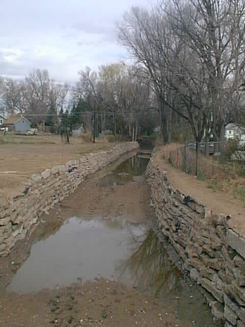
Among the critical issues identified by the panelists: storage and the permitting process for building or expanding reservoirs. Former Commissioner of Agriculture Don Ament told the audience the state cannot spent another 10 years waiting on federal permits.

James Eklund, director of the Colorado Water Conservation Board, said it’s also about innovation, whether with storage, conservation, agriculture or the environment. “We have to utilize the innovative community at our disposal,” including the business community, he said.

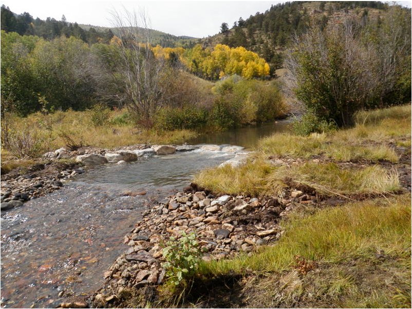
Eric Kuhn, director of the Colorado River District, said everyone needs to recognize that every drop of the Colorado River has been used since 1998, and there isn’t any more water coming into the system. In fact, he said, there will probably be less water available from the river in the future, and what does flow between its banks is fully appropriated. It’s a cautionary note to those on the Eastern Slope who want another transmountain diversion of water from the Colorado through the Continental Divide, as has been suggested in the plan…

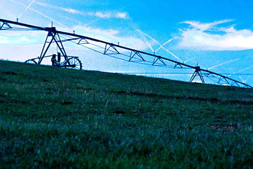
Robert Sakata of Brighton’s Sakata Farms noted that innovation in agricultural technology is helpful but also expensive. He showed off a GPS receiver, part of a system that helps with his farm’s water use. The receiver alone cost $8,000, and he has to sell half a million onions to cover that cost, he said.

The test of the state’s water plan will be whether it can be financed, said Ament, adding that he’s nervous about how the state will find the money and meet the regulatory requirements…

[Kelly] Brough also laid out the chamber’s wish list for the water plan. The business community must lead on this, she said. The days are gone “when we can look to somebody else to solve the challenges we face.” And this is one of those issues where Coloradans don’t want someone else to step in and solve it for them, she said.

Among the solutions: changing how Coloradans use water. As a business community, “we must lead,” by showing a commitment to conservation and efficiency, Brough said. Colorado needs to do more to support the population growth that is coming. The state also needs to move forward beyond conservation and work toward maximum economic use of water, she said. That includes more “green” infrastructure, use of recycled “grey water,” underground storage, reservoir expansion, improved permit processes and even rain barrels, she said. Brough also called on Gov. John Hickenlooper to take the lead improving the permitting process, arguing that problems with the process have caused years and even decades of delay building or expanding water storage in Colorado.

“We don’t have limited choices,” Brough said. “We have many choices.” She added that there’s a real cost to doing nothing. “I don’t know what it is,” she said, “but we can’t afford it.” State water policy must find cost-effective solutions to ensure economic success for Colorado she said. “The water plan is our first step.”

Colorado Water 2012: ‘An inadequate supply of clean water threatens our economy and our way of life’ — Nicole Seltzer

coloradowater2012.jpg

From The Pueblo Chieftain (Nicole Seltzer):

When I embarked on planning a year-long celebration of Colorado’s water, I honestly did not know what to expect. Were there others out there who would help seize the opportunity? Would anyone pay attention to water for an entire year? As dozens of Colorado water professionals now help to wrap up Colorado’s “Year of Water,” I can proudly say, yes, we made a difference! More than 100 communities held Water 2012 events this year, reaching almost 550,000 Coloradans with a message of “celebrating water.”

There were library displays in Fort Collins, author talks in La Junta and Steamboat, fine art shows in Denver and Durango, newspaper series in Alamosa, Pueblo and Grand Junction, proclamations by Gov. John Hickenlooper, U.S. Sen. Mark Udall and several city councils, children’s water festivals in numerous towns, and so much more.

When asked what difference Water 2012 made, those involved said it increased the exposure of residents in their communities to water information, which in turn strengthened their basic knowledge of the importance of water. The increase in water-related programs available in Colorado communities grew participation at water related events, as well as the number of people discussing water. All in all, Colorado is more “water literate” at the end of 2012 than it was at the beginning.

We also had an unexpected success. Nearly 90 percent of the water educators involved in Water 2012 strengthened their ties with other water educators. Never before had those charged with teaching Coloradans about water’s importance come together on a consistent basis to learn from each other.

Aside from increased water awareness and linkages between water educators, what is the legacy of Colorado’s Year of Water? I believe that the Colorado Water 2012 volunteers started something that will only grow bigger and better. While we won’t have “Water 2013” to keep us focused, Colorado’s water educators have seen what is possible when they come together as a community and create something whose whole is bigger than the sum of its parts.

Water is the lifeblood of Colorado. An inadequate supply of clean water threatens our economy and our way of life. From the family farmer to the ski resort executive, we all rely on this undervalued and often underappreciated resource.

My hope for Colorado in 2013 is that we sustain the momentum created in 2012 to continue educating our children and community leaders that we must make smart water choices in our lives.

I posted more that 100 times about Colorado Water 2012. You can take a trip down memory lane here.

Colorado Water 2012: ‘Will now be transitioning in into a statewide Value of Water movement’ — Judy Lopez

waterfootprint.jpg

Here’s the latest installment in the Valley Courier’s Colorado Water 2012 series, written by Judy Lopez. Here’s an excerpt:

The “Water 2012” awareness campaign for the Rio Grande Basin is winding down. What started as a celebration of Colorado’s historic water moments will now be transitioning in into a statewide “Value of Water” movement. This proactive crusade will continue on several fronts across all of the river basins in the state with a single goal of getting water on every body’s mind.

Water it is such a simple topic. It is wet stuff that we drink, bathe in, wash our clothes in, grow and prepare food in. It’s used for making stuff; animals use it and plants use it. The point is – it really gets used. That tends to be a problem, especially since there are getting to be so many people that have so many uses for a once plentiful resource. Water education was once a topic left to children as part of their school studies, but since there are now seven billion of us here on the planet, five million in Colorado, our water footprint (demand) or our “splash” is exceeding the supply that we have readily available.

The value of water means different things to everyone. On the most personal level, it is getting a drink of safe water whenever need to quench thirst. It is coveted in household use for food, hygiene and the basic needs. There are also the agricultural needs to grow and process food. Without these needs met then there is loss of jobs, higher food costs and less food security. Most modern manufacturing requires some form of water use, real economic drivers in times like that are the loss of jobs. Finally, there is the environmental need – streams, rivers and lakes require a given amount of water for the survival of aquatic species. That water in turn is key for the economies that survive on those streams, rivers and lakes.

More Colorado Water 2012 coverage here.

‘Farming on the high, arid desert plains of Eastern Colorado forced people to be imaginative’ — Rick Kienitz

bessemerditch1890waterarchives.jpg

From The Pueblo Chieftain (Rick Kienitz):

Before beginning a job for a municipal water provider, I, like most people, thought no further about where my water came from than from the kitchen faucet.

I knew water came from streams and aquifers and that the beginning of the water cycle was rain and snow, but I would rarely think of how that water finally made it to my house. The idea that somehow water had to make the long trek from a snowy mountain top to my home did not concern or worry me.

Increasingly, water scarcity and a growing population’s demand causes people like me to think more about where that all-important resource comes from. Seeing the process and the complexity of providing water to a large city made me not only appreciate the value and importance of water in Southern Colorado, but also had me wonder where that water supply originally came from.

Farming on the high, arid desert plains of Eastern Colorado forced people to be imaginative. Men like T.C. Henry and David K. Wall built canals and laterals to carry water from the rivers further inland to irrigate crops. Although these canals were massive undertakings and could move large amounts of water, the farmlands were also enormous and water was not always available, especially during times of drought.

Farmers using these canals began to develop supplemental water supplies in order to grow crops during dry years. These great engineering feats used expansive tunnels and pipelines, as well as natural contours, draws and saddles in the Continental Divide to transport water and irrigate farmlands hundreds of miles away.
Since many of these supplemental systems became too expensive for farmers to maintain and operate, many are now part of municipal water systems and supplies.

Still, it took the vision, ingenuity, resourcefulness, skill, and hard work of these farmers to devise and build these systems. The Twin Lakes Reservoir and Canal Co. — which was originally developed to bring water through a series of tunnels to irrigate farms in Crowley County — now provides water to a number of cities including Colorado Springs, Pueblo, Pueblo West and Aurora.

The Busk Ivanhoe system used the old Carlton railway tunnel to bring water across the Continental Divide to farm land in Otero County under the Highline Canal. This system now provides water to Pueblo and Aurora.

These are just a couple of examples of the many amazing engineering and infrastructure projects developed by early farmers and entrepreneurs that continue to provide water for farming and also help supply water to thousands of people in cities and towns.

We, as citizens, owe much to the resourcefulness, hard work and forethought of those before us.

More Colorado Water 2012 coverage here.

Your Colorado Water Blog looks back at the Dust Bowl

dustbowl.jpg

From Your Colorado Water Blog (Dr. Perry Cabot):

The airing of Ken Burns’ documentary The Dust Bowl last month brought greater attention to the Great Plains drought that began last year and extended into 2012. This documentary is another in a long lineage of inspired works on the Dust Bowl period of the 1930s that ruined millions of cropland acres and rippled hardship across the central United States for decades. Nevertheless, the Dust Bowl has generally faded into distant memory as farming practices improved and irrigation methods advanced and the country as a whole generally experienced stability in its food supply since that time. In other words, despite the harshness of the recent drought, we simply don’t feel the pain of farming’s travails as we once did…

Click through and read the whole blog post.

More Colorado Water 2012 coverage here.

‘What started out as a small water awareness campaign…grew into a statewide water celebration’ — Leah Opitz

coloradowater2012.jpg

Here’s the latest installment (Number 51) of the Valley Courier’s Colorado Water 2012 series, written by Leah Opitz. Here’s an excerpt:

What started out as a small water awareness campaign by the Foundation for Water Education grew into a statewide water celebration. Whether residents were in Durango or Fort Collins, there was some kind of “Water 2012” event happening in their town at some point this year. From book tours to displays in public libraries, from water project tours, to contests, Water 2012 offered something for everyone in the hope of getting Coloradans connected and active in water, both locally and at the statewide level.

Here in the San Luis Valley, Water 2012 marked a significant milestone in water history the 100th anniversary of the Rio Grande Reservoir, an engineering feat that represents the hard work, vision, and determination of the people of the San Luis Valley Irrigation District…

To celebrate, Water 2012 the Rio Grande Basin hosted tours of water projects going on around the San Luis Valley. From the Rio Grande Reservoir at the top of the watershed down to the Sanchez Reservoir, they drove many miles to get folks out to see what was going on with water. Folks had an opportunity to learn about new dam construction projects, new ditch construction projects, the Rio Grande Headwaters Restoration Project, and attendees even had a chance to venture underneath the dam at Platoro Reservoir to see the pump room.

The summer tour series started out with a caravan tour through Costilla County, stopping off at Sanchez Reservoir, the historic People’s Ditch, and then to see the Sangre de Cristo Trinchera Diversion Canal.

The next tour took folks down to Conejos County to see the North Fork of the Conejos River Diversion Project and the Platoro Dam Rehabilitation Project.

In August, the San Luis Valley Irrigation District hosted a group up in Mineral County at the Rio Grande Reservoir in celebration of its 100th anniversary.

Lastly, in October, Heather Dutton with the Rio Grande Headwaters Restoration Project brought folks out to see how the RGHRP is working to improve the quality of water, condition of streamside trees and shrubs, and stability of riverbanks along the Rio Grande. The majority of these projects were funded through the Rio Grande Basin Roundtable, both from the basin and statewide funding accounts.

More Colorado Water 2012 coverage here.

‘SNOTEL uses meteor burst communications technology to collect and communicate data in near-real-time’ — Mage Hultstrand

seasonaldroughtoutlook11152012thru2282013.jpg

Here’s a primer on the NRCS’s SNOTEL network from Mage Hultstrand writing for the Valley Courier’s Colorado Water 2012 series. Here’s an excerpt:

The Natural Resources Conservation Service (NRCS) installs, operates, and maintains an extensive, automated system to collect snowpack and related climatic data in the Western United States called SNOTEL (for SNOwpack TELemetry.)

The system evolved from NRCS’s Congressional mandate in the mid-1930’s “to measure snowpack in the mountains of the West and forecast the water supply.” The programs began with manual measurements of snow courses; since 1980, SNOTEL has reliably and efficiently collected the data needed to produce water supply forecasts and support resource management activities.

Climate studies, air and water quality investigations, and resource management concerns are all served by the modern SNOTEL network. It may also be the best way to track changing climate over time. The high-elevation locations and broad network of the sites provide data analysis opportunities to researchers, water managers, and emergency managers for natural disasters such as floods.

SNOTEL uses meteor burst communications technology to collect and communicate data in near-real-time. Radio signals are reflected at a steep angle off the ever present band of ionized meteorites existing from about 50 to 75 miles above the earth. Satellites are not involved as the NRCS operates and controls the entire communication system.

More Colorado Water 2012 coverage here.

The Colorado Foundation for Water Education 2012 Annual Report is hot off the press

cfwe2012annualreportcover.jpg

Here’s the link to the report.

More Colorado Foundation for Water Education coverage here and here.

Colorado Water 2012: Rio Grande River — recreation opportunities abound in the basin

riogranderiverstateengineersoffice.jpg

Here’s the latest installment in the Valley Courier’s Colorado Water 2012 series, written by Heather Dutton. Here’s an excerpt:

Opportunities for fishing abound from the headwaters and high mountain tributaries, through the San Luis Valley to the state line. Backcountry fly-fishing in the high country offers fishermen beauty, seclusion, and a chance to cook the day’s catch on a fire in the wilderness (please be advised of fire bans!). People also enjoy boating and fishing in the many high mountain reservoirs in the basin, such as the Rio Grande Reservoir.

As the river drops from the mountains and settles onto the Valley floor, anglers enjoy the gold medal fishery between South Fork and Hanna Lane. Gold medal waters are defined by Colorado Parks and Wildlife as areas with 60 pounds of trout per acre and at lease twelve 14” or larger trout per acre.

More Colorado Water 2012 coverage here.

‘The water levels in the San Luis Valley aquifers are dropping, and have been dropping’ — Craig Cotten

slvdischargerecharge.jpg

Here’s the latest installment in the Valley Courier’s Colorado Water 2012 series, written by Craig Cotten. Here’s an excerpt:

The Rio Grande is in the fourth year of below average streamflows. Other parts of Colorado are also in a severe drought this year, with some areas having a more severe single year drought than the San Luis Valley. However, much of Colorado had very good precipitation and streamflow last year which filled their reservoirs and aquifers. In fact, some areas in the northern part of the state had one of their best years ever last year in terms of precipitation and streamflow, while this basin languished in the midst of a multi-year drought. Since the extreme drought year of 2002, there have only been three years of above normal flow on the Rio Grande and only two years on the Conejos River. Some smaller streams around the valley have fared even worse, with only one year of above normal flows in the last ten.

The water levels in the San Luis Valley aquifers are dropping, and have been dropping, over the last several years. This drop is in response to the lower than normal recharge into the aquifers from the area rivers, streams, and ditches. After seeing modest gains during the years of 2007 to 2009, the unconfined aquifer is once again dropping substantially.

According to the aquifer study conducted by Davis Engineering, the unconfined aquifer in the West Central part of the San Luis Valley has lost nearly 500,000 acre-feet of water during the last three years. There is not a formal, comprehensive study of the confined aquifer throughout the Valley, but this aquifer is also seeing significant declines in the amount of artesian pressure. While it is not known exactly how much water is in the aquifers, it is obvious that the San Luis Valley cannot continue this drastic drop in the aquifers without severe long-term consequences…

In order to address the problem of injury to surface water users and the decline in the aquifers due to well pumping, the State Engineer is in the process of developing Rules and Regulations concerning the withdrawal of groundwater in Division 3. The State Engineer is being assisted in the development of these rules by a 55 member advisory committee made up primarily of area water users.

While these rules are not completed yet, we do know generally what they will require. In general, the rules will require that large capacity wells in the San Luis Valley repay the injury that they are causing to senior water rights, which are generally ditch and canal rights. In addition, the rules will have a sustainability component which will require that well owners ensure that the underground aquifers are brought back to a sustainable level.

The repayment of injurious depletions and ensuring sustainability can be accomplished by a well owner in two ways. A well owner may choose to implement an individual augmentation plan in which that owner will cover his individual well or wells. Otherwise, a well owner may choose to join a subdistrict, which, in exchange for monetary payment, will provide the repayment of injurious depletions and the sustainability of the aquifers for that owner.

More Colorado Water 2012 coverage here.

Colorado Water 2012 Book Club presentation: ‘Water Wranglers’ by George Sibley, November 20

waterwranglersgeorgesibley2012.jpg

Click here for all the inside skinny from the Water 2012 FaceBook page.

More Colorado River Basin coverage here and here.

Kerber Creek: ‘Aesthetically, the whole environment along the creek is so different’ — Brady and Jane Farrell

kerbercreek.jpg

Here’s the latest installment of the Valley Courier’s Colorado Water 2012 series (Aaron Monammadi). Here’s an excerpt:

The dedicated efforts of a few individuals can really make a difference, however, such as those involved in the Kerber Creek Restoration Project located in Saguache.

Brady and Jane Farrell, who have been on the project since the beginning and continue to be involved, share the following:

“Today, walking along our section of Kerber Creek is a completely different experience. The eroding banks have been reinforced with large rocks and stabilized by plantings. There are fish for the grand-kids to catch and release because the water is deeper. The aspens we planted along the creek are catching hold. The J hooks and weirs and other structures have created deep pockets for the fish to survive in, and the overall depth is increased as a result of re-channeling parts of the creek. Formerly by late summer the whole creek was so shallow you could walk across it without hardly getting your shoes wet, and there was little growth along the banks.

“Aesthetically, the whole environment along the creek is so different. A healthy creek is certainly much more attractive in every way. We love sitting by it or walking along it, enjoying the growing plants along the banks and cascading water along the creek that was formerly shallow, with banks falling into the water and little growth along the course of the stream. What a change has occurred over these past few years. And it will only get better in the coming years as the plantings mature and fish get bigger.”

The Kerber Creek Restoration Project is an award winning collaboration of 16 federal, state, and local agencies, non-profit groups and more than 20 local landowners dedicated to the restoration of the Kerber Creek watershed from historic mining impacts. From 2007 to the present, the Bonanza Stakeholders Group has raised over $2 million towards restoration efforts and contributed over 13,000 volunteer hours on the Restoration Project.

More Colorado Water 2012 coverage here.

‘Water in Colorado and the Grand Valley’ and ‘Pass the jug’ presentations at Mesa County libraries starting October 2

orchardmesa1911.jpg

From KKCO:

If this past summer has taught us anything, it’s the importance of water. Join Hannah Holm, Water Center coordinator at Colorado Mesa University, for “Water in Colorado and the Grand Valley,” an overview of where our water supplies come from, how we use water, and constraints on our water use. The presentation at three Mesa County Libraries locations also will discuss current water supply challenges and planning efforts to address them.

Holm’s presentation is scheduled for 6 p.m. Tuesday Oct.2, at the Central Library; 6 p.m. Wednesday, Oct. 3, at the Fruita Branch; and 6 p.m. Thursday, Oct.4, at the Palisade Branch. It is open to the public at no charge.

Holm is also scheduled to lead children in a “Pass the Jug” activity dramatizing the concept of water as a limited resource that must be shared among a variety of users. The children’s activity is set for 6:30 p.m. Tuesday Oct. 16, and 2 p.m. Wednesday, Oct.17, at the Central Library.

More Colorado Water 2012 coverage here.

Colorado Water 2012: ‘There are over 200,000 acres of wetlands across the Valley’ — Rio De La Vista

blancawetlands.jpg

Here’s the latest installment of the Valley Courier’s Colorado Water 2012 series, a discussion of the importance of the San Luis Valley wetlands to the area. Here’s an excerpt:

Wetlands are a valuable component of our semi-arid landscape for many reasons. They are an important aspect of the hydrology, storing water through the drier parts of the year, minimizing flood impacts, and supporting vegetation essential to both wildlife and livestock. In Colorado, only 2 to 3 percent of the landscape is either wetlands or river zones, called riparian areas. But over 75 percent of all wildlife depend upon those zones at some point in their life, including species that are either endangered or at risk. Wetlands also have a crucial role in sustaining agricultural production and they can also provide additional economic benefits and opportunities, such as recreational fishing, bird watching, duck hunting, and many more.

There is a vital water/wetlands connection wherever water is scarce. The Rio Grande and Conejos Rivers and the many smaller streams flowing into the SLV have helped to shape and influence the types of wetlands that exist here. Floodplain wetlands along the larger rivers feature backwater sloughs, oxbow lakes, and wet meadows. The vegetation communities in these areas range from tall emergent species such as softstem bulrush and cattail in semi-permanent to permanent wetlands to short emergent species such as sedges and rushes in wet meadows or seasonally flooded wetlands. Galleries of narrowleaf cottonwoods and willows also exist along rivers and creeks, ideally with understories of currant and wild rose…

The San Luis Valley Wetland Focus Area Committee (a collaborative group of organizations and agencies working on behalf of wetlands) held a workshop in mid-June to provide landowners and land managers a wide range of information about managing wetlands. This article draws upon the information from that program, and a handbook is being compiled from the many presentations. This free publication will be available to the public both in print and electronically. The booklet will address optimal management practices and recommendations on grazing, haying and mowing, burning, and water and weed management, as well as providing information on wildlife, land and water conservation options, and the many economic benefits of wetlands. It will also include a directory of resource organizations and agencies.

To learn more and obtain a copy of the handbook, please contact Ruth Lewis at the Natural Resources Conservation Service at 589-5661 extension 134 or the Rio Grande Headwaters Land Trust at 657-0800. The completed handbook will also be posted on line at http://www.riograndelandtrust.org.

More Colorado Water 2012 coverage here.

Colorado Water 2012: Willow Creek restoration illustrates the challenges for overcoming a mining past

willowcreekusgs.jpg

From the Valley Courier (Guinevere Nelson):

The Willow Creek Reclamation Committee (WCRC) was created to find solutions to these problems. To change the effects of historic mining practices, the committee needed to know how these metals interacted with water. To solve these problems, the committee takes water samples twice a year, coinciding with seasonal high and low flows.

Water samples are taken in two methods; the first method involves taking water directly from the stream to the bottle, the second method involves forcing water through a small (0.45 micron) filter. The WCRC is interested what this second, filtered, method indicates. The filtered sample takes larger undissolved molecules out and reveals molecules that are hooked to water and thereby biologically available to whatever may be swimming around in the creek. Through examination the committee has considered pH and heavy metals, fish and zinc, and the creek’s hydrology.

More Colorado Water 2012 coverage here.

The Colorado Water 2012 September newsletter is hot off the press

coloradowater2012.jpg

Click here to snag a copy for yourself.

Colorado Water 2012: Rio Grande Headwaters Restoration Project update

riogranderiverstateengineersoffice.jpg

Here’s the latest installment of the Valley Couriers’s Colorado Water 2012 series, written by Heather Dutton of the Rio Grande Headwaters Restoration Project. Click through and read the whole article. Here’s an excerpt:

In 2001, the San Luis Valley Water Conservancy District sponsored a 90-mile study of the Rio Grande, the 2001 Study, which identified causes of concern and potential methods of remediation. The 2001 study was completed with guidance from a Technical Advisory Committee composed of representatives from local, state, and federal entities. The Rio Grande Headwaters Restoration Project (RGHRP) was formed to implement the recommendations of the 2001 Study.

In 2004, the Colorado Rio Grande Restoration Foundation (Foundation) was formed to act as the governing body and fiscal agent of the RGHRP. The Foundation is a Colorado 501(c)(3) organization. Since establishment, the RGHRP has accrued a successful record of performing projects on the Rio Grande through the Streambank Stabilization and Riparian Restoration Program, In-Stream Structure Repair and Replacement Program, and Outreach and Education Program…

The RGHRP seeks to bring people together and build relationships, which result in projects that enhance the ecological, cultural, and agriculture value of the Rio Grande. Although great progress has been made in addressing the issues identified in the 2001 Study, the need continues for projects to improve the condition of the Rio Grande Basin. The RGHRP is always interested in developing new projects and partnerships. If you would like to work with the RGHRP or would like more information about program activities please contact Heather Dutton, Coordinator, at 589-2230 or visit the RGHRP website at riograndeheadwaters.org.

More Colorado Water 2012 coverage here.

Colorado Water 2012: ‘The Rio Grande starts as a small spring’ — Steve Vandiver

Map of the Rio Grande watershed. Graphic credit: WikiMedia

Here’s the latest installment of the Valley Courier’s Colorado Water 2012 series. Here’s an excerpt:

The Rio Grande starts as a small spring and as it proceeds downstream it picks up a number of small tributaries and soon is a large stream and then a small river as it flows into the only main stem reservoir on the river in Colorado, Rio Grande Reservoir. This is a private reservoir which is used for irrigation and other uses.

The river then runs downstream and joins the South Fork of the Rio Grande and then towards to the San Luis Valley. On its way through the Valley, there are a number of diversions into irrigation ditches which divert the allocation of the Compact dedicated to Colorado. There are limits to how much Colorado can use and the remainder has to go on downstream to New Mexico which creates a portion of their water supply under their allocation from the Compact.

After running through the Rio Grande Gorge for a number of miles and joining a number of small tributaries in northern New Mexico, it runs into a large flood control reservoir above Cochiti Dam. The largest tributary to the river in New Mexico is the Chama River which enters the river just below that dam, delivers about one-third of the supplies for New Mexico. New Mexico then uses their allocation of Compact water for agriculture and municipal supplies through the central portion of the state. The cities of Santa Fe, Albuquerque, Socorro and others rely on the river as a source of supply.

The river then enters the largest reservoir on the Rio Grande in the Upper Rio Grande reach, the Elephant Butte dam and Reservoir. This reservoir is critical to the entire Rio Grande Basin as it holds and regulates southern New Mexico and West Texas allocation under of the Compact, generates hydroelectric power and provides protection for all three states’ water supplies.

Immediately below the Elephant Butte dam is Cabello Reservoir which serves as a regulating reservoir from the water running through the power generation station in Elephant Butte Dam. There are three large diversions from the River between Cabello Dam and El Paso that provide irrigation water to several tens of thousands of acres of highly productive land. El Paso uses a portion of Texas’s water allocation for municipal supplies. The American Dam diversion just upstream of El Paso serves many thousands of irrigated acres downstream of El Paso before the river gets to Ft. Quitman. The water allocated from the river to the Juarez, Mexico area by treaty with the US, is diverted at the International Dam just below the American Dam. The river is effectively dry below this point except for the water produced by several drains from both the US and Mexico sides of the river.

50th anniversary celebration of the Fryingpan-Arkansas Project Saturday at Lake Pueblo

johnfkennedypuebloaugust171962chieftain.jpg

The project got its start with a visit to Pueblo from President Kennedy back in 1962. Here’s the first installment from Chris Woodka writing for The Pueblo Chieftain. Click through and read the whole article, Woodka is a terrific writer. Here’s an excerpt:

But on that day [August 17, 1962], work began to address the problem. Kennedy came to Pueblo to celebrate the signing of the Fryingpan-Arkansas Act the previous day. Local water leaders will celebrate the 50th anniversary of the Fry-Ark Project Saturday at Lake Pueblo…

The Twin Lakes Tunnel was constructed by the Colorado Canal Co. during the Great Depression, while the old Carlton railroad tunnel was used by the High Line Canal Co. to bring in water. In addition, Colorado Springs and Aurora were already building the Homestake Project, which would be intertwined with the Fry-Ark Project as both were built.

But the government project, a scaled-down version of an earlier, larger plan to bring water from the Gunnison River basin, represented a larger cooperative effort between farmers and municipal leaders in nine counties.

Since the first water was brought over in 1972, about 2.1 million acre-feet of water has been brought into the Arkansas River basin for irrigation and municipal use. The project also generates electric power at the Mount Elbert Power Plant.

fryingpanarkansasprojectdistrictboundariesmapsecwd.jpg

Woodka details some of the early water history along the Arkansas River mainstem in this report running in today’s Chieftain. Here’s an excerpt:

The Water Development Association of Southeastern Colorado was incorporated in 1946. Pueblo business leaders worked with valley water interests to investigate a Gunnison-Arkansas Project. By 1953, the project was scaled back to the Fryingpan-Arkansas Project, and the first hearings began in Congress.

During the congressional hearings in subsequent years, the project evolved from one primarily serving agriculture to one that included municipal, hydroelectric power, flood control and recreation as well.

The Southeastern Colorado Water Conservancy District formed in 1958.

The U.S. House passed the Fry-Ark Act on June 13, 1962; the U.S. Senate, Aug. 6, 1962. President John F. Kennedy signed it into law on Aug. 16, 1962.

Here’s a short look at Jay Winner, current general manager of the Lower Arkansas Water Conservancy District, from Chris Woodka Writing for The Pueblo Chieftain. From the article:

Back in the 1960s, his father Ralph Winner was the construction superintendent for Ruedi Reservoir, the first part of the Fry-Ark Project to be constructed and his family lived on the job site. His father came back in the late 1970s to supervise construction of one of the last parts of the collection system to be built, the Carter-Norman siphon. The siphon draws water across a steep canyon.

For three summers, Winner, then a college student, worked on the latter project. “It was the most fun I ever had,” he laughed. “I got to play with dynamite.”

From The Pueblo Chieftain (Chris Woodka):

A retired outfitter, [Reed Dils] is now a Southeastern Colorado Water Conservancy District board member and a former representative from the Arkansas River basin on the Colorado Water Conservation Board. “Initially, the flows got worse,” Dils said. “They (the Southeastern district and the Bureau of Reclamation) had chosen to run water in the winter…

“It became apparent to everyone there was another way to run the river,” Dils said. “Why the Fry-Ark act was passed, recreation mainly meant flatwater recreation. Over time, they learned there are other types of recreation.”

Here’s the release from Reclamation (Kara Lamb):

Reclamation and the Southeastern Colorado Water Conservancy District invite the public to celebrate the Fryingpan-Arkansas Project’s 50th Anniversary at Lake Pueblo State Park on Sat., Aug. 18. The event is located at Lake Pueblo State Park Visitor’s Center from 9 a.m.to 2 p.m.

Reclamation, the District and Colorado State Parks and Wildlife are offering free pontoon boat tours around Pueblo Reservoir and free tours of the fish hatchery located below Pueblo Dam. There will also be historical displays and several guest speakers.

Signed into law by President John F. Kennedy in 1962, the Fryingpan-Arkansas Project is a multipurpose trans-basin water diversion and delivery project serving southeastern Colorado.

The Fryingpan-Arkansas Project provides:

– Water for more than 720,000 people
– Irrigation for 265,000 acres
– The largest hydro-electric power plant in the state
– World renowned recreation opportunities from the Fryingpan River to the Arkansas River.

For more information the 50th Anniversary Celebration – and to see a teaser of the upcoming film! – visit our website at www.usbr.gov/gp/ecao.

More Fryingpan-Arkansas Project coverage here and here.

alanhamelcsu.jpg

Meanwhile, Alan Hamel is retiring from the Pueblo Board of Water Works this month:

From The Pueblo Chieftain (Chris Woodka):

“Little did I know how important the Fryingpan-Arkansas Project would be as I was watching the president’s car traveling down Abriendo Avenue that day,” Hamel said. “Look at all that it has done for our basin and what it will do in the future.”

Hamel became executive director of the water board in 1982, and was president of the Southeastern Colorado Water Conservancy District, the local agency that oversees the Fry-Ark Project, from 2002-04. He is currently serving on the Colorado Water Conservation Board.

More Pueblo Board of Water Works coverage here.

Colorado Water 2012: ‘Water truly is the lifeblood of a community’ — Jean Van Pelt

coloradowater2012.jpg

Here’s the latest installment in The Pueblo Chieftain’s series for Colorado Water 2012. Jean Van Pelt describes the Fryingpan-Arkansas Project. Here’s an excerpt:

…the Fryingpan-Arkansas Project has provided Southeastern Colorado with 50 golden years of benefits. The Fryingpan-Arkansas Project is a transmountain diversion that supplies Southeastern Colorado with supplemental water for irrigation, municipal and industrial uses, hydroelectric power, and recreational opportunities. The project also provides flood control and is designed to maintain or improve fish and wildlife habitats. The project acquired its name from the fact that it collects about 54,800 acre-feet of water each year from the Fryingpan River basin on the Western Slope of the Continental Divide and delivers it via the Arkansas River to the water-short Eastern Slope…

The North and South Side Collection System and Ruedi Dam and Reservoir are located on the Western Slope in the Fryingpan River basin. Sugar Loaf Dam and Turquoise Lake; Mount Elbert Conduit, Forebay Dam, Reservoir and Power Plant; Halfmoon Diversion Dam; Twin Lakes Dam and Reservoir; and Pueblo Dam and Reservoir are all located on the Eastern Slope in the Arkansas River basin.

More Colorado Water 2012 coverage here.

Agricultural water should be considered the most critical use of water for Colorado and all other states – Deborah Butler

agriculturalvaluechainanalysiscsu.jpg

Here’s the latest Written in Water guest column from Deborah Butler writing for The Pueblo Chieftain. Here’s an excerpt:

My concerns for the future of water in Colorado, but specifically the lower Arkansas Valley in Southeastern Colorado, are that water that is available will be used to increase future housing in the metropolitan areas of Colorado. Building more homes should not be a priority when there is not enough water for farmers to produce food. The plains and valleys in all parts of Colorado make an agricultural contribution that I feel is severely neglected by our large city and government leaders.

Agricultural water should be considered the most critical use of water for Colorado and all other states.

Without rain water, we have prairies without grass and no food for pastured cattle. The farmers don’t have irrigation water to produce feed, and they are selling off their cattle, which are part of our food chain. The feed yards and cattle sales in Otero County are one of our largest economic contributors. Water is the lifeblood or all humanity, and it is critical to all food chains. We need to bring an awareness of the impact of no water, versus the impact of the inconvenience of not watering on certain week days.

I think the most surprising thing about water usage it that we have grown to believe it is a self-sustaining commodity and we use it as if we were entitled.

More Colorado Water 2012 coverage here.

‘A water tour also can sharpen your math skills’ — Chris Woodka

californiagulchleadville.jpg

Check out Chris Woodka’s recount of his recent tour with the Pueblo Board of Water Works. The article is running as part of The Pueblo Chieftain’s excellent Colorado Water 2012 series Written in Water. Here’s an excerpt:

In my roughly 25 years of covering water issues, I have been on several water tours, which are routinely sponsored by water providers in the summer months because you can drive to the sites where water development means the most at a time when those sites do not happen to be covered in several feet of snow…

But last week, I joined the Pueblo Board of Water Works mountain tour as a guest. I was happy to just ride the bus, chipping in with a question now and then, but fully participating in the tour. I’d never done this.

I didn’t take a single note, and this column will be all that I’m going to write about the tour.

2012 Sustaining Colorado Watersheds Conference: Water 2012 — October 9-11

coloradowater2012.jpg

Click here to go to the Colorado Watershed Assembly’s conferences webpage for all the skinny on the conference.

More Colorado Water 2012 coverage here.

Colorado Water 2012: It’s the twentieth anniversary of the Summitville Mine disaster

summitvillemine.jpg

Here’s the latest installment of the Valley Courier’s Colorado Water 2012 series written by Cindy Medina with Alamosa Riverkeeper. Click through and read the whole thing, here’s an excerpt:

In 1992, U.S. Environmental Protection Agency (EPA) emergency response unit found a mountain decimated with a massive open scar, pools of murky green water, and snake-like black pipes lying throughout the site. In contrast, the untouched snow-capped San Juan Mountains surrounded the catastrophe. Later, downstream fishermen and farmers reported fish, victims of the cyanide spill at the mine site, floating in the Alamosa River and in their private reservoirs. How would the governmental agencies and the local residents respond to such an environmental catastrophe with a remediation cost that eventually would exceed $220 million?

The degree of environmental irresponsibility displayed by a Canadian mining company was counterbalanced by the degree of commitment and dedication by local residents, federal and state agencies to this environmental tragedy. In 2002, a settlement was reached with Robert Friedland for $28.5 million, with $5 million exclusively designated for the use “to restore, replace, or acquire the equivalent of” the injured natural resources. This natural resource damage settlement looks small compared to Friedland’s current status of a billionaire who works out of Vancouver, Singapore, and Magnolia as reported by author Walter Isaacson.

But the settlement proved significant to agencies and organizations for its leverage potency for additional monies for projects designed to restore the watershed.

More Summitville Superfund site coverage here and here.

Colorado Water 2012: Rio Grande Reservoir tour July 14 to celebrate 100th anniversary

riograndereservoir.jpg

From the Valley Courier:

In celebration of the 100th anniversary of the Rio Grande Reservoir, Water 2012 in the Rio Grande Basin invites everyone interested in the early history of water in the San Luis Valley to take a caravan tour of the historic Rio Grande Reservoir on Saturday, July 14th, 2012.

The tour is co-sponsored by the San Luis Valley Irrigation District, the Colorado Field Institute and the Rio Grande Inter-basin Roundtable. Hosts of the tour include Travis Smith of the San Luis Valley Irrigation District and other special guests.

The theme for the Reservoir’s 100th Anniversary is the past, present and future of Rio Grande Reservoir. A walking tour of the Reservoir and a presentation of the Rio Grande Cooperative Project will be made.

Construction on the Rio Grande Reservoir began in 1912 and was completed in 1914.

The reservoir provides storage for agricultural needs and is used for compact compliance, fish and wildlife habitat, recreation, and flood control. Rio Grande Reservoir has been in operation since 1912 as the only pre- compact on channel reservoir on the Rio Grande main stem.

The reservoir has endured many issues during the last 100 years including many facelifts. Rio Grande Reservoir represents the vision and determination of the Landowners of the San Luis Valley Irrigation District.

The tour will begin in South Fork at the Visitors Center. The group will meet there at 10:30 a.m. and caravan up to the Rio Grande Reservoir via Highway 149. The tour will arrive at the reservoir at 11:30 a.m. From 11:30 a.m. to 12:30 p.m., there will be a walking tour of the reservoir. From 12:30-2 p.m., lunch will be served and the San Luis Valley Irrigation District will give a presentation on the history of the reservoir. Lunch will be provided by the San Luis Valley Irrigation District.

Remember, Rio Grande Reservoir is in the high country (approximately 10,000 ft) please bring a light jacket and a hat.

The tour will be capped at 30 people and all participants must register online at http://www.rgwcei.org, http://www.water2012.org, or http://www.coloradofieldinstitute.org. To register, click on “Calendar of Events” , select “July 14th Tour” and follow the registration instructions.

More Colorado Water 2012 coverage here.

Colorado Water 2012: The Gunnison River Basin is home to Colorado’s largest reservoir — Blue Mesa

gunnisonriverbasin.jpg

Here’s the latest installment of the Valley Courier’s Colorado Water 2012 series. Frank Kugel details water operations and facilities in the Gunnison Basin. Here’s an excerpt:

The Gunnison Basin is home to the largest body of water entirely within the state of Colorado, Blue Mesa Reservoir, which has a capacity of 940,000 acre-feet (830,000 acre-feet active capacity). It is the primary storage component of the three reservoirs comprising the Aspinall Unit. Morrow Point Dam is the middle structure and its primary purpose is production of hydropower. Crystal Dam creates a stabilizing reservoir for the variable flows produced by Morrow Point Dam releases. Below Crystal lies the Black Canyon of the Gunnison River National Park…

The Bureau of Reclamation has a number of other storage projects in the basin, in addition to the Aspinall Unit reservoirs, including Taylor Park on the Taylor River, Ridgway on the Uncompahgre River, Silver Jack on the Cimarron River, Crawford on the Smith Fork of the Gunnison, fruit growers on Current Creek and Paonia on Muddy Creek, tributary to the North Fork of the Gunnison River.

One of the first projects developed by the Bureau of Reclamation was the Uncompahgre Project, which provides irrigation water for a variety of crops in the Uncompahgre Valley between Colona and Delta. A key component of the project is the Gunnison Tunnel, a 5.7 mile long tunnel that diverts water from the Black Canyon of the Gunnison and discharges it into a series of canals in the Uncompahgre Valley. The tunnel has a 1913 water right for 1300 cfs and supplies some 60% of the irrigation water for the 76,000 acres under the project.

Taylor Park Dam was constructed in 1937 to provide supplemental irrigation for the Uncompahgre Valley. Taylor Park Reservoir has a capacity of 106,230 acre feet. The 1975 Taylor Park Exchange Agreement allows for transfer of storage downstream to Blue Mesa Reservoir to provide the Gunnison Tunnel with a more readily available source of irrigation water. An additional benefit of this exchange was the flexibility to make releases in time and amount that would benefit recreational and agricultural users in the Upper Gunnison basin.

More Colorado Water 2012 coverage here.

Colorado Water 2012: Anglers love the 8 mile reach below Pueblo Dam

puebloreservoir.jpg

From The Pueblo Chieftain (Ron Van Valkenburg):

The waters offer year-round fishing opportunities and are especially important to fly-fishers who pursue trout throughout the winter. Unlike the waters above the reservoir, called freestone rivers, which get jammed with ice in the winter, tailwaters remain fishable for several miles below the dam and reservoir, which provides a constant water source. The quality of the tailwater depends on the depth of the reservoir, water temperatures, the gradients of the stream channel, and the amount of water released from the reservoir.

The greatest advantage to a tailwater fishery is this controlled source of water. Regardless of drought, there is a constant flow with ideal water temperatures, a weed-rich stream bottom with high levels of nutrients, and diverse aquatic insect populations — all key ingredients for growing large, healthy fish.

More Colorado Water 2012 coverage here.

The Colorado Water 2012 July newsletter is hot off the press

coloradowater2012.jpg

Click here to read the newsletter. Here’s a preview:

The Colorado Water 2012 K-12 Committee has been working hard on a photo contest in conjunction with the international River of Words contest. Students can submit one photo that expresses their point of view that will be judged amongst only other Colorado entries. The winner could have their photo hang in the capitol! The contest has already begun and the deadline is December 1, 2012.

More Colorado Water 2012 coverage here.

Colorado Water 2012: Greeley and Union Colony ditch history

irrigationditchgreeleyhistoricalresources.jpg

Here’s the latest installment of the Valley Courier’s Water 2012 series written by Jon Monson. Here’s an excerpt:

The Union Colonists had big plans for irrigation ditches. Ditch No. 1 was going to come from the mouth of the Poudre Canyon, roughly where the Larimer and Weld Canal is now, and irrigate almost 40,000 acres. Another 40,000 acres were to be irrigated by the No.2, which eventually became the New Cache Irrigation Company.

They started smaller though, building the No.3 first to irrigate about 3,500 acres. The No.3 was closest to town, actually forming the southern edge of the colony. Located uphill from the Poudre, the ditch could irrigate the parks and gardens of the townspeople as it passed by to irrigate farms east and west of the city.

Back then people were fascinated by the power of water to make the dry prairie bloom with shade and green vegetables. Everyone had a garden. Even the kids diverted water from their parents laterals to play farmer.

The grownup farmers worked hard those first few years, learning how to manage water and how to run a mutual ditch company. Things went well until the summer of 1874 when the Poudre River suddenly dried up. Curious, someone got on their horse and rode up stream to see what was the matter. Turns out the new little town of Camp Collins had thrown a diversion across the Poudre and was taking the entire river to irrigate their farms.

Back in the Union Colony the cry went up, “To your tents boys! Rifles and cartridges!” Remember this was less than ten years after the Civil War. Cooler heads prevailed and the two groups met in Windsor to discuss (argue?) the matter. That summer they decided to allocate the water to who ever needed it most. Now that must have been one tough job. Two years later, when the Colorado Constitution was written, Article XVI Section 6 enshrined the prior appropriation doctrine, “The right to divert the unappropriated waters of any natural stream to beneficial uses shall never be denied.”

More Colorado Water 2012 coverage here.

Rio Grande River Basin: First Valley Water 2012 tour takes in the San Luis People’s Ditch #water2012

sanluispeoplesditch.jpg

Here’s a recap of the first Valley Water 2012 tour from Lauren Krizansky writing for the Valley Courier. Here’s an excerpt:

A small group of water curious people listened hard through the sounds of water breaking over rocks in La Vega’s water channels to hear Cortez tell the story of the common grazing area, which is the last traditional commons left in America, and the power of The San Luis People’s Ditch, one of San Luis’ most precious veins.

“For nine generations we have been living here,” Cortez said. “We are a living history. We believe in the sustainability that has been handed down by our ancestors. We will never starve. We will never be alone.”

La Vega sits to the southeast of the oldest town in Colorado and is the only Mexican-Era land grant commons in the state. In 1863, villagers living in the Rio Culebra Basin allocated the commons 18 miles south to the New Mexico border. Today, 500 acres of La Vega remains and its fate rests in the hands of local descendants. A commission created in the ‘70s governs the commons, which is still a traditional, uncultivated wetlands used only for grazing cattle and horses for five months out of the year…

Running through La Vega is water from Rito Seco Creek and Río Culebra. It meanders through the meadow’s high grass and eventually finds it way to The San Luis People’s Ditch, an original acequia. The gravity-fed irrigation system was built in 1852 and it was eventually awarded the first adjudicated water rights in Colorado nearly a quarter of a century before Colorado became a state. Within the next decade, 14 other acequias were developed in the Culebra Watershed. Today, over 240 families in the Culebra watershed use acequias to irrigate over 24,000 acres of privately owned pastures and croplands.

More Colorado Water 2012 coverage here.

Colorado Water 2012: ‘Anyone in the basin will say that North Park remains a quiet and unique place’ — Caitlin Coleman

northplatteriver.jpg

Here’s the latest installment of the Valley Courier’s Colorado Water 2012 series. Caitlin Coleman takes us on a tour of the North Platte River Basin. Here’s an excerpt:

The North Platte Basin—a 2,050 square-mile area that encompasses all of Jackson County and a portion of Larimer County—is nestled up against the Continental Divide in north central Colorado between the Front Range, Routt County and the Wyoming border. About 65 percent of Jackson County is public land, managed by state and federal agencies; still there is plenty of room for the basin’s small population of about 1,400 people.

Anyone in the basin will say that North Park remains a quiet and unique place. Bearing the headwaters of the North Platte River and connected by this artery to Wyoming and Nebraska, the North Platte Basin is somewhat insulated from the booming population and water worries of the rest of Colorado. Geography, lack of major development and a U.S. Supreme Court Decree governing water development have protected the basin…

The basin’s first water rights were adjudicated in 1892. Until then, there were no water districts, no water commissioners, and no official water appropriations in the North Platte Basin, but that doesn’t mean there weren’t water diversions and development. Rather, the basin slowly developed throughout the 1880s, according to former water commissioner and historian Eric Wagner.

The water adjudication system began as a response to droughts in 1891, when people faced with stressed water resources wanted legal recognition of their water diversions. In the North Platte Basin, this precious water is used mostly for flood irrigation—watering meadows to produce a crop of high mountain hay, which sustains cattle locally or is trucked outside the basin and sold as a commodity, such as horse or cattle feed. That’s the way it’s been for years. Ditches wind across the basin, transporting water from rivers, streams and reservoirs to nourish agricultural land.

More Colorado Water 2012 coverage here.

Colorado Water 2012: ‘Wetlands, including wet meadows and marshes…are vital to birds’ — SeEtta Moss (Audubon Society)

whoopingcranes.jpg

Here’s the latest installment in The Pueblo Chieftain’s Colorado Water 2012 series, written by SeEtta Moss. Here’s an excerpt:

In many locations, the amount of water needed to support specified bird species can be quantified. But it is necessary to conduct a site-specific study that is targeted to either high-priority bird species or those that are representative of a guild of birds. Fortunately, birds consume very little of the water and most of the water needed for them is for evaporative or transit loss. Some species of birds, primarily those that migrate into or through Colorado, could avoid those parts of Colorado if there is insufficient water to meet their needs. That would have impacts on both the resident and non-resident bird watchers and would likely result in significant economic impacts to those areas of the state where the birds and bird watchers are absent.

The economic impact of bird watching in Colorado is significant. The 2006 report of the U.S. Fish and Wildlife Service National Survey of Fishing, Hunting and Wildlife Associated Recreation estimated there were 737,000 bird watchers (only those watching wildlife away from home). Bird watchers spent well over $250 million in Colorado on trip-related expenses during 2006.

More Colorado Water 2012 coverage here.

The Colorado Water 2012 June newsletter is hot off the press

coloradowater2012.jpg

Download or read a copy from here. Here’s a preview:

In early May, Senators Mark Udall and Michael Bennet announced a resolution recognizing 2012 as the “Year of Water” in Colorado. This resolution from the U.S. Senate helps recognize water as a precious resource in Colorado. In addition to the “Year of Water” resolution from the Senate, Colorado’s Governor Hickenlooper and communities all over the state made their own proclamations earlier this year. “Year of Water” videos, resolutions, and declarations are available on the Water 2012 website.

More Colorado Water 2012 coverage here.

Cortez: Colorado Water 2012 events include a tour of the water treatment plant

mcpheeconstruction.jpg

From the City of Cortez:

Through a statewide program called Colorado Water 2012, the Cortez Public Library, in partnership with the Colorado Foundation for Water Education, The Colorado State Library, the Dolores Water Conservancy District and the Cortez Water Plant are offering this educational opportunity to learn about state and local water. At 10:00 AM on June 28th, there will be a presentation by Mike Preston, of the Dolores Water

Conservancy District and Don Magnuson of Montezuma Valley Irrigation at the overlook at the end of the McPhee campground. Last, on the same day at 1:00 PM, there will be a tour of the Cortez Water Plant, hosted by Bruce Smart. Maps and directions are available at the Library.

More Colorado Water 2012 coverage here.

Colorado Supreme Court Justice Greg Hobbs Featured at June Water 2012 Book Club Event

flaminggorgepipelineearthjustice.jpg

From the release from Colorado Bar Association CLE (Dawn McKnight):

On June 18, author, scholar, and Colorado Supreme Court Justice Greg Hobbs will present on two of his books: Living the Four Corners: Colorado, Centennial State at the Headwaters, published in 2011, and his new book Into the Grand. The presentation will include a special introduction by Patty Limerick, Faculty Director and Chair of the Board of the Center of the American West at the University of Colorado.

The event is not only available to attend in person, but also via live webcast from your computer. You’re able to see the live event even if you’re not in the Denver area!

Colorado Supreme Court Justice Greg Hobbs’ Living the Four Corners: Colorado, Centennial State at the Headwaters was a finalist in 2011 in the Colorado Authors’ League General Nonfiction category and is published by Colorado Bar Association Continuing Legal Education. Hobbs says, “Culture of the Four Corners to me is the culture of the Americas. This book takes a look at the landscape and the culture and the spirituality and the legal arrangements that made the Four Corners part of United States. I hope it reflects, in a very positive way, our legal profession and its commitment to community.” Justice Hobbs says about this latest book Into the Grand, “I like writing, reading the writing of others, and traveling through the imaginative landscape of this great country with family, friends, maps and guides we meet along the way . . . The poems and prose poems are way markers and cairns.”

EVENT DETAILS:
June 18, 2012 – 4 – 6 p.m.
Colorado Bar Association CLE – 1900 Grant St, Ste 300, Denver, CO 80203
This program is complimentary and refreshments will be served
RSVP: Call Melissa Lucas at 303.824.5387 or mlucas@cobar.org.

Please indicate whether you plan to attend either live or by live webcast and the relevant information will be emailed to you.

More Colorado Water 2012 coverage here.

Colorado Water 2012: Agricultural water use

irrigation.jpg

Here’s the latest installment of the Valley Courier’s Water 2012 series. Nathan Coombs, manager of the Conejos Water Conservancy District, has written a primer about water and agriculture. Here’s and excerpt:

1) Priority- like it implies, there are certain users of water that get priority over others. This priority system is based on “first come, first served.” The earlier in history that someone put water to a good (beneficial) use, the lower their priority number. This number however, is like the placing in a tournament- #1 is best or senior and so on. A water right can however be both senior and junior. For example the #2 priority is senior to the #3, yet junior to #1. The actual physical location along the river is basically irrelevant. The priority number determines who gets the water in what order.

2) Decree- this term is used to define how much water, and to what purposes the water is used. For example, you cannot use water for raising fish unless this purpose is expressly granted in your decree. You also cannot take from the source (well or river) all that you want. Your decree states how much water to which you are entitled. The term decree is applicable to both river (surface) water and well (ground) water.

3) Compact- this is a legal term for a federally recognized interstate or international agreement. The Rio Grande River Compact dictates how water from the Rio Grande River is divided between Colorado, New Mexico, Texas, and Mexico. It was developed to be as equal and fair as possible. (This topic is always up for coffee shop discussion!)

4) Unconfined aquifer- this is the area of water that exists from immediately below the surface of the ground to a depth that varies from about 75 to 200 ft. At the bottom of this “layer” is a boundary of clays and Malpais lava flows that really slows water from moving up or down.

5) Confined aquifer- this is the area that is below the unconfined. Where the unconfined is relatively shallow, the confined can be thousands of feet deep. This is where artesian water comes from because of usual upward pressure.

6) Diversion- Diversion describes the location and method used to get water from a river or the ground. A headgate on the river is a diversion for surface water and a well is the diversion for the ground water.

More Colorado Water 2012 coverage here.

Colorado Water 2012 Book Club: ‘Living the Four Corners’ by Justice Greg Hobbs

purpleglazergarlicgroworganic.jpg

It’s been a while since I’ve published one of Justice Hobbs’ poems. Here’s his poem, Organic Garlic Offering, from the current Colorado Water 2012 Book Club selection, Living the Four Corners: Colorado Centennial State at the Headwaters. Hobbs is inspired by his son Dan who farms organic garlic below a ditch in the Arkansas Valley.

Organic Garlic Offering

Pick a spot of Colorado
sun below the ditch

October morning
plant them firm,

To root your hopes
set them loose

But turn
some water in

July’s the harvesting,
Purple Glazer, Silver White

Music Pink, Romanian Red,
Chesnok Inchelium, California Early,

Heirloom pungent, easy peel
good for salsa, pestos

Eating fresh and clean
saving this good farmland

Reprinted, with permission, from Living the Four Corners: Colorado Centennial State at the Headwaters by Justice Greg Hobbs. Click here to order the book from Continuing Legal Education Inc.

Here’s the link to Tom Romero’s review of the book. From the review:

The four great rivers of the American West (the Colorado, the Platte, the Arkansas, and the Rio Grande)—whose headwaters sit high in the peaks of Colorado’s Rocky Mountains—are threatened with silence. Because of industrial mining and large-scale irrigation, energy development, rapid large-scale urban growth, and climate change, these venerable rivers seemingly are taxed beyond their sustainable limits. Their vulnerability threatens the livelihoods of millions of people who have long relied on these rivers. Once majestic and unpredictable bodies of water, the headwaters of the Centennial State have become tightly controlled, over-managed cisterns on which every single drop is drained.

Nevertheless, as Justice Greg Hobbs reminds us in Living the Four Corners, these rivers continue to inspire awe and wonder, perhaps because of our deep-rooted reliance on the river systems for our economy, politics, and culture—or perhaps because we simultaneously recognize and take for granted each river’s persistence and durability.

intothegrandcovergreghobbs052012.jpg

Justice Hobbs has a new book just out, Into the Grand. Click here to order a copy. From Hobbs’ authors note:

I am led southwesterly by the best of guides. They include Kristin Kuckelman of Crow Canyon Archaeological Center, Rickey Hayes of the Ute Mountain Tribe, Michael Welsh of the University of Northern Colorado, Ken and Ruth Wright of the Wright Paleohydrological Institute, and Kate Thompson, who I met on the river when I was fishing with brother Will. Kate’s stunning cover photograph of lower Glen Canyon bending to Marble Canyon calls on all that’s Grand. To our journeying grandchildren, Joni, K.J., Shannon, Ella, Quinn and Grace, may you enjoy the glow of your very many glimmerings.

More Colorado Water 2012 coverage here.

Colorado Water 2012: ‘There was and continues to be tension between the Western and Eastern Slopes’ — Mike Gibson

riograndebasin.jpg

Here’s the latest installment of the Valley Courier’s Water 2012 series. Mike Gibson describes the workings and role of the Rio Grande Basin Roundtable with respect to the IBCC and other basin roundtables. Here’s an excerpt:

There was and continues to be tension between the Western and Eastern Slopes as some feel water should be moved to the Front Range, and many on the Western Slope do not share these ideas. Similarly, these diverse opinions were held in other river basins…

Members of the [Rio Grande Roundtable] RGRT have participated in discussions to address the issues facing other basins and the state. It has been concluded that meeting the shortfall in municipal water (600,00 acre-feet by 2050) will be achieved by conservation, implementation of projects under construction or design, new projects in the future, such as new reservoirs, potential new sources of water, and transfers from the agricultural sector. While the latter may be the easiest way to meet the shortfall, there is general consensus that such transfers should be minimized to preserve the agricultural lifestyle and economy of the State. These deliberations also considered the necessary water for recreational use and maintenance of the natural environment…

The Water Supply Reserve Account has been funded to $41.8 million of which $4.8 million has come to the Rio Grande Basin. The process to obtain these funds is for the proponents to discuss their project with members of the roundtable and its chairman. If it is determined the applicant and their project will meet the necessary criteria for funding, a formal application is completed and presented to the roundtable for their endorsement. The request is subsequently reviewed by CWCB staff and finally presented to the CWCB for approval.

The WSRA funds that have come to the Rio Grande Basin have covered a variety of “water projects” across the Basin, including reservoir studies and rehabilitation; on-site improvements to diversion structures and head gates; repairs of water conveyance structures; river restoration; the conservation of agricultural land and its associated water; and outreach and education. Recipients have included irrigation and reservoir companies and non -profits involved with conservation and restoration. The projects have been geographically widespread, from Creede, to Fort Garland, to San Luis and have been completed on the Rio Grande, Alamosa, and Conejos rivers and their tributaries. Since WSRA funds have been available, the Valley has addressed many outstanding issues that were known but did not have a mechanism to be implemented.

More Colorado Water 2012 coverage here.

The Colorado Water 2012 travelling exhibit is on display at the Aurora library until June 2

coloradowater2012.jpg

From email from the City of Aurora (Julie Patterson):

Colorado Water 2012 exhibit on display through June 2 at Aurora Central Library

AURORA, Colo. – “Colorado Water 2012,” a traveling exhibit celebrating Colorado water history and the importance of the state’s water resources, will be on display now through June 2 at the Aurora Central Library.

In conjunction with the exhibit, the Aurora Central Library will show a free screening of the documentary “Liquid Assets” at 6 p.m. May 23. This film presents stories from communities across the country to help provide an understanding of hidden water assets, demonstrate watershed protection approaches and illustrate 21st century solutions. It also looks at the 100-year-old aging, neglected and complex infrastructure that delivers water to American communities.

Also, at 6 p.m. May 30, the Aurora Central Library will host a free showing of the documentary “The American Southwest: Are We Running Dry?.” Narrated by Jane Seymour, this film is an intelligent and provocative piece that educates the public about conservation, water reuse, desalination and how population growth will affect future water legislation. The film also includes a significant amount of information about the Colorado River.

Coordinated by the Colorado Foundation for Water Education, the “Colorado Water 2012” exhibit coincides with several water milestones in Colorado history, including the 75th anniversary of legislation that created organizations such as the Colorado Water Conservation Board and the Colorado River Water Conservation District that built the foundation for the management of Colorado’s water resources; the centennial of the Rio Grande Reservoir; and the 50th anniversary of the Fryingpan-Arkansas Project.

The Aurora Central Library, located at 14949 E. Alameda Parkway, is open from 9 a.m. to 9 p.m. Monday through Thursday, from 10 a.m. to 6 p.m. Saturday and from 12:30 to 6 p.m. Sunday. For more information, call 303-739-6600 or visit www.auroralibrary.org.

Colorado Water 2012: Water and livestock

haymeadowsneargunnison.jpg

Water for production is just one factor in the relationship of ranching with water. The impact of livestock upon the watershed and its ability to receive snowmelt and rainfall is critical to a healthy water cycle that makes maximum use of nature’s heavenly gift. The most immediate need for a livestock operation is to supply the daily water consumption of the animals. Roughly 20 gallons of water per head per day are required in summer, and about 10 gallons per head per day in the winter.

Water quality is also very important. One of the most important things a livestock producer has to be concerned about is the dependability and quality of an adequate water supply. This certainly can be challenging at times during drought and with poor or failing wells.

More Colorado Water 2012 coverage here.

Colorado Water 2012: ‘The SWSI process implemented a collaborative approach to water supply planning’ — Eric Hecox

ibccroundtable.jpg

Here’s the latest installment in the Valley Courier’s Colorado Water 2012 series. Eric Hecox explains the Statewide Water Supply Initiative and basin roundtable process. Here’s an excerpt:

With the 2010 SWSI update, CWCB has updated its analysis of the state’s water supply needs. CWCB, the IBCC, and Basin Roundtables are now in an implementation phase to determine and pursue projects and methods to help meet the state’s consumptive and nonconsumptive water supply needs. This will be accomplished through the implementation of the SWSI recommendations by the CWCB.

More information is available at http://cwcb.state.co.us/water-management/water-supply-planning/Pages/SWSI2010.aspx.

More Colorado Water 2012 coverage here.

Colorado Water 2012: The Custer County Library District is planning a special water display from May 15 – 25

wetmountainvalley.jpg

From The Wet Mountain Tribune:

From May 15 through May 25, the West Custer County Library District will be hosting a water display and film to commemorate the 75th anniversary of legislation regarding management of Colorado’s water resources. Partnering with the Natural Resources Conservation Service (NRCS), the Custer Conservation District, and the CSU Extension office, the Library is participating in Governor Hickenlooper’s “Year of Water” project.

Library director Marty Frick explains that “Colorado Water 2012” is the governor’s idea for celebrating the creation of water organizations from the three-quarter century old legislation. In a state almost entirely defined as desert or semi desert, water is precious—perhaps one of the most controversial assets the state has. Hickenlooper partnered with the Supreme Court, Colorado Art Institute and libraries across the state to create the travelling eight-foot long triptych accompanied with the film, “The American Southwest: Are We Running Dry?”

In addition to statewide information about water and The West, the display will have local information provided by NRCS, the Conservation District, and the CSU Extension office.

On the afternoon of Wednesday, May 16, Custer Conservation District Manager Carol Franta and CSU Extension Agent Robin Young will present the River Trailer Education Program at the Custer County Schools. The River Trailer travels to schools and events to teach children and adults about watersheds, the water cycle, water conservation, and stream bank restoration. It’s a very effective hands-on tool, popular with young and old alike.

A free showing of “The American Southwest: Are We Running Dry?” is scheduled for Wednesday, May 23, at 5 p.m. in the community room adjacent to the library, 209 Main St. in Westcliffe. The 80 minute movie will inform viewers about water reuse, consequences of urban growth, water policy and solutions such as desalination, rainwater harvesting and green construction.

Stop by the library to see the water display during regular library hours, Tuesday through Friday from 10 a.m. to 5:30 p.m. and Saturday from 10 a.m. until 2 p.m. Call 783-9138 for more information.

More Colorado Water 2012 coverage here.

Colorado Water 2012: George Sibley is writing a weekly column about Colorado water issues starting today for the Grand Junction Free Press

coloradowater2012.jpg

This should be a real treat. Sibley is well known for his long career writing about water. He’s been featured at Colorado Central Magazine forever.

Mr. Sibley details Colorado Water 2012 in the first column of the series. Here’s an excerpt:

But why is 2012 the “Year of Colorado Water”? The idea of it began with the realization that three of Colorado’s more important water organizations are celebrating their 75th anniversaries this year — but we are not even going to say what those three organizations are right now because they all have longish titles mixing up basically the same set of words (“Colorado,” Conservation,” “Water,” etc.), and that is usually the point where eyes start to glaze over and minds wander off to images of eternally babbling streams…

Locally, Water 2012 activities will be focused on the current water situation in the Colorado and Gunnison River Basins, because that is where we live, and the rich history of water use and development by those who were here before us. You will, for example, be invited to the Upper Gunnison River in early June, and the valley of the North Fork of the Gunnison in early August, to help celebrate two important chapters in that rich history. In September, there will be a tour focusing on how water is used on farms in our region. Even if you cannot come to those events in person, you will have the opportunity through these stories in your newspapers and magazines, paper and electronic, to assemble a coherent picture of how that past has shaped the present — and what from that past we should and should not try to carry into the future.

The Colorado Foundation for Water Education has led the charge in organizing the “Year of Water,” but the Colorado and Gunnison Basin Roundtables will be carrying the torch in the Grand Valley and farther upstream. The Roundtables are two of nine representative bodies statewide, in other river basins, created by the legislature to encourage more public involvement in water decision-making for the coming decades, during which Colorado’s population may approach twice what it is now.

More Colorado Water 2012 coverage here.

The latest edition of the Colorado Water 2012 newsletter is hot off the press

coloradowater2012.jpg

Here’s the link to the May 2012 Newsletter from Colorado Water 2012. Click through and read the whole thing along with the impressive list of events that are planned over the next few months.

More Colorado Water 2012 coverage here.

Colorado Water 2012: Check out the photos from the Greeley Children’s Water Festival

irrigationditchgreeleyhistoricalresources.jpg

Check out the photos from the Colorado Water 2012 Facebook page.

More Colorado Water 2012 coverage here.

Colorado Water 2012: Colorado Springs Utilities has a slug of events planned over the next few months

coloradowater2012.jpg

Here’s the link to the Colorado Springs Utilities Water 2012 webpage.

More Colorado Water 2012 coverage here.

Colorado Water 2012: ‘The value of water is rising along with Colorado’s population’ — Rio De La Vista

blancawetlands.jpg

Here’s the latest installment of their Colorado Water 2012 series from the Valley Courier (Rio De La Vista). Here’s an excerpt:

The value of water is rising along with Colorado’s population, increasing demands for limited water supplies. One of the key roles of water managers and communities is to better understand where, when and how water is used, and to try to figure out how to meet those many needs as sustainably as possible.

Over many decades of water “development” to meet such needs, people have built systems and infrastructure to expand their ability to use water. These range from the vast system of reservoirs, canals and ditches to wells, irrigation sprinklers and drip systems that have been built to deliver water for ranch and farm operations to the wells, storage, pipelines, treatment plants and other systems that deliver clean water for municipal and industrial needs.

Within the current statewide conversation about water planning, these agricultural, industrial and municipal uses are referred to as “consumptive” uses. However, even within these consumptive uses, not necessarily all the water that is stored, diverted and/or delivered is actually “used” or fully consumed in the process. In many cases, some of that water may return to the system and be available to be used again.

Consumptive use of water in agriculture is measured (for management and legal purposes) by the amount used by the plants grown, and again, not all of the water applied to the land is actually “consumed.” For example, some of the water that flows across an irrigated meadow is used by the plants there, which serve as pasture or hay for livestock. But not all of the water applied is consumed, and some of it may flow into lower areas, creating wetlands and habitat for wildlife; and some of it may return to the river as well, sustaining flows to some degree and being available to the next user, some seeps into the ground recharging the aquifer, and so on.

This leads to another defined set of water uses that are every bit as vital to the “water is life” concept. Water uses for or by the environment and recreation are called, in the water vernacular, “non-consumptive” uses. These uses also don’t fit neatly into categories, as the environment, from the highest forests which take the first “drink” of the melting snow in the spring, to the wetland plants (that provide food and habitat to the multitude of ducks, geese, cranes and other birds and wildlife that rely upon them) do actually consume some water to grow too, like any other plant.

A healthy environment can provide all kinds of important “services” to people, from storing water in natural settings, recharging aquifers, purifying water to mitigating floods, to name a few. At the same time, there are many factors across the landscape that people can also affect profoundly, which can help the environment help us too. From good grazing management to building soil health on farms, management practices can help nature better stretch limited water supplies further as well.

More Colorado Water 2012 coverage here.

Colorado Water 2012: ‘Celebrate tap water!’ — Alan Hamel

coloradowater2012.jpg

From The Pueblo Chieftain (Alan Hamel):

…we at the Board of Water Works want you to be sure to include tap water in your celebrations. Plain old tap water? That’s right, tap water. Or, as we like to call the safe, bountiful supply of water we provide our customers, Pueblo’s Vital Blue.

Although it’s easy to take our municipal water system for granted as we turn the tap to fulfill our drinking, cooking, cleaning or landscape irrigation needs, we really should be mindful of all the things tap water does for us — things that no other water can do…

The No. 1 job of the Board of Water Works is to keep healthy water flowing to Pueblo’s homes and businesses all day, every day.

More Colorado Water 2012 coverage here.

Colorado Water 2012: Acequia culture dates back a thousand years

sanluispeoplesditch.jpg

Here’s the next installment of the Valley Courier’s Colorado Water 2012 series written by Lauren Krizansky. Click through and read the whole thing. Here’s an excerpt:

During the eighth century, the Moors brought the acequia – an Arabic word pronounced a-TH-equia – system to Spain under Hakam II’s reign. When the Spanish conquered South America centuries later, they introduced the system in similar landscapes eventually as far north as the American Southwest. In the late 1500s, the Spanish explorers found the northern New Mexico Pueblo Indians had independently developed a similar ditch irrigation system, which they improved with their horses and advanced tools.

Gravity and velocity pull the water through the land and are the two main system elements. Acequias move water through the crop fields and usually continue to flow back into larger bodies of water. The success of the system depends on the community and, if possible, the leadership of an acequia manager known as an acequiero in Spain or a mayordomo in the southwest. The ditches must be cleaned in the spring to remove eroded soil and organic materials and water must be delegated through land use, land size and water availability. Constant maintenance and surveillance is a necessity during peak irrigation months.

Acequias do not only preserve history, they preserve the land that, in turn, preserves the people. If the acequia is still a primarily earthen system, it seeps water back into the ground and follows the land’s natural contours. Since acequia maintenance requires hands, not machines, the community must work together to sustain the irrigation channels.

The ancient irrigation practice, however, is struggling to survive for many reasons in the Valley and abroad. Drought makes the systems obsolete and technology replaces manual labors. The children raised on the waters are interested in other things because reporting time spent as a mayordomo on a resume does not open gates in the modern world. In spite of the challenges, there are local efforts to give the modern world an opportunity to conserve an international history.

More Colorado Water 2012 coverage here.

Colorado Water 2012: An exhibit detailing the water history in the Arkansas Valley to be showcased starting tomorrow in Pueblo

stewartudalljohnkennedy.jpg

From The Pueblo Chieftain (Chris Woodka):

“In conjunction with Colorado Water 2012 (a statewide celebration of water projects) we wanted something that tied in with our new schedule of exhibits,” said Maria Tucker, director of the InfoZone News Museum at the Robert Hoag Rawlings Public Library. The exhibit opens Saturday, when the InfoZone will have a grand reopening celebration, and be on display until May 20.

Printed on 6-foot-tall cloth panels, the exhibit details the history of water in Pueblo that led up to the creation of the Fry-Ark Project, which Kennedy signed into law on Aug. 16, 1962. The next day, Kennedy came to Pueblo and delivered a speech at Dutch Clark Stadium. Many Puebloans still remember the motorcade to the stadium or the address itself. For those who don’t, a digital version film of Kennedy’s speech will be shown on a monitor near the display.

Included in the exhibit are old photos, newspaper articles and memorabilia of water history. The settlement of Pueblo, the catastrophic flood of 1921 and the Dust Bowl of the 1930s are all depicted…

Rare photos from the Bureau of Reclamation show how Pueblo Dam was constructed and how Lake Pueblo filled in the early 1970s.

More Colorado Water 2012 coverage here.