A rainstorm over southern Colorado. Photo: Abby Burk
Click the link to read the article on the Audubon website (Abby Burk):
May 7, 2026
Drought in Colorado isn’t abstract—it’s shaping decisions right now, from headwater streams to major reservoirs. And this year, the signals are hard to ignore. At the same time, conversations about water are tightening. There’s more concern and more sensitivity—especially around anything tied to water availability.
Snowpack across the Upper Basin has dropped to record or near-record lows. By early April, snow water equivalent in many areas fell to a fraction of normal, and snow cover reached the lowest levels observed in the satellite record. At the same time, this winter ranked among the warmest on record—reducing snow accumulation, accelerating melt, and increasing evaporative losses. These patterns are consistent with the impacts of climate change across the Colorado River Basin, where rising temperatures are diminishing snowpack reliability and reducing overall runoff efficiency.
June 1, 2026 seasonal water supply forecast summary.
Those conditions are now reflected in forecasts. Runoff across the Upper Basin watersheds is expected to be among the lowest on record, with sharply reduced inflows into Lake Powell. Meanwhile, Lake Powell and Lake Meadcontinue to sit near historic lows—leaving very little buffer in the system.
Even where spring storms have brought some relief, the underlying deficitremains. Dry soils, warm temperatures, and reduced snowpack mean less water ultimately reaches rivers.
This is not just a dry year. It’s a system under compounding stress.
Why This Matters: Ecological Drought
Ecological drought helps explain what those conditions mean on the ground.
That definition matters because it expands how we think about drought.
It’s not just about precipitation. It’s about how drought moves through a system:
From snowpack to soil moisture
From soil moisture to vegetation and habitat
From ecosystems to the services people depend on
Modern droughts are also changing. They are becoming hotter, longer, and more widespread, with impacts amplified by both climate conditions and human water use.
And those impacts don’t stay contained.
Ecological drought is fundamentally about connected systems. When ecosystems cross critical thresholds—losing wetland function, shifting vegetation, or degrading habitat—those changes feed back into water supply, with wide-ranging implications to agriculture, wildfire risk, and community stability.
What it Looks Like Right Now
In Colorado, ecological drought is showing up as a shift in timing, duration, and connectivity.
Even with recent moisture:
Peak river flows are shorter and less effective
River baseflows drop earlier
Floodplains connect less often
Wetlands and side channels dry sooner
These aren’t always dramatic changes—but they compound, especially when they occur in back-to-back years, reducing recovery time.
That’s a critical shift. Drought is no longer just episodic. It’s increasingly persistent, with ecosystems spending less time in recovery and more time under stress.
Birds Are Early Indicators
For birds, these shifts are immediate.
Migratory species depend on wetlands that function like stepping stones across the landscape. When those wetlands shrink or disappear earlier, habitat becomes compressed.
Riparian birds like the Northern Yellow Warbler and Song Sparrow rely on dense, water-supported vegetation during breeding season. Earlier drying reduces both cover and food availability.
And beneath all of this, food webs shift. Aquatic insects emerge differently under drier conditions, creating mismatches with nesting cycles.
Birds are often the first to show us what’s changing—but they’re not the only ones affected.
People Are In This System, Too
Ecological drought makes one thing clear: this is a single, connected system responding together. The same processes that shape habitat also shape outcomes for people. Soil moisture influences forage conditions for agriculture. Water timing and availability affect the reliability of community supplies. River flows support recreation and local economies, while connected floodplains help reduce risk and support recovery after disturbance.
This is what we mean by ecosystem services—the benefits people receive from functioning natural systems. When those systems are strained or begin to break down, those benefits decline as well.
What This Means for the Basin
The science is pointing to something bigger than a single dry year.
The Colorado River Basin is increasingly operating in a warmer, drier regime, where snowpack is less reliable and variability is higher. Recent conditions mirror some of the most consequential low-flow years in recent history—and they are becoming more frequent.
At the same time, current operating guidelines are set to expire, and the decisions made now will shape how the system responds to these conditions going forward.
What’s needed is a shift—from reactive, year-to-year crisis management to more durable and flexible operations; from short-term fixes to sustained investment in long-term resilience; and from fragmented efforts to stronger alignment across states, Tribes, and water users.
There is growing recognition that solutions must include conservation, efficiency, infrastructure, and watershed health—including restoration that improves how water is stored and functions across the landscape. Without that kind of alignment, risks will continue to compound—ecologically, economically, and socially.
A Clearer Lens for What’s Ahead
Ecological drought is not a new agenda. It’s a way to understand how drought actually works in today’s world—how water shortages move through ecosystems, how impacts cascade, and how those impacts ultimately reach people.
It connects snowpack to rivers, rivers to habitat, and habitat to communities. And it underscores something essential: when ecosystems are pushed beyond their limits, the consequences don’t stay ecological—they become systemic.
That’s why this matters now. Because the question in front of us isn’t just how we respond to this year’s drought. It’s whether we’re building a system that can function—ecologically and socially—under the conditions we know are coming (or are here).
Underwater until recently, a biodiverse ecosystem has quickly re-established in this particular side-canyon of Glen Canyon. Along with a whole host of plant life, I’ve documented crayfish, otters, beavers, deer, coyotes and tracks of mountain lions and bobcats throughout Glen Canyon’s wet tributaries. Photo credit: Elliot Ross/Glen Canyon Institute (GlenCanyon.org)
Click the link to read the article on The Denver Post website (Elise Schmelzer). Here’s an excerpt:
June 7, 2026
The tops of trees, dead since Lake Powell’s levels rose decades ago, poked through mud and ooze at the silent mouth of Davis Gulch, where the side canyon met the reservoir’s still waters. But just around a few bends in the sandstone walls, life began to appear. First, a fuzz of inch-tall greenery. Then, knee-high cattails and primrose, followed shortly by small cottonwoods and willows, then by towering gambel oaks. The silence of the canyon mouth was replaced by the soft rush of a creek, bird songs, and the constant cacophony of dragonflies and gnats. Scattered throughout the canyon, an ecologist, bug scientists, birders and advocates for Glen Canyon were working to document the ecosystems emerging as Lake Powell’s water levels have dropped after decades of drought and water overuse.
“Hiking the side canyons is like going through ecological time travel,” said Eric Balken, the executive director of the Glen Canyon Institute, a nonprofit dedicated to restoring the canyons inundated by Lake Powell, as he hiked up Davis Gulch…
The falling water levels have also steadily revealed long-submerged canyonlands: red slot canyons, sandstone amphitheaters, waterfalls that tumble over slickrock cliffs. The reemerging landscapes provide a new opportunity to study life in Glen Canyon, which sits just upstream of the iconic Grand Canyon. Little scientific work was completed in Glen Canyon before the federal government flooded it — an event seen by environmentalists then, and now, as an unmitigated ecological disaster, a paradise lost…But for a new generation of advocates, regaining paradise seems possible as the reservoir’s shorelines recede, bringing more than 100,000 acres of rugged terrain out of the water. The Glen Canyon Institute and canyon activists for years have argued that Lake Powell should be drained and the Colorado River allowed to again flow freely through Glen Canyon. Now, their argument is also bolstered by the fact that Lake Powell is emptying — whether Colorado River managers like it or not. For those advocates, recent years have provided a rare chance to study life in the emerging canyonlands and to make their case to basin leaders who are contemplating the long-term future of Colorado River management…
A map of Glen Canyon National Recreation Area produced by the U.S. National Park Service. The map shows the shoreline of Lake Powell as it was when it was full — the water level is now more than 170 feet lower. Click image to enlarge map. (National Park Service via Wikimedia Commons)
A large crowd listens to a presentation at the University of Colorado Boulder law school about securing powerful new water rights on Colorado’s West Slope to benefit the health of the Colorado River. Scott Franz/KUNC
June 5, 2026
This story is part of ongoing coverage of the Colorado River, produced by KUNC in Colorado and supported by the Walton Family Foundation. KUNC is solely responsible for its editorial coverage.
Water negotiators, river enthusiasts, Native tribes and lots of lawyers convened at the University of Colorado Law School on Thursday to take stock of the future of the dwindling Colorado River.
Here are five things KUNC’s water and environment reporter learned on the first day of the gathering.
There’s a thirst for treating the river as more than something to be consumed, and monetized and stretched out
Dale Sinquah, a tribal council member for Arizona’s Hopi tribe, is among a growing number of people who view the Colorado as a living being that should have the same rights as a person.
“If you look at it at that level and you allow it to, then it starts changing the ways in which you think about it, and maybe your actions,” he said.
Late last year, the Colorado River Indian Tribes of Arizona and California voted to give their namesake waterway the same legal rights as a person, saying the ‘living being’ deserves more protection while it’s being threatened by overuse and drought.
Sinquah said he had mixed reviews of the discussions at the water conference halfway through the first day.
“I’m kind of wondering if we’re stuck in that mode where you know personal interest (is winning) instead of how do we fix this as a whole, as a group,” he said. “It works better when you work together as a group.”
There’s still no finalized federal plan for the river yet, and the White House could have the final say…
Scott Cameron, the acting commissioner of the Bureau of Reclamation overseeing the operations of Lake Powell and Lake Mead, said the Interior Department is expecting to publish a short term operating plan for the reservoirs by “mid-summer.”
He said the plan would have to be renegotiated every two years and could be replaced at any time with one that the seven states can agree on.
“The good news is that the White House is very interested in what’s going on with the Colorado, so we’ll probably have to brief the White House on the (Secretary of the Interior’s) decision before it’s final,” Cameron said.
U.S. Interior Secretary Doug Burgum, center, speaks during a gathering with governors from six states in the Colorado River basin on Friday, Jan. 30, 2026. Photo credit: Lowell Whitman/Department Of Interior
River negotiations are ongoing, but details are scarce…
First governors from all seven states in the river basin were summoned to Washington, DC, ahead of the Feb. 14 deal deadline they missed.
Then, after that didn’t work, came the Microsoft Teams meeting.
Scott Cameron, the acting commissioner of the Bureau of Reclamation, said Interior Secretary Doug Burgum recently talked with the seven governors again on the virtual meeting platform.
“The fact that he is trying to wrangle his gubernatorial colleagues twice, I think, indicates how seriously Secretary Burgum takes what’s happening in the Colorado River,” Cameron said.
However, no deal has yet to materialize as the states remain at an impasse, and some in the upper basin have called for a different mediator to intervene.
June 1, 2026 seasonal water supply forecast summary.
One thing is clear.
Forecasts for the river have gotten worse in recent months. And there was an acknowledgement that the status quo is not sustainable.
Graphic via Holly McClelland/High Country News.
Could the feds get more involved in the management of upper basin reservoirs like Flaming Gorge? The answer is murky…
The audience asked Cameron, the Bureau of Reclamation official, about his thinking on how Interior should manage four large reservoirs in the upper basin that are collectively known as the upper initial units (they include Flaming Gorge on the Wyoming-Utah border).
Flaming Gorge is currently being partially drained so water can be sent down to Lake Powell so it doesn’t get so low that it stops producing hydropower.
Cameron said the Interior Secretary could exert more control over the reservoirs in the future in the event of an “emergency.”
“And what an emergency is, I think, is probably in the eyes of the beholder,” he said. “Now, you put four or five lawyers in a room. You’ll probably get nine answers on how much discretion the secretary has or doesn’t have in the upper initial units.”
Parts of the lake that have only recently been uncovered are full of old beer cans and other relics of boating escapades, including sunken boats.
But deeper down, Podmore shared photos of Native artifacts that have survived decades of being submerged.
New ecosystems are also taking shape.
The Colorado River Basin spans seven U.S. states and part of Mexico. Lake Powell, upstream from the Grand Canyon, and Lake Mead, near Las Vegas, are the two principal reservoirs in the Colorado River water-supply system. (Bureau of Reclamation)
Specialists surveying Colorado’s forests know this year will be challenging. Snow melted too quickly, strong winds dried out the trees, and the early signs of danger are already settling across the landscape. Wildfire season is no longer confined to a few months — it’s a year‑round reality, they said…And this year, the risk is even higher. Snowpack peaked at just 58% of normal — and weeks earlier than usual. An unusually warm March accelerated the melt, and parched soils absorbed much of the runoff before it reached streams and reservoirs, leaving less water to flow downstream. While much of the public conversation focuses on drought, dry fuels, and wildfire danger, another worry runs deeper — what happens to the state’s water supply if a major fire strikes?
[…]
When a large fire burns, the flames strip hillsides of vegetation, said Weston Toll, a watershed program specialist for the Colorado Forest Service. Once rainstorms arrive, there’s nothing left to hold the soil in place.
“When we have a storm event, all the sediment that is now exposed typically runs downhill and … will fill up reservoirs, which is bad from a water quality and quantity standpoint,” Toll said…
A 2023 report by the U.S. Geological Survey echoes that warning.
The agency found that wildfires pose a significant risk to water supplies by triggering severe flooding, erosion, and the delivery of sediment, nutrients, and metals into rivers, lakes, and reservoirs.
According to the USGS, these changes can degrade water quality, reduce reservoir storage, harm stream habitats, and drive up treatment costs for drinking‑water providers. The effects can vary widely — from barely noticeable shifts to 100‑fold increases in sediment, nutrients, and other contaminants. In the worst cases, experts said the water can resemble “chocolate milk.”
Ash and silt pollute the Cache la Poudre River after the High Park Fire September 2012. Photo credit: USDA
Click the link to access the report on the Frontiers in Environmental Science website (Laura M. Norman, Michael M. Pollock, Francina Dominguez, Michael A. Crimmins, David Lawrence5 and Michael Dettinger). Here’s the abstract:
Drylands across the globe are experiencing intensifying water scarcity, land degradation, and hydroclimatic extremes. This review integrates evidence from multidecadal field studies, hydrologic monitoring, geomorphic and ecological assessments, remote sensing, and land–atmosphere science to evaluate how restoration influences key components of the terrestrial water cycle. Low-tech natural infrastructure in dryland streams (NIDS)—including check dams, leaky weirs, one-rock dams, and gabions—has emerged as a promising but under-synthesized nature-based solution for restoring hydrologic function in these environments. We describe the mechanisms through which these interventions modify runoff detention, infiltration, sediment and alluvial storage, shallow-groundwater recharge, vegetation recovery, and surface-energy partitioning, and we summarize outcomes across diverse dryland settings. Findings consistently show increased water residence time, enhanced soil-moisture storage, expanded riparian vegetation, extended flow duration, and shifts toward greater latent-heat flux—producing localized cooling and strengthened ecohydrological feedbacks. Building on these localized effects, we articulate a hypothesis that links the spatial extent of restoration, the density of NIDS per unit drainage area, and the magnitude of the latent-to-sensible-heat contrast generated by wetter post-rainfall conditions. Specifically, we hypothesize that when NIDS are implemented at densities permitted by topography and across areas large enough to maintain elevated soil moisture after storm events, the resulting increases in latent heat flux, surface cooling, and boundary-layer moistening may enhance moisture convergence and boundary-layer development, potentially increasing the likelihood or stability of convective precipitation, analogous to how reductions in these processes have contributed to regional drought intensification. These land–atmosphere feedbacks remain untested at scale but represent an important research Frontier. By integrating hydrologic, geomorphic, ecological, and atmospheric perspectives, this review provides a comprehensive framework for considering how low-tech, landscape-scale interventions can strengthen watershed resilience and contribute to climate-relevant nature-based solutions.
Today, Governor Polis and Colorado Parks and Wildlife (CPW) announced the first round of wildlife and habitat projects funded through Senate Bill 24-230, which created new production fees on oil and gas development to mitigate the adverse impacts of oil and gas operations on wildlife and habitats.
CPW’s initial allocation of SB24-230 revenue will fund seven wildlife and habitat initiatives designed to address the impacts of habitat fragmentation, climate change and ecosystem degradation.
“Colorado is known for our iconic outdoor spaces, recreation, and wildlife viewing. Greenhouse gas emissions have a direct impact on our environment and all who call Colorado home. By investing in protecting habitats for Colorado’s wildlife, we are decreasing our carbon footprint, protecting native species, and keeping Colorado beautiful for generations to come,” said Governor Polis.
“SB24-230 provides an important new tool to invest directly in the health of Colorado’s wildlife and habitat,” said CPW Director Laura Clellan. “These initial projects demonstrate how funding generated from oil and gas operations can help restore habitat, improve ecosystem resilience and support wildlife across the state.”
Senate Bill 24-230 established two fees on oil and gas production in Colorado. One fee is administered by the Clean Transit Enterprise, and the other by Colorado Parks and Wildlife to support wildlife and land remediation.
The legislation recognizes that oil and gas development is a significant source of greenhouse gas emissions and habitat degradation, and it directs new investments toward mitigating those impacts and strengthening wildlife and ecosystem resilience.
Under the law, the CPW Director is authorized to set production fees within statutory ranges based on quarterly oil and gas spot prices published by the Colorado Energy and Carbon Management Commission.
The initial CPW production fee was established in October 2025 and generated $5,477,765 in revenue from oil and gas production between July 1 and Sept. 30, 2025.
To put the new revenue to work immediately in order to mitigate the impacts of oil and gas operations, CPW’s Executive Management Team identified seven projects and programs for early investment during fiscal year 2026.
The first round of funding will support:
Barr Lake State Park Habitat Enhancements ($1,500,000)
Beaver Restoration Program Implementation – Initial Phase ($1,174,111)
Operating Increase for Park Pollinator Gardens ($300,000)
Operating Increase for Wildlife Movement Coordination ($100,000)
Wildlife TRACKER Hosting and Maintenance ($125,000)
Together, these projects provide remediation services, including habitat restoration, wildlife monitoring, species conservation and strategic land and water protection efforts across Colorado.
CPW will continue to work closely with industry partners, conservation organizations and local communities to ensure that funds generated through SB24-230 are invested in projects that deliver measurable remediation services that mitigate the impacts of oil and gas operations.
“As Coloradans, we all value the outdoors and the wildlife that makes our state so special. When responsible oil and natural gas production can help support these kinds of projects, protecting the wildlife and habitat we all care about, that’s a huge win for all of Colorado,” said Dan Haley, Executive Director, Coloradans for Responsible Energy Development.
“The science is clear that climate change is negatively impacting Colorado’s wildlife and the ecosystems on which they rely,” said Tarn Udall, senior attorney at Western Resource Advocates. “That’s why the state created the oil and gas production fee in 2024, requiring the industry to partially cover the cost of its emissions and impacts through habitat protection and restoration. It’s rewarding to see Colorado Parks and Wildlife put the first tranche of those dollars to good use, and the agency is just getting started.”
Additional projects funded through the program will be evaluated and announced as future revenue is collected.
American beaver, he was happily sitting back and munching on something. and munching, and munching. By Steve from washington, dc, usa – American Beaver, CC BY-SA 2.0, https://commons.wikimedia.org/w/index.php?curid=3963858
Rio Grande levy near Alamosa, November 2024. Photo credit: The Alamosa Citizen
The theme this year was “Where Water Connects Us: Past Meets Present in the San Luis Valley”. Paul Formisano and the staff and volunteers from the Salazar Rio Grande del Norte Center delivered a varied, timely and interesting agenda!
San Luis People’s Ditch March 17, 2018. Photo credit: Greg Hobbs
Ken Salazar set the stage for the sessions, reminding attendees that, “Early settlers knew the only way to bring prosperity to the valley was to do it collectively as the early acequias did.”
Upper Rio Grande snowpack March 29, 2026. Credit: NRCS
The first session was titled, “State of the Rio: The 2026 river outlook general basin and compact projections” and the general consensus from the speakers was, as Brad Udall recently said about the Upper Colorado River Basin, “There is no historical analog,” for these conditions. Snow drought is front and center in the San Luis Valley these days.
Upper Rio Grande accumulated precipitation March 29, 2026. Credit: NRCS
Precipitation in the basin started out the water year in great shape due to a big rain event in early October. Since then there have been modest accumulations but has flattened out since late February to date.
Colorado SNOTEL basin-filled snowpack map March 28, 2026. Credit: NRCS
Division Engineer Craig Cotten started off his presentation with the basin-filled snowpack map for Colorado. He joked that, “The good news is, the Rio Grande is not the worst in the state.” It is not a good year as far as #snowpack and many SNOTEL locations are already melted-out.
Slide credit: Craig Cotten
Projected streamflow is not looking good and the forecast will likely be worse when the April 1, 2026 numbers are released by the NRCS. However, streamflow right now is looking okay, there is a lot of water in the #RioGrande at this time for example. That means that the little snowpack in the basin is already coming off.
Slide credit: Craig Cotten
Reservoir storage is in good shape (as a percent of average) except Sanchez Reservoir which has been drawn down for maintenance and repairs.
Current compliance numbers for the Rio Grande Compact from Craig Cotten. Photo credit: Chris Lopez/Alamosa Citizen
Colorado’s Rio Grande Compact compliance numbers heading into the scary diversion season are a positive. There is no debt owed to New Mexico and Texas. With the early onset to runoff season the State Engineer allowed irrigation to start on March 23, 2026. Current estimated streamflow for the Rio Grande at Del Norte (the compact USGS gage used for the river) is 305,000 acre-feet which carries a compact obligation of 76,000 acre-feet to New Mexico and Texas. For the Conejos River the estimated upper index annual flow is 165,000 acre-feet and the downstream obligation is 27,500 acre-feet. However, water levels are going to drop in the unconfined aquifer significantly this year due to low flows in the river. The situation in the aquifer is bad and it is going to get worse.
Cotten updated the attendees about the Rio Grande Compact lawsuit status. It is mostly a fight between Texas and New Mexico and the latest stipulated agreement has been approved by the Special Master. The U.S. Supreme Court is expected to approve the agreement.
Nathan Coombs, in keepting with the symposium theme said, “I believe we’re going to be alright this season we’re going to survive. People in the San Luis Valley are working together and we’re going to get through it.”
Slide credit: Heather Dutton
Heather Dutton gave an overview of reservoir operations for 2026. It is possible that all irrigation water will be released in April and May. She added, “If you’re going to fish the streams emphasize fishing in the morning and visit one of our valley breweries in the afternoon. It’s going to be tough year for all of us. Please keep the farmers in mind.”
Reclamation informed attendees about the current status of the Closed Basin Project. Project priorities are:
Colorado’s compact deliveries
Mitigation for construction and pumping
Eliminate Colorado’s Rio Grande Compact deficit
Other beneficial uses/irrigation
Slide from Amber Pacheco
The session “Twenty years of subdistricts” illustrated how the well owners have been working together over the years to determine a solution to the declining unconfined aquifer. Because groundwater is not separate from surface water the lowered levels in the aquifer affect surface streamflow in the Rio Grande. Valley pumpers have formed several sub-districts fashioned around the different hydrology in areas of the aquifer and are retiring some wells and taking land out of production. Another strategy used has been o develop augmentation plans to offset pumping. All of the strategies involve fees to sub-district members. There is extensive coverage of the issue on Coyote Gulch if you are interested in taking a trip down memory lane.
Slide credit: Rachel James
The session “Flowing together: Agriculture, rivers, and communities in partnership” was an overview of collaboration between the City of Alamosa, the West Side Ditch, and Rio Grande Headwaters Restoration Project on the river at the east side of Alamosa. It included a new headgate for the ditch company and will include a new levy orientation and access to the river from Cole Park. The speakers emphasized that it would not have happened without collaboration and the emphasis on creating a win for all stakeholders. For example, Bill Schoen credited the Rio Grande Headwaters Restoration Project for finding funding for the new headgate which is often a problem for mutual ditch companies. Daniel Boyes of the Restoration Project said that the new headgate helps fish and safety for boaters.
Rio Grande, Colorado | National Park Service
The final session before the keynote was “Perspectives on valley recreation” where access to public lands and the value of building a recreation economy to bolster valley opportunities were discussed. While 39% of Colorado’s agricultural output is from the valley economic activity is seasonal. The discussion centered around bringing tourism to the valley to improve the outlook for employment and economic growth.
The keynote speaker was Ben Golfarb and it was a real treat. I never tire of learning about “Nature’s Engineers” and the amazing effect this keystone species has on hydrology and habitat. Trapped extensively by fur traders to enable the fashion industry in the 19th century the species was nearly extirpated from the North American West. Along with a torrent of information and photographs, Goldfarb informed attendees that the native tribes did not participate in trapping because of their understanding of beaver’s role in the arid lands.
Rio Grande and Pecos River basins. Map credit: By Kmusser – Own work, Elevation data from SRTM, drainage basin from GTOPO [1], U.S. stream from the National Atlas [2], all other features from Vector Map., CC BY-SA 3.0, https://commons.wikimedia.org/w/index.php?curid=11218868
A team of nine CPW staff walked stretches of the river channel and collected as many fish as they could on Monday, Feb. 16. CPW staff reported ‘too many dead fish for the team to collect them all.’ Credit: CPW
Rio Grande Headwaters Restoration Project work near Del Norte results in 7.2-mile stretch of the river being dried up; biologists say it could take three to five years to recover the fishery
Colorado Parks and Wildlife has confirmed a “large-scale fish kill” along the Rio Grande below Del Norte that was the result of a 7.2-mile stretch of the river being dried up as part of a river restoration project.
The Rio Grande Headwaters Restoration Project has its Farmers Union Canal Diversion and Headgate Improvement project underway in the area. During construction on this project a decision was made that caused the ecological disaster.
A significant number of the fish populations in this stretch died across all age classes. Brown and rainbow trout as small as two inches and up to 24 inches have been found, along with all sizes in between. Credit: CPW
On Monday, a team of nine CPW staff walked stretches of the river channel and collected as many fish as they could, said John Livingston, southwest region public information officer for CPW.
“There were too many dead fish for the team to collect them all,” Livingston said in an email exchange with Alamosa Citizen.
The state agency was notified by a landowner on Feb. 3 that the north branch of the Rio Grande east of Del Norte was being dewatered, and fish were dying or dead.
Through its investigation, CPW determined that the species impacted include sportfish such as brown trout and rainbow trout, brook stickleback, longnose dace, fathead minnow and white sucker. Additional species such as northern leopard frogs and aquatic invertebrates such as mayflies, caddisflies and stoneflies, among others have also been found dead, according to Livingston.
“A significant number of the fish populations in that stretch died across all age classes. Brown and rainbow trout as small as two inches and up to 24 inches have been found, along with all sizes in between,” he said.
Brown trout spawn in the fall and this year’s eggs that were laid in the rocky bottoms of the river most likely have been lost, CPW reported.
“CPW faces challenging conditions to determine how many fish perished from the rapid dewatering. Many dead fish have also been scavenged by birds, raccoons, skunks, and foxes flocking to the area and others have been isolated in frozen pools,” Livingston said.
The Rio Grande Headwaters Restoration Project has its Farmers Union Canal Diversion and Headgate Improvement project underway in the area. Credit: CPW
Farmers familiar with the project told Alamosa Citizen a “hasty decision” was made to move ahead on the project during a cold spell this winter, resulting in the drying of the river through private corridors of the Rio Grande.
“There’s a lot happening behind the scenes to remedy this. Landowners are pissed,” one rancher told the Citizen.
CPW is concerned about the fish kill and potential impacts to other species, such as amphibians and aquatic invertebrates, and the potential impacts to the riparian corridor. An aboriginal population of Rio Grande chub, a Tier 1 Species of Greatest Conservation Need, has been documented in this reach of the Rio Grande, according to state parks and wildlife.
“This stretch of river is habitat for the federally endangered southwestern willow flycatcher and the federally threatened western yellow-billed cuckoo. While flycatchers and cuckoos do not overwinter in this reach, they rely on this habitat for nesting and rearing their young every spring and summer,” said Livingston.
Fish have been isolated in frozen pools. Credit: CPW
Aquatic biologists estimate it could take three to five years to recover the fishery, he said.
“CPW wants to thank the landowners along the river for their cooperation and for providing access to the river for this investigation, and CPW shares their concerns regarding this incident,” Livingston said.
Alamosa Citizen is seeking comment on this from Daniel Boyes, executive director of the Rio Grande Restoration Project.
Sunset from the western shore of Antelope Island State Park, Great Salt Lake, Utah, United States.. Sunset viewed from White Rock Bay, on the western shore of Antelope Island. Carrington Island is visible in the distance. By Ccmdav – Own work, Public Domain, https://commons.wikimedia.org/w/index.php?curid=2032320
Utah Gov. Spencer Cox has proposed a plan to fill the Great Salt Lake by 2034, aiming to restore the lake that currently supports approximately 7,000 jobs…
Brian Steed, the Great Salt Lake Commissioner, highlighted efforts to conserve water among local residents and the agricultural community. “I think we have a lot of work to do to get there obviously we all work for the governor and I’m really happy to set that as our metric and we’re going to strive really hard to make that goal,” said Steed. He noted that the goal is not just about filling the lake but also about encouraging sustainable water use practices in the surrounding communities.
Steed indicated that strategic plans have been in place for years to identify areas where water can be shared with the Great Salt Lake. This includes working with local agriculture to promote efficient water usage that benefits both farmers and lake levels.
A recent study by Colorado Parks and Wildlife and a Colorado Springs Tribune article by Jonathan Ingraham have raised concerns about the adverse effects certain whitewater parks might have on local fish populations – but local CPW officials said they are pleased to report Salida and Buena Vista’s parks aren’t among them. For Salida’s Scout Wave, CPW collaborated with Mike Harvey’s company to design the fish passage part of the wave, CPW aquatic biologist Alex Townsend said. “It definitely took some forethought.” Though there are examples of whitewater parks that are not built with fish welfare in mind, Townsend said the parks in Salida and Buena Vista are built that way, and other whitewater park designers need to be sure to work with biologists and wildlife experts…
When building the fish passage, they have a gradient that extends a little further than the wave itself, with planned drops and pools below those drops. They also created rough elements, which create vortices for the fish to have flow refuge, he explained, resulting in the fish passage being nowhere near the same velocity as the wave…
Mike Harvey, project manager of Recreation and Engineering Planning, who constructed the Scout Wave and fish passage, said, “We’ve been working with CPW over 15 years. This is not something that is new to us.” In regards to the Tribune article, he said, “It’s a little surprising that this is coming up again,” he said…
Building the fish passage did not require any extra labor on their part, nor was it difficult, he said. “You’re going to set rocks anyway, so you just set them in the configuration that they need.”
A beaver dam analog in Rocky Mountain National Park’s Kawuneeche Valley. Photo by Eric Brown, courtesy of Northern Water
Click the link to read the article on The Denver Post website (Elise Schmelzer). Here’s an excerpt:
December 30, 2025
High in the mountains west of Fort Collins, teams of scientists and engineers are pretending to be beavers.
They may not be swimming or chewing trees, but researchers with the U.S. Forest Service and Colorado State University are building [beaver dam analogs] in burn scars to study how wetlands created by the dams impact ecosystem restoration and water quality after wildfires. The research led by Tim Fegel is some of the first of its kind, he said. Scientists have studied how meadow and wetland restoration affects wildlife habitat, but there’s been little exploration of how wetlands created by beaver dams could change water quality post-wildfire, said Fegel, a biogeochemistry lab manager with the Forest Service who is leading the project.
“It’s kind of a brave new world for us with this type of work,” said Fegel, who is also a doctoral candidate at Colorado State University.
Wildfires destabilize soils and make them less capable of absorbing rain and snowmelt, resulting in higher runoffs and increased flood probability. High volumes of water, combined with a lack of vegetation roots to hold soil in place, mean that more sediment and debris travel downstream, impacting water quality and water treatment systems.
A burnt sign on Larimer County Road 103 near Chambers Lake. The fire started in the area near Cameron Peak, which it is named after. The fire burned over 200,000 acres during its three-month run. Photo courtesy of Kate Stahla via the University of Northern Colorado
Five years ago, the Cameron Peak and East Troublesome wildfires ripped through Colorado’s northern mountains, charring more than 620 square miles across watersheds that provide water for hundreds of thousands of people who live along the Front Range. That’s where Fegel and other researchers think the [beaver dam analogs] can help. Fegel hopes the work will provide land managers and water utilities with more data and, potentially, another water-quality tool. The team installed beaver-style dams across the Cache la Poudre and Willow Creek watersheds — both burned in the 2020 wildfires — to help slow water flow and instead spread the water over a floodplain. Engineers designed the dams, which are generally made of large logs hammered into the earth with branches and other material.
Ash and silt pollute the Cache la Poudre River after the High Park Fire September 2012. Photo credit: USDA
Negotiations among the Magnificent Seven representing the seven states of the Colorado River region begin to resemble the ongoing negotiations between the military and diplomatic representatives for North and South Korea, where negotiations for something beyond an armistice have been going on for more than sixty years. Here, as there, the negotiations have reached a stalemate, and both sides are now engaged in an information war. Between the two Koreas, this war takes the form of everything from huge arrays of speakers blasting pop music across the demilitarized zone to smuggled USB drives with movies and TV shows. Here, it is mostly just propaganda bombs tossed over our ‘DMZ,’ the Grand Canyons, about each side’s virtue and the other side’s obstinacy, depending on their regional media’s love of conflict and tendency to support the home team. The missed November deadline has been seamlessly replaced – as we all suspected it would be – by a February deadline. But otherwise – nothing new on that front. We can just hope it doesn’t go on for another fortysome years.
So I’m going to take advantage of the stalemate to ask the reader to think about a bigger picture that may be more interesting. It stems from a comment from my partner Maryo, from whom I learn too much to dismiss anything she says. ‘Why are you “romancing the river”?’ she asked the other day. ‘Romance is such a cheapened concept today – bodice-ripping stories of ridiculous antagonistic love. You’re undermining the value of your work, calling it a “romance.”’
‘Well,’ I said – figuring that if she feels that way, maybe my readers raise the same question – ‘maybe one of the things a writer ought to try to do is restore the value of words and the concepts they once represented that have become devalued through misuse.’ Spoken like a true Don Quixote, another old man who took arms, sort of, against abuse of the concept of ‘romance.’
I do think that one of the things that ‘civilization’ does in civilizing us is to simplify things for us, including words whose complexity and depth embrace concepts, ideas and feelings that can be inconvenient to an orderly civilized society. A ‘romance,’ from the medieval era on into the early 20th century, was a story of an adventure in pursuit of something mysterious, exciting, challenging, something beyond everyday life. That could be the pursuit of a love relationship that was life-changing (and maybe life-endangering) for its participants – Tristan and Isolde, Launcelot and Guinevere, Romeo and Juliet, Bonnie and Clyde.
But on a much larger scale, the romantic adventure can be establishing a relationship with anything outside of ourselves that intrigues or challenges us. The relationship can emerge with a place, a house, a horse, a car, a continent, a river, an idea, as well as another person, anything that intrigues us, wakes up our imagination – arational or prerational relationships that make the civilizing forces nervous. The relationship can run the quick dynamic spectrum from arational love to its flip side arational hate, through all the intermediary love-hate variations. It can also have a mythically selective or even creative attitude toward the gray-zone relationship between ‘truth’ and fact. Which leads those trying to develop an orderly civilization to dismiss anything (ad)venturing into the mythic as a lie. It just seems simpler that way.
The Powell survey on its second trip down the Colorado River, 1871. Photo credit: USGS
The first comprehensive study of the Colorado River region was uncivilized enough to state upfront its romantic origins: Frederick Dellenbaugh’s Romance of the Colorado River. Dellenbaugh’s book (available online for a pittance) delved as deeply as was possible at that time into both the First People prehistory in the region and the early history of the Euro-American invasion, from the Spanish trying to work their way up the river from its contentious confluence with the Gulf of California (‘Sea of Cortez’ to them) to the trappers imposing the first major Euro-American change on the river, stripping its tributaries of their beavers which increased the size and violence of the river’s annual spring-summer runoff of snowmelt. But the heart of the book is John Wesley Powell’s explorations to link the upper river and the lower river through its canyons.
Dellenbaugh, as a seventeen-year-old, accompanied Powell on his second Colorado River expedition, a ‘baptism under water’ (often literally) that shaped his ‘romantic’ vision. In his ‘Introduction,’ after observing that most of the great rivers that humans encountered in exploration and settlement gradually became like foster parents to those who settled along them, carrying goods for them and generally watering and growing their settlements, he says of the Colorado:
Dellenbaugh’s Romance was published in 1903. That same year, another great southwestern writer, Mary Hunter Austin came out with her Land of Little Rain, a fascinating collection of her explorations in the deserts of the lower Colorado River region. In that book she offered what might be a cautionary note about ‘romancing the river,’ in an observation about a small Arizona tributary of the Colorado River, ‘the fabled Hassayampa… of whose waters, if any drink, they can no more see fact as naked fact, but all radiant with the color of romance.’
I will now indulge my tendency to take a ‘tectonic’ look at history – looking for large chunks colliding or grating together or subducting under each other. I see the history of our engagement with the Colorado River dividing into three ‘tectonic romances’: first, the Romance of Exploration, which is chronicled in a couple different ways by those two explorers, Dellenbaugh and Austin; their 1903 publications summarize that age and put a semi-colon at the end of the period, as it were.
Second, the Romance of Reclamation: 1903 also marks the year the U.S. Reclamation Service came into being, an organization created almost specifically for settling the Colorado River deserts. Civilized people on both sides of the question would deny that there was any ‘romance’ to reclamation, but one early Bureau engineer would publicly disagree, writing in 1918 about ‘the romance of reclamation’:
C.J. Blanchard of the U.S. Reclamation Service authored that steaming verdure. The Service at that time was under the U.S. Geological Survey, a scientific organization disciplined to the ‘look before you leap’ methods of science, discerning the reality of a situation and adapting to that; but the Reclamation Service, frustrated by the seasonal flood-to-trickle flows of the Colorado, thought that changing that reality (through storage and redistribution) was a more promising route than adapting to it, and so was on its way to becoming independent of the USGS when Blanchard wrote his ‘romance of irrigation’ for an educational journal called The Mentor(thanks, Dave Primus, for calling it to my attention).
Members of the Colorado River Commission, in Santa Fe in 1922, after signing the Colorado River Compact. From left, W. S. Norviel (Arizona), Delph E. Carpenter (Colorado), Herbert Hoover (Secretary of Commerce and Chairman of Commission), R. E. Caldwell (Utah), Clarence C. Stetson (Executive Secretary of Commission), Stephen B. Davis, Jr. (New Mexico), Frank C. Emerson (Wyoming), W. F. McClure (California), and James G. Scrugham (Nevada) CREDIT: COLORADO STATE UNIVERSITY WATER RESOURCES ARCHIVE via Aspen Journalism
The best-known document of the Romance of Reclamation was of course the Colorado River Compact – a document in which the romance of reclamation overrode any relationship to ‘naked fact’ about the river and its flows, a situation that is now biting our collective ass.Yet an Arizona water maven said recently that any Bureau of Reclamation solution to the seven-state impasse would have to cleave closely to the Compact…. The history of the Romance of Reclamation has been written in the gaggle of Congressional acts, court decisions, treaties, regulations and directives that make up the ‘Law of the River’ (recitations of which never seem to include the 1908 Winters Doctrine allocating assumed water to federal reservations, including to the First Peoples).
The end of the Romance of Reclamation would be in the 1960s, pick your date: publication of Rachel Carson’s Silent Spring in 1962, passage of the Wilderness Act in 1964, passage of the Environmental Policy Act in 1969 – a decade in which the general American perception of the West underwent a sea change, from seeing it as a workplace for producing the resources to feed the American people and industries, to seeing it as a great natural playground to which America’s predominantly urban population could go to recharge, with a resulting desire to protect it from the very industrial consumption that supported the American ‘lifestyle.’.
This was the dawn of the third romantic epoch in our relationship with the river (and the continent in general) – the Romance of Restoration and Revision, driven by a belief that we have sinned against capital-N Nature – with many naked facts as evidence – and can only expiate our sins by preserving what remains of the nonhuman environment, restoring what we can of the damage we’ve done, and revising our own systems for consuming nature (e.g., renewable energy).
Aesthetics are at the root of our romance with capital-N Nature, aesthetics best served by the (increasingly rare) opportunity to be alone with and ‘silent on a peak in Darien,’ as Keats put it. We have a large (and growing) number of excellent writer[s] who work to elaborate on that aesthetic – Ed Abbey first, Craig Childs, Heather Hansman, Kevin Fedarko, to name a few.
But the aesthetic yearning to ultimately ‘put it back the way it was’ does not extend to other equally naked facts, like the dependence of the outdoor recreation industries on the creation of big mountain-highway traffic jams pumping big quantities of carbon and nitrogen gases into the already overladen atmosphere, as we all load up our cars with expensive gear to go off to commune with Nature. Or the naked fact that maintaining civilization-as-we-know-it for 300 million people involves a lot of nonrewable extraction from Nature that it will be very difficult to move away from entirely – unless we figure out how to control our breeding.
Just as significant achievements were achieved under the Romance of Reclamation, so significant achievements have been achieved under the Romance of Restoration and Revision – the setting aside of millions of acres of still-sort-of-wild land, instream flow laws, increasingly responsible forest management, et cetera. But we are clearly still in the early transition – half a century later – to a more realistic romance with restoring and revising to a kinder gentler relationship with the nonhuman systems of nature. And right now, we are experiencing a major counter-attack from the societal forces whose aesthetics still imagine a ‘working landscape’ of derricks, mines and other industrial-scale harvests, all suffused with the ‘smell of money,’ societal forces that believe the best of times were before we woke up to the increasingly fragile finitude of our planet under the burden of us. Let’s all go back and make America great again!
The back of Glen Canyon Dam circa 1964, not long after the reservoir had begun filling up. Here the water level is above dead pool, meaning water can be released via the river outlets, but it is below minimum power pool, so water cannot yet enter the penstocks to generate electricity. Bureau of Reclamation photo. Annotations: Jonathan P. Thompson
I cannot now imagine when and how this third epoch of our romance with the river will end. I think this aesthetic romance might peak with the ‘breaching’ of Glen Canyon Dam, an action that has taken on a somewhat mythic quality for today’s river romantics. I don’t think we will tear it down – let it stand as a monument to…something. But I suspect that even the Bureau of Reclamation is exploring some way of tunneling around it at river level, as we continue to flirt with the disaster of dead pool behind the dam. It will not be easy, due to the silt already piled up at the dam – but really, nothing is going to be easy anymore; that blessed civilization is now in the rear-view mirror.
I’m going to take advantage of the lull in the short-term news about the river’s management for maybe the next decade, to take a look at each of these three epochs of ‘romancing the river’ and their relationship to the ‘naked facts’ of the river – mostly see if there might be something there we’ve overlooked that might help us move forward in our ever-emerging relationship of this ‘First River of the Anthropocene.’ Onward and outward.
Map of the Colorado River drainage basin, created using USGS data. By Shannon1 Creative Commons Attribution-Share Alike 4.0
The project will be on 480 acres of degenerated land, in between Stanley Road, the 105, and the 106. The property sits within Subdistrict 1, and its water rights, all groundwater access and wells, were sold to the Rio Grande Water Conservation District in December of 2024. Credit: The Citizen
Down the Stanley Road looking north in central Alamosa County are the massive solar panels that offer an unusual but common skyline in the high mountain desert west of Mosca. In the foreground of the solar structures, on 480 acres of degenerated land, is a grand new experiment by the Colorado Land Board that promises to offer new insights into carbon, the Valley’s soil, and the growing but complicated “carbon market.”
In September the state land board inked a partnership with Land & Carbon Inc., a carbon project development company, to revegetate and restore the land under an initial 15-year partnership, and then a 40-year monitoring period to determine long-term success.
This is the first contract of its kind in the Valley, but it definitely won’t be the last. With more land and water being retired from irrigation every year, the question of how to revegetate only becomes more urgent. Revegation helps not just to improve carbon sequestration, but also to prevent dangerous dust-bowl conditions that threaten an increasingly dry Valley. The water on the Stanley Road property was retired to the Rio Grande Water Conservation District in 2024, and the partnership has committed to using only the allotted 18 inches of water over the first 3 years for revegetation. This project will illuminate the possibilities for revegetation in the Valley, and is likely to lead the way for more innovative partnerships and projects focused on both land restoration and carbon sequestration in the coming years.
The Colorado State Land Board manages lands that were granted to the state in a public trust from the federal government back in 1876. It operates as the second-largest land owner in the state, holding 2.8 million acres of surface land and 4 million acres of subsurface assets. Its land management practices aim to both steward the land and produce reasonable and consistent income, a majority of which gets distributed to the Colorado Department of Education’s Building Excellent Schools Today (BEST) program.
The Land Board established an ecosystem services program, focused on generating revenue from nontraditional products, like wetland and carbon credits, as opposed to more traditional products like agriculture, grazing, mining, oil and gas, hunting, recreation and renewables. A few years ago, through this program, the Land Board started exploring the prospect of carbon sequestration and carbon credits.
“We hired a group of consultants to help us enter this market. It’s new and not well understood by most people. It’s kind of on the leading edge of being developed, what we sometimes call an emerging market,” said Mindy Gottsegen, the State Land Board’s Stewardship and Ecosystem Services manager.
The carbon market has emerged as a viable way to simultaneously restore damaged lands, while generating valuable revenue. While there are government regulations around carbon emissions and compliance with certain environmental standards, the carbon market is an entirely voluntary system that operates without large government oversight. Companies buying and selling carbon credits can join the market, and participate, as long as they meet certain standards, set by third-party organizations.
While it is a complicated system, this is generally how it works for soil carbon credits in the Valley: Every piece of land has some amount of carbon in the soil because plants take in CO2 from the atmosphere, photosynthesize, and store it. Through plant roots, and the decay of other organic matter, the soil ends up holding on to a certain amount of carbon. Different land management practices can increase or decrease the amount of carbon sequestered.
To quantify carbon sequestration and sell credits, verified companies (or land owners) must first establish a baseline carbon measurement. Then, carbon gains are estimated over time using a combination of measurements and modeling. These numbers are reviewed, and based on the additional amount of carbon stored, carbon registries issue a proportionate amount of carbon credits. These credits can be sold on the market to entities looking to offset their carbon emissions. The revenue from carbon credits helps to fund and sustain carbon sequestration and land restoration projects.
“The Biological Carbon Program framework that our board approved in April of this year was kind of saying ‘This is how we’re going to get involved in the carbon market,’” said Gottsegen.
The program allows agricultural and land lessees to partner with board-approved Qualified Project Developers (QPDs) to create and implement restorative project plans. These companies work as the middle man between land owners and the carbon market, helping to make successful and sustainable changes, while also navigating the approval and acquisition of carbon credits.
Enter Land & Carbon Inc. Founded by Dave Lawrence in 2023, Land & Carbon is an innovative project development company, restoring highly degraded lands with low-cost, science-driven solutions. The company works to regenerate and revegetate land while offsetting and storing CO2 in the soil, using carbon credits to help pay for the projects.
“I used to — well I still do — drive around the country quite a bit. I’ve observed just how much degraded and barren land there is, without healthy crops or native vegetation — brown trampled land all around the country,” said Lawrence.
Lawrence had previously served as both the chairman of the Yale Climate & Energy Institute and the executive director of the Salk Institute Harnessing Plants Initiative. In these roles, he was actively involved in carbon projects, and realized that reducing atmospheric carbon would require more than just emissions reduction.
“I recognized that there were a number of different solutions available, and that they could be used in combination,” said Lawrence. “I started Land & Carbon with this idea that we would use a combination of practices, and collaborate with communities, ranchers, farmers, land holders, and experts — local, regional, national, and global — pulling all of this together to do the best job that we could restoring degraded land, and at the same time taking carbon out of the atmosphere.”
A significant amount of the degraded land across the West is largely agricultural and sits with different state land boards. Land & Carbon reached out to the Colorado State Land Board with hopes of collaborating to regenerate these lands in a way that was mutually successful, taking advantage of best practices to sequester carbon, restore ecosystem health, and help fund the state’s public education system.
Land & Carbon got approved as the Land Board’s fourth QPD in August and the deal, officially titled Grassland Carbon Ecosystem Services Production Lease, ES 117611, came soon after.
Of the land in the State Land Board’s portfolio, the Stanley Road property was selected because of a combination of factors. The property consists of 480 acres, in between Stanley Road, the 105, and the 106. It sits within Subdistrict 1, and its water rights, all groundwater access and wells, were sold to the Rio Grande Water Conservation District in December of 2024. This means moving forward there are severe limitations to the amount of water that can be used to revegetate. The land is highly degraded from decades of agricultural use, and has been barren for years. In that time, a takeover of invasive weeds, along with harsh soil and climate conditions, have prevented any sort of natural recovery.
This property had been a challenge for the Land Board, because of the amount of damage. While this level of degradation can be seen as a deterrent for other QPDs, these types of highly degraded properties are exactly what Land & Carbon seek out. When the Land Board asked if it would be interested in taking on the challenge, the answer was a resounding “Yes.”
In any project for Land & Carbon, the first steps include a “scope and discovery” research deep dive, to better understand what has already been done, and learn how its efforts will be situated in the broader context of work in the region. In the Valley, this means looking at CSU Extension information, published papers, USDA, State Land Board and Conservation District data, conducting their own boots-on-the-ground field visits, and also engaging with the community. All of it is pulled together to assess initial land characteristics.
“We’re a big believer in talking with people and learning from people who are actually doing the work. So we participated in workshops, convened by Colorado State, that allowed us to get to know different individuals and people and groups who were already doing things,” said Lawrence. “We don’t believe we have the corner on the market on all expertise. We really try to tap into as much local knowledge as we can, as to what has worked, what hasn’t worked and why.”
After that, an exhaustive evaluation of all available data and information is done, pulling in literature, field data, and models to create an initial plan, taking into consideration resource availability and supplies. Then they take baseline measurements to determine the starting amount of carbon in the soil that is crucial to then quantify improvements and carbon credits.
The Stanley Road project is still in these early stages, and they are working to collect data, determine land characteristics, and establish a carbon baseline, before considering different solutions and strategies.
“We tailor our solutions to the land. Not everything grows everywhere and not all grazing practices work everywhere. So how can we tailor the best combination to this land?” said Lawrence.
The next steps will come in the spring, at the start of the growing season, when Land & Carbon plans to establish what it has trademarked as Innovation Sites. These five- to 20-acre patches on the property are used to test out new ideas and different combinations, seed mixes, and technologies, in order to learn what works best on this specific land. These experimental sites will run for three to five years, after which the best, most successful techniques will be used on the larger property. Many of the tests will not work, but some will, and those are what get implemented broadly.
In the years to come, these plans will continue to develop. Final decisions around irrigation, and how to use the 18 inches of water allocated for the first 3 years of the project, have not yet been made. Nor have more definitive restoration plans, though in the press release by the Land Board, it was stated that the property is expected to support regenerative grazing within four to eight years.
The project is estimated to sequester greater than 10,000 metric tonnes of CO2 in the first 15 years, which is when the initial contract ends. This will be followed by a 40-year monitoring period to ensure the permanence of the soil carbon storage.
With the state of water in the Valley, and efforts to retire agricultural land for water conservation purposes, the amount of land in need of revegetation and restoration will only continue to grow over the next few years.
Both the State Land Board and Land & Carbon expressed interest in expanding the reach of this project and methodology, once it has been established. But that will take time.
“I always think it’s good to try to do one thing very well, and to kind of get a proof point. We are very focused on this property, and of course we would love to work with others as we move along in this, and show what we have going,” said Lawrence.
“We’re just getting started. The first few take extra time, but we’re hoping that once we get these few under our belt, we’ll be able to expand,” said Gottsegen. “Hopefully we can continue to build the carbon program with more leases in the coming years.”
Lawrence emphasized that Land & Carbon aims to make this project the template for affordable, quality land regeneration using carbon credits, that will work for people in the Valley.
“The idea is that what we learn, we share. We can serve as just advisors if that’s what somebody who has all the capabilities wants, and there’s a ton of people with capabilities, or we can actually do the work,” said Lawrence. “I think we all know the challenges that we face with water in the San Luis Valley. It’s important that we take whatever we learn, in collaboration with others, and work with them to try to implement this at scale.”
Evan Arvizu is a recent graduate of Colorado College with a degree in Environmental Anthropology and minor in Journalism. She is a former intern with the Rural Journalism Institute of the San Luis Valley. More by Evan Arvizu
Dust event from thunderstorm Great Salt Lake. Photo credit: Kevin Perry/University of Utah
Click the link to read the article on the Grist website (Leia Larsen):
December 1, 2025
Instead of waiting for more data, a new report lays out the case for action.
This coverage is made possible through a partnership between Grist and The Salt Lake Tribune, a nonprofit newsroom in Utah.
The dust blowing from the dry bed of the Great Salt Lake is creating a serious public health threat that policymakers and the scientific community are not taking seriously enough, two environmental nonprofits warn in a recent report.
The Great Salt Lake hit a record-low elevation in 2022 and teetered on the brink of ecological collapse. It put millions of migrating birds at risk, along with multimillion-dollar lake-based industries such as brine shrimp harvesting, mineral extraction, and tourism. The lake only recovered after a few winters with above-average snowfall, but it sits dangerously close to sinking to another record-breaking low.
The report from the Utah Physicians for a Healthy Environment and the Utah Rivers Council argues that Utah’s “baby steps” approach to address the dust fall short of what’s needed to avert a long-term public health crisis. Failing to address those concerns, they say, could saddle the state with billions of dollars in cleanup costs. “We should not wait until we have all the data before we act,” said Brian Moench, president of Utah Physicians for a Healthy Environment, in an interview. “The overall message of this report is that the health hazard so far has been under-analyzed by the scientific community.”
Click the image to download the report.
After reviewing the report, however, two scientists who regularly study the Great Salt Lake argued the nonprofits’ findings rely on assumptions and not documented evidence.
The report warns that while much of the dust discussion and new state-funded dust monitoring network focus on coarse particulates, called PM10, Utahns should also be concerned about tiny particulates 0.1 microns or smaller called “ultrafines.” The near-invisible pollutants can penetrate a person’s lungs, bloodstream, placenta, and brain.
The lake’s dust could also carry toxins like heavy metals, pesticides and PFAS, or “forever chemicals,” Moench cautioned, because of the region’s history of mining, agriculture, and manufacturing.
“Great Salt Lake dust is more toxic than other sources of Great Basin dust,” Moench said. “It’s almost certain that virtually everyone living on the Wasatch Front has contamination of all their critical organs with microscopic pollution particles.”
If the lake persists at its record-low elevation of 4,188 feet above sea level, the report found, dust mitigation could cost between $3.4 billion and $11 billion over 20 years depending on the methods used.
Exposed shoreline of the Great Salt Lake in Utah (USA). The lake’s level has dropped over the past three decades, creating an enormous public health threat from windblown dust disrupting a continental migratory flyway. Photo by Brian Richter
The Great Salt Lake needs to rise to 4,198 feet to reach a minimum healthy elevation, according to state resource managers. It currently sits at 4,191.3 feet in the south arm and 4,190.8 feet in the north arm.
The lake’s decline is almost entirely human-caused, as cities, farmers, and industries siphon away water from its tributary rivers. Climate change is also fueling the problem by taking a toll on Utah’s snowpack and streams. Warmer summers also accelerate the lake’s rate of evaporation.
The two nonprofits behind the report, Utah Physicians and the Utah Rivers Council, pushed back at recent solutions for cleaning up the toxic dust offered up by policymakers and researchers. Their report panned a proposal by the state’s Speaker of the House, Mike Schultz, a Republican, to build berms around dust hot spots so salty water can rebuild a protective crust. It also knocked a proposal to tap groundwater deep beneath the lake bedand use it to help keep the playa wet.
“Costly engineered stopgaps like these appear to be the foundation of the state’s short-sighted leadership on the Great Salt Lake,” the groups wrote in their report, “which could trigger a serious exodus out of Utah among wealthier households and younger populations.”
Bill Johnson, a professor of geology and geophysics at the University of Utah who led research on the aquifer below the lake, said he agreed with the report’s primary message that refilling the Great Salt Lake should be the state’s priority, rather than managing it as a long-term and expensive source of pollution.
“We don’t want this to become just about dust management, and we forget about the lake,” Johnson said. “I don’t think anybody’s proposing that at this point.”
It took decades of unsustainable water consumption for the Great Salt Lake to shrink to its current state, Johnson noted, and it will likely take decades for it to refill.
Kevin Perry, an atmospheric scientist at the University of Utah and one of the top researchers studying the Great Salt Lake’s dust, said Utah Physicians and Utah Rivers Council asked him to provide feedback on their report in the spring.
“It’s a much more balanced version of the document than what I saw last March,” he said of the report. “It’s still alarmist.”
Perry agreed with the report’s findings that many unknowns linger about what the lake bed dust contains, and what Utahns are potentially inhaling when it becomes airborne. He said he remains skeptical that ultrafine particulates are a concern with lake bed dust. Those pollutants are typically formed through high-heat combustion sources like diesel engines.
“In the report, they just threw it all at the wall and said it has to be there,” Perry said. “I kept trying to encourage them to limit their discussion to the things we have actually documented.”
The report’s chapter outlining cost estimates for dust mitigation, however, largely aligned with Perry’s own research. Fighting back dust over the long term comes with an astronomical price tag, he said, along with the risk of leaving permanent scars from gravel beds or irrigation lines on the landscape.
“Yes, we can mitigate the dust using engineered solutions,” Perry said, “but we really don’t want to go down that path if we don’t have to.”
Sunset from the western shore of Antelope Island State Park, Great Salt Lake, Utah, United States.. Sunset viewed from White Rock Bay, on the western shore of Antelope Island. Carrington Island is visible in the distance. By Ccmdav – Own work, Public Domain, https://commons.wikimedia.org/w/index.php?curid=2032320
Browns Canyon National Monument protects a stunning section of Colorado’s upper Arkansas River Valley. The area is a beacon to white water rafters and anglers looking to test their skills at catching brown and rainbow trout. Photo by Bob Wick / @BLMNational
Andre Spino-Smith scoots his Waka kayak into the trickling Arkansas River. It’s barely flowing at 350 cubic-feet-per-second in the river above the Pine Creek stretch. The rapids below are meek, far from the raging rowdiness of a couple months earlier when the steep section of Class V rapids here peaked at nearly 1,700 cfs.
“You know, it doesn’t matter what the flow is,” says Spino-Smith, a former professional kayaker who has probably paddled this stretch more than anyone else in the last quarter century. “I always have fun on this river.”
Today, the Upper Arkansas River between Leadville and Pueblo is the source of a lot of fun. While it primarily serves as a source of urban water, that tumbling snowmelt delivers a secondary but critical benefit of countless good times.
The river boasts one of the most vibrant trout populations in the land and floats more paying rafters than any stretch of river in the country. The Upper Arkansas River’s modern-day role of floating rubber and sating cities has evolved over many centuries.
The Arkansas River from Leadville down to Pueblo sustained Indigenous people for most of that time. Then came the miners and railroad builders and high country settlers. The waterway was a thoroughfare for floating beaver pelts and fresh hewn lumber to market. Then it was a dumping ground for miners scouring deep holes for gold and silver. Its meandering path through craggy gorges marked an easy route for railroad builders who breathed new life into former mining towns at the dawn of the 20th century.
The Upper Arkansas River continues to feed its communities, but residents extract less from the endlessly rolling water. Before reaching taps in thirsty cities and sprinklers on the arid plains, the river is celebrated for being, well, a river. Recreation in the water has expanded to trails above the canyons, anchoring economies that are increasingly dependent on natural beauty.
That embrace of the lifeblood of the Upper Arkansas Valley continues to evolve as communities grapple with larger and larger crowds and new residents flocking to a place where water runs and stars sparkle.
Mike Harvey leans on his shovel, whistles and points.
Tommy Garcia, piloting a John Deere 345 excavator in the middle of the Arkansas River, turns his head and swings his boulder-pinching bucket toward Harvey. Garcia, with Lowry Construction, deftly drops a massive stone in the river, right where Harvey is pointing.
“That machine is pretty impressive to watch, isn’t it?” says Harvey, standing atop a gently sloping, freshly poured slab of concrete in September.
In a few days, Garcia will shift more boulders and the Arkansas River will flow over that slab, creating a glassy standing wave. Even with super-low fall flows, the surfers will flock, just as they do downstream at Harvey’s slab-formed Scout Wave in his hometown of Salida.
This is the third time in more than a decade that Harvey has tinkered with the Pocket Wave in the Buena Vista Whitewater Park. Buena Vista locals — led by the Friends of the Buena Vista River Park — raised more than $150,000 to support this year’s $240,000 rebuild of the Pocket Wave.
Harvey and the park builders at the pioneering Recreational Engineering and Planning firm have deployed the heavy equipment operators from Lowry Construction to build both the Buena Vista and Salida parks. Piloting quarter-million-dollar excavators, they nimbly pluck giant boulders as if they were pepper shakers, twisting and turning them to fit so just in the river puzzle. Harvey directs the rocky Tetris like a maestro, pointing and whistling over the machine’s rumbling diesel engine.
A standup surfer in the Arkansas River at Salida during Fibark, the river celebration held in late June 2017. Photo/Allen Best
Two decades ago, nascent whitewater parks on Colorado rivers were largely about economics and luring visitors. Now they are more about local amenities and community-based recreation. That resonates with communities in the Midwest, says Harvey, who has designed and built more than a dozen river parks in Colorado as well as parks in Arkansas, Iowa, Nebraska, Ohio, Michigan, Pennsylvania and Texas.
“Salida and Buena Vista are national models for what people want,” says Harvey, noting the cooperation of the local South Main developer, a nonprofit and the Buena Vista recreation department in designing and building the Buena Vista Whitewater Park and miles of hiking and biking trails spiderwebbing above the river.
Mike Harvey has worked with many communities to successfully guide whitewater park, dam modification and river corridor improvement projects through planning, permitting, public-process, funding, design and construction phases. Mike Harvey Badfish SUP and Whitewater Park Designer at REP from his LinkedIn feed.
Salida and Buena Vista are “making their river the focal point of their community in a way that drives economics and works for locals.” And other riverside communities are watching.
“For towns in the Midwest, we are seeing communities trying to figure out how to keep young people around and they want to make their town as attractive as possible,” Harvey says. “And younger generations don’t necessarily want golf courses. They want bike trails and surfable waves.”
Harvey said river parks have “democratized the river” for the recreation generation, the growing demographic of young and old championing outdoor play as a sort of life purpose. Being able to safely play in swift water once required years of practice with wise mentors. Now, river park lineups, like at the Scout Wave in Salida, include school kids carving potato-chip surfboards next to middle-aged moms and land-locked surfer bros.
“I think there’s going to be a profound impact in the coming decades as these kids grow older and start businesses and families here,” says Harvey, whose son, Miles, grew up surfing his dad’s waves in Salida and now ranks as one of the world’s top river surfers. “These kids are going to be business leaders who clearly recognize the value of the river.”
Private investment, public reward
Like Harvey, Brice Karsh has spent long days improving his stretch of the Arkansas River. Karsh just dropped about $100,000 to improve riparian habitat along 300 yards of Arkansas River at his 262-acre Rolling J Ranch at the confluence of the river and the Lake Fork of the Arkansas and Halfmoon Creek. He hosts anglers and is planning another $200,000 to improve the fishing on the property downstream of Leadville he bought in 2016.
“There are 300 head of elk in the willows outside my window right now,” he says on a warm Tuesday in late October.
He’s used mapping technology to plan his million-dollar restoration effort on nearly 2.5 miles of riverfront. His ranch is just downstream from the 30-year, $40 million Superfund project in the 18-square-mile California Gulch, where federal cleanup of more than 2,000 mine waste piles and miles of toxin-leaking underground mines dating back to the 1860s is nearing its end.
His property, Karsh says, has been transformed “from outhouse to penthouse.”
“The people who do have access to the public areas below me and above me, just below Turquoise Lake, they catch my fish all the time,” he says of prized golden palomino trout he’s released into the river. “Private land owners who put a lot of money into their watersheds should not be forgotten when we celebrate trophy waters in the Arkansas and elsewhere. When we invest, everyone wins.”
Photo credit: Rolling J Ranch
“Every pan is a scratch ticket”
Kevin Singel is a guardian of one definitively old-school use of the Arkansas River. The Silverthorne resident and guidebook author is highly respected among the thousands of recreational gold panners who poke through eddies in Colorado rivers every year, sifting through sediment in search of shiny flakes swirling in their ridged pans.
“It doesn’t take a very big piece to be exciting,” Singel says, poking a shovel into a pile of rocks just below a shack-sized boulder on the Arkansas River. “I’ve had some amazing experiences just downstream of big rocks.”
Singel has more than 28,000 members who follow his Facebook posts detailing how to find gold in Colorado. His 2018 “Finding Gold in Colorado: Prospector’s Edition” details 186 sites he’s visited in his search for gold. His 2023 “Finding Gold in Colorado: The Wandering Prospector” details 270 legal-to-pan locations where Singel suspects there could be gold.
Not much has changed for how placer mining prospectors pan for gold. But everything else around the rivers has changed.
The 1859 gold rush in Colorado followed economic distress back East that sent countless young people West in search of fortune waiting in rocky landscapes. Many mountain communities were established during that rush as miners stuck around after scouring the hills.
“The history is powerful. We all feel it,” says Singel.
After many decades of poking and prodding through the rivers, the frequency of finding life-changing nuggets has faded. A full day of panning typically yields flecks that make up a fraction of a gram. It’s been many years since a Colorado panner scored big.
Most panners count a win with tiny hydrophobic grains that flicker in a swirl of sandy sediment.
“We call it flour gold or even fly-poop gold,” Singel says. “You just never know. This is like scratch lottery tickets. Every pan is a scratch ticket.”
Suddenly, the sun glints in black sand swirling in his blue pan.
“There we go. That’s what we are chasing,” he says, scooping the speckles into a tiny vial.
After a couple decades of prospecting, Singel tips his vials of gold flakes into jeweler melting pots. He turns his bits of gold collected from a couple dozen rivers across Colorado into wedding rings and pendants for his wife, nieces and nephews.
“I make them come digging with me too,” Singel says. “It’s become a thing for our family.”
A 100-mile video map of the Ark
Brian Ellis and his team at Wilderness Aware recently floated the Arkansas River from Granite through Cañon City with a 360-degree camera. The uploaded photos provide a foot-by-foot Google Street View of more than 100 miles of the river and its rapids. Ellis hopes the video can expose more potential rafters to the thrills of whitewater.
“We are thinking this could open the river to a lot more people,” says Ellis, who started guiding on the Arkansas River in 1999 and he bought the venerable Wilderness Aware rafting company in 2019.
In the late 1990s, whitewater rafting was on the edge; “kind of an extreme sport,” says Ellis, sitting on a rock down by the Wilderness Aware boat ramp.
Today, it’s much more mainstream and there are a lot more folks paddling their own rafts. Wilderness Aware, on the banks of the Arkansas River at the put-in for the easy Milk Run downstream of Buena Vista, offers boaters private river access and a parking lot. Back in the 1990s, there were maybe 100 boaters using that put-in every season. Today, more than 100 boaters pass through the Wilderness Aware boat ramp every summer weekend.
And that growth in private traffic has accompanied a general flattening and even a decline in the number of commercial rafters. Still, the more than 200,000 paying customers rafting with 45 outfitters every year makes the Arkansas River the most commercially rafted stretch of water in the country.
The Arkansas River Headwaters Recreation Area, which spans 152 miles and 5,355 acres along the Arkansas River between Leadville and Florence, hosted 1.13 million visitors in 2024. That’s up314,000 — or 40% — from 2014.
The management system for the AHRA is a national blueprint for regional and federal collaboration. The recreation area is managed by Colorado Parks and Wildlife and covers four counties as the river winds through Forest Service and BLM land and a national monument.
In the early 1990s, rafting outfitters proposed a one-of-a-kind arrangement with the federal Bureau of Reclamation, the Colorado Department of Natural Resources and the powerful Southeastern Colorado Water Conservancy District, which manages the complex Fryingpan-Arkansas Project that diverts water from the Western Slope into the Arkansas River drainage to water some 900,000 users along the growing Front Range.
Since the early 1990s, the Voluntary Flow Management Program has rafts floating on about 700 cfs every day between early July and the middle of August by timing the release of up to 10,000 acre-feet of water each year from Twin Lakes. The program gives the Arkansas River one of the most reliable boating seasons in the state. In 2022, nearly 200,000 commercial rafters on the Arkansas River spent about $39 million, supporting 498 jobs and creating a $50 million economic impact in the region. Almost all of that impact is delivered in June, July and August.
“The folks who have the biggest interests in this river — the owners of all the water rights and the Front Range municipalities— they have a much greater understanding of what this resource means to recreation now than they did 20 years ago,” Ellis says.
Harvey, standing in the Arkansas a few miles upstream of Ellis’ rafting company headquarters, agrees. He too is seeing a bit of a local pushback on development that draws tourists to the Arkansas River when tax funds could maybe be better spent on things like housing and infrastructure. That’s certainly the case across most of Colorado, where a growing number of communities are redirecting lodging tax dollars once dedicated to tourism marketingtoward things like early education, housing and trails.
“It’s funny how you can actually kick out the other side of the economic development argument into a place where people are saying ‘Hey pump the brakes,’” Harvey says.
But it’s coming from a deepening local attachment to the Arkansas River, Harvey says.
“What’s changed here is the level of collaboration,” he said. “What’s impressive here and probably is a model for other places is how these varied interests work together to meet their own needs while protecting the resource. I’m not sure other communities have such an impressive coalition around their river.”
Both Harvey and Ellis appreciate the renewed vigor in supporting the river but they fret the accompanying shift that is scrutinizing the visitors who flock to the valley.
The summer months are, obviously, exceptionally busy along the Arkansas River. And that is stirring a bit of a shift in communities hosting all that traffic. While lots of people visit the Arkansas River, today, a lot of people are moving closer to the river. The population in Chaffee and Fremont counties is up 20% in the last decade. That growth has shifted public sentiment around the river.
“People have moved here to better appreciate the river and its resources. But back in the 1990s and early 2000s, that often meant a lot of support for rafting. But that’s changing now,” says Ellis, who employs 40 workers at the height of summer. “That’s a little bit of backlash against rafting and visitors. Some people want town to be quieter in the summer because the restaurants are too full and the streets are too crowded. It’s an interesting dynamic, with a growing number of folks who are maybe not in the working world around them. And maybe they don’t recognize how badly we need that tourism flow to support the local economy.”
In the dark
Browns Canyon National Monument, nearly a decade after it was designated by President Barack Obama, secured International Dark Sky Park certification in December 2024. The campaign was organized by the nonprofit Friends of Browns Canyon, which regularly hosts night-sky gatherings and hired tech-equipped light measuring scientists to earn the recognition by DarkSky International.
The Friends of Browns Canyon group also was instrumental in forcing the Surface Transportation Board to scrutinize a plan to revive railroad traffic over Tennessee Pass and along the Arkansas River through Browns Canyon, the Royal Gorge and Cañon City. The board in 2021 nixed a request for expedited approval of trains on the Tennessee Pass Line, which has not seen trains since 1997.
While that 2021 decision was a victory for communities vehemently opposed to restoring train traffic along the Arkansas River, the threat is not dead. The Tennessee Pass plan was proposed by Colorado Midland & Pacific, which promised it would only transport people and perhaps construction materials, but not crude oil on the mountain route owned by Union Pacific.
The company that owns Colorado Midland & Pacific is the planned operator of the Uinta Basin Railway in Utah. That controversial 88-mile railroad was approved by the Surface Transportation Board in 2021 but a federal appeals court overturned that approval in 2023. The U.S. Supreme Court overturned that 2023 court decision earlier this year, resuscitating a plan that would route 2-mile-long trains loaded with Uinta Basin waxy crude along the Colorado River and through the Moffat Tunnel and metro Denver en route to Gulf Coast refineries. A secondary route for that eastbound crude could be over Tennessee Pass; a possibility that galvanizes communities who fear oil-train traffic along the Arkansas River would be a step back to that industrial use of their quiet, natural waterway.
“We have come such a long way from the mining and the railroads being economic drivers to the rafters and anglers, who pioneered recreation as the new economy in this valley,” said Michael Kunkel, who cofounded Friends of Browns Canyon and has lived in Chaffee County for more than 25 years.
“Depending on how the chips fall with the Uinta Basin Railway, I think trains on Tennessee Pass could come back. And we’ve got to fight that. There is no more precious resource than water.”
That water — for drinking, farms, fish and fun — has shaped unique communities along the Arkansas River. And those communities are increasingly ready to step up and protect the lifeblood of their valley.
“It’s still the river that is driving everything here,” Kunkel said.
The Uncompahgre River flows from Colorado’s San Juan mountains through the towns of Ouray and Ridgway and then into Ridgway Reservoir, which stores water for farms and households downstream. The river is beautiful, but also troubled; runoff from old mines carries heavy metals into the river, and it is pinched into an unnaturally straight and simple channel as it passes from mountain canyon headwaters into an agricultural valley.
As the river moves through the modified channel, it carves deeper into the valley floor and less frequently spills over its bank. As a result, the local water table has dropped, and riverside trees such as cottonwoods have died, impoverishing this important habitat. Water users on the Ward Ditch at the top of the valley were also struggling with broken-down infrastructure, making it difficult to access and manage water for irrigation. This confluence of challenges created a landscape of opportunity for the Uncompahgre Multi-Benefit Project, which addresses environmental problems along the river and water users’ needs, while also improving water quality and reducing flood risks downstream.
Uncompahgre River, Colorado | Hannah Holm
The Project, managed by American Rivers, took an integrated approach to restoring a one-mile stretch of the river, which included replacing and stabilizing the Ward Ditch diversion, notching a historic berm to reconnect the river to its floodplain, and placing rock structures in the river that both protect against bank erosion and improve fish habitat. Meanwhile, ditch and field improvements make it easier to spread water across the land for agriculture and re-establish native vegetation.
Photo credit: American Rivers
Photo credit: American Rivers
In addition to the direct benefits this project delivers for on-site habitat and landowners, the enhanced ability of the river to spread out on its floodplain, both through the ditch diversion and natural processes, also provides downstream benefits. As the water slows and spreads across the floodplain during high flows, its destructive power to erode banks and damage infrastructure downstream is diminished. The same dynamics enable pollutants and sediment from upstream abandoned mines or potential wildfires to settle out before the river flows into the downstream reservoir.
Uncompahgre River, Colorado | Hannah Holm
With construction wrapping up in November 2025, the transformation of this stretch of river and its adjacent floodplain is nearly complete. Fields of flowers and fresh willow plantings are replacing invasive species and dead cottonwoods, and new pools, sandbars, and riffles are providing instream habitat, complementing other organizations’ work to remediate old mines upstream. As a bonus, when the water level is right, the reach has become an inviting run for skilled whitewater boaters.
The San Juan Basin in northwestern New Mexico and southwestern Colorado is known for producing oodles of fossil fuels over the last century. But it is really so, so much more than that: An epicenter of cultures, lovely landscapes, and geological wonders. It is also a hotspot for fossils, some of which recently have yielded new information about the dinosaurs’ last days on earth.
While it’s generally accepted that non-avian dinosaurs were wiped out by an asteroid some 66 million years ago, researchers have long debated whether the big reptiles were doing well leading up to the cataclysmic event, or were already in decline and headed for extinction. A study published last month in Science, based on the fossil record of the San Juan Basin, finds that a diverse array of dinosaurs were actually flourishing at the end of the Cretaceous period. Had it not been for that asteroid, they might have stuck around for quite a bit longer.
And that’s not all for San Juan Basin dinosaur news! In September, a team of researchers announced they had identified a new species of duck-billed dinosaur in northwestern New Mexico. The Ahshiselsaurus, an herbivore, weighed up to nine tons and spanned up to 35 feet from bill to tail.
In a news release, the New Mexico Department of Cultural Affairs notes that the bones that led to the identification were unearthed in 1916 in what is now the Ah-shi-sle-pah Wilderness in San Juan County. “In 1935, the fossils were classified as belonging to another hadrosaurid called Kritosaurus navajovius. However, this new research identified distinctions between these fossils and all known hadrosaurids, including several key differences in the animal’s skull.”
Cottonwood trees in full autumn splendor in the Paradox Valley, Colorado. Jonathan P. Thompson photo.
🥵 Aridification Watch 🐫
This past weekend, my sister held the annual garlic-planting and apple cider-making ritual at her farm in the North Fork Valley in western Colorado. Folks from all around gather to help put thousands of garlic cloves into the ground. At the same time, a handful of us crank the handle and toss apples into the 125-year-old cider press that my ancestors brought to the Animas Valley from Pennsylvania in the early part of the century.
It was a lovely day, with an intensely blue, cloudless sky and high temperatures in the 60s. We felt lucky to have such conditions in early November, but they weren’t wildly abnormal. Though a few places in the region set daily high temperature records, at least as many also set daily low temperature records as the mercury dipped down to around 22° F, even in the lowlands, overnight.
More striking to me was when I stopped in Silverton on the trip back to Durango to take a bike ride on the new trails on Boulder Mountain. That mountain biking is even an option in Silverton in early November is a little odd. That the trails were bone dry at 10,600 feet in elevation is even odder. And that I was not just warm, but downright hot and sweaty in just short sleeves and shorts felt downright weird.
A cursory look at the data reveals that this has been one of the wettest — and least snowiest — starts to a water year on record, at least in southwestern Colorado. The huge, flood-spawning rains of October pushed the accumulated precipitation levels up into record high territory. But most of that liquid abundance fell as rain, not snow, even at high elevations. And the warm temperatures that followed has deteriorated what little snowpack existed. It’s striking to see only a thin layer of white painting its designs on north-facing slopes at 12,000 or 13,000 feet. And without a radical shift in weather (which is certainly possible), it’s hard to imagine ski areas opening by Thanksgiving.
Still, we’re only about one month into the 2026 Water Year, so it’s far too early to draw any conclusions from the data. Last year started out as one of the snowier seasons on record, before fading out into a pretty sparse snow year.
North-facing peaks in the San Juan Mountains, late October 2025. There’s snow, but a lot less than one would expect. Jonathan P. Thompson photo.
📖 Reading Room 🧐
Nick Bowlin and ProPublica just published an extensive investigation into oil and gas field “purges,” which is when injecting produced wastewater underground forces toxic water to spew out of old wells in mind-blowing volumes, killing vegetation and trees and contaminating the earth.| Bowlin’s investigation focuses on Oklahoma — where regulators are doing little to address it — but these purges occur anywhere that produced wastewater is injected into the ground as a way to dispose of it, which is to say every oil and gas field from Wyoming to New Mexico. Each barrel of oil pulled from the ground is accompanied by anywhere from three to 30 barrels of brackish wastewater that can be contaminated with an assorted soup of hazardous chemicals. This means that hundreds of billions of this stuff must be disposed of each year, usually by deep injection. As oil production continues, and as more and more wells are “orphaned” or abandoned without being plugged, the purge problem will only grow worse.
KUNC’s Alex Hagar has a nice, good-news piece on how beavers are returning to Glen Canyon and its tributary canyons as Lake Powell’s water levels recede. It’s yet more evidence that if — when — Lake Powell disappears, the canyons it and ecosystems it drowned will eventually recover, and may do so far more quickly than might be expected.
🔋Notes from the Energy Transition 🔌
Those of you who watch Denver television will certainly recognize longtime Denver 7 weather forecaster. He retired a little while back and has taken on a sort of second career advocating for a Super Grid — an integrated, nationwide, direct current, underground power grid designed to move power from where it’s generated to where it’s needed when it’s needed.
It’s a cool idea, but also a very, very ambitious one. Instead of rehashing all of the details, I’ll let you watch this video of his presentation, which gives a very informative overview of the whole energy situation.
Colorado is in its first year of responding to a zebra mussel infestation in a big river, the Colorado River. State staff say they have what they need to handle the high-priority needs — they just need their funding to stay off the chopping block.
The fast-reproducing mussels, or their microscopic stage called veligers, were first detected in Colorado in 2022. Since then, the state’s aquatic nuisance species team and its partners have been working to monitor water, decontaminate boats, and educate the public to keep the mussels from spreading. That effort logged a serious failure this summer when state staff detected adult zebra mussels in the Colorado River, where treatment options are limited.
CPW sampling on the Colorado River found zebra mussel veligers. The river is now considered “positive” for zebra mussels from its confluence with the Roaring Fork River to the Utah state line. CREDIT: PHOTO COURTESY OF COLORADO PARKS & WILDLIFE
“We’re continuing to sample the Colorado from below the Granby Dam all the way out to the [Utah-Colorado] state line,” said Robert Walters, who manages the invasive species program for Colorado Parks and Wildlife.
Adult zebra mussels, about the size of a thumbnail with a zebra-striped shell, reproduce quickly and can clog up pipes, valves and parts of dams, costing millions of dollars to remove. They also suck up nutrients, out-eating other native aquatic species, and their razor sharp shells cause headaches for beachgoers.
The state’s first adult zebra mussel showed up in Highline Reservoir near Grand Junction in 2022. But even after the lake was drained and treated, the mussels appeared again.
Colorado has been working to keep these invasive species out of its waters since 2007, when a task force was created to coordinate management efforts.
In 2008, Colorado approved a law that makes it illegal to possess, import, export, transport, release or cause an aquatic nuisance species to be released.
Now, the program completes over 450,000 inspections each year, according to Colorado Parks and Wildlife’s website. The teams have intercepted 281 boats with zebra or quagga mussels attached.
But their treatment options are limited on the Colorado River. CPW does not intend to treat the main stem of the Colorado River due to multiple factors, including risk to native fish populations and critical habitat, the length of the potential treatment area and complex canal systems, the agency said in a mid-September news release.
The goal continues to be educating the public — including lawmakers who are scheduled to hear an update on the zebra mussel issue during the Oct. 29 Water Resources and Agriculture Review Committee meeting.
“What I think that we really need to help us more effectively tackle this issue is a higher level of public awareness,” Walters said.
The first year of infestations
For invasive species teams, the first year involves a lot of monitoring, according to Heidi McMaster, the invasive species coordinator for the U.S. Bureau of Reclamation.
Quagga mussels were discovered in Lake Mead, Lake Mojave and Lake Havasu on the Colorado River in January 2007. The mussels were later confirmed in Lake Powell in 2013, according to the Bureau of Reclamation.
Hoover Dam with Lake Mead in the background December 3, 2024.
Colorado River water from Colorado’s mountains eventually collects in Lake Powell before flowing through the Grand Canyon to downstream states, Lake Mead and Mexico.
“I would think that the first response is probably panic, especially if people are not prepared for it,” McMaster said. “Once that initial panic wears off, it is tapping into the existing resources, the preparedness plans that state or managers have on how to deal with it.”
During the first year, specialists are looking at existing rapid response plans, vulnerability assessments and communication plans. They take samples and track life cycles to try to understand how the mussels reproduce, how environmental conditions impact breeding and what kinds of treatments might work to stop the spread.
In the Southwest and along the Colorado River, the temperature of the water allows invasive species to breed multiple times a year, McMaster said. Each one can produce a million larvae. Not all survive: There are turbulent waters, areas with fewer nutrients, and other threats, like predators. But if they grow to adulthood they can layer on top of each other on underwater surfaces.
If left unchecked, invasive mussels could clog up pipelines that carry cooling water to turbines used to generate hydroelectric power. Without the cooling effect of the water, the turbine would “burn up” and power generation would shut down, McMaster said.
The goal at the end of the first year is mainly to inform the public. That means repeating the “clean, drain, dry” refrain as often as possible to anyone moving watercraft from one body of water to another, she said.
After that, a successful first-year response will also include setting up inspection and decontamination stations. Then, specialists move onto treatment options, McMaster said.
At Hoover Dam and Lake Mead, on the Nevada-Arizona border, managers took an aggressive treatment approach to avoid damage to the dam, she said. They used UV lights to stun and temporarily paralyze the microscopic veligers so they cannot attach inside the dam.
“Prevention is still the No. 1 goal,” McMaster said.
It’s the cheapest and least risky option, she said. Once an invasive mussel species arrives in an area, however, the costs can ramp up exponentially into the millions of taxpayer dollars. The goal is always to keep them at bay as much as possible, she said.
“They might be in the state of Colorado,” McMaster said, “but if you look at the overall percentage of uninfested areas, that’s still a lot of maintenance that’s not having to happen.”
Pest control on a private lake
On July 3, Colorado Parks and Wildlife staff discovered adult zebra mussels in a privately owned lake in western Eagle County, according to a news release.
CPW also identified additional zebra mussel veligers in the Colorado River near New Castle, Highline Lake and Mack Mesa Lake at Highline Lake State Park, the release said.
There were too many mussels in the Eagle County lake to count, Walters said in late August. Any hard structure in the lake and any underwater rocks were relatively covered in adult mussels, he said.
An invasive species specialist said in July that they believed the lake was an upstream source of the mussels in the Colorado River, and that an outlet from the lake was bringing zebra-mussel-infested water into the Colorado River, according to news reports.
Walters said that has not been confirmed.
“We are just continuing to try to monitor,” Walters said during an interview Aug. 29. “What I can say is that, to the best of our knowledge, there currently is no connection from this privately owned body of water into any of the river systems of the state.”
The state’s team spent about eight hours on Aug. 25 treating the lake with a copper-based molluscicide, a substance used to kill mollusks, he said.
Staff also sampled the private lake’s water Aug. 27 to make sure the treatment’s concentration was at the right level and planned to continue monitoring and treating the water throughout September, Walters said.
No boats or other watercraft were entering or exiting the lake, he said.
“It’ll be a long time before we know if it was truly effective at eradicating the zebra mussels,” he said.
Zebra mussels. Photo credit: Colorado Parks & Wildlife
The state focuses its monitoring efforts on public waters, mainly those with high recreational use. Motorboats and other types of boats are the main way the mussels spread, he said.
However, that doesn’t mean the teams don’t survey private ponds and lakes, Walters said.
After the state discovered zebra mussel veligers in the Colorado River and Grand Junction area, they started asking landowners if they could survey private lakes, ponds, gravel pits and more near the river. They often survey privately owned recreational areas, like water skiing clubs, he said.
“We have been trying to work with those private landowners to allow us access to come out and sample them for invasive species,” Walters said.
We need to keep our existing funding
But with thousands of private and public water bodies in the state, CPW alone is never going to be able to monitor all of them as frequently as the high-risk water bodies, he said.
The staff normally work in teams of two to inspect reservoirs and lakes. They pull fine mesh nets through the water to try to find microscopic veligers. They do shoreline surveys to look for razor sharp shells and other signs of invasive species.
On a small pond, the process can take one to two hours. On a big reservoir like Blue Mesa, Colorado’s largest reservoir, it would take six to eight hours, he said.
“I don’t think that there is ever going to be capacity to monitor every public and private body of water in the state of Colorado. And I don’t think that that’s ever going to be our expectation,” Walters said.
The aquatic nuisance species program has more resources than ever, but there’s always room for more, Walters said.
“At this time, we feel like we do have a good amount of resources to be able to sample the waters that we consider to be the highest priority,” he said.
Formerly, the team was based in Denver. Now, the state has established a traveling team to cover the Western Slope and another focused on the Grand Junction area.
They don’t need more authority to monitor private water bodies, he said.
“What we need is to continue to receive the funding that we are receiving today, and hope that does not get threatened if there’s any sort of budget cuts that are considered,” Walters said.
Aquatic nuisance species stamp sales cover about $2.4 million, or 50%, of the program’s annual funding needs. All motorboats and sailboats must have this stamp before launching in state waters, according to the CPW website.
Colorado state law calls on federal agencies, like the Bureau of Reclamation and U.S. Forest Service, to cover the other half of the funding needs since many high-risk waters in Colorado are federally owned or managed.
How are other water providers responding?
Zebra mussels go with the flow. They naturally move downstream with the river’s current, but boats traveling from one lake to another can carry them upstream.
That has upstream water managers, like Northern Water and Denver Water, keeping a close eye on developments along the Colorado River.
The Northern Colorado Water Conservancy District works with the federal government to transfer Colorado River water on the Western Slope through a series of reservoirs, pump stations and tunnels — called the Colorado-Big Thompson Project — to farmland and over 1 million residents from Fort Collins across northeastern Colorado.
Horsetooth Reservoir looking west from Soldier Dam. Photo credit: Norther Water.
Zebra mussels are such prolific reproducers they can clog up water delivery pipelines, the main concern for a water manager like Northern Water, spokesman Jeff Stahla said.
The C-BT project is no stranger to invasive species. In 2008, quagga mussels showed up in several reservoirs, including Grand Lake, Lake Granby and Shadow Mountain Reservoir. Another reservoir, Green Mountain, was also positive for quagga mussels in 2017.
All of the lakes are mussel-free and delisted, Stahla said. Now they’re tightening up security.
“The biggest task we can right now is to inspect those boats going into the reservoirs to make sure that they’re not going to be causing the problem,” he said.
Dillon Reservoir in Summit County is Denver Water’s largest reservoir. Photo credit: Denver Water.
Denver Water, which serves 1.5 million people in Denver and nearby suburbs, is also focused on inspecting and decontaminating boats.
“It’s a little unnerving. That’s for sure,” Brandon Ransom, recreation manager for Denver Water, said. “It’s certainly not welcome news that anybody in the state wants to see.”
The water provider also transfers Colorado River water through mountain tunnels and ditches to Front Range communities. Not only are the invasive mussels a concern for gates, valves, pipes and tunnels, they also cause problems for recreation. The shells are sharp enough to cut feet and the decaying mussels and old shells “smell to all heck,” Ransom said.
They haven’t launched new prevention efforts in response to zebra mussels reports, but that’s because the provider and its partner agencies already had fairly controlled boat launch and inspection procedures, he said.
A view of part of Eleven Mile State Park in Park County, Colorado. The view shows the Eleven Mile Canyon Dam and part of the Eleven Mile Canyon Reservoir. By Jeffrey Beall – Own work, CC BY 4.0, https://commons.wikimedia.org/w/index.php?curid=154086653
They already intercepted adult zebra mussels on boats this year, he said. The latest catch was at Eleven Mile Reservoir in early October.
They’re trying to get the word out to people to make sure their boats and gear are clean, drained and dry. The zebra mussels like to hide in dark cavities, particularly around motors.
The good news is that Denver Water’s reservoirs, pipelines and tunnels on the Western Slope are upstream from the main infested areas, Ransom said.
“It doesn’t help me sleep at night, let’s put it that way,” he said. “We know that it’s closer and closer, and we’re trying to be extra vigilant when it comes to prevention in our waters.”
The Colorado State Board of Land Commissioners (State Land Board) has approved the acquisition of the approximately 800-acre Lake Fork Ranch, located just west of Leadville in Lake County. The purchase represents a strategic reinvestment of trust land proceeds into a high-quality property with strong natural and agricultural values, diverse income potential, and long-term value-appreciation prospects. Through this acquisition, continued agricultural use and carefully planned recreation access will ensure that the ranch remains an active and productive part of the local economy.
“With this acquisition, we are protecting a special and amazing outdoor space in Lake County, expanding recreational opportunities, investing in Colorado students, and supporting economic success in our rural communities. Today’s announcement highlights our work to bolster local communities, protect Colorado’s natural resources and lands, and ensure long-term funding and preservation for the next generation and in Lake County,” said Governor Polis.
“I’m proud of the work the State Land Board is continuing to do to preserve agricultural use and to thoughtfully plan recreation activities,” said Dan Gibbs, Executive Director of the Colorado Department of Natural Resources.
“Lake Fork Ranch exemplifies how we’re building a more resilient and forward-looking land portfolio for Colorado’s public schools,” said Dr. Nicole Rosmarino, Director of the State Land Board. “It’s an investment in both the economic and ecological future of our trust lands—balancing water, recreation, and natural-capital assets that will generate returns for generations to come.”
A Strategic Investment
The acquisition aligns with the agency’s current strategic plan—to grow recurring, diversified revenue through entrepreneurial, non-extractive ventures.
Located three miles west of Leadville and framed by dramatic views of Mt. Elbert and Mt. Massive, Lake Fork Ranch includes irrigated meadows, creek bottomland, and forested uplands served by numerous water rights. The property is one of the last large, intact, non-eased ranches near Leadville and offers year-round access via state and county roads.
The purchase was funded through Non-Simultaneous Exchange (NSE) proceeds—funds generated from prior trust-land dispositions that must be reinvested into new properties within two years. If NSE proceeds are not invested in real property within this timeframe, the funds are transferred to the Permanent Fund—an inviolate fund invested in financial instruments.
Building a Modern Land-Use Portfolio
The State Land Board will implement a phased business plan for Lake Fork Ranch through 2028, designed to engage multiple lines of business and with the goal of achieving recurring annual yields of 2 percent or greater, with the potential for outsized one-time returns through ecosystem-services projects. “This acquisition reflects the significant collaboration and analysis by our dedicated team working group that looked closely at how Lake Fork Ranch could strengthen our portfolio as a long-term asset,” said Matt LaFontaine, Acquisition and Disposition Manager for the State Land Board. “Our staff will continue to meet and develop the business plan for this property. I’m particularly proud to add a property that not only fits our investment strategy, but will also generate future opportunities for the schoolchildren of Colorado—the ultimate beneficiaries of every decision we make.”
Potential future initiatives on the property include:
Mitigation Banking: Lake Fork Ranch has strong potential for ecosystem services projects and associated revenue. In particular, the west side of the property contains significant riparian area and wetland soils.
Soil Carbon Sequestration: Staff believes that implementing a soil management carbon protocol can provide a reasonable income stream.
Biodiversity Voluntary Market Project: The property has the potential to generate biodiversity credits and soil carbon credits, due in part to the property’s two fens and several areas of high priority wildlife habitat.
Agritourism-Ecotourism and Short-term Rentals: Agritourism/ecotourism is an increasingly desirable recreation opportunity. The existing residential structures can provide a nucleus, and select development of a few small cabins and a two-unit bathhouse would ideally position the property for this use.
Traditional Recreation: One of the property’s greatest natural resources is Lake Fork Creek. A rod-fee based fishing lease on the creek to outfitters would be easy to implement in the Board’s first year of ownership. In addition, Staff believes that a small campground could be ideally located on the north side of the property.
Water Development: Lake Fork Ranch benefits from numerous water rights. There are potential leasing opportunities for the rights including for the irrigation of the property to produce hay.
Cultural Resource Preservation: The property’s historic ranch structures, including improvements dating to the 19th century, add cultural depth to its natural and financial value. Their restoration could support heritage tourism, interpretive programming, or similar offerings, complementing recreation and agritourism uses. Staff will assess the feasibility of these efforts.
Initial capital improvements—estimated at $2 to $3 million—could address infrastructure needs and position the property for these new revenue streams. Staff will return to the Board in the future to request expenditure authorization once project scopes are finalized.
A Smart Investment in Colorado’s Future
Through thoughtful management, Lake Fork Ranch will serve as an example of how working lands can produce income for Colorado’s public schools while simultaneously advancing the State’s broader goals for recreation, biodiversity, and water conservation.
“From wetland restoration to fishing access, Lake Fork Ranch gives us a living laboratory for nature-based enterprise,” said Eliot Hoyt, Assistant Director for Sustainability and Working Lands. “It’s part of our commitment to generate dependable revenue while protecting the landscapes that define Colorado.”
Future investments in habitat restoration and wetland protection will not only enhance the property’s long-term value, but also position the State Land Board for participation in emerging conservation markets that reward landowners for measurable ecological outcomes. Meanwhile, continued agricultural use and carefully planned recreation access will ensure that the ranch remains an active and productive part of the local economy.
Arkansas River Basin — Graphic via the Colorado Geological Survey
Riparian ecologists David Cooper, left, and David Merritt take stock of the tree root crowns collected from the banks of the Crystal River the last week in October. They will take the trunks back to the lab in Fort Collins to study the tree rings, the first step in understanding how floods impact riparian vegetation. CREDIT: HEATHER SACKETT/ASPEN JOURNALISM
Over three sunny-but-cool October days, a team of scientists and volunteers dug up and hauled away the root crowns of trees along the Crystal River, a first step toward a potential strategy to protect flows on one of the last free-flowing rivers in Colorado.
David Cooper, a senior researcher on wetland and riparian ecology at Colorado State University, studies how spring floods affect riparian vegetation. His van was full of the tree samples that he would take back to the lab in Fort Collins to study their rings.
“We want to know the year the plant was established because once we know the year the plant was established, then we could relate that to the flow record that’s recorded by gauges,” Cooper said. “Then we can speak to the role of floods, which is important for the public to understand and for river managers to understand.”
The banks of the Crystal just upstream from Redstone are lined with narrowleaf cottonwood and blue spruce. Cottonwoods in particular need the rushing flows of spring runoff for their seeds to germinate and have evolved to disperse their seeds just after the high point of snowmelt each year. The seeds, carried along the wind by a bit of fluff, land in the bare, wet, mineral soil of streambanks where some of them take root.
Peter Brown with Rocky Mountain Tree Ring Research takes a core sample from a tree on the banks of the Crystal River. A type of instream flow water right that protects peak flows could help maintain spring floods, which are essential for growing new cottonwoods. CREDIT: HEATHER SACKETT/ASPEN JOURNALISM
Cooper’s work, which is estimated to cost $26,300, was commissioned by a subcommittee of the Crystal River Wild and Scenic and Other Alternatives Feasibility Steering Committee, which is looking at different tools that could be used to protect the river. The Crystal, which flows about 40 miles from its headwaters in the Maroon Bells-Snowmass Wilderness through the towns of Marble, Redstone and Carbondale before its confluence with the Roaring Fork, is one Colorado’s last undammed major rivers.
Environmental and recreation advocates and local municipalities, as well as many residents of the Crystal River Valley, have long sought to protect the river from future dams and diversions — infrastructure projects that have left many other Western Slope rivers depleted.
Those who want to protect the Crystal River have for the past few years been exploring the best ways to do that. Although proponents say a federal Wild and Scenic designation would do the best job of protecting the river, that has been met with resistance from some property owners, leading the steering committee to explore other options, in addition to pursuing Wild and Scenic.
Scientists dug up this root crown next to the Crystal River in order to study the tree rings and how they relate to flood years. The Crystal River Wild and Scenic Instream Flow Subcommittee is looking at how to protect spring peak flows in the river. CREDIT: HEATHER SACKETT/ASPEN JOURNALISM
Instream-flow subcommittee
After a year’s worth of meetings with a facilitator, the steering committee chose to pursue three potential ways forward: a “peaking” instream-flow water right; an intergovernmental agreement; and a federal Wild and Scenic designation. None of the methods would preclude the others; there could eventually be layers of protections for the Crystal.
The instream-flow subcommittee, which includes representatives from American Whitewater, and local governments and residents, is exploring how to keep water in the river by using the Colorado Water Conservation Board’s instream-flow program.
The CWCB is the only entity allowed to hold water rights that keep water in rivers and are designed to preserve the natural environment to a reasonable degree. A “peaking” instream-flow water right would keep in the stream all of the water not claimed by someone else during years with high spring runoff, thereby maintaining these periodic floods, which are essential for growing new cottonwoods.
The idea is that if these peak spring flows are already spoken for by the environment, they can’t be claimed by future reservoir projects, which also tend to capture water at the height of spring runoff and store it for use later in the year.
“If you want to be a little more objective about it, it’s an argument for or against floods and natural river processes,” said David Merritt, a riparian ecologist and former instream flow coordinator for the U.S. Forest Service who has worked on other instream-flow projects around the state. “The dam goes in, it’s going to interrupt that and you’ll end up with a different ecosystem.”
If there is less water available to develop, it could make a particular river less attractive for building a reservoir, said Laura Belanger, a senior policy adviser with Western Resource Advocates. The environmental nonprofit has worked on these types of peak instream-flow projects in the Gunnison River basin.
“Infrastructure is expensive, so you need to get a certain yield out of it,” Belanger said. “That could potentially make a project not be cost effective and not have sufficient yield to be pursued. … Around the state, so much water is already claimed, and so, for a lot of new reservoir projects, the peak is the only thing that’s available.”
So far, this tool for protecting the peak is little used, but there are three recent examples on streams that drain the Uncompahgre Plateau: Cottonwood Creek, Monitor Creek and Potter Creek. In 2024, these three creeks secured an instream-flow water right for their spring peak flows in years with high runoff. All three still allow for some amount of future water development.
“They don’t kick in every year; they’re definitely unique,” Belanger said. “It doesn’t kick in until you hit a certain high flow and then it protects the hydrograph all the way up and then back down to a certain value.”
Wetland and riparian ecologist David Cooper, left, and campaign director at Wilderness Workshop Michael Gorman look for the best place to cross the Crystal River. Scientists and volunteers collected tree root crowns from the riverbanks the last week of October, the first step in understanding how floods impact riparian vegetation. CREDIT: HEATHER SACKETT/ASPEN JOURNALISM
Subcommittee still looking at Wild and Scenic
The steering committee’s work, including the tree-ring study, is funded by Pitkin County Healthy Rivers, by the Mighty Arrow Family Foundation, and in-kind donations from Western Resource Advocates and American Whitewater. But the majority of the funding – $99,699 according to Hattie Johnson, southern Rockies restoration director with American Whitewater and member of the instream flow and Wild and Scenic subcommittees – is through the state’s Wild and Scenic Rivers Fund.
The CWCB generally advocates for using state mechanisms such as the instream-flow program to protect rivers because it would rather avoid a federal Wild and Scenic designation. With increasing competition for dwindling water supplies, the state has been reluctant to support Wild and Scenic designations, which could lock up water and prevent it from being developed in the future.
The U.S. Forest Service determined in the 1980s that portions of the Crystal River were eligible for designation under the Wild & Scenic River Act, which seeks to preserve, in a free-flowing condition, rivers with outstandingly remarkable scenic, recreational, geologic, fish and wildlife, historic, and cultural values. Wild and Scenic experts say the “teeth” of the designation comes from an outright prohibition on federal funding or licensing of any new Federal Energy Regulatory Commission-permitted dam. A designation would also require review of federally assisted water resource projects.
Any designation would take place upstream from the big agricultural diversions on the lower portion of the river near Carbondale.
The subcommittee that is still looking at a Wild and Scenic designation has hired a facilitator team from the Keystone Policy Center to help the group produce a report of its findings at a cost of about $45,000. And the instream-flow subcommittee has also hired Ecological Resource Consultants to do a sediment-impacts study, which is set to begin before winter and is estimated to cost about $30,000.
Wild and Scenic subcommittee chair Michael Gorman said members have taken a deep dive into policy and legislation, and have learned a lot from stakeholders along the river.
“We’ve got more work to do and we’re excited to have the skilled facilitators at Keystone to help us compile what we’ve learned about how Wild and Scenic legislation ties into our specific priorities on the Crystal River,” Gorman said in a prepared statement. “We look forward to having a report that we can share with our community and inform future discussions.”
A beaver in the Lamar River. (Neal Herbert/National Park Service)
Click the link to read the article on the WyoFile website (Christine Peterson):
October 29, 2025
My rubber boots squelched as I grabbed another 5-gallon bucket full of mud from a Wyoming Game and Fish Department herpetology technician. We performed an awkward handoff before I dumped the mud on the ground in front of my sinking boots. The squelching continued as I used my boots to mash the fresh mud up against willow branches woven among 4-inch-wide posts rammed in a streambed.
Our little team, the herpetology technician, a Trout Unlimited project manager and another volunteer like me, were finishing up the first in a series of nearly a dozen fake beaver dams on a creek on the west side of the Snowy Range Mountains in southeast Wyoming. They’re technically called beaver dam analogues — since with their complex patterns of sticks and mud, they’re supposed to imitate real beaver dams. Although I’m not sure my noisy rubber boots really compare to the efficacy of the beaver tail.
The dams’ purpose, as the name implies, is to slow streamflow, lightly flooding banks and providing the water more time to seep into the ground.
If we’re lucky, a family of beavers will come along and make this analogue their home, even tearing out our handiwork to construct something they like better that’s more permanent and sturdier. Beavers are, after all, professional furry engineers, who perfected their craft over millennia.
A Wyoming Game and Fish Department herpetology technician pushes willow branches through posts in the South Fork of Lake Creek in the Snowy Range. The willow branches help create a beaver dam analogue, meant to slow water flow and replenish the water table. (Christine Peterson)
Our fake beaver dams aren’t meant to last forever. They’ll be maintained annually for about five years (unless real beavers take over earlier), but the result when established in the right place can be remarkable, restoring and rejuvenating wetlands, replenishing the water table, keeping water higher up in systems longer in the year, and providing habitat for everything from insects, frogs and toads to elk and moose, and yes, even beavers.
Stream restoration experts like Steve Gale, the Wyoming Game and Fish Department’s aquatic habitat biologist, can and do extoll the benefits of beavers and beaver dams. And while the rest of us standing in the stream bed see their utility, we also agreed with Gale when he said: “Who doesn’t want to play in the water with mud and sticks?”
Bigger than just beavers
Before European settlers streamed onto this continent, bringing an insatiable demand for beaver pelts, the rodents lived in streams, creeks and rivers almost everywhere. They dammed any flowing water they could find and had a hand in shaping large swaths of the nation.
While beavers can be a nuisance, falling ancient cottonwoods in parched areas and flooding creeks and irrigation ditches, they’re also one of the best examples of ecosystem engineers, Gale said, and their services have been missed. Without beavers and beaver dams, rivers run faster and cut down into the soil, they wash away sediment and move water faster from headwater states like Wyoming to other states downstream.
So now watershed managers are turning to contraptions like the ones a team of nearly 20, including Game and Fish employees and volunteers from all over the state, helped build in mid-September.
Two specialists with the Wyoming Game and Fish Department weave willow branches between posts in one of 11 beaver dam analogues built in mid-September. (Christine Peterson)
We stood on the banks of the South Fork of Lake Creek in the Pennock Wildlife Habitat Management Area and listened to Gale walk us through the process. In the last few decades, the South Fork of Lake Creek had cut deeper and deeper into the earth, ultimately sinking lower than the floodplain and as a result offering little water to surrounding vegetation. When runoff hit each spring, the water rushed down as plants sat parched on the banks.
“We lost riparian habitat and riparian width, which is important for calving areas,” he said. “We’re doing this work primarily for the deer, elk and moose.”
Beavers had been reintroduced here before, but even the industrious rodents had a hard time building dams and ponds deep enough to keep them alive and safe through winter.
We were here to help, hopefully. We would spend the bulk of the day pounding posts made from trees across the width of the creek over a quarter-mile-long stretch and then weaving bendy willow branches through the posts. After building a wall of willows, we would use buckets of mud and sod to fill in the cracks. With any luck, water would begin backing up almost immediately, eventually filling and slowly trickling over the tops.
Life or death
As beaver dam analogues become increasingly popular, biologists with state agencies and nonprofits are teaming up to place them in streams across the landscape.
Austin Quynn, the Trout Unlimited project manager helping direct our team, worked with groups of youth corps members over the last couple summers building, maintaining and repairing hundreds of analogues on a stream called Muddy Creek southwest of Rawlinsto help habitat for four native fish species: flannelmouth and bluehead suckers, roundtail chubs and Colorado River cutthroat. Last summer, beavers came from miles downstream and tore out dozens of analogues in one stretch. He sounded amused that his work was destroyed, because in its place, they’d built a massive dam that must have been what the beavers wanted and needed.
A finished beaver dam analogue stretches across a section of the South Fork of Lake Creek in the west side of the Snowy Range. Mud and woven willow branches help slow water, keeping the creek from becoming too incised and restoring wetlands. (Christine Peterson)
Some of the dams blew out from spring runoff, scouring the creek bed of sediment and leaving behind gravel that cutthroat trout could use for spawning.
Deep pools created by the analogues — and eventually beavers themselves — also offer fish refuge from the heat on mid-summer days.
On the east side of the Snowy Range, Wendy Estes-Zumpf, Game and Fish’s herpetological coordinator, and others built eight analogues in a creek which contains one of the last boreal toad populations in southeast Wyoming. It had been a stronghold for the creatures, but in the absence of beavers, the creek became incised, leaving little wetland habitat for toads to breed and survive.
A few seasons after Estes-Zumpf’s team erected the fake beaver dams, boreal toad populations have started to come back. She counted as few as four toads on past spring surveys and found almost 30 this spring including multiple age classes.
Beaver dam analogues aren’t a silver bullet for a drought-stricken West, Gale said, but for some species and some creeks, they could be the difference between life and death.
The Colorado Basin Roundtable has awarded $20,000 to Rivers Edge West and the Desert Rivers Collaborative to support restoration planning and coordination in the Gunnison and Colorado river basins, according to a news release. De Beque received $50,000 for improvements it is making to its 24.4-acre River Park on the Colorado River. Rivers Edge West and the Desert Rivers Collaborative plan to use their money to help identify priority restoration sites, develop a geospatial database and story map, and contribute to regional initiatives including the Grand Valley River Corridor Initiative, supporting health riparian ecosystems in Mesa County, according to the release. De Beque received the $50,000 to support engineering and design work needed for riverbank stabilization. The park is going to include an amphitheater, pavilion, parking areas, boat ramp and arboretum…Other allocations approved by the roundtable are:
$15,000 for the Middle Colorado Watershed Council’s Grand Tunnel Ditch flume replacement project;
$30,600 for the Blue River Watershed Group’s Blue River water quality monitoring dashboard and GIS resources;
$30,000 for the Eagle River Coalition’s Homestake Valley stream crossings project;
$30,000 for the Center for Snow and Avalanche Studies, for dust-on-snow data collection and cosmic ray evaluation, with this funding being contingent on the project receiving similar support from the state’s eight other basin roundtables.
Denver Water and Save the Colorado must enter mediation at the end of the month to see if a deal is possible on the mid-project challenge to the water utility’s $531 million dam raising underway at Gross Reservoir in Boulder County, according to an order from the U.S. Court of Appeals.
A federal trial judge initially halted construction on the nearly finished dam, saying the U.S. Army Corps of Engineers permits for Denver Water violated U.S. environmental laws and that the water level at Gross could not be raised. Judge Christine Arguello later lifted the injunction on construction, for safety reasons, while Denver Water appealed the permit issues to the 10th Circuit Court of Appeals.
The 10th Circuit will take briefs from both sides of the dam dispute in November, and is now ordering a mediation session for Oct. 30. The conference is to “explore any possibilities for settlement” and lawyers for both sides are “expected to have consulted with their clients prior to the conference and have as much authority as feasible” on settlement questions, the court order says.
Construction has continued since the injunction was lifted, with Denver Water pouring thousands of tons of concrete to raise the existing dam structure on South Boulder Creek. Denver Water has argued it needs additional storage on the north end of its sprawling water delivery system for 1 million metro customers, to balance extensive southern storage employing water from the South Platte River basin.
Denver Water’s collection system via the USACE EIS
Save the Colorado and coplaintiffs the Sierra Club, WildEarth Guardians and others argue too much water has already been taken from the Colorado River basin on the west side of the Continental Divide, and that the forest-clearing and construction at Gross is further destructive to the environment. Gross Reservoir stores Fraser River rights that Denver Water owns and brings through a tunnel under the divide into South Boulder Creek.
“We look forward to having a constructive conversation with Denver Water to find a mutually agreeable path forward that addresses the significant environmental impacts of the project,” Save the Colorado founder Gary Wockner said.
When securing required project permits from Boulder County, Denver Water had previously agreed to environmental mitigation and enhancements for damages from Gross construction. But Save the Colorado and co-plaintiffs sued to stop the project at the federal level, and Arguello agreed that the Army Corps had failed to account for climate change, drought and other factors in writing the U.S. permits.
Denver Water declined comment Tuesday on the mediation order.
The halt and restart of the Gross Dam raising came in what has turned out to be a tumultuous year for major Colorado water diversion and storage projects.
While the Gross Dam decisions were underway, Wockner was finishing negotiations with Northern Water over $100 million in environmental mitigation funding to allow the $2.7 billion, two-dam Northern Integrated Supply Project to move forward. Once the 15 communities and water agencies subscribed to NISP water shares saw the increasing price tag, some began pulling out.
Northern Water reviewed the scale of NISP with engineers, then said it planned to move forward at the previously announced scale. The consortium’s board has asked all 15 initial members to indicate by Dec. 31 where they stand with the project and its price tag.
Roller-compacted concrete will be placed on top of the existing dam to raise it to a new height of 471 feet. A total of 118 new steps will make up the new dam. Image credit: Denver Water.
Fun beaver/fish interaction: When I approached this pond, I startled brown trout preparing to spawn below it (beavs filter sediment & keep downstream substrate clean). The fish dashed to the dam & hid in its base. Beavers created perfect spawning grounds: pristine gravel adjacent to dense cover! 🤯🦫🐟
Until the passage of the Comprehensive Environmental Response, Compensation, and Liability Act (CERCLA) in 1980, miners across the American West extracted gold, silver, and other valuable “hardrock” minerals—and then simply walked away. Today, tens of thousands of these abandoned hardrock mines continue to leak acidic, metal-laden water into pristine streams and wetlands. Federal agencies estimate that over a hundred thousand miles of streams are impaired by mining waste. Nearly half of Western headwater streams are likely contaminated by legacy operations. Despite billions already spent on cleanup at the most hazardous sites, the total cleanup costs remaining may exceed fifty billion dollars.
So how did we end up here? In short, the General Mining Law of 1872 created a lack of accountability for historic mine operators to remediate their operations, but CERCLA and the Clean Water Act (CWA) arguably add an excess of accountability for third parties trying to clean up abandoned mines today.
The Animas River running orange through Durango after the Gold King Mine spill August 2015. Photo credit: Jonathan P. Thompson/The Land Desk
The first legislation to address this problem was introduced in 1999. Many iterations followed and failed, even in the wake of shocking images and costly litigation due to the Gold King Mine spill that dyed the Animas River a vibrant orange in 2015. Finally, in December, 2024, Congress passed the Good Samaritan Remediation of Abandoned Hardrock Mines Act of 2024 (GSA).
The GSA is a cautious, bipartisan attempt to empower volunteers to clean up this toxic legacy. The law creates a short pilot program and releases certain “Good Samaritans” from liability under CERCLA and the CWA, which has long deterred cleanup by groups like state agencies and NGOs. EPA has oversight of the program and the authority to issue permits to Good Samaritans for the proposed cleanup work.
Despite the promise of this new legislation, critical questions remain unanswered about the GSA and how it will work. Only time will tell whether EPA designs and implements an effective permitting program that ensures Good Samaritans complete remediation work safely and effectively. EPA now has the opportunity as the agency that oversees this program to unlock the promise of the GSA.
The GSA left some significant gaps unanswered in how the pilot program will be designed and directed EPA to issue either regulations or guidance to fill in those gaps. EPA missed the statutory deadline to start the rulemaking process (July, 2025) and is now working to issue guidance on how the program will move forward. EPA must provide a 30-day public comment period before finalizing the guidance document according to the GSA. With EPA’s hopes of getting multiple projects approved and shovels in the ground in 2026, the forthcoming guidance is expected to be released soon. While we wait, it’s worth both looking back at what led to the GSA and looking ahead to questions remaining about the implementation of the pilot program.
A Century of Mining the West Without Accountability
The story begins with the General Mining Law of 1872, a relic of the American frontier era that still governs hardrock mining on federal public lands. The law allows citizens and even foreign-based corporations to claim mineral rights and extract valuable ores without paying any federal royalty. Unlike coal, oil, or gas—which fund reclamation through production fees—hardrock mining remains royalty-free.
As mining industrialized during the 20th century, large corporations replaced prospectors. Until 1980, mines were often abandoned without consequences or cleanup once they became unprofitable. The result: an estimated half-million abandoned mine features will continually leach pollution into American watersheds for centuries.
CERLCA Liability Holds Back Many Abandoned Mine Cleanups
Congress sought to address toxic sites through CERCLA, also known as the Superfund law, which makes owners and operators strictly liable for hazardous releases. In theory, that ensures accountability. In practice, it creates a paradox: if no polluter can be found at an abandoned site, anyone who tries to clean up the mess may be held responsible for all past, present, and future pollution.
The Clean Water Act’s Double-Edged Sword
Even state agencies, tribes, or nonprofits that treat contaminated water risk being deemed “operators” of a hazardous facility. That fear of liability—combined with enormous costs—has frozen many potential Good Samaritans in place. Federal efforts to ease this fear have offered little more than reassurance letters without real protection.
The Clean Water Act compounds the problem. Anyone who discharges pollution into a surface water via any discernible, confined and discrete conveyance must hold a point source discharge permit. By requiring these permits and providing for direct citizen enforcement in the form of citizen suits, the CWA has led to significant improvements in water quality across the country. That said, courts have ruled that drainage pipes or diversion channels used to manage runoff from abandoned mines may also qualify as point sources. As a result, Good Samaritans who exercise control over historic point sources, like mine tunnels, could face penalties and other liabilities for unpermitted discharges, even when they improve overall conditions.
The 2024 Good Samaritan Act Steps onto the Scene
After decades of failed attempts, the Good Samaritan Remediation of Abandoned Hardrock Mines Act was signed into law in December, 2024. The GSA authorizes EPA to create a pilot program, issuing up to fifteen permits for low-risk cleanup projects over seven years. Most importantly, permit holders receive protection from Superfund and Clean Water Act liability for their permitted activities. This legal shield removes one of the greatest barriers to cleanup efforts.
Applicants can seek either a Good Samaritan permit to begin active remediation or an investigative sampling permit to scope out a site for potential conversion to a Good Samaritan permit down the road.
In either case, applicants must show:
they had no role in causing, and have never exercised control over, the pollution in their application,
they possess the necessary expertise and adequate funding for all contingencies within their control, and
they are targeting low-risk sites, which are generally understood to be those that require passive treatment methods like moving piles of mine waste away from streams or snowmelt or diverting water polluted with heavy metals below mine tailings toward wetlands that may settle and naturally improve water quality over time
Under the unique provisions of the GSA, each qualifying permit must go through a modified and streamlined National Environmental Policy Act (NEPA) review process. EPA or another lead agency must analyze the proposed permit pursuant to an Environmental Assessment (EA). If the lead agency cannot issue a Finding of No Significant Impact (FONSI) after preparing an EA, the permit cannot be issued. The GSA therefore precludes issuance of a permit where the permitted activities may have a significant impact on the environment.
The pilot program only allows for up to fifteen low risk projects that must be approved by EPA over the next seven years. Defining which remediations are sufficiently low-risk becomes critical in determining what the pilot program can prove about the Good Samaritan model for abandoned mine cleanup. To some extent, “low risk” is simply equivalent to a FONSI. But the GSA further defines the low-risk remediation under these pilot permits as “any action to remove, treat, or contain historic mine residue to prevent, minimize, or reduce (i) the release or threat of release of a hazardous substance, pollutant, or contaminant that would harm human health or the environment; or (ii) a migration or discharge of a hazardous substance, pollutant, or contaminant that would harm human health or the environment.”
This excludes “any action that requires plugging, opening, or otherwise altering the portal or adit of the abandoned hardrock mine site…”, such as what led to the Gold King mine disaster. Many active treatment methods are also excluded from the pilot program, therefore, because they often involve opening or plugging adits or other openings to pump out water and treat it in a water treatment plant, either on or off-site. As a result, the Good Sam Act’s low-risk pilot projects focus on passive treatment of the hazardous mine waste or the toxic discharge coming off that waste, such as a diversion of contaminated water into a settlement pond.
The GSA requires that permitted actions partially or completely remediate the historic mine residue at a site. The Administrator of EPA has the discretion to determine whether the permit makes “measurable progress”. Every activity that the Good Samaritan and involved permitted parties take must be designed to “improve or enhance water quality or site-specific soil or sediment quality relevant to the historic mine residue addressed by the remediation plan, including making measurable progress toward achieving applicable water quality standards,” or otherwise protect human health and the environment by preventing the threat of discharge to water, sediment, or soil. The proposed remediation need not achieve the stringent numeric standards required by CERCLA or the CWA.
Furthermore, it can be challenging to determine the discrete difference between the baseline conditions downstream of an acid mine drainage prior to and after a Good Samaritan remediation is completed. Not only do background conditions confuse the picture, but other sources of pollution near the selected project may also make measuring water quality difficult. This may mean that the discretion left to the EPA Administrator to determine “measurable progress” becomes generously applied.
Finally, once EPA grants a permit, the Good Samaritan must follow the terms, conditions, and limitations of the permit. If the Good Samaritan’s work degrades the environment from the baseline conditions, leading to “measurably worse” conditions, EPA must notify and require that the Good Samaritantake “reasonable measures” to correct the surface water quality or other environmental conditions to the baseline. If these efforts do not result in a “measurably adverse impact”, EPA cannot consider this a permit violation or noncompliance. However, if Good Samaritans do not take reasonable measures or if their noncompliance causes a measurable adverse impact, the Good Samaritan must notify all potential impacted parties. If severe enough, EPA has discretion to revoke CERCLA and CWA liability protections.
Recently, EPA shared the following draft flowchart for the permitting process:
Disclaimer: This is being provided as information only and does not impose legally binding requirements on EPA, States, or the public. This cannot be relied upon to create any rights enforceable by any party in litigation with the United States. Any decisions regarding a particular permit will be made based upon the statute and the discretion granted by the statute, including whether or not to grant or deny a permit.
Challenges Facing the Pilot Program Implementation
Despite its promise, the pilot program’s scope is limited. With only fifteen Good Samaritan permits eligible nationwide and no dedicated funding, the law depends on states, tribes, and nonprofits to provide their own resources. The only guidance issued so far by EPA detailed the financial assurance requirements that would-be Good Samaritans must provide to EPA to receive a permit. Definitions provided in this financial assurance guidance raised concerns for mining trade organizations and nonprofits alike with EPA’s proposed interpretations of key terms including “low risk” and “long-term monitoring”. Crucial terms like these, along with terms impacting enforcement when a permitted remediation action goes awry, like “baseline conditions”, “measurably worse”, and “reasonable measures” to restore baseline conditions, are vague in the GSA. How EPA ultimately clarifies terms like these will play a large role in the success of the GSA in its ultimate goal: to prove that Good Samaritans can effectively and safely clean up abandoned hardrock mine sites. The soon-to-be-released guidance document will therefore be a critical moment in the history of this new program.
Funding the Future
Funding remains the greatest barrier to large-scale remediation efforts. Coal mine cleanups are funded through fees on current production under the Surface Mining Control and Reclamation Act. Current hardrock mining, however, still pays no federal royalty. A modernized system could pair Good Samaritan permitting with industry-funded reclamation fees, ensuring that those profiting from today’s mining help repair the past. Without this reform, the burden will remain on underfunded agencies and nonprofits. However, this General Mining Law reform remains politically unlikely. In the meantime, the GSA creates a Good Samaritan Mine Remediation Fund but does not dedicate any new appropriations to that fund. Grants under Section 319 of the CWA (Nonpoint Source Pollution) and Section 104(k) of CERCLA (Brownfields Revitalization) programs may help, but funding opportunities here are limited.
The GSA includes provisions that allow Good Samaritans to reprocess mine waste while completing Good Samaritan permit cleanup work. These provisions include a key restriction: revenue generated from reprocessing must be dedicated either to the same cleanup project or to the GSA-created fund for future cleanups. A January 20, 2025 executive order to focus on domestic production of critical minerals led to a related Interior secretarial order on July 17, 2025, for federal land management agencies to organize opportunities and data regarding reprocessing mine waste for critical minerals on federal lands. Shortly after these federal policy directives, an August 15, 2025, article in Science suggested that domestic reprocessing of mining by-products like abandoned mine waste has the potential to meet nearly all the domestic demand for critical minerals. Legal and technical hurdles might prevent much reprocessing from occurring within the seven-year pilot program. Reprocessing projections aside, the political appetite for dedicated funding for the future may still grow if the GSA pilot projects successfully prove the Good Samaritan concept using a funding approach reliant on generosity and creativity.
Despite Significant Liability Protections, Good Samaritans Face Uncertainties
While the new law should help to address significant barriers to the cleanup of abandoned mines by Good Samaritans, uncertainties remain. The GSA provides exceptions to certain requirements under the Clean Water Act (including compliance with section 301, 302, 306, 402, and 404). The GSA also provides exceptions to Section 121 of CERCLA, which requires that Superfund cleanups must also meet a comprehensive collection of all relevant and appropriate standards, requirements, criteria, or limitations (ARARs).
In States or in Tribal lands that have been authorized to administer their own point source (section 402) or dredge and fill (section 404) programs under the CWA, the exceptions to obtaining authorizations, licenses, and permits instead applies to those State or Tribal programs. In that case, Good Samaritans are also excepted from applicable State and Tribal requirements, along with all ARARs under Section 121 of CERCLA.
However, Section 121(e)(1) of CERCLA states that remedial actions conducted entirely onsite do not need to obtain any Federal, State, or local permits. Most GSA pilot projects will likely occur entirely onsite, so it is possible that Good Samaritans might still need to comply with local authorizations or licenses, such as land use plans requirements. While it appears that GSA permitted activities are excepted from following relevant and applicable Federal, State, and Tribal environmental and land use processes, it is a bit unclear whether they are also excepted from local decision making.
The liability protections in the GSA are also limited by the terms of the statute. Good Samaritans may still be liable under the CWA and CERCLA if their actions make conditions at the site “measurably worse” as compared to the baseline. In addition, the GSA does not address potential common law liability that might result from unintended accidents. For example, an agricultural water appropriator downstream could sue the Good Samaritan for damages associated with a spike in water acidity due to permitted activities, such as moving a waste rock pile to a safer, permanent location on site.
Finally, the GSA does not clearly address how potential disputes about proposed permits may be reviewed by the federal courts. However, the unique provisions of the GSA, which prohibit issuance of a permit if EPA cannot issue a FONSI, potentially provide an avenue to challenge proposed projects where there is disagreement over the potential benefits and risks of the cleanup activities.
Measuring and Reporting Success of the Pilot Program
The Good Samaritan Act authorizes EPA to issue up to fifteen permits for low-risk abandoned mine cleanups, shielding participants from Superfund and Clean Water Act liability. Applicants must prove prior non-involvement, capability, and target on low-risk sites. Each permit undergoes a streamlined NEPA Environmental Assessment requiring a FONSI. To be successful, EPA and potential Good Samaritans will need to efficiently follow the permit requirements found in the guidance, identify suitable projects, and secure funding. The GSA requires baseline monitoring and post-cleanup reporting for each permitted action but does not require a structured process of learning and adjustment over the course of the pilot program. Without this structured, adaptive approach, it may be difficult for Good Samaritan proponents to collect valuable data and show measurable progress over the next seven years that would justify expanding the Good Samaritan approach to Congress. EPA’s forthcoming guidance offers an opportunity to fix that by publicly adopting a targeted and tiered approach in addition to the obligatory permitting requirements.
The EPA’s David Hockey, who leads the GSA effort from the EPA’s Office of Mountains, Deserts, and Plains based in Denver, has suggested taking just such a flexible, adaptive approach in public meetings discussing the GSA. EPA, working in coordination with partners that led the bill through Congress last year, like Trout Unlimited, intends to approve GSA permits in three tranches. EPA currently estimates that all fifteen projects will be approved and operational by 2028.
The first round will likely approve two or three projects with near-guaranteed success. If all goes according to plan, EPA hopes to have these shovel-ready projects through the GSA permit process, which includes a NEPA review, with the remedial work beginning in 2026. These initial projects will help EPA identify pain points in the process and potentially pivot requirements before issuing a second round of permits. This second tranche will likely occur in different western states and might increase in complexity from the first tranche.
Finally, the third tranche of permits might tackle the more complex projects from a legal and technical standpoint that could still be considered low risk. This may include remediation of sites in Indian Country led by or in cooperation with a Tribal abandoned mine land reclamation program. Other projects suited for the third tranche might include reprocessing of mine waste, tailings, or sludge, which may also require further buy-in to utilize the mining industry’s expertise, facilities, and equipment. These more complex projects will benefit most from building and maintaining local trust and involvement, such as through genuine community dialogue and citizen science partnerships. The third tranche projects should contain such bold choices to fully inform proponents and Congress when they consider expanding the Good Samaritan approach.
EPA appears poised to take a learning-by-doing approach. But the guidance can and should state this by setting public, straightforward, and measurable goals for the pilot program. This is a tremendous opportunity for EPA and everyone who stands to benefit from abandoned mine cleanup. But this is no simple task. Each permit must be flexible enough to address the unique characteristics at each mine site, sparking interest in future legislation so more Good Samaritans can help address the full scale of the abandoned hardrock mine pollution problem. But if EPA abuses its broad discretion under the GSA and moves the goalposts too much during the pilot program, they may reignite criticisms that the Good Samaritan approach undercuts bedrock environmental laws like the Clean Water Act. If projects are not selected carefully, for instance, the EPA could approve a permit that may not be sufficiently “low risk”, or that ultimately makes no “measurable progress” to improve or protect the environment. Either case may invite litigation against the EPA under the Administrative Procedure Act’s arbitrary and capricious standard or bolster other claims against Good Samaritans.
While the GSA itself imposes only a report to Congress at the end of the seven-year pilot period, a five-year interim report to Congress could help ensure accountability. If all goes well or more pilot projects are needed, this interim report could also provide support for an extension before the pilot program expires. The guidance issued by EPA should only be the beginning of the lessons learned and acted on during the GSA pilot program.
Seizing the Window of Opportunity
The GSA represents a breakthrough after decades of gridlock. It addresses the key fears of liability that stymied cleanup. Yet its success will depend on how effectively the EPA implements the pilot program and the courage of Good Samaritans who are stepping into some uncertainty. If it fails, America’s abandoned mines will continue to leak toxins into its headwaters for generations to come. But if the program succeeds, it could become a model for collaborative environmental restoration. For now, the EPA’s forthcoming guidance could mark the first steps toward success through clear permitting requirements and by setting flexible yet strategic goals for the pilot program.
If you are interested in following the implementation of the Good Samaritan Act, EPA recently announced it will host a webinar on December 2, 2025. They will provide a brief background and history of abandoned mine land cleanups, highlight key aspects of the legislation, discuss the permitting process, and explain overall program goals and timelines. Visit EPA’s GSA website for more information.
Map of the San Juan River, a tributary of the Colorado River, in Arizona, Colorado, New Mexico and Utah, USA. Made using USGS National Map data. By Shannon1 – Own work, CC BY-SA 4.0, https://commons.wikimedia.org/w/index.php?curid=47456307
Klamath salmon are spawning in the Williamson River 4 the 1st time since the early 1900s. This pivotal moment is a testament to decades of activism, rigorous scientific research & advocacy from Klamath Basin Indigenous communities & allies. Photos by Paul Wilson/Klamath Tribes pic.twitter.com/P1gYxhUXaD
American beaver, he was happily sitting back and munching on something. and munching, and munching. By Steve from washington, dc, usa – American Beaver, CC BY-SA 2.0, https://commons.wikimedia.org/w/index.php?curid=3963858
State Department’s “America First” global health strategy does not directly mention water, sanitation, or hygiene.
EPA extends deadline for coal power plants to comply with water pollution standards.
USGS investigates how beavers change a watershed in northwest Oregon.
And lastly, a North Carolina senator urges Congress to fund FEMA’s disaster response.
“But for every community that is back on its feet, there are still several communities that are on their knees or flat on their back. In fact, there are some communities that we wonder whether or not they ever will come back.” – Sen. Thom Tillis (R-NC) speaking on the Senate floor on October 1 to mark the one-year anniversary of Hurricane Helene, which wreaked the western part of his state.
The state budget office for North Carolina estimated that the record-breaking storm caused at least $53.8 billion in direct and indirect damage. Tillis complained that Congress was not adequately funding recovery efforts through FEMA. The current government shutdown, he said, added an obstacle just when hurricane risk is peaking. “FEMA simply doesn’t have the funding needed to respond to a major disaster.”
By the Numbers
$1.4 Billion: FEMA’s account balance for major disasters, as of August 31.
News Briefs
Shutdown The federal government closed its operations on October 1, except for those necessary for public safety or funded outside the annual budgeting process.
Agencies have posted their shutdown plans. The Bureau of Reclamation notes that dam operators and water treatment plant operators are exempted from furloughs.
Coal Help During an event to promote the most polluting fossil fuel for generating electricity, Lee Zeldin, the EPA administrator, announced several measures to help the coal industry, which is having trouble competing with cheaper, cleaner power sources.
A final rule gives coal plants six more years to decide whether they will stop operating by the end of 2034. Once they decide, they are allowed to continue operating under less-strict pollution standards.
The agency justified the extensions by pointing to rising electricity demand due to AI. “A significant number of facilities need more time to understand how their operations fit within a changing landscape of local and regional demand,” the agency wrote. Zeldin has made AI promotion a pillar of his term as EPA administrator.
Studies and Reports
Extreme Heat Disasters A U.S. president has never declared an extreme heat disaster, the GAO reports.
But such a declaration is allowed under the Stafford Act, the federal statute that governs disaster response.
GAO, the watchdog arm of Congress, assessed FEMA’s role in assisting states and tribes with extreme heat.
The report found “limited assistance.” Less than 1 percent of FEMA’s climate resilience grants from 2020 to 2023 were directed to projects addressing extreme heat.
If a disaster declaration were requested and approved, FEMA could provide bottled water or set up cooling shelters.
Beavers in Oregon The U.S. Geological Survey published a multi-part study that examined how beavers influence water quality and hydrology in the Tualatin River basin of northwest Oregon. More than 600,000 people live in the basin.
The studies found that beaver dams trap sediment, can increase water temperatures in unshaded ponds, and in some cases dampen stream flows during small storms. The findings are important for water managers, whose treatment processes are affected by water quality changes.
On the Radar
Global Health Strategy Missing WASH The State Department published an “America First” global health strategy – but it does not directly mention water, sanitation, or hygiene.
A foundation for public health, the WASH trio is absent from the 40-page strategy, which emphasizes instead American safety and prosperity.
An overriding goal is to prevent disease outbreaks abroad from reaching U.S. soil. Yet the strategy also acknowledges that disease outbreaks can cause political instability in their country of origin. Good health, in this sense, makes for good politics.
“Given that instability can be a breeding ground for national security threats, targeted U.S. health foreign assistance has helped preempt those threats from emerging.”
Federal Water Tap is a weekly digest spotting trends in U.S. government water policy. To get more water news, follow Circle of Blue on Twitter and sign up for our newsletter.
Scientists secure jute netting over mulch on a newly planted section of the Ophir Pass fen in Colorado’s San Juan Mountains. Anna Marija Helt/High Country News
The resinous scentof Engelmann spruce wafted over a shallow, mossy pool surrounded by lush sedges near the 11,800-foot summit of Ophir Pass, in southwestern Colorado’s rugged San Juan Mountains. This type of wetland, known as a fen, forms when perennial water saturates the ground, limiting plant decomposition and allowing organic matter to accumulate as peat.
Just downhill, however, on that hot, sunny July day, another part of the fen was visible: a degraded area, bare soil exposed on a steep slope.
Peatlands — fens and bogs — are key climate regulators. (Bogs are maintained by precipitation, but fens, which, in North America, occur in the Northeast, Midwest and Mountain West, depend on groundwater.) Their peat retains plant carbon that would otherwise decompose and be released as carbon dioxide. Despite covering only about 4% of Earth’s land area, peatlands store a third of the world’s soil carbon — twice the amount trapped in forest biomass. “Fens are old-growth wetlands,” said Delia Malone, a recently retired field ecologist with the Colorado Natural Heritage Program. Some of Colorado’s fens are over 10,000 years old.
In relatively dry southern Colorado, they also provide a secondary round of water storage. The first round is Colorado’s snowpack, which, as it melts, feeds groundwater that fens’ spongy peat captures and later releases to dwindling waterways and drying landscapes after the snow is gone.
But the steep and degraded bare patch at Ophir Pass no longer functions. Where sedges, mosses, bog birch and other wetland species should be thriving, white PVC groundwater testing wells dot the ground, and heavy straw tubes called wattles reduce water and sediment runoff into the creek below.
“This is the steepest peatland we’ve ever tried to restore, as far as I know,” said wetland ecologist Rod Chimner, a professor at Michigan Tech. In the Rockies, fens lie at high elevations, which complicates restoration. Approximately 2,000 fens have been mapped so far in the San Juans, and about 200 need work. Chimner’s Ph.D. advisor, David Cooper, began restoring the area’s fens decades ago, and together they’ve literally written the book on mountain peatland restoration. Now, Chimner and staff from Mountain Studies Institute (MSI) — a local nonprofit research and education center — are restoring an ecosystem born from the last ice age but damaged by bulldozing in the 1970s.
Dams, road-building and other human activities harm Colorado’s fens, which can take 1,000 years to build just 8 inches of peat soil. The Ophir Pass fen is a rare iron fen, fed by groundwater rendered acidic by iron pyrite. The resulting chemistry supports unique plant communities — and leaves iron and other minerals incorporated in the peat or deposited in hardened layers. This fen was likely damaged by bog iron mining, which has degraded several iron fens in the San Juans.
Wattles on a steep degraded section of the fen. Anna Maria Helt/High Country News
Lenka Doskocil examines roots in peat that could be centuries old. Anna Maria Helt/High Country News
A restored pool flanked by sedges. Anna Maria Helt/High Country News
CLOUDS STARTED TO BUILD as workers used hand saws to extract plugs of sedge and soil from a healthy, already restored part of the fen. Like Goldilocks’ bed, the plugs have to be just right: Too large or too many, and digging them up disturbs the soil surface; too small, and they won’t survive transplantation. “As long as it has at least one rhizome, it will plant and spread,” said Lenka Doskocil, a research associate with MSI’s Water Program and Chimner’s graduate student. She split a plug, revealing rhizomes embedded in the rusty-brown peat, then nestled it into a bucket of plugs. Sometimes, workers plant nursery plugs or greenhouse starts from seeds collected in the area.
Chimner and Doskocil hauled the first bucket of plugs up to the bare patch, began digging small, regularly spaced holes, then gently inserted one sedge plug per opening. A stiff breeze provided relief as several other people joined in. “Take your time and do it right,” Chimner said encouragingly as he stepped back to observe. Otherwise, the plugs wouldn’t take.
Doskocil spotted an older plug protruding from the soil. But it wasn’t from rushed planting: Frost heave, a freeze-thaw cycle that thrusts soil upwards, had kicked it out of the ground, she said, tucking it back in. Frost heave complicates planting and breaks rhizomes, preventing nearby plants from colonizing bare soil. But Chimner’s past research has yielded a solution: Team members insulated the surface around each newly transplanted sedge with Excelsior, a shredded aspen mulch tough enough to withstand several winters. “We’re giving them little down jackets,” Chimner said.
A rhythm of extract-portage-dig-plant-mulch ensued as the iron-painted ridge of Lookout Peak towered to the north. A passenger yelled “thank you” from a truck descending the pass. Doskocil broke open a handful of peat, revealing roots that were hundreds of years old, if not older.
Planting the steepest quarter acre here has been difficult, and a 2021 fire didn’t help. “We’re kind of starting all over again” in that section, Chimner explained. They’re experimenting with direct seeding, which is common in wetland restoration, but challenging at the high-elevation site. “I’ve seeded here three times,” said Haley Perez, a community science program assistant with MSI.
Conservation biologist Anthony Culpepper, associate director of MSI’s Forest Program, gestured uphill toward what used to be a bare “Mars slope.” He listed the challenges: timing, winds that blow seeds away, variable winter and monsoonal precipitation, a short growing season, a sunbaked slope and animals that eat the seeds. Still, over many seasons and with multiple collaborators — several federal agencies, San Juan National Forest, Purgatory Village Land, the National Forest Foundation, San Juan Citizens Alliance and others — they’ve made great progress. That former Mars slope is now covered with mat-forming, soil-stabilizing wetland plants, including rare species.
The fen is wetter from strategic placement of wattles and check dams, wooden slats that slow surface water flow so that it soaks into the ground instead of running straight downhill. In turn, more groundwater has enabled transplantation and spread of thousands of plants. Much of the fen is now green, with mosses and other vegetation colonizing on their own. “This is the first time I’ve seen arnica at the site,” said Culpepper, who also noted the lack of invasives, a promising sign.
MSI takes an adaptive approach to restoration: Research guides planning and execution, and outcomes are carefully monitored to guide future work. That’s important in a region and state where rising temperatures and declining snowpack are predicted to lower water tables, which could disrupt new peat formation and even promote peat decomposition, potentially shifting some fens from carbon storage to carbon release. “How do we get our systems to a spot where they’re resilient enough to withstand the challenges that are going to continue to come?” asked Doskocil. MSI and its collaborators are working on it — at Ophir Pass; at Burrows Fen, a new project north of Silverton; and elsewhere throughout the San Juans.
Fat raindrops landed as the group debated whether to secure the mulch with a layer of jute netting. A wind gust decided it; they added the netting and then, just as the sun returned, trooped uphill to their vehicles to head home. Someone asked Chimner if he was satisfied with the day. “When I can look down and see all green, I’ll be satisfied,” he replied.
Eleven study areas (black filled circles, enlarged for visibility and labeled A-H, J-K, M) across four western U.S. states (Colorado, Wyoming, Montana and Oregon) and are overlaid with five level III ecoregions. Note: A and B are located very close together and may appear as one circle at this scale. Credit:
In a study published last month in Communications Earth and Environment, researchers from Stanford University and the University of Minnesota were able to link the amount of surface water in beaver ponds across the western United States to the features in those landscapes that make beaver ponds bigger…Oftentimes, beavers will chain together multiple dams and ponds to form beaver pond complexes. The complexes increase an area’s water retention, cool water temperatures, and provide natural firebreaks. These wetland habitats also give the semiaquatic rodents ample room to roam and allow other species (such as amphibians, fish, and aquatic insects) to flourish…The advantages of beaver pond complexes aren’t going unnoticed—the reintroduction of beavers to the North American landscape is an increasingly popular strategy for land managers looking to naturally improve a waterway.
“Managers need to know where beaver activity—or beaver-like restoration—will store the most water and maximize the environmental benefits, such as providing cooling and enhancing habitat quality” said Luwen Wan, a postdoctoral scholar at Stanford and the new study’s lead author. “Our models highlight the landscape settings where ponds grow largest, helping target nature-based solutions under climate stress.
While improving water retention is a goal of many watershed management projects, especially in the increasingly drought-prone western United States, the researchers also emphasized that creating the largest possible ponds might not be the right solution for every area.
North American beavers (Castor canadensis) build dams and ponds that alter streamflow, enhance floodplain water storage, and provide refugia during droughts and wildfires. However, drivers of pond area variability remain poorly understood. Here, we quantified the influencing factors that drive pond area and dam length variations using an explanatory modeling approach, after mapping surface water area of beaver ponds and creating beaver pond complexes. Mapped area correlated well with manual delineations (r2 = 0.89), and additive pond area and dam length across 87 complexes followed a significant log-log scaling relationship. Dam length was the strongest covariate of pond area, while woody vegetation height and stream power index were also influential; together, these covariates explained 74% of the variation. Our results provide an empirical foundation to inform site selection and prioritization for beaver restoration, supporting watershed management, climate resilience and ecological conservation strategies in regions with comparable data availability and landscape characteristics.
American beaver, he was happily sitting back and munching on something. and munching, and munching. By Steve from washington, dc, usa – American Beaver, CC BY-SA 2.0, https://commons.wikimedia.org/w/index.php?curid=3963858
The Bureau of Land Management is naming winners of the 2025 Rangeland Stewardship and Rangeland Innovations awards, which recognize exemplary management and outstanding accomplishments in restoring and maintaining the health of public rangelands.
The bureau will present the awards on Sept. 17, at a ceremony hosted by the Public Lands Council during its 57th Annual Meeting, held this year in Flagstaff, Ariz., and via Zoom from 12-1:30 p.m. Mountain Standard Time (please join 5-10 minutes early).
The BLM and Public Lands Council continue a 20-year partnership to honor BLM livestock grazing permittees and lessees who demonstrate exceptional management, collaboration, and communication that restores, conserves, or enhances our public lands, and to recognize their accomplishments at a gathering of their peers.
“The BLM partners with 18,000 permittees to manage livestock grazing on about 21,000 allotments covering 155 million acres of public lands; supporting about 36,000 jobs and generating $2.87 billion in annual economic output,” said Acting BLM Director Bill Groffy. “These awardees represent collaborative, locally-led efforts to apply new technologies and grazing practices that will provide more flexibility to producers and improve rangeland health and public lands ecosystems.”
“As federal lands ranchers, we all are partners with BLM in maintaining western landscapes and raising our livestock with the best available methods. Livestock grazing creates robust habitat, prevents catastrophic wildfires, and produces wholesome consumer products, the benefits are numerous, but it takes a tremendous amount of hard work,” said Public Lands Council President and Colorado permittee Tim Canterbury. “This is not an easy job, and it only gets tougher every year – but these award recipients have proven their ranching and conservation prowess beyond any doubt. PLC congratulates these award winners, and I am personally honored to share this profession and our traditions with them.”
The Rangeland Stewardship Awards recognize the demonstrated use of beneficial management practices to restore, protect, or enhance rangeland resources while working with the BLM and other partners.
The 2025 Rangeland Stewardship Award – Permittee Category winner is the Molsbee family of Cottonwood Ranch in Wells, Nev., nominated by the Wells Field Office, BLM Nevada
This sixth-generation beef and horse ranch includes 36,000 acres of federal grazing permits in northeast Nevada. It has been a cornerstone of the local community and economy for over 60 years and is currently home to four generations. Family patriarch Agee Smith has served in local, county, and state conservation district and commission leadership roles since the 1980s. His daughter and son in law, McKenzie and Jason Molsbee, are incorporating new technologies as they raise their sons to apply sustainable ranching operations.
In partnership with the University of Nevada Reno, BLM, and U.S. Fish and Wildlife Service, they have spent five years refining virtual fencing technology and are now using their fifth-generation collar design. The ranch has significantly improved ecosystem health, restored riparian areas, expanded redband trout habitat, and boosted beaver and moose activity while more than doubling cattle stocking rates.
The Rangeland Innovations Awards recognize outstanding examples of demonstrated creativity, willingness to embrace change, and/or a modified perspective or approach to persistent rangeland stewardship challenges in addition to the accomplishments meriting the Rangeland Stewardship Award.
The 2025 Rangeland Innovations Award – Permittee Category winner is the Sanders and Davies families of Roaring Springs Ranch in Frenchglen, Ore., nominated by the Burns and Lakeview district offices, BLM Oregon/Washington.
Roaring Springs Ranch is a beef operation on over a million acres of deeded land and BLM grazing allotments between 4.5-8 thousand feet in elevation of high desert in southeast Oregon. The ranch has participated in the BLM’s outcome-based grazing authorization initiative since 2016. Their approach blends long-standing land stewardship with modern science and technology, improving outcomes for both livestock and natural resources.
The 2025 Rangeland Innovations Award – Collaborative Team Category winner is the Massey Ranch Precision Ranching and Virtual Fencing Project of Animas, N.M., nominated by the Las Cruces District Office, BLM New Mexico.
The project applies emerging technologies to manage grazing while minimizing environmental impact to public lands. Ranchers use virtual fencing to direct livestock movement more effectively and target grazing to promote pasture recovery and enhance native vegetation. The project uses a custom real-time overview dashboard with remote and local sensor systems to monitor livestock, water, and weather across 30,000 acres of arid rangeland in southwest New Mexico.
The Public Lands Council represents the cattle and sheep producers who hold approximately 22,000 public lands grazing permits. Federal grazing permit holders provide essential food and fiber resources to the nation, as well as important land management services like the eradication of invasive species, mitigation of wildfire risk, and conservation of vital wildlife habitat. The Public Lands Council works in active partnership with the BLM, the U.S. Forest Service, the National Park Service, the U.S. Fish and Wildlife Service, and local land management offices to make landscapes more resilient across the West.
Schematic on how virtual fencing works (collars, base station, grazing areas). Graphic credit: Colorado State University AgNext
CPW is developing a Beaver (Castor canadensis) Conservation and Management Strategy. The public scoping period is now open through August 31, 2025. Please provide feedback through the comment form on this page. A recorded presentation with more information is available under Important Links.
Background and Need
As a keystone species, beavers provide essential ecosystem services and increase local biodiversity in ecologically suitable habitats. However, beavers also represent a source of human-wildlife conflict, particularly at the interface of human infrastructure and waterways.
Increasing interest in beavers as an agent for ecological restoration prompted Colorado Parks and Wildlife (CPW) to begin developing formal guidance to inform beaver conservation and management, including such topics as: harvest regulation, restoration, techniques for coexisting with beaver, and relocation. Given the broad reach, complexity, and interrelatedness of these topics, CPW is gathering input from diverse stakeholders to inform a strategy for beaver conservation and management.
How to Get Involved
The public scoping period will be open from July 30 through August 31, 2025. A scoping feedback form will be available at the bottom of this page once the input period opens.
Public input on the draft Beaver Conservation and Management Strategy will be open in Fall 2025.
American beaver, he was happily sitting back and munching on something. and munching, and munching. By Steve from washington, dc, usa – American Beaver, CC BY-SA 2.0, https://commons.wikimedia.org/w/index.php?curid=3963858
Millions of dollars in federal funding has been released to continue restoring lands and streams in the fire-scarred Upper Colorado River Basin watershed in and around Grand Lake and Rocky Mountain National Park.
The roughly $4 million was frozen in February and released in April, according to Northern Water, a major Colorado water provider and one of the agencies that coordinates with the federal government and agencies such as the U.S. Forest Service to conduct the work.
Esther Vincent, Northern Water’s director of environmental services, said the federal government gave no reason for the freeze and release of funds.
The amounts and timing of the freeze and release are being reported here for the first time.
U.S. Congressman Joe Neguse, who represents Grand County, did not respond to a request for comment regarding the funds.
The news comes as tens of millions of dollars in federal grants and budget allocations are being cut in Colorado and across the country as part of the Trump administration’s reorganization of federal agencies and associated budget cuts.
In June, Gov. Jared Polis’ office released an accounting of federal money that has flowed to state agencies. That analysis showed the agencies were able to retain $282 million in funding, but that $76 million had been lost, and another $56 million is at risk.
It’s unclear how much funding that flows through federal agencies to other Colorado entities and nonprofits such as those in the Upper Colorado River Basin, has been lost.
The U.S. Forest Service did not respond to a request for comment. The U.S. Bureau of Reclamation declined to comment on the funding actions.
In Grand County, $761,000 has been released from the U.S. Bureau of Reclamation to help move forward on a broad-based effort by the Kawuneeche Valley Restoration Collaborative, according to Northern Water. The valley has been damaged by drought, failing irrigation systems and overgrazing by wildlife and is a critical piece of the Colorado River’s upper watershed. The collaborative, established in 2020, is a major partnership of seven entities, including Northern Water, Grand County, the Nature Conservancy and Rocky Mountain National Park.
East Troublesome Fire. Photo credit: Northern Water
The $3.3 million in East Troublesome fire funding that has been released through the U.S. Forest Service will help restore the watershed around Grand Lake and land in Rocky Mountain National Park. The fire began in October 2020 and burned nearly 200,000 acres, making it the second largest fire in Colorado history.
The fire burned land that constitutes a sprawling water collection area for Northern Water, a major water provider that pipes Colorado River water from Grand County, under the Continental Divide and east to the Front Range, where it serves roughly 1 million residents of northern Colorado and hundreds of farms.
Steve Kudron, former mayor of Grand Lake who now serves as its town manager, said restoration work in both projects is critical to the economy and health of the historic tourist town, which lies at the western edge of Rocky Mountain National Park.
“The biggest concerns that we had were closing parts of the forest because there hasn’t been sufficient cleanup. Some mountainsides are unstable,” he said. “It’s the funding that makes it safe for the public to go into those areas. That’s why it was important to get the funding back.”
Cooper Fieseler places stones intended to prevent erosion during a June 2025 Zeedyk structure-building outing on the White Acorn Ranch. (Mike Koshmrl/WyoFile)
Click the link to read the article on the WyoFile website (Mike Koshmrl):
Tom Christiansen drew a parallel to the human body as he described the purpose of the low-tech rock structures he’s been building for years within the creases of western Wyoming’s sagebrush sea.
The malady? Erosion. The treatment: A carefully placed stone.
“Each of these is a stitch on what we don’t want to become a sucking chest wound,” Christiansen told a group of rock-moving volunteers on Saturday in late June.
The group was assembled on the White Acorn Ranch, a picturesque cattle operation south of the Lander Cutoff Road that’s within the spectacular Golden Triangle — a 367,000-acre region along the flanks of the Wind River Range that houses the best remaining sagebrush habitat on Earth.
In a June 2025 outing near South Pass, Tom Christiansen, Mark Kot and Lindsey Washkoviak distribute stones that will be positioned into Zeedyk structures intended to protect wet meadows. (Mike Koshmrl/WyoFile)
The high desert’s sagebrush-steppe has enormous ecological value. That’s evidenced by the struggling species that depend upon the embattled biome. But it’s an arid environment, and certain nooks and crannies play an outsized role in nourishing the landscape’s native and domesticated inhabitants. High on that list are the grassy wet meadows that convey precious water, like arteries pump blood, through the contours of the sagebrush-covered hills.
“These areas are pretty small, but they’re very important,” said Christiansen, a retired sage grouse coordinator for the Wyoming Game and Fish Department. “These are the grocery stores.”
Youngsters Cooper Fieseler and Camryn Christiansen-Fieock check out a mega-sized Zeedyk structure built to address an especially broad “headcut” that was eroding into the green grass uphill. (Mike Koshmrl/WyoFile)
But those bottomlands can become barren of the biomass that feeds insects, sage grouse chicks and on down the food chain. Erosion, although a natural phenomenon, can be hastened by factors like overgrazing and extreme weather events made more likely by climate change. When erosion runs out of control into grassy gulches, they become incised gullies. Out goes the vegetation.
That’s where the simple rock structures come in.
The same spot before the mega-sized Zeedyk structure went in. (Tom Christiansen)
“Prevent that erosion, get more water into the soil, keep the water table up, keep the green vegetation — that’s the intent of these structures,” Christiansen said.
Known as Zeedyk structures, after their inventor, Bill Zeedyk, the stone assemblies come in different shapes and sizes. At the White Acorn Ranch and numerous other corners of the West, there are “one rock dams,” “zuni bowls,” “rock mulch rundowns” and other hand-built structures intended to arrest vertical “headcuts” in ephemeral streambeds.
By facilitating the flow of water and slowing it down, the structures can prevent erosion from spreading uphill. Although the ecological do-gooding tactic relies on simple concepts and materials — essentially well-placed rocks — building it out requires hard physical labor.
Mark Kot listens to a discussion about Zeedyk structures in June 2025. (Mike Koshmrl/WyoFile)
A bevy of volunteers flocked to South Pass on June 21 to erect new Zeedyk structures and shore up old ones.
Jared Oakleaf, Liz Lynch and Lindsey Washkoviak ventured up from Lander. Mark Kot, bad back and all, came from Rock Springs to move rock. Christiansen made the drive from Green River alongside his granddaughter, Camryn Christiansen-Fieock, of Big Piney. On a day off, Wyoming Game and Fish Department habitat biologist Troy Fieseler made the trek from Pinedale and with his son, Cooper.
A group of volunteers building Zeedyk structures in June 2025 aims to preserve the grassy bottoms pictured in this photo on the White Acorn Ranch. (Mike Koshmrl/WyoFile)
The rocks were donated, too. Robert Taylor, an avid sage grouse hunter from Washington state, ponied up for the materials the volunteers carefully placed.
Several of the bunch devoting their Saturday to moving rocks up on South Pass were seasoned. Fieseler even learned the ropes from the technique’s namesake himself.
“The very first time I did it, we had Bill Zeedyk come out,” he said. “He taught us to read the landscape.”
Troy Fieseler motions while talking with fellow volunteers during a June 2025 Zeedyk structure-building outing on the White Acorn Ranch. (Mike Koshmrl/WyoFile)
That 2021 workshop, held at Seedskadee National Wildlife Refuge, imparted Fieseler with lessons he hasn’t forgotten. Protecting uneroded wet meadows is a far more efficient use of time and resources than trying to restore those that have already washed out, he recalled.
Over the last decade, Zeedyk’s erosion-control tactics have gained traction in Wyoming and well beyond. The Natural Resources Conservation Service’s Sage Grouse Initiative gave the concept its legs, Christiansen said. Now there are thousands of structures dispersed across hundreds of projects, he said.
“Each of these, what’s its significance?” Christiansen said. “An individual one, it’s not so much, but when you start doing thousands of these across the West, there is significance.”
Zeedyk structures in action helping to control erosiion and retain moisture on a gulch in the White Acorn Ranch. (Tom Christiansen)
Enough time has passed since the technique’s inception that restoration specialists know it works, thanks to long-term monitoring.
The White Acorn Ranch’s Zeedyk structures also have proven hardy and able to withstand the worst that the harsh Wyoming environment can throw their way. Christiansen and his fellow volunteers labored in a corner of the state that got walloped during the winter of 2022-’23 by an unusually hefty snowpack.
“This ensured the runoff from the heavy snow,” Christiansen said. “They dealt with a lot of energy, and handled it. Very few rocks moved.”
Christiansen spoke of the rock structure’s resilience on the front end of a day of labor. From a section of state land, he motioned down a draw.
“There’s over 20 structures between here and where that slope toes off,” he said.
Every one of them had been erected by Christiansen, the crews of Zeedyk structure-building volunteers and agency folks that have also chipped in.
Frances Brennan, Cooper Fieseler and Camryn Christiansen-Fieock pose after a couple hours of playing and moving rocks that went into Zeedyk structures on the White Acorn Ranch. (Mike Koshmrl/WyoFile)
Rifle ranch owners John Powers, left, and plant ecologist Lisa Tasker talk about the Rifle Creek restoration project at a tour of the property on June 3. The project has replaced invasive species with native plants. CREDIT: HEATHER SACKETT/ASPEN JOURNALISM
The banks of a previously degraded 1-mile stretch of Rifle Creek are now thick with willows and cottonwoods, and have signs that deer, elk and beavers are once again frequent visitors.
This summer marks 10 years since an ambitious, multiphase riparian restoration project began on John Powers’ ranch, located north of Rifle and off Colorado 325. Since 2016, the property has been a worksite of the Colorado Natural Heritage Program, which has cataloged species; replaced invasive Russian olive, thistles and weeds with native trees, flowers, shrubs and grasses; and trained the next generation of scientists and conservationists on how to restore the health of a stream.
On June 3, Powers, who is a self-described lover of the outdoors, along with friend and associate Janna Six, as well as interns from CNHP, hosted a public-outreach day with conservation professionals who worked on the project, including representatives from local governments, agencies and nonprofit organizations, for a tour of the project. Powers called it a living lab for education and hopes it can serve as a demonstration project for other ranches in the area that want to control erosion.
A decade ago, the banks of the creek were severely eroded — bare of vegetation in places and steep. Part of the reason for these conditions is the upstream Rifle Gap Reservoir, which was completed in 1967. Sediment collects behind the dam, meaning the water released downstream is clean and erosive, cutting into the streambanks. The three-phase project sought to remedy that.
“Rifle Creek used to be shallow, allowing horse-drawn hay wagons to cross it,” Powers said in a written response to questions from Aspen Journalism. “After the Rifle Gap Reservoir was built, severe erosion occurred downstream, making creek banks vertical and 12-15 feet deep.”
Powers said the goals of the project are to improve the habitat for songbirds, pollinators and wildlife; increase carbon sequestration, including cultivating healthy soil and minimizing erosion; and maintain the economic benefits of a working ranch while enhancing the ecological condition of the riparian area.
Small cottonwoods and other native trees have fencing to protect them from wildlife and livestock until they get established. The riparian restoration project on the Powers Ranch near Rifle planted thousands of native trees, shrubs and grasses. CREDIT: HEATHER SACKETT/ASPEN JOURNALISM
The thousands of native plants were put in over a three-year intensive effort by volunteers and interns, led by plant ecologist Lisa Tasker. Some are protected by fencing from wildlife and livestock until they become established, and are watered with a drip irrigation system.
“My hope is that I live long enough that I won’t be able to see one side of the creek from the other side of the creek,” Powers told tour participants.
David Anderson, director and chief scientist at CNHP, said conditions on the ranch have changed dramatically for the better over the past decade due to the restoration work.
“We’re seeing a lot more birds now that there’s some woody structure,” he said. “There’s just a whole different suite of wildlife that can utilize the riparian area there now.”
Anderson added that with the new vegetation providing shade to cool the stream, conditions for native fish will improve.
Sprinklers have replaced flood irrigation on part of the Powers Ranch property near Rifle. This summer marks the 10th year since the beginning of a creek restoration project on the ranch. CREDIT: HEATHER SACKETT/ASPEN JOURNALISM
Restoration tactics take time
Rivers and wetland habitats comprise a small amount of Colorado’s land area, but they are of outsize importance to wildlife. Improving the health of Rifle Creek is a focus of the Middle Colorado Watershed Council, a nonprofit organization that works to protect and improve watershed health. Between 2015 and 2019, the creek was the subject of a watershed assessment, which looked primarily at water quality.
The council has also been implementing the goals of its Riparian Restoration Implementation Plan, which spans the entire Colorado River watershed from Glenwood Springs to DeBeque. But the stretch of Rifle Creek from below Rifle Gap Reservoir to its confluence with the Colorado River is a main concern.
“We won’t be able to restore the whole thing right away,” said Kate Collins, executive director of the council, referring to plans to conduct additional restoration work along Rifle Creek beyond the Powers ranch. “But what we want to do is identify certain projects that are either the most urgent or perhaps they are the most low-hanging fruit — in other words, there’s the best opportunity for restoration.”
The health of many streams across the Western Slope is impacted by erosion, invasive species and agriculture. Collins said the tactics for fixing them are often low-tech, such as replacing invasives with native plants.
“Some of these techniques are being widely used, and this Rifle Creek project could be a model for others,” she said, referring to the Powers ranch restoration project.
Rifle Creek in 2015 before the riparian restoration project. The banks of the creek were severely eroded. CREDIT: JOHN POWERS
Future plans for the ranch include another bio blitz in 2026 in which CNHP interns will document as many species of plants and animals on the ranch as possible over a 24-hour period and compare the results to their bio blitzes in 2016 and 2017.
Powers and Anderson are also interested in potentially building what are called beaver dam analogs (BDAs), which are human-made structures that mimic beaver dams, helping to slow streamflow and keep water on the landscape. These temporary wood structures usually consist of posts driven into the streambed with willows and other soft materials weaved across the channel between the posts. Environmental groups and local governments are using BDAs to improve stream health and wildlife habitat.
“We’re really interested in doing some of those,” Anderson said. “I hope that maybe next year or in another subsequent year that we’ll work with the interns to build some of those structures right in Rifle Creek.”
For Powers, the Rifle Creek restoration on his ranch has been a passion project that keeps a riparian area thriving, as well as adapting to climate change and a future with less water. Collins sees the project as a step toward reconnecting the community to its local waterway.
“(Rifle Creek) is a vital part of what runs through that town and that community, and it’ll be exciting to see what positive ecological changes those bring about to virtually everything else,” Collins said…
The Middle Colorado Watershed Council presented to Rifle City Council during the June 4 meeting for their plans on the restoration of Rifle Creek. The watershed is facing multiple challenges, including overallocation, ecological stress, aging irrigation infrastructure, salinity and natural contaminants, and growing pressure from climate-related threats like prolonged drought and wildfire risk.
“We’ve got some invasive species issues…the creek is creating a deeper channel because there’s no meandering and there’s nothing stopping it from racing towards the Colorado River,” said Wes Collins, director of restoration services at EcoPoint. “With some love, with some care, it can be a centerpiece for a lot of folks to enjoy, as well as create educational opportunities for our kids here in town.”
Kate Collins, executive director of the Middle Colorado Watershed Council, described the group’s Rifle Creek Master Plan for Resilience, which covers a 6.5-mile stretch from Rifle Gap Reservoir to the Colorado River confluence…The Middle Colorado Watershed Council is focusing on infrastructure upgrades, habitat restoration and monitoring water quality and flows to get the Rifle Creek watershed back to being healthy. This Resilience Plan aligns with Colorado’s Water Plan, supporting robust agriculture, thriving watersheds and the environment and fish passage among many other alignments, while also supporting Rifle community values through recreation, environment, agriculture and more…nitial projects include the Middle Colorado Watershed Council will be at Centennial Park, Deerfield Park, the Re-2 School District property, Government Creek, Grand Tunnel Ditch, the golf course and the Wisdom Ditch Outtake. Proposed improvements range from step pools and invasive species removal to flume replacement. These projects will hopefully lead to better instream flow, water quality, healthy vegetation, vibrant agriculture and crop production, public access and wildlife and fish migration.
A long-awaited restoration project along the Roaring Fork River in Glenwood Springs is officially complete. City officials, project partners and community members gathered [May 21, 2025] to mark the opening of a newly rehabilitated stretch of parkland near the Atkinson Trail — a site once plagued by erosion, invasive plants and deteriorating irrigation infrastructure.
“This project shores up a resource that was starting to wash away,” Glenwood Springs City Manager Steve Boyd said. “It’s a very valuable little park. It’s been years in the making, but we’re super glad it’s finally finished.”
Planning for the project began in 2019, with input and support from the city’s River Commission and several environmental groups. Years of grant writing, design changes and budgeting followed before construction could begin. City Engineer Ryan Gordon said the goal was to preserve the riverfront area’s natural look while solving multiple safety and environmental problems…Behind the fence where officials gathered Wednesday, the Atkinson Ditch has been filled in and replanted. Once a half-full water channel that bred mosquitoes and collected trash, the ditch was also home to an old head gate with sharp metal remnants from deteriorated culverts…Further upstream, crews removed invasive Russian olive trees, stabilized approximately 700 linear feet of riverbank and reinforced eroding areas that had begun to threaten the trail. In doing so, they protected both the public recreation area and the surrounding habitat. Long Range Principal Planner and River Commission liaison Jim Hardcastle said the project addressed persistent seepage and standing water issues that turned the area into “a festering mosquito log.”
The sun shines on homes in Phoenix, Arizona on October 19, 2024. A significant portion of the Colorado River basin’s groundwater losses came from Arizona, but the new study says those losses might have been worse without state regulations. Experts are now calling for more regulations around groundwater pumping to stem further depletion. Alex Hager/KUNC
Click the link to read the article on the KUNC website (Alex Hager):
June 2, 2025
This story is part of ongoing coverage of water in the West, produced by KUNC in Colorado and supported by the Walton Family Foundation. KUNC is solely responsible for its editorial coverage.
The Colorado River basin has lost huge volumes of groundwater over the past two decades according to a new report from researchers at Arizona State University.Researchers used data from NASA satellites to map the rapidly-depleting resource.
The region, which includes seven Western states, has lost 27.8 million acre-feet of groundwater since 2003. That’s roughly the volume of Lake Mead, the nation’s largest reservoir.
Udall/Overpeck 4-panel Figure Colorado River temperature/precipitation/natural flows with trend. Lake Mead and Lake Powell storage. Updated through Water Year 2024. Credit: Brad Udall
The findings add a layer of complication for the already-stressed Colorado River. As demand for its water outpaces supply, more users may be turning to groundwater instead, which is often less regulated than water from above-ground rivers and streams.
The majority of water conservation work throughout the Colorado River basin has been focused on cutbacks to surface water use. Some river experts say the focus should be broader.
Brian Richter analyzes water policy and science as president of Sustainable Waters. He was not an author of the study but says its findings show the need for a “holistic perspective” on water management from the region’s leaders.
“It suggests that we have to become more aggressive and more urgent in our reduction of our overall consumption of water,” he said.
Creating a balance of water that’s taken from aquifers and water that replenishes aquifers is an important aspect of making sure water will be available when it’s needed. Image from “Getting down to facts: A Visual Guide to Water in the Pinal Active Management Area,” courtesy of Ashley Hullinger and the University of Arizona Water Resources Research Center
The study found that groundwater losses in the Colorado River basin were 2.4 times greater than the amount of water lost from the surfaces of Lake Powell, Lake Mead, and a number of other smaller reservoirs that store Colorado River water. The study highlights agriculture’s outsized water use in the Colorado River basin, and said that industry could suffer some of the greatest consequences if the region keeps sapping limited water supplies.
Most of the losses happened in the river’s Lower Basin states of Arizona, California and Nevada. The study says Arizona’s “Active Management Areas,” which the state set up to regulate groundwater withdrawal, may have helped slow depletion.
Kathleen Ferris, an architect of Arizona’s groundwater laws, said much more work is needed to protect groundwater.
“We are not on track,” said Ferris, who was not involved in the study. “We are way behind the eight ball, and I’m really sad that nothing seems to get done. We should have been thinking about this issue 25 years ago.”
Ferris is now a senior research fellow at Arizona State University’s Kyl Center for Water Policy.
As experts call for more robust groundwater management policies, Richter said this study presents a small silver lining: scientists are producing better data than ever before, giving policymakers a better sense of the region’s water problems.
“From a public policy standpoint, this is bad news,” he said. “This tells us that it’s worse than we thought, because now we understand what’s going on underground as well. From a science perspective, this kind of study is good news, because it says that we are now much more capable of accurately describing a water problem like what we’re experiencing in the Colorado River system.”
Map of the Colorado River drainage basin, created using USGS data. By Shannon1 Creative Commons Attribution-Share Alike 4.0
Colorado River Connectivity Channel. Photo credit: Colorado Parks & Wildlife
Click the link to read the article on the Colorado Parks & Wildlife website (Rachael Gonzales):
May 2025
Colorado Parks and Wildlife (CPW) saw an increase in the native fish population numbers more quickly than anticipated in the recently completed Colorado River Connectivity Channel (CRCC) project at Windy Gap Reservoir, located near Granby, Colo.
In early May, CPW Aquatic biologists completed the first-ever raft electrofishing survey to estimate the trout population in the CRCC. Biologists estimated that approximately 848 brown trout and 221 rainbow trout over 6″ in length live within a one-mile reach of the newly constructed river channel.
“It was very exciting to see a healthy number of adult trout occupying all of this new habitat,” said Jon Ewert, CPW Hot Sulphur Springs Area Aquatic Biologist. “Especially considering that we have not stocked a single fish into the channel.”
As a result of the improved habitat, trout from connected river sections both upstream and downstream have been able to re-establish in the newly reconnected section of the Colorado River. CPW biologists also observed extensive brown trout spawning activity in the channel last fall and moderate rainbow trout spawning activity this spring.
“Seeing such positive results with water flowing through this new river section for just over a year, we anticipate that this fish population will continue to grow,” said Ewert.
This is the second time CPW has documented positive signs of native fish repopulating the CRCC earlier than anticipated. In the fall of 2024, CPW’s aquatic research team found evidence of native sculpin returning to the upper Colorado River and the CRCC after several decades of absence in nearly 30 miles of their former habitat. Sculpin found in the CRCC and downstream in the Colorado River included fish that were spawned and hatched in 2024.
During the survey, researchers documented one adult and 11 juvenile sculpin within the CRCC and a single juvenile sculpin in the Colorado River below the channel. Based on these sampling results, aquatic biologists and researchers from CPW believe that young sculpin are now able to take advantage of the new habitat and are dispersing downstream from healthy populations located upstream of the CRCC.
“The rapid colonization of the CRCC by this unique native fish species and its return to the Colorado River below Windy Gap is an important conservation milestone and a good indication that the channel is starting to improve the ecological health of the river,” said Dan Kowalski, CPW Aquatic Research Scientist.
While the beneficial effects of the CRCC may take years to be fully realized, the results from the fish surveys conducted in May 2025 and fall 2024 represent significant milestones in the efforts to enhance habitat conditions in the upper Colorado River. These findings suggest that the health of the river may be improving more quickly than expected.
Completed in the fall of 2023, the Colorado River Connectivity Project is one of the largest aquatic habitat improvement initiatives ever undertaken in Colorado. This project reconnects aquatic habitats that were fragmented by the construction of the Windy Gap Reservoir in 1985. Currently, the new river section is closed to public fishing access. It is expected to open after the area has had sufficient time to fully revegetate, which will take a couple more growing seasons. To learn more about the Colorado River Connectivity Channel Project, visit the project’s page on Northern Water’s website.
Sculpin from the Colorado River Connectivity Channel swim in a bucket during a fish survey in fall 2024. Photo credit: Colorado Parks & Wildlife
A CPW aquatic research technician holds a juvenile sculpin documented below the Colorado River Connectivity Channel during a fish survey in fall 2024. Photo credit: Colorado Parks & Wildlife
A close-up of a juvenile sculpin documented below the Colorado River Connectivity Channel during a fish survey in fall 2024. Photo credit: Colorado Parks & Wildlife
During the 1910s, a large gray wolf — christened Ol’ Big Foot by his human admirers and adversaries — roamed from one end of what is now Bears Ears National Monument to the other, from the sinuous White Canyon to Clay Hills, from the ponderosa-studded glades of Elk Ridge to the gorge-etched Slickhorn Country to the Colorado River where it tumbles through Cataract Canyon.
Big Foot was one of the last remnants of the pre-settler colonial era, a vestige of a time when the landscape — and the people who lived with it — existed in a more harmonious and balanced way. I’ve been thinking alot about this wolf, and its counterparts in other parts of the region in the years prior to the species’ extirpation, amid the news that Mexican gray wolves are making their way north from southern New Mexico and Arizona, and gray wolves reintroduced in northern Colorado are moving southward. Though it ended tragically, Big Foot’s story gives me an inkling of hope during hopeless times.
By the time Big Foot had established dominion over a big chunk of southeastern Utah, the Hole-in-the-Rock settlers had been in the region for a few decades, hunting the deer, elk, and bighorn sheep nearly to extinction, while livestock operators such as J.A. Scorup, the “Mormon Cowboy,” were also covering the vast swaths of un-roaded public domain with thousands of head of cattle and sheep. In other words, they were robbing the wolves, cougars, coyotes, foxes, bears, and lynx of their natural prey, and replacing it with another fatter and slower food source, with a predictable outcome.
Ol’ Big Foot was rumored to be the most efficient livestock culler around, and was constantly trailed by a pack of coyotes looking to scavenge his many kills. The big canine allegedly took down 150 calves in one fell swoop — although that figure is almost certainly exaggerated to provide further justification for slaughtering predators. Not that the invaders needed an excuse: Killing wildlife, especially charismatic megafauna, was part and parcel of the white settler colonial project, even in areas where livestock predation wasn’t an issue. The goal was not just to settle on the land, but to “settle,” or tame, the land itself; to rob the wilderness of its wildness.
Ranchers and their cowboy hands were no match for the predators so, as is often the case, the fiercely independent Western individualists pleaded for government aid. Federal and county agencies paid cash for evidence of predator kills. La Plata County, Colorado’s “scalp records” from the late 1800s record payouts for some 300 hawk heads (at 25 cents apiece), 200 bear pelts, two-dozen mountain lion hides, and a handful of wolf skins. The mercenary killing spree took a heartrending toll, but it wasn’t enough for the ranchers. So in 1915 the federal government tasked the U.S. Biological Survey with the extermination of every predator in the West, by whatever means necessary, including rifles, traps, and poisons. The resulting systematic slaughter was popularly dubbed “Uncle Sam’s War on Varmints,” thusly described in a 1927 wire service story:
As twisted as it may be, the sentiment in the last phrase — that killing wild predators was actually preserving wildlife and saving other animals from extinction — was a commonly held belief. And the bizarre notion persists among many of those who oppose bringing the wolf back, saying they would compete with human hunters for wild game.
Clippings from Colorado newspapers from the 1890s through the 1920s. Source: Colorado Historic Newspapers.
The death toll from the “war,” or attempted speciecide, is stunning. In 1924, for example, the government hunters reported killing 2,000 animals in Colorado, alone, including more than 1,700 coyotes, 153 bobcats, 50 lynx, 8 wolves, 6 mountain lions, 4 bears, and 2 wild dogs. The toll for wolves, cougars, and bears is relatively low because by that point, those species’ populations had plummeted. In 1919 the Biological Survey predicted the West would be wolf-free within five years, and estimated only 100 remained in Utah.
As the wolf populations declined hunters and newspaper reporters started focusing on individual animals, ascribing them with personalities and even christening them. The descriptions often read like those of human outlaws: a mix of fear, condemnation, and veneration.
“Lobo, a great gray wolf who was the king of the pack at Currumpaw, a vast cattle range in New Mexico, was a thinker as well as a ruler,” Ernest Thompson Seton told a newspaper reporter in 1905, after he had killed the wolf by using his dead mate as a decoy. Avintaquint, of the Vernal, Utah, area, was the “crafty leader of one of the wiliest brand of pillagers of the cattle range that ever roamed the west.” Two Toes feasted on lambs in the Laramie River region; another Big Foot led a pack in the Unaweep area of western Colorado; Big Lefty was known to be one of the largest and most cunning wolves in the Crested Butte area, even though he had lost a leg to a trap; and Big Tooth Ben loped about Valencia County, New Mexico.
More clippings from the 1910s and 1920s. Hopefully the third one doesn’t give Interior Secretary Doug Burgum any ideas.
Old Three-Toes was known not just for preying on livestock, but also for seducing domesticated ranch dogs, which she was forced to settle for since most of the males of her species had been slaughtered. She lived in southern Pueblo County in Colorado and, according to news accounts, would sidle up to a ranch house in the dark, “making her coming known by a peculiar howl. And when she left, the family dog often went with her. Several ranch dogs have paid the death penalty to trapper or hunter when found fraternizing with this vicious destroyer of ranch property.”
In 1923, government hunters trapped some of Three Toes’ pups and lured the matriarch in for the kill. It was an especially deadly time for the other famous wolves, all of whom were captured and killed, to much fanfare, via cruel methods in the early and mid-twenties. Many were poisoned, one dragged a trap for miles before being shot, and at least one was captured alive and used as a decoy to lure others into traps or shooting range.
The Salt Lake Telegram ran a piece on Old Easyfoot, “thecelebrated wolf of eastern Kane county,” noting that the huge animal “battled six dogs into submission on Oct. 6, 1928, and gave up the fight only when he had been drilled through and through by the high powered rifles of the biological survey hunters.” Easyfoot’s stuffed carcass was later installed in the state capitol building.
Dr. A.K. Fisher, the Biological Survey’s Director, predicted in 1926 that “within a year Colorado would be a sportsman’s paradise because of the elimination of the wolf and the mountain lion.” He said only six wolves remained in the entire state: one north of Eagle; one north of Fruita; two near Mancos; and two that ranged into Colorado from New Mexico. “Coyotes are our greatest trouble at this time,” Fisher added. “But the elimination of the wolf has given us more funds to concentrate on coyote work and progress is being made against them.”
You might think that folks with the Biological Survey would know that killing all of the predators would lead to their prey, i.e. rodents, running rampant. Duh!
Fisher was a bit premature in his forecast — Colorado’s last wolf was killed in 1940, and they never got close to wiping out the coyote. Nor did he mention that even as the predator-killing campaign garnered success, the agency found itself putting more and more resources into exterminating prairie dogs, rats, squirrels, and rabbits. Go figure! But his assessment was correct: The wolf of the Western U.S. (outside of Alaska) was doomed, aside from a few specimens that traveled over the border from Canada or Mexico.
The war was not without its critics. In 1931, the American Society of Mammalogists called the biological survey “the most destructive organized agency which ever threatened the native fauna of the United States.” Not that it seemed to sway the agency from its mission, and by then it was too late for the wolf anyway.
In 1929, Arthur H. Carhart and Stanley P. Young wrote Last Stand of the Pack, a non-fiction account of the lives and deaths of the “last nine renegade wolves.” A passage from the Carhart’s introduction illustrates the sometimes contorted, sometimes conflicted, often bizarre attitudes towards wolves — which he refers to as cruel “wilderness killers.”
***
I grew up in southwestern Colorado in the 1970s and ‘80s. Our family vacations were camping trips — it’s what we could afford — and I started backpacking with friends up Junction Creek when I was 12. I don’t remember ever seeing a bear, a mountain lion, or even a bobcat. We knew they were out there, sure, but even black bears were rare enough that we didn’t think about securing our food in camp. My friends and I often prowled around under the light of a full moon without a single worry that we might make a tasty mountain lion meal.
Not only were the grizzlies and wolves long gone by then, but I don’t think I would have believed that at one time they were so plentiful in the San Juan Mountains that members of the 1874 Hayden Survey came to see them as unavoidable pests, encountering grizzlies nearly everywhere they ventured, even on 13,000-foot peaks. I lived right next to, and often ventured into the Weminuche Wilderness, a vast and rugged and untrammeled region, and yet wildness of the kind that flourished in pre-settler-colonial times remained a myth to me, something that may have existed but that was ungraspable, even to my active and sometimes zany imagination.
The idea that wolves or grizzlies would ever return to the region? Inconceivable.
After all, the march of “civilization” and “progress” is linear, the human population and the resources it consumes and the space it occupies and the impacts it has is a runaway train barreling toward inevitable collapse. The climate will continue to heat up, the skies will grow smoggier, the forests will burn, the mighty saguaro will topple, wilderness and solitude will become increasingly commodified, even the coyote’s nocturnal yips will become a thing of the past. Or so it seems, especially in times like these, when greed’s toll becomes more and more apparent, when a huge bloc of the U.S. citizenry puts more value on the price at the pump than they do on the survival of the planet, when the people allow fear to override compassion and leaders cherish wealth and power over humanity and justice.
And yet. In my hometown of Durango, black bears roam freely and plentifully, purloining apples and pears and garbage. Herds of deer graze front lawns up in Tupperware Heights. Mountain lion sightings on the Test Tracks trails on the edge of town are frequent. Up in Silverton, moose-sightings are common, bighorn sheep lick the salt off the roads on Red Mountain Pass, and a lucky few catch a glimpse of Canada lynx. The wildlife, so rare in my youth, has returned, bringing a bit of wildness with it.
Nearly a century after Canis lupus was extirpated from the Southwest, there is a spark of hope, an inkling of possibility that the wolf will return to the Bears Ears country. In March, a Mexican gray wolf named Ella by local school children, was spotted north of Interstate 40 near Mount Taylor. It was killed by still undisclosed means, but it was an indication that the reintroduced wolf population in the southern part of the state is looking to broaden its horizons. And just last week, Colorado Parks & Wildlife published a map showing where radio-collared gray wolves, reintroduced in the northern part of the state, had roamed. One traveled some 1,200 miles, making it as far south as the Uncompahgre River watershed.
The wolves are inching ever closer to the San Juan Mountains. Source: Colorado Parks & Wildlife.
Some might argue that there is no longer a place in Colorado or southern Utah for the solitary wolf. There are too many people, too much development, far too many highways, too many public lands ranchers who refuse to learn non-lethal ways to deter predators, and too many right-wing politicians who despise the wolf and all it symbolizes. Maybe they’re right. Government hunters with Wildlife Services continue the work of their Biological Survey predecessors: Last year, they killed 58,000 coyotes and 317 wolves nationwide, adding to the toll taken by private hunters (hunting wolves is legal in the Northern Rockies, where the population has somewhat recovered), cars, and other causes.
Still, for every human that yearns for the wolf’s demise, there are ten filled with awe and wonder for what the species, and its return, represents. As old Big Foot’s story illustrates, the wolf is resilient. In the spring of 1920, a trap set by bounty hunter Roy Musselman out on Cedar Mesa a few miles east of Grand Gulch finally ensnared Big Foot, doing “what a dozen or more trappers are trying to do,” according to an account by A.R. Lyman following Big Foot’s death.
Lyman wrote that the twelve-year old, eight-foot long wolf had been tormenting ranchers for a decade at least, and had killed thousands of dollars worth of cattle. Big Foot foiled countless hunters and cowboys over the years, driving his bounty up to $1,000, and even Musselman had been on its trail for four years, catching seven other wolves during that time, including Big Foot’s mate. He had a distinctive howl that could be distinguished five miles away, Lyman wrote, “and he has led many an interesting race with white men and Indians, always making safe his escape by his speed and his knowledge of the country.”
His country is one of the few places in the U.S. that hasn’t changed all that much in the last 100 years. Another Big Foot would find plenty of landscape for roaming and many a nook and cranny for hiding out in. And now there are more deer and elk to eat (along with some slow-moving elk, if you know what I mean). I’ll leave you with Lyman’s words from April 1920:
Gray wolves are currently protected under the Endangered Species Act. Photo credit: Tracy Brooks, U.S. Fish and Wildlife Service via Aspen Journalism
A ponderosa pine seedling peeks out of the Hayman-Fire scarred landscape near Cheesman Reservoir. After the fire, Denver Water spent more than 10 years working with volunteers and Colorado State Forest Service crews to plant about 25,000 trees per year on the 7,500 acres of Denver Water property destroyed by Hayman. Photo credit: Denver Water
Forests around the world are taking longer to recover from severe wildfires – potentially indicating forest decline, according to a new study.
The research, published in Nature Ecology & Evolution, finds a “significant increase” in the severity of forest fires from 2001-10 to 2010-21 – especially in western North America, parts of Siberia and south-eastern Australia. It also finds that recovery from large fires has become “more difficult” for forests in recent years, particularly in the boreal forests of the far-northern latitudes. Furthermore, fewer than one-third of all forests studied recovered successfully within seven years of a “megafire” – a broad term used to refer to extreme fires. A “surprising discovery” was that fire severity had the largest impact on forest recovery – even more than climate change, one of the study authors tells Carbon Brief.
The dam raise process begins at the bottom of the dam using roller-compacted concrete to build the new steps that will go up the face of the dam. Photo credit: Denver Water.
Denver Water vowed this week to take the high-stakes battle over a partially built dam in Boulder County to the U.S. Supreme Court if necessary to defend what it sees as its well-established right to continue construction and deliver water to its 1.5 million metro-area customers.
“It would be irresponsible not to do that,” Denver Water’s General Manager Alan Salazar said in an interview Tuesday as a tense month of legal maneuvering continued.
Senior U.S. District Court Judge Christine Arguello on April 3 put a halt to construction of the $531 million Gross Reservoir Dam raise nearly four months after Denver Water and the river-defending nonprofit Save the Colorado failed to negotiate a settlement that would add new environmental protections to the project. When settlement talks stalled, Save the Colorado asked for and was granted an injunction.
Almost immediately, Denver Water filed for temporary relief from the injunction, saying, in part, that it would be unsafe to stop work as the incomplete concrete walls towered above Gross Reservoir in western Boulder County.
Arguello granted that request, too.
Now the water agency, the largest utility in the Intermountain West, has filed an emergency request with the federal appeals court, seeking to permanently protect its right to continue construction as the legal battle continues.
A decision could come as early as this week as a 10th Circuit Court of Appeals panel considers Denver Water’s emergency request, according to environmental advocate Gary Wockner. Wockner leads Save The Colorado, a group that has financed and led litigation against Denver Water and many other agencies seeking new dams or river diversions. Wockner said he is ready to continue the fight as well.
“We are prepared to defend the district court’s decision,” Wockner said, referring to the construction halt.
Alan Salazar, who became Denver Water CEO/Manager in August 2023 Photo credit: Denver Water
The high-profile dispute erupted in Denver just weeks after Northern Water agreed to a $100 million settlement with Save The Colorado and its sister group, Save The Poudre, to allow construction of the Northern Integrated Supply Project, or NISP, to proceed.
The money will be used to help restore the Cache la Poudre River, including moving diversion points and crafting new agreements with diverters that will ultimately leave more water in the river. Northern Water, which operates the federally owned Colorado-Big Thompson Project for the U.S. Bureau of Reclamation, is overseeing the permitting and construction of NISP.
But two years of talks and negotiations between Save The Colorado and Denver Water failed to yield a similar environmental settlement over the Gross Reservoir Dam expansion project. It was after the talks failed that Federal District Court Judge Arguello agreed to halt construction on the dam.
Whether a new environmental deal will be forthcoming now isn’t clear. Both sides declined to comment on whether settlement talks had resumed.
Salazar also declined to discuss whether a deal similar to the $100 million NISP settlement would emerge over the Gross Reservoir lawsuit.
“I don’t want to get into the cost of a settlement,” Salazar said. “But the impact on ratepayers would be significant.”
Case sets the stage for future water projects in Colorado
Across the state, water officials are closely watching the case play out.
For fast-growing Parker Water and Sanitation, the preliminary injunction to stop construction, though temporary, is worrisome.
Its general manager, Ron Redd, said he wasn’t sure how his small district, which is planning a major new water project in northeastern Colorado, would cope with a similar injunction or a U.S. Supreme Court battle.
“In everything permitting-wise you need consistency in how you move projects forward,” Redd said. “To have that disrupted causes concern. Is this going to be the new normal going forward? That bothers me.”
Denver Water first moved to raise Gross Dam more than 20 years ago when it began designing the expansion and seeking the federal and state permits required by most water projects.
After years of engineering, studies and federal and state analyses, construction began in 2022. It has involved taking part of the original dam, built in the 1950s, and raising its height by 131 feet to nearly triple the reservoir’s storage capacity to 119,000 acre-feet from 42,000 acre-feet. An acre-foot of water equals 326,000 gallons, enough to serve up to four urban households each year.
The giant utility has said it needs the additional storage to secure future water supplies as climate change threatens stream flows in its water system, a key part of which lies in the Fraser River, a tributary to the Upper Colorado River in Grand County. The expansion was also necessary to strengthen its ability to distribute water from the northern end of its system, especially if problems emerged elsewhere in the southern part of its distribution area, as occurred during the 2002 drought.
And the judge agreed climate change is a factor but she said it’s not clear the water would ever even materialize as flows shrink. She overturned Denver Water’s permits because she said the Army Corps had not factored in Colorado River flow losses from climate change, and whether Denver would ever actually see the water it plans to store in an expanded Gross. Arguello also ruled the Army Corps had not spent enough time analyzing alternatives to the Gross Reservoir expansion.
Wockner said forcing Denver Water and the U.S. Army Corps of Engineers to re-analyze water projections under new climate change scenarios, as his group has asked, is critical to helping protect the broader Colorado River and stopping destructive dam projects.
Whether the questions the case raises about permitting and environmental protections ultimately make their way to the U.S. Supreme Court isn’t clear yet.
But James Eklund, a water attorney and former director of the Colorado Water Conservation Board, the state’s lead agency on water planning and funding, said Denver Water has the expertise and financial muscle to take it there.
“They have really sharp people over there,” he said. “I would say they are not only willing, they would have the facts to present a case they believe would be successful.”
The Gross Reservoir Expansion Project involves raising the height of the existing dam by 131 feet. The dam will be built out and will have “steps” made of roller-compacted concrete to reach the new height. Image credit: Denver Water
In the past an inland sea covered the area of the North Fork of the Gunnison River. Screenshot from The Creation of the Night Owl Forest
A heartwarming story about a love of place and mimicking natural processes to create new life on a small uplands farm outside Paonia, Colorado. Using agroforestry, hugelkultur, and careful observation this short film shows how one woman’s inspiration becomes the Night Owl Food Forest. Thanks to LOR Foundation for making this film possible.
F Street in Salida February 2025. Photo credit: Allen Best/Big Pivots
Click the link to read the article on the Big Pivots website (Allen Best):
April 8, 2025
Federal funds for climate-change-related projects in Colorado have started arriving in almost perfect concert with the spring thaw.
Among the applications for the hundreds of millions of dollars will be:
energy efficiency work in southwestern Colorado communities,
curbing methane emissions from old coal mines west of Carbondale, and,
preparation of a climate action plan for the Yampa Valley.
Among the smaller grants, $187,605 went to Salida and Chaffee County. The money will fund a staff position shared by the two jurisdictions to create a greenhouse gas inventory, a climate action plan, and then the means to implement what the city and county decide to do.
That grant and seven others for rural Colorado jurisdictions from the U.S. Department of Energy totaling $1.865 million were announced in August 2024. The federal program had received key funding from the Infrastructure Investment and Jobs Act of 2021.
The awards were temporarily frozen by President Donald Trump.
The money is largely to be used for staffing for climate action planning but also for workforce training in communities where extraction and combustion of fossil fuels has been fading.
“Capacity is an essential component of local climate action, and these new awards will play an important role in enabling this work in Colorado’s rural and mountain communities,” Christine Berg, senior policy advisor for local governments in the Colorado Energy Office, said in the August 2024 announcement.
A far larger grant of $200 million to the Denver Regional Council of Governments, or DRCOG, had been announced in July 2024.
That money, a product of the Inflation Reduction Act of 2022, was to have been used for retrofits of buildings in the nine-county metropolitan area. DRCOG did not respond to repeated requests as to whether the money has been unthawed or is expected to be.
The Colorado Energy Office had been awarded $129 million. A spokesperson confirmed the money has arrived. It will be used:
To deploy advanced methane monitoring technology to produce data that will inform regulatory policy concerning methane emissions from landfills and coal mines, including those in the Redstone-Paonia area.
For energy efficiency and electrification upgrades in large commercial buildings that are otherwise hard to decarbonize.
To help local governments to implement projects that help reduce emissions from buildings, transportation, electric power, waste and other economic sectors. The money is to be administered through a new program, the Local Government Climate Action Accelerator.
Part of the $129 million received by the Colorado Energy Office will be used to work on large commercial buildings that are hard to decarbonize. Photo/Allen Best
What melted the ice?
The Trump administration’s budget office on Jan. 20 had ordered a pause on previously promised funds if they helped advance the “green new deal,” as the Congressional laws adopted when Joe Biden was president have been called. A federal court issued a temporary restraining order in late January, but the Trump administration seemed to ignore it.
Colorado in early February joined 21 other states and the District of Columbia in asking the court to require the federal agencies to release the money.
Will Toor, the executive director of the Colorado Energy Office, at the time declared that the federal government had signed contracts granting more than $500 million to Colorado through the 2021 and 2022 federal laws. “By not meeting these contractual obligations, the federal government is inflicting real harm on our state,” he said in a statement posted on the CEO website.
The Trump administration seemed to ignore the legal requirement, and a federal court judge on March 6 ordered the administration to comply.
Judge John J. McConnell Jr., of the Federal District Court for the District of Rhode Island, said the case amounted to executive overreach. The directive from the White House budget office, he said in a New York Times story, “fundamentally undermines the distinct constitutional roles of each branch of our government.” Without his action, he said, “the funding that the states are due and owed creates an indefinite limbo.” A federal appeals court on March 26 upheld that decision.
On March 28, Colorado Energy Office spokesman Ari Rosenblum reported that the $129 million in funding announced last summer for the state agency has been unfrozen.
“We are moving forward with work on all projects funded through this grant,” he wrote in an e-mail in response to a query from Big Pivots. “We expect to launch the Local Government Climate Action Accelerator this summer.”
Projects in rural Colorado
The $1.8 million grant — this is in addition to the program for local assistance that the Colorado Energy Office created with its $129 million — funded projects for Salida and Chaffee County and these additional rural communities:
$240,000 for Lake County to support a new position to lead development of the county’s first climate action plan and implement the county’s climate initiatives in and around Leadville. These and other similar positions are for three years.
$240,000 to the Colorado River Valley Economic Development Partnership, which has representatives of municipalities from New Castle and Silt on the east and Parachute and Battlement Mesa, as well as parts of unincorporated Garfield County. The project has a strong emphasis on workforce development and new job training in a county that formerly had a strong component of fossil fuel extraction.
$264,100 to the Routt County Climate Action Plan Collaborative. The money is to scale up electrification in Hayden, Oak Creek, Steamboat Springs and Yampa as well as other parts of Rout County. As with the Colorado River communities, there will be a workforce development and job training component as two coal-burning units at Hayden will close in the next several years. The coal for the plant comes from Twentymile Mine.
$240,000 to Pueblo and Pueblo County for a staff position for implementing city and county sustainability projects.
$240,000 to the City of Durango for a staff position to be housed within the Four Corners Office for Resource Efficiency to work with La Plata Electric Association and the city government to implement energy efficiency and so forth.
$191,100 to EcoAction Partners, a consortium of San Miguel and Ouray counties along with the towns of Telluride, Mountain Village, Ophir, and Norward. This money is to provide staffing to assist the 10 jurisdiction members with climate action plan projects and programming implementation.
$262,194 to Larimer County to help with staffing to develop a climate action plan for Estes Park and ensure alignment with Larimer County climate Smart Future Ready plan.
A $240,000 grant was awarded to the City of Durango to work with the a local non-profit group, the Four Corners Office for Resource Efficiency, and La Plata Electric Association on energy efficiency. Photo credit: Allen Best/Big Pivots
Salida tree grant
Salida will also receive another $250,000 to cover the costs of planting trees in a somewhat newer but lower-income neighborhood during the next five years.
The older part of Salida that can be seen along F Street, the town’s older commercial corridor, has many tall shade trees. The town’s southeast corner, though, is an area converted from light industrial and commercial into manufactured and other housing. It has a paucity of trees.
Sara Law, Salida’s sustainability coordinator and public information officer, explained that Salida expects to get hotter during summer months in coming decades because of accumulating greenhouse gases. The goal was to get medium- to low-tree covers to help provide cooling on those hot days of summer.
Awardees of that grant program, including Salida, are now able to work on their tree projects and submit for reimbursement.
Teddy Parker-Renga, associate director of communications and communities for the Colorado State Forest Service, reported on March 31 that awardees of that particular grant program, including Salida, had become eligible that day to submit reimbursements for their work. The money comes from the U.S. Forest Service and grants are administered by the Colorado State Forest Service.
At an elevation of 7,400 feet, Salida has a climate warm enough to accommodate rattlesnakes. They can be encountered on hiking trails of nearby Methodist Mountain, the northernmost peak in the Sangre de Cristo Range. Salida’s all-time high temperature record of 102 degrees was set in July 2019.
If a river running through your town is overused and underloved, it might be in line for a first-of-its-kind statewide restoration program, designed to assess and improve a river’s health, its recreational assets, and its safety.
In March, Great Outdoors Colorado and the Colorado Water Conservation Board approved a combined $417,000 in seed money to launch the program, according to Emily Olsen, regional vice president of Trout Unlimited. The fish advocacy group is helping lead the initiative, known as Colorado Rivermap, along with the U.S. Bureau of Land Management.
The project will launch this year with the selection of a technical team to identify the river segments that are most in need of help, according to Doug Vilsack, Colorado state director for the BLM.
“This is getting the big thinkers together and using the seed funding to see which reaches of rivers need our attention and how much funding we will need,” Vilsack said.
They’ll be looking for parks and river access points that are rundown and in need of repair and restoration. They’re on the hunt for stretches of river that have no access points, and those that have been used so heavily that streambanks are eroding.
Once the inventory is complete, the mapping group will turn to advocacy groups and agencies like Great Outdoors Colorado to ask for funding to make the improvements.
Colorado Rivermap has received letters of support from several local governments and counties, including Chaffee and Grand counties. And Olsen said local communities that want to be involved will be key to making sure there is main-street involvement in the work.
“We are going to think hard about where we can add value and find things local communities can support,” she said.
Other backers that will provide funding for the initiative include the Foundation for America’s Public Lands, Colorado Parks and Wildlife, and American Whitewater, Olsen said.
Colorado has eight major river basins. The waterways are a backbone of the state’s thriving tourist economy. (Colorado Water Conservation Board)
Colorado is known for its scenic waterways and is home to eight major river basins, from the South Platte on the Front Range, to the Yampa River Basin in the northwestern corner of the state, to the headwaters of the Colorado River, in Grand County.
The rivers help lure millions of tourists to the state, intent on rafting and fishing in their waters and camping along their shores.
In 2023 the state saw record-high visits, with tourist numbers hitting 93.3 million and visitors spending $28.3 billion, according to reports by visitor research firm Longwoods International.
But the state’s soaring popularity has also begun to wear on its iconic streams. The waterways, Vilsack said, “will be in tougher shape if we don’t do this.”
The initial survey of the rivers comes as Colorado launches a statewide recreation strategy, said Chris Yuan-Farrell, programs director for Great Outdoors Colorado.
“We are planning what we need for outdoor recreation, habitat and natural resources health. Rivers are obviously a big component of this,” Yuan-Ferrell said.
Initial steps include formation of the technical and mapping team. Olsen said they also plan to dramatically expand the team to include state and federal governments and private businesses with a stake in Colorado’s recreation economy. Vilsack said they expect this work to be completed within two years.
Anyone interested in the project can contact Olsen at emily.olsen@tu.org.
At Colorado Water Trust, we’ve spent more than two decades working to restore the health of Colorado’s rivers, primarily in rural and agricultural areas. But as Colorado’s population grows, as our urban spaces expand, and as our climate gets hotter and drier, our rivers and streams face new sets of challenges. These new challenges are surfacing at the same time that cities and towns across the state are reevaluating and rediscovering their relationships with their local waterways.
As part of our Strategic Plan, Colorado Water Trust is embarking on an exciting new initiative to see how we can help protect and restore river flows in more urban settings than we have historically operated in. As part of this initiative, we are thrilled to announce that we’re partnering with the University of Colorado’s Master of the Environment (MENV) capstone program to help us get a better understanding of how to do just that.
This partnership brings together a team of three talented MENV capstone students, who will work alongside Colorado Water Trust staff to help us better understand how cities and towns across the state relate to the streams and rivers that run right through their communities. Whether that’s recreation, water quality, wildlife or something else, Colorado Water Trust wants to know what residents care about most when it comes their local waterway.
Historic Arkansas Riverwalk of Pueblo, credit: Jeffrey Beall
Throughout 2025, the MENV students will be systematically analyzing the needs, opportunities, and challenges for urban river flow restoration around the state. Through their collaboration with Colorado Water Trust, these students will gain invaluable experience in water law, environmental policy, and community mapping and engagement—all while contributing to the future of urban water management in Colorado. To learn more about the MENV capstone program, check out their website. And stay tuned here, as we will also be featuring blog posts by the MENV students throughout their project to give you an inside look at who they are and what they are learning.
Why Urban River Flow Restoration Matters
In Colorado, the conversation about river health has historically centered on rural rivers and agricultural uses of water. While those concerns remain critical, urban rivers face their own set of unique challenges. With climate change, rapid urbanization, population growth, and competing demands on water resources, cities (and towns) need innovative solutions to ensure their waterways remain healthy, vibrant, and accessible to local communities. And by urban, we don’t just mean Denver and Colorado Springs, we mean towns of all sizes that have natural waterways running through their population centers.
Urban rivers provide a host of ecological, recreational, and social benefits. They help mitigate urban heat islands, improve water quality, provide green spaces for recreation, and offer an opportunity to connect with nature. Unfortunately, many of Colorado’s urban rivers are struggling with degraded water quality, reduced flows, and lack of public access. These problems are compounded by infrastructure demands, development pressures, competition from other water uses, and the complexities of managing water in urban settings.
Restoring water to urban rivers is crucial for sustaining these benefits. But to make meaningful progress, we need to develop strategies that reflect the unique needs and perspectives of urban communities. And to do that, we need to better understand the lay of the land. That’s where our community mapping approach with the MENV students comes in.
Pueblo River Walk at Night, credit: John Wark
The Power of Community Mapping
Community mapping doesn’t mean literal mapping of cities and their water ways, rather it is a process that involves identifying a community’s assets, resources, and challenges (in this case related to how residents of towns and cities interact with their local streams). Through conversations with water managers, municipal staff, residents, organizations, and local businesses, the MENV capstone students will gather insights into how these communities use and value their rivers, as well as any challenges or barriers they face in accessing or engaging with these waterways.
This participatory process will allow us to create a flow-restoration strategy that is tailored to the unique needs of each community. For example, understanding whether a river is used primarily for recreation, as a wildlife corridor, or as a local water source can help us develop solutions that not only improve river health but also meet the needs of the people who live and work alongside these rivers.
BNSF Train at The Arkansas River in Pueblo
What’s Next
With Colorado Water Trust staff support, the MENV capstone students will play the lead role in this mapping process. By conducting interviews and surveys, collecting data, and analyzing community needs, they’ll provide valuable insights that will inform the ways Colorado Water Trust supports these communities to implement their visions.
Our collaboration with the MENV capstone program offers several benefits for the students involved. The capstone project is designed to be a hands-on, real-world experience where students can apply the knowledge and skills they’ve gained throughout their academic careers to tackle complex and pressing environmental issues like urban river restoration.
Additionally, Colorado Water Trust will continue to emphasize equity and inclusion in all aspects of this project. Ensuring that the voices of historically marginalized communities are heard and incorporated into the process is critical to creating a water management strategy that works for everyone.
In the coming months keep an eye out for more blog posts as we’ll be introducing the MENV team and sharing more updates on our progress. If you are interested in being involved in this process and would be open to sharing thoughts about your local urban stream, please reach out to Josh Boissevain at jboissevain@coloradowatertrust.org.
Critics say the Trump administration’s halt to billions in conservation spending could cause long-term damage and slow hard-won progress.
For two decades, farmer John Burk has been working to improve the soil on his farm in Michigan, taking a few extra steps to make it more resilient and productive. His efforts have paid off.
“When we have the dry, hot summers or lack of rainfall, our crops can sustain the dry spells better. We don’t have huge yield decreases,” Burk said. “And when it rains and we have the freak storms, like it seems to do so much now, we don’t have the ponding and all the runoff.”
An added bonus: He needs less fertilizer, a major operating expense.
But Burk, and tens of thousands of farmers across the country like him, have learned that the Trump administration now considers these steps—which include limiting tillage, planting soil-enriching cover crops or installing water chutes to control erosion—“far left climate” activities. The administration has frozen billions of dollars in funding that pay for these activities while the U.S. Department of Agriculture (USDA) and White House conduct ongoing reviews.
The funding freeze, along with layoffs, threatened cutbacks and orders from the administration to remove climate information from the USDA’s website, have had a destabilizing effect on farmers and the agency alike. The agency, which under the Biden administration had more seriously embraced a role in addressing the climate crisis, is in chaos, former staffers say. Frustration from farmers is growing.
“I hear a lot of anger,” said Mike Lavender, policy director at the National Sustainable Agriculture Coalition.
The freeze has stoked uncertainty across farming communities at a particularly bad time. The Trump administration’s tariffs on imports from China, Canada and Mexico have sparked retaliatory tariffs that are expected to hurt American farmers already struggling with low crop prices and high fertilizer costs. Most farmers make decisions about the year ahead in the spring, but without knowing how much funding they can count on, those decisions are especially fraught this year. As extreme weather becomes the norm, the uncertainty mounts. Last year alone, farmers lost more than $20 billion to weather disasters, prompting Congress to approve $31 billion in disaster assistance.
“We’ve got an ag economy where prices are down and you’ve got increasing pressure because of Trump’s trade war—and now you’re taking away a source of income,” said Robert Bonnie, the under secretary for farm production and conservation at USDA under Biden. “You can put payments on hold. You can’t put spring on hold.”
The agency did not respond to specific questions or a request for comment for this story.
For decades, the agency has funneled support and funding for conservation projects through hugely popular programs that are so in demand each year, the agency turns away applicants. These farm practices make the soil healthier and more productive. They also help it store more carbon and are seen as significant tools for controlling climate-warming greenhouse gas emissions.
“Everyone thinks these conservation programs are about farmers,” Burk said. “But it’s way bigger than just the farmer. These don’t just help with yield. It’s helping every single person on the planet.”
The USDA oversees 20 conservation programs that are funded through the Farm Bill, the massive legislation covering farm and nutrition programs that’s negotiated every five years. Under the Biden administration these conservation and energy programs got a huge boost: $19.5 billion from the Inflation Reduction Act, Biden’s signature climate legislation.
But amid the Trump administration’s broader attacks on climate action, most of the unspent dollars remain frozen, despite the popularity of these programs and their benefits beyond addressing climate change.
One analysis, by former USDA employees, says the agency currently owes nearly $2 billion in promised grants and unpaid funds for conservation and energy efficiency programs to more than 22,000 farmers. Another, by an agricultural economist at the University of Illinois Urbana-Champaign, finds that farmers stand to lose $12.5 billion from the agency’s most popular and widely used programs. Congressional Republicans have signalled that they would shift the funds to other programs covered by the Farm Bill.
While the agency and its new secretary, Brooke Rollins, announced in February that $20 million in IRA funding will be released, it’s not clear when and how. Rollins said in a statement that the agency was concerned the dollars were being spent on programs “that had nothing to do with agriculture,” but went on to say the review was being conducted “to ensure that programs are focused on supporting farmers and ranchers, not DEIA programs or far-left climate programs.”
On March 26, the agency said it would release funding for the Rural Energy for America Program, which gives grants for farmers to install energy-efficient projects, like solar panels. In order to receive the funds, recipients of the grants will have to revise their applications to ensure that they “remove harmful DEIA and far-left climate features,” the agency said.
“The Biden administration didn’t go out and make up new practices,” Bonnie said. “These are things farmers have been doing for a long time.”
Cuts or freezes to funding aren’t the only potential challenges to climate action within the agency. The administration cut as many as 1,200 jobs from the agency’s Natural Resources Conservation Service (NRCS) and threatened to relocate offices, terminating dozens of leases. It has directed staff to remove mentions of climate change from the agency’s website (an action over which it was subsequently sued) and has threatened to defund or derail climate research, which would also impact work at universities that partner with the agency.
“Even conservative estimates have been that ag research returns $20 for every dollar spent,” said Karen Perry Stillerman, a deputy director at the Union of Concerned Scientists. “A major retrenchment would be a big deal for farms and for climate adaptation and resilience.”
For decades, environmental and farm groups pushed Congress, the USDA and farmers to adopt new conservation programs, but progress came in incremental steps. With each Farm Bill, some lawmakers threaten to whittle down conservation programs, but they have essentially managed to survive and even expand.
The country’s largest farm lobby, the American Farm Bureau Federation, had long denied the realities of climate change, fighting against climate action and adopting official policy positions that question the scientific consensus that climate change is human-caused. Its members—the bulk of American farmers—largely adhered to the same mindset.
But as the realities of climate change have started to hit American farmers on the ground in the form of more extreme weather, and as funding opportunities have expanded through conservation and climate-focused programs, that mindset has started to shift.
“They were concerned about what climate policy meant for their operations,” Bonnie said. “They felt judged. But we said: Let’s partner up.”
The Trump administration’s rollbacks and freezes threaten to stall or undo that progress, advocacy groups and former USDA employees say.
“We created this enormous infrastructure. We’ve solved huge problems,” Bonnie added, “and they’re undermining all of it.”
“It took so long,” Stillerman said. “The idea that climate change was happening and that farmers could be part of the solution, and could build more resilient farming and food systems against that threat—the IRA really put dollars behind that. All of that is at risk now.”
Burk says he plans to continue with conservation and carbon-storing practices on his Michigan farm, even without conservation dollars from the USDA.
But, he says, many of his neighboring farmers likely will stop conservation measures without the certainty of government support.
“So many people are struggling, just trying to figure out how to pay their bills, to get the fuel to run their tractors, to plant,” he said. “The last thing they want to be doing is sitting down with someone from NRCS who says, ‘If I do these things, maybe I’ll get paid in a year.’ That’s not going to happen.”
My friend Joe’s son and the Orr kids at the top of the Crack in the Wall trail to Coyote Gulch with Stevens Arch in the Background. Photo credit: Joe Ruffert
Kevin Fedarko was the keynote speaker at the symposium and he is as inspirational a speaker as you could ask for. It doesn’t hurt that the landscape that he spoke about is the Grand Canyon. He urged the attendees to, “Take your children out into these landscapes so that they can learn to love them.” He is advocating for the protection of the Grand Canyon in particular but really he is advocating for the protection all public lands.
Kevin Fedarko and Coyote Gulch at the Rio Grande State of the Basin Symposium hosted by the Salazar Rio Grande del Norte Center at Adams State University in Alamosa March 29, 2024.
What an inspirational talk from Kevin. I know what he is saying when he speaks about the time after dinner on the trail where the sunset lights up the canyon in different hues and where, he and Pete McBride, his partner on the Grand Canyon through hike, could hear the Colorado River hundreds of feet below them, continuing its work cutting and molding the rocks, because the silence in that landscape is so complete. He and I share the allure of the Colorado Plateau. Kevin was introduced to it through Collin Flectcher’s book The Man Who Walked Through Time, after he received a dog-eared copy from his father. They lived in Pittsburgh in a landscape that was industrialized but the book enabled Kevin to imagine places that were unspoiled.
My introduction to the Colorado Plateau came from an article in Outside magazine that included a panoramic photo of the Escalante River taken from the ledges above the river. Readers in the know can put 2 and 2 together from the name of this blog — Coyote Gulch — my homage to the canyons tributary to Glen Canyon and Lake Foul.
Stevens Arch viewed from Coyote Gulch. Photo via Joe Ruffert
Kevin’s keynote came at the end of the day on March 29th after a jam-packed schedule.
Early in the day Ken Salazar spoke about the future of the San Luis Valley saying, “Where is the sustainability of the valley going to come from.” Without agriculture this place would wither and die.” He is right, American Rivers and other organizations introduced a paper, The Economic Value of Water Resources in the San Luis Valley which was a response to yet another plan to export water out of the valley to the Front Range. (Currently on hold as Renewable Water Resources does not have a willing buyer. Thank you Colorado water law.)
Claire Sheridan informed attendees that their report sought to quantify all the economic benefits from each drop of water in the valley. “When you buy a bottle of water you know exactly what it costs. But what is the value of having the Sandhill cranes come here every year?”
Sandhill Cranes Dancing. Photo by: Arrow Myers courtesy Monte Vista Crane Festival
Russ Schumacher detailed the current state of the climate (snowpack at 63%) and folks from the Division of Water Resources expounded on the current state of aquifer recovery and obligations under the Rio Grande Compact.
The session about the Colorado Airborne Snow Measurement Program was fascinating. Nathan Coombs talked about the combination of SNOTEL, manual snow courses, Lidar, radar, and machine learning used to articulate a more complete picture of snowpack. “You can’t have enough tools in your toolbox,” he said.
Coombs detailed the difficulty of meeting the obligations under the Rio Grande Compact with insufficient knowledge of snowpack and therefore runoff volumes. Inaccurate information can lead to operational decisions that overestimate those volumes and then require severe curtailments in July and August just when farmers are finishing their crops. “When you make an error the correction is what kills you,” he said.
If you are going to learn about agriculture in the valley it is informative to understand the advances in soil health knowledge and the current state of adoption. That was the theme of the session “Building Healthy Soils”. John Rizza’s enthusiasm for the subject was obvious and had me thinking about what I can do for my city landscape.
Amber Pacheco described how the Rio Grande Basin Roundtable and other organizations reach out to as many folks in the valley as possible. Inclusivity is the engine driving collaboration.
A view of one of the Valley’s major agriculture resources, cattle. Credit: Owen Woods
Click the link to read the article on the Alamosa Citizen website (Heather Dutton and Emily Wolf):
March 27, 2025
Here in the San Luis Valley, water is deeply connected to our way of life. The Rio Grande, its tributaries and connected groundwater support local heritage, agriculture, recreation and the natural environment. Like all of the region’s streams and rivers, the Rio Grande is critical to the livelihood and economies of the communities of the SLV and is a growing recreational and economic asset to communities outside of the Valley as well.
Photo credit: Sinjin Eberle/American Rivers
To help illustrate the critical value water plays across all sectors in the Valley, American Rivers and One Water Econ released a new study this week, The Economic Value of Water Resources in Colorado’s San Luis Valley, which presents the economic benefits of key sectors and services that depend on water in the Valley. The analysis looks at irrigated agriculture, municipal and industrial uses, tourism and recreation, and environmental values like wildlife habitat.
While we all know and understand the intrinsic value of water in the Valley, economic data will further elevate not only the social importance of water, but also the economic contributions the Rio Grande and Conejos River, other streams, and connected groundwater provide to the San Luis Valley. Our community can use this economic data to tell the story of ongoing collaborative water management projects, help fight future threats, including groundwater export schemes, and make the case for multi-benefit river restoration efforts that are a win-win-win for agriculture, communities, and the environment.
San Luis People’s Ditch March 17, 2018. Photo credit: Greg Hobbs
Irrigated agriculture, a key economic driver in the SLV, is reliant on the surface water flowing through the Valley along with the vast number of groundwater wells and is deeply connected to the history of the Valley. The study found that crops supported by surface and groundwater make up 39 percent of Colorado’s total agricultural output, despite the population of the Valley being less than 1 percent of Colorado’s population. Additionally, irrigated agriculture was found to contribute more than $480 million annually in economic output. For every $1 that is spent on local inputs for agriculture production, an additional $1.56 is generated in the regional economy. Potatoes and vegetables are the largest economic generators in the agricultural space, with an annual economic output of $184 million. Not only does irrigated agriculture provide critical economic benefits, but the irrigated fields and wet meadows also support critical migratory bird habitat.
Sandhill cranes stop and gather in a field near the Monte Vista National Wildlife Refuge during their yearly trek.
Recreation, a growing economic sector for the Valley, is heavily reliant on water flowing from the surrounding mountains into the Valley and provides significant economic value. The Great Sand Dunes National Park and Preserve attracts national and international travelers, as do the world-class birding and wildlife viewing opportunities at the nine state and national wildlife refuges that are made up of wetland, riparian, and open water ecosystems, and support numerous species of resident and migratory birds, including sandhill cranes. Additionally, the Rio Grande and Conejos River draw many visitors for both whitewater boating and world class fishing. The recent economic analysis found water-related recreation provides $213.7 million in benefits annually in the San Luis Valley, and for every $1 spent on recreation, $1.91 is generated through ripple effects within the local economy. The Valley’s riverside lands, wetlands, and wet meadows are a critical part of the natural infrastructure supporting recreation and many species of wildlife. The analysis found that water-related habitat in the Valley is valued at more than $49 million annually and the annual Crane Festival generates $4 million in direct revenue from visitor spending.
Many other industries beyond recreation and agriculture also rely on water – local breweries, distilleries, bakeries, greenhouses, hospitals, and hotels among others – all rely on water. These “water-dependent” industries (WDIs) generally rely on the services of water utilities to support and grow their businesses. Water-dependent industries in the Valley support nearly $1.3 billion annually in total economic output. Water is undeniably a critical resource for the Valley, providing not only economic benefits but other ecosystem services, and intrinsic and cultural values. The economic data from this new analysis provides San Luis Valley communities with information to help protect the Valley from export schemes, further support water projects that conserve the Valley’s precious resources, and illustrate to those outside the Valley why water is so critical to the livelihoods of every person in the SLV.
Partners involved in the creation of the study from American Rivers, One Water Econ, and the San Luis Valley Water Conservancy District will present information about the study at the Rio Grande State of the Basin Symposium at Adams State University on March 29. The event is open to the public and all are encouraged to attend. The analysis is also available on American River’s website at www.americanrivers.org/SLVEconomicReport.
East Troublesome Fire. Photo credit: Northern Water
In this interview, Dr. Ellen Wohl describes her book, Landscapes on Fire: Impacts on Uplands, Rivers, and Communities. She explains the importance of an integrated approach to studying wildfires, bringing perspectives from across disciplines to understand how they reshape natural, biological, and human environments. Watch the full interview to find out more about the book. 🔗 Browse or order Landscapes on Fire: http://lite.spr.ly/6006GDM0. 👉 Access Landscapes on Fire via institutional subscription: http://lite.spr.ly/6008GDM2 📚 Explore all AGU books: http://lite.spr.ly/6000GDM4#wildfire#climate#geomorphology#Rivers#EarthScience#STEM#Books#Publishing#AGUPubs

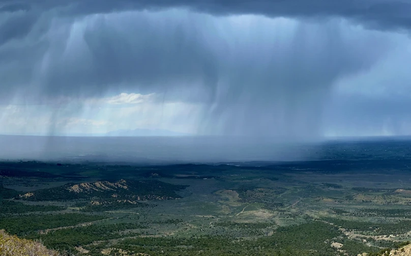
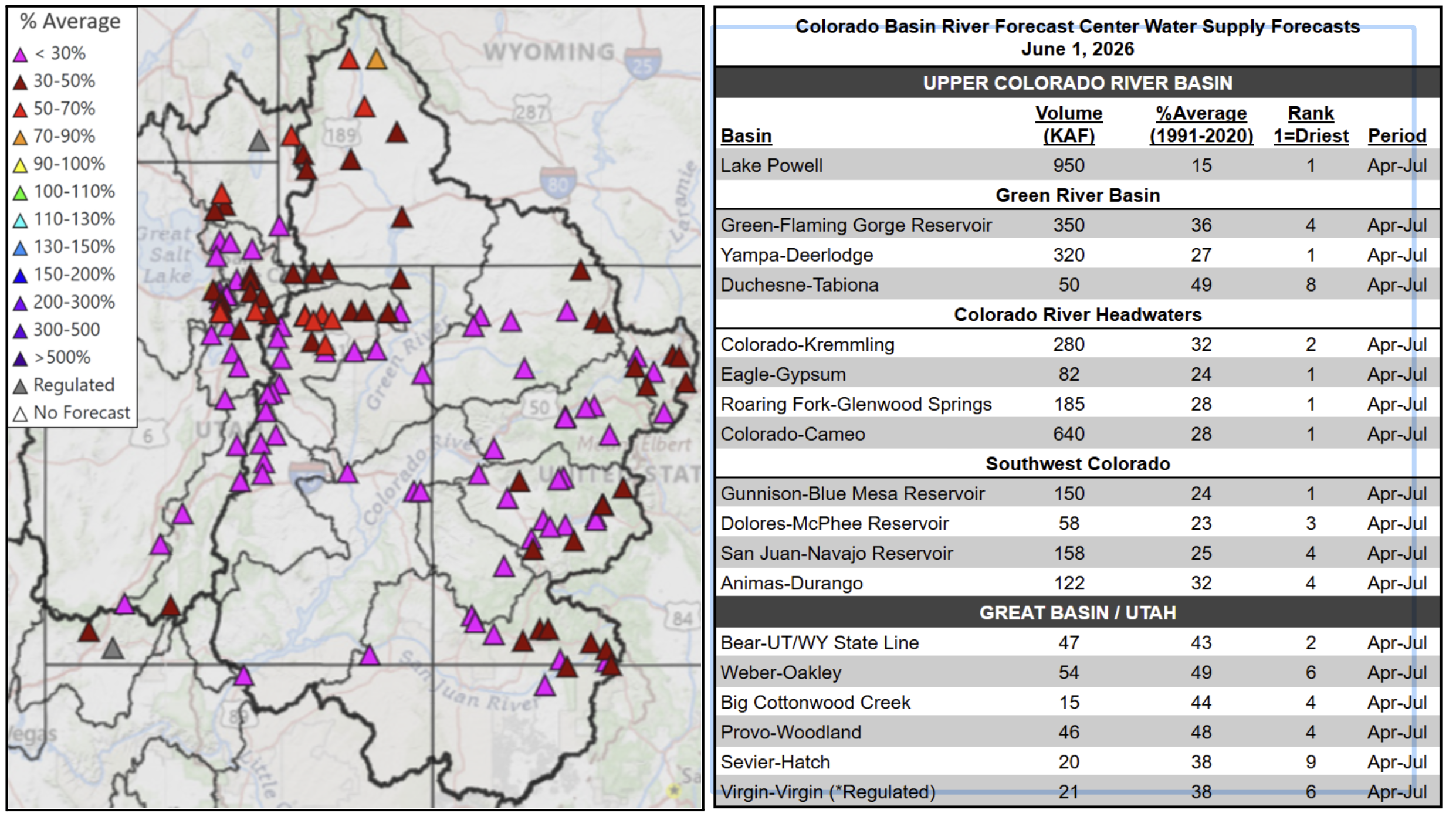

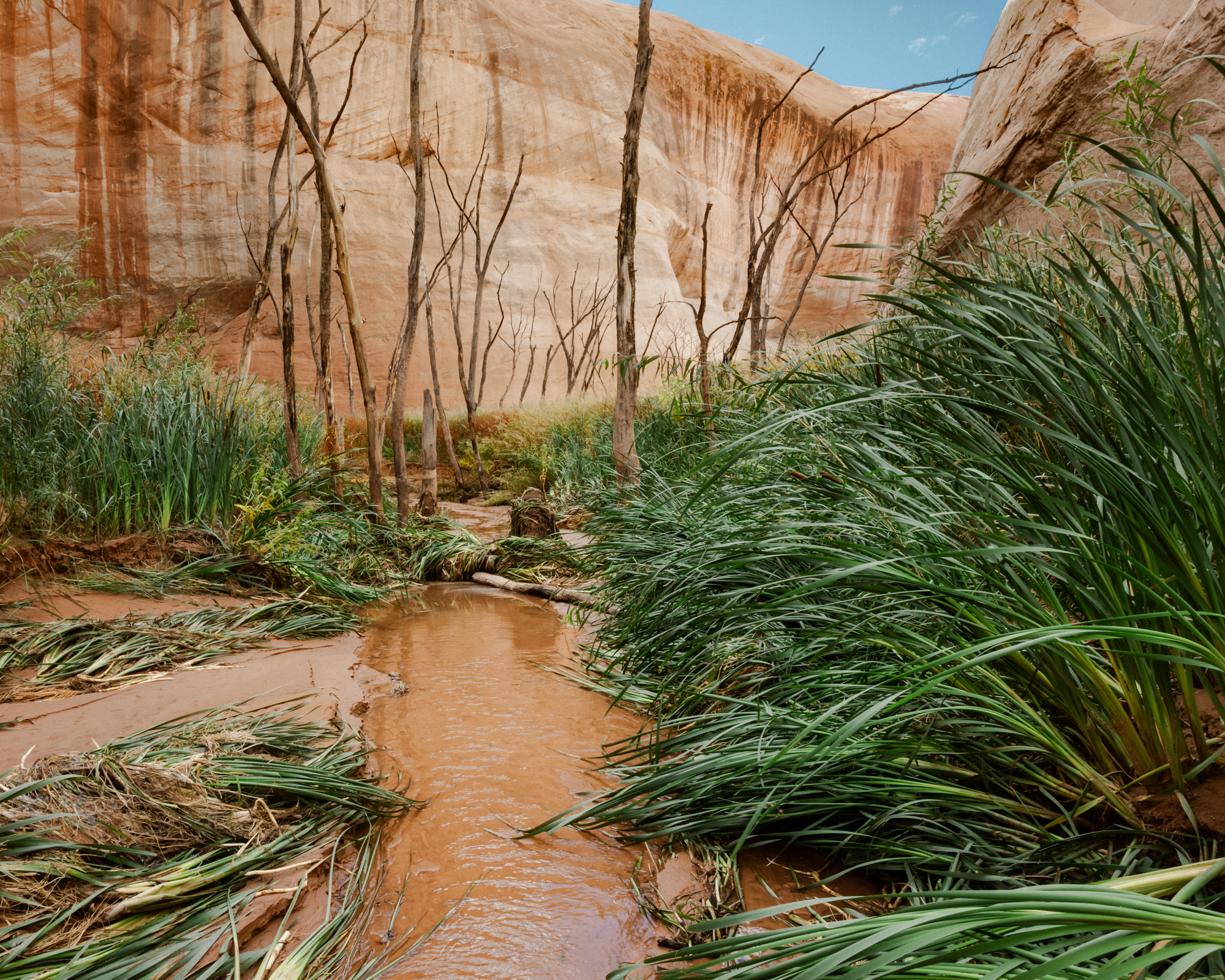
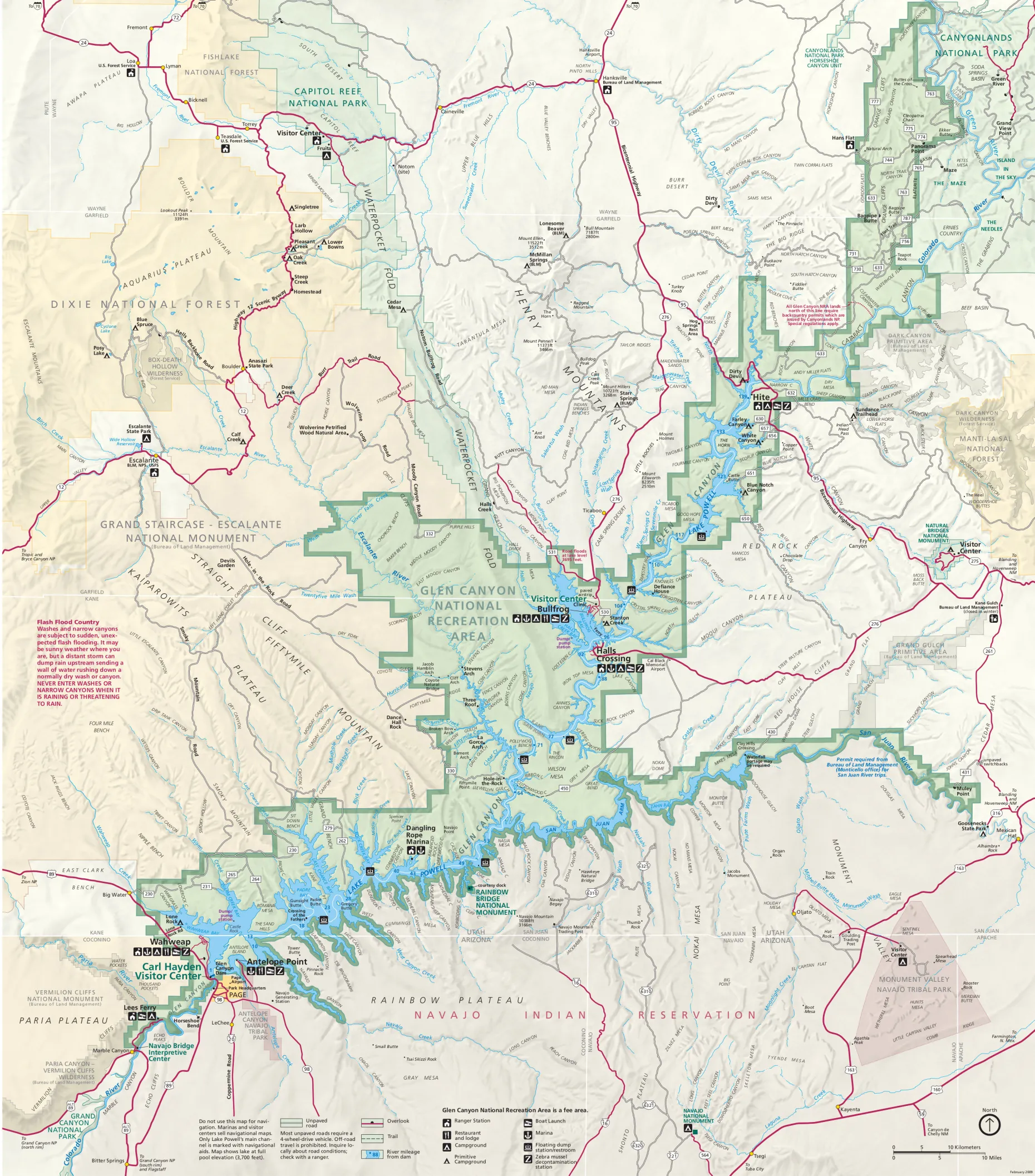
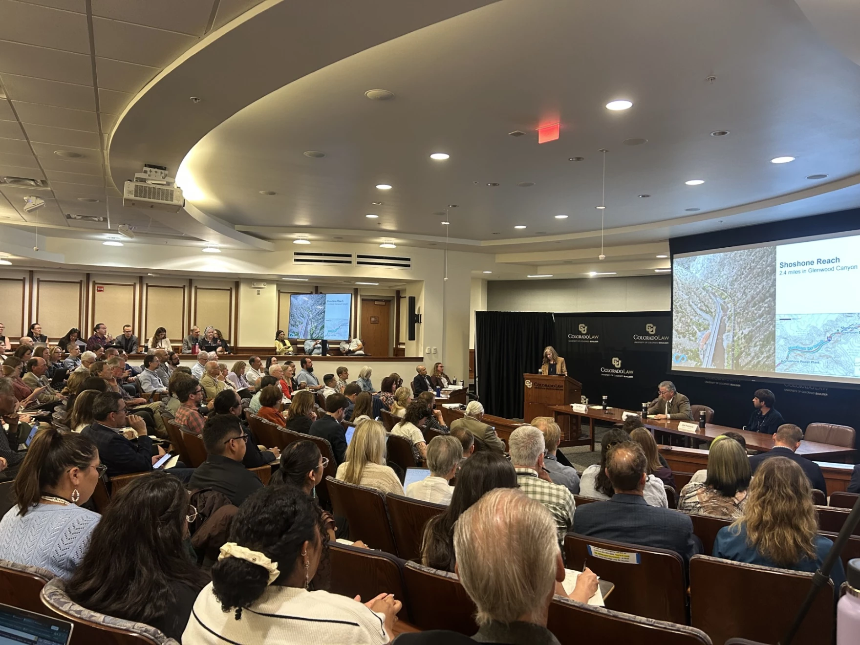
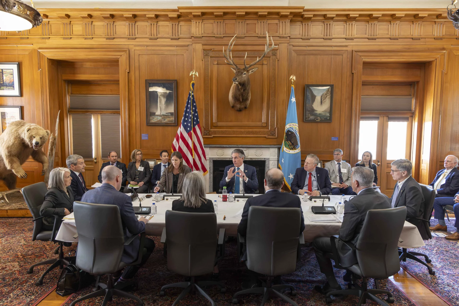


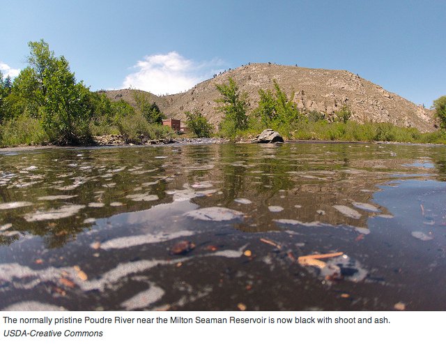


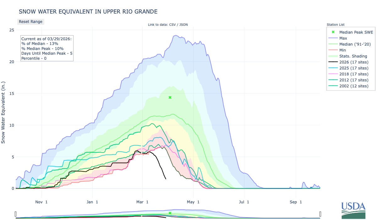

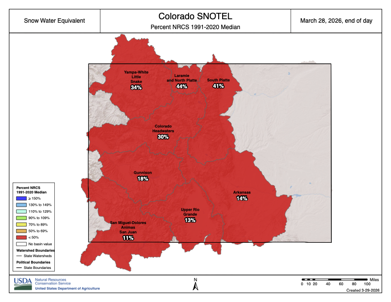
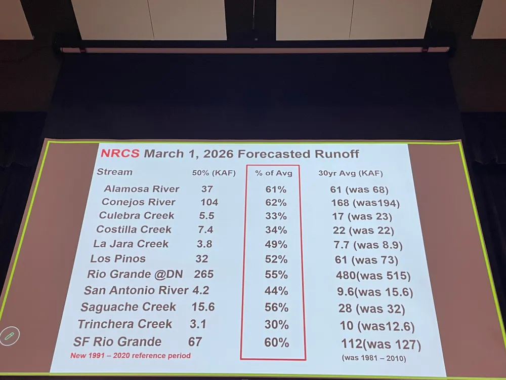
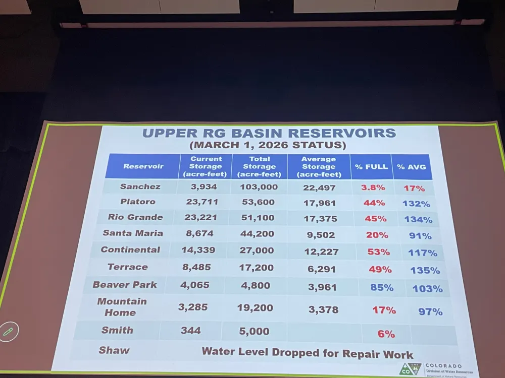
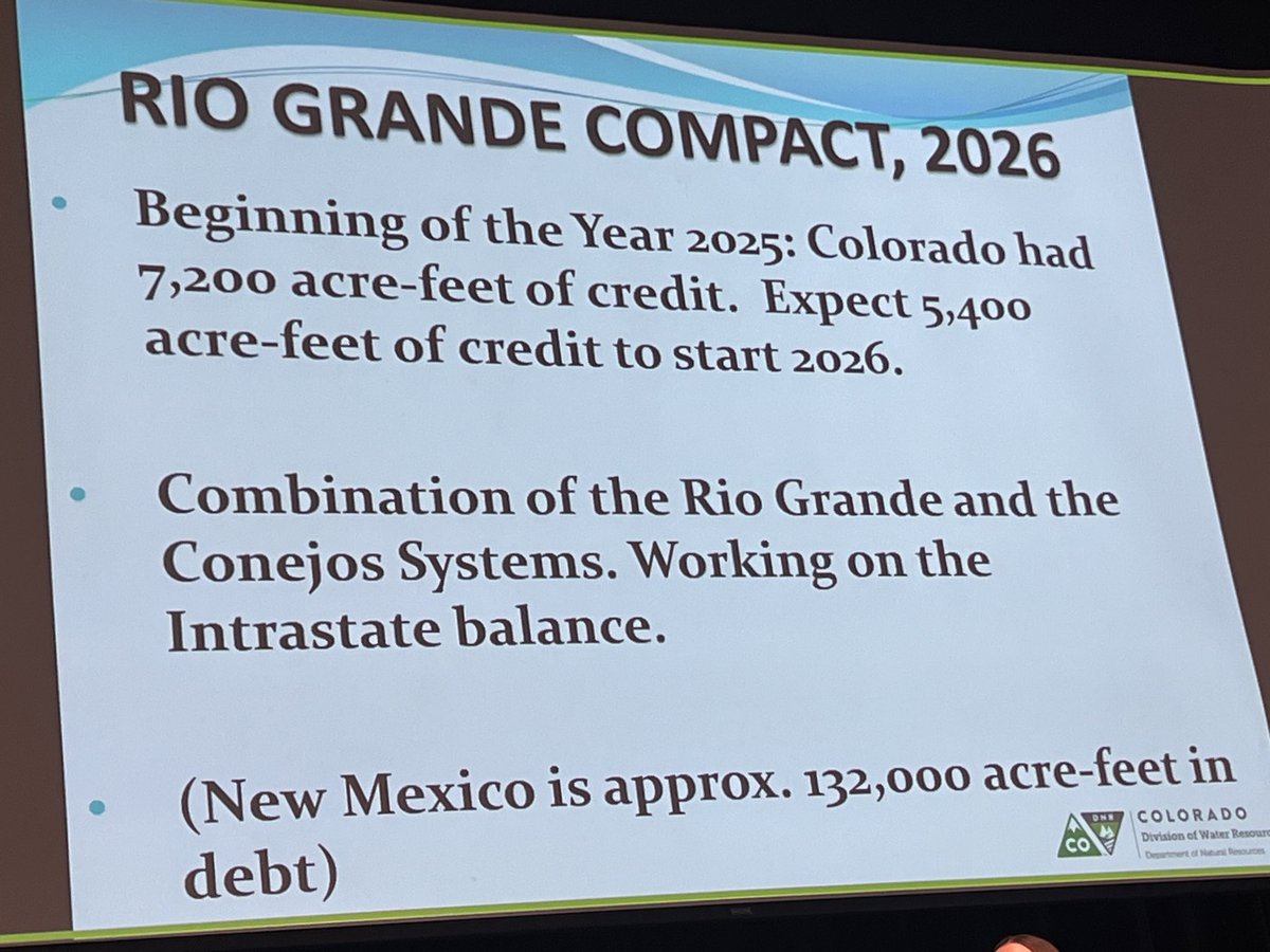
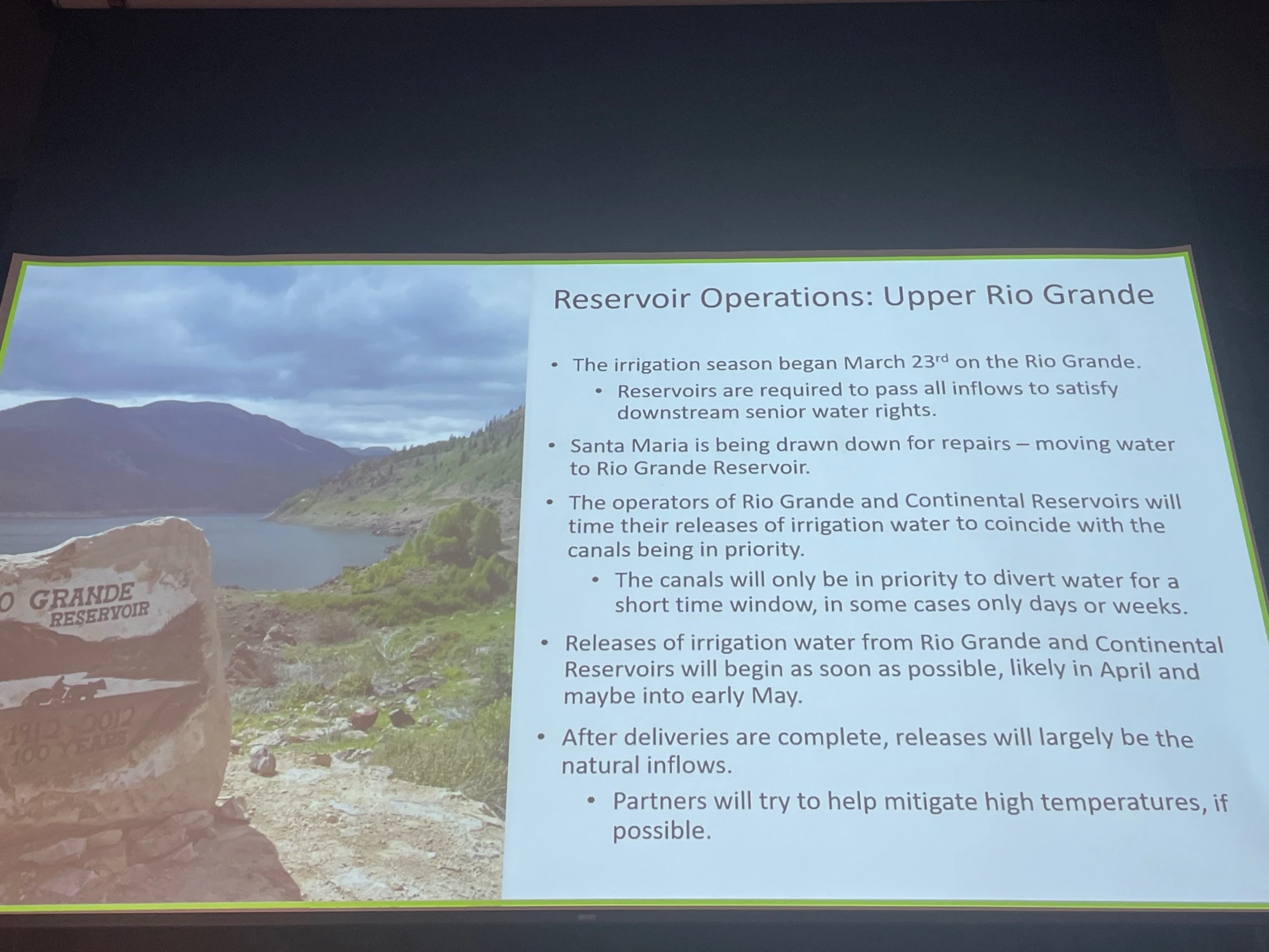
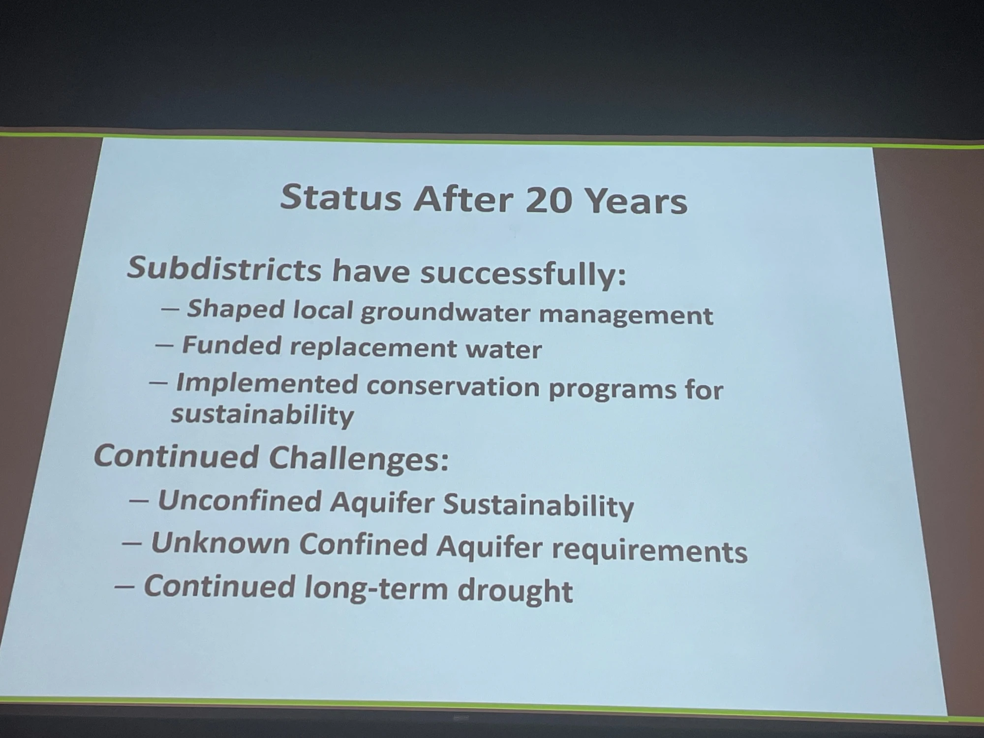
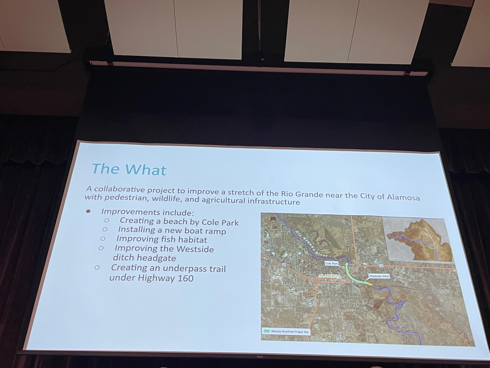


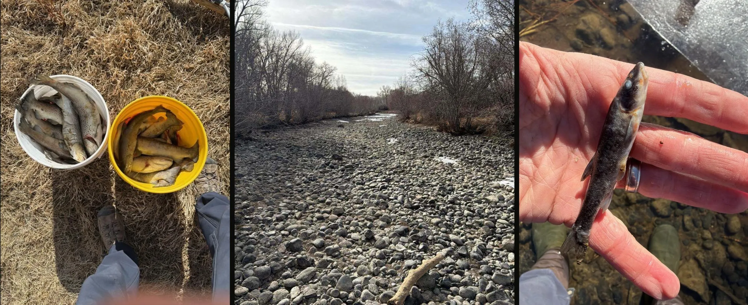
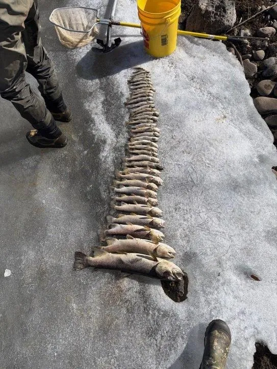
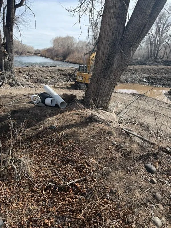

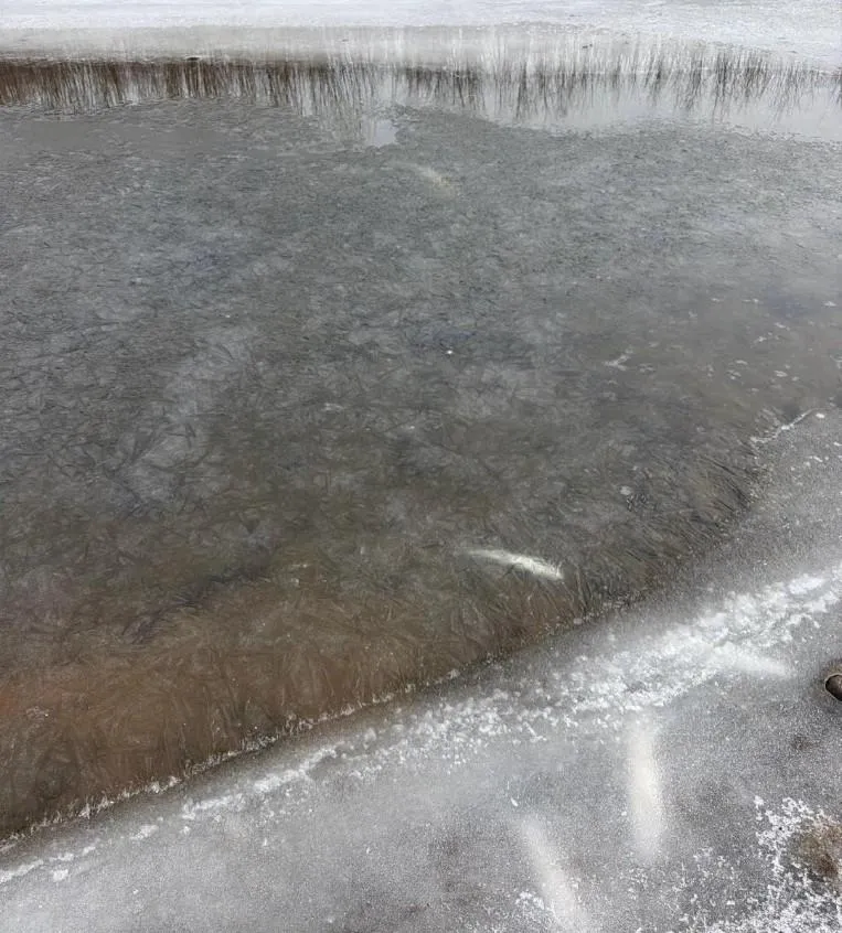


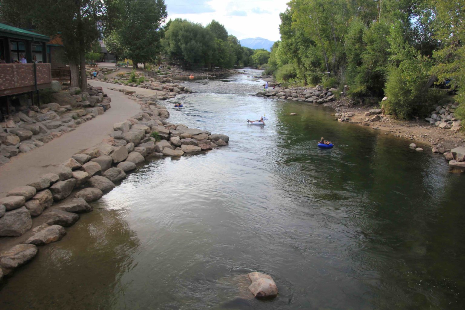
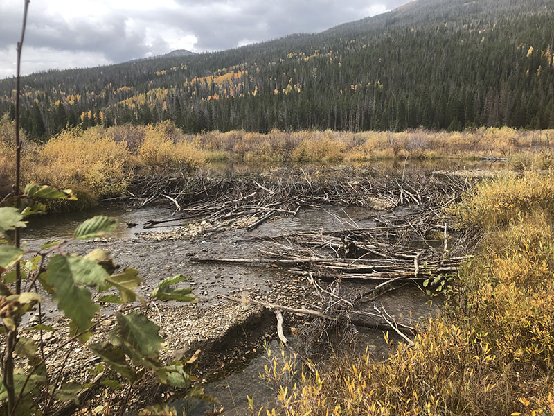


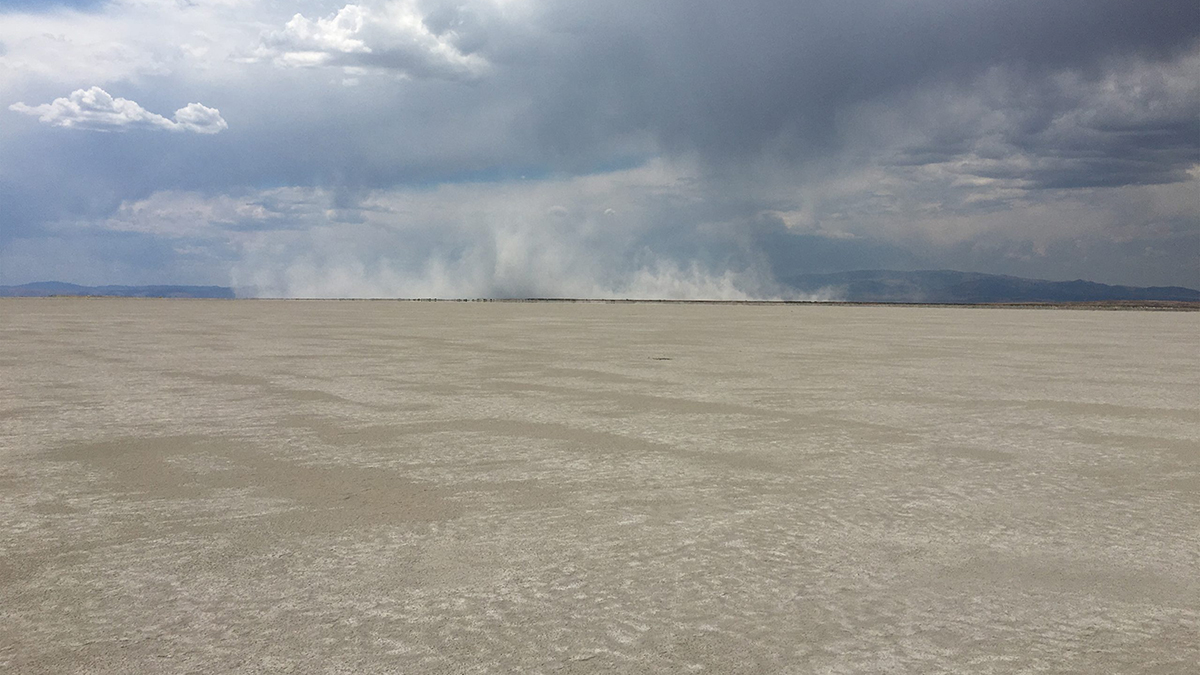
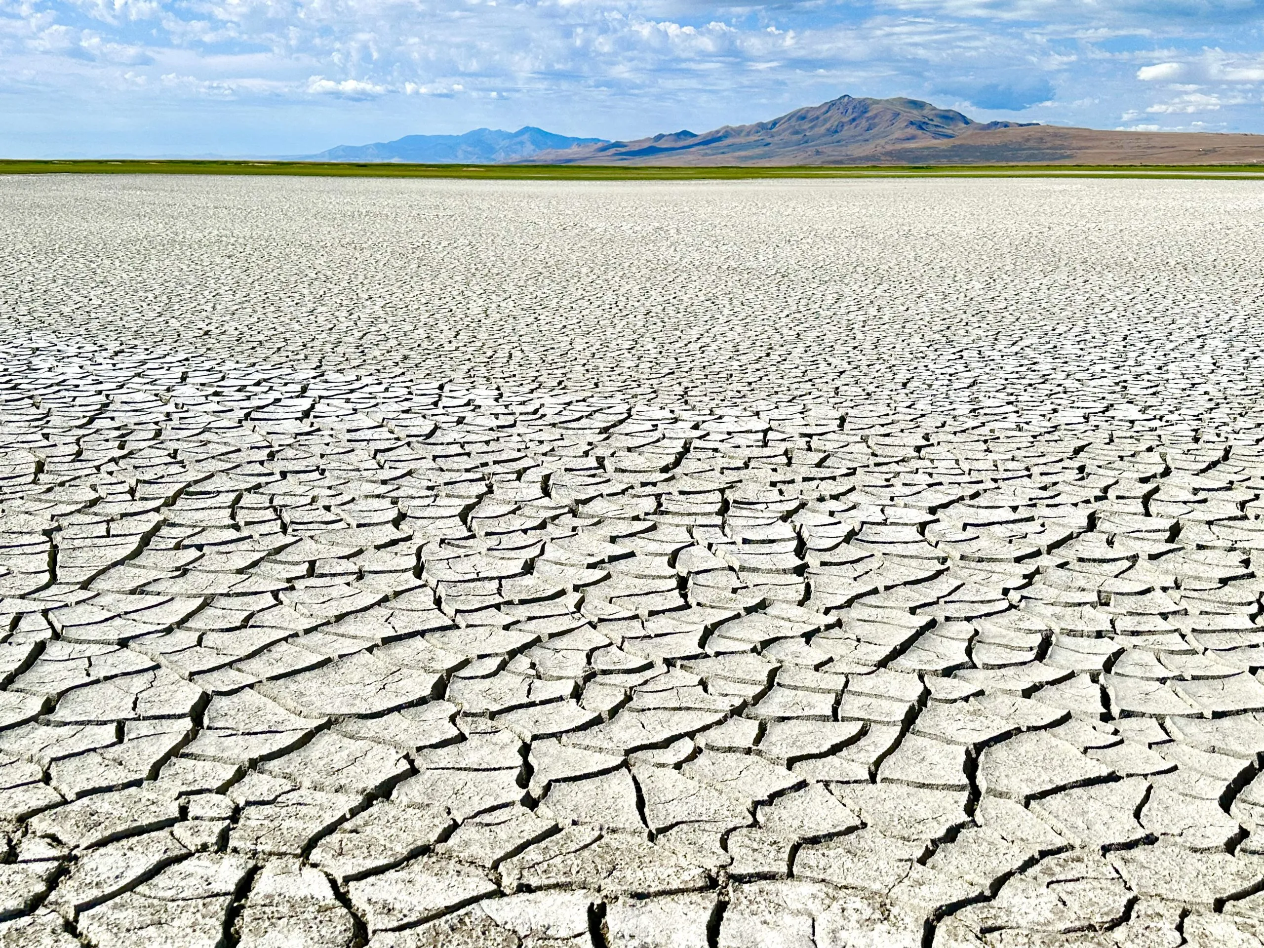
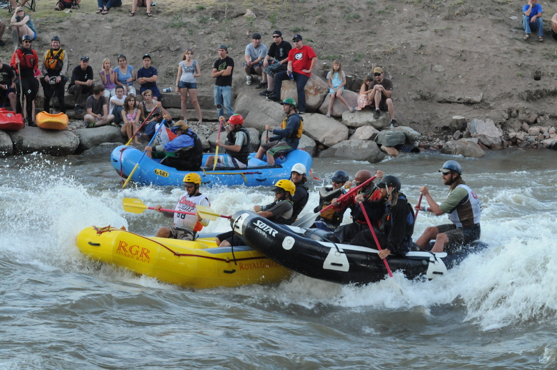
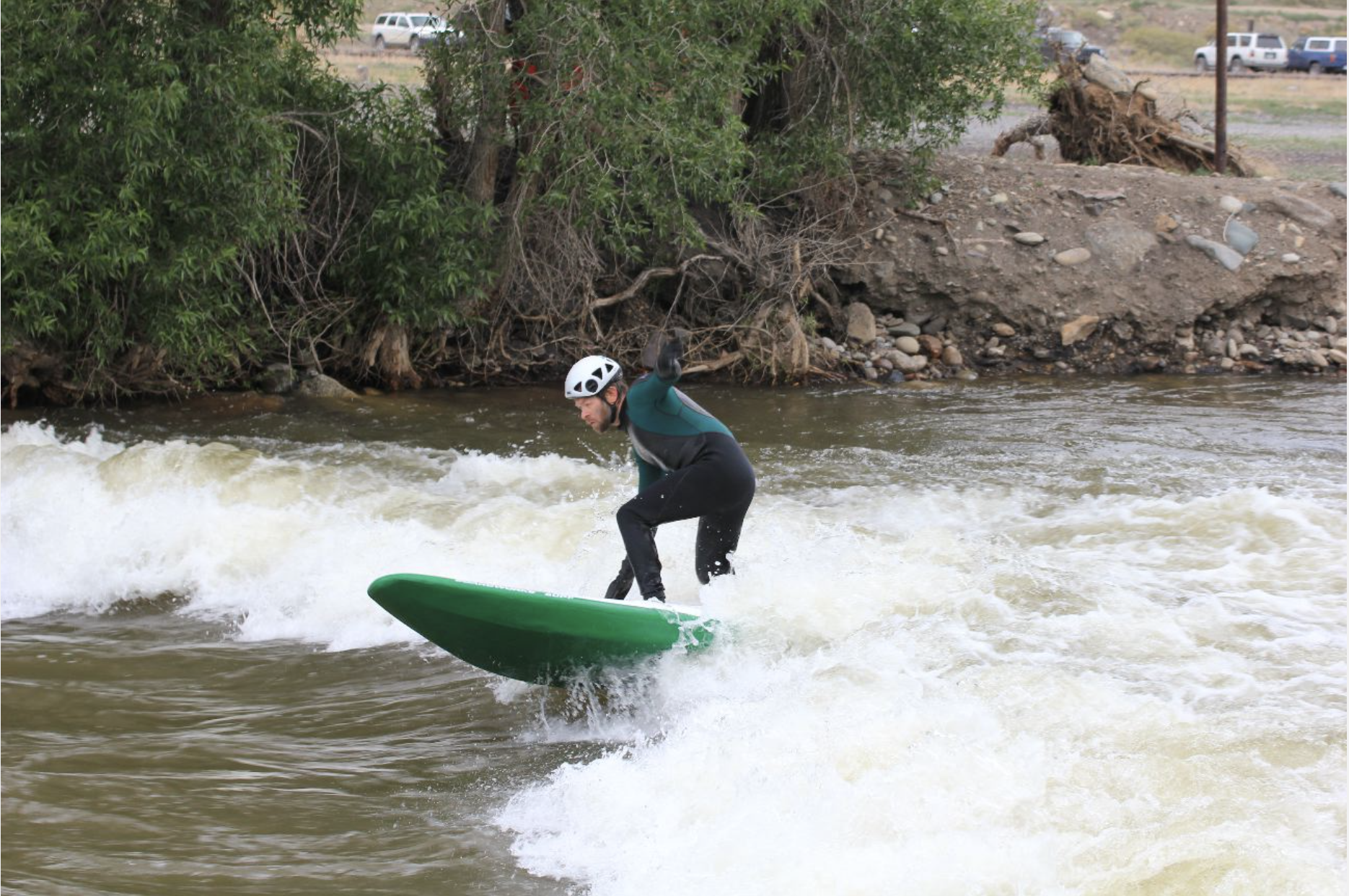


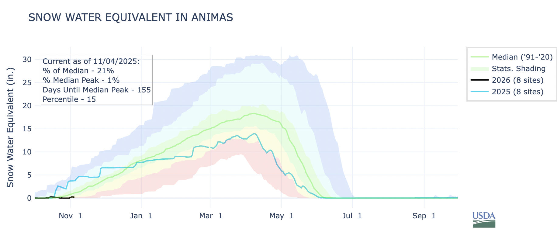
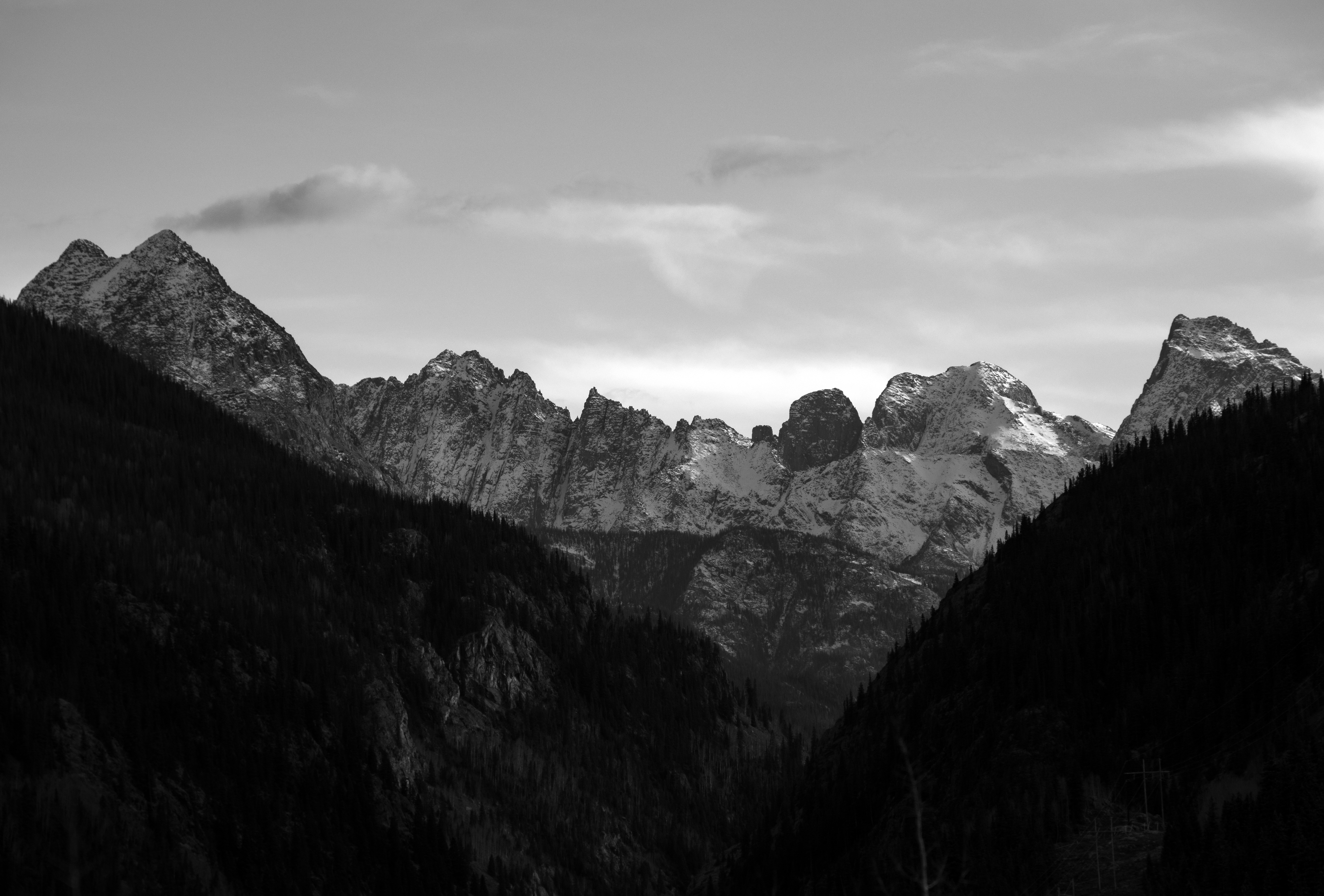


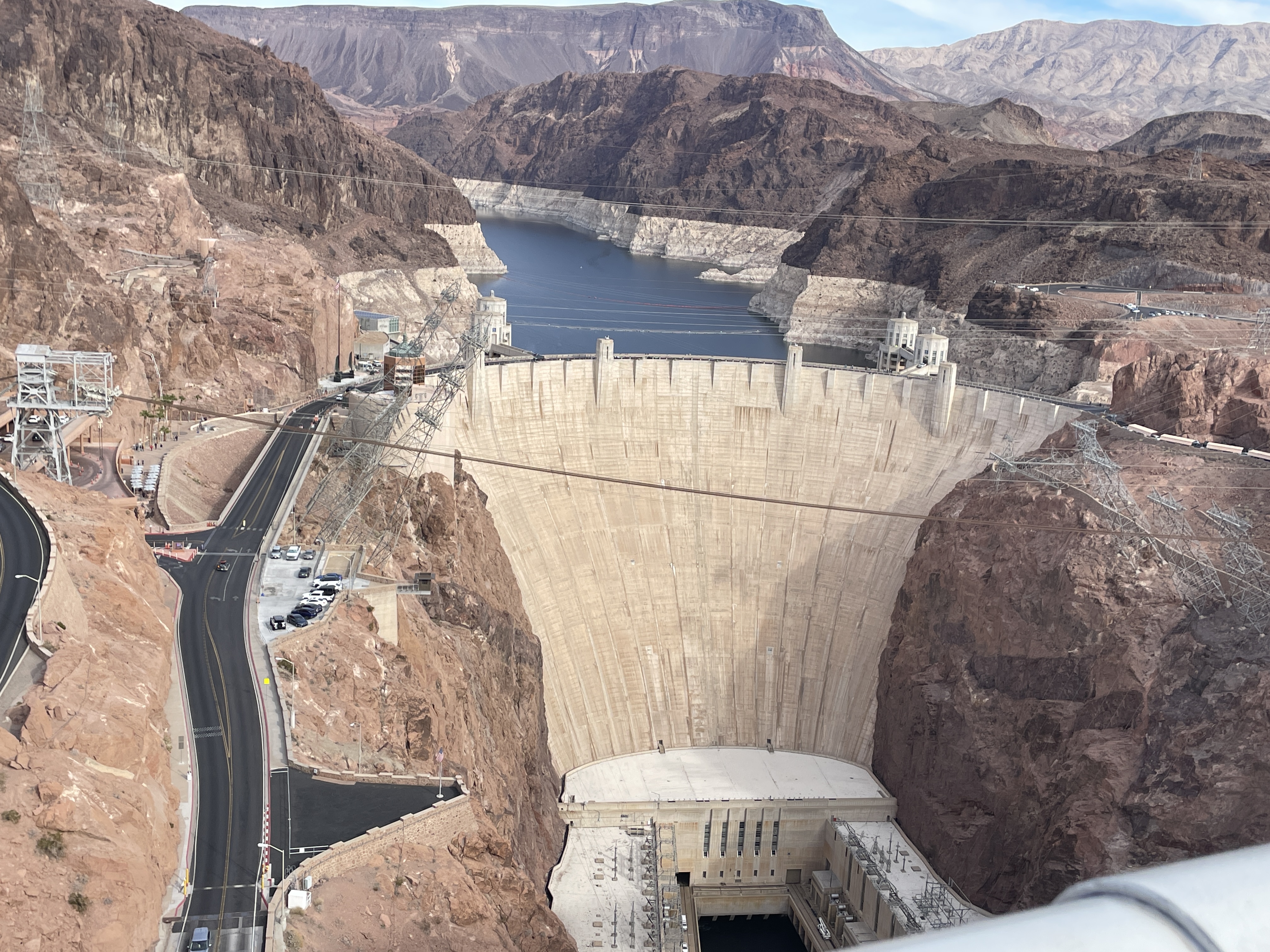


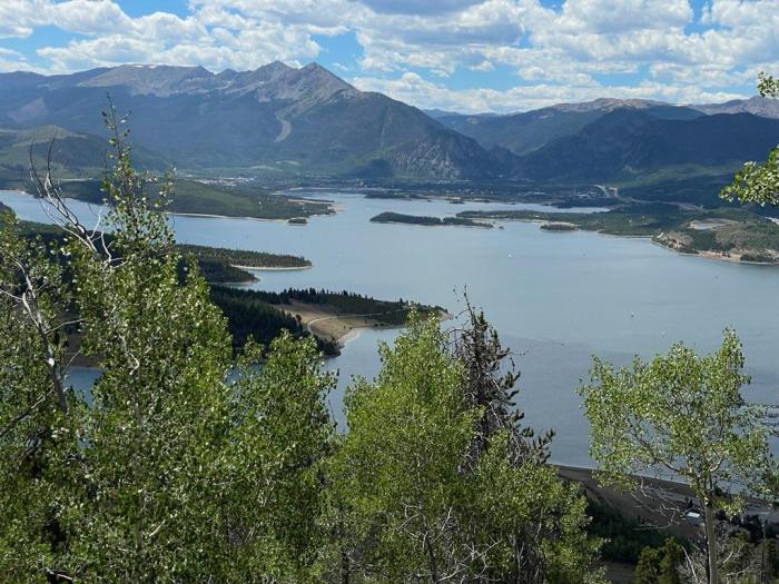


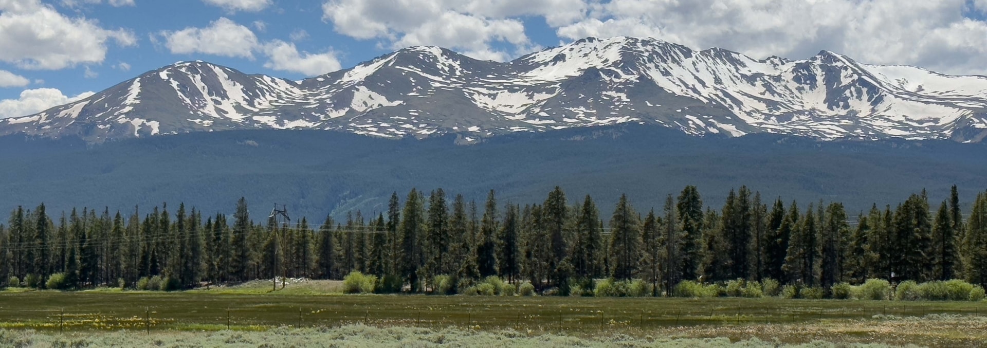
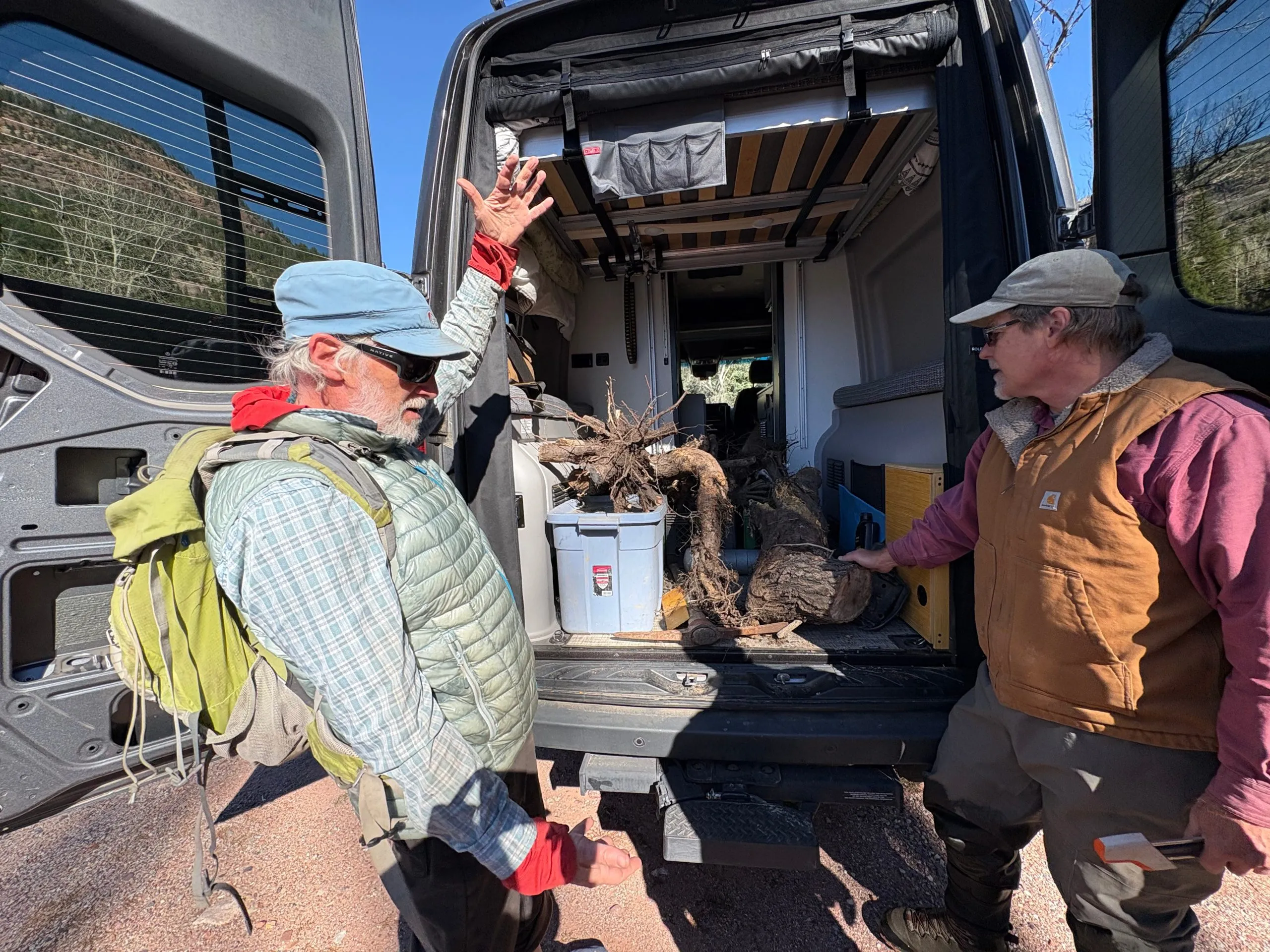


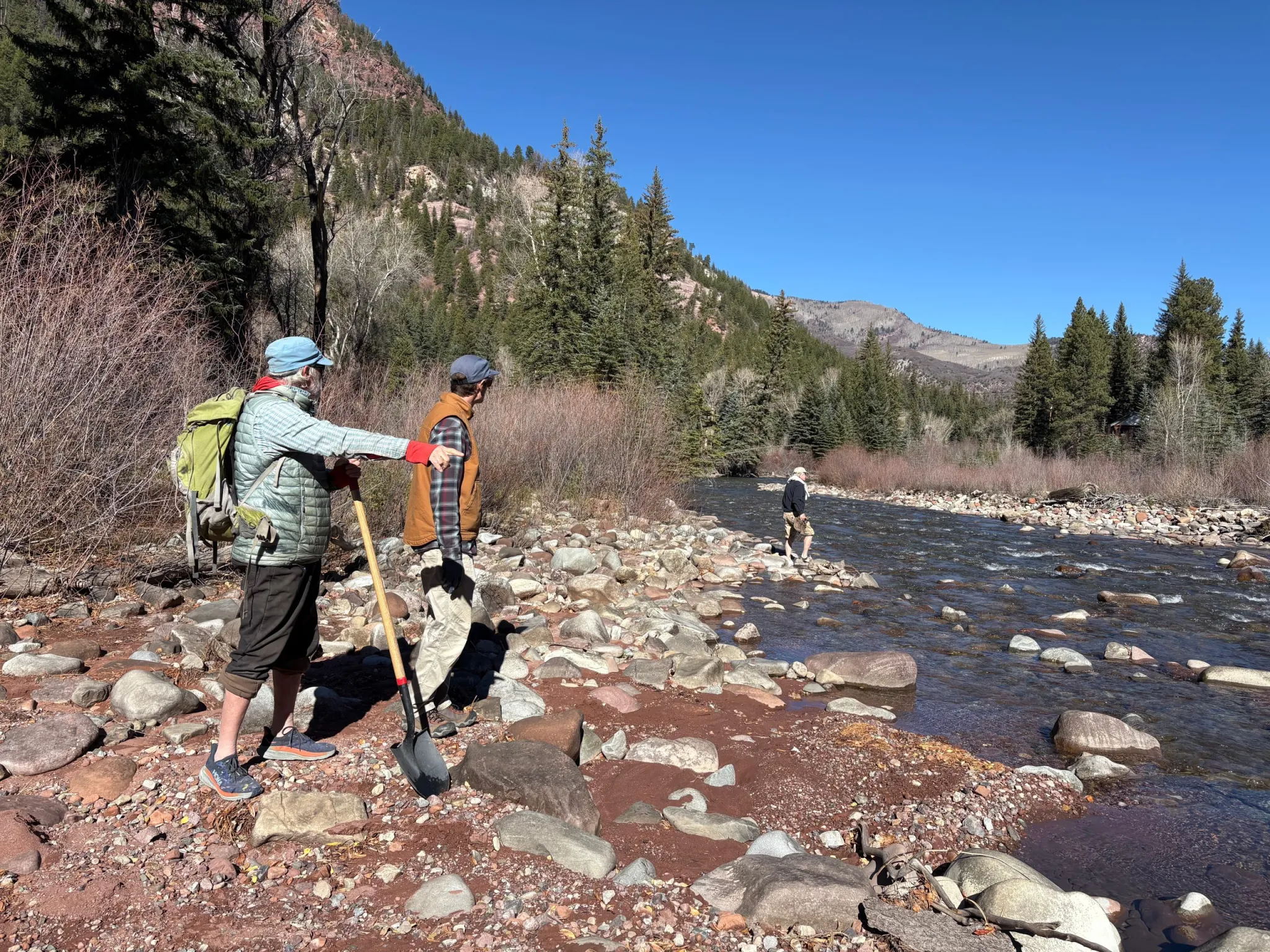

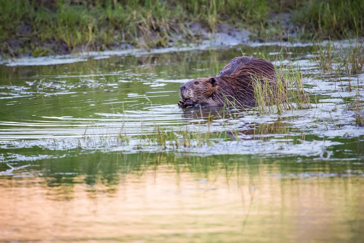
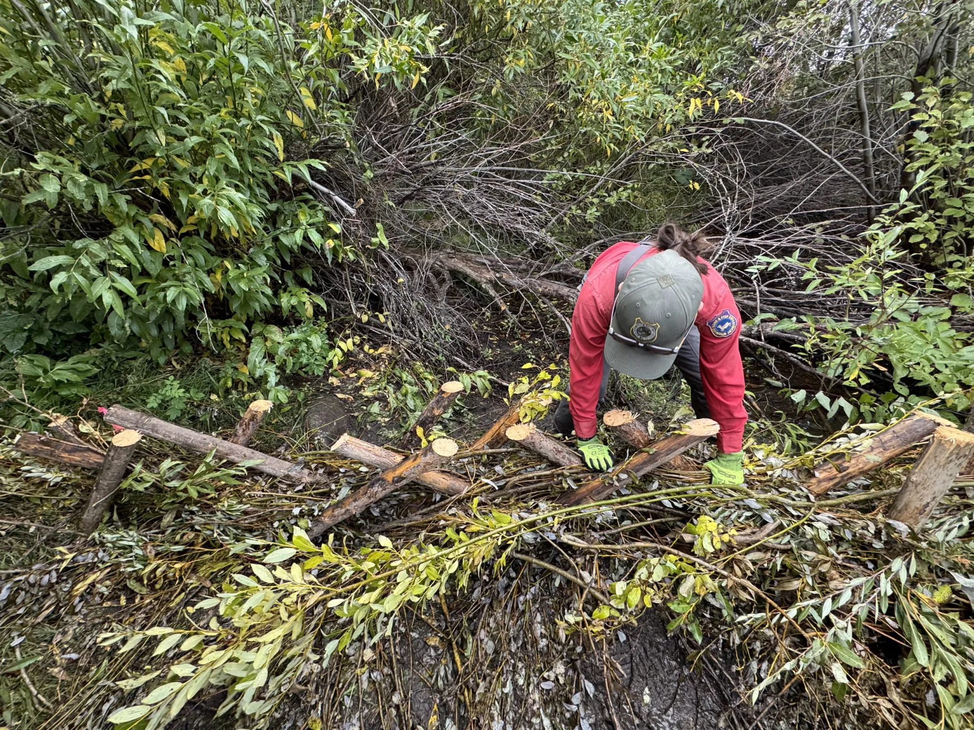
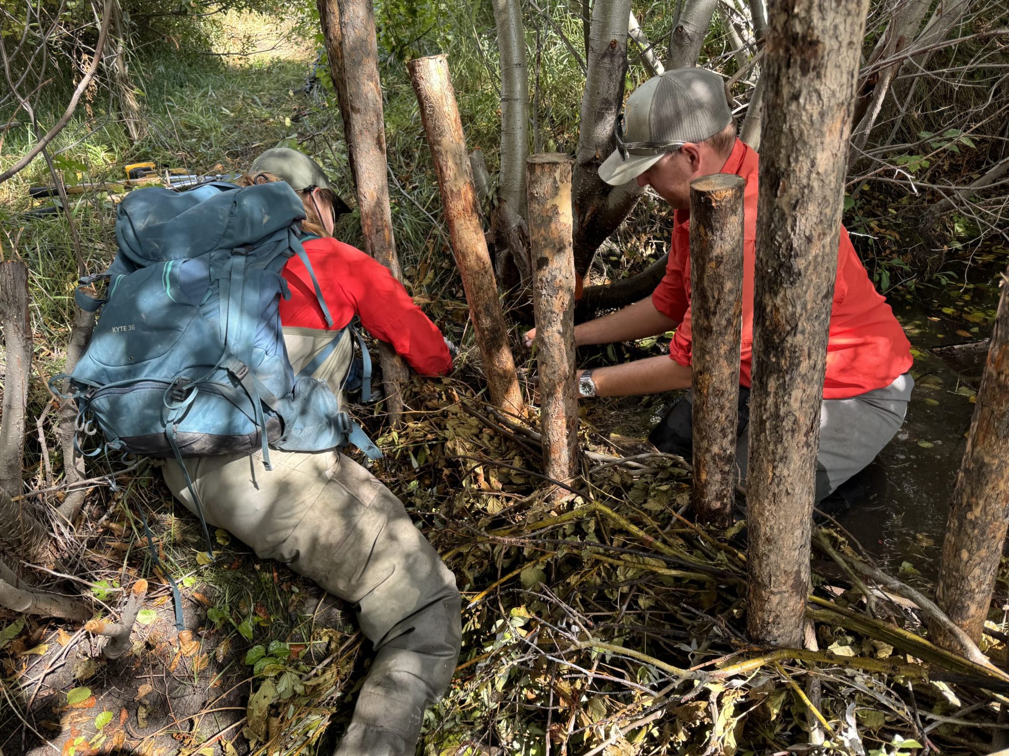


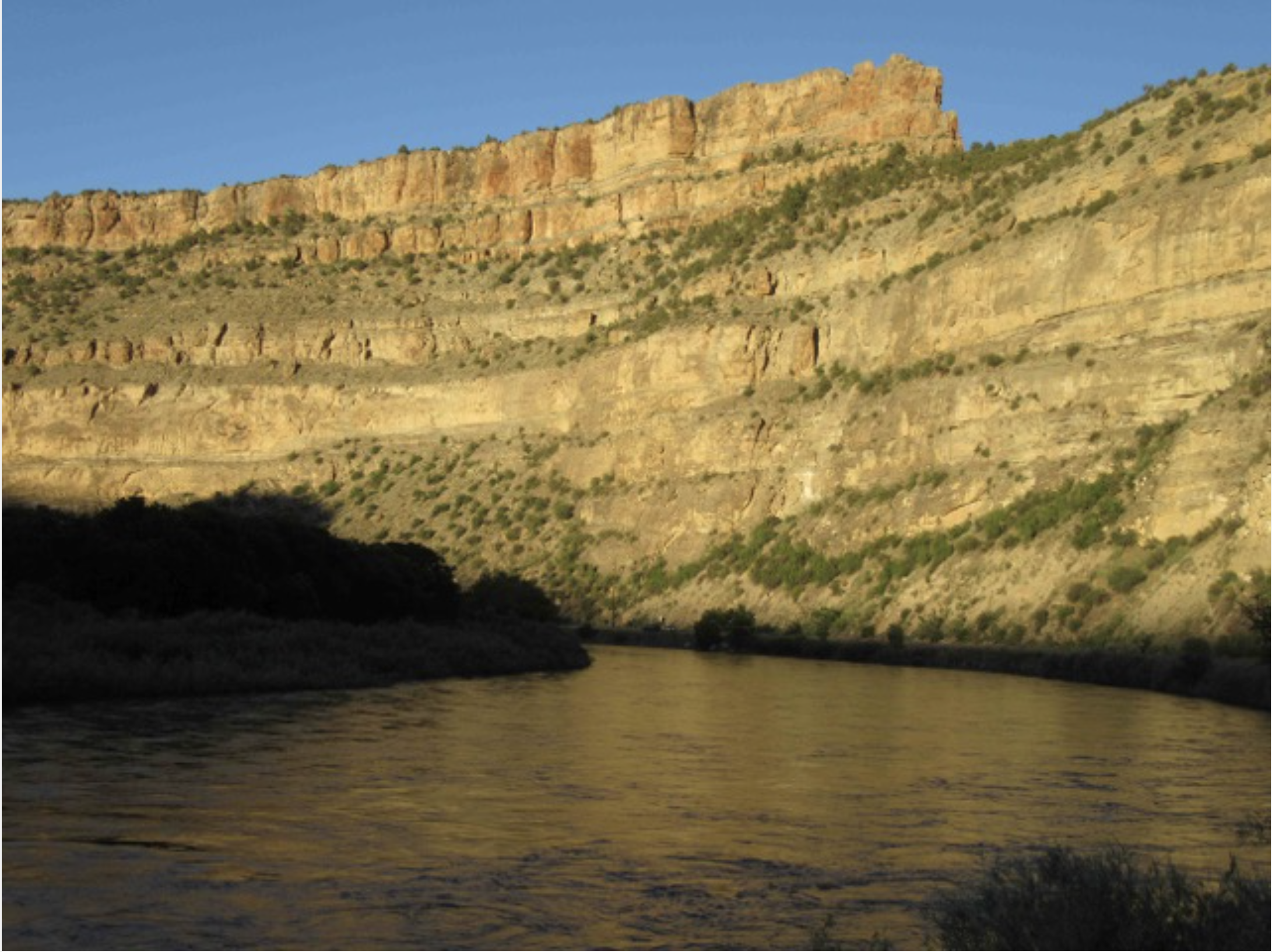
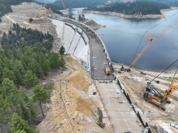


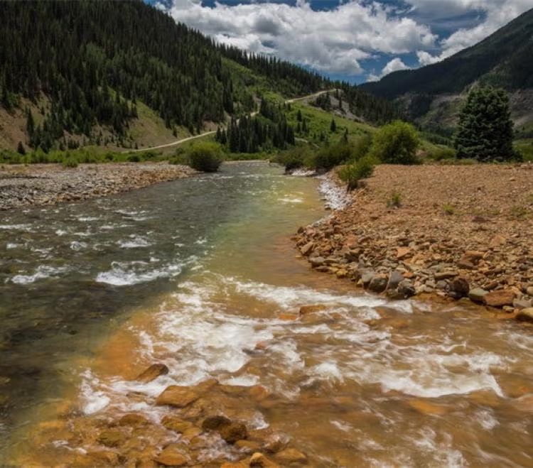


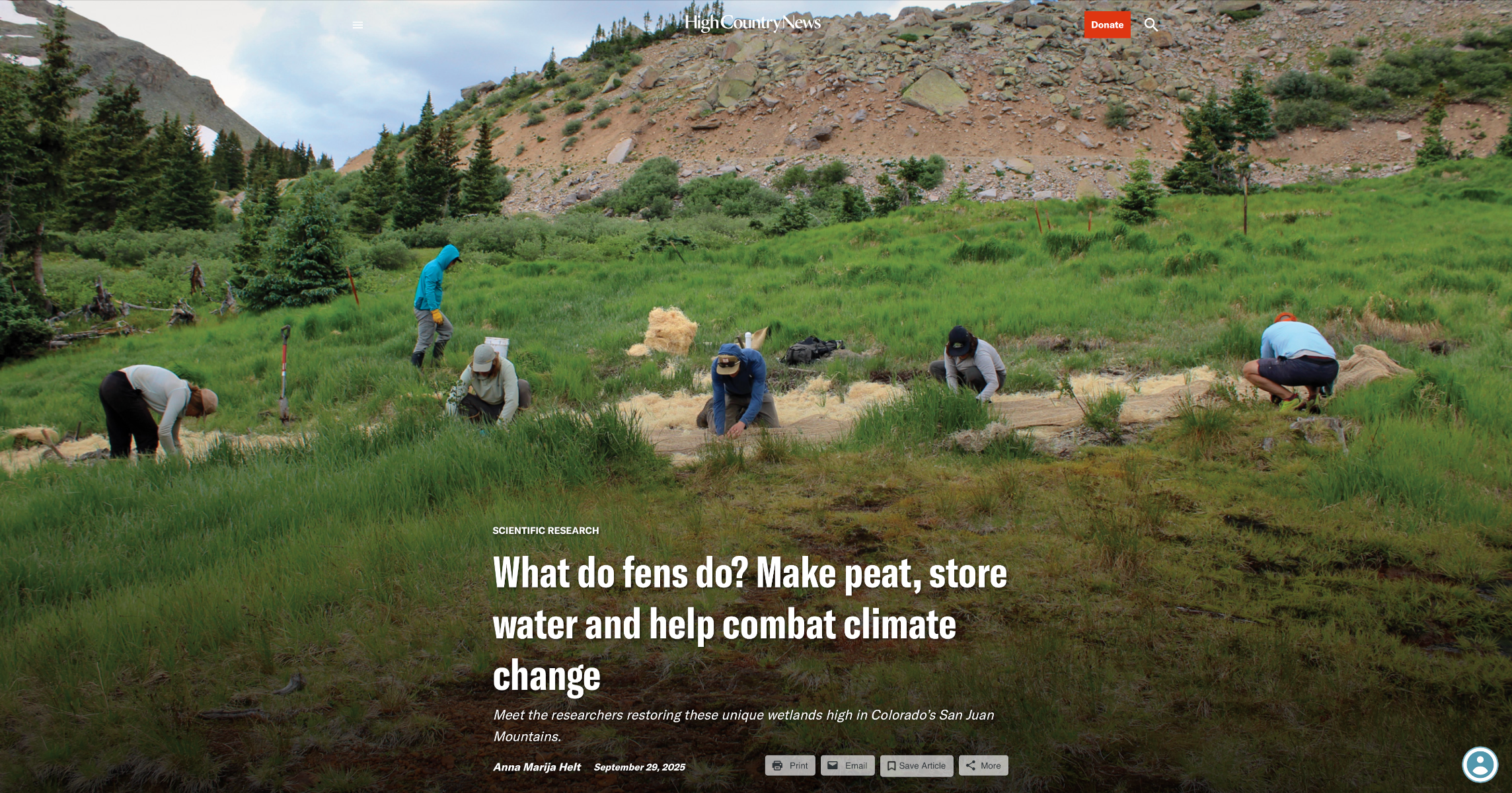
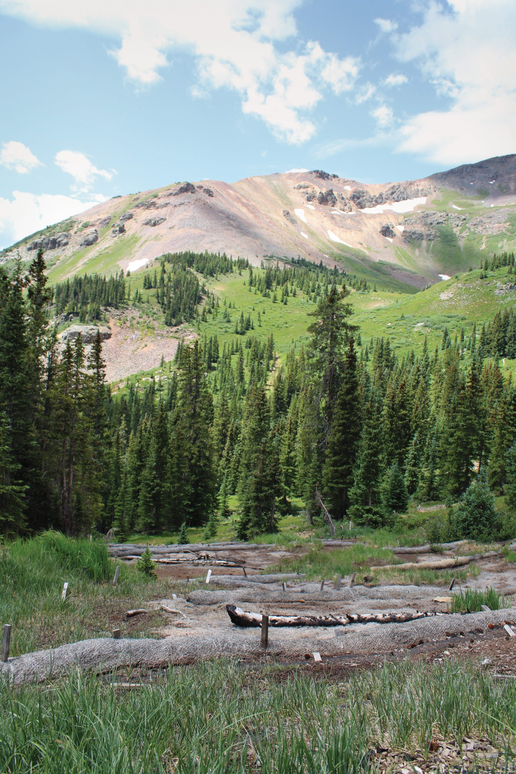


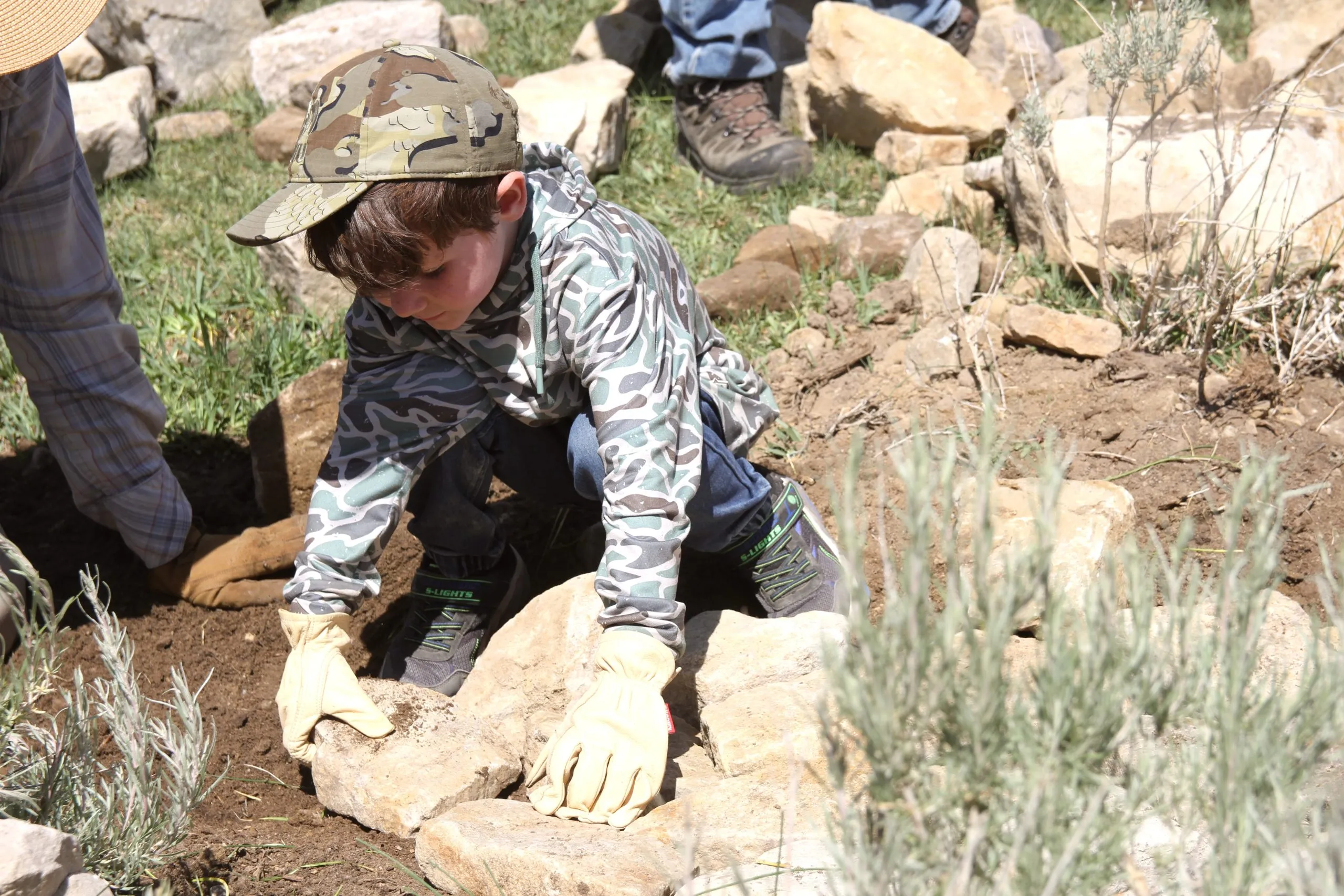
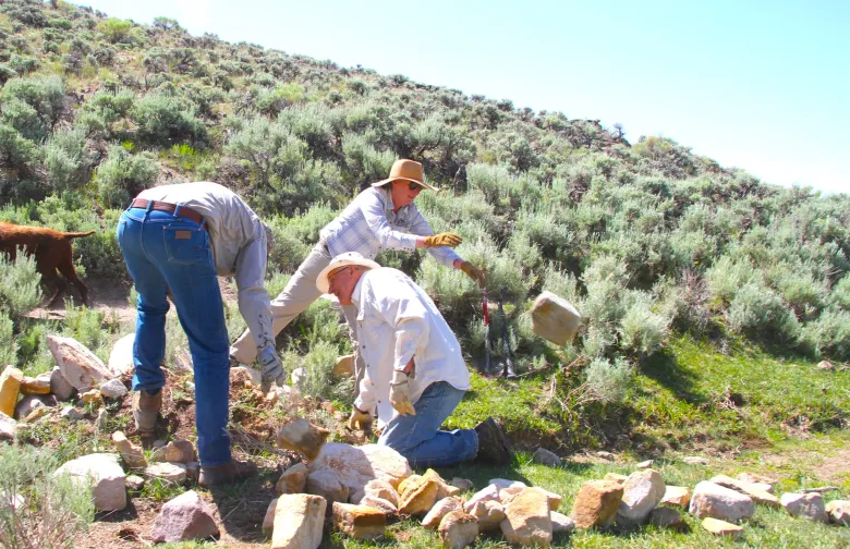


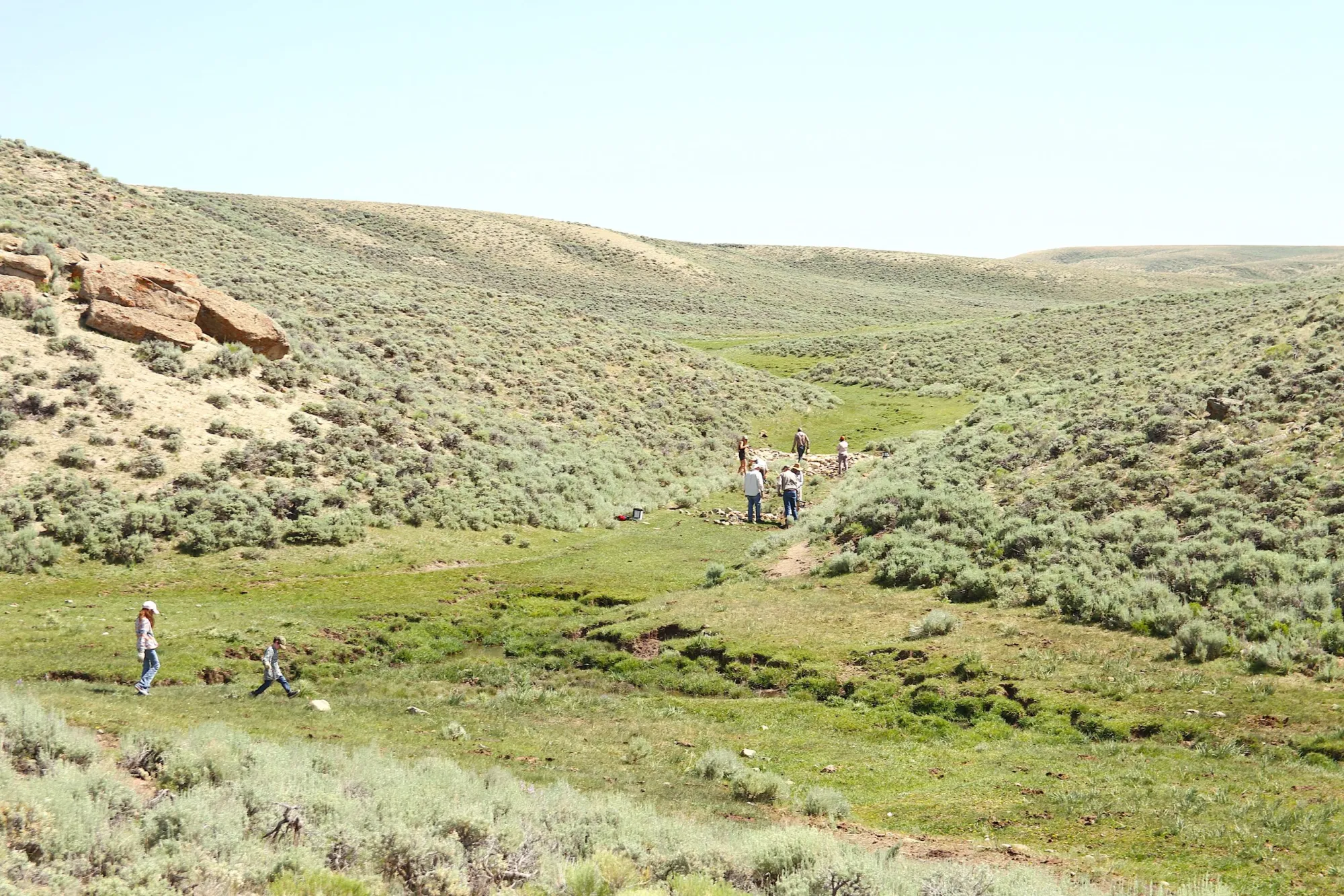


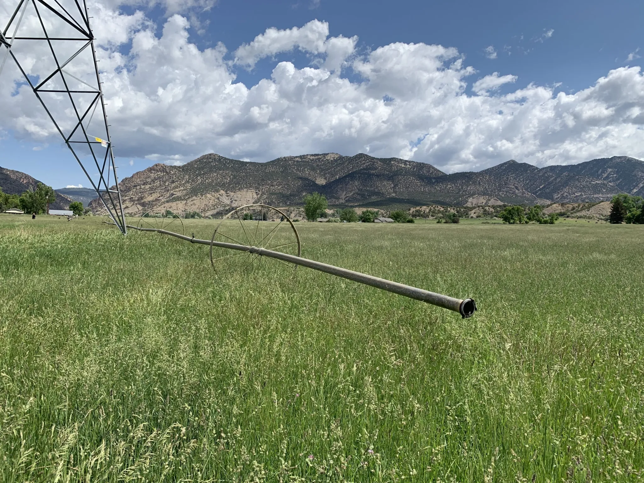
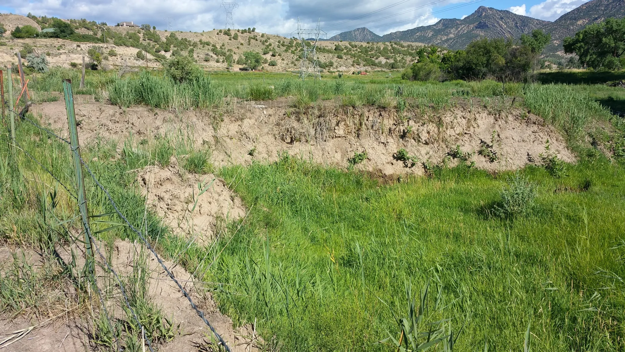
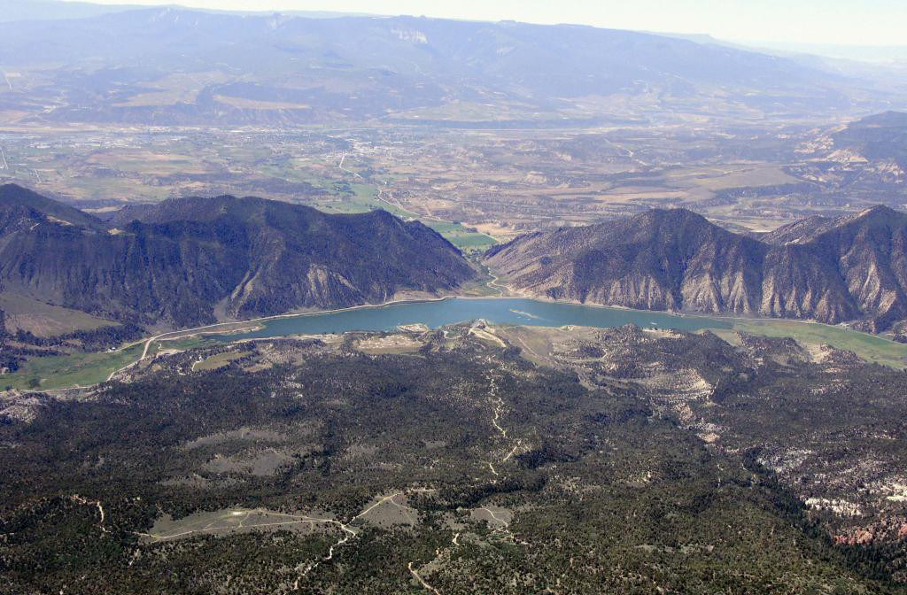

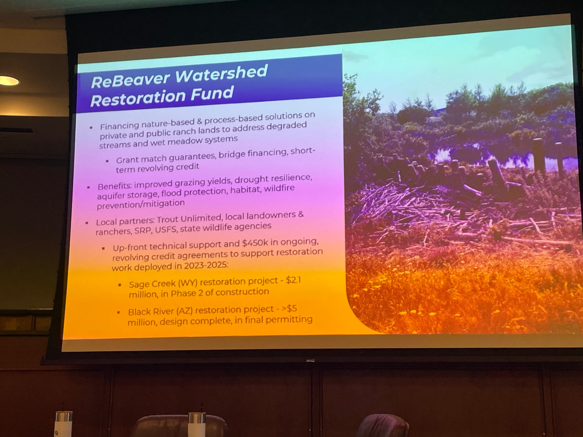


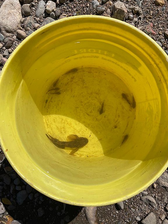


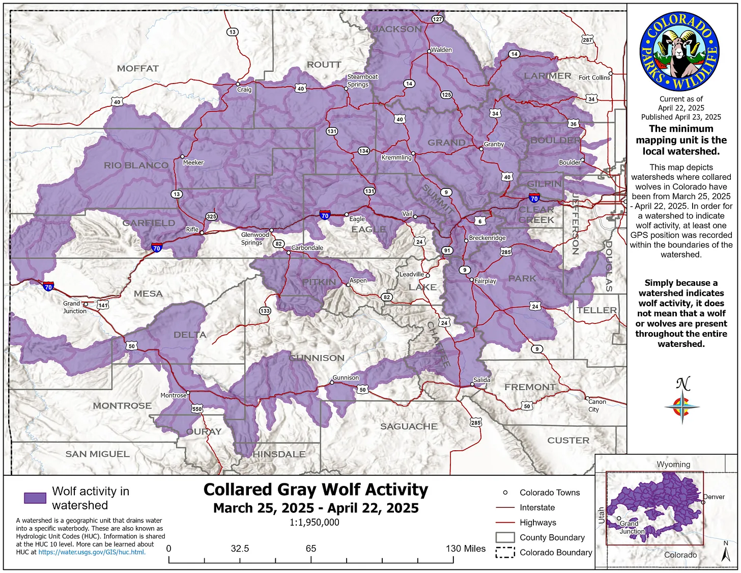

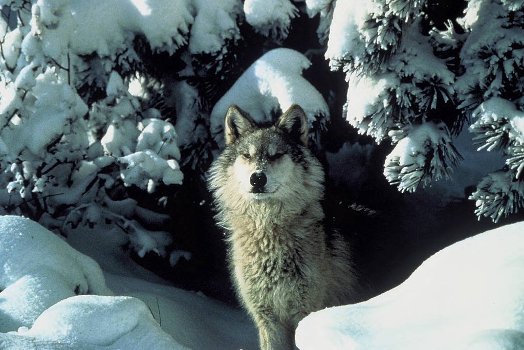
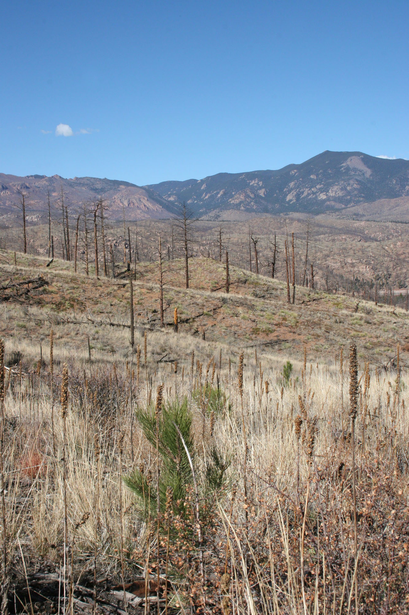
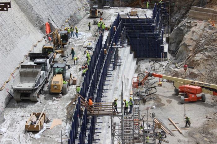


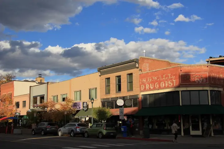

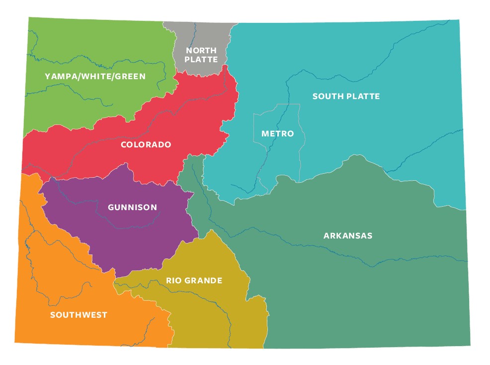
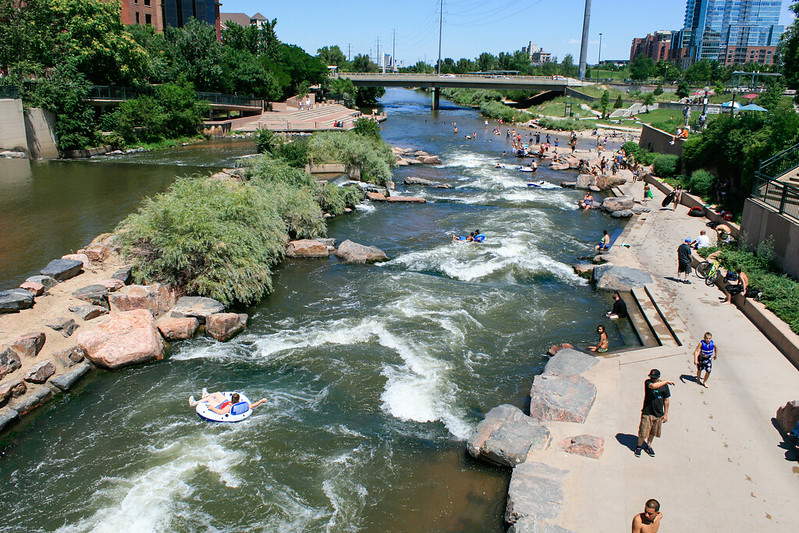


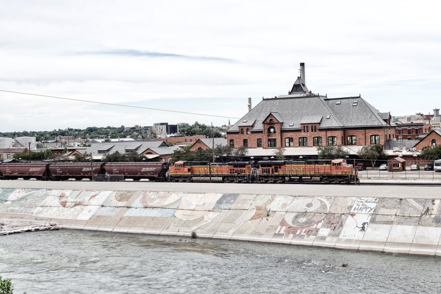


