
Click the link to read the article on the KUNC website (Alex Hager):
September 30, 2024
This story is part of a series on water myths and misconceptions in the West, produced by KUNC, The Colorado Sun, Aspen Journalism, Fresh Water News and The Water Desk at the University of Colorado Boulder. KUNC’s coverage of the Colorado River is supported by the Walton Family Foundation.
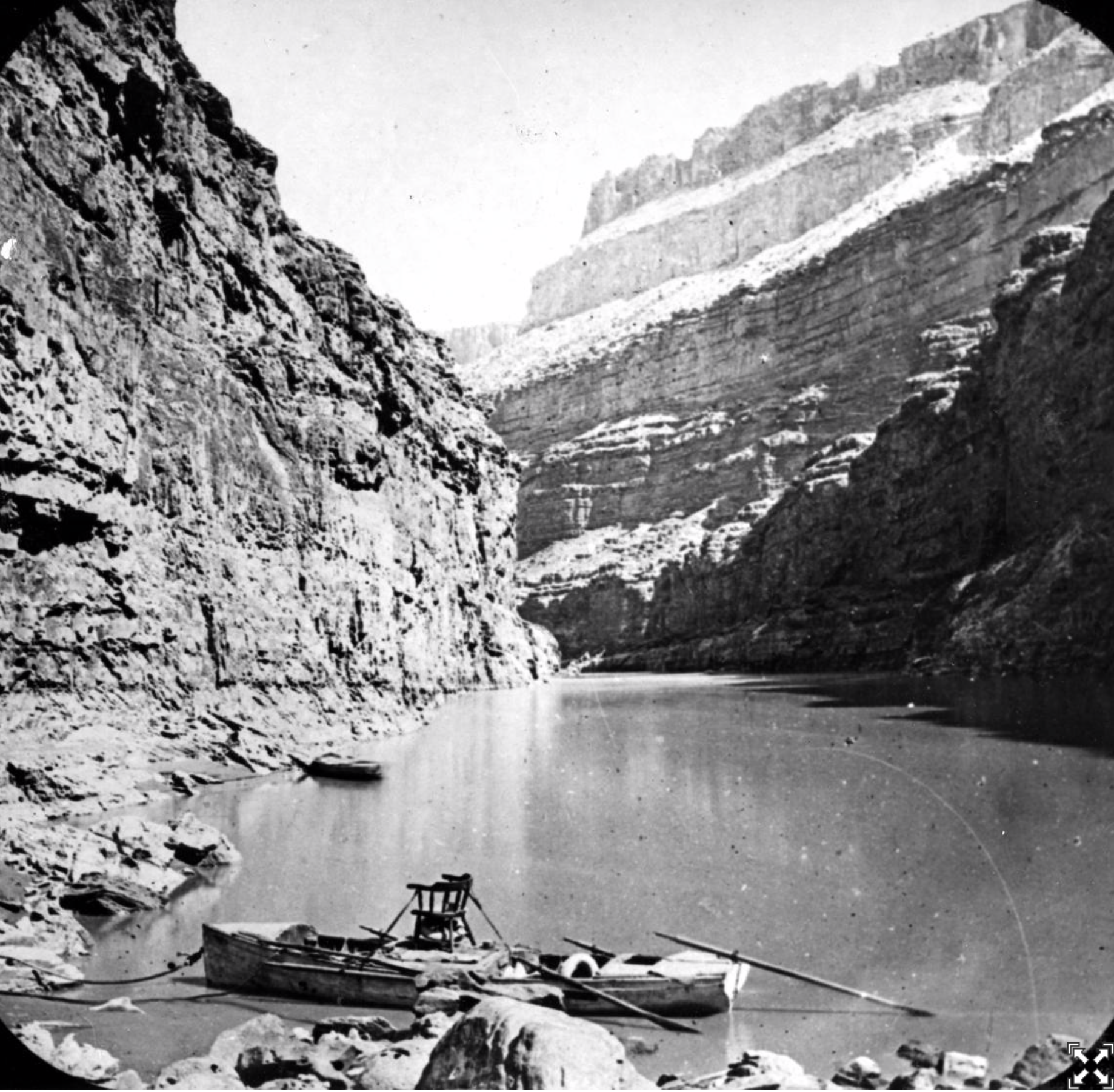
The Colorado River is a lifeline for about 40 million people across the Southwest. It supplies major cities like Los Angeles, Phoenix, and Denver and a multibillion-dollar agriculture industry that puts food on tables across the nation. But it doesn’t have enough water to meet current demands.
Policymakers are struggling to rein in demand on the river, which has been shrinking at the hands of climate change. The region needs to fix that gap between supply and demand, and there’s no obvious way to do it quickly.
But one tantalizingly simple solution keeps coming up. The West doesn’t have enough water, but the East has it in abundance. So, why don’t we just fix the Colorado River crisis by piping in water from the East?
The answer is complicated, but experts say it boils down to this: It doesn’t make sense to build a giant East-to-West water pipeline anytime soon for three reasons — politics, engineering, and money.
Political headwinds
If the West’s leaders wanted to take some water from the East, who would they even ask? Right now, there’s no national water agency that could oversee that kind of deal.
“I would argue that there aren’t many entities with the authority across the country to do this,” said Beaux Jones, president and CEO of The Water Institute in New Orleans. “I don’t know that the regulatory framework currently exists.”
Water is often managed using a messy patchwork of different government agencies and laws. The Colorado River is managed through a fragile web of agreements between cities, states, farm districts, native tribes and the federal government. Even though they’re all pulling from the same water supply, there’s no central Colorado River government agency.
A similarly complex system applies to many watersheds in the East. Even if a single city or state in the Western U.S. seriously wanted to build a pipeline from the East, it’s not even clear who they’d meet with to ask for water from a different area. And there’s no single federal agency that could sign off on such a deal and make sure it doesn’t harm people or the environment.

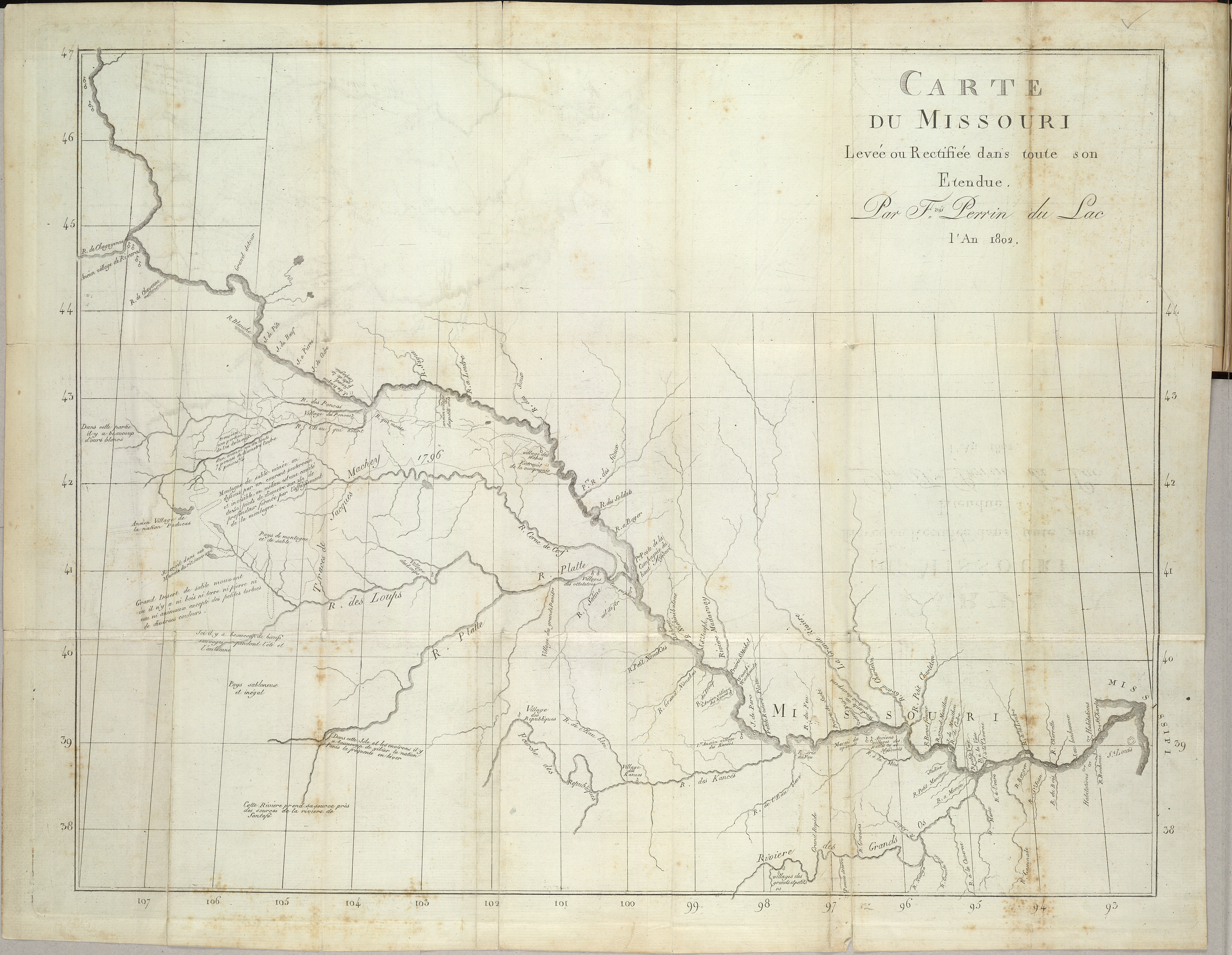
Any serious effort to pull new water in from the East to the Southwest would likely touch some part of the Mississippi River basin. It’s a sprawling network of smaller rivers that covers 31 different states, from Montana to Pennsylvania.
It’s a busy river with a lot of uses. And while its shortages aren’t as severe as dry times in the West, the Mississippi River basin goes through its own droughts. So even if, someday, the governments of the East and West set up a formal way to negotiate a water transfer, the cities, farms, boaters and wildlife advocates to the east might not be willing to share.
“The very nature of there being sufficient availability of water in the Mississippi River Basin to, in a large scale way, export that water,” Jones said. “I think there are many people on the ground within the Mississippi River basin that would fundamentally disagree with that.”
Engineering limits
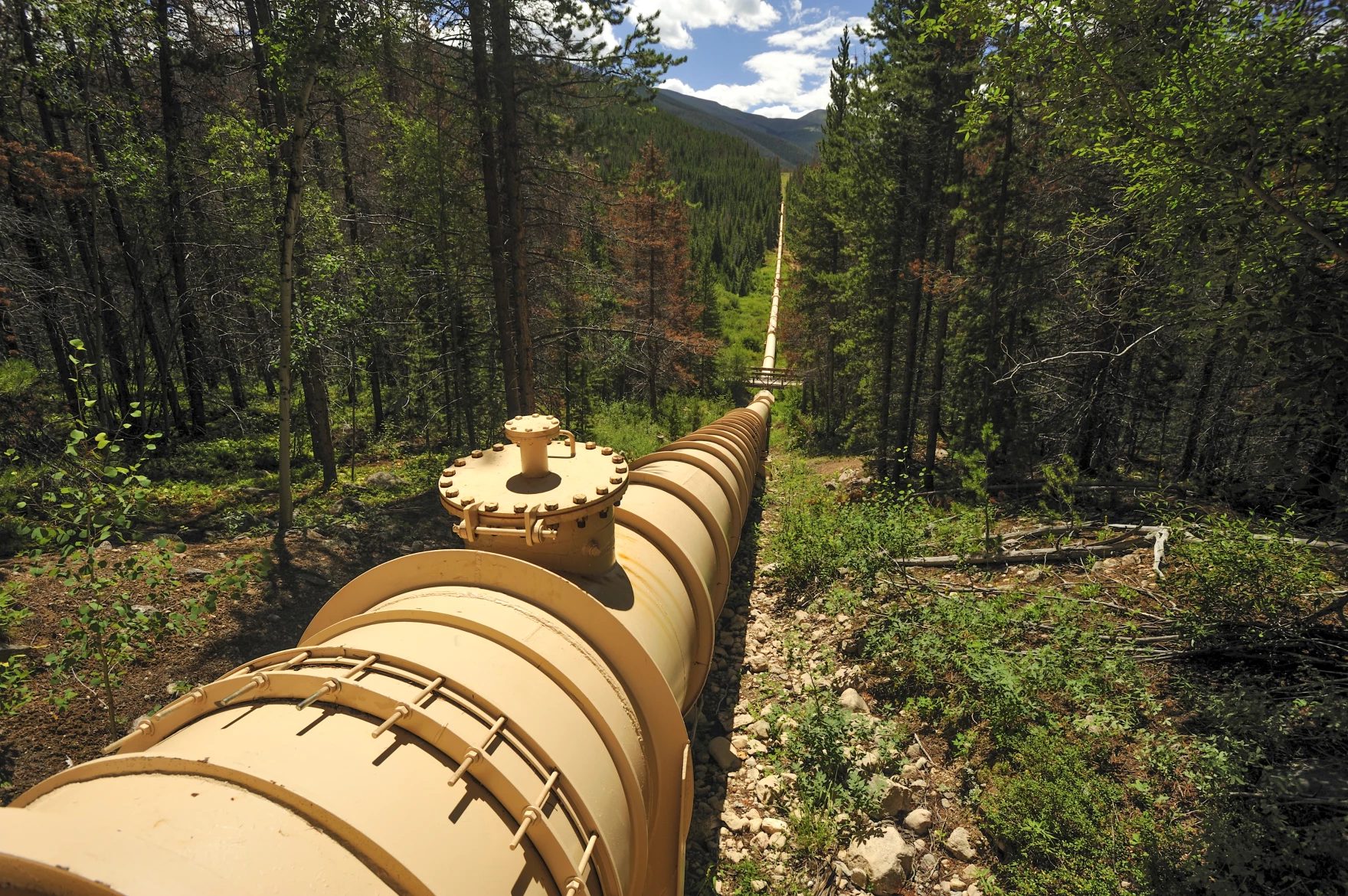
There are countless examples of large pipelines and canals moving liquids around the U.S. at this very moment. The longest existing today is the Colonial Pipeline, which carries gasoline from Houston to northern New Jersey through 5,500 miles of pipe.
So if we have the engineering capacity to do that, could we build similar infrastructure for water? In theory, yes. But it would have to be much larger than existing pipes for oil and gas.
“It takes so much more water to supply a city than it takes gasoline,” said John Fleck, a water policy professor at the University of New Mexico. “So the size of the pipe or the canal has to be a lot bigger, has to be much wider, has to cover a lot more ground.”
Because that pipeline or canal would be so big, it is more likely to ruffle some feathers along the way. Fleck suggested that landowners in its path, including local governments, could push back on a giant new piece of infrastructure running through their properties and mire any pipeline project in regulatory red tape.
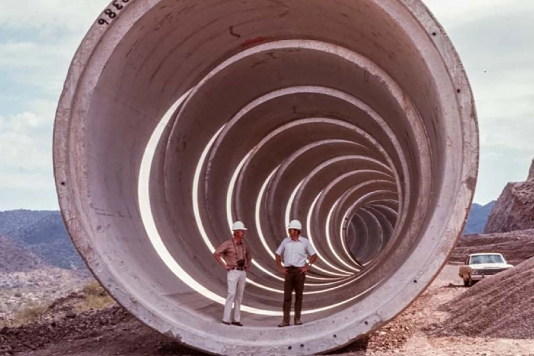
All that said, a pipeline is still physically possible. There is perhaps no better argument for an East-West water transfer than the fact that the Western U.S. is already crisscrossed by multiple huge pipes and canals that carry water across long distances.
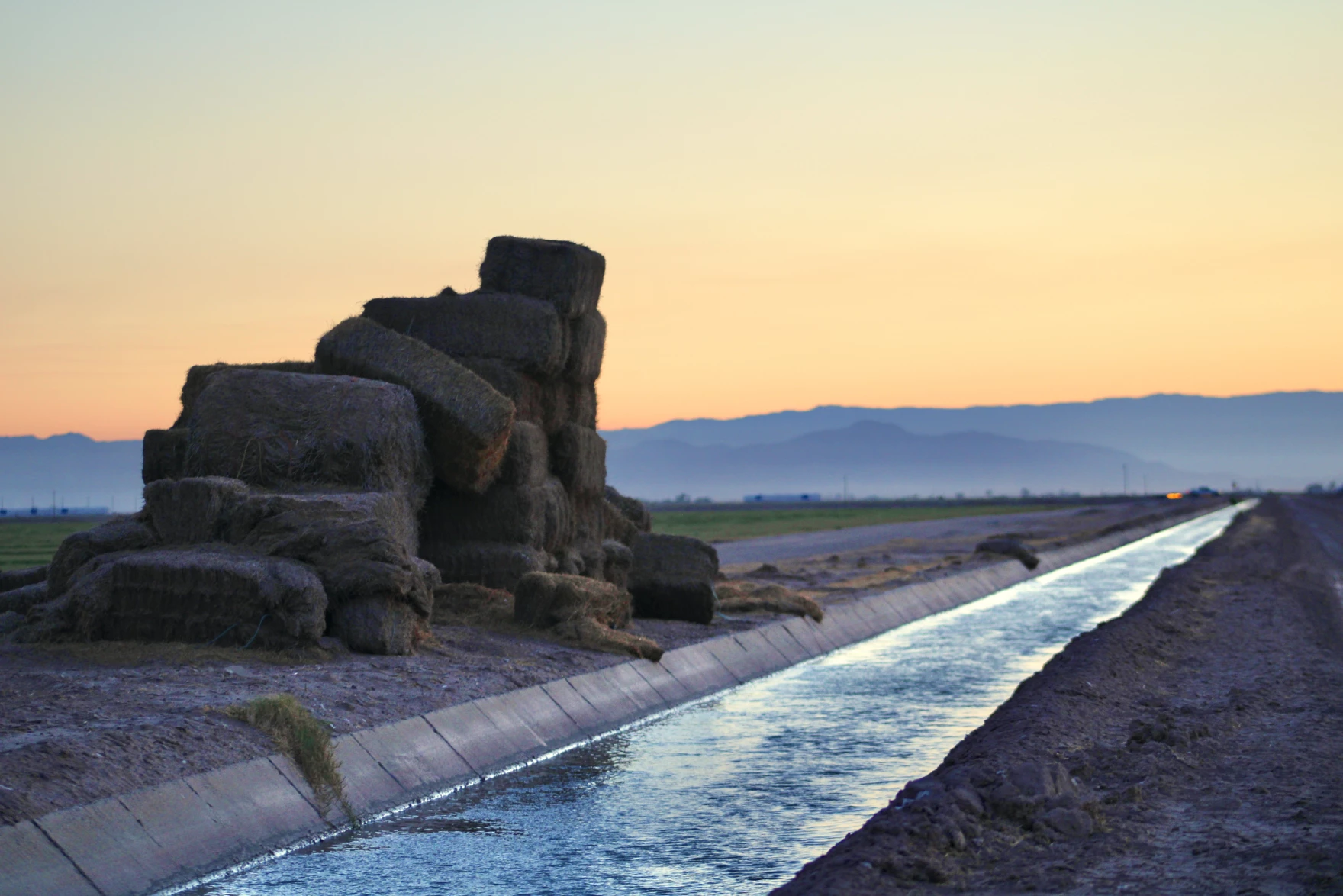
The West as we know it today wouldn’t exist without that kind of infrastructure. Much of Colorado’s population only has water due to a series of underground tunnels that bring water across the Rocky Mountains. Phoenix and Tucson have been able to welcome new residents in the middle of the desert with the help of a 336-mile canal that carries water from the Colorado River. Los Angeles, Albuquerque and Salt Lake City would not be the cities they are today without similarly ambitious water delivery systems built decades ago.
The existence of those water-moving projects isn’t proof that we should build a new, even bigger water pipeline from the East, Fleck said. In fact, he pointed to those systems as proof that we shouldn’t.
“All the feasible ones have largely been done, and the ones that are left are the ones that weren’t done because they just turned out not to be feasible,” he said.
Money problems
Even in a world where the West’s leaders could find a willing water seller, get the right permits and put shovels in dirt, experts say an East-to-West water pipeline would simply be too expensive.
Any solution to the Colorado River crisis will require massive amounts of public spending. The federal government alone has thrown billions of dollars at the problem in just the past few years. But water economists and other policy experts say a cross-country pipeline isn’t the most efficient use of taxpayer dollars.
Kathleen Ferris, former director of the Arizona Department of Water resources, pointed to two ongoing efforts that might be a more cost-effective way to help correct the region’s supply-demand imbalance. One involves paying farmers to pause growing on their fields, freeing up water to bolster the region’s beleaguered reservoirs. Another uses expensive, high-tech filtration systems to turn wastewater directly back into drinking water.
“Sometimes I feel like people don’t want to do the heavy lifting,” said Ferris, who is now a water policy researcher at Arizona State University. “Instead, they want to just find the next water supply and be done with it and have somebody else pay for it.”
Ultimately, she said, those kinds of programs already have momentum and cost less money than an East-to-West water pipeline.
“Why don’t we do the things that we know are possible and that are within our jurisdiction first,” Ferris said, “Before we go looking for some kind of a grand proposal that we don’t have any reason to believe at the moment could succeed.”
Pipe dreams becoming reality
Piping in water from outside of the Colorado River basin, for all of its challenges, is a tempting enough idea that the federal government has given it a serious look.
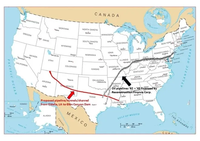
In 2012, a Bureau of Reclamation report analyzed ways to bring new water into the Colorado River Basin, including importing piped water from adjacent states.
The study concluded that strategy was not worth the money and effort.
“It just isn’t the time yet,” said Terry Fulp, a retired Reclamation official who helped write the study. “We felt that there were other things we could be doing in the basin, particularly in the Lower Basin, that would relieve the pressure.”

Fulp said the study was a worthwhile endeavor, and that the idea of importing water from the East might make sense down the road. The scale of the challenge posed by the Colorado River crisis, he said, will take some big thinking, “on the order of the thinking when we built the Hoover Dam.”
“It’s one of those possible solutions that should always stay, if not forefront on the table, somewhere on the table, so that you don’t lose sight of it,” Fulp said.
Despite the fact that many Colorado River experts have cast doubt on the feasibility of a cross-country water pipeline, even some sitting state officials say it deserves more research. Chuck Podolak, director of the Water Infrastructure Finance Authority of Arizona said the idea deserves “serious attention.”
“We understand that every option is hard, every option is expensive, every option has political hurdles, every option is a daunting engineering task,” he said. “Right now, we’re in a let’s-look-at-everything mode with eyes wide open.”
Arizona and other states around the region, with their eyes on continued growth, are already looking at ways to stretch out the water they already have using technology. Terry Fulp said those efforts may need to expend past the spendy and ambitious engineering projects that are already helping facilitate that growth.
“It’ll be the time someday, if we want the Southwest to continue to grow the way it’s been growing,” he said. “There’s only so much water in the basin.”


