Deadpool Data Dump: #LakePowell’s terrible, horrible, no good, very bad water year; Plus — Ruminating on the oil and gas infrastructure that clutters the landscape and sometimes explodes — Jonathan P. Thompson #ColoradoRiver #COriver #aridification

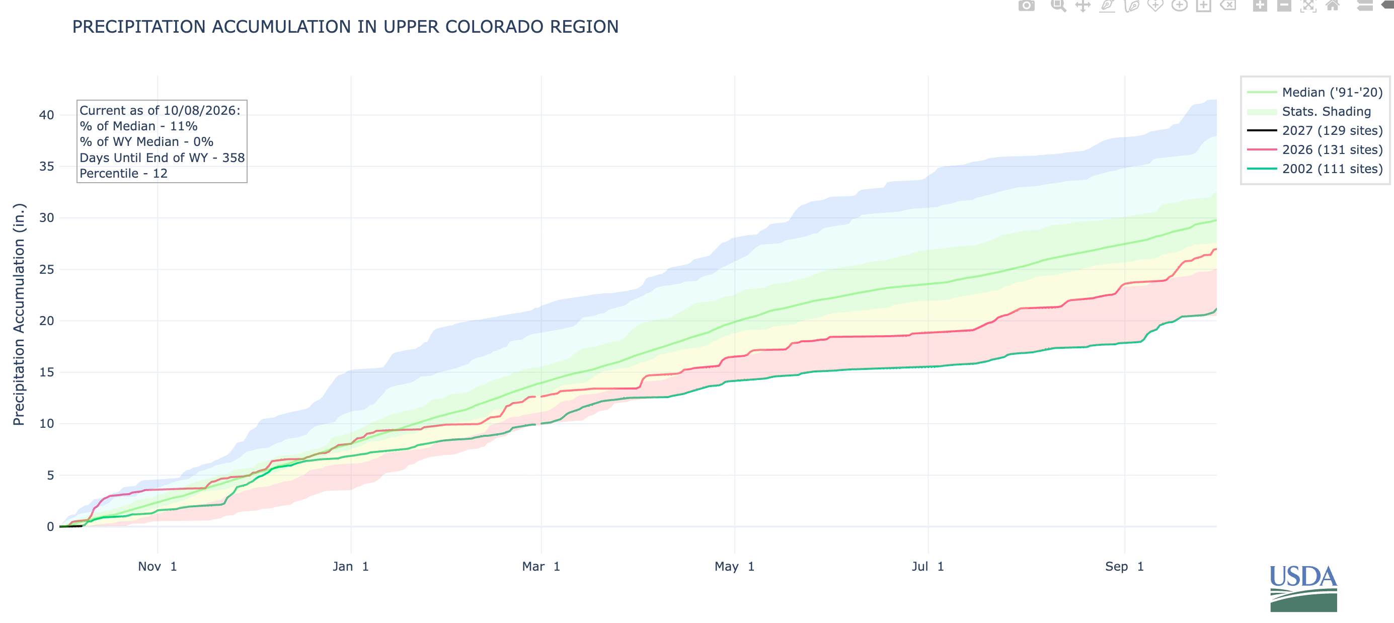
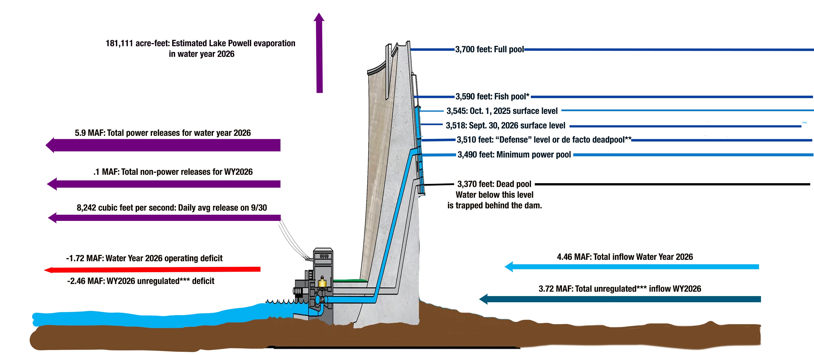
Land Desk graphic using data from the Bureau of Reclamation.

Click the link to read the article on The Land Desk website (Jonathan P. Thompson):

October 9, 2026

💀 DEADPOOL DATA DUMP 🌊

Lake Powell, the nation’s second largest reservoir, serves as a sort of barometer of the Colorado River watershed’s overall health. The reservoir and river have been struggling since the great aridification’s grim onset in 2002. While the river continues to flow, barely, the 2026 Water Year, characterized by one of the worst snow droughts on record, nearly finished off the reservoir. But in the end, it was saved from dropping to “de facto deadpool” by heavy rain at the beginning and end of the water year, and by larger-than-normal releases from upstream reservoirs. 

  • 4.46 million acre-feet: Total Lake Powell inflow from the Colorado, Dirty Devil, Escalante, and San Juan rivers in water year 2026. That’s the third lowest on record, behind 2002 and 2021. This is in spite of the fact that the 2026 snowpack was far lower than those two years, and melting mountain snowpack provides about 80% of the river’s water.
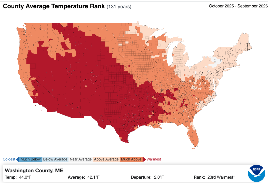
  • The Colorado River Basin experienced its warmest water year on record (in 131 years) in WY2026.
  • 3.72 million acre-feet. Total Lake Powell unregulated inflow in water year 2026. This is the estimate of how much water would have flowed into the reservoir without any supplementary releases from upstream reservoirs. Which is to say, the feds robbed Flaming Gorge, Navajo, and Blue Mesa of about 750,000 acre-feet to save Powell from shrinking even more. That was bad for those upstream reservoirs and the irrigators, anglers, recreational users, and communities that rely on them, and there’s no way it can be repeated if this winter is below average.
  • 6 million acre-feet: Total releases from Glen Canyon Dam in water year 2026. This is the lowest release since the very early days of the dam (in the 1960s). This means less water in the Grand Canyon and less water flowing into Lake Mead. 
  • 181,111 acre-feet: Estimated amount of water that evaporated from Lake Powell in water year 2026. This is equivalent to more than half of Nevada’s total annual allotment from the Colorado River. 
  • 1.72 million acre-feet: Lake Powell’s water deficit — or the difference between outflows (incl. evaporation) and inflows — for water year 2026. 
  • 27 feet: Amount the surface level of the reservoir fell in water year 2026, putting it within seven feet of the level the federal governnment has chosen to “defend,” meaning they’ll pull out all the stops to keep it from dropping below that (for reasons the Land Desk has gone over many times before). The late September storms brought the level back up a couple of feet.

Feds release two-year Colorado River plan, Nevada sues — Jonathan P. Thompson
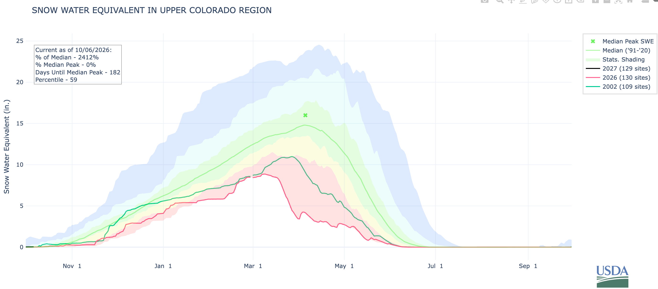

Anyone who lived through the 2002 water year probably thought it couldn’t possibly get any worse. Then along came 2026 and, voila! It was really, really bad — at least as far as the snow goes. And snow is really important, because it provides about 80% of the Colorado River’s flow.
But what’s this? The accumulated precipitation in 2026 was actually … not bad? Notice the big jumps at the very beginning of the water year (far left on the graph) and the very end.

A Colorado River glossary and primer — Jonathan P. Thompson


🛢️ FOSSIL FUEL FOLLIES 📈

THE NEWS: Not one, but two natural gas pipelines ruptured and erupted in flames at nearly the same time on opposite sides of New Mexico. One was in the Permian Basin in Lea County, where a gas line ruptured and caught fire, killing two people. Details of the incident have not been released, nor have the names of the victims. The other was near La Boca, New Mexico, just south of the Colorado line (and can be seen in the video above). It shot flames high into the sky and ignited a wildfire.

THE CONTEXT: Several years ago, as the oil boom in the Greater Chaco Region in northwestern New Mexico was nearing its peak, I sat down in the sleek, modern headquarters of the Bureau of Land Management’s Farmington field office with two BLM officials to talk about the oil boom. Before we got down to business, one of them asked: “Should we show him the scare map?” 

The answer, I guess, was yes, because her colleague handed me the paper showing every well ever drilled in the San Juan Basin, with little red dots for gas, black ones for oil.

It was scary. The northern and central sections of the Basin were almost solid red; in the south and west, dense swarms of black dots strung out along the oil-bearing formations. Dark pinpricks surrounded Chaco Culture National Historical Park. Huerfano Mountain, or Dzil Na’oodilii, where First Woman and First Man and then Changing Woman lived — a sort of Garden of Eden in Navajo cosmology — was embroidered with red and black. The BLM office we sat in, on a fine piece of real estate in the upper-class part of town, has three wells within a quarter mile, and a pumpjack grinds away right next to a golf course green down the road.

To find a stretch of land anywhere in the core of the Basin that hasn’t been drilled or isn’t covered by roads, tanks, pipes or some other hydrocarbon-related infrastructure is nearly impossible — the infrastructure is the landscape. “We’ve got so much pipeline in the ground, it’s like rebar,” said the official, with a tinge of glee. “If you had an earthquake, the ground wouldn’t even shake.”

The official seemed less disturbed than simply fascinated by this fact, and also didn’t seem bothered that he and his colleagues were facilitating even more infrastructure by handing out drilling permits by the dozen and clearing the way for thousands of new wells and all the roads, gathering systems, and pipelines that go with it. 
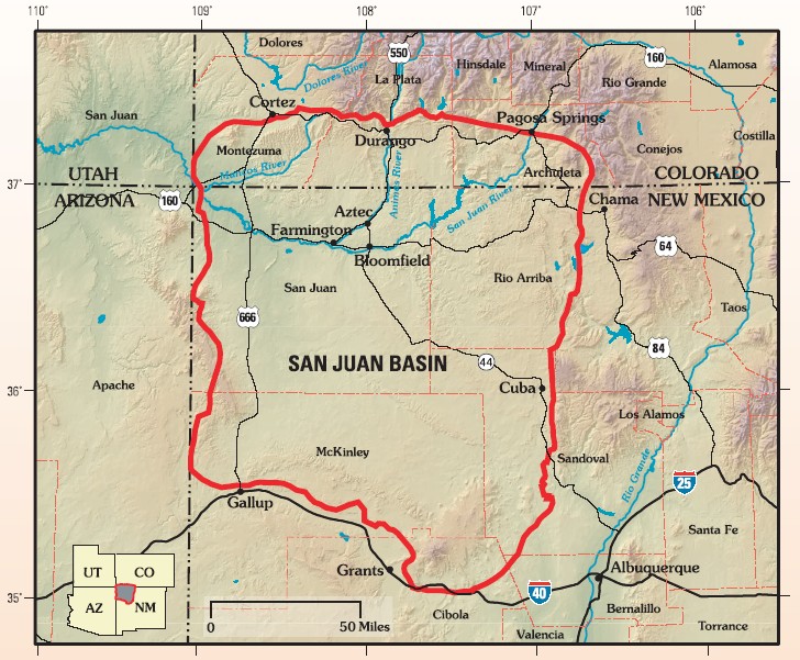
The San Juan structural basin is primarily in New Mexico. By US Geological Survey – Assessment of Undiscovered Oil and Gas Resources of the San Juan Basin Province of New Mexico and Colorado, 2002, USGS Fact Sheet FS-147-02, Public Domain, https://commons.wikimedia.org/w/index.php?curid=5749904

I happen to be writing this at a campsite in the heart of the San Juan Basin gas field. While I can gaze out across the landscape and see nothing but beauty, including the evening’s last light on Dzil Na’oodilii, I am constantly reminded of the ubiquity of the hydrocarbon infrastructure all around me. From just over a little rise comes a slightly squeaky and clanky sound of inadequately lubed bearings, and the low hum and whir of dozens of near and distant pumps and compressors and fans serenades me as I watch the stars unfurl across the big bowl of the sky. 

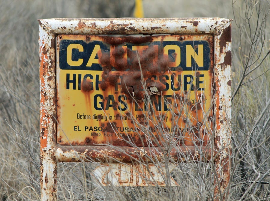
There’s another map of this area that’s even scarier than the one those folks showed me. It includes oil and gas-related “incidents,” which is to say ruptures and spills and explosions and fires and major leaks. Those, too, are all over the map, and happen with disturbing frequency. Usually they’re not as dramatic as the two explosions, but they can be harmful: hundreds of gallons of crude oil sloshed onto the ground and into waterways or aquifers, thousands of cubic feet of methane wafting into the air and adding the potent greenhouse gas to the atmosphere.

When I watch the debate over permitting reform, or read the thoughts of the Abundance crowd, a part of me agrees with the credo of building more. The idea of a new New Deal appeals to me, if done right. Line the highways and interstates with high-voltage transmission lines to carry clean energy across the region, build utility-scale solar on reclaimed coal mines and next to old coal plants and on marginal farmland, build factories to manufacture solar panels and batteries. It would create jobs, revitalize economies, and put more clean energy onto the grid. 

Then I hear news about these explosions, look at the oil and gas incident map, and come out here and find that I can’t take a picture of spectacular and sacred landscapes without a tank or well or road or drill pad showing up in it, somewhere. The Abundance folks and the proponents of the permitting reform legislation, or the Bipartisan Affordability and Jobs Act, want to cover the landscape and our communities with even more of this stuff. While many of them support the bill because it would expedite clean energy development, they don’t mind the fact that it would do the same for natural gas and oil and petroleum pipelines. And, in the social media wars raging over this bill, they discount the concerns of environmental groups worry about the cost we pay when blindly adhering to the credo of Build More Stuff. 

It makes me want to bring these folks out here to the San Juan Basin and take a little walk across this landscape, which is so suffused with beauty, but also cluttered with the detritus of society’s urge for more, always more.

📸 PARTING SHOT 🎞️

Angel Peak in the San Juan Basin at sunrise. Jonathan P. Thompson photo.

NEWSWIRE: Bipartisan lawmakers drop a “turd grenade” of a permitting bill on the environmental movement — Jonathan P. Thompson (LandDesk.org) #ColoradoRiver #COriver #aridification #ClimateChange

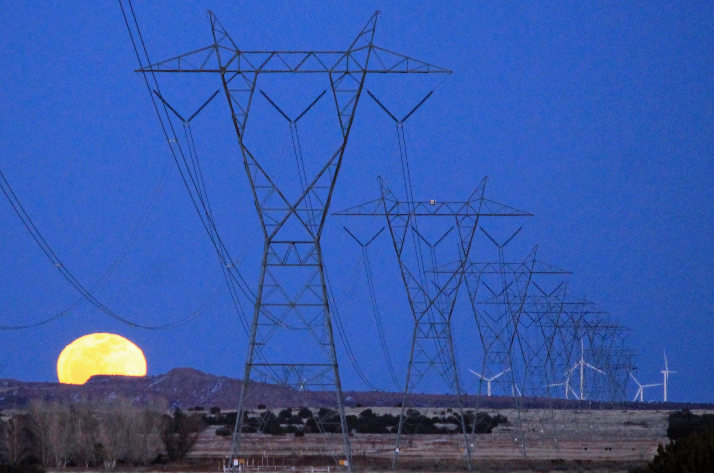
High voltage transmission lines, wind turbines, and the full moon near Winslow, Arizona. Jonathan P. Thompson photo.

Click the link to read the article on The Land Desk website (Jonathan P. Thompson):

October 5, 2026

🔭 OVERSIGHT 👮🏼

A bipartisan group of federal lawmakers, including Sens. Martin Heinrich (D-NM) and Mike Lee (R-UT), introduced legislation aimed at streamlining and accelerating federal environmental reviews and permitting for major projects on Sept. 30. The Bipartisan Affordability and Jobs Act would lower or remove regulatory hurdles for large-scale renewable and transmission projects, fossil fuel pipelines, mining projects, and other industrial projects such as data centers and accompanying power facilities.

The push for faster permitting has been in the pipeline for years, and garnered the support of the renewable energy industries and climate advocates in more recent years, after seeing huge transmission projects such as SunZia and TransWest Express languish in red tape for nearly two decades due to potential impacts to wildlife and cultural sites. The lines were purportedly designed to carry renewable energy back and forth across the West to provide what’s known as “geographical smoothing” of variable solar and wind resources. These sorts of delays, according to permitting reformists, were stifling the energy transition.

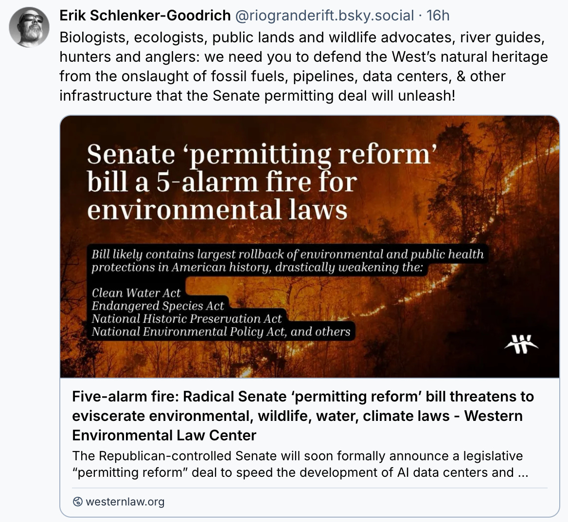
Shortly after the bill’s details were made public, ecologically minded environmental groups raised red flags, warning that, as written, the legislation would weaken bedrock environmental laws, including the National Environmental Policy Act and Endangered Species Act, and take away the public’s power to block or force revisions to projects of all kinds, including ones that will lead to more fossil fuel burning and more greenhouse gas emissions. They pointed out that not only was the notoriously anti-environment Lee sponsoring the bill, but it also had a full-throated endorsement of the American Petroleum Institute.

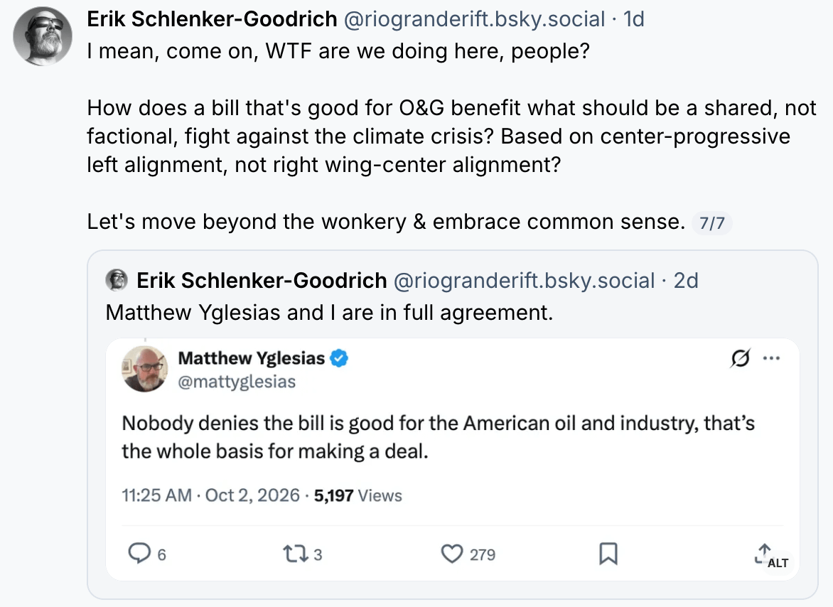
This triggered a vehement, some might even say toxic, reaction from the climate hawks and Abundance adherents that support reform, and ignited a rhetorical civil war within the environmental movement on social media.

The Abundance movement supports the bill, allying itself with the petroleum and tech industries, because it would make it easier to build large clean energy facilities and the transmission needed to move it around. They are operating on the belief that building more and bigger clean energy projects is the only way to battle climate change — even if it also opens the door to more fossil fuel burning. This theory assumes that the market will favor clean energy projects, even if policy favors “all of the above.” 

Marc Levitt, director of environmental regulatory reform for the Breakthrough Institute, called the bill a “heroic breakthrough for permitting reform” and “a massive down payment towards the energy abundant future that Americans deserve.”

Opponents, however, say that pushing energy development of all kinds will not only decimate cultural and natural resources and burden humans and wildlife, but it also will not do much to solve the climate crisis if every new solar array or transmission line is matched with a new natural gas pipeline or power plant. 

“The permitting deal is a betrayal of public lands, water and wildlife, and environmental justice values that Westerners depend on for clean air and water, places to hike, hunt, and fish, and the inestimable sense of freedom the West provides us all,” said Erik Schlenker-Goodrich, executive director of the Western Environmental Law Center based in New Mexico.

The legislation also raises concerns that the Trump administration could use the legislation to further weaken environmental protections to benefit the fossil fuel, nuclear, mining, and data center industries, while still throwing up roadblocks to solar and wind development.

The Land Desk will have an analysis of the bill and how it might play out on the Land Desk’s beat in the coming days.

🔋ENERGY TRANSITION 🔌
  • California Gov. Gavin Newsom signs legislation allowing residents to install plug-in or balcony solar without getting utility approval, along with a suite of other bills that should advance the energy transition. (Climate Colored Goggles)
🐓 REGULATORY CAPTURE CHRONICLES 🦊
  • The developer of a proposed pumped hydropower storage project on Black Mesa on the Navajo Nation reportedly tried to pay off, coerce, and bully non-profit Tó Nizhoní Ání into dropping its opposition to the project. The group has stood its ground. (KNAU)
⛏️ MINING MONITOR ⛏️
  • Advocacy groups file a lawsuit challenging the U.S. Forest Service’s and Fish and Wildlife Service’s approval of South32’s Hermosa mine expansion onto about 52,000 acres of federal land in the Patagonia Mountains of southern Arizona. The groups accuse the agencies of violating the Endangered Species Act by failing to adequately analyze the projects impacts on threatened wildlife. (Center for Biological Diversity)
🛢️ FOSSIL FUEL FOLLIES
  • Arizona Public Service and the Navajo Transitional Energy Company sign an agreement that could allow the Four Corners coal-burning power plant in northwestern New Mexico to continue operating until 2038, seven years later than its scheduled retirement date. APS officials say they need the facility online to meet growing data center-driven energy demand and ensure reliability as grid-battering extreme weather events increase in frequency. (Arizona Republic)
  • Tó Nizhoní Ání and San Juan Citizens Alliance file an appeal seeking to block the Interior Department’s approval for the expansion and 110-year life extension of the No Name area of the Navajo Mine in northwestern New Mexico. The mine feeds the Four Corners Power Plant, which is now slated to close in 2038. “It’s disturbing that a federal agency could fast-track a project of this size and scope with almost no credible review, analysis or public consultation,” said Nicole Horseherder, Tó Nizhóní Ání’s executive director. “This permit continues a legacy of corporate interests abusing our resources, tearing up our land, depleting our water and displacing Navajo citizens. Worse still, it’s being done by a Navajo enterprise.” (news release)
  • State data show the West Elk coal mine near Somerset, Colorado, is emitting potent greenhouse gas methane and other harmful compounds at nearly four times the permitted rate, spurring environmental groups to call for the mine’s operator to be sanctioned and forced to use the best available technology to slow the leaks. (Colorado Sun)
The West Elk coal mine near Somerset in winter. Jonathan P. Thompson photo.
  • Wyoming Gov. Mark Gordon (R) considers legally challenging a new California law that requires a contentious proposed coal export terminal in Oakland to go through a full environmental impact review prior to local agency approval, potentially stifling Wyoming’s effort to send Powder River Basin overseas via a West Coast port. (Cowboy State Daily)
⛈️ WACKY WEATHER WATCH⚡️
  • The recent deluges have done a real number on the roads leading into Chaco Culture National Historical Park in northwestern New Mexico. The south road, according to the park’s Facebook page, “is still muddy and slick in places, with patches of deep standing water and wet clay.” Meanwhile, “the former north road (CR 7950) has sustained catastrophic damage at Escavada Wash. This road is completely inaccessible as an entry point to the park. We expect the repair will take a long time. Please do NOT attempt to enter Chaco from the north road.” (NPS)
  • Flash flooding washes out sections of the BNSF Railway’s main line alongside the Rio Puerco near the Arizona-New Mexico border. The Rio Puerco lacks reliable streamflow gauges, but the Little Colorado River just downstream from its confluence with the Rio Puerco hit an astounding 6,800 cubic feet per second during the late-September storms in a place that is normally virtually dry. (Navajo Times)
🐟 COLORADO RIVER CHRONICLE 💧
  • Reduced water releases from Glen Canyon Dam diminish the Colorado River’s flows in the Grand Canyon, which in turn affects recreation, river ecology, and tribal nations’ sacred places. (High Country News)
🦫 WILDLIFE WATCH 🦅
  • A bear wanders into the Aspen farmers market and starts chowing down, apparently unfazed by the high prices. Things like this look cute, but it can end up being deadly for the bear.
🪦 OBITUARY 🏜️
  • Ken Sleight, the inspiration for Seldom Seen Smith in Edward Abbey’s the Monkey Wrench Gang, died on Oct. 2 in Moab. Sleight was a river-runner, canyon lover, and lifelong protector of and advocate for Utah’s “Standing Up Country.” “We just lost such a wonderful person,” John Weisheit, director of Living Rivers and friend and mentee of Sleight’s, told The Salt Lake Tribune. “We need more Ken Sleights, not less.” (Salt Lake Tribune)
📖 READING ROOM 🧐

The New Yorker has again ventured into the Four Corners Country, this time with a story by Peter Hessler about the Million Dollar Highway between Silverton and Ouray, “one of America’s scariest roads.” I always enjoy Hessler’s writing, whether about Cairo or Nucla, and this story’s no exception. His descriptions of the many accidents and ensuing rescues on that stretch of road are vivid and, yes, scary. And his history of the area and Otto Mears, the road’s original builder, is compelling. But I have to take issue with the framing of the story, and the headline, which is: “Why doesn’t anyone want to fix one of America’s scariest roads?” To which I’d respond: Does it really need fixing?

Look, traversing Red Mountain Pass can be daunting, especially during the spring freeze-thaw cycle when rocks are dislodged from the cliffs and tumble down onto the asphalt and the Mother Cline’s human-sized icicles hang perilously over the pavement.Sometimes folks tragically go over the edge. Several plow drivers have perished on the road after getting pummeled by the Riverside Slide. In 1963, Reverend Marvin Hudson and his two teenaged daughters were hit by the Riverside, swept into the gorge, and buried (oddly, Hessler leaves this story, one of the most nerve-chilling, out of the story). This problem has been largely solved by simply shutting the road when danger is high. 

So sure, the road can be dangerous and nerve-racking, but frankly, I can think of plenty of far scarier — and statistically more dangerous — stretches of road. Highway 550 between Albuquerque and Bloomfield is a virtual carnage factory, especially when the oil and gas fields are busy with water and oil-hauling trucks. Highway 191 between Monticello and Moab is super sketchy — and deadly. Or how about I-10 in the Phoenix area, I-40 just about anywhere, or I-70 dropping from the mountains into the Colorado’s Front Range on a weekend afternoon?

Back in the late 1980s, Colorado spent about a half-billion dollars to “fix” I-70 through Glenwood Canyon. Now it’s the site of multi-vehicle accidents, rockslides, debris flows, and not infrequent closures due to the above. So, yeah, Red Mountain Pass doesn’t need fixing. People just need to slow the hell down and pay attention.


Another control day — Jonathan P. Thompson


New #Colorado state law requires cities, water users to revegetate farmland before using water elsewhere — Rocky Mountain PBS #ArkansasRiver

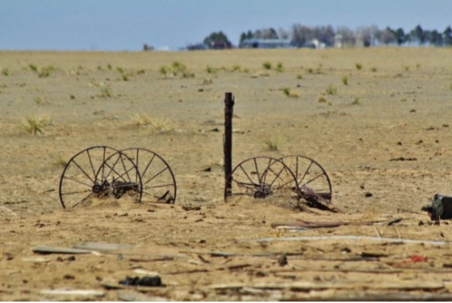
Photo of Crowley County by Jennifer Goodland

Click the link to read the article on the Rocky Mountain PBS website (Cormac McCrimmon). Here’s an excerpt:

June 16, 2026

A new Colorado law requires water users that buy water tied to farms in the Arkansas Valley to revegetate land before using water elsewhere…

“When that water leaves, the impacts of the dry-up don’t leave with it. They stay with the land and the people who live here,” said Jack Goble, general manager of the Lower Arkansas Water Conservation District, which advocated for the legislation.Revegetation involves restoring native plant cover to the land to reduce erosion, maintain soil moisture and manage noxious weeds…

In Crowley County, where productive farmland has declined by more than 90% since the 1970s because of water transfers, so-called “buy-and-dry” transactions have spawned a sea of dirt that supports little more than weeds. According to a recent report from ProPublica, these water transfers have caused an “environmental catastrophe,” in Crowley County, in which birds, bees and wildlife have fled. A 2026 report from Colorado State University estimates that every acre of irrigated land taken out of production leads to an annual economic loss of $1,400 to $1,600.  Governor Jared Polis (D) signed House Bill 26-1340 into law June 1. The new law, sponsored by representative Ty Winter (R), gained broad support in the House and Senate. The law takes effect January 1, 2027. 

“If you look at other natural resources — coal, gravel, oil and gas — when that’s mined from the land the requirement is on the entity that profits off of, and mines that, to go and reclaim that land. We think water should be no different,” Goble said.

Map of the Arkansas River drainage basin. Created using USGS National Map and NASA SRTM data. By Shannon1 – Own work, CC BY-SA 4.0, https://commons.wikimedia.org/w/index.php?curid=79039596

The #Colorado Legislature okays tougher rules for managing farmlands dried out by urban water transfers — Michael Booth (Fresh Water News)

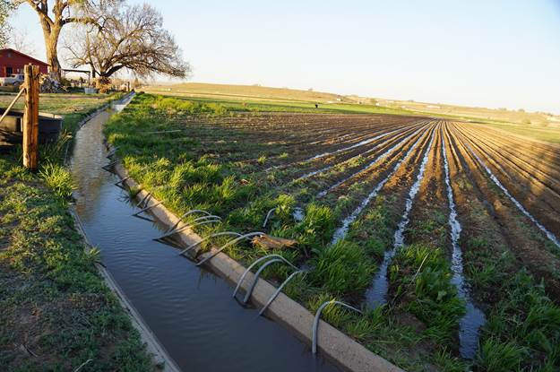
Flood irrigation in the Arkansas Valley via Greg Hobbs

Click the link to read the article on the Water Education Colorado website (Michael Booth):

May 21, 2026

Southeastern Colorado’s farmers and farming communities say they’ve won valuable protections against the historic worst practices of cities’ “buy and dry” of agricultural water, after final passage of revegetation requirements along the Lower Arkansas River that may spread to other basins of the state.

Gov. Jared Polis is expected to sign the measure, House Bill 1340 (Revegetate or Dry Farm Formerly Irrigated Agricultural Land), after officials from his Department of Natural Resources testified favorably for the bill.

“For the first time in Colorado, this new law establishes that when irrigation water is permanently removed from farmland for other uses, the responsibility to properly revegetate and reclaim that land belongs to the entity removing the water,” said Jack Goble, general manager of the bill’s primary advocate, the Lower Arkansas Valley Water Conservancy District.

“It also strengthens the role of local counties by requiring the water court to incorporate their revegetation criteria and enforcement mechanisms into change-of-use decrees. At its core, this law sets clear expectations, creates accountability and helps protect the land, neighboring landowners and rural communities that are left behind when water leaves,” Goble said.

Southeastern Colorado advocates conceded some measures after the bill’s introduction.

  • The original bill limited a water use transfer to 50% of the purchased water until 50% of the affected farmland had been successfully revegetated against erosion and deterioration. The bill as passed removes the hard percentage, and gives city water agencies more flexibility when they buy, such as posting a bond or negotiating conditions during local permit applications.
  • The initial bill language had a hard requirement for a five-year water court oversight of revegetation after a rights transfer to guarantee reclamation. The bill as passed gives water courts the ability to create an oversight period, but only when there is “a substantial risk that reclamation could regress,” Goble said.
  • The final bill gives assurances to Arkansas Valley communities by requiring any reclamation agreements with cities to be written into change-of-use decrees, after the details have been negotiated by an intergovernmental agreement in a permit.

“Colorado agricultural lands are vital to our economy and way of life in Colorado, and protecting Colorado lands from the impacts of drought, erosion and invasive weeds is important to protecting our natural resources and our communities. The governor will review the final version of the bill,” spokesperson Ally Sullivan said.

Aurora Water officials, from one of the Front Range water agencies that has traveled far for decades to acquire river rights and agricultural water rights, said they support concepts in the legislation, but have reservations about how it might be executed.

“Aurora Water has actively worked in the Lower Arkansas Valley for decades, including opening an office in Rocky Ford in 1988 with full-time staff dedicated to supporting long-term revegetation and land stewardship efforts after water has been removed from agricultural production,” said Aurora Water spokesperson Shonnie Cline. “In many respects, House Bill 1340 was largely modeled after practices Aurora Water has implemented in the region, and we strongly support the overall intent of the legislation.”

Cline said Aurora Water backs responsible reclamation, and “at this time, we do not anticipate the bill significantly changing Aurora Water’s current operations in the region.”

Aurora Water is much less enthusiastic about potential future legislation applying the new southeastern Colorado protections to other river basins in the state.

“Aurora Water would have concerns with any future expansion of this type of legislation into other regions of the state as it could unintentionally harm existing dryland farming operations or create disincentives for farmers who are successfully operating under dryland agricultural practices on converted lands,” Cline said.

“Additionally, Aurora Water believes it is important for water courts to retain the authority to independently evaluate whether revegetation or dryland farming standards to be incorporated into a court decree are technically appropriate, scientifically supported and feasible under the specific facts of each case, regardless of where the standards originate.”

Controversy over what happens to former farm and pasture land when a distant city dries it up has hit other parts of Colorado beyond the Lower Arkansas River, including Thornton’s purchase of thousands of acres of water rights in Weld and Larimer counties. Thornton has tried to placate the counties with commitments to revegetate or promote responsible dryland farming when it starts taking water off the acreage and putting it into an under-construction pipeline.

Aurora and Colorado Springs have faced decades of criticism from southeastern Colorado counties for past purchases and dry-ups that left areas like Crowley County looking like Dust Bowl victims. More recent farm water purchase agreements in places like Bent County limit the number of years in a row a city could take farm water, and make other concessions to try to support local economies.

Colorado Springs Utilities said after the bill’s final passage, “We recognize that revegetation of formerly irrigated lands is a fundamental requirement for any water transfer.”

“We strive to forge mutually beneficial partnerships in the Arkansas River Basin, which is why our team spent over three years negotiating terms and conditions for our water projects in Bent County,” Colorado Springs officials said, in a statement.

Colorado Springs officials said they appreciated the negotiations over House Bill 1340 for “taking these concerns seriously so that we could reach a compromise on the introduced bill that upholds our local agreements. … We believe that reliance on science and collaboration with local governments allows projects to be tailored to unique community and regional needs.”

More by Michael Booth

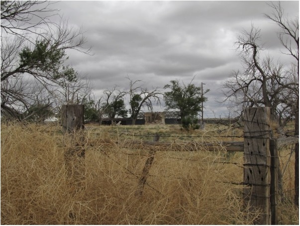
Crowley County. Photo credit: Jennifer Goodland

#Colorado stream access debate drifts beyond 2026 after lawmakers fail to find compromise between landowners, recreationists — The Summit Daily #2026COLeg

Recreational vehicle: Photo: Brent Gardner-Smith/Aspen Journalism

Click the link to read the article on the Summit Daily website (Robert Tann). Here’s an excerpt:

May 19, 2026

Lawmakers decided against introducing a “right to float” bill this legislative session, despite a push by river advocates

Last summer, a group of Colorado legislators hopped aboard several rafts with river guides and conservationists to float a mellow section of the Colorado River south of Kremmling.  The trip was organized by a coalition of outdoor recreation advocates, who’d hoped to persuade lawmakers to once again wade into the issue of stream access and what rights the public has when recreating in rivers that run through private property.  But over the course of Colorado’s 120-day legislative session, no such bill was introduced. A compromise between recreationists and landowner groups, which lawmakers had been seeking, never materialized…River rafters have been pushing for legislation that would provide immunity from trespassing for floaters who touch the privately-owned riverbeds and banks to help with navigation. They hoped the proposal could provide a tailored solution and avoid the longstanding fight over whether river beds should remain private property or be publicly owned…Landowner groups remained resistant to any legislative approach, which they say would only breed conflict. They would prefer to see river access issues continue to be resolved the way they’ve long been, with agreements made between landowners and river users…

Heading into this year’s legislative session, supporters of public river access advocates were again at odds over what kind of policy they should push for.  Not long after organizing lawmakers’ river trip last summer, the stream access coalition, made up of several outfitting and conservation groups, split into two camps. One was focused on the right to wade in rivers, primarily driven by anglers, while the other was concentrated on the right to float. It was the latter group, which dubbed itself the River Recreation Alliance, that ultimately pursued legislation this year…A right to wade bill would have meant taking on private property ownership of river beds. A study published last year by the free-market think tank Common Sense Institute warned that the state, should lawmakers go that route, would be at risk of violating the takings clause of the Colorado Constitution, which prohibits the government from taking or damaging private property without compensation.  Johnson believes legislation focused instead on floating would minimize those risks, since it would not strip land from property owners. Her coalition’s proposal also would have allowed rafters to touch the bed and banks of rivers only for safety reasons, such as scouting, portage and to avoid obstacles, according to a one-page memo Johnson shared.  Walking, wading, anchoring or wade fishing would not be protected under the proposal, which also would have provided liability for landowners when accidents or injuries occurred in the river. 

Nearly every corn seed planted in #Colorado is covered in insecticide. Lawmakers may restrict the chemical. Potential limits on use of neonicotinoids is under discussion between lawmakers, advocates — The #Denver Post

Soil food web. Credit: USDA Natural Resources Conservation Service (NRCS)

Click the link to read the article on The Denver Post website (Elise Schmelzer). Here’s an excerpt:

Colorado farmers plant tens of millions of corn seeds every year, nearly every one of them covered in a thin layer of insecticide. The neonicotinoids used in the coatings protect the seed from pests in the soil and, as the crop matures, the chemical is absorbed into the plant’s tissue, where it continues to paralyze and kill insects that chomp on the crop. Farmers say the insecticide is necessary, but growing concerns about its impact on crucial pollinator species and the wider environment are prompting a push in Colorado for more regulation of the widely used class of chemicals. Environmental advocates plan to seek a bill in the state legislature in 2026 that would limit their use in hopes of protecting pollinators and water quality. While a draft bill has not yet been made public, the environmental groups working on it said the legislation would ban the use of neonicotinoids without prior approval by inspectors overseen by the Colorado Department of Agriculture.