As October flooding recedes, the #SanLuisValley pins its hopes on a wet winter: The 3-month forecast predicts a better water year, and there are other encouraging early signs that a more beneficial spring runoff is in the cards — AlamosaCitizen.com #RioGrande

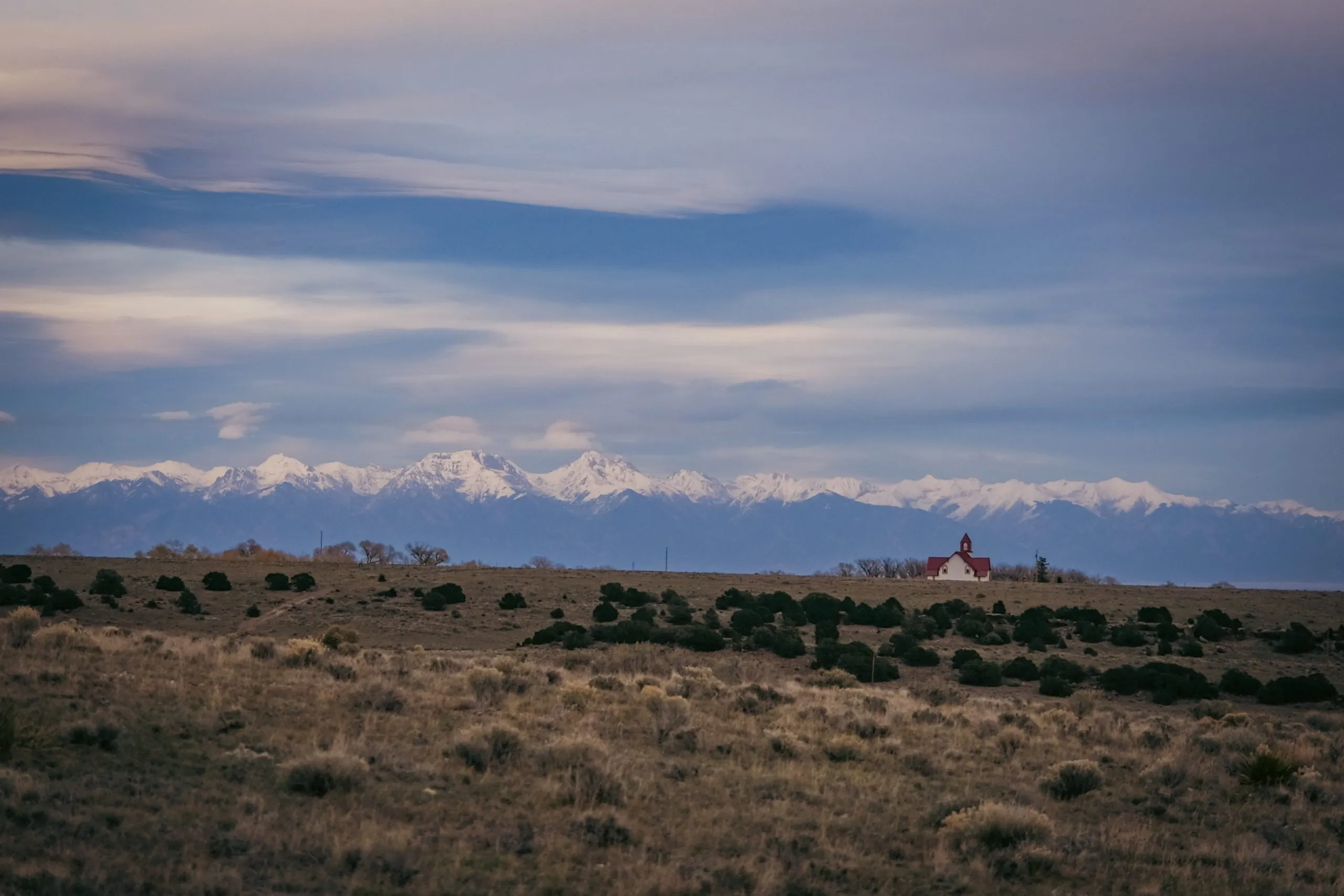
After the floods of October, the mountains surrounding the Valley are capped with snow. Looking east from the La Garita church toward the Sangre de Cristo range. Credit: Ryan Michelle Scavo

Click the link to read the article on the Alamosa Citizen website:

November 1, 2026:

The historic rains of Oct. 22-25 increased the annual flow of the Rio Grande by nearly 100,000 acre-feet and the Conejos River by around 60,000 acre-feet, according to preliminary data by the Colorado Division of Water Resources.

As fast as those rivers rose, though, they are receding just as quickly.

For the second straight October, the San Luis Valley found itself in historic flooding conditions, with this year’s fall storm delivering the fastest cubic-feet per second flow on the Rio Grande in nearly 80 years at 11,000 cfs.

“We saw very high flows in the past week or so, and we got a lot of recharge to the aquifers from those flows. However, we will need many, many more high-flow years to recover the aquifers and the water system as a whole,” said Craig Cotten, DWR division engineer in the San Luis Valley.

San Luis Valley Groundwater

The state is estimating the flooding allowed around 50,000 acre-feet of recharge to the closed basin area, which Cotten said is great. But understand, he said, that the unconfined aquifer has lost an estimated 72,000 acre-feet in the past year.

“The high precipitation event this past week is an encouraging sign for next year (spring 2027 runoff). However, recall that we had a similar high precipitation event last October that caused large streamflows and flooding, and yet it didn’t correspond to a good streamflow year this year,” he said. “In fact, this year would have been one of the driest on record if not for the increased precipitation over the past month.”

The same was said just ahead of the October 2025 storm, with the unconfined aquifer measuring at its lowest point at the time, and whatever water in the river at a near standstill. Then the Rio Grande hit 9,000 cfs and grew by 80,000 acre-feet and the Conejos by 20,000 acre-feet from the October 2025 storm. Only to be followed by the second warmest November on record and the first warmest December on record, according to National Weather Service data.
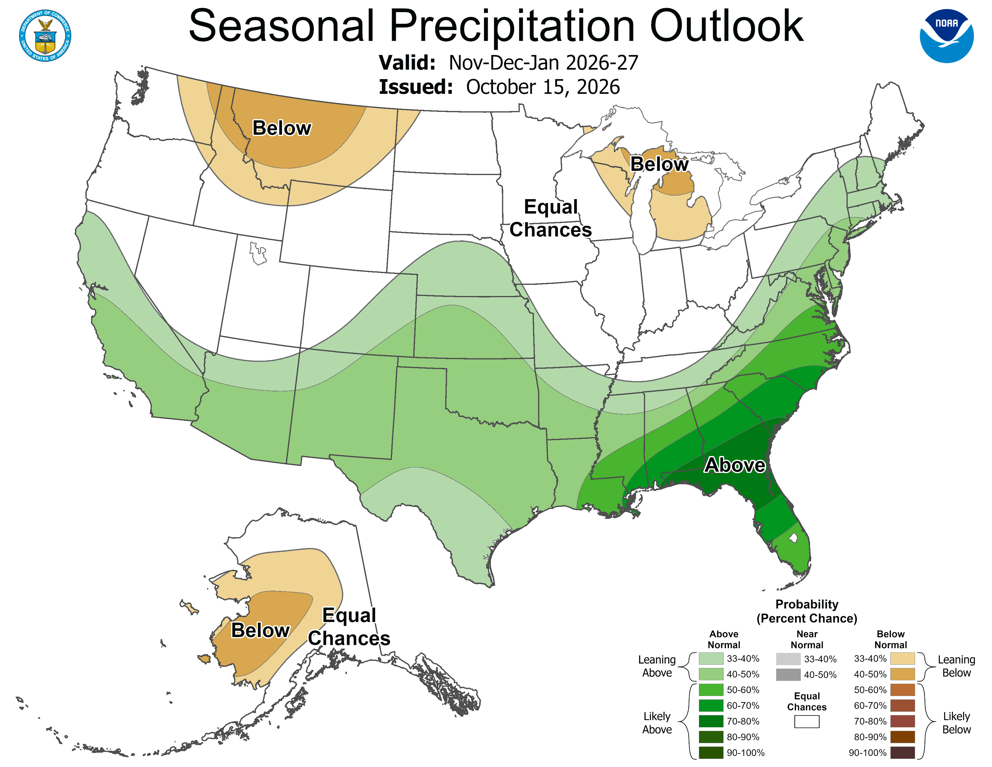
Will 2026 be any different? The next 3-month forecast says it will, and there are other encouraging early signs that a more beneficial 2027 spring runoff is in the cards.
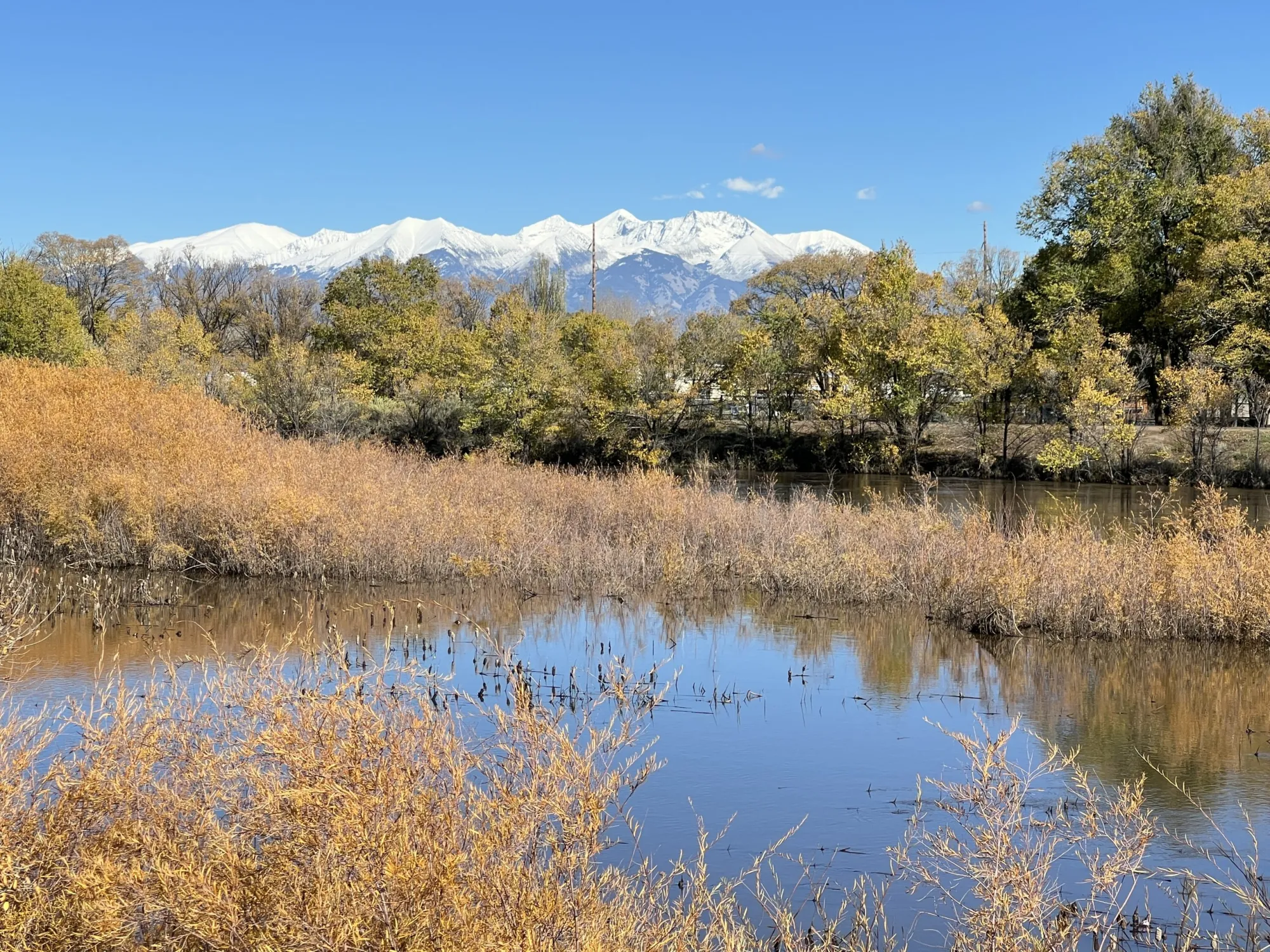
The Rio Grande has receded from its record-high flows, and the mountains have snow at last. Credit: The Citizen

For starters, and this is a big one, the 14ers that surround the Valley are all forming snow caps, including on the south face of Mt. Blanca, which hasn’t been the case in a couple of years.

Ask the irrigators who rely on Trinchera Creek about that. They’re having a better October, like the rest of the Valley’s agricultural community.

The irrigation season has been extended to Nov. 6 on the Rio Grande and Conejos River, and Cotten said it may be extended on the Alamosa River as well.

Currently, the Rio Grande’s forecasted annual flow at Del Norte is 440,000 acre-feet, or 68 percent of average. Of that, 109,000 acre-feet belongs to the Rio Grande Compact with New Mexico and Texas, according to Cotten. For the Conejos, the projected annual flow is 220,000 acre-feet or 82 percent of average, and a water compact obligation of 57,000 acre-feet.

Those totals likely grow in the coming weeks, should November storms arise.

The October storm couldn’t have been timed more perfectly to hold the moisture, with clocks set to turn back an hour Nov. 1. The return to standard time marks earlier and darker evenings, which allows for longer nights and the cold to settle in before the rise of the morning sun.

Lush green fields in Conejos County. Credit: The Citizen

Overnight temperatures are key moving through November and December if there is to be true benefit to the Valley floor going into 2027. The National Weather Service forecast remains encouraging for the type of snowy winter the Upper Rio Grande Basin desires, with climate maps showing above-normal levels of moisture December through February and an equal chance for winter-like temperatures.

“We will see what actually happens,” said Cotten, mindful of the currently warm temperatures that, mixed with the October rains, have left the Valley’s growing fields looking lush and ready for another cut.

The growing fields and marshes will most certainly “go to bed wet” as they say, just like an October ago. Only this time, with more moisture potentially on the way in the first days of November, there is hope again for a change in the Valley’s fortunes.

Rio Grande and Pecos River basins. Map credit: By Kmusser – Own work, Elevation data from SRTM, drainage basin from GTOPO [1], U.S. stream from the National Atlas [2], all other features from Vector Map., CC BY-SA 3.0, https://commons.wikimedia.org/w/index.php?curid=11218868

South Platte River Basin #climate for the week ending November 2, 2026 #SouthPlatteRiver

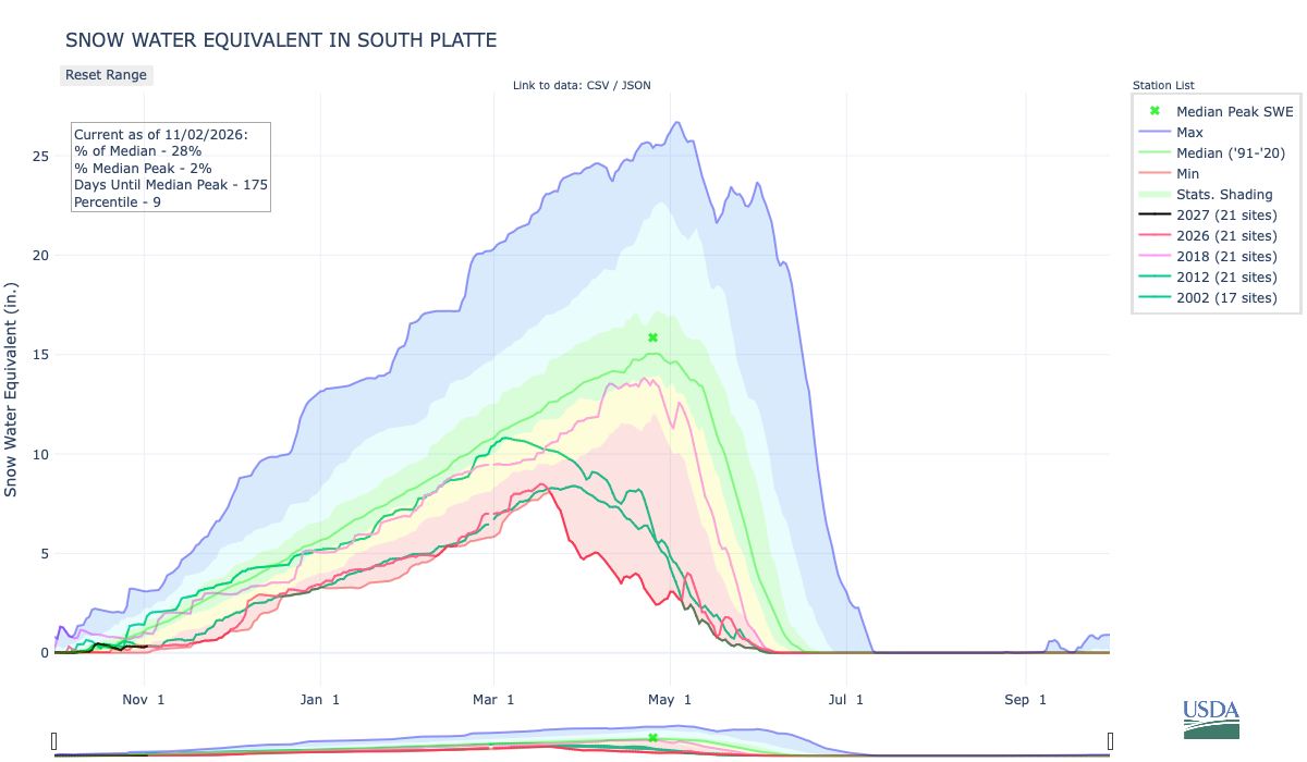
Below is the Snow Water Equivalent in South Platte graph from the NRCS for November 2, 2026. Snowpack is 28% of the median (down 16% one week, wild swings this time of the accumulation season) and 2% of the median peak (down 2% one week). There are 175 days until the median peak. I’ve added the lines for 2026, 2018, 2012, and 2002 since the statewide drought is still very pronounced.

Below is the Precipitation Accumulation in South Platte graph from the NRCS for November 2, 2026. This morning precipitation, at the SNOTEL stations, is at 68% of the median (down 11% one week), and 6% of the water year median (up 1% one week), There are 333 days left in the water year. I’ve added the lines for 2026, 2018, 2012, and 2002 since the statewide drought is still very pronounced.

There is a chance for snow showers today, and snow showers are likely Wednesday, in the central mountains. Rain/snow is likely today, with a chance for rain/snow Wednesday, in the northern mountains. Showers are likely today, with a chance for showers Wednesday, down here about 13 miles from South Table Mountain, where Ku Klux Klansmen burned crosses to celebrate Denver Mayor Ben Stapleton surviving a recall election in August 1924. From Wikipedia:

As chronicled by Robert Alan Goldberg in his book Hooded Empire : The Ku Klux Klan in Colorado, Stapleton was the Klan candidate for mayor of Denver in 1923 and won the election with Klan support. When Stapleton declared his candidacy for mayor in March 1923, he was Klan member number 1,128 and a close friend of the Colorado Klan Grand Dragon, John Galen Locke. Rumors of Stapleton’s Klan membership circulated during the mayoral campaign. Stapleton responded by denying that he was a Klan member and condemning the Klan, “to appease his Jewish and Catholic supporters.”  Stapleton declared, “True Americanism needs no mask or disguise. Any attempt to stir up racial prejudices or religious intolerance is contrary to our constitution and is therefore un-American.” The voters believed Stapleton’s denial and he was elected, defeating an unpopular incumbent, Dewey Bailey. Stapleton then appointed fellow Klansmen to multiple positions in Denver government, though he initially resisted Klan pressure to appoint a Klansman as chief of police.

An anti-Stapleton backlash developed due to the Klan’s infiltration of Denver government. The anti-Stapleton coalition began the process of petitioning for a recall election. Stapleton knew that to survive the recall he would need Klan support. He capitulated to the Klan demand that he appoint a Klansman as police chief, with the result that the police department became in effect a Klan organization. This galvanized the anti-Stapleton forces and they succeeded in forcing a recall election of Stapleton in August 1924.

According to Goldberg’s description of the recall election, “[t]he Klan dominated the Stapleton campaign, contributing more than $15,000 and scores of election workers.”  “On July 14, 1924, Mayor Stapleton addressed a Klan gathering on South Table Mountain and reaffirmed his commitment: ‘I have little to say, except that I will work with the Klan and for the Klan in the coming election, heart and soul. And if I am reelected, I shall give the Klan the kind of administration it wants.'”  The anti-Stapleton coalition had run a poor candidate against Stapleton in the recall election (Dewey Bailey, the incumbent mayor Stapleton defeated in 1923), and Stapleton won the recall election by a landslide. On the night of the election, Denver Klansmen burned crosses on South Table Mountain to signify their victory.

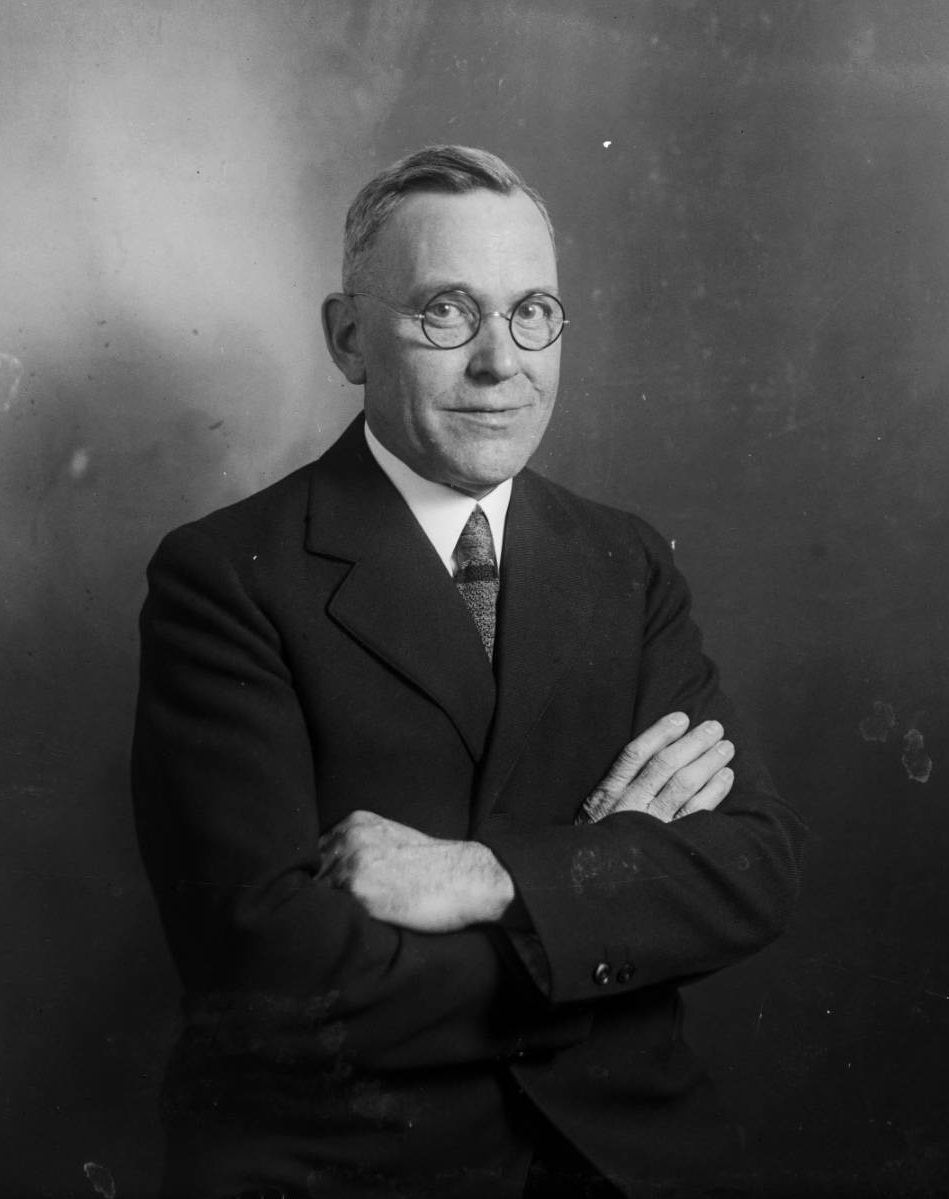
Benjamin Stapleton. By Harry Mellon Rhoads – Denver Library Digital Collections, Public Domain, https://commons.wikimedia.org/w/index.php?curid=72155568
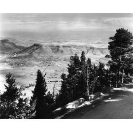
South Table Mountain. Date: 1910-1920. View from evergreen lined Lariat Loop Road on Lookout Mountain east over Golden. Credit: Denver Public Library Digital Collections

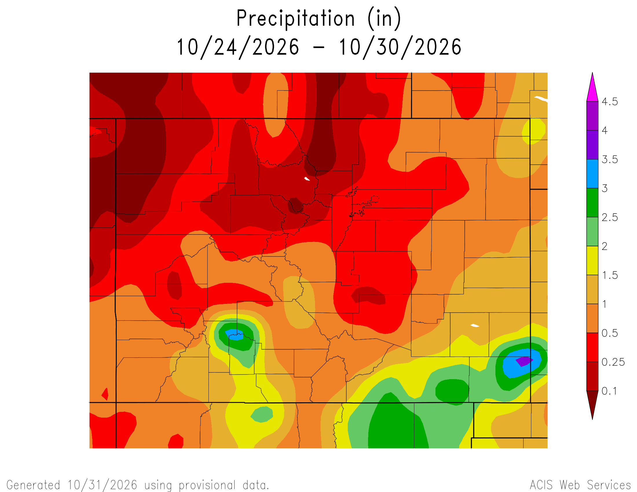
Here’s a look at the Colorado 7-Day precipitation map through October 30, 2026 from the High Plains Regional Climate Center. Precipitation in the South Platte Basin along the Continental Divide of the Americas ranged from 0.00” to 1.50″.

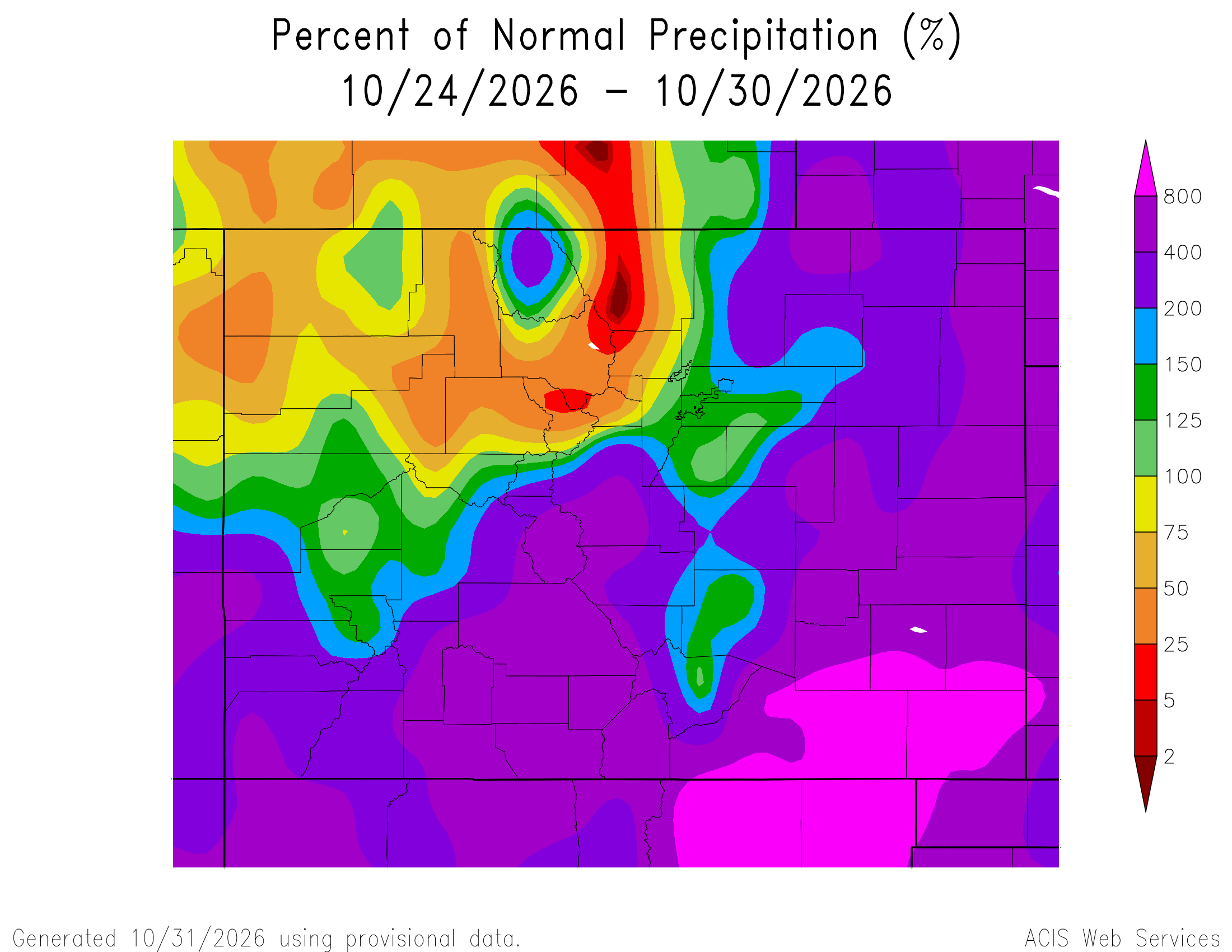
Here’s the Colorado 7-Day percent of normal precipitation map through October 30, 2026 from the High Plains Regional Climate Center. Precipitation in the South Platte River Basin along the Continental Divide of the Americas ranged from 0% to 800% of normal.

Here’s the most recent 7-Day Departure from Normal Temperature (F) for Colorado through October 30, 2026 from the High Plains Regional Climate Center.

Below is the 7-day Quantitative Precipitation Forecast for the week of November 2, 2026. Precipitation is anticipated for the mountains of the South Platte River Basin and may total up to 0.25″

Below are the 8-14 day outlooks from the Climate Prediction Center, issued November 1, 2026, for temperature and precipitation, for the week starting November 9, 2026. The CPC expects above normal temperatures and near normal precipitation for the mountains of the South Platte River Basin.

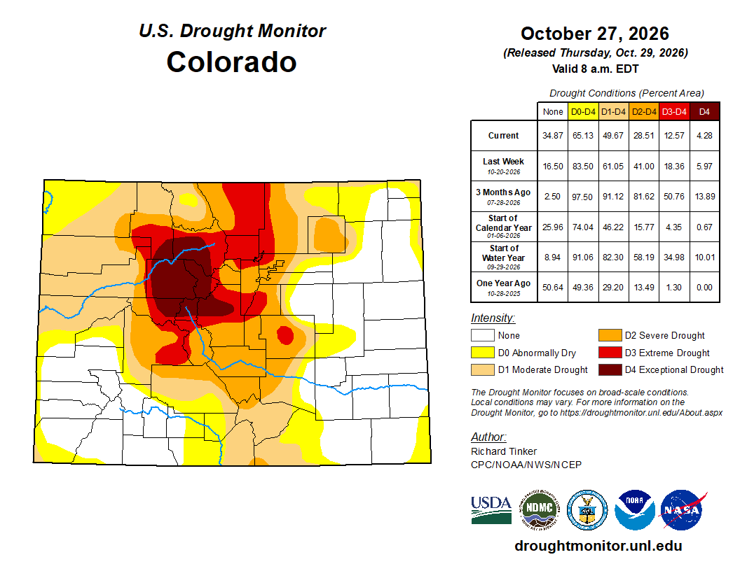
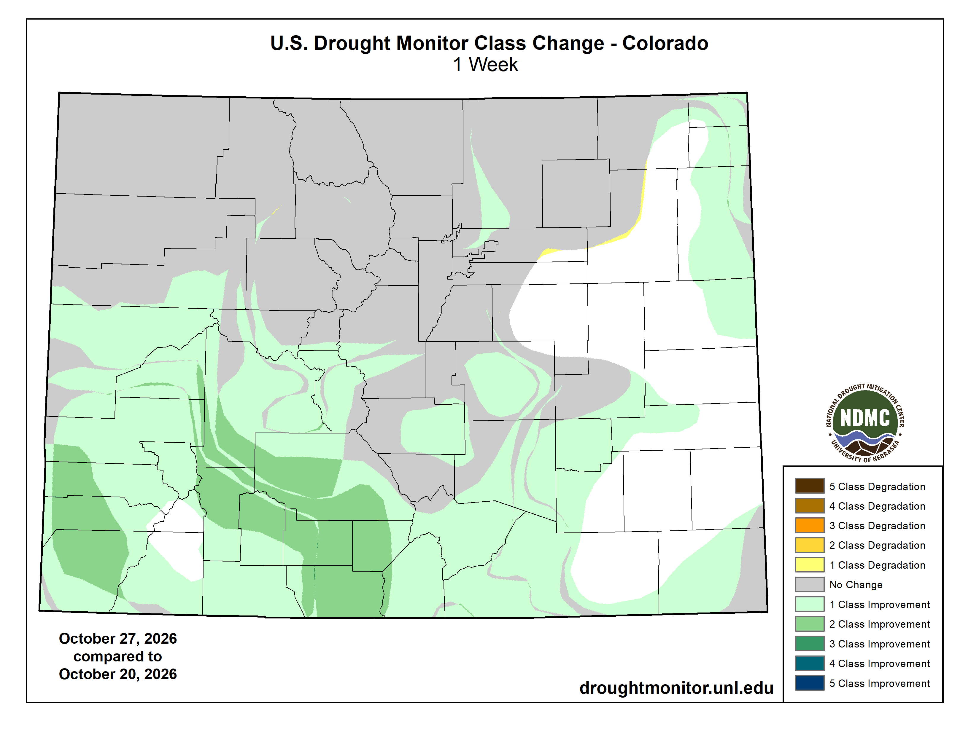
Below is the Colorado Drought Monitor map from October 27, 2026. There were one category improvements in Weld, Adams, Denver, Arapahoe, Douglas, Elbert, Logan, and Sedgwick counties in the South Platte River Basin. There were one category degradations in Morgan, Weld, Larimer, Boulder, Adams, Park, and Logan counties. There were two and 3 category degradations in Morgan County. Drought and abnormal dryness covers 65.13% of Colorado. The South Platte Basin is experiencing Abnormally Dry, Moderate, Severe, Extreme, and Exceptional drought conditions.

Below is the Colorado Drought Monitor one week change map ending October 27, 2026.

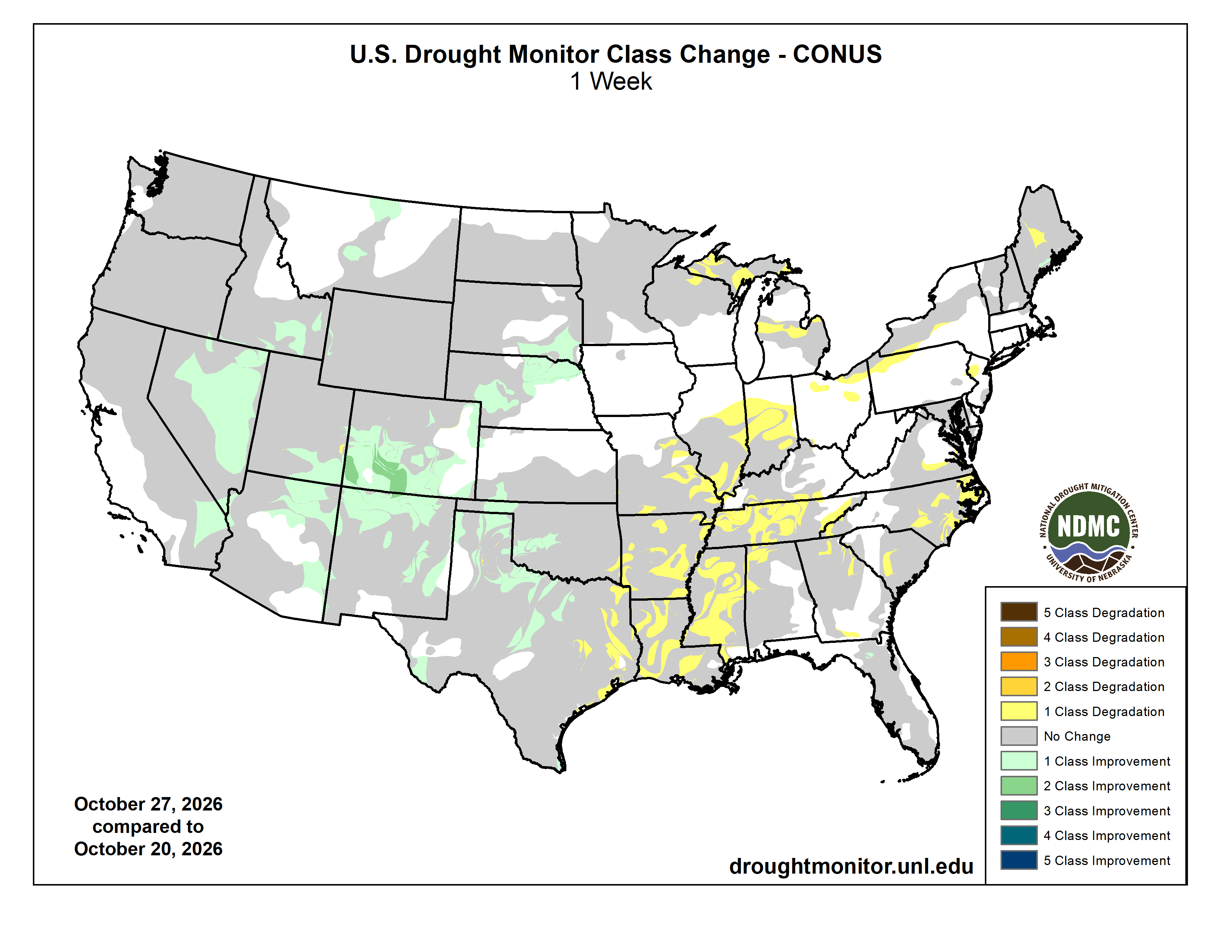
Here’s the US Drought Monitor Map from last week along with the one week U.S. change map.

Finally, Russ Schumacher Colorado’s State Climatologist, posted about the the rains and floods in southwest Colorado last week and there was this tidbit about El Niño:

Where does El Niño fit in to this story, and what’s coming next?

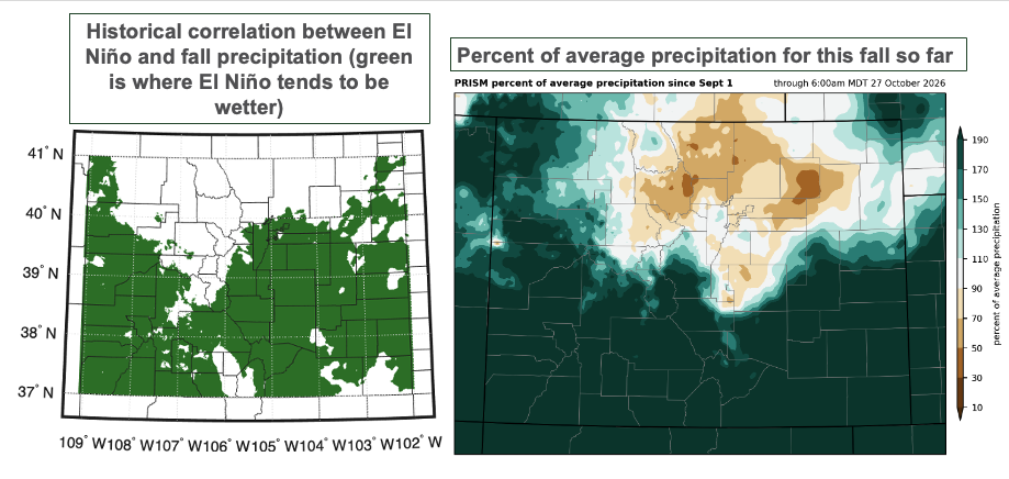
As Peter [Goble] outlined in this post, the fall season is when we see some of the most robust connections between El Niño and precipitation in Colorado, with falls tending to be wetter than average in southern Colorado during El Niño. It is quite remarkable how closely this fall’s precipitation patterns thus far match the historical correlations: on the figure below, look at how similar the green shading in the map on the left is to the areas that have seen above-average precipitation this fall!

(left) Map showing the historical correlation between El Niño-Southern Oscillation (ENSO) and fall precipitation in Colorado, with areas shaded in green showing where fall tends to be wetter during El Niño. (right) Percent of average precipitation from September 1 through October 27.