This proposed pipeline divert water from the Atchafalaya River in Louisiana through Louisiana, Texas, New Mexico, Arizona and up to the Glen Canyon Dam. Credit: Don Siefkes
Click the link to read the article on the AZCentral website (Joan Meiners). Here’s an excerpt:
May 3, 2026
Key Points
The idea of building a pipeline to move water from eastern states to the dry West is frequently proposed to solve water shortages.
Experts argue a cross-country pipeline is technically feasible but prohibitively expensive, legally complex and environmentally risky.
Many officials and environmentalists believe more practical solutions involve local conservation, water storage and regional management.
…Kyle Roerink, executive director of the Great Basin Water Network, an organization that works to promote water conservation in the West and has opposed several water pipeline projects, says that “exporting water from the Mississippi Delta will never be a sensible or reasonable solution.” His list of explanations include the “astronomical cost” stemming from eminent domain, permitting, construction, energy management and staffing fees, and the intractability of managing healthful water quality over such vast distances with so many pollution inputs…The southeastern states may also not be as eager to get rid of their water as Arizonans might assume. Coastal erosion due to climate-worsened hurricanes, drilling and other factors mean the Mississippi Delta needs all the sediment transported downstream by its major rivers. The Mississippi’s flows play a role, too, in diluting agricultural chemicals causing hypoxic dead zones in the Gulf as the region navigates its own experiences with unpredictable drought. On top of these broad limitations — which entities across the aisle including the Goldwater Institute, a conservative policy think tank, have deemed “cost prohibitive” as well as practically and environmentally infeasible — there are complex legal water rights obstacles that likely run deeper than the Trump administration’s ability to override.
“The issue of water rights management would be a Byzantine nightmare for such a large scale project,” Roerink told The Republic. “The Mississippi isn’t adjudicated under one set of laws. It is governed under many doctrines in many states. Just as in the West, eastern states have differing state laws governing water allocations in their respective jurisdictions. There are mixes of riparian and appropriation doctrines governing use. The legal framework leads me to believe that the only thing this pipeline would be good for are lawyers who practice in the U.S. Supreme Court.”
[…]
None of this has stopped Arizona leaders, as reader Lisa Nelson asked about, from formally considering cross-country water pipeline proposals. In 2021, the Arizona Legislature voted to appropriate $160 million into a fund to consider importing water from as far as the Mississippi River. In late 2024, Chuck Podolak, director of the Water Infrastructure Finance Authority of Arizona told KUNC’s Alex Hager that the idea still deserves “serious attention.”
USDA forecasts the largest U.S. corn planting, by acreage, since the Great Depression, and record production.
At the same time, the EIA notes that U.S. ethanol exports are at a record high, pushing ethanol production higher even as domestic consumption is flat.
Salt water continues to move up the Mississippi River.
EPA intends to approve a carbon sequestration permit for a company operating in eastern Indiana.
And lastly, a Senate committee advances a bill on water research and forecasting.
“Recent weather events across the country have highlighted the need for advanced water prediction.” – Excerpt from a Senate committee report on a bill that would expand the responsibility of the National Water Center, a federal program that uses computer modeling to forecast river flows and levels. “These models are crucial for predicting and managing water-related hazards and enabling timely and informed decision-making by emergency managers and water resource planners,” the Commerce, Science, and Transportation Committee noted. It voted to send the Water Research Optimization Act to the full Senate.
By the Numbers
River Mile 56: Estimated location, as of October 24, of the saltwater “wedge” pushing up a weakened Mississippi River. The Army Corps of Engineers just completed an underwater dam at river mile 64, in southern Louisiana, to impede the salty water’s upstream movement. Because it is denser than fresh water, the salt wedge moves along the river bottom. The wedge travels upstream when the river is weakened by drought. Two weeks ago the wedge was at mile 53.
News Briefs
Carbon Sequestration Permit The EPA says it intends to issue a permit to One Carbon Partnership that would allow the company to inject carbon dioxide deep underground at a site in eastern Indiana.
Indiana and other midwestern states are centerpieces in a regional expansion of carbon dioxide pipelines and underground storage.
This carbon sequestration project would be located in Randolph County and store carbon generated by the Cardinal Ethanol production facility. One Carbon, a joint venture between Cardinal Ethanol and Vault44.01, a carbon-capture specialist, will be required to monitor the Class VI injection well so that the carbon does not pollute aquifers used as drinking water.
The injection zone is between 3,100 and 3,659 feet deep.
The EPA is taking public comments on its proposed permit approval through December 8. Submit them here.
Studies and Reports
Rising Ethanol Production The Energy Information Administration reports that U.S. ethanol production has exceeded its pre-pandemic peak. Rising output is not due to domestic consumption, which is flat.
Exports instead are fueling the industry.
At the same time, U.S. corn production, a main input for the ethanol industry and a major source of groundwater demand in the High Plains, is breaking new ground.
The U.S. Department of Agriculture forecasts that corn plantings, by acreage, in 2025-26 will be the largest since the Great Depression. Production is expected to be around 16.8 billion bushels, which would be roughly equal to this year’s record output.
The two trend lines point to ethanol production remaining “near record highs” in 2026, according to the EIA forecast.
On the Radar
Carbon Sequestration Hearing The EPA will hold a public meeting on December 4 in Winchester, Indiana, to take comments on the proposed carbon injection project.
The meeting is from 5:30 p.m. to 9:00 p.m. at Winchester Community High School Commons.
Federal Water Tap is a weekly digest spotting trends in U.S. government water policy. To get more water news, follow Circle of Blue on Twitter and sign up for our newsletter.
Army Corps, for fourth consecutive year, authorizes an underwater dam to keep salt water from moving up the Mississippi River in Louisiana.
A cold-water flow experiment at Glen Canyon Dam to disrupt non-native fish downstream will end within a week.
Senate passes a defense spending authorization bill with water-related provisions.
And lastly, EPA sits on a “forever chemical” toxicity assessment, ProPublica finds.
“Do not make American families pay the price for Trump’s war on affordable American energy.” – Sen. Martin Heinrich (D-NM) speaking on the Senate floor to rally votes to end President Trump’s national energy emergency. Heinrich and his Democratic colleagues faulted the White House for increasing electricity prices by cancelling wind and solar projects and fully supporting data center developments, which consume large quantities of electricity. Yet, the Democrats’ effort to repeal the emergency declaration failed.
River Mile 53.1: Approximate location of the front of the saltwater “wedge” that is pushing up the Mississippi River, in southern Louisiana, according to the Army Corps of Engineers. If the wedge moves far enough upriver it will endanger drinking water supplies for communities that draw from the river. Chloride concentrations are higher in the trailing sections of the wedge. The Corps estimates that the point at which they exceed EPA drinking water standards is 15 to 25 miles behind the wedge front.
News Briefs
Saltwater Barrier The Army Corps of Engineers, for the fourth consecutive year, has authorized the construction of an underwater dam across the bottom Mississippi River as a way of keeping salt water from the Gulf of Mexico from moving upriver and spoiling municipal water supplies.
A contractor is building the dam at river mile 64. As of October 10, the front of the saltwater wedge was estimated at river mile 53.1.
Salt water intrudes when river flows are too feeble to push it out. These low-flow conditions have happened in the late summer or early fall every year since 2022.
Because salt water is heavier than fresh, the intrusion happens along the bottom of the river, which is why the temporary earthen dam is placed across the river bed.
If salt water moves too far upstream, it will contaminate the water supply for communities whose intake pipes extend into the river. In 2023, the Army Corps barged 153 million gallons of fresh water to communities in southern Louisiana that were affected by the saltwater intrusion.
Senate Passes Defense Spending Bill The Senate passed a bill that authorizes defense spending for fiscal year 2026. The bill also has a number of water-related provisions.
It requires the Defense Department to conduct a pilot wastewater surveillance study at four or more military installations. The goal is to test wastewater for substances that would identify drug use among service members or the presence of infectious disease. (Wastewater surveillance grew in prominence as a testing tool during the Covid pandemic.)
It establishes a working group on “advanced nuclear” technologies that could power desalination facilities.
It requires a report on energy and water use for any data center built or expanded on military property.
It repeals a moratorium on the burning of PFAS substances, including firefighting foam.
The bill includes an amendment from Sen. Tim Kaine (D-VA) that requires NASA to pay for new drinking water wells for the Eastern Shore town of Chincoteague. The town’s existing wells were contaminated with PFAS when the land was owned by the Navy. That land has since been transferred to NASA.
Studies and Reports
EPA Sits on ‘Forever Chemical’ Report An EPA report on the toxicity of PFNA – one of the thousands of PFAS in circulation – was ready to be published in mid-April, ProPublica reports. But the agency has not yet released it.
PFNA is one of six PFAS that the Biden administration decided to regulate in drinking water. The Trump administration announced in May that it would attempt to reverse that decision for four of the chemicals – including PFNA.
On the Radar
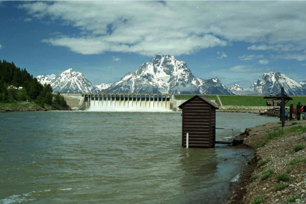
Glen Canyon Dam Flow Experiment The Bureau of Reclamation began releasing cool water from the depths of Lake Powell in mid-August.
The cold water is meant to disrupt smallmouth bass spawning downstream of Glen Canyon Dam. Smallmouth bass are a non-native species that federal agencies and their partners are attempting to rein in to protect threatened native species like the humpback chub.
The cold-water flow experiment is set to end by October 20.
Because the cold-water flows bypass Glen Canyon Dam’s turbines, the dam has been producing less power. That means more power purchased on the market. According to the Western Area Power Administration, which markets federal hydropower, purchased power expenses are “significant.” WAPA opposed the cold-water release plan, arguing the end date should be October 1, which would reduce purchased power costs.
Sales of hydropower fund the operation and maintenance of Glen Canyon Dam.
Federal Water Tap is a weekly digest spotting trends in U.S. government water policy. To get more water news, follow Circle of Blue on Twitter and sign up for our newsletter.
Protesters in Milwaukee take part in a 2019 march demanding action to address climate change. Fifteen young people are suing the state of Wisconsin for harming their future by allowing pollution that hastens climate change. (Photo by Isiah Holmes/Wisconsin Examiner)
Kaarina Dunn has grown up hearing stories of the Wisconsin winters her parents and grandparents got to enjoy. Winters with enough snow cover that the family of ski-enthusiasts could get on the slopes from Thanksgiving to Easter.
But despite the state’s continued connection with ice and snow, winters like those of her family’s past are gone. Climate change has caused Wisconsin’s winters to warm more than any other season. A number of recent winters have seen drought conditions with little to no snow across the northern part of the state — severely damaging winter tourism and canceling or modifying events such as the American Birkebeiner. While data shows that the amount of snowfall on average is similar to decades past, the weather doesn’t stay as cold throughout the winter, meaning that the snow melts before it can accumulate to the truly deep levels of previous generations.
Kaarina Dunn | Photo courtesy Midwest Environmental Advocates
“I hear all these great stories about how they got to ski over Thanksgiving, how they skied past Easter time, how they went on all these great trips around the state of Wisconsin to all these ski hills, mountains, all these amazing places,” Dunn, a 17-year-old Onalaska resident, tells the Wisconsin Examiner. “And I can’t help but feel incredibly saddened by this. I will never experience these things. These are family traditions, trips that my family would go on, with family members, with friends, and do all these amazing and fun things. And honestly, I do feel left out. I feel let down by my state. I can no longer enjoy these things due to the direct results of fossil fuels in the environment.”
Dunn is one of 15 young people suing the state of Wisconsin, arguing that state laws violate their constitutional rights and worsen climate change. The lawsuit mirrors a similar lawsuit from children in Montana, who successfully argued that the state had to consider the greenhouse gas emissions and climate change impact of permits involving fossil fuels.
The children are represented in the lawsuit by Madison-based Midwest Environmental Advocates and Oregon-based Our Children’s Trust.
In Wisconsin, the suit argues that state lawmakers have made a number of declarations that the state’s energy production should be decarbonized and the greenhouse gas emissions of that production should be reduced, but state laws prevent that from happening.
The state’s law for siting power plants requires that the state Public Service Commission determine that “[t]he proposed facility will not have undue adverse impact on other environmental values such as, but not limited to, ecological balance, public health and welfare, historic sites, geological formations, the aesthetics of land and water and recreational use.” However the law also prohibits the PSC from considering air pollution, including from greenhouse gas emissions, in that determination.
Additionally, the state set a goal in 2005 that 10% of Wisconsin’s energy come from renewable sources by 2015. That goal was met in 2013. However, now that the goal has been met, state law treats it as a ceiling on renewable energy the PSC can require.
“The Commission cannot require any electric provider to increase its percentage of renewable energy generation above the required level,” the lawsuit states, meaning that for more than a decade, Wisconsin’s energy regulators have been unable to push the state’s power companies to develop more renewable energy sources.
Skylar Harris, an attorney for Midwest Environmental Advocates, says that children today are going to spend most of their lives dealing with the effects of climate change on their health and lifestyles yet don’t yet have the ability to vote and influence environmental policy.
“I think people are really starting to acknowledge the direness of the situation that we’re in and the situation that climate change is causing, and how it impacts our inherent rights such as life and liberty and the pursuit of happiness,” Harris says. “And courts are really starting to see that without the right to a stable climate, which is what we’re arguing for in this case, the rights to life, the rights to liberty, the rights to the pursuit of happiness, they mean nothing, because people can’t pursue them to the fullest extent.”
Harris says that if the lawsuit is successful, she believes that the PSC will use its new authority to deny permits for new or expanded fossil fuel burning power plants and push the state’s power companies to expand their renewable capacities.
In the Montana lawsuit, officials argued that the state can’t be held responsible for the effects of climate change on the children in that lawsuit because climate change is caused by emissions from across the globe. Harris says that yes, climate change is a global problem, but it gets fixed by individual governments doing something about it.
“Climate change is a global problem, but there is no such thing as a global government,” she says. “So if we are to address this global issue, that means every individual, every business and every government, including the state of Wisconsin, has to step forward and do its part. And that’s what we’re trying to make sure is happening with this lawsuit.”
The 15 children in the lawsuit represent a wide swathe of Wisconsin. They live in urban and rural parts of the state and include athletes who have had wildfire smoke affect their sports, farm kids who have had droughts and heavy rains affect their families’ livelihoods and members of the state’s Native American tribes who have seen their cultural traditions put at risk.
Dunn has spent much of her childhood fighting for environmental causes as president of her local 4-H club and has won three grants for environmentally focused projects from the Bloomberg Philanthropies Climate Action Fund. She says she joined the lawsuit because it can help her community and kids like her across the state.
“I began my environmental work because I always believed in doing the right thing,” she says. “I believe in fighting for my community, fighting for my family, fighting for my siblings, fighting for everyone, fighting for youth and fighting for families.”
She adds that the PSC “knows that what they are doing is wrong. The governor and the Wisconsin Legislature have indicated that they want renewable energy, and the Public Service Commission simply isn’t changing the laws, and the Legislature isn’t changing the laws.”
Dunn’s family has lived western Wisconsin’s Driftless Region for generations and she spent most of her childhood in Vernon County. She says the Mississippi River is “almost a family member.”
But massive rain events causing flooding and erosion triggered a massive boulder to tumble down a bluff and into her backyard, making her family fear that it wasn’t safe in their home anymore. They moved north to La Crosse County.
“We felt very unsafe in the childhood home that I planned to live my entire life in. We made the difficult decision to move cities, move counties, move school districts,” she says.
A member of her school’s tennis team, Dunn says hotter summers and poor air quality caused by wildfires elsewhere on the continent have forced her to change how and when she practices. Flooding has prevented her and her family from swimming off the dock at her grandparents’ home and affected the work done at their walnut tree farm.
Dunn says that for her, joining the lawsuit is about standing up and trying to force her state government to admit it has a role to play in mitigating climate change and responding to the ways in which climate change has harmed her life and the lives of the other kids in the suit.
“Ultimately, our country knows the science that is creating climate change, the fossil fuel industry, and especially Wisconsin, they can no longer stand behind saying, ‘There’s nothing we can do. We don’t know about it. There’s nothing that we can do,’” she says. “But ultimately, we have the science and technology to make changes and to save my life and my future children’s life and have a safe and healthy environment.”
The wetlands of the Prairie Pothole Region provide essential benefits to communities and are a premier waterfowl breeding ground. Explore how CASC science is informing the strategic restoration and management of the Prairie Pothole Region in the face of climate change. Photo credit: USGS
Click the link to read the article on the USGS website:
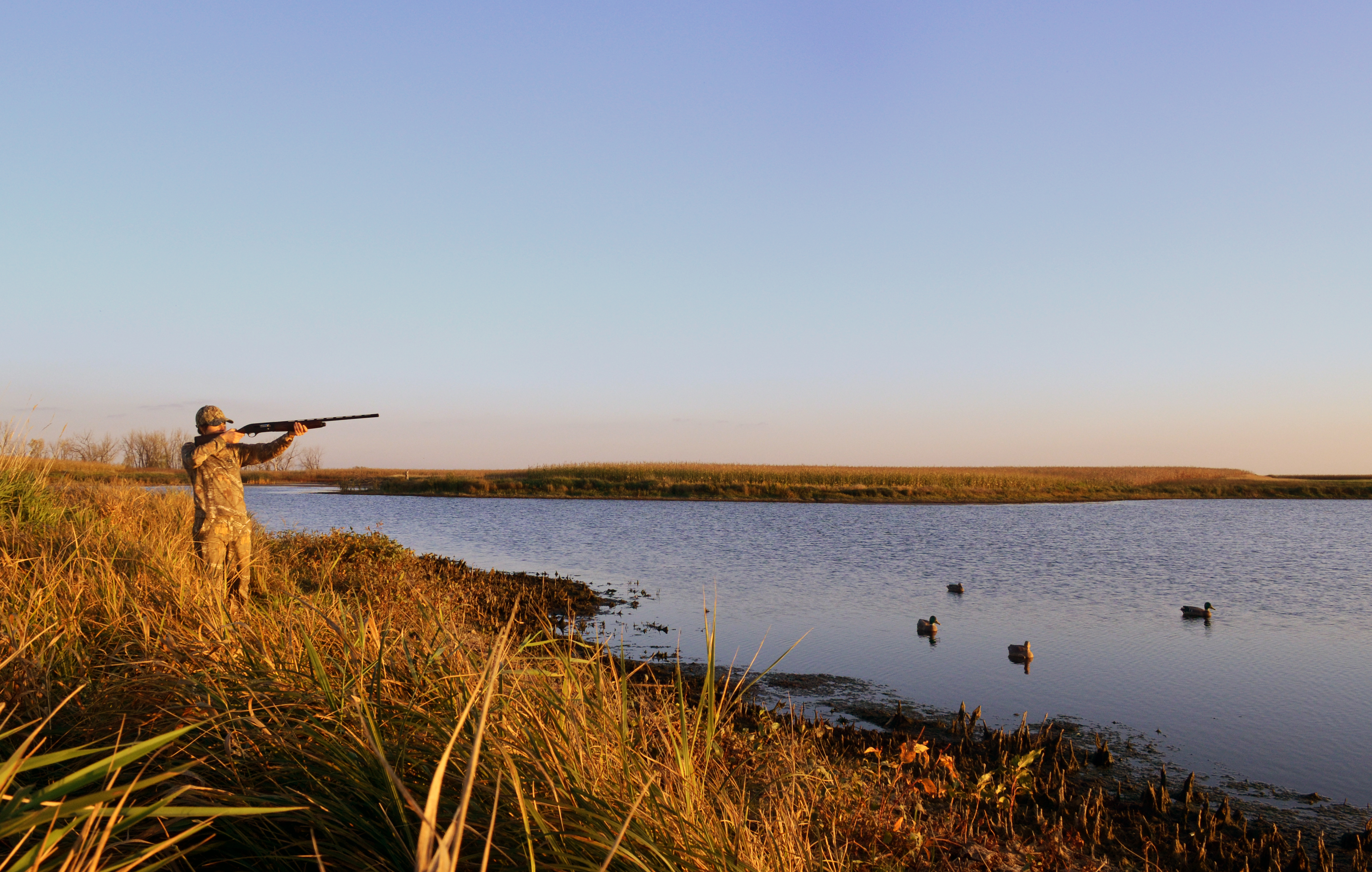
Waterfowl hunting. Credit: Chuck Traxler, USFWS
Climate Change and the Prairie Pothole Region
The Prairie Pothole Region’s economic and recreational significance is deeply rooted in its unique ecological characteristics. Extending across the northern Great Plains, the region’s rich, glaciated soils are a foundation for high-yield agriculture, contributing to the production of key commodities like wheat, soybeans, and corn. Across this landscape, depressional wetlands are interspersed with neighboring grasslands. These wetlands, commonly referred to as prairie potholes, provide essential benefits to communities like mitigating flood risks and regulating water flow, filtering pollutants, improving downstream water quality, storing significant amounts of carbon, and providing habitat for fish and wildlife.
The Prairie Pothole Region is a both a premier waterfowl breeding ground, attracting a large number of hunters, and major contributor to hunting opportunities across the continent. The region’s reputation as “North America’s Duck Factory” draws waterfowl hunters from within and outside the United States. Hunting and associated travel expenditures generate substantial revenue for local communities. An estimated 10,000 jobs and $760 million in labor income is generated in the region due to hunting and wildlife viewing. In recognition of these services provided by prairie pothole landscapes, conservation investment from federal programs like the Farm Bill and the North American Wetlands Conservation Act (NAWCA) provide significant funding for conservation initiatives. These investments support habitat restoration, land management, and research, creating jobs and stimulating economic activity in the conservation sector. Finally, national wildlife refuges and other public lands provide the public with additional access to these habitats so they can enjoy the many recreational opportunities.
Climate change is increasing temperatures and changing precipitation patterns, leading to pronounced shifts in this region. More frequent, high intensity storms over the last 25 years have been observed, causing a shift from snow-melt driven hydrology to summer and fall storm driven hydrology. At the same time, more frequent and severe droughts are causing changes in the diversity of wetland sizes, negatively impacting habitat quality of smaller-sized wetlands and landscape heterogeneity important to diverse waterfowl and wildlife populations. Land-use change, combined with these effects of climate change, are diminishing the region’s capacity to support viable populations of waterfowl and other wildlife populations. Climate adaptation scientists can provide the expertise and research needed to inform future adaptations important to maintaining the recreational and economic benefits of this region.
Supporting Prairie Pothole Management and Sustaining Recreational Opportunities
Since 2018, the USGS Climate Adaptation Science Centers has been documenting key impacts of climate change on this region. Results from multiple research efforts can inform strategic acquisition, restoration, and management in the Prairie Pothole Region to maintain its ecological, economic, and cultural importance to the United States.
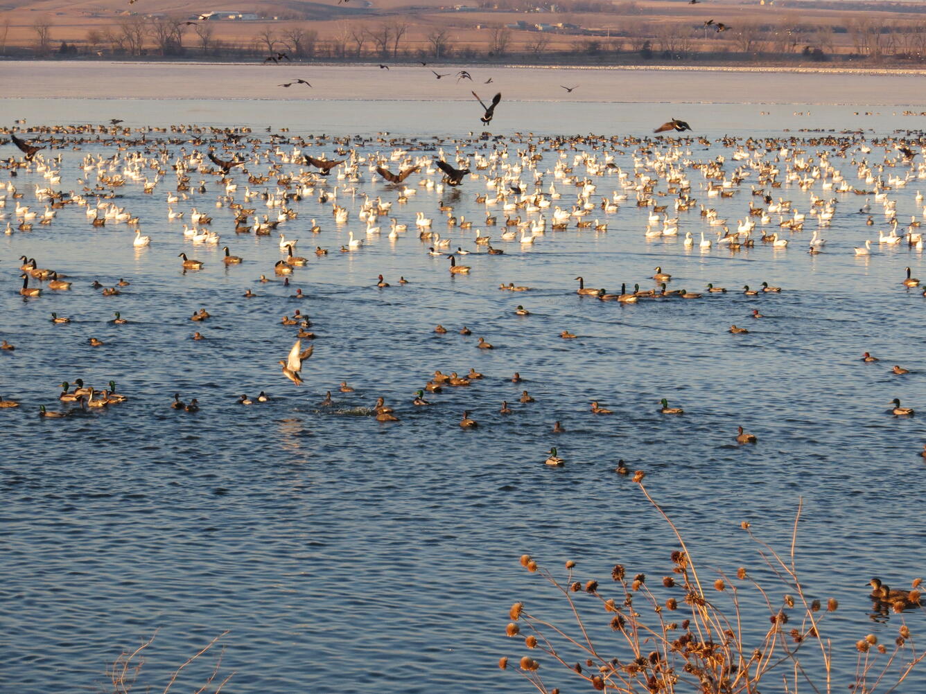
Waterfowl on Lake Andes; Lake Andes National Wildlife Refuge. Public domain
Impacts of Climate-Driven Shifts in Prairie Pothole Wetlands on Waterfowl
Recent science indicates that climate and land use change are affecting Prairie Pothole wetlands in unexpected ways, indicating that new areas may need to be targeted for restoration to maintain suitable waterfowl breeding habitat. Partnering with the U.S. Fish and Wildlife Service, CASC scientists used new models to simulate how these wetlands would change under different future climate change scenarios, and how those changes would impact the ability of the wetlands to support waterfowl breeding.
Results showed that areas that currently have the highest densities of intact wetlands and support large numbers of breeding ducks will also likely be the most successful in maintaining these habitats under future climate conditions. Additional follow up work used extensive datasets in collaboration with U.S. Fish and Wildlife Service scientists to generate actionable insights that can inform conservation strategies for grassland and wetland ecosystems in the Prairie Pothole Region.
Prairie Pothole Landscape on Broken Arrow WPA Lake Andes Wetland Management District South Dakota. Sources/Usage Public Domain. Credits: Marcie Hebert, USFWS
How Climate Change is Linking Prairie Pothole Wetlands to River Wetlands
Wetlands in the Upper Mississippi River Basin help control floods, filter pollution, and provide critical habitat for migratory birds. However, high intensity rainfall events can cause these depressional wetlands to overflow and connect with Mississippi River tributaries. This reduces the ability of wetlands to process nutrients and mitigate nutrient pollution in the Mississippi River. These overflow events are expected to increase due to climate change and land management, as extreme precipitation events become more frequent and severe.
CASC scientists are working with managers to identify how wetlands along the Minnesota River, a large tributary of the Mississippi River, will respond to floods, and the resulting implications for water quality and migratory bird habitat. This information will feed into a tool that will allow management agencies to balance wildlife and water quality objectives in future conservation actions.
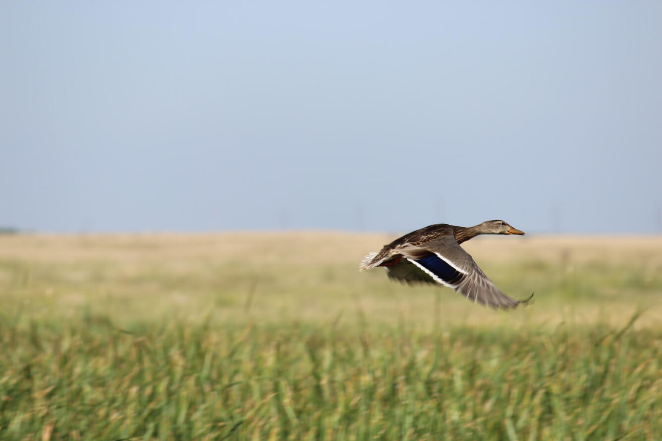
Mallard Hen in Flight over Lake Andes Wetland Management District South Dakota. Sources/Usage Public Domain.
How Weather Patterns and Land Use Influence Where Ducks are During the Fall and Winter
Ducks from the Prairie Pothole Region are important for both the economy and culture of the region. However, climate and land use change are altering their habitat are causing ducks to move to new areas during the hunting season. Partnering with the U.S. Fish and Wildlife Service and Ducks Unlimited, CASC scientists tracked these changes in duck distributions, using data from bird banding, hunting, and counts. They found that while many ducks are spending winters farther north, but it’s not a simple story. Different duck species are shifting their winter locations in different ways. Understanding these specific changes is key to figuring out what’s driving them and will inform decisions about managing habitats and harvest.
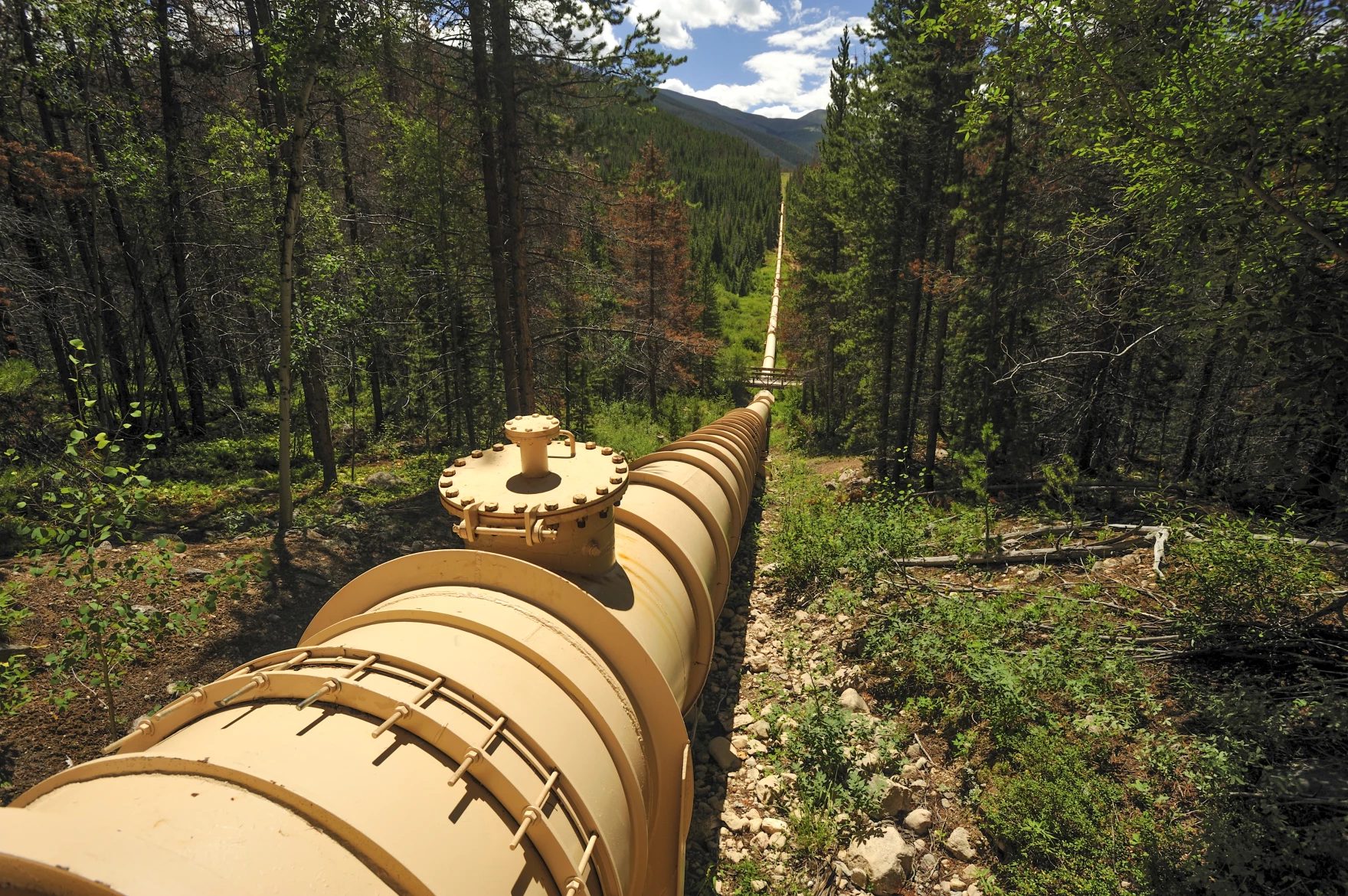
A complex system of pipes, tunnels and canals carries water around the Western U.S., like this one in Colorado’s Fraser Valley. However, policy experts say a cross-country pipeline wouldn’t make sense for political, financial and engineering reasons. Ted Wood/The Water Desk
Click the link to read the article on the KUNC website (Alex Hager):
September 30, 2024
This story is part of a series on water myths and misconceptions in the West, produced by KUNC, The Colorado Sun, Aspen Journalism, Fresh Water News and The Water Desk at the University of Colorado Boulder. KUNC’s coverage of the Colorado River is supported by the Walton Family Foundation.
The Colorado River is a lifeline for about 40 million people across the Southwest. It supplies major cities like Los Angeles, Phoenix, and Denver and a multibillion-dollar agriculture industry that puts food on tables across the nation. But it doesn’t have enough water to meet current demands.
Policymakers are struggling to rein in demand on the river, which has been shrinking at the hands of climate change. The region needs to fix that gap between supply and demand, and there’s no obvious way to do it quickly.
But one tantalizingly simple solution keeps coming up. The West doesn’t have enough water, but the East has it in abundance. So, why don’t we just fix the Colorado River crisis by piping in water from the East?
This proposed pipeline divert water from the Atchafalaya River in Louisiana through Louisiana, Texas, New Mexico, Arizona and up to the Glen Canyon Dam. Credit: Don Siefkes
The answer is complicated, but experts say it boils down to this: It doesn’t make sense to build a giant East-to-West water pipeline anytime soon for three reasons — politics, engineering, and money.
Political headwinds
If the West’s leaders wanted to take some water from the East, who would they even ask? Right now, there’s no national water agency that could oversee that kind of deal.
“I would argue that there aren’t many entities with the authority across the country to do this,” said Beaux Jones, president and CEO of The Water Institute in New Orleans. “I don’t know that the regulatory framework currently exists.”
Water is often managed using a messy patchwork of different government agencies and laws. The Colorado River is managed through a fragile web of agreements between cities, states, farm districts, native tribes and the federal government. Even though they’re all pulling from the same water supply, there’s no central Colorado River government agency.
A similarly complex system applies to many watersheds in the East. Even if a single city or state in the Western U.S. seriously wanted to build a pipeline from the East, it’s not even clear who they’d meet with to ask for water from a different area. And there’s no single federal agency that could sign off on such a deal and make sure it doesn’t harm people or the environment.
Colorado Water Conservation Board Executive Director and commissioner to the Upper Colorado River Commission Becky Mitchell, center, speaks on a panel with representatives of each of the seven basin states at the annual Colorado River Water Users Association conference in Las Vegas Thursday, December 15, 2022. The UCRC released additional details of a water conservation program this week.
CREDIT: HEATHER SACKETT/ASPEN JOURNALISM
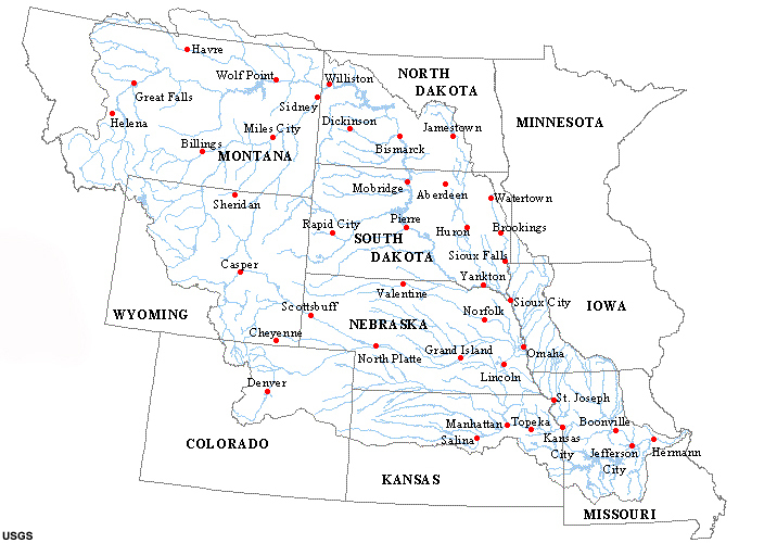
Any serious effort to pull new water in from the East to the Southwest would likely touch some part of the Mississippi River basin. It’s a sprawling network of smaller rivers that covers 31 different states, from Montana to Pennsylvania.
It’s a busy river with a lot of uses. And while its shortages aren’t as severe as dry times in the West, the Mississippi River basin goes through its own droughts. So even if, someday, the governments of the East and West set up a formal way to negotiate a water transfer, the cities, farms, boaters and wildlife advocates to the east might not be willing to share.
“The very nature of there being sufficient availability of water in the Mississippi River Basin to, in a large scale way, export that water,” Jones said. “I think there are many people on the ground within the Mississippi River basin that would fundamentally disagree with that.”
Engineering limits
There are countless examples of large pipelines and canals moving liquids around the U.S. at this very moment. The longest existing today is the Colonial Pipeline, which carries gasoline from Houston to northern New Jersey through 5,500 miles of pipe.
So if we have the engineering capacity to do that, could we build similar infrastructure for water? In theory, yes. But it would have to be much larger than existing pipes for oil and gas.
“It takes so much more water to supply a city than it takes gasoline,” said John Fleck, a water policy professor at the University of New Mexico. “So the size of the pipe or the canal has to be a lot bigger, has to be much wider, has to cover a lot more ground.”
Because that pipeline or canal would be so big, it is more likely to ruffle some feathers along the way. Fleck suggested that landowners in its path, including local governments, could push back on a giant new piece of infrastructure running through their properties and mire any pipeline project in regulatory red tape.
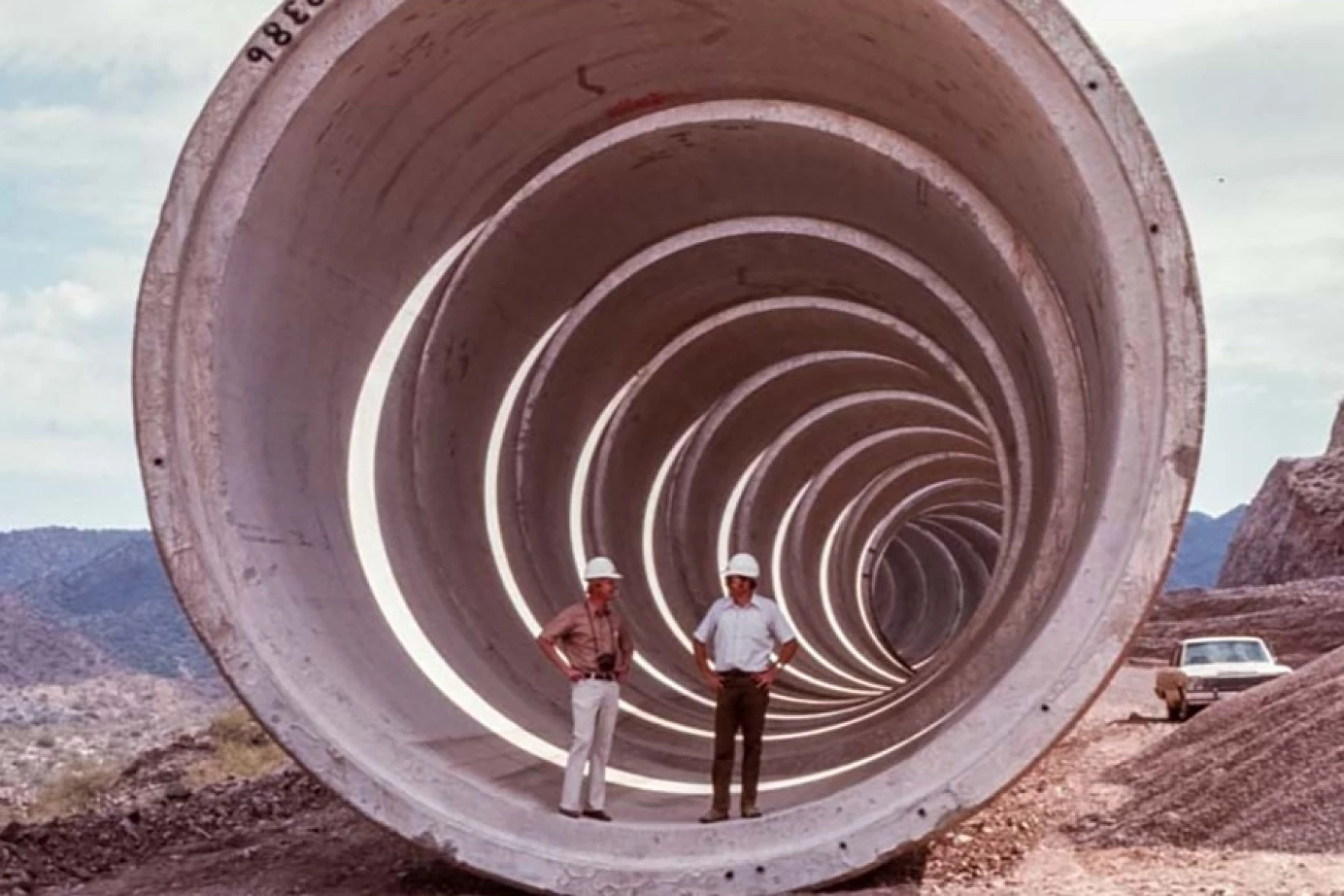
Phoenix, Los Angeles, Denver and Salt Lake City wouldn’t look like they do today without giant water-moving systems, like this pipe that is part of the Central Arizona Project. Experts say all of the feasible water pipelines have already been built, and a system to carry water in from the East is too difficult to be worth building. Photo credit: Central Arizona Project
All that said, a pipeline is still physically possible. There is perhaps no better argument for an East-West water transfer than the fact that the Western U.S. is already crisscrossed by multiple huge pipes and canals that carry water across long distances.
The West as we know it today wouldn’t exist without that kind of infrastructure. Much of Colorado’s population only has water due to a series of underground tunnels that bring water across the Rocky Mountains. Phoenix and Tucson have been able to welcome new residents in the middle of the desert with the help of a 336-mile canal that carries water from the Colorado River. Los Angeles, Albuquerque and Salt Lake City would not be the cities they are today without similarly ambitious water delivery systems built decades ago.
The existence of those water-moving projects isn’t proof that we should build a new, even bigger water pipeline from the East, Fleck said. In fact, he pointed to those systems as proof that we shouldn’t.
“All the feasible ones have largely been done, and the ones that are left are the ones that weren’t done because they just turned out not to be feasible,” he said.
Money problems
Even in a world where the West’s leaders could find a willing water seller, get the right permits and put shovels in dirt, experts say an East-to-West water pipeline would simply be too expensive.
Any solution to the Colorado River crisis will require massive amounts of public spending. The federal government alone has thrown billions of dollars at the problem in just the past few years. But water economists and other policy experts say a cross-country pipeline isn’t the most efficient use of taxpayer dollars.
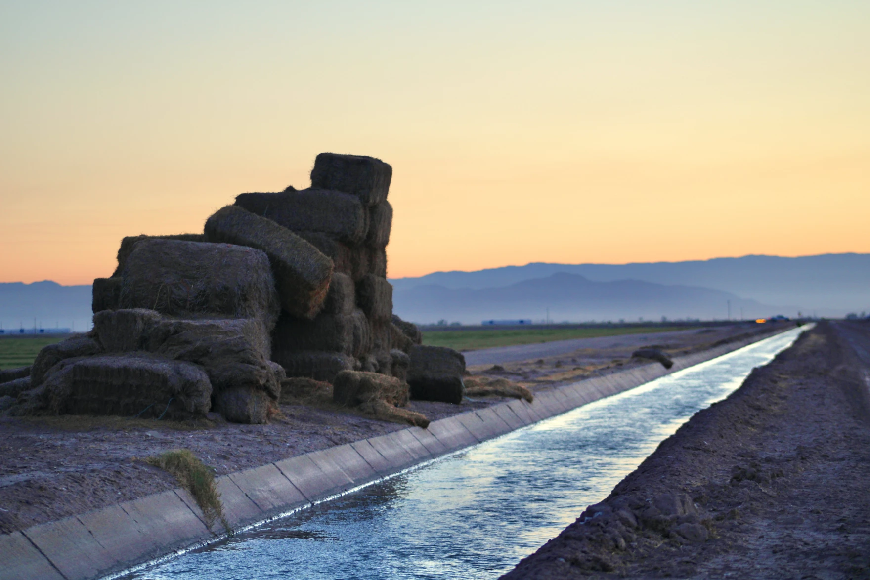
Stacks of hay bales sit beside an irrigation canal in California’s Imperial Valley on June 20, 2023. Experts say there are more cost-effective ways to fix the Colorado River crisis than building a cross-country canal, like paying farmers to pause growing thirsty crops such as alfalfa. Alex Hager/KUNC
Kathleen Ferris, former director of the Arizona Department of Water resources, pointed to two ongoing efforts that might be a more cost-effective way to help correct the region’s supply-demand imbalance. One involves paying farmers to pause growing on their fields, freeing up water to bolster the region’s beleaguered reservoirs. Another uses expensive, high-tech filtration systems to turn wastewater directly back into drinking water.
“Sometimes I feel like people don’t want to do the heavy lifting,” said Ferris, who is now a water policy researcher at Arizona State University. “Instead, they want to just find the next water supply and be done with it and have somebody else pay for it.”
Ultimately, she said, those kinds of programs already have momentum and cost less money than an East-to-West water pipeline.
“Why don’t we do the things that we know are possible and that are within our jurisdiction first,” Ferris said, “Before we go looking for some kind of a grand proposal that we don’t have any reason to believe at the moment could succeed.”
Pipe dreams becoming reality
Piping in water from outside of the Colorado River basin, for all of its challenges, is a tempting enough idea that the federal government has given it a serious look.
In 2012, a Bureau of Reclamation report analyzed ways to bring new water into the Colorado River Basin, including importing piped water from adjacent states.
The study concluded that strategy was not worth the money and effort.
“It just isn’t the time yet,” said Terry Fulp, a retired Reclamation official who helped write the study. “We felt that there were other things we could be doing in the basin, particularly in the Lower Basin, that would relieve the pressure.”
This map from the Bureau of Reclamation’s 2012 “Colorado River Basin Water Supply and Demand Study” shows places where water could theoretically be imported. One of the report’s authors said now “isn’t the time” to pipe water in from the East. Credit: U.S. Bureau of Reclamation
Fulp said the study was a worthwhile endeavor, and that the idea of importing water from the East might make sense down the road. The scale of the challenge posed by the Colorado River crisis, he said, will take some big thinking, “on the order of the thinking when we built the Hoover Dam.”
“It’s one of those possible solutions that should always stay, if not forefront on the table, somewhere on the table, so that you don’t lose sight of it,” Fulp said.
Despite the fact that many Colorado River experts have cast doubt on the feasibility of a cross-country water pipeline, even some sitting state officials say it deserves more research. Chuck Podolak, director of the Water Infrastructure Finance Authority of Arizona said the idea deserves “serious attention.”
“We understand that every option is hard, every option is expensive, every option has political hurdles, every option is a daunting engineering task,” he said. “Right now, we’re in a let’s-look-at-everything mode with eyes wide open.”
Arizona and other states around the region, with their eyes on continued growth, are already looking at ways to stretch out the water they already have using technology. Terry Fulp said those efforts may need to expend past the spendy and ambitious engineering projects that are already helping facilitate that growth.
“It’ll be the time someday, if we want the Southwest to continue to grow the way it’s been growing,” he said. “There’s only so much water in the basin.”
Kindra Arnesen is a 46-year-old commercial fishing boat operator who has spent most of her life among the pelicans and bayous of southern Louisiana, near the juncture where the 2,350-mile-long Mississippi River ends at the Gulf of Mexico.
Clark Porter is a 62-year-old farmer who lives in north-central Iowa where he spends part of his day working as an environmental specialist for the state and the other part raising corn and soybeans on hundreds of acres that his family has owned for over a century.
Though they’ve never met, and live 1,100 miles apart, Arnesen and Porter share a troubling kinship – both of their communities are tied to a deepening water pollution crisis that is fouling the environment and putting public health in peril across multiple US states.
Gulf hypoxic dead zone
Arnesen’s home lies near an oxygen-depleted expanse of the northern Gulf known as the “dead zone,” where dying algae blooms triggered by contaminants flowing out of the Mississippi River choke off oxygen, suffocating shrimp and other marine life.
Porter’s farm is positioned at the center of the Upper Mississippi River Basin where streams and other surface waters saturated with farm wastes flood into the big river, and contaminated groundwater permeates drinking water wells. Cancer incidence in Iowa is among the nation’s highest, and is rising.
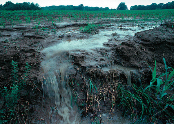
Unprotected farm fields yield topsoil as well as farm fertilizers and other potential pollutants when heavy rains occur.
The culprit at the center of it all is a colossal tide of fertilizer and animal manure that runs off fields in Iowa and other farm states to find its way into the Mississippi River. The same agricultural pollution problems are plaguing other iconic US waterways, including Chesapeake Bay and Lake Erie.
US farmers use more fertilizer and spread more manure than in most other countries, accounting for roughly 10 percent of global fertilizer use, behind China and India. But while the nutrients contained in animal manure and fertilizer are known to nourish crop growth, the resulting nitrogen and phosphorous that end up in waterways are known to create severe health problems for people.
A grand government plan to address the problem has cost taxpayers billions of dollars with minimal results so far, and nowhere is the problem more pronounced than in the Mississippi River Basin.
The reasons for the persistent pollution problem are multi-fold, including strong industry opposition to regulations to control the farm contaminants, and a perverse system in which some government programs incentivize farming practices that add to the pollution even as other government programs try to induce farmers to reduce the pollution.
“You’re talking about systemic dysfunction,” said Matt Liebman, professor emeritus of agronomy and sustainable agriculture at Iowa State University.
(The MARB has some of the most productive farming regions in the world and contains parts of 31 states. Source: Paper No. JAWR-20-0047-P of the Journal of the American Water Resources Association.)
An “extraordinary task”
The US Environmental Protection Agency (E.P.A) has called nutrient pollution “the single greatest challenge to our nation’s water quality,” and acknowledges that much of the nutrient pollution flowing into the northern Gulf originates on agricultural land. For nearly 30 years the agency has led a task force that includes tribal leaders and officials from 12 states working together to try to impede fertilizer and manure from running off cropland at the center of the country.
The task force has set a goal of reducing the five-year average extent of the hypoxic zone in the Gulf to less than 2,000 square miles by 2035. To meet that goal, the task force has been trying to cut total nitrogen and phosphorous loads in the water 20 percent by 2025 and 48 percent by 2035.
Key to the effort are a suite of voluntary conservation practices promoted by the US Department of Agriculture (U.S.D.A.) aimed at reducing the pollution, including idling land, not tilling before planting, using cover crops to protect the soil, and building retention ponds and wetlands to collect and absorb nitrogen. Farmers are also encouraged to plant nitrogen-absorbing vegetation in buffer strips along streams. The U.S.D.A. said in 2015 that the conservation programs were making headway, but in 2022 reported that efforts to reduce flows of nitrogen and phosphorus off farmland were showing negligible results.
The E.P.A. did not respond to a request for an interview. The U.S.D.A. said in an email message that In separate reports in 2017 and 2022 agency researchers “documented some promising trends nationally for reducing nutrient losses, such as increases in cover crop use, increased use of advanced technologies such as use of enhanced efficiency fertilizers and use of variable rate fertilizer application technologies, and a slight increase in soil testing. However, the key finding was that there was a national decline in nutrient management over a decade resulting in an increased loss of subsurface nitrogen and soluble phosphorus loss.”
The US has spent more than $30 billion since 1997 on efforts to clean up the Mississippi Basin, but in a 2023 progress report to Congress the E.P.A. said much more work is needed. Reducing nutrient loads is “an extraordinary task,” the E.P.A. report states. “Attempts to intercept, treat, or otherwise address nutrients after they are mobilized on the landscape are complex, difficult, and often costly.”
Last summer, the oxygen-depleted Gulf “hypoxic” zone measured roughly 3,000 square miles, which was smaller than in previous years. But experts said that was mostly due to a deep drought in the Midwest that reduced the river’s flow into the Gulf. In 2021, after a wet spring and summer, the Gulf’s hypoxic zone was close to 6,000 square miles.
And despite government efforts, nutrient loads to the Gulf in 2020 tallied roughly 3.7 billion pounds of nitrogen and 452 million pounds of phosphorous from what the government calls the Mississippi/Atchafalaya River Basin (MARB), the task force said in its report. That was up from total MARB nutrient loads to the Gulf in 2017, which were approximately 3.3 billion pounds of nitrogen and 314 million pounds of phosphorus, according to the 2019 task force progress report.
“More nitrogen is coming off the fields,” said R. Eugene Turner, professor emeritus of oceanography and coastal sciences at Louisiana State University and an expert on the Gulf hypoxic zone. “On average the load and the concentrations of nitrogen in the river are not coming down.”
The primary cause is more nitrogen pouring off the land from the big upper Mississippi River Basin farm states. From 2010 to 2022 the average annual amount of nitrogen leaving farmland in Iowa was 666 million pounds. That was 14 percent more nitrogen than from 1980-1996, according to state data.
In Minnesota, state authorities found nitrogen in major rivers, including the Mississippi increased from 21 percent to 55 percent over the past 20 years, according to a summary report in 2020.
Silvia Secchi, a professor and natural resource economist at the University of Iowa, agreed. Government agencies “tell you they are spending all this money, therefore they must be doing something right. But if you look at water quality data, at what’s really happening, it’s getting worse, not better.
“We have a tremendous amount of nutrients that pollute all the waters here, and end up killing fish and damaging the environment downstream,” Secchi said.
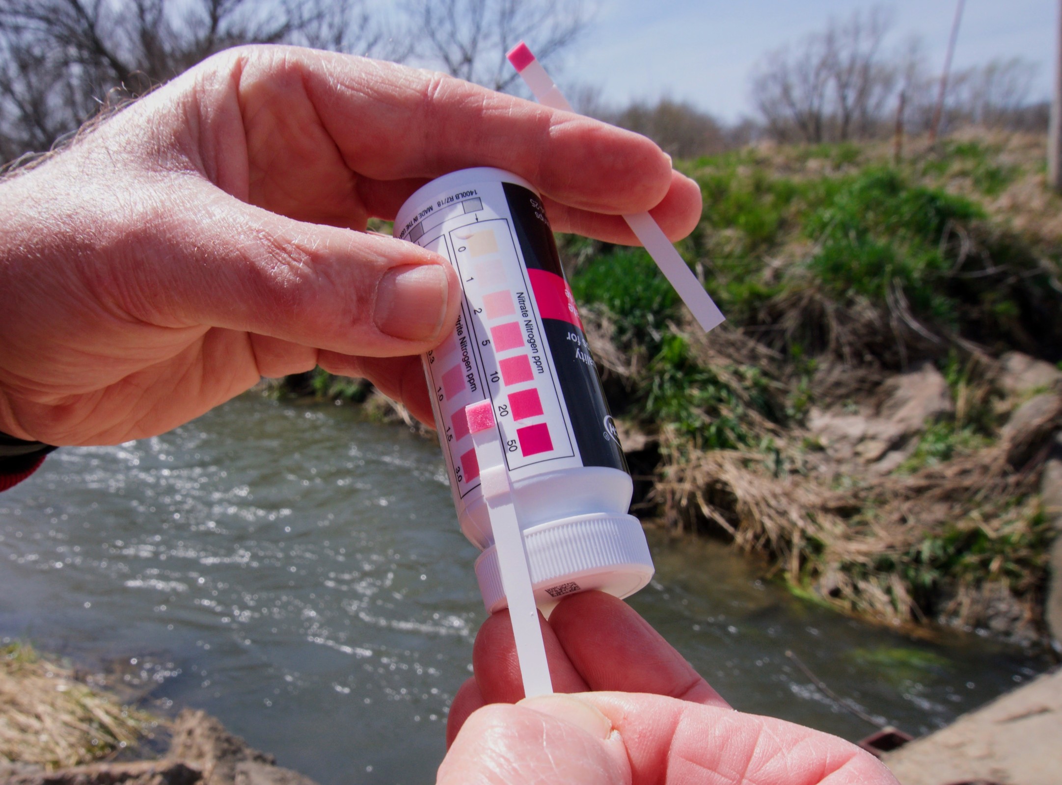
Jerry Stoefen, a farmer from New Liberty, Iowa concerned about nutrient pollution reads results of a nitrate test strip that shows nitrate concentrations in Rock Creek behind his house at 20 parts per million, or 20 times natural background levels. Nitrate, a toxic pollutant, forms when nitrogen mixes with oxygen. Photo credit: Circle of Blue
“Like a jigsaw puzzle”
There’s a reason federal and state agencies count so heavily on conservation practices to cure nutrient pollution. In field trials conducted by agricultural universities, and where farmers apply them over a period of years, they really work. The use of cover crops, which are planted not to be harvested but to provide a protective layer over soil, have been found to significantly reduce nutrient runoff. Planting vegetation in drainage ditches, installing sediment retention ponds, and building wetlands are also known to be effective.
Two of the largest conservation programs are the Conservation Stewardship Program (CSP) and the Environmental Quality Incentives Program (EQIP), both administered by the US Department of Agriculture (U.S.D.A).
Last year, the U.S.D.A. spent $400 million in CSP and EQIP payments in the six biggest Mississippi River Basin farm states – Illinois, Indiana, Iowa, Minnesota, Missouri, and Wisconsin. It’s a portion of the roughly $2 billion that the federal and state governments annually spend on conservation programs in the Mississippi Basin, according to Michael Happ, a researcher at the Minneapolis-based Institute of Agriculture and Trade Policy
But farmers in those six states – the basin’s largest source of nitrogen – applied CSP and EQIP practices to fewer than 3 million acres, according to federal data. That’s less than 3 percent of the 119 million acres of cropland in those states.
Sociologists who study why producers aren’t flocking to be paid to improve soil, conserve water, reduce runoff, and lower expenses, say the biggest impediments are the substantial changes required in how they farm. And their fear of losing productivity and revenue.
As a specialist with the Iowa Department of Agriculture who counsels farmers on best management practices, Porter explains it this way: “It’s perceived risk. Fear and worry about the effects on their drainage and their bottom line, and on yields. It’s a different system of farming than the one they’re using.”
Porter says his Iowa farm is an example of how effective changing farm practices can be in improving water quality. He started planting cover crops in 2011 on 550 acres to reduce erosion, build soil health, and keep excess nitrogen fertilizer in the ground. He constructed buffer zones in low-lying areas to prevent nitrogen from draining into streams. He retired 13 acres and raised a fertilizer-free meadow. The cost has been paid by state and federal grants.
As his diligence and techniques took hold over a decade, the farm’s soil fertility improved and the amount of fertilizer he spread diminished, as did the level of toxic nutrients leaving his land. Samples of water draining from his farm showed nitrogen concentrations of 1 to 2 parts per million, equivalent to natural background levels.
“It’s a little like a jigsaw puzzle,” said Porter. “It’s a systemic solution with multiple layers of best management practices that you fit together based on your topography, your soil types. It’s all available. It can work.”
Porter is trying to convince other farmers in his state to follow in his footsteps. “I’m getting yields that I’m happy with. I’m not spending as much money on the front end,” he said. “I feel better about the effects on my neighbors and people downstream.”
Nancy Rabalais, a marine ecologist at Louisiana State University, has led voyages to document the expanse of the Gulf hypoxic “dead” zone, since 1985. (Photo courtesy of Nancy Rabalais)
“Not like it is now”
One big reason many farmers have not been eager to embrace changes that lead to cleaner water is simply because they have not had to.
The federal Clean Water Act enacted in 1972 provided the E.P.A and states powerful authority to limit chemicals and contaminants from being discharged into US waterways through a “point source”, defined as pipes and manmade ditches. The law does not consider flows from irrigated croplands or stormwater discharges as point sources.
At the time in the early 1970s, the implications of waiving oversight of farm pollution was not thoroughly evaluated. US agriculture largely consisted of smaller, lower-polluting, mixed crop and livestock farms that grazed animals in manure-absorbing pastures.
But carving farms out of the Clean Water Act’s reach has since proved to be a significant factor in worsening water quality. Had the farm sector been held accountable for its waste, it would have been compelled to keep fertilizer and manure spread on fields out of surface and groundwater. That, in turn, would have kept farms operating at a scale that brought environmental costs in line with revenue.
Another barrier to any meaningful reduction in nutrient pollution is the action by Congress to incentivize farmers to plant corn, a crop that when conventionally grown requires large amounts of nitrogen fertilizer. US farmers grow more corn each year than they can sell, driven by government incentives – a practice that enriches companies selling corn seed and the chemicals used to grow corn – but results in range of harmful environmental injuries, including fouling waterways.
“The scale of the problem dwarfs the level of response, unless you change the design of the dominant crop and livestock production systems,” said ISU’s Liebman.
When it was first identified in the 1950s, what scientists now call the Northern Gulf Hypoxia Zone was seen as a small biological curiosity. But in the 1980s, as researchers gained greater understanding of the peril to marine life, they started mapping the size of the toxic zone, documenting its ominous growth. Congress passed the Harmful Algal Bloom and Hypoxia Research and Control Act in 1998 to address pollution in US coastal waters by pinpointing sources of nutrient contamination and their environmental consequences, and working to slash the pollution.
Now, more than two decades later, the money and time seems largely wasted, at least to Arnesen, who sees the deadly toll the toxic tide takes on marine life in her work operating a fishing boat.
“I started fishing offshore in the Northern Gulf of Mexico 25 years ago,” she said in an interview. “We caught everything. Not like it is now. Algae blooms cause massive fish kills. We’re seeing it all over the northern Gulf. It’s affecting the overall ecology of the system. It also affects me as a human being. We consume water out of the river. I try not to think about it. It scares me.”
This report was originally published by The New Lede and is part of an ongoing series looking at how agricultural policies are affecting human and environmental health.
Created by Imgur user Fejetlenfej , a geographer and GIS analyst with a ‘lifelong passion for beautiful maps,’ it highlights the massive expanse of river basins across the country – in particular, those which feed the Mississippi River, in pink.
Missouri lawmakers say water has almost always been plentiful in their state, giving no reason to think twice about a concept known as riparian rights — the idea that, if you own the land, you have broad freedoms to use its water. But that could change under a bill advancing quickly in a state legislature that is normally sharply divided. The measure would largely forbid the export of water across state lines without a permit, even though there is no evidence that is happening on any large scale.
Just the specter of water scarcity is inspiring bipartisan support. Besides persistent drought in parts of the state and plummeting Mississippi River levels in recent months and years, lawmakers are wary of the West, and the chance that thirsty communities facing dwindling water supplies will look east for lakes and rivers to tap…
“They’re not being real responsible,” state Rep. Jamie Burger (R), one of the bill’s lead sponsors, said of states like California and Arizona. “We feel like we need to be responsible in Missouri and protect what we have.”
If passed, the new limits would be the latest domino to fall as climate change makes droughts more frequent and intense across huge swaths of the United States, and threatens to exhaust water supplies in some parts of the West within the foreseeable future. States including Oklahoma, Iowa and Nebraska already have similar safeguards on water exports in place, while a compact among Great Lakes states has largely banned exports beyond the limits of their watershed since 2008.
Probably the most feasible option for bringing water from the Mississippi River basin would be to transfer water from Lake Sakakawea, a huge lake on the Missouri River in North Dakota, to the middle Rio Grande. The distance from Lake Sakakawea to the middle Rio Grande is approximately 1,000 miles. More importantly, it’s located at an elevation of 1,800 feet above sea level which greatly reduces pumping requirements.
A recent study done by the New Mexico Bureau of Geology and Mineral Resources suggests that water supply in the middle Rio Grande will decrease by about 30% over the next 50 years. That deficiency is approximately 300,000 acre-feet per year…Transferring 300,000 acre-feet of water from the Missouri River during six months of high flow each year, requires a flow of 830 cubic feet per second, similar to today’s flow in the Rio Grande at Albuquerque. This is far too much water for a pipe – it requires a canal 25 feet wide and eight feet deep. To pump this water, 650,000 horsepower or 500 megawatts of power will be needed. This is roughly half the power generated by a single unit at a nuclear power plant…
Transporting water from North Dakota to New Mexico would involve a canal that passes through or near seven states; North Dakota, Montana, South Dakota, Wyoming, Colorado, Kansas, and Oklahoma. Bringing water from Louisiana to the Colorado River will require passing through or near Louisiana, Texas, Oklahoma, New Mexico, Arizona, and Utah. Each of these states face serious water shortages. It is inconceivable to imagine that each of them won’t demand a proportionate share of water passing over or near their lands.
We must recognize that multistate interbasin transfers quickly become impractical when factoring in the water demands for all participants. The volumes of water in the Missouri River, Atchafalaya River and other North American rivers are large, but they are nowhere near sufficient to meet the demands of the arid West. We simply need to learn to live with what we’ve got, accept the fact that future shortages are inevitable, and then manage this most precious resource wisely and equitably.
Bruce Thomson, Ph.D., P.E., is a research professor in the Department of Civil, Construction and Environmental Engineering and in the Water Resources Program at the University of New Mexico.
“One of the big problems with bringing water from somewhere else is a false sense of security. When we live long distances from our water, we may not understand the limits of that supply or ecosystem- so conservation is less likely” — Abby Burk
Reprinted with permisssion from Don Siefkes:
Mike Wade, “Imperial Valley can’t sustain another water cut,” Dec. 14, is absolutely right. However, if we can’t get new water to the Colorado River, and even though conservation is important, no amount of conservation is going to fix this problem.
Here’s one solution to avoid the looming disaster. The National Infrastructure Bank (NIB) set out in House Resolution 3339 would provide $5 trillion in low-cost loans for a broad range of public infrastructure projects – including massive water systems – without the need for increasing taxes or any deficit budget spending. This bill is modeled on the successful Reconstruction Finance Corporation (RFC) started by President Herbert Hoover and used by President Franklin D. Roosevelt to build Hoover Dam and bring water and electricity to the Southwest.
Credit: Dan Swenson
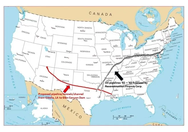
The NIB is prepared to invest up to $400 billion to bring new water to the Colorado River and the Southwest. One possibility would be to divert water from the Atchafalaya River in Louisiana through Louisiana, Texas, New Mexico, Arizona and up to the Glen Canyon Dam.
In this proposal, no water would be taken from the main channel of the Mississippi. As of Dec. 19, 1.43 million gals/sec of Atchafalaya River water was simply going into the Gulf of Mexico without producing electricity or supporting commercial shipping. Taking just 100,000 gals/sec (7%) of this water would fill Lakes Powell and Mead to 50% capacity in one year and 9 months. The project would save on construction costs by using an existing facility – the Old River Control Complex just south of Vidalia, Louisiana, where the Army Corps of Engineers diverts 30% of the downflow of the Mississippi to prevent flooding in New Orleans.
This undertaking would build a 1,400 mile series of pipelines, open channels, tunnels and pumping stations (similar to the California, Los Angeles, Colorado River Aqueducts and the Central Arizona Project). It could be built in a year, along interstate highway rights-of-way, using huge earth-moving machines like those employed in Holland for their canal systems.
There is historical precedent for building systems like this project with deliberate, urgent, speed. In less than a year between 1942 and 1943, the RFC financed and built two pipelines of similar length, 1,200 and 1,400 miles, to carry crude oil from Texas oil fields to the East Coast. These pipelines rescued the entire East Coast industrial oil refining system and won World War II for the Allies.
This proposed pipeline divert water from the Atchafalaya River in Louisiana through Louisiana, Texas, New Mexico, Arizona and up to the Glen Canyon Dam. Credit: Don Siefkes
Such a water aqueduct system might cost on the order of $14 billion-23 billion, a small amount for a $5 trillion bank and also small compared to cutting off water supplies to farmers in the Southwest who produce $39 billion worth of our annual food supply. Without new water in the Colorado, food prices will skyrocket more than they already have, and we will all needlessly suffer. It is also unthinkable to allow water levels in Lakes Mead and Powell to fall to the point where the dams can no longer generate electricity or provide drinking water.
We don’t think anything about pumping crude oil and gasoline through 190,000 miles of U.S. pipelines from areas that have oil and gasoline to areas that don’t. We certainly can do the same with water.
Alphecca Muttardy is a Macroeconomist with the Coalition for a National Infrastructure Bank (NIBCoalition.com), and 25 year veteran of the International Monetary Fund. Don Siefkes is an MIT-trained chemical engineer who represents the Coalition for the NIB in the San Francisco Bay Area. Their emails are, respectively, amuttardy@gmail.com and donsiefkes@aol.com.
The Mississippi River at Vicksburg, Mississippi October 7, 2022. Photo credit: NOAA
Soil moisture anomaly map October 7, 2022. Credit: NOAA
Click the link to read the article on the NOAA website:
Water levels on the Mississippi River normally decline in the fall and winter, but not by nearly as much as they did in October 2022. Lack of rain in the Ohio River Valley and Upper Mississippi River Valley in recent weeks caused river water to drop to levels not seen in more than a decade along key parts of the river. The low water levels are slowing barge traffic and raising concerns that saltwater intrusions in the Lower Mississippi could affect water supplies.
The Operational Land Imager (OLI-2) on Landsat 9 captured this natural-color image of the parched river on October 7, 2022. The image shows backed-up barges north of Vicksburg, Mississippi. At times, well over 100 towboats and barges waited due to a temporary river closure caused by barge groundings and dredging work, according to news reports. The towboats and barges are strung together into groups that vary in size but can easily be 1,000 feet (300 meters) long and 100 feet (30 meters) wide.
The map above shows how wet the soil was on the same day the Landsat 8 image was acquired. Using data from the Crop Condition and Soil Moisture Analytics (Crop-CASMA) product, the map shows soil moisture anomalies on October 7, 2022, or how the water content in the top meter (3 feet) of soil compared to normal conditions for the time of year. Brown areas were drier; blue areas were wetter. Crop-CASMA integrates measurements from NASA’s Soil Moisture Active Passive (SMAP) satellite and vegetation indices from the Moderate Resolution Imaging Spectroradiometer (MODIS) instruments on NASA’s Terra and Aqua satellites.
River levels at Vicksburg had dropped to 0.66 feet (0.20 meters) by October 20, a low level but still well above the record low of -7.00 feet in 1940. However, farther upstream in Memphis, the river level dropped to -10.79 feet on October 17, 2022, the lowest level recorded at the site since the start of National Weather Service records there in 1954.
USGS streamgage data Memphis, TN and New Madrid, MO October 2019 thru October 2022. Credit: NOAA
At New Madrid, Missouri, water levels had dropped to -5.1 feet on October 20, just slightly above the minimum operating level of the gage. Water levels, or “gage height,” or “river stages” do not indicate the depth of a stream; rather, they are measured with respect to a chosen reference point. That is why some gage height measurements are negative.
A lack of rain over a very broad area is the main reason water levels have dropped so low, explained Tennessee State Climatologist Andrew Joyner. “It doesn’t take long for water levels to go down given a lack of rain over such a large area,” he said.
Downstream, in the lower part of the river, the U.S. Army Corps of Engineers is dealing with the intrusion of saltwater into the lower reaches of the river. Normally, the flow of the river prevents saltwater from the Gulf of Mexico from moving very far upriver, but the river is so low that a wedge of saltwater has crept northward and threatens intakes used for freshwater supplies. To prevent saltwater from getting farther upstream, the Corps began construction on an underwater sill in Myrtle Grove, Louisiana, on October 11.
Forecasting from the National Weather Service Lower Mississippi River Forecast Center calls for water levels to drop even lower at several points along the river in coming weeks. In many cases, they expect water levels to drop even lower than they did in 2012, 2000, and 1988—other years when water levels hit unusually low levels.
What will happen beyond a few weeks is less clear. “Looking at one- and three-month forecasts, it looks like there are equal chances of above or below average rainfall,” Joyner said. “If we end up with average rainfall, conditions might not worsen, but it also won’t lead to improvements.”
Created by Imgur user Fejetlenfej , a geographer and GIS analyst with a ‘lifelong passion for beautiful maps,’ it highlights the massive expanse of river basins across the country – in particular, those which feed the Mississippi River, in pink.
Water levels are approaching their lowest in a generation, forcing emergency dredging to keep commerce flowing
Areas of persistent and developing drought stretch across much of the Mississippi basin, which itself covers 41 percent of the contiguous United States. Though record-setting storms caused catastrophic flooding in parts of the watershed this summer, the past few months have been among the driest on record in parts of the Heartland, at a time of year when river levels are normally hitting their low points. And long-term forecasts suggest that unusually dry weather is likely to continue. At some spots, gauges reported the Mississippi’s river stages — a measure of water height normally used to evaluate flood conditions — with negative values, an indication of how far below normal levels the waters have receded…
There’s also a risk for drinking water. The relative trickle that is reaching the river’s mouth in Louisiana’s outlying Plaquemines Parish is allowing salt water to intrude up the Mississippi from the Gulf of Mexico, threatening to taint drinking water drawn from the river and requiring emergency action by the Army Corps of Engineers.
Repeatedly over the past week, water levels have become too low for barges to float, requiring the corps to halt maritime traffic on the river and dredge channels deep enough even for barges carrying lighter-than-normal loads. Days after a queue of stalled river traffic grew to more than 1,700 barges during emergency dredging near Vicksburg, Miss., a separate 24-hour dredging closure began Tuesday near Memphis. More dredging, which routinely costs billions of dollars a year, could be needed if barges continue to run aground.
This summer, as seven states and Mexico push to meet a Tuesday [August 16, 2022] deadline to agree on plans to shore up the Colorado River and its shriveling reservoirs, retired engineer Don Siefkes of San Leandro, California, wrote a letter to The Desert Sun with what he said was a solution to the West’s water woes: build an aqueduct from the Old River Control Structure to Lake Powell, 1,489 miles west, to refill the Colorado River system with Mississippi River water.
“Citizens of Louisiana and Mississippi south of the Old River Control Structure don’t need all that water. All it does is cause flooding and massive tax expenditures to repair and strengthen dikes,” wrote Siefkes.”New Orleans has a problem with that much water anyway, so let’s divert 250,000 gallons/second to Lake Powell, which currently has a shortage of 5.5 trillion gallons. This would take 254 days to fill.”
[…]
Engineers said the pipeline idea is technically feasible. But water expertssaid it would likely take at least 30 years to clear legal hurdles to such a plan. And biologists and environmental attorneys said New Orleans and the Louisiana coast, along with the interior swamplands, need every drop of muddy Mississippi water. The massive river, with tributaries from Montana to Ohio, is a national artery for shipping goods out to sea. And contrary to Siefkes’ claims, experts said, the silty river flows provide sediment critical to shore up the rapidly disappearing Louisiana coast and barrier islands chewed to bits by hurricanes and sea rise. Scientists estimate a football field’s worth of Louisiana coast is lost every 60 to 90 minutes. Major projects to restore the coast and save brown pelicans and other endangered species are now underway, and Mississippi sediment delivery is at the heart of them…
Nonetheless, Siefkes’ trans-basin pipeline proposal went viral, receiving nearly half a million views. It’s one of dozens of letters the paper has received proposing or vehemently opposing schemes to fix the crashing Colorado River system, which provides water to nearly 40 million people and farms in seven western states. Fueled by Google and other search engines, more than 3.2 million people have read the letters, an unprecedented number for the regional publication’s opinion content…
The bigger obstacles are fiscal, legal, environmental and most of all, political.
“The engineering is feasible. Absolutely. You could build a pipeline from the Mississippi or Missouri Rivers. Would it be expensive? Yes. Do we have the political will? Absolutely not,” said Meena Westford, executive director of Colorado River resource policy for the Metropolitan Water District of Southern California. “I think that societally, we want to be more flexible. We want to have more sustainable infrastructure. So moving water that far away to supplement the Colorado River, I don’t think is viable. But it’s doable. You could do it.”
In fact, she and others noted, many such ideas have been studied since the 1940s. Most recently, in 2012, the U.S. Bureau of Reclamation produced a report laying out a potentially grim future for the Colorado River, and had experts evaluate 14 big ideas commonly touted as potential solutions. The concepts fell into a few large categories: pipe Mississippi or Missouri River water to the eastern side of the Rockies or to Lake Powell on the Arizona-Utah border, bring icebergs in bags, on container ships or via trucks to Southern California, pump water from the Columbia River in the Pacific Northwest to California via a subterranean pipeline on the floor of the Pacific Ocean, or replenish the headwaters of the Green River, the main stem of the Colorado River, with water from tributaries.
Missouri River Reuse Project via The New York Times
Images from the NASA Earth Observatory released in early July focused on the northern arm of Lake Mead and its decline from 2000 until now. As western states are being asked for solutions to keep Lake Mead and Lake Powell from hitting critical low points, there is more talk about what it would take to pump water from the Mississippi River to western states as well. (Image courtesy of NASA Earth Observatory)
Click the link to read the post on the Progressive Farmer website (Chis Clayton). Click through to the links. Here’s an excerpt:
With the long-term drought, or essentially the change in climate, and steady decline of water supplies on the Colorado River, residents in states such as California are increasingly suggesting why can’t we pipe water to western dams much like we pipe oil now? This isn’t a new debate, but it’s a topic that’s going to come up more and more as water levels at Lake Mead and Lake Powell continue to shrink.
This past weekend I received an email about an editorial in the Waterways Journal, “Drought Revives Mississippi River Pipe Dreams.” The editorial noted the debate going on through columns and letters to the editor in the Palm Springs, Calif., newspaper over the possibility of piping water from the Mississippi River to Lake Powell in northern Arizona.
Looking at nothing more than Google Maps, getting water the Mississippi River to Lake Powell is 1,459-mile journey from Baton Rouge, La.
Debate is heightening as states in the Colorado River are proposing cuts in water use for next year to keep Powell and Mead from reaching critically low levels — points at which the Glen Canyon Dam could stop generating hydropower.
Created by Imgur user Fejetlenfej , a geographer and GIS analyst with a ‘lifelong passion for beautiful maps,’ it highlights the massive expanse of river basins across the country – in particular, those which feed the Mississippi River, in pink.
The Second Los Angeles Aqueduct Cascades, located in Sylmar, just east of the I-5 Freeway near Newhall Pass, in the San Gabriel Mountains foothills of the northeastern San Fernando Valley. The Cascades are the terminus of the Los Angeles Aqueduct, which brings water 338 miles (544 km) from the Owens Valley to Los Angeles. Construction of the aqueduct began in 1908 and completed in 1913. The cascades are a Los Angeles Historic-Cultural Monument (HCM #742), a California Historical Landmark (#653), and a Historic Civil Engineering Landmark. By Los Angeles (talk · contribs) – Own work, CC BY-SA 3.0, https://commons.wikimedia.org/w/index.php?curid=4882240
As the region’s climate becomes drier, more pipelines are being proposed despite the economic and climate risks.
Pipelines that are advancing the fastest are rural and tribal projects backed by federal funding.
The proposals echo a century of large-scale water engineering that ushered in the modern era in the American West.
Across the country’s western drylands, a motley group of actors is responding to the region’s intensifying water crisis by reviving a well-worn but risky tactic: building water pipelines to tap remote groundwater basins and reservoirs to feed fast-growing metropolitan areas, or to supply rural towns that lack a reliable source.
Government agencies, wildcat entrepreneurs, and city utilities are among those vying to pump and pipe water across vast distances — potentially at great economic and environmental cost. Even as critics question the suitability of the water transfers in a new climate era, supporters in California, Colorado, New Mexico, Utah, the federal government, Indian tribes, and other states are prepared to spend billions on water-supply pipelines.
Lake Powell Pipeline map via the Washington County Water Conservancy District, October 25, 2020.
The pipelines range in length from several dozen miles to several hundred and the largest are intended to transport tens of millions of gallons per day. Among these is the 140-mile Lake Powell Pipeline, a roughly $2 billion project that aims to deliver 86,000 acre-feet (28 billion gallons) each year to Washington County, in Utah’s southwest corner.
Not all the projects are cut from the same cloth. Because of the daunting expense, lengthy permitting process, and legal battles, projects with federal backing have a leg up. The infrastructure bill signed by President Joe Biden last November includes $1 billion for rural water supply projects in the western states. Many of these projects, including one in progress in eastern New Mexico, were authorized more than a decade ago.
The infrastructure bill also includes $2.5 billion for tribal water rights settlements, which typically include a water-supply component. The Navajo-Gallup water pipeline, now under construction in northwest New Mexico to supply the Navajo Nation, Jicarilla Apache Tribe, and the city of Gallup, is part of the San Juan River water rights settlement.
Owens Valley
The current batch of pipeline proposals traces its lineage to a century of engineering and building mammoth water supply projects that ushered in the modern era of the American West. State and federal canals snake the length of California. Los Angeles bullied its way into the Owens Valley in the 1910s, eventually siphoning the valley’s water through an aqueduct. A few years later, San Francisco reached into Hetch Hetchy Valley for a reservoir and pipeline. The Central Arizona Project, which broke ground in the 1970s, was built to lift 1.5 million acre-feet of water — almost 500 billion gallons a year — more than a half mile in elevation along its 336-mile course to supply Phoenix and Tucson. In Colorado, at least 11 major projects pierce the Rockies, transferring water to the high-growth Front Range. States west of the 100th meridian would not have been able to attract millions of residents or develop their commercial and agricultural sectors without these water projects.
As the region’s climate becomes drier, more diversions are being proposed despite the economic and climate risks. Large-scale engineering retains its appeal and pipeline options are doggedly pursued by state and local agencies, and a band of self-styled water entrepreneurs.
Potential Water Delivery Routes. Since this water will be exported from the San Luis Valley, the water will be fully reusable. In addition to being a renewable water supply, this is an important component of the RWR water supply and delivery plan. Reuse allows first-use water to be used to extinction, which means that this water, after first use, can be reused multiple times. Graphic credit: Renewable Water Resources
Renewable Resources, a firm backed by former Colorado Gov. Bill Owens, wants to pump groundwater from the San Luis Valley to Front Range cities that are mushrooming with new subdivisions. A competing outfit, Water Horse Resources, is led by Aaron Million, who has dreamed for more than a decade of piping more Colorado River water to the Front Range. The potential water source for Water Horse is some 500 miles away: Flaming Gorge Reservoir, which straddles Wyoming and Utah. Another Front Range project in the Fort Collins area envisions a pair of new reservoirs and an 80-mile pipe network that extends to 15 communities. Called the Northern Integrated Supply Project, it is still waiting on an key federal permit.
In New Mexico, meanwhile, supporters of the Agustin Plains scheme wish to export 54,000 acre-feet of groundwater per year from a high desert basin to communities along the Rio Grande, some 60 miles to the east. The state engineer rejected the permit in 2018, but the applicant is appealing.
Southwest Utah is another epicenter of contested water diversions. The most recent came to light in April, when Escalante Valley Partners filed an application with the state Division of Water Rights for more than 50,000 acre-feet of groundwater per year for export. The water, more than 44 million gallons a day, would come from 115 wells drilled between 1,000 and 5,000 feet deep in Beryl-Enterprise, a basin where the state has restricted use of shallow groundwater due to over-extraction.
In the same area, the Central Iron County Water Conservancy District is championing the $260 million Pine Valley Water Supply project, currently being reviewed by the Bureau of Land Management for a right-of-way permit. If approved, the district would construct 66 miles of pipeline to access groundwater in neighboring Beaver County.
The most expensive water project in southwest Utah is a proposed 140-mile pipeline to Lake Powell. Critics contend that Lake Powell and the Colorado River that flows into it cannot handle any more diversions. The Bureau of Reclamation, which manages Powell and is reviewing the pipeline application, is already taking emergency action to augment the shrinking reservoir, holding back more water than usual and releasing extra supplies from reservoirs higher in the watershed.
Zach Renstrom is the general manager of the Washington County Water Conservancy District, the pipeline project’s chief beneficiary. The basic logic of today’s water manager is not so different from an investment adviser: manage risk through a portfolio of investments. Critics assert that Washington County residents, though use has declined from its very high early 2000s peak, still consume more water than almost any community in the U.S. and that water conservation practices should be sufficient. But Renstrom defends the need for another water source — even a very expensive one, with an overall price tag of about $2 billion — because Washington County’s single source right now is the Virgin River.
“Especially as someone who looks at climate change very seriously and believes in climate change and knows we need to account for that, to make sure the next generation has the tools that it needs to deal with those issues, I think we need to build these large water infrastructure projects,” Renstrom told Circle of Blue.
Utah officials are also pursuing a project in the state’s northern reaches to send water from the Bear River, the main tributary of the shrinking Great Salt Lake, to communities some 90 miles distant along the Wasatch Front. The state does not anticipate needing the project for several decades.
Those projects are miniscule compared to calls to divert eastern rivers like the Mississippi. An undertaking like that — which has legal, technical, environmental, and economic hurdles so enormous as to be implausible today, water experts say — echo even more grandiose and farfetched schemes that were proposed in the 1960s: engineering fantasies like the North American Water and Power Alliance, a continental-scale replumbing of North America’s watersheds, which never advanced much farther than the Parsons Company’s drafting board.
Few of these projects have secured all required permits and fewer still have broken ground. But it is often the case that designs that look appealing in sketches fold when they collide with real world obstacles.
One of the biggest obstacles is supply, says Denise Fort, a professor emerita at the University of New Mexico. Do these areas hold enough water to support more diversions?
Nearly a decade ago, Fort co-authored a report with the Natural Resources Defense Council on the proliferation of pipeline proposals in the western states. In reviewing that report today, Fort told Circle of Blue that the findings still hold true.
“Many of the pipeline projects under consideration today are dramatically different from those constructed in the past, in terms of sustainability of water supplies, available alternatives, costs, environmental impacts and energy use,” the report concluded. “The communities and agencies that are considering these projects would be well served by a careful analysis of the implications of these important choices.”
Construction of the Monument Valley waterline extension, which was funded by The Indian Health Service and the U.S. Department of Housing and Urban Development. The pipeline provided 128 homes with water. Another water project, the Western Navajo Pipeline, has been on hold for at least 10 years. Photo credit: U.S. Environmental Protection Agency
Fort said that, in many cases, pursuit of these pipelines is an attempt to continue a water-consuming lifestyle in a region that can no longer support the burden of that demand. Scientists expect the flow of the Colorado River to decline by 9 percent with each degree Celsius that the planet warms.
“We know what the future is, it’s coming,” Fort said. “And so we can’t continue to act as though it’s just a cyclical thing, and the water will reappear. We know that it will not.”
Fort believes that instead of sticking more straws into a shrinking pool, municipalities should seriously consider reallocating water from agriculture, which uses the lion’s share of the region’s supply. Instead of growing alfalfa for export, that water could be directed to cities. This approach is not without controversy and requires careful crafting — rural communities, in some cases, have resisted “buy and dry,” preferring leases that do not permanently sever water from land.
But such a move is what El Paso is banking on. The largest city in West Texas has spent $220 million since 2016 to purchase 70,000 acres of ranch land about 90 miles east, in Dell City. Crucially, the land comes with water rights. Today, El Paso leases the land for farming. But in several decades the city plans to pipe the water beneath those fields to its residents.
At the foundation of these debates about pipelines are competing views of the American West.
One school of thought is that water follows growth. “I think it’s much cheaper to take the water to the people than move people to the water. You disrupt a lot less lives that way,” Todd Adams, deputy director of the Utah Department of Natural Resources, told the Utah Water Summit last October.
Great Basin wetland. Photo credit: The Great Basin Water Network
The other view is one of conservation and restraint, championed by people like Kyle Roerink, the executive director of the Great Basin Water Network, a group that advocates against transferring water out of its natural basin.
“There is a suburban Manifest Destiny mindset throughout the region that I think is antithetical as it relates to the amount of resources that are available,” Roerink told Circle of Blue.
Looking at the history of pipeline projects and water transfers in the West, Roerink worries about unintended financial and environmental consequences if the current contenders move ahead. In the arid Great Basin, which covers much of Nevada and Utah, he is particularly attuned to dry soils if groundwater-dependent basins are depleted. It’s not an unheard of risk. To offset environmental damage in the Owens Valley from its aqueduct, the Los Angeles Department of Water and Power has spent $2.5 billion in ratepayer funds to suppress dust storms.
Many of the biggest projects were built in an era of minimal environmental review and major government subsidy. Those conditions have changed, one of many reasons why mega-projects like diverting the Mississippi River westward are implausible, even fanciful.
Of the pipeline projects currently under construction, most are not fanciful. Most are like the Eastern New Mexico Rural Water System — smaller in scale and federally supported.
Congress authorized the 140-mile project in 2009 and is contributing 75 percent of the cost. The rest is coming from local partners, which include four communities in Curry and Roosevelt counties.
The project received $177.4 million from the federal government this year and $30 million from the state government. If funding in future years comes in as expected, construction should be completed in six to eight years, Orlando Ortega, the administrator of the Eastern New Mexico Water Utility Authority, told Circle of Blue.
Ogallala Aquifer. Credit: Big Pivots
The project is a federal priority because the partner communities are all served by groundwater from the depleting Ogallala aquifer. At some point, the water will run out. The pipeline is designed to bring surface water from the state-owned Ute Lake.
Like all western water supply projects, there are questions about the long-term availability of Ute Lake as the region dries.
“We are very sensitive to drought conditions, and would certainly be cutting back on our reservation, if needed,” Ortega said.
Brett Walton
Brett writes about agriculture, energy, infrastructure, and the politics and economics of water in the United States. He also writes the Federal Water Tap, Circle of Blue’s weekly digest of U.S. government water news. He is the winner of two Society of Environmental Journalists reporting awards, one of the top honors in American environmental journalism: first place for explanatory reporting for a series on septic system pollution in the United States(2016) and third place for beat reporting in a small market (2014). He received the Sierra Club’s Distinguished Service Award in 2018. Brett lives in Seattle, where he hikes the mountains and bakes pies.
Click the link to read about America’s Most Endangered Rivers 2022 on the American Rivers website. Here’s an excerpt:
It is time to do more than plan. We must implement strategies that allow the Colorado River to thrive in the face of climate change. Failure is not an option.
The Colorado River provides drinking water for 40 million people, irrigates five million acres of farm and ranch land, and supports a $1.4 trillion economy. All of this is at risk due to rising temperatures and drought driven by climate change, combined with outdated river management and overallocation of limited water supplies. River flows are at historic lows and the levels of Lake Powell and Lake Mead reservoirs are dropping precipitously. With the passage of the Infrastructure Investment and Jobs Act, the seven basin states and the Biden administration now have a critical opportunity to implement proven, equitable solutions that enhance water security and river health, while building resilience to future climate change. Failure is simply not an option, given all that depends on a healthy, flowing Colorado River.
American Rivers appreciates the collaboration and efforts of our partners:
National Audubon Society
Environmental Defense Fund
Western Resource Advocates
Theodore Roosevelt Conservation Partnership
Water for Arizona
Water for Colorado
Raise the River
Business for Water Stewardship
Colorado River “Beginnings”. Photo: Brent Gardner-Smith/Aspen Journalism
Click the link to read “America’s Most Endangered Rivers of 2022 Spotlights Rivers in Crisis Mode” on the American Rivers website (Jessie Thomas-Blate):
Today [April 18, 2022] we are announcing America’s Most Endangered Rivers® of 2022 and sounding the alarm that our nation’s rivers and clean water are in crisis.
Catastrophic drought. Disastrous floods. Fish and other freshwater species nearing extinction, as rivers heat up.
Many people in the United States have imagined climate change as a problem in the future. But it is here now, and the primary way that each of us is experiencing climate change is through water. The climate crisis is a water crisis.
Today we are announcing America’s Most Endangered Rivers® of 2022 and sounding the alarm that our nation’s rivers and clean water are in crisis. Topping the list this year is the Colorado River, which is threatened by climate change and outdated water management. Thirty federally-recognized Tribal Nations, seven states, Mexico and 40 million people who rely on the river for drinking water are being impacted by this crisis. Also threatened is vital habitat for wildlife, as the Basin is home to 30 native fish species, two-thirds of which are threatened or endangered, and more than 400 bird species.
Lake Powell just north of Glen Canyon Dam. January 2022. Jonathan P. Thompson photo.
In March 2022, water levels at Lake Powell (the impoundment created by Glen Canyon Dam in Utah/Arizona) fell to the lowest point since the lake first filled in 1980. The Colorado River system is already operating at a deficit, and climate change is expected to further reduce the river’s flow by 10 to 30 percent by 2050. We’re calling on the Biden administration and the seven Basin states to work together to allocate funds from the Infrastructure Investment and Jobs Act to implement proven, equitable solutions that prioritize river health and water security.
Our country’s rivers need attention now. We must work better. Smarter. More equitably. We must elevate Tribal Nations and learn from their Traditional Ecological Knowledge. We must work collaboratively with frontline communities along the Mississippi River, and in places like the Mobile River (AL) and Tar Creek (OK), where residents deal with pollution on a regular basis. We must heed the calls of Tribal Nations to restore rivers like the Snake River.
California makes a prominent appearance in the report this year as well. In addition to the Colorado River (a key source of drinking water for some California residents), also featured are the Los Angeles River (threatened by inadequate management, climate change and pollution) and the Lower Kern River (threatened by excessive water withdrawals).
No matter where you live in the United States, your river and your drinking water are affected by climate change. Black, Indigenous, Latino/a/x and other communities of color feel these impacts most acutely, due to historical and contemporary policies, practices and norms that maintain inequities. It’s time to follow the lead of frontline communities that are advancing solutions for rivers and clean water — solutions that will make us all safer and healthier, and our nation stronger.
Did you know that later this year is the 50th anniversary of the passage of the Clean Water Act? How can it be that are we still battling over the importance of clean water? This battle comes to the ground on Arizona’s San Pedro River where rollbacks to the Clean Water Act initiated during the Trump administration have removed protections for seasonal and intermittent streams, which encompass almost 94 percent of the San Pedro River’s waterways and provide the lifeblood that sustains the river. We must protect the Waters of the U.S. now, before it is too late.
Rounding out this year’s report are Alabama’s Coosa River, which is threatened by pollution from industrial poultry farming, and Maine’s Atlantic Salmon Rivers, where we have an opportunity to save Atlantic salmon by making better decisions during the upcoming relicensing of hydropower dams.
All of these rivers face critical decisions this year, and you can do something to help. Go check out your favorite river from this report and TAKE ACTION TODAY!
If we are to meet this moment and confront the challenges facing our clean water, environment and communities, we must come together as a powerful movement, speaking up for the rivers that give us life — for these 10 endangered rivers, and all of the rivers essential to our shared future.
America’s Most Endangered Rivers® of 2022
Colorado River in Grand Junction. Photo credit: Allen Best
#1 Colorado River
State: CO, UT, AZ, NV, CA, WY, NM, Mexico
Threat: Climate change, outdated water management
The Snake River, Jackson Lake Dam and the Teton Range. 1997 photo/Wikipedia
#2 Snake River
State: ID, WA, OR
Threat: Four federal dams
The Mobile River, taken from the site of the former Fort Stoddert near Mount Vernon, Alabama. Date: 21 March 2009. Source: Own work Author: Altairisfar
#3 Mobile River
State: AL
Threat: Coal ash contamination
Evening on the Sheepscot River. Walking along the river in Wiscasset. Weekend trip to Maine for a friend’s wedding, October 2009. By Tim Sackton – Flickr: Evening on the Sheepscot River, CC BY-SA 2.0, https://commons.wikimedia.org/w/index.php?curid=12883043
Threat: Excessive water pumping; loss of Clean Water Act protections
Kayakers float the Los Angeles River near the Sixth Street Bridge in downtown L.A. Photo credit Tom Andrews via The High Country News.
#9 Los Angeles River
State: CA
Threat: Development, pollution
Tar Creek, Oklahoma drains from a Superfund site. Photo: LEAD Agency
#10 Tar Creek
State: OK
Threat: Pollution
Restoration work along the Colorado River reestablished a riverbank more conducive to irrigation access. (Source: Paul Bruchez)
Click the link to read “Colorado River named most endangered waterway in US” on the OutThereColorado.com website (Carol McKinley). Here’s an excerpt:
The Colorado River Basin is home to 30 native fish species, many of which are threatened. More than 400 bird species depend on the area as well. The 1,450-mile river provides water for Denver, Los Angeles, Phoenix and Las Vegas. Unlike Colorado’s other rivers, it touches all four corners of the state.
Rancher Paul Bruchez, his dad and his brother moved their families from Westminster to Kremmling in 2000 with a dream of ranching in the mountains. They bought the 6,000-acre Reeder Creek Ranch in part because the Colorado River runs through it. For a couple of glorious years, all was flowing according to plan: The Rocky Mountain snowpack fed the river, the fish were thriving and the crops grew tall. But when the drought of 2002 hit, the snowmelt was around half of where it was supposed to be and warm temperatures made things worse, quickening the thaw so that runoff didn’t last very long. That year, Bruchez could walk across the river in places and see the fish going belly up in the warm water.
“Come 2003, my family had a meeting. We wondered, did we move to the wrong place? Instead of leaving, we decided to adapt and adjust to the river flow, climate change and population growth,” Bruchez told The Denver Gazette.
Seeing no quick fix, Bruchez established a restoration project and a Colorado Basin roundtable and prepared to go along for the ride. Over time, Bruchez’s projects have led to water savings and recovery.
Lake Powell, just upstream from Glen Canyon Dam. At the time of this photo, in May 2021, Lake Powell was 34% full. (Ted Wood/The Water Desk)
Click the link to read “Advocacy group asks Southwest to ‘amp up the urgency’ on protecting Colorado River water” on the AZCentral.com website (Brandon Loomis). Here’s an excerpt:
“The urgency is extreme,” American Rivers spokesman Sinjin Eberle said, noting that the river serves some 40 million people and production of most of the nation’s winter vegetables. “We have to do something now.”
[…]
This year’s projection is not good. On the heels of two low-flow springs, the Colorado Basin River Forecast Center this month said current snowpack ready to melt suggests just 64% of normal flows will reach Lake Powell this season: 4.1 million acre-feet…
Brad Udall: Here’s the latest version of my 4-Panel plot thru Water Year (Oct-Sep) of 2021 of the Colorado River big reservoirs, natural flows, precipitation, and temperature. Data (PRISM) goes back or 1906 (or 1935 for reservoirs.) This updates previous work with @GreatLakesPeck.
“What we’re facing is the permanent warming and drying of the American Southwest,” Colorado State University water and climate scientist Brad Udall said in a statement. His research and outspoken warnings have suggested there’s little time to waste throttling back on water use when rising heat is causing plants and the atmosphere to sponge up springtime runoff before it ever reaches the river…
For its part, Arizona is working with neighbors to pay some users to keep water in Lake Mead over the next few years. These efforts follow a first-ever federal shortage declaration for 2022, which caused Arizona to forego water that otherwise would support Pinal County farms. In response those farmers have planted less and shifted to a declining groundwater supply.
The crisis is harming more than water suppliers’ outlooks. Lower reservoir levels are also limiting options for protecting the river’s own environment, especially in the Grand Canyon.
The prioritization of power generation at Glen Canyon Dam contributed to a decision by the U.S. Bureau of Reclamation not to release water to create an artificial flood to restore beaches and sandbars in Grand Canyon last fall, despite an abundance of rain-driven sand from last year’s monsoon season that had primed the river to deliver the desired results…
Flaming Gorge Reservoir July 2020. Photo credit: Utah DWR
Experiments with flushing water from Flaming Gorge Dam, upstream on the Green River, a Colorado River tributary, showed success in dislodging young bass from their protected nests and reducing numbers there, Bestgen told colleagues. A similar effort could make life hard for any bass that get established in Grand Canyon, but would further deplete Lake Powell’s storage.
The Green and Colorado rivers cut through Utah’s Canyonlands National Park. A warming climate is adding to the drought-driven declines in snowmelt and spring runoff across the Colorado River Basin. (Source: LightHawk Conservation Flying/The Water Desk)
Click the link to read “Colorado River named the most endangered in the U.S. by conservation group” on the Colorado Public Radio website (Michael Elizabeth Sakas). Here’s an excerpt:
The report highlighted how climate change and drought have affected the river but also faulted outdated water management practices for dwindling flows and low reservoir levels. Rice said the stakes are high, and more needs to be done to conserve the water that’s left. He said the basin states and the Biden administration must work urgently with the tribes and Mexico.
“We’ve made management decisions based on a river that hasn’t existed for a long time,” Rice said. “We have to use less water.”
American Rivers also released a list of strategies it recommends to adapt to a drier and warmer world. Rice wrote for the report that the scale and pace of climate-related changes in the Colorado River Basin “pose a gargantuan challenge, unprecedented in the history of water management.” Those strategies include changes to how federal infrastructure dollars are spent, like prioritizing forest management, restoring natural meadow systems to improve water retention and aquifer recharge and covering reservoirs and canals to reduce evaporation.
The report also details how drinking water across the U.S. is affected by climate change and notes how communities of color often feel these impacts most acutely because of “historical and contemporary policies, practices and norms that maintain inequities.” The report also urges water managers to follow the lead of tribal nations and frontline communities that are advancing solutions for rivers and clean water. Tribes in the Colorado River basin have long pushed for more inclusion in how the river is managed.
Colorado Riverfront Trail September 2019.
Click the link to read “Group lists Colorado River as most endangered” on the Grand Junction Daily Sentinel website (Dennis Webb). Here’s an excerpt:
The Colorado River, or portions of it, have made the list in years prior, but the river is being stressed as never before because of the level of demands on it and its diminishing water volumes, thanks to drought exacerbated by climate change. As American Rivers notes, the river is relied on by seven states, 30 federally recognized tribal nations and Mexico. It provides drinking water to 40 million people and vital habitat, including 30 native fish species and more than 400 types of birds. It also has been besieged by drought throughout this century, made worse by warmer conditions that further reduce snowpack runoff volumes…
Last summer, American Rivers and other conservation groups issued a list of 10 strategies to respond to climate change in the Colorado River Basin. These included things such as urban water conservation and reuse, shifting by farmers to crops requiring less water, improving land management practices to reduce the amount of dust that blows onto snowpack and accelerates snowmelt, prioritizing forest management and restoration, and upgrading agricultural infrastructure and operations. Rice also hopes to see increased efforts to restore headwaters, invest in watershed health, reconnect floodplains, ensure healthy riparian zones and restore rivers that have been diverted.
Click here to read the report (Adnan Rajib, Qianjin Zheng, Heather E. Golden, Qiusheng Wu, Charles R. Lane, Jay R. Christensen, Ryan R. Morrison, Antonio Annis & Fernando Nardi). Here’s the abstract:
Floodplains provide essential ecosystem functions, yet >80% of European and North American floodplains are substantially modified. Despite floodplain changes over the past century, comprehensive, long-term land use change data within large river basin floodplains are limited. Long-term land use data can be used to quantify floodplain functions and provide spatially explicit information for management, restoration, and flood-risk mitigation. We present a comprehensive dataset quantifying floodplain land use change along the 3.3 million km2 Mississippi River Basin (MRB) covering 60 years (1941–2000) at 250-m resolution. We developed four unique products as part of this work: Google Earth Engine interactive map visualization interface, Python code that runs in any internet browser, online tutorial with visualizations facilitating classroom code application, and instructional video demonstrating code application and database reproduction. Our data show that MRB’s natural floodplain ecosystems have been substantially altered to agricultural and developed land uses. These products will support MRB resilience and sustainability goals by advancing data-driven decision making on floodplain restoration, buyout, and conservation scenarios.
Drought isn’t a new thing in the West, but right now, much of the region is gripped in a historic drought. An unusually dry year coupled with record-breaking heat waves has strained water resources in the West this year. In fact, water levels are so low that the Bureau of Reclamation declared a water shortage on the Colorado River basin for the first time ever in mid-August. There are a lot of ideas for how to relieve the drought and ease its impacts—some more feasible than others. But when you think about water in the West, you have to think about scarcity too.
“You’re really thinking about, well, why is it scarce? Is it too little supply? Or is it too much demand? And in the case of water, it’s both, right?” said Jason Shogren, an economist at the University of Wyoming (UW). “You have a drought, and that is going to restrict the supply of water. And you have an increase in demand because people are moving more and more to the Rocky Mountain region, moving more and more to the west coast.”
And as Shogren pointed out, a lot of people move to the West and expect to keep parts of their lifestyles from where they came from, like lawns of lush green grass. But those require a lot of water. And Shogren said we have to think about all the different demands.
“And since we have a lot of demand for water in Southern California, Phoenix, Las Vegas. We have a lot of demand for water in agriculture production, whether it’s crops, or whether it’s nuts, or whether it’s wine,” he said. “And on the supply side, the question is, ‘Who gets what water? And why?'”
He added property rights over water are different by state and deciding how water rights are allocated and how they can be used gets tricky fast…
And with climate change intensifying extreme weather like droughts and flooding, there’s one potential solution that would help solve both problems. Dr. Tom Minckley said it involves moving water.
Missouri River Reuse Project via The New York Times
“We could say, ‘Oh, well, the western states are in drought. So we could take water from, say, the Mississippi or the Missouri River, and when it floods, we could capture that floodwater, and then basically return it to the head of the watershed,'” he said.
Dr. Minckley is a Professor in the Department of Geology and Geophysics at the University of Wyoming. He studies water in the West and how it’s managed. He said piping water from a flooded place to a place in drought is an idea that’s becoming much more popular. State governments already transfer water between some states in the west…
But because of Wyoming’s high elevation, moving water here from almost anywhere else would mean fighting gravity. It would require a lot of energy because water is actually quite heavy. Not to mention the logistics of where a pipeline would even go and how much it would cost – water is valued by the acre-foot.
“On average, it’s about $2,000 per acre-foot. And some of the Colorado River water in the state of Colorado is running for $85,000 an acre-foot. So, like, there’s these crazy, really big numbers out there,” said Minckley. “And the question is if we start moving water from where it is to where we want it to be, how do we pay for it?”
The idea has been researched and despite its growing popularity, the Bureau of Reclamation found its implementation highly unlikely because of the cost and logistics.
Cloud-seeding graphic via Science Matters
Another idea that’s been floated is cloud seeding…
[Bart] Geerts said farming communities in the High Plains have financially supported seeding operations in thunderstorms for decades, but it can be really hard to prove that kind of seeding actually worked. But, he said it is a lot easier to demonstrate that it worked when they seed winter clouds. Which can be more useful in the High Plains anyway.
Because there’s natural variability between the years, you can’t pinpoint exactly how much more snowfall there was due to seeding and they work with averages. Geerts said a common belief is that cloud seeding keeps moisture from falling in other places where it’s needed.
“It’s really not understood. There is that possibility but in general, these wintertime clouds are not very efficient,” he said. “Essentially water vapor condenses, you extract it, make it into snow, and thereby you reduce the downstream amount of water vapor to some extent. But that amount is so, so small, so insignificant compared to the total water vapor content.”
But Geerts added on the flip side of that, some of the seeding materials may float downwind and increase snowfall on the next mountain range.
“So it can work either way. We don’t really have an answer,” he said.
It seems like a lot of ideas and conversations about this topic end with that – “we don’t really have an answer.” But as droughts intensify, driven by climate change, those conversations continue to happen. And some may lead to more viable solutions.
Have you seen the U.S. Drought Monitor’s map lately? It’s not good. Especially for one half of the country.
More than 98% of the Western United States is experiencing drought. In the Northeast, it’s only about 15% of the land under a drought. In the Southeast it’s even lower, at 8%.
So if there’s plenty of water in reservoirs to the East, why not just move around resources and share the goods as one big happy country? A candidate in California’s gubernatorial recall election recently suggested building a pipeline from the Mississippi River the Golden State. We asked two drought experts. It turns out it would be stupidly complicated.
The first problem: Our country is very, very big.
“It’s really far away,” says Stephanie Pincetl, professor at UCLA’s Institute of the Environment and Sustainability. “There are mountains and deserts and swamps and all kinds of things. That infrastructure would be enormously expensive to build. I mean trillions of dollars.”
Even if cost wasn’t a factor, logistics would be complicated. The water would need to be transported in some sort of massive pipe…
You’d need to dig through thousands of miles of land – much of it probably private property – to put a pipe underground…
Now, let’s say money and logistics are no obstacle. It still doesn’t make sense environmentally.
“It would require a lot of energy to move that water, gobs of energy,” says Pincetl…
We’re much better off finding ways to conserve the water we do have and use it more wisely, Hall says…
Hall is less subtle: “That’s a wildly unrealistic thing to do. … We need to be thinking about our addictions to resources that we take for granted.”
Created by Imgur user Fejetlenfej , a geographer and GIS analyst with a ‘lifelong passion for beautiful maps,’ it highlights the massive expanse of river basins across the country – in particular, those which feed the Mississippi River, in pink.
Created by Imgur user Fejetlenfej , a geographer and GIS analyst with a ‘lifelong passion for beautiful maps,’ it highlights the massive expanse of river basins across the country – in particular, those which feed the Mississippi River, in pink.
The Arizona Legislature wants to look into the feasibility of pumping water from the Mississippi River to Arizona.
But the U.S. Bureau of Reclamation has already studied the idea, and weighed in on the project in 2012.
The agency studied factors such as cost, legal issues, power use and the amount of time the project would take.
A report estimated the project could cost up to $14 billion; the timetable was around 30 years.
“This is not a new idea. The concept of a massive pipeline to transport water from the Midwest into the Colorado River Basin, has been proposed in the past and evaluated, and the feasibility really isn’t there,” said Kim Mitchell of Western Resource Advocates…
Arizona still owes the federal government about a billion dollars for the Central Arizona Project, which pumps water from the Colorado River to the Phoenix and Tucson areas.
Created by Imgur user Fejetlenfej , a geographer and GIS analyst with a ‘lifelong passion for beautiful maps.’ It highlights the massive expanse of river basins across the country – in particular, those which feed the Mississippi River, in pink.
The Arizona Legislature on Tuesday made a formal request asking Congress to fund a study to determine the feasibility of pipelining Mississippi River floodwater to the Colorado River.
House Concurrent Memorial 2004 passed the Arizona Senate by a 23-7 vote and the Arizona House by a 54-6 margin. A memorial is not a law, but a legislative measure containing a request or proposal, asking other parties outside the Arizona Legislature’s jurisdiction to take action. HCMs have no official standing or effect, but serve as a public record of the request presented for consideration.
The memorial was introduced by Rep. Tim Dunn, R-Yuma. Rep. Leo Biasiucci, R-Lake Havasu City, is among co-sponsors.
It asks that “the United States Congress fund a technological and feasibility study of developing a diversion dam and pipeline to harvest floodwater from the Mississippi River to replenish the Colorado River and prevent flood damage along the Mississippi River.”
It also states that “If shown to be feasible, the United States Congress implement the diversion dam and pipeline as a partial solution to the water supply shortage in Lake Powell and Lake Mead and the flood damage that occurs along the Mississippi River.”
Lake Powell and Lake Mead are the two major reservoirs on the Colorado River. Both are at historically low levels and likely will trigger a Tier 1 water emergency in Arizona later this year or in 2022.
The memorial notes the low water levels of both reservoirs and the “historic flooding in 2011 and 2019 along the Mississippi River” that caused 11 deaths and more than $9.5 billion in damage.
It asks that the request be sent to the President of the U.S. Senate, the Speaker of the U.S. House of Representatives and the governors of states on the Mississippi River — Arkansas, Illinois, Iowa, Kentucky, Louisiana, Minnesota, Mississippi, Missouri, Tennessee and Wisconsin — as well as Arizona’s 11 members of Congress.
“Arizona has long been at the forefront among Western states in supporting the development and implementation of pioneering, well-reasoned water management policies,” Dunn said, a line straight out of the HCM he crafted. “Arizona and the other six Colorado Basin states are in the 20th year of severe drought and experiencing a severe water shortage. Water levels are at critical levels, jeopardizing the water delivery and power generation. A new water source could help augment Colorado River supplies.
“One promising possibility involves piping water that is harvested from Mississippi River floodwaters. Diverting this water, which is otherwise lost into the Gulf of Mexico, would also help prevent the loss of human life and billions in economic damages when such flooding occurs. This concept is already being proven in Denver, where floodwater is being successfully harvested from the Missouri River to help alleviate its water shortage.”
Created by Imgur user Fejetlenfej , a geographer and GIS analyst with a ‘lifelong passion for beautiful maps,’ it highlights the massive expanse of river basins across the country – in particular, those which feed the Mississippi River, in pink.
With the coronavirus already stretching supplies and budgets, local leaders worry that a flood could overwhelm them.
New Orleans is a hot spot for Covid-19, and thousands of cases locally means [Belinda Constant, Mayor of Gretna, LA, is] working with a skeletal staff under lockdown conditions. Meanwhile, the Mississippi has risen more than a foot in the past week, triggering emergency flood measures. And the rains keep coming.
Gretna itself is below sea level, and currently some 11 feet below the surging river. All that’s keeping the city dry is a levee built by the U.S. Army Corps of Engineers after Hurricane Katrina in 2005. Constant says she prays every day that it doesn’t rain any more, or that one of the enormous cargo ships making its way down the river doesn’t get caught in the currents and swept into the barrier…
Louisiana, along with the rest of the Mississippi Valley region, is in the middle of its annual wet season, which usually peaks in April. This year’s floods are predicted to be more moderate than 2019’s, which covered a record expanse of 19 states, starting in January and lasted for an unprecedented nine months and affected 14 million people.
Even a milder season could be devastating to many, however. The U.S. National Weather Service says they might still affect more than 128 million people, and several areas are approaching flood stage already.
Colin Wellenkamp is the executive director of the Mississippi River Cities & Towns Initiative, which coordinates and organizes towns along the entire river corridor. He says Mayor Constant’s anxieties are shared by many local officials. “We are averaging a 100- to 200-year flood event annually somewhere on the river,” he says. As a result, many towns’ emergency capabilities were already tapped out before Covid-19, he says.
The Federal Emergency Management Agency and the U.S. Army Corps of Engineers are promising the same amount of help to states as in previous years. Yet FEMA , by its own accounting, is well below its own 2015 targets for field staffing for emergencies. And even if the big agencies could provide the level support local communities have come to depend on, that still may not be enough. “The challenges are just so much bigger this year,” says Wellenkemp.
For starters, just like everywhere else, towns facing flooding are also facing extreme shortages of protective equipment such as face masks and gloves. Not only are doctors and nurses worried about shortages, so are first responders who may have to rescue people and property during an emergency. Most towns also rely heavily on volunteers for everything from filling sandbags to moving equipment to stocking shelters for displaced families. If officials can’t guarantee adequate safeguards for health, they aren’t sure people will show up…
Town officials have similar concerns related to institutions like the Red Cross, which they rely on to set up shelters when needed. Many wonder how they’ll cope in an era where group shelters such as gyms or tents are no longer an option.
Bob Gallagher, the mayor of Bettendorf, Iowa, isn’t one of them. He’s working with both state and federal officials and is optimistic that his city could handle flooding if it occurred. For now he’s sheltering homeless people in local hotels instead of group shelters, and says that’s working fine. But he acknowledges that the outlook might not be so rosy for smaller towns that have to rely almost entirely on volunteers in big emergencies.
The good news, says Wellenkamp, is that FEMA has made spending on Covid-19 preparations reimbursable by the federal government, a standard practice for damage from natural disasters that reach the level of federal emergency. The bad news is that FEMA still hasn’t reimbursed municipalities for the 2019 flooding, and many are already carrying heavy debt. “The economic impact from this will be greater than even last year’s record flood,” he says.
A year after flooding battered the Missouri River’s levee system, inundating towns and farmland and causing multiple closures to the nation’s interstate highway system, early forecasts warn that more of the same could be on the way: above-normal rainfall, greater than normal spring runoff. A USA TODAY Network analysis delves into records of an aging system of nearly a thousand levees where nobody knows how many were damaged last year or how many were repaired…
The forecast is a veritable index of meteorological plagues: above-normal rainfall; greater than normal spring runoff; thoroughly saturated soils; and an aging system of nearly a thousand levees where nobody knows how many were damaged last year and in previous floods or how many were repaired.
The 855 levee systems throughout the Missouri River basin protect at least half a million people and more than $92 billion in property. Yet a USA TODAY Network analysis of Army Corps of Engineers’ records found at least 144 levee systems haven’t been fully repaired and that only 231 show an inspection date.
Of those, nearly half were rated “unacceptable,” which means something could prevent the levee from performing as intended or a serious deficiency was not corrected. Only 3.5% were deemed acceptable; the rest were found to be “minimally acceptable.”
U.S. levee systems map via the U.S. Army Corps of Engineers. Click on the map to go to the interactive website.
Only 231 of the levee systems show any inspection date. For 38, the most recent inspection date was more than five years ago.
In the Army Corps’ Kansas City district, for example, about 70 projects, spanning 119 levees that requested repair assistance, are eligible for funding, but that doesn’t mean they’ll be ready if the waters rise like they did last year.
“Some of them have been repaired, but from a total system perspective, I don’t think any of them are whole,” said Jud Kneuvean, the district’s chief of emergency management, who expects full levee rehabilitation and repair to take at least another year.
In the meantime, the extent and impacts of flooding will depend on when and where the rain falls…
The 2,300-mile Missouri River begins in southwestern Montana, where the Gallatin, Madison and Jefferson rivers converge near the community of Three Forks, before gathering water from 10 states and parts of two Canadian provinces to become the “Big Muddy,” North America’s longest river.
In recent years, more rainfall has been pouring into the Missouri River basin, raising questions about whether climate change is bringing worsening floods more often. Data from the National Oceanic and Atmospheric Administration dating back to 1895 shows record-setting rainfalls in the area occurring more often. Last year, for example, was the wettest on record in North Dakota, South Dakota and Minnesota.
All that water adds to the challenge faced by Corps policymakers, who juggle sometimes conflicting priorities that include maintaining navigation; managing the reservoir system to prevent flooding; providing farmers with irrigation and hydropower; protecting endangered species; and preserving recreational opportunities.
While the priority is protecting human life and safety, the Corps’ decision-making sometimes puts special interest groups at odds, and the agency remains embroiled in controversy over whether the engineering of the river exacerbates flooding.
Things came to a head last year when a bomb cyclone in March melted all the snow in Nebraska and Iowa at once and dumped tremendous rain, swelling not just the Missouri, but the Elkhorn, Platte, James and Big Sioux rivers.
The Niobrara River in Nebraska breached the Spencer Dam on March 14, sending a wall of water downstream and into the Gavins Point reservoir near Yankton, South Dakota. At the peak, water flowed into the reservoir at 180,000 cubic feet per second — nine times more than the normal average for March. Meanwhile water was coursing into the rivers downstream of the dam and the effects of all that water were felt in nearly every community downstream.
Two other big rain events occurred in May and September. When the Corps’ Kansas City district deactivated its emergency operations center in December, it had been open for 279 days, the longest period on record…
Construction of the higher levee is in the administrative and planning stages, with actual construction activity set for fall.
Most of the Missouri’s levees fall into one of two categories: either federally built and locally operated or locally built and operated. The Corps inspects — and helps pay to repair — only the levees maintained to federal standards that participate in the federal flood program.
That exception means no one has a full list of damaged levees still in need of repair.
The number of levees that aren’t regularly inspected doesn’t surprise Neal Grigg, an engineering professor at Colorado State University who chaired a Corps-appointed review panel after 2011 flooding.
In an ideal management system, every levee “would be under the responsibility of some authority that was responsible and had enough money and good management capability to do that,” Grigg said.
But that’s not realistic, he added, noting that the Corps has tried through a task force to get some organization to the levee systems along the river, but it’s problematic, in part, because there are so many conflicting interests.
A host of agencies are cooperating to repair levees, but the progress is slow, said Missouri farmer Morris Heitman, who serves on the Missouri River Flood Task Force Levee Repair Working Group.
In addition to the Corps, the Federal Emergency Management Agency, the state of Missouri, the USDA Natural Resources Conservation Service and a large number of local levee districts all work to repair levees.
“We’re trying to dance with different agencies,” Heitman told the University of Missouri Extension. “All these agencies have their own requirements and parameters, and we’re trying to coordinate those to build a secure system against the river.”
Fixes to the 144 levee systems listed in disrepair in the Corps’ Omaha and Kansas City districts are in various stages of completion, and some aren’t expected to be done for more than a year.
In the Omaha district that includes Nebraska and Iowa, “pretty much all of the levees were damaged in one way or another,” said the corps’ Matt Krajewski.
While almost all of the district’s levees that qualify for federal aid have been restored to pre-2019 flood heights, Krajewski said they don’t offer the same level of “risk reduction” because they need final touches such as sod cover and drainage structures to protect against erosion. The Corps hopes to complete those repairs this summer.
In the meantime, the Corps is working to prepare its flood storage capacity by releasing more water than normal from its dams.
“We’re being really aggressive with our releases and trying to maintain our full flood storage,” said Eileen Williamson, a Corps spokeswoman for the Northwestern region.
But the projections for spring runoff don’t look good and may limit how much the Corps can do.
In February, the runoff was twice the normal average, said Kevin Grode, with the Corps’ Missouri River Basin Water Management district.
The James River, a tributary that flows out of South Dakota, has experienced flooding since March 13 last year and that flooding is forecast to continue. Moderate flooding is expected along the Big and Little Sioux Rivers in South Dakota and Iowa, and possibly in Montana’s Milk River basin. A risk of minor to moderate flooding is forecast from Nebraska City to the river’s confluence with the Mississippi in St. Louis.
But it’s not just the spring runoff that’s a problem, Grode said. The forecast also calls for “above average runoff for every month in 2020.”
John Remus, chief of the Corps’ Missouri River Water Management Division, said during a March briefing that if those projections are realized, “the 2020 runoff will be the ninth highest runoff in 122 years of record keeping.”
In March, a three-man team with Montana’s Helena-Lewis and Clark National Forest set off on horseback for a 35-mile, five-day journey into the wild North Fork of the Sun River, a tributary of the Missouri River.
They rode horses for the first 12 miles. When they reached a foot of snow, they switched to skis and took turns breaking trail.
Greeted by a half inch of new snow each morning, higher and higher they skied, encountering snow depths of 19 inches, then 2 feet, 9 inches and finally, 3 feet, 3 inches.
Karl Wetlaufer (NRCS), explaining the use of a Federal Snow Sampler, SnowEx, February 17, 2017.
At each elevation, aluminum tubes with non-stick coating were stuck into the snow to collect core samples used to measure the depth and water content of the snowpack.
“The numbers are used for everything from dam control along the Missouri River to regulating the locks on the barges of the Mississippi,” said Ian Bardwell, the forest’s wilderness and trails manager, who led the snow survey expedition. “It just depends on what level you are looking at it from.”
As of Wednesday, mountain snowpack in the Missouri River basin in Montana was 112% of normal, said Lucas Zukiewicz, a water supply specialist with the Department of Agriculture’s Natural Resources Conservation Service in Montana.
In 2018, Montana’s April snowpack was 150% of normal, then 7 to 9 inches of rain over six days drenched the Rocky Mountain Front, inundating communities in its shadow. The Corps was forced to release water from the Fort Peck Dam spillway, a rarity, as a result of surging flows. Had that same thing happened last year, flooding in states downstream would have been even worse.
“With the way things are changing with our climate,” said Arin Peters, a senior hydrologist for the National Weather Service in Great Falls, Montana, “it’s probably a matter of time before something combines to create a big catastrophe downstream.”
Yet for this year, there may be some good news downstream from the Montana snowpack, at the Gavins Point Dam in Yankton.
Gavins Point is what’s known as a reregulation dam, its purpose to even the Missouri’s flow from the reservoirs upstream. Because Gavins Point wasn’t designed to hold floodwater, its gates had to be opened last year, sending a surge downstream after Nebraska and parts of South Dakota were hit with rain and the bomb cyclone.
In November and December, Gavins Point was still releasing water at a rate of 80,000 cubic feet per second — more than five times the average flow, and something that had never happened before, said Tom Curran, the dam’s project manager.
The good news? Releasing all that water through the winter left the mainstem dam system drained to its multipurpose zone, where it has capacity to absorb runoff while also fulfilling its other functions, including recreation and downstream barge traffic.
Created by Imgur user Fejetlenfej , a geographer and GIS analyst with a ‘lifelong passion for beautiful maps,’ it highlights the massive expanse of river basins across the country – in particular, those which feed the Mississippi River, in pink.
Created by Imgur user Fejetlenfej , a geographer and GIS analyst with a ‘lifelong passion for beautiful maps,’ it highlights the massive expanse of river basins across the country – in particular, those which feed the Mississippi River, in pink.
More rain has fallen in the lower 48 states over the last 12 months than during any similar period in over 120 years of record-keeping. More than 36 inches has fallen on average. According to the Washington Post the record precipitation is an increasing trend, which is expected as climate warming intensifies rainfall.
While most of the country is drought-free, much of the Midwest and south central areas of the country are full of water. The upper Midwest has been inundated by rapid snowmelt and continuing rains. The Mississippi River has risen to one of its highest levels since 1993. The Coast Guard shut down a five-mile stretch in St. Louis to barge traffic which is hard on farmers who are being hit not only with rains and flooding, but also tariffs.
Farther south in Louisiana, Governor John Bel Edwards declared a state of emergency due to severe weather. The U.S. Army Corps of Engineers opened the Bonnet Carre spillway for the second time this year to protect New Orleans by diverting water into Lake Pontchartrain. The same storm system affected Houston, where thousands and businesses lost power and heavy flooding forced evacuations. Parts of the city received five inches of rain in 90 minutes on Thursday.
In the north, water levels on the Great Lakes are expected to reach record highs this year. Lake Superior rose two inches more than normal in April. About six years ago Lakes Huron and Michigan fell to their lowest points during a 15-year slump that dried up wetlands and forced cargo vessels to lighten loads. Now a spokesperson for the Army Corps told the Detroit Free Press they are at the other extreme, and experts say the prolonged drop-off followed by the recent rise in levels is a result, at least in part, of a warming climate.
Nebraska state officials flew over the flood-ravaged Spencer Dam on March 16, 2019. The Niobrara River had been running at 5 or 6 feet of gage height before it broke through the 90-year-old dam early on March 14, 2019. After that, an 11-foot wave rolled through. Photo credit: State of Nebraska
Here’s a report on the flooding in Nebraska from Peter Salter writing for The Lincoln Journal Star. Click through and read the whole article and check out the various videos. Here’s an excerpt:
From their offices in Lincoln early Thursday, hydrologists with the U.S. Geological Survey were monitoring the final few moments of a stream gauge more than 200 miles away, on the Niobrara River.
It was hinting at something catastrophic.
“We were watching it from here, and it looked like something incredible was happening that we couldn’t believe,” said Jason Lambrecht. “And suddenly, everything went dark.”
The gauge had been ripped away by the wall of water released when the 90-year-old Spencer Dam failed under the pressure of the river, swollen with rain and rapid snowmelt and broken ice. But its last readings allowed Lambrecht to measure the size of the surge.
Earlier, the Niobrara had been running at 5 or 6 feet of gauge height. After it broke through the dam, it measured nearly 17.5 feet. It wasn’t a gradual increase, either…
And in its wake, three Nebraska counties would learn how that much moving water can become immediately destructive and potentially deadly. How it can cause instant pain and long-term suffering. How it can harm not only those in its path, but those living miles away.
First, the wave swept away a section of U.S. 281, a nearby riverside saloon and at least one home, possibly occupied. And it continued downstream, barreling toward the town of Niobrara — and its mouth at the Missouri River — about 40 miles away.
Knox County: ‘It’s crazy’
The service station owners thought they were ready for the coming water.
They’d taken the tire machine and other equipment away. They brought the important paperwork home. They put their ’68 Camaro up on the lift. They moved the rest of what they could to higher ground, filling the rafters with inventory.
And the couple had a huge inventory. Vic’s Service has anchored the west edge of Niobrara for 25 years, and had enough hydraulic fittings and plumbing pieces to serve as a kind of farmer’s supply store, said Ruth Janak, who co-owns the station with her husband, Victor.
They checked on their business Wednesday, and found it already swamped with 4 feet of water, her desk upturned, pop machines on their sides. A mess, but nothing they couldn’t handle.
“We thought, when the water recedes, we’ll be able to get in and clean all that up,” she said.
They returned Thursday, and found most of it missing.
“Our main building, the one we did our business at, it’s gone. The gas pumps are gone. We lost the propane tank. So many tools are gone,” Janak said Friday. “Where’s all that stuff at? It’s crazy.”
Later, she would find a jug of hydraulic fluid — and someone else’s pontoon boat — on what remained of the town’s golf course. But their main building, and much of what it contained, had likely tumbled downstream.
Theirs wasn’t the only missing building. The wall of water had brutalized Niobrara’s west side, a low-lying commercial district, and the part of town closest to the river.
Jody Stark, the chair of the village board, listed the other casualties. Several buildings from a hay business? Gone. A state Department of Transportation garage? Gone. A Knox County road shop? Gone. The Mormon Bridge on Nebraska 12? Stark has video of the deck floating away. The Country Cafe? Still standing, but it had been nearly swallowed by water and ice, with maybe a foot of the roof visible at one point.
“A lot of buildings washed away,” he said. “They were pretty much swept right down the river and they’re in the Missouri somewhere.”
The good news? Almost all of the 300 or so residents of Niobrara live on higher ground, and weren’t directly hurt by the floodwaters…
Still, his town was struggling. The flooding compromised the town’s two wells, leaving its residents without a water supply, and the fire department was going door-to-door, filling containers. Getting in and out of town was also difficult; by Friday, the Standing Bear Bridge to South Dakota had reopened, and there was one passable gravel road south of town. Nebraska 14, the main route south out of Niobrara, was so strewn with ice it was only open for emergency travel.
The damage was unprecedented, Stark said, and worse than they had originally expected. But that was before they’d heard the Spencer Dam had failed and even more water was headed their way…
The Spencer Dam was a flow-through hydroelectric dam, with garage-type doors that let water through, and Becker said it wasn’t known whether the doors had been open or closed at the time. They disappeared downstream, he said.
Its breach triggered immediate and long-term problems. It swept away a Holt County house just downstream, and authorities were still searching for its owner.
“On March 14th at around 5 in the morning the dam on the niobrara river south of Spencer NE was overtaken by flooding and ice jams. 2 days prior to this there was significant snow melting. 1 day prior there was all day rain measuring 1-1.5 inches. The ground was still frozen from recent below normal temperatures. All that water broke loose ice chunks the size of cars and trucks. The dam was no match for this extreme force. The dam and the dike were both destroyed. The water then washed out Hwy 281 and flooding many communities downstream.” — Birkel Dirtwork
And the force of the flow severed the supply of water to the north, in Boyd County. Many of its 2,000 residents relied on the pipeline from Holt County that was buried beneath the river. Now that it’s gone, they don’t have the water they need for drinking, for livestock, for flushing.
They received a truckload of bottled water Friday, enough to last maybe a day, said Doug Fox, Boyd County’s emergency management coordinator. They need more…
And Boyd County was struggling to stay connected with the rest of the state. The failure of Spencer Dam took out a pair of routes over the Niobrara River, and the only ways out of Boyd County were north into South Dakota or west into Keya Paha County, Fox said.
Nebraska Rivers Shown on the Map: Beaver Creek, Big Blue River, Calamus River, Dismal River, Elkhorn River, Frenchman Creek, Little Blue River, Lodgepole Creek, Logan Creek, Loup River, Medicine Creek, Middle Loup River, Missouri River, Niobrara River, North Fork Big Nemaha River, North Loup River, North Platte River, Platte River, Republican River, Shell Creek, South Loup River, South Platte River, White River and Wood River. Nebraska Lakes Shown on the Map: Harlan County Lake, Hugh Butler Lake, Lake McConaughy, Lewis and Clark Lake and Merritt Reservoir. Map credit: Geology.com
Created by Imgur user Fejetlenfej , a geographer and GIS analyst with a ‘lifelong passion for beautiful maps,’ it highlights the massive expanse of river basins across the country – in particular, those which feed the Mississippi River, in pink. FromWired (Adam Rogers):
Basically, the Mississippi meanders. Sometimes the river curves around so tightly that it just pinches off, cutting across the peninsula and leaving the bigger curve high, if not dry. That parenthesis of water alongside the main channel is an oxbow. In a flood, water churns up chunks of sediment and spreads into the oxbow. When the flood waters recede, the layer of coarse sediment sinks to the oxbow’s bottom, where it remains.
So Muñoz’s team humped their pontoon boat all the way from Woods Hole, Massachusetts to three oxbows whose birthdates they knew—one from about 1500, one from 1722, and one from 1776—and jammed pipe into the lakebed with a concrete mixer. “It vibrates so hard, your hands fall asleep,” Muñoz says. “And then you have 300 or 400 pounds of mud you’re trying to get back up.” But it worked.
The cores were a map of time, with today at the top and the oxbow’s birthday at the bottom. In between: A peak of the radioactive isotope cesium-137 marked 1963, when humans started testing nuclear bombs. Using technique called optically stimulated luminescence to date, roughly, when a layer was last exposed to sunlight, they spotted classic floods, like 2011, which caused $3.2 billion in damages, and 1937, which required the largest rescue deployment the US Coast Guard had ever undertaken.
The important part, though, was that the characteristics of the layers for floods they had numbers on could tell them about the magnitude of floods they didn’t. They got 1851, 1543, and on and on…
AFTER A PARTICULARLY devastating flood in 1927—637,000 people lost their homes, perhaps up to 1,000 killed, $14 billion in period-adjusted damage—human beings deployed the US Army Corps of Engineers to wage all-out war on nature to protect industry, farms, and trade. People tried to warn the government even as construction began on the Mississippi’s infrastructure—channelization, dredging, dams in the upper stretch, and along the middle and lower levees, concrete mats along the banks called revetments, and gates.
“All that increases the amount of water and the speed that water goes during a flood. What we’re saying is, we can’t explain the increase we’re seeing with climate alone,” Muñoz says. “But for the first time, we can go back further, to a state in which the river wasn’t dominated by human activities. We can really show that the way the river behaves today is not natural.”
Even that look at the prelapsarian Mississippi may not change much. Warnings that flood control would lead to uncontrolled floods date back to at least 1852, when a famous engineer named Charles Ellet warned in a report to Congress that the whole idea was going to lead to disaster. Yet the US Army Corps of Engineers’ Mississippi River and Tributaries Project remains in full, multi-billion-dollar effect. (Representatives for the Corps of Engineers did not return multiple requests for comment.)
Now, Muñoz’s inferential datasets don’t convince every river researcher. Bob Criss, a hydrogeologist at Washington University at St. Louis, says he doesn’t completely buy Muñoz’s team’s particle-size correlations and tree-ring cell biology. “It’s just a bunch of voodoo and sound bites,” Criss says. “I certainly don’t object to his conclusion. But I don’t think it’s robust.”
Criss definitely does buy the idea that engineering has made flooding worse, though. He says straight-ahead numbers like stage measurement (the height of the river) are enough to tell you that. Levees upriver send more water downriver. Revetments move that water faster. What might have been slow-spreading floodwaters when they were unconstrained turn into neighborhood-destroying mini-tsunamis when they burst all at once from behind failing levees…
And [Victor] Baker buys what Muñoz has come up with. “Levees protect against little floods. If you have a super-big flood that exceeds the capacity of the levee, the levees make that worse.” he says. There have been bigger floods than people remember—but the landscape recorded them. And if humans learn to play those recordings back, maybe we can find a new way to get ready for the waters yet to come.
Personal-care product company Tom’s of Maine will donate a million dollars to preserve and restore the nation’s water supply by working with the Nature Conservancy on a three out of four possible projects. Why three of four potentials? The company is asking the public to vote for their favorite water protection project. the top three will receive $25,000, $15,000 and $10,000 in funding, in addition to a guaranteed base level of support for each.
Remaining funds from Tom’s of Maine will go to support the Conservancy’s North American freshwater program, including on-the-ground projects along rivers and in river basins as well as water use and management projects to ensure that more of our natural waterways are protected.
Potential project areas include:
The Mississippi River Basin: Restoring key floodplains to reduce nutrient pollution in a basin that covers (or drains) 41% of the US;
East Coast Dam Removal: Freeing miles of river from Maine to Maryland by removing dams and improving habitat connections;
Sustainable Rivers Program: Working with the Army Corps of Engineers to better balance what people and rivers need to thrive;
The Colorado River Basin: Restoring and protecting water supplies.
The Colorado River Basin covers areas of Arizona, California, Colorado, Nevada, New Mexico, Utah, and Wyoming, and irrigates nearly 4 million acres of cropland in the US and Mexico. It also supplies hydropower plants that generate more than 10 billion kilowatt-hours annually, according to the USGS. Like many areas of the country, the river basin suffers from supply and demand imbalances. The USGS is conducting a reclamation study that will define the extent of those imbalances and develop and analyze strategies to resolve those imbalances under a range of conditions that could occur during the next 50 years.
The Colorado River is about 1,400 miles long and flows through seven U.S. states and into Mexico. The Upper Colorado River Basin supplies approximately 90 percent of the water for the entire basin. It originates as rain and snow in the Rocky and Wasatch mountains. Credit USGS.
Mississippi River Basin
Here’s the release from the Walton Family Foundation (Justin Kenney):
$35 million investment will support urgent restoration priorities in the Colorado River Basin and Mississippi River Delta
The Walton Family Foundation (WFF) announced investments totaling $35 million to support the restoration and long-term health of the Colorado River Basin and the Mississippi River Delta. These investments are part of a larger five-year strategy to preserve healthy, flowing rivers and sustain the farmers, fishermen, businesses, families and wildlife that depend on them.
“The Colorado and the Mississippi are two of our greatest rivers, and they and the communities that depend on them are under serious threats,” said Rob Walton, board member and chair of the environment committee for WFF. “We are at a critical inflection point – the decisions made in the next few years will determine the long-term environmental and economic viability of both of these regions.”
Grants included in the investments announced today will support coalitions that include National Wildlife Federation, Lake Pontchartrain Basin Foundation and Coalition to Restore Coastal Louisiana in the Mississippi River delta; American Rivers, Western Resource Advocates, Trout Unlimited, The Nature Conservancy and Theodore Roosevelt Conservation Partnership in the Colorado River basin; and Environmental Defense Fund and National Audubon Society in both regions.
Colorado River Basin
WFF has dedicated $20 million over the next two years in an effort to create a more flexible, effective water management system in the Colorado River Basin and improve the overall health of the Colorado River. The lower basin was recently named the most endangered river in the nation by the conservation group American Rivers. The Colorado River is indispensable to the prosperity of the Southwest. It provides water to almost 40 million people in several of the country’s fastest-growing cities. It irrigates more than 5 million acres of farmland, with agriculture and animal production from counties served by Colorado River water resulting in upward of $5 billion in sales.
“Water management is an important and pressing issue for the state of Arizona, and one that has been a top priority,” Arizona Governor Doug Ducey said. “It impacts our economy, our quality of life, our environment and our ability to continue to grow and thrive. This significant investment will amplify and expand efforts underway along the Colorado River.”
“Coloradans know the importance of protecting our precious rivers and streams. Water is essential to our western way of life,” said Colorado Governor John Hickenlooper. “The Walton Family Foundation’s investment aligns with the goals of the Colorado Water Plan in ensuring water security, promoting sustainability, supporting agriculture and more. This investment is an example of the collaboration necessary to find pragmatic solutions to these issues and make sure these rivers are healthy for generations to come.”
In the face of drastic water shortages, policymakers, water managers and others in the region agree about the urgent need for water management reform. The foundation’s efforts focus on channeling this shared urgency to achieve important agreements that address ongoing water shortages and provide long-term solutions for the benefit of people and the river.
In the Lower Colorado River, WFF-funded efforts support:
Renewing the binational Colorado River agreement between the U.S. and Mexico to improve water management in both countries,
Ensuring California meets it commitment to fund and achieve mitigation to the shrinking Salton Sea, and
Partner with Arizona to manage its scarce water resources through pro-active conservation programs.
In the Upper Colorado River, WFF-funded efforts support:
Securing long-term public funding to protect and improve river health and secure the reliability of Colorado’s water supply, and
Advancing the development of an Upper Basin market-based water bank program that benefits rivers.
Core to all of this work, the foundation supports on-the-ground restoration of river health in “proof point” tributaries including the San Pedro River, Verde River, the Escalante River, the Gila River and the Colorado River Delta.
What others leaders are saying about the importance of a sustainable Colorado River:
Denver Mayor Michael Hancock
“Water is one of our most important resources out here in the west, but it’s a limited one. The time is now to secure our water future, and it will take collaboration and innovation to protect assets like the Colorado River Basin and the livelihoods of the Coloradans it supports. Investments in the health, resiliency and sustainability of our precious water resources ensures our water security and the future of the Colorado River.”
Governor Stephen Roe Lewis, Gila River Indian Community
“Working on a sustainable Colorado River is fostering a cultural, spiritual, and meaningful awakening of our culture. This announcement is welcome news at a critical juncture in the effort to protect the Colorado River and secure our water future.”
Phoenix Mayor Greg Stanton
“Forward-thinking partnerships are essential to continuing the long-standing Arizona tradition of advancing smart water policy. The Walton Family Foundation’s significant and meaningful commitment to Colorado River system conservation shows how we can work together to safeguard against climate change and the continued drought that is directly impacting Lake Mead.”
Mississippi River Delta
WFF will dedicate approximately $15 million over two years to support restoration projects that will stem the devastating land loss crippling the coast of Louisiana, where every hour a football field worth of land disappears into the Gulf of Mexico. The loss of wetlands and coastal habitat has left the region vulnerable to storms and rising sea levels.
“New Orleans is a coastal city whose future depends on fixing decades of damage due to the cutting of canals, subsidence, and erosion,” said Mayor Mitchell J. Landrieu. “We’re at an even greater risk due to sea level rise. Repairing what has been lost is not just important for Louisiana, but our country’s economy and security depends on our ports to transport goods, our seafood to eat and our oil and gas to fuel the nation. Together, we can build a better future for our coast, our people and the nation.”
The combination of bipartisan support for science-based solutions and funding for restoration means the region is ripe for meaningful, lasting change. The foundation’s investments will capitalize on this once-in-a-lifetime opportunity by supporting three core efforts:
Advance priority restoration projects and programs from the recently approved Louisiana Coastal Master Plan, with a target construction date of 2020;
Protect and maximize available restoration funds, develop innovative funding mechanisms and ensure funds are spent on restoration projects; and
Address future challenges through advances in science, modelling and mapping capabilities.
These efforts will ensure meaningful restoration of wetlands, oyster reefs, barrier islands and other coastal habitats that sustain the region’s critical seafood and tourism industries, and protects the city and port of New Orleans from devastating storms. The coast is home to a $34 billion tourism industry and 40 percent of all seafood harvested in the lower 48 states comes from the Gulf.
About the Walton Family Foundation and its Environment Initiatives
At the Walton Family Foundation, we believe that conservation solutions that make economic sense stand the test of time. We work to achieve lasting change by creating new and unexpected partnerships among conservation, business and community interests to build durable solutions to important problems.
Through its environment initiatives, the foundation is investing in two of the most important conservation issues of our time: restoring the health of the oceans through sustainable fisheries and preserving functioning rivers and the quality and availability of fresh water they provide. This work spans four initiatives: Oceans, Colorado River, Mississippi River and Coastal Gulf of Mexico. Learn more at: http://www.waltonfamilyfoundation.org.
This initial investment represents the first of what the foundation said will amount to more than $100 million by 2020. The foundation has also pledged $15 million to support the restoration of the Mississippi River Delta…
“The Colorado River basin is arguably one of the most important in the country, if not in the world,” Rice said. “And we use more than the river provides. We need to figure out how to do more with less water.”
The $20 million will be allocated toward different groups across the upper and lower river basins, including advocacy organizations such as American Rivers and the National Wildlife Federation.
Ted Kowalski, Colorado River initiative lead for the Walton Family Foundation , said helping sustain the river is crucial to supporting both the environment and the economy.
“If you look at the last 17 years, we’ve seen a remarkable drought,” Kowalski said. “It’s the longest and worst since the turn of the 20th century. It’s one of the worst we’ve ever seen. If we were to see a drought like 2012, the reservoirs would continue to decline.”
[…]
While the region would take a huge economic hit, Kowalski said the environmental cost would be worse, and work in the region should be about preventing these problems rather than combating them head on.
“The environment would be the biggest loser,” Kowalski said. “We want to hold hydrology not in the throes, but in advance of this crisis.”
View of runoff, also called nonpoint source pollution, from a farm field in Iowa during a rain storm. Topsoil as well as farm fertilizers and other potential pollutants run off unprotected farm fields when heavy rains occur. (Credit: Lynn Betts/U.S. Department of Agriculture, Natural Resources Conservation Service/Wikimedia Commons)
Morgan Conservation District’s 62nd annual meeting will be held on February 9th.
It will be held at the Fort Morgan Home Plate Restaurant, 19873 U.S. Hwy. 34. Breakfast will be at 8 a.m. and the meeting will start at 9 a.m. The cost of the meeting will be $25 in advance, and that will cover the annual meeting, annual membership in Morgan Conservation District, and free breakfast that morning.
If you do not RSVP in advance, and show up on the day of the meeting, please be advised that the cost will be the same, however breakfast will not be free, due to our needing to order the food in advance. Our keynote speakers, Bill Hammerich and Andrew Neuhart.
Bill Hammerich has served as the CEO of Colorado Livestock Association (CLA) for the past fourteen years. He grew up on a cattle and farming operation in Western Colorado and he attended CSU where he graduated with a degree in Agricultural Economics. Following graduation, he began working with Monfort of Colorado, then Farr Feeders and was with the Sparks Companies before joining CLA in 2002.
His time spent in the cattle feeding industry provided him not only with an understanding of how to feed cattle, but also the importance of protecting and sustaining the environment in which one operates.
Bill and his wife Sabrina live in Severance, Colorado and have two grown children, Justin and Jessica, and four grandsons.
Andrew Neuhart completed both a B.S. in Natural Resource Management and an M.S. in Watershed Science at CSU. After spending two years assisting in precision farming studies in the San Luis Valley for the USDA Soil, Plant and Nutrient Research team, Andrew went to work for the State of Colorado’s Water Quality Control Division. For 9 years with the WQCD, Andrew led a Permitting Unit for discharge permits under the Clean Water Act, for both industrial and domestic wastewater treatment facilities. Working for Brown and Caldwell over the last 4 years, Andrew assists clients with regulatory issues under the Clean Water Act, and has been working with the Ag Task Force, part of the Colorado Monitoring Framework, to get the word out regarding nutrient regulations and their impacts to agricultural operations.
Mr. Hammerich and Mr. Neuhart will be speaking about Regulation 85.
Regulation 85 establishes requirements for organizations holding a NPDES permit and with the potential to discharge either nitrogen or phosphorus to begin planning for nutrient treatment based on treatment technology and monitoring both effluents and streams for nitrogen and phosphorus.
The data from these efforts is designed to better characterize nutrient sources, characterize nutrient conditions and effects around the state and to help inform future regulatory decisions regarding nutrients. Please come to the meeting and learn more from our very knowledgeable keynote speakers!
Please RSVP as soon as possible to Angela at morganconservationdistrict@gmail.com or call 970-427-3362. Space is limited.
…only a day after the flood on the lower Meramec peaked, water levels on the Mississippi at St. Louis were the third-highest ever recorded. A few days later, record flood stages were recorded downstream at Cape Girardeau, Mo., and Thebes, Ill.
Why was the flooding so bad? Most news reports blamed it on the heavy rain, but Robert Criss, PhD, professor of earth and planetary sciences in Arts & Sciences at Washington University in St. Louis, said there was more to the flood than the rain.
“I think there was significant magnification of the flood levels on the Meramec by recent developments near the river,” he said. “Sure it rained a lot, but what happened here cannot be explained by the rainfall alone.”
The flood on the middle Mississippi River, in turn, was remarkable for its short duration and the time of year. “It was essentially a winter flash flood on a continental-scale river,” Criss said. “The Mississippi has been so channelized and leveed close to St. Louis that it now responds like a much smaller river.”
In the February issue of the Journal of Earth Science, Criss and visiting scholar Mingming Luo of the China University of Geosciences in Wuhan, China, take a close look at data for the New Year’s flood, treating it as a giant natural experiment that allowed them to test their understanding of changing river dynamics.
“Flooding is becoming more chaotic and unpredictable, more frequent and more severe,” Criss said. “Additional changes to this overbuilt river system will only aggravate flooding.
“In the meantime,” he said, “inaccurate Federal Emergency Management Agency flood frequencies based on the assumption that today’s river will behave as it has in the past greatly underestimate our real flood risk and lead to inappropriate development in floodways and floodplains.”
From the World Resources Institute (Andrew Maddocks/Paul Reig):
The world’s 100 most-populated river basins are indispensable resources for billions of people, companies, farms, and ecosystems. But many of these river basins are also increasingly at risk. As water demand from irrigated agriculture, industrialization, and domestic users explodes, major rivers on several continents are becoming so depleted that they sometimes fail to reach their ocean destinations. Add climate change, nutrient and chemical pollution, and physical alterations like dams and other infrastructure development to the mix and it’s clear that many communities rely on water resources that face an increasingly risky future.
WRI’s Aqueduct project recently evaluated, mapped, and scored stresses on water supplies in the 100 river basins with the highest populations, 100 largest river basins, and 180 nations. We found that 18 river basins— flowing through countries with a collective $US 27 trillion in GDP —face “extremely high” levels of baseline water stress. This means that more than 80 percent of the water naturally available to agricultural, domestic, and industrial users is withdrawn annually—leaving businesses, farms, and communities vulnerable to scarcity…
Decision-makers in many of world’s water-stressed basins have attempted to put management plans in place—with mixed results. The United States’ Colorado River is a prime example of a plan that, while well-intentioned, may ultimately be unsustainable. Starting in Colorado and running 1,400 miles to the Gulf of California, the Colorado River is the 14th most stressed among the world’s most populated river basins, and the sixth most stressed if ranked by size. More than 30 million people depend on it for water. The seven states receiving its water comprised 19 percent of the United States’ total GDP in 2010.
Because of its naturally arid setting—and due to its large and growing number of users and resulting high level of baseline water stress—the Colorado has become one of the most physically and legally managed rivers in the world. It is also under serious duress, exacerbated by a decades-long drought. This imbalance between supply and demand means that the river often runs dry before it reaches the Pacific Ocean—posing significant problems for wildlife, ecosystems, and communities that depend on it.
The Colorado River is an example of a basin where natural water stress is already severe. The complex web of infrastructure and governance structures around the river was, in a sense, created to ensure predictable, steady water supplies in a stressed region. On the other hand, that same development has driven increasing demands for limited supplies. Aqueduct’s country and river basin rankings deliberately do not include the effects of such extensive management, instead focusing on objective measures of underlying hydrological conditions. But the overall picture is clear: Even the most-established, iron-clad management systems start to crumble under increasing scarcity and stress…
What Is Water Stress?
Water stress is the ratio of total water withdrawals to available renewable supply in an area. In high-stress areas, 40 percent or more of the available supply is withdrawn every year. In extremely high-stress areas, that number goes up to 80 percent or higher. A higher percentage means more water users are competing for limited supplies. See the high and extremely high-stress areas highlighted in red and dark red on the maps.
“We created the largest artificial watershed in the world,” says Pat Mulroy, the powerful head of the Southern Nevada Water Authority, a wholesaler that supplies Las Vegas.
Water from the Colorado River is piped across deserts, channeled through mountains, and — after being treated in local sewage plants — winds up in rivers that flow to the southern ends of the country:
Some of New Mexico’s share goes into the Rio Grande, eventually flowing south and east through Texas and into the Gulf of Mexico.
What Denver returns to nature flows into the South Platte, a tributary of the Missouri River.
The coastal cities of Southern California dump a good bit of their diversion into the Pacific Ocean.
None of these water bodies is the logical end of the line for the Colorado River, whose natural terminus is a delta at the northern crook of the Gulf of California. A delta that is, ironically, all dried up…
The river’s web, if some have their way, could become even larger. John Kaufman, the man who proposed the Missouri River pipeline, wants to see the artificial boundaries expand. Kaufman is the general manager of Leavenworth Water, which serves 50,000 people in a town that welcomed Lewis and Clark in 1804 during the duo’s westward exploration.
The identity of the pipeline’s proponent, who was anonymous during the Bureau of Reclamation study and is for the first time being named in the media, is important because of where he lives — outside of the natural Colorado River Basin, or in the extended web.
In Kaufman’s vision, Kansas becomes a hydrological keystone for the West, facilitating water transfers that could affect at least 10 states and Mexico.
“We’d hopscotch water across Kansas and sell it to communities in the state,” Kaufman told me during a phone interview last month, explaining the benefit to his home territory. Construction of the pipeline would also supply jobs to Leavenworth, where the intake facilities would be located. At least one groundwater district in western Kansas is advocating for a similar concept, a Missouri River pipeline to the High Plains to compensate for declines in the Ogallala Aquifer, an essential source for irrigation. Kaufman has presented his idea to state and local officials several times this year.
Once the water flows past Kansas, “it’s a horse trade,” Kaufman said. Water delivered to the Front Range would be earmarked for the South Platte River Basin, which includes Denver. (The South Platte, remember, is part of the Missouri River Basin.) A pipeline would close the circle, sending South Platte water, via the Missouri, back uphill. Of course a few drops of the Colorado would be in the pipe, too.
“It’s a reuse project, really,” said Kaufman, who serves on Kansas governor Sam Brownback’s Missouri River advisory committee…
Then there are the swaps. Front Range cities get roughly 72 percent of their supplies from the Colorado River, according to a 2009 study commissioned by the Front Range Water Council. If water from the Missouri were imported, then some of the trans-Rocky diversions could remain within the Colorado River Basin.
Kaufman’s idea — he calls it the Eisenhower Pipeline, in honor of the sponsor of the interstate highway system, which got its start in Kansas — was included in the Bureau of Reclamation’s final report, but top federal officials distanced themselves from the project, once word leaked a few days before the report’s official release last December.
“In my view, [water import] solutions are impractical and not feasible,” said Ken Salazar, Secretary of the Interior at the time. The study actually gave the pipeline high marks for technical feasibility, but the $US 8.6 billion price tag and the high energy costs pushed the pipeline to the bottom of the pile. Conservation was the big winner, deemed to be significantly cheaper and able to deliver more water.
Kaufman knows the scheme is expensive, which is why he says that he needs financial buy-in from the states in the Colorado’s Lower Basin and cooperative agreements among all the Basin states in order to shuffle water supplies.
“It’s not about providing water to the Front Range,” he said. “It’s about providing water to the West.”
The new analysis, to be started this year and completed in 2015, will reassess the Kansas Aqueduct, one of four projects evaluated 31 years ago to provide water to high plains farms in Kansas and reduce the draw on the Ogallala aquifer, the region’s primary source of water for irrigation. None of the water transport projects that were evaluated in the 1982 study were built.
But one project, the Kansas Aqueduct, which would draw water from a turn in the Missouri River about 145 kilometers (90 miles) upstream of Kansas City, and drop it into a reservoir roughly 600 kilometers (375 miles) away in western Kansas, attracted significant attention.
The cost of the new $US 300,000 study will be shared equally by the state and the federal government, said Mark Rude, executive director of the Southwest Kansas Groundwater Management District. Rude added that the region’s strong farm economy and the urgency of extending the Ogallala’s life as a source of water to agriculture make this a useful period to reconsider the Kansas Aqueduct.
“The Kansas Aqueduct Project must be pursued while production income, property values and the economic system are in place to support the project,” Rude wrote in a June letter to state water officials…
Because of high plains geology and climate, water percolates into the aquifer each year in inches; but in order to sustain a thriving grain-and-cattle industry, water is pumped out in feet.
The farmers and cattlemen in Rude’s district in southwest Kansas know this fact all too well. Rude told Circle of Blue that current rates of groundwater extraction – mining, really – are about nine percent sustainable. In other words, the amount of water pumped out of that part of the aquifer would have to be cut by 90 percent to find a balance. Such a reduction would decimate the region’s towns.
Over the years, all that water has created a more prosperous life on the plains than the early pioneers could ever have imagined. The economic structure, formidable for the time being, collapses without water.
“Everything we need is here already,” Rude says, talking about the grain elevators, equipment dealers and related agricultural infrastructure in western Kansas. “But new investment needs water-confidence. How do we provide that when we are cutting water use? It’s ideal to have both cuts and new supplies and manage the aquifer more like a reservoir.”
Farmers in northwest Kansas, in Sheridan County, have agreed to self-imposed restrictions on the amount of water they draw from the Ogallala. It is an experiment that has yet to catch on elsewhere in the state.
Economics are foremost in Rude’s mind because the aqueduct would be a whopper of a project, at least double the estimated $US 3.6 billion price tag three decades ago, and comparable in scale to massive water diversions like the 540-kilometer (360-mile) Central Arizona Project that was approved before the Carter administration and built mostly with federal money.
Rude scoffs at the suggestion that a Kansas aqueduct is a relic of a by-gone age. “I’m comfortable if you say it’s a Roman project in the 21st century,” he said, recalling the channels that satiated Caesar’s capital more than two millennia ago. “The aquifer is a question that has to be dealt with.”
The U.S. Supreme Court on Thursday issued a unanimous ruling for Oklahoma over a North Texas water district in a case over delivery of water from the Red River.
The case, Tarrant Regional Water District v. Herrmann, Rudolf J. et al, pitted fast-growing North Texas against the state of Oklahoma. The Tarrant Regional Water District, which serves Fort Worth and other North Texas communities, wanted to buy water from Oklahoma reservoirs, but Oklahoma passed laws that effectively meant it wouldn’t sell.
The Tarrant district sued six years ago and has spent $6 million on the lawsuit, according to water district spokesman Chad Lorance. On Thursday, the Supreme Court upheld a ruling from the 10th U.S. Circuit Court of Appeals.
“The Compact does not pre-empt the Oklahoma water statutes,” Justice Sonia Sotomayor wrote in the Supreme Court opinion. She was referring to the 1980 Red River Compact, which stipulates that signatory states — which include Texas and Oklahoma — get an “equitable” share of water. The Tarrant district wants water flowing south out of Oklahoma, but they say that by the time the water reaches Texas it is essentially unusable, so they want to tap the reservoirs further upstream. Oklahoma state lawmakers have declined their request.
The decision could have implications for other parts of the country. For example, legal experts have been interested in whether Oklahoma’s efforts to stop or discourage out-of-state water sales would be trumped by a multi-state compact.
Click here to read the decision written by Justice Sotomayor (Hat tip to Ms. Galbraith).
More Tarrant v. Herrmann coverage here. More water law coverage here and here.
The [U.S. Supreme Court] will hear oral arguments [Tuesday] in the case of Tarrant Regional Water District v. Herrmann, et al. The case pits Oklahoma against Texas over rights to water from the river that forms part of the border between them. Depending on how the court decides, it could impact interstate water-sharing agreements across the country…
The future looks bright for this part of Texas, but it also looks dry. Drought has hit Texas particularly hard over the past couple of years. Water officials say the north Texas region’s growth is outpacing the water supply nearby.
“All of the locations — watershed locations — close by have been tapped for us,” says Linda Christie, government relations director for the Tarrant Regional Water District. The district is the water authority for an 11-county stretch of north Texas that includes Ft.Worth. “So now we’re going to have to go 200, 300 miles. And most of it would be water that is being pumped uphill.”
The Red River, less than 75 miles from Fort Worth, seems like an ideal solution to the Tarrant Water District’s problem. Fed by the Rocky Mountain snow pack, the river runs southeast on its way to the Gulf of Mexico.
Texas and Oklahoma already have a formal agreement on how to share water from the Red River. In 1980, Congress ratified the Red River Compact, giving the two states — along with Arkansas and Louisiana — an equitable apportionment of water from the river and its tributaries.
But what’s “equitable” is arguable. And that’s what the Supreme Court case is all about.
The Red River lies entirely within the state of Oklahoma. Texas argues that it can’t get its share of the Red River watershed from the Texas side of the river, so it needs to reach across the river into southeastern Oklahoma to get it…
Texas has tried to buy Oklahoma water from the state, its cities and towns, and its Native American tribes. But Oklahoma lawmakers have blocked those efforts with a string of laws restricting out-of-state water exports.
The view in Texas is that Oklahoma isn’t even using its full allocation of Red River water. Oklahomans respond that Texas hasn’t gotten serious enough about conservation.
In 2007 — citing the compact — the Tarrant District sought permission from Oklahoma regulators to tap the Kiamichi River, a Red River tributary located entirely within Oklahoma. Oklahoma said no, arguing that the compact does not supersede the state’s own authority over a water resource within its borders. The dispute has been in court ever since.
The lower courts have agreed with Oklahoma so far. But Christie says the Tarrant Water District is encouraged by the Supreme Court’s decision to hear the case. And the Obama administration has sided with Texas, too. In a friend-of-the-court brief, the U.S. solicitor general worried about the impact to North Texas’ population growth, and argued that the 10th Circuit Court of Appeals improperly assumed Oklahoma’s laws preempt the Red River Compact’s authority.
State and local policymakers and water authorities throughout the country are closely watching the outcome of the case, says Stephen Draper, a water expert who helped write guidelines for interstate water sharing for the American Society of Civil Engineers. Here’s why: The Red River Compact contains a lot of the same boilerplate language used in other state-to-state water sharing agreements.
If Oklahoma’s protectionist water laws are upheld, Draper says other states could be inspired to pass similar laws of their own.
Here’s a guest column running in The Denver Post, written by Allen Best, that gives an overview of the current state of the Colorado River. Click through and read the whole article. Here’s an excerpt:
Tow icebergs from Alaska? Pilfer from a tributary of the Yellowstone River in Wyoming? Or, even sneak water from the Snake, boring a 6-mile tunnel from a reservoir near Jackson Hole to the Green River? While it’s sure to make Idaho’s spud farmers cranky, it would help Tucson, Los Angeles and that parched paradigm of calculated risk, Las Vegas.
Interior Secretary Ken Salazar and everybody else with a megaphone has carefully branded these ideas as improbable or worse. Only slightly more credible is the idea of a pipeline from the Mississippi River. It could originate near Memphis, traverse 1,040 miles and, if reaching Castle Rock, rise 6,000 feet in elevation. Pumping would require a steady 800 megawatts of electricity, or a little more than what the Comanche 3 power plant in Pueblo produces.
In theory, this 600,000-acre feet of muddy Mississippi would replace diversions from the Colorado River headwaters between Grand Lake and Aspen. Those diversions range between 450,000 and 600,000 acre-feet annually. That would leave the creeks and rivers to the whims of gravity and geography, at least until arriving at Las Vegas and other places with growing thirst.
Cheap water? Not exactly: It would cost $2,400 per acre-foot for this Memphis-flavored sludge, assuming the idea isn’t grounded by protests from barge and riverboat operators. (Sometimes they, too, say they need more water.)
From Montana to West Virginia, officials on both sides have written President Barack Obama urging him to intervene _ or not _ in a long-running dispute over whether water from the Missouri’s upstream reservoirs should be released into the Mississippi River to ease low water levels that have imperiled commercial traffic.
The quarrel pits boaters, fishermen and tourism interests against communities downstream and companies that rely on the Mississippi to do business.
“We are back to the age-old old battle of recreation and irrigation verses navigation,” said Sen. Claire McCaskill, a Democrat from Missouri.
If the water is held back, downstream states warn that shipping on the Mississippi could come to a near standstill sometime after Christmas along a 180-mile stretch between St. Louis and the southern Illinois town of Cairo. But if the water is released, upstream communities worry that the toll of the drought could be even worse next year for farms and towns that depend on the Missouri.
Obama has not decided whether to enter the dispute, nor has the White House set a timetable to respond. But tensions are rising in this decades-old battle.
From his perch as executive director of the Southeast Missouri Regional Port Authority, Dan Overbey watched this week as workers scrambled to ship out as much grain as possible before the Mississippi gets so low that it is not economically feasible or physically possible to move loaded-down barges…
More than 800 miles to the northwest, Michael Dwyer was also stewing. He’s the executive vice president of the North Dakota Water Users Association.
To Dwyer, the downriver interests are “taking selfishness” to “a level you can’t even comprehend.”
“We suffered the impact of these reservoirs” when they were created decades ago by dams that flooded 500,000 acres of bottomland, Dwyer said. “To have some use of the resource only seems appropriate.”
At the Mississippi River port near Cape Girardeau, Mo., about a million tons of cargo are loaded or unloaded annually, providing about 200 jobs, Overbey said.
The water is also vital in parts of the Dakotas, where the dammed-up Missouri River has spawned a tourism industry centered on boating and fishing…
Over the past three decades, more than a dozen lawsuits have been filed challenging the management of the river, many of which set Missouri and other downstream states against the Dakotas and other upstream states.
The battles started in 1982, when Missouri, Iowa and Nebraska challenged a government contract allowing water to be drawn from the Missouri River in South Dakota to flush coal through a pipeline to power plants in the southeast. The U.S. Supreme Court blocked the project, but other lawsuits followed, including an effort by upstream states to reduce the water released from dams in an attempt to boost sport fishing in the reservoirs.
Missouri, meanwhile, sued the Army Corps of Engineers when it held back water because of droughts and shortened the navigation season. Environmental groups also joined the court battles, advocating for spring surges and summer declines in downstream river levels to help threatened species of birds and fish.
So far, no lawsuits have been filed in the current competition for water. But battle lines have been drawn…
The Corps of Engineers, which manages both the Missouri and Mississippi rivers, says its guidelines prohibit it from releasing water from the Missouri River reservoirs for the primary purpose of improving navigation on the Mississippi. That position was backed up by a 1990 report from the federal government’s General Accounting Office, though officials from downstream states believe Obama could trump that by declaring an emergency to avoid an “economic calamity.”
A pipeline from the Missouri River to Colorado’s Front Range has the potential to bring water to two states — and into the Arkansas River basin — but has not been on the table in Colorado water discussions.
The Missouri River reuse option is being considered as one of about 100 proposals that would relieve pressure on diversion of water from the Colorado River basin. The Bureau of Reclamation began the study in 2009 to assess future supply and demand along the Colorado River and a final report should be coming out this month. Pueblo and other Front Range communities import water from the Colorado River basin each year, so new supplies could reduce that demand. The reuse would provide water to depleted aquifers across Kansas through diversion of up to 600,000 acrefeet annually from the Missouri River near Leavenworth, Kan. A description of the project on file with Reclamation indicates some of the water could reach the Arkansas River basin, north of Colorado Springs. It’s unclear from the documents available if the proposal has a sponsor.
The project would cost billions of dollars and likely face political hurdles. Although water would have to be pumped 600 miles and 5,000 feet uphill from Leavenworth in order to reach Denver, Reclamation rates the project as “technically feasible.”
Although specific plans to move water from Flaming Gorge and the Mississippi River, as well as more general options from the Missouri River, have been debated, the KansasColorado plan has eluded discussion within Colorado.
“No, we have not talked about it,” said Gary Barber, chairman of the Arkansas Basin Roundtable. Barber also represents the roundtable on the Flaming Gorge Task Force, which has not reviewed the idea.
“We’ve gotten monthly reports on the Colorado River basin study,” said Alan Hamel, who represents the Arkansas River basin on the Colorado Water Conservation Board. “There has not been any discussion of this particular proposal.”
More coverage from Bruce Finley writing for The Denver Post. Here’s an excerpt:
Bureau of Reclamation officials on Tuesday said the “Missouri River Reuse Project” will be evaluated for feasibility following the release in coming weeks of a federal government study on water supply for the West.
“The state of Colorado has not taken a formal position on the pipeline or any of the options,” Colorado Department of Natural Resources spokesman Todd Hartman said…
The Missouri diversion described in Bureau of Reclamation documents would require a pipeline across Kansas, with water used to fill surface reservoirs and recharge depleted aquifers along the way to metro Denver.
It would convey 600,000 acre-feet of water a year depending on Midwestern needs. An acre-foot has been regarded as enough water to sustain two families of four for a year.
“Water would likely be stored in Front Range reservoirs such as Rueter-Hess, Carter, Barr and Chatfield,” a project summary said. “Colorado may choose to construct new reservoirs or enlarge existing reservoirs for the project.”
Some water could also be directed to the headwaters of the Colorado River Basin through pipelines and tunnels when there is great need to relieve drought in the basin, the summary continued…
The options for importing water reflect widening worries about future shortages. The Colorado River Basin, which spans Arizona, California, Colorado, New Mexico, Nevada, Utah and Wyoming, is the source of water for 30 million people. The government’s three-year Colorado River Basin Water Supply and Demand Study has found that within 50 years, the annual water deficit will reach 3.5 million acre-feet.
Bureau of Reclamation officials said their primary purpose was to define current and future imbalances in water supply and demand. They asked stakeholders and agencies across the seven basin states to submit ideas to prevent shortages. States have agreed to consider a Missouri River diversion. Other ideas are destined for an appendix.
Here’s the pitch from the U.S. Bureau of Reclamation:
The Missouri River Reuse option is a diversion of up to 600,000 AFY of water from the Missouri River for reuse within the Missouri River Basin of Kansas and Colorado. Water would be diverted from the Missouri River only when flows to support navigation and municipal water diversions along the river from Leavenworth, Kansas to Saint Louis, Missouri, are not impaired.
1. Within Kansas, the water would be used to fill surface reservoirs and recharge depleted aquifers in the upper and lower Republican River Basins, Solomon River Basin, and Smoky-Hill/Saline River Basin as determined from assessment of need and feasibility by the Kansas State Water Office in cooperation with the Kansas Division of Water Resources, Army Corps of Engineers, and the States of Colorado and Nebraska. In particular, the water would be used for irrigation and municipal, commercial, and industrial use and to recharge the Ogallala aquifer in western Kansas. Each of these basins (including the Ogallala aquifer in northwest Kansas) is tributary to the Missouri River. The Ogallala aquifer discharges into the Republican River in northeast Colorado and northwest Kansas. Kansas may choose to construct new reservoirs or enlarge existing reservoirs for the project.
2. Along the Front Range of Colorado, the water (totaling 500 cfs or more as Colorado determines)
would be used for municipal, commercial, and industrial use with return flows allocated for agricultural irrigation use within the South Platte River Basin (a tributary of the Missouri River). Some water could be used to recharge the bedrock aquifers of the Denver Basin. In eastern Colorado, some water could be used for irrigation and municipal use and to recharge the Ogallala aquifer. Water would likely be stored in Front Range reservoir such as Rueter-Hess, Carter, Barr, and Chatfield and in designated alluvial storage along the South Platte River. Colorado may choose to construct new reservoirs or enlarge existing reservoirs for the project.
3. Some water may be available for use outside the Missouri River Basin, particularly that portion of the water in the Missouri River which is non-native (originating as transmountain diversions from the
Colorado and Arkansas Rivers in Colorado and nontributary Denver Basin ground-water withdrawals). Some of this water could be directed to the Arkansas River in western and central Kansas and in eastern Colorado beginning near Colorado Springs. Some water could also be directed to the headwaters of the Colorado River Basin through pipelines and tunnels when there is great need to relieve drought in the basin provided the navigation and municipal supply flows in the Missouri River are plentiful and other water needs of western Kansas and eastern Colorado are being reasonably satisfied.
The location of the Missouri River diversion point is in Leavenworth County, Kansas near the City of Leavenworth. The water would be treated and disinfected at a large treatment plant to be designed and constructed, as necessary, for subsequent conveyance and use. End-user treatment, such as water softening for municipal, commercial, and industrial use, is anticipated.
Conveyance of water across Kansas and eastern Colorado would be through single or parallel largediameter pipelines located more or less adjacent to I-70. Infrastructure would include a series of highcapacity pumping stations (to be located, sized, and designed). The water conveyance infrastructure (pipeline and pumping stations) would be owned and operated by the Kansas Water Office in cooperation with the Corps of Engineers, Bureau of Reclamation, Kansas Division of Water Resources, Colorado Division of Water Resources, Colorado Water Conservation Board, and various public and private stakeholders. The diversion rights would owned by a Kansas entity
The Missouri River Reuse Project is technically feasible as evidenced by other large diversion projects in the western United States including, but not limited to: (a) the numerous transmountain diversion projects in Colorado that bring tens of thousands of acre-feet of Colorado River and Arkansas River water to the Front Range through numerous tunnels; (b) the Colorado River Aqueduct that brings water from the Colorado River at Parker Dam to Southern California; (c) the Los Angeles Aqueduct that brings water from Owens Valley to Los Angeles; (d) the Central Arizona (canal) Project that brings Colorado River water to Phoenix and Tucson, and (e) the State Water Project of California that provides irrigation water to farms in the San Joaquin Valley, and is a major source of supply for cities in Los Angeles, Riverside, San Bernardino, and San Diego Counties and other parts of southern California. Many of these projects involve the Bureau of Reclamation, Corps of Engineers, and numerous state water resources agencies.
A similar serious project has been proposed that would divert surface water from the Mississippi River and pump it west into the Colorado River Basin. Another large project has been proposed that would divert about 300,000 of acre-feet of surface water from the Green River at Flaming Gorge Reservoir in southwest Wyoming, pump the water across southern Wyoming along I-80 to Cheyenne and then south into the Denver Basin. Moreover, private energy and pipeline companies have constructed thousands of miles of interstate pipelines that pump vast quantities of natural gas and petroleum products across the United States.
Legal, engineering and construction costs need to be determined for numerous possible options. Construction costs will likely be in the billions of dollars and would be borne by the various end users — water providers and irrigators in Kansas and Colorado with some participation by the Corps of Engineers and Bureau of Reclamation. Operating costs must be affordable for irrigators and municipal users for the project to be feasible. In exporting water out-of-state to Colorado, Kansas could charge and collect a reasonable severance tax, as well as the State Water Plan fee.
The historic 2007 multi-state agreement among the seven Colorado River Basin States governing the future management of the Colorado River provides for the introduction and recovery of non-Colorado River system water and non-Colorado River system water exchanges. The Front Range of Colorado uses about 345,000 acre-feet of Colorado River water each year and releases that water into the South Platte River Basin, which is tributary to the Missouri River. According to the 2004 Colorado Statewide Water Supply Initiative (SWSI) report, the South Platte River Basin will need an additional 409,700 acre-feet of water by 2030 due largely to forecasted population increase. Bringing Missouri River reuse water to the Front Range provides an opportunity for Colorado to exchange all or a portion of this water for other water in the Colorado River Basin originating in the State of Colorado (such as from the Yampa, White, and Green Rivers) to the Lower Basin states. This exchange of water would engage the States of California, Arizona, Nevada, and New Mexico in helping to pay for the project. The federal government would also have a financial interest in the project because of the Colorado River treaty with Mexico.
The Missouri River Reuse Project could have major interstate impacts on regional and local water supply. Congressional and state legislative approvals will likely be needed with an accompanying environmental impact statement under NEPA. A 404 permit will be needed from the Corps of Engineers including numerous state approvals. Water rights for the diversion will have to be obtained from the Kansas Department of Water Resources and will be held by a Kansas entity.
Even though the water will be used in Kansas and Colorado, the reuse project will likely have profound and unprecedented positive impacts on the Colorado, Republican, and South Platte River compacts affecting Kansas, Colorado, Nebraska, Wyoming, Utah, Nevada, Arizona, New Mexico, California, and the Colorado River treaty with Mexico. The reuse project could also positively impact the North Platte and Arkansas River compacts involving Kansas, Colorado, Nebraska, and Wyoming. The State of Missouri will need solid assurance that the flows in the Missouri River will always be sufficient to support navigation and municipal water diversions in the state. A benefit to the states of Missouri and Kansas and Kansas City area water providers is the possible reduced risk of damage from flooding and river degradation.
The project has numerous options that can be considered in terms of design, construction, operations, and costs. Each of these options needs to be fully explored, which will take time and money. The possible source(s) of funding need to be determined and evaluated. The project is large and will need to engage the cooperation (buy-in) and participation by numerous states and their respective water resources agencies and water providers, the Corps of Engineers, the Bureau of Reclamation, and various Missouri River stakeholders. Other federal agency cooperation will be needed from the Environmental Protection Agency, Fish and Wildlife Service, Natural Resource Conservation Service, US Department of Commerce, US Energy Department, US Forest Service, and the Bureau of Land Management. Considerable risk and uncertainty exists when seeking approval and consensus from such a cadre of stakeholders.
Historic flows in the Missouri River demonstrate that the river it a reliable source of supply for navigation, irrigation, and municipal supply. Flows vary annually and seasonally. The main stem of the Missouri River is managed by the Corps of Engineers pursuant to an annual operating plan that is focused on flood control, navigation, municipal water supply, recreation, and habitat for fish and wildlife. The historic Missouri River flood of 2011 caused significant river-bottom degradation from Atchison, Kansas to Kansas City, Missouri, breached numerous federal and private levees, and considerable damage to public and private property. A large diversion from the Missouri River would provide another means for the Corps of Engineers to control flooding of the Missouri River in the Kansas City reach. During periods of low flow, projected river diversions would be reduced or suspended. Subsequent water stored in reservoirs west of the diversion point could be released as needed to ensure adequate supplies of water for municipal use, such as along the Kansas River.
The amount of electrical energy required for operations would be substantial and needs to be determined based on consideration of reasonable design alternatives. Power supply to the pumping stations would be provided by a combination of existing and expanded coal-fired power plants and wind energy as determined most appropriate and feasible by objective engineering and economic analyses.
Additional water for Kansas and Colorado reservoirs will positively support reservoir recreation activities. The reuse project would likely have a positive affect on the riparian habitat of the lower South Platte River basin, particularly for whooping cranes and other waterfowl in northeast Colorado and southwest Nebraska. Potential impacts on endangered and protected fish and waterfowl along the Missouri River would need to be determined.
Project alternative studies, engineering, design, construction, legal support, and operations would be a significant economic benefit to the States of Kansas and Colorado in terms of employment and population growth. A large diversion works, treatment plant, and pumping station would likely employ hundreds of skilled workers and engineers in Leavenworth County, Kansas. Pipeline and booster pumping stations would likewise employ hundreds of skilled workers across Kansas and eastern Colorado. Severance tax revenue for state of Kansas from the export of water to Colorado would also be significant. The economic benefit could be similar to the Keystone Pipeline from Canada to the United States or nearly any of the aqueduct projects in California. The project could also yield substantial volumes of new water to the Lower Colorado River Basin states under the Colorado River Compact.
700 milelong, $12B pipelines from Missouri River are the right way to meet #CORiver basin water demands...or not. http://t.co/kErEu38W
Triclosan-derived compounds can disrupt thyroid and endocrine functions and threaten aquatic life in the Mississippi River. Worst of all, it turns out that antibacterial soaps aren’t even good for us. In fact, the Minnesota Department of Health and American Medical Association warn against using antibacterial products because they may contribute to the emergence of new resistant strains of diseases, and the U.S. Food and Drug Administration has determined that good old soap and water are just as effective at getting our hands and other parts clean. Even so, triclosan is present in 75% of all Americans over the age of five, according to a recent study.
So what is a mother like me to do with the 64 fluid ounces of antibacterial liquid hand soap just waiting in my cupboard? “We’re phasing it out!” I announced to my husband, after reading the State of the River Report last week. The report’s authors advise consumers to look for triclosan in the ingredients list of soaps, lotions and other personal care products and to avoid things labeled as antibacterial. After my husband and I use up our existing stockpile of hand soap, we’re switching to just plain soap. One thing is certain. The baby will continue to lick shoes, shopping carts and cat beds, and no amount of antibacterial soap can keep his world germ-free.
Learn more about the health of the Mississippi River in the Twin Cities metro area at www.stateoftheriver.com.
On Friday, a task force of water interests from across Colorado charged to look into the feasibility of tapping the Green River met in Colorado Springs to discuss whether it’s possible or desirable to build a Flaming Gorge pipeline. While some on the task force said building a massive pipeline from western Wyoming to the Front Range would help restore the headwaters of the Colorado River while also preventing eastern Colorado farms from going dry, others were adamant that a Flaming Gorge pipeline is, at best, a project that could cause more strife than anything else…
“There’s been no real analysis of the environmental impacts,” [Chuck Wanner of Colorado Trout Unlimited] said, adding that he doesn’t believe that it’s possible for the task force to fully assess the feasibility of a Flaming Gorge pipeline by the end of the year.
Whatever project the state decides to build to bring more water to the Front Range, Colorado must tap all the Colorado River Basin water the state is entitled to, including Green River water, said Eric Wilkinson, general manager of Northern Water in Berthoud. That project, whether it’s a Flaming Gorge pipeline or something else, has to maximize currently-available infrastructure, and the proposed pipeline accomplishes that by using the Interstate 80 corridor in Wyoming, he said…
“The most important issue in this is whether or not a project unites the state,” said T. Wright Dickinson, a Brown’s Park rancher and former Moffat County commissioner. He said a Flaming Gorge pipeline as it is being envisioned would be too divisive to be built, doesn’t address what happens when Western Slope farmers need more water and isn’t adequate to address the state’s long-term water needs. Dickinson suggested an even bigger project: Tapping the Mississippi or Missouri rivers with a massive westbound pipeline…
The task force will meet once each month through December before making a final recommendation to state water regulators in January.
Here’s the second installment in their series “The fight for water” from the Deseret News (Amy Joi O’Donoghue). Click through and read the whole article. Here’s an excerpt:
The U.S. Bureau of Reclamation is nearing the final stages of a study that for the first time in more than 40 years is charting projected supply and demand “imbalances” of Colorado River water — which was over-allocated some 90 years ago through a water-sharing agreement among Utah, six other Western states and Mexico. A draft of the study is slated to be released next month, with a final report scheduled for July.
An early analysis by the federal agency predicts that large-scale deficits of water in the river system — greater than 3.5 million acre-feet — are likely over the next 50 years. It translates into an inability to meet the needs of millions of households, businesses or agricultural operations unless solutions can be found to cut use or increase supply. The grim scenario is especially plausible given the volatile impacts of climate change, leading the agency for the first time to incorporate how weather changes will play out in specific impacts to the seven states that depend on the river. “This is a pretty careful scrub of how water demands will unfold over the next couple of decades,” said Dave Trueman, the bureau’s division chief over resource management…
In the Mississippi River scenario, 675,000 acre-feet of water would be diverted from the nation’s largest river downstream of where it meets up with the Ohio River. From there, the water would be conveyed via tunnel, canal and a monstrous pipe 775 miles long and 144 inches in diameter to dump into the Navajo River in southwestern Colorado. The Navajo would then deliver that water to the San Juan River, a tributary of the Colorado River, for use by agricultural users in Colorado, Arizona and New Mexico. Those users would then be taken off the Colorado system and the savings in water would flow downstream to other cities that need to grow in the future.
Water transfers from the Great Lakes or the Mississippi River or Alaska and Canada to the arid southwestern U.S.
These are perennial favorites: people look at the vast amount of water in the Great Lakes, or flowing down the Mississippi River, or flowing north to the Arctic Ocean and think, gee, what could make more sense than to take that water and move it to where we really need it, like California or Arizona or Las Vegas. After all, we’ve been moving water around since the beautifully designed Roman aqueducts, and even earlier. But most of these mega-projects are zombies – killed off years ago, only to linger, undead.
Patricia Mulroy, who runs the Southern Nevada Water Authority, recently revived the idea of moving floodwaters from the Mississippi River all the way to Colorado, New Mexico, and Arizona to free up Colorado River water that could then be given to feed Las Vegas. Fear that similar projects would take water out of the Great Lakes led to a provision in the new international agreement signed by the U.S. and Canada that effectively prohibits transfers of water out of the basin because of fear that such diversions would lower the Great Lakes levels and threaten the health of fragile natural ecosystems. And of course there is the granddaddy of all water diversion proposals – called NAWAPA (the North American Water and Power Alliance) – proposed in the late 1950s and early 1960s by a consulting/construction company to divert around 150 million acre-feet of water annually (ten times the flow of the Colorado River) from the Yukon, Copper, Kootenay, Fraser, Peace, and other Alaskan/Canadian rivers all the way east to the Great Lakes and south to the southwestern U.S. and even Mexico. And a smaller version of this zombie is the Million Conservation Research Group proposal (named after Aaron Million – if it had anything to do with the cost, it would be the Billion Conservation Research Group) to build a pipeline from Wyoming to eastern Colorado to take 250,000 acre-feet of public water to sell for private gain. Professor Robert Glennon from the University of Arizona quipped that he sees many obstacles to the project, “not the least of which is the Rocky Mountains.”
These mega-projects are certainly technically feasible: there’s no mystery to building dams, aqueducts, pumping plants, and pipelines. What kills these projects is their massive political, environmental, and economic cost. They would cost tens or even hundreds of billions of dollars and lead to vast environmental destruction and devastation. Half a century ago, we didn’t know about the ecological consequences of massive water diversions, or we didn’t care, but those days are over. On top of this, any such project would require unprecedented political and legal water sharing agreements and anyone who believes such agreements can be reached is living in a fantasyland. But that doesn’t stop these zombies from periodically coming back to life.
A study by Halepaska and Associates for the Weld County Farm Bureau and Colorado Corn Growers found that deliveries of water to Nebraska have significantly increased since 2006. As much as 600,000 acre-feet of water more than necessary under the South Platte River Compact flowed out of the state in 2010 because of artificial recharge ordered by the state, the consultants said. The study found elevated groundwater levels and recommended better procedures for measuring the relationship between surface and underground water supplies. “One conclusion is that by neglect, inadvertance or mistake the state of Colorado is assisting the irrigation community of Nebraska, causing the economic dislocation of thousands of Colorado irrigators,” John Halepaska said.
Wolfe said other factors could be in play, and while the state is reviewing the analysis, it doesn’t necessarily agree with the conclusions. “What we’ve been trying to do is get a common understanding,” Wolfe said. “For instance, this year we’ve seen a huge amount of precipitation and a small amount of recharge (from past years).” Wolfe said he plans to meet with the groups in the next few weeks to assess the situation, but his initial assessement was that the study “oversimplified” the state-generated data it used.
The South Platte River Compact [is] indefinite on how much water Colorado is required to deliver, he said. The compact requires curtailment in Colorado if the flow at the state line is below 120 cubic feet per second from April 1 to Oct. 15. The compact requires Colorado to meet deliveries that would have been available at the time of Nebraska’s claim, June 14, 1897…
Wolfe said the state is conducting studies in Northeastern Colorado to refine measurements of how aquifers are recharged, as suggested by the consultants. The state is also developing better management tools for managing water accounting.
More South Platte River basin coverage here and here.
I’ve thought for a long time that Aaron Million’s proposal is akin to him driving a tanker truck across the Colorado/Wyoming border — not subject to Colorado water law — and that any water moved would count against the Upper Colorado River Compact. That’s the way the deputy state engineer sees it as well. Here’s a report from Chris Woodka writing for The Pueblo Chieftain. From the article:
“The state engineer cannot curtail diversions from another state,” Deputy State Engineer Mike Sullivan told the Legislature’s water resources review committee Tuesday. “We can’t go into Wyoming and padlock a headgate.” Sullivan and State Engineer Dick Wolfe told the committee they have concerns about proposals to take water from Flaming Gorge Reservoir and the Green River in Wyoming and send it through a pipeline to Colorado’s Front Range.
Wolfe explained that such plans could interfere with water rights administration in Colorado, particularly if lower basin states in the Colorado River Compact were to put a call on the river. Flaming Gorge Reservoir and the Green River are both part of the Colorado River basin, which supplies 80 percent of Colorado’s water. Under the compact, Colorado, New Mexico, Wyoming and Utah are required to deliver 75 million acre-feet of water over a 10-year period at Lake Powell. If they fail to do so, Arizona, California and Nevada could demand water, calling out junior rights in Colorado [ed. the compact has a 1922 priority, senior, for example, to the Colorado-Big Thompson Project]…
Fort Collins entrepreneur Aaron Million is claiming a Wyoming water right as the basis for his Flaming Gorge project, which would make enforcing it difficult under Colorado’s priority system. The Colorado-Wyoming coalition, led by Frank Jaeger of Parker Water and Sanitation, plans to work with the Bureau of Reclamation, and could claim the Flaming Gorge priority date. “There’s no authority in place for dealing with Flaming Gorge,” Wolfe told the committee.
Meanwhile, meeting attendees were treated to a discussion of population estimates yesterday. Here’s a report from Chris Woodka writing for The Pueblo Chieftain. From the article:
The state population grew to more than 5 million in 2010, from 4.3 million in 2000. Colorado grew at a 17 percent rate over the decade, compared with 9 percent for the nation as a whole…
[Elizabeth Garner, state demographer] gave a detailed analysis of counties, showing that the Eastern Plains and San Luis Valley were flat or lost population in the past decade, while the Front Range and Western Slope were the fastest growing parts of the state…
But the picture gets more complicated because baby boomers are getting older. Colorado’s population over age 65 is expected to grow by 150 percent in the next 20 years, which could also contribute to smaller household sizes, changes in water consumption patterns and the tax base. “We are becoming very different,” Garner said. “For the last decade, the largest part of our population has been the most productive . . . In the next 10 years, 1 million people will be leaving the labor force.”
“Why should agriculture, which is already short on water, be the reservoir for the state?” Brown asked. “We need to go forward with a better analysis of the shortage and what is needed to support agriculture.” Brown also is a member of the Lower Arkansas Valley Water Conservancy District and Arkansas Basin Roundtable, and has often tried to keep the issue in front of those groups…
Earlier this month, the [Arkansas Basin] roundtable formed a committee to address Brown’s concerns. In the process, he hopes to guide the state to a new way of thinking about its water needs. At last week’s Lower Ark meeting, Brown expanded on the need for the committee, which is closely aligned with the district’s goals. “The agriculture industry deserves to be more than the stepchild for water supply in the future,” Brown said…
Water users in El Paso County — Fountain, Widefield, Woodmoor and Donala — have been buying farms and ranches for water in recent years. Large blocks of water have been purchased on the Fort Lyon and Bessemer canals for future municipal use. Half of the Amity Canal was sold to Tri-State Generation & Transmission Association for a future power plant. And there are agricultural operations that easily could turn into municipal supply projects throughout the valley, potentially catching the valley off-guard as GP’s plan did. Large blocks of agricultural water have been consolidated in Pueblo and Otero counties, causing public officials to worry about where the water could be headed…
The Lower Ark board is one of few water agencies in the state that firmly supports a Flaming Gorge pipeline. Last year, it supported Aaron Million’s idea for the 560-mile line from the Green River in Wyoming to Colorado’s Front Range because it would develop unused state entitlement in the Colorado River basin and take pressure off Arkansas Valley farms. Million has always insisted that some water from the pipeline be set aside for agricultural and environmental uses. The state’s roundtables have committed to investigating Million’s plan, along with a similar proposal by the Colorado-Wyoming Coalition, as a way of filling the water supply gap…
At a roundtable meeting earlier this month, Fremont County rancher Tom Young asked whether the state should seriously consider importing water from the Missouri River basin in South Dakota, rather than looking for more out of the Colorado River basin from Flaming Gorge Reservoir.
If innovative thinking is the key to solving Southern Nevada’s complex water puzzle, then Mulroy has a doozy of an idea. She suggests a massive public works project that not only could help relieve Colorado River Basin users but help solve the recurring problem of flooding in the Midwest.
“To me, it’s just counterintuitive,” she says. “One man’s flood-control project is another man’s water supply. You’ve got to remember that Hoover Dam was built as a flood-control project. That was its fundamental purpose: To prevent further flooding of the Imperial Valley down in Southern California.”
The idea is to build diversion dams for flood control and move the water to aquifers beneath the farmlands of Iowa, Nebraska, Kansas and Colorado. If Colorado farmers don’t have to use Colorado River Basin water for their crops, it makes more water available to downstream users, like us.
“It makes no difference to the corn and the alfalfa whether it gets Colorado River water or Mississippi water or Missouri water,” she says.
“You could improve the transportation and cargo transports on the Mississippi River, which have been severely impaired this year by flood conditions, and at the same time provide some security for those communities that have lost everything by pulling some of that water off and moving it. My friends in New Orleans say, ‘Take it tomorrow, please!’ Their wetlands are being destroyed. It’s more water than the system down there can handle. Let’s use it. Let’s recharge the Ogalala aquifer, let’s replace some Colorado River users. Let them use some of this and leave the other water in the Colorado River for those states that are west of the Colorado. Let’s start thinking about this the way we thought about our national highway system.”
If a Missouri-Mississippi flood control project were implemented, Mulroy says she’d stop pressing the Snake Valley project. After this year’s floods in North Dakota, she says, people are starting to talk about it again.
“Every flood makes people start thinking about it,” she says. “And from an economic standpoint… building the national highway network was an enormous economic boon to the country, post-Depression. You build this kind of network and you could effectuate a number of jobs in the short term and provide economic opportunities.
“The instate project wouldn’t be needed because at that point what you’ve done is securitize the Colorado River. You’ve made the Colorado River much more resilient and you’ve augmented the entire river system to the benefit of seven states and two countries.”
Here’s a short Q&A with Ms. Mulroy from Richard N. Velott writing for Vegas, Inc..
More pipeline from the Mississippi River coverage here and here.