

Click the link to read the article on the Pagosa Springs Sun website. Here’s an excerpt:
October 23, 2025
Assessments and discussions have followed the historic floods that took place on Oct. 11 and 14, with several governmental entities continuing to work to determine the extent of the damage caused by the floods and their effects on the area. Pagosa Country experienced two historic floods in four days thanks to moisture from the remnants of a pair of tropical storms, Priscilla and Raymond. The flooding for the San Juan River at Pagosa Springs peaked at 8,270 cubic feet per second (cfs) and 12.66 feet at 6 p.m. on Oct. 11 and again at 8,560 cfs and 12.82 feet at 5:15 a.m. on Oct. 14, putting the two events as the fourth and third highest on record, behind floods in October 1911 and June 1927. Other area river levels were also significantly impacted, including the Piedra and Blanco rivers.
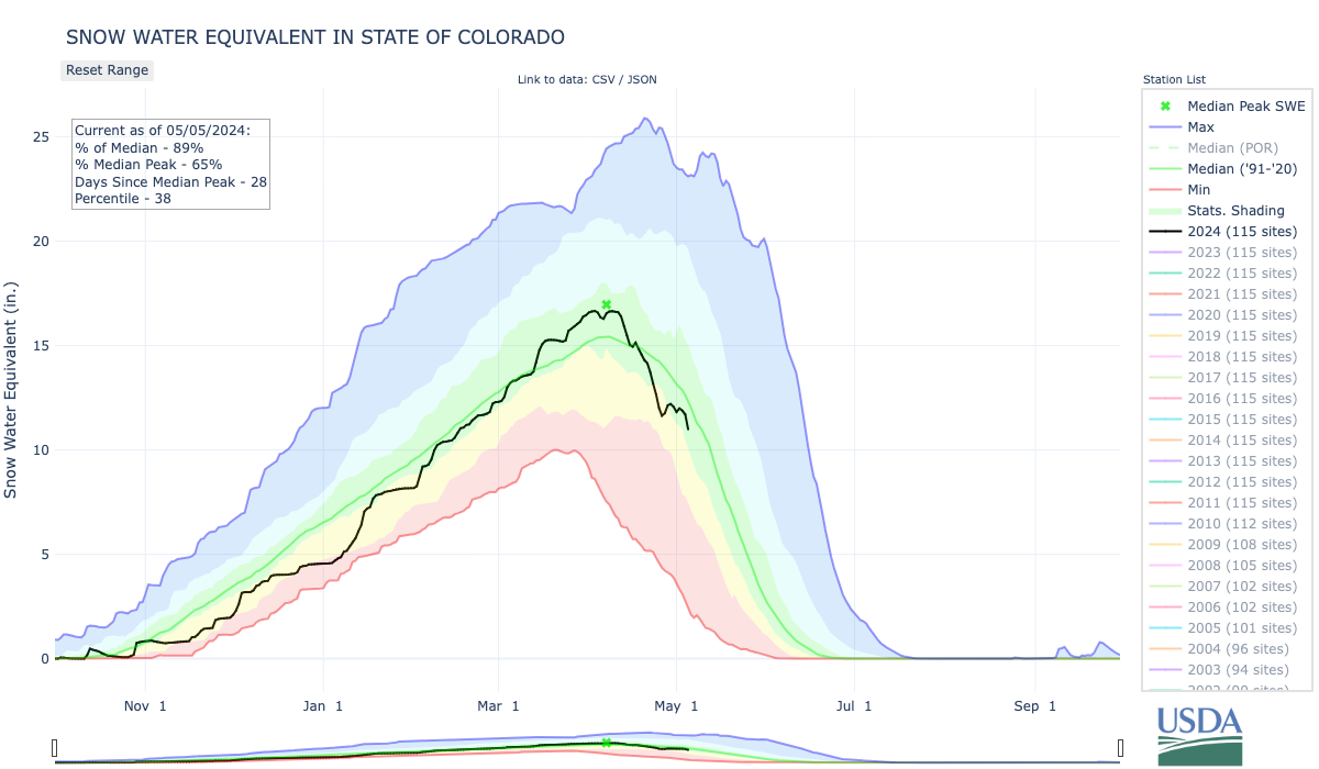
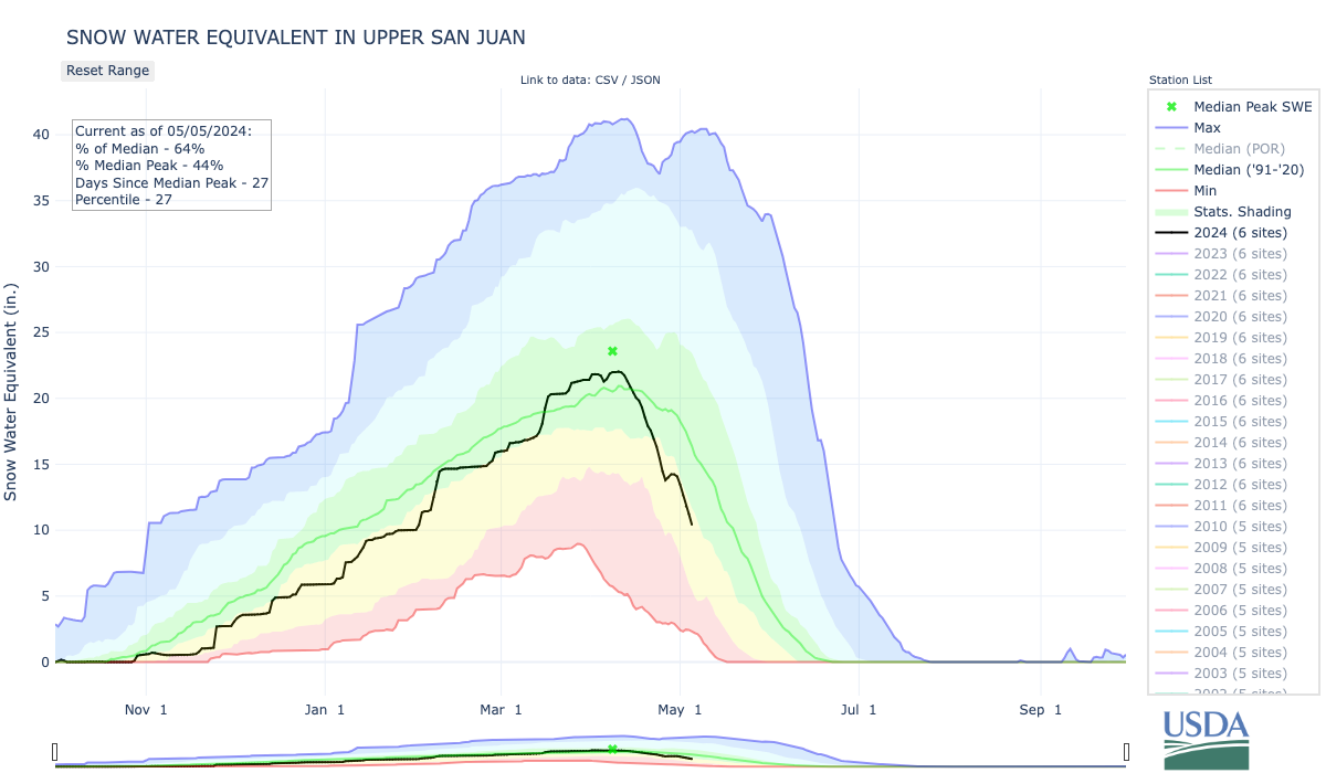
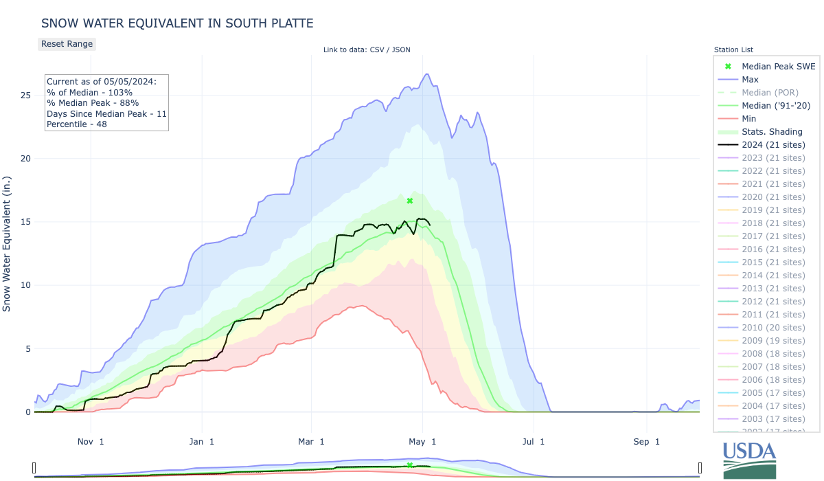
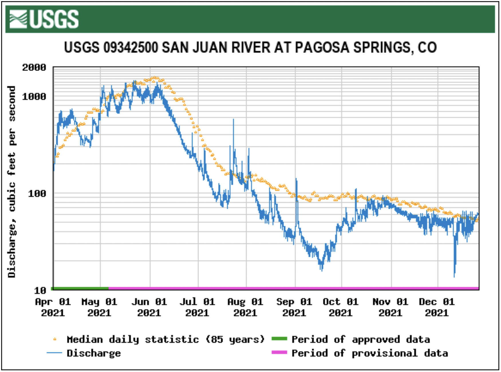
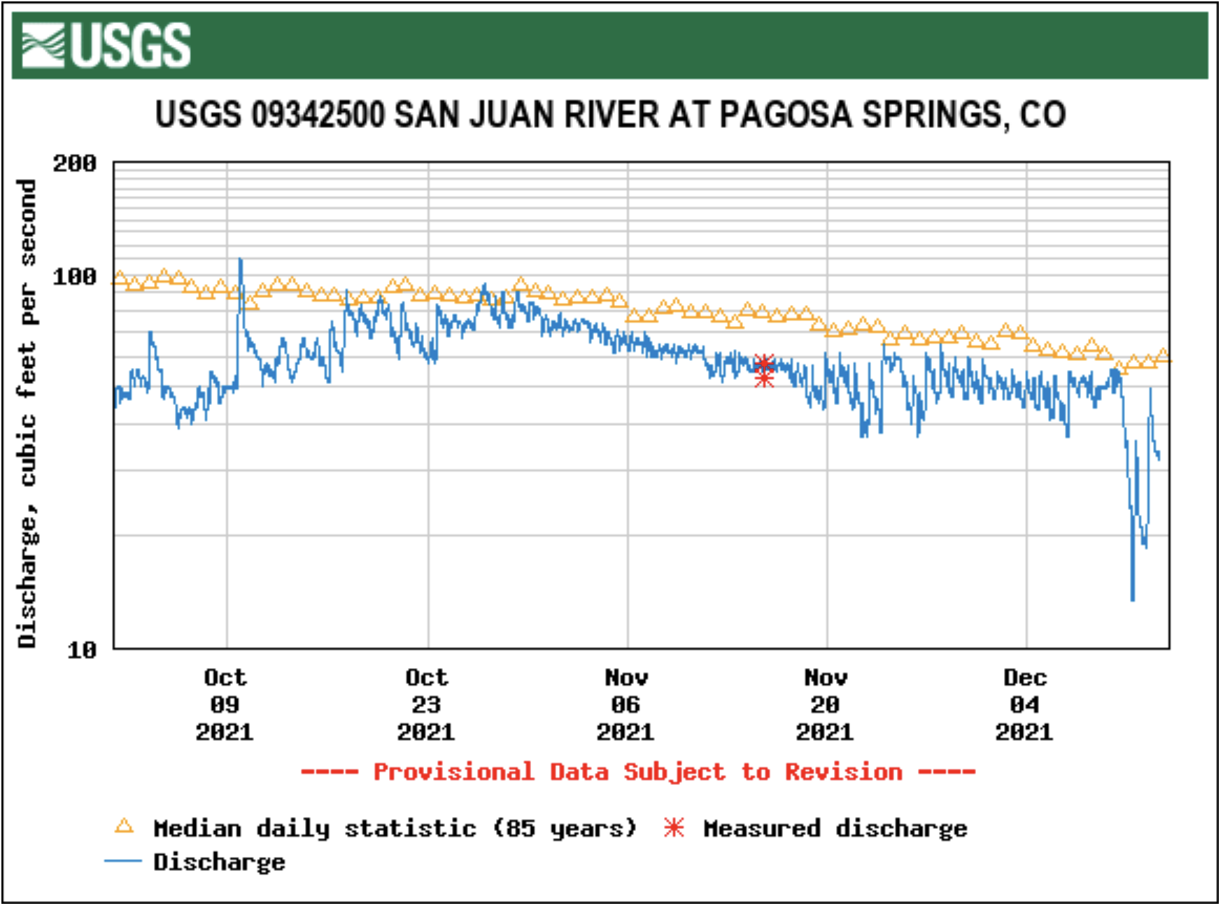
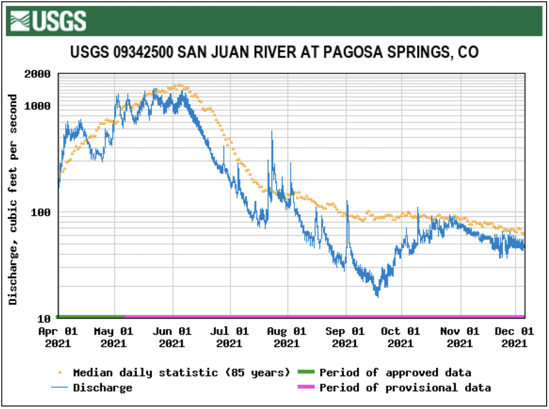
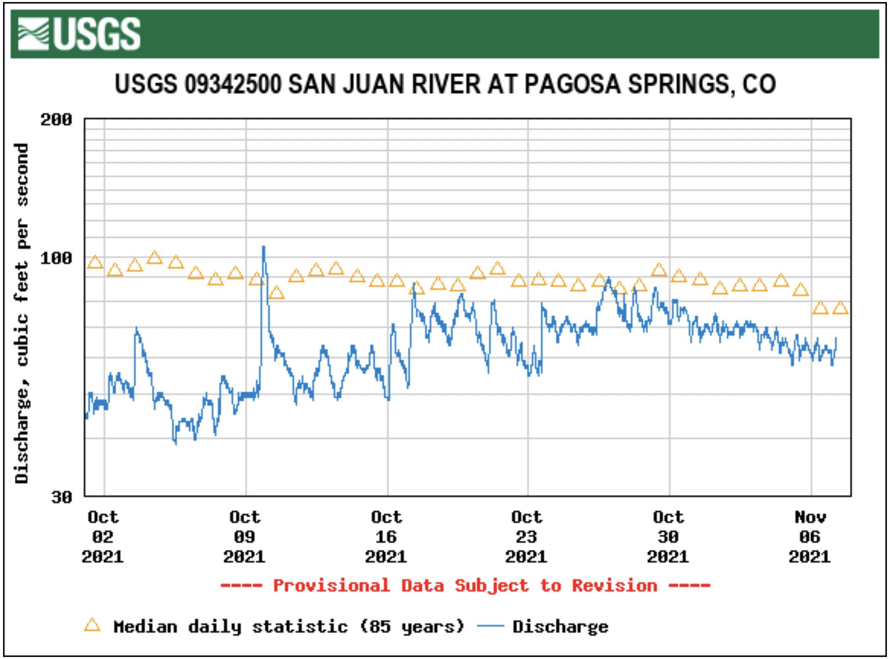
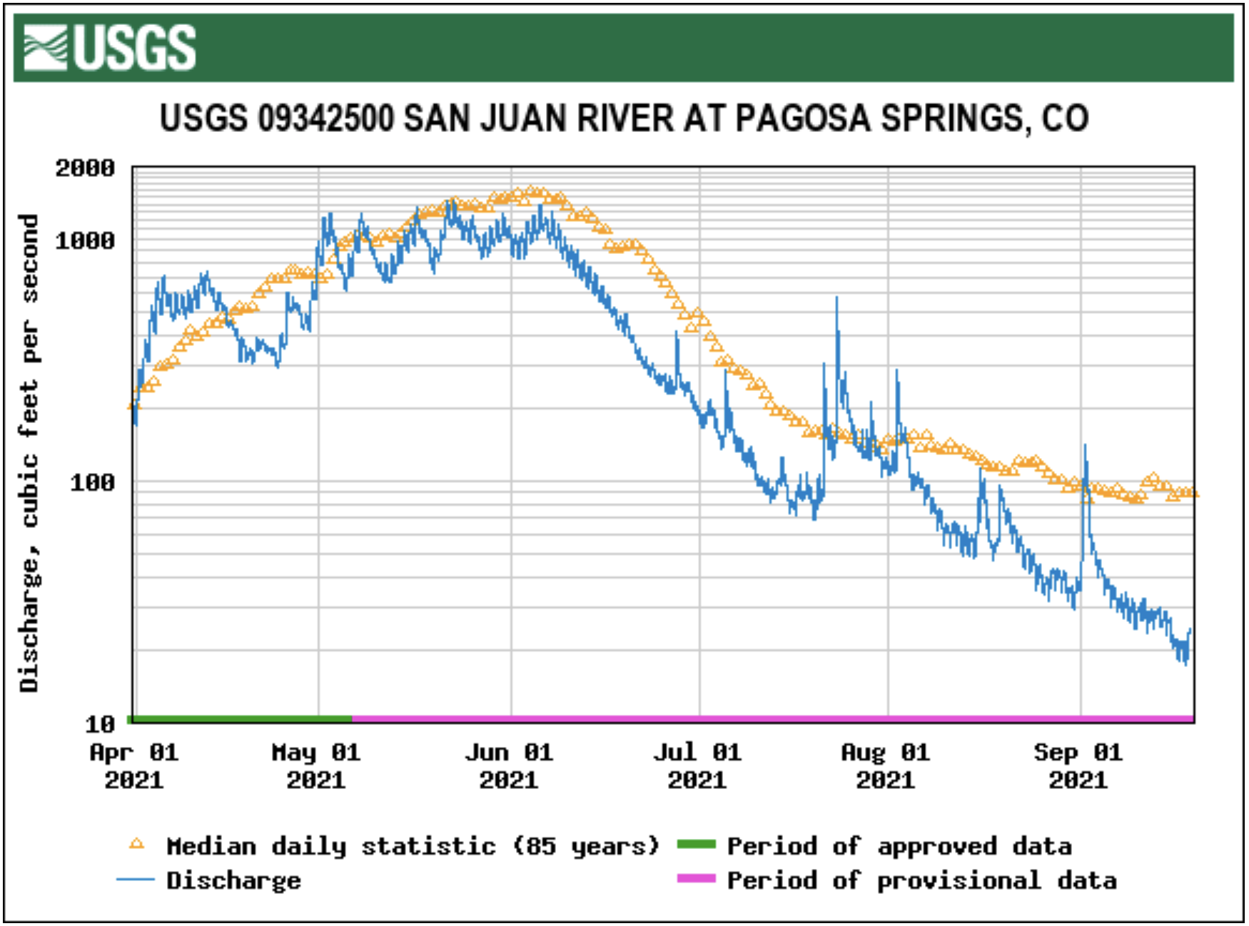
Area river levels have continued to decline since Oct. 14, with the San Juan River at Pagosa Springs running at 537 cfs and 5.52 feet as of noon on Wednesday, Oct. 22. That compares to a median of 88.00 cfs for the same date and a mean of 143.67 cfs. The increased moisture has also led to a significant increase in the level of Navajo Lake Reservoir. On Oct. 9, Navajo was at 6,020.44 feet elevation. By Oct. 21, that had increased by 12.10 feet to 6,032.54, according to the Lake Navajo Water Database. It remains 52.46 feet below full pool, or 6,085 feet elevation. It remains down 8.51 feet from a year prior. The database shows that total inflows for water year 2026, which began on Oct. 1, are at 421.49 percent of the average, and the rivers feeding Navajo are running at 147.04 percent of average.

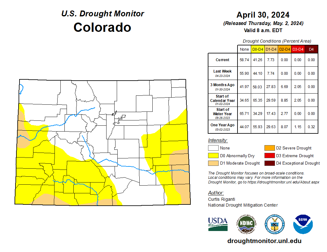
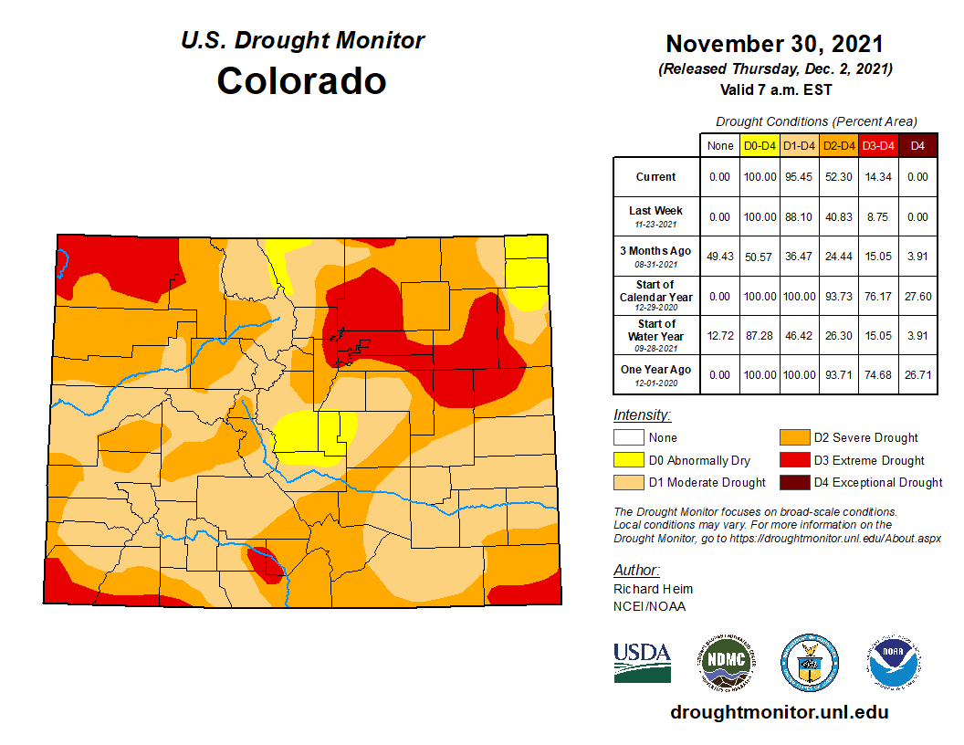
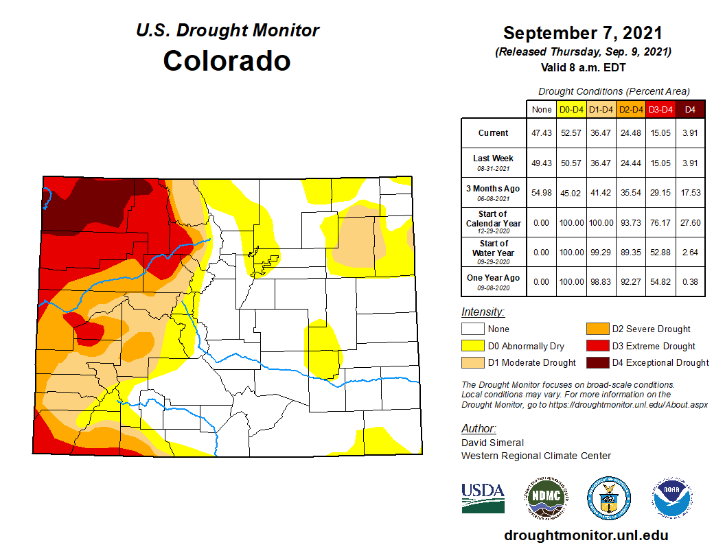
The storms also helped area drought. As of Oct. 14, the last update available by the U.S. Drought Monitor, 65.53 percent of the county was abnormally dry or above, with 3.71 percent of the county falling into moderate drought. A week, prior, 100 percent of the county was in moderate drought or above, with 30.18 percent being in severe drought or above, with 0.31 percent of that being in extreme drought…
On Oct. 21, Town Manager David Harris updated the Pagosa Springs Town Council on the damages to town infrastructure caused by the recent flooding along the San Juan River, with an early “thumbnail sketch” assessment showing around $9 million worth of damages. The major costs are associated with debris removal, riverbank stabilization, inflow and infiltration of unwanted water into the sewer system, 10th Street culvert replacement, sewer line replacement on the 1st Street bridge after the line was damaged by debris, and damages to a river restoration project that the town invested in some years ago, he explained…[Riley Frazee] noted total damages in the county based off of initial assessments is around $13 million. Of that $13 million, about $8.125 million is from the Town of Pagosa Springs and about $4 million is from damage to public roadways in Archuleta County. Archuleta County Sheriff Mike Le Roux noted that there are still about 200 miles of secondary roadways to be assessed. During the Oct. 18 tour with Bennet, Le Roux noted about 30 miles of primary county roads require “total reconstruction” and about 60 miles require significant patching and repair. Frazee also mentioned that the San Juan River Village Metro District sustained sewer system and roadway damage of about $2 million, which also qualify as infrastructure.


