President Trump axes Public Lands Rule: Plus — The Hoback Report, a guest dispatch from Bob Frodeman — Jonathan P. Thompson (LandDesk.org)

The Hoback River after a storm as it meets up with the Snake River. Bob Frodeman photo. (via The Land Desk)

Click the link to read the article on The Land Desk website (Jonathan P. Thompson):

May 12, 2026

The Hoback Report

by Bob Frodeman

The weather has been odd this year on the southern side of the Yellowstone Plateau. And summer is setting up to be a little scary – low water, fire danger, and masses of tourists.

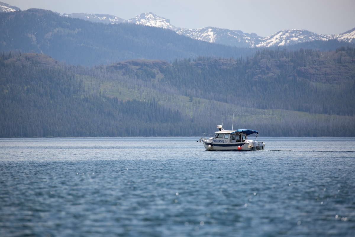
Hoback, Wyoming, is an unincorporated area of a few hundred people 14 miles south of the Jackson Town Square. It’s the poorest part of the wealthiest county, Teton, in the United States. The residents here stand a little apart – you see bumper stickers plastered with the message ‘Hoback Nation’. Some four million cars pass through our roundabout each year, mostly tourists, but also people driving to work from more affordable locales like Alpine and Pinedale. It’s also where the Hoback River joins the Snake just before it enters the Snake River Canyon, the site of whitewater trips offered by local outfitters.

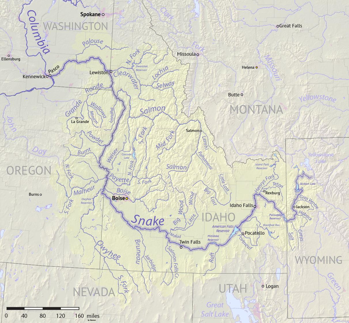
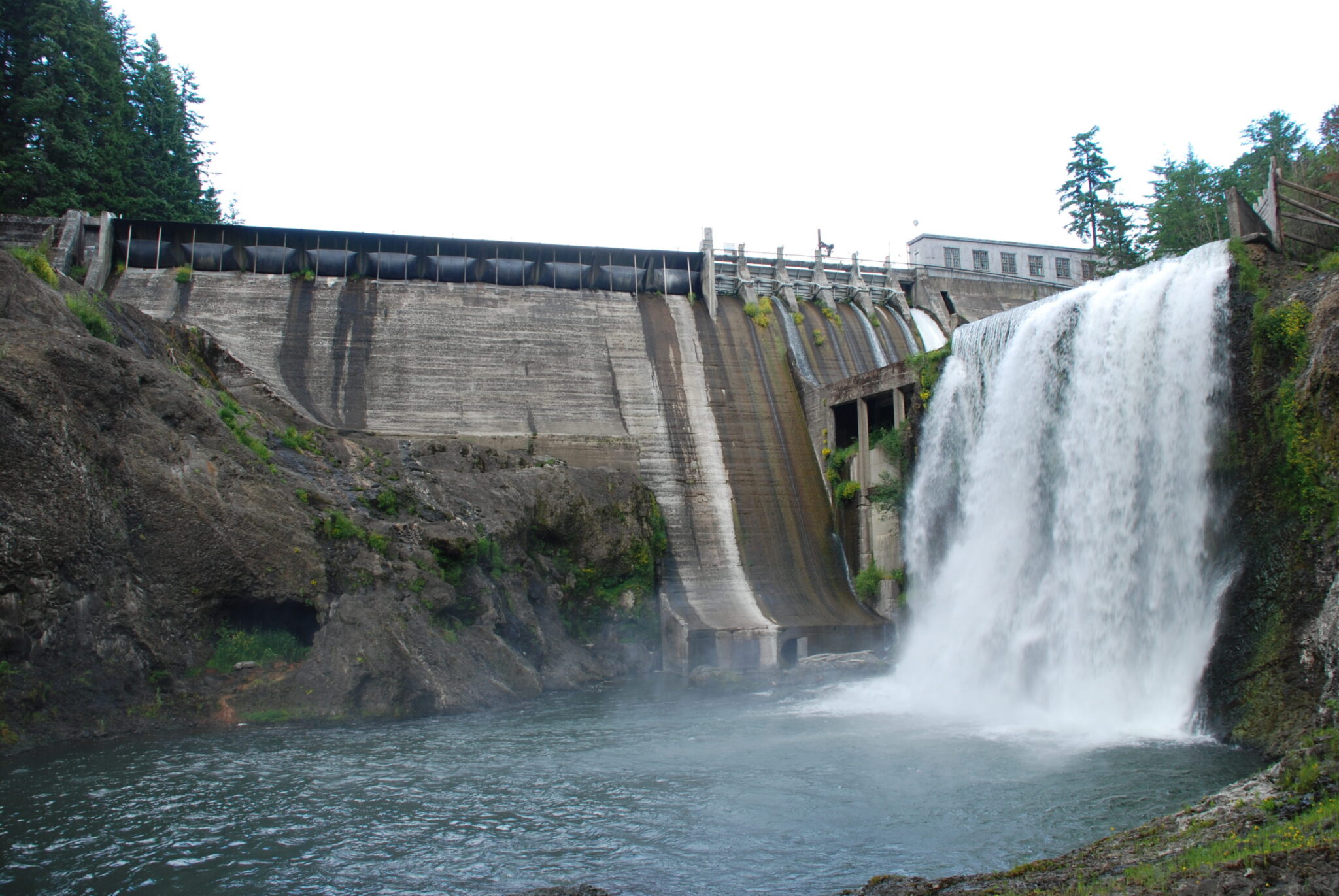
The Hoback River runs 66 miles, starting in the slopes of the Wyoming Range around Bondurant, Wyoming. It still runs free – no dams (yet). For a western river it’s medium sized: base flows sit at 200 cubic feet per-second across the winter, with peak flows reaching perhaps 4,300 cfs around the first of June. The last 11 miles of the Hoback, from its confluence with Granite Creek, are protected, part of the National Wild and Scenic Rivers System. My home looks up the Hoback: deer walk across the river in the winter and fishermen and kayakers come down all summer.

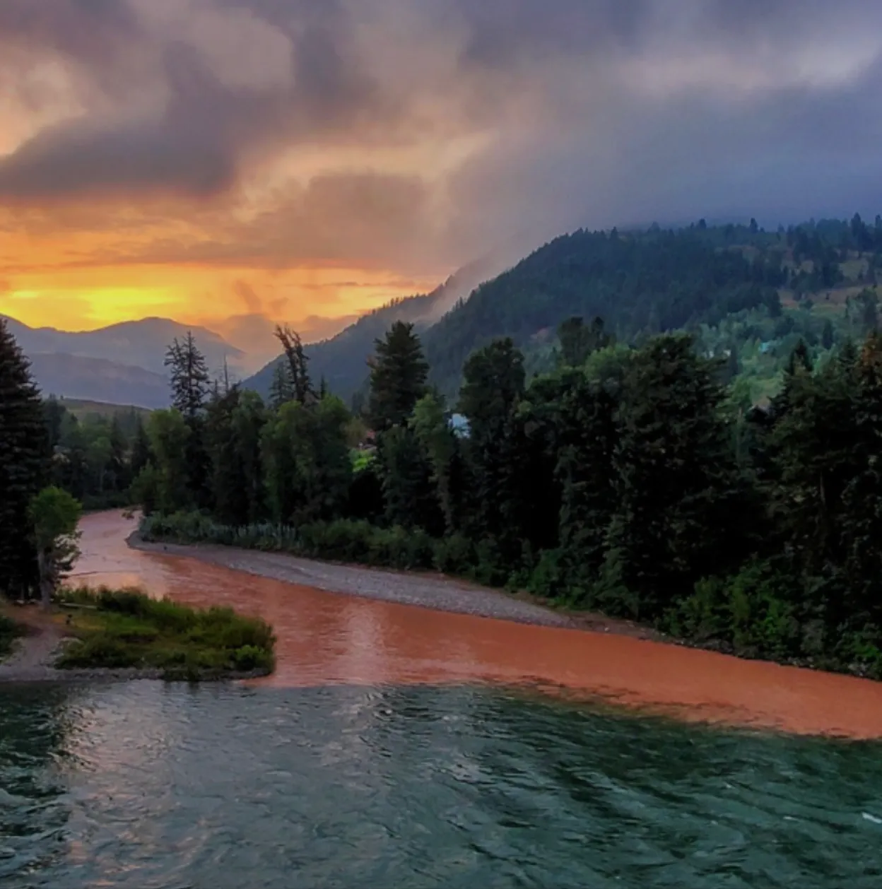
Waterwise, conditions were better here than across most of the West until the March warm-up. Teton County was even a bit above normal in snow water equivalent, or SWE, the typical measure of snowpack. But the snowfall was unevenly spread: lots of snow in the mountains, but dry in the valleys. For the first time since the 90s there wasn’t continuous snow cover in the valley across the winter, and we had a brown Christmas. The valleys saw five rain events this winter that melted what snow we did get at 6,000 feet. On the other hand, the warm, wet air meant more snow on the peaks. Jackson Hole Mountain Resort had the best snow in the West.

Up until the late March heatwave, the Hoback watershed was faring better than most of the West, snowpack-wise. But after that? Not so great. Source: NRCS.

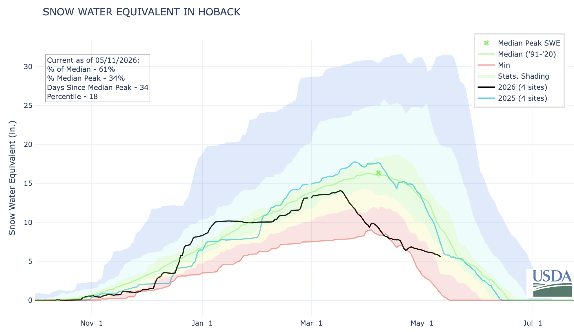
The heatwave of March was something to behold. On March 21 the temperature hit 71 degrees, 32 degrees above normal, taking a big bite out of the snowpack. The rivers grew five times from their base flows two months ahead of schedule. Daffodils appeared five weeks early.

On the good side, the winter has been easy on the wildlife. The antelope have been particularly hard hit by the winter of 2022-2023. That year the fawn mortality was nearly 100%, the result of three feet of crusty snow. Whether the antelope, deer, and elk will have enough browse this summer is an open question. Fingers are crossed for a good monsoon.

But even with a good monsoon this summer’s water situation is looking dicey. The local reservoirs, Jackson and Palisades, caught the early runoff, but Wyoming has rights to only 4% of the water in the Snake – senior water rights belong to Idaho farmers. The Bureau of Reclamation recently announced that Jackson Lake may be drained dry this summer to provide water to farmers across the Snake River Plain. We’ll learn more about Bureau of Reclamation plans at its meeting in Jackson in mid-May.

At least the ospreys were on time. The pair that inhabit the nest above our home appeared on April 1. They’ve been busy carrying sticks to replenish their nest. They spend the summer fighting with bald eagles, when they aren’t dismantling fish in the crooked dead conifer that juts out over the river.

This might sound idyllic, but there’s a wealth of political controversy in Teton County. You’d expect nothing less from a place that combines funhogs and billionaires, second homeowners and 4th generation ranchers, a county with 23,000 inhabitants hosting 3.3 million visitors a year. Teton County is a blue dot in a very red state. It creates a weird dynamic: the conservative Freedom Caucus politicians in Cheyenne are often hostile to us while also being dependent on our tourist-generated income (there is no state income tax). There’s also a jarring juxtaposition of the local and the international: the Jackson Hole Economic Policy Symposium, sponsored by the Federal Reserve Bank of Kansas City, meets here each August, and the likes of JD Vance and Kristi Noem come to town for fundraisers. Real estate office windows are plastered with ads printed in both English and Russian. And the average price of a home here is more than six million dollars.

Bob Frodeman lives in Hoback, Wyoming. He is a co-editor of A Watershed Moment: The American West in the Age of Limits.

Wyoming rivers map via Geology.com

🌵 Public Lands 🌲

The Trump administration today [May 12, 2026] fully rescinded the Conservation and Landscape Health Rule, a.k.a. the Public Lands Rule. The Biden-era rule was finalized in 2024 and endeavored to put conservation on a par with other uses of federal lands, such as grazing, mining, and drilling, primarily by making leases available for conservation or restoration projects. Now, before it ever even had a chance to be tested, it is being killed to better align the Bureau of Land Management’s regulations with the Trump administration’s agenda, which effectively is to return the agency to the days of the Bureau of Livestock and Mining.

This is yet another volley in the administration’s wholesale assault on public land management and environmental protections designed to benefit the extractive industries, while also sticking it to some of Trump’s many adversaries.

It’s unfortunate, sure, but the reaction from some environmental groups seems totally overblown and aimed more at triggering anger than truly considering the limited effects this will likely have on the ground. While I understand the need to rally the troops, so to speak, I’m not sure hyperbole and constant outrage is all that productive.

I’ve read, for example, that the administration is “stripping conservation” from public lands, and that this is simply a prelude to “dispose of these landscapes entirely.” It sounds a lot like the reactions from the extreme right when the rule was being developed: It would “eradicate grazing” and its framers were akin to tree-spiking eco-terrorists, that it would “lock up more land,” and then South Dakota Gov. Kristi Noem called it “dangerous.”

None of this is accurate.

For the most part, the Public Lands Rule was a sort of reinforcement of the 1976 Federal Land Policy Management Act’s multiple-use mandate, which directed the BLM to manage public lands “on the basis of multiple use and sustained yield” and “in a manner that will protect the quality of scientific, scenic, historical, ecological, environmental, air and atmospheric, water resource, and archeological values.”

The rule applied land health standards and codified a framework for establishing areas of critical environmental concern. Perhaps most significantly, it created a conservation lease system, which allowed entities to lease land to conduct restoration projects or conservation activities. While conservation tends to be considered a “non-use,” this flipped that to make conservation a “use” — one that could even generate revenues for the federal government. Whether this put conservation on a level-playing field with drilling, mining, and other extraction is unclear.

What is clear is that the rule could not be used to boot cows, drill rigs, mines, or any other existing use off public land. Conservation leases would only be available on land that wasn’t already leased or claimed. And it had absolutely nothing to do with public land conveyances, exchanges, transfers, or sales.

Since the rule didn’t stop extractive uses, abuses, or land transfers, revoking it won’t spark an uptick in grazing, drilling, or mining, nor will it lead to wholesale land selloffs. 

What the Public Lands Rule did do was attempt to steer the agency — albeit gently — further away from its old identity as a sort of clearing house for extractive industries. It acknowledged the effects of climate change on public lands, and the landscape-health standards — if applied correctly — could have stopped the BLM from leasing out certain parcels for development. And, it seems to me, the conservation lease concept could have helped kickstart a land healing industry.

For example, a conservation group might have been able to lease out one of the vacated grazing allotments in Canyon of the Ancients National Monument, and conduct restoration work on that land, such as replanting native grasses or removing noxious invasive weeds. Or perhaps using federal funds from the Biden-era Infrastructure and Inflation Reduction Acts — which Trump and the GOP gutted — an entity could have taken over terminated leases in the mostly abandoned Horseshoe-Gallup oilfield, cleaned up the mess, and plugged and reclaimed the methane-oozing wells. 

Tragically, the initiative was nipped in the bud before anyone could see how it might play out on the ground. Hopefully when this administration is over some semblance of democracy and reason will return to Washington and maybe not only revive this rule, but make it even stronger.


Redux: The rise of the land-healing industry — Jonathan P. Thompson


📸 Parting Shots 🎞️

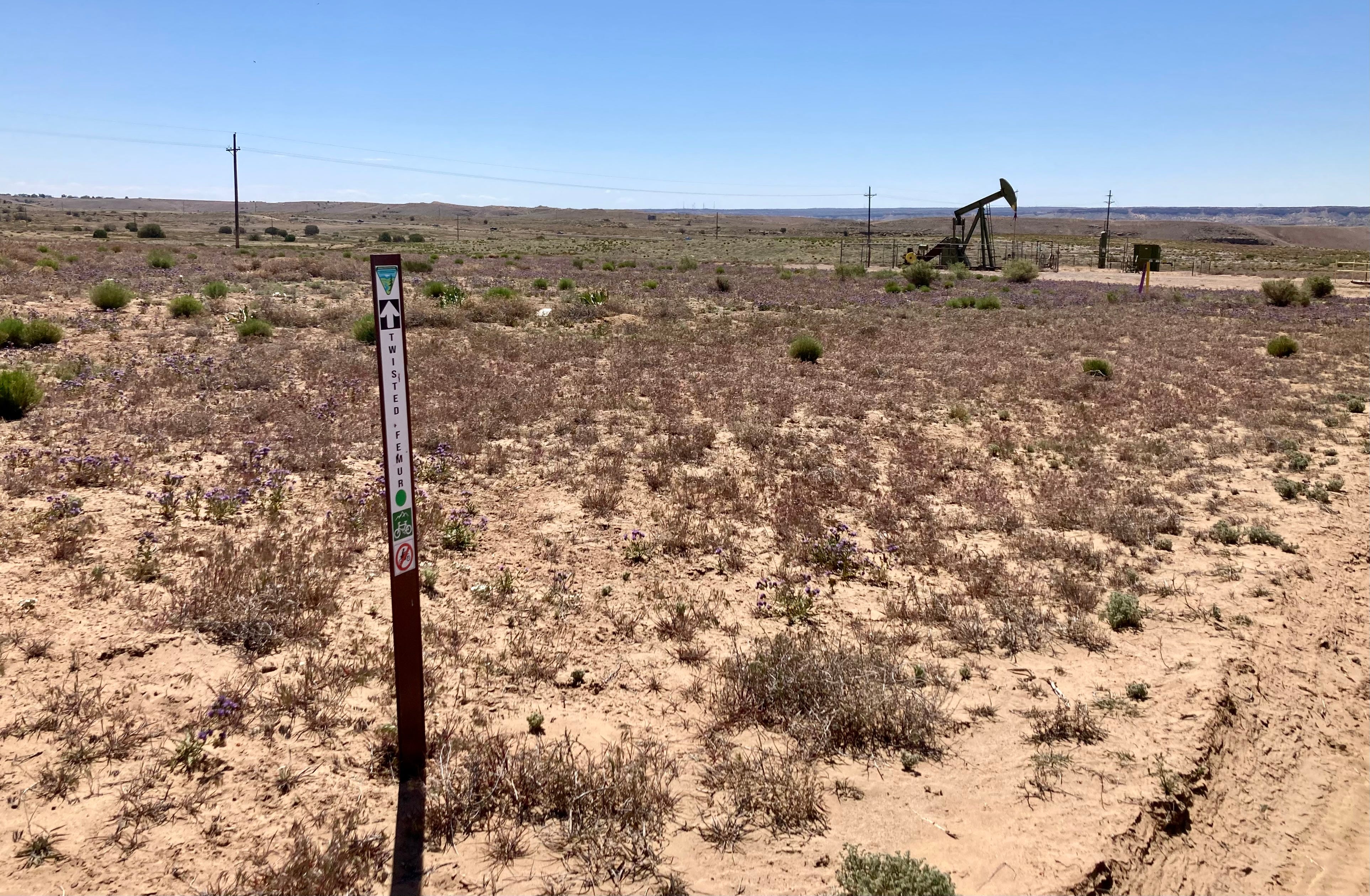
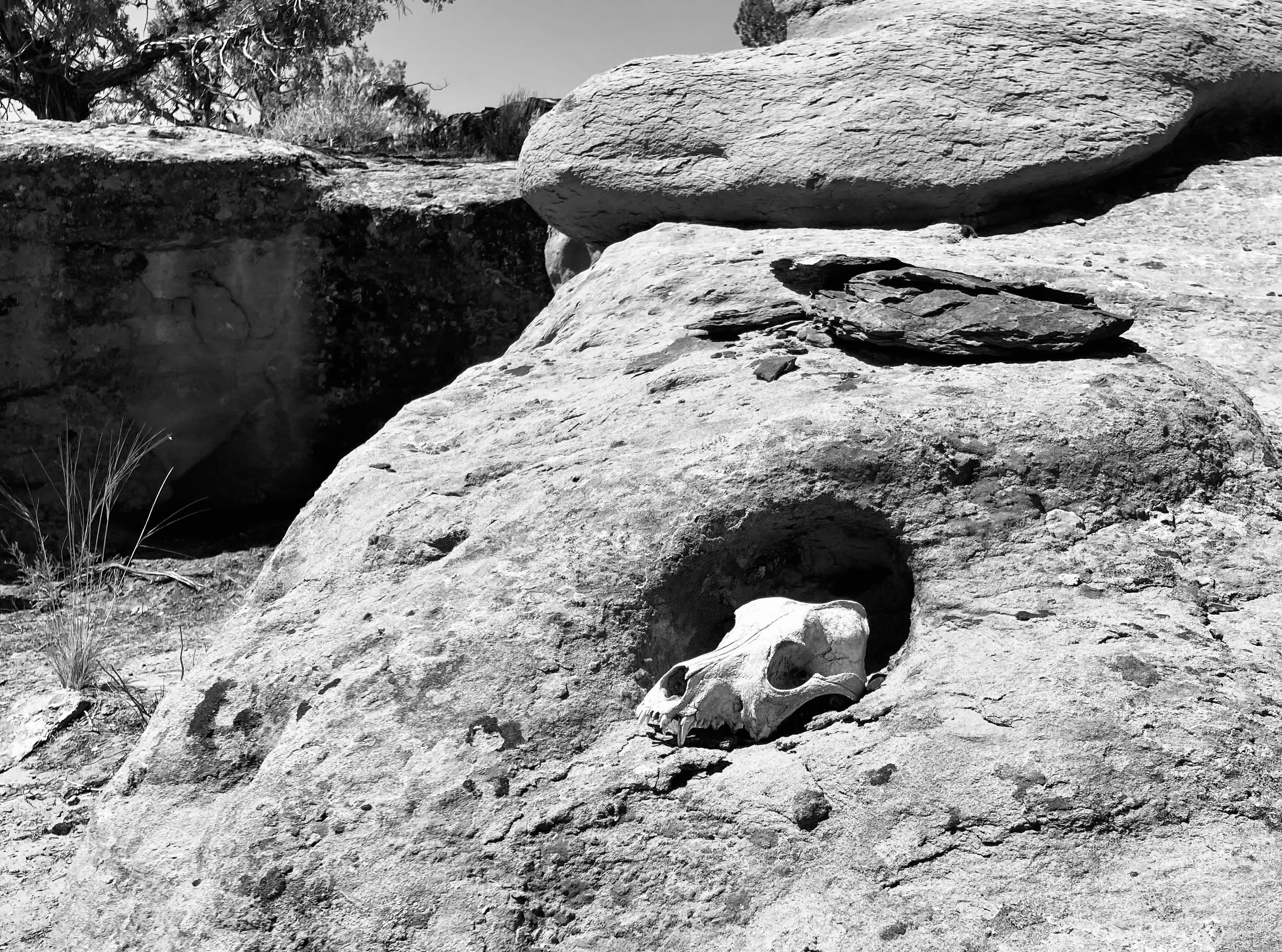
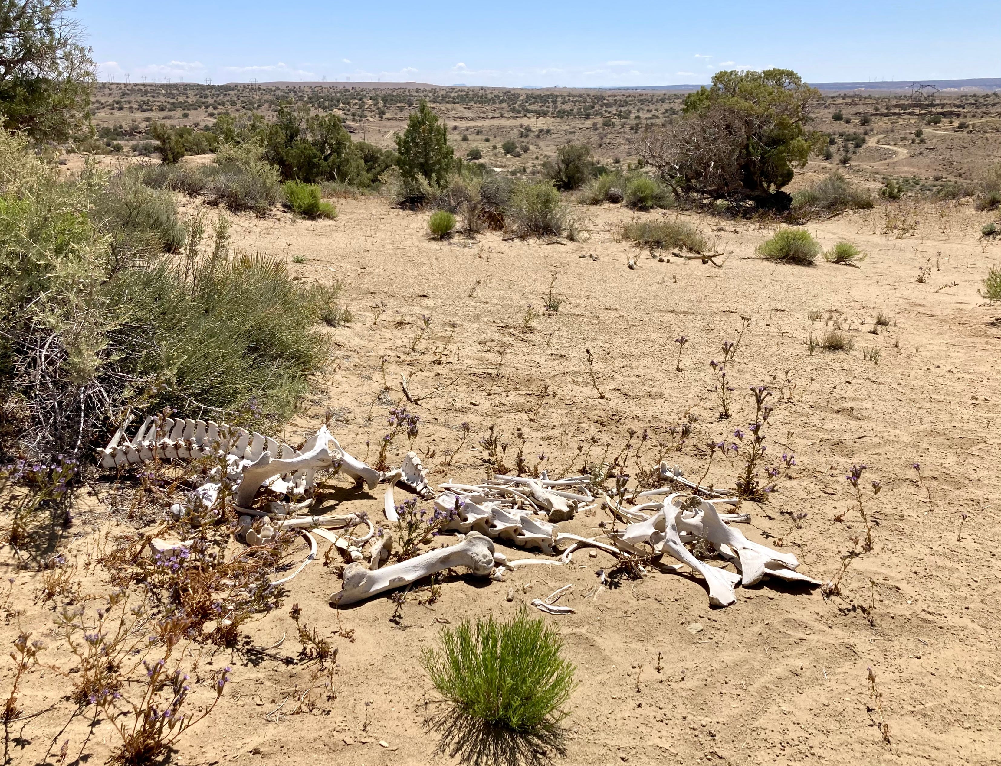
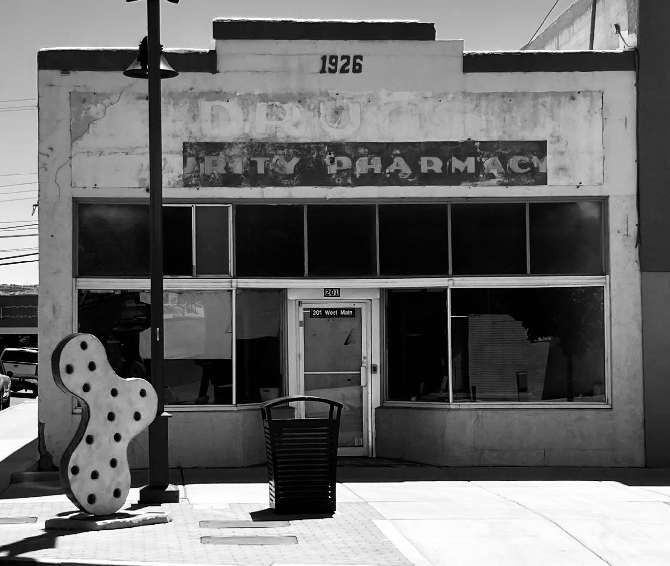
A friend and I went down to Farmington over the weekend to check out some of the newish mountain biking trails around there. We rode the Boneyard trail, which crosses through some interesting country and, as is almost always the case when on public lands in the San Juan Basin, it wound its way around pumpjacks and other gaspatch detritus. It’s sort of like a journey through the energy-economic transition, given that the trails are part of an effort to diversify the fossil fuel economy with outdoor recreation. 

The riding is good, though you might want to avoid the trails on a hot day, and sandy areas can bog down bikes with skinnier tires (I rode a gravel bike, which wasn’t a great idea). And, of course, afterwards we went to Blake’s Lotaburger for lunch. The following images are from the trail and downtown Farmington.

Near Farmington, New Mexico. Photo credit: Jonathan P. Thompson
Farmington, New Mexico. Photo credit: Jonathan P. Thompson

Thoughts on boomtown architecture — Jonathan P. Thompson


Yellowstone seeks to stiffen invasive species rules, ban some boats: To defend against troublesome mussels, large motorboats and sailboats would have to be dried for 30 days before being launched — @WyoFile #YellowstoneRiver #MissouriRiver #SnakeRiver

A motorboat on Yellowstone Lake. (NPS/Diane Renkin)

Click the link to read the article on the WyoFile website (Angus M. Thuermer Jr.):

March 12, 2024

To protect the headwaters of three major Western rivers from invasive, troublesome mussels, Yellowstone National Park wants to require larger boats to undergo a 30-day “dry time” before launching.

New rules up for comment also would ban any boat that’s once been contaminated by invasive Dreissena zebra or quagga mussels, regardless of decontamination cleaning.

The proposal builds on existing rules, including inspection of all watercraft, designed to protect Yellowstone and downstream waters from the fingernail-sized freshwater bivalves that cling to hard structures like boat hulls, docks and irrigation headgates. The proposal would help protect the ecological integrity of Yellowstone Park and the Yellowstone, Missouri and Snake rivers downstream in Idaho, Montana and Wyoming.

Map of the Yellowstone River watershed in Wyoming, Montana and North Dakota in the north-central USA, that drains to the Missouri River. By Background layer attributed to DEMIS Mapserver, map created by Shannon1 – Background and river course data from http://www2.demis.nl/mapserver/mapper.asp, CC BY-SA 4.0, https://commons.wikimedia.org/w/index.php?curid=9355543
Map of the Missouri River drainage basin in the US and Canada. made using USGS and Natural Earth data. By Shannon1 – Own work, CC BY-SA 4.0, https://commons.wikimedia.org/w/index.php?curid=67852261
Map of the Snake River watershed, USA. Intended to replace older File:SnakeRiverNicerMap.jpg. Created using public domain USGS National Map data. By Shannon1 – Own work, CC BY-SA 4.0, https://commons.wikimedia.org/w/index.php?curid=62294242

Under the proposed rules, boats with inboard, inboard/outboard and inboard jet motors — as well as sailboats — would have to be dried under a certified program for 30 days before launch. “Large, complex, trailered watercraft pose the highest risk of transporting and introducing invasive mussels … because they are difficult to inspect and less likely to … be fully decontaminated,” the park said in a release.

Manual cleaning is not 100% effective, the park said.

Mussels were recently discovered in waters within a day’s drive of Yellowstone, including the first found in the Columbia/Snake drainage last year near Twin Falls, Idaho. The year before, mussels showed up in Pactola Reservoir, South Dakota, not far from Wyoming’s eastern state line.

People can comment online through April 5 or to Yellowstone Center for Resources, Attn: AIS Proposed Changes, PO Box 168, Yellowstone National Park, WY 82190.

Spreading threat

The zebra mussel is native to the Black, Caspian, and Azov Seas and the quagga also comes from that area of Europe. They have infected the Midwest and lower Colorado River drainage.

Zebra Mussels in Lake Ontario. (John Manier/USGS)

They could threaten Yellowstone cutthroat trout, a species the park has spent more than two decades restoring. The mussels can also be destructive to water and power infrastructure, according to the U.S. Department of Interior. There are no known ways to eradicate the mussels. Any invasion would be expensive to mitigate.

Motor- and sailboats falling under the new rule would be inspected and sealed to a trailer for the 30-day dry period. Seals from Yellowstone National Park, Idaho State Department of Agriculture, Montana Fish, Wildlife, and Parks and Wyoming Game & Fish Department would be honored.

Once-infected boats would be banned because of the possibility they could, even if cleaned, cause a false detection during routine DNA monitoring and consequently waste resources.

Spawning cutthroat trout, Lamar Valley; Jay Fleming; July 2011. By Yellowstone National Park from Yellowstone NP, USA – Spawning cutthroat trout, Public Domain, https://commons.wikimedia.org/w/index.php?curid=50246593

Our Power is Rivers: Good Hydro versus Bad Hydro and the Future of Energy in the Pacific Northwest — @AmericanRivers #ActOnClimate

Condit Dam (removed in 2011), Washington | Photo by Thomas OKeefe via American Rivers

Click the link to read the article on the American Rivers website (Kyle Smith):

October 13, 2023

There is an ongoing debate in the Pacific Northwest around whether hydropower as a whole is “good” or “bad”. But this conversation misses important details and nuance.

There are thousands of dams blocking rivers across the Northwest. Many dams provide energy, transportation, flood control, and irrigation. But many are causing more harm than good – and they are falling apart. As a society, we are making choices about the costs and benefits of dams: Which ones can be operated in a more environmentally friendly and economically viable way? And which dams need to be removed?

Dams harm rivers. They can destroy fish and wildlife habitat, degrade water quality, and turn free-flowing rivers into slow moving reservoirs that emit methane, a potent greenhouse gas that causes climate change. Dams in the Pacific Northwest have been a main cause of salmon extinction and a source of painful injustice for the region’s Tribal Nations.

American Rivers has always taken a pragmatic, solutions-oriented approach to dams and hydropower. While we lead the movement to remove outdated dams, we are also a founding member of the Hydropower Reform Coalition, working to improve the operations of dams whose continued operation is important for our energy supply and economy. For the past several years, we’ve also been working with the hydropower industry in the “Uncommon Dialogue on Hydropower, River Restoration, and Public Safety” – finding common ground on plans to retrofit and rehabilitate dams that still serve an important purpose and remove dams that pose a safety risk.

Simply put: American Rivers is ensuring our nation prioritizes healthy rivers, whether that’s by making hydro dams more river- and fish-friendly, maximizing the performance and efficiency of dams, and removing dams whose costs outweigh their benefits.

So, what does this look like in the Pacific Northwest where 50 percent of our annual energy generation comes from hydro? Major dams, including those on the Columbia River, helped build our world-class economy and will continue to support our vibrant region. But we must take a hard look at dams that are causing far more harm than good.

The lower four Snake River dams, which stretch between Tri-Cities, WA and Lewiston, ID, were constructed between 1957 and 1972. These dams provide around 900 average megawatts of power — around 4% of the Northwest’s energy generation. They also provide irrigation for crops grown around the Tri-Cities, as well as transportation for barge traffic between the Tri-Cities and Lewiston. While the services the lower four Snake River dams provide are valuable to surrounding communities, those services can be replaced with alternative technologies. Breaching the earthen portion of the dams is the best solution we have to solve the significant impacts the dams are having on salmon, steelhead, killer whales, Tribal Nations, and economies that rely on these species.

Unlike the mainstem Columbia dams, the lower four Snake River dams are “run of the river” projects that do not provide flood control and store relatively little water in the reservoirs behind each dam. In summer months, those reservoirs bake in the hot sun, raising water temperatures and creating harmful conditions for cold water-dependent salmon and steelhead. In 2015, warm water in the lower Snake was responsible for killing over 95% of the year’s adult sockeye salmon run. Impacts on juvenile salmon are harder to measure, but conservative estimates are that upwards of 50% of juvenile salmon die between Lower Granite Dam on the Snake and Bonneville Dam on the Columbia during their journey to the ocean, and that figure is likely much greater in years when water temperatures rise above 70 degrees.

As we mentioned before, the lower four Snake River dams combined produce an average of around 900 megawatts. Compare that with John Day Dam on the mainstem Columbia 50 miles east of Hood River, which by itself produces around 1,200 average megawatts, and you begin to see why these four dams are the target of so much attention. Four times the negative impacts from dams and their harmful slackwater reservoirs, for less power than John Day Dam alone just doesn’t make sense as we envision a new clean energy future.

Granite Dam on the Snake River | Photo: Army Corps of Engineers

Finally, no form of energy can be considered clean if it leads to the extirpation of as many species as the lower four Snake River dams continue to cause, particularly when you consider the value those species have for Tribal Nations that have lived in the Columbia Basin since time immemorial. The American Fisheries Society, the National Oceanic and Atmospheric Administration, Trout Unlimited, and many other science-based organizations all recognize that breaching the lower four Snake River dams must be the centerpiece action for restoring salmon populations in the Columbia Basin.

Tribal Nations across the Northwest are leading this initiative to breach the lower four Snake River dams because of these negative impacts. The largest impact being to the salmon populations; their dwindling numbers directly impact the culture and traditions of tribal members and their future generations. In addition, with the harm placed on salmon by these dams, treaties made between the U.S. Government and the Tribes are being violated. We have a moral and ethical obligation to uphold our treaty promises and to save Snake Basin salmon and steelhead from extinction.

As we work to develop a bold new clean energy future for the Pacific Northwest, hydropower will continue to be an important part of our generation portfolio. When measured on the whole, it becomes clear that the lower four Snake River dams cannot be a part of that vision. We must build a system that is reliable, resilient, and equitable. We must continue working together to achieve a future of healthy rivers, abundant salmon, and affordable, reliable clean energy.

Map of the Snake River watershed, USA. Intended to replace older File:SnakeRiverNicerMap.jpg. Created using public domain USGS National Map data. By Shannon1 – Own work, CC BY-SA 4.0, https://commons.wikimedia.org/w/index.php?curid=62294242