#Utah won’t face mandatory cuts in feds’ new #ColoradoRiver proposal, but Lower Basin states could — Annie Knox (UtahNewsDispatch.com)

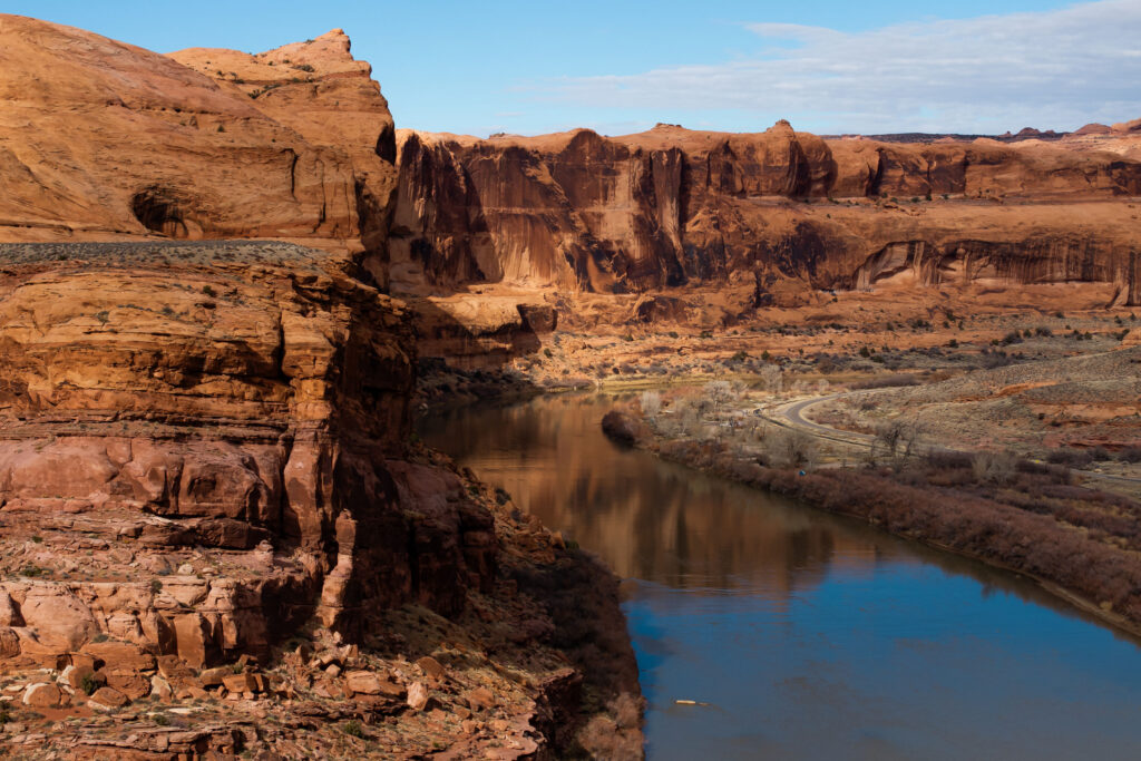
The Colorado River is pictured near Moab on Sunday, Feb. 18, 2024. (Photo by Spenser Heaps for Utah News Dispatch)

by Annie Knox, Utah News Dispatch
July 31, 2026

After Utah and six other states along the Colorado River failed to reach a deal on how to share its dwindling water supply, the federal government on Friday released its own 10-year outline. 

Colorado River Collaborative

This article is published through the Colorado River Collaborative, a solutions journalism initiative supported by the Janet Quinney Lawson Institute for Land, Water, and Air at Utah State University. See all of our stories about how Utahns are impacted by the Colorado River at greatsaltlakenews.org/coloradoriver

Under the proposal from the U.S. Bureau of Reclamation, the Lower Basin states of Arizona, California and Nevada would share in cuts of up to 3 million acre-feet per year. The framework doesn’t mandate cuts for Colorado, New Mexico, Utah and Wyoming. 

Instead, it identifies a conservation goal for the Upper Basin — 200,000 acre-feet per year — about as much as Utah’s Deer Creek and East Canyon reservoirs together can hold. The plan would also allow for smaller annual releases from Lake Powell of down to 5 million acre-feet, compared to the current 6 million acre-feet, with new operating guidelines every two years. 

Utah’s chief Colorado River negotiator, Gene Shawcroft, praised the proposal on Friday, telling reporters it recognizes the reality of the water available, not just the demand. But he emphasized it provides a broad framework, with the details to follow in coming days. 

“I would just simply say, this is a bridge, not a destination,” Shawcroft said in a virtual news conference. “It certainly could be a bridge over troubled waters, but perhaps a bridge over no waters. We just aren’t quite sure.”

He and Amy Haas, executive director of the Colorado River Authority of Utah, were still reading through the 2,600 pages contained in the bureau’s environmental impact statement released Friday.  

Haas said the state will know more about what it’s contending with when it gets a copy of a two-year operations plan for 2027 and 2028 in coming days, though the exact timeline wasn’t clear.
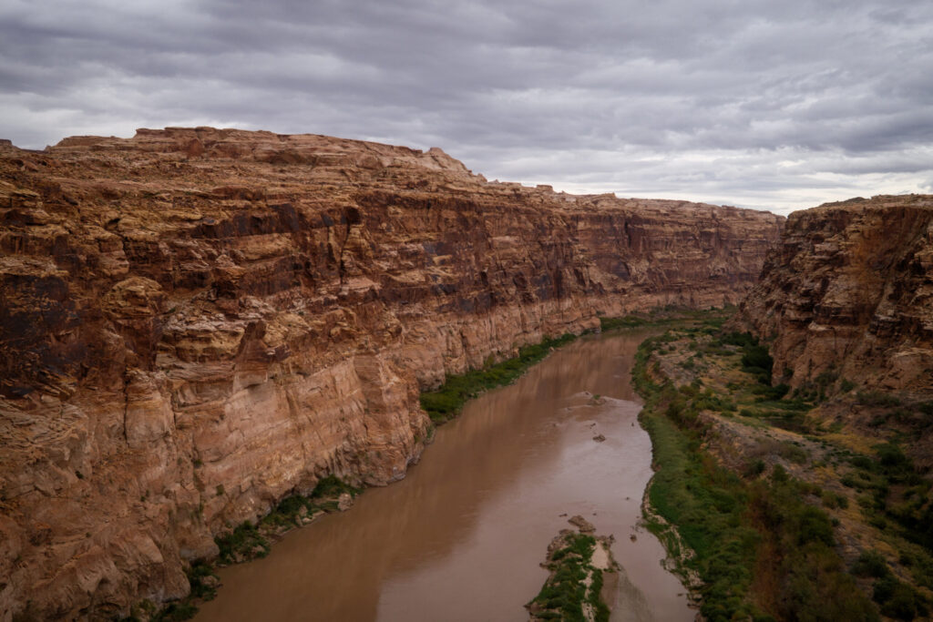
The Colorado River is pictured where if flows near Hite, just beyond the upper reaches of Lake Powell, on Friday, Sept. 19, 2025. (Photo by Spenser Heaps for Utah News Dispatch)

The Colorado River provides water to 40 million people across the U.S. and Mexico, contributing 27% of Utah’s water supply. It’s shrinking because of drought, overuse and hotter temperatures linked to climate change.

This year’s record-high temperatures and lowest snowpack on record aren’t helping. Normally, Colorado River runoff is about 13 million acre-feet, Shawcroft said. Now it’s 3.5 million acre-feet. 

He told reporters: “We’re in a dire situation.” 

On Friday, Arizona’s Department of Water Resources called the proposal’s cuts for the Lower Basin “unacceptable,” saying such reductions would devastate Arizona’s water users and its economy.”

The agency described negotiations over many months as “an exercise in lowering expectations, particularly for a long-term, seven-state agreement on operating this vital river system.” 

The disagreement could find its way into a courtroom soon. Arizona and Utah have both taken steps this year to build up litigation funds. 

“For Utah, litigation is never our plan A,” Haas told reporters Friday. “Whether it’s a plan B, depending on the context of this document, that remains to be seen. But litigation is not going to get us anywhere on this river. It’s not going to get us more water.” 

At issue in the negotiations is who absorbs necessary cuts. Upper Basin states argue they use less water than Lower Basin states, don’t have huge reservoirs to store water in dry years, and lack legal authority to place significant restrictions on water users. 
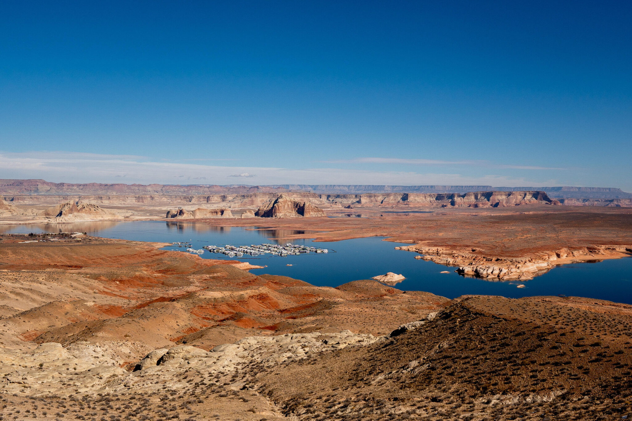
Lake Powell and the Wahweap Marina are pictured near Page, Arizona on Sunday, Feb. 2, 2025. (Photo by Spenser Heaps for Utah News Dispatch)

The proposal out Friday is adaptable and allows the states to keep negotiating, said Secretary of the Interior Doug Burgum.  

“This framework provides the flexibility to respond to changing hydrologic conditions while preserving the opportunity for the Basin States to continue working toward durable, consensus-based solutions,” Burgum said in a statement. 

Utah Gov. Spencer Cox, in a joint statement with his counterparts in the other upstream states, said they’re encouraged that incoming operating guidelines “will better reflect existing water supply, which must underpin any practicable plan going forward.” 

They went on to say that both the upper and lower divisions of the basin “are feeling the pain of severe drought. This is a reality that all states, and the federal government, will need to address practically, which is why a seven-state agreement will provide the best outcome for all water users in the Colorado River Basin.”

Water use is outpacing the river’s flows, and that overconsumption adds up. The combined amount of water in Lake Powell and Lake Mead is at its lowest point since before Glen Canyon Dam began to fill up in 1963, the bureau said in its Friday news release. 

If water levels dip to critical lows, as forecasts suggest they could by late this year, the nation’s two largest reservoirs could fail to produce power. If their depths continue to slide, they’ll fail to send water downstream. 

Conservation and recreation groups have called for an end to the gridlock, saying it’s dragging on in the background while hotter and drier conditions are driving up wildfire risks, air quality concerns and restrictions on the water supply. 

Utah News Dispatch is part of States Newsroom, a nonprofit news network supported by grants and a coalition of donors as a 501c(3) public charity. Utah News Dispatch maintains editorial independence. Contact Editor McKenzie Romero for questions: info@utahnewsdispatch.com.
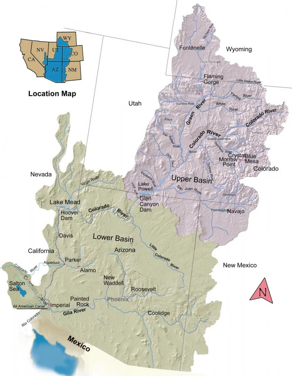
The Colorado River Basin spans seven U.S. states and part of Mexico. Lake Powell, upstream from the Grand Canyon, and Lake Mead, near Las Vegas, are the two principal reservoirs in the Colorado River water-supply system. (Bureau of Reclamation)

Feds to impose new cuts on lower #ColoradoRiver states amid climate-fueled #megadrought — Chase Woodruff (ColoradoNewsline.com) #COriver #aridification

Glen Canyon Dam holds back the waters of Lake Powell near Page, Arizona on Sunday, Feb. 2, 2025. Photo credit: Spenser Heaps/Utah News Dispatch

by Chase Woodruff, Colorado Newsline
July 31, 2026

The federal government on Friday formalized a set of guidelines for managing water use in the Colorado River Basin over the next decade, if Colorado and six other Western states can’t come to an agreement on how to deal with declining flows caused in large part by climate change.

“The Department has a responsibility to ensure the Colorado River system remains reliable and resilient for the millions of Americans, communities and industries that depend on it,” Interior Secretary Doug Burgum said in a press release. “This framework provides the flexibility to respond to changing hydrologic conditions while preserving the opportunity for the Basin States to continue working toward durable, consensus-based solutions.”

Under the U.S. Bureau of Reclamation’s “preferred alternative” for the management of the river’s reservoir system, outlined in a extensive environmental impact statement, the burden of the most severe cuts would continue to fall on the Lower Basin states of Arizona, California and Nevada, which could face mandatory cuts of up to 3 million acre-feet of water. The Upper Basin states of Colorado, New Mexico, Utah and Wyoming would face only voluntary conservation targets totaling 200,000 acre-feet.

All seven states were parties to the Colorado River Compact, a 1922 agreement governing the use of water from the vital Western watershed. Today, the Colorado River provides water to an area inhabited by 40 million people across the Southwest, though agricultural uses account for the vast majority of consumption.

Udall/Overpeck 4-panel Figure Colorado River temperature/precipitation/natural flows with trend. Lake Mead and Lake Powell storage. Updated through Water Year 2025. Note the tiny points on the annual data so that you can flyspeck the individual years. Credit: Brad Udall

Since 2000, a megadrought caused largely by global warming — the region’s worst dry spell in at least 1,200 years — has stressed water supplies across the basin and pushed the Colorado River Compact to a breaking point. The last set of federal guidelines to address shortages, issued nearly 20 years ago, will expire Jan. 1, and the seven Colorado River Compact states failed to reach a new agreement before a federally imposed deadline in February.

The combined amount of water stored in Lake Powell and Lake Mead, the Colorado River system’s two key reservoirs, fell this month to its lowest level since May 1957 — before Lake Powell, created by the Glen Canyon Dam, had even begun to fill.

Without a major turnaround in hydrologic conditions in the near future, water levels in Lake Powell are expected to fall by next spring to below “minimum power pool,” at which point the Glen Canyon Dam’s hydroelectric turbines would be unable to operate.

Negotiations over a comprehensive new agreement have led to an increasingly bitter dispute between the Upper Basin states — led by Colorado, the river’s headwaters state and by far the Upper Basin’s largest water user — and the Lower Basin states, especially Arizona, which has borne the brunt of the cuts imposed in recent years. Arizona is widely expected to launch a high-stakes legal challenge as soon as this summer, alleging Colorado and other Upper Basin states are failing to meet an obligation under the original Colorado River Compact to allow enough water to flow downstream.

Colorado Gov. Jared Polis issued a joint statement Friday with the governors of the other three Upper Basin states, saying that “both the Upper and Lower divisions of the basin are feeling the pain of severe drought,” and that they were “committed to continued good-faith discussions with our counterparts.”

“Many hours of meetings and negotiations took place between the Colorado River Basin states and these discussions will continue,” the statement said. “Today’s framework does not represent a final solution, but enables the River to be managed in the short-term while the seven states and (the Interior Department) continue to negotiate a consensus solution.”

In the absence of a new agreement among the states, the Bureau of Reclamation says it will continue to update its new guidelines every two years until 2036.

Andrea Travnicek, the Interior Department’s assistant secretary for water and science, said the plan “strikes a balance between flexibility and predictability … given unprecedented hydrologic conditions and the potential for considerable impacts on water users.”

In a statement, Democratic U.S. Sen. Michael Bennet of Colorado said he was “disappointed” by the failure to reach a new long-term agreement among the seven Colorado River Compact states.

“While a two-year operating plan is the bare minimum needed to operate the river, a long-term, consensus agreement that recognizes real hydrologic conditions is the only durable solution to bring certainty to the Colorado River,” Bennet said.

Colorado Newsline is part of States Newsroom, a nonprofit news network supported by grants and a coalition of donors as a 501c(3) public charity. Colorado Newsline maintains editorial independence. Contact Editor Quentin Young for questions: info@coloradonewsline.com.

Map of the Colorado River drainage basin, created using USGS data. By Shannon1 Creative Commons Attribution-Share Alike 4.0

The Desert Research Institute and OpenET Are Partnering With the Upper Colorado River Commission and the Bureau of Reclamation To Expand Evaporation Monitoring on the #ColoradoRiver #COriver #aridification

Map of the Upper Colorado River Basin showing project reservoirs where new monitoring equipment is deployed. Note: Reservoir extents have been exaggerated for visualization. Credit: The Desert Research Institute

Click the link to read the article on the Desert Research Institute website:

July 22, 2026

DRI and OpenET are partnering with the Upper Colorado River Commission and the Bureau of Reclamation to expand evaporation monitoring on the Upper Colorado River Basin’s largest reservoirs. This summer, new monitoring stations are being established on Flaming Gorge, Blue Mesa, and Navajo Reservoirs. The initiative follows the success of the Lake Powell evaporation monitoring project – one of the longest-running reservoir evaporation monitoring efforts in the Western U.S., which has provided data since 2019. Establishing state of the art weather and evaporation monitoring stations at these reservoirs will directly inform improvements for evaporation models and our understanding of water availability in the Colorado River.  

DRI’s evaporation monitoring uses advanced micrometeorological stations that collect continuous observations of weather, water temperature, and calculated evaporation rates. The Reservoir Evaporation Research Team, led by DRI’s Justin Huntington and Chris Pearson, has led numerous open water evaporation data collection and modeling efforts in the Western U.S., including the Bureau of Reclamation’s Open Water Evaporation Network Initiative and a statewide effort to track daily reservoir evaporation rates throughout Texas. 

“High-quality, over-water data provide critical benchmarks for validating and refining both satellite-based and gridded weather models, supporting more reliable large-scale evaporation estimates.”  

By installing the weather stations on floating platforms directly on the water, DRI’s instrumentation obtains more accurate data than traditional methods that occur on land adjacent to reservoirs. The weather stations transmit measurements in near real-time to DRI portals that allow for the data to be visualized and monitored by researchers and water managers. Specialized equipment known as an eddy covariance station is used to calculate evaporation using high-frequency measurements of water vapor, wind speed and direction in all three spatial dimensions.  

For more information about DRI’s research related to the Colorado River, view our Storymap: DRI Science on the Colorado River.  

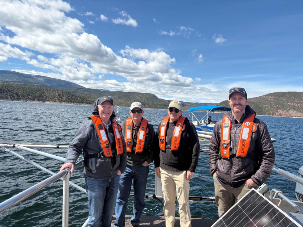
Photo credit: The Desert Research Institute

South Platte River Basin #climate for the week ending August 3, 2026 #SouthPlatteRiver

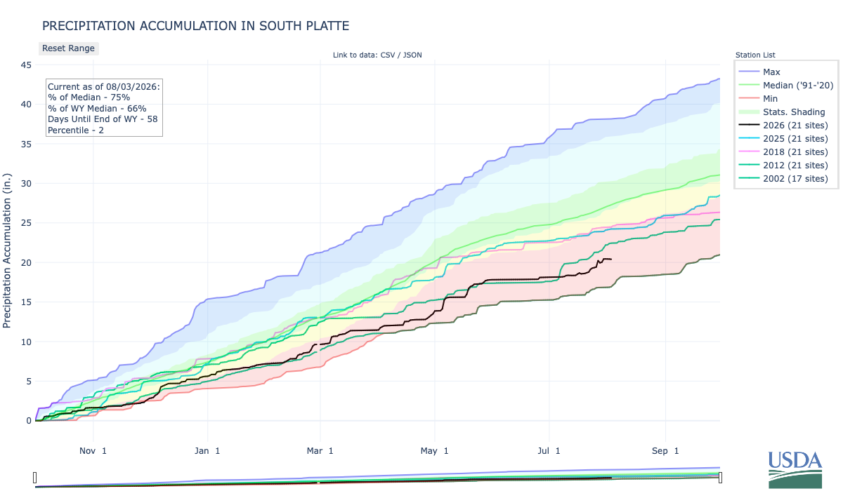
Below is the Precipitation Accumulation in South Platte graph from the NRCS for August 3, 2026. This morning precipitation is at 75% of the median (down 1% one week), and 66% of the water year median (up 1% one week). There are 58 days left in the water year.

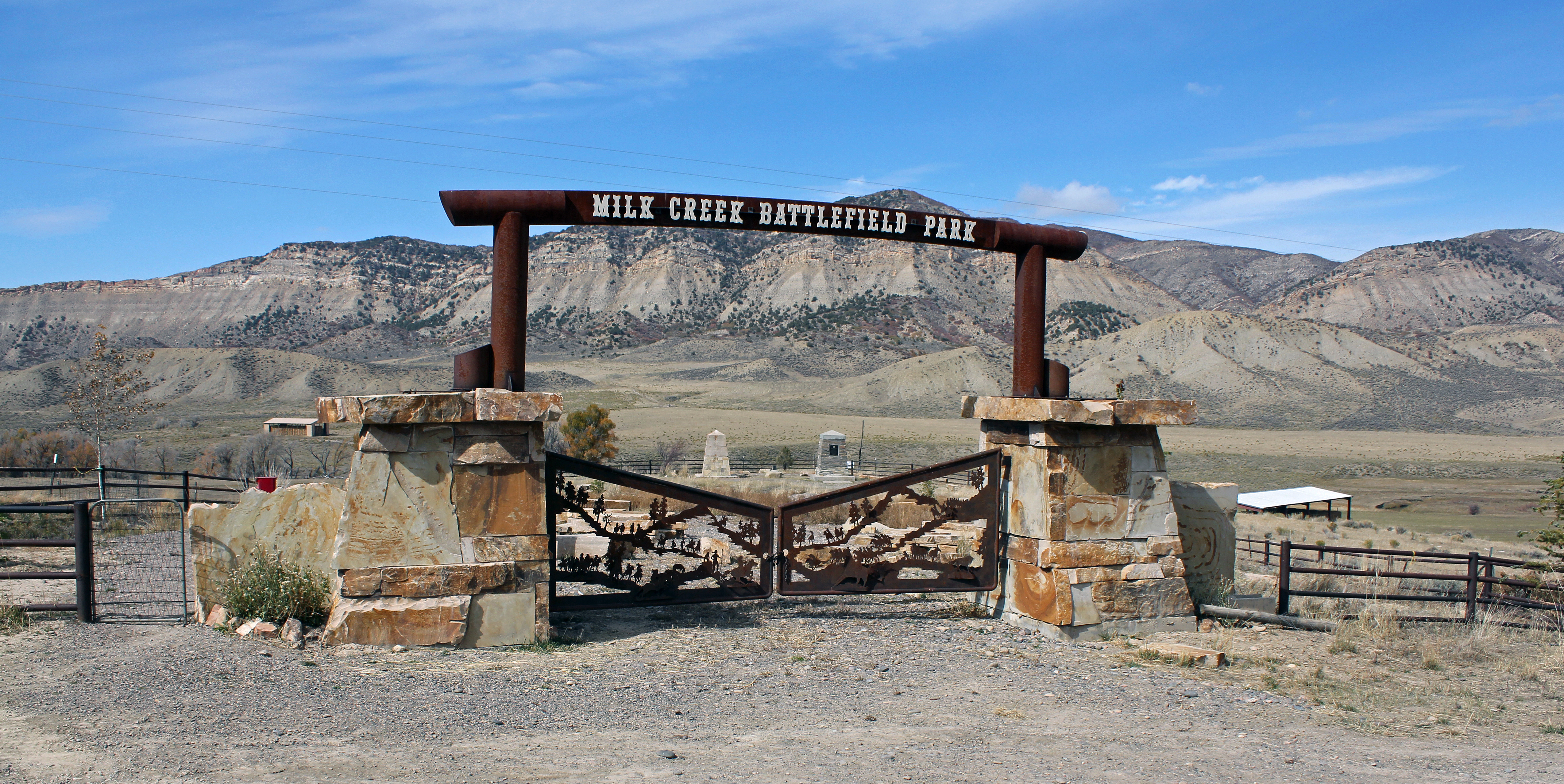
There is a chance for showers today, a chance for Thunderstorms Tuesday, then a chance for showers and thunderstorms Sunday in the central mountains. There is a chance for thunderstorms today and Tuesday, with a slight chance for showers and thunderstorms Sunday in the northern mountains. There is a slight chance for thunderstorms today and Tuesday, down here, about 227 miles from the Battle of Milk Creek Park near Meeker. The location is the site of the Battle of Milk Creek where Ute Indians ambushed U.S. troops led by MajorThomas T. Thornburgh, 18 miles (29 km) north of present day Meeker, Colorado. From Wikipedia:

Major Thomas T. Thornburgh led a command of 153 soldiers, and twenty-five militiamen, to the White River Indian Agency from Fort Steele on September 21, 1879, in response to a request for assistance by the Nathan C. Meeker, U.S. Government Indian Agent…On September 29, 1879, Ute warriors simultaneously ambushed Thornburgh’s forces and, at the Indian Agency, killed Meeker and Meeker’s employees. Ute warriors, led by Chief Colorow, attacked Thornburgh’s forces at Milk Creek on the northern edge of the reservation, about 18 miles from the White River Indian Agency. Within a few minutes, Major Thornburgh and 13 men were killed, including all his officers above the rank of captain. Another 28 men were wounded. Three-quarters of the horses and mules were killed at leisure by the surrounding Utes…Surviving troops dug in behind the wagon trains and animals’ bodies for defense. One man rode hard to get out a request for reinforcements. The US forces held out for several days…The troops were reinforced by 35 African-American cavalrymen known as Buffalo Soldiers from the 9th Cavalry at Fort Lewis in southern Colorado…Larger U.S. Army relief columns were sent from two forts, Fort Steele and Fort D.A. RussellColonel Wesley Merritt commanded five columns of troops from the 5th Cavalry Regiment, or about 350 troops, who traveled by train and marched to reach the surviving forces on Milk Creek on October 5. By the time Colonel Merritt arrived, the Utes had already dispersed.

Milk Creek Battlefield Park, 18 miles northeast of Meeker, Colorado. By Jeffrey Beall – Own work, CC BY-SA 3.0, https://commons.wikimedia.org/w/index.php?curid=70937831

Here’s a look at the 7-Day Colorado precipitation map through July 31, 2026 from the High Plains Regional Climate Center (latest map available from HPRCC this morning). Precipitation in the South Platte Basin along the Continental Divide of the Americas ranged from 0.30” to 1.80”.

Here’s the 7-Day percent of normal precipitation map through July 30, 2026 from the High Plains Regional Climate Center (latest map available from HPRCC this morning). Precipitation in the South Platte River Basin along the Continental Divide of the Americas ranged from 130% to 300% of normal.

Below is the 7-day Quantitative Precipitation Forecast for the week of August 3, 2026. Precipitation is anticipated for the mountains of the South Platte River Basin and may total up to 0.10″.

Below are the 8-14 day outlooks from the Climate Prediction Center, issued August 2, 2026, for temperature and precipitation, for the week starting August 10, 2026. The CPC expects above normal temperatures and above normal precipitation for the mountains of the South Platte River Basin.

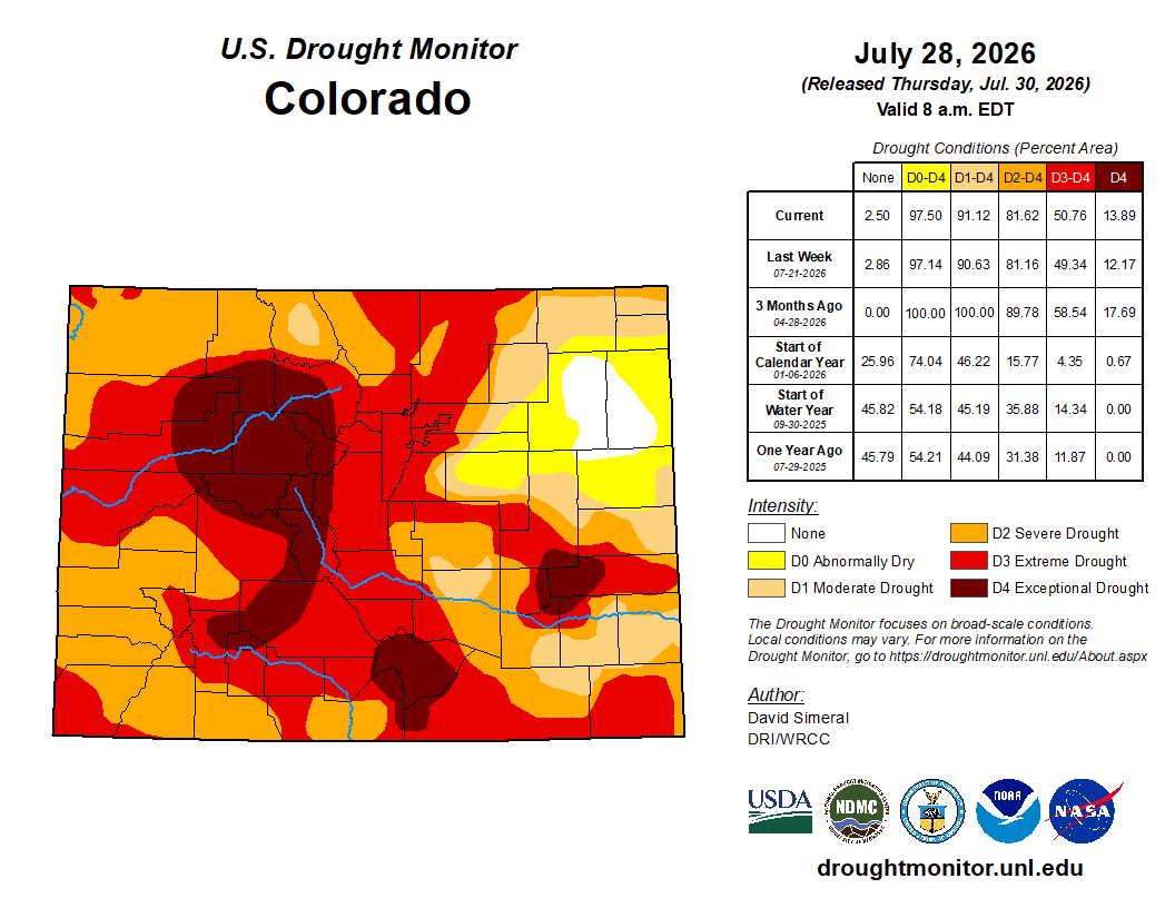
Below is the Colorado Drought Monitor map from June 28, 2026. There was a small one class improvement in Elbert County. Drought and abnormal dryness covers 97.50% of Colorado. The South Platte Basin is experiencing Abnormally Dry, Moderate, Severe, Extreme, and Exceptional drought conditions.

Below is the Colorado Drought Monitor one week change map ending July 28, 2026.

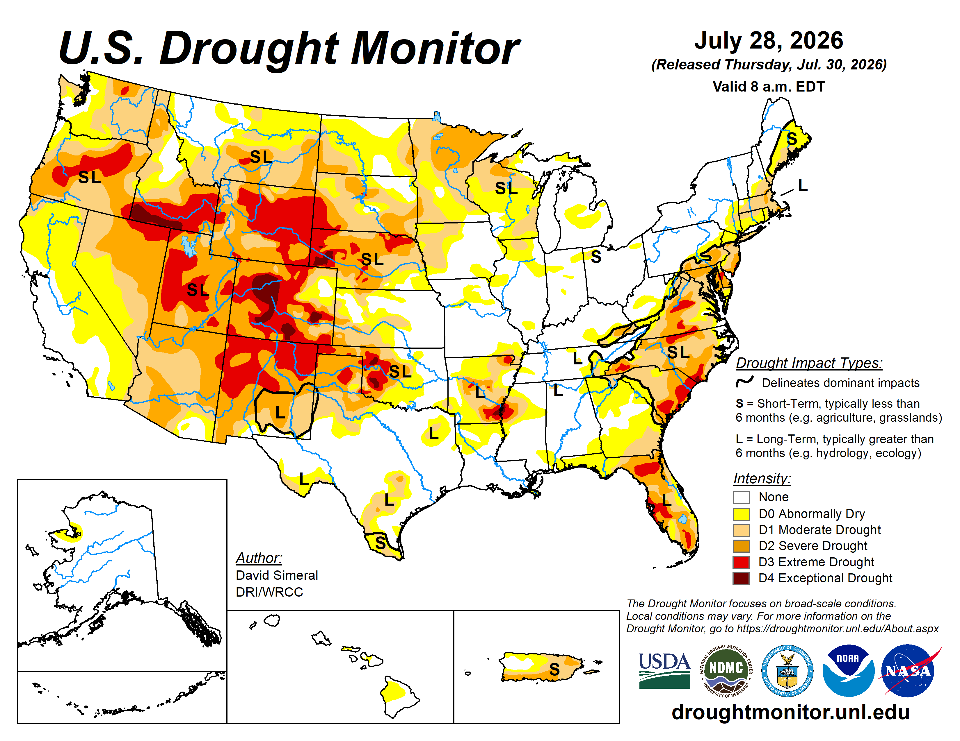
Here’s the US Drought Monitor Map from last week along with the one week U.S. change map.

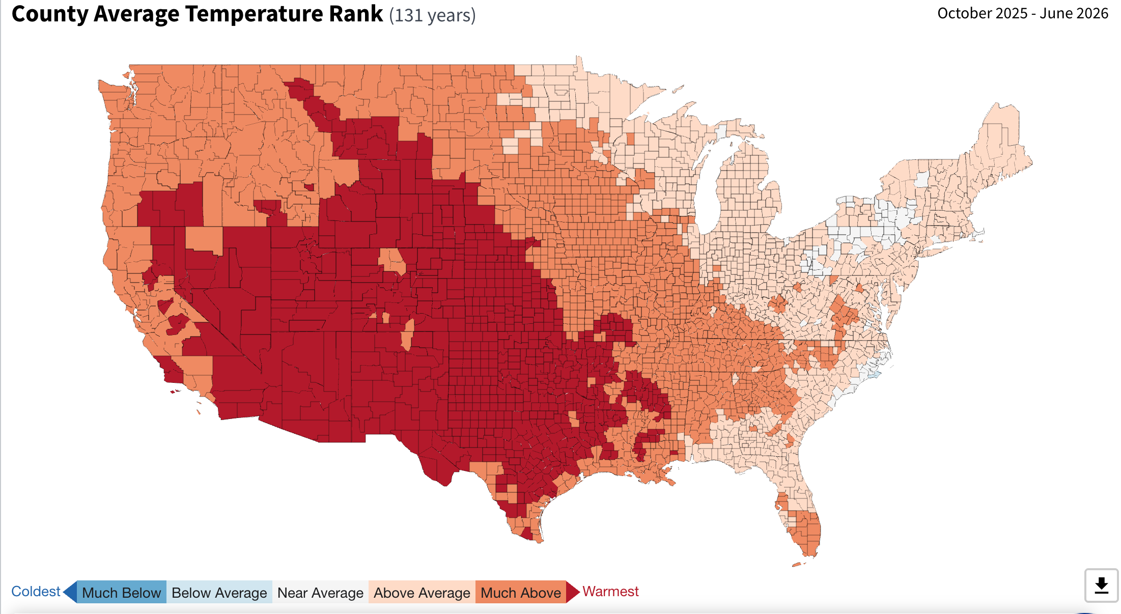
Finally, here’s a map showing the effect on temperature from fossil fuel combustion and methane venting for the 9-month period from October 2026 through June 2026.

Most of the West has just experienced the warmest nine-month period during the last 131 years, putting the region on pace to have its hottest water year on record.