
Coyote Gulch’s excellent new (to me) EV

by Robert Marcos
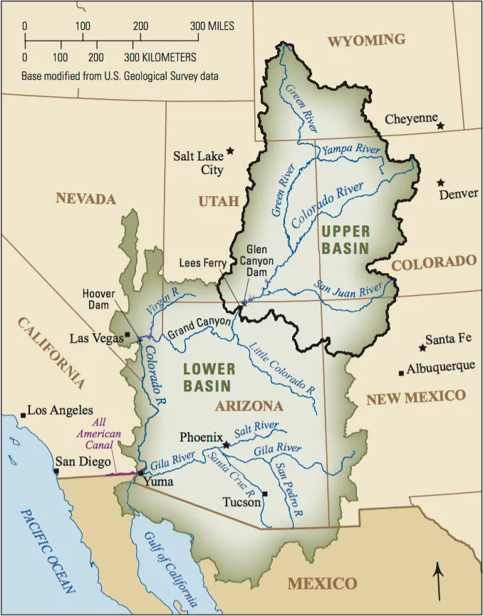
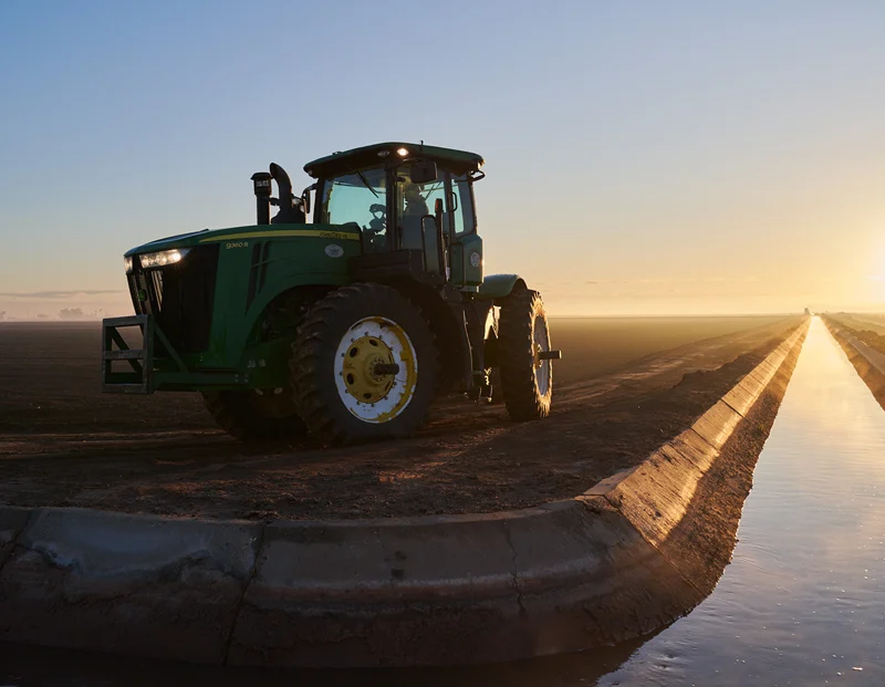
In a nutshell, the American West’s water crisis is not just a climate or a supply problem, it’s also a governance and an allocation problem. Nature has provided us with a finite supply of water, but our laws and our historical systems are directing that water to be used in inefficient ways. 1 There’s no more glaring example than Imperial Valley farmers who pay a base rate of $20 per acre foot for raw Colorado River water that they use to flood irrigate thousands of acres of forage, to feed cattle.2 Meanwhile just 100 miles away, water districts in San Diego pay $1,579 per acre foot for the same untreated water. 3
In the American West, water rights are legally tied to the land. If you sell the land, you sell the water; if you don’t use the water on that land, you lose it. Australia solved this in the 1980s and 1990s through “unbundling”. They legally separated water rights from land ownership.4 Because water is unbundled, it can be bought, sold, or leased on an open, transparent exchange—completely independent of the land. 5
• Water Entitlements: Treat water like shares in a company. A farmer owns a permanent right to a specific percentage of whatever water is available in the river system that year.
• Water Allocations: The actual volume of water credited to that share each season, fluctuating based on rain and dam levels. 6
If the Imperial Valley operated under the Australian system, the economic landscape would shift immediately:
• Eliminates “Use It or Lose It”: An alfalfa farmer wouldn’t have to flood their fields just to protect their legal rights. If a drought hits, they can choose to leave their fields fallow and sell their seasonal water allocation on the exchange to a desperate city or a high-value orchard. 7
• Puts a Clear Price on Water: Right now, Western water is artificially cheap for senior holders. A market creates a real-time price signal. When water is expensive, growing a low-value, thirsty crop like alfalfa in the desert can be financially foolish compared to selling the water itself. 8
J.H. Cullum Clark – a fellow at the George W. Bush Institute, said, “The simple case for allocating essential commodities like water through market mechanisms is that freely fluctuating prices bring supply and demand into equilibrium. If the amount of a commodity demanded by users exceeds the available supply, higher prices signal to suppliers that they should bring more supply online and to users that they should conserve”. 9

Click the link to read the article on the Colorado Newsline website (by Chase Woodruff):
August 26, 2026
Elected officials from across Colorado’s political spectrum continued a 68-year-old tradition last week when they took to the stage at the annual summer conference of the Colorado Water Congress in Steamboat Springs.
Connecting the news in Colorado to the big picture. First convened by Gov. Steve McNichols in 1958, the Water Congress brings together experts, policymakers, agricultural producers and other interest groups to negotiate and strategize in a state where water has always been a scarce and carefully managed resource.
That’s never been more true than it is today, at a time of extreme drought and escalating political conflict over the future of the Colorado River. The river’s cumulative flow at Cameo, just upstream of Palisade and Grand Junction, is at a record low this year, and Colorado and six other states that depend on its water are likely headed for an extended, high-stakes court battle over how to apportion the cuts forced on them by more than two decades of persistently dry conditions.
Addressing the Water Congress, Colorado leaders said the way forward for water users is through, as Attorney General Phil Weiser, the Democratic nominee for governor, put it, “collaboration and innovation.” They talked about storage and diversion projects, conservation measures and drought-resistant crops. They promised to defend farmers and ranchers from so-called “buy and dry” purchases of their water rights by municipal utilities, and to fight off efforts by the Lower Basin states of Arizona, California and Nevada to force mandatory cuts on upstream users in Colorado.
Notably absent, however, from the event’s three days of speeches on water policy — from politicians on both sides of the aisle — was the predominant reason why the situation on the Colorado River is bad and getting worse: human-caused climate change. Neither Weiser nor Victor Marx, the Republican candidate for governor, made any mention of the threat posed to Western water supplies by rising global temperatures. It was missing, too, from speeches by both GOP U.S. Rep. Lauren Boebert, a longtime fossil-fuel industry booster, and Democratic U.S. Rep. Joe Neguse, a former member of the House Select Committee on the Climate Crisis. [ed. emphasis mine]
Dwayne Romero, the Democratic nominee in Colorado’s drought-ravaged 3rd Congressional District, went so far as to say that “the climate is putting new pressure on” water management issues, but no further.
The lack of acknowledgment of the causes of the Colorado River Basin’s post-2000 megadrought comes as Colorado Republicans largely continue to ignore or deny the science of climate change — and as Democrats have been pressured by some party consultants to deemphasize the issue in the wake of their defeat in the 2024 election.

But even as this “climate hushing,” as Rhode Island Sen. Sheldon Whitehouse dubbed it earlier this year, appears to have taken hold in the Democratic Party, hydrologists and climatologists have grown increasingly confident in identifying human emissions, rather than natural variability, as the overwhelming factor driving the West’s water woes.
Whether or not it’s politically expedient for either party to say so, the scientific consensus is that rising levels of greenhouse gases in the Earth’s atmosphere — mostly the result of burning oil, gas and coal — have pushed the Colorado River system to the brink, and that drought conditions are likely to continue to worsen as long as those emissions continue to push global temperatures higher.
‘Hot drought’ and beyond
As of 2024, average global temperatures had risen by more than 2.3 degrees Fahrenheit over pre-industrial levels, according to NOAA data, and climate scientists have concluded that virtually all of that observed warming is due to greenhouse gas emissions from human activity. Parts of Colorado, including much of the Western Slope, are among the areas in the U.S. where average temperature increases have been most severe.
As litigation looms and drought takes its toll, state officials defiant over Colorado River’s future — Chase Woodruff (Colorado Newsline)
Even in the absence of any other changes to global climate patterns, this higher heat alone can lead to drier conditions on the ground, by increasing the rate at which moisture evaporates — sometimes called evaporative demand, a measure of the atmosphere’s “thirst.” In a 2024 report for the Colorado Water Conservation Board, state climatologists found that evaporative demand had risen by 5% statewide between 1980 and 2022, and was projected to increase by 8% to 17% by 2050.
Within about a decade of the onset of the Colorado River megadrought in the 2000s, researchers began to conclude that rising temperatures were a major factor, making the drought more severe than it otherwise would’ve been. In an influential paper published in 2017, hydrologists Brad Udall and Jonathan Overpeck used the term “hot drought” to describe the basin’s current conditions, distinguishing it it from previous 20th-century “dry droughts,” caused largely by lower precipitation.
Further research has only solidified those conclusions. Using historical soil-moisture data and tree-ring records, one 2022 study found that the current megadrought is the worst dry spell the Southwest has experienced in at least 1,200 years. Studies generally agree that about 40% to 50% of the Colorado River’s declining flows can be attributed to higher temperatures alone.

Still, scientists were cautious about the other half of the hydrological equation — whether, and to what extent, climate change was influencing rainfall and snowfall, too. Modeling global warming’s precise impacts on precipitation patterns proved more complicated than identifying what state climatologists called the “basic physical relationship” between heat and evaporation.
“Compared to the 20th century, the 21st century has indeed been drier, but only by about 2.5%,” hydrologists with the Colorado River Research Group wrote in 2016. “Whether or not this is the leading edge of a trend, or merely a part of normal variability, is unknown.”
In just the last two years, however, new research has begun to dispel that uncertainty — and the findings, wrote Udall and Overpeck last year, “translate to mostly bad news.”
It’s precipitation, too
Overall precipitation in the Upper Colorado River Basin has continued to decline since 2000, with multi-year averages about 7% lower than previous levels as of 2025. Colorado was one of nine states in the West to have experienced their warmest winter on record in 2025-26, and statewide snowpack fell to its lowest level in more than 40 years, setting the stage for this summer’s extreme conditions.
Researchers at the University of Colorado Boulder found last year that global warming is reducing precipitation in the West by stalling a key oceanic climate cycle known as the Pacific decadal oscillation, indicating that the region’s persistently dry conditions are being driven by human emissions “more intensely — and more directly — than previously understood.” Another 2025 paper by a different group of researchers echoed their findings.
“What’s important here is that we’re showing that rainfall has also been influenced by humans, in addition to just evaporation,” Pedro DiNezio, one of the CU Boulder study’s co-authors, told Newsline last year. “Both contribute to drought.”
A final key takeaway from climatological research on the Colorado River is that the higher global temperatures get, the worse things will be for river flows, which are not likely to ever return to their previous “normal.” Udall and others have encouraged the use of the term “aridification,” rather than drought or megadrought, to more accurately describe what’s happening to the river basin. But it’s also why he and Overpeck wrote last year that there’s a “silver lining” to the better understanding of river’s hydrology that researchers have gained over the last decade.
“We can say with confidence that human-caused emissions of greenhouse gases are having an increasingly negative impact on the flows of the Colorado River,” they wrote. “This climate change impact will continue to worsen, but because humans cause it, humans can halt it.”
The Trendline offers analysis on public policy in Colorado. Articles explore ways to think about the news based on research, history and other important context, helping Coloradans connect the headlines to the big picture.
Colorado Newsline is part of States Newsroom, a nonprofit news network supported by grants and a coalition of donors as a 501c(3) public charity. Colorado Newsline maintains editorial independence. Contact Editor Quentin Young for questions: info@coloradonewsline.com.
Click the link to read the guest column on The Desert Review website (Brian McNeece):
August 26, 2026
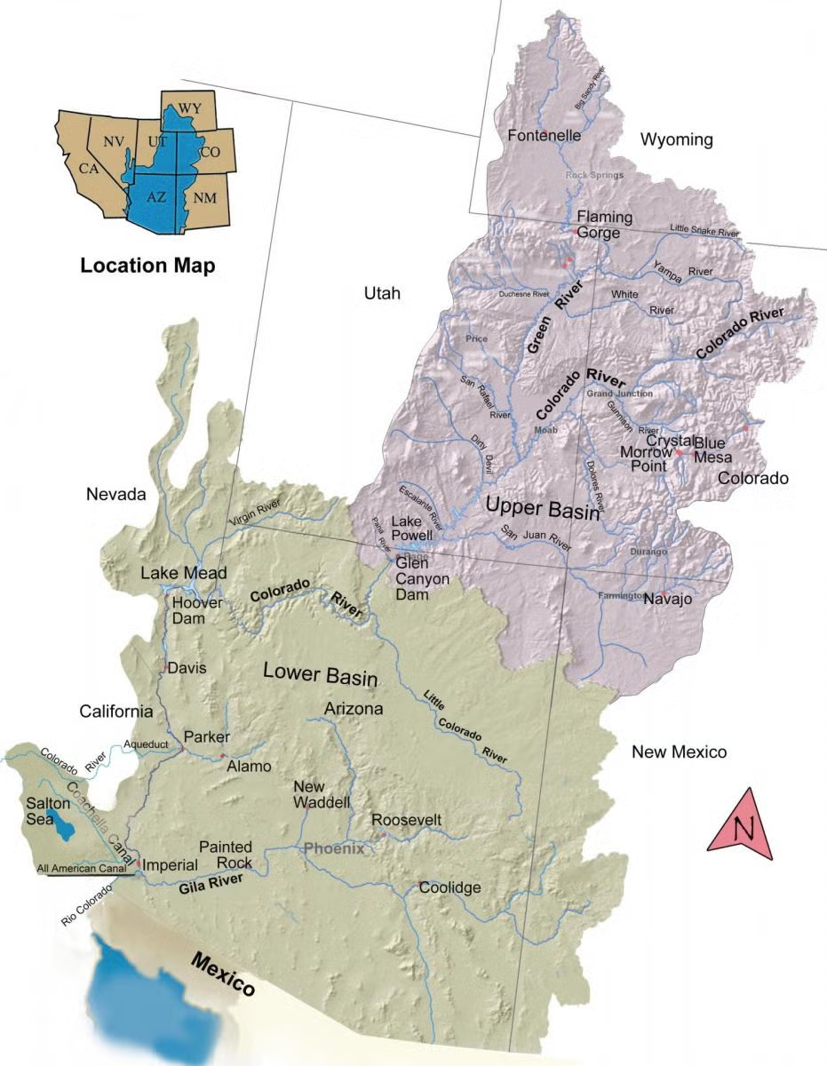
We can divide the Imperial Valley’s relationship with the Colorado River into four stages. Stage four is accelerating, and it may be our toughest challenge yet.
Water from the Colorado River first arrived via a canal through Baja California June 1, 1901. That started a forty year period of agricultural expansion, floods, shortages, and an accumulation of huge amounts of debt. It was a time of constant uncertainty.

In 1935 Hoover Dam eliminated the danger of floods. The All-American Canal in 1940 finally gave the IID independence from Mexico. The stage of uncertainty was over. The age of prosperity had begun.
From 1940 to 1980, the IID and the valley expanded and refined the system that the pioneers had so sublimely designed. By gravity alone, a network of canals irrigated half a million acres of farmland. The Colorado River supplied all the water we could use.
There was so much water that the IID and Imperial Valley farmers allowed tailwater and drain water to raise the Salton Sea. Tropical storms in 1976 and 1977 added even more water to the Salton Sea. Land near the Salton Sea was flooded. In 1980, farmer John Elmore of Brawley understandably sued the IID for ruining his land there.
Elmore won. IID lost. The courts ruled that the IID was using Colorado River water wastefully and was in violation of the Law of the River.
One might have expected that in 1980 the IID would—like in its early years—ask the farmers and townsfolk to support the massive investment needed to modernize its water control system by taxing themselves.
Instead, the IID accepted the Metropolitan Water District’s offer to pay for efficiency improvements in the IID system. In return, MWD would get 104,000 acre-feet of water every year for a small annual fee. Stage two was over.
Thus began stage three in the history of IID: the age of water transfers and a creeping reduction in water supplies. Midway in this forty year period—in 2003—the IID signed the Quantification Settlement Agreement, which capped the state of California’s allocation at 4.4 million acre-feet and consolidated the MWD transfer agreement with others, including an annual transfer of 200,000 acre-feet to the San Diego County Water Authority.
At the same time, a long drought meant that Lower Basin states of California, Nevada, and Arizona kept drawing down Lake Mead, despite six separate agreements to build elevation. Today, both Lake Mead and Lake Powell are at their lowest elevations of all time.
A new stage is upon us. We can say that it began around 2020, forty years after the Elmore suit in 1980. For now, it’s a return to uncertainty—the prospect of legal challenges to IID’s senior water rights
Stage four incubated for six years as the seven states along the river regularly scrummed to find an arrangement to share plunging water supplies. The problem being so vast and complicated, they left it to the Bureau of Reclamation to find the answer. Just a few days ago, the Bureau released its plan—over a thousand pages—that essentially laid the burden of cutbacks on the Lower Basin states of California, Arizona, and Nevada.
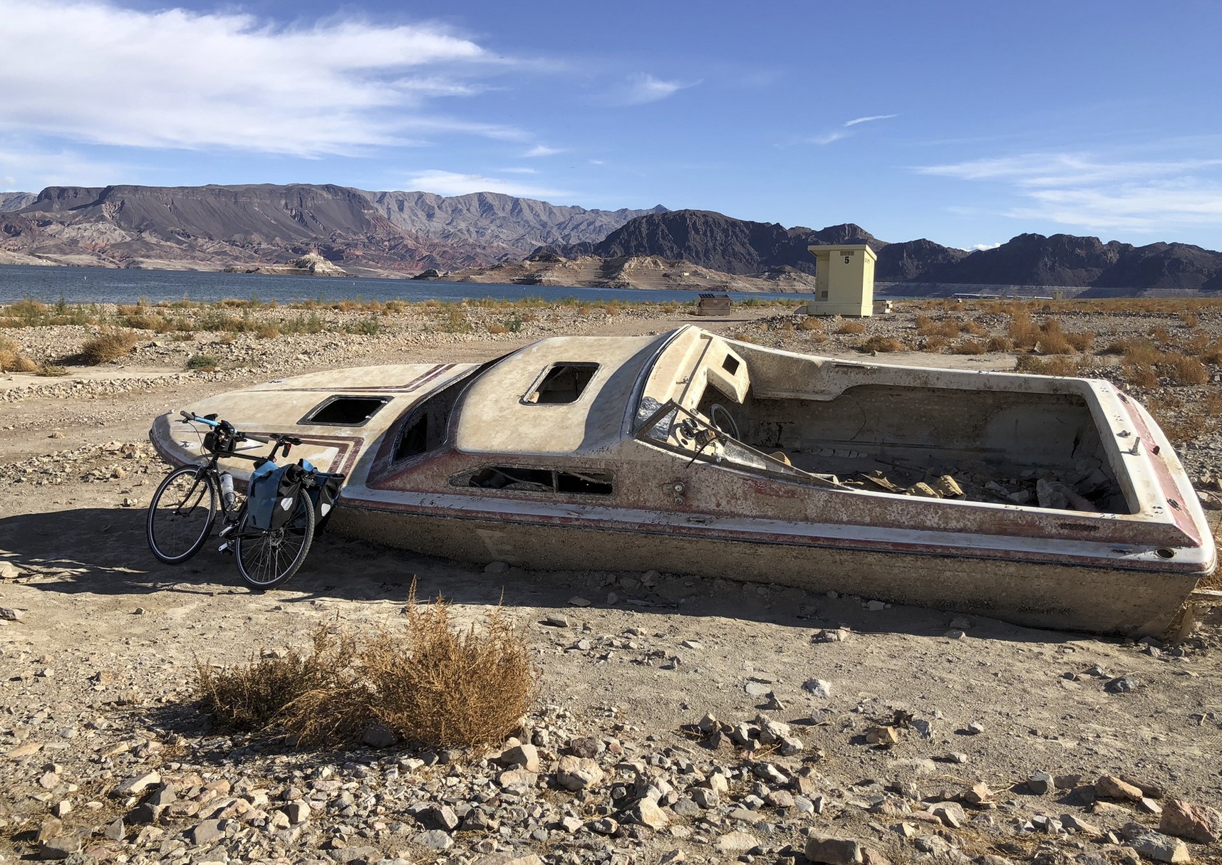
As the two giant reservoirs of Lake Powell and Lake Mead have receded, relics of the past reappear: boats, airplanes, the ruins of flooded towns. A forgotten concept has reappeared too: Water evaporates in transit down the river.
It has become clear to all in the Lower Basin that evaporation and uptake by plants along the river can no longer be ignored.
Through some poor thinking decades ago, the Bureau of Reclamation promised to deliver the same amount of water at Imperial Dam for the IID and at Yuma for Mexico that was released at Lee’s Ferry 600 miles upstream. But because about 13% is lost to evaporation, the Bureau had to rob Lake Mead every year to fulfill its promises. It can’t continue.
That’s why the cuts the Lower Basin states and Mexico have taken since 2020 haven’t been enough. And without a miracle winter, the new cuts they have offered—1.50 million acre feet, somewhat more than the evaporation losses—won’t be enough. This is the simple fact.
It gets worse. Instead of releasing its Colorado River Compact obligation of 8.23 maf, the Upper Basin states will release only 6 or 7 maf next year. Therefore, the more likely cuts will be in the neighborhood of 2.5-3 million acre-feet.
Three days after the Bureau of Reclamation plan was released, Nevada sued, alleging that the proposed cuts to Nevada will devastate its economy and that the Bureau (representing the Department of the Interior) did not properly follow the law.
Thus, we’re off and running to the courts, which all the states repeatedly stated they wanted to avoid. For the IID, it’s stage four of its history with the Colorado River. The only certainty at this point is that the IID will be embroiled in tough legal challenges to protect its senior water rights as heavy cuts hit users of Colorado River water. Let’s hope it doesn’t last forty years.

From SNWA Youtube page:
Why don’t we just build a pipeline from the Mississippi River, Great Lakes, or another major water source and pump that water to Lake Mead? Simple, right?
It’s one of the most common suggestions we hear to solve drought in the West. In this episode of Tap the Truth, we explore what it would actually take to move water across the country and why these projects are more complicated than they might seem.
Importing water is not as simple as laying pipe across a map. Interstate agreements, water rights, environmental impacts, water quality concerns, permitting challenges, and costs all need to be considered.
We also discuss why communities throughout the country are facing their own water challenges and why conservation remains one of the most reliable and cost effective tools available today.
Want to make a personal impact on Southern Nevada’s water future? Visit SNWA.com to learn about water saving programs, rebates, and conservation tips.
Watch more Tap the Truth episodes for straightforward answers to common questions about water, Lake Mead, the Colorado River, and Southern Nevada’s water supply.
Click the link to read the article on the Steamboat Pilot & Today website (John Camponeschi). Here’s an excerpt:
August 26, 2026
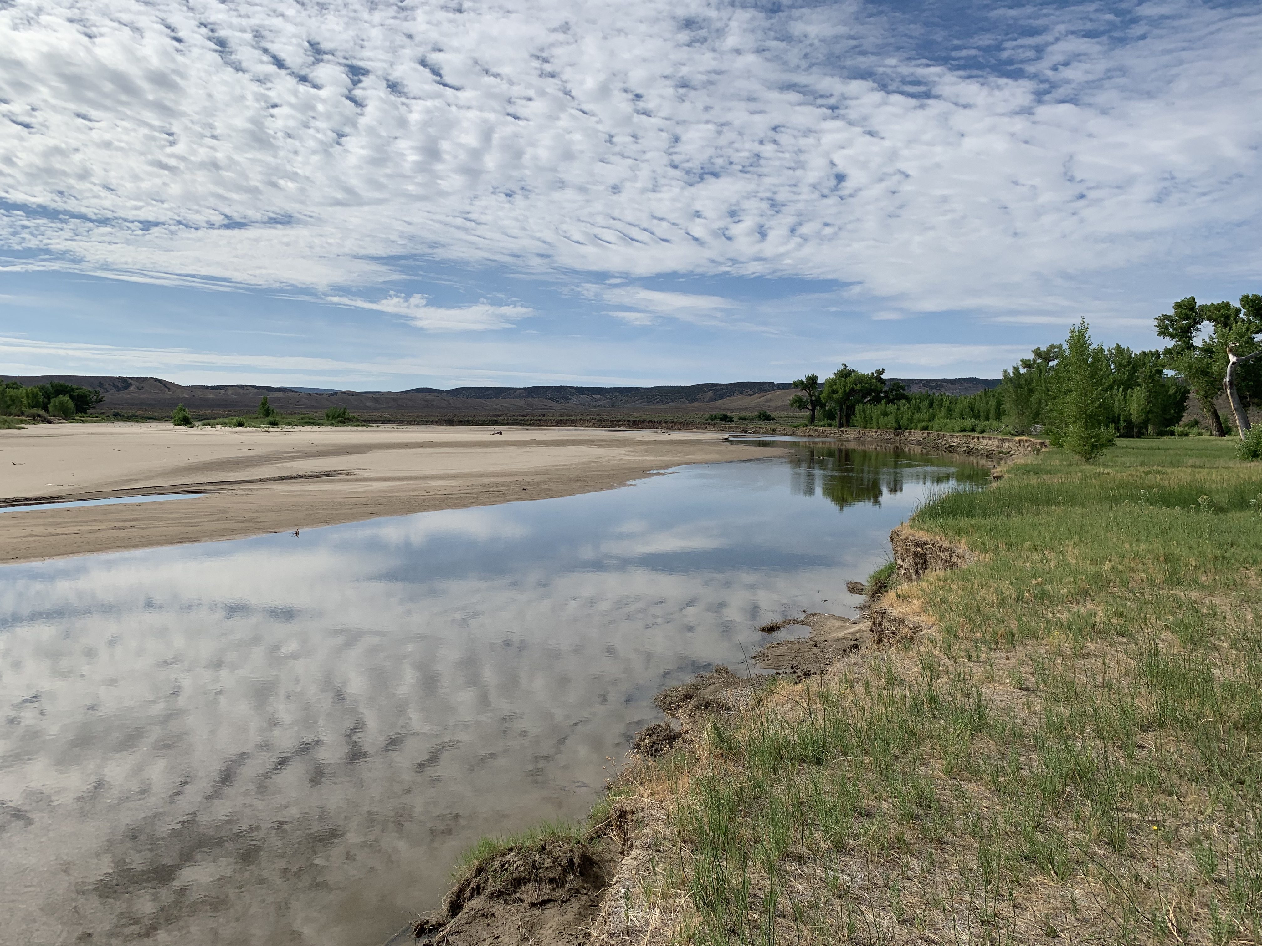
A rare call has been placed on the main stem of the Yampa River as historic drought conditions continue to strain water supplies across Northwest Colorado, potentially curtailing more than 300 upstream diversions and prompting water managers to urge residents to conserve wherever possible. The call was placed Aug. 19 at the Lily Park Ditch No. 1, Pump Station No. 1, near the confluence of the Little Snake and Yampa rivers. The agricultural water right carries a priority date of May 28, 1923…Holly Kirkpatrick, public affairs manager for the Upper Yampa Water Conservancy District, said the call is only the fifth to occur on the main stem of the Yampa River below Stagecoach Reservoir…Kirkpatrick said well over 300 diversions upstream of the calling point could be subject to curtailment if they have priority dates junior to May 28, 1923. The call also applies to tributaries upstream of the Little Snake and Yampa river confluence. Some of those tributaries, however, may already have little or no natural streamflow available because of the severity of this year’s drought, she said. The Upper Yampa Water Conservancy District reported Aug. 20 that baseflows in tributaries across the basin remained below the 10th percentile, an indication of unusually low water levels. The district’s report showed the Yampa River below Craig flowing at 94 cubic feet per second, compared with a historical mean of 156 cfs for the date. In Steamboat Springs, the river was flowing at 58 cfs compared with a historical mean of 96 cfs. Reservoir releases are now supplying much of the water moving through the Yampa River, Kirkpatrick said.

Click the link to read the article on the Steamboat Pilot & Today website (Ali Longwell). Here’s an excerpt:
August 26, 2026
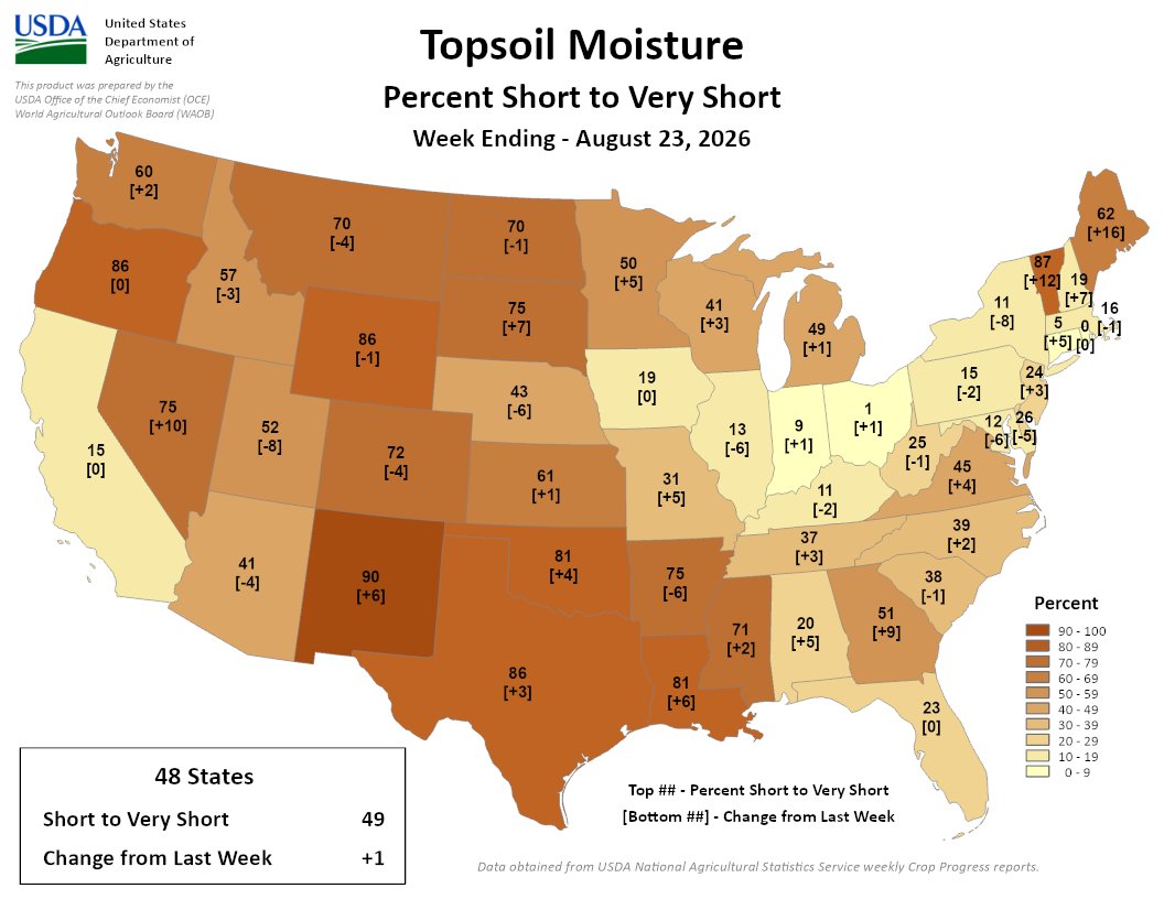
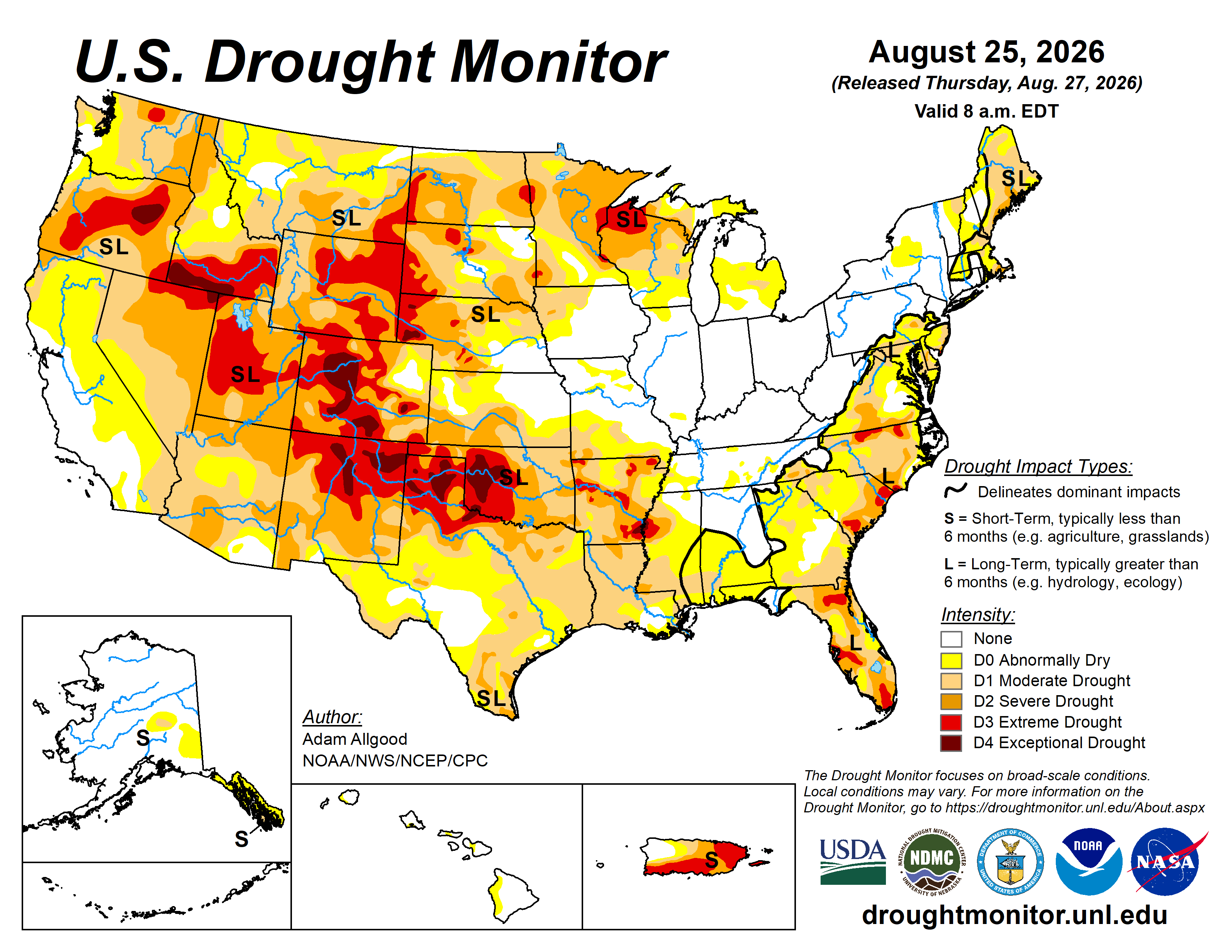
As Colorado nears the final month of the 2026 water year, extreme drought is persisting across the state as many regions, including the Western Slope, continue to rack up records when it comes to heat as well as precipitation — and the lack thereof.
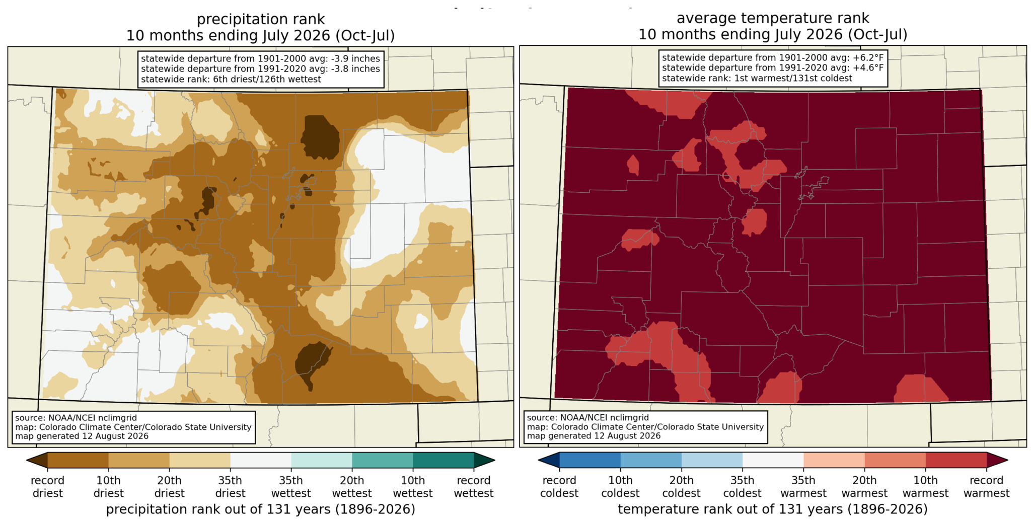
“We continue to be way above anything that we’ve seen in the data record for Colorado; we’re about 2 degrees warmer than the previous hottest water year to date on record — that was 1934 — and over 4 degrees warmer than the 1991 through 2020 average,” said Allie Mazurek, engagement climatologist at the Colorado Climate Center, at the Aug. 25 Water Conditions Monitoring meeting of the Colorado Water Conservation Board.
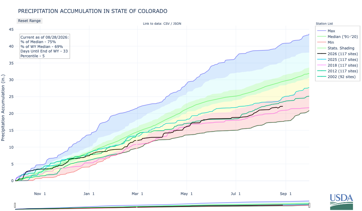
“The dryness has not been quite as remarkable as the warmth, but again, we have ranked as the sixth driest on record through the end of July, and are still among some of the driest water years that we’ve seen,” she added…
The first 10 months of the water year — which kicked off Oct. 1, 2025 — have seen three months rank as the hottest on record and six months fall among the top 10 hottest. While not over, August has already seen above-average temperatures, with many areas averaging 4-6 degrees hotter than normal, including west of the Continental Divide, which Mazurek said has experienced “the most notable warmth compared to average.”…While July and August are not the first months this water year to set these kinds of records — March, for example, saw statewide temperatures nearly 10 degrees above the 30-year average — Mazurek said it does ring a different kind of alarm bell…All in all, Mazurek described the water year so far as “very, very warm,” sitting 4.5 degrees above the average temperatures from 1981 to 2020.

Click the link to read the article on the KTAR website (Heidi Hommel). Here’s an excerpt:
August 26, 2026
The Upper Basin is on the verge of violating the Colorado River Compact for the first time in the agreement’s 104-year history, failing to send enough water downstream to the Lower Basin, Central Arizona Project President Terry Goddard told KTAR News 92.3 FM on Monday…Goddard said the new framework from the U.S. Bureau of Reclamation that will guide operations through 2036 could make it worse…
“We have a violation of the compact either today or within the next month,” Goddard said.
The compact requires the Upper Basin to deliver 75 million acre-feet to the Lower Basin over any rolling 10-year period, averaging 7.5 million acre-feet a year. Goddard said the Upper Basin is falling short of that obligation for the first time in the compact’s history, releasing only 6 million acre-feet this year and running right at the 10-year threshold. [ed. As Ed Millard says, the action is not from the Upper Basin but from Reclamation]

