The Crystal River flows through the Gunnison County town of Marble, seen here with Beaver Lake. A representative from the Town of Marble is expected to participate in a subcommittee focused on an intergovernmental agreement to protect the river. CREDIT: ECOFLIGHT
May 27, 2026
Five Colorado governments, including Pitkin County, and water entities have officially entered into a landmark intergovernmental agreement to protect the Crystal River from mainstem dams and out-of-basin water diversions.
The agreement comes at the recommendation of the Crystal River Wild and Scenic and Other Alternatives Steering Committee from March 2024, suggested as one of three potential long-term preservation measures, according to a press release. Along with Pitkin County, the Colorado River Water Conservation District, Gunnison County, town of Marble and West Divide Water Conservancy District formalized their shared commitment to oppose any new on-channel reservoirs on the mainstem of the Crystal River and any trans-basin diversions that would export water out of the watershed.
The Pitkin County Board of County Commissioners moved forward Wednesday with an intergovernmental agreement that expresses commitment “to protect the Crystal River from on-channel dams and transmountain diversions.” The agreement will be between Pitkin County, Gunnison County, the town of Marble, the Colorado River Water Conservation District and the West Divide Water Conservancy District. This was an approval of the first of two readings. The Colorado River Water Conservation District have yet to bring this agreement to their boards but have previously expressed support for the initiative, according to the district’s staff. Gunnison County and the town of Marble will be considering it in upcoming meetings.
“It would be an agreement that all the parties would oppose or not support any new dams on the main stem of the Crystal River, or any new trans-basin diversions out of the Crystal River,” Pitkin County Deputy Attorney Anne Marie McPhee told commissioners on Wednesday. “It is trying to keep the water in the river as long as possible.”
[…]
Despite moving the agreement forward after first reading, Commissioner Greg Poschman acknowledged that there has been concern around the agreement’s lack of enforcement ability, due to the signing bodies’ ability to leave the agreement at will. Poschman referenced specific criticism vocalized by Bill Jochems, a Pitkin County Healthy Rivers and Streams Citizen Advisory board member and Crystal River advocate.
“The expression from Mr. Jochems is, ‘it’s a nothing burger,’ right?” Poschman said on Wednesday. “It’s the weakest of all possible protections for the Crystal. Is that what we want to do at this point?”
Commissioner Francie Jacober commented that, despite the potential weakness that Jochems and Poschman pointed out, it would still be symbolically important for the county to lend their support to the intergovernmental agreement…The county has been pursuing a Wild and Scenic River designation for a portion of the Crystal River since the U.S. Forest Service found 39 miles of it eligible for the designation in 2002, according to county documents supporting Wednesday’s intergovernmental agreement. A Wild and Scenic designation could help with future conservation and preservation efforts.
Riparian ecologists David Cooper, left, and David Merritt take stock of the tree root crowns collected from the banks of the Crystal River the last week in October. They will take the trunks back to the lab in Fort Collins to study the tree rings, the first step in understanding how floods impact riparian vegetation. CREDIT: HEATHER SACKETT/ASPEN JOURNALISM
Over three sunny-but-cool October days, a team of scientists and volunteers dug up and hauled away the root crowns of trees along the Crystal River, a first step toward a potential strategy to protect flows on one of the last free-flowing rivers in Colorado.
David Cooper, a senior researcher on wetland and riparian ecology at Colorado State University, studies how spring floods affect riparian vegetation. His van was full of the tree samples that he would take back to the lab in Fort Collins to study their rings.
“We want to know the year the plant was established because once we know the year the plant was established, then we could relate that to the flow record that’s recorded by gauges,” Cooper said. “Then we can speak to the role of floods, which is important for the public to understand and for river managers to understand.”
The banks of the Crystal just upstream from Redstone are lined with narrowleaf cottonwood and blue spruce. Cottonwoods in particular need the rushing flows of spring runoff for their seeds to germinate and have evolved to disperse their seeds just after the high point of snowmelt each year. The seeds, carried along the wind by a bit of fluff, land in the bare, wet, mineral soil of streambanks where some of them take root.
Peter Brown with Rocky Mountain Tree Ring Research takes a core sample from a tree on the banks of the Crystal River. A type of instream flow water right that protects peak flows could help maintain spring floods, which are essential for growing new cottonwoods. CREDIT: HEATHER SACKETT/ASPEN JOURNALISM
Cooper’s work, which is estimated to cost $26,300, was commissioned by a subcommittee of the Crystal River Wild and Scenic and Other Alternatives Feasibility Steering Committee, which is looking at different tools that could be used to protect the river. The Crystal, which flows about 40 miles from its headwaters in the Maroon Bells-Snowmass Wilderness through the towns of Marble, Redstone and Carbondale before its confluence with the Roaring Fork, is one Colorado’s last undammed major rivers.
Environmental and recreation advocates and local municipalities, as well as many residents of the Crystal River Valley, have long sought to protect the river from future dams and diversions — infrastructure projects that have left many other Western Slope rivers depleted.
Those who want to protect the Crystal River have for the past few years been exploring the best ways to do that. Although proponents say a federal Wild and Scenic designation would do the best job of protecting the river, that has been met with resistance from some property owners, leading the steering committee to explore other options, in addition to pursuing Wild and Scenic.
Scientists dug up this root crown next to the Crystal River in order to study the tree rings and how they relate to flood years. The Crystal River Wild and Scenic Instream Flow Subcommittee is looking at how to protect spring peak flows in the river. CREDIT: HEATHER SACKETT/ASPEN JOURNALISM
Instream-flow subcommittee
After a year’s worth of meetings with a facilitator, the steering committee chose to pursue three potential ways forward: a “peaking” instream-flow water right; an intergovernmental agreement; and a federal Wild and Scenic designation. None of the methods would preclude the others; there could eventually be layers of protections for the Crystal.
The instream-flow subcommittee, which includes representatives from American Whitewater, and local governments and residents, is exploring how to keep water in the river by using the Colorado Water Conservation Board’s instream-flow program.
The CWCB is the only entity allowed to hold water rights that keep water in rivers and are designed to preserve the natural environment to a reasonable degree. A “peaking” instream-flow water right would keep in the stream all of the water not claimed by someone else during years with high spring runoff, thereby maintaining these periodic floods, which are essential for growing new cottonwoods.
The idea is that if these peak spring flows are already spoken for by the environment, they can’t be claimed by future reservoir projects, which also tend to capture water at the height of spring runoff and store it for use later in the year.
“If you want to be a little more objective about it, it’s an argument for or against floods and natural river processes,” said David Merritt, a riparian ecologist and former instream flow coordinator for the U.S. Forest Service who has worked on other instream-flow projects around the state. “The dam goes in, it’s going to interrupt that and you’ll end up with a different ecosystem.”
If there is less water available to develop, it could make a particular river less attractive for building a reservoir, said Laura Belanger, a senior policy adviser with Western Resource Advocates. The environmental nonprofit has worked on these types of peak instream-flow projects in the Gunnison River basin.
“Infrastructure is expensive, so you need to get a certain yield out of it,” Belanger said. “That could potentially make a project not be cost effective and not have sufficient yield to be pursued. … Around the state, so much water is already claimed, and so, for a lot of new reservoir projects, the peak is the only thing that’s available.”
So far, this tool for protecting the peak is little used, but there are three recent examples on streams that drain the Uncompahgre Plateau: Cottonwood Creek, Monitor Creek and Potter Creek. In 2024, these three creeks secured an instream-flow water right for their spring peak flows in years with high runoff. All three still allow for some amount of future water development.
“They don’t kick in every year; they’re definitely unique,” Belanger said. “It doesn’t kick in until you hit a certain high flow and then it protects the hydrograph all the way up and then back down to a certain value.”
Wetland and riparian ecologist David Cooper, left, and campaign director at Wilderness Workshop Michael Gorman look for the best place to cross the Crystal River. Scientists and volunteers collected tree root crowns from the riverbanks the last week of October, the first step in understanding how floods impact riparian vegetation. CREDIT: HEATHER SACKETT/ASPEN JOURNALISM
Subcommittee still looking at Wild and Scenic
The steering committee’s work, including the tree-ring study, is funded by Pitkin County Healthy Rivers, by the Mighty Arrow Family Foundation, and in-kind donations from Western Resource Advocates and American Whitewater. But the majority of the funding – $99,699 according to Hattie Johnson, southern Rockies restoration director with American Whitewater and member of the instream flow and Wild and Scenic subcommittees – is through the state’s Wild and Scenic Rivers Fund.
The CWCB generally advocates for using state mechanisms such as the instream-flow program to protect rivers because it would rather avoid a federal Wild and Scenic designation. With increasing competition for dwindling water supplies, the state has been reluctant to support Wild and Scenic designations, which could lock up water and prevent it from being developed in the future.
The U.S. Forest Service determined in the 1980s that portions of the Crystal River were eligible for designation under the Wild & Scenic River Act, which seeks to preserve, in a free-flowing condition, rivers with outstandingly remarkable scenic, recreational, geologic, fish and wildlife, historic, and cultural values. Wild and Scenic experts say the “teeth” of the designation comes from an outright prohibition on federal funding or licensing of any new Federal Energy Regulatory Commission-permitted dam. A designation would also require review of federally assisted water resource projects.
Any designation would take place upstream from the big agricultural diversions on the lower portion of the river near Carbondale.
The subcommittee that is still looking at a Wild and Scenic designation has hired a facilitator team from the Keystone Policy Center to help the group produce a report of its findings at a cost of about $45,000. And the instream-flow subcommittee has also hired Ecological Resource Consultants to do a sediment-impacts study, which is set to begin before winter and is estimated to cost about $30,000.
Wild and Scenic subcommittee chair Michael Gorman said members have taken a deep dive into policy and legislation, and have learned a lot from stakeholders along the river.
“We’ve got more work to do and we’re excited to have the skilled facilitators at Keystone to help us compile what we’ve learned about how Wild and Scenic legislation ties into our specific priorities on the Crystal River,” Gorman said in a prepared statement. “We look forward to having a report that we can share with our community and inform future discussions.”
The Crystal River was running under 8 cfs on Aug. 24, 2025. This section of river is downstream of big agricultural diversions and ditches owned and maintained by the Town of Carbondale. CREDIT: HEATHER SACKETT/ASPEN JOURNALISM
Streamflows on the Western Slope have plummeted over the last month, sending water managers scrambling to boost flows for endangered fish and ranking it among the driest years in recent history.
According to the Natural Resources Conservation Service, the Roaring Fork River basin ended the month of July at 28% of average streamflows. The Colorado River headwaters was at 42% of average; the Gunnison River basin was at 34% of average and rivers in the White/Yampa/Green River basin in the northwest corner of the state were running at 24% of average. Prior to this week’s rains, the Crystal River near the Colorado Parks and Wildlife fish hatchery was running at 7.5 cfs, or 10% of average.
“We’ve been seeing pretty widespread well-below-normal flows across the entire upper Colorado River basin due to extremely dry conditions starting back in December,” said Cody Moser, a senior hydrologist with the Colorado Basin River Forecast Center.
For most of August, the Crystal River near fish hatchery was running at less than 15 cfs. These extremely low conditions plus water temperatures above 71 degrees Fahrenheit, prompted CPW to implement on Aug. 15 a full-day voluntary fishing closure on the Crystal from mile marker 64 on Highway 133 to the confluence with the Roaring Fork. This section of the Crystal is downstream from big agricultural diversions and ditches owned and operated by the town of Carbondale.
The upper Roaring Fork River and its tributaries are also suffering the consequences of low flows. On Aug. 25 the Colorado Water Conservation Board placed a call for the minimum instream flow on a seven-mile section of the Roaring Fork through Aspen, between Difficult and Maroon creeks. The call was released the next day after rain boosted flows above the 32 cfs minimum amount.
The CWCB is the only entity in the state allowed to hold instream flow water rights, which are intended to preserve the natural environment to a reasonable degree. It’s not uncommon for the CWCB to place calls for this stretch in late summer and it did so in other years, including 2012, 2018, 2020, 2021 and 2022.
Low flows have also affected recreation at the North Star Nature Preserve, a popular area for paddle boarders east of Aspen. On July 24, Pitkin County implemented a voluntary float closure — asking people to launch at South Gate instead of Wildwood — which occurs when the river falls below 60 cfs.
“At low water levels, users are at risk of touching bottom, which could damage the riparian habitat and would be considered trespassing,” a Pitkin County official said in an email.
Before this week’s rainfall, the Roaring Fork above Aspen hovered around 30 cfs.
Streamflows across the Western Slope are often at some of their lowest points of the year during the late summer and early fall when snowmelt has waned and irrigators are still drawing from streams. But this summer’s lack of precipitation and low soil moisture were the main drivers of dry streams. Much of the Western Slope is in extreme or exceptional drought, according to the U.S. Drought Monitor.
“The biggest factor is the dry spring conditions and layered on top of them a much drier than normal summer,” said Peter Goble, assistant state climatologist. “We will be watching those base flows but also soil moisture levels as we go into fall and early winter to see if those pick back up.”
Dry soils that suck up snowmelt before it makes it to streams can mean a normal snowpack translates into below-normal runoff.
This section of the Colorado River at the boat launch near Corn Lake dipped to around 150 cfs in lake August. Known as the 15-mile reach, this stretch of river should have at least 810 cfs to meet the needs of endangered fish. CREDIT: HEATHER SACKETT/ASPEN JOURNALISM
Stressed out fish
Another area hard hit by low flows is the 15-mile reach of the Colorado River between Palisade and the confluence with the Gunnison River. The chronically dry section is home to multiple endangered fish species and is downstream from some of the biggest agricultural diversions from the Colorado River in the state. Each year water managers work together to time voluntary releases from upstream reservoirs to boost late-season flows for the fish.
But even with many entities working with the Upper Colorado River Endangered Fish Recovery Program, a 2022 memo from the U.S. Fish and Wildlife Service found that during the irrigation season of dry years, flows did not meet the 810 cfs target 39% of the time.
This year, flows have not been above 810 cfs since July 9. And although flows in the 15-mile reach have been climbing since Aug. 23, — up to about 650 cfs on Aug. 27 — nearly all the water in the reach before this week’s rain was attributable to upstream reservoir releases specifically intended for endangered fish. Without releases for the recovery program, flows in the 15-mile reach could have dipped as low as 30 to 50 cfs.
“From my standpoint it’s amazing how a dry year just makes it really hard to get down even a third of that flow target,” said Bart Miller, healthy rivers director with Western Resource Advocates. “It’s a challenging time for water users, but a super challenging time for fish. For the fish it’s a huge stressor.”
This map shows the 15-mile reach of the Colorado River near Grand Junction, home to four species of endangered fish. Map credit: CWCB
This year there was about 29,175 acre-feet earmarked for endangered fish, according to a presentation by program staff. But by Sept. 1 nearly all this water was scheduled to be used up. The nonprofit Colorado Water Trust has stepped in to lease an additional 5,000 acre-feet out of Ruedi Reservoir. The water is owned by the town of Palisade, the Colorado River Water Conservation District and QB Energy. The releases of about 100 cfs are projected to begin Aug. 27 and continue through mid-October, said Danielle Snyder, a water resources specialist with the Colorado Water Trust.
“This particular stretch is very critical for the health of the ecosystem,” Snyder said. “We saw a lot of benefit for both the community and the environment and we thought this would be a great opportunity given we have the capacity and funds to provide water to that region.”
The CWCB will also lease an additional 2,350 acre-feet for fish flows.
Locally dwindling streamflows have big implications downstream. Projections released earlier this month from the U.S. Bureau of Reclamation show the nation’s two largest reservoirs — Lake Powell and Lake Mead — continuing to drop. Lake Powell could drop below the level needed to make hydropower by late 2026. As proof of how dry the month of July was across the basin, inflow to Lake Powell was just 12% of normal.
One bright spot in an otherwise bleak forecast is that parts of the Western Slope are finally seeing some relief from the hot and dry summer with rain this week. But it probably won’t be enough to make up for the months-long lack of precipitation.
“We have been dry for six-plus months so I don’t imagine it will have a significant impact long term, but it’s nice to finally see some precipitation in the forecast and observed over the last day or two,” Moser said.
An undated historic photo shows the U.S. Forest Service ranger near the Mount of the Holy Cross. Before the turn of the 20th century, public lands lacked formal protection. “Nowhere has the strength and vitality of America been better reflected in the last 100 years than in the evolution of the National Forest System,” a forest official wrote in 1990. CREDIT: U.S. FOREST SERVICE
Editor’s note: This story is part two of a three-part series examining the notion of public lands, both in the United States and in our region. Part one looks at the earliest expressions of the commons in territories that would become the United States. Parts two and three look at the history and legacy of what is now the White River National Forest.
The evolution of the White River National Forest (WRNF) in just over a century mirrors the settlement of the American West — from an unregulated, free-for-all wilderness to strategically managed industrial tourism and sustainable, extractive industries. As the WRNF formed, it refined its management purview over user groups as they expanded from traditional timber and ranching to the ski areas, recreation sites and wilderness terrain that define the forest today.
Beginning with its original designation as a forest reserve in 1891, forest management was besieged by militant factions that argued against any management at all. This was an era when user groups included homestead farmers, fiercely independent ranchers and opportunistic loggers. Shrill denunciations and blatant noncompliance often occurred with these original land claimants who argued that public lands should be designated for those who came first and that its uses should be for what was best for them alone. Only as the forest adapted to changing times and needs did the multiuse mandate create opportunities and protections for all.
A prime example was Fred Light, a traditional rancher in the Roaring Fork Valley from the 1880s who at first resented the overlay of federal control over lands where he and other ranchers had grazed their cattle with no oversight and no fees. Light later came to appreciate the forest as it protected his interests from other users who threatened to overrun grazing lands, usurp water from the range or, in other ways, impinge on grazing entitlements. Light’s shift in temperament and his eventual willingness to follow forest regulations reflected a growing, if reluctant, acceptance that management principles are essential for all forest users to ensure equal access to the public commons.
Light’s transformation spread to other users as complexities arose around the need for sustainability. As a result, the forest mission grew into the broader interpretation of what is the best and highest use for all. This egalitarian approach required a deep and pragmatic exploration of values and resources that led to accommodating conflicting interests.
In the early days of the WRNF, however, forestry officials were immersed in countless disputes and occasional violent conflicts. Rangers were harassed, beaten and fired upon as they performed their duties according to the evolving directives of forest administrators. Juggling over the ensuing decades the utilitarian and esoteric aspects of this remarkably diverse topography of mountains, valleys, meadows, forests and rock-and-ice alpine splendor has required scientifically based and diplomatically advanced regulations to avoid the impacts of overgrazing, timber clear-cutting, mining, overcrowded recreation and other issues yet to surface.
Through it all, the WRNF remains public land — 2.3 million acres (3,593.75 square miles) of the most visited national forest in the United States, stewarded by rangers trained with the necessary skills of backwoodsmen, diplomats, defenders, peacemakers, resource managers and ecologists.
The story of the WRNF is therefore a weave of time and place, and of a people for whom the forest is both an economic lifeblood and a battleground for conservation and preservation. For many, the forest is a place of sacred, cherished, iconic and legacy landscapes in which any and all visitors may experience and celebrate the power and splendor of pristine nature.
The White River Plateau Timber Land Reserve, the second federal forest reserve to be created, came into existence in 1891 and has evolved into the White River National Forest we know today as the most visited national forest in the country. Its management purview reflects two centuries of tension between exploitation and preservation for the greater good. CREDIT: U.S. FOREST SERVICE
Snowmass Mountain is shown in a historic U.S. Forest Service photo. The architecture of the White River National Forest was determined by vast and nearly incomprehensible geologic forces that shaped the mountain landscapes we see today. CREDIT: U.S. FOREST SERVICE
Public lands with no protection
In a foreword to Justine Irwin’s unpublished manuscript “White River National Forest: A Centennial History,” Thomas Hoots, the WRNF supervisor in 1990, led off with a crucial observation: “Before the turn of the century, the public lands were without a protector.” The national commons was being plundered and exploited by whoever got there first. Such was the opportunism that was rampant during the fever of westward expansion marked by Manifest Destiny and a willful disregard to impose limits on human agency.
This land hunger was described the following way by Gifford Pinchot, chief of the U.S. Forest Service from 1898 to 1910 and one of America’s original wise use conservationists: “There is no hunger like land hunger, and no object for which men are more ready to use unfair and desperate means than the acquisition of land.”
Pinchot led a growing advocacy for conservation of national resources against great odds as they lobbied for protection of federal lands from the unbridled influences of capitalistic greed.
Richard A. Ballinger, secretary of the interior from 1909-11, clearly defined a prevailing view: “You chaps who are in favor of this conservation program are all wrong. In my opinion, the proper course to take with regard to [the public domain] is to divide it up among the big corporations and the people who know how to make money out of it.”
Thanks to those with clearer vision for a public lands legacy for America, the world and for future generations, Ballinger’s idea did not come to fruition. And yet such has been the message from the transactional Trump administration as the monetization of public lands offers yet again the potential for financial gain.
Thirty-five years ago, Hoots described a different ethic: “The nation’s leadership recognized this dilemma and so began the long climb towards public land and resource management as we know it today. Nowhere has the strength and vitality of America been better reflected in the last 100 years than in the evolution of the National Forest System.”
Gifford Pinchot portrait via the Forest History Society
The WRNF is an integral part of that system. It is also a stellar example of a forest that has withstood numerous threats and, despite many compromises toward achieving the multiple-use mandate, has retained the conservation principles that has made it one of the most successful stories of land management in the United States. “The strength of our nation,” concluded Hoots on the centennial of the WRNF, “demands nothing less of the stewards of these public resources.”
Federal forest management dates to 1876 when Congress created the office of special agent in the U.S. Department of Agriculture to assess the quality and conditions of forests in the United States. In 1881, the department expanded the office into the Division of Forestry. A decade later, Congress passed the Forest Reserve Act of 1891, authorizing the president to designate public lands in the West into what were then called “forest reserves.”
Enter what would become the White River National Forest, the preliminary boundaries of which were drawn on federal maps under the direction of administrators in Washington, D.C. These long-distance planners for a realm of national treasures gazed over mountainous regions whose value they could only speculate, but which they reasoned were valuable in ways other than extractive, fast-buck profits measured only in capital gains for the few.
Responsibility for these reserves fell under the Department of the Interior until 1905 when President Theodore Roosevelt transferred their care to the Department of Agriculture’s new division: the U.S. Forest Service. Pinchot led this agency as its first chief, charged with caring for the newly renamed public commons.
The WRNF was created as the White River Plateau Timber Land Reserve on Oct. 16, 1891, by President Benjamin Harrison. This reserve was the second oldest in the newly conceived forest system, after a reserve established east of Yellowstone National Park, which two decades earlier became the country’s first national park. The WRNF would become the largest forest in Colorado when, in 1945, it absorbed the Holy Cross National Forest, created as a reserve in 1905. This newly defined national forest was a priority because it was being exploited with unsustainable resource extraction. It soon earned a place of immeasurable importance in the mosaic of public lands designated across the rugged western United States.
A geologic map of Colorado, produced by the survey team led by Ferdinand Hayden in 1873-74, helped draw prospectors to the mountains. CREDIT: DENVER PUBLIC LIBRARY
Nature laid the foundation
The architecture of the WRNF was determined by vast and nearly incomprehensible geologic forces that shaped the mountain landscapes we see today. Precambrian granite is the bedrock that was heaved up, twisted, broken, eroded and later covered with beds of sandstone and, later still, covered with an inland seaway that stretched from Mexico to Canada.
That seaway propagated plant and marine life-forms that speak to a far-different climate and ecology than today and that would eventually, under enormous pressure, form into huge coal deposits. This Cretaceous Seaway then gave rise to new landscapes as several major uplifts shed the accumulated water into major river systems and began building the mountain peaks rising from the bedrock floor. The uplifting, some from magma upwelling, brought metals and minerals to the surface where they were dissolved in super-heated groundwater and conveyed in solution into bedrock faults and fissures where they precipitated out at concentration. This formed the veins that gold and silver miners would later extract through labyrinthine tunnels and shafts.
Glaciation sculpted the finishing touches on the landscape by paring mountains into ragged escarpments and precipitous arêtes, and gouging deep U-shaped valleys where glacial runoff cut deeper still in the V-shaped drainages that we see today. Nature’s work is never complete, and so the mountains and valleys continue to be formed by erosion and an almost immeasurable continued uplifting from energies emanating from Earth’s depths.
Then biology stepped in and established an overlay of life, the flora and fauna that we see today inhabiting the niches where they are genetically suited to proliferate and thrive. These are the desert scrublands, grassy meadows, mixed forests and lichen-covered alpine terrain comprising a half-dozen life zones and multiple ecosystems that give the WRNF the diversity that characterizes a healthy and vibrant ecology.
The forest is home to one of the largest mule deer herds and one of the largest elk herds in the nation, as well as bighorn sheep, mountain goats, black bears, mountain lions, snowshoe hare, marmot, porcupine, badger, marten, ground squirrels and chipmunks, hundreds of bird types, and thousands of plant species in a veritable Garden of Eden of biodiversity.
But the human stories are what capture our imaginations, as noted in Irwin’s WRNF Centennial History; the people of the forest have differed greatly in their relationship to it: “Some have loved her, some have abused her, some have hated her, but all have made her what she is today.”
A map shows the route of the 1776 Dominguez-Escalante expedition, led by two Spanish priests trying to find a way from Santa Fe to California. They reached Utah Lake before turning back, becoming the first Europeans to explore a vast portion of what would later become Colorado and Utah. CREDIT: WIKIMEDIA COMMONS
The first Europeans
The first Europeans to visit the region of the WRNF and enter the traditional homelands of the native Utes were Spanish Franciscan friars Fray Silvestre Velez de Escalante and Fray Francisco Atanasio Dominguez. The two explorers and their party left Santa Fe on an ambitious exploratory mission to find an overland route to the Roman Catholic mission in Monterey, in what later became California. They ventured into the Western wilderness in July 1776, the same year the American colonies declared independence from British rule.
After traversing what is now northern New Mexico and southwest Colorado, the party traveled north, eventually passing through the Paonia area and Muddy Creek. They met the Colorado River near Divide and Mamm creeks along the Grand Hogback, a diagonal sawtooth range near Silt and New Castle. With Ute guides, they crossed the White and Green rivers, making it as far as what is now known as Utah Lake along the Wasatch Front, where they encountered a thriving indigenous community. With winter approaching, the party turned back toward Santa Fe and faced starvation as they struggled to cross the Colorado River at a location now flooded by Lake Powell, but all made it back alive.
The Louisiana Purchase of 1803 opened the door to more exploration, this from the east where a few adventuresome parties reached Colorado’s Front Range. The towering Rockies were considered too severe an obstacle to pass through, except for freelancing traders and trappers who knew no bounds and no limits in their pursuit of trade and beaver pelts.
A French trapper, Antoine Robidoux, was perhaps the first Anglo to trap in the White River in 1825, harvesting beaver pelts from Trappers Lake on the north side of the Flat Tops. The Yampa Valley, to the north, became widely visited by mountain men such as Jim Bridger, Kit Carson and Jedediah Smith.
John Fremont, an Army officer and explorer, took part in an 1845 journey that crossed Tennessee Pass from the Arkansas River basin and then followed the White River into Utah. Credit: Wikimedia Commons
The seizing of Texas from Mexico in 1836 by Sam Houston stretched the promising Western U.S. boundaries, inviting more visitation as manifest destiny became a divine entitlement for Western settlement and provided a God-given mandate to force out native peoples and exploit the land and its many resources.
In 1845, John Fremont, guided by Carson, crossed Tennessee Pass from the Arkansas Valley and along the White River to Utah. With the announcement that gold had been discovered in California, streams of fortune-seekers flowed west through Colorado, many of whom recognized the grazing potential of verdant mountain valleys well-watered by rolling streams and rivers. After striking out on California gold, some returned to what would, in 1876, become Colorado to farm and raise cattle. The discovery of gold along Cherry Creek, near today’s Denver, made Colorado a hot new prospect in 1859, popularizing this mostly unmapped territory.
The next year, 1860, Capt. Richard Sopris, for whom Mount Sopris is named, prospected the Roaring Fork Valley with a party of 14. In journals, it was mentioned that they stopped to take in the soothing waters of Yampa Hot Springs at today’s Glenwood Springs. The Homestead Act was passed by Congress in 1862, encouraging more western migration and providing a relief valve for growing national tensions during the Civil War.
Official U.S. survey teams were sent west to report on resources and tribal relations. Foremost among them was John Wesley Powell, a Civil War veteran who had lost his right arm in the Battle of Shiloh, but it didn’t impede him from exploring the Green, Yampa, White and Colorado rivers. By the early 1870s, cattlemen began grazing their herds in Brown’s Park and the Meeker area in what would become northern Colorado.
As permanent settlements became established, some officials in the federal government became aware that Western lands had no protective management. They garnered congressional funding for a particularly seasoned survey team under the leadership of Ferdinand Vandeveer Hayden, who would later win acclaim for surveying Yellowstone. Hayden’s 1873-74 visits to the Gunnison Country, the Roaring Fork Valley and the White River produced maps that would later draw hordes of mining prospectors into Ute lands in the late 1870s.
The Hayden Survey produced detailed drawings of multiple mountainscapes across Colorado, including these depictions of Pikes Peak, the Sawatch Range and Elk Range. CREDIT: DENVER PUBLIC LIBRARY
Hayden and his “Rover Boys,” including renowned photographer and artist William Henry Jackson and geographer Henry Gannett, for whom the highest peak in Wyoming is named, summited, triangulated, mapped and named most of the major peaks that we know and climb today. The scientific acumen that this team provided was monumental in their understanding of geology, flora and fauna. Hayden correctly referred to the Elk Mountains as an example of an “eruptive range” and a “geologic jumble” for the upheavals he recognized. Described as “tall, slender, with soft brown hair and blue eyes,” Hayden, a consummate geologist, was given a nickname by the Utes that translated to “crazy man who runs around picking up rocks.”
A letter from Rover Boy J.T. Gardner to his daughter in New York state characterized what must have been a crowning moment in history to witness a pure wilderness: “We are in full tide of successful career camping almost every night at 11,000 or 12,000 feet and climbing peaks 14,000 feet and over, their tops overlooking crested ridges and grand rock-walled amphitheaters where old glaciers were born, I cannot tell you how I am enjoying this wonderful region. … What a sweet sight. … The terrible grandeur around me here where life is represented by the grim bears crawling along the edges of perpetual snow fields or the mountain sheep scaling the shattered crags.”
In a later letter, Gardner described the party’s discovery of Mount of the Holy Cross where a horizontal ridge and vertical couloir form a snow-filled cross. “We are undoubtedly the first who have ever reached this peak. I do not feel in the least over-fatigued and am very well and strong.” Enduring an early-winter storm, Gardner wrote: “On this climb I wore four heavy shirts and a thick buckskin coat. The snow blew so that I had to wear spectacles to protect the eyes.”
Hayden spent 20 days nursing a sick member of the party at the base of Mount Sopris while his party explored the Crystal River Valley, with Jackson photographing it all. Unfortunately for history, Jackson’s load-bearing mule stumbled and fell into the Crystal River, breaking the glass plate negatives. All photographic documentation from that portion of the survey was lost.
Nonetheless, Hayden’s Atlas of Colorado was published by the U.S. Department of the Interior in 1877, featuring six finely drawn resource maps identifying forests, pastures, croplands, and regions of coal, gold and silver. These geologic maps became a spur for treasure-seekers eager to flood into Ute lands. And there lay the age-old conflict between European trespass on the Western Slope of Colorado still controlled by the Utes under treaties, later broken, that were doomed at keeping the peace.
This story, and Aspen Journalism’s ongoing coverage of challenges facing local public lands, is supported by a grant from the Fund for Investigative Journalism.
The Shoshone hydro plant in Glenwood Canyon. The River District has made a deal with Xcel Energy to buy the water rights associated with the plant to keep water flowing on the Western Slope. Credit: Heather Sackett/Aspen Journalism
Pitkin County on Wednesday joined 29 other Western Slope counties, cities and towns, irrigation districts and water providers in financially backing a plan to buy a critical Colorado River water right.
Pitkin County commissioners unanimously approved a resolution supporting the Shoshone Permanency Project and pledging $1 million toward the campaign to keep the water rights associated with the Shoshone hydropower plant in Glenwood Canyon on the Western Slope. Pitkin County’s Healthy Rivers Board recommended the $1 million contribution from its fund at its regular meeting April 17.
The Colorado River Water Conservation District plans to purchase the water rights from Xcel Energy for nearly $100 million. The water rights are some of the biggest and oldest non-consumptive water rights on the mainstem of the Colorado River, and ensure water keeps flowing west to the benefit of downstream cities, farms, recreation and the environment.
“From our perspective we view this as an opportunity to really create and enhance a partnership that should be incredibly functional in the future,” River District General Manager Andy Mueller told commissioners on Wednesday. “We’re committed to working with you to keep the upper Roaring Fork healthy and figuring out creating solutions to bring water into the watershed at the right times of year.”
About 40% of the headwaters of the Roaring Fork River is diverted across the Continental Divide for use in the Arkansas River basin. It’s long been Pitkin County’s goal to mitigate the effects this has on the health of the Roaring Fork.
In exchange for support of the Shoshone project, Pitkin County will be able to use some water from Grizzly Reservoir, owned by the city of Aspen and the River District, to boost flows in the upper Roaring Fork River.
“One of the most productive things to come out of this, in addition to the benefits you’ve already discussed with the Shoshone project itself … is going to be that the River District has agreed that Pitkin County can now have a voice in working with Aspen and the River District on that Grizzly water,” said Jennifer DiLalla, an attorney with Moses, Wittemyer, Harrison and Woodruff. DiLalla is the county’s outside counsel who works on water issues. “That is one of the only sources of water available upstream of you. It’s not going to be there all that often, but when it is, it’s a really great benefit for the upper Fork.”
The $1 million pledge may help the county and the River District repair their rocky relationship after years of being at odds over certain water issues. Pitkin County didn’t initially support the Shoshone campaign because of the complex interaction of the water rights with another big set of downstream irrigation water rights in the Grand Valley known as the Cameo call.
“We’ve come a long way because it used to be not too long ago that we were just going to oppose this, period,” said Pitkin County Commissioner and River District representative Francie Jacober. “I would say that we are on the road to a new era of cooperation with the River District.”
Pitkin County’s concern was that with Shoshone under new ownership — and the proposed addition of an instream flow use for the water along with hydropower — the call for the water through Glenwood Canyon might delay or reduce the need for the Cameo call. Aspenites like to see the Cameo call come on because it forces the Twin Lakes diversion to shut off, which means more water flowing down the Roaring Fork, typically during a time of year in late summer and early fall when streamflows are running low and river health is suffering.
North Star Nature Preserve on the Roaring Fork River just upstream of Aspen experienced high water in June of 2023. Pitkin County is supporting the River District’s campaign to buy the Shoshone water rights in exchange for help boosting flows in the upper Roaring Fork. Credit: Heather Sackett/Aspen Journalism
Some of the mistrust between the two local governments can be traced to water rights owned by the River District that would have kept alive huge reservoirs on the Crystal River near Redstone. The district eventually abandoned those rights, but not without first being challenged in water court by Pitkin County. Pitkin County also opposed the widely supported River District 2020 tax increase — ballot measure 7a — which funds water projects across the district’s 15-county area.
To secure the Shoshone water rights — which comprise a 1902 right for 1,250 cubic feet per second and another from 1929 for 158 cfs — the River District must add an instream flow use to the water rights in addition to their current use for hydropower. That requires working with the Colorado Water Conservation Board, which is the only entity in the state allowed to hold instream flow rights which preserve the environment, as well as getting a new water court decree to allow the change in use.
Despite the support and $1 million pledge, Pitkin County still may oppose the change case in water court. The county hired Golden-based engineering firm Martin and Wood Water Consultants to do an analysis of the Shoshone and Cameo call interaction to see if the Roaring Fork could be harmed. According to Tara Meininger, an engineer with Martin and Wood, there could potentially be an annual impact of 26 acre-feet on average to the upper Roaring Fork.
But a final report is still not complete, said Pitkin County Attorney Richard Neiley, which is why the county reserved the right to oppose the River District in water court.
“It’s an important goal to make sure that change does not result in injury to the Roaring Fork forever,” Neiley said. “We haven’t given anything away with respect to being able to argue or oppose the change case on that basis.”
With Pitkin County’s $1 million contribution, the River District has now raised $57 million from local and regional partners. In addition, the project was awarded $40 million in the final days of the Biden administration, but that funding has since been frozen, though River District officials are hopeful that the federal funding will still be realized.
The River District plans to present an agreement on the instream flow water rights to the Colorado Water Conservation Board at its regular meeting in May.
“We’re about to enter into a process with the Colorado Water Conservation Board where your support will be essential to a successful experience there and then on into water court,” Mueller told commissioners. “So we just want to say thank you very much.”
Colorado transmountain diversions via the State Engineer’s office
The Colorado River District’s State of the River meetings are a spring tradition in Western Colorado, bringing communities together to discuss the most pressing water issues facing our region. These free public events provide valuable insights into river forecasts, local water projects, and key challenges impacting West Slope water users.
Eleven meetings are planned across the Western Slope; see the list below. These events offer an opportunity to hear directly from water experts and better understand the factors shaping the future of our rivers. A complimentary light dinner will be provided, and all events include a Q&A session to address your questions and concerns.
While each program is tailored to reflect local water priorities, key topics at all events will include:
River flow forecasts
Updates on the Colorado River system
Local water projects and priorities
Current challenges facing Western Colorado water users
Shoshone Water Rights Preservation Project updates
If there are specific local issues or projects you would like to see highlighted, please include that information in your registration.
Registration is required, but attendance and dinner are free. We encourage all community members—whether deeply involved in water issues or just beginning to engage—to join us and participate in this important conversation.
Secure your spot today and be part of shaping the future of water in Western Colorado.
Click each event below to register!
Agendas will be posted for each meeting once they are finalized.
Beaver Lake and the Crystal River in Marble seen from the air. Three subcommittees are continuing to work on exploring protections for the river. Credit: EcoFlight
Three subcommittees exploring ways to protect the Crystal River met in Marble on Monday to share their status and findings after six months of work.
The Crystal River Collaborative Steering Committee split into three subcommittees in March, each focused on evaluating a different method of river protection: a peaking instream flow; an intergovernmental agreement; and a federal Wild & Scenic designation.
Some Crystal Valley residents, along with Pitkin County, have pushed for a Wild & Scenic designation for years as the best way to prevent future dams and diversions. Others, wary of any federal involvement, have balked at the idea, instead proposing different types of protections. But nearly everyone involved agrees that some type of protection is necessary to ensure that one of Colorado’s last free-flowing rivers stays that way.
A peaking instream-flow water right could protect about 25,000 acre-feet of river flows during peak runoff so that that water could not be claimed by a new transbasin diversion or dam project. Committee member Andrew Steininger said the group has hired environmental consultant Brad Johnson to study the issue and write a report on the feasibility of a peaking instream-flow water right on the Crystal. The water right is designed to protect special riparian ecosystems, including plants that need annual floodwaters to survive, and it’s not clear how it would be adapted to the Crystal.
“We are anxiously awaiting Brad’s work, and I think that will really help inform what an avenue might look like,” Steininger said.
Gunnison County Commissioner Liz Smith gave an update on the intergovernmental agreement committee, or IGA. An IGA would include representatives from Gunnison County, Pitkin County, Marble, Colorado River Water Conservation District and West Divide Water Conservancy District. The IGA would have two main goals: Signatories would agree to not support any new reservoir or impoundment of water on the main stem of the Crystal and would agree to oppose in water court any water rights application that would remove water from the Crystal River basin.
Steering committee members agreed that Smith will work on a draft IGA with the local governments, which will be reviewed by the steering committee before the governments sign it.
The view looking upstream on the Crystal River below Avalanche Creek. Pitkin County and others wants to designate this section of the Crystal as Wild & Scenic. CREDIT: CURTIS WACKERLE/ASPEN JOURNALISM
Wild & Scenic
Members of the subcommittee dedicated to exploring a Wild & Scenic designation said the process is a lot more complicated than they initially thought it would be. The group provided 13 pages of information with many links to additional resources. Every white paper that the group reads and every expert that they talk to generates new questions, said committee member Hattie Johnson.
“One takeaway from this process is that we don’t have a draft to share, we don’t have a formal recommendation,” said committee member Lea Linse. “There is a lot more to this act than a lot of us starting this process realized.”
The U.S. Forest Service first determined in the 1980s that the Crystal River was eligible for designation under the Wild & Scenic Rivers Act, which seeks to preserve rivers with outstandingly remarkable scenic, recreational, geologic, fish and wildlife, historic and cultural values in a free-flowing condition. There are three categories under a designation: wild, which are sections that are inaccessible by trail, with shorelines that are primitive; scenic, with shorelines that are largely undeveloped, but are accessible by roads in some places; and recreational, which are readily accessible by road or railroad and have development along the shoreline.
The Crystal could include all three types of designation: wild in the upper reaches of the river’s wilderness headwaters, scenic in the middle stretches and recreational from the town of Marble to the Sweet Jessup canal headgate.
Each river with a Wild & Scenic designation has unique legislation written for it that can be customized to address local stakeholders’ values and concerns.
The teeth of the designation comes from an outright prohibition on federal funding or licensing of any new Federal Energy Regulatory Commission-permitted dam, on the mainstem of the river or its tributaries. A designation would also require review of federally assisted water resource projects.
According to section 7 of the Wild & Scenic Rivers Act, a project requires review when it meets both of the following criteria: it is proposed in the bed or banks of a designated river and it is proposed by a federal agency or it requires some type of federal assistance such as a permit, license, grant or loan. Projects on the bed or banks of a tributary of a designated river stretch also trigger a review when they are proposed by a federal agency or if they require some type of federal assistance such as a permit, license, grant or loan; and are likely to affect a designated river.
Subcommittee members said better understanding how that would play out in the Crystal River basin will require more work.
“The process where the broad and easy questions to answer have been covered, and now we are starting to get into tricky territory where additional facilitated conversations would be important to this group,” said committee member and Pitkin County Commissioner Kelly McNicholas-Kury. “Section 7 is always the sticking point. It’s always the area of the law where the negotiation and the learning and the clear understanding needs to be very intentional.”
Crystal River Valley resident and Wild & Scenic proponent Bill Argeros speaks at a steering committee meeting Monday at the Marble firehouse. Argeros said it’s time for the subcommittee to start drafting a proposal for legislation. Credit: HEATHER SACKETT/Aspen Journalism
There was some disagreement among the group about how fast they should move forward with a draft proposal for Wild & Scenic legislation. Crystal Valley resident Bill Argeros, who favors Wild & Scenic, said the committee’s task was very clear. The group’s charter says they are charged with creating a draft Wild & Scenic legislative proposal and map that protects the community-held values on the Crystal River, while addressing local concerns.
“Draft a proposal — that’s what we need to do, and I think that’s what everybody here is waiting for,” he said. “We need to work on that really hard and as quickly as we can.”
But others cautioned that pushing too fast would be a mistake and that there’s still a lot to learn. Carbondale rancher Bill Fales is familiar with these sometimes-messy community processes; he helped advocate to protect public land from new oil and gas leases in the Thompson Divide. Earlier this year, the Biden administration announced the 20-year withdrawal of nearly 222,000 acres from oil and gas development. The effort eventually paid off, but it took decades of work by ranchers and environmentalists.
“Look at Thompson Divide,” Fales said. “Eight months is premature. Don’t expect to do something this consequential in one year.”
All three subcommittees will continue working, and another meeting of the larger steering committee is scheduled for April.
This photo shows the Thompson Creek drainage on the right as it flows into the Crystal River just south of Carbondale. A company with oil shale interests has voluntarily abandoned its conditional water rights for a reservoir on Thompson Creek. CREDIT: ECOFLIGHT
The Colorado Water Quality Control Commission on Aug. 21 unanimously designated roughly 385 miles of waterways across 15 rivers and streams in the upper and lower Colorado, Eagle, Yampa, and Roaring Fork River basins as Outstanding Waters. The Outstanding Waters designations are authorized by the Colorado Water Quality Control Act and the Clean Water Act…
“An Outstanding Waters designation is a protection that can be given to reaches of streams that offer water quality protection. It is the highest level of water quality protection that can be given by the state of Colorado,” Anderson said. “With the protection, future projects that may happen along these reaches have to ensure that the water quality will not be diminished.”
This designation can protect creeks and rivers from future developments and pollution. He noted that all existing industries, ranches, homes, and utilities along these sections of designations will be grandfathered in…For creeks, streams, and rivers to receive this designation, the water quality must already be of a high standard. Eleven respective criteria points must be met as it relates to water quality before this designation can be obtained.
The Crystal River flows through the Gunnison County town of Marble, seen here with Beaver Lake. A representative from the Town of Marble is expected to participate in a subcommittee focused on an intergovernmental agreement to protect the river. CREDIT: ECOFLIGHT
After a year’s worth of work and meetings with a facilitator, a group focused on protecting the Crystal River is pursuing three potential ways forward.
The Crystal River Wild & Scenic and Other Alternatives Feasibility Collaborative Steering Committee recommends forming three subcommittees, each focused on continuing to evaluate a different method of river protection.
The first is an intergovernmental subcommittee composed of local governments that would develop an agreement that commits each of them to protecting the mainstem of the river against dams and trans-basin diversions. A “peaking” instream-flow subcommittee would look at protecting river flows during times of peak runoff and against diversions. A third subcommittee would move forward with writing a draft proposal for a federal Wild & Scenic designation that has the flexibility to address local landowner needs and that supporters say is still the strongest option for river protection.
Some Crystal Valley residents, along with Pitkin County, have pushed for a Wild & Scenic designation for years to protect the free-flowing nature of the river. But others, wary of any federal involvement, have balked at the idea, instead proposing different types of protections.
The steering committee was convened last year to explore different options, including Wild & Scenic, for river protections. As part of this work, they also held two community summits, which each drew more than 120 members of the public, as part of a process to get stakeholder input.
Marble resident Wendy Boland will be on the Wild & Scenic subcommittee. She said that the majority of residents are in favor of a federal designation, but that the subcommittee will have to address some people’s lingering concerns about private property and make sure those concerns are respected.
“Wild & Scenic is constantly being called the gold standard of river protection,” Boland said. “And the fact that it can be tailored to meet a local community’s needs and concerns is a big plus. So that’s really the goal of the subcommittee I’m on. We’ve listened to everybody’s concerns; can we draft legislation that would meet all those concerns?”
The Crystal flows from its headwaters in the Maroon Bells-Snowmass Wilderness through the towns of Marble, Redstone and Carbondale before its confluence with the Roaring Fork and is one Colorado’s last undammed major rivers.
The U.S. Forest Service determined in the 1980s that portions of the Crystal River were eligible for designation under the Wild & Scenic River Act, which seeks to preserve, in a free-flowing condition, rivers with outstandingly remarkable scenic, recreational, geologic, fish and wildlife, historic, and cultural values. Wild & Scenic experts say the “teeth” of the designation comes from an outright prohibition on federal funding or licensing of any new Federal Energy Regulatory Commission-permitted dam. A designation would also require review of federally assisted water resource projects.
Any designation would take place upstream from the big agricultural diversions on the lower portion of the river near Carbondale.
Jennifer Back, a retired National Park Service employee and former member of the Interagency Wild and Scenic Rivers Coordinating Council talks with Crystal River valley resident Larry Darien at a community summit on the Crystal River in April 2023. Three subcommittees will move forward with exploring options for protecting the river. CREDIT: HEATHER SACKETT/ASPEN JOURNALISM
‘Peaking’ instream flows
A second subcommittee will look at a tool that could be used to protect peak flows through the Colorado Water Conservation Board’s instream-flow program. The CWCB is the only entity allowed to hold water rights that keep water in rivers and are designed to preserve the natural environment to a reasonable degree. A “peaking” instream-flow water right would keep in the stream all of the water not claimed by someone else (also called “all of the unappropriated flow”) during certain times of the year.
So far, this particular tool is little-used, but there are three recent examples in the Gunnison River basin on Cottonwood Creek, Monitor Creek and Potter Creek. These three water rights were filed for in July and are still making their way through water court. No entities have filed statements of opposition. All three still allow for some amount of future water development.
The way that instream-flow water rights work is that another entity, usually a land use agency such as the U.S. Bureau of Land Management or a wildlife agency such as Colorado Parks and Wildlife will make a recommendation to the CWCB for a particular amount on a particular stream. Roy Smith, a water rights and Wild & Scenic Rivers specialist at the BLM, worked on the recent peaking instream-flow water rights in the Gunnison basin. He said in those cases, a peak instream flow was needed to protect the cottonwood trees because they need high flood waters that slowly recede to germinate seeds.
“Basically, what it means is every drop of water that has not been spoken for by any previously claimed water right is spoken for by this instream flow,” Smith said. “What we decided was let’s propose a water right where when the stream reaches bank full, a water right will be triggered that protects all the flow from that flow rate and above until the flood event is over.”
But the “outstandingly remarkable values” that Wild & Scenic seeks to protect and the special riparian ecosystems that peak instream flows are designed to protect may not align in the case of the Crystal River.
“A lot of the values that the Forest Service identified for potential Wild & Scenic designation are values like recreation and scenic and those are little bit harder to fit into the state’s instream flow program because that focuses on water-dependent ecology like bugs and fish and riparian habitat,” Smith said. “So there’s still a question as to whether those values on the Crystal can fit into this type of approach. The stakeholder group is going to have to figure that out.”
The intergovernmental agreement subcommittee will focus on developing a draft agreement to memorialize a commitment to protecting the Crystal against mainstem dams and trans-basin diversions. It will include representatives from the town of Marble, Gunnison County, Pitkin County and the Colorado River Water Conservation District. The River District is no stranger to water sharing agreements and has helped craft some of the most important ones in Colorado between Front Range and Western Slope water users.
Zane Kessler, the River District director of government relations, was a member of the steering committee and will serve on the intergovernmental agreement subcommittee. He said he was glad the group could find consensus on pursuing the three potential options for river protection.
“I think this should serve as an example of how local, county and regional governments on the Western Slope can work together to represent and protect the water interests of our shared constituents,” he said in a statement. “But the path forward is going to have to include communication and collaboration. It can’t be just one town, or county or district going it alone.”
Each of the three ways forward do not preclude any of the others being considered. The three subcommittees plan to provide monthly updates, and the entire steering committee will continue to meet every six months for the foreseeable future.
“Everybody loves the river, and they want to protect it,” Boland said. “The question is: Which ways can we make that best happen?”
Pitkin County supports Aspen Journalism with a grant from the Healthy Community Fund. Aspen Journalism is solely responsible for its editorial content.
The Crystal River flows past a stream gauge at the fish hatchery just south of Carbondale. This location has nearly dried up in late summer in recent years due to drought, climate change and senior water users’ upstream diversions. CREDIT: HEATHER SACKETT/ASPEN JOURNALISM
In 2012, one of the driest years in Colorado in recent memory, the Crystal River practically dried up.
Ken Neubecker, a now-retired Colorado projects director at environmental group American Rivers and former member of the Pitkin County Healthy Rivers board, recalls the stream conditions.
“I took a photo on the Thompson Road bridge, and it was running about 1 cubic foot per second, if that,” he said. “It was mostly dry rocks with some puddles in between.” (One cfs, which is equivalent to the amount of water to fill one basketball, is a common way to measure the flow of water.)
These extremely low-water conditions returned in the drought years of 2018, 2020 and 2021, with river flows near the fish hatchery just south of Carbondale hovering around 8 to 10 cfs — not enough to support aquatic life and nowhere near the 100 cfs that the state of Colorado says is the minimum needed to maintain a healthy stream.
Beginning high in the Elk Mountains, the Crystal River flows 40 miles through a canyon under the flanks of Mount Sopris and winds past the towns of Marble, Redstone and Carbondale before joining with the Roaring Fork River, a major tributary to the Colorado River. Along the way, its waters turn mesa hayfields, acres of alfalfa, and town parks and lawns a verdant green.
A historic drought driven by climate change and temperatures that creep ever higher are partly to blame. But the factors that lead to a dry river bed are many and include unique geology, ill-defined legal concepts, misunderstandings about the value of water, inefficient irrigation systems and vague state guidelines regarding waste that seem to be enforced only under specific circumstances.
These barriers to conservation are widespread across western Colorado. The Crystal River is one place where these complex issues converge, resulting in a chronic dry-up of stream sections in late summer most years. To Neubecker, the cause is water users taking more than they need and not leaving enough for downstream users — especially when the “user” is the river ecosystem itself.
“It just dries up a stretch of river and disconnects the upper part of the river from the lower part,” he said. “You have to be a good neighbor, and that concept has been totally thrown by the wayside.”
The Crystal is not unique. Rivers throughout the West face increasing pressure from chronic overuse, warming temperatures and prolonged dry spells. Persistent dry-ups that span weeks or months are a familiar feature of many so-called “working rivers” that supply water to the West’s sprawling farmlands and growing cities.
As scarcity has gripped the states that make up the headwaters of the Colorado River, a new level of scrutiny has fallen on water uses once considered insignificant, even small hayfields or grassy front yards. Communities throughout the West are now under pressure to justify their use of any amount, and make a case for continuing to do things the way they’ve always been done.
To better understand these issues plaguing the Crystal, Aspen Journalism examined the river’s biggest users to create the most complete picture possible of how water is used, why dry conditions persist and what can be done about it. We created a detailed analysis using publicly available information; state-of-the-art, satellite-based measurements; interviews with experts; and, where possible, site visits and ditch tours.
Understanding exactly how the West’s water is used — and perhaps where opportunities for efficiency improvements exist — will only become more crucial in a hotter, drier future with increasing scarcity across the Colorado River basin.
Crystal River Ditches. Credit: Laurine Lassalle/Aspen Journalism
Low ditch efficiencies
According to Aspen Journalism’s analysis, some of the Crystal’s biggest diverters have very low ditch efficiencies, meaning that the crops they grow are using just a small fraction of what they take from the river.
The low efficiencies pose the question: Does the small amount of water that is actually used by the crops justify the large amounts diverted from the Crystal, to the detriment of its ecosystem?
Of the 42 active ditches on the Crystal according to the Colorado Division of Water Resources (DWR) database, Aspen Journalism examined the top eight: those with the biggest and oldest water rights, the majority of which date to the 1880s. The analysis compared how much they were taking out of the stream based on diversion records maintained by DWR and how much water was absorbed by crops. Known as evapotranspiration, this is tracked by satellites through a publicly available platform called OpenET. Evapotranspiration is a measure of the amount of water used by crops, also called consumptive use.
Aspen Journalism’s analysis shows that Crystal River ditches that irrigate primarily agricultural land — the East Mesa, Lowline and Ella — have an average efficiency of between about 12% and 14%. That means the crops that are irrigated by these ditches use 12% to 14% of the water the ditch diverts. An outlier is the Sweet Jessup Canal, which irrigates Crystal River Ranch and whose crops use nearly 30% of the water it diverts, according to our analysis. Much of this ditch is lined or piped, making it more efficient.
For ditches that are used primarily for outdoor watering of residential lawns, gardens, ballfields and parks — ditches such as the Carbondale Ditch, the Weaver & Leonhardy, Bowles & Holland, and the Rockford, the latter of which also irrigates some agricultural land — our analysis showed lower efficiencies, ranging from less than 1% to about 9%. However, that analysis likely represents an undercount of the amount of water consumed on smaller parcels.
OpenET is becoming a widely used tool by water managers, including by the Upper Colorado River Commission, to calculate the water savings on individual fields that participate in its 2023 and 2024 System Conservation Program. Still, this technology has limitations. For example, the satellites work best on parcels that are at least .22 acres, so consumptive use tied to many residential lawns and gardens that are irrigated with water from these ditches is probably not included in these calculations. There is also no way to account for the amount of water a crop uses that comes from precipitation. Including that figure would result in lower ditch-efficiency percentages. For a complete explanation of how Aspen Journalism got these numbers, including all the caveats and limitations of the data, see our methodology breakdown.
The two ditches owned and operated by the town of Carbondale — the Carbondale Ditch and the Weaver Ditch — appear to be using a particularly small percentage of the overall water they take from the river. These ditches weave through the front yards, parks and alleyways of Carbondale, contributing to the charming, small-town feel and adding a riparian ribbon of green to an arid landscape. In general, these ditches that are used by residents to water their lawns and gardens have less-consumptive use than ditches that are all or nearly all agricultural use. However, since the OpenET does not pick up small lawns and gardens, it’s hard to know exactly how much water is being consumed from these ditches.
Kevin Schorzman, public works director for the town of Carbondale, said the town does not track ditch efficiencies, consumptive use or the number of homes that use ditch water for their lawns. He said the town has undertaken several projects over the past few years that should lead to improved efficiency in the ditch system, including lining portions of the Carbondale and Weaver ditches with concrete as well as piping sections of both ditches.
Officials have pointed to a river restoration project, which includes headgate modernization and automation on the Weaver Ditch as having benefits for the environment. But Schorzman said the project may or may not impact diversions from the river.
Colorado Division of Water Resources Division 5 and District 38. Credit: Laurine Lassalle/Aspen Journalism
Inefficiencies widespread
James Heath, DWR engineer for Division 5, agreed that Aspen Journalism’s ditch-efficiency numbers, while low, looked pretty reasonable. Additionally, a 2015 consumptive-use analysis of the Colorado River basin by Wilson Water Group put the overall system efficiency for the area that includes the Crystal’s watershed at 10%, which is in line with Aspen Journalism’s findings.
Very low ditch efficiencies seem to be common throughout Division 5, which contains the headwaters of the Colorado River. The 2015 Wilson Water Group study showed efficiencies in sub-basins ranged from 10% to 31%. Two other mountainous headwaters — the Blue River and Eagle River basins — had efficiencies of 14% and 16%, respectively.
Eric Kuhn, a Colorado River expert, author and former general manager of the Glenwood Springs-based Colorado River Water Conservation District, said the Crystal’s ditch efficiencies are in line with other places in western Colorado. He said irrigators in some basins are diverting 10 to 12 acre-feet for every acre-foot that their crops end up using.
“Those are the numbers we kind of got used to when people looked into them in detail,” Kuhn said.
It is common knowledge that ditches must take more water than only what is needed by crops, as pointed out by Joe White, director of finance at Colorado Rocky Mountain School. The private boarding school is the largest shareholder on the Rockford Ditch, which diverts from the Crystal.
“I don’t think that should surprise anyone,” White said. “Diversions are never going to equal consumptive use. Everyone knows it takes more diversion than consumptive use to deliver water to where it needs to be applied.”
White said Aspen Journalism’s numbers sound too low, but he did not provide his own consumptive-use numbers for the Rockford Ditch. White added that the Rockford needs to be kept full so that the lawn-watering irrigation pumps in the nearby neighborhood of Satank function properly.
“It’s challenging to regulate it as efficiently as we would like to,” he said.
Because the Crystal is not the only overtaxed stream in Colorado dealing with these issues, cities across the state are attempting to deal with water scarcity. That can be through strict conservation measures and, in particular, wringing water from nonfunctional, ornamental grass by banning its planting and incentivizing its removal.
But so far, widespread mandatory conservation measures — cracking down on waste and implementing efficiency standards — have not been aimed at agriculture, which is by far the biggest water-use sector and potentially has some of the lowest-hanging fruit to find water savings through irrigation improvements.
This parcel of land on Prince Creek Road is owned by Bailey Family Investment Company and is watered with Crystal River water via the Ella Ditch. The sprinkler gun system was installed in recent years. CREDIT: HEATHER SACKETT/ASPEN JOURNALISM
Reasons for low efficiencies
There could be several reasons why ditch efficiencies on the Crystal are low. The most basic is that flood irrigation is less efficient than sprinklers. About 58% of agricultural lands on the top eight ditches are flood irrigated, according to data from the state DWR. Many ditches were also built in the late 19th century and are not lined or piped, meaning that some of the diverted water is lost to leakage.
Some of the diverted water is lost to thin, rocky soils that water percolates through quickly. Irrigators often need to divert extra water, known as “push water,” to ensure that there’s enough pressure to get the water all the way to land at the end of the ditch, which is sometimes miles from the point of diversion. These transit losses are not considered part of consumptive use and are not measured by OpenET.
There is some evidence that soils in the area are especially rocky — the Crystal River was originally named Rock Creek — which may be contributing to low efficiency, allowing water to seep through the bottom and sides of ditches before reaching a farm field.
Heath, the division engineer, also found evidence of this from drill logs for water wells in the area.
“They are running into some pretty coarse materials at shallow depths that would cause a lot more ditch loss, a lot more deep percolation, which would increase the losses and cause the overall system efficiencies to go down,” Heath said. “So, I think it’s pretty reasonable, the numbers you’re coming up with.”
Much of the diverted water that the crops don’t use eventually seeps back to the river over days, weeks or months, a phenomenon known as “return flows.” If the Crystal River Valley’s geology really is as porous as evidence suggests, return flows probably make it back to the river quickly, without much being stored for late-season returns.
The problem with return flows is that they do not go back into the river at the same spot they are taken out and have a delayed return, contributing to seasonal dry-ups. And after percolating through the soil, return flows can be warm and laden with salt and other contaminants, impacting the river’s overall quality and the fish that depend on cold, clean water.
The Weaver Ditch, maintained by the Town of Carbondale, runs through downtown, turning parks and lawns green. A headgate modernization project may not result in less water diverted from the river, according to town officials. CREDIT: HEATHER SACKETT/ASPEN JOURNALISM
Is water being wasted?
Carbondale’s Schorzman said the town is adhering to state guidelines on waste and operating the ditch systems in a manner that is reasonably efficient. But pinpointing who might be wasting water in Colorado is difficult.
According to state guidelines on waste from 2017, which recently retired Colorado state engineer Kevin Rein said are still in effect, “a person shall not run through his or her ditch any greater quantity of water than is absolutely necessary for irrigation, domestic, and stock purposes to prevent the wasting and useless discharge and running away of water.”
The guidelines define waste as “diverting water when not needed for beneficial use, or running more water than is reasonably needed for application to beneficial use.” Beneficial use is defined as “the use of that amount of water that is reasonable and appropriate under reasonably efficient practices to accomplish without waste the purpose for which the appropriation is lawfully made.”
But “reasonably efficient” is not clearly defined. And how much more water ditches should take than what’s needed by crops is also unclear. Determining whether an irrigation practice is reasonable or wasteful is subjective.
Much like the famous Supreme Court test for obscenity, Rein said water commissioners have a good idea of what waste is when they see it. DWR has not done an efficiency analysis on the Crystal ditches, and Rein said he cannot identify a threshold for “reasonable” because every system is different.
“I don’t know whether it was intentional or not, but it’s important to our administration that it allows for judgment and for evaluation of myriad factors,” Rein said, referring to the subjective nature of the criteria.
The Rockford Ditch has the oldest water rights on the Crystal River. It irrigates some agricultural land as well as the lawns and gardens of the Colorado Rocky Mountain School and the Satank neighborhood of Carbondale. CREDIT: HEATHER SACKETT/ASPEN JOURNALISM
Divert it or lose it?
Another potential explanation for the low use numbers could be that some irrigators are overdiverting based on a misunderstanding of Colorado water law. The true value of a water right is tied to its historical consumptive use, which is how much water the crops use. However, there is an entrenched, incorrect belief that by maximizing the amount of water taken from a stream, one can increase the future value of a water right or protect it from abandonment. Many interpret Colorado’s famous “use it or lose it” doctrine as “divert it or lose it.”
“The reality of that is sometimes it can feel like you have something on paper and giving up something you have on paper feels like you’re losing something,” said Assistant Pitkin County Attorney Laura Makar.
According to a 2016 special report by DWR officials and experts at the Colorado Water Center at Colorado State University, “use it or lose it” is commonly seen as a barrier to implementing water-conservation measures and efficiency improvements.
Users are told to divert their whole amount, “in order to preserve the water right; that is, protect it from abandonment and/or lead to the maximum value of the water right in a water right change proceeding,” the report reads. “This conclusion is based on a misapplication of the law.”
In reality, there are two requirements for abandonment: A water right must sit dormant and unused for 10 years, and the owner must intend to abandon it. For the past 20 years, DWR has had a policy of not placing water rights that date to before the 1922 Colorado River Compact on the abandonment list, which is compiled every 10 years. This means pre-compact water rights (like many of those in the Crystal analysis) have an additional layer of protection from abandonment, even if they meet the two requirements.
Neubecker said taking more water than you can use violates one of the most sacred concepts at the heart of Colorado water law: the duty of water. The duty of water is the amount needed to grow a crop — not the maximum allowed by a decree — and varies depending on crop type and location.
“Technically, it is against the law to take more water than you actually need regardless of what your decree says,” Neubecker said. “It’s just that neither the lawyers nor the state engineer’s office are going to enforce it.”
The Bowles & Holland Ditch, named after two of Carbondale’s earliest white European settlers, used to grow crops like potatoes. Now it mostly irrigates the lawns and golf course of River Valley Ranch. CREDIT: HEATHER SACKETT/ASPEN JOURNALISM
Low efficiencies not a problem for state officials
DWR officials don’t have a problem with inefficient ditches as long as irrigators are not wasting water. Rein said that low efficiency doesn’t mean irrigation is being done improperly.
“I’m not aware that we have evidence of waste occurring on those systems,” Rein said.
There was, however, at least one documented instance of alleged water waste that occurred on the Crystal in recent years. In 2018, former water Commissioner Jake DeWolfe restricted how much water was flowing into the Lowine Ditch for taking more than it could put to beneficial use. Attorneys for one ditch user, Tom Bailey, complained in a letter to DWR, saying that the commissioner’s determination of waste was “ambiguous and erroneous,” and that the guidelines for waste are unlawful, claims that reflect the subjective nature of defining waste. DeWolfe declined to speak with Aspen Journalism for this story.
One of the ways water commissioners determine if waste is occurring is by looking at what is known as the “tail water,” which is where, after irrigating land, the ditch returns the water to the river. In 2018, DeWolfe said the large amount of tail water from the Lowline was an indication of waste.
The situation on the Crystal in 2018 is indicative of how state officials manage the river. The system is complaint-driven, meaning water commissioners will usually focus their efforts on streams where a water user has placed a call or where they have heard complaints of waste from water users. If a river is not on call, if no one is reporting their neighbors for taking too much or if there are no obvious indicators such as flooding, water commissioners probably won’t scrutinize ditches for waste. In most cases, tail water is not measured.
According to Heath, since 2018, no complaints about waste in the Crystal River basin have been received and waste has not been observed by water commissioners. Therefore, curtailment of structures within the Crystal River basin for waste issues has not occurred since 2018.
Heath said that as long as irrigators aren’t taking extra water to expand their historical irrigated acreage, his office doesn’t have an issue with low ditch efficiencies.
“As long as they continue to operate as they have historically operated, I don’t see that there is a problem with the diversions they are making,” he said. “They are operating their ditches and irrigating as they always have, and it just yields a low system efficiency.”
This section of the Lower Crystal River dried up during the late summer of 2012, a drought year. The dry stretches occurred again in 2018, 2020 and 2021, with the river hovering at around just 8 cfs. CREDIT: KEN NEUBECKER
When the river is harmed
In Colorado, inefficient or wasteful practices are only considered such if they deprive another senior user of water.
But what if the other water user being harmed is the river ecosystem itself? There are few ways to ensure that enough water stays in the river for the fish, plants and animals that depend on it.
The stretch of the Crystal River just south of Carbondale near the Colorado Parks and Wildlife fish hatchery has a tendency to dry up during the late irrigation season. The problem is worse in dry years, and the tool meant to address it is limited in what it can accomplish.
The Colorado Water Conservation Board holds instream flow water rights on the Crystal River, which are intended to preserve the natural environment to a reasonable degree. They date to 1975 and are some of the oldest instream flow rights in the state. Although the Crystal River was here long before any humans inhabited the valley, under the cornerstone of Colorado water law known as prior appropriation — where the oldest rights, which almost always belong to agriculture and cities, get first use of the river — the instream flow rights that protect the river itself might as well have been born yesterday.
The instream flow right is 100 cfs on the stretch of river between Avalanche Creek and its confluence with the Roaring Fork, but it is rarely met from August to October. The reason?
“It’s the senior uses in the area,” said Rob Viehl, chief of the Colorado Water Conservation Board’s stream and lake protection section. “There are a lot of large senior irrigation ditches right above the fish hatchery gauge that divert a lot of water. They are in priority, and they are legally senior to the instream flow.”
The dry stretch is immediately downstream from the diversion for the Carbondale Ditch, which can pull 42 cfs from the river.
“Carbondale definitely needs to do some ditch-efficiency work,” Neubecker said. “The town of Carbondale is the single-biggest water rights holder on the Crystal.”
Cold Mountain Rancher Bill Fales turns the headgate of the Lowline Ditch. Fales is participating in a non-diversion agreement with the Colorado Water Trust to keep more water in the Crystal River. CREDIT: HEATHER SACKETT/ASPEN JOURNALISM
Possible solutions
Much of western Colorado’s irrigation infrastructure is stuck in the 19th century. Upgrading ditches and headgates — and, in turn, making them more efficient — can be costly.
Matt Rice, southwest regional director for environmental group American Rivers, said Aspen Journalism’s analysis points to the need to upgrade that infrastructure. And with billions of dollars in federal funding available, now is a good time for these types of projects, he said.
“If you need that much nonconsumptive push water to get your 11 or 7 or 9%, my sense is that there is a lot of opportunity to do things better,” Rice said. “It seems to me that infrastructure modernization on the Crystal could be a key thing to investigate.”
Colorado River environmental groups — including American Rivers, Trout Unlimited, The Nature Conservancy, Pitkin County Healthy Rivers — have funded and worked on agricultural infrastructure improvement projects that claim to have multiple benefits for agriculture, the environment and recreation. The idea is that if a project makes an irrigation system more efficient, less water will need to be diverted from a river.
But although they may improve riparian habitat or create safer passage for boats, there’s no evidence these projects result in more water left in rivers. Of all the experts Aspen Journalism interviewed for this story, none could point to a ditch infrastructure improvement project that resulted in a measurable decrease in diversions, as reflected in diversion records maintained by DWR. Simply quantifying flow needs specifically for recreation and the environment through stream-management plans has been thwartedin recent years by agricultural interests.
The town of Carbondale and other groups have recently completed a headgate modernization project on the Weaver Ditch, which supporters say will benefit the environment. But Schorzman, Carbondale’s public works director, said in an email that the project “may or may not impact diversion amounts.”
Environmental groups say they must work with — and not against — agriculture since they are the biggest water-user sector and that building relationships is important. In that spirit, Pitkin County Healthy Rivers has earmarked tens of thousands of dollars (the exact amount the project will cost is still unclear) to fund a piping project for the East Mesa Ditch, which had a blowout from sinkholes in September. Healthy Rivers has not secured a commitment from ditch owners that there will be any benefit to river flows from the piping project, even though part of its mission is to maintain and improve the quantity of water in local streams.
“The question is: How can we stay true to our charter of maintaining streamflow while helping somebody divert water from the river?,” Pitkin County Attorney John Ely said at a September Healthy Rivers meeting. “You simply can’t preserve water in the river at all without someone you can work with and someone who holds a relatively senior water right. … You can’t solve the riddle of how to protect streamflow without working with agriculture.”
An often-heard refrain from water users is that if they leave the water in the river, it will just get picked up by the next downstream user, so they may as well divert it. That is true to a degree. But if all the water users on a system were to become more efficient, they might be able to each take less.
And a new state law allows water users to get paid to temporarily lease water to the state’s instream flow program for five out of 10 years. The loaned water is tracked by DWR officials so that it stays in the river through the stretch where it’s needed. So far, the program is little-used — just nine projects so far statewide — and no water users on the Crystal are currently doing this type of instream flow loan.
Crystal River rancher Bill Fales stands at the headgate for the Helms Ditch, with Mount Sopris in the background. As part of an agreement with the Colorado Water Trust, Fales could be paid to reduce his diversions from the ditch when the river is low. CREDIT: HEATHER SACKETT/ASPEN JOURNALISM
Carbondale ranchers Bill Fales and Marj Perry are participating in a slightly different program, a non-diversion agreement with the Colorado Water Trust designed to leave more water in the river. When river flows dwindle to less than 40 cfs, Fales will get paid to reduce his diversions from the Helms Ditch, which could result in an additional 6 cfs in the Crystal.
“Obviously we are like everybody else — we hate to see the river dry,” Fales told Aspen Journalism in 2022.
Colorado’s entrenched water law system protects those European American settlers who first put the water to beneficial use, growing crops and building cities. One hundred and forty years later, that system still reflects the values of the time that the concept of prior appropriation was invented and largely excludes water for the environment, recreation or tribal communities. But as water supplies continue to be squeezed across the Colorado River basin, that may one day change.
“Change is hard,” Makar said. “If we have a system that has been in place and working one way for a long time, it requires new education, new materials. … I think it’s worth it, and I think that the system is eventually going to require it. But that doesn’t mean it’s easy.”
This story was produced in partnership with The Water Desk, an independent initiative of the University of Colorado Boulder’s Center for Environmental Journalism.
This photo shows the Thompson Creek drainage on the right as it flows into the Crystal River just south of Carbondale. A company with oil shale interests has voluntarily abandoned its conditional water rights for a reservoir on Thompson Creek. CREDIT: ECOFLIGHT
A company with ties to oil shale development in western Colorado has dropped its attempt to maintain water rights for a proposed reservoir on Thompson Creek.
Puckett Land Co. on Jan. 26 filed a motion to dismiss its diligence application for conditional water rights that date to 1966 and are associated with the construction of a 23,983-acre-foot reservoir on Thompson Creek, a tributary of the Crystal River just south of Carbondale. Later that day, a water court judge signed off on the motion, meaning the water rights have now been abandoned.
The Greenwood Village-based company holds interests in 17,500 acres of land in Garfield and Rio Blanco counties, according to its water court filing. Attorney for Puckett Megan Christensen said the decision to voluntarily cancel these water rights was for business purposes. In its November filing, known as a diligence application, Puckett had said that current economic conditions are adverse to oil shale production.
“Puckett has a portfolio of water rights and in looking at them, they made the decision that this one wasn’t worth maintaining anymore, so they decided to just go ahead and dismiss it,” Christensen said in an interview with Aspen Journalism.
The proposed reservoir site had been on BLM land in Pitkin County within the boundaries of an area that the U.S. Forest Service and BLM are proposing to withdraw from eligibility for new oil and gas leases. The proposed Thompson Divide withdrawal area is comprised of 224,713-acres in Garfield, Gunnison and Pitkin counties that generally straddles the ridge of mountains running from south of Glenwood Springs to the northern edge of the West Elk Wilderness, south of McClure Pass.
Carbondale conservation group Wilderness Workshop supports the withdrawal area and celebrated Puckett dropping the water rights as a win for the Crystal River.
“This is great news for the Thompson Divide, the Crystal River, and our local ecosystem and communities,” Will Roush, executive director of Wilderness Workshop, said in a prepared statement. “Puckett’s intention to cancel their conditional water rights demonstrates just how speculative conditional water rights associated with oil shale development are. Other holders of similar rights ought to follow Puckett’s lead.”
Proposed Thompson Creek reservoir
Map: Laurine Lassalle – Aspen JournalismSource: BLM, Pitkin CountyCreated with Datawrapper
Conditional water rights
Puckett is among the companies with an interest in western Colorado oil shale development, who have water rights dating to the 1950s and ‘60s, which were amassed in anticipation of a boom. A report produced by conservation group Western Resource Advocates in 2009 found that there were conditional water rights associated with oil shale development for 27 reservoirs with 736,770 acre-feet of water in the mainstem of the Colorado River basin.
Companies have been able to hang onto these conditional water rights in some cases for over 50 years without using them because Colorado water law allows a would-be water user to reserve their place in the priority system based on when they applied for the right — not when they put water to use — while they work toward developing the water. Under the cornerstone of water law known as prior appropriation, older waters rights get first use of the river.
To maintain a conditional right, an applicant must every six years file what’s known as a diligence application with the water court, proving that they still have a need for the water, that they have taken substantial steps toward putting the water to use and that they “can and will” eventually use the water. They must essentially prove they are not speculating and hoarding water rights they won’t soon use.
But the bar for proving diligence is low. Judges are hesitant to abandon these conditional water rights, even if they have been languishing without being used for decades.
Before Puckett dropped its diligence application, John Cyran, senior staff attorney for Western Resource Advocates’ Healthy Rivers Program, said holding onto conditional rights like these raised speculation concerns.
“The water is being held without a plan to use it, which violates a central tenet in western water law,” Cyran said in an email. “Water shortages are affecting Colorado’s communities, fish and wildlife. We cannot afford to let companies profit off these shortages by holding onto unused conditional water rights.”
Crystal River Ranch was the only entity to file a statement of opposition to Puckett’s application. The deadline to file a statement of opposition is Jan. 31.
Crystal River Ranch also expressed concern that the over-50-year-old water rights had never been used and said that over the five decades Puckett had not shown it would develop them.
“During that period, the applicant has failed to obtain the necessary federal, state and local permits required to develop this reservoir,” the statement of opposition reads. “Therefore, this subject conditional water right must be canceled and abandoned.”
The Thompson Creek water rights had been part of a proposed “integrated system” that includes conditional water rights for two proposed small reservoirs, and a pump and pipeline on Starkey Gulch, a tributary of Parachute Creek. The application did not specifically mention work regarding the Thompson Creek reservoir site in its list of diligence activities and Puckett had said that diligence on any part of the system constitutes diligence with respect to the entire system. It is unclear how the Thompson Creek reservoir would have operated with these other parts of the system, but Christensen alluded to the reservoir being conceived of as additional back-up supply.
Christensen said the water rights applications for the Starkey Gulch components are still going forward because those water rights are closer to Puckett’s landholdings. These diligence applications were filed on Nov. 30 and so far no entities have filed statements of opposition.
Map of oil shale and tar sands in Colorado, Utah and Wyoming — via the BLM
It is a bitterly cold December morning and I am tooling up Boulder Canyon to do some backcountry skiing above Nederland. As I slow down for a hairpin turn, the sun makes its way over the edge of the canyon and I notice some movement in the creek. It’s a little bird known as a Dipper, bobbing up and down on a rock in the creek—and now diving into a pool below a fallen tree. These incredible birds live year-round near flowing streams in the Rocky Mountains and elsewhere in the west. They dive underwater for their food—aquatic insects—and actually have an extra eyelid so they can see while they’re underwater! Dipper populations on a stream mean it has excellent water quality and low silt load—both characteristics of Boulder Creek in Boulder Canyon above the City of Boulder.
Excellent water quality for Dippers and other species that live in or around aquatic ecosystem starts—of course—with water in the stream. In Colorado, water use is controlled under the state’s “prior appropriation system”, which forms the legal framework for water distribution in the state. You may have heard the phrase “first in time is first in right” which simply means the more “senior” rights to use a quantity of water are associated with the earliest uses. In many parts of the state (for example the Cache La Poudre River near Fort Collins or the Rio Grande and its tributaries near Alamosa), many irrigation water rights pre-date statehood. And, while the act of putting water to use forms the basis of a water right, that right is only enforceable if confirmed by a district court or, since 1969, Colorado’s water courts.
The habitat of the American Dipper (Cinclus americana) is usually clear, rushing, boulder-strewn, mountain streams, within tall conifer forests. Photo via http://birdingisfun.com
In many, if not most streams in the state, the amount of water decreed far exceeds available water supplies. Such streams are “over-appropriated”, meaning that only in a very wet year will many of the more recent (“junior”) water rights get to divert water. In fact, Boulder Creek is over-appropriated at locations downstream of the City of Boulder. The Dippers are still safe in the canyon, where there are few actual diversions of water for consumptive use.
“Over-appropriated” as a concept gets a bad rap. At the time of European settlement, those turning the prairie and mountain valleys into farms and cities were focused on building new homes in an unfamiliar place. Whether we agree with these decisions today, at the time, claiming every drop of available water was an obvious start to settling in a place as arid as Colorado. But Colorado’s prior appropriation system also has flexibility that allows volumes of water to be assigned to “instream flow” uses—providing a means to leave water in the stream to benefit aquatic ecosystems, including our friend the Dipper.
The Colorado Water Trust is on the forefront of creative and thoughtful efforts to use flexibility in state water law to put water back into streams. The Trust works to identify both streams in need of additional flows and water rights owners who want to re-imagine the use of their consumptive water rights to improve stream health in their own neighborhood. Broadly, these tools fall into two categories: leases or loans, which are used by the Trust and water right owners who want to maintain ownership of their water rights; and purchase of water rights from owners who are interested in selling to the Colorado Water Trust.
An image of the Crystal River Valley from an EcoFlight mission in August 2022. The view is downvalley, toward Mount Sopris. A group is exploring a federal designation of wild and scenic for the Crystal River in Gunnison and Pitkin counties. Courtesy of Ecoflight
On the Crystal River, a tributary of the Colorado River, the Water Trust and Cold Mountain Ranch, a water user diverting from a critical reach of the Crystal River, entered into an agreement that compensates the Ranch for coordinating diversions in a manner that enhances stream flows. The result is two-fold: the Ranch coordinates its diversions during certain types of water years to benefit the stream flow, but maintains ownership of its valuable, senior irrigation rights for use when water is more plentiful; and the stream benefits in years in which the river reach would otherwise be dry.
The Trust has also, from time to time, purchased portions of water rights, including an interest in the McKinley Ditch which diverts from the Little Cimarron River near Gunnison. Historically, three miles of the Little Cimarron River near Gunnison ran dry during late summer, due to upstream water diversions. Working with the Trust’s frequent partner, the Colorado Water Conservation Board, the Trust obtained a change decree from the Division 4 Water Court. The change decree authorizes the Trust’s water, which would otherwise be limited to irrigation uses, to be left in the stream for the benefit of the aquatic ecosystem.
Sarah Klahn, Board Member, Colorado Water Trust, Shareholder, Somach Simmons & Dunn. Credit: Colorado Water Trust
The Dippers in Boulder Canyon are in good shape, given the water quality and flow regime in Boulder Creek below Barker Dam; any resident Dippers in the Cimarron or Crystal watersheds in the vicinity of the Water Trust’s projects are in better shape than they were before the Trust’s projects were initiated. And for other streams in Colorado that may experience extreme low flows (or dry up completely) during certain types of water years, the Water Trust is actively looking for opportunities to partner with senior water right owners and use available tools provided by the prior appropriation system to enhance stream flows and enhance and protect aquatic ecosystems.
Sarah Klahn is a member of the Water Trust Board of Directors and a shareholder in Somach Simmons & Dunn. Sarah represents farmers and ranchers, as well as institutional clients, on water rights matters in four western states.
A frozen Thompson Creek near its confluence with the Crystal River just south of Carbondale. A company with an interest in oil shale development in western Colorado is seeking to maintain conditional water rights for a proposed reservoir on Thompson Creek. CREDIT: HEATHER SACKETT/ASPEN JOURNALISM
Puckett Land Co.’s 23,893 acre-foot proposal dates to 1966, part of “integrated system” involving lands in Garfield and Rio Blanco counties
A company with an interest in oil shale development in western Colorado is seeking to maintain its water rights associated with a proposed reservoir on Thompson Creek that would be located within an area proposed for oil and gas lease withdrawal.
Puckett Land Co. is seeking to hold on to conditional water rights that date to 1966 for a 23,893-acre foot reservoir on Thompson Creek, a tributary of the Crystal River just south of Carbondale. It would be nearly one-fourth the size of Ruedi Reservoir, which, when full, holds just over 100,000 acre-feet. The reservoir site is located on Bureau of Land Management land in Pitkin County.
According to water court documents filed in November, Puckett says the water is needed for the “commercial development of Puckett’s oil, gas, coalbed methane and/or oil shale minerals.” The water is decreed for industrial, domestic, recreational, irrigation, power, mining and all other purposes related to shale oil production, including the maintenance of a camp and community.
Puckett Land Co., based in Greenwood Village, Colorado, holds interests in 17,500 acres of land in Garfield and Rio Blanco counties, according to the application. The Thompson Creek water rights are described as being part of an integrated system that includes conditional rights for two small reservoirs, and a pump and pipeline on Starkey Gulch, a tributary of Parachute Creek. Those Parachute Creek basin reservoirs have not been constructed.
Attorney for Puckett Land Co. Peter D. Nichols said that it would be inappropriate to respond to questions from Aspen Journalism while the application is pending in water court.
The proposed reservoir site is within the boundaries of an area that the U.S. Forest Service and BLM are proposing to withdraw from eligibility for new oil and gas leases. The proposed Thompson Divide withdrawal area is comprised of 224,713-acres in Garfield, Gunnison and Pitkin counties that generally straddles the ridge of mountains running from south of Glenwood Springs to the northern edge of the West Elk Wilderness, south of McClure Pass.
Carbondale-based conservation group Wilderness Workshop supports the withdrawal, and executive director Will Roush said a reservoir on Thompson Creek is highly problematic for many reasons, including its many harmful effects on the ecosystem.
“The local community has been working for over a decade to protect Thompson Creek and the surrounding lands; damming the creek runs counter to these efforts and deeply held community values,” Roush said in a statement. “Furthermore, the intended use of this water would be to enable oil shale and other fossil fuel production. Given our water and climate crises, utilizing precious West Slope water to increase climate pollution is simply unacceptable.”
The proposed reservoir site is just upstream from Sunfire Ranch, which is near the confluence of Thompson Creek and the Crystal River. In 2020, Pitkin County spent $10 million to put a conservation easement on the property, meaning that most of the 1,240-acre property is protected from development. Pitkin County also has its own taxpayer-funded board, Healthy Rivers, that funds programs and grant requests that focus on improving water quality and quantity.
Pitkin County Attorney John Ely said he is evaluating Puckett’s application and deciding whether the county wants to weigh in. Interested parties have until Jan. 31 to file statements of opposition in water court. As of Friday, no such statements had been filed.
Proposed Thompson Creek reservoir
Conditional water rights
The reason Puckett has been able to hold on to water rights that are nearly 60 years old without putting them to beneficial use lies in a quirk of Colorado water law that at least one scholar says needs to be reformed. Conditional water rights allow a would-be water user to reserve their place in the priority system based on when they applied for the right — not when they put water to use — while they work toward developing the water. Under the cornerstone of water law known as prior appropriation, older waters rights get first use of the river.
To maintain a conditional right, an applicant must every six years file what’s known as a diligence application with the water court, proving that they still have a need for the water, that they have taken substantial steps toward putting the water to use and that they “can and will” eventually use the water. They must essentially prove they are not speculating and hoarding water rights they won’t soon use.
But the bar for proving diligence is low. Judges are hesitant to abandon these conditional water rights, even if they have been languishing without being used for decades. Andrew Teegarden, a water fellow at the Getches-Wilkinson Center for Natural Resources, Energy and the Environment at the University of Colorado School of Law, argues this is partly because in Colorado water is treated as a property right.
“Some of the standards I think are a little lackadaisical merely because they don’t require the holders to spell out and specify all of the diligence activities that an individual took,” Teegarden said. “Most of the diligence applications that you’ll see are not filled with tons and tons of information; it’s more general statements about things like maintenance and building infrastructure. … It seems like we could require a little bit more specificity out of some of these holders.”
In Puckett’s diligence filing, the company says that in the past six years, it has spent nearly $100,000 on maintaining, repairing and upgrading its infrastructure and overall water system on its properties in the Colorado River basin; spent more than $80,000 on operational activities such as road maintenance and erosion control; spent more than $16,000 on professional services, including survey and title work; and has spent more than $80,000 on legal services to protect and develop its water rights.
The application does not specifically mention work regarding the Thompson Creek reservoir site in its list of diligence activities and says that diligence on any part of the system constitutes diligence with respect to the entire system. It is not clear how the Thompson Creek reservoir would operate with other parts of the system.
Puckett also said in its application that current economic conditions are adverse to oil shale production, but that that should not be sufficient on its own to deny its diligence claim.
Diligence filings are common and often fly under the radar. In 2017, the last time Puckett filed a diligence application for the Thompson Creek reservoir, no parties filed statements of opposition in the case. In the diligence filing prior to that, in 2010, only one party — the owners of the Crystal River Ranch — came forward as opposers. In that case, Puckett agreed to abandon conditional rights for a pipeline that would have diverted water from a point below the proposed dam.
An aerial view of the Thompson Divide area, looking south along West Divide Creek, with the Bull Mountain pipeline running roughly parallel, to the left, of the creek bottom. Mount Sopris, at upper left, and Chair Mountain, upper right, frame the background. CREDIT: DAN BAYER / ECOFLIGHT
Oil shale and water use
In 2009, conservation group Western Resource Advocates produced a report called “Water on the Rocks” about oil shale water rights in western Colorado. According to the report, in anticipation of a boom, in the 1950s and ‘60s, companies with an interest in western Colorado oil shale amassed an enormous portfolio of water rights because extracting the oil from shale, a type of sedimentary rock, requires huge amounts of water. The report found that there were conditional water rights associated with oil shale development for 27 reservoirs with 736,770 acre-feet of water in the mainstem of the Colorado River basin.
If these conditional water rights were to be developed, the impacts could be felt by other water users throughout the basin. When the holders of conditional rights with older priority dates finally begin diverting water they have not used in decades, they may force junior rights holders to stop using water, something Teegarden calls “line-jumping.” The sheer volume of water tied to oil shale development, if ever used, could upend the whole system.
“As soon as some of these conditional rights begin coming online, they’re going to curtail these users that have been receiving that water in some cases for decades,” Teegarden said. “We have these users who have been making productive use of the state’s water for all this time and have been following all of the requirements of the law, but now they are the ones that might be punished for their use of the water.”
In a draft paper on the unintended consequences of conditional water rights in Colorado, Teegarden advocates for reforms to the anti-speculation and due-diligence standards. He says if users fail to put water to beneficial use within the typical 10-year abandonment period, the conditional water rights should be abandoned. With the help of the legislature, water courts could also implement a strict time limit for putting conditional rights to beneficial use and stop allowing them to exist indefinitely. For example, extensions through diligence filings could stop being granted after 50 years.
“I think that we really need to be serious about looking into and reforming these conditional rights before the time comes where we see some of these impacts to other water users across the state,” Teegarden said. “Because if we wait until that point, we won’t be able to guarantee a water-secure future, especially with the volumes of water that are associated with these conditional rights.”
Map of oil shale and tar sands in Colorado, Utah and Wyoming — via the BLM
For the Roaring Fork Basin overall, the snowpack soared from just 85% of average on Thursday morning to 102% on Monday morning, according to the NRCS. The Fryingpan Valley was the biggest gainer from the storms. The Chapman Tunnel Snotel site is at 107% of median. The Ivanhoe site is at 128%, Kiln is at 105% and Nast Lake is boasting a snowpack at 145% of median. Meanwhile the Independence Pass Snotel site remains well below the rest of the basin. Independence was at only 67% of median as of Thursday morning. That improved to 80% by Monday morning with more snow falling. Nevertheless, that’s the lowest reading in the region. In the Crystal River drainage, McClure Pass was at 82% of median as of Monday morning. The North Lost Trail Snotel site outside of Marble was at 117%. The Schofield site, which typically has one of the highest snowpacks in the region, was at 90% Monday.
An image of the Crystal River Valley from an EcoFlight mission in August 2022. The view is downvalley, toward Mount Sopris. A group is exploring a federal designation of wild and scenic for the Crystal River in Gunnison and Pitkin counties.
Courtesy of Ecoflight
In Colorado, there are several ways to protect rivers, which vary depending on the goals.
To maintain water quality, the Colorado Department of Public Health and Environment offers an Outstanding Waters designation. If boosting the flows for boating is the goal, municipalities can get a Recreational In-Channel Diversion (RICD) water right. And to protect the environment, the state water board acquires instream-flow water rights, designed to maintain minimum flows.
But if the goal is preventing dams and transbasin diversions, and guaranteeing a free-flowing river, experts say a federal Wild & Scenic designation is the gold standard. That was the message from some presenters at a community summit on the Crystal River on Thursday at Roaring Fork High School in Carbondale.
“It’s the strongest, most robust form of river protection,” said Jennifer Back, a retired employee of the National Park Service and former member of the Interagency Wild & Scenic Rivers Coordinating Council. “If you like what’s out there right now, Wild & Scenic River designation does a really good job of protecting what’s there.”
Back was one of eight presenters at Thursday’s [October 26, 2023] open house, organized by a steering committee that is exploring the feasibility of Wild & Scenic designation and other management and protection alternatives. The committee is chaired by representatives from the town of Marble, Gunnison County, Pitkin County and the Colorado River Water Conservation District.
The meeting, which drew about 130 people, was the second community summit of a public stakeholder process aimed at evaluating local interest in pursuing protections for the Crystal River, which flows about 40 miles from its headwaters, in the Maroon Bells-Snowmass Wilderness, and through the towns of Marble, Redstone and Carbondale before its confluence with the Roaring Fork River.
Some residents of the Crystal Valley, along with Pitkin County, have long been proponents of a Wild & Scenic designation. But others, wary of any federal involvement, have balked at the idea.
Manette Anderson, one of just a handful of residents of Crystal, a tiny historic hamlet named for the river, is a member of the steering committee. She said she’s still learning and that it’s too early in the process for her to yet be in favor of, or dismiss, any of the options.
“Going into all this, I thought Wild & Scenic would probably not be an option I would be interested in, generally speaking, because of anecdotal concerns that other people in other areas of the country have had with Wild & Scenic experiences,” she said. “But I’m open to learning about it.”
The U.S. Forest Service determined in the 1980s that portions of the Crystal River were eligible for designation under the Wild & Scenic River Act, which seeks to preserve in a free-flowing condition, rivers with outstandingly remarkable scenic, recreational, geologic, fish and wildlife, historic and cultural values.
There are three categories under a designation: wild, which describes sections inaccessible except by trail, with shorelines that are primitive; scenic, which describes shorelines largely undeveloped but accessible by roads in some places; and recreational, which describe places readily accessible by road or railroad and that have development along the shoreline.
The initial Forest Service proposal for the Crystal included all three designations: wild in the upper reaches of the river’s wilderness headwaters; scenic in the middle stretches; and recreational from Marble to the Sweet Jessup canal headgate. Each river with a Wild & Scenic designation has unique legislation written for it that can be customized to address local stakeholders’ values and concerns.
Any designation would take place upstream from the big agricultural diversions on the lower portion of the river near Carbondale.
According to Back, the management framework for a Wild & Scenic River can be as unique as the river itself, and involve cooperative agreements between federal, state and local agencies. The “teeth” of the designation, she said, comes from an outright prohibition on federal funding or licensing of any new Federal Energy Regulatory Commission (FERC)-permitted dam. A designation would also require review of federally assisted water resource projects.
“What we mean by that is a project that basically is in the waterway below the ordinary high-water mark,” she said. “It could be a bridge; it could be a road; it could be power lines. It’s not an outright prohibition, but they do have to be reviewed before the project goes forward.”
Back said there are 228 rivers in the country with a Wild & Scenic designation. Many of them are in Alaska and the Pacific Northwest. But with water managers historically unwilling to tie up potential future water development, Colorado has just 76 miles of one river — the Cache la Poudre — designated as Wild & Scenic.
Jennifer Back, a retired National Park Service employee and former member of the Interagency Wild and Scenic Rivers Coordinating Council talks with Crystal River valley resident Larry Darien at Thursday’s community summit on the Crystal River. Darien, who is on the steering committee exploring management options, has said he is in favor of protecting the Crystal but not in the form of a federal Wild & Scenic designation.
Protection options
In addition to Outstanding Waters, instream-flow water rights and RICDs, other potential river protections detailed at Thursday’s meeting include creating a National Conservation Area or Special Management Area (environmentalists are pursuing this on the Dolores River after determining that Wild & Scenic isn’t politically feasible there); 1041 regulations, which allow counties to maintain control over certain development; and local options such as riparian restoration projects and leasing agreements where water users can loan some of their water for the benefit of the environment.
Another option would be to create a management plan that doesn’t carry the same restrictions as Wild & Scenic but is still aimed at protecting ORVs, much like a stakeholder group on the upper Colorado River completed in 2020. This alternative management plan took more than 12 years to come to fruition, and participation of the stakeholders is voluntary.
Pitkin County Commissioner Kelly McNicholas-Kury, a member of the steering committee, said she continues to think that a Wild & Scenic designation is the best option for river protection that meets the criteria laid out by the stakeholder process: prevention of dams and out-of-basin diversions; sustainable recreation and tourism; support of local agriculture, water rights and property rights; limiting future development; and maintaining a healthy river corridor.
After Thursday’s presentations, attendees were asked to fill out a survey that ranked how well each option met these criteria.
A Wild & Scenic designation would not preclude any of the other protection options; multiple approaches could take place at the same time.
“Wild & Scenic would never get in the way of (Outstanding Waters), but Outstanding Waters is not going to give us what a Wild & Scenic River designation might,” McNicholas-Kury said.
According to McNicholas-Kury, the steering committee is striving for consensus among its members before it makes a recommendation to the public about a path forward for Crystal River protections. But if consensus cannot be reached, they can go to a super-majority vote that would require agreement of at least 75% of committee members.
“Folks have really come in with a desire to learn and a desire to keep an open mind,” she said. “I think there is a ton of consensus around wanting to protect the river, so I’m hopeful that we’ll get there.”
This alfalfa field is irrigated with water from the Crystal River via the East Mesa Ditch. Sinkholes have caused the ditch to collapse, cutting water to about one-third of the acres irrigated with ditch water. CREDIT: HEATHER SACKETT/ASPEN JOURNALISM
A Carbondale ditch company is looking for sources of funding after 30-foot-deep sinkholes caused the ditch to collapse in early September, cutting off water to downstream irrigators.
The East Mesa Ditch pulls water from the Crystal River mostly to irrigate about 740 acres of hay and alfalfa south of Carbondale. The ditch operator, East Mesa Water Co., received approval Sept. 20 for an emergency loan up to $418,140 from the Colorado Water Conservation Board to pipe the ditch and relocate it away from the area prone to sinkholes. The piped section will include a siphon and be about 1,500 feet long.
According to the CWCB memo, about 34% of the acres irrigated by the East Mesa Ditch are currently without water. The ditch is able to pull 41.8 cubic feet per second from the Crystal River using two water rights, the oldest of which dates to 1902.
East Mesa Water Co.’s secretary and treasurer, Richard McIntyre, said at the Pitkin County Healthy Rivers board meeting in September that the company would like to repair the ditch as soon as possible — definitely before next irrigation season — but first, they have to do a geophysical investigation so that they can avoid more sinkhole issues in the future. The ditch company, which has 12 shareholders, also plans to ask for grant money from the Colorado River Water Conservation District’s Community Funding Partnership as well as the Healthy Rivers program.
McIntyre and water company president Tim Nieslanik gave a presentation during the Healthy Rivers board meeting, held Sept. 21, but declined to speak further with Aspen Journalism. They have not yet asked Healthy Rivers for a specific amount of money.
“That is really going to depend on what the geophysicist discovers in this mesa and where the stable ground is,” McIntyre said. “You guys know water is kind of the lifeline for the ranchers here. Without it, we’re washed up, so to speak.”
Some Pitkin County Healthy Rivers board members see the East Mesa Ditch repair project as not only an opportunity to help local agricultural producers but a chance to potentially benefit the Crystal River.
“We are excited about opportunities where we can both help out the ranchers and farmers that are being hurt by this damage to the canal but also set ourselves up for a partnership in the future where we can look at opportunities for water savings that can potentially be returned to the environment or ways to manage the ditch in a way that benefits the Crystal River more so than it has in its current state,” Healthy Rivers board vice chair Kirstin Neff said.
On the Western Slope, agriculture efficiency infrastructure projects — such as upgrading headgates and diversion structures, lining and piping ditches, and replacing flood-irrigated meadows with sprinkler systems — are often funded with grants from public entities and environmental organizations. Pitkin County Healthy Rivers also helped to fund repairs to the East Mesa Ditch in 2016.
The idea is that when irrigators have more-efficient systems, they don’t need to take as much water from the river, leaving more for the benefit of the environment and recreation. But whether these agricultural efficiency projects actually result in more water in the river is unclear. Some say it’s likely that if irrigators can more easily access their full water right, they will use more — unless they are paid not to do so.
At the Sept. 21 meeting, Neff asked how the project would support Healthy Rivers’ mission, which is to improve the water quality and quantity in the Roaring Fork River watershed.
Nieslanik responded that the East Mesa Water Company is interested in leasing some of their water for the benefit of the environment. An example of this is a program that allows irrigators to temporarily loan water to the state’s instream flow program. Colorado water law was tweaked in 2020 to make it more attractive to water-rights holders and effective as a conservation tool, and ranchers in the Gunnison River basin are leasing their water through this program.
“We’d actually like to lease water to help pay back these loans,” Nieslanik said. “We have water at certain periods of time in the year after second cutting. … We would like to consider the ways that our additional water could be a monetary source for us, as well as maybe a safety net for municipalities.”
Representatives of the East Mesa Water Co. have said in the past they would be open to leaving water in the river. Also, they have let other water users borrow some of the ditch’s flow in the past. During an August 2018 first-ever call on the Crystal River, the East Mesa Ditch loaned 1 cfs to the town of Carbondale under an emergency substitute water supply plan.
“We bailed them out. They kindly sent us a check six months later for $10,000,” Nieslanik said. “We would love to do something the same way with you guys if you can help us fund this somehow.”
Nieslanik added that the company would like to get more irrigators to use sprinkler systems, which are more efficient than flood irrigation.
Finding creative arrangements with irrigators to boost streamflows on the Crystal during dry periods has long been a desire of some Healthy Rivers board members. So far, there has been just one such nondiversion agreement between rancher Bill Fales and the Colorado Water Trust that aims to leave more water in the Crystal River that he would usually divert using the Helms Ditch late in the irrigation season of dry years.
At the Sept. 21 meeting, Pitkin County Attorney John Ely voiced his approval for the county’s funding the East Mesa Ditch piping project. With agricultural water users laying claim to 86% of the water used in Colorado, many water managers who are focused on the environment agree that working with them instead of against them is the best way forward.
“The question is: How can we stay true to our charter of maintaining streamflow while helping somebody divert water from the river?,” Ely said. “You simply can’t preserve water in the river at all without someone you can work with and someone who holds a relatively senior water right. … You can’t solve the riddle of how to protect streamflow without working with agriculture.”
The U.S. Forest Service-owned parcel known as Janeway is adjacent to the Crystal River. A potential nature-based aquifer recharge project could reconnect the historic floodplain to the river and retime spring flows as part of a water supply replacement plan. CREDIT: HEATHER SACKETT/ASPEN JOURNALISM
Two studies have shown that a large meadow on the east side of the Crystal River known as Janeway shows promise as a potential site for a water-replacement project. But at least one Pitkin County official is questioning the need for a basin-wide water replacement plan at all.
Engineers say the 50-acre, 1,000-foot-wide historic floodplain just downstream of the Crystal’s confluence with Avalanche Creek could work as a location for a project to help junior water users solve shortages in dry years. One study looked at inundating that floodplain with water from the Crystal River during spring runoff, which would percolate through layers of earth and be stored as groundwater before seeping back to the river days, weeks or even months later.
This type of nature-based aquifer recharge project that retimes water from spring runoff could also have added benefits for the riparian ecosystem by reconnecting the floodplain to the river, which has been channelized by decades of development in the Crystal River Valley including the construction of Highway 133 and the railroad before that. The historic Janeway townsite is marked by the ruins of a log structure and old railroad grade, but the U.S. Forest Service parcel is now dominated by native grass, potato cactus, mountain mahogany, sagebrush and juniper.
“I think the Janeway is of particular interest given its location,” said Fay Hartman, southwest regional program conservation director with environmental group American Rivers, who worked on the nature-based solutions study. “It’s a pretty good-sized floodplain, which is obviously important. In the initial analysis it seems like it’s the best fit.”
Janeway was also one of the sites considered by Colorado River Engineering, which is the engineering firm that conducted an analysis for the West Divide Water Conservancy District and the Colorado River Water Conservation District of potential water-supply replacement options. This draft study considered more traditional water-replacement methods that are not natural-process based. If the nature-based concept does not move forward at Janeway, West Divide may explore the construction of a recharge pond at the same location.
“It is a similar concept with a more simplified approach,” the study reads. “It would not provide the riparian floodplain benefits that the nature-based solutions project does, but would have reduced costs for construction, operation and maintenance.”
The Crystal River flowing in late June just downstream of Janeway. Studies have identified the historic floodplain as a potential site for aquifer recharge as part of a valley-wide augmentation plan.
CREDIT: HEATHER SACKETT/ASPEN JOURNALISM
Historic call spurs studies
The two studies aimed at finding replacement water came at the direction nearly five years ago of engineers from Division 5 of Colorado’s Division of Water Resources. During the hot, dry summer of 2018, the Ella Ditch, which pulls water from the Crystal River and irrigates hayfields south of Carbondale, placed a call on the river for the first time. That means the Ella Ditch wasn’t getting the full amount to which it is entitled and upstream junior water users had to stop taking water so that the Ella could get its full amount.
The Ella Ditch, which irrigates agricultural land south of Carbondale, placed a call on the Crystal River for the first time ever in 2018. Photo credit: Brent Gardner-Smith/Aspen Journalism
The Ella Ditch has water rights that date to 1902, and any water rights younger than that — including those held by the town of Carbondale, the Marble Water Company and several residential subdivisions along the Crystal River — were subject to being shut off under a strict administration of the river by DWR. Under Colorado’s system of water law known as prior appropriation, those with the oldest water rights have first use of the river.
Most junior water rights holders have what’s known as an augmentation plan, which allows them to continue using water during a call by releasing water from a backup source, such as a nearby reservoir. The problem is that some of the in-home water users on the Crystal don’t have an augmentation plan.
The goal of the two studies, which were largely funded by grants from the state of Colorado and the River District, was to find potential sources of augmentation water. The initial study by Colorado River Engineering looked at traditional sources of replacement water like off-channel storage ponds.
A second study by American Rivers and others looked at nature-based solutions like aquifer recharge. That study looked at four potential project sites — Thompson Creek Open Space, Avalanche Creek confluence, Coal Creek and Janeway — with the Janeway site being the most promising. To address environmental concerns from Pitkin County and others, the River District has promised that any storage constructed as part of an augmentation plan will not happen on the main stem of the Crystal River.
Finding potential augmentation supply sites in the Crystal River Valley has been difficult, said Brendon Langenhuizen, director of technical advocacy at the River District.
“It’s a really tight basin. It’s really narrow with lots of steep tributaries, which means there’s not a lot of off-channel reservoir sites,” he said. “There’s not a lot of valley bottom where we could develop something.”
Source: Crystal River Augmentation Plan Feasibility Study. Credit: Laurine Lassalle – Aspen Journalism
Amount of water needed
Although Janeway is the most promising area for a nature-based solution and the one overlapping potential project site of the two studies, it still has drawbacks. The aquifer recharge project with additional environmental benefits is estimated to cost $1.5 million. The project could include a 765-foot excavated channel at the south end of the floodplain so it could be hydrologically connected to the river. Small porous wood structures across the floodplain would aid in ponding and water retention and revegetation efforts could include willows, cottonwoods and wetland sedges.
But this project wouldn’t meet all of the augmentation needs. And there are also still unanswered questions about the retiming of flows: The lagged natural return flows may not align with when water is needed. According to the Colorado River Engineering study modeling, the Janeway project site could provide up to 60 acre-feet of lagged return flows to the river over the course of the summer, with the most occurring in June. But the highest water demands are in July and the most likely months for a call are July, August and September, so the Janeway site is estimated to only provide 10 to 20 acre-feet toward solving a shortage.
Engineers are applying to the U.S. Forest Service for permits to install measurement devices known as piezometers to gather more information about the groundwater on the site.
“We have a request in to run some localized tests on the aquifer to see how fast water could move back to the Crystal River,” Langenhuizen said. “What we are looking for is some delay. Our peak demands are in July and if we could get two to three months delay that would be really helpful.”
According to the study, the total replacement water needed is 105 acre-feet. An acre-foot is the amount of water needed to cover an acre of land to a depth of one foot and could supply one to two families a year. July’s potential requirement is 34 acre-feet.
Other sources of augmentation water could be up to 38 acre-feet from Beaver Lake, which is located in Marble and managed by Colorado Parks and Wildlife; 10-15 acre-feet from Upper Basin Pond, a small, off-channel pond on private land upstream of Marble; and about 10 acre-feet from Rapid Creek Pond, a small off-channel parcel on private land downstream of Marble.
Other sites like the Orlosky Reservoirs in Marble, upper Coal Creek and lower Avalanche Creek were deemed not workable for a variety of reasons. The study also says that irrigators were approached about an agreement where they could temporarily cease irrigation to make water available to other users, but there was limited interest.
All four identified supplies would need to be built at their maximum capacities to meet a potential 20% future increase in demand of 11 acre-feet, according to the study.
This illustration from the study from Colorado River Engineering shows four potential sources of augmentation water and their general location in the Crystal River basin. The Janeway site would involve an aquifer recharge project that supplies 10 to 20 acre-feet of replacement water during the time it’s needed most.
Pitkin County concerns
Assistant Pitkin County Attorney Laura Makar is skeptical that an expensive, complicated augmentation plan for junior water users on the Crystal is necessary.
“We are talking about such a small amount of water that is needed so it still seems to me there is a pretty substantial flaw in not looking to see if there is any use of water on the Crystal that shouldn’t be occurring or isn’t occurring legally right now,” Makar said.
Like most places on the Western Slope, agriculture is king on the Crystal, with ranches on the lower reaches using far more water to grow hay and alfalfa than what’s needed to keep residential taps flowing.
Making sure all water users on the Crystal are held to the same standard should be the first step toward finding water to meet demands, Makar said.
“Why would we not want to look at low-hanging fruit that might be politically difficult but is actually engineering-wise and physically easy?” Makar said. “Instead we are looking at very difficult physical engineering solutions because we aren’t looking at what exists in the system.”
According to Division 5 Engineer James Heath, the wells for indoor water use that triggered the augmentation plan studies use less than 1% of the water used by agriculture on the Crystal. He said he has never shut off wells for in-home domestic use due to them using water out of priority, and probably would not in the future. His office has said it will not shut off indoor use as long as water users are working toward finding a solution, although outdoor watering of lawns, gardens and landscaping may be curtailed.
“Generally, what we try to do is limit the outdoor use and allow for indoor use to continue,” he said. “We can get the biggest bang for the buck by curtailing the outdoor use, which is where most of the consumption happens.”
The Crystal River at the fish hatchery just south of Carbondale was running at about 10 cubic feet per second on Oct. 13, 2020, much lower than the state’s instream flow standard of 60 cfs. Rivers in the Roaring Fork watershed have seen below-average streamflows in water year 2020, which ended Oct. 1, despite a slightly above-average snowpack. Dry soil conditions threaten to bring a similar scenario in water year 2021. Photo credit: Heather Sackett/Aspen Journalism
Heath said in general agricultural water users are not wasting water on the Crystal. The problem, he said, is that there is sometimes not enough water in the river to meet demands, especially in late summer of dry years. He said during the summers of 2020, 2021 and 2022, some irrigators were not getting their full share and could have placed a call, but chose not to.
But waste has occurred at least once in recent years. In 2018 — the same year as the first-ever call on the Crystal — a water commissioner from the Division of Water Resources turned down the headgate of the Lowline Ditch for what he said was waste, based on state guidelines.
During the 2018 call, the East Mesa Ditch loaned 1 cubic foot per second of water to the town of Carbondale — under an emergency substitute water-supply plan that allowed a temporary change in water use from agriculture to municipal — so it could continue to legally supply about 50 homes on the Nettle Creek pipeline with water. Makar said there’s no legal reason water users couldn’t craft a similar more permanent agreement, which could be activated if a call ever comes on again.
“It certainly has been done and done successfully,” she said.
Matthew Anderson, left, a water quality technician with Roaring Fork Conservancy, takes water samples while Chad Rudow, the water quality program manager, records the numbers on Avalanche Creek during the late-May runoff season. RFC is trying to get an Outstanding Waters designation on several local tributaries, which would protect water quality at the time of designation. CREDIT: HEATHER SACKETT/ASPEN JOURNALISM
Environmental groups in western Colorado are working to designate more reaches of high-elevation tributaries as Outstanding Waters, the state health department’s highest water-quality rating.
The Outstanding Waters designation can be awarded to streams with high water quality and exceptional recreational or ecological attributes, and the intent is to protect the water quality from future degradation. The program, established as part of the federal Clean Water Act, is administered through the state’s water quality control commission.
To get the OW designation, a steam’s water quality must meet 12 different standards for pH, dissolved oxygen, nitrate, E. coli and ammonia, and be under a threshold for seven dissolved metals: cadmium, copper, lead, manganese, selenium, silver and zinc. The designation is the highest level of three anti-degradation classifications awarded by the state. The OW designation does not affect current uses on streams; it only protects against activities with new or increased water quality impacts.
The Roaring Fork Conservancy is working to get an OW designation on potential candidate stream reaches in the watershed, including on tributaries and segments of Woody Creek and Hunter Creek, both tributaries of the Roaring Fork River; and on Bulldog Creek, a tributary of Avalanche Creek, and tributaries of Middle Thompson Creek, which all flow into the Crystal River. Chad Rudow, the conservancy’s water quality program manager, is leading the effort to collect baseline water samples on the streams in all four seasons and submit them for testing. Sometimes that requires skiing or snowmobiling into remote areas to access the streams in winter.
“As part of the water quality requirements for an Outstanding Waters designation, you want to establish that the stream has healthy characteristics and healthy water quality throughout all the major flow seasons,” Rudow said. “So we are trying to establish the water quality is consistently high across all the seasonal variation.”
After taking samples last month, staff whisked them to the lab at the Snowmass Water and Sanitation District, which tests for E. coli, and packed in ice other samples bound for a lab in Durango.
“So far, our results that have been coming back are high quality, and pollutants are coming back in really low quantities, which is what we are looking for,” Rudow said.
Roaring Fork Conservancy staff will do seven rounds of sampling over two years. So far, they have done four rounds in all four seasons, with three rounds to go. In addition to the water sampling, the potential candidate stream reaches go through a rule-making process with three public hearings — the first of which occurred in November — before CDPHE makes a final decision about whether to add them to the Outstanding Waters list.
The effort at designating more streams as Outstanding Waters is happening across the state. In the southwest corner, environmental group American Rivers and others worked to get more than 20 segments of streams designated. The Eagle River Watershed Coalition is working to get Big Alkali Creek, East Brush Creek and West Brush Creek on the list. And in the northwest part of the state, the nonprofit group Friends of the Yampa is working on getting 14 tributaries designated.
“It is a really fulfilling and rewarding thing I feel proud we are a part of,” said Lindsey Marlow, executive director of Friends of the Yampa. “When we were asked to identify which would be great, we shot for the sky and we did 14.”
According to Aimee Konowal, watershed section manager for CDPHE’s water quality control division, there are 88 stream segments and water bodies with an OW designation in Colorado; 57 are streams, which represent 7,600 miles of waterways.
Spring runoff boosted flows on a segment of Avalanche Creek during May 2023 where the Roaring Fork Conservancy is working to get an Outstanding Waters designation. The upper reaches of the creek already have the designation, which is awarded by the Colorado Department of Public Health and Environment.
How does OW protect water quality?
There are two main ways an OW designation can keep streams pristine, according to Konowal.
The first is through CDPHE-issued permits for point-source dischargers such as a wastewater treatment plant. If a future-project proponent proposed discharging to a stream with an Outstanding Waters designation, they would have to ensure — by adding conditions to the permit — that the project wouldn’t degrade the water quality. The second is through projects that need a permit from the U.S. Army Corps of Engineers, which also require a water quality certification from CDPHE (excluding smaller projects applying under a general or nationwide Army Corps of Engineers permit).
But it’s unclear what practical effect that the designation has had on streams, because these mechanisms remain untested.
“In my time here, we have not seen one of these larger federal permits impact Outstanding Waters,” Konowal said. “We have not been in that scenario where that has happened.”
There are also no instances of a wastewater treatment plant requiring a state permit discharging into Outstanding Waters, she said.
That is probably because most of the streams both seeking designation and those previously designated are in high-alpine wilderness areas, national parks or national forest land, which means there are already limits on some development that could affect water quality.
“Streams that are generally looked at as potential candidate reaches for Outstanding Waters, they are traditionally in areas that are pretty high up in the watershed,” said Fay Hartman, southwest region conservation director for American Rivers. “I think there usually is not as much development that would go on there.”
American Rivers is helping to lead the effort and outreach for OW designations throughout the state and Hartman said it’s an excellent way to help preserve high-water-quality streams in the future.
Existing activities such as grazing are compatible with the OW designation, since the high level of water quality required would be attained with these uses in place. Grazing is also a nonpoint source of water contamination, which is not subject to any Water Quality Control Commission regulations, Hartman said.
There is an open question of how or if the federal agencies would consider OW when managing their lands, but according to David Boyd, public affairs specialist with the White River National Forest, a state designation would not directly affect the Forest Service’s management of these areas.
One of the major issues affecting streams in western Colorado is the dwindling quantity of water, a problem not addressed by an OW designation. Transmountain diversions that take flows from some Western Slope headwaters to the Front Range, as well as diversions for agriculture and cities, leave less water in rivers for ecosystems and recreation. Drought and increased temperatures from climate change decrease flows even more, driving shortages. An Outstanding Waters designation does nothing to ensure there is enough water in rivers.
“It’s not intended to protect flows, which is what the majority of people in the Western U.S. are most concerned about, especially in the headwaters tributaries,” said Matt Rice, southwest regional director with American Rivers.
Still, Rudow and others say the Outstanding Waters designation on local streams is worthwhile, especially in light of the uncertainties that come with a hotter, drier future. Pitkin County Healthy Rivers board agreed last month to write a letter of support for the effort.
“If we can get these protections applied to these streams, it covers things we don’t even know are on our radar,” he said. “We are looking at the unknown and trying to provide a level of protection for the future and for things we might not even be able to anticipate.”
Streamflows in the Roaring Fork basin are down from last week.
Aspen Journalism is now compiling real time streamflow data. At Stillwater, located upstream of Aspen, the Fork ran at 39.7 cfs on April 24 at 1:30 pm. In terms of trends, the Fork ran at 40.1 cfs or 65.7% of average on April 23 after reaching 65.6 cfs on April 19. That’s down from 55.2 cfs and 117.4% of average, on April 16.
You can find all the featured stations from the dashboard with their real-time streamflow on this webpage.
Credit: Laurine Lassalle/Aspen Journalism
The USGS sensor on the Roaring Fork river below Maroon Creek recorded the Fork running at 138 cfs on April 23, or 98.6% of average. That’s down from 164 cfs on April 16.
At Emma, below the confluence with the dam-controlled Fryingpan, the April 23 streamflow of 364 cfs represented about 78.3% of average. That’s down from 412 cfs, and 101.7% of average, on April 16.
The transbasin diversion that sends Roaring Fork basin headwaters to Front Range cities was flowing at 13.7 cfs on April 23, up from 5.9 cfs on April 16.
Meanwhile, the Crystal River above Avalanche Creek, which is not impacted by dams or transbasin diversions, flowed at 195 cfs, or 70.1% of average, on April 23. Last week, the river ran at 244 cfs, or 123.9% of average.
Spring runoff is just beginning in the Crystal River Valley (April 2023). A group of nearly 140 people gathered in Marble Thursday to voice their values and concerns as part of a stakeholder process aimed at exploring protections for the river. Heather Sackett/Aspen Journalism
Click the link to read the article on the Aspen Journalism website (Heather Sackett):
Keeping the Crystal River free-flowing with no dams and preserving its scenic qualities, ecosystems and water rights for agriculture were values that nearly all the attendees of a Thursday community summit at the Marble Firehouse agreed on. How best to achieve those goals is another matter.
The summit was organized by the Wild & Scenic Feasibility Collaborative, which is made up of representatives from the town of Marble, Gunnison County, Pitkin County, the Colorado River Water Conservation District and American Whitewater, and was facilitated by staffers from Wellstone Collaborative Strategies and P2 Solutions. The meeting drew nearly 140 people — more than double the number expected — and sent organizers scrambling for more chairs.
The summit kicked off a much-anticipated public stakeholder process aimed at evaluating community interest in pursuing protections for the Crystal River, which flows through the towns of Marble and Redstone, as well as Gunnison and Pitkin counties. In small groups, attendees outlined their most important values, long-term aspirations, biggest concerns and criteria for evaluating management options.
A faction of residents and conservationists, including Pitkin County, is pushing for a federal Wild & Scenic designation, which it says would carry the strongest protections for preserving the river in its current state. Pitkin County, through its Healthy Rivers program, has funded a grassroots campaign by Carbondale-based conservation group Wilderness Workshop to drum up support for Wild & Scenic, and has secured a resolution of support for Wild & Scenic from Carbondale Town Council.
But some say that approach is jumping the gun and that the stakeholder process should include other options for protection without the federal government’s oversight.
Representatives from Pitkin County spoke about threats to the Crystal and the need for Wild & Scenic at a Gunnison Board of County Commissioners work session Tuesday.
“One of the concerns we are having is that the only foregone conclusion is that Wild & Scenic is the only tool,” Gunnison County Commissioner Jonathan Houck told them. “It’s going to be tough if people feel like the foregone conclusion is Wild & Scenic.”
Although there may not be imminent, specific threats of dams or diversions on the Crystal, Wild & Scenic proponents say that doesn’t mean there won’t be threats at some point. A hotter, drier future under climate change could push Front Range cities or downstream water users to look to one of the last rivers without a dam or transmountain diversion — a rarity in western Colorado — as a means to quench their thirst.
“Today, there is nobody trying to take water out of the Crystal River basin,” Pitkin County Commissioner Francie Jacober told Gunnison County commissioners at Tuesday’s meeting. “But I don’t have faith the Crystal River or the Roaring Fork or the Gunnison won’t be targeted. I want to do everything we can to protect the Crystal River before the threat is at our doorstep.”
One of the biggest threats of a dam on the Crystal was removed a decade ago when, after a legal battle with Pitkin County, the River District and Rifle-based West Divide Water Conservancy District relinquished water rights tied to a potential reservoir at Placita, just below McClure Pass. In 2012, the River District walked away from rights tied to a second reservoir, Osgood, that would have inundated the town of Redstone.
Pitkin County Healthy Rivers administrator Lisa Tasker, left, and Matt Annabel of Back 40 Stories, write down their most important values about the Crystal River at a community summit in Marble on Thursday. The summit was the kickoff event in a stakeholder process aimed at exploring protections for the river. Heather Sackett/Aspen Journalism
Designation details
The U.S. Forest Service determined in the 1980s that 39 miles of the Crystal River was eligible for designation under the Wild & Scenic River Act, which seeks to preserve rivers with outstandingly remarkable scenic, recreational, geologic, fish and wildlife, historic, and cultural values in a free-flowing condition.
According to the National Wild & Scenic Rivers System Guide for Riverfront Property Owners, one of most important provisions of the act protects rivers “from the harmful effects of project proposals within the river’s bed or banks” and projects that need a federal permit or loan are subject to review under the act.
Any designation would take place upstream of the big agricultural diversions on the lower portion of the river.
There are three categories under a designation: wild, which are sections that are inaccessible except by trail, with shorelines that are primitive; scenic, with shorelines that are largely undeveloped but are accessible by roads in some places; and recreational, which are readily accessible by road or railroad and have development along the shoreline.
The initial Forest Service proposal for the Crystal included all three designations: wild in the upper reaches of the river’s wilderness headwaters; scenic in the middle stretches; and recreational from the town of Marble to the Sweet Jessup canal headgate. Each river with a Wild & Scenic designation has unique legislation written for it that can be customized to address local stakeholders’ values and concerns.
A first attempt at a Wild & Scenic designation around 2012 couldn’t get buy-in from Marble residents or Gunnison County. Suspicions of the federal government still run high for some residents, even as they say they want to see the Crystal protected.
Larry Darien, who owns a ranch on County Road 3, which borders the river, has long been an opponent of Wild & Scenic. But he said he would be in favor of alternate protections. He does not want to see the river dammed or its waters transferred out of the basin and said the summit was a good start at working toward solutions.
“It seems to me like there’s a consensus on what we want and there’s more than one way to get there,” Darien said. “There are other options [besides Wild & Scenic]. I’m not in favor of the federal government helping me with my property.”
Facilitators will bring people together again in September to evaluate what those alternative management options might be. In the meantime, they plan to form a steering committee — on which Darien plans to serve as a representative of private-property owners — to collect input and lead the process.
In addition to county officials and residents, the summit drew people from a wide range of water interests, including influential Boulder water attorney Glenn Porzak; managers from Crystal River Ranch, which has the largest agricultural diversion on the river; representatives of U.S. Sen. John Hickenlooper, a Democrat, and U.S. Rep. Lauren Boebert, a Republican; local business owners; a representative from Colorado Stone Quarries, which operates the Pride of America Mine above Marble; environmentalists; and anglers and kayakers.
Pitkin County Commissioner Kelly McNicholas Kury was pleased with the high turnout.
“[Wild & Scenic] is what we feel like our constituents have wanted for a long time, but we know that we don’t own the solution by ourselves,” she said. “That’s why we have been willing participants in this process to evaluate what’s going to work best for the community. … There feels like a shared love for the river in this room tonight, and I think that is the most important thing to inspire the good conversations ahead.”
Editor’s note: Aspen Journalism is supported in part by a grant from the Pitkin County Healthy Community Fund.
An image of the Crystal River Valley from an EcoFlight mission in August 2022. The view is downvalley, toward Mount Sopris. A group is exploring a federal designation of wild and scenic for the Crystal River in Gunnison and Pitkin counties.
Courtesy of Ecoflight
The effort to explore getting a federal designation of wild and scenic for the Crystal River is about to get turned up a notch. The Wild and Scenic Feasibility Collaborative announced Monday it has selected Wellstone Collaborative Strategies and P2 Solutions to facilitate and lead a community engagement and stakeholder process. American Whitewater, a national nonprofit that advocates for the preservation and protection of whitewater rivers, will support Wellstone in the administration of its outreach efforts…
Denver-based Wellstone Collaborative Strategies and Loveland-based P2 Solutions were selected for their experience and competence in facilitation and community engagement. Both Jacob Bornstein, founder and principal of Wellstone Collaborative Strategies, and Wendy Lowe, owner of P2 Solutions, have demonstrated exceptional facilitation skills and experience shepherding broad community conversations to successful outcomes, according to a statement from the selection committee, according to an announcement. The principals in the businesses have strong backgrounds in natural resource issues and direct knowledge of the Crystal River…
With a goal of identifying long-lasting river protection, the collaborative envisions the creation of a stakeholder group that would engage in fact finding, identification of overlapping interests and concerns, and a robust discussion of shared goals and strategies. The initial phase of the stakeholder process will bring together a representative cross section of interested individuals to provide informed input; examine, explore and investigate river protection; access and rely on experts in river and riparian health; engage experts to provide factual information relevant to protective designations; agree upon rules of engagement; be a process grounded in the highest integrity and inclusiveness; and result in identification of shared principles for protection of the Crystal River.
Map of the Roaring Fork River drainage basin in western Colorado, USA. Made using USGS data. By Shannon1 – Own work, CC BY-SA 4.0, https://commons.wikimedia.org/w/index.php?curid=69290878The Crystal River just below Avalanche Creek on June 3. Streamflows near this location peaked on May 19 at 1,840 cfs according to data from the Colorado Basin River Forecast Center. CREDIT: HEATHER SACKETT/ASPEN JOURNALISMProtecting continued public access to these waterfalls along Yule Creek, just over the property line from a parcel set to be donated to a land conservation agency, is an ongoing priority for the CVEPA.
CREDIT: COURTESY PHOTO BY JOHN ARMSTRONGThe view looking upstream on the Crystal River below Avalanche Creek. A Pitkin County group wants to designate this section of the Crystal as Wild & Scenic.
CREDIT: CURTIS WACKERLE/ASPEN JOURNALISMThe Crystal River flows through the town of Marble just after its confluence with Yule Creek. Gunnison County, Pitkin County and local environmental groups want to see a marble mining company mitigate its illegal relocation of a creek by improving downstream riparian habitat. Photo credit: Heather Sackett/Aspen Journalism These marble blocks stamped with quarry owner’s name, Red Graniti, and operator’s initials, CSQ, line the banks of the Crystal River near the company’s load-out area in the town of Marble. The U.S. Army Corps of Engineers is considering whether to issue the operator a retroactive permit to allow it to move a stream. Photo credit: Heather Sackett/Aspen JournalismThe narrows on the Crystal River just below Placita where a dam big enough to store 62,009 acre-feet of water was once planned by the Colorado River District and the West Divide Water Conservancy District. The Pitkin County BOCC passed a resolution opposing the River District’s proposed tax increase. Photo credit: Brent Gardner-Smith/Aspen JournalismLooking upstream toward the confluence of the Roaring Fork River, left, and the Crystal River, right, just below Carbondale. More information about these and other rivers will be made available to the public with the help of a recent $37,000 state grant to the Roaring Fork Conservancy. Photo credit: Brent Gardner-SmithCrystal River near Redstone via Wikipedia CommonsCrystal River via Aspen JournalismCrystal River
The Crystal River runs low outside of Carbondale on September 1, 2020. With average temperatures warming in summer months by as much as 3.5 degrees since the 1950s in Garfield County, streamflows are trending down as peak runoff comes earlier and more water is sucked up by evaporation and dry soils, stressing available water supplies in late summer and fall. Photo credit: Dan Bayer/Aspen Journalism
A study of a water replacement plan on the Crystal River is looking at nature-based solutions, but experts say some type of storage will also probably need to be built to solve shortages in dry years.
Wendy Ryan, an engineer with Colorado River Engineering who is heading up an analysis of a basin-wide backup water-supply plan, gave a progress update at the Colorado Basin Roundtable meeting this week. The study was funded largely by a state grant and undertaken by the Colorado River Water Conservation District and the West Divide Conservancy District.
“We have a couple landowners near Marble we are working with to see if we can put storage supplies on their properties,” Ryan said in response to a question asking her what solutions she had found. “We don’t have any shovel-ready projects. We did a lot of work upfront, and now it’s simply trying to find what we can build.”
During the hot, dry summer of 2018, the Ella Ditch, which pulls water from the Crystal River and irrigates hayfields south of Carbondale, placed a call for the first time. That means the Ella Ditch wasn’t getting the full amount to which it is entitled and upstream junior water users had to stop taking water so that the Ella could get its full amount.
The Ella Ditch has water rights that date to 1902, and any water rights younger than that — including those held by the town of Carbondale, the Marble Water Company and several residential subdivisions along the Crystal River — were technically supposed to be shut off under a strict administration of the river by the state Division of Water Resources. Under Colorado’s system of water law known as prior appropriation, those with the oldest water rights have first use of the river.
Most junior water rights holders have what’s known as an augmentation plan, which allows them to continue using water during a call by releasing water from a backup source, such as a nearby reservoir. The problem on the Crystal is that several of these residential subdivisions don’t have an augmentation plan.
Engineers from Division 5 of the Colorado Division of Water Resources have said that if water users work together to find solutions and come up with an augmentation plan, they won’t shut off indoor residential water use if the call happens again. Outdoor watering could still be shut off.
The first phase of the study, which River District representatives presented to Pitkin County commissioners in June 2021, was a demand quantification, which put numbers on the amount of water needed at different times of year.
Engineers found 90 structures — many of them wells for in-house water use — that take water from the river system and which would need to be included in the augmentation plan. These structures deliver water to 197 homes; 80 service connections in Marble; about 23 irrigated acres; Beaver Lake and Orlosky Reservoir in Marble; 16,925 square-feet of commercial space; and livestock.
In order for these water users to keep taking water during a downstream call by an irrigator, they would have to replace about 113 acre-feet in the Crystal River per year. (An acre-foot is the amount of water needed to cover an acre of land to a depth of 1 foot and can typically meet the annual needs of one or two families.) The amount of extra flow that would need to be added to the river is small — just .58 cubic feet per second during July, the peak replacement month.
The Ella Ditch, in the Crystal River Valley, placed a call for the first time ever during the drought-stricken summer of 2018. That meant the Town of Carbondale had to borrow water from the East Mesa Ditch under an emergency water supply plan. Photo credit: Brent Gardner-Smith/Aspen Journalism
Wild & Scenic jeopardized?
Ryan and staff from the River District have said they are not considering storage on the mainstem of the Crystal River, which could jeopardize a federal Wild & Scenic designation, a long-sought-after goal of Pitkin County, local environmental groups and some residents. A Wild & Scenic standing would mean no dams or out-of-basin diversions.
“We were never going to consider any mainstem storage on the Crystal River,” Ryan said. “We don’t want to do anything to jeopardize that potential designation on the Crystal, and what we are looking at shouldn’t.”
But Pitkin County Commissioner Kelly McNicholas Kury said it’s hard to see how upstream storage and a Wild & Scenic designation won’t conflict.
“It troubles me to hear the engineers say it’s hard to envision a solution that doesn’t involve storage,” she said. “So that’s just a red flag. It’s always been a red flag for Pitkin County.”
McNicholas Kury and two other roundtable members voted in 2019 against funding the study unless storage was off the table.
The Crystal River at the fish hatchery just south of Carbondale was running at about 10 cubic feet per second on Oct. 13, 2020, much lower than the state’s instream flow standard of 60 cfs. Rivers in the Roaring Fork watershed have seen below-average streamflows in water year 2020, which ended Oct. 1, despite a slightly above-average snowpack. Dry soil conditions threaten to bring a similar scenario in water year 2021. Photo credit: Heather Sackett/Aspen Journalism
Nature-based solutions
A parallel study, undertaken by the River District and environmental-and-recreation advocacy group American Rivers, is looking at nature-based solutions. The idea is that by keeping water on the landscape higher in the basin, it could recharge aquifers and boost river flows in late summer.
“We have been analyzing whether the reconnection of floodplains can assist with aquifer recharge and natural water storage while also improving the resilience of watersheds and potentially contributing to later-season flows,” said Fay Hartman, American Rivers conservation director for the Southwest region.
According to Zane Kessler, the River District’s director of government relations, there are four potential areas for nature-based projects: the Coal Basin area; Avalanche Creek upstream of its confluence with the Crystal; the Janeway area, downstream of the confluence of Avalanche Creek and the Crystal; and the confluence of Thompson Creek and the Crystal. But none of the sites are perfect, Kessler said.
“The River District and American Rivers are partners in this effort investigating whether turning back the clock on past alterations that have degraded the Crystal River can help recapture some of the climate resilience we have lost,” he said. “Improving the storage in floodplains and wetlands I think we see as an innovative and lower-impact approach to meeting late-season water needs than dams or storage in the headwaters.”
Findings and recommendations from the nature-based solutions analysis are expected by the end of the month. But Ryan said some kind of storage is still needed because nature-based solutions will still not be enough to meet the supply-demand gap in dry years, according to her analysis.
“It might meet a portion of our demands, but it’s not going to meet all our demands,” she said.
The Weaver Ditch as it winds through Sopris Park in Carbondale. While the ditch is an amenity for the community, the water in the ditch comes directly out of the Crystal River, which is often stressed from lack of water. Some Carbondale residents irrigate their lawns and landscaping with the town’s ditches, like the Weaver Ditch, that flow through town. A new unified outdoor watering standard would not apply to those who use ditch water, but they still are encouraged to comply. CREDIT: HEATHER SACKETT/ASPEN JOURNALISM
In an effort to unify the Roaring Fork watershed, a local agency has developed valley-wide outdoor watering standards that its board members hope will be adopted by municipal water providers.
Last week the Ruedi Water and Power Authority board, which is made up of representatives from local towns and counties, gave its unanimous support to a set of unified permanent watering standards. The standards are focused on time of day and day of week for outdoor watering and would apply to any residential or commercial customer receiving municipal water from the city of Aspen, town of Basalt, town of Carbondale, city of Glenwood Springs, Snowmass Water & Sanitation District and Mid-Valley Metropolitan District.
The proposed schedule would limit outdoor watering to between 6 p.m. and 9 a.m. three days a week. Properties with odd-numbered addresses could irrigate on Wednesdays, Fridays and Sundays; even-numbered properties could water on Tuesdays, Thursdays and Saturdays. No outdoor watering would be allowed on Mondays. Water providers could still enact more stringent restrictions depending on local conditions in their areas; the standards are intended to be a new baseline.
“If we can make this change, the idea that (watering restrictions) change from year to year to year will go away,” said Rachel Richards, Aspen City Council and RWAPA board member. “It’s going to be much easier and less expensive than having to tell people every year what the rules are this summer.”
The new watering standards were developed with the help of a project accelerator grant from WaterNow Alliance, which according to its website is a network of water leaders advancing climate resilient water strategies, and Boulder-based environmental advocacy group Western Resource Advocates. Outdoor watering of lawns and landscaping is often the largest water use category for local water providers; for the city of Aspen, outdoor irrigation represents about 70% of total water use.
The proposed schedule would result in water savings because watering would happen during the coolest periods of the day, peak demands would be reduced and one day a week of no watering would allow storage to be refilled, according to a memo from WaterNow Alliance and WRA.
“The three-day-per-week schedule is relatively easy to communicate to residents and other water users and it can be easily programmed into all types of irrigation controllers,” the memo reads.
The valley-wide watering standards were an outgrowth of the regional water efficiency plan, said RWAPA Executive Director April Long.
“We learned from the providers that were part of that plan that they still really needed some unified messaging about outdoor water use,” Long said. “We realized we don’t even have common ground to tell people exactly what to do because we have so many drought stages, and restrictions implemented in different ways. We actually need some baseline standards so we can provide a common message that’s not confusing for all of our residents.”
There are some exceptions to the standards. Outdoor watering can still occur any time of day with a handheld hose or drip irrigation. And those who irrigate with water from a ditch, like many residents in the town of Carbondale, are not subject to the standards, but are encouraged to comply.
The standards lay out penalties for violation, including a written warning for a first violation, and fines increasing to $500 for a fourth violation. But proponents will focus solely on an education campaign for the first season before issuing warnings or fines.
The next step is for Long to present the watering standards to each of the participating municipalities and get them approved by elected officials.
A photo from August 2022 shows the streambank stabilization project area near the Marble airstrip. The Army Corps of Engineers sent a letter of non-compliance to the property manager because they determined the work falls outside of what’s allowed under the project’s permit. CREDIT: COURTESY PHOTO via Aspen Journalism
A streambank stabilization project on the Crystal River just west of Marble is on hold after the U.S. Army Corps of Engineers determined that the work undertaken this past summer fell outside what is allowed by the project’s permit.
The corps sent a letter of noncompliance, dated Sept. 27, to Susan Blue, longtime manager of the Marble airstrip, regarding work on the Crystal River as it runs through the property. Corps staff determined that the activities did not fall within the parameters of the project’s Nationwide Permit 3, which covers maintenance, according to Tucker Feyder, a regulatory project manager for the corps who signed the letter.
“If they were just doing maintenance on that section that was previously authorized, it could have fit a Nationwide Permit 3,” Feyder said. “The current project went a little above and beyond that.”
A Nationwide Permit 3 authorizes streambank restoration work covering up to 450 linear feet, but the current project “appears to extend significantly beyond what was previously authorized,” the letter reads.
Feyder said the noncompliance did not rise to the level of a violation of the Clean Water Act. A Clean Water Act violation would typically occur when a project has no permit at all from the corps, he said.
“They made a good-faith effort to work under a nationwide permit, and unfortunately, it got away from the intent of Permit 3,” Feyder said. “So we are viewing it as a noncompliance at the moment.”
ERO, a natural resources consultant with an office in Hotchkiss, is leading the project for the property owner, Marble Airfield LLC.
Marble Airfield LLC was, until Sept. 8, registered to the same post office box in Bentonville, Ark., as Walton Enterprises LLC. According to its LinkedIn page, “Walton Enterprises is a family-led, private family office supporting the personal, philanthropic and business activity for multiple generations of Sam & Helen Walton’s family.” Sam Walton was the founder of Walmart. (Aspen Journalism’s water desk is supported by a grant from Catena Foundation, a Carbondale-based philanthropic organization tied to Sam R. Walton, a grandson of Sam and Helen Walton’s.) On Sept. 8, the address to which Marble Airfield LLC was registered was changed to a location in Medford, Ore., according to the Colorado secretary of state website.
The letter says Marble Airfield has 30 days to provide a plan on how to bring the project into compliance. There are three options: They can argue that the work does fall under the Nationwide Permit 3 classification; they can apply for a different permit; or they could voluntarily restore the site. In addition, the property owners must provide information on the work that has been completed; information on the work that still needs to be completed; an updated map of the work site; and a description of any proposed mitigation.
This past summer, ERO contractors began work to restore the streambank along the Crystal River near the airstrip, which is about 1 mile long and was installed in the 1950s and ’60s. Annual maintenance of the riverbank has been required to prevent damage to the airstrip, according to ERO.
“Extreme weather events during the 2021 monsoon season and ongoing spring runoff have resulted in extensive erosion of the adjacent (eastern) riverbank and opposite (western) riverbank, causing many large conifer trees to topple into the river, ponding water and pushing river flows toward the airstrip,” ERO president Aleta Powers wrote in a memo to Gunnison County officials on Aug. 26.
This past summer, contractors began the work, which the corps had said in December was covered under the Nationwide Permit 3. But heavy machinery along the river attracted the attention of neighbors who contacted local environmental group Crystal Valley Environmental Protection Association. CVEPA alerted Gunnison County, which issued a stop-work order on Aug. 12.
“We really believed at first report and as the information came in that this far exceeded the Nationwide Permit 3 for bank stabilization,” said CVEPA president John Armstrong. “We are happy the corps is taking action, but we are not necessarily pleased with the consequences.”
A photo from August shows the streambank stabilization project area near the Marble airstrip. The Army Corps of Engineers sent a letter of non-compliance to the property manager because they determined the work falls outside of what’s allowed under the project’s permit. CREDIT: COURTESY PHOTO via Aspen Journalsim
County violation
ERO is also working to resolve violations of the Gunnison County Land Use Resolution that led the county to issue the stop-work order. The county said the project violated its restrictive buffer for protection of water quality and standards for development in sensitive wildlife-habitat areas. The county also said the project needed a floodplain development permit.
In response to the stop-work order, ERO on Aug. 26 submitted a memo and reclamation plan to the county. In the memo, ERO said the project was exempt from county regulations because it had a federal permit from the corps and because there are exemptions from county regulations for projects designed primarily for enhancement, protections, and/or restoration of water body banks or channels.
ERO said the project includes removal of fallen timber caused by bank erosion, reestablishment of the deepest part of the river, revegetation of the bank, and reshaping native river cobble into jetties, all of which they say is exempt from the county’s standards for protecting water quality. ERO also asserted the project is in compliance with the county’s standards for development in sensitive wildlife-habitat areas.
This map shows the streambank stabilization work along the Crystal River near the Marble airstrip. The project managers are working to resolve violations of the Gunnison County land use code.
CREDIT: MAP BY ERO via Aspen Journalism
“ERO is committed to assist Marble Airfield LLC in demonstrating full compliance with the Gunnison County LUR, and to assist Marble Airfield LLC with ensuring the protection and preservation of the natural environment and wildlife,” the memo reads.
Gunnison County has requested additional information from the property owners, including a wetlands delineation and the floodplain-development application.
“We need additional information from the property owners in order to figure out next steps and determine a path towards compliance,” Gunnison County Building and Environmental Health official Crystal Lambert said in an email. “I imagine that this will take a lot more time, at least weeks, if not months.”
To comply with Gunnison County, Powers from ERO said they will submit a floodplain-development permit application and have already submitted a reclamation permit application. She said they will also submit a preconstruction notification for a new permit from the corps per their requirement.
Helms Ditch Headgate. Photo credit: Colorado Water Trust
Here’s the release from the Colorado Water Trust (Alyson Meyer Gould, Bill Fales and Marj Perry):
On the 13th of September, 2022, Cold Mountain Ranch, with compensation from Colorado Water Trust, is boosting streamflows in the Crystal River, which is suffering from low flows during this hot and dry summer. This is the first year of implementation in a second pilot program with Colorado Water Trust and Cold Mountain Ranch to add flow to the River during dry years. The agreement compensates the Cold Mountain Ranch owners, Bill Fales and Marj Perry, for leaving their irrigation water in the Crystal River when it needs it most.
The Crystal River drops out of the Elk Mountains near Marble and flows north to its confluence with the Roaring Fork River in Carbondale. The river supports a number of traditional ranching operations as well as towns, recreationalists, and fish populations. Cold Mountain Ranch relies on the Crystal River to irrigate grass meadows that support its cow-calf operation. Under the agreement, the Water Trust monitors flows in the river. When flows fall to 40 cubic feet per second (cfs) in August and September, the ranch may voluntarily decide to cease diversion from the Crystal River in August through October. Colorado Water Trust determines the amount of water left in the natural stream and then pays the ranch $250 per cfs per day for up to 20 days each year. Once streamflows reach 55 cfs in the River (based on a 3-day rolling average), payments cease, but should flow again drop below 55 cfs, diversions can stop again and compensation resume. The pilot agreement can restore up to 6 cfs in the Crystal River.
In 2018, Colorado Water Trust and Cold Mountain Ranch signed a similar three-year pilot agreement that ended in 2020. Unfortunately, within this initial three-year period, Colorado Water Trust and Cold Mountain Ranch were unable to run the project. In 2018, the Crystal River’s flows were too low to implement the agreement – there was not enough water available to result in significant benefits instream. In 2019, the river was high enough to avoid triggering the agreement during the timeframe of the agreement. Although it flirted with the low flow trigger in the late fall, the timing was out of range for the agreement. And in 2020, because of dry and hot conditions and impacts to their hay crop, Colorado Water Trust’s partners at Cold Mountain Ranch needed to use as much water as possible to maximize their late season production and keep their ranching operation sustainable.
Colorado Water Trust and Cold Mountain Ranch’s initial three-year pilot agreement was the first crack at a highly customized, market-based solution that works for agriculture and rivers on the Crystal River, and offered lessons for the renewal and re-tooling of that initial agreement. In this new contract, the partners tried to account for drier years and changing climatic conditions, as well as the economic needs of the Ranch. The changes include a $5,000 signing bonus to support agricultural operations, additional payment and flexibility for coordination, and extending potential coordination into October.
“Although we certainly wish conditions were wetter, we are excited for a chance to run the program. On one hand it enables an active, family-owned ranching operation to use its water rights portfolio in a new and flexible way. On the other hand, it keeps water in the river when it is most in need. It checks the boxes for the definition of a win-win solution,” Alyson Meyer Gould, Staff Attorney, Colorado Water Trust.
The legal and technical framework created by Colorado Water Trust and informed by local interests and support from Lotic Hydrological, has the potential, if successful, to have far-reaching implications. In the end, it brings environmental benefits to the river without affecting enrolled ranches’ long-term sustainability. Thus, the project will support both people and the environment.
The Water Trust would like to thank Cold Mountain Ranch, Public Counsel of the Rockies, the Roaring Fork Conservancy, Lotic Hydrological, WestWater Research, the Colorado River Water Conservation District, Pitkin County, Colorado Cattlemen’s Agricultural Land Trust, Bonneville Environmental Foundation, the Aspen Skiing Company Environment Foundation, Catena Foundation, and the stakeholders of the Crystal River Management Plan for making this project possible.
Carbondale rancher Bill Fales says that in 47 years of ranching in the Roaring Fork Valley, he’s never sees hay production as dismal as in 2020. “I used to think that one of the advantages of ranching here is we had a really stable climate,” he says. Photo credit: Laurine Lasalle/Aspen Journalism
In July, Cold Mountain Ranch and the Colorado Water Trust penned an agreement they hope will improve the Crystal River’s streamflow in dry years. The contract compensates the Ranch owners, Bill Fales and Marj Perry, for adjusting the timing of their water diversions when late summer flows dip.
The Crystal River has its headwaters in the Maroon Bells-Snowmass Wilderness, but as the river descends through the wide pastures above the Town of Carbondale, more than 30 agricultural diversions, representing around 300 cubic feet per second (cfs) of water rights, pull water from the Crystal and its tributaries to irrigate around 4,800 acres of land. In drought years, which are becoming more frequent, sections of the Crystal River run dry.
Created by Imgur user Fejetlenfej , a geographer and GIS analyst with a ‘lifelong passion for beautiful maps,’ it highlights the massive expanse of river basins across the country – in particular, those which feed the Mississippi River, in pink.
“A river is like a circulatory system,” says Alyson Meyer Gould, staff attorney & policy director for the water trust, “if you have a point where the circulatory system doesn’t work, it can have negative effects both upstream and downstream.”
A 2016 report on the Crystal River found there are specific stretches of the lower Crystal River that are most impaired, primarily after major ditches divert water from the river and before their return flows rejoin the Crystal downstream. This change to the river’s hydrology can impact water temperature, habitat quality and habitat availability, diminishing the ecosystem.
Cold Mountain Ranch is right next to one such beleaguered section of the Crystal River. The property has been in Marj Perry’s family since 1924. A cow-calf operation, the ranch irrigates several hundred acres for pasture and hay, utilizes grazing permits on nearby public lands and leases pasture nearby. In a typical year, Fales flood irrigates from early May through early October, moving water via ditches around his property in a three-week cycle. Fales gets two cuttings of hay, and spring and fall pasture with their water rights.
Under the new six-year agreement with the Colorado Water Trust, when river flows dip to 40 cfs or below, Cold Mountain Ranch will decide whether to enact the diversion coordination agreement. The ranch will be paid a $5,000 signing bonus for entering the updated agreement, an acknowledgment of the time and effort required to negotiate such a contract.
In addition to the bonus, for each cfs per day — up to 20 days total per year in up to five years — that they don’t divert during the contract period, they will be paid $250. The agreement will lift when flows hit 55 cfs. If the ranch is able to enact the agreement for their maximum decreed flow rate for the 100 potential days in the agreement, they could be paid $150,000 over five years.
Says Fales, “It’s the right thing to do. I’m not sure it’s a perfect thing to do, but I try not to let perfect be the enemy of the good. We’ll try it, we’ll see if it works and see what we learn from it.”
This is the second time that Cold Mountain Ranch and the Colorado Water Trust have entered such an agreement. The first ran from 2018 to 2020 but was never implemented. In 2018, flows in the Crystal were so low that “there was not enough water available to result in significant benefits instream,” according to the water trust. In 2019, flows were high enough that the threshold was never met. In 2020, heat and drought meant the ranch couldn’t afford to give up any water and still grow the hay and pasture they needed to feed their cows.
Helms Ditch irrigated acreage. Credit: Colorado Water Trust via Aspen Journalism
The water for this agreement will come from the Helms Ditch, which can divert up to around 6 cfs. In late summer this can be about 30% of the ranch’s available water. About half those rights were adjudicated in 1903 and the other half in 1936, making the diversion significantly more senior than the environmental instream flows on the river, which date to the 1970s. Cold Mountain Ranch uses water from three ditches, but the Helms Ditch is not shared with any neighbors, which makes it an easier candidate for an agreement with the water trust.
Crystal River rancher Bill Fales stands at the headgate for the Helms Ditch, with Mount Sopris in the background. As part of an agreement with the Colorado Water Trust, Fales could be paid to reduce his diversions from the ditch when the river is low. CREDIT: HEATHER SACKETT/ASPEN JOURNALISM
One barrier to in-stream water conservation is the fact that water voluntarily left in the river can simply be diverted by another user downstream. In this case, the agreement is designed to alleviate drought stress on a concise stretch of stream, an area that in the dry year of 2012 was completely dewatered. If the water stays in the river for as little as a mile or two, it can make a big difference. As Heather Tattersall Lewin, director of science and policy at the Roaring Fork Conservancy explains, “As little as 6 cfs can make a difference in temperature resiliency, the existence of a cool pool versus a shallow riffle, or the ability for a fish to move from pool to pool or not.”
This agreement with Cold Mountain Ranch is not the only one of its kind for the Colorado Water Trust. In 2012, when much of the state was in a severe drought, there were insufficient laws in place to protect water users who wanted to conserve. In 2013, the Colorado Legislature passed Senate Bill 13-19, allowing some water users to temporarily reduce their water use without jeopardizing their legal rights. Without that protection, a water user who conserved could legally be considered to be abandoning their valuable rights to water, a rule often referred to as “use it or lose it.”
Willow Creek via the USGS
Senate Bill 13-019 was first used by the Colorado Water Trust and a rancher on Willow Creek in 2016. Willow Creek is a tributary of the Colorado River southwest of Rocky Mountain National Park. The rancher had noticed Willow Creek sometimes ran dry during the late summer months and reached out to the water trust. That agreement has been used to restore flows in 2016, 2021 and 2022. According to the water trust, “The project restores a fairly small amount of water to the stream, but because there are no other diverters immediately downstream, that additional water helps to keep Willow Creek connected to the Colorado River.” This style of agreement has since been drawn up by the water trust for four other projects, including Cold Mountain Ranch.
Climate change is impacting both the supply and timing of flows in streams like the Crystal River. Average peak runoff is moving to earlier in the season, extending the amount of time in late summer when streams run low. Warmer temperatures make the soil thirstier, so more snowmelt gets absorbed by the land instead of turning into runoff, even when snowpacks are typical, increasing the frequency of low-flow years.
“The Colorado Water Trust sees diversion agreements as one of many tools in the toolbox to improve flows in Colorado Rivers in the face of climate change,” says Blake Mamich, water transactions coordinator for the water trust.
For some water users, dry years will make changing their diversions more challenging — many agricultural water users on the Crystal River and its tributaries already experience water shortages in dry years. But, continues Mamich, “these agreements may be advantageous to agricultural producers in sub-optimal production years, as a way to diversify income while supporting the health of the river.”
Agriculture represents the majority of water use in Colorado, so ranchers and farmers will need to be part of any major water conservation strategy. But it’s not as simple as just buying agricultural water rights. Farms and ranches around the state are a significant part of the state’s economy and lifestyle — permanently drying them up can have profound negative effects on local communities.
That’s why the water trust is trying these voluntary and temporary agreements, hoping to find a solution that benefits both the environment and agriculture. But, in the quest to improve flows around the state, the water trust uses many statutory tools to get more water in rivers, including purchasing and leasing water rights, creating agreements around the timing of reservoir releases, and more.
The Crystal River widens and becomes shallower just before it passes under the southern bridge into River Valley Ranch. A group of local organizations is working to restore both the stream and the banks. CREDIT: WILL GRANDBOIS / ASPEN JOURNALISM
For the Crystal River, water from Cold Mountain Ranch is just a start. The Crystal River Management Plan cites a need for 25 cfs during severe drought to meet goals for maintaining the ecosystem. The agreement between the water trust and the ranch will, at most, contribute 6 cfs for just 20 days of the year. To continue to build the river’s resilience in the face of climate change, Mamich says it will likely take a combination of various tools, from new infrastructure to additional diversion agreements with more water rights holders in the watershed.
Olivia Emmer is a freelance journalist based in Carbondale, Colorado. She can be reached at olivia@soprissun.com.
State Highway 133 crosses the Crystal River several times as it flows downstream to its confluence with the Roaring Fork River in Carbondale. Some proponents of a federal Wild & Scenic designation are pushing for a quick timeline while others want a more cautious approach. CREDIT: HEATHER SACKETT/ASPEN JOURNALISM
A campaign to protect one of the last free-flowing rivers in Colorado is moving forward, but some proponents say not enough progress has been made over the past year.
Last spring a handful of advocates led by Pitkin County revived an effort to secure a federal Wild & Scenic designation, which would protect the upper Crystal River from future development, dams and diversions. A year into the effort, some say a planned stakeholder process is moving too slowly, while others say a designation can’t be rushed and must be approached carefully and inclusively.
The different philosophies underscore a rift between those who say a cautious and thorough multi-year approach is what’s needed to ensure success and those who say mounting threats to the river, driven by the climate crisis, demand bold and immediate action.
“That difference of opinion concerns me a great deal,” said Kate Hudson, Crystal River Valley resident and western U.S coordinator for Waterkeeper Alliance. “We are at an existential moment both in terms of water and climate and our congressional balance of power that requires we at least try and do this faster. We should at least try to move this as quickly as possible.”
In 2021 Pitkin County Healthy Rivers granted $35,000 to Carbondale-based environmental conservation group Wilderness Workshop to start up a public outreach and education campaign, with the goal of laying a foundation of grassroots support for the effort. The organization has built a website, held events and collected about 1,000 signatures on a petition supporting the designation. The next step will be working with Pitkin County to hire a facilitator for a formal stakeholder process.
At the June Healthy Rivers board meeting, Wilderness Workshop’s Wild & Scenic campaign manager Michael Gorman gave a presentation about progress so far. Board member Wendy Huber asked about the timeline and whether the process should be moving faster. Gorman said a designation could take several more years.
“I’m feeling a little urgency,” she said. “To sort of dilly dally seems to be losing opportunities.”
Grant Stevens, communications director for Wilderness Workshop, said that while he understands the community’s urgency, it’s important to develop a proposal that Colorado’s congressional representatives can get behind. A designation must be approved by Congress and advocates have been in contact with representatives from Sens. Michael Bennet and John Hickenlooper’s offices.
“We want to make sure we have something that a federal elected official will support, and we need to make sure we go through a community-driven process to get to that point,” Stevens said. “We don’t want to rush that.”
The view looking upstream on the Crystal River below Avalanche Creek. A Pitkin County group wants to designate this section of the Crystal as Wild & Scenic. CREDIT: CURTIS WACKERLE/ASPEN JOURNALISM
Designation details
The U.S. Forest Service first determined in the 1980s that the Crystal River was eligible for designation under the Wild & Scenic River Act, which seeks to preserve rivers with outstandingly remarkable scenic, recreational, geologic, fish and wildlife, historic and cultural values in a free-flowing condition. There are three categories under a designation: wild, which are sections that are inaccessible by trail, with shorelines that are primitive; scenic, with shorelines that are largely undeveloped, but are accessible by roads in some places; and recreational, which are readily accessible by road or railroad and have development along the shoreline.
The potential proposal for the Crystal includes all three types of designation: wild in the upper reaches of the river’s wilderness headwaters, scenic in the middle stretches and recreational from the town of Marble to the Sweet Jessup canal headgate. Each river with a Wild & Scenic designation has unique legislation written for it that can be customized to address local stakeholders’ values and concerns.
Cache la Poudre River from South Trail via Wikimedia Foundation.
Despite its renowned river rafting, fishing and scenic beauty, which contribute to the recreation-based economy of many Western Slope communities, Colorado has just 76 miles of one river — the Cache La Poudre — designated as Wild & Scenic. This underscores the difficulty of trying to preserve free-flowing streams, especially in a water-scarce region where some would like to see rivers remain available for future water development.
This map shows the sections of the Crystal River that could be designated wild, scenic and recreational according to the finding of eligibility by the U.S. Forest Service. CREDIT: COURTESY ROARING FORK CONSERVANCY
Stakeholder participation
Since the Crystal flows through Gunnison County and the town of Marble, advocates say getting those residents and elected representatives on board will be key to moving the effort forward. A first attempt at a Wild & Scenic designation, which sought to prevent the possibility of a future dam and reservoir project, couldn’t get buy-in from some Marble residents or Gunnison County. Advocates shelved the discussion in 2016 with the election of President Donald Trump. This time around, they hope to secure at least the participation if not the support of past opponents.
Marble Town Administrator Ron Leach acknowledged there is still a lot of work to be done as far as gauging public sentiment and building awareness.
Leach has been heavily involved in the town’s multi-year process to address overcrowding on the Lead King loop, a popular off-highway vehicle route near Marble. He said when it comes to these things, slow and methodical is the right strategy and that town officials are totally supportive of the Wild & Scenic stakeholders group, in which he participates as the Marble representative.
“The more process, the better the product,” Leach said. “I’ve learned that the hard way. Take it easy and make sure it’s right.”
Gunnison County Commissioner Roland Mason agreed. He said more conversations need to happen before he could say whether Gunnison County would support a designation.
“I appreciate the fact that they are not trying to rush the timeline,” Mason said. “From my perspective it’s moving at a little bit of a slow pace because of trying to get everyone on board but at the same time, it’s kind of necessary.”
But supporters may never get everyone on board. Larry Darien, who owns a ranch on County Road 3 that borders the river, was one of the early opponents to the designation and still remains opposed to Wild & Scenic because of its potential effect on private property.
While the Wild & Scenic Rivers Act does give the federal government the ability to acquire private land, there are many restrictions on those abilities. Condemnation is a tool that is rarely used, according to a Q&A document compiled by the Interagency Wild and Scenic Rivers Coordinating Council.
“I’m not in favor of a dam on the Crystal River and I’m not in favor of water being taken out and sent someplace else and I’m not in favor of Wild & Scenic designation,” he said. “There are other ways we can manage this besides Wild & Scenic and I think that’s the way we need to go instead of getting the federal government involved.”
The alternate route Darien is referring to is a collaboratively created alternative management plan on the Upper Colorado River, which offers some of the same protections as Wild & Scenic, but still allows for some water development.
Advocates will have to decide whether total consensus is a realistic goal and if they should move forward even though some opposition remains.
he headwaters of the Crystal River include the tributary of Yule Creek, the drainage seen to the left from an Eco-Flight, where Colorado Stone Quarries’ marble quarry is located. Some, including Pitkin County, would like to see the Crystal River designated under the federal Wild & Scenic River Act. CREDIT: HEATHER SACKETT/ASPEN JOURNALISM
Threats to the Crystal?
While there may be a general feeling of worry about drought and falling reservoir levels in the Colorado River basin overall, it’s unclear what — if any — specific, imminent threats there are to the upper Crystal River. In 2012, conservation group American Rivers deemed the Crystal one of the top 10 most endangered rivers. This was spurred by plans, which have since been scrapped, from the Colorado River Water Conservation District and the West Divide Conservation District to preserve water rights tied to reservoirs near Redstone.
Still, in a place where much of the state’s headwaters are taken across the Continental Divide to thirsty Front Range cities, Wild & Scenic proponents say it could happen on the Crystal, even if those threats are currently hypothetical. Many of Colorado’s rivers have been overly tapped, but there’s still water left to develop on the Crystal.
“To me, the greatest threat to the Crystal isn’t so much the storage facility, it’s that there’s still water in the Crystal,” said Pitkin County Attorney John Ely. “The biggest risk to the Crystal is just taking water out of the drainage. That’s why I think the (Wild & Scenic) effort is still worth doing.”
Aspen Journalism covers water and rivers in collaboration with The Aspen Times.
Crystal River rancher Bill Fales stands at the headgate for the Helms Ditch, with Mount Sopris in the background. As part of an agreement with the Colorado Water Trust, Fales could be paid to reduce his diversions from the ditch when the river is low. CREDIT: HEATHER SACKETT/ASPEN JOURNALISM
A Crystal River Valley rancher and a nonprofit organization are teaming up for the second time to try to leave more water in a parched stream.
Cold Mountain Ranch owners Bill Fales and Marj Perry have inked a six-year deal with the Colorado Water Trust to voluntarily retime their irrigation practices to leave water in the Crystal River during the late summer and early fall, when the river often needs it the most. In addition to a $5,000 signing bonus, the ranchers will be paid $250 a day up to 20 days, for each cubic foot per second they don’t divert, for a maximum payment of $30,000.
The water would come from reducing diversions from the Helms Ditch and could result in up to an additional 6 cfs in the river. The agreement would become active in the months of August and September any time streamflows dip below 40 cfs and once becoming active, will extend through October. The agreement will lift if streamflows rise above 55 cfs.
The goal of the program is to use voluntary, market-based approaches to encourage agricultural water users — who often own the biggest and most senior water rights — to put water back into Colorado’s rivers during critical times.
The program has the hallmarks of demand management, a much-discussed concept over the past few years at the state level: it’s temporary, voluntary and compensated. Other pilot programs that focus on agricultural water conservation usually involve full or split-season fallowing of fields, but with this agreement Fales still intends to get his usual two cuttings of hay.
“The idea is to find something that is a flexible way for water rights owners to use their water in years where it makes sense for something different than strictly agricultural practices,” said Alyson Meyer-Gould, director of policy with the Colorado Water Trust. “It’s another way to use their water portfolio.”
Low flows during drought on the Crystal River. Photo credit: Colorado Water Trust
Here’s the release from the Colorado Water Trust and the Cold Mountain Ranch (Alyson Meyer Gould and Bill Fales):
Cold Mountain Ranch and Colorado Water Trust finalized an agreement intended to increase streamflow in the Crystal River in drier years. The six-year agreement will compensate the Cold Mountain Ranch owners, Bill Fales and Marj Perry, for retiming their irrigation practices to leave their irrigation water in the Crystal River when the river needs it most.
The Crystal River, in 2012, was listed as the eighth most endangered river in the country by American Rivers. It is still a struggling river today. Owing to diversions off the river and the impacts of climate change decreasing snowpack, it runs very low or dry in most years. This impacts the fish and wildlife that depend on it. Colorado Water Trust and Cold Mountain Ranch are trying to help. This innovative agreement would provide the ranch the opportunity to add flows to their local river when it needs it most and hopefully contribute to a healthier aquatic and riparian habitat for those that depend on it. Together, we aim to show that agriculture and conservation can go hand in hand.
Cold Mountain Ranch relies on the Crystal River to irrigate pastures and hay fields that support its cow-calf operation. Under the agreement, Colorado Water Trust will monitor flows in the river and if flows fall to 40 cubic feet per second (cfs) in August or September, the ranch may voluntarily decide to shift its irrigation schedule to allow Colorado Water Trust to lease the water for environmental benefit. Colorado Water Trust will monitor and measure the changed practice and pay the ranch a $5,000 bonus for signing the agreement at the outset of the five-year contract and then $250 per cfs per day to encourage that shift. Once streamflows reach 55 cfs, payments would cease. The agreement can restore up to 6 cfs in the Crystal River.
In 2018, Colorado Water Trust and Cold Mountain Ranch signed a similar three-year pilot agreement that ended in 2020. Unfortunately, within this initial three-year period, Colorado Water Trust and Cold Mountain Ranch were unable to run the project. In 2018, the Crystal River’s flows were too low to implement the agreement – there was not enough water available to result in significant benefits instream. In 2019, the river was high enough to avoid triggering the agreement during the timeframe of the agreement. Although it flirted with the low flow trigger in the late fall, the timing was out of range for the agreement. And in 2020, because of dry and hot conditions and impacts to their irrigated crops, Colorado Water Trust’s partners at Cold Mountain Ranch needed to use as much water as possible to maximize their late season production and keep their ranching operation sustainable.
Colorado Water Trust and Cold Mountain Ranch’s initial three-year pilot agreement was the first crack at a highly customized, market-based solution that works for agriculture and rivers on the Crystal River, and offered lessons for the renewal and re-tooling of that initial agreement. In this new six-year contract, the partners tried to account for drier years and changing climatic conditions, as well as the economic needs of the Ranch. The changes include a $5,000 bonus to support agricultural operations, additional payment and flexibility for coordination, and extending potential coordination into October.
One of the most important goals of Colorado Water Trust’s work on the Crystal River was to design a solution that allows water rights owners to maintain healthy agricultural operations – and Colorado Water Trust continues to accomplish that goal.
Our past agreement also shows other ranchers on the Crystal River that when we say our solutions are voluntary and are NOT designed to harm their operations, we mean it. The vision for this project is that other ranchers on the Crystal River will see that Cold Mountain Ranch is fully empowered to make their own decisions in the best interest of their business, and will feel comfortable to sign on to the project as well. The Crystal River needs more water than just that of Cold Mountain Ranch’s and we hope others will get involved to maintain a healthy river.
ABOUT COLORADO WATER TRUST: Colorado Water Trust is a statewide, nonprofit organization that restores water to Colorado’s rivers in need. Colorado Water Trust accomplishes its mission with voluntary, market-based projects.
The Roaring Fork River seen here on May 24 near the Catherine Store Bridge in Carbondale. Downstream at Glenwood Springs, the river peaked for the season on May 20, early and outside the window of what’s considered normal. CREDIT: HEATHER SACKETT/ASPEN JOURNALISM
Rivers in western Colorado have already peaked for the season, creating challenging conditions for reservoir managers and rafting companies.
Fueled by spring windstorms that deposited snow-devouring dust on the mountain snowpack, most streams saw their peak flows between May 19 and 21 for this year, according to data from the Colorado Basin River Forecast Center.
On May 19, the Crystal River near Avalanche Creek hit its high mark for the spring at about 1,870 cubic feet per second. On that day in the southwest part of the state, the San Miguel River at Placerville peaked at 823 cfs; and the Yampa River in Steamboat Springs hit its high mark of 2,915 cfs..
On May 20, the Roaring Fork River just above its confluence with the Colorado River in Glenwood Springs peaked at 4,450 cfs; the Eagle River at Dotsero peaked at about 4,950 cfs.
On May 21, just upstream of major agriculture diversions to the Grand Valley at a location known as Cameo, the Colorado River peaked at about 10,730 cfs. At the Utah state line, streamflows peaked at 16,130 cfs.
The peak streamflow volumes for these locations were within the range of what’s considered normal.
Although there may be a second, smaller peak in coming days as summer temperatures return, forecasters say most of the snow below 11,000 feet has already melted out, meaning not enough is left to fuel a bigger peak than the one that has already happened.
For several locations — the Roaring Fork at Glenwood, the Crystal, the San Miguel and the Colorado at Cameo — the peak came so early that it was outside the window of what’s considered normal. The rest of the locations — the Yampa, the Eagle and the Colorado at the Utah state line — were inside the normal range, although on the earlier side.
These conditions can be partly attributed to dust on snow, which causes the snowpack to melt earlier and faster.
“Dust on snow has played a pretty big role this year,” said Cody Moser, a senior hydrologist with the CBRFC. “It really allows the energy from the sun to get absorbed into the snowpack much more than if you have this white, clean snow surface.”
According to Jeff Derry, executive director of the Silverton-based Center for Snow and Avalanche Studies, a total of 11 dust events occurred in April and May. A total of six or seven occur during a normal year.
This spring has been unusually windy, which has kicked up dust from northern New Mexico and Arizona and deposited it on Colorado’s snow-capped peaks; the San Juans Mountains, in the southwestern part of the state, were the hardest hit. Each year, the center ranks the severity of the dust storms.
“A number of those were really nasty events,” Derry said. “This is the first time since 2013 that we have said it’s a severe dust year.”
The Crystal River just below Avalanche Creek on June 3. Streamflows near this location peaked on May 19 at 1,840 cfs according to data from the Colorado Basin River Forecast Center. CREDIT: HEATHER SACKETT/ASPEN JOURNALISM
Early runoff brings challenges
The early runoff is a challenge for Blazing Adventures, a rafting company based in Aspen and Snowmass that runs trips on the Roaring Fork River. According to owner Vince Nichols, they usually try to run the Roaring Fork through the Fourth of July before heading to other sections of the Arkansas and Colorado rivers that see higher flows later in the summer. This year, it will be closer to mid-June, he said.
“It’s certainly been a strange runoff this year,” Nichols said. “We came out of the ski season with some optimism, but when we mixed in those high winds and dust, it ran off a lot faster than we were anticipating.”
The early runoff could also have implications for reservoir managers, who may have to begin releasing water earlier in the summer to meet downstream calls. A call happens when a senior water right is not receiving its full amount of water and junior upstream water users must cut back in order to send water to the senior user downstream.
This may end up being the situation with Green Mountain Reservoir, which is on the Blue River, is operated by the U.S. Bureau of Reclamation and is affected by the call from the Shoshone hydropower plant in Glenwood Canyon. The call comes on most years in midsummer, but this year, it may be earlier.
“I may have to start making storage releases earlier,” said Victor Lee, an engineer with the Bureau of Reclamation. “That’s pretty typical of dry years, but with this early runoff, the call might come much earlier than what I expected.”
The same may happen at Ruedi Reservoir, on the Fryingpan River. Ruedi is also operated by the Bureau of Reclamation and is affected by the call at Cameo, which comes on most summers.
Although Ruedi had been forecast to fill by the skin of its teeth this year, Bureau of Reclamation hydrologist Tim Miller said he now thinks it will end up 1,000 to 6,000 acre-feet short. He said he will continue releasing the minimum required flow of 110 cfs until downstream calls come on and he has to release more stored water.
“I always like to point out that our snowpack is a natural reservoir and if that reservoir releases its water earlier than what’s normal, you can kind of imagine the disruptions and problems that occur,” Derry said. “It makes reservoir management a little bit more complicated if you have the water coming down earlier than what you expected.”
Aspen Journalism covers water and rivers in collaboration with The Aspen Times. This story ran in the June 4 edition of The Aspen Times.
The USGS gauge on the Roaring Fork River near Aspen at Stillwater, located upstream of town, measured streamflow at 247 cfs on May 15, which is 148.8% of average. That’s up from last week, when the riveu,r was flowing at 144 cfs. On May 15, 2021, the river ran at 92 cfs.
The ACES gauge, located near the Mill Street Bridge in central Aspen, measured the Roaring Fork River flowing at 223.66 on May 15. That’s lower than the Stillwater reading because the Wheeler and Salvation diversion ditches are again operating for the season. It’s also up from 128.6 cfs last week.
The Crystal River above Avalanche Creek, near Redstone, flowed at 1,340 cfs, or about 195.9% of average, on May 15. The warmer temperatures of the past week increased the streamflow of the river as the Crystal jumped from 1,060 cfs on May 13. The Crystal River at the CPW Fish Hatchery bridge ran at 1,650 cfs on May 15, up from 1,300 cfs on May 8.
Snowpack in the Roaring Fork Basin was at 48% of average, according to NOAA on May 15. It’s been below average since April 20, reaching that designation for the first time this season, the Roaring Fork Conservancy wrote on April 21.
A herd of elk graze on Crystal River Ranch outside of Carbondale in spring 2020. The ranch is applying for a new stock watering water right. CREDIT: Brent Gardner-Smith/Aspen Journalism.
Click the link to read the newsletter on the Aspen Journalism website (Heather Sackett). Here’s an excerpt:
Crystal River Ranch
Crystal River Ranch, the huge expanse of irrigated land just west of Carbondale owned by Sue Anschutz-Rogers, a member of one of Colorado’s wealthiest families, is applying for another water right. This time, the ranch is asking for 5 cfs of water from the Crystal River for stockwatering. The majority of the 5 cfs would be to keep the water in the ditch ice-free so the cattle can drink from it in the winter. CRR pulls water from the Crystal via the Sweet Jessup Canal, and although it’s the first major agricultural diversion out of the lower Crystal, the land it irrigates is several miles downstream. The Sweet Jessup is also one of the biggest diversions on the Crystal and one of the oldest, with a water right dating to 1905. Its three water rights can pull a combined 74 cfs from the river. The Colorado Water Conservation Board and the city of Aurora have both filed statements of opposition to the application. In 2020, Crystal River Ranch filed to maintain a conditional water right for dams and reservoirs on the property, which a water court later granted.
The Marshall Fire that destroyed more than 1,000 structures in Boulder County Dec. 30 has increased the urgency of completing wildfire mitigation projects in the Aspen area and Pitkin County.
The U.S. Forest Service is working with the governments of Aspen and Pitkin County as well as fire districts and homeowners associations to identify places that are the highest priorities for fuels reduction. The private lands on Red Mountain and public lands surrounding the high-end neighborhood are one of the highest priorities…
Richards said the Marshall Fire that swept through parts of Louisville and Superior show the importance of fire mitigation on private lands as well as national forests…
A working group loosely referred to as the Roaring Fork Fuels Collaborative is looking at numerous wildland fire mitigation projects, including one called Sunnyside, which would treat lands adjacent to Red Mountain subdivision. Between 1,000 and 1,500 acres would be targeted, according to Kevin Warner, Aspen-Sopris District Ranger. It would require mechanical treatment of tree and vegetation removal and prescribed burns in areas away from homes. The earliest that project could advance is probably spring 2024, Warner said.
Cooperation from the homeowners would be essential so that land within the subdivision would be treated as well. Aspen Fire Chief Rick Balentine said his department is working on demonstration projects to show homeowners that easing wildfire risk doesn’t mean ruining their property…
The Forest Service led a project in 2016 to treat lands near Red Mountain in the Hunter Creek Valley. Additional work on up to 1,500 acres in Hunter Creek could be undertaken as soon as this spring, according to Gary Tennenbaum, director of the Pitkin County Open Space and Trails program. He credited the Forest Service for leading the successful 2016 project and not causing alarm in Aspen. He also credited the agency for its willingness to propose working close to Red Mountain…
Warner said five wildland fire mitigation projects throughout the region are being planned. The Forest Service and its partners probably don’t have the resources to pursue them all this year, but priorities will be dictated by factors such as moisture levels this spring and the ability to get a permit from the state over air quality.
The contending projects include 2,000 acres in Collins Creek east of the settlement of Woody Creek, 2,000 acres in Braderich Creek west of Redstone, the 1,500 acres in Hunter Creek in Aspen’s backyard, a project in Cattle Creek north of Basalt Mountain in Eagle County and a project in the Seven Castles area in Fryingpan Valley…
Pitkin County has budgeted $300,000 over three years to assist the Forest Service. The highest priority for the county is “where the forest meets homes,” said county emergency manager Valerie MacDonald. The county has collaborated in recent years on several small projects that reduced fuels on federal lands in the Crystal River Valley that are adjacent to private properties, such as Swiss Village, she said.
A project north of Redstone treated 100 acres. “It gives the historic town of Redstone a fighting chance to evacuate safety,” MacDonald said.
Like other speakers at the meeting, she said getting cooperation from private landowners is the key to building resiliency. Pitkin County is 83% public lands, but much of its private property is in what’s known as the wildland-urban interface…
The local planning comes as the U.S. Forest Service released a major new initiative called “Confronting the Wildfire Crisis.” It will target “firesheds” in the Western U.S. — areas 250,000 acres and larger with a high likelihood that an ignition could expose homes, communities and infrastructure to wildfire.
The initiative will target 20 million acres on national forestlands as well as up to 30 million acres on other federal, state and private lands over the next 10 years. It will also come up with a maintenance plan beyond the next decade.
President Joe Biden’s infrastructure bill earmarked $3 billion for the effort beyond regular funding for wildfire mitigation. The strategy is drawing criticism from some environmental groups.
The Crystal River widens and becomes shallower just before it passes under the southern bridge into River Valley Ranch. A group of local organizations is working to restore both the stream and the banks. CREDIT: WILL GRANDBOIS / ASPEN JOURNALISM
The town of Carbondale and the Roaring Fork Conservancy are finalizing funding to restore a half-mile stretch of the Crystal River and 18 acres of riparian habitat — provided they can convince Colorado Parks and Wildlife that it can be done with a light touch.
The location, next to the River Valley Ranch subdivision on the south side of town, is the ideal spot for the effort due to Carbondale’s Riverfront Park on the west side and the headgate for the town-owned Weaver Ditch on the east side, with some associated in-stream impacts.
As spelled out in a Water Plan grant request to the Colorado Water Conservation Board — originally slated for consideration in September but since pushed back to January — improvements will include streambank stabilization and river channel restoration, plant diversification and better access to the park as well as an automated ditch headgate. Efficiency work is ongoing on the ditch itself, but it is not officially part of the project.
The cost of the whole effort was originally estimated at $1,466,478, with roughly half hinging on the Water Plan grant. The multifaceted nature of the project lends itself to a wide array of sources to pay for the rest.
At least eight other agencies have committed funding or are considering grant applications. This includes $100,000 awarded from the Colorado River Water Conservation District in October. Other agencies partnering in the project include the Pitkin County Healthy Rivers Program, Great Outdoors Colorado, Colorado Parks and Wildlife’s Fishing Is Fun Program and the Aspen Valley Land Trust. Carbondale has committed at least $220,000 toward the effort to improve the reach of river described in the Water Plan grant application as “severely to unsustainably degraded.”
The project’s many layers make it a perfect fit for the Roaring Fork Conservancy (RFC), according to Heather Lewin, director of Watershed Science & Policy.
“You’ve got so many different things that we’re interested in doing — a flow issue, a riparian corridor, this older ditch outtake and the potential for efficiencies within the ditch itself,” she said.
Although better access and an outdoor classroom are part of the plan, the majority of the property will remain relatively rustic to provide an authentic outdoor experience and good wildlife habitat. CREDIT: WILL GRANDBOIS / ASPEN JOURNALISM
This Parshall flume, which was installed in the Yampa River basin in 2020 and is shown in this August 2020 photo, replaced the old, rusty device in the background. State engineers are developing rules for measuring devices, which would apply to the entire Western Slope. CREDIT: HEATHER SACKETT/ASPEN JOURNALISM
State officials are preparing for a future with less water by developing rules and guidance for water users to measure how much they are taking from streams.
State Engineer with the Colorado Division of Water Resources Kevin Rein is planning a rule-making process on measurement devices that includes stakeholder input. Although state engineers in each water division have the authority to enforce the requirement of measurement devices, Rein said drafting more formal rules through an administrative rule-making process, instead of an ad hoc push like in the Yampa River basin, would affirm that authority. Rules would also include specific technical guidance on the best types of flumes, weirs and meters to use for different types of diversions.
“The idea about rule-making is that we would have consistent guidance across the basin, developed through a formal process,” Rein said. “One thing I’ve found is that when you have stakeholder involvement in the development, then you have stakeholder buy-in during the implementation.”
Sprinklers and a ditch irrigate this section of Crystal River Ranch outside of Carbondale on Wednesday. According to state officials, about 95% of diversions in the Crystal and Roaring Fork River basins already have measuring devices. CREDIT: HEATHER SACKETT/ASPEN JOURNALISM
Yampa/White/Green river basin
Division 6 Engineer Erin Light is still taking a lenient stance with water users in the White and Green river basins while the measurement rules are developed. In fall 2019, Light ordered nearly 500 water users in the Yampa River basin to install measuring devices to record their water use and initially received some push-back from agricultural water users unaccustomed to measuring their diversions.
In March 2020, Light issued notices to water users in the White and Green, but decided to delay sending formal orders after the COVID-19 pandemic disrupted the economy. Orders are still on pause while Rein’s office develops the measurement rules, which would apply across the Western Slope.
“It made more sense to wait for the measurement rules to at least get started, maybe not necessarily get completed, but allow Kevin to get out and start doing the stakeholder meetings and encourage these structures to be installed without orders,” Light said.
Compliance is gradually increasing across the basin, but at a slower pace than Light would like. In January 2020, 49% of diversions in the Yampa River basin did not have a measuring device; as of April 2021, 42% were still without one. White River basin compliance has improved from 83% without a measuring device to 68% over the same time period; water users in the Green have gone from 69% to 49%. As a whole, Division 6 has gone from 55% of diversions without measuring devices to 46%.
“I would have hoped that we would have had more compliance at this point,” Light said. “I look at those numbers and think we still have some work in front of us and how are we going to accomplish our goal, which is to assure that all of these structures that we maintain records on have operable headgates and measuring devices.”
In some basins on the Western Slope, nearly all diversions already have measuring devices. For example, in the Roaring Fork and Crystal river basins, about 95% of the structures have devices, according to Colorado Department of Natural Resources Communications Director Chris Arend. That’s because there has traditionally been more demand and competition for water in these basins, he said.
Scott Hummer, water commissioner for District 58 in the Yampa River basin, checks out a recently installed Parshall flume on an irrigation ditch in this August 2020 photo. Compliance with measuring device requirements has been moving more slowly than state engineers would like. CREDIT: HEATHER SACKETT/ASPEN JOURNALISM
Water shortages drive measurement push
The push for Western Slope diverters to measure their water use comes down to impending water shortages. Division 6, in sparsely populated northwest Colorado, has traditionally enjoyed abundant water and few demands, but as climate change tightens its grip on the West, there is less water to go around. Calls by senior water users have gone from unheard of to increasingly common in just the last few years.
“We definitely have systems on call that have never been on call,” Light said of current conditions in the Yampa.
A call occurs when a senior water rights holder is not getting their full amount they are entitled to. They place a call with state engineers, who shut off more junior water rights users so the senior user can get their full amount. Under Colorado’s prior appropriation system, the oldest water rights have first use of the river.
“If you don’t have a measuring device during a call, we are shutting you off, period,” Light said.
As the threat of a Colorado River Compact call and the possibility of a state demand-management program grow, state officials say the need to measure water use grows, too.
A compact call could occur if the upper-basin states — Colorado, Utah, Wyoming and New Mexico — were not able to deliver the 75 million acre-feet of water over 10 years to the lower basin states — California, Arizona and Nevada — as required by the 1922 compact. Colorado water managers desperately want to avoid this scenario, in part because it could trigger mandatory cutbacks for water users.
If a compact call were to play out, measuring devices would be crucial, because as Rein says, you can’t administer what you can’t measure.
“We need to better measure what has been diverted, so having measurement rules and therefore measuring devices in place will be critical to prepare for and implement compact administration, should it happen,” he said.
The state is also currently exploring a potential demand management program, which would temporarily pay irrigators to not irrigate and leave more water in the river. The goal would be to boost water levels in Lake Powell and avoid a compact call. But in order to participate in the voluntary program, feasibility of which is still being evaluated, irrigators need to first measure their water diversions.
“We would have to know how much they were using in the years before, before we can give them credit for not using it,” Rein said.
Sprinklers irrigate this section of Crystal River Ranch outside of Carbondale on July 14, 2021. State engineers are creating rules that will lay out guidelines for water users to install measurement devices for their diversions from the river. CREDIT: HEATHER SACKETT/ASPEN JOURNALISM
Low interest in grant funding
One of the reasons Light originally paused enforcing the measurement device requirement in the White River basin was to give conservancy districts time to secure grant money to help irrigators pay for the potentially expensive infrastructure. But there was not much interest from water users in getting grant money, according to Callie Hendrickson, executive director of the White River & Douglas Creek Conservation Districts.
“We did not proceed with (securing grants),” she said. “We didn’t hear from very many people that they were seeking funding.”
The story was similar on the Yampa. The Upper Yampa Water Conservancy District had a $200,000 pot of money — half of it state grant money and half from the district — to reimburse water users for installing measuring devices. Irrigators can get 50% of their costs covered, up to $5,000 through the first tier of the grant program. According to Public Information and External Affairs Manager Holly Kirkpatrick, despite a very simple application process, the program has doled out just under $40,000 so far for about 20 projects.
“I had certainly hoped to have more interest in the first year of the program,” she said.
As Rein plans for webinars and meetings with water users later this summer and fall, the situation in the Colorado River basin grows more dire. The Bureau of Reclamation this week began emergency releases from Upper Basin reservoirs to prop up levels in Lake Powell to try to maintain the ability to produce hydroelectric power at Glen Canyon Dam.
“I recognize the value in having measurement rules as soon as possible because, yes, they would be extremely helpful if we need to take measures toward compact administration,” Rein said. “Having more data sooner rather than later is important.”
Aspen Journalism covers waters and rivers in collaboration with The Aspen Times. For more, go to http://www.aspenjournalism.org.
The Ella Ditch, in the Crystal River Valley, placed a call for the first time ever during the drought-stricken summer of 2018. That meant the Town of Carbondale had to borrow water from the East Mesa Ditch under an emergency water supply plan. Photo credit: Brent Gardner-Smith/Aspen Journalism
Officials say back-up water supply plan will not affect Wild & Scenic designation
Representatives from the Colorado River Water Conservation District say their efforts to develop a solution to a water shortage on the Crystal River will probably include natural fixes before a dam and reservoir and that the plan should not impact a future Wild & Scenic designation.
Staff from the Glenwood Springs-based Colorado River Water Conservation District presented some preliminary findings of a study of a back-up water supply plan, known as an augmentation plan, to Pitkin County commissioners [June 22, 2021]. They said their preference is to find and develop natural infrastructure like aquifer recharge or wetlands restoration before proposing a dam and reservoir.
Water could be diverted and stored in an underground aquifer during peak flows and then be allowed to slowly seep back into the river when it’s needed. Restoring wetlands can raise the water table throughout the valley floor, creating a sponge that holds water.
River District staff said they would absolutely not consider storage on the main stem of the Crystal — any potential small reservoir would be on a tributary — and that whatever solutions they come up with shouldn’t affect the long-held goal of some residents to get a federal Wild & Scenic designation to protect the free-flowing nature of the river.
River District Director of Government Relations Zane Kessler said the River District is working with environmental groups like American Rivers to find a solution to the shortage.
“We see a real opportunity to do something cool here and think outside the box,” he said. “I don’t know that natural infrastructure could take care of all of it, but we want to prioritize that first and look at opportunities.”
The Crystal River in August 2018 was running at 8 cfs near the state fish hatchery. Colorado River Water Conservation District staff said a study of a back-up water supply will look at natural infrastructure before dams and reservoirs to address a water shortage. CREDIT: HEATHER SACKETT/ASPEN JOURNALISM
Water shortage
The River District, along with Rifle-based West Divide Water Conservancy District, undertook the study, paid for by a state grant, to examine a problem that became evident during the summer of 2018: that in dry years there may not be enough water for both irrigators and residential subdivisions.
“2018 was a wake-up call for water users on the Crystal,” Kessler said.
That August, the Ella Ditch, which irrigates land south of Carbondale, placed a call on the river for the first time ever. That meant that junior water rights holders upstream were supposed to stop taking water so that the Ella Ditch, which has water rights dating to 1902, could receive its full amount. Under Colorado’s prior appropriation system, those with the oldest water rights have first use of the river.
The Colorado Division of Water Resources did not enforce the call by turning off water to homes, but instead told water users they must work together to create a basin-wide augmentation plan.
Most junior water rights holders have augmentation plans, which allows them to continue using water during a call by replacing it with water from another source, like releasing it from a reservoir. The problem on the Crystal is that several residential subdivisions don’t have augmentation plans.
Until water users come up with a permanent solution, DWR has said it may not allow outdoor water use when a senior call is on as a temporary fix. Water managers expect once-rare calls by irrigators to become more frequent as rising temperatures result in less water in streams.
Sprinklers irrigate land on the east side of the Crystal River (in foreground) in August 2018, one of its driest years in recent history. A call by a downstream senior water rights holder during the drought of 2018 illustrated a long-simmering problem: several subdivisions in the Crystal River Valley don’t have back-up water plans. CREDIT: HEATHER SACKETT/ASPEN JOURNALISM
Demand quantification
River District staff presented the first step in the study: a demand quantification or putting numbers on the amount of water needed for different uses throughout the year.
Engineers found 90 structures — many of them wells for in-house water use — that take water from the river system and which would need to be included in the augmentation plan. These 90 structures deliver water to 197 homes, 80 service connections in Marble, nearly 23 irrigated acres, Beaver Lake and Orlosky Reservoir in Marble, 16,925 square-feet of commercial space, plus some water for livestock.
In order for these water users to keep taking water during a downstream call by an irrigator, they would have to replace about 113 acre-feet of water in the Crystal River per year. The amount of extra flow that would need to be added to the river is small — just .58 cubic feet per second during July, the peak replacement month.
Some commissioners asked if simply using less water — instead of creating a new supply of water — especially by irrigators on the lower Crystal, could solve the problem.
“I’d love to see an analysis of the conservation opportunities,” said Commissioner Kelly McNicholas Kury. “What can we do that’s not taking the water out, but preserving it in the stream?”
River District General Manager Andy Mueller acknowledged there may be more “aggressive” irrigators on the Crystal, but that in addition, climate change is decreasing the amount of water available. He said he wants the River District to work more closely with Pitkin County to find conservation opportunities.
“I think those types of opportunities require identifying the potential for them but then developing relationships with the water users,” Mueller said.
Tuesday’s meeting was a chance for board members from both organizations, which have not historically seen eye to eye on water issues, to work together and ask questions. Next steps include public outreach and education, coordinating with water managers and eventually developing a basin-wide augmentation strategy.
“We are going to continue to evaluate alternatives and try to get some additional expertise in the realm of natural infrastructure or aquifer recharge,” Kessler said. “We are going to do our best to make sure that this effort aligns with the Wild & Scenic values that the community supports.”
Aspen Journalism covers water and rivers in collaboration with The Aspen Times. For more go to http://www.aspenjournalism.org.
The slag pile left over from a 1900s smelting operation on a wetlands property subject to a unique conservation play that is working its way through various agencies. An analysis by the Colorado Department of Public Health and Environment found that the material does not post a significant health risk if it is fenced off. CREDIT: CURTIS WACKERLE/ASPEN JOURNALISM
You wouldn’t want to put it in your granola, in the words of Crystal Valley Environmental Protection Association President John Armstrong, but a heap of waste material left over from a 1900s smelting operation near the banks of the Crystal River in Marble does not appear to pose enough of an environmental hazard to prevent the donation of 55 acres of otherwise stunning, mostly wetlands terrain to a land conservation organization.
But the road to reach this point has been long for the private owner of the now three contiguous parcels across the river that the owner has been trying since 2016 to see donated and permanently preserved in its natural state. In that time, concerns about potential liabilities associated with the slag pile have held up the initiative.
But support from CVEPA, which agreed to put $1,000 toward an analysis of the material, plus a discussion with the Pitkin County Health Rivers and Streams board about a grant, gave momentum to the effort last year. This spring, the Colorado Department of Public Health and Environment (CDPHE) completed its analysis of the site and determined that contaminant levels in the material are within the range considered to be non-threatening to human health for a day-use recreation site.
In the end, the analysis work was completed pro bono, and proponents hope that funds pledged can be used for materials to fence off the slag heap and put up some interpretive signage explaining the history of the smelter and the slag left behind. This would complement an eventual management framework in which a land-conservation agency holds title to the property and allows passive, non-motorized public access along an existing route following the river.
Blocks of marble, likely connected to a historic railroad line running to a quarry, were artistically stacked by a previous owner along what one Marble resident referred to as “The Trail With No Name.” CREDIT: CURTIS WACKERLE/ASPEN JOURNALISM
That would adhere to long-held use patterns on the land, where private owners have allowed the public to hike, bike or Nordic ski. The biodiverse area straddling the river and the wooded hillside, referred to by Marble history museum curator Alex Menard as the Trail With No Name, has been the site of nature walks hosted by the Roaring Fork Conservancy to observe the beaver dams dotting the wetlands. A portion of it near the slag heap is also marked by giant slabs of marble — probably left over from a railroad that used to run through the site to a marble quarry on Treasure Mountain — that a previous owner artistically stacked just off the trail. The trail itself leads to scenic waterfalls on Yule Creek, although the falls are just over the property line on an adjacent parcel controlled by a separate owner.
“This is really a wildlife refuge,” said Menard, who was instrumental in bringing the project to the attention of the CVEPA. “It’s a place where you can see an eagle taking a trout out of water with its talons, then half a mile farther up, there is a moose; walk a little more, there’s a bear, a blue heron. It’s a wild place.”
As noted by Armstrong, it could also be a desirable spot for a “McMansion,” if not for the benevolence of the private donor — an out-of-state woman who also donated the land in town that is becoming Marble Children’s Park. That land is now owned by Aspen Valley Land Trust, which is working with the town and obtaining additional grant funding to spruce up the site.
AVLT is critical to the conservation effort on the wetlands parcel, as well. AVLT staff is completing survey and title work on the property and will soon be proposing action to the land trust’s board. However, the exact shape of that action is still to be determined, according to AVLT director Suzanne Stephens.
“(We) have talked with our lands committee about potentially accepting fee ownership, but we are also investigating potential partnerships and other options for the property, so it’s not a foregone conclusion that we’ll end up with it,” Stephens wrote in an email. “However, we are committed to seeing it protected one way or another.”
Potential partners include Colorado Parks and Wildlife, CVEPA, Pitkin County and other entities, Stephens said.
A beaver dam along the Crystal River as it runs through a property that a private owner is seeking to donate for conservation purposes. Also visible in this photo is a Canada goose island nesting site with a large beaver lodge. CREDIT: COURTESY PHOTO BY ALEX MENARD
The site is “unquestionably one of the most important wetlands and riparian parcels in the valley,” Stephens said.
“The fact that it adjoins Beaver Lake and almost the entirety of its acreage is wetland and river make it extremely important from a land and water conservation perspective,” she wrote, referring to the body of water located on a CPW-owned parcel to the north. “The habitat is crucial and threatened across the west, and combined with the proximity to the town of Marble and the fact that the smelter site has historic significance and the parcel offers flat, easy access and a lovely walk make it a rare gem that deserves to be conserved for a multitude of reasons.”
The parcels outlined in yellow across the Crystal River from Marble are subject to a unique conservation effort. Beaver Lake is located on state-owned land abutting one of the parcels to the north. CREDIT: SCREENSHOT VIA GUNNISON COUNTY GIS MAPPING WEBSITE
‘Like a glass blob’
In the early days of industrialization and European settlement in the Crystal River Valley, a smelting and ore-crushing operation known as the Hoffman Smelter was erected on the site, according to Menard’s historical accounting. The site processed silver, lead, zinc and copper ore hauled by mule train from mines around Marble from roughly 1898 until 1911.
The smelter is long gone, but its shadow still hangs over the site. According to Armstrong, initial donation efforts in 2016 and 2017 ran aground on concerns about the slag heap, although proponents have long held that such concerns would ultimately be inconsequential.
A close-up view of the rock-like material that crumbles off the slag heap, left over from a 1900s smelting operation near Marble. CREDIT: CURTIS WACKERLE/ASPEN JOURNALISM
The heap in question — perhaps 50 feet long and 10 feet high and located near the edge of the trail — “looks like something volcanic,” Armstrong said.
The mostly solid mound is, however, shedding pieces the size of small rocks. But there is not a strong presence of dust or other material that could wash away in a rainstorm or become airborne in dry conditions. CVEPA’s hope has been that any toxic material is inert, locked up in the rock.
“I have a strong feeling that it shouldn’t be something that should preclude something from acquisition,” Armstrong said in December, when CVEPA was awaiting the results of a materials analysis involving a private lab and CDPHE.
CDPHE — which was reviewing the site following a grant process where projects are submitted that present a public benefit — has substantially completed its analysis, and its findings line up with Armstrong’s characterization.
“Nothing is alarming,” said Mark Rudolph, an environmental protection analyst and brownfield site coordinator with CDPHE. He referred to the slag material as “like a glass blob.”
Rudolph noted that vegetation around the slag pile is healthy and that water quality in the Crystal River, about 50 yards from the material, meets the highest standards. Lead concentrations in the material fall in the range deemed acceptable for recreation sites, he said, and most of it appears locked up in the rocklike formation.
A final report from CDPHE is pending and will include recommendations on how to manage the site for public use. Those recommendations are likely to include clearing from the road any particles that have come off the slag heap. The road was recently built using a historic easement that allows access to a neighboring property owner, who is developing a home. Other strategies could include reseeding areas around the heap and using crushed marble or some other material to cover the slag particles that are visible on the shoulder of the road.
“It’s going to be a great addition to the town if we can get it all the way through,” Menard said of the conservation effort.
Protecting continued public access to these waterfalls along Yule Creek, just over the property line from a parcel set to be donated to a land conservation agency, is an ongoing priority for the CVEPA. CREDIT: COURTESY PHOTO BY JOHN ARMSTRONG
For Armstong and CVEPA, there is further work to be done to ensure public access to the falls, which are about 1.5 miles in from the beginning of the walk through the wetlands. The falls are on the property owned by the man who recently built the road. He could not be reached for comment.
“The owner of the private property seems amenable to allowing access, as he has placed ‘no trespassing’ signs farther up the road beyond the access to the falls,” the CVEPA wrote in a winter 2020 newsletter article about the Marble wetlands donation initiative.
This story ran in the May 29 edition of The Aspen Times.
The view looking upstream on the Crystal River below Avalanche Creek. A Pitkin County group wants to designate this section of the Crystal as Wild & Scenic. CREDIT: CURTIS WACKERLE/ASPEN JOURNALISM
Colorado water shortage plays role in difficulty of securing designation
According to Crystal River valley resident Chuck Ogilby, there are three ways to protect rivers in Colorado. The first two involve using the state’s water court and water rights system. But the third is the one he places the most faith in.
“Who’s going to look after and be the parents, so to speak, of a free-flowing river? It’s the people,” Ogilby said. “The people of Colorado are the thing that will save our rivers. We have the right to fight for it the way we want, and we can advocate for free-flowing streams.”
Ogilby is one of a handful of river advocates in Pitkin County who are reviving a grassroots effort to secure a federal Wild & Scenic designation on the Crystal. But in a state where the value of water is tied to its use, and landowners’ fear of federal government involvement stokes opposition, a campaign to leave more water in the river for the river’s sake may face an uphill battle.
Proponents want protection of 39 miles of river from the headwaters of both the north and south forks, in the Maroon Bells-Snowmass Wilderness, to the Sweet Jessup headgate, the first major agricultural diversion on the lower end of the river. Advocates have three goals: no dams on the main stem, no diversions out of the basin and protection of the free-flowing nature of the river. As the Crystal is one of the last undammed rivers in Colorado, they want to keep it that way.
“I can’t tell you what the experience of walking up to a river and being on the river, whether I catch fish or not, does to me,” Ogilby said. “I can’t put it into words. It’s, I want to say, a religious experience. It’s very emotional.”
Crystal River Valley resident Chuck Ogilby on the banks of the river near the confluence with Avalanche Creek. Ogilby believes a Wild & Scenic designation on the Crystal is the best way to protect it from dams and out-of-basin diversions. CREDIT: HEATHER SACKETT/ASPEN JOURNALISM
A history of development plans and pushback
The Wild & Scenic River Act of 1968 brings protection from development. For example, new dams cannot be constructed on a designated stretch, and federal water-development projects that might negatively affect the river are not allowed. The National Wild & Scenic Rivers System seeks to preserve rivers with outstandingly remarkable scenic, recreational, geologic, fish and wildlife, historic and cultural values in a free-flowing condition.
There are three categories under a designation: wild, which are sections that are inaccessible by trail, with shorelines that are primitive; scenic, with shorelines that are largely undeveloped, but are accessible by roads in some places; and recreational, which are readily accessible by road or railroad and have development along the shoreline.
The U.S. Forest Service determined that the Crystal, which flows through both Gunnison and Pitkin counties, was eligible for designation in the 1980s and reaffirmed that finding in 2002. There are four segments being proposed: about seven miles of the north fork inside the wilderness boundary would be classified as wild; from the wilderness boundary on the north fork to the junction of the south fork, about two miles, would be classified as scenic; from the headwaters of the south fork through its confluence with the north fork and on to Beaver Lake, about 10 miles, would also be scenic, and from Beaver Lake to the Sweet Jessup headgate, about 20 miles, would be recreational. The outstandingly remarkable values are scenic, historic and recreational.
In 2012, conservation group American Rivers deemed the Crystal one of the top 10 most endangered rivers. This was spurred by plans from the Colorado River Water Conservation District and the West Divide Conservation District to renew their conditional water rights for nearly 200,000 acre-feet worth of storage in the form of Placita and Osgood reservoirs. Osgood would have inundated Redstone.
The dam and reservoir projects were eventually abandoned after they were challenged in water court by Pitkin County, but the memory of the threat lingered for river activists, who decided to actively pursue a Wild & Scenic designation in 2012, with the goal of eliminating the possibility of this type of development in the future.
The group shelved the discussion with the presidential election of Donald Trump in 2016. Some trace the moment they realized they were temporarily defeated to a community meeting in Marble and subsequent opinion piece by former director of the Bureau of Land Management William Perry Pendley. A 2016 column for the conservative Washington Times, which also ran in Western Ag Reporter, titled “When ‘wild and scenic’ spells trouble,” stoked fear among landowners in the town of Marble and Gunnison County that a designation means the federal government has power over private property.
“There were some mistruths spread in Marble that really moved them in the wrong direction from my perspective,” said Matt Rice, director of American Rivers’ Colorado Basin Program.
But the meeting was enough for the opposition to gain ground. If the town of Marble wouldn’t support the designation, neither would Gunnison County. The proposal was dead in the water.
Larry Darien was one of those opponents in 2016. He remains opposed to the Wild & Scenic proposal this time around because he said federal involvement in river management could bring unintended consequences. Darien owns a ranch on Gunnison County Road 3 that borders the Crystal.
“Whatever they come up with probably looks real good until you end up with something you didn’t bargain for,” he said. “I don’t want the federal government having anything to do with my property.”
Darien said he doesn’t want to see dams or reservoirs on the Crystal either, but a federal designation is not the right way to go about preventing that. He would support a designation of the headwaters that flow through the wilderness, but would prefer if private property owners downstream along the river were left out of it.
The Crystal River near the town of Marble forms a wetland area. A Pitkin County group wants to designate this section of the Crystal as Wild & Scenic. CREDIT: CURTIS WACKERLE/ASPEN JOURNALISM
Wild & Scenic Act
While the Wild & Scenic Rivers Act does give the federal government the ability to acquire private land, there are many restrictions on those abilities. Condemnation is a tool that is rarely used. The legislation written for each river is unique and can be customized to address stakeholders’ values and concerns.
White River National Forest Supervisor Scott Fitzwilliams has worked on Wild & Scenic designations in Oregon, where there are more than 65 sections of designated rivers. He said that in the next step of the process, which would be a suitability determination and an Environmental Impact Statement by the Forest Service, the protection of private property rights would be paramount.
“I’ve often said that if they changed the name to ‘leave the river as it is act,’ which is really what it does, people would be less concerned,” Fitzwilliams said.
Although Wild & Scenic supporters initially squabbled about the best way to address opposition — some said engaging staunch opponents was like inviting a wolf into the hen house — most now agree the best way forward is to bring them into the conversation early.
Pitkin County Commissioner Kelly McNicholas Kury is heading up a steering committee, which will decide how to proceed with the campaign. Pitkin County supports Wild & Scenic and commissioners have allocated an additional $100,000 to the Healthy Rivers board to work on getting a designation.
Committee members are tight-lipped about their strategy moving forward, and have not yet laid out a plan for spending the money, but many are eager to not repeat what they view as the mistakes from the first time around. McNicholas Kury stresses that this time the group will engage any and all stakeholders who want to participate in the process, even and especially those who have been vocally opposed to a federal designation. She said the group will probably hire a neutral facilitator to direct the process and bring all the perspectives to the table.
“The challenge will be ensuring we will reach all the interested parties and they will have a meaningful opportunity to contribute to what the final designations and river protections will be,” McNicholas Kury said. “It may require personally knocking on someone’s door and saying, ‘we need to hear from you.’”
Darien said he would be interested in participating in a stakeholder process, but that so far no one from the advocacy group or Pitkin County has reached out to him.
Avalanche Creek flows into the Crystal River north of Redstone near Avalanche Ranch. A group of Pitkin County river advocates are gearing up for another attempt at getting a Wild & Scenic designation on the Crystal. CREDIT: HEATHER SACKETT/ASPEN JOURNALISM
Colorado protective of water use
Despite its renowned river rafting, fishing and scenic beauty, which contribute to the recreation-based economy of many Western Slope communities, Colorado has just 76 miles of one river — the Cache La Poudre — designated as Wild & Scenic. That’s less than one-tenth of 1% of the state’s 107,403 river miles, according to the National Wild and Scenic Rivers System website.
By comparison, Oregon — a state with a contentious history of clashes between ranchers and the federal government over land management — has 110,994 miles of river, of which 1,916.7 miles are designated as wild & scenic—almost 2% of the state’s river miles.
Instead of backing the federal designation on its rivers, the state of Colorado instead funds a program for an alternative designation that carries some of the same protections as Wild & Scenic. In June of 2020, the Bureau of Land Management and the Forest Service approved an alternative management plan on the Upper Colorado River which takes the place of a Wild & Scenic designation. The process took 12 years and involved cooperation between many stakeholders.
Experts say the main reason there is opposition from water managers to Wild & Scenic in Colorado is not fear of a federal land grab, but the shortage of water in an arid state that is only getting drier with climate change. Fitzwilliams called water “the most valuable commodity in Colorado, without question.” A designation would lock up water in the river, making it unavailable for future development.
“In these very, very arid states where we just don’t have the water, we are very protective of making sure that water is available for all public uses,” said Jennifer Gimbel, interim director of Colorado State University’s Water Center and former director of the Colorado Water Conservation Board. “As we try to figure out how to manage the drought, we want to maybe figure out better how to move water from here to there and that Wild & Scenic designation would play a big part in that for better or for worse.”
The two main ways to ensure water stays in the river in Colorado are instream flow rights and recreational in-channel diversion water rights. Instream flow water rights are a minimum streamflow set by the Colorado Water Conservation Board with the goal of preserving the natural environment to a reasonable degree. A recreational in-channel diversion creates a water right for a recreational experience, like the waves in the Basalt whitewater park.
But Ogilby says these state protections don’t go far enough for the Crystal.
“We have to be able to convince people that getting it out of the Colorado adjudication system is the way we are going to ultimately protect it,” he said. “We are not going to save it with Colorado water law. We’ve got to get a (federal) overlay.”
Fears of development have recently returned in response to a study of a back-up water supply plan for the Crystal, undertaken by the same conservation districts who were behind the dam projects. The results aren’t in yet, but the study could find the need for storage to meet the demands of downstream water users in dry years.
A view of the former coal mining village of Placita, with the upper Crystal River winding along the valley floor as seen from from Colorado 133 as it climbs up McClure Pass. CREDIT: BRENT GARDNER-SMITH/ASPEN JOURNALISM
Early indications of support
The next few months will be crucial for the steering committee as they chart a path forward and decide how best to spend the money from Pitkin County. Broad-based local support is critical and there is some evidence the idea of Wild & Scenic is gaining ground.
As part of her capstone project in sustainable studies at Colorado Mountain College, Carbondale resident Monique Vidal is conducting an online survey about recreation on the Crystal River. So far, she has received about 65 responses, about 95% of which support moving forward with Wild & Scenic legislation.
“Our community overwhelmingly so far is supportive,” Vidal said.
Ogilby owns Avalanche Ranch, a small hot springs resort near the Crystal River just north of Redstone. He has spent much of his life advocating for rivers in the Vail Valley and Crystal River valley, and has helped defeat plans for Front Range water providers to take more from the headwaters of the Colorado River. He served for years on the Colorado Basin Roundtable as a representative of Eagle County and is now a member of Pitkin County’s Healthy Rivers board.
“I felt a little frustrated being on the roundtable because our position didn’t always gain ground,” he said. “We were up against the big boys. When I came over here, I feel this is my home. And maybe I can’t change everything about all the rivers in Colorado, but maybe I can make a real difference on the Crystal.”
For Wild & Scenic proponents, the clock is now ticking if they hope to get a designation while there is a Democratic administration under President Joe Biden. Ogilby said he feels a sense of urgency.
“Everybody feels that,” he said. “It feels like, oh my god, we have been blessed so let’s get after it. We are going to be pushing.”
Aspen Journalism covers water and rivers in collaboration with The Aspen Times and Swift Communitications publications. This story ran in the May 17 edition of The Aspen Times.
The Crystal River flows through the town of Marble just after its confluence with Yule Creek. Gunnison County, Pitkin County and local environmental groups want to see a marble mining company mitigate its illegal relocation of a creek by improving downstream riparian habitat. Photo credit: Heather Sackett/Aspen Journalism
The U.S. Army Corps of Engineers has denied local groups’ request for a public hearing in the case of a marble quarry that violated the Clean Water Act.
In a Dec. 28 letter to Pitkin County and others, Benjamin Wilson, project manager for the Army Corps’ Colorado West Section, said the agency does not intend to conduct a hearing or public meeting.
“We do not believe there would be a valid interest served or that we would receive any substantial new information we would not otherwise obtain through the public notice comment and review process we are currently engaged in,” the letter reads.
In separate comments submitted to the Army Corps, Pitkin and Gunnison counties, the Crystal River Caucus, the Roaring Fork Conservancy and the Crystal Valley Environmental Protection Association (CVEPA) had asked for monitoring, restoration, mitigation and a chance for the public to weigh in about the situation at the Pride of America Mine, which sits above the town of Marble.
“We are definitely not going to accept this,” said John Armstrong, director of CVEPA. “To not even offer to hear what the public has to say in a public hearing is kind of shocking to me.”
In the fall of 2018, mine operator Colorado Stone Quarries (CSQ) diverted a roughly 1,500-foot section of Yule Creek from its natural channel on the west side of Franklin Ridge, a rock outcropping, to the east side of the ridge so that it could build a road. Operators piled the streambed with 97,000 cubic yards of fill material, including marble blocks.
In March, the Army Corps determined that these actions, which were done without the proper permit, violated the Clean Water Act. CSQ is now retroactively applying for that permit, known as a 404 individual permit. Under Section 404 of the Clean Water Act, a project requires a permit from the Army Corps if it includes the discharge of dredged or fill materials into waters such as rivers, streams and wetlands.
In its permit application, CSQ proposed making the creek relocation permanent by leaving it where it is on the east side of the ridge. The company says this is the most efficient and environmentally sound option, and it results in the closest return to pre-diversion stream conditions.
Wilson said the Army Corps received more than a dozen comments, which have been forwarded to the mining company, along with additional questions from the Army Corps. Wilson said mining company officials must address these comments and propose a plan to mitigate the damage caused by the creek relocation. The deadline for the quarry to respond is Jan. 23, but Wilson said it will probably take the company longer than that to come up with a mitigation plan.
“We are working towards figuring out which alternative is indeed the least environmentally damaging,” Wilson said in an interview with Aspen Journalism. “I think it’s understood that no matter what alternative we choose to go forward with, additional mitigation will be required.”
The Filoha Meadows area of the Crystal River is one of the places that could benefit from riparian revegetation to improve water quality. Pitkin County would like a mining company to undertake mitigation projects in the Crystal River valley to compensate for damage caused when the company relocated a high-country creek. Photo credit: Heather Sackett/Aspen Journalism
Pitkin County wants the mining company to restore the riparian habitat, conduct water-quality monitoring at multiple sites in the basin and compensate for any damage by doing restoration projects in other areas. County representatives identified eight projects that could provide compensatory mitigation in the Crystal River basin, including restoration of Filoha Meadows streambanks, Thompson Creek riparian restoration and Crystal River streambank stabilization.
Carbondale-based Wilderness Workshop agrees. The conservation organization is also getting involved in the issue, signing on to the comments provided by CVEPA.
“It is a shocking issue,” said Peter Hart, conservation analyst and staff attorney for Wilderness Workshop. “Obviously, the damage is done, but I think that we’d like to see fines for violations imposed and see those funds actually utilized for restoration projects in the Crystal River valley.”
CSQ senior consultant Katie Todt, who is with Lewicki & Associates, said the company is evaluating potential mitigation options, including improvements to the current stream channel within the quarry’s permit area, which should stabilize the creek bank and promote vegetation growth. The company will more fully set out mitigation options in its expected Jan. 22 response to the Army Corps.
Wilson said that even though there won’t be another opportunity for the public to formally provide comments, the Army Corps is still obligated to consider any new information that comes to light.
Assistant Pitkin County Attorney Laura Makar said it was disappointing that the Army Corps decided not to hold a public hearing, especially since this is an atypical, retroactive permit application, submitted after the work needing a permit was already complete. There was significant information that could have been shared in a public hearing, she said.
“It would have been a good opportunity to ensure the record was complete,” Makar said.
This story ran in the Jan. 8 edition of The Aspen Times.
Vehicles and machinery were parked outside the entrances to the marble galleries of the Pride of America Mine in January. Local governments and environmental groups want the quarry operators to undertake mitigation projects to compensate for moving a creek, which violated the Clean Water Act. Photo credit: EcoFlight via Aspen Journalism
Local governments and environmental groups don’t think a proposal submitted by a mining company goes far enough to restore the damage done when the company diverted a section of creek near Marble, and they are asking the U.S. Army Corps of Engineers to hold a public hearing to address various concerns.
They also say the company, which was found to have violated the Clean Water Act for moving the section of Yule Creek without first applying for a permit, should undertake river restoration projects elsewhere in the Crystal River basin as compensatory mitigation for damage the company caused when it moved the waterway to construct a road to better access its marble quarry.
The quarry site and Yule Creek are in Gunnison County, but the creek is a tributary of the Crystal River, which flows through Pitkin County.
In separate comments submitted to the Army Corps, Pitkin and Gunnison counties, the Crystal River Caucus, the Roaring Fork Conservancy and the Crystal Valley Environmental Protection Association (CVEPA) are asking for monitoring, restoration, mitigation and a chance for the public to weigh in about the situation at the Pride of America Mine above the town of Marble.
“I think this is an activity of significant interest for those living in the Crystal River Valley,” said Pitkin County Assistant Attorney Laura Makar.
In its comment letter, CVEPA requested that the Army Corps hold a public hearing in the Crystal River Valley to “allow impacted residents a meaningful opportunity to engage in this decision-making process, and to better understand the situation that has transpired in our local watershed.”
In the fall of 2018, mine operator Colorado Stone Quarries (CSQ) diverted a 1,500-foot section of Yule Creek from its natural channel on the west side of Franklin Ridge, a rock outcropping, to the east side of the ridge so it could build a road. Operators piled the streambed with 97,000 cubic yards of fill material, including marble blocks.
In March, the Army Corps determined that these actions, which were done without the proper permit, violated the Clean Water Act. CSQ is now retroactively applying for that permit, known as a 404 individual permit. Under Section 404 of the Clean Water Act, a project requires a permit from the Army Corps if it includes the discharge of dredged or fill materials into waters, such as rivers, streams and wetlands.
In its permit application, CSQ proposed making the creek relocation permanent by leaving it where it is on the east side of the ridge. The company says this is the most efficient and environmentally sound option, and it results in the closest return to pre-diversion stream conditions. But that analysis doesn’t sit well with some local groups.
The Crystal River Caucus, which represents Pitkin County residents downstream of the site, said in its comment letter that the company’s proposed solution focuses too much on practicability above environmental factors.
“CSQ’s illegal activities have severely reduced, if not eliminated, many viable alternatives which could have been considered if the mining company had complied with the state and federal laws intended to regulate its activities,” the caucus wrote in its comment letter. “CSQ should not be rewarded for its violation of those laws.”
These marble blocks stamped with quarry owner’s name, Red Graniti, and operator’s initials, CSQ, line the banks of the Crystal River near the company’s load-out area in the town of Marble. The U.S. Army Corps of Engineers is considering whether to issue the operator a retroactive permit to allow it to move a stream. Photo credit: Heather Sackett/Aspen Journalism
Mitigation projects
In its comment letter, Pitkin County said CSQ has not demonstrated that it has a plan that eliminates its detrimental impacts. In addition to a public hearing, the county wants the mining company to restore the riparian habitat, conduct water-quality monitoring at multiple sites in the basin and compensate for any damage by doing restoration projects in other areas.
Pitkin County and the Healthy Rivers board identified eight projects that could provide compensatory mitigation in the Crystal River basin, including restoration of Filoha Meadows streambanks, Thompson Creek riparian restoration and Crystal River streambank stabilization.
“These projects could provide the following types of benefits to the watershed: riparian zone improvement, floodplain connectivity, erosion control, habitat for aquatic life and water quantity increase,” the letter reads.
The Basalt-based Roaring Fork Conservancy, in its letter, said it is interested in assisting with developing and implementing a long-term water-quality monitoring plan. According to the conservancy’s 2016 Crystal River Management Plan, the areas near Marble were some of the most ecologically intact prior to the recent mining activity on Yule Creek.
“RFC strongly encourages the applicant to undertake significant efforts, through a qualified and independent organization(s) to design and implement restoration projects and related long-term monitoring to restore the necessary and lasting ecological function in this severely impacted reach of Yule Creek,” the letter reads.
Yule Creek can be seen from a small viewing area at the entrance to the Pride of America Mine, three miles up County Road 3C from the town of Marble. The creek now flows on the east side of Franklin Ridge because mine operators moved it without a permit from the U.S. Army Corps of Engineers. Photo credit: Heather Sackett/Aspen Journalism
Next steps
In a prepared statement, CSQ said it is awaiting guidance from the Army Corps on next steps in the process.
“Once CSQ has received all of the public comments and the Corps’ response, it will review all of this information and consider the best course of action,” said CSQ senior consultant Katie Todt, who is with Lewicki & Associates.
The Army Corps will now decide whether to issue a permit after the fact — an unusual situation. CSQ did not submit any compensatory mitigation plans as part of its application, but the Army Corps could require them if it determines that CSQ can’t minimize all its impacts.
“The applicant is currently considering various options to conduct compensatory mitigation, if needed,” says the Army Corps’ public notice of the application from October. “Discussions thus far have included wetland enhancement and preservation near the confluence of Yule Creek and the Crystal River in effort to improve water quality within the watershed, among other options that seek to improve the ecological function of the Yule Creek watershed. CSQ is amenable to receiving information related to additional compensatory mitigation options.”
According to its public notice, the Army Corps says it will use the public comments received to prepare an environmental assessment of CSQ’s activities.
The public comment period closed Dec. 16, a deadline that had been extended by a month at the request of the Crystal River Caucus. According to Susan Nall, chief of the Colorado West Section of the Army Corps, it is the Army Corps’ goal to issue a decision on a permit within 120 days after receiving the application.
The Pride of America Mine, known locally as the Yule Quarry, is owned by Italy-based Red Graniti. The quarry has been the source of marble for many well-known monuments, including the Lincoln Memorial, the Tomb of the Unknown Soldier and the Colorado Capitol building. In 2016, the state Division of Reclamation, Mining and Safety granted the quarry a permit for a 114-acre expansion for a total of 124 permitted acres. CSQ officials say there is enough marble in its quarries to continue mining at the current rate for more than 100 years.
Aspen Journalism is a local, nonprofit, investigative news organization covering water and rivers in collaboration with The Aspen Times and other Swift Communications newspapers. This story ran in the Dec. 21 edition of The Aspen Times.
Map of the Roaring Fork River watershed via the Roaring Fork Conservancy
The Crystal River runs low outside of Carbondale on September 1, 2020. With average temperatures warming in summer months by as much as 3.5 degrees since the 1950s in Garfield County, streamflows are trending down as peak runoff comes earlier and more water is sucked up by evaporation and dry soils, stressing available water supplies in late summer and fall. Photo credit: Dan Bayer/Aspen Journalism
In November 2018, Marble Town Manager Ron Leach received a letter that he said was a wake-up call.
The letter was a notice from the Colorado Division of Water Resources that the town’s water rights had been “out of priority” for four weeks the previous August and September because of a call placed by a senior water-rights holder downstream on the Crystal River.
During drought years — and 2018 was an extreme one, with the Crystal running at less than 5% of average after peaking in May, several weeks earlier than usual — junior water-rights holders may have to curtail their water usage until the senior call is satisfied.
“Drought and water supply have been on people’s minds for a long time around here, but we’ve never gotten a letter like that,” Leach said.
The letter urged the Marble Water Company — the private nonprofit entity that delivers water to the town’s approximately 150 residents and a handful of businesses — to create a plan of augmentation, which is an alternate source of water such as a storage pond. Without augmentation, the letter warned, a call could subject Marble to a cease-and-desist order on its municipal water wells.
Several other neighborhoods that get their water from the Crystal also narrowly dodged a bullet that August. The same call put more than 40 homes in Carbondale at risk of not having water, according to Town Manger Jay Harrington.
“Firefighting capability was an issue, too,” Harrington said. “That’s where we had to scramble.”
Carbondale officials were able to make an emergency arrangement with another senior water-rights holder on the Crystal to temporarily borrow water to supply the homes. And they quickly set in motion plans to avoid the situation in the future. In essence, the town is shifting the supply for some of its water needs from the heavily irrigated Crystal to the more reliable Roaring Fork, as the town has three wells that draw from the Roaring Fork aquifer, and has the option to develop more wells. The town also owns 500 acre-feet of water in Ruedi Reservoir it can use to offset its well depletions from the Roaring Fork aquifer.
Up in Marble, Leach doesn’t have multiple, redundant water supplies to serve his constituents. Noting that Marble’s water supply barely exceeds peak summer demand, an engineering firm’s preliminary recommendation was for an 11-acre-foot reservoir, which would require 3 to 4 acres of flat ground.
“The town of Marble doesn’t have cash to do anything like that,” said Leach, who added that space in the constrained mountain valley might also be a hurdle. “There’s no easy solution.”
Still, Leach is confident something will get figured out — a state-funded water study of the Crystal was recently approved, he said — but a very dry 2020 has underscored that the water issue is not going away anytime soon. During what’s now widely accepted as a two-decade-long drought in the Colorado River basin, temperatures have risen, summer rains can’t be relied on and streamflows have dropped, with earlier peak flows sometimes leaving little water in streams by late summer. The state’s letter to Marble noted that “it is reasonable to assume that this administration scenario could happen more frequently in the future.”
To those who deal with water day to day, there’s no question climate change is here and its impacts are being increasingly felt in the summer.
“It all starts with climate change — that’s the big picture,” said Leach. “What’s happening in Marble, this is the micro-example.”
Other Roaring Fork municipalities are also grappling with climate-caused water supply issues. The city of Aspen, which provides municipal water from free-flowing Maroon and Castle creeks and has seen Stage 2 water restrictions enacted two of the past three summers, is creating a 50-year water plan — driven in part by climate-change impacts — that may include expanded water storage. In Basalt, the 2018 Lake Christine Fire came close to cutting power supplies, which could have caused the failure of pump stations that deliver water to users. And after one of Glenwood Springs’ water sources was temporarily shut down during this summer’s Grizzly Creek Fire, debris, ash, mudslides and fire retardant pose lingering hazards.
“We need to continually work on our water systems as we continue to adapt to climate change,” said Harrington. “We are going to have to figure out how to slow it down, but in the meantime, we need to take climate change into our planning.”
“We need to continually work on our water systems as we continue to adapt to climate change,” said Harrington. “We are going to have to figure out how to slow it down, but in the meantime, we need to take climate change into our planning.”
Marble Town Manager Ron Leach is looking for ways to augment the town’s water supply, which comes from the Crystal River aquifer. In 2018, that supply was threatened when the river was running too low to satisfy all water-rights holders. Photo credit: Catharine Lutz/Aspen Journalism
The heat is on
Warming temperatures, linked to increased global greenhouse-gas emissions, are the catalyst that impacts other key conditions in the mountains, including lower snowpacks and streamflows; earlier snowmelt and runoff peaks; more precipitation in the form of rain than snow; more frost-free days; and lower soil moisture.
As average temperatures rise in all seasons, heat waves like the one that gripped Colorado during the summer of 2020 are becoming more common. According to the National Oceanic and Atmospheric Administration, average temperatures from May to October in Pitkin and Garfield counties have risen more than 2 degrees Fahrenheit since the 1950s. Some months are warming faster than others. In Pitkin County, June, July and September have warmed by nearly 3 degrees since 1950, while in Garfield County, June and September are 3.5 degrees warmer.
Marble Town Manager Ron Leach is looking for ways to augment the town’s water supply, which comes from the Crystal River aquifer. In 2018, that supply was threatened when the river was running too low to satisfy all water-rights holders. Credit: NOAA via Aspen Journalism
Noting that 12 of the hottest 14 years in western Colorado have occurred in the past 18 years, Colorado River Water Conservation District general manager Andy Mueller said at a recent conference that “the biggest change in temperatures has been occurring within our district and eastern Utah, which is a real problem when you look at the fact that we’re the area that produces the most-significant amount of water in the entire rivershed.”
Scientists are in broad agreement that as long as greenhouse-gas emissions continue to rise — or even level off — temperatures will follow suit.
Projections for the region range depending on emissions scenarios, but nearly all of them forecast at least another rise of average temperatures of 3 degrees Fahrenheit by mid-century and a rise of approximately another 10 degrees by the end of the 21st century. To put this into perspective, a warming Aspen could have the climate of Carbondale or Glenwood Springs, while Glenwood would look and feel like Grand Junction in a few decades.
This graph shows the range of average maximum temperature increases projected for Carbondale under both and high and low emissions scenario. Credit: NOAA via Aspen Journalism
The atmosphere taketh away
Local summer precipitation trends are less clear. Monsoon rains — or the lack thereof — drive great swings year to year in summer precipitation, which is usually dwarfed, in terms of volume, by winter precipitation in the form of snow. Historical data shows no clear trends. A report prepared for the town of Carbondale says that average precipitation in the 20th century and since 2000 are about the same.
Still, the summer of 2020 capped a decade of multiple dry summers. Colorado this year saw its third-driest April-July period, according to the National Weather Service, and the 2.5 inches of precipitation Aspen had from June through August was nearly 2 inches below normal. It was the fourth summer in a row with below-average precipitation and the driest in that stretch — even the summer of 2018 saw more rain.
Precipitation projections are also not very clear — although some experts suggest that precipitation could decrease in the summer and increase in the winter. But whether there’s a little more or a little less rain and snow in the future — and the latest models show a long-term decline in the Colorado River Basin — scientists say it doesn’t matter.
Brad Udall: Here’s the latest version of my 4-Panel plot thru Water Year (Oct-Sep) of 2019 of the #coriver big reservoirs, natural flows, precipitation, and temperature. Data goes back or 1906 (or 1935 for reservoirs.) This updates previous work with @GreatLakesPeck
“There’s more uncertainty in how much precipitation is going to change and less uncertainty about how much temperature is going to change,” said hydrology expert Julie Vano, who is research director at Aspen Global Change Institute. “And the effect of just having warmer temperatures means more water is leaving the system.”
Jeff Lukas, a researcher on NOAA’s Western Water Assessment team, put it this way: “A warming atmosphere is a thirstier atmosphere.” In the Roaring Fork Valley, he said, only about a third of all precipitation makes it into streams and rivers; the other two-thirds is reclaimed by evapotranspiration, which is the combination of evaporation from surfaces and what plants absorb then release. Since evapotranspiration is driven in large part by temperature, as temperatures rise, the amount of water in rivers declines.
“The atmosphere giveth and the atmosphere taketh most of it away,” said Lukas. “Warming is the factor — across all seasons and all water-cycle processes — that draws moisture away from the land surface before becoming runoff.”
A table showing hydroclimate trends from Western Water Assessment’s “Colorado River Basin Climate and Hydrology State of the Science” report.
The flow is low
After more than a century of diversions, dams, storage projects and other stream manipulations, it’s complicated to calculate trends in natural streamflow, the term for the amount of water in a river. But streamflow, also called runoff, has perhaps the most direct effect on water availability. And trends are not looking good.
Since 2000, according to a recent report, the average annual volume of water in the upper Colorado River basin, from its headwaters to Lees Ferry (just below Lake Powell in Arizona), has dropped 15% below the long-term average from 1906 to 2019. Published last April, the Western Water Assessment’s “Colorado River Basin Climate and Hydrology State of the Science” report synthesizes all of the recent studies and data on this massive topic. The report’s authors compiled ever-increasing evidence about how rising temperatures are contributing to less water in the Colorado River, which supplies the needs of 40 million people. Although precipitation is still an important factor, some research shows that warming accounts for up to half of the water loss. One study calculated that every 1 degree Fahrenheit of warming decreases runoff by 7.5%.
Jeff Lukas, a researcher on NOAA’s Western Water Assessment team, has calculated that between 2000 and 2018, the Roaring Fork River at Glenwood Springs had 13% less water than the 20th century average, which in large part is attributable to declining peak flows, shown here in this graph. Credit: Lauren Lassalle/Aspen Journalism
Declining streamflows are also found up the Colorado’s tributaries. Taking into account water that would’ve been in the stream if it weren’t for diversions and ditches, Lukas calculated that between 2000 and 2018, the Roaring Fork River at Glenwood Springs had 13% less water than the 20th-century average. Analyzing data on the Crystal River near Redstone, he calculated a 5% drop in annual mean streamflow since 2000, compared with the latter half of the 20th century, but a 10% decline during drier years.
In that same analysis of the Crystal, Lukas found that the date of peak streamflow had shifted one week earlier since 2000: from reliably arriving in June to sometimes coming in May. Multiple studies across the Colorado basin have similarly calculated a one- to four-week earlier runoff — which means that high-country snowpacks are melting earlier, so that the highest volume of snowmelt rushing down those streams is coming earlier in the spring.
But an above-average snowpack doesn’t mean an equivalent runoff, as this past year has shown. After a good winter followed by a warm, dry spring and summer, just 55% of the upper Colorado’s runoff made it into Lake Powell.
“The expectation that this amount of snow leads to this amount of runoff — we’re just not seeing as much as we did in the past,” said Vano, the hydrology expert.
Projections on how runoff will change in the coming decades from Western Water Assessment’s “Colorado River Basin Climate and Hydrology State of the Science” report.
Earlier peak runoff and lower flows mean less water (especially in drought years) in late summer and early fall, a critical time for irrigation, recreation and natural systems. From late July through October, the Crystal River upstream from Carbondale has been flowing below half of average, lower than the instream flow water right held by the state for that stretch of river — but since irrigation rights are senior to the conservation right, there’s often no recourse. For example, that is what happened in August on another tributary of the Roaring Fork, when the Colorado Water Conservation Board, which holds 1,700 instream-flow rights throughout the state, requested administration of its instream rights on Hunter Creek, acknowledging that it would likely be “a futile call.”
“A river is not a river without water in it,” said Heather Tattersall Lewin, science and policy director for the Roaring Fork Conservancy.
As with higher temperatures, declining streamflows and earlier runoff are certain into the future, but how much will depend on emissions. A 2006 report by the Aspen Global Change Institute calculated that by 2030, peak runoff for the Roaring Fork River at Woody Creek will occur in May rather than June. And by 2100, the lingering snowpack we see on the high peaks in June will no longer exist, which means less water in the stream all summer. Add in increased demand from growth and diversions, and future Roaring Fork River flows through Aspen could go below required instream-flow levels for nine months of the year.
Downstream in Glenwood Springs, the Roaring Fork’s late summer flows could decline by 30% to 50% by 2070, according to a 2018 analysis by Lukas.
“Changes to water will touch nearly everything,” he said. “All the risk is on the dry side.”
The Crystal River showing a fraction of its normal summer volume in September. Water supply challenges related to climate change have been evident along the waterway as warmer summer temperatures stress streamflows. Photo credit: Dan Bayer/Aspen Journalism
The underlying factor
Another important factor to consider is one we don’t really see: soil moisture.
One of the metrics used to calculate drought severity, soil moisture has been studied locally by the Aspen Global Change Institute since 2013. This short period of record may preclude discerning any trends about whether local soils are getting drier, but the data does show how moisture levels can have a domino effect season to season.
Elise Osenga, community science manager for the institute, likens the soil to a sponge. A dry sponge, like dry soil, absorbs more water than when it’s wet, while a wet sponge, like saturated soil, lets the excess run off. The water that the soil doesn’t absorb goes into streams.
“Climate change is more likely to dry soils in the spring,” said Osenga, who explained that peak snowmelt and peak soil saturation happen around the same time in the mountains. “When that happens, we’ll see soils dry earlier in the summer and become more dependent on summer rain — which is problematic when we don’t get those rains.”
The Aspen Global Change Institute has been tracking local soil moisture since 2013. In each of the past three years, soil moisture has dipped well under the 2013-2017 average for most of the summer.
Each of the past three years, soil moisture in Pitkin County has dipped well under the 2013-2017 average for most of the summer. The drought year of 2018 saw an early snowmelt and soil drying, but fall rains helped soils recover, auguring well for the next year. Most remember the record snows of late winter and spring of 2019, but the lack of rain that summer dried things up. And 2020 largely mirrored 2018, although 2020 saw slightly better soil moisture until late summer.
This year, things may have cooled off since August, but drought conditions have worsened, with all of Colorado, as of Oct. 22, in some form of drought and 78% of the state in extreme or exceptional drought. This doesn’t bode well for spring.
With soil moisture, said Osenga, “what happens in September and October is actually really interesting, because it plays a big role in determining whether we start the next spring already at risk of a drought versus in better shape.”
With multiple dry years over the past two decades, some scientists are wondering if we’re entering a period of megadrought, which hasn’t been seen in several hundred years.
“It might be a combination of natural variability plus climate change — a double whammy,” said Vano.
No single drought is evidence of climate change, Lukas said, but “what we’re seeing since 2000 is that climate change is stacking the deck. We’re more prone to the deep droughts, the ones that sneak out of left field like in 2020.”
And even with good planning, that’s sure to make water managers in Marble and Carbondale and throughout the Colorado River basin nervous.
“We do see changing conditions, whether attributable to increased demand/development by water users, drought or long-term climate change,” wrote Colorado water commissioner Jake DeWolfe in an email. “Any of them leads to the same problem: a shortage of water. We are involved in planning for the future likelihood that we will need to limit, if not curtail, uses in Colorado to meet the needs of downstream states.”
An abridged version of this story ran in The Aspen Times on Oct. 30.
The Crystal River runs parallel to County Road 3 as it flows past the town of Marble. The Pitkin County Healthy Rivers board has expressed interest in a water quality monitoring program to see if the diversion of Yule Creek, a tributary of the Crystal, is having downstream impacts. Photo credit: Heather Sackett/Aspen Journlism
Pitkin County groups are keeping a close eye on a local marble-mining company that violated the Clean Water Act, as the company prepares to submit a permit application.
In March, the Army Corps of Engineers determined that Colorado Stone Quarries — the operator of the Pride of America Mine, above the town of Marble — violated the Clean Water Act when it relocated Yule Creek to make way for a mining road. CSQ is now retroactively applying for a permit from the Army Corps, which will require a 30-day public notice, public review and comments.
The Crystal River Caucus sent a letter to Gunnison County and Pitkin County commissioners on July 17 urging them to get involved during this upcoming public process to ensure the protection of local waterways Yule Creek and the Crystal River.
“Residents of the valley are concerned that future negligent or illegal actions taken by this company may put both Yule Creek and the Crystal River at additional risk,” the letter reads. “Even remedial actions, if not properly designed or carried out, could result in negative impacts downstream.”
Caucus chair John Emerick said that his group is supportive of protecting the water quality of the Crystal River and that the board plans to submit comments to the Army Corps.
“The place, to me, looks to be a mess, and they need to have a plan before they are allowed to operate,” Emerick said, referring to the state of the new channel.
Portals to the marble galleries of the Pride of America Mine can be seen in this still photo from drone footage. Quarry operators Colorado Stone Quarries relocated Yule Creek in 2018 to build an access road. Photo credit: Maciej Mrotek via Aspen Journalism
Creek diversion and diesel spill
In the fall of 2018, CSQ diverted a 1,500-foot section of Yule Creek from its natural channel on the west side of Franklin Ridge, a rock outcropping, to the east side of the ridge so it could build an access road. Operators piled the streambed with fill material, including marble blocks.
Although this move probably spared Yule Creek the impacts of a diesel spill last October, it was done without the proper permits or oversight, according to the Army Corps. CSQ was fined $18,600 by the state Division of Reclamation, Mining and Safety for the 5,500-gallon diesel spill.
Under Section 404 of the Clean Water Act, a project requires a permit from the Army Corps if it includes the discharge of dredged or fill materials into waters such as rivers, streams or wetlands. CSQ did not initially obtain a permit because company officials believed the work was exempt, citing the temporary nature of the access road and creek diversion.
Army Corp officials disagreed and determined the lack of a permit was a violation of the Clean Water Act.
CSQ now plans to submit a permit application next week, according to company spokesperson Lisa Sigler. The application will include alternative alignments for Yule Creek, including leaving the creek in the new channel or rerouting it back to the natural channel. At the Army Corps’ request, the application will include a biological assessment, cultural-resource survey and aquatic-resource delineation, Sigler wrote in an email.
The mine, known locally as the Yule Quarry, is owned by Italian company Red Graniti and employs 30 to 40 people. CSQ says there are enough marble reserves contained in its six galleries to continue mining at the current rate for more than 100 years. The quarry has supplied the pure white marble for renowned monuments such as the Lincoln Memorial, the Colorado Capitol building and the Tomb of the Unknown Soldier.
The creek diversion and access-road construction came after the quarry was granted a permit by DRMS in 2016 for a 114-acre expansion for a total of 124 permitted acres in the Yule Creek drainage.
This photo from September 2020 shows how quarry operators moved Yule Creek into a channel lined with marble blocks. Pitkin County groups are concerned the creek diversion could have downstream impacts. Photo credit: Heather Sackett/Aspen Journalism
Healthy Rivers concerns
Although the quarry sits in Gunnison County, about 3 miles up County Road 3 from the town of Marble, the relocation of the stream could have downstream impacts in Pitkin County. Yule Creek flows into the Crystal River, which flows through Pitkin County before it joins the Roaring Fork River in Carbondale.
Members of the Pitkin County Healthy Rivers board have said they support water-quality monitoring, especially regarding turbidity, or water clarity.
“We are concerned about sedimentation and water-quality impacts on the Crystal down in Pitkin County,” said Andre Wille, chair of the Healthy Rivers board. “We try to think on a watershed basis, so we don’t just focus on county lines.”
Heavy equipment in the streambed could kick up sediment, which is then suspended in the stream’s flow, Wille said.
“More concerning is probably the way those sediments then settle down and fill in the spaces in the gravel and in the rocks and smother insects,” he said. “If they are spawning, it smothers eggs of trout and fish, so it really kind of wrecks the habitat.”
CSQ general manager Daniele Treves said in a prepared statement that the quarry already has a water monitoring program at three locations on Yule Creek and has installed groundwater monitoring wells related to the diesel spill. The marble blocks placed in the new stream channel are intended to create step pools that encourage fine sediment to settle, he said.
“CSQ’s diversion of the Yule Creek simply redirected a portion of the creek from its then-present western channel to a historical channel approximately 200 feet to the east,” Treves said.
A video by Redstone resident and longtime local Maciej Mrotek shows how the area looked in May 2018, before the diversion, when Yule Creek was on the west side of Franklin Ridge. Drone footage from this past May shows the creek now running on the east side of the ridge in a channel filled with cut marble chunks and a road on the west side of the ridge where the creek used to be.
Mrotek, who said he has fond memories of playing in the area as a child, said the change was devastating.
“I took it very personally when I saw that, because I think it could have been handled in a much better way,” he said. “My goal is not to stop the mining. My goal is simply to channel the future activity of this mine in a positive fashion with a lot more oversight and respect.”
Aspen Journalism is a local, nonprofit, investigative news organization covering water and rivers in collaboration with The Aspen Times and other Swift Communications newspapers. This story ran in the Sept. 28 edition of The Aspen Times.
Russell and Andrea Shaffran, of Aspen, ready their boat for a float down the lower Roaring Fork River. Pitkin County is funding an American Whitewater survey of recreational flows on the Roaring Fork and Crystal rivers. Photo credit: Heather Sackett/Aspen Journalism
Pitkin County has approved funding for a study that aims to protect recreational flows in the Roaring Fork and Crystal rivers, and how future water development projects and climate change might affect those flows.
At a meeting earlier this month, Pitkin County commissioners approved a recommendation from the county’s Healthy Rivers Board to fund the $19,355 proposal from American Whitewater. The project includes an extensive survey of river users — specifically boaters — about what flows are optimal for certain popular river segments.
Kayakers, commercial river outfitters, stand-up paddleboarders and anyone else who runs local rivers can weigh in with their flow preferences for popular reaches of the Roaring Fork like North Star, Slaughterhouse, Toothache and the river below Basalt. They will also ask about the Crystal River, which gets less recreational traffic than the Roaring Fork, but has some well-known stretches, like the Narrows and Meatgrinder, which are favored by experienced kayakers, and the more accessible reach from Avalanche Creek to the BRB campground.
The lower Roaring Fork is increasingly popular with anglers, but this survey will focus on boating, both commercial and private.
Once American Whitewater determines what flows boaters prefer, the organization will use its “boatable days” tool, which compares the flow preferences to the historic river hydrology to see if and when the flow preferences are met and how that might change in dry or wet years.
“It allows us to actually quantify river recreation opportunities so it can be used to inform water management decisions and understand future impacts,” said Kestrel Kunz, Southern Rockies stewardship assistant for American Whitewater. “We can see how climate change might affect the number of boatable days in the valley.”
According to a report by the Colorado River Outfitters Association, the economic impact of commercial boating on the Roaring Fork in 2019 was $4.8 million. The economic impact statewide was $188 million. But despite the size of its contribution to the economy, recreation is an area often overlooked by traditional water planning and management, according to Pitkin County Healthy Rivers Board Chair Andre Wille.
“Recreation seems to really get the short end of the stick when it comes to streamflow management,” Wille said. “I think water managers in the Roaring Fork area and in a lot of other Western Slope rivers, the water managers are all about irrigation and recreation isn’t really taken into as much consideration as it should be, especially considering the economic impact of recreation and the importance to the citizens.”
About 40% of the headwaters of the Roaring Fork and Fryingpan rivers is sent to Front Range fields and cities — including Aurora, Colorado Springs and Pueblo — through transmountain diversions. When the Twin Lakes tunnel underneath Independence Pass ratchets its intake up or down, it can affect boating conditions downstream on the Roaring Fork and diversions out of the Fryingpan can affect flows on the lower Roaring Fork.
The information collected in the survey could help water managers better plan when and how much water to divert.
“It’s just a chance to get some data from recreation users and it would be nice if water managers would take that into consideration,” Wille said. “There might be other stream management strategies that are beneficial to the Roaring Fork. There might be a better way to manage filling (Twin Lakes) reservoir.”
The survey, which will be available on the American Whitewater and Pitkin County Healthy Rivers websites and local paddling forums, will ask boaters about their skill level, frequency of participation and craft type. The survey will allow boaters to assign use-acceptability ratings to various streamflows and ask them for their perspectives on water management planning. American Whitewater aims to collect at least 150 surveys each from boaters on the Roaring Fork and Crystal rivers.
James Foerster, owner of Aspen-based rafting company Elk Mountain Adventures, said he’s excited to see the county focusing on recreational boating. The company is one of three, along with Blazing Adventures and Aspen Whitewater that run trips on the Roaring Fork.
Foerster’s company runs what they call “adventurous” rafting trips from Cemetery Lane to Jaffee Park in Woody Creek on the Slaughterhouse section of the Fork, as well as “family-friendly trips” from Jaffee Park to Wingo Junction above Basalt on the Toothache section and from Hooks Spur Bridge, near the Fed Ex outlet by Willits, down the river to the Catherine Store Road bridge above Carbondale.
He says guides will change the put-in and take-out locations to adapt to changing flows as the season goes on.
“I think every commercial outfitter would tell you more water is better,” Foerster said. “I think what it really comes down to is the flows we get coming through Aspen in late July and August, they are unsustainable. And the lower Crystal as well, mainly because of diversions and ditches.”
Carbondale-based Lotic Hydrological will develop the survey. The findings will be synthesized and presented as technical reports by December 2020.
Aspen Journalism is a local, nonprofit, investigative news organization covering water and rivers in collaboration with The Aspen Times and other Swift Communications newspapers. This story ran in the June 30 edition of The Aspen Times.
The Roaring Fork River near Mill Street in Aspen was flowing around 255 cfs on Thursday afternoon. The Colorado River Basin Forecast Center predicts spring runoff will peak here for the year on Saturday. Photo credit: Heather Sackett/Aspen Journalism
Flows in local rivers are peaking this week, with a spring runoff that is slightly earlier and lower than normal.
“It kind of depends on where you are, but on the Colorado (River’s) main stem, for sure, the peak is below average,” said Cody Moser, senior hydrologist with the Colorado River Basin Forecast Center in Salt Lake City.
But despite the lower-than-average flows, this weekend is probably one of the best of the year to go boating on local waterways.
Vince Nichols, owner of the Aspen-based rafting company Blazing Adventures, said this weekend’s relatively big water is akin to a powder day.
The company is running trips on the upper Roaring Fork River, especially the Slaughterhouse section between Cemetery Lane and Woody Creek, and doing so in accordance with Pitkin County-mandated social-distancing and cleaning guidelines due to the COVID-19 pandemic.
“This will likely be one of the high-water weekends of the year,” Nichols said. “For the next seven to 10 days, there will be really good rafting conditions on the Roaring Fork.”
Flows in the Roaring Fork, at its confluence with the Colorado in Glenwood Springs, are predicted to be 74% of average for April through June. According to stream gauges, the Roaring Fork appears to have hit its peak seasonal flow on June 2 at just over 4,000 cubic feet per second. The normal period for peak runoff at this location is between May 29 and June 23, at about 5,900 cfs.
Predicting the exact day of peak flows near Aspen is trickier. The forecast center is predicting a peak for the Roaring Fork in Aspen on Saturday, at 490 cfs, because of rain expected that day. The Roaring Fork at Mill Street was running at a daily high of about 330 cfs on Thursday.
There would be more water flowing through Aspen if not for the Twin Lakes Tunnel, which takes water from the Roaring Fork headwaters near Independence Pass to Front Range water providers. About 600 cfs of water from the upper Roaring Fork basin was being diverted through the tunnel Thursday.
“The challenge is we’ve got that big warmup and precipitation in the forecast in this weekend,” Moser said. “It’s kind of a tough call.”
The low runoff, despite a snowpack that was slightly above normal, is due to 2019’s dry late summer and fall, plus this year’s drier-than-average March, April and May. Dry soils and plants sucked up a lot of the moisture before it made its way into the streams.
This photo taken on Thursday, June 4, shows little snow left on top of Independence Pass, the headwaters of the Roaring Fork River. This year’s peak spring runoff is slightly earlier and lower than normal. Photo credit: Brent Gardner-Smith/Aspen Journalism
Below-average flows
According to the U.S. Geological Survey gauges, the Crystal River near Redstone appears to have peaked on June 2, at about 1,750 cfs. The Crystal at this location usually peaks between May 25 and June 18, at about 1,930 cfs.
Downstream on the Colorado, flows peaked in DeBeque Canyon, above Grand Junction, on June 2, at about 13,300 cfs. A typical peak is about 17,000 cfs between May 24 and June 12.
This year’s peak flows on the Colorado near Grand Junction were augmented by releases from several upstream reservoirs to the benefit of endangered fish in the 15-mile reach between Palisade and the Gunnison River, which flows into the Colorado in central Grand Junction.
Beginning May 29, Green Mountain Reservoir, Wolford Mountain Reservoir, the Moffat Tunnel and other water-storage facilities released water to enhance the Colorado’s natural peak in the 15-mile reach. The augmented high flows enhance fish habitat.
Ruedi Reservoir, above Basalt on the Fryingpan River, did not participate in the coordinated reservoir operations this year because there was not surplus water to contribute, said Tim Miller, a hydrologist with the Bureau of Reclamation who manages water levels in Ruedi.
“I was getting kind of worried about fill a month ago,” Miller said. “I was pretty sure we didn’t have extra. We haven’t received anything near average precipitation for part of April or all of May.”
Ruedi Reservoir, which can hold 102,373 acre-feet of water, is currently 79% full. Releases from Ruedi will decrease Friday to allow it to fill, bringing flows on the Fryingpan to 115 cfs. Miller said it could end up about 5,000 acre-feet short of filling this year, which usually happens in early July.
Aspen Journalism is a local, nonprofit and investigative news organization that covers water and river issues in collaboration with The Aspen Times and other Swift Communications newspapers. This story ran in the June 5 edition of The Aspen Times.
Elk gather in irrigated hay fields below Dry Park Road on the Crystal River Ranch, which is seeking to maintain conditional water storage rights tied to two potential 55-foot-tall dams. One of the dams would be located at the edge of the hayfields, to the left in the photo, and another would be located in the Four Mile Creek valley. Photo credit: Brent Gardner-Smith/Aspen Journalism
Sue Anschutz-Rodgers, the owner of Crystal River Ranch above Carbondale, has told the state she is making progress toward building two 55-foot-tall dams that would form two 500-acre-foot reservoirs on land she owns in the Four Mile Creek basin and along Dry Park Road.
The cattle and hay operation has been owned by the Anschutz family since 1966. Water attorneys for Anschutz-Rodgers and the ranch are in state water court seeking to maintain conditional water-storage rights tied to the two potential reservoirs: Sue’s Four Mile Reservoir No. 1 and Sue’s Four Mile Reservoir No. 2.
They would be located on ranch-owned land in the Four Mile Creek drainage and along Dry Park Road, respectively.
The dam that would form Reservoir No. 1 would be 55 feet tall and 950 feet long, and the resulting reservoir would inundate 22 acres with water. The dam for Reservoir No. 2 would be 55 feet tall and 800 feet long, and the reservoir would inundate 30 acres. Each reservoir would hold as much as 500 acre-feet of water. By comparison, Grizzly Reservoir on Lincoln Creek above Aspen holds 590 acre-feet of water and is formed by a 56-foot-tall dam that floods 44 acres of land.
Anschutz-Rodgers is a philanthropist and environmentalist whose brother Phil Anschutz is worth $12 billion, according to Forbes. She has served locally on the boards of the Aspen Valley Land Trust and the Thompson Divide Coalition, and Anschutz-Rodgers is listed on the application as general partner of Crystal River Ranch Co., LLC.
On March 13, her water attorney, Glenn Porzak of Boulder-based Porzak Browning & Bushong, told the court in a proposed ruling that Crystal River Ranch “has exercised reasonable diligence in the development” of the two dams and reservoirs. He also noted that “the measure of diligence is the steady application of effort to complete the appropriation in a reasonably expedient and efficient manner.”
As such, the ranch is requesting that the conditional water-storage rights tied to the two potential dams — rights first decreed in 2006 — be extended for another six-year period.
“I believe we have shown the necessary amount of work to show diligence and extend these conditional rights,” Porzak said.
Any start of the dams’ construction, Porzak said, “is still at a preliminary stage.”
Water from Four Mile Creek irrigates land on Crystal River Ranch off of Dry Park Road above Carbondale. Ranch owner Sue Anschutz-Rodgers has told the state she is making progress toward building two dams and reservoirs on the property. Photo credit: Heather Sackett/Aspen Journalism
Irrigating more than 600 acres
The water from the potential reservoirs could be used to irrigate 535 acres of land along Dry Park Road, which drains into the Roaring Fork River, and another 93 acres of land in the Four Mile Creek basin. Four Mile Creek flows into the Roaring Fork downstream of the Ironbridge golf course.
The Crystal River Ranch house and the main part of the sprawling 7,600-acre site is located just off Garfield County Road 108, which leads from Carbondale up to the popular Spring Gulch cross-country ski area. The section of the ranch visible from CR 108 is irrigated with water diverted from the Crystal River via the Sweet Jessup Canal.
Another section of the ranch where elk are often seen roaming the irrigated hay meadows is off Dry Park Road, which runs between CR 108 and 4 Mile Road. The land in Dry Park is currently irrigated with water diverted from Four Mile Creek via the McKown Ditch, which crosses the ridge that separates Dry Park from the Four Mile Creek valley.
The headgate for the McKown ditch on Four Mile Creek is about 1½ miles downstream from the Sunlight ski area.
According to its application, the 1,000 acre-feet of water that the ranch hopes to store would be used for four purposes: stock watering, piscatorial, wildlife and irrigation. (Piscatorial pertains to fish.)
A herd of elk could be seen roaming amid the irrigation sprinklers of Crystal River Ranch on Thursday. Ranch owner Sue Anschutz-Rodgers has told the state she is making progress toward building two dams and reservoirs on the property. Photo credit: Heather Sackett/Aspen Journalism
Diligence application
Crystal River Ranch filed its initial water-rights application for the two potential dams in Division 5 Water Court in Glenwood Springs in 2006. After working through some issues with five other water-rights holders in the case, a conditional water-rights decree for the two dams and reservoirs was issued by Judge James Boyd in 2013.
The 2013 decree required Crystal River Ranch to submit a due-diligence application in 2019 in order to maintain the conditional water rights.
In the diligence application, Porzak said since 2013 the ranch has spent $70,000 to “survey the reservoir sites; prepare layouts of the dams and reservoirs; (and) design work on the spillways, inlets, and outlet infrastructures of the reservoirs.”
A portion of the $70,000 also went to “design irrigation improvements and conduct layout of the pumps and sprinklers for the lands to be irrigated by the reservoirs; conduct a hydrology analysis for each reservoir site; drill boreholes at each reservoir site; test soil samples and perform a geotechnical analysis of each reservoir site; and prepare cost estimates for each reservoir site and all of the associated infrastructure.”
In reviewing a diligence application, the division engineer and the water court’s referee, who functions as an administrative judge, apply a standard of diligence. The standard is often met by the applicant listing the work they’ve done on the potential facilities that are tied to the water rights and are necessary to put the water to use.
“You have to show you are moving forward in a reasonable manner,” said Alan Martellaro, the Division 5 engineer.
No entities filed a statement of opposition to the application.
Martellaro reviewed the diligence application along with Susan Ryan, the water court’s referee, and then filed a memo — called “a summary of consultation” — with the court Feb. 28.
The summary said Crystal River Ranch “should provide reports and other documents, which support the diligence activities performed within the relevant diligence period as claimed in the application.”
A stony irrigation channel runs past rolled hay on the Crystal River Ranch, just below Dry Park Road, with Basalt Mountain in the background. The pond in the lower field, to the right of the white trailer, drains to the Roaring Fork River and is the approximate location for a potential 55-foot-tall dam that would hold 500 acre-feet of water. Photo credit: Brent Gardner-Smith/Aspen Journalism
Next steps
To date, however, none of these documents have been filed with the court, and only a hard-to-read map of the general area where the reservoirs would be located has been made public.
Porzak said the work done on the two potential reservoirs has not yet been reduced to final written reports.
He also said that the activities in the diligence application were verified under oath by Craig Ullmann, the engineer who oversaw the work. Ullmann is president of Applegate Group Inc., a water-engineering firm with offices in Glenwood Springs.
Martellaro said the word “should” in the court’s summary of consultation means “should,” not “must,” so it is not clear whether the design documents for the two dams will be made public through the court process. He also said the documents cited in the application would be helpful for the state to have on file for the next diligence filing.
Porzak said all the relevant information was contained in the application.
Should the dams ever be built, the associated water rights would hold a priority date of 2006, a junior right under Colorado’s system of prior appropriation. As such, Crystal River Ranch couldn’t count on the water being there to store in dry years, Martellaro said.
“It’s a really junior water right on a stream that’s over-appropriated,” he said. “This is one of those creeks that just doesn’t have surplus. They are pretty much limited to snowmelt runoff to fill these ponds.”
Aspen Journalism is a 501(c)(3) nonprofit organization supported by its donors and funders and partners with The Aspen Times and other Swift communications publications on water coverage. This story ran in the May 4 edition of The Aspen Times.
A proposed trail connecting Redstone to McClure Pass is going through a federal environmental review. The existing trail switchbacks up McClure Pass. Photo credit: Pitkin County Open Space and Trails
The National Environmental Policy Act, or NEPA, turned 50 years old on Jan. 1. A fundamental component of the law is public involvement. Projects such as a new ski lift, trail or natural-gas lease each receives a NEPA review, and most of the time the public weighs in. NEPA has evolved over the years, but the biggest change may come in a new proposal from President Donald Trump.
Katherine Hudson looks over a map that features the proposed trail between Redstone and McClure Pass. Hudson plans to voice her concerns about the project during the public comment period required by NEPA. Photo credit: Marci Krivonen/Aspen Journalism
A NEPA case study: The trail between Redstone and McClure Pass
Katherine Hudson lives near the Crystal River between Carbondale and Redstone. She said she loves living close to nature but thinks a proposed multi-use recreation trail will disturb the river.
Proposed Redstoen to McClure Pass trail. Map credit: USFS
“For me, it’s not just about the view,” she said. “I value this incredible waterway and how lucky we are to have it.”
Hudson, a member of the Pitkin County Healthy Rivers Board, believes bridges planned along the trail will constrict the river.
A five-mile section of the proposed trail sits on Forest Service land and will get, thanks to NEPA, a close review. Hudson was one of about 50 people looking over maps and visiting with Forest Service staff at an open house in Carbondale in late January.
Under NEPA, federal agencies must consider impacts to the environment when projects such as the Redstone to McClure Pass Trail are proposed on public land. The law applies to all major federal actions, including infrastructure permitting and road construction. One goal is to “create and maintain conditions under which man and nature can exist in productive harmony,” according to the Environmental Protection Agency.
Proposed changes from Washington
In January, the White House released a plan to streamline NEPA, marking the first major update in decades. The changes would impose strict deadlines on completing analyses; would more closely involve contractors in studies; and would eliminate requirements to consider climate change.
“It would make it really difficult to analyze the impacts on climate in any project,” said Will Rousch, executive director at Wilderness Workshop, a public-lands watchdog group based in Carbondale. “It would redefine what a major federal action is. That might eliminate some projects from going through the NEPA process.”
Also, he said, fewer projects undergoing a review means fewer opportunities for the public to weigh in.
But supporters say NEPA has become time consuming for federal agencies, project applicants and people seeking permits.
U.S. Rep. Scott Tipton, a Republican from Colorado, points to a NEPA review of an Interstate 70 project near Denver that took 13 years to complete. He said lawsuits and reviews from multiple agencies kept it from moving forward more quickly.
“This was a good example of how we do need to make sure that we’re doing the right thing environmentally but also that we’re not creating roadblocks that stifle any kind of development at all,” Tipton said.
Katherine Hudson speaks with Roger Poirier of the White River National Forest at an open house in Carbondale in late January. The meeting was part of initial steps in the Forest Service analysis of the trail’s environmental impacts. Photo credit: Marci Krivonen/Aspen Journalism
Local efforts to make NEPA more efficient
President Richard Nixon signed NEPA into law in 1970. Two catastrophic events prompted its creation: Millions of gallons of crude oil leaked into the Pacific, and a heavily polluted river in Ohio caught fire. Now, agencies such as the White River National Forest use the law all the time.
“It’s part of our work daily, for sure,” said WRNF supervisor Scott Fitzwilliams. “We use NEPA on almost every single project. But there’s varying levels of it.”
For large, complex projects, a team of scientists may analyze a project’s impacts and create alternatives informed by public input. Small-scale projects, such as replacing a trailhead sign, don’t get in-depth reviews and public comments. The Forest Service determines how a project is analyzed based on its significance.
The White River National Forest, like the Trump administration, sees ways to make NEPA more efficient. The agency has developed tools that reduce the time it takes to do an environmental analysis. Their work began with a Forest Service-wide effort in 2017. The White River National Forest’s efficiencies have reduced NEPA document size and planning by more than 80% compared with the national average.
“We’re trying to be more efficient with the taxpayer’s money and really streamline where it’s appropriate,” Fitzwilliams said. “That doesn’t mean we cut corners; we still have a responsibility to disclose impacts, consider alternatives and involve the public, but we want to do it in a way that’s a little less bureaucratic.”
Since the streamlining began, Fitzwilliams estimates his agency has saved time and money by not conducting three environmental-impact statements — the most-in-depth analyses — that would have been done before. An EIS is still utilized, he said, if a project is significant enough.
“We’ve been doing less EIS’s and more EAs (environmental analyses),” said Fitzwilliams.
The approach began with ski areas. Hundreds of NEPA analyses have been done on ski hills in the White River National Forest, so a new project, such as a lift, may receive a lighter review because previous studies help inform it.
“We know the ground really well, and so we really focus on what the key issues are,” said Fitzwilliams. “Instead of doing a full specialist report on all the wildlife potential impacts, we may just focus on elk-calving areas.”
The agency isn’t cutting corners, he said, and still focuses on considering impacts, alternatives and public involvement, the latter of which remains a high priority.
“People expect that of their government,” Fitzwilliams said. “They don’t expect government to waste time and money just because.”
The White River National Forest’s efforts to innovate NEPA earned the agency national distinction in December at the Under Secretary’s Awards and Chief’s Awards ceremony in Washington, D.C.
What’s next locally and nationally?
The NEPA process for the Redstone to McClure Pass Trail is just getting started. It will take one year to complete, partly because it’s contentious. It’s getting an environmental assessment — a middle-ground approach under NEPA. It’s neither the law’s deepest analysis nor its lightest-touch approach, and the public will have two chances to give feedback.
The concerns raised at the open house — river health, maintaining biodiversity and preventing habitat fragmentation — will inform the final assessment.
“It’s an issue that a lot of people care about, and I think without the NEPA process, you’d end up with a much worse project regardless of how it turned out because people wouldn’t get a say,” said Rousch.
Hudson said she’s glad for the opportunity to comment on the trail project.
“I’m in it for the long haul because there are a lot of things that are at stake,” she said. “The Crystal River is a jewel of this watershed, and decisions could be made with this project that could permanently alter that treasure.”
She said she will submit concerns during both comment periods.
Aspen Journalism collaborates with Aspen Public Radio and The Aspen Times on coverage of environmental issues. A version of this story ran in The Aspen Times and aired on Aspen Public Radio on Feb. 13.
The Colorado River Water Conservation District and the West Divide Conservancy District gave up their conditional water rights in 2011 that could have allowed for a reservoir on the Crystal River at Placita. A proposed back-up water supply study has some groups worried that the idea of dams on the Crystal could be resurrected. Photo credit: Brent Gardner-Smith/Aspen Journalism
The fight over damming the Crystal River has been resurrected, this time before there are even any dam projects to fight over.
The Colorado Basin Roundtable voted Monday to recommend the state give $25,000 toward a water study in the Crystal River basin, despite calls from some to deny the Water Supply Reserve Fund request because of concerns that a study might conclude there is a need for water storage.
The Colorado River Water Conservation District and the West Divide Water Conservancy District brought the grant request to the roundtable in Glenwood Springs in an effort to solve a long-acknowledged problem on the Crystal: In dry years, there may not be enough water for both irrigators and some residential subdivisions.
On Nov. 18, the Gunnison Basin Roundtable gave its unanimous support to the grant application, even though its support was not necessary. Although the Crystal is in the Colorado River basin, its headwaters are in Gunnison County, and so the Gunnison roundtable decided to voice its support.
The feasibility study would look at water demands and options for creating a basinwide backup water supply plan, known as an augmentation plan. The study will look at small storage alternatives, probably off the main stem of the Crystal. Until the study is completed, it’s unclear how much water is needed for a basinwide backup supply.
But some fear that the plan could include dams and reservoirs on the free-flowing Crystal, and they opposed the grant unless storage was off the table.
Pitkin County Commissioner Kelly McNicholas Kury requested two amendments to the grant application: that any reservoir would be off the main stem of the river and would only be located downstream of the Sweet Jessup Canal diversion (about 2 miles downstream of Avalanche Creek) to preserve the possibility of designating 39 miles of the Crystal River as Wild and Scenic.
“We are not going to support this application as it’s currently written,” McNicholas Kury told roundtable members Monday. “The county continues to support Wild and Scenic designation on the Crystal.”
McNicholas Kury and two other roundtable members voted against the funding: recreation representative Ken Ransford and Eagle County representative Chuck Ogliby, who owns the Avalanche Ranch Cabins & Hot Springs in the Crystal River Valley.
The Crystal River Caucus, which doesn’t have a seat on the roundtable, also objected to the grant application and passed a resolution at its Nov. 14 meeting to that effect. In a letter to the roundtable, the caucus said it does not support the grant and urged voting roundtable members to deny the request. The caucus would, however, support a study and augmentation plan that evaluates options other than storage.
But others downplayed the threat of dams, insisting they won’t happen.
“You’re not going to see a dam on the main stem of the Crystal,” said Colorado River District President Dave Merritt. “It’s not going to happen. The river district is not predisposed to dams. There is a need for a small amount of augmentation water up there. We are talking tens of acre-feet, probably.”
The Sweet Jessup Canal’s diversion structure is on the Crystal River about two miles downstream from Avalanche Creek. Pitkin County wants any storage on the Crystal that an augmentation study might recommend to be located below the Sweet Jessup to keep open the possibility that the upper portion of the Crystal can one day qualify as Wild and Scenic. Photo credit: Brent Gardner-Smith/Aspen Journalism
No backup supply
During the historic drought of late summer of 2018, the Ella Ditch, which irrigates agricultural land south of Carbondale, placed a call on the river for the first time ever. This means, in theory, that junior-rights holders upstream have to stop taking water so that the Ella Ditch, which has water rights dating to 1885, can receive its full decreed amount.
Most junior-rights holders have what’s known as an augmentation plan, which lets them continue using water during a call by replacing the called-for water with water from another source, such as a reservoir or exchange. The problem on the Crystal is that several residential subdivisions don’t have augmentation plans.
Without an augmentation plan, these entities — which are the town of Carbondale, the Marble Water Company, Chair Mountain Ranch, Crystal River Resort, Crystal View Heights and Seven Oaks Commons — could be fined for every day they are out of priority and could potentially have their water shut off, if there is a call on the river.
Colorado Division of Water Resources Division 5 engineer Alan Martellaro said instead of each subdivision coming up with its own augmentation plan, a basinwide approach makes more sense.
“We think it would save everyone money if we had a reasonable regional solution,” he said. “It looks a lot to us that a call from the Ella Ditch is going to be more common in the future.”
The Ella Ditch, which irrigates agricultural land south of Carbondale, placed a call on the Crystal River for the first time ever in 2018. Water managers are seeking solutions in the form of a basin-wide augmentation study, which the Colorado River Basin Roundtable recommended for grant money. Photo credit: Brent Gardner-Smith/Aspen Journalism
Contentious history
To understand why some groups are opposed to even just a study whether storage is an option, it helps to review the contentious history of water development in the Crystal River Valley.
In 2011, the West Divide district and the Colorado River District abandoned their conditional water rights for nearly 200,000 acre-feet of water storage on the Crystal River after local groups — Crystal River Caucus, Pitkin County and Crystal Valley Environmental Protection Association — opposed the reservoirs tied to the conditional rights. Known as the West Divide project, the now-defunct conditional water rights were tied to a dam on the Crystal just downstream from Redstone, which would have created Osgood Reservoir, and a dam on the Crystal at Placita, which is at the bottom of McClure Pass.
To try to prevent the specter of dams coming back to haunt the Crystal in the future, Pitkin County and other local groups have pushed for a federal designation under the Wild and Scenic River Act of 1968, which requires rivers to be free-flowing. The Colorado River District opposes the designation.
“With our challenging history with both the river district and West Divide … this is why we are very nervous whenever we hear discussion of any dams on the Crystal River,” said Bill Jochems, Redstone resident and member of the Pitkin County Healthy Rivers board.
In the end, the roundtable approved the grant request. A motion to amend the request with a no-storage requirement failed.
“Obviously, storage is not the first choice,” said Ken Neubecker, the roundtable’s environmental representative and Colorado project director for environmental organization American Rivers. “But you have to look at all the options, including storage, or you’re just not being responsible.”
The two conservation districts plan to ask for a $50,000 grant from the Colorado Water Plan grant fund in early 2020 to fund the roughly $100,000 project. West Divide plans to contribute $15,000 and the Colorado River District $10,000.
Aspen Journalism collaborates with The Aspen Times and other Swift Communications newspapers on coverage of water and rivers. This story appeared in the Nov. 29 issue of The Aspen Times.
The blue expanse of Ruedi Reservoir as seen from the air. Students with the Carbondale-based Youth Water Leadership Program took to the air with EcoFlight to see how people have modified water in the Roaring Fork watershed. Photo credit: Heather Sackett/Aspen Journalism
On a recent, clear, cold Saturday morning, local students from Carbondale-based Youth Water Leadership Program packed into a six-seat, single-engine Cessna 210 piloted by Gary Kraft of EcoFlight.
From the cockpit and high above the Roaring Fork watershed, certain features jumped out — the long, straight line of Red Mountain Ditch cutting across the hillside; infrastructure of the Twin Lakes Reservoir and Canal Co. siphoning water to the Front Range; the ponds that feed Aspen Skiing Co.’s snowmaking system; and the glittering surface of Ruedi Reservoir.
One goal of the flight was to give students a firsthand experience of natural resources — in this case, rivers and water. Aspen-based EcoFlight flies policymakers, students and journalists over Western landscapes to highlight man-made impacts to the natural world.
“The best way to teach people about places is to get them in the places,” said Sarah Johnson, watershed-education specialist and founder of the Youth Water Leadership Program.
The plane took off from the Aspen airport, gaining altitude as it flew up Independence Pass to the headwaters of the Roaring Fork, down the Fryingpan River valley, around the white flanks of Mount Sopris and up the Crystal River valley before cruising past the Maroon Bells and Aspen Mountain back to the airport.
This snowmaking pond on the east side of Aspen Mountain as seen from the air with EcoFlight. Students from Carbondale-based Youth Water Leadership Program got a tour of water infrastructure in the Roaring Fork Valley. Photo credit: Heather Sackett/Aspen Journalism
How humans modify water
Also evident from the air were the burn scars from 2018’s Lake Christine Fire on Basalt Mountain, as well as the many large homes near Aspen with ponds on the property. For Coal Ridge High School senior and youth-water program leader Aidan Boyd, it was striking to see the patterns of land use in the valley.
“It is really interesting to compare the remote mountains that seem completely untouched to as you get more into the towns it’s just a very different feeling,” he said. “We’ve talked a little bit about how a lot of really wealthy houses will modify water — houses with lakes and pools. It was really interesting to see that.”
From 13,000 feet, it also became apparent just how near to one another are the headwaters of the watershed’s three main tributaries: the Roaring Fork, Fryingpan and Crystal rivers — something that isn’t evident when one travels the region by car. All three begin as trickles in close proximity, high among the 14,000-foot peaks of the Elk and Sawatch ranges.
“I never really realized how close everything is to each other because I’ve always driven up to Aspen and Basalt,” said Isla Brumby-Nelson, an eighth-grader at the Waldorf School on the Roaring Fork.
From left, youth water student leaders Aidan Boyd, Isla Brumly-Nelson and water education specialist and program founder Sarah Johnson in EcoFlight’s Cessna 210. Students got a bird’s-eye view of how humans have modified water in the Roaring Fork watershed. Photo credit: Heather Sackett/Aspen Journalism
Youth Water Leadership Program
The goal of the Youth Water Leadership Program is not only to increase students’ knowledge of their local watershed and Colorado River issues, but also to create student-driven, call-to-action projects. Students will present these projects — on topics that range from how drought affects small farmers to microplastics and desalination — at the annual Youth Water Leadership Summit in December.
The invitation-only event is sponsored by Pitkin County Healthy Rivers and Streams. Representatives from the Colorado Water Conservation Board, the Colorado River Water Conservation District, Colorado Parks and Wildlife, and Sen. Michael Bennet’s office have already confirmed they will attend.
“The program is about teaching young people how to participate in public life,” Johnson said.
The Saturday field trip culminated with a tour of the Snowmass Water and Sanitation District and Zeigler Reservoir. But the bird’s-eye view of the watershed that students experienced with EcoFlight is the experience that is most likely to stay with them, Johnson said.
“I think that perspective is eye-opening,” she said, “when you start to see all the ditches and diversions, man-made lakes versus natural lakes and how many more water-storage structures there were than we thought. … They are going to have this reference point and bring that into the conversation, and I think that is powerful.”
Editor’s note: Aspen Journalism collaborates with The Aspen Times and other Swift Communications newspapers on coverage of rivers and water. This story ran in the Nov. 2 edition of The Aspen Times.
Map of the Roaring Fork River watershed via the Roaring Fork Conservancy
Sprinklers irrigate land on the east side of the Crystal River (in foreground) in August 2018, one of its driest years in recent history. A call by a downstream senior water rights holder during the drought of 2018 illustrated a long-simmering problem: several subdivisions in the Crystal River Valley don’t have back-up water plans. Photo credit: Heather Sackett/Aspen Journalism
Two water-conservation districts are working to find solutions to a long-simmering problem on the Crystal River: In dry years, there may not be enough water for both irrigators and some residential subdivisions.
The Colorado River Water Conservation District and the West Divide Water Conservancy District plan to submit a state grant request for a feasibility study on a basinwide augmentation plan, or backup water supply plan, for the Crystal. The study would look at water demands and augmentation strategies, including the potential for a reservoir in or near the town of Marble.
he historic drought late in the summer of 2018 illustrated some long-acknowledged problems with water rights on the Crystal. In August and again in September, the Ella Ditch, which irrigates agricultural land south of Carbondale, placed a call on the river for the first time ever. This means, in theory, that junior-rights holders upstream have to stop taking water so that the Ella Ditch can receive its full decreed amount.
The Crystal River in August 2018 was running at 8 cfs near the state fish hatchery. Two conservation districts are hoping to get state funding for a study about water supply replacement plans for several subdivisions in the Crystal River Valley. Photo credit: Heather Sackett via Aspen Journalism
No back-up water supply
Most junior-rights holders have what’s known as an augmentation plan, which lets them continue using water during a call by replacing the called-for water with water from another source, such as a pond, a reservoir or an exchange.
The problem on the Crystal is that several subdivisions don’t have augmentation plans.
“This hasn’t been a surprise for at least 30 years,” said John Currier, chief engineer for the river district. “This is a well-known problem. The issue has been out there all the time, but the call is potentially becoming more frequent in those kind of dry years.”
The entities that were out of priority in 2018 — and therefore could potentially have water to homes shut off to satisfy a downstream call — include the town of Carbondale, the Marble Water Company, Chair Mountain Ranch, Crystal River Resort, Crystal View Heights and Seven Oaks Commons.
The Colorado Division of Water Resources, which administers the calls, sent these entities letters encouraging them to create an augmentation plan. Otherwise, their water could be shut off or they could be fined for every day they are using water out of priority when there is a future call by a downstream senior-rights holder.
Division 5 Water Engineer Alan Martellaro hopes it won’t come to that. Issuing fines won’t do anyone any good, he said.
“We basically told everybody: As long as we are moving forward and not dragging our feet, we are not going to issue any orders, especially since we are searching for regional answers,” Martellaro said.
The boundaries of the West Divide Conservancy District extend up the Crystal River Valley almost to McClure Pass. The district, along with the Colorado River Water Conservation District are submitting a state grant request for a feasibility study of a basin-wide augmentation plan.
Basinwide cooperation
West Divide, which is based in Rifle, with its boundary extending up the Crystal River Valley nearly to McClure Pass, sees the situation as an opportunity for basinwide cooperation to find what will probably be a multi-faceted solution. But that will require groups that were once at odds to work together.
“At this point, we are just getting back into this to see what’s feasible, and at this point we want to, and are open to, working with any interested parties up there,” said Bruce Wampler, a West Divide board member.
In 2011, the West Divide district and the Colorado River district abandoned their conditional water rights for nearly 200,000 acre-feet of water storage in the Crystal River drainage after local groups — Crystal River Caucus, Pitkin County Healthy Rivers and Crystal Valley Environmental Protection Association — opposed the reservoirs included in the conditional rights.
At the Gunnison Basin Roundtable meeting in Montrose on Sept. 16, Wendy Ryan, project manager for Colorado River Engineering, an engineering firm that works with West Divide, asked roundtable members for a letter of support for the grant application. (The town of Marble, which could be the site of storage, is in Gunnison County, but not in the Gunnison River basin.) Some roundtable members said they want to see the involvement of environmental groups before they would offer a letter of support.
“It’s going to be a hard nut to crack,” said Gunnison County Commissioner Jonathan Houck, a roundtable member.
As of Thursday, no members of the Pitkin County Healthy Rivers board said they had been informed of the grant application or the augmentation-plan study. The group officially opposes the construction of new storage facilities in the Crystal River watershed.
To get the state money from the Water Supply Reserve Fund, the feasibility study request must be approved first by the Colorado River Basin Roundtable and then the Colorado Water Conservation Board. The request, though not yet finalized, will probably be for roughly $100,000, Currier said.
West Divide introduced the proposal to the CBRT on Monday, and plans on putting forth a formal grant request in November.
Editor’s note: Aspen Journalism collaborates with The Aspen Times and other Swift Communications newspapers on coverage of water and rivers. This story appeared in the Sept. 24 edition of the Times.


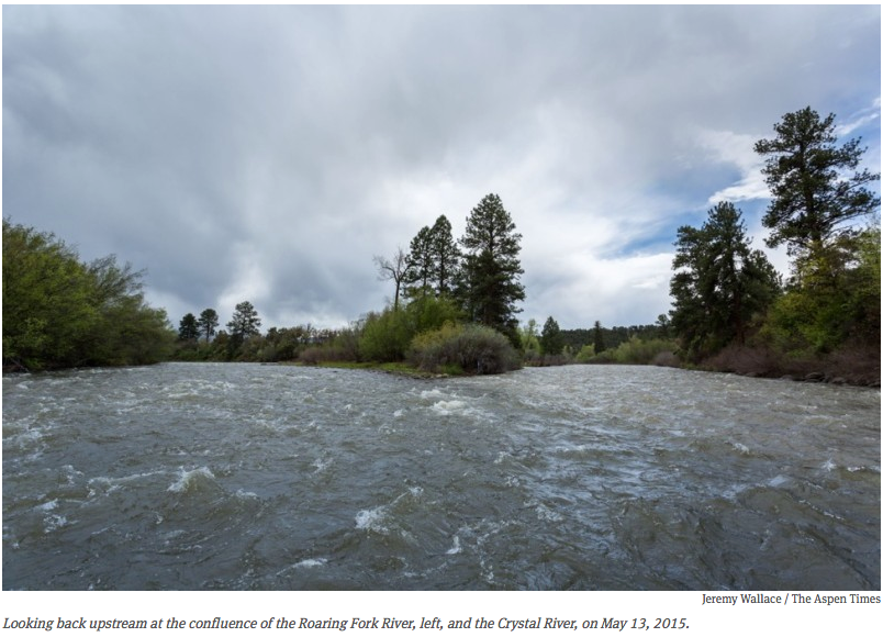

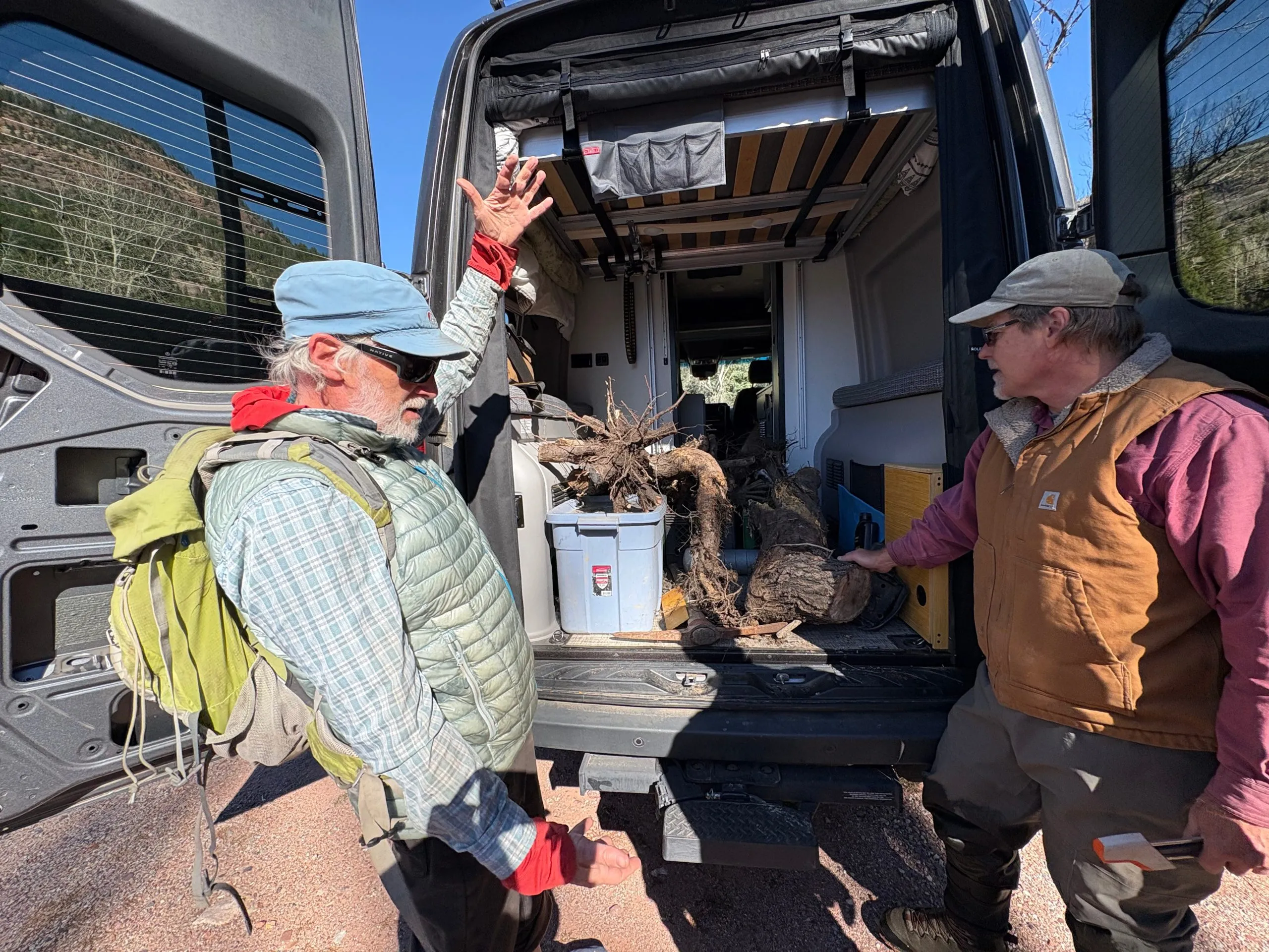


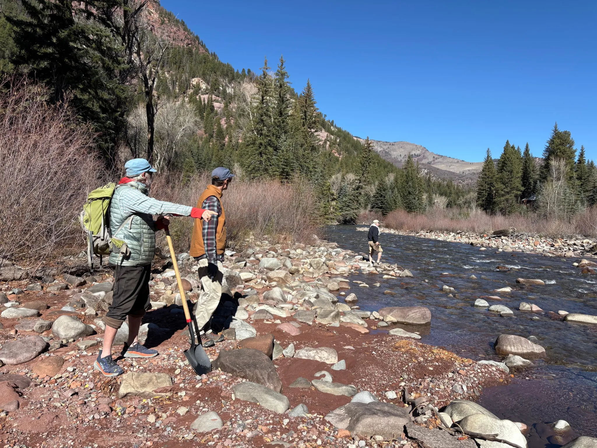
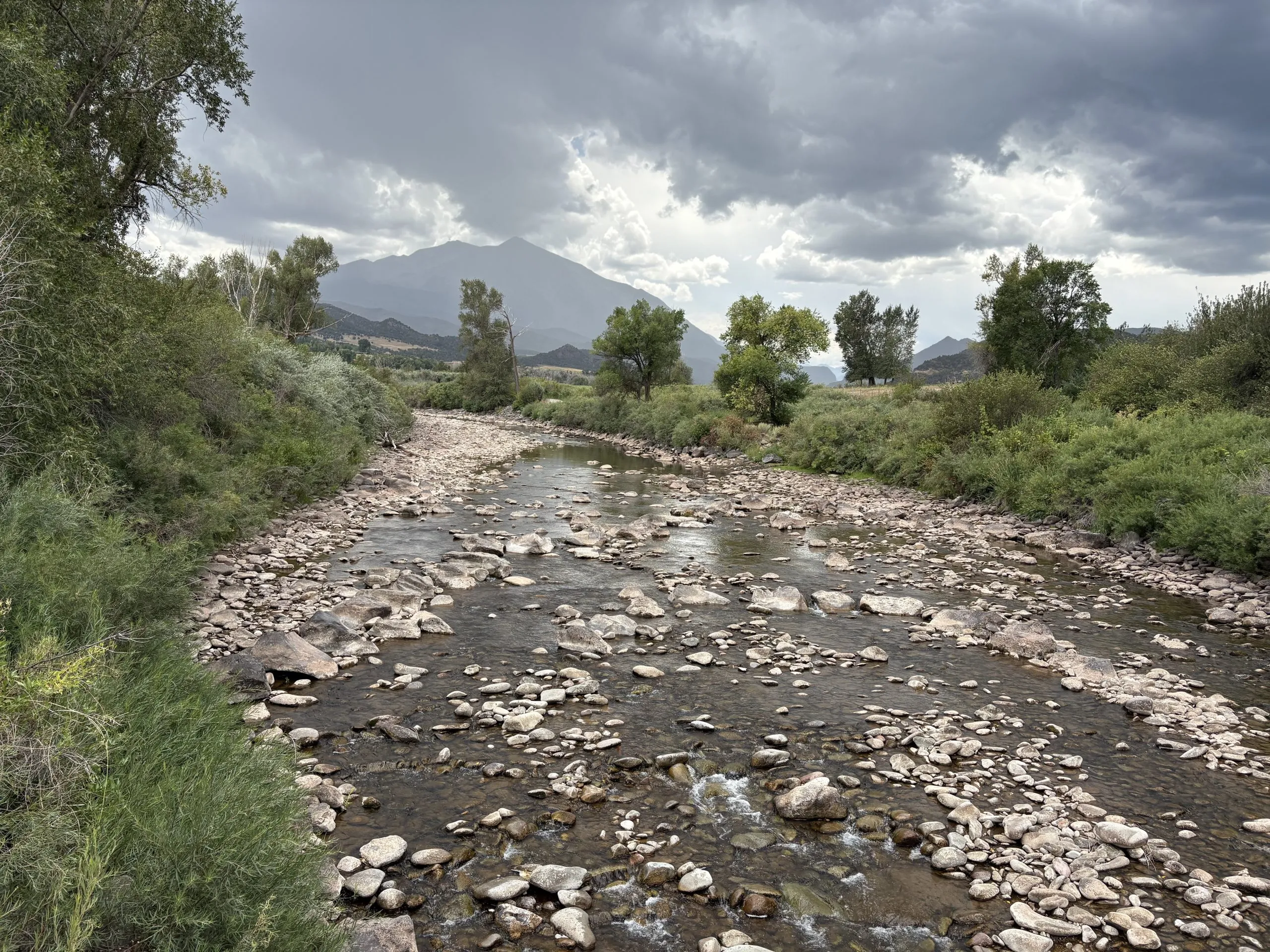

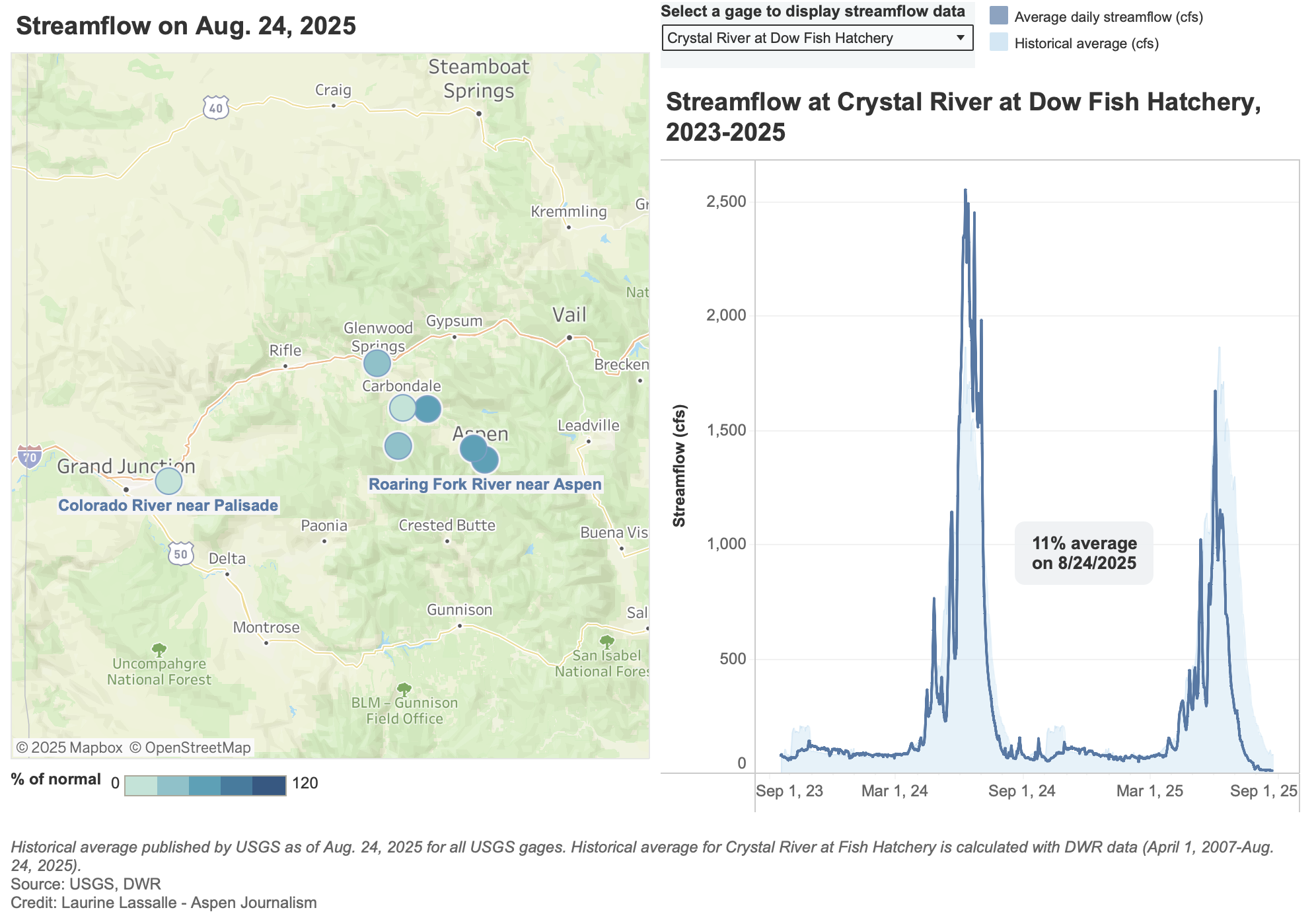
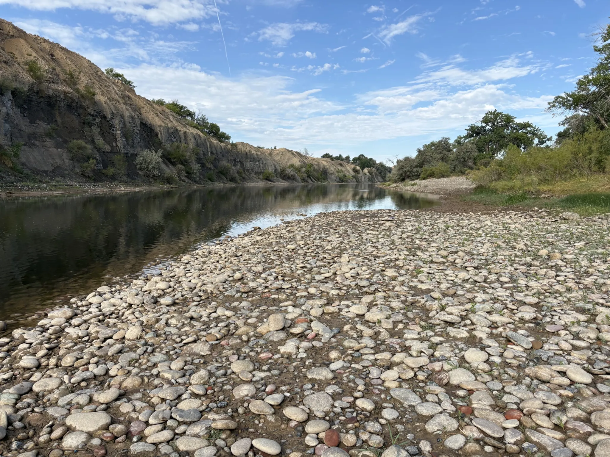

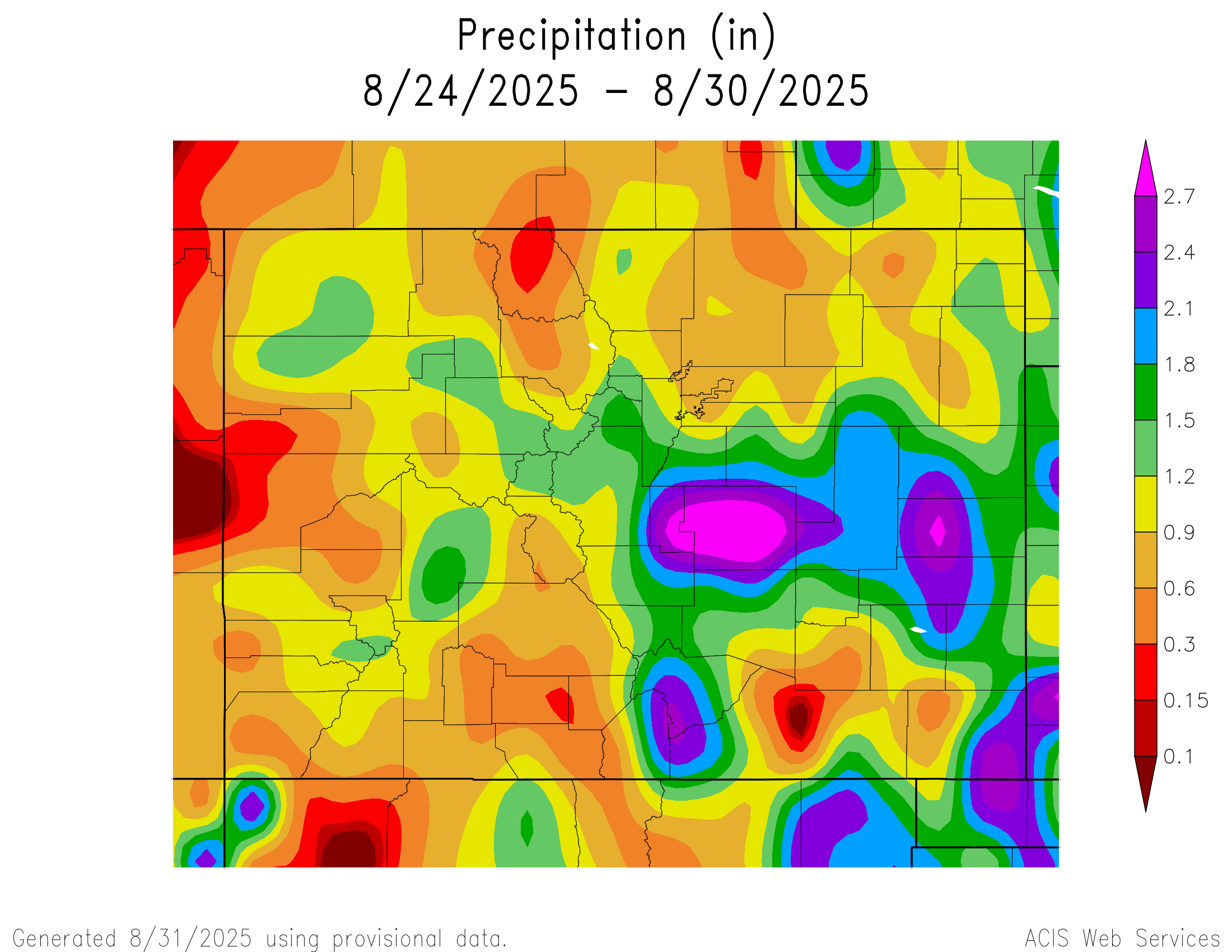

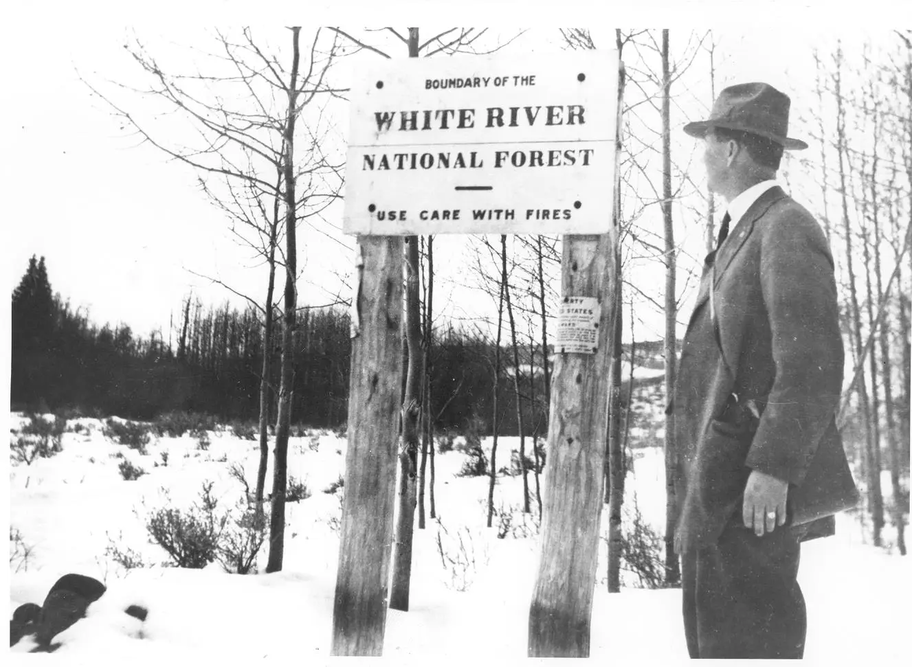
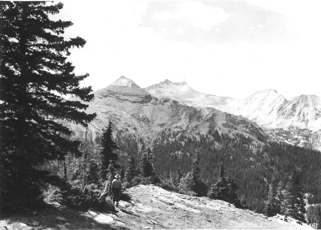

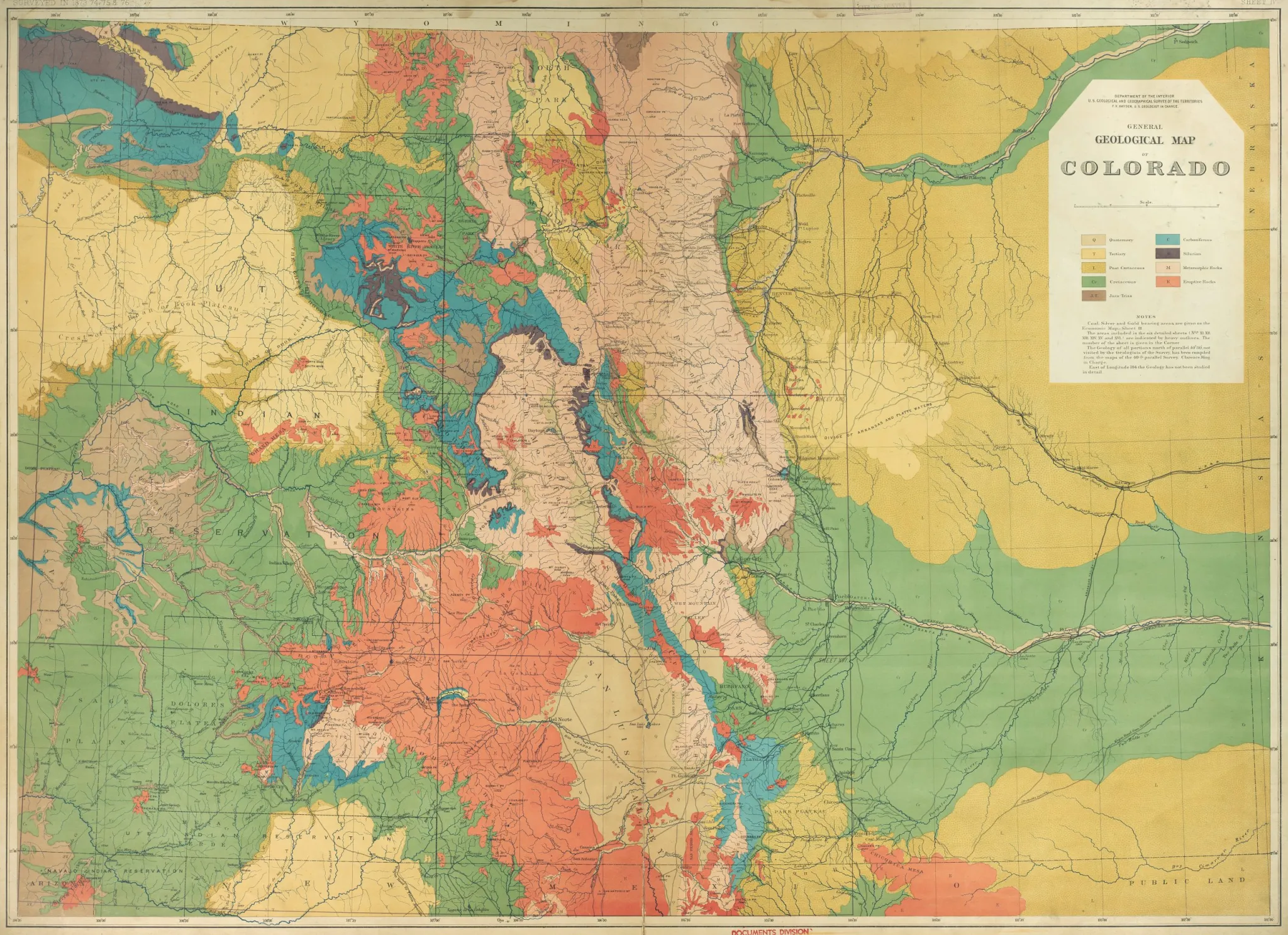

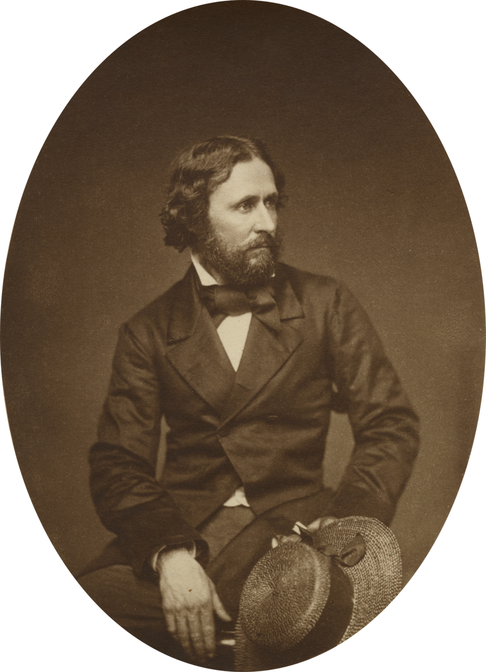
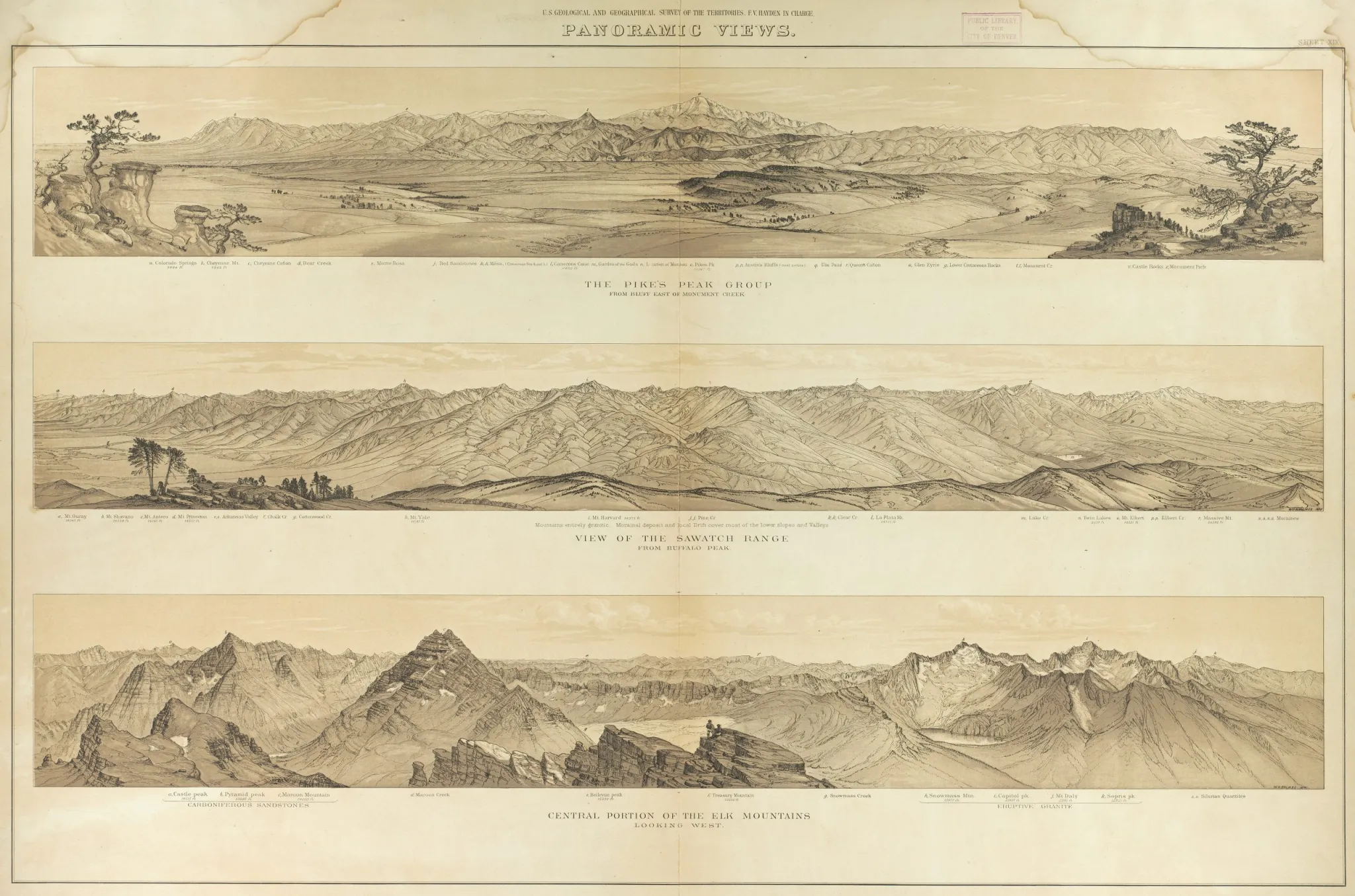

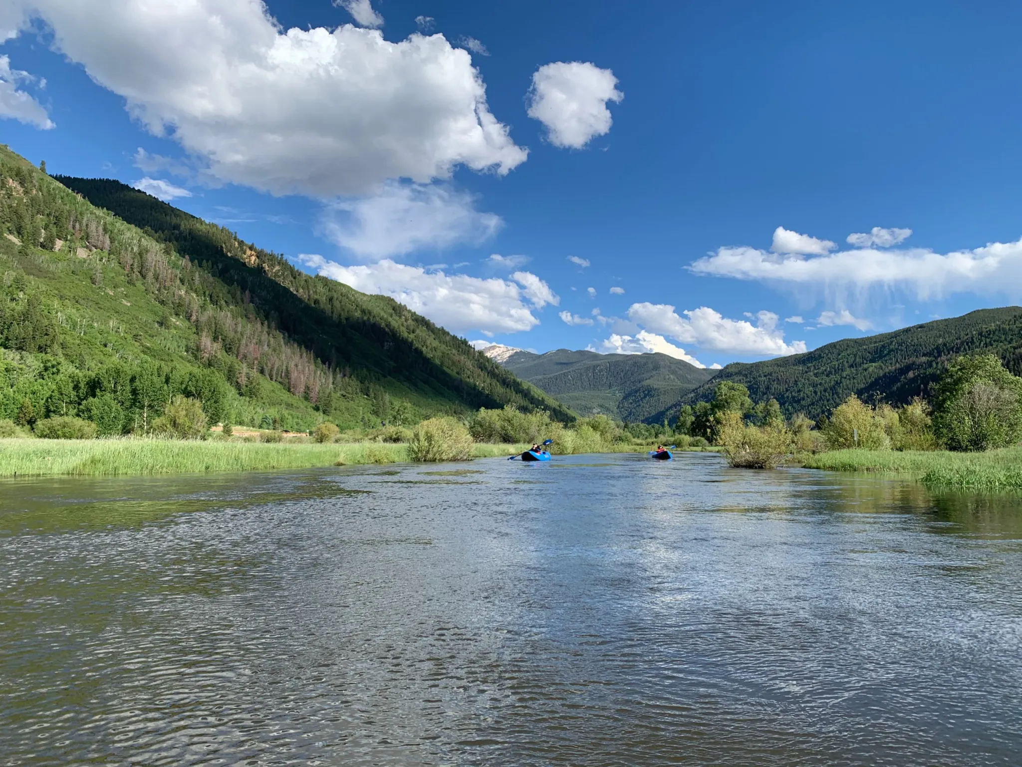


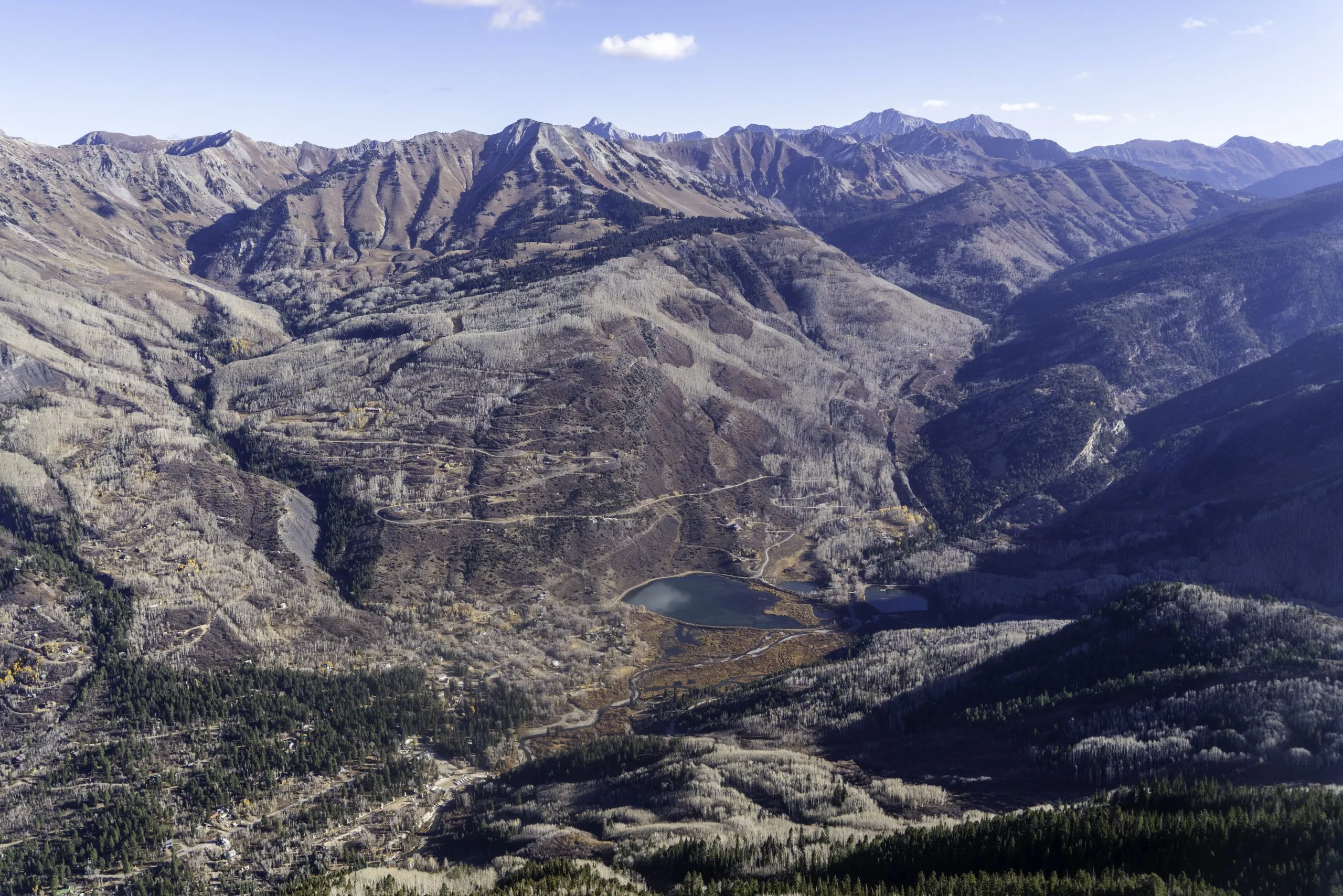
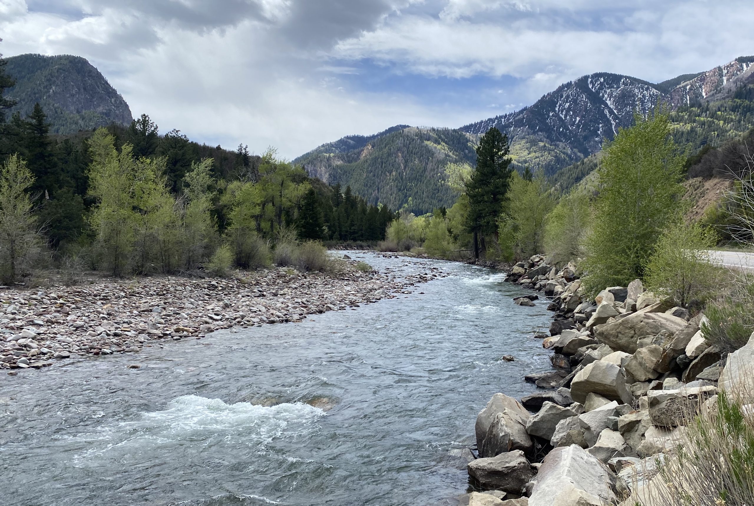
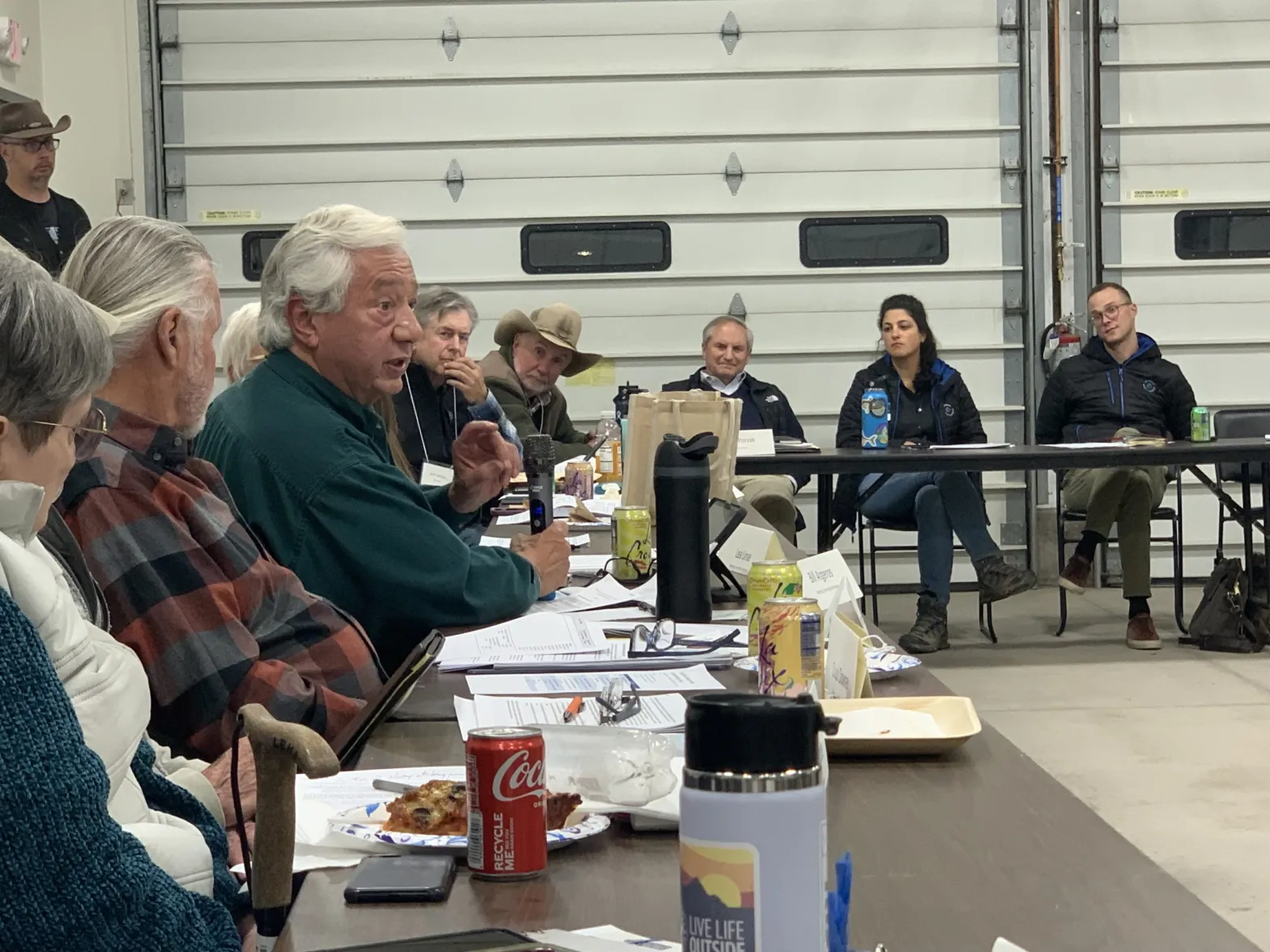

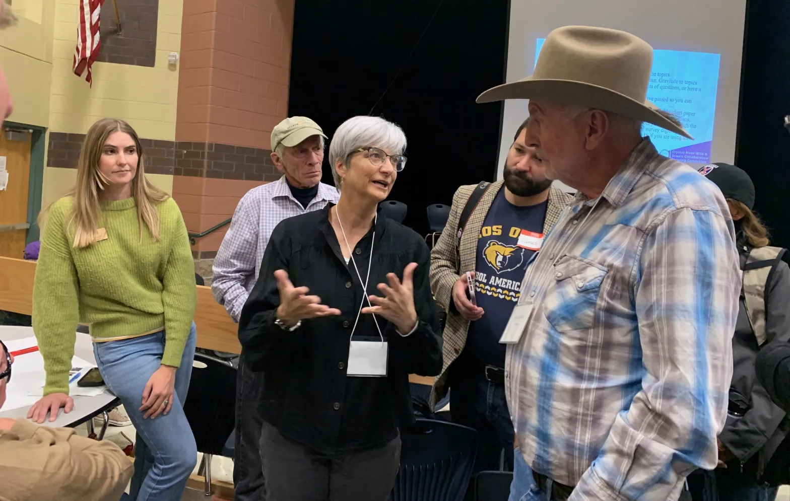


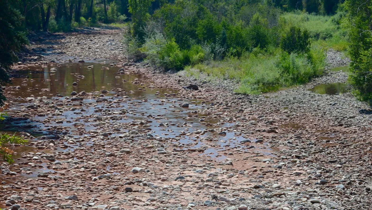


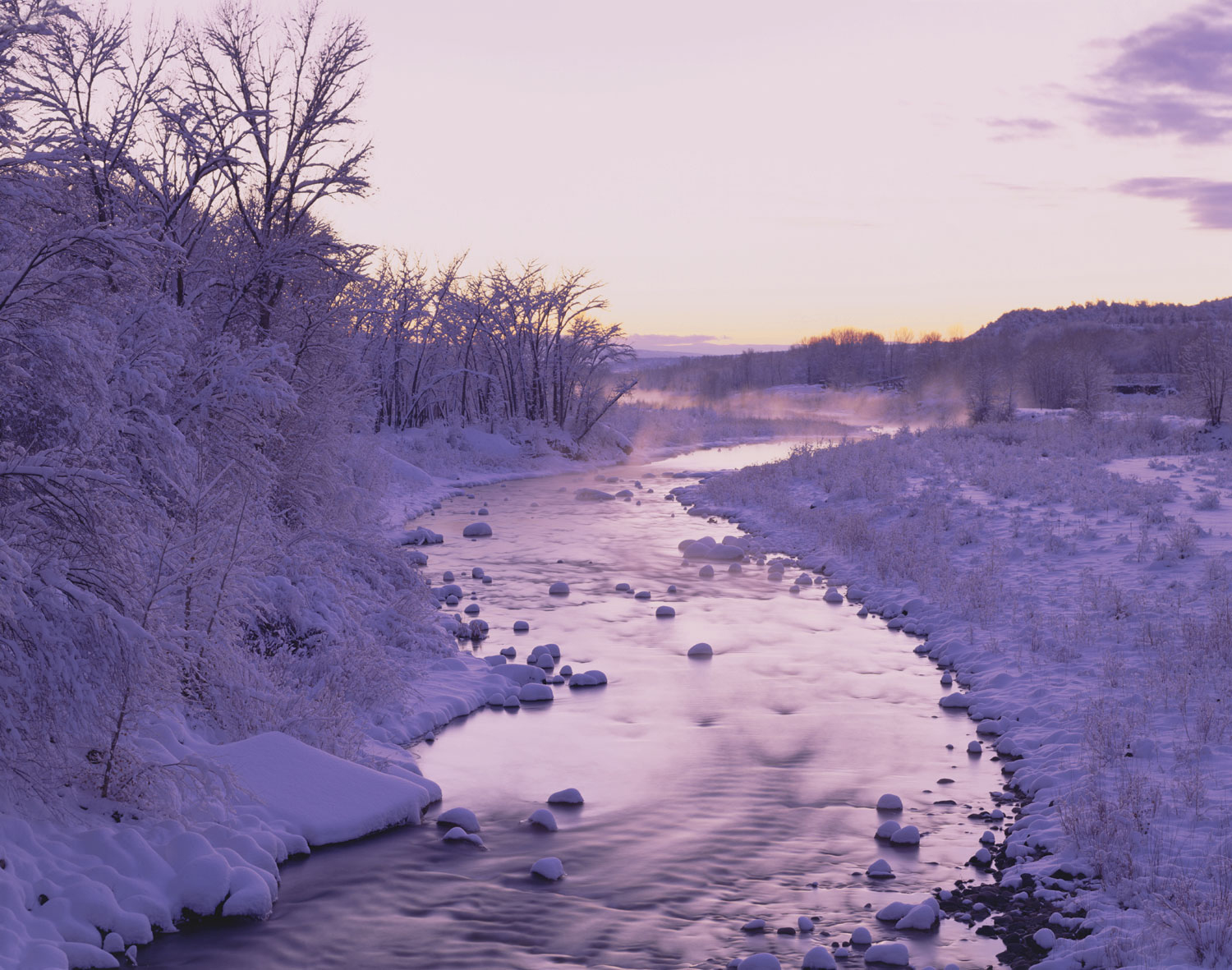


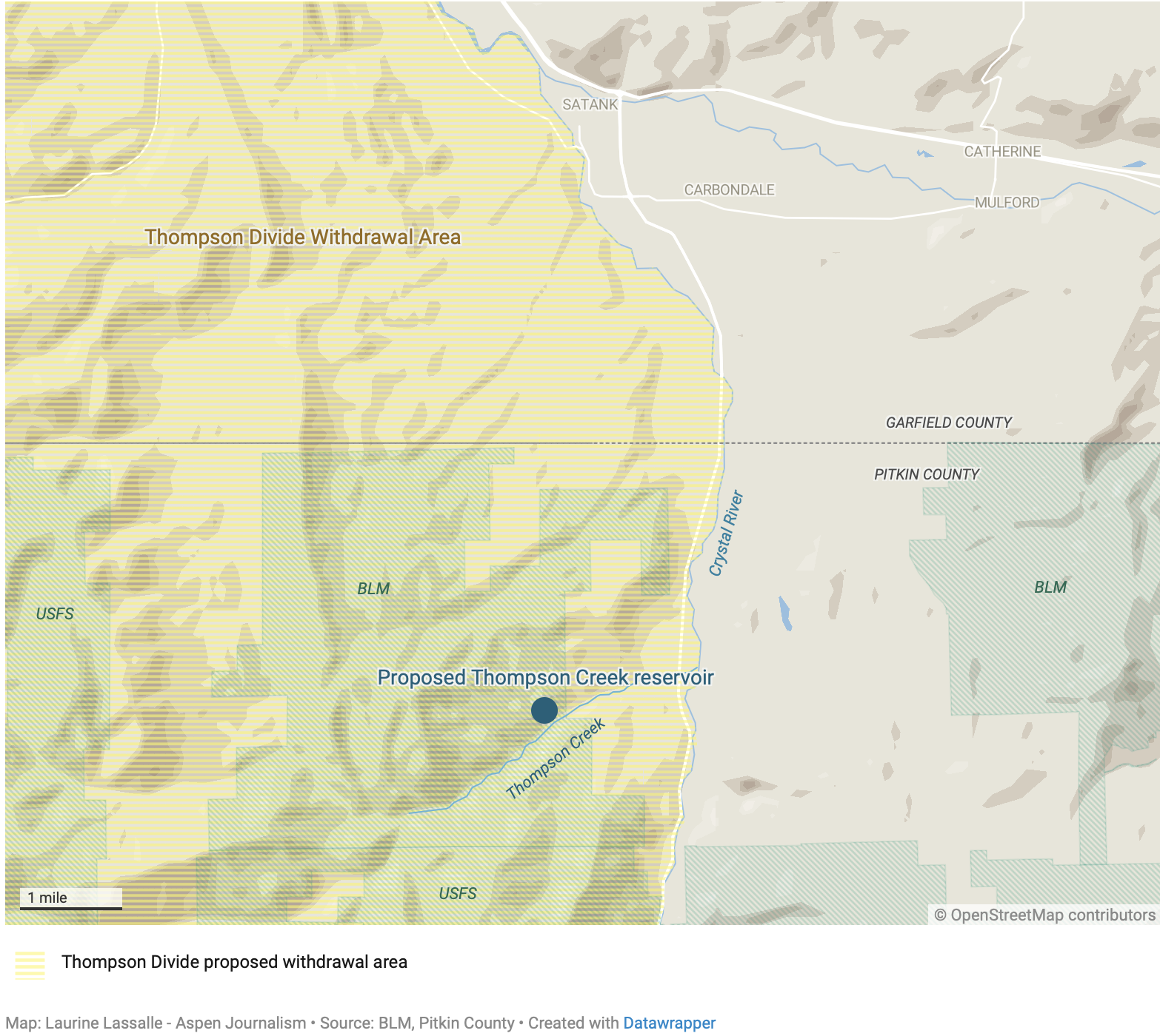
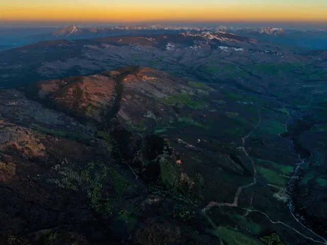
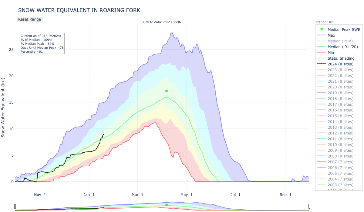
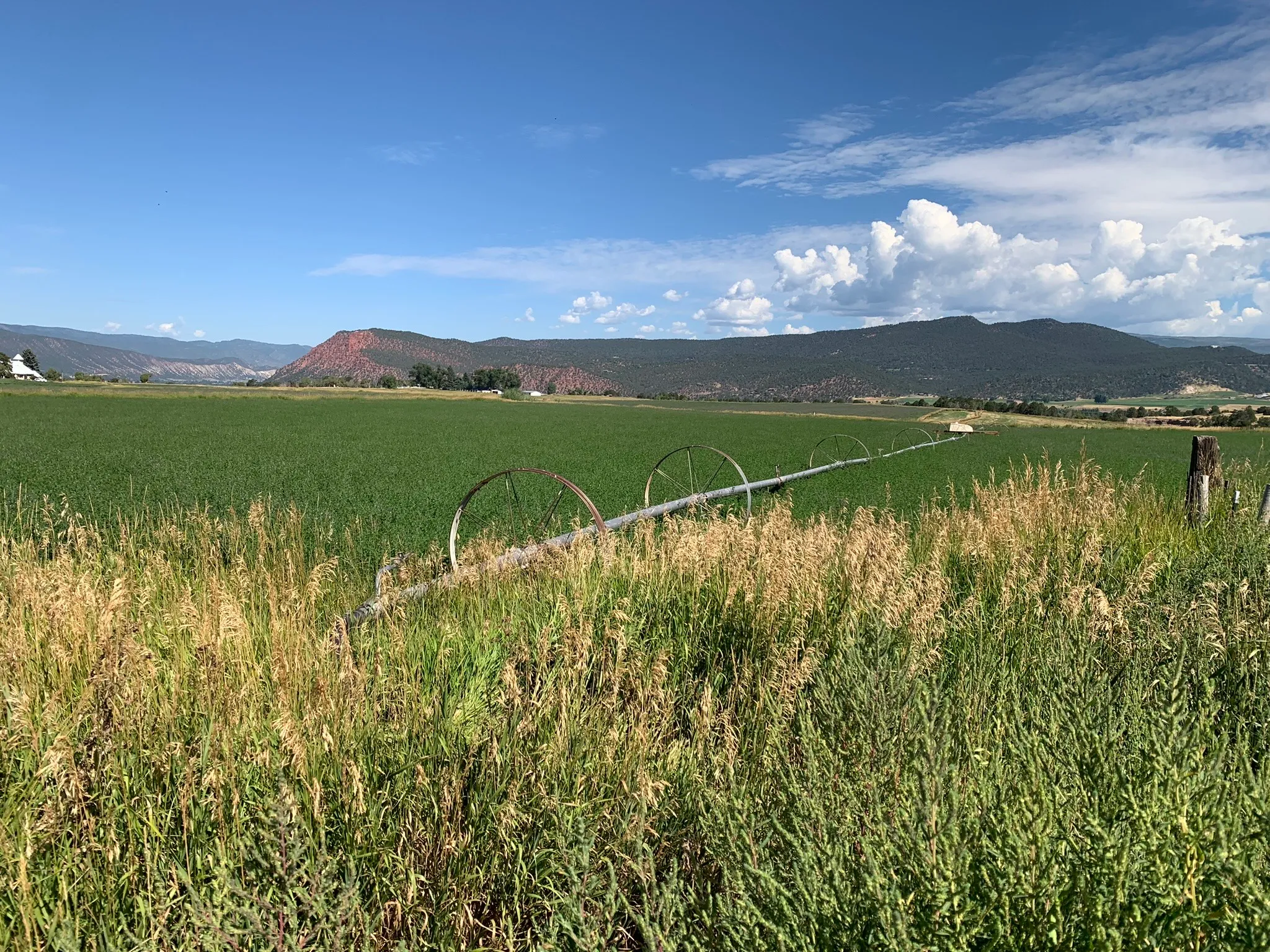
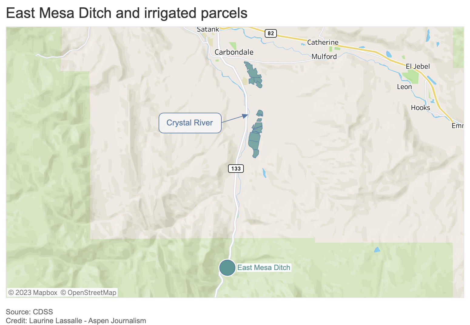
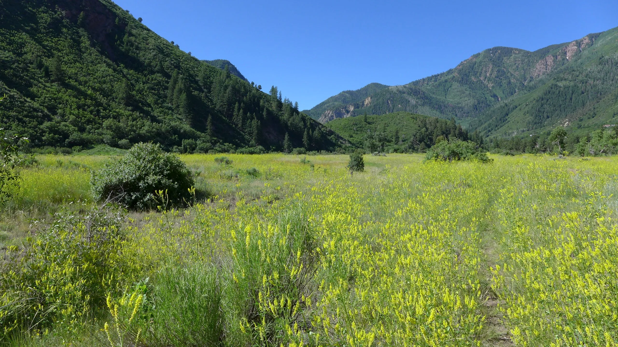

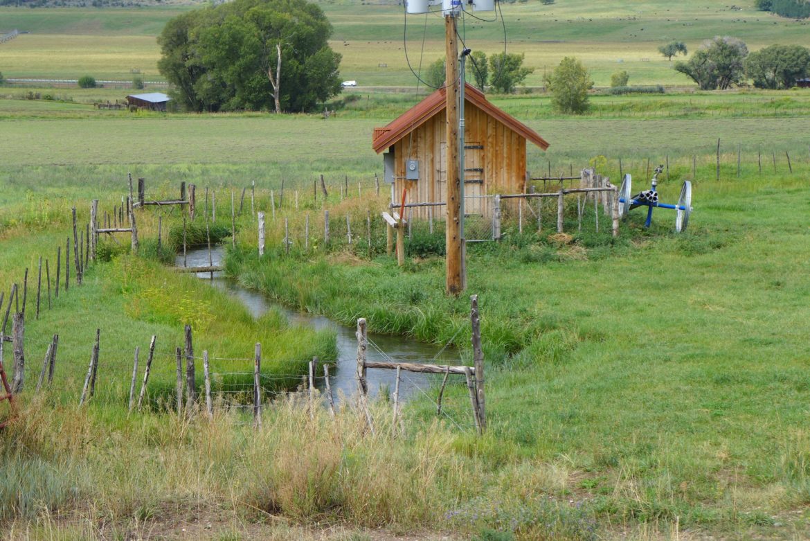
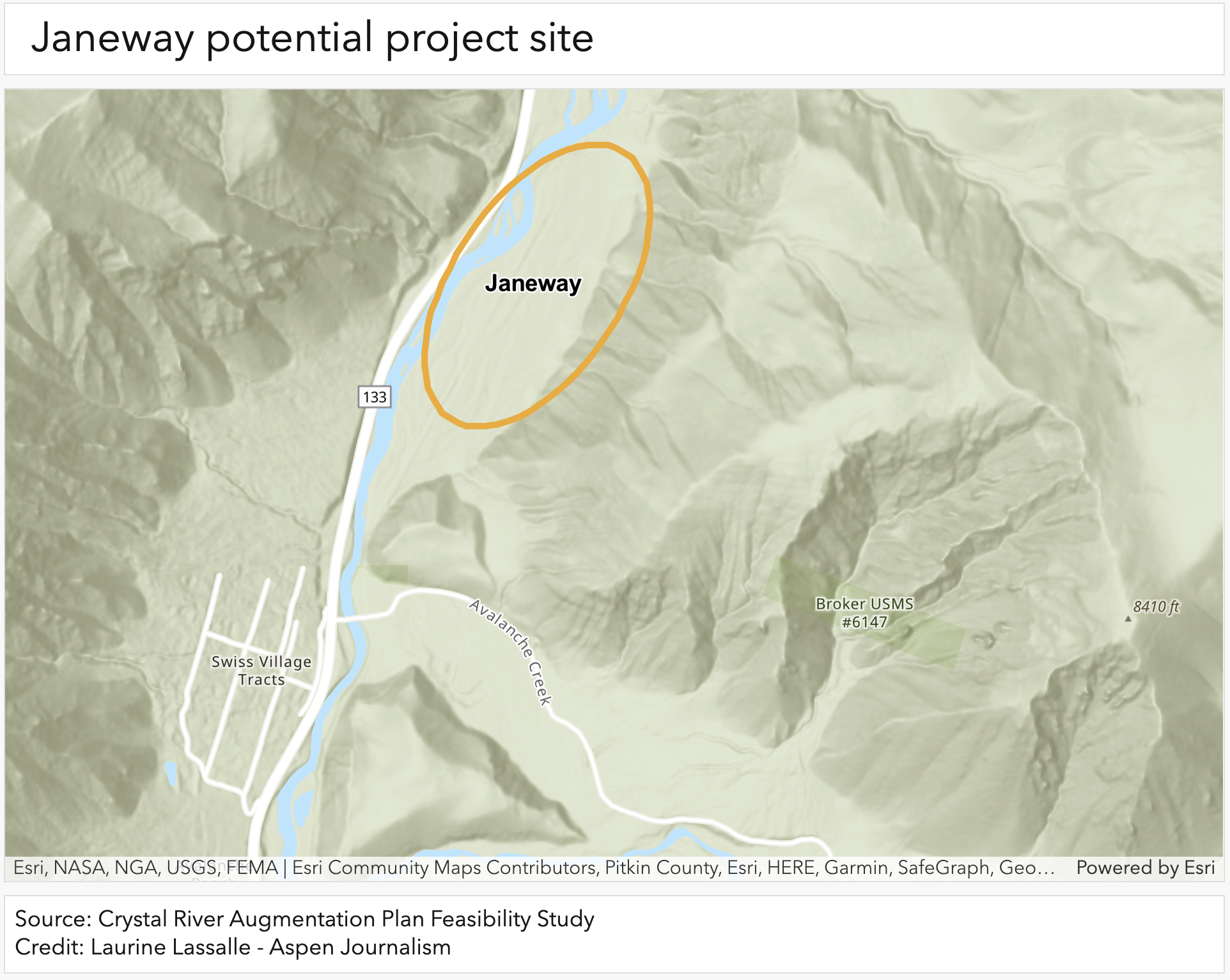

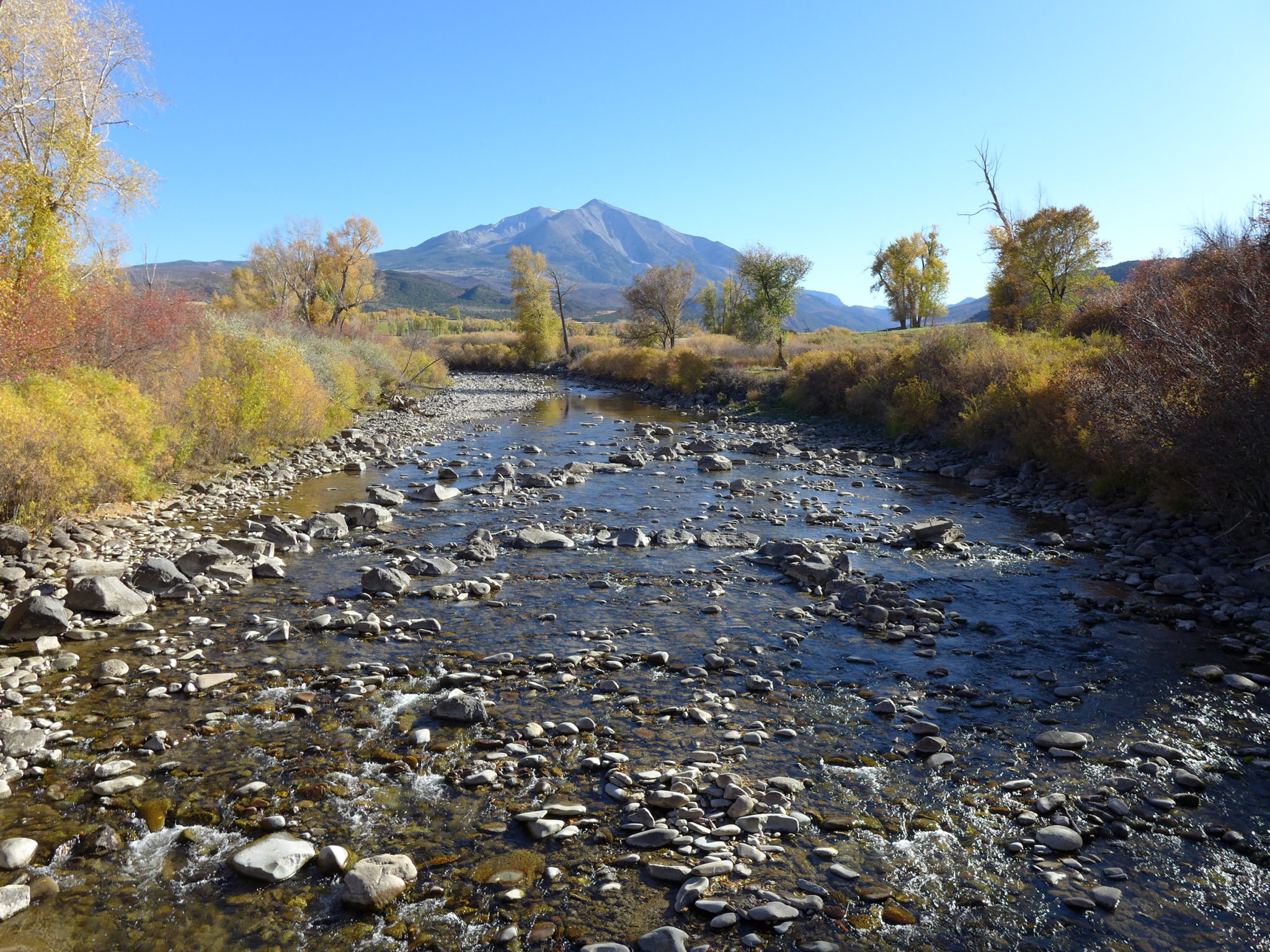
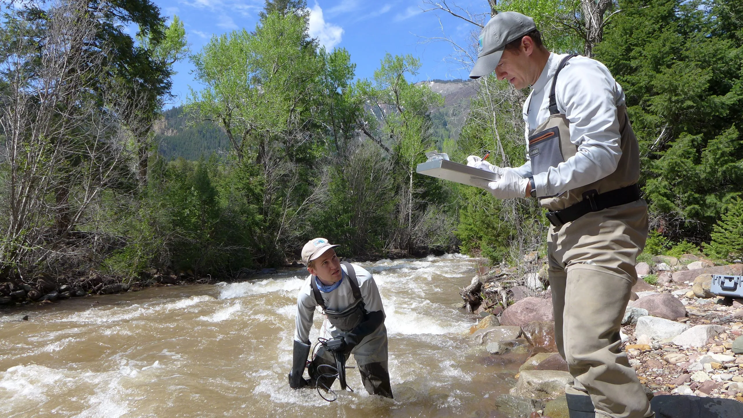
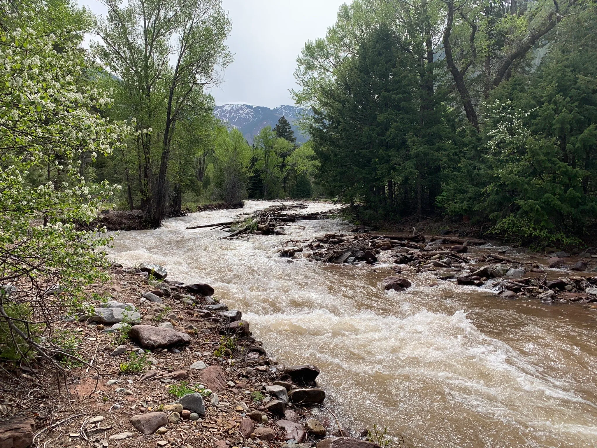

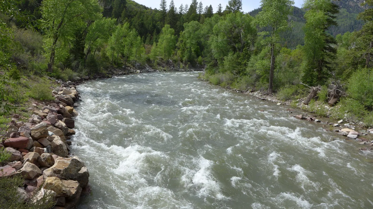

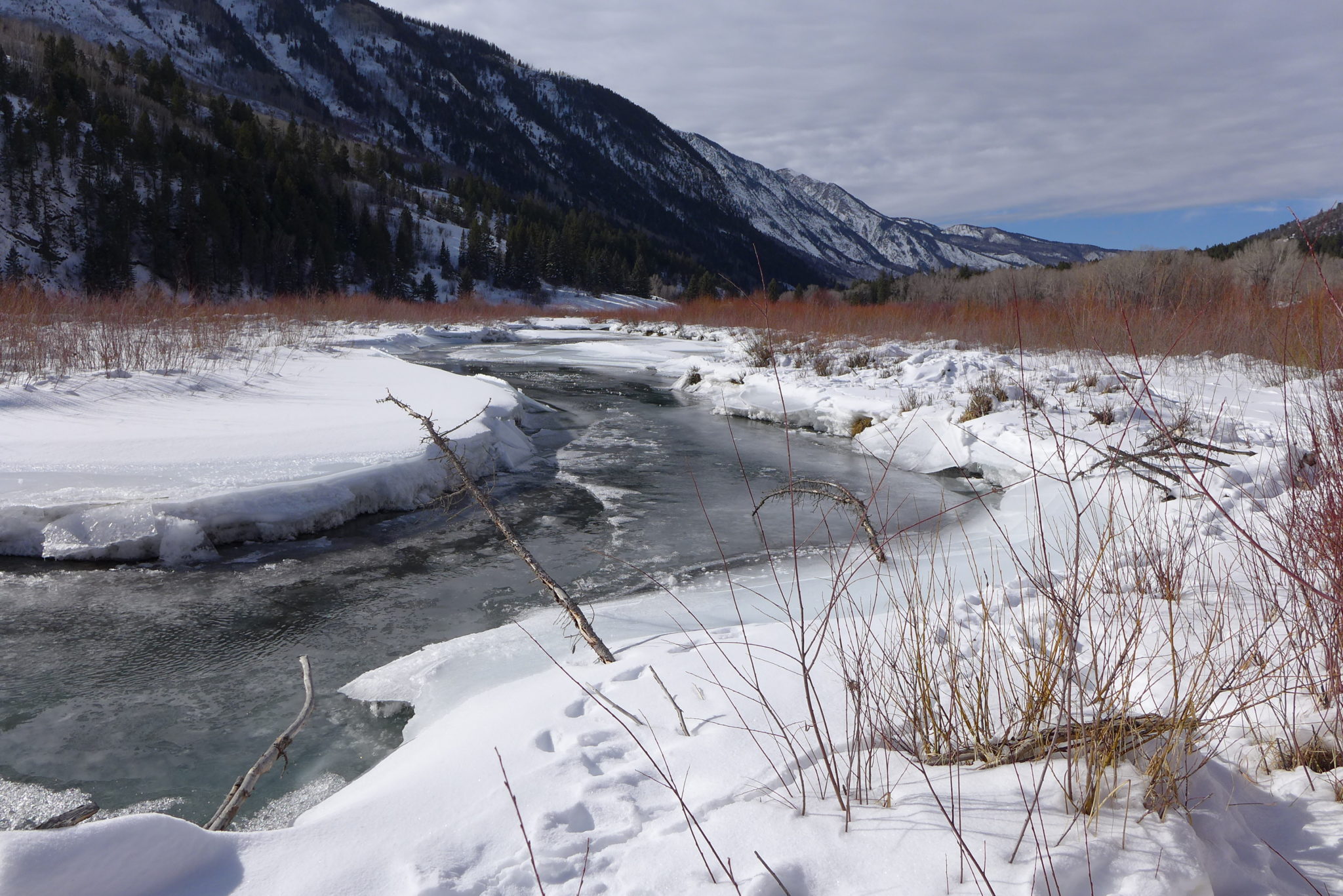

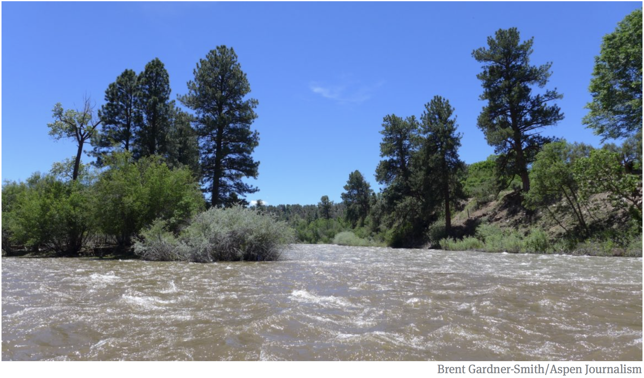
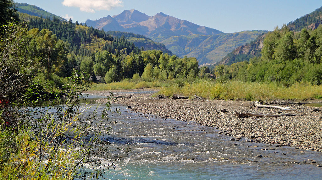


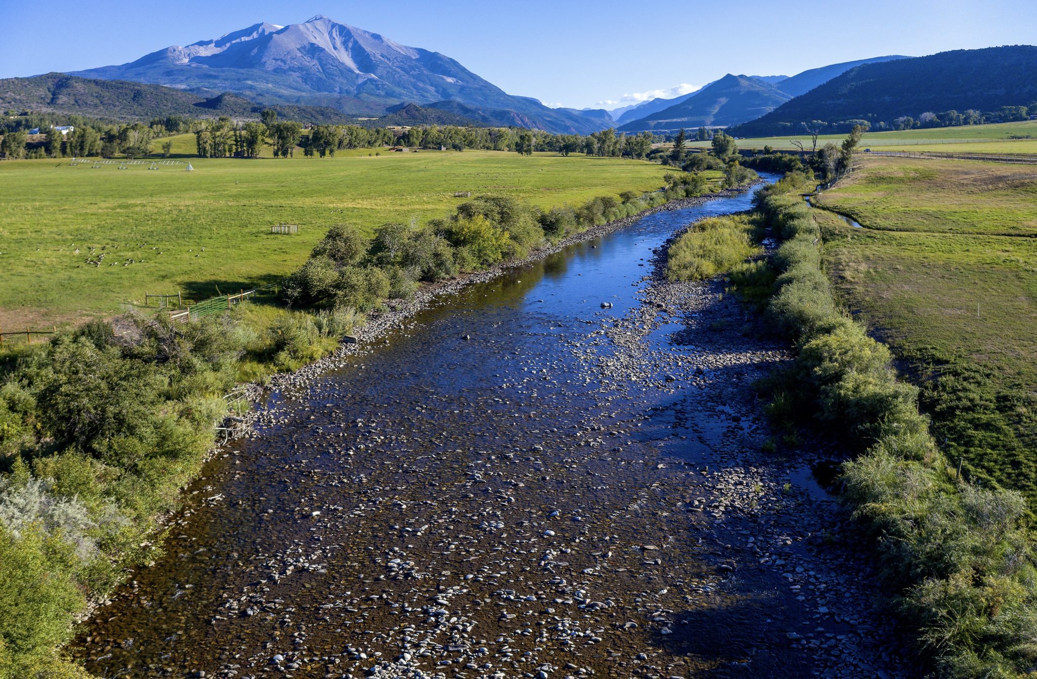
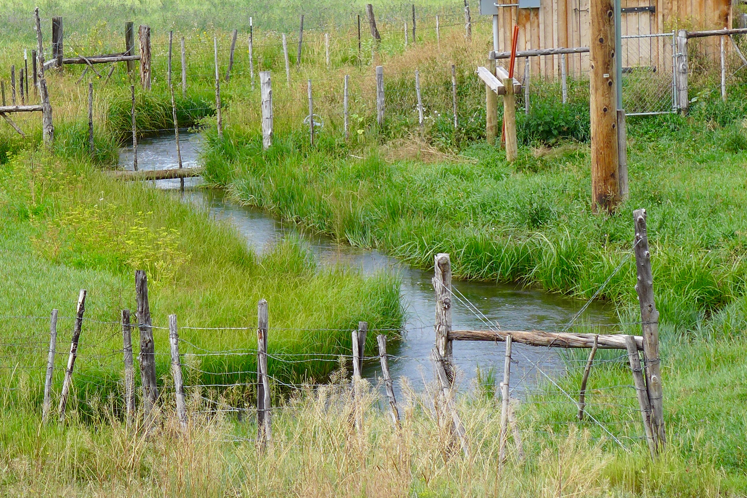
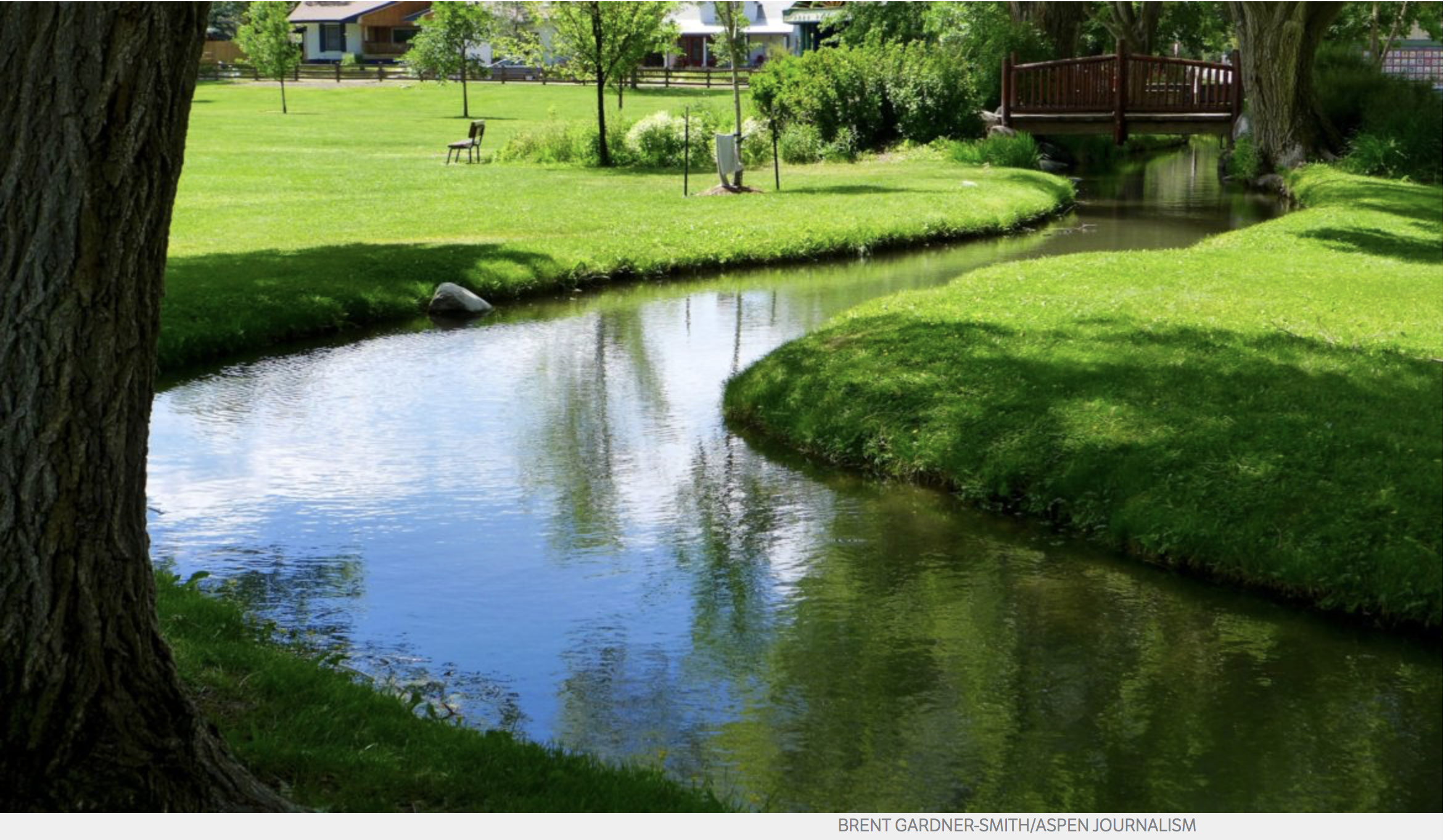
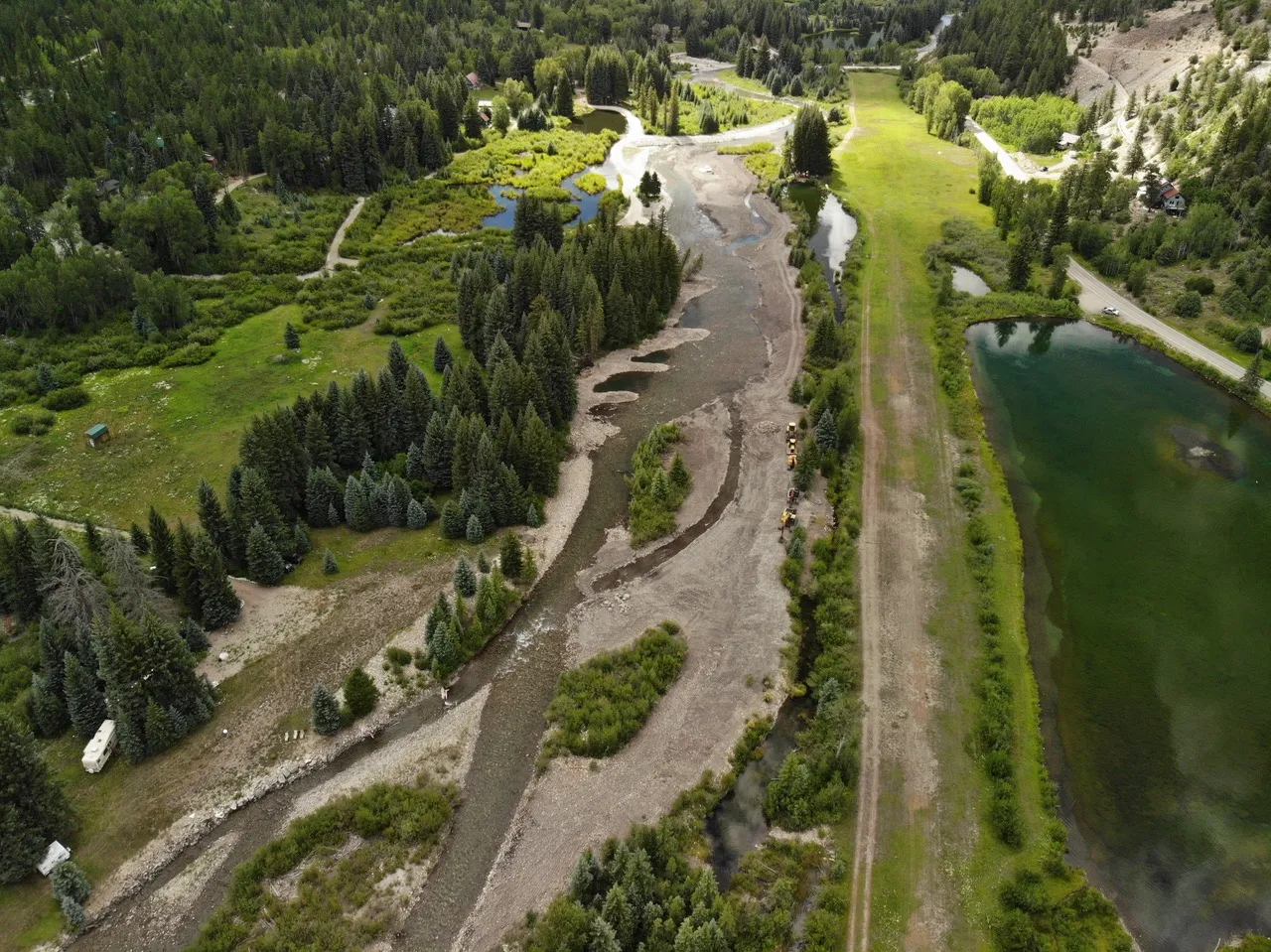


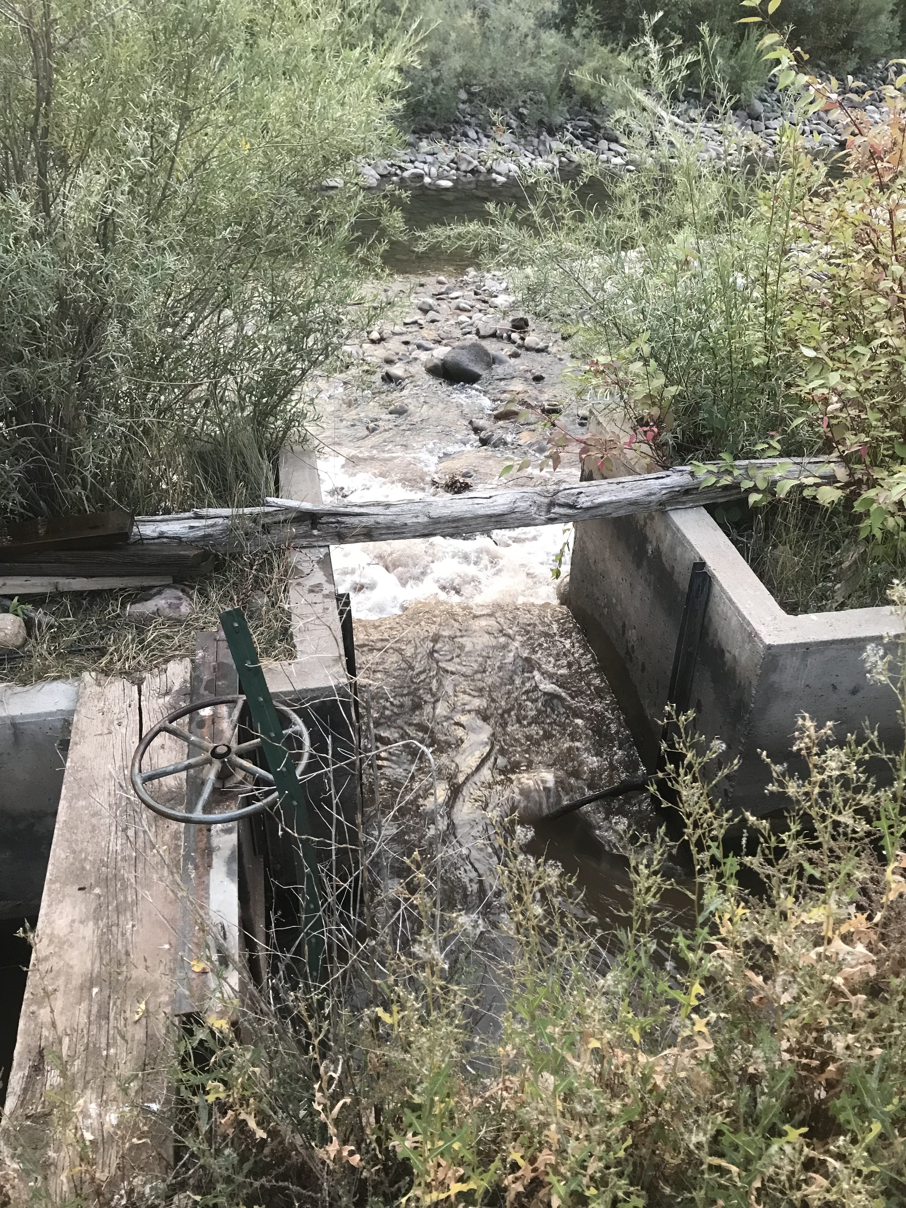


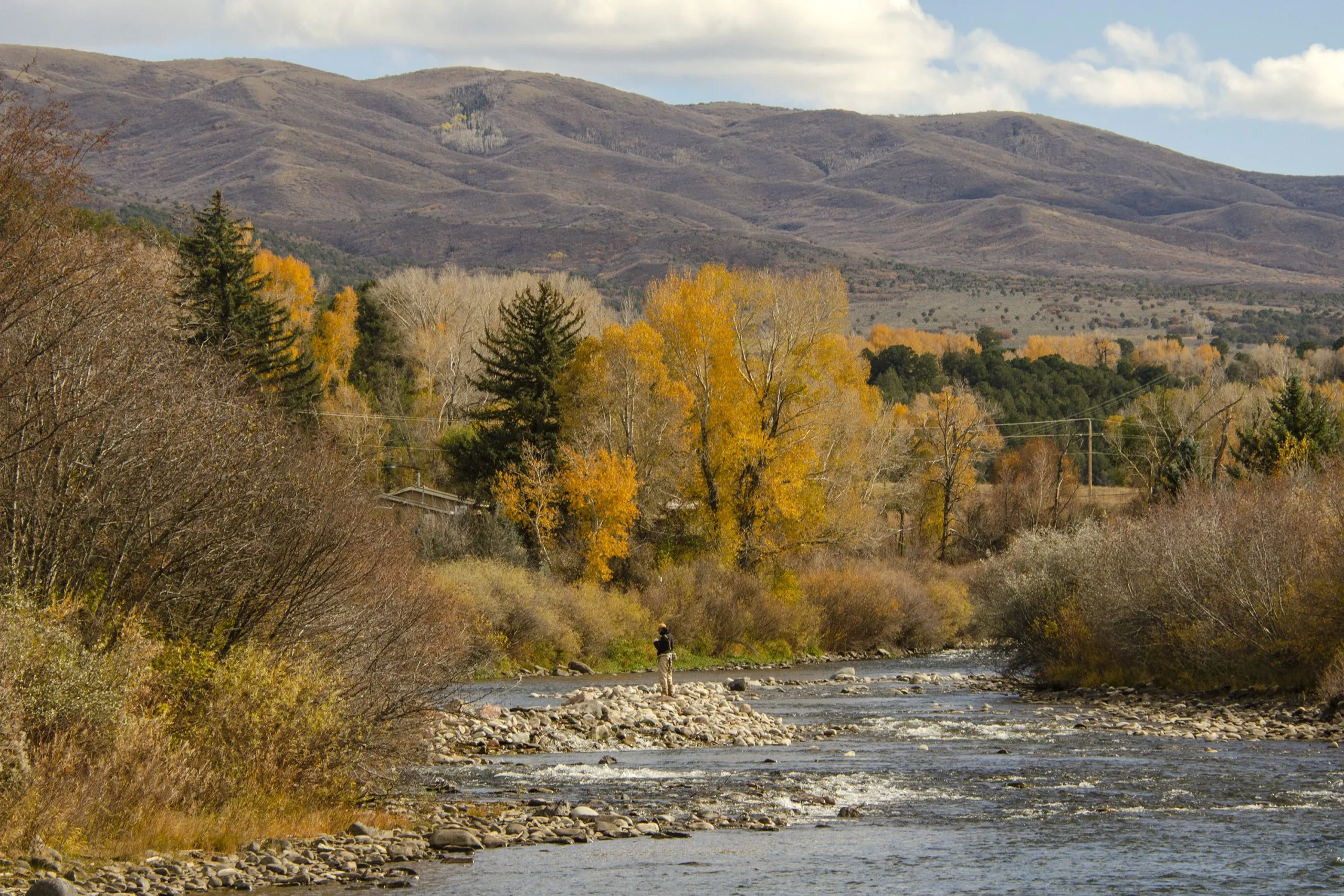


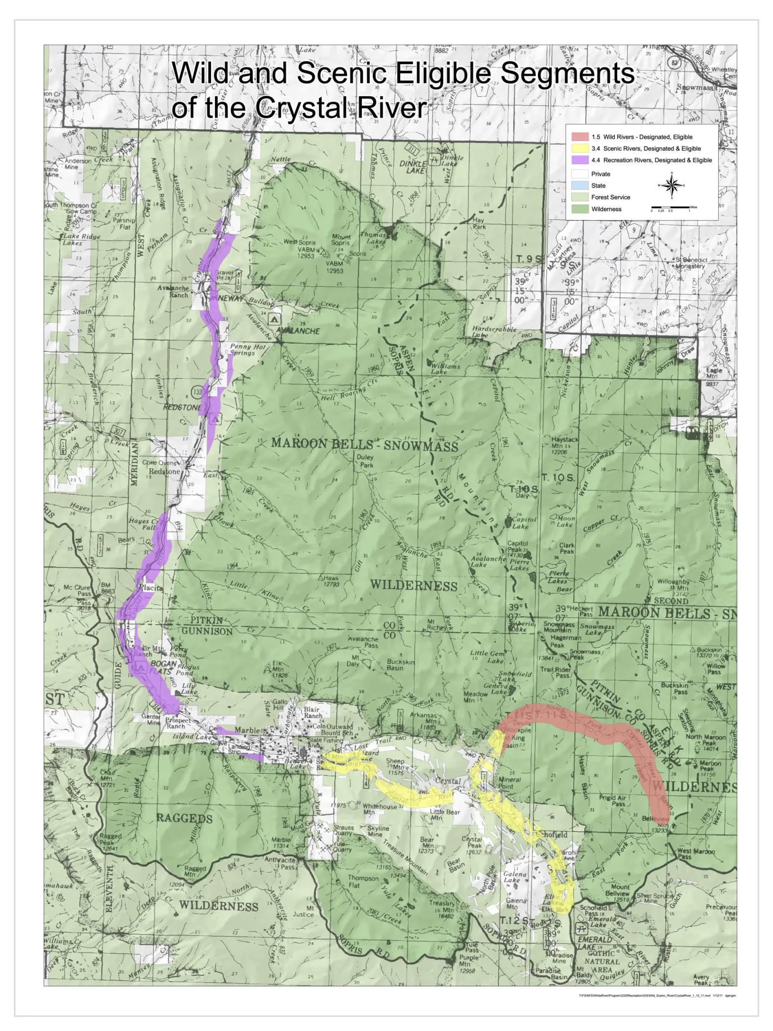
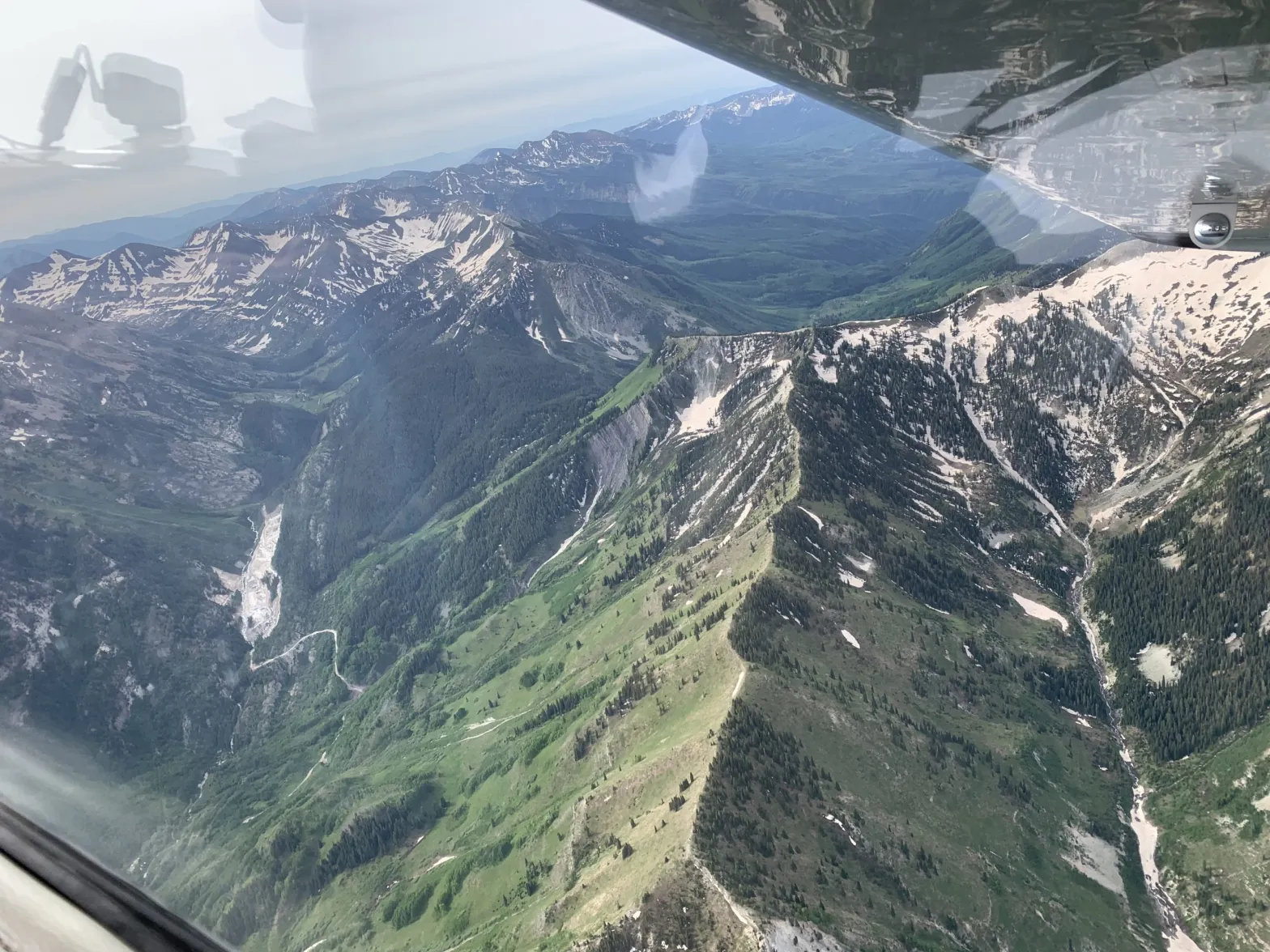


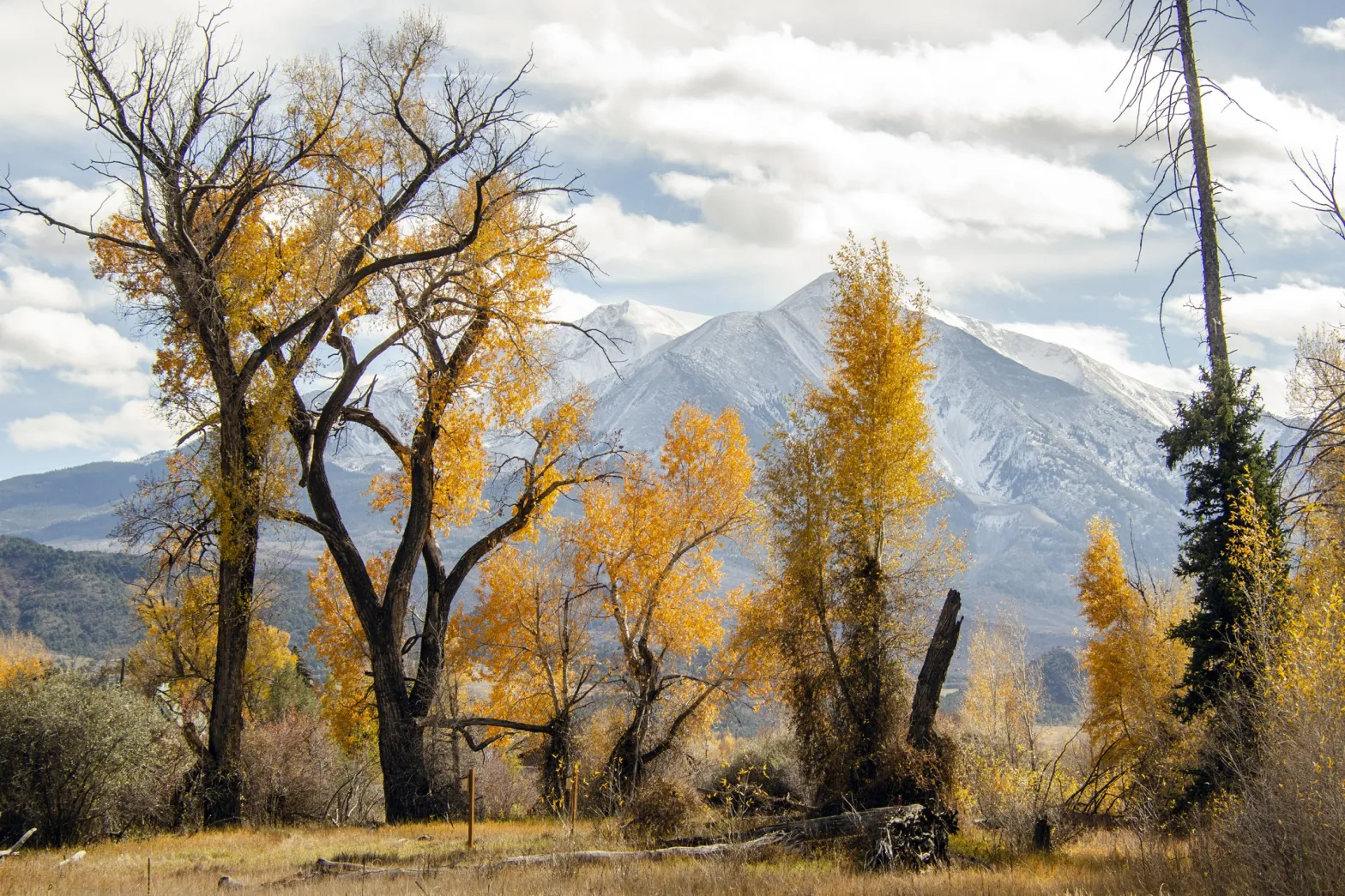
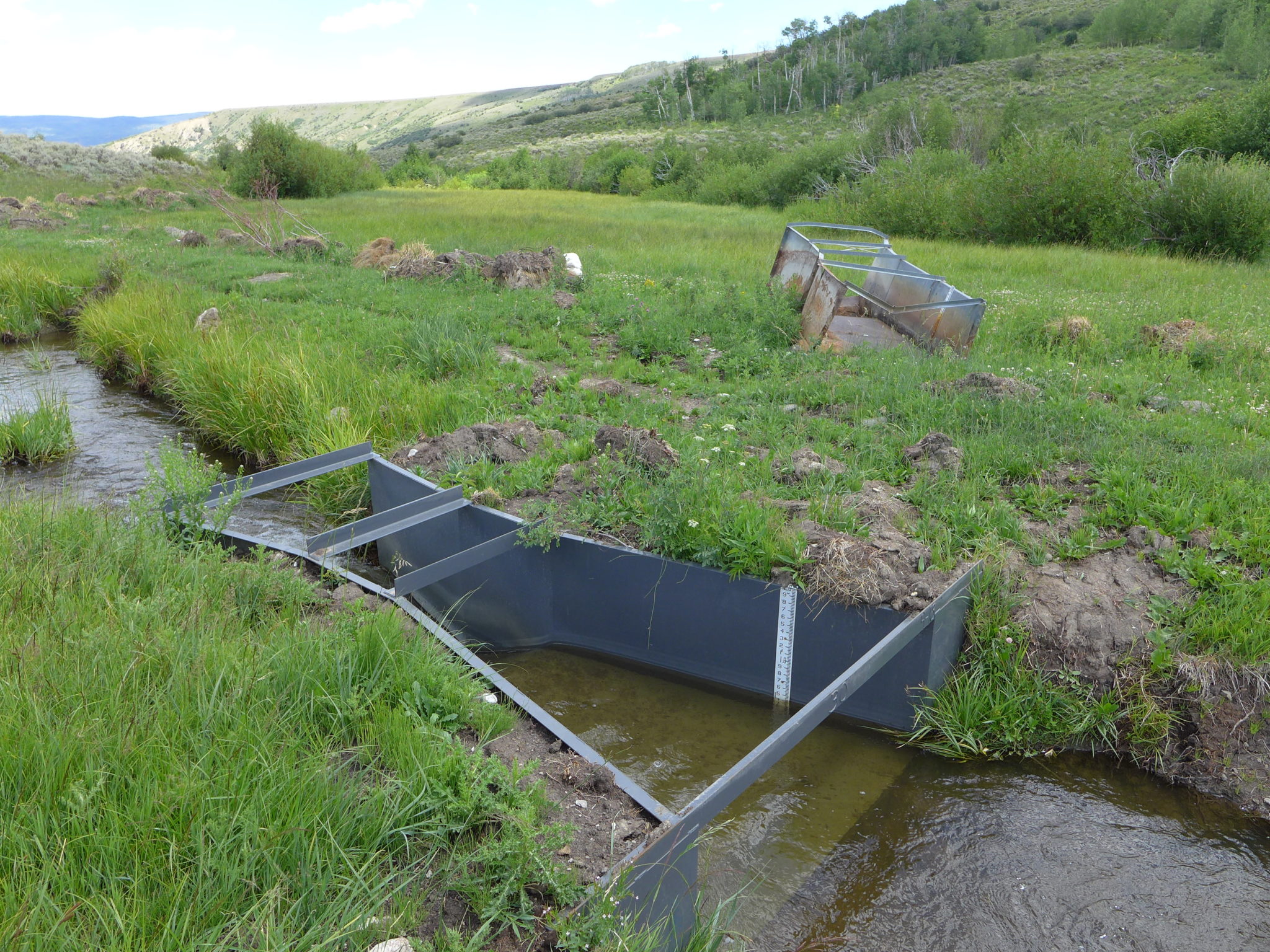


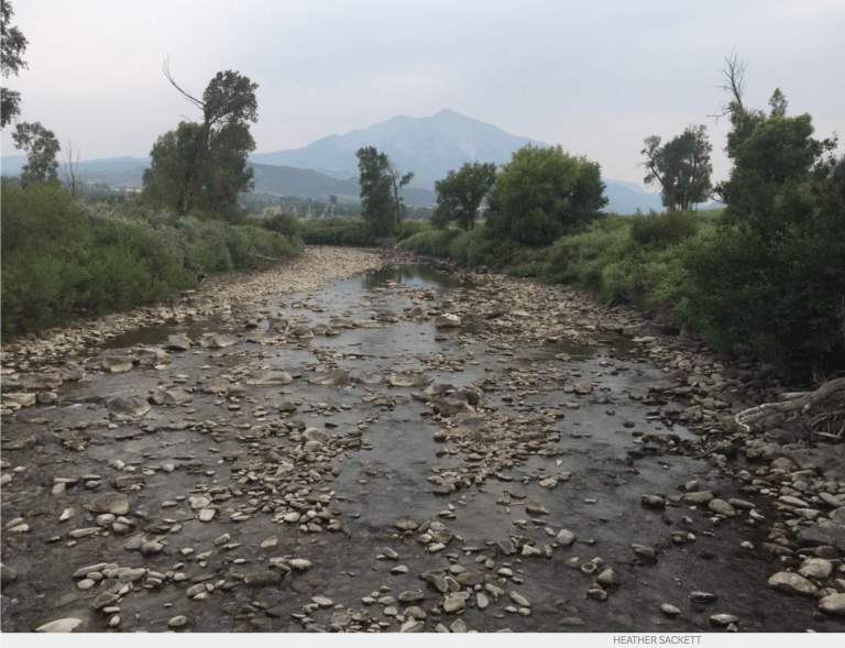
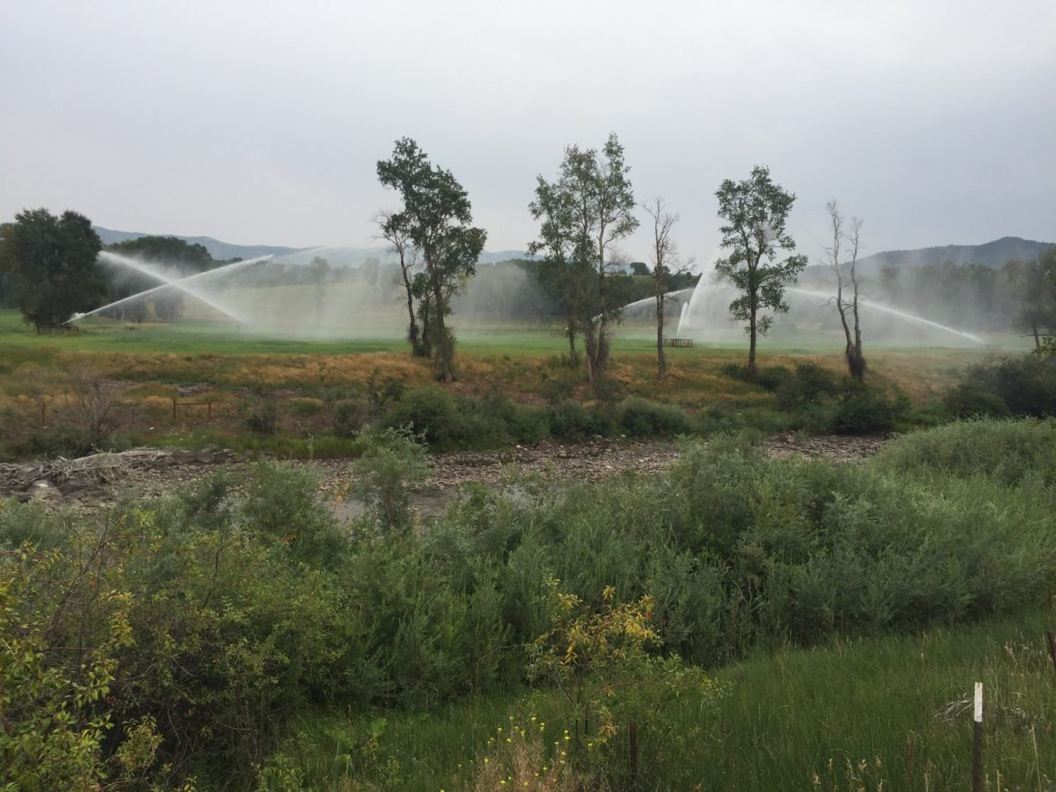
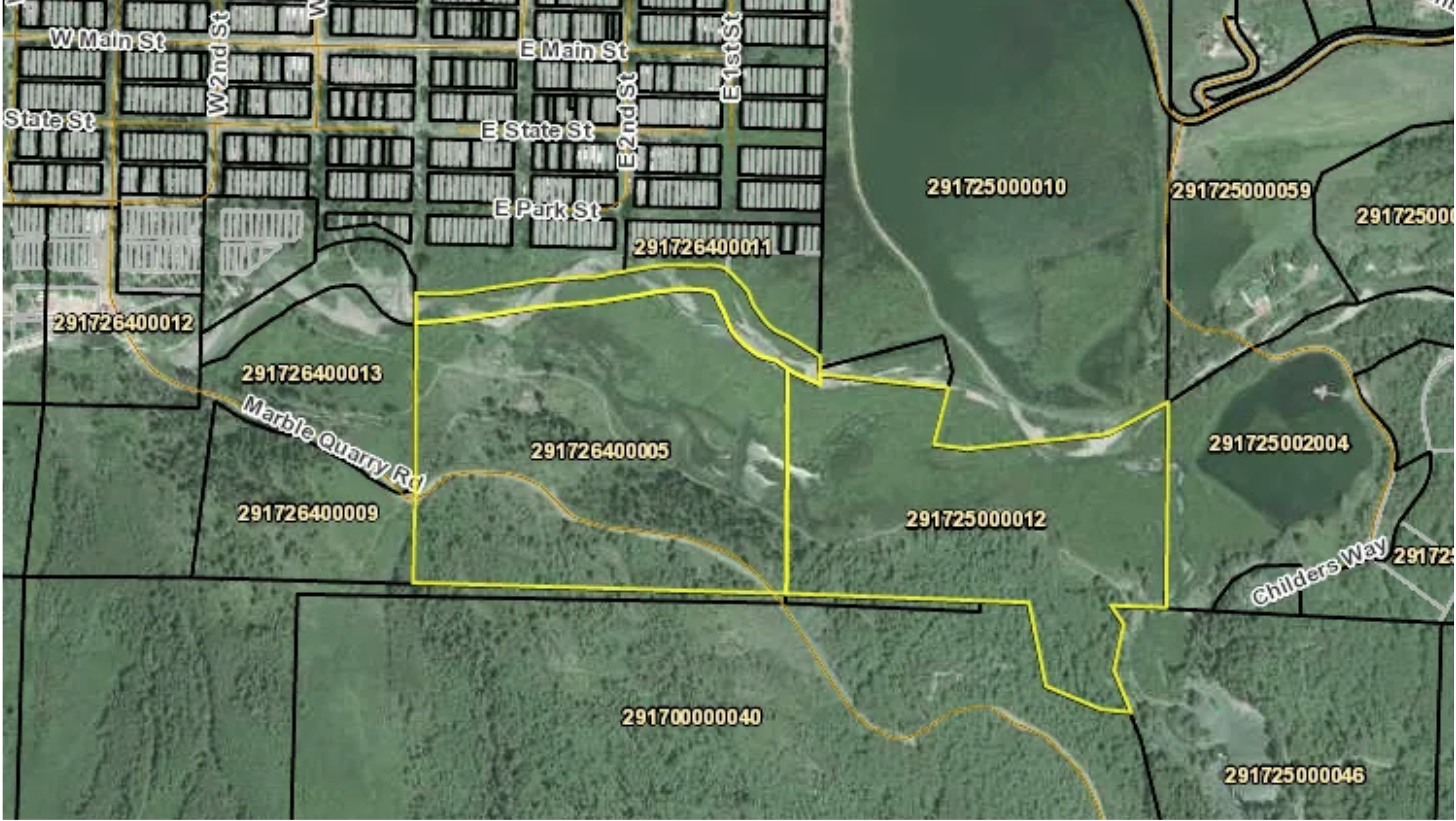


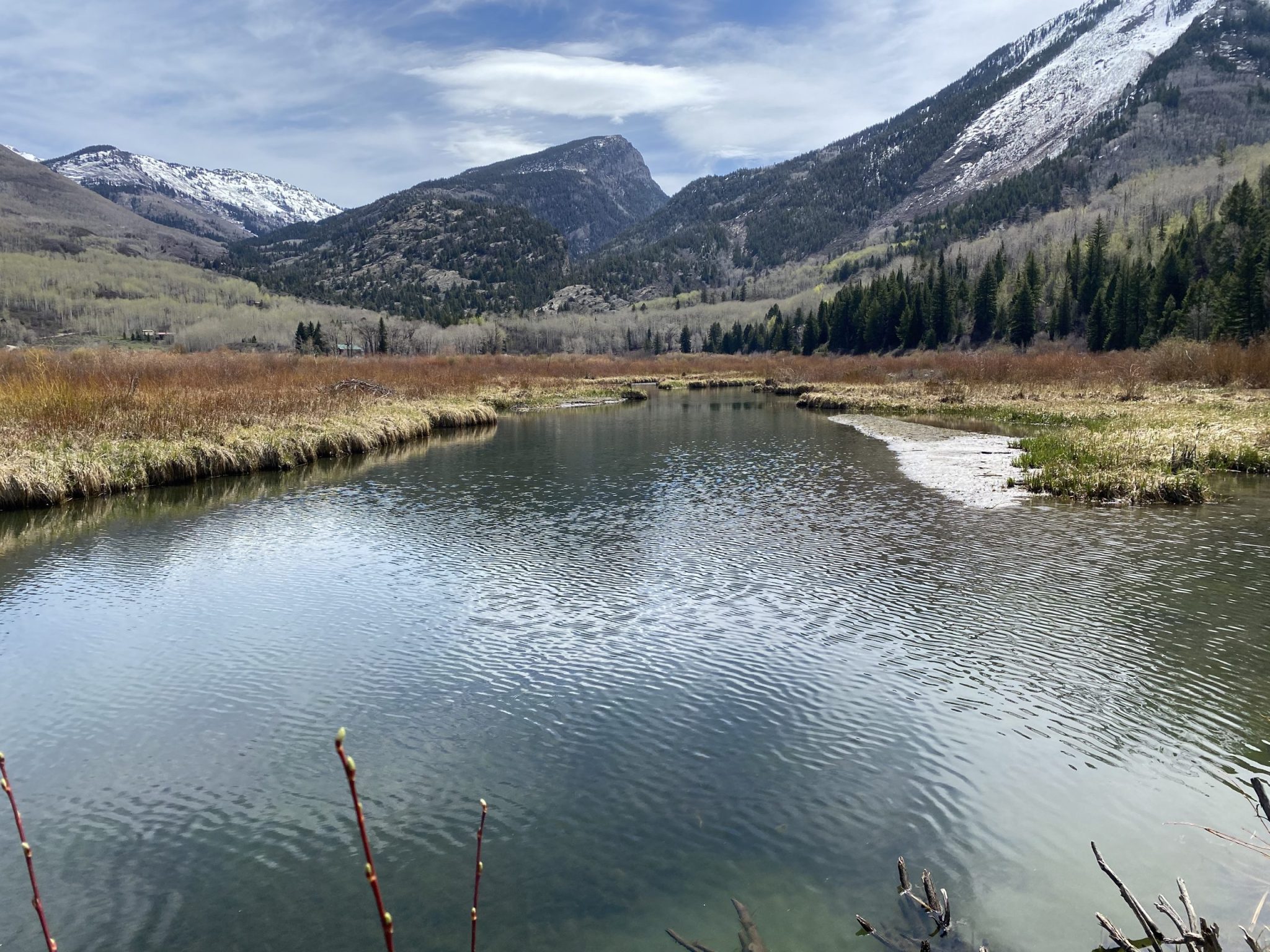
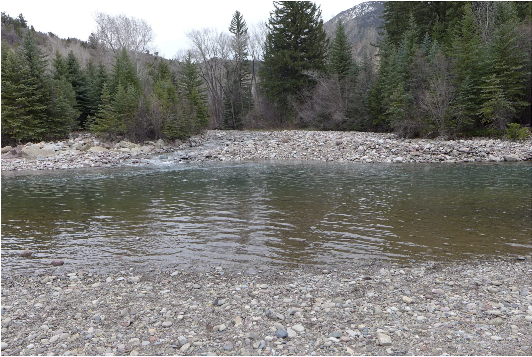
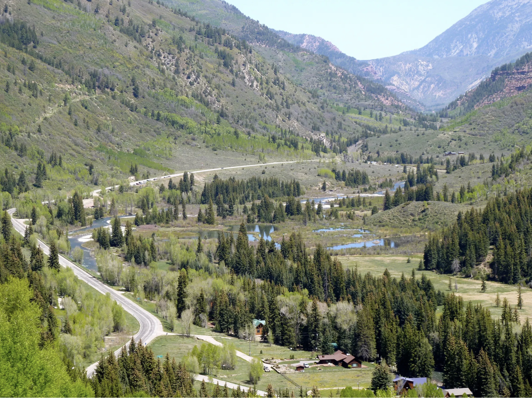
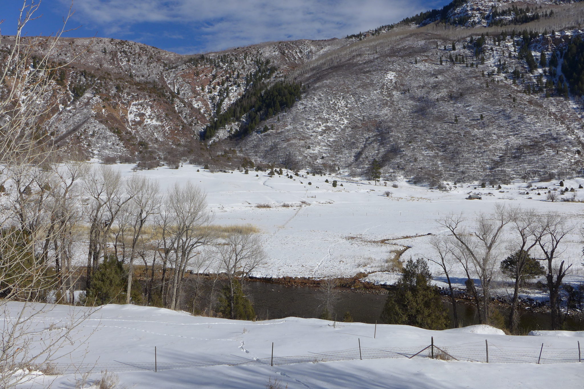
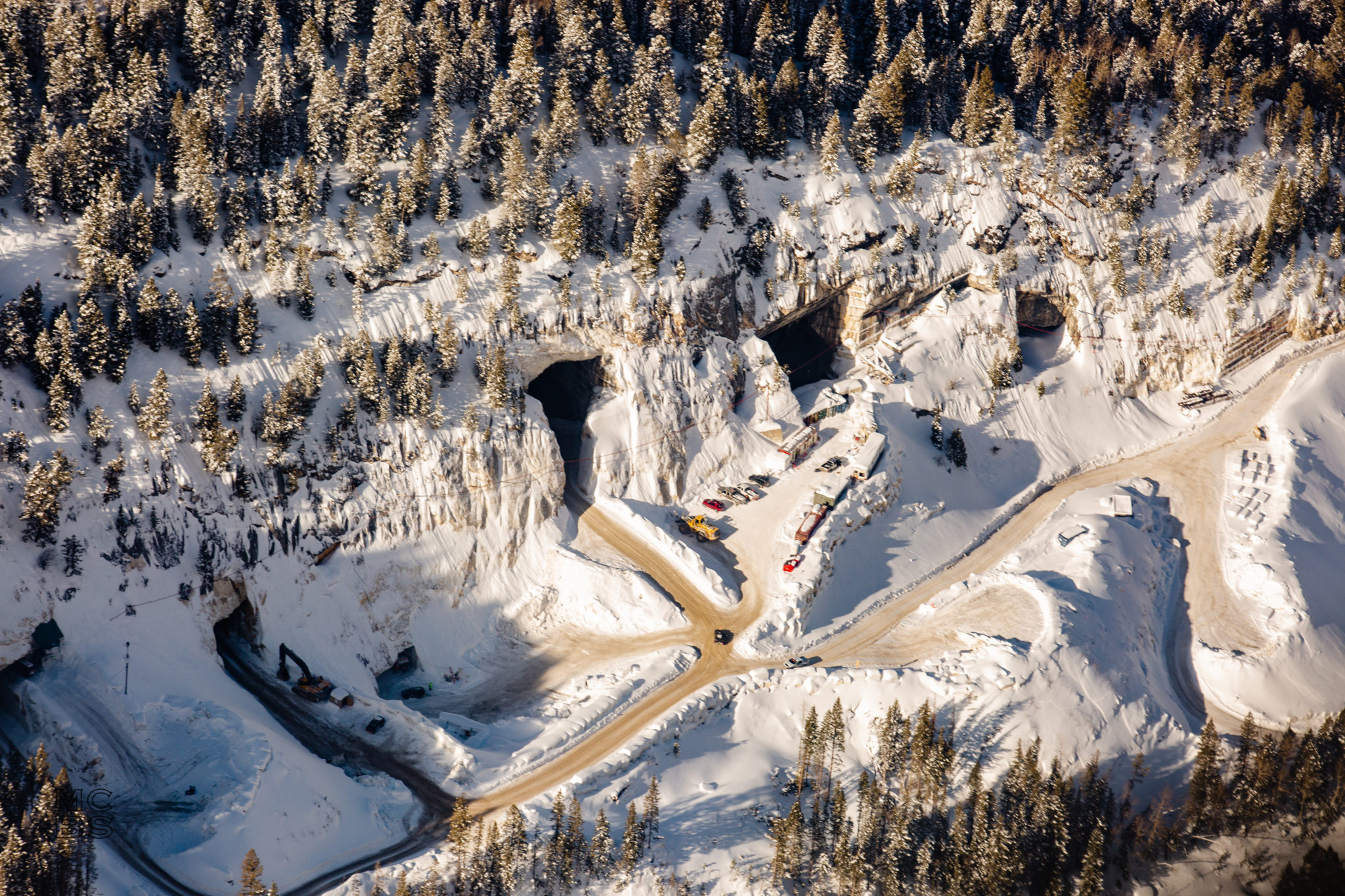
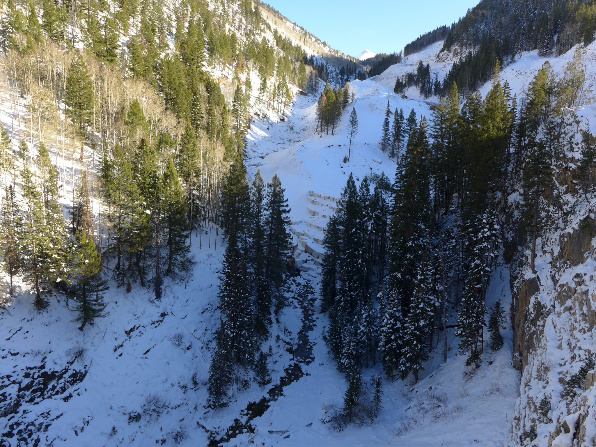
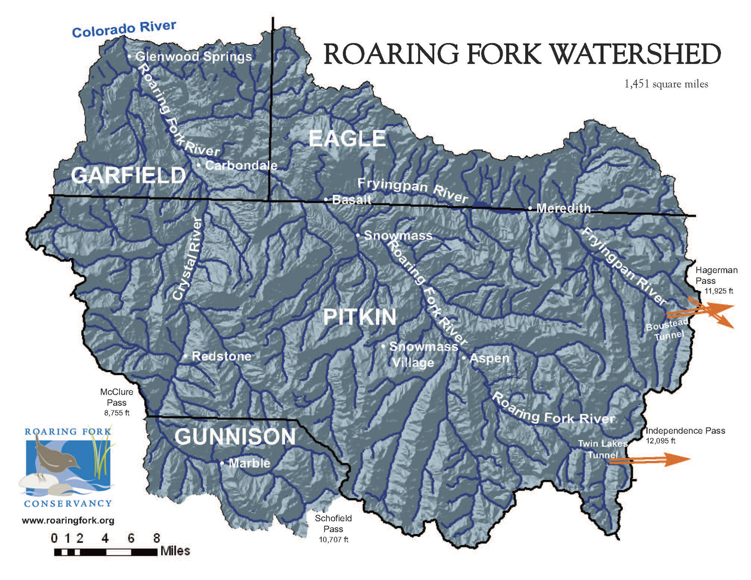
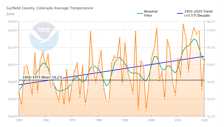
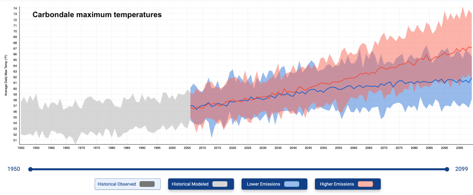


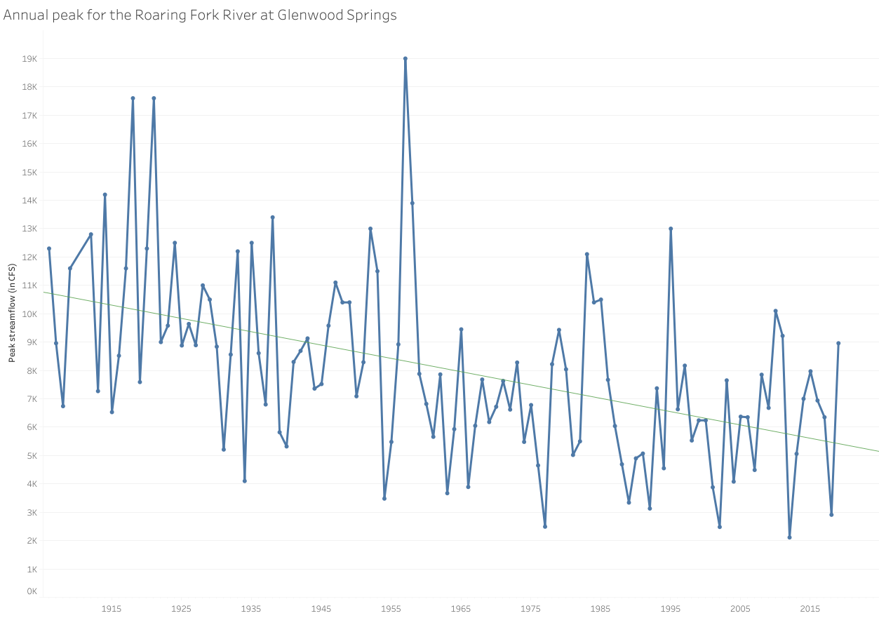

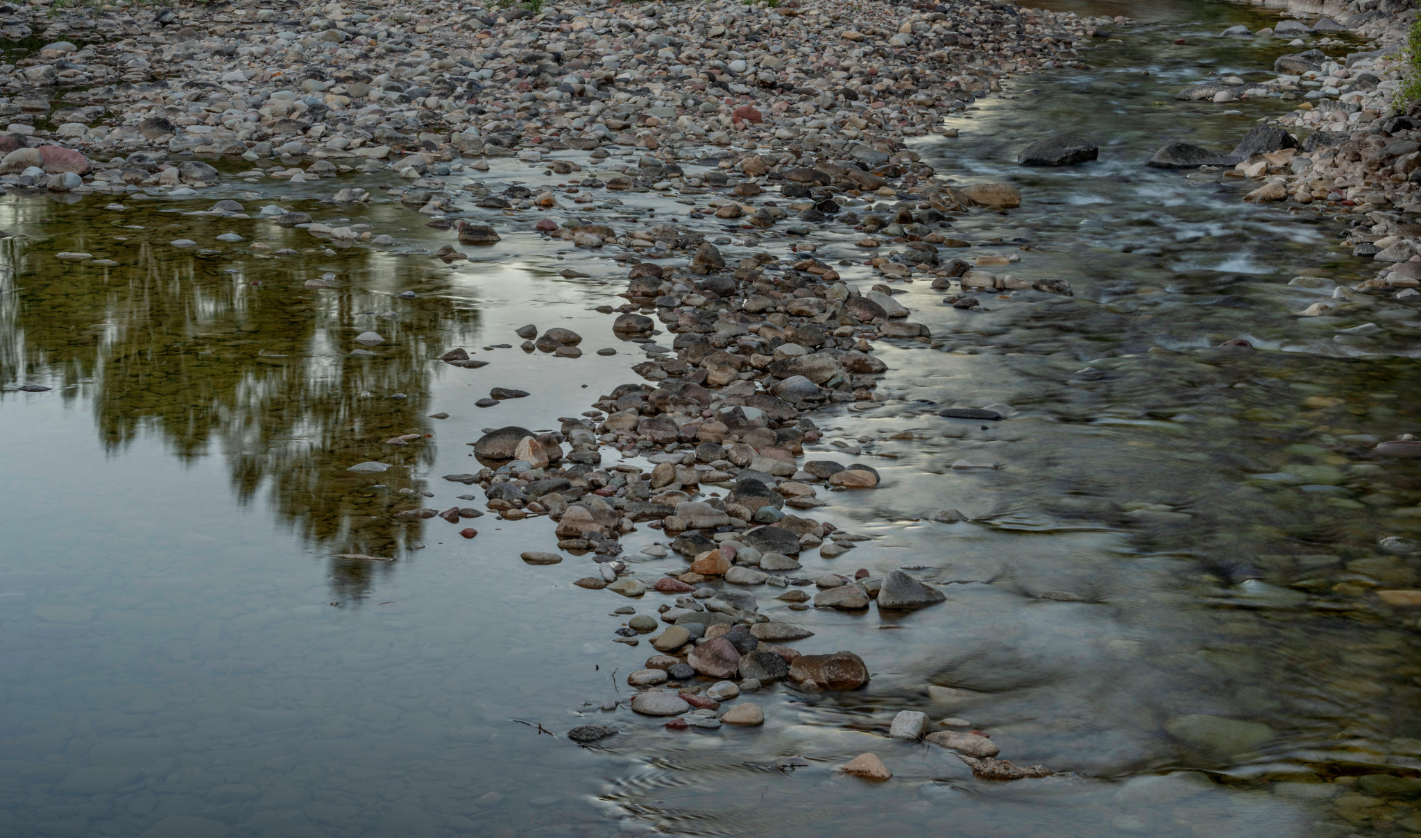

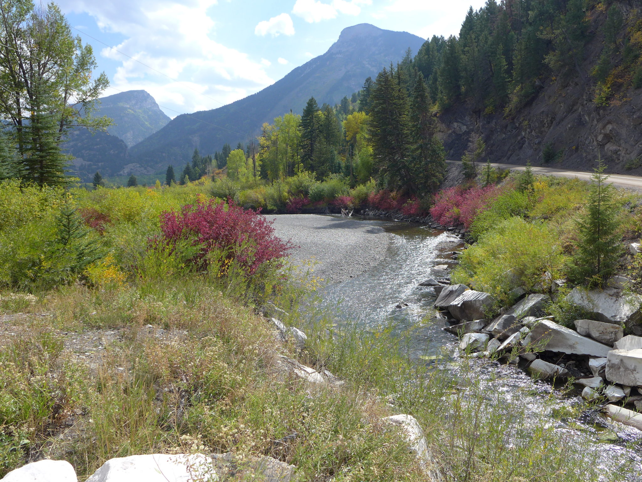

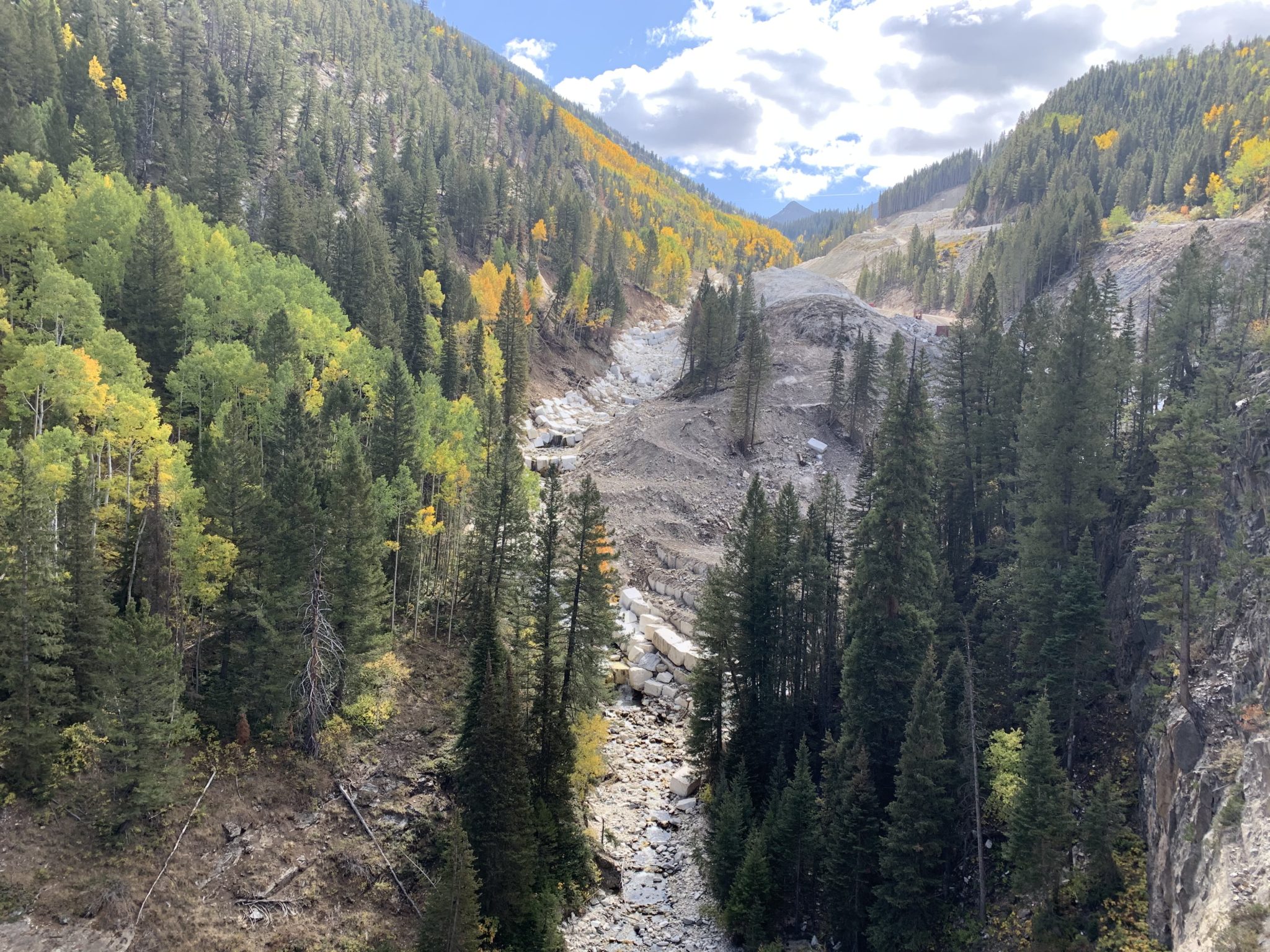

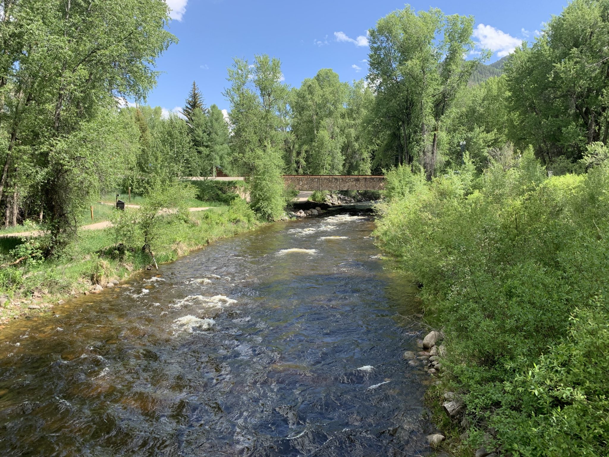
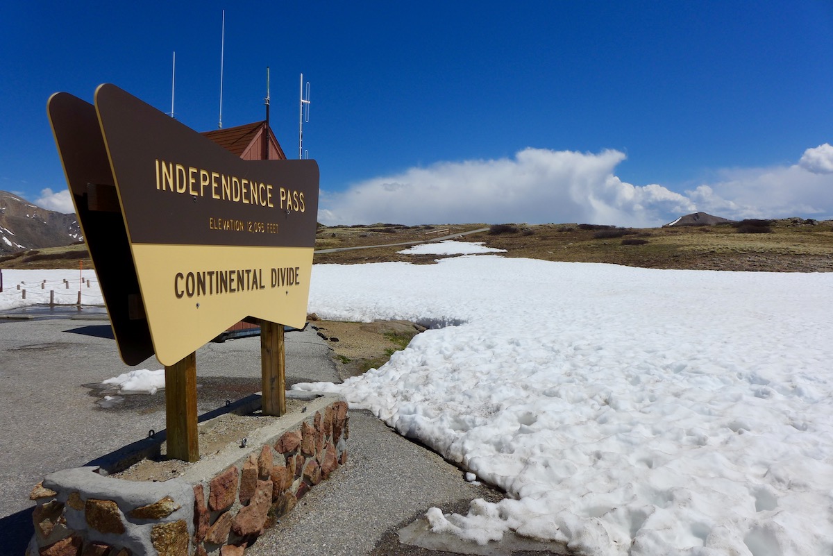
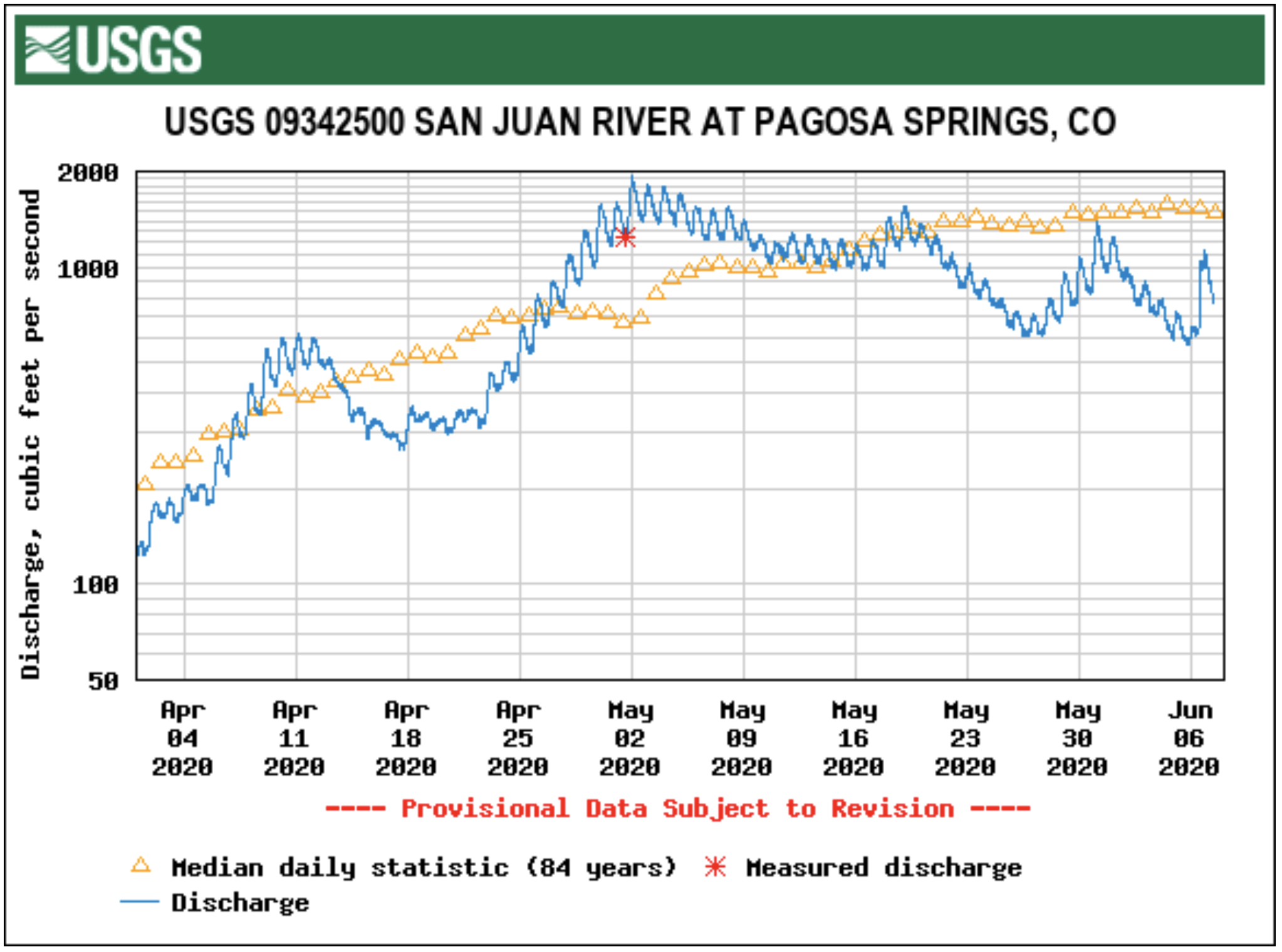
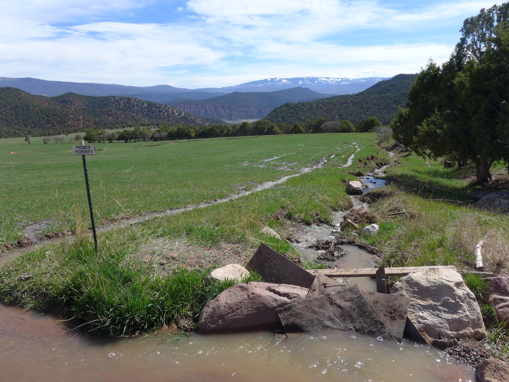
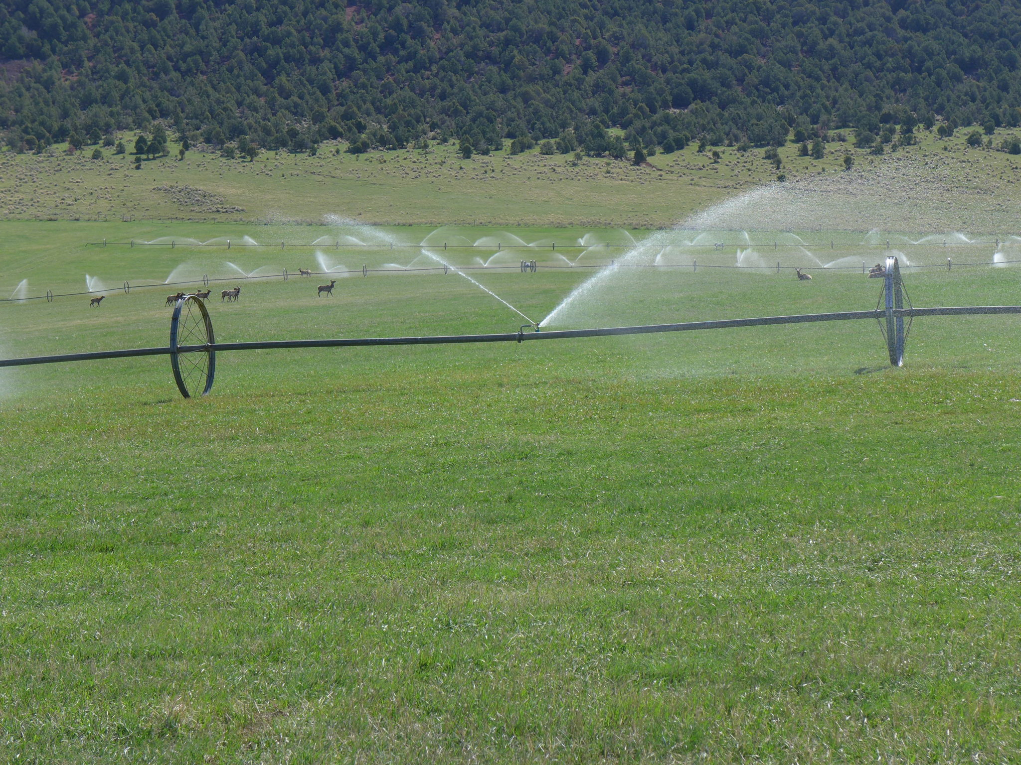
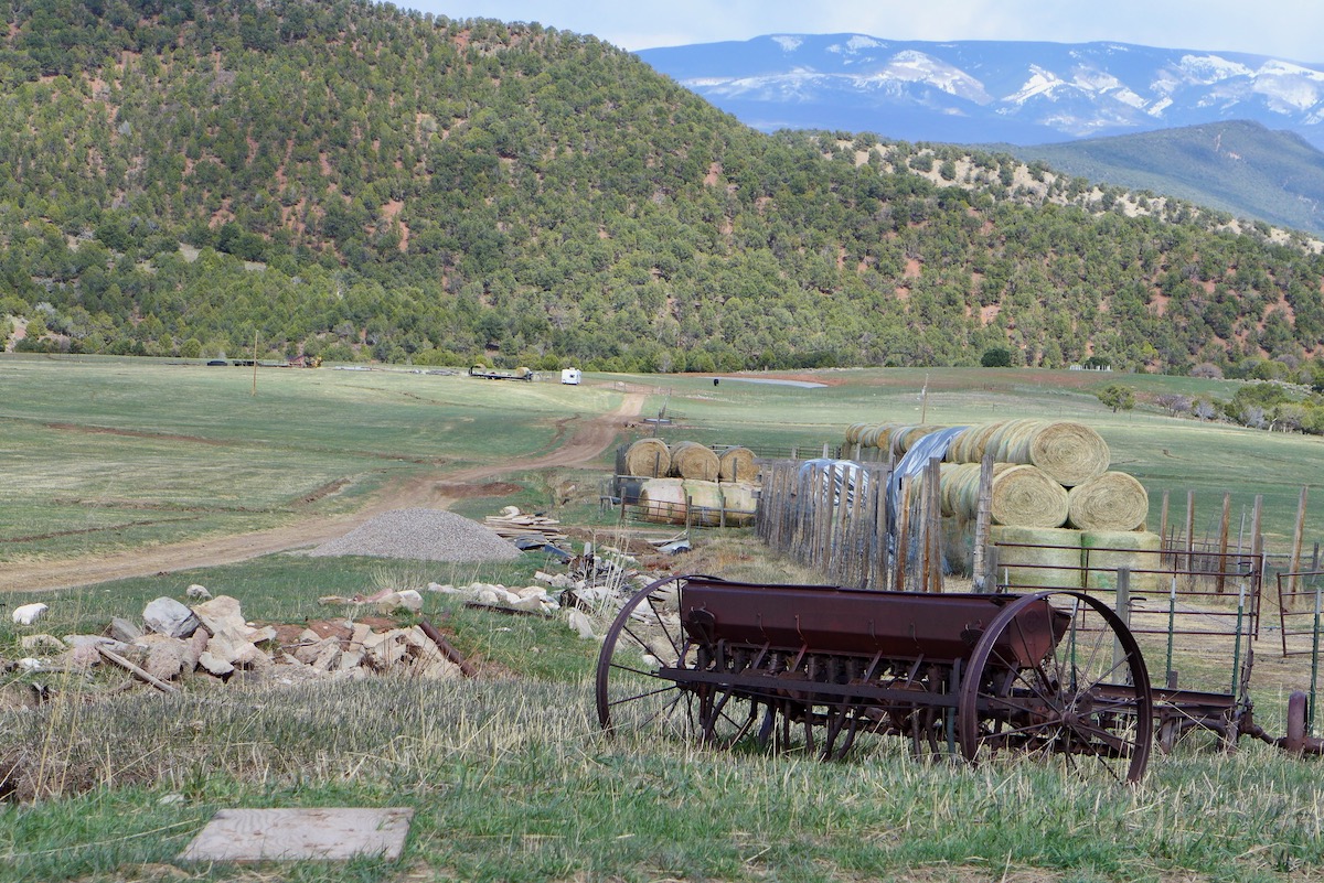
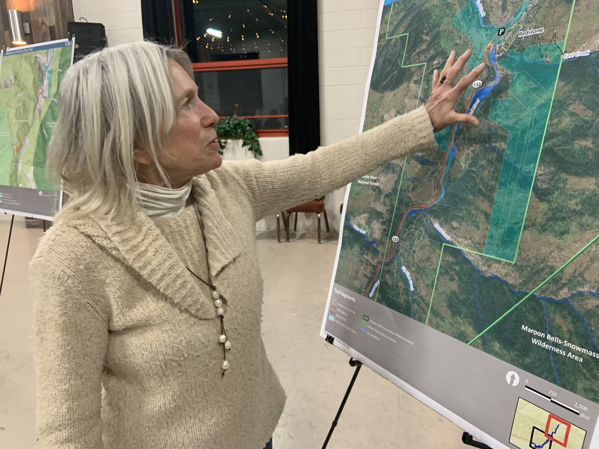
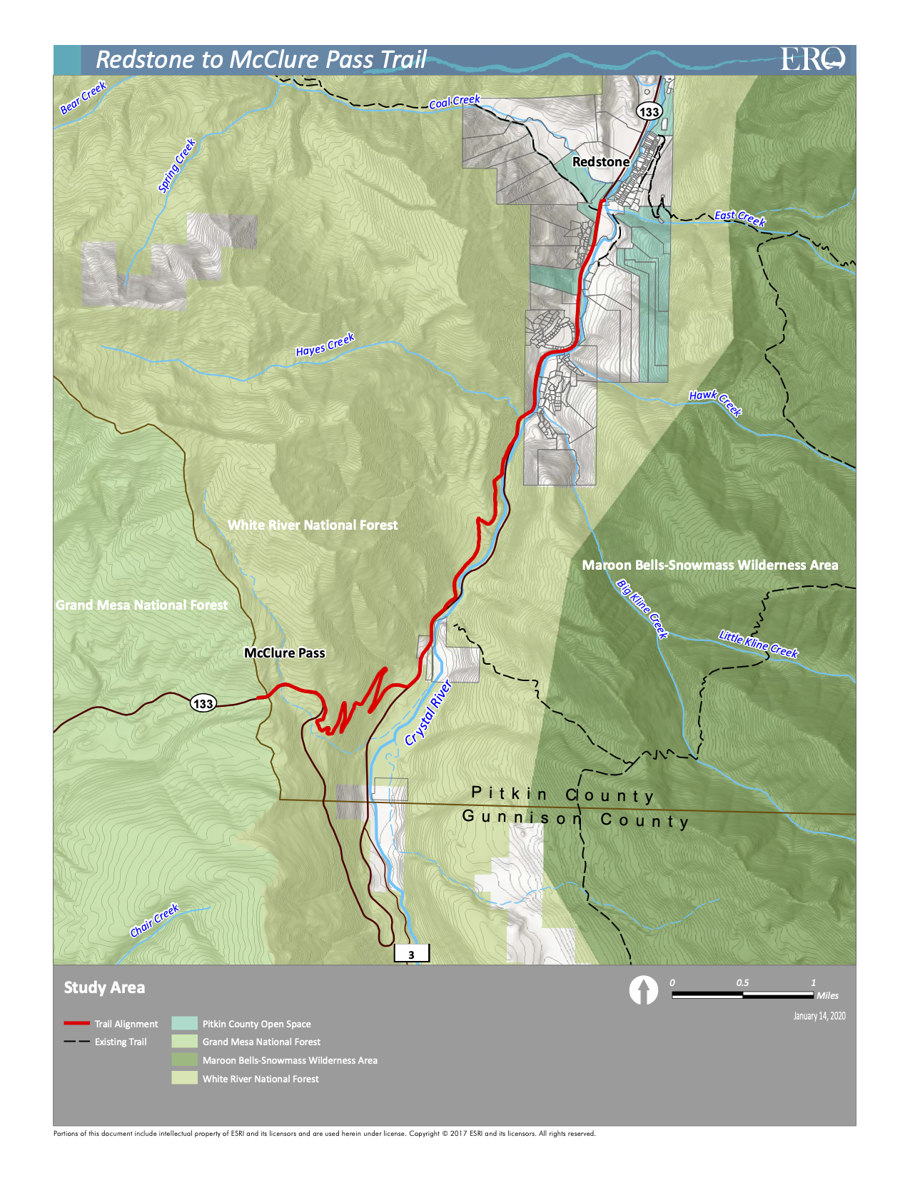
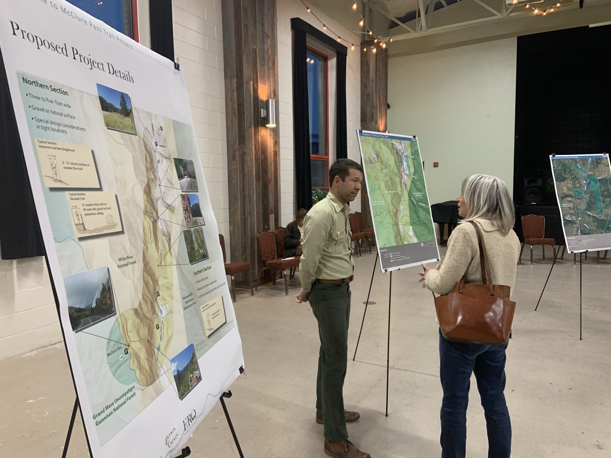
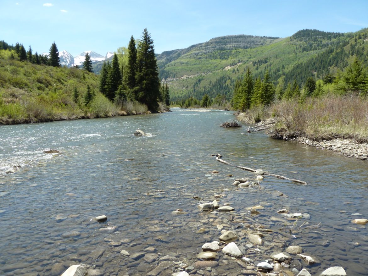
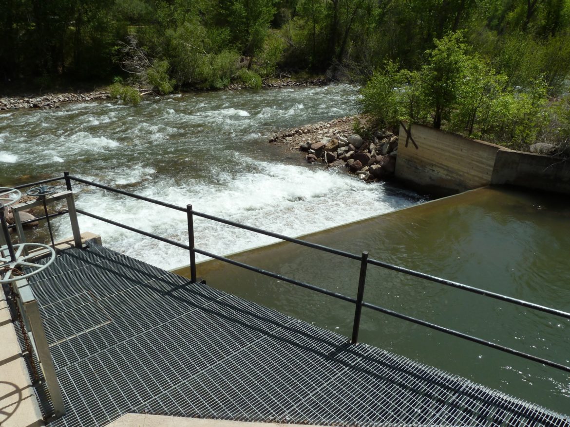


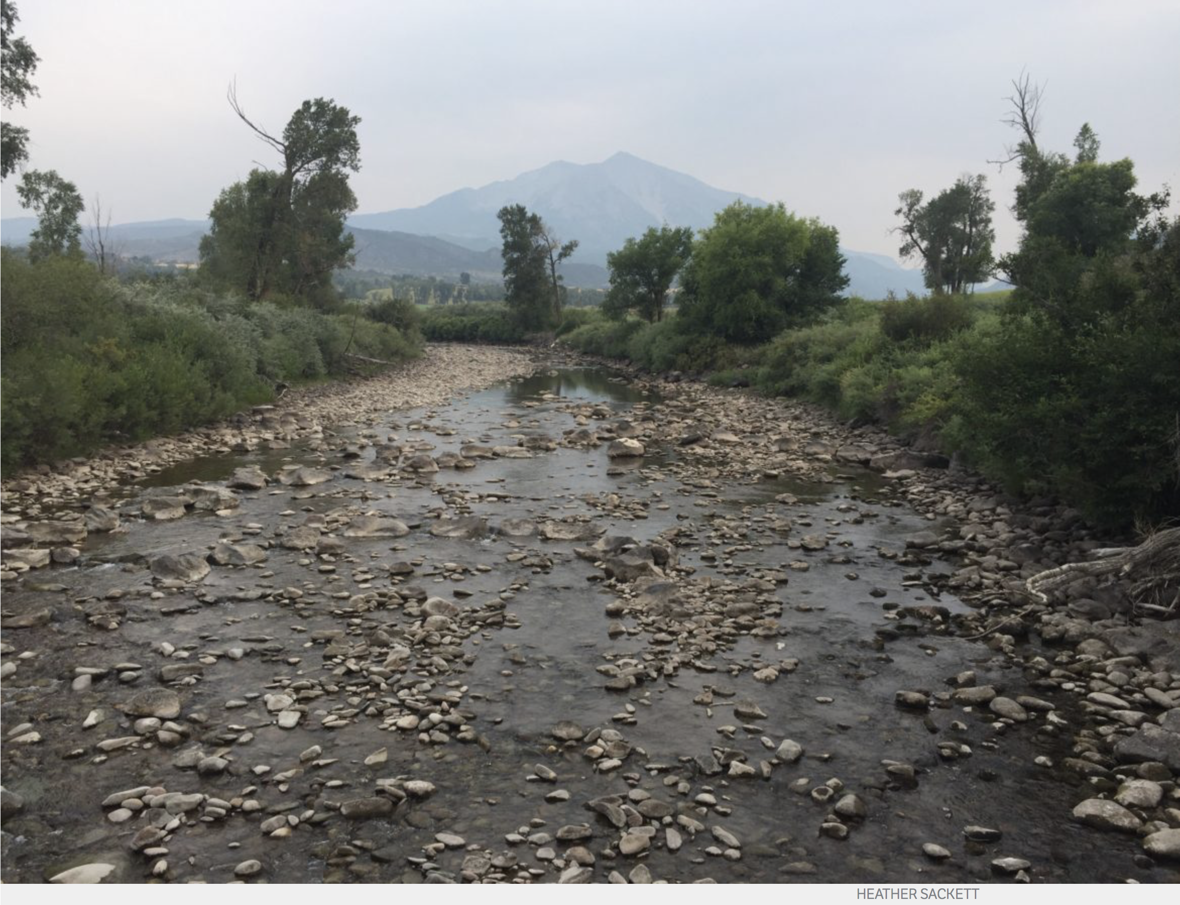
