
Click the link to read the article on the Aspen Journalism website (Heather Sackett):
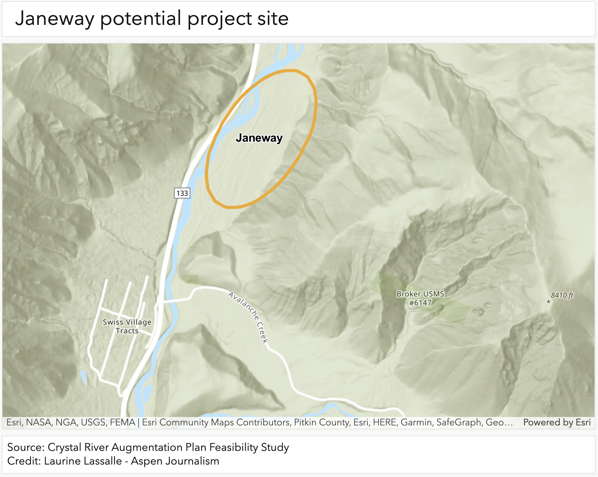
Two studies have shown that a large meadow on the east side of the Crystal River known as Janeway shows promise as a potential site for a water-replacement project. But at least one Pitkin County official is questioning the need for a basin-wide water replacement plan at all.
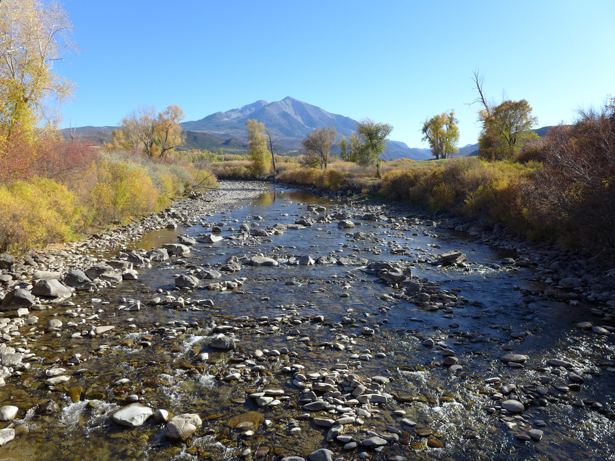
Engineers say the 50-acre, 1,000-foot-wide historic floodplain just downstream of the Crystal’s confluence with Avalanche Creek could work as a location for a project to help junior water users solve shortages in dry years. One study looked at inundating that floodplain with water from the Crystal River during spring runoff, which would percolate through layers of earth and be stored as groundwater before seeping back to the river days, weeks or even months later.
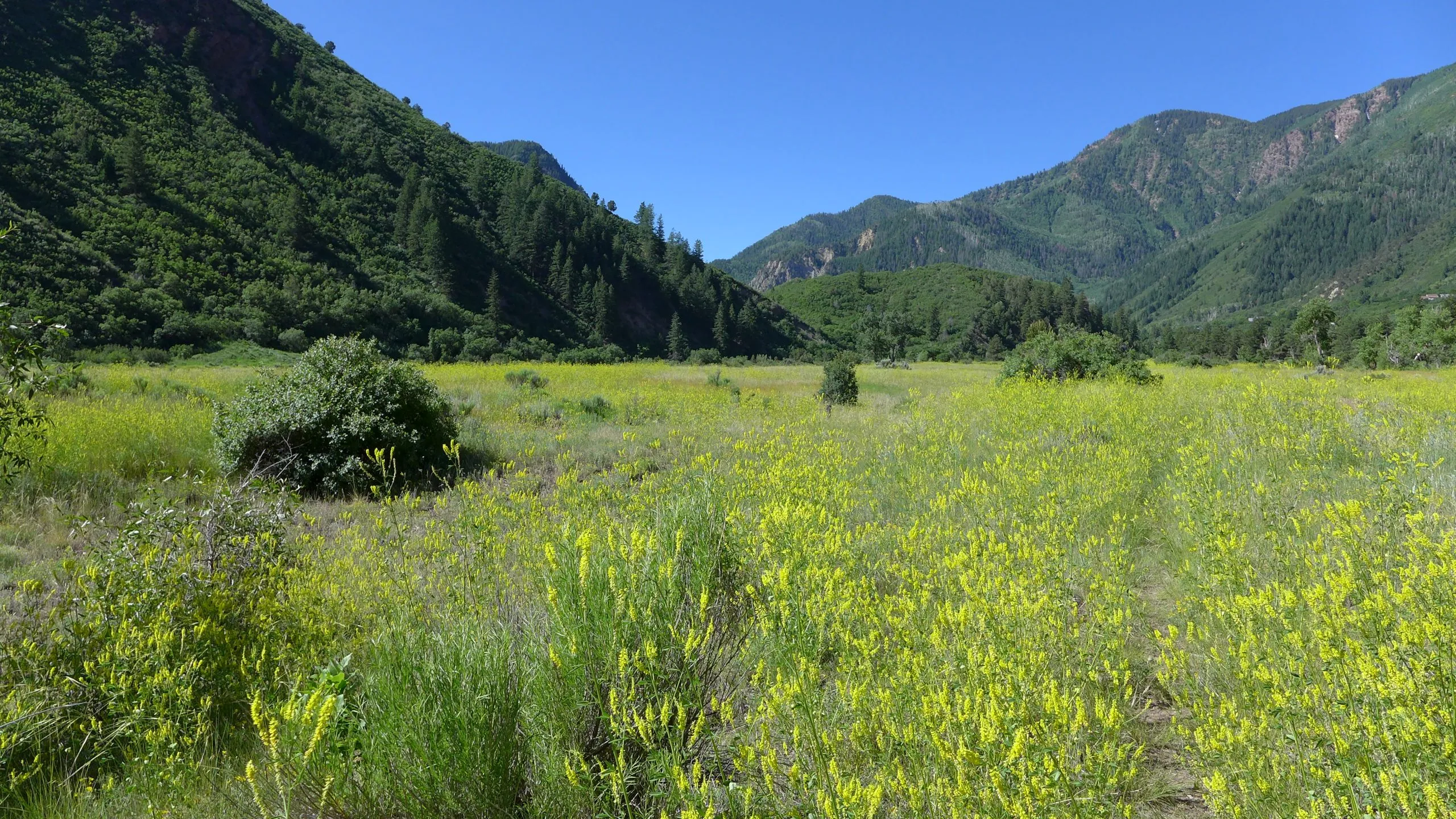
This type of nature-based aquifer recharge project that retimes water from spring runoff could also have added benefits for the riparian ecosystem by reconnecting the floodplain to the river, which has been channelized by decades of development in the Crystal River Valley including the construction of Highway 133 and the railroad before that. The historic Janeway townsite is marked by the ruins of a log structure and old railroad grade, but the U.S. Forest Service parcel is now dominated by native grass, potato cactus, mountain mahogany, sagebrush and juniper.
“I think the Janeway is of particular interest given its location,” said Fay Hartman, southwest regional program conservation director with environmental group American Rivers, who worked on the nature-based solutions study. “It’s a pretty good-sized floodplain, which is obviously important. In the initial analysis it seems like it’s the best fit.”
Janeway was also one of the sites considered by Colorado River Engineering, which is the engineering firm that conducted an analysis for the West Divide Water Conservancy District and the Colorado River Water Conservation District of potential water-supply replacement options. This draft study considered more traditional water-replacement methods that are not natural-process based. If the nature-based concept does not move forward at Janeway, West Divide may explore the construction of a recharge pond at the same location.
“It is a similar concept with a more simplified approach,” the study reads. “It would not provide the riparian floodplain benefits that the nature-based solutions project does, but would have reduced costs for construction, operation and maintenance.”

Historic call spurs studies
The two studies aimed at finding replacement water came at the direction nearly five years ago of engineers from Division 5 of Colorado’s Division of Water Resources. During the hot, dry summer of 2018, the Ella Ditch, which pulls water from the Crystal River and irrigates hayfields south of Carbondale, placed a call on the river for the first time. That means the Ella Ditch wasn’t getting the full amount to which it is entitled and upstream junior water users had to stop taking water so that the Ella could get its full amount.
The Ella Ditch has water rights that date to 1902, and any water rights younger than that — including those held by the town of Carbondale, the Marble Water Company and several residential subdivisions along the Crystal River — were subject to being shut off under a strict administration of the river by DWR. Under Colorado’s system of water law known as prior appropriation, those with the oldest water rights have first use of the river.
Most junior water rights holders have what’s known as an augmentation plan, which allows them to continue using water during a call by releasing water from a backup source, such as a nearby reservoir. The problem is that some of the in-home water users on the Crystal don’t have an augmentation plan.
The goal of the two studies, which were largely funded by grants from the state of Colorado and the River District, was to find potential sources of augmentation water. The initial study by Colorado River Engineering looked at traditional sources of replacement water like off-channel storage ponds.
A second study by American Rivers and others looked at nature-based solutions like aquifer recharge. That study looked at four potential project sites — Thompson Creek Open Space, Avalanche Creek confluence, Coal Creek and Janeway — with the Janeway site being the most promising. To address environmental concerns from Pitkin County and others, the River District has promised that any storage constructed as part of an augmentation plan will not happen on the main stem of the Crystal River.
Finding potential augmentation supply sites in the Crystal River Valley has been difficult, said Brendon Langenhuizen, director of technical advocacy at the River District.
“It’s a really tight basin. It’s really narrow with lots of steep tributaries, which means there’s not a lot of off-channel reservoir sites,” he said. “There’s not a lot of valley bottom where we could develop something.”
Amount of water needed
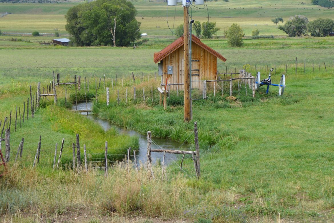
Although Janeway is the most promising area for a nature-based solution and the one overlapping potential project site of the two studies, it still has drawbacks. The aquifer recharge project with additional environmental benefits is estimated to cost $1.5 million. The project could include a 765-foot excavated channel at the south end of the floodplain so it could be hydrologically connected to the river. Small porous wood structures across the floodplain would aid in ponding and water retention and revegetation efforts could include willows, cottonwoods and wetland sedges.
But this project wouldn’t meet all of the augmentation needs. And there are also still unanswered questions about the retiming of flows: The lagged natural return flows may not align with when water is needed. According to the Colorado River Engineering study modeling, the Janeway project site could provide up to 60 acre-feet of lagged return flows to the river over the course of the summer, with the most occurring in June. But the highest water demands are in July and the most likely months for a call are July, August and September, so the Janeway site is estimated to only provide 10 to 20 acre-feet toward solving a shortage.
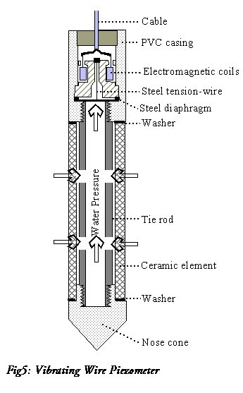
Engineers are applying to the U.S. Forest Service for permits to install measurement devices known as piezometers to gather more information about the groundwater on the site.
“We have a request in to run some localized tests on the aquifer to see how fast water could move back to the Crystal River,” Langenhuizen said. “What we are looking for is some delay. Our peak demands are in July and if we could get two to three months delay that would be really helpful.”
According to the study, the total replacement water needed is 105 acre-feet. An acre-foot is the amount of water needed to cover an acre of land to a depth of one foot and could supply one to two families a year. July’s potential requirement is 34 acre-feet.
Other sources of augmentation water could be up to 38 acre-feet from Beaver Lake, which is located in Marble and managed by Colorado Parks and Wildlife; 10-15 acre-feet from Upper Basin Pond, a small, off-channel pond on private land upstream of Marble; and about 10 acre-feet from Rapid Creek Pond, a small off-channel parcel on private land downstream of Marble.
Other sites like the Orlosky Reservoirs in Marble, upper Coal Creek and lower Avalanche Creek were deemed not workable for a variety of reasons. The study also says that irrigators were approached about an agreement where they could temporarily cease irrigation to make water available to other users, but there was limited interest.
All four identified supplies would need to be built at their maximum capacities to meet a potential 20% future increase in demand of 11 acre-feet, according to the study.

Pitkin County concerns
Assistant Pitkin County Attorney Laura Makar is skeptical that an expensive, complicated augmentation plan for junior water users on the Crystal is necessary.
“We are talking about such a small amount of water that is needed so it still seems to me there is a pretty substantial flaw in not looking to see if there is any use of water on the Crystal that shouldn’t be occurring or isn’t occurring legally right now,” Makar said.
Like most places on the Western Slope, agriculture is king on the Crystal, with ranches on the lower reaches using far more water to grow hay and alfalfa than what’s needed to keep residential taps flowing.
Making sure all water users on the Crystal are held to the same standard should be the first step toward finding water to meet demands, Makar said.“Why would we not want to look at low-hanging fruit that might be politically difficult but is actually engineering-wise and physically easy?” Makar said. “Instead we are looking at very difficult physical engineering solutions because we aren’t looking at what exists in the system.”
According to Division 5 Engineer James Heath, the wells for indoor water use that triggered the augmentation plan studies use less than 1% of the water used by agriculture on the Crystal. He said he has never shut off wells for in-home domestic use due to them using water out of priority, and probably would not in the future. His office has said it will not shut off indoor use as long as water users are working toward finding a solution, although outdoor watering of lawns, gardens and landscaping may be curtailed.
“Generally, what we try to do is limit the outdoor use and allow for indoor use to continue,” he said. “We can get the biggest bang for the buck by curtailing the outdoor use, which is where most of the consumption happens.”
Heath said in general agricultural water users are not wasting water on the Crystal. The problem, he said, is that there is sometimes not enough water in the river to meet demands, especially in late summer of dry years. He said during the summers of 2020, 2021 and 2022, some irrigators were not getting their full share and could have placed a call, but chose not to.
But waste has occurred at least once in recent years. In 2018 — the same year as the first-ever call on the Crystal — a water commissioner from the Division of Water Resources turned down the headgate of the Lowline Ditch for what he said was waste, based on state guidelines.
During the 2018 call, the East Mesa Ditch loaned 1 cubic foot per second of water to the town of Carbondale — under an emergency substitute water-supply plan that allowed a temporary change in water use from agriculture to municipal — so it could continue to legally supply about 50 homes on the Nettle Creek pipeline with water. Makar said there’s no legal reason water users couldn’t craft a similar more permanent agreement, which could be activated if a call ever comes on again.
“It certainly has been done and done successfully,” she said.
