#Colorado releases California Gulch settlement funds — The #Leadville Herald-Democrat #ArkansasRiver

View of the Yak Tunnel and Mine Complex in California Gulch near Leadville, Colorado; shows mill buildings and ore car tracks. Mount Elbert, Mount Massive, and the Sawatch Range are in the background. Denver Public Library Special Collections
Creator
Beam, George L. (George Lytle), 1868-1935. Date: 1908

Click the link to read an article from The Leadville Herald-Democrat (Patrick Bilow):

The Arkansas River Watershed Collaborative (ARWC), which also includes groups like Trout Unlimited, submitted an initial application last fall under the project title “Upper Arkansas Comprehensive Watershed Restoration Project.” The application requested $5 million from damages associated with the California Gulch Superfund Site for various initiatives, including culvert replacement and fuels mitigation…

Commissioner Sarah Mudge, who helped submit the application in December, said the group will submit a new request in February for consideration under a new round of funding. Mudge said ARWC has altered the scope of work slightly for the new application, but that culvert work and fuels mitigation will remain a priority.

Last September, the trustees, including Colorado Attorney General Phil Weiser, visited Lake County for a landmark tour of California Gulch, a Superfund site that was heavily impacted by mining operations. After the tour, the trustees heard proposals from groups like ARWC, which presented the “Upper Arkansas Comprehensive Watershed Restoration Project.”

[…]

Fuels mitigation will entail thinning efforts and the implementation of a county-wide slash management program. Mine impact mitigation refers to ongoing efforts to prevent soil and water pollution from old mine operations. And river restoration will include post-wildfire flood defense along waterways and culvert repair in four or five areas throughout Lake County.

Prior to mining, snowmelt and rain seep into natural cracks and fractures, eventually emerging as a freshwater spring (usually). Graphic credit: Jonathan Thompson

Superfund tour through Colorado paints positive picture — The Durango Herald

From The Durango Herald (Jonathan Romeo):

It was a long, difficult road as the community of Leadville went through a more-than-20-year process through the Environmental Protection Agency’s hazardous cleanup Superfund program. But local government officials here on Thursday told a large constituency of Southwest Coloradoans that, ultimately, it was worth it.

Various agencies from the Animas River watershed are on a three-day tour of several Superfund sites in Colorado, hoping to gain knowledge on the process as stakeholders look to make a decision about long-term water treatment in the Animas basin.

The situation in Leadville, in many ways, has a striking similarity with the leaking mine network north of Silverton – with its long mining history, relative isolation and fragile economy…

But after more than a century of unregulated mining in Leadville, a two-hour drive west of Denver, an adit suffered a blowout, causing a die-off along the Arkansas River down to Pueblo. In 1983, Leadville was placed on the EPA’s Superfund list, just a few years after the program was signed into law by President Jimmy Carter.

It wasn’t until 2007 that the town was officially taken off the National Priorities List. After the many battles between local, state and federal agencies, local officials there said it left a bittersweet feeling throughout the community.

“In the beginning, it definitely had an impact on our economic development,” said Howard Tritz, an assessor at the time. “It was a real obstacle. But the stigma of being a Superfund site has pretty much blown away; people are starting to come back here. It was bittersweet.”[…]

Melissa Sheets, a reclamation project manager with the Colorado Department of Public Health and Environment, said this week’s tour, which includes a number of stakeholders, is a sign the agencies have learned from past mistakes in dealing with local communities.

“I think we’re learning as Superfund grows up,” Sheets said. “Unfortunately for this community (Leadville), they got the Superfund designation when this program was brand new, so I think they got a lot of the bumps in the road. This outreach we’re doing is absolutely unprecedented. We’re trying to make sure everyone has an opportunity for input.”

After visiting Leadville, the group went to Minturn’s Eagle Mine Superfund site, where residents said there really was no other option beside Superfund.

“There’s always some tension and disagreement as to what cleanup measures are going to be most effective,” said Bob Weaver of Leonard Rich Engineering. “But it’s really important to realize everybody wants to achieve the same goal. You’re not always going to agree, but it’s a lot better than doing nothing.

Representatives from the Animas River were sure to point out the many differences between Leadville and Minturn, ranging from potentially responsible parties to differences in geology. But San Juan County Commissioner Ernie Kuhlman said overall it’s been a productive trip.

“I’ve learned a hell of a lot,” he said. “Anything we’re going to get is from working together. That’s what we’re doing here.”

Durango Mayor Dean Brookie said seeing the actual physical implementation of Superfund helped push the decision-making process…

Leadville Mayor Jaime Stuever offered one last bit of advice for the group before a tour of the California Gulch Superfund site.

“We live in an environment in today’s world were we have problems,” he said. “If you look at how many years mining took place here, you realize it takes a long time to clean up a mess that’s been here many, many years. How could we have done it ourselves? We couldn’t have done it ourselves.”

Mine Spills Not That Rare — Colorado Central Magazine


From Colorado Central Magazine (Christopher Kolomitz):

The blowout reminded Central Colorado residents of two eerily similar incidents that fouled the Arkansas River in 1983 and 1985. The toxic discharges on the local river occurred in a period of time when the Environmental Protection Agency was beginning Superfund clean-up of old mines around Leadville. The culprit of both discharges was the Yak Tunnel, which was one of three constructed to drain mines in the district.

Leading up to Superfund designation, the years of inaction were becoming a public health emergency. Drainage ditches in Leadville neighborhoods were turned orange or red because of the heavy metals coming from the historical mines. Annual discharge from the Yak Tunnel was pumping 210 tons of heavy metals into California Gulch, which was then reaching the river, according to the EPA.

A few days after the incident, the river through Salida was running clear but state wildlife officials were worried about the impact upon the brown trout spawn, and they estimated up to half of the eggs may have been lost, the local paper reported. Subsequent research found that high levels of cadmium prevented fish from living more than three or four years, wildlife officials said.

Threat of another catastrophic discharge surfaced once again in February 2008, when alarm was raised over the potential blowout of the Leadville Mine Drainage Tunnel. Tunnel collapses and blockages had created a potentially dangerous situation for an uncontrolled surge. In response the EPA drilled a relief well, which worked to reduce the danger.

Twelve specific cleanup units were identified as part of the Superfund designation and to date, seven have been wrapped up to a point where regulators are calling them deleted from the operational plan. Examples of the process include construction of water diversion channels and settling ponds to prevent heavy metals from reaching surface water, and consolidation of smelter waste and mine tailings which were then covered with clean soil.

At the Yak Tunnel, a water treatment plant has been credited with dramatically improving water conditions in the Arkansas River, and the overall cleanup has been hailed as a success, although the EPA has ruffled some local feathers. The river now supports a vibrant, healthy fishery with greater public access, and the residents of Leadville and downstream are living around less toxicity.

California Gulch superfund site now 70% delisted

California Gulch back in the day

From the Leadville Herald Democrat (Marcia Martinek):

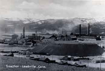
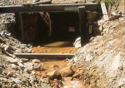
The EPA came to town on Thursday, Dec. 18, and it was a much-more cordial gathering than back in the 1980s when Leadville was first named a Superfund site. The occasion was to recognize the removal of Upper California Gulch, the Asarco Smelter/Colorado Zinc-Lead Mill site and the Apache Tailings from the Superfund National Priorities List. All are part of the California Gulch Superfund site.

The delisting of these areas, Operable Units 4, 5 and 7, from the Superfund list is said to be a major milestone in addressing mining contamination at the site.

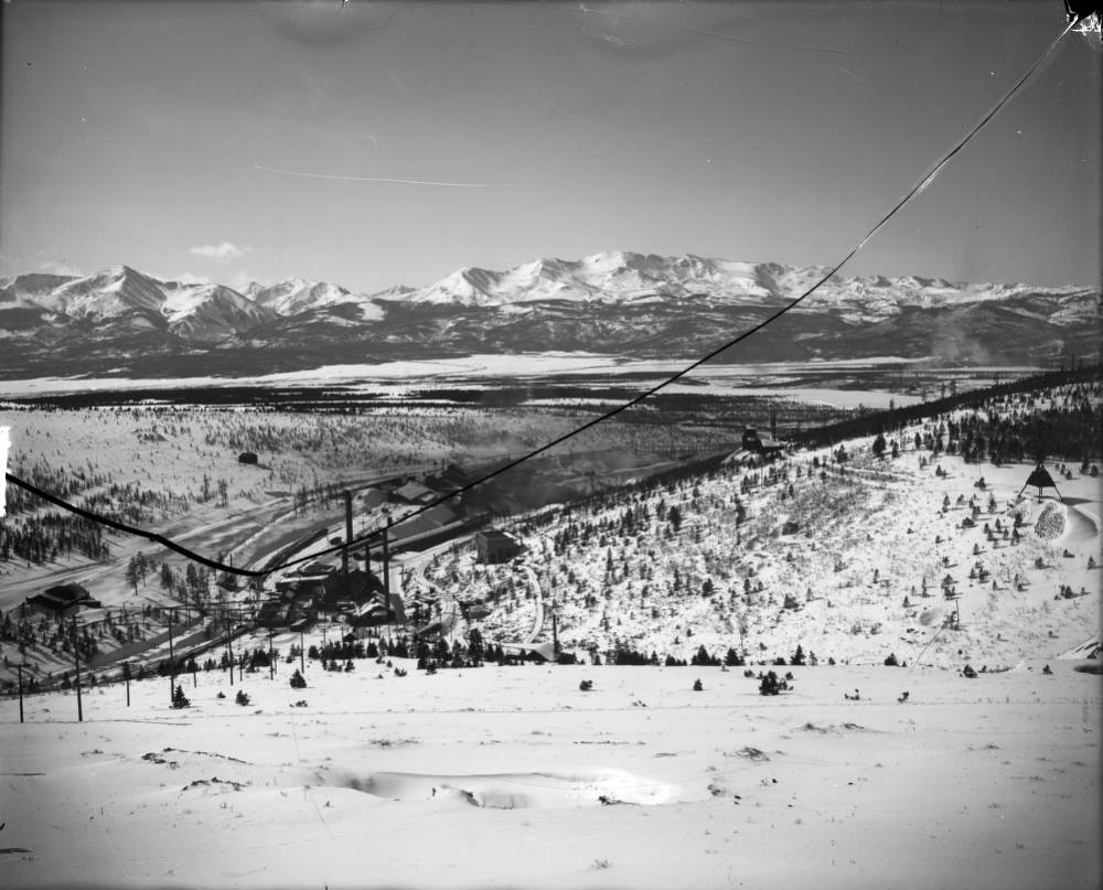
Lake County Commissioner Mike Bordogna provided a timeline of the activity in California Gulch stretching from the time when gold was discovered in California Gulch in 1859 through 1983 when California Gulch was placed on the EPA’s National Priorities List to the current day and the most recent delistings.

EPA Regional Administrator Shaun McGrath said that of the 18 square miles that initially made up the Superfund site, seven of the 12 operable units have now been delisted, accounting for 70 percent of the area. He added that 90 percent of the construction work is now complete.

McGrath also used the occasion to present the Lake County Commissioners with an Environmental Achievement Award for Excellence in Site Reuse. Cited were three reuse projects within Lake County: the Mineral Belt Trail, the Lake County Community Park and soccer fields, and the restoration of the Upper Arkansas River, which recently received the Colorado Parks and Wildlife’s Gold Medal Designation for trout fishing.

Martha Rudolph, director of Environmental Programs, Colorado Department of Public Health and Environment, looked back to the “thorny days” of the Superfund site, saying “California Gulch was a challenge from the beginning,” so much so that no cleanup took place at the site for the first ten years.
Despite the adversity, she noted, “Everyone always had the same goal.”

Thirty years later relationships among the entities have improved. And today the Arkansas River has gone from an eyesore to a true gem, Rudolph said.
Along with the Lake County award, numerous people were recognized for their work over the years with the EPA.

History of California Gulch

Commissioner Mike Bordogna traced the history of California Gulch through the years at the delisting celebration held Dec. 18.

1859 – Gold discovered at mouth of California Gulch

1893 – Silver market crash

1983 – National Priorities List listing

1991 – Leadville Mine Drainage Treatment Plant began operations

1992 – Yak Treatment Plant began operations

1994 – Site divided into 12 operable units

1995 – Construction of the Mineral Belt Train began

2000 – Mineral Belt Trail completed

2001 – OU10 (Oregon Gulch) deleted from NPL

2002 – OU2 (Malta Gulch) deleted from the NPL

2005 – Remedy construction at OU11 (Arkansas River floodplain) began

2008 – Upper Arkansas River ranked most popular Colorado fishery

$20.5 million natural-resource damages settlement reached

2010 – OU11 (Arkansas River Floodplain) remedial work completed

OU8 (Lower California Gulch) deleted from the NPL:

2011 – OU9 (residential areas) deleted from the NPL

2014 – Gold Medal Trout Waters designation awarded

Lake County received Brownfields grant

OU4 (Upper California Gulch) deleted from the NPL

OU5 (ASARCO Smelter/Colorado Zinc-Lead Mill Site) deleted from the NPL

OU6 (Apache Tailings) deleted from the NPL

More California Gulch coverage here and here.

EPA Announces Partial Deletion of California Gulch Superfund Site from National Priorities List

From The Targeted News Service (Joann Vista) via 4-Traders.com:

The Environmental Protection Agency has issued a final rule announcing the deletion of the Operable Unit 4, Upper California Gulch; Operable Unit 5, ASARCO Smelters/Slag/Mill Sites; and Operable Unit 7, Apache Tailing Impoundment, of the California Gulch Superfund Site located in Lake County, Colorado, from the National Priorities List (NPL). This final rule is effective on Oct. 24…

This partial deletion pertains to the Operable Unit 4, Upper California Gulch (media of concern–waste rock and fluvial tailing piles); Operable Unit 5, ASARCO Smelters/Slag/Mill Sites (media of concern–slag and soil); and Operable Unit 7, Apache Tailing Impoundment (media of concern–tailing and soil), of the California Gulch Superfund Site (Site). Operable Unit 2, Malta Gulch; Operable Unit 8, Lower California Gulch; Operable Unit 9, Residential Populated Areas; and Operable Unit 10, Oregon Gulch were partially deleted by previous rules. Operable Unit 1, the Yak Tunnel/Water Treatment Plant; Operable Unit 3, the Denver & Rio Grande Western Railroad Company Slag Piles/Railroad Easement/Railroad Yard; Operable Unit 6, Starr Ditch/Penrose Dump/Stray Horse Gulch/Evans Gulch; Operable Unit 11, the Arkansas River Floodplain; and Operable Unit 12 (OU12), Site-wide Water Quality will remain on the NPL and is/are not being considered for deletion as part of this action. The EPA and the State of Colorado, through the Colorado Department of Public Health and the Environment, have determined that all appropriate response actions under CERCLA, other than operation, maintenance, and five-year reviews, have been completed. However, the deletion of these parcels does not preclude future actions under Superfund.”

For more information, contact Linda Kiefer, Remedial Project Manager, EPA, Region 8, 1595 Wynkoop Street, Denver, Colorado; 303/312-6689, kiefer.linda@epa.gov.

More California Gulch coverage here and here.

The Resurrection Mining Co. files change of use on Twin Lakes shares to augment depletions at the Yak Tunnel treatment plant

Yak Tunnel via the EPA

From The Leadville Herald (Danny Ramey):

The Resurrection Mining Company has filed for approval of an augmentation plan that would allow it to use water shares to replace water depleted from the Yak Tunnel and water treatment plant. Under the plan, the company would use shares it owns in Twin Lakes Reservoir to replace water depleted by its operations in California Gulch. Resurrection filed an application for approval of the augmentation plan with Division 2 of the Colorado Water Court on May 20.

Resurrection currently owns 22 shares of water in Twin Lakes. Twelve of those shares are included on a provisional basis, meaning Resurrection can remove those shares from the plan or use it for purposes other than what it was originally approved for.

In its plan, Resurrection estimates that depletions from its plant range from 3 to 7.7 acre feet of depletions a year. The plan seeks to augment five structures owned by Resurrection. Of those structures, only two cause water depletion, according to the plan. Water depletes from the Yak Surge Pond and the Yak Treatment Plant via evaporation, and some also leaves the treatment plant through the disposal of residuals used in water treatment. The water shares from Twin Lakes would be delivered to the intersection of Lake Creek and the Arkansas River under the plan.

ASARCO and Resurrection have been using water from Twin Lakes to replace depletion from their operations at the Yak since 1989. However, they have been doing so under substitute water supply plans, which expired June 14, 2014. Resurrection’s application would provide for a permanent water replacement plan. The application also asks the division to renew the substitute water supply plan.

Resurrection and ASARCO entered into a joint agreement to develop mine sites in the Leadville area in 1965. The Yak Treatment Tunnel was originally under title to ASARCO. However, when ASARCO went bankrupt, Resurrection assumed the title.

More Arkansas River Basin coverage here.

The Resurrection Mining Co. files change of use on Twin Lakes shares to augment depletions at the Yak Tunnel treatment plant

Yak Tunnel via the EPA

From The Pueblo Chieftain (Chris Woodka):

The Resurrection Mining Co. has filed its plan in water court to permanently replace flows to the Arkansas River water from its Yak Tunnel reclamation plant.

According to a court filing in May, the company plans to dedicate 10 shares of Twin Lakes water to flow down Lake Creek to replace the water it is capturing and cleaning at the Yak Tunnel plant and surge pond about 1 mile southeast of Leadville.

The water court application formalizes an arrangement that has been in place since Resurrection took over operation of the Yak Tunnel from ASARCO after a bankruptcy filing in 2005.

ASARCO began operating the Yak Tunnel plant in 1989 following federal court decisions that required mining companies to intercept and treat drainage from mine tunnels. Twin Lakes shares were leased until the company bought its own shares in 1994.

Depletions amounted to 3-7.7 acre-feet (1 million- 2.5 million gallons) annually from 2006-13. Replacement for those flows were replaced under a substitute water supply plan, an agreement administered by the state Division of Water Resources.

The tunnel, like others in the area, originally was drilled to dewater mines and increase productivity. However, the drainage includes heavy metals that diminish water quality and endanger wildlife. The surge pond captures water that escapes from tunnels and allows the water treatment plan The court filing assures that an operating plan is in place, regardless of how much water is needed in any given year to replace depletion.

More water pollution coverage here.

CDPHE and Cotter Corp agree on a plan to end the Schwartzwalder Mine’s pollution of Ralston Creek with uranium — pumping and treating groundwater

schwartzwalderminedivisionofreclamationminingandsafety.jpg

The two parties have agreed on the geology and now believe they can pump enough water to lower the levels of water in the main shaft 150 feet below the Ralston Creek alluvium. The same approach being used at California Gulch; the perpetual pumping and treating of groundwater. Proof that the energy costs for uranium extraction sometimes never end. Here’s a report from Bruce Finley writing for The Denver Post. Here’s an excerpt:

The latest test data show that highly toxic water in the Schwartzwalder mine’s main shaft seeps underground into Ralston Creek, which flows to Ralston Reservoir.

A settlement deal requires Cotter to pump and treat millions of gallons of water and lower the level to 150 feet below the top of that 2,000-foot-deep shaft. This is intended to prevent uranium — in concentrations up to 1,000 times the health standard — from contaminating water supplies.

Cotter also must provide $3.5 million in financial assurance money to ensure cleanup of the mine west of Denver is done and pay a civil penalty of $55,000. Another $39,000 in penalties is to be waived.

The deal, approved by state regulators, ends Cotter’s lawsuits challenging state orders to clean up the mine and the creek. A state judge ruled in favor of regulators and Cotter appealed the decision.

More nuclear coverage here and here.

Whit Gibbons: ‘Why do we need the Environmental Protection Agency?’

rockymountainarsenal1964

From the Tuscaloosa News (Whit Gibbons). Click through and read the whole article. Here’s an excerpt:

Want to have cancer-causing, bird-killing DDT sprayed in your neighborhood? How about having high levels of brain- damaging mercury dumped into your favorite fishing spot? What about paper mill wastes clogging up rivers and fouling the air people breathe?

These health hazards were once commonplace in communities throughout our country. That they are no longer the hazards they once were is due in no small part to the Environmental Protection Agency, which protects us from these and other environmental abuses. Without EPA oversight, the United States would be a much less healthy place to live.

Those who believe we do not need federal regulation of activities that can turn the country into a toxic waste dump are likely unaware of the far-reaching environmental and human health consequences of such actions. They may also not want to accept the fact that some individuals and many corporations will put profit ahead of all other considerations–including the health and well-being of the general populace.

More Environmental Protection Agency coverage here.

Leadville: Public celebration for the delisting of Operable Unit 9 from the California Gulch Superfund Site, December 9

californiagulchleadville.jpg

From the Leadville Herald-Democrat:

Residents of Leadville and Lake County are invited to celebrate the fact that, after almost 30 years, most are no longer living in a Superfund site. Specifically the celebration is for the deletion of Operable Unit 9 from the California Gulch Superfund Site; OU9 encompasses the downtown area and West Park. The event will be Friday, Dec. 9, from noon to 2 p.m. at the National Mining Hall of Fame and Museum, 120 W. 9th St. It is being held by the city of Leadville, Lake County, the Colorado Department of Public Health and Environment and the Environmental Protection Agency. Information will be presented on the history of the Superfund site, the OU9 remedy, and current and future cleanup progress. Light refreshments will be served.

More California Gulch coverage here and here.

USGS: Hydrogeologic Setting and Simulation of Groundwater Flow near the Canterbury and Leadville Mine Drainage Tunnels, Leadville, Colorado

leadvilleminedrainagetunnel.jpg

Here’s the release from the U.S. Geological Survey (Wellman, T.P./Paschke, S.S./Minsley, Burke/Dupree, J.A.):

The Leadville mining district is historically one of the most heavily mined regions in the world producing large quantities of gold, silver, lead, zinc, copper, and manganese since the 1860s. A multidisciplinary investigation was conducted by the U.S. Geological Survey, in cooperation with the Colorado Department of Public Health and Environment, to characterize large-scale groundwater flow in a 13 square-kilometer region encompassing the Canterbury Tunnel and the Leadville Mine Drainage Tunnel near Leadville, Colorado. The primary objective of the investigation was to evaluate whether a substantial hydraulic connection is present between the Canterbury Tunnel and Leadville Mine Drainage Tunnel for current (2008) hydrologic conditions.

Altitude in the Leadville area ranges from about 3,018 m (9,900 ft) along the Arkansas River valley to about 4,270 m (14,000 ft) along the Continental Divide east of Leadville, and the high altitude of the area results in a moderate subpolar climate. Winter precipitation as snow was about three times greater than summer precipitation as rain, and in general, both winter and summer precipitation were greatest at higher altitudes. Winter and summer precipitation have increased since 2002 coinciding with the observed water-level rise near the Leadville Mine Drainage Tunnel that began in 2003. The weather patterns and hydrology exhibit strong seasonality with an annual cycle of cold winters with large snowfall, followed by spring snowmelt, runoff, and recharge (high-flow) conditions, and then base-flow (low-flow) conditions in the fall prior to the next winter. Groundwater occurs in the Paleozoic and Precambrian fractured-rock aquifers and in a Quaternary alluvial aquifer along the East Fork Arkansas River, and groundwater levels also exhibit seasonal, although delayed, patterns in response to the annual hydrologic cycle.

A three-dimensional digital representation of the extensively faulted bedrock was developed and a geophysical direct-current resistivity field survey was performed to evaluate the geologic structure of the study area. The results show that the Canterbury Tunnel is located in a downthrown structural block that is not in direct physical connection with the Leadville Mine Drainage Tunnel. The presence of this structural discontinuity implies there is no direct groundwater pathway between the tunnels along a laterally continuous bedrock unit.

Water-quality results for pH and major-ion concentrations near the Canterbury Tunnel showed that acid mine drainage has not affected groundwater quality. Stable-isotope ratios of hydrogen and oxygen in water indicate that snowmelt is the primary source of groundwater recharge. On the basis of chlorofluorocarbon and tritium concentrations and mixing ratios for groundwater samples, young groundwater (groundwater recharged after 1953) was indicated at well locations upgradient from and in a fault block separate from the Canterbury Tunnel. Samples from sites downgradient from the Canterbury Tunnel were mixtures of young and old (pre-1953) groundwater and likely represent snowmelt recharge mixed with older regional groundwater that discharges from the bedrock units to the Arkansas River valley. Discharge from the Canterbury Tunnel contained the greatest percentage of old (pre-1953) groundwater with a mixture of about 25 percent young water and about 75 percent old water.

A calibrated three-dimensional groundwater model representing high-flow conditions was used to evaluate large-scale flow characteristics of the groundwater and to assess whether a substantial hydraulic connection was present between the Canterbury Tunnel and Leadville Mine Drainage Tunnel. As simulated, the faults restrict local flow in many areas, but the fracture-damage zones adjacent to the faults allow groundwater to move along faults. Water-budget results indicate that groundwater flow across the lateral edges of the model controlled the majority of flow in and out of the aquifer (79 percent and 63 percent of the total water budget, respectively). The largest contributions to the water budget were groundwater entering from the upper reaches of the watershed and the hydrologic interaction of the groundwater with the East Fork Arkansas River. Potentiometric surface maps of the simulated model results were generated for depths of 50, 100, and 250 m. The surfaces revealed a positive trend in hydraulic head with land-surface altitude and evidence of increased control on fluid movement by the fault network structure at progressively greater depths in the aquifer.

Results of advective particle-tracking simulations indicate that the sets of simulated flow paths for the Canterbury Tunnel and the Leadville Mine Drainage Tunnel were mutually exclusive of one another, which also suggested that no major hydraulic connection was present between the tunnels. Particle-tracking simulations also revealed that although the fault network generally restricted groundwater movement locally, hydrologic conditions were such that groundwater did cross the fault network at many locations. This cross-fault movement indicates that the fault network controls regional groundwater flow to some degree but is not a complete barrier to flow. The cumulative distributions of adjusted age results for the watershed indicate that approximately 30 percent of the flow pathways transmit groundwater that was younger than 68 years old (post-1941) and that about 70 percent of the flow pathways transmit old groundwater. The particle-tracking results are consistent with the apparent ages and mixing ratios developed from the chlorofluorocarbon and tritium results. The model simulations also indicate that approximately 50 percent of the groundwater flowing through the study area was less than 200 years old and about 50 percent of the groundwater flowing through the study area is old water stored in low-permeability geologic units and fault blocks. As a final examination of model response, the conductance parameters of the Canterbury Tunnel and Leadville Mine Drainage Tunnel were manually adjusted from the calibrated values to determine if altering the flow discharge in one tunnel affects the hydraulic behavior in the other tunnel. The examination showed no substantial hydraulic connection.

The multidisciplinary investigation yielded an improved understanding of groundwater characteristics near the Canterbury Tunnel and the Leadville Mine Drainage Tunnel. Movement of groundwater between the Canterbury Tunnel and Leadville Mine Drainage Tunnel that was central to this investigation could not be evaluated with strong certainty owing to the structural complexity of the region, study simplifications, and the absence of observation data within the upper sections of the Canterbury Tunnel and between the Canterbury Tunnel and the Leadville Mine Drainage Tunnel. There was, however, collaborative agreement between all of the analyses performed during this investigation that a substantial hydraulic connection did not exist between the Canterbury Tunnel and the Leadville Mine Drainage Tunnel under natural flow conditions near the time of this investigation.

Here’s the link to the full report.

More Arkansas River basin coverage here.

Leadville to celebrate 150 years of mining

A picture named californiagulchleadville

From The Pueblo Chieftain (Tracy Harmon):

The April 1860 discovery of gold in California Gulch by Leadvillite Abe Lee set this town on its mining path filled with plenty of colorful characters and their rags-to-riches stories. The 150th anniversary celebration of mining in Leadville is scheduled at 5:30 p.m. April 24 at the National Mining Hall of Fame and Museum, 120 W. Ninth St. The event will begin with tours of the museum and a wine tasting. A three-course gourmet dinner will follow at 7 p.m…A silent auction and Victorian dance featuring the music of the Shadow Mountain Sting Band will follow starting at 9 p.m. Victorian or miners’ attire is encouraged. Cost is $80 per person or $150 per couple or $20 per person for dance-only tickets. Reservations for the event are requested by Monday by calling 1-719-486-1229.

ASARCO parent Grupo Mexico ponies up $1.79 billion for mining cleanup

A picture named californiagulchleadville.jpg

From the Environmental News Service:

ASARCO LLC is a mining, smelting, and refining company based in Tucson, Arizona that mines and processes primarily copper. Parent corporation Grupo Mexico is providing the $1.79 billion to resolve the ASARCO’s environmental liabilities from operations that contaminated land, water and wildlife resources on federal, state, tribal and private land in 19 states. “Through this historic settlement, the American public is compensated for the damage and loss of natural resources resulting from ASARCO’s past mining, smelting and refining operations,” said Secretary of the Interior Ken Salazar. “Were it not for this agreement, these injured resources would either remain impaired for future generations or require taxpayer expenditures to achieve environmental restoration.” The money from environmental settlements in the bankruptcy will be used to pay for past and future costs incurred by federal and state agencies at the more than 80 sites contaminated by mining operations in 19 states, said federal officials…

The contaminated Superfund sites are in Arizona, Alabama, Arkansas, California, Colorado, Idaho, Illinois, Indiana, Kansas, Missouri, Montana, Nebraska, New Jersey, New Mexico, Ohio, Oklahoma, Texas, Utah, and Washington.

More superfund coverage here.

California Gulch: ASARCO dough due December 9

A picture named californiagulchleadville.jpg

From the Leadville Herald Democrat (Ann E. Wibbenmeyer):

The state of Colorado will be getting $42 million of the $1.7 billion settlement. A smelter site in Denver near the intersection of interstates 25 and 70 known as Globeville, will be getting $16 million. Twenty-two million of the settlement money will be shared between the California Gulch Superfund Site and four other sites such as the Summitville Mine Superfund Site and a site near Vasquez Boulevard and Interstate 70. The exact amount to be used in Leadville is unknown.

More California Gulch coverage here and here.

EPA faking the look of mine tailings with shotcrete at California Gulch

A picture named californiagulchleadville.jpg

From the Leadville Herald Democrat (Ann E. Wibbenmeyer):

The reaction to the work was positive, with comments about how authentic the piles still looked. There was some discussion about the wood used for the new cribbing wall, and whether it should have been treated to look old. According to Kerry Guy, project manager with the U.S. Environmental Protection Agency, the wood was not treated at all. In this way, the boards will begin to look weathered sooner than with a treatment. The treatment on the surface of the wood could be done at a later time, he said, if that is what the community wants…

The work was done on the Denver City mine piles, which is owned by Leadville Silver and Gold. Bob Elder, local mining engineer, is the only remaining board member of this company and gave the EPA permission to use the piles [for the pilot study]…

Around the back of the Denver City piles, to the left, is the area that was covered with shotcrete. This is concrete shot onto the piles in varying shades to more closely resemble the rocks left on top of mining piles. Half of this was lined and the other half shot without a liner, to test the need for a liner to reduce the amount of acid mine drainage water into the Arkansas River.

More California Gulch/Yak Tunnel coverage here and here.

Leadville residents want everyone to have a voice in California Gulch superfund operations

A picture named californiagulchleadville.jpg

From the Leadville Herald Democrat (Ann E. Wibbenmeyer):

Members of the Citizens’ Advisory Group, appointed by the Lake County commissioners to advise the county on Superfund issues, were vocal in their demand for a non-appointed board for an as-yet-unformed Community Advisory Group during another formation meeting on Oct. 27. The guidelines for forming the latter group were given to Mayor Bud Elliott and Commissioner Mike Bordogna by Jennifer Lane, community involvement coordinator for the Environmental Protection Agency. Bordogna and Elliott wanted to make sure that the community had a say in pending decisions about the California Gulch Superfund Site. A Community Advisory Group, or CAG, is the EPA’s structure for ensuring community participation in EPA decisions, according to Lane. The first formation meeting was held in August, with renewed community interest in the issues. The group agreed to hire a facilitator to help structure the process of creating the group that would advise the EPA of the Lake County input on Superfund issues.

At the Oct. 27 meeting, with about 40 people in attendance, the people from the county-appointed group argued that anyone who showed up to any future meeting should be able to vote on the decisions, as opposed to just having certain people appointed to the committee. According to Bill Klauber, who is with the county-appointed group, this is the only way to ensure that every voice is heard. If a person doesn’t have a vote at the table, then that person’s voice is not being heard, he said.

More California Gulch coverage here and here.

H.R. 3123: Leadville Mine Drainage Tunnel cleanup

A picture named ldmtcollapse.jpg

From The Colorado Independent (Katie Redding):

The Leadville Mine Drainage Remediation Act of 2009, HR 3123, sponsored by Colorado Republican Doug Lamborn of the 5th District, would order the federal Bureau of Reclamation to take responsibility for the entire length of the Leadville Mine Drainage Tunnel, which drains zinc, cadmium and lead-laced water from many of Leadville’s historic mines. “We’re ecstatic that we’ve made it through the House again,” said Lake County Commissioner Ken Olsen…

The bill also directs the Bureau to work with the Environmental Protection Agency to treat additional water from the Superfund site. The Bureau has done so in the past, but alleged that it does not have the authority to treat the water in perpetuity.

But Olsen had no patience for federal agencies who won’t use their already-built plant to treat nearby contaminated water. “The plant is made to treat contaminated water entering the Arkansas River,” he insisted. “It’s a public plant.” Olsen added that he was “extremely hopeful” that Senators Udall and Bennet would be able to secure passage of S. 1417 in the Senate.

More H.R. 3123 coverage here.

California Gulch superfund site update

A picture named californiagulchleadville.jpg

Here’s an update about progress at operable unit 11 up at the California Gulch superfund site in Leadville, from Ann E. Wibbenmeyer writing for the Leadville Herald Democrat. From the article:

This area, also known as the 11-mile reach, can be seen from U.S. 24 south of Leadville near the Hayden Ranch. The work done in this area was the subject of a tour taken by the Lake County Open Space Initiative on Sept. 10. The issues in the area were caused by the mining operations on the east side of Leadville, according to Mike Holmes, project manager with the EPA. Waste from the mines would wash down the river and deposit along the riverbank, creating areas where no vegetation would grow. The goal of the project along the 11-mile reach is to remediate these fluvial tailings piles along the river.

This project is different than most remediation projects with the EPA, said Holmes. Part of the funding for this project came from a natural resource damages settlement that put money in a trust for state and federal agencies to use on habitat restoration. With this funding, for the first time, remediation is being done in conjunction with restoration, said Holmes. Usually the EPA does the remediation of mine waste, then Division of Wildlife or State Parks, for example, come in to restore the wildlife. Both were done this summer on the same project on the banks of the Arkansas River.

For the remediation, sugar beet pulp was used to neutralize the low pH, or acidity, of the soil. The pH of sugar beet pulp is 8, or basic, according to Holmes. There is calcium carbonate that releases over time in the pulp for a long-term remedy for the soil. Once this occurred, natural grasses and willows were transplanted to the river banks where there was no vegetation before. This will help in the restoration process as well, according to Nicole Vieira with the Colorado Division of Wildlife. This vegetation will make the banks more stable, especially with the unsteady releases from Turquoise Lake.

Another part of the restoration process was placing cross veins in the river. These are rows of boulders across the river that slow down the flow in specified areas. The river bed is excavated so that deep pools are created around the rocks for fish to live in the winter, she said. This will cut down on the amount of migrating in the winter to allow for healthier growth of fish, she said.

Meanwhile a new citizen advisory group is forming to oversee operable unit 6. Here’s a report from Ann E. Wibbenmeyer writing for the Leadville Herald Democrat. From the article:

According to Jennifer Lane, U.S. Environmental Protection Agency, Lake County Commissioner Mike Bordogna and Leadville Mayor Bud Elliott, the new CAG will be a completely different group than the existing group. Members of the existing citizens’ group are welcome to join the CAG, said Lane. Bordogna said that the two groups could work on parallel tracks. The difference, he said, is that the citizens’ group was appointed by the previous board of commissioners to advise the commissioners. This CAG would be set up under EPA guidelines, use EPA funds and advise the EPA.

The EPA is looking to cap more tailings piles in OU6, according to a report from Ann E. Wibbenmeyer writing for the Leadville Herald Democrat. From the article:

At a public meeting on Sept. 17, [Linda Kiefer, project manager for the U.S. Environmental Protection Agency] outlined the pilot study and the four methods being tested as possible remedies for the Greenback, RAM and Makato tailings piles in Stray Horse Gulch. These piles are visible both from the Mineral Belt Trail and East 5th Street, or CR 1. Under the original record of decision for remediating the operable unit 6 of the California Gulch Superfund site, there were two piles that were capped as part of the remedy. The rocks that were used to cover those piles changed the appearance of those historic tailings, which have since been referred to as “the wedding cakes” by Leadvillites ever since. The other part of this decision was to send other acidic runoff into the Leadville Mine Drainage Tunnel, which was supposed to be plugged to ensure that all the water would be treated in the plant run by the Bureau of Reclamation.

This brought the EPA to announce earlier this year that the remedy chosen in 2003 was not working, and it informed the Lake County commissioners that capping otherwise undisturbed piles was the next option. In 2003, this was an unpopular option, because the community wanted to preserve the history of those piles. The community still wants to preserve that history. The pilot study is an attempt to compromise by capping the piles, but making them blend into the other historic mine piles.

On one section of the test pile, shotcrete will be used as the capping material. This is a light concrete that is sprayed onto the pile. It can be done with various colorations, according to Kiefer. The section next to the concrete will be covered with inert rock and stabilized with timber cribbing, much like what is seen from the Mineral Belt Trail. The inert rock, which is non-acid producing waste rock from other piles, would retain the historic look of the piles…

The hope is that the construction of the test site will be done by the end of October, when the community will be invited on a field trip to see the outcome of the test pile.

More California Gulch coverage here.

H.R.3123, Leadville Mine Drainage Tunnel Remediation Act of 2009

A picture named ldmtcollapse.jpg

From the Colorado Independent (Katie Redding):

A U.S. House bill ordering the Bureau of Reclamation to pump and clean the contaminated water in the Leadville Mine Drainage Tunnel was voted down Tuesday, largely by Democrats, including two from Colorado, in what observers suggest looked like clear political gamesmanship.

H.R. 3123 coverage here.

California Gulch superfund site: EPA proposes altered cleanup plan

A picture named californiagulchleadville.jpg

From the Colorado Independent (Katie Redding):

In 1997, under pressure from media, including NBC Nightly News, as well as from citizens, preservationists and state representatives, incredulous EPA authorities agreed to leave several remaining tailings piles in the Leadville Mining District in place, divert most runoff around them, and send any contaminated runoff down Stray Horse Gulch, into an old mine shaft and through a series of convoluted mine workings to a treatment plant on the other side of town.

But in the intervening years, according to EPA Remedial Project Manager Stan Christensen, dye tracer tests have shown that not all the 300 to 500 gallons of contaminated water generated each year actually makes it to the plant. Depending on the day, the plant recovers somewhere between 12 percent and 75 percent of the contaminated water that comes its way, he said. No one is sure where the rest of the water goes.

More California Gulch coverage here and here.

California Gulch update

A picture named californiagulchleadville.jpg

Here’s an update on progress at the California Gulch superfund site, from Ann E. Wibbenmeyer writing for the Leadville Herald. From the article:

Institutional controls for California Gulch Superfund Site operable units three and eight got final approval from the county commissioners on March 2. The public hearing with the planning and zoning commission was on Feb. 23. With the approval of institutional controls, the process for deleting these two operable units from the National Priorities List for Superfund can begin. The deletions could be written into the federal register in September 2009…

The ICs will become part of the land-development code. Step one for the new controls will be to hand out a Best Management Practices handbook to all applicants for a building permit within either of the two OUs. Applicants will have to sign and verify that they received, read and understood the hand out in order to move forward on any projects. Step two would deal with the properties that have undergone engineered remedies by the U.S. Environmental Protection Agency through the Superfund process. Developers who want to build on these properties will have to get project approval from the Colorado Department of Public Health and Environment, which has been a partner in the Superfund projects…

The third step is for excavating and removing more than 10-cubic-yards of soil from a non-engineered property, which also requires approval from CDPHE. Below the 10 cubic yards, no approval is needed, but the Best Management Practices handout will be given to the applicant. If these new controls are not followed by property owners or builders within the OUs, there is a $100 fine. If the infraction is serious enough, then environmental charges could be filed by the Colorado attorney general’s office.

California Gulch progress report

A picture named californiagulchleadville .jpg

Here’s an update on the California Gulch Superfund site, from Ann E. Wibbenmeyer writing for the Leadville Herald. From the article:

For most of the residential area of Leadville, which is operable unit 9, an amendment to the trust agreement between Lake County, the U.S. Environmental Protection Agency and the mining company ASARCO is almost complete. The amendment was supposed to happen as soon as the remediation for that operable unit was considered complete, which happened a couple of years ago. This was complicated by the ASARCO bankruptcy that happened at the same time. The amendment would bring the Lake County Community Health Program, or Kids First into its second phase. Lake County would be in charge of the second phase. A new work plan is also in draft form for the second phase of the program. The program tested residential soils and remediated yards as needed. The new program would rely more heavily on education and only test and remediate yards if there is an indication of a problem. The last issue to be resolved for the new work plan is alerting new residents to the community of the possibility of contamination, a concern brought up by Sonya Pennock with the EPA. She was supposed to propose language to be discussed the next Wednesday morning. Otherwise, the final draft is ready to be released for public comment…

Also being brought before a public hearing are institutional controls for two other operable units in the Superfund site. These are OU3 and OU8, which were chosen first, because they are developable areas near the Arkansas River along U.S. 24. These are going before the county planning and zoning commission on Feb. 23. If there is a recommendation for approval, then these ICs could be in place by the next county commissioner meeting. Three months after getting the ICs in place, the two operable units could be deleted from Superfund site status.

The group decided to tackle operable units four and seven next.

The only exception to the progress being made on this site is OU6, which is the area that the EPA wants to reopen the record of decision to find a new remedy.

More Coyote Gulch coverage here.