Click the link to read the article on the Summit Daily website (Robert Tann). Here’s an excerpt:
May 19, 2026
Lawmakers decided against introducing a “right to float” bill this legislative session, despite a push by river advocates
Last summer, a group of Colorado legislators hopped aboard several rafts with river guides and conservationists to float a mellow section of the Colorado River south of Kremmling. The trip was organized by a coalition of outdoor recreation advocates, who’d hoped to persuade lawmakers to once again wade into the issue of stream access and what rights the public has when recreating in rivers that run through private property. But over the course of Colorado’s 120-day legislative session, no such bill was introduced. A compromise between recreationists and landowner groups, which lawmakers had been seeking, never materialized…River rafters have been pushing for legislation that would provide immunity from trespassing for floaters who touch the privately-owned riverbeds and banks to help with navigation. They hoped the proposal could provide a tailored solution and avoid the longstanding fight over whether river beds should remain private property or be publicly owned…Landowner groups remained resistant to any legislative approach, which they say would only breed conflict. They would prefer to see river access issues continue to be resolved the way they’ve long been, with agreements made between landowners and river users…
Heading into this year’s legislative session, supporters of public river access advocates were again at odds over what kind of policy they should push for. Not long after organizing lawmakers’ river trip last summer, the stream access coalition, made up of several outfitting and conservation groups, split into two camps. One was focused on the right to wade in rivers, primarily driven by anglers, while the other was concentrated on the right to float. It was the latter group, which dubbed itself the River Recreation Alliance, that ultimately pursued legislation this year…A right to wade bill would have meant taking on private property ownership of river beds. A study published last year by the free-market think tank Common Sense Institute warned that the state, should lawmakers go that route, would be at risk of violating the takings clause of the Colorado Constitution, which prohibits the government from taking or damaging private property without compensation. Johnson believes legislation focused instead on floating would minimize those risks, since it would not strip land from property owners. Her coalition’s proposal also would have allowed rafters to touch the bed and banks of rivers only for safety reasons, such as scouting, portage and to avoid obstacles, according to a one-page memo Johnson shared. Walking, wading, anchoring or wade fishing would not be protected under the proposal, which also would have provided liability for landowners when accidents or injuries occurred in the river.
At this time of year in Western Colorado, my friends and I watch rivers. We’re eagerly anticipating a bruising spring runoff and the start of kayak season. When it arrives, many of us become obsessive, meeting daily after work to paddle.
Not this year. In one of the driest springs in Colorado history, our watershed’s snowpack was 26% of normal on April 1. The impact on fire danger, drought, agriculture, economy, and ecology is going to be profound.
Colorado statewide annual temperature anomaly (°F) with respect to the 1901-2000 average. Graphic credit: Colorado Climate Center
But this is the new normal in a climate-changed world. Colorado has warmed 2.3° F since only 1980. The Upper Colorado River Basin suffered close to record-low precipitation in March—normally our snowiest month—and record heat. Snowpack peaked at the earliest date and lowest amount ever. This collapsed the ski industry, and many resorts closed in what is typically their most profitable month.
A kayaker runs the 6-foot drop of Slaughterhouse Falls on the Roaring Fork River near Aspen in June 2021. Recreation proponents gave six recommendations to the CWCB to better elevate recreation in the update to Colorado’s Water Plan. CREDIT: BRENT GARDNER-SMITH/ASPEN JOURNALISM
The kayak run my friends and I like best is called, ominously, “Slaughterhouse.” It flows through an alpine forest at 7,000 feet, near the town of Woody Creek. Kayakers must navigate tight channels and churning holes, steering around boulders the size of VW buses.
Though many of us have kayaked this stretch hundreds of times, we never paddle the same river twice, to echo Heraclitus, because flows are always minutely different, as is the turbidity of the water, the quality of sun, or clouds. At the same time, there is a Zen to the repetitiveness: a remembered left turn below a spruce tree to hit an eddy; a crucial line that splits two rocks; the plant smells we recall from last year and the previous 30.
This friend group of men in their forties and fifties—a photographer, a paramedic, a ski mountain manager, a caterer—has become attuned to the river. We continuously observe snowpack and storm cycles throughout winter, with an eye to runoff. We know that when it reaches 500 cubic feet per second (cfs) we can float Slaughterhouse for the first time. 800 to 1000 cfs is juicy, a joyous party, and that level often holds steady for many weeks. The water gets pushy around 1300 cfs, and some of us stop paddling when it gets too scary. No need to worry this spring: Slaughterhouse, which can peak above 7,000 cfs, topped out at about 250 cfs.
We know each other like we do the river. Banter focuses on making fun of our paddling. One meme of an upside-down kayak shared on a group chat read: “Roses are red, violets are blue, I lied about having a solid roll…where are you?” If you do happen to swim out of your boat, the group instantly switches from a bunch of jerks to a coordinated rescue team. Expect to hear “Are you doing OK?” for the rest of the day.
Later, expect to be made fun of at that location for the rest of your life. When we gather at the takeout, we drink beer and reflect on our glories and failures, loitering past dinnertime.
To be a good kayaker, you have to be willing to suffer the consequences of a mistake. Typically, that means being upside down in cold water, unable to breathe or see. Boaters call this underwater experience “the white room,” or “being Maytagged.” You accept the fact of an inevitable frigid swim, because, as old kayakers say, “We’re all between swims.” This season, the mistake we must endure is a societal one.
In a sense, kayakers are prepared for the hot, smoky summer ahead: We’ve learned to endure some inevitable pain. Harder to manage will be the loss. We’ll have to forgo the camaraderie, ritual and traditions that come from decades of recreation tied to seasons, place and environment. The truth is, as the planet warms, we’re in danger of losing a sense of who we are.
Auden Schendler
The philosopher Glenn Albrecht coined a term for this: solastalgia, the distress caused by environmental change, creating a “homesickness you feel while still at home.”
It is widely understood that climate change will forever alter our physical world. Indeed, it already has. It’s less obvious that it’s also coming for our friendships, our identity and the spirit and rhythm of our lives.
Auden Schendler is a contributor to Writers on the Range, writersontherange.org, an independent nonprofit dedicated to spurring lively conversation about the West. He lives in Basalt, Colorado, and is the author of Terrible Beauty: Reckoning with Climate Complicity and Rediscovering Our Soul.
Click the link to read the article on The Denver Post website (John Meyer). Here’s an excerpt:
April 13, 2026
Outfitters insist there will be a rafting season this year, but the same lack of snowfall that negatively affected ski resorts over the winter — forcing many to open late and close early — will also hurt rafting since there has been less snow to melt. That, along with ongoing drought, means the low-water conditions typically found in late summer may come much earlier than usual. To make it work, river guides plan to adjust in ways they hope will help them make the best of what they have.
“The water’s not going to get to be high, boat-flipping water,” said David Costlow, executive director of the Colorado River Outfitters Association. “Usually, we try to get to the middle of July before we start entering low water. It will probably be early this year. It could be the end of June, first of July, but it depends on the next few weeks…
The winter snowpack is currently well below average across the state; in fact, it is about a quarter of what Colorado usually has at this time of year, according to the USDA National Water and Climate Center. That’s the lowest since record-keeping began in 1941. Meanwhile, warm spring temperatures triggered a much earlier runoff than normal. Outfitters are hoping spring rains will improve the situation, but three-month weather projections from the Climate Prediction Center of the National Weather Service are calling for above-normal temperatures and below-normal moisture through June. March is normally Colorado’s snowiest month, so outfitters were hoping for a boost last month. It didn’t come.
Rafting on Clear Creek is almost entirely dependent on rainfall during the season, even in good snow years, because it’s situated in a relatively small drainage. Outfitters there are hoping Colorado’s monsoon season, typically mid-July through August, delivers this year…he Upper Colorado draws on runoff from a much larger basin that includes the west side of Rocky Mountain National Park and the Never Summer Range. Reservoirs in that drainage include Grand Lake, and flows are controlled by water managers. Rafting on the Upper Colorado is concentrated west of Kremmling…On the Poudre, Johnson said his company is focused on providing quality experiences for as long as there is enough water to do so.
Colorado’s snowpack is at its lowest in over 40 years this winter, raising alarms not only for skiers but for the many communities whose economies depend on outdoor recreation. While the lack of snow is highly visible on ski slopes, its effects stretch far beyond lift lines and even beyond Colorado’s borders.
Natalie Ooi. Photo credit: University of Colorado at Boulder
Natalie Ooi, a teaching professor who is the director of the Masters of the Environment (MENV) program and leads the Sustainability in the Outdoor Industry specialization, studies sustainable tourism and recreation economies. CU Boulder Today recently spoke with Ooi about why this season stands out, how towns built around outdoor recreation can adapt, and what longer-term conversations communities across the Mountain West and beyond should be having.
How unusual is this winter’s snowpack, and what makes it significant?
Mountain and recreation-dependent communities are seasonal by nature, so they expect some year-to-year variation and understand that weather influences visitation. But as Russ Schumacher, the state climatologist at Colorado State University, has reported, this winter’s lack of snow is the most severe since SNOTEL data began in the early-mid 1980s. (SNOTEL, which stands for snowpack telemetry, is a network of backcountry weather stations that gather and transmit snowfall data.)
One of the challenges in talking about the outdoor recreation economy is that while we often focus on mountain resort communities, there are recreation-dependent communities across the entire state. What’s unique about this season is that all of Colorado is effectively experiencing drier than normal conditions. Typically, you might see some areas below average, others at or above average. This year, it’s widespread. That scale is worth highlighting.
It’s easy to focus on mountain resorts because snow—or the lack of it—is so visible. But it’s just as important to think about river-based and other recreation-dependent communities and what this will mean for them in the spring.
Beyond skiing, which activities feel the impact of a low-snow winter?
River-dependent activities like rafting, tubing and fly fishing are also affected. At these record low snowpack levels, some rivers may limit recreation from a conservation perspective to protect aquatic species and overall river health if water levels drop too low. That creates a difficult dynamic for communities whose economies depend heavily on outdoor recreation and visitation. This isn’t just about ski towns—businesses tied to camping, backpacking, guiding, gear rental, retail and campground operations also feel the effects when visitation patterns shift.
In mountain resort and ski communities, there’s always season-to-season variation. Many ski industry managers will tell you average snowfall years are actually the best for business. Too much snow can create operational challenges and even deter some visitors. But in an average year, there’s enough snow to keep serious skiers happy while still being manageable for beginners and intermediates.
Why is this season particularly hard for ski resorts?
I think this season is more challenging because you have that double whammy of not just a lack of snowfall, but high temperatures as well. If it’s cold and there’s a lack of snowfall, most ski areas can make enough snow to build a solid base and open a good percentage of terrain that the majority of visitors and residents will use. They can still operate at a capacity where people continue to ski and aren’t canceling vacations.
This year, though, the combination of low snow and high temperatures makes that much harder. It’s just not feasible to make enough snow when it won’t stick around. The energy and water demands required to make snow that quickly melts simply aren’t a sound management decision.
Westwide SNOTEL basin-filled map March 11, 2026.
What does low snowpack mean for spring and summer river economies?
Low snowpack affects not just total water levels but also runoff timing. Shorter, earlier runoff windows can compress rafting and fishing seasons, making it harder for outfitters to plan staffing and reservations.
How does wildfire complicate the picture?
Wildfire is a real challenge for Colorado and the West. One of the biggest issues is how far-reaching the impacts are because of smoke. There are legitimate public health and safety concerns about being outside and inhaling that level of smoke.
Even if Colorado doesn’t have a wildfire in a major tourism region, a fire in Wyoming, Utah or elsewhere can still affect the tourism season. As the climate warms and wildfire risk increases, that disruption could become more common across multiple states.
How do resorts try to adapt in the short and long term?
It’s hard to pivot in the short term. That kind of rapid adaptation is challenging. But over the years, many ski resorts have adopted diversification strategies to reduce their reliance on winter and ski tourism as their sole focus.
If you look at Alterra Mountain Company and Vail Resorts as examples, there’s a reason they own and/or manage resorts across the U.S. and internationally. This season, for instance, the East Coast is having a phenomenal year. That likely means above-average visitation and revenue there, which can help offset declines in places experiencing poor snow conditions. Geographic diversification is one key strategy.
What ripple effects are communities seeing beyond lift ticket sales?
Lift ticket revenue is obviously a key part of a ski resort’s business, but it’s not the only one. This season provides a clear illustration of that dynamic.
For example, Vail Resorts reported that season-to-date skier visits were down 20% compared to the prior year. But lift revenue was down just 1.8%. That gap is largely due to season pass sales, which provide more stable, upfront revenue.
At the same time, other categories saw much steeper declines: Ski school revenue was down nearly 15%, dining revenue down almost 16% and retail and rental revenue down about 6%.
So even when lift revenue appears relatively stable, the broader resort ecosystem is feeling much sharper impacts.
Lower visitation can also affect seasonal employment, reducing hours or shortening contracts for workers who rely on winter tourism income. That hurts resort companies, but it also impacts the supporting businesses—often mom-and-pop shops or other chains—that rely on visitation. When overall visitation drops, all of those businesses feel it. The ripple effect across the entire community is significant.
What conversations should communities be having right now?
Economic diversification is key. Outdoor recreation is a powerful way to bring in visitors and outside dollars, especially in rural places that can’t attract manufacturing or may never become the next tech hub. But communities need to think strategically about broadening their economic base and leveraging their outdoor recreation infrastructure as a quality of life attractor for other industries.
Some places are already doing this. Steamboat Springs, for example, has built out an entrepreneurial ecosystem that is rooted in outdoor recreation and the mountain lifestyle but is separate to the tourism economy. Grand Junction has leaned into mountain biking and its access to public lands, while also seeking to attract outdoor recreation brands to diversify its economy beyond traditional extractive industries. These kinds of investments help communities spread risk across seasons and industries.
It’s also about managing the visitation they do have and maximizing visitor spending. How do you encourage people not just to camp on adjacent BLM (Bureau of Land Management) land and leave, but to come downtown? How do you design trail systems so they start or end downtown, prompting visitors to buy an ice cream, a coffee or a meal?
Ian Billick on the favored mode of transportation at Crested Butte.
City Council approved a $44,000 feasibility study last week that will explore where a new surf wave could be optimally built along the Animas River in Durango. The nonprofit Animas River Surfers proposed the feasibility study and a partnership with the city to get it done. It raised $13,000 to contribute to the study. The city budgeted $40,000 plus a 10% contingency from the 2015 sales tax fund for the study, which City Council approved last week along with budget appropriations for a wide scope of other projects. Parks and Recreation Director Scott McClain said it has received proposals for the study, and the chosen consultant will identify possible locations for a surf wave and narrow them down to one. The consultant will engage with commercial organizations and Animas River users during the study…City spokesman Tom Sluis told The Durango Herald the city hasn’t yet hired a consultant to conduct the feasibility study and it will be another week or so before a consultant is selected.
Like much of the West, Colorado’s water future will be shaped by a warming climate, population growth, and subsequently increasing competition for finite supplies. In conversations about managing our coveted Colorado River headwater resources, it is easy to assume the most influential voices belong to the well-represented on the population-dense Front Range or the well-funded interests far downstream. Yet some of the most consequential water decisions play out in small mountain valleys, often with limited staff, limited funding, and limited political clout.
It was in that context, despite the Great Recession of 2008, that voters approved the creation of Pitkin County Healthy Rivers that November, a sales tax-funded program with a simple but ambitious mandate: protect and enhance the rivers and streams of the Western Slope’s Roaring Fork Watershed on behalf of the people and the environment.
What few imagined at the time was that this small, locally funded program would become such an effective way to ensure the people and their cherished rivers had a seat at the table in complex, high-stakes water discussions. A “seat” that is not symbolic; it’s practical, persistent and sometimes uncomfortable. Because having local voices is not a luxury — it is essential.
The Power of Showing Up
Healthy Rivers’ influence begins with showing up. Showing up ready to listen and engage, recognize partners and advance and fiscally sponsor new alliances, all while emphasizing local knowledge, data, and community-backed priorities. In basin-wide planning efforts, feasibility studies, and project negotiations, Healthy Rivers represents local, place-based interests that might otherwise get overshadowed by far more powerful players, be they up or downstream.
This has meant actively seeking valuable connections, therefore knowledge, daresay wisdom, with hopes of earning a voice that ensures headwaters perspectives are considered at these tables. Think Colorado Basin Roundtable, U.S. Forest Service, Colorado Parks and Wildlife, the Colorado Water Conservation Board, local and nearby watershed groups, and other environmental non-profits. This outreach has led to critical partnerships and heightened transparency and inclusivity on many water matters. It has also meant supporting technical analyses and funding early-stage studies — most recently for water-quality monitoring on Lincoln Creek, a tributary to the Roaring Fork — so local conditions and risks are understood before decisions are made elsewhere.
And because our funding comes directly from local voters, Healthy Rivers advocates from the position of our constituents who overwhelmingly supported its creation. That matters in rooms where water is discussed in acre-feet and complex legal terms, often far removed from community-specific values. This has allowed Healthy Rivers to elevate community priorities in negotiations around watershed health, elevating environmental values like instream flows.
Small Programs, Real Influence
One misconception about many local programs is that they are too small to matter. In practice, Healthy Rivers has demonstrated that being nimble is an advantage. Healthy River’s contributions are rarely flashy, but they have been catalytic, having a role in everything from diversion arbitration, instream flow protections, riparian habitat restoration, and water-quality monitoring.
It has done this by supporting projects like technical studies, restoration efforts, and infrastructure improvements that likely wouldn’t have happened otherwise. And by convening unlikely partners, and stepping into conversations early, before positions harden and options narrow.
For example, Healthy Rivers helped support the pursuit of a Recreational In-Channel Diversion (RICD) on the Roaring Fork River, recognizing instream flow rights alongside recreation as legitimate, community-defining values worthy of legal protection. It is supporting a Wild & Scenic designation for the Crystal River, and investing in beaver-related studies in order to inform projects that restore wetlands, reconnect floodplains, and improve late-season flows.
Translating Complexity for Communities
Another core part of having a seat at the table is translation. Colorado water law, hydrology, and planning processes are famously complex. Without intentional effort, these processes can leave local communities feeling confused, disengaged, or shut out of decisions that directly shape their rivers.
Healthy Rivers sees its role as a bridge. It translates technical concepts into plain language, not to oversimplify, but to make participation possible. This has included helping residents understand what designations like “Wild & Scenic” actually do — and don’t — mean, or explaining how instream flow rights function alongside agricultural and municipal uses.
This two-way translation strengthens outcomes. Decision-makers gain local context. Communities gain confidence. And water decisions become more durable because they reflect shared understanding, not just legal compliance.
Collaboration Over Confrontation
A seat at the table does not guarantee agreement. Some of the most meaningful work Healthy Rivers does happens in moments of tension, usually when water supply, ecological health, recreation, and private property interests collide.
Our approach is rooted in collaboration, not advocacy for advocacy’s sake. That means listening carefully, acknowledging tradeoffs, and being honest about constraints. But it also means pushing back when local values are at risk of being overlooked. In projects like renovating the Sam Caudill State Wildlife Area, Healthy Rivers worked alongside CPW, Garfield County, and development partners to balance recreation access, public safety, and river protection, demonstrating how infrastructure investments can serve both people and rivers.
Lessons for Other Communities
This role requires patience. Water decisions typically move slowly, and progress often comes in inches rather than miles. And in a basin as complex as the Colorado River system, no one wins by going it alone. Our experience has reinforced a simple truth: collaboration works best when local voices are present early and consistently, not as an afterthought.
While not every community can replicate Pitkin County’s funding model, the underlying principles are transferable:
Local funding creates legitimacy. Voter-backed programs carry weight because they represent collective priorities.
Consistency builds trust. Showing up over time and building long term relationships matters.
Data and stories belong together. Technical rigor and real-world experience are stronger together than apart.
Early engagement saves time later. Investing upstream — literally and figuratively — reduces conflict downstream.
Healthy Rivers exists to ensure that when decisions are made about the Roaring Fork Watershed, the people who know and love these rivers are part of the conversation. That seat at the table does not guarantee outcomes, but it guarantees presence. And in water, as in so many things, presence is power.
A recent study by Colorado Parks and Wildlife and a Colorado Springs Tribune article by Jonathan Ingraham have raised concerns about the adverse effects certain whitewater parks might have on local fish populations – but local CPW officials said they are pleased to report Salida and Buena Vista’s parks aren’t among them. For Salida’s Scout Wave, CPW collaborated with Mike Harvey’s company to design the fish passage part of the wave, CPW aquatic biologist Alex Townsend said. “It definitely took some forethought.” Though there are examples of whitewater parks that are not built with fish welfare in mind, Townsend said the parks in Salida and Buena Vista are built that way, and other whitewater park designers need to be sure to work with biologists and wildlife experts…
When building the fish passage, they have a gradient that extends a little further than the wave itself, with planned drops and pools below those drops. They also created rough elements, which create vortices for the fish to have flow refuge, he explained, resulting in the fish passage being nowhere near the same velocity as the wave…
Mike Harvey, project manager of Recreation and Engineering Planning, who constructed the Scout Wave and fish passage, said, “We’ve been working with CPW over 15 years. This is not something that is new to us.” In regards to the Tribune article, he said, “It’s a little surprising that this is coming up again,” he said…
Building the fish passage did not require any extra labor on their part, nor was it difficult, he said. “You’re going to set rocks anyway, so you just set them in the configuration that they need.”
Browns Canyon National Monument protects a stunning section of Colorado’s upper Arkansas River Valley. The area is a beacon to white water rafters and anglers looking to test their skills at catching brown and rainbow trout. Photo by Bob Wick / @BLMNational
Andre Spino-Smith scoots his Waka kayak into the trickling Arkansas River. It’s barely flowing at 350 cubic-feet-per-second in the river above the Pine Creek stretch. The rapids below are meek, far from the raging rowdiness of a couple months earlier when the steep section of Class V rapids here peaked at nearly 1,700 cfs.
“You know, it doesn’t matter what the flow is,” says Spino-Smith, a former professional kayaker who has probably paddled this stretch more than anyone else in the last quarter century. “I always have fun on this river.”
Today, the Upper Arkansas River between Leadville and Pueblo is the source of a lot of fun. While it primarily serves as a source of urban water, that tumbling snowmelt delivers a secondary but critical benefit of countless good times.
The river boasts one of the most vibrant trout populations in the land and floats more paying rafters than any stretch of river in the country. The Upper Arkansas River’s modern-day role of floating rubber and sating cities has evolved over many centuries.
The Arkansas River from Leadville down to Pueblo sustained Indigenous people for most of that time. Then came the miners and railroad builders and high country settlers. The waterway was a thoroughfare for floating beaver pelts and fresh hewn lumber to market. Then it was a dumping ground for miners scouring deep holes for gold and silver. Its meandering path through craggy gorges marked an easy route for railroad builders who breathed new life into former mining towns at the dawn of the 20th century.
The Upper Arkansas River continues to feed its communities, but residents extract less from the endlessly rolling water. Before reaching taps in thirsty cities and sprinklers on the arid plains, the river is celebrated for being, well, a river. Recreation in the water has expanded to trails above the canyons, anchoring economies that are increasingly dependent on natural beauty.
That embrace of the lifeblood of the Upper Arkansas Valley continues to evolve as communities grapple with larger and larger crowds and new residents flocking to a place where water runs and stars sparkle.
Mike Harvey leans on his shovel, whistles and points.
Tommy Garcia, piloting a John Deere 345 excavator in the middle of the Arkansas River, turns his head and swings his boulder-pinching bucket toward Harvey. Garcia, with Lowry Construction, deftly drops a massive stone in the river, right where Harvey is pointing.
“That machine is pretty impressive to watch, isn’t it?” says Harvey, standing atop a gently sloping, freshly poured slab of concrete in September.
In a few days, Garcia will shift more boulders and the Arkansas River will flow over that slab, creating a glassy standing wave. Even with super-low fall flows, the surfers will flock, just as they do downstream at Harvey’s slab-formed Scout Wave in his hometown of Salida.
This is the third time in more than a decade that Harvey has tinkered with the Pocket Wave in the Buena Vista Whitewater Park. Buena Vista locals — led by the Friends of the Buena Vista River Park — raised more than $150,000 to support this year’s $240,000 rebuild of the Pocket Wave.
Harvey and the park builders at the pioneering Recreational Engineering and Planning firm have deployed the heavy equipment operators from Lowry Construction to build both the Buena Vista and Salida parks. Piloting quarter-million-dollar excavators, they nimbly pluck giant boulders as if they were pepper shakers, twisting and turning them to fit so just in the river puzzle. Harvey directs the rocky Tetris like a maestro, pointing and whistling over the machine’s rumbling diesel engine.
A standup surfer in the Arkansas River at Salida during Fibark, the river celebration held in late June 2017. Photo/Allen Best
Two decades ago, nascent whitewater parks on Colorado rivers were largely about economics and luring visitors. Now they are more about local amenities and community-based recreation. That resonates with communities in the Midwest, says Harvey, who has designed and built more than a dozen river parks in Colorado as well as parks in Arkansas, Iowa, Nebraska, Ohio, Michigan, Pennsylvania and Texas.
“Salida and Buena Vista are national models for what people want,” says Harvey, noting the cooperation of the local South Main developer, a nonprofit and the Buena Vista recreation department in designing and building the Buena Vista Whitewater Park and miles of hiking and biking trails spiderwebbing above the river.
Mike Harvey has worked with many communities to successfully guide whitewater park, dam modification and river corridor improvement projects through planning, permitting, public-process, funding, design and construction phases. Mike Harvey Badfish SUP and Whitewater Park Designer at REP from his LinkedIn feed.
Salida and Buena Vista are “making their river the focal point of their community in a way that drives economics and works for locals.” And other riverside communities are watching.
“For towns in the Midwest, we are seeing communities trying to figure out how to keep young people around and they want to make their town as attractive as possible,” Harvey says. “And younger generations don’t necessarily want golf courses. They want bike trails and surfable waves.”
Harvey said river parks have “democratized the river” for the recreation generation, the growing demographic of young and old championing outdoor play as a sort of life purpose. Being able to safely play in swift water once required years of practice with wise mentors. Now, river park lineups, like at the Scout Wave in Salida, include school kids carving potato-chip surfboards next to middle-aged moms and land-locked surfer bros.
“I think there’s going to be a profound impact in the coming decades as these kids grow older and start businesses and families here,” says Harvey, whose son, Miles, grew up surfing his dad’s waves in Salida and now ranks as one of the world’s top river surfers. “These kids are going to be business leaders who clearly recognize the value of the river.”
Private investment, public reward
Like Harvey, Brice Karsh has spent long days improving his stretch of the Arkansas River. Karsh just dropped about $100,000 to improve riparian habitat along 300 yards of Arkansas River at his 262-acre Rolling J Ranch at the confluence of the river and the Lake Fork of the Arkansas and Halfmoon Creek. He hosts anglers and is planning another $200,000 to improve the fishing on the property downstream of Leadville he bought in 2016.
“There are 300 head of elk in the willows outside my window right now,” he says on a warm Tuesday in late October.
He’s used mapping technology to plan his million-dollar restoration effort on nearly 2.5 miles of riverfront. His ranch is just downstream from the 30-year, $40 million Superfund project in the 18-square-mile California Gulch, where federal cleanup of more than 2,000 mine waste piles and miles of toxin-leaking underground mines dating back to the 1860s is nearing its end.
His property, Karsh says, has been transformed “from outhouse to penthouse.”
“The people who do have access to the public areas below me and above me, just below Turquoise Lake, they catch my fish all the time,” he says of prized golden palomino trout he’s released into the river. “Private land owners who put a lot of money into their watersheds should not be forgotten when we celebrate trophy waters in the Arkansas and elsewhere. When we invest, everyone wins.”
Photo credit: Rolling J Ranch
“Every pan is a scratch ticket”
Kevin Singel is a guardian of one definitively old-school use of the Arkansas River. The Silverthorne resident and guidebook author is highly respected among the thousands of recreational gold panners who poke through eddies in Colorado rivers every year, sifting through sediment in search of shiny flakes swirling in their ridged pans.
“It doesn’t take a very big piece to be exciting,” Singel says, poking a shovel into a pile of rocks just below a shack-sized boulder on the Arkansas River. “I’ve had some amazing experiences just downstream of big rocks.”
Singel has more than 28,000 members who follow his Facebook posts detailing how to find gold in Colorado. His 2018 “Finding Gold in Colorado: Prospector’s Edition” details 186 sites he’s visited in his search for gold. His 2023 “Finding Gold in Colorado: The Wandering Prospector” details 270 legal-to-pan locations where Singel suspects there could be gold.
Not much has changed for how placer mining prospectors pan for gold. But everything else around the rivers has changed.
The 1859 gold rush in Colorado followed economic distress back East that sent countless young people West in search of fortune waiting in rocky landscapes. Many mountain communities were established during that rush as miners stuck around after scouring the hills.
“The history is powerful. We all feel it,” says Singel.
After many decades of poking and prodding through the rivers, the frequency of finding life-changing nuggets has faded. A full day of panning typically yields flecks that make up a fraction of a gram. It’s been many years since a Colorado panner scored big.
Most panners count a win with tiny hydrophobic grains that flicker in a swirl of sandy sediment.
“We call it flour gold or even fly-poop gold,” Singel says. “You just never know. This is like scratch lottery tickets. Every pan is a scratch ticket.”
Suddenly, the sun glints in black sand swirling in his blue pan.
“There we go. That’s what we are chasing,” he says, scooping the speckles into a tiny vial.
After a couple decades of prospecting, Singel tips his vials of gold flakes into jeweler melting pots. He turns his bits of gold collected from a couple dozen rivers across Colorado into wedding rings and pendants for his wife, nieces and nephews.
“I make them come digging with me too,” Singel says. “It’s become a thing for our family.”
A 100-mile video map of the Ark
Brian Ellis and his team at Wilderness Aware recently floated the Arkansas River from Granite through Cañon City with a 360-degree camera. The uploaded photos provide a foot-by-foot Google Street View of more than 100 miles of the river and its rapids. Ellis hopes the video can expose more potential rafters to the thrills of whitewater.
“We are thinking this could open the river to a lot more people,” says Ellis, who started guiding on the Arkansas River in 1999 and he bought the venerable Wilderness Aware rafting company in 2019.
In the late 1990s, whitewater rafting was on the edge; “kind of an extreme sport,” says Ellis, sitting on a rock down by the Wilderness Aware boat ramp.
Today, it’s much more mainstream and there are a lot more folks paddling their own rafts. Wilderness Aware, on the banks of the Arkansas River at the put-in for the easy Milk Run downstream of Buena Vista, offers boaters private river access and a parking lot. Back in the 1990s, there were maybe 100 boaters using that put-in every season. Today, more than 100 boaters pass through the Wilderness Aware boat ramp every summer weekend.
And that growth in private traffic has accompanied a general flattening and even a decline in the number of commercial rafters. Still, the more than 200,000 paying customers rafting with 45 outfitters every year makes the Arkansas River the most commercially rafted stretch of water in the country.
The Arkansas River Headwaters Recreation Area, which spans 152 miles and 5,355 acres along the Arkansas River between Leadville and Florence, hosted 1.13 million visitors in 2024. That’s up314,000 — or 40% — from 2014.
The management system for the AHRA is a national blueprint for regional and federal collaboration. The recreation area is managed by Colorado Parks and Wildlife and covers four counties as the river winds through Forest Service and BLM land and a national monument.
In the early 1990s, rafting outfitters proposed a one-of-a-kind arrangement with the federal Bureau of Reclamation, the Colorado Department of Natural Resources and the powerful Southeastern Colorado Water Conservancy District, which manages the complex Fryingpan-Arkansas Project that diverts water from the Western Slope into the Arkansas River drainage to water some 900,000 users along the growing Front Range.
Since the early 1990s, the Voluntary Flow Management Program has rafts floating on about 700 cfs every day between early July and the middle of August by timing the release of up to 10,000 acre-feet of water each year from Twin Lakes. The program gives the Arkansas River one of the most reliable boating seasons in the state. In 2022, nearly 200,000 commercial rafters on the Arkansas River spent about $39 million, supporting 498 jobs and creating a $50 million economic impact in the region. Almost all of that impact is delivered in June, July and August.
“The folks who have the biggest interests in this river — the owners of all the water rights and the Front Range municipalities— they have a much greater understanding of what this resource means to recreation now than they did 20 years ago,” Ellis says.
Harvey, standing in the Arkansas a few miles upstream of Ellis’ rafting company headquarters, agrees. He too is seeing a bit of a local pushback on development that draws tourists to the Arkansas River when tax funds could maybe be better spent on things like housing and infrastructure. That’s certainly the case across most of Colorado, where a growing number of communities are redirecting lodging tax dollars once dedicated to tourism marketingtoward things like early education, housing and trails.
“It’s funny how you can actually kick out the other side of the economic development argument into a place where people are saying ‘Hey pump the brakes,’” Harvey says.
But it’s coming from a deepening local attachment to the Arkansas River, Harvey says.
“What’s changed here is the level of collaboration,” he said. “What’s impressive here and probably is a model for other places is how these varied interests work together to meet their own needs while protecting the resource. I’m not sure other communities have such an impressive coalition around their river.”
Both Harvey and Ellis appreciate the renewed vigor in supporting the river but they fret the accompanying shift that is scrutinizing the visitors who flock to the valley.
The summer months are, obviously, exceptionally busy along the Arkansas River. And that is stirring a bit of a shift in communities hosting all that traffic. While lots of people visit the Arkansas River, today, a lot of people are moving closer to the river. The population in Chaffee and Fremont counties is up 20% in the last decade. That growth has shifted public sentiment around the river.
“People have moved here to better appreciate the river and its resources. But back in the 1990s and early 2000s, that often meant a lot of support for rafting. But that’s changing now,” says Ellis, who employs 40 workers at the height of summer. “That’s a little bit of backlash against rafting and visitors. Some people want town to be quieter in the summer because the restaurants are too full and the streets are too crowded. It’s an interesting dynamic, with a growing number of folks who are maybe not in the working world around them. And maybe they don’t recognize how badly we need that tourism flow to support the local economy.”
In the dark
Browns Canyon National Monument, nearly a decade after it was designated by President Barack Obama, secured International Dark Sky Park certification in December 2024. The campaign was organized by the nonprofit Friends of Browns Canyon, which regularly hosts night-sky gatherings and hired tech-equipped light measuring scientists to earn the recognition by DarkSky International.
The Friends of Browns Canyon group also was instrumental in forcing the Surface Transportation Board to scrutinize a plan to revive railroad traffic over Tennessee Pass and along the Arkansas River through Browns Canyon, the Royal Gorge and Cañon City. The board in 2021 nixed a request for expedited approval of trains on the Tennessee Pass Line, which has not seen trains since 1997.
While that 2021 decision was a victory for communities vehemently opposed to restoring train traffic along the Arkansas River, the threat is not dead. The Tennessee Pass plan was proposed by Colorado Midland & Pacific, which promised it would only transport people and perhaps construction materials, but not crude oil on the mountain route owned by Union Pacific.
The company that owns Colorado Midland & Pacific is the planned operator of the Uinta Basin Railway in Utah. That controversial 88-mile railroad was approved by the Surface Transportation Board in 2021 but a federal appeals court overturned that approval in 2023. The U.S. Supreme Court overturned that 2023 court decision earlier this year, resuscitating a plan that would route 2-mile-long trains loaded with Uinta Basin waxy crude along the Colorado River and through the Moffat Tunnel and metro Denver en route to Gulf Coast refineries. A secondary route for that eastbound crude could be over Tennessee Pass; a possibility that galvanizes communities who fear oil-train traffic along the Arkansas River would be a step back to that industrial use of their quiet, natural waterway.
“We have come such a long way from the mining and the railroads being economic drivers to the rafters and anglers, who pioneered recreation as the new economy in this valley,” said Michael Kunkel, who cofounded Friends of Browns Canyon and has lived in Chaffee County for more than 25 years.
“Depending on how the chips fall with the Uinta Basin Railway, I think trains on Tennessee Pass could come back. And we’ve got to fight that. There is no more precious resource than water.”
That water — for drinking, farms, fish and fun — has shaped unique communities along the Arkansas River. And those communities are increasingly ready to step up and protect the lifeblood of their valley.
“It’s still the river that is driving everything here,” Kunkel said.
No trespassing signs line a section of the Fryingpan River flowing through private property upstream of Basalt. The Fryingpan is a popular stream for anglers, though public access is limited. CREDIT: HEATHER SACKETT/ASPEN JOURNALISM
A group of recreation advocates are hoping Colorado lawmakers will settle the state’s legal gray area surrounding public river access. The Colorado Stream Access Coalition is fighting for the public’s right to use the state’s waterways for recreation, a right they say is guaranteed in the Colorado Constitution.
“Our position is that under the Colorado Constitution, it’s always been understood that there was a public easement,” said Mark Squillace, a law professor at the University of Colorado Boulder and an expert on water and natural resources policy. “And if there’s a public easement, even though it’s private property, the public gets to use it. We would like to see legislation that basically guarantees the right to both wade and float through private property.”
Squillace was referring to a clause in the state constitution that declares all unappropriated water in every natural stream to be the property of the public and dedicated to the use of the people of the state.
Kestrel Kunz, southern Rockies protection director at American Whitewater, testified at the Water Resources Committee in August, asking legislators to guarantee public access to rivers for all Coloradans, while respecting landowners’ property rights. Kunz said American Whitewater gets regular reports of conflicts between boaters and property owners.
American Whitewater is seeking legal public protections for boating on Colorado’s rivers, to portage around hazards and to scout when needed.
“Colorado offers no clarity, no protection and no certainty for landowners or the public,” Kunz said. “That lack of clarity is dangerous.”
The issue of stream access highlights a basic tension in Colorado’s laws and values: Are rivers just another category of property that can be privately owned and fenced off? Or are they so central to the state’s culture, identity and outdoor recreation economy that they should be considered public resources open to public use?
“There are a lot of very wealthy landowners in this state that are strongly opposed to the public having any rights in what they consider to be their rivers,” Squillace said. “And we don’t believe they own the rivers. We think those are public resources that should be held in common for all the people to use.”
Paddlers float through North Star Nature Preserve on the Roaring Fork River upstream of Aspen. Some river access advocates want the state to clarify the right of boaters to touch the beds and banks of streams, and the ability to portage and scout for safety. CREDIT: HEATHER SACKETT/ASPEN JOURNALISM
The public’s right to use waterways was codified in a 19thcentury U.S. Supreme Court decision that said states own the beds of “navigable” rivers, meaning rivers that were used for commerce at the time of statehood. But Colorado does not consider any of its rivers to be navigable, meaning the streambeds belong not to the state — and therefore the public — but to adjacent property owners. A 1979 Colorado Supreme Court decision in People v. Emmert ruled on the side of property owners, saying that the public could not float through private property.
A subsequent Colorado attorney general opinion said boaters can float through private property, and as long as they don’t touch the streambed or banks, they won’t be charged with criminal trespass. But stream-access supporters say this informal policy needs to be clarified into law and should also make allowances for boater safety.
Kent Vertrees, a board member and staffer for Friends of the Yampa, said any new law should make it OK for people to get out of their boats to scout hazards and rapids, and portage around obstacles without fear of getting in legal trouble or being harassed by landowners.
“If there is a new tree that’s fallen or something that’s blocking such as a fence, I believe I can get out of the river to safely get around,” he said. “All I’m doing is portaging for this safety element. And that’s the gray area that needs to be figured out.”
Vida Dillard, president of the Roaring Fork Kayak Club, agrees. Her organization is part of the coalition supporting clarity around stream-access laws. The club, which has 53 active memberships, focuses on improving access to the sport for everyone, especially beginners. She said situations such as helping a swimmer or scouting could cause tensions with landowners, and that uncertainty disproportionately affects newcomers to kayaking.
“We teach our students to scout hazards and make really conservative choices,” she said. “And if you’re afraid you’re going to be trespassing or have a confrontation, it might make you less likely to hike out or make choices on the river that you need to make to be safe.”
Private property signs line a section of the Fryingpan River upstream of Basalt. Some advocacy groups a pushing for more public river access for anglers. CREDIT: HEATHER SACKETT/ASPEN JOURNALISM
Wading into murky waters
According to Squillace, stream access is ripe for legislation because of the case of Roger Hill, a fly fisherman on the Arkansas River, which thrust the issue into the national spotlight.
Hill had baseball-size rocks thrown at him by a property owner and later sued the state on the basis that he believed the river was navigable when Colorado became a state in 1876, and therefore the streambed he was standing on while casting his line was public. But the Colorado Supreme Court ruled in June 2023 that Hill had no legal standing in the case.
“I think it reflects the controversial nature of this issue,” Squillace said. “I think maybe the court was trying to duck the hard question of finally declaring that maybe the Arkansas River is navigable, in fact, and so should be open to public access.”
Coalition members will have to address a widening schism in their membership: those who think any new legislation should include the right of anglers, such as Hill, to wade and those who think it should remain more narrowly focused on the right to float. Some see the right to wade as an additional, expanded use and is where some landowners draw the line.
American Whitewater recently left the coalition and together with Colorado Whitewater and the American Canoe Association, is pursuing legislation that would grant just the right to float. Vertrees said the right to float and the right to wade are two separate issues that shouldn’t be lumped together.
“I personally cannot support [the right to wade] because I believe it will tank the whole thing,” he said. “I just personally believe that it’s going to be hard to do them both at once.”
Anglers want to be able to walk up and down a streambed to fish, but only after entering the river through a public access point and not trespassing across private property to get there. This right to wade is particularly relevant to the Fryingpan River, which is a popular Gold Medal trout fishery where only about half of the river below Ruedi Reservoir is public and no trespassing signs line stretches of the waterway.
Bill Nein, of Salida, prepares to release a brown trout he caught back into the Fryingpan River. Some river access proponents want the state to clarify rules regarding public use of streambeds and banks for fishing. CREDIT: HEATHER SACKETT/ASPEN JOURNALISM
More education needed
Opponents of a law expanding access say that this is a private property issue and that landowners have the right to exclude others from their property. Garin Vorthmann testified on behalf of the Colorado Farm Bureau at the Water Resources Committee meeting in August. She said she was also working with a broad coalition of landowners, private businesses and real estate agents.
“Depriving a landowner of the right to exclude people from their private property without just compensation is considered a taking,” she told lawmakers. “Legislation that would change the ownership of the bed or bank to be public or owned by the state obligates the government to provide just compensation to the landowner and will embroil the state in expensive litigation.”
Other experts say addressing this issue through legislation might only make it worse. A report released in September by the conservative-leaning Common Sense Institute said that “the path to clarification is fraught with innumerable bad outcomes where both sides and ultimately the state of Colorado will be worse off than they are now” and that “attempts by either side to expand those rights at the expense of the other are likely to create more problems than they solve.”
Greg Walcher, former director of the Colorado Department of Natural Resources and co-author of the report, said a better approach would be a public education campaign so that boaters know exactly where they are allowed to float: through land that is already owned by the state or federal government and therefore public. The study notes the importance of rivers to Colorado’s outdoor recreation economy, and the millions that the Great Outdoors Colorado (GOCO) grant program has invested in stream access and conservation projects in recent years.
“The floating industry has become huge in Colorado, so we need to find a solution,” Walcher said. “And part of that is making sure people understand where they can and can’t float.”
Proponents of stream access agree that education is important, and to that end, Steamboat Springs-based advocacy organization and content studio Rig to Flip is releasing a short film by Cody Perry called “Common Waters,” which features the Hill case and outlines the issue as they see it: that Colorado is one of the worst states for providing public access to streams, and in a place that prides itself on an outdoor lifestyle, increased access and clarity on the rules are needed.
With proponents still hashing out differing options on what a policy proposal should call for, any new legislation for the 2026 session won’t be introduced by the Water Resources and Agricultural Review Committee, but there’s still a chance lawmakers could take it up. Coalition members say they are continuing to meet with stakeholders and figuring out the best way forward.
“At American Whitewater, we believe that people are really only going to protect the resource if they have the opportunity to explore that place and understand and experience a river,” Kunz said. “So our hope is that by allowing people to access these rivers in Colorado that we will ensure future generations of river stewards.”
There’s a dirt lot in Pueblo that edges right up to the Arkansas River at the spot where a dam used to be.
For about a year, Joe Cervi, spokesperson for Pueblo Water, drove his truck down a broken road, opened a sliding iron gate, rolled down a gravelly path past two small reservoirs and a set of defunct railroad tracks, parked at the edge of that dirt lot, and ate his lunch.
Waterworks Park, which officially opened in May, took just under seven years and $11 million to bring it from idea to the ribbon cutting. The project turned a once-dangerous swimming hole — the old dam had been the site of several drownings — into a quarter-mile-long, family-friendly park that rivals any mountain town’s riverside recreation.
Pueblo has a brutal history with its backyard river. For over a century the river was purely used for industry and agriculture, demonstrating the irony of a city built for access to waterways that residents will rarely use.
The city also sits at a geographic junction, where the land flattens and the river’s major uses glide from recreation to irrigation. But this awkward point on the map appears too far east to make it onto CPW’s fishing brochures, too far west to be purely agricultural.
The effort to remake the Arkansas as a center of community loosely began about 50 years ago, in earnest about 30 years ago.
Pueblo levee Arkansas River.
In the late 1970s a group of artists took to the levee by night and kicked off what would be a decades-long and Guiness World Record-setting mural project, creating something of a tourism draw — or at least something for local artists to do in town — that continues to this day.
Pueblo River Walk at Night, credit: John Wark
In the 1990s, the Historic Arkansas Riverwalk of Pueblo Foundation started collecting money from a 20-year, $12.85 million bond passed by voters to lay infrastructure for 32 acres of walkable canals that wind beneath the city’s downtown streets. That project is ongoing, with a new boathouse expected sometime between December and June 2026.
But Waterworks Park is a whole new beast. It’s the first project that actually gets people in the river. Before the park was completed, boaters couldn’t navigate that section without exiting and walking around the dam, and fish couldn’t navigate that section at all.
Cervi grew up in Pueblo and visited the river as a teen for “just something to do,” he said. The same way that loitering in a parking lot or kicking rocks down the sidewalk is “just something to do.”
But now, with the Riverwalk and the levee murals well established, and Waterworks Park officially open to the public, there’s a lot more to do on the river than just … something.
“It’s so transformational,” Cervi said, looking upstream from one of the new bridges. “It’s just cool. I think I just want people to know that Pueblo can have nice things too.”
The hub of Colorado
While walking the park, Cervi toggled between logistical — “about a quarter-mile long, 11.5 acres, cost $11 million dollars,” he said almost immediately upon exiting his truck — and contemplative. This is his project, this is his city, after all.
“The river is why Pueblo is Pueblo,” he said. “The reason why settlers settled here is the confluence of Fountain Creek and the Arkansas River. That’s why it became the hub.”
It was the confluence of the creek and the Ark that birthed the city in the mid-1800s and it was the confluence of the creek and the Ark that almost killed it a century later.
The calls started around 6:30 p.m. on June 2, 1921, when a cloudburst unleashed over the river 10 miles west of town. Another storm, 30 miles to the north, caused Fountain Creek to swell simultaneously.
By 1:30 a.m., floodwaters from the two waterways met in Pueblo and surged onto the power plant property causing the lights in downtown Pueblo to flicker on and off, while logs jammed under bridges and flushed water into the streets. At 2:15 a.m., agricultural lands west of town were said to be underwater, by 3 a.m. reports came of livestock floating down the river.
A home that was ripped from its foundations and floated onto Main Street during the 1921 flood in Pueblo. (Courtesy Pueblo City-County Library District)
Downtown Pueblo and the surrounding farms were destroyed. More than 57,000 acres of ag land were flooded, and close to 5,000 acres became fully unusable. Passengers on the Missouri Pacific and the Denver and Rio Grande Western trains were swept into the river, Estimates of how many people died vary between about 80-120, though a report by the U.S. Department of the Interior conducted in 1922 states that “the exact extent of losses to life and property will never be known.”
In the immediate aftermath of the flood, the city rerouted the Arkansas to push it up against the bluff where it runs today, built the concrete levees now covered by murals, and established the Pueblo Conservancy District, an eight-person elected board that still works to protect downtown from the threat of floods.
These days it’s Fountain Creek — which absorbs runoff from Colorado Springs — that the District is concerned by. The “creek” might be a bit of a misnomer, according to Corinne Koehler, board member and former president of the Pueblo Conservancy District. “It’s a river now,” she said plainly. “But that’s for another story.”
A photograph titled “Searching for Bodies” taken the morning after the flood of 1921 in Pueblo. (Courtesy Pueblo City-County Library District)
While most people focus on the buildings, businesses and lives lost in the flood, it would continue to haunt the city’s political decisions and economic standing for decades, eventually push Pueblo from a railway hub in a prime location to an afterthought filled in by heavy industry.
At that time, Rollins Pass, which climbed the Rockies outside of Denver to connect the Front Range to northwestern Colorado was one of the most dangerous rail passes in the world — cattle died of cold, passengers would be stranded for days, and, despite its name, the pass was routinely impassable during the winter months.
The idea for a tunnel beneath Rollins Pass had been proposed three times by the 1920s, and was officially voted down by Coloradans in 1919, with dissent coming primarily from Pueblo, El Paso, and Las Animas counties, which all benefited from railroad lines traveling through southern Colorado.
After the flood, a special legislative session convened to discuss how to prevent future overflows. A bill was proposed to create the Pueblo Conservancy District and, seizing the opportunity to further their tunnel interests, legislators from Denver and the northern districts tacked on the Moffat Tunnel Improvement District.
Supporters of the tunnel argued that a water diversion tunnel could prevent similar overflows on the Front Range, and a $9 million bond for a combination tunnel was approved.
At the same time, efforts by nearly every town between Denver and Salt Lake City to draw new railways, residents and tourists to the northwestern corner of the state began to pull attention from the southern Colorado cities.
“In the early 1800s, there was a chance that Pueblo was going to be Denver,” Cervi said. “It was the hub of Colorado — it had steel, it had water, it had rail, it had everything. It’s hard to say why people do what they do.”
“It’s in times of disaster, you make these deals,” Koehler said. “We had no choice.”
Working on water time
While crossing one of two new bridges, a man stopped Cervi to ask him about parking. They’re working on it, Cervi told the man, but not everyone wants people to back their cars right up to the river. So far, access is one of the only negative pieces of feedback they’ve received, Cervi said.
Gary Lacy, an engineer on the project and founder of Recreation Engineering and Planning, concurred in fewer words: “The access and parking is driving me freaking nuts.”
“Well I think this is the pride of Pueblo,” the man on the bridge told Cervi. “Just look at it, I mean, it’s amazing.”
“It’s amazing what $11 million will buy you,” Cervi responded.
“Hey, I think that’s a deal,” the man said.
To fund the park Pueblo Water took out a $9.75 million loan from the Colorado Water Conservation Board. They tried looking for grants and partnerships, but didn’t want to wait around while costs went up.
“At the end of the day if you want something done you’ve just got to finance it,” Cervi said. “So we took out a loan and started digging.”
In order to construct the $11 million Waterworks Park in Pueblo, engineers damed half of the river to dry up the side where construction was taking place, then switched sides. (Screenshot from construction video, courtesy Pueblo Water)
On the east end of the new island, a black bench faces downstream. Carved into the backrest is a dedication to Pueblo Waterworks Executive Director Seth Clayton.
“It was his vision, he’s the one who said we can’t wait for grants. Because when you wait, costs go up,” Cervi said. “So if we want to get it done let’s just get it done. Pueblo Water is the kind of organization that gets shit done.”
Pueblo Water has been operating in some form since 1874. But Pueblo Water in its current form, with its current ability to get shit done, has existed since 1954 when a new city charter was written to fix a slapdash governing document written in 1911 that had been “amended so many times it was clearly a different document,” according to a letter submitted to Pueblo Water in 1997.
The charter committee consisted of 21 elected representatives, including four local drug store owners, two men from the Southern Colorado Power Company, two union representatives, a city council member, a housewife, a lawyer and a fireman. They were given 60 days to write the new charter.
The 89-page document merged two water districts into Pueblo Water and established a five-person water board, known officially as the Board of Water Works of Pueblo, Colorado.
The charter writers were unambiguous about the board’s independence. “The (City) Council shall have no jurisdiction or control, but shall adopt all ordinances requested by said board,” the charter says.
“Pueblo Water was in the position to obtain the loan and do the park because of our board,” Cervi said. “They said let’s just do it. It’s as simple as wanting to get it done.”
It’s hard to parse how much of Cervi’s Nike-tinged “just do it” attitude comes from his six years of experience with Pueblo Water, and how much is inherent to the native Puebloan, whose great-uncle, Gene Cervi, owned the Rocky Mountain Journal and passed on the motto “you can love me or you can hate me, but you’re going to read me” to a young Cervi.
In either case, Cervi is quick to credit not just the five-person board serving staggered six-year terms, but the board members before them and before them.
“We don’t just decide, OK what are we going to fix this year?” Cervi said. “They decided 10 years ago what we’re going to fix this year.”
Waterworks Park notwithstanding, of course. But even that investment was built on the work of boards past, he said. Pueblo Water was in a position to ask for a loan because of their financial stability, something that 71 years of independent governance set them up for.
“People want something immediate, sometimes they want change for change’s sake,” Cervi said. “You can’t do that in water.”
Give an inch, take a quarter-mile
One change that Pueblo Water did make at a moment’s notice was adding a standing wave to the edge of the park.
“They’d be like, how about a beach? How about a surf wave? How about a party island?” said Lacy. “I’d be like, don’t say that to us unless you mean it.”
They meant it.
In the 1980s, while working for the City of Boulder, Lacy helped engineer the Boulder Creek corridor, removing five dams and adding parks and biking trails along its banks.
“That, I think, is what really started it,” Lacy said.
In the ’90s, Golden grabbed Lacy to clean up and construct paths along Clear Creek, the downtown flow that runs from roughly Loveland Pass straight into the mouth of the Coors factory on the east end of town.
While the Boulder project was partly a public safety effort, Golden saw its creek as an economic opportunity for recreation and tourism.
“Salida and all these places afterward saw that and said: ‘We want that in our town,’” Lacy said.
Lacy and his company are now responsible for more than 100 dam removals and in-stream parks all over the U.S. and Canada, including the Scout Wave in Salida which helped boost riverside visitationfrom around 9,000 people in 2023 to at least 20,000 during high flows last year.
From the hips down, river surfing feels the same as ocean surfing, according to Roo Smith, a Boulder-based videographer who grew up surfing off the Washington coast.
“I’m feeling the edges of my board, I’m feeling the fins, I’m feeling the speed of the water zooming beneath me, everything is the same,” Smith said.
“But up here,” Smith said, pointing to his shoulders, “You’re not moving. So normally when people are starting, they’ll get on a wave and feel their feet getting rocked backwards, so they’ll lean forward and fall.”
Smith found his way to river surfing while attending Colorado College in 2017. He and a friend brought their boards to a roiling little ripple built as a whitewater park on a stretch of the Ark near downtown Pueblo.
It didn’t take immediately. Or, as Smith put it, “IT WAS SO FRUSTRATING.”
The board was too small, the wave was too small. “I was like, I want this to work, I know it should work, and it just isn’t working,” Smith said. So he came back with a buoyant stand-up paddleboard that he rented from the college recreation department.
Smith keeps videos of those early rides on his phone. In one, he settles into the wave, then abruptly grabs the board’s thick rail with his hands and kicks up into a headstand. Then he plants his feet, crouches low, and keeps surfing.
Someone yelps from behind the camera. “Yeah Roo!” they shout.
“Colorado surfers, they’re insane,” Cervi said. “They check the water flow to see if they can catch a wave, even in the winter, and if they can, they will.”
“It’s insane,” he repeated.
When Smith was getting started, he’d check a website called endlesswaves.net to find surfable river waves.
“I remember we went to this one wave, I think it was called Larry’s wave, in that really dirty part of Denver,” Smith said. (It’s called Dave’s Wave and it’s in Commerce City, he later corrected.)
“It started snowing, and we’re all in 2 mm wetsuits which are not nearly warm enough to be in a river in Colorado, in February, so we’re all freezing, and it’s snowing, or maybe hailing, but we surfed it. It was really fun.”
If Roo is a little hazy on the details from his early adventures, he’s clear-eyed about the potential for the sport.
It’s an exceptionally positive group of people, he said. All of the good things about surfing culture, without the territorial baggage.
“I haven’t seen any negativity surrounding the sport, which is really refreshing, coming from other sports where it’s like don’t share the powder spot, don’t share where the secret wave is,” Smith said. “Everyone’s like, here’s the pin to the new wave, come surf it!”
Cervi is hopeful that Pueblo’s new wave, and the park as a whole, will end up on more people’s maps.
“People talk down on Pueblo all the time because they can, and if you’ve never been off I-25 you might, because that’s all you’ve seen of it,” he said. “But it’s like the old adage, ‘you can’t call my sister ugly. Only I can call my sister ugly.’ This is my town, you know?” he laughed. “I get to say what’s good and bad for Pueblo. And this is definitely good for Pueblo.”
Sitting with his lunch at what was then a construction site, Cervi was fascinated by the details of building the new park. He’d watch the cranes place thousands of individual boulders, one at a time. “They’d sit there with and just turn them like, 1 inch, 3 inches. Then tilt them.”
Working on this project gave him a greater appreciation for his backyard river, and despite the occasional complaint about a lack of parking or permanent restrooms, he sees its potential to change Pueblo’s relationship to its river, even if it has to happen an inch or three at a time.
Click the link to read the article on the Colorado Politics website (Marianne Goodland). Here’s an excerpt:
September 10, 2025
Two new studies from the Common Sense Institute focus on the economic costs of wolf restoration and on what could be an upcoming battle at the state Capitol — the right to float. That latter is a belief that anyone using a public waterway may also have the right to access private property that runs along it…The think tank held a forum on Tuesday [September 9, 2025] to discuss both issues, along with a trio of panelists who have a particular interest in both. Greg Walcher, who headed the Department of Natural Resources under Gov. Bill Owens and one of the authors of the “right to float” study, pointed out that Colorado treats the issue differently than other states. That’s partly because Colorado law dictates land under the water, known as the streambed, belongs to the adjacent landowner. That also means stream embankments are private, Walcher said. The study pointed out that wading on private property, which could include anchoring a boat or other floatation device or portaging across private land to access the water, is considered trespassing…Most large rivers in Colorado are surrounded by public land, so the issue of public access doesn’t arise. It’s the hundreds of smaller streams that cross private land where the issue most often resides…
The issue has divided individuals who recreate in Colorado’s waterways and those who own the land adjacent to those waterways. That becomes even more important at a time when Colorado is increasingly becoming a recreation economy. Walcher explained that recreation generates billions of dollars in economic activity, tied to the state’s natural resources, including its bodies of water. The CSI study is the first of three to look at the issue, one that is expected to surface in the General Assembly next year, and potentially as a ballot measure for 2026.
From email from the Gunnison Basin Roudtable (Savannah Nelson):
October 29, 2024
As residents of the Gunnison River Basin, we are privileged to live alongside one of Colorado’s most remarkable natural treasures. The Gunnison River is more than just a waterway—it’s a vital part of our history, our environment, and our daily lives.
The Gunnison River was named after U.S. Army officer and explorer John W. Gunnison, who surveyed the area in the mid-19th century. However, long before Gunnison’s expedition, Indigenous peoples, including the Ute tribes, called this area home. They relied on the river as a source of food, water, and transportation, establishing deep connections with the land and its resources.
The East River Valley, northwest of the historic town of Gothic, home to the Rocky Mountain Biological Laboratory. The mountain with the pointed peak in the distance is Mount Crested Butte. Photo credit: Mark Stone/University of Washington
Our river begins at the confluence of the East River and Taylor River near Almont and flows for about 180 miles until it merges with the Colorado River in Grand Junction. Other tributaries include the North Fork, the Uncompahgre, Cimarron, and Lake Fork. Along its course, the Gunnison carves through some of the most dramatic landscapes in the state, including the striking Black Canyon of the Gunnison—its sheer cliffs dropping over 2,000 feet.
Recreation opportunities are a major piece of local life and tourism; fishing, rafting, swimming, kayaking, and boating are part of the culture surrounding the water.
The Gunnison River is also a lifeline for our local ecosystem. Its waters support a variety of fish species, such as brown and rainbow trout, which are great for anglers, but also contribute to the rich biodiversity of our area.
Sweet corn near Olathe, CO photo via Mark Skalny, The Nature Conservancy.
In addition to the fact that all of us rely on the Gunnison river and its tributaries for drinking water, they play a crucial role in the diverse agricultural activities of the basin. The agricultural uses vary and include a range of cattle and crops, including fruit production and Olathe sweet corn.
Our river is many things: a heritage that we share and a resource we must protect for future generations. To learn more about water and ways to get involved, head to gunnisonriverbasin.org.
Full parking lots, like those at the base of Smuggler Mountain on a recent fall morning, can contribute to a sense of crowding on the trail, according to researchers with Utah State University who are conducting recreational surveys for the Roaring Fork Outdoor Coalition. The coalition is working to develop plans that strike a balance between recreation and conservation at a regional level. Credit: Elizabeth Stewart-Severy/Aspen Journalism
There’s a certain whiplash that accompanies conversations about trails, crowding and conservation in the Roaring Fork Valley.
Sure, the parking lots are full, but does that mean that trails are crowded? Maybe your answer depends on how recently you tried to hike or bike somewhere else, east of the Continental Divide or farther west, or how long ago your core memories of that particular trail were imprinted.
More broadly, are we making the right recreational choices at the right time of year to protect wildlife and the landscapes that draw so many people to the Roaring Fork Valley?
The 3-year-old Roaring Fork Outdoor Coalition, headed up by Pitkin County Open Space and Trails, is looking for expert and community involvement to help answer those questions and establish a plan for natural resource conservation and recreation in the Roaring Fork Valley.
The coalition, which includes representatives from six local governments, two federal land management agencies and Colorado Parks and Wildlife, has entered the third and final phase of a five-year process with a $125,000 grant from the state. Representatives from Pitkin and Eagle counties, the cities of Aspen and Glenwood Springs, and the towns of Basalt and Snowmass Village are working with the state wildlife agency, the Bureau of Land Management and the U.S. Forest Service to identify regional priorities and possible projects, and map out a guide for future decisions involving recreation and conservation.
The coalition will also include a community advisory group and is asking for participation from experts and stakeholders, including conservation-focused organizations such as Wilderness Workshop and American Rivers, local fire and ambulance districts, recreation heavy-hitters such as Aspen Skiing Co., outfitters and guides, and more.
Some of these groups have given feedback on the first two phases of the project, which included listening sessions, gathering data and building a framework for the coalition’s work. In the final phase, land managers aim to create a plan that helps anticipate current and future trends while exploring the best strategies to harmonize recreation and conservation.
Although there are many documents that guide recreation and conservation decisions around the valley, “We haven’t worked at the valleywide scale before,” said Carly O’Connell, senior planner and landscape architect for Pitkin County Open Space and Trails. Even when trails cross several jurisdictions, such as the Rio Grande Trail, recreation and conservation management “happens ad hoc, as needed, and there’s not a ton of coordination.”
O’Connell said the regional effort is not meant to replace any existing plans.
“We want this to be a strategic and higher level vision for the planning of recreation and conservation in the valley,” she said.
Colorado Gov. Jared Polis signed an executive order in 2020 that called for the creation of regional planning groups such as the Roaring Fork Outdoor Coalition and for funding to support those efforts.
“The state is looking for actions and priority projects to fund that have widespread support,” O’Connell said, so part of the coalition’s goal is to identify those projects in this area.
Winter is a critical time for elk and deer, since food is scarce and the animals are more sensitive to disturbance from recreation. Research from the Colorado Natural Heritage Program identified the best habitat quality for elk and deer in the winter; the data will help inform conservation and recreation decisions as the Roaring Fork Outdoor Coalition works on a regional plan. Credit: Courtesy CNHP and Watershed Biodiversity Initiative
Watershed biodiversity report informs conservation values and needs
Recreation and conservation are both at the heart of Roaring Fork Valley community values, and are simultaneously in tension and deeply reliant on each other.
“The region’s growing popularity threatens to overwhelm the very attributes that make it special,” the Roaring Fork Outdoor Coalition’s March 2024 vision framework notes. “The surrounding White River National Forest is the most heavily used National Forest with more than 18 million annual visitors. Land managers in various agencies and organizations are at capacity responding to growing recreational pressure at portals within their respective jurisdictions.”
It is less clear if the lands and trails themselves are at or near capacity. Two recent studies have worked to unpack the realities involving both recreation and conservation in the area, and the coalition will work to bring the studies together to inform future planning.
Beginning in 2018, the Watershed Biodiversity Initiative set out to identify and map the biodiversity and habitat quality for both wide-ranging, large animals such as deer and elk and rare species in the Roaring Fork Valley. The local nonprofit hired scientists with Colorado State University’s Colorado Natural Heritage Program (CNHP) to produce the Roaring Fork Watershed Biodiversity and Connectivity Study, which includes detailed mapping and ranking of habitat by conservation and restoration value.
“What we saw is that the overall conservation health or conservation index for the Roaring Fork Valley is really quite healthy. It really has a lot of conservation value,” said Renee Rondeau, conservation planner and ecologist at CNHP and a lead scientist on the report. Rondeau will serve as a biodiversity expert for the Roaring Fork Outdoor Coalition.
There are areas that are heavily impacted by development, particularly along Highway 82 and Highway 133.
“Those highways have a huge impact on large wildlife, especially deer and elk,” Rondeau said. “As density goes up, it impacts biodiversity. As our footprint increases, it impacts biodiversity.”
Researchers at the Colorado Natural Heritage Program studied the habitat quality and conservation values across the Roaring Fork watershed to identify the areas that are most critical for conservation and those with potential for restoration to protect local biodiversity. Red and orange areas on the map show spots – many along highways 82 and 133 – where restoration work could improve habitat connectivity for elk and deer. Credit: Courtesy CNHP and Watershed Biodiversity
As both Colorado’s population and the popularity of recreation grow, Rondeau expects to see human impact on biodiversity and habitat increase as well. A main concern is conserving low-elevation lands where deer and elk spend winters, a critical time for the animals’ health.
“How can we make sure that people have a place to live and thrive and enjoy life, but also protect all those things that people came here for?” Rondeau said. “Biodiversity is at the forefront.”
Certainly, recreation is not the only stressor for biodiversity and wildlife, and the impact that recreation has is both species- and timing-specific. For example, recreation during summer months in many popular areas does not impact elk and deer, but recreation can be highly disruptive in the spring months during calving season or in the winter when the animals are trying to conserve energy.
The biodiversity and connectivity report gives a general overview of the conservation values across the watershed, and its advanced mapping tools also can provide highly specific details about when and why some areas are critical to protect.
“I’m going to help [the Roaring Fork Outdoor Coalition] make sure that people know how to unpack this and use it wisely,” Rondeau said.
Rondeau anticipates helping the coalition identify a series of questions that will guide decision-making and plans for conservation and recreation, something like a dichotomous key for planning. And she will be an advocate for conservation as a top priority, because once land is used for other purposes, it’s very difficult to go back.
“Restoration is super, super expensive,” Rondeau said. “Conserving the land, if it’s in good shape, is the cheapest thing you could possibly do.”
Rondeau also sees the value in recreation, alongside measures to protect the best remaining lands for biodiversity and habitat.
“Recreation is super important for lots of reasons, from economics to our well-being, our joy, our children. We can’t say no to recreation,” Rondeau said. “Most conservation biologists understand that there are some compromises that we have to make, even for the benefit of some animals. The more people who get out and observe them, the more likely they are to want to protect them.”
Responses from surveys at trailheads show that trail users, including hikers and mountain bikers, do not feel that local trails are too crowded. The Roaring Fork Outdoor Coalition will use data from the surveys and a biodiversity report to generate a regional plan for recreation and conservation. Credit: Elizabeth Stewart-Severy/Aspen Journalism
Trailhead surveys show limited concerns about crowding, even at recreational hotspots
A series of surveys paid for by the coalition and begun in 2022 and are ongoing look closely at the motivations and experiences of people recreating in the Roaring Fork Valley. The coalition will use the survey responses alongside the biodiversity report and mapping data, working to bring the reports together for the first time. O’Connell said such an inquiry will help answer key questions for the coalition.
“Are these portals for recreation in the right spot? Are we managing for the right experiences in the right places?” she asked. “Are there places that are seeing high levels of use that maybe shouldn’t be? And are there places in the valley that could accommodate higher levels of use where we could be prioritizing recreation?”
Recreation experts from Utah State University conducted a series of surveys at 14 trailheads in the Roaring Fork Valley that they labeled as primitive, semiprimitive, concentrated, or urban-proximate and developed. At each location, the researchers looked to understand the visitors’ demographics, motivations and perceptions of crowding, as well as the use patterns of each spot.
Christopher Monz, who is with Utah State’s Recreation Ecology Lab, headed up the research and will serve as a recreation expert for the Roaring Fork Outdoor Coalition. He said the information is meant to provide a baseline from the perspective of visitors to local trails, but it is not meant to dictate what management should be.
Instead, it reveals what drives people to visit certain trails and what their experiences are like once there.
The report reveals some commonalities in why people visit certain areas, including a desire for exercise and fitness at trails such as the Ute Trail in Aspen and Arbaney Kittle near Basalt, and more focus on nature and tranquility at more remote trailheads such as Capitol Creek and Snowmass Creek.
“Visitors come to those locations with very different motivations,” Monz said. “We need to know that to be able to provide a fulfilling experience.”
With more people than ever recreating in Colorado, crowding has been a concern.
Monz’s team asked visitors to rate statements such as “trailhead parking is adequate” and “other people affected my recreation experience” on a scale of 1-5. Monz notes that visitor demographics – their age, where they live, how long they’ve been recreating in a particular location – all affect perceptions of crowding. Most of the 1,212 surveys indicated that people do not feel that local trails are very crowded.
“In a very broad brush, we’re not seeing strong signals from this group that crowding is at some sort of critical level,” Monz said.
Asked to rate if other people affect their recreational experiences, survey respondents had a mean score that fell near 2 on the scale – “somewhat disagree” – across primitive, semiprimitive and concentrated sites. At urban-proximate trails such as the Ute Trail and Smuggler, the mean was closer to 2.5 – between “somewhat disagree” and “neither agree nor disagree.”
Asked if parking is adequate, the same respondents had a mean score between 3.4 and 4.2 – between “neither agree nor disagree” and “somewhat agree.”
“If you can obtain a parking spot at your desired destination with relative ease, there’s a perception that it’s not very crowded,” Monz said. “If you can’t, then there’s this sense that it is highly crowded, regardless of the experience you have when you get out on the trail.”
Survey respondents reported using different trails, visiting trails during less busy times of the day or year and avoiding places with difficult parking; Monz and his team call such adjustments “coping behavior” that shows adjustment to growing crowds.
Surveys given at trailheads such as this are inherently limited — not only because people don’t want to spend much time filling out a survey, but also because they do not reach the very people who feel most impacted by crowds. Those who opt out of hiking the Ute because it’s too crowded will not be filling out a survey at the base of the trail.
“Everybody wants to turn the clock back 30 years or 40 years, but that’s not the reality. What we can do is try to manage the current conditions with the best information possible,” Monz said. “We have some responsibility to the contemporary visitor.”
The Utah State team also collected vehicle traffic data from 50 trailheads, including more remote locations, around the Roaring Fork Valley this year, and O’Connell said she expects an analysis of that data early next year.
O’Connell said the coalition is also planning to conduct both a statistically valid and an online opt-in survey about recreational use that will target more households in the Roaring Fork Valley.
Aspen Journalism is supported by a grant from Pitkin County’s Healthy Community Fund. Aspen Journalism is solely responsible for its editorial content.
There’s a lot of anxiety about climate change shrinking Lake Powell, but it also means whitewater rapids upstream have re-emerged. Thrillseekers can now run them for the first time since the 1960s.
ARI SHAPIRO, HOST:
At the bottom of a deep, red rock canyon in the desert southwest, the Colorado River is restoring itself, or at least a part of itself, even as climate change shrinks its volume. And that has river enthusiasts celebrating. Long-forgotten whitewater rapids are reemerging upstream. Reporter Luke Runyon set out to find more.
LUKE RUNYON, BYLINE: Ah. We just docked our boats to scout Gypsum Canyon Rapid. The sky is blue. The sun is out. It’s hot, and you can hear the water roaring.
PETE LEFEBVRE: I’m just going to go down this main wave train and look for this doamer (ph) rock and tuck underneath that.
RUNYON: Professional river guide Pete Lefebvre has been down Cataract Canyon more than 130 times, but he’s never seen Gypsum Rapid. And it looks mean, a churning, roiling mess of water and boulders.
PETE LEFEBVRE: It’s steep. It’s sharp. It’s a must-make move. And I’m nervous (laughter).
RUNYON: Lefebvre has never seen this rapid because for more than 50 years, it’s been buried under mud. Cataract Canyon is a transition zone, where the dammed up waters of Lake Powell start backing up, and sediment buries whatever’s on the bottom. But since 2000, Lake Powell has dropped 100 feet. So here, the river is starting to behave like a river again, carving down and excavating these long-buried boulders. Mike DeHoff is another experienced river-runner.
MIKE DEHOFF: Cataract Canyon, I think, these days is like a friend that was in a car accident or had a terrible sickness that has come home from the hospital.
RUNYON: In 2019, he and Pete Lefebvre started the Returning Rapids Project. DeHoff’s wife, Meg Flynn, a librarian in nearby Moab, keeps its archive. Using old photos from before Lake Powell’s dam was built, they anticipate when and where new rapids might again show themselves.
MEG FLYNN: We see here how flowing water brings life and that the river, if you give it a chance, can recover at a rate that is really astounding to all of us.
On Aug. 22, the Pagosa Springs Town Council approved a resolution authorizing the town to apply for grant funding from the Great Out- doors Colorado (GOCO) Community Impact Grant Program and the fed- eral Land and Water Conservation Fund (LWCF). If awarded, the grant funding would go toward the purchase of 3.63 acres of property adjacent to the San Juan River near the junction of U.S. 160 and U.S. 84.
An agenda brief on the matter states that the funding would support the first phase of the East Gateway River Park Project, which would include purchasing the land, an environmental assessment, site improvement design, cleanup, boat ramp installation and parking im- provements. An executive summary plan, drafted by the town, states, “Future project phases will include con- structing additional amenities such as restrooms, a handicap-accessible fishing pier, shade structures, paved parking, and a riverwalk trailhead.”
A view of the popular Pumphouse campground, boat put-in and the upper Colorado River. Photo credit: Brent Gardner-Smith/Aspen Journalism
Click the link to read the article on the Summit Daily website (Ryan Spencer). Here’s an excerpt:
August 14, 2024
Grand, Eagle, Garfield and Mesa counties as well as local governments and water entities in Colorado have also pledged funds towards the $99 million purchase of the Shoshone water rights
The Summit County Commissioners have committed $1 million to support the Colorado River District’s effort to purchase and permanently protect the water rights associated with the Shoshone Hydroelectric Power Plant. For decades, the Colorado River District has been in talks with Xcel Energy to buy the rights to water used for Xcel’s Shoshone Generating Station, a hydroelectric plant in Glenwood Canyon. Last winter, the river district reached a historic deal to purchase the water rights from the utility company for $99 million. To date, more than half of that money has been raised. The vote Tuesday, Aug. 13, by the Summit County Commissioners moves the water district a step closer to closing on water rights important to communities up and down the Colorado River.
Rafters lift their paddles in the air as they make their way through a series of rapids on the Blue River as the Gore Range rises above the scene. Performance Tours Rafting/Courtesy photo
The flows guaranteed by the Shoshone rights provide critical water supplies that drive the recreation economies including rafting, kayaking and fishing in Summit, Grand and Mesa counties, according to the river district. Colorado River District general manager Andy Mueller called the commitment from Summit County, “a powerful statement of solidarity and foresight.”
This map shows the 15-mile reach of the Colorado River near Grand Junction, home to four species of endangered fish. Map credit: CWCB
The river district says the flows also are critical to the habitat of four fish listed on the federal Endangered Species Act as well as water security and quality for Western Slope agriculture and drinking water supplies. Since the river district struck a deal to purchase the water rights from Xcel in December, more than 20 Western Slope water entities and local governments have contributed $15.25 million in local funding. That includes the $1 million from Summit County, $1 million pledged by Grand County, $1 million from Mesa County, $2 million from Eagle County and $3 million from Garfield County. The state government has contributed an additional $20 million, and the Colorado River District’s Community Funding program has also contributed $20 million, bringing the total funds secured to date to $55.25 million, according to the river district. The river district says it is now turning its sights to a federal funding opportunity to secure additional funds toward the $99 million required to purchase the water rights
The News:Western Colorado’s Mesa and Montrose counties propose a 30,000-acre national conservation area for the Lower Dolores River corridor as an alternative to the proposed 400,000-acre national monument. While this may look like a peace offering or compromise of sorts from counties that have opposed protections of any kind, it is just as likely an attempt to block any sort of designation and will probably only further fan the flames of controversy. It’s the latest volley in a half-century-long battle over the fate of the beleaguered river.
The Context:The current controversy over the Dolores River takes me back to when I was a youngster in the early ‘80s. McPhee Dam was under construction on the Dolores River, its proponents having vanquished a movement that sought to block the dam and keep the river free. My parents had been on the losing side of the fight, and I can distinctly remember my father blaming the defeat, at least in part, on outsider environmentalists — including Ed Abbey — deriding the pro-dam contingent as a bunch of “local yokels.
I’m sure my dad took it personally. He was a fourth-generation rural Coloradan, had graduated from Dolores High School, and his mom and sisters still lived in Dolores — apparently making him a “yokel,” even though he opposed the dam. But also he saw it as a major strategic misstep. Not only were these people insulting locals, but they were falling into the pro-dam contingent’s trap, bolstering the dam-building effort in the process.
More often than not, these land protection fights are framed as well-heeled elitist outsiders and Washington D.C. bureaucrats imposing their values on and wrecking the livelihoods of rural, salt-of-the-earth local ranchers and miners. And in almost every case it is a gross oversimplification, at best, and at worst is an inaccurate portrayal and a cynical attempt to disempower locals — and anyone else — who favor land protection. So when those anti-dam folks caricatured the pro-dam contingent as local yokels, they were not only alienating locals who may have been on their side, but also validating the false depiction of the situation.
Fresh snow on Bears Ears. Photo credit: Jonathan P. Thompson/The Land Desk
We saw this play out in the battle over the Bears Ears National Monument designation and Trump’s shrinkage of it in a gross way. The anti-monument contingent insisted that all “locals” were opposed to the monument — and the media largely bought into it — never mind the fact that effort to establish a monument in the first place was driven by local Navajo Nation and Ute Mountain Ute citizens, and was taken up by tribal nations who have inhabited the landscape in question since time immemorial. Never mind that the anti-monument “locals” were backed by mining corporations, right-wing think tanks, and conservative politicians from all over (including a Manhattan real estate magnate and reality TV personality who became President). Utah’s congressional delegation even had the gaul to attempt to disenfranchise and silence the voices of tribal leaders because they happened to be based on the other side of a state or county line that was arbitrarily drawn based on arbitrary grids by dudes in Washington D.C.
The movement to protect the Dolores River has been portrayed in much the same way over the last several decades. It has its roots in 1968, when U.S. Rep. Wayne Aspinall, a Democrat from Colorado’s Western Slope, pushed through the Colorado River Basin Project Act, authorizing the construction of five Western water projects. One of them was the Animas-La Plata Project, a byzantine tangle of dams — including one on the Animas River above Silverton — along with canals, tunnels, and even power plants. Another was the Dolores Project, which included building McPhee Dam several miles downstream of the town of Dolores, which would impound water to lengthen the irrigation season for the Montezuma Valley and allow water to be sent, via canal, to the dryland bean farmers around Dove Creek.
The Dolores River, below Slickrock, and above Bedrock. The Dolores River Canyon is included in a proposed National Conservation Area. Photo: Brent Gardner-Smith/Aspen Journalism.
The prospect of another river being stilled by another giant monolith sparked a movement to block the dam and to designate the Lower Dolores River corridor as a Wild and Scenic River, which would have prohibited mining and oil and gas leasing, while also ensuring enough water would be left in the stream to keep the river “wild and scenic,” which is to say a lot more water than zero, which was the lower river’s flow from mid-summer into fall due to irrigation diversions.
Local farmers were generally in favor of the dam — and against Wild & Scenic designation, since it would likely deprive them of some irrigation water during dry times. But their cause was also backed by powerful agricultural interests on the state level, the pugnacious Durango attorney Sam Maynes, Sen. Gary Hart, the Colorado Democrat, and, probably most importantly, the Ute Mountain Ute Tribe, which would receive a portion of the vast amounts of water to which they were entitled from the Dolores Project. The project was ultimately authorized (though I doubt the local yokel comment had all that much to do with it, really). Construction of McPhee Dam began in 1979 and the reservoir began filling in 1983.
La Plata Mountains from the Great Sage Plain with historical Montezuma County apple orchard in the foreground.
No matter how one feels about dams, you have to admit it had some benefits. In 1978 the federally funded Dolores Archaeological Program was launched to survey, excavate, and study the rich cultural sites that were spread out across the area to be inundated by the reservoir. It was a huge project that brought a slew of researchers to the area, significantly advanced scientific knowledge of the Ancestral Puebloan people who inhabited the region for centuries, and provided the seeds for future archaeological work and organizations, including the Crow Canyon Archaeological Center.
And, contrary to opponents’ fears, the dam didn’t kill the river. Rather it was like putting the river’s manic-depressive flows on lithium. The massive spring runoffs were tempered, but water managers released enough water in most years to scour beaches and preserve Snaggletooth’s whitewater snarl. And for the first time in a century the lower Dolores didn’t run dry in July. In fact, the year-round flows were enough to build and sustain a cold-water fishery for trout in the first dozen or so miles below the dam and a habitat for native fish below that. The Ute Mountain Ute Tribe got both drinking water from the project as well as enough to irrigate a major agricultural enterprise near the toe of Ute Mountain, providing much needed economic development. The Town of Dove Creek receives water from the project as do the formerly dryland farmers, allowing them to diversify their crops. The dam’s completion happened to coincide with the demise of the domestic uranium mining industry, meaning that threat mostly went away as well, along with the need for added protections.
The Dolores River at its confluence with the San Miguel River. Jonathan P. Thompson photo.
Unfortunately, drier times set in and the current megadrought, now going on a quarter century, has depleted the river’s flows and reservoir levels. In order to keep the irrigation ditches flowing as deep into the summer as possible, dam managers have released almost no water during 14 of the last 24 years, essentially desiccating the stream bed below the dam and throwing the riparian ecology out of whack. In the midst of it all the uranium industry made a short-lived comeback between 2006 and 2012. Now it seems to be emerging from its zombified state once again and is targeting numerous sites along the Dolores River. The river runs through the Paradox Formation, as well, meaning it could be targeted by lithium and potash miners. Meanwhile, visitation to the Lower Dolores River has ramped up — along with the impacts — as social media posts reveal the canyons to more people and as the Moab crowd seeks new places to play.
Dolores River watershed
All of that spawned new Wild & Scenic campaigns for the Lower Dolores, but after it became clear they couldn’t get past political hurdles, stakeholders came together to work on a compromise, resulting in a proposal to create a national conservation area on 60 miles of river corridor below the dam, which would withdraw the land from new mining claims and oil and gas leases, bring more attention to the plight of this sorrowful and spectacular river, and possibly more funding to river restoration efforts. But it would leave another 100 miles of the Lower Dolores unprotected, in part because Mesa and Montrose Counties withdrew their support for the plan. Thus the proposal for President Biden to designate 400,000 acres as a national monument.
That proposal, perhaps predictably, has sparked a backlash and an anti-national monument campaign partly fueled by disinformation. And, just as predictably, it’s being falsely framed as a fight pitting locals vs. outsiders. It’s true that a survey commissioned by Mesa County of about 1,200 registered voters in Mesa, Montrose, and San Miguel Counties found that 57% of respondents oppose the national monument proposal. That shows that more locals oppose it, but that quite a few support the initiative, as well. And Center for Western Priorities director Aaron Weiss found that the survey may be biased since its creators consulted with national monument opponents, but not proponents, about which questions to ask and how to word them. And it shows.
For example, the survey precedes one set of questions with: “Currently, uranium mining in the Dolores River Canyon area in the west end of Montrose County impacts the local economy by providing tax dollars and jobs. The current national monument proposal would allow some but not all existing permit holders to continue to operate, but it has not been decided if the proposal would allow new permits or permit renewals in the future.” But this is misleading, because the uranium mining industry remains virtually dead, so the economic impact is zero to negligible. Furthermore, a national monument grandfathers in all existing valid mining claims and has no effect on patented (private) claims. So even if there were operating mines, a monument wouldn’t hamper operations. [ed. emphasis mine] Other questions were similarly misleading by implying that a national monument designation would remove management from the BLM or Forest Service.
Tellingly, the survey also found that 72% of respondents support existing national monument designations “such as Browns Canyon, Chimney Rock, and Colorado National Monument.” Why? Because they value conservation and they’ve seen that national monuments don’t hurt the economy or agriculture or significantly restrict access. That they are less sure about a new national monument might have something to do with the opponents’ simplistic and unfounded argument against it, which is that it could “impose severe economic hardships,” without explaining how.
Nevertheless, Mesa County used the survey to justify a resolution opposing the national monument and supporting its proposal for a vastly scaled down national conservation area. Again, this tactic is an echo of ones used by Bears Ears National Monument opponents. National Conservation Areas don’t inherently offer more or less protections or restrictions than national monuments, but they do need to be passed by Congress. Given how dysfunctional our Congress is, that could take years or even decades.
Yet the Lower Dolores River needs help now. No, a national monument won’t solve all its problems; it may not help the river, itself, at all. Already the fight over the proposal has shone a spotlight on a remote, largely unknown area, which will surely draw more visitors and more damage. A national monument designation at least would provide the possibility of protection against future development and burgeoning crowds.
The Dolores River between Rico and Dolores in southwestern Colorado on Memorial Day 2009. Photo credit: Allen Best/Big Pivots
Sources/Usage: Public Domain. View Media Details
The Dolores River, CO. (Olivia Miller, USGS).The historic flume hanging from a cliff above the Dolores River in western Colorado. This stretch would likely be included in a proposed national monument. Jonathan P. Thompson photo.Dolores River skeleton plant (Lygodesmia doloresensis). Photo by Peggy Lyon via Colorado Natural Heritage ProgramNathan Fey, seen here paddling the Lower Dolores River. The lower Dolores River depends on a deep snowpack for boating releases from McPhee Reservoir. (Photo courtesy Nathan Fey)A view of the Dolores River below Slickrock.The Dolores River in southwestern Colorado on Memorial Day in 2009. Photo/Allen BestPonderosa Gorge, Dolores River. Boating is popular on the Lower Dolores River, which is being considered as a National Conservation Area. Photo credit RiverSearch.com.St Louis Tunnel Ponds June 29, 2010 – view south towards Rico. Photo via the EPA.The Dolores River shows us what’s at stake in the fight to protect the American West — Conservation ColoradoPhoto via the Sheep Mountain AllianceLone Cone from the Dolores RiverDolores River south of Lizard Head PassDolores River above DoloresWestern San Juans with McPhee Reservoir in the foregroundDolores RiverDolores River near BedrockDolores River Canyon near Paradox
A major project to update the Maybell Diversion and headgate on the Yampa River is nearing completion as its users prepare for irrigation season. The Nature Conservancy, Maybell Irrigation District and JHL Constructors have worked together on the $6.8 million endeavor, which makes possible the first remote operation of the headgate in over 126 years.
Maybell is home to one of the largest irrigation diversions on the Yampa River. It provides water to about 2,000 acres of irrigated hay meadows in Northwest Colorado through a series of lateral ditches that come off the Maybell Diversion located just west of Craig toward Dinosaur National Monument…In the past, the headgate was manually operated, requiring a 3-mile round-trip hike and special tools and equipment to open the gates to the ditch. This often meant water was not used efficiently or at the most opportune times for ranchers. In addition, the Maybell Diversion has previously posed challenges for both fish and recreational boat passage through that part of the river in Juniper Canyon. In the past, fish movement was constrained by low river flows, especially during irrigation season. The Maybell reach has been considered a recreational-use hazard due to landslides, large boulders that block the river and push-up dams that hinder fish and boaters alike.
The newly modernized diversion and headgate will allow for remote operation and improved water delivery control to agricultural lands. It also aims to improve fish passage and recreational boat access. The redesign will connect two sections of floatable river with a constructed riffle at the diversion.
“We are excited to have this project completed,” said Mike Camblin, president of the Maybell Irrigation District. “Water is a precious resource, and this project allows us to manage it in the way the 21st century demands. We’re grateful to our partners, The Nature Conservancy, JHL Constructors and others who made this possible.”
On Saturday May 11, the San Juan River will have a surge of boaters competing for cash and prizes during the annual Pagosa Paddle whitewater races. Not up for paddling? Come out to cheer on these athletes as they go through the downtown water features that make up the whitewater park on the San Juan River through downtown Pagosa Springs. Spectators can watch the action from above at the Overlook viewing point, alongside the almost famous river walk or from the healing waters at The Springs Resort. We are collaborating again with The Springs Resort during their Pints, Pools and Paddles event. All Pagosa Paddle participants will receive a FREE soaking pass and a tshirt. Even better, the first 25 athletes to register will receive a full access pass to Pints, Pools and Paddles which means soaking and beer tasting after the race!!
One of Colorado’s oldest areas sees renewed interest
Acouple of years back there was a post on Facebook that identified locations of petroglyphs which exist in eastern Conejos County and western Costilla County, near historic Lobatos Bridge.
Vandals took notice and defaced the ancient carvings, and in turn heightened the concern among local land managers and residents who talk about the Facebook episode and fear too much public exposure to one of Colorado’s oldest areas could have a detrimental effect on preserving the cultural heritage of the southern end of the San Luis Valley.
Rio Grande. Photo credit: Ryan Scavo/Big River Collective
The Lobatos Bridge corridor has more than 10,000 years of human occupation and heritage to it, and serves as a gateway for the Rio Grande as it flows into northern New Mexico and then south into El Paso, Texas. It’s the Pass of the North, El Paso del Norte, that is considered the cradle of civilization of the Southwest United States. People followed the Rio Grande north, including into the San Luis Valley.
The traces of history are strong in the southern end of the San Luis Valley, and any efforts to bring attention to the favorite fishing holes and hunting grounds for generations of families is frowned upon and can be met with unfortunate displeasure.
It is with this understanding that two efforts are underway to carefully and thoughtfully showcase the public land corridors of the Lobatos Bridge and the Rio Grande Natural Area. The U.S. Bureau of Land Management is moving forward on creating the Lobatos Bridge Recreation & Interpretive area to showcase its history and to provide boat access and other recreational opportunities on the Rio Grande at Lobatos Bridge. BLM officials, along with champions of the project which include the Sangre de Cristo National Heritage Area and San Luis Valley Great Outdoors, met this month with residents of Conejos County to update them on a timeline for an educational outdoor classroom and public recreation in place come late 2024. Key to the timeline is an upcoming decision from Great Outdoors Colorado to provide grant funding.
A separate push is underway in Conejos County to revive the idea of connecting the Rio Grande corridor for recreational purposes from the Alamosa Wildlife Refuge through the Lobatos Bridge passageway and into northern New Mexico and the Rio Grande Gorge Bridge near Taos. It’s a conversation fraught with lessons learned from the last time the idea of creating a national monument area between the two states and along the Rio Grande was tried and met with distrust.
Both the Lobatos Bridge recreational and educational area and the idea of establishing either a national conservation area designation or national monument designation for the Rio Grande corridor into New Mexico are considered potential boons for Conejos County and its efforts to expand its recreational footprint and the potential for more discovery of the historic landmarks among tourists.
Casting an imposing shadow over all of it is one Ken Salazar, currently the U.S. ambassador to Mexico, and former U.S. senator, former U.S. secretary of the interior, former Colorado attorney general, and always a Valley native who touts his roots. His name came up at the BLM meeting on Lobato Bridge and is on the minds of local organizers working on a Rio Grande national conservation area designation. It’s both his love for his homeland and his concern for the local Conejos County economy that continues to hold his interest and help spur efforts forward, according to those who stay in touch.
Photo credit: Ryan Scavo/Big River Collective
History behind the projects
Sean Noonan, the outdoor recreation planner for BLM’s field office in the San Luis Valley, provided Conejos County meeting attendees in September with the history of the Lobatos Bridge project and why now. He took the crowd back to the late 1970s and how BLM came to swap land with a local property owner to gain control of the Lobatos Bridge area, and then the years of efforts to put in place a wild and scenic river designation for the Rio Grande area from the Valley into New Mexico.
It was during the process of the wild and scenic river designation debate that the federal government’s master planning fell off track due to its efforts to secure a guarantee of a federal water right along the Rio Grande, which raised the ire of local irrigators. Once heads cooled and the federal government backed off the guaranteed water rights concept, the designation became official. Now BLM talks about the recreation and heritage corridor at Lobatos Bridge as a way to keep history alive.
“It starts with millions of years of geology and the river that runs through it, and all the plants and animals, and all the people that have come up that river since time and memorial and the centuries of history that are literally scratched into the walls of the canyon and are still in existence from the recent past till today,” Noonan told the audience at the recent Conejos County meeting held at Our Lady of Guadalupe Parish Hall.
“That’s really the goal of this project,” he said, “to help tell that story and to continue to provide the access to the river to the public and to experience the river and to experience the landscape and to become ingrained in all of that heritage that many of you really carry in your blood.”
Photo credit: Ryan Scavo/Big River Collective
Photo credit: Ryan Scavo/Big River Collective
Should the GOCO funding come through, there is expectation that the Lobatos Bridge Recreation & Interpretive Education project will break ground in spring 2024. Local architect and designer Kelly Ortiz is hard at work building the storyboards for the educational area and actively seeking input from residents to bring their family histories to light.
One is the Mondragon Family and the trading post it once ran at the site. It was at the Mondragon Trading Post that people would pay a fee to ride the ferry that crossed through the Rio Grande at Lobatos Bridge and up the river to New Mexico. Providing boating river access once again at Lobatos Bridge is part of the BLM plan.
“At the bridge, the water was as deep as the rim of the gorge,” Julie Chacon, executive director of the Sangre de Cristo National Heritage Area said of the history of the area and the period when the Mondragon store operated. She too is focused on uncovering and telling the stories for the Lobatos Bridge educational project.
Photo credit: Ryan Scavo/Big River Collective
Connecting all the river dots
Later this month another community meeting, this one in Manassa, will be held to continue conversations started in June on requesting either a national conservation area designation or national monument extension for the upper and middle portions of the Rio Grande and across two states.
Chris Canaly, the savvy leader of San Luis Valley Ecosystems Council, is among those in the room. Also helping with the conversations are Anna Vargas, well-known in Conejos County for her environmental activism, and Nathan Coombs, head of the Conejos Water Conservancy District and whose voice in Manassa and Conejos County carries weight through his leadership in the Mormon community. Staff for both Sen. John Hickenlooper and Sen. Michael Bennet are paying attention. A federal designation has been tried before, back in 2014, and failed to gain consensus after Congress designated the Rio Grande del Norte National Monument which encompasses the Rio Grande Gorge just downstream from Lobatos Bridge. Like the Lobatos Bridge area, BLM manages the public lands of the Rio Grande national monument area and has to deal with the gnarly local issues of private land ownership and historic grazing rights in both neighboring New Mexico and the Valley.
Canaly thinks BLM gets a bad rap for its management of public lands overall. The federal agency, she said, is mindful of the importance of its engagement with community members and takes great care in its management of public lands in the San Luis Valley and Colorado.
“We are paranoid about recreation. We have to take the side of protecting the ecosystem,” Canaly said of her organization. “But we also understand the importance of planning recreation well and if it’s planned well, it’s a huge benefit to the communities nearby.”
There is no better example than the Great Sands Dunes National Park and Preserve and how that designation spurred a growth in tourism through Alamosa County.
Canaly said there appears to be more openness this time around to the idea of creating a federal designation for the Rio Grande corridor through Alamosa, Conejos and into neighboring Taos County.
Photo credit: Ryan Scavo/Big River Collective
Whether the current effort results in a request for a national conservation area or national monument designation, the feeling among environmental and recreational groups is there is enough momentum with the Lobatos Bridge project that it only makes sense to finish connecting the dots of the Rio Grande and let a rich story of the nation’s history come to life.
“The opportunity is there to understand the cultural resources that were here and the continuation of human activity that is well-documented here over the last 10,000 years. It is super, frickin’ interesting. Why not elevate that consciousness?” Canaly said.
Rafters lift their paddles in the air as they make their way through a series of rapids on the Blue River as the Gore Range rises above the scene. This year is the first weeks-long opportunity to raft down the Blue River since 2019.
Performance Tours Rafting/Courtesy photo
The 23-mile-long pipe that siphons water from Dillon Reservoir to the Front Range has run dry thanks to decreased water demand from the metropolitan areas near Denver.
This has allowed Summit County to keep more than 6,000 acre-feet of water in Dillon Reservoir, and officials with Denver Water, which controls the flows out of the reservoir, say it will help support more recreation on the Lower Blue River.
The outflow to the Blue River currently hovers around 1,050 cubic feet per second. That rate is around 175% of the historic outflow for the last week of June. Last year, outflow was at 56 cubic feet per second, which sits at the historic minimum.
For comparison purposes, a basketball is about one cubic foot. So to put the current flows into perspective, people can imagine 1,050 basketballs flowing past them every second.
Over the next week, the spillway should release flows between 900-1,200 cubic feet per second, and Denver Water forecasts don’t call for the flows dropping below 500 cubic feet per second until mid-July.
As of Monday, June 26, all 10 of Denver Water’s major reservoirs were full, causing free river conditions on the South Platte River.
Multiple swift-water deaths have caused public safety groups to urge caution while recreating on and near rivers. Officials advise folks to never use plastic tubes or vessels that aren’t commercial-grade rafts, and only experienced rafters should attempt to navigate High Country rivers due to their increased flows, natural obstacles and terrain traps.
Denver Water’s collection system via the USACE EIS
Click the link to read the article on the Ark Valley Voice website (Daniel Smith). Here’s an excerpt:
Salida’s signature summertime event, the nationally-recognized FIBArk Whitewater Festival, takes place in and around Salida June 15 through 18, 2023 heralding fine whitewater event competition. There are other athletic and fun events like the Raft Rodeo and foolish Hooligan Race downtown as well as musical events throughout. This, the 75th Diamond Anniversary promises to be one for the record books.
The crowd-favorite event, the Hooligan Race, runs from just north of the Whitewater Park, finishing at the park. Crowds line the riverbanks cheering and jeering as they witness competitors literally try to keep it all together in the homemade craft. Anything that floats (and is not a boat) qualifies.
Cleverly-designed (if not well-constructed) “craft” careen downriver, often leading to self-destruction as the occupants try to snag cash envelopes hung from lines across the river. While always a spectacle, safety is key and emergency crews are on hand to snag the unfortunate before they end up down in Cañon City.
A standup surfer in the Arkansas River at Salida during Fibark, the river celebration held in late June. Photo/Allen Best
The Grand Junction Fire Department has conducted five river rescues since May 1, according to spokesperson Ellis Thompson-Ellis. Training for river rescues has been a priority for the department of late, as people have underestimated the current conditions and their own skill levels. The Colorado River near Palisade was discharging at between 17,000 and 17,500 cubic feet per second, well above the median for this time of year, which is around 8,000 cfs, and the Gunnison River near Grand Junction is discharging at around 13,000 cfs, also well above the median of around 6,500 cfs. Those high waters have closed multiple sections of the Riverfront Trail, and the city of Grand Junction is warning people away from the River Park at Las Colonias.
Colorado River at Los Colonias Park in Grand Junction May 23, 2023.
Ponderosa Gorge, Dolores River. Boating is popular on the Lower Dolores River, which is being considered as a National Conservation Area. Photo credit RiverSearch.com.
The Dolores River in southwestern Colorado can be one of the best rafting destinations in the country when it has enough water. It offers gorgeous scenery in the high desert of the Colorado Plateau and history dating back to the ancient Anasazi, who used it as a highway to and from Mesa Verde not far to the south. There are many years when the Dolores is not runnable for commercial rafting outfitters because of insufficient water, though. When they can operate there, as they will this year thanks to Colorado’s abundant mountain snowfall this past winter, rafters and outfitters rejoice. The last time the Dolores could support rafting was in 2019…
Mcphee Reservoir
When snowpack is meager, runoff from the upper Dolores is stored in McPhee Reservoir near the town of Dolores for agricultural needs. This year, thanks to the great snowpack at its headwaters in the shadow of the 14,246-foot Mount Wilson near Telluride, there will be some left over for recreation, which happens down river from the reservoir…
With rafting season beginning this week for many outfitters in the state, the snowpack in nearly every Colorado river basin is near normal or above, some way above normal. The San Miguel, Dolores, Animas and San Juan basin this week stood at 88% above normal, and the adjacent Gunnison River basin was 71% above normal. Drainage in the northwest part of the state — which includes the Yampa, White and Green rivers — is 41% above normal, and the Colorado River headwaters is 24% above normal. Colorado rafting companies are expecting good things. The Arkansas basin’s overall snowpack stands at only 78% of normal, but its flows can be augmented by diversions from places in the high country where snowpack is better. Those water management decisions are made primarily for other purposes, such as agriculture, but rafters get to recreate on that water first. The Arkansas is Colorado’s most popular river for rafting by far…The Blue River, north of Silverthorne, may be runnable this year.
Rafters make their way down Clear Creek in Idaho Springs. Colorado’s rivers are expected to be running high after an epic winter. Photo credit: Sara Hertwig via Metropolitan State University of Denver
Colorado’s bountiful snowpack is beginning to melt, and stream and river flows are rising. If current predictions for spring runoff stay on track this could be the longest stretch of boatable days seen on Colorado’s rivers in over a decade, including a rare opportunity to float southwestern Colorado’s spectacular 240-mile-long Dolores River.
“We haven’t seen this kind of season since 2011,” said Erin Walter, a hydrologist for the National Weather Service based in Grand Junction. “All the basins are doing well.”
The Dolores Basin, in southwestern Colorado, has the highest snowpack in the state, at 254% of average. The Gunnison River Basin stands at 169%, the upper Yampa Basin is at 152%, while the combined Animas, San Miguel, San Juan and Dolores are collectively at 192%. The lowest snowpack numbers are in the South Platte Basin at 98% and the Arkansas Basin at 78%.
“This is definitely one for the record books,” said Kestrel Kunz, of American Whitewater. “As a boater I’m excited. This healthy snowpack is something that everyone can be excited about, regardless of whether you’re a river runner, rancher or restaurant owner.”
With that healthy snowpack and higher water comes danger, especially for beginning boaters. Rivers are faster and colder, the difficulty of rapids increases and there is more debris — like fallen trees — in the water and low bridges to watch out for. “Since the pandemic more people have gotten into river recreation so a large part of the population hasn’t seen these kinds of flows,” said Kunz. “We have to make sure people are accessing the flows and making good decisions about river safety.”
One of the epicenters of this season’s higher flows is Almont in the Gunnison River Basin where the East, Taylor and Gunnison rivers come together. The peak flow of the combined rivers may reach a 100-year high, according to the National Weather Service.
“High water is a good problem to have,” said Dirk Schumacher, outfitting manager for Three Rivers Rafting in Almont. “The projections we’re looking at right now, the river’s going to be high. High but not un-runnable. At normal flows, these are very straightforward Class 3 rivers. At higher water … everything just happens a lot faster.”
Schumacher was referring to a river flow rating system in which flows are rated from Class 1 to 5, with 5 being the highest intensity.
Despite the lower snowpack numbers in the Arkansas River Basin, Arkansas Headwaters Recreation Area park manager Tom Waters is optimistic. “We’re looking at a really good year,” Waters said. “It’s going to be a promising season for rafting and the fishery. I think we’ll see high water but we don’t anticipate really high water or really extended high water. People are already fishing and floating here.”
Dolores River watershed
But it is the southwestern corner of the state, on the Dolores River, that is generating the most excitement, said Andy Neinas of Echo Canyon Outfitters in Canon City.
“The Dolores is a gem among gems,” Neinas said. “But it’s a river that never runs. There hasn’t been a meaningful boating season on the Dolores in 10 years or longer. This year Americans are going to get to see a wonderful resource that has not been available to them.”
How fast or slow the snowpack melts will determine much about the length or brevity of the upcoming boating season. Unusually warm temperatures could send the snowpack rushing downriver all at once creating dangerous conditions and shortening the boating season. Depending on geography, the runoff can begin in early spring, and will have run its course by late summer.
Erin Walter, of the National Weather Service, said a number of variables come in to play, including rain, dust, wind, warm or cold temperatures and soil moisture content.
Dust carried by high winds in April tinted much of Colorado’s snowpack with a distinctive red coloring. “When it collects on snow, dust, being darker, absorbs the solar radiation rather than reflecting it and increases the rate of snow melt. We’ve also had several years of drought and the soil can suck up a lot of that moisture as well,” she said.
Graham Sexstone, research hydrologist for the U.S. Geological Survey (USGS), says the next 30 days will shape the rest of the rafting season.
“A lot depends on the weather over the next month,” Sexstone said. “Many of the USGS stream monitors are showing high flows already and the snowpack above 11,000 feet hasn’t even started to melt. The real runoff hasn’t begun.”
Dean Krakel is a photographer and writer based in Almont, Colo. He can be reached at dkrakel@gmail.com.
The Dolores River, below Slickrock, and above Bedrock. The Dolores River Canyon is included in a proposed National Conservation Area. Photo: Brent Gardner-Smith/Aspen Journalism.
On Thursday, Dec. 14, the San Juan Water Conservancy District (SJWCD) held a meeting where it conducted a public hearing and discussed its 2023 budget and discussed the possibility of a public take-out point along the San Juan River, among other items.
Engineering/Studies/Surveys appeared as the largest line-item expenditure in the proposed 2023 budget, amounting to $45,000. And since the board did not entertain reducing this item, it will “pull $20,000 out of sasvings” to pay for it and also maintain a zero deficit, explained Tedder.
Public access to the San JuanRiver
At the same meeting, the board heard about efforts to have public access to the river on land owned by the SJWCD and Pagosa Area Water and Sanitation District (PAWSD). [Al] Pfister, and possibly a representative from PAWSD, will be sitting down with representatives from Colorado Parks and Wildlife (CPW ), mainly to discuss fishery issues and potential funding, according to Pfister.
“This is basically being done under the watershed enhancement project,” Pfister said.
San Juan Mountains December 19, 2016. Photo credit: Allen Best
The second wave at River Run Park, Benihanas, is a high-speed, dynamic wave that gives up great rides but can be challenging to surf for beginners. Once you have it dialed, it’s one of the best high-performance waves in the state. It features a wave shaper – a set of three adjustable plates underneath the water that allow the wave to be dialed for particular flows. At higher flows (from 250 cfs to over 750 cfs) the wave creates a large A-Frame wave that can run from waist to chest high. Under 180 cfs, the wave is usually too weak to hold a surfer. Photo credit: EndlessWaves.net
Click the link to read the article on the Westword website (Catie Cheshire). Here’s an excerpt:
People who use the South Platte River for recreation, particularly river surfers, are hoping the next iteration of the Colorado Water Plan will include stronger language about the importance of recreation on the river. An updated version of the plan originally developed in 2015 during the John Hickenlooper administration will take effect in 2023, and the public can currently weigh in on the Colorado Department of Natural Resources draft. David Riordon, an avid river surfer in Denver, says he was pleasantly surprised that the draft indicated a positive approach to recreation, but hopes there will be more specifics regarding the use of the South Platte in the final document. While Riordon recognizes that the plan must tackle big issues across the state, he points out that river surfers keep a close eye on the South Platte’s status in metro Denver when they spend time on the waves at River Run Park in Englewood. “We see what comes by us or what doesn’t come by us,” Riordon says. “That could be water. It could be people. It could be fish, it could be trash. It could be plants. All kinds of stuff comes by us.”
Currently, river surfers gauge several factors, such as the discharge from Chatfield Reservoir and the City of Englewood, to see if the water is running at enough cubic feet per second to surf, generally 180 cfs. Riordon thinks the flow of the South Platte should be controlled the way it is on the Arkansas River, where a voluntary flow management program ensures that the Arkansas will be high enough for recreation during summer months, including rafting and fishing…Although the agreement guiding the Arkansas River program is between the Colorado DNR, Colorado Parks and Wildlife, Trout Unlimited, the Southeastern Colorado Water Conservancy District and the Arkansas River Outfitters Association, the U.S. Bureau of Reclamation actually operates it, measuring the reservoirs and controlling the outlet gates to ensure a constant flow of at least 700 cfs from July 1 to August 15. It also maintains a 250 cfs level during fall and winter months to improve conditions for trout. To create something similar on the South Platte, Riordon, who’s president of the Colorado River Surfers Association, hopes to connect with other stakeholders to apply for a grant from the Metro Basin Roundtable to determine if the idea would be feasible…
The new iteration [of the Colorado Water Plan] includes goals for protecting and enhancing both environmental and recreational attributes of the South Platte. Compared to the first version, completed before the original 2015 Colorado Water Plan, it takes a stronger stance on social justice and ensuring equitable access to recreation on the river, [Sean Chambers] continues.
The South Platte River Basin is shaded in yellow. Source: Tom Cech, One World One Water Center, Metropolitan State University of Denver.
It appears that not all, but most people have avoided floating the Upper Slate River during the time the Great Blue Herons were hatching and raising their young this spring and summer. According to Western Colorado University associate professor of wildlife and conservation biology Pat Magee, the voluntary avoidance of the heron rookery through July 15 was successful and as a result, 38 chicks were counted this summer. The number of floaters, especially stand up paddleboarders (SUPs), using the Upper Slate in the early summer appears to have decreased over the last three years as a result of education and awareness.
While as of this week there was still one active nest with three large and nearly flight-ready chicks, the Great Blue Heron colony is now largely gone for the summer and the voluntary period to avoid that stretch of the Slate ended in mid-July. As of early August, two nests remained active in the “lower colony” area and one of those contained three chicks. Three chicks were also counted in one nest located in the “middle colony” area and all four nests observed in the “upper colony” were done for the season by August 6.
Magee said it appears that two new nests were added to the overall colony in 2022…
Crested Butte Land Trust stewardship manager Peter Horgan said that that the community in general definitely seems to understand the situation and is respecting the no-float period. “The recommendation and request to voluntarily avoid floating the upper stretch of the Slate River past the Great Blue Heron rookery was largely honored during the 2022 floating season,” he said. “We want to express our appreciation to river users for respecting wildlife by waiting until after July 15 to float.”
Click the link to read the article on the Craig Daily Press website (Amber Delay). Here’s an excerpt:
Craig has been awarded a $3.3 million Economic Development Administration Assistance to Coal Communities Grant for construction of the Yampa River Corridor Project. The corridor project is the result of a multi-year planning process with local agencies designed to stabilize and diversify the economy in Craig and Moffat County after the closure of the coal mines and power plant. The city and county collaborated to secure this federal funding for the project, which will upgrade the city’s water intake infrastructure, as well as add new visitor amenities along the river.
The EDA funding will support approximately 70% of the project costs, which were estimated at $4.6 million this year. Yampa River Corridor Project Manager Melanie Kilpatrick said that match partners have committed to the remainder of the project funding, and the only variable could be inflation, which has affected other projects over the years.
Loudy-Simpson Park improvements. Credit: Riverwise Engineering
The corridor project encompasses several improvements to Loudy Simpson Park, including a new concrete boat ramp, access road and parking area, as well as improving the existing diversion dam site with a whitewater park, access road, parking area and park amenities. According to a statement from Kilpatrick, the project fits into Craig’s master plan for parks, recreation, open space and trails. It also fits within the Moffat County Vision 2025 Transition Plan, which outlines proactive strategies to help the community transition from a coal-centered economy.
The goal of the EDA funding is to support economic resilience by diversifying the region’s economic base. The idea is that having an outdoor recreational amenity so close to town will attract more visitors to spend time in town, creating a ripple effect in the local economy. While visitors bring in tourism dollars, the employees who serve those tourists then spend money on other goods and services in town. There have been studies in other communities where similar projects have taken place to measure the economic impact of whitewater parks.
A 2006 study in Durango estimated that whitewater recreation created 33 jobs for $1 million in annual sales from tourist dollars.
In 2009, the University of Idaho estimated that a whitewater park in Cascade, Idaho, generated $8.2 million annually from this ripple effect.
A whitewater park in Truckee, Nevada, reported economic benefits ranged from $1.9 million to $4.1 million annually.
Good Vibes River Gear and the Craig RV Park, local employers whose businesses would directly benefit from growth in river tourism, have committed to adding over 30 new full-time employees. And it’s estimated that the project will create approximately 129 new jobs in both direct and adjacent industries…
Credit: Riverwise engineering
Craig’s current city water intake diversion dam is a 200-foot wide and 10-feet high barrier made of concrete and rip rap boulders. Kilpatrick said in a statement that the existing diversion is in disrepair and needs to be updated. In its current condition, the diversion can also be a hazard for boaters, and it blocks passage for numerous fish species, several of which are federally listed endangered species. Replacing the current diversion dam with a natural channel design will allow the city to continue to draw its allotted water from the river and will improve boater safety and year-round fish passage.
“This sustains the city’s water supply in a fiscally responsible way. That’s hugely important to us,” Kilpatrick said. “We get improved fish passage, and healthier aquatic and riparian habitat. We get better access to the river. And we get the economic development associated with whitewater recreation.”
Here’s to weekends on wild rivers! And to cool boats that make a statement. There is no ride like a classic dory – and the Glen Canyon is a special boat. You must give this a try sometime if you haven’t already. So cool! @AmericanRivers
An excavator works at low water in the Roaring Fork River to modify the structures in the Basalt whitewater park. Photo credit: Brent Gardner-Smith/Aspen Journalism
The town of Basalt has budgeted to spend more than $1.6 million this year to complete a long-awaited park along the Roaring Fork River.
The second phase of Basalt River Park will include construction of a band shell, water-misting and play features, and extensive landscaping and sod. In addition, a new bus station with a bathroom will be constructed on Two Rivers Road at the park’s edge.
The work will require most of the 2022 construction season so the park won’t be fully ready for prime time until possibly late in the year, town manager Ryan Mahoney said. He believes the completed park will be a “crown jewel” for the town since it is so close to downtown…
The park is located at the town’s main intersection at Midland Avenue and Two Rivers Road, and a portion of it extends downstream. A contractor finished phase one this winter, including final grading and constructing a sitting wall from large boulders. About $886,000 was spent on that phase…
Basalt struggled for years with its vision for the property. Two roughly equally sized factions duked it out over how much of the former Pan and Fork Mobile Home Park site should be developed and how much should be open space and a park. Belinski and Light crafted a compromise that included selling additional square footage to the town for parkland.
Colorado and Southern depot back in the day via LovelandHistorical.org
FromThe Greeley Tribune (Ken Amundson and Paul Hughes):
The city of Loveland has withdrawn from a state economic-development award process that it hoped to tap to help build a whitewater amusement park and hotel.
The move came Sept. 24; an announcement was made [October 2, 2021].
It puts plans for the state-supported whitewater park in limbo, but the park is only mostly dead and could be resurrected in another form, a city spokesperson said. The withdrawal means the park won’t be built with tourism money from the state…
Kelly Jones, city economic development director, said the city would be talking with local developer Martin Lind, who was among the parties first involved with the regional tourism effort that could have built projects in Windsor, Loveland and Estes Park…
The park’s costs were estimated at $200 million with $12 million coming from state grants.
“We’re not able to show ‘substantial progress’” to this point on the project, said Bruno, assistant to the city manager. The state deadline for evidence of progress would have been Nov. 12…
Three developers had responded to a new request for proposals from the city, and Loveland said in September it wanted to finish reviewing their proposals by early this month.
The three were Stand Rock Partners in Madison, Wisconsin, which developed the Wisconsin Dells Wilderness Hotel and Golf Resort; Johnson Consulting Services in Minneapolis, with, its website said, $4 billion worth of project experience; and Lind’s Water Valley Co. in Windsor, which has built projects in Weld and Larimer counties.
A finalist had been selected, and City Council review of a proposal or a development agreement was scheduled for Oct. 19. But the city decided it couldn’t meet the state EDC’s definition of substantial progress and it withdrew.
American Whitewater floated a plan last year to expand protections for recreational river flows in Colorado. Maybe, the nonprofit protector of rivers thought, communities should not need to build whitewater parks to secure rights for recreational flows.
“It definitely, you know, got some ears perked,” said Hattie Johnson, American Whitewater’s southern Rockies stewardship director.
Colorado officially recognized recreation in a river as a beneficial use of water in 2001, enabling riverside communities to file for water rights to support whitewater parks. Those recreational in-channel diversion water rights, or RICDs, set a minimal stream flow between structures to support “a reasonable recreation experience.”
This map shows a stretch of the upper Colorado River, between Kremmling and Glenwood Springs, that is subject to a new framework designed to protect ecological and recreational values, in balance with the needs of water users on the Western Slope and Front Range. Graphic credit: Upper Colorado River Wild and Scenic Stakeholder Group
In the 20 years since the creation of RICDs and further legislation in 2006, Colorado communities have built dozens of whitewater parks, with 13 of them using RICD water rights. Some parks have delivered lasting economic benefits to riverside communities. But there hasn’t been a new RICD filing since 2013, when Glenwood Springs proposed three whitewater parks and found itself locked in Colorado water court for more than a year…
The nonprofit river conservation group American Whitewater is advancing a plan that structures in the river are not necessary for river recreation and communities should be able to file for RICD water rights without expensively engineered features that create waves and holes for kayaking, rafting and stand-up paddling. While there are 13 official RICD water rights in the state, there are more than 130 stretches of whitewater that can be rafted, kayaked and stand-up paddled in the state…
Early talks with Colorado’s sharp-elbowed water community have not gone well. No lawmaker took up American Whitewater’s proposed legislation, which has been scrapped. And opposition to a plan that expands recreational protection of water is stiff.
Montrose Water Sports Park. Photo credit: Google
The gist of opposition, which was voiced earlier this month at the meeting of the statehouse Water Resources Review Committee, is this: If any community can file for RICD water rights without actually building anything in the river, the expansion of those recreational rights could muddy Colorado’s already complicated water dealing.
Denver Water met with American Whitewater, where the powerful water utility expressed concerns over how changes to the RICD statute might “impact previous, hard-won agreements” that allowed recreational water rights, Hartman said. There is a lot of water trading that goes on in Colorado as the state’s water users navigate senior and junior water rights while meeting regional requirements to deliver Colorado River water to downstream users in Arizona, Nevada, California and Mexico.
“Reopening the statute to loosen it would probably make for a significant undertaking,” Hartman said.
The red dots show communities who have applied for Recreational In-Channel Diversion water rights in Colorado. The green, blue, black and red lines indicate stretches of whitewater paddled by rafters, kayakers and stand-up paddlers. The nonprofit American Whitewater group is exploring a possible amendment to the state’s water laws that would allow communities to more easily protect recreational water rights. (Provided by American Whitewater)
American Whitewater is adjusting its plan to accommodate flexible exchanges of water and what Johnson called “creative water management we are going to need in a hotter, drier future.”
“Having larger decrees for in-stream flows for recreation would make that really difficult and prevent it when it would be needed to deliver water to people’s homes and fields,” she said. “That is understandable.”
While old-guard water users may be chafing at a plan to expand recreational water rights, they are not dismissing recreation as an invalid use of Colorado’s water.
“Recreational water use and recreational enjoyment of the state’s waters are integral to Western Colorado’s lifestyle and economy,” said Zane Kessler, the head of government relations for the Colorado River Water Conservation District, adding that the current RICD water laws in Colorado “provide a good amount of flexibility.”
Kessler said the 15-county Western Slope river district “is sympathetic to the goals of American Whitewater,” but he wonders about the necessity of amending Colorado water law to allow communities like Craig and Sterling and Del Norte to increase the recreational appeal of their riverfront land.
The river district’s policy, he said, says that a RICD should not be granted if it would “materially impair” Colorado’s ability to meet its water delivery obligations under the Colorado River Compact agreements of 1922 and 1948. Colorado is part of a coalition of upper basin states — with New Mexico, Wyoming and Utah — who must deliver 7.5 million acre feet of Colorado River water to lower basin states as part of a nearly century-old agreement allocating river water that now supports some 40 million users…
Johnson said American Whitewater will continue talks with Colorado water users about how communities can protect recreational flows without having to build whitewater features. The group hopes to craft an amendment to the state’s recreational water rights rules that will both protect recreational use of river water while preventing a flood of applications for RICD water rights.
As coal mining fades, a diverse coalition of Moffat County residents and leaders is planning for the next chapter with a focus on protecting resources while managing recreation and tourism.
How can northwest Colorado entice and manage visitors, protect natural landscapes like the Green River’s stunning Gates of Lodore and prop up an economy girding for the looming departure of coal mining?
“As our coal leaves, what do we have left?” asks Jennifer Holloway, the executive director of the chamber of commerce in the town of Craig, where she grew up. “We have an amazing experience that can change lives. How can we share that, but also protect it?”
Three years ago, Moffat County “had some challenges with our identity,” Holloway says, describing how her father, when she was little, walked away from the family farm to work in the better-paying coal mines. “Not everyone had a coal job, but we focused on coal and neglected other things.”
Those other things — like tourism, agriculture and outdoor recreation — are no longer being neglected. It’s been a year since Tri-State Generation and Transmission and Xcel Energy announced they would be closing their coal-fired electrical plants and nearby coal mines starting in 2028. The closures will cost northwest Colorado as many as 800 jobs.
A community-based transition plan focuses on growing the region’s tourism and recreational amenities while protecting agricultural heritage and natural resources. The communities of Moffat County, downstream from the bustling resort of Steamboat Springs, are essentially a blank slate. They are taking cues from other Western Slope communities, hoping to glean lessons on what works and what does not. And the wheels are turning.
“Our community is on the cusp of doing great things, transformational things,” Holloway says.
Craig has applied for a $1.8 million federal grant for the roughly $2.7 million Yampa River Corridor Project, which hopes to revamp boat ramps and add a whitewater park as part of an effort to bolster the region’s appeal with river runners and paddlers. An additional phase of the plan would build a trail connecting Craig to the Yampa River…
First in line for state’s new rural assistance program
Nathan Fey, the head of Colorado’s Outdoor Recreation Industry Office has joined the Office of Economic Development and International Trade in recruiting students from the University of Colorado to map recreational assets in Moffat County as well as business infrastructure.
That case study will inform a larger project that will include local residents in shaping how northwest Colorado is presented to both visitors and outdoor recreation businesses. That larger project is part of Colorado’s new Rural Technical Assistance Program, or RTAP, which offers rural communities technical education that deploys online tools to help community leaders identify needs and build a plan for future growth. The second phase of the rural program involves technical assistance for planning and finally the state will help the community implement its strategic plan.
Moffat County is among the first communities to go through the new Rural Technical Assistance Program.
Say, for example, a snowmobile business or manufacturer approaches the state with an idea about relocating to Colorado. Fey can suggest Craig and Moffat County, offering maps of snow trail systems where the company can test designs as well as insights into supply chain management, broadband and commercial space. And residents in the community would already have expressed interest in welcoming that kind of business.
As he gazes up at massive sandstone cliffs above the Green River near its confluence with the Yampa River, [Andrew Grossman] riffs on what a shifting valuation for tourism economies might look like. Is it attracting wealthier visitors who leave more money in the community? But what if those high-rollers arrive on a private jet and emit that much more carbon than a less affluent visitor? One thing that is going away: the former yardstick for measuring success that was based solely on numbers of visitors.
“Maybe it’s time we apply a triple bottom line that considers resident sentiments, carbon footprints and economic benefit?” Grossmann says. “We have to reshift our value proposition.”
Powered by a $2 million endowment, the Yampa River Fund is building a more resilient waterway.
…folks whose lives are tied to one of the [Colorado River Basin’s] tributaries in northwestern Colorado aren’t standing by idly. In September 2019, more than 20 regional partners from throughout the Yampa River Valley, including recreation-focused businesses, farmers, nonprofits, and municipalities, joined forces to create the Yampa River Fund. Powered by a nearly $4 million endowment, the fund is doing what individual actors cannot: financing environmental restoration projects, agricultural infrastructure improvements, and releases from nearby reservoirs to ensure farmers, recreationists, and wildlife all have enough water to thrive.
None of this will reverse climate change, but the healthier the Yampa is, the better it will be at weathering a hotter, drier world. This understanding is what brought so many diverse—and sometimes seemingly contradictory—interests together. “We focus on creating win-win-win solutions,” says Nancy Smith, Colorado River Program conservation director at the Nature Conservancy, one of the fund’s founding entities. Smith emphasizes that third “win” because consensus is key: “The working group that created the fund took the time to build trust with one another so that everyone in that valley who depends on the river felt like they had a place at the table.”
Using the proceeds from its endowment, the fund has awarded $400,000 in grants over the past two years. Here’s how it breaks down.
The Lefevre family prepares to put their rafts in at Pebble Beach for a float down the Yampa River to Loudy Simpson Park on June 6, 2021. From left, Marcie Lefevre, Nathan Lefevre, Travis Lefevre and Sue Eschen. CREDIT: HEATHER SACKETT/ASPEN JOURNALISM
Bank Stabilization
Grant Recipient: Moffat County
Value: $44,821
Moffat County used a grant to bolster the riverbank at Loudy Simpson Park, which was eroding, in part, due to the growing number of people using the steep shoreline to access the river. A new boat ramp built to handle the crowds will limit future erosion (and open six additional miles of river to boaters by creating a new downstream takeout), and an ADA-compliant ramp helps wheelchair users easily access the water.
River Restoration
Grant Recipients: Trout Unlimited and the Yampa Valley Stream Improvement Charitable Trust
Value: $79,387
The fund has awarded three grants to rehabilitate sections of the Yampa and its tributaries. The work includes improving fish habitat and riparian zones (the border between the water and the land) and stabilizing shorelines to stop the tributaries from carving away at productive farmland.
Water Releases
Grant Recipient: Colorado Water Trust
Value: $135,585
To combat rising water temperatures and decreasing water levels—both of which harm wildlife, including four species of endangered fish—the fund pays for strategic releases of cold water from nearby reservoirs. The releases also increase water security for local farmers and help keep the river open for recreationists, who pump tourism dollars into the region.
Irrigation Improvements
Grant Recipient: The Nature Conservancy
Value: $31,680
This outlay pays for the permits needed to rebuild the125-year-old Maybell Ditch headgate, which diverts water from the Yampa into an irrigation canal. The new headgate will be more efficient, meaning more water for farmers and wildlife, and safer for boaters, who often avoid this section of river, in part because of the dangerous hydraulics created by the structure’s weir dam. The new, fish-friendly design will also ease passage for endangered species, like the razorback sucker.
Artificial Whitewater
Grant Recipient: The city of Craig
Value: $18,000
Craig received a grant to help pay for a whitewater park to diversify its tourism economy. A new diversion dam will also sustain the city’s water supply and allow fish to move up and down the river to spawn, feed, and escape to deeper water when river levels drop.
Tree Planting
Grant Recipient: Yampa Valley Sustainability Council
Value: $45,706
Volunteers with the Yampa Valley Sustainability Council’s ReTree program have been planting cottonwoods, alders, and willows along the Yampa for more than a decade. In 2020, the council used a grant to procure an irrigation system to increase the saplings’ survival rates, and this year it received another disbursement to cover 2022’s expenses, such as site preparation. One of the main goals is to create more shade to help mitigate rising water temperatures.
Greenway Master Plan
Grant Recipient: The town of Oak Creek
Value: $44,821
Oak Creek obtained funds to aid the design of a new greenway along a portion of its neglected namesake waterway. Construction will improve access and include rehabbing the creek’s banks, vegetation, and wildlife habitat. A healthy riparian zone can help regulate water levels by soaking up runoff and slowly releasing it into the creek.
A kayaker surfs the Hawaii Five-0 wave on the Roaring Fork River. The wave is an example of the type of naturally occurring river feature that conservation groups want included in the state statute that allows water rights for recreation. CREDIT: HEATHER SACKETT/ASPEN JOURNALISM
Growing importance of outdoor recreation economy driving push
Three conservation groups aiming to keep more water in rivers for recreation are working on a revision to a state law.
American Whitewater, Conservation Colorado and Western Resource Advocates are proposing an amendment to legislation that would allow natural river features such as waves and rapids to get a water right. Under the state’s current statute, in order to get what is known as a recreational in-channel diversion water right, it must be tied to a man-made structure in the river, such as a design feature that creates the waves in many kayak parks.
Pitkin County Healthy Rivers is supportive of amending the existing statute to include natural river features and said so in an April letter to legislators.
“I think it’s kind of ironic that you have to make a man-made engineered structure in a river to make it somehow be of value to have a water right,” said Healthy Rivers board member and boater Andre Wille. “It would be nice to not have to put a structure in the river.”
According to numbers provided by the Department of Water Resources, there are currently 21 recreational in-channel diversion, or RICD, water rights in the state, all of them tied to an artificial structure. In the Colorado River basin, that includes features in Vail, Silverthorne, Aspen and Avon. Glenwood Springs has an approved RICD for a series of waves. Durango, Steamboat Springs, Salida, Buena Vista and Golden also have whitewater features with RICDs.
This type of water right ties an amount of water necessary for a reasonable recreational experience to the man-made river features.
Hattie Johnson, southern Rockies stewardship director of American Whitewater, likens making the acquisition of water rights dependent on the creation of an artificial feature to protecting backcountry skiing by building a ski jump.
“Right now, we can only protect water in the river for recreation if we build a ski jump,” she said. “So, we are looking for a change that protects the resource to provide all the wide-ranging recreational activities that happen on the river.”
This wave, known as Hawaii Five-0, on the Slaughterhouse section of the Roaring Fork River is popular with kayakers. Conservation groups want to amend a state statute to allow naturally occurring river features to get a water right for recreation. CREDIT: HEATHER SACKETT/ASPEN JOURNALISM
Hawaii Five-0 wave
Proponents aim to tie a water right to a specific naturally occurring river feature, instead of a stretch of river — for example, the wave known as Hawaii Five-0 in the lower reaches of the run that begins with Slaughterhouse Falls on the Roaring Fork, instead of the entire 4.5-mile section of rapids. Slaughterhouse is a whitewater reach that begins at Henry Stein Park in Aspen and ends at Wilton Jaffee Park downstream in Woody Creek. It is a popular after-work run with kayakers and commercial rafting companies. Its many fishing holes also attract anglers.
A water right at Hawaii Five-0 could help keep water in the river for most of this section, since it’s located about a half-mile upstream of the take-out at Jaffee Park.
Scotty Gibsone has been running this section of river for 26 years and is on it nearly every day in the summer. His rafting company, Kiwi Adventure Ko, takes paddlers down the Class IV rapids of Slaughterhouse and the Class III Toothache section on the Roaring Fork in Snowmass Canyon. He said the Slaughterhouse season is short; it’s not usually runnable in boats after July 4. He can sometimes eke out a few more weeks using tubes in low water, but he would like to see higher flows overall.
“More water is always going to help, especially for us in the tourism sector,” he said.
A kayaker runs the 6-foot drop of Slaughterhouse Falls on the Roaring Fork River. In recognition of the contribution river recreation makes to Colorado’s economy, conservation groups want to amend a state statute to allow naturally occurring river features to get a water right for recreation. Proponents have discussed the Hawaii Five-0 wave, a few miles downstream from here, as an ideal place for a recreational in-channel diversion, or RICD, water right. CREDIT: HEATHER SACKETT/ASPEN JOURNALISM
Early opposition
Most RICD water rights are held by municipalities — cities, towns and counties — and many have encountered opposition in water court. When Pitkin County began the process of securing an RICD for the two waves in the Basalt park on the Roaring Fork, Southeastern Colorado Water Conservancy District and Twin Lakes Reservoir and Canal Company, two entities that take water from the basin’s headwaters over to the Front Range, opposed the water right.
There will probably be opposition from Front Range water providers to any amended state legislation. That is because an RICD could limit their ability to develop more water from the Western Slope in the future.
American Whitewater has met with representatives from Denver Water, Northern Water and Aurora Water to discuss the legislation.
“We did inform them that we believe there will be significant opposition to the proposal, but Aurora Water would need a draft and go through our process to determine our position,” Greg Baker, manager of public relations for the city of Aurora, said in an email. “There is great potential for unintended consequences from even a modest proposal.”
To appease its opposers, Pitkin County agreed to a “carve out” provision that allowed up to 3,000 acre-feet of new water rights to be developed upstream of the kayak park, without being subject to the county’s new water right. (An acre-foot equals about 326,000 gallons, or enough water to cover an acre 1 foot deep.)
A kayaker runs the 6-foot drop of Slaughterhouse Falls on the Roaring Fork River. Conservation groups want to amend a state statute to allow naturally occurring river features to get a water right for recreation. Proponents have discussed the Hawaii Five-0 wave, located a few miles downstream from here, as an ideal place for recreational in-channel diversion, or RICD, water right. CREDIT: BRENT GARDNER-SMITH/ASPEN JOURNALISM
Growing recreation sector
A growing recognition of the importance of the outdoor recreation economy to the Western Slope is driving proponents’ push for updating the RICD legislation. And as climate change continues to rob western Colorado of streamflows, there is an increasing sense of urgency to protect and maintain water for recreation into the future.
“What we are trying to do is say that recreation is part of this complex system and we need to take that type of use into consideration,” said Josh Kuhn, water advocate for Conservation Colorado. “When we think about the transitioning economy, especially on the Western Slope, we need to have the security that this economic driver is going to be there in the future.”
Proponents say an amended law would also open up the possibility of RICD water rights to river runners in less-wealthy areas. Rearranging a streambed to create an artificial wave can be problematic: It is expensive, it requires disturbing the river ecosystem with heavy equipment, and engineers don’t always get it right the first time. For example, Pitkin County has spent nearly $3.5 million on the Basalt waves. The county had to reengineer the structures twice after complaints from the public that the waves were dangerous and flipped boats.
Supporters plan to meet with stakeholders throughout the summer and fall to further refine their proposed modifications to the legislation. They hope lawmakers will introduce a bill during the 2022 legislative session.
Water rights for natural river features would represent a shift in a state where putting water to “beneficial use” has traditionally meant taking water out of the river for use in agriculture or cities. It could mean that the often-overlooked river-recreation economy gets a bigger seat at the water-policy table.
“Recreation is a huge part of Colorado’s economy, it’s a huge part of our future, and yet it’s barely recognized in Colorado water law — and to the extent it is, it’s limited to a real-small class of recreation that only some towns and places can afford,” said John Cyran, senior staff attorney with Western Resource Advocates. “I think it’s time for Colorado water law to catch up with what’s actually happening on the rivers.”
Aspen Journalism covers water and rivers in collaboration with The Aspen Times. For more, go to aspenjournalism.org.
The Lefevre family prepares to put their rafts in at Pebble Beach for a float down the Yampa River to Loudy Simpson Park on Wednesday. From left, Marcie Lefevre, Nathan Lefevre, Travis Lefevre and Sue Eschen. CREDIT: HEATHER SACKETT/ASPEN JOURNALISM
With the impending closure of coal mines and power plants in northwest Colorado, Craig officials and river enthusiasts are hoping a long-overlooked natural resource just south of town can help create economic resilience.
The city has applied for a $1.8 million grant from the federal Economic Development Agency for the Yampa River Corridor Project, which will refurbish boat ramps, add parking areas and a whitewater park, in an effort to develop the Yampa River as a source of outdoor recreation and local pride. The project is part of a multi-pronged approach to help rural Moffat County transition from an extraction-based economy to one that includes outdoor and river recreation as one of its main pillars.
“(River use) has definitely grown in the last couple of years,” said Jennifer Holloway, executive director of the Craig Chamber of Commerce. “Awareness that the river could be part of our future has grown. It had just not been on our radar as a town. We had the coal mines, we had the power plants. People tubed the river and fished in it sometimes, but it was not looked at as an economic asset until the last few years.”
An August 2020 preliminary engineering report by Glenwood Springs-based consultant SGM laid out the project components. The first phase of the proposed project would include improvements to Loudy Simpson Park on the west end of town, including a boat ramp, parking, a picnic area and vault toilet. The park is often a take-out point for tubers and boaters who float from Pebble Beach, just a few miles upstream. The project would also create better waves, pool drops with a fish passage, two access points and a portage trail at what’s known as the Diversion Park, as well as improve the city’s diversion structure.
The total project cost is roughly $2.7 million. A second project phase, which is still conceptual, would include bank stabilization and a trail connecting the river to downtown Craig.
Project proponents see the river as one of the town’s most under-utilized amenities and say it can add to the quality of life in the town of about 9,000.
Josh Veenstra is the owner of Good Vibes River Gear in Craig. The company rents paddle boards, rafts and tubes, runs shuttles on the Little Yampa Canyon and sells hand-sewn, mesh bags and drying racks, which are popular among the boating community. This is the fourth season for his company and Veenstra said the momentum is unbelievable.
“What it’s going to do is give Craig a sense of identity,” he said.
This boat ramp at Loudy Simpson Park will be replaced by a new one about a quarter-mile downstream as part of the Yampa River Corridor Project. The park is a popular place to take out after a day float from Pebble Beach. CREDIT: HEATHER SACKETT/ASPEN JOURNALISM
Transitioning from coal
Two of the region’s biggest employers and energy providers, Tri State Generation and Transmission and Xcel Energy, announced in 2020 that they would be closing their coal-fired plants and mines. Tri-State, whose plant is supplied by two local mines, Trapper and Colowyo, plans to close all three of Craig’s units by 2030. Xcel, whose plant is located in nearby Hayden, plans to close both its units by the end of 2028.
According to Holloway, the closures represent about 800 lost jobs.
“All of our restaurants survive off the power plant workers, all of our retail, all the rest of our businesses,” she said. “Most of our small businesses downtown are run by women whose husbands work in the mine. So I think we are going to see a mass changeover of people leaving.”
Holloway is focusing on ag-tourism, the arts and outdoor recreation as industries that can help replace lost jobs. Although she recognizes that tourism jobs generally don’t pay the high wages of extraction industries, outdoor recreation has been identified as an industry with a large potential for growth and is identified as a priority in Moffat County’s Vision 2025 Transition Plan.
In addition, the pandemic has shown that many white-collar workers can work remotely from anywhere that has internet. It has also increased interest in outdoor recreation. Project supporters say improving the river corridor could help attract a new demographic interested in the outdoors but who don’t want to pay the premiums of a resort community, like nearby Steamboat Springs.
“Entrepreneurs in the rec industry would be a great fit,” Holloway said. “A warehouse here would be so much cheaper than Steamboat. If we could get some of those entrepreneurs, that would attract those that have a remote job or business elsewhere but that want the rural outdoor lifestyle.”
This small section of rapids known as the diversion wave will get upgraded into a whitewater park as part of the Yampa River Corridor Project. The city of Craig is betting on river recreation to help fill the economic void as local coal-fired power plants shut down in the coming years. CREDIT: HEATHER SACKETT/ASPEN JOURNALISM
Recreation water right
Although city officials are moving forward with plans to build the whitewater park, they are — for now at least — forgoing a step that could help protect their newly built asset and keep water in the river.
Many communities in Colorado with whitewater parks, including Glenwood Springs, Basalt, Durango, Silverthorne and Vail, have a water right associated with the man-made waves, known as a recreational in-channel diversion or RICD. This type of water right ties an amount of water necessary for a reasonable recreational experience to the river features.
A RICD can help make sure there is enough water in the river for boating, but it also has the potential to limit future upstream water development. Under Colorado water law, known as the prior appropriation system, older water rights have first use of the river and therefore, a RICD does not affect existing senior water rights.
“It’s something that we have had some discussion about and we are looking closely at; it can be kind of political,” said Craig City Manager Peter Brixius. “I have not personally heard from folks, but I know people are opposed to it.”
Brixius said the conversation about a RICD is on hiatus at least until the fall.
Without a water right, which would secure the whitewater park’s place in line, future upstream water development could jeopardize having enough water for the park.
Peter Fleming, general counsel for the Colorado River Water Conservation District, said that while he can’t speak specifically for Craig, it makes sense for a municipality to protect its place in the prior appropriation system with a water right.
“If there may be some risk in the future that somebody is going to develop some water upstream that would either reduce or eliminate entirely the benefit of this expenditure, then yeah, you go to water court and try to protect this investment you have made,” he said. “Even if you don’t see anything on the horizon that is going to impact you, who knows what’s going to happen in 20 years.”
Craig has applied for a $1.8 million grant from the federal Economic Development Agency for the Yampa River Corridor Project, which will refurbish boat ramps, add parking areas and a whitewater park, in an effort to develop the Yampa River as a source of outdoor recreation and local pride.
Looking to the future
The city expects to find out if it got the EDA grant in early fall. The project has also received funding from Moffat County, Friends of the Yampa, Trapper Mine, Northwest Colorado Parrotheads, the Yampa/White/Green Basin Roundtable, Resources Legacy Fund and the Yampa River Fund.
City officials are hoping the Yampa River Corridor Project will attract visitors, contribute to marketing efforts to rebrand northwest Colorado and build morale around the area’s economic future. For river gear shop owner Veenstra, that future can’t come fast enough. He hopes to hold swift water rescue courses and do environmental education using the new river corridor area.
“Craig is one of the coolest little towns,” he said. “The closure of the power plant, everybody says it’s going to be the downfall of Craig. It’s the best thing that could ever happen to us because it made people snap out of it and go, ‘oh, we need to do something different.’ That’s why the whitewater park is getting built. It was a blessing in disguise.”
Middle and high school students from around Colorado competed May 15 and 16 in the 2021 FIBArk RunOff, a series of slalom and downriver races.
“The weekend of racing was a huge success, although water levels were lower than normal,” Alli Gober, FIBArk river events coordinator, said. “It’s always exciting to see younger paddlers stepping into the competition mind-set. Some of these young paddlers may go on to race internationally in the future, and it all starts here.”
Kevin Foley, president of Performance Tours Rafting, said Friday, May 14, that recent reports he has received from Denver Water indicate the organization is likely to prioritize filling the Dillon Reservoir.
“What we are being told is, right now, the reservoir is low and snowpack is below average, so their model this year going to be more fill and spill,” Foley said.
Each spring and summer, Denver Water determines how much water it will release into the Blue River north of the Dillon Dam based on how much water is needed in different locations throughout an intricate network of water systems and reservoirs that service water users.
Foley said current conditions and a low water level in Dillon Reservoir point to Denver Water filling the reservoir with any new snow or rain in the coming weeks, rather than diverting flows downstream into the Blue River.
Foley said he will find out more from Denver Water at a meeting next week, but as of now, he said it’s unlikely there will be an extended season on the Blue…
The Class 2 to 3 Blue River stretch, which usually takes just over an hour for commercial trips, runs 5 to 6 miles from a U.S. Forest Service put-in at Hammer Bridge through Boulder Canyon down to a take-out at Columbine Landing. Foley said Performance Tours and KODI Rafting’s cutoff for the stretch is usually 500 cfs, signaling when they can start and stop. He said the best rafting on the Blue is at 1,000 cfs.
The commercial rafting season on the Blue is notoriously fickle, sometimes very short at just a couple of weeks in dry years to up to two months of rafting in wet seasons…
Foley said drainages down on the Arkansas River near Buena Vista are looking much better than the Blue. He credited the voluntary flow management program on the Arkansas that enables commercial companies to raft on good, augmented flows deep into summer. Trips out of Buena Vista have been operating for some commercial companies since May 1.
Here’s the release from the Vail Recreation District via The Vail Daily:
The 2021 Eagle River Water & Sanitation District Vail Whitewater Race Series is almost here.
The Vail Recreation District offers five events on Gore Creek on Tuesdays from May 11 to June 8. This is a chance to test your paddling skills and compete against others. Register for individual races or the whole series.
For 2021, the Vail Recreation District is excited to introduce a new title sponsor for the series, the Eagle River Water & Sanitation District.
“The Vail Whitewater Race Series is a great example of how our community thrives on water. Whether it’s snow, our rivers, or the safe water we deliver to homes and businesses every day, clean water is vital to our quality of life,” said Eagle River Water & Sanitation District’s Diane Johnson. “As stewards of our rivers, we encourage everyone to reduce their impact on local streams by reducing their outdoor water use.”
The Vail Recreation District also partners with the Town of Vail and Alpine Quest Sports to put on these exciting races, held at the Vail Whitewater Park on Tuesday evenings beginning at 5:30 p.m. The first four races start at the Covered Bridge in Vail Village and end at International Bridge.
The last race on June 8 will start at the Ampitheater Bridge in Ford Park. Overall series prizes will be awarded following the final race.
The races will be divided between three categories including kayak (under 9-feet-6), two-person raft (R2) and stand-up paddleboard (SUP) with different course challenges every week. Open to paddlers ages 16 and up with intermediate to expert abilities, the skills to run Class III whitewater in your chosen craft are required. The two-round format will consist of an individual time trial with results determining the seeding for the second round, a head-to-head race.
Please note that for 2021 the Vail Recreation District has limited rafts for use, so the R2 category will be limited to 15 teams. Preregistration is highly encouraged.
An after-party will also be hosted in Vail Village each week with prizes awarded to the winners of all three categories. For the first race on Tuesday, the after-party will take place at the Altitude Bar & Grill. All race participants over 21 will receive free beer courtesy of New Belgium Brewing Company!
Registration is available at http://www.vailrec.com/register. Series registration for kayak and SUP participants is $60 and series registration for R2 participants is $80 per team.
Individual race registration for kayak and SUP participants is $15 preregistered or $20 day-of, and $20 preregistered or $30 day-of for R2 teams. Preregistration is highly encouraged and ends at 5 p.m. the day before each race. If space is still available, on-site, day-of registration will begin at 4:30 p.m. at the Vail Whitewater Park and all participants should be present at the safety talk at 5:15 p.m.
Every registered participant at each race will be entered to win a $1,000 gift certificate from Hala Gear that can be used towards a board and paddle package of their choice. The winner will be drawn after the final race so make sure you attend that last after-party!
The Vail Recreation District will be following all state and county COVID-19 guidelines for this upcoming race season.
For more information, visit vailrec.com, call the VRD Sports Department at 970-479-2280 or email sports@vailrec.com.
It’s hard to imagine, but for some rafting company owners, COVID concerns did not decimate business last summer. In his 10 years at the helm of Rocky Mountain Outdoor Center, owner Brandon Slate has never been as busy as he was last summer despite the global pandemic.
“Last year (in the spring) phones were not ringing at all and we ended up having the busiest season since I’ve been running the company,” Slate said. “It was crazy.”
Andy Neinas, Echo Canyon River Expeditions owner, said he is ready to put the challenging year of 2020 behind him and focus on the upcoming summer season. It was the restaurant portion of his business and the high costs of transporting customers to the river that hurt his bottom line…
According to the Colorado River Outfitters Association’s annual report, the late start to the rafting season was compounded by the health regulations which forced rafting companies to run at partial capacities…
“Reduced rafting participation is reflected in the 2020 economic impact on the state’s economy,” the report reads. “Due to high unemployment, the downturn in travel and reduced discretionary spending, this report reflects the significant impacts our industry encountered.
“However, outfitters displayed resiliency and adaptability in an unprecedented environment.”
Overall number of rafters taking to Colorado waterways totaled 430,175 last summer, a reduction of 112,230 customers or a nearly 21% decline. On the Arkansas River, the impact was not as stark.
There were 182,005 rafting clients boating the Arkansas in 2020, down just 8,241 customers or 4.3% less when compared to 190,246 rafters in 2019.
The statewide economic impact for commercial rafting in 2020 was $148. 7 million, compared to a 2019 impact of $184.9 million. Although there was a $26.2 million difference, the numbers were “much more robust than anticipated,” according to the report.
In the Arkansas River Valley, rafting brought $24.5 million in direct expenditures to rafting companies in 2020, down just $1.3 million from 2019’s $25.8 million. All totaled, the economic impact of rafting — when other expenditures such as lodging, restaurant, dining and gasoline sales are figured in — was $62.9 million to the area in 2020, down $3.1 million for 2019.
An excavator works in the bed of the Roaring Fork River near Basalt below a temporary dam. Boulders were being arranged to create one of two grade-control structures that will smooth out a section of river previously home to a steep drop created by a weir that channeled water to a diversion ditch. Photo credit: Curtis Wackerle/Aspen Journalism
Work currently underway in the Roaring Fork River between old town Basalt and Willits will make for a smoother ride for boaters beginning this spring.
The project, with an estimated price tag of $935,000, requires a temporary cofferdam during construction across much of the river’s channel, with heavy machinery in the exposed river bed. It will create two new “grade-control” structures to replace a weir that was used to channel water toward a diversion for the Robinson Ditch. That weir created a difficult passage for boaters that was often referred to as Anderson Falls.
Instead of that steep drop with no clear passage around or through, the project has been designed by Carbondale-based River Restoration to create a gradual riffle drop between the grade-control structures. The Robinson Ditch diversion structure, which delivers raw water for outdoor irrigation from April through October to customers in the Mid Valley Metropolitan District, will also be rebuilt as part of the project.
An excavator arranges boulders to create one of two grade-control structures in the Roaring Fork River, part of a $935,000 project to smooth out a section of river previously home to a steep drop. Photo credit: Curtis Wackerle/Aspen Journalism
Work on the project, which was approved for funding in March by Pitkin County’s Healthy Rivers and Streams board of directors, began in December and is permitted to take place through March 15, said Quinn Donnelly, an engineer with River Restoration.
The weir, he said, created “probably one of the bigger navigation hazards” on the Roaring Fork, resulting in many boaters avoiding that stretch, which is just above a boat ramp near the FedEx facility off of Willits Lane.
“We are trying to make a natural riffle here” that meets the needs of boaters, Donnelly said. Making that stretch of the middle Roaring Fork more accessible might also have the added benefit of taking pressure off other stretches of river and more crowded boat ramps farther downvalley, he said.
The project should also improve fish habitat as water scours the riverbed around the newly placed boulders.
The cofferdam is blocking the river across most of the channel, funneling the Roaring Fork’s winter flow into a series of culverts on river right. On Thursday morning, an excavator was picking up 3- to 6-foot-diameter boulders and arranging them in a line to form the upper grade-control structure. The site is visible from the bike path connecting Willits Lane to Emma Spur.
Donnelly said that most of the boulders that were being placed this week will be buried by alluvium below “scour depth,” with more rocks placed on top. The project has been designed to keep the ditch headgate clear of sediment and debris carried downstream.
Once the grade-control structures are completed, the current cofferdam will be removed. A second temporary cofferdam will be installed at river right to allow for the new headgate to be built. That, too, will be removed before the project is complete and the river flows unimpeded through the section.
As of last year, project planners had secured $256,200 in grants, including a $171,216 Colorado Water Plan grant and a $45,000 Water Supply Reserve Fund grant from the Colorado Water Conservation Board, as well as a $40,000 Fishing Is Fun grant from Colorado Parks and Wildlife.
Pitkin County’s Healthy Rivers fund, supported by a 0.1% sales tax, will cover the difference when all grants have been applied, said Lisa MacDonald, who works in the Pitkin County Attorney’s Office and provides staff support for the Healthy Rivers program.
MacDonald and Donnelly credited the Roaring Fork Conservancy and the Roaring Fork Fishing Guide Alliance for supporting the project. Donnelly noted that in any river project, there are myriad interests in play involving water users, riparian habitat and recreation. It is a balancing act, he said, but a successful model involves bringing stakeholders together and that has been the goal here.
The Roaring Fork River flows through culverts while being channeled around a temporary dam put in place to allow contractors to work on a project to smooth out a section of river previously home to a steep drop. Anderson Falls, which was created by a weir that funneled water into a diversion ditch, will be gone this spring. Photo credit: Curtis Wackerle/Aspen Journalism
Robinson Ditch Co. president Bill Reynolds, who is also the director of the Mid Valley Metropolitan District, said he’s happy to see the project making progress and believes it will enhance the experience for river users.
The ditch company paid for the engineering and design of its diversion infrastructure, he said. That infrastructure makes it possible for users in a wide swath of the midvalley to irrigate using raw water, as opposed to more-expensive treated potable water, which the district also provides via a series of wells, he said.
Ditch companies typically rely on government grants to make infrastructure improvements, he said, expressing gratitude for Pitkin County’s model of supporting river projects.
“Pitkin County and the funding mechanisms they’ve been using have been a blessing,” Reynolds said.
This story ran in The Aspen Times on Jan. 30.
The headgate for the Robinson Diversion is located on river right, just upstream from the boat ramp on Willits Lane on the Roaring Fork River. The Pitkin County Healthy Rivers Board is moving forward on a nearly $1 million project to fix the Robinson Diversion structure. Photo credit: Heather Sackett/Aspen Journalism
The headgate for the Robinson Diversion is located on river right, just upstream from the boat ramp on Willits Lane on the Roaring Fork River. The Pitkin County Healthy Rivers Board is moving forward on a nearly $1 million project to fix the Robinson Diversion structure. Photo credit: Heather Sackett/Aspen Journalism
The Robinson Diversion, located just upstream from the boat ramp on Willits Lane has long presented a hazard for boaters on the Roaring Fork River. Pitkin County Healthy Rivers has secured roughly $256,000 in grant money to permanently fix the area. Photo credit: Heather Sackett/Aspen Journalism
A view of the headgate on the Robinson Ditch and the boulder structure in the Roaring Fork River that maintains the grade of the river so water can reach the headgate. Pitkin County has received a water-plan grant to help repair the diversion structure and improve boating passage. Photo credit: Brent Gardner-Smith/Aspen Journalism
Photo credit: Colorado Department of Natural Resources
Here’s the release from the Colorado Department of Natural Resources (Chris Arend):
The Colorado Department of Natural Resources (DNR) announced today a new initiative to increase public safety around low head dams which have caused a number of accidents and fatalities on Colorado rivers in recent years. The effort includes new and planned signage around targeted low head dam sites, emergency responder education, public outreach and partnerships with private and non-profit organizations, local municipalities, and landowners and the launch of a new interactive map and webpage on DNR’s website: https://dnr.colorado.gov/colorado-low-head-dams
“DNR’s low head dam initiative is a positive step to increase public safety and awareness around low head dams across Colorado,” said Dan Gibbs, Executive Director, Colorado Department of Natural Resources. “Colorado has seen an increase in outdoor recreation in recent years, particularly on our rivers and streams, but this has also led to tragic fatalities on some of our low head dam structures. These fatal accidents are avoidable and are a strong motivation for our Department to increase our public outreach and education initiatives. While some of our efforts are already underway, we know we need to do more to educate Coloradans to reduce these unfortunate accidents and ensure all Coloradans can safely recreate in our great outdoors.”
Low head dams are engineered structures built into and across Colorado’s stream and river channels for a variety of purposes, including to divert water from streams for agricultural purposes, protect stream channels from degradation and provide recreational amenities.
Low head dams, sometimes referred to as the quintessential “drowning machines,” can be dangerous because water flowing over dams produces recirculating currents that can trap recreators. Rafters, kayakers and those floating our rivers for recreation are often unaware of these structures and the dangers resulting from them.
Low head dams can be difficult to detect by river users approaching from upstream due to their height, and the fact that the relatively tranquil pool they create provides no indication of the dangers just beyond the visual horizon created by the dam and ponded water. This can limit reaction time and boaters’ ability to exit the river upstream of the dam.
General currents upstream and downstream from a low-head dam. Graphic via Bruce a. Tschantz
“I appreciate the work being done by the Department of Natural Resources to address public safety at low head dams. Colorado rivers and streams are an enormous amenity for both water enthusiasts and fishermen,” said Ruth Wright, former Colorado legislator, public safety advocate and founder of Wright Family Foundation. “The low head dam initiative will provide valuable information to the public to help to prevent tragic and needless harm from the dangerous hydraulics of low head dams.”
Several high profile incidents in Colorado in recent years, including 4 fatalities, and 13 since 1986 point to the need for increased education and outreach efforts as well as closer coordination with local emergency responders. The average ages of those involved with low head dam-related incidents are between 13 and 30 years of age. DNR and a private ditch company recently installed warning signs at a low head diversion dam on the South Platte River adjacent to the Jean K. Tool State Wildlife Area. This diversion dam between Ft Morgan and Brush is the site of unfortunate drowning fatalities in 2016 and 2019.
“The Ditch and Reservoir Company Alliance (DARCA) is proud to work alongside the Department of Natural Resources and the water community at large through this initiative,” remarked Amber Weber, DARCA Executive Director. “Some of DARCA’s members have been touched by the loss of life due to a low head dam structure, and irrigators know the dangers a low head dam has. DARCA is glad to take part in this effort as agriculturalists join with recreationalists to make our waters safe to traverse.”
In response to these incidents, the DNR formed the Colorado Low Head Dam Safety Steering Committee to address safety issues around low head dams. The team of experts included; Colorado Water Conservation Board, Division of Water Resources – Dam Safety Branch, and Colorado Parks and Wildlife, Colorado Division of Homeland Security and Emergency Management (DHSEM), Colorado Office of Outdoor Recreation, the Mile High Flood District, and Wright Water Engineers. The Steering Committee oversaw the inventory study of Colorado low head dam sites, which identified and digitized the locations of diversion, grade control, and recreational structures across Colorado.
The Low Head Dam webpage on DNR’s website includes an interactive map produced from the inventory study enabling Coloradans to research and locate potential low head dam structures before embarking on trips down their favorite river or stream. The webpage includes additional resources on low head dams, links to partner organizations, and a feedback form for Coloradans to help identify missed features on Colorado Rivers which could be included on the interactive low head dam map.
“American Whitewater has been pleased to partner with DNR on this low head dam inventory project. Safe enjoyment of our nation’s rivers is central to our mission,” said Hattie Johnson, Southern Rockies Stewardship Director, American Whitewater. “We hope to integrate the data into our web based national whitewater inventory to help river users plan for and avoid these hazards. We are hoping to help crowdsource information to prioritize low head structures and to find solutions to improve their safety.”
DNR’s low head dam outreach initiative is funded in part from a $31,250 Colorado Water Conservation Board, Colorado Water Plan grant, matched with $20,000 from FEMA’s National Dam Safety Program state assistance grant and $15,000 of in-kind services from Wright Water Engineers, and a generous $20,000 donation from the Wright Family Foundation for additional signage. These donations will help future efforts including ongoing public education, increased outreach during spring months, when the Colorado recreation water season is in full swing, installation of warning signage both above and below highly visited low head dam structures, and additional outreach and education for emergency responders.
In the Gunnison River gorge, CPW Aquatic Biologist Eric Gardunio, holds a whirling-disease resistant rainbow trout. CPW is stocking fish resistant to the disease throughout the state. Photo credit: Colorado Parks and Wildlife
From the Business for Water Stewardship (Claudia Hensley):
New study finds Colorado’s waterways support over 100,000 jobs and billions in tax revenue across the state
AnewstudyreleasedbyB usinessforWaterStewardshiptodayfoundthat water-related outdoor recreation in Colorado produces $18.8 billion in economic output, and contributes $10.3 billion to the state gross domestic product (GDP) overall. According to the study:
6.7 million people participate in water-related outdoor recreation in Colorado annually, whether in the form of hiking, jogging, camping, fishing or other water-related activities on or around Colorado’s waterways.
Water-related recreation supports over 131,000 jobs a round the state that provide $6.3 billion in household income and generate an estimated $2.7 billion in tax revenue.
“The access to unparalleled outdoor recreation is part of what makes living in Colorado so special. But it’s not only about quality of life — outdoor recreation is a cornerstone of the state economy, and Colorado’s waterways are an essential economic engine,” said Molly Mugglestone, Director of Communications and Colorado Policy, Business for Water Stewardship. “Investing in clean and plentiful waterways isn’t just good for the environment, it’s good for business. Continued stewardship of Colorado’s waterways is essential to the long-term health of Colorado’s economy, ecosystems, and communities.”
“The access to unparalleled outdoor recreation is part of what makes living in Colorado so special. But it’s not only about quality of life — outdoor recreation is a cornerstone of the state economy, and Colorado’s waterways are an essential economic engine,” said Molly Mugglestone, Director of Communications and Colorado Policy, Business for Water Stewardship. “Investing in clean and plentiful waterways isn’t just good for the environment, it’s good for business. Continued stewardship of Colorado’s waterways is essential to the long-term health of Colorado’s economy, ecosystems, and communities.”
The study, conducted by Southwick Associates, presents economic contributions based on estimated retail spending in Colorado attributable to time on or along the water spent engaging in one of nine target activities (trail sports, camping, picnicking or relaxing, water sports, wildlife-watching, fishing, snow sports, bicycling or skateboarding and hunting or shooting) across nine river basins (Arkansas, Colorado, Gunnison, Metro, North Platte, Rio Grande, San Juan / Dolores San Miguel, South Platte, Yampa / White Green). Of the nine basins surveyed, the Colorado River mainstem alone generates $3.8 billion in economic output annually and supports 26,768 jobs.
“We believe it’s critically important to promote the outdoor industry’s importance to Colorado’s economy and our way of life. These figures are staggering, but not surprising,” said David Dragoo, founder of Mayfly Outdoors. “At Mayfly, we see the impact that recreation and engagement has on our community in Montrose as well as across the state. We think it’s part of our job to help ensure our communities can access and enjoy our rivers and waterways. Protecting river resources is even more important than ever as we recover from the COVID-19 pandemic.”
In releasing this study BWS has partnered with the Outdoor Industry Association to promote the critical need to protect Colorado’s rivers and waterways. “Outdoor recreation is a huge economic driver in the state and Colorado is home to many outdoor businesses and to our industry’s largest gathering, Outdoor Retailer, said Lise Aaangeenbrug, executive director, Outdoor Industry Association. “While we can’t gather as an industry this summer in Denver, watching the growth of people going outdoors during the pandemic and the release of this important data gives the industry great hope for the future. Protecting our state’s public lands and waterways are more important than ever to provide places to go outside and support the health and wellbeing of our communities.”
“We know that our great outdoors, including Colorado’s beautiful rivers, are a huge part of what makes our state such a great place to call home, drawing millions of people from around the globe every year and bringing industry and business here. But we can’t stop at enjoying nature – we must also protect it for the future. This study shows how much our state’s economy depends on preserving our rivers. We must continue to protect our quality of life and keep our environment as a top priority,” said Kelly Brough, President and CEO, Denver Metro Chamber of Commerce.
A raft, poised for action, on the Colorado River. Photo: Brent Gardner-Smith/Aspen Journalism
FromThe Denver Post (Judith Kohler) via The Broomfield Enterprise:
The report released Monday by Business for Water Stewardship said 6.7 million people participate in water-related recreation annually, supporting more than 131,000 direct and indirect jobs. That translates to $6.3 billion in household income, $2.7 billion in tax revenue and roughly $10 billion to the state’s gross domestic product, according to the analysis by Southwick Associates.
“The general message is the importance of rivers, waterways, to our economy,” said Molly Mugglestone, director of Colorado policy for the business organization. “We need to preserve and protect these areas that people want to go to and spend time on.”
[…]
The report relies on spending data collected by Southwick Associates for the Outdoor Industry Association and a survey that looked at where people recreated. The report includes responses from 1,252 people and targets such activities as swimming, rafting, kayaking and other sports on the water as well as trail running along the water, fishing and wildlife watching.
The report analyzes statewide data and date for nine river basins in the state…
The Business for Water Stewardship’s promotion of keeping waterways healthy is a big benefit for the outdoor industry, [David] Dragoo said. “As an industry, we don’t really have any infrastructure, if you will. Our corporate infrastructure is our public lands and our waters.”
The Summit County Sheriff’s Office announced Tuesday afternoon that the Blue River had returned to safe conditions would be reopening for recreational activities immediately.
On June 1, the Sheriff’s Office and the town of Silverthorne were notified by Denver Water that flow levels were rapidly increasing to 1,000 cubic feet per second, presenting safety concerns for river recreationists.
Sheriff Jaime FitzSimons and Silverthorne Police Chief John Minor decided to temporarily close the river from the base of the Dillon Dam to the Sixth Street Bridge, where the water was high enough to injure someone floating past that point.
On Tuesday afternoon, the Sheriff’s Office and town got the thumbs up from Denver Water that flow levels on the river had significantly decreased and were once again safe for recreation. At 1 p.m. Tuesday, the Blue River below Dillon Dam was flowing at 301 cfs.
While the river has opened back up, officials are reminding anyone heading out on the water to use caution. Members of the public are encouraged to review the Summit County Swift Water Safety and Flood Preparedness Guide available on the county’s website. The guide contains information on the history of high water events in the county, along with instructions for building sandbag levees, household checklists, flood insurance information, safety tips for recreating and more.
I was in Crested Butte this weekend to ride bikes. Got rained out one day, went on a little hike, and was treated to this madness. @outsidemagazinepic.twitter.com/ziBPGLz6oj
Rafters enjoy a day on the Gunnison River near Gunnison, Colo., on May 17, 2020. The Gunnison is flowing at about 80 percent of its normal volume for this time of year. Overall, Colorado’s snowpack is melting faster than usual. Along with lower river flows the presence of COVID-19 is creating challenges for commercial river running companies as well as private boaters. Credit: Dean Krakel/Special to Fresh Water News
With warming temperatures in Colorado’s mountains and spring runoff in full swing, the whitewater boating season should be off to a roaring start.
But Colorado’s stringent COVID-19 travel and recreation restrictions are forcing commercial rafting companies to create social distance on unruly rivers and face the potential for smaller crowds.
“The snowpack’s in good shape,” said John Kreski, rafting coordinator for Colorado Parks and Wildlife’s Arkansas River Headwaters Area. “But the phones aren’t ringing. This is very frustrating.”
Colorado’s highest flows, as of mid-May, are in the northern part of the state, with the Poudre and North Platte at 100 to 120 percent of normal, according to Aldis Strautins, a hydrologist for the National Weather Service in Grand Junction.
The upper Colorado, Gunnison, Green and lower Colorado rivers are all flowing at between 70 to 80 percent of normal, while the Arkansas River, from Buena Vista to the Royal Gorge, is flowing at 80 percent of normal.
Because of an unusually warm and dry April, flows are trending downward in the central and southern mountains.
The South Platte River and Clear Creek are running at 64 to 70 percent of normal, while the Rio Grande and San Juan River are just 45 percent of normal.
Northern Colorado rivers, such as the Poudre, will have enough snowmelt to extend flows for boating into late summer. Elsewhere in the state the best floating will occur from May into early July. “Get down into that 70 to 75 percent and you’re looking at a reduced season,” Strautins said. “There’s just not enough snow to extend it.”
Hoping to maximize the early season flows, outfitters are anxiously waiting to see how many visitors will show, according to Bob Hamel, executive director of the Arkansas River Outfitters Association, a trade group.
“Who’s going to travel? Who’s got money? Will we even be traveling or flying to destinations?” he asked.
Still, Hamel is hopeful that the state’s waterways can be opened for commercial use by early June, bringing some much-needed economic activity to the state.
Colorado’s rafting industry is the No. 2 contributor to the state’s recreation economy, behind skiing. Centered on the Colorado, Rio Grande, Arkansas and Platte rivers, it contributed nearly $188 million to the state’s economy, according to a report of the Colorado River Outfitters Association. Visitors spent an average of $135 on a river adventure, including food, lodging, gas and souvenirs.
These numbers don’t include hundreds of homegrown rafters and kayakers who recreate on Colorado’s rivers or the large numbers of boaters from out of state that bring their own gear to the hallmark waterways.
How COVID-19 will impact the industry this summer isn’t clear yet, though major changes are underway.
“Every river floating company will have to adapt their own safety procedures to the kind of trips that they offer,” said Hamel. “A half-day trip down the Taylor River can’t be handled the same as a multi-day trip down the Gunnison Gorge. Some rafts are bigger. Some are smaller. The rafting industry can’t do a one size fits all.”
One set of COVID-19 rafting guidelines developed by Mark Schumacher, owner of Three Rivers Resort in Almont, Colo., includes daily screening of employees, non-touch guest check-in, and hand sanitizer in all office and retail areas.
In addition, directional signs will guide visitors to wherever they need to go, with group size monitored by employees. The number of people on a raft will be reduced to maintain proper social distancing, with spaced seating and open windows on vans and shuttles, disinfection of equipment after each use, and instructions to clients to bring their own water bottles and food.
Andy Neinas, a river running veteran with Echo Canyon Outfitters in Cañon City, said the rafting industry is well-equipped to handle the COVID-19 restrictions.
“All of us are juggling things to make it all work. We’re going to being doing it differently, but nobody does it better than Colorado,” Neinas said.
Dean Krakel is a photographer and writer based in Almont, Colo. He can be reached at dkrakel@gmail.com.
FromThe Grand Junction Daily Sentinel (Alex Zorn):
According to the National Weather Service, rising temperatures this week led to rising river levels.
In fact, in the past week, river flows at the Colorado/Utah border have climbed from just over 7,000 cubic feet per second to nearly 13,000 cfs, according to flow data from the United States Geological Survey.
NWS service hydrologist Aldis Strautins said warmer days and nights helped the snowpack melt in the beginning of the week, resulting in higher river flows.
“Most sites will stay below any flood concerns. A few areas in the northwest part of Colorado, including the Yampa Basin and some of the smaller rivers, may reach higher levels,” he said. “We’re monitoring it right now.”
Wednesday’s river flow data for the Colorado River at the Utah border had the river flowing at 12,900 cfs. The average for May 20 at that spot in the river is more than 15,100 cfs.


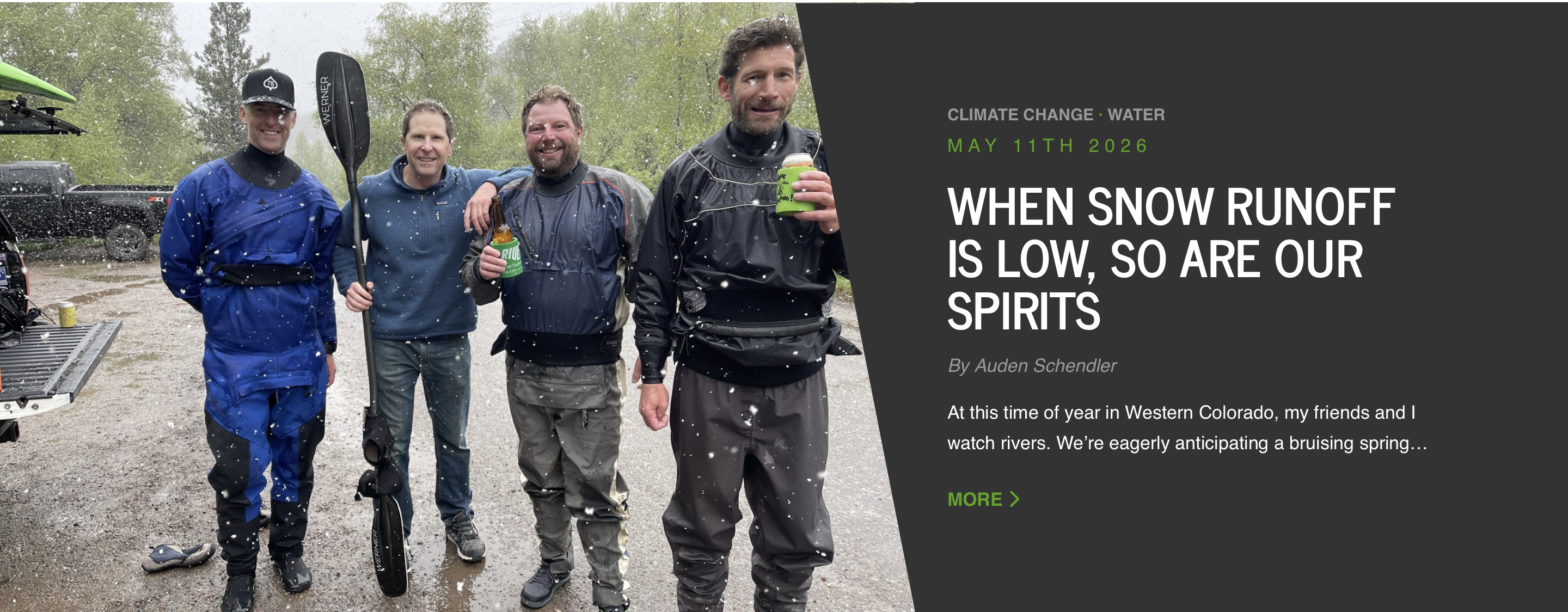


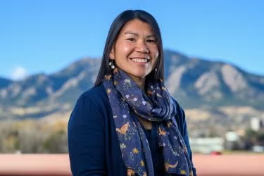
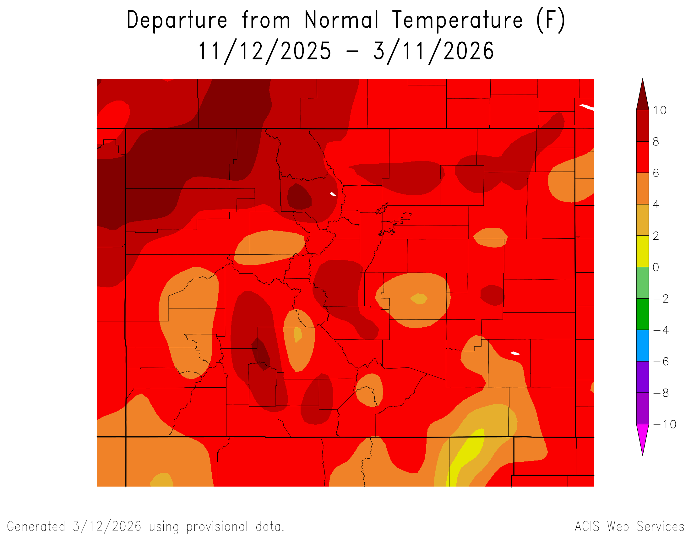
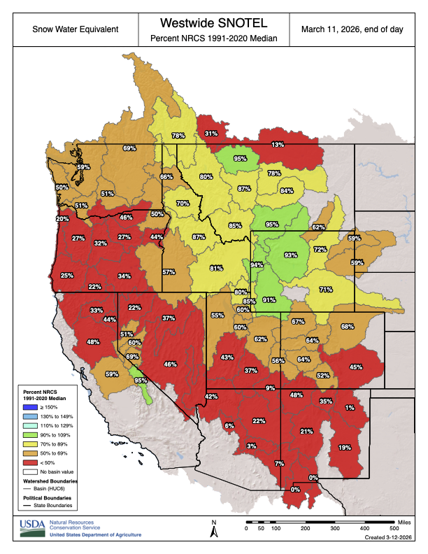
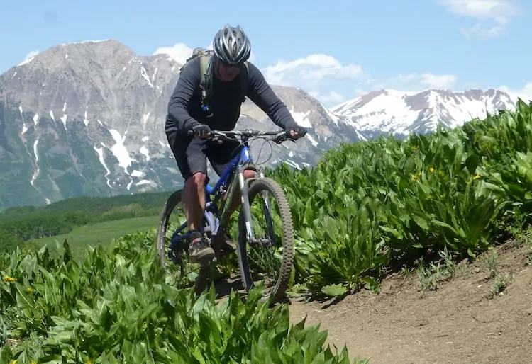
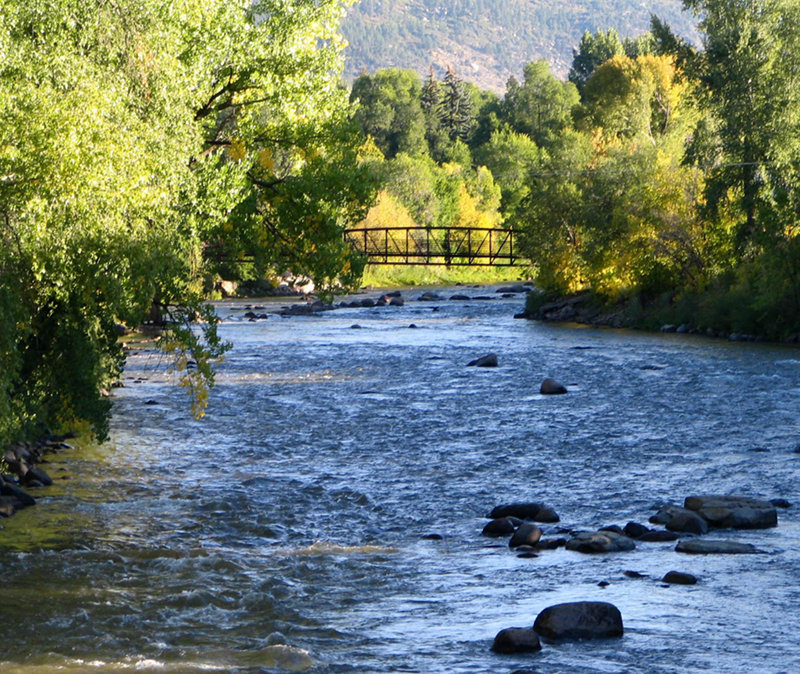

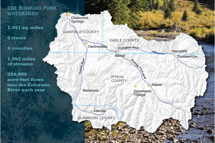


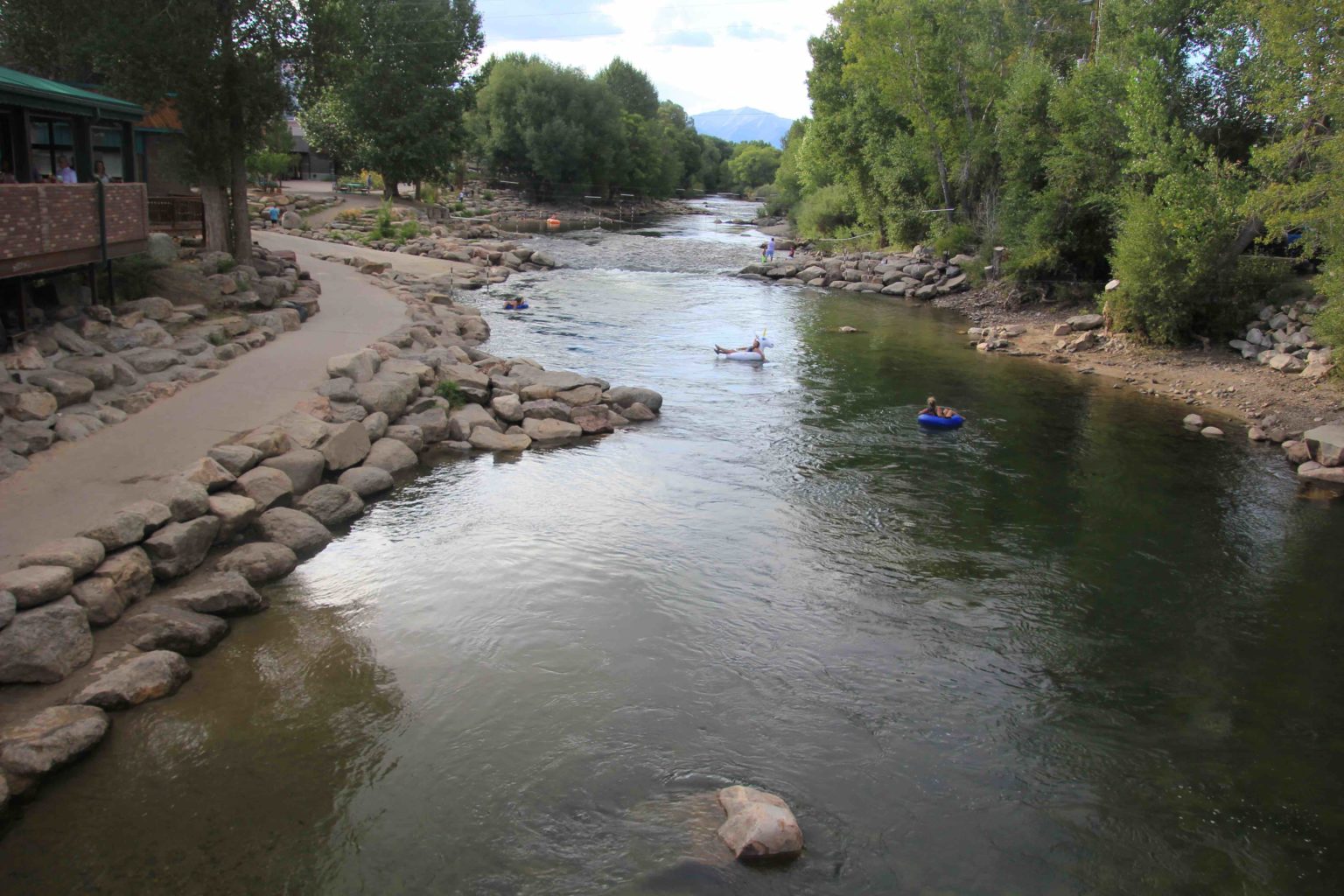
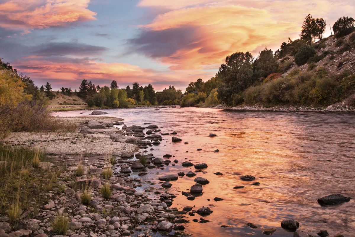
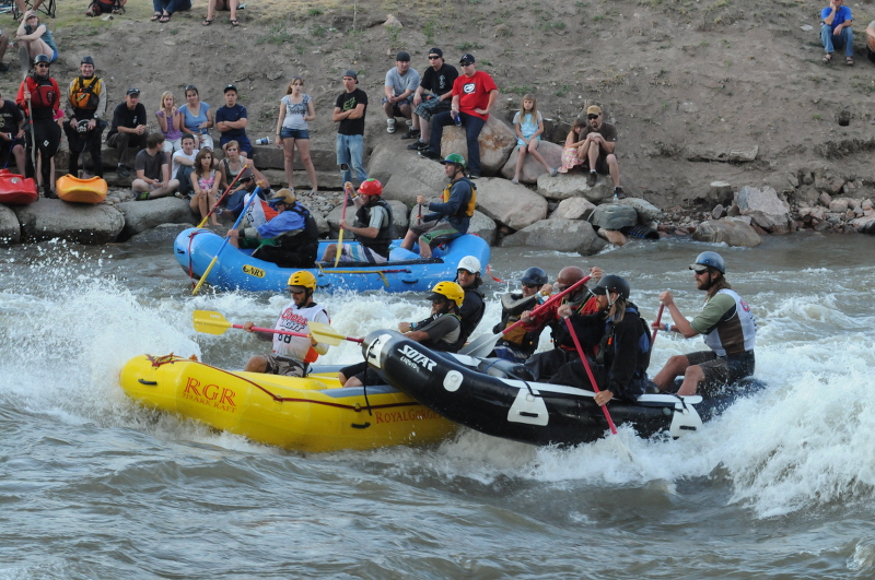
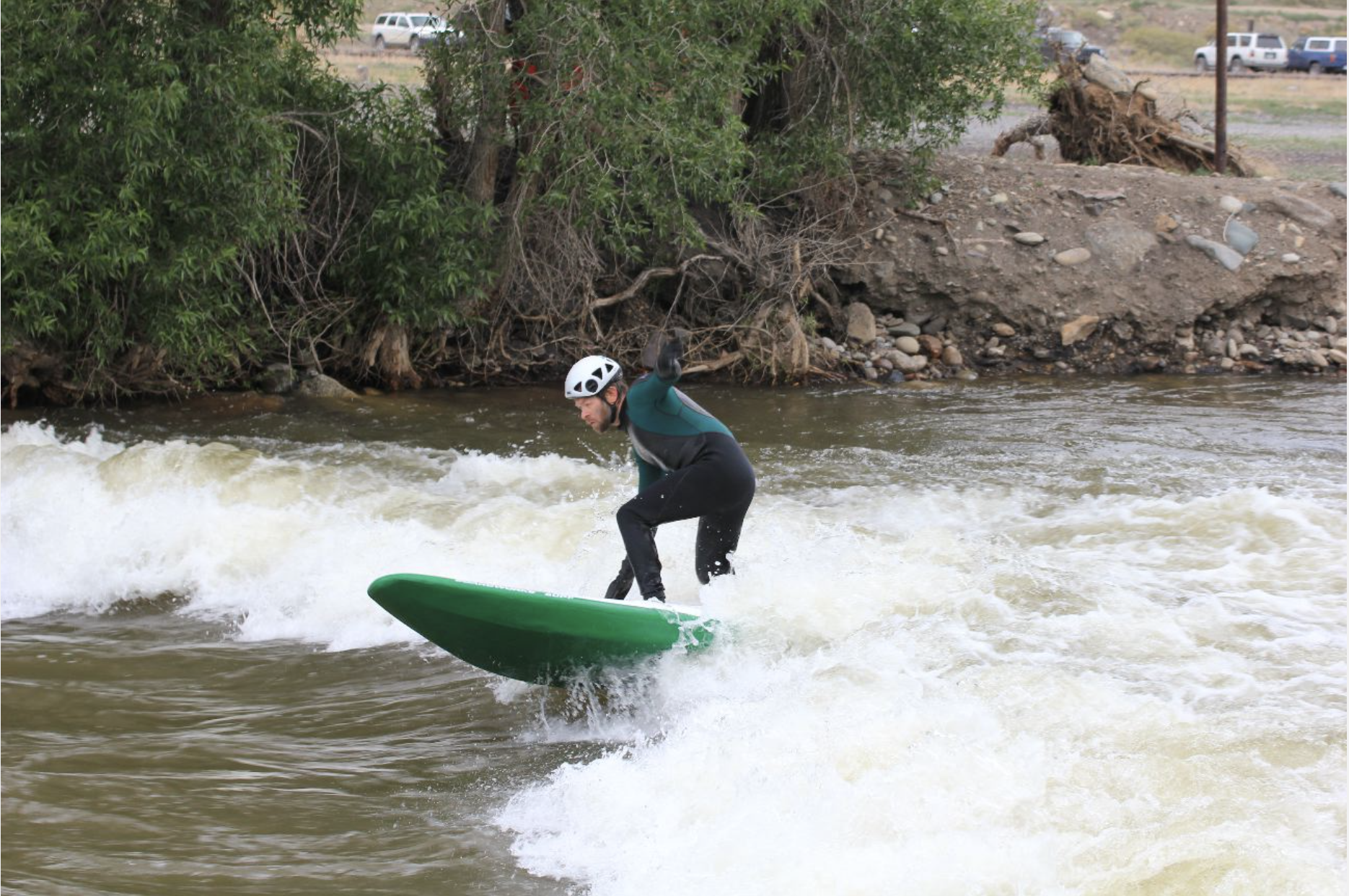


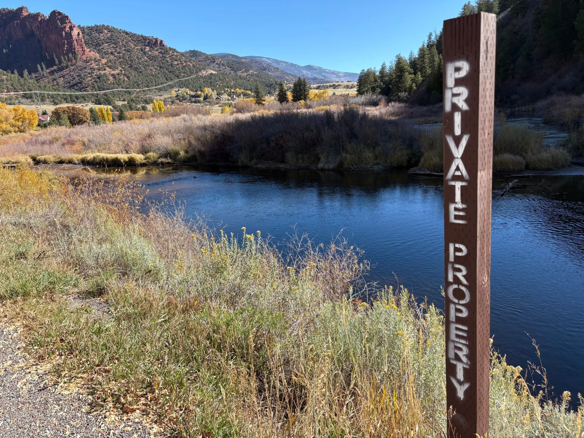
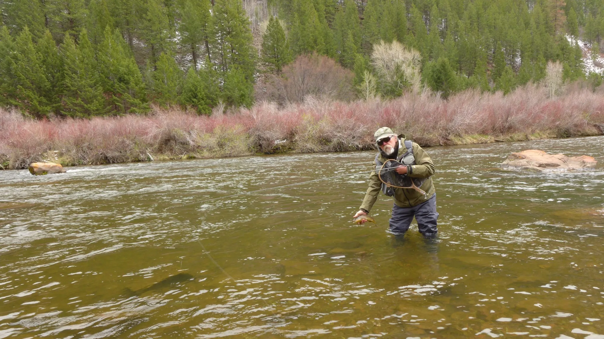


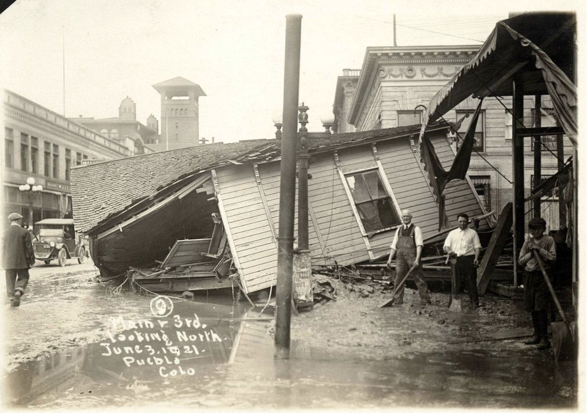
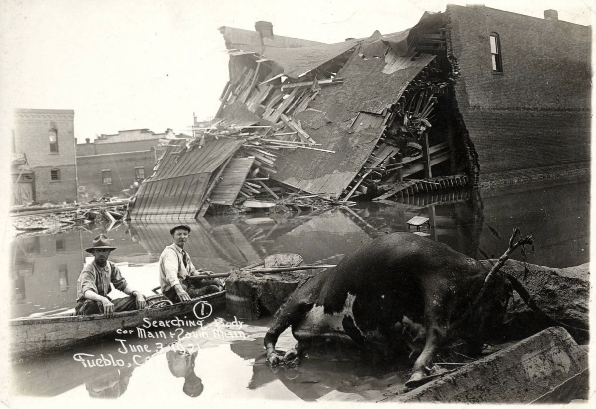

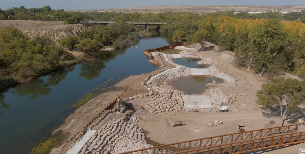


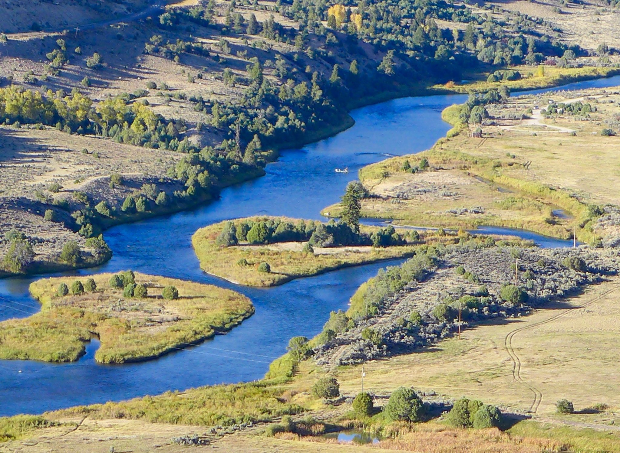
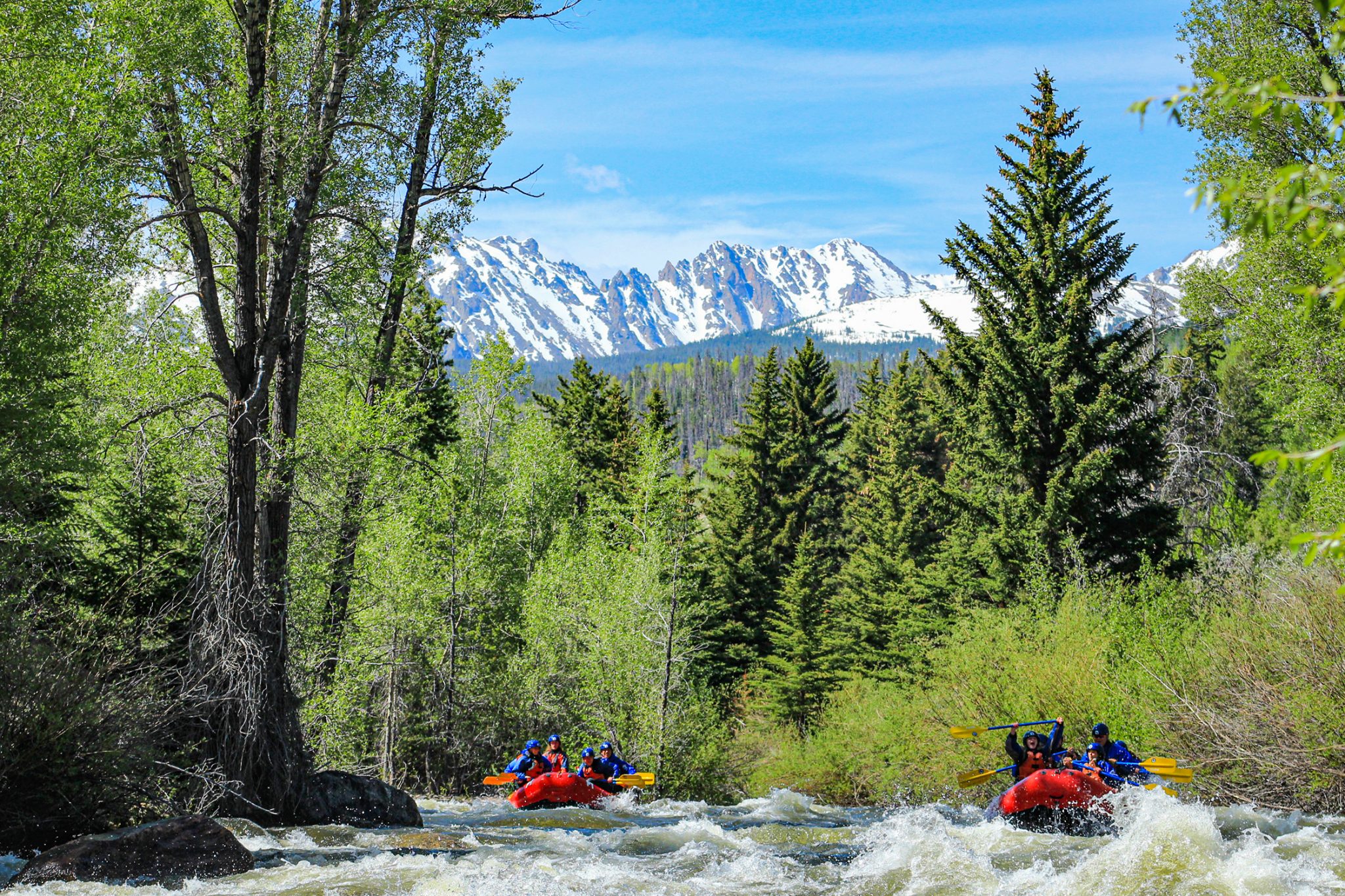

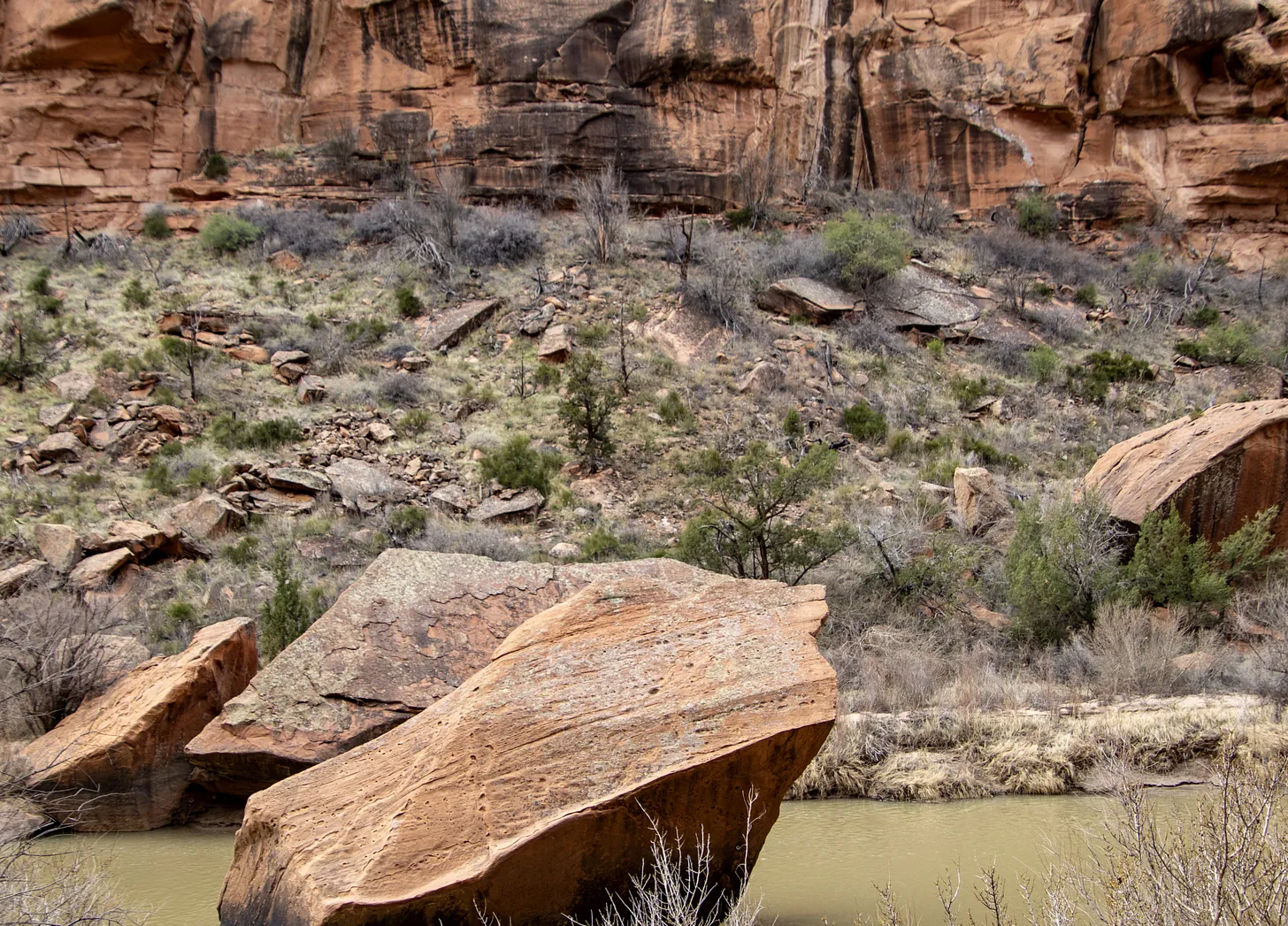


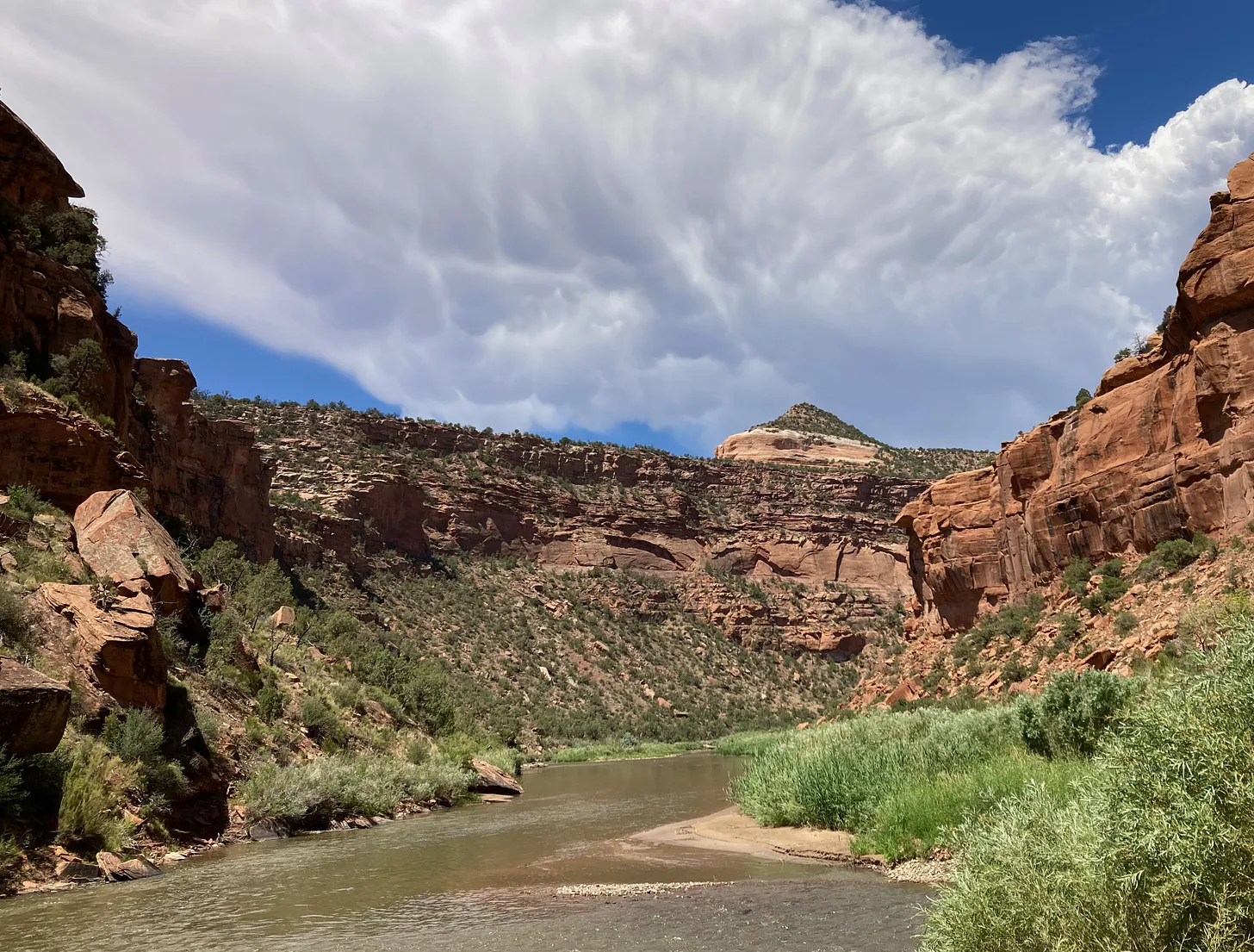


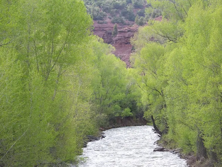


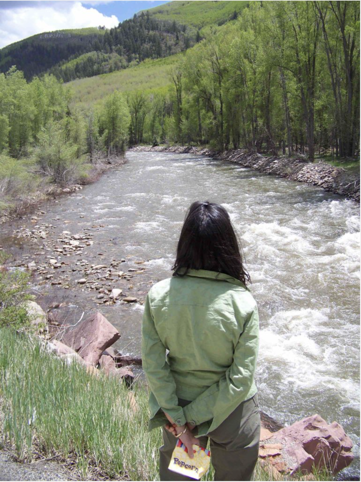


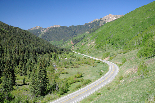


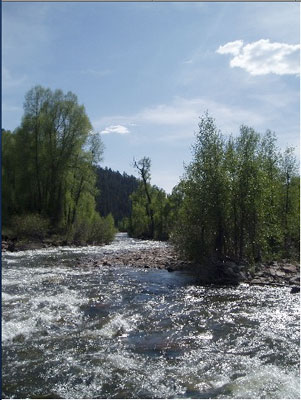


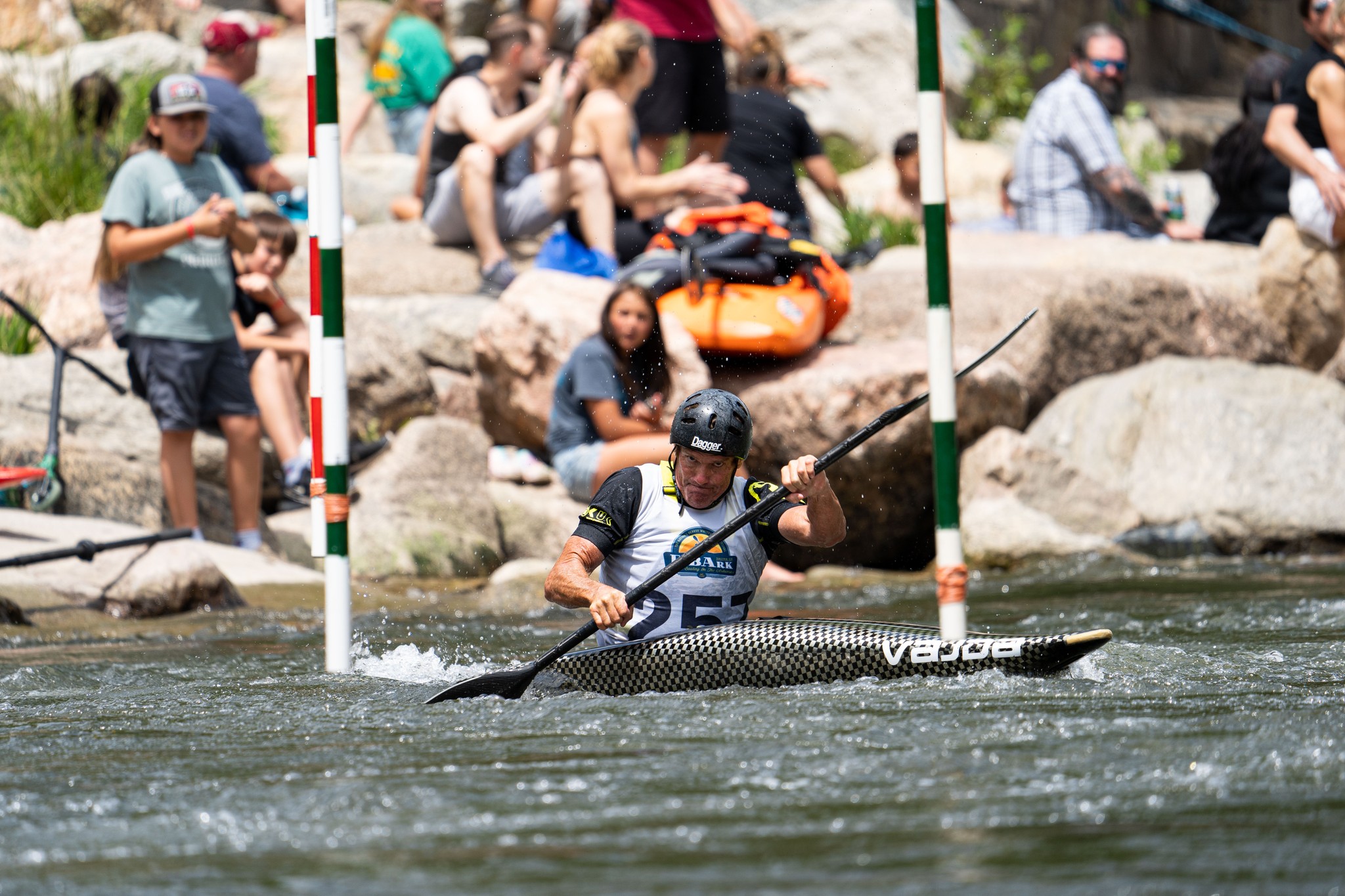


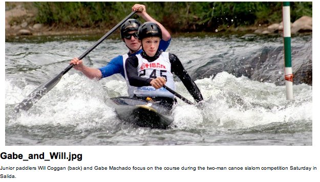
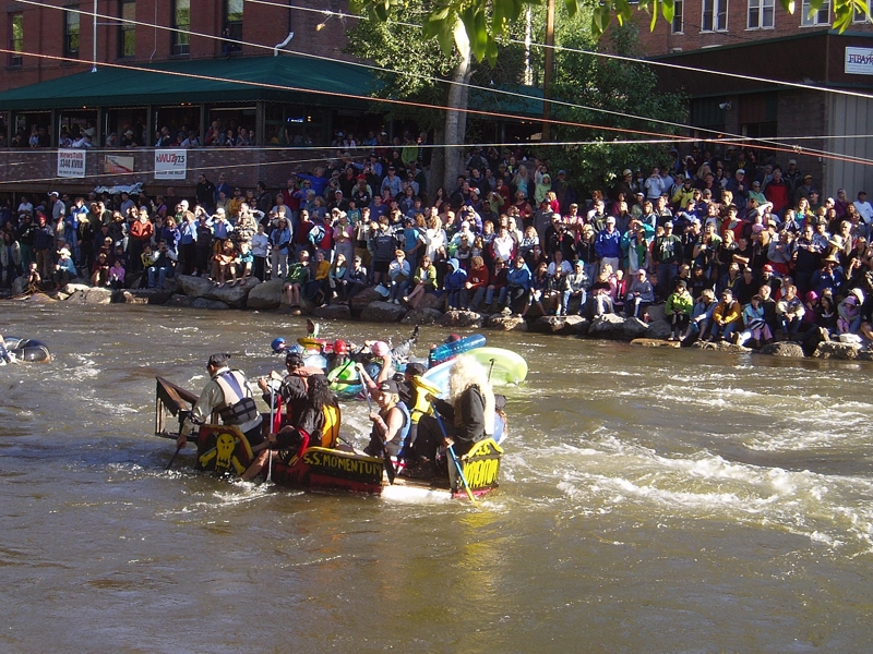
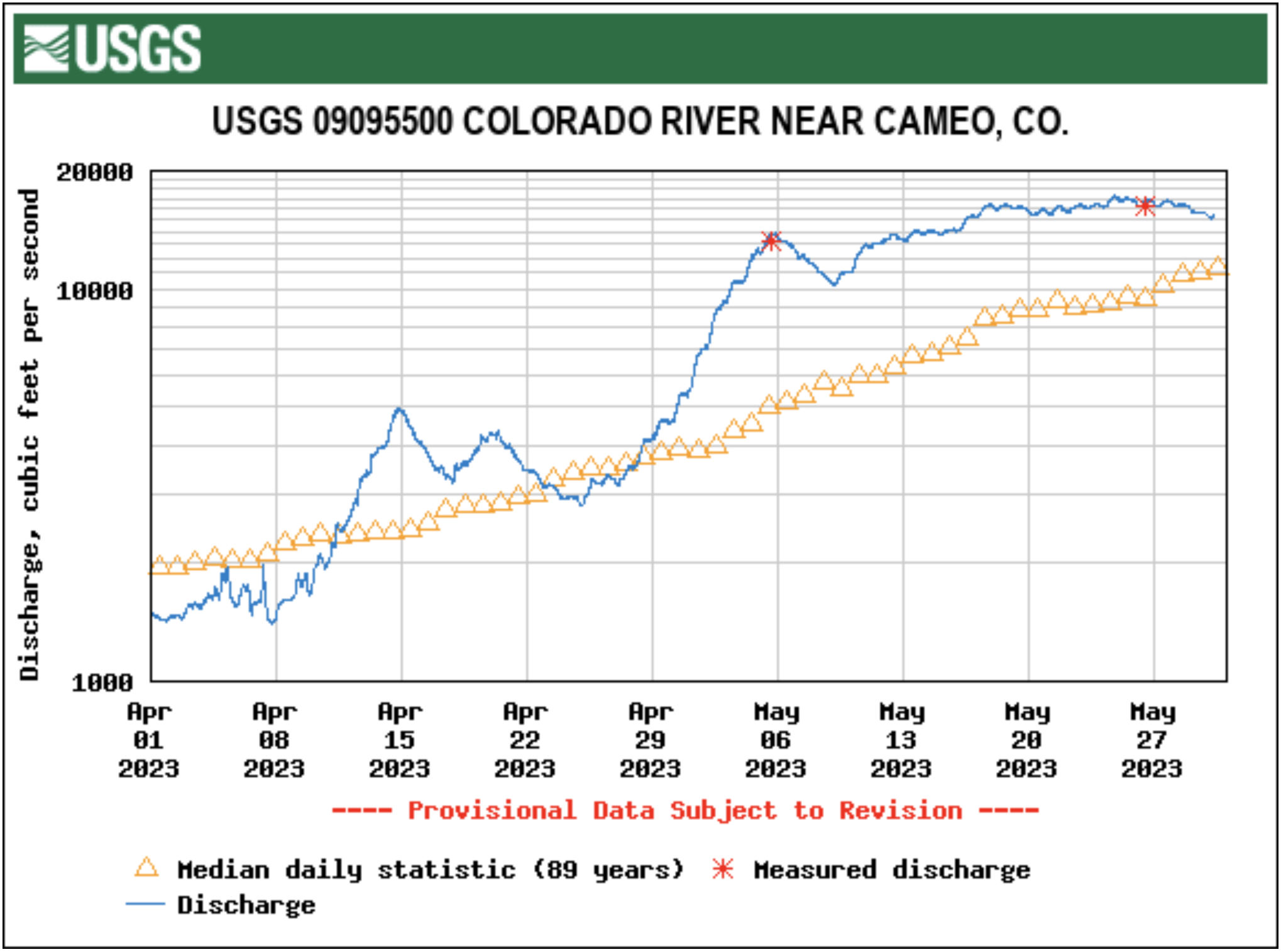

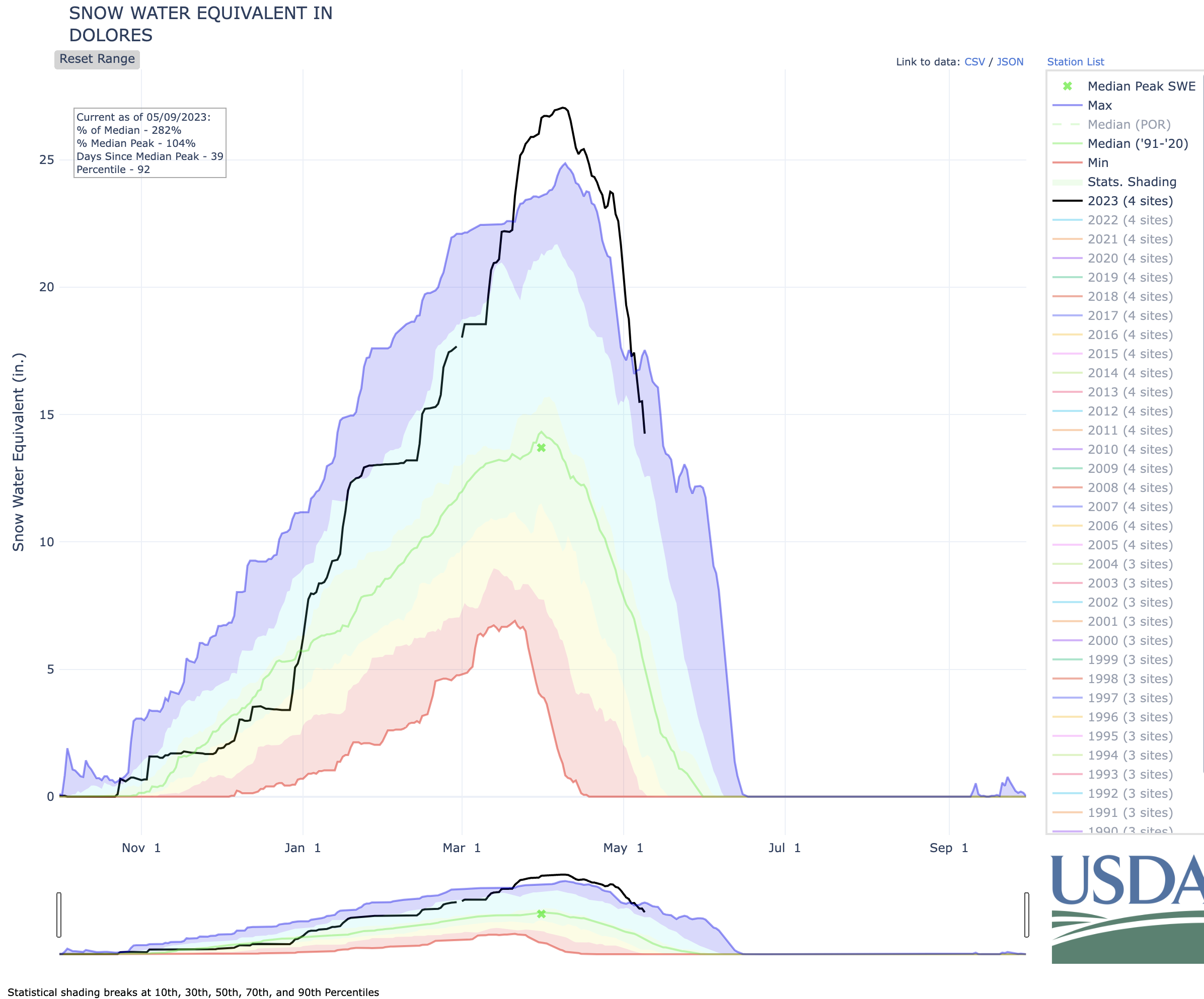
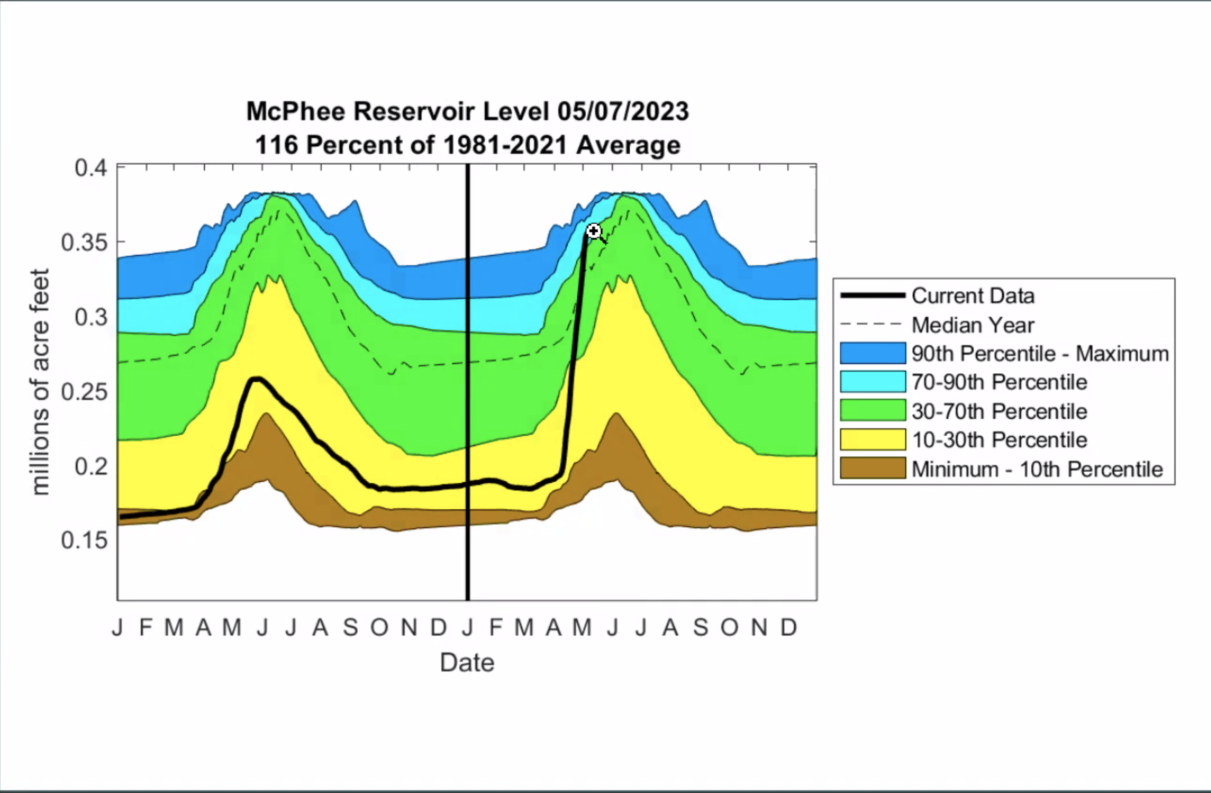

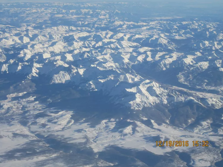
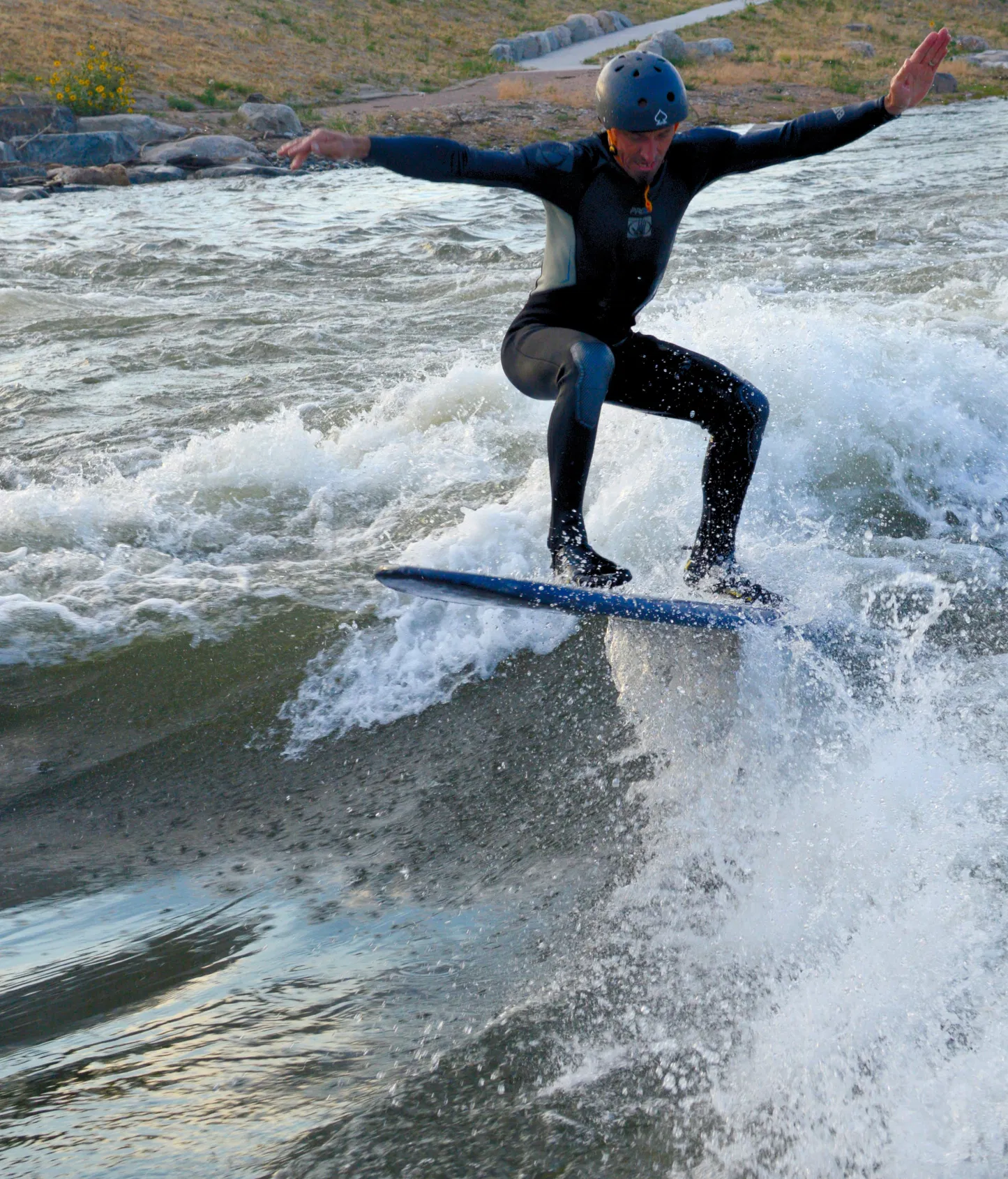

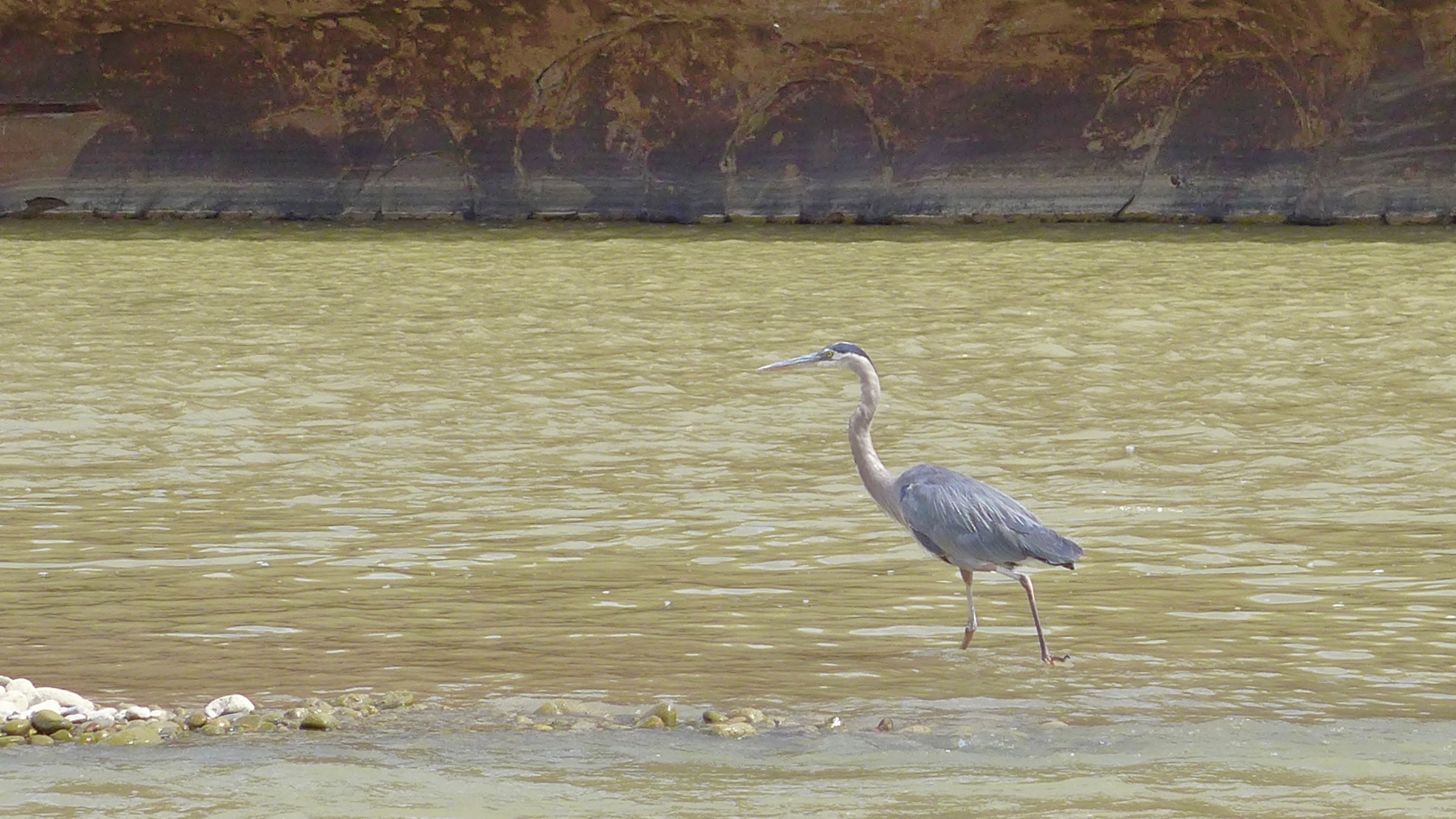
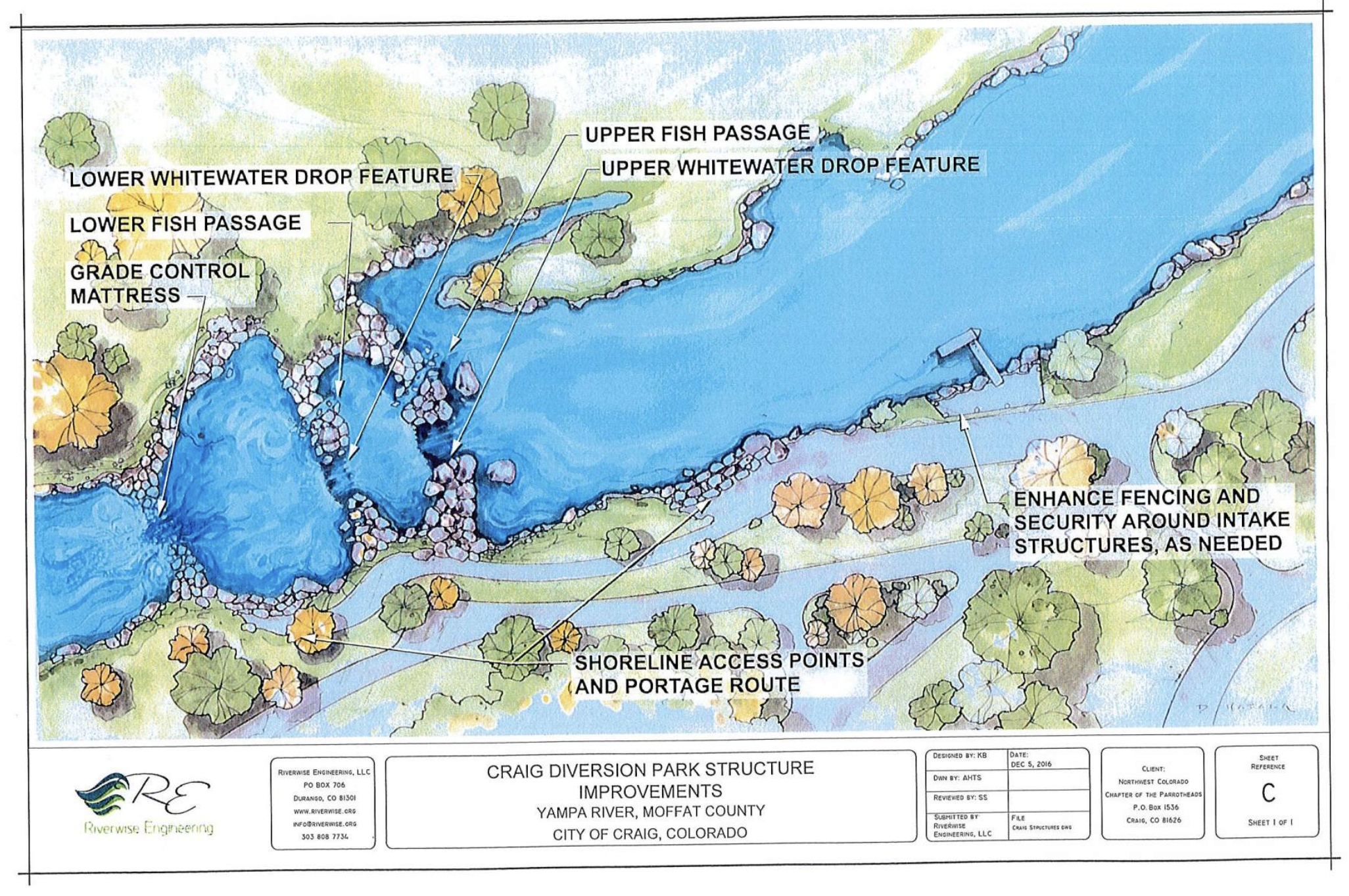
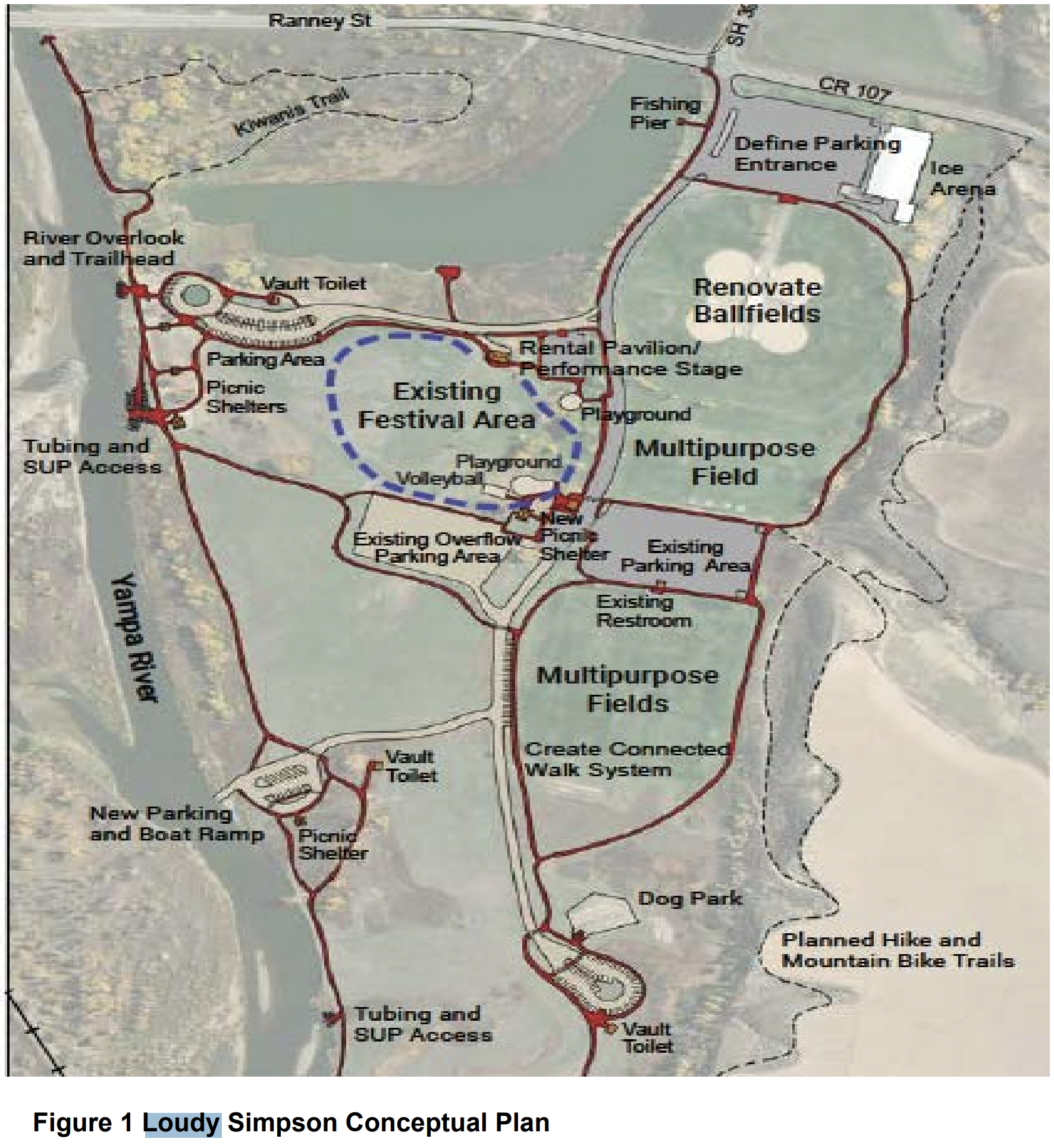
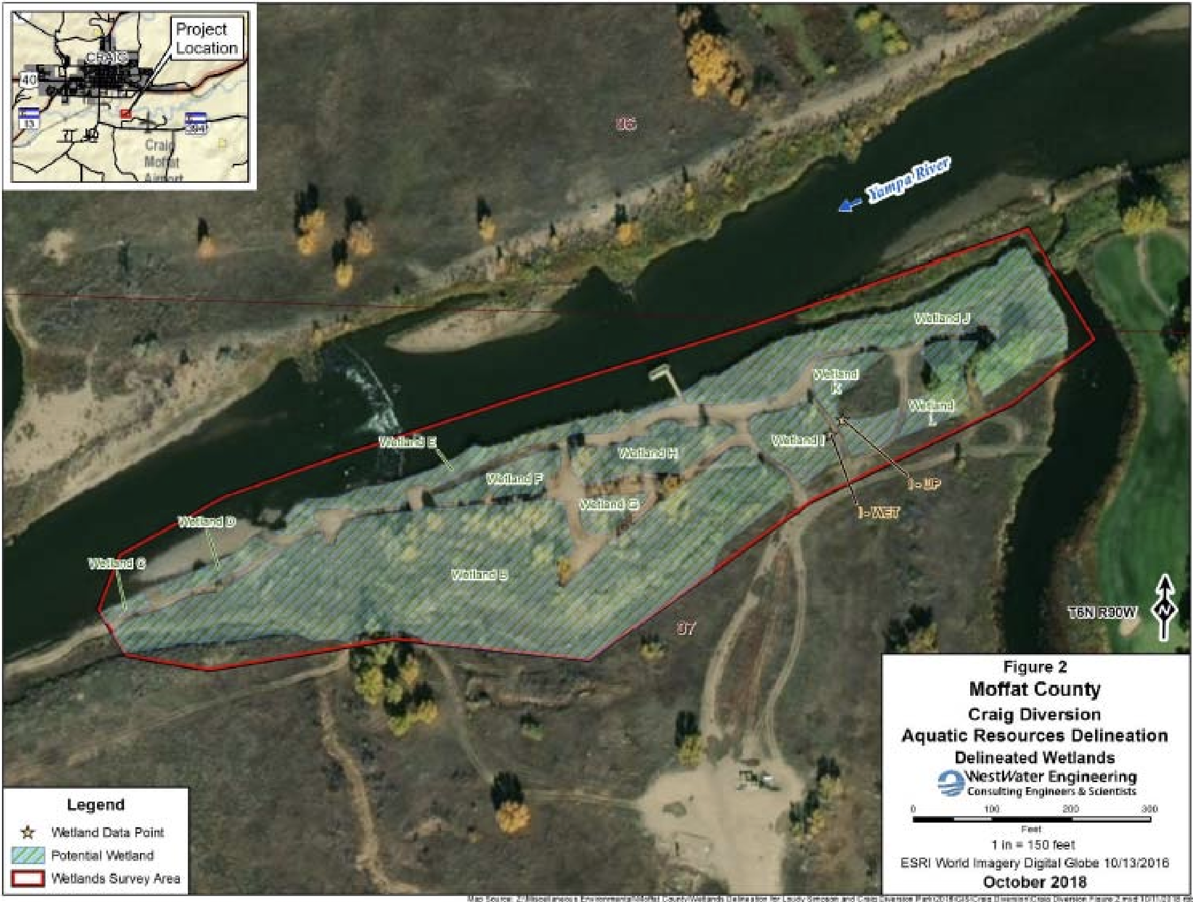
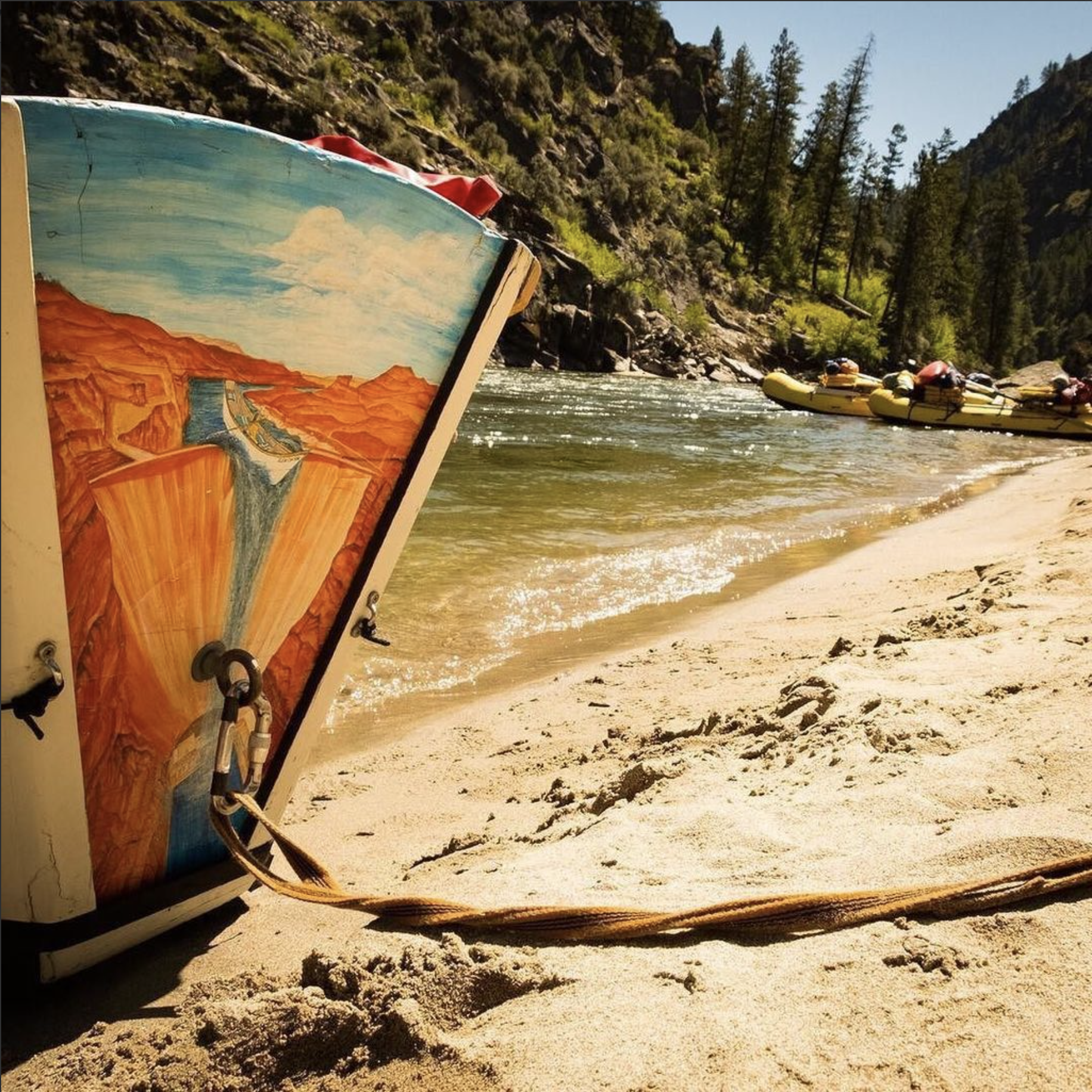

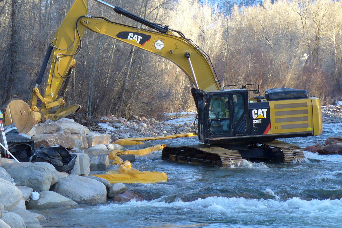
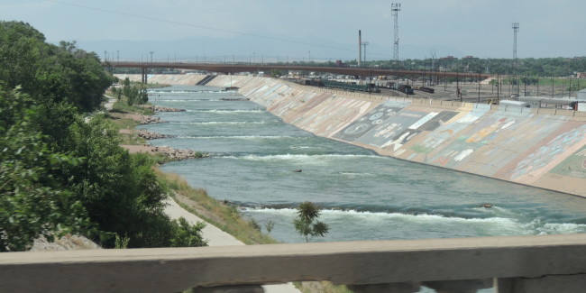
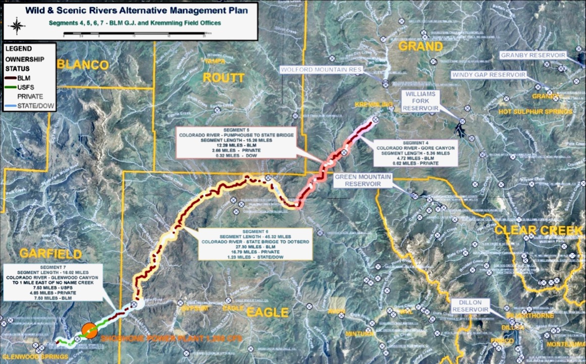


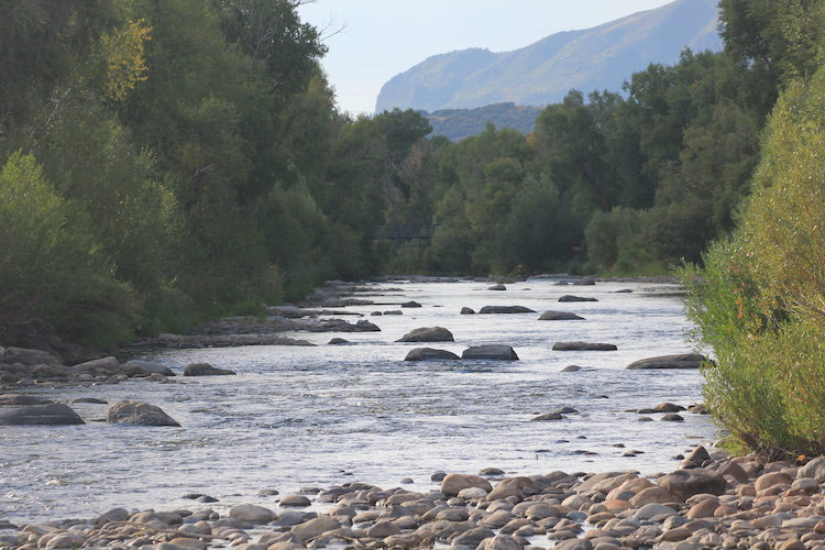


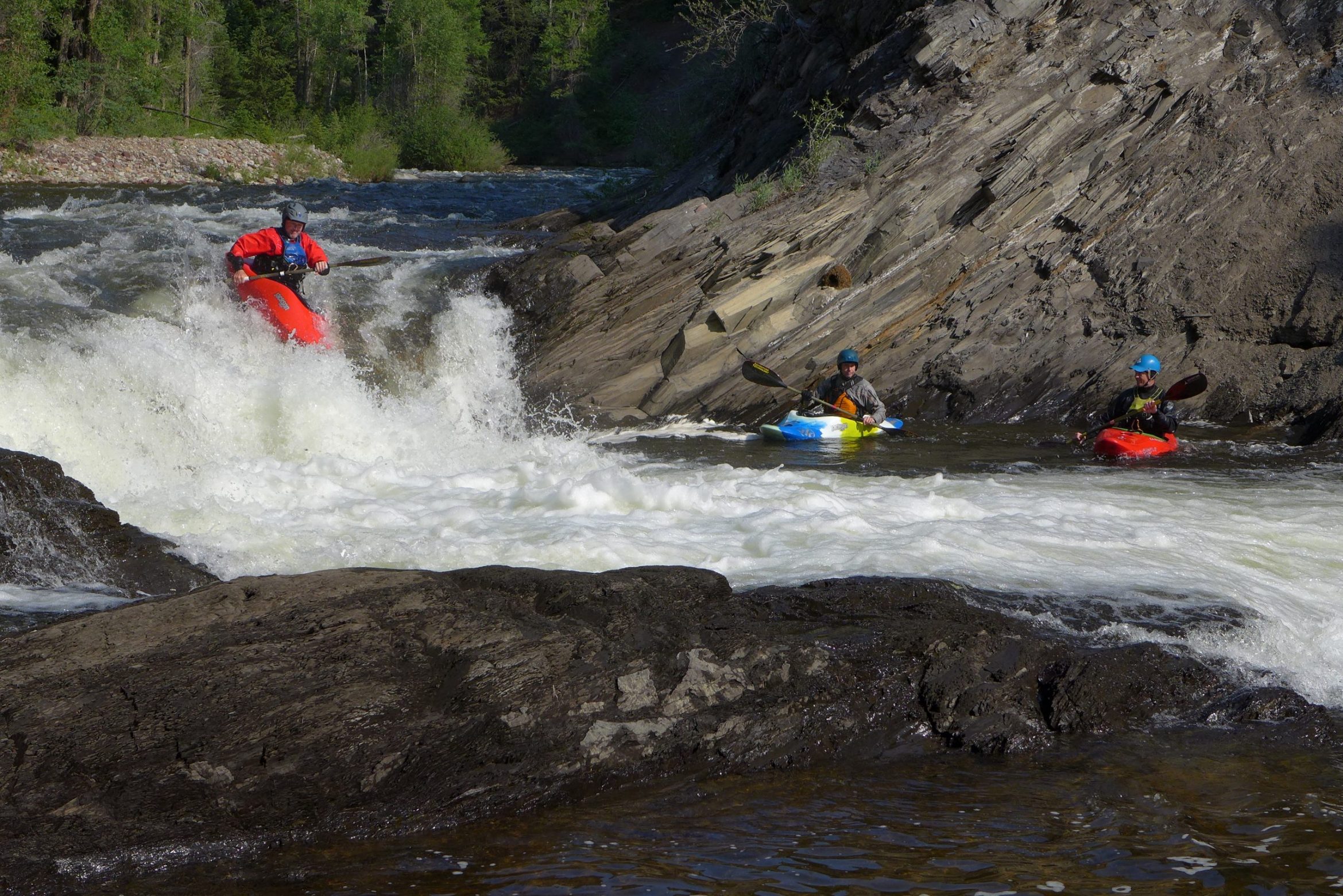
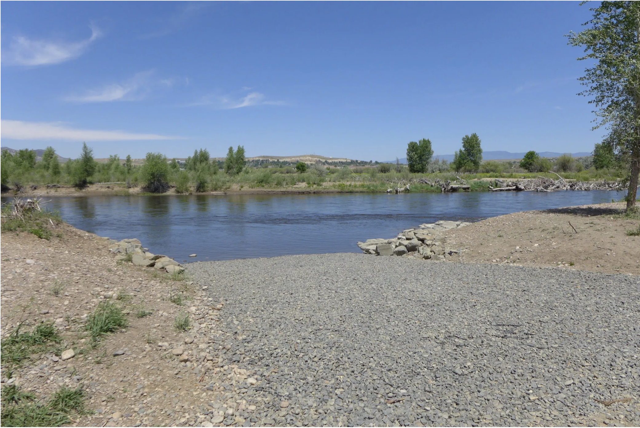
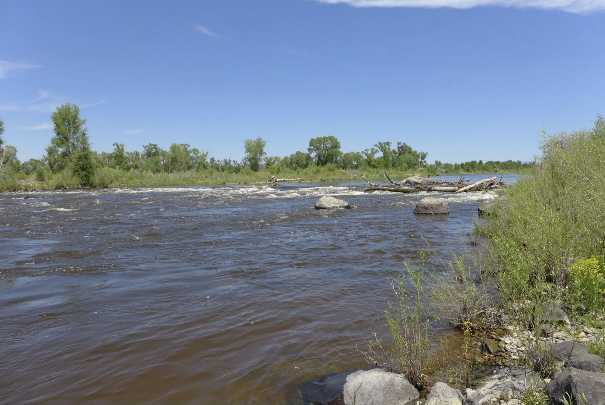
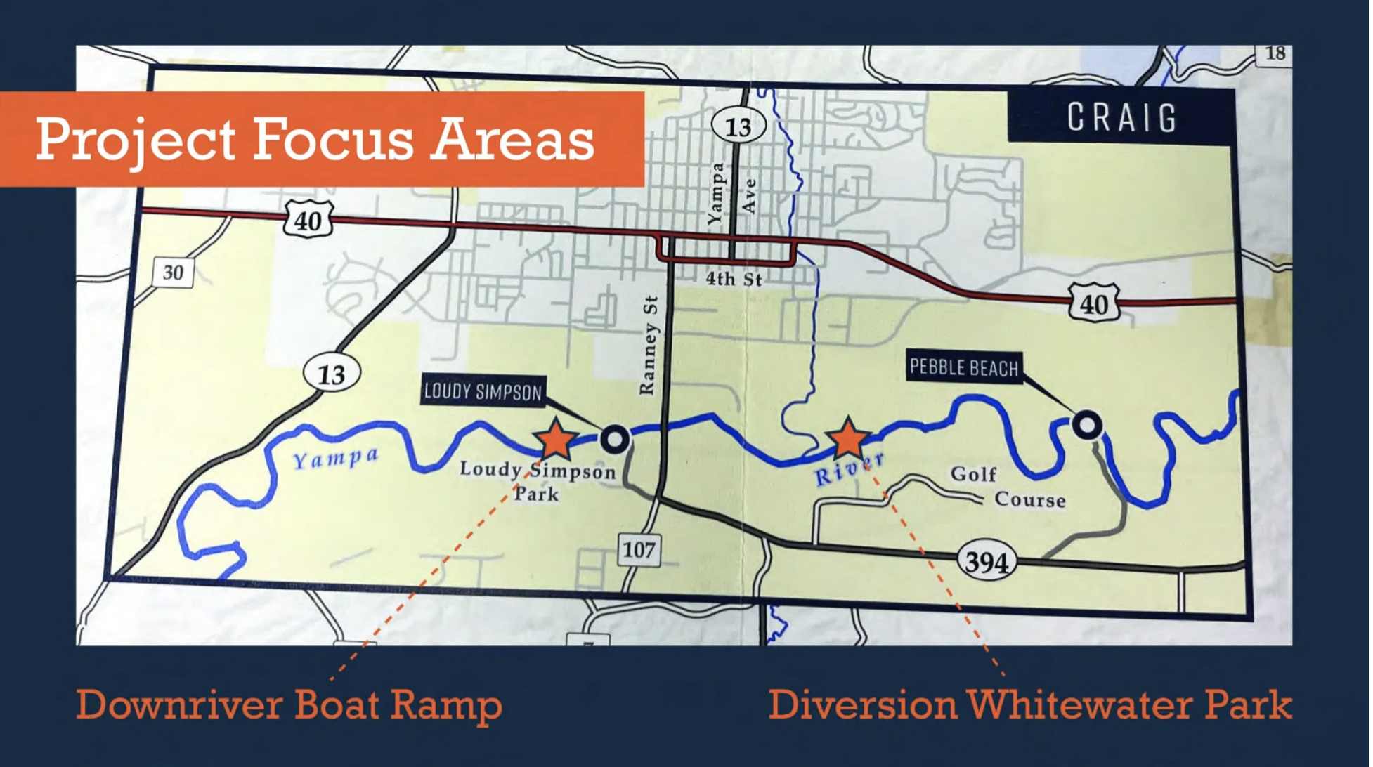


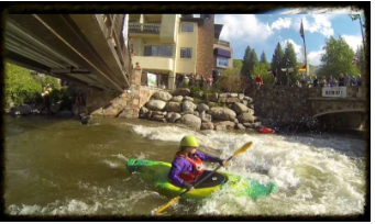

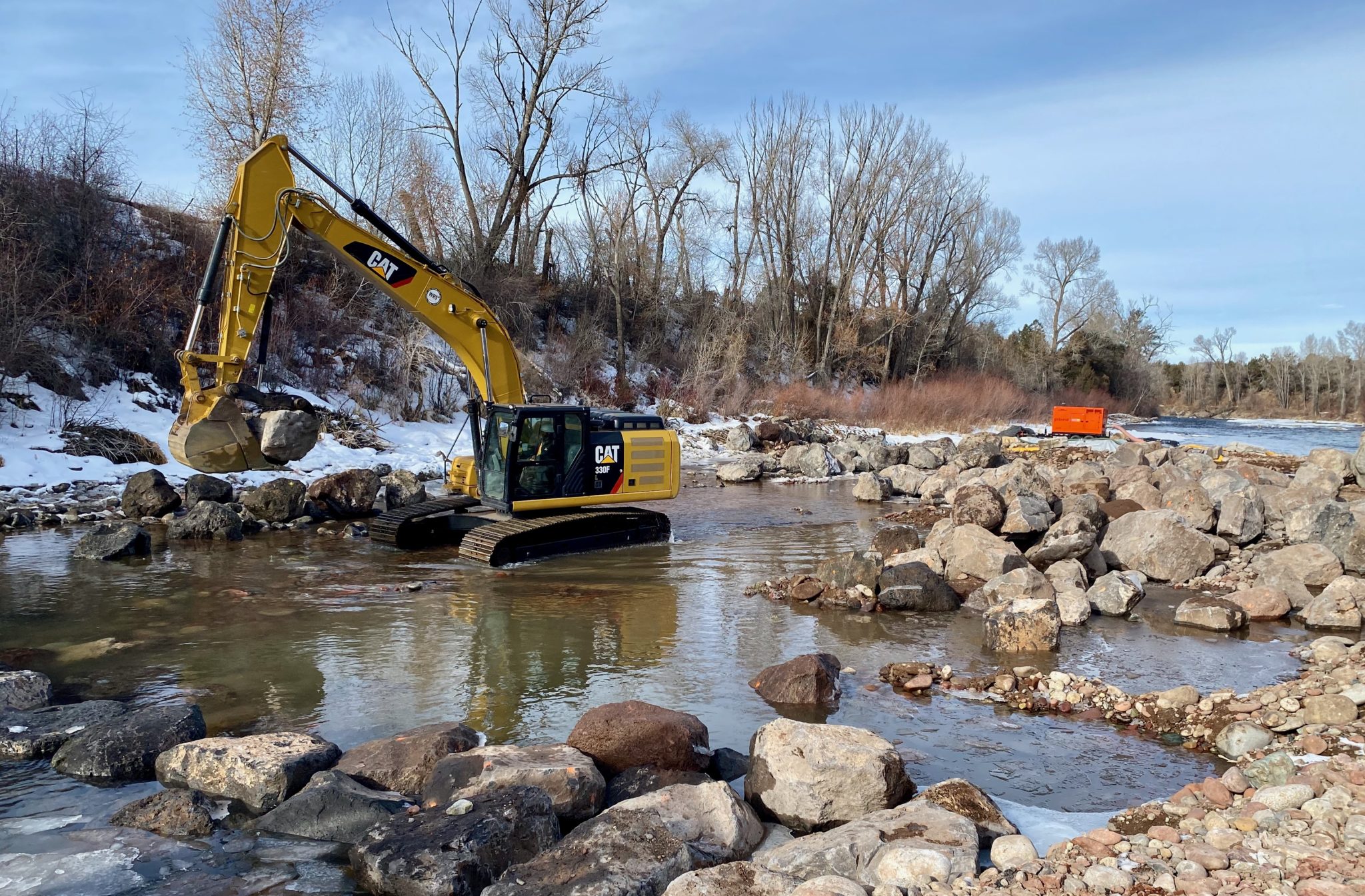
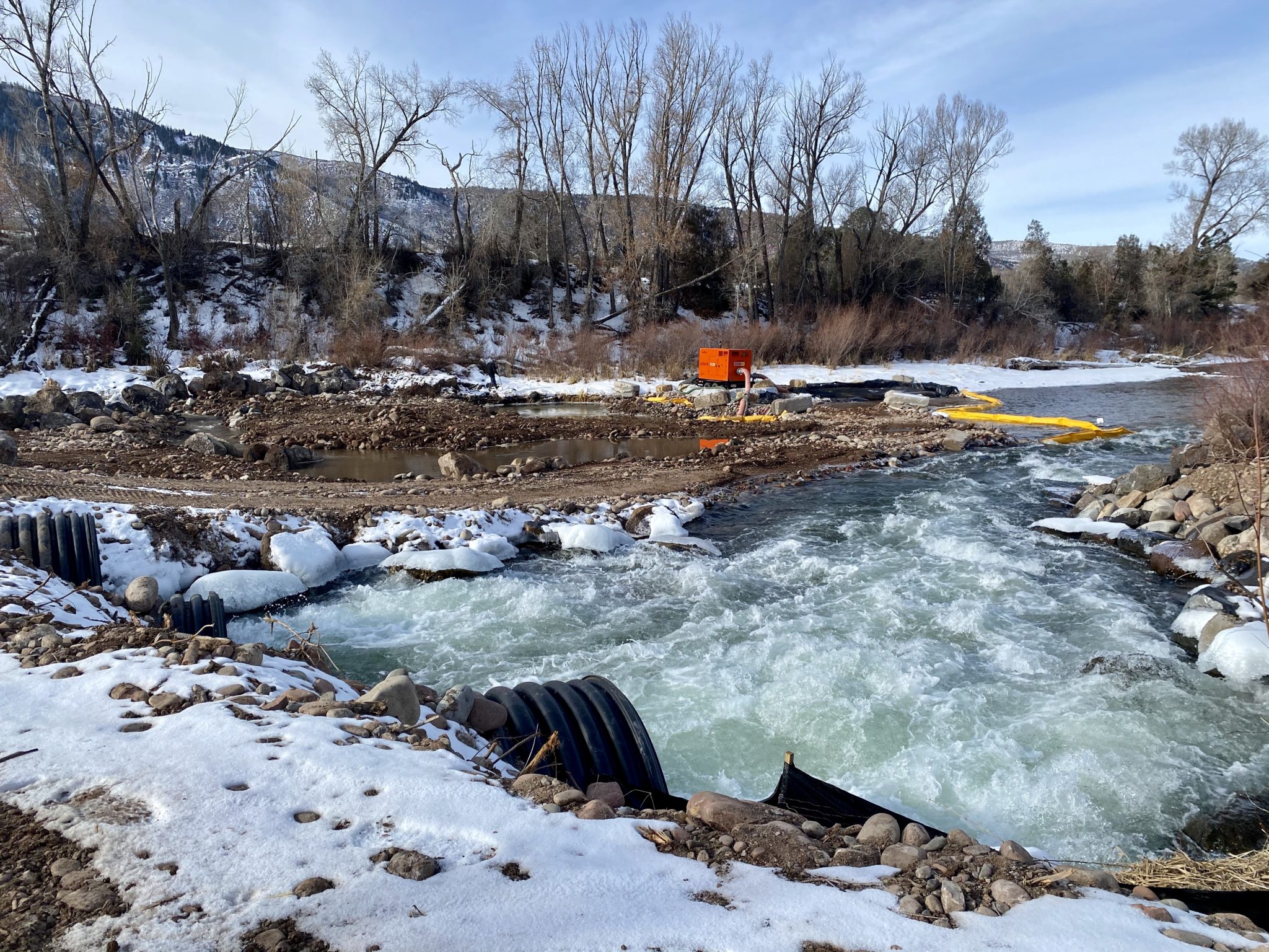


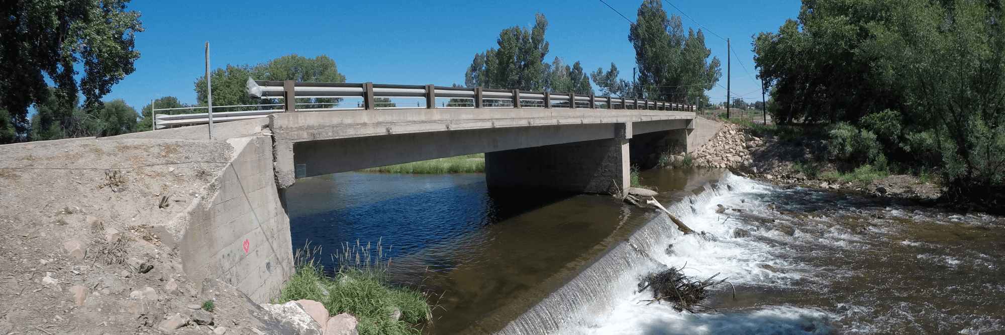


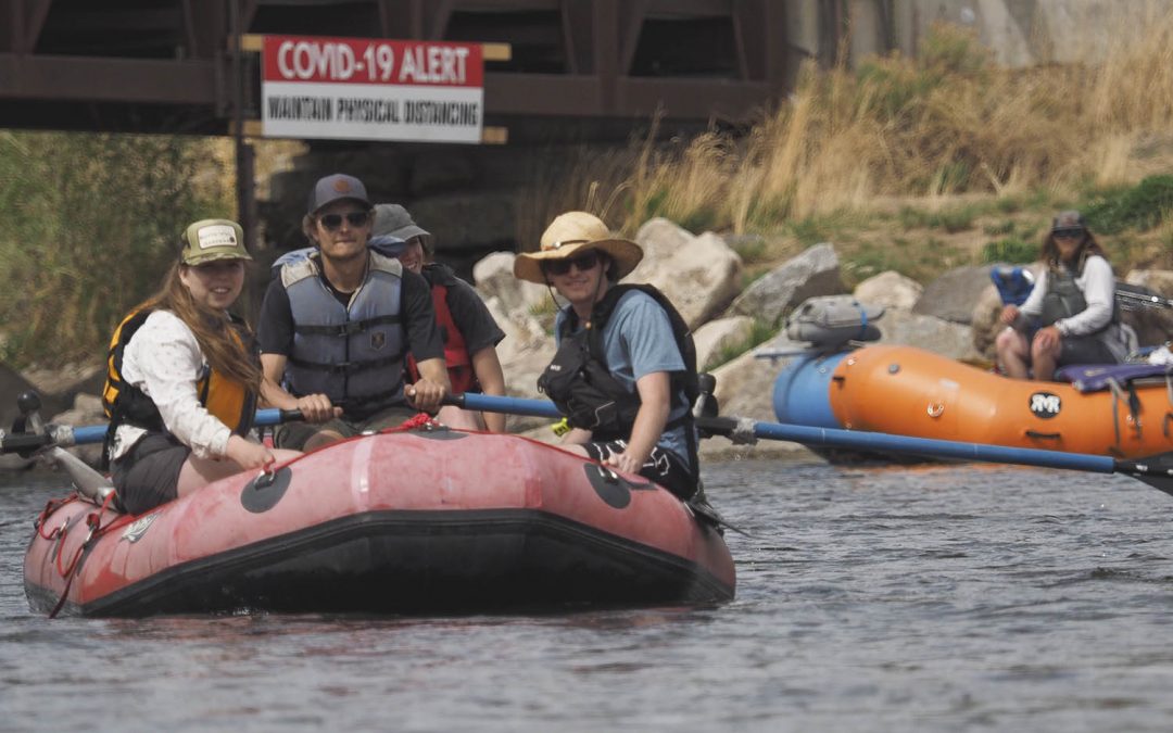
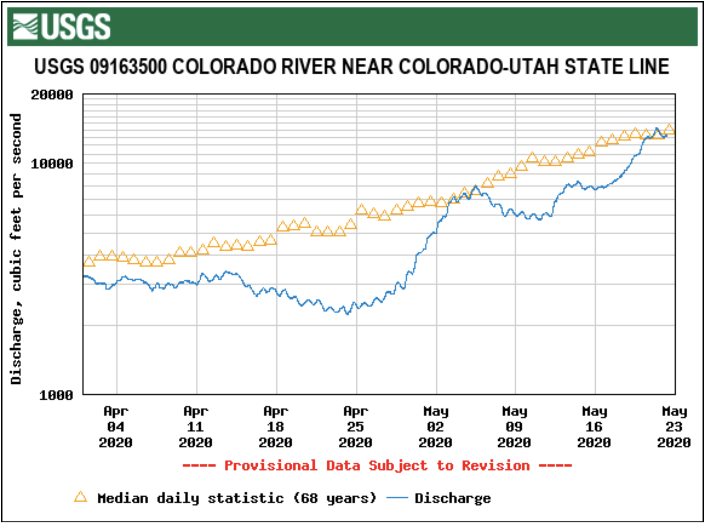