#Colorado #Water #Conservation Board studying possible expansion of Bear Creek Lake — CBS Colorado

Following heavy rains which fell mid-September 2013 in Colorado, the pool elevation at the Bear Creek reservoir rose several feet. At 4 a.m., Sept. 15, the reservoir pool elevation surpassed its previous record elevation of 5587.1 feet, and peaked at a pool elevation of 5607.9 ft on Sept. 22, shown here. Bear Creek Dam did what it was designed to do by catching the runoff and reducing flooding risks to the hundreds of homes located downstream.

Click the link to read the article on the CBS Colorado website (Ben Warwick). Here’s an excerpt:

The Colorado Water Conservation Board, Army Corps of Engineers and City of Lakewood partnered on a study to examine gaps in water supply and demand, as part of the Colorado Water Plan. The study looked at several different scenarios to forecast and address water supply gaps through the year 2050. The South Platte Basin, which serves the Denver metro area, Northern Colorado, and the northeastern plains, is projected to have a gap anywhere between 509,000 acre-feet and 835,000 acre-feet per year. 

The CWCB and Army Corps of Engineers chose Bear Lake because it has an existing dam and provides an opportunity to store more water at what the group calls a more reasonable cost. The study is examining whether an expansion can decrease the supply/demand gap, possible impacts to flood control, and environmental and recreational impacts. 

If deemed feasible, funding for expansion and enhancement of recreational areas and open space would be a large part of the project. 

There is no set timeline for the project. The feasibility study is ongoing.

#Drought news: One class improvement in a few small areas of western #Colorado

Click on a thumbnail graphic to view a gallery of drought data from the US Drought Monitor.

Click here to go the US Drought Monitor website. Here’s an excerpt:

This Week’s Drought Summary

The heaviest precipitation this week fell on a swath across southwestern Kentucky and immediately adjacent locales (3.0 to 4.5 inches), and the higher elevations of Arizona (3.5 to locally over 6 inches). Moderate to heavy amounts of 1.5 to locally 4.0 inches pelted the rest of Kentucky, southern Missouri, northeastern Arkansas, just north of the central Gulf Coast, and patchy areas across southern Virginia and the interior Southeast. Similar amounts dotted southern California and the higher elevations of the southern Sierra Nevada and the Four Corners region, especially across Arizona. Light to moderate precipitation extended across the remainder of the interior Southeast, from central Texas northward through the upper Midwest, across some lower elevations of the Four Corners region, in parts of the southern Great Basin, through most of the Sierra Nevada, and along much of the immediate West Coast. Much of the precipitation fell as heavy snow late in the period from Kansas and Nebraska to the lower Great Lakes. Amounts topped one foot at scattered spots across southwestern Iowa and southeastern Nebraska, with Omaha, NE reporting just under a foot. Small areas of moderate precipitation were observed in some areas to the lee of Lakes Erie and Ontario, but otherwise, the driest areas this week – reporting little or no precipitation – stretched along the northern tier of states from the Cascades through New England, most of the Intermountain West, the High Plains, southern Texas, Florida, the southern Atlantic Coast, the northern Ohio Valley, and the middle Atlantic States. No large, broad-scale changes were appropriate as a result, but numerous smaller-scale adjustments were introduced…

High Plains

Moderate precipitation and/or heavy snow hit eastern Nebraska and Kansas, and isolated but heavy precipitation fell on some of the higher elevations of Colorado. Other areas received light amounts at best. Decent snowpack and recent heavy precipitation in the highest mountains led to some improvement in the protracted D2-D4 in a few ranges in north-central and south-central Colorado. Areas farther north experienced another dry week, resulting primarily in a fairly broad expansion of severe drought into northeastern Wyoming and the western Dakotas…

West

Persistent above-normal precipitation led to improvements across the southern tier of the region as well as the southern Oregon coast. At the same time, continued deficient precipitation led to significant expansion and/or deterioration of D3 and D4 conditions near the Nevada/California border, and D0 to D2 conditions across Montana and adjacent Wyoming. Notably, the protracted D4 conditions in central Arizona finally eased slightly as the higher elevations report above-normal precipitation and a favorably enhanced snowpack. Smaller areas of improvement due to recent increased precipitation were brought into north-central New Mexico, southwestern Arizona, and southeastern California…

South
Moderate to heavy precipitation fell on swaths of Tennessee and the lower Mississippi Valley, bringing improvements to some of those regions. But the precipitation was not widespread, and some parts of this area that missed the heavier precipitation saw an increase in dryness and drought. Farther east, heavier precipitation was more sparsely distributed through Oklahoma, northeastern Texas, and central Texas, with the remainder of Texas recording only light amounts. Besides adjustments to short-term cry areas in response to the rainfall pattern, moderate drought persisted in southwestern Tennessee, and expanded into larger sections of northwestern Mississippi and south-central Louisiana. In addition, an area of severe drought was assessed in an area centered near Tallahatchie County, MS where 90-day rainfall totals were 8 to 10 inches below normal and 6-month totals were 10 to 12 inches below normal. In the expanded area of moderate drought in southern Louisiana, 6-month rainfall totals were as much as 15 inches below normal, but shorter-term deficits are less remarkable…

Looking Ahead

Over the next 5 days (January 28 – February 1, 2021) the heaviest precipitation is expected along the immediate West Coast, southern Cascades, and Sierra Nevada. These areas are expecting 3 to locally 7 inches of precipitation. Meanwhile, 1 to 3 inches are expected in the central and northern Cascades and the higher elevations from northeastern Oregon to northwestern Wyoming. Up to 2 inches may fall on north-central Utah, the higher elevations of Arizona, and part of Nevada. Farther east, the western half of the Plains should be dry, and only light precipitation is forecast across the northern Great Lakes, lower Mississippi Valley, Gulf Coast, Florida, and upper New England. Moderate to locally heavy precipitation should fall on a swath from much of the Mississippi Valley eastward through the southern half of the Appalachians, middle Atlantic region, and upper Southeast. The eastern half of North Carolina should pick up 1 to 2 inches. In the portions of the Plains expecting very little if any precipitation, daytime temperatures should average at least 3 degrees F above normal, with a swath from the Texas Panhandle to eastern Montana averaging 6 to 12 degrees F warmer than normal. In contrast, most of the Pacific and Atlantic Coasts and the Southwest should average at least 3 degrees F below normal. Daytime high temperatures will average at least 6 degrees F below normal in central Arizona, northern California, the upper Northeast, and lower New England.

The ensuing 5 days (February 2 – 6, 2021) bring enhanced chances of surplus precipitation in a broad area from the Rockies to the East Coast, excluding much of Texas and Florida. Odds favor above-normal precipitation throughout Alaska as well. Meanwhile, deficient precipitation is more likely across the Florida Panhandle, the southern one-third of Texas, northern California, and the Pacific Northwest. Warmer than normal weather is favored east of the Mississippi Valley and north of Florida, with the highest probabilities covering New England. Milder than usual conditions are also expected in the southern half of Alaska. Meanwhile, the odds favor subnormal temperatures from the High Plains to the West Coast, especially across California and most of Nevada, Utah, and Arizona.

US Drought Monitor one week change map ending January 26, 2021.

From The Clear Creek Courant (Deb Hurley Brobst):

The first six months of 2021 are predicted to be dryer than normal, and the Evergreen Metropolitan District is reminding residents that it isn’t too soon to conserve water.

All foothills residents, whether in a water district or on private wells, should be concerned about drought, and EMD General Manager Dave Lighthart is already expecting to impose water restrictions in the district as soon as April.

“The stream-flow forecast that came out in January is showing critical issues throughout the state but most importantly in the Bear Creek and the Mount Evans watersheds,” Lighthart said. “We want people to be aware that we are extremely dry. The long-range forecasts for the (foothills) are that temperatures will likely be higher than normal with an equal chance of lower-than-normal precipitation.”

According to the Natural Resources Conservation Service, as of Jan. 1, Colorado’s year-to-date mountain snowpack was 83% of normal and precipitation was 70% of normal. Last year, the snowpack was 119% and precipitation was 92% of normal.

The 2020 water year, which ended on Sept. 30, 2020, finished on a record dry note, according to the conservation service. The combined precipitation in August and September 2020 totaled the lowest in the 36 years the service has kept records. Then October precipitation across Colorado was 47% of average.

Last summer, EMD instituted Level 2 drought restrictions and was concerned it would need to move to Level 3 — the strictest level — until a couple of rainstorms in July increased water flows in Clear Creek.

EMD’s Level 1 requests voluntary reductions in water usage; Level 2 requires mandatory cutbacks in both residential and commercial outside watering; Level 3 requires no outside water uses and assesses fines for violations.

Lighthart said EMD generally waits until April to begin water restrictions, hoping that the typical spring snowstorms will positively impact snowpack, but “the long-range forecasts are not being very positive in that regard.”

Changes coming to Bear Creek Greenbelt — The Lakewood Sentinel

Bear Creek Lake Park. Photo credit: GoHikeColorado.com

From The Lakewood Sentinel (Joseph Rios):

In the city of Lakewood, the Bear Creek Greenbelt is the place to be for residents who love the outdoors. Each year, the park, located at 2800 S. Estes St., attracts thousands of cyclists, hikers and others who get the opportunity to enjoy a scenic route to Denver, Bear Creek Lake Park or other places.

With a grant secured from the Great Outdoors Colorado (GOCO) Board, the Colorado Youth Corps Association, a statewide coalition of eight corps that train children, young adults and veterans to work on conservation projects, will work with Lakewood to make the Bear Creek Greenbelt an even better place.

At the beginning of last month, the GOCO Board awarded the city of Lakewood a $34,000 grant to help remove Russian olive trees. The removal will be done through a partnership with Lakewood and Mile High Youth Corps, one of the corps that is part of the Colorado Youth Corps Association.

Russian Olive

Russian olive trees usually reach 12 to 45 feet tall, according to Utah State University Extension. They’re typically found along floodplains, riverbanks, stream courses, marshes and irrigation ditches in the western area of the country and can displace native riparian vegetation, according to the university. The tree can also choke irrigation ditches and damage tires.

“Really, the big benefit is to protect and restore wildlife habitat. It’s part of a larger restoration effort that is going to have an impact on people and the landscape,” said Madison Brannigan, program officer at GOCO. The organization uses proceeds from the Colorado Lottery to preserve, protect and enhance the state’s wildlife, parks, rivers, trails and open spaces.

The other part of the restoration effort at the Bear Creek Greenbelt will involve planting native trees and shrubs, removing weeds, seeding native grass, installing fencing, planting wetland vegetation and improving water quality, according to a release…

Outside of training, members of the Colorado Youth Corps Association earn a payment and education award to use toward college or payment for student loans…

In total, the GOCO Board awarded $61,000 worth of grants in Jefferson County to fund Colorado Youth Corps Association projects. Outside of Lakewood, the Foothills Park and Recreation District received a $27,000 grant to remove invasive species and to support habitat restoration.

@DenverWater appeal of @BoulderCounty’s 1041 decision about the Moffat Collection System Project scheduled for March 14, 2019

The dam that forms Gross Reservoir. Photo: Brent Gardner-Smith/Aspen Journalism

From The Longmont Times-Call (Charlie Brennan):

Thursday looms as an important day for both proponents and opponents of an expansion at Gross Reservoir, as Boulder County commissioners meet to hear Denver Water officials make the case that the massive project should not be subject to the county review process.

Denver Water, which serves about 1.4 million customers in the Denver metro area, but none in Boulder County, had hoped to start construction this year on a project to raise the Gross Reservoir Dam in southwestern Boulder County by 131 feet to a height of 471 feet and expend the reservoir’s capacity by 77,000 acre-feet.

The project is subject of a federal lawsuit filed by a half-dozen environmental groups, and still must also obtain a licensing amendment at the Federal Energy Regulatory Commission in order to go forward.

Boulder County Land Use Director Dale Case on Oct. 22 issued a finding that Denver Water’s plans were subject to the county’s so-called “1041” review process, a decision Denver Water asked without success for Case to reconsider, before finally appealing the question to the commissioners.

Commissioners will hear Denver Water’s appeal starting 4:30 p.m. Thursday in a public hearing expected to last at least four hours. It will take place in the commissioners’ third-floor hearing room at 1325 Pearl St. in Boulder.

In-person sign-ups to speak will be taken beginning an hour in advance of the hearing, and commissioners are expected to issue a decision that night.

Inaugural Evergreen Lake paddleboard race recap

Photo credit Dave Scadden Paddlesports.

From The Canyon Courier (Corinne Westeman):

People commented how exciting it was to have taken part in the inaugural race and how they hoped to see it grow in the coming years.

I found the participants’ paddleboarding expertise was wide-ranging: some seemed to be experts and others, like me, had only done it a few times.

Justin and Kelly Beard of Golden, who won the 18-35 and 36-59 age divisions, respectively, told me that they enjoy paddleboarding on their travels across the country. The couple said they paddleboard every few weeks and were very happy to see the sport gaining popularity, describing it as very easy to pick up and family friendly.

Similarly, Marian Schwabauer of Evergreen, who won the senior division, learned to paddleboard while in Hawaii.

@EPA Awarding $1.3 Million to Revitalize America’s Urban Waters and Surrounding Communities

E.coli Bacterium
E.coli Bacterium

Here’s the release from the Environmental Protection Agency (Tricia Lynn):

The U.S. Environmental Protection Agency (EPA) is awarding $1.3 million to 22 organizations in 18 states to help protect and restore urban waters and to support community revitalization and other local priorities.

“Often underserved communities in our nation’s cities face disproportionate impacts from pollution, and too often they lack the resources to do something about it,” said Joel Beauvais, EPA Deputy Assistant Administrator for Water. “EPA provides support to empower these communities to improve the quality of their waterways and to help reconnect people and businesses with the water they depend on.”

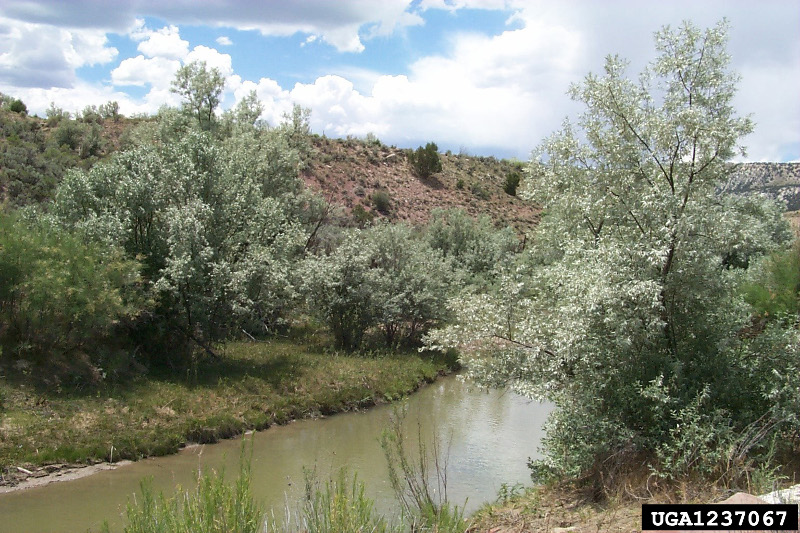
Many urban waterways have been polluted for years by sewage, runoff from city streets, and contamination from abandoned industrial facilities. Healthy and accessible urban waters can enhance economic, educational, recreational, and social opportunities in surrounding communities.

This year’s Urban Waters grantees will inform and engage residents in stormwater management and pursue community-based plans to address pollution in waterways. To accomplish these goals, many projects will address trash in waterways; test rivers, streams and lakes for pollutants; and prepare the next generation of environmental stewards for careers in the green economy. The 22 organizations receiving EPA grant funding are as follows:

Mystic River Watershed Association, Massachusetts ($60,000) will partner with towns and cities near Boston to create a multimedia education program to increase awareness of stormwater pollution for a regional coalition of municipalities.

Pioneer Valley Planning Commission, Massachusetts ($60,000) will develop a green infrastructure plan for Day Brook in Holyoke to reduce stormwater flow into the brook and resulting combined sewer overflow discharges into the Connecticut River.

NY/NJ Baykeeper, New Jersey ($48,150) will expand its plastic pollution reduction project by identifying, reducing, and preventing plastic transported via stormwater from reaching the lower Passaic River watershed and Newark Bay complex.

Sarah Lawrence College, New York ($60,000) will work with community scientists to investigate the severity and local sources of water pollution while increasing community engagement and stewardship in four underserved urban watersheds in the Lower Hudson River region.

Anacostia Watershed Society Inc., Maryland ($50,000) will educate and train middle-school students from low-income communities in Washington, DC on the problems associated with stormwater runoff and mitigation strategies through a variety of activities.

Virginia Commonwealth University, Virginia ($59,773) will develop a community greening and green infrastructure plan for its two urban campuses and the Richmond Arts District.

The Conservation Fund, Georgia ($60,000) will expand community engagement in planning for two future green infrastructure projects aimed at reducing stormwater runoff located in the headwaters of Proctor Creek in Atlanta.

University of Tennessee, Tennessee ($59,995) will, through a community-driven effort, collect nutrient data across the Baker Creek watershed, which will help the City of Knoxville and Tennessee Department of Environment and Conservation develop a watershed restoration strategy.

Openlands, Illinois ($60,000) will, in partnership with the Healthy Schools Campaign, manage the Space to Grow program which transforms schoolyards into vibrant places that benefit students, communities, and the environment.

The University of Toledo, Ohio ($59,988) will, in collaboration with North Toledo community members, Vistula Management, United North, and the Toledo-Lucas County Sustainability Commission, develop a plan to incorporate green stormwater infrastructure (GSI) at low income, multi-family housing sites in Toledo, Ohio.

Lake Pontchartrain Basin Foundation, Lousiana ($60,000) will partner with several New Orleans-based underserved schools to assess neighborhood stormwater runoff. The data from which will be used to improve local pollution mitigation practices.

Amigos Bravos, New Mexico ($55,508) will work with an underserved community located in Alburquerque’s South Valley to address chronic flooding due to poor stormwater management.

Saint Louis University, Missouri ($58,793) will evaluate whether the use of brine pretreatment as an alternative to chloride used as road salt will help reduce local chloride water pollution.
University of Nebraska-Lincoln, Nebraska ($59,935) will improve stormwater and green infrastructure training and assistance for Omaha’s workforce, students, and residents.

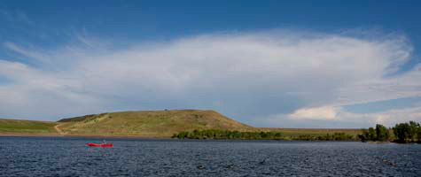
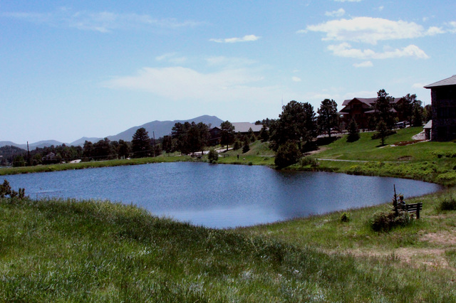
City and County of Denver, Colorado ($60,000) will develop the Heron Pond Regional Open Space Master Plan to consolidate and restore into open space approximately 80 acres of land surrounding Heron Pond, with an ultimate goal of reducing urban runoff pollution, improving wildlife habitat, and creating recreation opportunities for the highly urbanized, industrial, and underserved Globeville neighborhood.

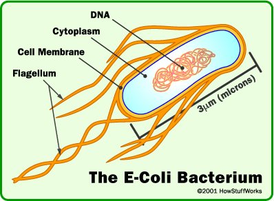
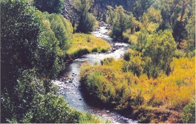
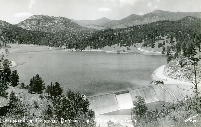
Groundwork Denver Inc., Colorado ($60,000) will work with local high school students from Sheridan, Colorado, an underserved community located at the mouth of Bear Creek, and Metropolitan State University, to determine the sources of E. coli feeding into the creek.

South Dakota School of Mines & Technology, South Dakota ($58,996) will develop and promote a stormwater and green infrastructure educational program for K-12 and college students and the broader community, culminating in a community design charrette for the planning of low-impact development and green infrastructure practices for the proposed Rural America Initiatives development.

Arizona State University, Arizona ($58,227) will work with students and Girl Scouts Troops to monitor water quality in local waterways and recreational fisheries to develop recommendations for community- based solutions.

Constitutional Rights Foundation, California ($59,673) will, in partnership with Los Angeles Waterkeeper and UCLA, expand its teaching curriculum for local undeserved high school students on community stormwater assessments to include enhanced STEM education, and will conduct local civic-minded community environmental projects.

Heal the Bay, California ($59,998) will partner with Los Angeles Trade Technical College and local high schools to monitor bacterial water pollution in the Los Angeles River, which will be used to make recommendations to local government agencies and watershed stakeholders for improving water quality and protecting public health.

Lummi Indian Business Council, Washington ($56,433) will teach third- through fifth-grade students at the Lummi National Schools about how a watershed works, water quality parameters, sources of impairments, and how this impacts the salmon and shellfish that the Lummi Nation depends on for subsistence, economic, and cultural needs.

The Lands Council, Washington ($45,250) will offer green job training and career pathways through the Green Sleeves Program at the Geiger Correctional Center in Spokane and will work with local high school teachers to develop and teach a year-long environmental science curriculum focusing on stormwater pollution and low-impact remediation.

The Urban Waters Small Grants are competed and awarded every two years. Since its inception in 2012, the program has awarded approximately $6.6 million in Urban Waters Small Grants to 114 organizations across the country and Puerto Rico, with individual award amounts of up to $60,000.

To learn more about the funded projects, visit https://www.epa.gov/urbanwaters/urban-waters-small-grants

Information on EPA’s Urban Waters program: https://www.epa.gov/urbanwaters

Fountain Creek: Can Bear Creek Dam in Jeff. County be a model for flood control?

Following heavy rains which fell mid-Septembe 2013 r in Colorado, the pool elevation at the Bear Creek reservoir rose several feet. At 4 a.m., Sept. 15, the reservoir pool elevation surpassed its previous record elevation of 5587.1 feet, and peaked at a pool elevation of 5607.9 ft on Sept. 22, shown here. Bear Creek Dam did what it was designed to do by catching the runoff and reducing flooding risks to the hundreds of homes located downstream.
Following heavy rains which fell mid-Septembet 2013 in Colorado, the pool elevation at the Bear Creek reservoir rose several feet. At 4 a.m., Sept. 15, the reservoir pool elevation surpassed its previous record elevation of 5587.1 feet, and peaked at a pool elevation of 5607.9 ft on Sept. 22, shown here. Bear Creek Dam did what it was designed to do by catching the runoff and reducing flooding risks to the hundreds of homes located downstream.

From The Pueblo Chieftain (Chris Woodka):

To see how a dam on Fountain Creek might function, it isn’t necessary to look far.

For more than 30 years, three flood control dams have protected downtown Denver from flooding. The first was built on Cherry Creek in 1950, but when waters from the 1965 flood inundated Denver, two other dams, Chatfield and Bear Creek were also built by the U.S. Army Corps of Engineers.

Of the three, Bear Creek Lake is the most similar to the type that would be built on Fountain Creek.

The earthen dam, 1 mile long, was completed in 1982 and usually stores a relatively small amount of water, about 2,000 acre-feet. Most of the remaining area behind and around the dam is a city of Lakewood park, which offers camping, fishing, picnic areas, trails, archery ranges and golf courses. Other recreational lakes and wetlands are behind the dam.

But twice in the past three years, the dam has prevented millions of dollars of damage by holding back water in a 236-square-mile drainage area — its primary function.

“It reached a record level in 2013 and close to that level in 2015,” said Joe Maxwell, operations manager for the Corps. “There were no abnormalities found as we monitored and it performed as it should.”

Wall of water

In the September 2013 flood, the largest in Colorado’s recorded history, damage to numerous communities, highways and water structures was recorded. But Bear Creek, Chatfield and Cherry Creek kept it from being worse.

Bear Creek Lake stored 28,500 acre-feet of the wall of water that descended during the 2013 event, well within its capacity. The lake level reached an elevation of 5,607 feet, higher than ever before and 50 feet above normal. Water releases began even as other areas still registered high water, because of the Corps’ protocols for operating all three reservoirs in tandem. It took three to four weeks to empty the floodwater.

“The goal is to release the water as soon as possible, but you don’t want to release it too fast,” Maxwell said.

Repairs to trails, roads and structures in the park cost $372,000 and were newly complete last May, when sustained rains pounded the Front Range. Like other areas, Bear Creek Canyon had weeks of sustained rain, which surprised the Corps by filling Bear Creek Reservoir again. The level of the lake rose 50 feet, and didn’t drop to normal until the end of July.

Repairs the second time around in 2015 were less extensive, because there was more warning, a different type of flooding and lessons learned from 2013, said Drew Sprafke, Lakewood regional parks supervisor.

“It was a different character without the high flow in the creek,” he said. “It re-impacted some of the same area, but we had more notice and knew how to respond.”

The city of Lakewood didn’t have to foot the whole bill, but matched county, state and federal funds to make the repairs. But the inundation of water has changed the character of the park, Sprafke said.

“We were able to make repairs,” he said. “But we lost 300 trees that will have to be clear cut. It’s a massive change to the park. The trees were under water for 11-12 weeks in both events, and invasive weeds came in. It will take at least five to 10 years to recover.”

Fountain Creek outlook

A dam, or multiple dams, on Fountain Creek would function in much the same way and has been talked about for years as a way to protect Pueblo from flooding.

The first idea for a dam on Fountain Creek came as part of an Army Corps of Engineers study in 1970 following the flood of 1965. The dam was never funded, and levees on Fountain Creek were completed through the city of Pueblo instead.

A multipurpose dam was brought up again by Pueblo County’s water attorney, Ray Petros, in 2005 as a potential alternative for Southern Delivery System.

As sedimentation has diminished the effectiveness of the levees, the dam idea has been revived in recent years.

A study last year by Wright Water Engineers for Pueblo County showed that 370,000 tons of sediment are deposited south of Colorado Springs each year as flows into Fountain Creek increase. Much of that winds up in Pueblo, raising the level of Fountain Creek and decreasing the effectiveness of the levees.

A payment of $50 million toward flood control on Fountain Creek was written into Pueblo County’s 1041 permit for SDS, and a dam is central to studies.

The Fountain Creek Watershed Flood Control and Greenway District, formed in 2009 as an outgrowth of the Vision Task Force, funded a U.S. Geological Survey study of hypothetical dam sites in 2013. That study showed the most effective way to reduce peak discharge and capture sediment would be a large dam about 10 miles upstream from the confluence of Fountain Creek at the Arkansas River.

Another alternative would involve several detention ponds north of Pueblo, which would be nearly as effective in reducing peak flows, but would capture less sediment.

A study for the district last year by engineer Duane Helton showed negligible impact on downstream water rights if flood control structures maintained a flow of 10,000 cubic feet per second through Pueblo during all but the largest flood events.

The district is now preparing for more detailed feasibility studies that would show where structures could be located and how much they would cost.

That’s a long way from the parks and trails that Lakewood residents enjoy near their flood control dam, but the Fountain Creek district is committed to protecting the creek and topping it with increased recreational opportunities only as the areas along the creek are stabilized.

The district has spearheaded both flood control and recreation demonstration projects so far.

USACE: Bear Creek reservoir in #Colorado to be lowered for valve replacement

Bear Creek Reservoir via City of Lakewood, June 15, 2013.

From the US Army Corps of Engineers (Eileen Williamson/Katie Seefus):

Bear Creek reservoir near Lakewood, Colorado, will be lowered twice from the current lake level of 5,558.7 feet to about 5,557.5 feet to allow for valve replacement work at Bear Creek Dam.

The U.S. Army Corps of Engineers, Omaha District will begin the first lowering today and the second lowering will begin late next week.

To lower the reservoir, releases will be increased to 70 cubic feet per second (cfs) which fall within channel capacity and are significantly less than the maximum 2015 summer release of 500 cfs. It will take less than one day for the reservoir to refill to the normal lake level of 5,558 feet.

This work is being conducted in response to damage documented following recent flooding. Beginning Friday, March 11, normal operations will resume. Bear Creek Lake will be closed to all ice activities due to fluctuating lake levels.

The valve replacement work has been coordinated by the U.S. Army Corps of Engineers with the State of Colorado and the City of Lakewood.

@USACEOmaha: Bear Creek Reservoir to be lowered for inspection and repair

Following heavy rains which fell mid-September [2013] in Colorado, the pool elevation at the Bear Creek reservoir rose several feet. At 4 a.m., Sept. 15, the reservoir pool elevation surpassed its previous record elevation of 5587.1 feet, and peaked at a pool elevation of 5607.9 ft on Sept. 22, shown here. Bear Creek Dam did what it was designed to do by catching the runoff and reducing flooding risks to the hundreds of homes located downstream.

From the US Army Corps of Engineers Omaha District (Kathryn Seefus/Eileen Williamson):

Bear Creek Reservoir near Lakewood, Colorado, will be lowered 5 feet from the normal operating pool elevation of 5,558 feet to allow for inspection and repair work at Bear Creek Dam.

Starting Friday, October 23, releases will be around 50 cubic feet per second (cfs) which fall within channel capacity and are significantly less than the maximum summer release of 500 cfs. The drawdown is expected to take about a week.

During the first three weeks of November, no release will be made from Bear Creek Dam to accommodate planned maintenance, survey, and inspection activities at the outlet works facilities of Bear Creek Dam. Valve repair work will also be conducted in response to damage documented following recent flooding. Beginning the last week of November, normal operations will resume and the lake will continue to refill.

USACE has coordinated this inspection and repair work with the State of Colorado.
Pool elevation graphs for the Tri-Lakes including Bear Creek Reservoir can be found online at: http://www.nwo.usace.army.mil/Missions/DamandLakeProjects/TriLakesProjects.aspx

Pool elevation data for these and other USACE-operated dams, updated hourly, can be tracked online at:
http://www.nwd-mr.usace.army.mil/rcc/plots/plots.html#omaha_plots

Repair projects dating from 2013 flood still in progress — The Canyon Courier

Evergreen Colorado Flooding September 2013 via Business Insider

From the Canyon Courier (Sandy Barnes):

Concrete barriers along the eroded creek bank in downtown Evergreen are still in place nearly two years after the 2013 flood that caused the damage.

Evergreen businessman Jeff Bradley, manager of the property, said he has obtained a permit from Jefferson County for the project, and has plans to restore the bank. Bradley said he also needs a permit from the federal government, although the project does not involve funds from the Federal Emergency Management Agency.

A few miles down Highway 74 at Lair O’ the Bear Park, a bridge restoration project dating from the 2013 flood is scheduled for this fall…

Another major bridge project is in the works at Evergreen Lake Park, which is owned by Denver Mountain Parks. The aging bridge that provides the only vehicle access to the park is scheduled for replacement next year. The Evergreen Park and Recreation District and the Evergreen Metropolitan District are each contributing $40,000 for the project, which is estimated to cost $790,000. The park district has added an additional $40,000 from Jeffco grant funding it received to assist with the bridge replacement cost.

The 2013 flood contributed to the deterioration of the bridge at the Lake Park, EPRD board member Peter Lindquist noted.

Evergreen Metro District offers help with water rights issue at Buchanan Ponds — the Canyon Courier

Buchanan Pond, Evergreen via EvergreenBound.com

From the Canyon Courier (Sandy Barnes):

The Evergreen Metropolitan District is offering the use of its senior water rights to guarantee a supply of water for two ponds at Buchanan Park.

Since discovering that the Evergreen Park and Recreation District has no identifiable water rights for the ponds next to Buchanan Rec Center, Ellen O’Connor, EPRD executive director, has been working with state water board officials and the EMD to resolve the issue. One possibility is using EMD water in the ponds rather than attempting to acquire water rights, O’Connor said at the Feb. 24 EPRD board meeting.

Because the park district has no clear water rights for the ponds, someone else could grab them, EPRD board member Peg Linn pointed out.

A worst-case scenario is that the ponds could be drained and dry, said EPRD board member John Ellis.

Before EMD water can be brought to the ponds, the Evergreen metro and park districts need form a partnership and reach an agreement. An engineering assessment and legal work also needs to be done at an estimated cost of $35,000 — an amount the EMD is asking the park district to pay.

“EPRD will be responsible for the costs associated with the proposal research,” said Dave Lighthart, EMD general manager.

During discussion of the issue at the Feb. 25 meeting of the EMD board of directors, member Mark Davidson advised caution while proceeding with the plan.

“We can’t get our water rights harmed,” said Davidson.

“We’re going to need to a lot more information to make our decision,” said EMD board member Scott Smith.

Both Davidson and others at the EMD meeting said the cost of using EMD water would be far less for the park district than going to water court and trying to gain water rights.

“In the final analysis, the plan that we proposed is the most sustainable,” said attorney Paul Cockrel, who represents the EMD.

“There’s a way to make this work,” said Ellis, who serves on the board of both the Evergreen metro and park districts. “This process would be less expensive than acquiring water rights.”

Ellis suggested that Lighthart make a presentation at the next EPRD board meeting on the plan to assist the park district. He and Linn are on a subcommittee of the EPRD board that has been examining the water rights issue in recent months.

A related issue is that the EPRD owns the dams at Buchanan Ponds and is responsible for maintaining them, said O’Connor.

A recent state inspection of the dams revealed the need for some repairs, she said. O’Connor expressed her appreciation to the EMD, which she said assisted the park district with a camera inspection to ensure that the dams had no major repair issues.

“The big concern was with the locks and pipes, and those are fine,” said Peter Lindquist, president of the EPRD board.

The EPRD also needs to provide the state with an emergency evacuation plan in event of the dam breaking, O’Connor added.

Troublesome water source

The source of water for Buchanan Ponds is Troublesome Creek, a tributary of Bear Creek that flows under the Highway 74 overpass near the property in Bergen Park. When the EPRD bought the property for Buchanan Park in 1994, it did not appear that water rights were attached to the ponds.

David Nettles, an engineer with division 1 of the Colorado Division of Water Resources, said he doesn’t see any water rights to the ponds, which formerly were part of the Village at Soda Creek development. In the early 1980s applications were filed by Gayno Inc. and George Alan Holley to acquire water rights for the planned project. Those rights were tied to an original decree dating from 1884 for the Lewis and Strouse Ditch.

It’s possible the rights were subsequently abandoned because of a failure on the part of the previous owners to file a required diligence report with the state, Nettles said.

The developers of the Village at Soda Creek were seeking a conditional water right for their project in the 1980s. According to state law, when a project is completed, the property owner must go to water court and file for an absolute right.

Every six years, the owner of a conditional water right also is required to file an application for a finding of reasonable diligence in the water court of the division in which the right exists. The owner of the conditional right has to prove that he has been pursuing completion of the project related to the water use for which he applied.

More South Platte River Basin coverage here.

Evergreen: Popular fishing holes need to shore up water rights

Buchanan Pond, Evergreen via EvergreenBound.com

From the Canyon Courier (Sandy Barnes):

The two ponds beside Buchanan Rec Center are stocked with trout and are popular among Evergreen residents and visitors who like to try their luck fishing.

The source of water for the ponds is Troublesome Creek, a tributary of Bear Creek that flows under the Highway 74 overpass near the property in Bergen Park.

Since Buchanan Park was developed in the early 2000s, maintaining water for these small lakes has not been a significant issue.

However, the Colorado Division of Water Resources recently informed the Evergreen Park and Recreation District of a potential problem concerning water rights for the Buchanan ponds, said Ellen O’Connor, EPRD executive director.

“We have learned the ponds were originally part of the Village at Soda Creek Lake development,” O’Connor said. “The original water rights were pretty robust and included storage, irrigation and augmentation.”

However, it is unclear as to whether the park district acquired those water rights when the property was purchased for Buchanan Park in December 1994.

“We’re trying to make them aware of the issue,” said David Nettles, an engineer with division one of the Colorado Division of Water Resources. “Someone could seek water rights from the ponds.”

“From looking at what I have, I don’t see any water rights,” Nettles remarked.

The park district would be notified if someone filed a claim for water rights at the Buchanan ponds, he added.

There are two inactive cases on file with the state water court regarding water rights for the Village at Soda Creek development. In the early 1980s applications were filed by Gayno Inc. and George Alan Holley to acquire water rights for the planned project. Those rights were tied to an original decree dating from 1884 for the Lewis and Strouse Ditch.

It’s possible that the rights were subsequently abandoned because of a failure on the part of the previous owners to file a required diligence report with the state, Nettles said.

To address the issue, EPRD has formed a two-member subcommittee. Board members John Ellis and Peg Linn are researching the matter and are expected to report to the board on their findings. O’Connor also has been conferring with Tim Buckley, the water commissioner serving the district for Evergreen…

Historic water issues at Buchanan Park

When Thomas Bergen, founder of Bergen Park, acquired his homestead from the federal government in 1875, water rights for the property were not a given.

The homestead certificate, which bears the signature of President Ulysses Grant, gave Bergen and his heirs an 80-acre tract of land, subject to “any vested and accrued water rights for mining … and rights to ditches as reservoirs used in connection with such water rights, as may be recognized and acknowledged by the local customs, laws and decisions of the courts.”

The Evergreen Park and Recreation District purchased two parcels of this historic property from the Fahnenstiel family in 2006 as part of a bond issue. This property is now part of Buchanan Park and the site of the Evergreen community garden, which is served by water taps provided by the Evergreen Metropolitan District.

A final note: While it is impressive to see, the authenticity of the signature of President Grant on the 1875 homestead certificate for Bergen is questionable. According to historical research, secretaries copied presidents’ signatures onto these documents after being authorized to sign them as proxies by President Andrew Jackson in the 1830s.

More water law coverage here.

Post-flood master plans for three Boulder County creeks ready for review — Longmont Times-Call

From the Longmont Times-Call (Joe Rubino):

It’s been more than 15 months since Boulder County was wracked by historic rainfall that caused area creeks to jump their banks, and, in some cases, create new channels entirely, resulting in extensive damage to homes and infrastructure along the way.

Following an exhaustive public process, Boulder County officials announced earlier this month that they have finalized post-flood master plans for three local creeks: Fourmile, Left Hand and the St. Vrain.

The plans are meant to be comprehensive guides outlining how best to restore and stabilize the watersheds for each body of water, including recommendations for bank stabilization, debris removal, re-vegetation and even channel realignment on public and private properties.

While many of the individual projects contained in the plans are not funded, charting them out is expected to give stakeholders, especially municipalities, a leg up in securing the money needed.

“If we identify the improvements in the plans it makes it much more likely they will be funded by grants coming from the state and federal government,” Boulder County Transportation Director George Gerstle said.

Gerstle’s was among many county departments, including Land Use, Open Space, and Health and Environment, that contributed to drafting the master plans, but he credited the property owners and other groups concerned with the county’s environment with spurring the process forward.

“Though we lead the efforts it really was a coalition of all the property owners and all of the interest groups that really made this possible,” he said. “It was a pretty intensive effort by a lot of people to put together, but I think some pretty great documents have come out of it.”

The county also employed the services of engineering consulting firm Michael Baker for the process.

Naturally, there are many property owners who want to get to work on when the county’s various creeks and streams pass through their land, and Gerstle said the master plans are an important tool to make sure all work that is done has the entire watershed in mind.

“A lot of property owners want to do something to stabilize the creek and this provides guidance on how to do it while maintaining the environmental integrity,” he said. “One thing we learned is we can look at (the creeks) bit by bit, we have to see how it all works together.”

A creek of particular importance is the St. Vrain.

Gerstle pointed out that the stream completely changed its traditional alignment just west of Longmont, leading to heavy damage in the city. The master plan outlines steps to put it back in its channel and keep it there in a way the respects the natural environment.

Dale Rademacher, Longmont’s general manager of public works and natural resources, said he appreciated the opportunity for collaboration presented by the master planning process and the way it looked at the St. Vrain as a whole from it origins near the Great Divide down to it confluence with Boulder Creek.

“We’re pretty happy with the outcome. This is a foundational document necessary to go forward for state and federal funding and we think it serves that purpose pretty well,” he said.

Rademacher highlighted one project in the St. Vrain plan that he said could be underway next month. It involves creation of an overflow channel for Heron Lake that would direct flood waters away from Airport Road, an important street that still has flood barriers sitting alongside it just in case.

Rademacher said the Heron Lake project is intended to “intercept flood flows that may come through the area again,” and protect property nearby. He said the project, which is the subject to an intergovernmental agreement between city and county officials, is expected to cost around $700,000 and is being put out to bid within the next week with construction hopefully beginning in January.

More South Platte River Basin coverage here.

Dredging planned for Evergreen Lake in the spring

Evergreen Colorado Flooding September 2013 via Business Insider

From the Canyon Courier (Beth Potter):

Officials are planning to dredge Evergreen Lake in the spring to clean out sediment brought in by the September 2013 flooding.

The “stealth” dredging project will be done with a pontoon boat to minimize the impacts on lake users, said Dave Lighthart, general manager of the Evergreen Metropolitan District.

Sediment material will be pumped from the boat through a pipe to a “de-watering” operation that will separate the water from the sediment. The water will be treated before being put back into the lake, Lighthart said.

“We’re trying to be as unobtrusive possible,” Lighthart said. “The lake is pretty visible and used for recreation, so we don’t have that ability to isolate and drain it.”

The project is expected to take a little longer and cost a little more than it would otherwise, because of its unobtrusive nature, Lighthart said. But the lake also serves as Evergreen’s raw drinking water source, which means the water can’t be pumped out, he said.

Some $880,000 in Federal Emergency Management Agency funds and state funds will pay for the project. An estimated 12,000 cubic yards of sediment were deposited in the lake during the 2013 flooding, Lighthart said.

The sediment will help with cleanup of the EDS Waste Solutions Inc. site on Highway 73. The 549-acre site is owned by the city and county of Denver, which plans to get the land back to its natural park-like state over a two-year period, said Bob Finch, natural resources director at Denver Mountain Parks, a division of the Denver Parks and Recreation Department.

“(This) helps them, and it certainly helps us,” Lighthart said of the plan to take the sediment to the landfill site.

Dredging work is expected to start in late March or early April after ice has melted off the lake, Lighthart said. It’s expected to take place near the south side of the “islands,” he said, where a survey showed most of the sediment was deposited during the flooding. Government funds must be spent by June 2016, he said.

More Bear Creek watershed coverage here.

Bear Creek mystery: Water testers seek source of E.coli contamination — The Denver Post

Bear Creek near Evergreen

From The Denver Post (Bruce Finley):

Twice a month, Metropolitan State University student biologists David Watson and Stephen Aderholdt have been slogging through contaminated Bear Creek testing the water, at work on a mystery of how its once-pure currents turned foul.

They’ve documented E.coli bacteria levels up to 19 times higher than the state health limit.

“Why is there so much E.coli? Where is it coming from?” Aderholdt, 31, said on the banks on a recent Saturday.

While government agencies have done their own testing and in 2008 deemed Bear Creek officially “impaired,” expanding data gathered by the students — trained by the Environmental Protection Agency and a community group called Groundwork Denver — may be crucial in crafting a cleanup.

Denver, Lakewood and Sheridan taxpayers would be on the hook, facing federal Clean Water Act penalties, if Bear Creek water quality isn’t improved.

This is a vexing problem because Bear Creek begins as a clear, clean trickle in wilderness snow atop 14,271-foot Mount Evans, visible to residents around metro Denver. The creek cascades through forests unsullied.

But starting in foothills near Evergreen, pristine water reaches suburban homes, roads, reservoirs, septic tanks, parks used by dog-walkers, golf courses, commercial sites. Denver Environmental Health water quality scientist Jon Novick, a public health analyst, said contamination is worst as Bear Creek approaches the South Platte River, which also is contaminated with E.coli and other pollutants.

Watson and Aderholdt have recorded E.coli contamination in Bear Creek as high as 2,400 colony-forming units (cfus) per 100 milliliters. The state health limit is 126 cfus.

The data collected by the Metro State team is useful, Novick said.

“It is helpful to understand where E.coli levels are increasing and the potential sources,” he said.

Denver conducts its own tests on the creek, four times a year, and has documented E.coli during summer as high as 770 cfu.

The Metro State students conduct tests at 18 locations twice a month. They started in May 2013. The work can be difficult, clambering up and down muddy banks, kicking through ice during winter. (Bear Creek E.coli levels during winter, when E.coli often decreases, have veered above the limit as high as 325 cfu.)

Watson and Aderholdt’s boots sink into creek-bottom muck as they stand in the creek, first measuring temperature and turbidity, then filling two clear containers. They cover an 8.2- mile stretch of the creek from the South Platte to Bear Creek Reservoir.

EPA scientists who trained them analyze the samples in a federal lab and review the data for accuracy. They occasionally accompany the students and Groundwork Denver supervisor Rachel Hansgen, who also coordinates community-driven water-sampling along other creeks and rivers.

EPA project manager Karl Hermann, a senior water quality analyst, said he’s been impressed with students’ seriousness over more than a year and sees their monitoring data as helpful in moving toward a solution that could avert penalties.

Bear Creek has remained on Colorado’s list of impaired waterways for years, Hermann said. Ramped-up EPA lab work this year, using the expanding data, may help pin-point sources of the pollution.

E.coli indicates a variety of different bacteria that come from people and animals. When E.coli levels exceed 235 cfu, the Colorado Department of Public Health and Environment orders waterways closed for swimming.

“We know dogs are involved and that humans are involved,” Hermann said. “We don’t have wastewater treatment plants along Bear Creek. If there’s a human element, it may be septic systems that are not working quite right. We have a number of other possibilities.”

University and community science groups, when trained, can make a difference, he said.

“There are protocols. Groundwork Denver and Metro State have gone through the process of learning to do things right,” Hermann said. “They’ve refined their methods and we are really happy with the collaborative approach.”

Groundwork Denver staffers also are developing a restoration plan for the Lower Bear Creek watershed, where greenway trails already are established. They’re hoping, if all goes well and the creek can be cleaned, that this plan will be a model for dealing with contaminated urban waterways, Hansgen said.

“The scientific method is something we use purposefully,” she said. “This is work that needs to be done.”

More Bear Creek coverage here.

‘They’re [Russian Olives] thorny, nasty trees’ — Drew Sprafke


Russian Olive

From The Denver Post (Emilie Rusch):

An offensive against the Russian olive tree — an invasive species that chokes out native cottonwoods and willows — has been launched by Denver, Lakewood, Englewood, Colorado Heights and the Fort Logan National Cemetery. “They’re thorny, nasty trees,” said Drew Sprafke, an official with the city of Lakewood Regional Parks. “When they form those dense stands, no one can get through them.”

Using a grant from the Colorado Water Conservation Board, an 11-person crew from Mile High Youth Corps will be working through early August removing the trees from the lower Bear Creek watershed.

Introduced to Colorado as an ornamental tree, Russian olives can be identified by their narrow, silvery leaves and olive-shaped fruit. They prefer moist, riparian areas, but can be found just about anywhere — along streams, in fields and open space, even ditches, Sprafke said

The eventual goal, Sprafke said, is to remove every Russian olive from Bear Creek Lake Park to the South Platte in Denver during a multiyear process.

The trees are considered a List B noxious weed by the state of Colorado, meaning local governments are required to manage and limit their spread.

Sprafke estimates there are 1,500 Russian olives between Bear Creek Lake Park and Wadsworth Boulevard.

More invasive species coverage here.

Denver Water: Harriman Dam Project complete

harrimandamdenverwater.jpg

Here’s the release from Denver Water:

Harriman Lake Park, located on the southwest corner of South Kipling Parkway and West Quincy Avenue in Littleton, Colo., will reopen to the public Friday, Feb. 15, 2013. The area has been closed since December 2011 for Denver Water to rebuild the 138-year-old Harriman Dam, bringing it up to current regulatory standards and restoring its full storage capacity.

The new dam will restore the water level approximately 3 feet higher, increasing the surface area of the restored reservoir from its former size of about 55 acres to about 66 acres. The reservoir will be refilled gradually after the Office of the State Engineer completes its inspection process.

This project allows Denver Water to meet the irrigation needs of multiple Harriman water users without adding demands to its potable water supplies or developing new sources of water. Denver Water uses the reservoir to deliver irrigation water to Fort Logan National Cemetery, Jeffco Public Schools, Pinehurst Country Club and other nearby areas.

Denver Water owns the reservoir, dam and land within the park, while Foothills Park & Recreation District manages the recreation at Harriman through an agreement with Denver Water.

Construction on Harriman Dam has been completed, and now Foothills Park & Recreation District is replacing recreational amenities before the park officially reopens Feb. 15. Fishing will not be allowed until the reservoir is restocked and vegetation is established along the banks.

More infrastructure coverage here.

The Evergreen Metro District plans to install an aeration system in Evergreen Lake

evergreendamandlakeflickr.jpg

From the Canyon Courier (Vicky Gits):

Aerating the lake during the summer months is expected to increase dissolved oxygen at the bottom of the lake, help lower the lake’s water temperature, produce cooler water going downstream over the dam and help reduce the amount of lakeweed or elodea in the water.

“The biggest concern we have is dissolved oxygen at the bottom of the lake,” said Gerry Schulte, executive director of the [Evergreen Metro District]. “If there isn’t enough (oxygen), the fish have a hard time, and it results in a process that releases iron and manganese into the water, and that creates a bigger treatment problem,” Schulte said.

The diffused aeration system is expected to increase dissolved oxygen concentrations. The new system is projected to run 10 hours at night only and recirculate the entire body of water every two days. The only visual effect will be bubbles on the lake.

Similar systems are currently at the wastewater plant in Kittredge and the Bear Creek reservoir east of Morrison. The Cherry Creek Water Authority is installing one in the Cherry Creek reservoir as well.

Aqua Sierra Inc. of Morrison will provide and install the equipment, which consists of eight underwater diffuser modules placed at an average depth of 20 feet or more. Modules will be placed 100 to 700 feet from the edge of the dam in the deepest part of the lake.

In addition to increasing the amount of dissolved oxygen, aeration is expected to counteract the heat-related water quality issues that occur in the summer months by creating a more constant temperature from top to bottom of the lake. So when the sun is out, it heats the top layer of water. The top layer goes over the dam and contributes to higher downstream temperatures.

More Bear Creek watershed coverage here.

Evergreen: Flushing the pipes

A picture named flushingfirehydrant.jpg

From the Canyon Courier:

The Evergreen Metropolitan District will begin the annual water-main flushing program the first week of June and continue through the summer. Affected areas will be Tanoa, El Pinal, Wah Keeney Park, Hiwan Hills and Hiwan. The purpose of water-main flushing is to remove fine particles that settle in the water mains that cause color, taste and odor issues. If you have any questions, contact the Evergreen Metropolitan District at 303-674-4112.

More infrastructure coverage here.

Idledale: Turning dirt for new storage tank project

A picture named orrmnwatertower.jpg

From the Canyon Courier (Vicky Gits):

The construction site is about 5 miles up Grapevine Road on the northeast corner of Grapevine and Sawmill Gulch roads, west of Morrison off Highway 74. All of the water is sourced from four surrounding underground wells. Bosco Constructors of Englewood won the assignment with a bid of $436,000 from about five submissions. Construction is expected to be finished by March. The district is also seeking to replace the cast-iron water pipe that runs from the water storage tank to the distribution system, once all the easements have been obtained. The district is budgeting an increase in water rates of about $10 a month, starting in 2010, to cover debt repayment. The average water bill currently is about $75 a month. The upgrade is being financed with a 30-year, $920,000 loan supplied by U.S. Bank.

More infrastructure coverage here.