To say that Aurora has a prolific portfolio of water rights and reservoirs is apt. Spanning across three water basins, Aurora water is transported 180 miles through a vast and complicated system.
But it hasn’t always been that way…
Aurora was wholly served by the City and County of Denver until 1954, when Denver put into place a “blue line” no longer granting permits for new taps in the ever-growing metropolitan area, leaving parts of Aurora out of Denver’s service region.
In 1957, Aurora purchased the water rights to the Last Chance Ditch and diverted the water that ran through it to be stored near the Cherry Creek Dam.
The completion of phase one of the Homestake Reservoir, which the city shares with Colorado Springs, was in 1967 and with that, Aurora was able to become completely self-reliant when it came to supplying the wet stuff to its residents.
The next 20 years saw rapid growth of Aurora’s water rights acquisitions, including rights in the three major basins being Colorado, Arkansas and South Platte. The city has continued to purchase water rights in areas spanning from Park to Eagle counties.
While the water rights are large in number for Aurora, 95% of the municipality’s water comes from reusable water…
Prairie Waters schematic via Aurora Water.
This is where the Prairie Waters filtration system plays its vital role in supply for the city. Meeting approximately 10% of the demands of the city’s water, the system begins at the South Platte River in southern Weld County, and through a system of 23 wells, water is ushered through hundreds of feet of sand and gravel which serves as a filter to clean out impurities in the water. It is then pumped into basins where it goes through another level of filtration removing even more contaminants. The water is then sent to one of three different pump stations and finally to a purification facility.
UV pretreatment Peter D. Binney Purification Facility.
The Peter D. Binney Purification Facility uses what are some of the most advanced processes of purification in the country, through ultraviolet oxidation, water officials say. With the ability to treat 50 million gallons a day, it’s the largest facility in the nation to use this technology…
With Aurora’s acquired water rights and the Prairie Waters System, Aurora looks to be prepared for the city’s growth.
Aurora Water serves more than 91,000 accounts in a city of more than 386,000 people and that number is rapidly increasing. The population is expected to double in the next 30 to 40 years.
With a bevy of new housing developments popping up on the eastern plains, it’s imperative that Aurora has the water to serve the increasing population with the most recently announced development promising 5,000 new homes.
Aurora water managers have long said that the city is set to provide water to tens of thousands of additional residents for at least another half century. Projections have shown that the city could need more than 40 billion gallons of water a year by 2070, more than double the usage in 2015.
In order to accommodate that amount, there needs to be ample storage, and Aurora has plans for that, too. Aurora currently has 156,000 acre feet of water storage, and enough to provide water to the city for three years, were there not to be another drop.
With 12 current reservoirs along the front range and throughout the mountains, Aurora has plans for three more reservoirs throughout the next 50 years.
One such reservoir has a litany of hurdles to jump, and might even require an act of Congress.
This map shows the location of test holes Homestake Partners plans to drill as part of its geotechnical investigation into the feasibility of a dam site in the Homestake Creek valley. The Forest Service has received more than 500 comments, most of them in opposition to, the drilling and the overall reservoir project. Credit: USFS via Aspen Journalism
The proposed Whitney Reservoir on U.S Forest land in Eagle County would be shared with Colorado Springs. U.S. Forest Service District Ranger Leanne Veldhuis approved the plan this spring allowing the cities to test for possible sites…
With 95% of Aurora’s water being surface, or reusable water, there is always the risk of a low snow-pack, quick evaporation or plain-old drought. The new reservoirs will prevent Aurora having to sell or lease water resulting from not having enough storage.
Wild Horse Reservoir, which looks to be the next reservoir completed, hopefully by decades end, was planned with the purpose of not only providing adequate and better storage, but work in providing better management of exchanged water.
Ken Neubecker, formerly of American Rivers, gives a presentation about the Eagle River Memorandum of Understanding during a hike and public outreach event organized by the Eagle River Watershed Council. The 1998 MOU, which lays out the amounts of water the signatories are entitled to develop, may be based on hydrology that is outdated due to climate change impacts of the last 20 years. CREDIT: HEATHER SACKETT/ASPEN JOURNALISM
The Eagle River Watershed Council on Tuesday hosted a hike for the public in the Homestake Valley, an area receiving increased scrutiny because of a project that proposes to take more water from the Colorado River basin and bring it to the fast-growing Front Range.
The goal of the event — which included presentations from representatives from public-lands conservation group Wilderness Workshop, municipal water provider Aurora Water and other experts — was to provide a broad overview of a complicated issue, according to watershed council executive director Holly Loff.
“We know it’s going to be a long process, but we want to make sure people are engaged in the conversation and look to us as a resource,” Loff said. “We will continue to provide science-based, factual information.”
The watershed council advocates for the health of the upper Colorado and Eagle river watersheds through research, education and projects, according to its website.
The cities of Colorado Springs and Aurora, which operate together as Homestake Partners, have water rights in the Homestake Valley and plan to use them to develop Whitney Reservoir. The project would be located near the Holy Cross Wilderness Area, which is 6 miles south of Red Cliff. Homestake Partners is currently doing geotechnical drilling to study whether the soil and bedrock in the area could support a dam and reservoir.
The proposed project would create a new reservoir on lower Homestake Creek, where water collected would be pumped up to the existing Homestake Reservoir, about 5 miles upstream. Then it would go through a tunnel under the Continental Divide to Turquoise Reservoir, near Leadville, and then to Aurora and Colorado Springs. Various configurations of four potential reservoir sites show it holding between 6,850 and 20,000 acre-feet of water.
Homestake Valley, in the upper Eagle River watershed near Red Cliff, is narrow and filled with aspen trees. A proposed water project could develop more water from the valley for the benefit of Front Range municipalities and Western Slope entities. CREDIT: HEATHER SACKETT/ASPEN JOURNALISM
Project opposition
Although it’s still early in the process and no application for the storage project has yet been filed, the proposal has already been met with opposition. Some iterations of the project would necessitate moving a section of the Holy Cross Wilderness boundary, which requires an act of Congress, and would inundate rare, groundwater-fed, peat wetlands, known as fens. The U.S. Forest Service received nearly 800 comments about the drilling study during its public scoping phase last year, and the majority of the remarks were against the reservoir project as a whole.
Some who attended the hike — which attracted about 20 people — questioned the concept of taking more water from the headwaters of the Colorado River over to thirsty and growing Front Range cities in the face of a climate change-fueled crisis.
“I’m just very concerned that if this is a typical year, is there enough water in the drainage to take 20,000 acre-feet out every year and how does that tie into the future curtailment call on the Colorado Compact?” said Tom Allender, who is board president of the watershed council, a former board member of Eagle River Water & Sanitation District and a retired planner for Vail Resorts.
The compact call to which Allender is referring could occur if the upper-basin states (Colorado, Wyoming, Utah and New Mexico) can’t deliver the 7.5 million acre-feet of water per year to the lower basin states (Arizona, California and Nevada), as required by a nearly century-old binding agreement. Water users in the upper basin would be forced to cut back, something known as “curtailment.”
A larger share of the state’s cutback obligations could fall to Front Range water providers since most of the water rights that let them divert water from the Colorado River basin over the Continental Divide are “junior” to the compact, meaning they date to after the 1922 agreement. If there was a compact call, Front Range diverters could potentially have to stop diverting and let the water flow downstream to Lake Powell.
“If the Homestake Valley is important to people and if they are interested in the impacts of a compact call and the impacts of climate change overall, then they should have an eye out for additional transmountain diversions,” Loff said. “That’s a bigger concern than a reservoir in general.”
Last year, Homestake Partners tested how they could get their stored water to the state line in the event of a compact call by releasing downstream about 1,700 acre-feet from Homestake Reservoir.
Contractors for Homestake Partners are drilling test holes for a geotechnical study near Homestake Creek. A proposed project could develop more water from Homestake Creek for Aurora and Colorado Springs, and could also benefit Western Slope entities. CREDIT: HEATHER SACKETT/ASPEN JOURNALISM
Eagle River MOU
Homestake Partners is not the only entity set to benefit from a new water-storage project. The Eagle River memorandum of understanding lays out a plan for both Front Range and Western Slope entities to develop water in the upper Eagle River basin. The agreement, signed in 1998, provides 20,000 acre-feet of water a year to Homestake Partners and 10,000 acre-feet a year to the Colorado River Water Conservation District, the Eagle River Water & Sanitation District, Upper Eagle Regional Water Authority, and Vail Resorts, known collectively in the MOU as the “Reservoir Company.”
Ken Neubecker, a retired Colorado project director at American Rivers and a former environmental representative on the Colorado Basin Roundtable, gave an overview of the MOU. He said the 23-year-old agreement is based on hydrology that is now outdated because of the worsening impacts of climate change. The models used to estimate streamflows are based on records from the 50 years between 1945 and 1994.
“Storage is an early-20th-century response to water-shortage problems and doesn’t really fit in the conditions we are facing now in the 21st century, and it’s based on laws established in the 19th century,” Neubecker said.
In their presentation, representatives from Aurora Water laid out the measures that the municipality is taking to conserve water, including offering rebates for high-efficiency toilets, water-wise landscaping and irrigation efficiency. Over 10 years, Aurora says it has conserved almost a half-billion gallons, or about 1,500 acre-feet.
That savings, however, does not translate into Aurora taking less water from the Western Slope. About 25,000 acre-feet of water a year is sent through Homestake Tunnel to the Front Range.
“We are a growing community,” said Greg Baker, manager of public relations for Aurora Water. “Our conservation program helps us meet that future need the development is going to place on our system. Does it reduce (transmountain diversions)? No. Does it mean we are using the water more efficiently? Yes.”
Baker said there are still a lot of uncertainties with the Whitney Reservoir project. The geotechnical drilling study will help determine whether it is even feasible to move ahead.
“We have not applied current climatological conditions to (the MOU) yet because we haven’t gotten that far,” he said. “Until we know exactly what comes out of that report, we can’t say what we would want to pursue. It’s way too early for us to even come up with that timeline.”
Aspen Journalism covers water and rivers in collaboration with The Vail Daily and other Swift Communications newspapers. For more, go to http://www.aspenjournalism.org.
Colorado transmountain diversions via the State Engineer’s office
Two men fish the Eagle River just above its confluence with the Colorado River in Dotsero. Homestake Partners released 1,667 acre-feet of water down Homestake Creek and into the Eagle River in September to test how a release would work in a compact call. CREDIT: BETHANY BLITZ/ASPEN JOURNALISM
Getting water to state line would be key in compact call
In September, Front Range water providers released some water downstream — which they were storing in Homestake Reservoir — to test how they could get it to the state line in the event of a Colorado River Compact call.
But accurately tracking and measuring that water — from the high mountain reservoir in the Eagle River watershed all the way through the Colorado River at the end of the Grand Valley — turned out to be tricky, according to a recently released report from the Colorado Division of Water Resources.
From Sept. 23 through Sept. 29, Colorado Springs Utilities, Aurora Water and Pueblo Board of Water Works released a total of 1,667 acre-feet of water, which would have otherwise been diverted to the Front Range, from the reservoir into Homestake Creek, a tributary of the Eagle River. The release gradually ramped up from about 25 cubic feet per second to 175 cfs and then gradually back down over the seven days.
But officials were unable to put a number on how much of that water made it to the state line.
In their attempt to quantify the actual amount of reservoir release delivered to the state line, state engineers ran into challenges that caused uncertainty, they said in an email.
Although they couldn’t measure how many acre-feet officially made it, State Engineer Kevin Rein said that the exercise was still a success and that all the water, minus transit losses, crossed into Utah.
“We have heard this is a failure because not everything worked perfectly, but in my mind, this was an opportunity under non-stress conditions to find out what we need to do to ensure that things will work,” Rein said.
A goal of this project, known as the State Line Delivery Pilot Reservoir Release, was to see if the water could be “shepherded” downstream without senior water-rights holders diverting the extra water. This required Division 5 water commissioners to actively administer some headgates, especially on Homestake Creek and the Eagle River.
According to the report, the water took about 2½ days to make the journey from the reservoir to the gage on the Colorado River near Cameo — about 16 hours longer than predicted by the Colorado Basin River Forecast Center. Along the way, about 10% of the water either evaporated or was soaked up by thirsty streamside soils and vegetation — processes known collectively as transit loss.
Making sure water could get to the state line would be essential in the case of a compact call.
This scenario, the chances of which increase as climate change continues to reduce river flows, could occur if the upper-basin states (Colorado, Wyoming, Utah and New Mexico) can’t deliver the 7.5 million acre-feet of water per year to the lower-basin states (Arizona, California and Nevada), as required by a nearly century-old binding agreement.
A compact call could be especially problematic for Front Range water providers since most of their rights that let them divert water over the Continental Divide from the Western Slope date to after the 1922 Colorado River Compact. That means mandatory cutbacks in water use could fall more heavily on the post-compact water rights of Front Range water providers.
Colorado Springs Utilities and Aurora Water, operating together as Homestake Partners, said the problem was that the rate of release was too low. It was more a matter of flow volume than administration. Even in a dry year, a release of 175 cfs was not high enough to reliably track the water, especially when it reaches the Colorado River, which has a much higher volume of water than Homestake Creek or the Eagle River, and the reservoir release is a smaller fraction of its overall flow.
In an email to Aspen Journalism, Homestake Partners said: “A bigger pulse of water would overcome some of the issues that DWR had in tracking the release. This sort of result is exactly what we wanted to explore — it tells us that if we, or anyone else in the state, chooses to make a state line release in the future, a higher volume of water will probably need to be released to be reliably tracked.”
State engineers also had to deal with a river that was constantly in flux. Upstream reservoir releases and changes to irrigation diversions made for additional challenges.
State officials said it was hard to separate the reservoir release from the rest of the Colorado River’s flow at the state line because of numerous ungaged streams and return flows from irrigation that enter the river between Palisade and the state line.
“The ungaged inflows could not be subtracted from the total flow in the river, therefore the separated flows were too large and did not allow for the initial waves of the reservoir release to be identified,” officials said in an email.
The total flows at the state line at the time of the reservoir release’s arrival were around 2,500 cfs, according to DWR.
The total flows at the state line at the time of the reservoir release’s arrival were around 2,500 cfs, according to DWR.
River District concerns
The Glenwood Springs-based Colorado River Water Conservation District, which protects Western Slope water interests, had several concerns about the reservoir release.
“I think it’s important that the public and the state recognize that they released 1,600 acre-feet of water during an incredibly dry period and they couldn’t actually track it to the state line,” said River District general manager Andy Mueller.
But Mueller’s concerns go beyond the trouble with tracking. He said the state engineer did not reach out to Western Slope water users who had the potential to be injured by the release. He also doesn’t trust that the cities won’t just refill the hole created by the release with more Western Slope water.
The River District’s main concern is that in a water-collection system as complex as Homestake Partners — with several different transmountain diversions bringing water from the Western Slope to the Front Range — it’s hard for the state to make sure they won’t take more water to replace the pool they released.
“From our perspective, it’s very difficult for the state to verify that they haven’t just brought the water over from a different part of their diversion system,” Mueller said. “So it leaves us with a lot of skepticism, and we voiced that in several discussions.”
To address some of these concerns, the cities are required to submit a verification plan to the state to prove three things: that they had enough space available in reservoirs on the east side of the divide to store the water, and they weren’t just releasing water downstream they couldn’t use anyway; that they actually decreased water taken through the Homestake Tunnel by the same amount as the pilot release; and that they didn’t create additional space in Homestake Reservoir to allow for greater storage this year.
“In essence, we brought the ‘hole’ we created in our storage in Homestake Reservoir through to the East Slope when we operated the tunnel in February and March,” the Homestake Partners’ email reads. “This was accomplished by not drawing down Homestake Reservoir quite as much as we otherwise could have this winter in preparation for spring runoff.”
Homestake Creek flows from Homestake Reservoir near Red Cliff. A pilot reservoir release to test how to get water to the state line in the event of a Colorado River Compact Call proved hard to track for state engineers. CREDIT: BETHANY BLITZ/ASPEN JOURNALISM
Demand management
The reservoir release also could have implications for a potential demand-management program, the feasibility of which the state is currently investigating. At the heart of a demand- management program is a reduction in water use on a temporary, voluntary and compensated basis in an effort to send as much as 500,000 acre-feet of water downstream to Lake Powell to bolster water levels in the giant reservoir — which spans Utah and Arizona — and, indirectly, to meet Colorado River Compact obligations.
Under such a program, agricultural water users could get paid to temporarily fallow fields and leave more water in the river. Front Range water providers could participate by releasing water stored in Western Slope reservoirs.
Rein was careful to say that the Homestake pilot release was in no way connected to demand management. Still, the experiment may have revealed potential problem areas should a demand-management program become reality.
“The ability to track water that is conserved consumptive use all the way to the state line is really critical for the success of that program,” Mueller said. “And if you can’t track a slug of 1,600 acre-feet of water to the state line, how are you going to track the voluntary reduction in use of a small ditch on the West Slope that maybe they are saving 15 acre-feet?”
Aspen Journalism covers rivers and water in collaboration with the Vail Daily and The Aspen Times. This story ran in the April 16 edition of the Vail Daily and The Aspen Times.
The U.S. Forest Service said it is just weeks away from deciding whether a high-profile request to explore the geological feasibility of a new reservoir site in Colorado’s Eagle County that would capture water flowing from the iconic Holy Cross Wilderness should be granted.
The request comes from Aurora and Colorado Springs, among others, who want to be able to capture more of the water flowing from the wilderness area to meet their own growing needs.
David Boyd, a spokesman for the U.S. Forest Service, said a decision is expected “early this year.”
Proponents had hoped for a decision late last summer, but Boyd said the delay wasn’t unusual and was triggered in part by last summer’s Grizzly Creek Fire.
Aurora and Colorado Springs, which own and operate the only reservoir in the area, Homestake I, hope to demonstrate that they can divert more water and build another reservoir to serve Front Range and West Slope interests without damaging the delicate wetlands and streams in the mountain forests there.
But in advance of any request to build an actual reservoir, they have asked the Forest Service for a special use permit to survey the area and to bore several test holes to determine soil conditions and areas best suited to build the proposed Whitney Reservoir.
If a reservoir were to be built, it would also require that the 122,000-acre-plus wilderness area shrink by 500 acres, an action that will require congressional approval.
Significant opposition to the exploratory permit erupted almost as soon as the proposal became public last year. The U.S. Forest Service received more than 500 comments on the proposal last summer. The majority of those were opposed to it, citing the need to protect the wilderness and the need to preserve as much of the region’s water as possible. The Eagle River, a part of the Colorado River system, is fed in large part by the Holy Cross watershed.
Warren Hern, a co-founder of the Defenders of the Holy Cross Wilderness, said the plan would do irrevocable damage to the rare bogs and wildflowers that populate the area.
He also noted that the proposed reservoir site lies along a major fault line.
“We will do everything in our power to stop this,” Hern said.
Greg Baker, a spokesman for Aurora Water, said his agency is well aware of the special relationship thousands of Coloradans have with the Holy Cross and its spectacular wetlands and hiking trails.
Baker declined to comment for this article, saying the agency would wait until the Forest Service issues a decision.
But in a recent interview, Baker said the cities had little choice but to pursue additional water supplies to meet growing demand.
“Water is a rare commodity and it needs to be used very carefully,” Baker said.
He also said any environmental damage that might occur could be successfully mitigated.
“What you do is wetlands rehabilitation, where you develop wetlands in other areas on a two- or three-to-one basis so you’re restoring additional wetlands for those you may lose,” Baker said.
The new proposal comes under a 1998 agreement known as the Eagle River Memorandum of Understanding, which allows the reservoir proponents to develop enough water to serve environmental, municipal and industrial interests.
Parties to the 1998 agreement include Aurora, Colorado Springs, the Colorado River District, the Eagle River Water and Sanitation District, and the Upper Eagle Regional Water Authority.
Located west of Vail between Minturn and Leadville, the Holy Cross Wilderness Area was the subject of a significant battle in the 1980s when Aurora and Colorado Springs sought to build a second major reservoir there known as Homestake II.
After the case made it all the way to the U.S. Supreme Court, Homestake II was defeated in 1994.
In exchange, however, the cities were granted permission to develop a smaller amount of water in the future in partnership with Western Slope interests, resulting in the permit request now being considered by the Forest Service.
Correction: An earlier version of this article incorrectly listed Vail Associates as a participant in the Whitney Reservoir proposal.
Jerd Smith is editor of Fresh Water News. She can be reached at 720-398-6474, via email at jerd@wateredco.org or @jerd_smith.
This map shows the location of test holes Homestake Partners plans to drill as part of its geotechnical investigation into the feasibility of a dam site in the Homestake Creek valley. The Forest Service has received more than 500 comments, most of them in opposition to, the drilling and the overall reservoir project. Credit: USFS via Aspen Journalism
These wetlands in the Homestake Creek valley are near the site of the proposed Whitney Reservoir. The Forest Service is considering whether to issue a permit for drilling and a geotechnical study to test whether the site would support a dam. Photo credit: Heather Sackett/Aspen Journalism
These wetlands, located on a 150-acre parcel in the Homestake Creek valley that Homestake Partners bought in 2018, would be inundated if Whitney Reservoir is constructed. The Forest Service received more than 500 comments, the majority in opposition to, test drilling associated with the project and the reservoir project itself. Photo credit: Heather Sackett/Aspen Journalism
A map from Colorado Springs Utilities that shows how tunnels could bring water to Whitney Reservoir from Fall and Peterson creeks, and from the Eagle River. The map also shows the route of a pipeline to pump water from Whitney Reservoir to Homestake Reservoir.
A wetland area along Homestake Creek in an area that would be flooded by a potential Whitney Reservoir. The cities of Aurora and Colorado Springs are looking to develop additional water in Eagle County and divert it to the Front Range. Photo credit: Brent Gardner-Smith/Aspen Journalism
A map prepared by Aurora Water that shows a potential 500-acre adjustment to the Holy Cross Wilderness boundary near the potential Whitney Reservoir on lower Homestake Creek. The map as current as of July 16, 2019.
Homestake Reservoir, which is partially in Pitkin County, but mainly in Eagle County. Below the reservoir the Homestake Creek valley is visible, as well as short section of what’s known as Homestake Road. Water held in the potential Whitney Reservoir would be pumped up to Homestake Reservoir and then sent to the Front Range. Photo credit: Brent Gardner-Smith/Aspen Journalism
The dam in the Eagle River headwaters that forms Homestake Reservoir, which diverts water to the Front Range. If the wetlands in the Homestake Creek valley contain ancient peat bogs called fens, it could hinder the progress of the Whitney Reservoir project. Photo: Brent Gardner-Smith/Aspen Journailsm
Here’s the release from Aurora Water (Greg Baker):
Reservoir release being made in cooperation with State Engineers Office
Beginning Wednesday, September 23, 2020, the Homestake Partners, which is comprised of Aurora Water and Colorado Springs Utilities, will make a one-time release of approximately 1,800 acre feet of water from Homestake Reservoir in Eagle County. The objective of this reservoir release is to determine the effectiveness of current administrative practices in shepherding released water from Homestake Reservoir, located south of Minturn, CO, downstream to the Colorado State Line.
This pilot project was developed by the Front Range Water Council and utilizes water contributed by Aurora Water and Colorado Springs Utilities, as well as by the Pueblo Board of Water Works. This water will be released from Homestake Reservoir into Homestake Creek, which is tributary to the Eagle River and the Colorado River.
The pilot release protocols were developed cooperatively with the Colorado State Engineer’s Office, with the release expected to provide the State and Division Engineers, as well as water users on the West Slope and East Slope, with valuable information related to compliance with the Colorado River Compact and the Upper Colorado River Compact. The project will test important aspects of administration practice. It will also provide data on hydrologic influences that would affect the timing and amount of the arrival of the released water at the state line.
“For municipalities that rely either wholly or partially on the Colorado River for their drinking water, it’s critical to understand all of the potential aspects a compact curtailment could have on our supplies,” said Pat Wells, General Manager for Water Resources and Demand Management for Colorado Springs Utilities. “Gathering this data before we get to that point will help us all plan for the future.”
As the water is released into Homestake Creek and travels downstream to the Eagle River and the Colorado River, the State Division of Water Resources will “shepherd” or facilitate the released water to the state line. The release of 1,800 AF represents contributions of 600 AF each by Colorado Springs Utilities, Pueblo Board of Water Works, and Aurora Water. This will not put any of the entities’ storage at risk; for example, 600 AF represents less than 0.3% of current system-wide storage in Colorado Springs Utilities’ raw water system and less than 0.4% of Aurora’s storage.
“The timing is perfect for this sort of investigation,” stated Alexandra Davis, Deputy Director for Water Resources for Aurora Water “Our reservoirs are well positioned at this time, even with the current drought conditions, and the lower flows in the rivers mean we will generate valuable information regarding protocols and practices currently in place for releasing stored water.”
The release is scheduled to occur Sept 23 – Sept. 30 and will produce flows of less than 175 cfs (cubic feet/second). These flows are higher than normal for this time of year in Homestake Creek and Eagle River, but within normal spring/summer runoff levels. There is no inundation concern for property adjacent to the tributaries.
The project also has the support by Boulder-based Western Resource Advocates.
“We are pleased these Front Range communities are taking a proactive step to address questions about conserving municipal water and shepherding saved water downstream,” Laura Belanger, senior water resources engineer and policy advisor with Western Resource Advocates said. ”This test release will help us understand potential benefits for water security and streams and demonstrates that all Colorado communities have an important role to play in ensuring a sustainable water future for Colorado.”
The upper Roaring Fork River, east of Aspen, near the river’s confluence with Difficult Creek. The stretch of river between Difficult Creek and Maroon Creek is often plagued by low flows in late summer and fall.
As a way to settle a 2009 state water court case led by Pitkin County and the Colorado River District, the Front Range city of Aurora has agreed to let as much as 1,000 acre-feet of water run down the upper Roaring Fork River each year instead of diverting the water under Independence Pass.
The pending settlement could mean that about 10 to 30 cubic feet per second of additional water could flow down the river through Aspen in summer and fall.
It’s an amount of water that Pitkin County Attorney John Ely said would be “visibly noticeable” and would help bolster flows in the often water-short stretch of the Roaring Fork between Difficult and Maroon creeks.
“It’s exciting,” Ely said. “It’s not very often you get to put water into the upper Roaring Fork. These opportunities are pretty limited, and I’m not sure if we’ll ever see another one.”
A June 13 memo from Ely on the agreement states that “the Pitkin County Healthy Rivers and Streams Board has long recognized this reach of the Roaring Fork as one of the most stressed reaches of the Roaring Fork” and that “the Roaring Fork Conservancy’s State of the Watershed report identifies the upper Roaring Fork just above Aspen and heading into town as being severely degraded.”
The Pitkin Board of County Commissioners is expected to approve the settlement in the form of an intergovernmental agreement with Aurora on Wednesday.
Aurora’s city council also is expected to approve the agreement, as is the Colorado River District board of directors at its July meeting. A Water Court judge has set a July 20 deadline for the parties to file the settlement.
Officials with Pitkin County and the Colorado River District see the deal with Aurora as a victory, especially as some estimates, according to Ely, place the value of water in Aurora at $50,000 an acre-foot, which makes the 1,000 acre-feet of water potentially worth $50 million.
The settlement is also of high value to officials at the Colorado River District, who led the efforts of the West Slope entities in the case.
“I think it’s a big deal,” said Peter Fleming, the general counsel for the Colorado River District, which represents 15 counties on the Western Slope. “I think it’s going to be a good deal for Pitkin County, the Roaring Fork River, and the West Slope as a whole. And frankly, I think it’s a pretty good deal for Aurora, as well.”
But Tom Simpson, a water resource supervisor with Aurora, said it’s a “bittersweet” deal for the growing Front Range city.
“We’ve worked hard on this agreement over the last year,” Simpson said. “It is bittersweet, but we are happy that we are finally there.”
The deal lets Aurora retain its current use of 2,416 acre-feet of water it diverts on average each year from the top of the Fryingpan River Basin, but Aurora also is giving up 1,000 acre-feet of water it now diverts from the top of the Roaring Fork River Basin.
Aurora also is agreeing to abide by operating protocols and future potential use of the senior water rights on the Colorado River now tied to the Shoshone hydropower plant in Glenwood Canyon. That agreement could limit the amount of additional water Aurora can divert in the future from the Colorado River Basin.
The provisions of the agreement relating to the Shoshone water right also include an acknowledgement that the senior water right might someday be changed to include an instream flow right rather than the water being diverted out of the river and sent to the hydropower plant.
“Aurora will not oppose an agreement between a West Slope entity or entities, the Colorado Water Conservation Board, and any other entity entered for the purpose of adding instream flow as an additional use of the senior hydropower right,” the agreement states.
Simpson agreed the overall deal represented a “haircut” for Aurora’s water rights in the Colorado River Basin.
“Yes, we’re going to get the 2,416 acre-feet out of Busk, but we’re going to make these other deliveries on the Roaring Fork, and we might lose just a little bit of water on the Shoshone protocol,” he said. “It’s a haircut, absolutely.”
On the other hand, Simpson said “while this agreement is not perfect, we feel like it is a good agreement, and preserves some of our Busk-Ivanhoe water and lets us all move forward.”
A view of Ivanhoe Reservoir, where water from the upper Fryingpan River headwaters is collected before being sent under the divide to Busk Creek, Turquoise Reservoir, and then the Front Range.
Started in 2009
In December 2009, Aurora filed a water rights application in Division 2 Water Court in Pueblo to change the use of its water rights in the Busk-Ivanhoe transmountain diversion system in the Fryingpan River headwaters.
The system, built in the 1920s, gathers water from Ivanhoe, Pan, Lyle, and Hidden Lake creeks and diverts the water through the Ivanhoe Tunnel to Turquoise Reservoir near Leadville before it is sent to East Slope cities. The system was built to deliver water to irrigators in the lower Arkansas River basin.
The water rights to the system carry appropriation dates from 1921 to 1927, which makes them junior to the senior water rights on the Colorado River near Grand Junction known as the “Cameo call.”
The Pueblo Board of Water Works bought half of the Busk-Ivanhoe system in 1972, and Aurora gradually secured its half-ownership in the system between 1986 and 2001.
In its 2009 application, Aurora told the water court it wanted to change the use of its water in the Busk-Ivanhoe system from irrigation to municipal use.
However, it also conceded it had already been using the Busk-Ivanhoe water for municipal purposes in Aurora, even though its water-right decree limited the use of the water to irrigation in the lower Arkansas River valley. It also came to light that Aurora was first storing the water in Turquoise Reservoir without an explicit decreed right to do so.
That caught the attention of Pitkin County, the Colorado River District, a host of other Western Slope water interests, and the state engineer’s office, which administers water rights.
As Ely put it in a June 13 memo to the Pitkin County commissioners, “In 1987, Aurora began using Busk-Ivanhoe water for undecreed municipal and residential purposes in an undecreed area, the South Platte Valley, after storing the water in an undecreed manner in Aurora system reservoirs.”
Aurora’s stance was that since the water had been diverted under the Continental Divide, it didn’t matter how it used or stored the water, as it should make no difference to the West Slope. But an array of West Slope entities, including the Colorado River District, disagreed with Aurora’s position.
In July 2013 the Western Slope entities and the state took Aurora to a five-day trial in Div. 2 Water Court in Pueblo, arguing that Aurora should not get credit for its 22 years of undecreed water use and storage.
“It was always an issue of fact at trial as to how much water was in play because it depends on how you calculate the yield of the project,” Ely said.
In 2014, thought, the district court judge in Division 2 ruled in Aurora’s favor, and the West Slope interests then appealed to the state Supreme Court.
The appeal process prompted a host of entities on both sides of the Continental Divide to come forward and argue aspects of the case before the court. It also prompted a scolding of Aurora by former Supreme Court Justice Greg Hobbs over the use of undecreed water rights.
In 2016, the Colorado Supreme Court reversed the lower court’s decision, ruled in favor of the Western Slope, and remanded Aurora’s original change application back to the lower court.
“The Supreme Court wrote that notwithstanding the fact that the change application and original decree concerned developed transmountain water, water used for undecreed purposes cannot be included in a calculation for historic consumptive use and is therefore excluded from water available for change of use,” Ely wrote in his June 13 memo.
So, rather than going back to Water Court and continuing to fight over the potential size of the Busk-Ivanhoe rights, which the West Slope now saw as being between zero and well-less than 2,416 acre-feet, Aurora began negotiating in January 2017 with the Western Slope entities still in the case, which included Pitkin County, Eagle County, the Colorado River District, the Grand Valley Water Users Association, the Basalt Water Conservancy District, Eagle County, Orchard Mesa Irrigation District, and Ute Water Conservancy District.
Today, each of those entities is also a party to the intergovernmental agreement expected to be submitted to the water court in July, along with a proposed decree for Aurora’s Busk-Ivanhoe rights.
Ely said Pitkin County didn’t start out in the case with an eye on securing 1,000 acre-feet for the Roaring Fork, but did have a local interest in the operation of the Busk-Ivanhoe project.
“We weren’t doing it to obtain an end result, we were doing it because the [Busk-Ivanhoe] project is in our backyard and we felt it was the right thing to do,” Ely said. “And all the other dialogue developed after the trial and the Supreme Court decision.”
At the time of the 2016 Colorado Supreme Court decision, Pitkin County had spent $353,000 in legal and other fees in the case, using money brought in by a tax to fund the county’s Healthy River and Streams program, which includes litigation in water court.
Since then, Ely said the county had spent an additional $27,300 for hydrology and engineering work, but had not spent more on additional outside legal help, as he and Assistant County Attorney Laura Makar handled the settlement negotiations for the county.
The dam across the main stem of the upper Roaring Fork that diverts water from Lost Man Creek and the Roaring Fork into a tunnel under Green Mountain and, eventually, into Grizzly Reservoir and the tunnel under Independence Pass to the Arkansas River basin. Some of the water owned by Aurora will be bypassed at this point to run down the Roaring Fork.
Pan, or Fork?
For Pitkin County and other Western Slope entities, it made more sense to negotiate with Aurora for some of the water it owns in the Independence Pass-Twin Lakes system rather than the Busk-Ivanhoe system, as any water bypassed by the Busk-Ivanhoe system would be scooped up by the Fry-Ark Project, which sits below the Busk-Ivanhoe system in the upper Fryingpan valley and also diverts water to the East Slope.
Aurora owns 5 percent of the shares in the Twin Lakes Reservoir and Canal Co., which operates the Independence Pass Transmountain Diversion System. Its share of the water diverted each year from the top of the Roaring Fork equals about 2,100 acre-feet a year, so the 1,000 acre-feet of water equals about half of Aurora’s water in the Twin Lakes company.
In the 10 years from 2007 through 2016, Twin Lakes Co. diverted a total of 485,762 acre-feet of water from the upper Roaring Fork River Basin through its diversion system, putting the 10-year average for that period at 48,567 acre feet. 2011 was the biggest year of diversions since 2007, with 67,463 acre-feet diverted, and 2015 was the lowest year since 2007, with 18,374 acre-feet diverted.
Colorado Springs owns 55 percent of the shares in Twin Lakes Co., Pueblo 23 percent, Pueblo West 12 percent, and Aurora 5 percent. There are also other minority shareholders, holding 5 percent of the shares, still using the water from the system for agriculture.
Twin Lakes is not a party to the intergovernmental agreement between Aurora and the West Slope entities, but it is willing to work with all involved to make the water deliveries as beneficial as possible for the Roaring Fork River.
Ely said Pitkin Country was grateful for the willingness of the Twin Lakes Co. to work with the county and the Colorado River District to release the water in a way that benefits the river, even if it means more work for the operators of the Independence Pass-Twin Lakes system.
According to Kevin Lusk, the president of the Twin Lakes Reservoir and Canal Co. and a senior engineer at Colorado Springs Utilities, the company is simply responding to the desires of a shareholder in the company, Aurora.
He also said it’s legal under a 1976 water-rights decree held by Twin Lakes to bypass water for use on the West Slope instead of diverting it under the Continental Divide.
“The decree allows for this type of operation and so really all we’re doing as a company is accommodating the request of one of our shareholders to do something that was contemplated and provided for in the decree,” Lusk said.
And as part of the agreement, representatives from Pitkin County, the Colorado River District, Aurora, and Twin Lakes will meet each year to agree on a delivery schedule for the water that describes the “desired rate, timing, amount, location and ultimate use of the water, as well as the operational needs and constraints” of the Independence Pass-Twin Lakes diversion system.
In a letter attached to the agreement laying out how Aurora and the Twin Lakes Co. plan to manage the releases, Aurora said it “would prefer the water to be delivered at times of the year and at locations that will provide the most benefit to the Roaring Fork River stream flow. Typically this will be in the second half of the summer, beginning July 15, through the fall season.”
And Pitkin County feels the same way, according to Ely.
“We would like it delivered later in the year when the flows of the river start to go down,” he said.
However, Lusk at Twin Lakes said if the West Slope entities wait too long in the season to bypass the water, it may not be there to bypass.
“I know that there is a great interest in saving a lot of this water and bypassing it at the end of the season,” Lusk said. “But it’s going to be a bit of a balancing act. You’ve got to take the water when it’s there, because if you don’t take advantage of it there won’t be any to release later.”
Lusk also said that if the West Slope really wanted to take full advantage of the water, it might consider building a reservoir above Aspen to store the water at peak runoff and then release it later in the season.
Grizzly Reservoir on Lincoln Creek, well above its confluence with the Roaring Fork River at Lincoln Gulch Campground. The reservoir briefly stores water before it is diverted under the Continental Divide.
Flows on the Fork
According to a draft resolution to be voted on by the Pitkin County commissioners Wednesday, there were several factors that went into the county’s goal of acquiring 1,000 acre-feet per year of water for the upper Fork, including “the expected amount of yield for Aurora in the Busk-Ivanhoe system; existing in-basin and out-of-basin diversions from the Roaring Fork River between Independence Pass through the City of Aspen; potential future demand on the river; extent of existing conditional water rights; and the results of a stream analysis and channel measurement study.”
If the deal is approved, as soon as next year 700 acre-feet of Aurora’s water is expected to be captured briefly in the Independence Pass system, which includes dams on Lost Man Creek, the main stem of the Roaring Fork River, and on Grizzly Creek, and then released down either the Fork or Lincoln Creek toward Aspen.
Another 200 acre-feet of Aurora’s Twin Lakes water will be held in Grizzly Reservoir on Lincoln Creek, which holds 570 acre-feet of water. That water will then be released late in the year, after most transmountain diversions have stopped, to bolster late-season flows in the river.
“So it’s actually reservoir release of previously stored water, while the [700 acre-feet] is a true bypass of water that would have gone through the tunnel that day to the other side,” Lusk said. “It’s new for us. We typically don’t operate the reservoir that way. Typically we would run that reservoir quite a bit lower, just for safety-of-dam reasons. But this change in operation is going to be holding the reservoir up much fuller for a lot longer, and we just need to watch the behavior of the dam.”
Another 100 acre-feet of water could also eventually be left in the Roaring Fork each year after a complicated exchange-of-water arrangement is worked out with Aurora and other parties on the Fryingpan River, which brings the potential total water left in the Fork to 1,000 acre-feet.
There is also a drought contingency provision which will allow Aurora to bypass 100 acre-feet less than they would have under the deal if the water level in their system of reservoirs falls below 60 percent on April 1 in a given year. So in a dry year, that could bring additional flows in the Roaring Fork back to 900 acre feet.
The upper Roaring Fork River at the Cascades at about 6 p.m. on Thursday, June 16, 2016, after Lincoln Creek surged into the Fork, about an hour after the Twin Lakes Tunnel was closed. When the Twin Lakes system is closed for whatever reason, as it has been the past several seasons, the Roaring Fork River leaps to life with renewed intensity.
Other provisions
The pending Busk-Ivanhoe settlement also includes a provision that allows the Basalt Water Conservancy District to store 50 acre-feet of water in Ivanhoe Reservoir, which holds 1,200 acre-feet of water and serves more as a forebay for the Ivanhoe Tunnel diversions than a storage reservoir.
And, in a provision to Aurora’s benefit, the West Slope entities, including Pitkin County, have agreed not to fight, at least on a wholesale basis, the permitting of two potential reservoirs that Aurora is working on, Wild Horse Reservoir in South Park and Box Creek Reservoir, which could hold between 20,000 and 60,000 acre-feet on private land on the south flank of Mt. Elbert.
“Any participation in the permitting processes by the West Slope Parties will not seek to prevent the project in its entirety and comments or requests may be raised only for the purpose of addressing water related impacts caused directly by either of the two above specified projects on the West Slope,” the draft agreement between Aurora and the West Slope says.
The concession from the West Slope is significant as Box Creek Reservoir will be able to store water from the West Slope.
The West Slope entities also agree not to oppose changes in diversion points tied to the Homestake transmountain diversion system in the Eagle River Basin, not to oppose Aurora’s efforts to repair the Ivanhoe Tunnel, which is also called the Carlton Tunnel. The tunnel was originally built as a railroad tunnel, and then used as a highway tunnel.
Finally, the parties to the deal have agreed, in what’s called a “diligence detente,” not to challenge in water court for 15 years a list of conditional water rights, held by both East Slope and West Slope entities, that are required to periodically file due-diligence applications with the state.
The list of conditional water rights includes rights held by Aurora tied to the Homestake project and rights by the Southeastern Water Conservancy District tied to the Fry-Ark Project. They also include rights held by the Colorado River District on a number of West Slope water projects, including the potential Iron Mountain Reservoir near Redcliff and the Wolcott Reservoir near Wolcott.
Notably, the agreement does not include provisions to legally shepherd the water from the Independence Pass-Twin Lakes system all the way to the confluence of Maroon Creek, so it’s possible that diverters on the river near Aspen, such as the Salvation Ditch, could pick up the water left in the river.
However, Ely said the county will seek cooperation from diverters on the river near Aspen.
“We’ve had some conversations with water users on this side of the hill, and we’ve had conversations with the Division 5 engineer’s office, and we’re hopeful that when the water is being bypassed and put in the river and there is an increase of flow, folks won’t take advantage of that and we’ll be able to get it down through Aspen,” Ely said. “And eventually, you know things will change, and we hope to have that water associated with its own water right, so we can call it further down, but that won’t be the case right away.”
An additional benefit to the deal, according to Ely, is that the management of the 1,000 acre-foot pool of water from Aurora may also lead to better management of a 3,000 acre-foot pool of water also available in the Independence Pass-Twin Lakes system.
That pool was created to mitigate the impacts to the Roaring Fork River from diversions by the Fry-Ark Project on Hunter, Midway, and No Name creeks, which drain into the Fork in central Aspen. And while Twin Lakes releases the water down the Roaring Fork, releases from the Fry-Ark Project replace the water in Twin Lakes Reservoir, where both transbasin diversion systems can send water.
For years, the water from the 3,000 acre-foot pool has been released at a rate of 3 cfs on a year-round basis and has not been timed to help bolster low-season flows. Now, given the greater cooperation over the management of the 1,000 acre-foot pool from Aurora, how the 3,000 acre-foot pool from Fry-Ark is managed may also change, to the benefit of the river.
Aspen Journalism is collaborating on the coverage of rivers and water with The Aspen Times. The Times ran a shorter version of this story on Tuesday, June 12, 2018.
The view on Homestake Reservoir in 2014. The reservoir is a key component of the upper Eagle River watershed and is part of a system that diverts water from the basin. The reservoir, and potential new water storage facilities, will likely play a role in a new integrated water management plan being developed by the Eagle River Watershed Council.
By Heather Sackett, Aspen Journalism
EAGLE — The Eagle River Watershed Council is moving ahead with an environmental and recreational needs assessment for the Eagle River basin as part of its effort to create an integrated water-management plan for the river and potentially its tributaries.
To do so, the organization is pulling together disparate groups for some difficult conversations about how the river is used — a requirement of the 2015 Colorado Water Plan.
“We decided the time is right to call all the people into the room,” said Holly Loff, executive director of the Watershed Council.
The Eagle-based nonprofit organization wrapped up meetings last week with representatives from stakeholder groups such as river guides, private land owners, conservation groups, local governments, federal and state agencies, ranchers, water commissioners and trans-mountain diverters in the Eagle River basin, which include the cities of Aurora and Colorado Springs. Representatives from each of the groups are scheduled to participate in a joint meeting this week.
The goal of the talks is to understand the concerns of stakeholders, which will help develop the objectives for the integrated water-management plan. Such plans are also often called “stream management plans.”
In addition to input from stakeholders, a study of the Eagle River basin is also compiling previously collected water-quality data. This information will guide future river-management efforts, as well as permitting and approval processes for future water projects. Loff described the project to members of the Colorado Basin Roundtable on Monday, Sept. 25, at a meeting near Kremmling.
The Eagle River flows past Wolcott in the spring of 2015. The Eagle River Watershed Council has begun talking with regional stakeholders about an emerging integrated water-management plan for the Eagle River.
Studying the river
Loff said the study area would include the length of the Eagle River, from its headwaters at Tennessee Pass to its confluence with the Colorado River at Dotsero. And the two-year planning effort will include a look at the prospect of additional storage in the river basin, as envisioned by a project described in the Eagle River Memorandum of Understanding, which includes a potential new reservoir on lower Homestake Creek below the existing Homestake Reservoir.
The Eagle River watershed plan, which was drafted in 2013 by the Watershed Council, lacks an understanding of environmental and recreational water needs, Loff said, a void the new effort seeks to fill. Carbondale-based Lotic Hydrological will be the hydrological consultant on the project and will perform field data collection and analysis.
The 2013 plans noted that “significant concerns were voiced” about conditions of streams in the Eagle River basin, including “continued impacts from mining, damage to riparian habitats, increasing demands for water, the lack of adequate in-basin storage, impacts from untreated urban and road runoff, the possibility of climate change and the prospect for future population growth and development.”
In addition to its work with various local stakeholder groups, the Watershed Council will soon be seeking input from residents of the Eagle River basin about its river-management plan.
“We do want this to be something the community feels they have a voice in,” Loff said. “The community will most certainly be asked to be involved.”
Eagle Park Reservoir, in the headwaters of the Eagle River basin. Water officials are looking at expanding the capacity of the reservoir.
State funding
The Boulder-based River Network has selected the Watershed Council as one of four organizations in Colorado to receive direct support and assistance in applying for state funding of the project.
Loff said funding for the study would come from the Colorado Watershed Restoration Program, which is overseen by the Colorado Water Conservation Board, with matching funds coming from a variety of sources, including stakeholders. But it is too soon to put a price tag on the project. Loff said the current process with stakeholder groups is helping to determine the scope of work. Only then can the Eagle River Watershed Council create a budget.
“It is unfortunate that we don’t have the scope, objectives or budget complete yet, but when you consider the fact that those are being established with the help of all of the stakeholders from the various groups, I think most would agree that it is the best approach and a good investment of time if we want this to be a strong plan with buy-in from all parties,” Loff said.
The upper Roaring Fork River, east of Aspen, near the river's confluence with Difficult Creek.
Plans for other rivers
The Watershed Council’s integrated water management plan for the Eagle River is one of many such stream management plans in development across the state. In 2015, the Colorado Water Plan called for 80 percent of priority streams in the state to be covered by stream management plans that address the needs of diverse stakeholders.
The Middle Colorado Watershed Council, for example, is working on a river management plan for 75 miles of the Colorado River from above Glenwood Canyon to DeBeque, according to the council’s executive director, Laurie Rink, who also briefed the members of the Colorado Basin Roundtable on Sept. 25. The plan will also include tributaries to the river along that stretch, but not the Roaring Fork River, which flows into the Colorado in Glenwood Springs, as the Roaring Fork Conservancy has previously studied it.
Link said Middle Colorado Council’s effort was also “very much a stakeholder driven process” and that there would be a “very heavy push on stakeholder agreements” as part of the planning process. Rink also said that her group’s aim is to eventually thread together the various river-management plans being developed in the Upper Colorado River basin, including the Eagle River plan.
The upper Roaring Fork River chundering through the Grottos around 6 p.m. on Thursday, June 16, 2016 after the Twin Lakes Tunnel had been closed and the natural flows of Lost Man and Lincoln creeks had been turned back into the river.
Roaring Fork advisors
In the Roaring Fork River basin, City of Aspen officials and a technical advisory group are working on a management plan for the upper reaches of that river above its confluence with Brush Creek, which flows out of Snowmass Village.
Aspen’s technical advisory group is made up of roughly 25 stakeholders and includes Pitkin County officials, the Roaring Fork Conservancy, Trout Unlimited, Colorado Parks and Wildlife and the Salvation Ditch Company, among others.
April Long, an engineer for the City of Aspen whose title is “clean river program manager,” is overseeing the Roaring Fork River management plan. Long said the group met twice during the summer. The meetings with the technical advisors were not open to the public, but Long said the city will seek public feedback as the plan progresses.
Lotic Hydrological is also the consultant on the Roaring Fork plan. Long said officials are using a hydrological simulation computer model, as well as historical data from river gauges, to predict and evaluate different flow scenarios with and without certain diversions.
“You can turn those diversions on or off and see how the river responds when you manage flows differently,” Long said about the model, and can ask, “If you wanted a certain type of ecosystem, what sort of flow do you need?”
Long expects a draft plan of the Roaring Fork River plan to be released in late November.
Editor’s note: Aspen Journalism is collaborating with the Vail Daily, the Summit Daily News, the Glenwood Springs Post Independent and The Aspen Times on coverage of rivers and water. The Vail Daily published this story on Saturday, Oct. 7, 2017. The Glenwood Post published the story in its print version on Monday, Oct. 9.
Dave Dresman, the Vail Valley Foundation’s event director for the games, has worked on the events since the foundation acquired the event in 2008. Dresman said in those few years, attendance has more than doubled and sponsorships have increased nearly fivefold. With that kind of growth, it’s no surprise that planning the event has become a full-time job.
“It really doesn’t stop now,” Dresman said.
While those plans will take some time to jell, there’s already a tentative window for the 2018 edition of the games: June 7-10.
As planning for 2018 continues, a lot of information from this year’s games will inform what next year will look like.
Much of that planning will be well-defined, from the number of volunteers to expanding bus service to finding better ways for people to navigate the events. But there’s always a wild card: weather.
This year’s games were held in virtually perfect conditions, with good, but not overwhelming, streamflows and warm, sunny weather…
This year’s games were the best-attended ever. The 2016 Mountain Games drew an estimated 67,000 people. Dresman said he expects the final tally for 2017 to approach 80,000.
What is known is this year’s games set records for registered competitors — about 3,300 — as well as more than 145 vendor tents.
A number of those sponsors set up shop in and near Adventure Town in Lionshead Village. This was the second year there have been Mountain Games events in Lionshead, with more events and action in this location in 2017 than there were for the 2016 games.
FromAspen Journalism (Allen Best) via the Aspen Daily News:
Two Front Range cities along with Western Slope parties and the Climax Molybdenum Co. hope to narrow their plans during the next 18 months for new or expanded reservoirs in the upper Eagle River watershed near Camp Hale.
One configuration of a possible new reservoir on Homestake Creek, a tributary of the Eagle River, would force a minor tweaking of the Holy Cross Wilderness Area boundary.
That adjustment along with the presence of ecologically important wetlands along where Whitney Creek flows into Homestake Creek are among the many complexities that partners — including the cities of Aurora and Colorado Springs — face as they consider how to satisfy their projected water needs.
Work underway this fall and expected to wrap up next year focuses on technical feasibility of individual projects. None alone is likely to meet the needs of all the partners.
Also at issue is money. One set of projects would cost $685 million, according to preliminary engineering estimates issued by Wilson Water Group and other consultants in April.
Aurora Water’s Kathy Kitzmann likens the investigation to being somewhere between the second and third leg around the bases.
“We’re not in the home stretch,” Kitzmann said at a recent meeting.
Still to be decided, as costs estimates are firmed up, is how badly Aurora, Colorado Springs and other water interests want the additional storage.
The Glenwood Springs-based Colorado River Water Conservation District has decided it only needs another several hundred-acre feet of yield.
John Currier, chief engineer for the river district, said that the less expensive studies have been done. Coming studies will be more expensive.
“I think we are to the point that the cost of investigations themselves are going to start driving the decisions, and I also think that the timing and need of the partners is helping drive those decisions,” Currier said.
At one time, the idea of pumping water eastward from Ruedi Reservoir was considered. That idea has been discarded as part of this investigation.
This exploration of water what-ifs is governed by a 1998 agreement, the Eagle River memorandum of understanding, or MOU.
The MOU envisioned water projects collaboratively constructed in ways that benefit parties on both Eastern and Western slopes, as well as Climax, the owner of the molybdenum mine that straddles the Continental Divide at Fremont Pass. Minimal environmental disruption is also a cornerstone of the agreement.
Long legal fight
The collaboration stems from a milestone water case. Aurora and Colorado Springs in 1967 completed a major water diversion that draws water from Homestake Creek and its tributaries.
Homestake Reservoir has a capacity of 43,500 acre-feet, or a little less than half of Ruedi, and is located partly in Pitkin County. The water is diverted via a 5.5-mile tunnel to Turquoise Lake near Leadville and into the Arkansas River.
Near Buena Vista that water is pumped 900 feet over the Mosquito Range into South Park for eventual distribution to Aurora and Colorado Springs.
But the cities left water rights on the table. In 1987, they returned to Eagle County with plans to divert water directly from the Holy Cross Wilderness.
The Colorado Wilderness Act of 1980 that created Holy Cross left the legal door open for a new water diversion. The law specified that “this act shall not interfere with the construction, maintenance, and/or expansion of the Homestake Water Development Project of the cities of Aurora and Colorado Springs in the Holy Cross Wilderness.”
But Colorado had changed greatly from 1967 to 1987 and state laws adopted in the early 1970s gave Eagle County expanded land-use authority. County commissioners in 1988 used that authority to veto Homestake II.
That veto, which was appealed all the way to the U.S. Supreme Court, along with the denial of the Two Forks Dam southwest of Denver at about the same time, signaled that Colorado was in a new era of water politics.
Under Colorado water law, though, the two cities still owned substantial water rights in the Eagle River Basin. Guided by the Glenwood Springs-based Colorado River District, negotiations led to an agreement to develop projects to jointly benefit the former protagonists: 10,000 acre-feet of guaranteed dry-year yield for Western Slope users, 20,000 acre-feet of average-year yield for the cities, and 3,000 acre-feet for Climax.
Eagle Park Reservoir is an off-channel reservoir located on property formerly owned by the Climax Molybdenum Company (Climax) at the Climax Mine in the upper Eagle River Basin, which was originally used to store mine tailings. As part of the mine reclamation process, Climax removed tailings deposits from the reservoir and converted the facility to a fresh water storage reservoir. In 1998, Eagle Park Reservoir Company (EPRC) purchased the reservoir from Climax and began using it for municipal, industrial, irrigation, and environmental water supply purposes. Photo via Leonard Rice Engineers.
Water supply options
Expansion of Eagle Park Reservoir is one option being studied.
Located near Fremont Pass at the headwaters of the East Fork of the Eagle River, it was originally created to hold mine tailings from Climax. In the 1990s it was gutted of tailings in order to hold water. A consortium of Vail Resorts, two-interrelated Vail-based water districts, and the Colorado River District combined to create a reservoir.
Aurora and Colorado Springs agreed to subordinate water rights in order to ensure firm yield for the Western Slope parties.
To expand the reservoir from the existing 3,300 acre-feet to 7,950 acre-feet could cost anywhere from $39.1 million to $70.8 million, depending upon how much work, if any, is needed to manage seepage beneath the existing dam. Test borings that began Sept. 12 will advance the design of the larger reservoir. Five possible configurations date from 1994.
Another option is to create a new relatively small dam on or adjacent to Homestake Creek, near its confluence with Whitney Creek. This is three miles off of Highway 24, between Camp Hale and Minturn.
Among the four possible configurations for this potential Whitney Creek Reservoir is a tunnel to deliver water from two creeks, Fall and Peterson, in the Gilman area.
A third option is restoration of a century-old dam at Minturn that was breached several years ago. Bolts Lake, however, would serve only Western Slope interests.
Still on the table is a new reservoir on a tributary to the Eagle River near Wolcott. That reservoir has been discussed occasionally for more than 30 years. However, like a Ruedi pumpback, it’s not part of the current discussion involving the Eagle River MOU partners.
Complex wetlands
Most problematic of the options is Whitney Creek. It would require relocation of a road and, in one of the configurations, water could back up into the existing wilderness area. For that to happen, Congress would have to tweak the wilderness boundary.
Wetlands displacement could also challenge a Whitney Reservoir. An investigation underway seeks to reveal whether those wetlands include areas classified as fens. Fens are peat-forming wetlands fed primarily by groundwater. As they may take thousands of years to develop, the U.S. Fish and Wildlife Service specifies that “every reasonable effort should be made to avoiding impact fens.”
“If fens are found, I expect a lengthy debate about the quantity and quality of fens required to be a fatal flaw,” said the river district’s Currier in a July memorandum. That determination will be made before drilling is authorized to determine whether a dam is possible.
Western Slope parties, said Currier in the memo, “believe an Eagle Park enlargement may ultimately become very attractive because the environmental and permitting issues are much, much simpler than a Whitney Creek alternative.”
Nearly all the alternatives being considered in the Eagle River Basin would require extensive pumping, as opposed to gravity-fed reservoir configurations. Water would have to be pumped 1,000 vertical feet into Eagle Park Reservoir, for example, then pumped again to get it across the Continental Divide.
A Whitney Creek Reservoir would require less, but still expensive pumping. Water in the reservoir would be received by gravity flow, but from there it would be pumped about seven miles up to Homestake Reservoir. Whether it can accommodate more water has yet to be determined, one of many dangling question marks.
Earlier, the parties had investigated the possibility of using an aquifer underlying Camp Hale as a reservoir. But drilling to determine the holding capacity proved maddening complex. Accounting for water depletions from pumping would have been very difficult. Further, operation of the system to prevent impact to other water users and instream flows would have been problematic. The idea was abandoned in 2013.
Currier, in his July report to the River District board of directors, outlined several questions that he said should provoke discussion among the Eagle River partners this fall: How much of the water outlined under the 1998 agreement does each party realistically need, and when? Are they ready to begin seeking permits after this new round of investigation to be completed next year?
Need for water?
This week, in response to questions from Aspen Journalism, the Eagle River MOU partners explained the need for the water to be developed between 2036 and 2050.
Both Aurora and Colorado Springs have added major projects in recent years. After the drought of 2002, a very-worried Aurora pushed rapidly for a massive reuse project along the South Platte River called Prairie Waters. It went on line in 2010 — far more rapidly than any project on the Eagle River could have been developed.
Colorado Springs last year began deliveries of water from Pueblo Reservoir via the Southern Delivery System, an idea first conceived in 1989. The Vail-based water districts also increased their storage capacity after 2002.
At a meeting in Georgetown in August, representatives of the two cities said they were unsure of the precise need for water.
Greg Baker, a spokesman for Aurora Water, describes a “delicate balancing act” about what is “going to be most reliable and what is going to be most environmentally permittable and permissible.”
Brett Gracely, of Colorado Springs Utilities, said project costs are “still in the realm of other projects are we looking at.”
The 1998 agreement specified that costs of initial studies should be divided equally, four ways. As the project progresses, the costs are to be split according to percentage of yield that each party would gain.
Editor’s note: Aspen Journalism and the Aspen Daily News are collaborating on the coverage of rivers and water. More at http://www.aspenjournalism.org.
Aurora Prairie Waters ProjectSouthern Delivery System map via Colorado Springs Utilities
Looking up the Colorado River as it flows through Horseshoe Bend, just east of downtown Glenwood Springs. The site is one of three where Glenwood Springs seeks to build a whitewater park. The city is now in the process of obtaining a water right for the parks but has yet to reach agreements with Aurora and Colorado Springs about the proposed water rights.
GLENWOOD SPRINGS – The city of Glenwood Springs is making progress toward securing a recreational water right for three potential whitewater parks on the Colorado River, but it has yet to come to terms with Aurora, Colorado Springs and the Colorado Water Conservation Board.
In kayaking terms, it could be said the city has greased close to a dozen Class II and III rapids so far since it started its run through water court in 2013. And it’s recently made it cleanly through a Class IV hole called “Denver Water.” But it is now facing two gnarly Class V rapids called “Homestake” and “CWCB.”
Aurora and Colorado Springs are co-owners of the Homestake Project, which includes a reservoir on Homestake Creek in the upper Eagle River basin that holds 43,300 acre-feet of water.
The water is stored and then shipped through the Homestake Tunnel to Turquoise Reservoir and on to the two Front Range cities, which also hold conditional water rights in the Homestake Project that could allow for development of more water.
The two cities, acting jointly as Homestake Partners, have told the water court and the Colorado Water Conservation Board (CWCB) that Glenwood Springs is claiming more water than it needs for a valid recreational experience.
And they say Glenwood Springs’ proposed water right for the parks would prevent the additional development of more water-supply projects in the upper Colorado River basin within Colorado.
“Glenwood’s proposed RICD [recreational in-channel diversion] would unilaterally foreclose development in the Colorado River basin above Glenwood, affecting users both in the basin and on the Front Range,” Aurora and Colorado Springs told the water court in June 2015. “This will result in further ‘buy and dry’ of agricultural water rights, and could in addition motivate West Slope users to make trans-basin diversions from other river basins, such as the Yampa and Gunnison.”
Looking up the Colorado River as it flows past the No Name rest stop on I-70. The site is one of three locations for potential whitewater parks that the city of Glenwood Springs is seeking a water right for.
Seeking flow
Glenwood Springs has filed for a single water right tied to “three proposed boating parks” to be known as the No Name, Horseshoe Bend and Two Rivers whitewater parks. Each park would include two wave-producing structures.
The whitewater parks would be able to call for between 1,250 cubic feet per second of water from April 1 to Sept. 30, for 2,500 cfs between June 8 and July 23, and for 4,000 cfs for five days between June 30 and July 6.
The ability for Glenwood to call for 1,250 cfs doesn’t seem to be much of an issue in the case, as that’s the same amount of water that the Shoshone hydropower plant upstream of the proposed whitewater parks has been calling downriver since 1902.
But flows of 2,500 and 4,000 cfs are apparently a different matter.
“We see nothing substantiating that there is any demand for water-based recreational experiences beyond those that are already available in view of the current stream regimen,” wrote attorneys for Homestake in 2014.
Yet the city has so far managed to file signed stipulations in water court with Denver Water, Ute Water Conservancy District, Orchard Mesa Irrigation District, Grand Valley Water Users Association, Ute Water Conservancy District, Glenwood Hot Springs Lodge and Pool, Bureau of Land Management and Colorado Dept. of Transportation.
The most recent of those agreements approved in Div. 5 water court in Glenwood Springs was with CDOT on July 25 and with Denver Water on May 31.
The agreement with Denver Water includes a provision where Glenwood Springs will not oppose a future, and as yet undefined, project to develop an additional 20,000 acre-feet of diversions from the West Slope, as contemplated in the 2013 Colorado River Cooperative Agreement, or CRCA, which Glenwood Springs signed.
“We’ve just agreed that we’re not going to have our water right impede that project once it’s defined and agreed to by the signatories of the CRCA,” said Mark Hamilton of Holland and Hart, the attorney representing Glenwood Springs in the case (2013CW3109).
Glenwood Springs has also reached conceptual agreements with the Colorado River District, West Divide Water Conservancy District and the town of Gypsum, but has yet to file signed stipulation agreements with the court.
Also in the case, but in support of Glenwood Springs’ application, are American Whitewater, Western Resource Advocates, and Grand County.
“We’ve made a really diligent specific effort to address a whole variety of concerns from a whole bunch of different people,” Hamilton said. “We’re making every effort to get there, but until Homestake and CWCB come to rest, we can’t assure anybody we still don’t need to have some kind of hearing in front of Judge Boyd.”
Judge James Boyd oversees water court proceedings in Div. 5 water court. The city’s application is still before the water court referee, who works with opposing parties to see if settlements can be reached before referring the case to the judge.
The referee has given the parties at least until Oct. 27 to see if agreements can be reached, but extensions of time are not usually hard to obtain.
Hamilton is set to meet on Sept. 8 with representatives from Aurora and Colorado Springs in another effort to reach an agreement. It will be the fourth such meeting since February.
Joe Stibrich, the water resources policy manager for Aurora Water and a member of the board of the Homestake Steering Committee, said last week he couldn’t discuss the ongoing settlement negotiations, but did say Aurora and Homestake Partners were working in good faith.
He also said, however, that the concerns already articulated by the two cities to the court and CWCB are still outstanding.
A view from the Pitkin County end of Homestake Reservoir, located on Homestake Creek, a tributary of the upper Eagle River.
Carving out the MOU
Aurora and Colorado Springs are both parties to the Eagle River Memorandum of Understanding, which is tied to the Homestake Reservoir and Tunnel.
The 1998 agreement allows for a new water supply project in the upper Eagle River basin that would provide 10,000 acre-feet of water for a variety of West Slope entities and 20,000 acre-feet for Aurora and Colorado Springs.
Such a project is now being actively studied, and may include a new dam on lower Homestake Creek that would flood complex wetlands.
Hamilton put a clause in the draft water rights decree that Glenwood Springs “shall not use the RICD water rights as a basis to oppose” projects described in the Eagle River MOU.
“That’s something that we offered up without even having a settlement agreement with them,” Hamilton said. “It was my initial shot at trying to draft a ruling that I though would address their concerns. And so I would envision that any additional settlement terms would be laid on top of what we’ve already put in there.”
There is likely more than the Eagle River MOU of interest to Aurora and Colorado Springs.
In 2012, the two cities told the BLM and USFS, in comment letters regarding potential Wild and Scenic designation on a section of the Colorado River, that “as much as 86,400 acre feet of water supplies may be developed by completion of the Homestake Project” and that “Aurora and Colorado Springs plan to develop the remaining portions of Homestake Project.”
Looking up the Colorado River toward Glenwood Springs at Two Rivers Park, where the city of Glenwood may someday build a whitewater park. The city has been working since 2013 on securing a recreational water right for three such parks on the river.
The CWCB
Even if an agreement can be worked out with Aurora and Colorado Springs, Glenwood Springs will still need to come to terms with the Colorado Water Conservation Board, which recommended in June 2015 that the water court deny the city’s RICD filing.
The CWCB is charged by the state legislature with reviewing proposed RICDs and then making a recommendation to the water court.
When it came to Glenwood’s filing, the CWCB board of directors concluded in an 8-to-1 vote that it would “impair Colorado’s ability to fully develop its compact entitlements” and would not promote “the maximum beneficial use of water” in the state.
The state agency also directed its staff to oppose Glenwood’s filing in water court.
It’s not clear at this point how Judge Boyd might handle the recommendation-to-deny from the CWCB, or if Glenwood Springs might be able to get the CWCB to change its stance opposing the proposed water right.
“If we reach settlements with Homestake it’s possible that the CWCB would then reconsider and change its recommendations,” Hamilton said.
When it comes to reaching terms with Aurora and Colorado Springs, Hamilton said he remains “optimistic.”
“There is diligent ongoing discussion on all sides and good faith efforts being made,” he said. “And if it fails, it fails, and we’ll go to Judge Boyd and start setting deadlines and dealing with things more formally. But I think everybody is giving it a fair shot and seeing if we can get there shy of that.”
Editor’s note: Aspen Journalism and the Aspen Daily News are collaborating on coverage of rivers and water. The Daily News published this story on Monday, Sept. 5, 2016.
The dam that forms Homestake Reservoir on Homestake Creek, a tributary of the Eagle River. An agreement allows for more water to be developed as part of this transmountain diversion project.
James Eklund, the director of the Colorado Water Conservation Board, invoked his Western Slope heritage at a “Summit on the Colorado Water Plan” hosted Saturday in Rifle by the Garfield County commissioners.
“The mantra I grew up with in Plateau Valley was not one more drop of water will be moved from this side of the state to the other,” said Eklund, whose mother’s family has been ranching in the Plateau Creek valley near Collbran since the 1880s.
Eklund was speaking to a room of about 50 people, including representatives from 14 Western Slope counties, all of whom had been invited by the Garfield County commissioners for a four-hour meeting.
The commissioners’ stated goal for the meeting was to develop a unified voice from the Western Slope stating that “no more water” be diverted to the Front Range.
“That argument had been made, probably by my great-grandparents, my grandparents and my parents,” Eklund said. “And I know there are a lot of people who still want to make that argument today, and I get that. But it has not done us well on the Western Slope.
“That argument has gotten us to were we are now, 500,000 to 600,000 acre feet of water moving from the west to the east. So I guess the status quo is not West Slope-friendly. We need something different. We need a different path. And these seven points provides that different path.”
The “seven points” form the basis of a “draft conceptual framework” for future negotiations regarding a potential transmountain diversion in Colorado.
The framework is the result of the ongoing statewide water-supply planning process that Eklund is overseeing in his role at the CWCB.
Eklund took the helm two years ago at the CWCB after serving as Gov. John Hickenlooper’s senior deputy legal counsel, and he’s been leading the effort to produce the state’s first water plan, which is due on the governor’s desk in December.
The second draft of the plan includes the seven points, even though the Colorado River Basin Roundtable, which meets monthly in Glenwood Springs under the auspices of the CWCB, is still on the record as opposing their inclusion in the water plan. That could change after its meeting on Monday.
The outflow of the Bousted Tunnel just above Turquoise Reservoir near Leadville. The tunnel moves water from tributaries of the Roaring Fork and Fryingpan rivers under the Continental Divide for use by Front Range cities, and Pitkin County officials have concerns that more water will someday be sent through it.
Not legally binding
The “seven points” seeks to define the issues the Western Slope likely has with more water flowing east under the Continental Divide, and especially how a new transmountain diversion could hasten a demand from California for Colorado’s water under the 1922 Colorado River Compact.
“The seven points are uniquely helpful to Western Slope interests because if you tick through them, they are statements that the Front Range doesn’t necessarily have to make,” Eklund said in response to a question. “If these were legally binding, the Western Slope would benefit.”
Under Colorado water law a Front Range water provider, say, can file for a right to move water to the east, and a local county or water district might have little recourse other than perhaps to fight the effort through a permitting process.
But Eklund said the points in the “conceptual framework” could be invoked by the broader Western Slope when negotiating a new transmountain diversion.
As such, a diverter might at least have to acknowledge that water may not be available in dry years, that the diversion shouldn’t exacerbate efforts to forestall a compact call, that other water options on the Front Range, including increased conservation, should be developed first, that a new transmountain diversion shouldn’t preclude future growth on the Western Slope, and that the environmental resiliency of the donor river would need to be addressed.
“We’re just better off with them than without them,” Eklund said of the seven points.
The downstream face of the dam that forms Homestake Reservoir on Homestake Creek, a tributary of the upper Eagle River. A tunnel moves water from Homestake Reservoir to Turquoise Reservoir, near Leadville.
A cap on the Colorado?
Eric Kuhn, the general manager of the Colorado River District, which is based in Glenwood Springs and represents 15 Western Slope counties, told the attendees that three existing agreements effectively cap how much more water can be diverted from the upper Colorado River and its tributaries above Glenwood Springs.
The Colorado Water Cooperative Agreement, which was signed in 2013 by 18 entities, allows Denver Water to develop another 18,000 acre-feet from the Fraser River as part of the Moffat, or Gross Reservoir, project, but it also includes a provision that would restrict other participating Front Range water providers from developing water from the upper Colorado River.
A second agreement will allow Northern Water to move another 30,000 acre feet of water out of the Colorado River through its Windy Gap facilities, but Northern has agreed that if it develops future projects, it will have to do so in a cooperative manner with West Slope interests.
And a third agreement known as the Eagle River Memorandum of Understanding will allow Aurora and Colorado Springs to develop another 20,000 acre feet of water as part of the Homestake project in the Eagle River basin, but will also provide 10,000 acre feet for Western Slope use.
“So effectively these three agreements, in effect, cap what you’re going to see above Glenwood Springs,” Kuhn said.
The Moffat, Windy Gap and Eagle River projects are not subject to the “seven points” in the conceptual agreement, and neither is the water that could be taken by the full use of these and other existing transmountain projects.
“So when you add all that up, there is an additional 100,000 to 150,000 acre-feet of consumptive use already in existing projects,” Kuhn said.
But beyond that, Kuhn said Front Range water providers desire security and want to avoid a compact call, just as the Western Slope does.
“We’ve been cussing and discussing transmountain diversions for 85 years,” Kuhn added, noting that the Colorado Constitution does not allow the Western Slope to simply say “no” to Front Range water developers.
“So, the framework is an agenda,” Kuhn said, referring to the “seven points.” “It’s not the law, but it is a good agenda to keep us on track. It includes important new concepts, like avoiding over development and protecting existing uses.”
rquoise Reservoir, which stores water brought under the Continental Divide from the Eagle, Fryingpan and Roaring Fork river headwaters.
Vet other projects too?
Rachel Richards, a Pitkin County commissioner, told the attendees that she would like to see more water projects than just new transmountain diversions be subject to the seven points.
As part of the state’s water-supply planning efforts, state officials have designated a list of projects as already “identified projects and processes,” or IPPs, which are not subject to the seven points.
“We would like to see the same environmental standards, and community buy-in standards, applied to increasing existing transmountain diversions or IPPs,” Richards said, noting that the “IPPs” seem to be wearing a halo.
“They need to go through just as much vetting for concern of the communities as a new transmountain diversion would, and we’re probably going to see a lot more of them first,” she said.
At the end of the four-hour summit on the statewide water plan, Garfield County Commissioner Mike Sampson said he still had “real concerns” about the long-term viability of Western Slope agriculture and industry in the face of growth on the Front Range, but he offered some support for the seven points.
“I think the seven points is probably a good starting position,” Sampson said.
He also said Garfield County would make some edits to a draft position paper it hopes will be adopted by other Western Slope counties.
On Saturday, the draft paper said “the elected county commissioners on the Western Slope of Colorado stand united in opposing any more major, transmountain diversions or major changes in operation of existing projects unless agreed to by all of the county(s) from which water would be diverted.”
But Sampson was advised, and agreed, that it might be productive to reframe that key statement to articulate what the Western Slope would support, not what it would oppose.
Editor’s note: Aspen Journalism is collaborating with the Glenwood Springs Post Independent and The Aspen Times on coverage of rivers and water. The Post published this story online on July 25, 2015.
Colorado Springs circa 1910 via GhostDepot.com FromRe:Sources Blog (Patrice):
Living in the West offers many advantages. Wide open spaces, majestic mountains and amazing recreational opportunities, to name a few. Still, there are challenges and water is certainly one them.
If you’ve seen the recent news, extreme drought is taking its toll in California. In light of this, we caught up with our own water planners – Abby Ortega and Leon Basdekas – to learn if what’s taking place with our neighbors could affect our community and why we need to stay involved in what’s happening around the region.
Some of our customers many ask, could what’s taking place in California happen in Colorado?
Extreme drought can happen anywhere, and we are certainly not immune. We continuously monitor our water supply situation and maintain a storage reserve in our reservoirs to meet customer demand for at least one year.
Why should we take an interest in or follow what’s happening with drought in the West?
In Colorado Springs and across the Front Range, we are heavily reliant on the Colorado River for our water supply. The Colorado River starts in Colorado, but we only keep a portion of the flow for use in the state per the Colorado River Compact. The Colorado River also serves Arizona, Utah, Nevada, Wyoming, New Mexico and California (see below for a breakdown). There is also an obligation to Mexico. When any of the states or Mexico are in an extreme drought, their reliance on the Colorado River water may increase, possibly resulting in ripple effects that could negatively impact us. At any given time, the Colorado River supplies about 70 percent of our community’s water. Drought can also affect the levels in Lake Powell and Lake Mead, which part of the western United States relies on for power production.
Will Colorado Springs experience any impact from the situation in California?
The California drought will not have direct impacts to our community’s water supply yet. We are working closely with the Upper Basin States to create a proactive contingency plan in the event that storage levels in Lake Mead and Lake Powell drop to critical levels.
What is Colorado Springs Utilities doing to help protect our community from this type of situation?
Maintaining a dependable water supply for Colorado Springs residents and businesses is one of our community’s greatest challenges. Continuous long-term water planning is the reason we have a reliable water system today that supports our economy and quality of life. For us, planning is part of our daily responsibilities and includes factors such as water sources, demand, water rights, infrastructure, storage and much more. In addition, we are currently updating our Integrated Water Resource Plan, which provides the roadmap for sustainably addressing water supply and demand issues, while reflecting our community values.
What can customers do to help?
The intelligent use of water will always be a priority for our community, which has done a great job of adapting to our semi-arid climate. Our customers continue to find ways to use water wisely and we can help. A good place to start is our website, which has free xeriscape class schedules, efficiency ideas, DIY videos, and more. Folks should also join in the conversations we’re having through the Integrated Water Resource Plan process. There are opportunities for input, whether online or at upcoming meetings.
Expansion of Eagle Park Reservoir and other storage options studied
The summer of 2002 was so hot and dry in Vail that when a rainstorm finally arrived in August, people violated the idiom about common sense and stood and then danced outside in the pouring rain.
In the offices of the local water provider, Eagle River Water & Sanitation District, Linn Brooks remembers worries that Gore Creek—the primary source of Vail’s water, via wells that draw from the creek’s alluvial aquifer—might disappear altogether. Droughts from the 20th century had never been as severe.
September rains in 2002 eased immediate concerns. But 13 years later, water district still seeks to steel itself from a return of drought that severe—or worse.
Twice, upstream reservoirs have been expanded modestly and wells were drilled downstream at Edwards at a cost of several million dollars.
Now comes discussion of a much more ambitious expansion of Eagle Park Reservoir, one of several ideas for increased storage of the final waters of the upper Eagle Valley.
Eagle Park Reservoir is along the East Fork of the Eagle River, near Frémont Pass, about 20 miles south of Vail. It was built in the 1960s to hold tailings from the nearby Climax molybdenum mine. Then, in the mid-1990s, it was cleaned up and converted to water storage beginning in 1998.
Expanded minimally in 2009 at a cost of $250,000, it can now store a maximum of 3,300 acre-feet of water. The idea now being reviewed would expand storage to between 6,000 and 9,000 acre-feet.
Brooks, now the general manager for the water and sanitation district, says the project would address future population growth in Vail and the Eagle Valley, provide water to meet minimum streamflow water rights and, somewhat more nebulously, deliver water to mitigate water quality problems and benefit the river ecosystem.
But the essential driver, says Brooks, is the potential for intensified drought. Before the drought of 2002, the worst year on record was 1977 and local water planners tried to plan for three years of consecutive drought of that magnitude.
Now, they’re trying to plan for three consecutive years as bad as 2002.
“I would say we are still reacting to 2002,” says Brooks.
But stacked up behind the fresh and concrete evidence of 2002 is the worrisome potential for even more intensified drought such as occurred around 800 to 1300 AD.
Tree rings in the Colorado River Basin—including some from trees near Eagle—provide evidence of those droughts. A recent study calculated that such droughts have a 66 percent chance of occurring in the 21st century.
On top of this comes the effect of accumulating greenhouse gas emissions. Climate models have drawn no clear conclusions about effects of precipitation in places like Vail, they are clear in warning of hotter, longer summers and, when it occurs, more intense drought.
Of course, river flows have always been variable on the Eagle and other river basins of the Southwest. Since the record-shattering drought of 2002, points out Brooks, Vail has also had a once-in-100 years runoff. Precipitation in the high Rockies, she points out, has “extreme variability.”
Memorandum of understanding
The Eagle River has three significant reservoirs at its headwaters:
• Black Lakes, located at Vail Pass, at the headwaters of Black Gore Creek, which can hold 750 acre-feet.
• Homestake Reservoir holds 14,000 acre-feet, but only 1,000 acre-feet can be used for Western Slope purposes. The rest is diverted for use by Aurora and Colorado Springs.
• Eagle Park Reservoir is the newest. In the early 1990s, water attorney Glenn Porzak, of Porzak, Browning Bushong, initiated discussions with Climax about converting assets of the mine to accommodate the growing needs of his clients in Vail for water storage. He represents Vail Resorts, and Eagle River Water and Sanitation District as well as the parallel Upper Eagle River Water Authority.
The consortium was expanded to include Eagle County, the Glenwood Springs-based Colorado River Water Conservation District, and owner of the mine, which is now FreeportMorgan. Climax paid to clean up the reservoir at a cost of $12 million.
But Aurora and Colorado Springs also own substantial water rights in the basin. In the 1960s, they joined to build Homestake Reservoir. In the 1980s, they proposed to further expand the water collection system within the Holy Cross Wilderness Area. The project was called Homestake II.
Eagle County thwarted that ambition. Its 1987 denial survived court challenges and statehouse attempts to yank the legal rug from under the local government.
The River District convened discussions that recognized that the water rights of the Front Range cities must be recognized—but, in developing the water, the Western Slope must benefit, too. The Eagle River memorandum of understanding inked in 1998 identifies 30,000 acre-feet of water in the Eagle River Basin to be developed in thirds: for Aurora, Colorado Springs, and the Western Slope.
Even if Eagle Park gets expanded, it’s unlikely to be the only project, says John Currier, chief engineer for the Colorado River Water Conservation District.
“It’s very likely that you can’t develop the water in the Eagle River MOU in one single project. I think it’s more accurate to say it’s one project with multiple components.”
Another long-discussed idea is a small reservoir in the Homestake Valley near the Blodgett Campground. Still another is a holding facility, called a forebay, in the same valley, along Whitney Creek, that would hold water pumped back from Camp Hale. From this impound water could be further pumped up the valley to Homestake Reservoir. Yet a third idea is a small reservoir on Red Sandstone Creek, north of Vail.
Benefits of Eagle Park, says Currier, are that it already exists, it’s on private property, eliminating need for the high level of environmental review that other projects on public land would require, and the property has already been disturbed.
The latter is a persuasive argument to Ken Neubecker, a representative of American Rivers, a conservation group.
“Without looking at the details, I would think favorably of it. Eagle Park Reservoir was an old tailings pile to begin with. It wasn’t like ripping up an undammed valley like Blodgett Reservoir would. Adding onto it would be the best use of facilities we already have.”
Expanding Eagle Park, however, will likely be expensive. No cost estimates have been delivered, but Brooks says it’s something “we cannot do on our own. We would have to have partners in a project like that.”
Porzak says Aurora could benefit by storing water from the Columbine Ditch, a water diversion across Tennessee Pass, in the reservoir.
Energy use also is problematic. The reservoir has almost no upstream. Water would have to be pumped 150 vertical feet from the East Fork of the Eagle River, says Porzak.
A small reservoir at Whitney Creek would also require pumping water, says Currier. But for diversions to the Front Range, going farther down the Eagle River is even more challenging.
Scenario planning
Exactly what would best benefit the Vail Valley is still unclear. Brooks has turned to a tool called scenario planning that is used by Denver, Seattle and many other water planners. It tries to calculate a whole range of variables, including population growth and climate change. Expanded storage is only one of the responses. “Basically, conservation and optimization should be applied first,” says Brooks.
Expanded storage, however, will ultimately be necessary for a variety of purposes. “I don’t think we will ever be able to conserve our way out of needing an expanded Eagle Park Reservoir,” she says.
While needs of population growth can be met relatively easily, Brooks sees need to provide broader but somewhat more nebulous environmental and aesthetic benefits.
“It’s always been a little harder for our boards to wrap their heads around paying for the aesthetics in the streams,” she says. “They’ve certainly gone there in the past, paying literally millions to ensure the stream flows for health.”
Making that case is becoming easier. Water quality impacts from urbanization and other development impacts have become documented, and state water quality standards have tightened. As nutrients get washed into the waterways from stormwater, the capacity of the river gets whittled away, Brooks explains.
There seems to be no rush by anybody to build anything quickly. But there is a sense that the decisions made need to be very good. Unless the climate changes to produce more snow and rain, the upper basin will be without additional water to develop. Downstream, there could be more, but not at the headwaters.
“If it’s not the last drop, it’s darned close to the last drop in the Eagle, because you’re just physically constrained by what you can develop,” says the River District’s Currier.
Going farther downstream, as has been discussed with such “big straw” projects as the Yampa River pumpback or Flaming Gore pumpback, remains possible, adds Currier, but “at that point your energy costs are hugely significant.”
Southern Delivery System route map — Graphic / Reclamation
Here’s part one of an in-depth look at the Southern Delivery System from John Hazlehurst writing for the Colorado Springs Business Journal. Click through and read the whole article. Here’s an excerpt:
Contending that the denial [of Homestake II] had been arbitrary and capricious, the two cities [Aurora and Colorado Springs] appealed the decision to the courts. In a comprehensive description of the city’s water system and possible future sources of supply given to City Council in 1991, CSU managers said that “extensive litigation is expected to continue.”
Denied by the Colorado Court of Appeals and the Colorado Supreme Court, the cities appealed to the U.S. Supreme Court, which declined to hear the case.
City officials were stunned. They couldn’t believe that a coalition of Western Slope “enviros” and ski towns had prevented them from developing water to which the city had an undisputed right. They had believed the Environmental Protection Agency’s 1990 decision to scuttle Denver’s proposed Two Forks Dam near Deckers on the South Platte River was an outlier, not a sign of things to come…
Slow to recognize that mountain communities now had the power to kill their water development plans, Utilities officials looked at another alternative. Instead of taking water directly from the wilderness area, the city proposed to build a dam on the mainstem of the Arkansas at Elephant Rock, a few miles upstream of Buena Vista.
A grassroots rebellion against the project was soon evident, as hand-lettered signs appeared along U.S. Highway 24, which parallels the Arkansas. The signs carried a simple message: “Don’t Let Colorado Springs Dam this River!”
It soon became clear that Chaffee County commissioners would not issue a construction permit for any such project, dooming it before the first planning documents were created…
If trans-mountain diversions or dams on the Arkansas were no longer feasible, that left a single alternative for developing the city’s water rights. CSU would have to let its water flow down to Pueblo Reservoir, construct a diversion structure on the dam, and pump it uphill to Colorado Springs.
It would be, water managers believed, the easiest project to build and permit.
“It was just a pipeline,” said CSU water resources manager Gary Bostrom, who has worked 35 years for Utilities. “What could go wrong?”[…]
“We didn’t really understand the importance of partnering with and involving the public in decision-making,” said [Gary Bostrom], “until the Southern Water Project.”[…]
The plan for the Southern Delivery System was presented to City Council in 1992. Among the material submitted to councilmembers was a comprehensive description of the city’s existing water system. Water managers made sure Council was aware of the importance of the task before them.
“The massive scope of this project,” CSU staff noted, “requires a very long lead time to allow for complexities of numerous permitting processes, land acquisition, litigation, design, financing and construction.”
Of all the variables, CSU managers and elected officials gave the least weight to those that may have been the most significant…
“We weren’t worried about hydrology,” said Bostrom. “The years between 1980 and 2000 were some of the wettest years on record. The water was there for the taking. Shortages on the Colorado weren’t part of the discussion.
“We knew about the Colorado River Water Compact of 1922 (which allocated Colorado River water between Mexico and the upper and lower basin states), but it wasn’t something we worried about.”
Then as now, 70 percent of the city’s water supply came from the Colorado River. SDS would tap the city’s rights on the Arkansas, diversifying the portfolio.
“We have to plan for growth,” said Bostrom. “That’s what history tells us. We know that it will be expensive, but the cost of not building a system well in advance of need would be much greater. People complained about the cost of the Blue River (trans-mountain diversion) project in the 1950s, but we wouldn’t have a city without it — we wouldn’t have the Air Force Academy.”
But even as the project moved slowly forward, the comfortable assumptions of a wet, prosperous future began to unravel.
“Exactly 15 years ago today (April 29, 1999),” said Bostrom, “we were in the middle of a flood — remember? We didn’t know it, but that was the day the drought began.”
More Southern Delivery System coverage here and here.
The new north outlet works at Pueblo Dam — Photo/MWH Global
From the Colorado Springs Business Journal (Marija B. Vader):
Wayne Vanderschuere, general manager of the Colorado Springs Utilities water services division, said the Southern Delivery System will be completed on schedule and $150 million under the original budgeted amount.
More Southern Delivery System coverage here and here.
Aurora wants to lease additional water from the Arkansas River basin in 2013 and is prepared to spend $5 million. The city’s storage has been drawn down to 53 percent of capacity, triggering a situation where it can lease water under the terms of a 2003 agreement with the Southeastern Colorado Water Conservancy District.
Aurora Water sent a letter to the Arkansas Valley Super Ditch last month offering to lease 10,000 acre-feet of water for $500 per acre-foot, or $5 million total. The terms are part of an agreement Aurora made with the Lower Arkansas Valley Water Conservancy District in 2010. That may not be enough, said Super Ditch President John Schweizer. If commodity prices stay high, farmers would be able to get about $1,200 per acre for corn and $1,500 per acre for alfalfa, minus costs for cultivating, planting, irrigation and harvesting. “We’ve got to see if there are farmers interested in doing it,” Schweizer said. “If the price per acre is right, I think you could see some interest.”
Schweizer expects opposition to the transfer. This year, a Super Ditch pilot program met unprecedented resistance from other water users after it was submitted to the state engineer. “A lot depends on the severity of the drought and how people in cities might be affected,” he said.
While the Super Ditch conceptually includes seven large irrigation ditch systems east of Pueblo, farms on the High Line and Catlin canals could fill the Aurora order, Schweizer said. Both canal companies already have had annual meetings, so the leases would be filled through negotiations with the boards of each canal and interested shareholders. Bylaws on both canals have been changed to allow for temporary water transfers, and the High Line Canal leased water to Aurora and Colorado Springs in 2004-05.
Aurora is waiting to hear if the Super Ditch can fill the order and does not have a backup plan, said Greg Baker, Aurora Water spokesman.
Agreements with three conservancy districts determine whether Aurora can lease additional water from the Arkansas River basin.
Aurora purchased nearly all of the Rocky Ford Ditch in Otero County, part of the Colorado Canal in Crowley County and several ranches in Lake County in the 1980s and 1990s to meet water needs of the city of 300,000 east of Denver. In 2004-05, it leased water from the High Line Canal, which irrigates farms in the Rocky Ford area, as the city recovered from the 2002 drought.
Next year, Aurora is bracing for another drought recovery to bolster its storage levels.
Under 2003 agreements with the Southeastern district and the Upper Arkansas Valley Water Conservancy District, Aurora may lease additional water when its storage levels drop below 60 percent of total capacity on March 15. It can lease water for up to three out of 10 years under those circumstances.
Aurora has drawn down Homestake Reservoir, which it shares with Colorado Springs, for dam repairs. Aurora stores water in 10 other reservoirs. Including Homestake, Aurora is at 53 percent capacity, but even without Homestake factored in, capacity already is at just 61 percent. Last month, the Aurora City Council authorized its water utility to begin looking for leases. “We’re looking at the agreement to determine if we have any issues with the leases,” said Jim Broderick, executive director of the Southeastern district.
Under its 2010 agreement with the Lower Ark District, Aurora is obligated to work with the Super Ditch before looking elsewhere for water in the Arkansas Valley. “It’s a step in the right direction,” said Jay Winner, general manager of the Lower Ark district. “The Super Ditch will build collaboration and cooperation among the ditch companies.”
Aurora also has an agreement with the High Line Canal board for future leases. Arkansas Valley water is exchanged upstream to Twin Lakes, where it moves to Aurora through the Otero Pumping Station and Homestake pipeline.
• $286 to rent two fans to keep participants cool during a lunchtime barbeque at what Utilities calls an SDS warehouse
Utilities defended the trip, saying the water tour gave participants an up-close look at the city’s water system that couldn’t be replicated with charts and graphs or in one day.
“Colorado Springs is not like cities such as Denver or Pueblo, which have local, in-town major waterways. Our community’s vast, complex water system includes 25 reservoirs and dams, more than 200 miles of pipes, four major pump stations, and facilities and infrastructure in 11 counties,” Utilities spokeswoman Patrice Lehermeier said in an email.
“The water tour gives leaders and officials first-hand knowledge of the massive work, equipment, facilities and people it takes to deliver water to Colorado Springs, as well as the ongoing construction of the Southern Delivery System,” she said. “It would be difficult to give people this level of information and insight in such an important investment using another forum. And despite all the talk of pipes and wires, a business, even in utilities, is about building relationships.”
The water tour started about 25 years ago, Lehermeier said.
The most recent tour cost $20,200, not $25,000 as originally reported by Utilities.
If and when streamflows drop below certain levels, the Eagle River Water & Sanitation District could be forced to enact strict water-use limits on top of ongoing conservation efforts, according to district general manager Linn Brooks…
The community water system also includes the two Black Lakes reservoirs, near Vail Pass, as well as Homestake Reservoir and also has access to water in Wolford Mountain Reservoir and Green Mountain Reservoir. The water in the reservoirs is used primarily for augmentation, which means when the district removes water from Gore Creek and the Eagle River, it can replace that water from the reservoirs to compensate downstream users.
This year, the Homestake Reservoir water is not available because the reservoir has been drained for repairs. That complicates the overall picture a bit, but in any case, that augmentation water, even though it’s destined for downstream users, can help sustain stream flows in Eagle County.
For now, flows are tracking close to where they were during the 2002 drought, which at the time was characterized as a 500-year event by some water experts. Gore Creek flows are a little lower than in 2002, at about 20 to 30 percent of average for this time of year. High in the drainage, at a gage in the wilderness was reading only at 11 percent of normal…
A somewhat normal monsoon season, with intermittent rains from mid-July to mid- or late August would likely sustain flows enough to stave off the most drastic conservation measures this year. But summer rains don’t compensate for a lack of winter snow. Snowpack is the key for sustaining base flows throughout the summer. “Thunderstorms can come in and drop a lot of moisture, but the ground can’t absorb all that water. It surges through the system and gives a short-lived benefit. A good rainstorm can give a week of propped up rainflows, she said…
The district uses water from both Gore Creek and the Eagle River, as well as a handful of wells, and has the ability to shunt water in different directions through a web of pipes to meet the needs — and address potential shortages in different parts of the system…
The district also monitors stream temperatures. If the climb to a point deemed dangerous to fish, that could also trigger operational changes. “We’re going to operate our system in a way that’s protective of fish,” she emphasized.
More Eagle River watershed coverage here and here.
“We have to protect the water we have, as well as provide water for endangered species,” said Alan Hamel, executive director of the Pueblo Board of Water Works and a member of the Colorado Water Conservation Board. “Oil shale development would involve intensive use of water, particularly for use in power generation.” Last month, the Pueblo water board and other members of the Front Range Water Council weighed in on the Bureau of Reclamation’s environmental impact statement for oil shale and tar sands…
The Front Range Water Council includes the major organizations that import water from the Colorado River: Denver Water, the Northern and Southeastern Colorado water conservancy districts, Aurora Water, Colorado Springs Utilities, Twin Lakes Reservoir and Canal Co. and the Pueblo water board. Collectively, they provide water to 4 million people, 82 percent of the population in Colorado.
More Front Range Water Council coverage here and here.
The closure means that no water will be brought over through the Homestake pipeline into Turquoise Lake next year, as work is conducted on the gate. The gate is located in the middle of the reservoir. That should not have a significant effect on the operations of either Aurora and Colorado Springs in the Arkansas River basin. Both utilities have high water storage levels. Homestake accounts for about 15 percent of Aurora’s storage and 10 percent of Colorado Springs’ storage.
“We were 90 percent full as of last week, and we’ll be bringing more water over to keep Spinney, Aurora and Quincy reservoirs more full than usual,” [Greg Baker, spokesman for Aurora Water] said.
Aurora has a 2-3 year supply of water in storage and will rely on its newly completed Prairie Waters Project to fully reuse as much water as possible. Aurora also will be managing its Arkansas Valley water — from rights purchased when farms were dried up in Otero, Crowley and Lake counties — more closely, Baker said…
For Colorado Springs, the situation is different. It relies heavily on the Colorado River basin for the majority of its water, but has sources other than Homestake, including Twin Lakes, the Fryingpan-Arkansas Project and the Blue River diversion. Homestake provides about 14 percent of the annual supply. “We’ll try to bring over water from Homestake when we are able, but, yes, we expect it to be drawn down for a year,” [Gary Bostrom, chief of water services for Colorado Springs Utilities] said.
The Fry-Ark Project has brought over 98,640 acre-feet of water this year, about 4,500 more acre-feet than was projected in May, when allocations were made…
Fort Lyon Canal, the largest ditch in the valley, will get an additional 1,700 acre-feet. The water comes on top of nearly 60,000 acre-feet already being delivered to farmers through the Fry-Ark Project. Late runoff and a heavy snowpack contributed to the second-largest import of Fry-Ark water since diversions through the Boustead Tunnel began in the 1970s…
Because Arkansas River flows stayed above 700 cubic feet per second through Aug. 15, no Fry-Ark water was needed to maintain the Upper Arkansas voluntary flow program, Vaughan added…
Basinwide, more than 200,000 acre-feet of water has been imported this year through transmountain tunnels and ditches, well above the average of about 136,000 acre-feet, said Pat Edelmann, of the U.S. Geological Survey. Twin Lakes has imported about 62,000 acre-feet and continues to move water. The Homestake Project has brought over 32,000 acre-feet.
Here’s the release from Aurora Water (Greg Baker):
The Homestake Dam and Reservoir in Eagle and Pitkin Counties, Colorado, will be undergoing scheduled maintenance in 2012 and 2013 that will impact recreational users of the facilities. The work involves regular, but necessary maintenance to help safeguard a valuable resource and ensure its viability for years to come. Homestake Reservoir, completed in 1968, is operated jointly by Colorado Springs Utilities and Aurora Water under the Homestake Water Project. To ensure the public’s safety during construction activity, access to the reservoir and the dam will be restricted during this maintenance period.
“We understand that this area is a popular recreational amenity, and we ask for your patience and understanding as we work as expeditiously as possible,” stated Greg Baker, spokesperson for the Homestake Project. “The construction season in the mountains is short, so we will make every attempt to be efficient with our time.”
Starting in September 2011, admittance to Homestake Reservoir will be closed below the East Fork Trailhead, just prior to the dam access road on Homestake Road. The top five feet of the dam crest will be removed to accommodate the large equipment needed for this project. Upon completion of the maintenance work in late 2013, the dam crest will be restored to its original height.
The bridge on Homestake Road immediately beyond the turnoff from Highway 24 will be replaced between October and December 2011. A temporary bridge will be in place to accommodate local traffic. Traffic will be directed to this detour, so it is recommended that visitors watch for traffic signs and be alert.
In 2012, the reservoir will be drained to accommodate repairs to the gate and intake structure for the Homestake Tunnel, which carries the water from Homestake to Turquoise Lake in Lake County. Natural flows to Homestake Creek will be maintained during this time. The U.S. Forest Service, in cooperation with a variety of partner groups, will be performing restoration and enhancement work, including fish habitat improvement, hazard tree removal, and campsite rehabilitation along Homestake Creek downstream from the reservoir.
From 2012 to 2013, milling and paving will occur on the dam’s asphalt face. Asphalt faced dams, while common in Europe, are unique in the U.S. Since the facing was first installed in 1968, it is almost 45 years of age and is due for a replacement.
Water collection in the reservoir will begin again in April 2013, though how long it will take to refill Homestake will depend on snowpack and runoff conditions. Restoration work around the dam should be completed in 2014, with full public access being restored by spring of that year.
Both Colorado Springs Utilities and Aurora Water will carefully monitor their other water sources to ensure that adequate supplies are available to meet customer demand. Aurora Water will maximize its storage in the Arkansas and South Platte basins, as well as utilize its recently completed Prairie Waters system. Colorado Springs Utilities does not anticipate impacts to its ability to deliver water to customers during the construction phase. During construction, and as needed, Colorado Springs Utilities will bring its share of Homestake Reservoir storage through the Homestake Tunnel to East Slope storage facilities.
Updates and notices on the Homestake Dam and Reservoir maintenance and repair project will be posted on websites of both Aurora Water (https://www.auroragov.org/Homestake) or Colorado Springs Utilities (CSU.org).
More coverage from the Aurora Sentinel (Sara Castellanos):
The reservoir will be drained for repairs to the gate and intake structure for the Homestake Tunnel, which carries the water from the reservoir to Turquoise Lake in Lake County. Contractors will replace the asphalt facing on the dam, which is 45 years old. “Homestake has an asphalt faced dam which is unusual here but very common in Europe,” Baker said. “It makes it a little more difficult to find qualified contractors for.” While this work is done, the U.S. Forest Service will work on fish habitat improvements, removal of hazardous trees and campsite rehabilitation in the area…
The total cost of construction of the renovations is $35.5 million, with Aurora paying $17.5 million over four years and Colorado Springs paying the second half. Money to fund the project will come out of Aurora Water’s operating budget…
While Homestake is offline, the city will continue collecting water from Prairie Waters, the drought-hardening project that came online last year. “Now that we have Prairie Waters online, it’s about the equivalent of what we take out of Homestake,” Baker said.
Eagle County and Aurora and Colorado Springs have reached an agreement on a 15-year- old dispute over water rights in the Eagle River Basin. The agreement, announced Wednesday, prevents the two cities from obtaining water within the Holy Cross Wilderness Area. Instead, water will be diverted from the Camp Hale area, a less pristine area that was used for Army training during World War II. The agreement also calls for the two cities to build a smaller-than- planned reservoir in lower Homestake Creek and to scale back a proposed groundwater development.
More transmountain/transbasin diversions coverage here.
“The old east-west model is obsolete. The new model is joint action,” said Aurora Mayor Ed Tauer. “The valley wins, Aurora wins. It’s how Colorado should work in the future.” Two prior agreements with Aurora and Colorado Springs, in 1998 and 2004, gave Eagle County water users the right to 1,000 acre-feet of water from Homestake Reservoir. Homestake Reservoir is jointly owned by the cities of Aurora and Colorado Springs and is a component of a transmountain diversion project that takes water from the Eagle River basin to Colorado’s eastern slope…
The west slope parties consist of the four original owners of Eagle Park Reservoir — Vail Associates, the Eagle River Water & Sanitation District, the Upper Eagle Regional Water Authority and the Colorado River Water Conservation District, together with Eagle County.
More Eagle River watershed coverage here and here.


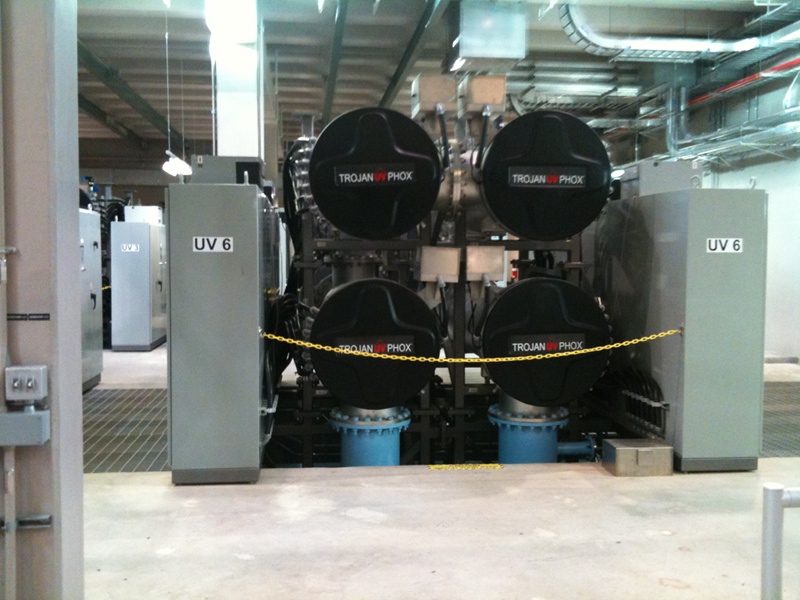


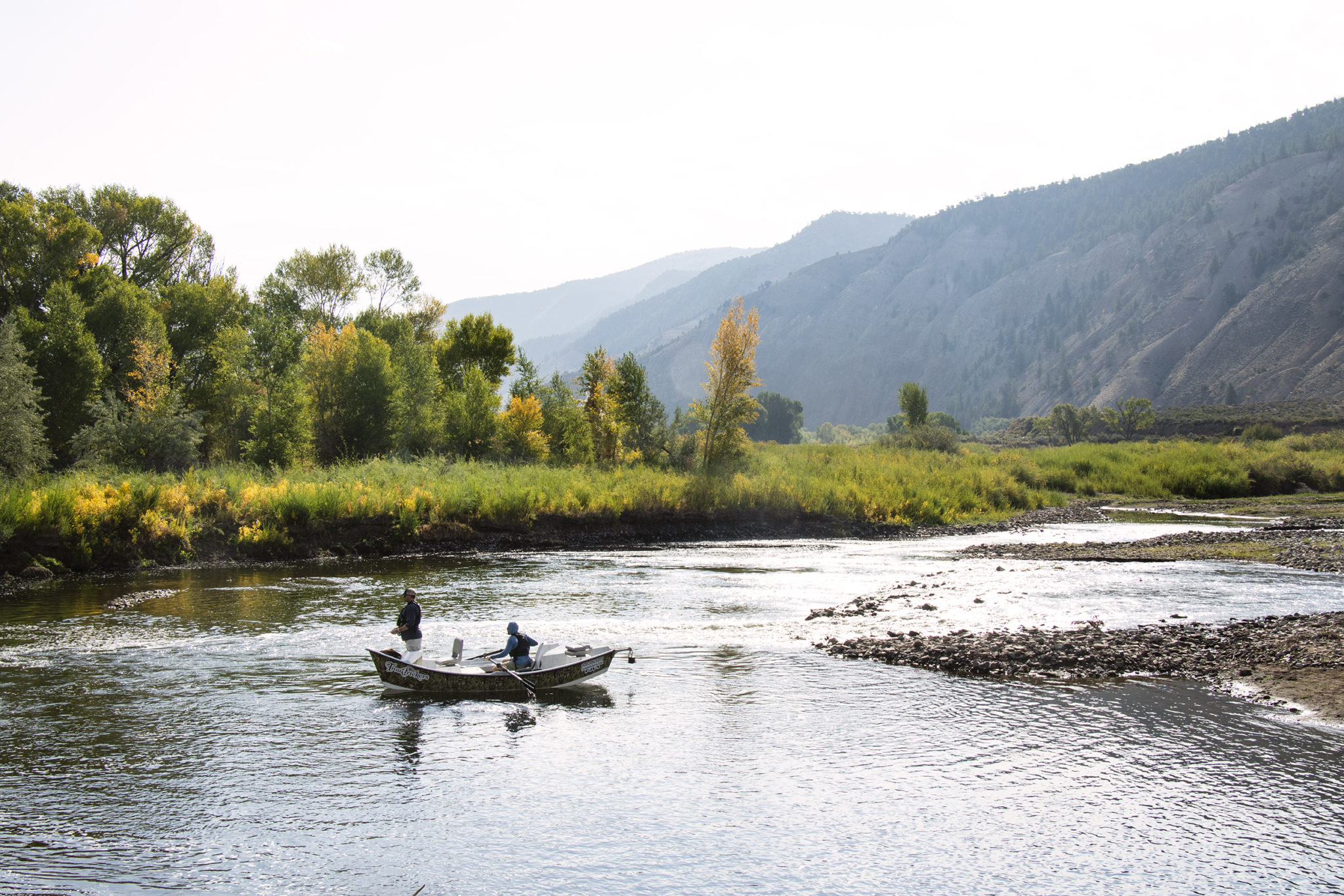


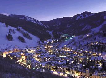
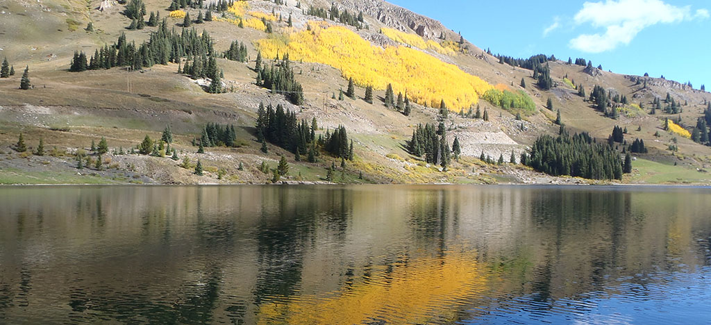


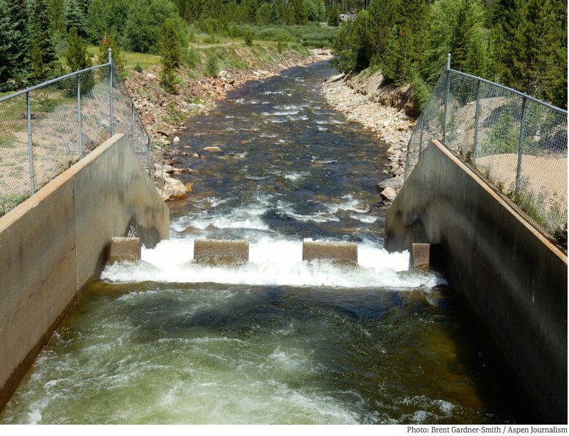

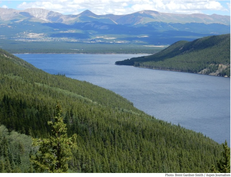

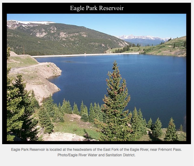
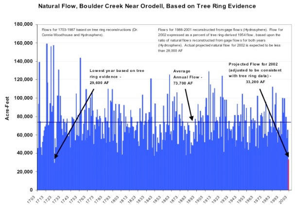


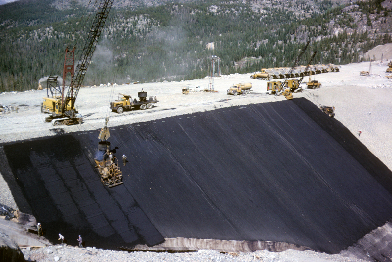


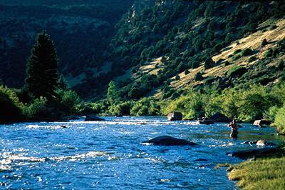