Pitkin County and West Slope close to securing 1,000 AF of water for upper Roaring Fork

The upper Roaring Fork River, east of Aspen, near the river’s confluence with Difficult Creek. The stretch of river between Difficult Creek and Maroon Creek is often plagued by low flows in late summer and fall.

By Brent Gardner-Smith, Aspen Journalism

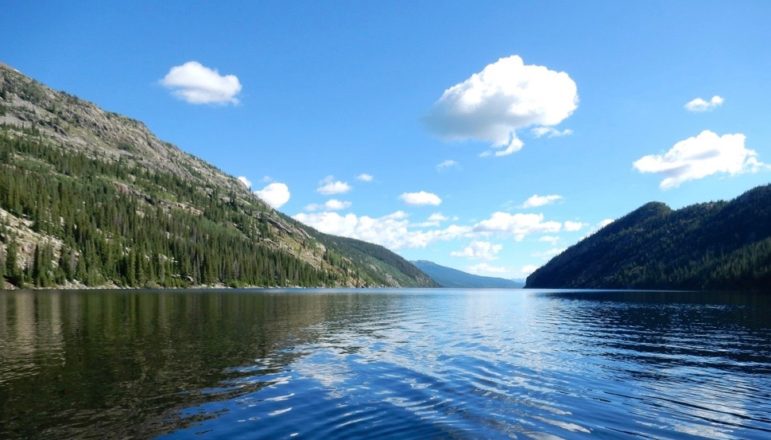
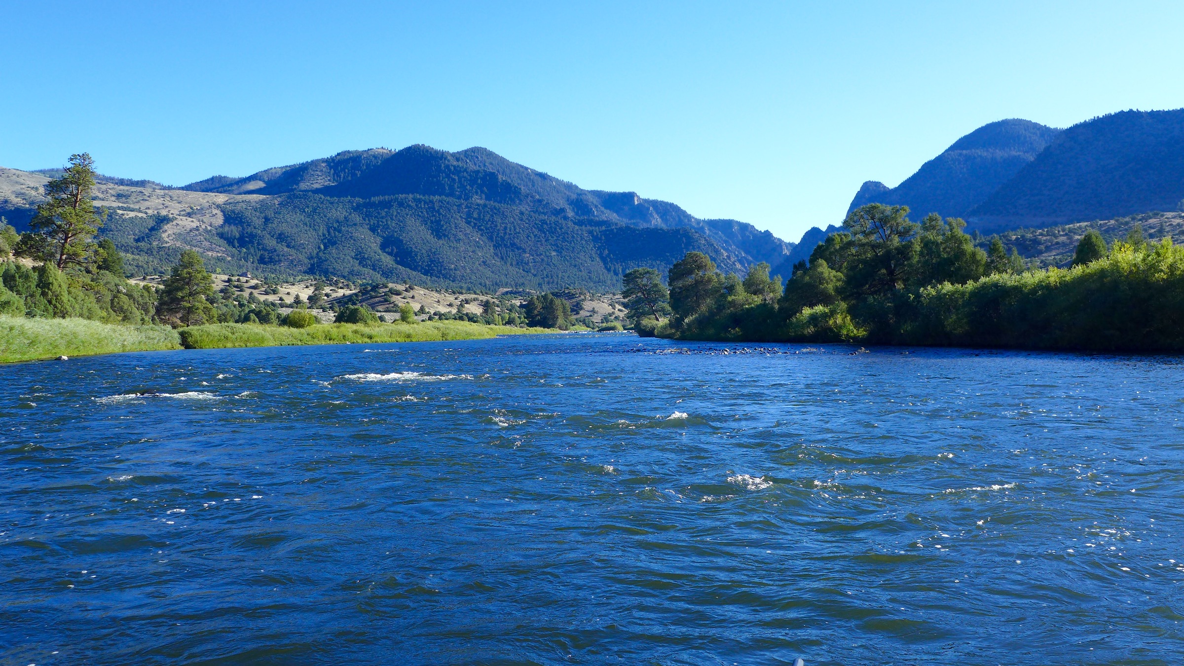
As a way to settle a 2009 state water court case led by Pitkin County and the Colorado River District, the Front Range city of Aurora has agreed to let as much as 1,000 acre-feet of water run down the upper Roaring Fork River each year instead of diverting the water under Independence Pass.

The pending settlement could mean that about 10 to 30 cubic feet per second of additional water could flow down the river through Aspen in summer and fall.

It’s an amount of water that Pitkin County Attorney John Ely said would be “visibly noticeable” and would help bolster flows in the often water-short stretch of the Roaring Fork between Difficult and Maroon creeks.

“It’s exciting,” Ely said. “It’s not very often you get to put water into the upper Roaring Fork. These opportunities are pretty limited, and I’m not sure if we’ll ever see another one.”

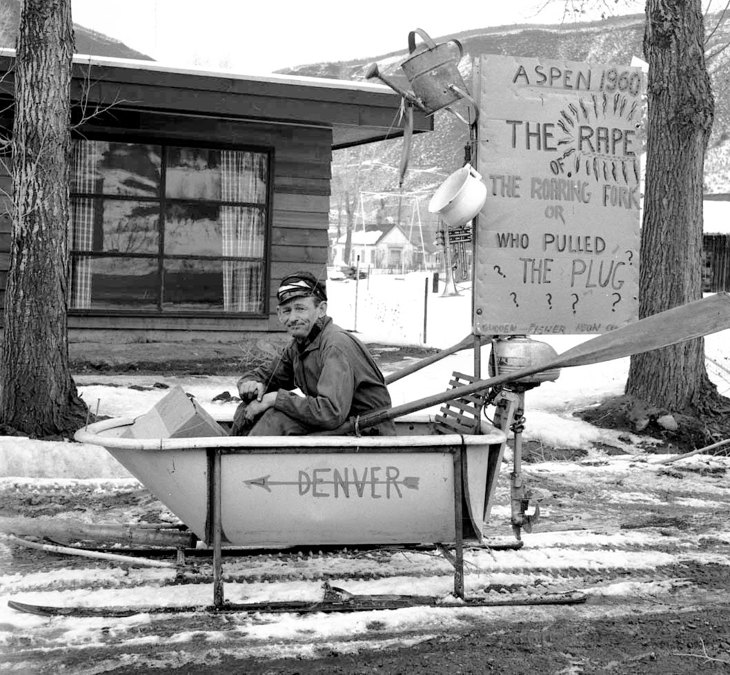
A June 13 memo from Ely on the agreement states that “the Pitkin County Healthy Rivers and Streams Board has long recognized this reach of the Roaring Fork as one of the most stressed reaches of the Roaring Fork” and that “the Roaring Fork Conservancy’s State of the Watershed report identifies the upper Roaring Fork just above Aspen and heading into town as being severely degraded.”

The Pitkin Board of County Commissioners is expected to approve the settlement in the form of an intergovernmental agreement with Aurora on Wednesday.

Aurora’s city council also is expected to approve the agreement, as is the Colorado River District board of directors at its July meeting. A Water Court judge has set a July 20 deadline for the parties to file the settlement.

Officials with Pitkin County and the Colorado River District see the deal with Aurora as a victory, especially as some estimates, according to Ely, place the value of water in Aurora at $50,000 an acre-foot, which makes the 1,000 acre-feet of water potentially worth $50 million.

The settlement is also of high value to officials at the Colorado River District, who led the efforts of the West Slope entities in the case.

“I think it’s a big deal,” said Peter Fleming, the general counsel for the Colorado River District, which represents 15 counties on the Western Slope. “I think it’s going to be a good deal for Pitkin County, the Roaring Fork River, and the West Slope as a whole. And frankly, I think it’s a pretty good deal for Aurora, as well.”

But Tom Simpson, a water resource supervisor with Aurora, said it’s a “bittersweet” deal for the growing Front Range city.

“We’ve worked hard on this agreement over the last year,” Simpson said. “It is bittersweet, but we are happy that we are finally there.”

The deal lets Aurora retain its current use of 2,416 acre-feet of water it diverts on average each year from the top of the Fryingpan River Basin, but Aurora also is giving up 1,000 acre-feet of water it now diverts from the top of the Roaring Fork River Basin.

Aurora also is agreeing to abide by operating protocols and future potential use of the senior water rights on the Colorado River now tied to the Shoshone hydropower plant in Glenwood Canyon. That agreement could limit the amount of additional water Aurora can divert in the future from the Colorado River Basin.

The provisions of the agreement relating to the Shoshone water right also include an acknowledgement that the senior water right might someday be changed to include an instream flow right rather than the water being diverted out of the river and sent to the hydropower plant.

“Aurora will not oppose an agreement between a West Slope entity or entities, the Colorado Water Conservation Board, and any other entity entered for the purpose of adding instream flow as an additional use of the senior hydropower right,” the agreement states.

Simpson agreed the overall deal represented a “haircut” for Aurora’s water rights in the Colorado River Basin.

“Yes, we’re going to get the 2,416 acre-feet out of Busk, but we’re going to make these other deliveries on the Roaring Fork, and we might lose just a little bit of water on the Shoshone protocol,” he said. “It’s a haircut, absolutely.”

On the other hand, Simpson said “while this agreement is not perfect, we feel like it is a good agreement, and preserves some of our Busk-Ivanhoe water and lets us all move forward.”

A view of Ivanhoe Reservoir, where water from the upper Fryingpan River headwaters is collected before being sent under the divide to Busk Creek, Turquoise Reservoir, and then the Front Range.

Started in 2009

In December 2009, Aurora filed a water rights application in Division 2 Water Court in Pueblo to change the use of its water rights in the Busk-Ivanhoe transmountain diversion system in the Fryingpan River headwaters.

The system, built in the 1920s, gathers water from Ivanhoe, Pan, Lyle, and Hidden Lake creeks and diverts the water through the Ivanhoe Tunnel to Turquoise Reservoir near Leadville before it is sent to East Slope cities. The system was built to deliver water to irrigators in the lower Arkansas River basin.

The water rights to the system carry appropriation dates from 1921 to 1927, which makes them junior to the senior water rights on the Colorado River near Grand Junction known as the “Cameo call.”

The Pueblo Board of Water Works bought half of the Busk-Ivanhoe system in 1972, and Aurora gradually secured its half-ownership in the system between 1986 and 2001.

In its 2009 application, Aurora told the water court it wanted to change the use of its water in the Busk-Ivanhoe system from irrigation to municipal use.

However, it also conceded it had already been using the Busk-Ivanhoe water for municipal purposes in Aurora, even though its water-right decree limited the use of the water to irrigation in the lower Arkansas River valley. It also came to light that Aurora was first storing the water in Turquoise Reservoir without an explicit decreed right to do so.

That caught the attention of Pitkin County, the Colorado River District, a host of other Western Slope water interests, and the state engineer’s office, which administers water rights.

As Ely put it in a June 13 memo to the Pitkin County commissioners, “In 1987, Aurora began using Busk-Ivanhoe water for undecreed municipal and residential purposes in an undecreed area, the South Platte Valley, after storing the water in an undecreed manner in Aurora system reservoirs.”

Aurora’s stance was that since the water had been diverted under the Continental Divide, it didn’t matter how it used or stored the water, as it should make no difference to the West Slope. But an array of West Slope entities, including the Colorado River District, disagreed with Aurora’s position.

In July 2013 the Western Slope entities and the state took Aurora to a five-day trial in Div. 2 Water Court in Pueblo, arguing that Aurora should not get credit for its 22 years of undecreed water use and storage.

“It was always an issue of fact at trial as to how much water was in play because it depends on how you calculate the yield of the project,” Ely said.

In 2014, thought, the district court judge in Division 2 ruled in Aurora’s favor, and the West Slope interests then appealed to the state Supreme Court.

The appeal process prompted a host of entities on both sides of the Continental Divide to come forward and argue aspects of the case before the court. It also prompted a scolding of Aurora by former Supreme Court Justice Greg Hobbs over the use of undecreed water rights.

In 2016, the Colorado Supreme Court reversed the lower court’s decision, ruled in favor of the Western Slope, and remanded Aurora’s original change application back to the lower court.

“The Supreme Court wrote that notwithstanding the fact that the change application and original decree concerned developed transmountain water, water used for undecreed purposes cannot be included in a calculation for historic consumptive use and is therefore excluded from water available for change of use,” Ely wrote in his June 13 memo.

So, rather than going back to Water Court and continuing to fight over the potential size of the Busk-Ivanhoe rights, which the West Slope now saw as being between zero and well-less than 2,416 acre-feet, Aurora began negotiating in January 2017 with the Western Slope entities still in the case, which included Pitkin County, Eagle County, the Colorado River District, the Grand Valley Water Users Association, the Basalt Water Conservancy District, Eagle County, Orchard Mesa Irrigation District, and Ute Water Conservancy District.

Today, each of those entities is also a party to the intergovernmental agreement expected to be submitted to the water court in July, along with a proposed decree for Aurora’s Busk-Ivanhoe rights.

Ely said Pitkin County didn’t start out in the case with an eye on securing 1,000 acre-feet for the Roaring Fork, but did have a local interest in the operation of the Busk-Ivanhoe project.

“We weren’t doing it to obtain an end result, we were doing it because the [Busk-Ivanhoe] project is in our backyard and we felt it was the right thing to do,” Ely said. “And all the other dialogue developed after the trial and the Supreme Court decision.”

At the time of the 2016 Colorado Supreme Court decision, Pitkin County had spent $353,000 in legal and other fees in the case, using money brought in by a tax to fund the county’s Healthy River and Streams program, which includes litigation in water court.

Since then, Ely said the county had spent an additional $27,300 for hydrology and engineering work, but had not spent more on additional outside legal help, as he and Assistant County Attorney Laura Makar handled the settlement negotiations for the county.

The dam across the main stem of the upper Roaring Fork that diverts water from Lost Man Creek and the Roaring Fork into a tunnel under Green Mountain and, eventually, into Grizzly Reservoir and the tunnel under Independence Pass to the Arkansas River basin. Some of the water owned by Aurora will be bypassed at this point to run down the Roaring Fork.

Pan, or Fork?

For Pitkin County and other Western Slope entities, it made more sense to negotiate with Aurora for some of the water it owns in the Independence Pass-Twin Lakes system rather than the Busk-Ivanhoe system, as any water bypassed by the Busk-Ivanhoe system would be scooped up by the Fry-Ark Project, which sits below the Busk-Ivanhoe system in the upper Fryingpan valley and also diverts water to the East Slope.

Aurora owns 5 percent of the shares in the Twin Lakes Reservoir and Canal Co., which operates the Independence Pass Transmountain Diversion System. Its share of the water diverted each year from the top of the Roaring Fork equals about 2,100 acre-feet a year, so the 1,000 acre-feet of water equals about half of Aurora’s water in the Twin Lakes company.

In the 10 years from 2007 through 2016, Twin Lakes Co. diverted a total of 485,762 acre-feet of water from the upper Roaring Fork River Basin through its diversion system, putting the 10-year average for that period at 48,567 acre feet. 2011 was the biggest year of diversions since 2007, with 67,463 acre-feet diverted, and 2015 was the lowest year since 2007, with 18,374 acre-feet diverted.

Colorado Springs owns 55 percent of the shares in Twin Lakes Co., Pueblo 23 percent, Pueblo West 12 percent, and Aurora 5 percent. There are also other minority shareholders, holding 5 percent of the shares, still using the water from the system for agriculture.

Twin Lakes is not a party to the intergovernmental agreement between Aurora and the West Slope entities, but it is willing to work with all involved to make the water deliveries as beneficial as possible for the Roaring Fork River.

Ely said Pitkin Country was grateful for the willingness of the Twin Lakes Co. to work with the county and the Colorado River District to release the water in a way that benefits the river, even if it means more work for the operators of the Independence Pass-Twin Lakes system.

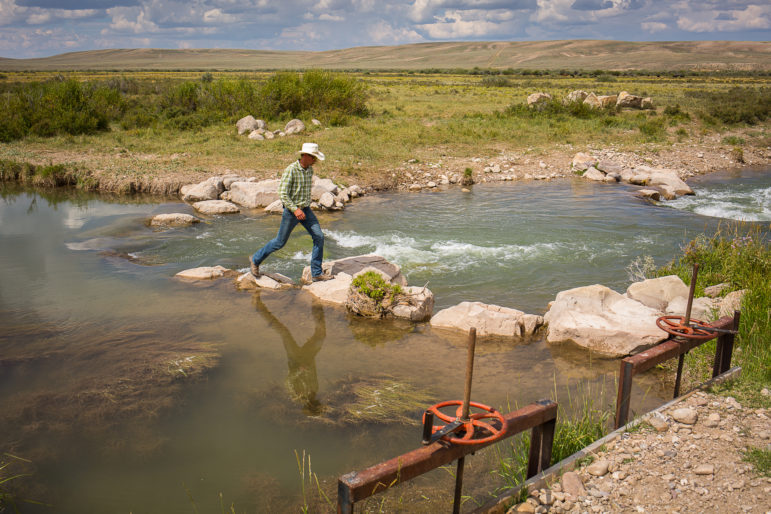
According to Kevin Lusk, the president of the Twin Lakes Reservoir and Canal Co. and a senior engineer at Colorado Springs Utilities, the company is simply responding to the desires of a shareholder in the company, Aurora.

He also said it’s legal under a 1976 water-rights decree held by Twin Lakes to bypass water for use on the West Slope instead of diverting it under the Continental Divide.

“The decree allows for this type of operation and so really all we’re doing as a company is accommodating the request of one of our shareholders to do something that was contemplated and provided for in the decree,” Lusk said.

And as part of the agreement, representatives from Pitkin County, the Colorado River District, Aurora, and Twin Lakes will meet each year to agree on a delivery schedule for the water that describes the “desired rate, timing, amount, location and ultimate use of the water, as well as the operational needs and constraints” of the Independence Pass-Twin Lakes diversion system.

In a letter attached to the agreement laying out how Aurora and the Twin Lakes Co. plan to manage the releases, Aurora said it “would prefer the water to be delivered at times of the year and at locations that will provide the most benefit to the Roaring Fork River stream flow. Typically this will be in the second half of the summer, beginning July 15, through the fall season.”

And Pitkin County feels the same way, according to Ely.

“We would like it delivered later in the year when the flows of the river start to go down,” he said.

However, Lusk at Twin Lakes said if the West Slope entities wait too long in the season to bypass the water, it may not be there to bypass.

“I know that there is a great interest in saving a lot of this water and bypassing it at the end of the season,” Lusk said. “But it’s going to be a bit of a balancing act. You’ve got to take the water when it’s there, because if you don’t take advantage of it there won’t be any to release later.”

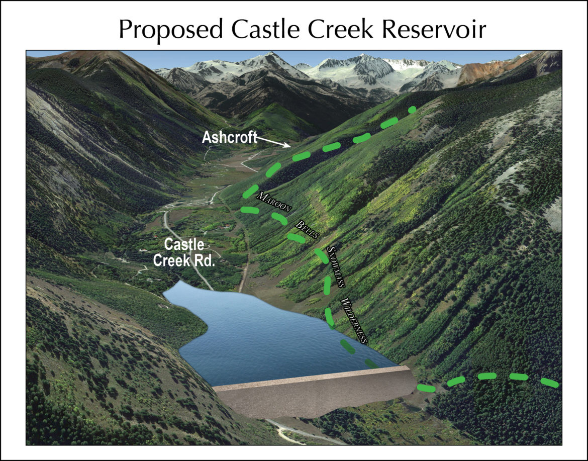
Lusk also said that if the West Slope really wanted to take full advantage of the water, it might consider building a reservoir above Aspen to store the water at peak runoff and then release it later in the season.
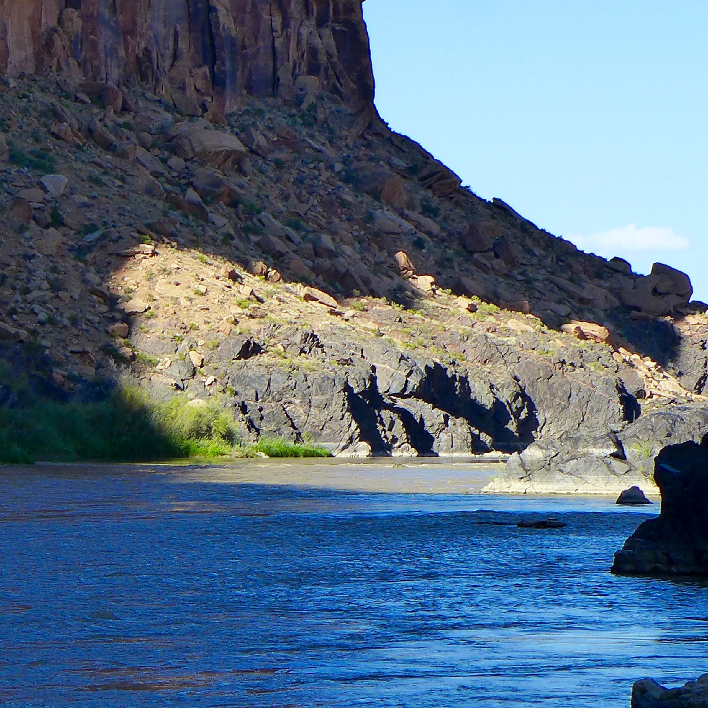
Grizzly Reservoir on Lincoln Creek, well above its confluence with the Roaring Fork River at Lincoln Gulch Campground. The reservoir briefly stores water before it is diverted under the Continental Divide.

Flows on the Fork

According to a draft resolution to be voted on by the Pitkin County commissioners Wednesday, there were several factors that went into the county’s goal of acquiring 1,000 acre-feet per year of water for the upper Fork, including “the expected amount of yield for Aurora in the Busk-Ivanhoe system; existing in-basin and out-of-basin diversions from the Roaring Fork River between Independence Pass through the City of Aspen; potential future demand on the river; extent of existing conditional water rights; and the results of a stream analysis and channel measurement study.”

If the deal is approved, as soon as next year 700 acre-feet of Aurora’s water is expected to be captured briefly in the Independence Pass system, which includes dams on Lost Man Creek, the main stem of the Roaring Fork River, and on Grizzly Creek, and then released down either the Fork or Lincoln Creek toward Aspen.

Another 200 acre-feet of Aurora’s Twin Lakes water will be held in Grizzly Reservoir on Lincoln Creek, which holds 570 acre-feet of water. That water will then be released late in the year, after most transmountain diversions have stopped, to bolster late-season flows in the river.

“So it’s actually reservoir release of previously stored water, while the [700 acre-feet] is a true bypass of water that would have gone through the tunnel that day to the other side,” Lusk said. “It’s new for us. We typically don’t operate the reservoir that way. Typically we would run that reservoir quite a bit lower, just for safety-of-dam reasons. But this change in operation is going to be holding the reservoir up much fuller for a lot longer, and we just need to watch the behavior of the dam.”

Another 100 acre-feet of water could also eventually be left in the Roaring Fork each year after a complicated exchange-of-water arrangement is worked out with Aurora and other parties on the Fryingpan River, which brings the potential total water left in the Fork to 1,000 acre-feet.

There is also a drought contingency provision which will allow Aurora to bypass 100 acre-feet less than they would have under the deal if the water level in their system of reservoirs falls below 60 percent on April 1 in a given year. So in a dry year, that could bring additional flows in the Roaring Fork back to 900 acre feet.

The upper Roaring Fork River at the Cascades at about 6 p.m. on Thursday, June 16, 2016, after Lincoln Creek surged into the Fork, about an hour after the Twin Lakes Tunnel was closed. When the Twin Lakes system is closed for whatever reason, as it has been the past several seasons, the Roaring Fork River leaps to life with renewed intensity.

Other provisions

The pending Busk-Ivanhoe settlement also includes a provision that allows the Basalt Water Conservancy District to store 50 acre-feet of water in Ivanhoe Reservoir, which holds 1,200 acre-feet of water and serves more as a forebay for the Ivanhoe Tunnel diversions than a storage reservoir.

And, in a provision to Aurora’s benefit, the West Slope entities, including Pitkin County, have agreed not to fight, at least on a wholesale basis, the permitting of two potential reservoirs that Aurora is working on, Wild Horse Reservoir in South Park and Box Creek Reservoir, which could hold between 20,000 and 60,000 acre-feet on private land on the south flank of Mt. Elbert.

“Any participation in the permitting processes by the West Slope Parties will not seek to prevent the project in its entirety and comments or requests may be raised only for the purpose of addressing water related impacts caused directly by either of the two above specified projects on the West Slope,” the draft agreement between Aurora and the West Slope says.

The concession from the West Slope is significant as Box Creek Reservoir will be able to store water from the West Slope.

The West Slope entities also agree not to oppose changes in diversion points tied to the Homestake transmountain diversion system in the Eagle River Basin, not to oppose Aurora’s efforts to repair the Ivanhoe Tunnel, which is also called the Carlton Tunnel. The tunnel was originally built as a railroad tunnel, and then used as a highway tunnel.

Finally, the parties to the deal have agreed, in what’s called a “diligence detente,” not to challenge in water court for 15 years a list of conditional water rights, held by both East Slope and West Slope entities, that are required to periodically file due-diligence applications with the state.

The list of conditional water rights includes rights held by Aurora tied to the Homestake project and rights by the Southeastern Water Conservancy District tied to the Fry-Ark Project. They also include rights held by the Colorado River District on a number of West Slope water projects, including the potential Iron Mountain Reservoir near Redcliff and the Wolcott Reservoir near Wolcott.

Notably, the agreement does not include provisions to legally shepherd the water from the Independence Pass-Twin Lakes system all the way to the confluence of Maroon Creek, so it’s possible that diverters on the river near Aspen, such as the Salvation Ditch, could pick up the water left in the river.

However, Ely said the county will seek cooperation from diverters on the river near Aspen.

“We’ve had some conversations with water users on this side of the hill, and we’ve had conversations with the Division 5 engineer’s office, and we’re hopeful that when the water is being bypassed and put in the river and there is an increase of flow, folks won’t take advantage of that and we’ll be able to get it down through Aspen,” Ely said. “And eventually, you know things will change, and we hope to have that water associated with its own water right, so we can call it further down, but that won’t be the case right away.”

An additional benefit to the deal, according to Ely, is that the management of the 1,000 acre-foot pool of water from Aurora may also lead to better management of a 3,000 acre-foot pool of water also available in the Independence Pass-Twin Lakes system.

That pool was created to mitigate the impacts to the Roaring Fork River from diversions by the Fry-Ark Project on Hunter, Midway, and No Name creeks, which drain into the Fork in central Aspen. And while Twin Lakes releases the water down the Roaring Fork, releases from the Fry-Ark Project replace the water in Twin Lakes Reservoir, where both transbasin diversion systems can send water.

For years, the water from the 3,000 acre-foot pool has been released at a rate of 3 cfs on a year-round basis and has not been timed to help bolster low-season flows. Now, given the greater cooperation over the management of the 1,000 acre-foot pool from Aurora, how the 3,000 acre-foot pool from Fry-Ark is managed may also change, to the benefit of the river.

Aspen Journalism is collaborating on the coverage of rivers and water with The Aspen Times. The Times ran a shorter version of this story on Tuesday, June 12, 2018.

Honing in on options for a potential White River Dam near Rangely

Looking up the White River valley, with the Wolf Creek valley opening up to the left. The view is from Hwy 64.

By Brent Gardner-Smith/Aspen Journalism

CRAIG — Three variations of a potential dam that could someday sit astride the main stem of the White River between Meeker and Rangely have been examined by the Rio Blanco Water Conservancy District in Rangely.

Last week in Craig, Steve Jamieson, a principal engineer and president at W.W. Wheeler and Associates, told the members of the Yampa, Green and White river basin roundtable that an 80-foot-tall dam built across the main stem of the White River at Wolf Creek could store 68,000 acre-feet of water.

He said a 104-foot-tall dam across the river could store 138,000 acre-feet.

And a 290-foot-tall dam across the valley floor could store 2.9 million acre-feet of water.

“The maximum you can get here is 2.9 million acre-feet in this bucket,” Jamieson said. “It’s a big bucket, and you can do that with a dam that it’s about 290 feet high. It would be a very efficient dam site, but you need to have the water to fill it.”

A slide being presented by Steve Jamieson of Wheeler a showing the range of dam and reservoir sizes that have been studied for the potential White River Dam on the main stem of the White River 23 miles east of Rangely. The dams range in size from 80-feet-tall to 290-feet-tall and could store between 68,000 AF to 2.9 MAF. The dam sizes were studied as part of Phase 2A of the White River storage project, and the state has provided $500,000 in funding so far to study the project.
Steve Jamieson, left, of Wheeler and Associates, and Brad McCloud, right, showing an illustration of where the axis of a 290-foot-tall dam across the White River would be. The big dam would require a 500-foot-wide spillway, which would mean relocating a section of Hwy 64.

Water enough

About 500,000 acre-feet of water a year runs down the lower White River each year, flowing through Meeker and Rangely and into Utah and the Green River.

And between 1923 and 2014, the annual flow in the White River at the Utah line ranged from 200,000 to 1.2 million acre-feet, according to Wheeler and Associates.

The potential White River Dam would be located 23 miles east of Rangely, along Highway 64.

The existing Taylor Draw Dam, which forms Kenney Reservoir on the main stem of the White River, is six miles east of Rangely.

That reservoir was built in 1984 to hold 13,800 acre-feet of water, but it’s gradually silting in, as was expected in a 1982 EIS done for the project. The surface area still “available for recreation,” or boating, is now less than 335 acres, down from 650 acres when the reservoir opened.

The dam’s hydro plant, however, is still generating about $500,000 a year in electricity revenue for the Rio Blanco district in a run-of-river setup.

A slide being presented by Steve Jamieson of Wheeler and Associates and Brad McCloud of EIS Solutions showing the range of dam and reservoir sizes that have been studied with state funding for the Wolf Creek drainage. The dams range in size from 80-feet-tall to 260-feet-tall and could store 41,000 AF to 1.6 MAF. The dam sizes were studied as part of Phase 2A of the White River storage project, and the state has provided $500,000 in funding so far to study the project.

Off-channel too

Jamieson also has been studying an off-channel dam in the Wolf Creek drainage, which is a broad, dry valley on the north side the river, just upstream of the proposed White River Dam site.

The Wolf Creek Dam would be located 3,000 feet back from the river and 170 feet above it.

An 80-foot-tall version of that dam could store 41,000 acre-feet of water, a 119-foot-tall dam could store 130,000 acre-feet, and a 260-foot-tall dam could store 1.6 million-acre feet, Jamieson said.

“This is really good dam site here, I like this,” Jamieson said. “It’s very flexible.”

However, the off-channel Wolf Creek Dam would require that water be pumped up from the river, at a high cost, or delivered via a 40-mile long canal or pipeline starting near Rio Blanco Lake — closer to Meeker than Rangely.

“It’s going to be a very long and expensive canal,” Jamieson said.

The pumping facility for a 90,000 acre-foot reservoir, which was studied in 2014, was estimated to cost $18.2 million build and up to $1.1 million a year to operate.

Jamieson said Highway 64 would need to be moved to accommodate the biggest White River Dam option, which requires a 500-foot-wide spillway on one side of the river valley.

The river itself would also have to be moved during construction.

“You’d be constructing two to three years at least,” Jamieson said. “So what we looked at is actually building a tunnel around into this abutment that we would divert the White River through during construction.”

A slide presented by Steve Jamieson of Wheeler and Associates on May 9, 2018, showing the maximum inundation area of a 290-foot-tall dam on the main stem of the White River. Jamieson presented the slide at the May 9, 2018 meeting in Craig of the Yampa/White/Green basin roundtable.

Gardner-sized

Jamieson said the district started studying the maximum size of the potential reservoirs after Sen. Cory Gardner asked during a site visit, “How big can you make this reservoir?”

During his presentation Jamieson repeatedly referred to Sen. Gardner, using phrases such as “this is the maximum Cory Gardner reservoir.”

A roundtable member asked, “Did the senator promise the money for this?”

The basin roundtables operate under the auspices of the Colorado Water Conservation Board and review grants for water projects.

“No, he did not, unfortunately,” said Brad McCloud of EIS Solutions, a public affairs consulting firm retained by the district. “We asked.”

The Colorado Water Conservation Board also wants to know what the maximum reservoir size is.

“Based on recent comments from some stakeholders, it may be beneficial to build the largest possible reservoir at Wolf Creek,” the scope of work for a 2017 grant from the board to the district states.

It also says “a much larger reservoir … could have additional benefits to the state.”

One of those benefits could be helping the state avoid a compact call on the Colorado River.

“Part of the Phase 2A study is to determine if the project may have the potential to provide Colorado compact curtailment insurance during periods of drought,” the 2017 grant application from the district said.

Since 2013, the district has received three grants totaling $500,000 from the Colorado Water Conservation Board for its White River project, and the potential benefit of compact compliance has been mentioned in all three grants.

The White River near the vicinity of the Wolf Creek drainage. The river sends about 500,000 acre-feet of water a year across the state line into Utah, with flows ranging from 200,000 AF to 1.2 MAF a year. The White drains the western side of the Flat Top Mountains and flows through Meeker and Rangely.

20,000 or 90,000

On Wednesday in Craig, Jamieson downplayed compact curtailment and focused on the district’s goal of creating a 20,000 or 90,000 acre-foot “working pool” of water inside larger potential reservoirs.

For example, it would require a 138,000 acre-foot on-channel reservoir to establish a 90,000 acre-foot working pool for the district, after allowances for a recreation pool and a 24,000 acre-foot sedimentation pool — which would fill in over 50 years.

To establish a need of the stored water, Jamieson cited a 2014 study showing demand in the basin at 91,000 acre-feet in 2065.

That’s on the high end, though.

The low-end need in 2065 was 16,600 acre-feet.

The district filed in water court in 2014 for a 90,000-acre-foot storage right at both the on-channel and off-channel locations.

But Erin Light, the division engineer in Div. 6, told the district in July 2017 “this application continues to contain aspects that are speculative and this is concerning to me.”

She questioned the district’s use of the highest estimates for such potential uses as oil shale production and flows for endangered fish.

The water attorney for the district, Ed Olszewski, responded to Light in August.

He said the district “disputes that any portion of the application is speculative” and the application is intended to be “as flexible as possible.”

As Jamieson wrapped up his presentation, he said the Rio Blanco district plans to “initiate project permitting” in 2019.

“I know we’re very aggressive,” Jamieson said. “We’re making progress.”

Aspen Journalism is covering water and rivers in collaboration with The Aspen Times and the Glenwood Springs Post Independent. The Times and the Post Independent published this story on Monday, May 14, 2018.

Aspen moves closer to settling Castle and Maroon creek dam cases

Under conditional water rights held by the city of Aspen since 1965, a 155-foot-tall dam would be built in this location on Maroon Creek to store 4,567 acre-feet of water. The city of Aspen is moving closer to reaching agreements with 10 opposing parties in water court to move the water rights to other locations.

By Brent Gardner-Smith, Aspen Journalism

City of Aspen officials are hoping to reach an agreement by May 29 with the 10 opposing parties in two water court cases over the city’s conditional water rights tied to potential dams on Maroon and Castle creeks.

While that timeline may be ambitious, one of the parties in the two cases, Double R Creek Ltd., which owns a residential property that would be flooded by the Castle Creek Reservoir, recently signed a settlement agreement with the city.

“My client has settled and feels that the settlement is a good one for my client since it eliminates the threat of the development of that reservoir anywhere in the Castle Creek valley,” said Kevin Patrick, a water attorney with Patrick, Miller and Noto who represents Double R Creek Ltd. “We’re pleased.”

The potential Castle Creek Reservoir, which would store 9,062 acre-feet of water behind a 170-foot-tall dam 2 miles below Ashcroft, would flood portions of the residential property owned by Double R Creek Ltd.

It also would flood residential property across Castle Creek owned by Asp Properties LLC, which also is opposing the city in water court.

The Maroon Creek Reservoir would hold 4,567 acre-feet of water behind a 155-foot-tall dam, located just below the confluence of East and West Maroon creeks on U.S. Forest Service property, within view of the Maroon Bells.

A graphic from Wilderness Workshop that shows how the potential Maroon Creek Reservoir would appear behind a 155-foot-tall dam just below the confluence of East and West Maroon creeks.

Other locations

Under similar settlement proposals sent to all the parties in the cases, the city would agree to move its conditional storage rights out of the Maroon and Castle creek valleys to six other potential locations in the Roaring Fork River valley, according to sources close to the court cases.

If the change in location of the water-storage rights is approved in water court, the city could retain the right to transfer as much as 8,500 acre-feet of water storage across those locations, down from the potential combined total of 13,629 acre-feet in Castle and Maroon creeks, but only in those six new locations.

The locations include the existing gravel pit in Woody Creek on land the city recently purchased for water storage next to the gravel pit, on the city’s golf course, on the Moore Open Space near the roundabout, on land near the Burlingame housing development and on the Cozy Point Open Space at the bottom of Brush Creek Road.

On May 29, city staff plans to present the signed agreement with Double R Creek Ltd. to the City Council in a regular public meeting for its final review and approval. They also are working to present signed agreements, or stipulations, with the other nine opposing parties in the cases, as well.

“We’re hopeful that when we come to council we’re going to have stipulations from all the parties,” said Margaret Medellin, utilities portfolio manager for the city. “And if we don’t, we will take what we have and continue to work toward a point of settlement.”

Outstanding areas of agreement among some of the opposing parties and the city revolve around assurances that the city won’t try and move its conditional rights, fail in its attempt, and then return to seeking to maintain its conditional rights in the Castle and Maroon valleys.

Patrick said the agreement he signed on behalf of his client includes those assurances.

An illustration prepared by Wilderness Workshop of the potential Castle Creek Reservoir, based on plans filed by the city of Aspen with the state in 1965 to create water rights for the reservoir. The city is now moving closer to reaching agreement with parties opposing the city’s 2016 due-diligence application to maintain the rights.

Ongoing process

The other parties in the two cases include two property owners in Maroon Creek, Larsen Family LP and Roaring Fork Land and Cattle Co., Pitkin County, the U.S. Forest Service, Wilderness Workshop, Western Resource Advocates, American Rivers, and Trout Unlimited.

The city first applied for the conditional water storage rights for the two potential reservoirs in 1965 and the decree for the rights carries a 1971 priority date. (See timeline.)

In October 2016, the city submitted two due-diligence applications for the reservoirs and the cases attracted opposition from 10 parties across the two cases.

In July 2017, the city announced its intention to move the conditional storage rights out of both valleys and has been in negotiations with the opposing parties in the case since then.

On Tuesday, the city’s water attorney, Andrea Benson of Alperstein and Covell in Denver, updated the Division 5 water court referee, Susan Michelle Ryan, on the city’s settlement efforts.

“Since the last status conference, I believe we’ve made some good progress toward settlement with all of the opposers,” Benson said.

Benson said in addition to having a signed stipulation with Double R Creek Ltd., the city has also reached a “settlement in concept” with both Western Resource Advocates and Wilderness Workshop. (See “minute order” on status conference from the water court referee.)

Will Roush, the conservation director at Wilderness Workshop, said his organization’s main goal in the cases has been “protecting those two creeks and ensuring that there wasn’t the possibility of building dams on either creek. Dams obviously fragment streams and the riparian habitat. So our goal has always been to protect the ecosystems of those two valleys.”

Paul Noto, a water attorney also with Patrick, Miller and Noto, is representing American Rivers, Trout Unlimited, and the Roaring Fork Land and Cattle Co. in the cases.

“We’ve been working with the city toward settlement, and it seems like we’re making progress, and we hope to have the case wrapped up shortly,” Noto said Tuesday.

Medellin, who declined to discuss the specifics of the proposed settlements, said city staff has been “negotiating with council’s direction.”

She also said the city’s position is that all of the parties in the case need to agree to settle for the final deal to be struck.

“We think we’ve been able to come to a place where we are all going to get what we want, or close to it,” she said.

Aspen Journalism is covering water and rivers in collaboration with The Aspen Times. The Times published this story on Wednesday, May 9, 2018.

Wringing what’s left out of the booming South Platte river basin

Development along the I-25 corridor north of Denver is booming, according to water providers in the South Platte basin. A new proposed storage and re-use plan will help meet demands they say.

By Brent Gardner-Smith, Aspen Journalism

KEYSTONE – Representatives of various water providers in the South Platte River basin said Wednesday they intend to develop a new water-storage project that includes 175,000 acre-feet of storage at three locations on the South Platte River system.

The potential project would store 50,000 acre-feet of water in Henderson, just north of Denver, 100,000 acre-feet in Kersey, downstream of Greeley, and 25,000-acre-feet further downriver on the Morgan County line at the Balzac Gage, east of Snyder.

By comparison, Ruedi Reservoir above Basalt holds about 100,000 acre-feet of water and Dillon Reservoir in Summit County holds about 257,000 acre-feet.

“We think we have something that could help the Front Range and the South Platte, and the state as a whole,” said Jim Yahn, who represents the South Platte basin on the Colorado Water Conservation Board and is manager of the North Sterling Irrigation District.

The proposal, which does not include a new transmountain diversion, is coming from an informal and collaborative working group that included officials from Denver Water, Aurora Water, and Northern Water, along with officials from other water providers and users, such as Yahn.

The group called itself the South Platte Regional Opportunities Working Group, or SPROWG, which rhymes with frog.

Now a new regional water organization is expected to be formed to guide the proposal toward permitting and funding, said Lisa Darling, the executive director of the South Metro Water Supply Authority.

Darling was on the working group and she was presenting the project to the members of the Interbasin Compact Committee, or IBCC, in Keystone on May 2.

She said the various water providers in the South Platte realized that “not unifying was not an option” and that the group developed “a series of projects that could be linked together to benefit everybody as a whole.”

Darling also said, “We have to be able to maintain control of the supply, and not have it leave the state unnecessarily.”

The South Platte River rises in the mountains west of Denver, runs through the city north to Greeley, and then turns east toward the Nebraska line.

According to slides presented to the IBCC, the reasons to do the big project because it would “maximize use and effectiveness of available water on South Platte” and “minimize traditional agricultural ‘buy and dry.’”

“There is no choice,” Darling told the IBCC. “We have to work together to do this, and we really don’t have a choice.”

The project, which would provide 50,000 acre-feet of “firm yield,” is based on capturing water in the river at times when it is physically and legally available, such as in wet years, and then storing it for release as needed in a regional water re-use system.

New facilities would include off-channel reservoirs, reclaimed gravel pits, and underground storage facilities, at the three strategic locations along the river to give providers more flexibility. There might also be some storage at Julesburg, near the Nebraska state line.

A key component of the project is a long pipeline and pump system from the lower river back to the metro area north of Denver, in order to re-use the water released earlier from the upstream storage facilities. Each time the water went through the system, up to 40 percent could be re-used, Yahn said.

“It’s a big one,” said Yahn, of the project. “It doesn’t fulfill all the needs, especially on the other basins, but on the South Platte it could be a pretty big deal.”

He also said the storage and re-use project would be in addition to all the other planned water projects in the South Platte basin, as listed in the “basin implementation plan” developed by the Metro and South Platte basin roundtables.

“It’s not in place of anything,” Yahn said. “It’s not in place of NISP (Northern Integrated Supply Project). It’s not in place of Gross (Reservoir) enlargement. It’s not in place of any of those other things that all of our entities are trying to do on the South Platte to meet some of our water demand.”

The project also builds upon a recently completed study of available storage sites in the lower South Platte basin. That study found there was available water to store, and a “long list of possible storage sites,” as well as a wide range of types of facilities, and costs.

A map shown by representatives of the South Platte Regional Opportunities Working Group to the members of the Interbasin Compact Committee on May 2, 2017, Keystone. The map shows three large water-storage facilities and a re-use pipeline back to the north metro area.

Help ag, and cities?

Yahn said that storage on the river upstream of irrigators on the lower South Platte would allow farmers to sell their water to cities in a more flexible way. They could, for example, fallow a portion of their fields instead of selling the whole farm.

He also said that would spread the potentially negative economic impact of “buy and dry,” which can change the economies of agricultural communities, across a bigger area in the South Platte basin.

“You’re not hurting, economically, any one area,” Yahn said. “You’re spreading it out and farmers are getting a little bit of extra money for their water, using it a little differently, treating it as a commodity, getting some interest out of it. But really, to do that, you need storage.”

Yahn also told the IBCC, “Basically, we’re trying to give farmer’s options. But you’ve got to have a place to put the water.”

Sean Cronin, the executive director of the St. Vrain and Left Hand Water Conservancy District in Longmont, also served on the working group, which was formed after the 2015 Colorado Water Plan was completed.

“I want to emphasize how significant this analysis and this effort has been, because it’s really a fundamental shift in how the South Platte was thinking of things at that time,” Cronin told the IBCC members. “It was told ‘you need to get your house in order.’ And this is very much in that vein, of getting the South Platte’s house in order.”

He also said “there is a sense of urgency for this. If you’ve traveled on I-25 between, say, north of Thornton to Ft. Collins, there is an absolute crazy boom going on right now in that corridor.”

A new home, complete with lush lawn, not far from I-25 in Thornton. The northern metro area is booming and water providers are willing to use 'buy-and-dry' as a way to move water from the ag sector to the municipal sector.

Price tag?

The project proponents did not provide a cost estimate during their presentation on Wednesday.

“As for costs, the number is, gazillions,” Darling told the IBCC members. “It is a very, very large number.”

But not large enough that the working group thought state funding would be needed.

“That was never really talked about at SPROWG, as to where the funding was coming from, or whether there was going to be state funding,” Cronin said. “In fact, it was sort of a presumption that the individual water providers would find enough value in this on a cost per acre foot that they could collectively get there and pull off a project. But we didn’t get there. There was no cost-benefit analysis.”

He said water from the Colorado-Big Thompson project, which serves the northern Front Range, was now “going for $38,000 an acre-foot, and developers aren’t even batting an eye, because houses are now going for $400,000. So, it is on in the South Platte.”

He said the storage and re-use project might actually take pressure off of water supplies from the Western Slope.

“The urgency for what we’re trying to do I think helps, ultimately, the West Slope because these guys are going to be scrambling for buy-and-dry, and when that’s all done they’re going to be looking elsewhere,” he said.

The Moffat Tunnel and water pipe, at Winter Park, is an example of existing transmountain diversion that brings water to the South Platte River basin. While the South Platte working group's project does include new transmountain water, there are concerns it could lead to more such water being shipped under the Continental Divide.

Interbasin view

The Interbasin Compact Committee, or IBCC, operates under the auspices of the Colorado Water Conservation Board and is charged with sorting out potential conflicts between basins, especially those brought up by transmountain diversions under the Continental Divide.

It includes two representatives from each of the state’s nine basin roundtables, six governor’s appointees and two members of the state legislature.

The South Platte project does not include new sources of West Slope water, but concerns were still raised by West Slope interests on the IBCCC last week that the South Platte project could eventually draw more water through existing transmountain diversions.

Eric Kuhn, the former general manager of the Colorado River Water Conservation District who remains a governor’s appointee to the IBCC, suggested that the West Slope might want to see “some protections that these reservoirs don’t end up sitting there empty for a long time and that it doesn’t just drag additional transmountain water over the hill.”

T. Wright Dickinson, a rancher along the Green River, also serves as a governor’s appointee on the IBCC.

“I think the South Platte is clearly demonstrating what many around this table has asked, in the context of fully utilizing your own resources,” Dickinson said. “But I have a concern that the project could in fact pull water through existing projects – more water across the divide.”

Bruce Whitehead, the executive director of the Southwestern Water Conservation District in Durango, commented on the South Platte basin’s apparent stance that the project was happening regardless of what the West Slope thought.

“I’m a little concerned about ‘we’re moving forward, with or without you,’” Whitehead said. “I’m not sure that’s the way we’re going to get cooperation.”

He also suggested the West Slope might embrace the project if it also included “an acknowledgement there won’t be any more development of water from the West Slope.”

That drew a chuckle from some IBCC members, as Front Range water interests have said they do not intend to walk away from the Western Slope as a source of water.

There are two “water development concept workshops” set up for the public to learn more about the South Platte project, one on May 10 at 1:30 p.m. at Denver Water’s headquarters in Denver and one on May 15 at 3 p.m. at Northern Water’s headquarters in Berthoud.

Yahn said the two meeting locations does not mean the project is coming from Denver Water and Northern Water.

“Denver and Aurora were part of it, and Northern, but it wasn’t them,” Yahn said. “It was all of us just thinking outside the box together. And taking off our agency hats.”

Editor’s note: Aspen Journalism is collaborating on the coverage of rivers and waters with The Aspen Times. The Times published a shorter version of this story on Monday, May 7, 2018.

Water experts talk drier Colorado at new Colorado State forum

Brad Udall, a senior water and climate research scientist at CSU, telling a crowd of water mavens on April 27 in Denver that Colorado faces a drier future, which means more fires. Udall studies the Colorado River basin and says there's been a 20 percent decline in water in the system since 2000.

By Brent Gardner-Smith, Aspen Journalism

DENVER – Some heavy hitters were invited by Colorado State University to speak at the inaugural Water in the West Symposium in Denver last week, including U.S. Secretary of Agriculture Sonny Perdue, the prior secretary of agriculture; Tom Vilsack of Iowa; U.S. Sen. Michael Bennett; and Gov. John Hickenlooper.

But the two players likely to have the biggest long-term impact on water in the West — climate change and drought — were escorted to the event at the McNichols Civic Center Building in downtown Denver by Brad Udall, a senior water and climate research scientist at CSU who studies the Colorado River Basin.

Udall’s version of climate change came wearing a T-shirt Udall designed with five “climate basics” listed on it: “It’s warming; It’s us; Experts agree; It’s bad; We can fix it.”

“The outlook is for a much drier Colorado” Udall told an audience of about 400 people on Thursday, which means less water and more fires in the state.

And he noted, “climate change is water change.”

Brad Udall, a climate researcher at CSU, has boiled down his findings to fit on a t-shirt. He told an audience at the inaugural Water in the West Symposium to expect a drier Colorado due to rising temperatures caused by human-induced climate change.

‘Odd and unusual’

Colorado State is preparing to build a new water center in partnership with Denver Waver on the National Western Center campus that’s being developed on the site of the long-running stock show in Denver.

And the symposium was a way of illustrating how one aspect of the new water center will function by bringing people together to talk about water policy and science.

The current 18-year-drought in the Colorado River Basin now has a name: the “Millennium Drought,” and it’s got Udall spooked.

“Something very odd and unusual is going on here,” Udall told the symposium crowd.

He said the period from 2000 to 2017 “is the worst drought in the gauged record” of the Colorado River and that flows have declined an average of 20 percent a year since the turn of the century due to rising temperatures.

It’s also time, Udall said, to consider that “drought” is no longer an apt description for what Colorado is facing, which is really long-term “aridification.”

“‘Drought’ implies we’re going to get out of it,” Udall said.

A slide from Brad Udall's presentation on April 26, 2018 at the CSU Water in the West Symposium. The slide describes the 20 percent drop in Colorado River flows since 2000, a condition Udall expects to also be the case in 2050.
U.S. Secretary of Agriculture Sonny Perdue, left, shakes hands with Tom Vilsac, the prior secretary of agriculture, on Friday in Denver during the Water in the West Symposium put on by CSU. Perdue, a Republican, and Vilsac, a Democrat, had a civil and well-informed exchange about water and ag in front of about 400 people.

Insidious issue

Perdue, who was governor of Georgia in 2007 during an extreme drought in that state, said Friday that he learned that drought brings out intense emotions in competing water users.

“Drought is probably one of the most insidious, stressful occasions that I can think of,” Perdue said, in large measures because “you have no idea when it is going to end.”

He acknowledged that water shortages in Georgia are rare compared to Colorado and the West.

“We found ourselves with some of the issues that I know you all are wrestling with, and that is the things that happen between municipalities, agriculture, recreationalists, endangered species, and all those things,” Perdue said.

Perdue, a Republican in President Donald Trump’s cabinet, was interviewed onstage by Vilsack, a Democrat who led the Department of Agriculture under President Barack Obama and is now working with CSU on food and water issues.

The exchange between the two was civil, given the current political climate, and it ended with the two of them reaching out to warmly shake hands and look each other in the eye.

Sen. Michael Bennett (D-Colorado) said Friday at the Water in the West Symposium in Denver that Coloradoans are going to have to trust each other when it comes to water, even if they disagree on things. Bennett also praised Colorado's 2015 state water plan, saying it is a testament to people coming together.

Fire budget

Perdue had also been praised earlier in the day by Sen. Bennett, a Democrat, for Perdue’s help in passing a bill to restore operational funds to the U.S. Forest Service that had been eaten up by the cost of fighting major fires in the West.

Bennett said he’d been working on the issue for nine years and considered both Perdue and Vilsack, for his earlier help on the issue, “heroes of Colorado.”

Bennett also praised the Colorado Water Plan published by the Colorado Water Conservation Board in 2015.

While acknowledging that the plan is “not perfect” and some people find it lacking in details, while others consider it too detailed, Bennett said the plan is a testament to how the state came together over water, “understanding that there is no way we can address this issue if we are at each other’s throats.”

Gov. Hickenlooper leaving the stage Thursday at the Water in the West Symposium in Denver. Hickenlooper, who said he is literally counting the days until his term ends, can count as his legacy the 2015 Colorado Water Plan.

Legacy plan

Gov. Hickenlooper, who signed the executive order in 2013 calling for a state water plan by 2015, spoke to the symposium Thursday, noting that with 259 days to go, he is now actually counting the days until his term of office ends.

He said the water plan, which weighs 4 pounds and took countless meetings over two years to produce, was referred to in the governor’s office during the process as “the colossal exercise.”

Regardless of what one thinks of the plan itself, the governor’s water-planning process did result in a working agreement between water interests on Colorado’s Front Range and Western Slope over a future potential new transmountain diversion under the Continental Divide.

Senior water mangers from both the Front Range and West Slope praised that agreement, or “conceptual framework,” as recently as April 18 at a regional water meeting in Grand Junction.

Given this year’s low snowpack, Hickenlooper also said Thursday the state was now “drawing up the paperwork” to activate the second stage of the state’s drought management plan.

Editor’s note: Aspen Journalism is covering rivers and water in collaboration with The Aspen Times, which published this story on Monday, April 30, 2018, and with the Glenwood Springs Post Independent, which published the story on Tuesday, May 1, 2018, the Vail Daily, which published the story on May 1, 2018, and the Summit Daily News, which published it on May 1, 2018.

Water leaders across Colorado stepping up efforts to educate public about resources

Members of the Colorado River basin roundtable raise their hands during a tour of the Windy Gap Reservoir in September. Water education, on both the Western Slope and the Front Range, often involves tours of water storage and transport facilities.

By Heather Sackett, Aspen Journalism

COLORADO RIVER BASIN – Developed by the Colorado Water Conservation Board and presented to the governor in November 2015, the state water plan recommended creating a data-based water education plan, creating a new outreach, education and public engagement grant fund, and improving the use of existing state education resources.

While many water professionals are beginning to understand the importance of education, one Colorado River Basin Roundtable member has long understood the importance of an education and communications strategy. At-large roundtable representative Diane Johnson is also the communications and public affairs manager for the Eagle River Water & Sanitation District.

In this position, she works in a variety of ways to engage the community, including through weekly spots on local radio station KZYR to talk about things like the preventive maintenance of drain cleaning, safe drug disposal (not flushing them down the toilet) and other issues the district faces. The district also staffs a water station at the farmers market, which Johnson said is a fantastic opportunity to talk with people about how the district brings safe drinking water to the masses.

“We all have much more ability to get our message out to people directly via social media or to your inbox,” Johnson said. “It’s great to have the e-news thing, but you’re not growing the engagement pie. So that’s the whole thing. You get that by having your voice in different places.”

A group of rafters in Fruita preparing for a river trip on the Colorado River this summer. Many water professionals in Colorado are working to educate people about water, and many people’s interest in the subject is formed on recreational river trips.

Communicating with the public

The Colorado River Basin Roundtable, which meets in Glenwood Springs, has not formally “gone pro” in terms of hiring a specialist. Johnson said she sees the benefits of the Colorado roundtable having a position focused on education, but there are currently no plans to hire anyone. The roundtable is working on launching and updating a website as a means to get information to the public about its message, goals, and projects.

“I certainly understand why you would want to have someone that [education] is their focus and will keep getting information out about all this work and conversations that are going on every month,” Johnson said. “So much information is competing for our attention, and we know people care about things they are connected to, so whatever we can do to get more people to care, it just creates an informed citizenry in the state.”

The nine basin roundtables were established in 2005 to facilitate discussions on water management and encourage local solutions. While there is information about each basin roundtable on the Colorado Water Conservation Board website, some roundtables have created their own website, including the Gunnison and Arkansas roundtables.

Two Front Range roundtables have created a position that will help implement their education action plan, their basin implementation plan, as well as Colorado’s Water Plan.

The South Platte and Metro roundtables, which meet in Longmont and Denver, respectively, joined forces this fall and hired Lacey Williams as their first-ever education coordinator. The two basin roundtables (the Metro Basin is located entirely within the South Platte Basin) first combined their resources in 2014-’15 to provide educational outreach activities, but this is the first time a position has been dedicated solely to education.

Williams, who has worked with the Rocky Mountain Water Environment Association and American Water Works, will provide information on water projects and studies and encourage community and stakeholder participation in discussion of issues and solutions.

“Most people don’t know where their water comes from, so they take it for granted,” Williams said. “They don’t necessarily always use it carefully or appreciate or value it. We’ve got to be cognizant of the future and planning appropriately to handle the supply gap that is coming.”

Williams will be paid $44,000, and her contract runs through 2018. A Water Supply Reserve Fund grant provided by the Colorado Water Conservation Board and administered through the Colorado Watershed Assembly funded the position.

Executive director of the Colorado Watershed Assembly, Casey Davenhill, said the sheer number of new people moving to the Front Range is a main reason the education coordinator position is needed.

“I think most of the roundtables have come to see that the task of engaging the public and keeping a robust volunteer group functioning at a high level requires some extra work,” Davenhill said. “New people coming into the community from outside Colorado may not understand about how [water] is used and how important it is and how they can be engaged in decisions that are made around water.”

Casey Funk, the senior water attorney at Denver Water, speaking in Grand Junction this summer about the Colorado River Cooperative Agreement, a copy of which he is holding in his arms, during a water education tour put on by Colorado Mesa University. The agreement took years to negotiate between Front Range and Western Slope interests and is one key to understanding how water is managed in Colorado.

Water Education Colorado

The statewide, nonprofit group Water Education Colorado is also prioritizing the importance of educating the public and has rebranded itself to help achieve that. Created by the state Legislature in 2002, the organization was previously called the Colorado Foundation for Water Education. In October, it rolled out the new name to match its new ambitions.

“Colorado Foundation for Water Education was very long, people can’t remember the acronym, and the word ‘foundation’ was tripping people up,” said Stephanie Scott, Water Education Colorado leadership programs manager. “We wanted to eliminate that confusion. Our new brand is moving toward being a new resource in Colorado.”

The organization has two main goals: developing skills and knowledge through its water leaders program and publishing a variety of news and information, including Headwaters magazine. The organization is looking to hire a content manager to organize all the published information from the last 15 years to make it searchable on the website, as well as a water reporter.

“I think the water industry as a whole is starting to value what outreach can do for them,” Scott said. “This burst of education in the state is long overdue and very much needed.”

Editor’s note:  Aspen Journalism is collaborating with the Vail Daily, the Summit Daily News, The Aspen Times, and the Glenwood Springs Post Independent on coverage of rivers and water. The Vail Daily published this story on Wednesday, Dec. 27, 2017, in both its print and online editions. The Summit Daily News published it online on Dec. 27. And The Aspen Times published it on Dec. 30.

Aspen working to use reclaimed water on its golf course

The turf on the city of Aspen's golf course requires 190-acre feet, or 62 million gallons, of water a year to irrigate, and the city would like to use treated water from the regional sanitation plant to meet some of that demand.

By Brent Gardner-Smith and Allen Best, Aspen Journalism

ASPEN – City of Aspen officials hope to begin using water reclaimed from treated effluent at the Aspen Consolidated Sanitation District to irrigate the city-owned golf course in 2018, but first the city and the district have to obtain a permit from the state.

The city wants to use as many as 1 million gallons a day of reclaimed, or reused, water from the sanitation district to irrigate the course, freeing up more water from Castle Creek to meet other needs of customers in the city water department’s service area.

“It does take some of the pressure off the system, giving us some flexibility in maybe using that water elsewhere,” said Margaret Medellin, utilities portfolio manager for the city of Aspen. But she also said, “This doesn’t eliminate the need for water storage.”

It takes 62 million gallons, or 190 acre-feet, of water a year from Castle Creek to irrigate the 109 acres of turf on the city’s golf course, according to Steve Aitken, the city’s director of golf.

Aspen filed for a water right from the state of Colorado for its reuse project in 2005. The conditional water right was granted in 2011.

The water right allows the city to pump 3 cubic feet per second of treated municipal effluent from the sanitation district’s treatment pond 2 miles up to a 19-acre-foot lined pond on the city’s golf course.

The water right allows for irrigation of 132 acres on the city’s golf course, 80 acres on the Maroon Creek Club’s golf course, 21 acres of open space at the Burlingame housing complex and 12 acres along Highway 82. It also allows use for snowmaking on 156 acres of terrain at the Buttermilk ski area.

But while the city has the water right in hand, and has constructed most of the pipeline to the golf course, it lacks a required permit from Colorado Department of Public Health and Environment (CDPHE).

Medellin is confident the city will obtain the permit, as is a consultant for the city on the project, John P. Rehring, an engineer at Carollo Engineers, a large firm specializing in water projects.

“The engineering for this system is relatively simple, and I think there is still time to implement and begin reuse in 2018,” Medellin said. “The pieces that are more complex are the regulatory requirements and arrangements between the city of Aspen and the Aspen Consolidated Sanitation District to operate the system. The CDPHE has remained hopeful that we can complete regulatory requirements in 2018.”

Bruce Matherly, the manager of the Aspen Consolidated Sanitation District, along with the city’s Aitken, filed a letter of intent to use reclaimed water and a user plan to comply with CDPHE in March 2016 for Aspen’s reuse system.

Matherly and Aitken told the state that the city and the sanitation district “would like to investigate the possibility of using reclaimed wastewater produced by [the district] to irrigate the landscape associated with the [city’s] municipal golf course.”

They also told the state “the small amount of nutrients in the reclaimed water would benefit the turf grass at the golf course” and “the reclaimed water supplied would offset the water that would otherwise be taken from side streams from the Roaring Fork River.”

Today, the city irrigates its golf course with water diverted from Castle Creek via the Holden and Marolt irrigation ditches.

The city of Aspen is still working on plans to pump water from this pond at the Aspen Consolidated Sanitation District treatment plant up to its golf course to use for irrigation. The water treatment plant is located on the banks of the Roaring Fork River below the Aspen Business Center.

State concerns

Officials at CDPHE raised some areas of concern in response to the application from the city and the district and asked for additional information.

Maureen Egan, an environmental protection specialist at CDPHE, asked Matherly to clarify how state water-quality standards would be met and measured at the golf course pond.

“It would be important for you to provide information demonstrating your ability to meet the E.coli limit,” Egan, wrote in an email to Matherly in April 2016.

Egan also asked, in another email, “is the impoundment at the golf course a water hazard or are there other instances where golfers or other members of the public may have contact with water in the impoundment?”

“The golf course pond is a water hazard as well as a private fishery,” Matherly told Egan, noting the city would like to retain both uses.

Egan also told Matherly that reuse might pose a challenge to the status of the golf course as a “certified Audubon sanctuary.”

“Reclaimed water, depending on nutrient content, may contribute to growth of blue green algae, which may in some instances produce toxins,” Egan wrote. “It is really difficult to predict what, if any, impact this could have on the bird population.”

In August 2016, the city and the district pulled their application.

“Still working on details of proposed reuse plan,” Matherly wrote in a notice of withdrawal of permit application filed with the state.

The city of Aspen is hoping to store treated water in a pond on its municipal golf course that has been pumped up from the Aspen Consolidated Sanitation District, but has yet to secure a necessary state permit. There are a number of ponds on the golf course, and the biggest would be used to store reused water.

Next steps

In December 2016, the city signed an $8,000 contract with Carollo so that engineers there could study Aspen’s reuse project and prepare a new application to the state. The city is working on details for an additional contract with Carollo along with CH2M, an engineering firm.

In May 2017, consultants with Carollo and city staff met with CDPHE officials “to discuss the next steps for securing a permit for applying reuse water on the golf course.”

A new application is being developed, Medellin reported. Asked if there is doubt as to whether the sanitation district’s level of treatment for E. coli is sufficient to meet state standards, she did not respond. However, she did suggest that regulatory requirements of reuse are challenging.

“Rightly so, the regulatory agencies are being thorough and robust in their reviews,” she wrote. “Additionally, as experience with reuse grows, many of the regulations and interpretations of regulations are changing.”

Editor’s note: Aspen Journalism is collaborating on coverage of rivers and water with The Aspen Times, the Glenwood Springs Post Independent, the Vail Daily, and the Summit Daily News. The Times published this story on Tuesday, Dec. 26, 2017.

Some Colorado River District constituents challenge hiring of Zane Kessler

A map showing the boundaries of the Colorado River District, and its 15 member counties.

By Brent Gardner-Smith, Aspen Journalism

GRAND JUNCTION – The Colorado River District says it stands behind the recent hiring of Zane Kessler as communications director, despite concerns from some of the more-conservative counties in the district about his past political activities regarding oil and gas leases in the Thompson Divide area.

Scott McInnis, a Mesa County commissioner and Glenwood Springs native, represented the Western Slope and Colorado’s 3rd District as a Republican in Congress from 1993-2005.

He said at a special river district meeting in Grand Junction last week that he wants to ensure Kessler is “riding for the River District brand,” and not that of his former employer, the Thompson Divide Coalition.

“It’s important that we all ride for the same brand,” McInnis said. “But sometimes its hard to change brands.”

Kessler was executive director for the TDC from 2012 until earlier this year when he took the communications job as part of the river district’s external affairs team.

In his previous role, Kessler championed the TDC’s efforts to either buy out leaseholders or have the Bureau of Land Management cancel several oil and gas leases in the Thompson Divide area west of Carbondale.

Late last year, the BLM, following an extensive review, did in fact cancel 25 undeveloped leases in the divide.

Most of the canceled leases were on lands within Garfield and Pitkin counties, but three leases were partially in Mesa County, covering about 3,800 acres.

A broader BLM review of 65 leases in the region resulted in other leases outside the Thompson Divide in Mesa County near De Beque being modified with new restrictions. Other leases were reaffirmed in full.

In addition to lobbying for the leases to be canceled, the coalition also advocated for the White River National Forest to close off the Thompson Divide area to new leasing as part of its 20-year oil and gas leasing management plan approved in 2014.

McInnis said the efforts by the Thompson Divide Coalition lead to restrictions on oil and gas development throughout the whole White River National Forest.

“What happened is, their efforts then expanded to the new White River National Forest policy and [now] they are not going to allow any more drilling,” McInnis said in a phone interview. “That’s a huge forest.”

A special Colorado River District meeting underway on Dec. 6, 2017, in a ballroom at Colorado Mesa University in Grand Junction. The meeting was sparked by opposition from some of the 15-member counties in the river district to the hiring of Zane Kessler as its new communications director and lobbyist.

Root of the issue

At the Dec. 6 meeting, McInnis and a posse of other county commissioners from Mesa, Moffatt, Rio Blanco, and Hinsdale counties, called Kessler’s allegiances into question.

Their concerns track to a comment Kessler made in a Sept. 6 Glenwood Springs Post Independent article about his departure from the TDC that he may continue to volunteer for the organization, if the opportunity arose.

In the article, Kessler was quoted by Post Independent reporter John Stroud as saying, “I will continue to be active with the coalition in a volunteer capacity.”

McInnis then called Stroud to confirm that the quote was accurate, and Stroud assured him it was, according to both Stroud and McInnis.

McInnis said at the Dec. 6 meeting that Mesa County had “deep differences” with the TDC. And he said he’s worried that the coalition might next turn its attention to the Colorado River and that he was upset no one had called Mesa County to ask about Kessler.

Kessler started as communications director for the River District on Sept. 5. He reports to Chris Treese, the district’s external affairs manager. Like Treese, Kessler is a registered lobbyist for the river district, which was formed in 1937 to protect and develop Western Slope water interests.

The district’s board is made up of representatives from 15 Western Slope counties, appointed by the commissioners in the member counties for three-year terms. Member counties include Delta, Eagle, Garfield, Grand, Gunnison, Hinsdale, Mesa, Moffat, Montrose, Ouray, Pitkin, Rio Blanco, Routt, Saguache, and Summit counties.

Zane Kessler, on one of the trips he made on horseback through the Thompson Divide area. Kessler grew up in Oklahoma and spent time on a family member’s ranch in east Texas.

GM backs decision

Outgoing Colorado River District General Manager Eric Kuhn, who is in the process of handing duties over to new GM, Andy Mueller, assured McInnis and the others that he was comfortable with the hiring process and the ultimate decision to hire Kessler.

Kuhn acknowledged in a Sept. 8 memo to river district board members that he had received a call from a “very concerned county commissioner” about the Kessler hiring, in apparent reference to McInnis, who later said he called both Kuhn and Treese.

“Both Chris [Treese] and I have confirmed that Zane has severed his ties with Thompson Divide and works exclusively for the River District under Chris,” Kuhn wrote in that memo.

He said the district received 25 applications for the position. Eight candidates were interviewed by a committee of five district employees, and Kessler was the unanimous choice, he said in the memo.

“”I was quite emphatic 1n my defense of our hiring process,” Kuhn told his board. “It was competitive. It was not arbitrary. There are no political litmus tests. We don’t ask what political party they belong to or who they voted for, or anything else of that nature. Where we had concerns, we vetted those issues.”

McInnis was perturbed by Kuhn’s reference to a “political litmus test.”

“This has nothing to do with partisan politics,” McInnis said in a phone interview after the meeting last week. “I don’t care whether he is a Democrat, a Republican, unaffiliated. I care about who he led. He was the four-star general for the Thompson Divide, and we had a rough history with them, coming into Mesa County, uninvited,” McInnis said.

Kessler, in a Sept. 12 letter to the editor of the Post Independent sought to assure his critics.

“While I am no longer working for the coalition, I look forward to continuing to work with diverse, Western Slope interests to protect western Colorado water for the welfare of the entire district.”

Contacted after the river district meeting last week, Kessler declined to talk on the record, but offered in a follow-up statement via email: “I have one job nowadays: to advocate on behalf of the Western Slope’s water interests and the water interests of every county in the district.”

According to Thomas Divide Coalition board member Chuck Ogilby, the coalition is in a quiet mode, and there are no plans to expand their mission beyond preserving the Thompson Divide area.

“Our mission was solely based on the Roaring Fork valley and the environments right around the Thompson Divide lands,” Ogilby said. “It was a very singular mission and continues to be.”

But McInnis thinks otherwise.

“My understanding is that discussions have taken place, and that the Thompson Divide intends to remain a coalition to take on other causes,” McInnis said in an interview. “And it seems to me the most logical cause they’re going to take on, not today, but they’ll be there, is the Colorado River.”

And he noted, “If there is anything that is sacrosanct over here on the Western Slope, it’s water, and that Colorado River.”

One of several large irrigation canals in Mesa County that divert water from the Colorado River.

Pressing the issue

The same day that Kessler’s letter appeared, on Sept. 12, McInnis and fellow Mesa County Commissioner Rose Pugliese sent a letter to about 50 people, including all of the river district’s board members, according to McInnis.

“Mr. Kessler, as an anti-oil and gas activist, has led the effort, for many years, to cancel oil and gas leases on public lands, including retroactive action to existing leases,” McInnis and Pugliese wrote. “These cancellations will have a broad and far reaching detrimental impact on energy related needs and jobs on the Western Slope.”

They said Kessler’s prior positions on behalf of the coalition “conflict with many of the River District’s goals and positions, and are harmful to the critical water rights the River District is charged with protecting for the multi-use concepts of energy, development, agriculture, to name a few.”

During the ensuing weeks, letters critical of the hiring decision were also sent from commissioners in Moffat, Rio Blanco and Hinsdale counties.

The three commissioners in Rio Blanco County advised the river district in a Sept. 25 letter, “If your decision to hire Mr. Kessler was made based upon a change in direction and philosophy by the CRD Board, we are even more concerned. A biased anti-energy, pro-environmentalist approach to public lands decisions would have a significant detrimental effect on the citizens of Rio Blanco County. It is our hope that the hiring of Mr. Kessler is not an indication of a change in direction or philosophy by the CRD Board. If it is, we are extremely concerned.”

On Oct. 3, Kuhn responded to the Rio Blanco commissioners in a letter, saying, “None who interviewed Zane and none who have had the opportunity to work with him had any question that he is a consummate professional who understands what it means to be an advocate for his employer.”

He also noted that the river district’s two attorneys once both worked for Front Range water interests, and that had not kept them from loyally serving the district.

“The River District has never hired nor failed to hire because of a candidate’s past associations, and I hope we never will,” Kuhn wrote. “Our two attorneys both represented and were closely associated with major Front Range municipalities immediately before joining the Colorado River District.”

But the issue did not die down. In fact, it morphed to include other concerns about the river district.

On Nov. 9, Kuhn sent a memo to the board informing them that Mesa Commissioner Pugliese was asking about the size of the district’s staff of 25 people, their salaries and benefits, and the district’s offices.

“I have to share with you that, to me, the most troubling implication of these questions and this controversy is the suggestion that the River District Board is not properly executing its fiduciary responsibilities,” Kuhn told his board.

On Nov. 13, the three Mesa County commissioners sent a letter to Tom Alvey, the president of the river district board, assuring him it was not a political issue and that they thought the river district staff was now using the suggestion of a “political litmus test” to “spin” the situation and “avoid answering the legitimate inquiries” made by Mesa County.

Then, on Nov. 22, Pugliese raised the issue of whether Mesa County should even stay in the river district.

“I am still trying to determine if it is beneficial for Mesa County to stay in the River District, and if staff is really representing the interests of our Mesa County constituents,” she wrote.

All that led to the Dec. 6 special meeting in Grand Junction, where McInnis reiterated his concerns to river district board members and staff, including incoming GM Mueller.

“If we don’t have the toughest, smartest, shrewdest voice in that state capitol, we are going to find an internal rift, and we’re going to find we’re losing a lot of ground,” McInnis said.

Mueller responded by saying he took McInnis’ comments to heart.

“We will be examining all of our staff members and expecting that they will all be the best,” Mueller said. “And I do mean the best team for everybody in the room. We will be reviewing our personnel hiring process.”

He added, “I do think that getting input from our constituents is important when we’re engaging in critical hiring.”

A mule deer browses near one of the Willsource Enterprise wells in the headwaters area of West Divide Creek, in the Mesa County corner of the Thompson Divide.

“Vendetta meeting”

Kessler did get some support at the meeting from other constituent county commissioners.

Rachel Richards of Pitkin County said she considered it “a vendetta meeting,” and warned the other commissioners about “wrongful interference” with the district’s employment practices.

“It seems like an attack on all the citizens of the Crystal River Valley, the ranchers, agriculturalists, the outfitters, the fishermen, everyone who came together to become the Thompson Divide Coalition,” Richards said. “Zane Kessler might seem like a figurehead to that group, but I’ve never seen as much unanimous support by a huge diverse community as I saw behind the Thompson Divide Coalition.”

Merritt Linke, a commissioner from Grand County, added, “He is obviously good at what he does. … Maybe we can accept that someone on this staff knew what they were doing, and he is going to be able to ride for the brand.”

Even McInnis said during the post-meeting phone interview that he had respect for Kessler’s professional abilities and the job he did for the Thompson Divide Coalition.

“It mushroomed into this large, very well-politically connected, very well-financed, strong organization under the leadership of Zane,” McInnis said. “I’ve never questioned Zane’s ability to organize something. He did a good job with them — it’s just the wrong goals — but anyway, he did a good job.”

He also said he was satisfied with the outcome of the special meeting.

“The river district is going to take a close look at their personnel policies in January, and if they need tightening up, tighten them up,” McInnis said.

Mesa County Commissioner Scott McInnis, in white shirt, talking with officials from the Colorado River District at a meeting in Grand Junction on Dec. 6, 2017.

Timeline and links to public documents

Below are links to public documents provided by the Colorado River District in response to requests from Aspen Journalism. The documents are listed by date.

(Note: “CRWCD” is short for Colorado River Water Conservation District, the organization’s full name).

5.1.17: CRWCD posts a job description for the new position of communications director.

9.5.17: Zane Kessler starts his new job as communications director at CRWCD.

9.6.17: Glenwood Springs Post Independent article, “Kessler leaving Thompson Divide Coalition for Colorado River District job.”

9.8.17: memo from Kuhn at CRWCD to board on the hiring of Kessler.

9.12.17: letter to editor from Zane Kessler, published in GSPI.

9.12.17: letter from Mesa County to CRWCD board members and others.

9.13/14.17: CRWCD meeting minutes from meeting GJ w/ Kessler in attendance and Kuhn discussing hire practices.

9.19.17 CRWCD names Andy Mueller as next GM.

9.25.17: letter from Rio Blanco County to CRWCD re Kessler.

9.27.17: letter from Hinsdale County to CRWCD re Kessler.

10.3.17: letter from CRWCD to Rio Blanco BOCC re Kessler.

10.10.17: letter from White River and Douglas Creek districts to CRWCD.

10.17.17: letter from Moffat County to CRWCD re Kessler.

11.6.17: letter from CRWCD board president to county commissioners.

11.9.17: Kuhn sends a memo to CRWCD board on “budget issues” raised by Commissioner Pugliese.

11.10.17: letter from CRWCD to Rose Pugliese from CRWCD.

11.13.17: letter from Mesa County to CRWCD board.

11.15.17: various emails sent to CRWCD on pending 12.6.17 meeting.

11.22/24.17: emails sent from various county commissioners on upcoming CRWCD meeting.

12.6.17: CRWCD district meeting attendance sheet.

Editor’s note: Aspen Journalism is collaborating on the coverage of rivers and water with the Glenwood Springs Post Independent, The Aspen Times, the Vail Daily, and the Summit Daily News. The Post Independent published a version of this story on Tuesday, Dec. 12, 2017.

State files again to dismiss Colorado River ‘personhood’ lawsuit, threatens to sanction lawyer

Protesters advocating for “personhood” rights for the Colorado River cast the words, via a projector, “Colorado River Rights of Nature” onto a building in Denver on Friday, Dec. 1, 2017.

By Lindsay Fendt, Aspen Journalism

DENVER — Protesters spurred on by the environmental group Deep Green Resistance gathered at dusk in front of the Alfred A. Arraj Courthouse in downtown Denver Friday. High above their heads, the words “Colorado River Rights of Nature” loomed, lit by a spotlight projector placed outside the protester circle.

The activists had come in support of a first-of-its-kind lawsuit in the United States, the Colorado River Ecosystem v. the State of Colorado, which seeks to grant direct rights to nature in the U.S. If successful, the case would allow anyone to file a lawsuit on behalf of the Colorado River ecosystem, including all the river’s tributaries.

And even as the protesters gathered on Friday, the attorney general’s office filed a second motion with the federal court to dismiss the lawsuit. A Dec. 1 deadline to do so had been set by the court in response to an amended complaint filed by the plaintiffs on Nov. 6.

But Friday’s protest was in response to a Nov. 16 letter sent by the Colorado attorney general’s office. The state’s attorneys threatened that if the plaintiffs did not withdraw the case they would file sanctions against Jason Flores-Williams, the lawyer representing the Colorado River and its “next friends” — members of Deep Green Resistance and others that have been appointed to represent the river’s interests.

Sanctions could range from censure to disbarment and could bill Flores-Williams for the hours incurred by the attorney general’s office while managing the case.

Responding to an interview request, the attorney general’s office declined to comment on its letter threatening sanctions.

Jason Flores-Williams, the lawyer representing “The Colorado River Ecosystem,” speaks to protesters outside the Alfred A. Arraj Courthouse in downtown Denver on Friday, Dec. 1, 2017.

Intimidation?

On Friday, standing before the crowd in a blue plaid suit and a backwards baseball cap, Flores-Williams reaffirmed that he would go forward with the case despite the sanctions at stake.

“They thought that by trying to intimidate me they would intimidate the rights of nature movement, instead it is going to invigorate it,” Flores-Williams said in a previous interview.

On Nov. 28, Flores-Williams had responded to the attorney general’s office with an open letter.

“Lacking actual legal grounds, the attorney general’s letter can only be understood as an attempt to harass me and silence the rights of nature movement,” said Flores-Williams’ response.

The pursuit of sanctions is a severe and rarely used tactic that courts will use to punish a lawyer for bringing a case with no real standing, and while Flores-Williams has rebutted claims that the case is frivolous, there is confusion over what exactly the plaintiffs are asking for in the lawsuit.

“They are not making any claims, this is more of a political statement,” said Mark Squillace, a law professor at the University of Colorado specializing in water law and natural resources. “[Sanctions are] extreme, but I do think it makes some sense in this case. If you are deliberately using the court to try to make a political statement and you don’t have a legal basis for the claim you’re making, the court can come down hard.”

Flores-Williams and the environmental groups aligned with him have made no secret about their intentions to build a movement around their case. Though this lawsuit looks only at the Colorado River ecosystem, its underlying implication is that nature should have rights in the same way people — and often corporations — do under U.S. law.

But the state’s second motion to dismiss argues again that the lawsuit filed by Flores-Williams violates the Eleventh Amendment, which bars private citizens from suing states in federal court. The state also says neither the Colorado River ecosystem or the “next friends” listed in the lawsuit hold legal standing.

“[The amended complaint] asks the court to transfer sovereign authority over the state’s public natural resources and bestow control on a handful of “next friends,” the state’s motion to dismiss said. “The amended complaint, however, is not based in law. Rather, its arguments are based in rhetoric that fails to establish this court’s jurisdiction or to present a valid legal argument to support its claims.”

Protesters carry signs outside the Alfred A. Arraj Courthouse in downtown Denver on Dec. 1, 2017, during a rally supporting a case to give the Colorado River personhood.

Rights of rivers?

The idea of rights of nature dates back to at least 1972, when lawyer Christopher Stone published the article “Should Trees Have Standing?” in Southern California Law Review.

The article caught the eye of Supreme Court Justice William O. Douglas, and that same year he heard the case Sierra Club v. Morton, where the Sierra Club sought to block the construction of a ski resort in California.

The court ruled that because the Sierra Club did not allege a specific injury that the ski resort presented to the club, that it lacked legal standing. But in a dissenting opinion Douglas asserted that nature itself should have standing.

“The ordinary corporation is a ‘person’ for purposes of the adjudicatory processes, whether it represents proprietary, spiritual, aesthetic, or charitable causes,” Douglas wrote. “So it should be as respects valleys, alpine meadows, rivers, lakes, estuaries, beaches, ridges, groves of trees, swampland, or even air that feels the destructive pressures of modern technology and modern life.”

Legal efforts to establish rights of nature have made some headway in some states, but Colorado courts have continuously struck them down.

“Colorado is maybe the worst of the western states to have this conversation because in some respects we are further behind than everybody,” said Doug Kenney, the director of the Western Water Policy Program at the University of Colorado.

In Colorado, this type of legal thinking is particularly sensitive with water resources due to the state’s complex and deeply entrenched system of water rights.

“It would certainly upturn the whole water rights system and drop a whole foreign concept into how we determine who gets water in the state, which our whole economy is based on,” said Doug Kemper, the executive director of the Colorado Water Congress, a lobbying organization for the water industry. “The constitution is clear that the water belongs to the people and that is what we believe.”

Many legal experts believe the rights-of-nature case has little chance of going forward, but it does come at a pivotal moment for the future of managing the Colorado River.

“The states are all getting along with each other right now and they are making these little incremental changes,” Kenney said. “On one hand it’s a huge success story and on the other hand it’s one of those issues where, do you solve the issue with incremental reforms or do you need some sort of fundamental leap forward? Kind of like this lawsuit.”

Editor’s note:
Aspen Journalism is collaborating with the Glenwood Springs Post Independent, The Aspen Times, the Vail Daily and the Summit Daily News on coverage of rivers and water. The Post Independent published this story on Sunday, Dec. 3, 2017.

Supporters seeking rights for Colorado River meet in Denver, amend complaint

The Colorado River in Cataract Canyon.

By Lindsay Fendt, Aspen Journalism

DENVER — Beneath the dim red glow of string lights at the Mercury Cafe in downtown Denver, about 25 people gathered Tuesday afternoon to rally support for a lawsuit against the state on behalf of the Colorado River.

The case, the first of its kind in the United States, has the potential to shift American environmental law by granting nature a legal standing. The suit lists “the Colorado River Ecosystem” as the plaintiff along with people who hope to serve as “next friends” for the river and represent its interests in court.

Five potential next friends were named in the original complaint — Deanna Meyer, Jennifer Murnan, Fred Gibson, Susan Hyatt and Will Falk — all members of the environmental group Deep Green Resistance, which states its goal is to “deprive the rich of their ability to steal from the poor and the powerful of their ability to destroy the planet.”

In an amended complaint, filed on Nov. 6, two more “next friends” were added to the case.

Owen Lammers of Moab is the executive director of Living Rivers, “which empowers a movement to realize social-ecological balance within the Colorado River watershed,” the amended complaint states. Living Rivers is a member of the Waterkeeper Alliance, a New York-based nonprofit dedicated to clean water founded by Robert F. Kennedy Jr.

“Because of Mr. Lammer’s significant relationship with, and dedication to, the Colorado River ecosystem, he is qualified to serve as next friend,” the amended complaint states.

This is a change from the original complaint, which did not cite any particular relationship between the Colorado River and the members of Deep Green Resistance.

Also added to the case was John Weisheit, who is “the person designated as the on-the-water ‘keeper’ per the Waterkeeper Alliance policies. In other words, Mr. Weissheit is the ‘Colorado Riverkeeper,'” the amended complaint states.

Weisheit, 63, “has enjoyed the Colorado River and its tributaries since childhood,” the complaint says. A resident of Moab, he’s been a river guide since 1980 and “continues to lead river trips that support scientific research and public education, in fulfillment of Colorado Riverkeeper’s mission statement.”

Weisheit is also a co-author of the 2004 book “Cataract Canyon, a human and environmental history of the rivers in Canyonlands,” which is a detailed 268-page guide to the “center of the universe.”

Jason Flores-Williams, the lawyer representing members of Deep Green Resistance in Colorado River Ecosystem v State of Colorado, speaks at a rights-for-nature meeting at the Mercury Cafe in Denver on Nov. 14, 2017. The state has moved to dismiss the lawsuit, and is expected to do so again in response to a recently amended complaint filed by Flores-Williams.

Signs of protest

Though the novel case is seeking personhood for the Colorado River ecosystem, the suit’s proponents hope to use it as a launching pad for a broader rights-of-nature movement.

“For you or I to defend a river in court right now we have to show how injury to the river injured us,” said Mari Margil, the associate director for the Pennsylvania-based Community Environmental Legal Defense Fund, a rights-for-nature legal group and a legal adviser on the Colorado River case. “There is a growing understanding that our environmental laws are starting in the wrong place.”

Rather than maneuvering within existing environmental law, where nature is considered property, rights-of-nature lawsuits seek to give the natural world rights to exist beyond its use to humanity.

Margil and other rights-of-nature proponents say that our current environmental legal framework — which is based on legislation like the Clean Air Act and Clean Water Act — does not go far enough. They point to past court decisions that have granted legal rights to corporations, like the 2010 Citizens United case, and say nature should have that same standing.

“I’ve long acknowledged that what we are doing in the environmental movement has not created change,” Meyer, one of the potential next friends in the lawsuit, said in a recent interview. “We see every biotic system on the planet in decline and nothing has gotten better. Until the river has rights, I don’t see any change happening in the way it is being used and exploited.”

At the meeting in the café in Denver on Tuesday, activists supporting the lawsuit propped up poster boards that said “The Colorado River runs through us” and “Legal standing for the Colorado River,” that were made for a courthouse rally held earlier that morning. They kicked off their meeting with a slow chant praising “sacred Colorado waters” before sitting down to strategize about building support around the lawsuit.

The group is planning protests, awareness campaigns and other rights-of-nature lawsuits in an effort to open up the courts for cases defending ecosystems from environmental ills.

“The court isn’t going to just give us anything,” Jason Flores-Williams, the Denver-based lawyer representing Deep Green Resistance and the potential next friends in the lawsuit, said at the meeting. “How we won’t lose is not based on whatever will happen inside the courtroom, but what happens outside of it.”

So far, the case has moved forward only a couple of short steps. Flores-Williams filed the case on Sept. 25, which the state followed with a motion to dismiss on Oct. 17 on the grounds that the case does not fall under federal jurisdiction and lacked specific injuries attributable to the state.

“The complaint alleges hypothetical future injuries that are neither fairly traceable to actions of the state of Colorado, nor redressable by a declaration that the ecosystem is a ‘person’ capable of possessing rights,” reads the motion to dismiss, which was filed by the Colorado attorney general’s office.

The plaintiffs were then allowed to amend their complaint, and on Nov. 6 Flores-Williams filed a new complaint, invoking rights under the U.S. Constitution in order to keep the case in federal court.

The map of the Colorado River basin included in the amended complaint filed on behalf of the Colorado River ecosystem by members of Deep Green Resistance and other next friends. The map understates the contribution of the Green River to the Colorado River system.

246,000 square miles

Flores-Williams used the opportunity clarify aspects of the original complaint. For example he added that the Colorado River has the right to “be restored” in addition to the right “to exist, flourish, regenerate, [and] naturally evolve.”

He also defined the scope of the plaintiff in the case, the “Colorado River Ecosystem,” saying it “encompasses the area bound by the highpoints and ridgelines where drop-by-drop and grain-by-grain, water, sediment, and dissolved materials ebb their way toward the Gulf of California: some 246,000 square miles (640,000 km2) in southwest North America including portions of Colorado, New Mexico, Wyoming, Utah, Nevada, Arizona, California in the United States, and portions of Baja California and Sonora in Mexico.”

The amended complaint states that the Colorado River ecosystem includes the river’s “major tributaries” and “all the creeks, streams, and tributaries that feed them, along with the surrounding landscape where water percolates and flows underground,” and it includes a map of the entire Colorado River basin.

It also cites the native endangered fish species that are struggling to survive in the Colorado River basin and says the Endangered Species Act “has failed to reverse the pace of biodiversity degradation.”

In terms of the connection between the river ecosystem and those who wish to be seen as “next friends” by the court, the amended complaint claims that “as the human part of the Colorado River ecosystem, next friends and guardians are capable of speaking through words on behalf of the natural communities that comprise the Colorado River ecosystem.”

The amended complaint also elaborates on the idea of personhood for the river, noting “the recognition of the Colorado River ecosystem as a ‘person’ is far less of a stretch than bestowing upon inanimate corporations the status of personhood.'”

And the amended complaint argues that by lack of such recognition the river’s rights are being denied under the due process and equal protection provisions in the U.S. Constitution.

On thing the amended complaint did not do is correct claims in the original complaint that the state of Colorado operates a number of dams and reservoirs on the Colorado River system that are, in fact, operated by the Bureau of Reclamation or other water-management organizations, including Blue Mesa Reservoir on the Gunnison and Green Mountain Reservoir on the Blue River, both tributaries of the Colorado River.

Will Falk,a member of Deep Green Resistance, speaking at the Mercury Cafe in Denver on Nov. 14, 2017. Falk is one of the named plaintiffs in Colorado River Ecosystem v State of Colorado, and has recently been traveling along portions of the Colorado River.

Beyond the law

The courthouse rally and the following rights-of-nature meeting were originally scheduled around a status conference slated for Tuesday, but the court vacated the hearing and gave the state until Dec. 1 to respond to the amended complaint. Flores-Williams expects the state will again move to dismiss the case.

Regardless of the outcome of the lawsuit, the case’s plaintiffs plan to keep fighting against what they see as exploitation on the Colorado River and hope to inspire others to file rights-of-nature cases.

“Our case by itself is not going to transform the American legal system,” Falk, a potential “next friend” in the case said in an interview. “People who care about the environment need to realize that one court case is not going to be a quick fix for a system that has a tradition of exploiting the natural world.”

The amended complaint notes that Falk “recently traveled the waters of the Colorado River.”

“To support the idea that the Colorado River needs rights, I wanted to go see firsthand the problems along the river,” Falk said in a recent interview.

Grand River Ditch July 2016. Photo credit Greg Hobbs.

“It started a couple weeks ago when we went up to La Poudre pass north of Rocky Mountain National Park to see the headwaters of the river,” Falk said. “And you don’t really find a whole lot of natural or wild water. What you find is the Grand Ditch, which is a ditch build in the 1880s that is still carrying water across the Continental Divide and over the Rocky Mountains and to the Front Range. From the very beginning, the river is being exploited. The water is taken from her birthing grounds. From the moments she begins to flow she is being stolen.”

Editor’s note: Aspen Journalism is covering rivers and waters in collaboration with the Glenwood Post Independent, The Aspen Times, the Vail Daily and the Summit Daily News. The Post Independent published a shorter version of the story on Sunday, Nov. 19, 2017.

State gives Aspen officials until Dec. 29 to answer dam questions

The location of the potential Maroon Creek Reservoir, just below the confluence of East and West Maroon creeks, where a beaver dam now backs up water. The Maroon Bells are well within view from the dam site.

By Brent Gardner-Smith, Aspen Journalism

The city of Aspen now has until Dec. 29 to provide a “substantive” response to central questions raised by state officials in water court regarding the city’s efforts to develop dams and reservoirs on upper Maroon and Castle creeks.

The questions raised by the state include whether the city can get a permit for the dams, if it can build the dams in reasonable time, if it has a specific plan to build them, and if it needs the water the reservoirs would hold.

After a status conference on Nov. 9 in water court in Glenwood Springs regarding two due diligence applications the city filed in December 2016 for the two potential dam-and-reservoir projects, a water court referee said, for the second time since August, that the city must provide a substantive response to key issues raised by the state.

Susan Ryan, the referee in Division 5 water court, said the city must do so whether or not it is able to reach settlement agreements with the 10 opposing parties in the two cases.

“It is going to require a written response to that summary of consultation regardless of whether or not settlement is reached with all the opposers in the case,” Ryan said during the status conference. “And so I just wanted to clarify that that is what I typically require in every water case and that is what I will require here.”

A summary of consultation in water court can be a routine review of a water rights application by two state officials, the division engineer, who administers water rights, and the water court referee, who functions as an administrative judge and seeks to resolve cases, if possible, before they are sent to a water court judge.

But the twin summaries of consultation released on Jan. 23 concerning the city’s diligence applications for the Castle and Maroon creek reservoirs raised threshold questions.

They said the city “must demonstrate that it will secure permits and land-use approvals that are necessary to apply the subject water rights to beneficial use” and the city must show it “will complete the appropriations within a reasonable time.”

They also said “a specific plan is in place to develop the subject water rights,” that the city “must demonstrate substantiated population growth in order to justify the continued need for these water rights” and that the city is “not speculating with the subject water rights.”

Maroon Creek Reservoir would hold 4,567 acre-feet of water behind a 155-foot-tall dam and encroach on portions of the Maroon Bells-Snowmass Wilderness. Castle Creek Reservoir, as currently decreed, would hold 9,062 acre-feet of water behind a 170-foot-tall dam, and would also flood some land in the wilderness boundary.

In two diligence applications filed on Oct. 31, 2016, the city told the court it has “steadily applied effort to complete the appropriation” of the conditional water rights for both of the reservoirs over the past six years, and that it has done so “in a reasonably expedient and efficient manner under all the facts and circumstances.”

In July, the city said it was seeking a way to transfer decreed storage rights to locations other than the decreed locations on Castle Creek and Maroon Creek.

On Nov. 7, city of Aspen voters rejected a ballot question that would have given the city the go-ahead to issue $5.5 million in general obligation bonds to purchase a 60-acre parcel in Woody Creek to use for water storage, in conjunction with the gravel pit operated by Elam Construction.

But city officials, before the vote, had stated they intended to buy the Woody Creek parcel whether the ballot question was approved or not. A recent study for the city found that between 1,000 acre-feet and 8,000 acre-feet of water could be stored using varying combinations of the land the city intends to buy and the gravel pit.

Also in July, the city filed brief responses to the summaries of consultation. But in August the water court referee said the city’s effort fell short.

A wetland that would be flooded under the potential Castle Creek Reservoir. The reservoir would stand across the main channel of Castle Creek, about two miles below Ashcroft.

City not eager to file response

During the Nov. 9 status conference, the city’s water attorney, Cynthia Covell of Alperstein and Covell, told Ryan the city would still prefer not to lay out its case in a substantive response at this stage of the proceedings.

“Since the last status conference the city has been working to finalize the reports that it has needed to assist in the settlement process, including its supply-and- demand risk assessment study, and its evaluation of one or more alternative storage sites that are not located in federal wilderness areas or on Castle Creek or Maroon Creek,” Covell said.

Covell said the city has only this week received responses from all 10 of the opposing parties to a Sept. 20 settlement proposal from the city, and that the City Council was scheduled meet in executive session Monday to discuss the responses.

“So at this point, Aspen would like to devote its time and resources to seeing if we can reach a settlement by the end of the year, we hope in both cases,” Covell said.

Attorneys in the cases said in August the main sticking point in the settlement negotiations was that the city wanted to keep open its options regarding transferring rights tied to the potential Castle Creek reservoir, while opposing parties want the rights for the potential reservoirs fully removed from both valleys.

During the status conference, after determining it was still the city’s position that it would prefer not to provide substantive answers at this time, Ryan asked the opposing attorneys what they thought.

“I frankly don’t buy the argument that it’s a hiccup or roadblock in terms of settlement,” attorney Paul Noto said. “I actually feel that it may lay some cards on the table that may in fact help settlement.”

Noto is representing American Rivers, Colorado Trout Unlimited, and the Roaring Fork Land and Cattle Co. in the Maroon Creek case, and the two environmental groups in the Castle Creek case.

Also opposing the city in the cases are Western Resource Advocates, Wilderness Workshop, Pitkin County, USFS, Larsen Family Limited Partnership in the Maroon Creek case, and Double R Creek Ltd. and Asp Properties LLC in the Castle Creek case.

Editor’s note: Aspen Journalism is collaborating with The Aspen Times on coverage of water and rivers. The Times published this story online on Wednesday, Nov. 15, 2017.

City of Aspen directs staff to develop reservoirs in Woody Creek

A map from a study done for the City of Aspen by Deere and Ault showing the two parcels of land in Woody Creek that the city sees as potential water storage sites. Both locations are a short walk from the Woody Creek Tavern and the Woody Creek post office.

By Brent Gardner-Smith, Aspen Journalism

The Aspen City Council has directed the city manager to buy a parcel of land in Woody Creek, regardless of the results of a current ballot question, and told staff via a resolution to “proceed with plans to develop the Woody Creek parcel for water storage.”

The parcel is 58 acres of land now owned by Woody Creek Development Co. (WCDC) that the city plans to buy for $3 million, even if city voters reject a $5.5 million bonding question to finance the purchase in next week’s election.

And the water storage includes a variety of potential reservoirs on the WCDC property and the neighboring gravel pit, which is operated by Elam Construction.

The biggest reservoir in the city’s options could top out at 8,000 acre-feet, would cost $81 million, and require “construction of a 5,000-foot-long dam, with a 60-foot maximum section,” according to a study completed in September for the city by Deere and Ault, an engineering firm in Longmont.

The study includes four alternatives, all of which are flexible and could be adjusted, city officials said.

The first option is to build a 1,000 acre-foot surface reservoir in the existing gravel pit. That could be built “relatively quickly, possibly within a few years,” the study says, while additional reservoirs on the WCDC site could then be completed within “the order of a decade.”

The city has no stated plans to buy the gravel pit, and the mine’s current reclamation plan, regulated by Pitkin County, does not mention turning the gravel pit into a reservoir. Nonetheless, the existing gravel pit and potential new pits on the neighboring WCDC parcel are at the center of the city’s water storage plans.

“The city and its consultant, Deere and Ault, have identified a property located in the Woody Creek area … as a high-value property for water storage,” states a resolution approved by Aspen City Council on Oct. 23. The resolution directs the city manager to buy the property and staff to move forward with developing the water storage.

The WCDC parcel and the neighboring gravel pit are a short walk up a hill behind the Woody Creek post office, on a level bench formed by 200 feet of cobble, gravel, and large boulders left behind by melting glaciers.

Margaret Medellin, a utilities portfolio manager in the city’s water department, said the reservoirs in Woody Creek, seen by the city as good options to potential reservoirs on Castle and Maroon creeks, will not be built anytime soon.

“Developing water storage is an effort that will take time to fully implement, as it involves property acquisition, studies, planning, permitting, engineering and design before any construction can begin,” Medellin said. “This is not an overnight process. Securing the property is the first step.”

Another step is clarifying the city’s demand for stored water.

A recent risk analysis done for the city by Headwaters Corporation suggests in a worst-case scenario in 2065, the city might see occasional shortages in the range of 2,000 acre-feet, but more work needs to be done to see how that translates into a specific water-storage need.

The Deere and Ault study recommends that the city should next “perform a water resources analysis to better understand how the [Woody Creek] site can be used to optimize the flexibility of the city’s water rights.”

The property next to the Elam gravel pit and the Woody Creek raceway that the city of Aspen has put under contract. The city is investigating the site as a place for potential water storage.

Finance and water rights

Before voting to approve Resolution 139 at an Oct. 23 City Council meeting to buy the WCDC parcel, Councilman Adam Frisch described how he saw the ballot question, which is question 2C on the city of Aspen ballot.

“This is an election question [and] council’s direction is that this [is] going to be purchased, it’s just a matter of how,” Frisch said. “And it’s either going to be done with using general obligation bonds, if the voters give us approval, [or] with COPs, which will be slightly more expensive, but we’re planning on executing that path if the voters don’t support us.”

Certificates of participation (COPs) are an alternative method for the city to obtain project financing.

Aspen City Manager Steve Barwick then said, “We may not use COPs. COPs would be possible. But we could also do some internal financing and use cash. You’ve identified the key issue though. It’s about the financial method rather than whether or not you are going to buy it.”

And while the city has said it intends to develop reservoirs in Woody Creek as an alternative to the potential Castle and Maroon reservoirs, it is still officially pursuing approval in water court for two due-diligence applications that would allow it to maintain conditional water storage rights on Castle and Maroon.

The city issued a press release in July stating its intent to transfer a portion of its water storage rights out of the Castle and Maroon creek valleys to Woody Creek, but it has not done so to date. It also is in settlement talks with the 10 parties opposing its due-diligence applications, and a status conference is set for Nov. 9.

The city holds conditional water rights to the potential Castle Creek Reservoir, two miles below Ashcroft, and to the potential Maroon Creek Reservoir, about a mile below Maroon Lake.

An Oct. 13 staff memo from David Hornbacher, the city’s director of utilities and environmental initiatives said the city is working to transfer “some or all of its Maroon and/or Castle creek conditional water storage rights” to the Woody Creek parcel.

In his remarks last week, Frisch said “this is about a stage of protecting water rights and hopefully, possibly, moving our water storage plans from the upper Ashcroft and Maroon Creek down to the Woody Creek area.”

A view of the downvalley end of the existing gravel pit in Woody Creek. The first potential reservoir to be built by the city could be in this location.

Reservoir details

The potential reservoirs studied by Deere and Ault are not on either a creek or a river, but are “off-channel” reservoirs that would be filled “using a pipeline from existing ditch structures,” which are not specified.

Water in the reservoir would be released via an outlet pipe and a spillway to the Roaring Fork River, which is 150 feet below the reservoir sites.

The first alternative in the Deere and Ault study shows three reservoirs totaling 2,500 acre-feet of storage.

The first phase of the first alternative in the Deere and Ault study is to build a 1,000 acre-foot reservoir in the lower end of the existing gravel pit. The reservoir would require “low asphalt cored dams” to hold back the stored water.

The next phase is to excavate the lower end of the WCDC parcel to create a 700-acre-foot reservoir. It would require a 20-foot-high dam and a “geosynthetic liner” on the bottom of the excavated area.

A second reservoir could then be dug out and lined on the WCDC property to hold 800 acre-feet of water.

Building the two reservoirs on the WCDC site would require mining 3 million cubic yards, or 4.5 million tons, of material, according to Deere and Ault.

Combined, the three reservoirs — two on the WCDC site, one in the existing gravel pit — would hold 2,500 acre-feet and would cost $73 million to build ($29,000 an acre-foot of stored water).

The second alternative in the Deere and Ault study shows a potential 8,000-acre-foot reservoir, on both the gravel pit parcel and the WCDC parcel.

The next alternative “represents the maximum storage vessel that could be realized using both parcels,” according to Deere and Ault.

This reservoir requires a 5,000-foot-long dam wrapping around the downvalley end of the existing gravel pit and then along the west side of the WCDC parcel. It would store 8,000 acre-feet and cost $81 million ($10,000 per acre-foot).

It would also require excavating 11 million cubic yards, or 16.5 million tons, of gravel.

The third alternative in the Deere and Ault study shows a 1,000-acre-foot reservoir in the gravel pit and a 2,000-acre-foot reservoir on the WCDC parcel.

The third alternative describes a 1,000-acre-foot reservoir in the existing gravel pit and another 2,000-acre-foot reservoir on the WCDC parcel. These two reservoirs would together store 3,000 acre-feet and cost $74 million ($25,000 an acre-foot).

The fourth alternative is a small and expensive underground reservoir built on the WCDC parcel and would hold 320 acre-feet and cost $48 million ($150,000 an acre-foot).

Aspen Journalism is collaborating with The Aspen Times, the Glenwood Springs Post Independent, the Vail Daily, and the Summit Daily on coverage of rivers and water. The Times published this story on Wednesday, Nov. 1, 2017

Colorado moves to dismiss complaint seeking ‘person’ status for Colorado River

Rainfall, off the canyon wall, into the Green River, part of the Colorado River ecosystem. The state of Colorado has responded to a lawsuit seeking a ruling that the river has the rights of a person.


By Brent Gardner-Smith
, Aspen Journalism

The state of Colorado moved in federal court this week to dismiss a lawsuit from an environmental group and five of its members who are seeking to declare the Colorado River ecosystem a “person” and represent its interest in court.

In a filing from the attorney general’s office on Tuesday, Oct. 17, Colorado told the U.S. District Court in Denver that Deep Green Resistance and its members do not have jurisdiction to sue the state in federal court under the 11th Amendment, do not have standing in the case due to lack of a specific injury, and do not state a claim “upon which relief can be granted.”

“The complaint alleges hypothetical future injuries that are neither fairly traceable to actions of the state of Colorado, nor redressable by a declaration that the ecosystem is a ‘person’ capable of possessing rights,” the state told the federal court.

Colorado said the questions of “whether the ecosystem should have the same rights as people, and who should be allowed to assert those rights in federal courts, are matters reserved to Congress by the Constitution.”

Jason Flores-Williams, a Denver-based attorney, is representing Deep Green Resistance and its members.

“I think they are just doing their job,” Flores-Williams said Saturday morning when asked about Colorado’s motion to dismiss. “It’s how the legal system works. And it’s appropriately the correct legal move. However, I would say, you can dismiss a case, but you can’t dismiss the reality of current conditions. Either the rights of nature are going to be recognized, and we’re going to start moving in a direction toward real solutions, or they will be dismissed and we will continue going down the road we’re going down, which is highly problematic.”

The case — Colorado River Ecosystem a/n/f Deep Green Resistance v. the State of Colorado — is being heard by U.S. District Court Judge Nina Wang, and a status conference is set for Nov. 14. The case number is 1:17-cv-02316.

A moody Colorado River rolls toward Utah in September 2017.

Ecosystem rights?

The Sept. 25 civil action from Deep Green Resistance asked the court to declare that “the Colorado River ecosystem is a ‘person’ capable of possessing rights,” including “the rights to exist, flourish, regenerate, and naturally evolve.”

The complaint asks that members of Deep Green Resistance be allowed to “serve as guardians, or ‘next friends,’ for the Colorado River ecosystem.” And it asks that they be able to file lawsuits to “force the state of Colorado to take certain actions, as violations of the rights of the Colorado River ecosystem.”

In its complaint, Deep Green Resistance argues that “the Colorado River Ecosystem is essential to life – human and non-human – in the American Southwest. Threats to the Colorado River Ecosystem are threats to life. Because threats to the Colorado River Ecosystem are threats to life, the Colorado River Ecosystem must possess the ability to protect itself from threats to its survival.”

But the state of Colorado rejected the idea of an ecosystem, or the “next friends” in this case, having rights to sue.

“No environmental statute or other law authorizes the ecosystem to bring a suit on its own behalf,” the state said in its motion to dismiss.

In reference to a prior case law, the state also said “there is no hint that ‘person’ includes inanimate objects, like the soil, water, and plants that, together with animals, create an ecosystem.”

In regard to the issue of personhood, the state told the court that Citizens United v. Federal Election Commission “does not provide an instructive analogy in this case.”

In its complaint, Deep Green Resistance cited the Citizens United case and told the court because “ordinary” corporations have “been repeatedly recognized as a ‘person’ for purposes of constitutional protection and enforcement” then the Colorado River deserves the same status and should be allowed to “hire a law firm, actively participate in its representation or testify in court.”

The complaint also said “the Colorado is 60 to 70 million years old and has enabled, sustained, and allowed for human life for as long as human life has been extant in the Western United States, yet the Colorado has no rights or standing whatsoever to defend itself and ensure its existence; while a corporation that can be perfected in fifteen minutes with a credit card can own property, issue stock, open a bank account, sue or defend in litigation, form and bind contracts, claim Fourth Amendment guarantees, due process, equal protection, hold religious beliefs and perhaps most famously invest unlimited amounts of money in support of its favorite political candidate.”

But the state said even if the Colorado River ecosystem had “person” status, it wouldn’t cure the river’s ills.

“There is no suggestion — even a speculative one — that declaring the ecosystem a ‘person’ would address the alleged injuries,” the state said.

The Roaring Fork River, in 2016, en route to the Colorado River.

For the river

The plaintiffs include Deep Green Resistance, a subcommittee of DGR called Southwest Coalition, and five Deep Green Resistance members: Deanna Meyer of Sedalia, Colo.; Will Falk of E. Heber City, Utah; Susan Hyatt of Moab, Utah; Jennifer Murnan of Longmont, Colo; and Fred Gibson of Colorado Springs, Colo.

Meyer is an animal-rights activist who has worked on protecting prairie dogs in Boulder and Castle Rock. Falk worked for a year as a public defender in Wisconsin after law school and is now an attorney, writer and activist living near Park City.

The Southwest Coalition’s tagline on its website is “Defending Mountains, Basins, Deserts, Prairies and Rivers of the Southwest.”

The first goal listed in the group’s published strategy document is “to disrupt and dismantle industrial civilization; to thereby remove the ability of the powerful to exploit the marginalized and destroy the planet.”

Deep Green Resistance told the court in its Sept. 25 complaint that it is a “worldwide, membership-based, grassroots organization” and “engages in a diversity of tactics to protect ecosystems” including “activist training programs” and “civil disobedience to confront ecological violence.”

Brian Ertz and Deanna Meyer during a 2015 interview about their efforts to pressure mall developers in Castle Rock, Colo., to protect prairie dogs.

Radical approach

Meyer, in a July 2015 interview posted on You Tube and Deep Green Resistance’s website, described the technique she and Brian Ertz of Wildlands Defense used in 2015 to inflict economic punishment on real estate developers by creating bad PR for them around killing prairie dogs.

“We need to radicalize people,” Meyer said at about 54 minutes into the 2015 interview. “We need to get people to do things much differently.”

She said “the yoga and the praying and the whatever, the petitions, and all that, it’s not going to do a damn thing. You’ve got do something that’s going to hurt these developers, or killers, or profiteers.”

With Meyer in the interview is Brian Ertz of Wildlands Defense of Idaho.

Meyer once served on the Wildsands Defense board, and worked part time for Wildlands Defense, after she and Ertz accepted a settlement payment in June 2015 from the developers of the Promenade mall in Castle Rock, Alberta Development Partners, LLC.

In November 2016, Meyer sued Ertz over the proceeds of the settlement, which were to be put toward preserving prairie dog habitat, in Meyer v. Ertz in U.S. District Court in Denver (16CV2897). The case was settled in February 2017.

As part of the case, Katie Fite, who worked for nine years as a senior wildlife technician at the Idaho Department of Fish and Game before co-founding Wildlands Defense, filed an affidavit on Jan. 8, 2017, describing Meyer’s time with Wildlands Defense.

Meyer “talked about wanting to get people stirred up so they would go out and stand in front of the bulldozers, with hazy aim,” Fite said. “Over time, I realized Meyer seemed to be enthralled with highly controversial advocacy methods promoted by Deep Green Resistance (“DGR”) and its founder, Derrick Jensen.”

Jensen, in a December 2015 interview about his radio program, said he was interested in Colorado River issues, but only from the perspective of the river.

“When I ask to interview somebody about the natural world, the question I always ask them first is ‘are you biocentric?’ Jensen said. “Because I’m not really interested in how the Colorado River is going to be used for irrigation in Arizona. If somebody wants to talk about that, they can talk about that on mainstream news. I’m really interested in the Colorado River’s perspective.”

Both Meyer and Ertz have been interviewed by Jensen on his Resistance Radio program. Jensen is also the author of a book called “Deep Green Resistance: Strategy to Save the Planet.”

In its Sept. 25 complaint, in which Jensen is not named, Deep Green Resistance lays blame for the depleted state of the Colorado River on the state of Colorado.

“One reason the Colorado River rarely reaches the sea is the compacts and laws that regulate how much water can be diverted from the river allow humans to take more water from the river than physically exists,” the complaint from Deep Green Resistance said. “The state of Colorado takes more water from the river than any of the other jurisdictions, save California.”

But the state, in its motion to dismiss, denies culpability for the condition of the Colorado River.

“Any injury that might result in the future from alleged ‘overallotment’ of water from the Colorado River cannot be fairly traceable to the state,” Colorado’s motion said.

The state also said Deep Green Resistance was asking the court “to make sweeping declarations that would fashion new law out of whole cloth.”

“It asks the court, rather than Congress or the executive branch, to declare that the ecosystem is a ‘person whose rights — whatever they might be — can be defended in court by self-declared representatives,” the state said. “Such a declaration has the potential to alter the fabric of American domestic and foreign policy.”

The upper Colorado River, just below Pumphouse.

Precedent, friend

Peter Fleming, the general counsel for the Colorado River District, described the lawsuit from Deep Green Resistance in a mid-October memo to the district’s board of directors, who represent 15 Western Slope counties.

He notes that in addition to seeking “personhood” for the river ecosystem, Deep Green Resistance was also alleging “that the State of Colorado can be held liable for violating the River’s rights.”

“The premise of this lawsuit is certainly unique in Colorado (as well as the nation) but it is not completely without precedent,” Fleming wrote. “As noted in the complaint, Ecuador has amended its constitution to recognize the rights of ecosystems. Likewise, jurisdictions in Colombia and India have found rivers to have certain rights that warrant protection.”

But Fleming said, “if successful, the lawsuit would be precedential not only in Colorado but throughout the country” and that “a ruling granting the requested relief could totally upend environmental litigation.”

He also addressed the claim of “next friend.”

“A key question would be why any specific group of individuals should be entitled to serve as an ecosystem’s “next friend” as opposed to any other group of individuals, organizations, municipalities, or states,” Fleming wrote. “The fights over the right to be appointed ‘next friend’ status alone would be chaotic – not even taking into consideration the unique claims that could be asserted.”

He said the state attorney general’s office “will be taking the lead on Colorado’s behalf,” but “will receive lots of help from others in opposing the lawsuit” and that he had “already offered the River District’s help.”

In a post on the Deep Green Resistance website about the Colorado River lawsuit, Falk, one of the “next friends,” weighs the chances of his group’s complaint succeeding.

“We may win in court and corporations will have to respect the Colorado River’s rights to exist, flourish, regenerate, and naturally evolve,” Falk wrote. “We will also gain a foothold for other ecosystems to assert their own rights. We may fail in court, but that does not mean the fight is over.

“In many ways, our failure would simply confirm what we already know: the legal system protects corporations from the outage of injured citizens and ensures environmental destruction. If we fail, we must remember there are other means — outside the legal system — to stop exploitation.”

Editor’s note: Aspen Journalism is collaborating with The Aspen Times, the Glenwood Springs, Post Independent, the Vail Daily and the Summit Daily News. The Times published a shorter version of this story on Saturday, Oct. 21, 2017.

Rising Colorado water leaders meet with Colorado River District board

By Brent Gardner-Smith, Aspen Journalism

The Government Highline Canal is managed by the Grand Valley Water Users Association, and serves as a major source of irrigation water in the Grand Valley.

GLENWOOD SPRINGS — A group of water leaders in Colorado, most new to their posts, appeared before the board of the Colorado River District on Tuesday in Glenwood Springs.

Becky Mitchell, executive director of the Colorado Water Conservation Board, and Kevin Rein, state hydraulic engineer for Colorado, both of whom took their current positions in July, introduced themselves to the river district board, which includes representatives of 15 Western Slope counties.

Mitchell said it was important for the state to develop a long-term source of funding for new water projects in both the Denver metro area and the Western Slope, but she said the various river-basin plans in the state needed to be prioritized before a funding question is put to voters.

“We don’t want to take some ballot measure up that won’t pass,” said Mitchell, who was promoted to her new position at CWCB after working on the 2015 state water plan. “We want to make sure we get everything prepared so we have the most chance for success, because this is such an important issue.”

Rein, who serves as the state’s water-law enforcer, said he intends to continue the policies and practices of his predecessor, Dick Wolfe, and that he hopes to administer water rights and respond to water court applications with consistency and transparency.

“It all comes down to balance for me,” Rein said, in trying to administer water rights against competing demands.

Jayla Poppleton, who has been the executive director of the Colorado Foundation for Water Education since January, also went before the river district board Tuesday, describing her organization’s new brand positioning.

Created by the state Legislature in 2002 to inform citizens about water, the organization is changing its name to Water Education Colorado, and its new logo is based on the layout of the state’s eight river basins.

The logo for Water Education Colorado seeks to convey a conversation about the eight river basins in Colorado as defined by the state’s basin roundtables, which are represented in the logo in clockwise fashion, and include, from the top left, the Yampa/White, North Platte, South Platte, Arkansas, Rio Grande, Gunnison, Southwest/San Juan/Dolores, and Colorado basins.

Andrew Mueller, who starts as new general manager of the river district on Dec. 1, was also at the meeting.

An attorney at a law firm in Glenwood Springs, Mueller once lived in Ouray and represented Ouray County on the Colorado River District’s board from 2006-2015. He was hired in September upon unanimous consent by the river district’s board.

At the district’s next quarterly board meeting in January, Mueller will officially replace Eric Kuhn, the district’s current general manager, who is retiring after 37 years.

Kuhn has a deep understanding of Colorado River issues, and he and John Carron, an engineer with Hydros Consulting Inc., presented to the board the latest findings of an ongoing “risk study” focusing on ways to keep enough water in Lake Powell in the face of another sharp drought.

Also presenting at Tuesday’s meeting was Mark Harris, the general manager of the Grand Valley Water Users Association, which diverts water out of the Colorado River in De Beque Canyon, at the red-roofed roller dam.

Harris was before the river district’s board seeking financial support for the second year of an experimental program that pays irrigators to fallow fields or crops, lower their consumptive use, and leave water in the river to help keep Lake Powell operational.

The association is one of the big three diverters in the Grand Valley, and provides water to 25,000 irrigated acres on the north side of the valley from Palisade to Mack via the 55-mile-long Government Highline Canal.

In 2017, the association compensated 10 large irrigators, whose names have not been disclosed, to fallow a total of 1,252 acres of irrigated land on parcels ranging from 60 acres to 240 acres.

A map showing, in red, the participants in the Grand Valley Water User’s Association program in 2017 to conserve consumptive use in the Grand Valley near Grand Junction.
An irrigated hayfield in the Grand Valley irrigated by the Government Highline Canal. Summer, 2017.

The 2017 program, which concludes this month, will result in 3,200 acre-feet of water not being used for irrigation.

The association funded the program with $1,039,000. Of that, it put $145,000 in an infrastructure fund, used $169,000 for program management, and paid $725,000 to irrigators. (That works out to about $225 per acre-foot of “conserved consumptive use” to the irrgators.)

Major funding sources for the program included The Nature Conservancy, the state of Colorado, and Denver Water. The association intends to run the program again in 2018.

Harris said the association continues to learn about how such a fallowing program in the Grand Valley might work in the face of a drought or other challenge to complying with the Colorado River compact, which requires Colorado and other states in the upper Colorado River basin to provide a set amount of water to California, Arizona, and Nevada, even in dry years.

Editor’s note: Aspen Journalism is collaborating with the Glenwood Springs Post Independent, The Aspen Times, the Vail Daily and the Summit Daily News on the coverage or rivers and water.

Stream management plans emerging for Eagle, Colorado and Roaring Fork rivers

The view on Homestake Reservoir in 2014. The reservoir is a key component of the upper Eagle River watershed and is part of a system that diverts water from the basin. The reservoir, and potential new water storage facilities, will likely play a role in a new integrated water management plan being developed by the Eagle River Watershed Council.

By Heather Sackett, Aspen Journalism
EAGLE — The Eagle River Watershed Council is moving ahead with an environmental and recreational needs assessment for the Eagle River basin as part of its effort to create an integrated water-management plan for the river and potentially its tributaries.

To do so, the organization is pulling together disparate groups for some difficult conversations about how the river is used — a requirement of the 2015 Colorado Water Plan.

“We decided the time is right to call all the people into the room,” said Holly Loff, executive director of the Watershed Council.

The Eagle-based nonprofit organization wrapped up meetings last week with representatives from stakeholder groups such as river guides, private land owners, conservation groups, local governments, federal and state agencies, ranchers, water commissioners and trans-mountain diverters in the Eagle River basin, which include the cities of Aurora and Colorado Springs. Representatives from each of the groups are scheduled to participate in a joint meeting this week.

The goal of the talks is to understand the concerns of stakeholders, which will help develop the objectives for the integrated water-management plan. Such plans are also often called “stream management plans.”

In addition to input from stakeholders, a study of the Eagle River basin is also compiling previously collected water-quality data. This information will guide future river-management efforts, as well as permitting and approval processes for future water projects. Loff described the project to members of the Colorado Basin Roundtable on Monday, Sept. 25, at a meeting near Kremmling.

The Eagle River flows past Wolcott in the spring of 2015. The Eagle River Watershed Council has begun talking with regional stakeholders about an emerging integrated water-management plan for the Eagle River.

Studying the river

Loff said the study area would include the length of the Eagle River, from its headwaters at Tennessee Pass to its confluence with the Colorado River at Dotsero. And the two-year planning effort will include a look at the prospect of additional storage in the river basin, as envisioned by a project described in the Eagle River Memorandum of Understanding, which includes a potential new reservoir on lower Homestake Creek below the existing Homestake Reservoir.

The Eagle River watershed plan, which was drafted in 2013 by the Watershed Council, lacks an understanding of environmental and recreational water needs, Loff said, a void the new effort seeks to fill. Carbondale-based Lotic Hydrological will be the hydrological consultant on the project and will perform field data collection and analysis.

The 2013 plans noted that “significant concerns were voiced” about conditions of streams in the Eagle River basin, including “continued impacts from mining, damage to riparian habitats, increasing demands for water, the lack of adequate in-basin storage, impacts from untreated urban and road runoff, the possibility of climate change and the prospect for future population growth and development.”

In addition to its work with various local stakeholder groups, the Watershed Council will soon be seeking input from residents of the Eagle River basin about its river-management plan.

“We do want this to be something the community feels they have a voice in,” Loff said. “The community will most certainly be asked to be involved.”

Eagle Park Reservoir, in the headwaters of the Eagle River basin. Water officials are looking at expanding the capacity of the reservoir.

State funding

The Boulder-based River Network has selected the Watershed Council as one of four organizations in Colorado to receive direct support and assistance in applying for state funding of the project.

Loff said funding for the study would come from the Colorado Watershed Restoration Program, which is overseen by the Colorado Water Conservation Board, with matching funds coming from a variety of sources, including stakeholders. But it is too soon to put a price tag on the project. Loff said the current process with stakeholder groups is helping to determine the scope of work. Only then can the Eagle River Watershed Council create a budget.

“It is unfortunate that we don’t have the scope, objectives or budget complete yet, but when you consider the fact that those are being established with the help of all of the stakeholders from the various groups, I think most would agree that it is the best approach and a good investment of time if we want this to be a strong plan with buy-in from all parties,” Loff said.

The upper Roaring Fork River, east of Aspen, near the river's confluence with Difficult Creek.

Plans for other rivers

The Watershed Council’s integrated water management plan for the Eagle River is one of many such stream management plans in development across the state. In 2015, the Colorado Water Plan called for 80 percent of priority streams in the state to be covered by stream management plans that address the needs of diverse stakeholders.

The Middle Colorado Watershed Council, for example, is working on a river management plan for 75 miles of the Colorado River from above Glenwood Canyon to DeBeque, according to the council’s executive director, Laurie Rink, who also briefed the members of the Colorado Basin Roundtable on Sept. 25. The plan will also include tributaries to the river along that stretch, but not the Roaring Fork River, which flows into the Colorado in Glenwood Springs, as the Roaring Fork Conservancy has previously studied it.

Link said Middle Colorado Council’s effort was also “very much a stakeholder driven process” and that there would be a “very heavy push on stakeholder agreements” as part of the planning process. Rink also said that her group’s aim is to eventually thread together the various river-management plans being developed in the Upper Colorado River basin, including the Eagle River plan.

The upper Roaring Fork River chundering through the Grottos around 6 p.m. on Thursday, June 16, 2016 after the Twin Lakes Tunnel had been closed and the natural flows of Lost Man and Lincoln creeks had been turned back into the river.

Roaring Fork advisors

In the Roaring Fork River basin, City of Aspen officials and a technical advisory group are working on a management plan for the upper reaches of that river above its confluence with Brush Creek, which flows out of Snowmass Village.

Aspen’s technical advisory group is made up of roughly 25 stakeholders and includes Pitkin County officials, the Roaring Fork Conservancy, Trout Unlimited, Colorado Parks and Wildlife and the Salvation Ditch Company, among others.

April Long, an engineer for the City of Aspen whose title is “clean river program manager,” is overseeing the Roaring Fork River management plan. Long said the group met twice during the summer. The meetings with the technical advisors were not open to the public, but Long said the city will seek public feedback as the plan progresses.

Lotic Hydrological is also the consultant on the Roaring Fork plan. Long said officials are using a hydrological simulation computer model, as well as historical data from river gauges, to predict and evaluate different flow scenarios with and without certain diversions.

“You can turn those diversions on or off and see how the river responds when you manage flows differently,” Long said about the model, and can ask, “If you wanted a certain type of ecosystem, what sort of flow do you need?”

Long expects a draft plan of the Roaring Fork River plan to be released in late November.

Editor’s note: Aspen Journalism is collaborating with the Vail Daily, the Summit Daily News, the Glenwood Springs Post Independent and The Aspen Times on coverage of rivers and water. The Vail Daily published this story on Saturday, Oct. 7, 2017. The Glenwood Post published the story in its print version on Monday, Oct. 9.

Water managers seek certainty in Colorado Basin — @AspenJournalism

The Colorado River, not far below the Utah-Colorado state line, flowing toward the lower basin.

GRAND JUNCTION — Bringing more certainty to an unruly and unpredictable Colorado River system was a common theme among water managers speaking at the Colorado River District’s annual seminar Friday­­.

Although the drought that has gripped much of the Colorado River Basin for the past 16 years has eased up a bit, population growth and the long dry spell have pushed the river’s supplies to the limit, with every drop of water in the system now accounted for.

Meanwhile, the effects of climate change on the Colorado’s future flows are still a big question mark, and it could mean wide variability in the years to come, with periods of punishing drought followed by a sudden record-setting wet year, as California recently experienced.

Bill Hasencamp, general manager of Colorado River resources for the Metropolitan Water District of Southern California, described how in April 2015, snowpack in the Sierras was at an all-time low. But by this spring, it was at an all-time high, after a winter of heavy precipitation.

The change in snowpack eventually led to huge fluctuations in water prices – from $1,800 per acre-foot at the height of the drought to just $18 per acre-foot this year, Hasencamp said.

That kind of turbulence places enormous pressure on the Colorado River Basin’s big municipalities, which must secure their water supplies for millions of people, said Eric Kuhn, the general manager of the River District, which is based in Glenwood Springs and helps protect western Colorado’s water resources.

Kuhn is retiring next year and was making his last formal presentation as general manager of the river district. As he heads into retirement, he’s working on a book with author John Fleck about the history of managing the Colorado River and the creation of the Colorado Compact.

“The reality is — and we all have to accept this — big-city providers need certainty,” he said. However, Kuhn said he didn’t think that means more transmountain diversions from the Western Slope.

The most obvious source of additional water for cities is agriculture, which holds the lion’s share of senior water rights on the Colorado River, but no one is eager to see rural areas sacrificed for urban growth, Kuhn said.

So, he added, water managers throughout the basin are figuring out ways to adapt 19th-century water laws to a 21st-century reality.

The upper Colorado River below the Pumphouse put-in.

System conservation

Cooperative agreements between irrigators and municipalities are one option, providing cities with additional sources of water during dry periods.

Already, a three-year pilot initiative called the System Conservation Pilot Program has shown that farmers and ranchers are open to using less water in exchange for compensation.

Beginning in 2014, four of the big Colorado River Basin municipalities and the Bureau of Reclamation contributed $15 million to fund water conservation projects throughout the basin.

The program was in limbo after this year while officials worked out some issues, but Hasencamp said Friday that the funders have agreed to continue the pilot program for another year, in 2018.

For water managers, these kinds of flexible arrangements, along with rigorous water efficiency, recycling, and reuse efforts, are the key to finding “certainty” on an inherently volatile river system.

Still, those solutions will not be easy.

As Bill Trampe, a longtime rancher from Gunnison County, explained, less irrigation often comes with unintended consequences such as diminished return flows to the river and nearby fields.

And as Lurline Underbrink Curran, the former county manager for Grand County, described, efforts to heal the destructive impacts of existing water diversions on the Fraser River, a tributary of the Colorado, means accepting that future diversions will in fact take place.

“We tried to form friendships that would help us do more with what we had,” she said.

California’s Salton Sea presents another dilemma, which reaches back up into Colorado River system.

The salty inland lake, created by an accidental breach in an irrigation canal, is drying up.

Since 2002, the state of California has been paying the Imperial Valley Irrigation District to keep the Salton Sea on life support by delivering 800,000 acre-feet of water, but that initiative expires at the end of this year.

Continuing the water deliveries means using up more of the Colorado River’s dwindling supplies, but letting it dry up means exposing local residents to a lakebed full of toxic dust.

None of these problems is new, but as many of the speakers at the river district’s annual seminar explained, water managers now have more tools than ever before to address those challenges — and new urgency with which to apply them.

Recent successes include the successful negotiation of an updated binational water agreement between the U.S. and Mexico, called Minute 232, that is expected to be signed this month. It will outline how the two countries share future shortages on the Colorado River.

“We’re at a point where we can work together, and the success we’ve had is from collaboration,” said Becky Mitchell, the new director of the Colorado River Conservation Board. “It’s really all hands on deck.”

Editor’s note: Aspen Journalism is collaborating with the Glenwood Springs Post Independent, the Aspen Times, the Vail Daily and the Summit Daily News on coverage of rivers and water. The Post Independent published this story in its print edition on Sunday, Sept. 17, 2017. The Aspen Times published it in its print edition on Monday, Sept. 18, 2017. The Vail Daily published it in its print edition on Sept. 18, as did the Summit Daily News.

Money for water: A pilot project wins over skeptical farmers and ranchers

Freddie Botur walking across rocks that form the diversion structure at his headgates on Cottonwood Creek, a tributary of the Green River. Botur was paid to let water flow past these headgates and down the river system toward Lake Powell.

PINEDALE, WYO. – When Freddie Botur, 45, whose ranch spans 72,000 acres outside of Pinedale, Wyoming, first heard about a program that was paying ranchers to let water run down the river instead of irrigating with it, he was skeptical. But Nick Walrath, a project coordinator for Trout Unlimited, told him he’d receive about $200 for every acre-foot of water saved by not watering hay on his Cottonwood Ranch.

For Botur, it would mean over $240,000 for fallowing just over 1,700 acres of hayfields for the latter half of the summer of 2015, letting 1,202 acre-feet of water run past his headgate on Cottonwood and Muddy Creeks, tributaries of the Green River, instead of to his fields.

“Oh my God,” he thought, “this is insane.”

Botur, talkative and athletic, was wearing mirrored sunglasses and a cowboy hat when we met in June outside a cluster of old homestead buildings on the family ranch that he operates at the foot of the lofty peaks of the Wyoming Range. For Wyoming ranchers, he explained, the kind of money he received for not growing hay represented as much as a third of their annual revenue.

The money-for-water program that Botur signed up for was a pilot program, launched in 2014 by the four largest municipal water providers in the Colorado River basin along with the Bureau of Reclamation. The goal: See how complicated it would be to pay ranchers to use less water on their fields and instead let the water flow down the Green, Colorado, and San Juan rivers to Lake Powell and Lake Mead, the two biggest water storage buckets in the Colorado River system.

The result: After three years, the initiative, known as the “System Conservation Pilot Program,” proved popular with skeptical ranchers like Botur, but water officials called a halt to the program after this year until they work out some big challenges. Their task will not be easy.

But as climate change alters the hydrology of the Colorado River Basin, water planners are searching for ways to adapt a system of century-old water laws to a new reality. If they’re successful, a revamped “system conservation program” could be one way to reshape water management for a hotter, drier West.

Freddie Botur in his home on his ranch near Pinedale, Wyo.

Long drought

The year 2014 marked a new level of urgency for water managers along the Colorado River. In July, Lake Mead, the nation’s largest reservoir, dipped to its lowest level since it was filled in 1937. Upstream, Lake Powell was also in bad shape.

Since 2000, a long-term drought had gripped much of the Colorado River Basin and the storage pool of both reservoirs had shrunk to less than half their capacity. For the first time, federal authorities decreased the amount of water that flows into Lake Mead from Lake Powell. And officials from the Bureau of Reclamation said there was a 50-50 chance that by 2015 Lake Mead’s water will be rationed to states downstream.

That, too, had never happened before.

Most alarming, however, were the climate models suggesting that the drought was a harbinger of a future marked by rising temperatures — a future in which city water providers could not depend on what’s left in the Colorado River to meet demands.

For water officials in the Upper Colorado Basin states — Colorado, Utah, Wyoming, and New Mexico — the ongoing drought posed an additional threat. If they failed to deliver the mandatory volume of water from Lake Powell to Lake Mead, as required by the law, the Lower Basin states of Arizona, Nevada, and California could make a “compact call” for their water, forcing the upper basin to stop diverting post-1922 water rights from the Colorado River.

“The cutbacks would go very deep,” says Eric Kuhn, the general manager of the Colorado River Water Conservation District.

In Colorado, for instance, the transmountain diversions that pipe water from the western side of the Rockies to the drier eastern side could be limited or stopped altogether. If that happened, Front Range cities —where more than 4 million people live —could lose up to 50 percent of their water supply.

And yet, water officials had barely discussed how such a scenario might be avoided.

If both Lake Mead and Lake Powell dropped significantly and Upper Basin states faced a compact call on the river, officials had few options to keep it at bay, said James Eklund, the former director of the Colorado Water Conservation Board who is now an attorney with Squire Patton Boggs in Denver. As the drought worsened, officials came to an uncomfortable conclusion, said Eklund: “If it gets really bad, we had no plan.”

Lake Powell, September 2014.

The beginning of a crisis

When the first inkling of future water shortages emerged during the 2002 drought, Eklund, who serves on the Upper Colorado River Commission, and other water planners in the Upper Basin, asked the Bureau of Reclamation to model the reservoir levels in Mead and Powell using drier hydrology. The results confirmed what many already knew: They needed to plan for a lot less water in the Colorado River.

A few ideas emerged.

They could release water from Upper Basin reservoirs to keep Mead and Powell full. They could keep cloud seeding, which may help a bit. And they could keep removing the tamarisk from the banks of the Colorado and Green rivers, and that also may help a little. Still, Eklund, said, it felt like they were “just nibbling” at the problem.

Eklund, a fifth-generation Coloradan whose parents operate a ranch near Grand Junction, grew worried. If Lake Powell dropped to so-called “dead pool” levels, the turbines that generate electricity through the Hoover Dam would stop spinning. Without that power, millions of people across the Southwest would see their electric bills skyrocket and the hydro revenue that now pays for environmental programs along the Colorado River like salinity control and fish recovery programs would disappear.

In the Lower Basin too, water managers were growing more and more alarmed at the severity of the drought. The year 2002 showed them how fast reservoirs could shrink, said John Entsminger, the general manager of the Southern Nevada Water Authority, which delivers water to Las Vegas and its surrounding urban areas. “That was the wakeup call,” he said.

The Green River, near Pinedale, Wyo. The river meets the upper Colorado River in Canyonlands National Park and then the combined rivers flow into Lake Powell.

Using the water

Both cities and ranchers in the seven states served by the Colorado River have grown increasingly dependent on the river over the last century, even as the amount of water in the system is falling. That scarcity has created a complex, often fraught relationship between municipal water providers and irrigators, with cities often buying ranches for their water rights, a practice known as “buy and dry.” They do so from willing sellers, but the remaining ranchers don’t see a benefit and the permanent removal of water from land in a community can bring unwanted change.

A similarly tense relationship exists between officials in the Lower Basin and ranchers in the Upper Basin. Fears of Southern California or Las Vegas taking someone’s water are culturally ingrained in ranching communities in Colorado and Wyoming. And in Colorado, a longstanding feud exists between the rural western side of the Rocky Mountains, which has most of the state’s water, and the Front Range, where the majority of the people live.

But the severity of the ongoing dry spell has helped drive a new spirit of collaboration among the Colorado River’s competing factions. Over the years, water officials, environmentalists, and irrigators began meeting in conferences, on river trips, in hotel bars and coffee shops, choosing negotiation and trust over potential court battles — in the hopes of avoiding a potential “compact call.”

A map of the Upper Colorado River Basin.

Seeding an idea

One such meeting occurred over a dinner that Eklund hosted for water managers from the basin states and officials from the Bureau of Reclamation and the Interior Department at Denver’s posh Palace Arms restaurant. On the agenda: negotiating Minute 319, a bi-national water-sharing agreement with Mexico, and ways to coordinate drought contingency plans among the upper and lower basin.

“It was one of those key moments where we could have gone off and done our own thing,” Eklund said. “But there was so much more that we could get out of it if we did things together.”

In the Lower Basin, cities like Las Vegas had invested millions in water-efficiency efforts like paying homeowners to get rid of their lawns, imposing strict water restrictions on golf courses, and reusing almost all wastewater. But Lake Mead continued to shrink and Entsminger, whose Las Vegas service area derives 90 percent of its drinking water from the reservoir, grew increasingly worried.

San Diego and Los Angeles had been paying farmers in the Palo Verde and Imperial valleys to lease their water on a temporary basis for years – a program that helped meet urban needs without drying up farms. If that strategy could work for California, Entsminger thought, it could also work for other parts of the Colorado River Basin.

The seeds of that idea emerged one day in 2013 during a brainstorming session in Hermosa Beach, California, with Jeffrey Kightlinger, the general manager of the Metropolitan Water District of Southern California, Chuck Cullom, manager of Colorado River programs for the Central Arizona Project, and Jim Lochhead, the CEO of Denver Water. Together, they came up with what would become the System Conservation Pilot Program, which they hoped would strike a balance between their need to avoid a catastrophic water shortage and farmers’ reticence toward selling off their water rights.

Entsminger and the other municipal water managers brought the idea to officials from the Upper Basin states along with the Bureau of Reclamation. In total, they pooled a $15 million fund to compensate people throughout the Colorado River basin for using less water. The program targeted ranchers and farmers — who own the vast majority of water rights on the river — but municipalities could apply too.

It would be temporary and it would be voluntary — and every gallon of water saved would go not to any one state or city, but directly back to the river itself. “No one had done that before,” recalls Entsminger, “you’re investing money and no one’s name is on it.”

Dennis Schroeder, in one of the hayfields on his large ranch near Pinedale, WY.

A grand experiment

The pilot program worked by soliciting proposals from individuals who volunteered to leave a portion of their water rights unused by letting the water run past their headgates and down their local section of river toward Lake Powell.

Applicants submitted a proposal describing their intended conservation activities, which were then reviewed by program administrators to ensure the proposals would actually leave more water in the Colorado River system.

For instance, low priority water rights — those dated after 1922 — were unlikely to yield much benefit since during dry years since junior water users must stop diverting to allow those with senior water rights their full claim amount.

In total, the four municipal water providers contributed $8 million to fund the program, with an additional $3 million from the Bureau of Reclamation. The fund was spread among projects in all seven Colorado River basin states and when the third year finishes up this fall, according to Michelle Garrison, who managed the program contracts for the Upper Colorado River Commission, it will have left an expected 21,590 acre-feet in the Upper Basin (and almost 98,000 acre-feet in the Lower Basin).

True, it is just a drop in the bucket for Lake Powell, which stores water from the Upper Basin of the Colorado River and had 15,020,378 acre-feet in it as of August 27, but it was the principle, and the experience, behind the System Conservation Program, that may prove most important.

“Nobody really knew how it would go,” said Cory Toye, the Wyoming water project director for Trout Unlimited, about the pilot program.

Would farmers and ranchers in the Upper Colorado River basin even agree to participate? For many of them, wary of the legacy of “water grabs” by big cities, accepting money from Las Vegas or Denver would be a form of betrayal to their communities and their culture.

Among Dennis Schroeder’s friends in the Pinedale, Wyo., ranching community there were fears that the program was actually a secret plot to take away ranchers’ water rights. And when Schroeder, who ranches on 355 acres of high desert, decided to participate, he heard from a few of them – fear-mongering mostly, he said, recalling one rancher’s warning: “Once you do that you’ll never get it back.”

Yet Schroeder understood there was a trade-off in participating — turning off his irrigation water early meant he lost out on some hay production — but when he did the math, the deal offered by the pilot program made sense to him. He participated for the first two years, receiving almost $15,000 each year for turning off his irrigation water in mid-July on 81 acres of land, letting 74 acre-feet of water remain in Pine Creek, a tributary of the Green River, which flows into the Colorado.

Entsminger knew they would have to tread carefully, that convincing Western ranchers and farmers that Las Vegas was “here to help” would not be easy. The program architects agreed that it would not look good if Lower Basin water managers were seen as paying for Upper Basin water, so the two basins used the funding separately.

Money from Denver Water and the Bureau of Reclamation would only fund projects in the Upper Basin while funding from the other municipalities along with the Bureau was reserved for projects in the Lower Basin.

“We were all sensitive,” Eklund said. “We didn’t want anyone to be able to point to money from Vegas or Phoenix going to fallow fields in the Upper Basin.”

To help navigate those cultural sensitivities Eklund and the other program architects also relied on partnerships with Trout Unlimited and The Nature Conservancy. Their staff members would be the messengers, reaching out to irrigation districts and individual farmers with whom they had already worked hard to establish good working relationships.

Jackson Ramsay on his ranch.

Overcoming skepticism

For Jackson Ramsay, 25, a fifth-generation rancher from Rock Springs, Wyo., such a relationship with Trout Unlimited proved critical to his eventual support for the pilot program. When Trout Unlimited’s Walrath told Ramsay and his two brothers about the program, their first thought was, “What’s the catch?”

“We were kind of skeptical just because there are so many crazy things happening with government programs,” he told me one afternoon in June at a Starbucks in Rock Springs, before mentioning a rancher he knew who got in trouble with the Environmental Protection Agency for building a pond on his property.

Rock Springs is a resource town, surrounded by a honeycomb of old coalmines, the world’s biggest reserve of sodium carbonate, and the huge Jonah gas field. Most locals, said Ramsay, believe that land should be used for multiple purposes and are wary of environmental regulations that might hinder agriculture or extractive industries.

“We like coal, we like gas, we like oil, and we like ag,” Ramsay said. Green groups, he added, not so much.

Jackson and his brothers first met Walrath seven years ago.

“When Nick told us who he worked for,” Ramsay recalled, “we were kind of like, ‘Trout Unlimited — that sounds a lot like ‘Sierra Club.’ What do you guys want?’”

But after Walrath offered to replace a headgate that had washed out during a flood, making it better for fish – a project they could not afford on their own – the Ramsay brothers came around to working with a “green group.” Later, Trout Unlimited dug a pipeline to their irrigation ditch to protect it from future floods and the relationship was sealed.

When Walrath told them about the System Conservation Program, the Ramsays did some research and decided to apply because it made good financial sense. Ultimately, they didn’t qualify for the pilot program because their fields had not been in production for long enough, but Ramsay told me that they would if the opportunity to participate arose again.

Jackson Ramsay, leaning against a headgate on his ranch. The headgate was improved with the help of Trout Unlimited.

Proven popular

As the pilot program matured, ranchers and farmers saw a unique opportunity: the ability to diversify their income by marketing their water rights in a way that hasn’t been available before.

The first year it ran, in 2015, the pilot program saw 15 applications. The second year, there were 32, and by last year, for the 2017 irrigation season, there were 47 applications.

“The third year we were shocked by the number of applicants,” said Garrison.

The numbers showed that with the right incentives, ranchers and farmers were much more receptive to helping cities avert a water crisis than any of the program architects had thought.

For hay and crops, the going rate was around $200 to $250 per acre-foot mostly for split-season irrigation projects — irrigating only at certain times, or stopping altogether on a certain date.

In Colorado, some participants used the program as an opportunity to transition into organic farming, which requires a three-year hiatus from pesticide spraying, while others fallowed certain fields for an entire season.

Near the town of Olathe, between Delta and Montrose, Colo., David Harold farms 700 acres of hay, sweet corn, and other vegetables.

He learned about the pilot program from a farmer-led coalition called No Chico Brush — named after the woody desert plants that covered vast swaths of land in southwestern Colorado before irrigated agriculture arrived in the late 1800s.

The group came together in 2013, a time when farmers in the Lower Gunnison River Basin worried that the ongoing drought might put an end to irrigated agriculture in their region and began researching water efficiency methods for farms.

“I had learned a lot about water rights and I didn’t feel threatened,” Harold said.

For Harold, the program made switching to drip irrigation much easier financially. In the past, he had struggled to improve his irrigation efficiency while growing crops at the same time, but participating in the pilot program provided him with some extra income.

Not everyone shared that perspective, however.

When other farmers learned Harold was signing up, several told him that they thought it was a terrible thing; that it was another form of “buy and dry”; that they would never do it. Others, he said — especially those farmers who were struggling financially — were more receptive.

Harold participated for one year, but with his new irrigation system in place, it did not make economic sense for him to continue participating. Still, he believes the pilot program was a worthwhile experiment in figuring out how to value water.

A pedestrian bridge over the lower Gunnison River, not far downstream from Olathe, Colo. The Gunnison meets the Colorado River in Grand Junction.
The confluence of the Green River, to the right, and the Colorado River, left, in October 2016. Most of the water left in rivers and streams by the System Conservation Pilot Program is headed for this point, directly above Lake Powell.

Water down the river

The program helped water managers figure out something essential as well, says Eklund. In an emergency drought scenario, when the usual conservation methods have been exhausted, when upstream reservoirs have been drained, and water levels in Lake Powell are still falling, what else can they do?

“How much water can we shove down the river in an emergency – how much money do we need to have ready to go?” Eklund said.

But to turn the pilot program into something permanent, Eklund and representatives from the other basin states have some big questions to resolve.

For instance, should farmers be compensated for the historical value of water used on their fields or the full potential usage guaranteed by their water right? What if someone like Harold had decided to plant alfalfa instead of sweet corn, which takes half as much water? How much should that contract be worth?

How can the program scale to include many participants? How can the contracting process for hundreds of irrigators be effectively managed, as it’s resource-intensive if done one-by-one as it was the past three years, when 56 contracts were produced and signed.

Water law, in some states, poses another hurdle. If farmers use less water than their allotment, they could risk losing some of their water rights.

In the future, Garrison hopes to see other states adopt legislation like Colorado has, where enrollment in approved conservation programs mean changes in water use cannot cause a farmer to lose a portion of his water right.

There is also the question of how to ensure the saved water actually, physically, gets to Lake Powell and Lake Mead, as downstream users are free to divert water in the river consistent with their water rights—whether it was destined for Lake Powell under the system conservation pilot program or not.

It’s what Garrison and others call the “shepherding problem.” In other words, how can the water be securely delivered, or shepherded, to Lake Powell without being diverted along the way?

But the hardest question to answer is also the one that proponents are reluctant to even ask: Is it even worth it?

As Gary Wockner, the director of the river conservation group Save the Colorado, pointed out, the same government agencies supporting the pilot program are also supporting new dam and diversion projects in Colorado, Wyoming, and Utah, that, if completed, would drain a further 250,000 acre-feet from the Colorado River system.

“If the fundamental premise is to stabilize Lake Powell, the last thing you’d want to do is permit new projects to take more water out of the river,” Wockner said. “You could spend millions leasing water from farmers and just barely break even.”

For Eklund, that apparent contradiction is part of a balancing act between the need to avoid future shortages on the Colorado River and protect Upper Basin states’ legal right to develop more water — if it’s available.

This year, heavy snows in the Rocky Mountains helped offset the years of persistent drought throughout the Colorado River Basin, but new research shows that rising temperatures will increase the frequency and severity of future droughts.

Just how much climate change will reduce the Colorado’s flow remains uncertain, but the pilot program at least made one thing clear: Ranchers and farmers are open, despite some negative social pressure, to take good money from metropolitan water providers and in exchange, leave some water in the river.

Cottonwood Creek, a tributary of the Green River, as it flows through Freddie Botur’s ranch. The boulders in the river were installed to help create fish habitat and improve the ranch’s irrigation system.

Other values

Last May, Botur left his ranch near Pinedale and traveled to Washington, D.C., along with several other ranchers who had participated in the pilot program, and Toye, from Trout Unlimited, to help secure more federal funding and support for the program’s future.

The trip was a whirlwind, with 12 meetings in two days, including one in Utah Sen. Mike Lee’s office where they were served Utah’s official state snack of Jell-O with marshmallows.

In two years, Botur had gone from skeptic to lobbyist. Faced with looming water shortages, it was better, he believed, to have a voluntary program that rewards people for doing what you want, instead of regulation forcing people to do something they don’t want.

Botur shut his water off even earlier than his contract required and other ranchers he knew did too. Water conservation was one value, but there were other values that the program supported and that Botur believed in — conservation of wildlife habitat, fisheries, and overall watershed health. Not to mention the value in avoiding future conflicts that will likely arise from population and climate conditions.

“It’s more than just money,” he said.

Editor’s note: Aspen Journalism collaborated with High Country News on this story. HCN published the story on its website on Wednesday, Aug. 30, 2017.

Aspen officials hesitant to respond to court-raised issues about potential dams

The site of the potential Maroon Creek Reservoir, just below the confluence of East and West Maroon creeks.

A water court referee has advised the city of Aspen it must provide “substantive” responses to issues raised by the division engineer and the court before she issues a ruling in two water court cases tied to the potential Maroon and Castle creek dams and reservoirs.

The issues raised include whether the city can get a permit for the dams, if it can build the dams in reasonable time, if it has a specific plan to build them, and if it needs the water.

The referee, Susan Ryan, wants the city’s responses to those outstanding questions, even if the city reaches a settlement agreement with the 10 parties currently opposing the city’s applications.

“Regarding the response to the summary of consultation, I think it would be useful to see a substantive response prior to the next status conference in this case,” Ryan said at the start of an Aug. 10 status conference on the two cases.

But Cindy Covell, the water attorney for the city, said the city does not want to make its case to the court at this stage of the proceedings.

“Obviously the reason this case is so highly opposed, among other reasons, is that there is a lot of people who think we can’t meet the burden of proof, and that would be the subject of the trial,” Covell said in response to Ryan. “And to the extent that we are putting our case out there ahead of time, it just may make it that much harder to reach a settlement from Aspen’s standpoint, because we know it is a difficult case.”

On July 19 the city issued a statement saying it was seeking “a way to transfer decreed storage rights to locations other than the decreed locations on Castle Creek and Maroon Creek.”

Maroon Creek Reservoir would hold 4,567 acre-feet of water on 85 acres of land, all owned by the USFS. It also would encroach on portions of the Maroon Bells-Snowmass Wilderness. Castle Creek Reservoir, as currently decreed, would hold 9,062 acre-feet on 120 acres of mostly private, high-end residential property, but also flood some USFS land and cross the wilderness boundary.

The city has maintained conditional water-storage rights for both reservoirs since 1965.

“To the extent that you feel that the summary of consultation is asking you to lay out all your evidence, I don’t really see that it is,” Ryan told Covell during the status conference. “I think it is more asking to make sure we have something in the record to support that you’ve met your burden of proof here, before any ruling is entered.”

As water court referee, Ryan’s also charged with investigating the factual and legal aspects of water rights applications before making a ruling.

The issues facing the city were raised in two summaries of consultation that Alan Martellaro, the division engineer, filed with the water court in January after consulting with Ryan about the city’s applications.

Both summaries of consultation filed in response to the Castle and Maroon applications said the city “must demonstrate that it will secure permits and land-use approvals that are necessary to apply the subject water rights to beneficial use.”

They said the city must show that it “will complete the appropriations within a reasonable time” and that “a specific plan is in place to develop the subject water rights.”

They also said the city “must demonstrate substantiated population growth in order to justify the continued need for these water rights” and that it must show it is “not speculating with the subject water rights.”

The U.S. Forest Service, one of 10 parties opposing the city in water court, has told the court it cannot issue a permit for the reservoirs, and so the city cannot complete the reservoirs in a reasonable time. Pitkin County, another opposer, told the court the city has not demonstrated it needs the water and that the city appears to be speculating.

The summaries of consultation required a response from the city to the court, and on July 10, the city submitted only a limited response.

During the Aug. 10 status conference, Ryan told Covell she did not find Aspen’s answers in July to the summaries of consultation “substantive.”

“We’re not trying to play hide the ball here,” Covell then told Ryan, “but a lot of those questions were legal questions, basically asking the city to put out the evidence it is going to use to prove its case at trial, and we just don’t think that’s an appropriate use of the summary of consultation process.”

But Ryan, the water court referee, disagreed.

“I think the purpose of the summary of consultation is to make sure the applicant can support any ruling that is entered in this case. And here the issues raised in the summary of consultation were ‘can and will’ — can the applicant develop this water right within a reasonable amount of time?” Ryan said. “And I do think that is something that needs to be in the record before I can enter any ruling in this case.”

If Ryan is dissatisfied with the city’s responses, she could issue a ruling denying the city’s applications. And the city could then appeal her ruling and take the case to trial before a water court judge. Ryan also can accept the city’s responses and issue a ruling that would maintain the city’s water rights for another six years.

During the Aug. 10 status conference, Ryan agreed to give the city more time (90 days) to respond to the issues raised in the summaries of consultation. The next status conference is set for Nov. 9.

Sometime after that, the city will need to file a substantive response, Ryan said.

Editor’s note: Aspen Journalism is collaborating with The Aspen Times on coverage of water and rivers. The Times published this story online on Wednesday, Aug. 23, 2017.

Aspen joins two adversaries in water court to apply for Colorado water funds

A crop of potatoes growing on an irrigated field in lower Woody Creek. The potatoes are being irrigated on land owned by Pitkin County as part of it's open space program.

Western Resource Advocates and Wilderness Workshop are opposing the city of Aspen’s efforts in water court to maintain conditional water storage rights tied to two potential dams on Castle and Maroon creeks. But the environmental organizations are formally collaborating with the city on finding water-supply alternatives to the two potential dams.

In late July, Western Resource Advocates and Wilderness Workshop joined the city in filing a preliminary application with the Colorado Water Conservation Board seeking state funds for a local study of potential “agricultural transfer mechanisms,” or ATMs.

Such programs provide alternatives to the “buy and dry” approach often used by cities to obtain water from ranchers and farmers.

“We all recognize that the issues that face our region will only be solved through the creative interaction of the entire community, and we hope that this effort will lead to more productive and collaborative projects,” Margaret Medellin, a utilities portfolio manager with the city, wrote in an email about the joint application.

CWCB officials recently asked water managers in the state to file either grant applications or notices of intent to apply so they could gauge interest for a new $10 million grant program designed to spur projects and programs spelled out in the 2015 Colorado Water Plan.

By the Aug. 1 deadline the state received 28 such notices for future grant cycles, including the one from the city and the environmental groups. In total, the “intent” notices identified more than $7.6 million in spending on various projects, according to a CWCB newsletter sent out Aug. 3. The CWCB also received 32 regular grant applications, requesting a total of $8.9 million for projects worth $60 million.
Recommended Stories For You

The scope and details of the emerging collaborative effort among the city, Western Resource Advocates and Wilderness Workshop were not included in their preliminary application to the CWCB, including how much money the groups might seek.

“At this point, there isn’t much information to share as project details still need to be developed,” Medellin said. “Once we jointly identify a pilot project, we will submit an application to the CWCB for funds.”

The application says a statement of work, a budget and a list of other funding sources will be forthcoming.

The CWCB’s board of directors will review and approve the new water plan grants in a two-step, two-meeting, process. The next grant application deadline is Oct. 1.

A field in the Roaring Fork River valley below Aspen. The city of Aspen hopes to work with irrigators to develop a source of water to meet its needs.

Work with irrigators

The three entities told the state they “seek to work with one or more irrigators in the Roaring Fork Valley to develop an alternative transfer mechanism that will help meet local water needs and demonstrate an alternative to buy-and-dry.”

According to the state water plan, ATMs can include techniques such as “rotational fallowing,” where irrigators voluntarily enter into a lease to stop watering parts of their fields during drought conditions. Or they can take the form of “interruptible supply agreements,” where irrigators agree to lease a certain percentage of their water to a city.

The joint application to the state says “the exact type of ATM would be determined in collaboration between Aspen, irrigators, Wilderness Workshop and Western Resource Advocates, and be in accordance with ATM types described” in the water plan.

On Aug. 3, the city put forth a settlement agreement to the two environmental organizations it is now collaborating with and to eight other opposing parties in the water court cases regarding the potential dams.

The city said it was willing to move its conditional right to store 4,567 acre-feet of water on Maroon Creek to other locations in the Roaring Fork River valley, including land in Woody Creek next to the Elam gravel pit, and the gravel pit itself.

However, the city did not commit to moving its 9,062-acre-foot right in Castle Creek, apart from a small portion that might flood a sliver of the wilderness.

While Wilderness Workshop and Western Resource Advocates are collaborating with the city on alternatives to storage, they are firmly opposed to the city maintaining storage rights in either Castle or Maroon creek valley.

“Moving the dams out of these two iconic valleys is dead center with our mission,” said Sloan Shoemaker, executive director of Wilderness Workshop. “Working collaboratively with partners in exploring alternative approaches to water supply will help achieve that mission-centric goal.”

A status conference was held about the cases with the water court referee Aug. 10. The parties agreed to another 90-day period to continue settlement efforts, with the next status conference in the case set for Nov. 9.

Aspen Journalism is an independent nonprofit news organization collaborating with The Aspen Times on the coverage of rivers and water. The Times published this story on Thursday, Aug. 17, 2017.

Colorado’s top water cop says ‘Don’t divert more than you need’

Water leaving a section of the Meeker Ditch, which was curtailed in 2014 by the state division engineer based in Steamboat Springs. The division engineer had found that the ditch operator was diverting more water from the White River than necessary to irrigate hay fields under the ditch.

CRESTED BUTTE — If there was a commemorative coin minted in honor of Colorado water law, the shiny side could be inscribed with the phrase “use it or lose it.”

But the flip side of the coin might read “don’t divert more than you need.”

The second phrase may yet gain currency in Colorado as a new set of internal guidelines about over-diverting, or wasting, water were recently approved and made public by the Colorado Division of Water Resources.

The guidelines, signed by outgoing state engineer Dick Wolfe on June 30 and embraced by the new state engineer Kevin Rein, say “the people of the state have a right to divert water and apply it to beneficial use but do not have a right to divert water and waste it.”

The 11-page guiding document also says, “the goal in any diversion of water should be to divert and convey that amount of water, and only that amount of water, needed to accomplish the intended beneficial use.”

There are many “beneficial uses” of water under state law, but the one most relevant to the waste discussion is using it to irrigate a crop, such as alfalfa.

And the guidelines say “water that is diverted in excess of what is required to accomplish the intended beneficial use is considered wasted and may be curtailed by Division of Water Resources.”

Rein has been with Division of Water Resources for 19 years and was promoted from his position as deputy state engineer to state engineer by Gov. John Hickenlooper in July. Rein said the guidelines have been in the works for some time, were written in a collaborative manner by staff and were in response to a growing number of questions about the issue.

The new guidelines give water commissioners and division engineers direction on what to do when encountering waste.

Asked, during a break in a Colorado Water Conservation Board meeting in Crested Butte in July, if he was comfortable with the phrase “don’t take more than you need” as shorthand to describe the concept of “waste” in Colorado, Rein said he preferred “don’t divert more than you need.”

“‘Divert,’ that’s clear to me,” he said. “That means taking water out of the river, or taking water off the main ditch. And what we mean by ‘what you need’ is to satisfy that beneficial use that your water right is based on.”

A division engineer in the Yampa River basin, pointing to a headgate on the Meeker Ditch, which had been determined to be over-diverting in 2014.

‘Waste’

The new internal guidelines are officially titled “Internal guide to understanding ‘waste’ and the determination of ‘waste’ associated with irrigation, as that term is used in the definition of beneficial use.”

There are some stern statements in the new internal guidelines, including that it is against Colorado law to divert more water from a river into an irrigation system than is “absolutely necessary.”

“Statutes provide that a person shall not run through his or her ditch any greater quantity of water than is absolutely necessary for irrigation, domestic, and stock purposes to prevent the wasting and useless discharge and running away of water,” the guidelines say.

Rein said the internal guidelines should provide statewide enforcement consistency and serve as a public clarification of the agency’s policy on identifying and enforcing waste.

“It really helps us to have that go-to document to explain it,” he said. “This gives us the best way to communicate to water users, ‘Here are the important considerations when it comes to waste.'”

The guidelines define waste as “diverting water when not needed for beneficial use, or running more water than is reasonably needed for application to beneficial use.” And the guidelines seek to distinguish between “efficiency” and “waste,” Rein said.

“Efficiency is an objective measure,” he said. “It’s an equation. It’s the amount of water consumed divided by the amount of water diverted for that purpose.”

However, he said a higher-efficiency irrigation system can still waste water by over-diverting, while a lower-efficiency system might be diverting and irrigating in a manner that is not wasting water.

And when it comes to determining if someone is wasting water, there is no equation, no formula.

“There is no number,” he said. “There is no amount of tail water. There is no amount of runoff or ponding or deep percolation that you can identity. It is a subjective call.

But the water commissioner can look at the irrigation practice and look at the diversion. And if that same … crop can be satisfied with a reduced diversion, then that satisfies the definition, or identification, of waste.”

Well-tended fields along the White River west of Meeker irrigated by the Meeker Ditch. In 2014, the ditch was directed by the division engineer to divert less water at its headgate.

Reasonable?

The guidelines also discuss seepage in irrigation ditches, overtopping of ditches, or tailwater spilling out of an irrigation system, and say there is a point where too much of each is “unreasonable.”

And the guidelines say it does not matter if a call from downstream senior rights is in effect or not; there can still be waste.

And, of importance to water rights owners, that wasted water should not count in a historical use analysis, which ultimately determines how much of a water right can be transferred or sold for another use.

The guidelines cite several reasons why people over-divert water, including trying to protect a water right from a claim of abandonment, trying to maximize the future potential value of a water right in a sale or transfer and failing to apply adequate labor to an irrigation system.

It can even occur “when a water user diverts more water than is needed based on the mere fact that they can.”

Rein acknowledges that when it comes to determining waste, a lot depends on the layout, construction and management of a given irrigation system. The guidelines also recognize that it can take more work to use less water, due to factors such as the need to frequently adjust distant headgates.

“Diverting more water than can be beneficially used because of the labor involved in diverting less water but requiring more time and labor to do so may or may not be considered an acceptable practice,” the guidelines state. “Regardless, an irrigator has the responsibility and duty to divert only that amount needed and is responsible for being a good steward of the resource.”

The guidelines also address the practice of over-diverting in an effort to increase the future potential value of a water right.

“There is a misperception by some that by maximizing the amount of water diverted, regardless of the need, one can enhance or preserve the magnitude and value of a water right in a future transfer or protect it from some other reduction such as through an abandonment proceeding,” the guidelines say. “Diverting more water than can be beneficially used to avoid abandonment is not considered an acceptable practice and will generally be considered a wasteful practice.”

Editor’s note: Aspen Journalism is collaborating with The Aspen Times and the Glenwood Springs Post Independent on coverage of rivers and water. The Times and the Post Independent published this story on Wednesday, Aug. 16, 2017.

Aspen puts forward settlement proposals for Maroon and Castle creek dams

This meadow, about two miles below Maroon Lake, would be covered by the potential Maroon Creek Reservoir. The 85-acre reservoir would also flood portions of the Maroon Bells -Snowmass Wilderness.

The city of Aspen has told opposing parties in two water court cases it is willing to remove the prospect of a potential Maroon Creek Reservoir from the Maroon Creek valley, if the way is made clear for it to apply to transfer the conditional water rights for the reservoir to other sites in the Roaring Fork River valley.

The city’s proposal requires the parties to let the city’s periodic diligence applications proceed unopposed, and to also agree not to challenge the city’s efforts to transfer the water rights in new cases, according to several attorneys for opposing parties who attended a city-hosted settlement meeting Wednesday.

And, the city said, even if it’s not successful in those cases, it won’t return and try to store water in the current location of the potential Maroon Creek Reservoir.

“We had a great meeting with the city yesterday and we’re very encouraged that we’ll be able to settle the Larsen family’s opposition on the Maroon Creek Reservoir by the end of the year,” said Craig Corona, a water attorney in Aspen representing Larsen Family LP, which is only in the Maroon Creek case in water court.

Aspen City Attorney Jim True said Thursday that “potential resolutions of the cases were discussed” at the meeting. He was there along with other Aspen officials, including City Manager Steve Barwick, Mayor Steve Skadron and Aspen City Councilwoman Ann Mullins.

Representatives or attorneys from nine of the 10 opposing parties were at the closed-door meeting.

The city of Aspen told the opposing parties it wants to transfer the full 4,567 acre-foot conditional storage right in the Maroon Creek Reservoir to other potential sites, including the Aspen golf course, Cozy Point Ranch at Brush Creek Road, an approximately 60-acre site next to the gravel pit in Woody Creek operated by Elam Construction Inc., or the already-excavated gravel pit. (Barwick, during a July 19 press conference, described the city’s general intent to try and transfer the water rights).

Paul Noto is a water attorney representing American Rivers, Colorado Trout Unlimited and the Roaring Fork Land and Cattle Co. in the Maroon Creek case, and the two environmental groups in the Castle Creek case. He said they were “getting closer” to a settlement.

“The proposal on Maroon Creek, we are a lot closer on, because as I understand it, the city is committing to move their water storage right, and therefore the potential to dam the creek, out of Maroon Creek valley forever and always,” he said. “And that’s a good thing.”

A map showing the potential Castle Creek Reservoir. The City of Aspen has agreed not to flood property owned by Simon Pinniger and Mark and Karen Hedstrom, and so the reservoir is expected to be smaller than shown.

Castle Creek proposal

The city’s proposal regarding the 9,062-acre-foot Castle Creek Reservoir is more complex than its proposal for the Maroon Creek Reservoir.

The city said it would be willing to reduce the size of the Castle Creek Reservoir so it does not flood very small portions of the wilderness, as it does under its current decree. It would then move those portions of the water rights out of the Castle Creek valley.

(Since 2010 the city has signed agreements with two other private property owners whose lands would be flooded by the Castle Creek Reservoir. The city agreed not to flood portions of land owned by Simon Pinniger and by Mark and Karen Hedstrom, on the upstream edge of the potential reservoir. “It is expected that this commitment by Aspen will result in a reduction in the volume and surface area of the Castle Creek Reservoir, and Aspen has contracted for a preliminary investigation of the anticipated revised size and volume of the Castle Creek Reservoir,” the city’s due diligence application from Oct. 31 states. As such, it already be the case that the potential reservoir would not encroach on the wilderness).

The city also said it might further reduce the size of the reservoir if that’s consistent with the size of the city’s future water needs, which are not yet determined. It also might move the resulting reservoir off the private land where it is now sited to another unspecified location or locations.

“The city is just not willing yet to make the commitment to move the water right out of the Castle Creek valley forever and always,” Noto said. “They have more work to do and studies to do to be able to be comfortable in making that commitment.”

But the negotiations over Castle Creek could slow down an agreement on Maroon Creek.

“At this point they aren’t willing to commit to settling the Maroon Creek case separately from the Castle Creek case, so there is a bit of a timing issue because we have more work to do on Castle Creek,” Noto said.

A view, looking toward Aspen, of the gravel pit in Woody Creek operated by Elam Construction Inc. The city has put the sage-covered property next to the gravel pit, to the right in the photo, under contract as a potential reservoir site.

Since 1965

As currently decreed, the Maroon Creek Reservoir would be formed by a 155-foot-tall dam that would back up water over 85 acres of USFS land about 2 miles below Maroon Lake and would flood a portion of the Maroon Bells-Snowmass Wilderness.

The Castle Creek Reservoir would require a 170-foot-tall dam across Castle Creek two miles below Ashcroft, mainly on private land, but with some USFS and wilderness land flooded. The surface area of the reservoir would cover 120 acres of land.

The conditional storage rights for the two reservoirs carry a 1971 decree date and were filed by the city in 1965. Since then the city has periodically told the state it still intends to build the two reservoirs someday, if necessary.

In October, the city submitted two due diligence applications for the potential reservoirs in water court. The applications drew opposition from 10 parties, including four landowners, four environmental groups, Pitkin County and the U.S. Forest Service.

“I think the city has done a lot of work in a short time frame since the last meeting, but there is still a lot more work for all the parties to do,” said Rob Harris, an attorney with Western Resource Advocates who is representing WRA and Wilderness Workshop in the two cases. “Frankly, for both of these water rights, neither one is moved out until they are moved out. We can talk about potential alternative solutions, but we’re not through the woods until both water rights are out of these valleys.”

When asked about the city’s proposal on Castle Creek, Harris said WRA was “committed to protecting” both valleys.

“We do genuinely believe that the city’s goal is to protect these valleys and to avoid building dams in them,” Harris also said. “But their goal is also to hang on to as much of their water right as they can feel comfortable hanging on to. And we have to work really hard to make those goals compatible.”

Aspen Journalism is collaborating with The Aspen Times on coverage of water. The Times published this story on Friday, August 4, 2017.

Aspen City Council wades into water shortage scenarios

Scenario A, worst-case:

This scenario is intended to represent assumptions with a combined 1 in 100 probability of occurring.
Climate change is at the worst end of consideration, at 6 weeks peak, 50 percent combined flow and ET impacts. Weighted average demand growth rate is 1.2 percent, resulting in a 2065 treated water demand of approximately 6,320 acre-feet. And flow adjustment factors are at their expected values.

Scenario B, no-growth

Climate change is at the worst end of consideration, at 6 weeks peak, 50 percent combined flow and ET impacts. Demand growth rate is zero; current treated water demand of approximately 3,500 acre-feet continues through 2065. And flow adjustment factors are at their expected values.

Scenario C, intervention

Climate change is at the worst end of consideration, at 6 weeks peak, 50 percent combined flow and ET impacts. Demand growth rate is zero, no outdoor usage during shortages; effective treated water demand during shortages is 2,280 acre-feet. And flow adjustment factors are at their expected values.

_

ASPEN – Whether Aspen needs to build a reservoir to meet water demands in 2065 may depend in part on whether it wants to keep irrigating its municipal golf course during an apocalyptic drought.

According to a water attorney and an economist working for the city on a risk analysis of future water shortages, Aspen may find itself unable to meet domestic water demands — including both indoor and outdoor water use — anywhere from two out of 25 years in an optimistic scenario to 19 out of 25 years in a worst-case scenario.

The most optimistic scenario can be achieved, in theory, if the city limits outdoor watering by its customers and also stops diverting water from Castle Creek to irrigate the 148-acre municipal golf course and other nearby open space.

Outdoor water use accounts for about 60 percent of current demand for city water.

The members of the Aspen City Council took a sip of such concepts Monday at a work session on the results of a water demand study.

Aspen Mayor Steve Skadron said he expects the council to now spend “several months” grappling with the city’s future water needs as part of an exercise to identify alternatives to maintaining conditional water rights for two large reservoirs on upper Castle and Maroon creeks.

Aspen trees near the site of the proposed Maroon Creek Reservoir. The City Council has acknowledged the pristine nature of the Maroon Creek location and is openly looking for water storage alternatives, including at the city golf course and Cozy Point Ranch.

Climate wildcard

Monday night, George Oamek, an economist with Headwaters Corp., presented three scenarios from a risk analysis he’s been developing for the city.

He told the council that his model is packed with uncertainties, mainly around the severity of climate change, but also around the amount of flow in Castle and Maroon creeks and the future demand from Aspen’s water customers.

“We’ve got just a tremendous amount of variability in the existing information that gets translated into our analysis,” Oamek said.

“There is so much uncertainty,” concurred council member Ann Mullins.

“Climate change is everything,” Oamek said. “And it’s the thing we know the least about.”

Oamek also said his model includes a 1-in-100 chance that the factors will line up to cause havoc, which he said is a common risk assumption for municipal water providers and in floodplain mapping with its concept of a “100-year-flood.”

“Frankly, water planners are risk adverse,” he said.

In Oamek’s “worst-case” scenario, runoff would come six weeks earlier in the spring and there would be half as much water flowing in Castle and Maroon creeks, the city’s primary sources of water.

The city of Aspen’s diversion structure on Castle Creek.

Water rights portfolio

The city owns two large senior diversion rights on Castle Creek tied to the historic Castle Creek-Midland Flume. The city has an 1892 decree allowing it to divert 60 cfs. On top of that, it has another right from 1892 for 100 cfs, giving it the ability to divert 160 cfs from Castle Creek.

The city’s streamwide diversion dam is just downstream of Midnight Mine Road and the water is sent via a pipeline to the city’s water treatment plant on a knoll above Aspen Valley Hospital.

Water from Maroon Creek is also sent via pipeline to the treatment plant and the associated 10 acre-foot Leonard M. Thomas Reservoir, which serves as a forebay to the treatment plant, holding water from both Castle and Maroon creeks.

The city owns a 3.4 cfs diversion right on Maroon Creek with an 1893 decree date and another 65 cfs diversion right with a 1949 decree date that, notably, includes an 1892 appropriation date. The city’s streamwide diversion dam on Maroon Creek is located at the T-Lazy-7 Ranch.

The water rights from Castle and Maroon creeks give the city a portfolio of “paper” rights adding up to 228.4 cfs, which is a much larger amount than the city runs through its water treatment plant, even in dry, high-demand, years.

According to a water availability study from Wilson Water adopted by the city in June 2016 as a planning document, the city in the last big drought year of 2012 brought between 2.38 and 9.4 cfs of water into its water treatment plan from Thomas Reservoir. The peak intake of 9.4 cfs was in June.

The city’s pipeline from the Castle Creek diversion limits the amount of water that can be sent from Castle Creek to the treatment plant to 25 cfs and the pipeline from Maroon Creek can move up to 27 cfs.

The city’s diversion rights are separate from its two conditional water storage rights higher on Castle and Maroon creeks.

Those rights, as currently decreed with a 1971 date, are for storing 4,567 acre-feet of water just below the confluence of East and West Maroon creeks in the Maroon Creek Reservoir, and for storing 9,062 acre-feet of water in the Castle Creek Reservoir two miles below Ashcroft.

The combined storage capacity of the potential reservoirs, as currently decreed, is 13,629 acre-feet. The reservoirs, notably, would be located above the city’s two downstream diversion dams.

And both the city’s diversion rights and its conditional storage rights are separate from rights it owns in three irrigation ditches on Castle Creek, downstream from its diversion dam. The headgates for the three ditches on Castle Creek are near the Marolt housing complex.

The city calculates the instream flow at a location below the headgate of the Marolt Ditch, as it is the lowest of the three ditches.

The city of Aspen's Leonard M. Thomas Reservoir, next to the city's water treatment plan, can hold water from both Castle and Maroon creeks.
The city of Aspen’s Leonard M. Thomas Reservoir, next to the city’s water treatment plant, can hold water from both Castle and Maroon creeks.

Supply down, demand up

In his presentation to the City Council, Oamek said his worst-case scenario assumes that demand for treated water would be 6,320 acre-feet of water a year, up from about 3,500 acre-feet today.

The assumption includes a negligible 0.4 percent growth rate in the permanent population in Aspen’s water service area, and a 2 percent growth rate for the part-time population and commercial sector.

That assumption does seem to run counter to Aspen’s past ability, and plans, to lower water demands while the population rises, which may be why the three scenarios also include a no-growth-in-demand scenario, where demand is held flat at current levels, regardless of potential population growth.

For example, a 2014 water efficiency plan from Element Consulting and WaterDM projects the city will, by 2035, “reduce treated demand by about 583 AF — an overall 14 percent reduction in demand.”

And the city has been making solid progress on reducing water demand. In 2012, city staffers told the council the city had reduced water consumption by “over two-thirds over the last 19 years.”

But the water efficiency plan does raise a cautionary note about the city’s lack of storage.

“On an annual basis, the dry year yield of the City’s water rights appears to be more than sufficient to meet current and forecast future demands,” the plan says. “However, the city does not have storage to regulate the timing of supply to match demands, and therefore is vulnerable to peak demand shortfalls in dry years when physical streamflow conditions are limited, or in emergencies such as a fire or landslide when one or more particular water supply sources may become unavailable.”

A graphic in Aspen's draft water efficiency plan shows that the city has generally been using less water over time.
A graphic in Aspen’s draft water efficiency plan shows that the city has generally been using less water over time.

Setting aside the downward demand trend, the most draconian scenario developed by Oamek assumes a near doubling of demand in a much hotter and drier world.

And it shows the city might not be able to meet all municipal water demands — including both indoor and outdoor use — in 19 of 25 years.

“There are frequent shortages for Aspen’s potable supply during that period,” Oamek said.

In 15 of those years, water shortages could be greater than 100 acre-feet of water.

In four of those years, water shortages could be greater than 1,000 acre-feet.

And in one of those years — think the drought year of 1977 — shortages could be greater than 2,000 acre-feet.

“Over 1,000 acre-feet … that would definitely cause some hardship,” Oamek said. “A lot of these shortages, they are not occurring during the irrigation season, or during the summer where you might be able to reduce outdoor use, or work some deals with the irrigators.

“The shortages are occurring kind of in the shoulder season, occurring in late summer, early fall, and also during the winter. And those shortages may be a little harder to mitigate through the utilization of outdoor sources.”

The well-watered Aspen golf course, which sits between Castle and Maroon creeks.

No outdoor watering

The picture gets brighter in Oamek’s “intervention scenario,” the least demanding of the three scenarios.

Runoff would still come six weeks earlier, and there would still be half as much water flowing down Castle and Maroon creeks.

But demand for city water is projected at 2,280 acre-feet a year, as the scenario assumes the city will curtail the use of treated waters for outdoor purposes during a drought.

“During times of shortages, we set outdoor usages to zero,” Oamek told the council, explaining that would drop annual demand in the model to about 2,200 acre-feet, down from 3,500 acre-feet.

In that scenario, there might be 14 years out of 25 when there are water shortages, but only in five of those years would the shortages be over 100 acre-feet, and none would produce shortages over 1,000 acre-feet.

One of the city’s irrigation ditches that carries water from Castle Creek toward the city’s golf course.

No ditch water

Cindy Covell, the city’s water attorney with Alperstein and Covell, then told the council she asked Oamek — the day of the council work session — to run another scenario where the city also stopped diverting water it controls into three irrigation ditches on lower Castle Creek, downstream of the city’s diversion dam to its treatment plant.

“I was thinking, if you were going to run a scenario that involved no outdoor irrigation – you’re telling your customers they can’t water their lawns – you probably are going to have a hard time taking irrigation water down those ditches and irrigating your golf courses and your parks,” Covell said.

Oamek ran a calculation — not a full model run — and said curtailing irrigation drove the number of years with indoor water shortages down to just two years out of 25, and in only one of those years was the shortage greater than 100 acre-feet.

In 2012, the city diverted up to a total of 20.5 cfs into the three Castle Creek irrigation ditches, with the highest diversion rate in June, according to the Wilson Water study.

The city has diversion rights in the Holden Ditch of 25.9 cfs with a 1952 decree, in the Marolt Ditch of 13.6 cfs with a 1934 decree, and in the Si Johnson Ditch of 2.55 cfs with a 1936 decree, according to an agreement with the Colorado Water Conservation Board. That adds up to a “paper” portfolio of 42.05 cfs worth of irrigation rights.

“To some extent you already have a bucket of water, which is the downstream irrigation ditches,” said water attorney Paul Noto, who represents three clients opposing the city’s conditional storage rights in water court, and was asked to comment at the work session by the mayor.

“Tonight we talked about what’s the worst-case scenario, [and] might I suggest that we look at priority irrigation under those ditches,” Noto said. “So perhaps we say, at the golf course we want to keep our fairways and greens green, but maybe we don’t irrigate the rough if the streamflows are below x.”

Noto also pointed out to the council that almost all of their municipal water comes from Castle Creek, and that the water in Maroon Creek is now primarily diverted to power the city’s small hydropower plant on the banks of Maroon Creek.

Maroon Creek, below the diversion, at about 12 cfs during a minimum stream flow demonstration in 2011.

Maintaining instream flows

Maintaining instream flows is a challenge in each of the scenarios presented, as there are dry years when it’s hard for the city to reach its goal of leaving enough water in Castle and Maroon creeks to maintain the environmental flows while also meeting all municipal water demands.

“Worst-case, maximum growth, there is a lot of damage to the instream flows,” Oamek said, noting the annual instream-flow shortages were over 10,000 acre-feet in the worst year in the model.

The city has a policy of maintaining minimum, or instream, environmental flows in Castle and Maroon Creeks.

The Colorado Water Conservation Board holds an instream flow right in Castle Creek for 12 cfs and a right in Maroon Creek for 14 cfs. The state defines that level of flow as the amount of water needed to protect the environment “to a reasonable degree.”

Both of the CWCB’s instream flow rights are junior to the city’s senior diversion rights on Maroon and Castle creeks.

The city, based on the recommendation of a consulting biologist, recently increased its minimum flow target on Castle Creek to 13.3 cfs. As such, the combined minimum instream flow level in Castle and Maroon creeks that the city seeks to maintain is 27.3 cfs.

The city’s policy of voluntarily honoring the state’s junior instream flow rights is centered on a 1997 agreement with the CWCB to protect 12 cfs of flow on Castle Creek. The agreement does not technically extend to Maroon Creek, although the city’s stated policy does.

However, the agreement with the state also includes a provision that allows the city to exempt itself from the policy during periods of “extraordinary drought,” which are not defined.

The provision gives the city latitude to meet its municipal demands and “invade,” as Oamek put it, the junior minimum instream flow rights held by the state, as necessary.

This map from 1984 is one of the few ever published that puts the Maroon and Castle creek reservoirs into the context of the city’s overall water system.

Need a bucket

Staff in the city’s Water Department continue to point out to the City Council that Aspen likely needs some amount of water storage in the future.

“In our integrated water supply system, there are alternatives to storage than can help mitigate our shortages, things like re-use, conservation, ag transfers … but even though these combined can minimize the shortages, storage is still needed because of timing issues,” Margaret Medellin, a utilities portfolio manager for the city told the council Monday night. “To really make these other mechanisms work, we still need a bucket to be able to augment and … re-time the water.”

That message has gotten the attention of Mayor Skadron.

“As we proceed, my goal would be to ensure a sufficient water supply for future generations and to ensure that their options are open,” he said.

He also asked during the meeting, “Does a scenario exist in municipal water planning where storage is not needed beyond just what nature provides?”

“Historically, that’s how Aspen has operated,” Medellin replied. “Aspen has very little storage and has historically operated as a direct-flow water provider. And in areas maybe that are wetter, back East, it is not as problematic.

“And I think the concern is as we are starting to see runoff happening earlier, the demand being extended and happening later into the system … [and] what has worked historically for Aspen, we aren’t convinced is going to work for the next 50 years.

“Even though that it is something that other communities can do, and something that Aspen has done, as we are looking into our models going forward, we’re not convinced that it’s something that is sustainable here,” Medellin said.

However, a 2016 water supply report done by Wilson Water and adopted by the City Council in June of 2016 as a planning document, painted a different picture and found that no storage was necessary – even after factoring in available climate change projections.

The Wilson Water study found that “the results of this analysis indicate the city can always provide sufficient potable and raw water supplies under these modeled demand and hydrology scenarios.

“Existing water supply infrastructure and water rights portfolio developed and managed by the City do not appear to be limiting factors in this evaluation.

“However, during drought periods, physical water supplies may limit the city from satisfying desired ISF (instream flow) bypasses. These modeled ISF deficits are forecasted to occur during drought periods in only the climate scenarios with very low late summer and winter streamflow conditions.

“Most ISF deficits occur at a frequency of 5% of the time or 1 out of 20 years. The predicted average daily ISF deficits are relatively small and can be managed utilizing the existing water supply tools the city has in place and/or is actively developing,” the Wilson Water study said.

And recently completed water-efficiency plans for Basalt, Carbondale, and Glenwood Springs found that those three nearby cities have adequate water supplies for the future without significant storage “buckets.”

A portion of the gravel pit in Woody Creek operated by Elam Construction. It’s hard to capture the scale of the gravel pit, but the little yellow speck in the back edge of the pit is a large dump truck.

Shortage into storage

Medellin also told the council one of the next steps is to convert the shortage numbers from the Headwaters risk analysis to potential storage numbers.

“It’s not a one-to-one conversion,” Medellin said, noting that the storage figure is always larger than the shortage number.

She said a “reservoir operations model” will be used to “apply a reservoir efficiency factor to account for losses and reservoir integrity.”

“What that means is all of the water that we put into a reservoir, we’re not going to get that back out,” she said. “So there is a factor that is commonly added to account for that. Then the next step is going to be to determine what volume of conditional storage rights we need to satisfy that requirement.”

Covell, the city’s water attorney, further explained the process.

“You look at your streamflows, and you say, how often can I fill up this reservoir?” she said. “And on the eastern slope, you might not be able to fill it up more than once every five years. So you say, if I need to be sure I’ve got to have 100 acre-feet of water in storage, I might have to fill up 600 acre-feet, because when I need that 100 acre-feet some of the water will have evaporated and I won’t be able to top it off again because my water right won’t be available.

“And that’s a, maybe, overly simplistic example, but when you’re trying to figure how much storage capacity you need, you have to figure out when you are going to be able to put water in, how much of it’s going to evaporate, and when you’re going to need to take it back out,” Covell said.

Medellin added that the engineering firm Deere and Ault of Longmont is now making calculations for both in-situ and surface water reservoirs, and the storage needs will be based on the representative period of years in the model being used by Headwaters.

The property next to the Elam gravel pit and the Woody Creek raceway that the city of Aspen has put under contract. The city is investigating the site as a place for potential water storage, either underground or above ground.

Settlement talks

It’s not clear yet how the scenarios presented Monday may change the city’s negotiating position with the 10 parties opposing its ongoing efforts in water court to maintain conditional water storage rights for reservoirs on Castle and Maroon creeks.

Last week, the city announced it now intends to transfer its water rights from Castle and Maroon creeks to two potential reservoir sites in Woody Creek, including on land it now has under contract near the Elam gravel pit, and the gravel pit itself.

“The impetus for the purchase is to seek a way to transfer decreed storage rights to locations other than the decreed locations on Castle Creek and Maroon Creek,” the city said in a July 19 press release titled “Aspen City Council to Purchase Land for Possible Alternate Site for Water Storage.”

“Since 1965, the city has held decreed water storage rights at sites in Maroon and Castle Creek Valleys but the nature of these pristine locations has made it a priority for the city to first seek other ways to address potential water shortages and to seek alternate locations for water storage,” the city stated.

And Skadron was quoted in the release as saying “securing Aspen’s water future is an essential task of today’s city council. It is council’s responsibility to look out for the welfare, safety, and health of the community and we take that very seriously. In addition, our commitment to protecting our environment is also a priority and this land purchase is a way to both protect the community and preserve Castle and Maroon valley wild lands.”

The city also said in the press release about the Woody Creek options that “other alternatives for water storage are still being explored, including in-situ reservoirs at the Aspen Golf Course, Cozy Point Ranch, the portion of the city-owned Maroon Creek golf course, and other upper valley locations.”

A second settlement conference with the opposing parties in the two water court cases is set for Aug. 2 and a status conference with the water court referee is Aug. 8.

Editor’s note: Aspen Journalism is collaborating with The Aspen Times on coverage of rivers and water. The Times published a version of this story on July 25, 2017.

Aspen changing course on conditional water rights?

The Maroon Bells from the meadow just above the confluence of East and West Maroon creeks, and the location of the potential Maroon Creek Reservoir.

ASPEN – Aspen city officials plan to reveal this week a proposal that seeks to resolve some of the issues raised by its efforts to maintain conditional water storage rights tied to potential dams and reservoirs on upper Castle and Maroon creeks.

Last week the city approved money to study underground storage, looked into how much water storage it needs, and responded in water court to a previous filing. In the past month, city officials also have met with a number of opponents in the water case.

“Things are changing rather quickly regarding the current diligence cases,” Aspen City Manager Steve Barwick said Friday, referring to the two ongoing due diligence cases now unfolding in Division 5 water court. “I expect a completely different discussion will be taking place within one week.”

Barwick also said he and other city staff members “have a great deal of work to do toward that outcome” and he expects to hold a news conference by Friday about the city’s proposal.

As presently decreed, the Maroon Creek Reservoir would store 4,567 acre-feet of water behind a 155-foot-tall dam a mile and a half below Maroon Lake. The Castle Creek Reservoir would hold 9,062 acre-feet behind a 170-tall-reservoir on the main stem of Castle Creek 2 miles below Ashcroft.

The city originally filed for the water rights in 1965 and has periodically told the state it intends to build the dams and reservoirs, if necessary, as part of its municipal water system.

The city filed its most recent applications for due diligence Oct. 31 and is seeking to hold on to its conditional rights for another six years.

City officials do not appear to have tipped their hand to the opposing parties in the cases about the substance of this week’s announcements.

“I really don’t know what the city will present at its big announcement,” said Rob Harris, senior staff attorney at Western Resource Advocates, who recently met with city officials on potential alternatives to the reservoirs, along with a representative from Wilderness Workshop of Carbondale. “I’m assuming that this will be more in the nature of the city announcing its preferred solution, or some part thereof, rather than any sort of finalized deal with any of the parties.

“Whatever they present, the follow-up questions we’re going to be asking include whether their idea moves Castle and Maroon creeks upstream of Aspen closer to permanent protection and, if their idea involves moving any or all of the water rights, what the potential impacts and benefits of that change will be,” Harris said.

The environmental organizations opposing the city in water court also include Colorado Trout Unlimited and American Rivers.

“What would not make us happy is if they said, ‘We will significantly downsize these reservoirs but keep them in the same place,'” said Matt Rice, director of American River’s Colorado River basin program, during an interview in late June. “We’re hopeful they are coming around to the impossibility of developing those projects in the two valleys, and what that means for this diligence, and that they are getting realistic about more-appropriately sized projects that can help them meet their water supply needs.”

Rice also said that Aspen Mayor Steve Skadron met with Bob Irvin, the president and CEO of American Rivers, on June 21 at city hall for 45 minutes.

“It was an opportunity to extend an olive branch of sorts and commit to working toward a resolution to this issue in good faith,” said Rice.

The city has scheduled a second settlement conference for Aug. 2 with the 10 opposing parties in the water rights cases.

A view of the Aspen municipal golf course from Red Butte. A consulting engineer for the city of Aspen has found that an ‘in-situ’ reservoir could likely be built to store water under the golf course, which sits on about 75 feet of glacially-deposited rock and gravel. A trench filled in with a clay-like material could be dug around the perimeter of the golf course and water could be poured into the open space in the remaining gravel, and pumped back out as necessary.

Golf course option?

On Monday the city council approved a $116,000 contract with the engineering firm of Deere and Ault of Longmont to drill test bores and dig exploratory pits on the course at the Aspen Golf Club as part of a feasibility study of an in-situ, or underground reservoir.

Such an “in-situ” reservoir would likely hold about 1,200 acre-feet of water, according to a preliminary investigation done by Deere and Ault.

Deere and Ault now plans to drill up to six test bores through what is estimated to be 75-feet of gravel under the golf course, and to dig up to eight pits, of undisclosed size, to analyze the soil and gravel conditions.

City Engineer Trish Aragon said this week that a construction management plan will be required by the city’s engineering department for any drilling work that goes deeper than 50 feet.

And a permit would be required if the excavation pits disturb more than 200 square feet of surface area.

Aragon, after checking with officials at the city’s water department, said it has not yet been determined when, or where, the drilling or digging will take place.

The members of the Aspen City Council on Monday, July 10, 2017. From left, Bert Myrin, Ward Hauenstein, Mayor Steve Skadron, Ann Mullins, and Adam Frisch.

In water court

On the same day the city council approved further investigations on the golf course, the city’s water attorney, Cindy Covell of Alperstein and Covell in Denver, submitted a required response to a “summary of consultation” report filed by the division engineer in Division 5, Alan Martellaro, on January 23.

In a July 10 letter Covell told Materellaro that Aspen “understands that it must meet the required burden of proof at trial,” but otherwise she left the concerns of the state officials unaddressed.

The report, prepared after consulting with water referee Susan Ryan, challenged the core of Aspen’s applications for the dam and reservoir rights.

“I cannot recommend approval of this application until the following concerns are addressed,” Martello’s report began, in a standard opening line for such reports.

The first concern cited was about the phrase “other beneficial uses” in the city’s claims to maintain its conditional storage rights, which carry a 1971 decree date.

And the second concern was whether Aspen’s applications meet key tests in a due diligence case.

“Regarding the ‘can and will’ and the ‘anti-speculation’ doctrines,” Martellaro wrote, “the applicant must demonstrate” that it will secure necessary permits and land use approvals, that it will complete the projects “within a reasonable time,” that a “specific plan is in place to develop the subject water rights,” and that the city “is not speculating with the subject water rights.”

The issues raised by the state officials are much the same as those raised by the ten opposing parties in the two cases.

The parties, in addition to the four environmental organizations, include Pitkin County, the United State Forest Service, and four private landowners.

Two of the landowners own property in the Maroon Creek valley, Thomas and Margot Pritzker and Marcella Larsen and her family. And two own property in the Castle Creek valley, Robert Y.C. Ho and Charles Somer.

“I think the division engineer raised some serious concerns that are entirely consistent with ours,” Rice of American Rivers said in late June. “We would appreciate it if they would answer the core questions.”

But the city chose not to do that this week.

The questions raised in the summary of consultation remain open in the case, however, and may be addressed in the future by the water referee or at trial, as Covell suggested.

The location of the potential Maroon Creek dam and reservoir, just below the confluence of East and West Maroon creeks.

Supply and uncertainty

On Tuesday the city council got an update on a risk analysis being conducted by Headwaters Corp. of Nebraska regarding the city’s future water supply and demand equation.

George Oamek, the economist who is preparing the study, submitted a preliminary report to the city on July 3, in an effort to help the city council determine how much will they need in the future and where they should store it.

He told the council that in order to complete his risk analysis, he and the council members are going to have make a number of assumptions about “uncertain variables.”

He said the data recorded by now defunct stream gages on Castle and Maroon creeks from 1970 to 1994 was insufficient for his analysis, although the 24 years of data has been the basis of several other in-depth water supply and demand studies done for the city.

He said that available climate data would be hard to use to predict local conditions.

And he recommended using land use projections in Aspen and Pitkin County to determine future water demand, as opposed to the standard methodology of using population projections.

Oamek also presented a pie chart to the council that illustrated the varying degrees of uncertainty presented by each of those areas.

About 70 percent of the uncertainty, and thus required assumptions, is in the area of climate change, he said, while 20 percent was related to the gaps in the data about flows in the creek, and ten percent was tied to demand projections.

Oamek told the city council members that he was relying on them for assumptions about land use and population.

Margaret Medellin, a utilities portfolio manager for the city, told the council that Tuesday’s meeting on the Headwaters study was not the last.

“This is just the first of many conversations,” she said. “We’ll be coming back to council for quite some time.”

Editor’s note: Aspen Journalism is an independent nonprofit news organization collaborating with The Aspen Times on coverage of rivers and water. The Times published a shorter version of this story on Monday, July 17, 2017.

City of Aspen eyes storing water under golf course in lieu of dams, reservoirs

A view of the Aspen municipal golf course from Red Butte. A consulting engineer for the city of Aspen has found that an 'in-situ' reservoir could likely be built to store water under the golf course, which sits on about 75 feet of glacially-deposited rock and gravel. A trench filled in with a clay-like material could be dug around the perimeter of the golf course and water could be poured into the open space in the remaining gravel, and pumped back out as necessary.

ASPEN – In their ongoing search for alternatives to building dams and reservoirs on Maroon and Castle creeks, Aspen officials continue to explore other options, including an underground reservoir that would store water below the city’s golf course.

Aspen City Council reacted favorably to a presentation in May about an “in-situ” or underground reservoir beneath the Aspen Golf Club, with one council member saying it was a “great introductory lesson.”

Aspen City Manager Steve Barwick said last week there is plenty more work to be done.

“City Council had a lot of questions regarding the viability, impact and cost of in-situ storage,” Barwick said, “and they have not yet even begun their review of the storage needs.”

Barwick also said recently that the city does not know exactly how much water it needs to store to meet future needs, but the council is set to hear a presentation on the subject at a July 11 work session.

“All of this, this whole notion of how much water do we need and how much water do we need to store, and all of that, has been based upon very preliminary analysis,” Barwick told the Pitkin County Healthy Rivers and Streams Board on March 16. “And now it’s time to tighten up the whole analysis and do a rational set of studies so we can have a rational discussion with the entire valley about what are we going to do here. How much storage do we need, and where do we want to put it?”

Loose rock and gravel on the edge of the Aspen golf course, showing a glimpse of what might lie below the surface of the course.

Feasible

Don Deere, a geotechnical engineer who has worked on a long list of water storage projects in Colorado, said during his presentation to the council in May that the city’s golf course has the right combination of bedrock and “terraced gravels” required for an in-situ reservoir, in which claylike walls are built in trenches around a rock-filled area to hold water.

“Engineering-wise, it’s feasible,” Deere confirmed this week in a phone interview. “You’ve got to drill it to know for sure if the site’s going to work, but there are some favorable aspects to that site, for sure.”

The 148-acre public golf course is located between lower Castle and Maroon creeks and sits on top of about 75 feet of gravel and river rock left by retreating Ice Age glaciers, said Deere, who is chairman of the civil engineering firm Deere and Ault Consultants, Inc. in Longmont.

An in-situ reservoir under the golf course could hold about 1,200 acre-feet of water, Deere said, which the city could then pump back up to its water-treatment plant if needed.

By comparison, the city has a 10 acre-foot reservoir at its water-treatment plant, which it says amounts to about a day’s use of water for the city’s water system. For comparison, Ruedi Reservoir holds about 100,000 acre-feet of water. Deere called a 1,200 acre-foot reservoir “a small reservoir.”

A potential 170-foot tall dam near Ashcroft on Castle Creek would create a reservoir that holds 9,062 acre-feet of water; a 155-foot dam on Maroon Creek near the Bells would hold 4,567 acre-feet.

The city applied to Division 5 water court in October to maintain its conditional water rights for the two reservoirs on Maroon and Castle creeks, and is facing opposition from 10 parties, including the U.S. Forest Service and Pitkin County.

Much of the opposition is because of the locations of the potential dams and reservoirs, both of which would inundate portions of the Maroon Bells-Snowmass Wilderness. Some opposers also are questioning whether the city really needs to store nearly 14,000 acre-feet of water.

And as the city tries to answer the “how much” question, they’ve also been looking at the “where” and “how” questions.

A graphic from Wilderness Workshop that shows how the potential Maroon Creek Reservoir would behind a 155-foot-tall dam just below the confluence of East and West Maroon creeks.

Exploring options

A study of the idea of storing water in old silver mines around Aspen was also presented at the May 15 work session by another Deere and Ault engineer, Victor deWolfe III.

He said it likely would be expensive and complicated for the city to use the old mines, especially as it would be difficult to maintain control of the water in the complex maze of old shafts and tunnels.

The in-situ option, by comparison, sounded more feasible.

Deere looked at two potential locations for an in-situ reservoir, both on city-owned property, the golf course and the city’s Cozy Point Ranch property at the intersection of Brush Creek Road and Highway 82.

The Cozy Point has a better combination of gravel and bedrock for an in-situ reservoir than the golf course, Deere said, but most of the focus at the work session was on the golf course site, in part because the city currently delivers water from Castle and Maroon creeks to irrigate the golf course.

A graphic from a paper authored by Don Deere shows how the walls of an in-situ reservoir are formed. The paper is called 'Gravel Pit Reservoirs, Colorado's Water Storage Solution.'

A trench, filled in

Deere told the council a reservoir under the golf course could be built by using a long-armed excavator to dig a 3-foot-wide trench around the course through the estimated 75 feet of gravel and river rock down to a solid layer of bedrock.

The trench, which would encircle the golf course, would be filled in with a claylike substance (a soil-bentonite mix) that would hold water. Deere said under the right conditions, such a deep trench, sometimes called a slurry wall, can be dug and filled back in with the claylike material at the rate of about 100 feet a day.

“In a couple of months, on a typical site, I can have a completely lined vessel,” he said.

City-owned water from Castle and Maroon creeks could then be delivered to new and existing ponds on the golf course and allowed to slowly infiltrate into the spaces between the loose rock left in the vessel.

If the city needed to during a drought, it could then pump the water from the new underground reservoir to its water treatment-plant located on a hill behind Aspen Valley Hospital. It’s about a mile from the center of the golf course to the treatment plant.

Water hazards

Councilwoman Anne Mullins asked Deere if the golf course would look the same after an in-situ reservoir was installed.

“I think we’d need to add some ponds, so there would be more water hazards when we’re done,” Deere said, but other than that, “it’s out of sight, out of mind.” And he said this week that after revegetation, no one would even know the in-situ reservoir was there.

As a general rule, Deere said it costs about $10,000 per acre-foot-of water stored to build an in-situ reservoir ­— if favorable soil conditions allow for the standard use of an excavator. But if conditions such as deeper gravel or harder bedrock require a crane and a platform to be used instead, the cost can go up by a multiple of five or six, he said.

Conceptually then, the construction costs of a 1,200 acre-foot in-situ reservoir could range from $12 million to $72 million, according to Deere.

“But we haven’t done a site specific cost estimate for the golf course,” Deere said this week.

He said it would require drilling test holes to know more about the feasibility and potential cost, as it would reveal the true depth of the gravel and the condition of the underlying bedrock.

In May, city officials told the parties in the water court cases that it expected to finish its study of in-situ storage by July. The next settlement conference in the cases is set for the first week of August.

Editor’s note: Aspen Journalism is collaborating with The Aspen Times, the Glenwood Springs Post Independent, the Vail Daily and the Summit Daily on the coverage of water and rivers. The Times published this story on Monday, July 3, 2017.

Timeline since Oct. 2016 of Castle and Maroon creek dam cases

Aspen Journalism has been producing a timeline concerning the potential Castle Creek Reservoir and the potential Maroon Creek Reservoir. The historic timeline has grown fairly massive, so AJ has updated the tail end of the timeline, starting with Oct. 31, 2016, when the city of Aspen filed two diligence applications on the reservoirs. Please see below.

Oct. 31, 2016, City files two diligence applications, one for Castle Creek Reservoir and one for Maroon Creek Reservoir.

Dec. 31, 2016, Ten parties file statements of opposition in two diligence cases.

January 23, 2017, Division Engineer and Water Court Referee file statements of consultation on city’s diligence applications.

January 27, 2017, City of Aspen lays out plans for public process and additional studies on storage needs and concepts.

Feb. 9, 2017, first status conference in diligence cases held.

The location of the potential Maroon Creek Reservoir.

March 3, 2017, A report from the Consensus Building Institute is completed. The report, prepared for the city after extensive stakeholder interviews by outside consultants, found that “the city currently has a unique opportunity to plan for Aspen’s future water needs in an engaged, collaborative, and comprehensive way, but some daunting challenges do exist.”

It also said:

“There is a need to carefully manage the relationship and timing between the collaborative process and the due diligence case currently before the water court referee in Division 5.”

“Stakeholders expressed concern regarding the degree of transparency that will be possible, in light of the concurrent conditional water rights case and indications from the city that some of the information germane to the court may not be publicly released during that time.”

“Stakeholders expressed interest in transparency regarding the data and studies being used by the city, including the city’s underlying assumptions and beliefs regarding the data, its sources, comprehensiveness, and predictability.”

And, “The city has an opportunity to increase trust in its process and decisions and also must overcome a deficit, to some degree, of public trust.”

March 16, 2017, Aspen officials, Steve Barwick and Margaret Medellin, discuss storage needs and options with Pitkin County Healthy Rivers and Streams Board. At the meeting, which was recorded by Aspen Journalism, Barwick told the river board:

“All of this, this whole notion of how much water do we need and how much water do we need to store, and all of that, has been based upon very preliminary analysis. And now it’s time to tighten up the whole analysis and do a rational set of studies so we can have a rational discussion with the entire valley about what are we going to do here. How much storage do we need, and where do we want to put it?”

Barwick also said:

“We have a very large work program that we’re looking at doing. We’re going to be spending hundreds of thousands of dollars over the next few years. But we don’t anticipate that we’re going to get even preliminary answers for several years down the road.”

March 21, 2017, The first initial settlement conference in the diligence cases held. According to multiple parties in attendance, early on in the meeting Aspen Mayor Steve Skadron scolded the opposing parties for “suing” the city in water court.

March 28, 2017, Brent Gardner-Smith of Aspen Journalism interviews Ward Hauenstein, candidate for Aspen city council for Grassroots TV’s “Probeline” series. Hauenstein would go on to win a seat on the council in a runoff election on June 6, 2017. The interview turns to the subject of the Castle and Maroon creek reservoirs at at 36:50.

April 5, 2017, Brent Gardner-Smith of Aspen Journalism interviews Ann Mullins, an incumbent city council member, for “Probeline.” Mullins would be re-elected, with the most votes of any council candidate, in May, to a second four-year term. The interview turns to the subject of the Castle and Maroon Creek reservoirs at 37:23.

April 5, 2017, The Aspen Times asks the two mayoral candidates their opinions about the diligence rights and the dams and reservoirs.

Aspen Mayor Steve Skadron, who would go on to handily win re-election in May, said “The city should reserve its rights. Without knowing more about viable alternatives to water storage, it simply would not be prudent water management or responsible government to give up these water rights.”

April 6, 2017 Brent Gardner-Smith of Aspen Journalism interviews Aspen Mayor Steve Skadron for “Probeline.” Skadron would be re-elected in May to a third two-year term. The interview turns to the subject of the Castle and Maroon Creek reservoirs at 47:44.

April 12, 2017, The Aspen Times asks council candidates about the potential dams.

Ann Mullins, who would go on to get the most votes in the election for council, said “The last thing I want to do is build a dam, and in the next few years with the cooperation of everyone concerned we can come up with the solution that works for Aspen.”

Ward Hauenstein, who would go on to win a run-off for a council seat, said, “The city should not build dams on either Maroon or Castle creeks. The environment should not be compromised.”

April 19, 2017, The Aspen Daily News publishes a letter from the “city of Aspen Utilities and Environmental Initiatives staff via Margeret Medellin,” a member of the staff.

The letter states that “Aspen’s legal rights for storage in Maroon and Castle Creeks have been a part of our Integrated Water System since 1965. To maintain these rights, Aspen must file diligence applications with water court every six years through a public process. These rights are not, nor have they ever been, secret.”

April 25, 2017, Aspen Journalism interviews Chris Treese, the external affairs manager at the Colorado River District about Aspen’s conditional water rights. The resulting edited transcript explores a number of questions about conditional water rights. The River District is not a part in the water court cases, and it has itself walked away from conditional storage rights on the Crystal River. Treese’s perspective is worth reading. Highlights below.

“BGS: To be clear, if you’ve steadily applied effort to ‘complete the appropriation’ of the conditional water right, then you’re moving towards storing the water. And if you are moving toward storing water, you need to be moving toward building a structure, a dam.

“CT: Yes, right.

“BGS: That’s what ‘complete the appropriation’ ultimately means, right?

“CT: Yes it does. Storage is clearly the end game, but diligence doesn’t specifically mean you’ve applied for a permit, or that you’ve hired bond counsel. There are a lot of early steps that may qualify as diligence.”

“Municipalities have enjoyed almost unfettered ability to hold on to water rights and to perfect their conditional rights as part of their portfolio, either because they are growing or because they may grow. So the great and growing cities doctrine has provided an essentially unconstrained ability for municipalities to hold large quantities of water rights.”

“The Supreme Court found that 50 years is a reasonable planning horizon, and it recognizes that water projects take a long time to develop and water rights can be evermore critical during a period like 50 years. It also said that there has to be some common sense, some historical reality, to the projections over that 50-year period.”

“What you can’t do is come in to a diligence filing and say, ‘We’ve talked about this.’ That’s not diligence. You would have had to do more than talk about it, you would have had to at least study it.”

“The courts recognize that developing a reservoir is not as simple as getting a bunch of spray-painted shovels and having a ground-breaking ceremony. There are a lot of studies, and permits, and financing, and there’s a lot that goes into the early conditional period when planning for a reservoir.”

“We don’t see this as the bargaining chip that we need to, or have been asked to, help preserve. It’s a tool in the toolbox, perhaps, but we haven’t analyzed exactly how these water rights might be used in the ongoing poker game.”

April 27, 2017, Western Resource Advocates and Wilderness Workshop sent a letter and a memo to the city of Aspen proposing to work with the city on exploring three alternatives to the potential reservoirs – water efficiency, reuse of water, and alternative agricultural transfer.

April 30, 2017, Aspen Daily News publishes a letter from Marcella Larsen titled “Aspen dams wrong policy, bad precedent.”

She wrote, “Remember, Aspen’s dams are a specific approval to store water in a particular place far up Castle and Maroon creeks, conditioned on actual construction of dams within a reasonable period of time. Aspen’s senior water rights that supply drinking water are not the same as the conditional dam rights. If this case does not settle and goes to trial, Aspen will have to prove it can, will, and legitimately needs to dam the Maroon Bells, including wilderness areas.”

Berries in the meadow near the Maroon Bells that would be flooded by a Maroon Creek Reservoir.

May 1, 2017, the city of Aspen sends a draft work plan with an anticipated timeline for various studies to all of the attorneys representing the opposing parties in the Castle and Maroon creek cases and cc’s six city officials.

The work plan includes tasks (primarily studies) estimated completion dates, and consultants, if known. The tasks are named below and sorted by the “estimated end date” on the chart from the city:

“investigation of mine water/storage potential,” July 2017, Deere and Ault;

“investigation of in-situ storage,” July 2017, Deere and Ault;

“groundwater system strategy,” December 2017, HRS;

“collaborate with WRA, WWW and others on conservation, reuse, agriculture transfers and other alternatives,” December 2017, TBD;

“update climate change models,” December 2017, TBD;

“update streamflow and demand projections,” December 2017, Headwaters Corp.;

“studies in support of public process;” December 2017, TBD;

“public outreach,” until February 2018, consultant tbd;

“present recommendations of public process to city council,” February 2018 to April 2018, no consultant;

“implementation of reuse system,” April 2018, Carollo;

“conservation programs,” June 2018, Element, others TBD; and

“additional studies as required to respond to city council direction,” June 2018, TBD.

None of the studies listed directly pertain to the feasibility of either the Castle or Maroon creek reservoirs.

A wetland area that would be flooded by a Castle Creek Reservoir.

May 8, 2017, Craig Corona, the water attorney for the Larsen Family Limited Partnership, sends a settlement letter to Cynthia Covell, the water attorney for the city of Aspen. (The letter is later released to the public by Marcella Larsen, on May 15, 2017).

The letter says, “We propose that the opposers agree to a stay of this diligence proceeding to give the City time to file an application to change the location and size of the reservoir water rights in water court. At a minimum, the City would have to agree to move the reservoirs from their decreed location to a location within the City’s jurisdiction.”

May 9, 2017, a status conference on the two water court cases for Castle and Maroon is held by the water court referee. The referee holds, in a “minute order,” that the city must file a response to the summary of consultation in the case by July 10, 2017, and also on that same day must file “a timeline that is as concrete as possible for completing the reports necessary to support the diligence claims.” The next status conference was set for Aug. 10, 2017. Notably, Larsen Family LP reserved its right to re-refer the case directly to the water court judge at any time.

May 9, 2017, Cynthia Covell sends Craig Corona a letter regarding the settlement proposal. The letter was later referenced in a story published by the Aspen Daily News, on May 18, 2017, in this paragraph: “Cynthia Covell, a Denver water attorney who handles water rights issues for the city, responded to the May 8 letter with questions about how the stay would function, while also defending the city’s ongoing process to study future water supply and demand, Corona said.”

May 11, 2017, Craig Corona sends Cnythia Covell another letter regarding the Larsen settlement proposal. (The letter is made public by Marcella Larsen on May 15, 2017).

The letter states, in part:

“If all parties agree to it, the City’s two diligence cases can be stayed and put on hold while the City files an application to change the location of the reservoirs. The goal would be to have the opposers agree not to oppose the change application (with some limitations). If an outside party opposes because the diligence cases aren’t finished first, the City could withdraw the change application and the parties will be in the same position they are in now. But, if there’s no objection and the change is decreed, dams won’t be built in the wilderness and the City will retain its water rights – a win-win. Unlike our first proposal, this allows the City to test whether a change case will be successful before giving up the decreed locations.”

“The City is concerned with giving up the current locations for the dams. But, the City can’t build the reservoirs there, anyway. It would take twenty to forty million dollars (at least) to condemn private property for the Castle Creek dam. The City would need a special use permit to inundate Forest Service property, and private legislation from Congress to inundate wilderness – highly improbable, if not impossible. So, if the City transfers the rights to a new location that has challenges, the City will be no worse off than they are now.”

“The City’s claims are weak. In almost fifty years, the City has done almost nothing to develop these rights. The City has no need for storage, especially not a sixty-year supply, according to the City’s engineers. Unless the City settles, it will not come out of these cases with its water rights intact.”

“The delay for the City’s studies is unnecessary and is self-inflicted. With no need for storage, it should be simple to determine a reasonable supply amount and risk. The 1,200 acre feet we originally offered would give the City a five-year supply. Is the City concerned that Castle Creek and Maroon Creek will be completely dry for more than five years? If that happens, 1965 reservoir rights are not going to help.”

“Instead of engaging in meaningful settlement discussions, the City engaged a myriad of consultants at great expense to study its ‘needs’ when it already has a demand study. This work should have been done before filing the application, not after. The City’s reluctance to pursue timely settlement gives the appearance that the City is simply preparing for trial causing unnecessary expense to the City and to the opposers. Perhaps this will change as the make-up of City Council changes.”

“Larsen Family LP will never stipulate to diligence for dams in the wilderness. It seems it should be easy for the City to say it will never dam the Maroon Bells. But, apparently, that’s not the case.”

May 11, 2017, Deere and Ault consultants issue a report on the idea of storing water in old Aspen mines, concluding that “it appears that the cons generally outweigh the pros” and that mine storage is a “high risk alternative.”

The Castle Creek reservoir would hold 9,062 acre-feet of water behind a 170-foot-tall dam located about two miles below the historic town site of Ashcroft. The city’s conditional water rights for the Castle and Maroon creek reservoirs are officially on the state’s books through 2016, when the city will need to convince the state water court it is diligently making progress toward building the dams.

May 15, 2017, Aspen city council holds a work session on “Aspen’s water future,” including a presentation from consultants from Deere and Ault on potential mine storage and in-situ storage. At the meeting, there was a limited running discussion of the potential need for the city to store 14,000 acre feet of water, or not.

The documents made public as part of the meeting included:

a quarterly progress report on implementing Reso 16-141, regarding the reservoirs;

an April 2017 monthly status report on progress on implementing Reso 141;

a March 2017 monthly status report on Reso 141; and

a request for proposals from the city for public outreach services.

The May 15 work session included a presentation on the findings from engineers Deere and Ault after their explorations into the feasibility of storing mine in old silver mines in Aspen and of building an in-situ reservoir under the city’s golf course.

The meeting was interesting for the presentations about mine and in-situ storage, but also for a running sub-discussion that revealed more about what some of Aspen’s elected officials know about the potential reservoirs and what they do not know. Please our notes on the meeting. Some highlights are below.

“We don’t even have a ballpark for the upper valley storage solution,” Adam Frisch, Aspen city council member.

“We have an old number, but it would be something that we would need to update,” Margaret Medellin, utilities portfolio manager for the city of Aspen.

“I think it would help us to have a better idea of the problem we’re trying to solve before we try and solve the problem,” Bert Myrin, Aspen city council member.

“So, yes there is money, and yes we potentially we could do it, if we have permission from the president or whatever to build in the Bells, maybe we could do this. The bigger question is, would we?” Myrin.

“I think, personally, we’re about 95, 98 percent built out residentially, as well as commercially, so unless there is a huge transfer of second homes, part-time homes into full-time ownership of epic proportions that’s never been seen in a community, in a resort community, anywhere, I don’t know how we get from 6,500 people full-time to 17,000,” Frisch.

The location of the potential Maroon Creek Reservoir.

May 15, 2017, Marcella Larsen of Larsen Family Limited Partnership, one of the opposing parties in the Maroon Creek Reservoir case, sends copies of two letters concerning a proposed settlement agreement directly to the Aspen city council and copies the email, with the documents attached, to reporters at Aspen Journalism, The Aspen Times and the Aspen Daily News. The two letters, dated May 8, 2017 and May 11, 2017, were from her attorney Craig Corona to the city’s water attorney, Cynthia Covell.

The subject line of Larsen’s email reads, “Solutions to Aspen’s Wilderness Area Dams, which you don’t even know about … ”

The body of the email is below.

“Dear Aspen City Council:

“As you know, the Larsen Family LP is an objector in Aspen’s efforts to place dams in the Maroon Bells Wilderness Area. Recently, we sent an offer of settlement to Aspen (5/8 and 5/11), which we understand council has not been provided, even though you had a work session today regarding your so-called water storage needs (unsupported by any study, so far).

“At this point, without addressing the legal and ethical issues of failing to provide you our settlement offer, we are simply sharing our offer with you directly.

“Also copied are the press, meaning the public, whom should be informed of the facts as well.

“There are solutions to your wilderness area dams. We hope you will take us up on our generous offer to settle the mess you have gotten yourselves into, without more needless and irresponsible expenditures of taxpayer funds.

“Marcella Larsen
Co-Manager, Larsen Family LP”

A view of the Castle Creek valley near the proposed dam site for the Castle Creek Reservoir.

May 18, 2017, Aspen Daily News publishes a story headlined “Settlement offer proposed to city on future dams.”

May 22, 2017, Aspen city council approves new landscaping and watering regulations designed to reduce water use.

May 22, 2017, the Aspen city council holds an executive session for, in part, the purpose of a “conference with attorneys regarding pending litigation, Castle and Maroon Creek diligence cases … ” and for “determining positions relative matters that may be subject to negotiations; developing strategy for negotiations … ”

May 23, 2017, Cynthia Covell on behalf of the city of Aspen sends Craig Corona, the water attorney for the Larsen Family Limited Partnerhsip, a letter informing him that “Aspen cannot accept your client’s settlement offer.”

The letter was distributed to the attorneys representing other opposing parties in the two cases, and according to an attorney in the cases, the letter also said, “A new application to change the location (of) the Maroon Creek Reservoir conditional storage right would require that a new location be specified. Aspen must complete its supply/demand study and identify an alternative location or locations for the Maroon Creek Reservoir storage right in order to be able to file a change application to move that right, or some portion thereof, to another location.”

The letter also stated that the city was working on a hosting a second settlement meeting during week of July 31 to August 4, and indicated that Steve Wickes, would once again facilitate the meeting.

May 31, 2017, Marecella Larsen of Larsen Family LP responds, in an email exchange, to questions from Aspen Journalism. Larsen is a retired attorney and served for four years as the assistant Pitkin County attorney from 1997 to 2001. Her answers, and point of view, as perhaps the most aggressive of the opposing parties in the two cases, are notable. Highlights below.

“Instead of trying to justify 14,000 acre feet of storage that would provide sixty-five years of unneeded storage, we wish Aspen would identify a realistic storage amount and location.”

“Our offer was quite clear that there were terms that could be negotiated, and the basic concept was that we would support (along with the other opposers) Aspen’s relocation of its dam rights, in a location and amount to be determined through negotiation. Again, that offer was rejected by Aspen.”

“The credible and credentialed expert Aspen hired in 2016 to prepare Aspen’s Water Supply Availability report concluded that Aspen ‘can always provide sufficient potable and raw water supplies’ without dams/reservoirs. When Aspen realized that the Wilson Water Group’s finding conflicted with their desire to continue with dam rights up Castle and Maroon Creek, they hired an economist (not a scientist) to prepare a new report.

“We expect this new ‘study’ from Headwaters will do what Aspen wants it to do: prove up an extreme ‘Mad Max’ scenario where both Castle and Maroon Creeks are obstructed for a long period of time, wildfires burning, land sliding, and water short.”

June 9, 2017, Aspen City Manager Steve Barwick responds to a query from Aspen Journalism seeking confirmation of the May 23 settlement letter to Craig Corona.

Barwick’s reply, in total, was “The City of Aspen is still working with all parties in the water case with the hope of reaching a mutually agreeable settlement. We are still trying to refine water supply and demand estimates and study alternative storage locations.”

Water court referee finds it ‘lawful’ to issue a water right to grow pot

The High Valley Farms marijuana cultivation facility near Basalt.

By Brent Gardner-Smith, Aspen Journalism

GLENWOOD SPRINGS – The water referee in Division 5 Water Court in Glenwood Springs, in a case involving a major marijuana grow operation in the midvalley, has found that Colorado courts can lawfully issue a new water right specifically to grow the plant, even though it’s still illegal to grow pot under federal law.

“The fact that the Controlled Substances Act [CSA] prohibits marijuana use does not make an otherwise lawful appropriation of water under Colorado law illegal,” wrote Susan Ryan, the water referee, in Friday’s order on High Valley Farms, the grow site for Aspen’s Silverpeak Apothecary. “Instead, the validity of the appropriation is governed by Colorado water laws.”

Ryan’s 12-page order found that the actual legal process of the state issuing a water right to grow pot does not conflict with federal law, even though the watering itself of cannabis plants still may be in conflict.

“Establishing a valid appropriation does not require an analysis of the legality of the subsequent use of the water right,” Ryan’s order says. “Because water-right appropriations are governed exclusively by Colorado law, there is no conflicting provision in the CSA.”

With the order, High Valley Farms LLC is able to continue to pursue its application for a new water right to irrigate marijuana, and a novel question under Colorado water law has been answered.

Ryan’s order is the most detailed articulation to date of the state’s position on the question of whether a new water right specifically to irrigate marijuana can be issued, although it applies only to Division 5.

And it’s possible that a water court referee or judge in another water court division could issue a differing opinion should the question arise in other ongoing cases. The Colorado Supreme Court might have to eventually sort out opposing views.

Rhonda Bazil, the Aspen-based water attorney for High Valley Farms, declined to comment on the order, as did Jordan Lewis, the owner of both High Valley Farms and the Silverpeak marijuana store in downtown Aspen.

A graphic from High Valley Farms showing the location of the facility and water sources.

Posing the question

Ryan, the water referee, recently took her position in the water court in Glenwood Springs after working as a water attorney in private practice at a law firm in Denver. She found herself having to rule on a question that had been posed in August 2015 by the preceding water referee, Holly Strablizky, who is also an attorney and now works for Eagle County, and state division engineer Alan Martellaro, who is based in Glenwood.

Strablizky and Matellaro jointly reviewed the 2014 water rights application from High Valley Farms, in which it openly told the water court it was seeking a water right to irrigate up to 3,000 marijuana plants in a facility near Basalt.

After amending its original application, High Valley Farms is now seeking the right to use 9.24 acre-feet of water a year from the Roaring Fork River and an existing well on the site.

After their joint review of the water rights application, the water referee and the division engineer issued a customary “summary of consultation.” In it, they posed a question to the court: Is it OK to issue a water right in Colorado specifically to grow pot, which is still an illegal act under federal law?

The question, however, was not stated in such plain terms.

“The application must explain how the claim for these conditional water rights can be granted in light of the definition of beneficial use as defined [under state law],” the summary of consultation says. “Specifically, beneficial use means the ‘use of that amount of water that is reasonable and appropriate under reasonably efficient practices to accomplish without waste the purpose for which the appropriation is lawfully made.’”

In the summary of consultation, the officials put the word “lawfully” in italics.

An underground water tank, poised to be buried, next to the High Valley Farms grow facility in Basalt in February 2016.

Answering the question

Ryan, in the Friday order, reframed the question from the summary of consultation in more direct terms.

“The issue before the court is whether High Valley can lawfully appropriate water to cultivate marijuana and for use in its greenhouse facilities in light of the federal Controlled Substances Act, which prohibits all marijuana use,” Ryan wrote. “Whether High Valley can seek to appropriate water for marijuana cultivation is a threshold issue in this case. To resolve this issue, the court must determine how ‘lawful’ is used in the water law statutes and if there is a conflict between those statutes and the CSA.”

After digging into the issue, Ryan determined that the “lawfully” in question does not pertain to the end use of the water, but to the legal framework and process that allows the water right itself to be granted.

In explaining her conclusion, she focused on two words, “lawfully made,” and not just on the word “lawfully” that had been emphasized in the summary of consultation.

“In this provision ‘lawfully made’ is closer to the word ‘appropriation’ than the word ‘use,’” Ryan wrote, turning to the “principles of statutory construction,” or the actual words used in a given law, for guidance.

The term “lawfully made,” she concluded, “modifies appropriation, not use.”

“The water court must determine whether the claimed appropriation is lawful, not whether the claimed beneficial use is lawful,” Ryan concluded. “A lawful appropriation of water does not require an analysis of the lawfulness of the subsequent use of that water.”

A view of the High Valley Farms marijuana-growing facility near Basalt. High Valley Farms LLC has applied for a water right specifically to grow marijuana.

No conflict with federal law

Ryan also found there was no conflict between state and federal laws in creating the High Valley Farms water right, which was a key concern in the case.

“There is no federal law that prohibits the appropriation of unappropriated water, if that appropriation is done in compliance with state law or lawfully,” she wrote.

As part of her finding, Ryan cited two other recent decisions by the Colorado Supreme Court that centered on conflicts between Colorado and federal law relating to marijuana, Coats v. Dish Network, LLC, which concerned an employee using medical marijuana, and People v. Crouse, which dealt with law enforcement officers having to return confiscated marijuana.

In both cases, there was a direct conflict between federal and state laws, and federal law prevailed.

“In contrast to the facts in those cases, there is no federal water law that governs the appropriation of water from intrastate water sources,” Ryan wrote. “The regulation and allocation of a state’s internal water resources has been expressly delegated to the states by the federal government. There is no way to determine whether an appropriation is lawful under federal law. Thus, lawful appropriation means lawful under Colorado water law.”

Ryan did recognize the federal government’s ability to overrule Colorado’s pot laws via the federal Supremacy Clause, but said applying federal law to marijuana would pertain to possessing and using marijuana, not to the “lawful appropriation” of water.

“If the federal government decides to enforce the CSA’s provisions, the Supremacy Clause would apply, and federal law trumps Colorado state law allowing the possession and use of marijuana,” Ryan wrote. “However, this does not change the analysis of whether a lawful appropriation is made under Colorado water law.”

A sign, and a statue, outside of the SIlverpeak marijuana store in downtown Aspen.

Will it stand?

Ryan’s order could be challenged and referred to the Division 5 water court judge, James Boyd, by one of the three other parties in the case, each of whom owns property near the High Valley Farm facility: the Roaring Fork Club; WCAT Properties, LLC; and the Spencer D. Armour III 2012 Trust.

But Jason Groves, a water attorney at Patrick, Miller and Noto of Aspen and Basalt, who represents all three opposing parties in the case along with his colleague at the firm, Scott Miller, said their clients are focused on the amount of water proposed by High Valley Farms, and not the marijuana question. As such, they do not plan on challenging the order.

“The current objectors in the case, which we represent, have no concerns about the beneficial use question raised in the summary of consultation,” Groves said. “Our concerns are on the amount of water they propose to use, which is nearly a four-fold increase in use from the existing well on the property.”

It is also possible that another party could file a motion to intervene in the case and contest the referee’s order, but so far no other person or entity has indicated they are inclined to take such action.

Please see related stories:

Sept. 7, 2016
Hazy legal question lingers over rights for Basalt marijuana facility

Feb. 8, 2016
Basalt water case could affect states pot industry

Jan. 2, 2015
Can Colorado approve a water right to grow pot?

Oct. 14, 2014
Silverpeak owner applies for water rights for pot greenhouse near Basalt

Editor’s note: Aspen Journalism, the Aspen Daily News and Coyote Gulch are collaborating on the coverage of rivers and water. The Daily News published this story on Tuesday, Feb. 21, 2017.

City of Aspen to fund ‘community-based’ study of water demands and storage options

A view of the Maroon Bells from near potential damsite of the Maroon Creek Reservoir.

By Brent Gardner-Smith, Aspen Journalism

ASPEN – The city of Aspen is embarking on a new “community-based” planning effort to find out how much water the city may need in the future and how best to meet that demand.

The process is also to include a review of water storage options in lieu of moving forward with the potential Maroon and Castle reservoirs, for which the city holds conditional water rights.

“We know there is a lot of expertise in the community,” Margaret Medellin, the city’s utilities portfolio manager told the Aspen City Council on Tuesday during a work session. “We want Aspen to know we are listening. We want to engage.”

Local water stakeholders are expected to be interviewed in the coming weeks by consultants hired by the city from Consensus Building Institute in Cambridge, Mass.

Aspen City Manager Steve Barwick advised council members that the overall water-planning effort could cost “several hundred thousand dollars.”

While the city has already signed a number of contracts with various firms for its new planning efforts, it has not yet hired a consultant to specifically determine future water storage needs and to find out whether it might ever really need to build large dams on Castle and Maroon creeks, as it has recently again told the state it intends to do if necessary.

It’s also not clear why officials feel the need to go beyond a “water supply availability” study completed for the city in June 2016 by Wilson Water Group. That study did not identify a clear need for additional storage facilities.

That study found that “the results of this analysis indicate the City can always provide sufficient potable and raw water supplies under these modeled demand and hydrology scenarios. Existing water supply infrastructure and water rights portfolio developed and managed by the City do not appear to be limiting factors in this evaluation.”

It also said “the results of this study indicate that under historical hydrology conditions, water demands through the next 50 years can be met. However, under specific dry climate change scenarios, the City would be required to implement several tools to curtail water demands in order to fulfill the objectives of providing a reliable water supply for potable, raw, and ISF (insteam flow) purposes. All of the water supply alternatives … are either in place currently or the City is actively working towards bringing them online.”

Those “water supply alternatives” in the report include a new water reuse facility and a deep well, but not either of the two large potential reservoirs on Castle and Maroon creeks.

The study concludes by noting that “for the 50-year planning window, under the largest growth and driest climate scenario an average monthly ISF deficit of 3.5 cfs is possible, and could be satisfied by increased well pumping.”

After this week’s work session both David Hornbacher, the city’s director of utilities, and council member Art Daily, said that the new water planning effort would seek to find out how much water storage Aspen might actually need in the future.

“We’re going for a community-based approach and that approach includes looking at the future demands and looking at supply alternatives,” Hornbacher 
said. “What is different from the previous report is that we’re engaging a lot of the members in the community and other interested parties to have a lot of input into some of the ideas.”

Daily, who is also a senior partner at the Holland and Hart law firm in Aspen, said the question of “What do we need?” is “the first thing we’re looking at. Definitely.”

“We don’t know what the future is going to require of us, but let’s make some reasonable assumptions about what we might realistically need in the way of storage,” Daily said. “And what alternatives are there to those two reservoirs?”

“That’s just smart planning and thinking,” Daily also said. “We know that the reservoir options are there. But are there better alternatives that have less impact on critical valleys, critical landscapes, private lands and county lands? I don’t know that we’ve in the past ever really closely analyzed what those options are.”

The city has filed two applications in Division 5 water court to extend its conditional water rights tied to the potential Castle and Maroon creek reservoirs, and 10 parties have filed statements of opposition in the two cases, including Pitkin County.

The water rights date to 1965 and the city has yet to undertake a comprehensive and detailed feasibility study of either potential reservoir.

A view from where a dam would stand to form the potential Maroon Creek Reservoir.

‘Not a very desirable location’

“That was pretty creative thinking 40 years ago,” Daily said, referring to the city’s filing for water rights on Castle and Maroon creeks, during an on-the-record interview in council chambers after Tuesday’s work session.

“We know today it is not a very desirable location to flood – Maroon Creek and that whole drainage,” Daily said. “And the lake and the mountains around it. We would hate to touch any of that. There is no question. And I don’t think anybody in the community feels differently about that.

“But I’m glad we still have those conditional rights,” Daily continued. “Let’s not give those up until we develop an alternative strategy.

“This is hard stuff. I don’t know exactly how you go about it. I’m no engineer. But I’m glad we’re embarked on the evaluation, the study. We are going to develop a lot of knowledge we don’t have today. And I’m not saying this is easy or inexpensive or anything but it’s critical to the long-term future of our community.”

One of many wetland areas that would be inundated by the potential Castle Creek Reservoir, for which the city holds conditional water rights. A new water planning effort by the city involves studying aspects of the potential reservoir.

Considering climate

During Tuesday’s work session, the council members were told by Ashley Perl, the director of the city’s climate-change program, that “Our lack of [water] storage makes us extremely vulnerable to a changing climate.”

After the meeting, Daily said the city still needs more information to determine how vulnerable it may actually be.

“Part of the study is, what are the realistic climate considerations for us?” Daily said. “None of us have the answers. And none of us want to be excitable or over-reactive. I just want to learn all we can.

“The information we have developed to date, it’s thin. It’s not persuasive yet. I think some of our assumptions are becoming more and more supported by what we’re learning.

“If climate change continues, as it seems to be moving, and I don’t buy Trump’s argument that there is no such thing, then we need to prepare a future where we may have less water. It’s that simple. And I think it is our job to prepare for that as best we can.

“The first thing we’re looking at is how much may we need. And making certain assumptions about the climate and what are our water resources going to look like 30, 40 years from now.

“If we don’t plan for it now, as best we can, with whatever how many years it is going to be, we won’t get it done. And we may not get it done in time. So let’s get on it.

“I think that’s what, really, the whole community is supportive of. It’s a question of exactly how you do it and what are we trying to accomplish and what do we need to know? Those are all good questions.”

A map of the potential Maroon Creek Reservoir, based on the city's conditional decree.
A map of the potential Maroon Creek Reservoir, based on the city’s conditional decree.

Listening to opposers

Daily also said he expected the city to listen to the parties who’ve filed statements of opposition in the Castle and Maroon creek water rights cases.

“If they’ve got anything to offer us, I want to hear that too,” Daily said. “And collaboration is critically important in something like this that has such a community impact. You know, we need all the input we can get. We need all the expertise that’s out there. And then we need to develop new expertise.

“It’s a tough process. [But] what I like is, the city – the proponents, and the opponents – they are going to collaborate because they all know that the best possible solution is if everybody’s intellect gets involved at the same time. And ultimately they may continue to oppose and never settle, but let’s find out.

“We’re going to have to work together. And these guys all want a realistic solution and they all want to know, what’s the real assessment of the potential problem?”

A map of the Castle Creek Reservoir, as currently decreed.

Hiring consultants

According to a Jan. 27 staff memo from Medellin, the city has recently entered into a contract with Sopris Engineering of Carbondale to “update surveying for Castle Creek Reservoir.”

It also notes that city staff “met with dam and reservoir expert, Terry Arnold, to review existing geological data.”

The memo does not discuss further study of or surveying the potential Maroon Creek Reservoir, which would be built in view of the Maroon Bells.

The city has also entered into a contract with Headwaters Inc. of Utah “to perform a preliminary review of risks in Aspen’s demand and supply through 2065.”

The city has also hired Deere and Ault Consultants to study the feasibility of storing water in old mines in the Aspen area.

The city staff memo said, “consultants Don Deere and Victor DeWolf met with staff and performed [an] on site investigative tour of local mines” on Jan. 26.

On Tuesday staff included several photos of the consultants walking in a dark local mine as part of their presentation to council.

Editor’s note: Aspen Journalism, the Aspen Daily News, and Coyote Gulch are collaborating on coverage of water and rivers. The Daily News published a shorter version of this story on Feb. 3, 2017.

Division engineer, referee, question substance of Aspen’s water rights applications tied to dams and reservoirs

A group of citizens during a site visit in September standing in the meadow near the Maroon Bells that would be flooded by a potential 155-foot-tall dam across Maroon Creek. State officials have recently questioned the city of Aspen’s claims to extend conditional water rights for the dam, and another one on Castle Creek, for another six years.

By Brent Gardner-Smith, Aspen Journalism

City of Aspen also signs flurry of contracts with water professionals to study reservoirs and Aspen’s water storage needs

GLENWOOD SPRINGS – After conferring on the city of Aspen’s applications to extend its conditional water rights tied to potential dams and reservoirs on Maroon and Castle creeks, the division engineer and the water court referee in Division 5 together have raised substantial questions about the two applications.

The two state officials, based in Glenwood Springs, said recently in two required summary of consultations that the city “must demonstrate that it will secure permits and land use approvals that are necessary to apply the subject water rights to beneficial use.”

It also said the city needs to show that it “will complete the appropriations within a reasonable time,” that the city has to show that “a specific plan is in place to develop the subject water rights” and that it is “not speculating with the subject water rights.”

Alan Martellaro, the division engineer in Division 5, signed the two summary of consultations on Jan. 23, one regarding Maroon Creek Reservoir and one regarding Castle Creek Reservoir. They are identical save for the names of the reservoirs and differing case numbers.

Martellaro wrote in both reports, “I cannot recommend approval of this application” until the concerns cited in the reports are addressed.

And the reports say that the “state and division engineers ask that the issues discussed in this consultation be addressed prior to granting any findings of diligence” for either the Maroon Creek or Castle Creek reservoirs.

The city filed two “due diligence” applications on Oct. 31, one for Maroon Creek Reservoir and one for Castle Creek Reservoir. Aspen is seeking to extend the conditional water storage rights for another six years. The rights were appropriated in 1965 and adjudicated in 1971.

The city has filed diligence applications for the reservoirs eight prior times, in 1972, 1977, 1981, 1985, 1989, 1995, 2002 and 2009, and each time has been awarded a new diligence decree for the conditional rights.

The conditional rights, as currently decreed, cannot be made absolute unless the city builds a dam 155 feet tall and an estimated 1,280 feet wide across Maroon Creek, within view of the Maroon Bells, and a dam 170 feet tall and an estimated 1,220 feet wide across upper Castle Creek two miles below Ashcroft.

The Maroon Creek Reservoir would hold 4,567 acre-feet of water and flood 85 acres of land, and the Castle Creek Reservoir would hold 9,062 acre-feet of water and flood 120 acres of land. Water in both reservoirs would flood some land within the wilderness boundary.

Members of the City Council indicated this fall said they are loath to actually build the dams, but still want to maintain the water rights for future potential use.

However, the language in the applications the city filed with water court in October indicates the city intends to build the dams some day.

The city told the court the two reservoirs are “part of Aspen’s integrated water supply system” and are “part of Aspen’s long-range plan to maintain a water supply to meet current and future demand.”

The city also said it has “steadily applied effort to complete the appropriation” of the water rights for the reservoirs and that it has done so “in a reasonably expedient and efficient manner under all the facts and circumstances.”

But the consultation reports in the two cases show that state water officials are skeptical about the city’s claims.

Aspen “is not entitled to an exemption from the anti-speculation doctrine” and “it cannot assert issue or claim preclusion to avoid the ‘can and will’ and the ‘anti-speculation’ doctrines,” the reports say.

The reports also observe that the city lists “other beneficial uses, both consumptive and non consumptive” in its water right application, in addition to storage. And as such, the city “must explain what these ‘other’ uses are or they should be cancelled by the court as speculative.”

Many of the points raised in the consultation reports were also raised by some of the 10 opponents to the city’s applications in their statements of opposition.

The United States of America, on behalf of the U.S. Forest Service, and Pitkin County are among the 10 parties that have filed statements of opposition in the two cases.

In addition to the two governments, four environmental organizations and four private-property owners also filed statements of opposition in the cases.

Attorneys at the U.S. Justice Department told the court the city “cannot show that it can and will” complete the two reservoirs “within a reasonable time” because both potential reservoirs would flood portions of the Maroon Bells-Snowmass Wilderness.

And Pitkin County told the court the city “appears to be speculating with no reasonable demonstration of need” for the reservoirs.

It is standard procedure in Division 5 water court for applicants to eventually file a “response to the summary of consultation.”

Orange tape marks the location of a potential 155-foot-tall across upper Maroon Creek near the Maroon Bells. The City of Aspen has filed to extend its conditional water tied to the potential dam and reservoir, as well as another dam on Castle Creek, but the state division engineer and water court referee in Division 5 have challenged the city's claims.
Orange tape marks the location of a potential 155-foot-tall dam across upper Maroon Creek near the Maroon Bells. The city of Aspen has filed to extend its conditional water rights tied to the potential dam and reservoir, as well as another dam on Castle Creek, but the state division engineer and water court referee in Division 5 have challenged the city’s claims.

Relevance of consultations

Under Colorado law, the water court referee and the division engineer are required to review all applications to water court.

The law says the officials are to “make such investigations as are necessary to determine whether or not the statements in the application and statements of opposition are true and to become fully advised with respect to the subject matter of the applications and statements of opposition.”

The law then requires that the “engineer consulted shall file a report” within 35 days.

But it is sometimes hard to discern how much weight such a report carries in the water court process.

Holly Strablizky, who recently stepped down from her position as water court referee in Division 5 after almost seven years, said last week during a presentation at the Colorado Water Congress that as water referee she “really tried hard and I know our division engineer tried really hard as well … to use the consultation process to get a better product out there.”

Strablizky, who is now an assistant county attorney for Eagle County, said the engineer and the referee also need to look at a given application from a statewide perspective.

“The constitution really says that we as the water court need to think not only of the parties that are in the cases, but the people of Colorado,” Strablizky said.

She also praised the use of the water court referee process, where parties are encouraged to settle their differences.

“I think it relieves pressure of hard deadlines and it allows for thoughtful and creative settlement discussions,” Strablizky said of the referee period, which usually lasts 12 to 18 months. “And it creates that opportunity for concise, and understandable, proposed decrees.”

The parties in Aspen’s two conditional water rights cases are set to have a joint initial telephone conference with the new water court referee, Susan Ryan, on Feb. 9.

A detail of a map of the potential Castle Creek Reservoir, prepared by Wilderness Workshop and based on a map filed by the city with the state in 1965. The dam would be 170-feet-tall and 1,220 feet across the valley.
A detail of a map of the potential Castle Creek Reservoir, prepared by Wilderness Workshop and based on a map filed by the city with the state in 1965. The dam would be 170 feet tall and span 1,220 feet across the valley.

Community water planning

In addition to participating in the two water rights cases regarding due diligence, the city is also launching a community-based water planning effort, and has signed a flurry of contracts to study its storage needs and better understand at least the potential Castle Creek Reservoir location.

It also not retreating from its call to build a new dam somewhere in the future.

In a memo about a Jan. 31 work session, city staff wrote, “Without water storage, Aspen’s water supply for households and businesses will be threatened.”

To move its new water-planning process forward the city has entered into a contract with the Consensus Building Institute of Cambridge, Mass., to develop a “convening assessment” that will lead to a “collaborative process,” according to the staff memo.

“It is critical to use an effective community-based approach in order to leverage the expertise in the community and develop a long-term water supply plan with the greatest chance of success to secure Aspen’s water future,” the city’s memo states.

The convening assessment is expected to take two months and then a collaborative process will begin by summer.

According to the memo for the work session, which was written by Margaret Medellin, the city’s utilities portfolio manager, Aspen has also entered into a contract with Headwaters Inc. in South Jordan, Utah, to perform a “preliminary review of risks in Aspen’s demand and supply” of water through 2065.

The city has also signed a contract with Sopris Engineering of Carbondale “to update surveying for Castle Creek Reservoir” and it has “met with dam and reservoir expert, Terry Arnold, to review certain existing geological data.”

A series of test bores in 1971 by the Bureau of Reclamation found 142 feet of loose rock and sand under the proposed Castle Creek dam site and that it was also on an unstable fault zone.

The city also signed a contract in January with Deere and Ault Consultants of Longmont for a feasibility study on the use of storing water underground, including in old mine shafts, which are plentiful under downtown Aspen.

The consulting firm says on its website that it is “a specialized civil engineering firm focused on water resources, geotechnical, dam, slurry wall, tunnel, and mine reclamation projects.”

And the city memo notes that “on January 26, 2017, consultants Don Deere and Victor DeWolf met with staff and performed on site investigative tour of local mines.”

The city also signed a contract with Carollo Engineers, a national engineering firm focused on water projects, to help it gain approval from the Colorado Dept. of Public Health and Environment to use treated effluent from the Aspen sewage treatment plant.

The city has been working on this reuse project for several years and plans to pump water up from the treatment plant for a number of uses, including watering the city golf course and for snowmaking.

The Jan. 27 staff memo closed by saying “staff is developing a project specific budget that will include estimates of the costs of community facilitation” as well “identified supporting engineering consultant and expert services, legal expenses and staffing.”

The budget details are to be presented at a follow-up work session.

Editor’s note: Aspen Journalism, the Aspen Daily News and Coyote Gulch are collaborating on coverage of rivers and water. The Daily News published a version of this story on Monday, Jan. 30, 2017.

Hickenlooper talks water, and beer, at Colorado Water Congress

Colorado Gov. John Hickenlooper speaking at the Colorado Water Congress on Wednesday, Jan. 25, 2017.

DENVER – A relaxed and candid Gov. John Hickenlooper told a luncheon crowd at the annual Colorado Water Congress meeting today at the Denver Tech Center that finding money for water projects, education, broadband services, and transportation infrastructure were all high priorities for him this year.

“Certainly what’s going on in Washington is a little disconcerting,” the Democratic governor said early on in his remarks. “You know, I’m an optimist, I think we’re going to be fine. I think we’ll figure this all out.”

On Tuesday, Jan. 24, Hickenlooper released a statement about President Trump’s executive order freezing grants and contracts at the EPA.

“This freeze could potentially impact the Colorado Department of Public Health and Environment’s ability to carry out its federally mandated commitment to protect clean air, clean water and safe drinking water,” Hickenlooper said in the statement. “We have sought clarification from the EPA and have asked for assistance from Senators Gardner and Bennet.”

Acknowledging that three-quarters of the people in the room probably voted for Donald Trump, as water buffaloes in Colorado tend to be politically conservative, Hickenlooper quipped, “We’ve changed our Facebook relationship status with Washington, D.C., to ‘It’s complicated.’”

That got a laugh from the crowd.

Hickenlooper then turned to climate change, noting it wasn’t clear yet whether Colorado would see more or less water in the future. And he said whether one believes climate change is caused by human activities or not, Colorado should still be preparing for the worst.

The governor also praised the Colorado Water Plan that was presented to him by the Colorado Water Conservation Board in December 2015, after he called in 2013 for the plan to be prepared in two years, a blink of an eye in “water time.”

“Over the last year we’ve made progress on pretty much every measurable goal in the plan,” Hickenlooper. “We’ve really worked hard to make sure that water can be a way to unite this state. Historically that hasn’t been the case.”

Hickenlooper also cited the work of the regional basin roundtables in creating the water plan.

“My sense is that water should not be a partisan issue,” Hickenlooper said. “It shouldn’t be about one party or the other. We should work hard, just like we did in creating the water plan to come up with a shared, consensus, plan and then we should all work together. If we have disagreements, sit down, work through the disagreements, but keep it the hell out of politics.”

He also talked about the idea of creating “a hub for water data” in Colorado so that people get more information about how water is used. And he said he wanted the state to be a leader in innovative water management.

The governor also made a plug for the annual “projects bill” presented to the state Legislature from the CWCB. This year’s bill includes a $25 million investment in what Hickenlooper called “Colorado water plan activities,” including water supply projects.

The bill also includes a $90 million loan from the CWCB to Northern Water to help finance a new reservoir as part of its Windy Gap project, which would deliver more Colorado River water to the northern Front Range.

The governor said despite the state’s “fiscal thicket” created by two statewide tax-limiting measures, water issues should be given bipartisan support, along with education, transportation, and broadband. And, he noted, that rural counties in Colorado will likely get hurt the most if new revenue sources are not eventually supported by voters.

Gov. Hickenlooper, raising a glass of beer to toast to Colorado while speaking on Jan. 25 at the Colorado Water Congress at the Hyatt Regency hotel.

Water, and beer

Hickenlooper, who has been mentioned as a Democratic candidate for president in 2020, published a memoir last year called “The opposite of woe: my life in beer and politics.” And he managed a way to work beer into his short speech by bringing up new regulations around water reuse.

“The more water reuse we have, the more we’re going to have to put on crops,” he said. “It’s basic math. Once we get regulations in place, the home builders, businesses, and all kinds of water users are going to be able to safely implement gray water and direct potable reuse systems. It’s really going to take pressure off of irrigated agriculture as well as … that pressure of taking water from the West Slope.”

The governor, who founded Wynkoop Brewing Co. in Denver in 1988, then turned to what he called the “highest and most beneficial use” of water – the making of beer.

“I’d like the opportunity to lead you all in a toast,” Hickenlooper said as CWCB Director James Eklund approached the podium and poured him a glass of beer.

“Where’s our beer?” someone called out from the tables.

“If you want to run through a statewide election and get elected governor, you get your own pint on the lectern too,” Hickenlooper said to much laughter, while taking a sip and apologizing for not having beer for everyone.

“If it was my meeting … ,” he said, to more laughter, before toasting, “let’s raise a glass to the strong state of the headwaters state.”

Three directors step off the CWCB board as their terms expire

Alan Hamel, left, April Montgomery, center, and Travis Smith, right. The three long-serving directors on the Colorado Water Conservation Board are stepping down as their current term ends.

By Brent Gardner-Smith, Aspen Journalism

DENVER – Three members of the Colorado Water Conservation Board were given a warm send-off by their fellow board members Tuesday as their latest three-year terms on the board came to an end.

Alan Hamel, representing the Arkansas River basin, Travis Smith, representing the Rio Grande River basin, and April Montgomery, representing the San Miguel, Dolores, Animas, and San Juan river basins, are all leaving the board of the state agency charged with planning to meet Colorado’s water needs.

Dating back to 1937, the CWCB board has 15 members, ten of whom are voting members. Eight of the members represent one of the state’s major river basins and the ninth member represents the city and county of Denver.

The tenth voting board member is the director of the state’s department of natural resources, and ex-officio non-voting board members include representatives from the Dept. of Agriculture, Colorado Parks and Wildlife, the attorney general’s office, and the state engineer.

The three-year terms of the board’s appointed members are staggered. The members are appointed by the governor and must be approved by the state Senate after approval by the Senate’s agricultural committee. No more than five of the nine members appointed by the governor can be from the same political party and they each must live in the river basin that they represent on the board.

There are no formal term limits on the CWCB board, but Gov. Hickenlooper has imposed an informal two-term limit on the current board.

Citizens interested in serving on the CWCB board must submit applications to the governor’s office and there have been numerous applications already submitted for each of the three open seats, according to CWCB Director James Eklund.

It’s possible that new board members won’t be appointed by the board’s March meeting, so the three board members who stepped down Tuesday may be asked to come back for one more meeting, as their terms officially last until a replacement is sworn in.

Pueblo Reservoir, near Pueblo, a key component of water management in the Arkansas River basin.

Alan Hamel

Hamel was appointed to the CWCB board in 2011 and re-appointed in 2014. A self-acknowledged “water buffalo,” he’s been working in Colorado’s water sector for 57 years, including having served 30 years as executive director of the Board of Water Works of Pueblo. Hamel’s name is also on Pueblo Water’s headquarters building in downtown Pueblo.

“You’re like Yoda,” CWCB Director James Eklund told Hamel Tuesday, reflecting on his young family’s current obsession with Star Wars. “You put everything in the right context.”

The reference didn’t go unnoticed by one CWCB staff member, who quickly developed a graphic with Hamel’s face on Yoda’s body to share with the board in the next section of Tuesday’s meeting.

Jim Yahn, who represents the South Platte River basin on the CWCB board, told Hamel, “You have so much knowledge and so much wisdom.”

Patrica Wells, who represents Denver on the board, and is the general counsel for Denver Water, said Hamel’s “signature self-deprecating sense of humor” was a key part of what made him a good board member.

Hamel, who is unfailingly polite and welcoming to newcomers to the water world, said, “It has truly been an honor to serve on this board. The state is fortunate to have this board.”

The members of the CWCB board do get to know each other quite well while serving on the board, especially as the board meets in different parts of the state every other month, so there is often lots of travel and new shared experiences for the board members.

The current board members also spent an intense several years working together to develop and publish the Colorado Water Plan in December 2015 after the governor called for the CWCB to write the plan in 2013.

The headwaters of the Rio Grande River basin.

Travis Smith

Smith, of the Rio Grande basin, has served on the CWCB since 2005 and served as board chair in 2007 and 2008. Professionally, he is the superintendent of the San Luis Valley Irrigation District, a rancher, and a self-described “ag guy.”

He said he’s learned over the years to listen to his fellow board members.

“We like to think this is the water business, but it’s the people business,” Smith said.

During the formation of the Colorado Water Plan, Smith often said he wanted the plan to read more like a novel and less like a report, and was known for reminding his fellow board members that “words matter.”

Wells, of Denver, said that Smith was the “epitome of a CWCB board member” because while he was an expert on his own basin’s water issues, he also brought a statewide perspective to the board.

Smith noted that he had been appointed to the CWCB board by three different governors, served on the board with five different directors of the Dept. of Natural Resources, and served under three different directors of the CWCB.

“It has been a great ride,” Smith said, observing that he sees “a new era of cooperation” in Colorado water.

A view of the Dolores River below Slickrock.

April Montgomery

Montgomery, representing the southwest corner of the state on the CWCB since 2009, often brought more of an environmental perspective to the board than other members. A resident of Norwood, she works professionally as the vice president of the Telluride Foundation and sat on the Southwestern Water Conservancy District board for 12 years.

“I call you all friends now,” Montgomery told her fellow board members. “And I appreciate how much we listen to each other.”

Montgomery was praised by Wells for “working tirelessly” on CWCB issues and for taking an “enormous amount of care.” John McClow, who represents the Gunnison River basin on the board, said he valued the “fresh and valuable” perspective she brought to the table, and Eklund noted the “skill and diplomacy” Montgomery deployed in dealing with the complicated issues in her corner of the state.

As a parting gesture, Montgomery gave the CWCB board members and CWCB staffers a gift of a small jar of honey from bees that she keeps.

Ty Wattenberg, a rancher representing the North Platte River basin on the board, told Montgomery her gift of honey was her way of hoping he’d “sweeten up.”

The CWCB board was scheduled to wrap up their January meeting by mid-afternoon on Tuesday. Their next meeting is on March 22 and 23 in Greeley.

Busy week as CWCB, Colorado Water Congress meet in Denver

The confluence of the Green and Colorado rivers, in Sept. 2014.
The confluence of the Green and Colorado rivers in September 2014.

By Brent Gardner-Smith, Aspen Journalism

DENVER – One of the busier weeks in Colorado water policy began this morning as the Colorado Water Conservation Board opened a two-day meeting at the Hyatt Regency hotel in the Denver Tech Center.

The CWCB meeting will be immediately followed at the same hotel by the three-day Colorado Water Congress annual meeting.

All winter water meetings go better with news of a healthy snowpack and this morning the statewide snowpack is at 157 percent of normal, with more snow in the forecast.

The CWCB meeting opened, as usual, with a series of reports from directors, most of whom sit on the board in a non-voting capacity.

Highlights from the report included:

John Stulp, the governor’s point person on water issues, updated the board on the activities of the Interbasin Compact Committee, which last met in November at a larger meeting focused on alternative transfer mechanisms. Stulp reported that having water storage in the right place was seen as key toward making new water leasing arrangements work. (Also see Jan. 2 memo on the IBCC meeting from the Colorado River District);

Stulp also reported on a survey taken in August by the Colorado Cattlemen’s Association that showed a third of ag producers are open to new ways of leasing water, another third want more information, and a third are not in favor of it;

Don Brown, commissioner of the Colorado Dept. of Agriculture noted that prices for corn and wheat are down 50 to 60 percent compared to the 1980s but that prices for farm tools are up significantly. He said that a tractor in the 1980s cost $50,000 and today a tractor costs $350,000;

Brown also said that a recent survey showed the people now value ag in Colorado more for the open spaces it preserves than the food it produces, which he suggested means that people need to better understand food production issues;

James Eklund, CWCB director, said that recent efforts to update a treaty minute with Mexico on the Colorado River was not completed by Jan. 20 and that there are “obviously different dynamics at play” under the Trump administration;

Eklund told the CWCB board he has recently taken a leadership position in trying to get water interests on both sides of the Continental Divide to agree on an “risk” study that Western Slope interests are working on to better understand the risk of water levels in Lake Powell dropping below several benchmarks. (For more, see River District memo on the study);

Eklund noted that the System Conservation Pilot program is entering a third year (the program was originally set up for two years) and has $1.8 million to spend this year on paying ranchers and farmers to fallow land and instead send the “saved” water downstream toward Powell;

Eklund said that Kirk Russell, the section chief of CWCB’s finance section, has been named interim deputy director of the CWCB, and that other section chiefs are going to rotate through stints serving as the CWCB’s interim deputy director. Eklund said it was a way to take advantage of the expertise of the agency’s various section chiefs, and that he expected Russel to remain as interim deputy director through the legislative session;

Eklund made a joking reference to “alternative facts” and to statements made by President Trump’s press secretary Sean Spicer on Saturday, and said that “facts are important.” He then noted that the CWCB has “great facts” regarding progress being made on new storage facilities in the state and on developing alternative transfer methods, or ways to use ag water for municipal purposes without hurting the ag sector;

Bob Broscheid, the director of Colorado Parks and Wildlife, then updated the CWCB board. He said while a big snowpack is a positive in terms of water supply, the deep snow has caused some wildlife in the state to congregate along roads and highways, which can be a hazard to both drivers and the animals;

Broscheid said Parks and Wildlife is considering “baiting operations” to try and encourage the animals to move away from roadways. Those operations are different than “feeding” efforts to try and influence animal populations, and those are under consideration depending on snowpack;

Broscheid said about 1,200 pronghorn antelope were recently seen walking single file along a roadway north toward Wyoming. “They send us wolves and grizzly bears, and we send them antelope,” Broscheid said of Wyoming;

Broscheid also discussed the likelihood of legislation this year that would significantly increase fees charged to Colorado residents for hunting licenses for all species, perhaps as high as nearly 100 percent. “We’ve laid the groundwork” for such an increase, he said, noting there is a need for $38 million a year in the face of state funding challenges;

Broscheid also said the agency is considering charging a new invasive-species-inspection fee for non-motorized watercraft using state reservoirs, including “canoes, kayaks, paddleboards – those kinds of things.” He said there is a working group weighing the issue as part of a fee program (PDF) dedicated to preventing aquatic nuisance species from spreading throughout the state. And he said to date such efforts have been relatively successful;

The meeting then moved into executive session to discuss the following items, per the memo to the board from the attorney general’s office:

Rio Grande Compact Issues

Colorado River Issues; including

• Negotiations on Minute 32X with Mexico
• Drought Contingency Planning
• Glen Canyon Dam Long Term Experimental and Management Plan (LTEMP) — Final Record of Decision
• System Conservation Pilot Program

Case No. 14CW3096, Division 5: Application of Stillwater Ranch Open Space Association; and the Busk-Ivanhoe case.

The Stillwater Ranch case is based in Aspen, where a group of landowners are working to solidify diversion rights from the Roaring Fork River. The CWCB is an opposer in the case, which has been set for a trial in March.

The Busk-Ivanhoe case has sent ripples throughout the state, and a number of transmountain diverters are checking to see if their water rights might be impacted by the decision, especially as it relates to decreed storage rights for water from the Western Slope. (Also see recent memo from the legal counsel at the River District on the case.)

Ten parties file statements of opposition in Maroon Creek and Castle Creek reservoir cases

Will Roush, left, of Wilderness Workshop, and Ken Neubecker, right, of American Rivers, hold up tape on Sept. 7 showing where the base of a 155-foot-tall dam would be located on Maroon Creek if the City of Aspen were to build a reservoir tied to one of its conditional water rights. Wilderness Workshop and American Rivers were two of ten parties who filed statements of opposition by Dec. 31 in two water rights cases the city is pursuing.
Will Roush, left, of Wilderness Workshop, and Ken Neubecker, right, of American Rivers, hold up tape on Sept. 7 showing where the base of a 155-foot-tall dam would be located on Maroon Creek if the city of Aspen were to build a reservoir tied to one of its conditional water rights. Wilderness Workshop and American Rivers were two of 10 parties who filed statements of opposition by Dec. 31 in two water rights cases the city is pursuing.

By Brent Gardner-Smith, Aspen Journalism

ASPEN – The United States of America and Pitkin County are among the 10 parties that have filed statements of opposition in two conditional water rights cases being pursued by the city of Aspen in water court for Maroon Creek Reservoir and Castle Creek Reservoir.

In addition to the two governments, four environmental organizations and four private-property owners filed statements in the cases by the Dec. 31 deadline.

Such statements of opposition are typically short and generic, and simply give notice of formal entry into a case. But the statements filed by the U.S. and Pitkin County offer some insight into their concerns about the city’s water rights applications.

Attorneys at the U.S. Justice Department acting on behalf of the U.S. Forest Service told the court the city “cannot show that it can and will” complete the two reservoirs “within a reasonable time” because both potential reservoirs would flood portions of the Maroon Bells-Snowmass Wilderness.

And Pitkin County told the court the city “appears to be speculating with no reasonable demonstration of need” for the reservoirs.

The city filed two applications in Division 5 water court in Glenwood Springs on Oct. 31, one for Maroon Creek Reservoir (16CW3128) and one for Castle Creek Reservoir (16CW3129). Aspen is seeking to extend the conditional water storage rights for another six years. The rights were appropriated in 1965 and adjudicated in 1971.

The city has filed diligence applications for the reservoirs eight prior times, in 1972, 1977, 1981, 1985, 1989, 1995, 2002 and 2009, and each time has been awarded a new diligence decree for the conditional rights.

The conditional rights, as currently decreed, cannot be made absolute unless the city builds a dam 155 feet tall and an estimated 1,280 feet wide across Maroon Creek, within view of the Maroon Bells, and a dam 170 feet tall and an estimated 1,220 feet wide across upper Castle Creek.

The Maroon Creek Reservoir would hold 4,567 acre-feet of water and flood 85 acres of land, and the Castle Creek Reservoir would hold 9,062 acre-feet of water and flood 120 acres of land. Water in both reservoirs would flood some land within the wilderness boundary.

The federal case

The two statements of opposition from the federal government are nearly identical, save for the name of the potential reservoirs in each case. Both begin by saying the reservoir would require a Forest Service permit, and then they raise the wilderness issue.

“Maroon Creek Reservoir would impound water that would inundate lands within the Maroon Bells – Snowmass Wilderness Area,” the statement in the Maroon Creek case said. “Development of Maroon Creek Reservoir is not authorized by [federal law] or any existing special use permit or land use authorization.

“Under the Wilderness Act of 1964, the U.S. Forest Service cannot authorize any new development of conditional water rights, including the conditional water right requested in Case No. 16CW3128 in the Maroon Bells–Snowmass Wilderness Area,” it continued.

“Because the applicant [the city] does not hold a valid right to use or occupy national forest system lands, and the U.S. Forest Service lacks authority to authorize development of Maroon Creek Reservoir within the Maroon Bells–Snowmass Wilderness Area, the applicant cannot show that it can and will complete the claimed appropriation within a reasonable time,” the statement of opposition said.

The statements of opposition from the U.S. were signed by John Cruden, the assistant attorney general at the Environment and Natural Resources Division in the Department of Justice in Washington, D.C., and James DuBois, a trial attorney with the department, who is based in Denver.

In September, the acting district ranger in the Aspen-Sopris Ranger District, Kevin Warner, told the Aspen City Council it would take a presidential exemption to the Wilderness Act to allow the Forest Service to issue a permit for the reservoirs.

“Based on our understanding of the Wilderness Act, and the fact that there was no exception built into the designation for the Maroon Bells wilderness area … it would need to go to the president,” Warner said.

The city has not filed for a Forest Service permit for either reservoir.

Pitkin County’s view

Staff attorneys for Pitkin County told the court that the city should be held to “strict proof” to its claims, including its “ownership of or enforceable property interest” in the dam and reservoir sites.

“This water right is located within a designated wilderness area and the applicant’s ability to obtain the property interest necessary to construct the structure, as decreed, within this wilderness area is unproven,” the county told the court.

The county also told that court the city’s 2016 water supply study “demonstrates that this water right is unnecessary to meet current and future demand within a reasonable planning period using normal population growth assumptions.”

It also said recent statements by Aspen’s mayor and city council members “indicate that (the city) does not intend to effectuate these water rights in a reasonable time period,” and that the city “appears to be speculating with no reasonable demonstration of need.”

16 statements

In all, 16 statements of opposition were filed in the two water court cases by 10 different parties.

In addition to the two governments, U.S. and Pitkin County, four environmental organizations filed statements in both cases: Colorado Trout Unlimited, American Rivers, Wilderness Workshop and Western Resource Advocates.

As such, there is a common set of six parties in each case – the two governments and the four environmental groups – and they’ve filed 12 statements between them, six in each case.

There are also four different property owners, two in each case, and they each filed one statement. That adds four statements to the list of 12, for a mind-numbing total of 16.

Making it somewhat easier to track, the list does break out into eight parties in each case: two governments, four environmental organizations, and a unique pair of property owners.

The differing pairs of property owners in each case brings to 10 the total number of parties across the two cases.

A detail of a map showing the location of a potential dam forming the Castle Creek Reservoir, with underlying property owners. The map was prepared with information based on a map the city filed with the state in 1965.

Property owners

The two property owners who filed in the Maroon Creek case are Roaring Fork Land and Cattle Co. and Larsen Family LP.

Roaring Fork Land and Cattle is an entity controlled by Thomas and Margot Pritzker. The Pritzkers, who are on the Forbes billionaires list, own property near T-Lazy-7 Ranch in the Maroon Creek valley.

Marcella Larsen of Aspen is the co-manager of the Larsen Family LP, based in Boca Raton, Fla., and she signed the statement of opposition. The Larsen family owns residential property in the lower Maroon Creek valley.

The two property owners who filed in the Castle Creek case are Double R Creek Ltd. and Asp Properties LLC. Double R Creek is controlled by Robert Y.C. Ho, a member of a prominent Hong Kong family, while Asp Properties is controlled by Charles Somers, the CEO of a company based in California.

The properties owned by Ho and Somers are located under the potential dam site of Castle Creek Reservoir, two miles below Ashcroft.

A 2016 rendering from Wilderness Workshop of a potential Maroon Creek Reservoir, which would hold 4,567 acre-feet of water behind a 155-foot-tall dam. The rendering was prepared by a professional hydrologist and is based on plans submitted to the state by the city 1965.

Environmental arguments

The statements of opposition filed by the four environmental groups do not offer much insight as to why they are in the cases, but they issued press releases about their filings.

“Aspen does not need these dams for municipal water supply, climate resiliency, or for stream protection – now or at any time in the foreseeable future,” a Dec. 28 from om American Rivers quoted Matt Rice, its director of programs in the Colorado River basin, as saying.

The same release also quoted David Nickum, the executive director of Colorado Trout Unlimited, as saying, “Building dams on free-flowing streams in one of Colorado’s most iconic wilderness areas is the last approach we should be taking to meet water needs in the 21st Century.”

Wilderness Workshop of Carbondale, which is collaborating with Western Resource Advocates of Boulder, released both a press release on Dec. 21 and an article about the water court cases from its newsletter.

“Both dams would inundate portions of the Maroon Bells-Snowmass Wilderness and cause significant environmental damage: severing the streams in two, flooding important riparian habitat, and reducing the ecologically critical spring peak flows,” Wilderness Workshop’s newsletter said.

“The city council met three times this fall to discuss water rights, but those meetings focused almost exclusively on the impact of population growth and climate change to Aspen’s future water supply,” Wilderness Workshop members were told. “They were silent on the ecological impacts of the dams, the regulatory obstacles, financial costs and dubious assertion that these rights actually protect the streams. Over a dozen concerned citizens spoke, unanimously asking the city to abandon their water rights.

“Despite this outcry, the city is moving ahead. All five council members justified their vote on the basis that we might need to store water in the future despite their recent study concluding just the opposite,” the organization said.

In its press release, the Wilderness Workshop quoted Will Roush, its conservation director, as saying: “We’re filing for two reasons: first, to have a seat at the table with the city and other parties to find common ground and second, to make sure that dams are never built on Castle or Maroon Creeks.”

Castle Creek, not far below Ashcroft. This section of river would be covered by a potential Castle Creek Reservoir.

City’s position

David Hornbacher, the city’s director of utilities and environmental initiatives, declined to comment on the statements of opposition.

A resolution unanimously approved by the city council on Oct. 10 said, “the city is obligated and intends to provide a legal and reliable water supply and to that end can and will develop all necessary water rights, including but not limited to, Maroon Creek Reservoir and Castle Creek Reservoir.”

In its diligence applications, the city told the court the two reservoirs are “part of Aspen’s integrated water supply system” and “part of Aspen’s long-range plan to maintain a water supply to meet current and future demand.”

Further, the city said it has “steadily applied effort to complete the appropriation” of the water rights for the reservoirs and it has done so “in a reasonably expedient and efficient manner under all the facts and circumstances.”

However, in its Oct. 10 resolution, the city council also directed its staff to “enhance and increase the city’s efforts to investigate alternative locations and sizing requirements of the Maroon Creek Reservoir and/or Castle Creek Reservoir, and to report its findings back to City Council for further consideration and action as appropriate.”

Typically in water court cases, opposing parties are given a year to try and work out their differences under the guise of a water court referee. The discussions among parties in this phase of the process are private.

If parties cannot reach agreement within a year, they can ask for another six months. And then dates are eventually set for a trial in front of a judge.

Editor’s note: Aspen Journalism, the Aspen Daily News, and Coyote Gulch are collaborating on coverage of rivers and water. The Daily News published this story on Monday, Jan. 2, 2017.

Aspen claims Fry-Ark Project creates ‘obligation’ for Castle Creek Reservoir

Freddie Fisher in his 1954 Winterskol float. Fisher was a professional musician who ran a ramshackle fix-it shop and yard in Aspen and sent in a regular stream of witty letters to The Aspen Times. In the mid-1950s, the proposed Fryingpan-Arkansas project was being reviewed at the local, state and federal level, and Aspenites were concerned about the amount of water that would be diverted from the Roaring Fork River watershed, on top of the amount already being diverted by the Twin Lakes-Independence Pass project.
Freddie Fisher in his 1954 Winterskol float. Fisher was a professional musician who ran a ramshackle fix-it shop and yard in Aspen and sent in a regular stream of witty letters to The Aspen Times. In the mid-1950s, the proposed Fryingpan-Arkansas project was being reviewed at the local, state, and federal level, and Aspenites were concerned about the amount of water that would be diverted from the Roaring Fork River watershed, on top of the amount already being diverted by the Twin Lakes-Independence Pass project.

Editor’s note: The following is the fourth and final part in a series exploring the city of Aspen’s historic intent in filing for and maintaining conditional water rights for storage reservoirs on Castle and Maroon creeks.

By Brent Gardner-Smith, Aspen Journalism

ASPEN – The city of Aspen has said for decades that legislation approving the Fryingpan-Arkansas Project gives a certain status to the potential Castle Creek and Maroon Creek reservoirs.

However, it’s hard to discern just what that status is, and federal and regional water officials are dismissive of the city’s claims.

Built in the 1960s and early 1970s, the Fry-Ark Project is one of the larger transmountain diversion systems in Colorado. It diverts water from the headwaters of the Roaring Fork River, including Hunter, Midway, and No Name creeks, along with large amounts of water from the many tributaries in the headwaters of the Fryingpan River.

In all, the project includes 16 diversion structures that direct an average of 57,000 acre-feet of water a year to the Boustead Tunnel, which runs under the Continental Divide. The gathered water then flows to Turquoise Reservoir near Leadville and into the Arkansas River basin, serving both Front Range cities and agriculture on the eastern plains.

A key component of the Fry-Ark Project is Ruedi Reservoir above Basalt, which was built in the early 1960s as “compensatory storage” for Western Slope water users. Water collected in Ruedi does not flow to the East Slope.

Plans to divert water from the Fryingpan River date back to the 1930s, but the Fry-Ark Project as largely configured today was the result of intensive planning efforts and discussions that took place throughout the 1950s and early 1960s.

Aspenites in the 1950s were well aware of the looming Fry-Ark Project, especially as the Twin Lakes-Independence Pass project, built in the 1930s, was already diverting large amounts of water off the top of the Roaring Fork River.

For example, in the 1954 Winterskol parade, local musician, letter-to-the-editor writer and junkyard operator Freddie Fisher created a witty float about the looming “rape of the Roaring Fork” that featured himself sitting in a bathtub-boat on skis while pondering the question, “Who pulled the plug?”

A detail of the cover of a 1975 EIS on the Fry-Ark Project that was prepared the Bureau of Reclamation.
A detail of the cover of a 1975 EIS on the Fry-Ark Project that was prepared by the Bureau of Reclamation.

In the legislation

As the city is often quick to point out, the federal Fry-Ark legislation does in fact state that a feasibility report on a reservoir on a “tributary of the Roaring Fork River” should be prepared by the Department of the Interior; and if such a reservoir made economic sense, then the feasibility report should be submitted to Congress for review.

“The secretary [of Interior] shall investigate and prepare a report on the feasibility of a replacement reservoir at or near the Ashcroft site on Castle Creek, a tributary of the Roaring Fork River above its confluence with the Fryingpan River with a capacity of approximately 5,000 acre-feet,” the authorizing legislation states, “but construction thereof shall not be commenced unless said report, which shall be submitted to the president and the Congress, demonstrates the feasibility of said reservoir and is approved by Congress.”

The city maintains that the language, “at or near the Ashcroft site on Castle Creek,” still pertains to the potential Castle Creek Reservoir two miles below Ashcroft.

The operating principles for the Fry-Ark Project, which were hashed out by both entities on both sides of the Continental Divide, also address Ashcroft Reservoir.

“The Ruedi Reservoir shall be constructed and maintained on the Fryingpan River above the town of Basalt with an active capacity of not less than 100,00 acre-feet,” the principles state. “In addition thereto and in order to offset adverse streamflow conditions on the Roaring Fork River above the town of Aspen which might occur as a result of the project enlargement of the Twin Lakes Reservoir, the Ashcroft Reservoir on Castle Creek, or some reservoir in lieu thereof, shall be constructed on the Roaring Fork drainage above Aspen to a capacity of approximately 5,000 acre-feet: Providing, however, That the Ashcroft Reservoir shall be constructed only if the Secretary of the Interior after appropriate study shall determine that its benefits exceed the costs … ”

It also further defines Ashcroft Reservoir by stating that “‘Ashcroft Reservoir’ means not only the reservoir contemplated for construction on Castle Creek, a tributary of the Roaring Fork River, but also, unless the context requires otherwise, any other reservoir that may be constructed in the Roaring Fork Basin above the town of Aspen in lieu of that reservoir.”

To better understand the city’s claim, it’s instructive to view the potential Castle Creek Reservoir as “son-of” Ashcroft Reservoir, which in turn is “son-of” Aspen Reservoir.

For much of the long planning stage of the Fry-Ark Project, it included an “Aspen Reservoir,” which would have stored 28,000 acre-feet of water behind a tall dam at the bottom of the North Star-Stillwater section of the Roaring Fork River, just east of Aspen.

However, opposition to the Aspen Reservoir, primarily from James H. Smith Jr., owner of the North Star Ranch in Aspen, eventually caused Ruedi Reservoir above Basalt to be built instead of Aspen Reservoir.

One of the reasons Aspen Reservoir was attractive to water planners at the time was that it could be used to fill in low flows in the Roaring Fork River below the Salvation Ditch, a large irrigation ditch that diverts water at Stillwater Drive, near the entrance to Mountain Valley.

The combination of the Salvation Ditch, the Independence Pass diversions from the 1930s, and the coming Fry-Ark diversions meant the Fork through Aspen would be often dropped to exceedingly low levels, which is often the case today. And so it was felt that a compensatory reservoir east of Aspen, above the Salvation Ditch, would help keep more water, and fish, in the river.

But opposition by Smith, who was well connected in Washington, D.C., having served as assistant secretary of the Navy for aviation, helped kill the idea of Aspen Reservoir.

In the wake of the decision to abandon Aspen Reservoir, local, state, and federal water officials agreed to include a mention of another potential reservoir, Ashcroft Reservoir, or an alternate nearby reservoir, in the authorizing legislation for the Fry-Ark Project, as something of a consolation prize for Aspen.

Ashcroft Reservoir was once envisioned to be formed by a 140-foot-tall dam near the Elk Mountain Lodge property that would back up 9,056.7 acre-feet of water behind it.

The water right tied to Ashcroft Reservoir was eventually cancelled for lack of adequate due diligence in the 1970s, but today the city of Aspen still considers Castle Creek Reservoir, which is designed to hold 9,062 acre feet, to be the legitimate offspring, at least in the context of the Fry-Ark Project, of Ashcroft Reservoir.

But officials at the Bureau of Reclamation, the Colorado River Water Conservation District, and the Southeastern Water Conservancy District all say that the language in the Fry-Ark approvals has no direct bearing today on either of the two potential reservoirs that Aspen says it still intends to build someday when necessary.

A large portion of the meadow in the North Star nature preserve east of Aspen was flooded in June 2015. The expanse of water offers a glimpse of what the long-planned Aspen Reservoir might have looked like.

An ‘unmet obligation’

Officials at the city of Aspen, speaking on background, have characterized the tie to Fry-Ark Project as an “unmet obligation” to the city. The obligation, as the city sees it, is to at least prepare a feasibility study of a reservoir on a tributary of the Roaring Fork River.

That “obligation” has been referenced a number of different ways over the years by the city, including most recently on Oct. 10, 2016, when Aspen City Council unanimously approved a resolution declaring their intent to file a diligence application this year for the conditional water rights it holds tied to potential reservoirs on Castle and Maroon creeks.

“Whereas, when these water rights were appropriated, this reservoir storage was an important component of Aspen’s long term water supply plan, particularly since the Fryingpan-Arkansas project was proceeding without the originally planned compensatory storage reservoir on the upper Roaring Fork River,” the council’s 2016 resolution stated.

The city filed two diligence applications on Oct. 31, one for Castle Creek Reservoir and one for Maroon Creek Reservoir. As of Wednesday afternoon, three environmental groups and three private landowners had filed statements of opposition in the cases, and Pitkin County, the U.S. Forest Service, and Trout Unlimited are expected to file statements by the end of the week.

American Rivers, Wilderness Workshop, and Western Resource Advocates have filed statements in both cases. In the Maroon Creek case, Roaring Fork Land and Cattle Co., which is controlled by billionaires Tom and Margot Pritzker, filed a statement. And in the Castle Creek case, Double R Creek Ltd and Asp Properties LLC filed statements. Double R Creek is controlled by Robert Y.C. Ho of Hong Kong and Asp Properties is controlled by Charles Somers, the CEO of SBM, a building services company located in McClellan, Calif.

Here’s how the city described the Fry-Ark relationship to the Division 5 Water Court in 2010, during the most recent diligence review of the water rights for the potential Castle Creek and Maroon Creek reservoirs:

“The Frying Pan-Arkansas Project, authorized by legislation dated August 16, 1962, authorized construction, operation and maintenance of a replacement reservoir on Castle Creek to furnish water required for protection of western Colorado water users,” states a proposed decree from the city’s water attorneys. “This reservoir was contemplated to have a capacity of 5,000 acre-feet, but this reservoir was never built.”

But not everyone agrees that the Fry-Ark legislation “authorized construction, operation and maintenance” of a reservoir on Castle Creek.

The city in 2010 also told the state there was a direct link between the Fry-Ark Project and its potential Castle Creek and Maroon Creek reservoirs.

“In 1965, taking precautions to ensure that its water rights were protected in the event the Frying Pan-Arkansas Project reservoir was in fact never built on Castle Creek, the city of Aspen filed applications seeking its own conditional water rights for storage on Castle Creek and Maroon Creek, i.e., the Castle Creek Reservoir and Maroon Creek Reservoir water rights for which diligence is sought herein,” the city’s 2010 diligence filing stated.

And in a 1990 water management plan, the city stated that “the authorizing act and operating principles of the Fryingpan-Arkansas Project require the Bureau of Reclamation to prepare a feasibility study on a reservoir of up to 5,000 acre feet, in order to offset adverse streamflow conditions in the Roaring Fork River above Aspen.”

But while a feasibility study may be called for in the Fry-Ark legislation, it is difficult to find anyone outside of the city of Aspen who thinks the call is still relevant.

The end of the tunnel that delivers water diverted from Hunter, Midway and No Name creeks as part of the Fry-Ark Project. The City of Aspen says their is a lingering unmet obligation in the Fry-Ark Project to study the potential Castle Creek Reservoir.
The end of the tunnel that delivers water diverted from Hunter, Midway, and No Name creeks as part of the Fry-Ark Project. The city of Aspen says there is a lingering unmet obligation in the Fry-Ark Project to study the potential Castle Creek Reservoir.

Ancient history?

Sterling Rech, a public affairs manager with the Bureau of Reclamation, recently said, in response to questions about the city’s claim, that the Fry-Ark legislation “requested an investigation but explicitly did not authorize Ashcroft Reservoir unless the report demonstrated feasibility and subsequently, Congress approved it. There is no record of that approval in Reclamation law.”

Rech was asked to double-check with senior Reclamation officials on the point, and after doing so, stood by his statement that the Fry-Ark Project “did not authorize” a reservoir in the Castle Creek valley.

Given that officials at Reclamation would be the ones within the Interior Department to prepare a feasibility study on Castle Creek Reservoir, this would seem to be relevant to the city’s position.

Jim Pokrandt, director of community affairs for the Colorado River District, said the mention of the Ashcroft Reservoir in the Fry-Ark legislation, or a nearby reservoir in lieu of it, “is ancient history versus current events.”

The River District played a key role in developing the operating principles that still guide the Fry-Ark Project. And it’s the entity that originally filed for the conditional water rights on Ashcroft Reservoir in 1959.

“Being mentioned and studied in the context of the Fry-Ark does not bestow anything special at this point in time,” Pokrandt said of the city’s claim.

Chris Woodka, the issues manager for the Southeastern Water Conservancy District, had a similar take. Southeastern was created explicitly to manage the water diverted by the Fry-Ark Project and was instrumental in shaping its authorizing documents.

But Woodka also dismissed any link between the potential Castle Creek Reservoir and the Fry-Ark Project.

“It really doesn’t have a direct connection anymore to the Fryingpan-Arkansas Project,” Woodka said.

However, city officials still beg to differ.

The outfall of the Bousted Tunnel, which delivers water from the Roaring Fork and Fryingpan rivers to the East Slope.
The outfall of the Boustead Tunnel, which delivers water from the Roaring Fork and Fryingpan rivers to the East Slope.

Feds still obligated?

Officials at the city say, on background, that it is clear that a reservoir on a tributary of the Roaring Fork — somewhere above Aspen — was included in the Fry-Ark authorizing legislation, and it was done so by none other than legendary West Slope Congressman Wayne Aspinall, who served in the U.S. House of Representatives from 1949-1973.

And the city says that the obligation still remains for the Department of the Interior to conduct a feasibility study on such a reservoir.

City officials also point to a 2007 letter in regard to potential federal approval of new reservoirs in the Arkansas River basin to hold water diverted from the Fry-Ark project.

In that letter, the city and Pitkin County told the federal government that if it was going to study new reservoirs on the East Slope, it should also study reservoirs on the Western Slope, and by implication, the Ashcroft Reservoir or its successor, Castle Creek Reservoir.

“It is important that the Western Slope’s present and future water supply and storage requirements (for both consumptive and non-consumptive uses) be placed on a par with those of the Eastern Slope and included in all discussions on H.R. 1833,” the city and Pitkin County wrote in a letter to Congressman John Salazar in 2007 regarding pending legislation for the PSOP project, or Preferred Storage Options Plan. “Any feasibility study resulting from H.R. 1833 must address Western Colorado’s present and future regional water needs, not just investigate ways to mitigate impacts from an increase in trans-mountain diversions.”

According to city officials, the city felt it had leverage to ask for such a study because of the language regarding Ashcroft Reservoir in the Fry-Ark legislation. And that a study of Western Slope storage would have had to look at reservoirs such as Castle Creek Reservoir.

Be that as it may, the city’s claim of a lingering obligation in the Fry-Ark project is still out there, but with no clear resolution of how much standing it gives, or might someday give, the Castle and Maroon creek reservoirs.

One reason it is uncertain is that the city has never directly asked the Department of the Interior to produce a feasibility study on the Ashcroft Reservoir, or a successor, based on the obligation claimed by the city in the Fry-Ark legislation.

As such, the “unmet obligation,” if it exists, is still outstanding. And city officials say they’ll see what value it has at some point in the future.

Editor’s note: Aspen Journalism, the Aspen Daily News, and Coyote Gulch are collaborating on the coverage of water and rivers. The Daily News published this story on Thursday, Dec. 29, 2016.

Castle Creek dam site dismissed in 1971 by the Bureau of Reclamation

One of the many small ponds that dot the portion of the Castle Creek valley that would be flooded by the Castle Creek Reservoir. The city has told two landowners it will reduce the size of the potential reservoir so as not to flood their properties, which are at the upper end of the reservoir.

By Brent Gardner-Smith, Aspen Journalism

Editor’s note: The following is the third part in a series exploring the city of Aspen’s historic intent in filing for and maintaining conditional water rights for storage reservoirs on Castle and Maroon creeks.

ASPEN – The city of Aspen has never conducted and then made public a detailed and comprehensive feasibility study of either the potential Maroon Creek Reservoir or the Castle Creek Reservoir.

But in 1971, the Bureau of Reclamation drilled three out of five planned test holes at the Castle Creek dam site, two miles below Ashcroft. What they found in the first few test borings — 142 feet of loose rock and sand — prompted officials at Reclamation to abandon the last two planned bores.

The findings caused the federal agency to write a letter to Aspen’s city manager, telling him that to keep drilling would not be a “wise investment.”

The 1971 drill tests by Reclamation appear to be the high-water mark of investigation into the physical feasibility of either reservoir.

The city filed maps with the state in December 1965 for the two potential reservoirs, but it did very little work on the projects between 1965 and 1970, disregarding suggestions from its consulting engineer, Dale Rea, to conduct feasibility studies on the reservoirs.

But on May 11, 1970, according to city council minutes, the members of the council met with the head of the Colorado River Water Conservation District to discuss the Castle Creek Reservoir.

The minutes note that Rollie Fischer, the “secretary engineer” of the River District, was in Aspen “to discuss with council their cooperation on the reservoir for Castle Creek or the Ashcroft area.”

“Mr. Fischer gave the background and responsibilities of the Water Conservation District and discussed those items that the city and board co-operate on, i.e., proposed dam on Castle Creek,” the Aspen City Council minutes state. “The status of which the Bureau of Reclamation is presently doing preliminary studies as [to] the proposed location of the dam.”

It’s not yet clear just how serious officials at the Colorado River District and the U.S. Bureau of Reclamation were about constructing the Castle Creek Reservoir in cooperation with the city of Aspen, but in the fall of 1970, the Bureau decided to drill some test bores into the ground that would serve as the foundation of the proposed dam. Fischer went up to take a look at the work on Oct. 5, 1970.

“The Bureau of Reclamation has been taking cores at Aspen’s proposed Castle Creek Reservoir site,” Fischer wrote in a quarterly report to the River District Board on Oct. 10. “I visited the site of the coring work with a Bureau of Reclamation geologist. The first cores indicate that valley alluvium is approximately 142 feet deep and the dam site is in a fault zone.”

Word of Reclamation’s findings apparently soon reached Aspen officials.

A topographic map showing the location of the potential Castle Creek Reservoir, downstream of Ashcroft. The map was submitted by the City of Aspen as part of its Oct. 31, 2016 diligence filing.
A topographic map showing the location of the potential Castle Creek Reservoir, downstream of Ashcroft. The map was submitted by the city of Aspen as part of its Oct. 31, 2016, diligence filing.

“Aspen’s proposed dam”

On Oct. 28, 1970, Rea sent a letter to J.W. Robins, a project manager at Reclamation’s office in Grand Junction.

“On several occasions I have had discussions with Mr. Leon A. Wurl, city manager, Aspen, Colorado, concerning any progress you have made with respect to Aspen’s proposed dam on Castle Creek,” Rea wrote to Robins. “We understand you did test drill our proposed dam site but have no further information. If you have made any progress at all in this matter, I would appreciate hearing from you, along with a copy to Mr. Wurl.”

On Nov 4, Rea heard back.

“This letter is in response to your inquiry of Oct. 28, 1970, regarding the status of our work at the Castle Creek dam site,” Robins wrote. “The dam axis we are considering is located about 1,400 feet upstream from the one originally contemplated. The purpose of this change is to place the dam embankment so as to reduce seepage loss through the alluvial fan on the right embankment.

“Our drill crew is presently working on a program of five test holes; to date two holes have been completed. The first hole was located adjacent to the creek channel and found 142 feet of pervious sand and gravel over bedrock of aplite, an igneous intrusive rock. The second hole was drilled on the alluvial fan on the east side of the creek and found 115 feet of overburden over aplite.

“Work is now beginning on a test hole on the right (east) abutment. Other items of work which we have completed at the site include plane table surveys of topography of the damsite and the digging of five test pits to explore for earth materials for dam embankment.

“The rather deep deposit of pervious sand and gravel at this site will present a special design problem to minimize seepage loss,” Robins wrote. “If we can provide further information, please let us know.”

The November 1970 letter was cc’d to Wurl at the city of Aspen.

The “rather deep deposits of pervious sand and gravel” at the Castle Creek dam site were, at a minimum, going to make the Castle Creek Reservoir more expensive.

The following spring, on May 8, 1971, Wurl wrote a letter to Rea.

“It was suggested by the Bureau of Reclamation that perhaps we obtain a cost estimate from a private concern to determine the estimated amount of seepage that would be lost in the bottom of the dam,” Wurl wrote.

A view of the Castle Creek valley near the proposed dam site for the Castle Creek Reservoir.

A deeper report

And on May 11, 1971 Wurl got a more formal report from Robins at Reclamation about the agency’s drill tests. The report was copied to Fischer at the River District, and it referenced a recent meeting where Wurl had asked Reclamation officials about the Castle Creek drilling tests.

“As explained at this meeting the Bureau drilled three deep holes at the Castle Creek site during the fall and early winter of last year,” Robins wrote.

“The first hole was located adjacent to the present channel of Castle Creek to determine the depth to bedrock and the character of the overburden. The hole found 142 feet of pervious sand and gravel over bedrock. The bedrock was also quite broken and believed to represent a possibly dangerous fault zone.

“The second hole was drilled on the alluvial fan near the base of the right abutment and found 125 feet of sand, gravel, and cobbles over bedrock,” Robins wrote. “Percolations tests showed this material to be unacceptably pervious.

“Although the exact quantity of water that would be lost through this material if a dam were to be constructed at this site without a cutoff trench would be impossible to estimate without detailed tests, the results of the percolation tests we performed indicate the seepage losses would be excessive to acceptable standards for Reclamation design as the resulting piping may dangerously weaken the foundation of the dam.”

This could not have been good news for Aspen city officials, especially the part about how “the seepage losses would be excessive to acceptable standards for Reclamation.”

“The third hole was located at about dam crest elevation on the right abutment,” Robins continued in his letter to the city. “Igneous rock was found but the rock was badly broken to a depth of 142 feet where drilling was stopped. Percolation tests in this hole also showed the rock to be very pervious and an expensive grouting program would be necessary to properly seal this foundation material.

“The fourth hole, planned on the left abutment, was not drilled because of the unsatisfactory geological conditions encountered at the other three holes.

“The results of this drilling indicate that an excessive amount of seepage loss could be expected through the sand and gravel in the canyon bottom unless a cutoff trench or some type of special treatment was performed. The great depth (as much as 142 feet) and the distance of about 900 feet across the bottom area would make such treatment unjustifiably expensive.

“Because of the poor conditions found at the three exploratory holes drilled by the Bureau, we do not believe this additional work would be a wise investment for the district or the city of Aspen,” Robins concluded.

In 1971, Reclamation was still in the business of funding and building large reservoirs in Colorado, but Robins had just dismissed the idea of building one on the city’s proposed site on Castle Creek.

One of the many wetlands in the area that would be covered by a Castle Creek Reservoir.

‘Costly mitigation’

In 2012, Aspen Journalism posed a number of questions in writing to city officials about the two reservoirs, including one about the Bureau’s 1971 report.

“Any construction at these sites would require extensive permitting as well as consideration of environmental values and community priorities at the time,” city officials replied at the time. “Construction is very expensive. The Castle Creek site, in particular, will likely require costly mitigation of soil conditions, such as grouting and lining.”

But it’s not clear how expensive such a “grouting and lining” effort would be.

In its Oct. 31 application for finding of reasonable diligence in Division 5 Water Court, the city made a reference to the “significant cost of permitting, design and construction” for the reservoirs, but it has yet to make public a detailed and updated estimate of those costs.

When asked recently if it had produced a recent estimate, David Hornbacher, the city’s director of utilities and environmental initiatives, said the city had “nothing to share at this time.”

A public record search has not provided any evidence of Aspen’s response to the Bureau’s advice that additional work on the Castle Creek dam site would be an unwise investment.

A detail of a map showing the location of a potential dam forming the Castle Creek Reservoir, with underlying property owners. The map was prepared with information based on a map the city filed with the state in 1965.

Rights decreed, despite drill tests

But on Nov. 5, 1971, the slowly turning wheels of justice produced an official water court decree for Aspen’s conditional water rights for both reservoirs. The decree came as part of Civil Action W-5884 and gave Maroon Creek Reservoir a priority number of 806 and Castle Creek Reservoir a priority number of 805.

The priority numbers represent the water right’s place in the state’s prior appropriation system, which is predicated on the idea of “first in time, first in right.”

The 1971 date marks the adjudication for the conditional water rights, while the appropriation date, when the “first step” was taken on the water rights, is July 19, 1965, the date on which the Aspen City Council gave direction to Rea to survey the dams and prepare maps to file with the state.

In April 1971, city officials were apparently still discussing the Castle Creek Reservoir with officials at the Bureau of Reclamation and the Colorado River District.

Wurl sent a letter to Rea on April 15, 1971, inviting him to a meeting in Aspen.

“On April 27 at 11:00 there will be a meeting here with the Bureau of Reclamation and the Colorado River Conservation District people relating to the proposed dam site on Castle Creek,” Wurl wrote. “I thought perhaps you would like to attend this meeting.”

About a year later, on May 31, 1972, the city filed its first finding for reasonable diligence with the water court to extend the conditional water rights for the two reservoirs.

The diligence report was prepared by the law firm of Delaney and Balcomb in Glenwood Springs, a leading local water law firm.

In its effort to convince the court it was making progress on building the two dams, the city said it conducted “Geologic core drilling on Castle Creek dam site in November of 1970.”

It did not, however, tell the court of the results of that core drilling, which the city had learned about a year-and-half earlier, November 1970.

Editor’s note: Aspen Journalism, the Aspen Daily News, and Coyote Gulch are collaborating on the coverage of rivers and water. The Daily News published a version of this story on Wednesday, Dec. 28, 2016. This version includes the correct year – 1971 – of a letter referenced in the last section.

Did the city of Aspen ever really intend to build dams and reservoirs?

A view of the Maroon Bells, through a zoom lens, from the meadow that would be flooded by a potential 155-foot-tall dam on Maroon Creek. The city of Aspen voted Monday to tell the state this month it still intends to build such a dam - someday - if necessary.
A view of the Maroon Bells, through a zoom lens, from the meadow that would be flooded by a potential 155-foot-tall dam on Maroon Creek. The city of Aspen voted Monday to tell the state this month it still intends to build such a dam – someday – if necessary.

Editor’s note: The following is the second part in a series exploring the city of Aspen’s historic intent in filing for and maintaining conditional water rights for storage reservoirs on Castle and Maroon creeks. The series, which began Monday, continues tomorrow.

ASPEN – In December 1965, an engineer working for the city of Aspen filed maps of two dams and reservoirs with the state engineer’s office, indicating the city intended to build a 170-foot-tall dam on upper Castle Creek and a 155-foot-tall dam on upper Maroon Creek.

And by June 16, 1966, Aspen’s claim for storage was formalized in a proposed water-rights decree labeled as Civil Action 5884, which indicates the city of Aspen was serious about building both reservoirs.

Under the heading of “Maroon Creek Reservoir,” for example, the court document says, “The claimant of said reservoir is the city of Aspen.”

“The purposes for which the water stored in said reservoir will be used are industrial, irrigation, domestic, municipal and other beneficial uses, both consumptive and non-consumptive,” the decree application states. “The capacity of said reservoir is 4,567 acre-feet.”

“The appropriation date hereby awarded said structure is the 19th day of July 1965,” the court document continues.

That’s the date on which Aspen City Council directed its consulting engineer, Darrell “Dale” Rea, to prepare maps of both reservoirs.

The court document closes by noting that the conditional water right was “granted on condition that the dam and other structures necessary to store water in said reservoir shall be completed and that the water stored in said reservoir shall be applied to beneficial use with due diligence and within a reasonable length of time.”

In other words, Aspen could have its conditional rights to store water, as long as the city actually built the dams at the center of their claim “within a reasonable length of time.”

That was half a century ago.

A detail from the water right decree for Maroon Creek Reservoir.

On to water court

After the city filed to have its water rights approved, a hearing in water court was held on Nov. 29, 1966, so a water court judge could make a decision about the city’s proposed rights. Rea, the city’s consulting engineer who originally surveyed the Castle Creek and Maroon Creek reservoirs, testified.

An attorney representing Aspen, Janet Gaylord, walked Rea through a series of questions meant to inform the court of Aspen’s intent to store water from the creeks.

Rea said in court that he started working for Aspen as a consulting engineer in July 1956, when the city was trying to acquire and develop a municipal water system.

“At that time we made a feasibility report for the development of surface rights for the city … which included proposed rights on Hunter Creek, Castle Creek and Maroon Creek,” Rea said. “We made the estimated cost for construction of a filter plant and diversion structure necessary to deliver and bring this water to the city of Aspen.”

One key component of the city’s new water system was to rebuild a diversion dam on lower Castle Creek, not far below Midnight Mine Road, and another was to install a 30-inch pipe that could bring 25 cubic feet per second (cfs) of water from the diversion dam to a new water-treatment plant on a knoll above Aspen Valley Hospital between Castle and Maroon creeks.

According to the archives of the Aspen Historical Society, this is a photo of the Aspen water plant under construction in 1966. The plant was a significant step forward for Aspen's municipal water supply system.
According to the archives of the Aspen Historical Society, this is a photo of the Aspen water plant under construction in 1966. The plant was a significant step forward for Aspen’s municipal water supply system.

Water for Aspen

Rea said during these projects he also looked into the supply of, and projected demand for, water in Aspen.

“Our studies of projection show that Castle Creek and Maroon Creek had low flows in the summer that would not be sufficient to sustain the city more than a few years,” Rea testified. “This meant that they would have to store water in either or both of these creeks.”

And so Rea had surveyed two dams that were to sit astride upper Castle and Maroon creeks. Stored water was then to be released to run several miles down the streams to the city’s diversion dams, which would direct the water into pipelines to the city’s water-treatment plant.

Rea identified for the court the November 1964 water plan he prepared for the city, which included charts of flow levels on the creeks, as recorded by the state engineer from 1913 to 1917.

Based on those four years of records, Rea projected that low flows in some dry years could drop to 24 cfs in Castle Creek and 16 cfs in Maroon Creek.

He said such low flows “would not yield enough water unless storage supplemented the flow in the dry years,” and that “these flows would not suffice the city at the presently projected growth for more than, I think, five years.”

“Somewhere between ’70 and ’75,” Rea said, “the city would need supplemental flows either from Maroon Creek, which it is not now presently using, or the construction of storage on Castle Creek.”

Then, reviewing his “proposed steps of development,” Rea said that within “the next five or 10 years” Aspen would need to build a reservoir on Castle Creek and later a reservoir on Maroon Creek.

He added, “That will take care of the city of Aspen for the foreseeable future.”

A young skier on Buttermilk Mountain about 1965. Aspen was starting to grow as a result of its ski areas, but it wasn't clear how big the community would get by 2000.
A young skier on Buttermilk Mountain about 1965. Aspen was starting to grow as a result of its ski areas, but it wasn’t clear how big the community would get by 2000.

Locals and visitors

Gaylord, the attorney for the city, asked Rea about his population projections.

Rea said his estimates took into account “transit population,” referring to the growing number of visitors coming to Aspen in both winter and summer, as well as “permanent residents.”

He estimated that the combination of visitors and locals equaled 7,000 people in 1965, and the combination would rise to 30,000 people in 1990.

“We have found that it is necessary for Aspen to have storage on these streams in order to meet this population,” he told the court.

In his 1964 plan, Rea at one point had estimated that as many as 66,000 people might someday live in the greater Aspen area, but in his court testimony, he spoke of a more modest population estimate.

Rea’s estimate of a population of 30,000 people was fairly accurate, although time would prove that Aspen’s municipal water system would be able to serve 30,000 people without having to build a reservoir.

By 2008, for example, Aspen’s year-round resident population was about 6,400. And data from the Aspen Consolidated Sanitation District showed that another 8,000 people or so were also in town each day, bringing the town’s average daily population to about 15,000.

But peak days such as the Fourth of July and Christmas could attract about 30,000 people to Aspen.

“In 2007, the average daily flow of sewage to the treatment plant, which is next to the river below the Aspen Business Center, was about 1.5 million gallons, which means there were an average of 14,362 people in town each day,” the Aspen Daily News reported in 2008. “The plant can handle 3 million gallons a day, which is enough capacity for about 31,000 people.”

Sheep being driven across the Castle Creek bridge from their summer range in the mountains, in 1967. Sheep were grazed on the ski areas in Aspen and Snowmass until the early 1980s.
Sheep being driven across the Castle Creek bridge from their summer range in the mountains in 1967. Sheep were grazed on the ski areas in Aspen and Snowmass until the early 1980s.

Timing and feasibility

During his 1966 appearance in water court, the judge asked Rea when the city proposed to complete the two dams for which it held water rights.

“Well, they have three alternatives,” Rea replied of the city. “I would say between ’70 and ’75 one of these will need to be constructed in order to [supplement] the direct flow.”

He also said that while the city might build both dams at once, “from the actual demand they would build this one first and the other one later.”

“It is proposed that they drill the two reservoir sites for the geological surveys, and depending upon that result they will select either the Maroon Creek Reservoir or Castle Creek Reservoir, and it will be constructed and there is no time schedule for the second reservoir,” Rea said, speaking in November 1966. “I would assume that all of these facilities would be needed within the next 35 years.”

A detail of a letter sent by Dale Rea to the Aspen city manager in 1967 about studying the Maroon and Castle creek reservoirs.

Feasibility study?

On May 5, 1967, Rea sent a letter to Leon Wurl, Aspen’s city manager, proposing to conduct a feasibility study for the two reservoirs.

“We would recommend the preparation of an interim report during the 1967-68 winter season,” Rea said. “The purpose of this report would be to form the basis of a continuance with the district court on the reservoir and pipeline decrees.”

The reference to “the basis of a continuance” is to the expected diligence review that would be required for the proposed reservoirs.

“A final report could be performed only after geological studies and field surveys have been completed along with investigations for financing the project,” Rea wrote. “Geological studies could start in 1968 or 1969. The engineering cost of such a report should await discussions with the council on the actual scope of such a report.

“The interim report would set forth problems that would have to be evaluated before construction could start on the dams,” Rea also wrote.

He provided an outline of information that today still seems relevant. And much of the information he proposed the city investigate has apparently never been done. Or if it has, the city has yet to make it public following a request under the Colorado Open Records Act.

Rea’s outline included investigating and compiling information about water rights, hydrologic data, and geologic data.

It also included producing surveys, maps and “data” on the proposed dams, including “choice of materials for constructing dam” and “final location of dam.”

A 2016 rendering from Wilderness Workshop of a potential Maroon Creek Reservoir, which would hold 4,567 acre-feet of water behind a 155-foot-tall dam. The rendering was prepared by a professional hydrologist and is based on plans submitted to the state by the city 1965.

Follow-ups

The city was slow to respond to Rea’s suggestion of an investigation into the dams, so Rea sent a follow-up letter.

In the Jan. 12, 1968, missive to Aspen’s Wurl, Rea presented costs for “engineering, aerial [photography] and geological in the eight items of our letter and outline of May 5, 1967.

“The report as presented should firm up the location, capacity and cost of the two reservoirs,” Rea said. “It will also show how much water is needed, where it will be used, and the cost of treating and transmitting the water to the areas of use. Methods of financing the total construction costs will be also presented.”

In November 1968, Rea checked one of the items off his list for additional study when he submitted a preliminary report to the city on “stream gauging, hydrology and water supply.”

“The purpose of this preliminary report is to collect data that will supplement the water filings made with the state engineer in December 1965 for reservoirs on Castle and Maroon creeks,” he wrote. “This report is limited to stream gauging, hydrology and water supply because they offer a good beginning that is highly desirable and lays the foundation for collection of further needed data in order to adequately design the two dams.”

On March 3, 1969, Rea wrote yet another proposal letter to the city, which included a detailed budget for an investigation into the reservoirs.

“We would recommend the entire preliminary report be started in 1969 and completed in 1969 or 1970,” Rea wrote.

Under the heading “Final Report – Phase II” he wrote, “This final report may be completed on both dams at the same time or at separate times. There will be some savings in field investigations if the two dams are investigated at the same time.”

He went on to write that for “the purpose of a capital improvement program, we would recommend that $22,500 be set up for 1971 and $22,500 in 1972 to cover pre-design information on the two dams. This can always be deferred if financially necessary, provided the attorney feels that the criteria of ‘due diligence’ has been met.”

As 1969 drew to a close, it appears the city had yet to act on Rea’s suggestion to conduct a detailed feasibility study of the dams. But while the city was apparently sitting on its hands, the Bureau of Reclamation conducted its own investigation, which did not bode well for the Castle Creek dam site.

Next in our series: The Bureau of Reclamation finds serious flaws at the Castle Creek Reservoir site.

Editor’s note: Aspen Journalism, the Aspen Daily News, and Coyote Gulch are collaborating on the coverage of rivers and water. The Daily News published this story on Tuesday, Dec. 27, 2016.

Conditional rights tied to potential dams near Aspen born inside Aspen City Hall in 1965

Harald Pabst, October 1965, who was elected mayor of Aspen in Nov. 1964. Two months after this photo was taken Pabst would sign the maps that created the conditional water rights for the Castle and Maroon creek reservoirs.
Harald Pabst, pictured in October 1965, who was elected mayor of Aspen in November 1964. Two months after this photo was taken, Pabst would sign the maps that created the conditional water rights for the Castle and Maroon creek reservoirs.

By Brent Gardner-Smith, Aspen Journalism

Editor’s note: The following is the first part in a series exploring the city of Aspen’s historic intent in filing for and maintaining conditional water rights for storage reservoirs on Castle and Maroon creeks.

ASPEN – Thursday will mark the date 51 years ago when two maps were filed with the state of Colorado by the city of Aspen, signaling the city’s intent to someday build two large dams and reservoirs on upper Maroon and Castle creeks.

It was on Dec. 29, 1965, that the maps pinpointing the location of the two potential dams, their height, and the size of the resulting reservoirs were filed with the state water engineer’s office. Aspen’s mayor at the time, Harald Pabst, signed both maps.

One map, in its notes section, described a 155-foot-tall dam within view of the Maroon Bells that would create a reservoir holding 4,567 acre-feet of water. The other map described a 170-foot-tall dam two miles below Ashcroft that would hold 9,062 acre-feet.

On Oct. 31 of this year, the city filed applications with the state to extend the conditional water rights for the two potential dams and reservoirs for another six years.

It was the ninth time the city has filed for diligence on the reservoirs since 1972. This was the first time the reservoirs were separated out into two applications, one for Maroon Creek Reservoir and one for Castle Creek Reservoir.

Pitkin County, American Rivers, and the U.S. Forest Service have all stated publicly they intend to file statements of opposition in the cases, which are being processed in Division 5 water court in Glenwood Springs, before the Dec. 31 deadline. Wilderness Workshop, Western Resource Advocates, and a property owner on whose land the Castle Creek dam would be built filed statements of opposition last week.

During deliberations this fall by Aspen City Council about the conditional water rights tied to the two dams, it sometimes sounded as if the current council members viewed the old water rights as orphans once left on the doorstep of city hall by distant strangers.

“As far as where the 150-foot-dam picture comes from, was that us, or someone else?” said Aspen City Councilman Adam Frisch during a Sept. 20 work session on the water rights. “All I know is 150 feet keeps on getting talked about in print from some very smart and well-meaning organizations, so I’m assuming it came from somewhere.”

David Hornbacher, the city’s director of utilities and environmental initiatives, confirmed for Frisch that the heights of the two dams — 155 feet tall at Maroon Creek Reservoir and 170 feet tall at Castle Creek Reservoir — came from the two maps signed by Aspen’s mayor in 1965 and filed with the Colorado state engineer’s office by the city’s consulting engineer.

“In 1965, maps were prepared,” Hornbacher said. “And those maps showed physically where these conditional water rights would be. It would show the depth. Based on the depth, what the volume of water is. So the height is directly off of that information that was filed back in 1965.”

And the rights have been nurtured ever since, although with a parenting philosophy that could be described as “benign neglect.” The city has never done a feasibility study for either dam and reservoir project. And yet, it has consistently told the state it intends to build both dams when needed.

Now at 51 years of age, it’s still not clear if the water rights will ever mature to fruition. But the city announced on Halloween it is still willing to care for them. And in so doing, the city once again told the state the dams are vital components of its integrated water system and that it will build the dams if it needs to, especially in light of climate change.

This detail from the 1965 map for Maroon Creek Reservoir shows the location of the reservoir, the height of the dam (155 feet) and the signature of the then mayor of Aspen, Harald Pabst.
This detail from the 1965 map for Maroon Creek Reservoir shows the location of the reservoir, the height of the dam (155 feet), and the signature of the then-mayor of Aspen, Harald Pabst.

Council approved

The date of Dec. 29, 1965, is relevant because that’s the day the city filed official maps with the state engineer’s office in Glenwood Springs for the dams on Castle and Maroon creeks. The maps are clear and compelling, and include both the mayor of Aspen’s signature and that of Dale Rea, the city’s consulting engineer.

While the maps were filed in December 1965, the water right itself carries an earlier appropriation date of July 19, 1965. That’s the day on which the Aspen City Council confirmed staff’s initiative to have Rea locate the two dam sites and prepare maps to file with the state. That direction from the council is viewed as the first step taken under Colorado water law to create the water rights for the two dams.

John Kerrigan was the city manager, or administrator, in 1965 and he obtained the council’s consent for Rea to proceed, according to minutes from a regular city council meeting held on July 19.

Under a heading in the minutes of “Reservoir,” there is only a cryptic, and singular, note on the water storage projects. It says “Mr. Kerrigan said Dale Rea is preparing land filings on the reservoir.”

A district court judge would eventually make the rights official on Nov. 5, 1971, giving the conditional water rights their adjudication date. The process to adjudicate water rights often took years because the water court slowly reviewed large bundles of applications.

The Castle Creek Reservor, decreed in Civil Action 5884, was given Structure No. 589 and Priority No. 805. The Maroon Creek Reservoir, also decreed in CA 5884, was given Structure No. 590 and Priority No. 806.

Civil Action 5884 is a 242-page decree that earmarked priority numbers for a long list of other potential local reservoirs, including Ashcroft Reservoir, Pabst Reservoir, Snowmass Reservoir, and the Paepcke Forebay Reservoir on the main stem of the Roaring Fork River.

The rights to the Castle and Maroon reservoirs are the only significant conditional storage water rights decreed in CA 5884, in what could be considered “the class of 1971,” that are still being maintained today.

Rea, the consulting engineer for the city of Aspen, was from Littleton and he had spent 12 years with U.S. Bureau of Reclamation, mostly in Denver, before going out on his own to design and develop water systems for a number of growing Colorado cities.

In 1956 he was contacted by the city, which had just purchased a large portfolio of senior water rights on Castle and Maroon creeks from the Holy Cross Electric Association.

The rights were originally used to produce hydropower in the 1890s, with the water diverted from the two creeks and sent down wooden flumes to a knob of land on the hillside between the two creeks.

The lower end of the Castle Creek flume, about 1900. A water right to use 60 cfs of water in the flume dates to Nov. 16, 1885. The original claimant was the Castle Creek Water Co. Today, the water right is the City of Aspen's most senior diversion right in its portfolio of water rights.
The lower end of the Castle Creek flume, about 1900. A water right to use 60 cfs of water in the flume dates to Nov. 16, 1885. The original claimant was the Castle Creek Water Co. Today, the water right is the city of Aspen’s most senior diversion right in its portfolio of water rights.

The 1956 water plan

By the mid-1950s, the city was also in the process of acquiring the assets of the Aspen Water Co., a private water company that had been struggling for years to provide the citizens of Aspen with a reliably clean supply of water.

Rea submitted a water plan on Aug. 17, 1956, that was designed to provide for the city’s water needs from 1957 to 1977.

“The report included requirements, supply, treatment, distribution, operation, maintenance, finance and revenue of a complete system,” the Aspen Times reported about Rea’s 1956 water plan. “It incorporates an estimated 1,700 to 3,500 permanent residents with provisions for transient populations of 5,000.”

Rea recommended that the city build a new water system using its senior water rights on Castle and Maroon creeks.

Rea’s 1956 report made no mention, though, of dams being necessary on either upper Castle and Maroon creeks, even up to 1977, to supply the city with adequate water.

Instead, Rea said there was “sufficient water” available from Castle Creek “without storage.”

“The city’s best water right is out of Castle Creek with priority No. 136a in the water district for 60 cubic feet per second (for) irrigation and domestic supply,” Rea wrote. “Therefore the city would have no problem on Castle Creek with respect to water rights or adequately [sic] of supply, as low flow records on Castle Creek indicate that the supply is more than double the future requirements of the city.”

Under the heading of “surface supply,” Rea declared, “Surface water supply in Aspen should be no problem, as Pitkin County probably has a greater run-off per acre than any county in Colorado.”

And under the heading of “reliability,” he noted that “in some communities severe drought conditions and underground pumping of individual development will gradually diminish the surface flow to a point where it is dangerous for a city to rely strictly on surface water flow. Fortunately this is not the case in Aspen, as the large drainage basin of each of the streams under study are sufficient to yield a continuous flow at all times.”

City Hall in Aspen in 1956, on an unpaved Galena Street. When engineer Dale Rea drafted a water plan for Aspen in 1956, the town was still a fairly quiet place.
City Hall in Aspen in 1956 on an unpaved Galena Street. When engineer Dale Rea drafted a water plan for Aspen in 1956, the town was still a fairly quiet place.

Urgent water need

On March 5, 1959, Rea attended a special joint meeting of the Aspen City Council and the city’s new “utility advisory board,” which was to oversee the city’s new water and electric utility departments.

According to the Aspen Times the main agenda item was “how to get a safe water system in the quickest possible time in the most efficient way.”

Rea, the Times wrote, “told the assembled officials that the only logical source of water at the present time was Castle Creek. This is the only source on which the city owns adequate water rights.

“Following Rea’s report and a general discussion it was decided to take his recommendations drawing up the plans necessary to develop a state-approved system using Castle Creek as a source of water,” the Times reported.

Today, Castle Creek remains the city’s primary source of water.

On Oct. 12, 1959, Rea attended another meeting in Aspen, as city officials were wavering on their earlier decision to build their new system based on a supply of water from Castle Creek, and instead were thinking of using water from Hunter Creek.

“At Monday’s meeting, and at several previous meetings, engineer Dale Rea informed officials that additional water rights would be needed before Hunter Creek could be considered,” the Times reported. “The city already owns more than enough rights on Castle Creek to enable it to use that stream as the primary source for its system.”

The city owned, and still does own, two large water rights on Castle Creek, one dating from 1885 for 60 cfs and an 1889 right to 100 cfs. And it owns a right from 1892 for 65 cfs from Maroon Creek. On Colorado’s Western Slope, these are large, and senior, water rights and make the city the dominant rights holder on the creeks, and especially so on Castle Creek.

There was lot of construction underway in Aspen in September 1960, including trenching on Main Street in front of the Hotel Jerome to replace water pipes. Securing a reliable  supply of treated water was on ongoing project in Aspen until at least late 1967.
There was lot of construction underway in Aspen in September 1960, including trenching on Main Street in front of the Hotel Jerome to replace water pipes. Securing a reliable supply of treated water was on ongoing project in Aspen until at least late 1967.

The water council

In 1963 Harald Pabst ran for mayor of Aspen on top of a “clean sweep” ticket, and Aspen’s water rights and water delivery system was a campaign issue.

Pabst was the grandson of the founder of Pabst Brewery. He came to the Aspen area in the 1950s and bought a large swath of ranch land in the lower Snowmass and Capitol Creek valleys.

According to the Times, Pabst was “well known to Aspenites for his duties as administrative vice president of the Aspen Institute and director of the Aspen Skiing Corp.,” which was then a public company.

Each of the council candidates in 1963 laid out their campaign platforms in a front-page feature in the Times in October, and each of them addressed water.

In his candidate statement, Pabst said, “although the subject of Aspen’s water supply has probably received more attention than any other problem, there is still much dissatisfaction and uncertainty expressed by Aspenites.

“We feel that a thorough, factual re-evaluation of the water problem should be made, based on an inventory and analysis (volume, purity, etc.) of existing adjudicated water rights and related existing structures, cost of required improvements and new facilities, as well as operating costs.”

The balance of the 1963 “clean sweep” ticket in Aspen included Werner Kuster, the owner of the Red Onion bar and restaurant, Dr. Robert Barnard, who would go on to serve as Aspen mayor, Bill McEachern, and Dave Stapleton.

Aspen Mayor Robert (Bugsy) Barnard, right, at the Paragon bar in Aspen on Jan. 8, 1968, four years after he was elected to the Aspen City Council with Harald Pabst.

Risk of losing rights

Robert “Bugsy” Barnard, in his statement printed in the Times, said it was “difficult to understand how a city such as Aspen can be surrounded by four rivers and still be plagued with an insufficient water supply that requires rationing during the summer months and is frequently found to be contaminated by disease-producing micro-organisms. And all this in the face of extremely high water costs to the consumer.

“A further difficulty in the water situation lies in the fact that by ceasing to use any of the city’s surface water rights in the Roaring Fork River, Castle Creek or Maroon Creek, Aspen faces the serious risk of losing these water rights through non-use,” Barnard wrote, citing a concern that still exists in City Hall today.

The clean-sweep ticket did just that on Nov. 5, 1963, when 411 votes were cast, a record turnout for Aspen at the time. And so a new Aspen City Council was soon seated, and it had water on its agenda.

A crowd of people waiting next to a bus in Aspen in 1965. The bus says, Glenwood-Aspen Stage. By the mid-sixties, Aspen was gaining in popularity among visiting skiers.
A crowd of people waiting next to a bus in Aspen in 1965. The bus says “Glenwood-Aspen Stage.” By the mid-1960s, Aspen was gaining in popularity among visiting skiers.

Updated water plan

In March 1964 the water-focused city council directed Rea “to investigate and draw up plans and specifications for a long range water plan,” according to the Times, and the next month Rea signed a new contract with the city to develop the plan.

In December 1964, nearly six years after his first water plan for the city, Rea submitted a “water supply and development feasibility study,” and this time he declared that water storage would be necessary to meet future needs.

“The ultimate density of the entire Aspen valley from the lower end of the airport to the originally proposed Aspen Dam on the Roaring Fork is 65,980 people,” Rea wrote. “The water use for this population is estimated at 28 million gallons per day; to supply this water it will be necessary to construct dams on both Castle Creek and Maroon Creek and possibly Hunter Creek.”

Today, the peak-population day of about 35,000 people in the city’s water service area typically comes on July 4, and the city’s water treatment plant has a current capacity of 20 million gallons per day.

“It is estimated that this population could be reached in about 40 to 50 years which is not too long to plan a water system,” Rea added. “At that time, the total estimated flows of Castle Creek and Maroon Creek will be needed to supply Aspen’s need of about 28 million gallons per day.”

Rea then recommended to the council “that dam and reservoir sites be selected on Castle Creek and Maroon Creek and filings for their use be made with the state engineer.”

“In order to expand the supply in these two creeks, large storage reservoirs can be constructed, one on each creek,” Rea also wrote.

These are apparently the first calls in a city plan for reservoirs on Castle and Maroon Creek, and they appear to be based on an overly large population forecast.

Even Rea acknowledged in his 1964 report that his population projection was “on the optimistic side and ‘good times’ will have to remain if the projection is to be realized.”

Rea also wrote that one of the purposes of the report was to “project the growth of the community to require the full development of the city’s water rights.”

And he recommended, “any surplus water rights from the proposed development of these sites be sold to prospective downstream users,” suggesting there would, in fact, be “surplus water” from the reservoirs.

Rae’s 1964 report, and its recommendations to build reservoirs, resonated with the city council led by Mayor Pabst.

Rea would later testify that his report to the council “resulted in the making of claims of the city to the state engineer for reservoirs … to supply the city of Aspen in the foreseeable future.”

John Kerrigan, the Aspen city manager, or administrator, in 1965. He appears to be standing outside of the Wheeler Opera House and holding a button that says, for some reason, 'There is no Aspen.'
John Kerrigan, the Aspen city manager, or administrator, in 1965. He appears to be standing outside of the Wheeler Opera House and holding a button that says, for some reason, “There is no Aspen.”

Council takes the plunge

On July 22, 1965, Rea sent a letter to city administrator Kerrigan laying out a scope of work to begin investigating aspects of Aspen’s long-range water supply system, including the two reservoirs.

The letter laid out plans for locating a “large storage reservoir” on both Castle and Maroon creeks.

“Field work for preliminary filing could be done before snow falls if authorized at once,” Rea wrote, and noted, “This project has been discussed with the state engineer and it meets with his approval.”

And Rea wrote two of the more intriguing sentences in the available historical record about the value of filing for the storage rights.

“We believe these filings will greatly enhance your water rights,” Rea told Aspen’s Kerrigan. “Further, in the case of Castle Creek, the need may not be too far in the future.”

The city council of 1965 would affirmatively vote on their intent to file for water rights on the dam sites at a council meeting on Aug. 2, 1965.

On Sept. 1 Rea began working in the field to survey the locations for the two reservoirs. And it appears from the historic public record that it was Rea, and Rea alone, who determined where the two potential dams should be built and how big they should be.

On Dec. 6, with Rea’s work in the field complete, the city council was informed that the required maps for the upcoming water rights filing would be signed by Mayor Pabst.

The minutes of the meeting state: “Filings on Maroon and Castle Creek: Mr. Kerrigan referred to filings on Maroon and Castle Creek – maps to be signed by mayor and city clerk and sent to Dale Rea to be filed with state engineer.”

And sometime before Dec. 29, when the maps for the two reservoirs were were duly filed with the state engineer’s office, both Rea and Mayor Pabst signed the maps.

The 1965 map for the Maroon Creek Reservoir shows a dam across Maroon Creek, just below the confluence of East and West Maroon creeks. The note on the map says the height of the planned dam is 155 feet, the resulting reservoir’s capacity is 4,567 acre feet and the estimated cost of the project was $770,000.

The map for the Castle Creek Reservoir shows a dam across Castle Creek, between Fall and Sandy creeks. The notes on the map say the height of the dam is 170 feet, the capacity 9,062 acre-feet and the cost is $790,000.

A detail of a map showing the potential Paepcke Forebay, formed by a 150-foot-tall dam across the main stem of the Roaring Fork River. Note airport runway to left of map, indicating dam would be just above Shale Bluffs in a deep narrow canyon.

Dam the Fork?

Before Aspen filed for the maps describing the scope and scale of the dams and reservoirs on Castle and Maroon, it also investigated the idea of building a large dam across the main stem of the Roaring Fork River.

In March 1963, the city council directed staff to continue investigating the feasibility of building a dam on the main stem of the Roaring Fork River, at a deep and narrow part of the river between the airport and Shale Bluffs. The location, notably, was below the confluences of both Castle and Maroon creeks.

The council discussion was labeled in the minutes from March 18, 1963, as “feasibility – water rights use.”

“Discussed – water rights – and council directed that the city administrator continue the investigation of the feasibility of using the water rights owned by the city of Aspen from Hunter Creek, Maroon Creek, Castle Creek, the Roaring Fork River and other tributary sources, at a point on the Roaring Fork River … ,” the minutes state.

And in September 1963, the council took another step toward a potential dam on the Roaring Fork.

The minutes of a regular council meeting, under the heading, “Water – utilization program,” state, “[City] Attorney Stewart and council discussed plans for definite utilization of water and water rights. Point of diversion this side of Shale Bluffs. Dam for power, irrigation, flood control and recreation. A feasibility report is to be considered this fall, and the engineer should establish 2 to 3 damsites, and prepare plans.”

The council then voted unanimously on a motion to “conduct investigation to determine the places of potential damsites on the mainstem of the Roaring Fork River below Aspen” and to file a map and claim statement with the state engineer.

Three years later, in April 1966, the Colorado River District, not the city of Aspen, filed a map with the state that included a 150-foot-tall dam across the Fork.

The potential dam was now part of the Snowmass Project, and the resulting reservoir, which could hold 4,760 acre-feet of water, was called the Paepcke Forebay.

A pipeline, called the Gerbaz Conduit, was to run from the Paepcke Forebay to Watson Divide and Snowmass Creek. Water was to then to be sent down the creek and collected again in the Pabst Reservoir, which was to hold 73,645 acre-feet of water behind a 290-foot dam on lower Snowmass Creek. By comparison, Ruedi Reservoir holds about 102,000 acre-feet of water.

Water from the Pabst Reservoir was then to run down the last part of the creek to a hydropower plant at the confluence with the Roaring Fork, in what is now Old Snowmass.

The conditional water rights for the Snowmass Project would go on to be cancelled by a water court judge for lack of diligence in 1979, mainly because the Paepcke Forebay on the Roaring Fork would have flooded the site of the wastewater treatment plant operated by the Aspen Consolidated Sanitation District, and the project stalled.

So as it turned out, the city of Aspen’s efforts to build a dam across the main stem of the Roaring Fork would not result in concrete ever being poured. And perhaps the councils of the early 1960s sensed such a plan might never come to fruition.

Next up in the series: The city of Aspen defends the conditional water rights in court as its consulting engineer calls for more study of the dams and reservoirs.

Editor’s note: Aspen Journalism, the Aspen Daily News, and Coyote Gulch are collaborating on coverage of rivers and water. The Daily News published this story on Monday, Dec. 26, 2016.

Opposition to Aspen’s Castle Creek dam rights rolls in

A detail of a map showing the location of a potential dam forming the Castle Creek Reservoir, with underlying property owners. The map was prepared with information based on a map the city filed with the state in 1965.

By Brent Gardner-Smith, Aspen Journalism

ASPEN – The owner of a $12 million property in the Castle Creek valley where the city of Aspen says it intends to build a 170-foot-tall dam filed a statement of opposition in water court Tuesday in response to the city’s effort to maintain its conditional water rights for the Castle Creek Reservoir project.

The property owner since 2008 is Double R Creek Ltd., an entity controlled by Robert Y. C. Ho, a member of a prominent Hong Kong family, which paid $6.6 million for the land. Ho is chairman of the Robert H. N. Ho Family Foundation.

About half of the dam would sit on a parcel of private land owned by Double R Creek, according to information on a map filed by the city with the state in 1965 and signed by Aspen’s mayor at the time, Harald Pabst.

The water rights for both the Castle and Maroon reservoirs were adjudicated in 1971. As such they are considered junior water rights in Colorado.

The dam, as depicted by the city’s map would be approximately 1,220 feet wide, from side to side, or almost a quarter-mile wide across the valley.

The statement of opposition filed on behalf of Double R Creek, Ltd., by veteran local water attorney Kevin Patrick, was brief. But it did say, “opposer owns property, vested water rights and decreed conditional water rights which may be injured if the court approves the application as filed.”

(In 2012, Aspen Journalism contracted with the Pitkin County GIS department to make an updated map of the dam and reservoir location, based on the 1965 map, and with property parcels added. In 2016, Wilderness Workshop created illustrative maps, also based on the city’s 1965 map.)

A detail of a map of the potential Castle Creek Reservoir, prepared by Wilderness Workshop and based on a map filed by the city with the state in 1965. The dam would be 170-feet-tall and 1,220 feet across the valley.
A detail of a map of the potential Castle Creek Reservoir, prepared by Wilderness Workshop and based on a map filed by the city with the state in 1965. The dam would be 170 feet tall and span 1,220 feet across the valley.

Environmental groups file

Wilderness Workshop of Carbondale and Western Resource Advocates of Boulder also filed statements of opposition in the city’s Castle Creek Reservoir case, which is being reviewed in Division 5 Water Court in Glenwood Springs. The organizations also each filed statements in the twin cases concerning water rights for Maroon Creek Reservoir.

Staff attorneys at Western Resource Advocates prepared the statements of opposition for both Wilderness Workshop and for Western Resource Advocates, and both statements in both cases were nearly identical.

The city of Aspen “must satisfy its burden of demonstrating a ‘substantial probability’ that it ‘can and will put the conditionally appropriated water to beneficial use within a reasonable period of time,’” the statements all say.

(Please see Wilderness Workshop statements on Castle and Maroon, and Western Resource Advocates statements on Castle and Maroon.)

A topographic map showing the location of the potential Castle Creek Reservoir, downstream of Ashcroft. The map was submitted by the City of Aspen as part of its Oct. 31, 2016 diligence filing.
A topographic map showing the location of the potential Castle Creek Reservoir, downstream of Ashcroft. The map was submitted by the city of Aspen as part of its Oct. 31, 2016, diligence filing.

Navratilova lot split

The other half of the potential Castle Creek dam would be located on property owned by ASP Properties, LLC, a California LLC. The county assessor values the property as being worth $10.4 million. ASP has not filed a statement of opposition in either case.

Both properties under the city’s Castle Creek dam site bear the legal description of “Navratilova lot split,” and the property owned by ASP Properties, across Castle Creek Road from the Double R Creek property, was the site of the former home of tennis champion Martina Navratilova.

The Castle Creek dam, as envisioned by the city, would sit astride not just the main stem of Castle Creek, but across the bottom of the Castle Creek valley. The dam site is two miles downstream of the Ashcroft historic town site and just upstream of the Mount Hayden trailhead.

One of the many small ponds that dot the portion of the Castle Creek valley that would be flooded by the Castle Creek Reservoir. The city has told two landowners it will reduce the size of the potential reservoir so as not to flood their properties, which are at the upper end of the reservoir.

Other landowners

The reservoir behind the dam would contain 9,062 acre-feet of water, or about a tenth as much as Ruedi Reservoir.

In addition to flooding private property, a small portion of the pool would inundate portions of public property owned by the U.S. Forest Service within the boundary of the Snowmass-Maroon Bells Wilderness.

Since 2010 the city has signed agreements with two other private property owners whose lands would be flooded by the Castle Creek Reservoir. The city agreed not to flood portions of land owned by Simon Pinniger and by Mark and Karen Hedstrom, on the upstream edge of the potential reservoir.

“It is expected that this commitment by Aspen will result in a reduction in the volume and surface area of the Castle Creek Reservoir, and Aspen has contracted for a preliminary investigation of the anticipated revised size and volume of the Castle Creek Reservoir,” the city’s due diligence application from Oct. 31 states.

The city also told the state in its application that both the Maroon and Castle Creek reservoirs are considered “part of Aspen’s integrated water supply system” and are “part of Aspen’s long-range plan to maintain a reliable water supply to meet current and future demand.”

The city has never completed a feasibility study of either reservoir, but argues that “when an integrated system is composed of several features, as is the case here, work on one feature of the system is considered in finding that reasonable diligence has been shown in the development of water rights for all features of the entire system.”

Also expected to file statements of opposition in the two cases are Pitkin County, U.S. Forest Service, American Rivers and several other parties. The deadline to do so is Dec. 31.

Editor’s note: Aspen Journalism and the Aspen Daily News are collaborating on coverage of rivers and water. The Daily News published this story on Friday, Dec. 23, 2016.

CWCB and city of Aspen oppose Maroon Creek Club water rights application

A map showing the location of four ponds on the Maroon Creek Club's golf course for which the club is seeking refill rights. The ponds are located between Maroon Creek and Buttermilk Mountain.
A map showing the location of four ponds on the Maroon Creek Club’s golf course for which the club is seeking refill rights. The ponds are located between Maroon Creek and Buttermilk Mountain.

By Brent Gardner-Smith, Aspen Journalism

ASPEN – The Colorado Water Conservation Board and the city of Aspen are objecting to an effort by the Maroon Creek Club to broaden a 1989 water right so it can refill four ponds on its private golf course as it sees fit.

Both the CWCB and the city have filed statements of opposition in the water court case, which was filed in Division 5 Water Court on Aug. 10.

Maroon Creek LLC has told the court it is not asking to expand the 1989 water right, but is instead seeking “determination of surface water rights” regarding potential refill rights for four ponds, arguing that the 1989 right includes a refill option.

The ponds are usually filled once a year with water diverted from Maroon and Willow creeks, via the Willow Creek Ditch and the Herrick Ditch under the club’s 1989 water right.

But both the state and the city are concerned that in seeking such a determination, the club will actually expand its water right, and do so despite an earlier settlement agreement that sets a cap on the amount of water that the ponds can store in a year.

The four ponds can hold between 4.7 acre-feet to 13.6 acre-feet of water and altogether can store 35.1 acre-feet.

Two of the ponds are on the Buttermilk Mountain side of Highway 82 and two are on the clubhouse, or north, side of the highway. The ponds were built in the 1990s when the club’s golf course was shaped by a fleet of earthmovers.

Overall flow into the ponds, per the club’s 1989 water right decree, is not to exceed 4 cubic feet per second at any one time from the two irrigation ditches that feed them.

The Willow Creek Ditch can divert 10 cfs from Willow Creek, a tributary of Maroon Creek that enters at T-Lazy-7 Ranch. And the Herrick Ditch can divert 60.86 cfs from Maroon Creek, which is a tributary of the Roaring Fork River.

Maroon Creek LLC concedes the original decree is silent as to refill rights, but points to an amended 
application from the 1989 case that says “the reservoirs will be filled and refilled, in priority, as needed.”

“The explicit reference to reservoir refill indicates the original applicant’s intent to alter the presumptive one-fill rule with respect to the reservoirs,” states the “application for a determination” from Maroon Creek LLC. “Further, the reservoirs are on-ditch structures and are part of the greater Maroon Creek Club golf course. Keeping the reservoirs full through refill is ‘consistent with and implicit in the normal operation’ of key golf course ponds, which provides further evidence that reservoir refill was intended to be a part of the final decree in the original case.”

Attorneys with Garfield and Hecht in Glenwood Springs prepared the water court filing. And Andrew Hecht, a founder of and a partner in Garfield and Hecht in Aspen, is the manager of Maroon Creek LLC.

Looking over the Maroon Creek Club golf course from Tiehack on Dec. 5, 2016. One of four ponds on the course is visible, barely, in the foreground.

City and state file statements

The Colorado Water Conservation Board, which owns instream flow rights in Maroon Creek and the Roaring Fork and Colorado rivers, filed a detailed statement of opposition in the case on Oct. 27.

“The principle that reservoirs are limited to one fill per year is well-established in Colorado water law,” states a filing from the CWCB, prepared by attorneys general for the state of Colorado. “Therefore, absent specific language in a decree to the contrary, a decreed right to fill a reservoir is limited to a single filing per year.”

The CWCB argues that the 1989 water rights held by the Maroon Creek Club were the result of a stipulated agreement in the water court case that created the rights, and as such are explicitly limited to a single fill of each of the four reservoirs.

“The decree unambiguously awards a single fill,” the CWCB says.

And addressing any potential decision to the contrary, the CWCB told the court it “should reject an interpretation which is contrary to the long-accepted single-fill rule.”

The CWCB holds instream flow rights on Maroon Creek and on the Roaring Fork and Colorado rivers.

Water attorneys for the city of Aspen also filed a statement of opposition in the case.

“Aspen owns numerous water rights decreed for diversion from Maroon Creek and the Roaring Fork River and its tributaries, including certain water rights that Applicant [Maroon Creek LLC] has contracted for use on the property that is the subject of this application, which may be injured by the requested determination of surface water rights,” the city told the court.

As such the city says Maroon Creek LLC “must prove that the request for determination of surface water rights does not create a new water right or expand the decreed amount of use of the water rights” from the 1989 decree.

A status conference in the case is set for Dec. 22.

Editor’s note: Aspen Journalism, the Aspen Daily News, and Coyote Gulch are collaborating on coverage of water and rivers. The Daily News published this story on Monday, Dec. 6, 2016.

Aspen files diligence applications for dams and reservoirs

A view from where a dam would stand to form the potential Maroon Creek Reservoir.

ASPEN – The city of Aspen filed two applications Monday in Division 5 Water Court for “finding of reasonable diligence” on the conditional water rights it has maintained since 1965 for the potential storage reservoirs on upper Castle and Maroon creeks.

The city told the court it has “steadily applied effort to complete the appropriation” of the conditional water rights for both of the reservoirs over the last six years, and that it has done so “in a reasonably expedient and efficient manner under all facts and circumstances.”

It then asks the court to issue conditional decrees for both reservoirs for six more years.

The “appropriation” of the current conditional water rights would mean completing the construction of the dams and the storage of water as described in the decrees, which call for a 170-foot-tall dam on upper Castle Creek to hold 9,062 acre-feet of water and a 155-foot-tall dam on upper Maroon Creek to hold 4,567 acre-feet.

The city did not cite any specific actions it has taken in the last six years in regard to investigating, designing, constructing, or financing the actual dams and reservoirs, outside of reaching agreement with two landowners in the Castle Creek Valley not to flood their property if the Castle Creek Reservoir is built.

Instead, both applications filed Monday say the reservoirs are “part of Aspen’s integrated water supply system” and are “part of Aspen’s long-range plan to maintain a water supply to meet current and future demand.”

The city’s diligence applications say it spent in excess of $6 million on its water system since 2010 and point to Colorado’s Water Right Determination and Administration Act of 1969 as to how that can help its case.

The law states that “when a project or integrated system is comprised of several features, work on one feature of the project or system shall be considered in finding that reasonable diligence has been shown in the development of water rights for all features of the entire project or system.”

The same law also says, however, that “the measure of reasonable diligence is the steady application of effort to complete the appropriation in a reasonably expedient and efficient manner under all the facts and circumstance.”

A wetland in the upper Castle Creek valley that would be flooded by a potential Maroon Creek Reservoir, which would be formed by a 170-foot-tall dam.

Directed to file

Aspen City Council unanimously passed a resolution on Oct. 10 directing staff to file the diligence applications, which were due on Oct. 31.

The last diligence decree was awarded on Oct. 11, 2010, which set the clock ticking on the last six-year diligence period.

In all previous filings, the city has filed one application covering both reservoirs, but on Monday it filed separate applications for each potential reservoir.

By Tuesday afternoon, both of the applications from the city had been processed by the water court clerk. The case number for the Maroon Creek Reservoir application is 16CW3128. The case number for the Castle Creek Reservoir application is 16CW3129.

The city has filed diligence applications for the reservoirs eight prior times, in 1972, 1977, 1981, 1985, 1989, 1995, 2002 and 2009, and each time has been awarded a new diligence decree for the conditional rights.

The required time between diligence filings changed from every four years to every six years in 1990, which accounts for the differing time spans between filings before and after that date.

When a water rights application is filed in water court, interested parties have two months to file a statement of opposition in the case.

And with the filing date for both of the city’s applications coming on Halloween, the deadline for statements of opposition to be filed has been set for New Year’s Eve, Dec. 31, 2016.

Any citizen, regardless of whether they own water rights, or might be injured by a water right claim, is allowed to file a statement of opposition in water court, although the court requires opposers to honor the court’s process, which can be time-consuming.

A group of local residents listen as Will Roush, the conservation director for Wilderness Workshop of Carbondale, describes the location, and potential impacts of, the city of Aspen’s proposed Maroon Creek dam and reservoir. The 155-foot-tall dam would be built across Maroon Creek and across the wedding meadow, just behind where Roush is standing.

The opposition to come

The U.S. Forest Service informed the city in October it intends to file a statement of opposition, especially as the Maroon Creek Reservoir is wholly on U.S.F.S. land and would inundate portions of the Maroon Bells–Snowmass Wilderness.

Matt Rice, director of the Colorado River Basin Program for American Rivers, confirmed Tuesday that the national nonprofit organization also still intends to oppose the city’s diligence applications.

“We don’t believe that new water storage dams on Castle Creek and Maroon Creek are appropriate now or anytime in the future,” Rice said.

In a press release issued Tuesday by American Rivers, Rice said, “Constructing these dams would likely cost hundreds of millions of dollars, but the price would pale in comparison to the massive environmental impacts. American Rivers and our members urge the Aspen City Council to reconsider this decision.”

Rice said that Trout Unlimited, Western Resource Advocates, Wilderness Workshop and several private landowners are “seriously considering” filing statements of opposition.

Will Roush, conservation director for Wilderness Workshop, said Tuesday his organization has yet to decide if it will oppose the city in water court.

Wilderness Workshop sent out a press release on Tuesday, however, with a quote from Roush.

“The city of Aspen’s pursuit of dams on Castle and Maroon creeks could not be more out of step with the community’s values,” he said in the release. “These two iconic creeks, universally treasured by our community, have far too many social and ecological values to build unneeded reservoirs on them.”

And the Pitkin County Healthy Rivers and Streams Board unanimously agreed on Oct. 20 to direct staff to prepare a letter or resolution urging the Pitkin County commissioners to file a statement of opposition in the diligence cases.

“We’ve always felt that reservoirs were against the mission of the Healthy Rivers and Streams Board,” said Bill Jochems of Redstone, who has served on the river board for the last seven years.

He said reservoirs deprive rivers of necessary high spring runoff and “have highly undesirable aspects from an aesthetic point of view.”

Castle Creek with flowers

Mayor proud to file

Steve Skadron, the mayor of Aspen, sent a letter to the editor Tuesday saying he was “proud” of the city for filing the diligence applications.

“Without knowing more about viable alternatives for water storage, it simply would not be prudent water management on our part to give up these water rights,” Skadron wrote. “After all, climate and other changes in this region are uncertain and what our needs will look like in 2066 is not something we are poised to gamble away by letting this storage right go.”

Aspen’s applications say “the city continues to investigate and develop more refined tools for planning its future water needs.”

Skadron also pointed out that the council directed staff on Oct. 10 to “undertake a collaborative effort to work with the community and stakeholders to find other water storage solutions.”

A map showing the location of the potential Castle Creek Reservoir. The extend of the reservoir has been slightly modified to flood a smaller portion of private property owned by adjacent neighbors.
A map showing the location of the potential Castle Creek Reservoir. The extent of the reservoir has been slightly modified to flood a smaller portion of private property owned by adjacent neighbors.

Reservoir size to be ‘revised’

The size of the Castle Creek Reservoir is expected to be reduced after agreements the city reached with Mark and Karen Hedstrom in May of 2010 and with Simon Pinniger sometime after mid-2012. Both the Hedtroms and Pinniger own land at the upper edge of the potential reservoir.

However, the city did not cite the size of the potentially reduced Castle Creek Reservoir in its diligence application.

“It is expected that this commitment by Aspen will result in a reduction in the volume and surface area of the Castle Creek Reservoir, and Aspen has contracted for a preliminary investigation