‘In water, we never use the word fair. It is not part of the vocabulary’ — Nathan Coombs

Students pulling samples

From the Valley Courier (Lauren Krizansky):

Colorado youth are tomorrow’s water leaders, and in the Valley they are getting a head start. Natural resource education opportunities are abundant between the Sangre de Cristos and the San Juans, and teachers are connecting their students to one of the Valley’s most priceless resources – water – through Colorado Academic Standards approved lessons in nature’s classroom.

“Water, where it comes from affects us and what happens in our community,” explained Conejos Water Conservancy District Manager and Conejos County Conservation District Supervisor Nathan Coombs to a group of North Conejos School District students earlier this year. “And we have to measure water to know if it is going to the right places… the value of water is tremendous.”

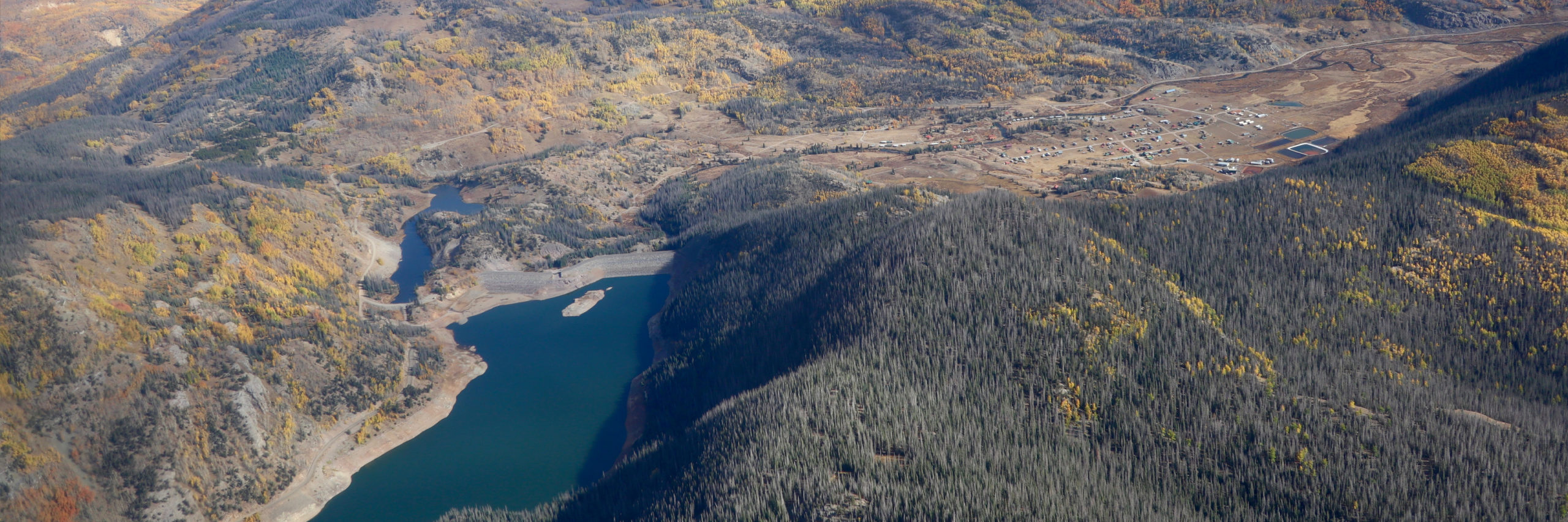
After breaking down water management in the Conejos District to a few key vocabulary words – priority, compact, curtail, diversion, aquifer, ground water and surface water – Coombs brought it to life standing over the Conejos River on the Manassa Ditch No. 1 with the 65 middle school students, discussing the 97 diversions between the Platoro Reservoir and where they were standing. “In the river, it doesn’t matter where you are,” Coombs said. “It’s all about your number.”

He added, “In water, we never use the word fair. It is not part of the vocabulary.”

After detailing how the rivers in Colorado deliver water to seven states, Rio Grande Compact obligations and how it takes 44 hours in a raft to float on the Conejos River from the reservoir to Las Sauces, the students couldn’t stop asking questions and volunteering answers.

Water leaders like Coombs make these experiential lessons an option for Valley teachers with help from interested classroom teachers and environmental educators like the Rio Grande Water Conservation Education Initiative (RGWCEI) specialist Judy Lopez.

“This gives the students a real life connection,” said Conejos science teacher Andrew Shelton while watching his students turn on to their natural environment this fall. “This is a farming community , and it really hits home with them.”

RGWCEI works with the Valley’s conservation districts , school districts, community members and producers with a goal to create an educated populous that not only respects the Valley’s natural resources, but also understands the big part agriculture plays in conserving those resources, Lopez said.

“Not only are they getting lectures, but hands on experience that will ultimately build an intrinsic value system,” she said. “Science today tends to be taught within the context of labs and boxes. These experiences create problem solvers.”

About 85 percent of Valley students either stay here or return after college, she added, making natural resources lessons during younger years much more important .

“The youth are going to value the Valley more,” Lopez said. “They will be responsive to the natural resources as citizens, parents and families.” Students of all kinds Natural resource education in the Valley isn’t limited to the K-12 classroom. Last spring, the Rio Grande Leaders Course graduated a number of locals looking to understand and protect the Valley’s water. The Rio Grande Water Conservation District (RGWCD), San Luis Valley Water Conservancy District (SLVWCD), Rio Grande Headwaters Restoration Project (RGHRP) and RGWCEI sponsored course provided 25 community members the opportunity to engage in education and networking to prepare to take a future role in safeguarding , developing and managing the Valley’s water resources. It included information on Valley hydrology, water rights administration, notable court cases, current events and local partners and projects. Course attendees included young farmers, federal agency employees and other interested individuals , making for interesting dialogue and numerous perspectives on water use.

“It opened my eyes,” said Aliesha Carpenter, originally from La Jara and now married to a fourth generation Center potato farmer during the course’s closing ceremonies in March. “It wasn’t just about agriculture. It was about wildlife, the Sand Dunes and life for people. Without it, our agricultural economy would disintegrate. There needs to be a younger generation in agriculture.” Bureau of Land Management (BLM) assistant field manager Paul Tigan added, “I think the course helped with the understanding of the long term context of water management in the Valley. Federal employees have a tendency to come into a place, stay for a few years and then move on. This is a good opportunity to develop a context and to understand .”

RGWCEI is also reaching out to education professionals through its annual teachers workshop series. The series, now in its seventh year, offers educators from all backgrounds the opportunity to learn how to teach in the outdoors and from the outdoors. It includes a one-week experiential learning course annually over a three-year timeframe. The series is broken into three sectors: From Watershed to Cup Year One: Following Water Through the “Creekulum;” From Watershed to Sustainability Year Two: Building a “Stream” of Consciousness; and From Watershed to Table Year Three: Following Water Down the Food Chain. The series is based out of the Trinchera Ranch in Fort Garland, but uses the entire Valley as its classroom.

“It’s a way for teachers to reconnect,” Lopez said. “They learn how to teach in the outdoors, and it gives them a background. A teacher’s biggest fear is that they don’t know enough. They get to be on the ground with natural resource specialists and leave with hands on lessons , creating more confident educators.”

Completion results in three graduate credits, an extensive education in the Valley’s natural resources and their systems and the ability to build natural resources-based activities through the K-12 Project Wet curriculum, an outdoor environmental education tool. State supported initiative

In May 2010, the Colorado Kids Outdoors Grant Program Legislation, HB10-1131 was signed into law, recognizing the importance of the outdoor environment on the health of the state’s residents, especially youth.

It aims to prepare students to address present and future environmental challenges and innovations that impact quality of life, according to the Colorado Department of Education (CDE) Colorado Environmental Education Plan (CEEP) published in 2012. Colorado’s environment , economy and communities depend on informed citizens who can make decisions about air and water quality; the health of farms, ranches, forests and wildlife; how to meet energy and other resource needs; how to create and sustain healthy communities; and how to provide opportunities for residents to partake in the state’s natural beauty while protecting it for future generations.

In 2011, a partnership was born between CDE and the Colorado Department of Natural Resources (DNR) to write CEEP, and to foster awareness needed to promote, coordinate and sustain standards-based environmental education across the state.

The plan is designed to support implementation of the Colorado Academic Standards while developing students’ knowledge and skills related to the environment and getting students to spend more time outside, according to CEEP. The timing of this plan is advantageous as districts, schools and teachers are revising curricula and improving instructional practices to address the strategic imperative of developing all students’ postsecondary workforce readiness. Its strategies support teachers in addition to encouraging the integration of high quality environmental education opportunities and use of the outdoors in ways that are relevant, connected and meaningful for their students.

More education coverage here.

San Luis Valley water is safe from the USFWS and the southwestern willow fly-catcher

southwesternwillowflycatcher

From The Pueblo Chieftain (Matt Hildner):

A federal wildlife manager assured Colorado officials Thursday that the protection of habitat for an endangered bird would not lead to demands on the state to relinquish water.

In January, the U.S. Fish and Wildlife Service designated critical habitat for the southwestern willow flycatcher along 23 miles of the Rio Grande and a 2.9mile stretch of the Conejos River. “The designation itself does not affect water delivery or water users,” Wally Murphy, who oversees the U.S. Fish and Wildlife Service’s protection of endangered species in New Mexico, told the Rio Grande Compact Commission.

San Luis Valley water officials had been alarmed by the January designation after spending years working on a habitat conservation plan to protect the bird’s habitat on private land in the valley. The service excluded 114 miles of private stream bank along the Conejos and Rio Grande that were covered in the conservation plan.

But State Engineer Dick Wolfe, who represents Colorado on the commission, pressed Murphy on whether the operations of Platoro Reservoir or the Closed Basin Project might be impacted. “Habitat is ultimately driven by water to some extent so it seems like there is a nexus there,” Wolfe said.

Murphy said there would be no call for water. Platoro, which has a capacity of 59,000 acre-feet and sits near the Continental Divide, provides flood control and irrigation water for farmers and ranchers along the Conejos. The Closed Basin Project draws groundwater from the northeast corner of the valley and sends it downstream to assist with Colorado’s requirements under the compact.

More endangered/threatened species coverage here and here.

Colorado Water 2012: ‘…about 10 of the oldest priority dates in the Rio Grande system belong to the Conejos River’ — Nathan Coombs

coloradowater2012

Here’s the current installment for the Colorado Water 2012 series from the Valley Courier written by Nathan Coombs the Manager of the Conejos Water Conservancy District. Click through and read the whole article for the history of the area. Here’s an excerpt:

In the 1850-70’s when the railroads were carving out rights-of-way through Northern New Mexico and the San Luis Valley, the US military was expatriating hostiles, and farmers and ranchers were focusing on water. This was the era of the canal building and ditch digging. Land was being cleared and the essential element- water was being acquired. In this high desert, the ranchers and farmers were quick to learn the importance of this life-giving substance.

Settlers to the Conejos River area, which rivals the San Luis area for antiquity of civilization and establishment, were not any different. These water users filed for and received their adjudicated decrees. In fact about 10 of the oldest priority dates in the Rio Grande system belong to the Conejos River. Early on these pioneer/settlers were legally and progressively seeking and putting to beneficial use water. With their shoulders bowed to the work they kept their vision focused on the future.

The southern end of the San Luis Valley has always had strong developmental ties to the rivers. The oldest communities in the area were established along the waterways and dependant on the rivers for their success. Ditches like the Guadalupe and the Headsmill (priorities 1&2 respectively) were developed for 1,000’s of acres of land and industry, with examples like the Finley Ranch and the Antonito grist mill and the Town of Antonito’s drinkable water supply developed from their priority on the Conejos River. Although these structures had to be hand built to divert the water, the area developed and progressed.

The people of the Conejos did not sit back and expect gravity to do the work. They looked up, up stream, 10,000 feet up in fact. In the early 1940’s The Conejos Water Conservancy District was formed to be the local vehicle that would seek partnership with the Bureau of Reclamation in building a reservoir. The San Luis Valley Project study identified the Platoro site at nearly 10,000 feet above sea level as the most feasible. As soon as WWII ended and funding became available construction began. This $3 million project was completed one year ahead of schedule and under budget. (Where have those days gone?)

More Colorado Water 2012 coverage here.

Rio Grande Roundtable meeting recap: Rio Grande compact requirements will likely prevent an increase in the pool at Platoro Reservoir

platororeservoir.jpg

From The Pueblo Chieftain (Matt Hildner):

Although compact requirements are a moving target throughout the year, Division 3 Water Engineer Craig Cotten said the amount of water moved past the state line in winter and early spring can limit curtailments on local irrigation ditches. “They really depend on how much water we get through the wintertime, especially in March,” he told a meeting of the Rio Grande Basin Roundtable Tuesday. “Our flows are going up so we’re getting a lot more through.”[…]

Irrigation ditches along the Rio Grande would face a 15 percent curtailment on all flows as of now. The state’s obligations under the compact, which governs the use of the Rio Grande between Colorado, New Mexico and Texas, vary according to streamflow…

The Conejos River, which runs through the southwestern corner of the San Luis Valley and shares in the state’s compact requirements, is expected to produce 265,000 acre-feet this year. The state must send 85,000 acre-feet downstream. Irrigation ditches there currently face a 20 percent requirement.

Water users in the Conejos Water Conservancy District will likely not have the luxury of increasing storage at Platoro Reservoir, a 59,000 acre-foot reservoir that sits at the river’s headwaters in the San Juan Mountains. Platoro can only increase its storage when there is 400,000 acre feet or more of usable water in Caballo and Elephant Butte reservoirs in New Mexico.

More IBCC — basin roundtables coverage here.

The Rio Grande Basin Roundtable ponies up $407,000 to increase SCADA installations along the Conejos River to facilitate streamflow monitoring

scada.jpg

From The Pueblo Chieftain (Matt Hildner):

While the move still requires approval of state water officials, the Conejos Water Conservancy District hopes the proposal will return some water to its users while allowing for a more accurate accounting of delivery requirements under the Rio Grande Compact. The district, which has 86,000 acres of irrigable land in the southwestern corner of the San Luis Valley, wants to add 72 electronic gauging stations and automate four of the most-used headgates in the river basin. The district and ditch companies inside its boundaries would put up $92,000 in matching funds.

The Conejos, like the Rio Grande, is subject to the Rio Grande Compact, which has fluctuating requirements for how much water must be sent downstream to New Mexico and Texas, depending on the amount of snowpack in a given year. As much as 70 percent of the river’s flow is allowed to head downstream in a wet year and as little as 25 percent in a dry year…

The added gauges may also help the district pin down return flows from diversions, a task that’s complicated by a jumble of river channels and irrigation ditches near the junction of the Conejos with the Rio Grande. The district also hopes the gauges would allow for a more accurate tracking of releases from Platoro Reservoir, which has a capacity of 59,000 acre-feet.

More IBCC — basin roundtables coverage here.

Rio Grande Roundtable recap

A picture named riograndebasin.jpg

From the Valley Courier (Ruth Heide):

Colorado Division of Water Resources Division III Division Engineer Craig Cotten told attendees at Tuesday’s Rio Grande Roundtable meeting that the dry appearance of the river, particularly in Alamosa, is a sign the state is current on its debt to downstream states so more water can be diverted to area irrigators without having to send it all down the river. “We are looking really good on the Rio Grande,” Cotten said. “We are meeting all of our obligation right now with return flows. That’s why the river is fairly dry through Alamosa, because we have got a little bit of water going to the West Side and Chicago Ditches and not a lot of water going through Alamosa.”

Cotten said 2010 turned out to be a less-than-average year with water flows on the Rio Grande. The annual forecast for the river is currently 540,000 acre feet. An average year would run 650,000 acre feet, “so we are a fair amount below average at this point in time,” Cotten said. The current forecast is even lower than the June 1 prediction of 575,000 acre feet on the Rio Grande, Cotten pointed out. Of the 540,000 acre feet flow on the Rio Grande for the year, 140,000 acre feet are obligated to New Mexico and Texas to meet Rio Grande Compact requirements. “We do have a fairly good obligation to downstream states, but we have already been able to deliver quite a bit of that water to the downstream states,” Cotten said. He said currently only about 5 percent of the state’s obligation on the Rio Grande is still owed, and that obligation is being met through return flows.

The Conejos River system is also meeting its obligation to downstream states, Cotten explained. That river system is also below average in total forecast flow, Cotten added. An average annual flow on the Conejos River system is 325,000 acre feet. This year’s adjusted forecast is 285,000 acre feet, which is down from the June 1 prediction of 315,000 acre feet. Of the total flow, the Conejos River system is obligated to send 99,000 acre feet downstream, “and currently we have delivered all the water we need to during the irrigation season,” Cotten said. During November and December the Conejos system will deliver more water downstream, and that will be sufficient to meet the Rio Grande Compact obligation, according to Cotten…

In addition to reporting on the status of the Rio Grande Compact and the Valley’s major rivers, Cotten reported to the Rio Grande Roundtable that groundwater rules are still under construction and the state engineer is hopeful they will be promulgated by the end of the year. Modeling work is currently being conducted for different areas of the San Luis Valley to determine how much impact wells have on rivers so adequate replacements for injurious depletions can be made. Cotten said that modeling work is nearly completed and he hoped it would be finished in the next month. With that completed, the advisory group that is working with the state engineer to develop groundwater regulations can finish up the sustainability portion of the regulations, Cotten explained…

Cotten also updated the group on the status of the first water management sub-district case. The sub-district of the Rio Grande Water Conservation District is designed to reduce irrigation in the closed basin area of the Valley to protect senior water rights, help meet Rio Grande Compact obligations and replenish Valley aquifers. The sub-district’s plan of management proceeded through the court, objections, trials and judicial ruling and is now pending a decision from the Colorado Supreme Court, which Cotten said might not occur until next spring.

More IBCC — basin roundtables coverage here.

Platoro Reservoir: Dam safety upgrades

Platoro Reservoir

From The Pueblo Chieftain (Chris Woodka):

U.S. Rep. John Salazar, D-Colo., secured a request for $646,000 in the energy and water appropriations bill. Salazar sits on the Appropriations Energy and Water Subcommittee, which approved the funding. The bill must still gain House and Senate approval. Platoro Reservoir is used for flood control and for re-regulating the flows of the Conejos River for irrigation in the San Luis Valley Project of the Bureau of Reclamation. Flows are crucial to the Rio Grande Compact with Texas and New Mexico The reservoir is used by the Conejos Water Conservancy District as well as a large number of hunters, fishermen and recreational enthusiasts. Funds will go toward further inspection of deteriorating inflow pipes, and to install a system to carry increased bypass flows. “Platoro Reservoir, built in 1951, can no longer handle our wintertime by-pass flows creating a critical dam safety issue,” Salazar said. “This funding will help preserve the life and use of the reservoir for agriculture, flood-control and recreational use.”