Rare optimism about the #ColoradoRiver: Brad Udall says the seven basin states have “blundered” their way into a situation that may produce better sharing of the diminished waters — Allen Best (BigPivots.com) #COriver #aridification

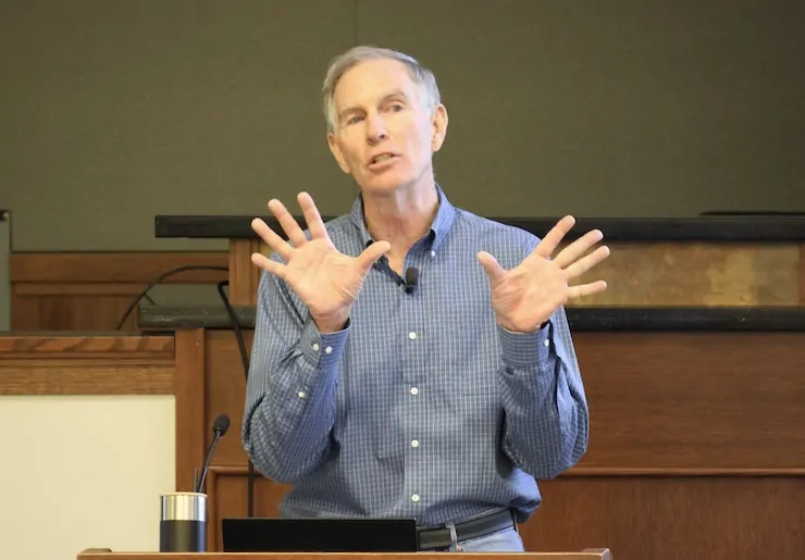
Brad Udall. Photo credit: Allen Best/Big Pivots

Click the link to read the article on the Big Pivots website (Allen Best):

August 24, 2026

Brad Udall is known far and wide as a prophet of doom about the Colorado River. So why the optimism provoked by last week’s federal marching orders?

“I think we can solve this. I really do,” Udall said in a lecture delivered in Boulder on Aug. 21.

Earlier that same day, the Department of Interior had issued its record of decision about how it would manage the key dams and hence the river during the two water years beginning in October. This came after Colorado and the six other basin states had failed during two years of negotiations to agree about how to share diminished river flows.

As even schoolboys in Kentucky likely know, the Colorado River has encountered severe problems since 2000. Flows in the river are down 20% and continuing to decline in direct proportion to rising temperatures. The two big reservoirs, Mead and Powell, have declined 75% in stored water.

The lower-basin states, which get their water from these two big reservoirs, had already cut their use significantly. The Department of Interior has ordered the three states to expect 1.25 million acre-feet less water from Mead during the next two years. It also expects the three states to figure out how to store 700,000 acre-feet over the next two years. Colorado and other upper basin states cannot expand water use.

Agriculture users, said Udall, will bear the brunt of these cutbacks. Municipal users — all the cities from Colorado’s Front Range to southern California get water from the river and its tributaries — will have to chip in with water savings. Infrastructure limitations of the two big dams, Hoover and Glen Canyon, when holding little water need to be resolved. For example, penstocks [river outlet tubes] on the two big dams were never designed for day-in, day-out use, as may be necessary with reduced amounts of water. And as for the hydroelectric production? Yes, it’s a small amount but important. It provides backup power.

The process created by the Interior Department — the Bureau of Reclamation is the key agency within Interior — requires new plans every two years for the next decade. Udall sees merit in this approach.

“When the negotiations started, the idea was that we’re going to get a 20-year plan. We got five two-year plans, which you might see as a setback, but I think we might have blundered into something actually useful, because it potentially is true adaptive management, where people get to pay attention repeatedly as this evolves.” [ed. emphasis mine]

Udall also sees strong dynamics producing solutions.

“I think we’re going to see a solution because the people who are involved in the negotiations are hard-working. They’re knowledgeable. They’re intelligent. They have super good relationships with each other. And they know that the chips are down. If they don’t solve it, the solution Mother Nature provides will be downright ugly. I think we will solve this. I actually do.”

When the breakthroughs will occur, Udall said he didn’t know. And he hedged his confidence with caution. “I won’t put bets on this.”

What is clear, though, is that Arizona will be key to solving the conundrum of 21st century flows being far less than 20th century expectations. The river in the last century average 15.2 million acre-feet. Even when it carried healthy volumes of water, though, the river had ceased to reach an embayment of the Pacific Ocean. Flows this century have declined and, since 2020, remarkably so: to an average of just 10 million acre-feet.

Flows will almost certainly decline further. Accumulating greenhouse gas emissions guarantee continued warming, producing reduced flows.

“Western water law is enormously complicated and really inhibits solutions,” he said. “We’ve made a whole bunch of policy mistakes through time, including permanent allocations, assuming way too much water, and enforcing or legalizing really unrealistic policies.”

Whether the framework created by the federal government for finding solutions will work, he said, will depend upon hydrology. In some circles optimism remains that the strong El Niño this year will produce improved precipitation and hence greater flows. And maybe it will, said Udall, but the record on flows during El Nino years has been all over the scattergram. A few very big years — 1983 and 1998 stand out — yes. But some real duds, too. In other words, this coming winter could conceivably be as bad as the past winter. Or, if not as bad, then will continue the downhill slide.

Now rewriting the rules

Udall also made the point that prior agreements were incremental in nature, unlike what the new federal rules represent.

“The rules in 2007 and 2019 were really hard fought, but they were incremental. They were truly incremental. What we’re looking at right now, it’s not incremental. It’s a complete rethink,” he said.

“I think people mistakenly thought that, given the successes in 2007, 2019, we would just kind of waltz our way to new rules. And I think that’s the wrong way to think about what’s going on. This is a really a different deal in 2026.”

This new paradigm imposed by the federal government, Udall went on to say, is the “first global instance where climate change is forcing a complete redo of water management. I think I can make a pretty good case for that.”

Udall/Overpeck 4-panel Figure Colorado River temperature/precipitation/natural flows with trend. Lake Mead and Lake Powell storage. Updated through Water Year 2025. Note the tiny points on the annual data so that you can flyspeck the individual years. Credit: Brad Udall

Udall has become well known at water meetings in Colorado and beyond, particularly during the last decade, in warning that communities and economic sectors dependent upon the Colorado River were headed for trouble. Climate change is water change, he began saying more than 20 years ago. And in 2014, he conducted research along with another scholar, Jonathan Overpeck, that showed the strong correlation between rising temperatures and reduced flows in the river. That science, he said, has strengthened.

Although living in Boulder, Udall in recent years has been affiliated with Colorado State University’s Colorado Water Center. There, he wears the title of senior water and climate research scientist/scholar.

However, Udall is also understood in terms of his family tree. He is a descendant of John D. Lee, the Mormon settler for whom Lee Ferry (also called Lees Ferry) is named. Located in Arizona, near the Utah border, it divides the Colorado River’s upper and lower basins.

Don’t make too much of being a John D. Lee descendant, he said. “He had 21 wives that we know of, and some have suggested he has 800,000 descendants. That might actually be part of the problem with the Colorado River.”

Ken Sleight the original Monkey Wrencher photo via Salon

As for his personal familiarity with the river, Udall divulged that he has rafted the Grand Canyon 45 times, at least some of those in the employ of Ken Sleight, best understood by readers of Edward Abbey’s “Monkey Wrench Gang” as the model for Seldom Seen Smith.

Arizona’s role

In Udall’s view, Arizona is central to solving this 21st century problem. The Central Arizona Project will “see a whole lot less water, but it’s not going to zero. I don’t know quite how that gets revolved, but that’s just so clear,” he said.

The Central Arizona Project delivers water from the Colorado River through 336 miles of canal to metropolitan Phoenix and ultimately Tucson, with farms along the way. It was authorized by Congress in 1968 and completed in 1993. Both his father, Morris, and his uncle, Stewart, were key figures in this. It can deliver 1.6 million acre-feet, the majority of the 2.8 million acre-feet that Arizona was scheduled to receive from the Colorado River under a 1964 court ruling.

As Udall pointed out, farms that got water from the project have received far less since cutbacks began in 2020. And now, more cuts for the farms — and cities — will be coming.

Given an hour for his presentation, far longer than his usual 20- or 30-minute slots, Udall had time to sketch some history, even taking time to define the universal way of measuring water quantities in the basin, the acre-foot.

“The reason that an acre-foot is used is farmers farm in terms of an acre,” he explained. “In the upper basin, you might put a foot or two feet of water on top of an acre to get a hay crop out. In the lower basin, near the Mexico border, you might put 10 feet of water on top of an irrigated field to get 10 different cuttings of alfalfa.”
Credit: The Land Desk
Thoughts about hay

Alfalfa came up in the Q&A. The question, in not so many words, was how to cut back water used to feed livestock. After all, agriculture uses about 75% of the water (after evaporation) in the Colorado River, and alfalfa and other feedstocks comprise a large portion of that. A full hour could have been devoted to that question — and likely left topics on the table. The tension inherent in this topic is revealed in how the Family Farm Alliance describes this push replace animal forage to crop switching: “crop shaming.”

“It’s easy to hate on alfalfa because people don’t eat it, but we kind of do, right? Dairy, ice cream, beef cattle. And the idea that you’re going to tell farmers not to grow alfalfa, which turns out to be a pretty good crop for them in their rotation, probably isn’t going to work very well. You’re probably far better off to say, ‘Hey, here’s your reduced allocation. You use it as you want,’” responded Udall

“I think most people in this room don’t care about corn. We very much care about alfalfa, and its water use, but I’m not sure trying to prohibit farmers from using a crop that’s key in their rotation and actually has some kind of interesting benefits is a suitable way to get there. “

Udall also mentioned the difficulties of crop switching.

“It’s been suggested that ag shift to higher value products that use less water. One way to do that is only grow stuff in the winter because growing in Yuma (Arizona) and Imperial (Valley) in midsummer is not a great idea. But when you ask a farmer to shift produce or products, you ask them to change marketing, you ask them to (change) labor, transportation, storage, equipment, knowledge. You ask them to change a lot of things, and arguably there’s a need to help this transition happen.”

This discussion, he concluded, is one that needs to be had but is very complicated. “It really is going to take a deep dive to figure out how to deal with this.”

You will be able to soon hear what Udall had to say (and see the slides he shared) at the Getches-Wilkinson Center’s site. The history lessons alone make it worth an hour.

A few other snippets:

• “The lower basin wants some contribution from the upper basin (in reducing use) maybe 5% or maybe 2%, but some kind of skin (in the game). And the upper Basin says no way. Until recently, the upper basin wanted to reserve the right to increase its use.”

• Our (Colorado delegate to the Upper Colorado River Commission) Becky Mitchell has recently been saying, you know, none of this gets us any extra water. And we need to move beyond this, and I applaud Becky for saying that.”

• Udall told a fascinating story about the Central Arizona Project. At the time the proposal for federal funding was before Congress, the Upper Colorado River Commission paid a Denver-based engineer to examine the numbers. That engineer’s conclusion: There’s not enough water for the Arizona project once the upper basin uses its full allocation (as defined in the Colorado River Compact of 1922). The number was 1.2 million acre-feet a year. And the two big reservoirs, Mead and Powell, have been losing 1.25 million acre-feet a year.
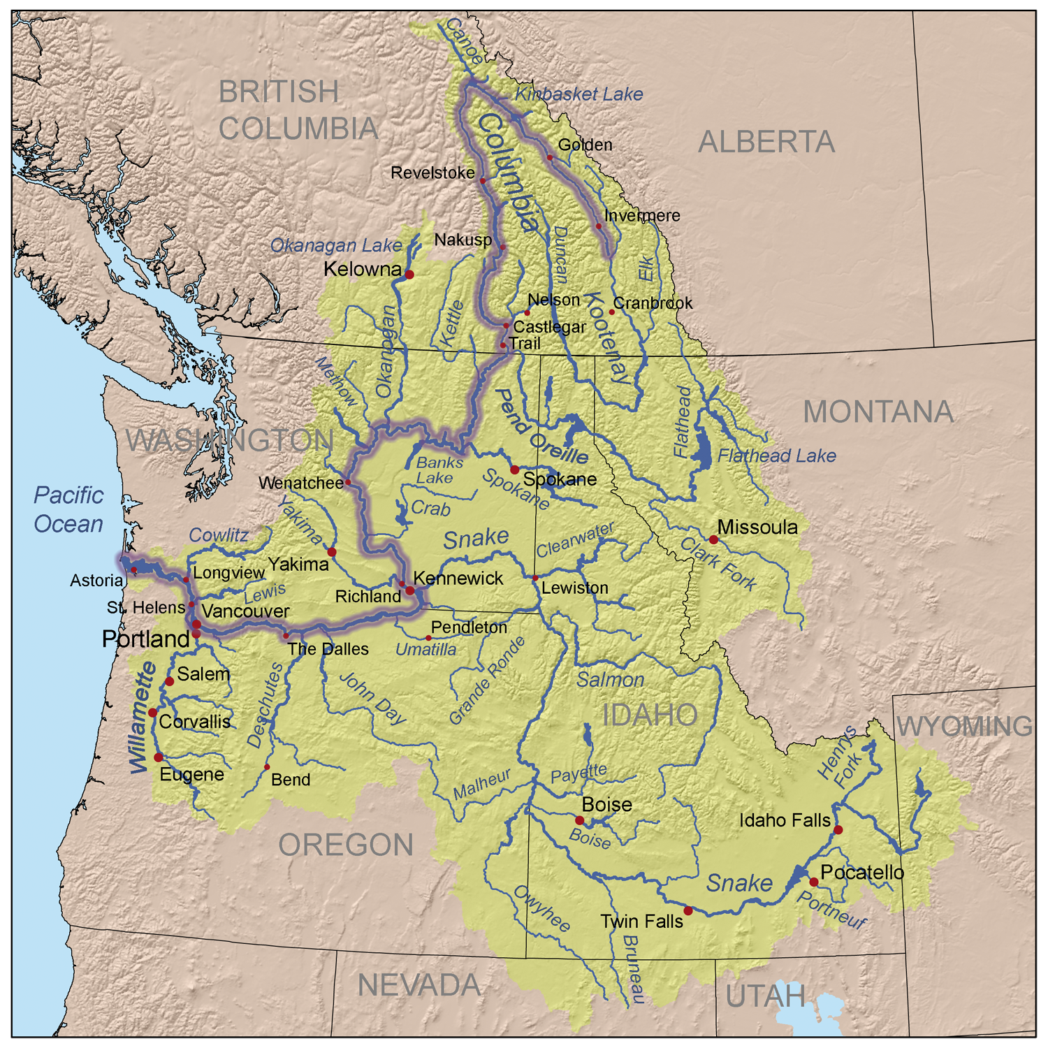
Map of the Columbia River watershed with the Columbia River highlighted. By Kmusser – self-made, based on USGS and Digital Chart of the World data., CC BY-SA 3.0, https://commons.wikimedia.org/w/index.php?curid=3844725

• The idea in 1968, said Udall, was that the federal government was going to figure out how to augment flows of the Colorado River. One of the ideas was to export water from the Snake River in Wyoming’s Jackson Hole to the Green River and hence the Colorado. Washington Sen. Henry “Scoop” Jackson and other members of Congress from the Pacific Northwest objected. And the augmentation that was part of the thinking never has happened.

Green River Basin

• On the first-in-time, first-in-right premise of Western water law. “You know, first-in-time, first-in-rank gets reinvented by 4-year-olds every day of the year throughout the world. I was here first; it’s mine. And most parents step in and say you’re going to share, right: But not Western water law. It was completely understandable in the 1800s, where you had a few users. But it’s really not so great in modern society. …

“You can’t have a case where 1,500 famers deprive 5 million people in Phoenix or 2 million people in the Front Range of water, of what I’ll call critical human water needs. It just isn’t going to work politically. Shared sacrifice would be a whole lot better way to deal with this.”

It’s pretty hard to cut back water use under Western water law, because if one user decides not to take water, the next user downstream can grab it. “If we’re trying to get water to Lake Powell, you have to rethink how this gets done.”

Colorado statewide annual temperature anomaly (°F) with respect to the 1901-2000 average. Graphic credit: Colorado Climate Center

• Temperatures have increased 3 degrees Fahrenheit since 1979. “Not a single year after 2000 is below the 20th century average,” he said of the Colorado River Basin. “Increased temps lead to increased evaporation. We think you can lose up to 5% flow (of water) per degree rise.”

Temperature increases have produced up to 15% increase in losses due to evaporation.

• As for precipitation, the last 27 years have been the worst 27 years since record-keeping began in 1895. The declines worsened beginning in around 2015.

A 1% decline in precipitation leads to a 2% decline in flows.

• As for Udall writing a book, as one audience member suggested, he said other authors have covered much of the same ground, even if he has a somewhat different angle. “I don’t know. I need an assistant!”
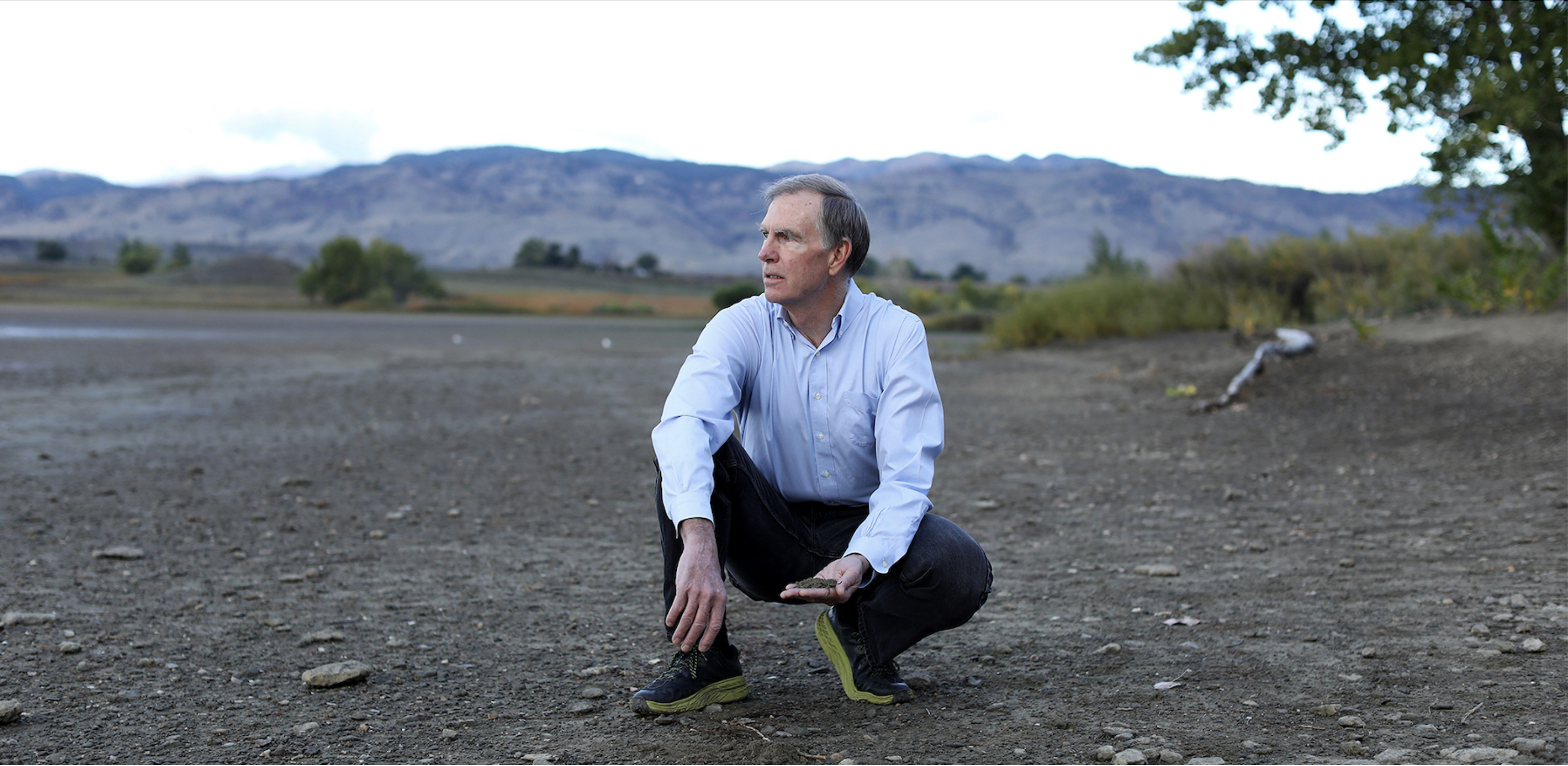
Brad Udall is pictured at Boulder Reservoir, which helps deliver water from the Upper Colorado River to the Front Range. Photo: Vance Jacobs/Colorado State University

President Trump attacks the Roadless Rule, again, Plus: Hoback Report on the Traffic Apocalypse — Jonathan P. Thompson (LandDesk.org)

Click the link to read the article on The Land Desk website (Jonathan P. Thompson):

August 21, 2026

🌵 Public Lands 🌲

Sometimes it feels like the deeper the Trump administration sinks into various quagmires of its own making, the more it lashes out at politically popular protections for public lands. Each passing day brings a new assault on the environment, the climate, and, well, humanity.

This time, the U.S. Department of Agriculture has moved (again) to rescind the Roadless Rule, which protects some 45 million acres of U.S. Forest Service land from new roadbuilding and logging. Agriculture Secretary Brooke Rollins predictably and baselessly claimed that the rule has hampered forest management and fire-fighting capabilities. This is untrue.

When the Bill Clinton administration implemented the Roadless Rule in 2001, it culminated a multi-decade effort to identify and set aside forest lands that hadn’t been disturbed by roads for possible designation as wilderness. At the time, management of inventoried roadless areas was carried out by individual Forest Service offices. The Roadless Rule put a nationwide prohibition on timber harvesting, road construction, and road reconstruction in inventoried roadless areas, with a number of exceptions. The intent was not only to conserve these relatively undisturbed areas, but also to save money: By 2001, the Forest Service’s existing road network was over 386,000 miles long, with an estimated $8.4 billion in deferred maintenance and reconstruction. Building more roads would just exacerbate that deficit.

While inventoried roadless areas have many of the same characteristics as wilderness areas, the Roadless Rule stops far short of offering wilderness-level protections, and expressly allows for motorized uses of existing roads, off-highway motorized use in specified areas, livestock grazing, and energy and mineral development.

So it’s hard to take Rollins seriously when she says the rule is hampering access for fire prevention and fighting efforts. In fact, the rule clearly allows for road-building to fight fires. It also allows for cutting, removing, and selling “generally small diameter timber” for various reasons, including “reducing the likelihood of uncharacteristic wildfire.”

In a Senate hearing this spring concerning Sen. Mike Lee’s (MAGA-UT) amendment aiming to repeal the Roadless rule, Sen. Alex Padilla, D-California, pointed out that 240,000 acres of inventoried roadless areas in his state alone had been treated for wildfire hazard mitigation treatment, showing the dubiousness of Lee’s (and now Rollins’) claims. And the Trump administration, for better or worse, has lagged on forest thinning: A Center for Western Priorities analysis found the Forest Service treated 35% less acreage in 2025 than it did under Biden in 2024. That suggests that vegetation management is being stifled not by regulations, but by a lack of resources — the Trump administration has slashed Forest Service staffing and budgets considerably since taking office.

In fact, the evidence suggests that the Roadless Rule has actually helped deter wildfires. A 2007 Pacific Biodiversity Institute study found that 88% of the nation’s wildfires are sparked by humans, and 95% of human-ignited blazes occur within a half-mile from a road. Roads act like syringes, injecting humanity — along with their errant cigarette butts, untended campfires or grills, sparks from machinery or hot catalytic converters — further into the backcountry than they would go by trail.

The Roadless Rule originally applied to almost 60 million acres, but in the years following its implementation, it was bandied about by presidential administrations and the courts. In 2005, the George W. Bush White House revoked the rule and replaced it with the alternate roadless rule, which allowed states to petition the Forest Service to create their own standards; Colorado and Idaho chose to do so. When the Tenth Circuit court later reinstated the 2001 rule, the 2005 rule was nullified, but Idaho and Colorado’s rules remained in effect. As a result the administration’s proposed repeal would not affect Colorado and Idaho’s plans.

The rule and its moderate protections for habitat, wildlife, forests, and watersheds have proven deeply popular across a wide demographic swath of the public. Last June, Rollins moved to repeal the Roadless Rule for the first time, resulting in intense backlash not only from environmentalists, but also from the more conservative-leaning hook and bullet crowd and general public, which barraged the department with comments supporting the rule. It’s worth noting that even Project 2025, the ultra-right-wing “blueprint” for the Trump administration, called for repealing only the portion of the Roadless Rule that pertained to Alaska’s Tongass National Forest. This spring, when Lee tacked a Roadless Rule-repealing amendment onto bipartisan wildfire legislation, he annihilated the cross-aisle support for the larger bill, effectively ruining its chances of passing.

Now the public has a chance to weigh in once again. The USDA is accepting comments until Sept. 21, so go here and say your piece.

⛈️ Wacky Weather Watch⚡️

The summer of nightmare heat continues as yet another heat dome settles over parts of the West. Parts of southern California, Las Vegas, Phoenix, and most areas in-between are under heat watches or extreme heat warnings for the next several days. There is also a chance of thunderstorms, which may bring a bit of relief, but if the summer so far is any indication, they’re just as likely to bring catastrophic flash flooding, damaging winds, fire-starting lightning, and huge dust storms, a.k.a. haboobs.

🛢️ Hydrocarbon Hoedown 📈

I know that many of you have been hating on data centers lately, especially the ones used to process all that AI slop so that billionaires can become trillionaires (through some process that defies all logic). But please, I beg you, save some of your disdain for the oil and gas companies, too! After all, they are using the data center energy-use scare to justify drilling for natural gas to power the damned things. Not only that, but every day that our president screws up negotiations to end his war on Iran is another day that the Strait of Hormuz remains closed to oil tankers, another day of rising oil prices, and another day of record-high profits for petro-corporations, their executives, and their shareholders. 

For example: ExxonMobil reported adjusted earnings of $23.5 billion for the first half of 2026; Chevron’s adjusted earnings were $14.7 billion; Valero raked in a $5.4 billionprofit … you get the picture. 

🗺️ Messing with Maps 🧭

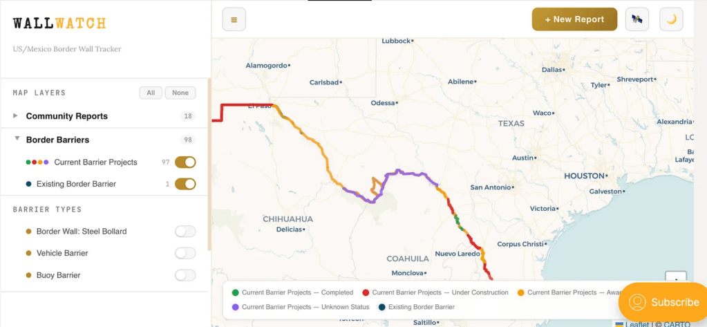
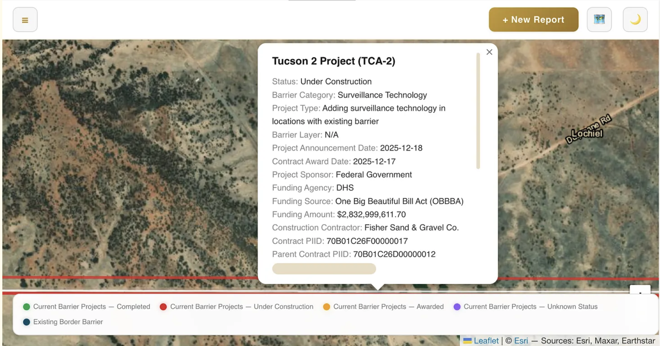
If you want to know what’s happening on the U.S.-Mexico border, you go to the Border Chronicle. And now, if you want to know what’s happening with Trump’s border wall, which is just a monumental piece of environmental disaster, you can go to the Border Chronicle’s new Wall Watch, the publication’s community-reported interactive map tracking construction of the barrier.

Say you want to know what sort of wall is being built in the Big Bend region? Or what sort of structure already exists near Lochiel, Arizona, where border wall contractors have destroyed old-growth cottonwood trees and are threatening the remainder of the grove? You can toggle the map to the satellite view, zoom in on the place of interest, and click on the border and get a pop-up informing you of what work is taking place, who the contractor is, and the expected cost.

Screenshot from the Border Chronicle’s Wall Watch.

📝 Hoback Report

A guest post by Bob Frodeman


Could the West be the place where America finally gives up its belief in endless growth? Probably not, but you can imagine different triggers. For instance, drought, a shrinking snowpack, and a parched Colorado River could halt growth in Phoenix. Or overwhelming numbers of tourists in Yellowstone or Arches National Park could force the establishment of timed entry (which Arches had, until the Trump Administration decreed that this was oppressing the right of people to sit in traffic). Or climate change-driven wildfires threatening entire cities (see Spokane) could put a crimp in sprawl.

But in my neck of the woods traffic may be the trigger.

Traffic is getting absurd in Jackson. The chaos used to be limited to the summer months; now it’s pretty much year-round. Climate change has extended the hiking season on both ends: this May a new record was set for visitation in Grand Teton National Park. And while the valley floor was denuded of snow last winter (a brown Christmas – in Jackson?!), the snow fell higher up, giving us some of the best skiing in the West during a generally horrific snow year.

Policy, history, and geography all contribute to the situation. First, it’s just plain hard to get here: there are only three roads into the valley. The spectacular mountains and forests mean that more than 97% of Teton County is publicly owned – Teton and Yellowstone National Parks, Bridger-Teton National Forest, and the National Elk Refuge. The Elk Refuge offers a striking visual: created in 1912, when Jackson had a population of a few hundred, the Refuge now hems town in on the north side, preserving land that would otherwise be jammed with hundreds of homes. Another 1% of the land is covered by conservation easements.

Caught between public land, various bumps and ridges, and the Snake River, there’s only one artery in town, called Highway 89 when it runs north-south, and Broadway when it turns east-west. Pressed up against Saddle Butte, Broadway already is five lanes and would be hell to expand. Highway 22, a two-lane spur that runs up and over Teton Pass that WYDOT wants to expand to five lanes, is already a traffic nightmare morning and night. And all the other roads in town are suburban streets lined with homes.

Nonetheless, the Town of Jackson currently has 825,000 square feet of additional development in the works. This includes the 245,000 (down from the original 400,000) square-foot Mogul development, a humungous hotel and condo complex planned for the northern entrance to Jackson (traffic already backs up a mile or two every afternoon on that road coming into town). The Jackson Town Council has approved the sketch plan for the complex. The other 600,000 square feet are scattered across the downtown area. On top of this, on the southern edge of town – on what will essentially become an extension of town – a new subdivision called Northern South Park has begun construction. Situated on ranch land, Teton County has approved a neighborhood of 1,437 homes, which would add 23% to the existing housing stock of Jackson.

What’s bizarre is the lack of self-consciousness about what’s happening. A few weeks ago I wrote a town council member asking for the list of ongoing projects. There isn’t one. I generated the 825,000 number by calling up the town clerk and asking her to go through the various applications. We added it up together.

Given all this, plus the 4 million annual tourists, it’s hard to see how Jackson will avoid utter and complete gridlock. But wait—it gets better, by which I mean worse. Because land is so scarce in Teton County, and home prices so high (median price $2.5 million, eight times the Wyoming average), workers drive in from Star Valley (30 miles to the south) and Teton Valley, Idaho (30 miles to the west). Both areas are primed for more growth: the population of Teton Valley doubled from 2000 to 2020 (to 10,000) and is projected to be the fastest growing part of Idaho. And this is to say nothing about the dangers of traveling Teton Pass – there was a landslide there two summer ago that diverted traffic for three weeks, and this summer a runaway truck killed two people.

Most of these people, as well as the commuters from Star Valley, come to Jackson for work and play. It adds up to a traffic apocalypse. Alas, Jackson and Teton County has no control over these outlying areas. The obvious move is to create a regional authority to work on the problem. But no such authority exists, and the political culture of these areas is quite different from Jackson, which makes conversations hard.

In Jackson you hear a lot of talk about managing growth. What you don’t hear is talk about the necessity of stopping growth. But this is the conversation that Jackson needs to have – as well as many other places across the West that are bumping up against limits.

President Trump axes Public Lands Rule: Plus — The Hoback Report, a guest dispatch from Bob Frodeman — Jonathan P. Thompson (LandDesk.org)

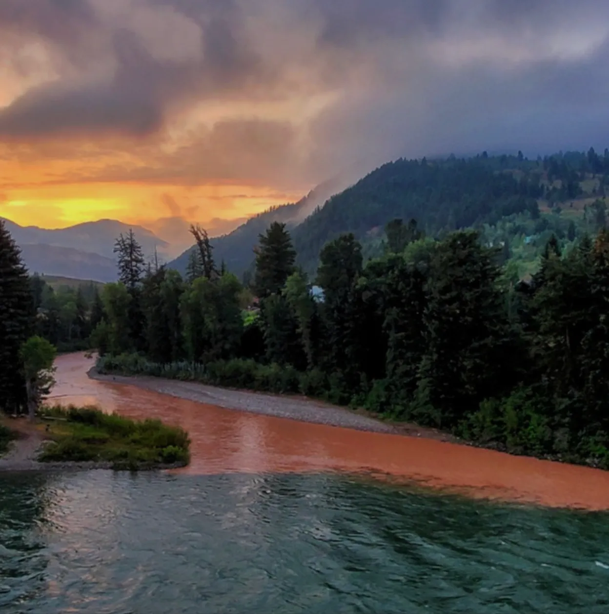
The Hoback River after a storm as it meets up with the Snake River. Bob Frodeman photo. (via The Land Desk)

Click the link to read the article on The Land Desk website (Jonathan P. Thompson):

May 12, 2026

The Hoback Report

by Bob Frodeman

The weather has been odd this year on the southern side of the Yellowstone Plateau. And summer is setting up to be a little scary – low water, fire danger, and masses of tourists.

Hoback, Wyoming, is an unincorporated area of a few hundred people 14 miles south of the Jackson Town Square. It’s the poorest part of the wealthiest county, Teton, in the United States. The residents here stand a little apart – you see bumper stickers plastered with the message ‘Hoback Nation’. Some four million cars pass through our roundabout each year, mostly tourists, but also people driving to work from more affordable locales like Alpine and Pinedale. It’s also where the Hoback River joins the Snake just before it enters the Snake River Canyon, the site of whitewater trips offered by local outfitters.

The Hoback River runs 66 miles, starting in the slopes of the Wyoming Range around Bondurant, Wyoming. It still runs free – no dams (yet). For a western river it’s medium sized: base flows sit at 200 cubic feet per-second across the winter, with peak flows reaching perhaps 4,300 cfs around the first of June. The last 11 miles of the Hoback, from its confluence with Granite Creek, are protected, part of the National Wild and Scenic Rivers System. My home looks up the Hoback: deer walk across the river in the winter and fishermen and kayakers come down all summer.

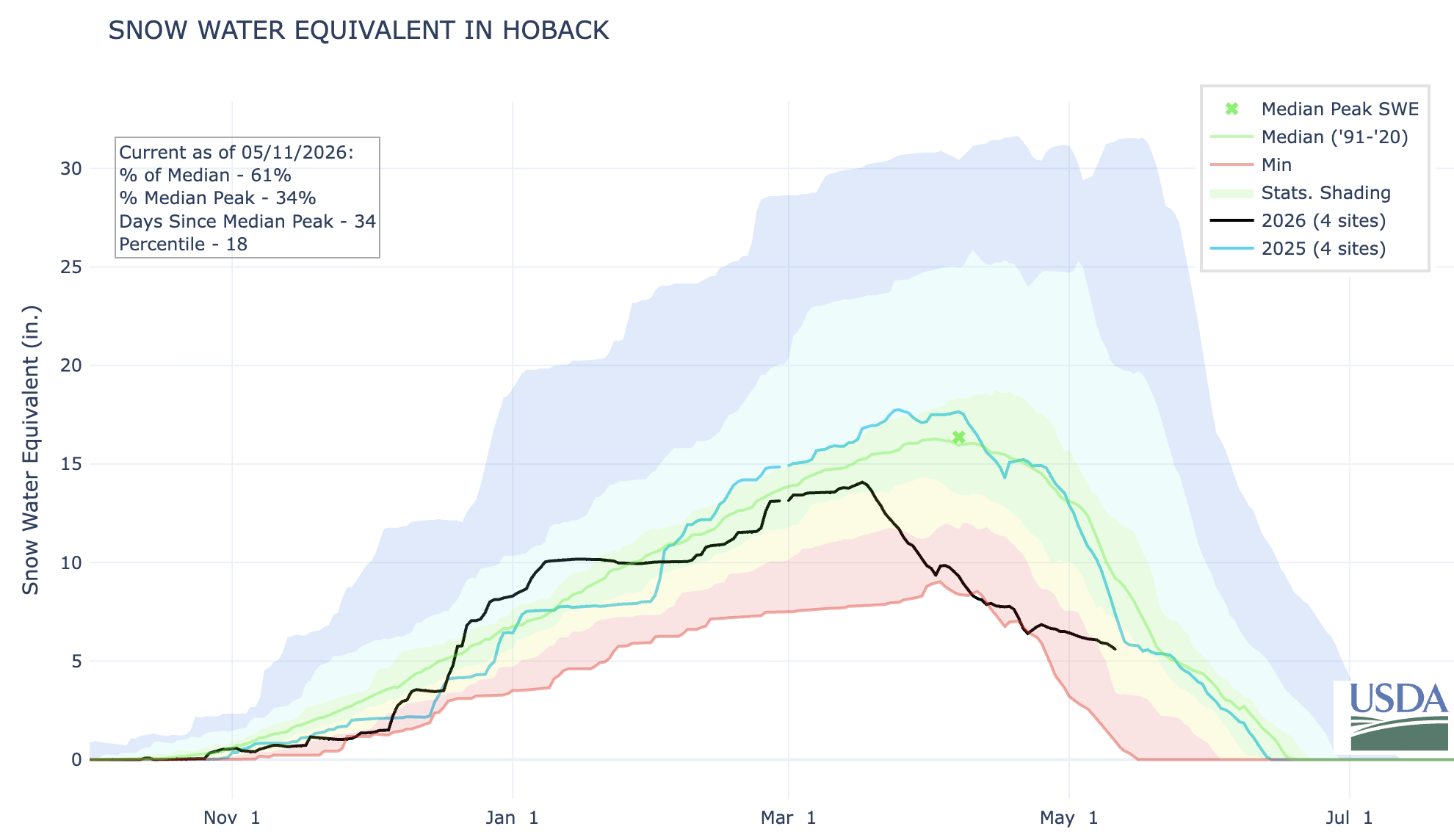
Waterwise, conditions were better here than across most of the West until the March warm-up. Teton County was even a bit above normal in snow water equivalent, or SWE, the typical measure of snowpack. But the snowfall was unevenly spread: lots of snow in the mountains, but dry in the valleys. For the first time since the 90s there wasn’t continuous snow cover in the valley across the winter, and we had a brown Christmas. The valleys saw five rain events this winter that melted what snow we did get at 6,000 feet. On the other hand, the warm, wet air meant more snow on the peaks. Jackson Hole Mountain Resort had the best snow in the West.

Up until the late March heatwave, the Hoback watershed was faring better than most of the West, snowpack-wise. But after that? Not so great. Source: NRCS.

The heatwave of March was something to behold. On March 21 the temperature hit 71 degrees, 32 degrees above normal, taking a big bite out of the snowpack. The rivers grew five times from their base flows two months ahead of schedule. Daffodils appeared five weeks early.

On the good side, the winter has been easy on the wildlife. The antelope have been particularly hard hit by the winter of 2022-2023. That year the fawn mortality was nearly 100%, the result of three feet of crusty snow. Whether the antelope, deer, and elk will have enough browse this summer is an open question. Fingers are crossed for a good monsoon.

But even with a good monsoon this summer’s water situation is looking dicey. The local reservoirs, Jackson and Palisades, caught the early runoff, but Wyoming has rights to only 4% of the water in the Snake – senior water rights belong to Idaho farmers. The Bureau of Reclamation recently announced that Jackson Lake may be drained dry this summer to provide water to farmers across the Snake River Plain. We’ll learn more about Bureau of Reclamation plans at its meeting in Jackson in mid-May.

At least the ospreys were on time. The pair that inhabit the nest above our home appeared on April 1. They’ve been busy carrying sticks to replenish their nest. They spend the summer fighting with bald eagles, when they aren’t dismantling fish in the crooked dead conifer that juts out over the river.

This might sound idyllic, but there’s a wealth of political controversy in Teton County. You’d expect nothing less from a place that combines funhogs and billionaires, second homeowners and 4th generation ranchers, a county with 23,000 inhabitants hosting 3.3 million visitors a year. Teton County is a blue dot in a very red state. It creates a weird dynamic: the conservative Freedom Caucus politicians in Cheyenne are often hostile to us while also being dependent on our tourist-generated income (there is no state income tax). There’s also a jarring juxtaposition of the local and the international: the Jackson Hole Economic Policy Symposium, sponsored by the Federal Reserve Bank of Kansas City, meets here each August, and the likes of JD Vance and Kristi Noem come to town for fundraisers. Real estate office windows are plastered with ads printed in both English and Russian. And the average price of a home here is more than six million dollars.

Bob Frodeman lives in Hoback, Wyoming. He is a co-editor of A Watershed Moment: The American West in the Age of Limits.

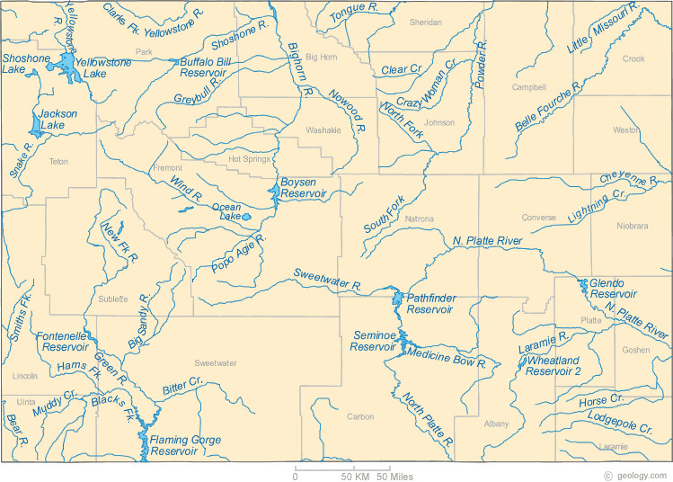
Wyoming rivers map via Geology.com

🌵 Public Lands 🌲

The Trump administration today [May 12, 2026] fully rescinded the Conservation and Landscape Health Rule, a.k.a. the Public Lands Rule. The Biden-era rule was finalized in 2024 and endeavored to put conservation on a par with other uses of federal lands, such as grazing, mining, and drilling, primarily by making leases available for conservation or restoration projects. Now, before it ever even had a chance to be tested, it is being killed to better align the Bureau of Land Management’s regulations with the Trump administration’s agenda, which effectively is to return the agency to the days of the Bureau of Livestock and Mining.

This is yet another volley in the administration’s wholesale assault on public land management and environmental protections designed to benefit the extractive industries, while also sticking it to some of Trump’s many adversaries.

It’s unfortunate, sure, but the reaction from some environmental groups seems totally overblown and aimed more at triggering anger than truly considering the limited effects this will likely have on the ground. While I understand the need to rally the troops, so to speak, I’m not sure hyperbole and constant outrage is all that productive.

I’ve read, for example, that the administration is “stripping conservation” from public lands, and that this is simply a prelude to “dispose of these landscapes entirely.” It sounds a lot like the reactions from the extreme right when the rule was being developed: It would “eradicate grazing” and its framers were akin to tree-spiking eco-terrorists, that it would “lock up more land,” and then South Dakota Gov. Kristi Noem called it “dangerous.”

None of this is accurate.

For the most part, the Public Lands Rule was a sort of reinforcement of the 1976 Federal Land Policy Management Act’s multiple-use mandate, which directed the BLM to manage public lands “on the basis of multiple use and sustained yield” and “in a manner that will protect the quality of scientific, scenic, historical, ecological, environmental, air and atmospheric, water resource, and archeological values.”

The rule applied land health standards and codified a framework for establishing areas of critical environmental concern. Perhaps most significantly, it created a conservation lease system, which allowed entities to lease land to conduct restoration projects or conservation activities. While conservation tends to be considered a “non-use,” this flipped that to make conservation a “use” — one that could even generate revenues for the federal government. Whether this put conservation on a level-playing field with drilling, mining, and other extraction is unclear.

What is clear is that the rule could not be used to boot cows, drill rigs, mines, or any other existing use off public land. Conservation leases would only be available on land that wasn’t already leased or claimed. And it had absolutely nothing to do with public land conveyances, exchanges, transfers, or sales.

Since the rule didn’t stop extractive uses, abuses, or land transfers, revoking it won’t spark an uptick in grazing, drilling, or mining, nor will it lead to wholesale land selloffs. 

What the Public Lands Rule did do was attempt to steer the agency — albeit gently — further away from its old identity as a sort of clearing house for extractive industries. It acknowledged the effects of climate change on public lands, and the landscape-health standards — if applied correctly — could have stopped the BLM from leasing out certain parcels for development. And, it seems to me, the conservation lease concept could have helped kickstart a land healing industry.

For example, a conservation group might have been able to lease out one of the vacated grazing allotments in Canyon of the Ancients National Monument, and conduct restoration work on that land, such as replanting native grasses or removing noxious invasive weeds. Or perhaps using federal funds from the Biden-era Infrastructure and Inflation Reduction Acts — which Trump and the GOP gutted — an entity could have taken over terminated leases in the mostly abandoned Horseshoe-Gallup oilfield, cleaned up the mess, and plugged and reclaimed the methane-oozing wells. 

Tragically, the initiative was nipped in the bud before anyone could see how it might play out on the ground. Hopefully when this administration is over some semblance of democracy and reason will return to Washington and maybe not only revive this rule, but make it even stronger.


Redux: The rise of the land-healing industry — Jonathan P. Thompson


📸 Parting Shots 🎞️

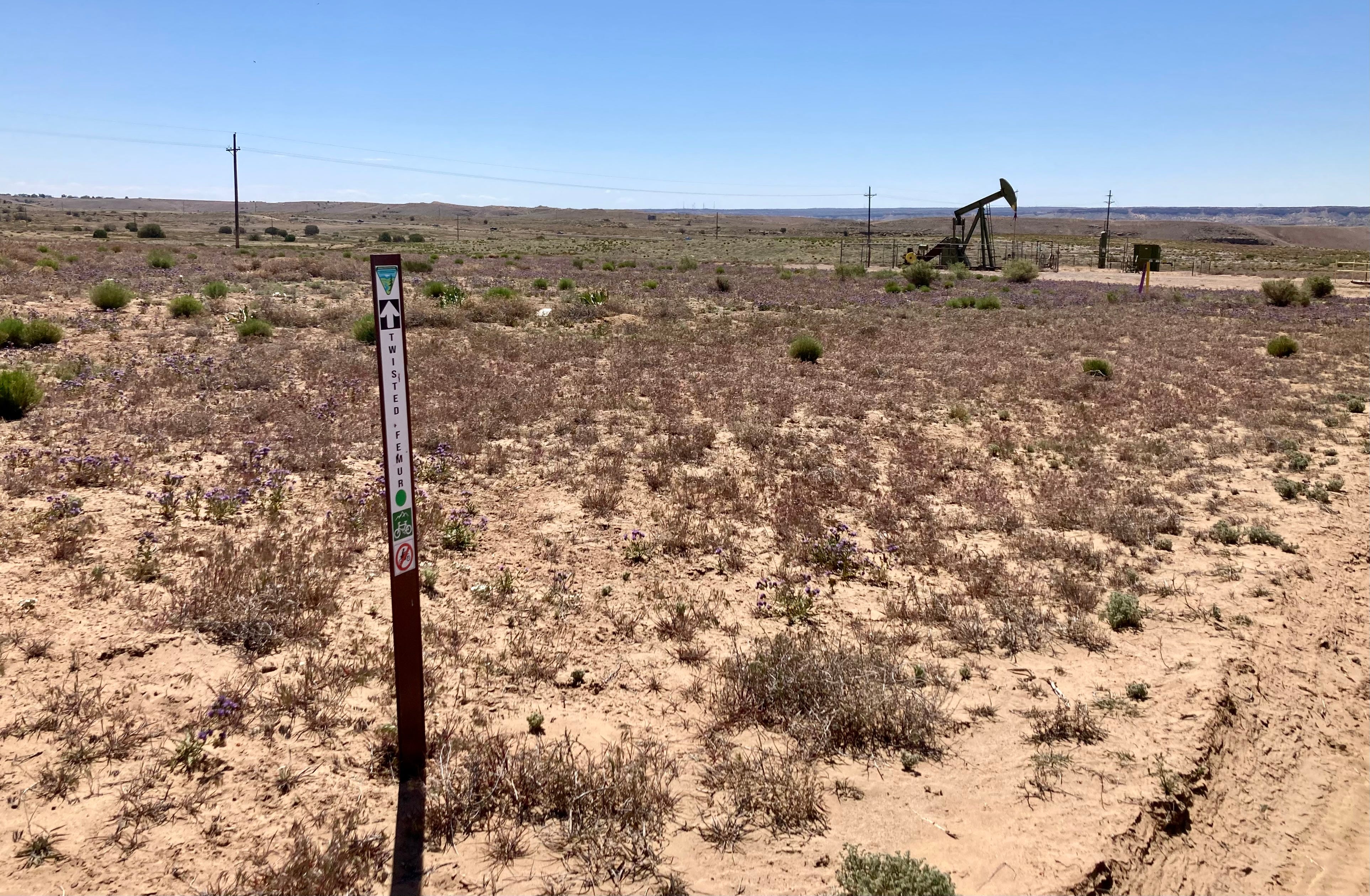
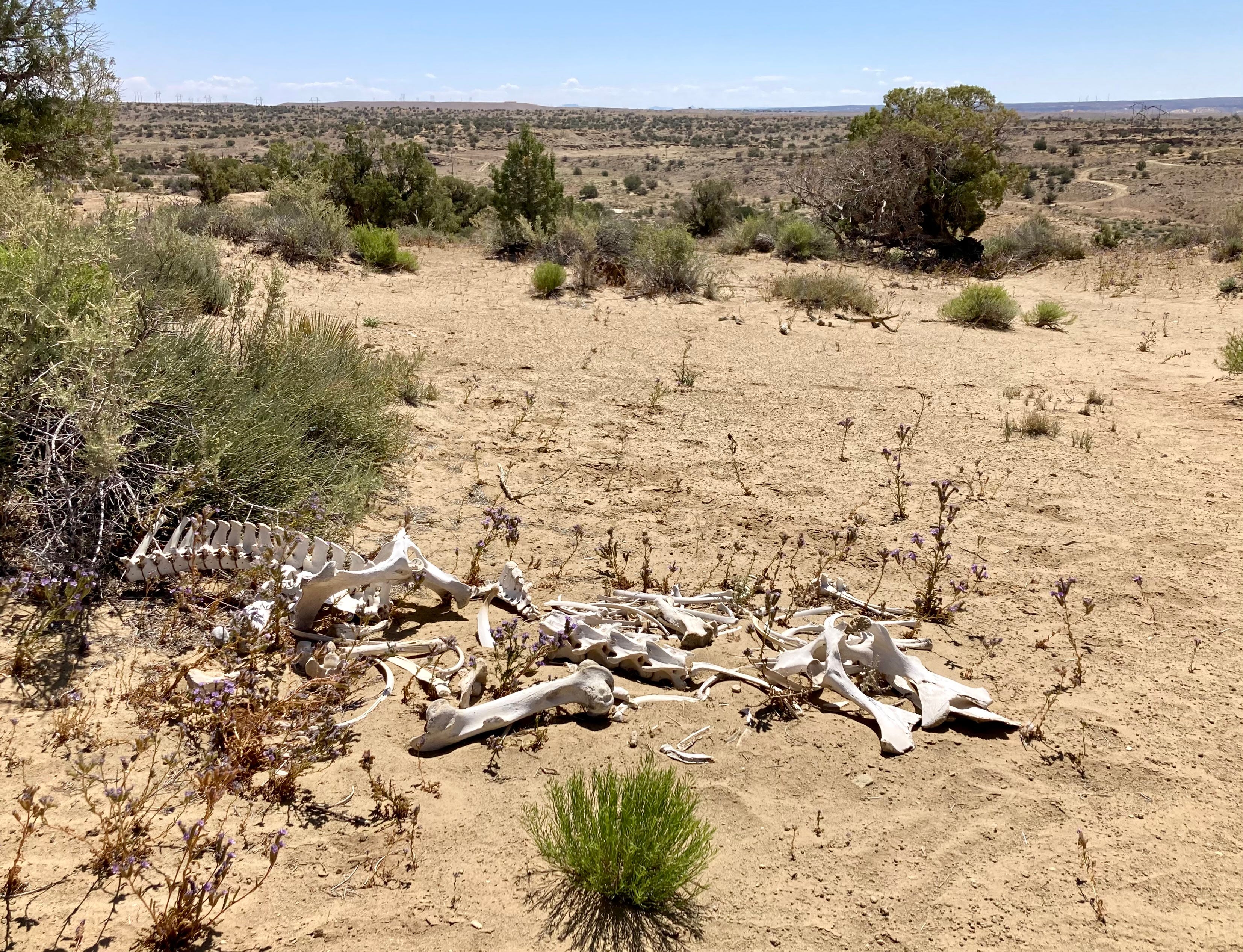
A friend and I went down to Farmington over the weekend to check out some of the newish mountain biking trails around there. We rode the Boneyard trail, which crosses through some interesting country and, as is almost always the case when on public lands in the San Juan Basin, it wound its way around pumpjacks and other gaspatch detritus. It’s sort of like a journey through the energy-economic transition, given that the trails are part of an effort to diversify the fossil fuel economy with outdoor recreation. 

The riding is good, though you might want to avoid the trails on a hot day, and sandy areas can bog down bikes with skinnier tires (I rode a gravel bike, which wasn’t a great idea). And, of course, afterwards we went to Blake’s Lotaburger for lunch. The following images are from the trail and downtown Farmington.

Near Farmington, New Mexico. Photo credit: Jonathan P. Thompson
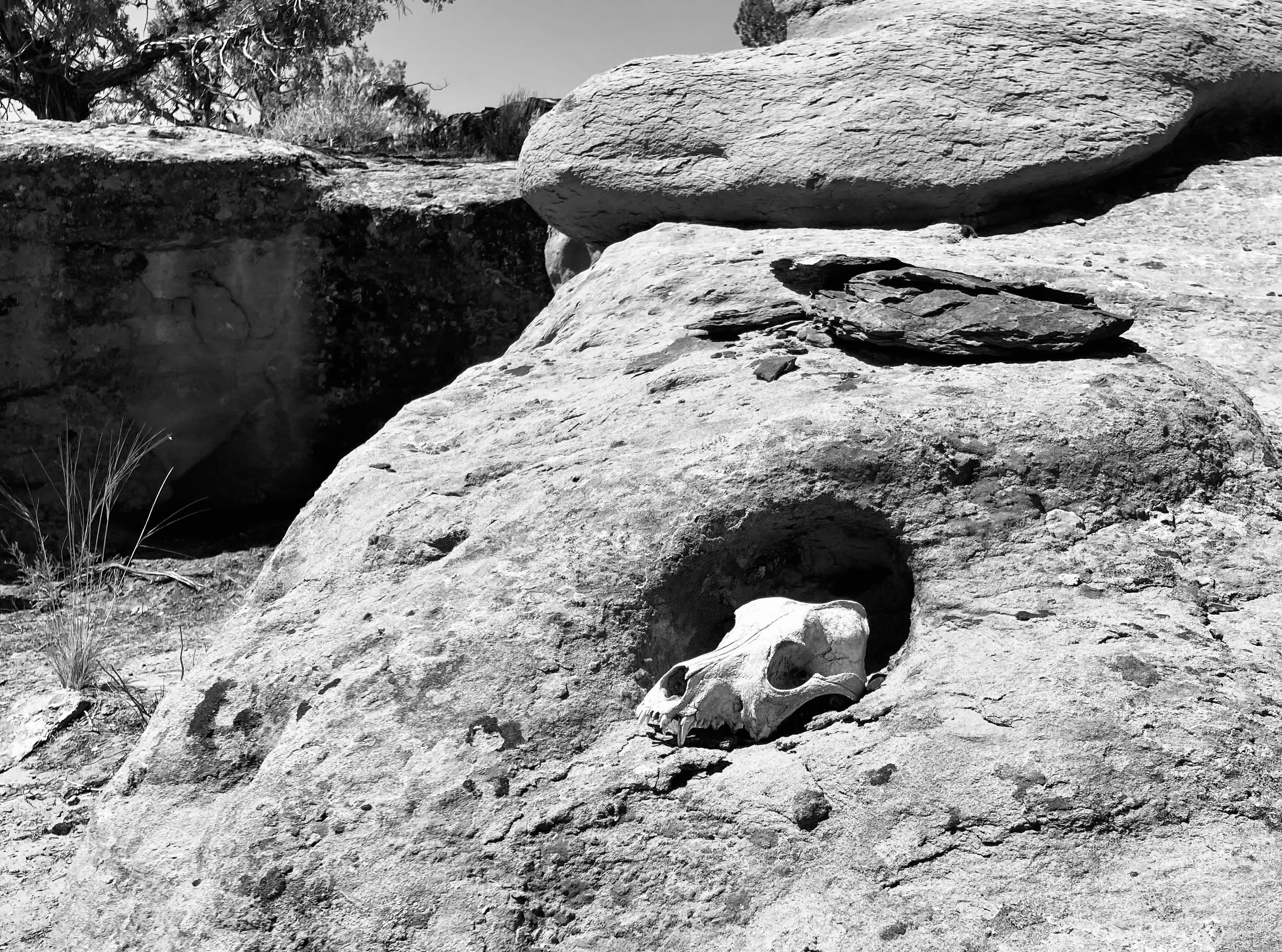
Farmington, New Mexico. Photo credit: Jonathan P. Thompson

Thoughts on boomtown architecture — Jonathan P. Thompson


Water across the West at risk as President Trump targets national monuments: A new study found that about 83% of water passing through public lands uses monument designation for its only protection — Wyatt Myskow (High Country News)

RuggyBearLA Photography RuggyBearLA / via Flickr

Click the link to read the article on the High Country News website (Wyatt Myskow):

December 9, 2025

This story was originally published bInside Climate News and is republished here through a partnership with Climate Desk.

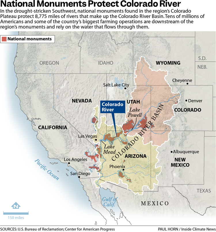
The 31 national monuments designated since the Clinton administration, which could be downsized as the Trump administration pushes to open more public lands to extractive industries, safeguard clean water for millions of Americans, according to a new analysis from the Center for American Progress.

Using geospatial data to quantify the miles of rivers and watersheds within the studied national monument boundaries, as well as the number of users who depend on that water, the report found that the water supplies for more than 13 million Americans are directly provided by watersheds within or downstream of these national monuments. About 83% of the water passing through these public lands has no other protection besides the monument designations, it found.

National monuments protect more than 21,000 miles of waterways across the U.S., nearly twice as much waterway mileage as the National Wild and Scenic Rivers System, the analysis also determined.

The report comes as the Trump administration weighs downsizing or revoking the designation of  some national monuments.

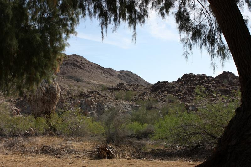
Corn Springs Chukwalla Mountains California. By Michael Dorausch from Venice, USA – Corn Springs CA, CC BY-SA 2.0, https://commons.wikimedia.org/w/index.php?curid=41004589

In March, the Trump administration announced it would eliminate California’s Chuckwalla and Sáttítla Highlands national monuments before removing language from a White House fact sheet announcing that decision. The following month, The Washington Post reported that the administration was considering downsizing or eliminating six national monuments, and in June, the U.S. Department of Justice issued an opinion that the president has the power to rescind national monument designations, backtracking on a decades-old determination on the matter.

Stone and evening light, Bears Ears National Monument, Utah. Jonathan P. Thompson photo.

During Trump’s last term, Bears Ears and Grand Staircase-Escalante national monuments, established by the Obama and Clinton administrations, respectively, were shrunk to fractions of their original sizes, but they were restored by President Joe Biden after he took office.

If national monuments are downsized or eliminated, the areas surrounding a waterway will lose protections from extractive industries, including oil and gas drilling, mining and grazing. Contamination from those industries could seep into streams and, in turn, rivers. Those industries also use water, sometimes vast amounts in arid regions, further reducing the supply that flows to nearby communities. (In certain cases, some mining and grazing are already permitted on national monument lands, but the activities are limited in scale and more regulated than they are outside the monuments.)

“Landscapes and waterways go hand in hand,” said Drew McConville, a senior fellow for conservation policy at the Center for American Progress and a co-author of the report. “The clean water depends on what comes into them from natural lands … Just protecting the wet stuff itself doesn’t guarantee that you’re keeping [water] clean and durable.”

The portion of historically marginalized communities living within the watersheds of the national monuments is greater than the average for watersheds nationally, it found. Twenty-three of the monuments studied are also found in regions expected to face water shortages due to climate change in the coming decades, making the arid regions downstream even drier.

Grand Staircase-Escalante National Monument, for example, protects 2,517 miles of waterways, according to the analysis, and nearly 90% of the watersheds within the monument are expected to see declines in their water levels. The monument straddles the Upper and Lower Colorado River Basins, with the Paria and Escalante rivers flowing within its boundaries and Lake Powell, the nation’s second-largest reservoir, just to its south. 

The monument is often thought of as a sparse, arid region, which it is, said Jackie Grant, the executive director of Grand Staircase Escalante Partners, a nonprofit focused on protecting the monument that has spent $11 million to protect the Escalante River watershed and all its tributaries. It remains vital to the Colorado River System, which millions of people in the Southwest rely on. Grand Staircase-Escalante helps slow water from the Paunsaugunt Plateau in Bryce Canyon National Park, much of which starts as snowpack in the park before melting and flowing downstream. 

“People don’t think of water when they think of Grand Staircase-Escalante National Monument,” Grant said. “So when we can bring this view of water and how important it is to the protection of the monument, it helps us put another building block in our case for supporting the monument, because not only is it important for the animals, the native plants, the geology and the paleontology, water plays a huge role in the monument, and the monument protects the water itself.”

The Antiquities Act of 1906 was signed into law by Theodore Roosevelt, for “… the protection of objects of historic and scientific interest” through the designation of national monuments by the President and Congress. National monuments are one of the types of specially-designated areas that make up the BLM’s National Conservation Lands. Some of the earliest national monuments included Devils Tower, the Grand Canyon, and Death Valley. They were initially protected by the War Department, then later by the National Park Service. More recently, the BLM and other Federal agencies have retained stewardship responsibilities for national monuments on public lands. In fact, the BLM manages more acres of national monuments in the continental U. S. than any other agency. This includes the largest land-based national monument, the Grand Staircase-Escalante National Monument in Utah featured here. National monuments under the BLM’s stewardship have yielded numerous scientific discoveries, ranging from fossils of previously unknown dinosaurs to new theories about prehistoric cultures. They provide places to view some of America’s darkest night skies, most unique wildlife, and treasured archaeological resources. In total, twenty BLM-managed national monuments, covering over five million acres, are found throughout the western U. S. and offer endless opportunities for discovery. Photos and description by Bob Wick, BLM.

Stretching across 1.87 million acres of public land, Grand Staircase-Escalante National Monument is one of the country’s most expansive national monuments, protecting scores of wildlife as well as archeological resources in southern Utah. But a nine-billion-ton coal deposit is buried in the center of the monument along with deposits of minerals, including uranium and nickel. The Trump administration has long touted boosting the country’s coal production, and has established a pro-mining agenda this year.

“It’d be very easy to contaminate either one of those rivers if mining were to take place in the center section of the monument,” Grant said. 

Margaret Walls, a senior fellow at Resources for the Future who has studied national monuments but was not part of this study, said national monuments are designated to protect cultural or historical landmarks, and it can be forgotten that they can also serve purposes like safeguarding water. Though she noted that even if monument protections are loosened, the areas remain federal lands, and their changes in status do not guarantee they will be developed. 

“We don’t protect waterways the way we do land,” Walls said, “we’re going to get those water benefits by protecting the land.”

Created by Imgur user Fejetlenfej , a geographer and GIS analyst with a ‘lifelong passion for beautiful maps.’ It highlights the massive expanse of river basins across the country – in particular, those which feed the Mississippi River, in pink.

The secret double life of america’s public lands: And why you should know about it if you drink water… —  John Zablocki (AmericanRiver.org)

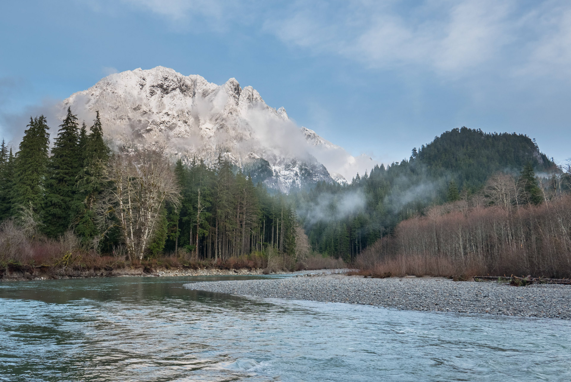
Middle Fork Snoqualmie River, Washington | Monty Vanderbilt

Click the link to read the article on the American Rivers website (John Zablocki):

January 21, 2025

Public lands are the birthright of every American. One of the great privileges of living in this country is the ability to access hundreds of millions of acres to enjoy the great outdoors — all for free.

People care about and use public lands for many reasons. From hunters and anglers to miners and ranchers, hikers and mountain bikers—there is something for almost everyone on public lands. But what if you live in a city and never set foot on public lands?  Why care about them then?

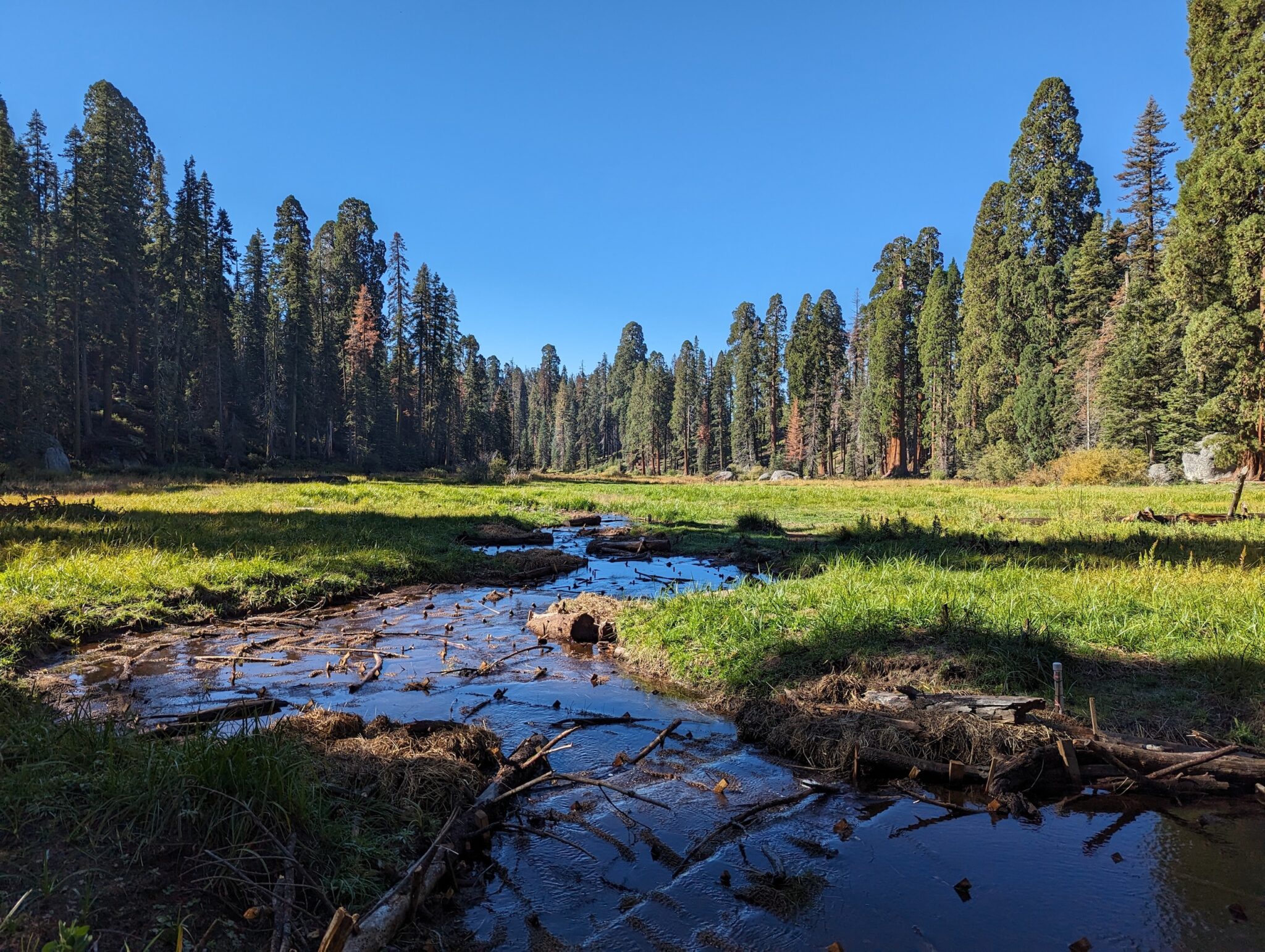
Log Meadow, California | Maiya Greenwood

Not everyone hunts, fishes, mines, ranches, hikes, or bikes; but everyone, truly everyone, depends on clean water. The big secret about public lands is that they are arguably the country’s single biggest clean water provider. According to the US Forest Service, National Forests are the largest source of municipal water supply in the nation, serving over 60 million people in 3,400 communities across 33 states. Many of the country’s largest urban areas, including Los Angeles, Portland, Denver, and Atlanta receive a significant portion of their water supply from national forests.

Healthy forests and grasslands perform many of the functions of traditional water infrastructure. They store water, filter pollutants, and transport clean water to downstream communities. And they do it naturally — essentially for free. When rivers are damaged from land uses on public lands, we all pay the price — literally; we all pay more in taxes and utility bills to clean up the water.

What happens on the public’s land also happens to the public’s water. The importance of managing public lands for the benefit of public water is so fundamental, it has been a pillar of public lands management agencies’ missions since their inception over a century ago. For example, The Organic Act of 1897[1] that created the US Forest Service stated:

What tribal leaders think about Interior’s dams report: The federal government has acknowledged the harms of #ColumbiaRiver dams. Now what? — @HighCountryNews

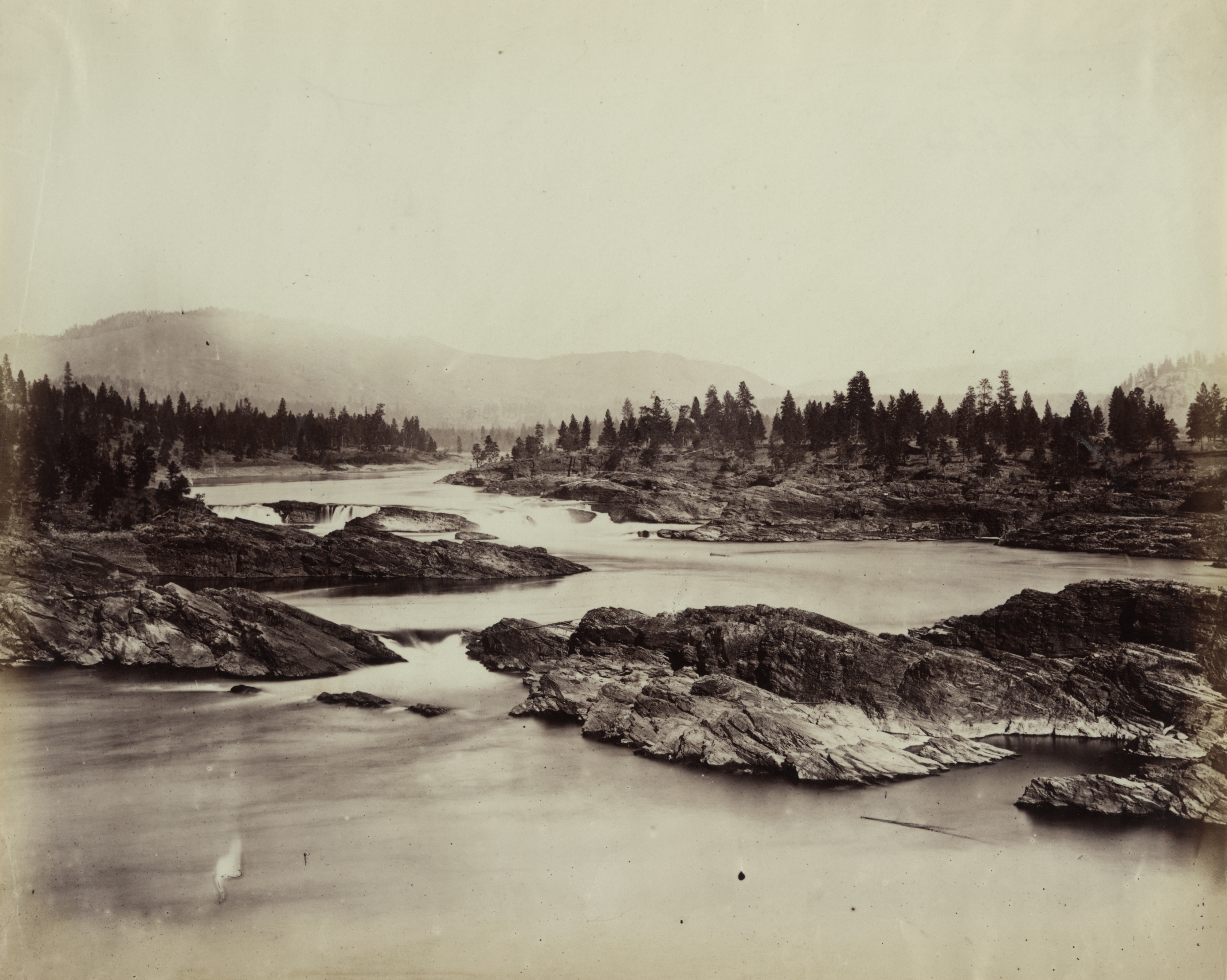
Kettle Falls in 1860. By Unknown author – Library of Congress archives at http://hdl.loc.gov/loc.pnp/ppmsca.03399, Public Domain, https://commons.wikimedia.org/w/index.php?curid=3923552

Click the link to read the article on the High Country News website (B. ‘Toastie’ Oaster):

September 1, 2024

There was a time you could catch tons of salmon in a single day at Kettle Falls, a series of pools cascading into each other on the Columbia River in northern Washington. That was before the U.S. government built Grand Coulee Dam in 1942. After 82 years, in June of this year, the Department of Interior published Historic and Ongoing Impacts of Federal Dams on the Columbia River Basin Tribesan analysis that explores how 11 hydropower dams on the mainstem Columbia, Snake and North Fork Clearwater rivers have hurt Indigenous economies, cultures, spiritual practices, environments and healthThose historic and ongoing harms include the destruction of important cultural sites like Kettle, as well as Celilo Falls, another ancient fishery that was also a magnificent international marketplace. Dams are also famously driving the basin’s salmon stocks toward extinction. “Of sixteen once existing salmonid stocks, four have been extirpated — Mid-Columbia River Coho, Mid-Columbia River Sockeye, Upper Columbia River Coho, and Snake River Coho,” the report reads. All but five of the remaining stocks are now endangered or threatened. 

Indigenous people have long known about the damage dams cause, but to hear the federal government admit it is another thing. HCN spoke to Shannon Wheeler, chair of the Nez Perce Tribe; Phil Rigdon, superintendent of the Natural Resources Department at the Confederated Tribes and Bands of the Yakama Nation; and Corinne Sams, who’s on the board of trustees for the Confederated Tribes of the Umatilla Indian Reservation and is also chair of the Umatilla Fish and Wildlife Commission and the tribal nation’s representative at the Columbia River Inter-Tribal Fish Commission. Here’s what they have to say about Interior’s report.

These conversations have been edited for brevity and clarity.

High Country News: What was tribal involvement in creating the Interior Department’s report?

Shannon Wheeler: We are the ones that submitted (it) to them. We had already completed this in the 1990s. We revamped it and gave them the newest version over the past eight months, and that’s what they have been working (from).

Corinne Sams: We’ve always been heavily engaged with the Department of Interior, along with the recent Columbia Basin Restoration Initiative, which is now being called the Resilient Columbia Basin Agreement, with the United States government. That was solidified in January of this year. Over the last three years, Umatilla Tribe and our staff have worked vigorously to ensure that the United States government understands the impacts and the losses that have occurred to salmon and other anadromous fish within the Columbia and Snake Basin. So we’ve played an enormous role.

Phil Rigdon: The Department of Interior came, and we did a consultation with the federal government on (the report). Our leadership expressed concerns (about) the impacts that the dams have had on our salmon, lamprey, sturgeon and fish species, but also the knowledge of our connection to the Columbia River. Our lives have changed forever, ever since those (dams) were in. But we continue to advocate and go fish and continue to practice our culture and our way of life. This report comes out in a manner that highlights a lot of broken promises to our people, but we continue to push and advocate on behalf of resources that we hope will be returned back to the levels they should be

HCN: Is there anything you think the report gets wrong or leaves out?

SW: No.

CS: No. This is the first time the federal government has ever recognized the true impacts to our people and to our ecosystem in regard to hydro systems, so we’re very optimistic and encourage individuals to read the report, to become informed. Because our ultimate goal is to decarbonize and replace the energy sector, which will eventually, hopefully, replace those hydro systems. We recognize that this isn’t only about fish. We have several other interests in the basin: transportation, recreation, irrigation. All of those components are important, and we don’t want to leave one out. We’re really pushing for everybody within the basin to remain whole. 

PR: These reports are important. But sometimes (it’s) tough to understand the heart of it. Our people are still down (there) fishing right now. Our people continue to carry our way. But the report is an important step into highlighting those things that we consider problematic over the history of the dams.

HCN: What kinds of federal actions do you want to see based on this report?

SW: Consideration for breaching of the four Lower Snake River dams.

CS: There’s a billion-dollar backlog on infrastructure and hatchery maintenance, and we utilize those hatcheries as mitigation fish, for the loss of the abundant natural runs. But our ultimate goal is to get our natural runs back to healthy and harvestable levels. We’ve done a significant amount of work and have been co-managing these resources (with government agencies) for decades, but the tribes have been managing these resources for millennia. This isn’t just a tribal effort. This is for all Americans that live within the basin.

PR: There’s Bateman Island Causeway down at the mouth of the Yakima (River) that causes the thermal block that causes enormous problems for juvenile and adult fish migration up to the Yakima Basin. The small things really need to be invested in and done now. Some of these things that have been a problem for a long time are critical. And then to look at the big things, like the Lower Snake River dams, and really come up with solutions. But we also believe it can’t be like it was for us. We can’t leave people behind in the manner that we were left behind, putting the dams in for the energy development. There is a balance here that needs to be achieved through what these reports do, but also what we’re trying to do as a people.

HCN: Do you think any federal action hinges on Democrats winning the upcoming presidential election?

SW: Tribal nations across the country have all had impacts one way or another regardless of what type of administration is in. But I also believe that this administration understands that there’s impacts that the United States has had on its people.

CS: Absolutely. If we see a shift in administration, all of these agreements, all of these reports, become uncertain.

PR: I think it’s not important. Republicans fish, and Democrats fish, too. We need to come together to find solutions. I don’t think we should make it all dependent on who wins an election, but we should be thinking about how we solve long-term problems. The polarization that you see is sad, in a lot of ways, because I don’t think we’re getting to the right conversations. I don’t think we want to go political. I have red-state Republicans advocating for our work in the Yakima. That’s unique because of our partnerships, but also how we’re trying to build trust within our local communities. We’re from rural communities, rural America, tribal people. Sometimes we’re less concerned about the politics. We’re thankful for the Biden administration and the leadership they’re showing in doing these studies. I don’t want to discount that at all. But we want to make sure it’s not dependent upon who gets elected, but that we continue moving forward as a people.

Native salmon fishermen at Celilo Falls. Russell Lee, September 1941. By Russell Lee – This image is available from the United States Library of Congress’s Prints and Photographs divisionunder the digital ID fsa.8c22374.This tag does not indicate the copyright status of the attached work. A normal copyright tag is still required. See Commons:Licensing., Public Domain, https://commons.wikimedia.org/w/index.php?curid=3923525

HCN: Do you think there’s a path here to bringing back Celilo Falls?

CS: When they inundated Celilo Falls, several years after that they did sonograms. And they say the falls are still under there. I think deep in our hearts we always hope to see the return of that fishery, that place. Our ancestors and our old people talk about just the sound alone, the sound of those falls. They miss that sound. 

PR: I would love to see that. I don’t want to get our hopes up, either.    

We welcome reader letters. Email High Country News at editor@hcn.org or submit a letter to the editor. See our letters to the editor policy.

This article appeared in the September 2024 print edition of the magazine with the headline “What tribal leaders think about Interior’s dams report.”

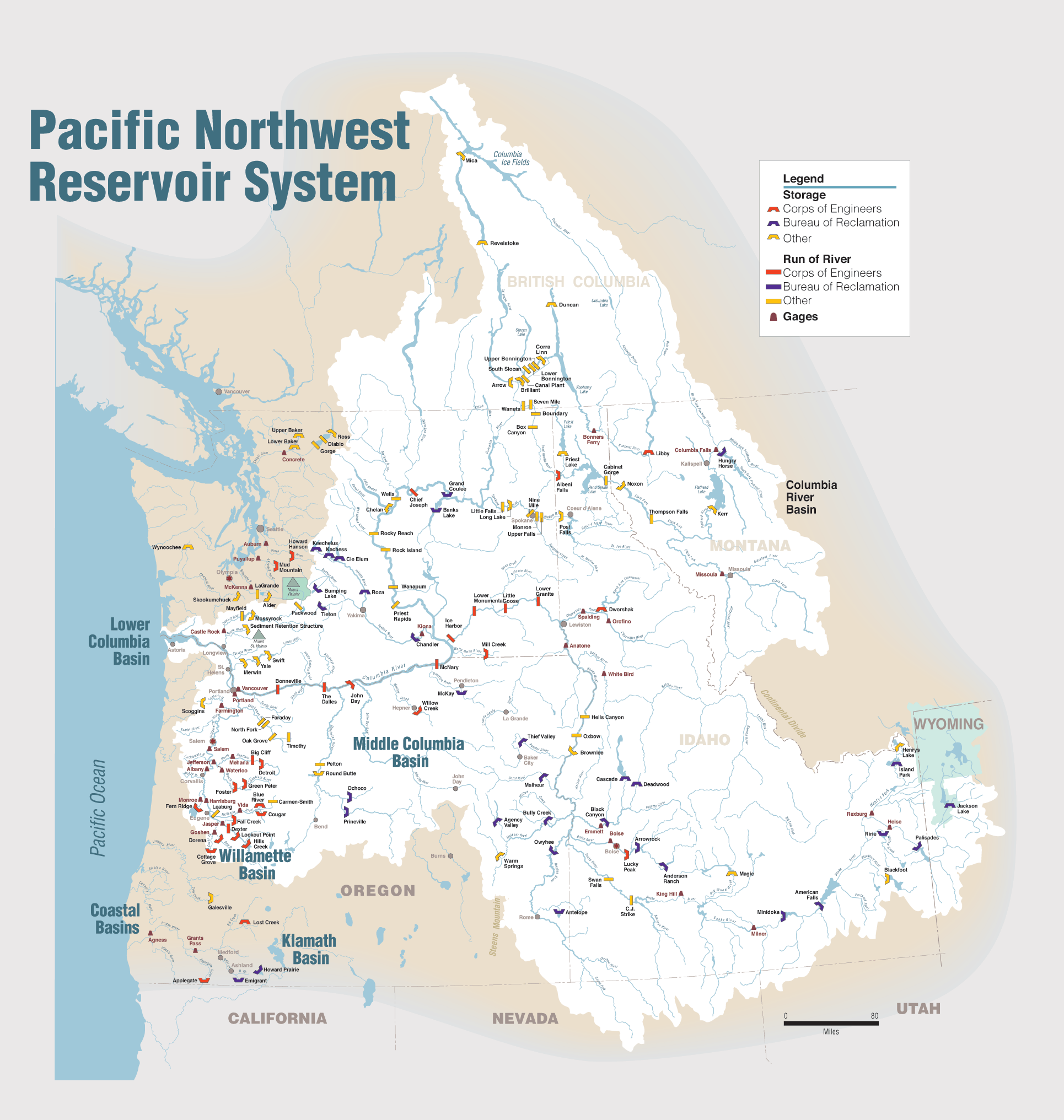
Map of the Columbia River watershed with the Columbia River highlighted. By Kmusser – self-made, based on USGS and Digital Chart of the World data., CC BY-SA 3.0, https://commons.wikimedia.org/w/index.php?curid=3844725

Yellowstone seeks to stiffen invasive species rules, ban some boats: To defend against troublesome mussels, large motorboats and sailboats would have to be dried for 30 days before being launched — @WyoFile #YellowstoneRiver #MissouriRiver #SnakeRiver

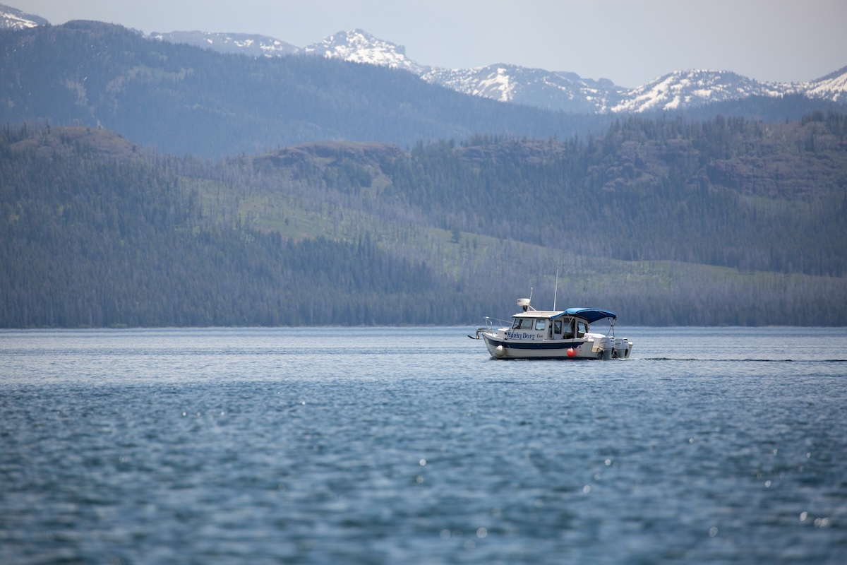
A motorboat on Yellowstone Lake. (NPS/Diane Renkin)

Click the link to read the article on the WyoFile website (Angus M. Thuermer Jr.):

March 12, 2024

To protect the headwaters of three major Western rivers from invasive, troublesome mussels, Yellowstone National Park wants to require larger boats to undergo a 30-day “dry time” before launching.

New rules up for comment also would ban any boat that’s once been contaminated by invasive Dreissena zebra or quagga mussels, regardless of decontamination cleaning.

The proposal builds on existing rules, including inspection of all watercraft, designed to protect Yellowstone and downstream waters from the fingernail-sized freshwater bivalves that cling to hard structures like boat hulls, docks and irrigation headgates. The proposal would help protect the ecological integrity of Yellowstone Park and the Yellowstone, Missouri and Snake rivers downstream in Idaho, Montana and Wyoming.

Map of the Yellowstone River watershed in Wyoming, Montana and North Dakota in the north-central USA, that drains to the Missouri River. By Background layer attributed to DEMIS Mapserver, map created by Shannon1 – Background and river course data from http://www2.demis.nl/mapserver/mapper.asp, CC BY-SA 4.0, https://commons.wikimedia.org/w/index.php?curid=9355543
Map of the Missouri River drainage basin in the US and Canada. made using USGS and Natural Earth data. By Shannon1 – Own work, CC BY-SA 4.0, https://commons.wikimedia.org/w/index.php?curid=67852261
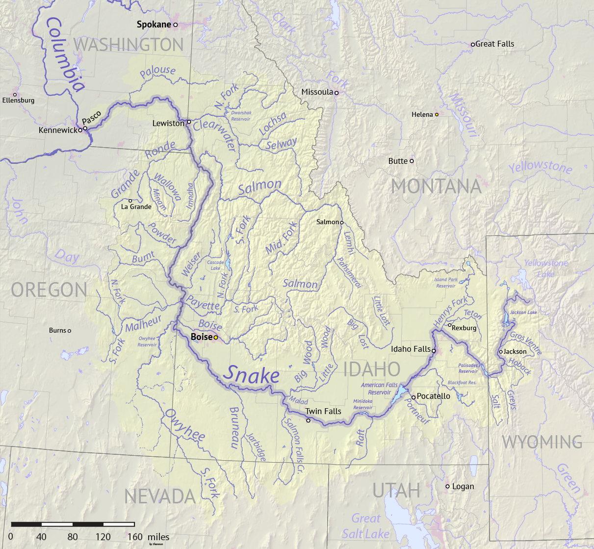
Map of the Snake River watershed, USA. Intended to replace older File:SnakeRiverNicerMap.jpg. Created using public domain USGS National Map data. By Shannon1 – Own work, CC BY-SA 4.0, https://commons.wikimedia.org/w/index.php?curid=62294242

Under the proposed rules, boats with inboard, inboard/outboard and inboard jet motors — as well as sailboats — would have to be dried under a certified program for 30 days before launch. “Large, complex, trailered watercraft pose the highest risk of transporting and introducing invasive mussels … because they are difficult to inspect and less likely to … be fully decontaminated,” the park said in a release.

Manual cleaning is not 100% effective, the park said.

Mussels were recently discovered in waters within a day’s drive of Yellowstone, including the first found in the Columbia/Snake drainage last year near Twin Falls, Idaho. The year before, mussels showed up in Pactola Reservoir, South Dakota, not far from Wyoming’s eastern state line.

People can comment online through April 5 or to Yellowstone Center for Resources, Attn: AIS Proposed Changes, PO Box 168, Yellowstone National Park, WY 82190.

Spreading threat

The zebra mussel is native to the Black, Caspian, and Azov Seas and the quagga also comes from that area of Europe. They have infected the Midwest and lower Colorado River drainage.

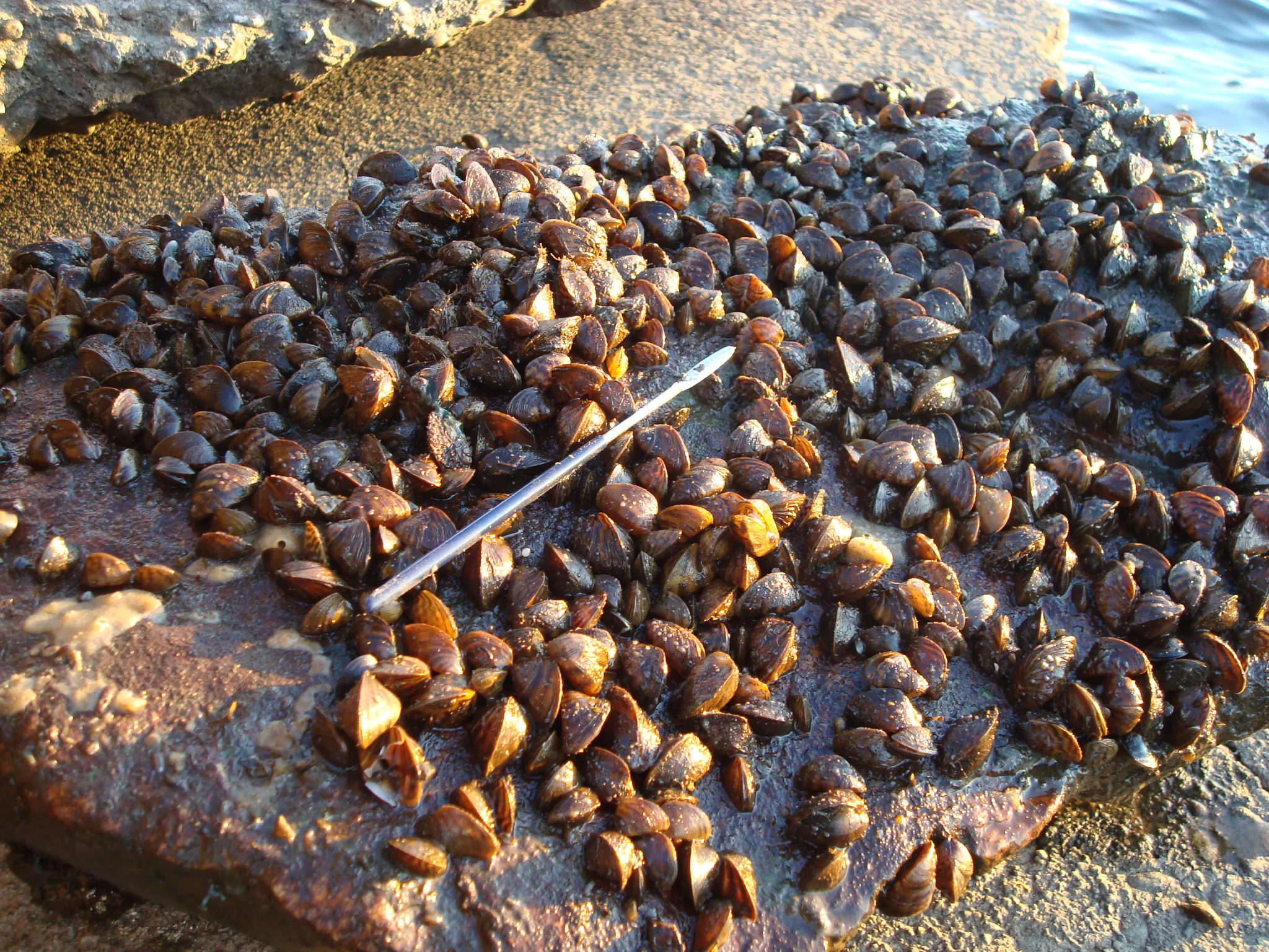
Zebra Mussels in Lake Ontario. (John Manier/USGS)

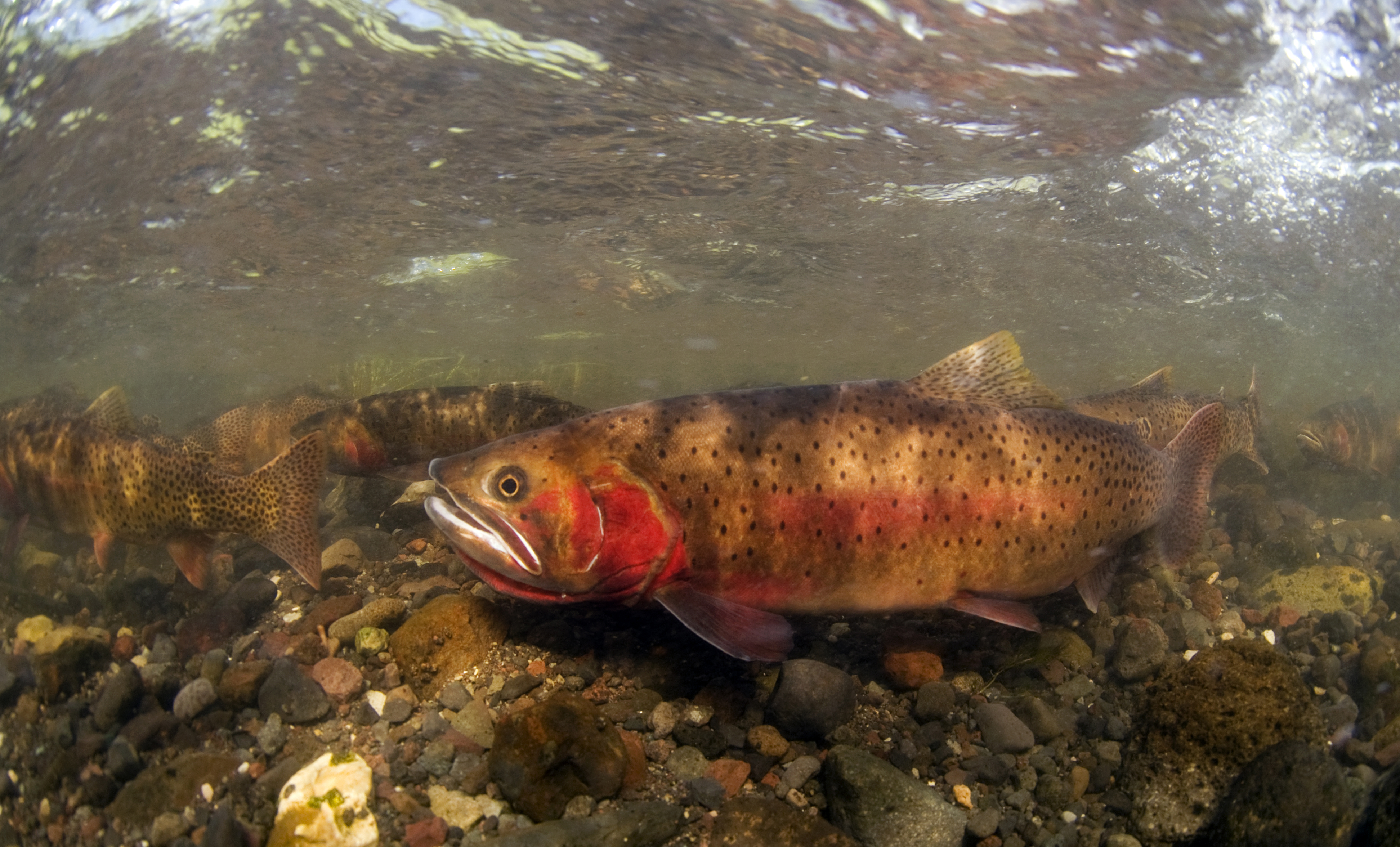
They could threaten Yellowstone cutthroat trout, a species the park has spent more than two decades restoring. The mussels can also be destructive to water and power infrastructure, according to the U.S. Department of Interior. There are no known ways to eradicate the mussels. Any invasion would be expensive to mitigate.

Motor- and sailboats falling under the new rule would be inspected and sealed to a trailer for the 30-day dry period. Seals from Yellowstone National Park, Idaho State Department of Agriculture, Montana Fish, Wildlife, and Parks and Wyoming Game & Fish Department would be honored.

Once-infected boats would be banned because of the possibility they could, even if cleaned, cause a false detection during routine DNA monitoring and consequently waste resources.

Spawning cutthroat trout, Lamar Valley; Jay Fleming; July 2011. By Yellowstone National Park from Yellowstone NP, USA – Spawning cutthroat trout, Public Domain, https://commons.wikimedia.org/w/index.php?curid=50246593

Article: Irrigation intensification impacts sustainability of streamflow in the Western United States — Nature Communications

An irrigation headgate on a canal in the Upper Green River Basin has a lock that can be used to regulate flows. (Angus M. Thuermer Jr./Wyofile)

Click the link to access the article on the Nature Communications website (David KetchumZachary H. HoylmanJustin HuntingtonDouglas Brinkerhoff & Kelsey G. Jencso). Here’s the abstract:

Abstract

Quantifying the interconnected impacts of climate change and irrigation on surface water flows is critical for the proactive management of our water resources and the ecosystem services they provide. Changes in streamflow across the Western U.S. have generally been attributed to an aridifying climate, but in many basins flows can also be highly impacted by irrigation. We developed a 35-year dataset consisting of streamflow, climate, irrigated area, and crop water use to quantify the effects of both climate change and irrigation water use on streamflow across 221 basins in the Colorado, Columbia, and Missouri River systems. We demonstrate that flows have been altered beyond observed climate-related changes and that many of these changes are attributable to irrigation. Further, our results indicate that increases in irrigation water use have occurred over much of the study area, a finding that contradicts government-reported irrigation statistics. Increases in crop consumption have enhanced fall and winter flows in some portions of the Upper Missouri and northern Columbia River basins, and have exacerbated climate change-induced flow declines in parts of the Colorado basin. We classify each basin’s water resources sustainability in terms of flow and irrigation trends and link irrigation-induced flow changes to irrigation infrastructure modernization and differences in basin physiographic setting. These results provide a basis for determining where modern irrigation systems benefit basin water supply, and where less efficient systems contribute to return flows and relieve ecological stress.

Pacific Northwest tribal nations, states sign historic #ColumbiaRiver Basin agreement with U.S. — The Seattle Times

Columbia River Basin. By U.S. Army Corps of Engineers – Portland District Visual Information, U.S. Army Corps of Engineers, Public Domain, https://commons.wikimedia.org/w/index.php?curid=8963386

Click the link to read the article on The Seattle Times website

Leaders of four Pacific Northwest tribal nations indigenous to the region on Friday inked a historic agreement with the U.S. that lays out the future of the operations of hydropower dams in the Columbia River Basin, including the dams on the Lower Snake River. At the White House on Friday, the Nez Perce, Umatilla, Warm Springs and Yakama tribes, and the states of Washington and Oregon, signed a memorandum of understanding, outlining a series of commitments from the federal government. It’s not an agreement for dam removal; in fact, removal of the Lower Snake dams, a long-running and controversial goal of tribes and other groups, is put off for years. But it’s the end of an era.

“We need a lot more clean energy, but we need to develop it in a way that’s socially just,” Yakama Nation Chair Gerald Lewis said at the White House. “The last time energy was developed in the Columbia Basin it was done on the backs of tribal communities and tribal resources.”

[…]

Tribal nations helped draw up a road map for the future of the region’s energy and salmon. Under the $1 billion-plus agreement announced in December and approved by a federal judge this month,tribes will help restore wild fish and lead in the construction of at least 1 to 3 gigawatts of clean-energy production. The agreement stems from years of mediated negotiations in a decadeslong court battle over dam operations. A stay of litigation is in place for up to five years and could continue for as long as 10. In a key compromise, the agreement also reduces water spilled over the dams for summer and fall run fish, including fall Chinook, one of the more robust salmon runs on the river, and a mainstay of tribal and sport fisheries. That allows the Bonneville Power Administration to sell more power from the dams into the lucrative California power market. However, spring spill would be boosted, to help spring Chinook by providing something more like a spring freshet for young fish migrating to the sea.

It comes as climate change turns more mountain snow to rain, throwing imperiled salmon and steelhead into hot water, and straining access to a steady stream of hydropower.

Map of the Columbia River watershed with the Columbia River highlighted. By Kmusser – self-made, based on USGS and Digital Chart of the World data., CC BY-SA 3.0, https://commons.wikimedia.org/w/index.php?curid=3844725

Our Power is Rivers: Good Hydro versus Bad Hydro and the Future of Energy in the Pacific Northwest — @AmericanRivers #ActOnClimate

Condit Dam (removed in 2011), Washington | Photo by Thomas OKeefe via American Rivers

Click the link to read the article on the American Rivers website (Kyle Smith):

October 13, 2023

There is an ongoing debate in the Pacific Northwest around whether hydropower as a whole is “good” or “bad”. But this conversation misses important details and nuance.

There are thousands of dams blocking rivers across the Northwest. Many dams provide energy, transportation, flood control, and irrigation. But many are causing more harm than good – and they are falling apart. As a society, we are making choices about the costs and benefits of dams: Which ones can be operated in a more environmentally friendly and economically viable way? And which dams need to be removed?

Dams harm rivers. They can destroy fish and wildlife habitat, degrade water quality, and turn free-flowing rivers into slow moving reservoirs that emit methane, a potent greenhouse gas that causes climate change. Dams in the Pacific Northwest have been a main cause of salmon extinction and a source of painful injustice for the region’s Tribal Nations.

American Rivers has always taken a pragmatic, solutions-oriented approach to dams and hydropower. While we lead the movement to remove outdated dams, we are also a founding member of the Hydropower Reform Coalition, working to improve the operations of dams whose continued operation is important for our energy supply and economy. For the past several years, we’ve also been working with the hydropower industry in the “Uncommon Dialogue on Hydropower, River Restoration, and Public Safety” – finding common ground on plans to retrofit and rehabilitate dams that still serve an important purpose and remove dams that pose a safety risk.

Simply put: American Rivers is ensuring our nation prioritizes healthy rivers, whether that’s by making hydro dams more river- and fish-friendly, maximizing the performance and efficiency of dams, and removing dams whose costs outweigh their benefits.

So, what does this look like in the Pacific Northwest where 50 percent of our annual energy generation comes from hydro? Major dams, including those on the Columbia River, helped build our world-class economy and will continue to support our vibrant region. But we must take a hard look at dams that are causing far more harm than good.

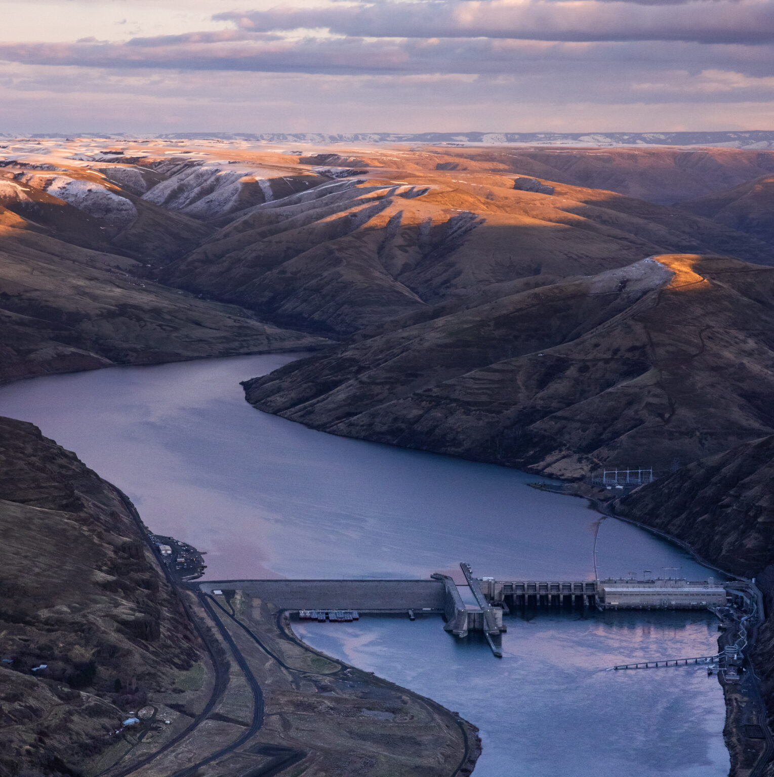
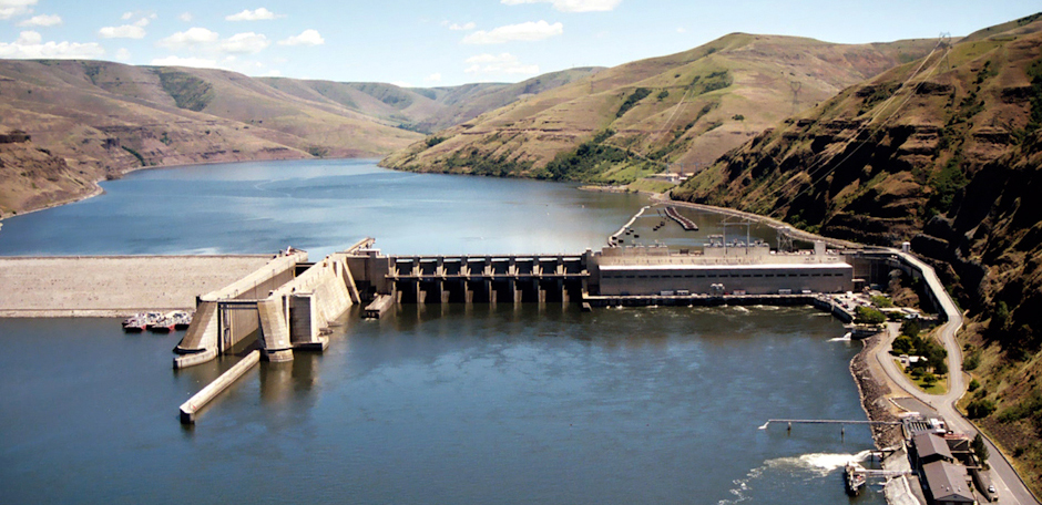
The lower four Snake River dams, which stretch between Tri-Cities, WA and Lewiston, ID, were constructed between 1957 and 1972. These dams provide around 900 average megawatts of power — around 4% of the Northwest’s energy generation. They also provide irrigation for crops grown around the Tri-Cities, as well as transportation for barge traffic between the Tri-Cities and Lewiston. While the services the lower four Snake River dams provide are valuable to surrounding communities, those services can be replaced with alternative technologies. Breaching the earthen portion of the dams is the best solution we have to solve the significant impacts the dams are having on salmon, steelhead, killer whales, Tribal Nations, and economies that rely on these species.

Unlike the mainstem Columbia dams, the lower four Snake River dams are “run of the river” projects that do not provide flood control and store relatively little water in the reservoirs behind each dam. In summer months, those reservoirs bake in the hot sun, raising water temperatures and creating harmful conditions for cold water-dependent salmon and steelhead. In 2015, warm water in the lower Snake was responsible for killing over 95% of the year’s adult sockeye salmon run. Impacts on juvenile salmon are harder to measure, but conservative estimates are that upwards of 50% of juvenile salmon die between Lower Granite Dam on the Snake and Bonneville Dam on the Columbia during their journey to the ocean, and that figure is likely much greater in years when water temperatures rise above 70 degrees.

As we mentioned before, the lower four Snake River dams combined produce an average of around 900 megawatts. Compare that with John Day Dam on the mainstem Columbia 50 miles east of Hood River, which by itself produces around 1,200 average megawatts, and you begin to see why these four dams are the target of so much attention. Four times the negative impacts from dams and their harmful slackwater reservoirs, for less power than John Day Dam alone just doesn’t make sense as we envision a new clean energy future.

Granite Dam on the Snake River | Photo: Army Corps of Engineers

Finally, no form of energy can be considered clean if it leads to the extirpation of as many species as the lower four Snake River dams continue to cause, particularly when you consider the value those species have for Tribal Nations that have lived in the Columbia Basin since time immemorial. The American Fisheries Society, the National Oceanic and Atmospheric Administration, Trout Unlimited, and many other science-based organizations all recognize that breaching the lower four Snake River dams must be the centerpiece action for restoring salmon populations in the Columbia Basin.

Tribal Nations across the Northwest are leading this initiative to breach the lower four Snake River dams because of these negative impacts. The largest impact being to the salmon populations; their dwindling numbers directly impact the culture and traditions of tribal members and their future generations. In addition, with the harm placed on salmon by these dams, treaties made between the U.S. Government and the Tribes are being violated. We have a moral and ethical obligation to uphold our treaty promises and to save Snake Basin salmon and steelhead from extinction.

As we work to develop a bold new clean energy future for the Pacific Northwest, hydropower will continue to be an important part of our generation portfolio. When measured on the whole, it becomes clear that the lower four Snake River dams cannot be a part of that vision. We must build a system that is reliable, resilient, and equitable. We must continue working together to achieve a future of healthy rivers, abundant salmon, and affordable, reliable clean energy.

Map of the Snake River watershed, USA. Intended to replace older File:SnakeRiverNicerMap.jpg. Created using public domain USGS National Map data. By Shannon1 – Own work, CC BY-SA 4.0, https://commons.wikimedia.org/w/index.php?curid=62294242