Biden-Harris administration to replace Leadville Mine Drainage Tunnel Treatment Plant — Reclamtion #ArkansasRiver

The LMDT is west of Hwy. 91 north of Leadville. Forest, wetlands, and a small neighborhood are located nearby. Photo credit: Reclamation

Click the link to read the release on the Reclamation webiste (Anna Perea and Elizabeth Smith ):

LOVELAND, Colo. — The Bureau of Reclamation announces a $56 million investment from the President’s Investing in America agenda for the construction of a replacement Leadville Mine Drainage Tunnel Treatment Plant. Originally built in 1991, the plant removes heavy metals from contaminated water caused by mining operations in the Leadville area. It has since reached its service life, and this investment from the Bipartisan Infrastructure Law will ensure the plant continues to protect water supply

The Department of the Interior recently announced a nearly $585 million investment from the Bipartisan Infrastructure Law for infrastructure repairs on water delivery systems. Funds will support 83 projects across all five Reclamation regions, including the Leadville Mine treatment plant.

Leadville Mine Drainage Tunnel outbuildings. Photo credit: Reclamation

Since 1991, the treatment plant has operated to remove lead, zinc, manganese, iron, and other heavy metals from contaminated water that flows from the 2-mile-long Leadville Mine Drainage Tunnel. The plant sends 650 million gallons per year of treated, clean water to the headwaters of the Arkansas River in accordance with Environmental Protection Agency guidelines.

“The replacement of the treatment plant represents one of the key priorities that the Bipartisan Infrastructure Law is intended to accomplish, protecting our water supplies for people and the natural environment,” said Jeff Rieker, Eastern Colorado Area Office Manager. “This funding will allow us to replace aging infrastructure that is critical for continued protection of the water resources of the Arkansas River, benefitting both the river itself, as well as the people who rely on it for a wide range of activities and uses.”

At present, the treatment plant has surpassed its expected service life of roughly 30 years. Over the next several years, Reclamation will construct a new treatment plant that incorporates knowledge gained over the past three decades, focuses on safety and improves the plant’s visual impact.

“The new plant will provide a longer service life and continue Reclamation’s commitment to community safety and producing clean water for the Arkansas River,” said Plant Supervisor, Jenelle Stefanic. “There will also be more maneuverability within the floor plan and additional safety features such as fall protection and noise reduction technology.”

Prior to mining, snowmelt and rain seep into natural cracks and fractures, eventually emerging as a freshwater spring (usually). Graphic credit: Jonathan Thompson

Mine Spills Not That Rare — Colorado Central Magazine


From Colorado Central Magazine (Christopher Kolomitz):

The blowout reminded Central Colorado residents of two eerily similar incidents that fouled the Arkansas River in 1983 and 1985. The toxic discharges on the local river occurred in a period of time when the Environmental Protection Agency was beginning Superfund clean-up of old mines around Leadville. The culprit of both discharges was the Yak Tunnel, which was one of three constructed to drain mines in the district.

Leading up to Superfund designation, the years of inaction were becoming a public health emergency. Drainage ditches in Leadville neighborhoods were turned orange or red because of the heavy metals coming from the historical mines. Annual discharge from the Yak Tunnel was pumping 210 tons of heavy metals into California Gulch, which was then reaching the river, according to the EPA.

A few days after the incident, the river through Salida was running clear but state wildlife officials were worried about the impact upon the brown trout spawn, and they estimated up to half of the eggs may have been lost, the local paper reported. Subsequent research found that high levels of cadmium prevented fish from living more than three or four years, wildlife officials said.

Threat of another catastrophic discharge surfaced once again in February 2008, when alarm was raised over the potential blowout of the Leadville Mine Drainage Tunnel. Tunnel collapses and blockages had created a potentially dangerous situation for an uncontrolled surge. In response the EPA drilled a relief well, which worked to reduce the danger.

Twelve specific cleanup units were identified as part of the Superfund designation and to date, seven have been wrapped up to a point where regulators are calling them deleted from the operational plan. Examples of the process include construction of water diversion channels and settling ponds to prevent heavy metals from reaching surface water, and consolidation of smelter waste and mine tailings which were then covered with clean soil.

At the Yak Tunnel, a water treatment plant has been credited with dramatically improving water conditions in the Arkansas River, and the overall cleanup has been hailed as a success, although the EPA has ruffled some local feathers. The river now supports a vibrant, healthy fishery with greater public access, and the residents of Leadville and downstream are living around less toxicity.

USGS: Hydrogeologic Setting and Simulation of Groundwater Flow near the Canterbury and Leadville Mine Drainage Tunnels, Leadville, Colorado

leadvilleminedrainagetunnel.jpg

Here’s the release from the U.S. Geological Survey (Wellman, T.P./Paschke, S.S./Minsley, Burke/Dupree, J.A.):

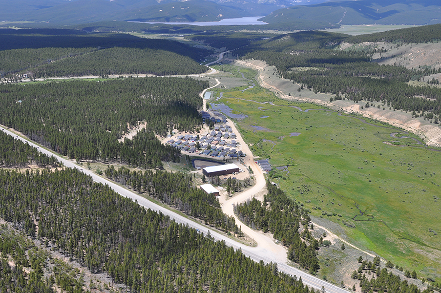
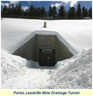
The Leadville mining district is historically one of the most heavily mined regions in the world producing large quantities of gold, silver, lead, zinc, copper, and manganese since the 1860s. A multidisciplinary investigation was conducted by the U.S. Geological Survey, in cooperation with the Colorado Department of Public Health and Environment, to characterize large-scale groundwater flow in a 13 square-kilometer region encompassing the Canterbury Tunnel and the Leadville Mine Drainage Tunnel near Leadville, Colorado. The primary objective of the investigation was to evaluate whether a substantial hydraulic connection is present between the Canterbury Tunnel and Leadville Mine Drainage Tunnel for current (2008) hydrologic conditions.

Altitude in the Leadville area ranges from about 3,018 m (9,900 ft) along the Arkansas River valley to about 4,270 m (14,000 ft) along the Continental Divide east of Leadville, and the high altitude of the area results in a moderate subpolar climate. Winter precipitation as snow was about three times greater than summer precipitation as rain, and in general, both winter and summer precipitation were greatest at higher altitudes. Winter and summer precipitation have increased since 2002 coinciding with the observed water-level rise near the Leadville Mine Drainage Tunnel that began in 2003. The weather patterns and hydrology exhibit strong seasonality with an annual cycle of cold winters with large snowfall, followed by spring snowmelt, runoff, and recharge (high-flow) conditions, and then base-flow (low-flow) conditions in the fall prior to the next winter. Groundwater occurs in the Paleozoic and Precambrian fractured-rock aquifers and in a Quaternary alluvial aquifer along the East Fork Arkansas River, and groundwater levels also exhibit seasonal, although delayed, patterns in response to the annual hydrologic cycle.

A three-dimensional digital representation of the extensively faulted bedrock was developed and a geophysical direct-current resistivity field survey was performed to evaluate the geologic structure of the study area. The results show that the Canterbury Tunnel is located in a downthrown structural block that is not in direct physical connection with the Leadville Mine Drainage Tunnel. The presence of this structural discontinuity implies there is no direct groundwater pathway between the tunnels along a laterally continuous bedrock unit.

Water-quality results for pH and major-ion concentrations near the Canterbury Tunnel showed that acid mine drainage has not affected groundwater quality. Stable-isotope ratios of hydrogen and oxygen in water indicate that snowmelt is the primary source of groundwater recharge. On the basis of chlorofluorocarbon and tritium concentrations and mixing ratios for groundwater samples, young groundwater (groundwater recharged after 1953) was indicated at well locations upgradient from and in a fault block separate from the Canterbury Tunnel. Samples from sites downgradient from the Canterbury Tunnel were mixtures of young and old (pre-1953) groundwater and likely represent snowmelt recharge mixed with older regional groundwater that discharges from the bedrock units to the Arkansas River valley. Discharge from the Canterbury Tunnel contained the greatest percentage of old (pre-1953) groundwater with a mixture of about 25 percent young water and about 75 percent old water.

A calibrated three-dimensional groundwater model representing high-flow conditions was used to evaluate large-scale flow characteristics of the groundwater and to assess whether a substantial hydraulic connection was present between the Canterbury Tunnel and Leadville Mine Drainage Tunnel. As simulated, the faults restrict local flow in many areas, but the fracture-damage zones adjacent to the faults allow groundwater to move along faults. Water-budget results indicate that groundwater flow across the lateral edges of the model controlled the majority of flow in and out of the aquifer (79 percent and 63 percent of the total water budget, respectively). The largest contributions to the water budget were groundwater entering from the upper reaches of the watershed and the hydrologic interaction of the groundwater with the East Fork Arkansas River. Potentiometric surface maps of the simulated model results were generated for depths of 50, 100, and 250 m. The surfaces revealed a positive trend in hydraulic head with land-surface altitude and evidence of increased control on fluid movement by the fault network structure at progressively greater depths in the aquifer.

Results of advective particle-tracking simulations indicate that the sets of simulated flow paths for the Canterbury Tunnel and the Leadville Mine Drainage Tunnel were mutually exclusive of one another, which also suggested that no major hydraulic connection was present between the tunnels. Particle-tracking simulations also revealed that although the fault network generally restricted groundwater movement locally, hydrologic conditions were such that groundwater did cross the fault network at many locations. This cross-fault movement indicates that the fault network controls regional groundwater flow to some degree but is not a complete barrier to flow. The cumulative distributions of adjusted age results for the watershed indicate that approximately 30 percent of the flow pathways transmit groundwater that was younger than 68 years old (post-1941) and that about 70 percent of the flow pathways transmit old groundwater. The particle-tracking results are consistent with the apparent ages and mixing ratios developed from the chlorofluorocarbon and tritium results. The model simulations also indicate that approximately 50 percent of the groundwater flowing through the study area was less than 200 years old and about 50 percent of the groundwater flowing through the study area is old water stored in low-permeability geologic units and fault blocks. As a final examination of model response, the conductance parameters of the Canterbury Tunnel and Leadville Mine Drainage Tunnel were manually adjusted from the calibrated values to determine if altering the flow discharge in one tunnel affects the hydraulic behavior in the other tunnel. The examination showed no substantial hydraulic connection.

The multidisciplinary investigation yielded an improved understanding of groundwater characteristics near the Canterbury Tunnel and the Leadville Mine Drainage Tunnel. Movement of groundwater between the Canterbury Tunnel and Leadville Mine Drainage Tunnel that was central to this investigation could not be evaluated with strong certainty owing to the structural complexity of the region, study simplifications, and the absence of observation data within the upper sections of the Canterbury Tunnel and between the Canterbury Tunnel and the Leadville Mine Drainage Tunnel. There was, however, collaborative agreement between all of the analyses performed during this investigation that a substantial hydraulic connection did not exist between the Canterbury Tunnel and the Leadville Mine Drainage Tunnel under natural flow conditions near the time of this investigation.

Here’s the link to the full report.

More Arkansas River basin coverage here.

S.1047 — Leadville Mine Drainage Tunnel Act of 2011: Senator Udall introduces bill that would authorize the Bureau of Reclamation to take over operation of the relief well permanently

A picture named lmdtportal.jpg

From The Pueblo Chieftain (Chris Woodka):

Concern about a potential blowout in the tunnel, located north of Leadville, was raised in early 2008 when high groundwater levels were suspected of building pressure from millions of gallons of contaminated water behind bulkheads in the tunnel and possibly leaking into surrounding areas.

Since then, U.S. Sen. Mark Udall has tried to get approval for legislation that would give the Bureau of Reclamation authority to continue operating a relief well and to take steps toward a long-term solution.

The Leadville Mine Drainage Tunnel Act would clarify that the Bureau of Reclamation has the authority to treat the water diverted into the tunnel and — if necessary — to expand on site to treat additional water. The bureau is also required to maintain the structural integrity of the tunnel to be safe over the long haul.

Previously, Reclamation claimed it lacked specific authority to treat water behind the blockages in the tunnel, a federal facility built to drain mines as a way to improve production in World War II and the Korean War…

Reclamation and the Environmental Protection Agency, which oversees mine drainage mitigation at a nearby Superfund site in California Gulch, have been unable to reach a long-term solution.

More Leadville Mine Drainage Tunnel coverage here and here.

California Gulch: ASARCO dough due December 9

A picture named californiagulchleadville.jpg

From the Leadville Herald Democrat (Ann E. Wibbenmeyer):

The state of Colorado will be getting $42 million of the $1.7 billion settlement. A smelter site in Denver near the intersection of interstates 25 and 70 known as Globeville, will be getting $16 million. Twenty-two million of the settlement money will be shared between the California Gulch Superfund Site and four other sites such as the Summitville Mine Superfund Site and a site near Vasquez Boulevard and Interstate 70. The exact amount to be used in Leadville is unknown.

More California Gulch coverage here and here.

Leadville residents want everyone to have a voice in California Gulch superfund operations

A picture named californiagulchleadville.jpg

From the Leadville Herald Democrat (Ann E. Wibbenmeyer):

Members of the Citizens’ Advisory Group, appointed by the Lake County commissioners to advise the county on Superfund issues, were vocal in their demand for a non-appointed board for an as-yet-unformed Community Advisory Group during another formation meeting on Oct. 27. The guidelines for forming the latter group were given to Mayor Bud Elliott and Commissioner Mike Bordogna by Jennifer Lane, community involvement coordinator for the Environmental Protection Agency. Bordogna and Elliott wanted to make sure that the community had a say in pending decisions about the California Gulch Superfund Site. A Community Advisory Group, or CAG, is the EPA’s structure for ensuring community participation in EPA decisions, according to Lane. The first formation meeting was held in August, with renewed community interest in the issues. The group agreed to hire a facilitator to help structure the process of creating the group that would advise the EPA of the Lake County input on Superfund issues.

At the Oct. 27 meeting, with about 40 people in attendance, the people from the county-appointed group argued that anyone who showed up to any future meeting should be able to vote on the decisions, as opposed to just having certain people appointed to the committee. According to Bill Klauber, who is with the county-appointed group, this is the only way to ensure that every voice is heard. If a person doesn’t have a vote at the table, then that person’s voice is not being heard, he said.

More California Gulch coverage here and here.

S. 1417 and H.R.3123, Leadville Mine Drainage Tunnel Remediation Act of 2009

A picture named ldmtcollapse.jpg

Senator Udall and Representative Lamborn have companion bills in the congress to grease the wheels of pumping from above the collapse in the Leadville Mine Drainage Tunnel. Here’s a report from Ann E. Wibbenmeyer writing for the Leadville Herald Democrat. From the article:

Two bills have been introduced in this current legislative session. Lamborn introduced H.R.3123 and Udall introduced S.1417. Just like federal legislation introduced last year during the state of emergency, these are companion bills clarifying BOR responsibility for the tunnel and the water inside. Last year, the bill introduced in the Senate by former Senator Ken Salazar was halted by opposition from the BOR. The bill introduced jointly by the Congressman Udall and Congressman Lamborn made it to a vote in the House of Representatives. “The clock ran out,” said Udall about the lack of movement on this bill after the vote sent the bill to the Senate. The election loomed and the senate had a lot on its plate, and the bill was introduced rather late, he added.

More Coyote Gulch coverage here and here.

Leadville Mine Drainage Tunnel: Senator Udall and Representative Lamborn introduce legislation to fund and authorize Reclamation treatment of mine water

A picture named ldmtcollapse.jpg

Here’s a report from Chris Woodka writing for The Pueblo Chieftain. From the article:

“We both share a strong, deep commitment when it comes to the Leadville drainage tunnel,” Udall said. “We need for someone to step in and take responsibility,” Lamborn added. The lawmakers are sponsoring the legislation to avert disaster if the blockage in the Leadville tunnel were to give way under pressure and release a toxic flood into the Arkansas River. It will also improve the water quality of water from the mines that is returned to the river, Udall said. [ed. the toxic flood scenario was debunked by Reclamation last year].

In response to the emergency, a relief well was added to remove water backed up in the Leadville tunnel. The water was pumped to Reclamation’s treatment plant north of Leadville…

The bill would give Reclamation the authority to continue operating the relief well and to take steps toward a long-term solution. Previously, Reclamation claimed it lacked specific authority to treat water behind the blockages in the tunnel, a federal facility built to drain mines as a way to improve production in World War II and the Korean War. Reclamation and the EPA have been unable to reach a long-term solution.

More Coyote Gulch coverage here.