Click the link to read the discussion on the CBRFC website:
The Colorado Basin River Forecast Center (CBRFC) geographic forecast area includes the Upper Colorado River Basin (UCRB), Lower Colorado River Basin (LCRB), and Eastern Great Basin (GB).
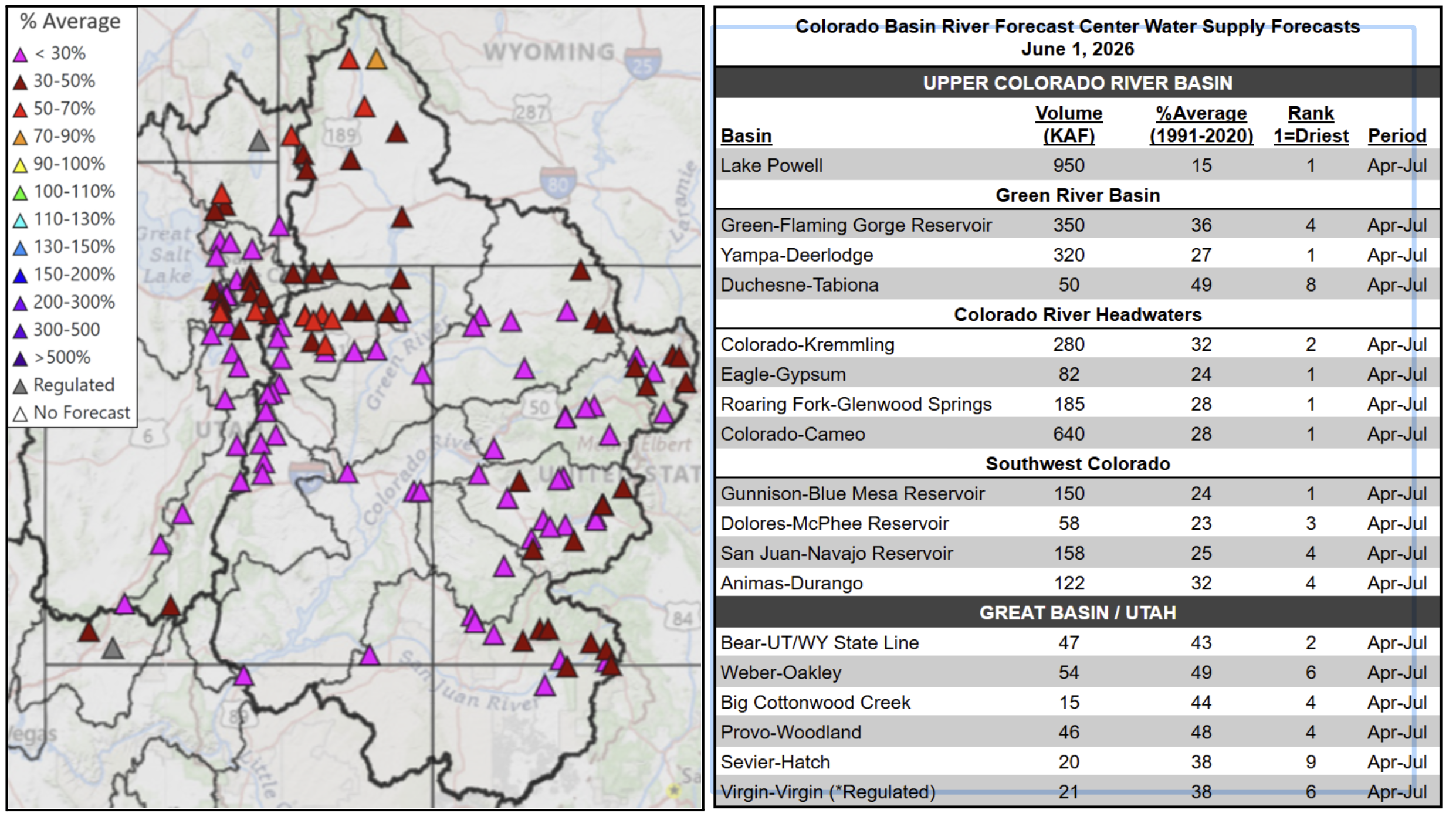
Water Supply Forecasts
April-July volume forecasts are well below normal and rank in the driest five on record at many locations. Record low snowpack and poor soil moisture conditions are the primary hydrologic conditions impacting the water supply outlook, while future weather is a primary source of forecast uncertainty. June 1 water supply forecasts are summarized in the figure and table below.
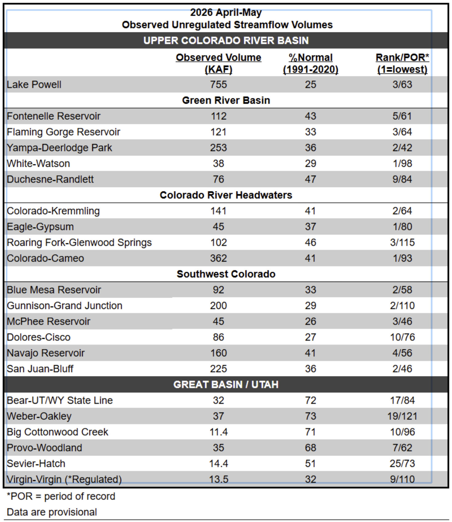
Observed Streamflow (April-May)
Poor soil moisture and snowpack conditions have led to well below normal April-May observed unregulated streamflow volumes, which are summarized in the below table.
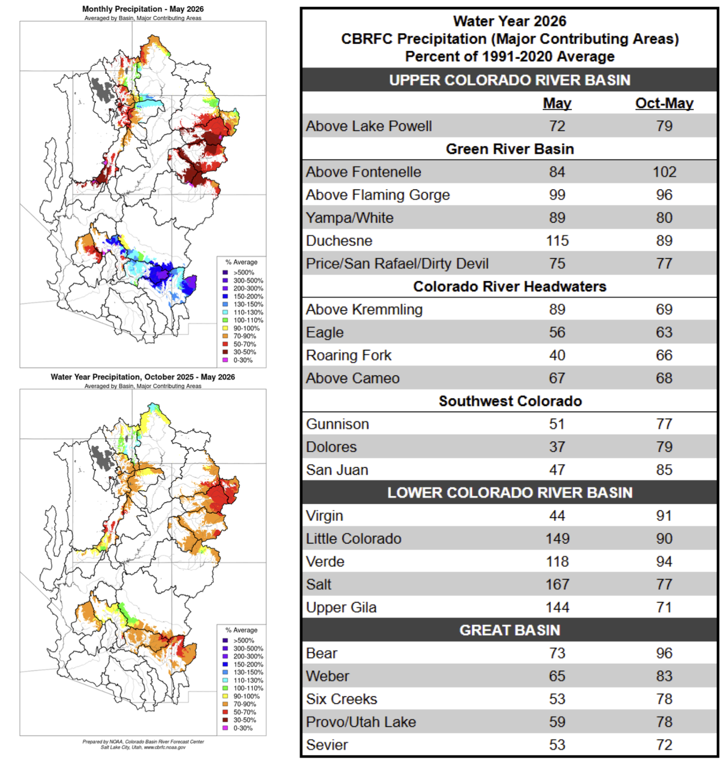
Water Year Weather
Much of the CBRFC area experienced its warmest and least snowy winter on record. Following this, an unprecedented heatwave in March initiated significant snowmelt in areas that would usually still be building a snowpack. April brought cooler and wetter weather, and May generally continued this trend, with temperatures remaining mostly near normal across the CBRFC area. Portions of the GB and UCRB experienced periods of snowfall accumulation through May, but above normal precipitation was limited to small areas within the Green River Basin and Colorado River headwaters. In the LCRB, central/eastern AZ into western NM ended the month with significantly above normal precipitation, but this is a function of the very dry climatology as most of the LCRB routinely receives near zero precipitation in the month of May.
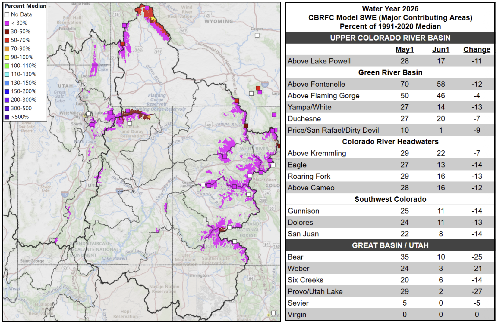
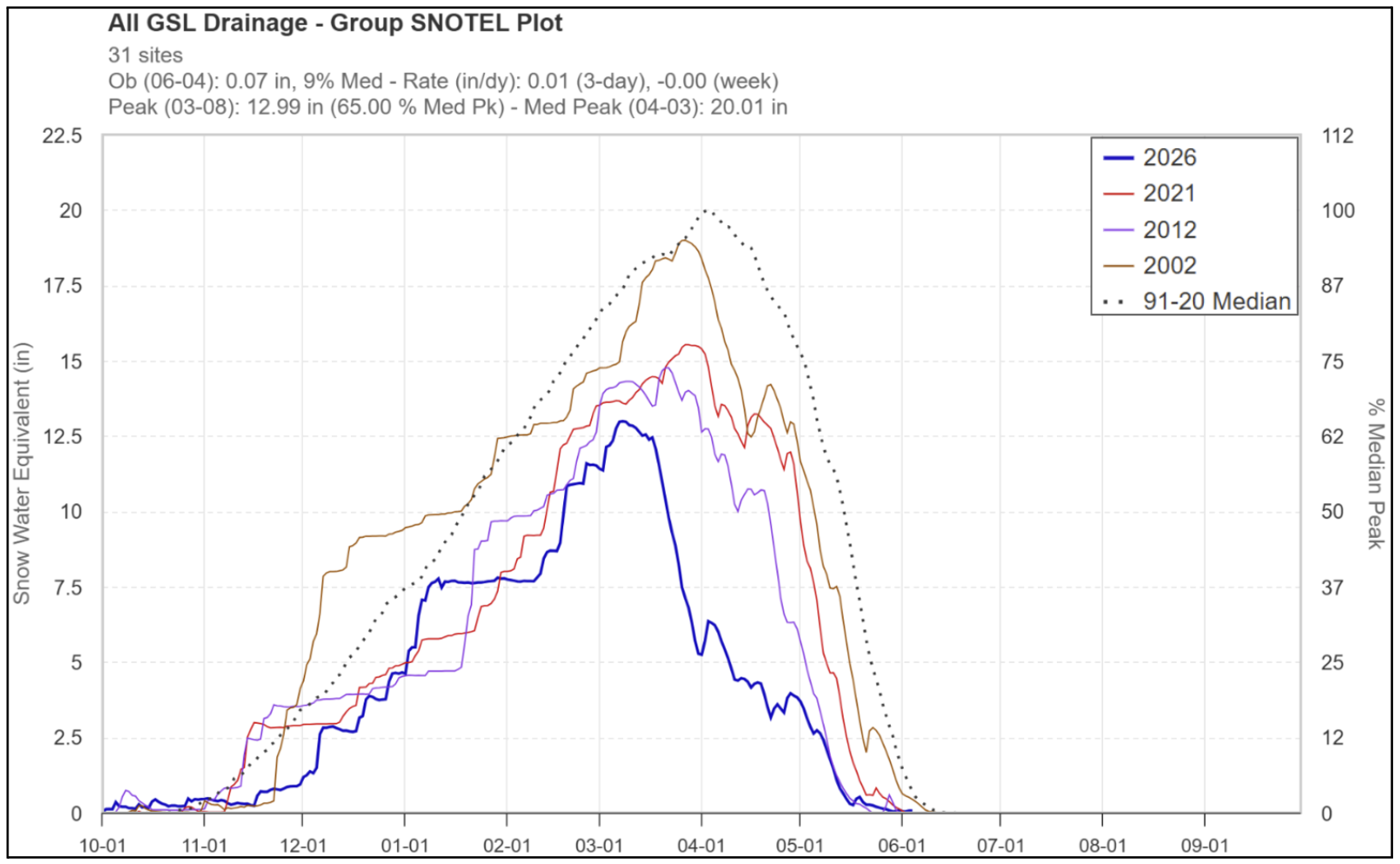
Snowpack Conditions
Snow water equivalent (SWE) has been at or below record low for most of the snow accumulation season. The significant heatwave during the last half of March led to historically low April 1 snow water equivalent conditions across the region. UCRB and GB SNOTEL SWE peaked around March 8, which is 3-4 weeks earlier than the 1991-2020 normal peak date. June 1 SWE across the UCRB and GB is generally less than 25% of normal, with more favorable conditions in the Upper Green River Basin. SWE conditions are summarized in the figures and table below.

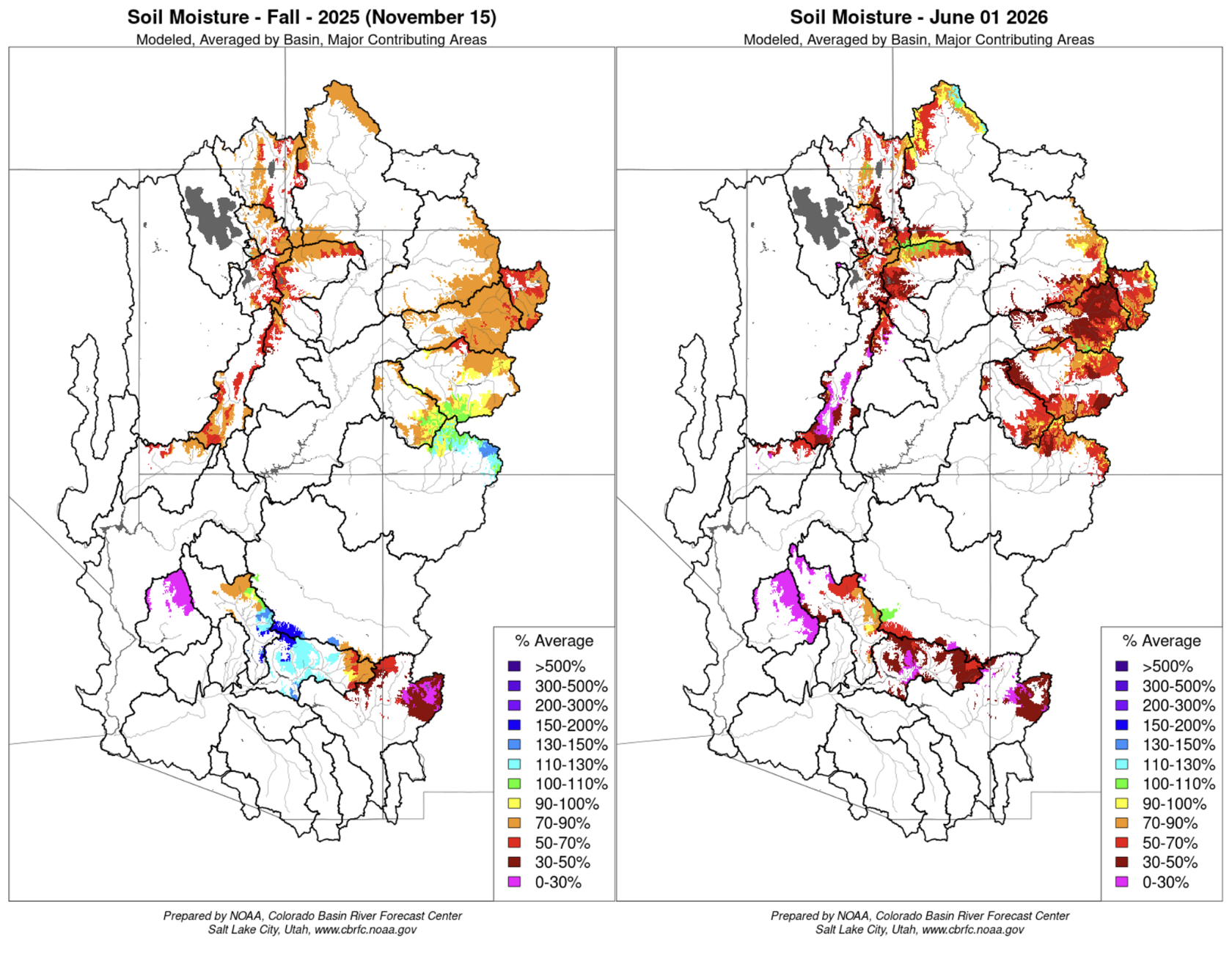
Soil Moisture
CBRFC hydrologic model soil moisture conditions impact water supply forecasts. Basins with above average soil moisture conditions can be expected to experience more efficient runoff from rainfall or snowmelt while basins with below average soil moisture conditions can be expected to have lower runoff efficiency until soil moisture deficits are fulfilled. The timing and magnitude of spring runoff is impacted by snowpack conditions, spring weather, and soil moisture conditions.
Mid-November 2025 soil moisture conditions were below average across most areas as a result of warmer and drier than normal weather during the 2025 water year. Early June soil moisture conditions are generally well below average across the region due to the lack of snow. CBRFC hydrologic model soil moisture conditions are shown in the figures below.
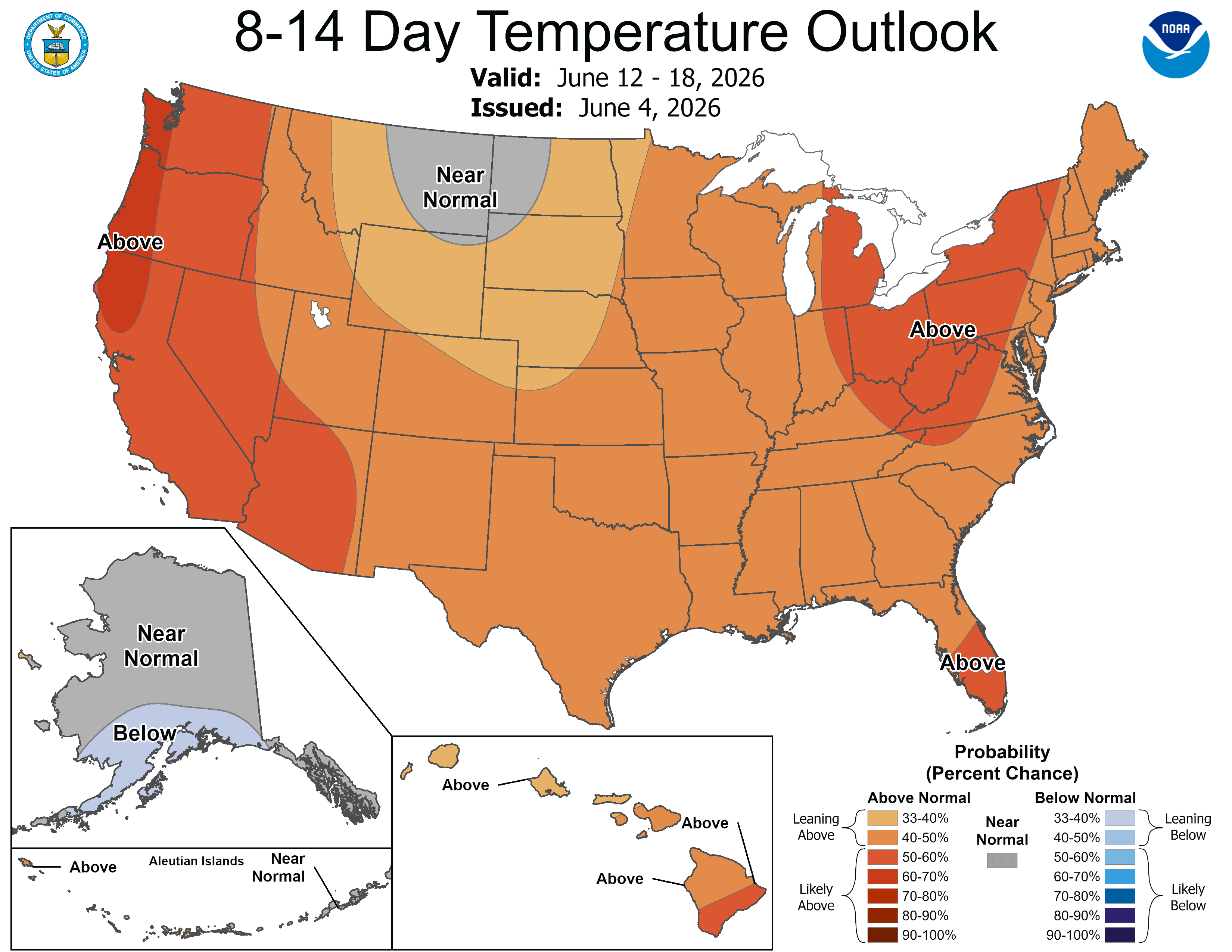
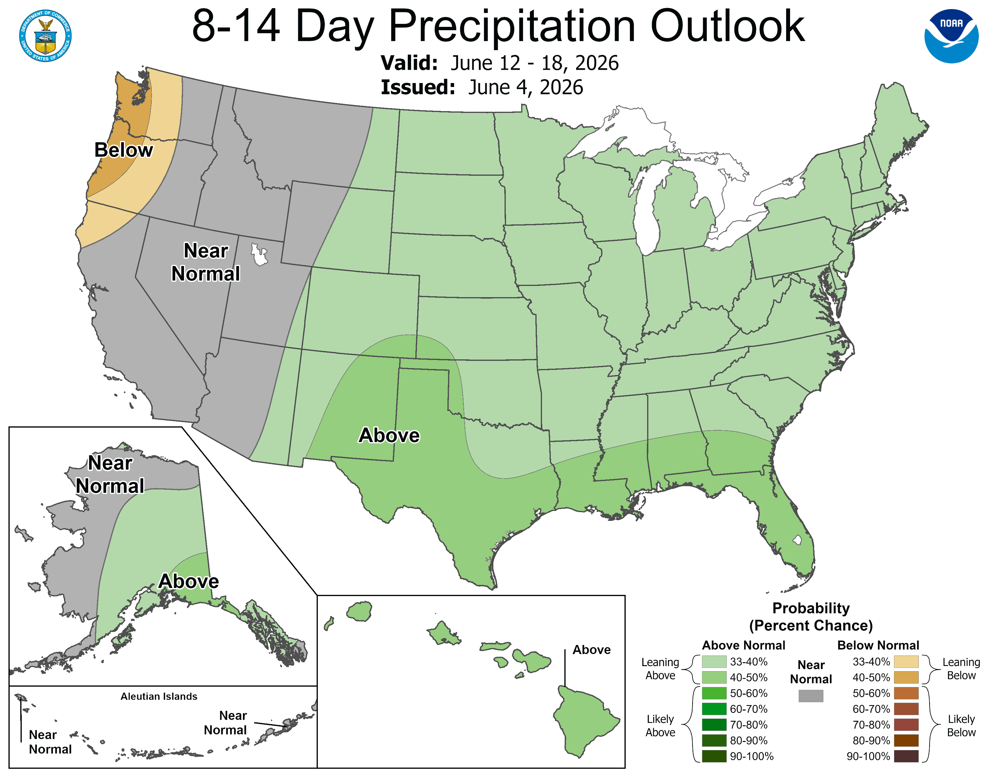
Upcoming Weather
Temperatures are heating up across the CBRFC area as June begins. Precipitation chances in the near-term are limited to warm, convective showers and storms, mainly over eastern areas. The 7-day precipitation forecast and the Climate Prediction Center (CPC) 8–14 day temperature and precipitation outlooks are shown in the figures below.