Who depends more on Colorado River water: 40 million people or 1.8 million cattle?

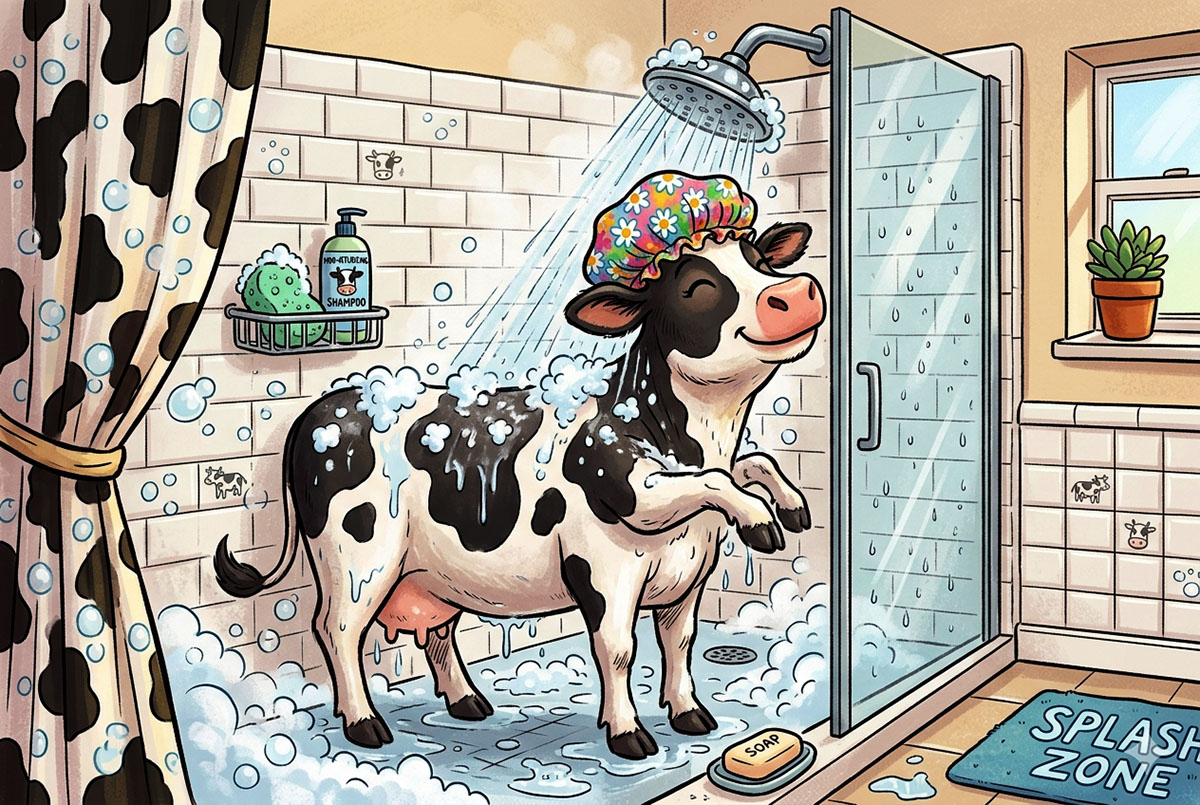
A cartoon cow enjoying a shower, wearing a colorful shower cap and surrounded by bubbles in a bathroom. The showerhead is spraying water, and there are soap and shampoo products visible.
Dairy cow bathing with a shower cap on. Created by Google’s Nana Banana 2.

by Robert Marcos, photojournalist

In terms of actual volume consumed, cattle depend significantly more on Colorado River water than people do. All total, the Colorado River water that’s consumed by the 40 million people who have access to it represents about 18% of the river’s total allocate use. Meanwhile cattle and their forage – specifically alfalfa and hay, use 46% of the river’s allocated use, making livestock the single largest consumer of the Colorado River.1

The Data Breakdown

According to a landmark Nature Communications Earth & Environment study tracking the river’s allocation, the water consumption heavily favors cattle and the production of forage over use by cities. 2

Cattle Feed vs. Cities: Crops like alfalfa and grass hay consume roughly twice as much water as the combined municipal and industrial use of every single city that relies on the river – including massive hubs like Los Angeles, Phoenix, Denver, and Las Vegas. 3

The Agricultural Monopoly: Irrigated agriculture accounts for 52% of the river’s overall water consumption (which includes natural evaporation). Of that massive agricultural share, 62% goes strictly to feeding livestock. 4

Upper Basin Extreme: In the Upper Colorado River Basin (Colorado, New Mexico, Utah, and Wyoming), cattle-feed crops consume 90% of all agricultural irrigation water. This is three times more water than all municipal, commercial, and industrial uses combined in that region. 5

Critical Nuance

Water policy experts note that most of the 40 million people who are said to “depend” upon Colorado River water actually utilize water from a variety of sources: including surface water, recycled water, groundwater, captured rain water, water from state water projects, and in some cases desalinated water. Only five American cities rely solely on Colorado River water: Yuma, Lake Havasu, Bullhead City, Needles, and Green River Wyoming. 6

Las Vegas draws approximately 90% of its water from Lake Mead, making it perhaps the most vulnerable major city to reservoir decline. Phoenix and the broader Phoenix metropolitan area relies on the river for about 40% of its water through the Central Arizona Project canal. Tucson receives most of its water from the Colorado River via the same 336-mile Central Arizona Project. Denver and Colorado’s Front Range cities draw water from the river’s headwaters through transmountain diversions like the Colorado-Big Thompson Project. The Imperial Valley and Coachella Valley in California—among the nation’s most productive agricultural regions—use more Colorado River water than any other area. 7
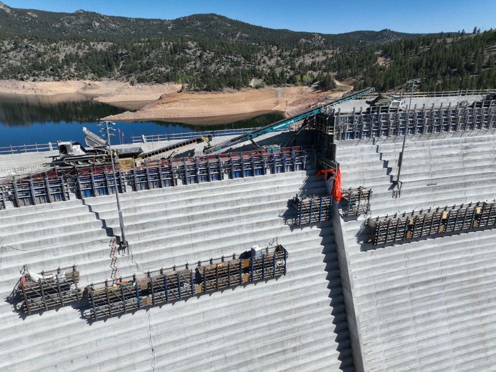
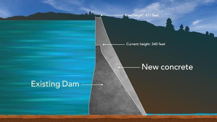
Gross Dam’s $600 million expansion is largely done. Will Denver Water ever get to fill its expanded reservoir? Facing environmental challenge, state’s largest water utility is still under order not to use extra capacity — The #Denver Post

The new conveyor system moved concrete across the gap where the spillway channel will be to the far side of the dam. Photo credit: Denver Water.

Click the link to read the article on The Denver Post website (Elise Schmelzer). Here’s an excerpt:

June 14, 2026

…it remains unclear whether Denver Water will ever be able to fill the reservoir to its new full capacity as a yearslong court battle lumbers on between the utility and environmentalists. Months of mediation between the parties have failed. Denver Water is now asking a federal appeals court to reverse a lower court judge’s 2025 order barring the utility from filling the expanded reservoir and ordering the yearslong federal permitting process to be redone. A panel of three judges for the 10th U.S. Circuit Court of Appeals is scheduled to hear arguments in the case on July 31 in Santa Fe…

U.S. District Court Judge Christine Arguello in 2024 found that federal regulators violated environmental protection laws when they failed to properly analyze the environmental impact of the project or consider reasonable alternatives to the dam expansion that would be less harmful. She later issued the order against filling the reservoir. Environmental groups argued in court, and in their filings, that regulators failed to evaluate how siphoning more water from the drought-stricken Colorado River would impact the basin as a whole. And the groups charged that they failed to weigh other project options that wouldn’t require the clear-cutting of a half-million trees or risk damage to wetlands. The case has drawn the attention of other Front Range water providers, lawyers from across the county and the U.S. Chamber of Commerce — all of which have filed briefs in the appeals case…

While the dam structure itself is complete, at least a year of work remains to fully finish the project, Martin said. Construction crews must finish the spillway and place the final topper foot of concrete on the completed dam structure. Divers will place a gate between the reservoir’s water and the dam’s intake tubes. But the crews on site will diminish in the coming months, from up to 500 workers a day to closer to 100. On the morning of June 3, crane operators already worked to remove from the dam crest the heavy machinery that was necessary to build the main structure.

Roller-compacted concrete will be placed on top of the existing dam to raise it to a new height of 471 feet. A total of 118 new steps will make up the new dam. Image credit: Denver Water.

‘Not great’ but ‘OK’: How a dry winter is impacting hay season in the Yampa Valley — Steamboat Pilot & Today #YampaRiver

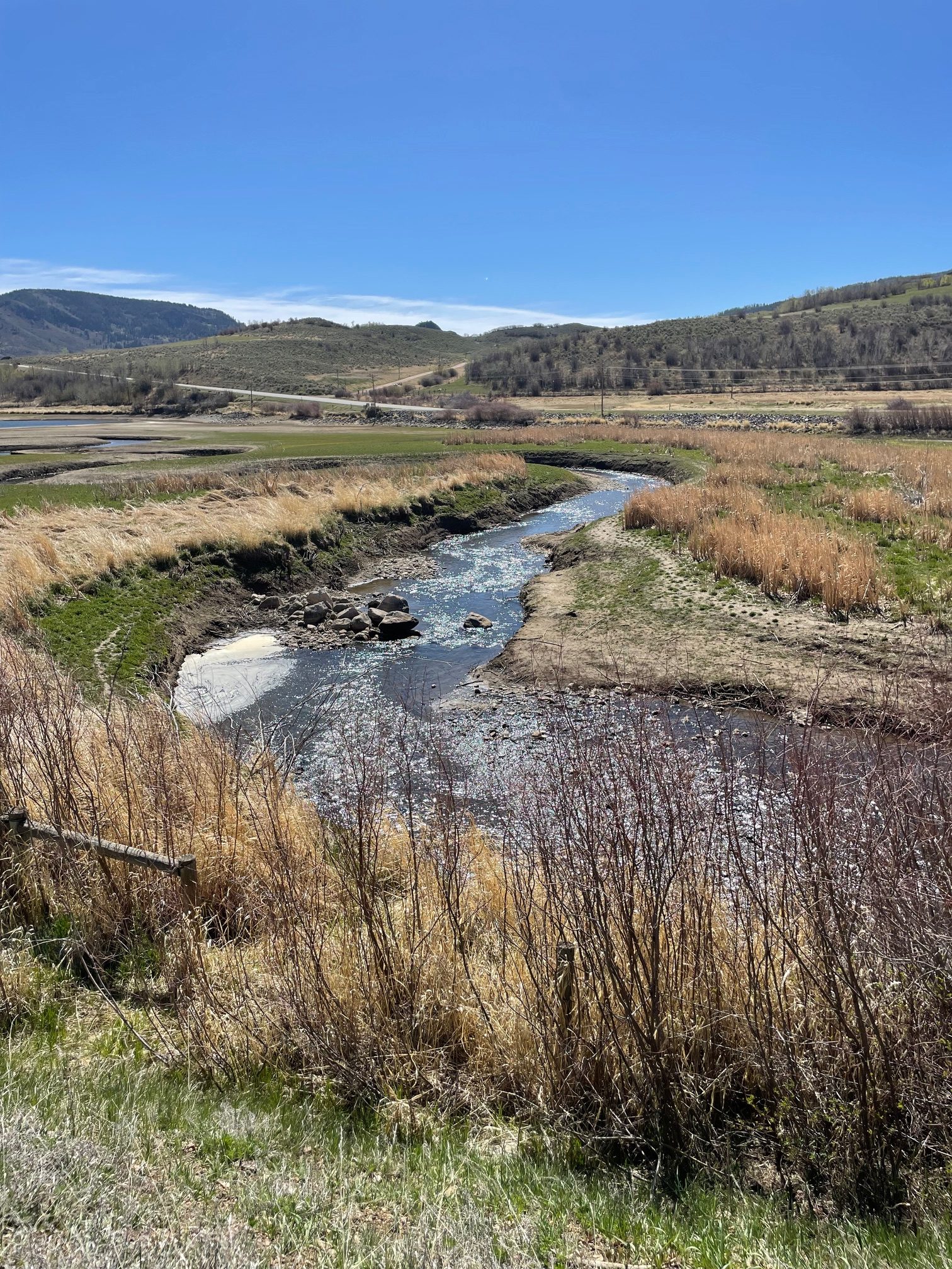
Yampa River inflow to Stagecoach Reservoir April 22, 2026. Photo credit: Scott Hummer

Click the link to read the article on the Steamboat Pilot & Today website (Elainna Hemming). Here’s an excerpt:

June 12, 2026

Ranchers are constantly adjusting to changing weather conditions and seasonal variations by nature. Jay Fetcher, of Fetcher Ranch in North Routt County, has documented snow melt dates for his hay meadows for each of the 75 years the ranch has been in the family, and said the variation is “incredible.” A year with low snowpack and a warm spring is just another condition to adjust to in the ranching world. This year, dryland hay broke dormancy early in Routt County, meaning cutting has already started, about two or three weeks earlier than usual. The low snowpack is not only generating concerns for ranchers with irrigated hay but water concerns for those with livestock. Despite these problems, the general consensus was that this year is expected to be below average, but not detrimental.

“People with dry land probably can expect some reduced yields, but I will say that the rains we’ve gotten over the last couple weeks have brought on grasses in dry land and pasture situation areas better than I would have anticipated,” said Todd Hagenbuch, the county director and agriculture agent for the Colorado State University Routt County Extension…

The second big concern from the lack of snowpack was water for cattle and other livestock. According to Hagenbuch, the snow runoff fills ponds and streams that the animals drink out of, but this year there’s simply no water in a lot of them. For ranchers whose ponds and streams are not filled, they have to haul water in for the livestock. 

“That’s the big issue is adequate water for livestock, and it will be all summer,” said Mucklow. Mucklow is currently not needing to haul water on his ranch, but he personally knows several ranchers who are in that position. 

Mucklow also said that there is a federal drought program conducted by the U.S Department of Agriculture that compensates ranchers who have to haul water. 

Having drinking water for his cattle was also a primary concern for Fetcher earlier in the season. “It was on my mind as we had no snowpack, and the snow was gone,” said Fetcher. On his ranch, they rely on the streams and springs for the cows in the pastures. Fetcher said the recent rains gave him a significant amount of moisture that eased his worries considerably. 

Yampa River Basin via Wikimedia.

South Platte River Basin #climate summary for the week ending June 15, 2026

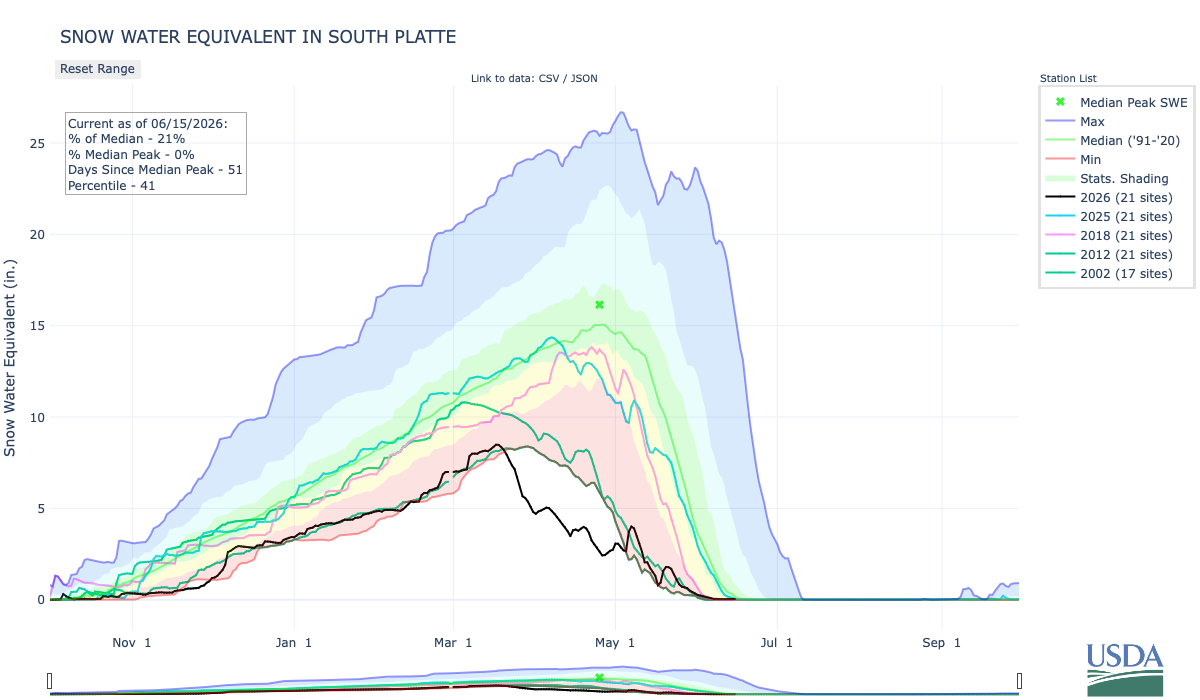
The South Platte river basin is pretty much melted out. Below is the June 15, 2026 Snow Water Equivalent in South Platte graph from the NRCS.

Below is the Precipitation Accumulation in South Platte graph from the NRCS for June 15, 2026. Precipitation is at 74% of the median and 58% of the water year median this morning. There are 107 days left in the water year.

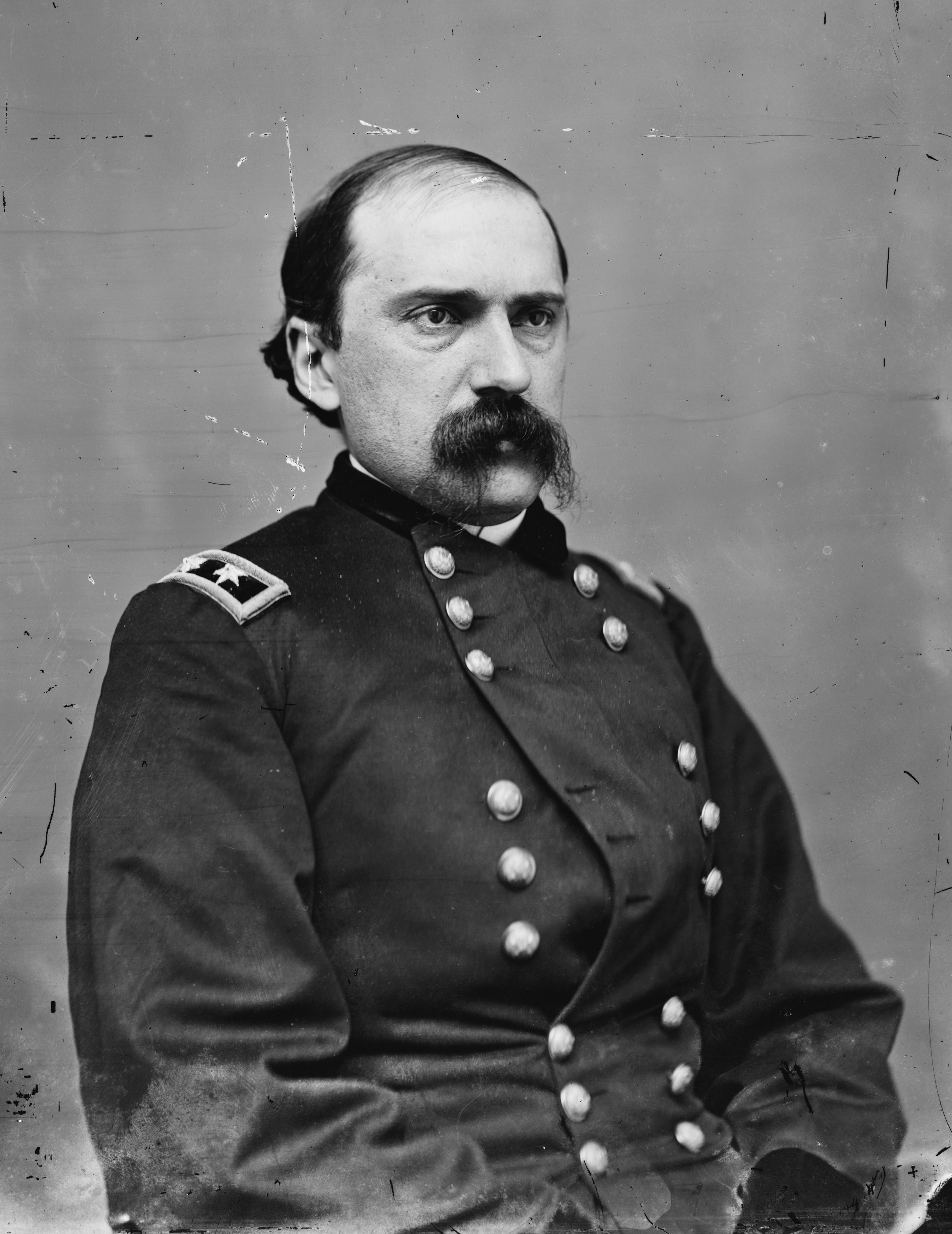
It looks sunny and warm all week in the central and northern mountains. It also looks sunny and warm all week down here in Denver where Edward M. McCook served as the 5th and 7th Governor of Colorado Territory. From Wikipedia; “On June 14, 1869, President Ulysses S. Grant appointed Edward M. McCook as the fifth governor of the Colorado Territory. McCook served during a critical period leading up to Colorado’s statehood in 1876…McCook’s administration coincided with the early years of irrigation development along the Front Range. During this period, communities began constructing many of the ditches and diversion systems that later became the foundation of Colorado’s prior-appropriation water rights system. The rapid agricultural growth of the 1870s was already underway by the time he took office…McCook was born in Steubenville, Ohio, on June 15, 1833. As a young man, he moved to the Kansas Territory and became a lawyer. He joined the Pike’s Peak Gold Rush in 1859 and represented the Pikes Peak region in the Kansas Territorial House of Representatives…In 1869, President Ulysses S. Grant appointed McCook Governor of the Territory of Colorado, a selection bitterly opposed by Jerome B. Chaffee, the Colorado Territorial Delegate to the United States House of Representatives. During his tenure, Governor McCook signed the legislation that created Colorado Agricultural College (now Colorado State University) and was among the first territorial governors to endorse women’s suffrage.”

General Edward M. McCook, U.S.A. By Mathew Benjamin Brady – Library of Congress Prints and Photographs Division. Brady-Handy Photograph Collection CALL NUMBER: LC-BH831- 935[P&P], Public Domain, https://commons.wikimedia.org/w/index.php?curid=1355339
Smith Ditch Washington Park, Denver

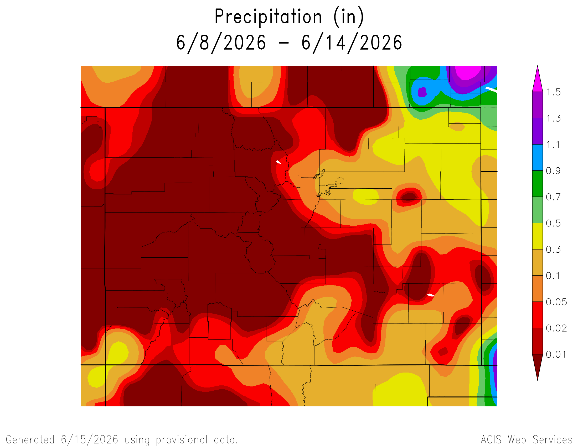
Here’s a look at the 7-Day Colorado precipitation map through June 14, 2026 from the High Plains Regional Climate Center. Precipitation in the South Platte Basin along the Continental Divide of the Americas ranged from 0.00” to 0.30”.

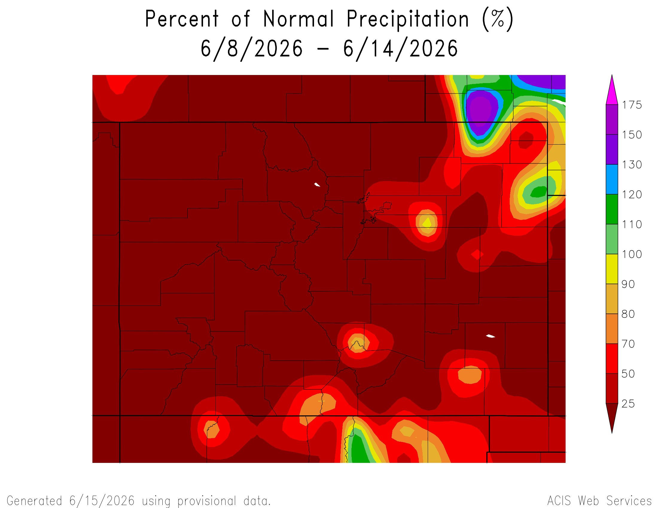
Here’s the 7-Day percent of normal precipitation map through June 14, 2026 from the High Plains Regional Climate Center. Precipitation in the South Platte River Basin along the Continental Divide of the Americas ranged from 0% to 50% of normal.

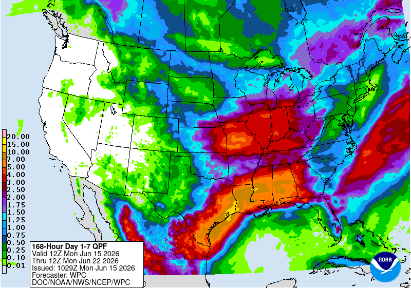
Here’s the 7-Day Quantitative Precipitation Forecast issued June 15, 2026 by NOAA. Precipitation is anticipated for the mountains of the South Platte River Basin and may total 0.50”.

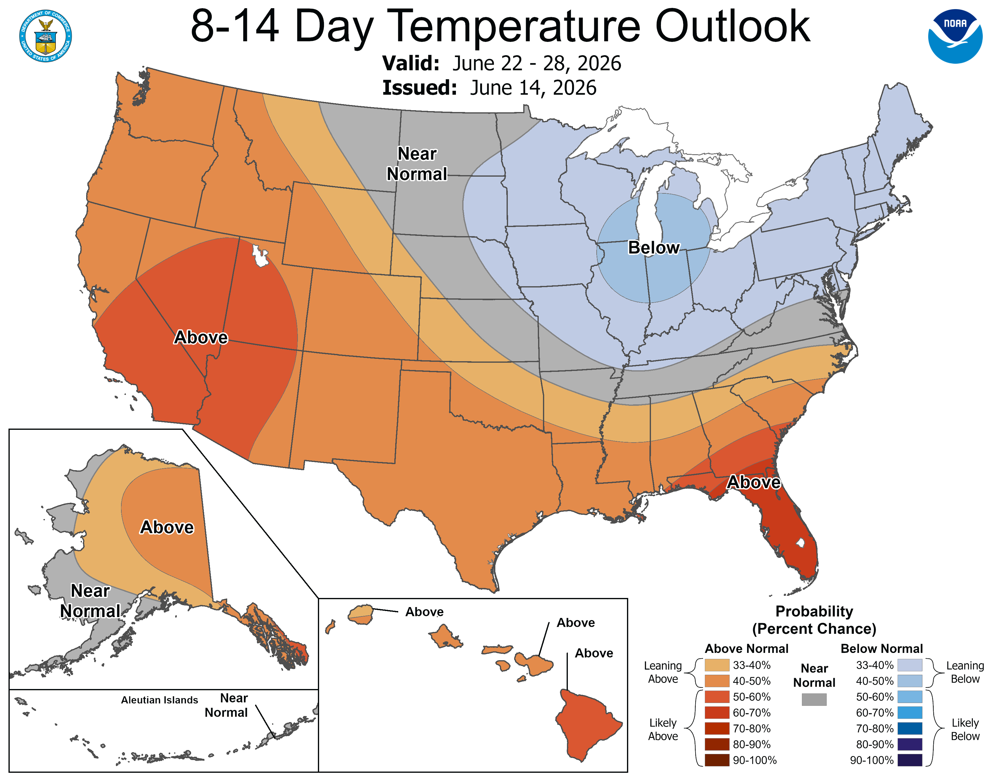
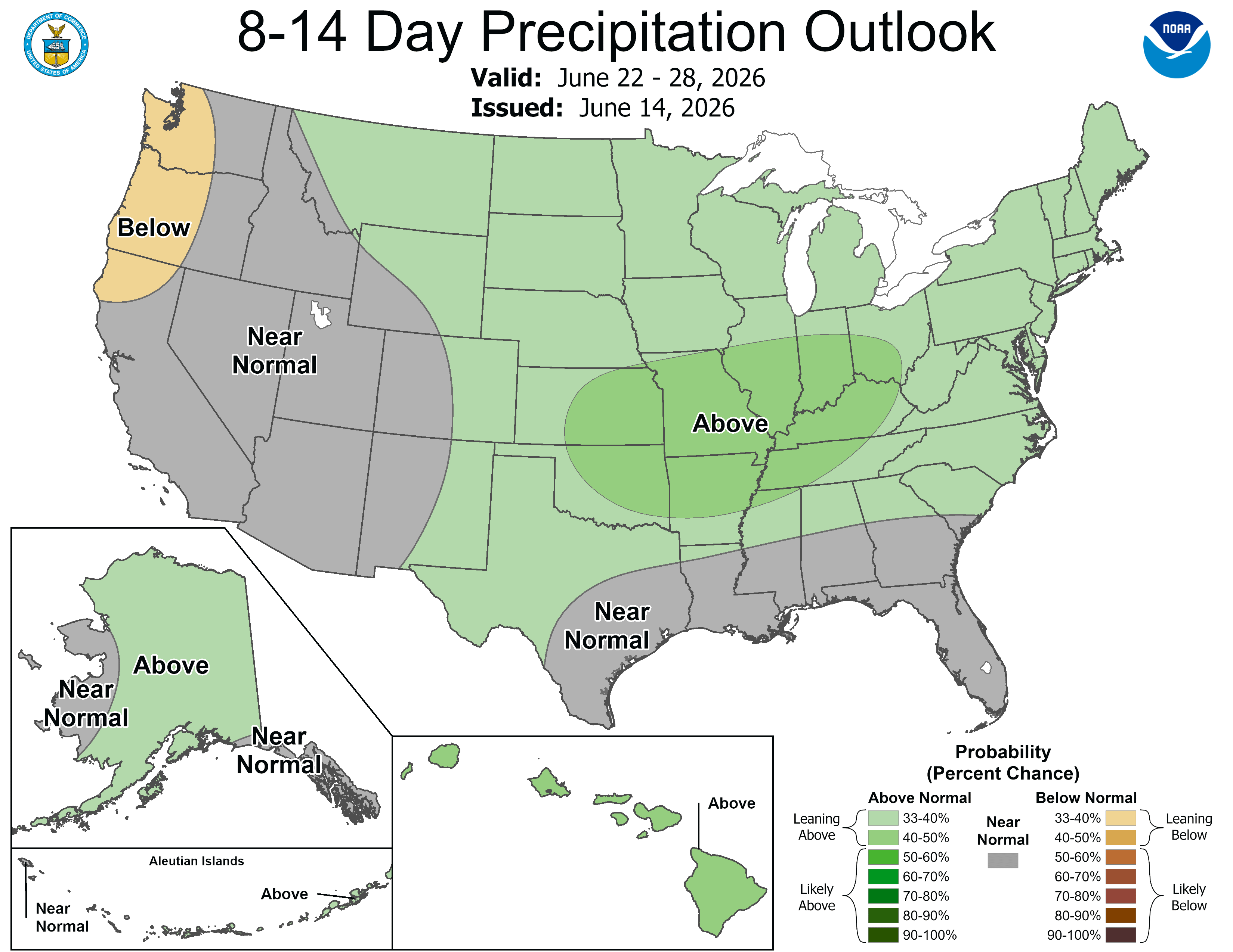
Below are the 8-14 day outlooks from the Climate Prediction Center, issued June 15, 2026, for temperature and precipitation, for the week starting June 22, 2026. The CPC expects above normal temperatures and above normal precipitation for the mountains of the South Platte River Basin.

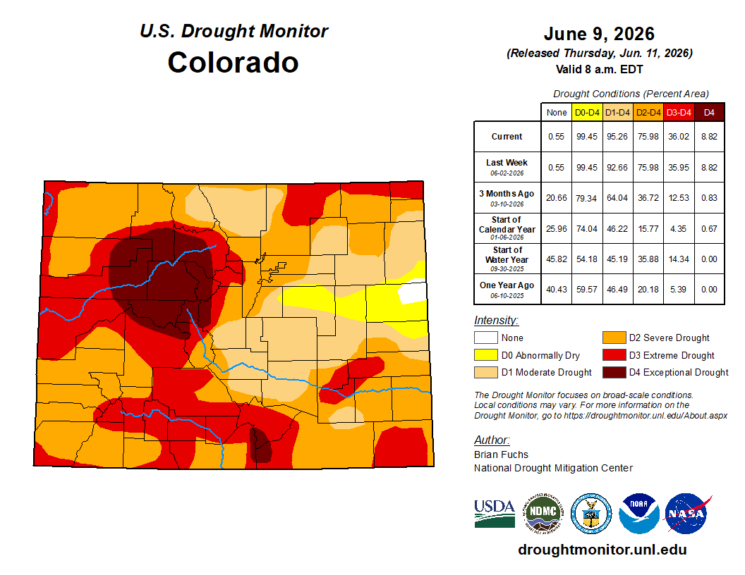
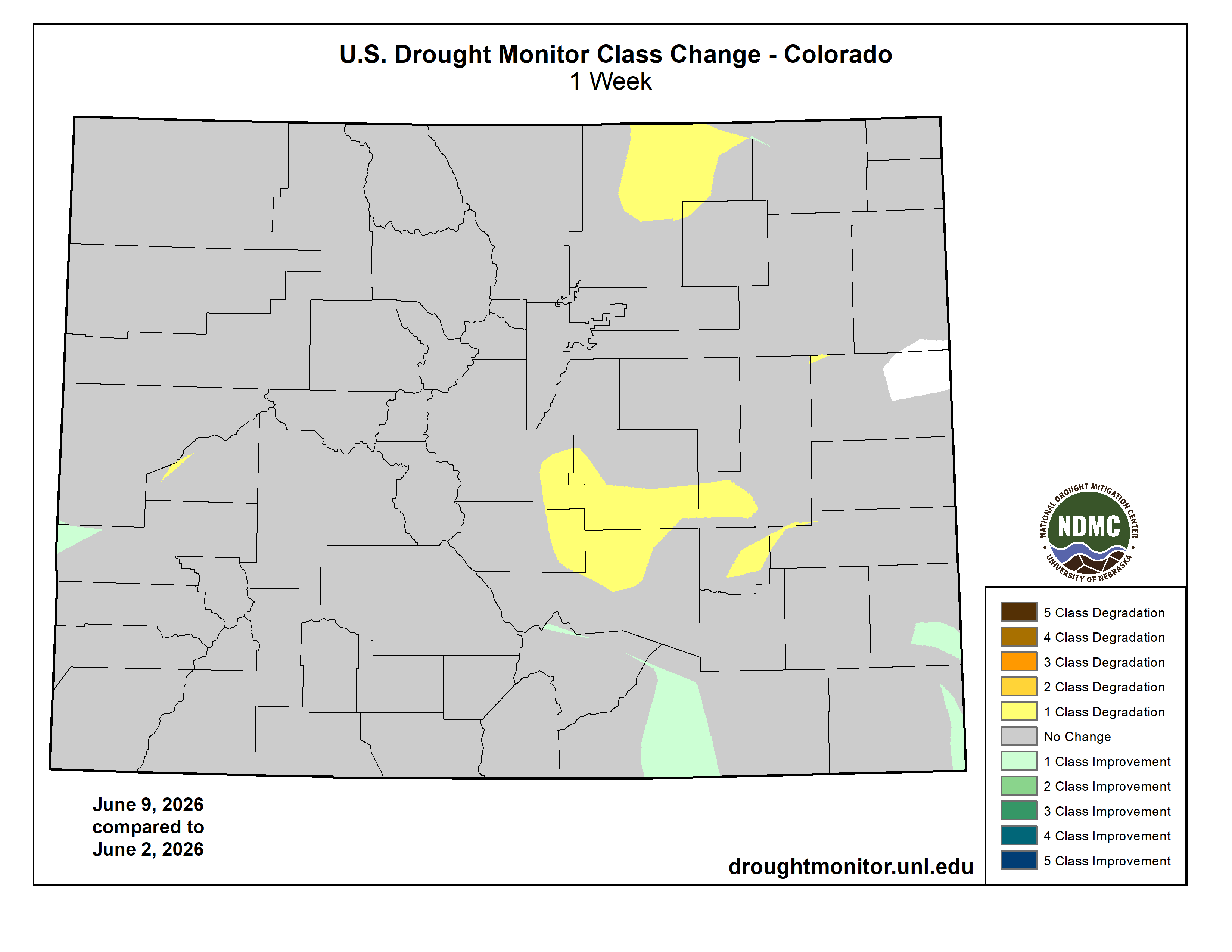
Below is the Colorado Drought Monitor map from June 9, 2026. There were one class degradations in Weld and Morgan counties, in the South Platte River Basin. Drought and abnormal dryness covers 99.45% of Colorado. The South Platte Basin is experiencing Abnormally Dry, Moderate, Severe, Extreme, and Exceptional drought conditions.

Colorado Drought Monitor map June 9, 2026.

Below is the Colorado Drought Monitor one week change map ending June 9, 2026.

Colorado Drought Monitor one week change map ending June 9, 2026.

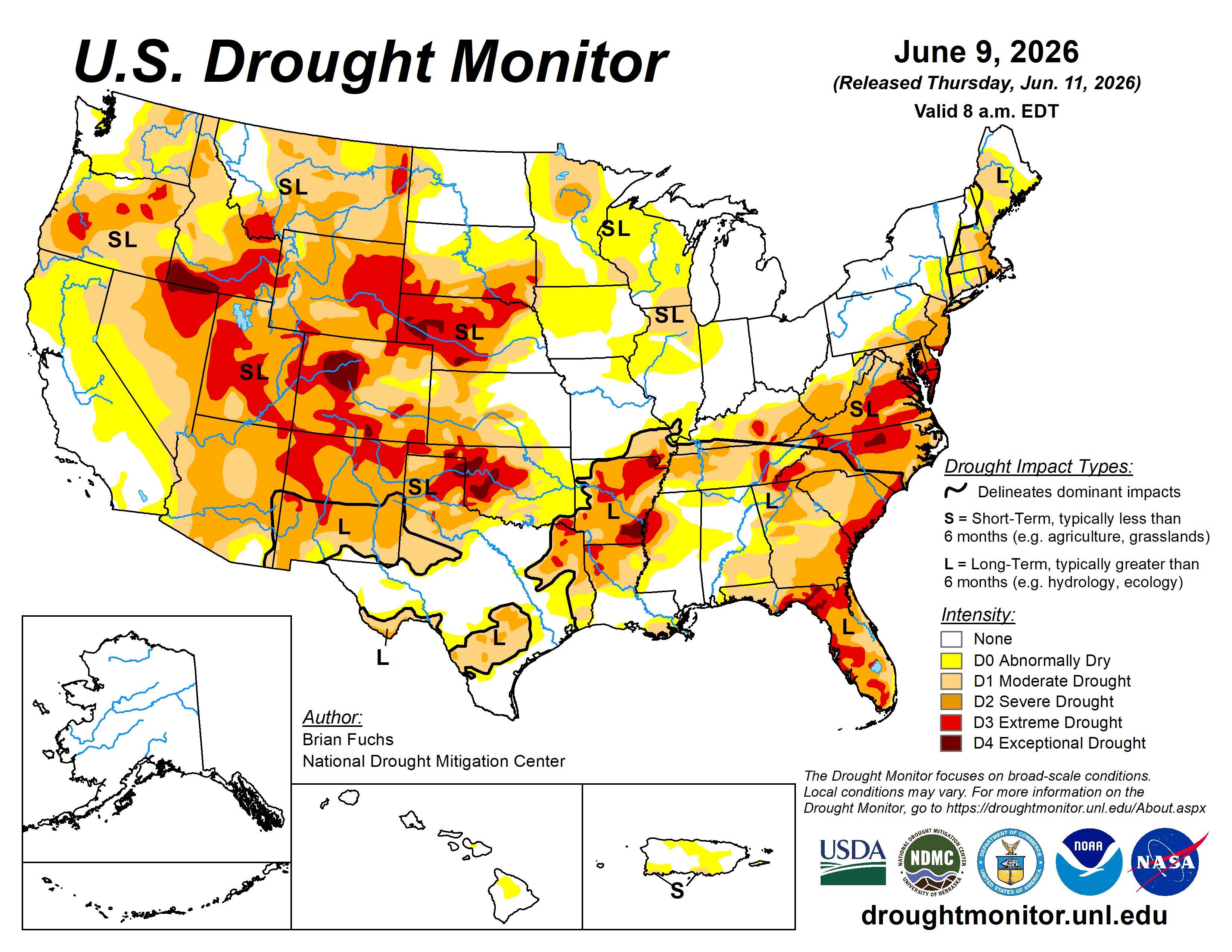
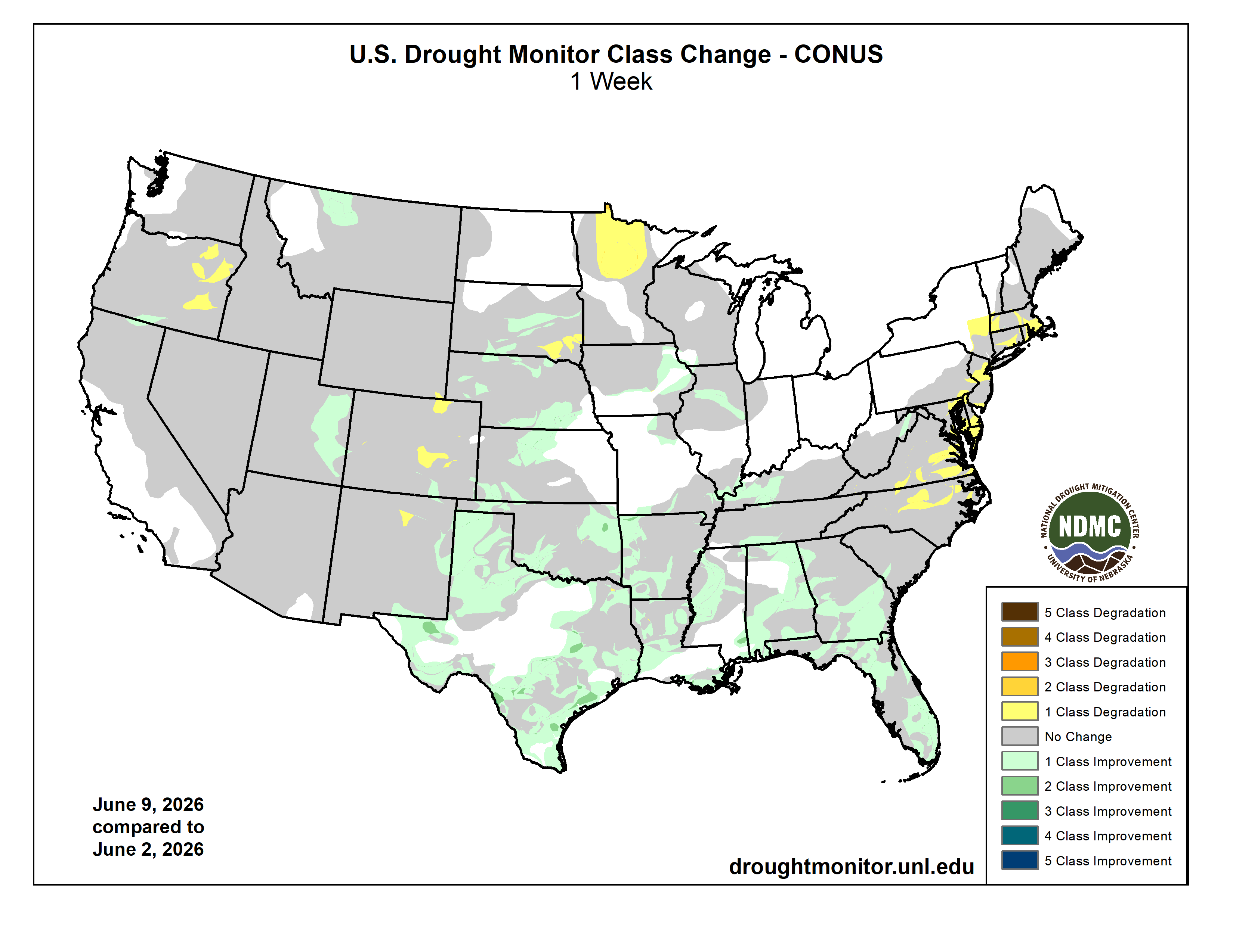
Here’s the US Drought Monitor Map from last week along with the one week U.S. change map.

US Drought Monitor map June 9, 2026.
US Drought Monitor one week change map ending June 9, 2026.

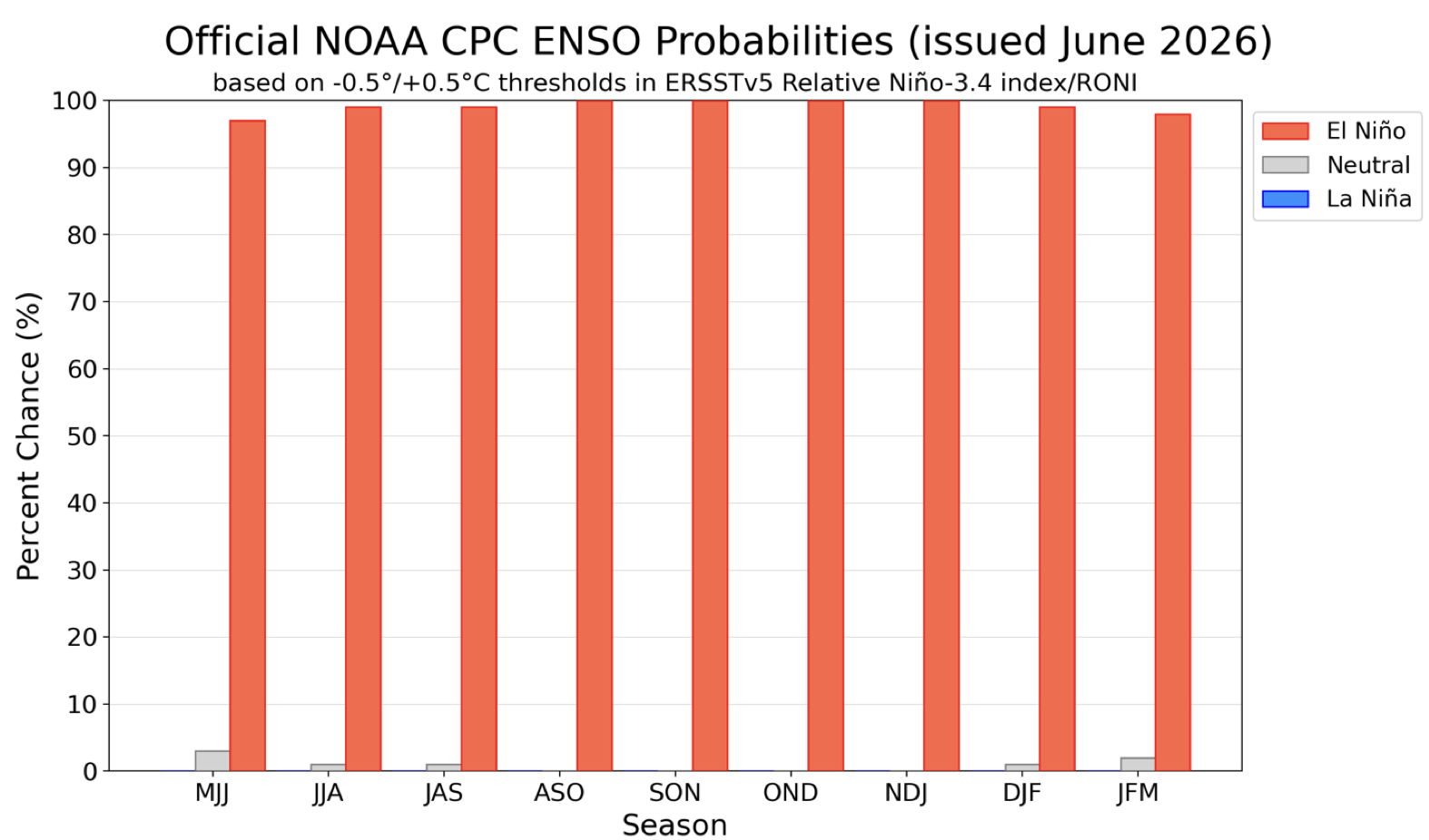
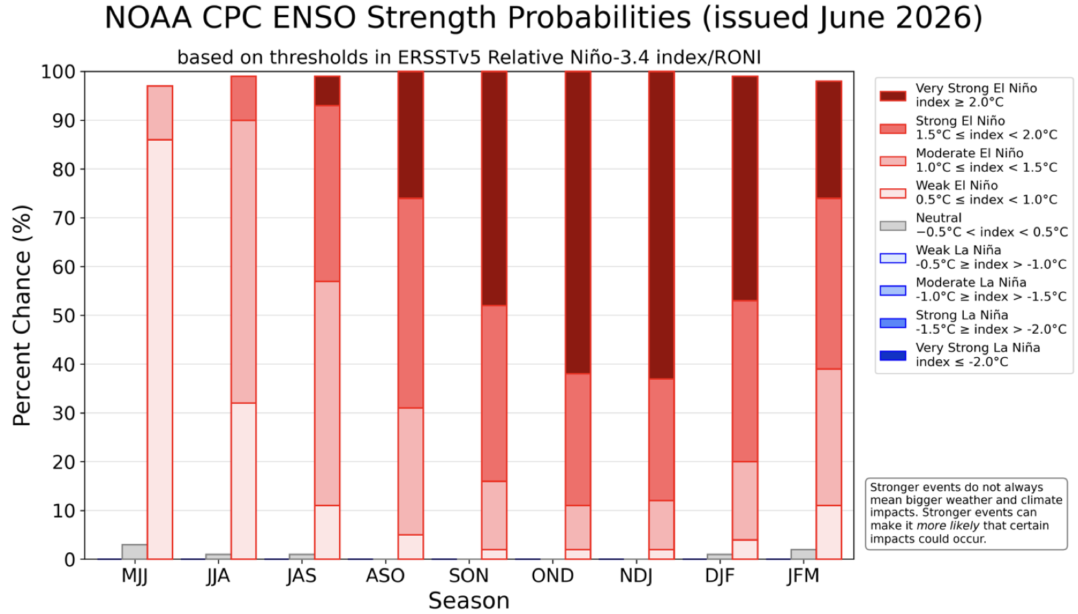
The Climate Prediction Center published their latest El Niño/Southern Oscillation (ENSO) diagnostic discussion last week. They write: “June 8, 2026, ENSO Alert System Status: El Niño Advisory. Synopsis: El Niño conditions are present and expected to strengthen into the Northern Hemisphere winter 2026-27.

Official ENSO probabilities for the Niño 3.4 relative sea surface temperature index (5°N-5°S, 170°W -120°W) minus tropical mean (20°N-20°S). The relative index is re-scaled to match the variance of the traditional index. Figure updated 11 June 2026. Higher resolution image/table: https://cpc.ncep.noaa.gov/products/analysis_monitoring/enso/roni/probabilities/