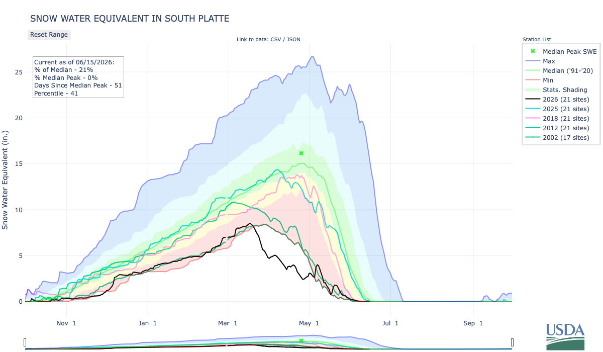
The South Platte river basin is pretty much melted out. Below is the June 15, 2026 Snow Water Equivalent in South Platte graph from the NRCS.
Below is the Precipitation Accumulation in South Platte graph from the NRCS for June 15, 2026. Precipitation is at 74% of the median and 58% of the water year median this morning. There are 107 days left in the water year.

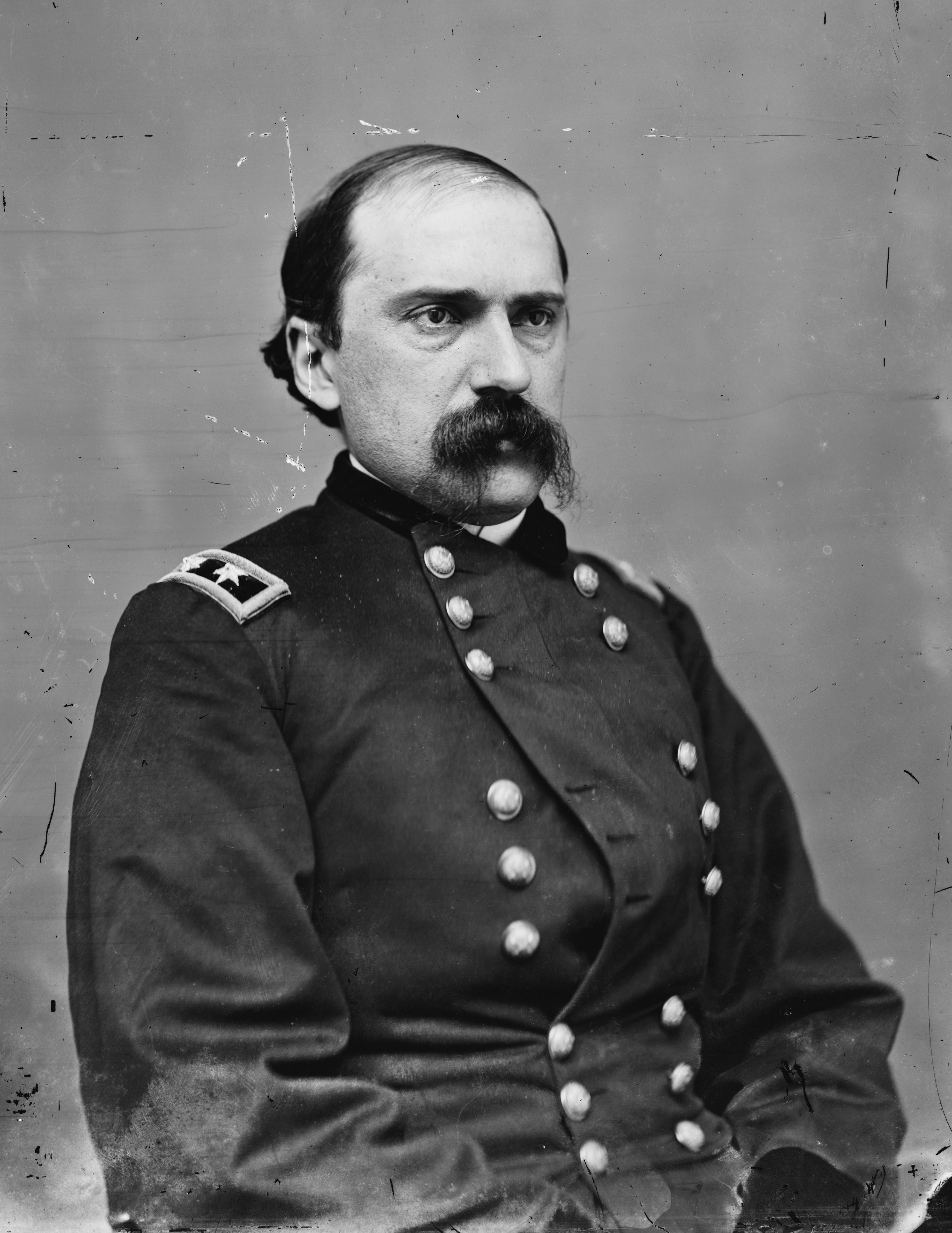
It looks sunny and warm all week in the central and northern mountains. It also looks sunny and warm all week down here in Denver where Edward M. McCook served as the 5th and 7th Governor of Colorado Territory. From Wikipedia; “On June 14, 1869, President Ulysses S. Grant appointed Edward M. McCook as the fifth governor of the Colorado Territory. McCook served during a critical period leading up to Colorado’s statehood in 1876…McCook’s administration coincided with the early years of irrigation development along the Front Range. During this period, communities began constructing many of the ditches and diversion systems that later became the foundation of Colorado’s prior-appropriation water rights system. The rapid agricultural growth of the 1870s was already underway by the time he took office…McCook was born in Steubenville, Ohio, on June 15, 1833. As a young man, he moved to the Kansas Territory and became a lawyer. He joined the Pike’s Peak Gold Rush in 1859 and represented the Pikes Peak region in the Kansas Territorial House of Representatives…In 1869, President Ulysses S. Grant appointed McCook Governor of the Territory of Colorado, a selection bitterly opposed by Jerome B. Chaffee, the Colorado Territorial Delegate to the United States House of Representatives. During his tenure, Governor McCook signed the legislation that created Colorado Agricultural College (now Colorado State University) and was among the first territorial governors to endorse women’s suffrage.”

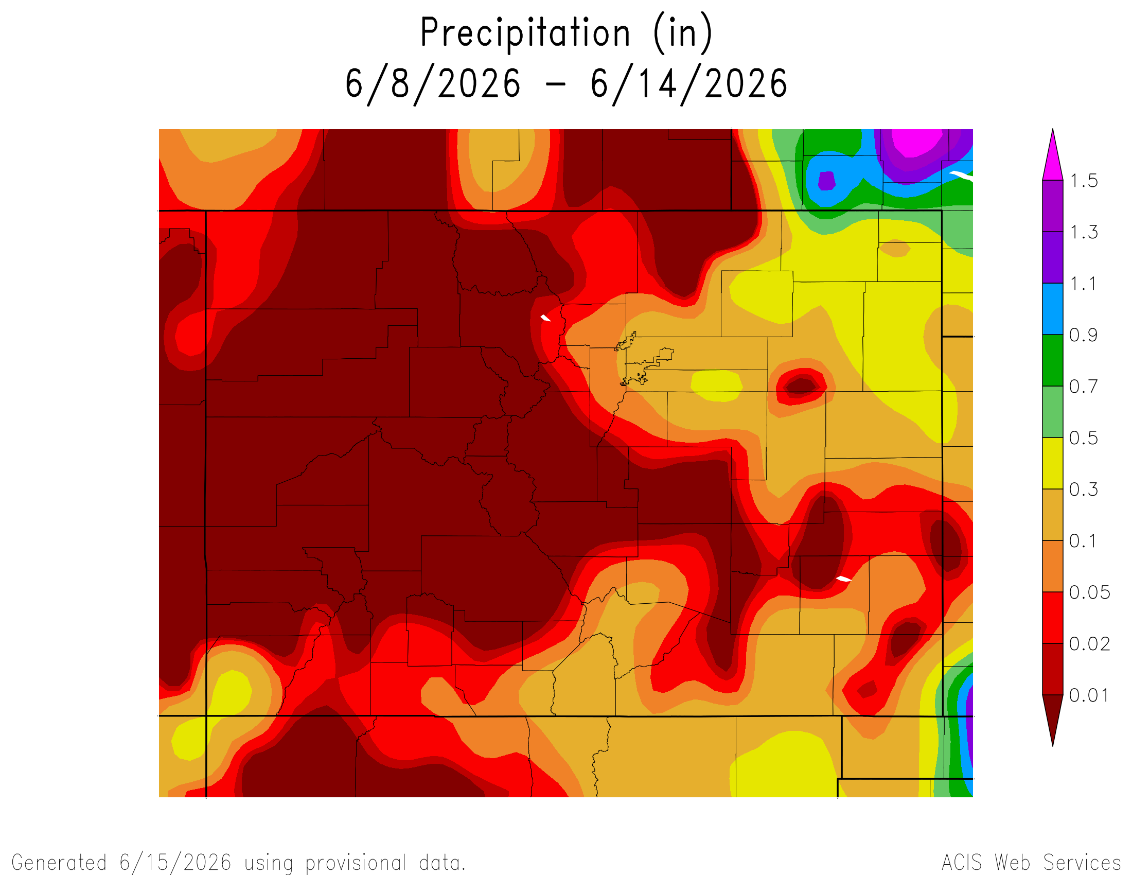
Here’s a look at the 7-Day Colorado precipitation map through June 14, 2026 from the High Plains Regional Climate Center. Precipitation in the South Platte Basin along the Continental Divide of the Americas ranged from 0.00” to 0.30”.
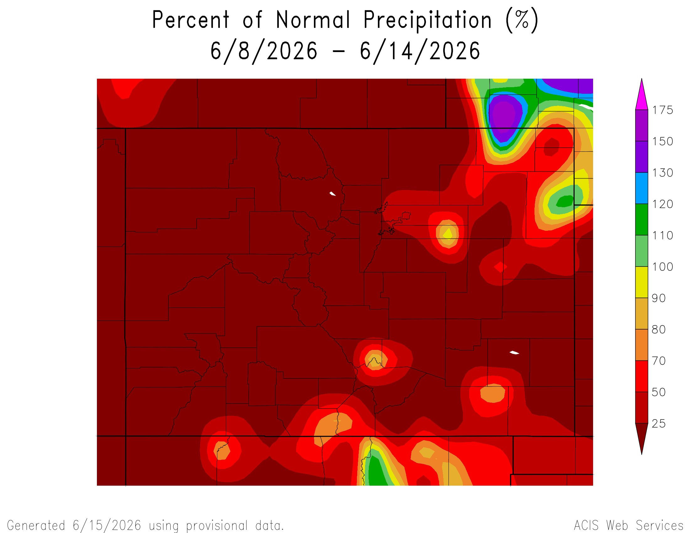
Here’s the 7-Day percent of normal precipitation map through June 14, 2026 from the High Plains Regional Climate Center. Precipitation in the South Platte River Basin along the Continental Divide of the Americas ranged from 0% to 50% of normal.
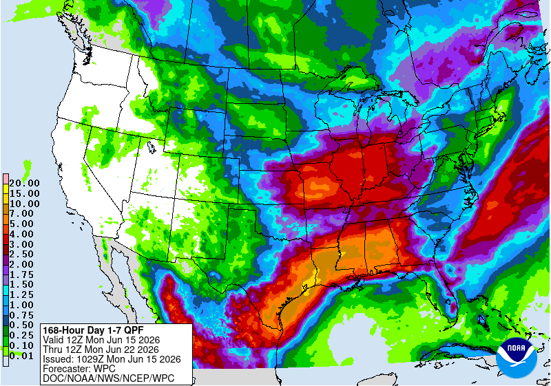
Here’s the 7-Day Quantitative Precipitation Forecast issued June 15, 2026 by NOAA. Precipitation is anticipated for the mountains of the South Platte River Basin and may total 0.50”.
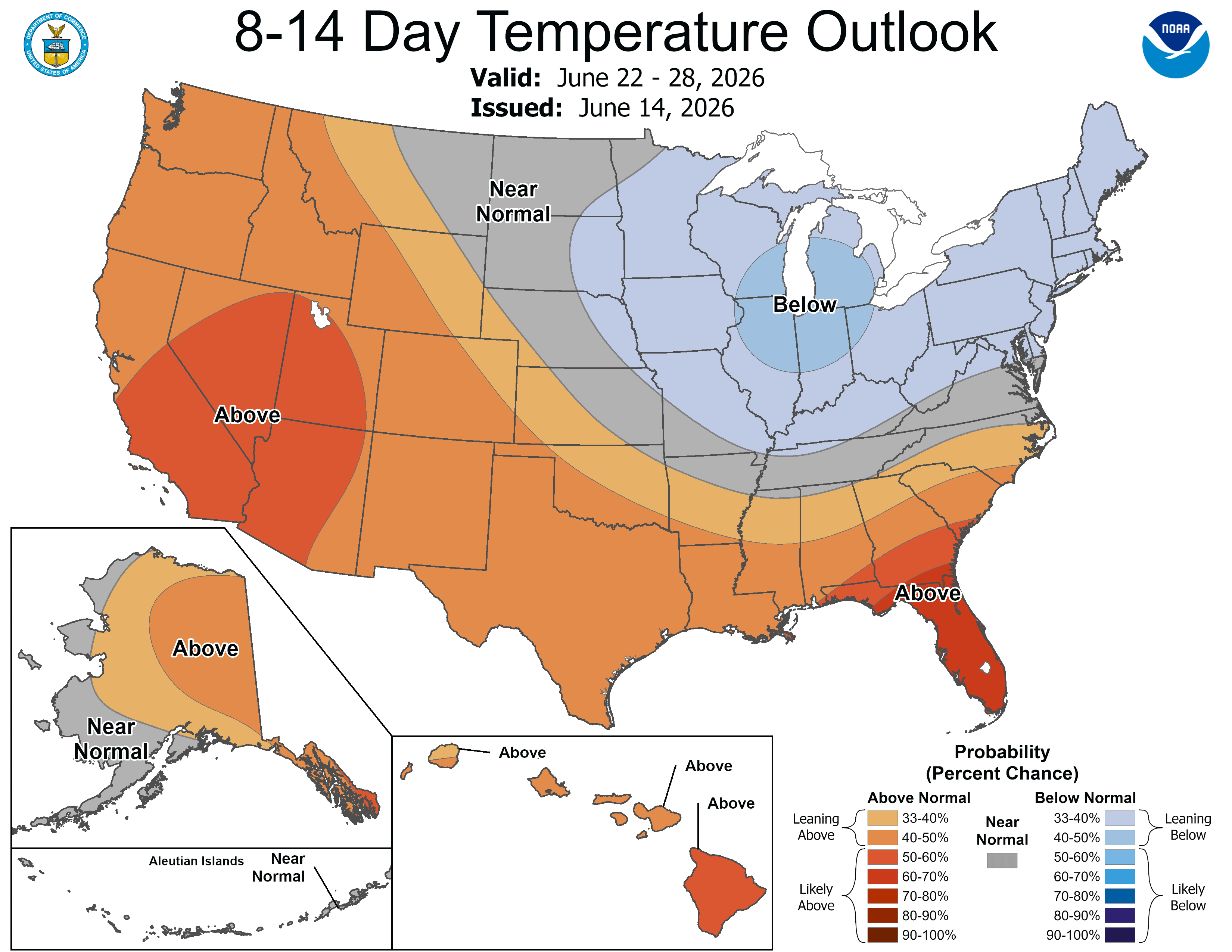
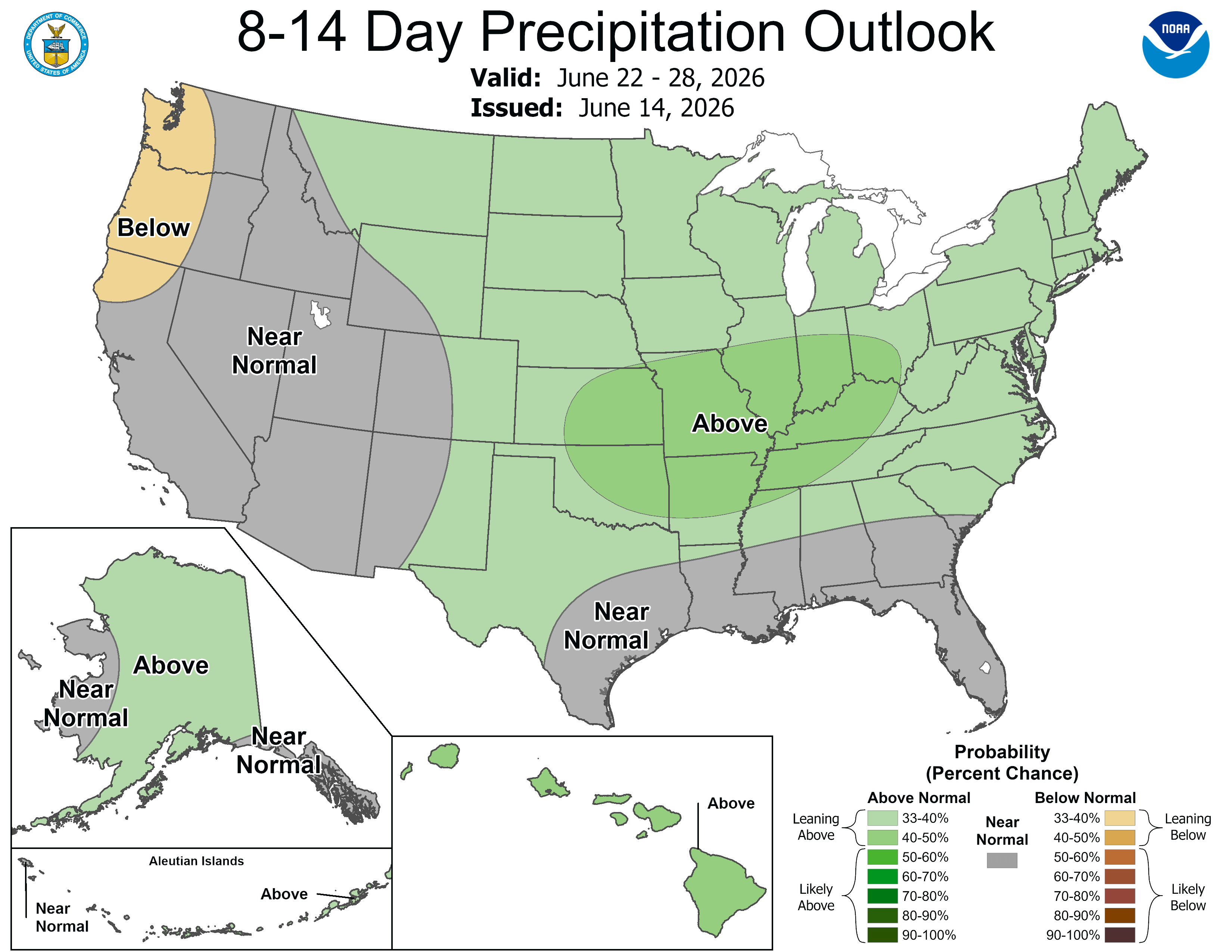
Below are the 8-14 day outlooks from the Climate Prediction Center, issued June 15, 2026, for temperature and precipitation, for the week starting June 22, 2026. The CPC expects above normal temperatures and above normal precipitation for the mountains of the South Platte River Basin.
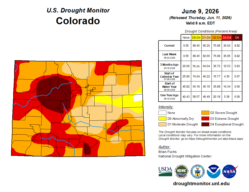
Below is the Colorado Drought Monitor map from June 9, 2026. There were one class degradations in Weld and Morgan counties, in the South Platte River Basin. Drought and abnormal dryness covers 99.45% of Colorado. The South Platte Basin is experiencing Abnormally Dry, Moderate, Severe, Extreme, and Exceptional drought conditions.
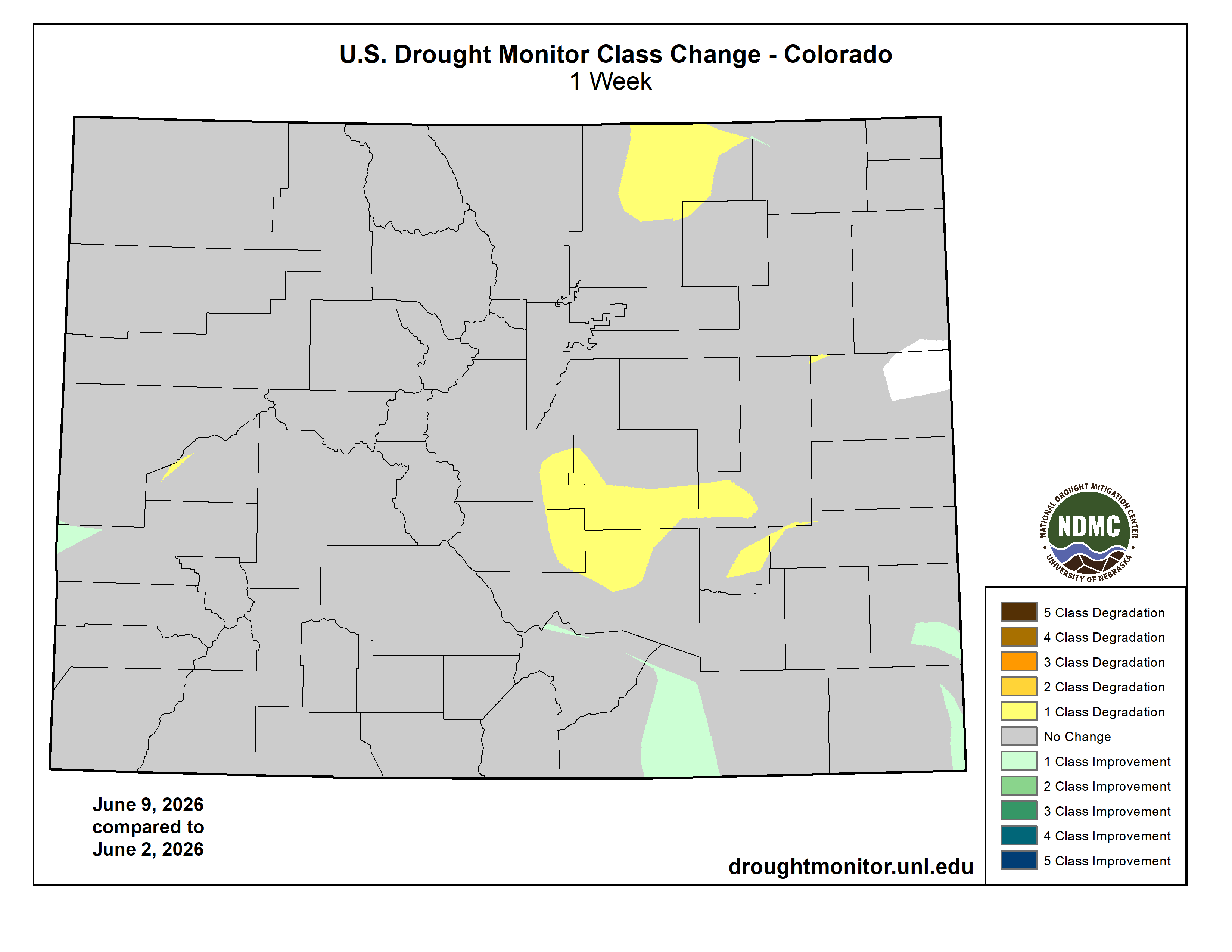
Below is the Colorado Drought Monitor one week change map ending June 9, 2026.
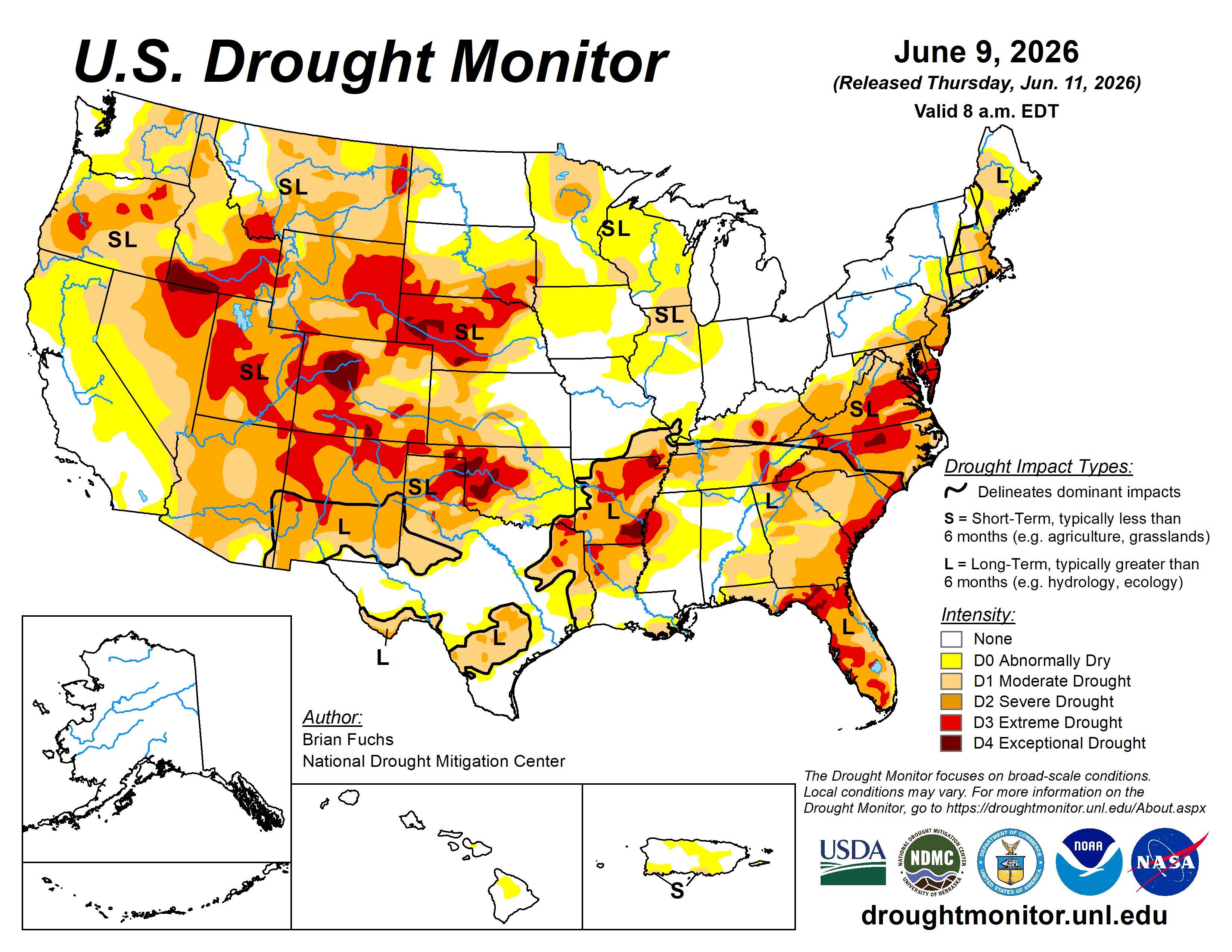
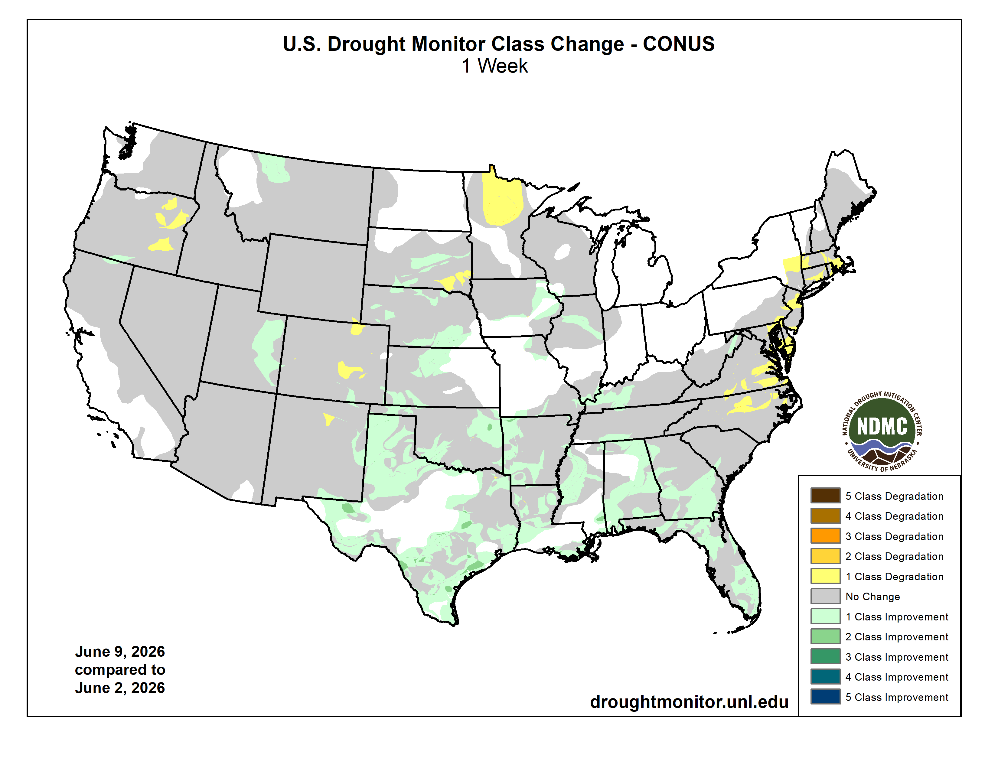
Here’s the US Drought Monitor Map from last week along with the one week U.S. change map.
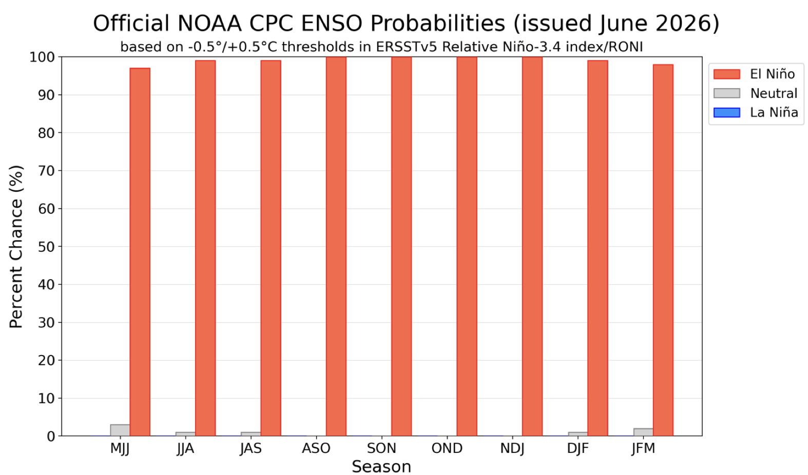
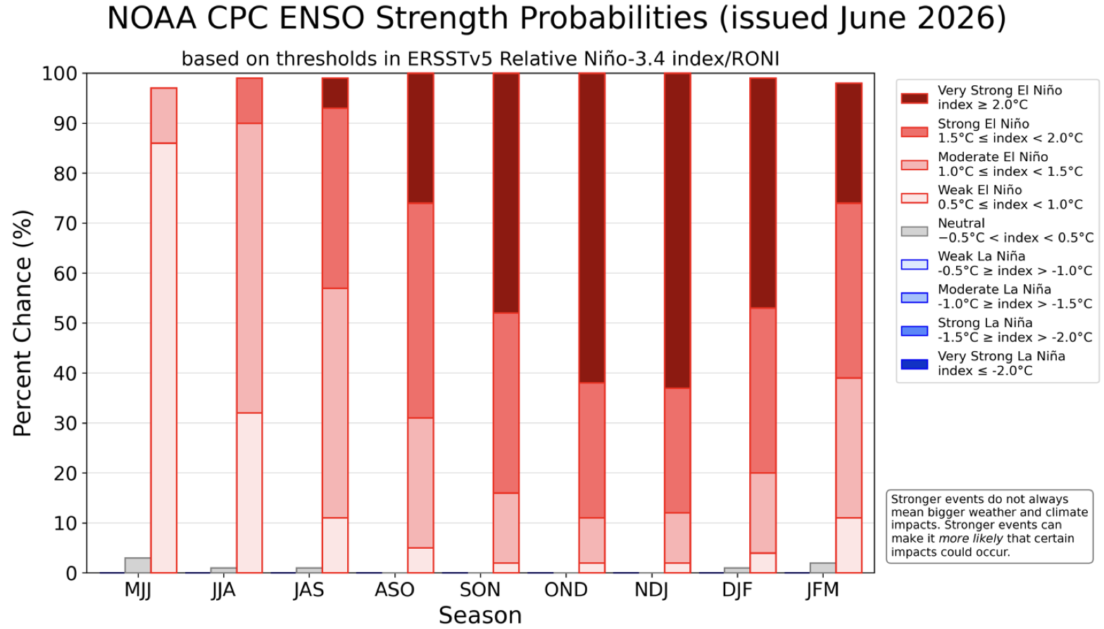
The Climate Prediction Center published their latest El Niño/Southern Oscillation (ENSO) diagnostic discussion last week. They write: “June 8, 2026, ENSO Alert System Status: El Niño Advisory. Synopsis: El Niño conditions are present and expected to strengthen into the Northern Hemisphere winter 2026-27.“