City Spokesperson Todd Barnes said the city will decide between three ways to move forward: asking for a rehearing at the Court of Appeals, appealing to the Colorado Supreme Court or applying for a new permit. The project will now cost the city an additional $126 million because of the delays and increase in labor and steel costs.
“While we are disappointed with the court’s ultimate decision, we appreciated that the court acknowledged Thornton’s lengthy and active efforts to work with Larimer County and its citizens as we went through the permit process,” said Barnes…
The Larimer County Planning Commission voted to deny the permit on May 16, 2018. In response, Thornton worked to address the concerns raised by the Commission. Thornton then submitted a revised application, which included changing the preferred route: a corridor approach that was recommended by the Commission. With the new edits, the Commission recommended to the Board of Commissioners to approve the project. However, the Board voted unanimously to deny the application on Feb. 11, 2019, saying the project did not meet seven of the 12 criteria. Thornton took the decision to the District Court, claiming the board abused its discretion in denying Thornton’s application. While the Board said that seven of the criteria weren’t met, the District Court ruled that there were only three instances with competent evidence to support the Board’s conclusion. Thornton appealed the decision at the Court of Appeals, who dealt a blow to Thornton, but recognized the Board’s abuse of power.
“Although we agree with Thornton that the Board exceeded its regulatory powers in several respects, we ultimately affirm its decision to deny the permit application,” they wrote in the opinion…
The Larimer Board of County Commissioners also recommended Thornton use the river, but Thornton said that running that water through the City of Fort Collins would degrade the water. The Court of Appeals said the method would also require modification of the water decree and ruled in favor of Thornton. As well, that court noted that making that request is outside of the Board’s power. Additionally, the Court of Appeals ruled the Board abused its discretion by suggesting Thornton’s potential use of eminent domain weakened its application because it was “disfavored by property owners.” The Court said that can’t be considered in the 1041 process.
“It is clear that the Board may not consider Thornton’s potential use of eminent domain during its 1041 review,” the judges wrote.
Thornton Water Project route map via ThorntonWaterProject.com
Click the link to read the article on the NASA website:
The rugged, steep Rocky Mountains rise abruptly in the middle of Colorado, splitting the state roughly in half between the western high country and the eastern plains. The extreme contrast of these landscapes also brings an extreme disparity in water.
The Western Slope receives 80 percent of the state’s precipitation, as weather systems rising to cross the continental divide shed their loads of rain and snow before moving east. Water that falls to the west of the divide drains toward the Pacific Ocean, while water that falls to the east runs toward the Gulf of Mexico and Atlantic.
The plains of eastern Colorado, however, are semi-arid. In 1820, explorer Stephen Harriman Long—for whom Long’s Peak is named—famously dismissed it as a “Great Desert” unsuitable for agriculture. But the sandy, loamy soil can make fertile farmland when irrigated.
Grand River Ditch
In the mid- to late-19th century, the Gold Rush and the arrival of the railroad brought an influx of settlers to Colorado, including ranchers and farmers. Then in the 1880s, the plains received higher-than-average precipitation. The new settlers plowed under native drought-resistant grasses and used eastern farming techniques to grow wheat and corn, practices that would later contribute to soil erosion and the Dust Bowl.
When drier conditions returned, the residents looked to the Rocky Mountain snowpack and the Colorado River, then known as the Grand River, as a reliable source of water for irrigation. One of the first efforts to tap that supply was the Grand River Ditch. Beginning in 1900, the ditch diverted water from the Never Summer Mountains through Poudre Pass and into the Cache la Poudre River.
First water through the Adams Tunnel. Photo credit Northern Water.
In the early 1930s, during the Great Depression and the Dust Bowl drought, farmers and their representatives formed the Grand Lake Committee and conceived a more ambitious plan to divert water from the Western Slope of the Rockies and connect the Colorado and Big Thompson rivers. After much negotiation, construction of the Colorado-Big Thompson Project was begun by the U.S. Bureau of Reclamation in 1938. By the time it was completed and declared fully operational in 1957, it comprised 18 dams, 12 reservoirs, six hydroelectric plants, 95 miles (150 kilometers) of canals, and 35 miles (55 kilometers) of tunnels. The most critical of these is the tunnel that runs 13 miles (21 kilometers) under Rocky Mountain National Park and was named for U.S. Senator Alva B. Adams, who championed the project in Congress.
In 1940, two teams of workers began tunneling from either side of Rocky Mountain National Park: one from the West Portal at Grand Lake and one from the East Portal southwest of Estes Park, Colorado. In 1944, when the drilling teams met thousands of feet below the continental divide, the two sides of the tunnel were misaligned by just the width of a penny. The complex task of lining the 9.75-foot (3-meter) diameter tunnel with concrete took a few more years before first water flowed through the tunnel in 1947.
The portals are visible in the image above, which was acquired on September 2, 2021, with the Operational Land Imager (OLI) on Landsat 8 and overlain with topographic data from the Shuttle Radar Topography Mission (SRTM).
Photo credit: NASA
Snowmelt and runoff collected in Lake Granby is pumped to a canal that flows into Shadow Mountain Reservoir and Grand Lake, where it enters the West Portal of the Adams tunnel. Upon exiting the East Portal, the water flows into the Wind River toward Mary’s Lake, then proceeds through other tunnels and canals to multiple Front Range reservoirs. Between the West and East portals, the tunnel’s elevation drops 109 feet (33 meters). Driven by the force of gravity, water flows through the tunnel at a rate of 550 cubic feet (15.5 cubic meters) per second—traveling the length of the tunnel in about two hours.
It was a $160 million feat of civil engineering (roughly equivalent to $2 billion in today’s dollars). But it was not achieved without some controversy. Many residents of the Western Slope felt they were not being adequately compensated for the loss of water. Conservationists feared the project would despoil the natural beauty of Rocky Mountain National Park. The project proceeded after officials reached an agreement to construct the Green Mountain dam and reservoir to store water on the Western Slope, and to move the tunnel portals outside the boundaries of the national park.
Today, the Colorado-Big Thompson project delivers 200,000 acre-feet of water a year to northeastern Colorado, quenching the thirst of one million residents and irrigating more than 600,000 acres of farmland. Although the diversion project was initially built to irrigate farms and fields, it now also supplies water for cities and towns, industry, hydropower generation, recreation, and fish and wildlife. In Colorado, where more than 80 percent of the people live where only 20 percent of the precipitation falls, such transbasin water diversions have become a part of life.
NASA Earth Observatory images by Joshua Stevens, using Landsat data from the U.S. Geological Survey and topographic data from the Shuttle Radar Topography Mission (SRTM). Story by Sara E. Pratt.
Map of the Colorado-Big Thompson Project via Northern Water
With five of Greeley’s six high mountain reservoirs in the burn area, erosion is expected to carry sediment into Greeley’s water supply. Left untreated, that could affect the city’s water quality. But officials are already planning to make sure that doesn’t happen.
The Cameron Peak fire ignited on August 13 on the Arapaho and Roosevelt National Forest near Cameron Pass and Chambers Lake. Credit: Inciweb
“When fires burn, if they’re hot enough, they can actually burn underbrush and soil,” said Adam Jokerst, Greeley’s deputy director of Water Resources, adding that vegetation is burned up as well. “With the lack of the vegetation … you can get increased erosion when it rains or when the snow melts.”
That erosion carries sediment into the Poudre River, which pulls water from the reservoirs to supply water for the city. Water with high sediment content can be harder to treat, Jokerst said, but it is possible to treat safely.
For better or for worse, Jokerst said, Greeley water officials have a lot of experience handling erosion into the water supply after dealing with the impacts of the High Park Fire in 2012. That fire burned more than 87,000 acres, making it the sixth-largest in state history.
There are at least a few steps to take to mitigate erosion impacts: aerial mulching, felling trees and adding flocculants during the treatment process. For aerial mulching, crews drop shredded wheat chips or straw from a helicopter. The mulch reduces erosion and helps with revegetation. Cutting down the burned trees and letting them fall into the gullies and rills — the channels created in the soil by water erosion — prevents stormwater and meltwater from carrying added erosion into the water supply.
Jokerst said it’s common to see the water get murkier during the runoff season every year. To provide clean, clear drinking water when that happens, crews use more flocculants, which are chemicals that help to separate the water from the sediment, in the treatment process. If there’s very high sediment content at the Bellvue Treatment Plant, officials can turn off the plant so it stop pulling water from the Poudre, Jokerst said. The city can then use the Boyd Treatment Plant…
If the fire keeps on into snowfall season in the winter, Jokerst said crews will have to wait until the spring to start on erosion control measures. Greeley officials are working with the city of Fort Collins, Northern Water and the Coalition for the Poudre River Watershed, a nonprofit Jokerst said will be a key entity in the post-fire recovery.
Long Draw Reservoir
Chambers Reservoir July 2016. Photo credit: Greg Hobbs
Judge Juan Villasenor issued an order in 8th Judicial District Court on Sunday, granting the request of both No Pipe Dream and Save the Poudre to “intervene” in the lawsuit, essentially allowing both groups to back Larimer County’s decision to deny a permit for a section of water pipeline.
The ruling states that both groups have an interest in the decision of whether the pipeline can be built to carry water from the Poudre River to Thornton, but that “neither organization nor their members’ interests are entirely or adequately represented by the existing parties.”
[…]
The judge agreed in his ruling that those residents could be adversely affected by the pipeline and rejected Thornton’s argument that they should not have a say in the suit. He ruled that the group does have a legitimate interest in the case and is seeking the same result as the Larimer County — a court decision upholding the commissioners’ permit denial.
“Thornton contends — facetiously in the Court’s view — that the interests that the No Pipe seeks to protect aren’t germane to its purpose,” the ruling states, stressing that the residents’ interests could be harmed if the pipeline were built along either route.
“The outcome of this litigation could result in a loss of property through loss of the property itself, use, access or quiet enjoyment,” the ruling states, adding “Thus, No Pipe has an interest in the outcome of the litigation.”
[…]
The judge also allowed a second group, Save the Poudre, to join the lawsuit because, like No Pipe Dream, the nonprofit was involved in the process all along and is seeking the same result as Larimer County.
DENVER — Beneath the dim red glow of string lights at the Mercury Cafe in downtown Denver, about 25 people gathered Tuesday afternoon to rally support for a lawsuit against the state on behalf of the Colorado River.
The case, the first of its kind in the United States, has the potential to shift American environmental law by granting nature a legal standing. The suit lists “the Colorado River Ecosystem” as the plaintiff along with people who hope to serve as “next friends” for the river and represent its interests in court.
Five potential next friends were named in the original complaint — Deanna Meyer, Jennifer Murnan, Fred Gibson, Susan Hyatt and Will Falk — all members of the environmental group Deep Green Resistance, which states its goal is to “deprive the rich of their ability to steal from the poor and the powerful of their ability to destroy the planet.”
In an amended complaint, filed on Nov. 6, two more “next friends” were added to the case.
Owen Lammers of Moab is the executive director of Living Rivers, “which empowers a movement to realize social-ecological balance within the Colorado River watershed,” the amended complaint states. Living Rivers is a member of the Waterkeeper Alliance, a New York-based nonprofit dedicated to clean water founded by Robert F. Kennedy Jr.
“Because of Mr. Lammer’s significant relationship with, and dedication to, the Colorado River ecosystem, he is qualified to serve as next friend,” the amended complaint states.
This is a change from the original complaint, which did not cite any particular relationship between the Colorado River and the members of Deep Green Resistance.
Also added to the case was John Weisheit, who is “the person designated as the on-the-water ‘keeper’ per the Waterkeeper Alliance policies. In other words, Mr. Weissheit is the ‘Colorado Riverkeeper,'” the amended complaint states.
Weisheit, 63, “has enjoyed the Colorado River and its tributaries since childhood,” the complaint says. A resident of Moab, he’s been a river guide since 1980 and “continues to lead river trips that support scientific research and public education, in fulfillment of Colorado Riverkeeper’s mission statement.”
Weisheit is also a co-author of the 2004 book “Cataract Canyon, a human and environmental history of the rivers in Canyonlands,” which is a detailed 268-page guide to the “center of the universe.”
Jason Flores-Williams, the lawyer representing members of Deep Green Resistance in Colorado River Ecosystem v State of Colorado, speaks at a rights-for-nature meeting at the Mercury Cafe in Denver on Nov. 14, 2017. The state has moved to dismiss the lawsuit, and is expected to do so again in response to a recently amended complaint filed by Flores-Williams.
Signs of protest
Though the novel case is seeking personhood for the Colorado River ecosystem, the suit’s proponents hope to use it as a launching pad for a broader rights-of-nature movement.
“For you or I to defend a river in court right now we have to show how injury to the river injured us,” said Mari Margil, the associate director for the Pennsylvania-based Community Environmental Legal Defense Fund, a rights-for-nature legal group and a legal adviser on the Colorado River case. “There is a growing understanding that our environmental laws are starting in the wrong place.”
Rather than maneuvering within existing environmental law, where nature is considered property, rights-of-nature lawsuits seek to give the natural world rights to exist beyond its use to humanity.
Margil and other rights-of-nature proponents say that our current environmental legal framework — which is based on legislation like the Clean Air Act and Clean Water Act — does not go far enough. They point to past court decisions that have granted legal rights to corporations, like the 2010 Citizens United case, and say nature should have that same standing.
“I’ve long acknowledged that what we are doing in the environmental movement has not created change,” Meyer, one of the potential next friends in the lawsuit, said in a recent interview. “We see every biotic system on the planet in decline and nothing has gotten better. Until the river has rights, I don’t see any change happening in the way it is being used and exploited.”
At the meeting in the café in Denver on Tuesday, activists supporting the lawsuit propped up poster boards that said “The Colorado River runs through us” and “Legal standing for the Colorado River,” that were made for a courthouse rally held earlier that morning. They kicked off their meeting with a slow chant praising “sacred Colorado waters” before sitting down to strategize about building support around the lawsuit.
The group is planning protests, awareness campaigns and other rights-of-nature lawsuits in an effort to open up the courts for cases defending ecosystems from environmental ills.
“The court isn’t going to just give us anything,” Jason Flores-Williams, the Denver-based lawyer representing Deep Green Resistance and the potential next friends in the lawsuit, said at the meeting. “How we won’t lose is not based on whatever will happen inside the courtroom, but what happens outside of it.”
So far, the case has moved forward only a couple of short steps. Flores-Williams filed the case on Sept. 25, which the state followed with a motion to dismiss on Oct. 17 on the grounds that the case does not fall under federal jurisdiction and lacked specific injuries attributable to the state.
“The complaint alleges hypothetical future injuries that are neither fairly traceable to actions of the state of Colorado, nor redressable by a declaration that the ecosystem is a ‘person’ capable of possessing rights,” reads the motion to dismiss, which was filed by the Colorado attorney general’s office.
The plaintiffs were then allowed to amend their complaint, and on Nov. 6 Flores-Williams filed a new complaint, invoking rights under the U.S. Constitution in order to keep the case in federal court.
The map of the Colorado River basin included in the amended complaint filed on behalf of the Colorado River ecosystem by members of Deep Green Resistance and other next friends. The map understates the contribution of the Green River to the Colorado River system.
246,000 square miles
Flores-Williams used the opportunity clarify aspects of the original complaint. For example he added that the Colorado River has the right to “be restored” in addition to the right “to exist, flourish, regenerate, [and] naturally evolve.”
He also defined the scope of the plaintiff in the case, the “Colorado River Ecosystem,” saying it “encompasses the area bound by the highpoints and ridgelines where drop-by-drop and grain-by-grain, water, sediment, and dissolved materials ebb their way toward the Gulf of California: some 246,000 square miles (640,000 km2) in southwest North America including portions of Colorado, New Mexico, Wyoming, Utah, Nevada, Arizona, California in the United States, and portions of Baja California and Sonora in Mexico.”
The amended complaint states that the Colorado River ecosystem includes the river’s “major tributaries” and “all the creeks, streams, and tributaries that feed them, along with the surrounding landscape where water percolates and flows underground,” and it includes a map of the entire Colorado River basin.
It also cites the native endangered fish species that are struggling to survive in the Colorado River basin and says the Endangered Species Act “has failed to reverse the pace of biodiversity degradation.”
In terms of the connection between the river ecosystem and those who wish to be seen as “next friends” by the court, the amended complaint claims that “as the human part of the Colorado River ecosystem, next friends and guardians are capable of speaking through words on behalf of the natural communities that comprise the Colorado River ecosystem.”
The amended complaint also elaborates on the idea of personhood for the river, noting “the recognition of the Colorado River ecosystem as a ‘person’ is far less of a stretch than bestowing upon inanimate corporations the status of personhood.'”
And the amended complaint argues that by lack of such recognition the river’s rights are being denied under the due process and equal protection provisions in the U.S. Constitution.
On thing the amended complaint did not do is correct claims in the original complaint that the state of Colorado operates a number of dams and reservoirs on the Colorado River system that are, in fact, operated by the Bureau of Reclamation or other water-management organizations, including Blue Mesa Reservoir on the Gunnison and Green Mountain Reservoir on the Blue River, both tributaries of the Colorado River.
Will Falk,a member of Deep Green Resistance, speaking at the Mercury Cafe in Denver on Nov. 14, 2017. Falk is one of the named plaintiffs in Colorado River Ecosystem v State of Colorado, and has recently been traveling along portions of the Colorado River.
Beyond the law
The courthouse rally and the following rights-of-nature meeting were originally scheduled around a status conference slated for Tuesday, but the court vacated the hearing and gave the state until Dec. 1 to respond to the amended complaint. Flores-Williams expects the state will again move to dismiss the case.
Regardless of the outcome of the lawsuit, the case’s plaintiffs plan to keep fighting against what they see as exploitation on the Colorado River and hope to inspire others to file rights-of-nature cases.
“Our case by itself is not going to transform the American legal system,” Falk, a potential “next friend” in the case said in an interview. “People who care about the environment need to realize that one court case is not going to be a quick fix for a system that has a tradition of exploiting the natural world.”
The amended complaint notes that Falk “recently traveled the waters of the Colorado River.”
“To support the idea that the Colorado River needs rights, I wanted to go see firsthand the problems along the river,” Falk said in a recent interview.
Grand River Ditch July 2016. Photo credit Greg Hobbs.
“It started a couple weeks ago when we went up to La Poudre pass north of Rocky Mountain National Park to see the headwaters of the river,” Falk said. “And you don’t really find a whole lot of natural or wild water. What you find is the Grand Ditch, which is a ditch build in the 1880s that is still carrying water across the Continental Divide and over the Rocky Mountains and to the Front Range. From the very beginning, the river is being exploited. The water is taken from her birthing grounds. From the moments she begins to flow she is being stolen.”
Editor’s note: Aspen Journalism is covering rivers and waters in collaboration with the Glenwood Post Independent, The Aspen Times, the Vail Daily and the Summit Daily News. The Post Independent published a shorter version of the story on Sunday, Nov. 19, 2017.
Expanding the 5,000-acre-foot capacity reservoir has been on Greeley officials’ to-do list for more than a decade. But the type of work the city is planning takes a lot of time, mainly because it involves the federal government.
If everything goes without a hitch, Greeley officials have circled 2030 as the year they’ll increase Seaman to 10 times its current capacity…
Here’s why:
» Greeley has never expanded any of its six reservoirs, and most have been around for nearly a century.
» Increasing Seaman to 53,000 acre-feet of water from 5,000 acre-feet will put Greeley in position to satisfy the city’s water needs for decades. (An acre foot of water is enough water for two families to use for a year). The city uses between 25,000-30,000 acre-feet of water per year: That’s expected to reach 40,000 acre-feet by 2030.
Harold Evans, chairman of the water and sewer board in Greeley, likens the Seaman’s expansion to the kind of planning that has kept water flowing from the city’s Bellvue Treatment Plant area since 1907…
Right now, Greeley is working with a consultant and in conjunction with the Army Corps of Engineers to develop an environmental impact statement.
Greeley is still about two years away from having a draft of that statement.
In the meantime, Greeley officials are working to secure more water rights. The city doesn’t have enough rights to fill the expanded Seaman Reservoir. They’re 40 percent there, and as Reckentine said, it’s an everyday process. Every year, in fact, Greeley commits millions toward purchasing water rights.
Expanding the reservoir could cost $95 million more just in construction costs, according to an estimate provided in a Colorado Water Conservation Board document.
Water rights come from a variety of places, including retiring farms.
Today, Greeley typically uses its reservoirs as drought protection.
Basically, Greeley has water rights from the Colorado, Poudre, Laramie and Big Thompson rivers. But whether Greeley is able to get all of the water it’s owed depends on the rivers’ flow levels.
In drier years, Greeley would have to do without some of that water. That’s where reservoirs come in. Evans said the first reservoirs were used to finish Greeley area crops when river flows weren’t strong enough to do so in late fall.
Snowmelt and water diverted into reservoirs could be tapped for that purpose. Evans said it’s like putting money in the bank. Pound-for-pound, water’s worth more than money, though.
If and when the Seaman Reservoir expansion is complete, Greeley will likely use some of the water from that reservoir every year.
For Evans, that’s a perfect example, among many, of an investment in the future.
Evans mentions the new pipeline from the Bellvue Water Treatment Plant being installed now, with a lifespan of 75-100 years. The Seaman Reservoir has been around since the 1940s.
ABOUT MILTON SEAMAN RESERVOIR
» Built 1941
» Storage: 5,008 acre-feet
» Elevation: 5,478 feet
» Dam height: 115 feet
» Proposed enlargement date: 2029
» Proposed storage: 53,000 acre-feet
SET FOR LIFE?
The Seaman Reservoir expansion will put Greeley in a good position, but Deputy Director of Greeley Water Eric Reckentine hesitates to call it the final answer.
Greeley has a four-point plan when it comes to water:
» Maintain what you have — Greeley has reinforced water lines with concrete and fiberglass to reduce leaks.
» Secure supply to stay ahead of demand — The Windy Gap Project, which ensured water during lean times, is an example of this.
» Build storage for the lean times — The Milton Seaman Reservoir expansion project is the best example of this.
» Conserve the water you have — Greeley has a state-approved water conservation plan, and the new water budgets are another example of conservation.
THE OTHER RESERVOIRS
Here’s a quick look at Greeley’s other five reservoirs:
» Barnes Meadow Reservoir — Built in 1922 and located across Colo. 14 from Chambers Lake in the Roosevelt National Park, Barnes Meadow Reservoir holds 2,349 acre-feet of water.
» Peterson Lake Reservoir — Built in 1922, and located southwest of Chambers Lake and adjacent to Colo. 156, Peterson Lake Reservoir holds 1,183 acre-feet of water.
» Comanche Reservoir — Built in 1924, and located along Beaver Creek and west of the Colorado State University Mountain campus, the Comanche Reservoir holds 2,628 acre-feet of water.
» Hourglass Reservoir — Built in 1898, and also located along Beaver Creek and west of the Colorado State University Mountain campus, the Hourglass Reservoir holds 1,693 acre-feet of water.
» Twin Lakes Reservoir — Built in 1924, and located southwest of Pingree Park off Colo. 14, Twin Lakes Reservoir holds 278 acre-feet of water.
Doug Billingsley doesn’t know what he’s going to do to replicate the peace and quiet of his work when he retires and re-enters the hubbub of normal life. Greeley pays Billingsley to live at Milton Seaman Reservoir, about 15-20 minutes from the mouth of the Poudre Canyon. Billingsley lives in a city-provided house, and has lived there for the past eight years with his wife, who suffers from multiple sclerosis, and her caretaker.
Billingsley monitors the Seaman Reservoir. The reservoir is Greeley’s largest, and its water levels can rise and fall quickly. He must ensure the banks and dams are sound and functioning properly, and he’s charged with releasing water down the Poudre Canyon when necessary. Call him the water shepherd.
He’s used to the solitude, if not the quiet.
“I drove over the road truck for 18 years, and was by myself for up to 30 days at a time — I lived in a truck,” Billingsley said. “This is no biggie; this is heaven.”
The city pays him a salary as well as his living expenses. But there’s a catch: He’s on call 24 hours per day, seven days per week.
The floods of 2013 are a prime example. And Billingsley spent the better part of a week stuck at home after a bridge went out, trapping folks up the canyon. Of course, he had to monitor Seaman’s water levels during the flood, as well.
Billingsley’s wife loves having him at home every night, and he loves being there.
Apart from animals there’s nothing to bother a Seaman Reservoir caretaker. They’ve seen elk, mountain lions, bears, but none of them hurt anybody, he says.
Scott Hummer, general manager of North Poudre Irrigation Company, talks about how his agency worked with Fort Collins Natural Areas and Colorado Parks and Wildlife to include a fish passage when the irrigation company replaced a diversion structure on the Poudre River that was destroyed by the 2013 floods. Work was completed [in February 2016]. (Pamela Johnson / Loveland Reporter-Herald)
Here’s the release from Colorado State University (Jim Beers):
The Cache la Poudre River, which flows from the mountains through Fort Collins, Timnath and Windsor to the plains east of Greeley, is at the heart of countless activities: from irrigating crops and lawns to providing drinking water for more than 365,000 people and hosting numerous recreational activities.
Those with connections to and concerns for the Poudre River will gather on Friday, Feb. 3 for the fourth annual Poudre River Forum. After its first three years at Larimer County Fairgrounds, the forum is moving down the river to Greeley as a reminder that the Poudre River is important to all who benefit from it — from its headwaters to its confluence with the South Platte. This year’s forum — the theme is “As the Poudre Flows — Forest to Plains” — will be held from 8:30 a.m.-4:30 p.m. at the Island Grove Events Center, 501 N. 14th Ave., Greeley. Pre-registration is required for all participants.
Understanding the river, each other
Sponsored by the Poudre Runs Through It Study/Action Work Group, the forum serves as a community-wide gathering of people from agricultural, municipal, business, recreational and environmental backgrounds to learn about and discuss issues related to the Poudre River.
“The Poudre River Forum brings together those who use the river for agricultural and urban diversions and those who work to improve its ecological health. In the past those groups have not necessarily seen eye to eye,” said MaryLou Smith, PRTI facilitator. “Increasingly our participants are open to the idea that it takes collective vision and action to make the Poudre the world’s best example of a healthy, working river.”
Once again, this year’s event will be facilitated by the Colorado Water Institute at Colorado State University. “The Forum is a great opportunity for the communities connected by the Poudre River to come together to better understand the entire watershed, and each other,” said Reagan Waskom, director of CWI.
Forests and water quality/quantity
Laurie Huckaby with the U.S. Forest Service, will present “The last 1,000 years in the Poudre according to the trees,” to kick off the topic of how important the upper watershed is to water quantity and quality.
“Water quality and forests are inextricably linked,” said Joe Duda of the Colorado State Forest Service, who will join Huckaby as one of the presenters. “Forest conditions and insects, disease and fire all can have profound impacts on water flow and quality. Only healthy, resilient forests can continuously supply clean water.”
Global lessons for local success
“Finding the Balance: Managing Water for People and Nature” is the message of keynote speaker Brian Richter. Richter has been a global leader in water science and conservation for more than 25 years, and currently serves as chief scientist for the Global Water Program of The Nature Conservancy in Washington D.C. Richter’s ideas about the importance of recognizing the balance of working river/healthy river are the basis for which PRTI was initially formed. He has consulted on more than 120 water projects worldwide, and has served as a water advisor to some of the world’s largest corporations, investment banks, the United Nations, and has testified before Congress on multiple occasions. Richter co-authored,with Sandra Postel, the 2003 book Rivers for Life: Managing Water for People and Nature and in 2014 wrote Chasing Water: A Guide for Moving from Scarcity to Sustainability.
Change affects all sectors
An afternoon panel session will probe the impacts of change — positive and negative — along the Poudre River and how they have been similarly and differently addressed by agriculture, urban, and environmental sectors. They will discuss what anticipated future changes might these three sectors see as opportunities or incentives for mutually beneficial collaboration that could result in a healthier, working river?
“It has been said that the only thing that is constant is change,” said John Bartholow, retired ecologist from U.S. Geological Survey, and panel coordinator/moderator. “The question is, can we learn to adapt to those changes sure to come on the Poudre in ways that benefit agriculture, municipalities, and the environment?”
The panel will include Eric Reckentine, deputy director, City of Greeley Water and Sewer; John Sanderson, director of science, Nature Conservancy of Colorado; and Dale Trowbridge, general manager, New Cache la Poudre Irrigating Company.
Videos, displays and music too
The day-long forum also includes “River Snapshots” highlighting more than 15 projects undertaken by a variety of groups on the Poudre last year; “My How the Poudre Has Changed,” featuring historical 1970’s footage of the Poudre; updates from both the cities of Greeley and Fort Collins on current water programs; and over two dozen river-focused displays from community organizations and agencies. The day concludes with a social hour including food, beer and other beverages, and river-themed door prizes.
Registration is $50 and includes lunch. Scholarships for students and reduced rates are available. The deadline to register is Friday, Jan. 27 at http://prti.colostate.edu/forum_2017.shtml.
For more information, contact event coordinator Gailmarie Kimmel at PoudreRiverForum@gmail.com or 970-692-1443.
A State Engineer Map of 1907-8 shows the Grand River Ditch diverting from Water District 51, upper Colorado River drainage, across the Continental Divide into Water District 3 in the upper Poudre River drainage (shown in red middle left hand side); also showing Chambers Lake (upper left hand side of map)
July 20 inspection of Grand River Ditch led by Dennis Harmon, General Manager, Water Supply and Storage Company. From left to right Randy Gustafson (Water Rights Operation Manager, City of Greeley), Dennis Harmon, and Michael Welsh (Historian, University of Northern Colorado).
The Grand River Ditch has an appropriation date of 1890 for 524.6 c.f.s of water diverted from the Colorado River Basin to irrigate 40,000 acres of land in the Poudre Basin through the Larimer County Ditch. The water flow of the ditch is continuously measured at this gauging station on La Poudre Pass.
West of the Divide, the Grand River Ditch contours towards and around the Never Summer Range in Rocky Mountain National Park (established in 1915 after construction of the Grand River Ditch) for 14.77 miles to Baker Gulch.
A wetland at the western side La Poudre Pass,
gives birth to the baby Colorado River.
Discarded horse slip scrapers bolted together perhaps to armor the spillway of a small now-breached dam in the vicinity of the ditch.
The Grand River ditch is located above the Little Yellowstone Canyon with spectacular views of the Never Summer Range.
The mining town of Lulu City was located down in the valley where, not far beyond, Lake Granby now gathers water for delivery east to Northern Colorado through the Adams Tunnel.
In the early 21st Century a stretch of the Grand River Ditch was washed away and repaired. Rehabilitation of the mountainside is proceeding under supervision of the National Park Service. Water Supply and Storage Company contributed $9 million in settlement of NPS claims.
The easement Water Supply and Storage Company owns for the Grand River Ditch also serves as a hiking path along a number of gushing creeks.
The ditch is fitted with gates that are opened to bypass creek water after the summer season comes to a close.
The water flowing through La Poudre Pass drops into Long Draw Reservoir located in the Roosevelt National Forest east of the Continental Divide.
Moose and deer share wetland meadows of a long summer evening.
Water Supply and Storage Company stores Poudre River water in Chambers Reservoir.
Greg Hobbs and Dennis Harmon on the Continental Divide.
Flood irrigation — photo via the CSU Water Center FromNPR (Liz Baker):
The City of Thornton is one of many growing suburbs of Denver, Colo. On a day without much traffic, it’s only a 20-minute commute into the state capitol, and its new homes with big yards make it an attractive bedroom community. Nearly 130,000 people live there, and the population is expected to keep booming.
All that big growth comes with a big need for water. In the 1980s, Thornton placed its hopes in the Two Forks Dam project, which would have provided the city with enough water well into the future. But when that project started to seem uncertain, Thornton started looking for another source.
“We essentially embarked on a plan to purchase a large quantity of water rights associated with irrigated agriculture in Larimer and Weld Counties,” Water Resources Manager for the City of Thornton, Emily Hunt says…
That town’s mayor, Butch White, says the town was outraged when they found out that Thornton, an urban city, was behind the purchases. Some of that anger was because of property taxes — since Thornton is a municipality, it is exempt from paying taxes on all that land surrounding the community — taxes that used to support the local school and fire districts.
There was also a deeper reason for Ault’s hard feelings: According to Colorado water law, once a water right is converted from agricultural to municipal use, that land is permanently dried out. Irrigation, and therefore agriculture, can never return to that property. And agriculture had supported the town of Ault for a century.
This process called “Buy and Dry” is the result of the West’s Gold-Rush era water laws that follow a simple rule: first in right, first in use. That means people with longer links to a property, for example, a farmer whose family has been on a piece of land since pioneer days gets water priority over someone who hasn’t been there as long…
Thornton got approval [ed. a water court decree] to divert its water shares from Ault, but that came with a lot of stipulations which make the conversion a slow process. And for its part, Thornton believes it has done a fair job of managing the situation. It pays Ault a voluntary payment in lieu of property taxes, and plants native grasses on the dried up farms…
Eventually, Thornton will build a pipeline to divert water from Ault to their city 60 miles away.
The new water line regulations would require mostly anyone trying to move water through or out of Weld County to go through the use by special review — or USR — process.
This process gives the county commissioners and surrounding residents a say in the development. The commissioners can give conditional permission — forcing the builder to alter their plans. Usually, officials require more landscaping or other mitigation. The USR process also requires two public hearings — one in front of the planning commission and one in front of the county commissioners. Here, residents get three minutes each to air their grievances.
Because Weld doesn’t require a USR permit now, no one gets to weigh in on the projects. Residents, and perhaps even county officials, can get left in the dark.
“We just need to stay up to speed with the things coming in,” County Commissioner Mike Freeman said. “It comes back to protecting our surface owners.”
It will be the first discussion of at least three before the board can pass the rules. Officials can update or change the rules at any point before they’re passed.
Under the current proposed regulations, some organizations would be exempt from the permitting process.
Only companies or agencies building pipelines 16 inches or thicker will have to apply, said Weld County Attorney Bruce Barker.
“The intent is primarily to deal with the aspects of placing and siting a big water pipeline,” he said.
Weld agencies — such as cities and water districts — get some slack as long as the water is staying in the county.
The rules are gentler now than they were in the early stages, Barker said. County officials had stakeholder meetings with those agencies, and representatives let them know that although Colorado water regulations seem like they can handle a one-size-fits-all approach, they can’t.
“Major concerns in places like the Arkansas Valley don’t really apply here,” Barker said.
There aren’t the same level of power struggles over the water, so commissioners are pumping the breaks on the harsh language against moving water out of the county.
Before, the language had Greeley water officials worried.
“We’re always concerned with things that could affect us,” said Greeley Water and Sewer Director Burt Knight. “We’ve got a connection into Windsor, and Windsor extends outside of Weld County.”
They also have pipelines into other counties in case of natural disasters. The infrastructure is already in place so one can back the other up if water supplies get damaged.
“We’re OK with where they’re heading,” Knight said. “They were receptive to some of our comments.”
Indeed they were.
“There are some municipalities in Weld that get big water pipelines into the county,” Barker said. “Those are exempted.”
Greeley is exempt, but other towns trying to use Greeley’s water aren’t.
The city of Thornton started buying farms in the Eaton and Ault areas decades ago.
“Their goal was and still is to go ahead and dry those properties up,” Barker said.
It’s called buy and dry. Organizations buy farmland with water rights, go to water court and get the use changed. Then they use it for something else — such as municipal water.
Thornton’s water would come out of Weld and get pumped south to the city.
They’re gearing up to apply for the USR later this year, Barker said.
Oil and gas pipelines will see similar regulations, Barker said. But because county officials are already working on USR requirements for that industry, pipeline rules will get wrapped up in those laws.
Grand County is that part of the snow-rich Western Slope most proximate to the farms and cities of the Front Range. It juts like a thumb eastward, the most easterly point of the Pacific drainage in North America.
As such, it became a target, early and often, of transmountain diversions. The first major diversion across the Continental Divide was completed in 1890 and the last, located at Windy Gap, where the Fraser River flows into the Colorado, in 1985. Several others, more audacious in scale, came between.
Taken together, these great engineering achievements annually draw 60 percent or more of the native flows of this headwater region eastward, over and through the Continental Divide. The water delivered to cities between Denver and Fort Collins have made them among the most vibrant in the country, and the water that flows to farms as far east as Julesberg, hundreds of miles away, among the nation’s most productive.
But this achievement has had a hidden cost that became more apparent in recent years. Combined with the frequent drought since 2000, the depletions have left the Colorado River shallow and warm as it flows through Middle Park. It is, according to environmental advocates, a river on the edge of ecological collapse, unable to support sculpin, trout, and other fish…
Now come new efforts, the most recent announced earlier this month, to bring the Colorado River and its tributaries back from this brink.
Called the Mitigation and Enhancement Coordination Plan, the agreement between Denver Water, Grand County, and Trout Unlimited proposes to govern Denver’s incremental diversions through the Continental Divide known as the Moffat firming project. However, according to the architects of the deal, it should also serve as a model in the ongoing dialogue as Colorado’s growing metropolitan areas look to squeeze out the final drops of the state’s entitlements to the Colorado River, as defined by the Colorado River compact of 1922 and other compacts.
“It is a demonstration of a new way of doing business that should be a model as Colorado talks about meeting its water gaps (between demands and supplies),” says Jim Lochhead, chief executive of Denver Water…
David Taussig, a native of Grand County and now the county’s water attorney, working from the 16th Street firm of White & Jankowski in downtown Denver, also sees the agreement as a model. “Nobody knows what (the agreements) will look like, but there are ways to develop things that benefit the Western Slope,” he says.
There are skeptics, unable to explain this strange alchemy in which a river can in any way benefit from having less water, as the agreement insists can be the case.
Among those withholding enthusiasm is Matt Rice, the Colorado coordinator for American Rivers. He points out that the agreement covers just 4 of the 32 creeks and streams trapped by Denver Water in the Fraser Valley and the adjoining Williams Fork. Too, like too many other similar programs, the data collection begins after permits are awarded, not before, which he thinks is backward.
In short, while Denver is careful to talk about “enhancements,” he thinks it falls short of addressing full, cumulative impacts.
Cumulative impacts are likely to be a focal point of federal permitting. While the Environmental Protection Agency is likely to have a voice, the vital 404 permit must come from the U.S. Army Corps of Engineers. The parties to the new agreement have asked that their agreement be incorporated into the permit…
Under terms of this agreement, however, Denver Water is required to spend $10 million in direct costs in Grand County.
A major concern on the Fraser River is higher temperatures caused by more shallow flows, harmful or even deadly to fish. The money would go to such things as temperature-monitoring stations, to track how warm the Fraser is getting in summer months.
In places, creeks and the Fraser River will be rechanneled. A river with 75 percent of its flows diminished over a year’s cycle has less need for width. Instead, it needs a narrower course, to allow more depth and hence the colder water needed for aquatic life. Such work was already started several years ago on a segment near the Safeway store in Fraser.
A far greater financial cost to Denver specified by the agreement is the agency’s commitment to forfeit up to 2,500 acre-feet annually of the city’s added 18,700 acre-foot take…
A final environmental impact statement from the U.S. Army Corps of Engineers is expected in late April. The federal agency can also impose conditions of its own making. They would be included in a record-of-decision, which is expected to be issued in late 2015.
A permit from the Colorado Department of Health and Environment is also needed. Boulder County insists it also has say-so over enlargement of Gross Reservoir, an assertion contested by Denver Water.
In addition, the Federal Energy Regulatory Commission must award a permit for revised hydroelectric generation at Gross.
At earliest, expansion of Gross could start in 2018 and be ready to capture spring runoff in 2022…
Mely Whiting, an attorney for Trout Unlimited, says the new deal builds on both the Colorado River Cooperative Agreement and the Windy Gap settlements. They mesh together and, downstream from Windy Gap, should have great benefit.
The weakness is that in the Fraser Valley, there is little existing baseline data. “We don’t have a very good grasp on either what we have lost or what we may lose in the future,” she says. “We know there have been declines, but don’t have nearly as much information (as below Windy Gap). So the effort will be to develop a strong baseline and get a strong understanding of what is going on up there.”
At the end of the day it is a compromise, and Whiting admits that not all environmentalists are thrilled.
“On my side of the equation, when I talk to people in the conservation community, some people want language that nails Denver to the ground, so that they have no wiggle room. They want things very predictable,” she says.
“This Learning by Doing agreement is not extremely predictable,” she added. “We have some basic parameters. There are three ways we are going to measure, to monitor to make sure the values of the streams aren’t going down.”
According to National Park Service officials, the 47,600 cubic-yard debris flow changed the river channel, deposited a large debris fan, increased sedimentation in the Colorado River, degraded ecosystems and damaged the aesthetics of a wilderness area. Because the area now contains more sediment and debris that it would under natural conditions, had the man-made canal never existed and never breached its bank, the Park began exploring solutions for restoration.
On Feb. 12, Park representatives announced the availability of their “Record of Decision,” which selected the referred alternative from the Environmental Impact Statement guiding the restoration process. Plans are to remove large debris deposits from the alluvial fan in the Lulu City wetland, stabilizing slopes and banks and restoring the Lulu City wetland by removing debris piles. Some small-scale motorized equipment will be used in the stabilization and revegetation efforts, and large equipment will be used to remove debris deposits and reconfigure the Colorado River through the Lulu City wetland.
According to a Park statement, there will be “short-term, adverse impacts on natural soundscape, wilderness, water resources, weltands, visitor use and experience, and wildlife from restoration activities and the use of mechanized equipment.” The long-term benefits, however, will be the high-level restoration to the area. At this time, he Park does not have any information regarding when restoration activities will begin.
Here’s the release from Colorado State University (Jennifer Dimas):
The Cache la Poudre River is life-blood for Northern Colorado. In recognition of its importance to the area, the community is invited to the first Poudre River Forum, 10 a.m. – 4:30 p.m. on Saturday, Feb. 8 at The Ranch Events Complex in Loveland. The forum, “The Poudre: Working River/Healthy River,” will focus on all of the river’s stakeholders, representing perspectives from agricultural, municipal, business, recreational and environmental backgrounds. Topics to be discussed include:
• The water rights of agricultural and municipal diverters;
• Where the water in the Poudre comes from and what it does for us;
• Ecological factors such as flow, temperature, fish and sedimentation.
The forum will feature presentations and dialogue, including remarks by State Supreme Court Justice Greg Hobbs about how the Poudre itself was the site of early conflict and cooperation leading to the development of the doctrine of prior appropriation in the West, and how water law has evolved in recent years.
Following the event, a celebration of the river will be held until 6 p.m. with refreshments and jazz by the Poudre River Irregulars.
Sponsored by Fort Collins Utilities Services, the July tour took participants through forests scorched by the High Park Fire to learn about the special challenges of treating water laden with ash and sediment flowing from charred slopes.
From there it moved to the top of Cameron Pass, where the Upper Cache la Poudre River watershed begins. A stop at the Gateway Natural Area on the return trip offered the opportunity to identify the microscopic bacteria in the river that could make one dance a more frantic jig were they not intercepted before flowing from our taps.
“Basically the reason (Fort Collins) was founded was water,” explained Clyde Greenwood. The utility and water supply supervisor serves as the utility’s resident historian.
Greenwood said Fort Collins was fortunate in that there were no mines in the Poudre Canyon watershed. A watershed is the territory that drains into a body of water.
“Fort Collins is a unique town with pristine water,” he said…
Fort Collins takes half of its water from the Colorado-Big Thompson project’s Horsetooth Reservoir. The other half comes from the Poudre. As a result of quality problems caused by the fire, water supply engineer Adam Jokerst said last year the city took no water from the Poudre for 100 days and depended solely on Horsetooth. This helped the city avoid water restrictions, but reduced the amount of reservoir water it could carry over to this year.
This year, last-minute heavy snows in the high country, the availability of more C-BT water, and the ability to once again take water from the Poudre allowed the city to avoid restrictions, he said.
The main problem plaguing the city’s water supply, he said, is the lack of flexibility with limited reservoir space. “We kind of live from year to year. If we get storage, our system is pretty robust.”
More Cache la Poudre River watershed coverage here and here.
Bobby Magill is a terrific writer. Click here to read his in-depth report on the current state of the Colorado River, running in the Fort Collins Coloradoan. Here’s an excerpt:
The Colorado River — the carver of the Grand Canyon and the chaotic stage for river runners in Glenwood, Westwater, Cataract and numerous other canyons — is bridled by urban growth from its headwaters at La Poudre Pass at the Larimer-Grand county border all the way to its dry delta in Mexico…
Top to bottom, the story of the Colorado River is one of a plumbing system for the west’s cities, farms and backyards — a story that is both national in scope and intensely local to Northern Colorado even though the course of the river itself never touches Front Range cities.
The first drops are stolen from the Colorado River by the Grand Ditch, which girdles the Never Summer Mountains near La Poudre Pass, diverting spring snowmelt into the Poudre River for the benefit of farmers far below on the plains.
A few miles south, Colorado River water filling Lake Granby and Grand Lake is piped beneath Rocky Mountain National Park to provide water to Fort Collins, Loveland, Boulder and other cities via the Colorado-Big Thompson Project. That project supplements the water Fort Collins takes from the Poudre River — a lifeline for the city after the High Park Fire dirtied Fort Collins’ Poudre River water.
Denver diverts even more water from the Colorado River, and as ongoing drought leaves the mountain slopes bare of snow, those who rely on the Colorado River farther downstream worry about what the river’s future means for them…
Nearly all Colorado River water managers agree that the river’s headwaters are likely to become hotter and drier as the climate changes, making flows more erratic and less predictable from year to year. So, the problem is this: Because 90 percent of the people who rely on the Colorado River for water live in the Southwest, but 90 percent of its water comes from Colorado and Wyoming’s mountains, the laws of supply and demand on the Colorado River don’t benefit Coloradans.
Sometime down the line — maybe 20 years, maybe 30 or more — Colorado residents may be forced to cut back how much of the river’s water they use if there isn’t enough water in the river basin to give Front Range cities the water they need while sending Colorado’s legal quota of water down the river to Arizona and California, said Eric Kuhn, general manager of the Colorado River District.
Here’s a great use of social media to get the word out about HB12-1278. The YouTube video — produced and directed by Colorado Water Institute, animated by Noah Besser — follows the history of the appropriation and administration of the South Platte River downstream of the mountains.
Here’s the link to the web page where you can order a copy. Here’s the pitch:
Water Wranglers
The 75-Year History of the Colorado River District:
A Story About the Embattled Colorado River and the Growth of the West
The Colorado River is one of America’s wildest rivers in terms of terrain and natural attributes, but is actually modest in terms of water quantity – the Mississippi surpasses the Colorado’s annual flow in a matter of days. Yet the Colorado provides some or all of the domestic water for some 35 million Southwesterners, most of whom live outside of the river’s natural course in rapidly growing desert cities. It fully or partially irrigates four-million acres of desert land that produces much of America’s winter fruits and vegetables. It also provides hundreds of thousands of people with recreational opportunities. To put a relatively small river like the Colorado to work, however, has resulted in both miracles and messes: highly controlled use and distribution systems with multiplying problems and conflicts to work out, historically and into the future.
Water Wranglers is the story of the Colorado River District’s first seventy-five years, using imagination, political shrewdness, legal facility, and appeals to moral rightness beyond legal correctness to find balance among the various entities competing for the use of the river’s water. It is ultimately the story of a minority seeking equity, justice, and respect under democratic majority rule – and willing to give quite a lot to retain what it needs.
The Colorado River District was created in 1937 with a dual mission: to protect the interests of the state of Colorado in the river’s basin and to defend local water interests in Western Colorado – a region that produces 70 percent of the river’s total water but only contains 10 percent of the state’s population.
Here’s the release from Colorado Trout Unlimited (Randy Scholfield):
Colorado Trout Unlimited today announced that Grand County government – led by County Commissioners Gary Bumgarner, James Newberry, and Nancy Stuart – is the recipient of TU’s 2012 Trout Conservation Award for its work protecting the Upper Colorado River watershed in the face of Front Range water diversions and other threats.
The award is presented each year to recognize outstanding achievements in conserving Colorado rivers and trout habitat.
“I have never seen a local government place the level of attention, resources, and overall emphasis on river conservation as has been the case with Grand County over the past five years,” said David Nickum, executive director of Colorado Trout Unlimited. “Commissioners Bumgarner, Newberry and Stuart, and County Manager Lurline Curran, have worked tirelessly to preserve healthy river flows along with the wildlife, local communities, and quality of life that depend on them. They have been true champions for the Colorado headwaters.”
“As a resident of Grand County for 40 years, and as a father who wants his children and their children to experience the same natural wonders that I’ve enjoyed here over the years, I am deeply appreciative of the unified effort from our commissioners and staff in their fight to save our rivers and lakes,” said Kirk Klancke, president of the Colorado River Headwaters Chapter of TU. “I am proud of my county for having courageous leaders like these, who are an example to all of the Davids that are facing Goliaths.”
Nickum called Grand County “a longstanding and valued partner” with Trout Unlimited in working to protect and restore the Upper Colorado River watershed. He noted that Grand County officials have invested more than $3 million into assessing and addressing the needs of its rivers, and spent thousands of hours negotiating with Front Range water users and advocating to federal permitting agencies for better protections for the Upper Colorado River watershed.
Among other accomplishments in the past year, Grand County (along with other west slope governments and Denver Water) unveiled a historic “cooperative agreement” that includes many important benefits for the Colorado River and its tributaries, including millions of dollars for river restoration and environmental enhancement; 1,000 acre-feet of water to help with low flows in the Fraser River watershed; guarantees that the vital Shoshone call continues to operate in the future to keep water in the Colorado River year-round; and an agreement that any future transbasin projects will only be pursued with the consent of the West Slope. The agreement is also important in establishing a stakeholder partnership called “Learning by Doing” to provide ongoing monitoring of river health to ensure adequate protection measures.
Grand County has also worked with the Northern Colorado Water Conservancy District to use Windy Gap pumping capabilities to re-manage some “excess” water for the benefit of flows in the Colorado River and has filed for a Recreational In Channel Diversion to help support a new in-river water right on the Colorado mainstem.
Moreover, Grand County leaders are negotiating with Northern for enhanced funding for river restoration projects—including a needed bypass around Windy Gap Reservoir to improve Colorado River habitat—and additional water for use in Grand County to boost flows and river health. Grand County is also promoting an agreement to release water for endangered fish in the downstream Colorado River out of Granby Reservoir – thereby benefiting the Colorado through miles of key trout habitat – instead of releases solely from Ruedi Reservoir, as has been done in the past.
For all the progress in recent years, the health of the Upper Colorado River ecosystem will continue to decline unless further protections are put in place to address looming impacts from two new Front Range diversion projects, Denver’s Moffat Tunnel expansion and Northern’s Windy Gap Firming Project. Nickum noted that EPA recently issued recommendations that supported Grand County and TU’s case for stronger mitigation on the Windy Gap Firming Project.
“Grand County officials understand that the Colorado headwaters are the lifeblood of their communities and of our state’s tourism economy and outdoor quality of life,” said Nickum. “They have set an example for our public leaders of what strong river stewardship looks like.”
Here’s the release from Rocky Mountain National Park (Kyle Patterson):
The Grand Ditch Breach Restoration Draft Environmental Impact Statement (DEIS) has been released by the National Park Service (NPS). A public workshop will be held on Wednesday, April 11, from 6:00 p.m. to 8:00 p.m. in the Larimer County Courthouse/Commissioner’s Office at 200 W. Oak St., in Fort Collins and on Thursday, April 12, from 5:30 p.m. to 7:00 p.m. in the Grand Lake Fire Protection District at 201 W. Portal Road in Grand Lake. The public is encouraged to attend one of the meetings. The workshop format will be informal. A presentation will be followed by a question and answer period. Park staff will be on hand to discuss the DEIS and answer questions. Exhibits will be on display to describe the project and the environmental analysis. Attendees will have the opportunity to offer written or verbal comments.
The purpose of this project is to restore the natural hydrological processes, ecological services, and wilderness character of the area in the Upper Kawuneeche Valley impacted by the 2003 Grand Ditch breach. Implicit in this purpose is that the ecosystems restored are naturally dynamic and self-sustaining. The Upper Kawuneeche Valley area of impact contains more sediment, debris, and subsequent injuries from the 2003 breach than it would under natural conditions. The breach has resulted in highly unnatural conditions within the project area as a large amount of excess sediment has been deposited into the system and remains in an unstable, erodible state. The estimated 47,600 cubic-yard debris flow from the 2003 breach resulted in channel morphologic changes, deposition of a large debris fan, increased sedimentation along the Colorado River, altered aesthetics of a wilderness area, and tree mortality and scarring. These impacts have degraded the aquatic, riparian, and upland ecosystems, in addition to the wetland communities that support a unique array of species in comparison to other habitat types in the park.
The Grand Ditch Breach Restoration DEIS analyzes five alternatives to guide restoration of the area within Rocky Mountain National Park impacted by the 2003 Grand Ditch breach.
Alternative A, the alternative of no action / continue current management, would continue current management of the impacted area, following existing management policies and NPS guidance. This alternative serves as a basis of comparison for evaluating the action alternatives.
Alternative B, minimal restoration, would emphasize a smaller scale of management activity, compared with the other action alternatives, to restore portions of the impacted area. This alternative would focus actions on areas that are unstable and present a high potential of continued degradation of existing ecosystem resources and services. Management activities would be conducted using hand tools to reduce impact on wilderness character. This alternative would include stabilization of the road-cut hillside immediately below the Grand Ditch under one of two stabilization options.
Alternative C, high restoration, would involve more intensive management actions over large portions of the impacted area. This alternative would focus actions on unstable areas that present a high to moderate potential of continued degradation of existing ecosystem resources and services. Restoration methods would be used to stabilize banks, slopes, and disturbed areas, and to lessen the availability of breach debris and sediments to the system over a larger portion of the project area. This alternative would involve the use of heavy equipment and possibly reusing excavated debris for restoration and stabilization actions both within and between zones. This alternative would include stabilization of the road-cut hillside immediately below the Grand Ditch under one of two stabilization options.
Alternative D is the preferred alternative. This alternative would emphasize the removal of large debris deposits in the alluvial fan area and in the Lulu City wetland. Actions would be conducted to stabilize limited areas of unstable slopes and banks throughout the upper portions of the restoration area. Hydrology through the Lulu City wetland would be restored in the historical central channel through removal of large deposits of debris, relying on the historical channel to transport river flow. Small-scale motorized equipment would be employed for stabilization and revegetation activities, while larger equipment would be employed for excavation of large debris deposits and reconfiguration of the Colorado River through the Lulu City wetland. This alternative would include stabilization of the road-cut hillside immediately below the Grand Ditch under the preferred option, option 1.
Alternative E, maximum restoration, would involve extensive management activity and use of motorized equipment over large portions of the impacted area to restore the project area to reflect both pre-breach and desired historical conditions. Extensive recontouring and stabilization of 2003 debris deposits along banks and slopes would be conducted to approximate pre-breach contours and to reduce transport of sediments over a larger portion of the impacted area. Extensive changes would be made to both the existing and historical Colorado River channels to route the river to its historical alignment through the center of the Lulu City wetland. To facilitate movement of heavy mechanized equipment and excavated debris from the wetland to upland disposal areas, a temporary haul road would be constructed. This alternative would include stabilization of the road-cut hillside immediately below the Grand Ditch under one of two stabilization options.
The potential environmental consequences of the actions are evaluated for each alternative. Short-term, adverse impacts on natural soundscape, wilderness, water resources, wetlands, visitor use and experience, and wildlife that range up to major would result from restoration activities and the use of mechanized equipment. Up to long-term, major benefits would accrue for all impact topics under alternatives C, D, and E as a result of a high level of restoration of ecological reference conditions within a 100-year period.
A copy of the DEIS is available for public review online at http://parkplanning.nps.gov/romo Printed copies may be obtained from Rocky Mountain National Park, 1000 US Highway 36, Estes Park, Colorado 80517-8397, 970-586-1206. The DEIS will also be available at the Boulder Public Library in Boulder, the Estes Valley Library in Estes Park, the Juniper Library in Grand Lake, and at the Poudre River Public Library in Fort Collins.
The National Park Service will accept comments until May 25, 2012. If you wish to comment on the Grand Ditch Breach Restoration DEIS, you may submit your comments by any one of several methods. You may mail comments to: Superintendent, Rocky Mountain National Park, Estes Park, CO 80517-8397. You may also comment via the Internet at http://parkplanning.nps.gov/romo…you may hand deliver comments to: Rocky Mountain National Park Headquarters, 1000 US Highway 36, Estes Park or to the Kawuneeche Visitor Center, Rocky Mountain National Park, 16018 Highway 34, Grand Lake.
Please be aware that names and addresses of respondents may be released if requested under the Freedom of Information Act. Individual respondents may request that their home address be withheld from the record, which will be honored to the extent allowable by law. There also may be circumstances in which a respondent’s identity may be withheld from the record, as allowable by law. If you wish to withhold your name and/or address, you must state this prominently at the beginning of your comment. All submissions from organizations, or businesses, and from individuals identifying themselves as representatives or officials of organizations or businesses are available for public inspection in their entirety. Anonymous comments may be included in the public record. However, the NPS is not legally required to consider or respond to anonymous comments.
More coverage from Pamela Dickman writing for the Loveland Reporter Herald. From the article:
The park lays out five possibilities of how to repair the landscape, including two that use heavy equipment for higher levels of restoration, one that uses hand tools only for minimal restoration and one in which no additional work would be completed. The preferred option, however, focuses stabilization by removing debris from the alluvial fan and in the LuLu City wetlands, using larger equipment for some of the work and small-scale equipment for the rest, according to the national park.
Crews also would stabilize limited areas of the slopes and banks, restore the historical channel in the Lulu City wetland and remove large debris deposits using traditional river flow.
The work also would include stabilization of the road cut hillside immediately below the ditch.
More coverage from Bobby Magill writing for the Fort Collins Coloradoan. From the article:
The Grand Ditch diverts water that would naturally flow into the Colorado River beneath the Never Summer Mountains and sends the water over the Continental Divide to the Poudre River to be used by Front Range farmers downstream. Fort Collins-based Water Storage and Supply Co., which operates the ditch, was sued by the federal government to claim compensation for the breach, and a settlement was reached in 2008. Since then, park officials have been working with Colorado State University to learn more about the ecology of the damaged area, and in 2010, they came up with five possible restoration scenarios…
The plan the NPS prefers doesn’t call for the highest level of restoration, and isn’t the “environmentally preferable” option, according to the analysis. The maximum level of restoration would involve extensive use of motorized equipment over a large area, according to the analysis. Park spokeswoman Kyle Patterson called the plan park officials want to go with a “strategic alternative” that would reduce the project’s impact to wilderness yet achieve a nearly ideal level of restoration for the area.
Say hello to DefendTheColorado.org, a new website designed to connect interested people and raise awareness of the issues around transbasin diversions from the Upper Colorado River here in Colorado. Here’s a report from Tonya Bina writing for the Sky-Hi Daily News. From the article:
For the Trout Unlimted Project, [Editorial Photographer and Videographer Ted Wood of Story Group, Boulder] brought in Boulder colleagues Beth Wald, a photojournalist who of late has been covering environmental and cultural stories in Afghanistan, and Mark Conlin, a seasoned underwater photographer.
“We launched the project as a way to get more visibility of the stream-flow issues on the Fraser and Upper Colorado,” said Trout Unlimited’s Randy Schoefield. “What we’re trying to portray is the community’s deep connection to the river.”
The Story Group plans to add more portraits to the website in coming days and weeks. Eventually, Trout Unlimited hopes to host public events that display the portraits as well as work by other photographers, granting a full sense of the river’s significance in Grand County and the consequences of further transbasin diversions.
Click on the thumbnail graphic above and to the right for a map of Denver Water’s collection system. More Colorado River basin coverage here.
We love a good reservoir spilling photo here at Coyote Gulch. Here’s a picture of Long Draw Reservoir spilling in 2010. Click on the thumbnail graphic to the right for a larger view.
The Fraser River was a favorite fishing hole for President Eisenhower whose wife had Colorado roots. The stream has changed much since those days and more changes are coming. In today’s Denver Post Scott Willoughby tempers his enthusiasm for the landmark agreement by asking the obvious question. Where do Colorado-Big Thompson diversions fit in? From the article:
If we can dismiss politics for a moment, the fisherman’s perspective might help simplify things. And by simplify, I mean, point out the obvious flaws in the plan before uncorking the champagne.
For starters, this so-called “global” pact regarding future use of the Colorado River was designed to push Colorado away from trans-basin water diversions, yet it failed to include the Northern Colorado Water Conservancy District, the single largest user of Upper Colorado River water. Northern’s Colorado-Big Thompson and Windy Gap trans-mountain diversions are responsible for removing more water from the Upper Colorado than anything else, and Northern currently has plans on the table to take another 30,000 acre-feet per year through its Windy Gap Firming Project. Yet, during the course of the five-year negotiation, Northern wasn’t at the table.
Denver Water was. And among the greatest rewards it received for playing is a tacit approval of the proposed Moffat Collection System Project that will draw another 18,000 acre-feet annually from the Colorado headwaters and move it to an expanded Gross Reservoir near Boulder…
The Windy Gap Firming Project alone is likely to decrease water level in Lake Granby, reduce trout habitat and food sources in the Colorado River and impose challenges to boaters floating the river at certain times of the year.
And, it seems, the Ute Water Conservancy District is not on board with the agreement. Here’s a report from TheDenverChannel.com. From the article:
The Grand Junction-based district is concerned about its water rights if the Shoshone Generating Station stops operating. The water right for the station is among the most senior on the Colorado River. Ute Water also doesn’t like the way water stored in Green Mountain Reservoir in central Colorado would be accounted for.
More coverage from Joe Hanel writing for The Durango Herald. From the article:
The agreement does not involve water from Southwest Colorado, although it will help the entire western half of the state by creating a new culture that requires agreement from everyone before water can be pumped east, said Eric Kuhn, head of the Colorado River Water Conservation District. “The West Slope’s interests were very simple and that is to preserve what makes Western Colorado special and unique, and that is the ecosystem, and the Colorado River is key to that,” Kuhn said.
Denver and 33 Western Slope groups, including towns and ski areas, signed on to the agreement. But other major Front Range utilities did not join in the accord.
Under the agreement, when water is scarce, Denver Water agrees not to use its legal right to draw down streams in Grand County unless Denver has banned residential lawn watering. In return, Denver secured Western Slope agreement to expand its service area by providing recycled water to its suburbs. The southern suburbs have been among the fastest-growing areas of the country the last 15 years, but they lack a reliable long-term water supply. Denver also agreed not to drain Lake Dillon – its main reservoir – too low, and to support a kayak park in Glenwood Springs that would require water to flow downstream, away from Denver’s system of pumps and reservoirs.
Western Colorado has long been wary of Denver because the city owns legal rights to pump Colorado River water east over the Continental Divide. The Denver suburbs are also on a desperate hunt for water, and their high populations give them the money to buy the rights to even more Western Slope water. Thursday’s agreement is historic because Denver agreed to take less water than it has the legal right to use. The city will devote some of its supply to Western Slope ski resorts and communities.
More Colorado River Cooperative Agreement coverage here.
From the editorial staff of the Northern Colorado Business Report:
The final public dialogue portion of the program will be held in two sessions in Fort Collins: Monday, April 11, from 6 to 8:30 p.m. at the Timberline Church on South Timberline Road, and Saturday, April 16, from 2:30 to 5 p.m. at The Drake Center on West Drake Road. These sessions, facilitated by CSU’s Center for Public Deliberation, will be where we all can discuss alternatives for Northern Colorado’s water future.
To prepare for the public deliberation and to see recordings from previous sessions of The Poudre Runs Through It, go online to www.univercityconnections.org/.
“We do a lot of guiding on the Fraser and Colorado rivers, and even before this we’ve lost a lot of insects. The green drakes on the Fraser are completely gone, a whole insect class that’s just disappeared,” said Ehlert, owner of Winter Park Fly Fisher and a 20-year guide with Grand County Fishing Company. “The other one was the salmonfly hatch on the Colorado. We still have them below Kremmling. But we used to get them on the river above Kremmling and now they are completely gone.” Ehlert believes he knows the culprit behind the mystery, and he’s not alone in pointing his finger squarely at trans-mountain water diversions he believes are sucking the life out of the Fraser River and Colorado headwaters. Shallow rivers and rising water temperatures have pushed the ecosystem to the brink, he said. “We’re fighting right now just to keep the water we have in the river, but I personally think we’re not being aggressive enough. We need to get the water back that’s gone,” he said. “If we lose any more, I think the whole system is going to crash. It may be too late now. Once the insects and food are gone, the fish are going to follow.”
Concerns over the health of the entire Upper Colorado River drainage have been magnified in recent months by proposals from Denver Water and Northern Colorado Water Conservancy District to annually draw an additional 45,000 acre feet from the Fraser, Williams Fork and Blue rivers through the Moffat Collection System Project and Windy Gap Firming Project. If approved, the water that would otherwise make its way into the Upper Colorado will instead be diverted across the Divide primarily for residential use among multiple municipalities along the Front Range from Greeley to Denver.
As part of the proposal, the water districts are expected to submit both a Fish and Wildlife Mitigation Plan and an Enhancement Plan to the Colorado Wildlife Commission at the April 7 workshop in Meeker. While the required FWMP addresses expected future impacts from the two projects, the optional enhancement plans are designed to address past and ongoing impacts to the river suffering the combined effects of development, agriculture, sediment loading, whirling disease and diversions, among others. The formal presentation of the plan starts a 60-day clock in which the Wildlife Commission will determine its official recommendation for or against the projects to the state.
From email from Colorado Trout Unlimited (Sinjin Eberle):
In Colorado, cold, clean water is our most precious resource. Healthy, free-flowing rivers support recreation opportunities like fishing, kayaking and rafting, while also supplying drinking and irrigation water to Colorado’s families and farms. Unfortunately, many of the rivers and streams that we depend on to sustain life and our western way of living are on the brink of collapse. The Colorado River is one such river on the brink.
Today, over 50% of the Upper Colorado River’s water is permanently removed and shipped across the Rocky Mountains to growing Front Range cities and suburbs, threatening the health of fish, wildlife and local headwaters communities. And Now, despite this, proposals like the Moffat and Windy Gap Firming Project threaten to TAKE MORE, leaving less for fisherman, farmers, and West Slope communities and threatening the very survival of our state’s namesake river.
In honor of World Water Day, please take a moment to watch our new video, ‘Tapped Out,’ then take the pledge to use our water resources wisely and keep the Colorado River flowing.
Mary Lou Smith, a policy and collaboration specialist with the Water Institute, said the main message of the forum was to get people with diverse opinions about the region’s water future talking together. “The message was it’s important for us to look at the various values we bring to the table when we look at the future of the water supply in this area,” she said. “We said how can we work together? That really set the tone.”[…]
Smith said the purpose of the forum was not to push any particular agenda as to how the region’s future water needs should be met. One ongoing controversial water issue in the region is whether Glade Reservoir – a proposed new storage project- should be built just outside Poudre Canyon. Smith said Glade may or may not be part of the solution. “There’s a whole portfolio of solutions, including storage,” she said. “This isn’t about building Glade – it’s much broader than that. It’s about realizing there are trade-offs and helping the public better understand how water law works and forming educated opinions.”
Three more educational sessions are set to continue the discussion on Feb. 24, March 10 and March 24. All three will be held in the Larimer Courthouse, 200 W. Oak St., from 5:30 to 7:30 p.m.
More Cache la Poudre River watershed coverage here and here.
More than 300 people turned out Thursday night at the Larimer County office building in Old Town to consider the best ways to keep the various future needs of Poudre River water from being fodder for a fight as part of a UniverCity Connections-sponsored series of public forums called “The Poudre Runs Through It: Northern Colorado’s Water Future.”
Author Laura Pritchett suggested people find “the radical center,” the place where those with sometimes drastically different ideas about the river can meet to civilly discuss their views and find solutions to the region’s water needs without fighting. The radical center, she said, should be that middle ground where people discover there isn’t just one solution for the water – either store it in Glade Reservoir or not at all. Those in the radical center, she said, seek to find a “portfolio” of solutions…
The fundamental threat to the Poudre River is urban growth, said Reagan Waskom, director of the Colorado Water Institute at Colorado State University. “Much of the future water demand will be right here in the Front Range corridor,” he said. “We haven’t as a society decided if we want to control that growth yet.”[…]
Lynn Hall of Fort Collins said her biggest fear is losing the wildlife habitat along the Poudre River through the city. “To have a natural river with as much wildlife habitat as it has a few blocks from downtown is really a miracle,” she said. “We need to be really clear to figure out how we can make this accessible to humans, but not as an urban construction.”
The second part of the series of forums will be three education sessions scheduled for Feb. 24, March 10 and March 24 at the Larimer County office building, 200 W. Oak St. Those will be followed by two public dialogue sessions on April 11 and 16.
More coverage from the Rocky Mountain Collegian (Vashti Batjargal):
The public forum served as a place for residents to discuss the value the Poudre River holds and how water should be allocated to each of the region’s competing needs. “We have a fixed resource and it’s all about trade-off,” said Reagan Waskom, director of the Colorado Water Institute. “In everything we choose, we also choose not.”[…]
George Reed, owner of 62 acres of land 10 miles north of Fort Collins, said he’d like a reservoir. “We could learn a lesson from the squirrels: You have to put some water away,” Reed said. “I’ve never seen a reservoir I didn’t like.”[…]
The forum was designed to get community input for decisions on water distribution and conservation for growth and agricultural needs. CSU associate professor of history Mark Fiege said the decisions the community will ultimately make concerning water distribution will have an effect on future generations. “It will impose a burden and responsibility that we cannot fully predict,” he said.
More coverage from Bill Jackson writing for The Greeley Tribune. From the article:
The initial session turnout surprised organizers, but only a small percentage of the crowd offered public comment. Organizers, including UniverCity Connections, Colorado State University and the Community Foundation of Northern Colorado, collected comments from the crowd as they left. Those comments will be compiled and used at educational sessions later this year. MaryLou Smith, a policy and collaboration specialist with the CSU Colorado Water Institute, said the sessions were conceived as a city of Fort Collins event, but she realized, from the turnout, that other communities along the 126-mile stretch of the river should also be included.
Reagan Waskom, director of the water institute at CSU, said the Poudre River, as well as others in northern Colorado, face serious demands in the future. Much of those demands will come from expected growth along the Front Range. To meet those demands, he said, an additional 500,000 to 800,000 acre feet of water a year will be needed; an acre-foot of water is considered enough to supply two families with a year’s supply of water. The annual flow of the Poudre is about 275,000 acre feet…
Tom Moore is a local farmer and business owner who said cities in the area are willing to pay $10,000 an acre-foot for water. “It’s hard to put an agricultural value of one-third that,” he said, adding it is the quality of water in the region that draw people and businesses.
More Poudre River watershed coverage here and here.
Fort Collins-based Water Supply & Storage Co. plans to appeal a U.S. Forest Service decision released Sept. 3 that would make it fully responsible for implementing a 15-year plan to restore the greenback cutthroat trout in the reservoir and surrounding streams. The mitigation program’s cost could be considerably higher than the approximately $800,000 projected by the Forest Service in an environmental impact statement, said Dennis Harmon, general manager of the irrigation company. But even that figure would be more than the company should have to pay in order to keep its permit to operate the reservoir, which was built in 1929 and expanded in 1974. “We just think this is way out of line for something that is already permitted,” he said. “We haven’t changed how this facility operates since the ’70s. “We think this mitigation is more appropriate for a new reservoir in the wilderness than on 53 acres of existing reservoir.”[…]
An effort to renew a Forest Service permit for the expanded portion of the reservoir turned into a decade-long fight when Colorado Trout Unlimited sued in 1994 over a plan that would keep La Poudre Pass Creek dry during the winter. In 2004, a U.S. District Court threw out the permit, forcing the Forest Service to start the permitting process over and to come up with a plan that would protect trout habitat. The revised environmental study came up with a plan for restoring the greenback cutthroat trout to more than 40 miles of streams in and around Rocky Mountain National Park. The plan called for eliminating invasive fish species and building barriers to keep them from getting re-established in the Poudre headwaters. Trout Unlimited worked with Water Supply & Storage and other entities, including the Colorado Division of Wildlife, to come up with a way to fund the mitigation program, which would be the largest native trout restoration project in state history.
But the decision by Glenn Casamassa, supervisor of the Arapaho and Roosevelt national forests, puts the responsibility for funding the restoration program on Water Supply & Storage because it holds the permit for the reservoir…
The National Park Service is expected to release its record of decision on the project within the coming weeks, said Larry Gamble, chief of planning and compliance for Rocky Mountain National Park. The decision will mirror the directions laid out by the Forest Service, he said.
More Cache la Poudre River watershed coverage here.
Update: Here’s the release from Trout Unlimited (Randy Scholfield):
A settlement to one of Colorado’s longest-running water disputes – and the opportunity to launch the largest native trout restoration in Colorado’s history – was dealt a blow by the Forest Service’s refusal to accept a collaborative arrangement for funding the project.
Colorado Trout Unlimited (CTU) and the Water Supply and Storage Company (WSSC) last year agreed to settle a long-standing dispute regarding how best to address environmental impacts of the Long Draw Reservoir in the Cache la Poudre headwaters. But the Forest Service on Sept. 3 rejected the cost-sharing arrangement at the heart of the proposal.
The parties based the proposal on a Forest Service concept for restoring native greenback cutthroat trout in 40 miles of the Cache la Poudre headwaters, but they developed a collaborative framework for doing so under which WSSC would provide seed money for the program while CTU and the State of Colorado would leverage that contribution through public and private grants and in-kind contributions. The Forest Service supported the greenback restoration alternative, but rejected the collaborative approach and instead placed full responsibility for the program on WSSC.
“The good news is that the Forest Service, WSSC, and CTU all agreed that restoring native trout in the Poudre headwaters is the right approach to mitigating Long Draw’s impacts,” said David Nickum, Executive Director of CTU. “The bad news is that the Forest Service rejected a carefully crafted proposal that had allowed stakeholders to find common ground after more than 10 years of legal battles. This is a huge missed opportunity.”
Under the proposed collaborative effort, WSSC would take responsibility for reclaiming and restoring native cutthroat trout in Long Draw Reservoir and its tributaries – establishing a large and stable recovery population. WSSC, CTU, and state agencies including the Division of Wildlife and Colorado Water Conservation Board would then leverage that contribution to extend restoration into multiple adjacent drainages that could ultimately create a “metapopulation” – a network of native fish populations across a larger watershed that is more resilient and sustainable than small isolated populations. The effort would be the largest native trout restoration project in Colorado’s history and would represent a major step toward recovery and de-listing of greenbacks under the Endangered Species Act.
“We worked diligently to develop the Forest Service’s concept into a balanced, win-win proposal,” said Dennis Harmon, General Manager of WSSC. “We are disappointed and frustrated that the Forest Service has missed this opportunity to resolve the dispute and has instead adopted a decision that will extend the controversy over Long Draw as well as its economic and environmental costs. We simply do not feel that the cost to the company (estimated by the Forest Service at more than $800,000 and maybe much more) to renew a permit for 53 acres around the perimeter of Long Draw Reservoir is appropriate or fair to the Company and its shareholders.”
The Forest Service has an administrative appeal process by which parties can seek reconsideration of agency decisions. Despite the setback posed by the current decision, CTU and WSSC hope to work with the agency through its appeal process to advance a collaborative approach, avert further legal battles, and bring this long conflict to a positive close for the Poudre River and the fish and farmers that rely upon it.
From the Fly Rod and Reel weblog (David Nickum/Dennis Harmon):
“The good news is that the Forest Service, WSSC, and CTU all agreed that restoring native trout in the Poudre headwaters is the right approach to mitigating Long Draw’s impacts,” said David Nickum, Executive Director of CTU. “The bad news is that the Forest Service rejected a carefully crafted proposal that had allowed stakeholders to find common ground after more than 10 years of legal battles. This is a huge missed opportunity.”
Under the proposed collaborative effort, WSSC would take responsibility for reclaiming and restoring native cutthroat trout in Long Draw Reservoir and its tributaries – establishing a large and stable recovery population. WSSC, CTU, and state agencies including the Division of Wildlife and Colorado Water Conservation Board would then leverage that contribution to extend restoration into multiple adjacent drainages that could ultimately create a “metapopulation” – a network of native fish populations across a larger watershed that is more resilient and sustainable than small isolated populations. The effort would be the largest native trout restoration project in Colorado’s history and would represent a major step toward recovery and de-listing of greenbacks under the Endangered Species Act.
“We worked diligently to develop the Forest Service’s concept into a balanced, win-win proposal,” said Dennis Harmon, General Manager of WSSC. “We are disappointed and frustrated that the Forest Service has missed this opportunity to resolve the dispute and has instead adopted a decision that will extend the controversy over Long Draw as well as its economic and environmental costs. We simply do not feel that the cost to the company (estimated by the Forest Service at more than $800,000 and maybe much more) to renew a permit for 53 acres around the perimeter of Long Draw Reservoir is appropriate or fair to the Company and its shareholders.”
From the Loveland Reporter-Herald (Jackie Hutchins):
Rocky Mountain National Park officials outlined Thursday night plans they’re considering to repair damage caused when the Grand Ditch, on the park’s northwest side, overtopped its bank on May 30, 2003…
They want to restore stream and groundwater processes, native plant communities, the stability of the hillside below the breach site, wilderness character, wildlife habitat and water quality in the affected area and downstream. Options being considered include allowing natural passive restoration to take place in some spots where appropriate, stabilizing steep, unstable slopes with an engineered solution, removing deposited sediment or redistributing it through the area, removing downed timber or using it in the restoration process, grading and recontouring areas to restore appropriate water flows, and actively restoring native plants where appropriate using locally gathered plants.
Crews might have to use motorized equipment such as chain saws, heavy-lift helicopters and earth-moving equipment — equipment not typically used in a wilderness area. “It is one of the most wild areas of the park,” Grand Ditch Breach Restoration coordinator Paul McLaughlin said. Though it’s not the most popular part of the park for visitors, lynx have been tracked there, and wolverines use the area.
Public comment to solicit ideas for the restoration is being taken through June 16. “Later this fall, we’ll be coming back to you with our alternatives,” McLaughlin said. A draft environmental statement should be released in fall 2011, with the final environmental impact statement done by summer 2012.
Rocky Mountain National Park will conduct two public meetings on the Grand Ditch Breach Restoration Project the first week of June, 2010. The first meeting will be held in Grand Lake at the Grand Arts Center, 913 Park Avenue on Tuesday, June 1, from 7:00 p.m. to 9:00 p.m. The second meeting will be held in Fort Collins at the Harmony Library, 4616 South Shields Street on Thursday, June 3, from 7:00 p.m. to 9:00 p.m…
Rocky Mountain National Park is beginning a multi-year process to complete an Environmental Impact Statement (EIS) to guide the restoration of the breach-impacted area. We will be gathering input from park staff, other agencies and the public to develop a set of alternatives for restoration of the breach-impacted area. The purpose of the restoration project will be to restore the hydrological processes, ecological services and wilderness character impacted by the 2003 Grand Ditch Breach.
Alternatives to be considered will likely include a combination of the following: Allowing natural (passive) restoration to occur where appropriate; stabilizing steep, unstable slopes with an engineered solution; removing deposited sediment and redistributing it through the impacted area or elsewhere; removing dead timber from the impacted area and/or using it in the restoration process; regrading and recontouring areas to restore appropriate hydrologic processes; native plant restoration with appropriate, locally gathered plant materials; may require the use of motorized equipment such as chainsaws, heavy lift helicopters, and earthmoving equipment; may require temporary fencing to protect native plant restoration areas.
Major issues to be considered in this restoration planning process include short-and-long-term potential impacts to: wilderness character; geological resources; geological hazards; soundscapes; surface and groundwater hydrology; stream channel, floodplain and wetland morphology and function; water quality; riparian and wetland communities; species of special concern (plants and animals); wildlife habitat; aquatic habitat; visitor experience; long-term resource productivity; archeological and historical sites.
A newsletter has been prepared that details the issues identified to date. Copies of that information may be obtained from Rocky Mountain National Park’s Information Office, 1000 US Highway 36, Estes Park, Colorado 80517-8397, (970) 586-1206. Information will be available for public review online at http://parkplanning.nps.gov/romo.
If you wish to comment on the newsletter or on any other issues associated with the plan, you may submit your comments by any one of several methods. You may mail comments to: Grand Ditch Breach Restoration Plan, Rocky Mountain National Park, 1000 US Highway 36, Estes Park, Colorado 80517-8397. You may also comment via the Internet at http://parkplanning.nps.gov/romo [1]. Finally, you may hand-deliver comments to: Superintendent, Rocky Mountain National Park, 1000 US Highway 36, Estes Park, Colorado 80517-8397.
Comments submitted to the website or by mail are welcome at any time; however, they would be particularly helpful if received by June 16, 2010.
From the Loveland Reporter-Herald (Pamela Dickman):
Three years after the May 30, 2003, breach, the National Park Service filed suit against the owners of the Grand Ditch. And in 2008, Water Storage and Supply Co. settled out of court, paying $9 million to Rocky Mountain National Park.
Officials at the park are now starting the lengthy environmental-impact-statement process of determining the best way to restore the damaged area. They will listen to experts and residents for ideas on how to best do that without causing further damage. Options, according to Rocky Mountain National Park, include:
• Doing nothing and allowing natural restoration in some locations.
• Stabilizing steep slope.
• Removing sediment and dead timber and possibly using it in other areas of the restoration project.
• Planting native species.
• Regrading and re-contouring areas to restore the natural water flow.
The possibilities, which could be combined into the final plan, may require using chainsaws, helicopters and even fences…
Comments will be accepted at two upcoming public meetings:
• June 1, 7-9 p.m., Grand Arts Center, 913 Park Ave., Grand Lake.
• June 3, 7-9 p.m., Harmony Library, 4616 S. Shields St., Fort Collins.
Written comments: Send to Grand Ditch Breach Restoration Plan, Rocky Mountain National Park, 1000 U.S. 36, Estes Park, CO 80517 or submit online at http://parkplanning.nps.gov/romo.
Colorado River Basin snowpack levels are at 77 percent of average, in line with statewide averages this year, according to information shared at the annual State of the River Meeting. “It’s been a poor year until recently,” said Senior Water Resources Engineer Don Meyer of the Colorado River District to a roomful of water stakeholders Tuesday at the Mountain Parks Electric meeting room in Granby…
Forecasted elevation of Lake Granby is expected to be at 8,268 feet, according to Andrew Gilmore, hydraulic engineer with the Bureau of Reclamation, the agency that operates the Colorado-Big Thompson project. That level equates to about 12 feet from full. But Don Carlson of the Northern Colorado Water Conservancy District, the agency that delivers water to Northeastern municipalities, water districts, industries and farms, had a slightly less conservative prediction for Granby Reservoir. Because of moisture on the East Slope, Northern may be able to use some of its low priority rights for water, he said, which will take some pressure off of West Slope supplies this year. Granby Reservoir may be closer to 4 to 5 feet below full, he said…
Snowpack has “been behind all year, although did make a nice recovery recently,” said Bob Steger, Denver Water’s manager of raw water supply. “The good news is, we think we’re going to fill all of our reservoirs anyway, despite the low snowpack.”[…]
State of the River
The Colorado River District, which operates Wolford Mountain Reservoir is extending its offering of bounty for anglers who catch northern pike, a predator to native species. Anglers will be awarded $20 for each Pike caught.
• Northern and the Bureau of Reclamation are planning to replace the dam structure between Shadow Mountain Reservoir and Grand Lake this year. The dam/bridge at the eastern end of the canal is old, doesn’t perform well and poses safety concerns to boaters, said Northern’s Don Carlson. To avoid Grand Lake’s heavy summer traffic season during which many boaters use the canal, work on the dam project is planned for 30 days during the month of October.
• Pumping started at Windy Gap near Granby on April 29 to send 15,000 acre feet for storage to partners in northeastern Colorado, with another 40,000 acre feet from Lake Granby for their use.
• During the 25-year anniversary of the Windy Gap Reservoir, water will be taken down in mid-July through the end of September to address sediment build-up. Although sediment has been building up through the years, the reservoir was further impacted by a pond breach last year at the Orvis Shorefox property, which added silt to the reservoir.
• Denver Water customers are conserving more water due to a tiered rate structure that increases with increased water use per gallon. Graphs show that since Denver Water implemented its new rate structure, water use has plateaued even though the utility’s customer base has increased.
• Denver Water is redoing the outlet works at Williams Fork Reservoir and constructing a new auxiliary power plant at a cost of $17 million. The new outlet works should increase the capacity from 275 cfs to 750 cfs when completed. In the meantime, this summer the dam will operate with temporary outlet works with limited release capabilities, at 125 cfs. “We’ll get through this year as best we can with the limited release capabilities,” said Denver Water’s Steger.
• At the Vasquez Canal, Denver Water is replacing 1,500 feet of covered canal with pipe.
• There were several temperature exceedances in the Fraser River last year, according to the Grand County Water Information Network. They were upstream from Windy Gap and at the conjunction of Ranch Creek, she said. As many as 32 temperature monitoring sites will be in place again this year. Through partnerships, algae toxin monitoring and gathering of water clarity data will also continue at reservoirs and lakes this summer.
…after the settlement of a years-long federal lawsuit against the ditch company, Fort Collins-based Water Storage and Supply Co., and plenty of study, the Park Service is beginning a two-year process of creating a plan to restore the area damaged by the breach. The plan, which will be outlined in an environmental impact study of possible ways to restore the area, will take two years to complete. The project itself will continue for up to three years after that. Park officials are looking for the public’s ideas for how to restore the area, keeping in mind that the project might use heavy equipment and helicopters inside a federally designated wilderness area where motorized equipment is otherwise prohibited. The point of the project is to balance ecosystem restoration against the project’s short-term impact from the possible use of earthmoving equipment in a wilderness area, said Paul McLaughlin, Grand Ditch Breach restoration coordinator for Rocky Mountain National Park.
“It’s the same water. Conserve it!” the billboard reads, across images of lawn sprinklers, a snowy mountain and a woman taking a shower. The billboard is the first tactic in a new campaign by local governments in northwest Colorado to remind Front Range water users of their impacts to the state’s western rivers…
The new campaign, a collaborative effort by the Colorado River Water Conservation District and the Northwest Colorado Council of Governments, hopes to make the connection for folks. More billboards and signs at bus stops will pop up throughout the Denver-metro area in coming months. All the promotional efforts will direct people to a website, www.itsthesamewater.com, or a smartphone page where they can learn about where water comes from, the impacts of diversions and how to conserve.
More transmountain/transbasin diversions coverage here.
Commissioners, the county manager and their water experts attended a Denver Water Board meeting on Wednesday to officially present the Stream Management Plan to the utility’s board members. Their team of water consultants has been checking the methodology behind the Grand County-initiated plan since the start, but some board members have only a vague knowledge about Grand County’s direction, according to Grand County Commissioner James Newberry. “I thought it went well,” said Newberry on Thursday. “The Stream Management Plan was well-received.”[…]
From the use of widely-accepted practices studying 80 miles of river system including seven tributaries in Grand County, the draft report of the Stream Management Plan paints a sobering picture of the area’s rivers. It shows that adult trout habitat is in short supply. Late-summer flows on the rivers are too low, causing late-summer water temperatures to frequently exceed state standards. Rapid flow changes near dams are problematic. And, the rivers suffer from too much sediment (most severe on the upper Fraser). Flushing flows — high-magnitude flows that flush sediment, bring needed oxygen to spawning beds and carry away waste— are too low and infrequent on some reaches, and control structures in the system create barriers for fish to pass. “There is a high PH on the Fraser upstream of Ranch Creek, we don’t know why but we’re monitoring it,” Wesche said of some key findings in the study, adding that a stretch of the Fraser River was flagged for pollutants from leaked discharge at the Moffat Tunnel’s west portal.
Target flows, or flows needed for stream health during winter and summer, as well as flushing flows, are specifically identified in the draft stream plan to mark what is needed to improve river health. There is also a working list of restoration projects, such as channel bar improvements, improved spawning habitat at Ranch Creek, culvert enlargements and implementation of sediment ponds on the upper Fraser.
The “million-dollar question,” however, centers on phase three of the plan, according to county officials who at Wednesday’s meeting with Denver aimed to get a nod of agreement that the city water providers were willing to work with Grand County in recognition that the plan is a valid testament of river health. Denver Water is “comfortable working within that science,” as long as the plan is used as a “guidance” document and not used in “some sort of regulatory fashion,” said Denver Water’s Director of Planning Dave Little on Thursday. “Science is subjective,” he said. “Some think that putting the word ‘science’ on it means it’s absolute, but there is a lot of personal judgment and personal opinion involved in interpreting data.”
Denver Water has not objected to the county’s approach in using the stream management plan as a basis for negotiating ways to manage impacts to the river system. “We’ve agreed not to argue the science but to concentrate on providing solutions for the impacts,” Little said, adding that the Denver Water Board is behind using the plan on “how to best apply limited resources to get the best value from a stream-health point.”[…]
While phase one of the plan included inventory and review of stream data and phase two presents scientifically-based recommendations of stream flow, phase three will take the involvement of Denver Water and the Northern Water Conservancy District, the Division of Wildlife and others to ensure coordination of diversions, reservoir releases and restoration of river reaches actually happen. Grand County officials call it “sharing the risk.” For part of phase three of the plan, they are also sharing the cost. Denver Water and Northern each put in $100,000 to help pay for the study.
As part of Denver and county negotiations in regard to the Moffat Firming project, a list of enhancements to river health has been offered by Denver Water, and how those items fit into the findings of the stream management plan are still being talked about among stakeholders.
Colorado transmountain diversions via the State Engineer’s office
Here’s a look at some of the history behind transmountain diversions, from Chris Woodka writing for The Pueblo Chieftain. Be sure to click though and read the whole thing. Here are some excerpts from the article:
“I expect that these waters in the mountains, instead of being a menace to the people upon the plains, will be their source of strength and their source of wealth,” William Jennings Bryan told an international water conference in Pueblo in 1910. The problem then, as it is now, is that the water just wasn’t there.
A semi-arid region where the average annual rainfall is less than 20 inches was not readily recognized as an agricultural mecca. In most years as it does now, water came in a rush when snow melted in spring, during summer monsoons and in many years would stop late in the growing season, when many crops were ready for harvest. In the worst years, no water came at all. “Nature gave Colorado two valuable resources: an abundance of water and vast tracts of fertile and arable land,” said the late Harold Christy, a CF&I water engineer who helped form the Southeastern Colorado Water Conservancy District. “She gave us these great assets but did not logically locate them practical use. She left the job of consolidation to the hand of man.” The solution was to move water from one side of the mountains to the other and store it for when it was needed. The state Legislature began looking at ways to do that as early as 1889. The 50-year span from 1920-70 would mark an era of projects designed to fulfill that vision in Eastern Colorado.
At first, moving water across mountains mostly involved digging ditches across mountain passes. The earliest effort still running is the Grand Ditch, completed in the 1890s, in what is now Rocky Mountain National Park. Many other ditches were dug by farmers looking for a way to make water available throughout the growing season. As the cities have grown, they have acquired many of those systems after irrigators found them expensive to maintain. Pueblo, for instance, acquired the Ewing, Wurtz and Columbine ditches in Lake County in the early 1950s to cope with water shortages at the time.
Engineers also were already toying with tunnels in the early 1900s. An early large tunnel project devoted solely to water was the Gunnison-Uncompahgre Tunnel completed in 1909, which was built by the Bureau of Reclamation to move water from one sub-basin of the Colorado River to another, and later transferred to a local district. Similarly, the Laramie-Poudre Tunnel, completed in 1911, brought water from the North Platte into the South Platte basin in Northern Colorado. Rail tunnels, like the Carlton Tunnel near Leadville that later became the diversion tunnel for the Busk-Ivanhoe system, or Denver’s Moffat Tunnel, were later used as ways to move water.
Drew Peternell, Director of Colorado Trout Unlimited’s Colorado Water Project has penned a call to negotiation and common sense in today’s Denver Post. Click through and read the whole thing. Here are a couple of excerpts:
Trout Unlimited, a sportsmen’s group committed to preserving Colorado’s rivers and fisheries, can accept a Moffat project if Denver agrees to responsible measures to protect western Colorado. That means, at a minimum, guaranteeing healthy year-round stream flows in the Fraser, Williams Fork and upper Colorado Rivers. That also means improving Denver’s track record on water conservation. Denver has implemented some meaningful conservation measures, but there is much more it can do — such as offering incentives for households to replace water-thirsty turf with drought-tolerant landscaping…
What’s at issue in the Moffat plan is our willingness on the Front Range to accept a modest tradeoff to preserve Colorado’s magnificent outdoor resources. With smart resource management, we have enough water to sustain both our home places and our wild places — we don’t need to choose between the two. If it respects diverse needs, Denver Water can find pragmatic water supply solutions that work for everyone, on both sides of the Divide.
More Moffat Collection System Project coverage here.
Meanwhile here’s a look at transmountain diversions from Chris Woodka writing for The Pueblo Chieftain. From the article:
The diversions vary in size from the very small, like the Larkspur Ditch that brings Upper Gunnison River water to the Arkansas River basin, to the very large – the Colorado-Big Thompson Project. Many were developed as primarily agricultural diversions that are turning into municipal projects. The C-BT Project, fed by the Alva B. Adams Tunnel, was four-fifths agricultural when it started more than 70 years ago. Today, about two-thirds of the project’s yield provides water for northern Colorado’s growing cities.
The ditches and tunnels that already cross the mountains have a long history of dispute. Water planners are starting to worry about what could happen if those systems fail. Those who live in the areas where the water is taken from on the West Slope want to make sure the water is used wisely on the Front Range. And the Front Range is looking to slake its thirst with even more pipelines from the West.
More transmountain/transbasin diversions coverage here.
Drought readiness is one of the reasons that Denver Water wants to move more water to their northern system, hence the enlargement of Gross Reservoir by raising the dam 125 feet or so. Colorado River Basin firm yield is expected to keep dropping as it has in recents years as a result of climate change. Here’s a look at statewide planning for climate change from Chris Woodka writing for The Pueblo Chieftain. From the article:
You may not think climate change is real. As for water planners, they believe.
Climate change already had become a staple of water discussions by October 2008, when Gov. Bill Ritter convened a special meeting on the topic. “At no time has our water been threatened so much by drought, climate change and population growth,” Ritter said at the time. “As we assess the impact of climate change, water absolutely has to be a part of the discussion.”
The Fraser River of the 21st century is much different from the river that former President Eisenhower used to fish back in the day. Low flows due to transmountain diversions have diminished the fishery there.
The U.S. Army Corps of Engineers held a hearing last night in Denver for Denver Water’s Moffat Collection System Project which would divert additional water from the Fraser watershed. Residents, planners and politicians (many from Grand County) showed up to be heard. A majority of the speakers asked for the comment period to be extended 45 days.
Speakers for the most part voiced opposition to the proposed Denver Water expansion of Gross Reservoir and the increased diversions to fill the new space. The hope is to raise the dam 125 feet or so to get another 18,000 acre-feet of firm yield on the north side of their service area. They also hope to build a new reservoir on Leyden Creek.
“It breaks my heart to see a natural environment disappear while the east slope creates an environment that belongs east of the Mississippi River,” said Fraser resident Kirk Klanke during the hearing.
He also voiced support for an extension of the comment period. The EIS is a couple of thousand pages and many of the speakers said that they’ve not had enough time to probe the proposed workings.
Canton O’Donnell wants the Corps to evaluate the Moffat project in conjunction with the proposed Windy Gap Firming Project. Windy Gap is the Northern Colorado Water Conservancy District’s plan to increase municipal supply for the Front Range using the Colorado-Big Thompson project to transport water stored downstream of Granby Reservoir. One speaker asked the Corps to hold off on issuing permits for either the Windy Gap Firming Project or the Moffat Collection System Project until Denver Water and the Northern Colorado Water Conservancy District come up with their plan to coordinate the two projects to minimize impacts to the headwaters area.
“If your house is on fire and you have two bedrooms you’d want the fire department to take care of both,” said 4th generation Grand County rancher and county commissioner Gary Bumgarner in support of consolidating the environmental impact statements for both projects.
“This is a very bad project for many reasons,” said Grand Lake Mayor, Judy Burke, while reminding the Corps that pumping warmer water upstream to Grand Lake is causing algae blooms in the lake.
The Colorado-Big Thompson project moves water from Granby Reservoir, through Shadow Mountain Reservoir and into Grand Lake for transport under the Continental Divide through the Adams Tunnel. The Windy Gap Firming Project would increase the volume of water pumped up to the Adams tunnel so presumably the lake clarity problem will increase along with lowered water quality.
Whitewater enthusiasts oppose the drowning of the reach of South Boulder Creek just above Gross Reservoir. One commenter called it a, “Premier whitewater run.”
Interested parties have one more chance to speak publicly on the project next week in Keystone. Here’s the release from Denver Water with details about the hearings.
More Moffat Collection System Project coverage here.
The Water Supply and Storage Company is installing a large box culvert across a massive breach that occurred in the ditch in 2003. A 2.5-mile section of the Grand Ditch Road, used by hikers for access to the Never Summer Mountains from La Poudre Pass, is closed through Oct. 15, Rocky Mountain National Park spokeswoman Kyle Patterson said. The road is closed between the Little Yellowstone Trailhead and the Thunder Pass Trailhead.


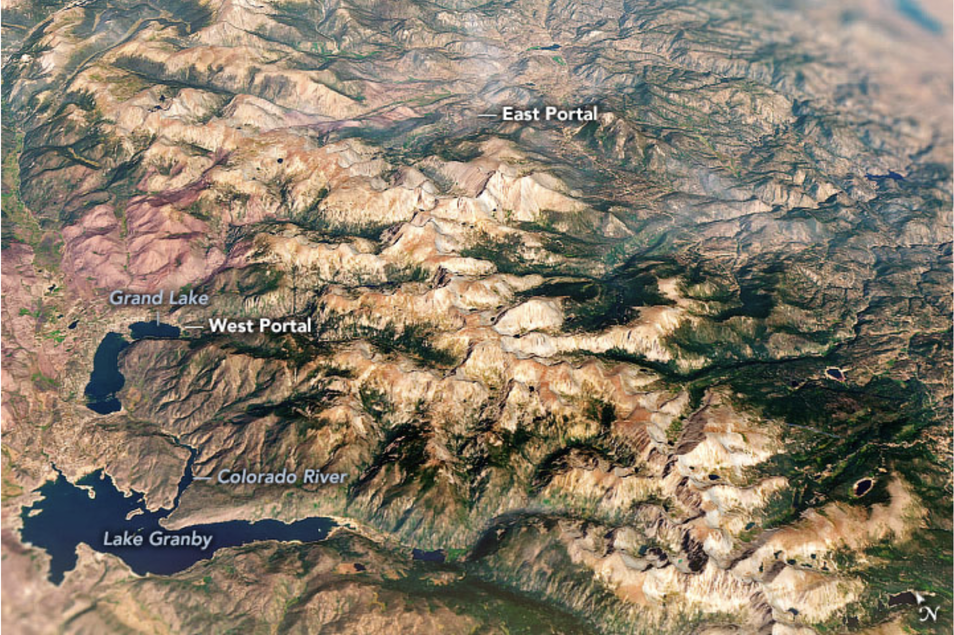

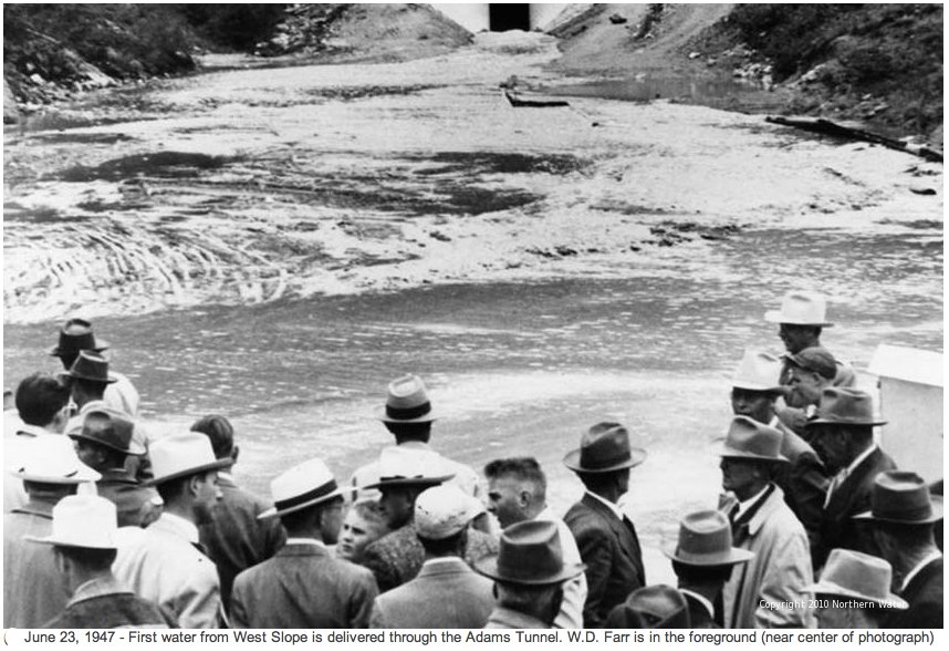


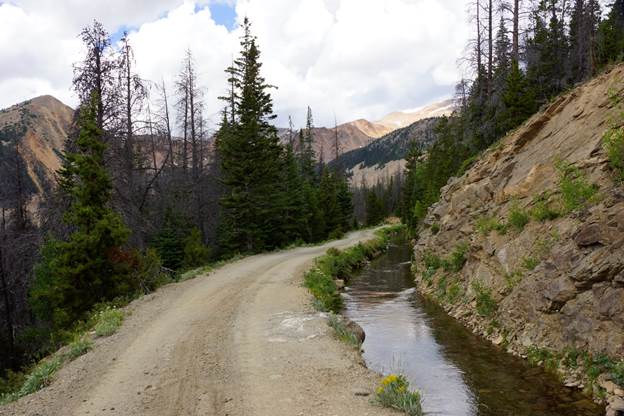


![Scott Hummer, general manager of North Poudre Irrigation Company, talks about how his agency worked with Fort Collins Natural Areas and Colorado Parks and Wildlife to include a fish passage when the irrigation company replaced a diversion structure on the Poudre River that was destroyed by the 2013 floods. Work was completed [in February 2016]. (Pamela Johnson / Loveland Reporter-Herald)](https://coyotegulch.blog/wp-content/uploads/2016/03/cachelapoudrefishpassage022016lovelandreporterheraldscotthummer.png)
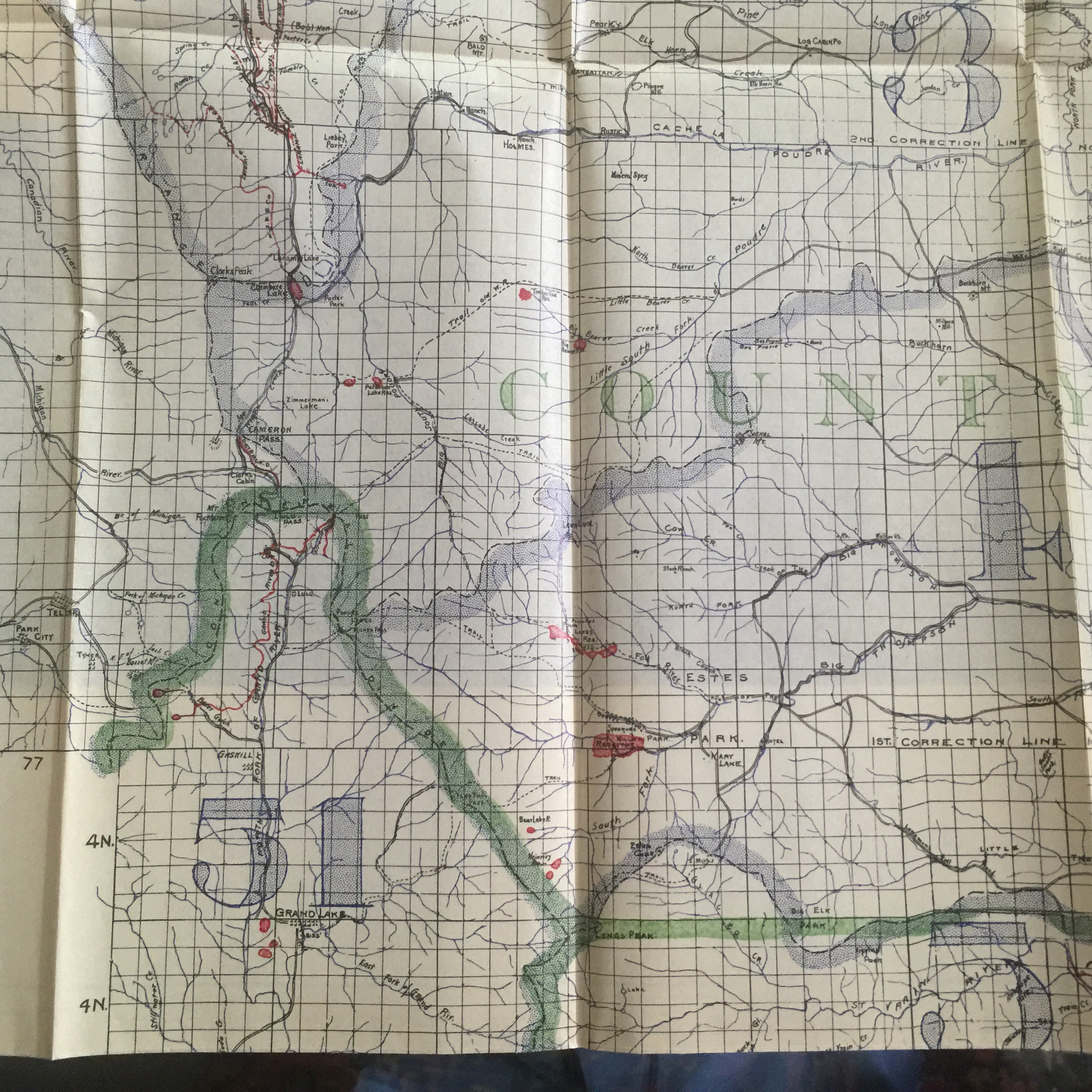

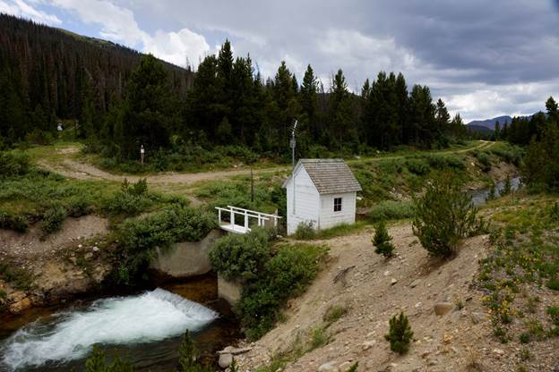
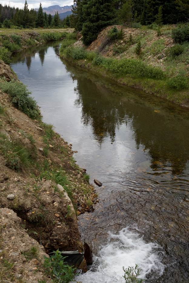
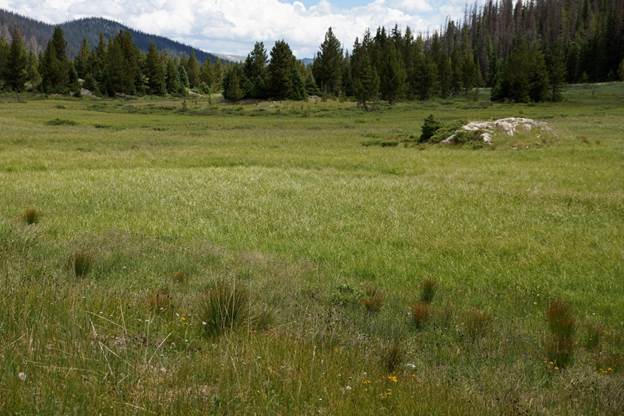

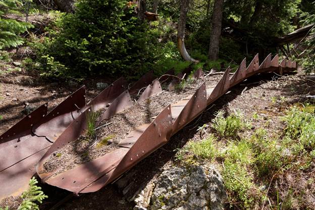

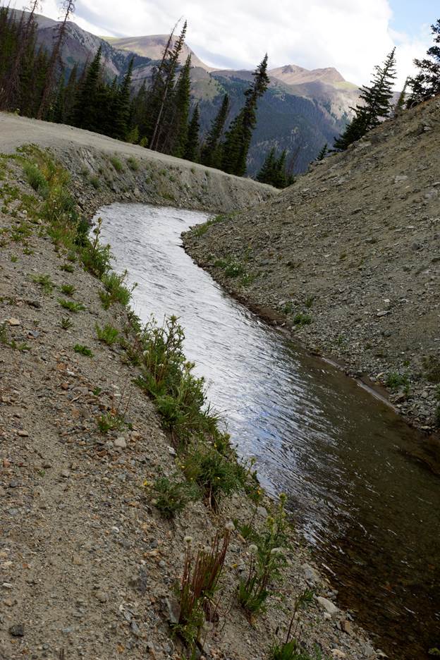
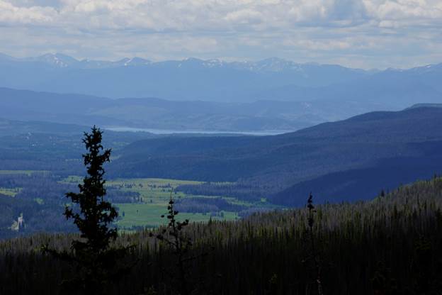
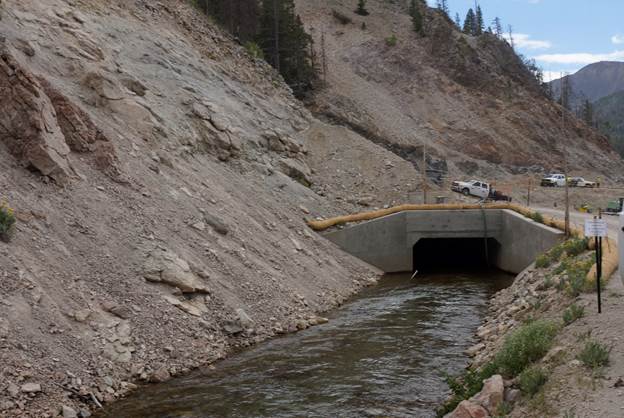

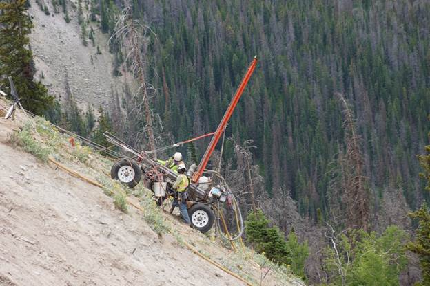
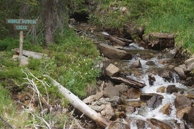
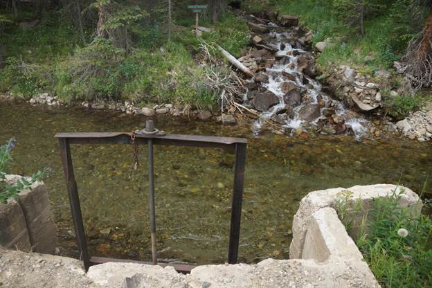

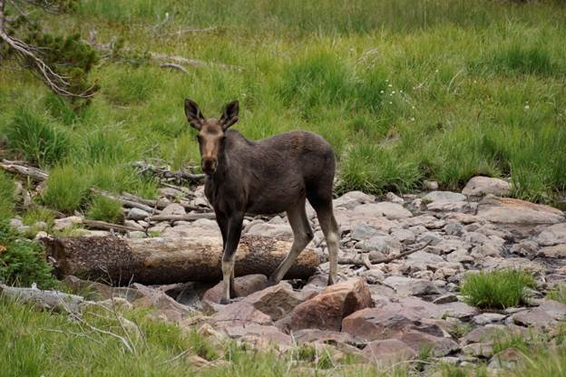
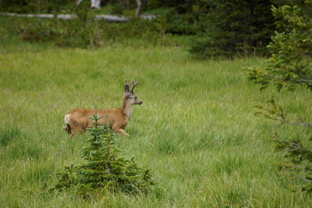
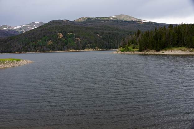


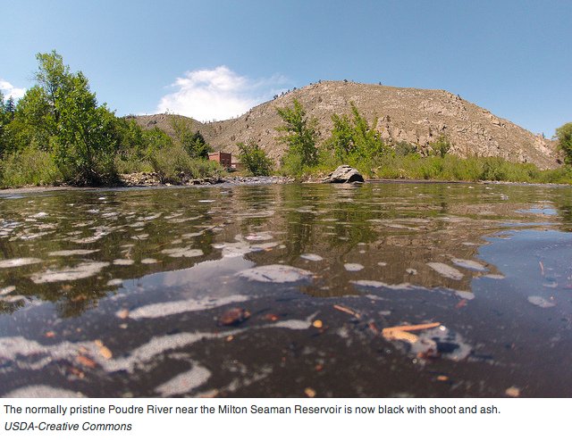


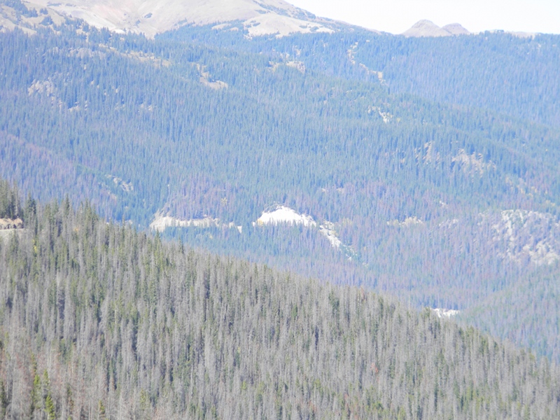


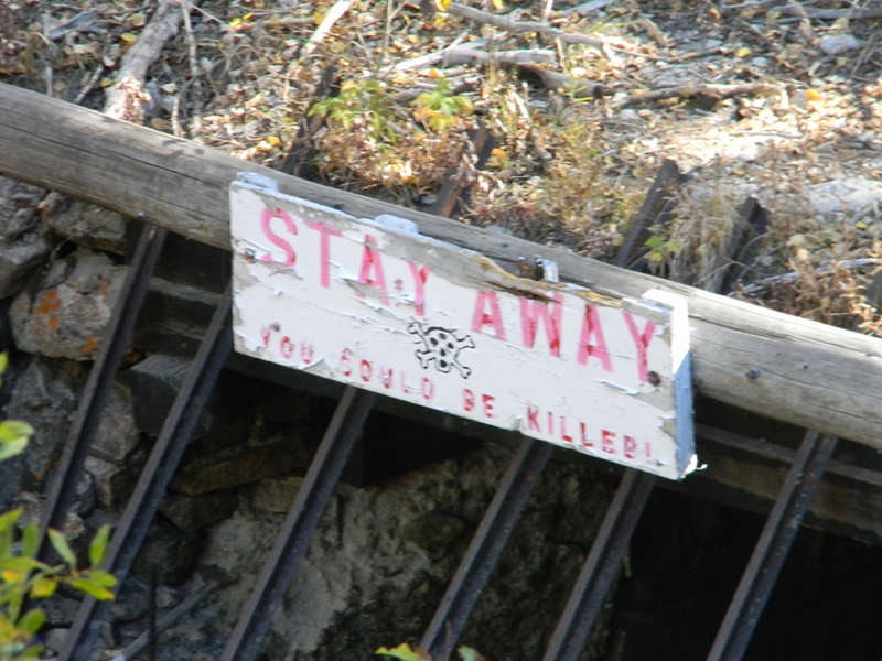


