Click the link to read the article on The Land Desk website (Jonathan P. Thompson):
July 14, 2026
🌵 Public Lands 🌲
THE NEWS: On Monday, President Donald Trump pulled out his figurative Sharpie pen — i.e. he issued two presidential proclamations —- and dramatically reduced the size of Bears Ears National Monument and Grand Staircase-Escalante National Monument, both in southern Utah, thereby removing national monument protections from more than 2.9 million acres of public lands and the antiquities therein. He also disbanded and terminated the Intertribal Bears Ears Commission, a direct attack on the tribal nations that first proposed a national monument for their homelands and that have been co-managing it until now.
The move reopens huge swaths of Utah’s canyon country to new mining claims and mineral leasing, reviving the potential for oil and gas drilling, uranium mining, and potash, lithium, and coal extraction in previously protected areas. It also scraps the existing resource management plans for both national monuments, throwing even the remaining shards of protected areas into regulatory uncertainty.
Additionally, the proclamations order the managing agencies, the Bureau of Land Management and the U.S. Forest Service, to ease restrictions on motorized travel, vegetation management, and livestock grazing within the remaining national monuments.
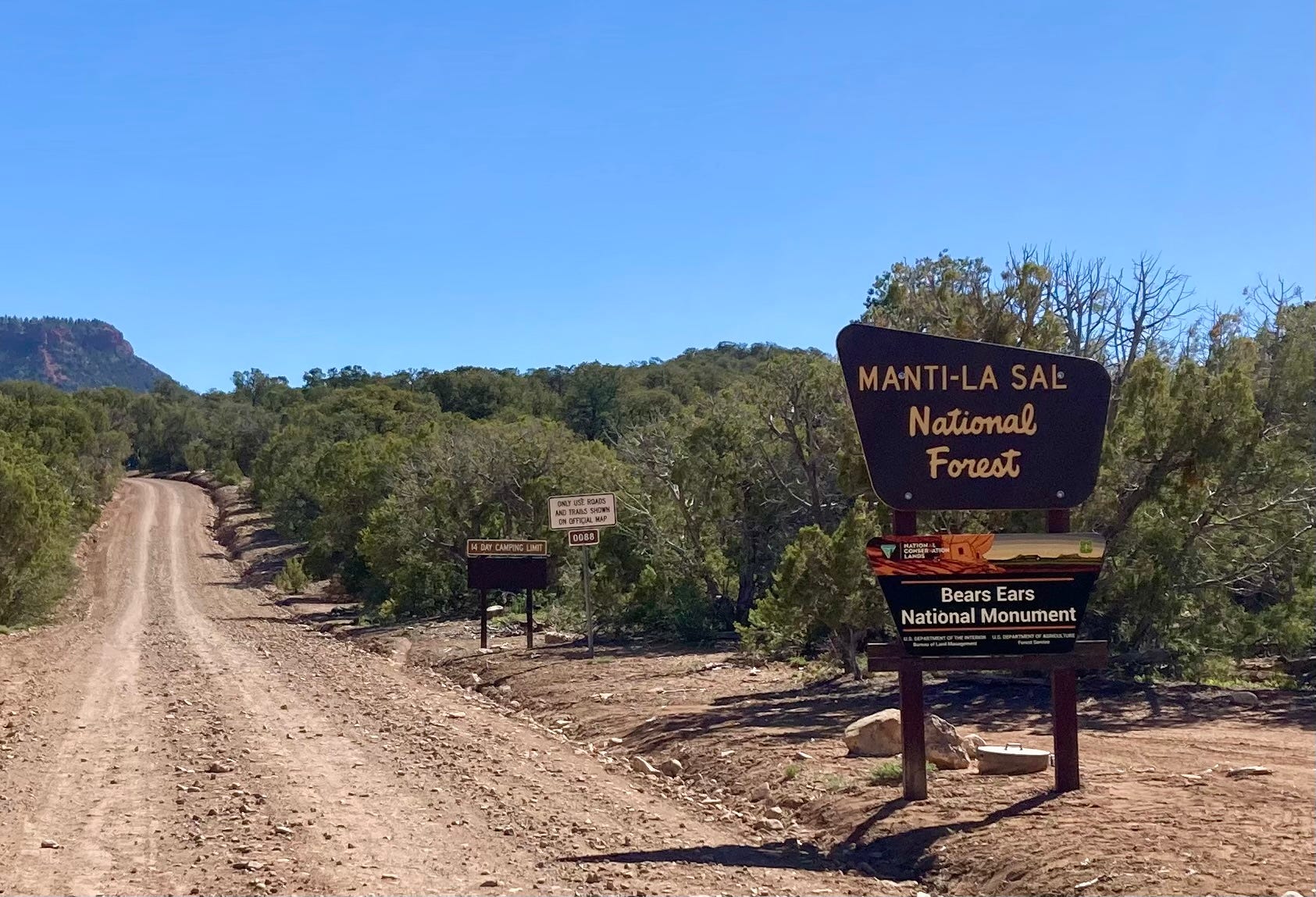
THE SORDID DETAILS: The administration has not yet released a map of the shrunken boundaries, but from the proclamation’s description it would appear that at Bears Ears they roughly follow the same lines as those created in 2017 when Trump downsized the national monument the first time. The difference is that he cut an additional 100,000 acres from the national monument. At GSENM, however, he appears to have eliminated the former Grand Staircase Unit on the southwest side of the national monument, and slashed the Kaiparowits Unit to a fraction of its previous size.
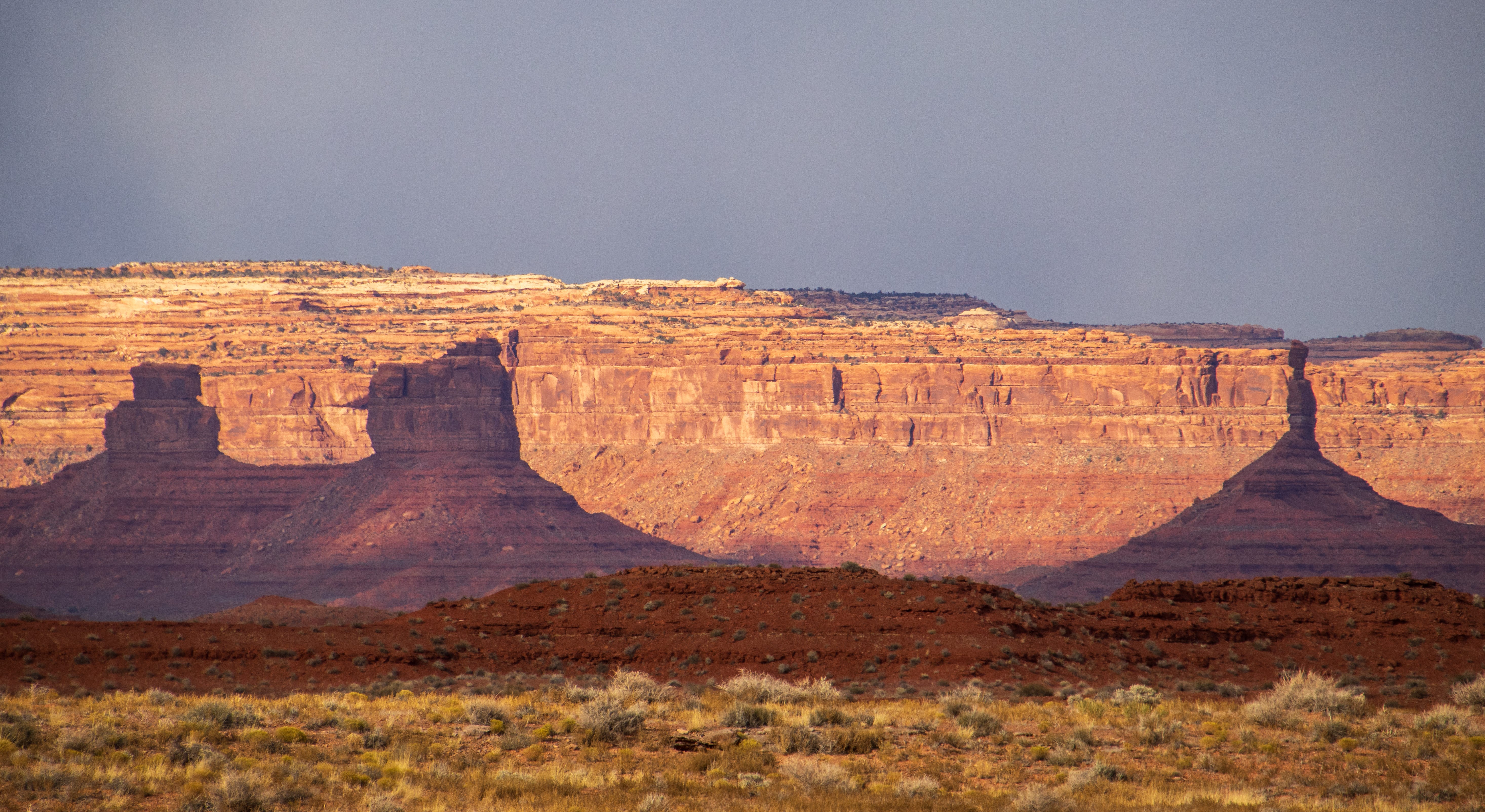
For Bears Ears:
- Yesterday’s proclamation removed 1.24 million acres from national monument status, reducing the 1.36 million-acre monument to just 121,096 acres (91% reduction). When Trump shrunk it in 2017, there was more than 200,000 acres remaining.
- The reduced national monument includes two main units:
- The 106,816-acre Shash Jaa Unit that contains the Bears Ears Buttes, Arch Canyon, Mule Canyon, Comb Ridge, and portions of the Butler Wash Archaeological District.
- And the 14,279-acre Indian Creek Unit, which includes Newspaper Rock.
- Also included are small non-contiguous parcels that lie outside the two main units, such as:
- Doll House Ruin (157 acres);
- Scorup Cabin, which was used by the “Mormon Cowboy” J.A. Scorup when he ran cattle in the Bears Ears region in the late 1800s and early 1900s. This likely burned in the Babylon Fire. (314 acres)
- The Rig Canyon Mining Exploration Site, an oil well from 1926. Yes, these knuckleheads are preserving a drilling site from mining claims and oil and gas development, while opening up thousands of Ancestral Puebloan sites to “multiple use,” including oil and gas drilling. This may be in the Babylon Fire burn zone as well. (693 acres)
- Moon House, an Ancestral Puebloan cliff dwelling on Cedar Mesa. (318 acres).
- The Citadel, an Ancestral Puebloan dwelling on Cedar Mesa. (88 acres).
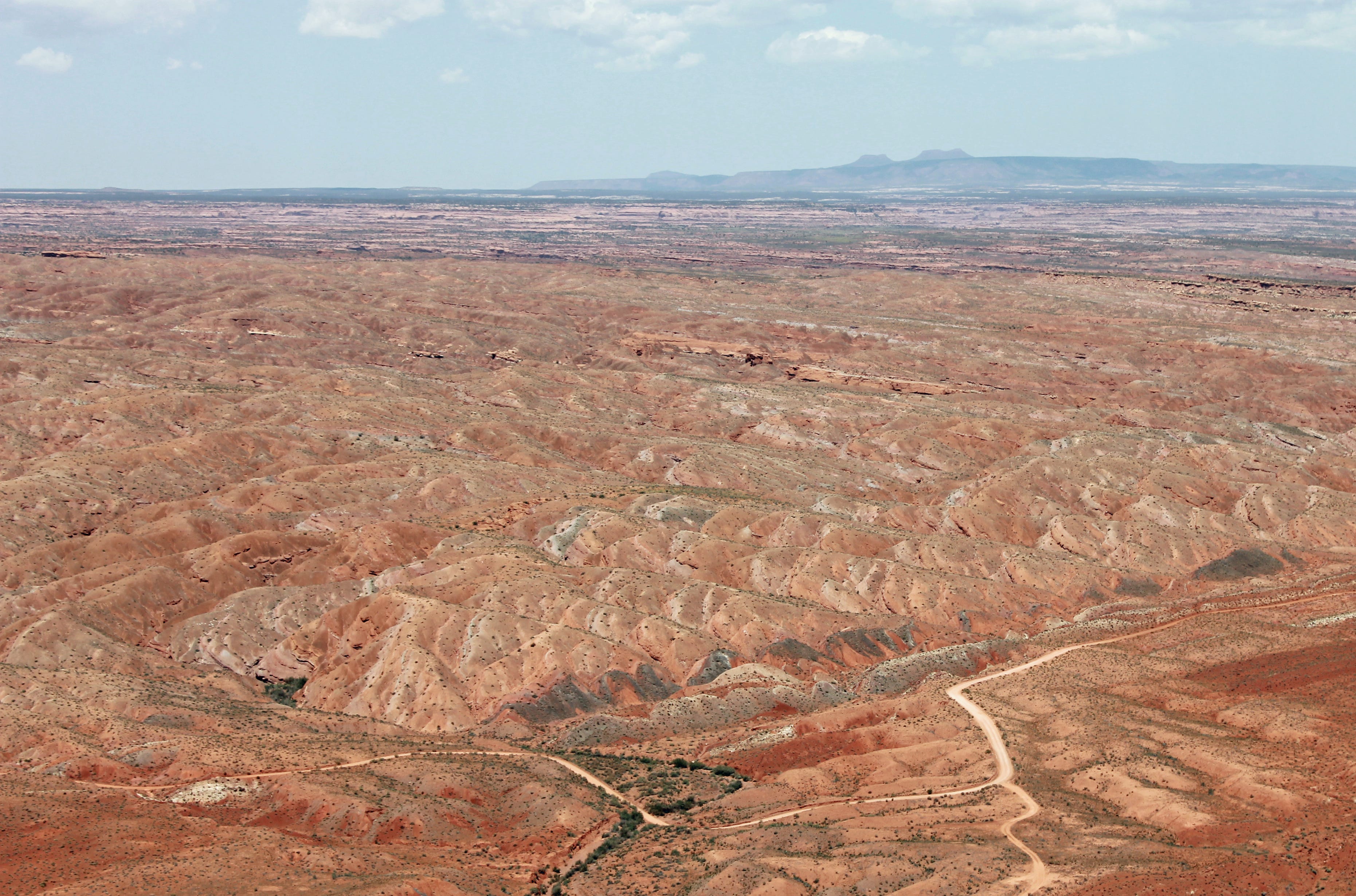
This removed national monument status from huge swaths of spectacular and significant natural and cultural landscapes, including nearly all of Cedar Mesa, White Canyon and its tributaries, Cottonwood Wash, most of Butler Wash, Valley of the Gods, and Dark Canyon.

For Grand Staircase-Escalante:
- Trump’s proclamation removed 1.69 million acres from national monument status, reducing the formerly 1.87 million-acre monument to just 181,541 acres(90% reduction). When Trump shrunk it in 2017, there was more than 1 million acres remaining under national monument status.
- The reduced monument will consist of two main units:
- The 172,641-acre Canyons of the Escalante Unit, which includes the Escalante River, the Escalante Natural Bridge, Calf Creek Canyon, the Hundred Hands pictograph panel, and the Boulder Mail Trail.
- 8,900-acre Kaiparowits Horizon Unit. Yes, you read that right: This unit has been reduced to less than 9,000 acres, which is a tiny fraction of what it was after Trump shrunk it the first time. It appears that the entire post-2017-shrinkage Grand Staircase Unit is just gone. This makes available at least 11 billion tons of coal, some 10.5 trillion cubic feet of coalbed methane, and 550 million barrels of oil from tar sands.
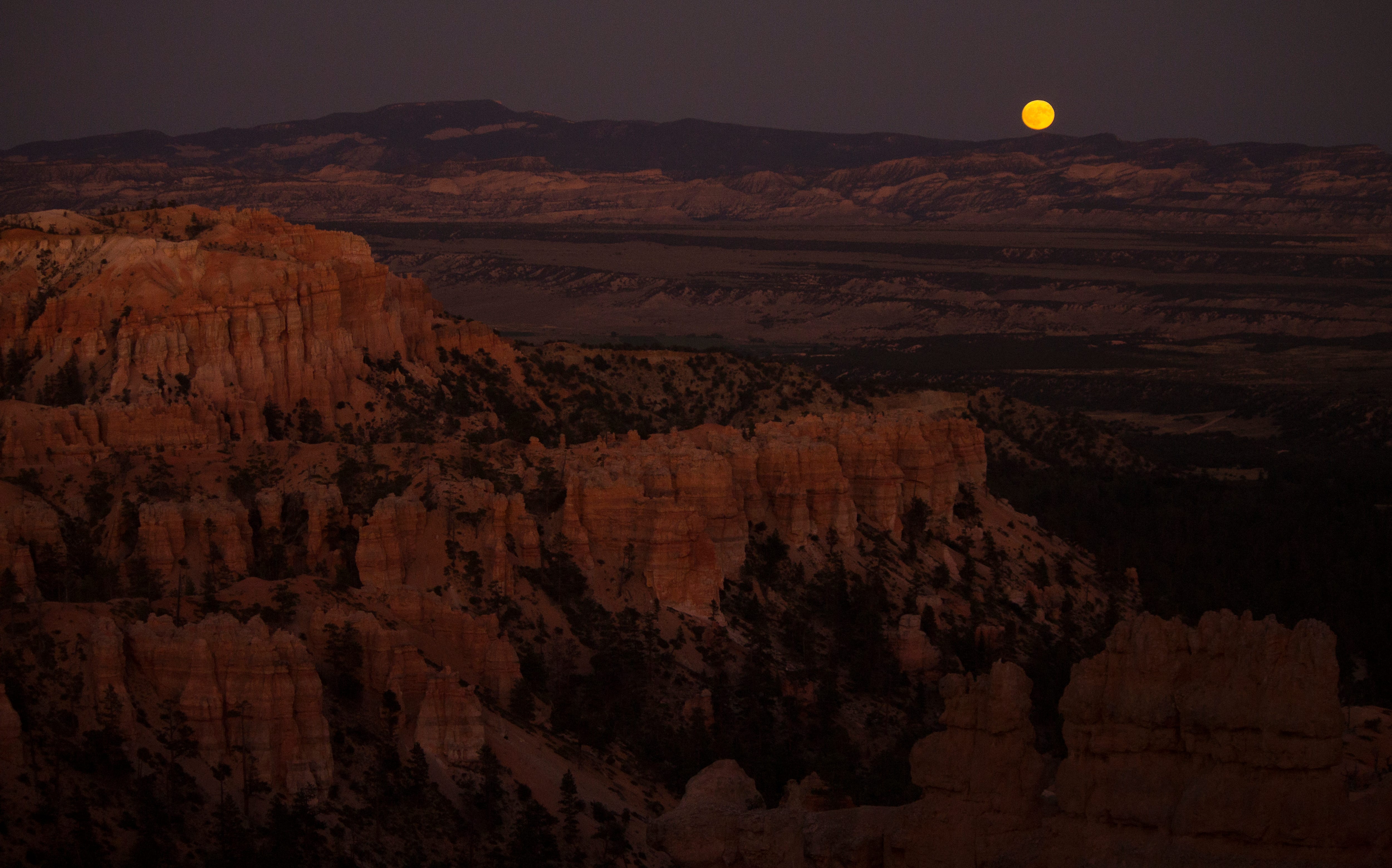
For both national monuments:
- The proclamation orders the managing agencies (USFS and BLM) to consider livestock grazing lands to constitute a “traditional cultural place” and to “consider how proposed activities will impact” those lands. They also order the agencies to re-allocate voluntarily relinquished grazing allotments. Under the Biden proclamation, voluntarily relinquished allotments were permanently retired.
- The proclamations order new transportation plans that endeavor “to maximize public access” by “designating roads and trails on which motorized and non-motorized vehicle use will be allowed.
- The proclamations call on agencies to “consider the full range of vegetation management tools, including mechanical mastication, and grazing” and to authorize the use of mechanical, natural, and chemical tools, along with livestock grazing, to mitigate noxious weeds and fuel management.
WHAT’S NEXT: The lawsuits filed by tribal nations and advocates after Trump’s previous national monument shrinkage will be revived, and new ones likely filed, challenging the legality of proclamations (see below). However, unless a judge orders an injunction on the proclamations, the shrinkages will likely stand as the cases wind their way through the courts.
That means huge amounts of land once again will be open to new mining claims and oil and gas and coal leasing.
Shortly after Trump shrunk the national monuments in 2017, companies owned by the Kimmerle family of Moab staked a number of mining claims in the newly opened parts of Bears Ears National Monument, specifically in the White Canyon drainage and upper Cottonwood Creek. Whether they were actually interested in mining, were speculating, or merely trying to gain standing for a lawsuit when Biden restored the boundaries isn’t clear. In any event, Kyle Kimmerle did join Utah’s lawsuit challenging the Biden restoration, saying it blocked his ability to mine those claims.
While I doubt that any large mining companies will stake a lot of claims in the newly reopened areas, given the legal and regulatory uncertainty, smaller interests might come in and stake claims for uranium mining in the hopes of selling them if the shrinkage sticks.
Neither Bears Ears nor GSENM are exactly oil and gas drilling hotspots, but that won’t stop Trump’s BLM from putting up huge swaths of land on the auction block, in hopes of enticing some speculator to pay $2/acre for drilling rights on some of the most spectacular pieces of Canyon Country. Same goes for coal: Big firms are highly unlikely to bite on the Kaiparowits reserves, given sluggish demand, its remoteness, lack of transportation routes, and regulatory uncertainty. But then, who knows, maybe someone will decide to build a coal mine, power plant, and giant data center on the plateau; I bet the Trump’s BLM would permit it.
THE CONTEXT: We knew this was coming. After all, Trump radically shrunk the national monuments — mostly out of spite — during his first term. This time he also had orders from Project 2025 not only to shrink or eliminate these protections, but to destroy the Antiquities Act itself, the bedrock law that allows presidents to establish national monuments.
Yesterday’s move appears to be aimed at achieving both of Project 2025’s objectives. The proclamations will draw advocates’ and tribal nations’ lawsuits, which will eventually reach the Supreme Court. The justices — many of whom have proven hostile toward environmental protections — then will decide the fate not only of these national monuments, but of the Antiquities Act as a whole, thereby imperiling the future of public land conservation.
Any judge with integrity would block Trump’s proclamations. The Antiquities Act of 1906 gives a president the power to establish national monuments on federal land to protect landmarks, structures, and “other objects of historic or scientific interest.” However, it does not overtly give a president the power to rescind or reduce a national monument. The one time a president — Franklin D. Roosevelt, in 1938 — set out to abolish a national monument, his attorney general opined that the Antiquities Act gave him no such power. A May 2017 legal analysis by Mark Squillace, a law professor at the University of Colorado, and three other scholars, argues that the Federal Land Policy and Management Act of 1976 “makes it clear that the President does not have any implied authority to (abolish or modify monuments), but rather that Congress reserved for itself the power to modify or revoke monument designations.”
Trump, however, has never been too keen on the rule of law, and the current Supreme Court Chief Justice John Roberts has invited folks to bring an Antiquities Act case to him so he could eviscerate one of the nation’s bedrock conservation laws.
Trump’s proclamations are based on the theory that the two national monuments are simply too big. The Antiquities Act says the president may, at their discretion, reserve parcels of federal land, “the limits of which in all cases shall be confined to the smallest area compatible with the proper care and management of the objects to be protected.” Last year, Trump’s Deputy Assistant Attorney General Lanora C. Pettit argued that if another president decides the monument violates the “smallest area compatible” requirement, they can shrink it accordingly.
Of course, that’s not what the Antiquities Act says, nor is it what Congress intended when it wrote the law in the first place. It is the very permanence or irreversibility that makes the Antiquities Act special and distinguishes it from other types of public land withdrawals and executive orders. It’s what sets, say, Bears Ears National Monument apart from the 20-year oil and gas leasing bans around Chaco Culture National Historical Park and on the Thompson Divide. The former can’t be reversed by an executive order because it was established under the Antiquities Act; the latter two can because they were implemented by executive orders.
If the courts — and ultimately the Supreme Court — were to fall for Pettit’s arguments, it would render impotent one of the nation’s foundational environmental and cultural protection laws. After all, the Grand Canyon, Zion, Chaco, Capitol Reef, Arches, and many more of America’s treasured national parks first were established as national monuments under the Antiquities Act. Imagine if a later president, out of spite for his predecessor, had decided to simply abolish with a stroke of a pen any of these designations and open these special places to drilling and mining before Congress gave them national park status.
In 1908, President Theodore Roosevelt used the Antiquities Act to establish the 800,000-acre Grand Canyon National Monument. If the Trump administration’s (and Utah’s and other national monument opponents’) logic were to be applied, the national monument would have been cut down to several thousand acres surrounding a handful of landmarks such as Havasu Falls, Mather Point, Vishnu Temple, and Bright Angel Point, and the rest of it would have been opened up to the extractive industries.
But what is Vishnu Temple without the rest of the Grand Canyon? What these folks are missing is that these discrete “objects” — whether they are landforms, dwellings, or other cultural sites — cannot be separated from the landscape itself, because to do so robs them of their meaning. So in order to protect them — as the Antiquities Act authorizes the President to do — one must protect the entire landscape. Therefore, the combined pre-shrinkage 3.2 million acres of both GSENM and Bears Ears National Monuments was, in fact, the “smallest area compatible with the proper care and management” of those landscapes. In fact, it may not be large enough.
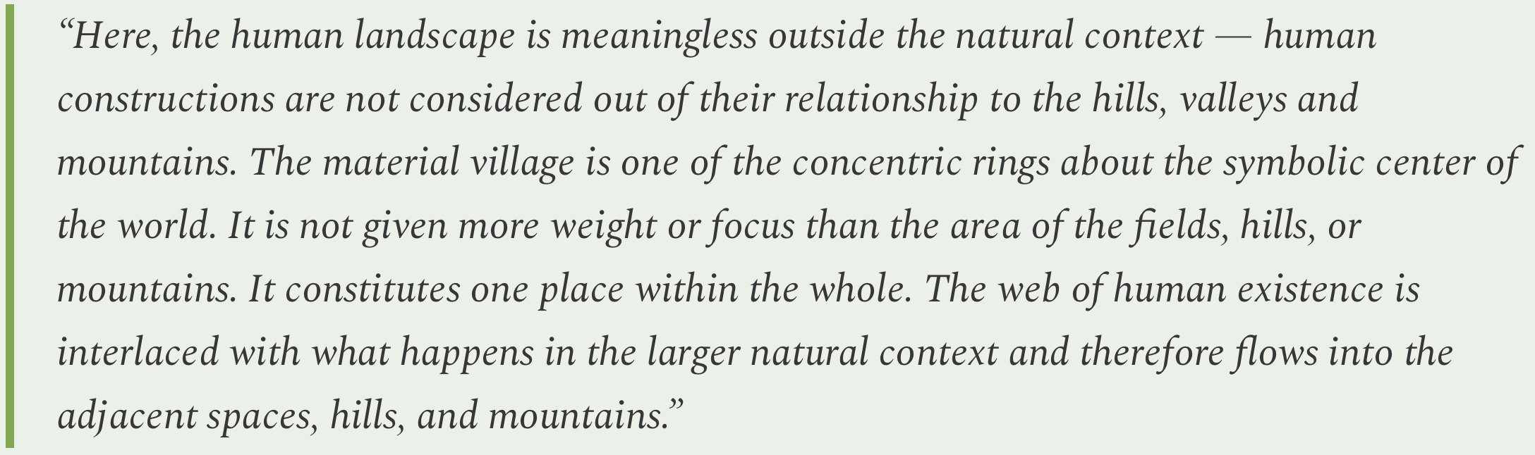
I’ll leave you with what I find to be a powerful and succinct argument for landscape-scale preservation. It’s from a 1991 paper on Ancestral Puebloan culture in the Four Corners region co-written by the late Rina Swentzell, a scholar from Santa Clara Pueblo:
***
I’ve written about Bears Ears, Grand Staircase-Escalante, and the Antiquities Act many times in the past and won’t repeat it all here. Instead, I’ve removed the paywall from some of the most popular, notable dispatches from the archives, so anyone can read them for a limited time. If you like them, consider becoming a paid subscriber!
The Meaning of Monuments (and the Antiquities Act) — Jonathan P. Thompson
Big win for Bears Ears, Grand Staircase-Escalante — Jonathan P. Thompson
The mega-monument that almost was — Jonathan P. Thompson