This year’s ‘peak:’ record-low runoff leaves reservoirs far below normal; Dillon, Williams Fork and Antero reservoirs hit hard — Jay Adams (DenverWater.org) #SouthPlatteRiver #ColoradoRiver

Click the link to read the article on the Denver Water website (Jay Adams):

June 24, 2026

The full impact of this past winter’s record-low snowpack is rearing its ugly head in the form of:

  • Record-low spring stream flows.
  • Low reservoir storage levels.
  • An empty reservoir.
  • And one incredibly rare statistic.

On June 17, Denver Water’s reservoir system hit its peak storage level following a diminished spring runoff.

Water levels in the utility’s reservoirs collectively hit 81% of the system’s storage capacity — the second-lowest peak storage level on records dating back to 1983, considered the beginning of the modern Denver Water collection system.

“Peak storage” is the moment, or day, when the utility’s collection system holds the most water it will hold for the next year. It’s akin to topping off a swimming pool once a year in June to carry the pool through the next year of use.

Typically, the “peak storage” moment happens in mid-June, after the spring runoff.

But in 2026, due to the record-low winter snowpack and low spring runoff, Denver Water’s collection system held more water on Jan. 1 — 83% of capacity — than on June 17, as the runoff dwindled and storage levels inched to 81% of capacity.

There’s only one other year since 1983, when the Strontia Springs Dam was completed, that Denver Water’s storage was higher in the dead of winter than the dawn of summer — the drought year of 2002.

“Having our highest amount of water happen in January is incredibly rare. It speaks to how little snow we saw this winter and the impact of the record-setting warm weather,” said Nathan Elder, Denver Water’s manager of water supply.

“We’ve seen many records fall this year, and unfortunately, they were not good ones.”
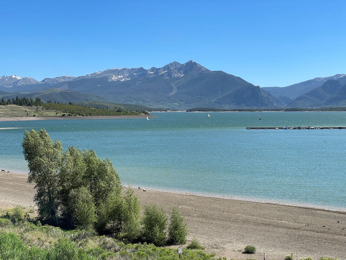
Dillon Reservoir reached 80% capacity on June 17, the highest elevation it is expected to see in 2026. Dillon is the largest reservoir in Denver Water’s collection system, storing roughly 38% of the utility’s water supply. Photo credit: Denver Water.

During the spring peak, the amount of water stored in Denver Water’s reservoirs typically hits an average of 97.5% of capacity.  

And since 1983, the utility’s peak storage levels have hit at least 95% of capacity (considered sufficient for normal operating conditions) in all but six years.  

“Ideally, we like to top off our mountain reservoirs during the spring runoff, but this year our storage levels came up well short,” Elder said.

Record low ‘paycheck’

Why do water managers focus on peak storage numbers?

The peak reservoir storage figure is critical to determining how much water is available until next year’s spring runoff. It’s comparable to a family determining how much money they have to pay the bills until the next paycheck comes through.

“The spring runoff is our annual paycheck from Mother Nature,” Elder said. “The water filling our reservoirs is the cash that fills our bank account. But in our case, that paycheck only comes once a year — and this year we didn’t get anywhere close to the normal amount.”

Tenmile Creek in Frisco, as it enters Dillon Reservoir on June 12. Denver Water saw record low flows into the reservoir in 2026. Photo credit: Denver Water.

This year’s meager paycheck was reflected in the record-low peak flows on the rivers and streams that feed Denver Water’s reservoirs.

Mountain snowmelt accounts for 90% of Denver Water’s supply, which provides water to 1.5 million people in metro Denver.

In Summit County, Denver Water recorded this year’s peak stream runoff into Dillon Reservoir at just 404 cubic feet per second, or cfs, on May 29. That’s a record-low “peak inflow” and less than a quarter of the normal peak inflow into the reservoir of 1,750 cfs, which typically happens on June 7.

In Park County, the South Fork of the South Platte River experienced a double-whammy, with record-low flows that occurred abnormally early in the season.

Flows on the South Fork peaked on March 25 at a record-low flow of just 18 cfs. That’s 15% of the normal peak flow of 120 cfs, which usually happens on June 10.

The South Fork of the South Platte River south of Fairplay on May 22. The river peaked at a record low flow of just 18 cfs in 2026. Photo credit: Denver Water.

“In a typical year, the rivers and streams start rising in late-April as the snow starts to melt, then they peak in early June, and then they start to ease back to normal flows throughout the summer,” Elder said.

“This year the runoff started about six weeks early in March, and the normal spring surge of water we usually see was basically nonexistent.”

Reservoir impact

The results of the record-low spring flows are having a significant impact on three of Denver Water’s most popular reservoirs.

Dillon Reservoir in Summit County topped off on June 17 at 80% of capacity, with water levels about 18 feet below normal for this time of year. Water levels are expected to drop over the next year until the 2027 spring runoff — hopefully more boisterous than this year’s meager flow — begins.
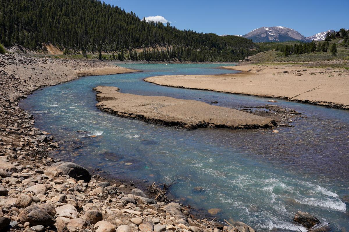
Dillon Reservoir in Summit County reached 80% capacity on June 17. This picture shows the low levels at the Snake Inlet on the southeast corner of the reservoir on June 12. Photo credit: Denver Water.

In Grand County, Williams Fork Reservoir topped off June 21 at merely 53% of capacity, about 35 feet below normal for this time of year and forcing the closure of the reservoir’s boat ramp.

At the Williams Fork Reservoir in Grand County, the boat ramp will be closed all summer due to low snowpack and record-low runoff. Photo credit: Denver Water.

Because of the low snowpack, Denver Water also dipped into its emergency water supply at Antero Reservoir in Park County.

Using water from Antero Reservoir is only done in extremely dry years. It’s comparable to someone having to dip into their 401(k) savings to pay bills until their next paycheck.

Denver Water moved water out of Antero this spring and sent it downstream to Cheesman Reservoir to avoid losing water in shallow Antero due to evaporation.

Denver Water moved water from Antero to Cheesman reservoir in 2026 to reduce losses from evaporation. The water in Antero Reservoir, pictured above, is only used in extreme dry years. Photo credit: Denver Water.

Early forecasts for the abysmal spring runoff and low peak storage were two factors that led Denver Water to issue a Stage 1 drought declaration in March.

The declaration, which calls on customers to reduce water use by 20% and includes mandatory watering restrictions of two assigned days per week, seeks to stretch existing water supplies until next spring’s paycheck is deposited in the reservoirs.

“While the reservoirs are low this year, they are doing what they were built for, which is to help us get us through a dry year,” Elder said.

“We hope customers notice the low reservoir levels and take steps to conserve water at home so we can stretch our water supplies over the coming months.” 

Denver Water’s entire collection system. Image credit: Denver Water.

New #Colorado state law requires cities, water users to revegetate farmland before using water elsewhere — Rocky Mountain PBS #ArkansasRiver

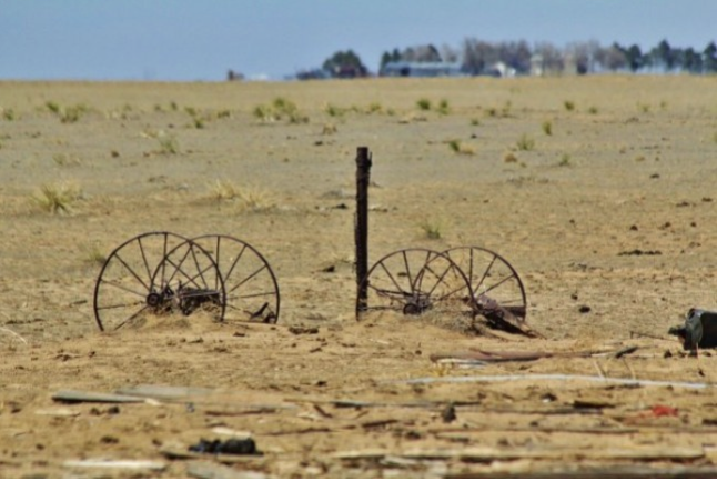
Photo of Crowley County by Jennifer Goodland

Click the link to read the article on the Rocky Mountain PBS website (Cormac McCrimmon). Here’s an excerpt:

June 16, 2026

A new Colorado law requires water users that buy water tied to farms in the Arkansas Valley to revegetate land before using water elsewhere…

“When that water leaves, the impacts of the dry-up don’t leave with it. They stay with the land and the people who live here,” said Jack Goble, general manager of the Lower Arkansas Water Conservation District, which advocated for the legislation.Revegetation involves restoring native plant cover to the land to reduce erosion, maintain soil moisture and manage noxious weeds…

In Crowley County, where productive farmland has declined by more than 90% since the 1970s because of water transfers, so-called “buy-and-dry” transactions have spawned a sea of dirt that supports little more than weeds. According to a recent report from ProPublica, these water transfers have caused an “environmental catastrophe,” in Crowley County, in which birds, bees and wildlife have fled. A 2026 report from Colorado State University estimates that every acre of irrigated land taken out of production leads to an annual economic loss of $1,400 to $1,600.  Governor Jared Polis (D) signed House Bill 26-1340 into law June 1. The new law, sponsored by representative Ty Winter (R), gained broad support in the House and Senate. The law takes effect January 1, 2027. 

“If you look at other natural resources — coal, gravel, oil and gas — when that’s mined from the land the requirement is on the entity that profits off of, and mines that, to go and reclaim that land. We think water should be no different,” Goble said.

Map of the Arkansas River drainage basin. Created using USGS National Map and NASA SRTM data. By Shannon1 – Own work, CC BY-SA 4.0, https://commons.wikimedia.org/w/index.php?curid=79039596

How sports betting became #Colorado’s ticket to funding $140 million in water #conservation projects: Colorado’s gamblers are paying for new irrigation systems, reservoirs and water research studies — The #Denver Post

Maybell Irrigation District’s headgate on the Yampa River, September 2022. Photo credit: Heather Sackett/Aspen Journalism

Click the link to read the article on The Denver Post website (Noelle Phillips). Here’s an excerpt:

June 18, 2026

For the 18 ranchers who rely on the Maybell Irrigation District’s canal to funnel water to their fields, the 127-year-old headgate that diverted flow from the Yampa River meant a two-hour round trip through a rocky canyon whenever they needed water. The rusted structure was barely hanging on, and its operation was time-consuming for the busy ranchers, who had to lug special tools on all-terrain vehicles and on foot to open or close the mechanism. But it seemed impossible for the tiny district to find the $6.8 million needed to replace the headgate and the rocky diversion dam that pushed water into the canal. Then legalized sports betting came along, and, with it, millions of dollars for Colorado water projects. The tiny irrigation district, in Moffat County in the far northwest corner of the state, soon became the poster child for how gambling money is benefiting Colorado’s waterways. The district received a $750,000 grant from the Colorado Water Conservation Board, which doles out money from sports betting tax revenue, said Diana Lane, sustainable food and water program director for The Nature Conservancy in Colorado, which helped the district land the grant. That led to a matching grant from the U.S. Bureau of Reclamation’s WaterSMART program. With those two grants in hand, other organizations jumped on board, and money poured in, she said. In 2024, the Maybell Irrigation District installed a new headgate that can be opened or closed via cellphone. If a rancher is cutting hay and doesn’t need to irrigate, he can close the gates to match the amount of water he actually needs at that moment, Lane said. And the diversion structure no longer uses boulders to control the water flow. Instead, it’s a modern structure that is the right height for water control. The project also benefited four fish species, including the threatened humpback chub, and it made river navigation easier for boaters, helping the region’s outdoor recreation economy.

“That $750,000 was really the ball that got it all rolling, that showed people, ‘Oh, this is going somewhere,’” Lane said of that initial state grant.

Since sports betting became legal in May 2020, the state has collected more than $154 million in taxes, and the Colorado Water Conservation Board has funneled $140 million to various projects that preserve and conserve Colorado’s precious water. Supporters say the gambling money is a godsend for ranchers, fishermen, paddlers and others who want to protect the state’s water and those who depend on it for their livelihoods. Critics, however, say legalized sports betting has come at a cost — fueling an addiction crisis that the state was unprepared for and is underfunding.

Yampa River Basin via Wikimedia.

In revitalizing the #ColoradoRiver Delta, a little goes a long way — Daniel Stolte (University of #Arizona) #COriver #aridification

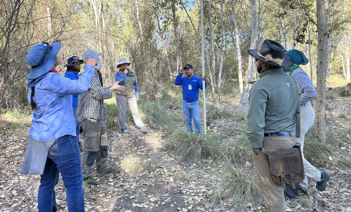
Cottonwood habitat in the El Chaussé restoration site. Trees are nine year old in this image from 2026. Photo credit: Martha Gomez-Sapiens

Click the link to read the article on the University of Arizona website (Daniel Stolte):

June 18, 2026

Today’s Colorado River Delta is a far cry from the lush waterway that thrived before the river was forced behind dams that diverted much of its flow for half a century. Now, with just small amounts of water and funding, stretches of the parched riverbed have been transformed into healthy riparian habitats.

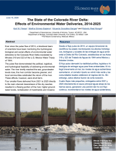
Click the graphic to download a copy of the report.

A new report from a University of Arizona-led team of researchers has evaluated the effects of the 2014-2025 controlled water releases along the lower Colorado River in Mexico to restore natural habitat. The report also lays out a roadmap for continuing the current binational restoration efforts. The report was published today by the Center for Colorado River Studies at Utah State University.

“It’s hard to find some good news about the Colorado River, but we believe we have some to share,” said first author Karl Flessa, professor emeritus in the U of A Department of Geosciences. “The lessons learned from more than a decade of work show that a small amount of water can do big things.”

The controlled water deliveries to the Colorado River streambed from 2014-2025 were mandated by two addenda of the U.S.-Mexico Water Treaty of 1944, which governs the allocation of Colorado River water between the two countries. The current addendum expires at the end of 2026.

To ensure the restoration sites continue to thrive, Flessa said sustaining this binational success will require a renewed commitment of water and funding by the United States, Mexico and non-governmental organizations.

The report reveals that bird numbers and diversity have increased since restoration began in 2014. The delta is an important rest stop for birds migrating along the Pacific Flyway. Beavers and other wildlife have also increased.

Graphic credit: USGS

The restoration of the Colorado River Delta began in 2014, in the form of a so-called pulse flow, a one-time water release from Morelos Dam that lasted 57 days. Before that, the riverbed below Morelos Dam was dry. The pulse flow was conducted to allow researchers to assess the effects on the ecosystem once water returned.

The pulse flow of 2014 kickstarted a concerted, binational effort to systematically restore riparian habitat along certain stretches of the formerly dry river delta. Environmental NGOs, both in the U.S. and in Mexico, developed three designated restoration sites by terrain-shaping and planting of native riparian vegetation, including cottonwood trees, mesquite trees and willows – species that once dominated the landscape when the Colorado flowed through a healthy delta.


In 2019, AZPM produced a story on revitalizing the Colorado River delta five years after the 2014 pulse flow.


“These NGOs actually have nurseries on site, in which they germinate an array of Sonoran Desert riparian plants. Those seedlings are then planted and carefully irrigated according to the habitat needs,” said Martha Gomez-Sapiens, a U of A research scientist and co-author on the study. “In some cases you will see irrigation drip lines that go to each individual tree – a system designed to maximize water efficiency in this desert environment.”

Subsequent creation, irrigation and maintenance of 1,381 acres of riparian vegetation attracted birds and other wildlife. Deliveries to the river channel raised water tables, supported existing vegetation and increased the length of the flowing river.

In addition, local communities have benefited from recreational, educational and job opportunities. All three restoration sites have visitor programs that cater to local communities and schools, and one – the Laguna Grande complex, managed by the Tucson-based Sonoran Institute – even boasts a visitor center. All offer recreational opportunities in a region dominated by water scarcity.

While the pulse flow of 2014 demonstrated the feasibility of revitalizing former habitats with controlled and planned water releases, the authors conclude that releasing large amounts of water during a limited timeframe has limited benefits for a long-term revitalization of the delta.

“Most of the pulse flow water infiltrated into the groundwater before it could be used by new vegetation,” Flessa said. “Since then, we have learned how to use the water more efficiently for restoration of riparian habitat.”

Importantly, the report points out that restoration sites are not self-sustaining. Revitalizing degraded river habitat will require continuing maintenance, occasional water allocations and monitoring.

According to the authors, just 6,890 acre-feet per year, which represents approximately 0.05% of the Colorado’s total annual average flow, would suffice to preserve the existing restoration sites. With a little more water and a little more funding, the number or size of the sites could be increased even more, according to the report.

“Effective and sustainable habitat restoration can be done with a little bit of water, a small amount of funding and a lot of hard work.” Flessa said.

Other co-authors on the report are Eduardo González-Sargas in the Department of Biology at Colorado State University and Roberto Real Rangel, of The Nature Conservancy in Mexicali, Mexico.

Fig. 1. The Colorado River Basin covers parts of seven U.S. states as well as part of Mexico. Credit: U.S. Geological Survey

Archuleta County adopts septic system requirements — The #PagosaSprings Sun #SanJuanRiver

Graphic credit: EPA

Click the link to read the article on the Pagosa Springs Sun website (Clayton Chaney). Here’s an excerpt:

July 1, 2026

The Archuleta County Board of Health (BoH) held a special meeting on June 15 to consider approval of Regulation 43, pertaining to on-site wastewater treatment system (OWTS), also known as septic systems…

According to the regulation attached to the meeting agenda, “The purpose of these Regulations is to establish the minimum standards for the location, design, construction, performance, installation, alteration, and use of OWTS with a design capacity equal to or less than 2,000 gallons per day within the Jurisdiction.”

[…]

It also states that the regulations apply to all OWTS in the unincorporated areas of the county and over all municipal corporations within the territorial limits of Archuleta County.

Furthermore, it explains that an “OWTS permit must not be issued to any person when the subject property is located within a municipality or special district that provides public sewer service, except where such sewer service to the property is not feasible according to the determination of the municipality or special district, or the permit is otherwise authorized by the municipality or special district.”

The document explains that Archuleta County Water Quality Department “may enter upon a private property at reasonable times and upon reasonable notice for the purpose of determining whether or not an operating OWTS is functioning in compliance with the OWTS Act and applicable regulations adopted pursuant thereto and the terms and conditions of any permit issued and to inspect and conduct tests in evaluating any permit application.”

Map of the San Juan River, a tributary of the Colorado River, in Arizona, Colorado, New Mexico and Utah, USA. Made using USGS National Map data. By Shannon1 – Own work, CC BY-SA 4.0, https://commons.wikimedia.org/w/index.php?curid=47456307