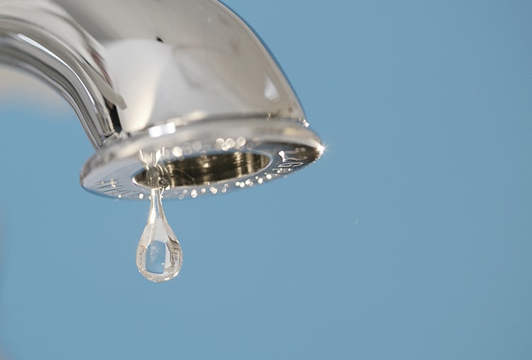
A constantly dripping faucet won’t only drive you crazy but it will freak Mother Nature out, too. Even a small faucet leak can waste up to three gallons of water each day. Photo credit: Delta Faucet
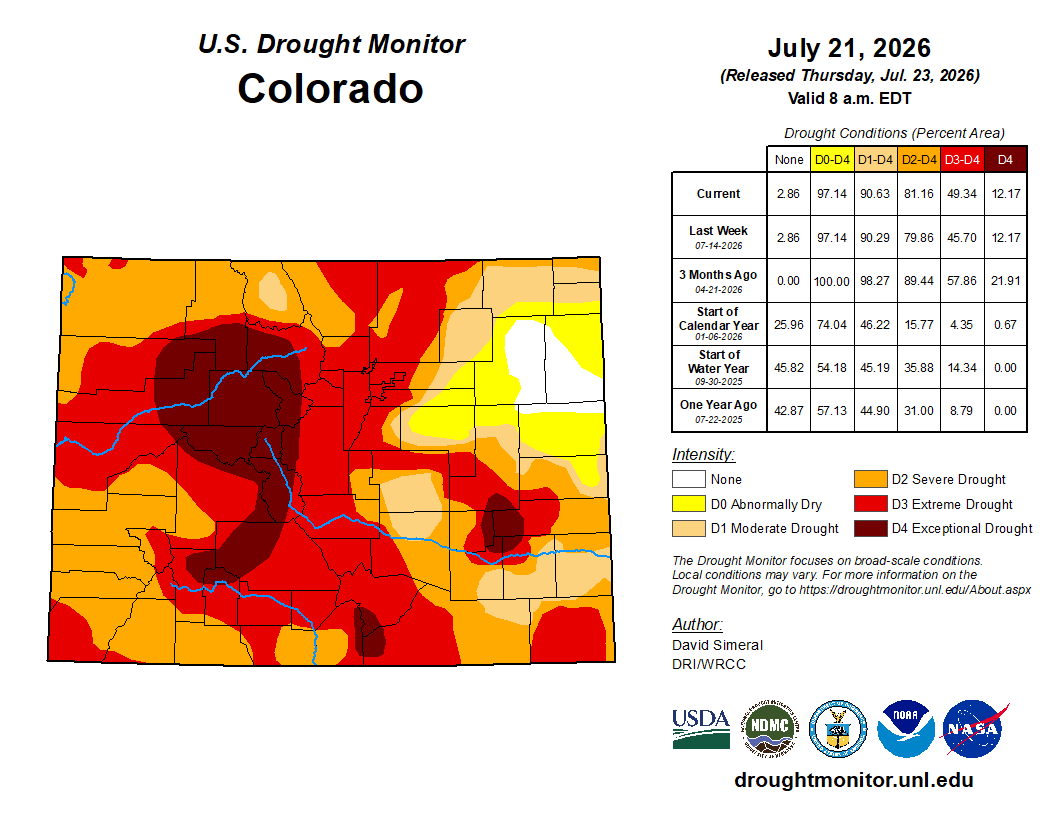
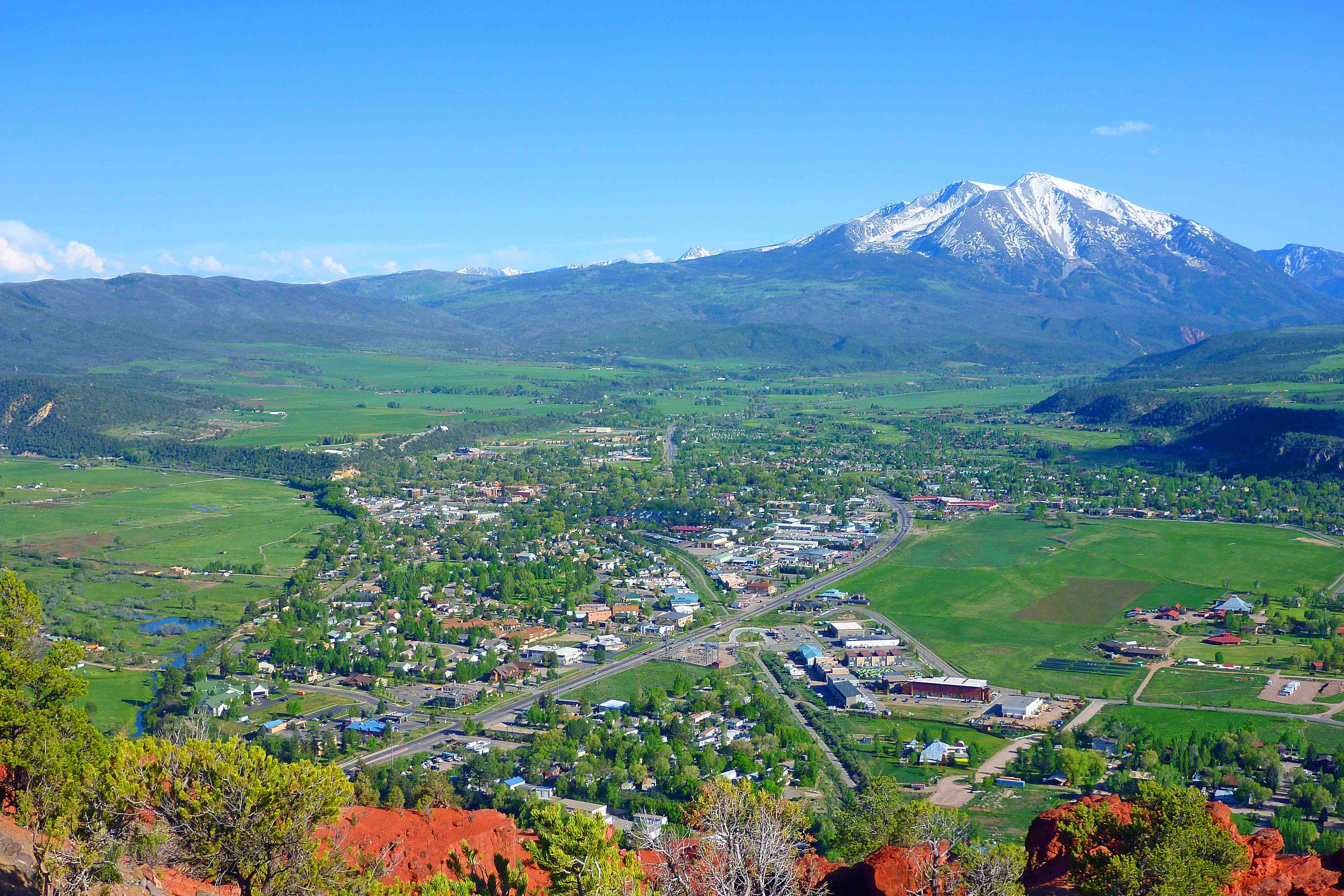
Despite recent rains, most of Colorado remains in deep drought and a governor’s task force has now put forward four recommendations to help deal with the problem. State climatologist Russ Schumacher said the monsoon rains were welcome, and certainly bringing some relief — increasing stream flows on the Western Slope and helping control widespread wildfires — but it’s unclear that the rain will continue in the fall or reduce the risk of another snow drought next winter…
The four recommendations
The first was to reduce onsite water consumption at all state facilities. This would require the state to develop water efficiency and drought plans, including water use audits, leak detection, landscape evaluations and other efficiency measures. It’s an expansion of Colorado’s “Greening Government” framework, which requires state facilities to proactively address water use.
The second is to direct state facilities to shift outdoor water management practices and reduce lawn watering and irrigation use. Kat Weismiller, section chief at the Colorado Conservation Water Board, said the goal was to “advance efficiency and conservation efforts on state facilities through long-term planning that can reduce onsite water consumption and build drought resilience.” It directs the state to evaluate outdoor water use at state facilities and make recommendations to reduce that water use or change landscaping.
The third recommendation directs the state to reduce washing state-owned vehicles. The goal is to reduce water waste by reducing the frequency of washing vehicles, while maintaining essential safety and health standards.
The fourth recommendation is to extend state tax deadlines for small businesses impacted by the drought. This temporary administrative waiver, which is similar to the wildfire tax relief already being offered in 2026, would apply to all eligible taxpayers, including agricultural producers and recreational businesses, which could apply for extensions.
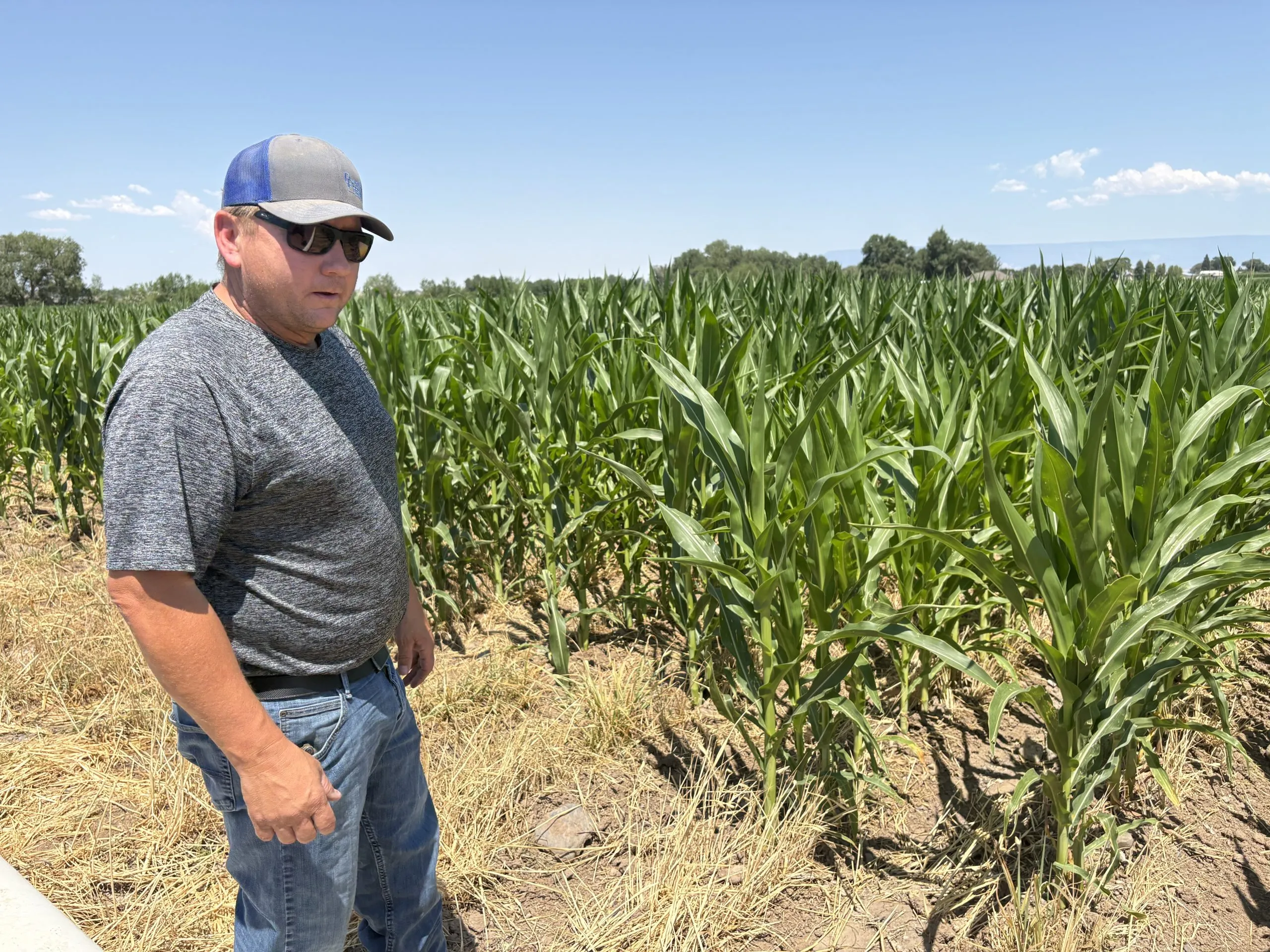
Farmer Randy Friend grows corn in the Olathe area. He left the debris from last year’s crop on the ground as a form of mulch to try to retain moisture in this exceptionally dry year. CREDIT: HEATHER SACKETT/ASPEN JOURNALISM
Fourth-generation Olathe farmer Randy Friend stopped his pickup truck next to a row of corn whose green leaves were limp and curling, with a gray tinge. Friend’s corn was stressed as the valley endured a July heat wave with temperatures nudging close to 100 degrees.
“I hate to see it looking like that with our water situation,” Friend said.
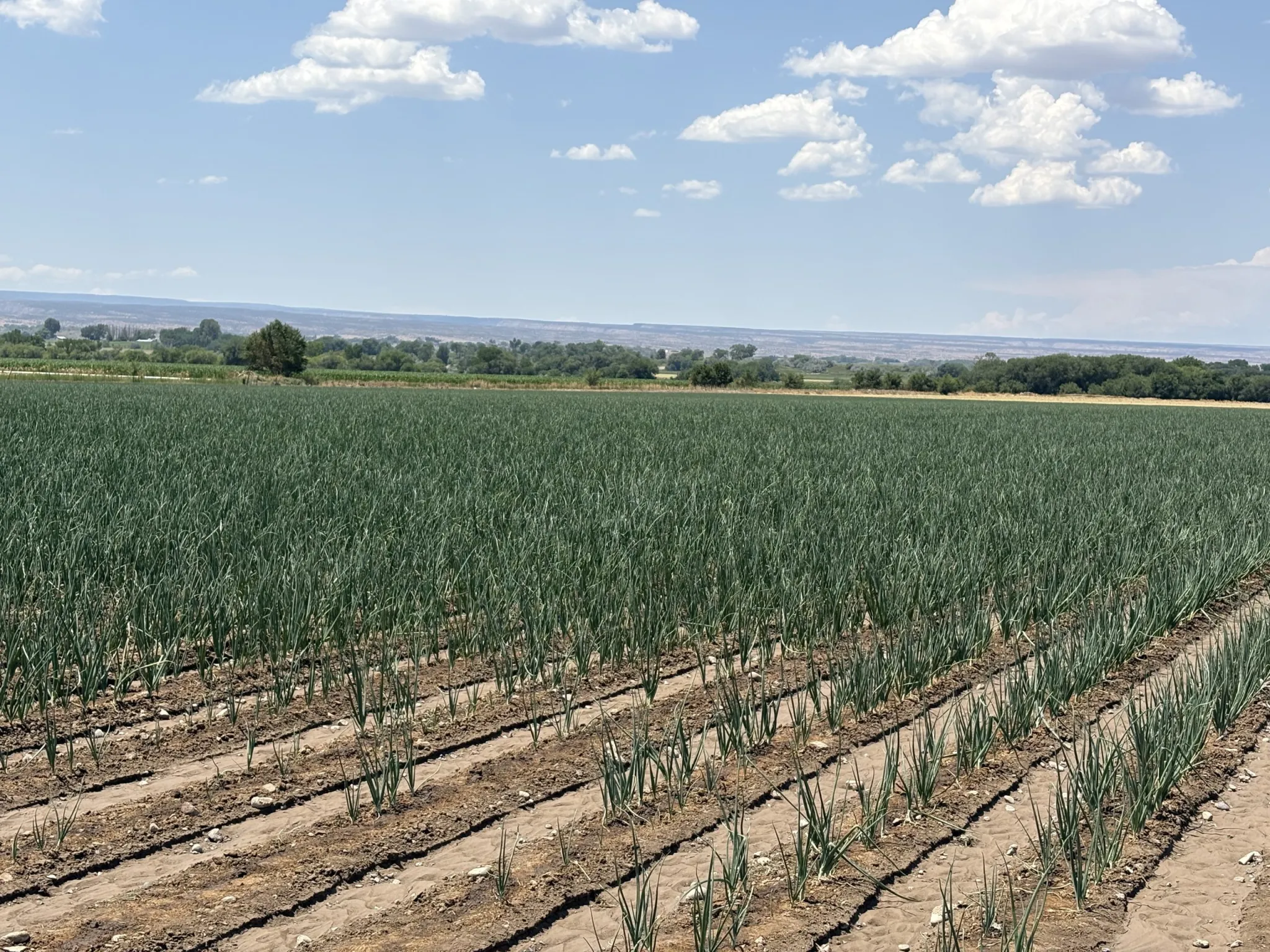
Next was a field of onions, a thirsty crop with a long growing season. The furrows between the dark-green sprouts were still damp, an indication the field was just irrigated that morning.
“Onions are our most expensive crop to grow and the most reward on a good year,” Friend said. “But they can also bankrupt you because they take so much more water.”
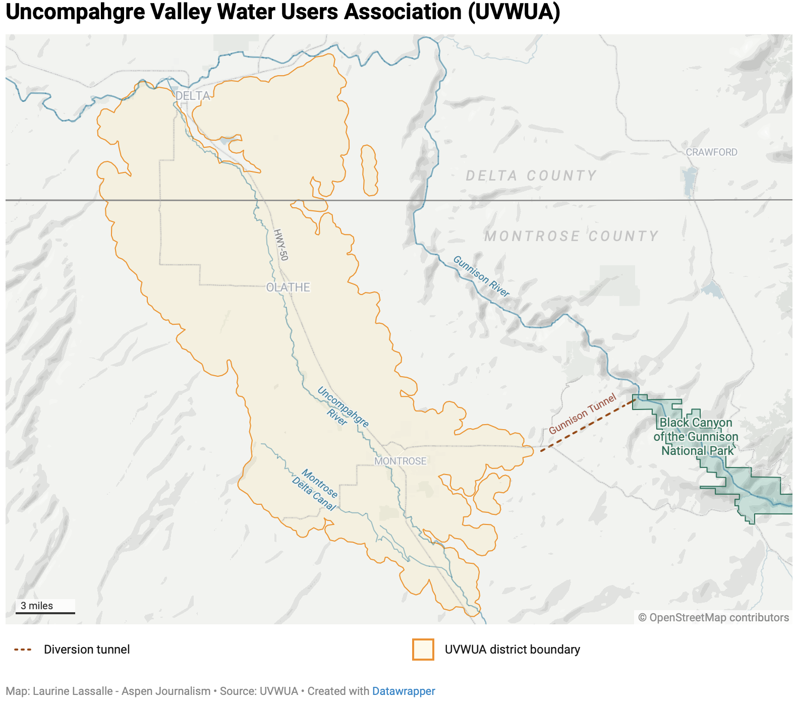
Friend farms corn, onions and forage crops for livestock as part of the Uncompahgre Valley Water Users Association, a vast expanse of farmland that extends from just south of Montrose to Delta, on Colorado’s Western Slope. Water from the Gunnison and Uncompahgre rivers, along with miles of tunnels, canals and ditches, transforms about 76,000 acres of high desert into lush green fields of corn, pinto beans, onions and alfalfa.
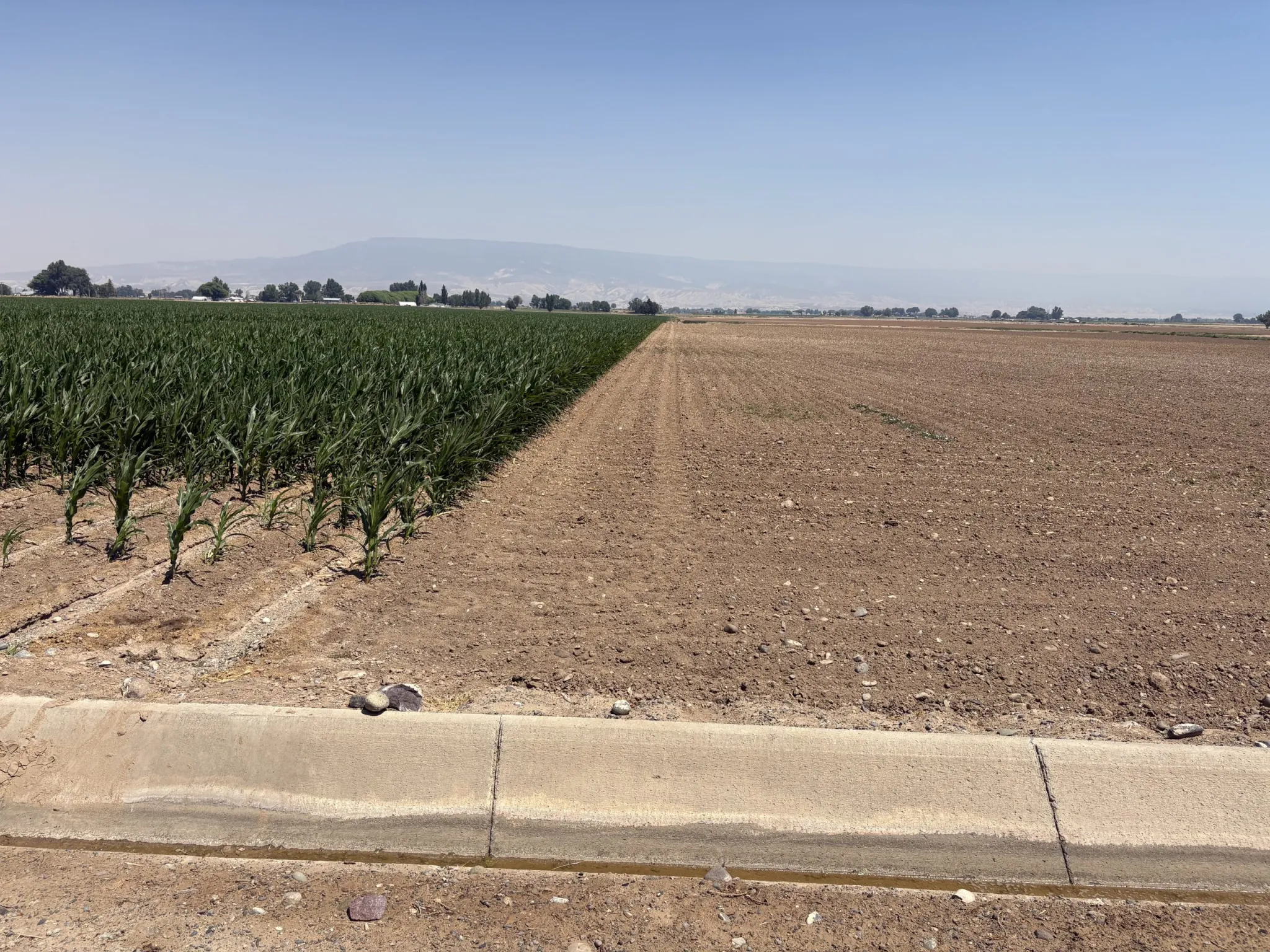
But this year, Uncompahgre Valley farmers are making tough decisions and developing new tools as they try to adapt to one of the hottest, driest years on record in the Upper Colorado River basin. Many are leaving fields dry, culling their cattle herds, switching to crops that use less water and relying on crop insurance payouts as the association faces a 50% cut to its irrigation water supply.
“I’ve been farming 30 years now, and this is by far the most extreme, biggest cut of water that I’ve ever had to deal with,” Friend said.
Some producers in the Uncompahgre Valley Water Users association have left some fields unplanted due to drought. The association has only about half its normal water supply this year. CREDIT: HEATHER SACKETT/ASPEN JOURNALISM
The Uncompahgre water users get about half of their water supply from Taylor Park Reservoir, at the headwaters of the Gunnison River, via the Gunnison Tunnel, a six-mile-long aqueduct that can bring up to about 1,175 cubic feet per second to the valley. The other half comes from the Uncompahgre River, a much smaller river basin that saw an abysmal end-of-season snowpack with just 14% of median April 1. That means the association has only about half its normal water supply for irrigation season.
“We’re limping along right now, but it’s going to be a challenging year,” said association manager Steve Pope. “We got to get our producers through Labor Day; we’re going to need the water then. It’s just a physical supply issue; the water just wasn’t there.”
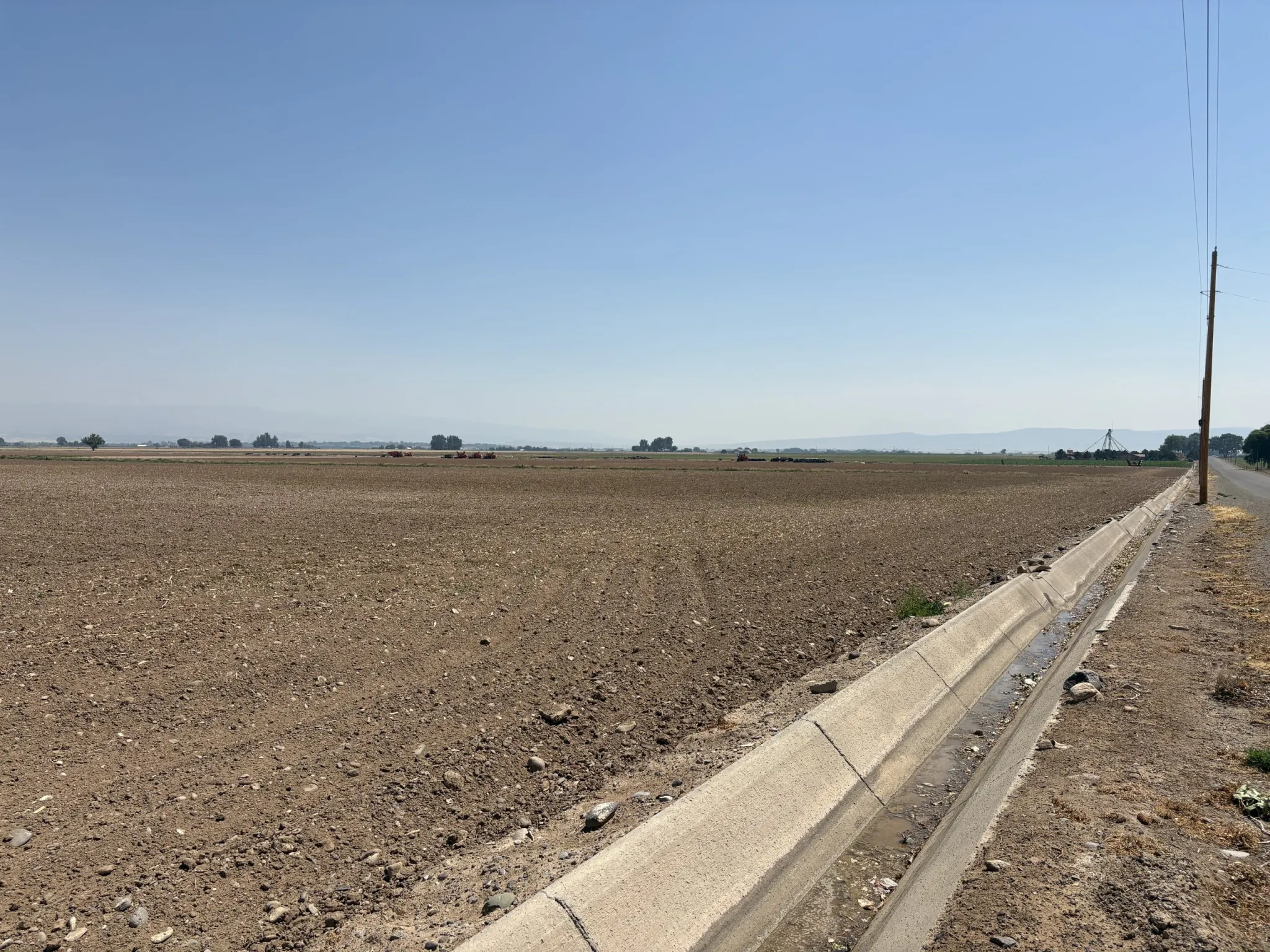
With its water cut by half, many producers in the Uncompahgre Valley have chosen to irrigate only some of their fields, leaving others unplanted for the season. The district’s northwest area, which is where much of the valley’s row crops are grown, has been the hardest hit. Pope estimates those farmers are fallowing between 30% and 60% of their ground. Driving around the district revealed many fields that were brown and dry.
“There’s just a tremendous amount of land out there that’s just barren, and there’s nothing you can do about it,” he said.
This field in the Uncompahgre Valley Water Users Association district has been fallowed this season due to a lack of water. The state of Colorado announced Wednesday that it will set up a conservation program using federal dollars, which means more fields on the Western Slope could soon look like this. CREDIT: HEATHER SACKETT/ASPEN JOURNALISM
Friend, an association board member, said he is fallowing about one-fourth of the land he farms and using about 30% to 40% of his acres to grow forage crops that use less water, such as sorghum-Sudangrass. But switching to drought-resistant plants is a strategy that doesn’t work for every grower. Friend also owns a feedlot so he can mix these drought-tolerant crops with higher-quality feed to make it work. Although some growers on the Western Slope are experimenting with alternative forage crops, such crops have yet to be grown on a large scale. Water-intensive alfalfa, with its high protein content, remains dominant.
Daris Jutten, a fifth-generation rancher in Ouray and Montrose counties, said the lack of water has prompted him to cut his herd back to the fewest cows he has ever had on his ranch. He has also left some of his alfalfa fields fallow.
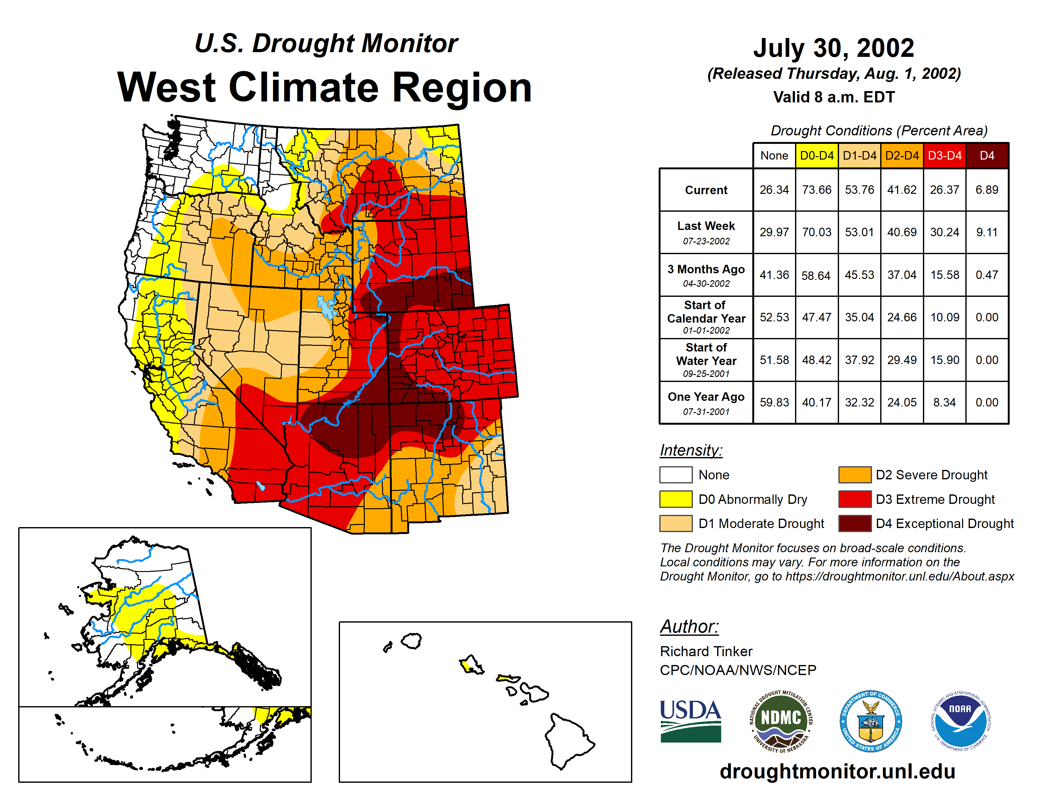
West Drought Monitor map July 30, 2002.
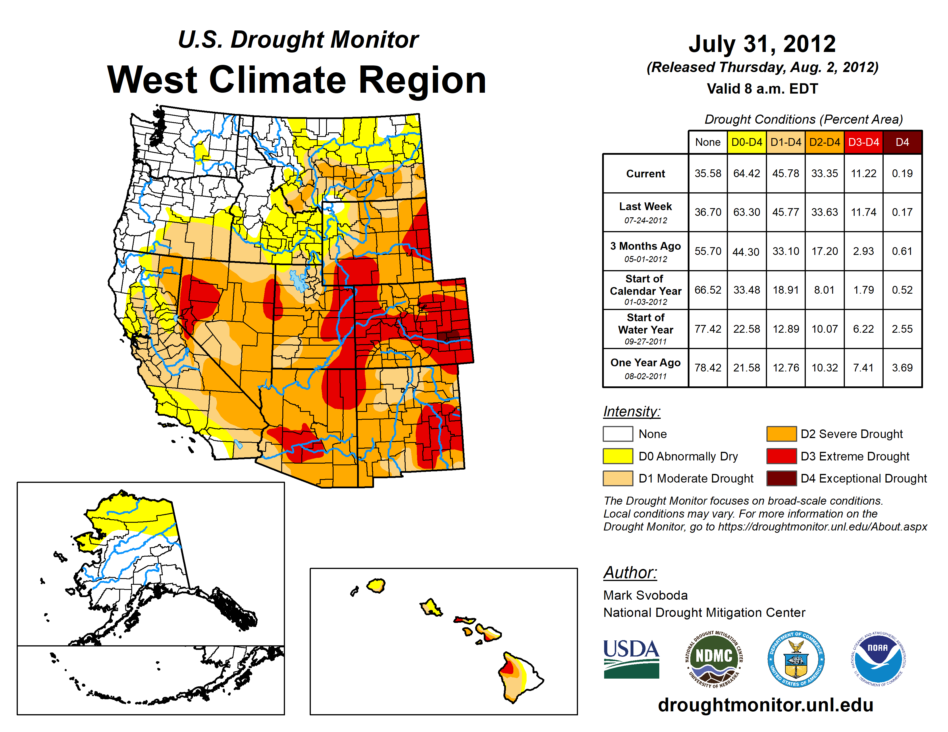
West Drought Monitor map July 31, 2012.
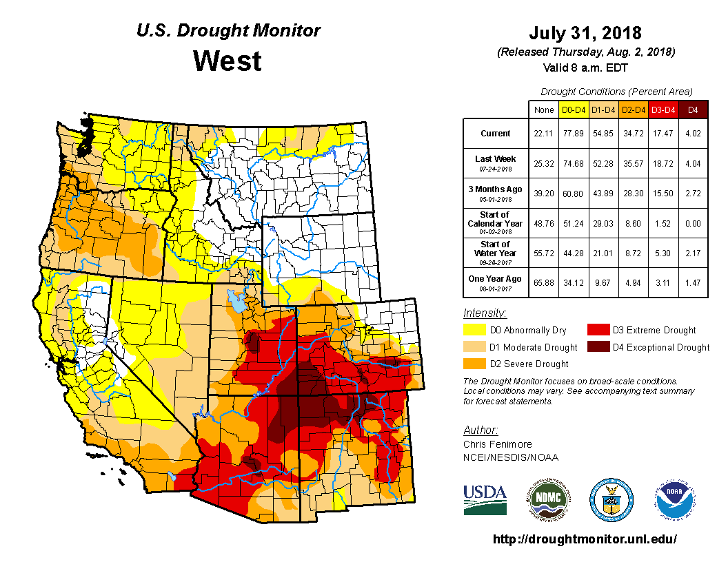
West Drought Monitor July 31. 2018
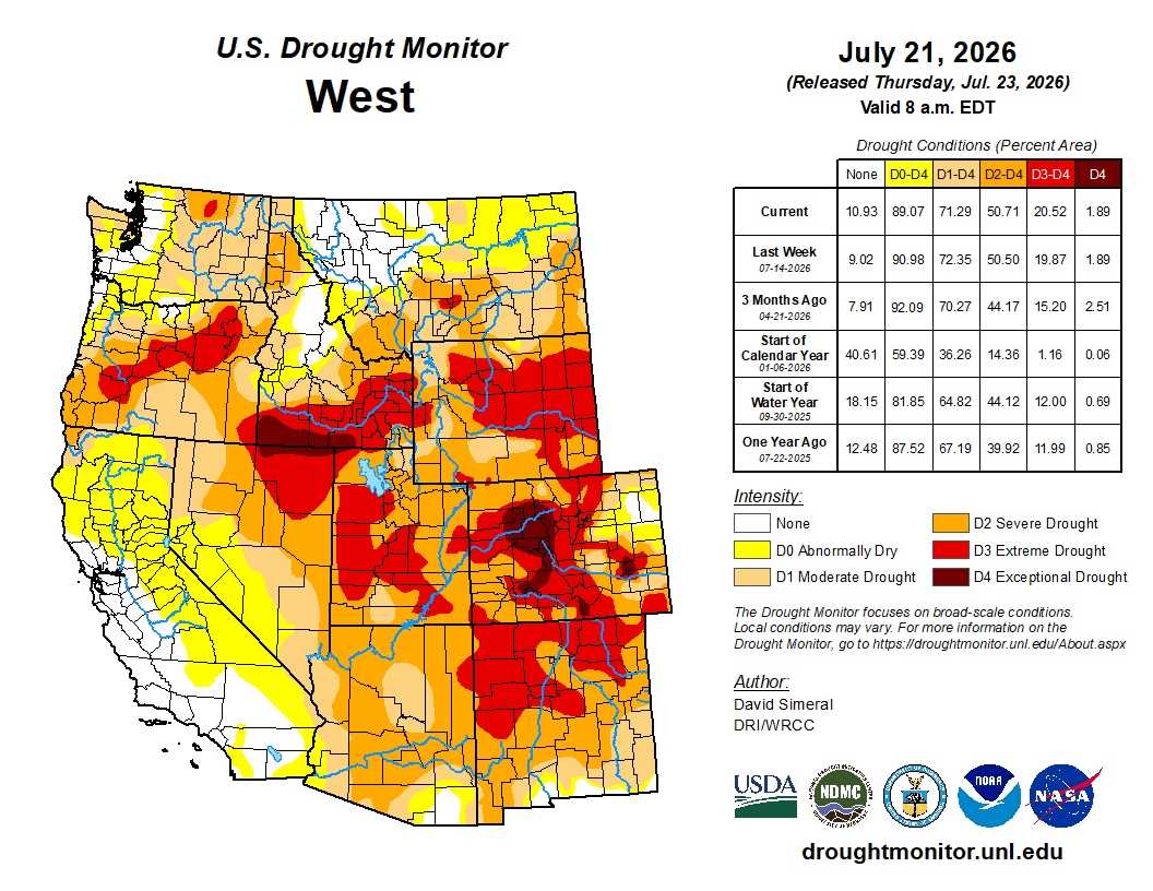
West Drought Monitor map July 21, 2026.
“I’ve seen it bad before, but I’ve never seen it this bad,” Jutten said. “2002 was bad. 2018, 2012 were all bad. But they don’t even come close to what this thing is.”
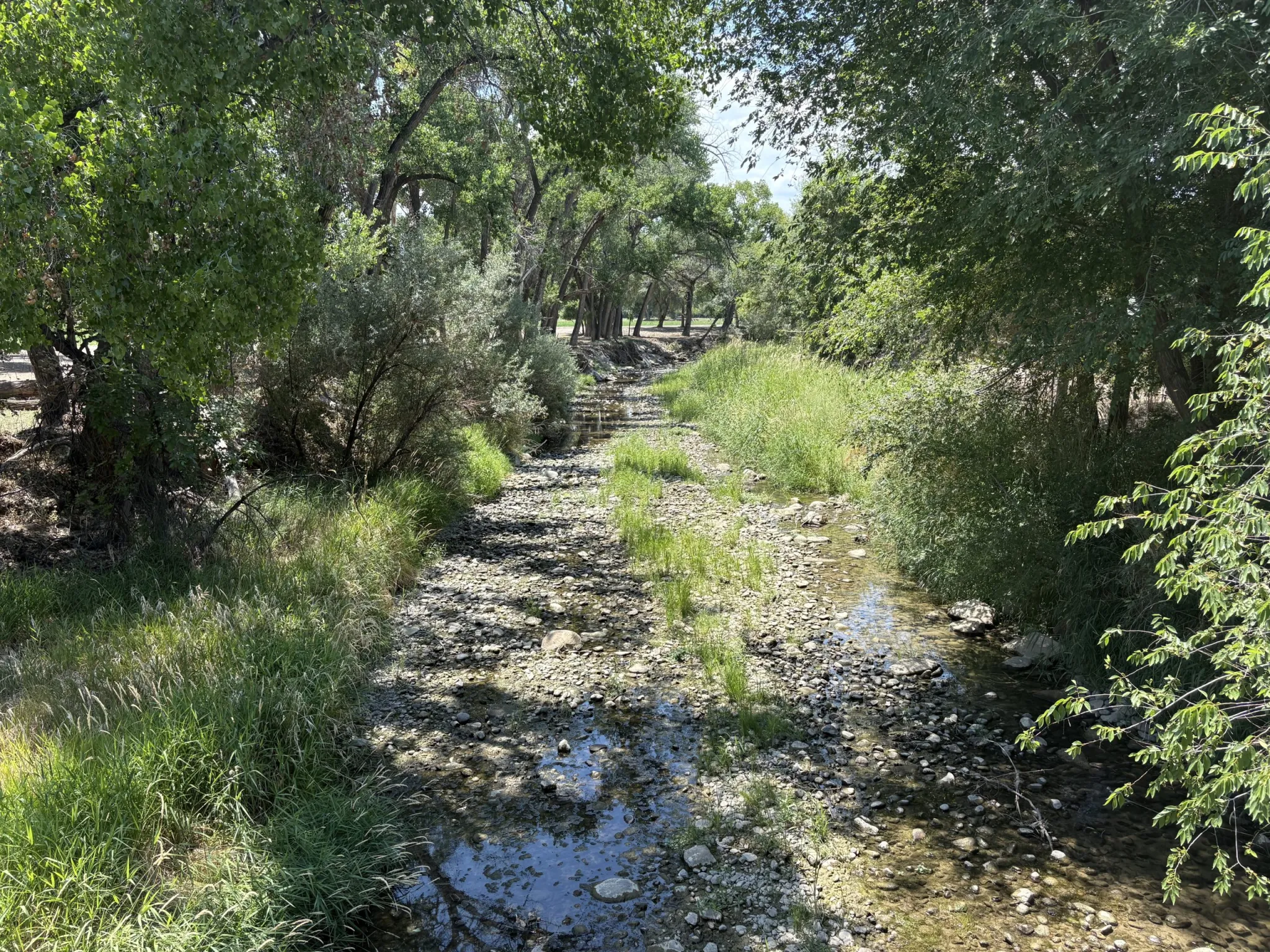
The Uncompahgre River in Olathe was nearly dried up in July due to agricultural diversions and drought. The Uncompahgre Valley Water Users Association is the biggest agricultural water user in the Upper Colorado River Basin. CREDIT: HEATHER SACKETT/ASPEN JOURNALISM
Colorado’s new conservation program adds pressure to cut water use
This year’s lack of water and a management crisis have brought the Colorado River system to the brink of collapse.
As the nation’s two largest reservoirs, Lake Powell and Lake Mead, plummet to new lows, water managers are taking emergency steps to keep Lake Powell levels high enough to produce hydropower at Glen Canyon Dam. At the same time, federal officials are crafting a plan for how the seven states that share the Colorado River will share shortages and how the reservoirs will be operated for the next two years.
Colorado’s new conservation program adds pressure to cut water use
This year’s lack of water and a management crisis have brought the Colorado River system to the brink of collapse.
As the nation’s two largest reservoirs, Lake Powell and Lake Mead, plummet to new lows, water managers are taking emergency steps to keep Lake Powell levels high enough to produce hydropower at Glen Canyon Dam. At the same time, federal officials are crafting a plan for how the seven states that share the Colorado River will share shortages and how the reservoirs will be operated for the next two years.
Upper Basin water managers have focused on the fact that their farmers and ranchers are affected first by a warming climate and are already experiencing shortages because the water simply isn’t there. The Upper Basin states (Colorado, New Mexico, Utah and Wyoming) suffer because there aren’t major reservoirs from which they can draw in dry years the way that the Lower Basin states (Arizona, California and Nevada) do. Both basins are increasingly expected to reduce consumption because supplies are shrinking and the Colorado River system as a whole must be managed within these new limits.
Onions are one of the water-intensive row crops grown in the Uncompahgre Valley. Farmers in the region are adapting to drought by fallowing fields and planting crops that use less water. CREDIT: HEATHER SACKETT/ASPEN JOURNALISM
On July 15, state officials announced the creation of a “near-term contribution program” that will pay water users to voluntarily cut back in 2027 and 2028, using $100 million in promised funding from the U.S. Bureau of Reclamation. The Upper Basin states have a goal of saving 100,000 acre-feet by the end of September 2028, which marks the end of water year 2028. The saved water will need to have a home in Upper Basin storage buckets — Lake Powell, Navajo, Blue Mesa or Flaming Gorge reservoirs — but precisely how it will be used and how it will fit into broader Colorado River management are still unknown.
The program has been a long time coming, and the concept is not new to Colorado. Officials said they are incorporating the lessons learned from previous demand-management studies beginning in 2019, stakeholder input and recent pilot programs.
As the biggest agricultural user in the Upper Basin, the Uncompahgre Valley — drought-stricken as it is — is ideally located for these types of programs and is considered one of the lowest-hanging fruits when it comes to finding places to save water.
When Colorado’s contribution program is implemented next year, the association will be ready. Knowing that a program was inevitable, Western Slope water managers have been proactive, developing a data-mapping tool that can help the association adapt to drought.
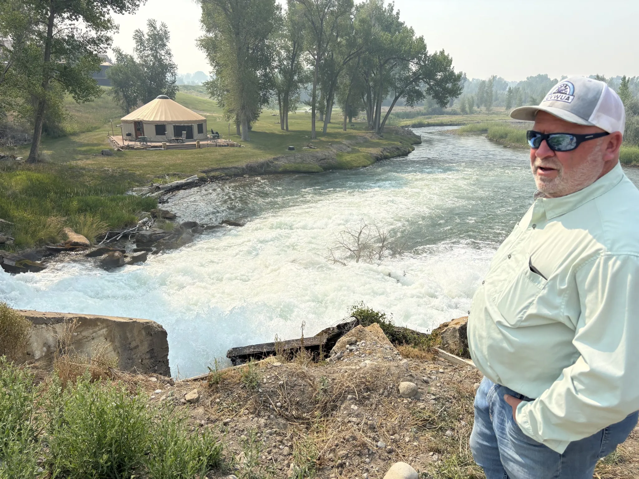
UVWUA Manager Steve Pope stands at the spot where water from the South Canal dumps water from the Gunnison River into the Uncompahgre River. It’s then diverted to the west side of the valley where it irrigates fields and row crops. CREDIT: HEATHER SACKETT/ASPEN JOURNALISM
Mapping tool helps plan conservation
With 550 miles of interconnected canals and laterals snaking through the valley, downstream irrigators often depend on reusing the water that runs off an upstream neighbor’s fields, and leaving a field dry could have unintended downstream consequences.
Developed by the Colorado River Water Conservation District and The Freshwater Trust, the tool can pinpoint where the greatest opportunities for water savings are, as well as how to avoid the worst consequences of fallowing ground. It can show what happens when efficiency improvements are made to the association’s century-old infrastructure and can show which ditches should be lined to provide the most bang for the buck to reduce seepage loss.
“From our perspective, it’s a great management tool because it allows us to track water through our system,” Pope said. “Let’s say there’s [a conservation] program, well, what would be the best farms to go to a deficit irrigation or fallow that would create the most (water savings), and you can target that.”
The tool is aimed at helping producers adapt to drought and can show which projects would result in the most water savings. Although the River District does not endorse a large-scale conservation program, it has long recognized that one was inevitable and has sought to mitigate the worst impacts to rural agricultural communities.
The intent of the tool is to help create a program that can maximize economic and environmental benefits as well as water conservation, said Raquel Flinker, director of interstate and regional water resources with the River District.
“It was always to provide data and analytics that would make whatever entity [is] creating a program design it in a way that seemed the most sensible,” Flinker said.
Some Uncompahgre Valley producers have participated in experimental programs that pay them to cut their water use, including the federally funded System Conservation Pilot Program, which took place in 2023 and 2024. Friend and a few others in the association enrolled in 2024 and were paid to reduce their water use. The association’s board has allowed their members to participate in conservation programs, but they remain somewhat controversial. An irrigation district in the Western Slope’s other big agricultural area, the Grand Valley, does not allow its members to participate.
Pope said instead of programs that pay farmers not to irrigate, he would rather see federal money pay for more efficiency upgrades to water-delivery systems such as lining ditches and improving headgates. The recently announced state program is meant to include a broad range of water-saving actions, but pilot conservation programs in the Upper Basin have always defaulted to paying irrigators to temporarily stop using water.
“The problem I see with it is if somebody enrolls and they sign off the year before, and then we don’t get any water and they are 50% fallowed anyway, did the program really generate any water?” Pope said. “It’s very difficult to measure the benefits of these types of programs when you have such an unreliable supply to begin with.”
Pope brings up an inherent contradiction about Upper Basin conservation: How can agricultural water users cut back when they already don’t have enough in drought years like this?
Despite the 100,000-acre-foot goal for the Upper Basin, Colorado leaders have long said they can’t commit to saving a specific amount of water. They said that figure can be reached only if sufficient federal funding is available and hydrologic conditions allow. And for now, the program remains short-term, while the effects of a warmer and drier climate appear likely to continue for the long-term.
“If this is the new normal, it’s going to get way more difficult,” Friend said. “If we have another winter like this last one, a lot of people are pretty worried about it.”
REMINDER: There’s just [2 days] left to comment on the Trump administration’s proposal to rescind ban on new oil and gas leases and mining claims within a 10-mile radius of Chaco Culture National Historical Park. The BLM is accepting public comment until July 29 on three alternatives: 1. keeping the ban in place; 2. shrinking the 10-mile buffer zone to just five miles; 3. eliminating the ban altogether. To comment, click on this link and then click on the “Participate Now” button at the top of the page.
🐓 Regulatory Capture Chronicles 🦊
Wall at the Twin Angel site, a Chacoan outlier that lies along the Great North Road. Note the oil and gas facility in the background. Jonathan P. Thompson photo.
President Donald Trump’s proclamations virtually eliminating Grand Staircase-Escalante and Bears Ears national monuments this month listed several arguments purportedly justifying the shrinkage. One of those was that national monument protections aren’t necessary, because the land and antiquities in question are already protected by various federal laws. The same argument is used to justify revoking the mining-claim and mineral-leasing ban around Chaco Culture National Historical Park.
There is some truth in this: There is a suite of federal laws, from the Federal Land Policy and Management Act to the Endangered Species Act, that are intended to protect environmental and cultural resources on all federal land, whether it’s in a national monument or not. But those laws aren’t always adequate, and now the administration is actually working to weaken Section 106 of the National Historic Preservation Act, which would be key to protecting the cultural sites in the former national monuments and the Chaco “buffer zone.”
When a mining or drilling company proposes a project on a mining claim or mineral lease on public land, the National Historic Preservation Act requires the jurisdictional agency to determine whether the proposed development might affect historic properties. If so, it triggers Section 106 of the law, which requires the agency to consult with tribal nations or other potential stakeholders, to identify potentially affected properties, and to work to avoid, minimize, or mitigate adverse effects on those properties.
Section 106, commonly referred to as “identify and avoid,” requires oil companies or other developers to conduct a cultural inventory of all land in the path of development. If the surveyors happen upon a “significant” site, the well pad, road, or pipeline must be relocated. This can prevent direct impacts to larger sites; you’re not likely to see a Chacoan great house bulldozed for a well pad, for example. But archaeological surveys can miss more subtle cultural features such as stone shrines, Chacoan “road” segments, or ancient cornfields. And the agencies aren’t likely to let a cultural landscape get in the way of the drill rigs or their “multiple use” mandate. Section 106 has not prevented gasfield roads from cutting across Chaco’s Great North Road in several places, nor has it kept several oil and gas wells from being drilled within a half mile of Pierre’s Site, a Chaco outlier within the 10-mile buffer zone.
Ruth Van Dyke, a professor of anthropology at Binghamton University cataloged the impacts of oil and gas development on the sound- and view-scapes at Pierre’s. “I found that, despite the due diligence agencies have exercised to protect the ground footprint of Pierre’s, there have been significant impacts,” she wrote. Twelve pumpjacks are visible from the Acropolis, and it’s likely that . When I visited a few years back, the whir-pop-pop-whir of the machines was irritatingly audible, affirming Van Dyke’s observation: “Rather than a sacred landscape and part of a UNESCO World Heritage Site, the Pierre’s community had the feeling of an industrial park.” (While many people have pointed out that there’s scant recoverable oil within the buffer zone, there is plenty of natural gas, which could be targeted if and when commodity prices increase).
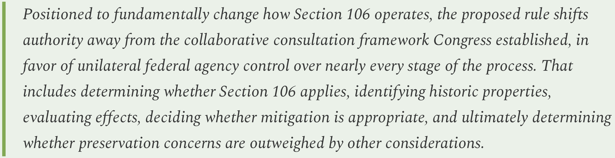
Given the inadequacies of Section 106 now, it has stunned historic preservation advocates to learn that the Trump administration’s Advisory Council on Historic Preservation is proposing to weaken the law even further by giving the agencies more power, while taking input away from the public and other stakeholders, including tribal nations.
That last clause is especially important when it comes to the lands cut out of the two Utah national monuments and the Chaco “buffer zone,” if it were to be rescinded as the administration proposes. We have seen that this for this administration, the quixotic quest for “energy dominance” outweighs nearly every other consideration, at least when it comes to public lands. That means that if the changes to Section 106 go through, we can no longer rely on that law to even partially protect the vast, numerous, and cultural sites and landscapes within Bears Ears, Grand Staircase-Escalante National Monument, and the Greater Chacoan Landscape. It makes the mineral withdrawals more important than ever.
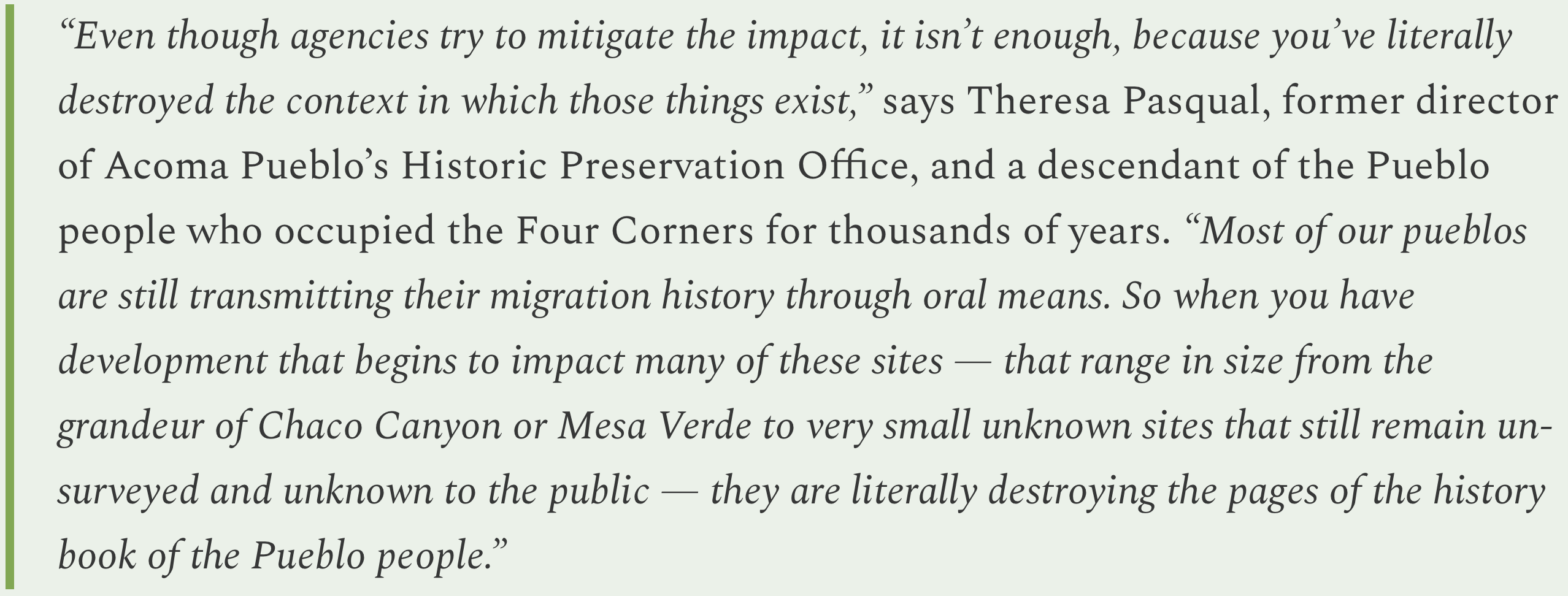
Several years back, when writing about the Greater Chacoan Landscape, I spoke with Theresa Pasqual, former director of Acoma Pueblo’s Historic Preservation Office, about Chaco, the landscape, and how federal laws weren’t enough. I’ll leave you with a sagacious quote from her:
⛈️ Wacky Weather Watch⚡️
It’s feeling downright apocalyptic lately. We’ve had crippling drought, hellish temperatures, locust plagues, cataclysmic fires,pestilence, and all that was just prelude to an especially sporadic and violent monsoon, so far, which helped some firefighting efforts, but also unleashed flash flooding in Arizona, Utah, and Colorado.
The most severe flooding generally occurred on burn scars left by this season’s wildfires, but the intensity of the downpours also wreaked havoc in unburned areas, including Telluride and, most tragically, outside Bicknell, Utah, where a family of five was killed by a flash flood.
Here’s a rundown of some of the most notable flooding:
In Telluride, a downpour kicked off flash floods and debris flows that shut down the Tomboy Road (it remained closed as of Monday morning), temporarily closed Hwy 145, and inundated the Telluride Middle/High School, where three to four feet of mud and water blasted and oozed into the Palm Theatre.
The Cottonwood Fire burned through more than 97,000 acres in southwestern Utah before being mostly contained. Over the past several days, it has been the recipient of heavy rainfall, which have turned area streams, including the Beaver River, into raging, slate-gray-colored, debris-clogged torrents. The flooding closed down I-15 for a period of time, and forced the evacuation of parts of Beaver City. I should make some crack here about semiaquatic rodents that build dams, but I will refrain.
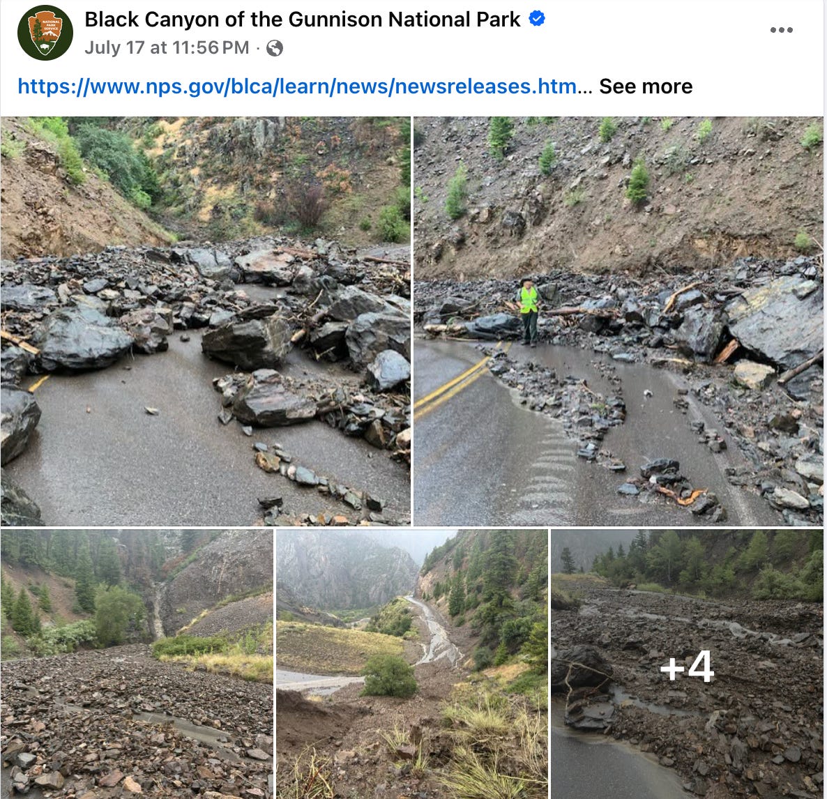
A cloudburst let loose on a year-old burn scar near the Black Canyon of the Gunnison National Park, spurring major debris flows that covered roads with rocky detritus and forced the evacuation of about 20 people from a campground.
I-70 in western Colorado was shut down when water and mud washed onto the highway between New Castle and, appropriately, Silt, on Monday evening.
Flash flooding in the Prescott Valley in central Arizona was big enough to turn at least one large shipping container into, well, a ship floating down the road. The Prescott area remained under a flood watch on Tuesday and Tuesday night, while the Phoenix area was facing an extreme heat watch later this week.
Any amount of moisture is welcome on the drought-desiccated earth, but if the videos of raging rivers in what usually are nearly dry arroyos give you the idea that the water woes are alleviated, think again. So far these cloudbursts are just that: Short, intense, and isolated bursts of precipitation that get arroyos and debris flows running, but only cause quick spikes in nearby river streamflows. Yes, that’s better than nothing, but no, it’s not going to halt Lake Powell’s precipitous decline.
All of those Telluride-area storms, for example, only pushed the San Miguel River near Placerville to about 160 cubic feet per second for a few hours. That’s about double what it had been running at, but just over half of the median flow for this time of year.
We’re also seeing a lot of precipitation inequality. While Telluride and the surrounding mountains were hammered, locales to the southwest of there remained relatively dry. The Dolores River gage at Slick Rock (downstream from the burn area) remained at a steady and unblinking zero cfs, although just a little ways downstream the gage at Bedrock registered 100 cfs, which is pretty good for the Lower Dolores in July.
Still, this does appear to be only the beginning of the monsoon. If the past is any indication, then the storms are likely to become more frequent and more widespread, and hopefully a little less intense, in the coming weeks.
Meanwhile, in the Northwest, lightning has sparked dozens of blazes that are growing together into massive complexes. The Hay Creek Complex in Gilliam, Wasco, and Sherman counties in Oregon is up to 92,000 acres and the Rowe Creek Complex to the south of there is at about 143,000 acres with 0% containment as of Monday night. Further east, the Powder River Fire in Baker County near the Idaho border was up to 20,500 acres.
Razorback sucker. Credit: The Land Desk
🦫 Wildlife Watch 🦅
The Trump administration’s U.S. Fish and Wildlife Service last week quietly downgraded Environmental Species Protections for the razorback sucker, a fish native only to the Colorado River Basin, from endangered to threatened.
“This remarkable fish is very abundant in the river channels of the Colorado Basin,” wrote David Starr Jordan in his 1889 report on the fish of Colorado and Utah. “It reaches a weight of 8 to 10 pounds and is largely used for food.” The razorback sucker, or Xyrauchen cypho, once thrived in the mid- and lower-elevation portions of the Colorado River and its tributaries. But human activities such as dumping mine waste into streams, irrigation diversions, dams, and stocking of non-native fish that prey on the sucker’s eggs and young diminished the population of razorback sucker and other native fish.
So in 1991, the USFWS listed the fish as endangered under the ESA, bringing it extra protections and resources toward its recovery. A propagation and stocking effort helped bring the population back, and fish stocked in the Colorado and Green Rivers have been found to be reproducing, according to Colorado River Endangered Fish Recovery Program. As a result, the USFWS determined that the species is “not currently in danger of extinction throughout all or a significant portion of its range,” and in 2021 proposed “downlisting” it to “threatened” status. That action was finalized last week.
Advocates understandably question the timing of the move. One of the main threats to the sucker is low streamflows, and we’re seeing some of the lowest streamflows on record throughout the Colorado River Basin right now, and climate change is likely to make them worse. The non-native fish that prey on the sucker tend to thrive in warmer water, also a result of climate change (Colorado wildlife officials have enacted voluntary fishing closures on several rivers in the state due to high water temperatures).
“The razorback sucker’s outlook is no better today than when the fish was originally protected under the Endangered Species Act in 1991, so this move makes no sense,” said Taylor McKinnon, Southwest director at the Center for Biological Diversity, in a written statement. “It’s still in danger of extinction throughout its range, which should preclude this downlisting.”
If you happen to be anywhere near Mancos, Colorado, from mid-August to the end of September, I urge you to visit the Sundog Gallery to see the “Portal” exhibit, featuring oil paintings by the late Stanton Englehart. I consider Englehart to be thepainter of the Four Corners Country — no one captures the light, and darkness, of the Great Sage Plain, the mesas, the canyons, and even the waters of Lake Powell quite like Englehart did.
The show opens Aug. 14 with a reception from 4 p.m. to 7 p.m. at the Sundog Gallery on Grand Avenue in downtown Mancos and runs until Sept. 30.