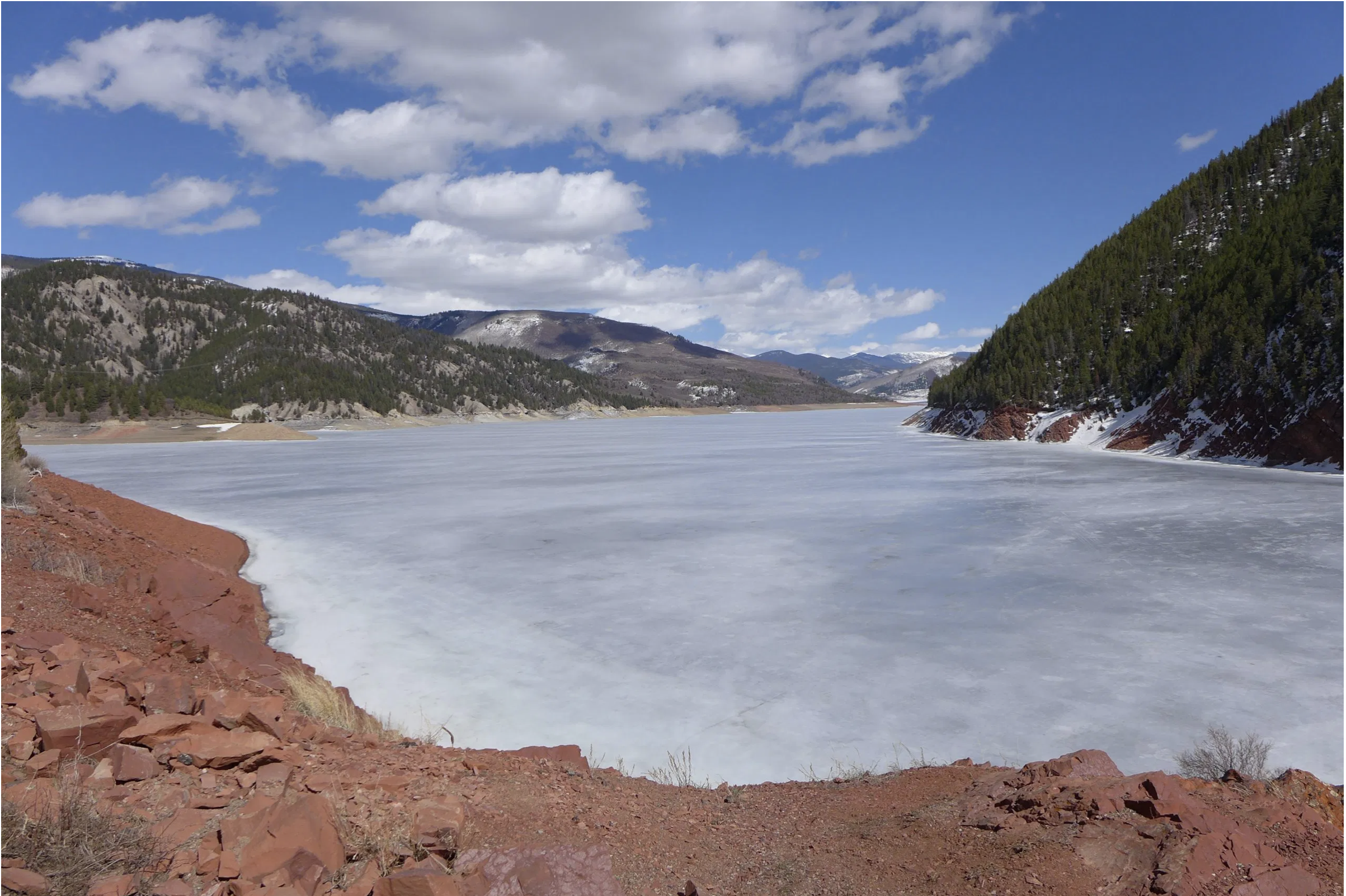
Click the link to access the EIS on the Reclamation website. Here’s the abstract:
July 31, 2026
The Secretary of the Department of the Interior, acting through the Bureau of Reclamation, proposes the adoption of new guidelines and coordinated management strategies to address Lake Powell and Lake Mead through their full operating range to take effect when the current agreements expire in 2026. Management strategies will primarily focus on the operation of Glen Canyon Dam and Hoover Dam, but may include actions upstream and downstream of these facilities to protect critical reservoir elevations.
This Final EIS has been prepared to inform the Secretary’s timely adoption of a new set of guidelines that would be sufficiently robust and provide improved predictability to all water users and managers in the Colorado River Basin. This Final EIS has been prepared pursuant to the National Environmental Policy Act to address the formulation and evaluation of specific interim criteria and to identify the potential environmental impacts of implementing such criteria.
Map of the Colorado River drainage basin, created using USGS data. By Shannon1 Creative Commons Attribution-Share Alike 4.0
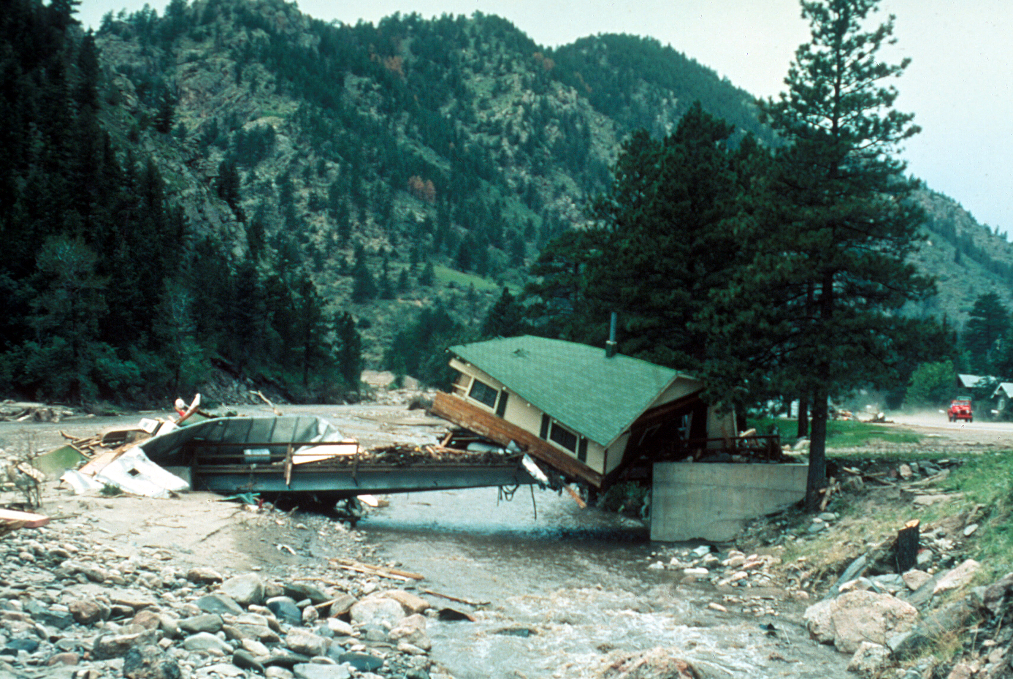
Big Thompson Flood, Colorado. Cabin lodged on a private bridge just below Drake, looking upstream. Photo by W. R. Hansen, August 13, 1976. Photo via the USGS.
Re-upping this post for July 31, 2026. The flood remains Colorado’s deadliest. Here’s a link to Coyote Gulch coverage mentioning the Big Thompson Flood.
July 31, 1976, Steamboat Springs: I had been wandering around the Flat Tops Wilderness for a week or so with Mrs. Gulch. Drizzle in between downpours during the monsoon. We were holed-up in a hotel to dry out and I phoned my mother to check in.
She asked, “Johnny are you anywhere near the Big Thompson Canyon? There’s been a terrible flood.”
And it was a terrible flood. After the September 2013 floods Allen Best wrote about being part of the disaster response in The Denver Post. It’s a good read on this 40th anniversary. Here’s one passage:
I was at the Big Thompson disaster. I was living in Fort Collins then and was among scores of young men (sorry, women, those were different times) with strong backs who could be summoned in case of forest fires. My only fire was at an old sawmill site in the foothills. The joke was that one of us had set the fire because we were so desperate for minimum-wage work.
Then came July 31. It was hot that night in Fort Collins. It hadn’t rained a drop.
I was living above Gene’s Tavern, just two blocks from the Larimer County Courthouse. When the call came, I was at the sheriff’s office almost immediately. It was 9 p.m.
Being among the first at the command center at the Dam Store west of Loveland, near the mouth of Big Thompson Canyon, I was assigned to a pickup dispatched to look for people in the water near the turnoff to Masonville. Already, the river was out of its banks. From the darkness emerged a figure, dripping and confused. “I went fishing at Horsetooth (Reservoir) and was driving home and then there was all this water,” he sputtered. He was befuddled. So were we.
Our leader decided we’d best get out of there. From what I saw the next morning, that was an excellent decision. Water later covered the road there, too. I spent the night at the Dam Store as the water rose. Helicopters were dispatched, but there was little that could be done. Our lights revealed picnic baskets, beach balls and propane bottles bobbing in the dark, roiling water that raced past us, but never any hands summoning help.
In the morning, we found those hands. The bodies were stripped of clothing and covered with mud. The first I saw was of a woman who we guessed was 18, not much younger than I was then. This thin margin between life and death was startling in my young eyes.
Eventually, 144 people were declared victims of the flooding that night (although one turned up alive in 2008 in Oklahoma).
Estes Park got some rain, but not all that much. The larger story was partway down the canyon, in the Glen Haven and Glen Comfort areas, where the thunderstorm hovered. In just a few hours, it dropped 10 to 14 inches of water.
Downstream in the canyon, just above the Narrows, some people were unaware that anything was amiss until they went outside their houses and saw the water rising in their yards. It hadn’t even rained there. One cabin I saw a few days later was stripped of doors and windows but stood on its foundations, a mound of mud 5 or 6 feet high in the interior. I seem to recall a dog barking as we approached, protecting that small part of the familiar in a world gone mad.
At the old hydroelectric plant where my family had once enjoyed Sunday picnics, the brick building had vanished. Only the turbines and concrete foundation remained. In a nearby tree, amid the branches maybe 10 or 15 feet off the ground, hung a lifeless body.
The river that night carried 32,000 cubic feet per second of water at the mouth of the canyon, near where I was stationed. It happened almost instantaneously — and then it was gone. It was a flash flood.
Here’s an excerpt from a look back forty years from Michelle Vendegna writing for the Longmont Times-Call.
Night on the ledge
“We, Terry Belair-Hassig and Connie Granath-Hays, graduated from Berthoud Jr. Sr. High School the month before, and were anxious to begin the summer. We spent the beautiful, sunny day of July 31, 1976, at a Hewlett-Packard company picnic at Hermit Park not far from Estes Park. After the picnic, we drove up to Estes Park and had dinner at Bob and Tony’s Pizza.
The clouds started moving in about 6 p.m., so we began the drive down to Loveland via U.S. 34. Within minutes, Connie had to pull her car over because the driving rain was causing zero visibility. We needed to get home, so she started out again, but we didn’t get too much farther before we were blocked by trees, boulders and debris washing down the canyon sides. We had just passed the Loveland Heights area — barely three miles since entering the canyon. The closest town, Drake, was miles away.
Connie pulled over to the side of the mountain as far as she could. There were a few other cars in this section doing the same, but we all sat in our cars — planning to wait out the storm. However, once the river began to rise and the water was hitting the tires, we decided to leave the car and start climbing. Connie’s dad had taught her to always ‘be prepared,’ so she had a tarp and a few extra jackets stored in her trunk. We grabbed them before climbing. It was a dark, treacherous climb.
A small group of people scrambled up the mountain near us. Connie gave one of the men her extra jacket. She also had a flashlight which came in handy later in the evening when the lightning wasn’t lighting up the canyon. The other people were lucky enough to find an overhang of rocks to sit under. We tentatively settled on a ledge out in the open, and wrapped ourselves in the tarp. Of course, the tarp was just an old tarp, not waterproof like the ones are today. It protected us for a while, but with the downpour of rain and runoff from the hillside, it too became drenched.
After only a little while, we watched her car, during the lightning flashes, being lifted up and carried down the river. We decided at this point we should climb higher, so we found a ledge where we spent the long, cold night. We had spent many winters skiing and had never been as cold as we were that night.
We sat on that little ledge (3 foot by 1 foot) with our knees drawn up to keep us from sliding off. We sang, shivered, cussed and did anything we could to keep our minds off of how cold and achy we were. We heard and saw cars, houses and propane tanks floating down the river during flashes of lightning. We thought by now it must be about morning time, but looking at our watch, it was about 10 p.m. We had a long night ahead of us.
The next morning was another blue bird day and we were freezing and soaked to the bone. We decided it would be warmer to take our jackets off and left them on the ledge. The road below us had been washed away, but the river had receded enough that we could get off the ledge and move around a little on the steep mountainside. We heard the helicopters for a long time before we saw one. Finally, we were rescued off the side of the mountain by a four-seat helicopter,and dropped off up river on a section of the highway that had survived. There were several other people there. I remember we were all surveying the canyon in a daze. There wasn’t much conversation. I leaned over and picked up a small piece of asphalt and put it in my pocket.
Click here to read the Fort Collins Coloradoan special about the flood.
On July 31, 1976, during the celebration of Colorado’s centennial, the Big Thompson Canyon was the site of a devastating flash flood that swept down the steep and narrow canyon, claiming the lives of 143 people, 5 of whom were never found. This flood was triggered by a nearly stationary thunderstorm near the upper section of the canyon that dumped 300 millimeters (12 inches) of rain in less than 4 hours (more than 3/4 of the average annual rainfall for the area). Little rain fell over the lower section of the canyon, where many of the victims were.
Around 9 p.m., a wall of water more than 6 meters (20 ft) high raced down the canyon at about 6 m/s (14 mph), destroying 400 cars, 418 houses and 52 businesses and washing out most of U.S. Route 34. This flood was more than 4 times as strong as any in the 112-year record available in 1976, with a discharge of 1,000 cubic meters per second (35,000 ft³/s).
Officials on Friday detailed how a Big Thompson River that was flowing at 30 cubic feet per second increased to 30,000 by the time it got to the narrows near Sylvan Ranch and the Dam Store.
The 2013 flood, by contrast was flowing at 16,000 cubic feet per second at the same point. But Bob Kimbrough, from the U.S. Geological Survey, said that number can be misleading. Just because it was flowing at less than half the rate, doesn’t mean the water was half as high as it was in 1976. It could have been a foot or two lower, Kimbrough said.
Further, the 2013 flood lasted longer. Where the 1976 flood dissipated nearly as quickly as it rose, the 2013 flood flowed over saturated ground for days, causing foundation failures and greater erosion than the 1976 flood.
Click here to read the extensive coverage from The Estes Park Trail-Gazette.
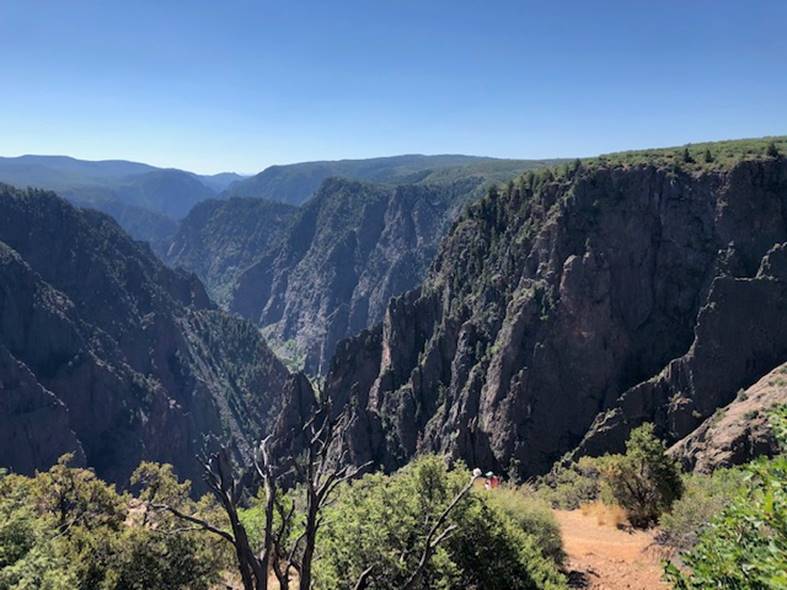
Between the reservoir and the endangered fish in the lower Gunnison sits the Gunnison Tunnel, which diverts water just below Crystal Reservoir at the head of the Black Canyon and carries it to about 80,000 acres in the Uncompahgre Valley. It belongs to the Uncompahgre Valley Water Users Association (UVWUA), which, as Colorado River District engineer Caleb Foy puts it, “holds a very senior water right” In Colorado, the oldest rights have priority over more junior rights. UVWUA is not untouched. It opened the season at 50% allocation — “just seeing the writing on the wall in regard to the poor hydrologic conditions,” Foy said. This means all UVWUA users receive half as much water as they would in a normal year. UVWUA’s other supply, Ridgway Reservoir, is ~85% full, but by design: the association told shareholders this spring that its “goal is to maintain storage in Ridgway Reservoir until mid-July to help support peak season demands.” And the natural flows in the Uncompahgre and Cow Creek that normally supplements UVWUA through the Spring and summer, delivered nothing — the association “received zero water in regard to direct flow water from the Uncompahgre system this year to date,” Foy said. Blue Mesa, he said, holds “multiple colors of water” — some stored under Aspinall Unit rights, some belonging to the association under a Taylor Park first-fill right. If the reservoir ever fell far enough that only the UVWUA’s water remained, that “would effectively dry up the Black Canyon.” Avoiding that is why the flows in the lower Gunnison are so low. It leaves the basin, in Foy’s words, in “a less risky neighborhood than we would have otherwise been in.”
Ruedi Reservoir was 65% full as of Wednesday. Increased releases out of Ruedi could bump up flows in the Fryingpan River to as high as 700 cfs. Credit: Heather Sackett/Aspen Journalism
Residents and anglers can expect to see high flows in the Fryingpan River in the month of August as water managers increase releases out of Ruedi Reservoir in an attempt to relieve the worst drought conditions downstream.
The Colorado Water Trust plans to begin releasing from a 4,700-acre-foot pool it leases in Ruedi on Monday. The Glenwood Springs-based Colorado River Water Conservation District also plans to begin releases from its 10,500-acre-foot Ruedi pool next week. Flows in the Fryingpan River are expected to typically be between 300 and 500 cfs while the releases are happening, though they could climb higher. It’s unclear how long the increased releases will last; it will depend on weather and precipitation over the coming weeks.
Water managers say flooding on the Fryingpan begins to be a concern around 800 cfs; River District officials say water managers will aim to keep the river below 700 cfs.
“We do not want to cause any flooding; we are very aware of that,” said Brendon Langenhuizen, director of technical advocacy for the River District.
Langenhuizen laid out details of the planned releases at a remote Zoom meeting of local leaders and water managers on Wednesday.
Although flooding may not happen until 800 cfs, impacts to the Fryingpan’s famous Gold Medal trout fishery happen long before that. Anglers generally like flows to remain below 300 cfs, the level at which wading becomes difficult and potentially dangerous.
Aspen Mayor Rachel Richards noted the dire conditions downstream, but asked if flows could be kept in the 300 to 350 cfs range when possible.
“Additionally, it’s more about the warning to fishermen if the water releases are changing rapidly,” Richards said. “I think the notification on the Fryingpan is what’s really critical here.”
Rick Lofaro, executive director of the Basalt-based Roaring Fork Conservancy, said his organization has already started getting the word out.
“There is an organization called the Roaring Fork Fishing Guide Alliance, and we are in lockstep with them,” Lofaro said. “We have already started to alert people to these increased flows, and the fishing community will be notified by the Roaring Fork Conservancy, along with the greater community.”
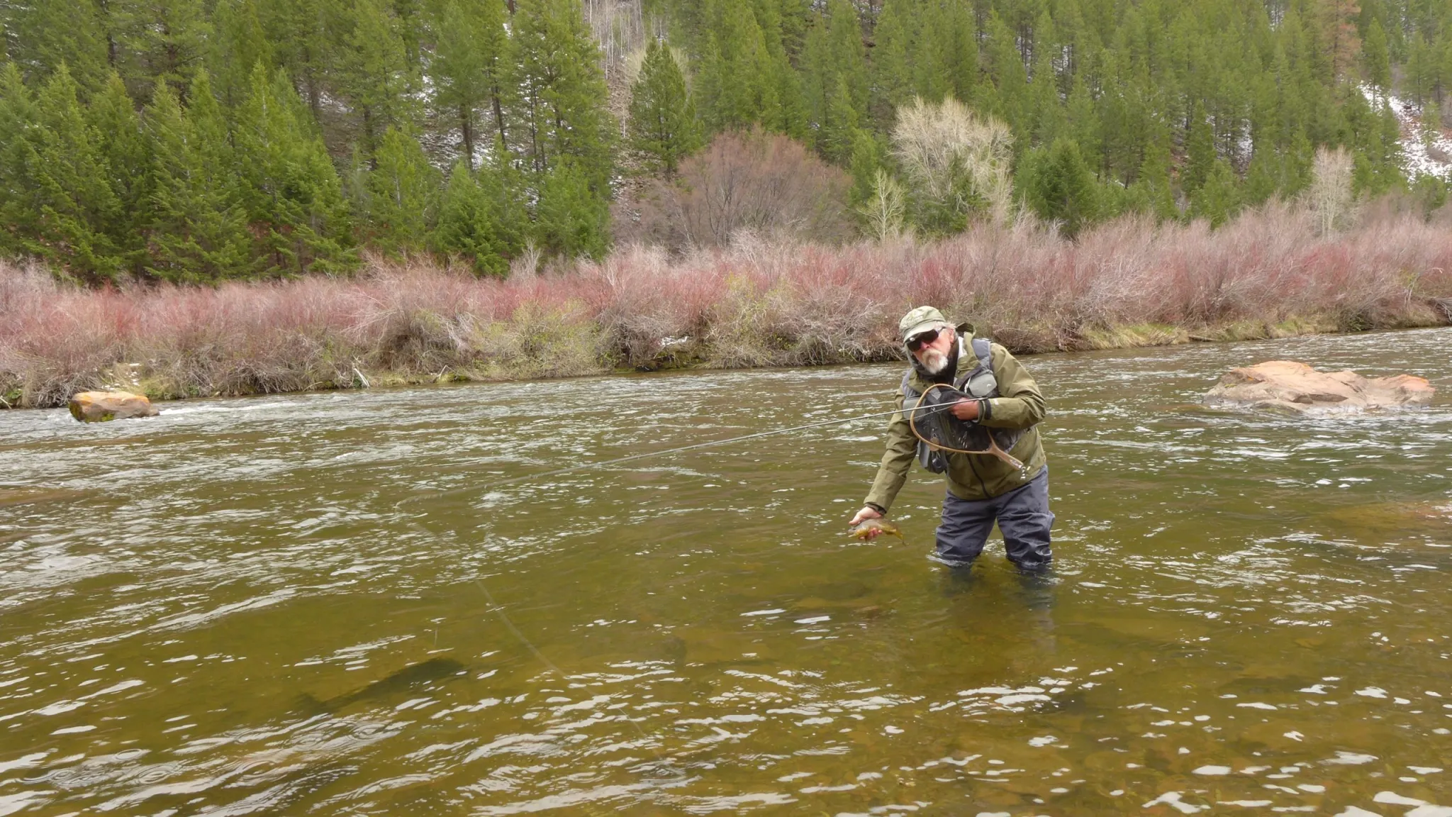
Bill Nein, of Salida, prepares to release a brown trout he caught back into the Fryingpan River. Anglers generally like flows to stay below 300 cfs for easy wading. CREDIT: HEATHER SACKETT/ASPEN JOURNALISM
As of Wednesday, Ruedi was about 65% full. Tim Miller, a hydrologist with the U.S. Bureau of Reclamation, noted that this year’s reservoir operations are pacing about 10 days ahead of 2002, which was another year where drought conditions increased releases and lowered water levels at the reservoir. When asked by a U.S. Forest Service representative about when the water level would become too low for the boat ramp to operate, Miller said exactly when is unclear but that it would happen in the next month.
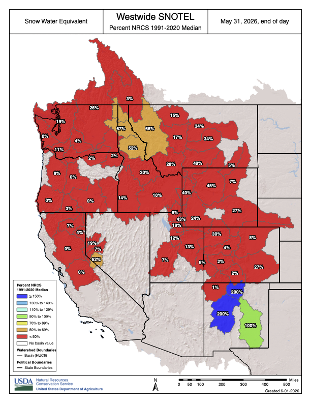
Westwide SNOTEL basin-filled map May 31, 2026.
The Ruedi releases are aimed at alleviating the impacts of the worst snow-drought on record in the upper Colorado River basin, which are being felt on local waterways, as well as farther downstream. Pitkin County has issued a mandatory closure of the Roaring Fork River through the North Star Nature Preserve – a popular stretch for paddleboards and kayaks – because of unprecedented low flows. And Colorado Parks and Wildlife has issued voluntary fishing closures on portions of the Roaring Fork, Crystal and Colorado rivers due to low flows and high water temperatures.
The effects of drought are also being felt in the Grand Valley, one of the big agricultural hubs on the Western Slope with some of the most senior water rights on the Colorado River. The water from Ruedi will flow down to be used by irrigators in this area, who are currently about 500 cfs short of the water they need, according to Langenhuizen.
“This has been a tough year for a lot of people from the bottom of the basin all the way to the top, and a lot of people have been pitching in to help us get through and share resources,” he said. “Everybody’s kind of taking a hit this year.”
The River District’s Ruedi releases are part of its 2026 drought response plan. They are meant to cushion the blow of shortages in a pool of water in Green Mountain Reservoir known as the Historic Users Pool. HUP water is released mainly to satisfy farmers and ranchers in the Grand Valley, whose group of senior water rights — known as the Cameo call — are the commanding force on the river.
When Cameo places a call for its water, it can force junior users all the way up to the headwaters to shut off. The HUP also protects other water users, known as HUP beneficiaries, because without the releases from Green Mountain, Cameo would place more frequent calls, forcing these users to cut back.
However, this year, the HUP did not fill, causing repercussions up and down the river.
“This is really driven because we don’t have HUP coverage, which has an impact on a lot of users in the Colorado River basin, both municipal and irrigators,” Langenhuizen told Aspen Journalism in a separate interview. “We really tried to look at this as wholesale, like how can we help as many people in the Colorado River basin as possible?”
Depending on water demands, the 4,700 acre-feet from the Water Trust could be used by irrigators in the Grand Valley, or it could be used for hydropower generation in the Grand Valley and then flow into the 15-mile reach, a chronically water-short stretch of the Colorado River that is critical habitat for endangered fish.
Bicycling the Colorado National Monument, Grand Valley in the distance via Colorado.com
To bolster the Colorado River’s flow downvalley through historic drought, water authorities will be increasing the flow out of the Ruedi Reservoir through August. That water will flow into the Fryingpan River…Water will then flow into the Roaring Fork River, then down the Western Slope, where populations in Grand Valley are in “dire need,” he said…
Green Mountain Reservoir (back in the day) is owned by the U.S. Bureau of Reclamation and located in Summit County north of Silverthorne along the Blue River. Photo credit: Denver Water.
Traditionally, the Western Slope relies heavily on the Green Mountain Reservoir — about 17 miles south of Kremmling — to sustain a steady Colorado River flow. But due to the state’s dry, warm winter, that reservoir struggled to fill over the spring. The administrators of Green Mountain Reservoir found that low water levels and fast releases were exacerbating a slow-moving landslide on its banks, so they limited how much water could be released out of the reservoir to half a foot a day…
Tim Miller, a hydrologist with the U.S. Bureau of Reclamation that manages the levels at Ruedi Reservoir, said the reservoir played a similar supplemental role in 2002, when Colorado saw another historic drought. This year’s use of the reservoir is about 10 days ahead of then, he said.