Forget Western Water War: Local Managers Choose Partnership; Collaboration keeps water flowing — Brett Walton (circleofblue.org) #ColoradoRiver #COriver #aridification

The Arizona Canal cuts through Phoenix. Photo Brett Walton/Circle of Blue

Click the link to read the article on the Circle of Blue website (Brett Walton):

July 7, 2026

The Colorado River, from one viewpoint, is a mess.

The iconic waterway, fundamental to the region’s modern existence – its desert metropolises, its high-tech industries, its agriculture, and its recreation economy – is on the verge of crashing. A two-decade drying trend, aided by carbon pollution in the atmosphere and water use that exceeds supply have nearly drained the basin’s liquid savings accounts.

Nature is now threatening to overwhelm human interventions. Lake Powell is 28 percent of its capacity. Lake Mead, just 24 percent. Climate pressures abound in these hot, dry times. A March heat dome obliterated temperature records. Snowpack was the worst on record. At least five fires larger than 25,000 acres are currently burning in the parched basin.

The basin’s seven states, unable to find consensus on how to live with a shrinking supply, are deadlocked after four years of attempting to negotiate the river’s management rules. State and federal authorities are deciding how much less Colorado River water will be available, anticipating that the reductions will hurt. Knowing that water enables economic growth, they don’t want to be viewed as selling out their constituents.

Look closer, however, and the narrative of warring factions fades a bit. At the local level, water managers are collaborating to ensure residents and businesses have adequate water supplies. They are signing multiparty deals and pursuing joint projects to share resources and keep water flowing to homes and businesses. Such dealmaking is not a remedy to all that ails the basin. But it is viewed as essential in a time of deep climate uncertainty and anxiety.

In June, six water suppliers in Arizona, California, and Nevada signed a memorandum of understanding with the Bureau of Reclamation, a federal agency, to facilitate interstate exchanges of desalinated and recycled water for Colorado River water. The exchanges, taking advantage of spare treatment capacity on the California coast, would introduce new water into a depleting basin.

Earlier this spring, Phoenix, Tucson, and other Arizona water users announced a venture to create an emergency reserve of water for cities facing shortages and to simplify voluntary water transfers in the state – “an easy button” to move water to where it is needed, said Max Wilson, Phoenix’s water resources management adviser.
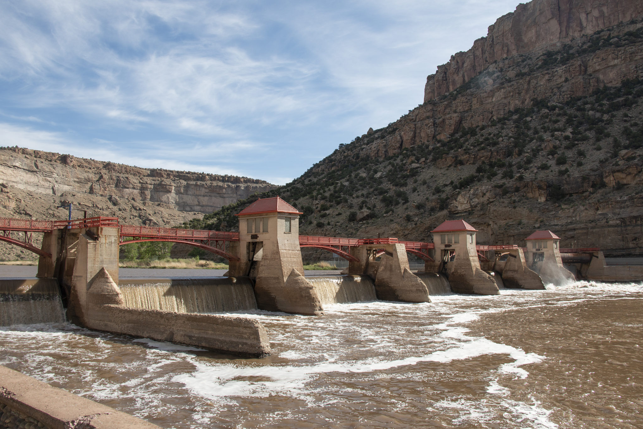
The Grand River Diversion Dam, also known as the “Roller Dam”, was built in 1913 to divert water from the Colorado River to the Government Highline Canal, which farmers use to irrigate their lands in the Grand Valley. Photo credit: Bethany Blitz/Aspen Journalism

On Colorado’s Western Slope, home to the river’s headwaters, irrigation districts are taking less water this summer than they are permitted in order to share with towns that would have faced supply cuts.

And in New Mexico, Santa Fe’s water utility is in early talks with neighboring pueblos about joint infrastructure for storing water underground, recycling water, and sharing water between systems in case wildfire pollutes a water source and renders it unusable.

“Cities have the ultimate responsibility to make sure there’s tap water,” said Kathryn Sorensen of Arizona State University and the former director of the Phoenix water utility. “And that means they have to be constantly vigilant and constantly innovate and constantly find new arrangements and new supplies.”

These arrangements, while not a new development, have taken on greater significance as the American West struggles through record heat and aridity this year that is an indicator of worsening water supply challenges in the drying region. Based on a decades-long track record, these arrangements also illustrate that neighbors helping neighbors can be a cost-effective form of climate adaptation.

“It makes sense to me that this happens at the local level because that’s where the risk is,” Sorensen said. She cited the Central Arizona Project, or CAP, as another example. CAP delivers Colorado River water to Phoenix, Tucson and other customers in the state’s populous midsection.

“The risk to the CAP of there not being water in the canal is that the CAP doesn’t deliver water to its contractors and subcontractors,” she said. In other words, a contractual failure.

But for the cities who hold those contracts? A failure to deliver water would hasten a public health and economic crisis. “The risk to a city is there’s no tap water,” Sorensen said. “And that’s just a totally different level of risk. So you see these types of innovations happen at the level where the risk exists.”

Collective Action

Partnerships do not happen spontaneously. They are the product of months and years of discussion, negotiation, and relationship building.

“The biggest challenge is communication, understanding the needs of your partners and clearly their sensitivities,” said Bill Schneider, the Santa Fe water resources manager.

Schneider is part of discussions with four pueblos in the Santa Fe area on joint water infrastructure projects, including water recycling and underground storage.

One clear possibility is that Santa Fe could connect its water system to the Pojoaque Regional Water System, which will serve Pojoaque, Nambé, San Ildefonso, and Tesuque pueblos with Rio Grande water.

Connecting neighboring systems is a form of insurance, Schneider explained. Wildfires are a perpetual risk in the watersheds of northern New Mexico. If a severe wildfire sends ash and debris into the Rio Grande, the polluted water could force water systems to shut off their river intakes. It has happened before on the Rio Grande. The Albuquerque Bernalillo County Water Utility Authority had to close its intake for two months in 2011 after the Las Conchas fire. With an interconnected system, water could be delivered to the pueblos from Santa Fe’s other sources, which include the Santa Fe River and groundwater.

Due to the high cost of building infrastructure, system interties and similar partnerships make financial sense, Schneider said. “It means you don’t have to go out and build an entirely new system.”
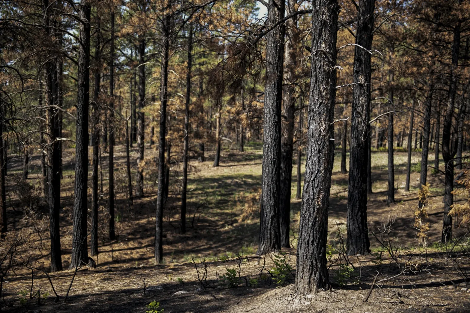
Wildfires are an annual risk to water supplies in northern New Mexico. Photo © Pablo Unzueta for Circle of Blue

These infrastructure arrangements already exist in many places, but especially in Arizona. Nevada, for instance, has banked part of its Colorado River allocation underground in Arizona for more than two decades.

A decade ago, when Sorensen was the director of Phoenix Water Services, Phoenix and Tucson signed a trailblazing water deal. It allowed Phoenix to bank some of its Colorado River water underground in Tucson. When the water is needed, Tucson will be able to pump the groundwater and, in exchange, Phoenix will take some of Tucson’s share of Colorado River water. The deal, which has not yet had to be exercised, makes the most efficient use of the water treatment capabilities and infrastructure in the two cities.

That agreement, Sorensen said, paved the way for other exchange partnerships in central Arizona. Mesa, in a project completed this year, provides treated wastewater to the Gila River Indian Community in exchange for 8,000 acre-feet of Colorado River water. (An acre-foot – 326,000 gallons – can supply about 3.5 households in urban Arizona for a year.)

In Sorensen’s view, dealmaking is fundamental for utility leaders.

“They’re good horse traders, right?” she said. “That’s part of the job. ‘How can we make a win-win exchange or trade here that makes everyone happy and maximizes the resource?’ The water managers are really good at that.”

The latest iteration is the Secure Water Arizona Program, or SWAP, that Phoenix and Tucson are developing with other central Arizona cities.

Details are still being finalized, but the program will have three components. One is an emergency reserve of water that cities can tap as a last resort. A second piece is facilitating water exchanges between willing sellers and willing buyers. The third element is what Wilson calls “the sandbox” – a forum for collaboration on the next generation of central Arizona water projects.

The idea, said Max Wilson, the Phoenix water adviser, is a form of mutual aid. “At its core, the assumption of the SWAP is that water users shouldn’t be letting other water users go dry.”

Even with the benefits, Wilson acknowledged that collaboration needs to be carefully calibrated.

“People don’t want to see water being forcibly reallocated, for sure,” he said. “People don’t want to see their water going to uses that they necessarily wouldn’t see as beneficial. But when people have legitimate needs, I’ve been really impressed by how the water user community has come together and been willing to say, ‘Let’s talk and let’s figure out what a potentially mutually beneficial solution to those needs could be.’”

Arizona Rivers Map via Geology.com.

Trial vignette: How much water does the unconfined aquifer store? — Chris Lopez (AlamosaCitizen.com) #SanLuisValley #RioGrande

Click the link to read the article on the Alamosa Citizen website (Chris Lopez):

July 8, 2026

Attorney: ‘In order to evaluate the current state of the aquifer in context, you would need to know how much the aquifer holds, wouldn’t you?’

Engineer: ‘I don’t believe so’

How much water is in the storage area of the unconfined aquifer? That was a question SWAG attorney Brad Grasmick posed to state Division 3 Water Engineer Craig Cotten and left the Alamosa water court hanging on at the conclusion of Wednesday’s day in water court.

Grasmick represents the Sustainable Water Augmentation Group, farmers who operate in the subdistrict and have banded together to oppose the Fourth Amended Plan of Water Management which is the matter before Division 3 Water Court Judge Michael Gonzales. 

In his first full day of cross examining Cotten, Grasmick covered a variety of territory from surface water credits to the one-to-one pumping feature of the new plan to Cotten’s responsibility to administer the plan. At times he got so deep into the proverbial weeds in grilling Cotten that Gonzales spoke of his own frustration in trying to follow along.

“You’re losing me on focus,” Gonzales told Grasmick as he called for a lunch break.

The question Grasmick posed at the end of his nearly six hours of cross examination offered a unique exchange. Grasmick started by saying he hasn’t seen a figure on how much water the unconfined storage area can hold. It’s been well-established in the testimony of Cotten and HRS hydrologist Matt Seitz that the unconfined aquifer functions as an underground reservoir and was built up initially through early subirrigation practices and then canal diversions. 

Storage readings of the unconfined aquifer that go back to 1976 show it responsive to strong spring runoff seasons but now transitioning through the process of aridification to the San Luis Valley floor as it adapts to 25 years of drought and the lack of consistent snow melt.

“Nor have I seen how much water is presently in storage in the unconfined aquifer. Do you agree with that?” Grasmick asked.

Cotten: “Well, we have the Davis Engineering service change in storage, so we know the change in storage from 1976. The total amount of water in storage at the present time, I’m not aware of that number.”

Grasmick: “OK. In order to evaluate the current state of the aquifer in context, you would need to know how much the aquifer holds, wouldn’t you?”

Cotten: “I don’t believe so.”

Grasmick: “Well, and you would also need to know how much is in the aquifer in order to evaluate this decline in context, correct?”

Cotten: “No, I don’t believe so.”

Grasmick: “Well, as an example, if there was a one million acre-foot decline in storage, that’s very different if the reservoir holds one and a half million acre-feet than if it holds say four million acre-feet, isn’t it?”

Cotten: “There again, I don’t believe so if you’re shooting for an actual storage amount, change in storage amount as your goal.”

In the Fourth Amended Plan of Water Management under consideration, Subdistrict 1 is charged with recovering the unconfined aquifer to a “sustainable” level of negative-200,000 to negative-400,000 acre-feet of water storage.

Grasmick continued his questioning: “So you disagree that contextual analysis of data is necessary to ensure that it’s not misinterpreted?”

Cotten: “I don’t agree that we need to know the total storage or the actual storage right now in developing this plan.”

The exchange continued for about another three minutes before Grasmick began to shift to another subject and Gonzales intervened.

“I apologize. I think it’s been a long day, so I think it’s probably a good place to stop,” the judge said.

The water trial on the Subdistrict 1 Fourth Amended Plan of Water Management resumes Thursday [July 9. 2026].

San Luis Valley Groundwater

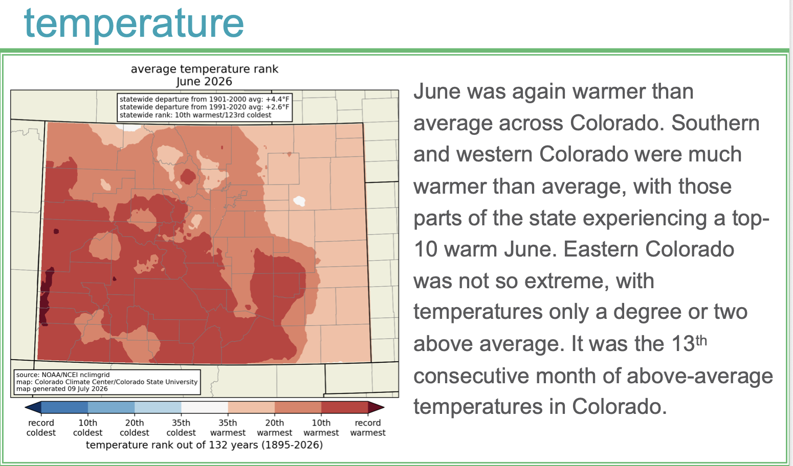
The June 2026 Colorado Monthly Climate Summary is hot off the presses from the #Colorado #Climate Center

Click the link to read the summary on the Colorado Climate Center website:

Fishing for DNA – how a cup of river water can reveal secrets about human health, pollution and biodiversity

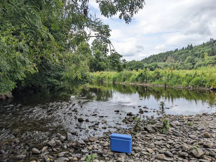
Trees and other greenery lining a river, a small cooler set on rocks in the foreground
Hidden in the water is a wealth of genetic information. Jenny Whilde, CC BY-ND

Jenny Whilde, University of Florida

The DNA in a single cup of water can track wildlife, monitor pollution and survey pathogens in waterways and their surroundings, all at the same time.

DNA is contained in each cell of every plant, animal, fungus and microbe. It carries the genetic instructions needed for an organism’s survival, growth and function, and the DNA of each species is unique.

Organisms shed DNA into their environments. This environmental DNA, or eDNA, can come from cells shed from skin, spores and pollen blowing on the wind, or even just a cough or sneeze. It can provide huge amounts of information. Researchers can use it to assess biodiversity, monitor the spread of invasive species and detect pathogens.

River floating between a line of trees, a boat floating placidly in the middle of the water under blue skies and white clouds
Advances in technology have allowed researchers to parse the DNA of hundreds of species floating in the Avoca River. David Duffy, CC BY-ND

Traditional monitoring methods, such as field observation or trapping, can be difficult, intrusive and time-consuming. Tracking an elusive species in the wild can mean hours or days without a sighting, perhaps in difficult terrain or remote locations. Trapping wildlife can be stressful for the animals and relies on expert knowledge to properly handle wildlife and position traps.

With eDNA, researchers can collect information about a species without ever needing to see or interact with it. Moreover, a cup of water, a few ounces of sand or even air sucked through a filter can hold enough information to determine what has been in the area, including people, wildlife and infectious pathogens.

Cracking the DNA code

Researchers sequence DNA fragments collected from sand, water or air to decode the order of the chemical building blocks that make up DNA. These sequences can be used to not only identify the species that the fragments of DNA came from, but also to narrow down the area where the organism originated.

Until recently, researchers typically used an approach called metabarcoding to sequence eDNA. This method creates many copies of specific, short genetic markers that researchers can use to identify particular species.

Although powerful, metabarcoding is selective by design. It finds only what it is designed to find – typically small but informative regions of DNA called barcodes – and ignores everything else. Because the DNA fragments are so short, it’s difficult to link these bits of information. A single barcode cannot cover all species in an area, and it cannot provide information about the genetic traits of species in the area. https://www.youtube.com/embed/bdwU_ZPk1cY?wmode=transparent&start=0 Genetic information is everywhere, if you have the tools to sequence it.

My team at the Duffy Lab at the University of Florida took a different approach. Rather than focusing on one short region of DNA in a sample, we used a technique researchers call long-read shotgun metagenomic DNA sequencing, which reads each fragment of DNA in long, continuous sections. All the DNA and traits in one long fragment clearly come from the same individual. As a result, we can sequence all of the DNA from every species, from viruses to vertebrates and everything in between.

Compared to metabarcoding, shotgun sequencing is faster and requires less lab manipulation and processing. The “shotgun” portion of the name refers to how the DNA is fragmented, read in short stretches and then reassembled. This random, explosive fragmentation resembles the firing of a shotgun.

By comparing the results of shotgun DNA sequencing to large reference genome databases, researchers can figure out which species the DNA came from. This process provides an all-in-one DNA readout of everything in a single sample.

Rather than identifying the presence of particular target species, like the barcoding technique, shotgun sequencing is a broad snapshot of the ecological communities in a specific area. In a single assessment, researchers can detect microbes, fungi, plants and animals in as little as 24 hours.

River rich in species

To test our new method, my team and I collected water samples from the Avoca River in Ireland, starting from near its source in the Wicklow Mountains all the way down to where it enters the Irish Sea in Arklow town. We also collected sand samples from beaches near the river mouth.

These samples revealed a wealth of genetic information drifting through the river system.

Map of Avoca River in County Wicklow, with red boxes congregating towards the mouth of the river towards the Irish Sea
The red boxes in this map indicate where researchers collected samples along the Avoca River. Nousias et al/NAR Genomics and Bioinformatics, CC BY-NC-SA

The DNA we filtered from the water samples came from many organisms living in or near the water, including otters and oysters, foxes and fish, badgers and bacteria. Some of the species we detected were common and easily visible along the river (cows, sheep, dogs and humans), while some were more difficult to see (leatherback turtles and octopi). Some required a magnifying glass (biting midges, microscopic worms and viruses).

Researchers can also use environmental DNA to evaluate whether biodiversity restoration is working as expected. From our samples of the Avoca River, we detected DNA from organisms with major economic and ecological consequences: a fungus called Leptosphaeria maculans that affects crops and a fungus called Batrachochytrium dendrobatidis that has caused catastrophic declines in frog populations around the world. This is the first time researchers have detected B. dendrobatidis in Ireland.

Horizontal bar graph showing eDNA counts of animals like pigs, cows, sheep and horses, among others. Dogs, ferrets and otters have the highest concentration of eDNA
This chart shows a selection of mammals whose eDNA the researchers found in their river water samples. Different color lines refer to different sample locations. Nousias et al/NAR Genomics and Bioinformatics, CC BY-NC-SA

Not only can eDNA show which species are present, it can also reveal their origins and help researchers understand how they migrate and disperse. For example, the blue mussel eDNA we recovered near the mouth of the Avoca River most closely matches the DNA of mussels found off the coast of Wales (84%) and France (16%).

Pollution mitigation

Human impact on the river was clearly reflected in the eDNA we collected.

The samples we collected upstream in a sparsely populated area had very little human DNA. By contrast, the samples we took near the town of Arklow in 2022 contained high levels of human DNA, consistent with untreated wastewater entering the river at that time.

Additionally, we found DNA from human-associated pathogens in river water and beach sand. These included bacteria such as streptococcus, parasites such as entamoeba, and sexually transmitted pathogens such as chlamydia, herpes and gonorrhea.

Orange cap test tubes lined up on a lab table
These filtered Avoca River samples are readied for eDNA extraction. David Duffy, CC BY-ND

When we returned to collect samples in 2024, the human DNA signal had practically disappeared. This coincided with the construction of pipework leading to the new Arklow Wastewater Treatment Plant, diverting human waste from the river.

The ability to identify wildlife, human activity and pathogens all from one water sample highlights the potential for a wide-ranging One Health approach to environmental health surveillance. In principle, it is possible to use eDNA to simultaneously identify pollution sources and emerging pathogens, track invasive species and monitor environmental reservoirs of disease, nearly in real time.

All of nature in a nutshell

Environmental DNA offers a new form of ecosystem monitoring. Rather than carrying out environmental surveillance through the separate lenses of zoology, botany, microbiology and epidemiology, eDNA acts as a continuous genomic observatory.

This “all-in-one” approach to ecosystem monitoring is becoming ever easier as DNA sequencing costs continue to fall, technology advances allow longer DNA fragments to be sequenced, and computational power improves.

A single cup of water can unlock the incredible secrets flowing beneath the surface of the river. Biodiversity in and around the water, the effects of pollution and recovery, and the beautiful complexities of entire ecosystems are just waiting to be revealed.

Jenny Whilde, Adjunct Research Scientist in Marine Bioscience, University of Florida

This article is republished from The Conversation under a Creative Commons license. Read the original article.

Article: Urban water affordability crisis exacerbated by #ClimateChange — Jennifer Skerker, Christian Klassert, Baptiste Francois, Aniket Verma, Casey Brown & Sarah Fletcher (Nature.com)

Click the link to read the article on the Nature Sustainability website (Jennifer Skerker, Christian Klassert, Baptiste Francois, Aniket Verma, Casey Brown & Sarah Fletcher). Here’s the abstract:

July 8, 2026

Climate change intensifies water stress globally, necessitating expensive infrastructure interventions to maintain reliable supply. To fund infrastructure, utilities often raise rates, increasing water bills for low-income households. The resulting affordability impacts depend on utility costs and interactions between rate design, financing, climate and household demands. Here we develop a city-scale modelling framework to estimate climate change impacts on water affordability, integrating climate, utility adaptation decisions and demand. In Santa Cruz, California, we find that climate change alone could double water bills by mid-century, leaving an additional 7–16% of Santa Cruz households with unaffordable water. Our results suggest that climate change may lead to greater water affordability challenges than previously estimated in hotspots where supply is vulnerable to climate change. This highlights the need for policy intervention and financing to ensure climate adaptation does not compromise affordability. The magnitude of climate-related affordability challenges depends on local context, requiring city-scale assessments.

Pitkin County commissioners voice initial approval for another water buy: River advisory board recommends against spending $442,500 — Heather Sackett (AspenJournalism.org)

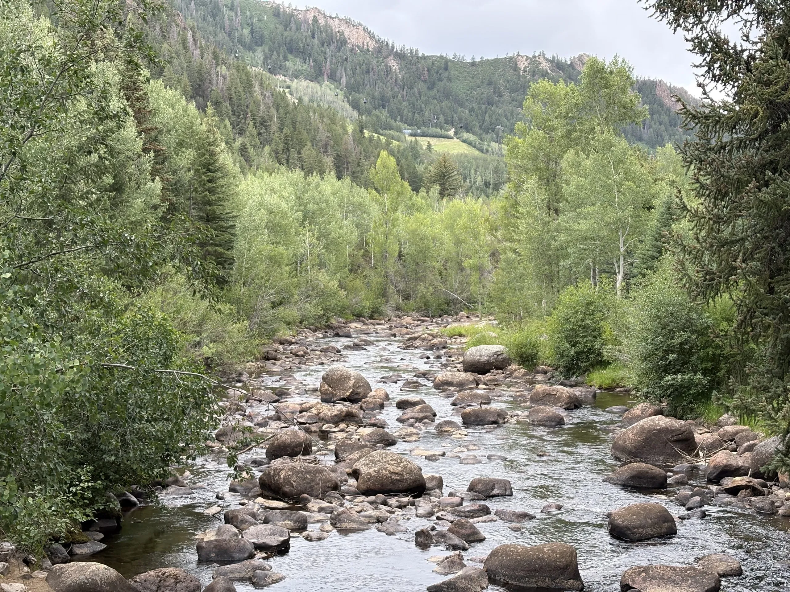
The Roaring Fork River in Aspen on July 8. Pitkin County Commissioners gave initial approval to buying more shares of Twin Lakes water to boost low flows on the Fork. CREDIT: HEATHER SACKETT/ASPEN JOURNALISM

Click the link to read the article on the Aspen Journalism website (Heather Sackett):

July 8, 2026

Against the recommendation of an advisory board, Pitkin County commissioners on Wednesday gave preliminary approval to buy more water to boost flows in the often-depleted Roaring Fork River.

Commissioners approved on first reading a resolution and ordinance to spend $442,500 to buy 4.68 shares from the Twin Lakes Reservoir & Canal Co., which is about 3.5 acre-feet of water, according to a staff memo. The deal is in addition to the $6.5 million Pitkin County already agreed to spend earlier this year for about 71 acre-feet from Twin Lakes and another ditch company.  

Twin Lakes collection system

The water is currently taken across the Continental Divide to the Arkansas River basin to be used by entities on the Front Range. The deal would allow the water to be released out of Grizzly Reservoir to Lincoln Creek and could help boost the Roaring Fork through Aspen and upstream, which suffers from low flows in dry years. 

“I think it’s really critical that we purchase water rights when we can, and this is an opportunity that we can, and we should,” District 1 Commissioner Patti Clapper said. 

Pitkin County has long had a goal of increasing the amount of water in the Roaring Fork, a river that has about 40% of its headwaters diverted to the eastern side of the state through the Independence Pass Transmountain Diversion System to be used by Colorado Springs, Pueblo and Aurora. These diversions can often contribute to the depletion of the Roaring Fork through Aspen, and purchasing Twin Lakes water represents a rare opportunity to return water to the Western Slope.

Commissioner Greg Poschman said he supports acquiring the water shares. 

“I think it’s great that we are doing this,” he said. “I know it’s expensive; there are some raised eyebrows about that, but I think this is something we have to do.”

Poschman added that he was concerned that the Healthy Rivers board members recommended against buying more water and said he would like to fully understand their reasons. County staff said they were trying to schedule a joint meeting with the Board of County Commissioners and the Healthy Rivers board in August. 

Members of the county’s Healthy Rivers board, which advises the BOCC, are concerned that the water will have a small impact on river health but a big impact on the program’s budget. The board held a special meeting June 25 to consider acquiring the shares and approved a motion saying the water yield would potentially be only 1 additional cubic feet per second for two days.

“Additionally, the deleterious effects of the purchase price on the long-term fund balance of the Healthy Rivers Fund will reduce the Healthy Rivers Program’s ability to support programs to address other ballot measure mandates, including water quality, ecological health, recreation opportunities, wildlife and riparian habitat, and promoting water conservation,” the motion reads.

The motion goes on to say that in the future, the county should implement a framework for evaluating the true value of water shares to the Roaring Fork.

At Wednesday’s meeting, County Budget Director Connie Baker told the BOCC that the Healthy Rivers board will have to trim or reallocate about $500,000 from next year’s budget to account for the combined impact of this year’s two water purchases.

Healthy Rivers board member Ned Andrews said he is against the purchase, citing the impact that it will have on the program’s budget. 

“None of the analysis or details that would justify such a purchase or a strategy going forward has been done,” Andrews told Aspen Journalism. “I think before you commit essentially a quarter of your budget for the next 15 years, you’d want to have an analysis that shows you what could be accomplished. My gut feeling is that it wouldn’t really accomplish much.” 

Andrews also opposed the earlier, larger water share purchase, although the rest of the Healthy Rivers board was supportive.

At their regular June meeting, Healthy Rivers board members went through the budget line by line and considered where they could trim, although those cuts have not yet been finalized.

Pitkin County’s Healthy Rivers Program is funded by a .1% countywide sales tax, and its mission is to improve the water quality and quantity of the local watershed. The program has funded projects such as beaver inventories, investigating water quality on Lincoln Creek, upgrades to diversion infrastructure and ditches, and an effort at a Wild and Scenic designation on the Crystal River. 

Spending big bucks in an effort to rescue rivers is not new for Pitkin County, which has spent at least $3.5 million on the Roaring Fork River Park in Basalt, including a water court battle to secure the water right for recreation, several redesigns of problematic waves, and improvements to the riverbank and boat launch.

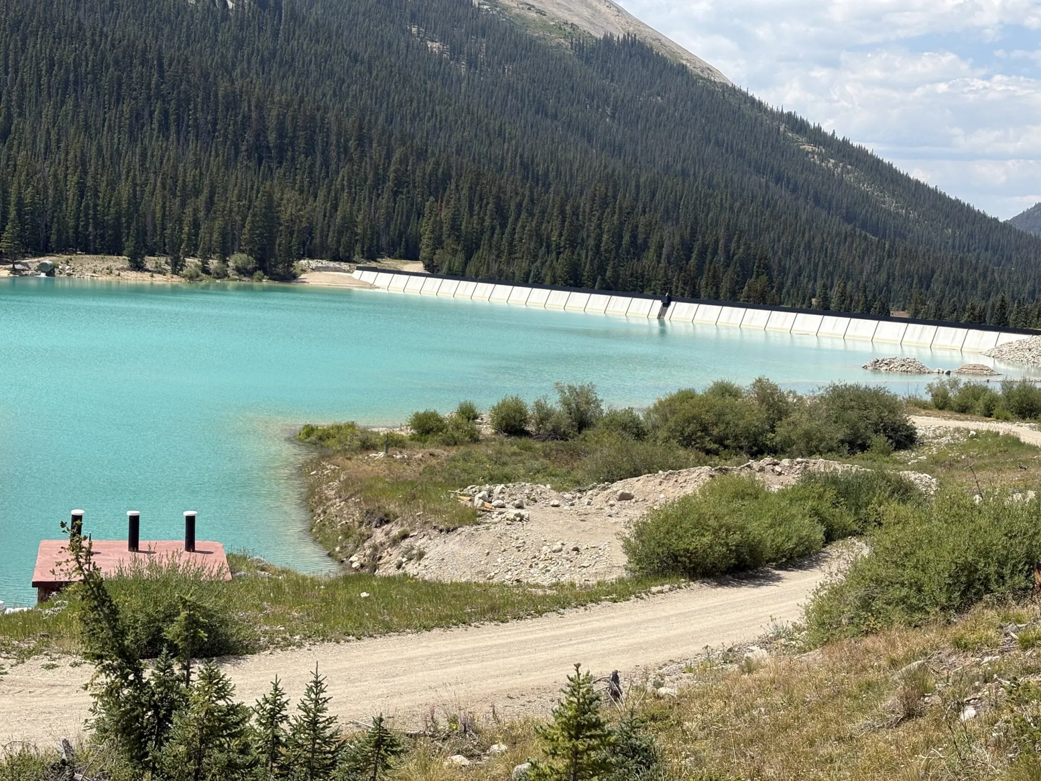
Grizzly Reservoir, a forebay that collects water to send through the Twin Lakes Tunnel to the Front Range, sits in the middle of the Lincoln Creek watershed and connects water users on both sides of the Continental Divide. Pitkin County commissioners gave initial approval to a deal that would allow more water to be released from Grizzly for the benefit of the Roaring Fork. CREDIT: HEATHER SACKETT/ASPEN JOURNALISM

Bond for original purchase approved

The BOCC at Wednesday’s meeting also approved issuing a bond for the original purchase of Twin Lakes shares. That deal cost the county $6.5 million, although only 45 of those acre-feet represent Western Slope water that is currently diverted to the Front Range. The county plans to sell or trade the other 26 acre-feet, which is owned by the Fountain Mutual Ditch Co. in El Paso County and decreed for use on the east side of the divide.

The 45 acre-feet of water can be released down the Roaring Fork during the irrigation season when flows are low, and it must be used by a downstream water user on the Colorado River before the town of DeBeque. Instream flow for the benefit of the environment is not a decreed use of the water.

This year, according to Colorado Water Resources Division 5 Engineer Tyler Benton, at least some of Pitkin County’s Twin Lakes water was released as part of the Colorado River Water Conservation District’s emergency substitute water supply plan, which the district enacted in response to this year’s historic drought. Benton said he expects the River District to provide a full accounting of how much Pitkin County water has been released Friday. 

Grizzly Reservoir is currently drained for dam maintenance, which may have affected how much water could be released under the River District’s plan.

At a time when drought impacts are being acutely felt across the state and climate change continues to rob rivers of their flows, for some, the unique opportunity to put water back into a depleted stream is worth the cost. 

“This is expensive water, but it’s the only water you can get up at the headwaters of the Roaring Fork,” said Pitkin County Deputy Attorney Anne Marie McPhee. “So that scarcity makes it more valuable.”

The issue is scheduled for a public hearing and second reading July 22.

Map of the Roaring Fork River drainage basin in western Colorado, USA. Made using USGS data. By Shannon1 – Own work, CC BY-SA 4.0, https://commons.wikimedia.org/w/index.php?curid=69290878

Havasupai Tribe slams #Arizona regulators over uranium mine arsenic easing: Plus, Wildfires keep on burning, and the weather isn’t helping — Jonathan P. Thompson (LandDesk.org)

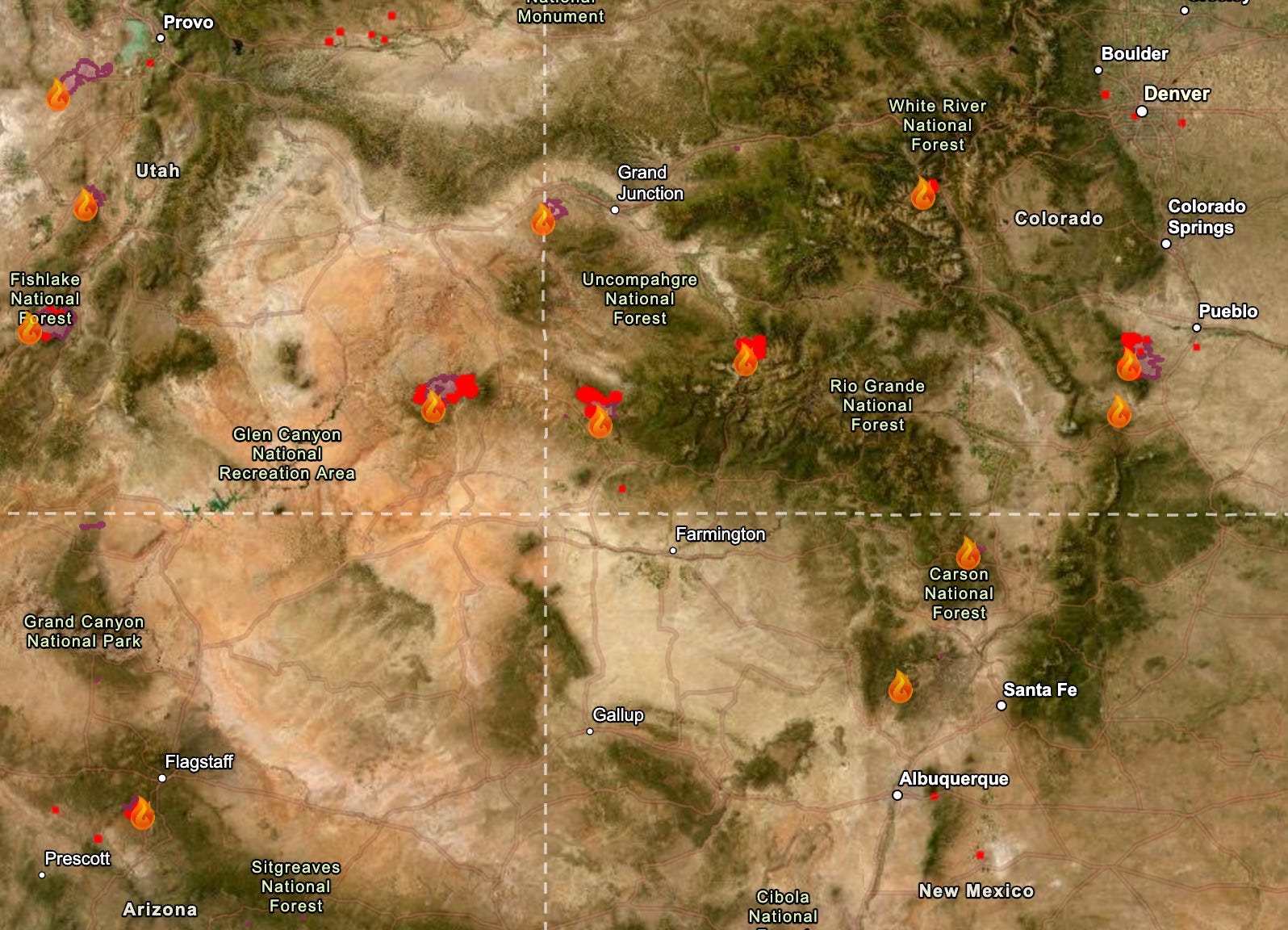
Map of large fires burning in the Four Corners region as of 7/7/2026. Source: National Interagency Fire Center.

Clink the link to read the article on The Land Desk website (Jonathan P. Thompson):

July 7, 2026

🔥 Wildfire Lookout 🔥

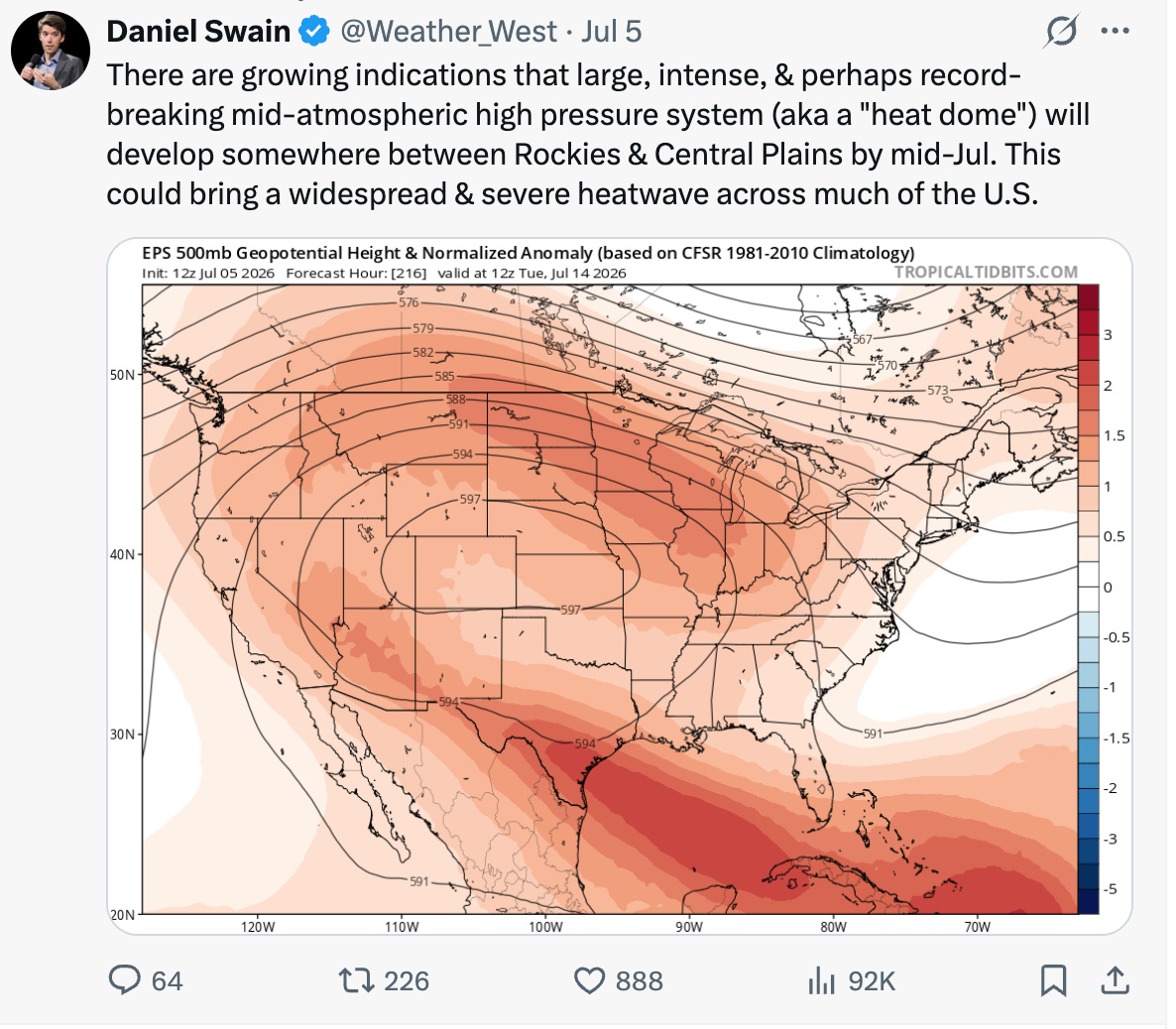
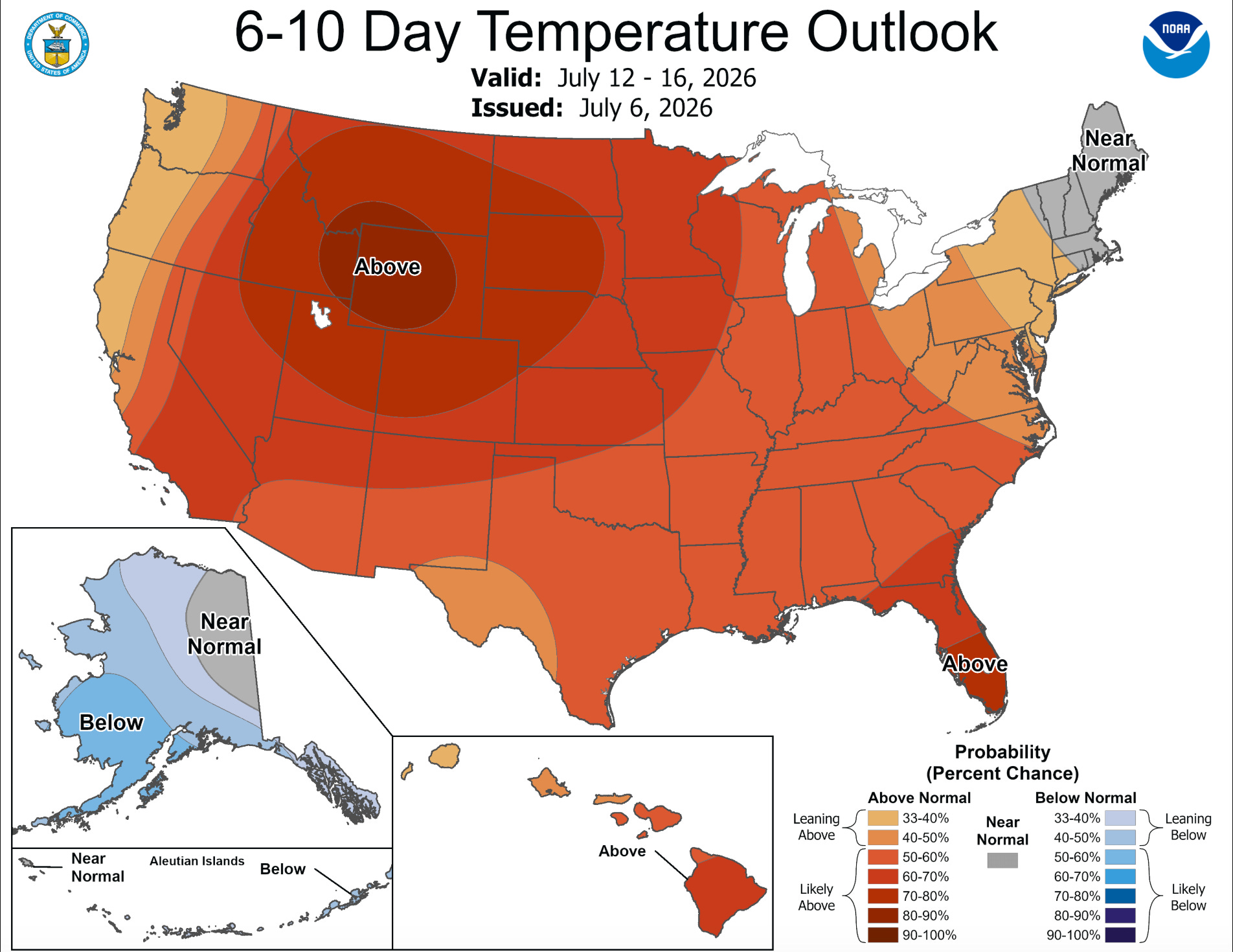
The fire situation in the Four Corners area is not improving. The weather remains hot, dry, and windy, and this week’s forecast calls for more of the same. Next week may even be hotter, if longer-range models hold. Meanwhile, air quality has deteriorated in some places that previously seemed to avoid the worst of the smoke. The good news is that the Fourth of July weekend came and went without any new major fire starts in the region.

So far this year some 37,209 fires have burned through about 3.3 million acres, according to the National Interagency Fire Center. That’s the second highest acreage for the first half of the year in the last decade. 

Here’s a rundown of some of the Four Corners area fires. By no means is this a complete list.

  • The Babylon Fire, burning in the higher elevation parts of Bears Ears National Monument in southeastern Utah, had grown to over 96,000 acres by Monday night, making it the nation’s largest active blaze (the Cottonwood Fire in the western part of the state has gone through about the same amount of acreage, according to Watch Duty). The two are also tied for the fourth largest fires in the state’s recorded history. The Babylon Fire is at 0% containment, with the most active area moving up the west slope of the Abajo Mountains, between Shay Mountain and Mount Linnaeus. Air tankers are pulling water from Lake Powell, and officials are asking boaters to avoid the area between Dangling Rope and Rainbow Bridge. 

    Closed public lands include: The Needles District of Canyonlands National Park, Manti-La Sal National Forest lands within the Monticello Ranger District, and BLM lands in the Indian Creek Corridor, Beef Basin, Dark Canyon, and the Sweet Alice Wilderness Study Area. Still Open: Natural Bridges National Monument, Cedar Mesa, Grand Gulch, and other lower elevation areas in the southern reaches of Bears Ears National Monument.
  • The Ferris Fire along the Dolores-Montezuma County line in southwestern Colorado initially burned in a northeasterly direction toward the Disappointment Valley. Then the winds shifted and the most active front of the fire curved back to the northwest, crossing the Ponderosa Gorge of the Dolores River, and is within about 12 miles of the town of Dove Creek. As of Monday night the fire was at 51,622 acres and 22% containment.
  • The Gold Mountain Fire north of Ouray, Colorado, has burned across almost 29,300 acres of San Juan Mountain high country and was 2% contained as of Monday night. Firefighters on Monday conducted strategic backfiring operationseast of Ridgway to provide more protection for structures in that area. There is a chance of thunderstorms this afternoon and evening, which could bring dry lightning along with gusty and erratic winds, with high temperatures reaching the high 80s and low 90s.
  • The Pocket Fire north of Sedona, Arizona, has reached 26,442 acres and was at 48% containment as of Monday night. Forecasters are predicting more hot and dry weather today, with the mercury topping out around 100° F and sub-20% relative humidity.
⛏️ Mining Monitor ⛏️

On July 6, the Arizona Department of Environmental Quality approved Energy Fuels’ request to amend its aquifer quality permit for a groundwater monitoring well at its Pinyon Plain Mine near the Grand Canyon. The change raises the allowable concentration of arsenic from .050 milligrams per liter to .055 milligrams per liter and the associated alert level from .040 to .050 mg/l.

The Havasupai Tribe strongly condemned the change in a written statement, calling the approval a “profound attack on the Tribe’s inherent responsibility to guard and protect the waters of the Grand Canyon.”

Energy Fuels asked for the revision — and ADEQ granted it — after finding that construction of the mine’s shaft had created a hydraulic sink that allowed naturally occurring arsenic — a known toxic substance — to move toward the facility’s perimeter wells, putting them in violation of their permit.

So, regulators simply altered the permit’s limits and, according to the tribal nation’s statement, “chosen to weaken environmental protections instead of strengthening them.”

Dr. Bradley K. Esser, a retired Lawrence Livermore Laboratory scientist, submitted technical comments on the proposed revision last year. He cast doubt on Energy Fuels’ hydraulic sink explanation, and demonstrated that the arsenic concentrations detected in the monitoring wells are far higher than regional natural background levels. He posited that it was far more likely the elevated arsenic concentrations came from sump water from the mine’s workings contaminating the groundwater.

Uranium, arsenic, and lead concentrations shot up in the Pinyon Plain Mine’s “sump water,” or groundwater that had flowed into the mine shaft, after active mining began in 2023. While an independent scientist acknowledges that it’s possible elevated arsenic levels in perimeter monitoring wells are the result of a mining-related hydraulic sink pulling naturally occurring arsenic to the wells, he posited that it’s more likely that sump water made its way into the groundwater in the wells. Source: Grand Canyon Trust.

Esser also writes:


🥵 Aridification Watch 🐫

Monsoon season officially kicked off in the Southwest in the middle of last month, but it has yet to bring significant amounts of moisture. Earlier forecasts predicting higher than average precipitation beginning later this month are still in place for some parts of the West, but they likely will be accompanied by above-normal temperatures just about everywhere.

Next week isn’t looking so hot for fire-dousing moisture in the Southwest, but after that the chances of above-normal precipitation start climbing.
Smoky skies and three-digit heat? Ick.
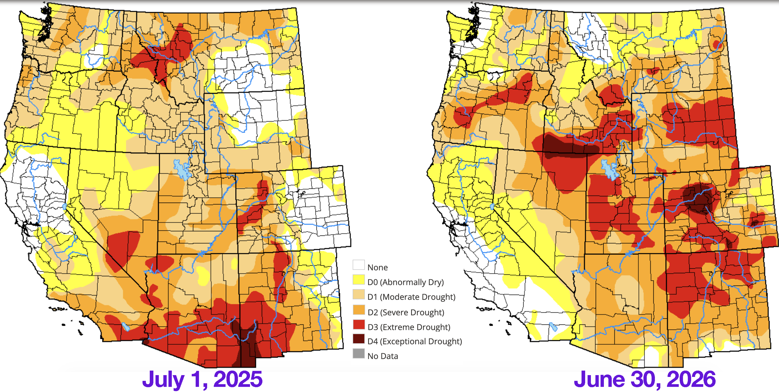
The drought situation has grown worse over the last year in most of the Interior West, though there has been improvement in the deep Southwest. Source: U.S. Drought Monitor.

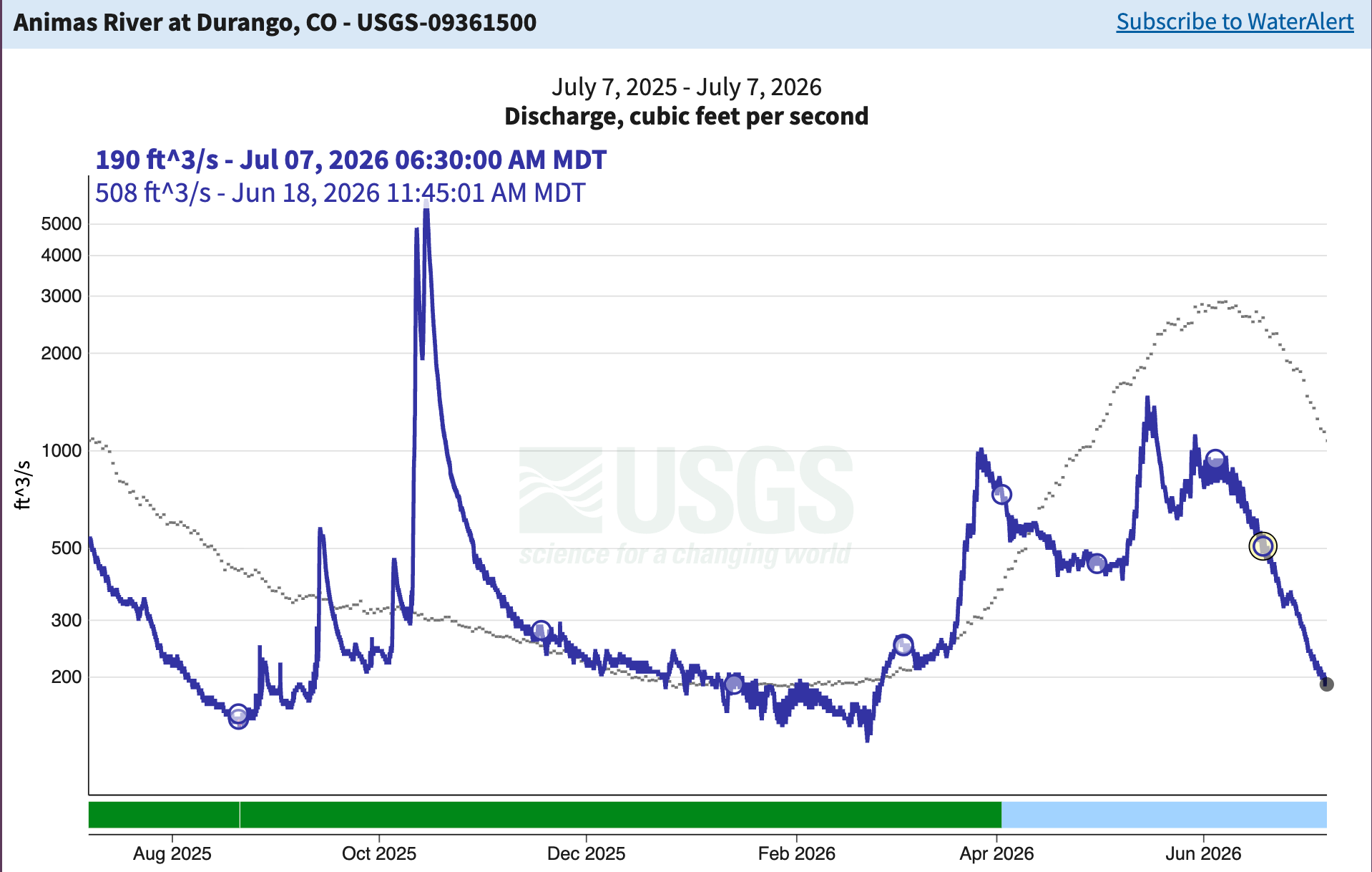
‘As you might expect, the hot, dry weather is taking a toll on streams around the region. The Animas River through Durango is running at 190 cubic feet per-second; the median flow for this date is over 1,000 cfs.


📸 Parting Shot 🎞️

Red rocks and crazy clouds in Utah before fire season had arrived and sullied up the skies. Jonathan P. Thompson photo.