By Robert Marcos
In a drier future, if Southern California’s municipalities lost all access to imported water, they’d need twenty to thirty new desalination plants – each producing 50 million gallons of water a day, to make up for the 2.6 million acre feet of water that the region’s 19 million residents currently use.1
Unfortunately we know that desalination plants take far too long to build, require far too much energy, and at $3000 to $3600 per acre foot – the water they produce is far too expensive.2 This is why the state’s official “water supply strategy” promotes the development of wastewater recycling and stormwater capture first, with desalination considered as a last resort.3
Wastewater Recycling
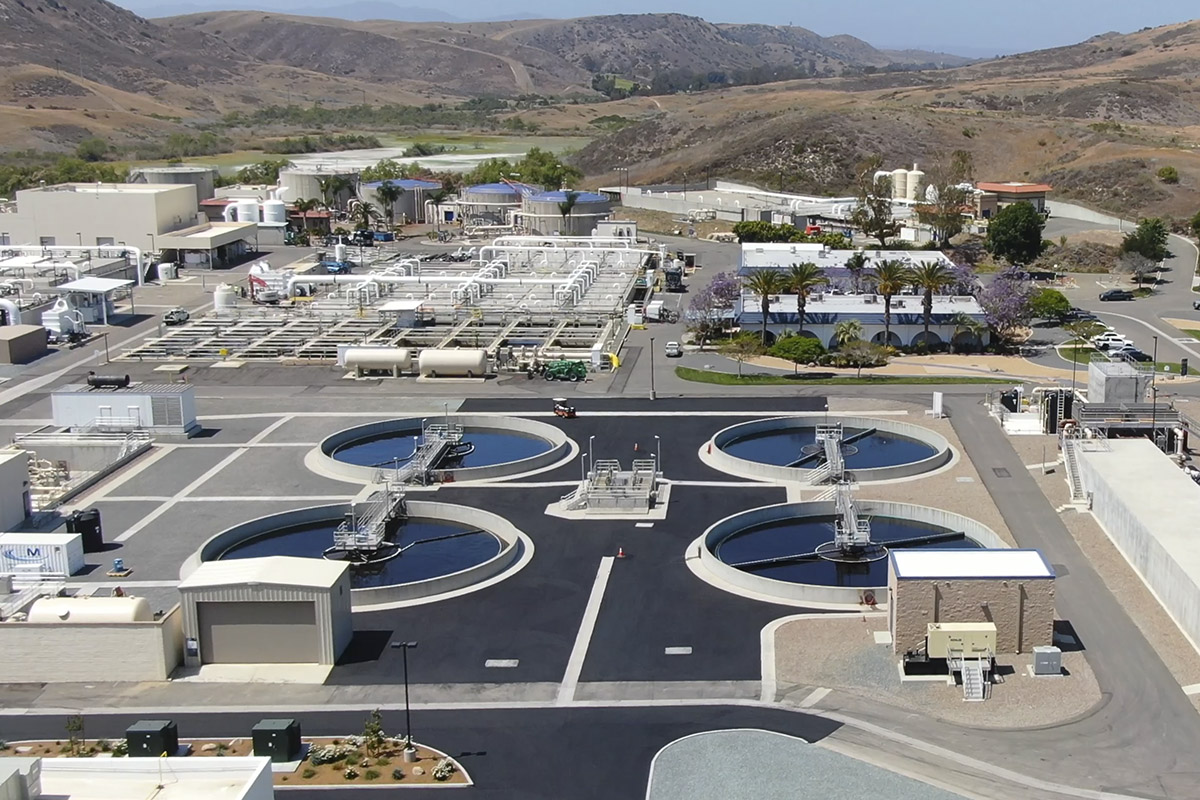
The recycling of wastewater is a favored solution because it treats water that’s already within the system. Wastewater recycling – also known as water reclamation, follows a multi-stage purification process that accelerates the Earth’s natural water cycle. It typically begins with primary treatment, where wastewater is held in settling tanks to allow heavy solids to sink and be removed. In secondary treatment, oxygen is added to aeration tanks to help naturally occurring microbes consume dissolved organic pollutants. The process then moves to tertiary treatment, involving fine-grained filtration through sand, coal, or membranes, followed by disinfection using chlorine or ultraviolet (UV) light to kill remaining pathogens. For potable (drinking) water applications, advanced systems may add reverse osmosis and advanced oxidation to remove trace chemicals and salts. This treated water is then distributed through a dedicated “purple pipe” system, separate from standard drinking water lines, for uses like landscape irrigation, industrial cooling, and groundwater replenishment.4
San Diego’s multi-year “Pure Water” wastewater recycling project is expected to cost over $5 billion, with Phase 1 alone costing approximately $1.5 billion and future phases projected to significantly raise the total expense. Phase 1 is expected to produce 30 million gallons of potable water daily, with the entire system potentially costing $5 billion or more.5
Stormwater capture
In a city like Los Angeles, stormwater capture is the process of collecting rainfall and urban runoff from open spaces, rooftops, and streets to either use directly or—more commonly—to allow it to soak into the ground to recharge local groundwater basins for future use. This is achieved through large-scale infrastructure like spreading grounds and dams, as well as community-level projects like rain gardens and permeable pavement. While the infrastructure itself is highly reliable—with the county currently capable of capturing enough water to serve millions of people during wet years—the overall supply remains inconsistent because it depends entirely on highly variable seasonal rainfall. For instance, capture totals can swing drastically from roughly 120 billion gallons in a record wet season to just 11.9 billion gallons in a dry one, making it a valuable but unpredictable supplement to the region’s imported water sources.6
The cost to create a stormwater capture system in Los Angeles varies drastically based on scale, ranging from $100 for a simple home rain barrel to over $70 million for massive regional infrastructure projects.7