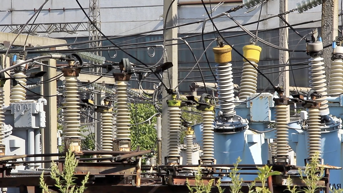
Insulators at an electrical substation. Image provided by Storyblocks.
by Robert Marcos
Most of us might assume that our monthly utility bills are slowly paying off the power grid, but the reality is that the electrical grid is a financial treadmill that never actually stops. This constant cycle of compounding interest, depreciation, and emergency retrofits means that the grid is never truly paid off; instead, consumers are locked into an endless loop of funding an aging asset that falls deeper into debt with every necessary upgrade.1
Energy lost during transmission: In the United States about 5% of generated electricity is lost during transmission and distribution, though some sources put the figure closer to 6–7% depending on how the losses are defined and measured.2
Physical Vulnerabilities: Critical substations are often located in extremely remote locations and are only protected by basic chain-link fences.
Threat of Electro-magnetic Pulse: Solar storms and high-altitude atomic detonations could knock out a power grid by inducing massive electrical currents in transmission lines that might overload and permanently destroy critical high-voltage transformers.
Sniper and Ballistic Attacks: Attackers can easily target and puncture fluid-filled high-voltage transformers from a distance.
The benefit of generating power where it’s needed
Generating power where it is consumed significantly reduces transmission losses that occur over long-distance power lines. In conventional centralized systems, electricity can lose a notable percentage of its energy as heat while traveling across vast grid networks. By producing electricity locally—through distributed energy resources such as rooftop solar, microturbines, or small-scale wind—these losses are minimized, resulting in greater overall system efficiency and more effective use of generated energy.3
Localized power generation also enhances grid resilience and reliability, particularly in regions vulnerable to extreme weather, wildfires, or infrastructure strain. Decentralized systems can operate independently or in microgrids, allowing critical facilities and communities to maintain power during outages that would otherwise disrupt centralized systems. This distributed approach reduces dependence on a single point of failure and supports faster recovery during emergencies.4
In addition, generating power at the point of use can provide economic and environmental advantages by aligning energy production with local needs and resources. It enables the integration of renewable energy sources tailored to regional conditions, reduces the need for costly transmission infrastructure, and can lower energy costs over time. For communities, businesses, and utilities, this approach supports cleaner energy adoption while fostering greater control over energy consumption and sustainability goals.5
The cover of a new book I’ve just published, Storm in My Head, a collection of poetry written over the 60 years I’ve been living in the headwaters of the Colorado River, since 1966 — George Sibley
This is the cover of a new book I’ve just published, Storm in My Head, a collection of poetry written over the 60 years I’ve been living in the headwaters of the Colorado River, since 1966. My 60-year celebration. Those of you who prefer your literature in sprints and strolls over the marathon essays I impose on you might enjoy this book. I’m in the process of getting it distributed, and it may eventually be in a bookstore near you or on Amazon; but for the time being, if you are interested, an email to me, george@gard-sibley.org, will initiate a response on how to get a little money to me (10 bucks plus shipping) to get an inscribed copy wending its way to you.
End of advertisement – back to the river….
Romancing the River – Elephants in the River
The Colorado River situation is moving toward replacing the existing ‘Interim Guidelines’ for managing the river system with a new set of interim guidelines for managing the river system. This new set is devised mostly by the Bureau of Reclamation, which is growing a little desperate to avoid the embarrassment of having its river system cause the flow of the river to stop – ‘dead pool’ – behind one or another of its big dams, in a river management system built for a considerably larger Colorado River – now as mythic a river as the biblical four that flowed out of the Garden of Eden.
All this makes me think I’ll briefly abandon my historical update of Frederick Dellenbaugh’s Romance of the Colorado River, and try to sort through what has been happening recently in the present, most of which we’ve been reading or hearing about in the media.
Reports on the river’s flow after the Weirdest Winter Ever (at least in recorded time) have just gotten worse and worse; now the anticipated inflow to Powell Reservoir is 13 percent of the thirty-year average, from tributary runoffs that peaked as much as two months earlier than the usual early June. The Bureau of Reclamation’s 24-month projection indicates that, if last year’s releases from Powell were replicated this year, they might have to stop generating power by late summer to protect the power turbines – which in effect declares the remaining quarter of the reservoir’s potential storage ‘dead pool,’ since the only other way past Glen Canyon Dam is through four outflow tubes of questionable viability that the Bureau would like to use as little as possible.
The Bureau will address this with two emergency measures: first, by bringing a large quantity of stored water down the Green River from Flaming Gorge Reservoir, and second, by cutting releases from Powell Reservoir by close to two million acre-feet (maf) – which in turn will leave Mead Reservoir lower and diminish its power generation. This is an emergency plan that can nowise be considered long-range planning.
The Lower Basin states in turn have bumped up their willingness to take more shortages for the next couple years by roughly doubling shortages they have already agreed to accept – if the feds will pay them something for not using water that is not there. Their earlier cuts were basically just enough to finally start taking out of their individual allotments the system losses (mostly evaporation) they have been dismissing, with Bureau cooperation, as being met through ‘surplus flows’ that effectively disappeared when the Central Arizona Project came online in the 1990s.
The four Upper Basin states have responded by suggested that it might be time to bring in a facilitator or mediator to conduct the seven-state negotiations on future management planning. This launched an episode of fussing between the Lower and Upper Basins as to who first had that idea, with the other basin objecting to it. But no one seems to be totally opposed to the idea at this point, and it might happen.
Udall/Overpeck 4-panel Figure Colorado River temperature/precipitation/natural flows with trend. Lake Mead and Lake Powell storage. Updated through Water Year 2025. Note the tiny points on the annual data so that you can flyspeck the individual years. Credit: Brad Udall
But basically it all seems to be in reaction to an ‘emergency’ water year, with no advance on more long-range planning – and there is no reason to believe that this year in just a one-shot emergency like the 1977 water year. It is just the most extreme year in an extreme period – the past quarter century – that is probably the shape of the future in the Colorado River region, and there are no more Flaming Gorge reservoirs to draw down for the next emergency year….
It’s probably important to remember a distinction: there is a river, the Colorado River, and we have overlaid on that river a management systemfor managing the river’s water for its human uses, a system whose parts either store water or distribute stored water to users. But we do not directly ‘manage’ the river itself, which runs according larger ‘operators’ – to global climate factors that we can inadvertently change but do not directly control, to what is happening to precipitation that falls in the river’s watersheds, and to how much what lives on the land (including us) interacts with the flow both on and below the land surface.
That last point – the water ‘on and below the land surface’ – strikes me as very important but largely ignored in the stalemated negotiations. You remember the metaphor of ‘the elephant in the room’: a big thing that everyone in the room is trying to ignore because to acknowledge it is to open a can of worms? (Sorry, mixing metaphors here.)
Well, we have ‘elephants in the river’ – or rather maybe in the ‘box’ containing the sacred Law of the River, through which we try to manage to the river. That’s the box that we’re all supposed to be ‘thinking outside of.’ Beginning to work ‘outside the box’ on anything will open a can of worms, but… are we going to have any choice, further down the road when it will be even harder if the elephants in the river continue to be ignored?
Trying to think in an integrated way of the water under the land as well as that on the land is one of our elephants in the river. We need to keep in mind the distribution of the freshwater all land-based life depends on (basically a solar-distilled three percent of the ocean’s water). In our times more than half of the freshwater on the planet is ‘banked’ in mountain glaciers and the ice sheets of the polar regions and Greenland – although this fraction is gradually diminishing under the changing climate. Of the remaining 35-40 percent, most of it is groundwater – water that soaks into the land, nurturing nearly all of the plant life that is the foundational food, fuel and housing supply for the animal kingdom (including us). This leaves only a small fraction of the water on the surface – lakes, wetlands, streams and rivers – and this is also a diminishing fraction, as the warming climate increases sublimation and evaporation from all waters exposed to the sun’s increasing power.
Typical water well
Yet that is also the fraction of freshwater over which nearly all the human squabbling is happening. For a long time, until the last century-plus, that was all the water that most of the animal kingdom could access, but now we have – and use, not wisely – pumps that make the groundwater accessible too.
We also know that most of that small fraction of surface water is pretty intimately connected to the groundwater. A river is not just a drain for water that failed to soak into the ground; as a river runs through its low-elevation course in a watershed, it constantly interacts with the groundwater, gaining water when the land is wet and the ground is full of water, and giving water to the land, as gravity permits, when the land is dry.
Healthy mountain meadows and wetlands are characteristic of healthy headwater systems and provide a variety of ecosystem services, or benefits that humans, wildlife, rivers and surrounding ecosystems rely on. The complex of wetlands and connected floodplains found in intact headwater systems can slow runoff and attenuate flood flows, creating better downstream conditions, trapping sediment to improve downstream water quality, and allowing groundwater recharge. These systems can also serve as a fire break and refuge during wildfire, can sequester carbon in the floodplain, and provide essential habitat for wildlife. Graphic by Restoration Design Group, courtesy of American Rivers
This knowledge ought to drive us toward thinking of groundwater and surface water as a single water source – not just our awareness that pumping the land dry will also diminish the river, but also our awareness that irrigating the chronically dry lands from the streams and rivers not only grows more plants and animal foods that the dry land could – but some of that irrigation water also sinks below the root zone to recharge the groundwater. The city of Gunnison, where I live, bought a ranch adjacent to the city because the city leaders knew enough about alluvial water to know that their groundwater supply (several relatively shallow wells) depended on keeping that ranch under irrigation from the river — water mostly cleaned by the ground it passes through.
But back to the Colorado River, the fraction of the water that does not soak into the land is a larger fraction than you would find in gentler lands primarily because most of the water falls on mountains in winter as snow, which melts in a relatively short time period as the weather warms, too fast for all of it to sink into land that is often too steep or too rocky for absorbing it anyway. But even in that ‘runoff period,’ scientists are learning that a lot of the water in the stream in the ‘spring flood’ season is groundwater flowing in from saturated lands.
Despite knowing all this, however, we persist in fighting over the fraction of freshwater that flows in the river’s watersheds through the year in the Colorado River region (natural basin plus out-of-basin extensions), and pay little in a basin-wide way to the use and abuse of groundwater. Only Colorado – to the best of my knowledge – has tried statewide to legally integrate the use of surface waters and groundwater: since 1969 all groundwater users had to acquire water rights, in the same priority system with surface water users. And – before there was easy access to computers and spreadsheets – all groundwater uses going back almost a century were also integrated into that priority system, a massive ‘can of worms’ to negotiate.
What’s been happening in Colorado for 35 years then is the beginning of the intelligent management of an integrated surface-and-groundwater supply – apparently far too intelligent for the Trumpish agri-industrialists of the two largest Colorado River water users, Southern California and Arizona. Arizona was forced to develop a groundwater management plan (1970) for the areas of Arizona that would be served by the federal Central Arizona Project, in order to get Congress to pass the project; but the rest of the state has been pumping groundwater at prodigious rates, with surface subsidence as evidence of collapsing emptied aquifers that are lost forever. Most of California’s groundwater overpumping is up in the Central Valley, not ‘served’ by the Colorado River, but as Colorado River flows inexorably diminish in a warming world, there will be growing temptations to pump in the Imperial and Coachella Valleys.
I have not found figures for the amount of unregulated groundwater ‘mining’ that goes on in the Colorado river region, but the number and volume of aquifers that have collapsed and been lost due to water-mining would probably go a long way toward filling Mead and Powell Reservoirs. And if you pause for a second and think about it, storing water underground is probably better than storing it in open reservoirs under a desert sun.
That is not the only elephant in the Colorado River – and most of them lead back, one way or another to the Colorado River Compact. The ‘temporary’ two-basin division that has clearly become toxic. Acknowledgement that the compact commission’s original goal of a seven-state division is not just possible now, but has been realized, to everyone’s discontent, making the two-basin division nothing but a battleground. Acceptance of the fact that the diminished river will continue to diminish so long as we continue to put greenhouse gases into the atmosphere faster than the planet can absorb them. Acknowledgment of the fact that as the planet warms, surface storage in big desert reservoirs is a bad idea that will get worse. Acceptance of the fact that the reconvening of a compact commission is overdue, to formalize the seven-state division and its appropriative consequences. And maybe the biggest worm-can of all: are some reasonable, even moral, limits on the appropriation doctrine possible?
We’ll look at some of these other elephants in future posts here – which I think is where the ‘romance of the Colorado River’ is today. I also think we will never have a workable resolution to our current river-system problems until we take on the elephants and bump our own consciousness of water in the arid regions up a notch from the naive ‘conquest of the desert.’
Map of the Colorado River drainage basin, created using USGS data. By Shannon1 Creative Commons Attribution-Share Alike 4.0
Click the link to access the report on the Frontiers in Environmental Science website (Laura M. Norman, Michael M. Pollock, Francina Dominguez, Michael A. Crimmins, David Lawrence5 and Michael Dettinger). Here’s the abstract:
Drylands across the globe are experiencing intensifying water scarcity, land degradation, and hydroclimatic extremes. This review integrates evidence from multidecadal field studies, hydrologic monitoring, geomorphic and ecological assessments, remote sensing, and land–atmosphere science to evaluate how restoration influences key components of the terrestrial water cycle. Low-tech natural infrastructure in dryland streams (NIDS)—including check dams, leaky weirs, one-rock dams, and gabions—has emerged as a promising but under-synthesized nature-based solution for restoring hydrologic function in these environments. We describe the mechanisms through which these interventions modify runoff detention, infiltration, sediment and alluvial storage, shallow-groundwater recharge, vegetation recovery, and surface-energy partitioning, and we summarize outcomes across diverse dryland settings. Findings consistently show increased water residence time, enhanced soil-moisture storage, expanded riparian vegetation, extended flow duration, and shifts toward greater latent-heat flux—producing localized cooling and strengthened ecohydrological feedbacks. Building on these localized effects, we articulate a hypothesis that links the spatial extent of restoration, the density of NIDS per unit drainage area, and the magnitude of the latent-to-sensible-heat contrast generated by wetter post-rainfall conditions. Specifically, we hypothesize that when NIDS are implemented at densities permitted by topography and across areas large enough to maintain elevated soil moisture after storm events, the resulting increases in latent heat flux, surface cooling, and boundary-layer moistening may enhance moisture convergence and boundary-layer development, potentially increasing the likelihood or stability of convective precipitation, analogous to how reductions in these processes have contributed to regional drought intensification. These land–atmosphere feedbacks remain untested at scale but represent an important research Frontier. By integrating hydrologic, geomorphic, ecological, and atmospheric perspectives, this review provides a comprehensive framework for considering how low-tech, landscape-scale interventions can strengthen watershed resilience and contribute to climate-relevant nature-based solutions.