Click the link to read the article on the Water Education Colorado website (Kelly Bastone):
Regaining functionality in Colorado’s headwaters systems by restoring nature’s design
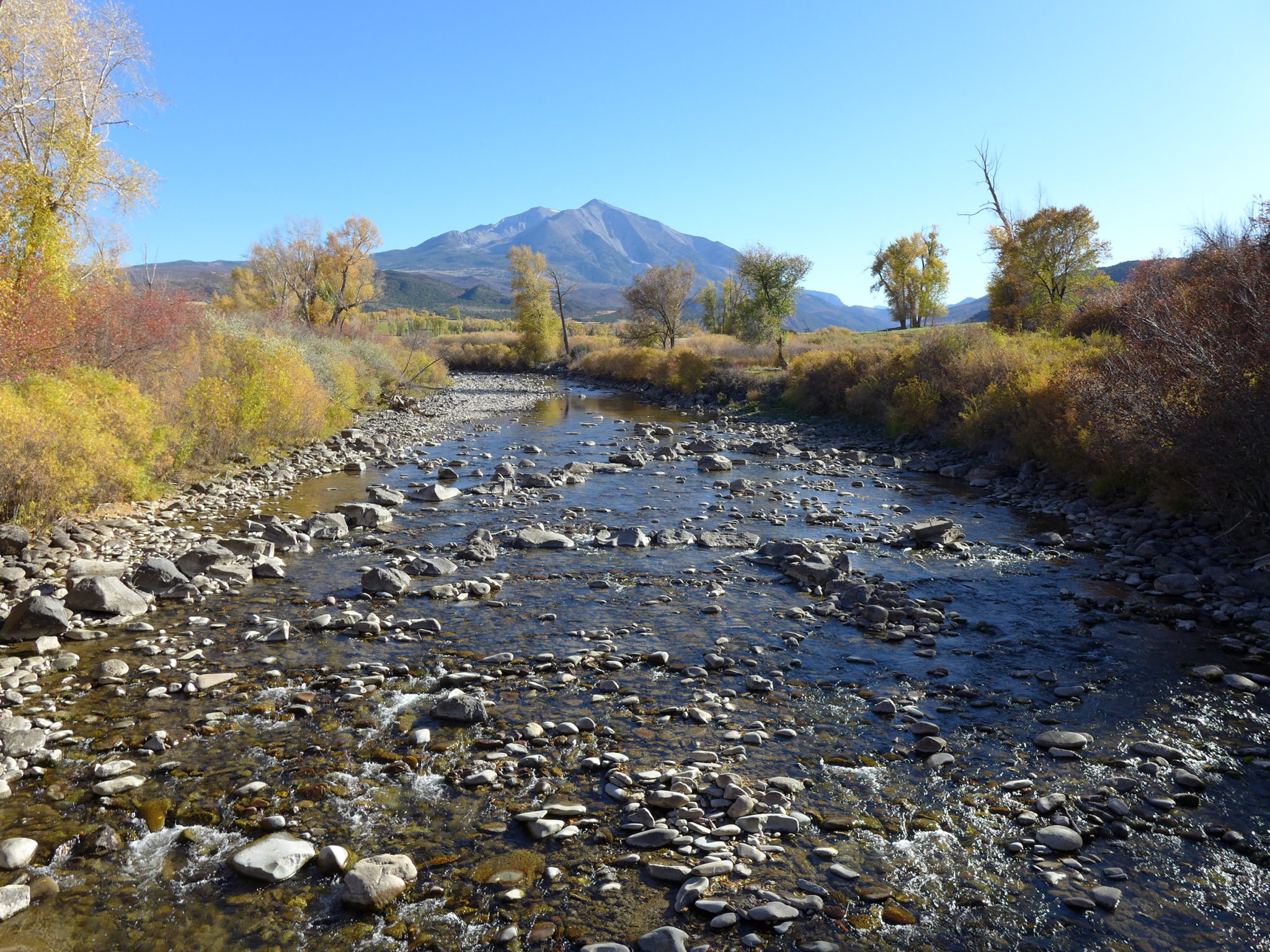
Most of Colorado’s source streams are changing rapidly and look nothing like they did a couple hundred years ago. With climate change impacting headwater areas, we’re learning to appreciate what was lost—and what can be regained.
Intrepid though they were, the first European explorers and settlers along the West’s various river systems did a lot of complaining. Pioneers groused about downed trees blocking their path and waterlogged ground that made footing treacherous. Mosquitoes, debris jams, underwater snags, and a confusing network of secondary streams thwarted humans’ attempts at efficient travel.
Intrepid though they were, the first European explorers and settlers along the West’s various river systems did a lot of complaining. Pioneers groused about downed trees blocking their path and waterlogged ground that made footing treacherous. Mosquitoes, debris jams, underwater snags, and a confusing network of secondary streams thwarted humans’ attempts at efficient travel.
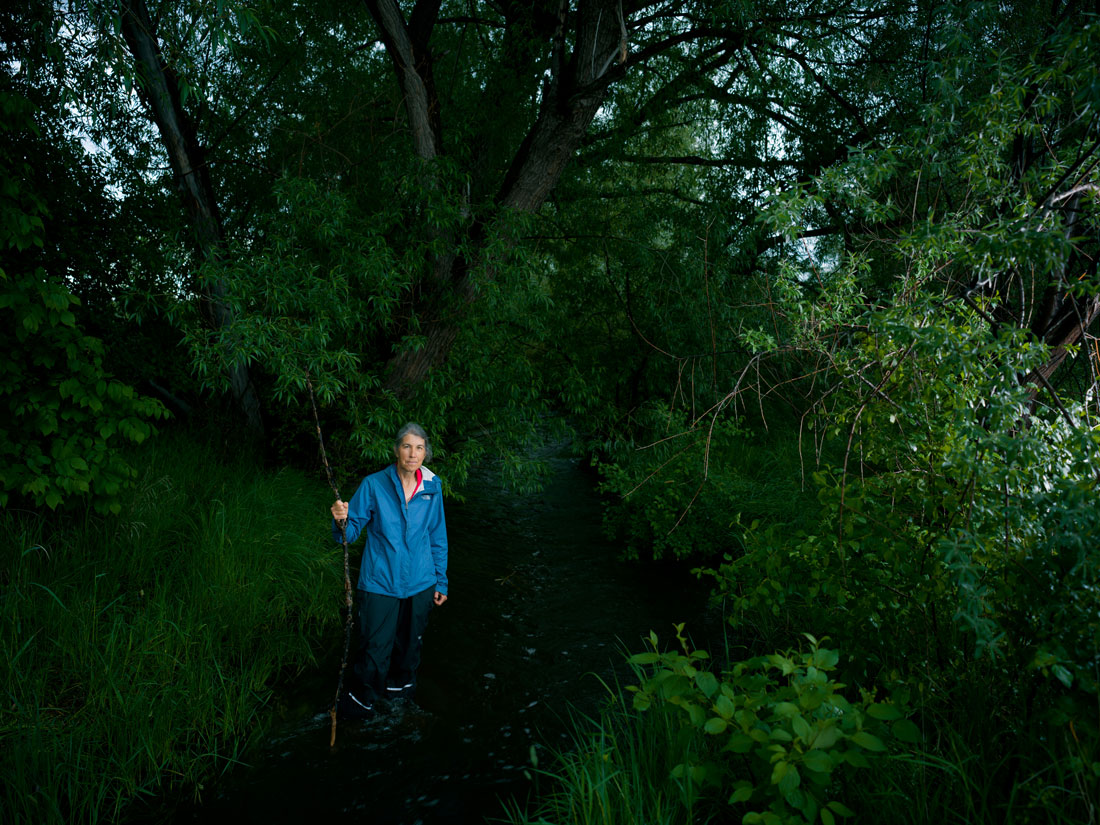
“It was hard to boat, hard to hike,” explains Ellen Wohl, an author and geosciences professor at Colorado State University who has researched written accounts of early exploration–along with virtually every other aspect of changing stream structure and ecology. A self-professed fast-talker and a preeminent expert on how rivers interact with the land over time, she rattles off terms such as “spatially heterogeneous” and “morphological influences” with the casual ease of someone ordering a pizza. Yet she also translates fluvial geomorphology into blessedly common language: In their natural state, says Wohl, streams are messy. “They’ve got pools, riffles, constrictions and expansions, logjams, beaver dams, and wetlands that spread across the valley floor.”
Such tangles were particularly thick at headwaters—the source streams feeding into the larger rivers that we know by name, such as the Colorado and South Platte rivers. Beavers typically turned these smaller waterways into a vexing labyrinth of dammed pools and wetlands choked with water-loving willows and trees.
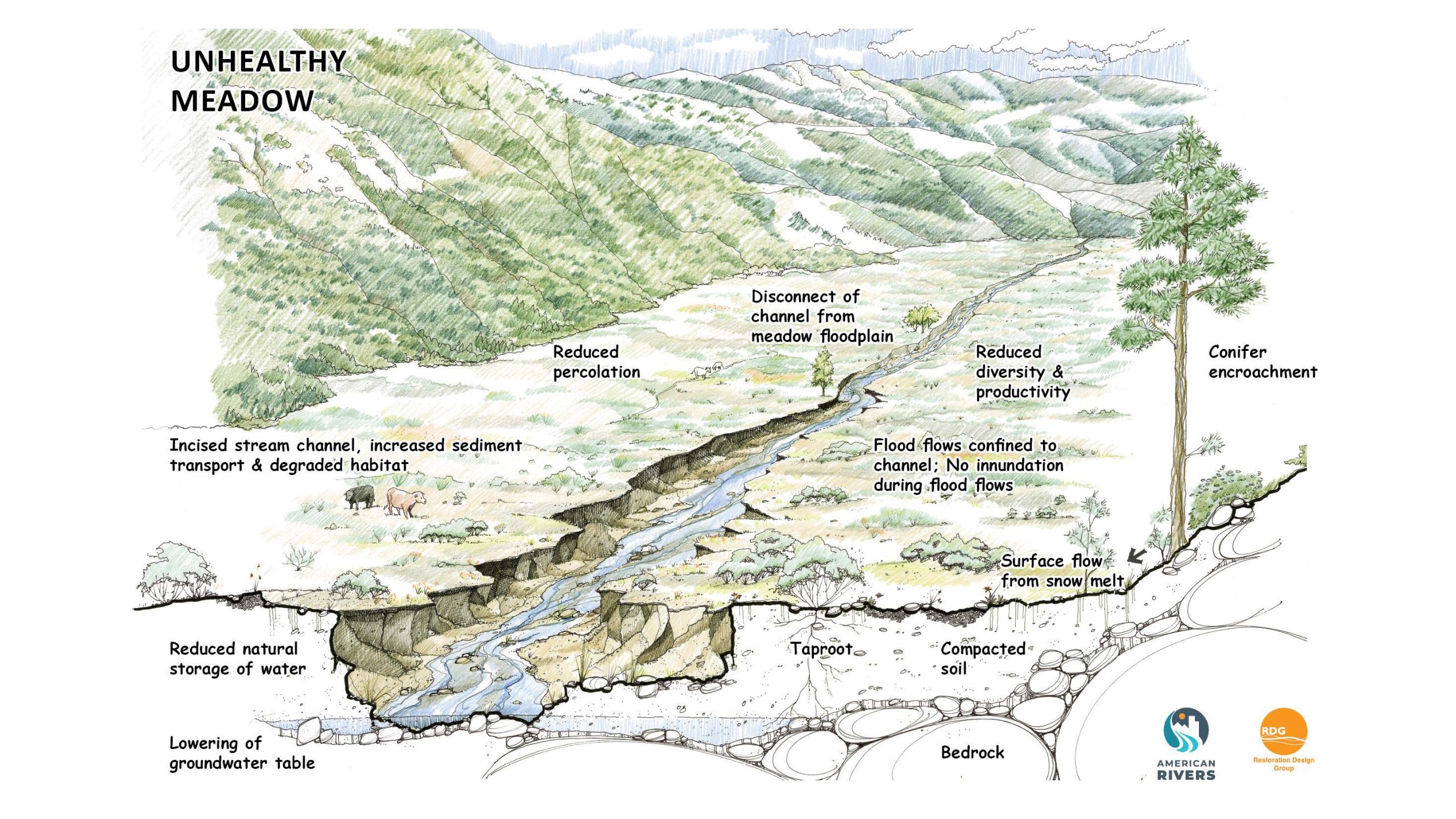
And so, feeling antagonized by the headwaters’ soggy, messy terrain, Colorado’s early European settlers devoted their energies to tidying up. They extirpated the beavers and demolished their dams; settlers also straightened and diverted the streams to irrigate crops and fill miners’ rocker boxes. Human engineering replaced nature’s infrastructure across most of the state’s headwater systems. Consequently, neat channels surrounded by pliant grasses replaced the jumble of wetlands that once characterized source streams from the Eastern Plains to high-alpine valleys.
Fast forward almost 200 years and Colorado communities are facing new threats. Catastrophic wildfires, enduring drought, and waterborne pollutants endanger the many cities that developed downstream of headwater systems. Experts now believe that the swampy ecosystems that once tormented early explorers may actually become allies in weathering and adapting to these new threats. Restoring natural infrastructure, such as beaver habitat and the wetlands it creates, could shield communities from damaging floods, purify water of toxins and high sediment loads, and reduce the apocalyptic effects of megafires. Such benefits become possible when people appreciate the genius of headwaters’ natural state—but only if people can learn to live with their mess.
The Big Thompson River headwaters flow through Moraine Park, which doesn’t appear to be degraded—at least not to most observers. They see a simple ribbon of water snaking among grasses that allow for unobstructed views of the surrounding summits as well as the valley’s resident elk—making this one of the best-loved areas of Rocky Mountain National Park. Even anglers flock here to cast for Big Thompson trout without worrying about tangling their lines in trees or shrubs, both of which are largely absent.
However, this kind of naked channel isn’t natural, explains Mark Beardsley of EcoMetrics, a collective of scientists that analyzes and restores headwaters. The Big Thompson’s ribbon-like stream resulted from previous generations’ attempts to impose order on what was once a jumbled, waterlogged valley. Before, willows and trees slowed the water’s flow and created sanctuaries for juvenile members of many wildlife species. The slower water also would let woody debris like leaf litter, branches and roots settle out of the flow, keeping downstream rivers cleaner.
But in its current state, says Wohl, “Big Thompson in Moraine Park provides less attenuation of water, solutes [such as nitrate], and sediment moving downstream, and less diverse and abundant aquatic and riparian habitat than it provided when the beavers were more active there.” And across Colorado, many headwater streams now look as stripped-down as the Big Thompson. “We have simplified our headwaters into ditches,” says Wohl. “Like a tree that’s had all its branches cut off, but actually, all those branches are really important to the health of the tree.”
Changes began with the fur trade in the early 1800s, when trappers all but eliminated beavers from Colorado. By some estimates, today’s beaver population represents just 10% of historical numbers. Without those dam-builders, many headwaters lost the ponds and waterlogged uplands that once filled valleys such as Moraine Park. Where wetlands persisted, settlers drained them to establish streamside homesteads and ranches.
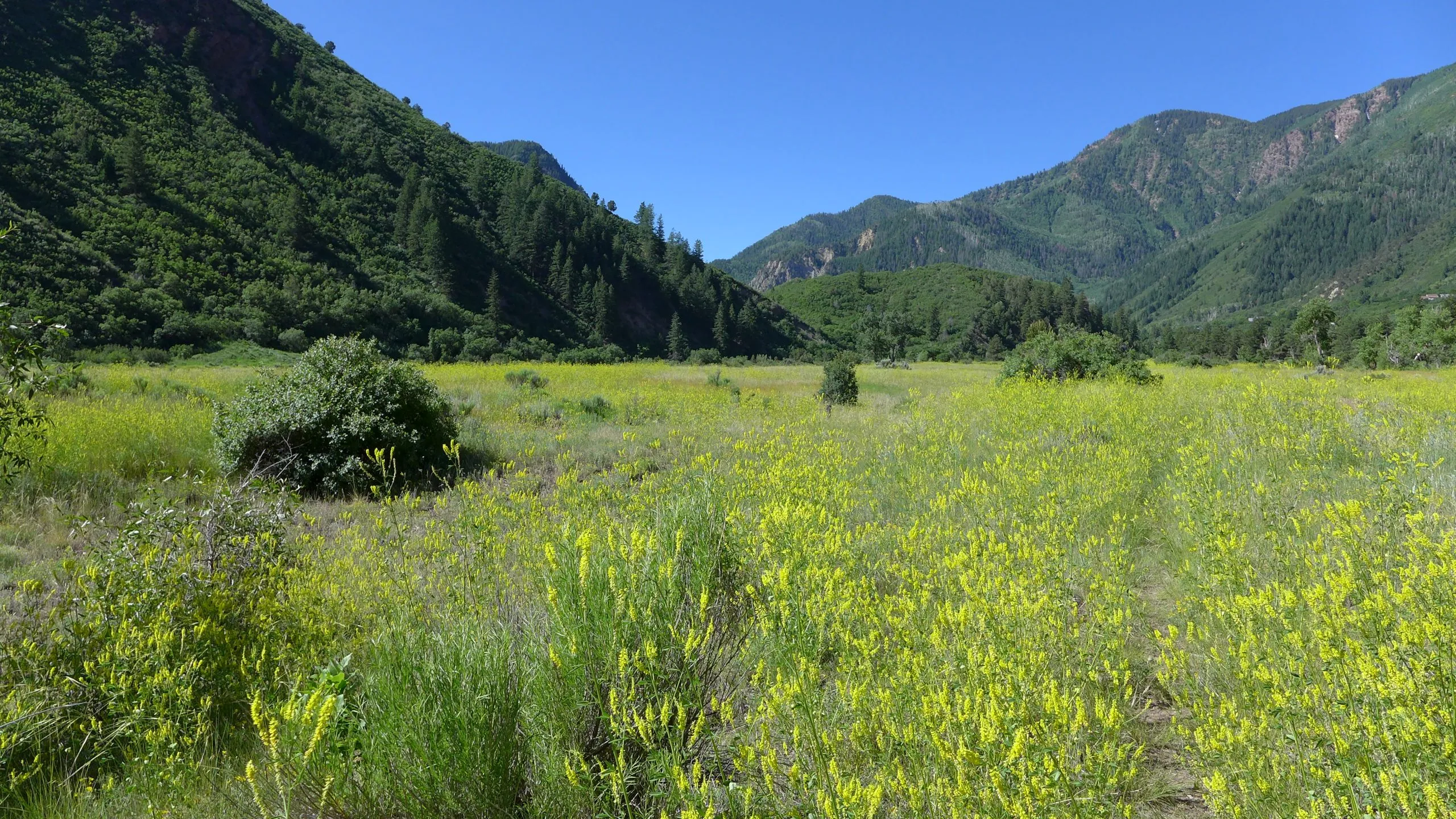
Scientists define streams by numerical order: A first-order stream has no tributaries, and a second-order stream is created at the confluence of two first-order drainages. Headwater streams are typically first- and second-order streams. They can be found at various elevations, from mountain valleys to the plains, and their characteristic plants vary by ecosystem. Regardless of where they’re located, headwaters often take on tangled shapes that slow the water’s progress and distribute it across meandering oxbows and liquid fingers that look more like wet webs than streamlined ribbons. Though some Colorado headwaters stop flowing during dry seasons, historically they’re moist, soggy places that keep water on the landscape, like sponges.

And headwater streams are often so small that they could be plowed over or piped underground, explains Wohl. Many were diverted to run mines and ranches. Others served as flumes conveying felled timber, and, says Wohl, as those logs rode snowmelt rushing downstream “it was like taking a scouring brush to the channel.”
Over time, as headwater streams lost their “branches” and became a single trunk of water, they began to act like irrigation ditches that accelerate water, and everything in it, to locations downstream. With climate change intensifying both storms and droughts, the canal-like efficiency of modified headwaters is proving to be a detriment for communities across Colorado. “Floods get bigger, with a higher peak flow for a shorter time,” Wohl says. Researchers are only now beginning to measure the flood-intensifying impact of channelized headwaters and every site is different, but according to unpublished modeling studies conducted by Nicholas Christenden, a PhD student at CSU’s Department of Civil and Environmental Engineering, one Front Range site demonstrated that restored beaver structures and associated vegetation might attenuate peak flow by 26%.
Faster, stronger floodwaters pose many long-term threats to stream and community health. They threaten bridges and riverside roads, and pollutants—including everything from sediment to agricultural chemicals—get funneled into municipal water sources.
Biodiversity also suffers from this channelization, because without complex wetlands and floodplains, streams support a less diverse population of insects, fish, amphibians, plants, birds and even bacteria.
Yet Colorado has managed to preserve a limited number (about 20% of the state’s total headwaters mileage, estimates Wohl) of “stage-zero” headwater streams that still function as nature designed. On this scale developed a decade ago and commonly used by stream health practitioners, stage zero refers to these unaltered systems. As streams degrade they can go from stage zero up to stage four before they start to recover. The scale maxes out with stage-eight streams, which have recovered to near pre-disturbance levels. Stage-zero systems demonstrate remarkable resiliency during extreme weather events, and they’ve persuaded some experts that we need to up our investment in preserving and restoring headwaters, not as we made them, but as they were.
Should you hike up to the uppermost reaches of Cochetopa Creek, within La Garita Wilderness in the San Juan Mountains, you will find a waterlogged, willow-choked valley that Wohl adores. “Oh it’s beautiful,” she croons of this stage-zero gem.
With its beaver ponds and meandering secondary channels where juvenile amphibians and fish can take shelter and grow, the Cochetopa Creek headwaters is a de facto sponge that slows and retains water passing through. Floods are dispersed across its many inlets, which trap pollutants and suspend sediment and return clear water to the flow downstream, just as a water treatment plant might do, but without the multi-million-dollar price tag. Thus the chain-of-ponds system also reduces the impact of high-energy surges. That water-purifying capability also traps atmospherically deposited nitrates, phosphates and other chemicals, which would otherwise concentrate in downstream water bodies where they trigger toxic algae blooms, says Wohl, who published her findings in a 2018 paper for Biochemistry.

“Certainly we see significant benefits downstream,” explains Dan Brauch, a Gunnison-area fisheries biologist with Colorado Parks and Wildlife. Cochetopa’s stage-zero beaver complexes store water that’s slowly released during late summer’s hot, dry periods, which improves water quality and quantity for downstream trout, Brauch says. “That water retention is also important to this area’s agricultural properties, because it means that more water is likely to reach those irrigators for a longer portion of the season,” he continues. Of course not all stream systems react to beaver activity in the same way. A 2015 study looking at the impacts of beaver dams on streamflow and temperature in Utah found that beavers don’t have consistent results on streamflow. During the study period, beaver development caused more variability in stream systems but, the report says, continued study is needed to better predict and understand beavers’ impacts.
The complex of wetlands found in intact headwater systems, such as at Cochetopa Creek, also can serve as a fire break and refuge for the area’s animals during wildfire. “Every living thing that can get there will,” attests Beardsley. After widespread fires, waterlogged headwater systems remain as a “big green patch,” he continues, from which repopulation efforts take hold in the surrounding burn.
These wetlands even sequester carbon in the floodplain to counterbalance the factors fueling climate change. Wohl’s study of North St. Vrain Creek concluded that while its broad, sponge-like floodplains represent just 25% of the total channel length within the river network, they store 75% of its organic carbon. “Headwaters that remain in their original condition provide a lot of ecosystem services,” Wohl says.
Residents of Glenwood Springs, for example, enjoy lower water costs because several of their headwater systems retain many of their natural processes. “Bison Lake Basin, No Name Creek and Grizzly Creek watersheds are [considered] stage-one watersheds exhibiting high geomorphic, hydrologic, and biotic integrity,” says David Boyd, public affairs officer for the White River National Forest, where these headwaters are located. That’s advantageous to the city’s water treatment, explains Matt Langhorst, Glenwood Springs’ public works director. “The water that comes out doesn’t have a lot of sediment, so it costs us a little less money to put it through the treatment process, and we pass that savings along to residents of Glenwood Springs,” he continues.
What’s more, these headwater wetlands also support a boggling diversity of flora and fauna, says Sarah Marshall, a wetland ecologist with CSU’s Colorado Natural Heritage Program. “The most intact systems just have more species,” she explains. “Birds, mammals, bugs, bats—all of it,” she continues. “Between the sights and also the sounds, it’s a very rich sensory experience to be in a diverse wetland.”
Headwaters’ power is their complexity, says Marshall. “When you take water out of that system,” as has happened at the Big Thompson and so many Colorado headwater streams, “You take away that complexity piece.” It’s like trying to support a reef ecosystem without the coral. Headwater wetlands, like coral reefs, “Provide a structure or a home for a lot of living species, and is itself a living thing, with fungi and bacteria that live in the soil,” Marshall explains. Trout, for example, depend on the deep pools that beavers create to survive the cold Colorado winters, because only those pockets stay warm enough to keep fish alive, whereas most headwater streams are so shallow that they freeze solid.
Yet defining what “healthy” means when describing headwater streams remains challenging, says Marshall. Health isn’t based on easily definable traits and each system is unique. Still, says Wohl, there are certain markers that generally point to “healthy” headwater systems. “Natural systems are not static, so there should be a range of variability,” she continues. Water flows will vary greatly between peaks and lows; water temperature will differ by location; species’ numbers may also fluctuate. Healthy headwaters, says Wohl, “have the ability to sustain their natural communities.” Thus native migratory birds and wild trout should be able to live, season to season, without replenishment or support from human agencies.
Beardsley, meanwhile, defines a healthy headwater system as one that’s preserved its natural processes. “In human health, we’d say that the person can still perform their vital functions,” he explains. Yes, scientists can measure water quality and use that to indicate something about purity, but “health is broader than that,” Beardsley explains. “It’s about physical and biological integrity, where plants, animals and abiotic parts all depend on one another.” In other words, he concludes, health is something that’s challenging to define or measure, but “defining and measuring it is something we can and must do to restore healthy watersheds.”
For all their planetary and human benefits, healthy headwaters come with tradeoffs that people sometimes find hard to accept. Hikers don’t like soaking their boots amidst flooded willows that stymy progress. In their natural state, headwaters are jumbled, cluttered places that frustrate our preference for efficiency.
But the biggest concern comes from downstream water users, including some water providers, municipalities, agricultural producers and others who raise concerns about the potential implications of holding water on the floodplain. These water rights holders worry that water retained upstream in headwaters areas—whether in wetlands or behind beaver dams—might alter or limit the amount of flows or timing of runoff, impacting the water that they legally have a right to use.
But, says Marshall, “If you want to catch fish and you want clean water to drink, you really need the mess upstream.”
When land and water managers or property owners seek to rehabilitate headwater streams that have suffered decades of replumbing and degradation, they can follow a surprising number of clues that indicate how the waterway once functioned.
Some glimpses remain in the written records that settlers left. “There are general land office descriptions, when people surveyed, that document what they saw,” says Marshall. “They are sometimes very descriptive, especially with the acres that were difficult to cross,” she jokes. In their snarled, labyrinthian state, headwaters have never facilitated easy passage for humans’ preferred forms of travel.
Technological imaging can also provide sketches of headwaters’ former shapes, sizes, and historical footprint. “Aerial photography lets us see evidence of where rivers used to be,” notes Marshall. Imprints from former beaver ponds and wetlands often remain on the land and suggest the paths that water used to take through valleys that now evidence a single stream among stark grasses.
LiDAR, which stands for light detection and ranging, is yet another way that researchers discern evidence of past water patterns. LiDAR has helped water managers assess snowpack depth across various headwaters in Colorado, and the data can also guide practitioners who want to understand what a particular stream looked like before human re-engineering.
“Aerial imagery of the Big Thompson in Moraine Park, as in a lot of mountain parks, shows broad floodplains that used to be a mix of meadows and wet places, with meandering, multi-threaded sliver channels that historically had beavers and large wood,” Marshall explains. But as elk replaced beavers in Moraine Park, the woody vegetation all but disappeared, either because it was browsed by ungulates or didn’t find sufficient water, and the simplified stream dug into the floodplain, losing its connection to the surrounding ecosystem.
Sometimes, Wohl and other researchers look at data, such as streams’ hydrographs, to determine the threshold requirements for sustaining key ecological functions. “Fish spawning, for example, might require a certain minimum flow and distribution,” Wohl explains. Managers can aim for those targets, rather than trying to restore working waterways to their pristine conditions.
Indeed, it’s not always easy—or desirable—to try to recreate the past with today’s streams. After all, they’re living, dynamic systems, not museum artifacts, and they’re healthiest when they have the freedom to change and adapt. “You could pick a point in history to return to,” says Beardsley, “But these ecosystems are always changing and evolving. So there’s no point in trying to create a static system.” The idea is to restore streams’ multi-faceted functionality, so earth, water, rock, chemical and biological elements all work together—and then let the system run itself.
In fact, headwaters’ adaptability is precisely what makes them such valuable assets for human communities looking to boost their resiliency in the face of climate change. “We want systems that can react and adapt to future pressures,” Beardsley continues. When torrential rains fall on mountainsides that have been denuded by wildfire, headwater systems can slow the flooding and filter the water before it arrives at municipal infrastructure—but only if these streams retain some version of their original, natural processes.
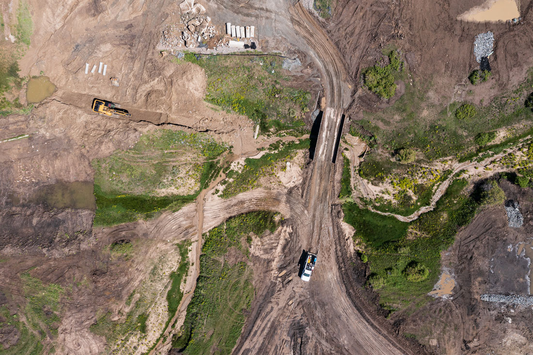
That’s why the Mile High Flood District (MHFD) recently helped a landowner in Parker to create a development plan that restored Stroh Gulch, a headwater stream that feeds Cherry Creek. Not that Stroh Gulch was pristine: Located on a cattle ranch, it includes reaches that have lost their native scrub oak and have become channelized. But as the landowner prepared to offer the property to housing developers, the MHFD collaborated on a vision for the project that would revive the headwater stream’s health and meet builders’ economic needs. Three years ago, E5X Management and Muller Engineering Company accepted the project parameters, and this year, construction begins on the 1,200-acre Tanterra development.
Instead of lining Stroh Gulch with concrete and reducing it to nothing more than a ditch, developers are planting grasses, shrubs and trees that restore the stream’s heterogeneity. “We look at them as infrastructure,” explains Barbara Chongtua, MHFD’s development services director. “One benefit to homeowners is the aesthetic component, that these become places to walk, meditate and play,” she continues. “But the natural system—we refer to it as nature-based solutions—also slows the water down and prevents erosion,” she explains. The water infiltrates the ground closer to its source, so it doesn’t all dump into the active channel. According to simulations conducted by Muller Engineering, the interplay of rocks, shrubs, and trees “really beat down the peak and the frequency of runoff,” says Chongtua.
“The Mile High Flood District is dedicated to protecting people, property, and our environment, and we used to do that with a lot of concrete and rock, to contain [flooding],” Chongtua continues. “But now we’re realizing that we can achieve that protection by working with nature, by working with its living systems, which are a lot more cost-effective and get stronger over time.” Tanterra is just the beginning. Says Chongtua, “This gives us a pilot project that we can scale up.”
Improving the health of Stroh Gulch makes a positive difference, even though the stream isn’t likely to achieve stage zero status. Because, experts agree, headwaters health isn’t an all-or-nothing game: Degrees matter. The rehabilitation efforts that are most likely to succeed also work by degrees, so that the best candidates for restoration typically retain some of their defining characteristics, says Beardsley. For example, it’s hard to relocate beavers to a zone where they have no food, habitat, or building materials.
It’s difficult to relocate beavers, period, says Beardsley. They’re natural forces that humans can’t readily control. So at Trail Creek, located within the Taylor River headwaters between Gunnison and Crested Butte, efforts merely invited beavers onto the mile-long segment. Wanting to improve water quality above Taylor Park Reservoir, local land managers worked with funding partners that included the National Forest Foundation and the Coca-Cola Corporation to restore water-holding wetlands. Beginning in 2021, volunteers sunk wooden posts into the stream banks and wove willows between them to create artificial beaver dams that, they hoped, would attract beavers from the surrounding forests.
It worked: By the following summer, beavers had returned to the valley after a 20-year absence and had constructed a dam and lodge that had begun to saturate the once-parched riparian zone. Retained water nourished the 200-plus willows that teams had planted, and the revived interaction between plants, water and wildlife promises to reverse the encroachment of sagebrush that had replaced riparian plants throughout the corridor.
“The big benefit is that water remains on the landscape,” says Beardsley. “That provides a big resiliency factor in times of drought.”
Coloradans have different needs and face a fresh set of threats that didn’t bear on those European settlers 200 years ago. “We’ve traded away a lot of those functions and benefits [of headwaters] by some of our past land uses,” says Beardsley. “But we can trade back, which is exciting.” Trail Creek and related projects indicate that headwater streams can indeed heal, when humans set them up to self-adapt.
“We don’t know how they should respond to a lesser snowpack or drier conditions or wildfire,” admits Beardsley. But he trusts nature to figure it out. “We ha
A freelance writer living in Steamboat Springs, Kelly Bastone covers water, conservation and the outdoors for publications including Outside, AFAR, 5280, Backpacker, Field & Stream, and others.