#Colorado’s newest biggest battery — @BigPivots #ActOnClimate

The Thunder Wolf Energy Center east of Pueblo, near Avondale, has 100 megawatts of battery storage. Credit: Big Pivots

Click the link to read the article on the Big Pivots website (Allen Best):

Colorado now has its largest battery ever and its second-largest solar installation.

The Thunder Wolf Energy Center east of Pueblo, near Avondale, has 100 megawatts of battery storage, surpassing the 5 megawatts at the Spring Valley Campus above Glenwood Springs that formally began use in November 2022.

See: A biggest ever in Colorado for battery storage.

It also has 248 megawatts of solar energy, making it the second biggest solar installation in Colorado. Still largest is the Bighorn Solar project, which comes in at 300 megawatts. It is located on land adjacent to Comanche Generating Station in Pueblo that is owned by Rocky Mountain Steel.

This project is located on Colorado State Land Board property, which will get revenue from lease payments. NextEra Energy Resources is the developer and sells the power to Xcel via a power-purchase agreement.

Neptune, another solar project in Pueblo County, also went on line on June 16, adding 250 megawatts of capacity. The remaining capacity in that project of 75 megawatts is to go on line July 31.

Much more of both solar and storage can be expected as Xcel completes its plans that were triggered by its electric resource planning process in 2016. That plan approved by the Colorado Public Utilities Commission ultimately calls for 275 megawatts of battery storage in Pueblo and Adam counties.

Behind that there will be more yet. The plan approved by PUC commissioners in 2022 calls for 400 megawatts of battery storage to go along with 1,600 megawatts of solar and 2,300 megawatts of wind energy.

Allen Best is a Colorado-based journalist who publishes an e-magazine called Big Pivots. Reach him at allen.best@comcast.net or 720.415.9308.

#Aurora rolls back heightened restrictions on lawn watering — Aurora Sentinel #drought

Aurora water supply and collection system. Credit: Aurora Water

Click the link to read the article on the Aurora Sentinel website (Max Levy). Here’s an excerpt:

Aurora lawmakers on Wednesday voted to scale down restrictions on residents watering their lawns in response to rebounding water levels at the city’s reservoirs. The council voted in February to limit residents to two days of lawn watering per week rather than three, reflecting the fact that the city had less than 30 months’ worth of water stored between its reservoirs and the snowpack at the time. But with the ample rain that has fallen since then, and the decision of residents not to irrigate outdoor landscaping, Aurora Water on Wednesday asked the council’s permission to ease the restrictions…

Brown said the city’s reservoirs were about 85% full as of Wednesday. Though opponents of the restrictions questioned whether the policy had any impact, Brown said the actions of Aurora Water customers meant outdoor water use had been below average and said the majority of single-family homes complied with the rules…

Mayor Mike Coffman also brought up how nearly half of the city’s water goes to outdoor irrigation, and the city doesn’t get that water back. He argued that man-made climate change was a reality and that the city needed to deal with the related problem of water scarcity by conserving. The council voted unanimously to roll back the enhanced restrictions on lawn watering to allow watering as often as three times per week. Residents will still be limited to watering outside the hours of 10 a.m. to 6 p.m. until Sept. 30.

Beyond 2026: Governance for the #ColoradoRiver in the #Anthropocene — Sibley’s Rivers #COriver #aridification

Click the link to read the article on the Sibley’s Rivers website (George Sibley):

The graph above is from a study released a couple weeks ago, mid-June, on ‘The Colorado River Water Crisis: Its Origin and the Future,’ authored by two elders of Colorado River affairs: Dr. John Schmidt, river scientist at Utah State University, and Eric Kuhn, longtime manager of the Colorado River Water Conservation District, now retired; both are deeply immersed in the river’s issues, and committed to working through the current crisis to a more reality-based future for the river and those who use its waters. A third author is Charles Yackulic, a noted scientist with the U.S. Geological Survey, but not so well known in Colorado River matters. When Jack Schmidt and Eric Kuhn speak about the river, everyone listens – especially when they speak together.

This graph alone explains a lot of the pain and anxiety we’ve been experiencing, and anticipating experiencing, in the Colorado River region – the natural basin plus technological out-of-basin extensions. (Sometimes the anticipation of pain can be more painful than the actual eventuality – try to think ‘dead pool’ without a serious twitch.)

The black line meandering through the graph is a smoothing curve tracing the general up-or-down-and-how-far of the erratic annual flows of the river (the little black dots peppered all over the graph). But the genius of their analysis is in the three horizontal lines. They’ve divided the 117 years for which we have some semblance of measures for Colorado River’s flows into three fairly distinct periods: The Early 20th-Century Pluvial (two-bit word for ‘really wet period’) when the river averaged almost 18 million acre-feet a year (maf/yr) for a quarter-century; then the six-decade Mid to Late Century period when the river averaged 14.3 maf/yr; and then what they’ve chosen to call the Millennium Drought in which the river has only averaged flows of 12.5 maf/yr. (I would just call it ‘The Anthropocene.’)

Eugene Clyde LaRue measuring the flow in Nankoweap Creek, 1923. Photo credit: USGS

In terms of flow, that might be three different rivers. The large-scale management of the Colorado River began with the Colorado River Compact in 1922, created just past the peak of the Early 20th-century Pluvial; it was written for the ‘first river,’ as it was then. It’s true there were scientists like E.C. ReRue saying that tree rings indicated that the pluvial period was highly unusual, and 12-13 maf might be a better average flow when the river had a lot of pooled up storage and irrigation water spread out to dry under the desert sun…. But try telling that dour perception to a bunch of engineers and city-builders in the Early Anthropocene, sitting with their new-fangled bulldozers idling on the banks of a wild river running 18 maf a year….

As the river slipped into the severe drought of the 1930s, and the rest of the 20th century where the average flow was less than the 15 maf that had been divided in the Compact, to say nothing of the 1.5 maf for Mexico, it still seemed possible, with the addition of new elements in what became known as ‘The Law of the River,’ to continue governing that ‘second river’ more or less by the Compact. But it was an increasingly shaky situation, saved mostly by the fact that the Upper Basin states were using quite a bit less than their 7.5 maf/yr, and the water they weren’t using was pooled up in not one but two huge reservoirs that were occasionally both full.

But when the Millennial Drought struck just after the turn of the century, the ‘third river’ was born, its flows 40 percent lower than those of the ‘first river,’ things began to fall apart….

It’s interesting that the publication of this study more or less coincided with news releases about the official beginning of meetings to work out a new management regime for the Colorado River, to be in place by the end of 2026. There is nothing mystical or even historical about the choice of 2026 for this; the date stems from the fact that, early in what Schmidt, Kuhn and Yockulic call the ‘Millennial Drought,’ the managers of the Colorado River storage and delivery systems realized they were in trouble. After a really bad water year in 2002, followed by half a decade of mediocre-to-pretty-bad water years, storage in the River’s two big ‘fail safe’ reservoirs had dropped from near-full in 2001 to half-full. So the managers gathered in 2006 to work on new river management stratagems – beginning by creating ‘Colorado River Interim Guidelines for Lower Basin Shortages and the Coordinated Operations for Lake Powell and Lake Mead’; the ‘interim’ for the Interim Guidelines would be two decades, to 2026, at which time they planned, or at least hoped, to have a new river management plan.

Management for all three of the rivers portrayed on the graph has been done under the auspices of ‘The Law of the River,’ the bag of compacts, treaties, laws, court decisions, state resolutions, federal regulations and other elements, that have accumulated over the past century around the original 1922 Colorado River Compact, to clarify, interpret, legislate, and otherwise support the Compact. The ‘Interim Guidelines’ went into the bag with the rest of the Law of the River – as did a set of Drought Contingency Plans (Upper and Lower Basins) in 2019.

But now – practically on the eve of 2026 – storage has continued to drop so alarmingly in the Mead and Powell Reservoirs, despite cuts in consumptive use under the Interim Guidelines, that last summer the Bureau of Reclamation and Interior Department issued a semi-panicky mandate that, to fend off the possibility of going to dead pool in the big reservoirs, it would be necessary to cut consumptive uses much more – by 2-4 maf/yr, a huge cut.

This has engendered several plans, the most popular of which would produce a reduction of three maf over three years – only half of the Bureau’s minimum request – and would require the federal government to pay $1.2 billion to get it done. This plan will probably be accepted, however, even though it too may prove insufficient to get us on to 2026, partly because any of the other plans would probably end up in court for the next decade, and partly because we just had a big fat pluvialish year of snow in the mountains that will give a stay to the increasingly scary decline in the big reservoirs.

This new agreement to reduce use will go in the bag along with the rest of the Law of the River. The question then becomes – what will happen in 2026? Will we just be adding another set of patches, bandaids and crutches to the Law of the River bag, to keep the 1922 Colorado River Compact propped up and somewhat afloat?

Crested Butte

When I think of the Colorado River Compact today, I think of the 1950 Chevy I bought for $50 in 1970-something from an old guy in Crested Butte. After driving it for a couple years, it started running worse than usual, so I took it to the garage to see what the mechanic recommended.

‘Well,’ he said, ‘if it was mine, I’d jack up the radiator cap and put a better car under it.’

That wasn’t exactly what I wanted to hear. And there are still a lot of people who think the Colorado River Compact is still just fine, with a little help from the Law of the River bag of tricks. People who say it would be impossible to replace the Compact, and don’t want to hear of it.

But look at the graph. The Colorado River Compact was written for a river that for a quarter century was running an average of 17.9 maf. Now it is a considerably different river. There is one sentence in the Colorado River Compact we ought to revisit – its first sentence:

“The major purposes of this compact are to provide for the equitable division and apportionment of the use of the waters of the Colorado River System; to establish the relative importance of different beneficial uses of water, to promote interstate comity; to remove causes of present and future controversies; and to secure the expeditious agricultural and industrial development of the Colorado River Basin, the storage of its waters, and the protection of life and property from floods.

Wouldn’t it be nice to have a Compact for managing the river we have now that did all of those things? The 1922 Compact really only fulfilled the fourth objective; it sufficed to ‘secure the expeditious agricultural and industrial development of the Colorado River Basin,’ so long as Congress was willing to ignore that there was ‘interstate comity’ with only six of the seven states, and there were plenty of ‘present and future controversies’ lurking in the wings.

The commissioners had also failed in their original intentions for ‘providing for the equitable division and apportionment of the use of the waters’. What they had wanted to do was to effect a seven-way division of the river so that each state would know that, when it was ready to go into super-growth mode like California already was, there would be water for them to develop. Essentially, they wanted to abrogate the appropriation doctrine at the interstate level, so that one state (California) could not preclude development in the other states.

They spent most of their first week of compact commission meetings trying to work out that seven-state division, but they were all so full of their own big dreams that it would have required a couple ‘first rivers’ to fulfill their hopes. The two-basin division of the river they eventually settled on sufficed to get the Boulder Canyon Project underway, but was not what they had hoped to do. It did give the Upper Basin states a temporary sense of relief, until the drought of the 1930s made them realize the implications of the ‘shall not cause the flow to be depleted below’ clause, which afforded plenty of potential future controversies; the Lower Basin states, meanwhile, found immediate cause for controversy, with Arizona soon suing California.

All of this makes me think it may be time to, as it were, jack up the first sentence of the existing Compact, and create a new Compact to put under it, one that actually accomplishes the three worthy stated objectives that remain unfulfilled.

Also in the news last week was the announcement that The Supremes, our jolly kick-ass band of judicial activists, have delivered another kick to some of the First People in the Colorado River basin. We’ll begin to delve into that in the next post here….

Map credit: AGU

The legal loopholes that threaten farmworkers’ health and safety: As summer #heatwaves loom and farmworkers take to the fields, an in-depth report highlights massive gaps in regulations, especially around #pesticide use and exposure — Grist

Field workers harvesting strawberries. Photo credit: Public Policy Institute of California

Click the link to read the article on the Grist website:

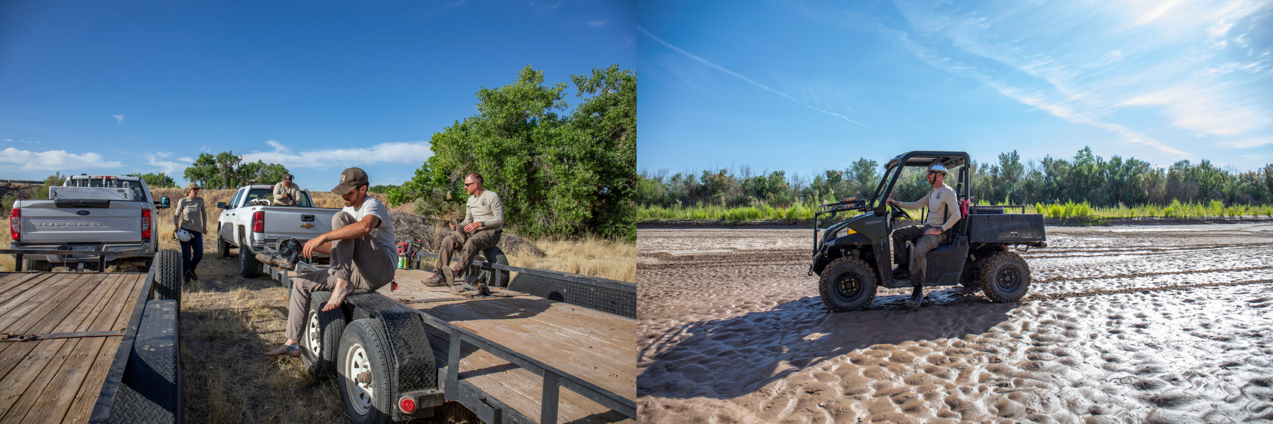
An estimated 2.4 million people work on farms in the United States. Though their work is critical to agriculture and the economy alike, pesticide exposure continues to be a major occupational risk—and the effects ripple out into society and the food we eat.

Pesticides can easily drift onto farmworkers—and the schools and neighborhoods near fields. Current pesticide regulations aren’t consistently enforced, and vulnerable workers aren’t always able to seek help when there are violations. 

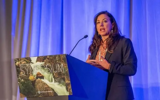
Exposures may continue around the clock, especially on farms where workers and their families live, says Olivia Guarna, lead author of a recent report, “Exposed and at Risk: Opportunities to Strengthen Enforcement of Pesticide Regulations for Farmworker Safety,” by the Center for Agriculture and Food Systems at Vermont Law and Graduate School, in partnership with the nonprofit advocacy group Farmworker Justice. This is one of a series of reports addressing needed policy reforms and federal oversight of programs impacting farmworkers. 

Alongside faculty and staff in the Center for Agriculture and Food Systems, Guarna, a honors summer intern with a background in environmental issues, spent 10 weeks interviewing attorneys, officials, administrators, legal advisors, and farmworker advocates, researching how pesticide use is regulated and enforced in Washington, California, Illinois, and Florida. What Guarna didn’t expect was just how complicated the regulatory scheme is. The federal Environmental Protection Agency technically has oversight over pesticide use, yet in practice receives little data from states, whose enforcement is spotty at best. “There are a lot more protections on paper than I think are actually being implemented to protect farmworkers,” she says.

One of the biggest issues, according to Laurie Beyranevand, Director of the Center for Agriculture and Food Systems and one of the authors of the report, is that unlike other environmental laws administered by the EPA, the agency doesn’t adequately gather data from the states, making enforcement of existing standards more difficult. 

In Florida, the report found, inspections are virtually never a surprise. “Farmworkers report that when inspectors come to the farms, growers know they are coming, and they get to prepare,” says Mayra Reiter, project director of occupational safety and health for Farmworker Justice. “Inspectors don’t get to see what goes on day-to-day in those workplaces.”

Washington is considered one of the more progressive states in terms of farmworker protections. Yet between 2015 and 2019, Guarna discovered the average violation rate there was 418%, meaning that multiple violations were found on every inspection performed. 

In California, when violations are found, fines are often not levied, the report concluded. Even when penalties are issued, they’re often for amounts like $250 — token fines that growers consider to be part of the cost of doing business. Only a single case reported in California between 2019 and 2021 involved a grower being fined the more significant sum of $12,000.

Still, California is one of the few states that makes information readily available to the public about what chemicals are being applied where. Elsewhere, it’s virtually unknown. Washington, Florida, and Illinois do not require pesticide use reporting at all. 

“You have the farmworkers being directly exposed, and there’s so little transparency on what’s in our food,” Guarna says. “It’s not just farmworkers who are affected — drift is a big problem when it’s close to schools and neighborhoods. There’s just so little we know. A lot of the health effects happen years down the road.

In some instances, toxic exposure has become quickly and tragically evident when babies are born with birth defects. Within a span of seven weeks in 2004 and 2005, for example, three pregnant farmworkers who worked for the same tomato grower, Ag-Mart, in North Carolina and Florida, gave birth to babies with serious birth defects, like being born without arms or legs. Florida’s Department of Agriculture and Consumer Services issued two complaints against Ag-Mart in 2005, alleging 88 separate violations of pesticide use laws altogether. Ultimately, 75 of those violations were dismissed. Ag-Mart was fined a total of $11,400.

Yet thousands of poisonings continue to happen each year, Farmworker Justice says. In August 2019, for example, a field of farmworkers in central Illinois was sprayed with pesticides when the plane of a neighboring pesticide applicator flew directly overhead, the report noted. Several workers turned up at local emergency rooms with symptoms of chemical exposure. 

Despite these incidents, Illinois does not mandate that medical providers report suspected cases of exposure. Only because a medical provider at the hospital personally knew someone in the local public health department—who in turn contacted connections at the Illinois Migrant Council and Legal Aid Chicago—did the exposure result in legal action.

Workers often live on the farms where they work, exposing them to chemicals virtually round-the-clock, Reiter adds. “We know from farmworker testimonies that when they return to their homes, they can smell the pesticides, and it lingers for days after they return,” she says.

Vulnerable legal status can make it difficult for farmworkers to report exposures. Millions of farmworkers hail from Mexico, Guatemala, and elsewhere in Central America, according to Farmworker Justice, although significant numbers also come from countries like Jamaica and South Africa. An estimated half of farmworkers in the U.S. are undocumented

Millions of others come on H2-A guest-worker visas that allow them to come to the country for seasonal jobs of up to 10 months. These temporary visas are tied to specific employers, so workers fear being deported or otherwise retaliated against if they raise complaints about safety violations.

“Because [workers] are looked at as expendable, they’re regularly exposed to neurotoxic pesticides that can be carried into their home settings,” says agricultural policy expert Robert Martin, who recently retired from John Hopkins Center for a Livable Future. “They’re largely immigrants, and they don’t have a lot of legal protections. The advocates they do have, like Farmworker Justice, are terrific, but they’re really taken advantage of by the system because of their legal status.”

Inherent conflicts of interest also present legal loopholes. The state agencies charged with enforcing federal and state pesticide safety laws, like state Departments of Agriculture, are often the same agencies that promote the economic interests of the ag industry. And farmworkers know it. “That sort of cultural conflict is a big issue,” Guarna says. “Farmworkers have become deeply skeptical of departments of agriculture, and skeptical that they have farmworkers’ interests at heart. They fear their complaints are going to fall on deaf ears.”

While the EPA is legally required to maintain oversight over state agencies, in practice, they only require states to report about federally funded work—and the vast majority of state programs are funded by state budgets. Mandatory and universal standards for inspections and responses to violations would help tremendously, the report concludes. “One of our recommendations is that there should be whole-of-program reporting where states, tribes, and territories have to report all their activities,” Guarna says. “There are some very discrete fixes that can be made that would have a huge impact, so I am hopeful about that.”

Among the report’s 17 policy recommendations is to ensure that enforcement of pesticide safety gets delegated to an agency that is specifically tasked with protecting the health of workers. This could include transferring enforcement to state departments of labor or health, or even creating a new authority specifically dedicated to pesticide regulation.

“Exposed and At Risk” follows a previous report from the Center for Agriculture and Food Systems that focused on the two major threats facing farmworkers—heat stress and pesticide exposure. It focused on opportunities for states to take action to better protect farmworkers, and was written in collaboration with the Johns Hopkins Center for a Livable Future. That collaboration also led to a third report, called “Essential and in Crisis: A Review of the Public Health Threats Facing Farmworkers in the U.S.,” which recently explored the public health and environmental impacts of industrial agriculture. Martin, who co-authored these findings, explains that the concentrated power and wealth of large agribusiness companies has consequences for both worker safety and the environment. 

Following corporate consolidation since the 1980s, “there are fewer meat, seed, pesticide companies, and their combined economic power really keeps the status quo in place,” Martin says. ”There are some pretty direct public health threats of these operations.”

As “Exposed and at Risk,” notes, the regulatory system should be structured in a way that works to protect farmworkers. But currently, federal regulators lack sufficient data to even identify the tremendous gaps in enforcement. Requiring states to develop comprehensive reporting systems would be a small step toward protecting the foundation of American agriculture.


Vermont Law and Graduate School, a private, independent institution, is home to a Law School that offers both residential and online hybrid JD programs and a Graduate School that offers master’s degrees and certificates in multiple disciplines, including programs offered by the School for the Environment, the Center for Justice Reform, and other graduate-level programs emphasizing the intersection of environmental justice, social justice and public policy. Both the Law and Graduate Schools strongly feature experiential clinical and field work learning. For more information, visit vermontlaw.edu, Facebook, Twitter and Instagram.

Roberts Tunnel runs dry, bringing possible extension to Summit County’s rafting season — Summit Daily News #runoff #BlueRiver

Rafters lift their paddles in the air as they make their way through a series of rapids on the Blue River as the Gore Range rises above the scene. This year is the first weeks-long opportunity to raft down the Blue River since 2019. Performance Tours Rafting/Courtesy photo

Click the link to read the release from Performance Tours Rafting via the Summit Daily News:

The 23-mile-long pipe that siphons water from Dillon Reservoir to the Front Range has run dry thanks to decreased water demand from the metropolitan areas near Denver. 

This has allowed Summit County to keep more than 6,000 acre-feet of water in Dillon Reservoir, and officials with Denver Water, which controls the flows out of the reservoir, say it will help support more recreation on the Lower Blue River. 

The outflow to the Blue River currently hovers around 1,050 cubic feet per second. That rate is around 175% of the historic outflow for the last week of June. Last year, outflow was at 56 cubic feet per second, which sits at the historic minimum.

For comparison purposes, a basketball is about one cubic foot. So to put the current flows into perspective, people can imagine 1,050 basketballs flowing past them every second. 

Commercial rafting operations typically require flow rates above 500 cubic feet per second. 2023 marked the first weekslong commercial rafting season in Summit County thanks to above-average precipitation this spring and reduced demand from the Front Range

Over the next week, the spillway should release flows between 900-1,200 cubic feet per second, and Denver Water forecasts don’t call for the flows dropping below 500 cubic feet per second until mid-July.

The commercial rafting season was nearly ended by a downed tree across the commercial stretch of the river, but locals banded together to remove it and save the season despite the danger posed by the situation.

As of Monday, June 26, all 10 of Denver Water’s major reservoirs were full, causing free river conditions on the South Platte River.

Multiple swift-water deaths have caused public safety groups to urge caution while recreating on and near rivers. Officials advise folks to never use plastic tubes or vessels that aren’t commercial-grade rafts, and only experienced rafters should attempt to navigate High Country rivers due to their increased flows, natural obstacles and terrain traps.

Denver Water’s collection system via the USACE EIS

Greenland melt punching off the charts — Jason Box @climate_ice

#Drought News June 29, 2023: Much of N.W. #Nebraska, E. #Wyoming, N.E. #Colorado saw rainfall of at least 2 inches over the last week

Click the link to view a gallery of drought data from the US Drought Monitor website.

Click the link to go to the US Drought Monitor website. Here’s an excerpt:

This Week’s Drought Summary

Widespread changes were made across the country, with many degradations and improvements occurring. In the eastern U.S., mostly widespread improvements occurred following widespread heavy rains, though parts of New Jersey and Long Island that missed out on these rains saw conditions worsen. The Midwest and east-central Great Plains saw mostly worsening conditions and widespread crop stress and low streamflows after another week of mostly dry weather. A mix of improvements and degradations occurred in Texas, where recent precipitation amounts have varied widely. The northern Great Plains received widespread heavy rainfall this week, leading to large-scale improvements to ongoing drought and abnormal dryness. In the Pacific Northwest, a few areas saw above-normal precipitation and improving conditions, but larger parts of the region saw increasing evaporative demand, continued dry weather and lowering streamflows, leading to worsening conditions…

High Plains

This week’s weather varied substantially across the High Plains region. Much of the Great Plains portion of the region, with the exception of eastern Nebraska and eastern Kansas, saw widespread precipitation, some of it heavy. Much of northwest Nebraska, eastern Wyoming, northeast Colorado, South Dakota and the southern half of North Dakota saw rainfall of at least 2 inches over the last week. In western Nebraska, eastern Wyoming and the Dakotas, this led to widespread improvements to the drought depiction in areas where the heaviest rains fell. Isolated heavy rains in central and western Kansas also led to localized improvements to ongoing drought areas. Meanwhile, conditions continued to worsen in southeast Nebraska, northeast Kansas and the Kansas City area, where mostly dry weather continued. Given continued decreases in soil moisture and groundwater, and growing short- and long-term precipitation deficits, exceptional drought was introduced in parts of the Omaha metropolitan area. North of Lincoln, Nebraska, hay production was reported to be about a third of normal for this time of year. Stress to other vegetation, including trees, also continued in southeast Nebraska this week…

Colorado Drought Monitor one week change map ending June 27, 2023.

West

With the exception of western portions of Washington and Oregon, much of the West region experienced near- or cooler-than-normal temperatures this week. Heavy rains fell in parts of southeast Montana, northwest Wyoming and adjacent portions of central Idaho and southwest Montana. These rains helped to alleviate long-term precipitation deficits and increase streamflows in these areas, leading to a reduction in coverage of ongoing drought and abnormal dryness. Adjacent to improvements in the Texas Panhandle, recent precipitation in northeast New Mexico has also helped to improve conditions there. Continued above-normal precipitation in parts of central and south-central Oregon has helped to alleviate long-term precipitation deficits and increase soil moisture, leading to localized shrinking of drought coverage. In southeastern and western portions of Washington, and in western Oregon, recent dry weather, low streamflows and increasing evaporative demand led to an expansion of drought and abnormal dryness in parts of these areas…

South

Much warmer than normal temperatures covered the western half of the region, especially across southwest Texas, where temperatures were at least 9 degrees above normal in many locations. Farther east, temperatures were near normal or cooler than normal, with readings coming in from 3 to 6 degrees below normal in eastern Tennessee. Recent rains in central Louisiana led to a shifting of a small area of moderate drought as short-term precipitation deficits shifted to the northeast. Short-term moderate drought developed in parts of northeast Arkansas and eastern Oklahoma, where short-term precipitation deficits grew and streamflow decreased. In north-central, central and southeast Texas, soil moisture and streamflow decreased amid growing precipitation deficits, leading to localized worsening in drought conditions or introduction of abnormal dryness. Farther west in Texas, a combination of precipitation this week and a re-evaluation of precipitation from recent weeks led to more improvements in the Texas Panhandle and in adjacent western Oklahoma, as well as improvements in a severe drought area south of Lubbock…

Looking Ahead

Through the evening of Monday, July 3, the National Weather Service Weather Prediction Center is forecasting widespread rain, locally heavy, to fall from southeast Wyoming and northeast Colorado eastward across Nebraska and northern Kansas, southern Iowa and northern Missouri, and farther east into the Midwest and Ohio River Valley. Rainfall amounts in central Illinois may exceed 3 inches locally. Widespread moderate and locally heavy rainfall amounts are forecast in parts of the Appalachian Mountains as well. Locally heavy rains are forecast in southern Florida during this period as well. West of the Continental Divide, mostly dry weather is expected.

Looking ahead to the period from July 4-8, the National Weather Service Climate Prediction Center forecast favors above-normal precipitation across much of the contiguous U.S., especially from eastern Idaho through Nebraska and northern Kansas. Below-normal precipitation is favored in Arizona and in western Washington and northwest Oregon. Below- or near-normal temperatures are favored in the northwestern Great Plains, while above-normal temperatures are likely in the south-central U.S., south Florida and the eastern Great Lakes, with warmer-than-normal temperatures slightly favored across much of the eastern and southern U.S., excluding southern California and the southern Appalachians. Warmer-than-normal temperatures are also strongly favored in the Pacific Northwest. Wetter-than-normal weather is favored across Alaska, except for the Panhandle, where below-normal rainfall is slightly favored. Warmer-than-normal temperatures are slightly favored in the north slope and Arctic Coast regions of Alaska, and in the far southeastern Alaska Panhandle. Cooler-than-normal conditions are favored across roughly the southwestern half of Alaska.

US Drought Monitor one week change map ending June 27, 2023.

2023 #COleg: Stream Restoration Legislation Will Benefit Birds and People in #Colorado: New law is a win and a good first step to clarifying stream restoration activities — Audubon Rockies

Governor Polis signs SB23-270 into law. Photo: Abby Burk

Click the link to read the article on the Audubon Rockies website (Abby Burke):

Our decisions about the health and functioning of our streams and rivers reflect our priorities and values and influence all areas of life for people, birds, and nature. This legislative session, SB23-270, Projects To Restore Natural Stream Systems, was passed by the Senate, then the House, and then signed into law on June 5, 2023, by Governor Polis. SB23-270 is a solid win for Colorado’s streams and a good first-step opportunity to steward our rivers back into health. The bill was led by the Department of Natural Resources staff and sponsored by Senators Dylan Roberts and Cleave Simpson, along with Representatives Karen McCormick and Marc Catlin.

Through numerous meetings, outreach events, and late-night (or early morning?) committee hearings, SB23-270 moved through substantial changes from when it was first introduced. Audubon Rockies, Colorado Healthy Headwater Working Group, and Water for Colorado partners worked with agencies, lawmakers, water conservation districts, and other partners for the best possible outcome for healthy, functioning, and resilient river systems for people and birds—the natural water systems that we all depend upon.  

Why the Need for Stream Restoration Legislation in 2023? 

The need for stream restoration clarity around water rights administration is mainly three-fold.

First, existing Colorado water administration creates substantial regional variability, uncertainty, and even barriers to restoring the valuable natural processes of stream corridors. Legal clarity for stream restoration can reduce barriers for these important projects to get off the ground. 

Second, the majority of our stream corridors have been degraded by more than two centuries of hydrologic modification, agricultural land use practices, roads and development, channelization, mining, and climate-driven disasters. The good news is that case studies of Colorado and other Western states’ stream restoration projects have proven successful in improving human and environmental health and reducing vulnerability to fire, flood, and drought. Thus, it was critical to provide clarity on how stream restoration could be done without needing to obtain a water right. The uncertainty around water rights was causing many projects to be put on hold.

Third, the timing of the currently available once-in-a-lifetime opportunity to receive funding from federal programs for stream and watershed restoration is critical so that we can have healthy streams and rivers for decades into the future. 

The Evolution of the Bill 

The bill moved through significant water community dialogue, education, and input throughout the arc of the legislative session. Significant amendments during the Senate Agriculture and Natural Resources Committee hearing resulted in unanimous support and forward movement through the General Assembly for the final version that passed. 

The original bill draft was based on the science of utilizing the “historic footprint”* for where stream restoration could take place without enforcement actions. The historical footprint is how stream restoration has operated in Colorado for more than 30 years. However, that was not a concept that many legislators and water stakeholders were familiar with, so the language evolved to things they were familiar with.

The final bill defines a set of minor stream restoration activities that are not subject to water rights administration. These include stabilizing the banks or substrate of a natural stream with bioengineered or natural materials, installing porous structures in ephemeral or intermittent streams to stop degradation from erosional gullies and headcuts, and installing structures in stream systems to help recover from and mitigate the tremendous impacts that occur to water supplies from wildfires and floods. The language in SB23-270 provides clarity for project proponents and the water rights community. It also provides protections for completed stream restoration projects and those that have secured permits before August 1, 2023. 

While this bill is an important step forward in facilitating stream restoration activities that improve the health and resilience of our streams and landscapes, Audubon and our partners will continue to work with stakeholders and regulators to clarify a path forward for stream restoration projects that do not fit within the minor stream activity categories. 

Senator Roberts remarked at the SB23-270 bill signing on June 5th, 2023, “This bill is taking away the red tape that has gotten in the way of some of these projects and costs barriers that have gotten in the way of these projects. We can do this type of work in so many parts of our state. That’s so important right now, as we know as we try to do everything we can to conserve and protect our water. This bill started off with a very contentious idea. We made some amendments that made it a little less contentious. We know we will continue to work on this issue as it goes forward. But we are making major progress here today.”

What’s Next?

In the coming months, the Colorado Department of Natural Resources will work closely with the Division of Water Resources to interpret the language signed into law. Following this, Audubon and the Healthy Headwaters Working group will facilitate outreach and training events on SB23-270 for stream restoration practitioners and interested organizations. And most importantly, we will continue to educate decision-makers on the evolving state of river restoration science and the benefits of healthy functioning floodplains and river corridors for birds and people.

Thank You!

Thank you for your interest and engagement during the 2023 Colorado legislative session on stream restoration! More than 300 people attended the live Audubon-Colorado Department of Natural Resources stream restoration webinars, part 1 and part 2. And 1,266 Audubon members sent supportive comments to legislators. Canyon Wrens, Yellow Warblers, and Belted Kingfishers depend on you to support our healthy rivers, wetlands, and watersheds for all of us. Audubon will continue working with agencies, lawmakers, and partners to prioritize water security for people, birds, and the healthy freshwater ecosystems we all depend upon.

*Historic footprint references the historic riverine footprint encompassing the stream channel, associated riparian zones, and floodplain.

A sign of what is at stake in the #ColoradoRiver — @BigPivots #COriver #aridification

Rebecca Mitchell. Photo credit: Allen Best

Click the link to read the article on the Big Pivots website (Allen Best):

Becky Mitchell has first-ever assignment to represent Colorado full time in body of upper-basin states

In an indication of what is at stake, Colorado has made Becky Mitchell the state’s first full-time commissioner on the Upper Colorado River Commission.

In prior years, the position had been a part-time position. Mitchell has held the position for the last four years and has directed the Colorado Water Conservation Board for six years.

“The next few years are going to be incredibly intense as we shift the way that the seven basin states cooperate and operate Lakes Powell and Mead,” said Mitchell. “This expanded role will allow me to fully focus on Colorado’s needs at such a critical time and actually work toward long-term sustainable solutions to managing the Colorado River.”

“Climate change coupled with Lower Basin overuse have changed the dynamic on the Colorado River, and we have no choice but to do things differently than we have before,” she said in a statement issued by the Colorado Department of Natural Resources.

Colorado legislators in their 2023-24 budget appropriated funding for an upgraded position supported by an interdisciplinary team within the Department of Natural Resources and support from the Colorado Attorney General’s Office.

The Upper Colorado River Commission, or UCRC, was established by the 1948 Upper Colorado River Basin Compact. It is the body through which Colorado and three other Upper Basin states coordinate on Colorado River matters.

Mitchell has carved a reputation as an individual who speaks her mind vigorously. That vigor was on clear display at a conference sponsored by her agency on June 1 in Denver. “When we talk about security and certainty, the way that water is being used in the lower basin is damaging all of our security and certainty, not just their own,” she said.

See: “Trustafarians on the Colorado River.”

A week later, at the Getches-Wilkinson Center conference about the Colorado River in Boulder, Mitchell was somewhat more restrained in her criticism of the lower-basin states, whose representatives were at the same table. But she verged on emotional in describing the bum deal that she believes that some of the 30 tribes in the Colorado River Basin have received in struggling to get their water rights recognized. She spoke for the need for a pivotal shove. “I want everyone to move as quickly as I want to move, and sometimes that’s difficult,” she said.

South of Hesperus August 2019 Sleeping Ute Mountain in the distance. Photo credit: Allen Best/The Mountain Town News

She mentioned the tribes again in the prepared statement: “This role will also allow me the time to get out on the ground more—to hear from folks from all areas across the state, to listen to the needs of all water partners,” she said. “This includes tribal communities and leaders, as it’s critical to include these voices in the Colorado River conversation.”

“The Colorado River provides water for 40 million people and 30 Tribes spread over 7 states and 2 countries, so there’s a lot at stake,” Mitchell said. “We have the tools to solve this, we just need the collective resolve and determination to implement them in a thoughtful, collaborative way.”
Mitchell rose up through the ranks at the the CWCB, where she spent 14 years. She is generally credited with overseeing both the first draft of the Colorado Water Plan and its revision completed earlier this year.

Lauren Ris, who has been deputy director of CWCB since 2017, has been appointed acting director of the agency. The CWCB is now accepting applications for a permanent director through June 28 on its online portal.

The CWCB represents each major water basin in the state and other state agencies in a joint effort to use water wisely and protect Colorado’s water for future generations. The CWCB was created in 1937 and is governed by a 15-member board.

The agency’s responsibilities include protecting Colorado’s streams and lakes, flood mitigation, watershed protection, stream restoration, drought planning, water supply planning, and water project financing. The CWCB also works to protect the state’s water apportionments in collaboration with other western states and federal agencies.

Allen Best is a Colorado-based journalist who publishes an e-magazine called Big Pivots. Reach him at allen.best@comcast.net or 720.415.9308.

Map credit: AGU

Rescuing silvery minnows like ‘slapping a Band-Aid on a severed limb’: The endangered species is only a symptom within a larger system in peril, conservationists say — SourceNM #RioGrande

Mallory Boro and Keegan Epping comb through the fine net for any silvery minnows left in the drying ponds of the Rio Grande at San Acacia. Fish litter the riverbed, inhabiting increasingly smaller ponds where the river breaks. (Photo by Diana Cervantes for Source NM)

Click the link to read the article on the Source NM website (Danielle Prokop):

SOCORRO COUNTY, N.M. — Four people walk the streambed, combing the pools in Socorro County’s San Acacia Reach. Two wade thigh-deep in the bank crook, a seine net strung between them, and tug it through the water. Another calls out temperatures and measures the pool. The fourth jots it down in a notebook.

At the edge of the pool, the net is suddenly boiling with violent wriggling and thrashing. Mallory Boro from the U.S. Fish and Wildlife Service gently grasps a small fish with one deft flick of a hand. An endangered silvery minnow.

The minnow is placed in a five-gallon bucket and then moved to an oxygenated rescue tank on the back of an all-terrain vehicle. Then, onward to the next pool to do it all again. There are miles of riverbed left to go.

This is a fish rescue on the Rio Grande. And the people doing it know it’s not enough.

“This is like slapping a Band-Aid on a severed limb,” said Thomas Archdeacon, who has led the silvery minnow recovery project for the U.S. Fish and Wildlife Service in Albuquerque, N.M., for the past decade.

Four team members, left, at the U.S. Fish and Wildlife service pull on their shoes before a fish rescue. Mallory Boro, Lyle Thomas, Keegan Epping and Thomas Archdeacon often work extended hours in the heat to comb through more than 18 miles of riverbed that can dry nearly overnight. Archdeacon, right, has led the silvery minnow program at U.S. Fish and Wildlife for the past decade. (Photo by Diana Cervantes for Source NM)

These rescues require a lot of work, but even so, the fish are often in poor health from being in shallow, hot pools with little oxygen. Or they are sickened by other dead and rotting fish left behind when the water recedes.

“The ones that we rescue don’t survive very well. We’re getting between a 5% and 15% survival rate, which is bad,” he said. “Healthy fish have an 80% to 100% survival rate.”

Archdeacon drops his posture, taking a moment to rest against the ATV. He is an earnest speaker, lent gravitas by the touch of gray in his red hair. He has been studying and publishing research about the fish for nearly 15 years — most of his career.

Between 18 and 20 miles of the river dried in the San Acacia Reach overnight in mid-June, pushing the fish rescue crew to work punishing hours. The pools were smaller and drying faster than usual for June.

A vehicle in the dry riverbed of the Rio Grande. The San Acacia Reach is a stretch of the Rio Grande that has dried nearly every year for the past 25 years. (Photo by Diana Cervantes for Source NM)

More effort has to go to restoring the habitat that fish could survive in, and securing water in the river, he said.

“Eventually, we’re trying to take the emphasis off of the fish rescue, because it’s not effective conservation,” he said, running a hand across his face as the day creeps above 90 degrees.

Spawning between dams

The silvery minnow is not a charismatic species. The nondescript fish is green to yellow on top, a cream underbelly usually no more than 4 inches long, with small eyes and a small mouth. It’s short-lived, estimated to survive just over one year or up to two years in the wild, and four years in captivity.

Shoals of minnows used to swim nearly 3,000 miles of the Rio Grande’s length from the Gulf of Mexico to Española, N.M., and along much of the Pecos River.

They are unique in one aspect: Unlike most freshwater fish, the silvery minnow directly spawns into the water in the spring, and then the fertilized eggs slip downstream. This technique, called pelagic broadcasting, is much more common for marine creatures. The silvery minnow is the last of five species that spawn this way living in the Rio Grande. One is extinct entirely. The others survive in different rivers, but no longer in the Rio Grande.

The U.S. Fish and Wildlife Service team pulls seine nets through almost any pool left in the drying riverbed. The rescuers check each pool for silvery minnow. They throw back the other species of fish. The pools are often hot and poorly oxygenated. (Photo by Diana Cervantes for Source NM)

In earlier times, shallow wetlands emerged at the river’s bend. In slow eddies and silty bottoms, the silvery minnow was prolific. The species follows the river’s rhythms, waiting to spawn when the spike of snowmelt pulses.

But federal and local irrigation projects straightened the river, making it deeper and faster. They removed the bump of snowmelt, storing it in reservoirs for crops. The construction of Elephant Butte and other dams prevented fish from moving upstream. Eggs and larvae drift downstream to face predators or cold water in Elephant Butte. The river carries others into irrigation ditches or dry streambeds, where fish may hatch, but there is little chance for returning to the river to spawn.

In 1994, after years of steep declines, the silvery minnow was listed as endangered at the federal level.

Now, the fish are primarily found in a stretch of river between Cochiti Dam and Elephant Butte — if there’s enough river to support silvery minnow.

“If some catastrophic event occurs, they’re a lot more vulnerable because it’s more likely to affect all of them,” Archdeacon said.

Silvery minnow are primarily found in a stretch of the Rio Grande between Cochiti Dam and Elephant Butte — if there’s enough river to support the fish. “If some catastrophic event occurs, they’re a lot more vulnerable because it’s more likely to affect all of them,” said Thomas Archdeacon, left. (Photo by Diana Cervantes for Source NM)

For 25 years, the San Acacia Reach has dried nearly every summer when farmers divert water for crops, according to documentation held by the Rio Grande Compact Commission.

Archdeacon said he doesn’t have any answers as to why the silvery minnow population has better reproduction and recruitment chances in the reach, compared with upstream in Albuquerque, where the river has only dried once in the last 40 years — in the summer of 2022.

“My guess is that the eggs float downstream, and the channel is wider — more sand bed — and shallower, which is just better for reproduction,” he said.

Drought complicates recovery efforts on all sides. In a good year like 2017, the fish population boomed into the millions. But only a tiny number lasts long enough to continue the next generation. And in lousy years, which are more frequent, that dwindling number of spawners only shrinks. In 2018 and again in 2022, the river dried before the fish could spawn.

Even when thousands of fish spawn simultaneously, only a few successfully carry on to the next generations.

Some of the pools range in depth from a few feet to a few inches. Under the June sun, they rapidly shrink. Archdeacon noted that the pools were appearing earlier each year, and the river is drying faster. (Photo by Diana Cervantes for Source NM)

Federal agencies partnered with hatcheries and the ABQ BioPark to breed other silvery minnows, in the tens of thousands to hundreds of thousands, both for release into the wild and as a bank against inbreeding when wild populations crash.

“Genetically speaking, it’s keeping them from going down a hole they can’t dig themselves out of,” Archdeacon said.

But dumping hatchery fish into the Rio Grande is not a silver bullet. Recovery means a wild, sustainable population, which Archdeacon added would require “serious large-scale habitat restoration” and sufficient water flows to spawn.

If 1 million to 2 million fish were upstream and successfully spawning each spring, he estimated, then fish rescue may be worth it.

But that’s not the reality.

In 2022, early drying wiped out egg collection efforts. With the 2020 and 2021 generations reaching the end of their lifespan, the 2023 generation will be vital for keeping the hatchery populations alive.

“But there’s also nothing that prevents this from happening again,” Archdeacon said.

Lyle Thomas places a silvery minnow found in a pool into an oxygenated holding tank on the back of the carts. The fish are transported to better environments, but their survival rate is low, since the fish are often unhealthy from being in the pools. (Photo by Diana Cervantes for Source NM)

Dry beds 

Nothing dies quietly in the riverbed. Dozens of blue catfish, golden green smallmouth buffalo and red shiners grow brown as they writhe in the silt, seeking a pool. Some red remains as their gill slits flare, and they twist and slam their bodies into the mud.

Their moments of frantic slapping stretch into long, excruciating minutes. It takes nearly an hour before some of the larger fish heave their last breath.

When the pools are large enough, maybe between ankle- and knee-deep, the team can throw the fish back in to survive in shrinking pools. But when the pools shrink to just the barest puddle, it means throwing the fish that aren’t silvery minnows out into the mud.

The U.S. Fish and Wildlife team measures the temperatures of each pond, noting what kind of conditions the rescued fish are coming from. At right, Mallory Boro discards a fish from the net, when the pool is too small to return it, searching for silvery minnow. (Photos by Diana Cervantes for Source NM)

Archdeacon cradles a native smallmouth buffalo. “If the river wasn’t dry, nothing would eat them,” he said, putting it onto the ground. “I’d guess this one is about 10-years-old.”

The minnow, unlike the other fish trapped in the pools, is on the federal list of endangered species — that’s why there’s a team to save them.

Human choice is central to what’s happening here, Archdeacon said, just as people make decisions to use water elsewhere, and this dry bed is a consequence.

“You’re choosing people over fish,” he said. “You cannot paint this into a rosy picture. If you’ve been out here, it’s not good.”

Some of the fish rescuers said they’ve become somewhat desensitized to the mass death of other fish. They have a job to do.

Still, it doesn’t really get easy, either.

“I think about this 365 days a year,” Archdeacon said. “I can’t sleep at night. It’s pretty bad.”

From left, a gizzard shad in the streambed. At right, fish species of all kinds turn muddy and brown from struggling to find water in the San Acacia reach, dying by the hundreds. (Photos by Diana Cervantes for Source NM)

Driving out of the sand bed of San Acacia, away from fish gasping in the riverbed, irrigation canals criss-cross under roadways, full and glistening in the sun. Fields of green alfalfa zip by, watered by pivot sprinklers.

Little fish, big controversy

The silvery minnow has been central to a slew of lawsuits against the federal government, at district and appellate levels.

Out of a case brought jointly by New Mexico, irrigation districts and conservation groups, a 10th Circuit Appeals ruling in 1999 found that top U.S. Fish and Wildlife officials at the time had not followed procedures in securing habitat for the fish. Three years later, the same court found the agency was dragging its feet in providing needed documentation, writing: “These delays and irrational decisions come at the expense of the silvery minnow, officially endangered for nearly eight years.”

More years of litigation resulted in a 2020 federal appeals court decision upholding a lower court’s determination that the U.S. Army Corps of Engineers was not allowed to provide additional water for endangered species and was not required to consult with the U.S. Fish and Wildlife Service to change its practices.

In 2021, WildEarth Guardians — a western conservation nonprofit headquartered in Santa Fe — filed a notice of intent to sue the U.S. government over a 10-year plan between agencies to ensure they wouldn’t harm endangered species.

That plan, set up just a few years before the lawsuit, was the result of a consultation on a series of reclamation projects and water operations in habitats for the silvery minnow, Southwestern willow flycatcher and yellow-billed cuckoo — all species with federal protections in the Middle Rio Grande. 

Keegan Epping checks a seine net for any live silvery minnows from a pull. (Photo by Diana Cervantes for Source NM)

The nonprofit wrote a letter addressed to federal agencies and New Mexico state department leaders, announcing their intention to sue:

“We hope that this warning (both the legal notice and the dire conditions on the river) will provide water managers, and quite frankly all people, an incentive to rethink water management as it has existed this past century and chart a new course for this dying river,” the letter said. “The Rio Grande is too valuable to lose.”

After talks and negotiations, further legal action is being taken.

In late November 2022, WildEarth Guardians filed a lawsuit in federal District Court, alleging that the U.S. Fish and Wildlife Service and Bureau of Reclamation violated the Endangered Species Act with the 10-year plan.

U.S. Fish and Wildlife found that the bureau did not jeopardize any endangered species in its 2016 plan. WildEarth Guardians alleges that the decision was “arbitrary,” relies on “vague, uncertain and unenforceable” conservation measures, and failed to consider climate change’s impact. 

The current plan wouldn’t meaningfully recover species, the nonprofit said.

WildEarth Guardians asked the court to toss out the 10-year plan and require the agencies to reexamine projects and operations on the Rio Grande.

When the water dries fish gasp for hours in the streambed until they die.(Photo by Diana Cervantes for Source NM)

The silvery minnow’s population is worse off than when it was listed three decades ago, said Daniel Timmons, the river programs director and Rio Grande waterkeeper for WildEarth Guardians.

“Actually limiting the amount of water that’s being taken out of the river in order to make sure there’s enough water left for fish is an action that the federal government has continued to refuse to do,” Timmons said.

Federal management of dams, diversions and depletions is the primary threat that removes water from the river ecosystem, he said.

“It’s not just about the silvery minnow. It’s about the river as a whole,” Timmons said. “That’s the piece that the federal government to date has really failed to grasp, is the importance of the species as an indicator of an entire river system in crisis and collapse.”

Crisis on the Rio Grande is a multi-part series that travels along the river from Colorado through New Mexico and into Texas.

Read more: ‘Not an object to be bartered,’ the Rio Grande is lifeblood for the land

#ColoradoRiver endangered fish recovery sees some success: Enough water for 15-mile reach remains a challenge — @AspenJournalism

Students from Palisade High School transfer baby razorback suckers from a tank into the Colorado River. The students raised the endangered fish in a hatchery as part of the Upper Colorado River Endangered Fish Recovery Program. CREDIT: HEATHER SACKETT/ASPEN JOURNALISM

Click the link to read the article on the Aspen Journalism website (Heather Sackett):

In May, students from Palisade High School gathered on the bank of the Colorado River to kiss goodbye to 250 juvenile, endangered razorback suckers and release them into the muddy, fast-moving spring runoff, marking the 50th anniversary of the federal Endangered Species Act (ESA).

For the past three years, PHS student scientists have been raising the fish in a hatchery, feeding and weighing them, testing the water, cleaning their tanks and inserting a transponder tag so that biologists can track their movement once released each season as part of the Upper Colorado River Endangered Fish Recovery Program.

RAZORBACK SUCKER The Maybell ditch is home to four endangered fish species [the Humpback chub (Gila cypha), Bonytail (Gila elegans), Colorado pikeminnow (Ptychocheilus lucius), and the Razorback sucker (Xyrauchen texanus)] © Linda Whitham/TNC

Razorback suckers, which can live to more than 40 years old and grow to 3 feet, are one of four prehistoric fish species that live only in the Colorado River basin and whose numbers declined with the acceleration of water development projects such as dams and diversions. In 1991, the species was listed as endangered under the ESA, and it has become something of a success story for the recovery program. The populations have recovered enough in the Colorado River that the program is pulling back on stocking and the U.S. Fish & Wildlife Service has proposed downlisting the species to threatened, a lesser category.

“In the last couple of years, we’ve gotten confirmation that at least two of the fish showed up on a spawning bar, completing the life cycle,” said Julie Stahli, director of the recovery program. “It’s a great sign.”

Because of rebounding populations, one of the razorback sucker’s fellow endangered species, the humpback chub, was downlisted to threatened in 2021. The other two endangered fish — the Colorado pikeminnow and bonytail — are not recovering as well as the razorback sucker and humpback chub.

But, despite the successes and the coordinated efforts of federal and state agencies, upstream water users and environmental organizations, meeting minimum flow requirements in a chronically dry section of fish habitat remains a challenge, and stressors such as climate change, drought and nonnative predators are creating new hurdles for helping the fish recover.

Although the fish are arguably the earliest water users on the river, under Colorado’s system of water law, water for the environment typically has some of the most junior rights. Those who use water by taking it out of the river — farmers, cities, industry — usually have senior rights, giving them first use of the water and not always leaving enough for the fish. To remedy this, one of the main goals of the recovery program and its partners is to get more water into a chronically dry section of river in the Grand Valley where the fish live, known as the 15-mile reach.

Screen shot from the Upper Colorado River Endangered Fish Recovery Program website August 28, 2021

The recovery program works to reestablish healthy populations of four species of fish that are listed under the ESA by adding water to the river, restoring habitat, growing hatchery fish and controlling nonnative predator fish. It was created in 1988 to protect the fish while still allowing water development, two seemingly opposed goals.

“Shutting down water development in the West to save an endangered species was a no-go for everyone,” Stahli said. “They came up with what was then a very strange plan to use the water and recover the endangered fish at the same time. There are pathways for both.”

Students from Palisade High School kissed good-bye to hatchery-raised juvenile razorback suckers before releasing them into the Colorado River last month (May 2023). The fish are listed as endangered under the Endangered Species Act, but populations have recovered enough that U.S. Fish and Wildlife Service has proposed to downlist them to threatened. CREDIT: HEATHER SACKETT/ASPEN JOURNALISM

15-mile reach

The 15 miles of the Colorado River between large Grand Valley agricultural diversions and where the Gunnison River adds its flow to the Colorado is critical habitat. It also tends to not have enough water to support healthy populations, especially during irrigation season in dry years. Water diversions to the Grand Valley to grow crops, including famous Palisade peaches, can combined take up to 1,950 cubic feet per second from the river — collectively, the biggest agricultural diversion from the Colorado River on the Western Slope.

2022 memorandum that reviewed what is known as a Programmatic Biological Opinion, originally issued by the USFWS in 1999, found that during the irrigation season of dry years, flows did not meet the minimum monthly recommendation of 810 cfs 39% of the time. Peak spring flows of more than 12,900 cfs, which are needed for healthy habitat and fish spawning, are also not met 31% of the time in dry years, despite a voluntary program where upstream reservoir operators can send extra water down to the 15-mile reach at the same time to boost the natural peak.

The inability to hit target flow recommendations has led the recovery program to begin the process of reevaluating whether the monthly 810 cfs benchmark was a realistic goal to begin with.

“The recovery program has determined that the service’s spring and summer base flow recommendations in dry years are unrealistic and appear to have been unrealistic through the entire period of record,” reads the review memo. “The recovery program should work closely with the service to determine if there is utility in revising the 15-mile reach flow recommendations to more closely align with what we know about Colorado River hydrology and which studies would be needed to support such revisions.”

This map shows the 15-mile reach of the Colorado River near Grand Junction, home to four species of endangered fish. Map credit: CWCB

This reassessment, which is scheduled to be completed by 2028, will look broadly at flow recommendations and the best ways to set them, according to Stahli. For example, a daily minimum flow recommendation may make more sense than a monthly average.

“It’s really an examination of how we are doing within the river basin and whether the 15-mile reach is still serving the ecological function we think it is,” she said.

One of the main actions of the recovery program has been working to add water to this reach. It has been the focus for the program’s environmental conservation partners such as The Nature Conservancy and Western Resource Advocates.

“Our approach is we have always very heavily emphasized the flow piece of it,” said Bart Miller, healthy rivers director at WRA. “In the last 23 years, there has been a lot of dry years. … It’s clear that in the system as a whole, there’s been less water.”

To combat these declining flows from drought and climate change, several entities offer up water they store in upstream reservoirs and release it for the benefit of the fish. For example, for the past few years, the Colorado Water Conservation Board has leased water owned by the Colorado River Water Conservation District, Garfield County and Ute Water Conservancy District in Ruedi Reservoir and sent it downstream to boost flows for the fish during dry periods.

Historically, 43% of the Upper Colorado and San Juan recovery programs’ funding, which was $8 million and $3.46 million, respectively, in 2022, has been spent on flow management and protection, according to the program’s 2023 report to Congress. Since 1998, dedicated pools in reservoirs for the fish and other sources have provided more than 1.7 million acre-feet to supplement flows in the 15-mile reach.

The recovery program helps fish in other ways, too, such as funding fish passages that help them move past dams; hatchery breeding and stocking; screens that prevent them from swimming into irrigation canals; and habitat restoration.

Nonnative predators that eat endangered fish and compete for habitat have increased since the fish were listed and are now the biggest threat to the recovery of the species, according to the PBO review memo. Smallmouth bass, northern pike and walleye are the biggest problems.

“I believe if we didn’t have nonnative fish, these (endangered) fish would be fine,” Stahli said.

Historically, the program has spent 6% of its funding on management of nonnative species. But in fiscal years 2023-24, the program expects to spend 20% of its funding on getting rid of nonnative fish. Stahli said the recovery program catches 2 million to 3 million nonnatives a year.

“What keeps me up at night is nonnative fish,” Miller said. “They have the numbers throughout the basin and have really exploded over the last decade.”

These baby razorback suckers were raised in a hatchery by students from Palisade High School. Students released the endangered fish to the Colorado River last month (May 2023). CREDIT: HEATHER SACKETT/ASPEN JOURNALISM

Coordinated operations

One of the advantages of such a highly engineered and manipulated river system is that it creates opportunities for water users to coordinate their operations to the advantage of the endangered fish.

Green Mountain Dam. Photo credit: USBR

The first example of this is the Historic Users Pool, a 66,000-acre-foot pool of water in Green Mountain Reservoir, which is on the Blue River in Summit County. This water is earmarked for beneficiaries on the Western Slope, including the Grand Valley irrigators. But in some years, not all the water is needed and any surplus can be made available for endangered fish.

The details of the timing and volume of water to be released are hashed out on conference calls that can include more than 40 participants.

“In most years, the HUP surplus becomes the largest single source of flow augmentation for the 15-mile reach,” said Victor Lee, an engineer with the U.S. Bureau of Reclamation who coordinates the HUP conference calls.

The second example is Coordinated Reservoir Operations (CROS), where upstream reservoir operators can voluntarily send a pulse of water that arrives at the 15-mile reach at the same time and enhances the peak flow of the year. Retiming excess flows in this way creates a flushing flow that clears out excess sediment built up on fish-spawning grounds over the previous year. CROS is managed by the CWCB.

“Each reservoir operator decides for themselves whether or not they will participate in CROS for that year,” said Michelle Garrison, a water resources specialist with CWCB. “The fundamental idea behind CROS is to retime what you were going to bypass anyway. If the reservoir operators don’t think they have excess inflow, they will not participate.”

CROS is more likely to occur in wetter-than-average years, but not extremely wet years, Garrison said. In 11 of the past 30 years, peak flows were supplemented with CROS releases. CROS did not happen this year because the prolonged high runoff from a big snowpack was enough of a benefit.

Despite its ongoing challenges, the recovery program proves that entities with different missions can come together for the good of four species of vulnerable wildlife. The fish, although they are the charismatic megafauna of the Colorado River ecosystem and are important in their own right, are also a proxy for river health. If humans can successfully aid in their recovery, it says something about our values, Miller said.

“Do we care that the rivers still flow in the month of August? And if we do, then these fish are the canary-in-the-coal-mine example,” Miller said. “They are the first species that are feeling the brunt of climate change and river management and diversions and everything humans have imposed on the river in the last century and a half. It’s a tribute to us that we can get together on a big geographic scale and put our energy behind trying to keep all the pieces of our larger Colorado River community in place.”

#ClimateChange is fueling an insurance crisis. There’s no easy fix — The Washington Post #ActOnClimate

The Silver City Hotshots conduct firing operations along Highway 518 west of Holman, New Mexico, on May 9, 2022, during the Hermits Peak Fire. The fire became New Mexico’s largest wildfire in state history in May 2022, scorching more than 315,000 acres. (Inciweb)

Click the link to read the article on The Washington Post website (Maxine Joselow and Vanessa Montalbano). Here’s an excerpt:

In California, State Farm and Allstaterecently stopped selling new home insurance policies after years of catastrophic wildfires. In Louisiana, at least seven insurance companies have failed since Hurricane Ida. And in Florida, most big insurance companies have already pulled out of the storm-battered state.

In these disaster-prone states, the climate crisis is fueling an insurance crisis, leaving homeowners struggling to find affordable coverage. Yet policymakers have few easy fixes at their fingertips.

“None of the solutions here are easy,” said Benjamin Keys, a professor of real estate and finance at the University of Pennsylvania’s Wharton School who has studied the effects of climate-change-fueled disasters on insurance markets.

new federal report, released today by the Treasury Department’s Federal Insurance Office, reinforces this conclusion. While it offers 20 recommendations for state insurance regulators, it acknowledges that the Biden administration has limited authority to compel these changes, a Treasury official said on a call with reporters yesterday. If you’re a homeowner in California, Florida or another disaster-prone state, you may be wondering: What can policymakers do to make it easier — and cheaper — for folks to get insurance?

Monday Briefing: #Water issues everywhere — @AlamosaCitizen #RioGrande #SanLuisValley

In the San Luis Valley. Photo credit: Alamosa Citizen

Click the link to read the newsletter on the Alamosa Citizen website. Here’s an excerpt:

1. Rio Grande Basin recovery

The Rio Grande Water Conservation District is moving forward on two major fronts: It’s ready to open the application window for Upper Rio Grande irrigators to apply for some of the $30 million set aside under state legislation, SB 22-028, to permanently retire irrigated acres in the San Luis Valley. The money sits in the Groundwater Compact Compliance and Sustainability Fund, and Valley farmers can submit applications beginning Thursday to access it. The RGWCD is also moving to implement its Fourth Amended Plan of Water Management for its Subdistrict 1. The board of the Rio Grande Water Conservation District is accepting public comments on the amended plan, with a public hearing slated for July 14. Both the Groundwater Compact Compliance Fund and the Fourth Amended Plan of Water Management are key to the Valley’s efforts to restore and bring sustainability to the Rio Grande Basin.

Potential Water Delivery Routes. Since this water will be exported from the San Luis Valley, the water will be fully reusable. In addition to being a renewable water supply, this is an important component of the RWR water supply and delivery plan. Reuse allows first-use water to be used to extinction, which means that this water, after first use, can be reused multiple times. Graphic credit: Renewable Water Resources

2. Douglas County plans for water commission

Up north, Douglas County commissioners this week will continue their discussions around establishing a Douglas County Water Commission to assist in the broader effort to bring more water into the sprawling Front Range county. Douglas County has been reaching out to water providers and residents to pitch the idea and plans this week to continue those conversations around initially establishing a Technical Advisory Committee. In the background of it all is Douglas County’s interest in Renewable Water Resources and the Rio Grande Basin as a source of water. We’ll keep tracking to see where it all goes.

Graphic credit: Alamosa Citizen

3. The Valley’s water checkmate

The various county commissions in the San Luis Valley have been working to put in place their own checkmate when it comes to pumping water out of the Upper Rio Grande Basin like the RWR proposal to Douglas County. We first told you about it back in January, and now Alamosa County last week adopted the “Intergovernmental Agreement to Protect Water Resources” and the Valley’s other county and municipal governments are expected to become signatories to the agreement as well. The agreement establishes the San Luis Valley Joint Planning Area to protect surface water and groundwater resources. The essence of the agreement is that anyone looking to transfer water out of the San Luis Valley would have to apply for a 1041 permit from each of the county and municipal governments and get sign off from all local governments to move a project forward. “This might be our best opportunity to stop water exportation,” Saguache County Commissioner Tom McCracken, who chairs the San Luis Valley Regional Council of Governments board, said at the time of our first article. “I’m feeling really excited about it.”

Rio Grande and Pecos River basins. Map credit: By Kmusser – Own work, Elevation data from SRTM, drainage basin from GTOPO [1], U.S. stream from the National Atlas [2], all other features from Vector Map., CC BY-SA 3.0, https://commons.wikimedia.org/w/index.php?curid=11218868

U.S. Supreme Court rejects claims by the Navajo Nation in a key #water case — AZCentral.com #ColoradoRiver #COriver #aridification

From the 2018 Tribal Water Study, this graphic shows the location of the 29 federally-recognized tribes in the Colorado River Basin. Map credit: USBR

Click the link to read the article on the AZCentral.com website (Arlyssa D. Becenti and Shaun McKinnon) Here’s an excerpt:

Writing for the majority, Justice Brett Kavanaugh said the U.S. treaty with the Navajo Nation “said nothing about the affirmative duty for the United States to secure water.”

“Rather, Congress and the President may enact — and often have enacted — laws to assist the citizens of the western United States, including the Navajos, with their water needs,” he wrote.

Kavanaugh was joined in the majority by Chief Justice John Roberts and Associate Justices Clarence Thomas, Samuel Alito and Amy Coney Barrett. Dissenting were Justices Neil Gorsuch, Sonia Sotomayor, Elena Kagan and Ketanji Brown Jackson…

Navajo Nation President Buu Nygren and Speaker Crystalyne Curley expressed their disappointment in the decision.

“Today’s ruling is disappointing and I am encouraged that the ruling was 5-4,” said Nygren. “It is reassuring that four justices understood our case and our arguments.”

He said Navajo Nation lawyers will continue to analyze the opinion, and he remains undeterred in obtaining quantified water rights for the Navajo Nation in Arizona. He also said the Navajo Nation established a water rights negotiation team earlier this year and are working very hard to settle the tribe’s water rights in Arizona.

#SanJuanRiver levels drop, drought conditions not expected — The #PagosaSprings Sun #ColoradoRiver #COriver #aridification

Click the link to read the article on the Pagosa Springs Sun website (Josh Pike). Here’s an excerpt:

Flow levels in the San Juan River have dropped over the last several weeks, though they remain above median and drought conditions are not forecast for the near future. The San Juan River in Pagosa Springs was running at 1,170 cubic feet per second (cfs) at 11 a.m. on June 21, down from a nighttime peak of 1,380 cfs at 1 a.m., according to data from the U.S. Geological Survey (USGS).

Navajo Nation Statement on the Supreme Court of the United States’ opinion of #Arizona, ET AL. V. Navajo Nation #ColoradoRiver #COriver #aridification

Navajo Mountain March 2023. Jonathan P. Thompson photo.

Click the link to read the release on the Navajo Nation website (Donovan Quintero, Mihio Manus):

NAVAJO NATION STATEMENT ON THE SUPREME COURT OF THE UNITED STATES’ OPINION OF ARIZONA, ET AL. V. NAVAJO NATION .indd

WINDOW ROCK — Navajo Nation President Buu Nygren and Speaker of the 25th Navajo Na- tion Council Crystalyne Curley expressed their disappointment in today’s Arizona ET AL v. Na- vajo Nation ET AL 5-4 decision.

“Today’s ruling is disappointing and I am encouraged that the ruling was 5-4. It is reassuring that four justices understood our case and our arguments. As our lawyers continue to analyze the opinion and determine what it means for this particular lawsuit, I remain undeterred in ob- taining quantified water rights for the Navajo Nation in Arizona. The Navajo Nation established a water rights negotiation team earlier this year and we are working very hard to settle our water rights in Arizona. My job as the President of the Navajo Nation is to represent and protect the Navajo people, our land, and our future,” said President Nygren. “The only way to do that is with secure, quantified water rights to the Lower Basin of the Colorado River. I am confident that we will be able to achieve a settlement promptly and ensure the health and safety of my people. And in addition, the health and productivity of the entire Colorado River Basin, which serves up to thirty tribes and tens of millions of people who have come to rely on the Colorado River.”

Speaker Curley also expressed her disappointment and said the Navajo Nation has always fought to protect the rights of the Navajo people. “Our leaders long ago fought for our right to our precious homeland between our Sacred Mountains and that included the water right, the right to life. Through the sacrifices and prayers of our ancestors, we secured the right to have access to water based on our treaties. Our leaders negotiated the terms of our treaties in good faith with the federal government. Today’s ruling will not deter the Navajo Nation from secur- ing the water that our ancestors sacrificed and fought for — our right to life and the livelihood of future generations,” said Speaker Curley.

The Supreme Court’s ruling in Arizona v. Navajo Nation highlights the broader challenges faced by Indigenous communities across the country in securing their rights to vital natural resources. As climate change and increasing resource demands put additional stress on water supplies, the Navajo Nation’s battle for water rights serves as a critical reminder of the impor- tance of protecting access to this essential resource for all communities.

Fill ‘er up: #Colorado’s reservoirs hit 100% of normal for the first time in 3 years — Water Education Colorado

Blue Mesa Reservoir is the largest storage facility in Colorado in the Upper Colorado River system. Prolonged drought and downriver demand is shrinking the reservoir. Credit: Tom Wood, Water Desk

Click the link to read the article on the Water Education website (Jerd Smith):

Thanks to heavy winter snows and a rainy spring, Colorado’s system of water reservoirs hit 100% of normal this month, the fullest they’ve been in three years, according to the Natural Resources Conservation Service (NRCS).

Last year at this time, reservoirs were just 80% of normal.

“This is great news for reservoir storage,” said Karl Wetlaufer, assistant snow survey supervisor at the NRCS in Lakewood. Wetlaufer’s comments came Tuesday at a meeting of the state’s Water Availability Task Force, a multi-agency group that tracks snow and water supplies statewide and also monitors conditions for drought and flooding.

That “normal” statistic doesn’t mean full, but it does mean that the reservoirs have returned to health. At this time of year, that means the statewide system, which includes dozens of individual reservoirs, is 75% full, according to the NRCS.

Terrace Reservoir on the Alamosa River is spilling for the first time in many years, June 2023. Photo credit: Alamosa Citizen

The Rio Grande Basin, which has struggled with below-average mountain snows and dwindling storage for years, has seen its reservoirs surge back to life this year, with stored supplies measuring 124% of normal. Last year its reservoirs stood at just 83% of normal.

In fact, in 2022 all the reservoirs across the state’s major basins were low, with the South Platte River Basin coming closest to health, registering 98% of normal.

“It’s really encouraging to see almost all of our major (river) basins increase, so significantly,” Wetlaufer said.

Colorado is home to the headwaters of the seven-state Colorado River system and the vast majority of the drought-ridden region’s water supplies originate here. Thanks to the heavy winter snows and healthy runoff, Lake Powell and Lake Mead, the two largest reservoirs in the nation, are gaining as well.

“I usually feel like a broken record talking about drought,” said Assistant State Climatologist Becky Bolinger, who is a member of the task force. “But now I get to talk about a bunch of water.”

And all that water has largely pulled Colorado out of drought, with just a few small areas of the state, including parts of Summit County, as well as northeastern and southeastern Colorado, registering as abnormally dry, the least intense level of drought, according to the U.S. Drought Monitor.

Bolinger said the weather pattern known as El Niño has established itself and is likely to remain in place until next spring. During El Niño periods, usually lasting months though sometimes years, the Pacific Ocean’s surface temperatures are warmer than normal. Warm waters cause a shift in the Pacific jet stream, causing areas in the northern U.S. to become drier and warmer than usual, and the gulf and southeast to experience wetter conditions than usual.

For the past three years, La Niña has dominated Colorado’s weather cycle, bringing much drier conditions to Colorado’s southwestern region and heavy snows to its northern mountains.

That is likely to change this year as the El Niño pattern takes hold.

“Generally [El Niño] is good for our state, because it means more precipitation,” Bolinger said, but in the coming weeks, much warmer temperatures are predicted to arrive and the summer monsoon season is likely to weaken.

“Remember, we live in Colorado, it will dry out again,” Bolinger said. “We aren’t going to stay in this wet pattern forever. Enjoy it while it lasts.”

Jerd Smith is editor of Fresh Water News. She can be reached at 720-398-6474, via email at jerd@wateredco.org or @jerd_smith.

Navajo Reservoir operations update June 22, 2023 #SanJuanRiver #ColoradoRiver #COriver #aridification

The San Juan River, below Navajo Reservoir. Photo: Brent Gardner-Smith/Aspen Journalism

From email from Reclamation (Susan Novak Behery):

The Bureau of Reclamation is continuing the ramp-down from the 2023 Spring Peak Release.  The current release is 1,200 cfs.  The next release changes are shown in the table below.

DateDayTimeRelease (cfs)
6/23/2023Fri4:00 AM900
6/24/2023Sat4:00 AM700
6/25/2023Sunno change700
6/26/2023Mon4:00 AM500
6/27/2023Tueno change500

Areas in the immediate vicinity of the river channel may continue to be unstable and dangerous. Please use extra caution near the river channel and protect or remove any valuable property in these areas. 

Following ramp-down, summer releases will be made for the authorized purposes of the Navajo Unit, and to attempt to maintain a target base flow through the endangered fish critical habitat reach of the San Juan River (Farmington to Lake Powell).  The San Juan River Basin Recovery Implementation Program recommends a target base flow of between 500 cfs and 1,000 cfs through the critical habitat area.  The target base flow is calculated as the weekly average of gaged flows throughout the critical habitat area from Farmington to Lake Powell.  

For more information, please see the following resources below:  

Bureau of Reclamation:  

• Susan Behery, Hydrologic Engineer, Reclamation WCAO (sbehery@usbr.gov or 970-385-6560).   

• Navajo Dam website: https://www.usbr.gov/uc/water/crsp/cs/nvd.html  

• Navajo Dam Release Notices: https://www.usbr.gov/uc/wcao/water/rsvrs/notice/nav_rel.html  

• Colorado River Basin Facebook Page: https://www.facebook.com/coloradoriverbasin

U.S. Supreme Court rejects Navajo Nation’s #water rights trust claim: #Arizona v. Navajo Nation is the final federal Indian law case to be ruled on by the high court this term — Source #NM #ColoradoRiver #COriver #aridification

Navajo Nation. Image via Cronkite News.

Click the link to read the article on the Source NM website (Kolby KickingWoman):

The U.S. Supreme Court said the United States is not required “to take affirmative steps to secure water for the Tribe” because the Navajo Treaty of 1868 does not state that in a 5-4 vote in Arizona v. Navajo Nation.

The case was the third and final federal Indian law case this term.

Thursday’s decision reverses a ruling by the U.S. Court of Appeals for the 9th Circuit that the Navajo Nation. The tribe cannot proceed with a claim against the Department of the Interior to “develop a plan to meet the Navajo Nation’s water needs and manage the mainstream of the Colorado River in the Lower Basin.”

The court also ruled that the tribe cannot present a cognizable claim of breach of trust.

Justice Brett Kavanaugh wrote the opinion and was joined by Chief Justice John Roberts and Justices Clarence Thomas, Samuel Alito and Amy Coney Barrett.

“And it is not the Judiciary’s role to rewrite and update this 155-year-old treaty,” Kavanaugh wrote. “Rather, Congress and the President may enact—and often have enacted—laws to assist the citizens of the western United States, including the Navajos, with their water needs.

Kavanaugh went on to write that the United States has no similar duty with respect to land on the reservation and it would be “anomalous to conclude that the United States must take affirmative steps to secure water.”

“For example, under the treaty, the United States has no duty to farm the land, mine the minerals, or harvest the timber on the reservation—or, for that matter, to build roads and bridges on the reservation,” Kavanaugh writes. “Just as there is no such duty with respect to the land, there likewise is no such duty with respect to the water.”

The Navajo Nation argued that securing water rights to the Colorado River for the tribe fell under the federal government’s trust obligations that were being unfulfilled.

Critics immediately react to the decision saying it is a virtual theft of water from the Navajo Nation.

As he has done in the past, Justice Neil Gorsuch laid out the history of the tribe and the surrounding circumstances that led to this point in his dissenting opinion. He writes that it is known that the United States holds some of the tribe’s water rights in trust and the government owes the Navajo Nation “a duty to manage the water it holds for the Tribe in a legally responsible manner.”

In his concluding paragraphs, Gorsuch writes that the tribe has tried nearly everything and poses the question, “Where do the Navajo go from here?”

“The Navajo have waited patiently for someone, anyone, to help them, only to be told (repeatedly) that they have been standing in the wrong line and must try another. To this day, the United States has never denied that the Navajo may have water rights in the mainstream of the Colorado River (and perhaps elsewhere) that it holds in trust for the Tribe,” Gorsuch writes. “Instead, the government’s constant refrain is that the Navajo can have all they ask for; they just need to go somewhere else and do something else first.”

The court ruled in mid-June on the other two federal Indian law cases. The high court affirmed the Indian Child Welfare Act in a major win that was celebrated across Indian Country. The same day the ICWA opinion was released, the court also ruled on Lac du Flambeau Band of Lake Superior Chippewa Indians v. Coughlin.

In that ruling, the court stated that tribes cannot use sovereign immunity in Bankruptcy Court.

The court still has a number of cases to rule on before taking a summer break. The justices will return for the next term starting in October.

The opinion on Arizona v. Navajo Nation can be read here.

Moving #Water Around #Colorado is Fraught Project — The Buzz

Potential Water Delivery Routes. Since this water will be exported from the San Luis Valley, the water will be fully reusable. In addition to being a renewable water supply, this is an important component of the RWR water supply and delivery plan. Reuse allows first-use water to be used to extinction, which means that this water, after first use, can be reused multiple times. Graphic credit: Renewable Water Resources

Click the link to read the article on The Buzz website (Floyd Ciruli):

Whether it’s Colorado River water to the Platte for the Front Range or the San Luis Valley aquifer to the Denver suburbs, the quest to move water from the source to the population in Colorado never ends.

Jerd Smith in Fresh Water News (6-7-23) describes the latest effort.

“Real estate developers interested in exporting water they own from San Luis Valley to fast-growing, water-short Douglas County have contributed thousands of dollars to candidates for the Parker Water & Sanitation District board, one of the largest water providers in the county.

“Such large contributions are unusual in low-profile water district board elections, where candidates often provide their own funding for their campaigns of a few hundred dollars, rather than thousands, according to Redd, Manager of Parker Water. “That’s a lot of money for a water board race,” Redd said.”

Renewable Water Resources, the investor group, continues to search for a local government to help on costs, but I said:

“Floyd Ciruli, a pollster and veteran observer of Colorado politics who has done extensive work in the past for Douglas County water providers, said the RWR initiative faces an uphill battle.

“‘They have resistance at both ends.’ Ciruli said, referring to opposition in the San Luis Valley and in the metro area. ‘It’s interesting that [RWR] is contributing to these boards. It’s a real long shot.'”

Source: Developers behind San Luis Valley water export proposal contribute thousands to Douglas County water district races: https://www.watereducationcolorado.org/fresh-water-news/developers- behind-san-luis-valley-water-export-proposal-contribute-thousands-to-douglas-county-water-board- races/

Colorado Announces  First Full-time #ColoradoRiver Commissioner – Rebecca Mitchell — #Colorado Department of Natural Resources #COriver #aridification

Colorado Water Conservation Board Executive Director and commissioner to the Upper Colorado River Commission Becky Mitchell, center, speaks on a panel with representatives of each of the seven basin states at the annual Colorado River Water Users Association conference in Las Vegas Thursday, December 15, 2023. The UCRC released additional details of a water conservation program this week. CREDIT: HEATHER SACKETT/ASPEN JOURNALISM

Click the link to read the release on the Colorado Department of Natural Resources website (Chris Arend):

Denver – The Colorado Department of Natural Resources announced today that Rebecca Mitchell will become the State of Colorado’s first full time Commissioner to the Upper Colorado River Commission. Mitchell will now navigate the deep challenges of the Colorado River in this upgraded position, supported by an interdisciplinary team within the Department of Natural Resources and support from the Colorado Attorney General’s Office. The team, established with funding in the FY 2023-24 budget passed by the General Assembly and signed by Governor Polis, will greatly enhance the state’s position in Colorado River interstate issues and upcoming negotiations on the operations of Lake Mead and Lake Powell. 

The next few years are going to be incredibly intense as we shift the way that the seven basin states cooperate and operate Lakes Powell and Mead,” said Becky Mitchell, the State of Colorado’s Commissioner to the Upper Colorado River Commission. “This expanded role will allow me to fully focus on Colorado’s needs at such a critical time and actually work towards long term sustainable solutions to managing the Colorado River. Climate change coupled with Lower Basin overuse have changed the dynamic on the Colorado River and we have no choice but to do things differently than we have before.”

Mitchell has served as the Director of the CWCB for six years and, for the last four, has been serving a dual role after accepting the Governor-appointed position of Colorado River Commissioner in 2019. This is the first time Colorado has had a full-time, state-employed Upper Colorado River Commissioner.

“Water is essential to our economy, impacts housing, and plays a pivotal role in our thriving outdoor recreation and agriculture industries. Rebecca’s leadership and experience have already improved management and negotiations on the Colorado River and we look forward to her continued efforts to protect our waterways and defend our water rights,” said Governor Polis. 

Mitchell serves as Colorado’s representative to the Upper Colorado River Commission (UCRC). The UCRC is an interstate water administrative agency established by the 1948 Upper Colorado River Basin Compact. The UCRC is the body through which the four Upper Division States coordinate on Colorado River matters.

“It’s been a pleasure to have worked with Becky for the last four years in her role as Colorado Water Conservation Board Director, ” said Dan Gibbs, Executive Director, Colorado Department of Natural Resources. “Becky rose through the ranks of the Department of Natural Resources and has changed the culture and statewide leadership on water issues at CWCB. Now, Becky can bring her expertise and passion as our State’s full time Commissioner with a well-supported team of interdisciplinary state staff from CWCB, our Executive Director’s Office, the Division of Water Resources, Attorney General’s Office and others to ensure her success.”

“This role will also allow me the time to get out on the ground more—to hear from folks from all areas across the state, to listen to the needs of all water partners,” said Mitchell. “This includes Tribal communities and leaders, as it’s critical to include these voices in the Colorado River conversation.”

And while Mitchell looks forward to her new role, she also looks back at her 14 years at the CWCB. “During these years I had the opportunity to really build the team and watch it come together, as well as oversee development of the Colorado Water Plan,” she said. Mitchell will have a continued partnership with the agency. Lauren Ris, who has served as Deputy Director of CWCB since 2017, will step in as Acting Director of the agency.

The Colorado River provides water for 40 million people and 30 Tribes spread over 7 states and 2 countries, so there’s a lot at stake,” Mitchell said. “We have the tools to solve this, we just need the collective resolve and determination to implement them in a thoughtful, collaborative way.” 

#Drought News June 23, 2023: A mean frontal boundary draped across much of the lower 48 states resulted in periods of heavy rainfall across portions of the W. Great Plains and Intermountain West

Click the link to view a gallery of drought data from the US Drought Monitor website.

Click the link to go to the US Drought Monitor website. Here’s an excerpt:

This Week’s Drought Summary

Much of the lower 48 states experienced near to below normal temperatures this week, with the exception of parts of the northern Great Plains, Upper Midwest, southern Texas, and parts of the Lower Mississippi Valley. Large portions of southern Texas experienced excessive heat this week, with daytime high temperatures averaging well above 100°F for several locations. A mean frontal boundary draped across much of the lower 48 states resulted in periods of heavy rainfall across portions of the western Great Plains and Intermountain West, leading to improvements to drought conditions across much of the western half of the lower 48 states. The only exception was in the northern Cascades in Washington, where below-normal precipitation led to worsening drought conditions. Heavy rain also fell across parts of the Southeast, with many locations across the Deep South receiving in excess of 5 inches of rainfall, leading to improvements to abnormally dry and moderate drought conditions from central Mississippi southeastward to Florida. Toward the end of the weekend, a slow-moving storm system traversing eastward across the Middle Mississippi and Ohio Valleys resulted in additional periods of heavy rainfall across portions of the eastern U.S. However, much of the Mississippi and Ohio Valleys and the Northeast experienced a mix of worsening and improving drought conditions based on antecedent dryness and where the heaviest rain fell, respectively. Another round of deterioration was warranted again this week across much of the Midwest and eastern Great Plains, where below average precipitation continued to add to precipitation deficits that go back several months…

High Plains

Much of the Northern Plains received below average rainfall this week, adding to short-term precipitation deficits. In conjunction with the below average weekly rainfall, above normal temperatures and high winds (typical for this region) only acted to exacerbate worsening drought conditions by increasing evaporation from soils and vegetation. As a result, widespread degradation of abnormal dryness (D0) and drought was warranted this week across the Dakotas. Degradation was also warranted farther southward, extending across the eastern Great Plains all the way to Kansas, despite more seasonal daytime high temperatures this week. Conversely, across western portions of the High Plains region, another round of improvements is warranted, as yet another week of above normal rainfall (with many areas receiving upwards of 2 inches of rainfall, with locally higher amounts) was observed across many areas, leading to improvements to long-term drought conditions…

Colorado Drought Monitor one week change map ending June 20, 2023.

West

Another week of above normal rainfall across many areas of the Intermountain West resulted in widespread, yet targeted improvements to long-term drought conditions, assisted by near and below normal average high temperatures for the week. The only area that experienced worsening drought conditions was across parts of the northern Cascades in Washington, where year-to-date precipitation deficits have continued to climb (in excess of 12 inch deficits), and this is following a predominantly below average 2022-2023 winter rainy season. Soil moisture, groundwater levels, and stream flows continue to decline…

South

Several rounds of heavy rainfall associated with clusters of thunderstorms traversed portions of the Southern region from Oklahoma to Mississippi, leading to targeted improvements to abnormal dryness (D0) and drought conditions. Additional improvements to the drought depiction are also warranted across portions of the Texas Panhandle, where drought indicators have continued to improve due to well above average (in some cases record) rainfall over the past 60 days. Conversely, targeted degradations are warranted across parts of the Lower Mississippi and Tennessee Valleys, where short-term dryness continues to increase. Excessive heat, especially during the latter portions of the week, helped to exacerbate dryness across portions of southern Louisiana and coastal areas of eastern Texas, where 30-day rainfall deficits continue to increase…

Looking Ahead

According to the Weather Prediction Center (WPC), over the next 6 days (June 22 – 27) above normal temperatures are forecast to dissipate and become more seasonal across the Great Lakes and Middle and Upper Mississippi Valley, and become confined to the south-central U.S. Parts of the Southern Plains could see record heat this week, as temperatures are likely to soar well above 100°F for many locations, with the potential for some locations to exceed 110°F. Much of the remainder of the lower 48 states is likely to experience seasonal to below normal temperatures. WPC predicts above normal precipitation across portions of the Central and Northern Plains and Upper Midwest, with the potential for several areas to receive in excess of 3 inches of rainfall. Above normal rainfall is also expected across much of the Eastern U.S., associated with a lingering storm system helping to usher in moisture from the western Atlantic.

During the next 6 to 10 days (June 27 – July 1), the Climate Prediction Center (CPC) favors near to below normal temperatures across much of California and the central Great Basin. Near to below normal temperatures are also predicted across much of the northern tier states from the Northern Plains to the Great Lakes, and southeastward into the Mid-Atlantic. Above normal temperatures are favored in the Pacific Northwest and New England. Above normal temperatures are strongly favored across the south-central U.S., with the potential for record heat across portions of the Southern Plains and Lower Mississippi Valley. Near and above normal precipitation is favored across much of the lower 48 states. However, below normal precipitation is more likely across the Four Corners region, extending eastward into the Southern Plains and Lower Mississippi Valley.

US Drought Monitor one week change map ending June 20, 2023.

2023 #COleg: #Colorado Department of Natural Resources Director Appoints Colorado Produced Water Consortium Governing Body

Click the link to read the release on the Colorado Department of Natural Resources website:

Wednesday, June 21, 2023

Denver – Colorado Department of Natural Resources Executive Director Dan Gibbs announced the appointment of the Governing Body of the Colorado Produced Water Consortium. The Consortium was created by the Colorado General Assembly to help reduce the consumption of freshwater within oil and gas operations.

The Governing Body members are; John Messner, Commissioner, Colorado Energy and Carbon Management Commission (formerly Colorado Oil and Gas Conservation Commission); Tracy Kosloff, Deputy State Engineer, Division of Water Resources; and Trisha Oeth, Director of Environmental Health and Protection, Colorado Department of Public Health and Environment.

“I am honored to appoint these dedicated public servants to lead the Colorado Produced Water Consortium, said Dan Gibbs, Executive Director, Colorado Department of Natural Resources. “John, Tracy, and Trisha bring years of experience and a wealth of expertise to this role to reduce the use of freshwater and increase the recycling of produced water in oil and gas operations.”

The Colorado Produced Water Consortium (Consortium) was established in the Department of Natural Resources by HB23-1242 to help reduce the consumption of freshwater within oil and gas operations. The Consortium’s responsibilities also include making recommendations towards developing an informed path for reuse and recycling of produced water inside and potentially outside of oil and gas operations within the state, measures to address barriers associated with the utilization of produced water and research to evaluate analytical and toxicological methods employed during produced water treatment. 

The Consortium will be made up of 31 members representing state and federal agencies, research institutions, environmental groups, industry, local governments, environmental justice groups, and disproportionately impacted communities. The Governing Body will appoint 22 members and the leadership of the Colorado General Assembly will appoint 6 members. If members of the public are interested in serving on the Consortium, please click on this link to fill out an application

The Consortium will begin meeting summer 2023.  To receive notices or find out about upcoming meetings see the Consortium’s webpage

For the period of record, 2015-2023, the 47% very short to short for the Lower 48 is a record for this time of year — @DroughtDenise

All Midwestern States, except North Dakota and Ohio, are above 50% VS/S. Note: these numbers pertain to agricultural land, not all land area. H/t Brad Rippey, USDA

Map of #Colorado precipitation going back to May 1, 2023. That’s a mighty big area with more than 10″ over this period — @Russ_Schumacher

#Denver Adds 137 Miles of New Bikeways Since 2018 — Denver North Star

Click the link to read the article on the Denver North Star website (Allen Cowgill):

At a recent small ceremony on the side of West 46th Avenue next to Rocky Mountain Lake Park, Mayor Michael Hancock unveiled a sign marking 125 new miles of bikeways for the Denver bike network.

The sign marks a major milestone for the Denver Department of Transportation and Infrastructure (DOTI), with an aggressive buildout of bikeways throughout Denver, though some residents feel the new bikeways don’t go far enough for comfort and safety.

The goal of 125 new miles of bike lanes was set in 2018 by the mayor with the goal of bringing high-comfort bike facilities within a quarter mile of where more Denverites live “to connect riders of all abilities to the places they want to go.”

At the event, Hancock said that “this is not a victory lap, we are proud of the milestone we have reached, but we’ve got to keep going.”

When asked about Denver being a growing city and the importance of providing numerous options for people traveling, the mayor said, “It’s the only option. The old single-mode transportation system in Denver no longer applies. We have grown exponentially over the last decade.”

“We have to be a more multimodal city, and we have to have the infrastructure that supports it,” Hancock continued. “The various types of bike lanes we have … are extremely important for folks to feel safe in riding bikes and using different modes around the city whether they are on scooters (or bikes), we have to continue to invest in transit. We don’t have any other option.”

DOTI actually exceeded the mayor’s goal, building out 137 miles of bikeways since 2018. Though technically the original goal was for bike lanes, it has since been expanded to include neighborhood bikeways, or bike facilities that are not actual bike lanes, but routes that share the road with drivers on low-volume streets.

Levi Wall bikes home to Lakewood up the West 23rd Avenue protected bike lane, part of the 137 new miles of bikeways since 2018. Photo by Allen Cowgill via Denver North Star

They use sharrows, traffic circles, diverters, and paint and post bulb-outs to calm traffic for people who bike, and have been a popular option for planners in north Denver. Of those new bikeway miles, 24 miles were painted bike lanes, 45 miles were buffered bike lanes (bike lanes with a painted space between the bike lane and vehicle travel lane), 23 miles were protected bike lanes, 34 miles were neighborhood bike lanes, and 11 miles were shared-use paths and trails.

“As we continue to build out our bike and multimodal network, we are creating a more sustainable alternative to driving that’s safer, enjoyable and better for our health and our environment,” DOTI Executive Director Adam Phipps said.

Layton Hill, a resident of the Highland neighborhood in North Denver, has lived in Denver for 10 years and has noticed a change in the types of people riding bikes in Denver.

“I used to see a lot more people out primarily for fitness, and now my most common bike trip is to daycare, and I’m seeing lots and lots of other families with children on their bicycles going about their day,” Hill said.

Hill said the new bike lanes aren’t perfect, but they do make it easier for him to get around. Most of the time, the streets are comfortable for him, but 10% of the time, there will be a driver that will get too close to him while he has his daughter on the back of his bike.

“They have made it better to get around,” Hill said. “I would like to see more truly prioritized lanes for people not in cars. I think having more diverters in place on just the few streets that are designated as bike lanes would be good. It would still allow neighbors to access their houses of course, and small businesses to receive deliveries. Everyone retains access to their curb, but it would just make those streets just a little bit less highly trafficked, and make them a little more comfortable for people not in cars.”

The diverters that Hill referenced are modal filters that allow bikes and pedestrians to go through an intersection, but force drivers of cars to turn, limiting the amount of vehicle traffic on the street.

Currently in North Denver there are only two diverters: West 35th Avenue and Irving Street, and West 41st Avenue and Pecos Street. The protected bike lanes that have been installed in places like West 23rd Avenue and West 17th Avenue have been impactful in generating increased bike and scooter traffic. Recent research from Ride Report, an organization that has been working with the city to collect data, shows that the West 17th Avenue protected bike lane had a nearly eightfold increase in shared bike and scooter ridership between 2019 and 2023 after the protected bike lanes and new painted bike lanes were installed.

Over 57,000 trips using shared bikes and scooters have been taken on West 17th Avenue alone since the new bike lanes were completed.

Allen Cowgill is the City Council District 1 Appointee for the Denver DOTI Advisory Board.

Water year highlight: Terrace Reservoir spills over — @AlamosaCitizen #runoff #SanLuisValley #RioGrande

Click the link to read the article on the Alamosa Citizen website (Owen Woods):

COLORADO Division 3 Engineer Craig Cotten stood above the Terrace Reservoir dam early Tuesday morning watching the water fall into the concrete spillway below. He took his phone out and snapped some pictures, smiling the whole time. He introduced himself to a few people who watched the waterfall, too. 

Cotten said that in 2019, Terrace Reservoir, located northwest of Capulin, got just below the lip of the spillway, but didn’t quite spill over. This was cool, he said. 

The greenish water of the reservoir stretched out past the bend, up to the Alamosa River. Along the north and south shores, stands of aspen trees were submerged. Some of them are almost entirely underwater. Further upriver, most of the cottonwoods along the Alamosa River were flooded, surreally resembling a Florida swamp. 

The word around the Valley is that nobody can remember when a spillover like this last occurred. Cotten admitted that it was probably sometime in the 1980s, but he wasn’t quite sure. 

When this water year began in October 2022, Terrace was sitting with a mere 3,136 acre-feet of storage. Today, June 13, 2023, Terrace is spilling over with 15,251 acre-feet of storage. Terrace has a total storage capacity of 19,195 acre-feet. 

Looking at Colorado’s Division of Water Resources tracking of Terrace’s storage since 1989, no data point since then comes even close to this week’s water levels.

Similarly, Cotten and Valley water managers have been paying attention to Platoro Dam and Reservoir on the Conejos River. It too is nearing capacity from this spring’s snowmelt but Cotten doubted it will actually spill over. Platoro has a storage capacity of 59,570 acre-feet.

Diggin’ Deeper into the Underworld of Grasslands: Unearthing the importance of native plants and root systems in grassland ecosystems — Audubon

Pasqueflowers. Photo: Josh Lefers/Audubon Great Plains

Click the link to read the article on the Audubon website (Anthony Hauck):

As a habitat certification program, Audubon Conservation Ranching works, primarily through the practice of well-managed rotational grazing, to stabilize grassland bird populations. As indicator species, grassland birds can represent the overall health of their environments. In this post, we’ll explore just how deep the environmental benefits beyond birds run.

Native grasslands are not just beautiful landscapes; they are vibrant ecosystems teeming with life, from the tips of swaying grasses to the intricate networks beneath our feet. One key player in the hidden world of grassland ecosystems is native plants and their root systems.

First, native plants – grasses, wildflowers, and select shrubs – have evolved over time to thrive in specific grassland habitats, their root systems playing a pivotal role in maintaining soil and soil health.

Soil Health

Native plant roots penetrate deep into the soil – sometimes up to four times deeper than the height of the plant itself – carving out channels and pores that improve soil structure, enhancing water infiltration and reducing erosion. For example, the central taproot of the native compass plant can extend 15 feet into the ground!

These extensive root systems help anchor the soil in place, preventing erosion and reducing sediment runoff into water bodies. This helps maintain water clarity and prevents the loss of valuable topsoil.

Water Filtration

The dense root systems of native plants act as natural filters, capturing and absorbing pollutants and excess nutrients that would otherwise enter water bodies. This filtration process helps improve water quality and reduces the risk of algal blooms and other water-related issues.

Graphic credit: Julie Rossman/Audubon

Organic Matter

As native plants grow, they shed organic matter through their roots, forming a rich and fertile soil layer. This organic matter acts as a food source for soil microorganisms, promoting their activity and nutrient cycling.

Native plants and their root systems facilitate the cycling of essential nutrients, such as nitrogen and phosphorus, by absorbing and releasing them back into the soil, making them available to other organisms.

Below-Ground Biodiversity

The root systems of native plants provide vital habitats and support a diverse array of organisms below the ground.

Native plant roots release sugars and other compounds that nourish a diverse community of soil microorganisms. These microorganisms, including bacteria and fungi, form symbiotic relationships with the roots, aiding in nutrient cycling, disease suppression, and soil health.

Native grasslands also support a rich diversity of invertebrates, such as earthworms, beetles, and ants, which rely on native plants for food, shelter, and reproduction. These invertebrates contribute to nutrient cycling, soil aeration, and other important ecosystem functions.

Native plants and their root systems are crucial for soil health, water quality, and below-ground biodiversity in the native and restored grasslands in which the Audubon Conservation Ranching program works. Birds are what we want to see, but the role of native plants and their intricate root systems shouldn’t go unnoticed – it’s hard at work, even when you can’t see it.

#Colorado takes first step to hold #CommerceCity refinery accountable for pollution: Colorado’s health department has issued a compliance advisory against Suncor — in what has become a familiar pattern — 9News.com

Denver, Colorado, USA – January 12, 2013: The Suncor Energy refinery in Denver, Colorado. Based in Calgary, Alberta, Suncor Energy is a Canadian oil and gas company with revenues of over 35 Billion Canadian Dollars. Photo credit: City of Boulder

Click the link to read the article on the 9News.com website (Cole Sullivan). Here’s an excerpt:

The Colorado Department of Public Health and Environment called the June 1 “compliance advisory” the first step in its enforcement process to hold the company accountable.  It details more than 100 alleged violations that occurred at the state’s only oil refinery from July 2021 to June 2022.  State regulators will meet with Suncor to discuss the issues and require fixes before determining if penalties should be levied against the company.  A Suncor spokesperson said the company self-reported the violations and is working with CDPHE to resolve the compliance advisory.

“The enforcement process can create meaningful, positive changes and outcomes,” a CDPHE spokesperson told 9NEWS. “For example, the division’s historic $9 million settlement announced in March 2020 resolved an enforcement action with Suncor.”

[…]

The compliance actions have become an annual routine for the company, with records from the state indicating orders and advisories every year since 2013.

“It hasn’t proven to help,” said Ean Thomas Tafoya, who directs the Colorado chapter of environmental justice group GreenLatinos. “They’ve had one of the largest [fines] in the state’s history and yet they continue to have violations and more issues at this facility.”

Hotspots H2O: Day Zero Threatens Uruguay’s Capital — Circle of Blue

Sunset in Montevideo, Uruguay. By Intendencia de Montevideo – https://montevideo.gub.uy/files/dji0554jpg, CC BY-SA 4.0, https://commons.wikimedia.org/w/index.php?curid=122735908

Click the link to read the article on the Circle of Blue website (Zara Gounden & Fraser Byers):

June 7, 2023

In Uruguay, a mounting crisis is unfolding as ‘Day Zero’ – when the public water supply is depleted – draws closer in Montevideo.

On May 31 the National Administration of State Sanitary Works (OSE) announced that, without significant rainfall, the city of Montevideo would run out of water by June 22. The capital city of 1.4 million residents has plunged into uncertainty, triggering demonstrations.

Desperate officials are taking extraordinary measures in response. The OSE is alleviating dependence on the country’s largest freshwater reserve, the Paso Severino, by adding salt water from the River Plate estuary into the public water supply.

Montevideo’s water emergency joins a growing list of major metropolitan areas affected by extreme weather events that lead to dire water shortages. The El Nino Southern oscillation in the Pacific, in combination with the effects of climate change, have led to a global surge in such Day Zero events.

In Cape Town, South Africa. Day Zero scarcity hounded the city in recent years. Public protests demanded more responsible water resource management and a shift in water allocation from agriculture, which was initially granted 40% of the total water reserves during the drought.

Last year, Day Zero occurred in Monterrey, Mexico. Taps in the city went dry. Tanker trucks became the primary means to provide water to communities. Public demonstrations over water shortages also occurred in major cities in Brazil, Iran, and India.

Montevideo’s strategy to add salt water to supplement and extend its fresh water supply may be globally unique. But – the high levels of sodium and chloride in the region’s tap water are more than double the limits suggested by the World Health Organization (WHO). Uruguay has waived taxes on imported bottled water, and doctors have been empowered to provide prescriptions for free bottled water to pregnant women and individuals with chronic illnesses. OSE has even begun drilling for groundwater inside city parks to provide nearby hospitals with reliable supplies.

Despite such urgent actions, organizers such as Federico Kreimerman, president of the workers union at OSE, called for a greater response to limit the effects of the drought. Speaking to Reuters, Kreimerman blamed the current circumstances on a confluence of factors – low rainfall, industrial overuse, and weak public investment. On Twitter he wrote: “The government cannot make it rain, but it can take measures so that workers are not the losers. Waive fees, regulate bottled water. Otherwise, the water crisis will increase social inequalities.”

WEBINAR: The #Colorado #Water Plan in Action — Water Education Colorado #COwaterplan

Click the link for all the inside skinny on the Water Education Colorado website:

June 28, 3:00-4:30 p.m.

Join us next Wednesday, June 28 at 3 p.m. for a webinar on putting the Colorado Water Plan into action! 

The update to the Colorado Water Plan, published earlier this year, relies on people across the state to get things done and implement it. What sort of work fits in with the plan? What support is there to get this work done? And what projects have already been successful in advancing the goals of the plan? 

During the webinar, we’ll hear about action areas in the plan and how those overlap with funding opportunities. Plus we’ll hear from representatives from different parts of the state and take a look at a variety of projects — including a focus on collaborative water sharing in the Arkansas River Basin, forest health work in the Yampa River Basin, stream management planning and agricultural infrastructure improvements in the Rio Grande Basin, and water reuse, conservation and storage in the Metro area — that have already been implemented before diving into a discussion about moving forward. 

With speakers:
Russ Sands, Colorado Water Conservation Board
Julie Baxter, City of Steamboat Springs
Daniel Boyes, Rio Grande Headwaters Restoration Projects
Lisa Darling, South Metro Water Supply Authority
Scott Lorenz, Colorado Springs Utilities

This webinar is FREE for WEco members
Not a member? Join to support our mission and to take advantage of this and many other benefits.

Final Report: Practical #PFAS Treatment with Sawdust — Environmental Protection Agency

PFAS contamination in the U.S. October 18, 2021 via ewg.org.

Click the link to access the report on the EPA website:

Objective:

This project aims to develop a new functionalized sawdust anion exchange resin for PFAS removal and to develop new cost-effective treatment processes using functionalized sawdust (FS). The hypothesis of this research is that cellulose-based sawdust can be functionalized into anion exchange resin, which can remove negatively charged PFAS in drinking water. This research will improve water management practices, and technical methods to minimize the PFAS risks to human, ecosystem and the environment. The specific research objectives of the proposed work are to: 1) Functionalize sawdust into biomass-based anion exchange resin; 2) Determine PFOA and PFOS removal from drinking water using functionalized sawdust column tests. The first objective helps students to understand the natural biomass (sawdust) from planet can be used for cleaning drinking water, which is related to people’s health. The second objective helps student to understand how much of PFAS existing in tap water, which is related to the polymer production from industries. This will help students to recognize the critical balance between prosperity of industry and protection of human health and the ecosystem. This project enables the student team to identify the community issues in our drinking water system. Undergraduate students will be trained in the area of sustainability, analytical chemistry, process design and environmental protection.

Summary/Accomplishments (Outputs/Outcomes):

In this Phase I project, functionalized sawdust has been chemically synthesized with epichlorohydrin and dimethylamine and characterized by Fourier transform infrared spectroscopy. The kinetic and isothermal adsorption experiments with FS have been performed and samples have been collected for liquid chromatography coupled to quadrupole time-of-flight mass spectrometry (LC-QToF) analysis. It has been observed that the functionalized sawdust can remove 93% of PFOA and 84% of PFOS in batch process. For the adsorption kinetics, the adsorption sorption rate constant of PFOA and PFOS is 0.1739 g/mg/h and 0.1022 g/mg/h respectively. The initial adsorption rate of PFOA and PFOS is 15.12 mg/g/h and 7.25 mg/g/h, respectively. The results suggested that the adsorption of PFOA and PFOS on FS was very fast and majority of adsorption can be completed within 2 h. The results have been summarized in the 2020 Progress Report.

Adsorption isotherm is critical to evaluate the sorption capacity of adsorbents as well as understand the PFAS and FS interactions. For the adsorption isotherm, series concentrations (ranging from 5-250 mg/L) of PFOA and PFOS solutions were absorbed with 0.2 g FS, respectively. The bottles were maintained on the shaker (200 rpm) for 120 h. The residual concentration of PFAS compounds have been quantified by LC-QToF analysis. As showed in Fig. 1, two commonly used models, the Langmuir and Freundlich were adopted to describe the experimental data and assess the adsorption behavior of the PFAS on each media. The adsorption isotherms show that the FS possesses high adsorption capacity 209.26 mg/g for PFOA and 161.80 mg/g for PFOS according to the Langmuir fitting (Table 1). The Langmuir adsorption model is based on the assumption of a structurally homogeneous adsorbent, monolayer adsorption and equivalent adsorption sites. The Freundlich model assumes adsorption on a heterogeneous surface. A good fit with the Langmuir model indicated monolayer adsorption of PFAS on the FS. The adsorption isotherm results in this study suggested that the synthesized FS showed high adsorption capacity for PFOA and PFOS removal…

Conclusions:

Our goal for the Phase I project is to develop a new functionalized sawdust anion exchange resin for PFAS (especially PFOA and PFOS) removal and to develop new cost-effective treatment processes using FS. To achieve this goal, the commercial sawdust has been functionalized by reaction with epichlorohydrin and dimethylamine. FTIR was used to characterize the functional groups changes along with the functionalization reactions. It can be observed that functional groups (such as hydroxyl group) have been significantly changed after functionalization, which indicated the occurrence of functionalization reactions. To assess the efficiency of FS in PFAS removal, we also adsorption kinetic and adsorption isotherm of PFOA and PFOS in batch process.  Based on the adsorption kinetics, we found that adsorption of PFOA and PFOS on FS was very fast and majority of adsorption can be completed within 2 h in batch condition. Based on Langmuir and Freundlich model, we also determine adsorption isotherms to assess the adsorption behavior of the PFAS on each media. The result suggested that the synthesized FS showed high removal efficiency and high adsorption capacity for PFOA and PFOS removal according to the Langmuir fitting. Through this study, we believe that we have successfully synthesized sawdust-based anion exchange resin, which possessed high adsorption capacity of PFOA and PFOS removal from water system. We recommend that more PFAS compounds should be tested with this new developed technology and a techno-economic analysis is needed to assess the cost of advantages of FS for PFAS removal.  

Tribes seek greater involvement in talks on #ColoradoRiver #water crisis — The Los Angeles Times #COriver #aridification

The Colorado River cuts through Lees Ferry in the Navajo Nation en route to the Grand Canyon. Photo credit. Gonzo fan2007 – Own work, CC BY-SA 4.0, https://commons.wikimedia.org/w/index.php?curid=3631180

Click the link to read the article on the Los Angeles Times website (Ian James). Here’s an excerpt:

Leaders of several tribes say they continue to be left out of key talks between state and federal officials, and they are demanding inclusion as the Biden administration begins the process of developing new rules for dealing with shortages after 2026, when the current rules are set to expire.

Gila River Indian Community (GRIC) Gov. Stephen Roe Lewis advocates early engagement of tribes in the decision-making process. (Source: Water Education Foundation)

“They’ve met, they’ve discussed, they’ve made decisions that we only find out afterwards,” said Gov. Stephen Roe Lewis, leader of the Gila River Indian Community in Arizona. “And the 30 tribes — and I’ve heard this from my fellow tribal leaders — they are very frustrated by that, especially as we look at a post-2026 process moving forward.”

During the upcoming talks, Lewis said he and other Native leaders want to see the federal government include representatives of the 30 tribes whenever they convene a meeting with all seven states. He said this approach wouldn’t stop state representatives from meeting among themselves. Lewis raised the concern at a conference in Boulder, Colo., last week, saying that as work begins on a post-2026 plan, “it’s no longer acceptable for the U.S. to meet with seven basin states separately, and then come to basin tribes, after the fact.” He said when leaders of the tribes met with Interior Secretary Deb Haaland last year, she made a commitment “that we would be at the table when these highest-level decisions were being made.”

[…’

The Interior Department said the process of developing new rules to replace the 2007 guidelines will involve “robust collaboration” between the seven states, tribes, other stakeholders and Mexico…For the next two months, until Aug. 15, the Interior Department and the U.S. Bureau of Reclamation will accept comments from the public on how the existing rules should be changed to “provide greater stability to water users and the public throughout the Colorado River Basin.”

Map credit: AGU

Watershed Warriors: Meet the local groups working to protect the #UncompahgreRiver — The #Montrose Daily Press #GunnisonRiver

Uncompahgre River Valley looking south

Click the link to read the article on the Montrose Daily Press website (Kylea Henseler). Here’s an excerpt:

Agricultural users, who grow our very food, depend on the health of the river, soil and habitat around it, while recreational users take advantage of opportunities for activities like fishing and surfing. In this sense, the river boosts the economy and literally helps put food on the table…Multiple local and nearby groups have organized around this river and other Western Slope water resources, and yesterday, June 15, 2023, four met up at the Montrose Library to introduce themselves and explain their mission and current efforts. Most have educational opportunities available and are seeking volunteers, and all are focused on protecting watershed health for all kinds of users for years to come…

Friends of the River Uncompahgre

The mission of this Montrose-based group is “restoring, enhancing and protecting the Uncompahgre River through stewardship efficacy, partnerships and education,” according to Board President ​​Melanie Rees. Its biggest immediate focus is on restoration, as the group is working with Grand Junction-based RiversEdge West on a project to remove invasive species from areas of the river in the city of Montrose and revegetate them with native plants…

Shavano Conservation District

This special government district covers parts of Montrose, Delta, Gunnison, Ouray and San Miguel counties and has been around since the Dust Bowl era focusing on providing conservation resources for agricultural producers. ..

Uncompahgre Watershed Partnership

The Ouray County-based Uncompahgre Watershed Partnership focuses on protecting the upper Uncompahgre River Watershed, but since the water flows toward Montrose, their work impacts us all. According to Executive Director Tanya Ishikawa, the group was founded in 2007, when local residents were concerned that state officials couldn’t monitor the water quality within the watershed closely enough…

Gunnison Gorge Anglers

A chapter of the national organization Trout Unlimited, Gunnison Gorge Anglers serves parts of Montrose, Delta, Hotchkiss, Paonia, and Telluride.  While “Anglers” is right in the name, President Joel Evans said: “We’re talking about a lot more than fishing. We’re talking about the river and how to take care of things.”

Map of the Gunnison River drainage basin in Colorado, USA. Made using public domain USGS data. By Shannon1 – Own work, CC BY-SA 4.0, https://commons.wikimedia.org/w/index.php?curid=69257550

#RoaringFork flows to spike early next week [June 18, 2023] as Twin Lakes diversion pauses: Flooding not a concern for local officials — @AspenJournalism #runoff

About 600 cfs of water from the Roaring Fork River basin flowing out of the east end of the Twin Lakes Independence Pass Tunnel on June 7, 2017. Photo credit: Aspen Journalism/Brent Gardner-Smith

Click the link to read the article on the Aspen Journalism website (Heather Sackett):

The upper Roaring Fork River will likely see its highest flows of the season beginning early next week as the transbasin diversion from its headwaters to the other side of the Continental Divide is shut off.

Twin Lakes Reservoir and Canal Co. is expecting to stop diverting from the headwaters of the Roaring Fork, which will result in an additional 350 to 450 cubic feet per second flow downstream through Aspen. Local officials say that amount of water is welcome, doesn’t pose flooding concerns and is a chance to see what natural spring runoff would look like without a transmountain diversion.

“The river is flowing really low right now, particularly for this time of year,” said April Long, an engineer and stormwater manager at the city of Aspen. “We welcome the additional flow and do not believe we have any concern for flooding at this point.”

According to the stream gauge just above Aspen at Stillwater, the Roaring Fork was flowing at 257 cfs on Wednesday — about 62% of average — and the Twin Lakes diversion was taking 344 cfs through the tunnel on Wednesday and up to 437 cfs on Thursday. That means the river could be flowing as high as nearly 700 cfs at Stillwater by early next week. That’s still well below the “action stage” for flooding of 1,048 cfs, as defined by the Colorado Basin River Forecast Center.

Interim General Manager of the Twin Lakes Reservoir and Canal Co. Matt Heimerich said the company’s space in Twin Lakes Reservoir is nearing capacity and the Colorado Canal that brings water to farmers in Crowley County is also full. When those two things happen, Twin Lakes is required to shut off the Independence Pass diversion.

“It’s a little bit of a moving target,” Heimerich said. “It’s dependent on the two conditions and they have to happen in a simultaneous fashion.”

Heimerich said they are projecting to reach the storage condition on Monday, June 19, which means they will start to ramp down diversions on Sunday, June 18. Diversions will resume once water levels drop in the Arkansas River basin and the Colorado Canal can no longer be filled with water on the east side of the divide.

Transmountain Diversion system

The Independence Pass Transmountain Diversion System, operated by Twin Lakes Reservoir and Canal Co., collects runoff from 45 square miles of high alpine terrain, including the New York, Brooklyn, Tabor, Lincoln, Grizzly and Lost Man creek drainages, dumping those flows into Grizzly Reservoir, which can hold 570 acre-feet of water.

From there the water runs through the 4-mile-long Twin Lakes Tunnel under the Continental Divide and into Lake Creek, a tributary of the Arkansas River. Twelve miles later the water arrives at the Twin Lakes Reservoir where it is stored before being sent down the Arkansas River, eventually reaching Front Range cities and Eastern Plains farms with the help of a network of pipelines, pumps and canals.

Four municipalities own 95% of the shares of Twin Lakes water: Colorado Springs Utilities owns 55%; the Board of Water Works of Pueblo has 23%; Pueblo West Metropolitan District owns 12% and the City of Aurora has 5%. It’s Colorado Springs’ largest source of Western Slope water and represents about 21% of the utility’s total water supply.

Twin Lakes collection system

Because of cool temperatures and cloudy skies, this year’s runoff has been slow and steady so far.

“That’s definitely what we’ve been seeing: a fairly long, extended period of high flows versus a single, well-defined peak,” said Cody Moser, a senior hydrologist with CBRFC.

Prior to the added flows, the Fork near Aspen peaked on May 30 at 417 cfs.

Christina Medved, director of community outreach at the Basalt-based Roaring Fork Conservancy, said the additional flow is great news for the river ecosystem. The group has a planned educational float next week through the North Star Nature Preserve upstream of Aspen, which will look more like the true wetland that it is because of the extra water. Water managers and river lovers in the Roaring Fork Valley like when the Twin Lakes diversion pauses — which often happens in late summer when senior water users in the Grand Valley place the Cameo call, shutting off upstream junior users — because it means more water flowing through local communities.

“What could be exciting is for people to go look at the river,” Medved said. “This is as close as we get to seeing it as if there wasn’t a transbasin diversion.”

Even though officials don’t expect flooding in the Aspen area, they are still urging caution, especially for kids and pets, around high-flowing rivers.

Map of the Roaring Fork River drainage basin in western Colorado, USA. Made using USGS data. By Shannon1 – Own work, CC BY-SA 4.0, https://commons.wikimedia.org/w/index.php?curid=69290878

Rainy spring reduces East Slope water usage, filling #GreenMountainReservoir and increasing #BlueRiver flows — Reclamation #ColoradoRiver #COriver #aridification

Green Mountain Reservoir. Photo credit: Colorado Parks & Wildlife

Click the link to read the release on the Reclamation website (Anna Perea):

LOVELAND, Colorado – The Bureau of Reclamation expects to fill Green Mountain Reservoir in late June, leading to increased flows on the Blue River below Green Mountain Dam and in the Colorado River below the Blue River confluence near Kremmling. 

Reclamation will increase Blue River flow below Green Mountain Dam by mid-June. Green Mountain Dam release will increase to approximately 750 cubic feet per second. In addition, Reclamation will discontinue Elliot Creek diversion to reduce spillway releases. Overall, Reclamation anticipates flows in the Blue River below Green Mountain Dam could range from 500 to 1,500 cubic feet per second from mid-June through mid-July.  

“Thanks to an abundance of precipitation on the Front Range this spring, cities and irrigators are using less water from transbasin diversions and water managers have prioritized filling east slope reservoirs with water available from rivers on the Front Range,” said Reclamation’s Eastern Colorado Area Manager, Jeffery Rieker. “As a result, many east slope reservoirs have filled, and additional water will remain in the Colorado River.” 

Green Mountain Reservoir, a feature of the Colorado-Big Thompson Project, provides stored water for beneficial use within the Colorado River basin upstream of the Gunnison River confluence in Grand Junction, Colorado. Green Mountain Reservoir stores more than 100,000 acre-feet for use by West Slope project beneficiaries. This allocation is commonly referred to as the “Power Pool” and includes the 66,000 acre-foot Historic Users Pool.  

Media inquiries or general questions about Reclamation should be directed to Anna Perea, Public Affairs Specialist, at 970-290-1185 or aperea@usbr.gov. If you are deaf, hard of hearing or have a speech disability, please dial 7-1-1 to access telecommunications relay services. 

Colorado transmountain diversions via the State Engineer’s office

Tribal voices at the #ColoradoRiver table — @BigPivots #COriver #aridification

Lorelei Cloud. Photo credit: Allen Best/Big Pivots

Click the link to read the article on the Big Pivots website (Allen Best):

Native Americans were not invited to craft the Colorado River Compact in 1922. Now they are at the table — and insist they must be part of solutions. Big Pivots

Voices of Native Americans, long shunted to the side room, if acknowledged at all, are being heard more clearly in Colorado River discussions, as reflected in two recent water conferences in Colorado.

At the first, a drought summit held in Denver, a panel that was devoted to the worsening imbalance between water supplies and demands included Lorelei Cloud, the vice chairman of the Southern Ute Indian Tribe. Her presence was an overt acknowledgement by conference organizers that the Ute tribe, if a part of Colorado, is also a sovereign. That’s something new.

The conference was sponsored by the Colorado Water Conservation Board, the state’s preeminent water policy agency. Cloud recently became a board member, representing southwestern Colorado. She’s the first Ute ever on the board.

Cloud lauded Colorado for being ahead of many other states in including native voices. “We’re making strides,” she said but added that work remains.

The next week, she was on a stage in Boulder, at the Getches-Wilkinson Center’s annual conference about the Colorado River. Thirteen of the 30 federally recognized tribes that hold water rights in the Colorado River Basin were present.

Their rights stem from a 1908 Supreme Court decision involving tribal lands in Montana. The high court agreed that when the U.S. government created reservations and expected tribes to live there, water sufficient to the presumed agrarian ways was part of the deal.

This decision, called the Winters Doctrine, has enormous implications for the shrinking Colorado River. Tribes collectively hold 25% to even 30% of the water rights in basin. Not all claims have been adjudicated. Most tribal rights predate others. The Southern Ute rights, for example, date to 1868.

The Compact’s Signers. Photo via InkStain

All predate the Colorado River Compact. Tribes were not invited to Santa Fe in 1922 to apportion the river’s waters among the seven basin states, though the compact does acknowledge federal obligations.

Now, with the Colorado River delivering an average 12.5 million acre-feet, far less than the 20-plus assumed by those who crafted the compact, with flows expected to decline further, we have hard decisions to make. Tribal voices are being integrated into the discussions. Not fast enough for some, but very different than just a few years ago, when the federal government merely “consulted” tribes in the 2019 drought plan. The states were fully engaged.

“We need to be at the table, not just at a side table,” said one tribal representative at the Boulder conference.

Some tribes have been amenable to leasing their rights to cities and others. But will tribes with a few thousand members exert as much influence as California with its giant farms and its huge cities? California maintains that its senior rights be respected in any agreements. Still unclear is what hewing to that principle means when it comes to tribes with their even more senior rights.

From the 2018 Tribal Water Study, this graphic shows the location of the 29 federally-recognized tribes in the Colorado River Basin. Map credit: USBR

Also unclear is the practicality of fully integrating the 30 tribes, each with unique circumstances and perspectives, in discussions with the seven basin states and federal government about how to address the sharp limitations imposed by the river. What has changed is broad recognition that tribal voices must better be included. Through the Water and Tribes Initiative, the tribes themselves have insisted upon being heard.

Residual anger at being shunted aside remains. Also ample is a spirit of cooperation. Many representatives suggested their tribes offer creativity and innovations in the community of 40 million Colorado River water users that extends from the farms of northeastern Colorado to the metropolises of Southern California.

Stephen Roe Lewis, the governor of the Gila River Indian Community south of Phoenix, pointed out that his tribe has undertaken the largest integration of solar panels over water canals in North American, a practice called aquavoltaics.

The Gila River Indian Community, located south of Phoenix, has worked with Arizona collaboratively on projects. Top: Lorelei Cloud, vice chairman of the Ute Mountain Indian Tribe and a director of the Colorado Water Conservation Board, at the entrance to the Ute exhibit at History Colordo in downtown Denver. Photos/Allen Best

Others suggested they offered perspective. The Hopi have been in Arizona for more than 2,000 years. They’ve experienced drought before, said tribal member Dale Sinquah. “Our ceremonies and prayers revolve around water,” he said. “That is what Hopi can contribute, along with dialogue.”

Native Americans often talk of water as being sacred, but that does not mean roped-off, kept in closets. The Native understanding is different than the legalistic framework most of us use. They see water as something to be used, yes, but not in the same lens as most of us, who view it more narrowly as a commodity. What that means in practice is hard to tease out.

Peter Ortego, a non-native attorney representing the Ute Mountain Ute Tribe of Colorado, said he found it odd the session had not started with a prayer. “Maybe we should ask, ‘What should we do day to day to respect the spirituality of water?’”

He’s got a point. I’ve never asked that question, but I am very curious about the answer.

Map credit: AGU

Juneteenth 2023

Here’s the Wikipedia entry for Juneteenth:

Juneteenth (officially Juneteenth National Independence Day) is a federal holiday in the United States commemorating the emancipation of enslaved African Americans. Deriving its name from combining June and nineteenth, it is celebrated on the anniversary of the order by Major General Gordon Granger proclaiming freedom for enslaved people in Texas on June 19, 1865 (two and a half years after the Emancipation Proclamation was issued).[7] Originating in Galveston, Juneteenth has since been observed annually in various parts of the United States, often broadly celebrating African-American culture. The day was first recognized as a federal holiday in 2021, when President Joe Biden signed the Juneteenth National Independence Day Act into law.

Researchers studied how communities reacted to the historic Yellowstone flood and what can be learned from it — #Wyoming Public Radio #ActOnCLimate

Roosevelt Arch at Yellowstone National Park’s North Entrance. By Yunner – Own work, CC BY-SA 3.0, https://commons.wikimedia.org/w/index.php?curid=15412589

Click the link to read the article on the Wyoming Public Radio website (Caitlin Tan). Here’s an excerpt:

once in 500-year flood event devastated Yellowstone National Park one year ago this month. A lot of infrastructure was destroyed – roads, bridges and buildings literally were swept into rivers. Researchers have since studied the damage, hoping to learn lessons. This includes a specialized group of scientists who study civil infrastructure immediately in the wake of a disaster. Bret Lingwall, an associate professor at the South Dakota School of Mines and Calvin Tohm, who is a graduate student at the school, were at Yellowstone last year collecting data

What we’re essentially getting is the topography, the shape, the morphology, of the damage. So be that a washed out bridge, or a landslide or a rock fall, or whatever the damage is. We’re collecting what the surface looks like, then later researchers can come back and look at subsurface information. We also collect samples, we collect soil and rock samples to take back to the lab for laboratory testing and further analysis… — Bret Lingwall

On the physical infrastructure side, we’ve got conclusions about the physical construction of bridges, and things like the wing walls, which protect abutments from erosion. Also, placement of bridges – giving plenty of room for the rivers to do what the river wants to do and move within its floodplain. On the policy side, these events were yet another critical data point in the growing database of our knowledge. As a science and engineering community, we’re learning that the famous 100-year flood exceedance probability criteria for design is probably insufficient for the way our communities are constructed, and how they actually operate. Higher standards are likely required due to the increasing what we call ‘fragility of our communities.’ So the 100-year standard was selected many, many, many years ago. And we’ve learned a lot since then, and these floods were important data to contribute to the efforts that are underway in the various code and organizational committees across the country to raise the flood standards for infrastructure, instead of from 100-year to maybe 250, 500 or 700-year flood events. Because these are the events that are more damaging. There’s just more losses than we probably want to tolerate as a community… — Bret Lingwall

But really, when it comes to any community that is in a mountainous riverine environment where you have rivers, creeks and streams that seem small and tame on a year-to-year basis, but what a fury that can be unleashed in these extreme flood events.

@CoCoRAHS Celebrating 25 Years!

Click the link to read Nolan Doesken’s message on the CoCoRAHS website:

Fort Collins, Colorado — June 17, 2023

Greetings to all CoCoRaHS Volunteers,

Today marks a significant milestone in the history of our network. On this very day in 1998 our website began accepting data from a few dozen volunteers in and around Fort Collins, Colorado.  The internet was still young, and “logging in” to enter data was something brand new to many of us.  Back then, little did we know how CoCoRaHS would grow and flourish over the years.

So, “Hear Ye, Hear Ye”, today, the governor of Colorado is declaring June 17, 2023 as “CoCoRaHS Day”!  On our 25th anniversary we’ve watched 95,000 stations come and go, with about 26,000 active stations currently submitting data.  Each day our database grows into something larger than we’ve ever handled before, and we are currently sitting on a precipitation database with around 70 million records.

Rain or shine, you have ventured outside to measure all types of precipitation, faithfully recording the data that forms the backbone of our network. Your commitment has made CoCoRaHS what it is today, and I am immensely grateful for your contributions.

Russ Schumacher, the new state climatologist that replaced me when I retired, wrote a nice article about our anniversary with some neat maps showing the growth over the years, and a link to view the Governor’s Proclamation.

Please follow our Message of the Day, as we celebrate our 25th anniversary by reviewing some of the benchmarks throughout our history.

Or sing along in this quick video with myself and a couple of staff members to celebrate with my favorite cake – a boston creme pie!

As the #ColoradoRiver Declines, #Water Scarcity and the Hunt for New Sources Drive up  Rates — Inside #Climate News #COriver #aridification

All American Canal Construction circa. 1938 via the Imperial Irrigation District. The 80-mile long canal carries water from the Colorado River to supply nine Southern California cities and 500,000 acres of farmland in the Imperial Valley where a few hundred farms draw more water from the Colorado River than the states of Arizona and Nevada combined

Click the link to read the article on the Inside Climate News website (Wyatt Myskow and Emma Peterson, June 17, 2023):

The price of water is rising across the Southwest as utilities look to cover the cost of the increasingly scarce resource, the infrastructure to treat and distribute it and the search for new supplies.

PHOENIX—Across the Southwest, water users are preparing for a future with a lot less water as the region looks to confront steep cuts from the Colorado River and states are forced to limit use to save the river. Farms are being paid to not farm. Cities are looking to be more efficient and find new water supplies. And prices are starting to go up. 

In Phoenix, the city’s Water Services Department is preparing to increase residents’ monthly water bills starting this October if the hike is approved by the city council. The city isn’t alone. Water providers throughout the entire Colorado River Basin have raised water rates, or are preparing to, to compensate for increasing costs of infrastructure repairs and water shortages along the river. Inflation is driving up the costs of resources to treat and deliver water to customers, and other additional fees are planned to incentivize conservation.

The issue is economics 101, said Casey Wichman, an assistant economics professor at Georgia Institute of Technology and a university fellow with Resources for the Future who studies water pricing. Providers along the basin are coming to terms with the diminishing supply in the river and the infrastructure that needs to be repaired or replaced, largely driven by the rapid growth in population. All of those drive up costs, he said. 

“The cheapest way to build new supply is just to get your customers to use less.” To do that, he said, water utilities often turn to raising rates, making the need to incentivize conservation another driver of the increasing price of water. 

Finding new water sources and getting people to conserve more is becoming increasingly important as the Southwest grapples with climate change and looks to shore up its supply.

“We have a lot of people living in areas where the water supplies just aren’t there,” Wichman said.

Arizona released a report this month showing the Phoenix metropolitan area was over-drafting the region’s groundwater and announced that moving forward, no new development would be allowed if it relied on groundwater. Throughout the Valley, cities like Phoenix and Tempe are introducing drought contingency plans. Further cutbacks of Colorado River water, particularly in the Lower Basin, which consists of Arizona, California and Nevada, are unavoidable. 

The region has experienced more than 20 years of drought and decades of overallocation. Arizona’s supply from the Colorado River has already been extensively cut back, and under a proposal from the river’s Lower Basin states introduced last month and supported by the Biden Administration, the states would agree to cut an additional 3 million acre feet of water over the next three years to prevent Lake Mead and Lake Powell, the nation’s two largest reservoirs, from falling to levels that wouldn’t allow electricity generation at the Hoover and Glen Canyon dams, or the river stops flowing past the dams altogether. 

Aerial photo – Central Arizona Project. The Central Arizona Project is a massive infrastructural project that conveys water from the Colorado River to central and southern Arizona, and is central to many of the innovative partnerships and exchanges that the Gila River Indian Community has set up. Public Domain, https://commons.wikimedia.org/w/index.php?curid=326265

In recent years the Central Arizona Project, a 336-mile-long system that delivers Arizona’s allocation of Colorado River water to around 80 percent of the state’s population, has seen a nearly 25 percent cut in the amount of water that flows through its canal. 

The price CAP charges is derived from how much it costs to deliver the water to where it needs to go, said Chris Hall, CAP’s assistant general manager for administration and finance. If less water is being delivered to the state, the price of each gallon will go up. 

“We’re spreading that cost over fewer acre feet. It’s really just that simple,” he said. “It doesn’t have anything to do with us having to do any major retrofits to accommodate less deliveries or change our business operations in a meaningful way. It’s just less water.”

This year, the cost of an acre foot of water, enough for about three homes for a year, is $217. Next year it will be $270. By 2028, CAP is expecting the price to rise to $323.

“Water in the Southwest is still, especially in Arizona, relatively affordable,” Hall said. CAP’s goal, he said, is ensuring rates go up in a way that is stable. 

Rates Have Long Been Too Low, Experts Say

Among the biggest expenditures in water utility infrastructure are pipelines. In order to fund their repairs and replacements, utilities will have to raise the price of water. Many experts believe that is long overdue, and that water rates haven’t been high enough to keep up with the large investments required to keep infrastructure in acceptable condition.

The City of Phoenix has over 7,000 miles of utility pipelines that deliver water to companies and households. The average water pipe will last 70 to 75 years in Arizona, but a large portion of them are reaching that age where they need to be replaced. While these pipes are built to last using what, at the time of any given pipeline’s construction, are enormously expensive and durable components, corrosion takes place over time and the pipe can crack, introducing contaminants into the drinking water system. 

“It is a matter of water quality and water reliability,” said Kathryn Sorenson of Arizona State University’s Kyl Center for Water Policy. 

Utility companies and elected officials are reluctant to raise prices, she said, which underfunds these vital investments. Other experts believe water prices across the country are historically low, and increases are inevitable. 

“Water is remarkably cheap for the value it provides to individuals and how we can’t sustain life without it,” said Wichman, the assistant economics professor.

But raising rates isn’t a simple task, he said. Cities like Phoenix have a much larger customer base to spread the increased costs over, he said, but rural communities tend to just eat the costs or not increase rates at the pace needed. 

Wichman said residents feel the same way about higher water rates as they do higher taxes: They’re not big fans. 

At a May public meeting regarding the proposed increase in Phoenix’s water rates, residents were skeptical of the proposal. “I want the city to be a lot more creative in how they search for funds to help cover some of these costs other than just putting it on the backs of the ratepayers,” said Jeff Spellman, a West Phoenix resident, who also questioned how the city would make sure the parts of the city most affected by climate change—like his—get the help they need to confront it.

Residents on fixed incomes, like Spellman, have expressed concern over water increases and how they will affect their lives, as well. “My pension isn’t going up by almost 40 percent like these rates are,” he said.

Higher water rates tend to have a greater impact on people in low-income communities, who generally have less efficient appliances and households with more members, resulting in more use, Wichman said. 

He said that utilities often adopt complicated rate structures designed to recover costs, promote conservation and keep fees affordable, but those are all very different, and often contradictory, goals. “Those tend to not work that well,” Wichman said.

There are no laws capping how much municipal utilities can charge per month for water, just some that require it be reasonably priced. The Arizona Corporation Commission, however, has a strict rate-making process, Sorenson said, that is taken very seriously. 

Cutbacks, Inflation and Conservation Spike Rates

For providers in Arizona that get water from the Colorado River, the costs are beginning to add up. 

Starting this October, Phoenix customers could see a 6.5 percent increase—roughly $2 for the average user per month—with another 6.5 percent increase next March and a final 13 percent increase in 2025. Phoenix Water Services will also impose a water allowance on customers to promote conservation, resulting in a $4 increase each month should customers use more than what is allotted to them.

For Phoenix, the rate increases were born out of trying to find a way to signal to residents how much water they were using, said Water Services director Troy Hayes. The city currently has a flat rate for water until a customer uses a certain number of gallons. 

“If you use water below that, your bill doesn’t change,” Hayes said. “So they can go up and go down as long as they stay below that amount. They just don’t have really a concept of the amount of water they’re using.”

Many believe raising water rates is the best, and perhaps the only way to disincentivize citizens from overusing their allotments. 

“Back in the 1970s, something like 75 to 80 percent of single-family homes in Phoenix had majority turf or lush landscaping, that number today is down to nine percent,” Sorenson said.

A canal delivers water to Phoenix. Photo credit: Allen Best

She believes a huge amount of that change is directly related to Phoenix charging more in the summer months for water than winter months, giving a direct price signal that people will pay attention to.

The cost of raw water has gone up 35 percent in recent years, according to the city, but it’s not just the price of water itself driving the change. Inflationary pressures are having big impacts, too, with the chemicals to treat the water to drinkable standards rising by 136 percent.

Measures to reduce the demand on the river and overtaxed aquifers are forcing cities to invest hundreds of millions of dollars to find new sources of water, whether from desalination, agreements with tribal governments, recycling more wastewater or finding new untapped groundwater resources. Those costs, water utility directors and city staff have said, will force utilities to raise rates in the future to pay for the new sources of water. 

The pressures from inflation are not isolated to Arizona, though. 

Colorado Springs Utilities raised rates by 5 percent at the beginning of the year to address inflation and infrastructure projects. The utility created a separate fund supported by a new fee to purchase other water rights and infrastructure, according to Jennifer Jordan, a spokesperson for the utility. Denver also raised its rates this year.

California has also implemented fees for years to discourage overuse, which is expected to increase. 

#BlueMesaReservoir seeing recovery after thirsty years — The Delta County Independent #runoff #GunnisonRiver #ColoradoRiver #COriver #aridification

The boat ramp at Elk Creek Marina had to be temporarily closed so the docks could be moved out into deeper water. Colorado water managers are not happy that emergency releases from Blue Mesa Reservoir are impacting late summer lake recreation. CREDIT: HEATHER SACKETT/ASPEN JOURNALISM

Click the link to read the article on the Delta County Independent website (Katharhynn Heidelberg). Here’s an excerpt:

As of Monday [June 12, 2023], the state’s largest body of water was 16 feet from being full to the brim. That means 685,000 acre-feet sitting in the reservoir right now, with spring runoff from a snowy winter not quite finished.

“That’s way better than anybody thought it would be this year,” Bureau of Reclamation hydrologist Erik Knight said Monday. “It’s going to get close (to filling). If it doesn’t, it will probably be within 5 feet.”

[…]

The Gunnison Tunnel, which brings vital irrigation water to the Uncompahgre Valley, has taken its full amount at about 1,000 cubic feet per second. The power plant at Crystal Dam is at full capacity and the river downstream from the tunnel is flowing at about 1,000 cfs.

West Drought Monitor map June 22, 2021.

In 2021, drought was so dire in the West that provisions of the Colorado River Drought Contingency Plan kicked in, and BuRec was obliged to release water from the already hurting Blue Mesa to Lake Powell, to keep that reservoir from dropping below the levels necessary for power plant turbines at the Glen Canyon Dam. Knight said no releases from Blue Mesa to prop up Powell are expected this year. The larger reservoir, though, is not in perfect shape and the water crisis on the Colorado River remains…

Ridgway Reservoir, fed by the Uncompahgre River and Dallas Creek, is also in good shape, said Steve Pope, manager of the Uncompahgre Valley Water Users Association…Pope noted there is still snow sitting in the high country above the reservoir that is to come down. He said excess would be bypassed through the headgates.

Every drop counts: Precipitation measuring network @CoCoRAHS celebrates 25 years, with no signs of slowing down — @russ_schumacher (#Colorado State University)

Graphic credit: Colorado State University

Click the link to read the article on the Colorado State University website (Russ Schumacher):

June 12, 2023

When heavy rain and a flash flood devastated the Colorado State University campus and Fort Collins community on July 28, 1997, it would’ve been hard to imagine that a long-lasting positive outcome would emerge. Yet that is the history of the Community Collaborative Rain, Hail, and Snow network, or CoCoRaHS, which is celebrating its 25th anniversary this week. June 17 has officially been proclaimed as “CoCoRaHS Day” in Colorado by Governor Jared Polis.

The growth of CoCoRaHS: observations from June of year 5 (2003), year 10 (2008), and year 25 (2023).

After the 1997 rainstorm, former state climatologist Nolan Doesken set out to determine how much rain had fallen in Fort Collins. Using water collected in buckets or whatever else may have offered a reasonable estimate, he and colleagues discovered that the rain was extremely localized, with over 12” on the west side of town, but only 1” on the east side. The official rain gauge on campus recorded 6.17” of rain over two days. But Nolan realized that if local residents had relatively low-cost rain gauges outside their homes, and if there were a way to systematically collect the daily rainfall totals from these “citizen scientists”, that it would be possible to paint much more detailed pictures of future rainstorms.

Nolan Doesken — Colorado Water Foundation for Water Education President’s Award Presentation 2011

CoCoRaHS began as a local effort in Fort Collins, with the first observations entered on June 17, 1998. The network expanded to the rest of Colorado, then nationwide, then internationally. CoCoRaHS now has over 26,000 volunteer observers across the United States (including all 50 states, Puerto Rico, Guam, and the US Virgin Islands), Canada, and the Bahamas, and it is the single largest source of daily precipitation measurements in the US. In 2022, over 5 million observations were collected, and there are no signs of slowing down.

CoCoRaHS volunteers are dedicated—because the official gauge holds about 11 inches of rain, stories have been shared from observers in tropical areas diligently dumping out their gauge once or twice per day during major storms to ensure accurate measurements. The data collected by CoCoRaHS observers are trusted for a wide array of applications: they are vital to National Weather Service operations in monitoring droughts and floods, by meteorologists studying rainfall and hailstorms, and as “ground truth” for researchers when calibrating advanced radar systems. Farmers and ranchers contribute measurements to the network, and also rely on the data to inform their operations.

The CoCoRaHS network is managed by a small, dedicated group of staff at the Colorado Climate Center at CSU, but the “Community” part of CoCoRaHS is truly vital to its success. In addition to sharing and comparing their rainfall measurements, CoCoRaHS volunteers connect with one another online for “WxTalk Webinars”, and even at in-person gatherings. Volunteer coordinators recruit new observers and ensure the data meet the highest quality standards. CoCoRaHS has also advanced a wide range of educational activities, encouraging schools to participate and contributing to climate and water literacy activities across the country.

And even after 25 years, the network continues to grow. If you, or someone you know, are always watching the weather, then you are a perfect candidate to become a CoCoRaHS observer. The only requirements are an official rain gauge, enthusiasm to carefully measure precipitation each day, and the excitement to be a citizen scientist.

U.S. Supreme Court Upholds Native American Adoption Law — Navajo Nation President Jonathan Nez

Reclamation: June 2023 Most Probable 24-Month Study projectons for #LakePowell and #LakeMead #ColoradoRiver #COriver #aridification

Click the link to access the latest projections on the Reclamation website.

#Colorado Parks & Wildlife cautions public to avoid #ArkansasRiver below Lake #Pueblo due to high, cold, surging #water flows (June 15, 2023)

Pueblo Dam. Photo courtesy of Colorado Parks and Wildlife

Click the link to read the release on the Colorado Parks & Wildlife website (Bill Vogrin):

June 15, 2023

CPW cautions public to avoid Arkansas River below Lake Pueblo due to high, cold, surging water flows

PUEBLO, Colo. – Colorado Parks and Wildlife and its partner agencies are urging the public to avoid the Arkansas River below the Lake Pueblo State Park dam as flows have exceeded 3,000 cubic feet per second (CFS) due to recent normal runoff from spring snow melt in the mountains and locally heavy rains.

CPW, the Pueblo County Sheriff’s office and the City of Pueblo Fire Department are warning that the currents in the river below the dam are fluctuating dramatically, causing surges in the water levels. And the water is extremely cold below the dam – just 58 degrees – because of the spring runoff from the high mountains around the Upper Arkansas River Valley.

“We urge everyone to stay out of the river until the flows calm down,” said Joe Stadterman, CPW’s park manager at Lake Pueblo. “And anyone fishing along the banks should wear life jackets. This is an especially important time to be safe around the river.”

Spring runoff from snowmelt typically causes water levels in Lake Pueblo, in the Arkansas River below the dam and through the city of Pueblo to jump dramatically. Recent heavy rains have compounded the surge of water into the lake forcing heavier than normal releases from the dam.

This week, water is being released at a rate of about 3,365 cfs. That translates to a discharge rate equal to one cubic foot of water per second or about 7.5 gallons per second. Prior to this surge, water was being discharged at just about 200 cfs or less.

“The tailwaters below the dam are a popular place to fish and tube,” Stadterman said. “But this is not a safe time for any activities in the water. Everyone should wait until this river advisory is lifted and the flows are back to normal.”

The partner agencies expect the river advisory to remain in place for at least a week. Please await further information as to when flows are reduced and the river is back to normal levels.

CPW manages recreation at Lake Pueblo in partnership with its owner, the U.S. Bureau of Reclamation. The bureau built Lake Pueblo in 1970-75 as part of the Fryingpan-Arkansas water diversion, storage and delivery project. It provides West Slope water to upwards of 1 million Front Range residents, primarily in southeastern Colorado, as well as agricultural irrigation.

Photo credit: Colorado Parks & Wildlife

Interior Department Initiates Process to Develop Future Guidelines and Strategies for Protecting the #ColoradoRiver #COriver #aridification

Lake Powell. Photo credit: USBR

Click the link to read the release on the Department of Interior website:

WASHINGTON — The Department of the Interior today [June 15, 2023] announced that it is initiating the formal process to develop future operating guidelines and strategies to protect the stability and sustainability of the Colorado River. The new guidelines will replace the 2007 Colorado River Interim Guidelines for Lower Basin Shortages and the Coordinated Operations for Lake Powell and Lake Mead, which are set to expire at the end of 2026.

The robust and transparent public process will gather feedback for the next set of operating guidelines, including new strategies that take into account the current and projected hydrology of the Colorado River Basin. The Basin is currently facing an historic drought, driven by climate change, that is increasing the likelihood of warming temperatures and continued low-runoff conditions, and therefore reduced water availability, across the region.

“The Biden-Harris administration has held strong to its commitment to work with states, Tribes and communities throughout the West to find consensus solutions in the face of climate change and sustained drought. Those same partnerships are fundamental to our ongoing work to ensure the stability and sustainability of the Colorado River Basin into the future,” said Deputy Secretary Tommy Beaudreau. “As we look toward the next several years across the Basin, the new set of operating guidelines for Lake Powell and Lake Mead will be developed collaboratively based on the best-available science.”

“Developing new operating guidelines for Lake Powell and Lake Mead is a monumentally important task and must begin now to allow for a thorough, inclusive and science-based decision-making process to be completed before the current agreements expire in 2026,” said Reclamation Commissioner Camille Calimlim Touton. “The Bureau of Reclamation is committed to ensuring we have the tools and strategies in place to help guide the next era of the Colorado River Basin, especially in the face of continued drought conditions.”

The process announced today is separate from the recently announced efforts to protect the Colorado River Basin through the end of 2026. The Supplemental Environmental Impact Statement to revise the December 2007 Record of Decision will set interim guidelines through the end of 2026; the process announced today will develop guidelines for when the current interim guidelines expire.

The Notice of Intent to prepare an Environmental Impact Statement asks the public to consider the past 15 years of operating experience since adoption of the 2007 Interim Guidelines, as well as how the best-available science should inform future operational guidelines and strategies that can be sufficiently robust and adaptive to withstand a broad range of hydrological conditions. The NOI also asks the public to consider how and whether the purpose and elements of the 2007 Interim Guidelines should be retained, modified, or eliminated to provide greater stability to water users and the public throughout the Colorado River Basin. The NOI will be available for public comment until August 15, 2023.

While the post-2026 process would only determine domestic operations, the Biden-Harris administration is committed to continued collaboration with the Republic of Mexico. It is anticipated that the International Boundary and Water Commission will facilitate consultations between the United States and Mexico, with the goal of continuing the Binational Cooperative Process under the 1944 Water Treaty.

President Biden’s Investing in America agenda represents the largest investment in climate resilience in the nation’s history and is providing pivotal resources to enhance the resilience of the West to drought and climate change, including to protect the short- and long-term sustainability of the Colorado River System. Through the Bipartisan Infrastructure Law, Reclamation is investing $8.3 billion over five years for water infrastructure projects, including water purification and reuse, water storage and conveyance, desalination and dam safety. The Inflation Reduction Act is investing an additional $4.6 billion to address the historic drought.

To date, the Interior Department has announced the following investments for Colorado River Basin states, which will yield hundreds of thousands of acre-feet of water savings each year once these projects are complete:

Map credit: AGU