‘Energy dominance’ agenda sidelines tribes: Changes to NEPA come at the expense of tribal consultation. The administration has changed or revoked rules and policies to prioritize extraction — Anna V. Smith (High Country News)

The Mexican Hat uranium tailings repository on the Navajo Nation holds contaminated waste from uranium mills in Utah and Arizona. The Navajo Nation has raised concerns about its proximity to the San Juan River, a source of drinking water. Russel Albert Daniels/High Country News

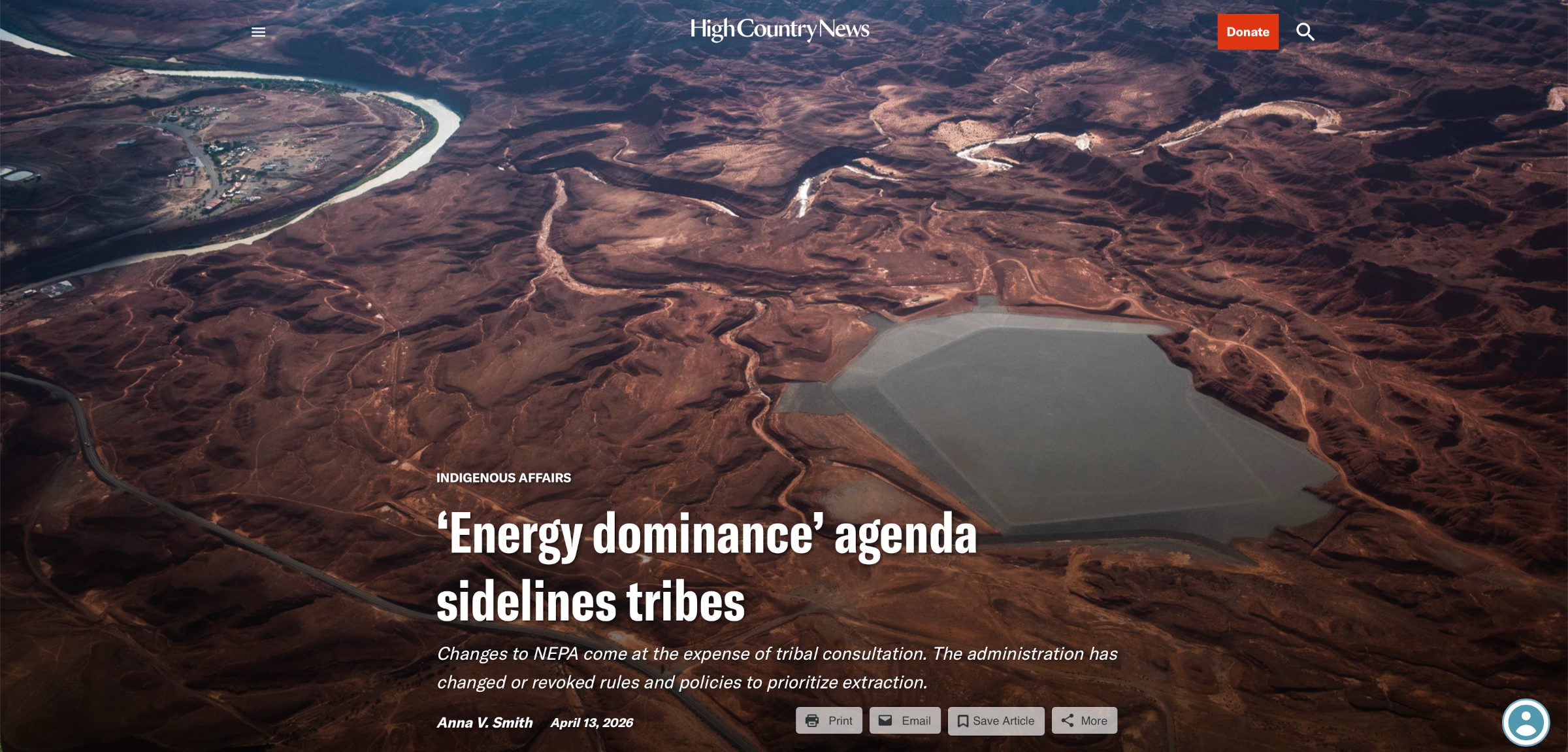
Click the link to read the article on the High Country News website (Anna V. Smith):

April 13, 2026

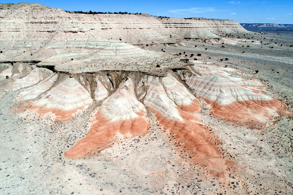
Last fall, construction on the Velvet-Wood uranium mine broke ground in the sandstone deposits of San Juan County, Utah. It’s the first mine that the federal government has permitted under a new expedited “emergency” process that allows projects to go through the environmental review required by the National Environmental Policy Act (NEPA) in just 14 days, a process that previously took months or even years. Tribal governments were given just seven days to offer feedback, and the standard public comment period was eliminated owing to the project’s “emergency” status. In the past, both tribes and the public had at least 30 days give input.

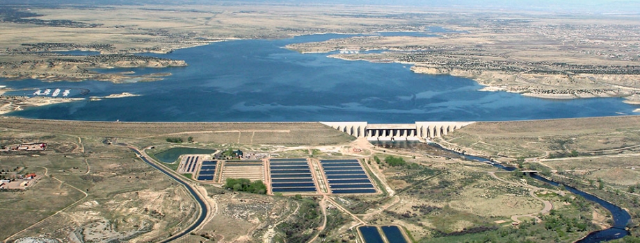
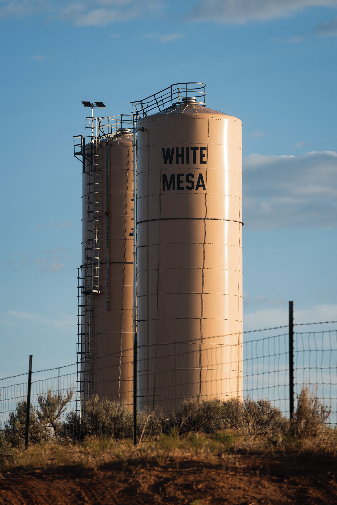
The mine is located in an area already deeply scarred by uranium mining, where the Ute Mountain Ute Tribe has long opposed the White Mesa Uranium Mill, which abuts the community. During the weeklong tribal comment period, six nations shared their concerns with the Bureau of Land Management, citing the expedited process and possible water contamination from the mine’s activities. No changes were made to the project, however.

Earlier this year, in addition to mandating expedited “emergency” processes for NEPA reviews, the Trump administration finalized its proposed elimination of standards — including public comment periods — for how federal agencies carry out NEPA environmental reviews for large-scale projects on public lands. The changes came without consultation with tribal nations and despite their strong opposition. 

Water towers in White Mesa, Utah. The Ute Mountain Ute Tribe has long opposed the neighboring White Mesa Uranium Mill. Six tribal nations warned the Bureau of Land Management about possible water contamination from the new Velvet-Wood uranium mine, but no changes were made to the project. Russel Albert Daniels/High Country News

“The announce-and-defend method of developing federal Indian policy is an inappropriate, paternalistic, unjustified, and historically inefficient method of decision-making,” the National Congress of American Indians and National Association of Tribal Historic Preservation Officers said in a joint letter. Eliminating previous standards “ignores federal trust and treaty responsibilities, impinges on roles and sovereignty of Tribal Nations, and flouts longstanding policy and practice by failing to consult with Tribal Nations.” 

The federal government is legally required to consult with tribal nations on rules and policies that affect them, but so far the Trump administration has regularly bypassed consultation requirements or sped through them in order to accomplish its “energy dominance” agenda on tribal nations’ ancestral lands. Altogether, the changes represent a shift in the way that tribal nations — and the public — are able to have a say in how land in the Western U.S. is managed.

A map of the upcoming Thacker Pass mine in northern Nevada. The federal government has bought stakes in mining companies, including the company behind the Thacker Pass lithium mine in Nevada, which is opposed by some tribal nations and Indigenous communities. Image used courtesy of Lithium Americas

FROM THE START, agencies under Trump have changed or revoked rules and policies to prioritize extraction, citing the so-called energy “emergency.” The BLM and the Forest Service rescinded the Public Lands Rule and the Roadless Rule without tribal consultation, even though both decisions have major implications for tribes’ ability to protect natural and cultural resources on public land. Meanwhile, the administration is seeking to “streamline” Section 106 of the National Historic Preservation Act, one of the most useful tools tribal nations have for ensuring government consultation. Changes are also proposed for Section 401 of the Clean Water Act, which enables tribes to review the impacts of extractive projects within reservation borders before a federal agency permits the project. 

“It’s all predicated on something that isn’t true: We don’t have an energy emergency,” said Gussie Lord, managing attorney at Earthjustice’s Tribal Partnerships Programs. Chipping away at public input and tribal consultation will only exacerbate issues that tribal nations face, Lord said. “A lot of their resources, their cultural and environmental resources often are one and the same. The existing laws and regulations that we have are already insufficiently protective of tribal rights and resources.”

The administration’s changes to the NEPA review process took effect immediately last year, also without consultation. Under the Biden administration, the Council on Environmental Quality spent three and a half years updating the implementation regulations by consulting with tribal nations and the public, incorporating provisions requiring agencies to consider climate change and environmental justice impacts when reviewing projects. NEPA applies to all federal agencies, meaning that each agency has to come up with its own implementation guidelines. Tribes and experts worry that, under the new guidelines, agencies may not be compelled to work with tribes.

According to University of Arizona professor of law Justin Pidot, who previously served as general counsel for the White House Council on Environmental Quality, the resulting uncertainty could have serious consequences. “One is the agencies don’t know how to work together. The second is that there’s litigation risk. The third is that project sponsors don’t know what they’re supposed to do,” Pidot said. The removal of those standards “creates lots of complexity for the public, for tribes, for states, for local governments, for nonprofits.”

Under the Interior Department’s new interim set of standards, for example, reviews for something like a mining project will take 28 days. When the “emergency” declaration is added,  it could take just 14 days, as it did with the Velvet-Wood mine. Past reviews could take up to four years. “It substantially limits the degree of information flowing from the federal government to the public about big projects, including to tribes,” Pidot said.  “What is surprising about this particular decision of theirs is that having a common set of rules makes sense for everyone.”

In comments to the Council on Environmental Quality about the elimination of the NEPA standards, many tribal nations expressed similar concerns. (See sidebar.) Tribes said they were not consulted, and that while dealing with numerous agencies and their different processes was burdensome, the removal of the regulations weakens the whole purpose of NEPA. The National Congress of American Indians and other organizations noted that some streamlining and deregulating could prove useful — but not when tribal perspectives were excluded from the process. 

Last year’s federal budget cuts and mass layoffs further complicate matters, affecting agencies’ ability to carry out their work. Meanwhile, congressional budget cuts impacted funding for, among other things, tribal historic preservation officers, which are key to carrying out government-to-government consultation. The idea seems to be to “drown people in an avalanche while providing them with no resources to meet the moment, and call that consultation and collaboration,” Pidot said.

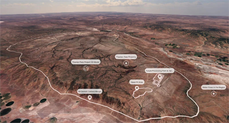
At the same time that the federal government has moved to reduce public and tribal input, it has also been buying stakes in mining companies, including the two companies behind controversial projects opposed by some tribal nations and Indigenous communities: the Thacker Pass lithium mine in Nevada and the Ambler Road project in Alaska. “It’ll be interesting to see if their approval processes for mines in which the federal government has a stake is quicker than it otherwise would have been,” Lord said.

Pidot summed it up this way: “The big theme is that anything and anyone that stands in the way of the kinds of projects that this administration wants to do is an obstacle to progress that they’re going to overrun.”  

We welcome reader letters. Email High Country News at editor@hcn.org or submit a letter to the editor. See our letters to the editor policy.

This article appeared in the April 2026 print edition of the magazine with the headline “NEPA changes could sideline tribes.”

The Daneros uranium mine in the Red Canyon uranium mining district in San Juan County, Utah. All uranium ore mined from this area travels through Bears Ears National Monument. Russel Albert Daniels/High Country News

Gay Mine, a former phosphate mine and current Superfund site on Fort Hall Reservation, in 1948. P1972-201-101. Courtesy of Idaho State Archives

Tribes’ perspectives on changes to nepa implementation

Shoshone-Bannock Tribes, ID
“On the Fort Hall Reservation are environmentally hazardous sites created prior to modern-day NEPA protections. … By stripping away NEPA’s provisions for public participation and environmental review, the federal government would further entrench long-standing historic inequities that have disadvantaged Tribal communities.”

Confederated Salish and Kootenai Tribes, MT
“CEQ (Council on Environmental Quality) states that it does not need to consult with Tribes. … This is a tortured and disingenuous reading of EO 13175, in part because it focuses almost exclusively on a federal view of economic impacts on Tribal governments rather than the universe of environmental impacts.”

Susanville Indian Rancheria, CA
“The proposed removal of these regulations represents a significant step backward in our nation’s commitment to environmental protection and tribal sovereignty.”

Cheyenne River Sioux Tribe, SD
“CEQ is ignoring its established policy of including indigenous traditional ecological knowledge in environmental reviews under NEPA. These issues that have been part and parcel of the implementation of NEPA for decades, such as the consideration of impacts to environmental justice communities, the cumulative effects of projects, and climate change, are being arbitrarily cast aside in contravention of explicit statutory language.”

Bishop Paiute Tribe, CA
“Our traditional and ancestral lands extend far beyond the exterior boundaries of our reservation, and the natural resources on these lands are not merely commodities to be exploited. They are vital to the cultural, spiritual, and economic fabric of all Tribal communities, sustaining traditions that have endured for generations.”

Tulalip Tribes, WA
“The lack of consultation exacerbates the already existing power imbalances, further diminishing the ability of tribes to exercise meaningful sovereignty and protect their interests.”

Nez Perce Tribe, ID
“The Tribe strongly objects to CEQ’s Proposed Rule, which eviscerates the framework that has been relied upon since CEQ first issued NEPA regulations in 1978.”

Big Pine Paiute Tribe, CA
“The interim final rule sidesteps NEPA … as it endorses Donald Trump’s personal agenda. The USA is a country of laws, not a place where one’s personal agenda may supersede the law.”

Native land loss 1776 to 1930. Credit: Alvin Chang/Ranjani Chakraborty

Forecast for Fryingpan-Arkanasas Project imported water for 2026 barely 10 percent of average — ArkValleyVoice.com #ArkansasRiver #FryingPanRiver

The AVC agreement stores water down-river in the Pueblo Reservoir, built after President John F. Kennedy signed legislation authorizing the Fry-Ark agreement in 1962. Photo courtesy of the City of Aurora.

inClick the link to read the article on the Ark Valley Voice website (Susan Roebuck). Here’s an excerpt:

April 16, 2026

In April and May of each yearthe U.S. Bureau of Reclamation (which operates the Fry-Ark Project) and the Southeastern Colorado Water Conservancy District (SECWCD), which handle allotments of this water, make forecasts about the amount of water that can be imported through the Fry Ark Project. According to Chris Woodka, Senior Policy and Issues Manager, Southeastern Colorado Water Conservancy District (SECWCD), the 20-year average for imported water is 60,000 acre-feet per year. On April 1, the U.S. Bureau of Reclamation forecast importing barely ten percent of that, only 6,500 acre-feet in 2026. This is the least amount imported since the system became fully operational in the late 1970’s.

Also on April 1, the SECWCD projected allocating 4,600 acre-feet of those 6,500 acre-feet to water right holders. However, with the current snowpack, at this time it is not known if there will be any allocation this year. If not, the imported water will be held in storage in one of the Fry Ark Project’s reservoirs.

Fryingpan-Arkansas Project via the Southeastern Colorado Water Conservancy District (Click to enlarge)

The #ColoradoRiver disappeared from the geological record for 5 million years. Scientists now know where it went — Holly Ober (University of #California Los Angeles) #COriver

Dark red and green mudstone beds with tan sand-dominated layers above, marking the arrival of Colorado River sediment into the Bidahochi basin 6.6 million years ago. Drone image taken by Brian Gootee, with permission of the Navajo Nation*

Click the link to read the release on the UCLA website (Holly Ober):

April 16, 2026

Key takeaways

  • The Colorado River existed in western Colorado 11 million years ago and first exited Grand Canyon around 5.6 million years ago. Now, scientists know more about the path it took to eventually reach the Gulf of California.
  • A  study of zircons found in sandstone suggests it pooled just east of the Grand Canyon, before making its way downstream, ultimately arriving at the Gulf of California around 5 million years ago.
  • The moment marked the Colorado River’s transition to a continental-scale river that connected life throughout its course.

Geologists have solved the mystery of the disappearance from the geological record, millions of years ago, of one of North America’s most important waterways: the Colorado River. A new paper published in Science shows that the river flowed into an upstream lake over the course of a few million years, then likely flowed for the first time into the Grand Canyon. The moment marked the Colorado River’s transition to a continental-scale river as it made its way down to the Gulf of California.

“In some ways, you could really think of it as the birth of the Colorado River that we know today,” said first author and UCLA geologist John He. “There are rivers everywhere, but a river that carries water and sediment across the continent connects life throughout the region, and the entire ecosystem probably changed as a result of the arrival of the Colorado River into the basin.”

The finding, based on the analysis of sandstone samples, complements paleontological evidence, such as fish fossils, that suggests life began to become part of an integrated ecosystem throughout the Colorado River basin during this hidden chapter of its history.

Shaded relief map of the US via Learner.org

How and when did the Colorado River reach the Grand Canyon?

The Colorado River existed in western Colorado 11 million years ago and first exited the Grand Canyon around 5.6 million years ago. But how it navigated the terrain between the two points for around 5 million years had been a mystery. Now, new evidence suggests it pooled just east of the Grand Canyon, in what is now part of the Navajo Nation, before charting a downstream path that ultimately led to the Gulf of California around 5 million years ago.

The Grand Canyon was carved in multiple phases over a long period of time, but precisely when and how much the Colorado River incised it remains debated among geologists.  

“Geologists have proposed over a dozen hypotheses for the canyon’s formation and the Colorado River’s path,” said co-author John Douglass, a geologist at Paradise Valley Community College.  

One obstacle in the ancient river’s path is the Kaibab Arch, a topographic high point located in northern Arizona and southern Utah. Geologists have proposed different scenarios for how the river crossed it, but one theory that the new evidence makes more plausible is lake spillover. In this scenario, the Colorado River would have filled a lake and eventually exited it along a course to the Grand Canyon.

“Other processes, such as karst piping, which involves water transport through rock, and headward erosion, may have also contributed to the establishment of the river’s course,” explained corresponding author Ryan Crow, from the U.S. Geological Survey. “Some reaches were likely newly carved, and others would have been significantly deepened by the integrated Colorado River over millions of years.”

The collaborative work began when He, Douglass and Emma Heitmann at the University of Washington, met in the field while studying the remnant deposits of Bidahochi Lake, an ancient lake on Navajo Nation land. Most of the deposits of this enigmatic lake have eroded away, so no one knows how large the lake was. Geologists also didn’t know what rivers fed the lake, or why Bidahochi Lake eventually disappeared.

To understand where the sediments in Bidahochi Lake came from, He searched for zircons in the sandstone they collected.

Cluster of three compound crystals of zircon. By Rob Lavinsky, iRocks.com – CC-BY-SA-3.0, CC BY-SA 3.0, https://commons.wikimedia.org/w/index.php?curid=10449836

Zircons are microscopic crystals that form in cooling magma. They do not degrade or change much over time and therefore contain an accurate geochemical signature of the moment they were created. Zircon is found in granite and other volcanic rocks, so it occurs abundantly in many sediments after the source rocks erode.

Geologists have developed a technique called detrital zircon geochronology that uses lasers or ion beams to measure the ratios of uranium and lead isotopes in hundreds of zircons in a sample. The unique age and history of each zircon can thus be traced to learn the sources of a sediment and estimate when it was deposited. The age spectrum derived from hundreds of zircons in a sample is called its detrital signature.

“Zircons are some of the oldest fragments of our Earth,” said He. “They’re like little time vaults, and by looking at the age and geochemical signature of zircons, we can tell where a sediment that has been moved by a river originated.”

He was studying the detrital zircon signatures of the samples he collected when, to his surprise, he detected what he thought was the signature of sediments known to have been deposited by the Colorado River. When he brought this up to Douglass, his colleague said that was exactly what he, Crow and some of his colleagues at the U.S. Geological Survey were looking for at the same time.

The researchers teamed up with USGS geologists and colleagues at the Arizona Geologic Survey, the University of Oklahoma, and the University of Washington. Together, they compared the detrital signatures of thousands of zircons in the sand that He and coauthors collected with those from other known deposits of the ancestral Colorado River and a few other possible sources.

The results showed that signatures of the sediments deposited about 6.6 million years ago in Lake Bidahochi closely matched those of other Colorado River deposits downstream and upstream, including the Browns Park Formation in northern Utah and Colorado. Study of rock layers in the field from this time period showed signs of rippling that indicated a strong river flowed into standing water, and fossils of large fish species characteristic of fast-flowing waters.

These lines of evidence strongly indicated that the Colorado River was supplying water and sediment to the Bidahochi basin before it spilled over and the river began to flow through the Grand Canyon. This set the stage for the mighty Colorado River that carved much of the Grand Canyon and upon which much of the West depends for water.

“I think there is something unique and disquieting when the planet’s history is laid out before our eyes, but we cannot fully read it. We’ve always known the Grand Canyon is there, this solid towering wall of rock, but we’re learning more each day how it formed,” said He.

*Any person(s) wishing to conduct unmanned aerial vehicle flights on the Navajo Nation must first apply for and receive a permit from the Navajo Department of Transportation.

Dories at rest on a glorious Grand Canyon eve. Photo by Brian Richter

Big cuts are coming for #ColoradoRiver water. This #Arizona town will feel them first — KJZZ.org #COriver #aridification

Cave Creek Town Hall. By BowenLarsen – Own work, CC BY-SA 4.0, https://commons.wikimedia.org/w/index.php?curid=166323823

Click the link to read the article on the KJZZ website (Alex Hager). Here’s an excerpt:

April 17, 2026

On the outer edges of the Phoenix metro, the small town of Cave Creek sits nestled among the saguaro-dotted hills. It’s home to about 5,000 people and known mostly for its quiet residential neighborhoods, art galleries and an annual rodeo…Cave Creek, which gets about 95% of its water from the Colorado River, will be among the first to feel the impact of those cuts…Colorado River water travels to Cave Creek through the Central Arizona Project, a 336-mile canal that carries water from the state’s western border to the Phoenix and Tucson areas.

The federal government has suggested major cuts to the amount of water the CAP carries each year, forcing Cave Creek officials to find a backup plan quickly. They will be able to keep taps flowing in the short term, but the future is uncertain, as long-term fixes are expensive and complicated…The first option for most cities, [Brad] Hill said, would be a turn to groundwater. For most, it is relatively easy and cheap to dig more wells near town and carefully use some of the water sitting in underground aquifers. Cave Creek cannot do that. Aquifers underneath the Valley are shaped like bathtubs. For one of those bathtubs, the deepest part is in the middle, and Cave Creek sits on the outer edge, so there isn’t much water underneath town…Cave Creek is, part of a program to store excess Colorado River water underground. The town pays an annual fee for the rights to put water into that pool, which essentially serves as an emergency savings account for times when there isn’t enough water above ground to serve everybody’s needs. Cave Creek has the right to take some of that water, but first it has to physically get it to town. Since the underground aquifer is far away, building a pipe directly into it would be prohibitively expensive and time-consuming. So instead, Cave Creek will be part of an exchange. Cave Creek is working on deals with three other Valley cities: Phoenix, Peoria and Surprise. Those cities can more easily tap into that underground savings account, so they will start using more groundwater and leave some of their CAP water in the canal, where Cave Creek can access it using its existing pumps.

Arizona Rivers Map via Geology.com.

Current Drought Reduction: How much precipitation is needed to end #drought in one month? — NOAA

Precipitation needed to end drought conditions in 1 month. Based on the PHDI. PHDI is a primary measure of long-term drought but may not apply to all areas, including those with heavily managed surface water. No additional precipitation is needed for white areas. Credit: NOAA