Federal plan makes steep #ColoradoRiver water cuts to #Arizona, #California and #Nevada: The Bureau of Reclamation’s final environmental review leaves the door open for states to reach an agreement on how to share the water — by Jake Bolster (High Country News) #COriver #aridification

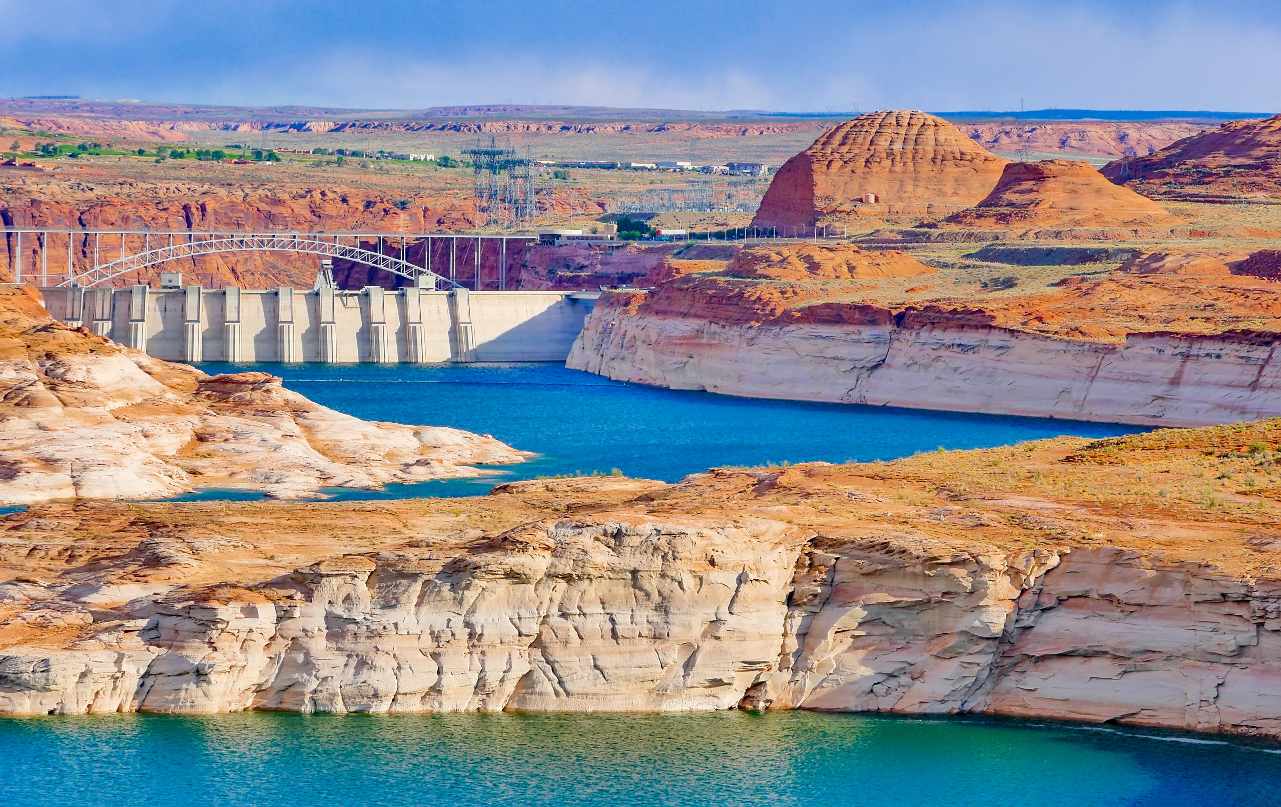
Lake Powell and Glen Canyon Dam. Photo credit: Western Resource Advocates


Click the link to read the article on the High Country News website (Jake Bolster):

August 4, 2026

This article originally appeared on Inside Climate News, a nonprofit, non-partisan news organization that covers climate, energy and the environment. Sign up for their newsletter here.

Water users in the American Southwest confronted on Friday the strong possibility that cities and farms in the region must reduce Colorado River use by hundreds of billions of gallons after the Trump administration released a new management plan for the coming decade.
The document, published by the federal Bureau of Reclamation, outlines a 10-year management approach that could adjust to changing hydrological conditions that affect the river’s flow, with operations updatable every two years. The agency proposed cuts in water allotments originally suggested by Arizona, California and Nevada, which make up the river’s Lower Basin. Colorado, New Mexico, Utah and Wyoming, the region’s Upper Basin, could make voluntary conservation measures.

Interim guidelines and drought contingency plans agreed upon by the basin states in 2007 and 2019 are set to expire in 2027 and negotiations for a new agreement due this year have stalled, with the states missing repeated deadlines to come to a consensus.

But the Bureau of Reclamation operates much of the river’s infrastructure, including the Hoover and Glen Canyon dams, which form Lake Mead and Lake Powell, the nation’s two largest reservoirs. A federal record of decision finalizing operations on the river for the next two years will follow the final environmental impact statement Reclamation released Friday. 

“This plan strikes a balance between flexibility and predictability for the Colorado River system that is vital to the 40 million people who rely on it given unprecedented hydrologic conditions and the potential for considerable impacts on water users,” said Andrea Travnicek, Interior’s assistant secretary for water and science, in a statement accompanying the plan’s release. “It also allows a new flexibility to respond to changing conditions and potential consensus.”

The agency is considering releases from Lake Powell, the reservoir near the border of Utah and Arizona that delineates the upper and lower basins, ranging from 5 million to 12 million acre feet to the downstream states (one acre foot can supply about two to four households for a year). The Lower Basin, including Mexico, could take steep cuts in their water allocations, potentially losing 1.5 million acre feet in both 2027 and 2028.

Under such a scenario, Arizona would lose 760,000 acre feet of its allotment from the river, California 440,000 acre feet and Nevada 50,000, following a proposal submitted by the Lower Basin.

But beyond 2028, Lower Basin cuts could reach up to 3 million acre feet.

The Arizona Department of Water Resources called that figure “unacceptable” in a statement published online. “Such reductions would devastate Arizona’s water users and its economy,” the agency said. 

Reclamation appears to be seeking voluntary Upper Basin reductions of up to 200,000 acre feet, and discussed moving water from federally managed dams in the basin downstream, as hydrology allowed.

“The proposal responds to a fundamental reality: the Colorado River no longer reliably produces enough water to support all the uses and expectations built around it,” said JB Hamby, California’s Colorado River Commissioner, in a statement. “That challenge is shared across the Basin, and addressing it requires specific, measurable reductions in water use by every state.”

A spokesperson for the Colorado Department of Natural Resources said the state is “analyzing” the document.

Upper Basin governors said in a statement that they were “encouraged that new operating guidelines will better reflect existing water supply, which must underpin any practicable plan going forward.”

The Colorado River is perhaps the most climate-stressed waterway in the U.S. It provides water to between 35 and 40 million people across seven Western states, 30 tribes and two Mexican states as it wends its way through the Southwest, home to some of the country’s most arid and drought-stricken landscapes. Millions of Westerners also rely on the electricity the Hoover and Glen Canyon dams generate. 

The 1922 compact between the river’s users assumed roughly 17.5 million acre feet of water was available to the two basins and Mexico, but the historical average of its natural flow has only been roughly 14.7 million acre feet. That number plummeted to an average of 11.2 million acre feet between 2020 and 2024, according to provisional data from Reclamation. 

In that same time period, the agency calculated average use and evaporative loss across the basin at just over 13 million acre feet.

“The operational ranges that Reclamation put forward, they’re the right things that we need to be doing in order to fix the supply and demand imbalance,” said John Berggren, regional policy manager at Western Resource Advocates. “But it is just a range, and what they actually do over the next two years or within any given year, that will matter if they’re actually gonna be able to bring the system back into balance.”

Berggren hopes the short-term certainty this plan provides can unstick negotiations between the states.

“I hope [the basin commissioners] don’t just keep doing what they’ve been doing for the last two or three years, ’cause that clearly hasn’t worked,” he said. “I hope they try and take this opportunity to change things up. Let’s try something new and hopefully get to a seven-state agreement.”

Reclamation’s final environmental impact statement was initially supposed to codify the management plan the basin states have yet to agree on. Though deadlines for those negotiations have come and gone, Reclamation is still holding the door open for a deal, which is widely regarded as the most productive path to a durable long-term operating agreement for the river. 

“Let’s try something new and hopefully get to a seven-state agreement.”

Negotiations are stalled over whether cuts should be mandatory across the entire basin. After overdrawing from the river for decades, the Lower Basin now uses less water than it is apportioned, according to federal accounting; it wants to see future cuts shared across the seven states. The Upper Basin, which has never used the full amount of water it is legally entitled to, has fiercely contested demands for it to make mandatory cuts, offering voluntary conservation measures instead. The states that make up that basin contend that variable environmental conditions, such as this year’s record-low snowpack, already limit how much water they use.

Even with some idea of federal management options in place, the absence of a seven-state  agreement further increases the prospect of states dependent on the Colorado River suing one another in cases that would be adjudicated by the Supreme Court.

Still, proposing to manage the river in a way that is adaptive to hydrological conditions is “the kind of agreement that we are going to need to really think about long-term how do we live in this basin with much less water moving forward,” said Celene Hawkins, Colorado River program director at The Nature Conservancy. 

Hawkins hopes this spurs a seven state agreement “so that, ultimately, we can do really good work for communities and for the river itself.”

We welcome reader letters. Email High Country News at editor@hcn.org or submit a letter to the editor. See our letters to the editor policy.

Map of the Colorado River drainage basin, created using USGS data. By Shannon1 Creative Commons Attribution-Share Alike 4.0

How low will we go? Reservoir levels are dropping as customers use water: Dillon Reservoir is down 20 feet, another is less than half full, while a third is dry — Jay Adams (DenverWater.org) #SouthPlatteRiver

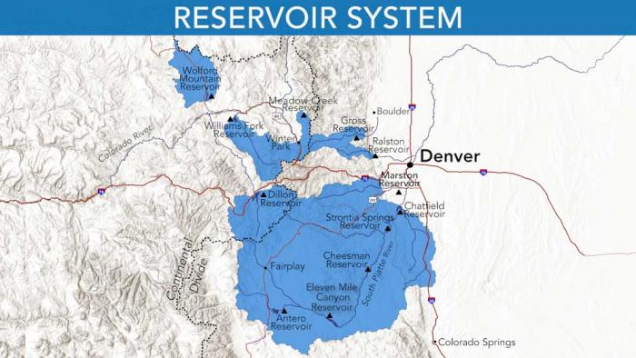
Denver Water relies on a network of reservoirs to collect and store water. The large collection area provides flexibility for collecting water as some areas receive different amounts of precipitation throughout the year. Image credit: Denver Water.

Click the link to read the article on the Denver Water website (Jay Adams):

August 3, 2026

Denver Water’s reservoir storage system, holding water supplies carefully built up over many years, is getting hit hard this summer as hot, dry weather drags on and customers use water.

As of July 31, 2026:

  • Dillon Reservoir in Summit County, Denver Water’s largest reservoir, was down 20 feet and expected to drop another 8 to 10 feet by Labor Day. 
  • Williams Fork Reservoir near Kremmling was about one-third full; by the end of summer the dam’s hydro turbines won’t be able to produce hydropower. 
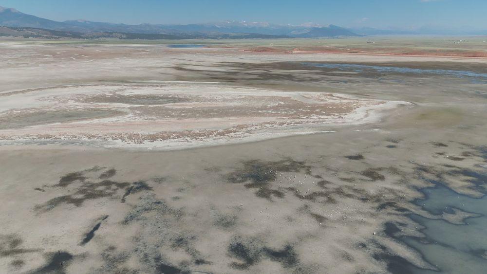
  • And Antero Reservoir near Fairplay, considered an emergency drought storage reservoir, was dry after the water was moved out of it in May and June.  

Overall as of July 31, Denver Water’s reservoirs stood at 75% of capacity, more than 20 percentage points down from the 96% they’re normally full at the end of July.

And reservoir levels will continue to drop as customers use water. 

By April 1, 2027, right before the start of next year’s runoff, Denver Water’s reservoirs are expected to be merely 60% to 62% of capacity — the lowest they’ve been on April 1 since the 2002-2003 drought.

“Denver Water’s robust reservoir system serves as our water ‘savings account,’” said Nathan Elder, Denver Water’s manager of water supply.

“This year we are making significant withdrawals from our savings — and we don’t know how long the hot and dry weather conditions will last, or what this winter’s snowpack will look like. We need customers to do their part and reduce water use inside and outside, so that we won’t need to implement even more drastic restrictions.”

In order to stretch existing water supplies, Denver Water’s mandatory drought restrictions this summer limit outdoor watering to two assigned days per week. The utility’s regular summer watering rules also remain in effect, including no watering allowed during the day between 10 a.m. and 6 p.m. (Check assigned days and watering rules here.)

See how far Dillon has dropped:

Reservoirs play a critical role during droughts, as the stored water that was saved in the past is used to get through dry years.

In July, Denver Water customers used an average of 282 million gallons of water every day. In the winter, when there is no outdoor watering, Denver Water customers typically use about 110 million gallons per day.

Here’s a closer look at some of Denver Water’s key reservoirs:

Antero Reservoir

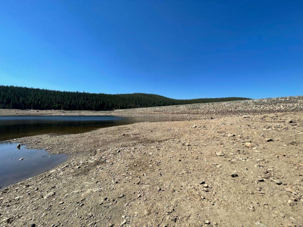
In May and June, Denver Water moved all the water out of the relatively shallow Antero Reservoir in Park County to avoid losing it to evaporation.

Antero’s water was sent down the South Platte River to Cheesman Reservoir, and, due to demand, almost all of that water has been used. Antero Reservoir is considered an emergency water storage reservoir that is used during drought years.

Antero Reservoir in Park County on June 30 without water. Denver Water used the water in the reservoir to meet customer demand due to record low snowpack and runoff. Photo credit: Denver Water.

This is the second time Denver Water has had to use all the water in Antero due to drought. The last time the reservoir was emptied to stretch water supplies in a drought was in 2002.

It is expected to take several years of average or above-average snowpack to refill Antero Reservoir.


Cheesman Reservoir

Cheesman Reservoir, located near Deckers along the South Platte River, opened in 1905.

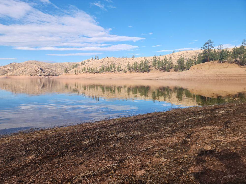
As of July 31, Cheesman Reservoir was at 71% of capacity. The reservoir would have been even lower without the additional water moved from Antero.

Cheesman Reservoir on July 23, 2026, when it was at 74% of capacity. The reservoir is a critical storage site along the South Platte River near the small town of Deckers. Photo credit: Denver Water.

Cheesman’s water level as of July 31 was 26.5 feet down from full and the reservoir is expected to drop to 54% to 61% of capacity by April 1, 2027. During the drought of 2002-2003, Cheesman dropped all the way down to 29%, less than one-third of its capacity.


Dillon Reservoir

Dillon is Denver Water’s largest reservoir. Located in Summit County, it opened in 1963.

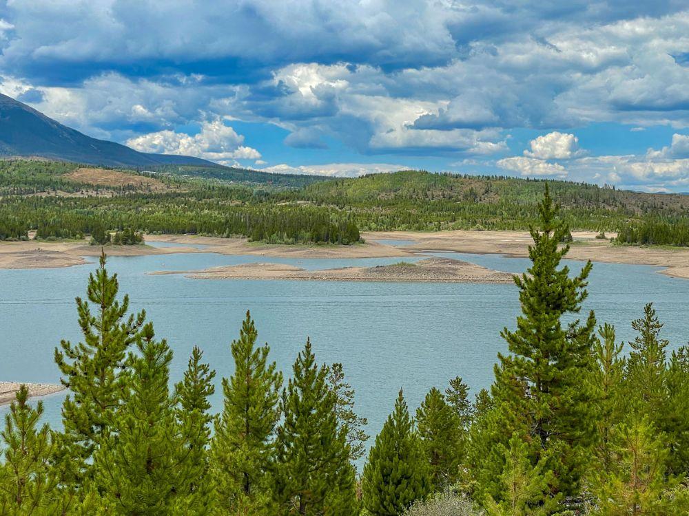
As of July 31, Dillon Reservoir was at 75% of capacity and down 22.5 feet. The reservoir is expected to drop another 8-10 feet by Labor Day.

At the end of July, Denver Water was pulling about 163 million gallons of water a day from the reservoir to meet the water demands of its customers in Denver and surrounding suburbs.

By next spring, Elder expects Dillon will be down to 50% to 60% of capacity. During the drought of 2002-2003, Dillon was down to 48% of capacity.

Dillon Reservoir in Summit County on July 20 looking west at the Tenmile Range in the background and Dillon Marina on the right. The reservoir is down 21 feet and was at 77% of capacity on July 24. Photo credit: Denver Water.

As for the record low? Dillon bottomed out at 35% of capacity in 1978 during a drought.


Gross Reservoir

Gross Reservoir is a critical water storage site in Boulder County. The dam is currently under construction and water levels have been lowered in the reservoir to allow that construction work to move forward safely.

As of July 31, Gross Reservoir was at 53% of capacity.

Gross Dam in Boulder County on June 2, 2026. The dam is under construction as part of the Gross Reservoir Expansion Project. The project is designed to nearly triple the capacity of Gross Reservoir to store more water to get through times of drought. Photo credit: Denver Water.

The Gross Reservoir Expansion Project is designed to nearly triple the size of Gross Reservoir, which will allow Denver Water to store more water to help get through times of drought. The project hit a major milestone in June 2026 when workers placed the last of the roller-compacted concrete steps that make up the higher dam.


Williams Fork Reservoir

The Williams Fork Reservoir, near Kremmling in Grand County, as of July 31 was 36% of capacity and down 52 feet.

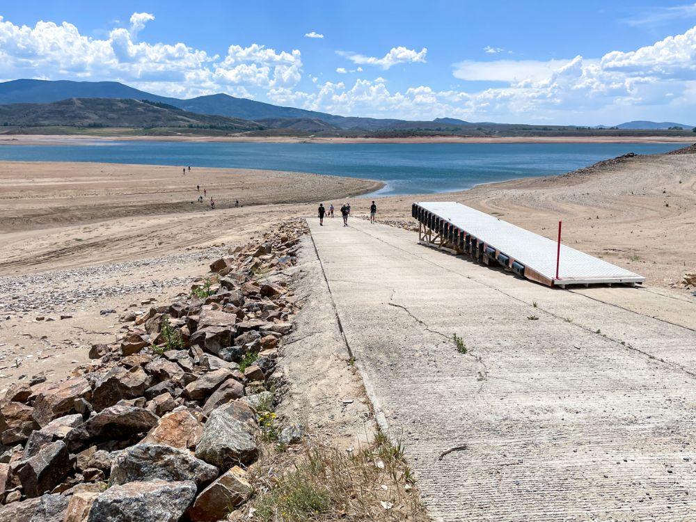
The reservoir’s boat ramp was closed this summer due to low water levels caused by drought. Kayaking and other hand-paddled watercraft are still allowed.

Watch a video of conditions at Williams Fork this summer: 

By the end of summer, the water level in Williams Fork is expected to be so low that the dam’s hydropower plant will no longer be able to generate power. The reservoir is expected to drop to 6% to 15% of capacity by April 1, 2027.

A group of visitors walks down the boat ramp at Williams Fork Reservoir on July 20. The ramp was closed this summer due to low water levels caused by drought. Photo credit: Denver Water.

Denver Water does not use Williams Fork to store water for the metro area. Instead, the reservoir’s water is used to exchange, or offset, water that is stored in Dillon Reservoir in order to meet downstream water rights obligations on the Colorado River.


Meadow Creek Reservoir

Denver Water’s smaller reservoirs are also affected by the drought, such as the Meadow Creek Reservoir near Granby in Grand County, a popular dispersed camping and fishing site.

Denver Water took advantage of this year’s low water conditions and further lowered the reservoir to just 6% of capacity in order to conduct an inspection and construction project on the dam.

Meadow Creek Reservoir in Grand County is being lowered this year for a construction project on the dam. Photo credit: Denver Water.

Water released from Meadow Creek was used for irrigation in Grand County, and 350 acre-feet of water was moved to storage in Gross Reservoir.

While Meadow Creek is not a primary storage site, its fate this summer demonstrates some of the challenges and complexity that comes with managing a water system while juggling the impacts of drought, maintenance requirements and the need to deliver to 1.5 million people in Denver and surrounding suburbs.


Looking ahead

While having Denver Water’s overall reservoir system at 75% of capacity as of July 31 may not sound too bad, Elder says customers need to act now to conserve as much water as possible.

And while there has been talk of a strong El Nino, summer monsoon rains and big winter storms on the horizon, Elder notes that “hoping for more rain and snow” is not an actual strategy for managing through a historic drought.

Also, 90% of the water Denver Water collects comes from mountain snow, meaning that even a strong monsoon this summer won’t do much to stem the fall in reservoir levels.

The bottom line is that no one really knows what next year’s water supply outlook will be until next winter — and more critically, until next spring’s runoff season, when the snow starts to melt and water flows into the reservoirs.

Right now, Elder’s team has calculated Denver Water’s water supply outlook through April 1, 2027, right before the next spring runoff begins.

And the team is forecasting that by then, Denver Water — and its customers — will be facing reservoir levels of just 60% to 62% of capacity, the lowest since the 2002-2003 drought.

“We have a strong reservoir system, but we are going through a lot of water this summer and reservoir levels are dropping,” Elder said.

“Every drop counts, and every action customers can take to conserve water inside and outside will help stretch our water supply. This is the time to Use Only What You Need.”

Denver Water’s decade long Use Only What You Need campaign found humor in conservation. Photo credit: Denver Water.

#Monument pulls out of regional water project, citing high costs — The #ColoradoSprings Gazette

A map being shown around El Paso County by suburban water agencies traces the path of the Loop, a complex $134 million pipeline and pumping project that would allow northern and eastern communities in the county to reuse aquifer water returning to Fountain Creek, and pipe along water rights they have bought up on the southern side of the county. (Provided by Woodmoor Water and Sanitation District)

Click the link to read the article on the Colorado Springs Gazette website (Savannah Eller). Here’s an excerpt:

August 4, 2026

On Monday evening [August 3, 2026], the Monument town council voted unanimously to begin exiting the multidistrict authority. The Loop is left with just two water district members of the original four after the decision…Proposed in 2022, the Loop would divert water flowing down Fountain Creek, pumping it northward and east around Colorado Springs to districts along the way. Billed as a way to break the reliance of communities on the nonreplenishing groundwater of the Denver Basin, the Loop was first estimated to cost between $160 and $190 million to construct…Town staff recommended the action after hearing that Donala Water & Sanitation District, one of the remaining partners, would also be voting to remove itself from the agreement soon…Cherokee Metro District pulled out of the project in 2024. Interim General Manager Kevin Brown previously told The Gazette the district had to divert resources to remove forever chemicals in its supply before a compliance deadline. Instead of the Loop, Cherokee was going to focus its efforts on securing access to water rights in the Upper Black Squirrel Creek Basin.

Water stored in Colorado’s Denver Basin aquifers, which extend from Greeley to Colorado Springs, and from Golden to the Eastern Plains near Limon, does not naturally recharge from rain and snow and is therefore carefully regulated. Courtesy U.S. Geological Survey.

In a first, #Utah got more power from #solar than any other source: The state used to run on #coal, but now renewables are surging — Grist

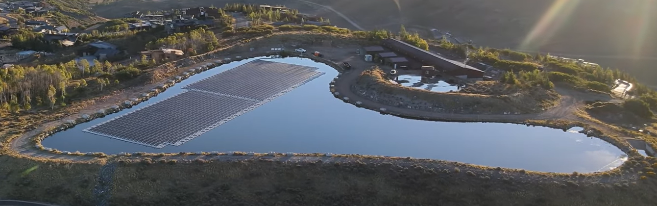
Image of floating solar array at Signal Hill Treatment Plant. The goal is to offset approximately 92% of the electrical usage at that facility. This floating array and the involvement with the Summit County Power Purchase Agreement for electricity from the Elektron Solar project, located in Tooele County, Utah, will get the District to nearly a totally renewable energy usage position. Photo credit: Mountain Regional Water

Click the link to read the article on the Grist website (Leia Larsen):

August 6, 2026

This coverage is made possible through a partnership between Grist and The Salt Lake Tribune, a nonprofit newsroom in Utah.​​ ​

Utah’s solar generation eclipsed all other electricity sources for the first time ever in May, the culmination of a slow but steady years-long shift away from coal. Energy experts are calling it a win for the environment and the state’s economy. 

Photovoltaic panels in Utah produced nearly 1 terawatt hour in May 2026. That represented nearly a third of all electricity generated in the state that month, according to data from Ember, a global energy think tank. Natural gas generated 32 percent, coal generated 28 percent, and wind 2 percent.

“The trend of more and more solar in Utah is wonderful news for air quality, it’s wonderful news for the climate, and it’s wonderful news for jobs and the economy,” said Dan Schroeder, a physics professor at Weber State University who regularly checks energy data.

Schroeder attributes the trend to several large solar farms coming online in recent years. The 2,500-acre Green River Energy Center in the central part of the state became operational this spring, and includes 400 megawatts of solar generation and 400 megawatts of battery storage. Excelsior Energy Capital’s Faraday Solar project in Utah County, the state’s second-largest county,  started providing up to 685 megawatts for the Meta data center there last fall. The Elektron Solar Project, an 80-megawatt photovoltaic farm, began sending electricity to Salt Lake City, Park City, and Summit County in June 2024.

Solar also supports nearly 8,000 jobs in Utah, according to the latest information from the Solar Energy Industries Association. The state is home to 132 solar companies, including 54 solar developers and 23 solar manufacturers. Investors committed $1.5 billion to Utah’s solar market in 2025 alone.

Oil and gas extraction, by comparison, accounted for 1,291 jobs in the state in 2025, according to the U.S. Bureau of Labor Statistics. Coal mining accounted for 1,059 in 2023, the most recent year the bureau has data for that industry. Utah had another 1,905 jobs in coal and petroleum product manufacturing last year. 

The rise of solar power has helped the state wean itself off a dependence on coal. In 2017, coal generated between 64 percent and 78 percent of electricity in Utah, depending on the month. By 2023, it started accounting for less than half of the state’s power sources in certain times of the year. This spring, it was less than a third. 

Electricity generation is complicated, however, and solar won’t represent a third of Utah’s portfolio every month. But with its sunny, dry climate, “Utah still has room to grow its solar percentage,” Schroeder said.

He pointed to California, which saw nearly 51 percent of its electricity generation come from solar panels in May, the most recent month that Ember has data — showing Utah has much more room to grow.

“We’re going to see milestones like this increasingly happen,” said Logan Mitchell, a climate scientist and energy analyst with Utah Clean Energy.

About 51 percent of the new utility-scale electricity generation added to the country’s grid is expected to come from solar this year, according to the U.S. Energy Information Administration. The country is likely to add another 43.4 gigawatts of solar, 24.3 gigawatts of battery storage, and 11.8 gigawatts of new wind power in 2026, compared to just 6.3 gigawatts of natural gas generation and zero new coal capacity.

Some of Utah’s electricity gets exported to other states, and some of its solar farms serve a single customer, like the project in Utah County that has a contract with Meta, the parent company of Instagram and Facebook.

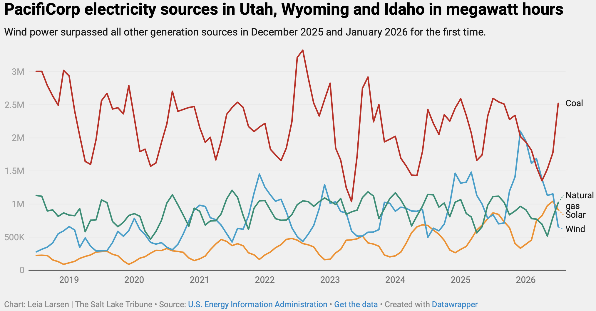
Mitchell pulled the numbers from the state’s largest electricity provider, PacifiCorp, which is the parent company of Rocky Mountain Power. Turns out, another renewable energy source has seen a surge in generation in the region — wind power.

Wind blew past all other energy sources in PacifiCorp’s portfolio for Utah, Wyoming, and Idaho in December and January for the first time, according to data from the U.S. Energy Information Administration.

“Wind plus solar is on a tear right now,” Mitchell said. “We may have achieved liftoff.”

Rio Grande commissioners say no for now to data centers: One-year moratorium allows officials to look at land use codes — Owen Woods (AlamosaCitizen.com) #RioGrande #SanLuisValley

Click the link to read the article on the Alamosa Citizen website (Owen Woods):

August 5, 2026

The Rio Grande County Board of Commissioners is the latest government body to place a moratorium on data centers. The commissioners also adopted a resolution prohibiting any large-scale, or hyperscale data centers in the county. 

During Wednesday’s regular meeting, the commissioners unanimously approved the year-long data center moratorium to allow the county’s departments to address land use codes. The moratorium is broad as existing language relating to data centers didn’t exist in the county’s codes before. The separate resolution prohibiting large-scale and hyperscale data centers was approved unanimously. 

Commissioners said they are using Colorado Municipal League definitions for large-scale and hyperscale.

This decision comes two weeks after a public hearing and work session that allowed county department heads and commissioners to hear the concerns from the public. 

Rio Grande County Administrator Skip Schoen said there has been “considerable concern” in the county about data centers as “a category.” 

More than 30 people spoke at the public hearing with more members of the public writing in their comments. 

The public concern in Rio Grande County echoes widespread concern about data center construction in the rest of the San Luis Valley and much of the country. 

Saguache County, the town of South Fork and Costilla County have already adopted varying moratoriums and resolutions to address data centers. 

Alamosa County has yet to signal an intent to place a moratorium on data centers as it is currently going through a process with a company called Strata Inc. that intends to build a small-scale, closed loop-cooled data center in the county. 

The city of Alamosa will take up a resolution to place a temporary moratorium on “Utility Scale Battery Energy Storage Systems and Large Load Data Centers” during Wednesday night’s regular meeting.