



Sarah Porter, Arizona State University
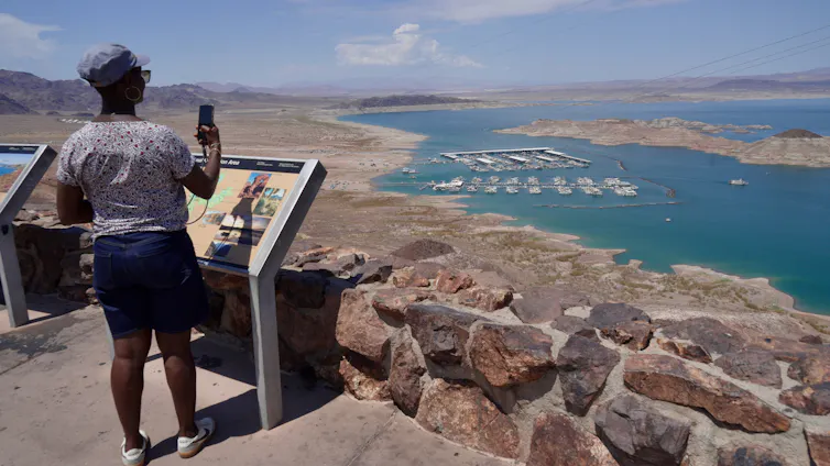
In August 2026 the nation’s two largest reservoirs, Lake Mead and Lake Powell, both on the Colorado River, hit their lowest levels since they first began to be filled in 1936 and 1963, respectively.
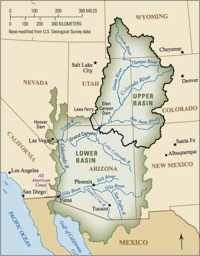
The federal government and the seven Colorado River basin states – Arizona, California, Colorado, Nevada, New Mexico, Utah and Wyoming – have been unable to reach an agreement about who should reduce water usage by how much to avoid catastrophic declines in lake levels.
And the existing plans and commitments, including a federal outline announced in late July 2026, don’t get close to achieving what’s needed to keep the river flowing. Here’s a look at the key issues making an agreement so hard to reach.
To stabilize the Colorado River system, seven states and Mexico need to reduce annual consumption of Colorado River water by at least 3 million acre-feet (980 million gallons), and probably more like 4 million acre-feet (1.3 trillion gallons), each year.
The Lower Basin states – Arizona, California and Nevada – have been using less water, even as their populations have grown.
They have proposed to further reduce water use in 2027 and 2028, and Mexico has, too. Those decreases, coming only from the Lower Basin states, would be the biggest-ever reductions of Colorado River water use, but they would amount to only about 3.7 million acre-feet over two years, about half what is likely needed.
Unless more water is conserved, the reservoirs that have stored surplus water over the decades could shrink to the point that only the water that naturally flows into the river each year would be released downstream. That’s a condition called “run of river,” which could result in drastic cuts to the Lower Basin’s water supply.
If the winter of 2026-27 is like the winter the West had in 2025-26, the river and reservoirs will likely be at that point by mid-2027. A really good winter with lots of snow might push the timing out a year or two, but it won’t solve the problem: People are using a lot more water from the reservoirs than nature is replenishing each year with rainfall and snowfall.
Water was first divided among the Upper and Lower Basins in 1922, using an overoptimistic estimate of how much water there would be. In the past quarter century, low snowpack and reductions in the amount of snow that converts to surface water have meant that flows can’t keep up with demand.
The other key problem is evaporation. These massive reservoirs are in a hot, dry region. The U.S. Geological Survey estimates that annual evaporation is about 1.5 million acre-feet. That’s about 10% of what the seven states expect to be able to use each year – and about half of the overall cuts in water use that would be needed to keep the river flowing.
Even if sufficient water were released from Lake Powell to Lake Mead to cover the Lower Basin’s and Mexico’s apportionments, Lake Mead would continue to decline because of evaporation.
Farmers and ranchers in the Upper Basin have had less water available in 2026 because the winter was extraordinarily dry.
But if water levels at Lake Powell and Lake Mead fall too low to allow dam managers to release stored water, the effects would be on the Lower Basin.
Entities that receive water from the Central Arizona Project have junior priority in the Lower Basin. Central Arizona cities have years’ worth of groundwater they could access – not a forever supply, but enough to use for some years while they work on developing new water supplies.
If cuts go deeper, tribal and nontribal agriculture along the main stem would arguably take the hardest hit. They may have higher-priority rights, but if there’s no water they’re still in trouble. And there isn’t an alternative water supply for agriculture along the river’s main route.
Across the nation, people would notice higher costs and limited availability of some produce, especially in the winter. At times of year when those crops can’t grow in colder parts of the country, Yuma County, Arizona, and Imperial County, California, are key suppliers of vegetables. Other products would be affected too, including Desert durum wheat, a high-gluten wheat that is preferred for pasta.
The federal Bureau of Reclamation has made clear its commitment to continuing hydropower production by keeping reservoir elevations above the minimum level needed to generate electricity.
As a result, the reservoirs will likely not reach the point called “deadpool,” at which no water can move through the dam. But they may reach levels at which no water beyond what’s required to generate power – or what arrives as rain or snow – would flow downstream.
The Lower Basin states have said they would reduce water use by 1.6 million acre-feet a year, effectively handling the reduction due to evaporation. But the Lower Basin has remained insistent on the Upper Basin states’ sharing in additional conservation measures.
The Upper Basin states say they’re already using much less water than they are apportioned under the Colorado River Compact and that the shortfall is due to overuse in the Lower Basin.
Without a negotiated way forward, there are two potential legal fights on the horizon, which could happen at the same time.
One is a Supreme Court fight over how to interpret the Colorado River Compact. It tends to take about a decade to resolve interstate water-sharing fights in the Supreme Court. If that happens, the region will face years of uncertainty regarding the amount of water available to different users.
At the same time, negotiators, tribes and others in the Lower Basin have made clear that they don’t agree with the approach to the crisis the Bureau of Reclamation announced in late July 2026. The specifics of how that plan will be carried out have not yet been released, but Arizona and Nevada have already threatened to sue.

Agriculture uses somewhere between 70% and 75% of the water in the Colorado system.
The reductions needed to protect the system can’t be achieved by getting people in Phoenix and other cities to turn the water off when they brush their teeth. Even if people ripped out all the grass that’s watered with Colorado River water, it wouldn’t save enough.
Ideally, farmers would be encouraged – and even paid – to permanently stop irrigating some land. My colleague Kathryn Sorensen and I have called for people to start talking about how to permanently eliminate some agricultural water demand across the entire Colorado River basin. The scope of the problem is too large: There’s no other way to balance the system.
I think it’s going to require federal leadership. In the 1930s a national effort set out to improve farming efficiency all around the nation, but especially in the South and West. Under the Bankhead-Jones Act of 1937, the federal government bought millions of acres of marginal farmland to take it out of production.
Farming is important, but not every acre of farmland should stay in production. If it’s a choice between making sure some water goes to cities or keeping every possible acre of farmland irrigated, we have to be able to discuss both options.
Sarah Porter, Director of the Kyl Center for Water Policy, ASU Morrison Institute for Public Policy, Arizona State University
This article is republished from The Conversation under a Creative Commons license. Read the original article.
Click the link to read the article on the Colorado Newsline website (Caitlin Sievers):
August 20, 2026
The future of the Colorado River is looking bleak, and officials in the seven states that depend on its water say they’re happy to negotiate — but with current use rules expiring at the end of the year, compromise seems unlikely.
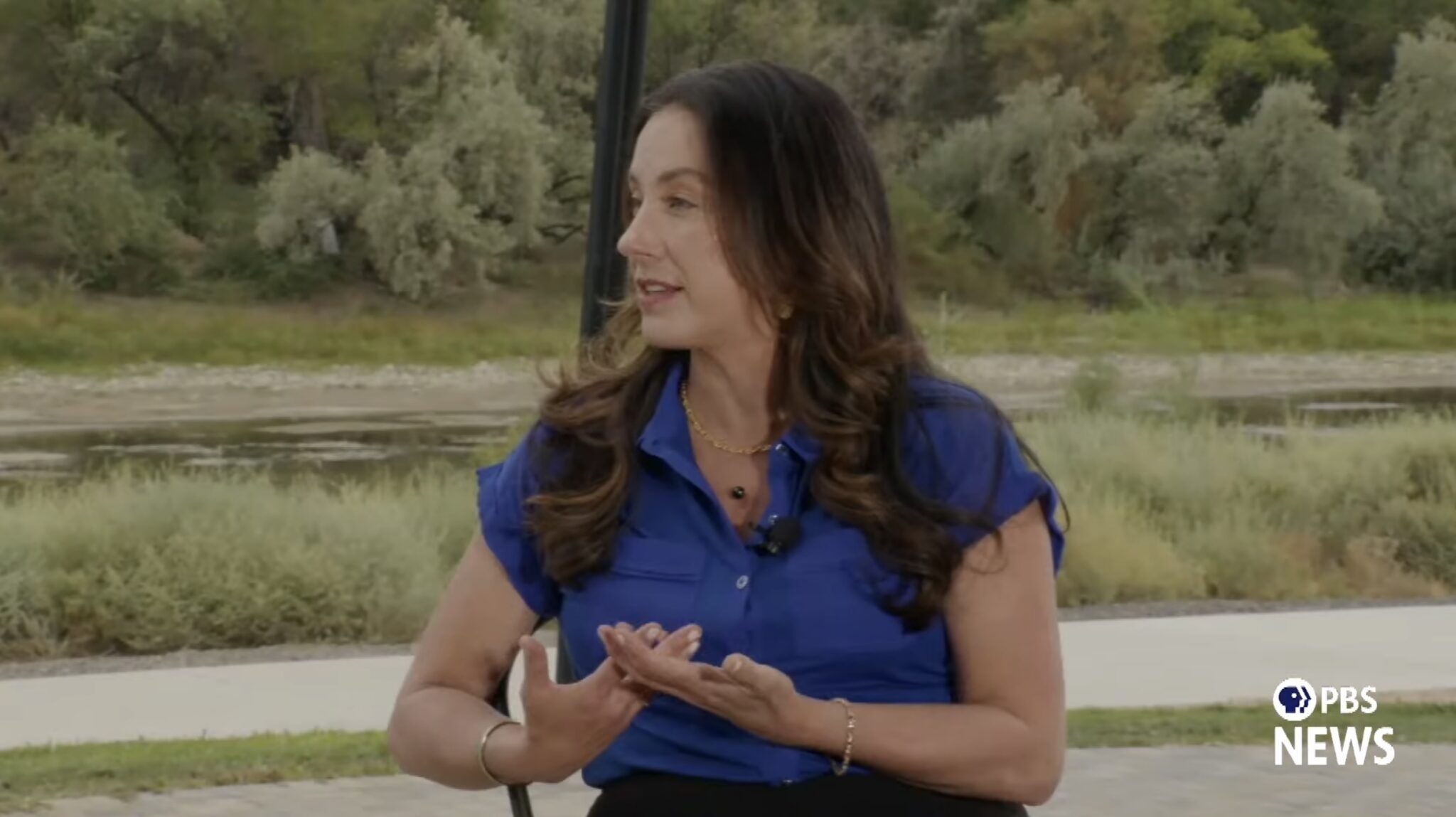
During a more than two-hour PBS special on Wednesday, officials from the Upper and Lower basins, as well as farmers and water experts, painted an alarming picture of a shrinking river without enough water to meet legal allocation obligations set more than 100 years ago.
The Colorado River is a vital source of drinking water for 40 million people in the seven states, Mexico and 30 Native American tribes, and it provides water for farming operations and hydroelectricity.
The Lower Basin states — Arizona, Nevada and California — and the Upper Basin states — Colorado, New Mexico, Utah, and Wyoming — have been attempting to negotiate an updated water usage agreement for more than two years. So far, they’ve been unsuccessful.
Because of the negotiating impasse, the federal government has devised a plan to replace the agreement that expires at the end of the year. It will impose drastic cuts on the Lower Basin states, and Arizona will feel the brunt of those cuts with a cut to its river water of up to 77%.
Arizona faces an outsized burden when it comes to reductions because the Central Arizona Project, a series of canals that supplies Colorado River water to the metropolitan Phoenix and Tucson areas, is one of the newest users of the river water, making it legally one of the first to be cut.
The major sticking point in the negotiations is the Upper Basin states’ refusal to commit to any mandatory cuts, while the Lower Basin states already take cuts in dry years.
Becky Mitchell, Colorado’s water commissioner, said that her state already deals with mandatory cuts, they’re just from Mother Nature, not the U.S. government. The Colorado River is fed by melting snowpack in the Rocky Mountains, which is at a record low this year.
“What I can’t promise is to deliver water when it’s not there,” Mitchell said. “Nobody can.”
She characterized the Lower Basin states’ argument that the Upper Basin wasn’t taking mandatory cuts as a “major flaw,” since the Upper Basin uses anywhere between three to five millions acre-feet per year, based on what’s available.
An acre-foot of water is enough to cover an acre of land to a depth of one foot, or about 325,851 gallons. That’s enough to provide three homes in Arizona a year of water, on average.
Mitchell said the cuts from Mother Nature are “far more fierce than the federal government will ever be,” putting farmers on the western slope of the Rockies at risk of going out of business.
And while those in the Upper Basin balk at the swimming pools and golf courses in the middle of the desert that are prevalent in urban centers of Arizona and Nevada, municipalities account for only about 25% of the Lower Basin’s water use.
Agriculture accounts for the other 75%. Andrea Travnik, assistant secretary for water and science at the U.S. Department of Interior, dodged a question from PBS about whether the federal government would contemplate putting restrictions on water use for farming, which would be incredibly politically unpopular.
Travnik said that the federal government has already worked with the states to raise water levels in Lake Mead through conservation efforts, and will continue to push for conservation, in addition to other solutions like desalination — which is extremely expensive — and water reuse.
But Brad Udall, a water and climate scientist at Colorado State University, said that if the 1,500 farmers that depend on Colorado River water for their crops are pitted against the 5 million people in metropolitan Phoenix and the 18 million people in the greater Los Angeles area, the winner will be obvious.
Udall thinks the states need to ditch the outdated 1922 Colorado River Compact, which allocated 7.5 million acre-feet for each basin, and was based on a faulty model that assumed the river system could supply 15 million acre-feet annually. While use agreements have been updated numerous times since then, the allocations to each basin remain the same.

The region is in the midst of a 20-year mega drought that is wreaking havoc on the river. Since 2000, flows in the Colorado River have decreased by 20%. And since, 2020 flows are down 35%.
After negotiations with the Upper Basin were unfruitful earlier this year, the Lower Basin states in May offered their own proposal to reduce their shared usage by 1.25 million acre-feet annually in 2027 and 2028, with about a 30% cut for Arizona.
This proposal was aimed at helping to stabilize water levels in Lake Powell and Lake Mead, the system’s two key reservoirs, whose water levels fell this month to their lowest point since 1957.
Udall described both reservoirs as just above deadpool, the point at which water drops too low to flow past a dam by gravity.
“Deadpool is a point where you lose control of the reservoir,” he said. “Mother Nature controls what happens. It controls what comes in. It controls what you send out the bottom.”
Reaching deadpool would turn those reservoirs into nothing more than concrete basins where water evaporates, Udall said.
“It’s kind of hard to overstate the consequences of losing those water bank accounts for the states that rely on it in the Lower Basin,” he said.
While Mitchell said that the Upper Basin couldn’t guarantee its 7.5 million acre-feet delivery of water to the Lower Basin, it would attempt to prevent the reservoirs from reaching deadpool.
Tom Buschatzke, director of the Arizona Department of Water Resources, said that the basins could come to an agreement today, if the Upper Basin would agree to take a 2% mandatory cut of its annual available water supply, or about 100,000 acre-feet in a year with 5 million acre feet available.
Mitchell did not say she would agree to those cuts, saying that the Upper Basin states are already managing their water responsibly.
But Arizona and the other Lower Basin states have undertaken significant conservation efforts for Colorado River water since 2014 and have reduced their consumption from 7.4 million acre-feet in 2015 to just over 6 million in 2024, adding 165 feet of water to Lake Mead.
All of the water officials who participated in the PBS special said they would prefer to hammer out a compromise instead of going to court, but that they were committed to protecting their water rights.
In March, Arizona retained the high-powered law firm Sullivan & Cromwell to represent the state in possible litigation among the Colorado River Basin states and the federal government.
Kathryn Sorensen, director of research at the Kyl Center for Water Policy at Arizona State University, said that while the fight for Colorado River water has become “existential” because of overallocation, Arizonans shouldn’t panic yet.
Even if the Central Arizona Project goes dry, she said, Phoenix still has banked groundwater and the Salt and Verde rivers to fall back on. Sorensen said she doesn’t expect municipal water shortages, but she does predict higher water bills.
The Trump administration’s draft “preferred alternative” plan for the river, released last month, could reduce the Lower Basin’s allocation by 3 million acre-feet per year, slashing Arizona’s water supply from the river by more than 75%. But there’s still a possibility that the federal government could implement the Lower Basin’s proposal for smaller cuts instead.
The federal government’s new river usage rules, which are still being negotiated, will be released later this year.
Udall said that the U.S. is totally failing to address the overall cause of the river’s decline.
“There’s a whole bunch of scientific studies that suggest that this is very much human-caused,” Udall said. “It’s due to our greenhouse gas emissions and the warming of the earth right now.”
This story was originally produced by Arizona Mirror, which is part of States Newsroom, a nonprofit news network which includes Colorado Newsline, and is supported by grants and a coalition of donors as a 501c(3) public charity.
Colorado Newsline is part of States Newsroom, a nonprofit news network supported by grants and a coalition of donors as a 501c(3) public charity. Colorado Newsline maintains editorial independence. Contact Editor Quentin Young for questions: info@coloradonewsline.com.

Click the link to read the article on the InkStain website (Jack Schmidt and John Fleck):
August 7, 2026

When Lake Mead’s elevation crossed the threshold of 1,040 feet above sea level in the spring of 1937, stretching upstream 100 miles behind Hoover Dam in the deserts of the Arizona Nevada border, it was national news.
So much water!

As Mead drops past that threshold in the opposite direction in the summer of 2026, it’s telling a different story. So little water.
Two milestones in the last few days are worthy of note. The first is Lake Mead itself, which in the last two days dropped past the previous lowest levels in history set in 2022, meaning it is now the lowest it has been since the reservoir was first filled in the 1930s.
Lake Mead was at 7.012 maf yesterday (Aug. 6, 2026) (1040.5 ft). The previous record low was 7.018 maf (1040.58 ft) that was set on July 28, 2022. Thus, yesterday’s reservoir contents in Lake Mead are the lowest since at least May 1937.
Meanwhile, Lake Powell is now 85,000 af (1.51 ft) above its lowest historical amount since it was first filled in the 1960s.
But that does not fully capture the extent of the crisis. Total reservoir contents of all 46 reservoirs in the Reclamation data base (extending from Fontenelle and Grand Lakes to Lake Havasu) was at 21.27 maf on July 1, the lowest since at least May 29, 1965 (probably earlier, since the Reclamation data base doesn’t report many reservoir contents at that early date).


Click the link to read the article on The Land Desk website (Jonathan P. Thompson):
August 18, 2026
⛏️ Mining Monitor ⛏️
The vultures didn’t wait long to feed on the carrion of shrunken national monuments. Within days of President Donald Trump’s order slashing nearly 3 million acres from Bears Ears and Grand Staircase-Escalante National Monuments, mining claims were filed within the former boundaries of both monuments with San Juan County and Kane County, respectively.
While Trump’s shrinkage did reopen that land to new mining claims and mineral leasing, it does not go into effect until Sept. 11, 60 days after the proclamations were issued. The claims have not officially been recorded with the Bureau of Land Management.
On July 14, Kimmerle Mining LLC out of Moab filed seven claims just within the eastern border of what had been Bears Ears National Monument just two days earlier. A few weeks later, Charles Rosequist filed two claims in the southwest corner of the GSENM, near Kaibab Gulch and the Vermilion Cliffs.
Kimmerle Mining, its principal Kyle Kimmerle, and other family members hold dozens of mining claims across southern Utah and western Colorado uranium country. The family firm became known for staking claims in what would become Bears Ears National Monument leading up to its designation, and for locating more after Trump’s first national monument shrinkage in 2017.
Just before Biden restored the boundaries in 2021, Kimmerle Mining staked five new claims within the national monument and acquired additional claims from another firm in the historic White Canyon mining district. Kimmerle Mining promptly filed for a permit to do exploration work there, but the BLM said they had to demonstrate the claims’ “validity,” or show that they contained “valuable minerals.” The process for doing so would cost up to $100,000. Shortly thereafter, Kimmerle joined the state of Utah’s lawsuit seeking to eviscerate the national monument, claiming that its establishment had caused him to lose out on mining profits.
And, in 2018, the Kimmerle family staked the Easy Peasy claims in the Cottonwood Wash drainage in what had been Bears Ears National Monument. The new claims are adjacent to those, in the Cheese & Raisins Hills area, which was mined historically for vanadium and uranium. The Shumway brothers staked claims there back in the 1930s, including the Big Hole Mine, and the ruins of an old vanadium mill are still visible nearby.
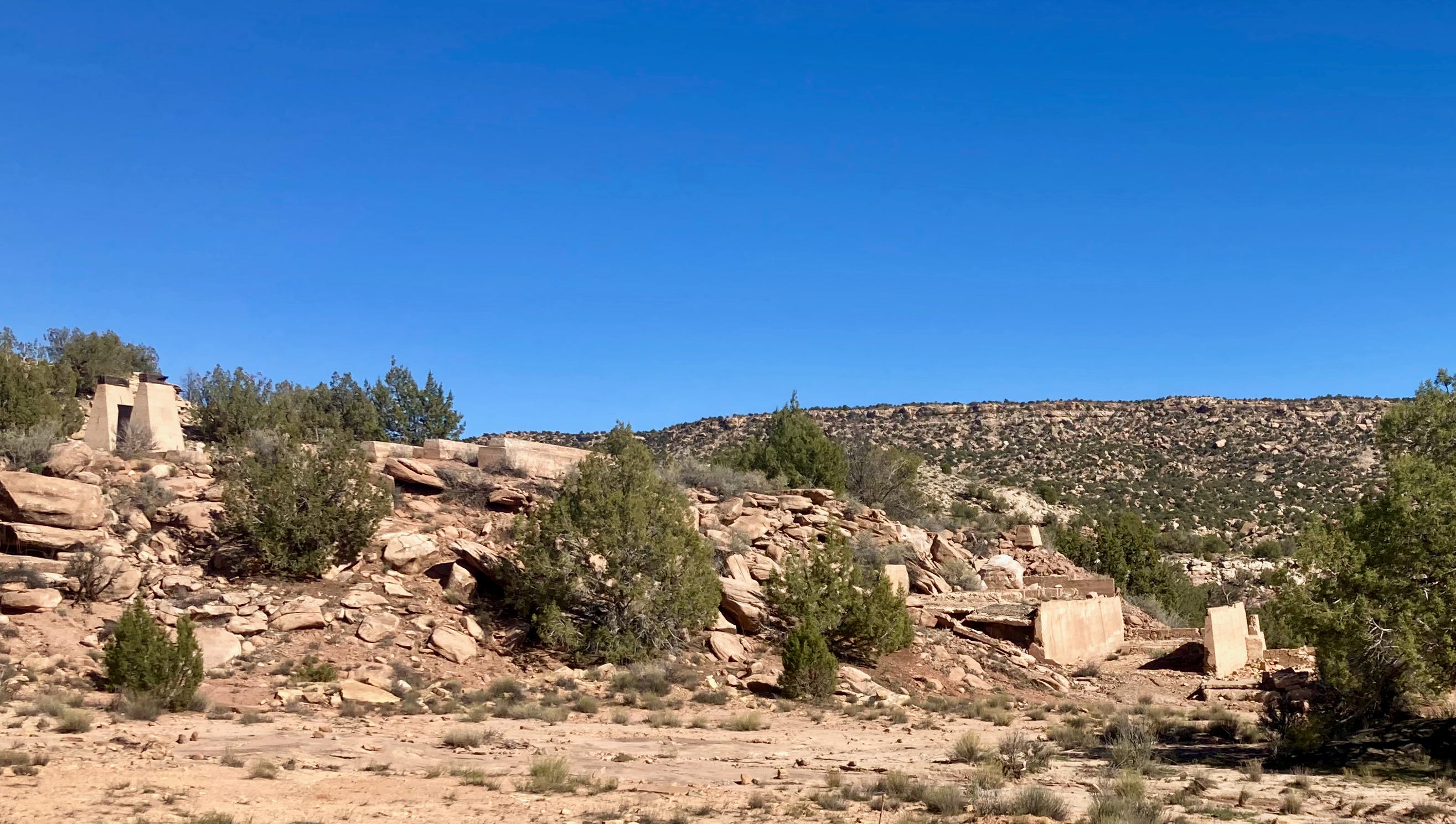
Whether the firm plans to mine the claims, or is just looking for more grounds for a future lawsuit in the event that the next administration restores the boundaries isn’t clear. They have been known to use mining claims to make political points: Late last year, Kimmerle Mining staked four 20.66-acre lode claims on the east slope of the Henry Mountains, naming them Trump I, Trump 2, Trump 3, and Trump 4.
Trump slashes nearly 3 million acres from Bears Ears and Grand Staircase-Escalante national monuments — Jonathan P. Thompson
**
Also in the shady mining moves around national monument shrinkage: Less than a week before Trump issued the proclamations, Energy Fuels CEO Ross Bhappu purchased 74,000 shares of the uranium mining and milling firm’s stock, and the company’s chairman Bruce Hansen bought 4,000 shares. Democratic lawmakers on the House Natural Resources committee are now investigating the trade and the possibility that the executives received privileged, non-public information from the Trump administration in advance of the shrinkage.
Energy Fuels owns and operates the White Mesa uranium mill in San Juan County, Utah, east of Bears Ears National Monument. The company lobbied the Obama administration prior to its original 2016 designation. Though the administration ultimately excluded Energy Fuels’ Daneros mine from the monument, the firm lamented the fact that seven miles of the mine’s one access road still fell within the boundaries.
In 2017 Energy Fuels lobbyists, including former U.S. Rep. Mary Bono, R-Calif., met with Trump administration officials, and requested that it “reduce the size of the (Bears Ears National Monument) to only those specific resource areas or sites, if any, deemed to need additional protection beyond what is already available to Federal land management agencies.”
In 2021, IsoEnergy acquired the Daneros Mine and other mining properties from Energy Fuels. But any ore mined in the former Bears Ears is likely to be processed at Energy Fuels’ White Mesa mill, so they stand to benefit from the shrinkage.
⛈️ Wacky Weather Watch⚡️
It wasn’t exactly a hurricane that hit Hurricane, but it was pretty darned destructive. This past weekend a huge storm pounded southwestern Utah, leading to arroyo-busting flash floods that turned the city’s streets into rivers of mud. The water gave a big boost to the Virgin River, which shot up from about 165 cubic feet per second to over 4,000 cfs in a matter of hours.
🐟 Colorado River Chronicles 💧
Lake Powell reached a grim benchmark this past weekend, when its surface elevation dropped to its lowest level since 1968, when the nation’s second largest reservoir was still filling up. In April of 2023, the level fell to 3,519.92 feet. On August 15 of this year, it reached 3,519.91 feet and is still falling at a rate of about two inches per day.
While not exactly surprising, the event launched many a news story in the mainstream media. And as is often the case with complicated issues like these — and the Glen Canyon Dam problem is not exactly simple or straightforward — some of the facts in these stories can be a little less than factual, and could use a bit of clarification.
Today’s New York Times piece provides a couple of examples:
- The graphic showing reservoir levels at Lake Powell says that at 3,370 feet, known as dead pool, “Water no longer flows past the dam.” As Zak Podmore — who wrote the book on Lake Powell and deadpool — pointed out on X-Twitter, that is not quite right. What actually would happen is that the dam would become a run-of-the-river facility, meaning water released from the dam would be equal to water flowing into the reservoir (minus losses from seepage and evaporation). So the Grand Canyon would not go completely dry, though there would be times when flows are pretty darned low.
- The piece notes: “About 6 million people across the Southwest rely on electricity from the dams [both Glen Canyon and Hoover].” This isn’t wrong, it’s just worded in a way that overstates the importance of these generators’ energy output to the Western power grid. Combined, the dams produce enough electricity annually to power some 550,000 households for a year. That power is sold at cost to municipalities, cooperatives, tribal nations, irrigation districts, and utilities across the West, which include it as part of their larger portfolios. The 6 million figure probably refers to all of the customers all of those entities serve; if the dams go down, these folks most likely wouldn’t notice except for a small jump in their power bills.
Glen Canyon Dam hydropower: What’s it good for? — Jonathan P. Thompson
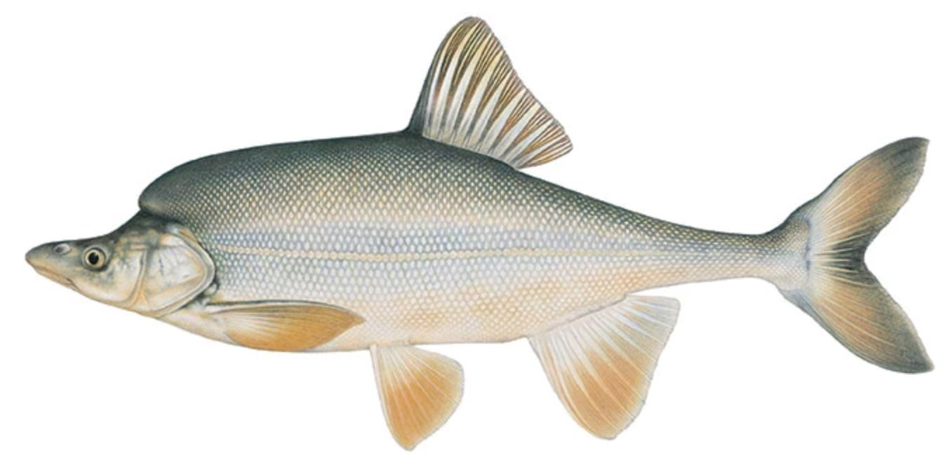
Protect the Grand Canyon’s Humpback Chub A guest dispatch by Ron Rudolph
This month Lake Powell will shrink to a level last seen in 1968, a few months before the first astronauts orbited the Moon. The receding reservoir has forced the Bureau of Reclamation to abandon the practice of releasing cool water from the reservoir, a strategy used successfully to prevent smallmouth bass from becoming entrenched in Grand Canyon National Park below Glen Canyon Dam.1 The bass are an invasive species that can escape from Lake Powell and could imperil the Grand Canyon’s native humpback chub population, the most important remnant of a federally protected species that was once widespread throughout the Colorado River system.2 Scientists attribute steep declines in the humpback chub population in the upper Colorado River Basin largely to smallmouth bass predation.3
Sustaining the humpback chub population in the Grand Canyon is essential to prevent the species’ extinction. With cool water releases no longer feasible, protecting the humpback chub now requires a different approach. Increasing the delivery of sediment into the Grand Canyon may be the most effective remaining tool. Additional sediment transported from Lake Powell, either around or through Glen Canyon Dam, would increase turbidity, making it more difficult for smallmouth bass to establish a stable population.
The Bureau’s decision to halt cool water releases reflects the severity of the ongoing drought, which has reduced this year’s unregulated flow of the Colorado River to the second lowest since Glen Canyon Dam was completed 63 years ago.4 In April, the agency instituted unprecedented efforts to bolster Lake Powell, which were intended to preserve Glen Canyon Dam’s ability to generate hydropower.5 Despite those efforts, the Bureau’s July 24-month forecast of the minimum probable flow of water into Lake Powell anticipates Glen Canyon Dam will be unable to generate electricity from February 2027 through at least June 2028.6 In fiscal year 2025, Glen Canyon Dam generated enough electricity to supply the annual average needs of 269,000 U.S. households.7
Humpback chub evolved exclusively in the Colorado River system, the water often referred to as “too thick to drink and too thin to plow.” It developed exquisite adaptations to thrive in a volatile environment, driven by flash floods that can rapidly turn relatively clear water to an opaque reddish-brown, making it impossible to see one’s finger one inch below the surface. Its gills and mouth have protective flaps that prevent sediment from clogging them, its eyes are tailored to see in muddy water, and special sensory organs detect prey and plants, allowing the fish to breathe and eat in highly turbid conditions. In contrast, smallmouth bass evolved in clear lakes and streams, relying on their vision to obtain food.
Fortunately, the adult humpback chub population is flourishing in the western Grand Canyon where sediment from the annual monsoon season turns the river into a torrent of mud. From 2010 to 2024, the population grew about 160-fold, with the median population estimated at about 70,000.8 This resurgence caused the U.S. Fish and Wildlife Service to reclassify the species from being endangered — i.e., in imminent threat of extinction, under the Endangered Species Act — to a less serious status of threatened.9
Smallmouth bass were not present in the Grand Canyon prior to the construction of Glen Canyon Dam, but now occur occasionally in its western section. The largest smallmouth bass captured in the park – 15.2 inches – was found in the far western section of the Grand Canyon in 2006.10 The fact that humpback chub flourish in the western Grand Canyon while smallmouth bass do not underscores the importance of intense and sustained pulses of turbidity created by suspended particulates. These conditions appear to be a key factor in preventing smallmouth bass from becoming established.
Because Glen Canyon Dam traps most sediment before it can reach the Grand Canyon, the Bureau should commission a study to evaluate options for increasing sediment delivery from Lake Powell. A sediment bypass system, such as a pipeline around or through the dam, could provide the turbidity needed to suppress smallmouth bass in the absence of cool water releases. Given current hydrologic realities, such an approach may be the most effective long‑term strategy for protecting the humpback chub and preserving the ecological integrity of the Grand Canyon.
1 “Feds Nix Grand Canyon fish protection flows below Lake Powell,” Arizona Republic, August 7, 2026
2 Glen Canyon Adaptive Management Program — https://gcdamp.com/index.php/ Smallmouth_Bass_Page
3 U.S. Geological Survey, “Dropping the Bass: USGS science helps partners stop spread of invasive smallmouth bass in the Colorado River,” March 21, 2025
4 The Bureau of Reclamation’s July 2026 “Most Probable” 24-Month Study projects unregulated inflow for this water year at 3.501 million acre-feet. 2002 is the driest on record at 2.64 MAF
5 Reclamation Acts to Protect Colorado River System During Historic Drought; https:// http://www.usbr.gov/newsroom/news-release/5326, April 17, 2026
6 Bureau of Reclamation, July 2026 Probable Minimum 24-Month Study; https://www.usbr.gov/ lc/region/g4000/24mo_MIN.pdf. When Lake Powell drops below elevation 3,490, it can no longer generate hydropower. See Bureau of Reclamation, Final Environmental Impact Statement, Post-2026 Operational Guidelines and Strategies for Lake Powell and Lake Mead, Technical Appendix 15, Dams and Electrical Power Resources, page 15-11
7 In Fiscal Year 2025 Glen Canyon Dam generated 2,792,000,000 kilowatt-hours of electricity, according to the Western Area Power Administration’s Statistical Index — https:// http://www.wapa.gov/wp-content/uploads/2026/06/FY-2025-Statistical-Appendix.pdf, page 9. According to the U.S., Energy Information Administration, U.S. households use an average of 10,365 kWh annually. https://www.eia.gov/tools/faqs/faq.php?id=97&t=3; avg monthly consumption 863; annual 10,365 kWh EIA https://www.eia.gov/electricity/ sales_revenue_price/pdf/table_5a.pdf
8 Dzul et al., “Integrating mark-recapture, catch, and expert habitat assessments to quantify recent increases in humpback chub abundance over a 200 km long river segment of the Colorado River in western Grand Canyon,” Canadian Journal of Fisheries and Aquatic Sciences, July 2026. Dzul estimated with 95% confidence that the population was between 40,000–200,000
9 86 FR 57588
10 Bureau of Reclamation, Glen Canyon Dam/Smallmouth Bass Environmental Assessment Update, January 26, 2023

by Robert Marcos, photojournalist
I entered the Snake River from a boat ramp at Celebration Park in Melba Utah. The park protects a 10,000 year old petroglyph site that was created by ancestors of the Shoshone, Bannock, and Northern Paiute people. It’s amazing to gaze upon these glyphs and consider that some of America’s first inhabitants stood exactly where you are standing, and then invested hours of their valuable time creating these artistic designs. Click here for a short video.
Meanwhile – the Snake River is 1,078 miles long and it originates at Yellowstone National Park in Wyoming. The Snake carries an average of 36 million acre feet of water across Idaho, Oregon, then finally joins the Columbia River at Burbank, Washington.
The absolute headwaters start at Two Oceans Pass in Yellowstone National Park. Rills and streams fed by melting winter snowpack flow into Grand Teton National Park, filling Jackson Lake. This seasonal snowmelt from the Teton and Gros Ventre mountain ranges provides the initial high-volume push of water every spring.
As the river enters southern Idaho, it crosses a massive, porous volcanic plain underlain by fractured basalt lava. Rivers that flow down from northern mountains often sink completely underground into this aquifer. This water travels sub-surface and re-emerges directly into the Snake River through colossal spring complexes like Thousand Springs. These springs act as a natural reservoir, pumping steady, massive amounts of cold water into the river even during bone-dry summer months.
While the river is physically very long, it actually accumulates over half of its total water volume in the lower quarter of its run. As it cuts through Hells Canyon toward Washington, it absorbs massive influxes of water from major rivers:
• The Henry’s Fork
• The Salmon River (features a 16,000 year old paleo-indian site at Cooper’s Ferry)
• The Clearwater River
By the time the Snake River empties into the Columbia River in Washington, these combined mountain, spring, and tributary sources make it one of the largest hydrologic resources in the United States. 4