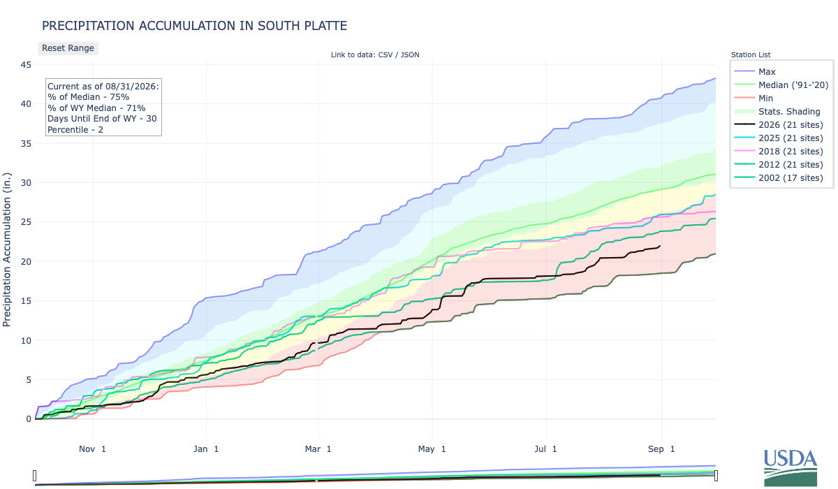
Below is the Precipitation Accumulation in South Platte graph from the NRCS for August 31, 2026. This morning precipitation, at the SNOTEL stations, is at 75% of the median (no change one week), and 71% of the water year median (up 2% one week). There are 30 days left in the water year.
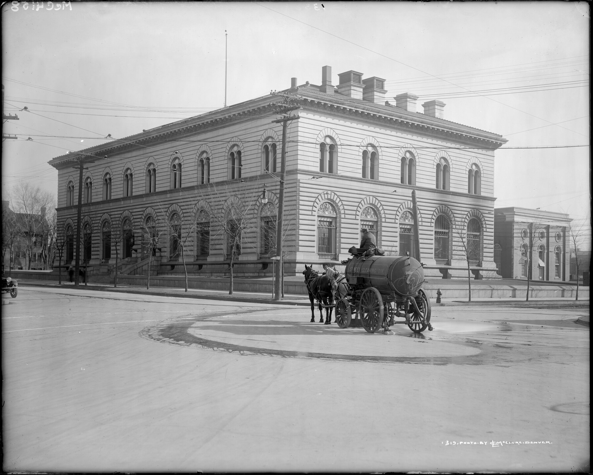
Showers are likely today, there is a chance for thunderstorms Friday, and a chance for showers and thunderstorms Saturday in the central mountains. Showers a likely today, with a slight chance for thunderstorms Friday, and a chance for showers/thunderstorms Sunday in the northern mountains. Showers are likely today, with a slight chance for showers Friday, and a slight chance for showers and thunderstorms on Saturday and Sunday, down here about 6.0 miles from the U.S. Mint where The ‘Wildest Gun Battle in Denver History’ Was Also the First Successful Mint Holdup in the U.S. Here’s an excerpt from Law Week Colorado:
1920s Denver is often associated with bootlegging, booming population growth and tumultuous governmental control as powerful legislative and executive seats were taken by members of the Ku Klux Klan. 1922 is also when the Denver Mint was robbed by a gang of bandits, culminating in the “wildest gun battle in Denver history,” according to the Craig Courier in December 1922. “Four bandits held up a federal reserve bank automobile in front of the United States mint here, and after a terrific gun battle with mint employees, made their escape with $200,000 in $5 bills,” reported the Cheyenne Wells Record in December 1922. The Cheyenne Wells Record went on to note the robbery was the first successful mint holdup in U.S. history and that the robbery was also the largest in Denver history to date…A month after the robbery, the Jefferson County Republican reported that after the robbery, the bandits made their way to a garage at 1651 Gilpin Street in Denver, which they had rented a few days before, with a mortally wounded companion, later identified as J.C. Sloan where “they left the dead body of Sloan crumpled up.” The Jefferson County Republican reported Sloan was believed to be the leader of the gang. The discovery of Sloan led investigators to other leads in the case including a trunk filled with firearms and ammunition and photographs and letters. Three months after the robbery, the Longmont Ledger reported an arrest was made in Albuquerque. J.W. Morgan and Pearl Ward were arrested in March 1923 in connection with the robbery, but neither would divulge more information to investigators about the Mint robbery…“No one was ever charged with the robbery, despite Denver Police Chief A.T. Clark’s announcement 12 years later that the robbery team had been identified. The suspects that were identified were already in prison on unrelated charges or had died,” reported K5 News in 2014.
View of a horse drawn street cleaner at Cherokee Street and Colfax Avenue, Denver, Colorado; the United States Mint is in the background. Credit: McClure, Louis Charles, 1867-1957/Denver Public Library Digital Collections
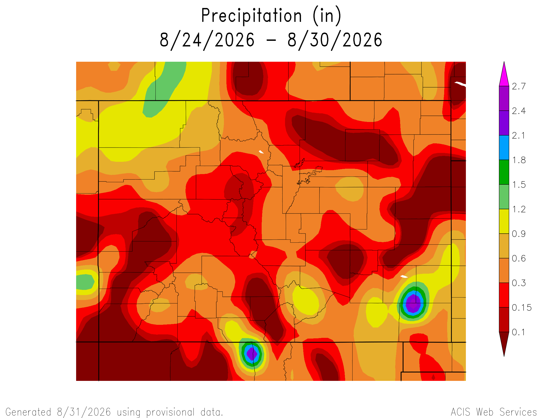
Here’s a look at the 7-Day Colorado precipitation map through August 30, 2026 from the High Plains Regional Climate Center. Precipitation in the South Platte Basin along the Continental Divide of the Americas ranged from 0.10” to 0.30”.
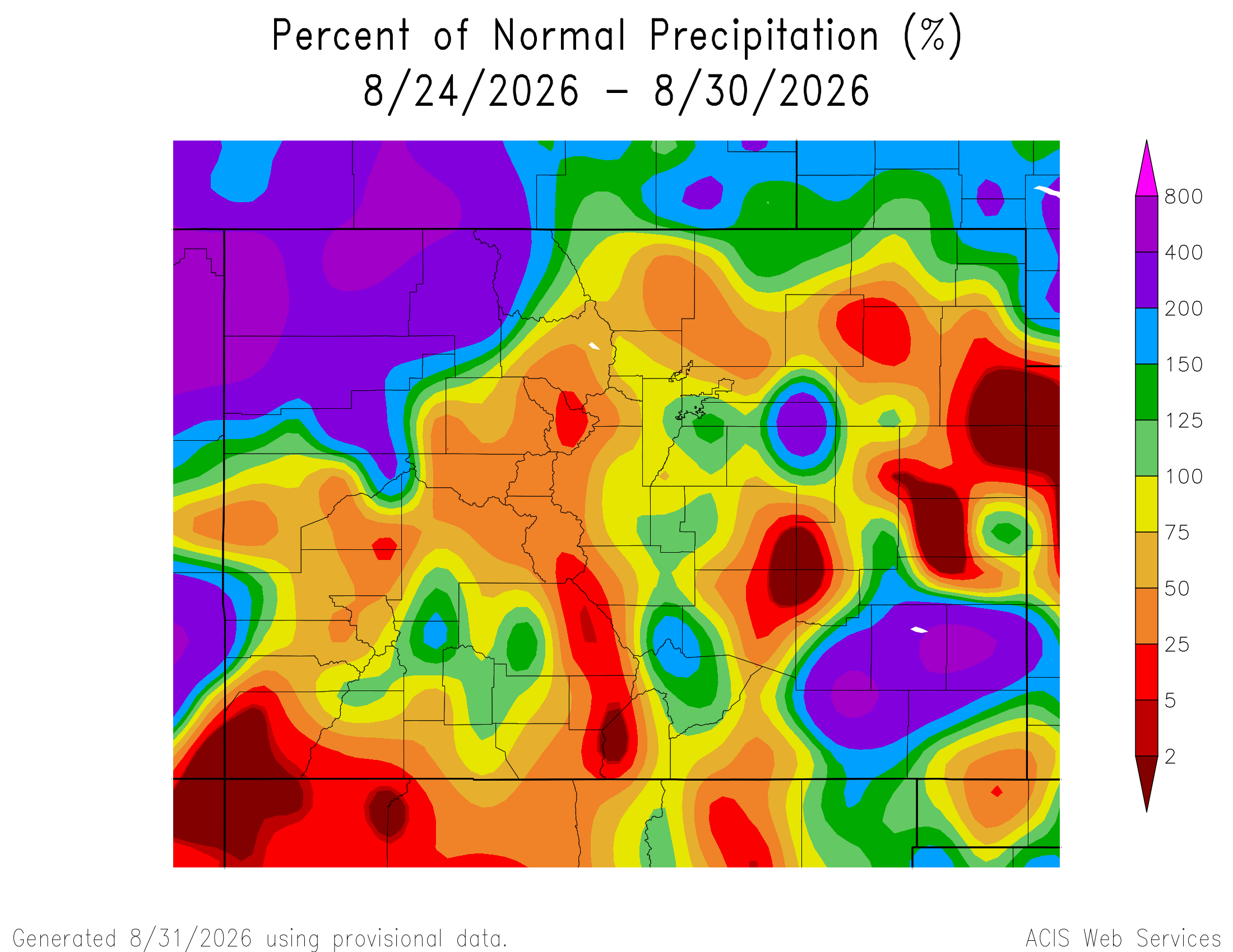
Here’s the 7-Day percent of normal precipitation map through August 30, 2026 from the High Plains Regional Climate Center. Precipitation in the South Platte River Basin along the Continental Divide of the Americas was 5% to 125% of normal.
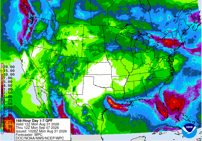
Below is the 7-day Quantitative Precipitation Forecast for the week of August 31, 2026. Precipitation is anticipated for the mountains of the South Platte River Basin and may total up to 0.50″.
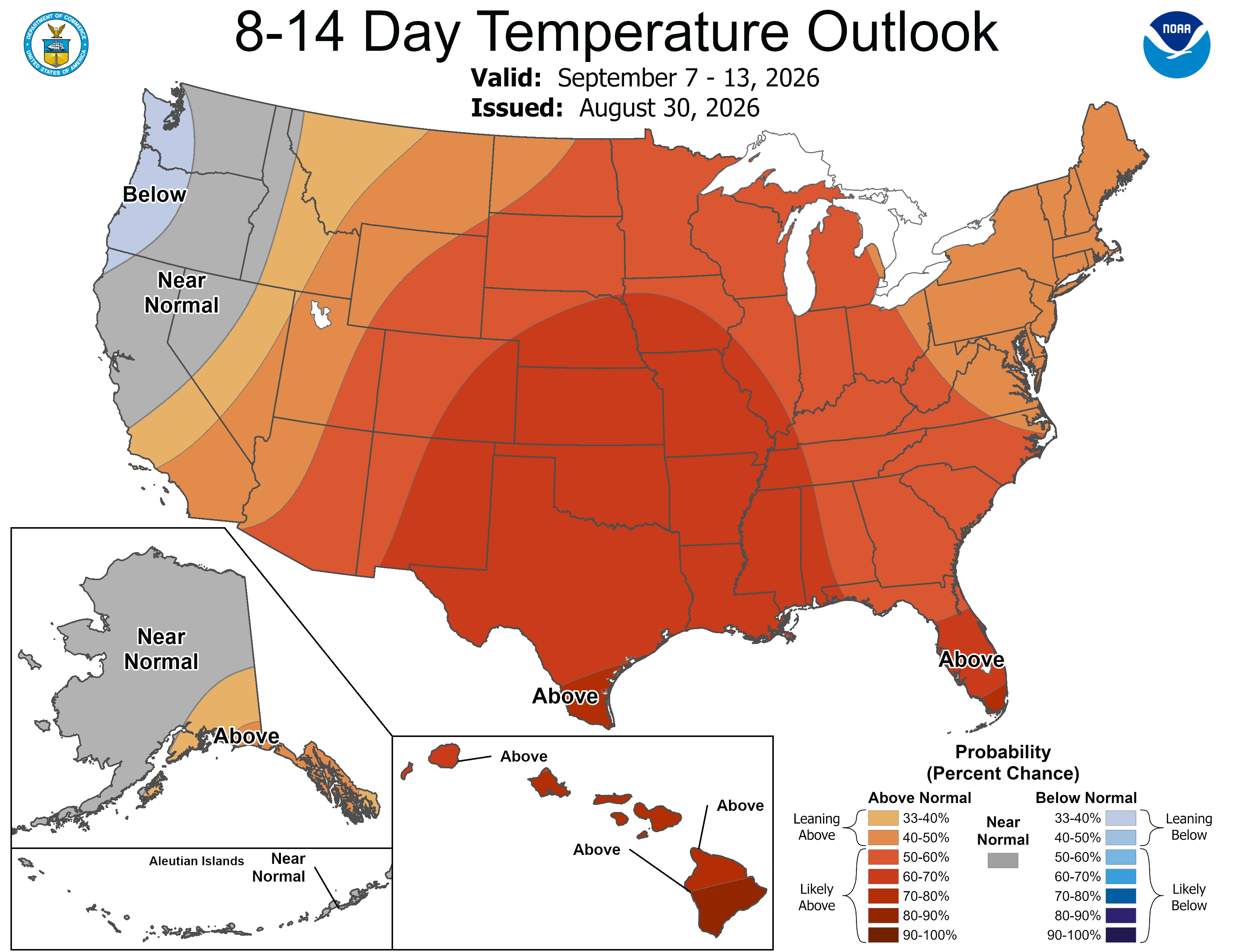
Below are the 8-14 day outlooks from the Climate Prediction Center, issued August 30, 2026, for temperature and precipitation, for the week starting September 7, 2026. The CPC expects above normal temperatures and above normal precipitation for the mountains of the South Platte River Basin.
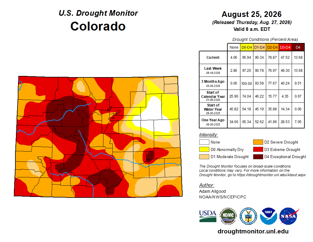
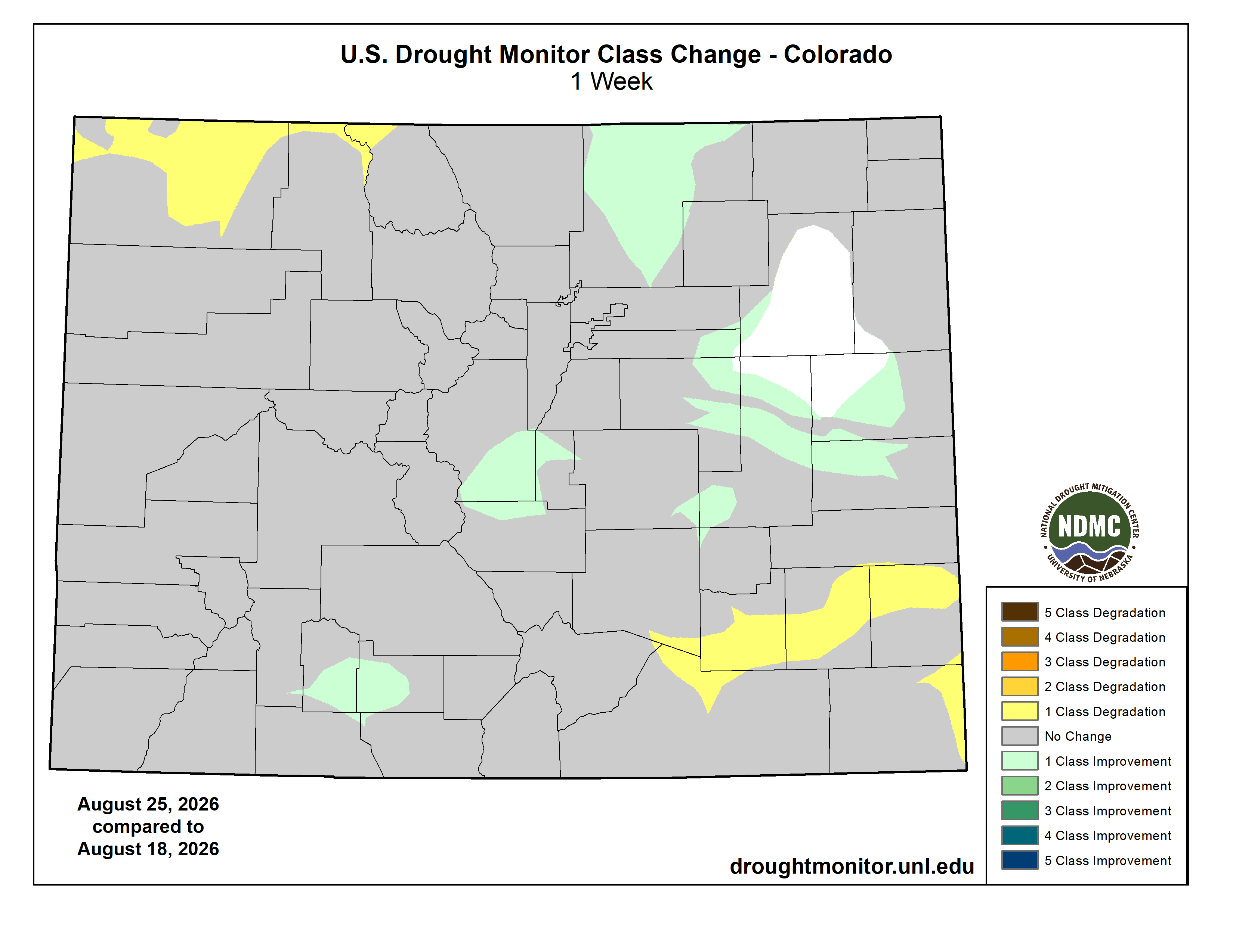
Below is the Colorado Drought Monitor map from August 25, 2026. There were one class improvements in Park, Weld, and Morgan counties. Drought and abnormal dryness covers 95.94% of Colorado. The South Platte Basin is experiencing Abnormally Dry, Moderate, Severe, Extreme, and Exceptional drought conditions.
Below is the Colorado Drought Monitor one week change map ending August 25, 2026.
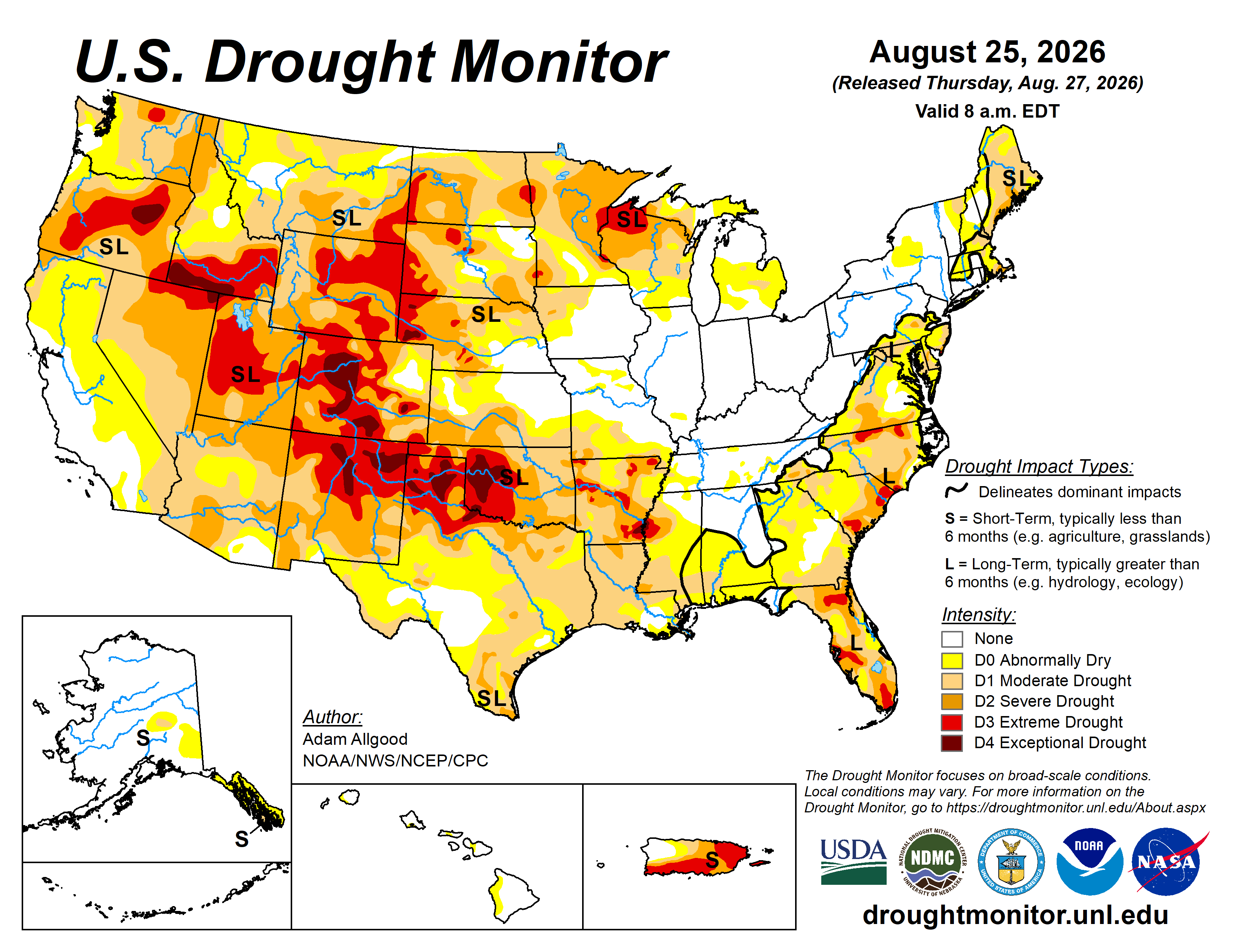
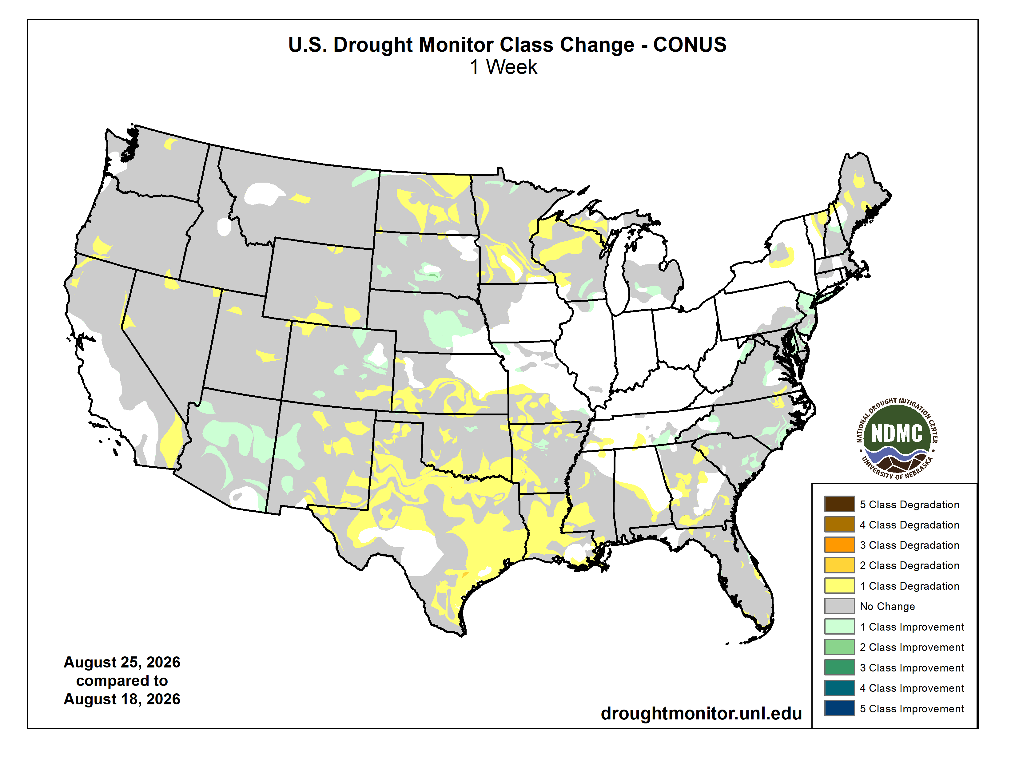
Here’s the US Drought Monitor Map from last week along with the one week U.S. change map.
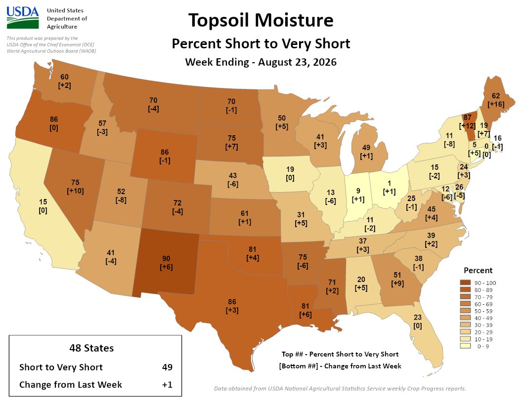
Finally, here’s the Topsoil Moisture Percent Short to Very Short map for the week ending August 23, 2026 from the USDA:
49% of the Lower 48 is short/very short, a 1% increase from last week. Highest short/very topsoil spans parts of the West, Plains, South, and Northeast, led by NM at 90%; VT at 87%; OR, WY, and TX at 86%; and LA and OK at 81%
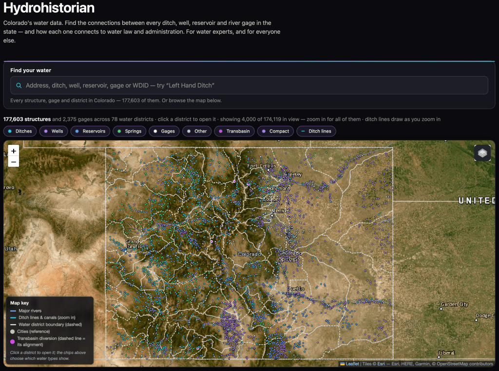
We have met briefly at at least one Colorado water conference (but it’s been a while). I was the Water Resources Analyst at Northglenn for a while, and now am the Water Resources Manager at Consolidated Mutual. But, on my own time, I’ve built something for Colorado water records that may be useful to you or your readers, and I’d rather you see it early. I would appreciate feedback and hopefully some exposure from your organization.
It’s the whole state in one place: all 177,301 decreed structures, 2,271 stream gages, diversion records, water court history, and the calls that administer them, across all seven divisions. Type an address and it shows you the ditches and rights around it. Open any ditch and you get its decrees, what it actually diverted year by year, and where it sits in line. Open a district and you get a straight-line diagram of who takes what, and where.
The piece I’m proudest of went live this week: for any structure, on any day, how much of its decree was actually in priority. Not whether a call was on — how many cfs of that particular ditch’s decree was in priority, counted by the hour, running back through the call record to 1950. I don’t know of anywhere else you can get that without building it yourself.
And it shows its work. Where DWR publishes its own day-by-day out-of-priority analysis, the page scores itself against DWR live, on the page: 98.7% agreement across about 86,000 structure-days, and it lands on DWR’s exact percent-of-day 90.9% of the time. Every page also states plainly what it can’t tell you. I’d rather your readers see the error bars than trust me.
A few things a reader could do with it in five minutes: find out whose ditch runs behind their house; see how many days their ditch was out of priority in the 2002 and 2012 droughts; or watch a senior downstream call reach up a tributary and shut off juniors sixty miles away.
I’d genuinely value your eye on it, and if you think it’s worth a mention to your readers, that would mean a lot. Happy to give you a walkthrough, or to run a specific question against the data if it would make a better post.
— John Crawford
(Water Resources Manager, Consolidated Mutual Water Company), but working independently on this project hydrohistorian.com.
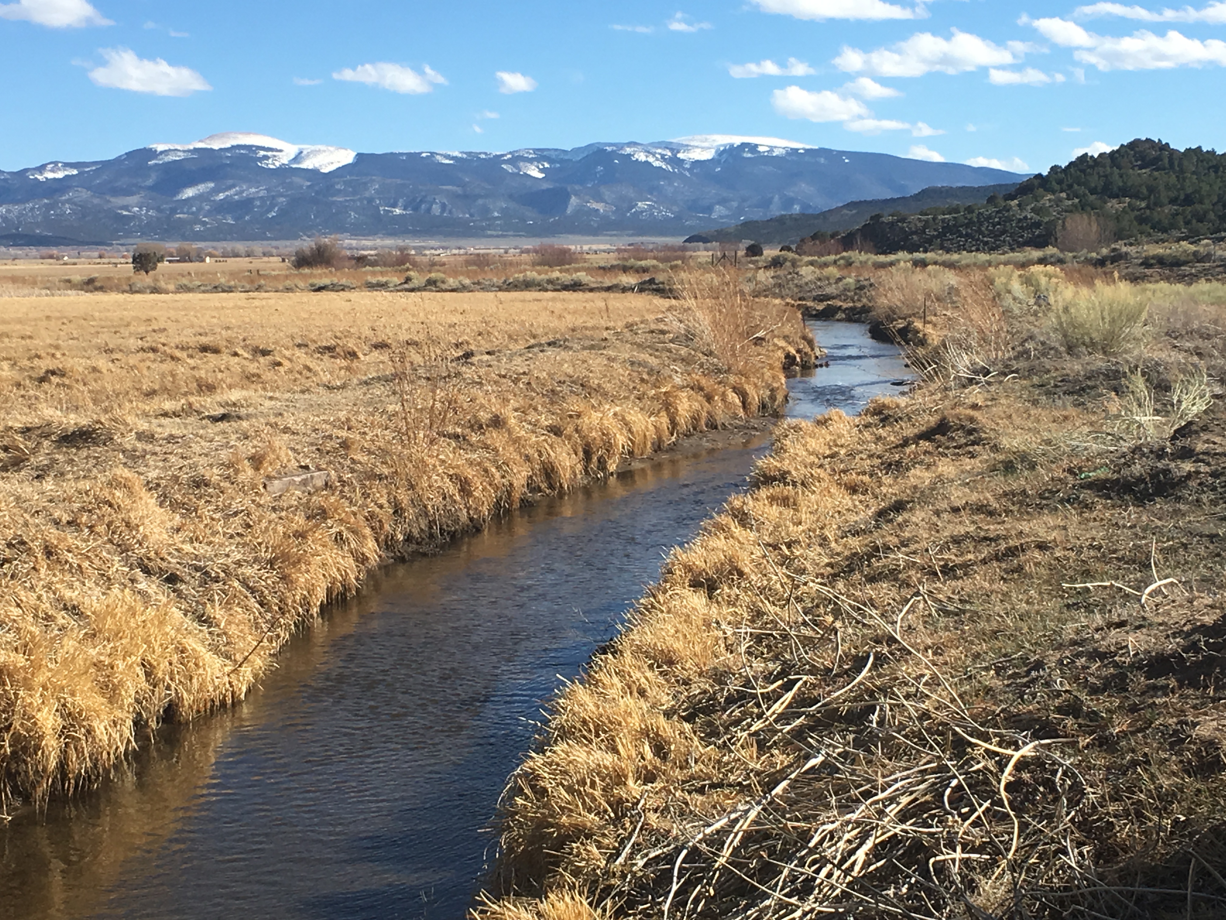
Milkweed, sweet peas, and a plethora of other flora billow from Farmer’s Ditch in the North Fork Valley of western Colorado. Jonathan P. Thompson photo.
It seems like every time the Colorado River and other Western water woes make national headlines, some pundit — usually from the East Coast — weighs in with their “simple” or “obvious” solution. And I get mad and start throwing things around the room, then type out some blistering rant riddled with epithets and insults.
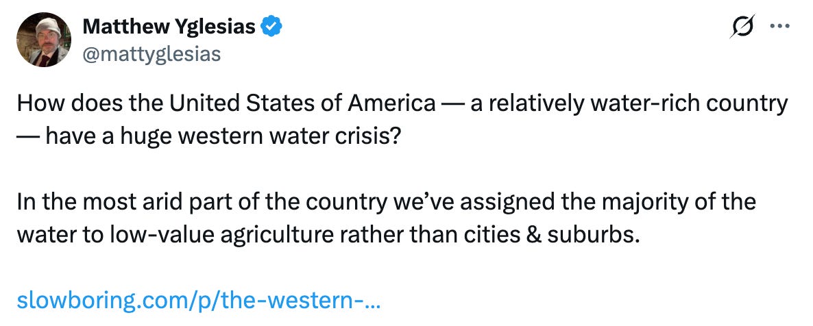
Well, the Colorado River is in the news again, and with it have come the usual swarm of oversimplified hot-takes. The one that really got my goat this time is from Matthew Yglesias, who wrote a piece headlined: The Western water crisis has a simple solution: Stop giving the majority of the water away to farmers for almost nothing!
These things piss me off so much not because they’re wrong, but because there is no “simple” solution to the Western water crisis. That’s because the crisis itself isn’t simple, and saying that it has simple fixes implies that the folks who have spent a lot of time trying to solve the problem are a bunch of idiots, since they hadn’t come up with this solution already. It seems as if Yglesias and his ilk assume that the West is not only monolithic, but that we Westerners are a bunch of backwoods bumpkins who don’t understand the region’s own problems.
Who cares what these bozos believe, right? Right. But judging by the comments on Yglesias’ social media posts, a lot of other people are similarly deluded. So I figured his piece provides a nice opportunity to clear some things up.
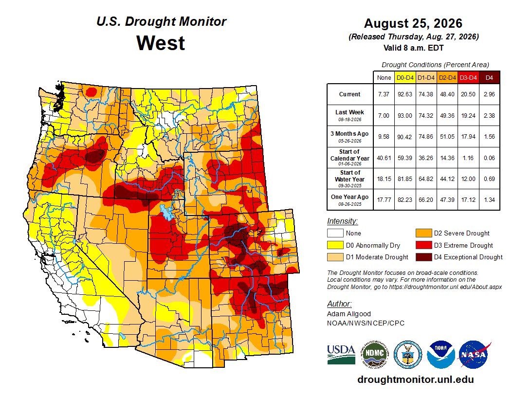
West Drought Monitor map August 25, 2026
In fact, there is no single “Western water crisis.” The West is huge and is geographically, hydrographically, and ecologically diverse. While most, but not all, of the Western U.S. is in some stage of drought currently, not all of those places are experiencing a water crisis, per se. There is a Colorado River water crisis and a Rio Grande water crisis and a San Joaquin Valley water crisis, but those crises are not all the same.
The Colorado River crisis is multifaceted and manifests in different ways in different places and on different levels. The river itself is in crisis, in that stretches of the mainstem and its tributaries virtually dry up during summers like this one. Its users are facing a potential crisis, i.e. looming shortages, as in some of them are getting less water from the river than they did in the past. And the vast and complex plumbing system and legal framework that has been built up to harness and govern the river is perhaps facing the most immediate crisis: It is collapsing under its own weight and in many ways has become obsolete. Each of these is a distinct calamity, with its own twists, turns, causes, and bevy of potential solutions.
From his perch in the Northeast, however, Yglesias sees just one dimension, writing in the “nut graf” of his piece:
Uh, not quite.
Yes, irrigated agriculture is by far the dominant consumer of Colorado River water, accounting for 52% of overall consumption and 74% of direct human consumption. And yes, agricultural users typically and notoriously pay less for the water than municipal users. No, this is not dictated by federal law.
Agricultural users were among the first entities in the colonial-settler era to put large quantities of water to beneficial use, giving them the most senior rights to the largest quantities of water. The Imperial Irrigation District, for example, has senior rights to about 3 million acre-feet of Colorado River water, most of which is used for agriculture.
These water rights holders have a legal right to use a set amount of water each year. They are not leasing or purchasing the water from the federal government or anyone else. It’s essentially theirs, for free, as long as they are able to divert it from the river and put it to beneficial use.
San Luis People’s Ditch March 17, 2018. Photo credit: Greg Hobbs
Usually the water rights are held by irrigation districts, ditch companies, municipalities, corporations, or, in some cases, very large individual landholders. In the late 1800s, these entities built their own diversions, canals, and delivery systems. Construction was often financed by private investors and the individual irrigators, who held stocks, or shares, in the ditch company. Each share would entitle its holder to a set amount of water from the canal. The shareholder would pay an annual fee for each share to cover construction, maintenance, and operating costs.
The Bureau of Reclamation was established in 1902 to build larger scale dams, diversions, and canals to deliver water to users and to spur agricultural development in the arid West. Call it the nationalized version of an irrigation district, but on steroids. The federal government paid for the projects, but the irrigation districts and municipal water utilities they served were expected to pay back the costs over time. The taxpayers supposedly wouldn’t have to pay a dime. Yet as the years went by, and as the budgets of the projects skyrocketed, the terms of the paybacks were relaxed, especially for agricultural users. This effectively subsidized water delivery, which in turn lowered farmers’ costs.
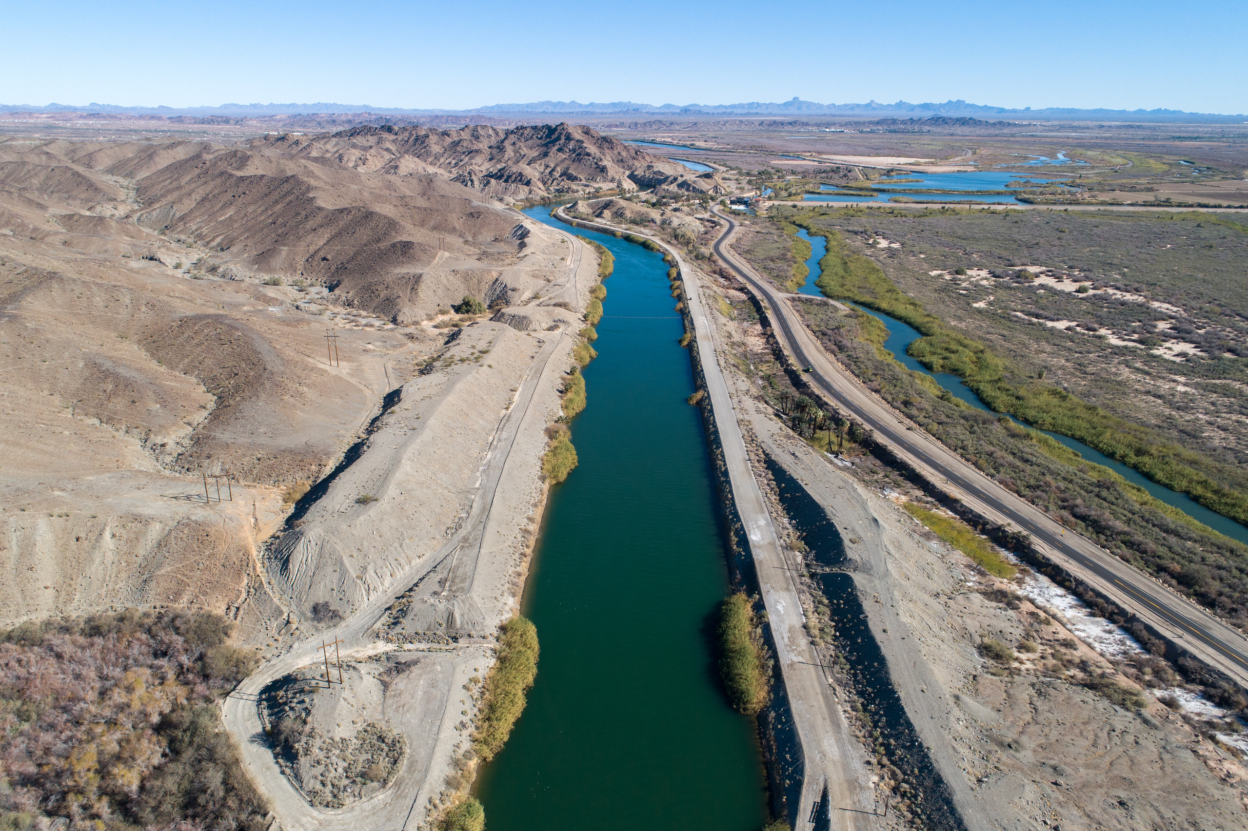
The All American Canal, the largest diversion on the Colorado River, passes through Winterhaven, CA on its way to the Imperial Valley. The Colorado River is seen flowing next to it.
One of the Bureau’s big projects was the 80-mile-long All-American Canal, built in the 1930s to ferry Colorado River water to the Imperial Irrigation District and other users. The IID entered into a 50-year payback contract, which ended in 1994. The Bureau still owns the canal, but the IID operates and maintains it and other infrastructure that delivers Colorado River water to nine cities and some 500,000 acres of farmland.
The IID pays nothing for the Colorado River water itself. It does pay to operate and maintain its vast water delivery system, and offsets those costs by charging agricultural and municipal users just $20 per acre-foot for water it delivers, a bargain basement rate. In other words, Imperial Valley farmers do get cheap water, but so do Imperial Valley cities and even industry (which pays $85/af, also relatively affordable). IID also brings in about $160 million annually by selling water to the San Diego County Water Authority. The operating costs for the All-American Canal system are lower than, say, the Central Arizona Project’s, because the All-American Canal is gravity fed, whereas the CAP uses huge amounts of electricity to pump water uphill.
Similar setups exist across the Colorado River Basin. But each system is distinct, and each has its own mix of federal and private funding and operational scenarios and rates.
And here’s one of the main flaws of Yglesias’s argument: He assumes that there’s some all powerful actor out there that sets rates and standards for water from the Colorado River, although he himself clearly doesn’t know who or what that actor is (he always uses the passive voice, or the all-encompassing “you” in these cases). That’s because that entity doesn’t exist. While the feds could stop subsidizing agriculture, and should not build any more water projects, they don’t have the authority to step in and adjust water rates. States probably could set rates for groundwater, but they can’t charge the IID for exercising their water rights on the Colorado River.
Next, Yglesias pivots to pillorying alfalfa, because that’s in vogue these days. I’m not going to get into that too much, because I’ve written about it so many times here before, but this little bit is pretty funny:
Now, I’m no alfalfa apologist (nor am I an alfalfaphobe), but I feel like I should point out that most of the alfalfa grown with Colorado River water is used to feed dairy cows, which in turn produce milk and cheese and ice cream. Unless Yglesias is a vegan, he might want to consider that. He then argues that since alfalfa is relatively low-value (money wise) compared to Las Vegas casinos, Phoenix microchip factories, or housing, the water should be going to casinos, factories, and housing, not farms, which would presumably happen if farmers had to pay more for water (i.e. they’d go broke and be forced to sell).
First off, there is nothing novel or groundbreaking about this idea. Sprawl has been gobbling up farmland, and water rights, for decades in the West. Phoenix didn’t just grow into the desert, it also grew into citrus orchards and alfalfa fields, and will probably continue to build housing and data centers on what ag land remains. A different version of this concept, where a city or developer purchases a farmer’s water rights, but uses them somewhere else — a practice known as buy and dry — is also not uncommon.
This does not solve the water crisis. Instead of cutting consumption, which is what’s needed, it merely shifts the consumption from one use — agriculture — to other ones, such as housing and golf courses and chip manufacturing and data centers. This may wring more cash out of each acre-foot of water, but it doesn’t lower consumption. An acre-foot is an acre-foot, whether it’s going to alfalfa, a golf course, a neighborhood’s lawns, a data center or a swimming pool.
Besides, transitioning land out of agriculture comes with its own problems. We can argue forever about whether farming alfalfa or any other crop in the desert is appropriate, or of adequately high value, or whatever. We can argue that the Bureau of Reclamation should never have existed, and that irrigating the arid West should have been left to private entities operating in a free market. But the fact is, there is farming in the desert, those projects did end up subsidizing the agriculture industry, and communities, economies, cultures, and even new landscapes have emerged from and formed around those farms.
Photo of Crowley County by Jennifer Goodland
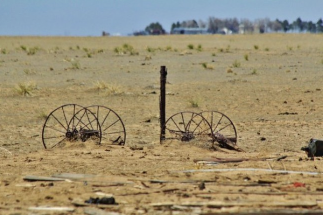
Taking vast swaths of land out of farming, whether to build houses or solar panels or to buy the water rights and use them somewhere else, has myriad consequences, many of them negative. Fields can become noxious-weed-clogged dust pits, the wildlife and ecosystems that have come to rely on irrigation runoff dry up, farm workers and families and the businesses that rely on them are displaced, communities’ economies are upended. As Madeline Wilson, an agricultural systems specialist for Colorado State University’s extension office pointed out at a 2024 panel on dust-on-snow, every field fallowed in the San Luis Valley for conservation purposes also represents a family. “We’re not just talking about drying up lands,” she said, “but the drying up of our economy.”
In no way does this mean that farms should be immune from curtailment. Indeed, because agriculture is the biggest user of Colorado River water, it will have to take the largest cuts in consumption. There is simply nowhere else from which the 4 million acre-feet or more of reductions per year needed to bring demand into line with dwindling supplies can come. But forcing farmers into bankruptcy by jacking up water rates (if there was a mechanism to do so), or prescribing “incredibly simple” policy solutions that don’t consider the complexities of the situation and its myriad moving parts or the on-the-ground impacts, isn’t the way to do it.
Udall/Overpeck 4-panel Figure Colorado River temperature/precipitation/natural flows with trend. Lake Mead and Lake Powell storage. Updated through Water Year 2025. Note the tiny points on the annual data so that you can flyspeck the individual years. Credit: Brad Udall
The “root cause” of the Colorado River crises is not alfalfa or pecans or cotton or cattle, it’s not the prior appropriation doctrine or the low price of water, it’s not overpopulation, it’s not data centers or golf courses or lawns or bad forest management or lack of or too many reservoirs. The root cause is twofold. First, there’s scarcity. The Southwest is an arid place, and climate change-exacerbated warming is drying it out more: there is less precipitation; the precipitation we do get is falling as rain, not snow; the snow we get is melting faster; and evapotranspiration is happening at a higher rate. This all leads to less water in the streams, reservoirs, rivers, and even aquifers. Secondly, there’s the chronic and long-term failure to acknowledge the scarcity, and the stubborn refusal to adapt to it and adjust consumption accordingly.
Consumptive use of Colorado River water for the Lower Basin’s largest users over time. Source: Bureau of Reclamation.
There has been progress. Over the last two decades some of the biggest water users on the river have slashed their water use considerably, sometimes because they had no choice, in some cases because they were incentivized to do so, and in other cases they did it to get ahead of future cuts. Last year, for example, the Imperial Irrigation District used 900,000 acre-feet less than it did in 1999. By its count, it has conserved over 9 million acre-feet since 2003 by fallowing fields and deploying various efficiency measures. And yet they’ve done so while continuing to grow nearly $240 million worth of alfalfa annually. It will need to do more; everyone will. But it’s a pretty big start.
There is one simple solution to the Colorado River crises: Everyone on the river has to use less water. Period. This won’t come from pithy policy prescriptions or one-dimensional solutions. It will require the tribal nations, the states, and all of the water users in the basin to come together and find a new way to approach and think about and revere the lifeline of the Southwest.
Coming in September: The Land Desk News Feed! This will be a once-a-week roundup of the West’s most important headlines, journalism, and commentary, curated and summarized by yours truly. I’m thinking it will probably drop on Wednesdays, but haven’t settled on anything, yet. Most weeks it will come in addition to the regular two Land Desk dispatches, but some weeks it may take one of the others’ place (meaning you’d only get two newsletters that week so as to not clog up your inbox all the time!).
All paid and free subscribers should expect the first edition on Sept. 9.
📸 Parting Shot 🎞️
Church and Cerro Pedernal, Youngsville, NM. Jonathan P. Thompson photo
Click the link to read the article on the InkStain website (Karl Flessa):
August 20, 2026
In the classic Monty Python sketch, a customer returns to the pet shop where, just 30 minutes ago, he purchased a parrot. He complains that the parrot is dead. The shopkeeper tries to convince the customer the parrot is only resting or is stunned.
In the ensuing argument, the customer uses no fewer than eighteen euphemisms: “This parrot is definitely deceased…demised…passed on…no more…ceased to be…expired…gone to meet his maker…a stiff…bereft of life…rests in peace…pushing up the daisies…metabolic processes are now history…off the twig…kicked the bucket…shuffled off his mortal coil…run down the curtain…joined the bleedin’ choir invisible.”
Indeed, the parrot was nailed to its perch, already dead when the customer bought it.
The Compact and its subsequent agreements are as dead as that parrot.
The Compact is dead because it is founded on a false premise: a river that can produce the prescribed amount of water.
The Compact is dead because it is unjust: neither the Tribes nor nature participate in negotiations.
The Compact is dead because it doesn’t work. The Basin States are locked in battle; the Federal government tinkers and dithers.
In the longer version of the sketch, the shopkeeper goes to the back in search of a live replacement, returning to report “…we’re right out of parrots.”
So are we.
We need a new Compact.
Proposals are not lacking: proportional allocations, Tribal standing, a whole-basin approach, adjustments based on actual flows, a basin authority, nature’s fair share, interstate trading… .
What’s lacking is the courage to change. [ed. emphasis mine]
The Compact is a dead parrot.
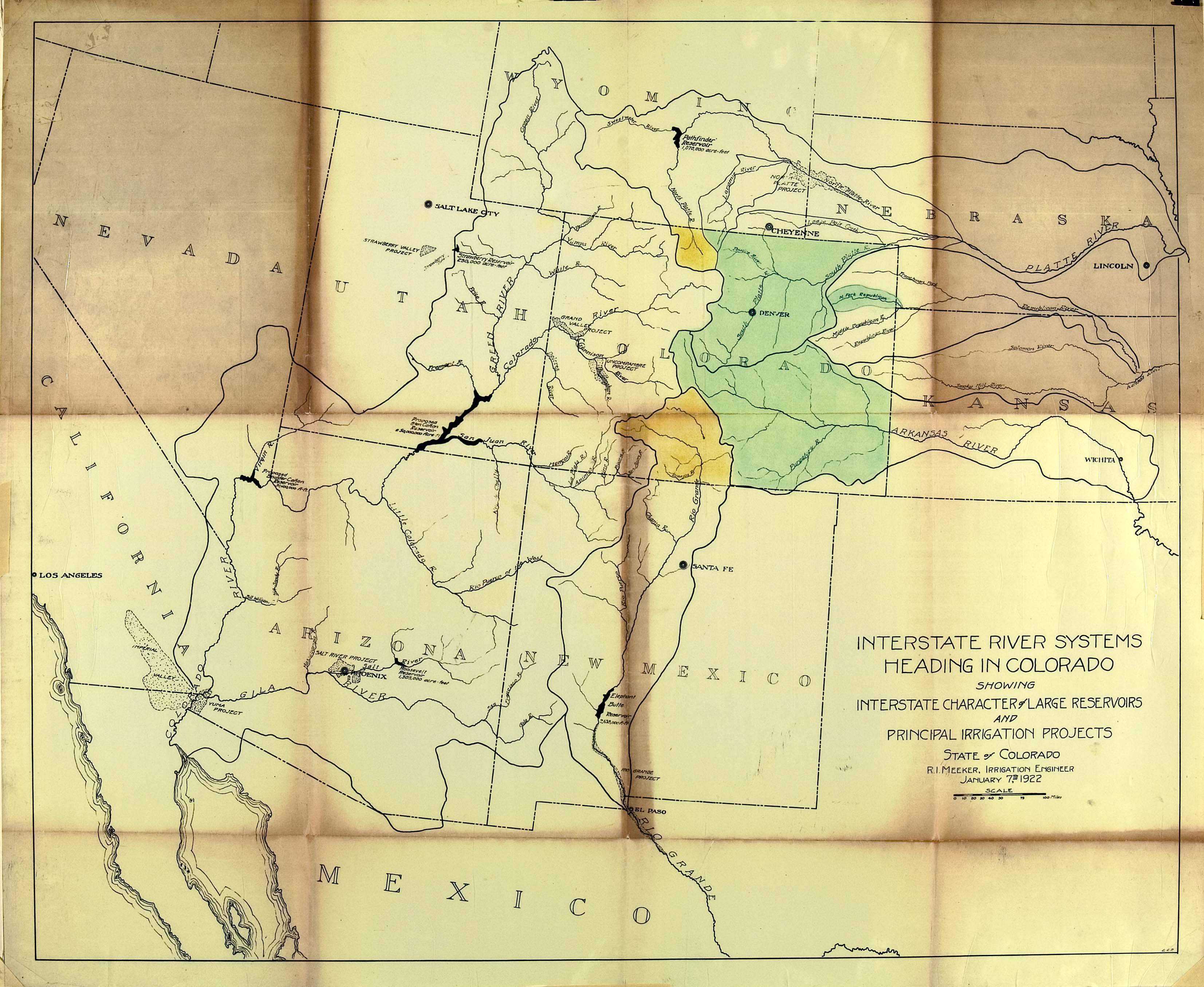
Delph Carpenter’s original map showing a reservoir at Glen Canyon and one at Black Canyon via Greg Hobbs