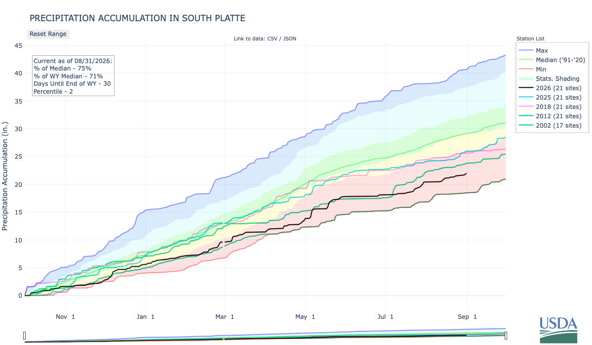
Below is the Precipitation Accumulation in South Platte graph from the NRCS for August 31, 2026. This morning precipitation, at the SNOTEL stations, is at 75% of the median (no change one week), and 71% of the water year median (up 2% one week). There are 30 days left in the water year.
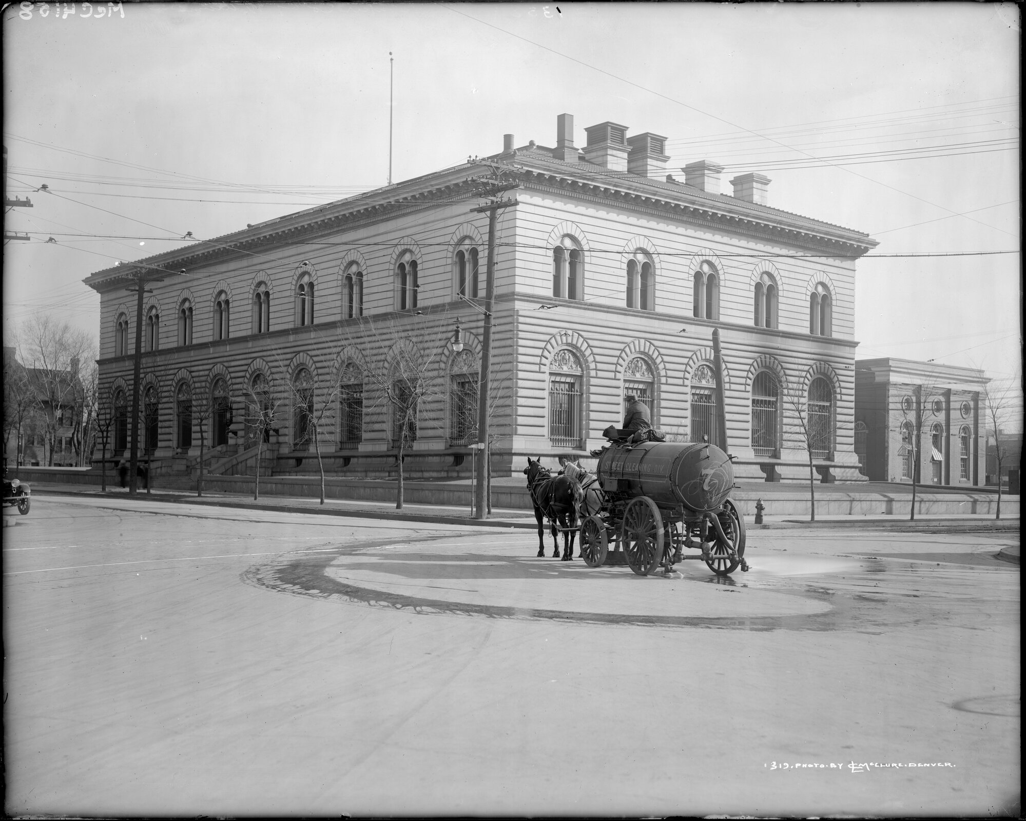
Showers are likely today, there is a chance for thunderstorms Friday, and a chance for showers and thunderstorms Saturday in the central mountains. Showers a likely today, with a slight chance for thunderstorms Friday, and a chance for showers/thunderstorms Sunday in the northern mountains. Showers are likely today, with a slight chance for showers Friday, and a slight chance for showers and thunderstorms on Saturday and Sunday, down here about 6.0 miles from the U.S. Mint where The ‘Wildest Gun Battle in Denver History’ Was Also the First Successful Mint Holdup in the U.S. Here’s an excerpt from Law Week Colorado:
1920s Denver is often associated with bootlegging, booming population growth and tumultuous governmental control as powerful legislative and executive seats were taken by members of the Ku Klux Klan. 1922 is also when the Denver Mint was robbed by a gang of bandits, culminating in the “wildest gun battle in Denver history,” according to the Craig Courier in December 1922. “Four bandits held up a federal reserve bank automobile in front of the United States mint here, and after a terrific gun battle with mint employees, made their escape with $200,000 in $5 bills,” reported the Cheyenne Wells Record in December 1922. The Cheyenne Wells Record went on to note the robbery was the first successful mint holdup in U.S. history and that the robbery was also the largest in Denver history to date…A month after the robbery, the Jefferson County Republican reported that after the robbery, the bandits made their way to a garage at 1651 Gilpin Street in Denver, which they had rented a few days before, with a mortally wounded companion, later identified as J.C. Sloan where “they left the dead body of Sloan crumpled up.” The Jefferson County Republican reported Sloan was believed to be the leader of the gang. The discovery of Sloan led investigators to other leads in the case including a trunk filled with firearms and ammunition and photographs and letters. Three months after the robbery, the Longmont Ledger reported an arrest was made in Albuquerque. J.W. Morgan and Pearl Ward were arrested in March 1923 in connection with the robbery, but neither would divulge more information to investigators about the Mint robbery…“No one was ever charged with the robbery, despite Denver Police Chief A.T. Clark’s announcement 12 years later that the robbery team had been identified. The suspects that were identified were already in prison on unrelated charges or had died,” reported K5 News in 2014.
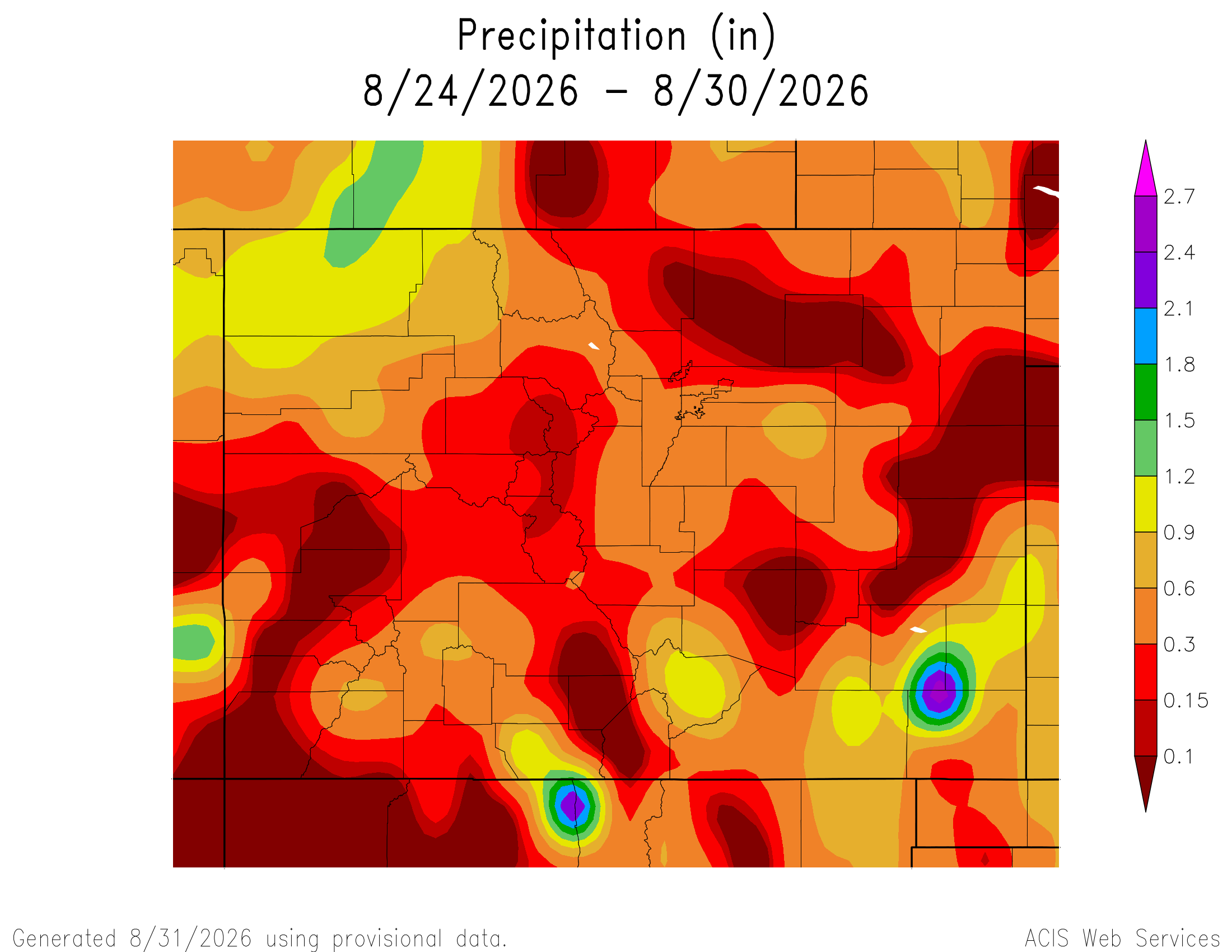
Here’s a look at the 7-Day Colorado precipitation map through August 30, 2026 from the High Plains Regional Climate Center. Precipitation in the South Platte Basin along the Continental Divide of the Americas ranged from 0.10” to 0.30”.
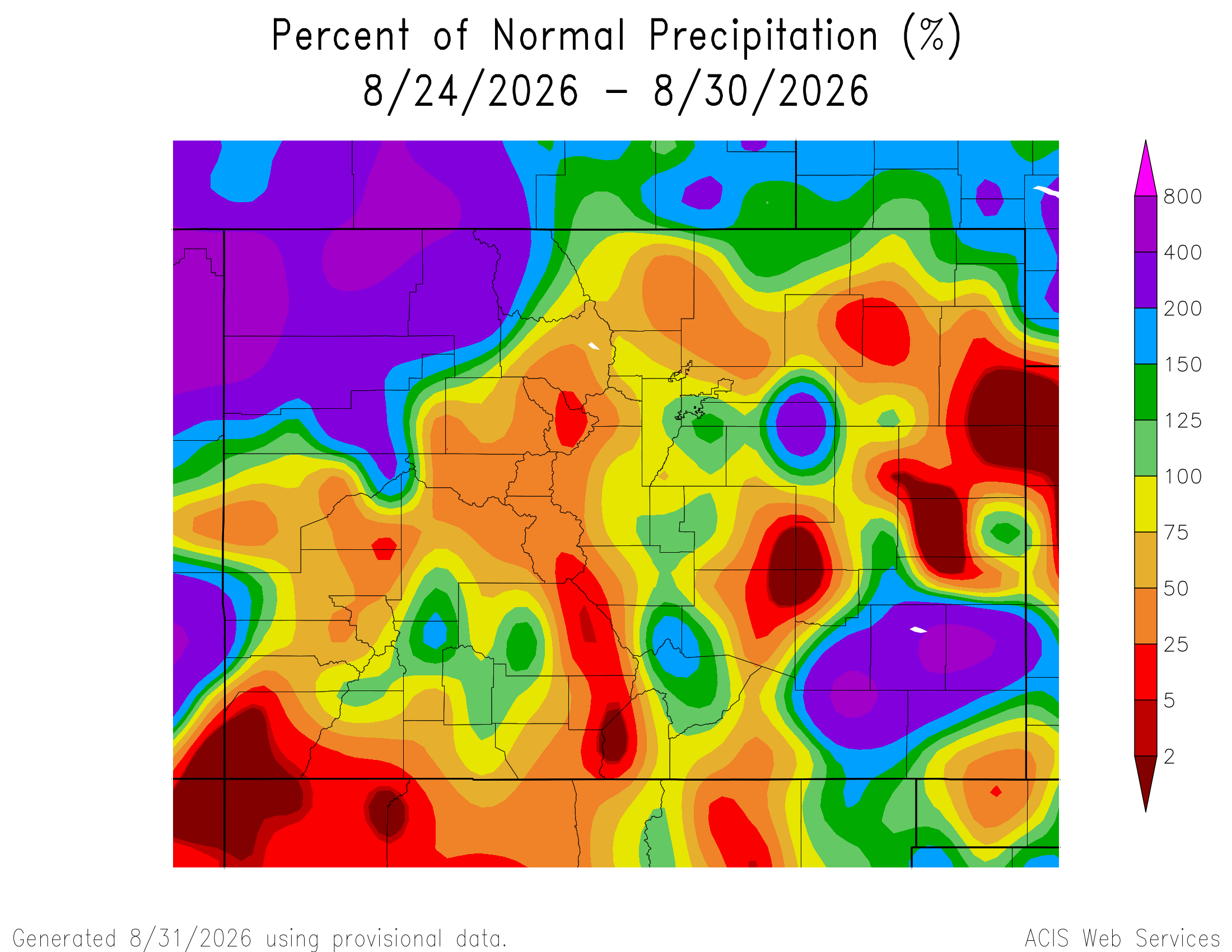
Here’s the 7-Day percent of normal precipitation map through August 30, 2026 from the High Plains Regional Climate Center. Precipitation in the South Platte River Basin along the Continental Divide of the Americas was 5% to 125% of normal.
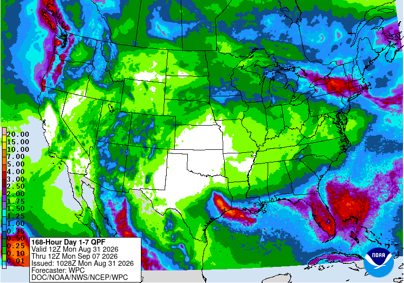
Below is the 7-day Quantitative Precipitation Forecast for the week of August 31, 2026. Precipitation is anticipated for the mountains of the South Platte River Basin and may total up to 0.50″.
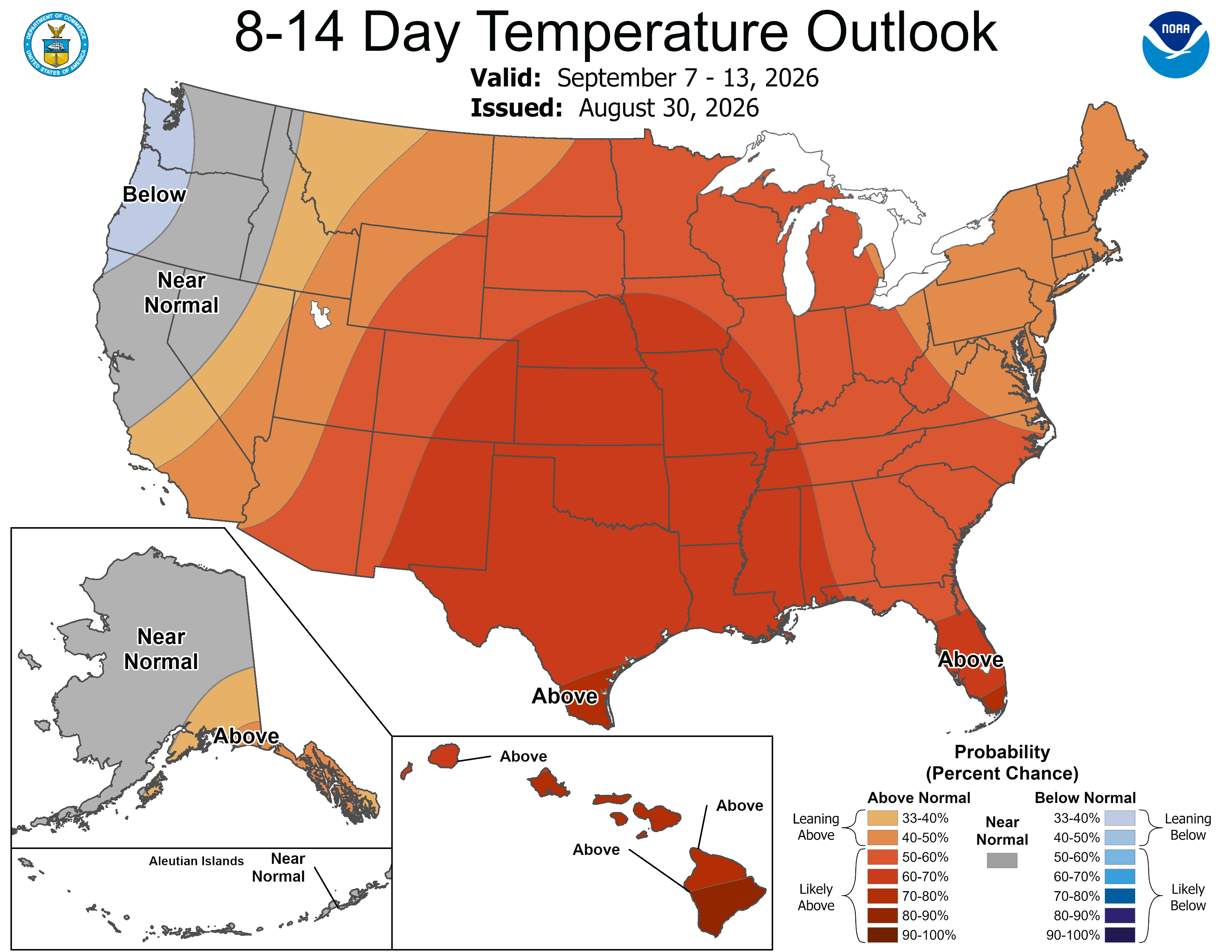
Below are the 8-14 day outlooks from the Climate Prediction Center, issued August 30, 2026, for temperature and precipitation, for the week starting September 7, 2026. The CPC expects above normal temperatures and above normal precipitation for the mountains of the South Platte River Basin.

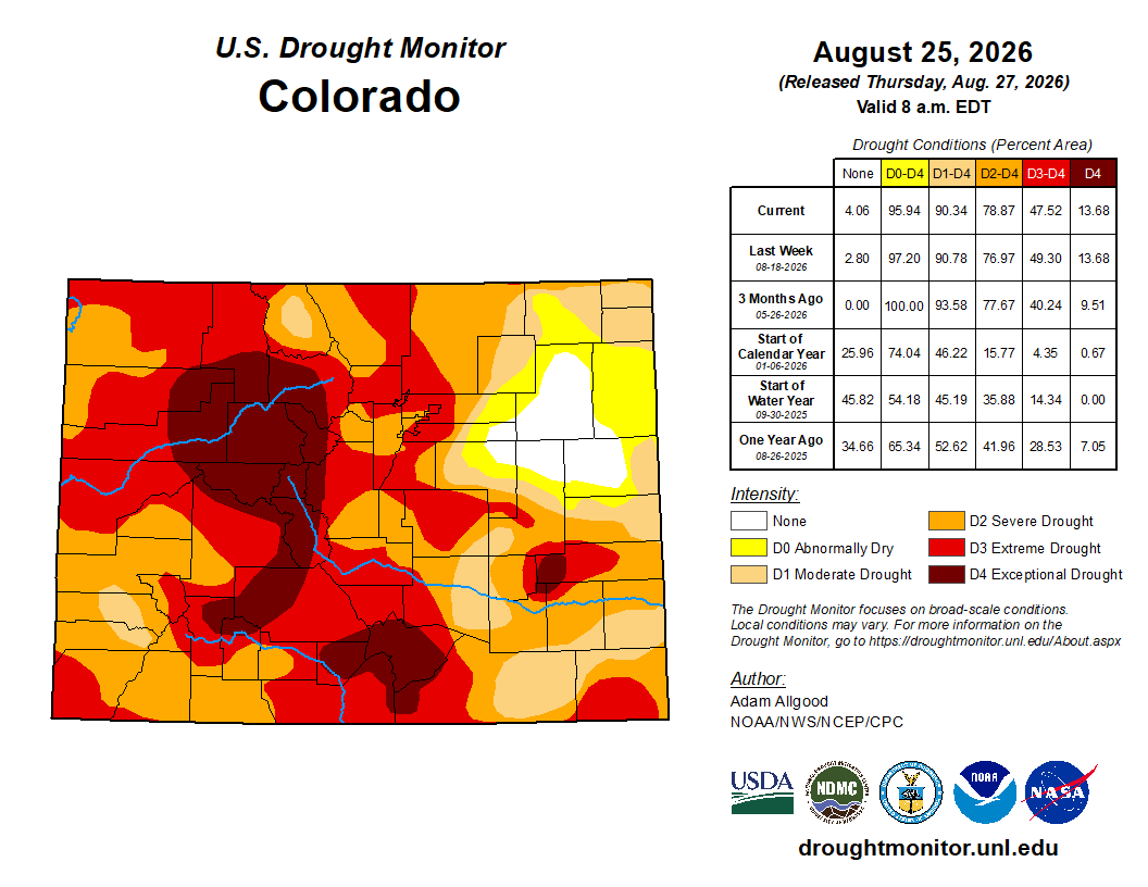
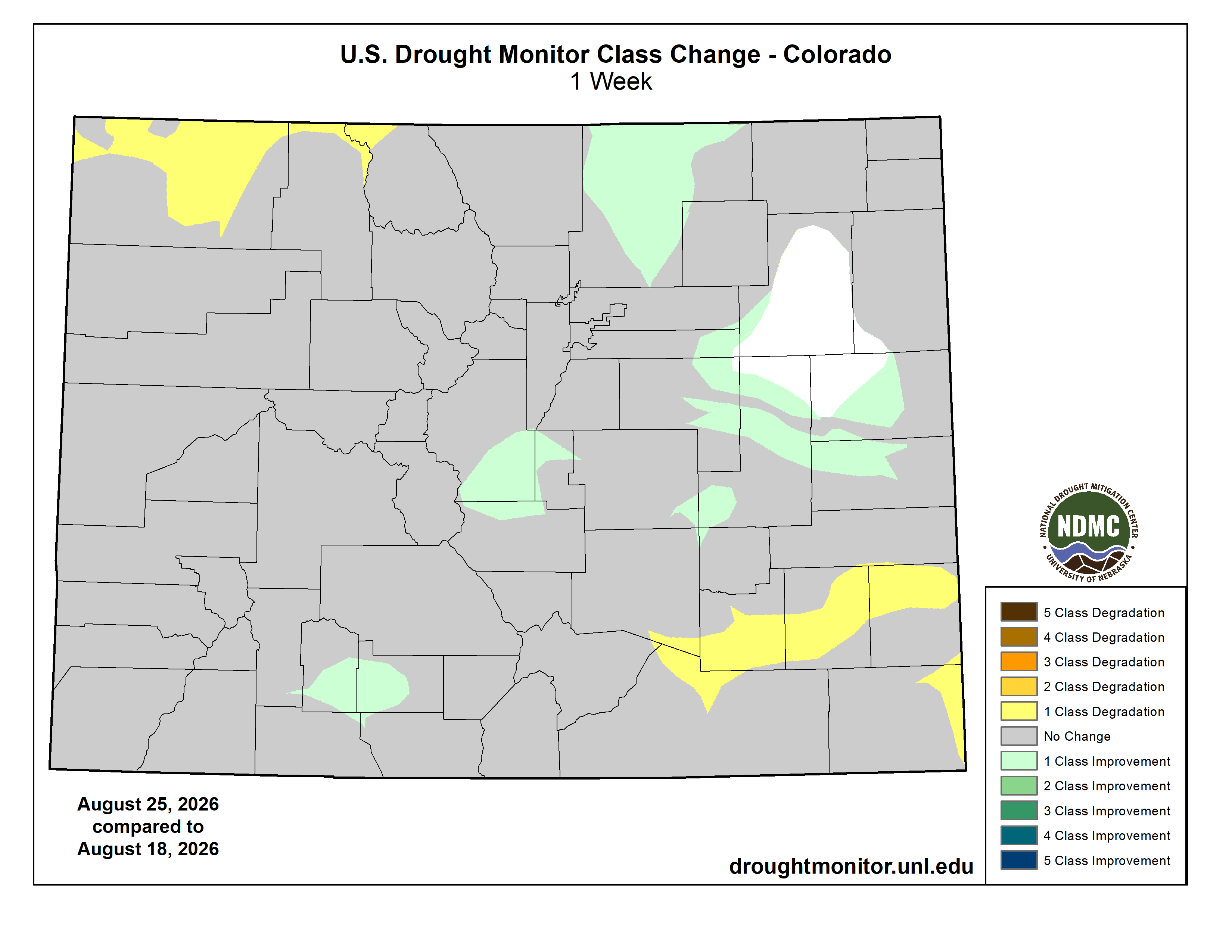
Below is the Colorado Drought Monitor map from August 25, 2026. There were one class improvements in Park, Weld, and Morgan counties. Drought and abnormal dryness covers 95.94% of Colorado. The South Platte Basin is experiencing Abnormally Dry, Moderate, Severe, Extreme, and Exceptional drought conditions.
Below is the Colorado Drought Monitor one week change map ending August 25, 2026.
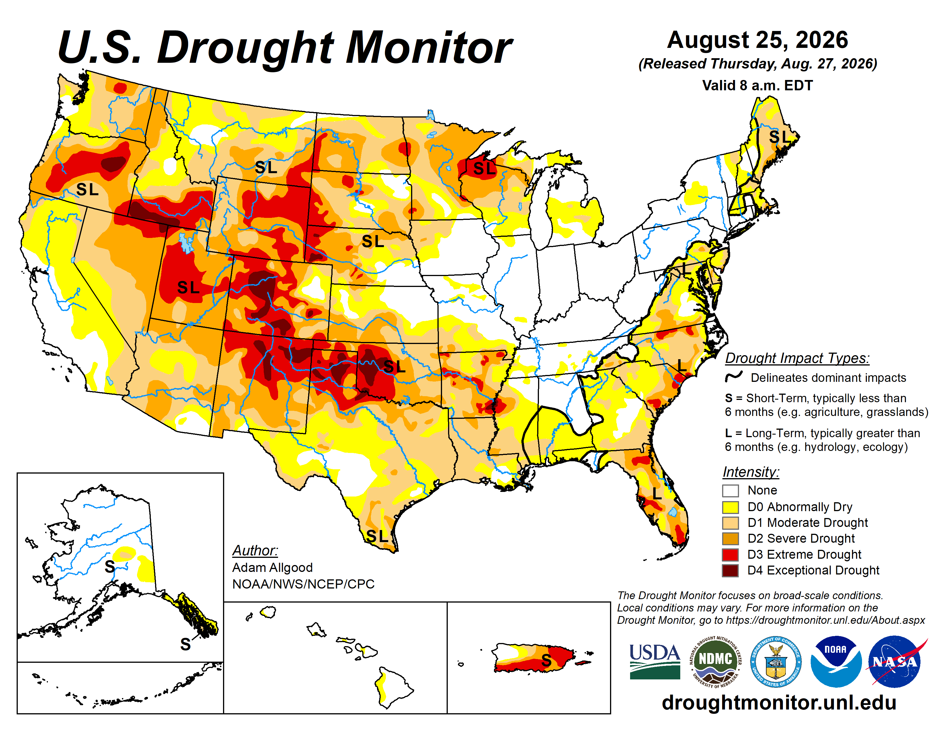
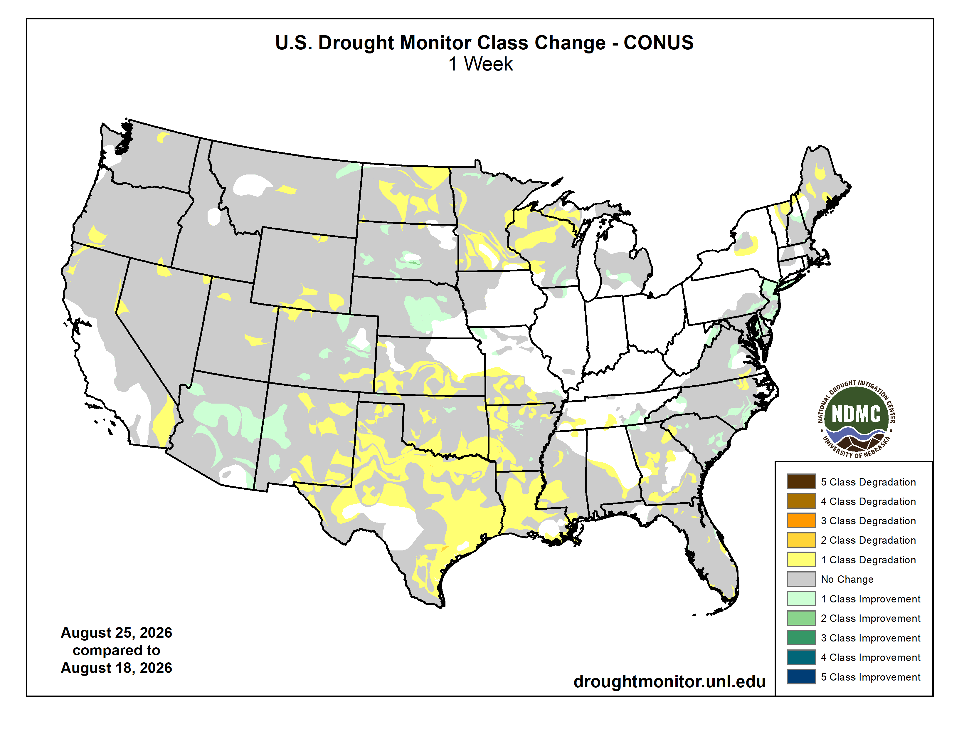
Here’s the US Drought Monitor Map from last week along with the one week U.S. change map.
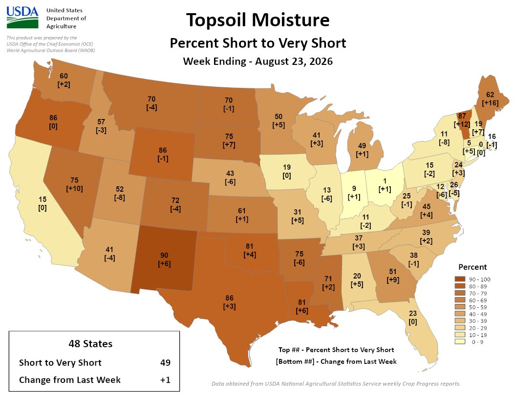
Finally, here’s the Topsoil Moisture Percent Short to Very Short map for the week ending August 23, 2026 from the USDA:
49% of the Lower 48 is short/very short, a 1% increase from last week. Highest short/very topsoil spans parts of the West, Plains, South, and Northeast, led by NM at 90%; VT at 87%; OR, WY, and TX at 86%; and LA and OK at 81%