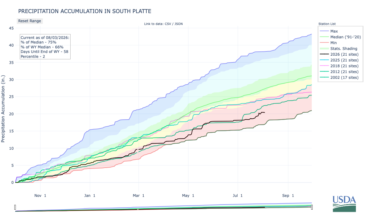
Below is the Precipitation Accumulation in South Platte graph from the NRCS for August 3, 2026. This morning precipitation is at 75% of the median (down 1% one week), and 66% of the water year median (up 1% one week). There are 58 days left in the water year.
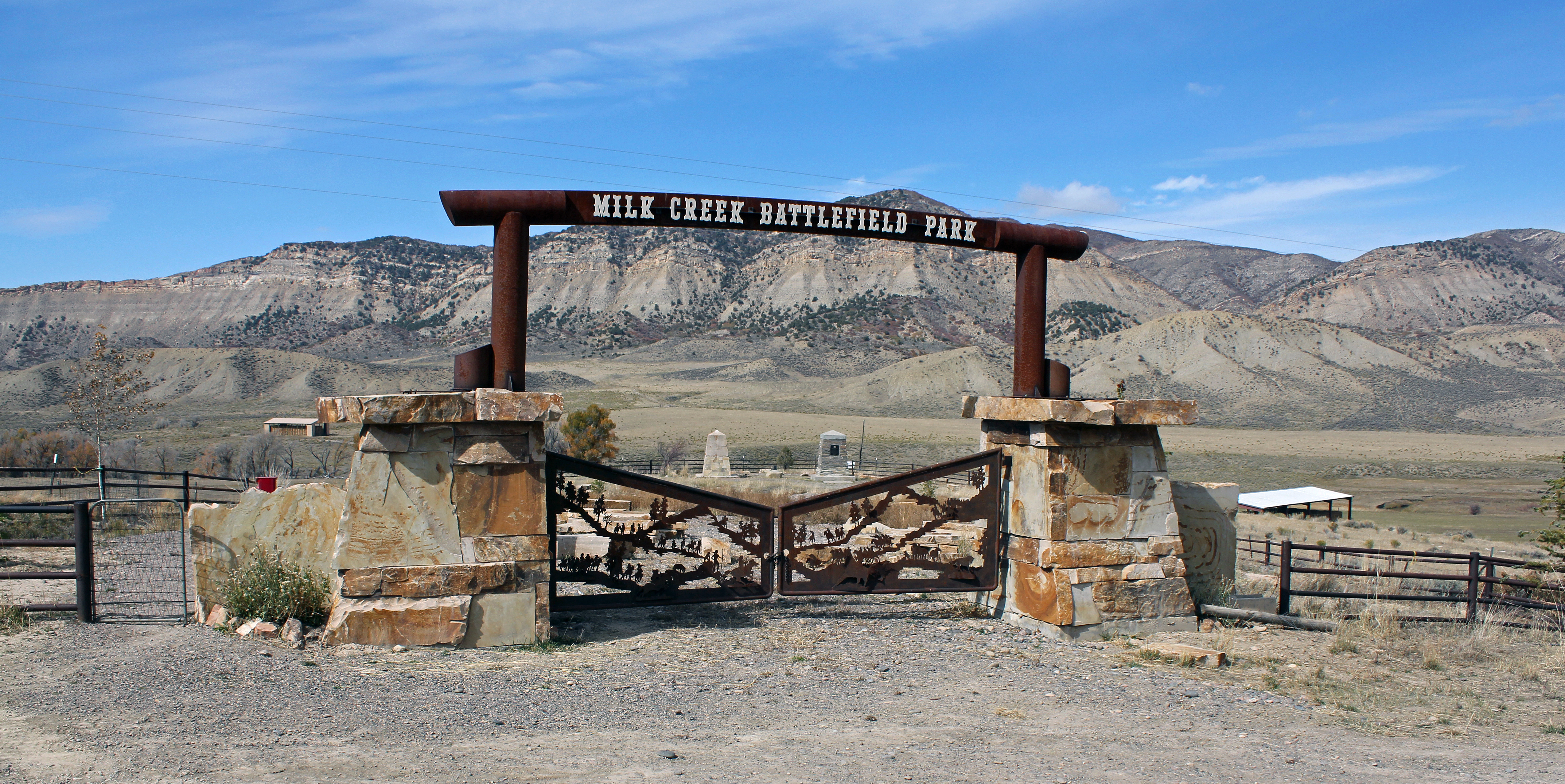
There is a chance for showers today, a chance for Thunderstorms Tuesday, then a chance for showers and thunderstorms Sunday in the central mountains. There is a chance for thunderstorms today and Tuesday, with a slight chance for showers and thunderstorms Sunday in the northern mountains. There is a slight chance for thunderstorms today and Tuesday, down here, about 227 miles from the Battle of Milk Creek Park near Meeker. The location is the site of the Battle of Milk Creek where Ute Indians ambushed U.S. troops led by MajorThomas T. Thornburgh, 18 miles (29 km) north of present day Meeker, Colorado. From Wikipedia:
Major Thomas T. Thornburgh led a command of 153 soldiers, and twenty-five militiamen, to the White River Indian Agency from Fort Steele on September 21, 1879, in response to a request for assistance by the Nathan C. Meeker, U.S. Government Indian Agent…On September 29, 1879, Ute warriors simultaneously ambushed Thornburgh’s forces and, at the Indian Agency, killed Meeker and Meeker’s employees. Ute warriors, led by Chief Colorow, attacked Thornburgh’s forces at Milk Creek on the northern edge of the reservation, about 18 miles from the White River Indian Agency. Within a few minutes, Major Thornburgh and 13 men were killed, including all his officers above the rank of captain. Another 28 men were wounded. Three-quarters of the horses and mules were killed at leisure by the surrounding Utes…Surviving troops dug in behind the wagon trains and animals’ bodies for defense. One man rode hard to get out a request for reinforcements. The US forces held out for several days…The troops were reinforced by 35 African-American cavalrymen known as Buffalo Soldiers from the 9th Cavalry at Fort Lewis in southern Colorado…Larger U.S. Army relief columns were sent from two forts, Fort Steele and Fort D.A. Russell…Colonel Wesley Merritt commanded five columns of troops from the 5th Cavalry Regiment, or about 350 troops, who traveled by train and marched to reach the surviving forces on Milk Creek on October 5. By the time Colonel Merritt arrived, the Utes had already dispersed.


Here’s a look at the 7-Day Colorado precipitation map through July 31, 2026 from the High Plains Regional Climate Center (latest map available from HPRCC this morning). Precipitation in the South Platte Basin along the Continental Divide of the Americas ranged from 0.30” to 1.80”.

Here’s the 7-Day percent of normal precipitation map through July 30, 2026 from the High Plains Regional Climate Center (latest map available from HPRCC this morning). Precipitation in the South Platte River Basin along the Continental Divide of the Americas ranged from 130% to 300% of normal.

Below is the 7-day Quantitative Precipitation Forecast for the week of August 3, 2026. Precipitation is anticipated for the mountains of the South Platte River Basin and may total up to 0.10″.

Below are the 8-14 day outlooks from the Climate Prediction Center, issued August 2, 2026, for temperature and precipitation, for the week starting August 10, 2026. The CPC expects above normal temperatures and above normal precipitation for the mountains of the South Platte River Basin.


Below is the Colorado Drought Monitor map from June 28, 2026. There was a small one class improvement in Elbert County. Drought and abnormal dryness covers 97.50% of Colorado. The South Platte Basin is experiencing Abnormally Dry, Moderate, Severe, Extreme, and Exceptional drought conditions.
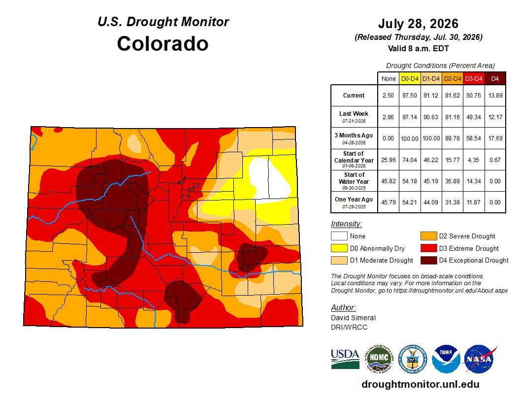
Below is the Colorado Drought Monitor one week change map ending July 28, 2026.

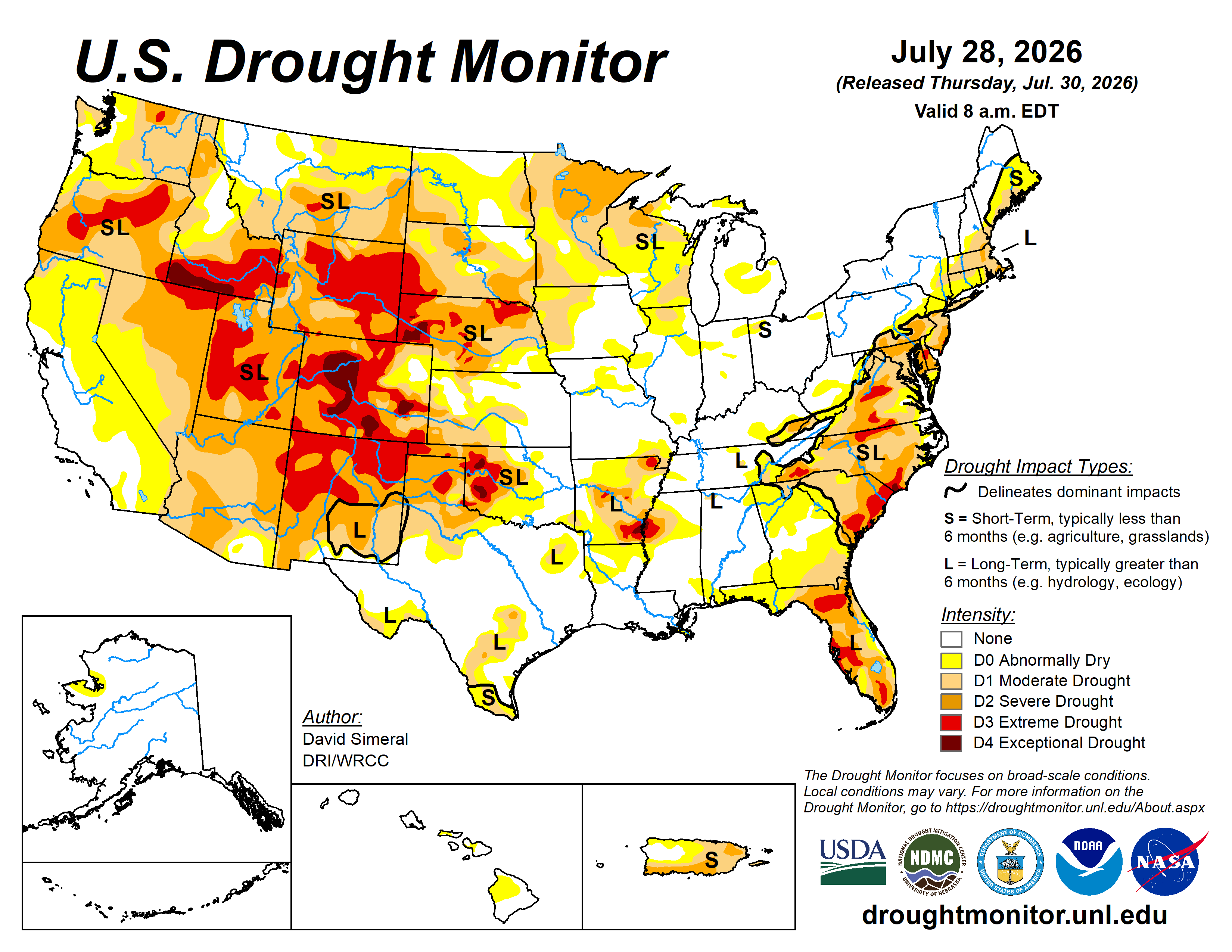
Here’s the US Drought Monitor Map from last week along with the one week U.S. change map.

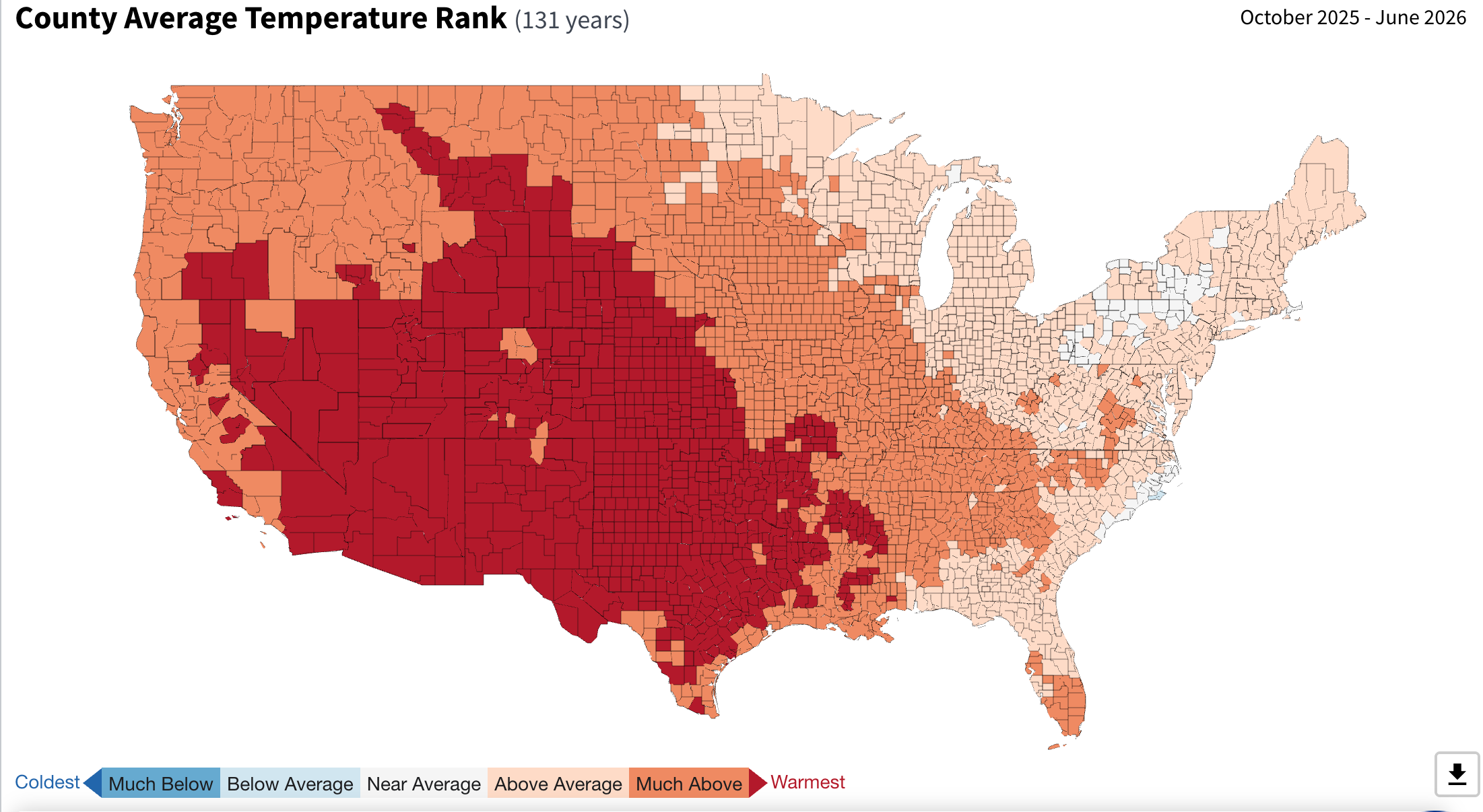
Finally, here’s a map showing the effect on temperature from fossil fuel combustion and methane venting for the 9-month period from October 2026 through June 2026.