US military bases teem with #PFAS. There’s still no firm plan to clean them up — Grist

Petersen Air Force Base. Photo credit: Peterson Air and Space Museum

Click the link to read the article on the Grist website (Sachi Kitajima Mulkey):

April 29, 2024

Excessive levels of PFAS have been detected at 80 percent of active and decommissioned military bases.

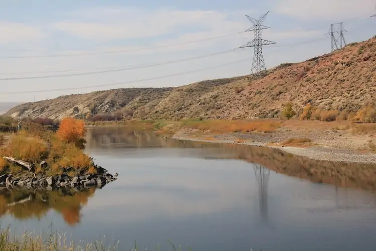
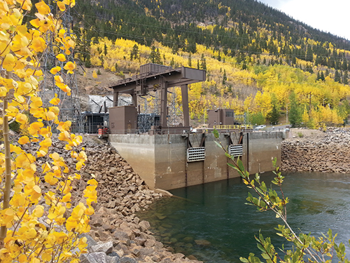
In 2016, Tony Spaniola received a notice informing him that his family shouldn’t drink water drawn from the well at his lake home in Oscoda, Michigan. Over the course of several decades, the Air Force had showered thousands of gallons of firefighting foam onto the ground at Wurtsmith Air Force Base, which closed in 1993. Those chemicals eventually leached into the soil and began contaminating the groundwater.

Alarmed, Spaniola began looking into the problem. “The more I looked, the worse it got,” he said. Two years ago,  his concern prompted him to co-found the Great Lakes PFAS Action network. The coalition of residents and activists is committed to making polluters, like the military and a factory making waterproof shoes, clean up the “forever chemicals” they’ve left behind.

PFAS, or per- and polyfluoroalkyl substances, are a class of nearly 15,000 fluorinated chemicals used since the 1950s to make clothing and food containers, among other things, oil- and water-repellent. They’re also used in firefighting foam. These chemicals do not break down over time, and have contaminated everything from drinking water to food. Research has linked them to cancer, heart and liver problems, developmental issues, and other ailments.

The U.S. Department of Defense, or DOD, is among the nation’s biggest users of firefighting foam and says 80 percent of active and decommissioned bases require clean up. Some locations, like Wurtsmith, recorded concentrations over 3,000 times higher than what the agency previously considered safe.

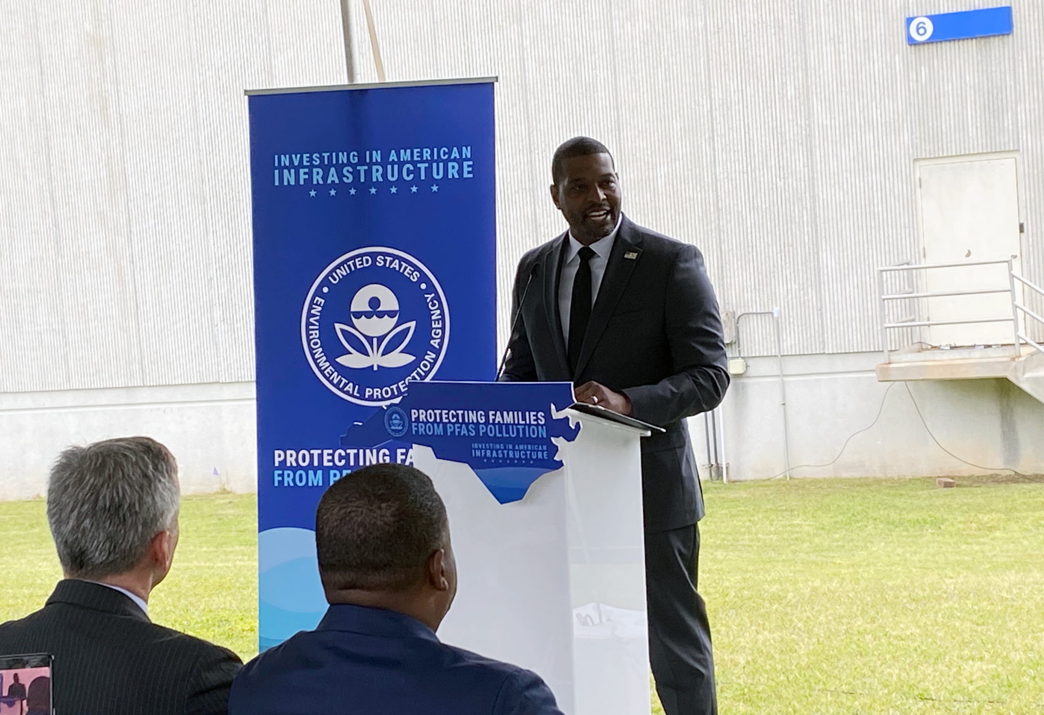
Today, the EPA considers it unsafe to be exposed to virtually any amount of PFOA and PFOS, two of the most harmful substances under the PFAS umbrella. Earlier this month, it implemented the nation’s first PFAS drinking water regulations, which included capping exposure to them at the lowest detectable limit. As of April 19, the agency also designated these two compounds “hazardous substances” under the federal Superfund law, making it easier to force polluters to shoulder the costs of cleaning them up. 

Meeting these regulations means that almost all of the 715 military sites and surrounding communities under Defense Department investigation for contamination will likely require remediation. Long-standing cleanup efforts at more than 100 PFAS contaminated bases that are already designated Superfund sites, like Wurtsmith, reveal some of the challenges to come.

“The heart of the issue is, how quickly are you going to clean it up, and what actions are you going to take in the interim to make sure people aren’t exposed?” said Spaniola.

A sign warning hunters not to eat deer because of high amounts of toxic PFAS chemicals in their meat, in Oscoda, Michigan. Drew YoungeDyke, National Wildlife Federation

In a statement to Grist, the DOD says its plan is to follow a federal clean up law called the Comprehensive Environmental Response, Compensation, and Liability Act, or CERCLA, to investigate contamination and determine near- and long-term clean up actions based on risk. But many advocates, including Spaniola, say the process is too slow and that short-term fixes have been insufficient. 

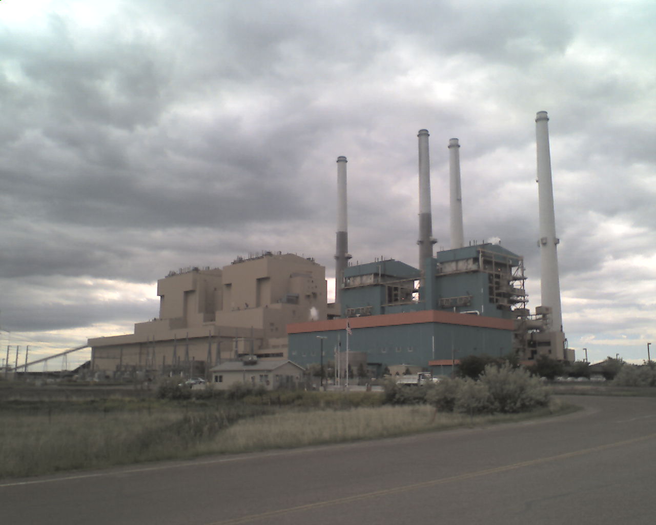
The problem started decades ago. In the 1960s, the Defense Department worked with 3M, one of the largest manufacturers of PFAS chemicals, to develop a foam called AFFF that can extinguish high-temperature fires. The PFAS acts as a surfactant, helping the material spread more quickly. By the 1970s, every military base, Navy ship, civilian airport, and fire station regularly used AFFF. 

Firefighting foam containing PFAS chemicals is responsible for contamination in Fountain Valley. Photo via USAF Air Combat Command

In the decades that followed, millions of gallons flowed into the environment. According to the nonprofit Environmental Working Group, or EWG, 710 military sites throughout the country and its territories have known or suspected PFAS contamination. Internal studies and memos show that not long after 3M and the US Navy patented the foam in 1966, 3M learned that its PFAS products could harm animal test subjects and accumulated in the body. 

In a 2022 Senate committee hearing, residents from Oscodatestified about the health impacts, such as tumors and miscarriages, from the PFAS contamination at Wurtsmith. In 2023, Michigan reached a settlement after suing numerous manufacturers, including 3M and Dupont. Today, thousands of victims across the country are suing the chemical’s manufacturers. While some organizations and communities have tried to hold the military financially responsible for this pollution — farmers in several states recently filed suits in the U.S. District Court in South Carolina to do just that — the DOD says it’s not legally liable.

Congressional pressure on the Pentagon to clean these sites has been growing. In 2020, National Defense Authorization Acts required it to phase out PFAS-laden firefighting foam by October, 2023. Since passing that law, Congress has also ordered the department to publish the findings of drinking and groundwater tests on and around bases.

Results showed nearly 50 sites with extremely high levels of contamination, and hundreds more with levels above what was then the EPA’s health advisory. Following further congressional pressure, the military announced plans to implement interim clean-up measures at three dozen locations, including a water filtering system in Oscoda.

According to a report by the Environmental Working Group, it took an average of nearly three years for the Department of Defense to complete testing at these high-contamination sites. It took just as long to draft stopgap cleanup plans. Today, 14 years after PFAS contamination was discovered at Wurtsmith, the first site to be tested, no site has left the “investigation” phase, and there has yet to be a comprehensive plan to begin permanent remediation on any base.

The Department of Defense says any site found to have PFAS contamination exceeding the Environmental Protection Agency’s previous guideline of 70 parts per trillion will receive immediate remediation, such as bottled waters and filters on faucets. When a site is found to be contaminated, the EPA says, the department has 72 hours to provide residents with alternate sources of water.

After six years spent working with various clean up initiatives, Spaniola says waiting for the military to take action has taken a toll on the people of Oscoda. “The community had a really good relationship with the military,” he said. “I’ve watched that change from a very trusting relationship to a terrible one.” 

Dozens of states have mandated additional requirements to treat PFAS in municipal water systems, but such efforts often overlook private well owners. That’s leaving thousands of people at risk, given that in Michigan, where some 1.5 million people drink water from contaminated sources, 25 percent of residents rely on private wells.  

Nationwide, the Environmental Working Group found unsafe water in wells near 63 military bases in 29 states. While the DOD has tested private wells, it has not published the total number of wells tested or identified which of them need to be cleaned up. 

Typical water well

“For those who are on well water, it’s a real problem until there’s a bit of recognition for some sort of responsibility for the contamination,” said Daniel Jones, associate director of the Michigan State University Center for PFAS Research. He is advising cleanup efforts near Grayling, Michigan. “It sort of comes down to who has pockets deep enough to pay for the things that need to be done.”

The EPA’s recent decision to designate PFOA and PFOS “hazardous substances” under the federal Superfund law is unlikely to provide quick financial assistance to communities, even though the agency has made $9 billion available for private well owners and small public water systems to address contamination. Whether that support reaches private well owners is up to individual states, which can work with regional EPA offices to draft project plans before applying for grants to secure funding.

The agency has established a five-year window for water systems to test for PFAS and install filtering equipment before compliance with the newly tightened levels will be enforced. While EPA says the new PFOA and PFOS regulations do not immediately trigger an investigation or qualify them as Superfund sites on the National Priorities List, decisions for each site will be on a case-by-case basis.

“It is a tremendous win for public health, it is tremendously important and cannot cannot come soon enough, particularly for military communities who have been exposed for decades,” said Melanie Benesh, vice president of governmental affairs at the Environmental Working Group. Benesh hopes that the new rules help push the Defense Department to move more quickly.

PFAS contamination in the U.S. October 18, 2021 via ewg.org.

#Wyoming Governor Gordon promises to sue after Environmental Protection Agency moves to slash #coal emissions — @WyoFile #ActOnClimate

Ceremonial shovels mark the location of the Innovation Center coal refinery field demonstration project north of Gillette on Sept. 2, 2022. It will be co-located with Atlas Carbon’s facility that produces activated carbon products. (Dustin Bleizeffer/WyoFile)

Click the link to read the aricle on the WyoFile website (Dustin Bleizeffer):

April 26, 2024

Biden administration’s suite of coal pollution rules a win for climate and health, advocates say, but a major blow to one of Wyoming’s bedrock economic drivers.

Gov. Mark Gordon has promised to sue over a new suite of federal rules that most observers agree will hasten the U.S. thermal coal industry’s trajectory toward extinction — an existential threat to many Wyoming communities and one of the state’s main economic drivers.

The U.S. Environmental Protection Agency on Thursday issued four “final” rules aimed at drastically cutting coal pollution, including a mandate that existing coal-fired power plants cut or capture 90% of their planet-warming carbon dioxide emissions by 2032 or convert to natural gas or close altogether. The agency’s other rules set timelines for significant cuts to smokestack emissions of mercury and other toxic metals, polluted wastewater from coal power plants and more stringent standards for coal ash disposal.

The “power plant” rules make good on President Joe Biden’s promise to address human-caused climate change, according to the EPA. The actions are also intended to help curtail illness and premature deaths from coal pollution while providing a clear regulatory framework for utilities to shift to renewable sources of energy.

The agency also noted that it consulted with coal-reliant utilities about their existing plans regarding coal facilities and crafted the implementation schedules to allow for planning that avoids electrical power supply issues.

Gov. Mark Gordon and U.S. Environmental Protection Agency Administrator Michael Regan held a joint press conference at the University of Wyoming on August 9, 2023. (Dustin Bleizeffer/WyoFile)

“By developing these standards in a clear, transparent, inclusive manner, EPA is cutting pollution while ensuring that power companies can make smart investments and continue to deliver reliable electricity for all Americans,” EPA Administrator Michael S. Regan said in a prepared statement.

Coal proponents in Wyoming are furious. 

This graph shows the globally averaged monthly mean carbon dioxide abundance measured at the Global Monitoring Laboratory’s global network of air sampling sites since 1980. Data are still preliminary, pending recalibrations of reference gases and other quality control checks. Credit: NOAA GML

While the rules target coal-fueled power plants, they also put Wyoming coal mines on notice: Their already waning U.S. customer base has an expiration date.

“It is clear the only goal envisioned by these rules released by the Environmental Protection Agency today is the end of coal communities in Wyoming,” Gordon said in a prepared statement Thursday. “EPA has weaponized the fear of climate change into a crushing set of rules that will result in an unreliable electric grid, unaffordable electricity and thousands of lost jobs.”

The Wyoming Mining Association also discounted climate change as an excuse to attack the coal industry. 

“Wyoming is once again the sacrificial lamb on the altar of the climate change cult,” the association’s Executive Director Travis Deti said. 

The rules

The carbon dioxide emissions rule applies to coal-fired power plants as well as new natural gas-fired facilities, requiring them to prevent at least 90% of greenhouse gasses from entering the atmosphere. 

“Existing coal-fired power plants are the largest source of [greenhouse gas] from the power sector,” the EPA stated in the rule. “New natural gas-fired combustion turbines are some of the largest new sources of [greenhouse gas] being built today, and these final standards will ensure that they are constructed to minimize their [greenhouse gas] emissions.” 

The rule updating Mercury and Air Toxics Standards tightens emissions by about 70%, an especially significant reduction for plants that burn lignite — a lower-value coal than Wyoming’s subbituminous product — according to the agency.

Coal-fueled power plants will also be required to reduce various “pollutants” associated with wastewater by more than 660 million pounds annually, and follow more stringent standards to prevent leaks at coal-ash storage facilities.

Implications for Wyoming

Wyoming remains the nation’s largest coal producer, although production has plummeted by nearly half since 2008, with companies shipping some 237 million tons in 2023, according to the Wyoming State Geological Survey. More than 90% of coal mined in the state is sold to power plants in the U.S., which is why it’s often referred to as “thermal coal” — unlike “metallurgic coal” that is sold to steel manufacturers.

Wyoming coal production has decreased by nearly half since 2008. (University of Wyoming)

Coal mining contributed some $650 million in taxes, royalties and fees to the state in 2019 and employed more than 5,000 workers, according to the Wyoming Mining Association.

The vast majority of coal mining occurs in the Powder River Basin in the northeast corner of the state, while several communities host nearby coal-fired power plants: Gillette, Glenrock, Wheatland, Kemmerer and Rock Springs.

Although Wyoming has experienced declines in both coal production and coal-fired power, the industry still serves as a major economic backbone for the state — and a significant source of government revenue. The potential loss of coal-fired power facilities is an especially daunting prospect for nearby communities.

Those communities have wrestled with the knowledge of potential plant closures for a long time already, and the EPA’s new rules only serve to clarify that potential reality, said Robert Godby, associate professor at the University of Wyoming’s Economics Department.

“It really just kind of steepens the glide path to what we all knew was happening anyway,” he told WyoFile on Friday. 

Explosive materials are loaded into a “blast hole” at a coal mine. (Dyno Nobel)

The new rules are likely to be challenged in court, not only by Wyoming, but also by other coal-reliant states, Godby said. Politics will also continue to play a role — particularly if a Republican wins the presidential election this year. He noted, however, that former President Donald Trump was not able to make good on a promise to turn around the coal industry’s decline.

Regardless, utilities are under increasing pressure to make long-term investment decisions in a quickly changing energy environment, and the EPA’s actions this week diminish the likelihood that they’ll find the regulatory certainty needed to invest in coal-fueled power.

“It makes it more likely they’re going to retire [coal plants] and announce firm dates,” Godby said. “That’s going to create more certainty for the communities that are affected.”

Meantime, Gordon, who has touted technologies to reduce carbon dioxide from coal power plants, has vowed to fight the rules.

“These rules are a travesty, and their effects are devastating,” Gordon said. “I have directed the Wyoming Attorney General to engage with and lead a coalition of states to challenge the power plant emissions rule, and we are prepared to apply our litigation strategy to the oncoming wave of federal regulatory actions that threaten Wyoming.”

The University of Wyoming’s School of Energy Resources, and its partners, are advancing multiple CO2 capture and sequestration demonstration projects at Basin Electric’s Dry Fork Station north of Gillette, seen here on Sept. 2, 2022. (Dustin Bleizeffer/WyoFile)

#Snowpack news April 29, 2024

Colorado snowpack basin-filled map April 29, 2024 via the NRCS.
Westwide SNOTEL basin-filled map April 29, 2024 via the NRCS.

Trump will dismantle key US weather and science agency, climate experts fear: Plan to break up NOAA claims its research is ‘climate alarmism’ and calls for commercializing forecasts, weakening forecasts — The Guardian #ActOnClimate

Meteorologists preparing a forecast, early 20th century. By NOAA Photo Library – wea01302, Public Domain, https://commons.wikimedia.org/w/index.php?curid=17970931

Click the link to read the article on The Guardian website (Dharna Noor). Here’s an excerpt:

April 26, 2024

Climate experts fear Donald Trump will follow a blueprint created by his allies to gut the National Oceanic and Atmospheric Administration (Noaa), disbanding its work on climate science and tailoring its operations to business interests…The plan to “break up Noaa is laid out in the Project 2025 document written by more than 350 rightwingers and helmed by the Heritage Foundation. Called the Mandate for Leadership: The Conservative Promise, it is meant to guide the first 180 days of presidency for an incoming Republican president. The document bears the fingerprints of Trump allies, including Johnny McEntee, who was one of Trump’s closest aides and is a senior adviser to Project 2025. “The National Oceanographic [sic] and Atmospheric Administration (Noaa) should be dismantled and many of its functions eliminated, sent to other agencies, privatized, or placed under the control of states and territories,” the proposal says…

That’s a sign that the far right has “no interest in climate truth”, said Chris Gloninger, who last year left his job as a meteorologist in Iowa after receiving death threats over his spotlighting of global warming…The guidebook chapter detailing the strategy, which was recently spotlighted by E&E News, describes Noaa as a “colossal operation that has become one of the main drivers of the climate change alarm industry and, as such, is harmful to future US prosperity”. It was written by Thomas Gilman, a former Chrysler executive who during Trump’s presidency was chief financial officer for Noaa’s parent body, the commerce department…

Gilman writes that one of Noaa’s six main offices, the Office of Oceanic and Atmospheric Research, should be “disbanded” because it issues “theoretical” science and is “the source of much of Noaa’s climate alarmism”. Though he admits it serves “important public safety and business functions as well as academic functions”, Gilman says data from the National Hurricane Center must be “presented neutrally, without adjustments intended to support any one side in the climate debate”. But Noaa’s research and data are “largely neutral right now”, said Andrew Rosenberg, a former Noaa official who is now a fellow at the University of New Hampshire. “It in fact basically reports the science as the scientific evidence accumulates and has been quite cautious about reporting climate effects,” he said. “It’s not pushing some agenda.”

[…]

Noaa also houses the National Weather Service (NWS), which provides weather and climate forecasts and warnings. Gilman calls for the service to “fully commercialize its forecasting operations”. He goes on to say that Americans are already reliant on private weather forecasters, specifically naming AccuWeather and citing a PR release issued by the company to claim that “studies have found that the forecasts and warnings provided by the private companies are more reliable” than the public sector’s. (The mention is noteworthy as Trump once tapped the former CEO of AccuWeather to lead Noaa, though his nomination was soon withdrawn.) The claims come amid years of attempts from US conservatives to help private companies enter the forecasting arena – proposals that are “nonsense”, said Rosenberg. Right now, all people can access high-quality forecasts for free through the NWS. But if forecasts were conducted only by private companies that have a profit motive, crucial programming might no longer be available to those in whom business executives don’t see value, said Rosenberg.

Specially designed hurricane-proof building constructed to house joint offices of the Houston-Galveston National Weather Service Forecast Office and the Galveston County Emergency Management Office. By Nsaum75 at en.wikipedia, CC BY-SA 3.0, https://commons.wikimedia.org/w/index.php?curid=8895755

Good News from the Clean Energy Beat: #Solar for All! Clean Energy Powers California! — Jonathan P. Thompson (LandDesk.org) #ActOnClimate

Photo credit: Jonathan P. Thompson

Click the link to read the article on The Land Desk website (Jonathan P. Thompson):

April 26, 2024

😀 Good News Corner 😎

Now this is what I’m talking about: Last week, the Biden administration forked out $7 billion to states, tribal nations, and non-profits to carry out its Solar for All program aimed at expanding rooftop and residential solar and energy storage access to low-income folks and other underserved communities.  About $1.7 billion of that cash will go to the West (see breakdown below). This is what I call a win-win-win-win situation:

  • Win 1 = It will add more solar power to the nation’s energy mix, hopefully displacing some fossil fuel generation, which will result in cleaner air and fewer greenhouse gas emissions.
  • Win 2 = This added solar will be on rooftops or vacant lots in or near towns or cities, reducing the need to blanket the desert with photovoltaics, which can be hugely destructive to ecosystems and wildlife habitat. 
  • Win 3 = Rooftop and community-level solar installations will increase residents’ self-sufficiency and reduce dependency on the grid, which is becoming less and less reliable as more frequent and severe extreme weather events damage infrastructure and utilities are forced to shut off power to reduce wildfire hazard. Plus, many homes that lack access to electricity, especially on tribal lands, will now have power. 
  • Win 4 = This program has the potential to radically transform the residential solar landscape, redistributing this exclusive amenity now reserved to homeowners who can afford to spend tens of thousands of dollars upfront on a solar system, to, well, all of us, including renters. 

Recipients include:

  • Colorado Energy Office: $156 million for single-family and multifamily rooftop solar statewide. 
  • New Mexico Energy, Minerals, & Natural Resources Department: $156 million to “help overcome existing barriers to widespread adoption of distributed solar generation” by expanding access to shared solar beyond the new community solar program. 
  • Utah Office of Energy Development: $62 million to launch a new program to “strengthen the market for deploying residential-serving solar … for disadvantaged and low-income homes” 
  • Montana and Wyoming and Idaho, Bonneville Environmental Foundation: $131 million to “expand economic and environmental benefits of solar to low-income, tribal, and disadvantaged communities.” 
  • Colorado-based Oweesta Corporation: $156 million to “address adoption barriers to Native residential and community solar deployment” in tribal lands across the nation. 
  • Executive Office of the State of Arizona: $156 million to “bring the benefits of the state’s abundant solar resources to the state’s low-income and disadvantaged communities.” 
  • California Infrastructure Economic Development Bank: $250 million to reach “the homes and businesses statewide that are most in need of affordable, reliable clean energy.” 
  • Nevada Clean Energy Fund: $156 million 
  • Hopi Utilities Corporation: $25 million to deploy residential solar and storage systems on the Hopi Reservation, where 35% of households do not have electricity and those that do experience frequent and extended outages. 
  • GRID Alternatives (Western Indigenous Network Solar for All) $62 million. Provides grants and incentives and technical assistance to deploy tribal residential solar, prioritizing communities in Arizona, Colorado, Nevada, New Mexico, and Utah. 
  • Alaska Energy Authority, $62 million, to partner with Alaska Housing Finance Corporation to deploy solar photovoltaic infrastructure statewide. 
  • Oregon Department of Energy, $87 million 
  • Washington State Department of Commerce, $156 million 
  • Alaska, Tanana Chiefs Conference $62 million to provide tribal residents with residential and community solar. 

***

And the good news keeps a coming: Wind, solar, hydropower, and geothermal generation supplied more than 100% of California’s energy demand on 39 of 47 days this spring. It wasn’t all day, by any means, but anywhere from about 15 minutes on some days to just over nine hours on April 20. 

That is to say that a state of 39 million people, with one of the world’s largest economies, ran on non-fossil-fuel energy sources for more than nine hours. That’s a big deal. 

Sure, it was on a Saturday in spring, when power demand tends to be lower, and on 4/20, when I guess a lot of people might have been outside smoking dope, which may or may not have affected electricity use. And a small percentage of that power came from large hydropower dams, which have their own problems and which California does not apply toward its renewable portfolio standards. Still, it’s a milestone that wasn’t imaginable a couple of decades ago, when coal generation dominated the power grid and utility-scale solar and wind power barely registered.

Most of the power came from utility-scale solar installations (California grid operators don’t track rooftop solar output, but it contributed by reducing overall demand). In fact, the state’s collective solar systems not only met demand, but exceeded it enough to charge grid-scale batteries and still have enough left over to export to other states. On some days there was so much solar they had to curtail generation — or basically throw it away.

Here’s what it looked like:

Graphic credit: Jonathan P. Thompson/The Land Desk
The green line represents electricity demand for the day. Part of the reason it dips during the middle of the afternoon is because that’s when rooftop solar output is at its peak, and rooftop solar reduces grid demand since folks are using power from their own panels rather than taking it from the grid. Source: CAISO.

And then there’s the dreaded solar duck curve to deal with. This refers to the shape of the electricity net-demand graph on sunny days (net-demand is determined by subtracting solar and wind supply from demand since they aren’t “dispatchable” power sources). On a number of days this spring, solar output was so high that it pushed the net-demand curve down into negative territory in the middle of the day. The real problem’s start when the sun sets and solar output suddenly diminishes. The net-demand curve shoots back up, forcing grid operators to fire up natural gas generation to “follow the load,” or meet demand. 

But even that dynamic is changing as an ever-increasing amount of that late afternoon load spike is being met with power from grid-scale batteries that had been charging all day. On the evening of April 16, for example, another milestone was reached when battery storage discharge became the largest energy source on California’s grid, contributing nearly as much power as natural gas and nuclear generation combined for about an hour. Just this week, California announced it had surpassed 10,000 megawatts of battery storage capacity — a 1,250% increase from just five years ago. 

Batteries alone, however, won’t get California or the West to 100% clean energy. The region will also need more of what’s known as “geographic smoothing,” or moving power around the region to fill gaps left when wind and solar generation drop off. This might include sending Wyoming wind power to California when the sun stops shining, or shipping California solar to Colorado during the middle of the day. Achieving this will require better regional integration of the grid and power markets. Just yesterday the Biden administration announced a plan to spend $331 million to help build out transmission lines, an important step in realizing this goal.

Read more about the Duck Curve:

The Energy Transition and Public Lands, Part III — December 15, 2021.

A pronghorn hangs out among Wyoming wind turbines. Better integration of the Western grid would allow California and Arizona to draw on Wyoming wind to back up solar when the sun goes down. Jonathan P. Thompson photo.

A recap of Part I and Part II: Climate change is wreaking havoc on the electricity grid as extreme heat spurs an increase in demand for p…

Read full story

***

NEWS: Another proposed pumped hydropower storage project on the Navajo Nation bites the dust.

CONTEXT: One way to store energy is in batteries. Another way is with pumped hydropower facilities, usually consisting of two reservoirs, one above the other. Surplus power from the grid, usually generated by solar or wind during the day, is used to pump water from the lower to the upper reservoir. When the power is needed, such as when the sun sets and solar drops off, water is released from the upper reservoir and gravity propels it through a turbine that feeds electricity into the grid before emptying into the lower reservoir to begin the cycle anew.

It’s smart technology, capable of providing massive amounts of energy just when it’s needed. The problem is, these things require water, dams, reservoirs, pumping plants, and pipelines, all of which can have an impact. That means properly siting these facilities — and working with stakeholders before finalizing plans or applying for permits — is important. And, well, so far, a lot of developers haven’t done a great job with that, and now it’s biting them in the butt.

Confluence of the Little Colorado River and Colorado River; Credit: EcoFlight

A few months ago the Land Desk reported on federal regulators’ rejection of seven proposed pumped hydropower storage projects on the Navajo Nation, while also establishing a policy of denying any project on tribal land if the tribe opposes it. The regulators deferred a decision on one additional proposal — the massive, three-reservoir Big Canyon project that would be on Navajo Nation land along a tributary of the Little Colorado River. The Navajo Nation initially had expressed concerns about the proposal without explicitly opposing it. After the new policy was put in place, the tribe clarified its opposition. This week, the Federal Energy Regulatory Commission followed its new policy and rejected the permit.

It’s a bummer to see so many clean energy proposals go down in flames. Had they been built, the projects would have contributed mightily to the Western energy transition. Their failure, however, is not on the tribal nation or advocates who opposed the projects. The developers are to blame for faulty siting decisions and for failing to adequately consult with stakeholders at the very beginning of the process. That would save everyone a lot of headaches, and it might even result in some good projects getting built in the right places.

For more on the proposals and their problems, check out this excellent piece — complete with great maps — by the Grand Canyon Trust’s Daryn Akei Melvyn.

📸 Parting Shot 🎞️

Ute Mountain in the spring. Jonathan P. Thompson photo.

The #ColoradoRiver district kicks in more funds for study of reservoir project — The #GrandJunction Daily Sentinel #WhiteRiver #GreenRiver #COriver #aridification

A view looking down the Wolf Creek valley toward the White River. The proposed off-channel dam would stretch between the dirt hillside on the right, across the flat mouth of the valley, to the hillside on the left. CREDIT: BRENT GARDNER-SMITH/ASPEN JOURNALISM

Click the link to read the article on The Grand Junction Daily Sentinel website (Dennis Webb). Here’s an excerpt:

April 27, 2024

The Colorado River District has contributed $550,000 toward efforts to pursue permitting for a possible 66,720 acre-foot reservoir on a tributary of the White River in Rio Blanco County. The river district board recently approved the funding after approving a previous grant of $330,000 in 2021 to help with permitting efforts. The funding is coming from Community Funding Partnership money that is generated by a tax increase approved by voters in the 15-county district in 2020.

The Rio Blanco Water Conservancy District has been pursuing the project for more than a decade. In 2021, the Rio Blanco district and state Division of Water Resources reached an agreement averting a trial in water court and resulting in a decree giving the district the right to store 66,720 acre-feet of water for a number of uses. The Rio Blanco district’s preferred reservoir site would be on Wolf Creek, and the reservoir would be filled with water pumped from the White River. Among anticipated uses, it would supply water to the town of Rangely and to farmers and ranchers.

The river district board hasn’t taken a formal position on the project itself. But it approved the 2021 funding after district staff endorsed the need for an inclusive, collaborative permitting process, and for a robust review of alternatives and reservoir sizing that identified local water needs, according to a river district staff memo to the district’s board. The board also encouraged the Rio Blanco district at that time to seek more river district funding as the permitting process progressed.

While the Rio Blanco district, through a Bureau of Land Management process, completed the permitting work that the initial river district funding supported, the U.S. Army Corps of Engineers in January determined the project will require an individual Corps of Engineers permit, meaning more review will be needed. The Rio Blanco district spent about $3.25 million for permitting and pre-permitting work on the project from 2021-23. It has estimated that permitting will cost another $2.7 million through 2025, and other project expenses in 2024-25, such as design and engineering, will cost nearly $2 million. It had asked for $1.5 million from the river district in its latest request.

A #Nevada professor’s invention has steered Western water supply for more than 100 years — #Wyoming Public Media #snowpack

James Church in his office. Photo credit: The University of Nevada Reno

Click the link to read the article on the Wyoming Public Media website (Kaleb Roedel). Here’s an excerpt:

March 8, 2024

In the early 1900s, James Church was a professor at the University of Nevada, Reno. He taught classics, German and art history. Outside the classroom, he loved to be outside – in the mountains…That propelled Church and researchers from the Nevada Agricultural Experiment Station to build a weather observatory on the summit of Mt. Rose. Their goal was to better track snowfall and spring runoff data. In the process, Church developed and patented a snow tube he called the Mt. Rose sampler. It’s the device still used by Anderson and hydrologists around the world…Before Church created the Mt. Rose sampler, snowpack measurements focused on depth. His invention, however, showed how much water was in the snow and would end up in rivers and lakes…

Karl Wetlaufer (NRCS), explaining the use of a Federal Snow Sampler, SnowEx, February 17, 2017.

[Adrian] Harpold says the snow science pioneered by Church does more than help water managers predict summertime water supplies for cities and farmers. It also allows emergency managers to forecast floods and droughts, which are becoming more frequent and severe in a warming world.

“The value of that small piece of metal that he invented is probably literally billions of dollars over the last 100 years,” Harpold says…

Church’s groundbreaking work in the early 1900s became the backbone of water management in the West, says [Jeff] Anderson, adding that “by the ‘20s, which is only like 10 years after he developed the snow tubes, it already spread to other states across the West.” And in 1935, after a year of severe drought, the federal government created a Western snow survey and water supply forecasting program, based entirely on Church’s techniques…A century later, newer technologies can measure the amount of water in the snow crunching beneath my snowshoes. It can be done automatically at remote weather stations called SNOTEL sites.

SNOTEL automated data collection site. Credit: NRCS

Pagosa Paddle #whitewater races to be held May 11, 2024 — Friends of the Upper #SanJuanRiver

Near Pagosa Springs. Photo credit: Greg Hobbs

Click the link for all the inside skinny on the Friends of tthe Upper San Juan River website:

Saturday May 11, 2024

Pagosa Springs/San Juan River

 On Saturday May 11, the San Juan River will have a surge of boaters competing for cash and prizes during the annual Pagosa Paddle whitewater races.   Not up for paddling? Come out to cheer on these athletes as they go through the downtown water features that make up the whitewater park on the San Juan River through downtown Pagosa Springs.   Spectators can watch the action from above at the Overlook viewing point, alongside the almost famous river walk or from the healing waters at The Springs Resort.  We are collaborating again with  The Springs Resort during their Pints, Pools and Paddles event. All Pagosa Paddle participants will receive a FREE soaking pass and a tshirt. Even better, the first 25 athletes to register will receive  a full access pass to Pints, Pools and Paddles which means soaking and beer tasting after the race!!

RESERVE YOUR SPOT

Navajo Unit April Operations Meeting Minutes and Slides — Reclamation #SanJuanRiver #ColoradoRiver #COriver #aridification

Aerial view of Navajo Dam and Reservoir. Photo credit: USBR

From email from the Western Colorado Area Office:

April 26, 2024

Please see the links below for the Meeting Summary and Slides from the April Operations Meeting of the Navajo Unit. 

Meeting Summary: https://www.usbr.gov/uc/wcao/water/rsvrs/mtgs/pdfs/archives/nm2024_04.pdf

Meeting Slides: https://www.usbr.gov/uc/wcao/water/rsvrs/mtgs/pdfs/archives/nmho2024_01.pdf

Arizonans Celebrate #ColoradoRiver Tribes’ Landmark Water Agreement — #Arizona Department of Water Resources #COriver #aridfication

Amelia Flores, chairwoman of the Colorado River Indian Tribes. (Source: CRIT)

Click the link to read the article on the Arizona Department of Water Resources website:

April 26, 2024

Arizona’s Governor and ADWR Director joined with the Colorado River Indian Tribes and top federal officials on Friday in signing documents implementing an agreement allowing the tribes to market portions of their Colorado River allocation to water users off-reservation.

The signing event represents a critical step to implement the Colorado River Indian Tribes Water Resiliency Act of 2022.

Present at the event to execute the agreements at the Bluewater Resort on the CRIT reservation near Parker were Arizona Governor Katie HobbsU.S. Senator Mark Kelly of Arizona, as well as Secretary of the Interior Deb HaalandBureau of Reclamation Commissioner Camille Calimlim Touton and Tom Buschatzke, Director of the Arizona Department of Water Resources.

Both Governor Hobbs and Director Buschatzke participated in the signing ceremony.

In her remarks at the event, Governor Hobbs gave a gracious nod to Director Buschatzke “and your entire team” for the Department’s years of effort to help make the marketing agreements a reality.

From left: ADWR Director Tom Buschatzke, Bureau of Reclamation Commissioner Camille Calimlim Touton, and U.S. Sen. Mark Kelly. Photo credit: Arizona Department of Water Resources

“Director Buschatzke, I feel like this is the 100th time I’ve said this since I took office, but we are lucky to have you leading the Arizona Department of Water Resources and I want to thank you and your entire team who have spent years working on this,” the Governor said.

According to a statement released by the tribes, the agreements signed on Friday “will move CRIT one step closer to strengthening its sovereignty over its water resources to improve the lives of future generations of CRIT members while protecting the life of the river.”

Governor Hobbs observed that the agreements bring an end to “an outdated framework” that restricted the tribes from making choices about allocating their own water resources.

“The celebration today is the beginning of a new chapter for tribal sovereignty and self-determination, where tribal leaders have the freedom to manage their resources, and by extension, their futures,” said Governor Hobbs.

She also noted the important role the tribes played “as a partner in protecting the Colorado River” when they participated in the 2019 Drought Contingency Plan to help stabilize Lake Mead.

The CRIT reservation stretches along the Colorado River on both the Arizona and California side. It includes approximately 300,000 acres, with the river serving as the focal point and lifeblood of the area.

Native America in the Colorado River Basin. Credit: USBR

New EPA rules will force fossil fuel power plants to cut pollution

by Robert Zullo, Utah News Dispatch
April 25, 2024

The U.S. Environmental Protection Agency on Thursday released a sweeping set of rules aimed at cutting air, water and land pollution from fossil fuel-fired power plants.

Environmental and clean energy groups celebrated the announcement as long overdue, particularly for coal-burning power plants, which have saddled hundreds of communities across the country with dirty air and hundreds of millions of tons of toxic coal ash waste. The ash has leached a host of toxins – including arsenic, mercury, lead, cadmium, radium and other pollutants – into ground and surface water.

“Today is the culmination of years of advocacy for common-sense safeguards that will have a direct impact on communities long forced to suffer in the shadow of the dirtiest power plants in the country,” said Ben Jealous, executive director of the Sierra Club, one of the nation’s oldest and largest environmental organizations. “It is also a major step forward in our movement’s fight to decarbonize the electric sector and help avoid the worst impacts of climate change.”

But some electric industry and pro-coal organizations blasted the rules as a threat to jobs and electric reliability at a time when power demands are surging. They also criticized the rule’s reliance on largely unproven carbon capture technologies.

America’s Power, a trade organization for the nation’s fleet of about 400 coal power plants across 42 states, called the number of new rules “unprecedented,” singling out the new emissions standards that will force existing coal plants to cut their carbon emissions by 90% by the 2032 if they intend to keep running past 2039.  Michelle Bloodworth, the group’s president and CEO, called the rule “an extreme and unlawful overreach that endangers America’s supply of dependable and affordable electricity.”

The Pennsylvania Coal Alliance, a nonprofit organization representing Pennsylvania coal mining companies, called the new rule “a haphazard and dangerous threat to our grid’s electricity supply, national security and our economy,” in a news release.

‘This forces that’

Many experts expect the regulations to be litigated, particularly the carbon rule, since the last time the EPA tried to restrict carbon emissions from power plants, a group of states led by West Virginia mounted a successful legal challenge that went to the U.S. Supreme Court.

But Julie McNamara, deputy policy director with the Union of Concerned Scientists, said the agency took great pains to conform the rule to the legal constraints outlined by the court.

“This rule is specifically responsive to that Supreme Court decision,” she said. “Which doesn’t mean that it won’t go to the courts but this is so carefully hewn to that decision that it should be robust.”

The four rules EPA released Thursday mainly target coal-fired power plants.

“By developing these standards in a clear, transparent, inclusive manner, EPA is cutting pollution while ensuring that power companies can make smart investments and continue to deliver reliable electricity for all Americans,” EPA Administrator Michael S. Regan said.

In some ways, they attach a framework to a sea change in electric generation that is already well under way, McNamara said.

Coal accounted for just 16% of U.S. electric generation in 2023, according to the U.S. Energy Information Administration. In 1990, by comparison, it comprised more than 54% of power generation. However, some states are more reliant on coal power than others.

In 2021, the most coal-dependent states were West Virginia, Missouri, Wyoming and Kentucky, per a 2022 report by  the EIA.

“This rulemaking adds structure to that transition,” McNamara said. “For those who have chosen not to assess the future use of their coal plants, this forces that.”

The same EIA report found that Ohio and Pennsylvania had the largest declines in coal-fired capacity over the past two decades. Both states shifted from coal to natural gas as their largest source of electricity over that period.

Heather O’Neill, president and CEO of the clean energy trade group Advanced Energy United, said the new regulations are a chance for utilities to embrace cheaper, cleaner and more reliable options for the electric grid.

“Instead of looking to build new gas plants or prolong the life of old coal plants, utilities should be taking advantage of the cheaper, cleaner, and more trusty tools in the toolbox,” she said.

The carbon rule 

In 2009, the EPA concluded that greenhouse gas emissions “endanger our nation’s public health and welfare,” the agency wrote, adding that since that time, “the evidence of the harms posed by GHG emissions has only grown and Americans experience the destructive and worsening effects of climate change every day.”

The new carbon emissions regulation will apply to existing coal plants and new natural gas plants. Coal plants that plan to operate beyond 2039 will have to capture 90% of their carbon emissions by 2032. New gas plants are split into three categories based on their capacity factor, a measure of how much electricity is generated over a period of time relative to the maximum amount it could have produced.

The plants that run the most (more than 40% capacity factor) will have to capture 90% of their carbon emissions by 2032. Existing gas plants will be regulated under a forthcoming rule that “more comprehensively addresses GHG emissions from this portion of the fleet,” the agency said.

Michelle Solomon, a senior policy analyst for Energy Innovation, an energy and climate policy think tank, predicts that most coal plants will close rather than install the costly technology to capture carbon emissions.

“Climate goals aside, the public health impacts of the rules in securing the retirement of coal fired power plants is so important,” she said. Coal power in the U.S. has been increasingly pressured by cheaper gas and renewable generation and mounting environmental restrictions, but some grid operators have still been caught flat-footed by the pace of coal plant closures.

“I think the role of this rule, to provide that certainty about where we’re going, is so crucial to get the entities that have control over the rate of the transition to start to take action here,” she said. But the National Rural Electric Cooperative Association’s CEO, Jim Matheson, called the rules “unlawful, unrealistic and unachievable” noting that it relies on technology “that is not ready for prime time.”

And Todd Snitchler, president and CEO of the Electric Power Supply Association, a trade group for competitive power suppliers, called the rule “a painful example of aspirational policy outpacing physical and operational realities” because of its reliance on unproven carbon capture and hydrogen blending technologies to cut emissions.

A beefed up Mercury and Air Toxic Standards rule

The EPA called the revision to the Mercury and Air Toxic Standards  “the most significant update since MATS was first issued in February 2012.” It predicted the rule would cut emissions of mercury and other air pollutants like nickel, arsenic, lead, soot, sulfur dioxide, nitrogen oxide and others. It cuts the mercury limit by 70% for power plants fired by lignite coal, which is the lowest grade of coal and one of the dirtiest to burn for power generation.

For all coal plants, the emissions limit for toxic metals is reduced by 67%. The EPA says the rule will result in major cuts in releases of mercury and other hazardous metals, fine particulate matter, nitrogen oxides and carbon dioxide.  The agency projects “$300 million in health benefits,” including reducing risks of heart attacks, cancer and developmental delays in children and $130 million in climate benefits.

Stronger wastewater discharge limits for power plants

Coal fired power plants use huge volumes of water, and when the wastewater is returned to lakes, rivers and streams it can be laden with mercury, arsenic and other metals as well as bromide, chloride and other pollution and contaminate drinking water and harm aquatic life.

The new rule is projected to cut about 670 million pounds of pollutants discharged in wastewater from coal plants per year. Plants that will cease coal combustion over the next decade can abide by less stringent rules.

“Power plants for far too long have been able to get away with treating our waterways like an open sewer,” said Thomas Cmar, a senior attorney at Earthjustice, a nonprofit environmental law organization, during a briefing on the new rules earlier this week.

Closing a coal ash loophole 

Coal ash, what’s left after coal has been burned for power generation, is one the nation’s largest waste streams. The 2015 EPA Coal Combustion Residuals rule were the first federal regulations for coal ash. But that rule left about half of the ash sitting at power plant sites and other locations – much of it in unlined disposal pits – unregulated because it did not apply to so-called “legacy impoundments” that were not being used to accept new ash.

“We’re going to see a long-awaited crackdown on coal ash pollution from America’s coal plants, and it’ll be a huge win for America’s health and water resources,” said Lisa Evans, a senior attorney with Earthjustice. “They are all likely leaking toxic chemicals like arsenic into groundwater and most contain levels of radioactivity that can be dangerous to human health.”

Groundwater monitoring data shows that the vast majority of ash ponds at coal plants are contaminating groundwater, said Abel Russ, a senior attorney with the Environmental Integrity Project. Butunder the old rule, Russ said, facilities could dodge cleanup requirements by blaming contamination on older ash dumps not covered by the regulation.

“This is a huge loophole,” Russ said. “You can’t restore groundwater quality if you’re only addressing half of the coal ash sources on site.”

However, several attorneys on the Earthjustice briefing said the new rules, which will require monitoring at clean up and hundreds of more ash sites, will only be as good as the enforcement.

“It’s meaningful only if these utilities obey the law. Unfortunately to date, many of them have not,” said Frank Holleman, a senior attorney with the Southern Environmental Law Center.

Utah News Dispatch is part of States Newsroom, a nonprofit news network supported by grants and a coalition of donors as a 501c(3) public charity. Utah News Dispatch maintains editorial independence. Contact Editor McKenzie Romero for questions: info@utahnewsdispatch.com. Follow Utah News Dispatch on Facebook and Twitter.

#Wyoming stakeholders nudge feds in opposing directions on sage grouse #conservation plan — @WyoFile

Sunrise Ceremony

The courtship ritual performed by the sage-grouse, the icon of western North America’s sagebrush plains, is one of nature’s most dramatic. Males woo hens at display sites, called leks, fanning their tails and inflating their breast sacs. For decades, The Nature Conservancty has worked with ranchers and energy and mining companies to protect the grouse’s stage in the sage. GREATER SAGE-GROUSE © Charlie Hamilton James

Click the link to read the article on the WyoFile website (Dustin Bleizeffer):

April 26, 2024

Embracing the state’s decades of collaboration, federal officials have found more agreement than outrage in response to a pending plan to protect the iconic western bird.

As home to about 38% of the planet’s remaining greater sage grouse — far more than any other state or province — and the architect of key conservation measures, Wyoming has a lot to gain or lose from upcoming changes to the complex, multi-agency matrix of rules and regulations governing management of the imperiled bird and its habitat. 

Those stakes were top of mind Wednesday evening for Natrona County rancher Doug Cooper and others who attended a BLM information session on the agency’s recently released draft management plan for sage grouse habitat

“When you say ‘conservation,’ it sounds wonderful,” Cooper said. “But I’m not sure ‘conservation’ is going to mean just that when we get down on the ground.”

Similar questions bubbled up for the dozen residents trying to make sense of the latest developments in what has been a whipsaw of approaches between Republican and Democratic administrations. Does the pending plan account for sage grouse predation from ravens and magpies? Is livestock grazing considered a harmful practice that might come under new restrictions in sage grouse habitats? And how might restrictions on federal lands impact grazing and oil and gas development on adjacent private property?

Natrona County rancher Doug Cooper poses a question to Bureau of Land Management officials April 24, 2024 in Casper. (Dustin Bleizeffer/WyoFile)

Not only is the bird’s future at stake, but it serves as an indicator for 350 other species that rely on a sprawling sage-steppe ecosystem that also supports rural economies in Wyoming and throughout much of the West. If the sage grouse is in peril, so are myriad other species and rural economies, according to proponents. The future of the species and its habitat also has major implications for the oil and gas industry, which frequently targets minerals underlying the sage grouse’s habitat in Wyoming. 

The agency is soliciting public comments through June 13 on its draft environmental impact statement. After weighing that input, the BLM will issue a final rule for how it will manage sage grouse habitat in 10 western states, including the species’ stronghold in Wyoming.

“It is extremely important to get your guys’ feedback and ideas on how this plan can be improved,” BLM Wyoming Sage Grouse Coordinator Matt Holloran said.

Holloran, a wildlife biologist who has led myriad sage grouse studies, explained that the draft plan includes several aspects of the agency’s 2015 and 2019 plans while incorporating new scientific data and accounting for mounting pressures on the bird’s habitat from climate change, invasive plant species and wildfire.

The draft plan includes six alternative approaches, ranging from very stringent conservation measures to no change in current management. The BLM’s “preferred” option is Alternative 5, which mostly aligns with Wyoming’s own evolving management strategies implemented by executive order under recent governors.

Bureau of Land Management Wyoming Sage Grouse Coordinator Matt Holloran (right) visits with a Natrona County resident April 24, 2024 in Casper. (Dustin Bleizeffer/WyoFile)

That alignment with state policy has likely contributed to stakeholders across the spectrum in Wyoming expressing cautious, but caveated, optimism since the BLM published the draft plan in March

Sage grouse conservation in Wyoming

The BLM manages 18 million surface acres and about 43 million acres of subsurface minerals in Wyoming. Although the agency does not manage wildlife, it does manage wildlife habitats, giving it an outsized influence on the state’s bedrock energy, recreation, wildlife and agriculture industries.

When conservation groups in the early 2000s sounded alarms about declining sage grouse populations, state leaders sprung into action fearing economy-endangering federal action, including a potential listing under the Endangered Species Act. Wyoming has earned accolades since for being the first state to voluntarily take on greater sage grouse protections — both a proactive drive for conservation and in defense of ongoing agriculture and oil and gas development.

In some instances, the state’s protections go further than the federal government’s, including a maximum 5% disturbance threshold for industrial activity in sage grouse “core areas.” So far, Wyoming is the only western state with a disturbance threshold that also takes wildfire impacts into account.

How the 5% calculation is made, however, is important. Some critics have alleged that some core area boundaries are simply made larger to allow for more disturbance.

The gubernatorial-appointed Sage Grouse Implementation Team is considering adding tens of thousands of acres of protective “core area,” along with some retractions, to the state map. Proposed changes are outlined here. (Sage Grouse Implementation Team)

So far, the BLM management strategies align with Wyoming’s, which are prescribed in its sage grouse core areas plan and overseen by the Sage-Grouse Implementation Team.

Following Wyoming’s lead, the BLM proposes to maintain livestock grazing within core areas — mostly considered an insignificant impact and, in some cases, beneficial to sage grouse, according to state and federal documents. Although the BLM’s preferred alternative doesn’t include major changes to grazing, it does further define poor grazing practices that would be restricted in sage grouse management areas, according to local BLM officials.

Stakeholder responses

Oil and gas industry officials in Wyoming have tentatively expressed hope for a workable federal approach to conserving sage grouse and its habitat. Notably, the BLM’s preferred alternative does not include new leasing restrictions for oil and gas.

Conservation groups, however, want the BLM to include the use of a special wildlife habitat designation — Areas of Critical Environmental Concern — which would prohibit industrial activities. They point to a 2021 U.S. Geological Survey study that shows sage grouse populations have declined 80% throughout the West since 1965, and that even with recent conservation measures the species’ population is still expected to decline.

Responding to a question Wednesday, the BLM’s Holloran said the agency takes the species’ cyclical population into account. “What you see is those lows keep getting lower and the highs are not as high,” he said.

The Petroleum Association of Wyoming says it will push back against calls to include stringent habitat designations such as Areas of Critical Environmental Concern.

“Alternative 5 is the best option presented, but there is still work to be done,” PAW Vice President Ryan McConnaughey told WyoFile via email. “We appreciate the BLM’s willingness to take a measured approach and will work through the comment process to share our concerns.”

Reached for comment, Gov. Mark Gordon’s office referred to earlier statements regarding the BLM’s draft plan.

“While more analysis of this is needed,” Gordon said in March, “the first pass shows the BLM picked a preferred alternative that will allow for detailed comments that specifically [address] Wyoming’s  concerns, including that the preferred alternative does not propose Areas of Critical Environmental Concern (ACEC) on top of our state identified core areas.”

Visit this BLM website for more information regarding the draft plan and how to comment.

Greater sage grouse range map via the USFWS.

Is Biden a public-lands protector? 

by Jonathan Thompson, High Country News
April 25, 2024

Welcome to the Landline, a monthly newsletter from High Country News about land, water, wildlife, climate and conservation in the Western United States.  Sign up to get it in your inbox.

On March 27, Interior Secretary Deb Haaland signed an order withdrawing nearly 222,000 acres of federal land in western Colorado’s Thompson Divide area from future mining claims and oil and gas leases. The protected area includes aspen forests, alpine ridges, piñon-juniper-dotted mesas and high-country meadows — diverse habitat that is home to an array of big game species and other wildlife. It stretches from Glenwood Springs to Crested Butte and over to Paonia, home of High Country News’ headquarters.

The move was a big deal for the eclectic ensemble of local ranchers, environmentalists and recreational users who had spent the last two decades fighting proposed mining and fossil fuel development in the area. It solidified a decade-old ban on new oil and gas leases while also driving a nail into the coffin of a thwarted bid to mine molybdenum on the “Red Lady,” a wildflower-strewn mountain outside Crested Butte.

The Thompson Divide protections cover just one-tenth of 1% of the land administered by the Bureau of Land Management. So a cynic might see this temporary withdrawal — it expires in 2044 — as little more than a mildly consequential attempt by President Joe Biden to further differentiate himself from his Republican rival and perhaps regain the support of voters disillusioned by his administration’s failure to end or significantly curtail fossil fuel development on public lands.

Zoom out a bit, though, and a much different picture reveals itself: The Thompson Divide withdrawal, like the Chaco region leasing ban, is merely one piece in a far larger policy puzzle. Taken alone, they’re not terribly significant. But the whole is far greater than the sum of the parts: It’s the most significant shift in public-land management since Congress passed the Federal Land Policy and Management Act of 1976, which mandated multiple use and sought to rid the BLM of its reputation as the “Bureau of Livestock and Mining,” in the process rocking the Western political landscape and sparking the Sagebrush Rebellion.

Marcelina Mountain in the Raggeds Wilderness is seen from Gunnison National Forest’s Horse Ranch Park trail, Colorado. A portion of the scene is part of a withdrawal of nearly 222,000 acres of federal lands in Colorado’s Thompson Divide area from future mining claims and oil and gas leases.

The administration has issued so many public-lands-related orders, rules and protections over the last several weeks that I’ve had a tough time keeping up. Tracking the environmentalists’ fluctuating responses — along with the growing outrage from Republican officials — has been downright exhausting, and at times exasperating. The recent acts include:

The BLM finalized its methane waste prevention rule on March 27, requiring operators on public lands to find and repair leaks and to reduce flaring and venting of the potent greenhouse gas. Each year, oil and gas facilities on federal land lose about 44.2 billion cubic feet of methane — i.e., natural gas — and other associated gases to venting and flaring alone. This equates to burning 2.7 million tons of coal, and it also robs American taxpayers of as much as $32 million per year in lost royalties. The rule will not only require drillers to capture or reuse methane when feasible, it will also charge royalties on wasted gas, bringing in tens of millions of dollars annually in additional revenue.

The administration blocked new oil and gas leases on 13 million acres — or just over half — of the National Petroleum Reserve-Alaska. The move is a bittersweet victory for environmentalists; it doesn’t affect the gargantuan Willow Project, which the Biden administration approved last year, or any other active leases in the reserve. Alaska Republicans slammed Biden nonetheless, calling his action an “illegal” blow and a “one-two punch” to the state’s economy.

The administration revoked a Trump-era approval for the proposed 211-mile Ambler industrial road through northwestern Alaska wilderness, saying it would violate environmental laws and harm wildlife and Indigenous subsistence hunters. The road would give mining companies access to a massive copper deposit buried beneath ecologically sensitive lands.

The Biden administration also blocked new mining claims and oil and gas leases on 4,200 acres of federal land near Placitas, New Mexico, for the next 50 years. The Pueblos of San Felipe and Santa Ana consider the land in question sacred.  

The administration finalized rules raising royalty rates and reclamation bonding amounts for oil and gas drilling on federal land. Environmentalists welcomed the new rules, which mark one of the most significant changes to the Mineral Leasing Act since it became law in 1920. However, some argued that they did not go far enough to reduce hydrocarbon production — or reduce the resulting emissions — from public lands. And a ProPublica/Capital & Main investigation found that the new bonding amounts, which were based on flawed math, would not be nearly enough to cover the actual costs of cleaning up all the wells. Meanwhile, New Mexico’s oil and gas industry, which has enjoyed record-high profits in recent years, whined: “The new anti-oil and gas development policies will substantially handcuff production opportunities for small producers.”

The Biden administration just blocked new oil and gas leases on over half of Alaska’s National Petroleum Reserve.

Probably the most intense reactions — of both elation and anger — came in response to last weeks finalization of the public-lands rule, designed to put conservation on a par with oil and gas development, grazing and other extractive uses. The rule directs the agency to prioritize landscape health and creates a mechanism enabling outside entities to lease public land for restoration projects, much as a rancher or oil and gas company might lease BLM land. It also allows firms to lease land for mitigation work to offset impacts from development elsewhere on public lands, and it clarifies the process for designating areas of critical environmental concern, or ACECs, where land managers can add extra regulations to protect cultural or natural resources. And it directs the agency to incorporate Indigenous knowledge into decision-making, particularly when considering ACECs.

Environmentalists lauded the decision. In a written statement, Wilderness Society President Jamie Williams called it a “generation-defining shift in how we manage our shared resources.” It was met by an equally fervent but entirely opposite response from conservative lawmakers. Rep. Lauren Boebert, a Colorado Republican, denounced it as a “land grab” that would “end federal grazing” and block access to public lands — a misguided worry that was echoed by a variety of her GOP colleagues.

Both responses are likely to prove excessive. The rule doesn’t add any new restrictions or put any public land off-limits to development, nor does it give greens the power to expel a legitimate drilling, mining or grazing operation in order to do a restoration project. It simply provides new tools to help the BLM uphold the multiple-use charge that Congress mandated nearly 50 years ago, before the agency went astray during the Reagan and successive Bush administrations. And Boebert’s notion that it will hurt grazing is especially off-base: While Biden has occasionally stood up to the oil industry, he has done nothing to reform public-lands grazing policy, much to conservationists’ dismay.

Again, taken on its own, the new rule is hardly radical or revolutionary. But combined with the administration’s other actions — from significantly reducing the amount of land leased to oil and gas companies, to restricting energy development via resource management plans, to establishing new and restoring shrunken national monuments — it begins to amount to something important.  At long last, a coherent — if imperfect — public-lands climate policy has begun to take shape.

This article first appeared on High Country News and is republished here under a Creative Commons license.

2024 #COleg: Correcting Discrepancies within SB24-127 — Getches-Wilkinson Center

Every March, thousands of Sandhill cranes stop in #GreatSandDunes National Park & Preserve on their way to their northern breeding grounds. The fields and wetlands of #Colorado’s San Luis Valley provide excellent habitat for these majestic #birds. With the dunes and mountains nearby, they dance and call to each other. It’s one of nature’s great spectacles. Photo @greatsanddunesnps by #NationalPark Service.

Click the link to read the article on the Getches-Wilkinson Center website (Andrew Teegarden):

April 24, 2024

Currently, there are two conflicting bills in the Colorado Legislature that would create a new state program regulating the dredge and fill of wetlands and streams across the State – HB 24-1379 and SB 24-127. A key question facing lawmakers is the scope of this new program or, in other words, which wetlands and streams will be protected. The sponsors of the Senate Bill assert that it will mirror the federal program as it existed under the Obama Administration and that it adopts the “significant nexus” test, which dictated the scope of the federal Clean Water Act program during that timeframe. This article dispels that argument and demonstrates that SB24-127 would, in fact, cover far fewer wetlands and waterbodies than were protected under the significant nexus test of the federal Clean Water Act.

I. The “Significant Nexus” Test

The history of wetland regulation at the federal level has a long and complicated history that we have previously detailed. The Supreme Court has now decided four cases that address the definition of “Waters of the United States” (WOTUS). In response to those cases, nearly every administration since 2000 has attempted to craft its own definition of WOTUS by regulation.

In 2006, the Supreme Court decided Rapanos v. Army Corps of Engineers, and Justice Kennedy developed by the significant nexus test in his concurring opinion.1 Pursuant to this test, wetlands were said to have a significant nexus to traditional navigable waters if, “either alone or in combination with similarly situated lands in the region, significantly affect the chemical, physical, and biological integrity of other covered waters.”2 To conform with this test, the Obama administration amended the regulatory definition of WOTUS and included eight categories of waters.

Under this regulatory definition of the significant nexus test, any wetlands located within the 100-year floodplain and are not more than 1500 feet from the ordinary high-water line were defined as “adjacent” and therefore a WOTUS.3 Additionally, wetlands within 4,000 feet of the high-water mark of any traditional navigable water, interstate water, territorial seas, impoundments, or covered tributaries could be included as a WOTUS if they have an effect on the chemical, physical, or biological integrity of navigable waters.4 Therefore, the significant nexus set a floor by including all wetlands within the 100-year floodplain and within 1500 feet from the ordinary high-water line while also protecting certain other wetlands within 4,000 feet of a high water mark depending on site characteristics.

II. Distinguishing SB24-127 from the Significant Nexus Test

SB24-127 does not fill the gap created by Sackett, because it does not provide potential protections for those wetlands out to 4000 feet from the ordinary high-water mark, which could include a significant number of wetlands in a high elevation state like Colorado. SB24-127 would limit the jurisdiction of the new state removal fill program, to those waters within the 100-year floodplain and those not more than 1500 feet from a lake, reservoir, or stream.5 Unlike the Obama Administration’s significant nexus test, however, SB24-127 does not provide for coverage for any wetlands outside the 100-year floodplain and 1500-foot demarcation, regardless of whether those waters have a significant nexus to traditional navigable waters. Thus, if a wetland were outside the 100-year floodplain and 1501 feet away from a state water, it would not be protected regardless of how important that wetland may be in protecting the integrity of state waters and wildlife habitat.

SB24-127 claims to limit jurisdiction under these parameters because it would help remove the time intensive and costly process of completing case-specific analysis to determine jurisdiction. However, the program will still have to engage in determining which wetlands are subject to the state agency’s jurisdiction.

Moose heading down to the wetlands and the Colorado River in Rocky Mountain National Park May 19, 2023.

III. Implications for Colorado

Our analysis demonstrates that SB24-127 does not fill the gap created by the Sackett decision. As compared to the significant nexus test that was put in place by the Obama Administration after the Rapanos decision, SB24-127 would protect far fewer wetlands across Colorado even though these wetlands play a critical role in protecting clean water, wildlife habitat, and outdoor recreation.

In our view, HB24-1379 is the better policy choice, because it includes all wetlands within the definition of state waters and thus does not require time-consuming and expensive case-by-case determinations about jurisdiction. HB 24-1379 also includes exclusions for certain activities – not categories of wetlands – which are much easier to administer. And it relies heavily on general permits for routine categories of activities, which provide predictability and certainty for the regulated community.

If we make the wrong policy choice in designing Colorado’s wetland protection program, we may possibly threaten the interconnectedness of our water systems in Colorado, create long-term water quality impacts, and affect downstream waters. Our state waters also play a vital role in flood and fire mitigation which are likely to be of greater importance as climate change ravages the Western United States.

SB24-179 does not fill the Sackett gap, it instead creates new, unpredictable regulatory gaps that will be difficult and expensive to administer, creating uncertainty for the regulated community and other stakeholders. If there is one thing we have learned from the tortured history of the federal wetland program it is this – any attempt to define the scope of the program based on the “connection” between a wetland and other surface water is doomed to conflict and unnecessary expense. All wetlands deserve protection, especially here in the state of Colorado. We have an opportunity right now to avoid that morass, but SB24-179 would simply lead us back down that same dusty road.

547 U.S. 715 (2006).

2 Id. at 780.

33 C.F.R § 328.3 (2018).

4 Id.

5 SB24-127 p. 19 lines 7-10 available at https://leg.colorado.gov/sites/default/files/documents/2024A/bills/2024a_127_01.pdf

Wetlands – Russell Lakes SWA with Avocets. Photo credit: Colorado Parks and Wildlife

The Upper Gunnison Water Conservancy District gives $260K to water projects — The Gunnison Country Times

Map of the Gunnison River drainage basin in Colorado, USA. Made using public domain USGS data. By Shannon1 – Own work, CC BY-SA 4.0, https://commons.wikimedia.org/w/index.php?curid=69257550

Click the link to read the article on The Gunnison Country Times website. Here’s an excerpt:

April 24, 2024

The Upper Gunnison River Water Conservancy District awarded $260,000 to organizations and individuals across the basin during its 2024 grant cycle. This year marked the water district’s 15th annual grant program, which uses tax revenue to support diverse water projects in the basin. Grant funds will be used for projects that improve irrigation water management and efficiency, restore degraded stream channels and aquatic habitat, support engineering and design and carry out basin water education. The district received requests for more than $315,000. All applicants were required to provide a 50% cost match…

The 16 projects funded this year include maintenance on the boardwalk bog bridge along the Rec Path in Crested Butte, as well as the installation of educational signage about the wetlands in the area. The district gave $25,000 to support the ongoing harmful algal bloom study at Blue Mesa Reservoir with the U.S. Geological Survey. Two Western Colorado University students will work with the National Park Service to explore the effects of toxic algal blooms on the foraging patterns of kokanee salmon. An Arch Ditch automation project will allow the diversion to fully operate remotely. This is the first one of its kind in the Gunnison Basin. The upgrade will reduce the labor needed to manage the diversion and conserve water. In Gunnison, $50,000 will help address irrigation issues at the Dos Rios Golf Club and reduce water use. The existing system is 40 years old, and uses roughly 65 million gallons of water per year. With the new system, the managers expect to cut water use almost in half.

2024 #COleg: #Colorado voters may be asked to send more sports betting money to water projects — Fresh Water News

Central City back in the day

Click the link to read the article on the Water Education Colorado website (Jerd Smith):

April 25, 2024

Colorado voters may be asked to let more money flow to water projects by allowing the state to keep all of the sports betting tax revenue it collects, if a measure referring the issue to the November ballot is approved by lawmakers.

House Bill 24-1436 has bipartisan support, with House Speaker Julie McCluskie, D-Dillon, and Rep. Marc Catlin, R-Montrose, serving as the measure’s main sponsors in the House, and Sen. Dylan Roberts, D-Frisco, and Sen. Cleave Simpson, R-Alamosa, leading sponsorship in the Senate.

The sports betting program was initially approved by voters in 2019, passing with just over 51% of the vote. The measure collects a 10% tax on the proceeds of licensed sports betting. Some of the money is used to cover the cost of regulating betting and the rest, up to $29 million total, is funneled toward water projects. In the event tax collections exceed $29 million, the legislature decides how to refund the money under the Taxpayer’s Bill of Rights.

That’s where House Bill 1436 comes in.

If House Bill 1436 passes but voters reject the ballot measure, the bill directs the state to refund any sports betting tax revenue collected in excess of $29 million to sports betting operators. The provision is aimed at persuading voters to cast a “yes” vote on the question.

While the original sports betting ballot measure received tepid support, the tax question, if it makes the ballot, may win broader support due to ongoing voter concerns about water conservation and protection and the high-profile crisis on the drought-stressed Colorado River, veteran pollster and political analyst Floyd Ciruli said.

“I have not seen any polls that negate what we knew strongly back then, that water conservation and water protection are environmental issues that Coloradans care strongly about,” he said.

Since 2021, nearly $43.1 million in sports betting tax revenue has been transferred to water projects, according to the Colorado Department of Revenue, with annual cash for water projects nearly tripling during that time, rising from $7.9 million at the end of the 2021 fiscal year, to $23.7 million in 2023.

Brian Jackson, director of Western water for the Environmental Defense Fund, helped spearhead the 2019 campaign backing the initial ballot measure. He and a similar coalition of environmental groups are forming to campaign for this latest ballot measure as well, if lawmakers ultimately refer it to the ballot.

“Frankly, we never thought we would hit that cap,” Jackson said. “But revenues and profits have snowballed.”

State forecasts indicate the cap is likely to be exceeded in the next year or two, Jackson said, reaching $31 million this fiscal year, which ends June 30, and $35 million in the next.

Jackson said early polling indicates strong support for a new ballot initiative among Democratic and Republican voters statewide, but he said those who back removing the cap plan to campaign heavily even with the early support, in part because this November’s ballot is expected to be crowded with a number of questions on topics like property taxes and abortion access.

“We are going to run a campaign because this is a great opportunity to invest in our state and to widen the message about conserving and protecting Colorado’s water,” Jackson said.

Voters approved Proposition II, a similar tax-surplus measure related to tobacco taxes for preschool funding, in 2023.

Little formal opposition appears to have formed as of now, although at least one tribal community, the Ute Mountain Ute in Towaoc, has been engaged in a three-year battle with the state over the sports betting program. Among the issues is whether, as a sovereign nation, the tribe should be required to pay the 10% tax on profits, according to Peter Ortego, general counsel for the Ute Mountain Ute.

“We believe federal law makes it clear that we do not have to pay that tax,” Ortego said.  “But we are very far apart from the state on that issue.” The Ute Mountain Ute have not taken a position on House Bill 1436.

The Colorado Department of Revenue did not respond to a request for comment about the dispute with the tribes over sports betting.

The gaming industry spent millions in 2019 in support of the original sports betting ballot measure. Whether it will support or oppose House Bill 1436 isn’t clear. The Colorado Gaming Association did not respond to a request for comment.

The measure has passed the House and is now in the Senate. The 2024 legislative session ends May 8.

More by Jerd SmithJerd Smith is editor of Fresh Water News. She can be reached at 720-398-6474, via email at jerd@wateredco.org or @jerd_smith.

Five Tips for an Earth-Friendly Yard — #Colorado State University

Downy serviceberry in Mrs. Gulch’s landscape April 25, 2024.

Jessica Thrasher from the Colorado Water Center shares five tips on creating your own earth-friendly, sustainable yard to conserve water and support pollinators and surrounding wildlife. Watch all videos in our How To Be A Better Earthling series:    • How to Be a Better Earthling  

Money keeps pouring in for Shoshone rights — The #GrandJunction Daily Sentinel #ColoradoRiver #COriver #aridification

The wave at Glenwood Whitewater Park has become a destination for kayaking and paddling enthusiasts. It’s also a nice spot for families looking to spend time on a sunny afternoon. Streamflow on the Colorado River near the park on April 12, 2023 was at 2,040 cubic feet per second. CREDIT: LAURINE LASSALLE/ASPEN JOURNALISM

Click the link to read the article on The Grand Junction Daily Sentinel website (Dennis Webb). Here’s an excerpt:

April 24, 2024

Local funding

Following is a list of local entities that have committed funds so far to an effort to purchase the historic Shoshone power plant water rights:

* Eagle County, $2 million

* Ute Water Conservancy District, $2 million

* Mesa County, $1 million

* Grand County, $1 million

* City of Grand Junction, $1 million

* Clifton Water District, $250,000

* Grand Valley Irrigation Co., $250,000

* Grand Valley Water Users Association, $100,000

* City of Rifle, $100,000

* Orchard Mesa Irrigation District, $100,000

* Basalt Water Conservancy District, $100,000

* Palisade Irrigation District, $50,000

* Mesa County Irrigation District, $50,000

* West Divide Water Conservancy District, $50,000

Total: $8.05 million

Secretarial #drought designations for 2024 include 569 primary counties and 345 contiguous counties through April 24, 2024 — @DroughtDenise

For more info, please see the Emergency Disaster Designation and Declaration Process Fact Sheet at https://fsa.usda.gov/Assets/USDA-FSA-Public/usdafiles/FactSheets/emergency_disaster_designation_declaration_process-factsheet.pdf

Biden-Harris Administration Announces New Interagency Effort to Support Tribal Water and Sanitation Infrastructure

Photo credit: U.S. Department of Interior

Click the link to read the release on the U.S. Department of Interior website:

April 23, 2024

WASHINGTON — The Department of the Interior’s Bureau of Reclamation and Indian Health Service (IHS) today announced a new Memorandum of Understanding to further develop safe drinking water and community sanitation infrastructure projects across Indian Country. Principal Deputy Assistant Secretary for Water and Science Michael Brain made the announcement at the White House’s first-ever Clean Water Summit, alongside Indian Health Service Deputy Director Benjamin Smith and Yakama Nation Chairman Gerald Lewis. Reclamation Commissioner Camille Calimlim Touton also spoke on a panel at the event to uplift Reclamation’s investments in climate and drought resilience across the West.

Through the Memorandum of Understanding, the agencies will collaborate to complete studies, planning and design to be used in constructing domestic water infrastructure projects. The collaboration is aimed at accelerating completion of such facilities in Tribal communities. The MOU follows President Biden’s Executive Order 14112, which directs federal agencies to work together to remove barriers and streamline Tribal access to resources. 

“At the Interior Department, we know that having modern water infrastructure is not only crucial to the health of our kids and families – it’s also important for economic opportunity, job creation and responding to the intensifying effects of climate change,” said Principal Deputy Assistant Secretary for Water and Science Michael Brain. “Through this new agreement, and historic resources from President Biden’s Investing in America agenda, we are taking a significant stride towards ensuring essential water and sanitation infrastructure throughout Indian Country.  

“This Administration’s all-of-government approach allows us to leverage funds from historic investments through President Biden’s Investing in America Agenda to go even further for Tribal communities,” said Commissioner Camille Calimlim Touton. “Reclamation is pleased to work with the Indian Health Service in exploring opportunities for projects with the Yakama Nation and other Tribes to initiate implementation of this MOU.” 

A potential pilot project under this agreement has been identified on the Yakama Reservation in Washington State. After an IHS engineering investigation confirmed high levels of arsenic in the water system of the small community of Georgeville, the Yakama Nation and IHS agreed to construct a treatment system to remove arsenic from the water supply using Bipartisan Infrastructure Law funding. The MOU allows the Bureau of Reclamation to provide technical support for this and future projects.  

“Having access to safe and reliable water systems is an essential matter of public health,” said Indian Health Service Director Roselyn Tso. “Unfortunately, far too many Native American communities are still awaiting these basic services. The Indian Health Service appreciates the Biden Administration’s historic multi-billion-dollar investment in water and sanitation infrastructure in Indian Country. This agreement with the Bureau of Reclamation will accelerate completion of these critical projects and reduce barriers for our tribal nations to partner with our agencies.”  

In 2022, Reclamation joined the Federal Infrastructure Task Force to Improve Access to Safe Drinking Water and Basic Sanitation to Tribal Communities. With new resources provided through the Bipartisan Infrastructure Law and Inflation Reduction Act, the Bureau has committed significant funding towards Tribal water infrastructure projects. Earlier this month, the Bureau made $320 million available for Tribal domestic water supply projects, as part of an overall $550 million allocated through the Inflation Reduction Act and as part of President Biden’s Justice40 Initiative for domestic water assistance for disadvantaged communities. The Indian Health Service is currently in its third year of funding water and sanitation projects through a $3.5 billion investment from the Biden-Harris administration, and today announced allocation decisions of $700 million in Fiscal Year 2024.  

President Biden’s Investing in America agenda represents the largest investment in climate resilience in the nation’s history and is providing much-needed resources to enhance Western communities’ resilience to drought and climate change, including providing significant resources towards expanding access to clean water in Tribal communities. The Bureau of Indian Affairs has also dedicated $250 million from the Bipartisan Infrastructure Law towards repairing Tribal water infrastructure – including dams, irrigation, and water sanitation systems.  

Native land loss 1776 to 1930. Credit: Alvin Chang/Ranjani Chakraborty

Mesa County contributes $1 million to the Shoshone Water Rights

Shoshone Falls hydroelectric generation station via USGenWeb

Click the link to read the release on the Mesa County website:

April 23, 2024

On April 23, during the administrative public hearing of the Board of Mesa County Commissioners, they approved a million-dollar contribution toward the permanent protection of the most senior, non-consumptive water right on the Colorado River — the Shoshone water rights.

“Mesa County’s $1 million investment in the Shoshone water rights is not just a financial commitment, but a pledge to our community’s future,” said Bobbie Daniel, Chair of the Board of Mesa County Commissioners. “By safeguarding these rights, Mesa County ensures that the West Slope’s lifeblood — our beloved Colorado River — continues to sustain our families, farms, and natural habitats. We stand united with our fellow counties and stakeholders in protecting and preserving our most precious resource for future generations.”

For more information about the Shoshone Water Right Preservation Campaign & Coalition, visit KeepShoshoneFlowing.org.

Watch the video below to learn why the signing of the Shoshone Water Rights Agreement is vital to Mesa County.

A Future for Birds and People in the #ColoradoRiver Basin: Audubon and partner NGOs propose an alternative for post-2026 operations — Audubon #COriver #aridification

Adult Yellow-billed Cuckoo. Photo: Andy Reago and Chrissy McClarren/Flickr (CC-BY-2.0)

Click the link to read the release on the Audubon website (Jennifer Pitt):

March 29, 2024

Audubon has joined partner conservation organizations to propose “Cooperative Conservation” as an alternative for the federal Bureau of Reclamation (Reclamation) to study as they consider how to manage the Colorado River after 2026, when current management rules expire. Reclamation has initiated a process expected to assess multiple alternatives before they establish new operational rules.

In recent weeks the Upper Basin (Colorado, New Mexico, Utah and Wyoming) and Lower Basin (Arizona, California and Nevada) have each submitted proposals of their own. They appear to be in broad agreement that Colorado River water uses need to be reduced, not only because the Colorado River’s water is over-allocated, but also because climate change is shrinking the river. But alignment between the Upper Basin and Lower Basin ends there, with significant dispute over whose water uses should be reduced.

Cooperative Conservation has a different focus. It prioritizes stabilizing the Colorado River water supply, provides opportunities to make management more equitable, and creates mechanisms to improve environmental outcomes [ed. emphasis mine]:

  • Water supply reliability would be improved by consideration of recent trends as well as assessing the health of the entire system, departing from the current operations that have not kept up with changing conditions such that in 2022 federal managers were worried about the continued ability release water through the dams.
  • Ecosystem health would be addressed with stewardship and mitigation provisions. Today’s operations are based on a policy framework that has not prioritized Colorado River habitats, leaving many used by birds such as Yuma Ridgeway’s Rails and Yellow-billed cuckoos degraded and vulnerable.
  • Colorado River Delta habitats and flows have been restored in recent United – States Mexico agreements, and the opportunity for future binational agreements to extend and expand commitments to these resources would be preserved. Most of Colorado’s Delta was desiccated as the river was developed through the 20th century, and these agreements have developed a path towards restoring some of what was lost.
  • Conservation Reserve program to incentivize water conservation, that improves on the current system of “Intentionally Created Surplus” by adding to the stability of water supplies, offering an opportunity for state and federal governments to forge an agreement with Colorado River Basin Tribes looking to realize greater benefits from their water rights, and create ecological benefits through flexible management that puts water where it is needed in the Colorado River.

These innovations could help the diversity of birds and wildlife and more than 35 million people who depend on the Colorado River. But Reclamation will not be able to move forward with them if the states cannot answer important questions about who should reduce water uses to bring demands into balance with supplies. Without consensus, Colorado River management could be headed to the courts, and opportunities for improved management will be lost. We remain optimistic that over the coming months the states will negotiate a solution, and urge them to recognize that reaching agreement on how to share water shortages is essential.

In the meantime, Audubon will be promoting Cooperative Conservation and all that it offers. Reclamation is expected to publish their analysis of Colorado River management alternatives by the end of 2024.

DOWNLOADABLE RESOURCES

Cooperative Conservation Alternative 20240329.pdf

Map credit: AGU

New Agreement to Improve River Flows in Grand County — @Northern_Water

Willow Creek, at the headwaters of the Colorado River, on April 2, 2021. Photo/Allen Best

Here’s the release from the Northern Colorado Water Conservancy District (Christine Travis and Jeff Stahla):

April 23, 2024

Grand County and Northern Colorado Water Conservancy District (Northern Water) have agreed to a unique and first-of-its-kind Operational Framework that provides Grand County with the ability to have as much as 7,000 acre-feet of additional controllable water to release from the Colorado-Big Thompson (C-BT) Project for stream enhancement and other purposes that will benefit Grand County’s recreation and agriculture industries. The volume available for streamflow improvement will be dependent on annual river conditions and C-BT Project storage levels.

Approved Tuesday [April 23, 2024] by the Grand County Commissioners, the agreement outlines a methodology to determine the water that will be available to the County each year. Water made available under this agreement to the County will be released to Willow Creek, or to the Colorado River, will supplement existing flows, and could accumulate to nearly 40,000 acre-feet over the course of a decade. Prior to 2005, this water was used for irrigation of hay fields near the Town of Granby. Since that time, the underlying lands have been removed from agricultural production and converted to residential and commercial development. Without this agreement, the water will continue to be captured by the C-BT Project and available to Northern Water for uses in Northeastern Colorado.

“The Operational Framework Agreement will provide the County with an additional water management tool to improve and enhance flows on the Colorado River,” said Grand County Commissioner Chair Merrit Linke. “The Colorado River is the life blood to sustaining our agriculture and recreation industries that are critically important to our local economy as well as all of the West Slope.”

Grand County and Northern Water will, in coming months, consult and coordinate with the U.S. Bureau of Reclamation regarding the implementation of the agreement.

Some of the winter wheat is feeling the effects of the dry weather over the past few months — @DroughtDenise #drought

The amount of #winterwheat in good to excellent condition has fallen, while the wheat in poor to very poor condition has risen. https://agindrought.unl.edu/Home.aspx

#ElNiño  is winding down. Here’s what the winter season looked like for #Colorado’s mountains — and what comes next: The seasonal pattern is transitioning to #LaNiña into the summer, bringing with it a change in the jet stream — The Summit Daily #ENSO

Click the link to read the article on the Summit Daily website (Robert Tann). Here’s an excerpt:

April 23, 2024

This past winter marked the first in three years to experience an El Niño season. But what impact the pattern had on the Rocky Mountains is harder to tell compared to other parts of the state. In Breckenridge, for example, the majority of winter and early spring netted above-average precipitation, something that would be associated with a La Nina year, said Kenley Bonner, meteorologist for the National Weather Service office in Boulder. November was the only month to see below-normal precipitation, while the rest of the months through March were above normal, Bonner said. Temperature wise, this past winter was warmer than average, according to data collected in Dillon. The same can be said for much of the Western Slope. In Grand Junction, monthly average temperatures have hovered around 4 degrees above normal since November, said Lucas Boyer, meteorologist for the National Weather Service office in Grand Junction…

Snowpack in the Blue River Basin, which encompasses all of Summit County, had a slow start to the season, with levels below the 30-year median for much of November through the first half of January. Snowpack climbed afterwards, trending along the 30-year median line for much of February before rising above normal for all of March and the first two weeks of April

The same was true for the entirety of the Colorado River Headwaters Basin, which includes some central and northern mountain areas as well as parts of the Western Slope…

NOAA Climate Prediction Center forecast for each of the three possible ENSO categories for the next 8 overlapping 3-month seasons. Blue bars show the chances of La Niña, gray bars the chances for neutral, and red bars the chances for El Niño. Graph by Michelle L’Heureux.

According to an April 11 report from the Climate Prediction Center, a transition from El Nino to a neutral system, where ocean temperatures are seasonally normal, is 85% likely to happen between April and June. There is currently a 60% chance that a La Nina system will then develop between June and August. Early reports show the transition could make for a hotter, dryer than normal summer across the U.S…

A three-month outlook released by the prediction center on April 11 shows Colorado has between a 33% and 50% chance of experiencing above-normal temperatures for May, June and July in various areas. The southwestern portion of the state also has between a 33% and 40% chance of seeing below-normal precipitation during that period, while the northeastern portion has equal chances of seeing above- or below-normal precipitation.

Missed the public hearing for Thornton’s 1041 water pipeline application (April 22, 2024)? Here’s a recap — The #FortCollins Coloradoan #PoudreRiver

Graphic credit: ThorntonWaterProject.com

Click the link to read the article on the Fort Collins Coloradoan website (Ignacio Calderon). Here’s an excerpt:

April 22, 2024

Monday’s hearing started with a presentation from county staff, during which the Larimer County Planning Commission recommended approval of the project if proposed conditions were met. Thornton then gave another presentation to talk about how the city’s new application is different from the previous one. After that, the session was open to public comment, which will continue at the next hearing…

Planning Commission recommends approval

“With the proposed conditions of approval in place, this application meets the review criteria for a water transmission pipeline,” [John] Barnett said. “… Therefore, the development service team recommends approval of the Thornton water project.”

[…]

The public hearing session will resume at 6 p.m. May 6 via Zoom and in person in the First-Floor Hearing Room of the Larimer County Administrative Services Building, 200 W. Oak St. in Fort Collins. For more details on how to sign up for public comment and the 1041 regulations, visit www.larimer.gov/planning/1041-regulations. You can also track the progress on the permit and access related documents on this county portal.

#Drought news April 25, 2024: According to the NRCS SNOTEL network (4/23), region-level (2-digit HUCs) median SWE levels are as follows: Missouri 80%, California 95%, Great Basin 108%, Upper Colorado 87%, Lower Colorado 145%, Rio Grande 78%, and Arkansas-White-Red 79%

Click on a thumbnail graphic to view a gallery of drought data from the US Drought Monitor website.

Click the link to go to the US Drought Monitor website. Here’s an excerpt:

This Week’s Drought Summary

This U.S. Drought Monitor (USDM) week saw improvements on the map in drought-affected areas of the Southwest, Northern Plains, and the Midwest while conditions deteriorated in areas of the Pacific Northwest, Eastern Plains of Colorado and Montana, Southern Plains, and the South. In the Pacific Northwest, a combination of factors (below-normal snowpack conditions, short-term dryness, low streamflows) led to expansion of areas of Abnormally Dry (D0) and Moderate Drought (D1) in western portions of Oregon and Washington. In Montana, poor snowpack conditions in the northwestern and west-central part of the state led to expansion of areas of Extreme Drought (D3) where some SNOTEL stations were reporting record or near-record low snow-water equivalent (SWE) levels. In the Southern Plains, drier-than-normal conditions during the past 30-90-day period in addition to low streamflows, declining soil moisture, and impacts to crops led to expansion of areas of Moderate Drought (D1) and Severe Drought (D2) in Oklahoma and Kansas. Conversely, wetter-than-normal conditions have prevailed during the past 30-60 days in portions of the Midwest leading to widespread improvements across drought-affected areas of Iowa, Minnesota, Wisconsin, and Michigan. Likewise, improvements were made on the map in areas of the Southwest (Arizona and New Mexico) in response to beneficial precipitation received across much of the region since the beginning of the Calendar Year (January 1). In California, snowpack conditions moving into late April (4/24) were near normal levels with the statewide snowpack at 97% of normal, according to the California Department of Water Resources. Elsewhere in the West, below-normal SWE levels have persisted in the mountain ranges of Washington, northern Idaho, Montana, and northeastern Wyoming. According to the Natural Resources Conservation Service (NRCS) SNOTEL network (4/23), region-level (2-digit HUCs) median SWE levels are as follows: Pacific Northwest 75%, Souris-Red-Rainy 76%, Missouri 80%, California 95%, Great Basin 108%, Upper Colorado 87%, Lower Colorado 145%, Rio Grande 78%, and Arkansas-White-Red 79%…

High Plains

On this week’s map, one-category degradations were made in Kansas where precipitation has been below normal during the past 90-day period with the greatest departures (4 to 5 inches) observed in south-central and eastern Kansas. Moreover, stream gages on numerous creeks and rivers in central and eastern Kansas were reporting much below-normal flows (< 10th percentile), according to the USGS. In terms of impacts, the USDA reported (4/21/24) that 26% of the winter wheat crop in Kansas was rated in poor to very poor condition. In addition to dry conditions, average temperatures across the Plains states have been well above normal levels (ranging from 4 to 8+ degrees F) during the past 90 days with the greatest anomalies observed in far eastern portions of the region. In North Dakota Climate Division 6 (East Central Division), the December-March period was the 2nd warmest on record with an +11.6 degrees F anomaly, according to NOAA NCEI. In northeastern Nebraska and northwestern South Dakota, shorter-term improvements in drought-related conditions led to reductions in areas of Abnormally Dry (D0) and Moderate Drought (D1). For the week, average temperatures were below normal (2 to 10+ degrees F) with the greatest departures observed in western portions of the Dakotas and Nebraska as well as along the eastern plains of Wyoming and Montana. Overall, the region was generally dry during the past week except for a few areas that benefitted from isolated shower activity in northeastern Kansas, north central and northeastern Nebraska, and southwestern South Dakota…

Colorado Drought Monitor one week change map ending April 23, 2024.

West

On the map, improvements were made across areas of central and southeastern Arizona and in southern New Mexico in response to a re-assessment of overall conditions looking at numerous drought metrics at various time scales. Since January 1, much of Arizona as well as western and northern portions of New Mexico have observed precipitation levels ranging from normal to well above normal. In contrast, below-normal precipitation has prevailed across much of eastern New Mexico. Looking at SWE levels (April 1) from the NRCS SNOTEL network, all basins (6-digit HUC) within Arizona and New Mexico were above normal. Elsewhere in the region, areas of Abnormally Dry (D0) were introduced in western Oregon and Washington in response to short-term dry conditions and very low streamflow levels that have significantly dipped in recent weeks. In Montana, poor snowpack conditions led to further degradations on the map…

South

In the South, light-to-moderate rainfall (up to 4 inches) was observed across isolated areas of the region during the past week with the heaviest accumulations logged in eastern Texas, northern Louisiana, southwestern Arkansas, and central Mississippi. For the week, average temperatures were near to slightly above normal in southern portions of Texas and Louisiana, while areas in the northern half of the region were generally cooler-than-normal (1 to 8 degrees F). On the map, conditions deteriorated in areas of the South Texas Plains and Edwards Plateau in response to a combination of factors including short-term dryness (past 30-90 days), low streamflows, declining soil moisture levels, and stressed vegetation. In terms of water supply, statewide reservoir conditions in Texas were at 73.9% full (4/24). However, some lingering low reservoir conditions are being reported in the western half of the state in the San Angelo and San Antonio areas, according to Water Data for Texas. In Oklahoma, dry conditions led to another round of degradations on the map across the northern portion of the state. According to the latest U.S. Department of Agriculture (USDA) Oklahoma Crop Progress and Condition report (4/21/24), the statewide soil moisture (topsoil) condition was rated 46% short to very short. In northwestern Tennessee, reductions in areas of Abnormally Dry (D0) and Moderate Drought (D1) were made in response to precipitation during the past 30-day period…

Looking Ahead

The NWS Weather Prediction Center (WPC) 7-Day Quantitative Precipitation Forecast (QPF) calls for moderate-to-heavy precipitation accumulations ranging from 2 to 5+ inches (liquid) across western Washington and Oregon as well as eastern portions of the Southern and Central Plains and lower Midwest. Lighter accumulations (< 2 inches) are expected in areas of the Central and Northern Rockies and Upper Midwest, while isolated light shower activity is expected in portions of Northern California, the Great Basin, and the Northeast. The NWS Climate Prediction Center (CPC) 6-10 Day Outlooks call for a moderate-to-high probability of above-normal temperatures across most of the conterminous U.S., with the exception of the Far West, and the western Great Basin where cooler-than-normal temperatures are expected. In Alaska, there is a low-to-moderate probability of above-normal temperatures in the southern half of the state and below-normal temperatures north of the Brooks Range. In terms of precipitation, below-normal precipitation is expected across the Eastern Tier of the conterminous U.S. as well as out West in western Colorado, Utah, and southern Nevada. Elsewhere, there is a high probability of above-normal precipitation across the Pacific Northwest, Northern California, eastern New Mexico, Texas, the Plains states, and the Upper Midwest.

US Drought Monitor one week change map ending April 23, 2024.

A flurry of public land protections: Biden’s rushing to get new rules in place, just in case … — Jonathan P. Thompson (LandDesk.org)

Beeweed and pumpjack. San Juan Basin, New Mexico. Jonathan P. Thompson photo.

Click the link to read the article on The Land Desk website (Jonathan P. Thompson):

The public lands beat has been rather busy, to put it mildly, as the Biden administration rushes to finalize rules, orders, and protections as soon as possible to make them less vulnerable to being rolled back if Biden were to lose in November to, ummm, a more hostile candidate. Maybe Biden’s also working to more clearly distinguish himself on environmental issues from Trump in advance of the election — as if the stark contrast isn’t abundantly clear already. 

So much has happened that I’ve fallen behind. So forget the pre-amble, let’s get to it:

In late March, the Bureau of Land Management finalized its methane waste prevention rule, which requires oil and gas operators on federal lands to find and repair leaks in their infrastructure and to phase out flaring and venting of methane — a.k.a. natural gas. The rules complement the EPA’s similar regulations finalized earlier this year. 

Methane is a potent greenhouse gas, having about 86 times the warming potential of carbon dioxide over the near-term (methane in the atmosphere breaks down into carbon dioxide and water over the long-term). While methane — which occurs alongside oil in underground reservoirs — can be captured and marketed as natural gas, oil drillers tend to vent or flare it and other associated gases, since it isn’t as profitable as oil. 

Flaring and venting of methane and other gases shot up after horizontal drilling-multistage hydraulic fracturing opened up vast new stores of oil. Source: Bureau of Land Management.

Between 2010 and 2020, after the “fracking”-enabled shale revolution got underway, oil and gas operations on federal and tribal land vented and flared an average of 44.2 billion cubic feet of methane annually. That’s as bad for the climate as burning around 9 million tons of coal. And since operators don’t pay royalties on gas they throw away,  that cost American taxpayers some $166 million in lost revenue over a decade. 

The rules look to rein that in by gradually decreasing the maximum amount of methane that can be flared or vented and charging royalties on the gases that are wasted. It is expected to slash greenhouse gas emissions and result in about $50 million annually in added royalty revenue. 

Methane Madness: Part IJonathan P. Thompson

***

A few days later, the administration finalized its ban on new oil and gas leases and mining claims on about 220,000 acres along Western Colorado’s Thompson Divide. The protections cover a stretch of high-country BLM and USFS land between Glenwood Springs, Crested Butte, and Somerset. It does not affect valid, existing leases or claims. 

In the early 2000s an eclectic group of environmentalists, ranchers, and recreational users banded together to protect the Divide from the growing threat of oil and gas development. Their efforts goaded the feds to halt new development and cancel existing leases on much of the acreage, long before this spring’s move. Meanwhile, a similar uprising in the Crested Butte area blocked a proposed molybdenum mine on Mt. Emmons, or the Red Lady. 

The administration’s withdrawal bolsters these efforts and blocks new development for the next 20 years. By then, one would hope, the administration’s demand-side efforts to reduce fossil fuel consumption — including encouraging clean energy development and pushing zero-emission cars — will have kicked in. 

***

And Biden and Interior Secretary Deb Haaland raised royalty rates and reclamation bonding amounts for oil and gas drilling on federal land. This one was a long-time coming. The previous 12.5% royalty rate has remained unchanged since Congress passed the Mineral Leasing Act in 1920. And oil and gas drillers have been getting away with posting bonds for all of their wells in a state that don’t get anywhere near covering the cost of cleaning up a single well. 

Environmentalists welcomed the reforms, but also criticized them for failing to address climate impacts of oil and gas development on public lands. Oh, and then there’s the thing about the faulty math: Mark Olalde and Nick Bowlin, for ProPublica and Capital & Main, found that even the new bonding amounts wouldn’t cover clean up. The problem? A BLM staffer miscalculated the cost to plug and reclaim a single well, and the inaccurate figure got incorporated into the analysis and final rule. Whoops. 

***

The administration blocked new oil and gas leases on 13 million acres of the National Petroleum Reserve-Alaska. That’s a huge amount of land and especially remarkable given that it’s in a petroleum reserve and it’s likely to result in some 50% less greenhouse gas emissions than Trump’s plan for the same area. Still, it may not be enough for the climate hawks who remain livid over the administration’s approval of a scaled-back, but still gargantuan, Willow (a.k.a. “carbon bomb”) drilling project in the reserve. Meanwhile, Biden’s Willow approval is not enough to soothe the anger of Alaska’s congressional delegation — including Democrat Rep. Mary Peltola — who blasted Biden for ignoring Alaska’s love for fossil fuels and called it an “illegal” move that dealt a “one-two punch” to the state’s economy. You just can’t win for losing, can you? 

*** 

Light and texture. Big Gypsum Valley, Colorado. Jonathan P. Thompson photo.

And last, but certainly not least: The Bureau of Land Management finalized its public lands rule, designed to put conservation on a par with oil and gas development, grazing, and other extractive uses.

The rule’s main provisions include: 

  • It directs the agency to prioritize landscape health in all decision making, which is what it’s already supposed to do when assessing grazing allotments. It hasn’t done a very good job at that, so far. 
  • It creates a mechanism for outside entities — states, tribes, or nonprofits — to lease public land for restoration projects — much as a rancher or oil and gas company might lease BLM land. 
  • It allows firms to lease land for mitigation work to offset impacts from development elsewhere. 
  • It clarifies the process for designating areas of critical environmental concern, or ACECs, where land managers can add extra regulations to protect cultural or natural resources. 
  • And it directs the agency to incorporate Indigenous knowledge into decision-making, particularly when considering ACECs. 

The rule is being hailed by conservationists as a “generation-defining shift” in public land management, and lambasted by Sagebrush Rebel-wannabes as a “misguided land grab meant to prevent oil and gas production … <and> … an attack on our ranchers and farmers that will end grazing on federal lands and will also prevent Coloradans from accessing their public lands.” (A gold star to whoever guesses which MAGA-loving congress member made the latter grossly misinformed quote!).

Honestly, I’m not sure either side’s hoohas are warranted. It’s hard to see how a couple new leasing categories will be generation defining, I kinda doubt the rules will affect oil and gas production, and I’m absolutely certain they won’t end grazing or otherwise block access to public lands. 

The rule doesn’t add any new restrictions or put any land off-limits to development. It doesn’t give greens the power to kick a legitimate drilling, mining or grazing operation off public land to do a restoration or mitigation project. The mitigation leases could actually facilitate energy development. As for grazing, the Biden administration has indicated it considers ranching to be a type of land conservation, a theory that is manifested in the BLM’s policy of veering away from public lands grazing reform. Grazing is allowed in most ACECs. And the agency just set the 2024 grazing fee at $1.35 per animal unit month, the minimum Congress allows. I think the cows and their ranchers will be just fine under this new rule.

It seems to me that this rule’s provisions are fairly open to interpretation. That means the actual implementation — and how it plays out on the ground — will depend largely on BLM state, regional, and field-office managers. And those local-level bureaucrats can be swayed by the prevailing attitudes of the communities where they live and work, and by pressure from local or state officials. 

In the end, the rule is essentially a reminder to the BLM that their job is not just to bend over for corporate and extractive interests, but to actually care for the land that belongs to all Americans. It is simply reinforcing the multiple-use charge Congress set forth when it passed the Federal Lands Policy and Management Act back in 1976. It’s not that big of a deal. But then again, FLPMA helped spark the Sagebrush Rebellion in the late 1970s. So who knows what this rule might inspire now…

📸 Parting Shot 🎞️

Eagles in a tree near Norwood, Colorado. Jonathan P. Thompson photo.

April 2024 #ENSO update: gone fishing — NOAA

Click the link to read the article on the NOAA website (Emily Becker):

April 11, 2024

The El Niño of 2023–24 is weakening. Forecasters estimate an 85% chance that El Niño will end and the tropical Pacific will transition to neutral conditions by the April–June period. There’s a 60% chance that La Niña will develop by June–August. Overall, the forecast this month is very similar to last month, and we continue to expect La Niña for the Northern Hemisphere fall and early winter (around 85% chance).

La Niña and El Niño are opposite phases of the El Niño-Southern Oscillation climate pattern. “ENSO” for short. Just like El Niño, La Niña changes the ocean and atmospheric circulation in the tropics. Those changes start in the Pacific Ocean and then ripple around the world in predictable ways. So, the arrival of La Niña gives us an early picture of potential upcoming climate conditions.

Why are our probabilities relatively high, even though we’re still solidly in the grip of the “spring predictability barrier,” a time of year when forecasts are often trickier? What could La Niña mean for summer and fall climate? And what might we expect for the global average surface temperature, after a record-setting year? So many questions! The hooks are baited, let’s cast our lines.

Tropical fishes

First things first: current ENSO conditions. The sea surface temperature anomaly in the Niño-3.4 region of the tropical Pacific is our primary metric for ENSO (anomaly = departure from the long-term average, long-term in this case is 1991–2020). Since El Niño’s peak in November–December 2023 at about 2.0 °C (3.6 °F), this anomaly has been dropping steadily, but, at 1.2 °C, it is still well above the El Niño threshold of 0.5 °C (0.9 °F).

2-year history of sea surface temperatures in the Niño-3.4 region of the tropical Pacific for all strong El Niño events since 1950 (gray lines) and the current event (purple line). Graph by Emily Becker based on monthly Niño-3.4 index data from CPC using ERSSTv5.

Looking at the atmosphere over the tropical Pacific, however, we find that the expected El Niño pattern—weaker-than-average trade winds, more rain and clouds in the central tropical Pacific, drier conditions over Indonesia, reflecting a weaker Walker Circulation—has largely disappeared. This is not unexpected; as ENSO events decay, sometimes the atmosphere and the ocean are on somewhat different schedules. (This is also the case when they begin.) What it tells us is that the ocean-atmosphere coupling, an essential component of ENSO, has likely ended. That provides confidence that the warm sea surface temperature anomaly will continue to diminish, likely crossing into neutral (between 0.5 and -0.5 °C) by April–June.

Animation of maps of sea surface temperatures in the Pacific Ocean compared to the long-term average over five-day periods from February through early April 2024. El Niño’s warm surface is weakening and some regions of cooler-than-average sea surface temperature are appearing. NOAA Climate.gov, based on Coral Reef Watch maps available from NOAA View.

Creatures of the deep

More evidence that El Niño is likely to give way to neutral soon, with La Niña right on its tail, can be found under the surface of the tropical Pacific. We keep a close eye on the temperature of the water in the upper 300 meters (~1000 feet) of the equatorial Pacific because this water provides a source to the surface. Since January, two upwelling Kelvin waves—blobs of cooler water that travel from the west to the east under the surface—have been moving through.

Water temperatures in the top 300 meters (1,000 feet) of the tropical Pacific Ocean compared to the 1991–2020 average in February–April 2024. NOAA Climate.gov animation, based on data from NOAA’s Climate Prediction Center.

The more recent upwelling Kelvin wave will continue to shift eastward and rise up, providing a source of cooler-than-average water to the surface.

Sailfish

As I mentioned above, La Niña causes changes in global atmospheric circulation, making certain temperature and rainfall patterns more likely. We’ll dig into this a bit more after El Niño ends, but one potential La Niña impact has been getting some notice recently: La Niña tends to encourage a more active Atlantic hurricane season. It does this by reducing vertical wind shear—the change in wind from near the surface to high up in the atmosphere—over the Atlantic Ocean, making it easier for hurricanes to grow. Considering that the tropical Atlantic Ocean is already very warm, you can bet that NOAA’s hurricane outlook team is paying close attention to the likelihood of La Niña. NOAA’s early seasonal hurricane outlook will come out next month, and we’ll have a post about hurricanes on the ENSO Blog in June.

NOAA Climate Prediction Center forecast for each of the three possible ENSO categories for the next 8 overlapping 3-month seasons. Blue bars show the chances of La Niña, gray bars the chances for neutral, and red bars the chances for El Niño. Graph by Michelle L’Heureux.

Shark tank

Speaking of the bathwater Atlantic, let’s revisit the topic of the global average surface temperature. This metric isn’t particularly relevant to anyone’s day-to-day operation—when’s the last time you woke up in the morning and thought “I’ll just check the global mean surface temperature forecast for today!”—but it’s a critical monitoring tool for climate change.

El Niño’s warmer-than-average tropical Pacific tends to contribute to higher global average surface temperature, while La Niña’s cooler tropical Pacific usually contributes to relatively cooler years. However, emphasis is on the relative since more recent La Niña events have been among the top ten warmest years ever.  One can see that much of the global oceans are warmer than average, going beyond El Niño.

Like with ENSO, we track the global surface temperature anomaly as the departure from the long-term average. Unlike ENSO, a few different “long-term” base periods are used by different researchers and in different situations, including 1991–2020 (recent normal), 1901–2000 (the 20th century), and 1850–1900 (the pre-industrial era). However, so long as you pay attention to which base period is being used, the message is still the same—the global average temperature anomaly is breaking records.

According to NOAA’s National Center for Environmental Information, “the February global surface temperature was 2.52 °F (1.40 °C) above the 20th-century average of 53.8 °F (12.1 °C), making it the warmest February on record [dating back to 1850] and the ninth consecutive month of record-high global temperatures.”

This map from the National Center for Environmental Information shows where February 2024 temperatures fall in the 1951–2024 record. Record-warm February temperatures covered large areas of the Atlantic and Indian Oceans. Approximately 13.8% of the world’s surface experienced record warm temperature this February, the highest percentage for February since the start of records in 1951.

Could a developing La Niña return the global average surface temperature closer to normal? Not very likely. We are just a few months in, and NCEI’s Global Annual Temperature Outlook already predicts “a 45% chance that 2024 will rank as the warmest year on record and a 99% chance that it will rank in the top five.” For more info on how NCEI makes this prediction, check out this post.

The forecast from the North American Multi-Model Ensemble (NMME), a collection of state-of-the-art climate models from U.S. and Canadian centers, predicts only a slight reduction in the global surface temperature anomaly over the next several months. Note that the NMME prediction uses a base period of 1850–1900 to provide an estimate of the increase in global temperature over “pre-industrial” times.

Monthly average temperatures (red dots and line) rose to more than 1.5 degrees Celsius above the pre-industrial average in late 2023. On average, forecasts from the North American Multi-model Ensemble (NMME) system indicate temperatures are likely to decline only slightly as El Niño continues to wane through early 2024. Graph by Kayla Besong based on data from NCEI and Emily Becker/IRI.

It could be another very interesting year, climate-wise. Stay tuna-ed for more from us on ENSO and global climate!

‘Peak #snowpack’ can pack a surprise punch: Mountain snowpack typically peaks in April, but there have been some harrowing, far-from-typical years — News on Tap #ColoradoRiver #SouthPlatteRiver #COriver #aridification

Click the link to read the article on the Denver Water website (Todd Hartman):

April 22, 2024

April is a big month for water watchers. That’s when Colorado’s snowpack typically reaches its highest level before the big melt-out that follows. 

The watchers call this moment “peak snowpack.” And it can be a useful measure to predict water supplies for the warm months to come.

The snow-covered Continental Divide, seen from Loveland Pass. Melted snow, captured and stored in mountain reservoirs, is the source of nearly all the water Denver Water provides to customers every day. Photo credit: Denver Water.

Peak moments that fall earlier on the calendar can mean a spring runoff that ends too soon and reservoirs that don’t fill. Conversely, late peaks can mean reservoirs spill and high-water flows that can overtop riverbanks. 

Indeed, a closer look at “peak” numbers over the last several decades reveals some big surprises when the timing of the maximum snowpack falls outside the late April norm. Such off-rhythm peaks can lead to watering limits or, in the other extreme, raging runoff that can do damage to land and property.

For Denver Water, this year’s peak snowpack numbers look good. 

A mid-to-late April high point appears likely, and a healthy amount of water in the snow supports the utility’s forecast for full reservoirs for the upcoming irrigation season.

In short, it’s what Denver’s water watchers might call “a typical year.”


Join people with a passion for water, at denverwater.org/Careers.


In fact, though, the timing of the peak snowpack and how much frozen water the snow holds at that point is a highly variable condition and can leave water supply managers scrambling. This variability can be easy to forget when most years follow the script, or don’t veer far from it.

“As a water manager, if I only had one piece of data to determine how water supply was looking for a given year, it would be peak snowpack,” said Nathan Elder, who manages the tricky business of water supply for Denver Water. 

“Snowpack peaks can be highly variable in quantity and timing, and those factors indicate what the runoff and water supply situation will look like.” 

Take a look at the following graphs, which show the wide variability in the amount of water frozen in the snow at the point of “peak snowpack” over the past 45 years. The range in both the Colorado and South Platte river basins where Denver Water collects water can stretch from 10 inches to more than 25 inches of water in the snow.

The amount of water frozen in the snow at the moment of “peak snowpack” over the last 45 years in the Colorado River Basin, where Denver Water collects water. Image credit: Denver Water.
The amount of water frozen in the snow at the moment of “peak snowpack” over the past 45 years for the South Platte River Basin, where Denver Water collects water. Image credit: Denver Water.

Denver Water gets its water from parts of two major river basins — the South Platte and the Colorado. Both tend to hit peak snowpack in late April (the 23rd and the 25th respectively) and hit an average of about 12 and 17 inches of “snow-water equivalent,” or SWE, a fancy way of saying amount of water in the snowpack.

But some years Mother Nature has ignored those averages by frightening margins.

One of the scariest was 2012, when peak snowpack for Denver Water collection areas in both basins came not in mid-to-late April, but early March — March 5 in the South Platte and March 6 in the Colorado. 

That was about seven weeks ahead of average and it forced Denver Water to implement outdoor restrictions as reservoirs failed to replenish.

Then there was the infamous spring of 2002, when snow-water totals for Denver Water collection areas at peak were a mere 50% of average in the South Platte Basin and 56% in the Colorado — another example, like 2012, of terrible numbers striking both of Denver Water’s collection basins in the same year. 


Learn more about how Denver Water monitors the snowpack


The spring 2002 peak snowpack contained some of the lowest amount of water in the snow over the last 45 years of records. 

My kids and their friends built a small terrain park in front of their house near Sloans Lake after the March 2003 St. Patrick’s Day blizzard.

That early 2000s drought hung on until the following spring in 2003, when it was busted — fantastically and famously — with a late March blizzard that dropped 7 feet of wet snow in the foothills, 3 feet of snow in the city and put an end to 19 months of below-average precipitation in Denver. 

“Liquid Gold,” blared the banner headline of the now-closed Rocky Mountain News. Anyone living in Denver more than 20 years remembers the storm. 

Peak snowpack has also offered surprises on the opposite end of the spectrum, bringing late peaks and a wealth of water.

In 2015, the peak snowpack date in both basins came a month later than normal, on May 23. That meant a more compressed runoff season and flooding challenges, particularly along the South Platte.

Watch this video about the epic spring runoff of 2015: 

In 1997, the South Platte’s peak snowpack hit a stunning 203% of average. In all, that was 24 inches of water in the snow, twice the average level in a basin that fills four major reservoirs for Denver Water.

Another mark experts like to track is date of melt-out — the date when the last of the snow melts at various measuring spots in the high country. In both basins that typically happens in early June. But, like peak snowpack, melt-out dates can surprise too.

Way back in 1981, a terribly dry year, the South Platte basin saw melt-out April 27 — about the time when Denver Water would typically see peak snowpack! Scary stuff.

Alas, in 1995, the South Platte went to different extremes, with the final melt recorded July 4, an entire month later than average.

During the 1983 Colorado River flood, described by some as an example of a “black swan” event, sheets of plywood (visible just above the steel barrier) were installed to prevent Glen Canyon Dam from overflowing. Source: Bureau of Reclamation

In the Colorado River Basin, the latest such melt-out stretched to July 12, in 1983. That year is famous for the swollen river flows all the way to Lake Powell, where Glen Canyon Dam nearly overtopped.

That runoff season was memorialized in the “The Emerald Mile,” a remarkable book that chronicled attempts to take advantage of record river flows to set speed records boating through the Grand Canyon. 

All of it is a reminder that average years are just another way nature leaves room for surprises. 

So, let’s be satisfied this spring with an “average” peak and a solid water supply for 2024.

The Environmental Protection Agency, South Adams County Water and Sanitation District to break ground on drinking water treatment enhancements for #PFAS chemicals on April 25, 2024

This USGS map shows the number of PFAS detected in tap water samples from select sites across the nation. The findings are based on a USGS study of samples taken between 2016 and 2021 from private and public supplies at 716 locations. The map does not represent the only locations in the U.S. with PFAS. Sources/Usage: Public Domain. Visit Media to see details.

From email from the EPA:

DENVER (April 23, 2024) — On Thursday, April 25, U.S. Environmental Protection Agency (EPA) Regional Administrator KC Becker will join U.S. Senator Michael Bennet on a visit to the South Adams County Water and Sanitation District (SACWSD) to break ground on a water treatment system that will allow SACWSD to deliver high-quality drinking water that meets all state and federal regulations, including EPA regulations for to treat PFAS chemical contamination by 2029.

WHO:       

·       U.S. Senator Michael Bennet

·       EPA Regional Administrator KC Becker

·       South Adams County Water and Sanitation District Board President Heidi McNeely

·       South Adams County Water and Sanitation District Manager Abel Moreno

Additional representatives from South Adams County Water and Sanitation District will be in attendance, along with other key project partners from:

·       Brown & Caldwell, engineering consultant

·       PCL Construction, construction manager

·       United States Environmental Protection Agency

·       Colorado Department of Public Health and Environment

WHAT:  

EPA and partners will break ground on the Klein Enhancement Project. The project, a partnership with Brown & Caldwell Engineering and PCL Construction, will construct an ion-exchange water treatment system that will allow SACWSD to deliver high-quality drinking water that meets all state and federal regulations, including EPA regulations required to treat for PFAS chemical contamination. SACWSD was recently awarded nearly $61 million in federal funding to complete the construction. The project is expected to be completed in late 2026. 

Tours of existing treatment facilities and the enhancement project site will be available after speakers’ remarks.

WHEN:         2 p.m., Thursday, April 25, 2024

WHERE:       7400 Quebec Street, Commerce City, Colorado 

U.S. Bureau of Land Management #conservation rule likely to survive challenges, advocates say — @WyoFile

A Sublette Herd pronghorn sizes up an intruder in its habitat within the confines of Jonah Energy’s Normally Pressured Lance gas field in August 2023. (Mike Koshmrl/WyoFile)

Click the link to read the article on the WyoFile website (Angus M. Thuermer Jr.):

April 22, 2024

A federal rule to put conservation on par with extractive industries will not be subject to the Congressional Review Act that could allow it to be easily overturned, a U.S. representative from New Mexico said Monday.

The Bureau of Land Management has drawn criticism from Wyoming’s governor, its D.C. delegation, industrial leaders and agricultural interests after finalizing the Public Lands Rule last week. But a coalition of conservationists defended the BLM in a press call Monday organized by the Conservation Lands Foundation and The Wilderness Society.

The rule will allow the BLM to consider “mitigation restoration leasing” equally with other uses like grazing, mining and oil and gas development.

The rule identifies conservation tools to keep natural landscapes intact and restore them where degraded, a move advocates say marks a shift from what the BLM has considered or ignored when setting frameworks for use of its 18.4 million acres in Wyoming.

Although Republican U.S. Sen. John Barrasso, a staunch advocate for the energy industry, has said he would use the Congressional Review Act to block the rule, U.S. Rep. Melanie Stansbury, a Democrat from New Mexico, said that’s not going to happen.

The review act, successfully employed by former U.S. Rep. Liz Cheney to block another BLM planning effort in 2017, is subject to time limits and deadlines that make its successful use improbable in this instance, Stansbury said. “This rule being finalized now should protect it from a rollback by Congress,” she said. “It should be fine in terms of making it ineligible for Congressional Review Act repeal.”

Wyoming native Jordan Schreiber, a lobbyist for The Wilderness Society, said she was “very confident” about defending the rule. “I’m not losing sleep over it,” she said of congressional discomfort.

A durable measure

To thwart the rule, Barrasso last year introduced a bill that targets the BLM initiative. Nine senators, including U.S. Sen. Cynthia Lummis, another Republican, joined as sponsors. The bill has not advanced.

Industrial users also have challenged the plan, as has Gov. Mark Gordon, who questioned the constitutionality of the BLM action. The Petroleum Association of Wyoming called it “a new, extra-legal, executive branch authority.” That suggests lawsuits will be filed.

BLM supporters said the rule will survive such legal challenges. “We are confident that the rule will prove durable over time and we intend to strongly defend the rule … in the courts,” said Michael Carroll, BLM campaign director with The Wilderness Society.

The Sand Dunes Wilderness Study Area encompasses 27,000 acres of BLM land in the Red Desert. There, people can hike, bird watch and hunt. (Bob Wick/BLM/FlickrCC)

New Mexico’s Stansbury also dismissed misinformation. “This is not a land grab,” she said, blaming Republicans for inaccurate spin.

“This is not an attempt by the federal government to take away activities on public lands,” including utilizing resources “that we use in everyday life,” Stansbury said. “This is really about modernizing the way that we do land management. It’s about putting conservation and cultural uses on par with extractive uses.”

Congress stated that the BLM “should not emphasize the greatest short-term economic element,” when outlining how to manage its 30% of Wyoming’s land and 245 million acres nationwide, said Chris Winter, a professor at the University of Colorado Law School. The U.S. 10th Circuit Court of Appeals has said that “conservation to protect environmental balance” is one of the uses the BLM must weigh along with oil and gas development, grazing and so on, Winter said.

Lander resident Bailey Brennan, an attorney and farmer, said her 3-year-old daughter has been with her on three pronghorn hunts on public lands, all possible because of intact migration corridors. With the rule, restoration leases will allow the National Wildlife Federation she works for to help fight cheatgrass and restore riparian areas along those routes.

That type of work will ensure daughter Frances could have the same pronghorn hunting experience “when she is a grown-up with her children,” Brennan said.

Water conflict: #ColoradoSprings Utilities, others say #Aurora in violation of 2003 pact — #Colorado Politics #ArkansasRiver

Straight line diagram of the Lower Arkansas Valley ditches via Headwaters Magazine

Click the link to read the article on the Colorado Politics website (Mary Shinn). Here’s an excerpt:

April 22, 2023

Aurora Water is spending $80 million on a ranch of about 5,000 acres near Rocky Ford and its associated water rights. An Aurora presentation showed it estimates it is paying about $9,600 per acre-foot of water. The purchase could yield 18,000 to 22,500 acre-feet every 10 years, Aurora city documentation states…Aurora Water expects to use the water three out of every 10 years to help support its growth and allow the water to irrigate crops during the remaining seven years…

Southeastern Colorado Water Conservancy District President Bill Long said the purchase breaks an agreement Aurora Water signed with the district. Residents in the district have paid property taxes to support bringing water from the Western Slope to the Arkansas Basin.  

“They have purchased water when they agreed not to,” he said.

Colorado Springs Utilities said in an official statement they agree with the Southeastern Colorado Water Conservancy District’s interpretation that the purchase is a violation of the 2003 agreement.

Polluters must pay to clean up areas contaminated with PFOA, PFOS — SourceNM.com #PFAS

EPA Administrator Michael Regan (Photo by Lisa Sorg / NC Policy Watch)

Click the link to read the article on the SourceNM.com website (Lisa Sorg):

April 22, 2024

Industries that discharge toxic PFOA and PFOS compounds into the environment will now be held legally and financially responsible for the contamination, according to a final rule issued by the EPA last week.

The Department of Defense is also subject to the new requirements.

PFOA and PFOS are now classified as hazardous substances under Superfund law, which authorizes the EPA to use its enforcement powers to require polluters pay for and clean up the contamination. The designation also mandates new reporting requirements for facilities that release the compounds into the environment.

These facilities include 3M, DuPont and its spinoff company, Chemours.

“Designating these chemicals under our Superfund authority will allow EPA to address more contaminated sites, take earlier action, and expedite cleanups, all while ensuring polluters pay for the costs to clean up pollution threatening the health of communities,” EPA Administrator Michael Regan said.

The EPA announced the new rule a week after setting legally enforceable drinking water standards for five types of the toxic compounds, as well as a mixture. PFOA and PFOS are among those compounds with maximum contamination limits of 4 parts per trillion.

Exposure to PFOA, PFOS and other similar compounds has been linked to multiple health problems, including thyroid and liver disorders, reproductive and fetal development problems, immune system deficiencies, high cholesterol, and kidney, testicular and other cancers.

There are several exemptions to the rule — entities that receive, often unknowingly, these compounds from industrial sources: community water systems and publicly owned treatment works, municipal storm sewer systems, publicly owned/operated municipal solid waste landfills, publicly owned airports and local fire departments, and farms where biosolids are applied to the land.

When Regan announced the new drinking water standards, public utilities clamored for ways to pass the treatment costs to polluters. PFOA and PFOS, as well as other types of the toxic compounds, can’t be removed through traditional treatment methods. The upgrades can run in the tens of millions of dollars. The $1 billion in federal funding to help utilities meet the drinking water standards is not enough, given the widespread contamination.

“Communities across the Southeast and the country have been shouldering the costs of PFAS contamination for far too long,” said Kelly Moser, senior attorney and leader of the Water Program at the Southern Environmental Law Center. “Today’s designations will help put the burden of addressing PFAS pollution back on the polluter. Now states and municipalities must use the tools they have to stop ongoing toxic PFAS pollution before more contaminated Superfund sites are created.”

Under the new rule, entities are required to immediately report releases of PFOA and PFOS that meet or exceed the reportable quantity of one pound within a 24-hour period to the National Response Center, as well as state, tribal and local emergency responders.

“After decades of industry using and disposing PFOA and PFOS, EPA can now accelerate cleanups of the most contaminated sites,” said Earthjustice Legislative Counsel Christine Santillana, in a prepared statement. “It’s highly encouraging to see EPA initiate this designation and gives hope to impacted communities that their health will be better protected.”

The final rule also means that federal entities that transfer or sell their property must provide notice about the storage, release, or disposal of PFOA or PFOS on the property and guarantee that contamination has been cleaned up or, if needed, that additional cleanup will occur in the future. It will also lead the Department of Transportation to list and regulate these substances as hazardous materials, according to the EPA.

Under federal law, hazardous materials can be transported only with a special permit, accompanied by a shipping manifest. Transportation documents for most hazardous substances are public through the EPA’s e-Manifest database; it will now be easier to track the transport of PFOA and PFOS.

This designation of the two chemicals will also ensure that hundreds of Department of Defense installations with PFOA and PFOS contamination are finally cleaned up.

This could affect the Tarheel Army Missile Plant in Burlington, where PFOA and PFOS were found in the groundwater and soil last year. Although the military has already transferred that property to private owners, the Department of Defense is responsible for cleaning up contamination below the ground — now including PFOA and PFOS.

“Nearly 500 military installations are contaminated with PFAS, but the DOD has failed to make PFAS cleanup a priority – and our service members and defense communities are paying the price,” said Jared Hayes, a senior policy analyst at the Environmental Working Group.

The national Sierra Club had submitted public comments last year, asking the EPA to crack down on industrial dischargers.

“We’re grateful that the EPA continues to find ways to fight what can only be described as an uphill battle against PFAS contamination,” said Erin Carey, acting director of the North Carolina chapter of the Sierra Club. “Right now, the regulation of these dangerous chemicals is far too narrow to be fully protective. With more than ten thousand of these compounds in production, we must move toward regulation of PFAS as a class, rather than this ‘whack-a-mole’ method of regulating individual compounds. Broader and more ambitious action will be required of this agency, of industry and of our elected leaders to meaningfully tackle the terrifying and widespread threat of ‘forever chemicals’ in our bodies and our environment.”

NC Newsline is part of States Newsroom, a nonprofit news network supported by grants and a coalition of donors as a 501c(3) public charity. NC Newsline maintains editorial independence. Contact Editor Rob Schofield for questions: info@ncnewsline.com. Follow NC Newsline on Facebook and Twitter.

Court sides with Forest Service in Purgatory Resort water rights dispute — The #Durango Herald #Hermosa Creek

A view of Hermosa Creek in Hermosa, Colorado. The view is from a bridge on U.S. Highway 550 and shows a Durango and Silverton Narrow Gauge Railroad trestle. By Jeffrey Beall – Own work, CC BY 4.0, https://commons.wikimedia.org/w/index.php?curid=89863900

Click the link to read the article on The Durango Herald website (Reuben M. Schafir). Here’s an excerpt:

April 21, 2024

Purgatory is seeking to access federal land so that it may capture water from Hermosa Creek for snowmaking and other municipal purposes. San Juan Nation Forest has objected to the access on the basis that the diversion could detrimentally impact the native cutthroat trout population. The ruling, issued Monday by Senior Judge William Martinez in the U.S. District Court for the District of Colorado, passed judgment on the application of the Quiet Title Act and found that the statue of limitations had expired years before the lawsuit was filed on Oct. 27, 2022. The decision did not address the substantive questions around the resort’s access to Hermosa Creek water, and it does not put the entire issue to bed, San Juan National Forest Supervisor Dave Neely said.

For over two decades, SJNF officials have expressed concern about Purgatory’s attempts to divert 4.54 cubic feet per second of water from Hermosa Creek via an in-stream diversion and ground wells. A water court decreed two water rights in 1972 and 1982, respectively. The water is to be diverted from the East Fork of Hermosa Creek and its alluvial groundwater on land on the back side of the resort area. In a 1991 agreement, the SJNF made a trade with Purgatory’s corporate predecessors and acquired that land. In exchange, the resort acquired land on the front of the mountain.

The core of the case is whether Purgatory retained a right to an easement on the backside on National Forest land – a necessity to access and divert the water in question – when it conveyed the land in an agreement stating it was “free from all encumbrances.” Purgatory sought a quiet claims action that would have definitively affirmed its rights to the water and an easement or right of way necessary to access it under the federal Quiet Title Act.

Drinking water for 268,000 Coloradans exceeds new limits on “forever chemicals.” How will providers find millions to fix the water? — The #Denver Post #PFAS

This USGS map shows the number of PFAS detected in tap water samples from select sites across the nation. The findings are based on a USGS study of samples taken between 2016 and 2021 from private and public supplies at 716 locations. The map does not represent the only locations in the U.S. with PFAS. Sources/Usage: Public Domain. Visit Media to see details.

Click the link to read the article on The Denver Post website (Noelle Phillips and Elise Schmelzer). Here’s an excerpt:

April 21, 2024

The 27 water systems identified by the Colorado Department of Public Health and Environment as exceeding the new standards range in size from Thornton, which serves about 155,000 customers, to Dawn of Hope Ranch, a religious retreat in Teller County that serves 55 people. Some of the larger utilities on the state’s list already are planning to build multimillion-dollar filtration systems, but experts say the smaller water providers will be among the last to fall into compliance. While grant money is available, experts note it’s likely water customers will pay some of the costs via higher rates.

The federal regulations announced 10 days ago require drinking water providers to lower the concentration of forever chemicals below the new limit by 2029. The chemicals — perfluoroalkyl and polyfluoroalkyl substances, collectively known as PFAS — have been used for decades to make waterproof, nonstick or stain-resistant products and are linked to a wide range of health problems, including cancer and reduced fertility…

In Colorado, state water regulators have a good idea which water systems have PFAS in their drinking water supplies, said Christopher Higgins, a professor of civil and environmental engineering at the Colorado School of Mines, who is an expert in PFAS contamination. Fifty-six other water providers in the state have found PFAS in their water but in concentrations below the EPA’s limit, including Aurora, Frisco and Gunnison…

The federal government set aside more than $10 billion to help communities test and treat drinking water for PFAS. That money is intended for rural or disproportionately impacted communities. That’s not nearly enough, Zobell said…Unless there is a leap in PFAS-removal technology in the next three years, many providers will have to raise rates or find money elsewhere, Zobell said. Moody, with the American Water Works Association, said the financial burden has been a primary concern among water providers…There are just a handful of companies in the United States that build and install the filtration systems, Moody said. They will go after the larger contracts, leaving the smallest, more rural water companies in the back of the line because those contracts will be less profitable.

Airborne survey indicates short runoff season — The #Aspen Daily News #RoaringForkRiver #FryingpanRiver #ColoradoRiver #COriver #aridification

Click the link to read the article on The Aspen Daily News website (Austin Corona). Here’s an excerpt:

April 18, 2024

A report from an airborne survey conducted on April 9 shows that snowpack in the upper reaches of both rivers is warmer and smaller than last year. The survey was conducted by Boulder-based Airborne Snow Observatories, a private company operating through contracts with local governments. The survey area includes the headwaters of the Roaring Fork from the Continental Divide to just above Aspen, as well as the Fryingpan River above Ruedi Reservoir, and the headwaters of Snowmass Creek, Maroon Creek, Castle Creek, Hunter Creek and Woody Creek…

Jeff Deems, a Carbondale resident and chief technical officer for hardware at ASO, said the “cold content” of the snow — a measurement of how much energy is required to melt snow — measured on the day of the survey indicates that much of the watershed’s snowpack is already melting or on the verge of melting. According to a report from ASO’s survey, the amount of snow in the basin below freezing, or “unripe,” is roughly 10 percentage points lower than last year around the same time. It currently stands at about 26% of the overall snowpack. The rest of that snow is right at, or approaching, its melting point.  

“I think we’re seeing a fairly warm snowpack this year,” Deems said. “I dug a snow pit on April 9, when the plane was in the air, at 11,000 feet on Richmond Ridge. And most of the snowpack was isothermal — so that is at zero degrees Celsius, at the melting point. There was a very minimal layer in the middle that was a few degrees below freezing.”

The total amount of water in this year’s snowpack is smaller than last year. The snow water equivalent, or SWE, in the survey area this year was about 520,000 acre-feet on April 9, a roughly 12% drop from the same number taken at the same time last year (the 2023 survey occurred April 11-12). Deems said the SWE observed in the April 9 flight indicates that this year’s snowpack is smaller than previously thought. Snow telemetry (SNOTEL) sites around the basin show similar snowpack conditions from last year, while the ASO survey shows a clear drop in SWE.  Deems said he thinks the disparity is a result of changing snow distribution patterns, which the SNOTEL sites cannot measure with detail because they are tied to a fixed location.

This map shows the snowpack depth of the Maroon Bells in spring 2019. The map was created with information from NASA’s Airborne Snow Observatory, which will help water managers make more accurate streamflow predictions. Jeffrey Deems/ASO, National Snow and Ice Data Center

Utah’s reservoirs and streams in ‘impressive’ shape, state says

by Kyle Dunphey, Utah News Dispatch
April 20, 2024

Utah’s streams and reservoirs are in good shape heading into the spring, with the snowpack likely seeing its peak for the season and runoff expected to bring more water down from the mountains in the coming weeks. 

The Utah Division of Water Resources on Thursday reported the state’s reservoirs at about 85% capacity, which officials say is “impressive” for this time of year. The announcement comes on the heels of an above average winter, with Utah seeing about 132% of the normal snow water equivalent — essentially how much water is in the snowpack — at the beginning of April. 

March alone brought 150% of normal snow water equivalent, and 156% of normal precipitation. 

That brings the water year, which is defined as the 12-month period from Oct. 1 to Sept. 30, to about 117% above normal. Across the state, the snowpack appears to have reached a peak of 18.8 inches in early April. 

“The timing and magnitude of our snowpack peak plays a crucial role in our water management strategies,” said Candice Hasenyager, director of the Division of Water Resources, in a statement. “We have all this snow still in the mountains, and we need to pay attention to how it melts.”

Reservoirs around the state are currently averaging about 20% above normal capacity for this time of year, with many reservoirs releasing water to make way for spring runoff. Deer Creek reservoir is currently at 96% capacity, with Strawberry at 92%, Echo at 85% and Jordanelle at 81%. 

That’s a stark contrast to last year, when the statewide reservoir capacity was around 50%. 

“Spring runoff is really where the magic happens for water supply,” Hasenyager said. “Knowing how much water to release and estimating how much water will make its way into the reservoir requires continual monitoring.”

State data also points to 60% of Utah’s streams flowing at normal to above-normal levels. That water is giving a needed boost to the Great Salt Lake, which hit a historic low of 4,191.3 feet in 2021. The division on Thursday reported a 2.5 foot rise in levels since October, bringing the elevation of the lake’s south arm up to 4,194.5 feet as of Friday. 

Most of Utah’s water supply — an estimated 95% — comes from the snowpack. Spring runoff will continue to result in above-average, sometimes dangerous, flows near streams and rivers. The state is urging residents to be cautious, with the high volume resulting in “treacherous” conditions, especially for children and pets. 

“Rising temperatures, while beneficial for spring runoff, require careful monitoring. A balance must be maintained to avoid both flooding from rapid melting and inadequate water replenishment from slow melting,” reads a press release from the Division of Water Resources. 

Utah News Dispatch is part of States Newsroom, a nonprofit news network supported by grants and a coalition of donors as a 501c(3) public charity. Utah News Dispatch maintains editorial independence. Contact Editor McKenzie Romero for questions: info@utahnewsdispatch.com. Follow Utah News Dispatch on Facebook and Twitter.

Earth Day 2024

Click the link to read “Nine practices from Native American culture that could help the environment” on The Washington Post website (Samuel Gilbert). Here’s an excerpt:

Zuni waffle gardens

Certain ancient practices could mitigate the deleterious effects of global warming. From building seaside gardens to water management in desert terrain, these time-honored practices work with the natural world’s rhythms. Some might even hold the key to a more resilient future and a means of building security for both Indigenous communities and other groups disproportionately impacted by climate change.

Edward S. Curtis photographed the waffle garden design, an example of subsistence farming practiced by the Zuni in the American Southwest, during the 1920s. (Edward S. Curtis/Library of Congress)

[jim] Enote has continued this ancient garden design, creating rows of sunken squares surrounded by adobe walls that catch and hold water like pools of syrup in a massive earthen waffle. The sustainable design protects crops from wind, reduces erosion and conserves water…

UC Davis students, academics and members of the local Native American community take part in a collaborative cultural burn at the Tending and Gathering Garden at the Cache Creek Nature Preserve in Woodland, Calif. Photo: Alysha Beck/UC Davis

‘Good fire’

Before European settlers traveled to the American West, Indigenous people managed the landscape of northern California with “cultural burns” to improve soil quality, spur the growth of particular plants, and create a “healthy and resilient landscape,” according to the National Park Service.

“The Karuk have developed a relationship with fire over the millennia to maintain and steward a balanced ecosystem,” said Bill Tripp, director of natural resources and environmental policy for the Karuk Tribe. “A good portion of the resources that we depend on, in the natural environment, are dependent on fire.”

[…]

Acequia cleaning prior to running the first water of the season

Ancient irrigation

In New Mexico, there are 700 functioning acequias, centuries-old community irrigation systems that have helped the parched state build water resilience. These acequias — a design from North African, Spanish and Indigenous traditions — were established during the 1600s. The name can refer to both the gravity-fed ditches filled with water and the farmers who collectively manage water. Unlike large-scale irrigation systems, water seepage from unlined acequias helps replenish the water table and reduce aridification by adding water to the landscape. The earthen ditches mimic seasonal streams and expand riparian habitats for numerous native species…

Some of the flora in the Giant Tree Forest August 4, 2022.

The original carbon capture technology

U.S. forests are carbon sinks, sequestering up to 10 percent of nationwide CO2 emissions. Indigenous forestry can play a critical role in reducing global warming by restoring biodiversity and health to these ecosystems, including the management of culturally significant plants, animals and fungi that contribute to healthier soil…

Granadian fields, view from La Calahorra castle. Dryland farming in the Granada region of Spain. Jebulon – Own work CC BY-SA 3.0

Dryland farming

The Hopi nation in Arizona receives an average of 10 inches of rain per year — a third of what crop scientists say is necessary to grow corn successfully. Yet Hopi farmers have been cultivating corn and other traditional crops without irrigation for millennia, relying on traditional ecological knowledge rooted in life in the high desert…

Salmon Weir at Quamichan Village on the Cowichan River, Vancouver Island. By Dally, Frederick – Library and Archives Canada. See Category:Images from Library and Archives Canada., Public Domain, https://commons.wikimedia.org/w/index.php?curid=1718515

Restoring salmon runs

In recent decades, an Indigenous-led plan has begun to restore salmon runs on the Klamath River. The salmon began to disappear in 1918 when the first of five dams blocked the path of the Chinook salmon as they made their way upstream to spawn…

Maíz de concho from Almunyah Dos Acequias.Viejo San Acacio, CO Photo by Devon G. Peña

Resilient seeds

Seventy-five percent of global crop diversity has been lost in the past century, further threatening food security as agriculture becomes increasingly vulnerable to climate change…

Stylized cross section of a clam garden like the ones located along northern Hunter Island. Credit: Húy̓at

Swinomish clam gardens

When Swinomish fisherman Joe Williams walked onto the shore of Skagit Bay in Washington to help build the first modern clam garden in the United States, he was overwhelmed with a sense of the past and present colliding. “It was magic, really,” said Williams, who also serves as the community liaison for the Swinomish tribe. “I could feel the presence of my ancestors.”

[…]

Ahwāri mudhif. By Mohamad.bagher.nasery – Own work, CC BY-SA 3.0, https://commons.wikimedia.org/w/index.php?curid=22245902

Climate-smart Indigenous design

In the field of architecture, Indigenous knowledge and technologies have long been overlooked. Julia Watson’s book “Lo—TEK: Design by Radical Indigenism,” published in 2019, examines Indigenous land management practices that represent a catalogue of sustainable, adaptable and resilient design, from living bridges able to withstand monsoons in northern India to man-made underground streams, called qanats, in what is now Iran…

How much water remains in southeast #Colorado’s aquifers?: Colorado legislative committee approves many millions for water projects in Colorado — including $250,000 for a study crucial for Baca County — Allen Best (@BigPivots) #OgallalaAquifer #RepublicanRiver #RioGrande

Corn in Baca County. Photo credit: Allen Best/Big Pivots

Click the link to read the article on the Big Pivots website (Allen Best):

Unanimous votes in the Colorado Legislature are rare, but they do happen. Consider HB24-1435, the funding for the Colorado Water Conservation Board projects.

The big duffle bag of funding for various projects was approved 13-0 by the Senate Water and Agriculture Resources Committee. It had bipartisan sponsors, including Rep. Marc Catlin, a former water district official from Montrose.

“Colorado has been a leader in water for a long, long time, and this is bill is an opportunity for us to stay in that leadership position,” said Catlin, a Republican and a co-sponsor.

“This is one of my favorite bills,” said Rep. Karen McCormick, a Democrat from Longmont and former veterinarian. She is also a co-sponsor.

This historical photo shows the penstocks of the Shoshone power plant above the Colorado River. A coalition led by the Colorado River District is seeking to purchase the water rights associated with the plant. Credit: Library of Congress photo

The bill has some very big-ticket items, including $20 million for the Shoshone power plant agreement between Western Slope interests and Public Service Co. of Colorado, better known by its parent company, Xcel Energy. Andy Mueller, the general manager of the Glenwood Springs-based Colorado River District, called the effort to keep the water in the river “incredibly important” to those who make a living in the Colorado River Basin.

This map shows the 15-mile reach of the Colorado River near Grand Junction, home to four species of endangered fish. Map credit: CWCB

Mueller also pointed out that keeping water in the river will benefit of four endangered species of fish that inhabit what is called the 15-mile stretch of the Colorado River near Grand Junction.

Another $2 million was appropriated for the turf-replacement program in cities, a program first funded in 2022. Another mid-range item is telemetry for Snotel sites, to keep track of snow depths, the better to predict runoff. It is to get $1.8 million.

Among the smallest items in the budget is a big one for Baca County, in Colorado’s southeast corner. The bill, if adopted, would provide the Colorado Water Conservation Board with $250,000 to be used to evaluate the remaining water in aquifers underlying southeastern Colorado. There, near the communities of Springfield and Walsh, some wells long ago exhausted the Ogallala aquifer and have gone deeper into lower aquifers, in a few cases exhausting those, too. Farmers in other areas continue to pump with only modest declines.

What exactly is the status of the underground water there? How many more decades can the agricultural economy dependent upon water from the aquifers continue? The area is well aside from the Arkansas River or other sources of snowmelt.

A study by the McLaughlin Group in 2002 delivered numbers that are sobering. Wes McKinley, a former state legislator from Walsh, at a meeting in February covered by the Plainsman Herald of Springfield, said the McLaughlin study numbers show that 84% of the water has been extracted. That study suggested 50-some years of water remaining. If correct, that leaves 34 years of water today.

Tim Hume, the area’s representation on the Colorado Groundwater Commission, has emphasized that he believes this new study will be needed to accurately determine how water should be managed.

How soon will this study proceed? asked Rep. Ty Winter, a Republican from Trinidad who represents southeastern Colorado. Tracy Kosloff, the deputy director of the Colorado Division of Water Resources, answered that the technical analysis should begin sometime after July. “I would think it is reasonable to finish it up by the end of 2025, but that is just an educated guess.”

She said the state would work with the Baca County community to come up with a common goal and direction “about how they want to manage their resources.”

Ogallala Aquifer groundwater withdrawal rates (fresh water, all sources) by county in 2000. Source: National Atlas. By Kbh3rd – Own work, CC BY-SA 3.0, https://commons.wikimedia.org/w/index.php?curid=6079001

Unlike the Republican River area of northeastern Colorado, where farmers also have been plunging wells into the Ogallala and other aquifers, this area of southeastern Colorado has no native river. In the Republican Basin, Colorado is trying to remove 25,000 acres from irrigation by the end of 2029 in order to leave more water to move into the Republican River. See story. A similar proposition is underway in the San Luis Valley, where farmers have also extensively tapped the underground aquifers that are tributary to the Rio Grande. See story.

San Luis Valley Groundwater

The closest to critical questioning of the bill came from Rep. Richard Holtorf, a Republican who represents many of the farming counties of northeastern Colorado. He questioned the $2 million allocated to the Office of the Attorney General.

He was told that $1 million of that constantly replenishing fund is allocated to the Colorado River, $110,000 for the Republican River, $459,000 for the Rio Grande, $35,000 for the Arkansas and $200,000 for the South Platte.

Then there’s the litigation with Nebraska about the proposed ditch that would begin in Colorado near Julesburg but deliver water to Nebraska’s Perkins County. Colorado hotly disputes that plan.

Lauren Ris, the director of the Colorado Water Conservation Board, said Colorado is “very confident in our legal strategy.”

Holtorf also noted that the severance tax provides 25% of the funding for the water operations. The severance tax comes from fossil fuel development. As Colorado moves to renewable energy, “what happens to this Colorado water if we kill the goose that lays the golden egg?”

Ris replied said future declines in the severance tax is a conversation underway among many agencies in Colorado state government.

The South Platte Hotel building that sits at the Two Forks site, where the North and South forks of the South Platte River come together. Photo: Brent Gardner-Smith/Aspen Journalism

Revitalizing a 71-mile regional gem: High Line Canal Conservancy unveils ‘Great Lengths Campaign’ following GOCO award — News on Tap #SouthPlatteRiver

Click the link to read the article on the Denver Water website:

April 13, 2024

Last month, the High Line Canal Conservancy announced its “Great Lengths for the High Line,” a $33 million campaign poised to revitalize one of the region’s most cherished resources. 

This investment leverages public funding for a total investment of $100 million in the canal over five years, breathing new life into the 71-mile High Line Canal and ensuring its preservation, protection and enhancement for generations to come.

A sign along the High Line Canal trail in Aurora installed in 2021 provides a map to help trail users navigate the corridor. Photo credit: Denver Water.

In a significant leap toward this goal, the nonprofit on March 15 announced a $7 million contribution from Great Outdoors Colorado, often referred to as GOCO. 

The conservancy said the extraordinary award from GOCO adds to the significant philanthropic support from donors across Colorado to date, including $10 million from Denver Water, and leaves the conservancy with a remaining $1 million to raise. 


Learn more about the work behind the transformation of the High Line Canal. 


Completion of the campaign will ensure that the community vision for the canal is realized through more than 30 prioritized trail projects. The GOCO grant brings the conservancy closer to its goal, but there is still a great deal of work to be done.   

“For decades, the future of the historic High Line Canal has been in jeopardy. Today, with tremendous public and private investment, we can immediately begin fulfilling the community’s vision for the canal and, together with our many partners, ensure the High Line Canal will be improved and protected as a centerpiece of our region’s park system,” said Harriet Crittenden LaMair, CEO of the High Line Canal Conservancy. 

The High Line Canal is an irrigation ditch built in the 1880s. Denver Water still uses the canal to deliver irrigation water to customers when conditions allow. Photo credit: Denver Water.

Formed in 2014 to revitalize Denver Water’s historic 71-mile irrigation delivery system into one of the nation’s longest continuous urban trails, the High Line Canal Conservancy aims to enhance trail users’ experience and improve the region’s environmental health.

“Denver Water has a century-old canal that has outlived its usefulness as an irrigation canal,” said Alan Salazar, CEO/Manager of Denver Water. 

“We wanted to transform the canal into a recreational and environmental crown jewel for the region. And, after years of building partnerships with the help of our governmental partners and the leadership from the High Line Canal Conservancy, today, with GOCO’s investment, we celebrate a giant leap toward this vision. With $32 million in private funds raised by the conservancy and matching funding from local partners and Denver Water, we are thrilled to help make this vision a reality for our region,” Salazar said.


Are you on TAP? Get the free weekly email for water conservation tips, news and stories about the people who deliver the water.


In partnership with local jurisdictions and Denver Water, the Great Lengths campaign will support the conservancy’s work to improve safety, ecological sustainability, community vitality, and equitable access along the High Line Canal, which meanders continuously from Waterton Canyon in Littleton to the high plains near Denver International Airport.

Over the past seven years, the conservancy and its partners have engaged communities across the region to develop a comprehensive plan, “The Plan for the High Line Canal,” to protect and enhance the trail. 

Today, as one of the most exciting and largest urban trail projects in the country, the transformation of the canal with enriched landscape, safer crossings, improved access, better signage, and areas for gathering, play and education is becoming a reality. 

The High Line Canal Conservancy in March announced its “Great Lengths for the High Line,” a $33 million campaign aimed at reimagining the historic canal as one of the nation’s premier linear parks. Image credit: High Line Canal Conservancy.

“We owe our progress to the more than 10,000 community members across the region — countless volunteers, youth and leaders — that have participated and underscored the importance of safety, connectivity, access and comfort along the Canal,” said LaMair. 

“Now we look forward to High Line Canal users joining our Great Lengths for the High Line fundraising campaign, so this great work continues for decades to come.”

Projects along the canal will be implemented in partnership with the local governments, including counties, cities and special districts. No donation is too small and can be made by logging on to highlinecanal.org/great-lengths.


Join people delivering water to their community, at denverwater.org/Careers.


“We are grateful for this much-needed investment and commitment to improving accessibility and quality of life for residents across our region,” says Arapahoe County Board Chair Carrie Warren-Gully. 

“The county has long been a leading partner in efforts to enhance the High Line Canal corridor. This new investment reinforces the power of collaboration to ensure future generations can enjoy this treasured resource, especially along a stretch of the canal that has been historically underserved and underfunded. We are ready to roll up our sleeves and get the work done.”

From “Poem: I am not alone” — Greg Hobbs along the High Line Canal. Photo credit: Bobbi Hobbs

Serving more than 1 million trail users annually across 11 jurisdictions, the canal traverses some of the most diverse communities in the state. The 860-acre canal connects 24 schools, hundreds of neighborhoods, and millions of people to more than 8,000 acres of open space. 

“Investing in the Great Lengths Campaign is a wonderful way to improve the canal not just in your own community — but across all communities. It’s an opportunity for individuals to leverage their philanthropic dollars in a public-private partnership to create a legacy for generations to come,” said Tom and Margie Gart, co-chairs of the Great Lengths Campaign Committee.

Reclamation awards $1.9M for new water treatment technology

Desalination plant, Aruba

Click the link to read the release on the Bureau of Reclamation website (Chelsea Lair):

Apr 18, 2024

WASHINGTON – The Bureau of Reclamation’s Desalination and Water Purification Research program awarded eight projects funding totaling more than $1.9 million. Reclamation selected the projects from 80 eligible applications all submitting pioneering solutions to desalination and water treatment technologies.

“These awards allow us to tackle the climate crisis by investing in development and application of advanced water treatment technologies that expand access to otherwise unusable water resources,” said Research and Development Program Manager Ken Nowak. “These efforts increase water supply flexibility under the risks of long-term climate change and shorter-term drought.”

The Desalination and Water Purification Research Program provides financial assistance for advanced water treatment research and development, leading to improved technologies for developing water supply from non-traditional waters, including seawater, brackish groundwater, and municipal wastewater, among others.  

Recipients of the project funding have provided an additional $1.4 million of non-federal cost share to further support these research efforts.

ARIZONA

Arizona State University: Funds awarded ($209,708 federal funding, $424,479 total project cost) for Nanobubbles as a Chemical-Free Fouling and Scale Control Strategy for Reverse Osmosis Project. This project proposes a chemical-free solution during water desalination.

COLORADO

Mickley & Associates LLC: Funds awarded ($117,700 federal funding, $235.400 total project cost) for the Updated Survey of U.S. Municipal Desalination Plants Project. This project aims to identify an estimated 50 to 70 facilities and gather detailed information about U.S. municipal desalination facilities that have been built since 2017 and will be built through 2024. The project will also determine that status of facilities included in past surveys as several older facilities are no longer operating.

University of Colorado: Funds awarded ($250,000 federal funding, $339,133 total project cost) for the Advancing Water Reuse Through Improved Diagnostic Tools for Corrosion Control Project. This project will develop a new method for proactively assessing the presence of toxic metal release in water systems and the susceptibility of release due to changing water conditions. Current methods are limited, because they do not link the presence of a toxic metal to the likelihood of release into potable water.

MASSACHUSETTS

Harmony Desalination Corporation: Funds awarded ($390,871 federal funding, $781,742 total project cost) for the Field Pilot Testing a Batch RO Process Using Electrically Conducting Reverse Osmosis Membranes Project. This project proposes extended field testing of a high recovery batch reverse osmosis process using innovative anti-scaling and antifouling electrically conducting membranes in comparison with conventional reverse osmosis membranes.

NEW JERSEY

New Jersey Institute of Technology: Funds awarded ($249,940 federal funding, $396,971 total project cost) for the Enhanced Coagulation for the Removal of Per- and Polyfluoroalkyl Substances using Hydrophobic Ion Pairing Approach Project. This project proposes to utilize hydrophobic ion-pairing as a pretreatment to enhance the removal of both short-chain and long-chain per-/polyfluoroalkyl substances during coagulation/flocculation process.

New Jersey Institute of Technology: Funds awarded ($250,000 federal funding, $500,334 total project cost) for the Field-Effect Transistor Nanosensors for Testing Per- and polyfluoroalkyl Substances Impacted Water and Air Project. This project will fabricate novel field-effect transistor sensors, systematically examine the sensing performance, device stability, and reusability when probing per-/polyfluoroalkyl in synthetic water and air samples and conduct a field demonstration of the sensors.

NEW MEXICO

New Mexico State University: Funds awarded ($250,000 federal funding, $312,514 total project cost) for the Brine 2030: Enhanced Water Recovery with Mineral Valorization for Sustainable Cement Production Project. This project seeks to address two seemingly different problems: brine management and greenhouse gas emissions from cement manufacturing.

TEXAS

Texas State University: Funds awarded ($250,000 federal funding, $399,234 total project cost) for the Pilot Photobioreactor Development for Scalant Removal and Enhanced Water Recovery from Brackish Reverse Osmosis Concentrate Project. This project seeks to demonstrate continuous pilot photobioreactor operation using sunlight and reduction of the reactor footprint.

For more information on Reclamation’s Desalination and Water Purification Research Program visit http://www.usbr.gov/research/dwpr.

Every #NewMexico river endangered and vulnerable to contamination, according to national report — SourceNM.com

Water flows through the Rio Grande on April 16, 2024 near the Mesilla Valley Bosque State Park in Doña Ana County. (Photo by Leah Romero fr Source NM)

Click the link to read the article on the SourceNM.com website (Leah Romero):

Reasons include recent rollbacks to Clean Water Act protections and a state water permitting system that is still in the planning phase

There are over 108,000 miles of river in New Mexico, all of which were deemed the most endangered in the country recently by a national report. 

American Rivers is a national nonprofit organization concerned with conservation and advocacy on behalf of the country’s rivers. The organization releases an annual report listing the country’s top 10 endangered rivers for the year. 

New Mexico waterways have made the list in recent years. This year the organization found enough evidence to show that recent rollbacks in national streams and wetlands protections place up to 95% of the state’s rivers in jeopardy. 

“When you have a national report that singles out New Mexico, it should be a very big wake up call,” said Paula Garcia, executive director of the New Mexico Acequia Association. “We should be looking at how we can protect these waters because our state is unique in how dependent our communities are on these very small drain systems.”

The report cites the May 2023 U.S. Supreme Court opinion in the case of Sackett v. Environmental Protection Agency

The case reintroduced the question of what constitutes “waters of the U.S.” which have more protections under the 1972 Clean Water Act. 

The Supreme Court, in an opinion written by Justice Samuel Alito, ultimately decided that these waters were defined as “a relatively permanent body of water connected to traditional interstate navigable waters.” 

Wetlands were defined as having “a continuous surface connection with that water, making it difficult to determine where the ‘water’ ends and the ‘wetland’ begins.”

Water experts and conservationists note that the definition of a “relatively permanent” body of water is vague and places several of New Mexico’s rivers – which do not have water for months out of the year – at risk of contamination. 

New Mexico’s surface water is at a higher risk due to the state’s arid climate and reliance on dwindling waters for drinking, agriculture and recreation.

Garcia said New Mexico’s smaller streams and acequias, which flow as tributaries to larger rivers, are particularly endangered because they are reliant on open dams, rainfall or snowpack runoff.

New Mexico is one of three states, including New Hampshire and Massachuttes, without a state-based surface water quality permitting program. 

State environment department leaders and legislators started the process of implementing such a program before the Supreme Court decision, according to Tricia Snyder, Rivers and Waters program director for New Mexico Wild. 

The 2024 state legislature appropriated $7.6 million to the New Mexico Environment Department’s water quality management fund to develop the permitting program. The money was designated through the General Appropriation Act of 2024. However, planning is still in the early stages and it could be several more years before New Mexico has it set up. 

Source New Mexico reached out to the New Mexico Environment Department for comment but received no response. We will update if and when we receive that reponse.

Rachel Cann, deputy director at the water conservation organization Amigos Bravos, explained that the lack of a state permitting program was not a major priority in the past since the federal government issued permits.

She added that New Mexico’s smaller waterways and the lack of a permitting program is why the state is “really feeling the brunt” of the federal protection rollbacks. 

Matt Rice, southwest regional director for American Rivers, said this recent report is the first time in the organization’s 40 years where an entire state’s rivers were named on the list.

“There wasn’t just one river we could point to that was facing a specific threat,” Rice said. “Because there aren’t that many large rivers in New Mexico, all the rivers I think, have a more urgent importance.”

Rice pointed out that while New Mexico rivers have appeared on the endangered list in recent years, the contributing factors have largely been addressed by state and local governments as well as advocacy organizations. 

While the designation of most endangered in the country is striking, Rice said the story is “not a sad one.” The Gila, Pecos and Gallinas rivers have all appeared on the list in recent years for diversion plans, mining proposals and wildfire damage respectively. However, Rice said “tremendous progress” has been made in addressing the dangers to each river. 

“(The list) is showing that New Mexico is doing things the right way. They’re proactively working to establish their own program to protect their water, because only New Mexicans know how important their rivers and streams are to them,” Rice said. 

New Mexico Lakes, Rivers and Water Resources via Geology.com.

#Colorado Department of Natural Resources Produced Water Consortium Submits First Report: Best Practices for In-field Recycling and Reuse of Produced Water Report

Click the link to read the release on the DNR website:

(DENVER) -The Colorado Produced Water Consortium, an initiative within the Department of Natural Resources, released its first legislative deliverable, the Initial Guidance Documents and Case Studies to Promote Best Practices for In-field Recycling and Reuse of Produced Water Report

“I am proud to see the collaborative work of the newly developed Colorado Produced Water Consortium begin to bear fruit with the development of the Initial Guidance Documents and Case Studies to Promote Best Practices for In-Field Recycling and Reuse of Produced Water Report. The engagement, diversity of views, and expertise of the whole of the Consortium was utilized in the development of this report, which will continue to evolve as more technology, case studies, and research are incorporated in the future as we continue to implement HB23-1242 and explore ways to reduce the amount of freshwater used and increase the amount of reuse and recycling of produced water used in oil and gas operations across the state,” said Consortium Chair John Messner.

The Consortium collaboratively developed this synthesis report by identifying and reviewing over 130 research journal articles, best practices, and case studies. Key themes that promote best practices for in-field recycling and reuse of produced water throughout the state emerged from the review and will be used to inform the Consortium’s future recommendations. Given the ongoing and evolving nature of produced water research, the library of references is expected to grow over time.

“I congratulate the Consortium in submitting their first deliverable to the Colorado legislature and for working hard to bring together the expertise of a diverse set of stakeholders,” said Dan Gibbs, Executive Director, Colorado Department of Natural Resources. “This first report builds the expertise of Colorado’s policy makers and the public on produced water. I look forward to the Consortium’s continued work to inform produced water policy.”

The Colorado Produced Water Consortium was established in the Department of Natural Resources by HB23-1242 to help reduce the consumption of freshwater within oil and gas operations. The Consortium’s responsibilities also include making recommendations towards developing an informed path for reuse and recycling of produced water inside and potentially outside of oil and gas operations within the state and identifying measures to address barriers associated with the use of produced water.

The Consortium consists of 31 members representing state and federal agencies, research institutions, environmental groups, industry, local governments, environmental justice groups, and disproportionately impacted communities.

The full report is available online:  Initial Guidance Documents and Case Studies to Promote Best Practices for In-field Recycling and Reuse of Produced Water Report.

Are #Colorado’s Northeastern Plains prepared for #ClimateChange? — KUNC #ActOnClimate

The Crossing Trails Wind Farm between Kit Carson and Seibert, about 150 miles east of Denver, has an installed capacity of 104 megawatts, which goes to Tri-State Generation and Transmission. Photo/Allen Best

Click the link to read the article on the KUNC website (Rae Solomon). Here’s an excerpt:

…the six counties that comprise Colorado’s Northeast Plains – namely, Morgan, Logan, Washington, Yuma, Phillips and Sedgwick Counties – seem to be lagging behind the rest of the state when it comes to mobilizing for climate change preparedness. Those communities do not have any plans for climate action and resiliency and a regional hazard mitigation plan for Northeast Colorado makes no mention of climate change.

“That region is among the lowest in the state,” said Karam Ahmad, director of the climate team at the Colorado Health Institute. “Cities and counties in that region don’t really have climate related plans, or strong commitments to climate adaptation.”

[…]

In a recent statewide survey, The Colorado Health Institute asked Coloradans if their communities were prepared for climate disaster. In all of Colorado, the Northeast Plains stood out for its lack of confidence in local climate change preparedness. More than 60% of respondents in Northeast Colorado reported they did not think their community was prepared for climate change. That’s compared to about 47% statewide.

#Earth’s record hot streak might be a sign of a new #climate era — The Washington Post #ActOnClimate

Colorado statewide annual temperature anomaly (F) with respect to the 1901-2000 average. Graphic credit: Becky Bolinger/Colorado Climate Center

Click the link to read the article on The Washington Post website (Sarah Kaplan). Here’s an excerpt:

April 19, 2024

As soon as the planet entered an El Niño climate pattern — a naturally occurring phenomenon associated with warming in the Pacific Ocean — scientists knew it would start breaking records. El Niños are associated with spikes in Earth’s overall temperature, and this one was unfolding on a planet that has already warmed 1.2 degrees Celsius (2.2 degrees Fahrenheit) from preindustrial levels…Yet this El Niño didn’t just break records; it obliterated them. Four consecutive days in July became the hottest days in history. The Northern Hemisphere saw its warmest summer — and then its warmest winter — known to science…

By the end of 2023, Earth’s average temperature was nearly 1.5 degrees Celsius (2.7 degrees Fahrenheit) higher than the preindustrial average — and about 0.2 degrees Celsius (0.36 degrees Fahrenheit) hotter than climate modelers predicted it would be, even taking El Niño into account. Researchers have spent the past several months investigating possible explanations for that 0.2 C discrepancy: a volcanic eruption that spewed heat-trapping water vapor into the atmosphere, changes in shipping fuel that affected the formation of clouds that block the sun. So far, those factors can only account for a small fraction of the anomaly, raising fears that scientists’ models may have failed to capture a longer-lasting change in the climate system…

Even if global average temperatures do return to a more predictable trajectory, the effects of warming on people and ecosystems have already entered uncharted territory. Sea ice around Antarctica shrank to its smallest extent ever last year. The mighty Amazon River has reached its lowest level since measurements began. Researchers this week declared a global coral bleaching event — just the fourth in history — and warned that the crisis in the oceans is on track to set a record.

Column: Changing our lives is scary. But the #climatecrisis is way scarier — @Sammy_Roth (The Los Angeles Times) #ActOnClimate

Colstrip Power Plants 1-4 from right to left. By P.primo (talk) – I created this work entirely by myself., Public Domain, https://en.wikipedia.org/w/index.php?curid=18292329

Click the link to read the column on The Los Angeles Times website (Sammy Roth). Here’s an excerpt:

April 19, 2024

Yet as I’ve traversed the American West over the last two years with my L.A. Times colleagues, exploring how the transition from fossil fuels to cleaner energy is reshaping sensitive ecosystems and rural communities, one lesson has risen above the rest: If we don’t embrace change now, while we still have a choice, far worse changes will eviscerate us later. That lesson crystallized for me over the last few months, as I wrote about a Montana coal town struggling to accept that its West Coast customer base no longer wants coal power — you can read my full story here — and as I struggled personally to figure out what kinds of stories I want to tell going forward, after a decade of reporting on challenges facing the energy transition…

Folks in Colstrip [Montana] and similar towns are justifiably worried that if big cities replace fossil fuels with renewable energy, their lives will change for the worse. They’re not totally opposed to wind and solar, but they’re skeptical those technologies will ever fully replace fossil fuels, in terms of the bountiful jobs, tax revenues and other economic benefits that coal, oil and gas have provided.

2024 #COleg: Keeping water rights on the #YampaRiver while utilities figure out future technologies — Allen Best (@BigPivots)

Power distribution lines in the Yampa River Valley October 2020. Photo credit: Allen Best/Big Pivots

Click the link to read the article on the Big Pivots website (Allen Best):

April 18, 2024

Bill moving through Colorado Capitol that would allow Xcel Energy and Tri-State G&T to keep water rights for 20 years after last coal plant closes

Colorado’s Yampa River Valley has five coal-burning units that will cease operations from 2025 to 2030. Two are at Hayden and three are at Craig. All require water for cooling.

What will become of that water once the coal plants close?

SB24-197, a bill that is rapidly moving through the Colorado Legislature, would allow Xcel Energy and Tri-State Power and Generation to hold onto their water rights, even if they are not using them, until 2050. That is a precedent-setting exception to Colorado’s famous use-it-or-lose-it provision in water law.

The utilities say they may very likely need the water once they figure out how they will replace the coal generation. Neither utility has announced specific plans, but in response to a question at the bill’s first hearing in a Senate committee last week, Xcel Energy’s Richard Belt identified pumped-storage hydro and hydrogen as leading candidates. The federal government has devoted considerable funding and support for development of both technologies, he said.

“Those are the two leaders,” said Belt. “There aren’t many on the horizon that would fill the niche in that decree.”

Both technologies would provide storage. Xcel and other utilities are on their way to having massive amounts of cheap renewable energy. Still to be solved is how to ensure reliability when winds quiet for long periods. And the sun, of course, always goes down.

Storage will be essential and perhaps some kind of baseload generation. Xcel’s current plans call for an increase in natural gas capacity to ensure reliability even if the natural gas plants are used only infrequently, say 1% or 2% of the time. Xcel Energy is also adding literally tons of four-hour lithium-ion battery storage.

Cabin Creek pumped hydro reservoir. Photo credit: EE Online

The company’s biggest storage device is still its oldest, the 324-megawatt Cabin Creek pumped storage unit. Water from the upper reservoir is released to generate electricity when it is needed most, then pumped back uphill when power is relatively plentiful.

A developer has secured rights from landowners at a site between Hayden and Craig. See story. Another pumped-storage hydro possibility has been identified in the area between Penrose and Colorado Springs.

Hydrogen has less of a track record, at least in Colorado. However, it is part of  Colorado’s all-of-the-above approach. See story. Hydrogen can be created from natural gas, but to meet Colorado’s needs it must be created from water. It would then be stored. Like pumped-storage hydro, it would be created when renewables are producing excess electricity, and the hydrogen could then be tapped to create electricity when needed most. That electrical generation would also use water for cooling, Belt said.

The bill, said Belt, proposes to allow Xcel the time for the economic and feasibility details of these emerging technologies to be resolved “instead of forcing a near-term decision driven by the processes of current water law.”

Normally, utilities would be required to demonstrate purpose of water, which can take several years, or risk abandonment. Because they will not have to, some see this as allowing the utilities to speculate. The utilities insist that it’s too soon to know exactly what their future water needs will be. But in addition to owning land in the Yampa Valley and water, they have expensive transmission linked to the rest of Colorado.

State Sen. Cleave Simpson, a Republican from Alamosa — and a former lignite coal-mining engineer, made note of that infrastructure on the floor of the Senate on Monday morning when he spoke in favor.

The bill will allow the utilities to hold onto the water in Western Colorado “so the region can have a true just transition and so hopefully it can continue to be an energy producing

region using existing infrastructure.” Upon advice of the Colorado Attorney General’s Office, the bill was amended by the Senate to specify that the water must remain in the Yampa River Basin.

Coyote Gulch near the confluence of the Little Snake and Yampa Rivers July 2021.

Since Colorado adopted carbon reduction targets in 2019, there have been questions about what might happen to the water in the Yampa Valley. It’s not a huge amount of water, but it can matter in a basin that since 2018 has had several calls on the river after having none for the previous 150 years.

The issue was hashed out by the legislatively-created Drought Task Force in 2023. The task force called attention to the idea of allowing utilities to preserve their water rights until 2050, but the idea failed to get a full endorsement.

Sen. Dylan Roberts, a prime sponsor, explained at the Senate Agriculture and Natural Resources Committee meeting that additional work in recent months has produced legislation that has ended objections. Indeed, Western Resource Advocates supported the full bill, as did others.

Jackie Brown, who represented Tri-State on the task force, told the Senate committee members that the measures in SB24-197 “provide Tri-State certainty that our water resources remain intact and available for future dispatchable carbon-free generation as needed and is projected in our electric resource plan. While we continue our planning process, keeping this utility water in the Yampa River helps all water users, creating a win-win situation.”

The Glenwood Springs-based Colorado River District in 2021 conducted a study of what happens to water when released from the Elkhead Reservoir, which is located near Hayden. The study found that 14% of the water was picked up by irrigators, 10% was lost to transit – and the rest of it flowed downstream. That suggests what will become of this water while it is not used.

Downstream lie segments of the Yampa where endangered fish species live. Those stretches have become nearly non-existent during the hot and dry summers of recent years.

Routt County Commissioner Tim Corrigan said his county supports the bill. He said hebelieved that Moffat County did also. He emphasized that the solution will help the environment as well as other users. The energy transition in northwest Colorado, he said “will take place over a very long time.”

The bill also has provisions applicable across Colorado. It allows the owner of a decreed storage water right to loan water to the Colorado Water Conservation Board for a reach of river for which the board does not hold a decreed instream flow water right. It also requires the CWCB to establish an agricultural water protection program in each of the state’s water divisions.

Simpson, on the Senate floor, also explained that the bill would create what he called a much-needed program, crafting a pathway to loan water from water storage for a reservoir to benefit an instream flow program “without going through the whole CWCB process with getting an adjudicated flow.”

Yampa/White/Green/North Platte river basins via the Colorado Geological Survey