Barren fields find beneficial use: Innovative project will revegetate and restore the land, while producing revenue from carbon credits — Evan Arvizu (AlamosaCitizen.com) #SanLuisValley

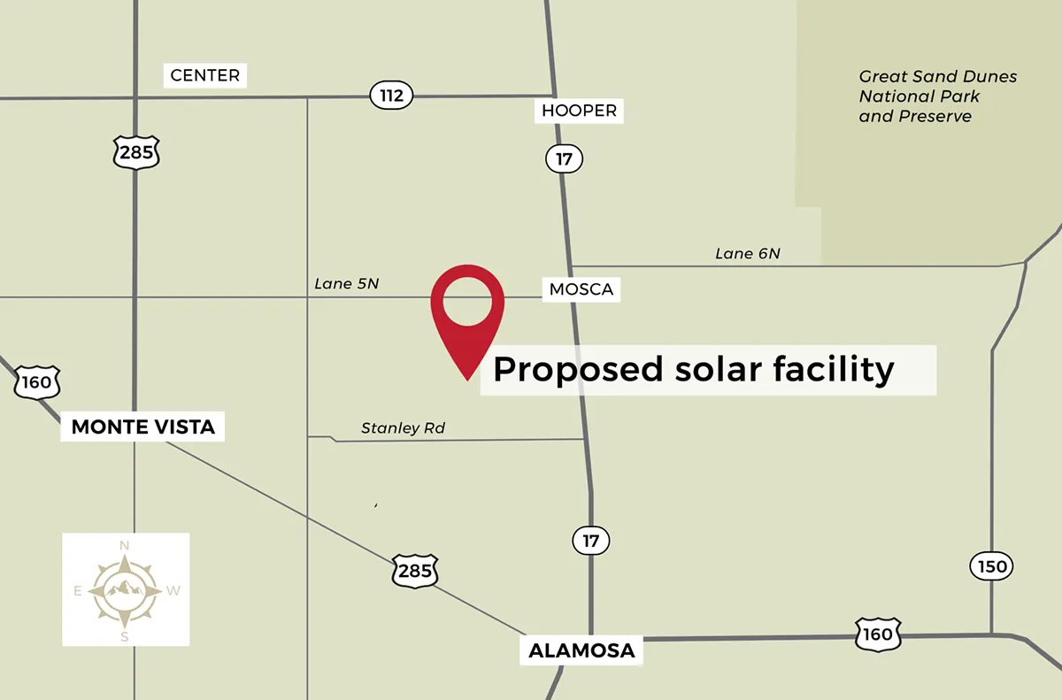
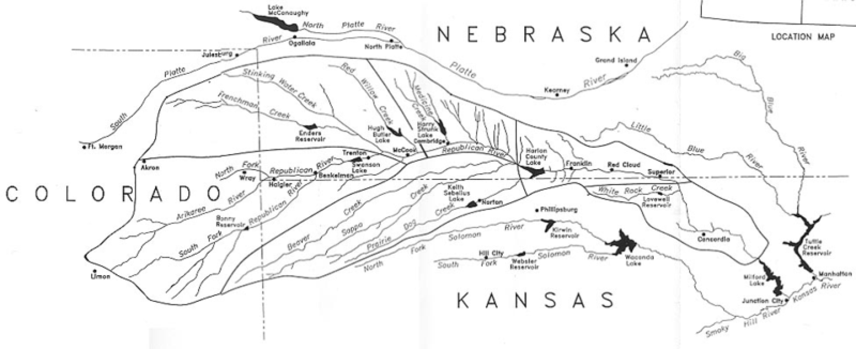
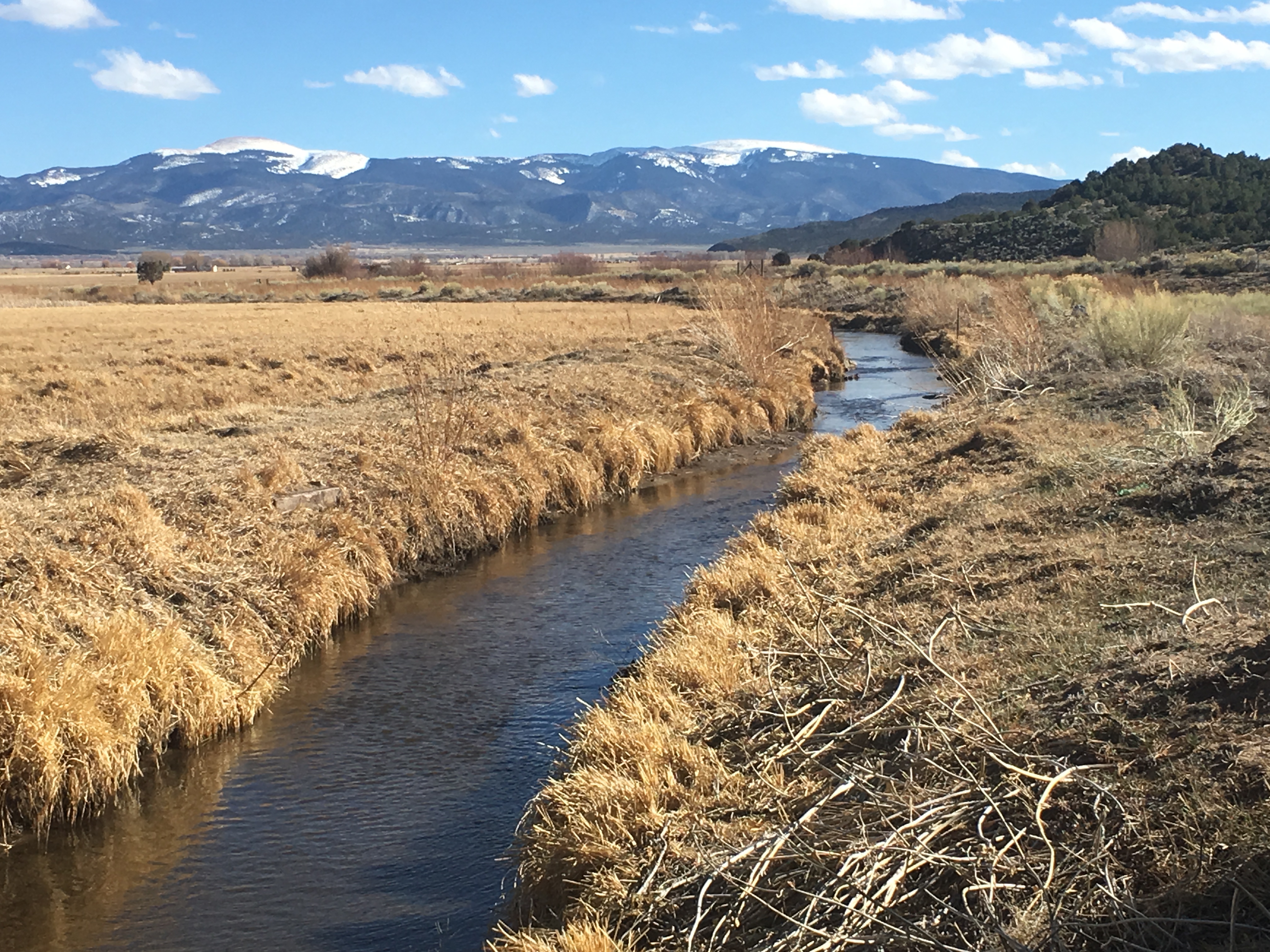
The project will be on 480 acres of degenerated land, in between Stanley Road, the 105, and the 106. The property sits within Subdistrict 1, and its water rights, all groundwater access and wells, were sold to the Rio Grande Water Conservation District in December of 2024. Credit: The Citizen

Click the link to read the article on the Alamosa Citizen website (Evan Arvizu):

November 27, 2025

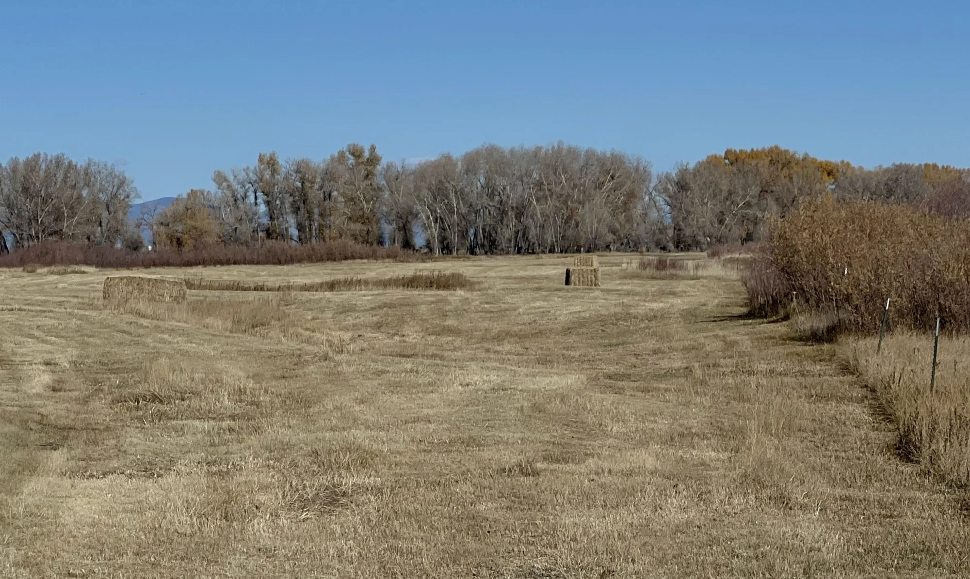
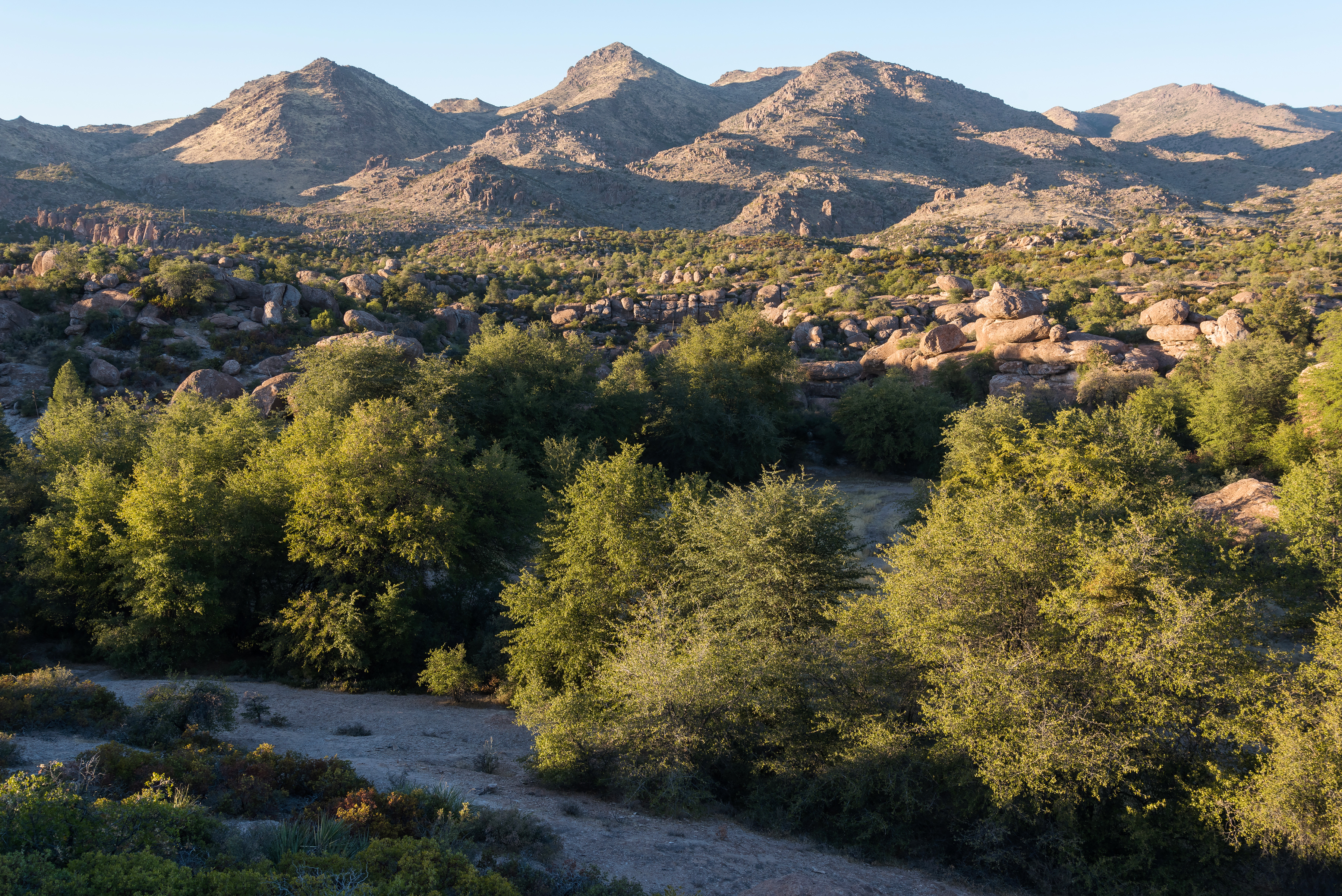
Down the Stanley Road looking north in central Alamosa County are the massive solar panels that offer an unusual but common skyline in the high mountain desert west of Mosca. In the foreground of the solar structures, on 480 acres of degenerated land, is a grand new experiment by the Colorado Land Board that promises to offer new insights into carbon, the Valleyโ€™s soil, and the growing but complicated โ€œcarbon market.โ€

In September the state land board inked a partnership with Land & Carbon Inc., a carbon project development company, to revegetate and restore the land under an initial 15-year partnership, and then a 40-year monitoring period to determine long-term success.

This is the first contract of its kind in the Valley, but it definitely wonโ€™t be the last. With more land and water being retired from irrigation every year, the question of how to revegetate only becomes more urgent. Revegation helps not just to improve carbon sequestration, but also to prevent dangerous dust-bowl conditions that threaten an increasingly dry Valley. The water on the Stanley Road property was retired to the Rio Grande Water Conservation District in 2024, and the partnership has committed to using only the allotted 18 inches of water over the first 3 years for revegetation. This project will illuminate the possibilities for revegetation in the Valley, and is likely to lead the way for more innovative partnerships and projects focused on both land restoration and carbon sequestration in the coming years.

The Colorado State Land Board manages lands that were granted to the state in a public trust from the federal government back in 1876. It operates as the second-largest land owner in the state, holding 2.8 million acres of surface land and 4 million acres of subsurface assets. Its land management practices aim to both steward the land and produce reasonable and consistent income, a majority of which gets distributed to the Colorado Department of Educationโ€™s Building Excellent Schools Today (BEST) program. 

The Land Board established an ecosystem services program, focused on generating revenue from nontraditional products, like wetland and carbon credits, as opposed to more traditional products like agriculture, grazing, mining, oil and gas, hunting, recreation and renewables. A few years ago, through this program, the Land Board started exploring the prospect of carbon sequestration and carbon credits.

โ€œWe hired a group of consultants to help us enter this market. Itโ€™s new and not well understood by most people. Itโ€™s kind of on the leading edge of being developed, what we sometimes call an emerging market,โ€ said Mindy Gottsegen, the State Land Boardโ€™s Stewardship and Ecosystem Services manager.  

The carbon market has emerged as a viable way to simultaneously restore damaged lands, while generating valuable revenue. While there are government regulations around carbon emissions and compliance with certain environmental standards, the carbon market is an entirely voluntary system that operates without large government oversight. Companies buying and selling carbon credits can join the market, and participate, as long as they meet certain standards, set by third-party organizations.

While it is a complicated system, this is generally how it works for soil carbon credits in the Valley: Every piece of land has some amount of carbon in the soil because plants take in CO2 from the atmosphere, photosynthesize, and store it. Through plant roots, and the decay of other organic matter, the soil ends up holding on to a certain amount of carbon. Different land management practices can increase or decrease the amount of carbon sequestered. 

To quantify carbon sequestration and sell credits, verified companies (or land owners) must first establish a baseline carbon measurement. Then, carbon gains are estimated over time using a combination of measurements and modeling. These numbers are reviewed, and based on the additional amount of carbon stored, carbon registries issue a proportionate amount of carbon credits. These credits can be sold on the market to entities looking to offset their carbon emissions. The revenue from carbon credits helps to fund and sustain carbon sequestration and land restoration projects.

โ€œThe Biological Carbon Program framework that our board approved in April of this year was kind of saying โ€˜This is how weโ€™re going to get involved in the carbon market,โ€™โ€ said Gottsegen. 

The program allows agricultural and land lessees to partner with board-approved Qualified Project Developers (QPDs) to create and implement restorative project plans. These companies work as the middle man between land owners and the carbon market, helping to make successful and sustainable changes, while also navigating the approval and acquisition of carbon credits.


Enter Land & Carbon Inc. Founded by Dave Lawrence in 2023, Land & Carbon is an innovative project development company, restoring highly degraded lands with low-cost, science-driven solutions. The company works to regenerate and revegetate land while offsetting and storing CO2 in the soil, using carbon credits to help pay for the projects.

โ€œI used to โ€” well I still do โ€” drive around the country quite a bit. Iโ€™ve observed just how much degraded and barren land there is, without healthy crops or native vegetation  โ€” brown trampled land all around the country,โ€ said Lawrence. 

Lawrence had previously served as both the chairman of the Yale Climate & Energy Institute and the executive director of the Salk Institute Harnessing Plants Initiative. In these roles, he was actively involved in carbon projects, and realized that reducing atmospheric carbon would require more than just emissions reduction.

โ€œI recognized that there were a number of different solutions available, and that they could be used in combination,โ€ said Lawrence. โ€œI started Land & Carbon with this idea that we would use a combination of practices, and collaborate with communities, ranchers, farmers, land holders, and experts โ€” local, regional, national, and global โ€” pulling all of this together to do the best job that we could restoring degraded land, and at the same time taking carbon out of the atmosphere.โ€

A significant amount of the degraded land across the West is largely agricultural and sits with different state land boards. Land & Carbon reached out to the Colorado State Land Board with hopes of collaborating to regenerate these lands in a way that was mutually successful, taking advantage of best practices to sequester carbon, restore ecosystem health, and help fund the stateโ€™s public education system. 

Land & Carbon got approved as the Land Boardโ€™s fourth QPD in August and the deal, officially titled Grassland Carbon Ecosystem Services Production Lease, ES 117611, came soon after.

Of the land in the State Land Boardโ€™s portfolio, the Stanley Road property was selected because of a combination of factors. The property consists of 480 acres, in between Stanley Road, the 105, and the 106. It sits within Subdistrict 1, and its water rights, all groundwater access and wells, were sold to the Rio Grande Water Conservation District in December of 2024. This means moving forward there are severe limitations to the amount of water that can be used to revegetate. The land is highly degraded from decades of agricultural use, and has been barren for years. In that time, a takeover of invasive weeds, along with harsh soil and climate conditions, have prevented any sort of natural recovery.

This property had been a challenge for the Land Board, because of the amount of damage. While this level of degradation can be seen as a deterrent for other QPDs, these types of highly degraded properties are exactly what Land & Carbon seek out. When the Land Board asked if it would be interested in taking on the challenge, the answer was a resounding โ€œYes.โ€ 

In any project for Land & Carbon, the first steps include a โ€œscope and discoveryโ€ research deep dive, to better understand what has already been done, and learn how its efforts will be situated in the broader context of work in the region. In the Valley, this means looking at CSU Extension information, published papers, USDA, State Land Board and Conservation District data, conducting their own boots-on-the-ground field visits, and also engaging with the community. All of it is pulled together to assess initial land characteristics. 

โ€œWeโ€™re a big believer in talking with people and learning from people who are actually doing the work. So we participated in workshops, convened by Colorado State, that allowed us to get to know different individuals and people and groups who were already doing things,โ€ said Lawrence. โ€œWe donโ€™t believe we have the corner on the market on all expertise. We really try to tap into as much local knowledge as we can, as to what has worked, what hasnโ€™t worked and why.โ€

After that, an exhaustive evaluation of all available data and information is done, pulling in literature, field data, and models to create an initial plan, taking into consideration resource availability and supplies. Then they take baseline measurements to determine the starting amount of carbon in the soil that is crucial to then quantify improvements and carbon credits. 

The Stanley Road project is still in these early stages, and they are working to collect data, determine land characteristics, and establish a carbon baseline, before considering different solutions and strategies. 

โ€œWe tailor our solutions to the land. Not everything grows everywhere and not all grazing practices work everywhere. So how can we tailor the best combination to this land?โ€ said Lawrence.

Theย next steps will come in the spring, at the start of the growing season, when Land & Carbon plans to establish what it has trademarked as Innovation Sites. These five- to 20-acre patches on the property are used to test out new ideas and different combinations, seed mixes, and technologies, in order to learn what works best on this specific land. These experimental sites will run for three to five years, after which the best, most successful techniques will be used on the larger property. Many of the tests will not work, but some will, and those are what get implemented broadly.

In the years to come, these plans will continue to develop. Final decisions around irrigation, and how to use the 18 inches of water allocated for the first 3 years of the project, have not yet been made. Nor have more definitive restoration plans, though in the press release by the Land Board, it was stated that the property is expected to support regenerative grazing within four to eight years. 

The project is estimated to sequester greater than 10,000 metric tonnes of CO2 in the first 15 years, which is when the initial contract ends. This will be followed by a 40-year monitoring period to ensure the permanence of the soil carbon storage.


With the state of water in the Valley, and efforts to retire agricultural land for water conservation purposes, the amount of land in need of revegetation and restoration will only continue to grow over the next few years. 

Both the State Land Board and Land & Carbon expressed interest in expanding the reach of this project and methodology, once it has been established. But that will take time. 

โ€œI always think itโ€™s good to try to do one thing very well, and to kind of get a proof point. We are very focused on this property, and of course we would love to work with others as we move along in this, and show what we have going,โ€ said Lawrence.

โ€œWeโ€™re just getting started. The first few take extra time, but weโ€™re hoping that once we get these few under our belt, weโ€™ll be able to expand,โ€ said Gottsegen. โ€œHopefully we can continue to build the carbon program with more leases in the coming years.โ€

Lawrence emphasized that Land & Carbon aims to make this project the template for affordable, quality land regeneration using carbon credits, that will work for people in the Valley.

โ€œThe idea is that what we learn, we share. We can serve as just advisors if thatโ€™s what somebody who has all the capabilities wants, and thereโ€™s a ton of people with capabilities, or we can actually do the work,โ€ said Lawrence. โ€œI think we all know the challenges that we face with water in the San Luis Valley. Itโ€™s important that we take whatever we learn, in collaboration with others, and work with them to try to implement this at scale.โ€

Evan Arvizu

Evan Arvizu is a recent graduate of Colorado College with a degree in Environmental Anthropology and minor in Journalism. She is a former intern with the Rural Journalism Institute of the San Luis Valley. More by Evan Arvizu

San Luis Valley Groundwater

Study: Something’s gotta give on the #RioGrande: #ClimateChange and overconsumption are drying up the Southwest’s “other” big river — Jonathan P. Thompson (LandDesk.org)

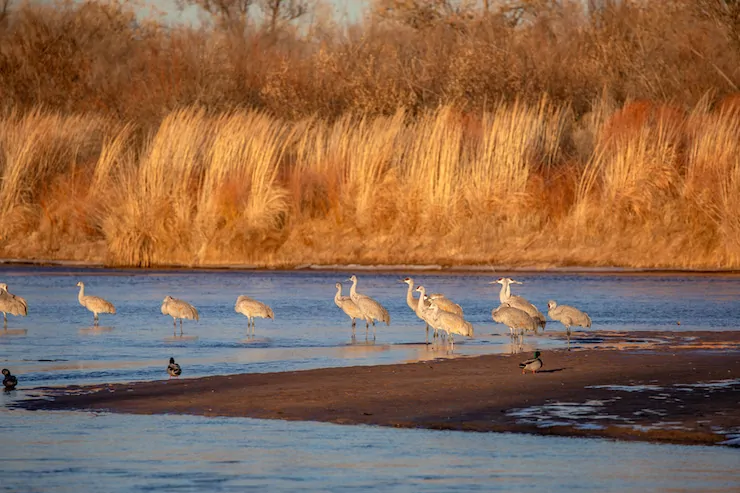
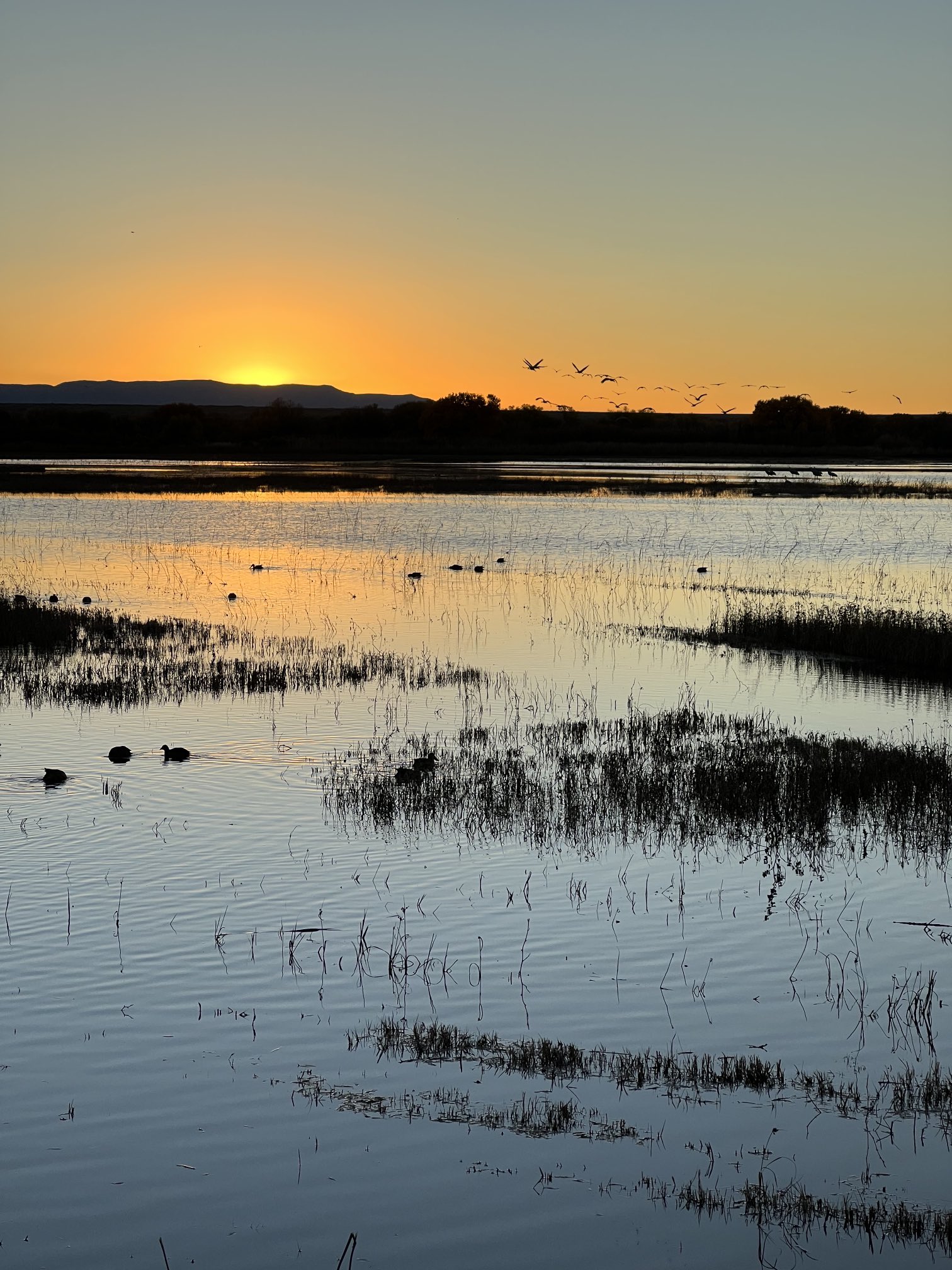
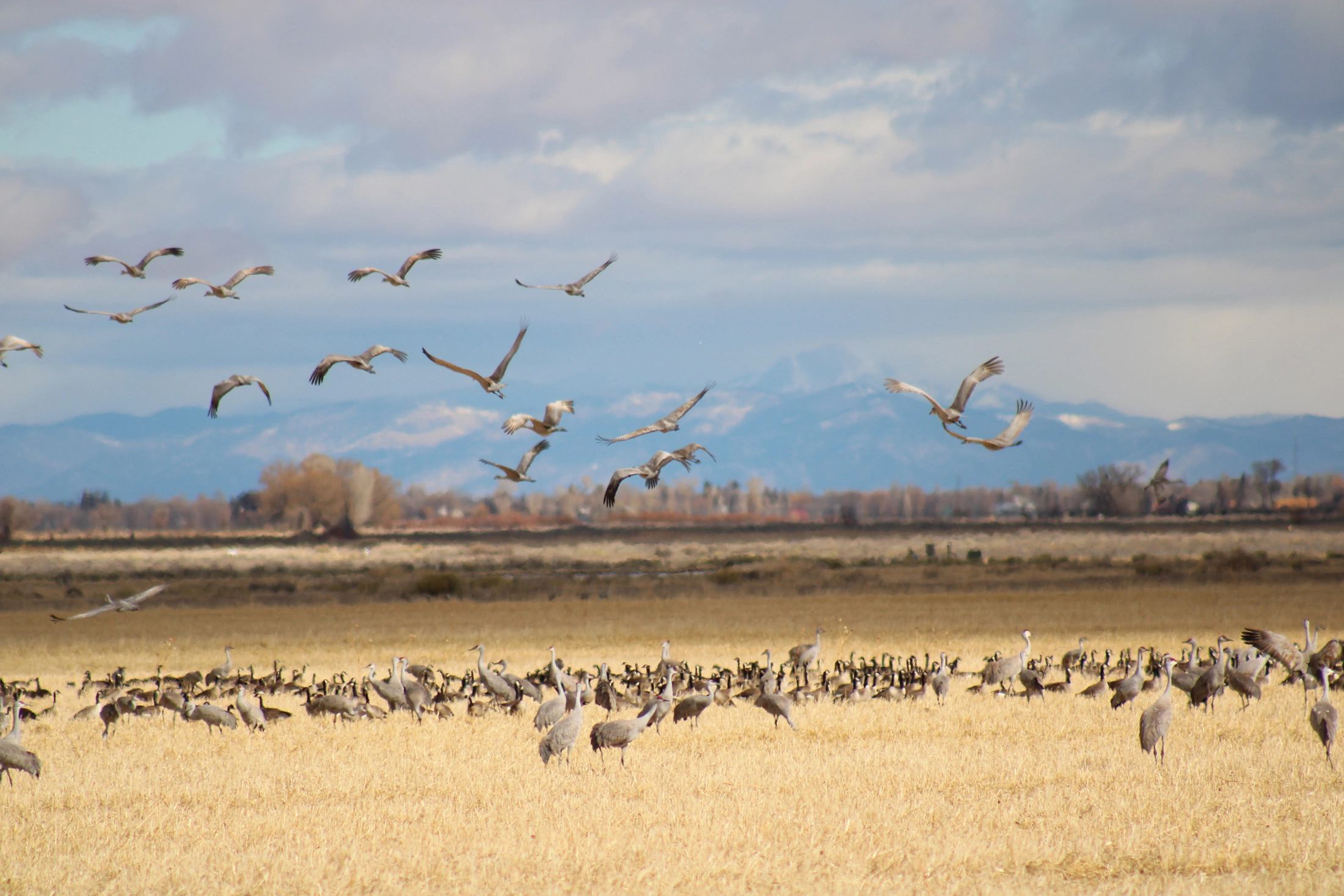
Sandhill cranes and some mallard ducks roost on a sandbar of the Rio Grande River at sunset on Jan. 22, 2025 in Albuquerque, New Mexico. Copyright Credit ยฉ WWF-US/Diana Cervantes.

Click the link to read the article on The Land Desk website (Jonathan P. Thompson):

November 21, 2025

๐Ÿฅต Aridification Watch ๐Ÿซ

The Colorado River and its woes tend to get all of the attention, but the Southwestโ€™s โ€œotherโ€ big river, the Rio Grande, is in even worse shape thanks to a combination of warming temperatures, drought, and overconsumption. Thatโ€™s become starkly evident in recent years, as the river bed has tended to dry up earlier in the summer and in places where it previously had continued to carry at least some water. Now Brian Richter and his team of researchers have quantified the Rio Grandeโ€™s slow demise, and the conclusions they reach are both grim and urgent: Without immediate and substantial cuts in consumption, the river will continue to dry up โ€” as will the farms and, ultimately, the cities that rely on it.

The Rio Grandeโ€™s problems are not new. Beginning in the late 1800s, diversions for irrigation in the San Luis Valley โ€” which the river runs through after cascading down from its headwaters in the San Juan Mountains โ€” sometimes left the riverbed โ€œwholly dry,โ€ wrote ichthyologist David Starr Jordan in 1889, โ€œall the water being turned into these ditches. โ€ฆ In some valleys, as in the San Luis, in the dry season there is scarcely a drop of water in the riverbed that has not from one to ten times flowed over some field, while the beds of many considerable streams (Rio la Jara, Rio Alamosa, etc.) are filled with dry clay and dust.โ€


Rio Grande Streamflow Mystery: Solved? — Jonathan P. Thompson


San Luis Valley farmers gradually began irrigating with pumped groundwater, allowing them to rely less on the ditches (but causing its own problems), and the 1938 Rio Grande Compact forced them to leave more water in the river. While that kept the water flowing through northern and central New Mexico, the Rio Grandeโ€™s lower reaches still occasionally dried up.

Then, in the early 2000s, the megadrought โ€” or perhaps permanent aridification โ€” that still plagues the region settled in over the Southwest. [ed. emphasis mine] Snowpack levels in the riverโ€™s headwaters shrank, both due to diminishing precipitation and climate change-driven warmer temperatures, which led to runoff and streamflows 17% lower than the 20th century average, according to the new study. And yet, overall consumption has not decreased.

โ€œIn recent decades,โ€ the authors write, โ€œriver drying has expanded to previously perennial stretches in New Mexico and the Big Bend region. Today, only 15% of the estimated natural flow of the river remains at Anzalduas, Mexico near the riverโ€™s delta at the Gulf of Mexico.โ€ Reservoirs, the riverโ€™s savings accounts, have been severely drained to the point that they wonโ€™t be able to withstand another one or two dry winters. As farmers and other users have increasingly turned to groundwater pumping, aquifers have also been depleted. The situation is clearly unsustainable.

Somethingโ€™s gotta give on the Rio Grande, and while we may be tempted to target Albuquerqueโ€™s sprawl, drying up all of the cities and power plants that rely on the river wouldnโ€™t achieve the necessary cuts.

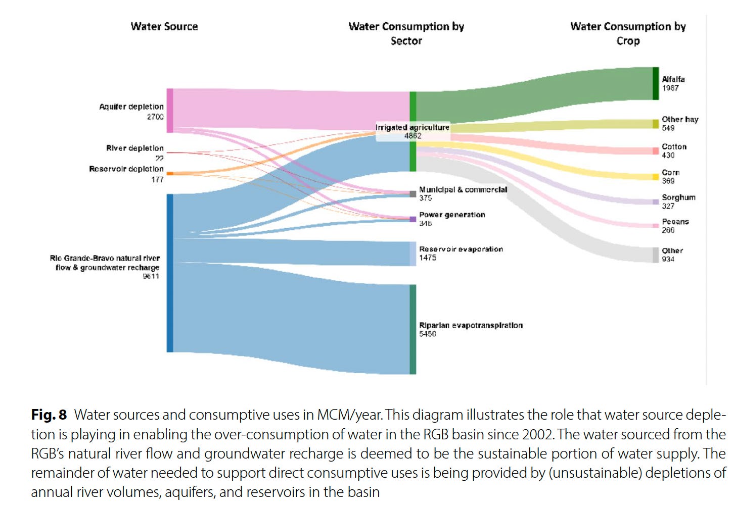
Source: โ€œOverconsumption gravely threatens water security in the binational Rio Grande-Bravo basinโ€ by Brian Richter et al.

It will come as little surprise to Western water watchers that agriculture is by far the largest water user on the Rio Grande โ€” taking up 87% of direct human consumption โ€” and that alfalfa and other hay crops gulp up the lionโ€™s share, or 52%, of agricultureโ€™s slice of the river pie. This isnโ€™t necessarily because alfalfa and other hays are thirstier than other crops, but because they are so prevalent, covering about 433,000 acres over the entire basin, more than four times as much acreage as cotton.

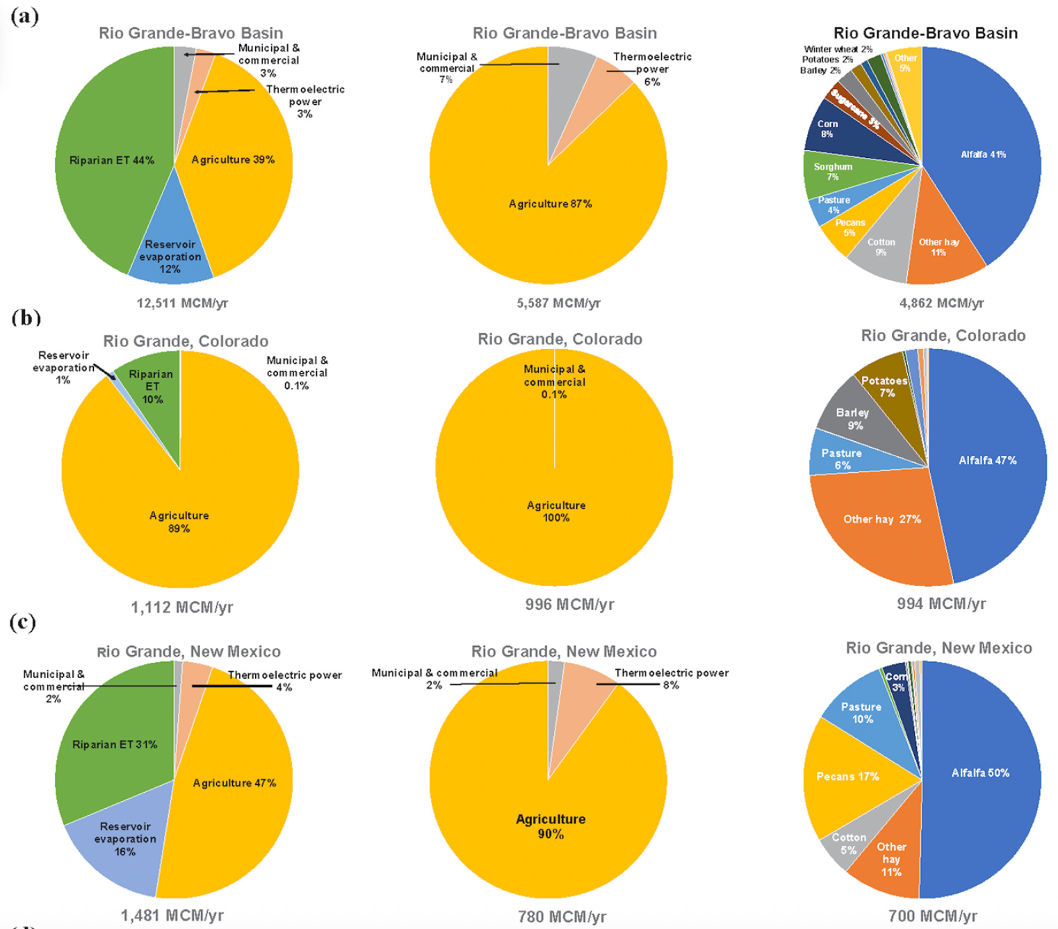
Source: Overconsumption gravely threatens water security in the binational Rio Grande-Bravo basin

This kind of math means farmers are going to have to bear the brunt of the necessary consumption cuts โ€” either voluntarily or otherwise. In fact, they already have: Between 2000 and 2019, according to the report, Colorado lost 18% of its Rio Grande Basin farmland, New Mexico lost 28%, and the Pecos River sub-basin lost 49% (resulting in a downward trend in agricultural water consumption). Some of this loss was likely incentivized through conservation programs that pay farmers to fallow their fields. But it was also due to financial struggles.

Yet even when farmers are paid a fair price to fallow their fields there can be nasty side effects. Noxious weeds can colonize the soil and spread to neighborsโ€™ farms, it can dry out and mobilize dust that diminishes air quality and the mountain snowpack, and it leaves holes in the cultural fabric of an agriculture-dependent community. If a fieldโ€™s going to be dried up, it should at least be covered with solar panels.


Think like a watershed: Interdisciplinary thinkers look to tackle dust-on-snow — Jonathan P. Thompson


Another possibility is to switch to crops that use less water. This isnโ€™t easy: Farmers grow alfalfa in the desert because itโ€™s actually quite drought tolerant, doesnโ€™t need to be replanted every year, is less labor-intensive than other crops, is marketable and ships relatively easy, and can grow in all sorts of climates, from the chilly San Luis Valley to the scorching deserts of southern Arizona.


Alfalfaphobia? Jonathan P. Thompson


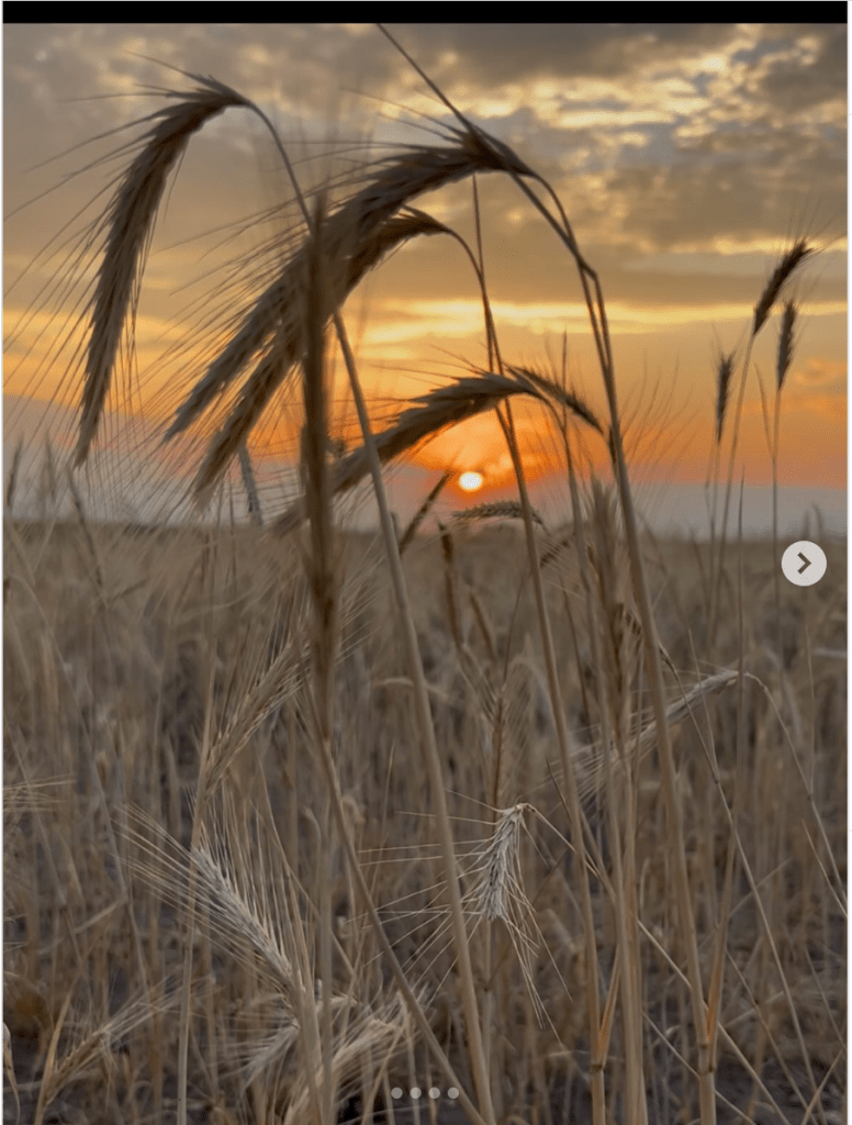
Still, it can be done, as a group of farmers in the San Luis Valley are demonstrating with theย Rye Resurgence Project. This effort is not only growing the grain โ€” which uses less water than alfalfa, is good for soil health, and makes good bread and whiskey โ€” but it is also working to create a larger market for it. While itโ€™s only a drop in the bucket, so to speak, this is the sort of effort that, replicated many times across the region, could help balance supply and demand on the river, without putting a bunch of farmers out of business.

Photo credit: The Rye Resurgence Project

***

Oh, and about that other river? You know, the Colorado? Representatives from the seven states failed to come up with a deal on how to manage the river by the Nov. 15 deadline. The feds had mercy on them, giving them until February to sort it all out. Iโ€™m not so optimistic, but weโ€™ll see. Personally, I think the only way this will ever work out is if the Colorado River Compact โ€” heck, the entire Law of the River โ€” is scrapped, and the states and the whole process is started from scratch, this time with a much better understanding of exactly how much water is in the river, and with the tribal nations having seats at the table.

โ›๏ธ Mining Monitor โ›๏ธ

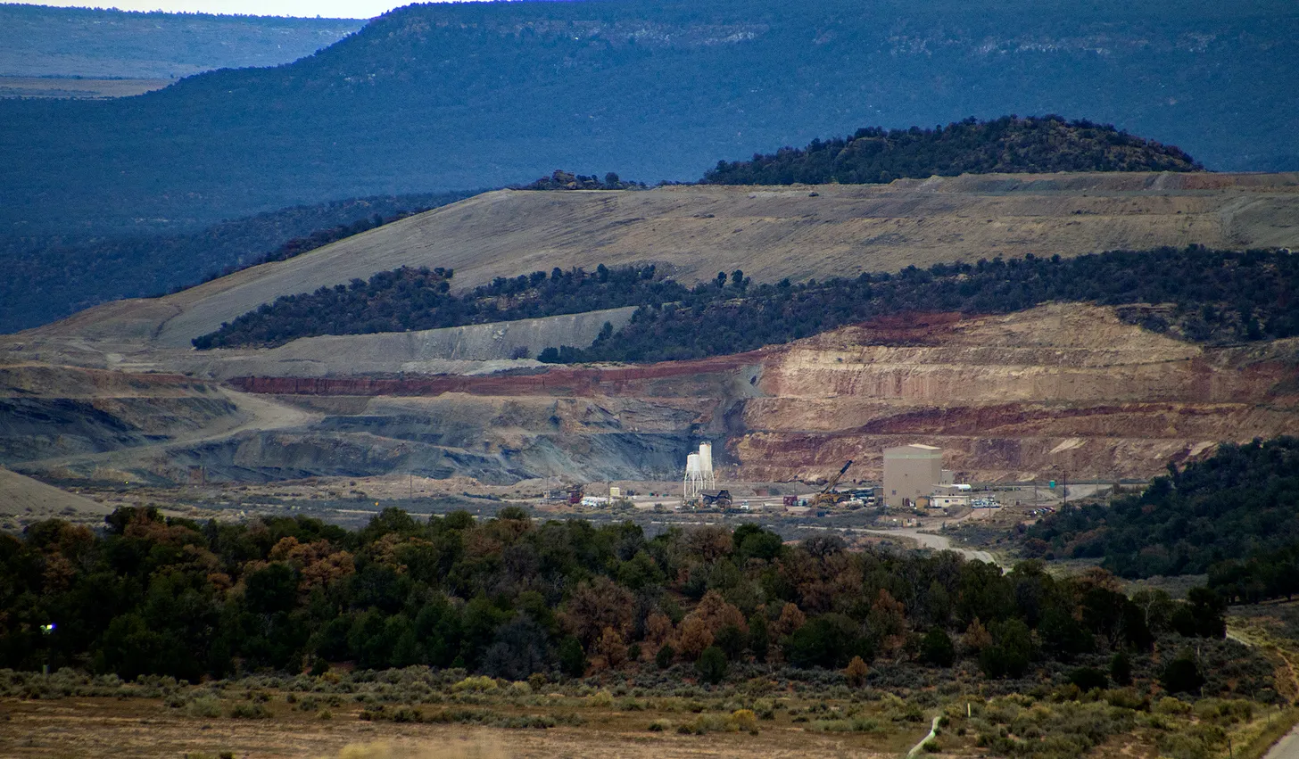
There are a bunch of wannabe uranium mining companies out there right now, locating claims and acquiring and selling claims and touting their exploratory drilling results. But there are only a small handful of firms that are actually doing anything resembling mining. One of them is the Canada-based Anfield, which just broke ground on its Velvet-Wood uranium mine in the Lisbon Valley, even without all of the necessary state permits. 

Now Anfield says it has applied for a Colorado permit to restart its long-idle JD-8uranium mine. The mine is on one of a cluster of Department of Energy leases overlooking the Paradox Valley from its southern slopes, and was previously owned and operated by Cotter Corporation. The mine has not produced ore since at least 2006. Anfield says it will process the ore at its Shootaring Mill near Ticaboo, Utah, which has yet to get Utahโ€™s green light.


๐Ÿ  Random Real Estate Room ๐Ÿค‘

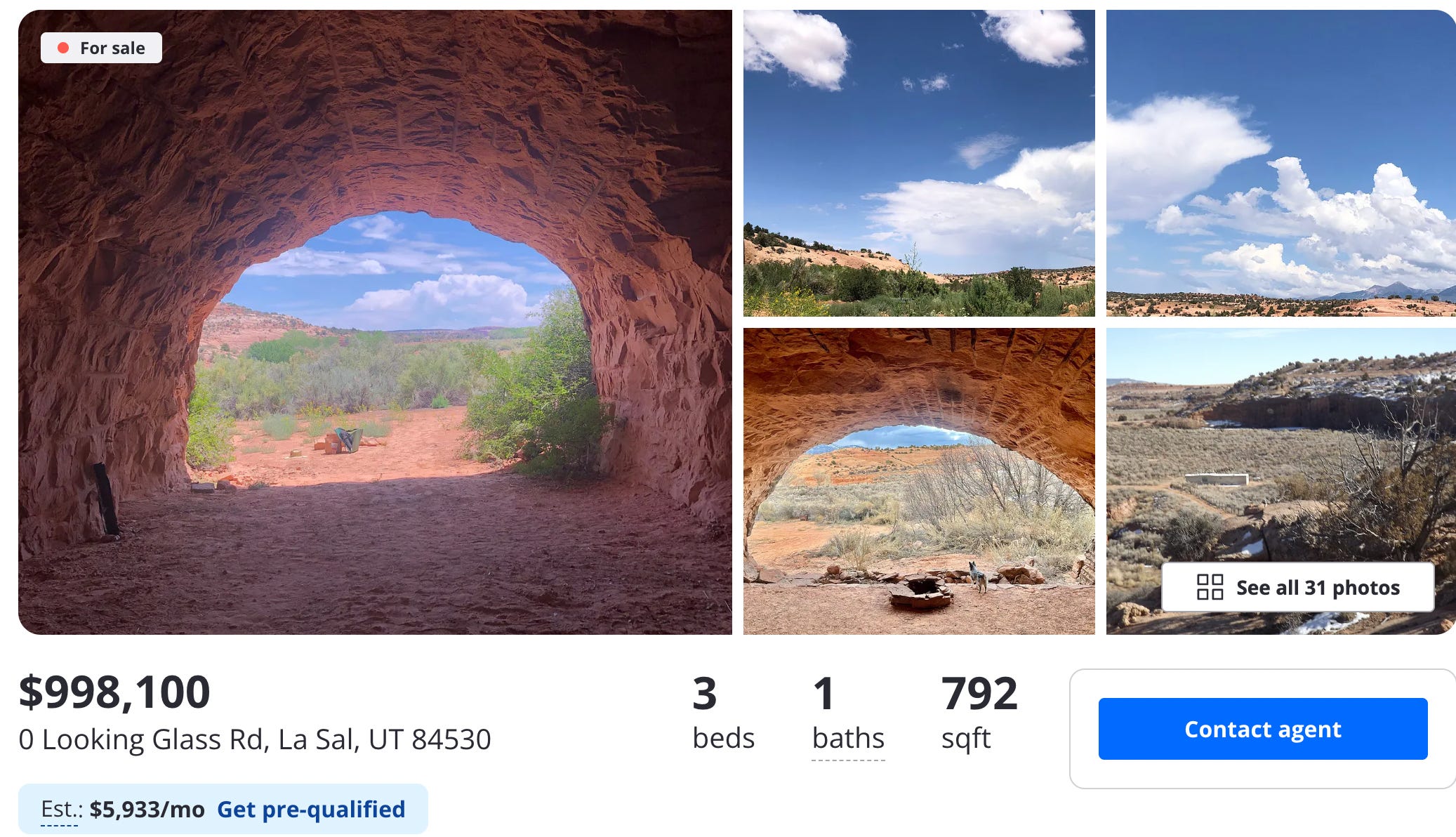
Look! Affordable housing near Moab! Sure, itโ€™s a cave, but itโ€™s only $99,000. Oh, whatโ€™s that? $998,000? Theyโ€™re selling a cave for a million buckaroos? But of course they are. To be fair, itโ€™s not just a cave. Itโ€™s several of them, plus a trailer. Crazy stuff.

๐Ÿ“ธย Parting Shotย ๐ŸŽž๏ธ

A work train in the Animas River gorge just below Silverton. Jonathan P. Thompson photo.
Rio Grande and Pecos River basins. Map credit: By Kmusser – Own work, Elevation data from SRTM, drainage basin from GTOPO [1], U.S. stream from the National Atlas [2], all other features from Vector Map., CC BY-SA 3.0, https://commons.wikimedia.org/w/index.php?curid=11218868

Your daily dose of wow (h/t Henry Brean)

A drying-up #RioGrande basin threatens water security on both sides of the border — The Associated Press

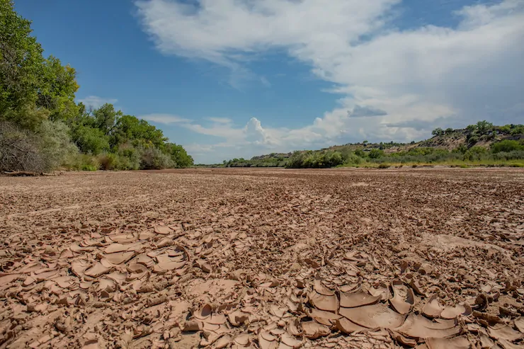
For the second time in the 21st century, this segment of the Rio Grande in Albuquerque went dry, leaving this image of cracked sediment on a blistering afternoon on Aug. 7, 2025. Photo (and copyright)/WWF-us, Diana Cervantes

Click the link to read the article on the Associated Press website (Susan Montoya Bryan). Here’s an excerpt:

November 20, 2025

Research published Thursday says the situation arguably is worse than challenges facing theย Colorado River, another vital lifeline for western U.S. states that have yet to chart a course for how best to manage that dwindling resource. Without rapid and large-scale action on both sides of the border, the researchers warn that unsustainable use threatens water security for millions of people who rely on the binational basin. They say more prevalent drying along the Rio Grande and persistent shortages could have catastrophic consequences for farmers, cities and ecosystems…Theย studyย done by World Wildlife Fund, Sustainable Waters and a team of university researchers provides a full accounting of the consumptive uses as well as evaporation and other losses within the Rio Grande-Bravo basin. It helps to paint the most complete โ€” and most alarming โ€” picture yet of why the river system is in trouble…The research shows only 48% of the water consumed directly or indirectly within the basin is replenished naturally. The other 52% is unsustainable, meaning reservoirs, aquifers and the river itself will be overdrawn…

Irrigating crops by far is the largest direct use of water in the basin at 87%, according to the study. Meanwhile, losses to evaporation and uptake by vegetation along the river account for more than half of overall consumption in the basin, a factor that canโ€™t be dismissed as reservoir storage shrinks…The irrigation season has become shorter, with canals drying up as early as June in some cases, despite a growing season in the U.S. and Mexico that typically lasts through October. In central New Mexico, farmers got a boost with summer rains. However, farmers along the Texas portion of the Pecos River and in the Rio Conchos basin of Mexico โ€” both tributaries within the basin โ€” did not receive any surface water supplies…The analysis found that between 2000-2019, water shortages contributed to the loss of 18% of farmland in the headwaters in Colorado, 36% along the Rio Grande in New Mexico and 49% in the Pecos River tributary in New Mexico and Texas.ย  With fewer farms, less water went to irrigation in the U.S. However, researchers said irrigation in the Mexican portion of the basin has increased greatly.

Rio Grande and Pecos River basins. Map credit: By Kmusser – Own work, Elevation data from SRTM, drainage basin from GTOPO [1], U.S. stream from the National Atlas [2], all other features from Vector Map., CC BY-SA 3.0, https://commons.wikimedia.org/w/index.php?curid=11218868

Many eyes on the #ColoradoRiver. The #RioGrande may be more urgent: New study of river from headwaters in #Colorado to the Gulf of Mexico demonstrates need for changes — Allen Best (BigPivots.com)

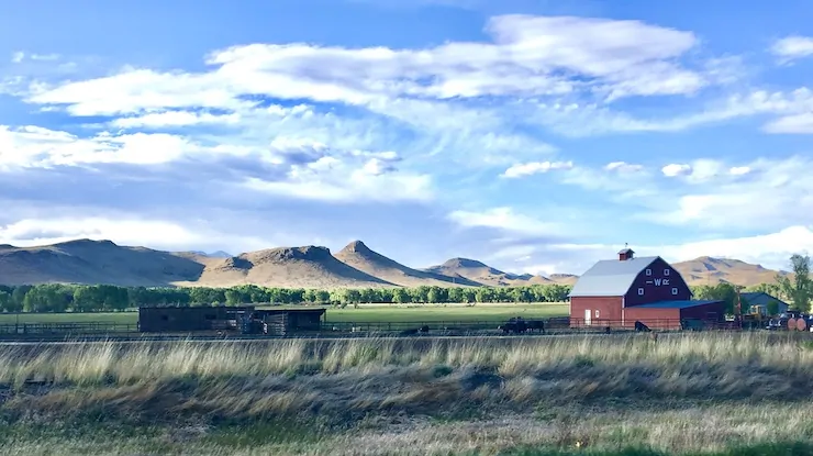
San Luis Valley farm. Photo credit: Allen Best/Big Pivots

Click the link to read the article on the Big Pivots website (Allen Best):

November 20, 2025

In November 2023, I stopped by the office of Cleave Simpson, then (and still now, at least for a brief time more), the general manager of the Rio Grande Water Conservancy District.

There, in Alamosa, he shared with me his observation that the Rio Grande during the 21st century has had water declines parallel to those of the Colorado River.

Both rivers originate in Colorado, and neither river has been able to deliver the water assumed by any number of diversion projects. Problems began in the 20th century but have intensified greatly in the 21st century because of drought but also rising temperatures.

The Rio Grande has had 17% reduced flows since 2000. The Colorado River flows have declined 20%.

Of the two rivers, the Rio Grande is longer, at 1,900 miles but carries less water, 9.1 million acre-feet/year. The Colorado flows 1,450 miles and has been carrying an average 15.4 million acre-feet. Neither river has delivered water into oceans with any reliability in decades.

Sandhill cranes and a few mallard ducks roost at sunset on a sandbar of the Rio Grande in Albuquerque during January. Photo(and copyright)/WWF-us, Diana Cervantes. Top: The San Luis Valley near Del Norte. Photo/Brian Richter

Despite these parallels, the Colorado has received far more attention, as is pointed out in a new report by Brian Richter of the World Wildlife Fund and nine others from academic institutions in Arizona, California, and other states.

Why is that? The Colorado provides drinking water for about 40 million people compared to 15 million for the Rio Grande. In irrigated agriculture, itโ€™s a similar story: 22,300 square kilometers in the Colorado River Basin vs. 7,800 square kilometers in the Rio Grande.

โ€œHowever, the water crisis facing the Rio Grande Basin is arguably more severe and urgent than the Colorado River Basin,โ€ Richter and his colleagues contend. They argue for some rethinking and institutional alignments to help ratchet water use down to sustainable levels.

The study is the first full accounting of how water is consumed across the entire Rio Grande Basin. Mexico calls it the Rio Bravo.

Doesnโ€™t Colorado also have a strong accounting system, as necessary to meet requirements of the 1938 compact among states that share the Rio Grande?

Yes, says Richter. However, he adds a โ€œbut.โ€ He reports difficulty in getting estimates of  how much water is being consumed by each sector and by each crop. He believes he has succeeded.

โ€œTo my knowledge, nobody has laid out the numbers at the level of clarity and accuracy that we were able to accomplish,โ€ he said.

Another major contribution of the paper is the estimation of the degree to which water consumption is unsustainable, he said.

โ€œWe estimate that 11% of water consumption in Colorado is unsustainable. Natural replenishment from snowmelt runoff, precipitation, and groundwater recharge supplies only 89% of the water being consumed; the remainder (deficit) is being met by depleting groundwater.โ€

โ€œThe Rio Grande basin is at a tipping point, and everyone needs to be part of the solution,โ€ said Enrique Prunes, a co-author and the World Wildlife Fund Rio Grande manager. โ€œThese findings will help us rethink how we manage water to secure a future for everyone.โ€

For the second time in the 21st century, this segment of the Rio Grande in Albuquerque went dry, leaving this image of cracked sediment on a blistering afternoon on Aug. 7, 2025. Photo(and copyright)/WWF-us, Diana Cervantes

Dry cracked sediment from the Rio Grande on a blistering afternoon on Aug. 7, 2025 in Albuquerque, N.M. For the second time in the 21st century the Rio Grande has gone dry in the Albuquerque stretch. (TC) (EDITORโ€™S NOTE:
T/C, to fact check).

Agriculture uses 99.9% of the water in Coloradoโ€™s San Luis Valley and 87% in the basin altogether.

Dramatic declines in reservoir storage illustrate the scope of problem. Altogether, 12% of reservoir storage has been lost in the 21st century. The decline is most severe in New Mexico, where 71% less water was stored at the end of 2024 compared to 2002.

Groundwater depletion has been even more drastic. Roughly 15 times more groundwater has declined compared to surface storage. The two are coupled. As surface water supplies decline, groundwater mining grows.

Draining of aquifers has been a particularly vexing problem, as was explained in a story published in Headwaters magazine in June (and published in installments at BigPivots.com during July). See in particular 20th century expansion and 21st century realities in the San Luis Valley

โ€œIn the San Luis Valley of Colorado, diminished river flows and aquifer recharge have led to continued over-pumping, causing aquifers levels to decline,โ€ Richter and his team write. โ€œThe Colorado state engineer has threatened to shut off hundreds of groundwater wells if the aquifer supporting irrigated farms cannot be stabilized.โ€

The San Luis Valley is famous for its potatoes as well as the barley to make Coors beer, but potatoes use just 7% of the water and barley 9%. The vast majority of water in the valley produces feedstocks for livestock: 47% for alfalfa, 27% for other hay, and 6% for pasture lands.

The study finds that groundwater in the San Luis Valley has been depleted at a rate of 89,179 acre-feet/year, equivalent to 11% of the annual average of direct water consumption in the valley.

What can be done? Large cities have done more with less. Albuquerqueโ€™s population grew 40% while its water use declined by 17%. However, municipal and commercial water consumption account for only 7% of all direct consumption in the three-state and two-country basin.

Strategies for reducing consumption in irrigated agriculture have been proven but must be rapidly deployed at sufficient scale and financially sustained by governments, companies, and credit institutions to rebalance the basinโ€™s water budgets, state, and binational levels.

At the same time, water shortages have contributed to the loss of 18% of farmland in the riverโ€™s headwaters in Colorado, 36% in New Mexico, and 49% in the Pecos River tributary in New Mexico and Texas.

Strategies being embraced to curb groundwater drafting in the closed basin of the San Luis Valley have been controversial. A key case is likely to go before the Colorado Supreme Court. In Mexico, cutbacks have led to violence. One protestor died.

The study points to several strategies that could reshape how water is used in the basins. These include restoring river habitats, adjusting dam operations to better support seasonal flows, improving water-sharing agreements, and helping farmers switch to crops that require less water.

That effort to encourage crop-switching has been underway in the San Luis Valley, but with successes only at the margins.

Rio Grande and Pecos River basins. Map credit: By Kmusser – Own work, Elevation data from SRTM, drainage basin from GTOPO [1], U.S. stream from the National Atlas [2], all other features from Vector Map., CC BY-SA 3.0, https://commons.wikimedia.org/w/index.php?curid=11218868

Study warns of โ€˜existential water crisisโ€™ in the #RioGrande Basin: Urges action to avoid โ€˜continued loss of farmland due to financial insolvency from lowered crop productionโ€™ — AlamosaCitizen.com

Chart showing water use trends in US and Mexico. Credit: Overconsumption gravely threatens water security in the binational Rio Grande-Bravo basin. Map via Springer Nature.

Click the link to read the article on the Alamosa Citizen website:

November 21, 2025

major new study on the nearly 1,900-mile long Rio Grande Basin โ€” from the San Luis Valley into the Gulf of Mexico โ€” shows a โ€œsevere water crisis emergingโ€ with total reservoir storage in decline at around 4.24 million acre-feet or 26 percent of capacity.

The study brings together detailed water consumption estimates of surface and ground water use throughout the basin and concludes โ€œa likely outcome will be continued loss of farmland due to financial insolvency from lowered crop production and other factors including the aging of farmers and lack of affordable farm labor,โ€ without urgent action.

โ€œClimate scientists have reframed the long-running drought as the onset of long-term aridification and are forecasting additional river flow diminishment of 16-28% in coming decades as the climate continues to warm,โ€ the study notes.

The authorsโ€™ analysis shows that during 2000โ€“2019, Colorado lost 18 percent of its farmland in the Upper Rio Grande Basin, New Mexico lost 28 percent along its Rio Grande sub-basins, and the Pecos River sub-basin lost 49 percent.

Further drying puts farmers and cities who rely on the Rio Grande in an โ€œexistential water crisis.โ€

Brian Richter, one of the authors of the study, says San Luis Valley farmers are central to the development and implementation of solutions for the rapidly drying Rio Grande given that โ€œthe vast majority of the direct human consumption of water in the SLV takes place on irrigated farms.โ€

Researchers estimate that the present level of over-consumption of both surface and groundwater in the Valley is approximately 11 percent. โ€œThat means that water consumption needs to be reduced by that percentage,โ€ Richter said.

Richter is president of Sustainable Waters and senior freshwater fellow for the World Wildlife Fund. The two organizations teamed with researchers to provide a full accounting of the consumptive uses as well as evaporation and other losses within the Rio Grande Basin.ย 

The Rio Grande stretches nearly from the San Luis Valley through New Mexico, El Paso, Texas, and empties into the Gulf of Mexico. It provides drinking water for more than 4 million in Colorado, New Mexico and Texas, and 11 million people in Mexico, the study notes. More than 1.9 million acres of irrigated farmland is tied to the Rio Grande.

The study, โ€œOverconsumption gravely threatens water security in the binational Rio Grande-Bravo basin,โ€ relies on data from annual runoff volumes, municipal and commercial consumptive use estimates from the U.S. Geological Survey, and reservoir storage levels, among other data sets.

Snowmelt runoff has decreased 17 percent over the past 25 years, according to the report. At the same time, total direct water consumption has been increasing since 2000, largely due to increasing water usage by farmers in Mexico.

When comparing challenges of Colorado River users to the Rio Grande, researchers say the โ€œwater crisis facing the RGB is arguably more severe and urgent than the CRB,โ€ given the fact groundwater in the San Luis Valley has been depleted at a rate of 89,000 acre-feet per year; New Mexico has a water debt to Texas; and Mexico has a mounting water debt to the U.S. under a 1944 treaty that is causing political tension between the two countries.

The Upper Rio Grande here at the end of 2025 is benefitting from heavy October rainsthat materialized across the southwest and provided a stopgap to what were some of the worst summer river flows ever recorded on the river.

Management of the Upper Rio Grande Basin will be back in the spotlight come January 2026 when Colorado Water Court Division Three takes up the Fourth Amended Plan of Water Management for Subdistrict 1 of the Rio Grande Water Conservation District. The new strategy calls for a groundwater overpumping fee of $500 per acre-foot any time an irrigator in Subdistrict 1 exceeds the amount of natural surface water tied to the property of their operation. The rule punishes farmers who do not have natural surface water coming into their fields but instead rely solely on groundwater pumping for their crops.

The whole point of the plan for the agricultural-rich area of the San Luis Valley is to let Mother Nature dictate the pattern of how irrigators in Subdistrict 1 restore the unconfined aquifer and build a sustainable model for farming in the future.

Richter credits Colorado and irrigators in the Valley for taking steps to address the Rio Grande. The proposed $500 fee for overpumping in Subdistrict 1, he says, โ€œis going to set off a lot of change in the Valley, because many/most farmers wonโ€™t be able to continue producing the same crops theyโ€™ve been growing in recent years.โ€

โ€œColorado has definitely taken some important steps, and manages its water resources far better than New Mexico or Texas,โ€ Richter says. โ€œBut Colorado still has not been able to reduce pumping to anywhere near the needed degree, so itโ€™s no surprise the aquifer continues to decline.โ€

The study looks at crops grown along the Rio Grande and how agricultural fields account for 87 percent of direct water consumption. โ€œOverall, agricultural consumption is nearly seven times the volume of all other direct uses combined.โ€

Alfalfa and grass hay โ€“ water-intensive crops that dominate the landscape in the Valley and in Northern and the Middle Rio Grande of New Mexico โ€“ account for nearly 45 percent of the irrigation water consumed along the Rio Grande Basin. A shift to less-intensive crops, as the Rye Resurgence Project advocates, and a moratorium on new wells in over-drafted areas of basin in New Mexico and Texas, are necessary first steps to addressing the Rio Grandeโ€™s challenges, according to researchers of the study.

โ€œPotatoes might be one of the few crops that remain sufficiently profitable to persist in the Valley,โ€ says Richter. โ€œIf those transitions to other crops or to permanent farmland retirement lead to reduced water consumption to the level needed (11 percent), there is hope that the (unconfined) aquifer can be rebalanced with natural replenishment. However, it will require a greater level of pumping reductions to enable the aquifer to recover to the level required by the state engineer.โ€

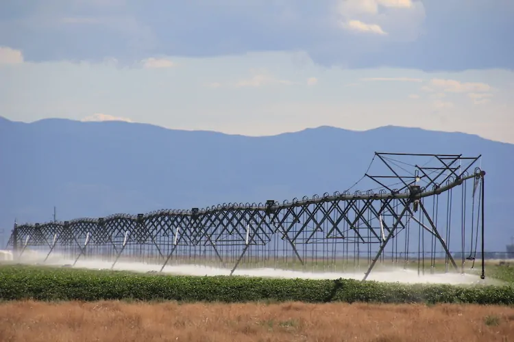
San Luis Valley center pivot August 14, 2022. Photo credit: Allen Best/Big Pivots

Massive #solar project moves forward: Alamosa County commissioners hope it will lead to power grid improvements — AlamosaCitizen.com

Credit: Illustration by The Citizen

Click the link to read the article on the Alamosa Citizen website:

November 12, 2025

an Alamosa County Commissioners meeting on Wednesday.

NextEra Energy is planning a maximum 600 megawatt solar plant and 600 megawatts of solar storage off Lane 2N between County Road 104 and County Road 108 in the central part of unincorporated Alamosa County.

So massive is the project that Alamosa County Commissioners are hoping it will help to convince state officials about the importance of increasing transmission capacity to move power in and out of the Valley.

As it stands, Coloradoโ€™s power grid currently isnโ€™t equipped to support this size of the proposed new plant, which NextEra Energy is calling its โ€œSpud Valleyโ€ solar project. The company plans to connect its Alamosa County project to the existing Public Service Co. and Xcel Energy substation that is adjacent to the site.

A single megawatt can power around 160 homes, so 600 megawatts has the equivalent power for tens of thousands of homes. Plus, Spud Valley includes just as much solar storage.

The Spud Valley project would be located on four square miles with 10 different land owners either selling or leasing property to NextEra Energy. The project is located in Subdistrict 1 of the Rio Grande Water Conservation District and a section of Alamosa County that has been rapidly reducing its agricultural output due to water constraints from the declining unconfined aquifer.

NextEra Energy is hoping to begin construction by the middle of 2027 and have the plant operational in 2028, according to company officials as they gained approval from Alamosa County on waivers to certain regulations within the required 1041 permit that didnโ€™t apply to the project. Final steps with Alamosa County will be taken in 2026 and notice given for a public hearing.

โ€œThis is substantially larger than anything now,โ€ Alamosa County Land Use Director Richard Hubler told the county commissioners. He said he hopes the project positively impacts the discussion around increasing the San Luis Valleyโ€™s transmission capacity.

Xcel Energy actively manages the power grid. When demand for power is high across the state, power generated in the Valley is transmitted out to meet the stateโ€™s demand. Given the size of the Spud Valley project, the power grid would have to be further developed to be able to handle the amount of solar from the new Alamosa County operation.

โ€œThis is a massive project and so it changes the balance of power more or less,โ€ Hubler said.

The Spud Valley site is adjacent to the 30 megawattย Alamosa Solar Generating Facility managed by Whetstone Power.

Screenshot from Google maps of vicinity for new solar plant

#Colorado State Land board approves 45,950-acre La Jara Reservoir transfer: Three-hour meeting heard support for the deal from ranchers, recreationists, conservationists and local and federal officials — AlamosaCitizen.com

Click the link to read the article on the Alamosa Citizen website:

November 13, 2025

The Colorado State Land Board gave final approval Thursday to the three-way transfer of 45,950 acres that make up the La Jara Basin, which includes La Jara Reservoir in Conejos County.

The decision came with plenty of apprehension around the federal government and whether the Trump Administration is a reliable partner in the deal. In the end, state land board commissioners agreed to โ€œroll the diceโ€ and hope for the best.

In the end, Commissioner Josie Heath was the lone no vote. 

The La Jara Basin land transfer will net the state land board $49.6 million, or $1,000 per acre for the land transferred to the U.S. Forest Service and BLM, and $2,500 per acre for the La Jara Reservoir area which will be managed by Colorado Parks & Wildlife.

The deal includes $43.5 million from the coveted Land and Water Conservation Fund, which sits with the U.S. Department of Interior and is used to โ€œsafeguard natural areas, water resources and cultural heritage.โ€

Pressure mounted on the state land board to approve the transfer as U.S. Sens. Michael Bennet and John Hickenlooper urged final approval. Former U.S. Secretary of the Interior Ken Salazar compared the transfer to the establishment of the Great Sand Dunes National Park. 

โ€œThis is the project of the 21st Century for the San Luis Valley,โ€ Salazar said.

State land board commissioners acknowledged their apprehension for giving final approval centered around mistrust for the Trump Administration and whether the current federal administration would abide by the deal. The commissioners hoped that even though the funds were appropriated that they would actually โ€œmaterializeโ€ in the future. 

When Alamosa Citizen published this story on the state land boardโ€™s hesitation on a final deal, the state agency found itself under pressure to give final approval. The state land board spent more than three hours hearing support for the deal from San Luis Valley local officials and the federal agencies that will assume management of the public lands once the land transfer is completed.

The state land board had three options โ€“ approve the land transfer to the federal agencies and CPW; keep the property with the state land board; or approve the La Jara Reservoir transfer to Colorado Parks & Wildlife and keep the portion of the property that the U.S. Forest Service and BLM sought.

A trove of local officials and residents spoke in-person and over Zoom of their support for the approval of the land transfer.  Alongside ranchers, farmers and recreationists, local officials provided their input, including Conejos County Commissioner Mitchel Jarvies and district manager for the San Luis Valley Water Conservation District Heather Dutton.

Representatives of the two federal agencies told state land board members that it was doubtful they could muster support in Congress to approve money for the acquisition again if the current deal wasnโ€™t accepted.

With the deal finalized, the U.S. Forest Service will take over 21,821 acres and BLM will manage 21,704 acres of the La Jara Basin. Colorado Parks & Wildlife will take management of La Jara Reservoir.

The federal Office of Budget and Management still has to free up the money for the Bureau of Land Managementโ€™s portion of the sale, according to BLM officials.
A view across La Jara Reservoir from a hill between the reservoir’s two dams. The reservoir is in Conejos County, Colorado. By Jeffrey Beall – Own work, CC BY 4.0, https://commons.wikimedia.org/w/index.php?curid=140180051

The Weminuche Wilderness at 50 — and a way forward for public lands: The creation of Colorado’s wilderness area was remarkably nonpartisan — Jonathan P. Thompson (LandDesk.org)

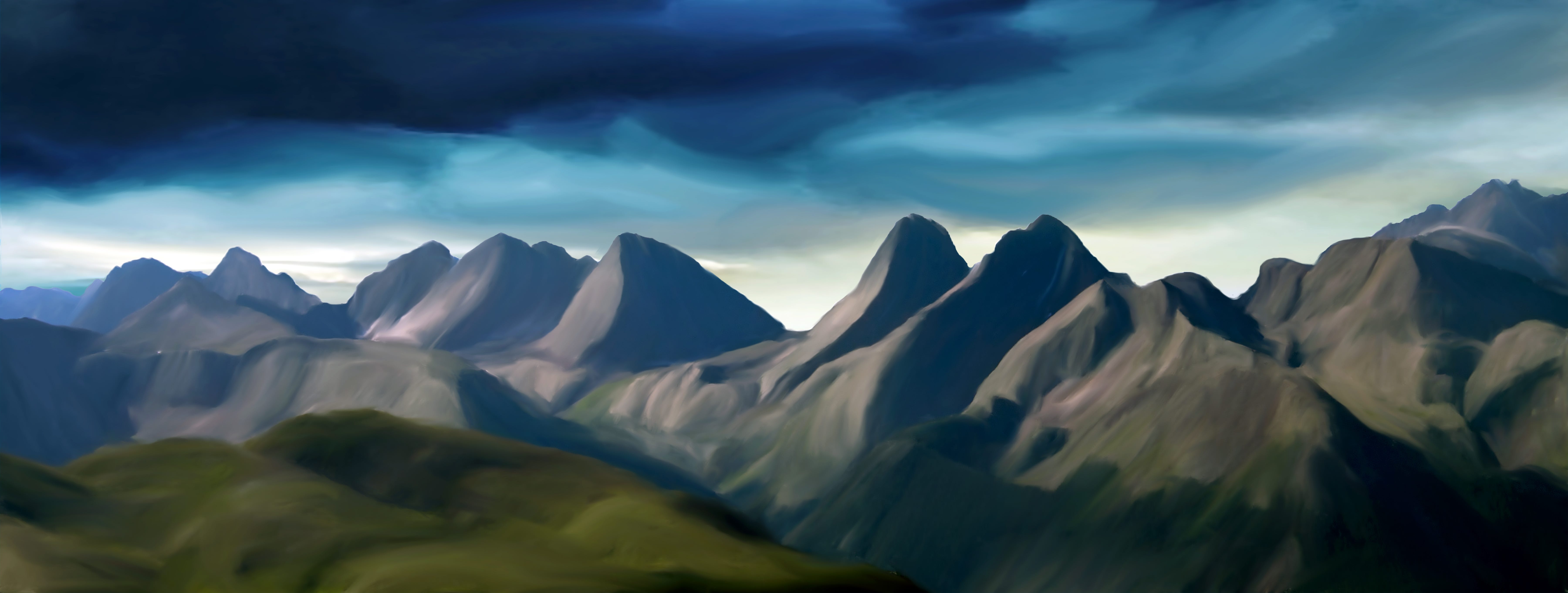
A photo illustration of the Grenadier Range in the Weminuche Wilderness. Jonathan P. Thompson photo.

Click the link to read the article on The Land Desk website (Jonathan P. Thompson):

October 28, 2025

Editorโ€™s note: Last week I had the pleasure of speaking at the San Juan Citizensโ€™ Alliance celebration of 50 years of the Weminuche Wilderness, Coloradoโ€™s largest wilderness area at nearly 500,000 acres. Congress passed the legislation establishing the Weminuche in 1975, and it now covers some of the most spectacular landscape in the nation. This is an adapted version of the talk I gave (with a lot fewer umms and uhhs in it).

As Iโ€™m sure you all are aware, our public lands have been under attack for a while now, but especially in the last nine months, from both the Trump administration and from the Republican-dominated Congress.

This all out assault has given me many reasons to worry about the fate of some of my favorite places. I have worried about Sen. Mike Lee, the MAGA adherent from Utah, selling off Animas Mountain or Jumbo Mountain to the housing developers; I have fretted about Trump shrinking or eliminating Bears Ears, Grand Staircase-Escalante, or Ancestral Footprints of the Grand Canyon national monuments and opening them to the latest uranium mining rush; and I worry that regulatory rollbacks and the administrationโ€™s โ€œenergy dominanceโ€ agenda will make the San Juan Basin and the Greater Chaco Region more vulnerable to a potential new natural gas boom driven by data center demand for more and more power.

But one place I havenโ€™t worried (as much) about being attacked by the GOP and Trump is the Weminuche Wilderness. Thatโ€™s not because I think Trump or Lee are above messing with wilderness areas. They arenโ€™t. In fact, just this week they opened the Arctic National Wildlife Refuge up to oil and gas leasing. Still, the Wilderness Act is one of the few major environmental laws these guys havenโ€™t gone after directly โ€” at least so far.

But more than that, the reason I feel the Weminuche is less vulnerable to MAGA attacks is because I am confident that even the most die-hard anti-environmentalist sorts understand that an attack on the Weminuche would be an attack on this region and its identity. The Weminuche has simply become ingrained in the collective psyche of southwest Colorado and beyond. If the feds were to try to open it to logging or drilling or mining or any other sort of development, there would be a widespread, deep revolt from this entire region, even from many a Trump voter.

In part, thatโ€™s because of how special the place is, with or without a wilderness designation. But it also has to do with the way the wilderness was established, and the widespread local support it ultimately garnered.

Not long after the Wilderness Act of 1964 was signed into law, federal and state agencies and residents of southwestern Colorado began talking about establishing a wilderness area in the remote San Juan Mountains. Areas such as the Silverton Caldera had been heavily mined, and no longer qualified for wilderness designation (even if the mining industry and local communities would have allowed it).

But the heart of the San Juans in and around the Needle and Grenadier ranges certainly fit the bill. In 1859, Macomb expedition geologist J.S. Newberry described the San Juans as a โ€œthousand interlocking spurs and narrow valleys, [which] form a labyrinth whose extent and intricacy will at present defy all attempts at detailed topographical analysis. Among these are precipices, ornamented with imitations of columns, arches, and pilasters, which form some of the grandest specimens of natureโ€™s Gothic architecture I have ever beheld. When viewed from some nearer point they must be even awful in their sublimity.โ€

โ€œAwfulโ€ might be a bit harsh, but sublime? Indeed. That this should become a wilderness must have seemed like a no-brainer.

Nevertheless, the process to designate the Weminuche was no slam dunk. It took a half decade of wrangling and debate and boundary adjustments and congressional committee sausage-making. What to me is most remarkable, however, looking back on the process from our current, politically polarized era, is that the debates were not partisan. And even though there were differing opinions on where the boundaries should be drawn or even whether there should be any wilderness at all, the conversation was just that: a conversation, and a civil one at that.

Proposals were forwarded by the Forest Service and the Colorado Game & Fish Department. Meanwhile, the Citizens for the Weminuche Wilderness โ€” made up of local advocates, ranchers, scientists, business people, and academics โ€” came up with its own proposed boundaries.

My father chronicled some of the back and forth in an insert he put together and edited for the Durango Herald in 1969 called โ€œThe Wilderness Question.โ€ It includes his editorials and news stories, but also opinion pieces from a variety of residents.

Looking back, it is a truly striking document. First off, thereโ€™s the fact that the Forest Serviceโ€™s original proposal would have excluded Chicago Basin โ€” now considered the heart of the wilderness area and a Mecca for backpackers and peak-baggers (and their attendant impacts) โ€” and the City Reservoir trail and surrounding areas. They were left out, in part, because there were hundreds of mining claims in those areas, and the mining industry remained interested in them, despite their remoteness and difficult access.

The citizens group, however, was having none of that, and demanded that both areas be included in the wilderness area. Carving these areas out would be like cutting the soul from the place. Ranchers weighed in, as well. James Cole, who was described as a โ€œprominent Basin rancher,โ€ wrote this for the Herald supplement: โ€œThe La Plata County Cattlemen are in favor of the proposed Weminuche Wilderness Area โ€ฆ We would like to see Weminuche Creek and Chicago Basin, which the forest service would like to exclude, included in the Wilderness Area.โ€

It may seem odd, today, to see a livestock operatorsโ€™ group advocating for morewilderness than even the feds wanted, but it makes a lot of sense. Not only are many ranchers conservation-minded, but their operations were unlikely to be affected by wilderness designation, since grazing is allowed in wilderness areas. Itโ€™s actually far stranger to see southeastern Utah ranchers become some of the most zealous opponents of Bears Ears National Monument, since its establishment didnโ€™t ban or restrict current grazing allotments.

Fred Kroeger, a lifelong Republican1 and local water buffalo, who for years pushed for the construction of the Animas-La Plata water project, supported wilderness designation because it would protect the regionโ€™s water. (My grandparents, who were Animas Valley farmers and Republicans also supported the designation).

John Zink was a rancher, businessman, fisherman, and hunter and member of the citizensโ€™ committee. In the Herald supplement he wrote that the proposed Weminuche Wilderness, โ€œoffers outdoor lovers an opportunity to support another sound conservation practice.โ€

He continued:

โ€œFor me it wonโ€™t be many years until slowed feet and dimmed eyes make the south 40 the logical place to hunt, and when the time comes, I expect to enjoy it. But a new and younger generation of outdoor lovers will then be climbing the peaks and wading the icy streams. I ask all outdoor enthusiasts to support the proposed Weminuche Wilderness Area, so each new generation may enjoy it much as it was when Chief Weminuche led his braves across this fabled land.โ€

Thatโ€™s not to say everyone was in favor of the citizensโ€™ proposal, but opposition was almost always on pragmatic, not political or ideological grounds. Probably the most strident opposing opinion piece in the Herald supplement came from an engineer at the Dixilyn Mine outside of Silverton, who didnโ€™t want his industry shut out of any potentially mineralized areas, including Chicago Basin. Less than two decades later, the mining industry would be all but gone from the San Juans โ€” and it had nothing to do with wilderness areas or other environmental protections.

John Zinkโ€™s son, Ed, who would go on to become a prominent businessman, pillar of the community, and the driving force establishing Durango as a cycling hub, asked that some areas, including the trail to City Reservoir, be excluded from the wilderness to accommodate the rights of โ€œriders of machines.โ€ He was talking about motorbikes back then, but would later focus more on mountain bikes. Zink, a staunch Republican, was undoubtedly bummed when the City Reservoir trail was included in the wilderness area, per the citizensโ€™ proposal.

Nevertheless, a few years later, when I was about eight years old, I went on one of my earliest backpacking trips up the trail with Zink (who was my dadโ€™s cousin), along with his sons Tim and Brian, nephew Johnny, and my dad and my brother. We hiked for hours without seeing anyone else โ€” and without hearing the buzz of any motorized vehicles. Ed didnโ€™t seem to miss his motorcycle one bit, nor did he or other motorized groups file lawsuits to try to block or shrink the wilderness, as is common practice today.

Ed would later be instrumental in establishing the Hermosa Creek wilderness area north of Durango, a compromise bill that left Hermosa Creek trail open to mountain bikes and motorbikes. Again, he worked from a pragmatic mindset: He wanted to protect the watershed from which his irrigation and drinking water came, and the forests that sustained game and wildlife, while also retaining recreational access.

When Congress finally passed the bill establishing the Weminuche, it went with the citizensโ€™ group proposal and then some, designating 405,000 acres of federal land as a wilderness area and including Chicago Basin and City Reservoir. The Weminuche Wilderness was expanded in 1980 and again in 1993.

In the years since, public lands protection and conservation have become more and more politicized, along with just about everything else. The pragmatism of the 1970s has been abandoned in favor of ideology; public lands, somehow, have become a pawn in the culture wars. Iโ€™m sure both parties share some of the blame, but judging from their actions of late, the MAGA Republicans have become the staunchly anti-public lands conservation party โ€” and bear absolutely no resemblance to the old school Republicans who fought for wilderness designation 50 years ago. Hell, for that matter, some Republican politicians donโ€™t even resemble their selves from just a couple of decades ago.


The death of the pragmatic Western Republican: Extremism is killing the old-school GOP — Jonathan P. Thompson


Trumpโ€™s going to go away some day, and the attacks on public lands will probably ease off. But they wonโ€™t stop altogether. Humansโ€™ hunger for more stuff and minerals and energy will undoubtedly put pressure on the places we hold dear, maybe even on the Weminuche. But polarization and political partisanship will only hamper our ability to save these places. Our only hope is to, somehow, recover some of the civility, the non-partisanship, and the pragmatism that fueled the designation of the Weminuche in 1975.

I have no idea how weโ€™ll get there, but I do hold out hope. I really have no choice. Iโ€™ll leave you with some words written by my father, Ian Thompson, in the โ€œWilderness Questionโ€ insert in 1969:

โ€œThe Wilderness effort we are engaged in at the time is, in one respect, a pitifully futile struggle. Earthโ€™s total atmosphere is human-changed beyond redemption, Earthโ€™s waters would not be recognizable to the Pilgrims. Earthโ€™s creatures will never again know what it is to be truly โ€œwild.โ€ The sonic thunder of manโ€™s aircraft will increasingly descend in destructive shock waves upon any โ€œwilderness areaโ€ no matter how remote or how large. No, there is no wilderness, and throughout the future of humanity, there will be no wilderness. We are attempting to save the battered remnants of the original work of a Creator. To engage in this effort is the last hope of religious people.

โ€œThe child seen here and there in โ€œThe Wilderness Questionโ€ would have loved Wilderness. There is tragedy in that knowledge. Hopefully we will leave him a reasonable facsimile of Wilderness. In the last, tattered works of Creation this child might find the source of strength necessary to love America and the works of man. If we care enough to act.โ€

*Nowhere in the several-page insert are political parties mentioned, most likely because people were less inclined to identify themselves according to political party, but also because environmental preservation was not at all partisan at the time. I mention their affiliations here to further demonstrate the way the discussion transcended party politics.


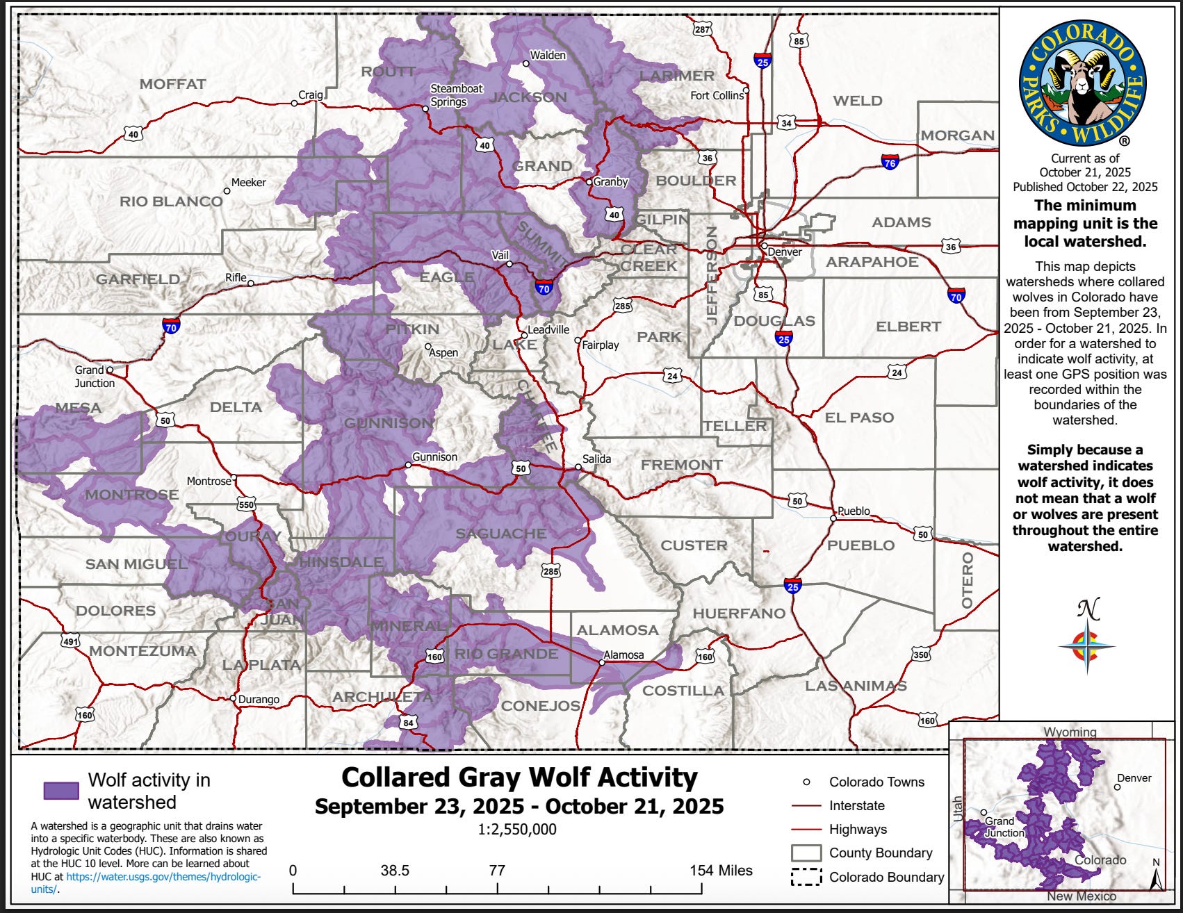
Speaking of the Weminuche: It looks like wolves may have made their way into the wilderness area. Colorado Parks and Wildlifeโ€™s most recent Collared Gray Wolf Activity map shows that the wolves have been detected in the San Juan, Rio Grande, Uncompahgre, and Gunnison River watersheds in the southwestern part of the state. Since the minimum mapping unit is the watershed, itโ€™s not clear that the wolves have for sure ventured into the Weminuche. But it is certain that they have been recorded in the San Juan Mountains. It seems only a matter of time before they cross into New Mexico and maybe even Utah.


When Trump was elected for the second time, I figured there was no way he could make public lands grazing any less restrictive. After all, presidential administrations of all political persuasions have famously โ€” or infamously โ€” done very little to restrict grazing or to get it to pay for itself (the BLMโ€™s grazing fee has remained at $1.35 per AUM, the mandated minimum) for decades. But, alas, the U.S. Agriculture Department recently announced its plan to โ€œFortify the American Beef Industry: Strengthening Ranches, Rebuilding Capacity, and Lowering Costs for Consumers.โ€ 

The plan, as you may imagine, looks to expand public lands grazing, among other things. And it was released at about the same time as Trump encouraged folks to eat Argentinian beef, since he seems to have developed a sort of crush on Argentina President Javier Milei. 

Iโ€™ll get into the details of the USDA plan and offer some thoughts on it in the next dispatch. In the meantime, you can dive into my deep dive on public lands grazing here, though you have to be a paid subscriber (or sign up for a free trial) to get past the paywall.


The West’s Sacred Cow Public land grazing makes it through another administration unreformed — Jonathan P. Thompson

West’s Sacred Cow part II: Indian Creek case study Plus: Monarchs in trouble, Wacky weather, Living in f#$%ed up times — Jonathan P. Thompson

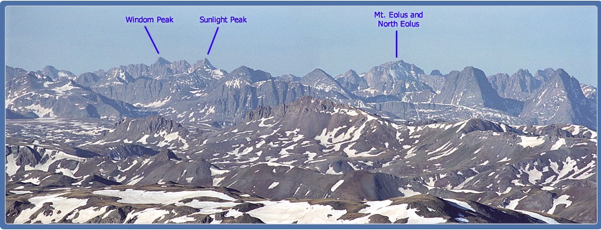
Windom, Eolus, and Sunlight — Weminuche Wilderness via 14ers.org
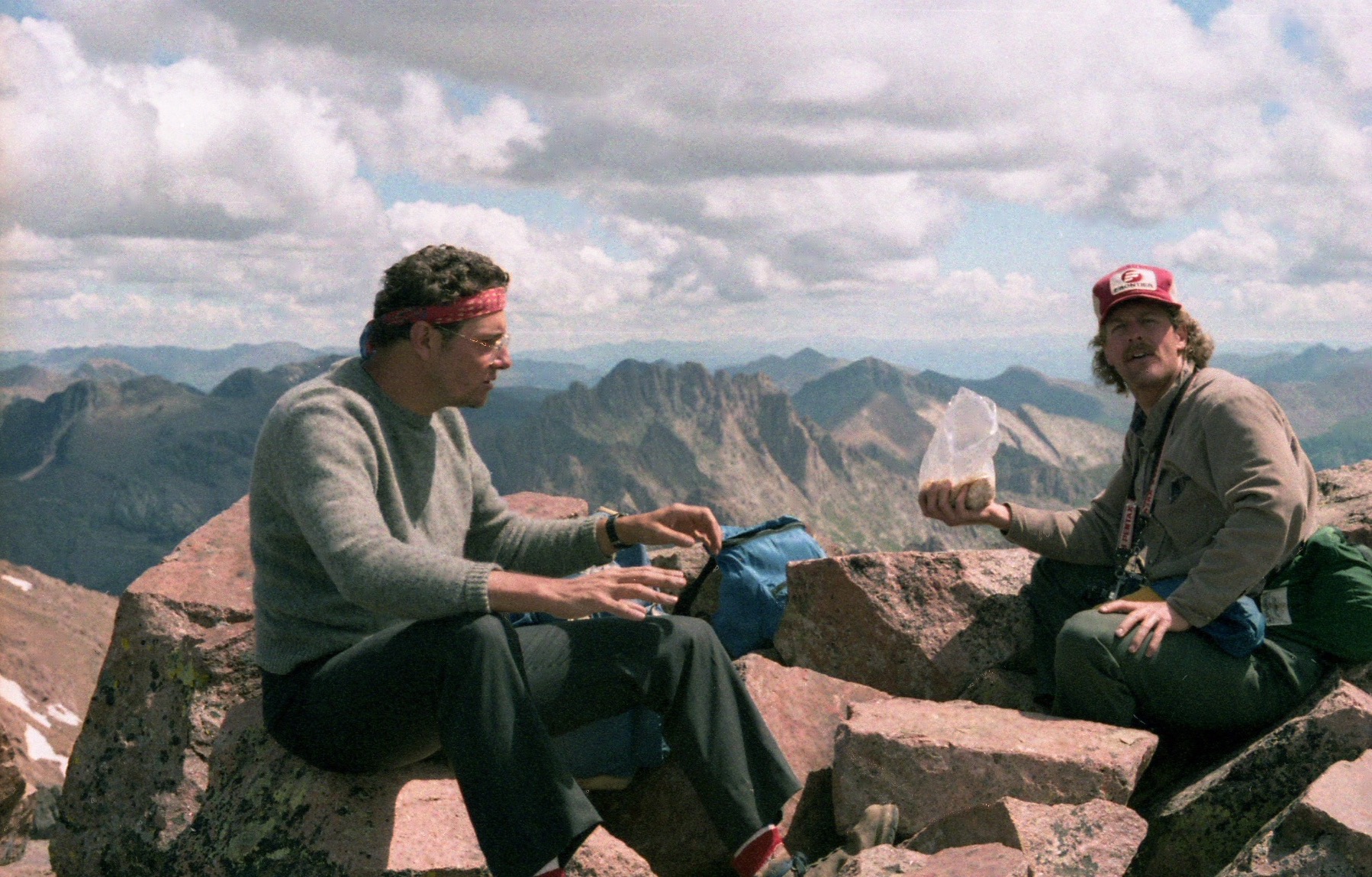
Coyote Gulch enjoying a lunch break at the top of Windom Peak or Sunlight Peak in the Weminuche Wilderness with a hiking buddy, 1986ish.

What would it take to fix #NewMexico’s #drought? — The Santa Fe New Mexican

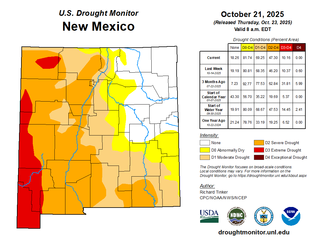
New Mexico Drought Monitor map October 21, 2025.

Click the link to read the article on the Santa Fe New Mexican website (Lily Alexander). Here’s an excerpt:

October 17, 2025

What would it take to get New Mexico out of megadrought? The short answer: water. The longer answer: multiple years of heavy winter snows. The Southwestern U.S. โ€” including New Mexico โ€” has faced a steady drought for a quarter century, improving and degrading as seasonal moisture comes and goes. The short-term drought in the state is now relatively mild, thanks to a rainy summer monsoon, but the longer-term conditions paint a different picture โ€” one thatโ€™s harder to fix, said Andrew Mangham, a senior service hydrologist with the National Weather Service in Albuquerque.

โ€œA really good, aggressively wet monsoon season โ€” just one โ€” can wipe out drought effects in terms of the short term,โ€ Mangham said. โ€œThis can improve fine fuels, by which I mean grasses and shrubs; those can be quite healthy. Surface soils can be fairly wet. But that doesnโ€™t necessarily mean that itโ€™s going to fill up the reservoirs.โ€

Drought is measured through multiple sectors: hydrological, referring to reservoir and river levels; agricultural, referring to how drought impacts crops; and ecological, referring to forest health. The U.S. Drought Monitor tracks the short-term drought across the state, categorizing it from โ€œabnormally dryโ€ to โ€œexceptionalโ€ in intensity. A swath of northeastern New Mexico is not currently experiencing drought, but the rest of the state is facing at least abnormally dry conditions, according to the monitorโ€™s most recentย data; the drought is worst in southwestern New Mexico, as it has been for months…Around the time the reservoir storage levels dropped, the Southwest entered what scientists call a megadrought, now in its 25th year. This is believed to be the worst megadrought of the past 1,200 years, and recentย researchย from the University of Texas at Austin indicates it could continue at least through the end of the century. New Mexicoโ€™s long-term drought wholly improving would require heavy wintertime snows in the northern part of the state and in southern Colorado, Mangham said, as thatโ€™s the source of much of the water that ends up โ€œrechargingโ€ the stateโ€™s rivers and reservoirs…Snowpack is more helpful for drought than the spotty, hard-hitting storms of the summer monsoon, Mangham said. This is because snow is typically slower-moving than rain โ€” and too much rain at once leaves only a little soaking into the soil.

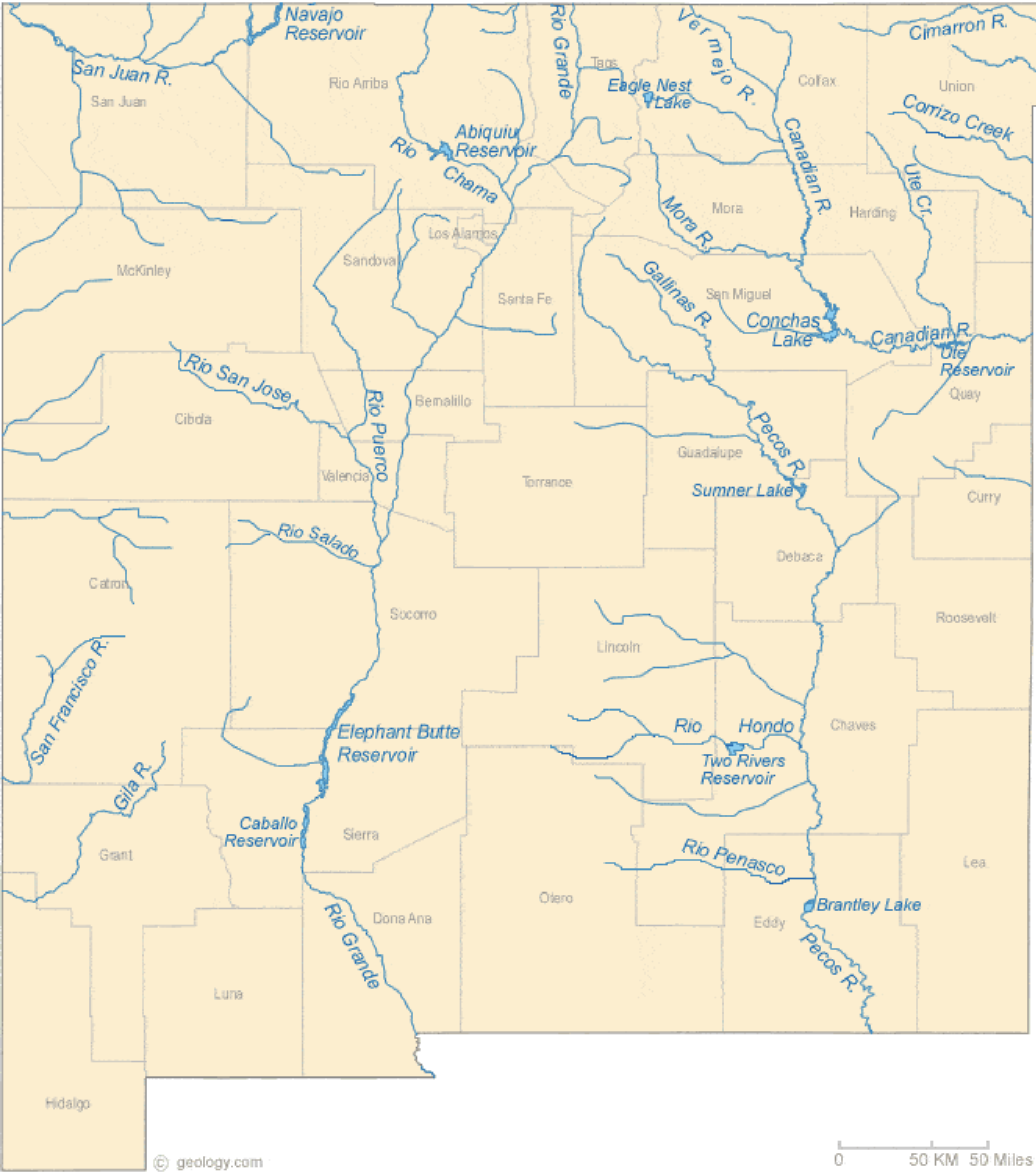
New Mexico Lakes, Rivers and Water Resources via Geology.com.

The driest year on #NewMexicoโ€™s Middle #RioGrande since 1964 — John Fleck (InkStain.net)

The driest year at Otowi since 1964. Code: https://github.com/johnrfleck/water-tools

Click the link to read the article on the InkStain website (John Fleck):

October 11, 2025

Total flow to date on the Rio Grande at Otowi is the lowest since 1964.

Otowi is the place where the river leaves the upper valleys and enters the canyons that lie at the head of the valley of Albuquerque, what we in New Mexico call the โ€œMiddle Rio Grande.โ€

The graph shows total flow to date this year, with previous drier years called out in red. You can see that the โ€œdrought of the โ€™50s,โ€ (which really extended well into the 1960s) was the big impact decadal-scale event here, not the โ€™30s, Dust Bowl.

If you squint, you also can see the subtle impact of the San Juan-Chama Project, which beginning in the 1970s began importing Colorado River water. Iโ€™m measuring total flow with this calculation, not what is formally called the โ€œOtowi Index Flow,โ€ the official measure of native water used for Rio Grande Compact accounting. This is the number that matters the most to me โ€“ itโ€™s the total amount of water we have to work with here in the Middle Rio Grande, the actual flow of water into the valley each year. You can see a subtle impact of that SJC water, raising up the floor in dry years. At least I think I can see that.

A Note on Method

I am not a computer programmer, or software engineer, or whatever you call that thing. But Iโ€™ve been writing computer code since I was a teenager in Upland, California, writing Fortran on punch cards that we would send to the guy who ran the school district mainframe to run in the middle of the night. (Southern Californiaโ€™s Mediterranean climate meant we did not have to trudge miles to school barefoot in the snow, but we did write code on punch cards.)

Iโ€™ve done it because itโ€™s fun (I did a stint as a free software volunteer on the GNOME project 20-plus years ago), as a toolkit for analyzing data in my haphazard career as a โ€œdata journalist,โ€ and in early days of newspaper Internet work, when we rolled our own web site code in Perl. I am a terrible coder, but with some help (site:stackexchange.com โ€œcryptic error messageโ€) I know enough to make my way around the data I have questions about. I was the guy at the newspaper who โ€œborrowedโ€ Lotus 1-2-3 from a friend to analyze city budgets, and persuaded the IT folks to put โ€œRโ€ on my desktop computer against their better judgment. But itโ€™s laborious stuff because of the gap between my subject matter expertise and my coding skills. As a result, there were things I didnโ€™t bother with.

Luis Villa, a friend from my GNOME days who went on to become a lawyer and big think person about โ€œopenโ€ and the commons, posed a question on his blog last month about the gateway language model coding tools provide into open data. The provocative header to the section of the post was โ€œAccessibility & Democratizationโ€:

โ€œVibecodingโ€ is a technique by which you tell a language model in plain language what you want your code to  do. It writes it. You run it. It chokes, you paste in the error message and say โ€œFix this.โ€ After a couple of iterations, it works. This is both dangerous and liberating. For me, it opens up vast areas of open data for analysis that I never would have bothered with because of the agony of pasting error messages into a search engine trying to find someone on Stackexchange who had the same problem, running their code, getting a new error message, turtles all the way down. I know the questions and the analytical structures I need, but turning those ideas into code was a pain in the ass!

In the case of the graph above, I had some old code I had written that downloaded USGS streamflow data, converted cubic feet per second (a rate) to acre feet over a specified time period (a volume), compared flow to date this year to flow to the same date in previous years, and made a graph.

This year has been super dry. I was curious about previous years that had been this dry. Updating the code to color those with lower flow than this yearโ€™s red was conceptually trivial, but would have been tedious and time consuming. Also, the old codeโ€™s visualization was ugly. Vibecoding the changes took an order of magnitude less time than writing all of that code by hand. Iโ€™m pretty sure it took longer to make the locator map in Datawrapper (which is fast!) than it did to update the code.

This would be a terrible idea, as Simon Willison argues, if my goal was to become a better programmer, or a software engineer writing production code. This is the same reason using language models to do your writing for you โ€“ if your goal is to come to understanding โ€“ is a terrible idea. The act of writing is an act of coming to understanding. For me, the knowledge work here is staring at the graph, incorporating what it is telling me into my knowledge framework, and doing the work of writing this blog post. I need to know enough to look at the code and the data it spits out to be confident that itโ€™s sane. But I donโ€™t care about the finicky syntax of Rโ€™s โ€œmutateโ€ and โ€œifelse.โ€

Code here, part of a set of water data analysis scripts Iโ€™ve used for years, updated this week with Anthropicโ€™s codebase management tools to fix a bunch of messes I knew needed fixing, freely licensed under the MIT license so you can do with them what you will.

A reversal of water fortunes: October brought full canals and bolstered reservoirs, and โ€˜a little extra head startโ€™ into winter — AlamosaCitizen.com #RioGrande #SanLuisValley

Greg Higel’s Alamosa County cattle ranch and hay operation opened ditches to take water in. Credit: The Citizen

Click the link to read the article on the Alamosa Citizen website:

October 17, 2025

The reversal of fortunes this water year for San Luis Valley irrigators โ€“ going from one of the deadest rivers on record to a bountiful water year that sees full canals and increased reservoir storage โ€“ has been breathtaking.

The โ€œwater yearโ€ for Valley farmers technically ends Nov. 1, which means no more water in the fields. Now with the mid-October rains from the southwest and resulting historic fall river flows, the state is talking to farmers about extending the water season a bit into November, which would allow for another week of irrigating and another cut of hay.

โ€œIโ€™m working hard, but Iโ€™m not complaining,โ€ said Greg Higel, whose Alamosa County cattle ranch and hay operation takes in surface water through the Centennial Ditch. It was private ditch operators like Higel who opened their head gates to begin diverting water off the Rio Grande. 

โ€œAll of us who live along the river on the flat have water out in the meadows today,โ€ said Higel. 

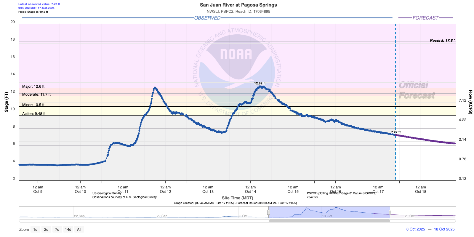
That was not the case before Sunday, Oct. 12, when it became evident the Upper Rio Grande would be impacted by La Niรฑaโ€™s first seasonal storm.

Back in April at the start of the irrigation season, State Engineer Jason Ullmann warned Valley irrigators that the 2025 water year looked troubling given the lack of snow in the San Juan Mountains and expectation for another light spring runoff. 

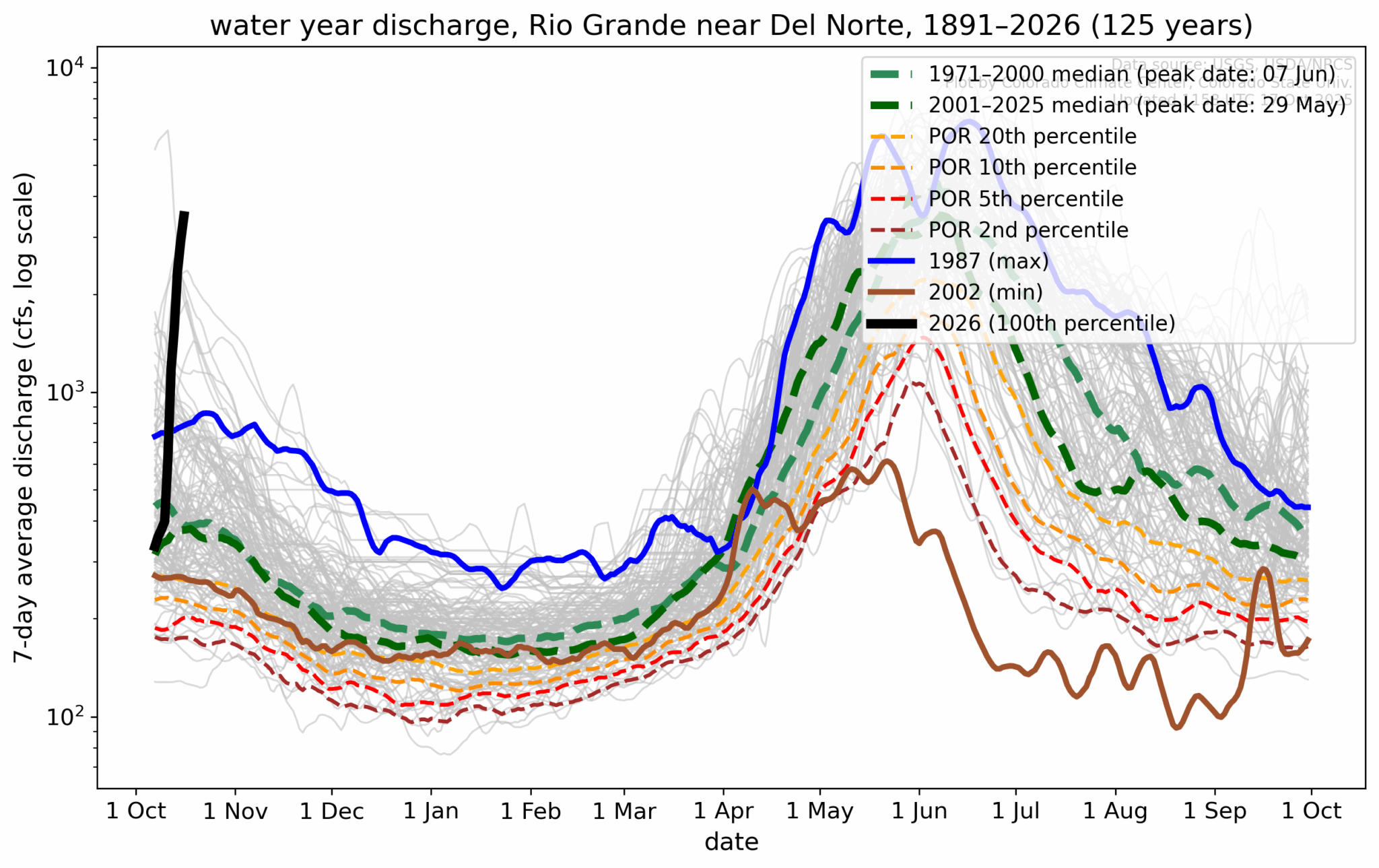
By August, the Rio Grande through Alamosa was disappearing before our eyes. Literally. The flow of the Rio Grande was 180 cfs at Del Norte, the Conejos at Mogote was running at 75 cfs, and downstream into New Mexico the Rio Grande had become a dry bed in Albuquerque.

The state is talking to farmers about extending the water season a bit into November, which would allow for another week of irrigating and another cut of hay. Credit: The Citizen

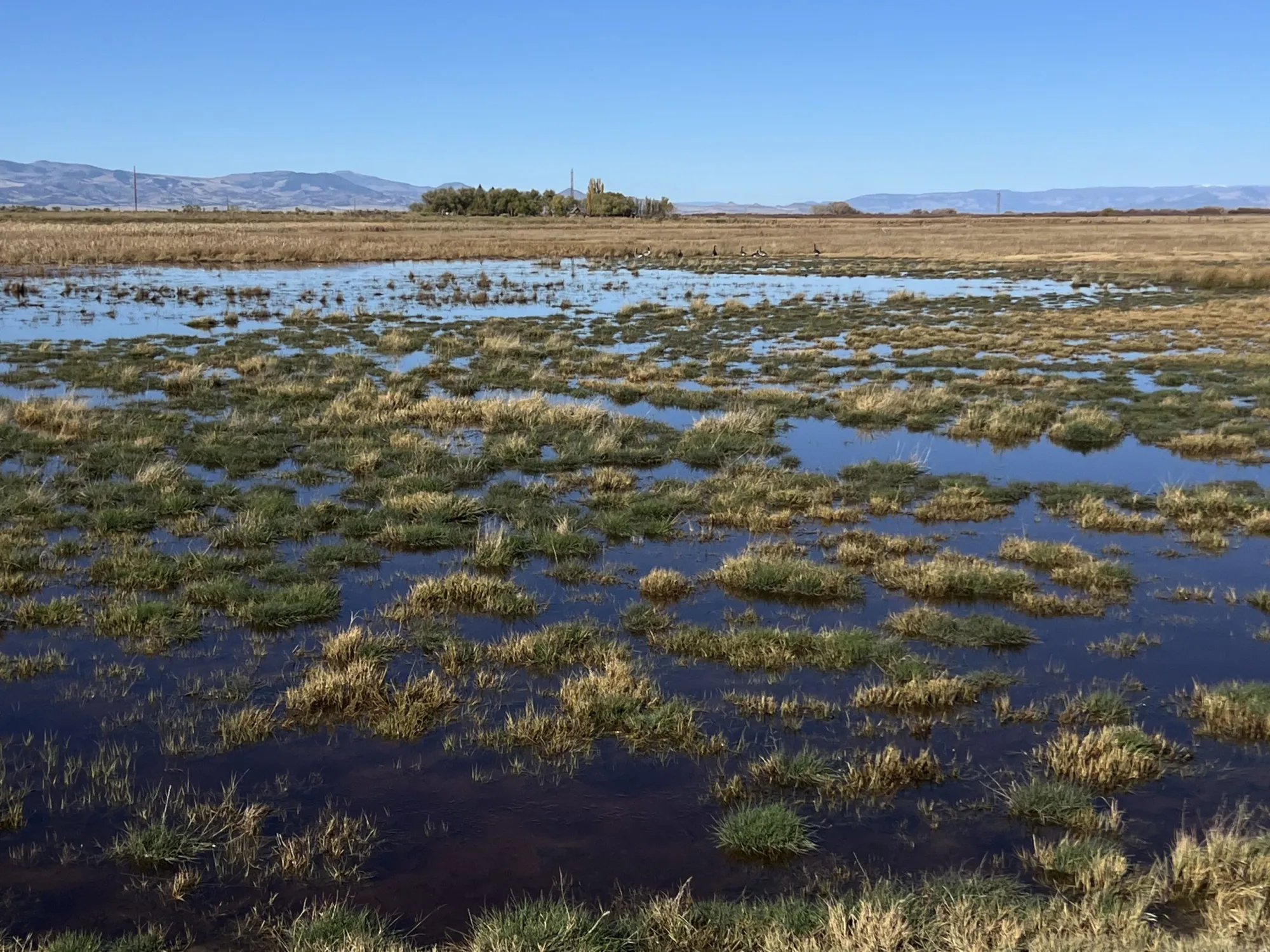
Then came the ocean storms over the Pacific and heavy rains through the southwest, and the rivers that are essential to the Valley and downstream into New Mexico sprang to life. The Upper Rio Grande at Del Norte hit 7,180 cfs, and unheard of flow this late into the water season. The Conejos River at Mogote hit its record high flow for the season, and farmers in the southern end of the Valley, like Higel on the west end, opened ditches to take water in.

โ€œThis helps us in the long run,โ€ said Lawrence Crowder, president of the Commonwealth Ditch.

The Commonwealth had six ditch riders working the storm and diverting water into fields throughout the week. Now the expectation is the water will freeze in the fields and then thaw in the spring to give irrigators โ€œa little extra head start.โ€

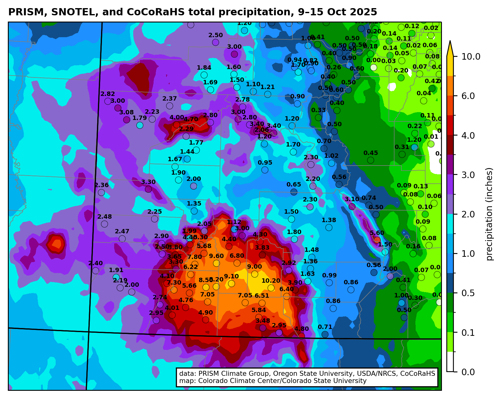
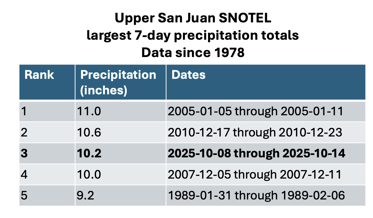
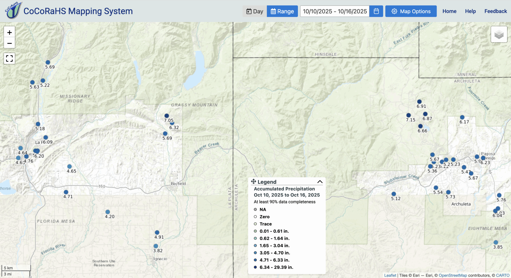
Total precipitation (inches) from 9-15 October 2025 with gridded data from the PRISM Climate Group and observations from the Community Collaborative Rain, Hail, and Snow (CoCoRaHS) network.

โ€œItโ€™s not going to dry out much between now and when the snow flies,โ€ Crowder said.

The October moisture also turned around the calculations of the Colorado Division of Water Resources and its delivery of water to the New Mexico state line under the Rio Grande Compact. The weather event, according to initial estimates by the Colorado Division of Water Resources, added 20,000 to 25,000 acre-feet of water to the Rio Grande system itself, and around 10,000 to 15,000 acre-feet that was diverted into the private ditches like the Commonwealth and Centennial.

โ€œAll of us who live along the river on the flat have water out in the meadows today,โ€ said rancher Greg Higel. Credit: The Citizen

With all the extra water, Colorado no longer thinks it overdelivered this year and instead likely owes in the neighborhood of 5,000 acre-feet to New Mexico. 

At the upcoming Rio Grande Water Conservation District quarterly meeting on Oct. 21, Colorado Division of Water Resources officials will deliver a report that should provide final estimates on the amount of water the great storm of October delivered and the impact it had on the Upper Rio Grande Basin.

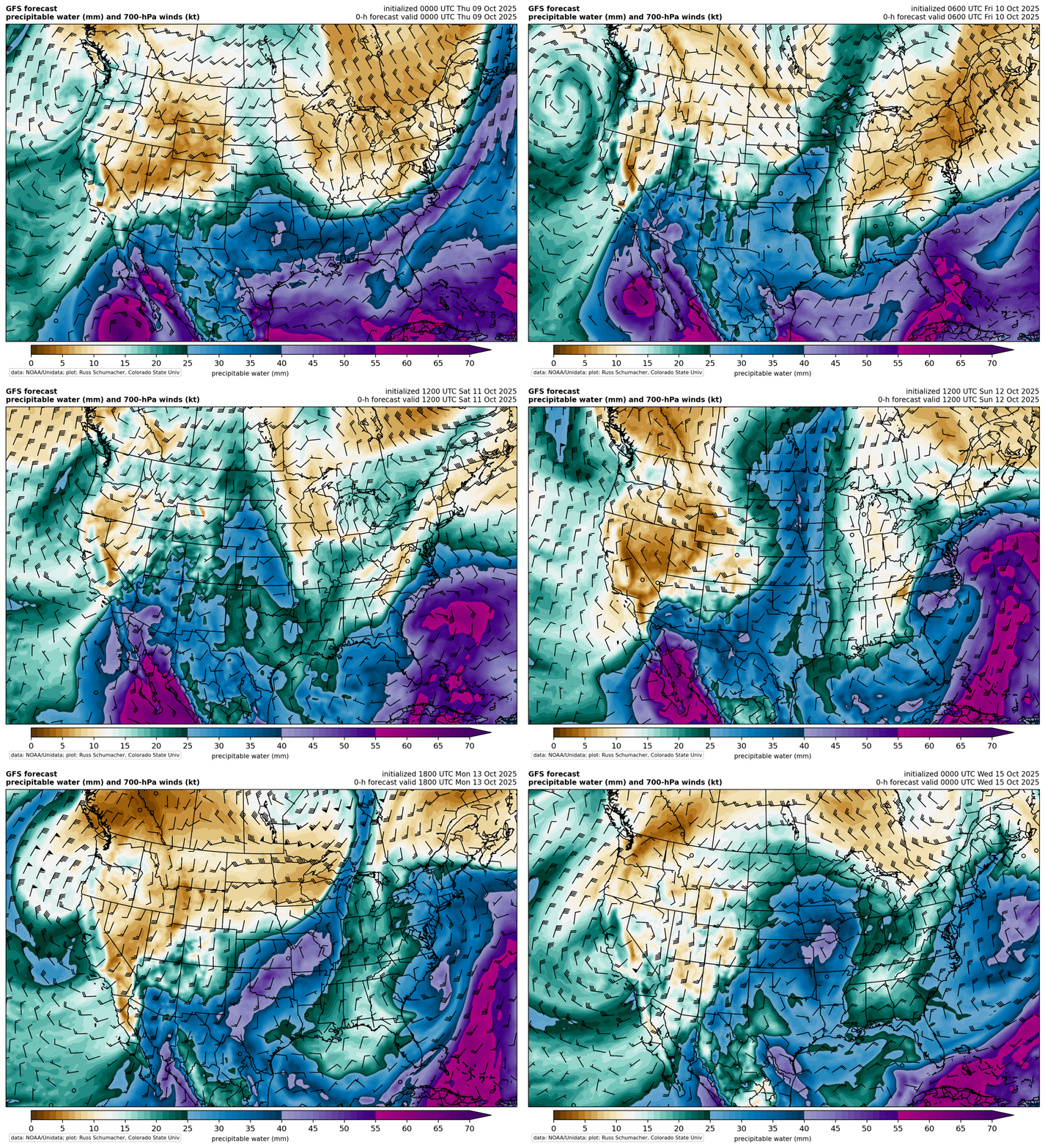
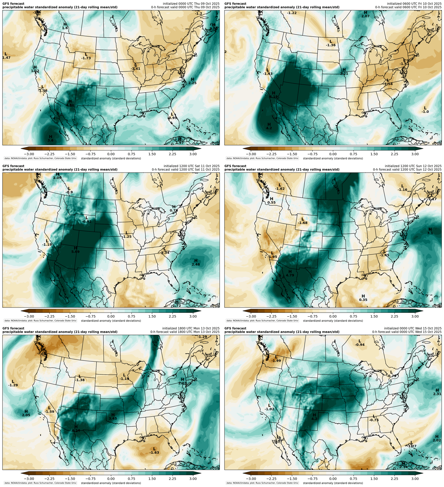
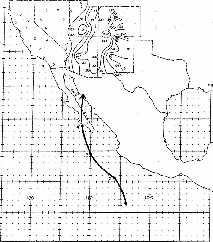
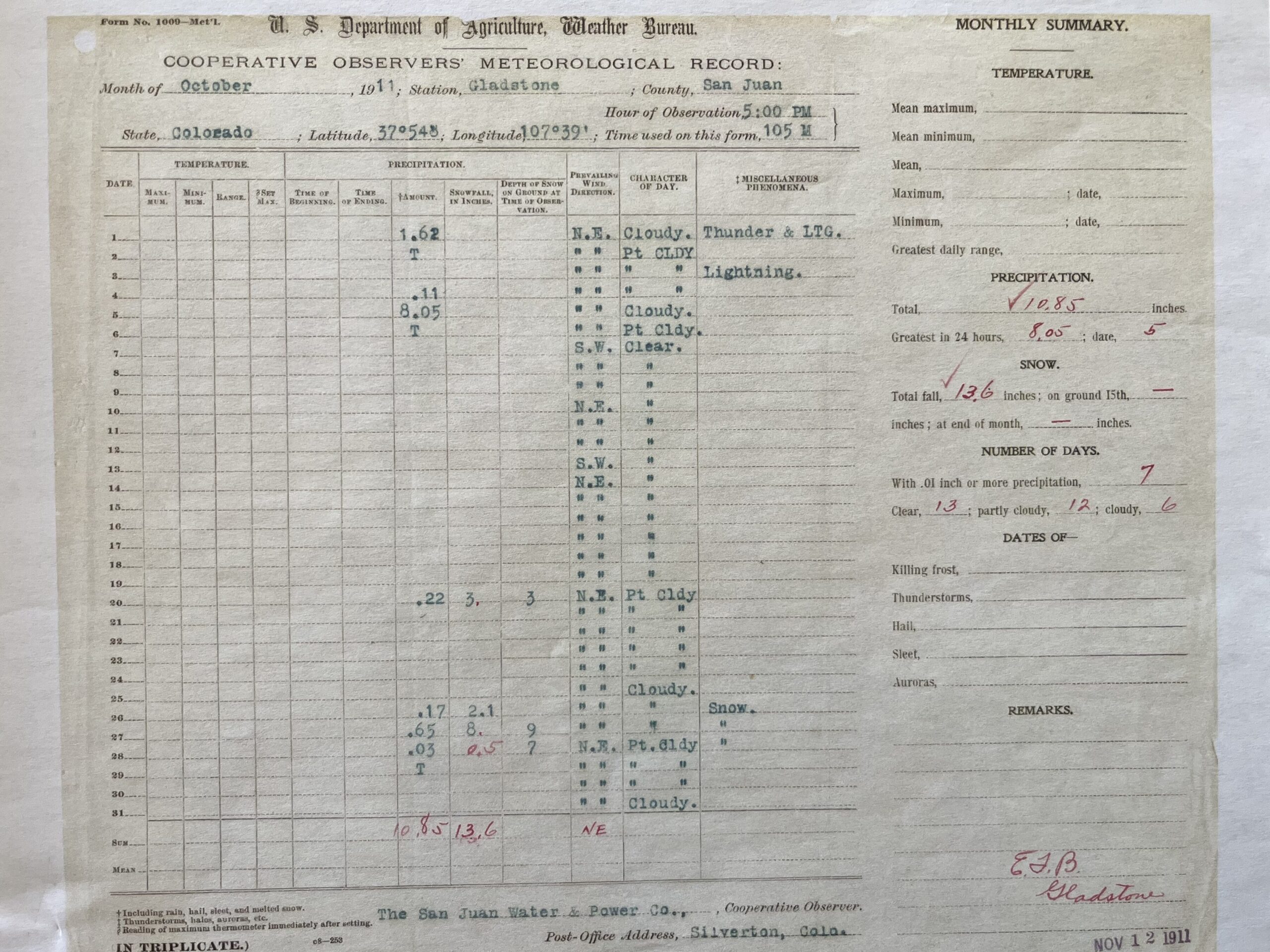
In terms of flow on the Rio Grande, only the peak from October 1911 is higher than the current average flow for the period between October and April, according to research by Russ Schumacher of the Colorado Climate Center in Fort Collins.

Needless to say, the reversal of fortunes on the Upper Rio Grande was dramatic. At least for 2025.

Rio Grande and Pecos River basins. Map credit: By Kmusser – Own work, Elevation data from SRTM, drainage basin from GTOPO [1], U.S. stream from the National Atlas [2], all other features from Vector Map., CC BY-SA 3.0, https://commons.wikimedia.org/w/index.php?curid=11218868

โ€œthe nearest thing I have seen to being trueโ€ — John Fleck (InkStain.net)

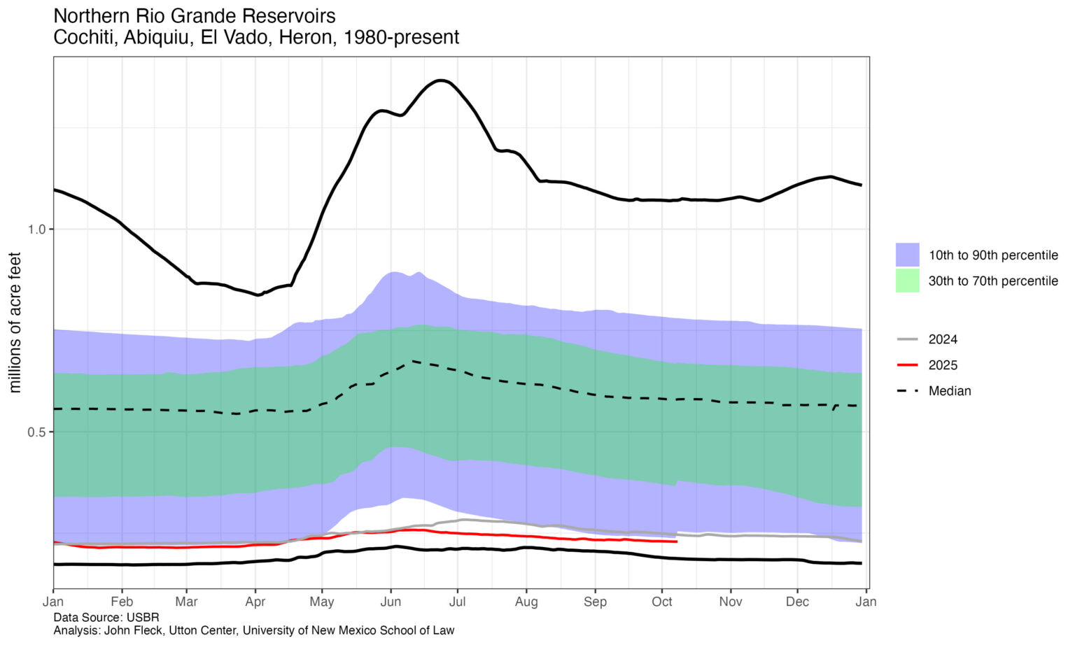
Exploring the data commons (I need to update the legend, the black lines are max and min)

Click the link to read the article on the InkStain website (John Fleck):

October 9, 2025

A bunch of odds and ends cluttering my brain, blog posts that are half written in my mind that are in the way:

Quoting Luis Villa on accessing the open data commons

Yes.

See graph above.

I always have had more questions (sometimes ill-posed, sometimes well-thought-through) than my coding abilities can execute. (See also domestic wells below.)

Source

The Commons

I pay for a subscription to Newspapers.com in order to have access to a large portion of my written work. I view what I have written over the course of my life โ€“ newspapers, books, blogs โ€“ as a mindful and intentional contribution to the information commons. But this aligns poorly with the formal economic and legal structures โ€“ โ€œinstitutionsโ€ as we might define them for our water resources students, the rules that serve as the foundation for the more common-language definitions of โ€œinstitutionsโ€ that might apply here, the organizations of publishing โ€“ newspapers and book publishers and Inkstain.

The newspaper paid me well (it wasnโ€™t a lot of money, but I viewed it as a fair transaction) and owned what I produced. I pay now for the privilege of reading it. The books are more complicated. I choose to make Inkstain freely available.

Derrida and Adorno, two philosophers I have been poking at of late, are helping me think about the definitional challenges โ€“ not โ€œthe commonsโ€ in particular, but what weโ€™re doing when we attach words/concepts to things, the cultural quicksand beneath our linguistic feet.

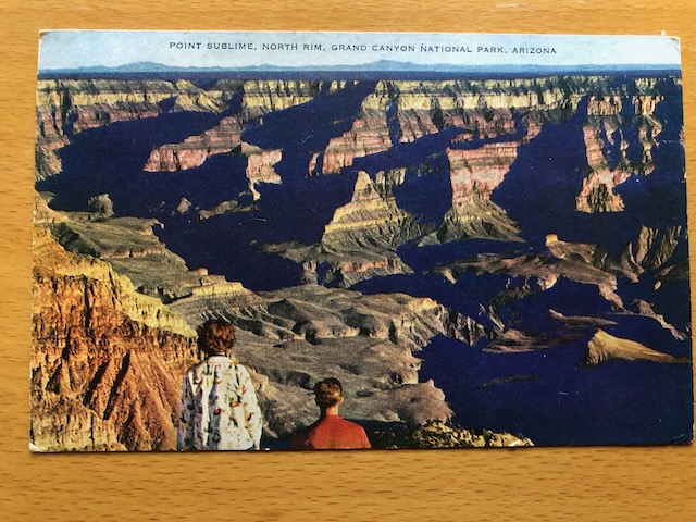
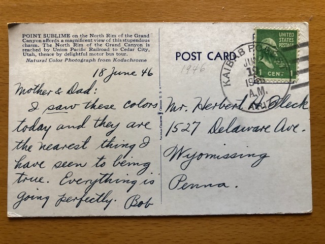
That Postcard

Point Sublime
โ€œthe nearest thing I have seen to being trueโ€

Found this in a stack of old Dad stuff. It is my origin story, my father as a young artist in a moment of profound change. In laying the groundwork for his life, it laid the groundwork for mine.

Domestic Wells

OpenET-reported change in evapotranspiration, 2000-2004 compared to 2020-2024. Green is places water consumptive use from all sources has gone up. Brown is places it has gone down.
Density of domestic wells in greater Albuquerque. Dark green is >150 wells per square kilometer. Brown is no wells at all.

See Luisโ€™s comment above about vibe coding and open data.

I am not sure what to do with this. I canโ€™t unsee it.

Iโ€™m out on the epistemological thin ice here, but as a journalist I spent much of my life working in areas where that ice is thin, itโ€™s where the interesting stuff happens.

Ostrom and the Colorado River

Iโ€™ve mostly been grabbing the handrail and trying not to fall off as my Wilburys friends, in what we see as a discourse vacuum, charge ahead with our critique of Colorado River governance:

In a 2011 paper, Elinor Ostrom laid out one of the final versions of her โ€œdesign principles,โ€ characteristics of successful institutional arrangements for collective action around natural resource systems. We spend a lot of time on this in the class I teach with Bob Berrens each fall for UNM graduate students. It was at the heart of my book Water is For Fighting Over, and it is at the heart of Ribbons of Green, the book Bob and I wrote that UNM Press will be publishing next year.

(Did I mention how much I love teaching?)

There are two design principles in particular that are at the heart of the current Colorado River challenges. Quoting from Ostrom 2011:

  • How are conflicts over harvesting and maintenance to be resolved?
  • How will the rules affecting the above be changed over time with changes in the performance of the resource system, the strategies of participants, and external opportunities and constraints?

There is an additional principle from Ostrom that shows up over and over in her work, thatโ€™s embedded in her explicit principles: a need for a shared understanding of the quantification of the resource.

I am thinking through how these ideas relate to the current Colorado River challenges. Those challenges suggest what I had thought was a functional system lacks these three things. I am thinking a lot about what I described in 2015 when I was writing Water is For Fighting Over, versus what I see happening in 2025. What has changed, or what did I miss?

In which I get my first ambulance ride

Burying the lead here (I always hated the artifice of the journalistic jargon-spelling โ€œledeโ€), but I had occasion recently to spend a few days in the bubble of the medical-industrial complex. Iโ€™m fine, I think, but the identification of a โ€œnewโ€ life-changing risk is in actuality the identification of a risk that has probably been there all along. Itโ€™s just that now I know about it.

Which means I can do some stuff to reduce that risk, including magical pharmacology (โ€œIf I crash,โ€ I told my bike-riding buddy Sunday, โ€œbe sure to tell the EMTโ€™s!โ€) and also saying more โ€œnosโ€ to the stresses of my life of public engagement. My contributions to the commons are not without personal cost, as well as the personal benefits I derive. (Sorry, J.)

It also means that I spend a lot of time thinking about this (new?) risk. This is subtext to all the rest of what I just wrote.

More on the October 2025 rain and floods in southwest #Colorado — Russ Schumacher (Colorado #Climate Center)

Click the link to read the article on the Colorado Climate Center website (Russ Schumacher):

October 17, 2025

Our post from over the weekend highlighted the first round of heavy rainfall and flooding in southwest Colorado. There was a break in the rain on Sunday, October 12, and then a second round of heavy rain on Monday the 13th associated with moisture from remnant Tropical Storm Raymond. Thatโ€™s right, a one-two punch of tropical moisture from the larger Priscilla and then from Raymond a couple days later. Here are some observations of the total precipitation over the entire event.

Total precipitation (inches) from 9-15 October 2025 with gridded data from the PRISM Climate Group and observations from the Community Collaborative Rain, Hail, and Snow (CoCoRaHS) network.

With soils already saturated and rivers and creeks running high, the Monday rainfall led to even more flooding in La Plata and Archuleta Counties. The San Juan River at Pagosa Springs actually peaked slightly higher on Tuesday morning than it did on Saturday, once again reaching major flood stage.

River stage for the San Juan River at Pagosa Springs from October 9-17, 2025. From https://water.noaa.gov/gauges/pspc2.

The high elevations of the San Juan mountains received another 3-4โ€ณ of precipitation on Monday (a bit of it as snow on the higher peaks), with 1-3 additional inches at lower elevations around Pagosa Springs, Bayfield, and Durango. This brought the 7-day total precipitation to a remarkable 10.2 inches at the Upper San Juan SNOTEL station, with over 9โ€ณ at several other sites.

7-day precipitation at southwestern Colorado SNOTEL stations from 9-15 October 2025. From the USDA NRCS interactive map

Volunteer observers from the Community Collaborative Rain, Hail, and Snow network (CoCoRaHS) recorded over 7 inches of rainfall in 7 days north of Bayfield and northwest of Pagosa Springs. These are huge rainfall totals for this part of the state!

CoCoRaHS precipitation observations for the period from 10-16 October 2025 in La Plata and Archuleta Counties. From https://maps.cocorahs.org/

Updating the table from the previous post to show seven-day precipitation accumulations at the Upper San Juan SNOTEL station, we see that the 10.2โ€ณ from the recent storm is surrounded only by huge winter snowstorm cycles. In the years since that station was established in 1978, there arenโ€™t any fall rainstorms that come anywhere close to rivaling it.

Ranking of the top 7-day precipitation totals at the Upper San Juan SNOTEL station since 1978, with overlapping periods removed. Data from ACIS.

The hurricane and flood of October 1911

Looking back farther in history, however, there is one event that surpassed this one in terms of the level of flooding in the southwestern US (including Colorado): the โ€œSonora hurricaneโ€ of October 1911. This caused the flood of record on many rivers in southern Colorado, including the San Juan at Pagosa Springs (the 17.8 feet shown on the graph at the beginning). Jonathan Thompson of the Land Desk had a great summary a few years ago about that flood along with other historic floods in the region. (h/t John Orr for pointing me to this). 

The track of the 1911 hurricane appears to be somewhat similar to what happened with Priscilla this year, with tropical moisture streaming ahead of the decaying circulation. (Animations below are from this year, the map below that is the track of the 1911 hurricane.)

Animation of precipitable water fin GFS model initializations, every 6 hours between 9-15 October 2025. Images from https://schumacher.atmos.colostate.edu/weather/gfs.php
Animation the standardized anomaly of precipitable water (right) from GFS model initializations, every 6 hours between 9-15 October 2025. Images from https://schumacher.atmos.colostate.edu/weather/gfs.php
Track of the October 1911 hurricane, along with rainfall measurements in the southwestern US. From the National Weather Service report โ€œTHE EFFECTS OF EASTERN NORTH PACIFIC TROPICAL CYCLONES ON THE SOUTHWESTERN UNITED STATESโ€, https://www.weather.gov/media/wrh/online_publications/TMs/TM-197.pdf . h/t Jeff Lukas for pointing out this report.

There are a lot more rainfall observations available now than there were during the 1911 storm (thank you, CoCoRaHS observers and SNOTEL network, among others!), but from the available data, the rainfall totals over 1-2 days in the 1911 storm were greater than those in the 2025 event, but the fact that there were *two* tropical cyclone remnants in 2025 made the total precipitation over 5-7 days much greater. The break in the rainfall on Sunday in between the two waves of heavy rain was certainly important, or the flooding could have been closer to what happened in 1911. 

And it turns out there was a particularly controversial rainfall observation in October 1911 โ€” I was not really aware of this previously, but my predecessor Nolan Doesken was involved in many of the debates surrounding the chart shown here.

Photo of the cooperative observer form from Gladstone, Colorado, October 1911.

This is the observation form from Gladstone, Colorado, north of Silverton, at around 10,500 feet elevation. It shows 8.05โ€ณ on October 5, 1911. Thereโ€™s no question that a lot of rain fell in southwestern Colorado during that storm based on the floods that happened, but if itโ€™s possible for over 8โ€ณ of rain to fall in one day at 10,500 feet, that has major implications for the robustness of infrastructure that is needed. A later study of the flooding near Gladstone by Pruess, Wohl, and Jarrett found that it was not consistent with such large rainfall accumulations (or at least not within 24 hours), and the Gladstone observation is now generally deemed to be unreliable.(Thanks to Jeff Lukas for pointing this paper out.) Even so, Silverton recorded 4.05โ€ณ on October 5, 1911, and flooding on the Animas and San Juan Rivers reached record levels (at least since measurements have been in place)

The good news: improvements in drought conditions

The flooding in southwestern Colorado led to the destruction of multiple homes and to major disruptions around the region. But the flip side is that all the rain will help to ameliorate the lingering drought in the area. Everyone would prefer that the water arrive more steadily rather than in a huge burst like this, but as noted in this Colorado Sun story, small reservoirs like Vallecito saw big boosts in their storage from the storm. On this weekโ€™s US Drought Monitor, there were widespread two-category improvements in southwestern Colorado, going either from D2 (severe drought) to D0 (abnormally dry), or from D1 (moderate drought) to nothing on the map. Two-category improvements in one week are very rare for the Drought Monitor, typically only applied when there are major rain events associated with tropical systems.

Summary of US Drought Monitor changes for the week ending October 14, 2025. Courtesy of Allie Mazurek, Colorado Climate Center.

Both the Animas and Rio Grande Rivers saw huge increases in streamflow, with 7-day average flows near record levels for the fall, and close to the average early-summer peak from snowmelt runoff. On the Rio Grande, only the peak from October 1911 is higher than the current average flow for the period between October and April. [Daily data is missing for the Animas in October 1911, but it surely peaked even much higher than shown on the graph.]

Flows on the Animas River at Durango. Water Year 2026 is shown in black in comparison to past years. From https://climate.colostate.edu/drought/#streamflow
Flows on the Rio Grande near Del Norte. Water Year 2026 is shown in black in comparison to past years. From https://climate.colostate.edu/drought/#streamflow

Other than around the San Juan Mountains, this event didnโ€™t end the drought that goes back to last winter (or even longer, depending on how you define it) across western Colorado, but did put a nice dent into the precipitation deficits that had mounted over that period. Now itโ€™s time to look ahead to the snow accumulation season and see what arrives in the usual source of water in western Colorado: the mountain snowpack.

We got pulled in to analyzing this major storm, along with some other activities this week, but we will be finalizing and releasing our recap of Water Year 2025 within the next week or so, so please stay tuned for that! [Subscribeย hereย if you want to get it delivered straight to your inbox. And use the โ€˜subscribeโ€™ box here on the blog if you like these posts and want to get them in your email โ€” itโ€™s a different mailing list.]

Rivers begin to recede after surge from heavy rains: Now itโ€™s time to measure and account for the extra water in management of the #RioGrande Compact — AlamosaCitizen.com

The Rio Grande at 7,000cfs, which was its peak after a series of end-of-season rain storms. Credit: Ryan Michelle Scavo

Click the link to read the article on the Alamosa Citizen website:

October 14, 2025

The dangerous high waters on the San Juan River and Upper Rio Grande are beginning to recede following the surge from heavy rains that created historic autumn peak streamflows on the San Luis Valleyโ€™s river system.

The high flows also came at the end of irrigation season for Valley farmers and the Colorado Division of Water Resources, which will now account for the extra water in its management of the Rio Grande Compact.

The Rio Grande itself peaked at 7,000 cfs from the bounty of rain that came through the southwest region here in mid-October. The Colorado Division of Water Resources is estimating that the out-of-character weather event added 20,000 to 25,000 acre-feet of water to the Rio Grande system itself and around 10,000 to 15,000 acre-feet that was diverted into the Valleyโ€™s canal system, according to staff engineer Pat McDermott.

That measuring of the water and accounting for how it fits into this yearโ€™s obligations under the Rio Grande Compact is underway. The irrigation season ends Nov. 1.

McDermott, in a report Tuesday to Rio Grande Basin Roundtable members, said not all of the water will be of beneficial use to the Valley and the Upper Rio Grande Basin. The middle Rio Grande could see about 5,000 acre-feet flow downstream, but with a largely dry riverbed in Albuquerque, benefits from the October storms likely wonโ€™t extend as far south as Elephant Butte.

โ€œThis is not a significant event in New Mexico,โ€ McDermott said.

For the reservoirs on the western and southern end of the Valley, it has been. Rio Grande Reservoir, Platoro Reservoir and Terrace Reservoir all will increase storage, with the reservoirs all in priority during the irrigation season for the first time since 2019.

Rio Grande Reservoir will have somewhere between 2,000 and 4,000 acre-feet of storage, Platoro Reservoir has increased its storage and Terrace Reservoir has gone up about 2,000 acre-feet, McDermott said.

โ€œThis is kind of unusual to have this big a flow event,โ€ McDermott said. โ€œIt doesnโ€™t happen.โ€

McDermott noted the importance and effectiveness of the Valleyโ€™s canal ditch riders, who worked to push water into their ditches to help with the surges of streamflow.

The Empire Canal, Monte Vista, the Rio Grande Canal, the Farmers Union, San Luis Valley Canal all opened their ditches to take in water, McDermott said.

โ€œWe here have very, very cooperative owners that have opened up their ditches after several months of non-use. We want to thank all those ditch operators for getting out there and taking some of this available flow. It is a wonderful thing.

โ€œThis is a really good thing for our basin,โ€ said McDermott. โ€œItโ€™s going to give us an opportunity to get some water back out into the ditches late in the season, which we donโ€™t see very often.โ€

Much of Valley will now go into its offseason with moist soils. But as McDermott noted, areas like the critical Saguache Creek, Carnero Creek, and the east side of the Valley down south through Trinchera didnโ€™t receive much benefit from the rains. 

The next best thing would be a normal to above-normal snow season in the San Juan Mountains and Sangre de Cristo range. 

La Niรฑa is still looking weak. But as October has shown, weather can happen.

Rio Grande and Pecos River basins. Map credit: By Kmusser – Own work, Elevation data from SRTM, drainage basin from GTOPO [1], U.S. stream from the National Atlas [2], all other features from Vector Map., CC BY-SA 3.0, https://commons.wikimedia.org/w/index.php?curid=11218868

Why declining aquifers in #Colorado matter: #ColoradoRiver rightfully gets attention. So should the #groundwater depletion underway in the #RepublicanRiver and other basins — Allen Best (BigPivots.com)

San Luis Valley center pivot August 14, 2022. Photo credit: Allen Best/Big Pivots

Click the link to read the article on the Big Pivots website (Allen Best):

September 12, 2025

Woes of the Colorado River have justifiably commanded broad attention. The slipping water levels in Lake Powell and other reservoirs provide a compelling argument for changes. How close to the cliffโ€™s edge are we? Very close, says a new report by the Center for Colorado River Studies.

But another cogent โ€” and somewhat related โ€” story lies underfoot in northeastern Colorado. Thatโ€™s the story of groundwater depletion. There, groundwater in the Republican River Basin has been mined at a furious pace for the last 50 to 60 years.

Much of this water in the Ogallala aquifer that was deposited during several million years will be gone within several generations. In some places it already is. Farmers once supplied by water from underground must now rely upon what falls from the sky.

In the San Luis Valley, unlike the Republican River Basin, aquifers can be replenished somewhat by water that originates from mountain snow via canals from the Rio Grande. The river has been delivering less water, though. It has problems paralleling those of the Colorado River. Changes in the valleyโ€™s farming practices have been made, but more will be needed.

In a story commissioned by Headwaters magazine (and republished in serial form at Big Pivots), I also probed mining of Denver Basin aquifers by Parker, Castle Rock and other south-suburban communities.

Those Denver Basin aquifers, like the Ogallala, get little replenishment from mountain snows. Instead of growing corn or potatoes, the water goes to urban needs in one of Americaโ€™s wealthier areas.

Parker and Castle Rock believe they can tap groundwater far into the future, but to diversify their sources, they have joined hands with farmers in the Sterling area with plans to pump water from the South Platte River before it flows into Nebraska. This pumping will require 2,000 feet of vertical lift across 125 miles, an extraordinary statement of need in its own way.

Like greenhouse gases accumulating in the atmosphere, these underground depletions occur out of sight. Gauges at wellheads tell the local stories, just like the carbon dioxide detector atop Hawaiiโ€™s Mauna Loa has told the global story since 1958.

Coloradoโ€™s declining groundwater can be seen within a global context. Researchers from institutions in Arizona, California, and elsewhere recently used data from satellites collected during the last two decades. The satellites track water held in glaciers, lakes, and aquifers across the globe. In their study published recently in Science Advances, they report that water originating from groundwater mining now causes more sea level rise than the melting of ice.

โ€œIn many places where groundwater is being depleted, it will not be replenished on human timescales,โ€ they wrote. โ€œIt is an intergenerational resource that is being poorly managed, if managed at all, by recent generations, at tremendous and exceptionally undervalued cost to future generations. Protecting the worldโ€™s groundwater supply is paramount in a warming world and on continents that we now know are drying.โ€

This global perspective cited several areas of the United States, most prominently Californiaโ€™s Central Valley but also the Ogallala of the Great Plains.

In Colorado, the Ogallala underlies the stateโ€™s southeastern corner, but the main component lies in the Republican River Basin. The river was named by French fur trappers in the 1700s, long before the Republican Party was organized. The area within Colorado, if unknown to most of Coloradoโ€™s mountain-gawking residents, is only slightly smaller than New Jersey.

A 1943 compact with Nebraska and Kansas has driven Coloradoโ€™s recent efforts to slow groundwater mining. The aquifer feeds the Republican River and its tributaries. As such, the depletions reduce flows into down-river states.

Farmers are being paid to remove land from irrigation with a goal of 25,000 acres by 2030 to keep Colorado in compliance. So far, itโ€™s all carrots, no sticks. Colorado is also deliberately mining water north of Wray to send to Nebraska during winter months. This helps keep Colorado in compact compliance. So far, these efforts have cost more than $100 million. The money comes from self-assessments and also state and federal grants and programs.

In some recent years, more than 700,000 acre-feet of water have been drafted from the Ogallala in the Republican River Basin. To put that into perspective, Denver Water distributes an average annual 232,000 acre-feet to a population of 1.5 million.

Hard conversations are underway in the Republican River Basin and in the San Luis Valley, too. They will get harder yet. Sixteen percent of all of Coloradoโ€™s water comes from underground.

The Colorado River has big troubles. Itโ€™s not alone.

For stories in the series, see:

Part I: Hard questions about groundwater mining in Colorado: Itโ€™s going fast! What needs to be done in the Republican River Basin?

Part II: South Metro cities starting to diversify water sources: Castle Rock and Parker 25 years ago were almost entirely dependent upon groundwater. They are diversifying, and one plan is to import water from far down the South Platte River Valley.

Part III: 20th century expansions and 21st century realities in the San Luis Valley: The solutions seem fairly obvious. Executing them is another matter.

Part IV: Balancing demands of today and tomorrow:  Are we doing better than kicking the can down the road?

How much water remains in Baca County?: Study commissioned by legislators uses newer techniques than were available in 2002.

Summer’s over; and it was a dry one: #Drought covers about 82% of the Western U.S. — Jonathan P. Thompson (LandDesk.org)

Click the link to read the article on The Land Desk website (Jonathan P. Thompson):

September 2, 2025

๐Ÿฅต Aridification Watch ๐Ÿซ

Summerโ€™s officially over. Meteorological summer, that is. And damn what a dry and hot and smoky summer it was.ย It wasnโ€™t one of those summers with superlative maximum temps: The mercury in Death Valley only climbed to 124 on a couple of occasions this summer, for example, far off the record high. But in most places the average temperatures for the months of July and August were far higher than normal.

Phoenixโ€™s max temp hit 118ยฐF on two occasions this summer and 117ยฐF once. More significant, though, was the relentlessness of the heat, and the lack of much monsoon relief. The result was significantly higher average temperatures than normal. National Weather Service.

Meanwhile, almost everywhere in the West was cursed with below normal precipitation. The monsoon was late, and when it finally did arrive, it was a dud. At least it has been so far. Not only were rainfall amounts lower than usual, but the soil was so dry that it sucked up a lot of the moisture before it reached the rivers. That has meant that the typical August streamflow jumps never really materialized, especially in the Colorado River Basin. The fish arenโ€™t doing so well. Heather Sackett of Aspen Journalismย reportsย that the Crystal River, along with the rest of the Roaring Fork, Gunnison, and White/Yampa River Basins are hurting, prompting officials to institute voluntary fishing and floating closures.


The trouble with normal … — Jonathan P. Thompson


About 82% of the West is in drought, with about 47% suffering from severe to exceptional drought. The hardest hit areas include northwestern Colorado and southwestern Wyoming (aka the Colorado River headwaters), southeastern Arizona and southwestern New Mexico, and the Idaho panhandle.

The combination of factors has resulted in low inflows into and steep declines in water storage in Lake Powell. The reservoir โ€” which is both a barometer of the Colorado Riverโ€™s health and the Upper Basinโ€™s savings account โ€” is now at about the same level as it was in early September of 2021. It both complicates and adds urgency to negotiations over how to split up the Colorado River in a warmer, dryer world.

Letโ€™s look at some graphics:

What a difference a year makes. At the end of last summer, most of the West was fairly healthy, moisture-wise, and a wet September, October, and November further improved the situation. But after that, things started drying out and warming up, desiccating large swaths of the region, with only northern California, southern Oregon, and the plains getting a reprieve. Source: U.S. Drought Monitor.

These hydrographs for the Animas River in Durango, the Chaco River just above its confluence with the San Juan, and the Rio Grande through Albuquerque, show that the monsoon did, in fact, arrive, albeit dreadfully late and bringing nothing but chips and cheap bean dip (a potluck metaphor, by the way). The Chaco River ballooned from bone dry to raging river (off the charts!) in a matter of hours, but was nothing but a muddy trickle a couple days later. The Animas also got a boost, but nothing close to as big as it normally gets this time of year. For once, the Rio Grande looks the best, with flows jumping from zero to about 300 cfs, before plateauing around 120 cfs for several days now.

A couple of decent storms basically kept the Animas from drying up entirely, but not much more than that.
It looks like the Chaco River went from very, very dry to about 600 cfs (it literally jumped off the chart at 460 cfs, soโ€ฆ.) and did so in the form of a wall of water.
The Rio Grande in Albuquerque was dry until the monsoon managed to kick it up to a not-dry 120 cfs or so.

Of course, these charts could turn around at any time. The monsoon may just be getting started, and will end up bringing steady, autumn rain and sustained higher streamflows with it. The biggest floods of the region have typically come in September and October, usually as tropical storms make their way inland and dump their load on the Interior West, think Oct. 1911 or Sept. 1970. That could happen again.

Even multiple deluges wonโ€™t reverse the Lake Powell deficit thatโ€™s built up this year, however. This water yearโ€™s actual inflows into the reservoir have been below normal for nearly every month, and were especially low in August. But more alarming are the unregulated inflows, which are an estimate of how much water would be flowing into the reservoir if there were no diversions or reservoirs upstream. This can look a bit weird, since in some months the estimate is a negative number.

During August, about 255,000 acre-feet ran into Lake Powell. This was just 58% of normal. But thatโ€™s more than 254,000 acre-feet more than it would have been without upstream reservoir releases.
Note that the unregulated inflow volume tends to be higher than the actual inflow volumes during spring runoff (when upstream reservoirs are holding water back) and lower during the summer (when upstream reservoirs are releasing water for irrigation and so forth). The unregulated inflows have been lower than normal all water year so far.
The negative numbers shouldnโ€™t be taken literally โ€” I donโ€™t know what that would look like. Itโ€™s just showing that without upstream reservoir releases, the flows would have gotten pretty meager in August during the pre-dam days.
Lake Powellโ€™s storage is at its second lowest level ever for the end of August. An average or below average winter could further drain it to critical levels by next year.

Federal Water Tap, September 1, 2025: EPA Wonโ€™t Strengthen #Wastewater Pollution Rules for Meat and Poultry Industries — Brett Walton

Rio Grande and Pecos River basins. Map credit: By Kmusser – Own work, Elevation data from SRTM, drainage basin from GTOPO [1], U.S. stream from the National Atlas [2], all other features from Vector Map., CC BY-SA 3.0, https://commons.wikimedia.org/w/index.php?curid=11218868

Click the link to read the article on the Circle of Blue website (Brett Walton):

September 1, 2025

The Rundown

  • EPA withdraws a proposed rule to reduceย wastewater pollution from slaughterhouses.
  • EPA will seek to cut federal protections forย wetlands.
  • USDA will prepare an environmental impact statement for repealing theย Roadless Ruleย that shields national forests and grasslands from logging and road building.
  • New Mexico and Texas agree toย Rio Grande lawsuitย settlement.
  • CBO reports onย U.S. agricultureโ€™s greenhouse gas emissions.
  • EPA proposes allowing Wyoming to manage its ownย coal-waste program.
  • Interior Department completes work onย soil burn severity assessmentย for a large fire north of the Grand Canyon.

And lastly, the Department of Energy supports a feasibility study for what would be one of the countryโ€™s largest pumped storage hydropower projects.

โ€œThe seven states need to recognize that there is pain and sacrifice all over the place and try and get past that visceral perception and figure out what they can do to work together to provide water reliability for the 40 million people who depend on the Colorado River.โ€ โ€“ Scott Cameron, senior adviser to the interior secretary, speaking at a meeting of the Glen Canyon Dam Adaptive Management Work Group on August 20. Cameron, who said he is โ€œcautiously optimisticโ€ about a seven-state deal on managing the river before the current operating rules expire at the end of next year, said the basin needs to look for strategies to reduce consumption and โ€œto facilitate transfers and exchanges.โ€

By the Numbers

10 Percent: Share of U.S. greenhouse gas emissions generated by agriculture, according to a Congressional Budget Office report. The main pollutants in this total are nitrous oxide, a byproduct of fertilizer, and methane, which comes from livestock manure and cow burps.

$21 Million: Research and development funding from the Department of Energy for hydropower projects. The largest portion ($7.1 million) is to investigate the feasibility of a massive pumped storage hydropower project proposed for Navajo Nation land. Pumped storage toggles water between a lower and upper reservoir, a system that functions like a battery. New Mexico State University is the co-investigator for Carrizo Four Corners, the 1,500-megawatt pumped storage project that could provide 70 hours of energy storage, far more than the several hours of storage provided by the largest lithium-ion batteries.

News Briefs

Slaughterhouse Waste
The Environmental Protection Agency will not strengthen wastewater discharge rules for meat and poultry producers. The rules were proposed during the Biden administration.

To justify the action, the agency cited its desire to lower food prices and reduce industry operating costs.

The Biden-era rule intended to reduce the volume of pollutants that enter waterways from some 3,879 slaughterhouses nationally. Those pollutants include nitrogen, phosphorus, organic matter, fecal coliform, and grease. They contribute to harmful algal blooms and low-oxygen dead zones in rivers, lakes, and coastal ecosystems.

A Narrow Wetlands Definition
The EPA is preparing to release a rule by the end of the year that would shrink the number of wetlands with federal protection under the Clean Water Act, E&E News reports.

According to a slide presentation seen by E&E, the agency โ€œwould regulate wetlands only if they meet a two-part test: They would need to contain surface water throughout the โ€˜wet season,โ€™ and they would need to be abutting and touching a river, stream or other waterbody that also flows throughout the wet season.โ€

The changes are in response to a 2023 Supreme Court ruling that provided narrower, but undefined criteria for determining which water bodies have federal protection.

Rio Grande Settlement
By signing a settlement agreement, New Mexico, Texas, and the Justice Department are closer to ending a long-running dispute over water rights from the Rio Grande and the groundwater pumping that affects river flows, Inside Climate News reports.

โ€œThe settlement package includes new formulas to calculate how much water each entity is owed; an agreement for New Mexico to reduce groundwater depletion, and changes to the operating manual for the Bureau of Reclamationโ€™s Rio Grande Project.โ€

Roadless Rule
The U.S. Department of Agriculture is pushing ahead with its attempt to undo a 24-year-old rule that prevents logging and road building in โ€œroadlessโ€ areas of national forests and grasslands.

Rescinding the Roadless Rule, which was adopted in the last month of the Clinton administration, will affect more than 44 million acres, mostly in 10 western states.

The department will prepare an environmental impact statement for its intent to repeal the rule. It argues that more local control over land management decisions are needed.

Comments are due September 19. Submit them via http://www.regulations.gov using docket number FS-2025-0001.

Studies and Reports

Dragon Bravo Fire Burn Severity
An Interior Department team completed an evaluation of the soil burn severity of the Dragon Bravo Fire, which has burned across more than 149,000 acres north of the Grand Canyon.

The fire severely burned the soils on just over 2 percent of the acres. Another 26 percent was moderately burned. The most severe burns cook the soil, which increases surface runoff after storms. Erosion and downstream floods can be the result.

In context: As Flames Scorch Western Forests, Flagstaff Area Offers Roadmap for Post-Wildfire Flood Prevention

On the Radar

Emergency Alert System Improvements
The Federal Communication Commission is beginning the process to assess and potentially upgrade the nationโ€™s emergency alert systems that local agencies use to inform residents about natural hazards like floods and fires.

The commission is taking public comments through September 25. Submit them hereusing docket number 25-224.

Wyoming Coal Waste
The EPA wants to grant more states the authority to regulate waste products from burning coal for electricity. Wyoming is the latest state to seek this power, called primacy.

The agency is proposing to approve Wyomingโ€™s bid to oversee its coal ash permitting program.

A public meeting will be held October 30. Public comments on the proposed approval are due November 3. Details are in the above link.

Three states currently have primacy. North Dakotaโ€™s application is being reviewed.

Federal Water Tap is a weekly digest spotting trends in U.S. government water policy. To get more water news, follow Circle of Blue on Twitter and sign up for our newsletter.

Settlement Signed in #Texas v. #NewMexico #RioGrande Case: The Rio Grande states and the Department of Justice are one step closer to resolving a long-standing Supreme Court case over water rights — Martha Pskowski (InsideClimateNews.org)

Young coyote crosses the dry bed of the Rio Grande August 11, 2025. Photo credit: Laura Paskus

Click the link to read the article on the Inside Climate News website (Martha Pskowski):

August 29, 2025

The Rio Grande flows over 1,800 miles from the mountains of southwestern Colorado to the Gulf of Mexico. A lawsuit filed in 2013 between Texas and New Mexico over Rio Grande water has taken as many twists and turns as the river itself.

A settlement signed this week by New Mexico, the Department of Justice and two irrigation districts, and reviewed by Inside Climate News, lays out agreements for irrigation management on the Rio Grande. It is one part of a larger settlement package that will be presented to a special master in the case, Judge D. Brooks Smith of the U.S. Third Circuit Court of Appeals, for approval next month. 

The outcome of the case is expected to have broad implications for cities that rely on the Rio Grande and farmers throughout New Mexico and far west Texas.

The settlement package includes new formulas to calculate how much water each entity is owed; an agreement for New Mexico to reduce groundwater depletion, and changes to the operating manual for the Bureau of Reclamationโ€™s Rio Grande Project. 

Under the settlement, New Mexico could transfer water rights from the Elephant Butte Irrigation District (EBID) in Southern New Mexico in order to meet its obligations to Texas. The state agrees in the settlement that it would compensate EBID. 

The case began when Texas alleged that groundwater pumping in Southern New Mexico deprives the state of water it is owed under the Rio Grande Compact. Colorado and the United States are also parties to the case. Local irrigation districts, cities and agricultural interest groups have been involved as friends of the court. The case has evolved from a dispute between Texas and New Mexico to encompass conflicts between groundwater and surface water users in the area.

โ€œWe are ecstatic to have reached a settlement and look forward to continue delivering water to our farmers and the City of El Paso,โ€ said Jay Ornelas, general manager of the El Paso Water Improvement District No. 1, an irrigation district. โ€œThe agreement provides long-term protection to El Paso farmers and the City of El Paso that rely on water from the federal Rio Grande Project.โ€

A Strained Inter-State Compact

The Rio Grande Compact, signed in 1938, lays out how much water Colorado, New Mexico and Texas can use from the Rio Grande. The compact only addresses surface water in the river. But hydrologists now understand that aquifers and rivers are connected. Wells drilled into adjoining aquifers can reduce the flow of water into the Rio Grande.

At issue in the case is a 100-mile stretch of the river between Elephant Butte Reservoir in Southern New Mexico and the Texas-New Mexico state line. Water is released from the reservoir for both Southern New Mexico and far West Texas, including El Paso. 

As agriculture expanded and severe droughts hit the region, farmers drilled more wells into the aquifer. Texas argues these wells in Southern New Mexico are siphoning off water that should flow to Texas.

โ€œIn one way itโ€™s a conflict between the state of Texas and the state of New Mexico,โ€ said Burke Griggs, a professor of water law at Washburn University in Topeka, Kansas. โ€œBut the conflict that really matters here is the conflict between surface water rights and groundwater pumping.โ€

Climate change is impacting snowmelt in the riverโ€™s headwaters. Extreme heat is increasing evaporation rates from the river where it flows downstream through the desert. The case is closely watched in New Mexico, where scientists predict thatwithin 50 years water supply from rivers and aquifers will decline by 25 percent. The City of El Paso, which relies on Rio Grande water, has diversified its water sources as the river became less reliable.

The Supreme Court rejected a settlement that the states reached in 2022 because the federal government had not consented to its terms. The parties went back to the drawing board. A new settlement was announced on May 15, with the United States on board. 

โ€œThe United States got what it needed in terms of firm commitments by New Mexico to reduce groundwater depletions,โ€ Griggs said.

In a statement, the El Paso Water Improvement District No. 1 said that the settlement will improve efficiency, conserve scarce water resources and ensure that water is available for the districtโ€™s farmers and the City of El Paso. EBID has also signed on to the settlement.

Judge Smith, the special master, has called the parties to appear in court in Philadelphia on September 30 to explain the agreements. The details of the other parts of the settlement package have not been made public. As surface water dwindles across the Southwest, the settlement could bring to an end years of uncertainty surrounding the Rio Grande. 

โ€œWeโ€™ll know with this settlement, I think with much greater precision, how much water there is to be used, how much water people are going to be able to pump a year or two out,โ€ Nat Chakeres, general counsel for New Mexicoโ€™s Office of the State Engineer, told lawmakers in Santa Fe earlier this month.

While Texas v. New Mexico may soon come to a close, water challenges in the desert Southwest are becoming ever more urgent. The settlement comes as Elephant Butte reservoir is at less than four percent capacity, nearly a record low, and the Rio Grande south of Albuquerque has run dry for over a month.

Rio Grande and Pecos River basins. Map credit: By Kmusser – Own work, Elevation data from SRTM, drainage basin from GTOPO [1], U.S. stream from the National Atlas [2], all other features from Vector Map., CC BY-SA 3.0, https://commons.wikimedia.org/w/index.php?curid=11218868

โ€œThereโ€™s just no water in the systemโ€ — Cleave Simpson via AlamosaCitizen.com #RioGrande

West Drought Monitor map August 5, 2025.

Click the link to read the article on the Alamosa Citizen website:

August 6, 2025

โ€œThereโ€™s just no water in the system,โ€ said Cleave Simpson, the general manager of the Rio Grande Water Conservation District. He was talking to us on Tuesday, Aug. 5, about the startling conditions of the Upper Rio Grande Basin that showed a flow of 36 cubic-feet per second at the Alamosa County line. The river was flowing 15 cfs at the Lobatos Bridge. 

The warnings about this yearโ€™s dryness go back to February when we saw a string of 60-degree days and then more record heat back in April. Fast forward to August and whatโ€™s been a relatively dry summer with less than an inch and a half of accumulated precipitation and we see very little water in the river.

Much of the Great Basin is under intense fire restrictions. 

Rio Grande and Pecos River basins. Map credit: By Kmusser – Own work, Elevation data from SRTM, drainage basin from GTOPO [1], U.S. stream from the National Atlas [2], all other features from Vector Map., CC BY-SA 3.0, https://commons.wikimedia.org/w/index.php?curid=11218868

Part IV: Balancing demands of today and tomorrow: Are we doing better than kicking the can down the road? — Allen Best (BigPivots.com)

Photo credit: Allen Best/Big Pivots

Click the link to read the article on the Big Pivots website (Allen Best):

July 22, 2025

This is the final part of a series about four groundwater basins in Colorado. The story was commissioned byย Water Education Coloradoย and benefited from editing by Caitlin that organizationโ€™s staff. It appears in a variant form in theย summer 2025 issue of Headwaters magazine.ย 

The San Luis Valley, like the Republican River Basin, has almost no tax base other than irrigated agriculture. โ€œNearly everything in the valley is somehow related to agriculture. Our hospital, our schools โ€” everything is dependent on agricultureโ€™s existence in the valley,โ€ says Amber Pacheco from her office in Alamosa. From her office in Wray, Deb Daniel has a parallel observation.

What then constitutes sustainability of the water that is the foundation of agriculture or, in the case of Parker, Castle Rock, and other south metro communities, their economic vitality? What decisions should be made now to foster that vitality through the 21st century?

Smuggler Mine back in the day via GregRulon.com

Thoughts about conservation have shifted over time. When Coloradoโ€™s gold and silver miners arrived, they had no goal of conserving. They either mined the veins to exhaustion, or it became too costly to continue. In a sense, that has happened in the Republican River Basin. The only limits to this groundwater mining are those triggered by the interstate compact. Because the Republican River and its tributaries get most of their water from aquifers, pumping must be limited โ€” or supplemented.

In the last 20 years, the Republican River Water Conservation District has done some of both. It has or soon will have committed $86 million to pump water from wells expressly to deliver water to the Nebraska state line. One of the directors, Tim Pautler, has called this a strategy of kicking the can down the road. Other directors have started to agree.

โ€œItโ€™s like the clock is ticking when it comes to sustainability,โ€ said Rod Lenz, the board chair, at the boardโ€™s quarterly meeting in May 2025. โ€œWhat more can we do with the tools we have? Do we dare ask for more tools such [as would be delivered by] statute changes? Do we really want all the groundwater districts in the basin to ask the state engineer to reconsider how much weโ€™re allowed to pump, or do we just stay in compliance until we canโ€™t?โ€

San Luis Valley Groundwater

In the San Luis Valley, coming off the century-defining drought of 2002, state legislators went in exactly the opposite direction. They said that the unconfined aquifer was to be managed sustainably. Granted, thatโ€™s easier said if you have a major river flowing nearby, even if that river has been hammered hard by the warming, drying climate of the 21st century.

Water stored in Coloradoโ€™s Denver Basin aquifers, which extend from Greeley to Colorado Springs, and from Golden to the Eastern Plains near Limon, does not naturally recharge from rain and snow and is therefore carefully regulated. Courtesy U.S. Geological Survey.

The south metro area falls somewhere between these two extremes. State legislators nearly a half-century ago ordered a โ€œslow sipโ€ of the groundwater such as to preserve it for a century. In some places, there seems to be sufficient water to slow sip for another 300 years. In other places, the aquifer might have enough water for a few decades. Some water utilities hope for a completely sustainable water supply in decades ahead. Much work has been done. The harder work lies yet ahead.

What we need are aspirations premised not on entitlement and enrichments solely for today, but instead to build economies and cultures that more comprehensively look several generations ahead. That should be the question in all these meetings, all these court cases, all of these individual actions. Based on what we know and understand today, what should we be doing for the kids, grandkids and their grandkids, too? Are we doing better than kicking the can down the road?

Also: You can also download the entire story here in a magazine format.

Photo credit: American Rivers

No, there is not plenty of water for data centers: And, yes, we should worry about it, along with the facilities’ power use — Jonathan P. Thompson (LandDesk.org) #ColoradoRiver #COriver #RioGrande #aridification

A satellite view of Mesa, Arizona, showing a handful of the 91 energy- and water-intensive data centers in the greater Phoenix metro area. Source: Google Earth.

Click the link to read the article on The Land Desk website (Jonathan P. Thompson):

July 29, 2025

๐Ÿ“ˆ Data CENTER Dump ๐Ÿ“Š

When I first read a recent headline in Matthew Yglesiasโ€™s Slow Boring newsletter, I assumed it was a sort of joke to rope me into reading. โ€œThereโ€™s plenty of water for data centers,โ€ it said, reassuringly. โ€œProbably the last worry you should have about either water or AI.โ€

Unfortunately, he wasnโ€™t joking. But he opened his piece with a line that should have warned his readers to take everything else he said with a grain of salt:

Before I continue with my rant, Iโ€™d just like to encourage Yglesias to do a little more thinking about water scarcity before writing about it. Oh, and also, maybe consider spending a little bit of time in the water-starved West before committing punditry about it. (This is the same guy who tweeted that Sen. Mike Leeโ€™s proposal to sell off public land was โ€œpretty reasonableโ€ and an โ€œokay idea on the meritsโ€).

Yglesias acknowledges that data centers use water, and that more data centers will lead to more water consumption. But itโ€™s okay, he says, because โ€œWeโ€™re not living on Arrakis, and rich countries are not, in general, abstemious in their water usage.โ€

No, we are not on Arrakis, but have you seen the lower reaches of the Colorado River or even the mid-reaches of the Rio Grande lately? Itโ€™s looking pretty Dune-like if you ask me.

Well, sure, Yglesias argues, but even in those places, people are doing frivolous things with water, like filling up their Super Soakers or using it to make ice cubes for their cocktails. Yes, he used those actual examples. Never mind that the potable water used each day by a single Microsoft data center in Goodyear, Arizona, could yield more than 35 million ice cubes or fill about 223,000 Super Soakers. That would be one big, drunken water fight.

Yglesias also notes that agriculture, especially growing alfalfa and other feed crops for cattle, is an even larger water consumer than Big Tech. True, for now. And he writes:

His logic appears to be: People are currently using a lot of water for all sorts of things โ€” frivolous or otherwise. So, it should be fine to use a lot more water for data centers in perpetuity, since water is โ€œsufficiently plentiful.โ€ This is the sort of thinking that got the Colorado River Basin into its current mess, in which there actually may not be enough water to drink very soon if its collective users donโ€™t change their ways. Adding a fleet of water-guzzling hyperscale data centers to places like Phoenix, Las Vegas, andย Tucson, where water is anything but โ€œsufficiently plentiful,โ€ will only exacerbate the crisis.


A Dog Day Diatribe on AI, cryptocurrency, energy consumption, and capitalism — Jonathan P. Thompson


Researchers have tried various methods to determineย how much water a single ChatGPT query or AI-assisted Google search usesย as compared to, say, streaming a Netflix video or writing a standard e-mail.ย So far the estimates diverge wildly. An early calculation came up with a whopping 500 ml for each AI query, but the estimates have since gone down. The difficulty is due in part to the fact that water use data isnโ€™t always publicly available, and also because data centersโ€™ water use can vary depending on location, as do theirย carbon footprints.

What is clear is this: Data centers use large quantities of both energy and water, no matter where they are. The massive server banks churning away in warehouse-like buildings on the fringes of Phoenix and Las Vegas, and even in rural Washington and Wyoming, each gobble as much electricity as a small city to process AI queries, cryptocurrency extraction, and other aspects of our increasingly cloud-based society. The harder they work, the hotter they get, and the more power and water they need to cool off to the optimum operating temperature of between 70ยฐ to 80ยฐ F.

Evaporative or adiabatic cooling, where air is cooled by blowing it through moistened pads (i.e. high-tech swamp coolers), works well in arid areas like Phoenix, Tucson, or Las Vegas. They use less energy than refrigerated cooling, but also use far more water.

Data centers can also indirectly consume water through their energy use, depending on the power source. Thermal coal, nuclear, or natural gas plants need water for cooling and steam-production (some of this water may be returned to the source after use, except with zero-discharge facilities); natural gas extraction uses water for hydraulic fracturing; and solar installations can require large amounts of water for dust-suppression and cleaning. This explains how Googleโ€™s data centers withdrew 8.65 billion gallons of water globally in 2023 1.


Energy-Water Nexus Data Dump 1: Fracking — Jonathan P. Thompson


A 2023 study found that a single Chat GPT-3 request processed at an Arizona data center uses about 30 milliliters of water, compared to 12 ml per request in Wyoming. That doesnโ€™t seem like much (itโ€™s less than a shot-glass) until you consider that there are at least 1 billion ChatGPT queries worldwide per day and growing, using a total of some 8 million gallons of water daily, worldwide. And, training the AI at an Arizona data center would use about 9.6 million liters โ€” or 2.5 million gallons โ€” of additional water.

Another estimate finds the average data center uses between 1 million and 5 million gallons of water per day, onsite, which would be far more than the aforementioned Goodyear center (56 million gallons/year), but in line with a planned Google data center in Mesa, Arizona. When Google was first planning the facility back in 2019, the city of Mesa guaranteed delivery of nearly 1 million gallons of water per day. If they reach certain milestones they can use up to 4 million gallons daily, or about 4,480 acre-feet per year.

Now multiply those numbers by the more than 90 data centers of various sizes and water and energy intensity in the Phoenix area, alone, which would amount to somewhere between 14 million to 450 million gallons per day. No matter how you add it up, they collectively are sucking up a huge amount of water and power, and enough to strain even Yglesiasโ€™s purported โ€œsufficiently plentifulโ€ supplies (which do not exist in Arizona, by the way).

The average Phoenix-area household uses about 338 gallons of water per day, or almost 123,000 gallons per year. One of these big data centers, then, could guzzle as much water as some 10,000 homes. And yet housing developments in groundwater-dependent areas on Phoenixโ€™s fringe must obtain 100-year assured water supply certification before they can begin building. The same is not the case for data centers.

According to Open ET maps, a 75-acre alfalfa field in Buckeye (western Phoenix metro area), uses about 156 acre-feet โ€” or 50.8 million gallons โ€” per year. Thatโ€™s far less than the 28-acre Apple Data Center in Mesa consumes. Of course, there are the equivalent of about 3,470 alfalfa fields of that same size in Arizona (260,000 acres), meaning the total water consumption of hay and alfalfa is still greater than that of data centers. But it shows that while replacing an alfalfa field with houses would result in a net decrease in water consumption, replacing those same fields with data centers would substantially increase consumption.

And donโ€™t forget that the 75-acre alfalfa field produces about 690 tons of alfalfa per year, which could feed quite a few dairy cows, which in turn would produce a bunch of milk for making cheese and ice cream. Just saying. Maybe itโ€™s time to update the old saying: โ€œIโ€™d rather see a cow than a data center.โ€


Western water: Where values, math, and the “Law of the River” collide, Part I — Jonathan P. Thompson


Data centers arenโ€™t going away. After all, they are the hearts and brains of the Internet Age. Many of us may wish that AI (not to mention cryptocurrency), which are more water- and energy-intensive than other applications, would just up and vanish. But thatโ€™s probably too much to ask for. Besides, AI, at least, does have real value. 

So what can be done to keep the data center boom from devouring the Westโ€™s water and driving its power grid to the snapping point? Hereโ€™s where Yglesias had a good point: Policymakers and utilities should adjust water and power pricing for large industrial users, i.e. data centers, to discourage waste, incentivize efficiency and recycling, and push tech firms to develop their own clean energy sources to power their facilities.

Itโ€™s imperative that utilities force data centers to pay their fair share for infrastructure upgrades made necessary by added water or power demand, rather than shifting those costs to other ratepayers, as is usually the case. Arizona should make data centers prove out their water supply, just like they do with housing developments. Plus, states should stop trying to lure data centers with big tax breaks, which ultimately are paid for by the other taxpayers. And local governments and planners should subject proposed data centers to the highest level of scrutiny, and not give in to promises of jobs and economic development if it means sacrificing the communityโ€™s water supply or the reliability of the power grid.

Proper policy isnโ€™t a cure all, by any means. But it could mitigate the impacts of the imminent data center boom. Meanwhile, Mr. Yglesias, I will reiterate that the West, at least, does not have plenty of water for data centers, and I will continue to worry about them guzzling up what little water remains.


๐Ÿ“– Reading Room ๐Ÿง

  • The Land Desk is reading all of yโ€™allโ€™s great responses to last weekโ€™s open thread about forms of resistance. Check it out and weigh in if you havenโ€™t already.
  • Len Necefer has had some really strong pieces on hisย All At Once by Dr. Lennewsletter recently, includingย this oneย musing about the opportunities for the Navajo Nation to build a recreation economy on the San Juan River (great idea!). He writes about how strange it is that he, a Navajo Nation citizen, must get a permit from the BLM to raft the river, when it borders his homeland (and is at the heart of Dinรฉ Bikeyah). I also like that he sees boating/recreational opportunities along the entirety of the river, not just from Sand Island to Clay Hills Crossing. Iโ€™ve always thought it would be super cool to boat the reaches between Farmington and Bluff (actually, Iโ€™ve always wanted to boat from Durango to Farmington to Bluff).ย 
  • Another Substack thatโ€™s been getting my attention isย Time Zero, a podcast and Substack on โ€œthe nuclearized world.โ€ Theย Wastelandingย series is about the legacy of uranium mining and milling on the Colorado Plateau, the Navajo Nation, and on Pueblo lands. Very powerful stuff.ย 
  • Theย Colorado Sunโ€™s Shannon Mullane has aย good storyย about the Southern Ute Tribe finally getting some of its Animas-La Plata water, which was the whole reason the last big Western water project, as itโ€™s known, was finally built.

Cisco Resort and other water buffalo oddities — Jonathan P. Thompson


1 This is not the same as consumption, which is the amount of water withdrawn minus the amount returned to the source.

Udall/Overpeck 4-panel Figure Colorado River temperature/precipitation/natural flows with trend. Lake Mead and Lake Powell storage. Updated through Water Year 2024. Credit: Brad Udall

Part III: 20th century expansions and 21st century realities in the #SanLuisValley: The solutions seem fairly obvious. Executing them is another matter — Allen Best (BigPivots.com) #RioGrande

Center pivot in the San Luis Valley. Photo credit: Allen Best/Big Pivots

Click the link to read the article on the Big Pivots website (Allen Best):

July 20, 2025

Center, as its name implies, lies at the center of the San Luis Valley. The valley is among the nationโ€™s two most prominent places for growing potatoes. Among the growers is a fourth-generation family operation, Aspen Produce LLC.

Jake Burris married into the family. In addition to spuds, the family grows barley and alfalfa on 3,500 acres. Some neighboring farmers also grow canola. Burris is president of the board of managers of one of six subdistricts in the San Luis Valleyโ€™s Rio Grande Water Conservation District. His subdistrict โ€” called Subdistrict No. 1 โ€” was formed in 2006 in response to a declining water table. Whatโ€™s known as the unconfined aquifer supports this area, the most agriculturally productive in the San Luis Valley. With just seven inches of annual precipitation, irrigation in the San Luis Valley is everything. And in Subdistrict 1, much of that water comes from 3,617 wells..

Alfalfa grown is quite thirsty, but potatoes get grown on much larger areas of the Rio Grande Water Conservancy District. Photo credit: Allen Best/Big Pivots

Alfalfa is the thirstiest crop, using 24 to 36 inches of water to get three cuttings. The strong sunshine and cooler temperatures found above elevations of 7,000 feet produce a high-quality hay that draws orders from dairies as far as California. Alfalfa is grown on 21,100 acres in the district. Potatoes cover 51,100 acres. Barley is grown on 28,000 acres. Some have replaced barley with rye. Several thousand acres have together been devoted to canola, lettuce, and other crops. A recent census found about 25,000 acres had been fallowed.

The San Luis Valley has two primary aquifers. Lower in the ground, separated by relatively impermeable beds of clay from what lies above, is the confined aquifer. The first well into the confined aquifer was bored in 1887. Because of the pressures underground, it was an artesian well. No pumping was needed to bring water to the surface. Louis Carpenter, a professor at the Colorado Agriculture College (now Colorado State University), estimated the valley had 2,000 artesian wells when he visited in 1891.

The unconfined aquifer lies above the confined aquifer. The unconfined aquifer existed prior to major water development in the valley but water volumes rose greatly when farms began using Rio Grande water in the 1880s. Four ditches deliver Rio Grande water to the farms and hence to the aquifer. Introduction of high-capacity pumps in the 1950s and center-pivot sprinklers in the 1970s accelerated groundwater extraction. In 1972, the state engineer imposed a moratorium on new wells from the confined aquifer, followed in 1981 by a moratorium on new wells in the unconfined aquifer. These moratoria acknowledge that groundwater drafting had to be limited.

Then came 2002, hot and dry, escalating the challenge. Impact to the unconfined aquifer was drastic with rising temperatures causing growing water demand even as snowpack declined.

The unconfined aquifer โ€œhas been dropping overall since about 2002,โ€ says Craig Cotten, the Colorado Division of Water Resources engineer for Division 3, which encompasses the San Luis Valley. โ€œWe just have not had a real good series of years as far as the surface water.โ€

In 2004, state legislators passed a law that sets the San Luis Valleyโ€™s aquifers apart from those of the Republican River and Denver Basin groundwater stories. That law, SB04-222, explicitly orders both the confined and unconfined aquifers in the San Luis Valley be managed for sustainability. The Colorado law governing the Denver Basin aquifers requires a โ€œslow sipโ€ but does not imagine sustainability. In the Republican River Basin, no law speaks to sustainability. There, only the interstate compact insists upon limits.

San Luis Valley Groundwater

Hereโ€™s another difference. Water from aquifers create the Republican River and its tributaries. In the south-metro area, surface streams cause little recharge to the Denver Basin aquifers. In the San Luis Valley, the Rio Grande as well as some surface streams coming off the San Juans contribute water to both the unconfined and confined aquifers. The hydrogeology is more complex.

This 2004 law also encouraged the formation of groundwater subdistricts within the Rio Grande Water Conservation District. The thinking was that very local groups of farmers could work together to figure out how to keep their portions of the aquifers sustainable. They could also be more effective in this pursuit by working together than doing so individually.

Six subdistricts have been created in the Rio Grande Water Conservation District and one in the Trinchera Water Conservancy District. Subdistrict No. 1 began operations in 2012 after the state approved its operating plan.

All these groundwater districts have the goal of reducing water consumption as necessary to replenish the aquifers or by introducing water into the aquifer from the Rio Grande or other sources.

Agriculture constitutes nearly the entire economy of the San Luis Valley. Photo credit: Allen Best/Big Pivots

Exactly how much restoration of the aquifers is needed? The state law specified a return to volumes that approximate those of 1976 to 2001 in the confined aquifer. But thereโ€™s some guesswork about how much water the confined aquifer had then. Detailed records on Subdistrict No. 1 were not kept until 1976.

In August 2024 the unconfined aquifer in Subdistrict 1 was estimated to have averaged almost 1.2 million acre-feet less water during the five preceding years than it had in 1976. The rules approved by the Colorado Supreme Court in 2011 in a document called the Plan for Water Management call for the unconfined aquifer recovery within 200,000 to 400,000 acre-feet of where it was in 1976. That would be deemed sustainable, as ordered by the 2004 law.

To achieve this, the state engineer said that Subdistrict No. 1 would need to recover 170,000 acre-feet each year between now and 2031. Initially, Subdistrict No. 1 aimed to take 40,000 acres out of irrigation per year, or about 80,000 acre-feet of annual groundwater pumping, to allow the unconfined aquifer to recover. That goal is unattainable, say water officials, and hence a rethink is needed. Success has occurred, though. In 2024, for example, roughly 176,000 acre-feet were pumped from the confined and unconfined aquifers in Subdistrict No. 1, the fewest since groundwater metering began in 2009. Thatโ€™s about a 30% reduction.

More sustained success will be necessary. โ€œYou donโ€™t recover that unconfined aquifer through single years of good runoff,โ€ says Ullmann, the state engineer. โ€œThere are difficult decisions that have to be made in order to recover and restore the aquifers, but thatโ€™s what these subdistricts are trying to do.โ€

Unlike the Republican River Basin, the unconfined aquifer in the San Luis Valley is fed water diverted from the Rio Grande, seen here at Monte Vista, and into irrigation canals. Photo credit: Allen Best/Big Pivots

This success is at least partly due to efforts to modify irrigation practices and taking land out of production. Amber Pacheco, deputy general manager of the Rio Grande Water Conservation District, explains that itโ€™s difficult to quantify the reductions.

โ€œSome farmers, for example, have simply reduced the number of alfalfa cuttings (and hence the irrigation required), for example. Or they only irrigate when they need to do so. Others have changed the cover crops planted after a potato harvest to reduce the amount of water needed.โ€

As in the Republican River District, local efforts to take land out of production use the foundation of federal programs, particularly CREP, or Conservation Reserve Enhancement Program. The subdistrict provides 20% of funds and the federal government 80%.

As did the Republican district in 2022, the Rio Grande district got an additional $30 million allocation of federal money funneled through the state. That money allows $3,000 in payment per acre-foot of curtailed groundwater use.

More must be done to recover the aquifer. The current proposal assembled by Burris and other directors of Subdistrict No. 1, their fourth iteration, would require aquifer recharge as a condition of pumping on a one-to-one basis. Water for recharge would come from water secured from the Rio Grande or native flows into the unconfined aquifer. This new plan allows subdistrict members with surface water credits to pump from the aquifer, because they are resupplying it.

The pumping allowed under the plan would be cut drastically. The Rio Grande district does not have authority to shut down wells, but it does have authority to assess fees for over-pumping. That fee stands at $150 per acre-foot. The plan would elevate that to $500. And, if aquifer recovery is not achieved, it would rise to $1,000.

Ultimately, the state engineer has authority to curtail wells that do not provide replacement water pursuant to an approved groundwater management plan or some other augmentation plan.

Some farmers in the subdistrict disagree with this plan. Opponents banded together as the Sustainable Water Augmentation Group, or SWAG, and filed a lawsuit to block implementation of the plan. A five-week trial has been scheduled for early 2026. Nobody expects that courtโ€™s decision to be the end of it. Whoever loses might well appeal the decision to the Colorado Supreme Court, a process likely to continue into 2028.

Might the problem of the depleted unconfined aquifer be resolved by diverting more water from the Rio Grande? The river has long been over-appropriated. This year, for example, rights junior to 1880 were being curtailed in May. As with the Republican River, water must be allowed to flow downstream as required by the Rio Grande Compact.

For the unconfined aquifer to recover quickly, Mother Nature would need to quickly step up. โ€œIt would take multiple years of above-average flows [in the Rio Grande] to recover to the level that we need,โ€ says Pacheco. In fact, 19 of the last 20 years have been sub-average as compared to 1970 to 2000. This yearโ€™s runoff in mid-May was forecast to be 61% of the average from 1890 through 2024.

Part IV: โ€œItโ€™s like the clock is ticking when it comes to sustainability,โ€ said Rod Lenz, chair of the Republican River Water Conservation District, at a recent board meeting. This and other parting thoughts about the three groundwater basins examined in this story. Also, a study is underway to provide a better estimate of the groundwater remaining in Baca County.  You can also download the entire story here in a magazine format.

Colorado Rivers. Credit: Geology.com

The #RioGrande has gone dry in Albuquerque — John Fleck (InkStain.net)

Rio Grande looking upstream, taken from Albuquerqueโ€™s Central Avenue Bridge, 2:15 p.m. July 14, 2025

Click the link to read the article on the InkStain website (John Fleck):

July 15, 2025

The โ€œofficialโ€ call: the Rio Grande went dry in the Albuquerque reach, just upstream of the cityโ€™s wastewater treatment plant (click here for the map), on Sunday evening (July 13, 2025), for only the second time in the 21st century.

โ€œDryโ€ in this case has a formal definition. The thinning ribbons of water you see in the picture above, taken mid-afternoon Monday (July 14, 2025) have to break. Itโ€™s still a muddy mess; the riverโ€™s subsurface manifestation, the shallow aquifer, still has water in it, the trees (look at their lovely green!) still have access to that part of the river. But if youโ€™re a fish or a turtle, these are sad times.

The fact package

We got an excellent update on river conditions (as we do every month) at the meeting of the Middle Rio Grande Conservancy District, the government agency responsible for river flood control, drainage, and irrigation in New Mexicoโ€™s Middle Rio Grande. Most of what follows I learned by attending that meeting.

The last time the river dried in the heart of New Mexicoโ€™s largest city was 2022. Before that, it hadnโ€™t happened since the 1980s.

Drying is common to the south, between Albuquerque and Elephant Butte Reservoir. Happens most every year. Whatโ€™s new is drying in the heart of this large urban area.

Imported Colorado River water, via the San Juan-Chama Project, delayed the Albuquerque drying. The Middle Rio Grande Conservancy District used that water to supplement flows and get water to irrigators from June 16 to July 6, when their San Juan-Chama supplies ran out. (Source: Anne Markenโ€™s report to the MRGCD board)

The Conservancy District is currently operating under the rules of โ€œprior and paramountโ€ operations, meaning a subset of the lands of the valleyโ€™s six Native American Pueblos get water, while all non-Indian irrigators upstream of Isleta Pueblo are being curtailed. (Source: Marken, if you wanna understand whatโ€™s happening on the Rio Grande, you can do no better than Anneโ€™s monthly report to the board)

As of July 8, the federal government had ~31,545 acre feet of P&P water in storage in El Vado (thereโ€™s a bit of space available despite the damโ€™s problems) and Abiquiu. (Source: USBR report to the MRGCD board)

Downstream from Isleta, once the Pueblos have gotten their P&P water, some irrigation is possible using return flows. Because of the structure of the plumbing, this favors the riverโ€™s east side communities. (Source: Matt Martinez report to the MRGCD board, ditto what I said about Marken: โ€œIf you wanna understandโ€ฆ.โ€)

The pumps that have kept water flowing to Corrales in the absence of the rickety old siphon that used to get water there were shut down June 26. (Source: Matt Martinez)

Current flow at the Central Avenue Bridge, as measured by the USGS: is it even worth trying to measure this? What does โ€œ1.78 cubic feet per secondโ€ mean in a river like the one you see in the picture above?

The role of aerosols in lesser precipitation in the Southwest U.S.: How what happens in the North Pacific can effect snowfall in the San Juan Mountains — Caitlin Hayes (BigPivots.com)

The Upper Rio Grande near Creede, Colorado. By Jerry R. DeVault KSUJD – Own work, CC BY-SA 2.5, https://commons.wikimedia.org/w/index.php?curid=12062576

Click the link to read the article on the Big Pivots website (Caitlin Hayes):

July 10, 2025

In the late 2010s, when  Flavio Lehner worked for the National Center for Atmospheric Research in Boulder, water managers often asked him about the drought in the Southwest. Was the low precipitation simply an unlucky draw in the cycle of long-term weather variations? What role did climate change play? Most importantly, was the drought there to stay?

No one had answers, but Lehner began pursuing them.

Now a study by Lehner and his team, published July 9 in Nature Geoscience, shows that climate change and aerosols have indeed led to lower precipitation in the Southwest and made drought inevitable.

The research is the first to isolate the variables of human-caused climate change and air pollution to show how they directly affect the regionโ€™s precipitation; the study predicts that drought conditions will likely continue as the planet warms.

โ€œWhat we find is that precipitation is more directly influenced by climate change than we previously thought, and precipitation is pretty sensitive to these external influences that are caused by humans,โ€ said Lehner, the senior author. He is now an assistant professor of earth and atmospheric sciences in the College of Agriculture and Life Sciences at Cornell University.

A trend towards lower precipitation in the Southwest started around 1980, with the onset largely attributed to La Niรฑa-like conditions, a climate phenomenon that results in cooler surface temperatures in the tropical Pacific Ocean. The new research shows that even if El Niรฑo-like conditions had prevailed instead, the Southwest would not have experienced a corresponding increase in precipitation.

โ€œIn our models, if we see a warming trend in the tropical Pacific, we would expect more precipitation in the Southwestern United States, but thatโ€™s not the case here,โ€ said first-author and doctoral student Yan-Ning Kuo.

โ€œOn top of the El Niรฑo and La Niรฑa sea surface temperature trends, thereโ€™s a uniform warming trend because of historical climate change, as well as emissions from anthropogenic aerosols, that both create a certain circulation pattern over the North Pacific. Those two factors prevent the precipitation for the Southwestern U.S. from increasing, even under El Niรฑo-like trends.โ€

Lehner said the results point to a bigger shift in the connection between the weather in the tropical Pacific and in the U.S., due to climate change and aerosols.

โ€œWhat we call a teleconnection from that region to the Southwestern U.S. is changing systematically,โ€ he said, โ€œand these external influences really modulate that relationship, so it doesnโ€™t behave exactly how we expect it to behave.โ€

There is some good news. Researchers expect that the concentration of aerosols โ€“ which includes the emissions from vehicles and industry โ€“ will drop as China and other countries in East Asia implement policies to improve air quality. But Lehner said warming temperatures may offset those improvements.

โ€œMost experts expect the world as a whole to reduce air pollution, and globally, itโ€™s already going down quite quickly. Thatโ€™s good news on the precipitation side,โ€ Lehner said. โ€œAt the same time, the warming is going to continue as far as we can tell, and that will gradually outweigh those benefits, as a warmer atmosphere tends to be thirstier, gradually drying out the Southwest.โ€

The researchers were able to determine the role of climate change and aerosols by eschewing prevailing climate models that in recent years have not been able to accurately reflect the sea surface temperatures observed in real-time. The team designed their own simulations that allowed them to plug in data from satellites and statistical models to understand the impact of each contributing factor.

Lehner said the research offers new methods for approaching questions about climate changeโ€™s impact on weather patterns, while also specifically helping water managers and other stakeholders in the Southwest plan for the future.

โ€œIn the Southwest, people really depend on what little water there is โ€“ every drop in the Colorado River, for example, is accounted for through water rights,โ€ he said. โ€œI am excited to go back and show the results to people who need them.โ€

Co-authors include Isla R. Simpson, Clara Deser and Adam Phillips from the National Center for Atmospheric Research (NCAR); Matthew Newman from the National Oceanic and Atmospheric Administration (NOAA); Sang-Ik Shin from NOAA and the Cooperative Institute for Research in Environmental Sciences; and Julie M. Arblaster and Spencer Wong from Monash University.

The study was supported by NOAA, the U.S. Department of Energy, the National Science Foundation and the Australian Research Council Centre of Excellence for Climate Extremes.

This was originally published in the Cornell Chronicle.

San Juan Mountain foothills and sunset from the window of a plane. Jonathan P. Thompson photo.

The deepening water shortage row between the #US and #Mexico — BBC #RioGrande

Aerial photograph of La Boquilla Dam and Toronto Reservoir taken from a commercial flight. By Levi Martinez-Reza – Own work, CC BY-SA 4.0, https://commons.wikimedia.org/w/index.php?curid=157605445

Click the link to read the article on the BBC website (Will Grant). Here’s an excerpt:

July 13, 2025

After the thirtieth consecutive month without rain, the townsfolk of San Francisco de Conchos in the northern Mexican state of Chihuahua gather to plead for divine intervention. On the shores of Lake Toronto, the reservoir behind the state’s most important dam โ€“ called La Boquilla, a priest leads local farmers on horseback and their families in prayer, the stony ground beneath their feet once part of the lakebed before the waters receded to today’s critically low levels…

“We’re currently at 26.52 metres below the high-water mark, less than 14% of its capacity.” — Rafael Betance, who has voluntarily monitored La Boquilla for the state water authority for 35 years

Now, a long-running dispute with Texas over the scarce resource is threatening to turn ugly. Under the terms of a 1944 water-sharing agreement, Mexico must send 430 million cubic metres of water per year from the Rio Grande to the US. The water is sent via a system of tributary channels into shared dams owned and operated by the International Boundary and Water Commission (IBWC), which oversees and regulates water-sharing between the two neighbours. In return, the US sends its own much larger allocation (nearly 1.85 billion cubic metres a year) from the Colorado River to supply the Mexican border cities of Tijuana and Mexicali. Mexico is in arrears and has failed to keep up with its water deliveries for much of the 21st Century…

Many in northern Mexico believe the 1944 water-sharing treaty is no longer fit for purpose. Mr Ramirez thinks it may have been adequate for conditions eight decades ago, but it has failed to adapt with the times or properly account for population growth or the ravages of climate change.

Where in the West are people moving?: Also, fire season arrives in #Colorado, flood season in #NewMexico. More — Jonathan P. Thompson (LandDesk.org)

Click the link to read the article on The Land Desk website (Jonathan P. Thompson):

July 11, 2025

โ›ˆ๏ธ Wacky Weather Watchโšก๏ธ

Earlier this week I was gazing with some amount of wonder at the Watch Duty fire map. Wildfires were cropping up in nearly every corner of the West, from the slopes of Navajo Mountain to the forests southwest of Window Rock; from the Gila Wilderness to two large blazes in southwestern Utah; from the Madre Fire north of Santa Barbara to the Gothic Fire in Nevada.

Oddly, however, Colorado seemed to be dodging fire season, despite ongoing drought conditions. That all changed a couple of days later, as blazes were sparked โ€” mostly by lightning, it seems โ€” along both rims of the Black Canyon of the Gunnison, on the Uncompahgre Plateau, and outside Buena Vista. Meanwhile, the Deer Creek Fire raced through 4,000 acres of forest and brush on the slopes of the La Sal Mountains just over the Utah border in just a matter of hours.

This isnโ€™t surprising. Even in a not-so-dry year one would expect to see smoke in the air in July, especially when hotter than normal temperatures (Arches National Park recorded 106ยฐ F on July 10) combine with afternoon thunderstorms that bring a lot of lightning but not much rainfall.

But it does seem a little bit odd to be worrying about wildfires when, not far away, people and houses are literally being carried away by floodwaters. First came the horrible and heartbreaking tragedy in Texasโ€™ Hill Country. Then, just a day or two later, more than three inches of rain fell over a couple of hours on the South Fork wildfire burn scar in southern New Mexico, sending mud-and-debris filled flash floods careening through the community of Ruidoso, killing three and damaging hundreds of houses and infrastructure.


The 1911 Flood: Could it happen again? — Jonathan P. Thompson


Ruidoso canโ€™t seem to catch a break from climate change-exacerbated disasters. In April 2022, theย McBride Fireย ripped through the area, killing two people and destroying more than 200 homes. Then, last June, theย South Fork and Salt Firestogether burned nearly 25,000 acres and some 1,400 structures. Shortly thereafter heavy rains on the burn scar led to major flash flooding in the town.

This time there was even more rain in a shorter period of time, sending a massive wall of water down the Rio Ruidoso. In less than an hour, the riverโ€™s flow jumped from about 7 cubic feet of water per second, to 5,200 cfs (with the gage height leaping from 1.45 feet to 18.42 feet). Thatโ€™s the highest flow by far since records began in 1958, and 700 cfs higher than last yearโ€™s post-fire flood. It turned the creek into aย destruction machine.

Since record keeping began in 1954, the Rio Ruidoso did not even get close to 3,000 cfs until 2008. Since then it has exceeded that level four times, setting new records in both 2024 and 2025, which is likely because of increased runoff from the South Fork fire burn scar. Source: USGS.

***

Climate scientists have concluded that climate heating most likely intensified the Texas storms, finding, โ€œNatural variability alone cannot explain the changes in precipitation associated with this very exceptional meteorological condition.โ€ And it certainly safe to say that the severity of both the New Mexico and Texas storms fit the pattern that one would expect to see as the climate heats up. Warmer air carries more moisture and has more energy, meaning it can lead to more acute storms.

But folks of a certain political bent think something else entirely is to blame: Deep-state โ€œweather weaponsโ€ and cloudseeding. And they are serious enough about it that they are vandalizing weather radars and threatening to kill folks who work in the weather modification field. This WIRED article gives a good overview of the conspiracy theories at work.

Itโ€™s obviously a crock of cuckoo, for so many reasons. Deep state? Weather weapon? Targeting both red Texas and deep blue New Mexico? Yeah, no. Letโ€™s say you do buy into all of that, then you might want to consider the questionable efficacy of said weather weapon.

Cloud-seeding graphic via Science Matters

Western water managers and ski areas have been trying to wring more snow from storms via cloudseeding for decades. Maybe, just maybe theyโ€™ve been able to increase precipitation from select storms by a as much as 10%, although thatโ€™s difficult to ascertain. And yet, they have not been able to end the megadrought that has seized the Southwest for two-and-a-half decades, they have not been able to concoct enough storms to fill Lakes Powell and Mead, and they have not delivered endless powder days to Rocky Mountain ski resorts.

Anyway, this is just an excuse to link to this old video on Project Skywater, which was the Bureau of Reclamationโ€™s 1970s effort to use cloudseeding to increase snowpack in the Colorado River Basin to meet growing demands for water. It was a big, well-funded project. It didnโ€™t yield much in the way of results. Nevertheless, it was the impetus for the San Juan Avalanche Project, which brought a herd of snow experts to Silverton to do a comprehensive study of avalanches and the potential impacts all of that new cloudseeding-yielded snow would bring.

Sorry for the poor production quality of the video, but itโ€™s almost as old as I am, so what do you expect? Besides, itโ€™s got a cool soundtrack.

๐Ÿคฏ Crazytown Chronicle ๐Ÿคก

Itโ€™s funny, back in 1971, the Interior Department (via its Bureau of Rec) was putting out informative videos about attempted weather modification. Now they are spewing MAGA-cult propaganda that shouts Kim Jong Un. Oh how our public lands overseer has fallen! It refers to Trump as the โ€œmost iconicโ€ president ever. Whatever the frack that means. Oh, also, expect an โ€œiconicโ€ fireworks show over Mt. Rushmore next year.

๐Ÿ“ˆ Data Dump ๐Ÿ“Š

After pondering population growth and development in Kanab, Utah, in the last dispatch, I figured Iโ€™d take a look at where in the West folks are moving to in the post-COVID era. The answer: Arizona. Specifically Pinal County, which had the highest net in-migration rate1 from 2023 to 2024, and Maricopa County, which had the largest number of net in-migrants. San Juan County, Colorado, is also in the top 20 for migration rates, but that wasnโ€™t exactly due to a massive population influx to the mountain town. It had a net in-migration of just 20 people, which is a lot in a county of 800 people.


As the Colorado River shrinks, desert towns grow Jonathan P. Thompson


Keep in mind this is not the population growth rate, which includes births and deaths, but just the migration rates (though the two closely correspond). 

Many of these counties are the usual suspects, but there are some surprises. San Miguel (Telluride), Eagle (Vail), Hinsdale (Lake City), and Dolores (Rico) counties, all in Colorado, have some of the highest rates of out-migration in the West. These same counties had relatively high net in-migration between 2021 and 2023. The cause of the exodus is not clear, though it might have to do with high housing prices, which plague all of these places. 

Pinal Countyโ€™s appeal is probably related to it becoming an electric vehicle, battery, and other high-tech manufacturing hub in recent years, boosted by Biden-era incentives. Congress and Trump killed many of those incentives with their recent budget reconciliation bill, possibly jeopardizing at least some of the new firms and jobs. It will be interesting to see if the 2024 migration trends can continue. Neighboring Maricopa County continues to draw tens of thousands of new residents and air-conditioning-dependents each year, never mind that the mercury hit 118ยฐ F a couple of days ago. 

And now, on to the charts.

#RioGrande Compact settlement is โ€˜on track…this is an extraordinary moment unlike any in history’ — Colorado State Attorney General Phil Weiser (AlamosaCitizen.com)

Click the link to read the article and listen to the Valley Pod on the Alamosa Citizen website:

July 9, 2025

A draft agreement settling the long-running Rio Grande Compact lawsuit dealing with New Mexicoโ€™s delivery of water to the Texas border is on the one-yard line and should be pushed across the goal line come fall, says Colorado Attorney General Phil Weiser.

Weiser was on a two-day tour of the San Luis Valley this week when he gave an update on the lawsuit to members of the Rio Grande Basin Roundtable. All three compact states โ€“ Colorado, New Mexico and Texas will be party to the settlement. 

Earlier this week, Special Master D. Brooks Smith scheduled a hearing for the week of Sept. 29 on the parties motions toward a settlement. 

The states had worked out a previous agreement to the 2013 case, only to have the federal government object when the proposed settlement was presented to the U.S. Supreme Court. This time, said Weiser, the federal governmentโ€™s role has been addressed.

โ€œWeโ€™re on track,โ€ Weiser said during a recording of The Valley Pod. โ€œWe have a settlement that properly has the federal government in its place and resolves the concerns which were mostly between New Mexico and Texas.โ€


Listen hereย to the full Valley Pod episode with AG Phil Weiser.


Colorado has nine interstate water compact agreements, including the Colorado River Compact which dominates the headlines. At the Rio Grande Basin Roundtable meeting, Conejos Water Conservancy District Manager Nathan Coombs asked Weiser how the state and local water users could collaborate on more โ€œcreative waysโ€ in administering the river compacts.

โ€œWe all agree with keeping our compacts whole. But I would ask what are some of the processes we could go through to make them more vehicles for the water users within the state as we see this drying?โ€ Coombs said.

On The Valley Pod, Weiser addressed the Valleyโ€™s efforts to recover the Upper Rio Grande Basinโ€™s confined and unconfined aquifers.

โ€œWe will have to continue looking at this situation of groundwater and have to keep asking โ€˜How do we best manage this precious resource?โ€™ I donโ€™t have any immediate views on what to do in the face of the challenging hydrology. I do believe we have to keep thinking hard about a series of strategies that include โ€˜How are we most smartly storing water, how are we re-using water, and how are we conserving water?โ€™โ€

Weiser, a two-term attorney general, is a candidate for governor, seeking the Democratic Party nomination in 2026. In The Valley Pod episode he talks more about his candidacy as well as the 27 different lawsuits Colorado has been party to in the past six months in challenging the Trump Administration.

โ€œThis is an extraordinary moment unlike any in history,โ€ Weiser said.

Rio Grande and Pecos River basins. Map credit: By Kmusser – Own work, Elevation data from SRTM, drainage basin from GTOPO [1], U.S. stream from the National Atlas [2], all other features from Vector Map., CC BY-SA 3.0, https://commons.wikimedia.org/w/index.php?curid=11218868

The July 10, 2025 briefing in hot off the presses from Western Water Assessment

Click the link to read the briefing on the Western Water Assessment website:

During June, much of the region experienced above average temperatures and below average precipitation. Record low precipitation fell across parts of northern Utah and southwestern Wyoming while much above average precipitation was observed in southern Utah and southwestern Colorado. As of July 1, seasonal snowmelt was completed with many mountain locations melting out 1-2 weeks earlier than average. Seasonal streamflow volume forecasts remained below to much below normal with the inflow to Lake Powell forecasted to be 42% of average. Regional coverage of drought expanded significantly from 53% in early June to 63% on July 1, driven largely by expansion of drought in Utah. Drought conditions are likely to persist or worsen as NOAA seasonal forecasts suggest above average regional temperatures and below average precipitation for Wyoming during July to September.

Above average June precipitation was observed in southern Utah, eastern Wyoming and the majority of Colorado. Much of Utah and Wyoming and northwestern Colorado received below average precipitation during June. Parts of southern Colorado and southern Utah received twice the average June rainfall while some locations in northern Utah and southwestern Wyoming observed record low June rainfall totals. Average June rainfall is typically low in the Intermountain West and areas of southern Utah and southwestern Colorado with 150-400% of average June rainfall observed total rainfall amounts of 1-2 inches.

June temperatures were above average for much of Colorado, Utah and Wyoming, except for eastern Colorado and Wyoming where temperatures were up to two degrees below average. The warmest temperatures were observed in Utah, northwestern Colorado, and western Wyoming where June average temperatures were in the top 10% of all observations since 1895.

As of July 1st, snowpack was melted out across the region and snowmelt occurred earlier than average across all basins except the Tongue River Basin in northern Wyoming. In Colorado, snowmelt occurred only a few days early in the Arkansas and South Platte River Basins, around a week early in the Animas, Colorado Headwaters, Dolores, Gunnison and Yampa River Basins, two weeks early in the San Juan River Basin and nearly four weeks early in the Rio Grande River Basin. In Utah, snowmelt was only a few days early in the Bear River Basin, 1-2 weeks early in the northern Utah, Price, Sevier and Virgin River Basins and 24 days early in the Escalante River Basin. In Wyoming, snowmelt occurred earlier than average in all basins except the Tongue River Basin, with the Belle Fouche, Cheyenne and Snake River Basins melting out 2-3 weeks early.

Regional drought coverage expanded from 53% in early June to 63% as of July 1 with all of Utah and about half of Colorado and Wyoming experiencing drought. Extreme (D3) drought conditions expanded in western Colorado but were removed from southwestern Utah and southeastern Wyoming where above average June precipitation was observed. Drought worsened by one to two classes in northern Utah and southwestern Wyoming, but drought conditions improved in portions of eastern and southern Colorado and southern Utah. In eastern Wyoming, drought conditions improved by one to three drought classes.

West Drought Monitor map July 8, 2025.

Seasonal streamflow volume forecasts remained below to much below average with the final forecasts of the year ranging from 33% of average for Utahโ€™s Bear and Virgin River Basins to 86% of average in Wyomingโ€™s Shoshone and Yellowstone River Basins. For nearly all regional river basins, streamflow volume forecasts significantly decreased from April 1 to June or July 1. The evolution of the Yampa River seasonal streamflow forecast exemplifies a pattern seen across the Intermountain West. After a near average winter snowpack, the April 1 forecast indicated an average seasonal streamflow volume, but by July 1, the Yampa River forecast declined to only 51% of average. Much below streamflow volume forecasts (<60% of average) were issued for the Colorado Headwaters, Dolores, San Juan and Yampa River Basins in Colorado, the Bear, Duchesne, Green, San Juan, Sevier, Virgin and Weber River Basins in Utah, and the Green, North Platte and Powder River Basins in Wyoming. The inflow forecast for Lake Powell was a paltry 42% of average on July 1.

ENSO neutral conditions currently exist in the eastern Pacific Ocean and remain most likely throughout the forecast period. The NOAA seasonal precipitation forecast for July-September suggests an increased probability of below average precipitation for Wyoming and northeastern Colorado. The seasonal temperature forecast suggests a high probability of above average temperatures for the entire region.

The secret double life of americaโ€™s public lands: And why you should know about it if you drink waterโ€ฆ — ย John Zablocki (AmericanRiver.org)

Middle Fork Snoqualmie River, Washington | Monty Vanderbilt

Click the link to read the article on the American Rivers website (John Zablocki):

January 21, 2025

Public lands are the birthright of every American. One of the great privileges of living in this country is the ability to access hundreds of millions of acres to enjoy the great outdoors โ€” all for free.

People care about and use public lands for many reasons. From hunters and anglers to miners and ranchers, hikers and mountain bikersโ€”there is something for almost everyone on public lands. But what if you live in a city and never set foot on public lands?  Why care about them then?

Log Meadow, California | Maiya Greenwood

Not everyone hunts, fishes, mines, ranches, hikes, or bikes; but everyone, truly everyone, depends on clean water. The big secret about public lands is that they are arguably the countryโ€™s single biggest clean water provider. According to the US Forest Service, National Forests are the largest source of municipal water supply in the nation, serving over 60 million people in 3,400 communities across 33 states. Many of the countryโ€™s largest urban areas, including Los Angeles, Portland, Denver, and Atlanta receive a significant portion of their water supply from national forests.

Healthy forests and grasslands perform many of the functions of traditional water infrastructure. They store water, filter pollutants, and transport clean water to downstream communities. And they do it naturally โ€” essentially for free. When rivers are damaged from land uses on public lands, we all pay the price โ€” literally; we all pay more in taxes and utility bills to clean up the water.

What happens on the publicโ€™s land also happens to the publicโ€™s water. The importance of managing public lands for the benefit of public water is so fundamental, it has been a pillar of public lands management agenciesโ€™ missions since their inception over a century ago. For example, The Organic Act of 1897[1]ย that created the US Forest Service stated:

Snow #runoff may be higher than earlier forecasts predicted: Airborne Snow Observatory flights, which measure more terrain and environments than SNOTEL sites do, show greater snowpack volume in high countryย — AlamosaCitizen.com #RioGrande

Snow Water Equivalent measurements as determined by ASO flights over the Upper Rio Grande (March 23), left, and Conejos River (April 28). Credit: Airborne Snow Observatory

Click the link to read the article on the Alamsosa Citizen website:

May 16, 2025

Thereโ€™s more snowmelt to come. At least from the eyes of ASO surveys and those measurements across the Upper Rio Grande Basin.

ASO flights โ€“ Airborne Snow Observatory  โ€“ that were conducted in May show a higher level of snow runoff and corresponding water than earlier spring forecasts from the Natural Resources Conservation Service (NRCS) and National Weather Service. The surveys were conducted by Airborne Snow Observatories, Inc., and along with forecasts from NRCS and NWS, are used by the state to forecast a water season for local irrigators and to help Colorado determine the amount of water to deliver downstream for Rio Grande Compact purposes.

โ€œThis year it appears that between the pattern of snow accumulation and the early start to the melt season, the runoff forecasts reliant only on the SNOTEL observations have been lower than our snow and runoff estimates that incorporate the full-basin observations of the snowpack,โ€ said Jeffrey Deems, co-founder and chief technology officer of Airborne Snow Observatories, in an email this week to Alamosa Citizen.

โ€œThere is of course plenty of runoff season left,โ€ he said, โ€œand always the potential for spring and summer rain (or snow), so how the season unfolds remains to be seen.โ€

The company was just completing its second flight over the Rio Grande at Del Norte the week of May 12 and had conducted two flights over the Conejos. Its turnaround time on measurements is about 72 hours, and Deems is confident the latest surveys will confirm earlier ones โ€“ that thereโ€™s more runoff in the high country than the SNOTEL sites could determine.

Gauging station near Mogote on the Conejos River. Credit: The Citizen

โ€œIn the Rio Grande basin, and especially in the Conejos watershed, the sparse SNOTEL network does not reflect the diversity of terrain and snow environments, and therefore can miss important changes in snowpack volume,โ€ Deems said.

โ€œThis year it appears that between the pattern of snow accumulation and the early start to the melt season, the runoff forecasts reliant only on the SNOTEL observations have been lower than our snow and runoff estimates that incorporate the full-basin observations of the snowpack.โ€

State water division engineer Craig Cotten noted the differences in the ASO measurements compared to the NRCS and NWS when briefing members of the Rio Grande Basin Roundtable at their May meeting. The ASO flights were showing โ€œsignificantly higherโ€ levels of moisture than the other two sources and the state was โ€œtrying to figure out whatโ€™s going on with that and why their forecasts are so much higher.โ€ 

โ€œWe have been discussing our forecasts with the DNR and local water district folks in the Rio Grande and Conejos basins,โ€ Deems said. โ€œIn contrast to the NRCS and NWS, our forecast model is informed by our airborne snow surveys which measure the snow water volume over the entire watershed(s), as opposed to only relying on the sparse network of SNOTEL stations that provide an index of snow conditions.โ€

Water managers through the years have complained of inaccurate readings of snow and there has been a push by the San Luis Valley Conservancy District and Rio Grande Water Conservation District to add more SNOTEL stations to fill in particular areas around Creede and Conejos County.

โ€œOur forecasts start from an accurate snow water volume, and then forecast melt and runoff based on forecasts of future weather, โ€œ Deems said of ASO data. โ€œThe NWS forecasts do something similar, but start from a simplified snowpack estimate derived from SNOTEL station measurements of precipitation. The NRCS forecasts use the SNOTEL snow measurements in comparison to a 30-year record as a statistical predictor of dry-season runoff volume.โ€

In a year when the month of February brought record high temperatures that caused an early melt to a light snow season, and then above-normal precipitation in April and snow in the high country and 1.5 inches of rain in early May, and the early spring predictions of a โ€œdry yearโ€ look premature from the air.

โ€œAs it stands now, our forecasts are in line with the amount of snow water volume we have measured over our two flights in the Conejos,โ€ Deems said. The next forecast updates from the ASO flight will be available in the coming week, data the state and local manager will be anxious to review.

Rio Grande and Pecos River basins. Map credit: By Kmusser – Own work, Elevation data from SRTM, drainage basin from GTOPO [1], U.S. stream from the National Atlas [2], all other features from Vector Map., CC BY-SA 3.0, https://commons.wikimedia.org/w/index.php?curid=11218868

Outdoor Report: Snow Survey — AlamosaCitizen.com #RioGrande

May 1, 2025 Stream Forecast Volume via the NRCS.

Click the link to read the article on the Alamosa Citizen website:

May 14, 2025

OUTDOOR CONDITIONS

The early May rain delivered a recharge to the Upper Rio Grande Basin, and perhaps thereโ€™s more snowmelt coming from the higher elevations that forecasters havenโ€™t yet figured out?

Craig Cotten of the Colorado Division of Water Resources, in speaking at this weekโ€™s May 13 meeting of the Rio Grande Basin Roundtable, said airborne snow forecasts are predicting โ€œmuch higherโ€ streamflows on the Rio Grande and Conejos than the other two sources the state relies on to make its predictions โ€“ U.S. Natural Resources Conservation Service (NRCS) and National Weather Service.

Cotten explained the state division of water resources uses all three sources to help it forecast the depths and the amount of water in the rivers. Colorado is forecasting 390,000 acre-feet this water year on the Rio Grande and 180,000 acre-feet on the Conejos โ€“ both measurements at around 60 percent of the long-term averages for the river system. 

While NRCS and National Weather Service have been predicting low river flows from a light snow year, the Colorado Airborne Snow Measurement Program and its ASO Snow Survey has data that suggests โ€œmuch higherโ€ streamflows and is a source of information that the state is โ€œtrying to figure out whatโ€™s going on,โ€ Cotten said.

โ€œWe still think itโ€™s not going to be a great year on any of our stream systems,โ€ he said.

#RioGrande Report, May 12, 2025 — John Fleck (InkStain.net) #aridification

A great emptiness. Credit: USBR

Click the link to read the article on the InkStain website (John Fleck):

May 12, 2025

From the agenda packet for this afternoonโ€™s (May 12, 2025) meeting of the Middle Rio Grande Conservancy District board.

(They do one of these every month, I always find them interesting, and I always forget to post them.)

26.5 miles are currently dry in the lower stretch of New Mexicoโ€™s Middle Rio Grande, in the stretch between Socorro and Elephant Butte Reservoir, though the Low Flow Conveyance Channel (a big canal next to the riverโ€™s main channel through this lower reach โ€“ itโ€™s an engineered system, what counts as โ€œriverโ€ is semantics at this point) is flowing, and water is still flowing through the Elephant Butte Narrows.

The riverโ€™s actually up right now through Albuquerque thanks to last weekโ€™s rain and the warmup melting off some last bits of snow. But this is likely the peak.

Rio Grande and Pecos River basins. Map credit: By Kmusser – Own work, Elevation data from SRTM, drainage basin from GTOPO [1], U.S. stream from the National Atlas [2], all other features from Vector Map., CC BY-SA 3.0, https://commons.wikimedia.org/w/index.php?curid=11218868

It rained — John Fleck (InkStain.net) #RioGrande

Mud! Photo credit: John Fleck

Click the link to read the article on the InkStain website (John Fleck):

May 8, 2025

A week of rain (I exaggerate, six days) has lifted our spirits after one of the driest starts to a calendar year on record in Albuquerque. The river was muddy yesterday on the family Wednesday lunch outing, and the cottonwoods looked so happy. The wild roses were blooming, we stuck our noses in them to smell.

And yetโ€ฆ.

Lowest on this date since 1996.
  • Percentile ranking of yesterdayโ€™s flow: 7 (record goes back to 1965)
  • Lowest flow on this date in history since 1996.

Early #runoff, short boating season predicted: Upper #RioGrande water managers expect continued warm, dry weather with possible late summer monsoon — Heather Dutton and Daniel Boyes (AlamosaCitizen.com)

Photo Credit: The Citizen

Click the link to read the article on the Alamosa Citizen website (Heather Dutton and Daniel Boyes):

May 2, 2025

San Luis Valley water managers have reviewed streamflow forecasts, available water stored in reservoirs, and anticipated reservoir operations for the 2025 spring, summer, and fall seasons, and determined that 2025 will likely be a year with early runoff, low flows in streams and rivers, and a short boating season.

The Colorado Division of Water Resources Division 3 Engineerโ€™s March 31 10-day report forecasted the total annual flow at the Del Norte gage will be 390,000 acre-feet. For reference, the flows in 2020 totaled 377,000 acre-feet. The National Weather Service is forecasting hot and dry conditions into July, with chances of a normal monsoon season in late summer. The snow water equivalent for the Upper Rio Grande Basin was 25 percent of the median for the 1991-2020 time period on April 28, 2025. The irrigation season began on April 1 on the Rio Grande. As such, on-stream reservoirs are required to pass all inflows to satisfy the needs of downstream senior water rights holders.

Given the low amount of snow remaining in the mountains and the anticipated summer drought conditions, it is likely that local rivers and streams will reach their peak runoff in May. The reservoir operators at Rio Grande, Santa Maria, and Continental Reservoirs will begin releasing stored irrigation water to downstream farmers after the river peaks. The San Luis Valley Irrigation District (SLVID) will release water from Rio Grande Reservoir to the Farmers Union Canal as soon as their first direct flow priorities come into priority on the Rio Grande at anticipated rates of 150-400 cubic feet per second for up to 15 days. 

Rio Grande. Photo Credit: The Citizen

This schedule will be updated through May as river conditions change. 

The Santa Maria Reservoir Company anticipates beginning releases from Santa Maria and Continental Reservoirs to the Rio Grande Canal and Monte Vista Canal in late May or early June. The timing of the releases of water will depend on flow rates in the canals and when farmers order water. The natural river flows and releases of irrigation water will provide the highest rates of flow during the summer season. As such, boatable flows on the Rio Grande may diminish as early as mid to late June.

Entities including Colorado Parks and Wildlife (CPW), the San Luis Valley Water Conservancy District (SLVWCD), and the Rio Grande Water Conservation District (RGWCD) store water in reservoirs in the Upper Rio Grande Basin and call for releases for their operations in accordance with their water rights decrees. Where possible, releases by these organizations will be prioritized during hot periods to supplement the natural flow of the Rio Grande helping to reduce high water temperatures and low river flows, thereby protecting the health of fish. Generally, when water temperatures reach 68 degrees, fish become very stressed and voluntary fishing restrictions are enacted at 72 degrees. Stakeholders will watch temperatures on the Rio Grande and the South Fork of the Rio Grande carefully and take action to release water where possible.

The water managers and reservoir operators in the Rio Grande Basin are working in partnership to manage water in order to meet multiple needs. These efforts build off of many years of collaboration amongst water users on the Rio Grande. In order to better inform the local communities of water management operations, additional information will be compiled and shared via news outlets, social media, and email as reservoir releases are planned and executed.

Mexico and U.S. reach deal on #RioGrande water sharing — The Associated Press

Rio Grande and Pecos River basins. Map credit: By Kmusser – Own work, Elevation data from SRTM, drainage basin from GTOPO [1], U.S. stream from the National Atlas [2], all other features from Vector Map., CC BY-SA 3.0, https://commons.wikimedia.org/w/index.php?curid=11218868

Click the link to read the article on the Associated Press website. Here’s an excerpt:

April 28, 2025

Mexico and the United States said Monday they had reached an agreement that involves Mexico immediately sending more water from their shared Rio Grande basin to Texas farmers after U.S. President Donald Trump threatened tariffs and sanctions earlier this month.

โ€œMexico has committed to make an immediate transfer of water from international reservoirs and increase the U.S. share of the flow in six of Mexicoโ€™s Rio Grande tributaries through the end of the current five-year water cycle,โ€ U.S. State Department spokesperson Tammy Bruce said in a statement.

Bruce thankedย Mexico President Claudia Sheinbaumย for her involvement in facilitating cross-border cooperation…The countriesโ€™ joint statement Monday, while lacking specific details of the agreement, said both countries had agreed that the 1944 treaty regulating how the water is shared was still beneficial for both countries and not in need of renegotiation. Under the treaty, Mexico must deliver 1,750,000 acre-feet of water to the U.S. from six tributaries every five years, or an average of 350,000 every year. An acre-foot is the amount of water needed to cover 1 acre of land to a depth of 1 foot.

The Land Desk Predict the Peak Super-Contest: Plus: President Trump expedites big mining projects — Jonathan P. Thompson (LandDesk.org)

The Lisbon Valley copper mine in southeastern Utah is looking to expand, and now the Trump administration has moved to expedite its permits. Jonathan P. Thompson photo.

Click the link to read the article on The Land Desk website (Jonathan P. Thompson):

April 22, 2025

โ›๏ธ Mining Monitor โ›๏ธ

A little while back I wrote about Trumpโ€™s executive order aimed at making it easier to mine on federal lands. Now itโ€™s becoming a little clearer how that might play out on the ground. The U.S. Permitting Council last week released a list of the first wave of mining projects the administration plans to fast track through the permitting process.

The projects include a few that the Land Desk has covered or mentioned in the past, such as:

The announcement promised there are โ€œmany more projects on the wayโ€ to the expedited list, though it does not elaborate on what fast-tracking might look like, exactly. The council says it will publish permitting timetables for the projects by May 2. Stay tuned to the Land Desk for updates.


๐Ÿ˜€ Good News Corner ๐Ÿ˜Ž

Prizes, folks. There are prizes for the winners of the Land Deskโ€™s Predict the (spring) Peak Super Contest! Why super? Because itโ€™s not just for one stream, but for five. And that means there could be five winners, and each gets to choose one of these prizes from our merch selection.

Is that enticing, or what? But there is a bit of a catch: Only paid Land Desk subscribers will be eligible to enter the contest, meaning only they can win the prizes. But donโ€™t fear: Sign up now and get 20% off the regular annual subscription price, and get the privilege of entering the Predict the Peak contest.

The idea is to accurately predict the spring runoff peak streamflow (in cubic feet per second) and the date of the peak for any or all of these five stream gages:

So an entry for the Animas might look like this: Animas River, May 17, 2,950 cubic-feet per-second. The winning entry would be the closest streamflow reading to the actual peak, with the date being a tie-breaker if needed. So if someone gets the cfs right, but the date wrong, they would beat out someone with the right date but wrong flow.

Entries will only be eligible if they are entered into the comment section below this post. Donโ€™t email me your entries! They wonโ€™t count! (If you are a paid subscriber but are having problems commenting, let me know at landdesk@substack.com). And they must be entered before Friday, May 16, to be eligible. Winners will be determined after spring runoff has peaked on all of the rivers, which will likely be in late June or early July (or perhaps earlier if spring remains warm).

Iโ€™ve prepared the following graphs to help you out. They show this yearโ€™s April 22 snowpack level, along with the snowpack curve and peak flows and dates for 2021 and 2023. Good luck!

Streamflow readings are for the Animas River gage in Durango. Source: NRCS, USGS.

Streamflow readings are for the North Fork gage in Lazear. Source: NRCS, USGS.

Streamflow readings are for the Rio Grande gage at Otowi Bridge. Source: NRCS, USGS.
Streamflow readings are for the San Miguel River gage at Uravan. Source: NRCS, USGS.

Streamflow readings are for the Colorado River gage at the Utah-Colorado state line. Source: NRCS, USGS.

Streamflow readings are for the Colorado River gage at the Utah-Colorado state line. Source: NRCS, USGS.

20% Off Spring Runoff Special

Salazar Rio Grande del Norte Center: #RioGrande Compact with Bill Paddock and David Robbins April 24, 2025

UPDATE: The shindig will be broadcast over YouTube at this link: https://youtube.com/live/FDJ_BECkAmE?feature=share

From email from the Salazar Rio Grande del Norte Center (Paul Formisano):

Join Colorado attorneys Bill Paddock and David Robbins as they present โ€œElephant Butte Reservoir, the Rio Grande Compact, and Water Administration in the San Luis Valleyโ€ on Thursday, April 24, 2025, from 3:00 p.m. to 5:00 p.m. in McDaniel Hall 101 at Adams State University.

Paddock and Robbins have worked for many decades protecting water interests in the San Luis Valley and throughout Colorado. Their perspectives will provide timely insights into the 1938 Rio Grande Compact, how it shapes current river management in the San Luis Valley and the broader river basin, and last yearโ€™s Supreme Court ruling on Texas v. New Mexico and Colorado.

The presentation will be followed by a free reception from 5:30 p.m. to 8:30 p.m. at Vistas Restaurant in Rex Stadium on the Adams State campus sponsored by the Rio Grande Water Conservation District, the San Luis Water Conservancy District, and the Conejos Water Conservancy District.

These events will be held in conjunction with the Rio Grande Compact Commission meeting on Friday, April 25, 2025 starting at 9:00 a.m. at the Rio Grande Water Conservation District office in Alamosa. This annual meeting brings together officials from Colorado, New Mexico, and Texas to discuss river policy and management. The meeting is free and open to the public.

For more information about the April 24th events, please contact Salazar Center director Paul Formisano, Ph.D., at pformisano@adams.edu.
Rio Grande and Pecos River basins. Map credit: By Kmusser – Own work, Elevation data from SRTM, drainage basin from GTOPO [1], U.S. stream from the National Atlas [2], all other features from Vector Map., CC BY-SA 3.0, https://commons.wikimedia.org/w/index.php?curid=11218868

#RioGrande lawsuit scheduled for June trial in Philadelphia: Mediation will continue in the meantime — Danielle Prokop (SourceNM.com)

The Rio Grande at Isleta Blvd. and Interstate 25 on Sept. 7, 2023. (Photo by Anna Padilla for Source New Mexico)

Click the link to read the article on the Source NM website (Danielle Prokop):

April 16, 2025

The federal judge overseeing the lawsuit between New Mexico, Texas and Colorado over Rio Grande water has ordered a 10-day trial in Philadelphia starting June 9 at the request of all the parties, who are also pursuing mediation talks to resolve the lawsuit in the meantime.

The case, officially called Original No. 141 Texas v. New Mexico and Colorado, began more than a decade ago, sparked by escalating legal disputes around Rio Grande water below Elephant Butte between Texas and New Mexico.

The U.S. Supreme Court allowed the federal government โ€” which operates a network of dams, and nearly 140 miles of irrigation canals to deliver water to two irrigation districts in the region and Mexico โ€” to enter as a party to the case in 2018.

In the February status hearings, the federal mediator and attorneys for all three parties told United States Court of Appeals for the Third Circuit Chief Judge D. Brooke Smith, who is overseeing the case, that they were still seeking a resolution to the 12-year old case.

Jeffrey Wechsler, the lead attorney representing New Mexico, said setting a trial date would help mediation talks.

โ€œDeadlines help negotiations rather than hinder them,โ€ Wechsler said, according to transcripts of the hearing.

The New Mexico Department of Justice and other partiesโ€™ attorneys confirmed to Source NM that mediation talks are ongoing as of April, with another mediation session scheduled for April 22, according to NMDOJ Chief of Staff Lauren Rodriguez. โ€œMeanwhile, the trialโ€”focused on determining liability and establishing a baseline for apportionment under the compactโ€”remains on schedule,โ€ she wrote in a statement, โ€œif an agreement is not reached by then.โ€

Any potential settlement or recommendation from Smith based on a trial would still need approval from the U.S. Supreme Court, the only court that handles interstate waters disputes.

Last year, U.S. Supreme Court justices struck down a deal proposed by New Mexico, Colorado and Texas to end the litigation in a close 5-4 decision. They sided with objections from the federal government that the statesโ€™ deal unfairly excluded the โ€œunique federal interests,โ€ and sent the case back to the negotiation table and potentially trial.

The alliances between the state and federal government in the case have dramatically shifted since 2022 as the nature of the dispute changed. Initially, Texas and the federal government agreed that New Mexico pumping below Elephant Butte threatened Rio Grande water for both Texas irrigation and treaty obligations to Mexico.

However, since Colorado, New Mexico and Texas proposed a deal to measure Texasโ€™ water at the state line and include transfers of water between New Mexico and Texas irrigation districts to balance out shortfalls, the federal government is going to have to build its own case.

โ€œTexas and the United States are no longer aligned,โ€ federal attorney Thomas Snodgrass told Smith in February. He said the federal government was still preparing a case that New Mexico should be held liable for groundwater pumping impacts on the Rio Grande since 1938.

The court already held one part of a two-part trial in October 2021, but the proposed settlement delayed the second part indefinitely.

Weschler told Smith in February that if the case does proceed to trial in June, it will be shorter than the three-months set aside for trial in 2021.

โ€œThe case is prepared for trial. In fact, itโ€™s halfway through trial,โ€ Weschler said. โ€œWeโ€™ve completed our discovery, weโ€™ve completed disclosures โ€” thereโ€™s really not much more to do other than to begin.โ€

Rio Grande and Pecos River basins. Map credit: By Kmusser – Own work, Elevation data from SRTM, drainage basin from GTOPO [1], U.S. stream from the National Atlas [2], all other features from Vector Map., CC BY-SA 3.0, https://commons.wikimedia.org/w/index.php?curid=11218868

Federal Water Tap, April 21, 2025: Agencies Fast-Track Controversial #FossilFuel and Mining Projects in Great Lakes, #Arizona — Brett Walton (circleofblue.org)

Click the link to read the article on the Circle of Blue website (Brett Walton):

April 19, 2025

The Rundown

  • Army Corps expedites permit process forย Line 5 oil tunnelย that crosses beneath the Great Lakes.
  • White Houseย fast-tracks 10 mining projectsย in its quest for domestically produced minerals.
  • FEMAย cancels grant programย meant to prepare communities for weather hazards, while USDA overhaulsย climate-smart agricultureย grant program.
  • Federal agencies intend to shrink wildlife habitat protections under theย Endangered Species Act.
  • Judge sets a trial date forย Rio Grandeย lawsuit between New Mexico and Texas.
  • EPA extends public comment period for health risk assessment ofย PFAS in sewage sludge.

And lastly, the Justice Department seeks to end an agreement to improve sewage infrastructure in Alabama.

โ€œThe DOJ will no longer push โ€˜environmental justiceโ€™ as viewed through a distorting, DEI lens. President Trump made it clear: Americans deserve a government committed to serving every individual with dignity and respect, and to expending taxpayer resources in accordance with the national interest, not arbitrary criteria.โ€ โ€“ Assistant Attorney General Harmeet K. Dhillon of the Justice Departmentโ€™s Civil Rights Division, as reported by Inside Climate News.

Dhillon is referring to a Biden-era civil rights agreement with the state of Alabama that sought to improve sewage infrastructure in the stateโ€™s poorest counties, which are also majority Black. The Justice Department is trying to end that agreement.

The agreement directed Alabama agencies to take a number of actions, such as halting referral of home wastewater violations to law enforcement and expanding a public health campaign about the dangers of raw sewage. It included a sewage system assessment and an infrastructure plan for at-risk areas.

By the Numbers

$882 Million: Funding that FEMA is rescinding from the Building Resilient Infrastructure and Communities program, which was meant to prepare towns for floods, sea level rise, hurricanes, and heat. FEMA is canceling the grant program, Engineering News Record reports.

$3 Billion: Biden-era funding for the Partnership for Climate-Smart Commodities that is being retooled by the Trump administration. The U.S. Department of Agriculture said it will reevaluate the program it has rebranded as Advancing Markets for Producers to ensure that less money is spent on administrative costs. Expenditures under the previous grants that were incurred through April 13 will be paid out.

Great Lakes satellite photo via Wikipedia.

News Briefs

Line 5 Tunnel Expedited
The Army Corps of Engineers determined that the Line 5 tunnel, a proposal to drill an oil pipeline tunnel beneath the strait that separates lakes Michigan and Huron, is being put on the permitting fast track.

The determination is in response to President Donald Trumpโ€™s declaration of a national energy emergency in order to speed up the permitting and construction of fossil fuel infrastructure.

Carrie Fox, an Army Corps spokesperson, told Circle of Blue that the new permit review procedures and timeline are not known right now.

โ€œWe are coordinating with the applicant, who is Enbridge, and also coordinating with the Council on Environmental Quality, who will assist in establishing the review timeline,โ€ Fox said. โ€œSo until those steps take place, we donโ€™t have a timeline. And so we wonโ€™t know how exactly itโ€™ll change yet. We just know right now that the permit has been placed under emergency procedures, but the timeline is to be determined.โ€

Enbridge proposes drilling a 3.6-mile tunnel beneath the Straits of Mackinac. The existing seven-decade-old pipeline sits exposed on the lakebed. It has been hit by ship anchors and a rupture would be calamitous for Great Lakes ecology, tourism, and water supplies.

Six Great Lakes tribes, after learning in March that the project permitting would likely be expedited, withdrew from the federal review process in protest, the Milwaukee Journal Sentinel reports.

Mining Projects Fast-Tracked
The White House put 10 mining projects on the fast-track for regulatory approval, continuing the administrationโ€™s desire for more domestically produced minerals.

Oak Flat, Arizona features groves of Emory oak trees, canyons, and springs. This is sacred land for the San Carlos Apache tribe. Resolution Copper (Rio Tinto subsidiary) lobbied politicians to deliver this National Forest land to the company with the intent to build a destructive copper mine. By SinaguaWiki – Own work, CC BY-SA 4.0, https://commons.wikimedia.org/w/index.php?curid=98967960

The list includes the Resolution Copper mine, in Arizona, which would be located on land that is sacred to the Apache people. Tribe members have petitioned the U.S. Supreme Court to halt the project, the Arizona Republic reports.

The U.S. Department of Agriculture, the lead permitting agency for the Resolution project, will update the timeline by May 2.

The other mining projects would produce gold, phosphate, copper, lithium, and other critical minerals.

Redefining the Endangered Species Act
Two federal agencies that oversee the Endangered Species Act intend to eliminate the definition of โ€œharmโ€ because it does not fit with the new administrationโ€™s interpretation of a recent Supreme Court ruling.

The National Marine Fisheries Service and the U.S. Fish and Wildlife Service had considered harm to mean habitat destruction. No longer, after the Loper Bright decision that the administration reads as curtailing agency authority in this matter.

The only wrongful actions under the ESA would be those that โ€œtakeโ€ an animal, meaning to capture, injure, or kill it.

The proposed change would apply only to new permits and would not affect existing actions. Public comments are being accepted through May 19 via www.regulations.gov using docket number FWS-HQ-ES-2025-0034.

Studies and Reports

Army Corps Water Storage Agreements
The Army Corps could improve its communication with utilities about the fees it charges them for water storage space in its reservoirs, according to a Government Accountability Office report.

The fees are a portion of the cost to operate and maintain the reservoirs. The Corps had 438 water storage agreements nationwide, as of 2023.

Tile Drainage and Transportation
The U.S. Geological Survey published a report describing how drainage from farm fields affects downstream flows.

The only wrongful actions under the ESA would be those that โ€œtakeโ€ an animal, meaning to capture, injure, or kill it.

The proposed change would apply only to new permits and would not affect existing actions. Public comments are being accepted through May 19 via www.regulations.gov using docket number FWS-HQ-ES-2025-0034.

Studies and Reports

Army Corps Water Storage Agreements
The Army Corps could improve its communication with utilities about the fees it charges them for water storage space in its reservoirs, according to a Government Accountability Office report.

The fees are a portion of the cost to operate and maintain the reservoirs. The Corps had 438 water storage agreements nationwide, as of 2023.

View of runoff, also called nonpoint source pollution, from a farm field in Iowa during a rain storm. Topsoil as well as farm fertilizers and other potential pollutants run off unprotected farm fields when heavy rains occur. (Credit: Lynn Betts/U.S. Department of Agriculture, Natural Resources Conservation Service/Wikimedia Commons)

Tile Drainage and Transportation
The U.S. Geological Survey published a report describing how drainage from farm fields affects downstream flows.

Tile drains, common in the Midwest, move water from beneath fields into ditches.

The report was supported by state transportation departments, which want to build roads, bridges, and culverts that can withstand high water flows.

On the Radar

Future Army Corps Projects
The Army Corps is seeking proposals from states, tribes, and regional bodies for projects to be considered for future feasibility studies or improvements.

Proposals are due August 15.

PFAS in Sewage Sludge
The EPA is extending the public comment period for its draft risk assessment of two PFAS in sewage sludge, also known as biosolids.

Comments are now due August 14. Submit them via http://www.regulations.gov using docket number EPA-HQ-OW-2024-0504.

In the assessment, the agency evaluated risks to people living on or near lands where these biosolids are applied. The analysis, which looked at PFOA and PFOS, also considered risks for people whose primary consumption of water and food comes from these lands. It is not intended to assess risk for the general public.

Rio Grande and Pecos River basins. Map credit: By Kmusser – Own work, Elevation data from SRTM, drainage basin from GTOPO [1], U.S. stream from the National Atlas [2], all other features from Vector Map., CC BY-SA 3.0, https://commons.wikimedia.org/w/index.php?curid=11218868

Rio Grande Lawsuit
The lawsuit between Texas and New Mexico over water supply from the Rio Grande will have a 10-day trial starting June 9, Source NM reports.

The parties to the case, which include Colorado and the federal government, are continuing to seek a mediated solution before the trial begins.

Federal Water Tap is a weekly digest spotting trends in U.S. government water policy. To get more water news, follow Circle of Blue on Twitter and sign up for our newsletter.

#NewMexicoโ€™s incredible shrinking #RioGrande — John Fleck (InkStain.net)

Shrinking river.

Click the link to read the article on the InkStain website (John Fleck):

April 12, 2025

My Utton Center colleague Rin Tara and I spent the day out in the field yesterday, a visit to River Mile 60 at the bottom end of New Mexicoโ€™s Middle Rio Grande.

(Disclosure: We took bikes, but โ€œout in the fieldโ€ sounds fancier than โ€œon a bike ride.โ€)

The trip was fodder for a piece Iโ€™m working on looking at the US Bureau of Reclamationโ€™s Middle Rio Grande river maintenance program carried out under the Flood Control Acts of 1948 and โ€˜50. Or possibly itโ€™s a piece about the flooding in the 1920s that doomed the community of San Marcial. Or maybe its a piece about the remarkable geomorphology of a high sediment load river doing river things.

Or maybe itโ€™s just a piece about a breathtaking expanse of desert with a struggling river valley flowing through its heart. Probably all of those things, which is why, dear readers, that you may not see the piece for a while.

The river, as defined by the presence of water, was barely there. Itโ€™s a weird stretch where sediment built up when it was the delta for the high stands of Elephant Butte Reservoir, a quaint reminder of when we had a lot of water. The river is now cutting back down through the debris, and the whole area is a mess from a human water management perspective.

From the riverโ€™s perspective? Meh, itโ€™s just a river doing river things.

At a time when flows should be rising as a result of melting snow, they are declining as a result of the absence of melting snow. We cut the bike ride shorter than I had planned, because it was hot and I am old. But Iโ€™ll be back. Itโ€™s a lovely spot, and I have to figure out what to write.

Shrinking when it should be growing.

Federal Water Tap, April 14, 2025: President Trump Signs Barrage of Water, Energy Executive Orders — Brett Walton (circleofblue.org)

Click the link to read the article on the Circle of Blue website (Brett Walton):

April 14, 2025

The Rundown

  • White House moves to cut funding for keystone federalย climate change reportย and targetsย โ€œunlawfulโ€ regulations.
  • President Trump signs an order to relaxย showerhead water efficiency standards.
  • Another order opposes state laws that impede hisย โ€œenergy dominanceโ€ visionย and seeks to invalidate them.
  • Yet another order requires agencies to put maximumย 5-year expiration datesย into existing energy and environmental laws.
  • EPA says it will review new studies of health outcomes fromย fluoridated drinking water.
  • Mexico says it will immediately release some water in theย Rio Grandeย basin.
April 1, 2025 seasonal water supply forecast summary. Credit: Colorado Basin River Forecast Center

And lastly, federal forecasts indicate a down year forย Colorado River runoffย and the riverโ€™s already depleted reservoirs.

โ€œThese State laws and policies are fundamentally irreconcilable with my Administrationโ€™s objective to unleash American energy.ย They should not stand.โ€ โ€“ย Executive orderย from President Donald Trump that takes aim at state climate change laws that limit carbon-emitting energy production. The order instructs the attorney general to identify state laws and policies that the Justice Department believes illegally impede energy projects, and then attempt to halt implementation of the laws. The order mentions nearly every type of energy source except solar and wind.

“The attorney general will prioritize investigating state laws that mention one of the administrationโ€™s many ideological bugbears: climate change; environmental, social, and governance initiatives; environmental justice; greenhouse gas emissions; and carbon taxes.:

Any merit to all this? No, says Ted Lamm of UC Berkeley School of Law. Accusations of state overreach in this arena are a โ€œmirage.โ€

By the Numbers

  • 67 Percent of Average: Most probable runoff into Lake Powell this year from the Colorado River, according to a federal forecast. The report covers the April-July period. The down year is not good news for Lake Powell (33 percent full) or Lake Mead (34 percent).
  • 4.1 Million Barrels Per Day: U.S. crude oil exports in 2024, a new annual record. Europe is now the biggest export market, after its decision in 2022 to ban Russian imports.

News Briefs

Rio Grande Water Negotiations
President Claudia Sheinbaum said Mexico would carry out โ€œimmediate deliveryโ€ of some water to the Rio Grande basin, an instance of trade politics influencing water policy, The Hill reports.

Under a 1944 treaty, Mexico is required over five years to deliver 1.75 million acre-feet from its side of the basin. It is far behind in the current cycle, even as deliveries have picked up this year in response to political pressure.

As of April 5, Mexico had delivered 512,604 acre-feet in this cycle.

Eliminating โ€œUnlawfulโ€ Regulations
Recent Supreme Court decisions โ€“ Sackett (wetlands), Ohio (air emissions), Loper Bright Enterprises (deference to agency expertise), among others โ€“ have curtailed the executive branchโ€™s regulatory powers. The White House now wants to institutionalize those rulings.

It will be action by subtraction, quickly.

Trump signed an executive order giving agencies 60 days to draw up a list of current โ€œunlawful and potentially unlawfulโ€ regulations and devise a plan to repeal them.

The order directs agencies to repeal these rules without public notice and comment periods, which are generally required by law. The order claims that because these unnamed rules are unlawful, getting rid of them merits an exemption from notice and comment.

Pressure Politics
Ticking a favored topic, Trump also signed an order to rescind Biden-era water conservation regulations for certain high-end showerheads.

The rule restricted multi-nozzle showerheads to a total flow rate of 2.5 gallons per minute, which has been the federal standard for showerheads since 1992. The flow rate could not apply to each nozzle individually, which would multiply water use.

The Trump administrationโ€™s previous attempt to allow multi-nozzle showerheads to flow at higher rates was criticized by the plumbing industry. IAPMO, a trade group, argued that plumbing systems in new buildings, which are built for conservation, could be undersized if higher water volumes are allowed.

Sunset Provisions
Another order seeks to cut existing and future regulations in a different way: by adding โ€œsunset provisionsโ€ that set an expiration date.

The order directs agencies to insert sunset provisions into bedrock environmental and energy laws such as the Energy Policy Act, Mining Act, Federal Power Act, and Endangered Species Act. The sunset dates are to be between one and five years after the provision is finalized. Regulations can be renewed โ€œas many times as is appropriate, but never to a date more than 5 years in the futureโ€ if they are deemed worthy.

Studies and Reports

Cutting Climate Research Funding
The Trump administration is cutting funding for the federal governmentโ€™s keystone report on climate change in the United States and its impacts, Politico reports.

The White House is cancelling a contract with the firm that oversees the U.S. Global Change Research Program, which conducts the National Climate Assessment. Ending the contract โ€œforever severedโ€ interagency climate change work, one senior official told Politico.

The National Climate Assessment is mandated by Congress, written by hundreds of academic and federal researchers, and summarizes the most recent science on climate change and its consequences for the country.

Coal Executive Order
To assist the dying U.S. coal industry, Trump signed a proclamation that gives coal-fired power plants a two-year reprieve from stricter air pollution standards.

U.S. coal production has fallen off a cliff, down more than half from its peak in 2008, according to government data. The reasons are structural and interrelated: higher production costs, stricter environmental controls, and cheaper competitors.

On the Radar

Fluoride
Lee Zeldin, the EPA administrator, said the agency will review scientific information about the health effects of fluoride as it considers potential regulatory action under the Safe Drinking Water Act.

The agency will produce โ€œan updated health effects assessment for fluoride.โ€

A federal judge ruled last year that the agency must update its fluoride regulations due to new research into health risks.

Cybersecurity Drill
The EPA will host a nationwide drill next month to prepare drinking water utilities for a cyberattack.

Sign up for the May 27 drill here.

Federal Water Tap is a weekly digest spotting trends in U.S. government water policy. To get more water news, follow Circle of Blue on Twitter and sign up for our newsletter.

Measuring the value of the #SanLuisValleyโ€™s water: New report puts a dollar amount on water in various sectors of the economy โ€“ and itโ€™s billions — AlamosaCitizen.com #RioGrande

The Rio Grande ties together generations of people and communities across the San Luis Valley. Credit: Chris Lopez

Click the link to read the article on the Alamosa Citizen website:

April 4, 2025

The next time a water exportation project is pitched to move water from the San Luis Valley โ€“ and there will be a next time โ€“ the speculator will learn the value of that water to the six-county region measures into the billions of dollars.

A new report by American Rivers and senior economist Claire Sheridan of One Water Econ captures for the first time the economic value of the water that runs through the San Luis Valley. It was a study prompted in 2022 by the threat of water exportation from the Upper Rio Grande Basin by Renewable Water Resources. 

As part of its proposal to export and sell 20,000 acre-feet of water every year from the Valley, RWR offered to establish a $50 million community fund that it argued would fairly compensate the Valley for its water. The study, โ€œThe Economic Value of Water Resources in Coloradoโ€™s San Luis Valley,โ€ pegs fair compensation of the RWR proposal at around $1.3 billion per year. (More on that figure below)

โ€œItโ€™s a really complex question to answer. What is the value of water in the San Luis Valley?โ€ said Heather Dutton, manager of the San Luis Valley Water Conservancy District. โ€œThe value of water in the San Luis Valley is so much greater than a one-time payment of $50 million.โ€ 

Dutton, Sheridan from One Water Econ, and American Riversโ€™ Emily Wolf presented the findings of the report at the annual Rio Grande State of the Basin Symposium held March 29 at Adams State.

The study goes beyond putting a dollar value to water for the Valleyโ€™s agricultural purposes. It also examines the value of water as it relates to the Valleyโ€™s outdoor recreation industry and wildlife and natural habitat surroundings. 

Boat ramp on the Rio Grande. Credit: The City of Alamosa
Sandhill crane watching March 11, 2025. Photo credit: Owen Woods/Alamosa Citizen

And it looks at โ€œwater-dependentโ€ industries that are key to the Valleyโ€™s economy and their reliance on water for their customers and sanitation services. Those โ€œwater-dependentโ€ industries like San Luis Valley Regional Medical Center and Adams State University account for approximately 21 percent of total direct economic output and 23 percent of employment in the Valley, according to the study.

โ€œCapturing the value of water as it is used in homes, businesses, and for environmental purposes can add important information to conversations about the future of the Valley and its water resources,โ€ noted the studyโ€™s authors.

The study puts into perspective how valuable water in the Upper Rio Grande Basin is when you apply it to the Valleyโ€™s economy and livelihood. According to the report, the San Luis Valley economy generates $4.5 billion in total annual economic output, largely driven by hospitals, electric power companies, insurance, crop farming and cattle ranching. Alamosa and Rio Grande Counties account for 60 percent of the population and 67 percent of total economic output in the region.

Sandhill Cranes

Other insights from the report:

  • Agriculture in the San Luis Valley, including cattle ranching, generates 10 percent of all output in the region (although this varies significantly by county) and makes up 39 percent of Coloradoโ€™s total agricultural output.
  • Agriculture is the single largest private employer in the SLV, and irrigated agriculture employs 8 percent of the total workforce (an estimated 2,322 jobs per year). Approximately 64 percent of these jobs are in the category of all other crop farming (which represents alfalfa and grass hay) and 34 percent are in vegetable farming (mostly potatoes).ย 
  • The agriculture, forestry, fishing, and hunting sector generate over 4,000 jobs each year. This sector also leads in economic output, generating $566 million annually.ย 
  • The value of clean drinking water in the San Luis Valley is estimated to be over $3,600,000 per day.

The analysis also found that water-related habitat in the Valley is valued at more than $49 million annually and the annual Crane Festival generates $4 million in direct revenue from visitor spending.

โ€œItโ€™s just apparent that just as water flows through this community, so do the dollars that are generated from that water,โ€ said economist Claire Sheridan.

Sheridan did the math for the audience at the Rio Grande Symposium in explaining how far under value RWRโ€™s $50 million community fund pitch was when considering the value of water to residents of the Valley.

She used a model FEMA goes by in its emergency management work that factors in two components in creating a value for water to a community: One component is a willingness to pay for clean and safe drinking water. โ€œIf you go to your tap and turn on your water, what are you willing to pay to make sure that you can drink that water? What is that worth to you?โ€ The other component is โ€œavoided replacement costโ€ that factors in costs if a resident has to go buy water.

For the San Luis Valley and its estimated population of 46,600, those two components combined come out to about $77.23 per person, per day, said Sheridan. When you apply $77.23 to the Valleyโ€™s population, the value for clean drinking water in the San Luis Valley is about $3.6 million per day or $1.3 billion annually.

1869 Map of San Luis Parc of Colorado and Northern New Mexico. “Sawatch Lake” at the east of the San Luis Valley is in the closed basin. The Blanca Wetlands are at the south end of the lake.

Dancing with Deadpool on #NewMexicoโ€™s Middle #RioGrande — John Fleck (InkStain.net)

Dancing with Deadpool.

Click the link to read the article on the InkStain website (John Fleck):

April 4, 2025

We are heading into a remarkable year on New Mexicoโ€™s Middle Rio Grande. Here are some critical factors:

  1. The preliminary April 1 forecast from the NRCS is for 27 percent of median April โ€“ July runoff at Otowi, the key measurement gage for New Mexicoโ€™s Middle Rio Grande.
  2. Current reservoir storage above us is basically nothing.
  3. Reclamationโ€™s most recent forecast model runs suggest flow through Albuquerque peaked in February. It usually peaks in May.

We will learn a great deal this year.

What Iโ€™m Watching

New Mexico water projects map via Reclamation

City Water

At last nightโ€™s meeting of the Albuquerque Bernalillo County Water Utility Authorityโ€™s Technical Customer Advisory Committee, water rights manager Diane Agnew said the utility is planning to shut down its river diversions, shifting system operations to groundwater, by the end of April. Albuquerque invested ~half a billion dollars in its river diversion system, in order to make direct use of our San Juan-Chama Project water, to relieve pressure on the aquifer. This will be the fifth year in a row that Rio Grande flows have been so low that we canโ€™t use the new system for a substantial part of the year.

(For the nerds, Dianeโ€™s incredibly useful slides from last nightโ€™s TCAC meeting are here, the 4/3/2025 agenda packet.)

We have groundwater. My taps will still run, and Iโ€™ll be able to water my yard. But weโ€™ll once again be putting stress on the aquifer that weโ€™ve been trying to rest, to set aside as a safety reserve for the future. Is that future already here?

Reclamation operates pumps to move water from the Low Flow Conveyance Channel into the Rio Grande. The LFCC acts as a drain for the lower part of the Middle Rio Grande.

Irrigation

Middle Rio Grande Conservancy District irrigators who depend on ditch water are going to have a tough year, with supplies running short very early. The impacts here are a little weird.

Most of the relatively small number of the non-Indian full-on commercial farmers have supplemental wells. Smaller operators, who farm as a second income, will have to rely on their first income, whatever that is, and hope for some monsoon rains to get more cuttings of hay. Lots of hobby farmers will just run their domestic wells, or buy hay for their horses from out of state.

Native American farming is a more complicated story that I donโ€™t fully understand. State and federal law recognize the fact that they were here first โ€“ we really do kinda comply with the doctrine of prior appropriation here. Their priority rights โ€“ โ€œprior and paramountโ€ โ€“ were enshrined in federal law in the 1928 act of Congress that kicked in federal money through the predecessor of the Bureau of Indian Affairs โ€“ crucial money to get construction of the Middle Rio Grande Conservancy District started when no one else โ€“ neither the rest of the federal government, nor the bond market โ€“ was willing to pony up the money. (Buy our new book Ribbons of Green, as soon as UNM Press publishes it! It includes a deep dive into the critical role of the Pueblos in supporting the formation and early funding of the MRGCD, without which there likely would be no MRGCD.)

Is there a way to set aside some prior and paramount water for Pueblo farmers this year to keep their fields green?

Side channels were excavated by the Bureau of Reclamation along the Rio Grande where it passes through the Rhodesโ€™ property to provide habitat for the endangered silvery minnow. (Dustin Armstrong/U.S. Bureau Of Reclamation)

River Drying

The Rio Grande through Albuquerque will go dry, or nearly so, in a way we havenโ€™t seen since the early 1980s. That means a very tough year for the endangered Rio Grande silvery minnow. Weโ€™re testing the boundaries of the definition of โ€œextinctionโ€. (To understand the minnow story, I again commend you to my Utton Center colleague Rin Taraโ€™s terrific look at the minnow past and future.)

Do people care, either about the minnow or the river itself? Weโ€™ll find out!

Birds and water at Bosque de Apache New Mexico November 9, 2022. Photo credit: Abby Burk

Bosque

Our riverside woods, a ribbon of cottonwood gallery forest that took root in the mid-20th century between the levees built by the Bureau of Reclamation, will likely stay relatively green. The trees dip their roots into the shallow aquifer. As weโ€™ve seen with the more routine river drying that happens every year to the south, the bosque muddles through.

New Mexico Lakes, Rivers and Water Resources via Geology.com.

Take your children out into these landscapes” — Kevin Fedarko

My friend Joe’s son and the Orr kids at the top of the Crack in the Wall trail to Coyote Gulch with Stevens Arch in the Background. Photo credit: Joe Ruffert

Kevin Fedarko was the keynote speaker at the symposium and he is as inspirational a speaker as you could ask for. It doesn’t hurt that the landscape that he spoke about is the Grand Canyon. He urged the attendees to, “Take your children out into these landscapes so that they can learn to love them.” He is advocating for the protection of the Grand Canyon in particular but really he is advocating for the protection all public lands.

Kevin Fedarko and Coyote Gulch at the Rio Grande State of the Basin Symposium hosted by the Salazar Rio Grande del Norte Center at Adams State University in Alamosa March 29, 2024.

What an inspirational talk from Kevin. I know what he is saying when he speaks about the time after dinner on the trail where the sunset lights up the canyon in different hues and where, he and Pete McBride, his partner on the Grand Canyon through hike, could hear the Colorado River hundreds of feet below them, continuing its work cutting and molding the rocks, because the silence in that landscape is so complete. He and I share the allure of the Colorado Plateau. Kevin was introduced to it through Collin Flectcher’s book The Man Who Walked Through Time, after he received a dog-eared copy from his father. They lived in Pittsburgh in a landscape that was industrialized but the book enabled Kevin to imagine places that were unspoiled.

My introduction to the Colorado Plateau came from an article in Outside magazine that included a panoramic photo of the Escalante River taken from the ledges above the river. Readers in the know can put 2 and 2 together from the name of this blog — Coyote Gulch — my homage to the canyons tributary to Glen Canyon and Lake Foul.

Stevens Arch viewed from Coyote Gulch. Photo via Joe Ruffert

Kevin’s keynote came at the end of the day on March 29th after a jam-packed schedule.

Early in the day Ken Salazar spoke about the future of the San Luis Valley saying, “Where is the sustainability of the valley going to come from.” Without agriculture this place would wither and die.” He is right, American Rivers and other organizations introduced a paper, The Economic Value of Water Resources in the San Luis Valley which was a response to yet another plan to export water out of the valley to the Front Range. (Currently on hold as Renewable Water Resources does not have a willing buyer. Thank you Colorado water law.)

Claire Sheridan informed attendees that their report sought to quantify all the economic benefits from each drop of water in the valley. “When you buy a bottle of water you know exactly what it costs. But what is the value of having the Sandhill cranes come here every year?”

Sandhill Cranes Dancing. Photo by: Arrow Myers courtesy Monte Vista Crane Festival

Russ Schumacher detailed the current state of the climate (snowpack at 63%) and folks from the Division of Water Resources expounded on the current state of aquifer recovery and obligations under the Rio Grande Compact.

The session about the Colorado Airborne Snow Measurement Program was fascinating. Nathan Coombs talked about the combination of SNOTEL, manual snow courses, Lidar, radar, and machine learning used to articulate a more complete picture of snowpack. “You can’t have enough tools in your toolbox,” he said.

Coombs detailed the difficulty of meeting the obligations under the Rio Grande Compact with insufficient knowledge of snowpack and therefore runoff volumes. Inaccurate information can lead to operational decisions that overestimate those volumes and then require severe curtailments in July and August just when farmers are finishing their crops. “When you make an error the correction is what kills you,” he said.

If you are going to learn about agriculture in the valley it is informative to understand the advances in soil health knowledge and the current state of adoption. That was the theme of the session “Building Healthy Soils”. John Rizza’s enthusiasm for the subject was obvious and had me thinking about what I can do for my city landscape.

Amber Pacheco described how the Rio Grande Basin Roundtable and other organizations reach out to as many folks in the valley as possible. Inclusivity is the engine driving collaboration.

Many thanks to Salazar Rio Grande del Norte Center director Paul Formisano for reaching out to me about the symposium. I loved the program. You can scroll through my posts on BlueSky here

Orr kids, Escalante River June 2007

2025 #RioGrande State of the Basin Symposium

I’m in Alamosa to attend the symposium. There is a great program planned for today chock full of information about Colorado’s “South Slope”. Click the link to view the agenda. Of course snowpack will be a large part of the discussion today, as it is every April 1st in Colorado. Also, I’m looking forward to the session featuring a new study from American Rivers with Heather Dutton and Emily Wolf.

Russ Schumacher will be discussing snowpack and precipitation.

layer cakes over the Sangre de Cristos (which could really use some more snow) #cowx

— Russ Schumacher (@rschumacher.cloud) 2025-03-29T02:49:25.319Z

Live-posting will be on my BlueSky feed at: https://bsky.app/profile/coyotegulch.bsky.social

Water powers the heart of life in the #SanLuisValley: New study details the economic benefits of key sectors and services that depend on water — Heather Dutton and Emily Wolf (AlamosaCitizen.com) #ActOnClimate

A view of one of the Valley’s major agriculture resources, cattle. Credit: Owen Woods

Click the link to read the article on the Alamosa Citizen website (Heather Dutton and Emily Wolf):

March 27, 2025

Here in the San Luis Valley, water is deeply connected to our way of life. The Rio Grande, its tributaries and connected groundwater support local heritage, agriculture, recreation and the natural environment. Like all of the regionโ€™s streams and rivers, the Rio Grande is critical to the livelihood and economies of the communities of the SLV and is a growing recreational and economic asset to communities outside of the Valley as well.

Photo credit: Sinjin Eberle/American Rivers

To help illustrate the critical value water plays across all sectors in the Valley, American Rivers and One Water Econ released a new study this week, The Economic Value of Water Resources in Coloradoโ€™s San Luis Valley, which presents the economic benefits of key sectors and services that depend on water in the Valley. The analysis looks at irrigated agriculture, municipal and industrial uses, tourism and recreation, and environmental values like wildlife habitat.

While we all know and understand the intrinsic value of water in the Valley, economic data will further elevate not only the social importance of water, but also the economic contributions the Rio Grande and Conejos River, other streams, and connected groundwater provide to the San Luis Valley. Our community can use this economic data to tell the story of ongoing collaborative water management projects, help fight future threats, including groundwater export schemes, and make the case for multi-benefit river restoration efforts that are a win-win-win for agriculture, communities, and the environment.

San Luis People’s Ditch March 17, 2018. Photo credit: Greg Hobbs

Irrigated agriculture, a key economic driver in the SLV, is reliant on the surface water flowing through the Valley along with the vast number of groundwater wells and is deeply connected to the history of the Valley. The study found that crops supported by surface and groundwater make up 39 percent of Coloradoโ€™s total agricultural output, despite the population of the Valley being less than 1 percent of Coloradoโ€™s population. Additionally, irrigated agriculture was found to contribute more than $480 million annually in economic output. For every $1 that is spent on local inputs for agriculture production, an additional $1.56 is generated in the regional economy. Potatoes and vegetables are the largest economic generators in the agricultural space, with an annual economic output of $184 million. Not only does irrigated agriculture provide critical economic benefits, but the irrigated fields and wet meadows also support critical migratory bird habitat.

Sandhill cranes stop and gather in a field near the Monte Vista National Wildlife Refuge during their yearly trek.

Recreation, a growing economic sector for the Valley, is heavily reliant on water flowing from the surrounding mountains into the Valley and provides significant economic value. The Great Sand Dunes National Park and Preserve attracts national and international travelers, as do the world-class birding and wildlife viewing opportunities at the nine state and national wildlife refuges that are made up of wetland, riparian, and open water ecosystems, and support numerous species of resident and migratory birds, including sandhill cranes. Additionally, the Rio Grande and Conejos River draw many visitors for both whitewater boating and world class fishing. The recent economic analysis found water-related recreation provides $213.7 million in benefits annually in the San Luis Valley, and for every $1 spent on recreation, $1.91 is generated through ripple effects within the local economy. The Valleyโ€™s riverside lands, wetlands, and wet meadows are a critical part of the natural infrastructure supporting recreation and many species of wildlife. The analysis found that water-related habitat in the Valley is valued at more than $49 million annually and the annual Crane Festival generates $4 million in direct revenue from visitor spending.

Many other industries beyond recreation and agriculture also rely on water โ€“ local breweries, distilleries, bakeries, greenhouses, hospitals, and hotels among others โ€“ all rely on water. These โ€œwater-dependentโ€ industries (WDIs) generally rely on the services of water utilities to support and grow their businesses. Water-dependent industries in the Valley support nearly $1.3 billion annually in total economic output. Water is undeniably a critical resource for the Valley, providing not only economic benefits but other ecosystem services, and intrinsic and cultural values. The economic data from this new analysis provides San Luis Valley communities with information to help protect the Valley from export schemes, further support water projects that conserve the Valleyโ€™s precious resources, and illustrate to those outside the Valley why water is so critical to the livelihoods of every person in the SLV.

Partners involved in the creation of the study from American Rivers, One Water Econ, and the San Luis Valley Water Conservancy District will present information about the study at the Rio Grande State of the Basin Symposium at Adams State University on March 29. The event is open to the public and all are encouraged to attend. The analysis is also available on American Riverโ€™s website at www.americanrivers.org/SLVEconomicReport.

U.S. Denial of #Mexicoโ€™s Request Sparks Diplomatic Strain: Water at a Breaking Point — #Texas Border Business #RioGrande #ColoradoRiver #COriver #aridification

Created by Imgur user Fejetlenfej , a geographer and GIS analyst with a โ€˜lifelong passion for beautiful maps.โ€™ It highlights the massive expanse of river basins across the country โ€“ in particular, those which feed the Mississippi River, in pink.

Click the link to read the article on the Texas Border Business website. Here’s an excerpt:

March 25, 2025

In a historic and consequential move, the United States has officially denied Mexicoโ€™s request for a special water delivery from the Colorado River to Tijuana. The Bureau of Western Hemisphere Affairs, a U.S. Department of State division, addressed this matter on March 20, 2025, via their official social media channels. It marks the first time since the signing of the 1944 Water Treaty that such a request has been rejected โ€” signaling deepening tensions over water management and compliance between the neighboring nations. The 1944 treaty, a longstanding bilateral agreement, regulates water distribution between the U.S. and Mexico between the Rio Grande and Colorado Rivers. According to the treaty, Mexico must deliver 1.75 million acre-feet of water to the U.S. over five-year cycles, averaging 350,000 acre-feet annually. However, by late 2024, Mexico had fallen over one million acre-feet behind its commitments. Officials attribute this shortfall to a combination of prolonged drought, increased agricultural demands, and aging infrastructure on the Mexican side of the border. The U.S. Department of State defended its decision by citing the severe impact that Mexicoโ€™s ongoing shortfalls have had on American agriculture โ€” particularly in the Rio Grande Valley of Texas, where water scarcity is crippling the livelihoods of thousands of farmers. Crops such as citrus, cotton, and vegetables have suffered from reduced irrigation, leading to lower yields and economic instability in the region…

Tijuana, which sources approximately 90% of its water from the Colorado River, faces intensifying shortages. The cityโ€™s aging infrastructure, combined with the broader regional drought, means the denial of emergency water deliveries from the U.S. could further strain Baja Californiaโ€™s already fragile water supply systems. The water crisis is also reshaping the agricultural landscape in South Texas โ€” most notably in Santa Rosa. The Rio Grande Valley Sugar Growers, Inc. (RGVSG), a cooperative of over 100 family-owned farms and the last remaining sugar mill in Texas, was forced to shut its doors after over five decades of operation. The closure followed a dramatic decline in sugarcane acreage, which dropped from 34,000 acres in early 2023 to just 10,000 by early 2024. Without reliable irrigation water โ€” much of it linked to Mexicoโ€™s unmet deliveries โ€” sugarcane farming became economically unsustainable.

USDA Announces $280 Million Grant Agreement to Support #RioGrande Valley Agricultural Producers Amid Severe Water Shortages

The Vinton stretch of the Rio Grande just north of El Paso at Vinton Road and Doniphan Drive on May 23, 2022. The river below Elephant Butte Reservoir in Southern New Mexico through Far West Texas is dry most months of the year, only running during irrigation season. (Photo by Diana Cervantes for Source NM)

Click the link to read the article on the USDA website:

McALLEN, Texas, March 19, 2025 โ€“ U.S. Secretary of Agriculture Brooke Rollins today announced a $280 million grant agreement between the U.S. Department of Agriculture (USDA) and the Texas Department of Agriculture (TDA) to provide critical economic relief to eligible Rio Grande Valley farmers and producers suffering from Mexicoโ€™s ongoing failure to meet its water delivery obligations under the 1944 Water Treaty. Secretary Rollins announced this grant agreement today in McAllen, Texas alongside U.S. Senator Ted Cruz and U.S. Representative Monica De La Cruz (TX-15).

โ€œFarmers and ranchers in the Rio Grande Valley have worked for generations to feed communities across Texas, the U.S., and beyond,โ€ said Secretary Rollins. โ€œA lack of water has already ended sugarcane production in the Valley and is putting the future of citrus, cotton, and other crops at risk. Through this grant, USDA is expediting much-needed economic relief while we continue working with federal, state, and local leadership to push for long-term solutions that protect Texas producers.โ€

โ€œThe Texas agriculture community helps feed, clothe, and fuel our entire country, and it is critical that they have the help and resources they need to keep their industry thriving,โ€ said Senator Cornyn. โ€œTodayโ€™s announcement of more than $280 million in emergency assistance is great news for South Texans, many of whom have been greatly impacted by Mexicoโ€™s failure to deliver water under the 1944 Water Treaty. I was proud to help lead the fight to secure this important funding alongside Senator Cruz, Congresswoman De La Cruz, and Senate Ag Committee Chairman Boozman, who joined me in the Rio Grande Valley last year to hear firsthand from farmers about the challenges they are facing. I will continue advocating for the needs of Texas farmers and ranchers in Washington, and with the help of the Trump administration, I look forward to seeing this industry continue to grow.โ€

โ€œI was proud to lead the effort in the U.S. Senate to secure this $280 million block grant, which is critical for Texas producers in the Rio Grande Valley, and to work with Secretary Rollins and President Trump in getting it across the finish line. Secretary Rollins is a champion of agriculture, and we are working together on the crisis facing Texas agriculture across the board, including holding Mexico accountable for its obligations under the 1944 Water Treaty,โ€ said Senator Cruz.

“Farmers and ranchers are the backbone of our South Texas communities and economy. The funding deployment announced by Secretary Rollins today will provide critical relief for the South Texas agricultural industry after suffering tremendous losses due to drought conditions and the Government of Mexico’s refusal to comply with the 1944 Water Treaty. I am proud to work alongside the Administration to deploy this critical aid and deliver solutions for the families, businesses, and communities across the nation that rely on Texas agriculture to thrive,” said Representative De La Cruz.

โ€œIโ€™m proud to partner with the Trump administration and USDA to get this critical funding out the door and into the hands of our South Texas farmers and ranchers,โ€ said Texas Agriculture Commissioner Sid Miller. โ€œThe rollout of the 1944 Water Treaty Grant Agreement is exactly the kind of action we need to help our agriculture producers in the valley weather this prolonged drought.โ€

Under the 1944 Water Treaty, Mexico is obligated to deliver an annual minimum of 350,000 acre-feet of water measured in five-year cycles or 1.75 acre-feet over five years to the United States from the Rio Grande River. The United States in turn delivers 1.5 million acre-feet of water to Mexico from the Colorado River. Mexicoโ€™s persistent noncompliance with this treaty agreement has led to severe water shortages for Rio Grande Valley farmers and ranchers, devastating crops, costing jobs and threatening the local economy.

As outlined in the grant agreement, TDA will oversee the implementation of these grant funds, including managing the sign-up process and distributing payments. Payments through this grant agreement will be issued to eligible producers who suffered eligible loss of water deliveries in calendar years 2023 and 2024.

An eligible producer is one who was in the business of production agriculture and had a Texas Commission of Environmental Quality Division certificate authorizing the diversion of water in calendar years 2023 and/or 2024 in the Lower Rio Grande River Valley Water District in Texas.

Producers who are likely to benefit from this grant funding will receive additional details through TDA.

U.S. denies Mexicoโ€™s water request: Under 1944 treaty, #Mexico sends #RioGrande Basin water to U.S. in return for water from #ColoradoRiver — AlamosaCitizen.com

Credit:ย ibwc.gov

Click the link to read the article on the Alamosa Citizen website:

March 20, 2025

The United States on Thursday said it denied an urgent request made by Mexico for water to be delivered to Tijuana under a 1944 water-sharing treaty between the two nations, with the United States blaming Mexico for โ€œdecimating American agriculture โ€“ particularly in the Rio Grande Valley.โ€

The move highlights the complicated and stressful relationship the two nations have through water-sharing agreements with the Colorado River and Rio Grande Basin, and how the effects of climate change are playing into water disputes.

Mexico made a request for a special delivery of water from the Colorado River to be delivered to Tijuana, the U.S. State Departmentโ€™s Bureau of Western Hemisphere Affairs said in a post on X. The Treaty of February 3, 1944 calls for Mexico to deliver water from rivers that form the Rio Grande Basin to the United States, which in turn sends Mexico water from the Colorado River.

In recent years as surface and groundwater supplies shrink from warming southern regions, Mexico has fallen behind in its water obligations under the treaty. Last year the Rio Grande Valley Sugar Growers, Texasโ€™s only sugar mill, closed and blamed a lack of water that came through Mexicoโ€™s compliance with the 1944 water treaty for halting operations after 51 years.

โ€œMexicoโ€™s continued shortfalls in its water deliveries under the 1944 water-sharing treaty are decimating American agriculture โ€“ particularly farmers in the Rio Grande Valley,โ€ the State Departmentโ€™s Bureau of Western Hemisphere Affairs said in its X post. โ€œAs a result, today for the first, the U.S. will deny Mexicoโ€™s non-treaty request.โ€

Mexican President Claudia Sheinbaum told reporters in Mexico, โ€œthereโ€™s been less water. Thatโ€™s part of the problem.โ€

She said the water issue was being worked through by the International Boundary and 

Water Commission. The little-known agency handles any disputes involving the water compacts and controls the flow of water through the management of water gates.

In November of 2024, the United States and Mexico reached an agreement on how to improve delivery of water under the 1944 water treaty to address Mexicoโ€™s problems. It took 18 months of negotiations to reach a deal.

In April the Rio Grande Compact Commission will hold its 86th annual meeting in Alamosa.

Map of the Rio Grande watershed. Graphic credit: WikiMedia