
Click the link to read the article on the InkStain website (John Fleck):
May 12, 2025
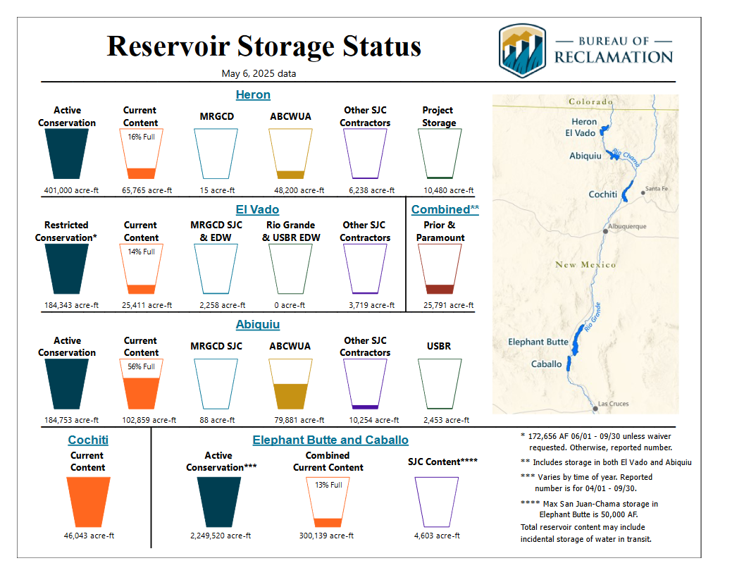
From the agenda packet for this afternoon’s (May 12, 2025) meeting of the Middle Rio Grande Conservancy District board.
(They do one of these every month, I always find them interesting, and I always forget to post them.)
26.5 miles are currently dry in the lower stretch of New Mexico’s Middle Rio Grande, in the stretch between Socorro and Elephant Butte Reservoir, though the Low Flow Conveyance Channel (a big canal next to the river’s main channel through this lower reach – it’s an engineered system, what counts as “river” is semantics at this point) is flowing, and water is still flowing through the Elephant Butte Narrows.
The river’s actually up right now through Albuquerque thanks to last week’s rain and the warmup melting off some last bits of snow. But this is likely the peak.
