dOak Flat, Arizona features groves of Emory oak trees, canyons, and springs. This is sacred land for the San Carlos Apache tribe. Resolution Copper (Rio Tinto subsidiary) lobbied politicians to deliver this National Forest land to the company with the intent to build a destructive copper mine. By SinaguaWiki – Own work, CC BY-SA 4.0, https://commons.wikimedia.org/w/index.php?curid=98967960
Click the link to read the article on the AZCentral website (Debra Utacia Krol). Here’s an excerpt:
May 15, 2025
Key Points
The San Carlos Apache Tribe wants a federal court to delay a land swap that would allow construction of a copper mine at Oak Flat.
A federal judge ordered a halt to the deal last week after hearing arguments by the grass roots group Apache Stronghold.
The San Carlos Apache Tribe has asked a federal court to block the Trump administration from finalizing a land exchange at Oak Flat Campground, following on the heels of a successful bid by grassroots group Apache Stronghold. The tribe sued to stop the exchange in 2021 after the U.S. Forest Service issued its final environmental impact statement. That opened a 60-day window during which the government could have finalized a deal with copper mining corporation Resolution Copper to take ownership of the site and begin construction on a huge copper mine that would eventually obliterate Oak Flat. San Carlos asked the U.S. District Court on May 14 to stop any progress on a plan that would allow Resolution to take ownership of Oak Flat and begin extracting copper on land considered sacred to Apache and other Native peoples. The tribe wants the order to stand until its own litigation was concluded…
“The Trump Administration is once again planning to violate federal laws and illegally transfer Oak Flat to the two largest foreign mining companies in the world,” said San Carlos Apache Tribe Chairman Terry Rambler. “Oak Flat sits above one of the largest copper deposits in the world. Resolution Copper intends to export the copper while destroying Apache sacred lands that the federal government has a Trust responsibility to protect. We will not allow this to happen.”
U.S. District Judge Steven V. Logan has already ordered a halt to the land swap in an order May 9 that ordered the Forest Service to hold off on issuing the document until one day after the Supreme Court had either refused to take the case of after it had decided in the government’s favor…The struggle over a small plot of land in the mountains is also at the heart of an ongoing national debate about the conflict between First Amendment religious rights, public lands oversight and a 150-year-old mining law’s relevance in the 21st century. [ed. emphasis mine]
In this detailed computer animation, we take a look into the future of Oak Flat, meticulously illustrating the development of subsidence as a result of the block cave mining process over an extensive period of 40 to 50 years. Crafted with transparency and precision, this video is grounded in the findings of multiple technical studies, aiming to provide as realistic a projection as possible of the landscape changes that Oak Flat will undergo. Block cave mining, a method known for its efficiency and low cost, has significant impacts on the terrain above the extraction zone. Through state-of-the-art animation, viewers will gain an understanding of how and why these changes occur, presenting a clear picture of the subsidence process from start to finish. Join us as we explore the intricacies of block cave mining and its effects on Oak Flat, guided by the latest in animation technology and scientific research. Whether you’re a student, a professional in the field, or simply interested in the future of our landscapes, this video is an invaluable resource for grasping the challenges and considerations of modern mining practices. By offering a visual journey through time, we aim to foster a comprehensive understanding of the complexities involved in mining operations and their environmental impacts. Learn more at http://www.resolutioncopper.com
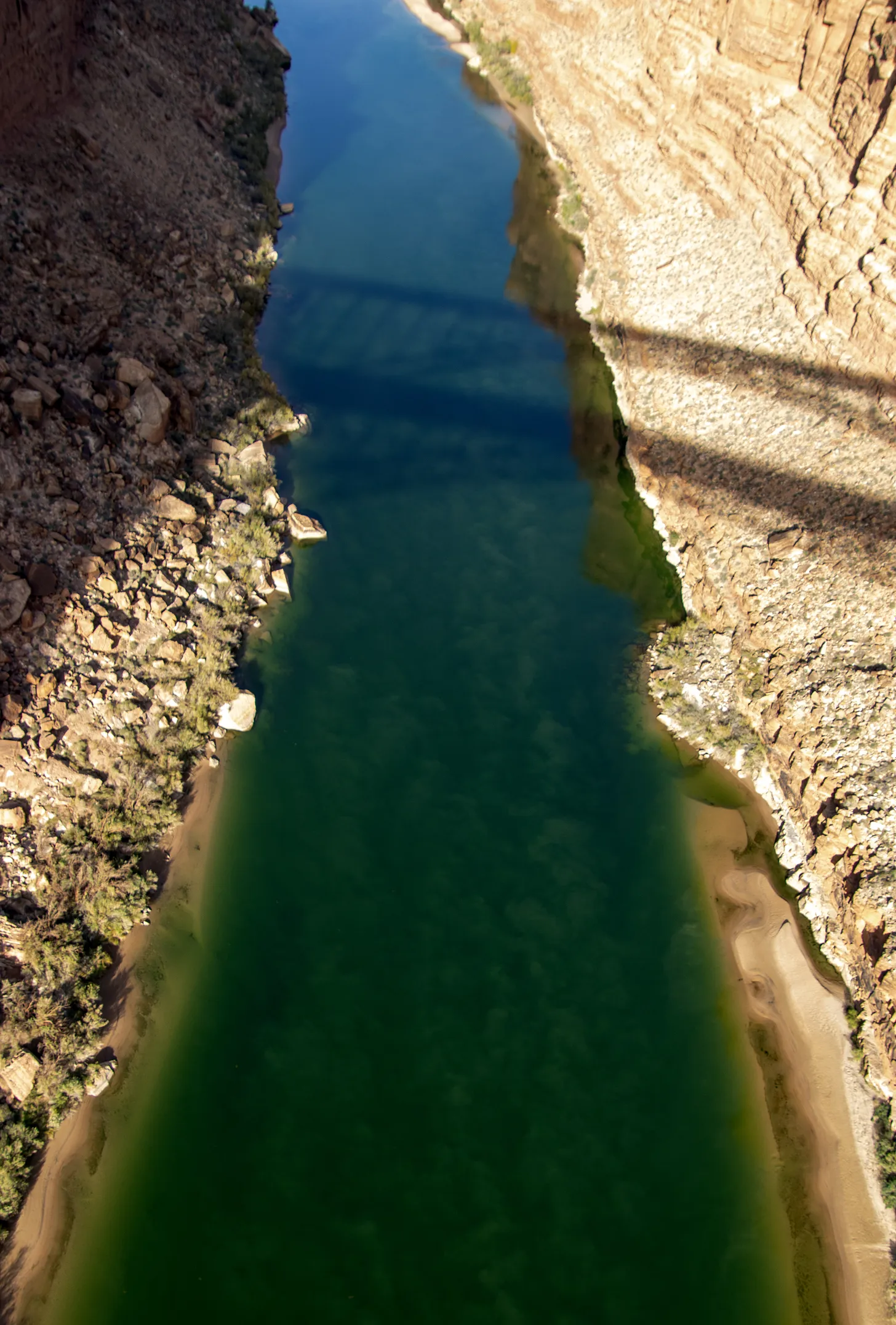
The Colorado River from the Navajo Bridge. Jonathan P. Thompson photo.
Click the link to read the article on the AZCentral.com website (Austin Corona). Here’s an excerpt:
May 15, 2025
Key Points
With no settlement yet on how to manage shortages on the Colorado River, the Trump administration is preparing to fill its last vacant Western water post, commissioner of the Bureau of Reclamation.
The seven states who draw water from the Colorado have struggled for years to agree on a plan to deal with shortfalls. The divisions remain among the states on the upper river and lower river.
Arizona’s top water negotiator says the Trump administration seems more willing to talk about different approaches to shortage sharing, but issues about who should take the largest cuts remain
The Trump administration is preparing to announce its pick to head the Bureau of Reclamation, a crucial position in deciding the future of the Colorado River, a White House spokesperson told The Arizona Republic. The move would effectively complete the new federal team overseeing strained negotiations over one of Arizona’s largest water sources. The new commissioner will take charge amid tense negotiations among the seven states that use the Colorado River, which has strained under multi-decade drought and high water demand…
Experts worry that this year’s poor river flows could trigger lawsuits over foundational river-management laws as soon as 2027. States only have months to reach a deal, and negotiators have not shown signs of progress.
Tom Buschatzke, director of the state Department of Water Resources and Arizona’s Colorado River negotiator, has said the Trump administration is already more “engaged in a much more meaningful way” on the Colorado River than former President Joe Biden’s team and has responded to some of Arizona’s long-unanswered requests in the negotiating process. Trump officials could give Arizona and the other Lower Basin states of California and Nevada a new opportunity to convince federal regulators that those states should not have to take all the cuts on the river. Biden negotiators would not call for cuts in the Upper Basin, while Buschatzke said the new administration may be more open to finding a “collaborative” solution. Even so, Upper Basin states — Colorado, Wyoming, Utah and New Mexico — have continued arguing that they cannot be forced to cut their water use if climate change and drought are the causes of low flows in the river, meaning any attempts to cut their use could lead to a lawsuit. A case could drag on for years, while water levels in the reservoirs continue to drop.
The Cache la Poudre River flows through Bellevue, Colorado on May 12, 2025. Water from the river will be used to fill the nearby Glade Reservoir once it’s built. The cost to build the new water storage project has grown from $400 million to $2.2 billion. Alex Hager/KUNC
Click the link to read the article on the KUNC website (Alex Hager):
May 15, 2025
This story is part of ongoing coverage of water in the West, produced by KUNC in Colorado and supported by the Walton Family Foundation. KUNC is solely responsible for its editorial coverage.
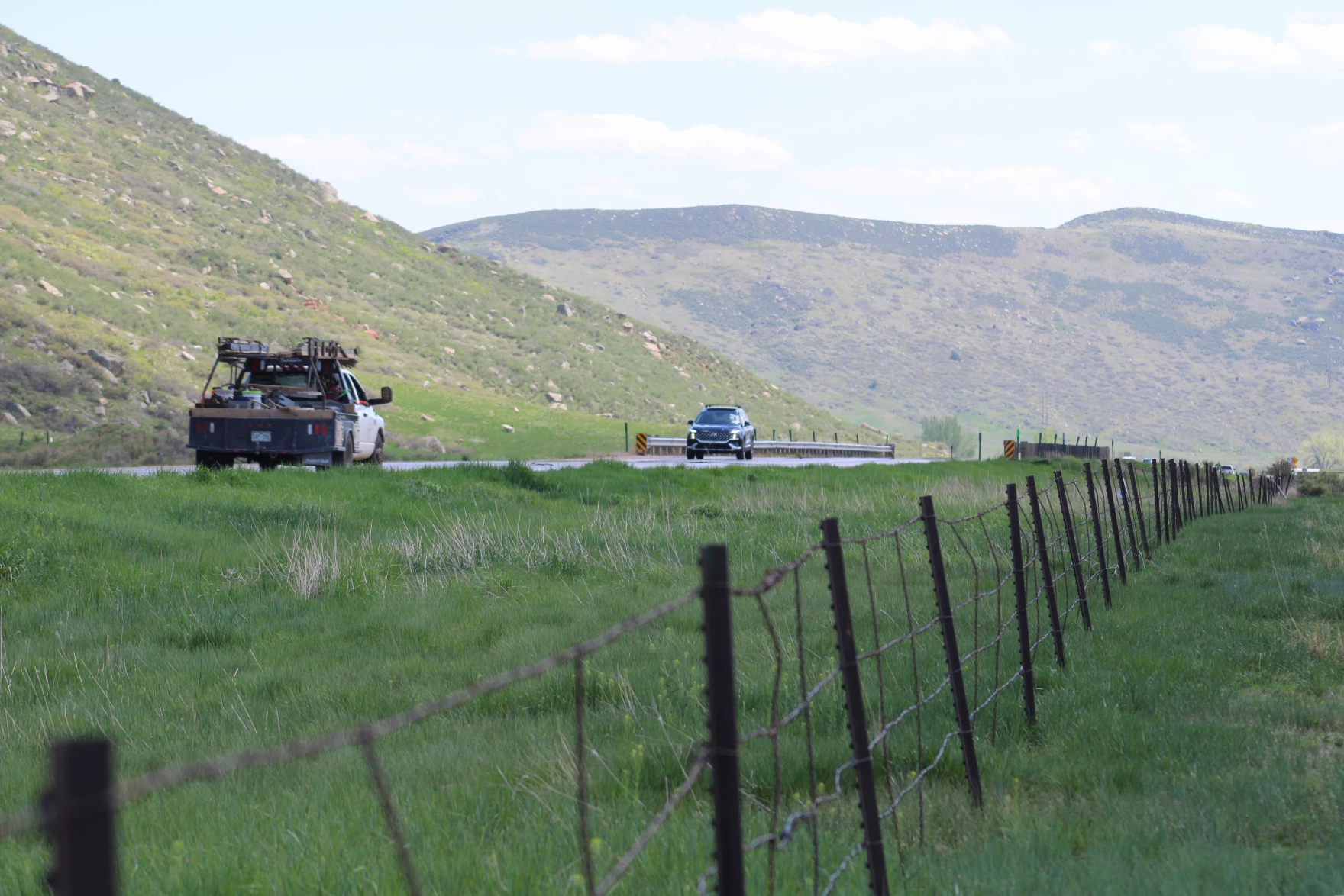
There’s a stretch of highway in Larimer County where prairie grasses sway with each passing vehicle. Cars, horse trailers and semi trucks zip through the valley on their way between Fort Collins and Laramie. Soon, it’ll be under more than 200 feet of water.
U.S. Highway 287 runs through the future site of Glade Reservoir. The Larimer county Board of County Commissioners approved the 1041 Land Use Permit for NISP in September, 2020. Photo credit: Northern Water
It’s the planned site of Glade Reservoir, the cornerstone of a massive new water storage system designed to meet the demands of fast-growing towns and cities in Northern Colorado. After more than two decades of permitting, planning and environmental lawsuits, it’s closer than ever to breaking ground.
But along the way, some things changed. Over the years, costs to build the reservoir system — and reroute seven miles of U.S. Highway 287 — have ballooned. Price estimates for the Northern Integrated Supply Project, often referred to as NISP, went from $400 million to $2.2 billion. Because of that, some of the towns that signed up to use its water are cutting back on their involvement before the reservoir system stores a single drop.
Northern Water, the agency building NISP, has projected confidence that it will still get built as planned. The long road from idea to construction, and the things that have changed along the way, can tell us a lot about how Northern Colorado uses water, and how much it costs to keep taps flowing.
The Northern Integrated Supply Project, currently estimated at $2 billion, would create two new reservoirs and a system of pipelines to capture more drinking water for 15 community water suppliers. (Northern Water project pages)
Rising costs
When it was first pitched, in the early 2000s, NISP garnered support as a way to make sure small towns with fast-growing populations could host new housing developments without going dry.
For a tiny town like Severance, that was an attractive proposition. Just 11 years ago, about midway through the NISP planning process, the town had a population of about 3,000. That’s when Nicholas Wharton took the job as town manager. Since then, he’s overseen the installation of the town’s first stoplight, the from-scratch development of its own police department and a homebuilding boom that has nearly quadrupled Severance’s population.
Signing on to NISP, he said, was a way to make sure Severance had enough water for all that growth.
“I think for smaller towns,” he said, “It was a great idea back when it was affordable to us.”
Wesley Lavanchy, the town administrator for Eaton, Colo., poses outside of his office on April 15, 2025. His town is one of four water agencies that reduced the amount of water it would store in NISP, and the amount it would pay to keep it there. Alex Hager/KUNC
Since then, Severance has cut back on the amount of water it will store in NISP, and the amount it will pay to be a part of the project. At one point, the town held 2,000 shares of the project. In 2024, it sold off 1,500 of those shares. Wharton said the town council might try to sell off even more.
And Severance isn’t alone.
Due West, in Eaton, town officials also got cold feet. They were one of four NISP shareholders to offload a portion of their involvement in the new reservoir project on the same day in July 2024.
For years, the water agencies that were part of NISP were mostly focused on paperwork — making sure the project had the permits it needed to get built. Then, there was a lawsuit from environmentalists standing in the way. But after NISP’s proponents were mostly seeing green lights on permits and decided to settle a major lawsuit, the focus shifted to money.
“I think the question for us now is, how do we afford this?,” said Wesley Lavanchy, Eaton’s town administrator. “Moving forward, how much can we afford? It’s like chocolate cake. You like it, it tastes great, but you can’t eat the whole thing.”
Ultimately, Eaton decided to sell off more than half of its NISP shares.
“I suspect that more entities would have been able to hold their commitment had the permitting process not drug on so long, the cost escalated, the litigation kind of wrapped things up,” Lavanchy said.
Cheaper alternatives
While the cost to build NISP has gone up, the cost of other water sources has gone down. Eaton and Severance said it’s getting easier to afford shares of the Colorado-Big Thompson project, which was a big motivator in their pullback from NISP.
That project, referred to as CBT, pipes water from the Colorado River across the continental divide. It flows underneath Rocky Mountain National Park and into major reservoirs along the Northern Front Range, such as Horsetooth Reservoir near Fort Collins and Carter Lake outside of Loveland.
Water from the Colorado-Big Thompson project is managed by Northern Water, the same agency building and operating NISP.
Boats cruise across Horsetooth Reservoir near Fort Collins, Colorado on May 12, 2025. The reservoir holds water from the Colorado-Big Thompson project, which has seen prices level off in recent years. Glade Reservoir is expected to be even larger than Horsetooth. Alex Hager/KUNC
For years, the CBT system was the main way for growing cities in Larimer and Weld Counties to get water for residential development. Typically, farms have sold their portion of CBT water to cities, towns, or developers. Occasionally, they are taken to auction, where cities bid against one another for water stored in those big reservoirs.
The cost of that water skyrocketed between 2010 and 2022. Estimated prices, adjusted for inflation, went from less than $20,000 per share, to around $100,000 per share, according to data from the consulting firm Westwater research. Since 2022, that soaring rise has leveled out.
“We believe that’s largely driven by a softening in the home construction sector,” said Adam Jokerst, a Fort Collins-based regional director for Westwater. “A lot of CBT purchases are by municipalities and developers who dedicate them to municipalities. And when new home construction slows, we see less demand for those shares.”
How did NISP get so expensive?
Northern Water said the price to build NISP has been climbing for about 15 years. Brad Wind, the agency’s general manager, cited inflation and rising interest rates as major drivers. He doesn’t, however, expect that to stop or significantly change the reservoir project.
“It’s an expensive project,” Wind said. “We and the participants advancing the project like it was envisioned.”
The lengthy process to get the project’s two reservoirs — Glade, and a smaller one called Galeton reservoir — from concept to construction gave time for the winds of economic change to shift direction. It’s not uncommon for a massive dam project like NISP to take more than fifteen years to attain a laundry list of environmental permits.
The project also faced opposition from local governments and nonprofits. At one point, Fort Collins voted to oppose the project. The most significant roadblock came from the environmental nonprofit Save the Poudre.
The group rallied local support and took legal action to try and stop NISP. At a 2015 event, Save the Poudre director Gary Wockner told a crowd of supporters that he would “fight to stop the project for as long as it takes.”
In late February, Wockner’s group settled for $100 million dollars. Northern Water will pay that sum into a trust over the course of the next two decades, and the money will be used to fund river improvement projects. In the intervening time, though, the price tag to build NISP likely grew significantly.
Wind said Northern plans to hire a contractor that could find ways to bring down the price by changing construction methods, but doesn’t expect “substantial reductions” to building costs, especially with rising prices of imported construction materials.
Over the years, the towns and water agencies that wanted to use NISP signed periodic agreements to stay part of the project. Now, time is ticking for those participants to sign a binding contract.
Eaton’s Lavanchy said that upcoming contract made his town take a harder look at their water needs, and whether those needs would be satisfied by NISP.
“We’re not dating anymore,” he said, “We’re getting married, and there’s no way out. Divorce is not an option. So it’s like, ‘Let’s be smart and think about, what are these obligations going to run us?’”
‘Demand continues to increase’
Even as some entities cut back on their financial ties to NISP, the project still has momentum.
For one, those towns and water agencies looking to sell their shares found a willing buyer. Eaton, Severance, Fort Lupton and the Left Hand Water District all sold their shares to the Fort Collins Loveland Water District.
Vehicles drive on U.S. Highway 287, near Bellevue, Colo. on May 12, 2025. The highway will be rerouted to make way for a massive new reservoir. Alex Hager/KUNC
The Fort Collins Loveland Water District, which serves an area roughly between Harmony Road and State Route 34, declined to be interviewed for this story.
Second, NISP has a total of 15 participants, and many of them are still on board for the same amount of water they signed up for years ago.
“No matter what,” Severance’s Wharton said, “In one way, you’ll see those 15 probably still continue to be a part of it no matter what, because everybody does realize how precious that water is and how this will be one of the last [big reservoirs.] I don’t think anybody’s discouraged.”
Even the towns that reduced the amount of water they’ll pay to use from NISP are keeping some. Severance and Eaton said they want to make sure they’re getting water from a diverse group of sources, especially with climate change and political bickering threatening their main source of water — the Colorado River via the CBT.
Ultimately, the fast-growing region served by Northern Water — from Boulder County to Fort Collins, and east to Fort Lupton — will keep needing water for a future that will likely see plenty of new home construction.
“It doesn’t appear that folks are shying away from moving to Northern Colorado,” Brad Wind said. “Either from within our state or from outside of our state, so the demand continues to increase for a high quality water supply, which NISP will produce.”
Regarding the Wolf Creek Reservoir on-going project, the district is still working to get an approval from the Army Corps of Engineers on their purpose and need statement to justify the project. Despite data from NRCS showing a drop of roughly 1/3 in water usage by area irrigators over the past 5 years, they have received funding to assess area water users need and or desire for additional water. The District will pursue a Recreation Survey as well.
The recently released Yampa River Scorecard Project grade of C-plus for the upper segment of the Yampa River shows a need for some improvements for overall river health in the stretch between Stillwater and Stagecoach reservoirs. Jenny Frithsen, environmental program manager at Friends of the Yampa, oversees the long-term river health monitoring and evaluation project. Frithsen said a major reason for the lower score is because that river segment is heavily utilized by agricultural water users but has less water coming in from smaller tributaries compared with downstream sections of the river.
“The first and foremost contributor to river health is water in the river, and the Upper Yampa and the Bear River are arguably the hardest-working and most heavily administered sections of river in the Yampa River system,” Frithsen said. “It probably is no surprise that the flow regime has lower scores for our ecological river health assessment. It is an altered flow regime.”
Frithsen presented a high-level overview of the 2024 river study segment during a South Routt Water Users meeting Monday evening at Soroco High School. The study looks at 45 indicators and nine characteristics of river health to determine and issue a score for combined flow and sediment regime, water quality, habitat and riverscape floodplain connectivity, riparian condition, river form, structural complexity and biotic community. On the positive side, the study team found the Upper Yampa stretch rated good in water quality, structural complexity, beaver activity, channel morphology and invasive weeds. The healthy beaver activity, especially on U.S. Forest Service land, showcases the natural engineering work of the large rodents to help mitigate the impacts of human water use and infrastructure. The beavers’ work maintains minimum flows in late summer and fall and provides a refuge for fish during low flows.
This year marks the 25th anniversary of the establishment of Canyons of the Ancients National Monument. Encompassing 178,000 acres of public land west of Cortez, the Monument was created on June 9, 2000 by President Bill Clinton using the authority of the Antiquities Act. Canyons of the Ancients was the brainchild of Interior Secretary Bruce Babbitt, who had great familiarity with the area owing to his Arizona roots. Canyons of the Ancients is widely renowned for what is often called the highest known density of archaeological sites in the United States, including more than 6,000 recorded sites and a total number of sites estimated as high as 30,000. As such, Canyons of the Ancients offers an unparalleled opportunity to observe, study and experience how cultures lived and adapted over time in the American Southwest.
As explorers and settlers colonized the western United States, the evidence of these ancestral cultures sparked enormous interest and curiosity. The famous western photographer, William Henry Jackson, recorded dramatic photographic images of prehistoric dwellings in the McElmo Valley in 1874. The General Land Office (the original precursor to the Bureau of Land Management) set aside Goodman Point in 1889 and made it off limits to homesteading for the protection of significant cultural resources. Eventually, in 1985, the BLM proposed protection for the larger landscape that today comprises Canyons of the Ancients, labeling it as an Area of Critical Environmental Concern. At the time, the BLM described the cultural resources as “individually and collectively unique and nationally important, representing a successful and challenging adaptation to marginal environments that lasted for 800 years.” A century’s worth of recognition and interest in preserving this cultural landscape set the stage for the presidential proclamation that established Canyons of the Ancients as a National Monument in 2000.
Click the link to read the article on the Summit Daily website (Kyle McCabe). Here’s an excerpt:
May 9, 2025
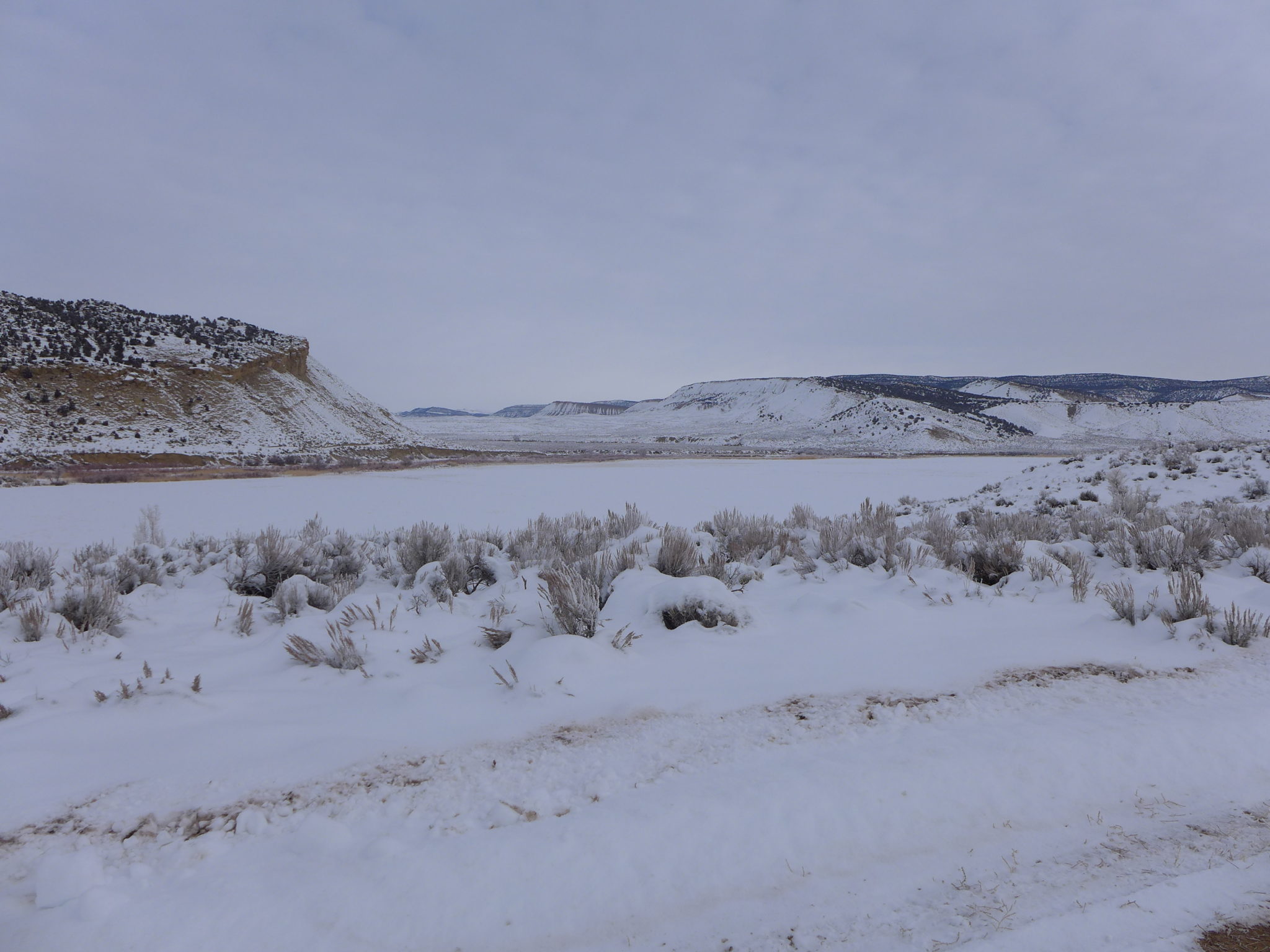
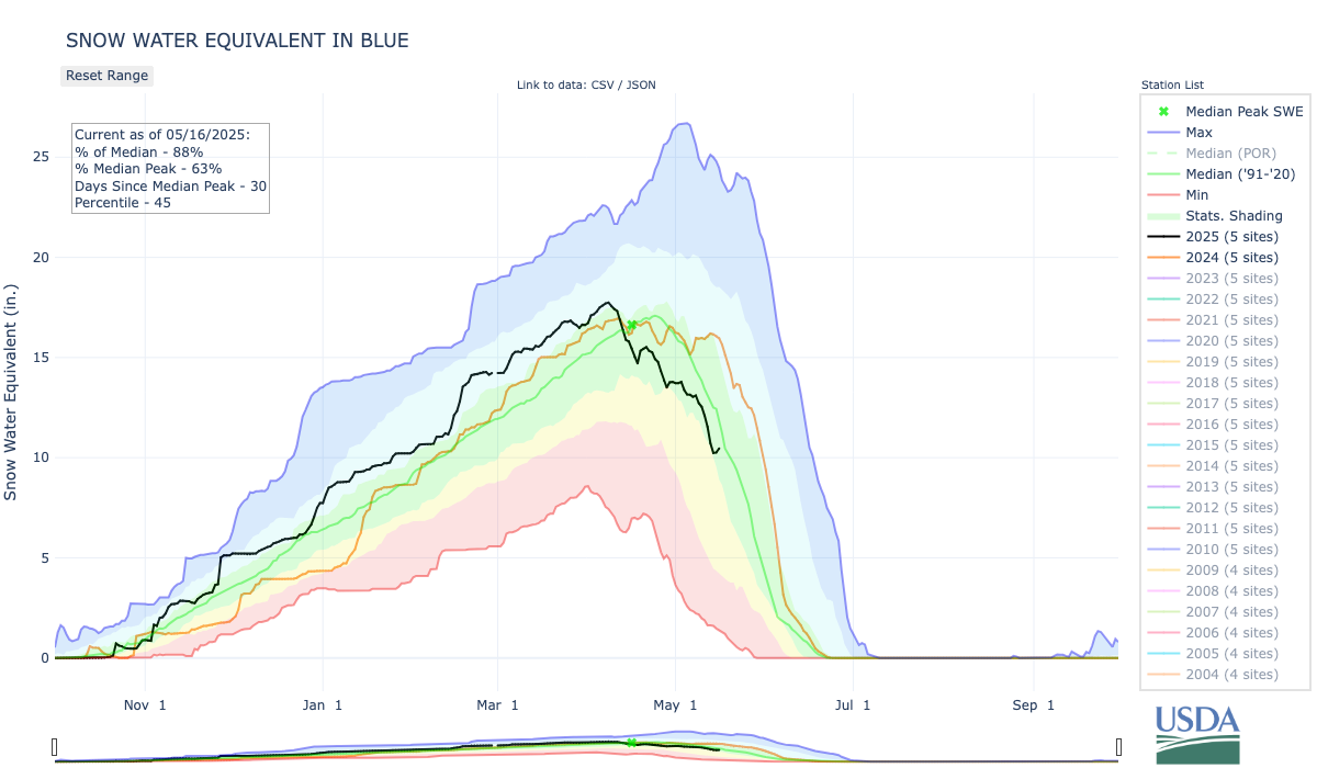
Snowpack in the Blue River Basin, which encompasses all of Summit County, stood at 90% of the 30-year median as of Friday. The figure shows that Summit is in a good position compared to the state as a whole, which sat at 58% of the median. Aldis Strautins, a service hydrologist with the National Weather Service in Boulder, said that 90% of the median is “within normal ranges.” He added that some lower elevation areas of Summit County, like the 9,350 foot-elevation snow telemetry monitoring site at Summit Ranch, have already melted out or gotten close.
“Some of the higher sites, like your Copper Mountain and Fremont Pass, those are still doing fairly well,” Strautins said. “Still have quite a bit of snowpack up there, which would make sense for this time of year.”
The Dillon Reservoir currently sits at 84% of its capacity, according to the Denver Water website.
The wetlands of the Prairie Pothole Region provide essential benefits to communities and are a premier waterfowl breeding ground. Explore how CASC science is informing the strategic restoration and management of the Prairie Pothole Region in the face of climate change. Photo credit: USGS
Click the link to read the article on the USGS website:
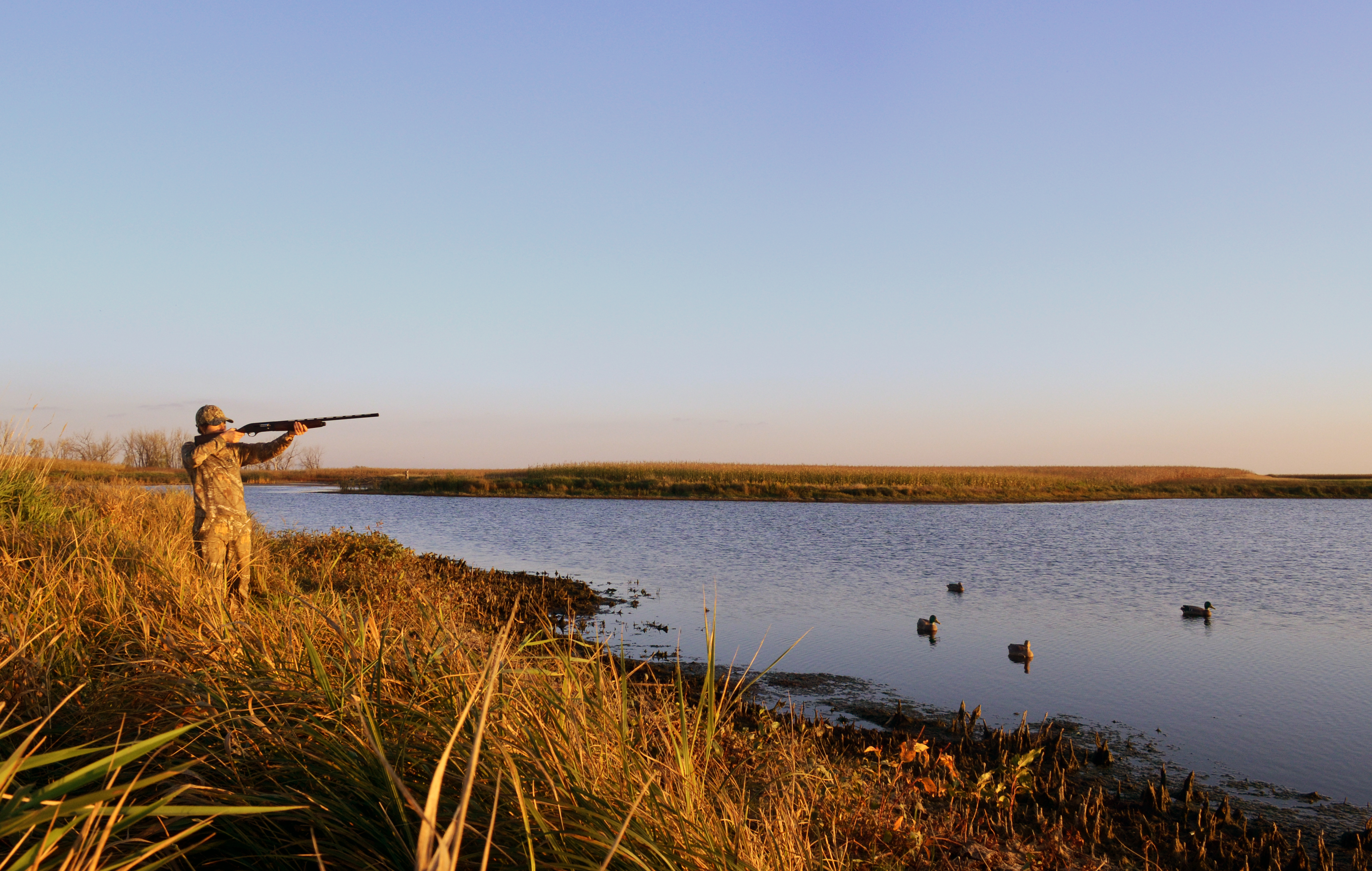
Waterfowl hunting. Credit: Chuck Traxler, USFWS
Climate Change and the Prairie Pothole Region
The Prairie Pothole Region’s economic and recreational significance is deeply rooted in its unique ecological characteristics. Extending across the northern Great Plains, the region’s rich, glaciated soils are a foundation for high-yield agriculture, contributing to the production of key commodities like wheat, soybeans, and corn. Across this landscape, depressional wetlands are interspersed with neighboring grasslands. These wetlands, commonly referred to as prairie potholes, provide essential benefits to communities like mitigating flood risks and regulating water flow, filtering pollutants, improving downstream water quality, storing significant amounts of carbon, and providing habitat for fish and wildlife.
The Prairie Pothole Region is a both a premier waterfowl breeding ground, attracting a large number of hunters, and major contributor to hunting opportunities across the continent. The region’s reputation as “North America’s Duck Factory” draws waterfowl hunters from within and outside the United States. Hunting and associated travel expenditures generate substantial revenue for local communities. An estimated 10,000 jobs and $760 million in labor income is generated in the region due to hunting and wildlife viewing. In recognition of these services provided by prairie pothole landscapes, conservation investment from federal programs like the Farm Bill and the North American Wetlands Conservation Act (NAWCA) provide significant funding for conservation initiatives. These investments support habitat restoration, land management, and research, creating jobs and stimulating economic activity in the conservation sector. Finally, national wildlife refuges and other public lands provide the public with additional access to these habitats so they can enjoy the many recreational opportunities.
Climate change is increasing temperatures and changing precipitation patterns, leading to pronounced shifts in this region. More frequent, high intensity storms over the last 25 years have been observed, causing a shift from snow-melt driven hydrology to summer and fall storm driven hydrology. At the same time, more frequent and severe droughts are causing changes in the diversity of wetland sizes, negatively impacting habitat quality of smaller-sized wetlands and landscape heterogeneity important to diverse waterfowl and wildlife populations. Land-use change, combined with these effects of climate change, are diminishing the region’s capacity to support viable populations of waterfowl and other wildlife populations. Climate adaptation scientists can provide the expertise and research needed to inform future adaptations important to maintaining the recreational and economic benefits of this region.
Supporting Prairie Pothole Management and Sustaining Recreational Opportunities
Since 2018, the USGS Climate Adaptation Science Centers has been documenting key impacts of climate change on this region. Results from multiple research efforts can inform strategic acquisition, restoration, and management in the Prairie Pothole Region to maintain its ecological, economic, and cultural importance to the United States.
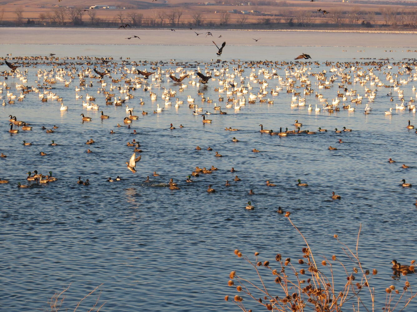
Waterfowl on Lake Andes; Lake Andes National Wildlife Refuge. Public domain
Impacts of Climate-Driven Shifts in Prairie Pothole Wetlands on Waterfowl
Recent science indicates that climate and land use change are affecting Prairie Pothole wetlands in unexpected ways, indicating that new areas may need to be targeted for restoration to maintain suitable waterfowl breeding habitat. Partnering with the U.S. Fish and Wildlife Service, CASC scientists used new models to simulate how these wetlands would change under different future climate change scenarios, and how those changes would impact the ability of the wetlands to support waterfowl breeding.
Results showed that areas that currently have the highest densities of intact wetlands and support large numbers of breeding ducks will also likely be the most successful in maintaining these habitats under future climate conditions. Additional follow up work used extensive datasets in collaboration with U.S. Fish and Wildlife Service scientists to generate actionable insights that can inform conservation strategies for grassland and wetland ecosystems in the Prairie Pothole Region.
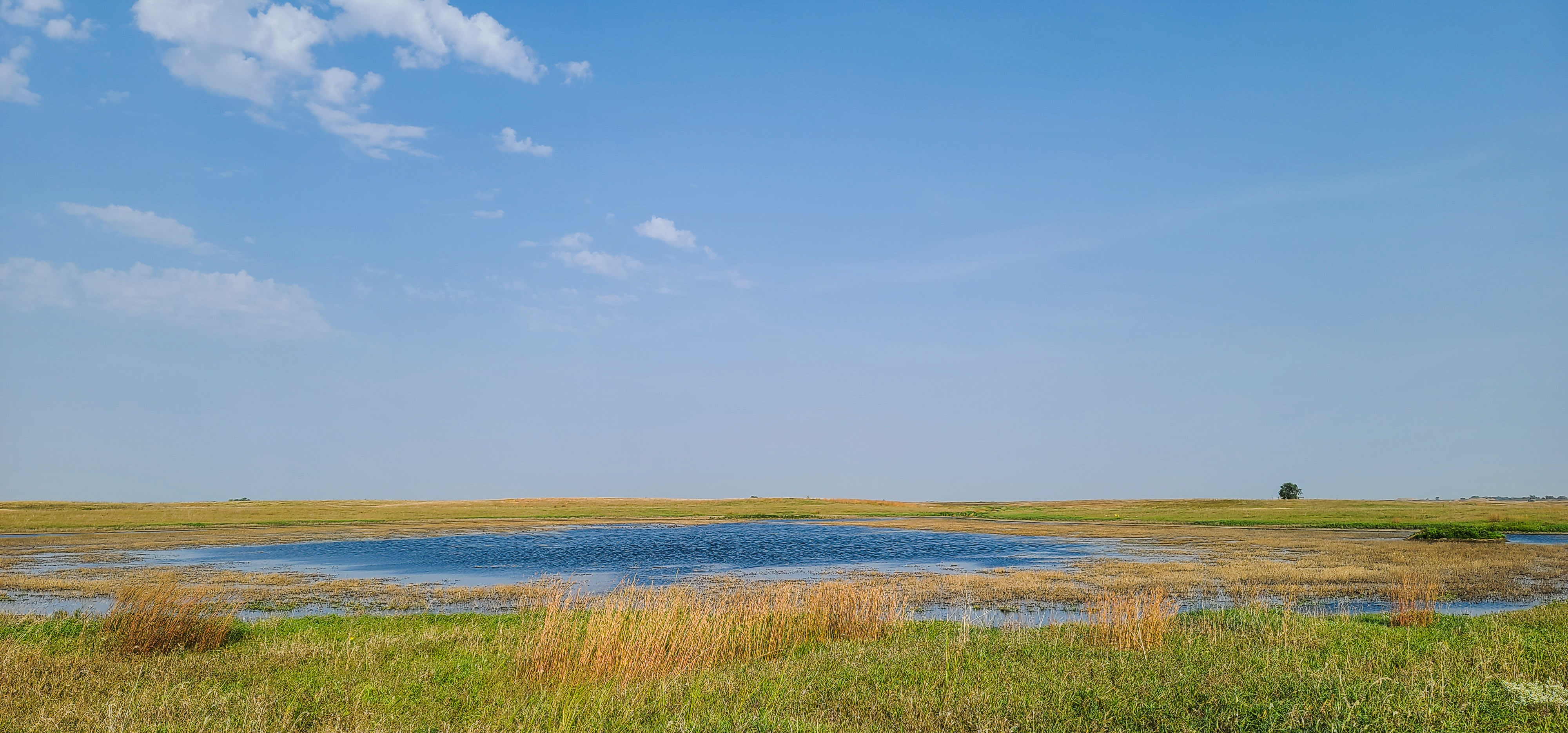
Prairie Pothole Landscape on Broken Arrow WPA Lake Andes Wetland Management District South Dakota. Sources/Usage Public Domain. Credits: Marcie Hebert, USFWS
How Climate Change is Linking Prairie Pothole Wetlands to River Wetlands
Wetlands in the Upper Mississippi River Basin help control floods, filter pollution, and provide critical habitat for migratory birds. However, high intensity rainfall events can cause these depressional wetlands to overflow and connect with Mississippi River tributaries. This reduces the ability of wetlands to process nutrients and mitigate nutrient pollution in the Mississippi River. These overflow events are expected to increase due to climate change and land management, as extreme precipitation events become more frequent and severe.
CASC scientists are working with managers to identify how wetlands along the Minnesota River, a large tributary of the Mississippi River, will respond to floods, and the resulting implications for water quality and migratory bird habitat. This information will feed into a tool that will allow management agencies to balance wildlife and water quality objectives in future conservation actions.
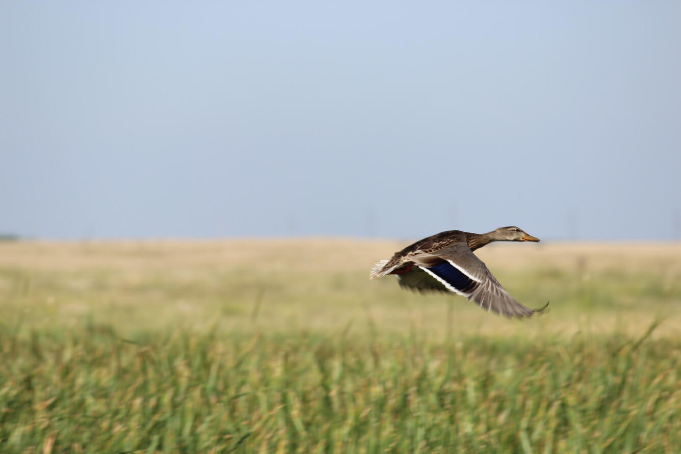
Mallard Hen in Flight over Lake Andes Wetland Management District South Dakota. Sources/Usage Public Domain.
How Weather Patterns and Land Use Influence Where Ducks are During the Fall and Winter
Ducks from the Prairie Pothole Region are important for both the economy and culture of the region. However, climate and land use change are altering their habitat are causing ducks to move to new areas during the hunting season. Partnering with the U.S. Fish and Wildlife Service and Ducks Unlimited, CASC scientists tracked these changes in duck distributions, using data from bird banding, hunting, and counts. They found that while many ducks are spending winters farther north, but it’s not a simple story. Different duck species are shifting their winter locations in different ways. Understanding these specific changes is key to figuring out what’s driving them and will inform decisions about managing habitats and harvest.