Prepared remarks: The Way Forward on Water Management (March 10, 2025) — Phil Weiser

Click the link to read the remarks on Colorado Attorney General Phil Weiser’s website:

Talk Given to Business for Water Stewardship on March 10, 2025

In Colorado, we confront challenges as opportunities. As Wallace Stegner, the famed Western writer, once put itโ€”itโ€™s impossible to be pessimistic in the West; itโ€™s the native land of hope. How we manage our water is a test of that ethos.

There are no two ways to put this:  we face significant water scarcity challenges in Colorado and the West. That scarcity is driven, in part, by increasing demands as population booms. And itโ€™s also driven by our changing climate, which is reducing snowpack, changing runoff patterns, increasing evaporation, and drying soils.

While we know that climate change significantly impacts Coloradoโ€™s water, its extent and exact impact is presently unknown. That uncertainty, coupled with the unpredictability in rainfall and snowpack, is destabilizingโ€”making it difficult for farmers, ranchers, and even cities to know what to expect each year or how to plan for the future. Unfortunately, the variable weather patterns we are seeing are very likely to be our new normal, creating considerable pressure for us to create more adaptive and resilient systems for water management.

Increased uncertainty and unpredictability in water make planning more important than ever, with an imperative of developing new and innovative strategies for water management. It is no exaggeration to say that the future success of Colorado will depend, in considerable part, on our ability to adapt to scarcity and reduce the uncertainty and unpredictability that come with it. The best and most durable solutions will go beyond individual success and will collaborate with other interests to find win-win solutions.

I know this is important to Business for Water Stewardship, and Iโ€™m excited to talk with you about it today.  I also want to speak about how our management of water must remain intertwined with respect for the rule of law, as the solutions we craft are only as good as the laws they are built upon and the institutions charged with implementing and upholding them.

I. Moving Toward a Resilient and Adaptive System of Water Management

Adapting to scarcity and creating more certainty will require us to develop innovative and collaborative strategies for water management. It will also require collective action. We cannot focus on individual successes and ignore the community in which these projects occur. I appreciate how you captured this point on your website:

We believe businesses have an opportunityโ€”and a responsibilityโ€” to ensure that their operations and investments improve communities and ecosystems where they do business. And in water-stressed regions, that responsibility is deeply rooted in how we value, use, and protect water.  Thatโ€™s why we help businesses work collaboratively with community and policy stakeholders to advance solutions that ensure people, economies, and ecosystems have enough clean water to flourish.[1]

I couldnโ€™t agree more. Each of us, whether as businesses or individuals, has a responsibility to ensure that, wherever we can, we work to improve communities and ecosystems where we live and work. Let me begin by focusing on a few projects that have done that. And I want to contrast those with projects that do not.

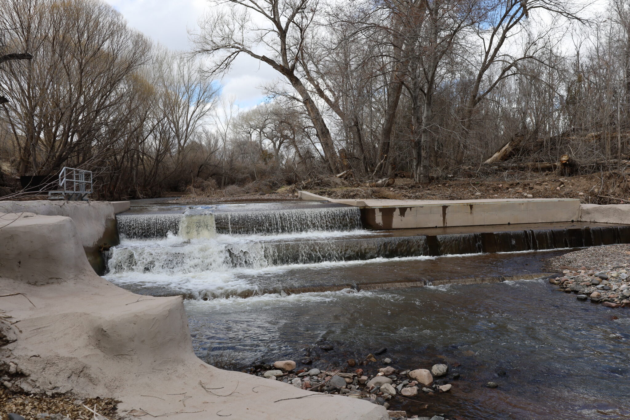
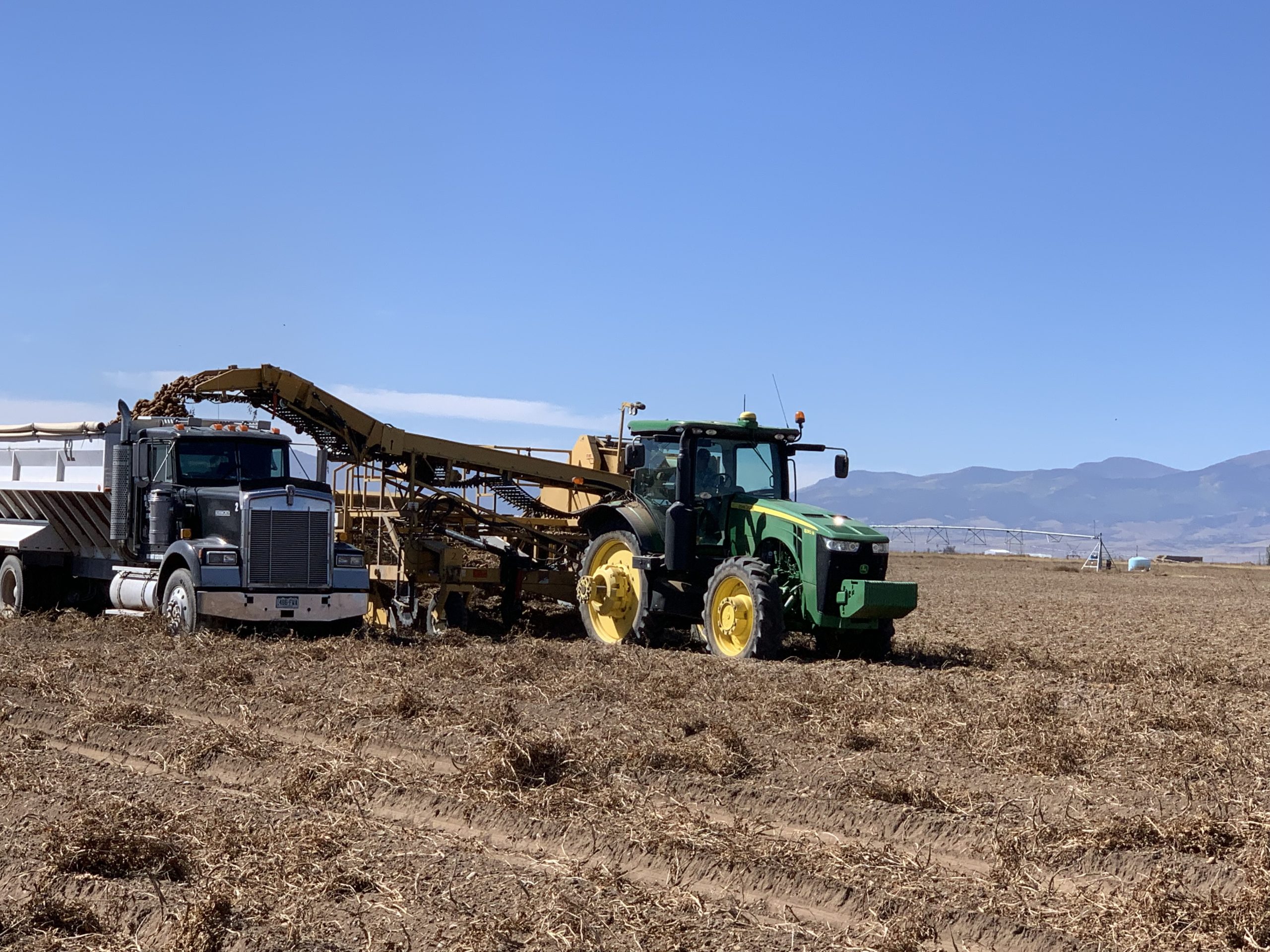
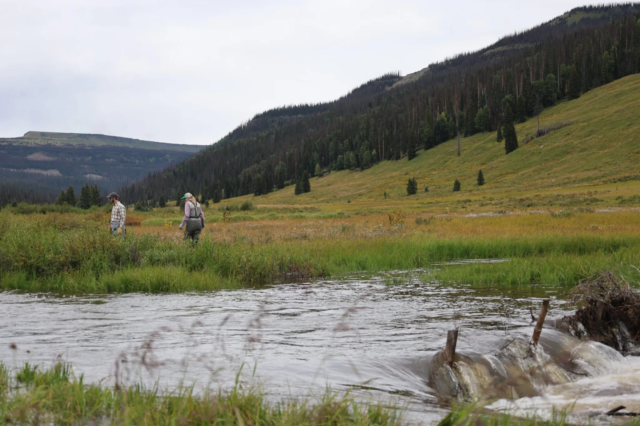
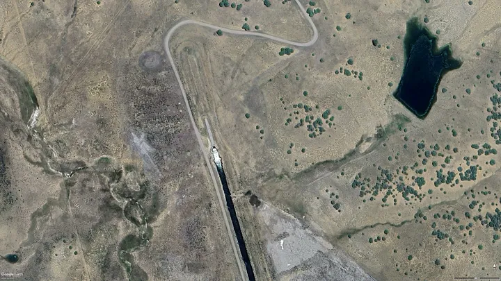
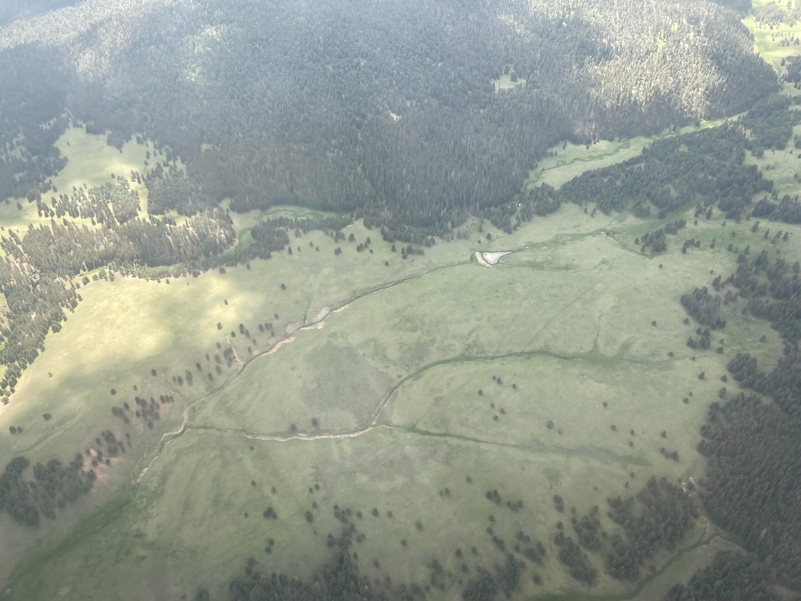
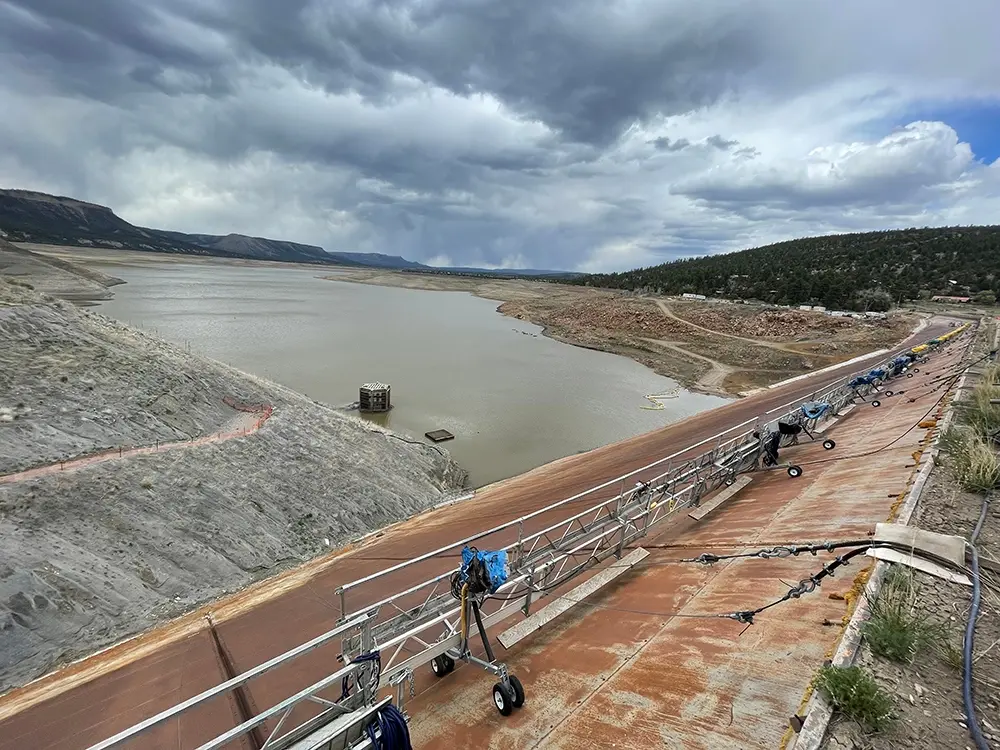
Maybell Diversion Restoration project. Photo credit: JHL Constructors

A. The Maybell Diversion Project

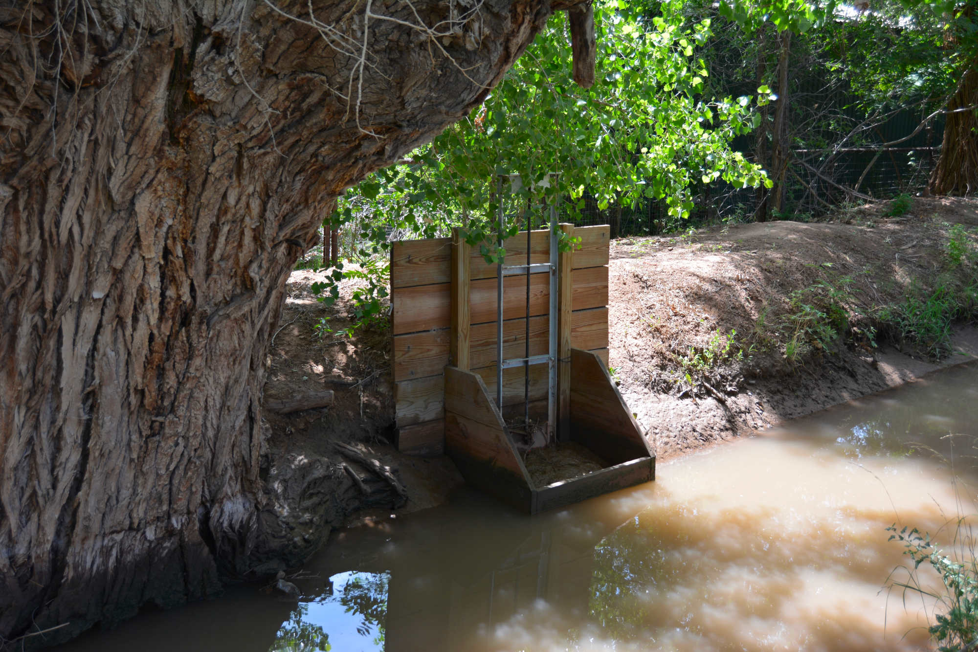
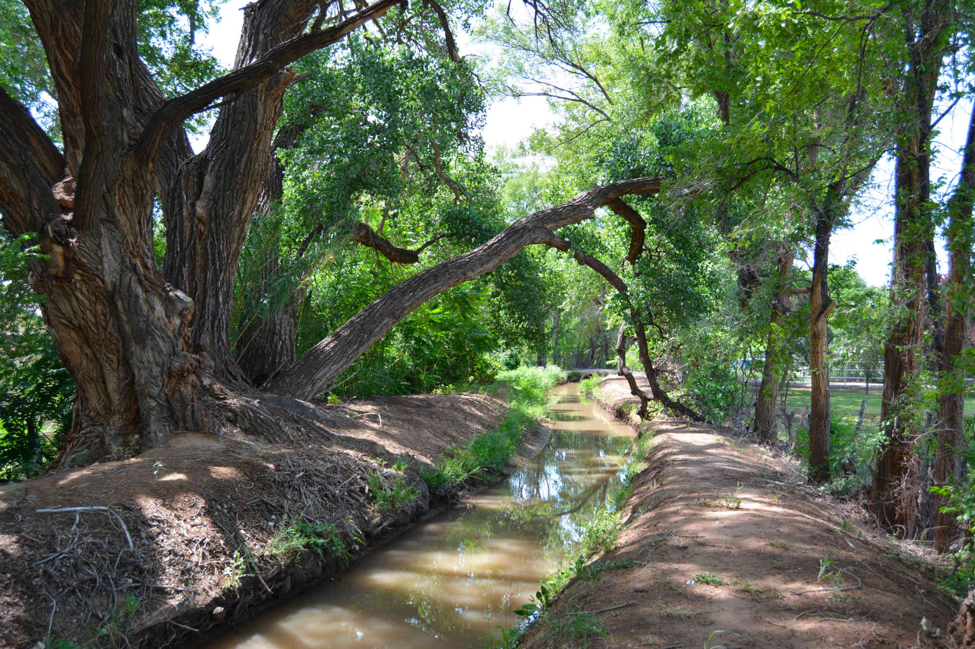
The Maybell Diversion Project is a wonderful example of a project that has multiple benefits. Updating and modernizing the Maybell Diversion Project improved efficiency for irrigation, increases resiliency to drought, and benefitted threatened and endangered species.[2]

Before the project was completed in 2024, irrigators from Maybell Irrigation District had to trudge two hours through steep, rugged sagebrush country to manually open and close the rusted and broken metal headgate.[3] It was an arduous, yet crucial task because Maybell is one of the largest irrigation diversions on the Yampa.[4]

The Nature Conservancy worked with numerous partners to help fund the $6.8M project. Funding partners include: the Bureau of Reclamationโ€™s WaterSMART program; the National Fish and Wildlife Foundation; the Upper Colorado River Endangered Fish Recovery Program,[5] and the Colorado Water Conservation Board.[6]

Today, the opening and closing of the Maybell headgate can be controlled remotely and is determined by a combination of water user needs and available flows into the Maybell Ditch. The Maybell Irrigation District also coordinates with the Upper Colorado River Endangered Fish Recovery Program and the Division of Water Resources to guide water use in the Lower Yampa.[7]

As I said previously, this project promises mutual benefits. It allows continued irrigation of historical lands, which supports local farmers and the economy. At the same time, it also improves fish habitat and removes barriers to boat passage, supporting the environment and secondary economic benefits like river recreation.

In 2021, I spoke to the Colorado Water Congress about โ€œThe Imperative of Investing in Water Infrastructure.โ€[8] In that speech, I highlighted important water infrastructure projects around the state, including a plan to replace the aging Grand Valley Hydroelectric facility with a new more efficient plant capable of producing 1.5 times as much power. Like the Maybell Diversion Project, that plan brought multiple benefits. In addition to producing more clean electricity, their continued use of the water right will ensure that water flows into the 15-mile Reach, a critical stretch of river for four species of endangered fish. Many local irrigators will also benefit from increased diversions at an upstream diversion point supplying the plant.

In that speech, I also emphasized the importance of developing funding sources and investment opportunities in water infrastructure. I mentioned a few success stories, like Proposition DD, HB 21-1260, which provides $20 million in funding for implementation of the Colorado Water Plan, and HB 21-240, which provides $30 million for watershed restoration in response to wildfires, including funding for flood prevention and mitigation. But those are not enough. With continued growth on the horizon, our commitment to fund projects laid out in the Colorado Water Plan is imperative. That plan is the roadmap for investing in our future and fulfilling the Planโ€™s vision will take billions of dollars.
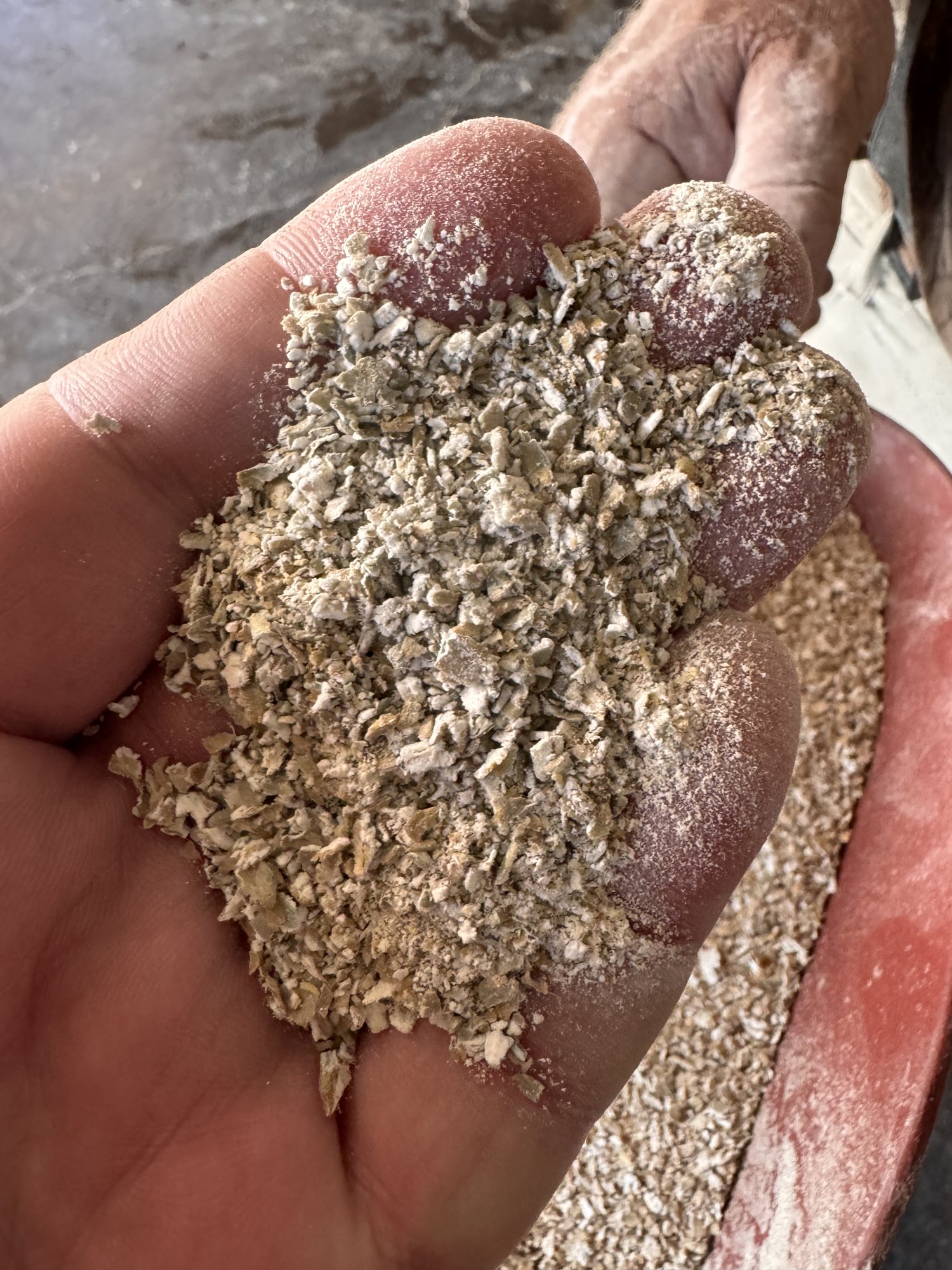
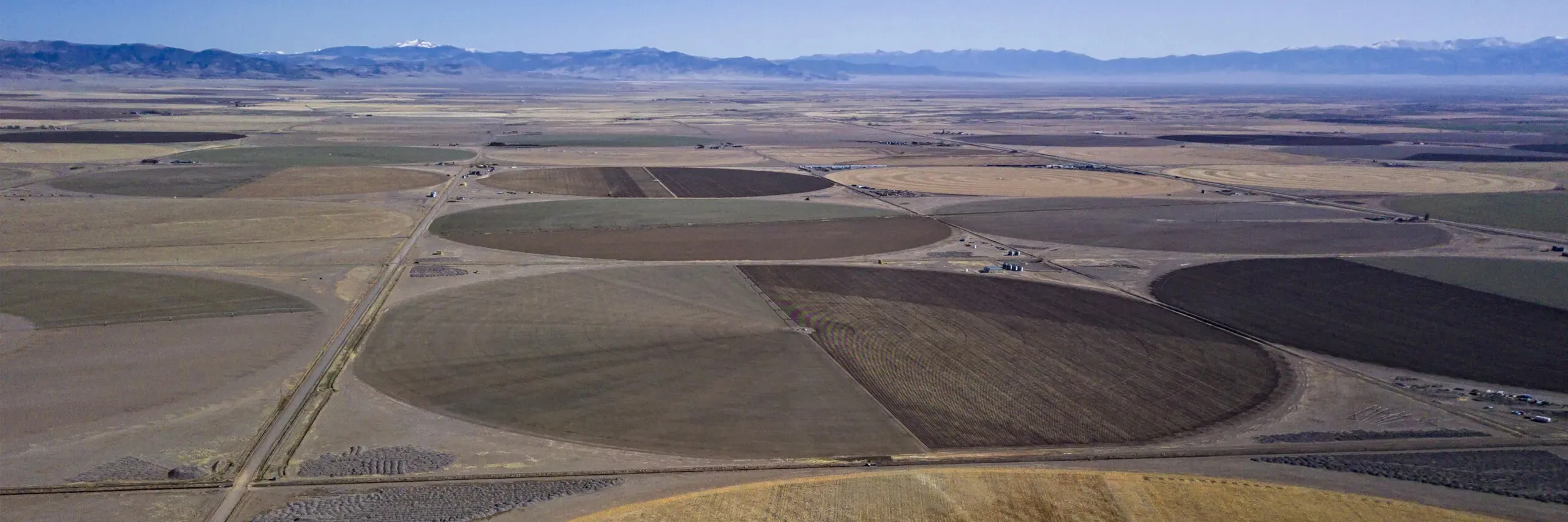
Photo credit: Rye Resurgence Project

B. Rye Resurgence Project

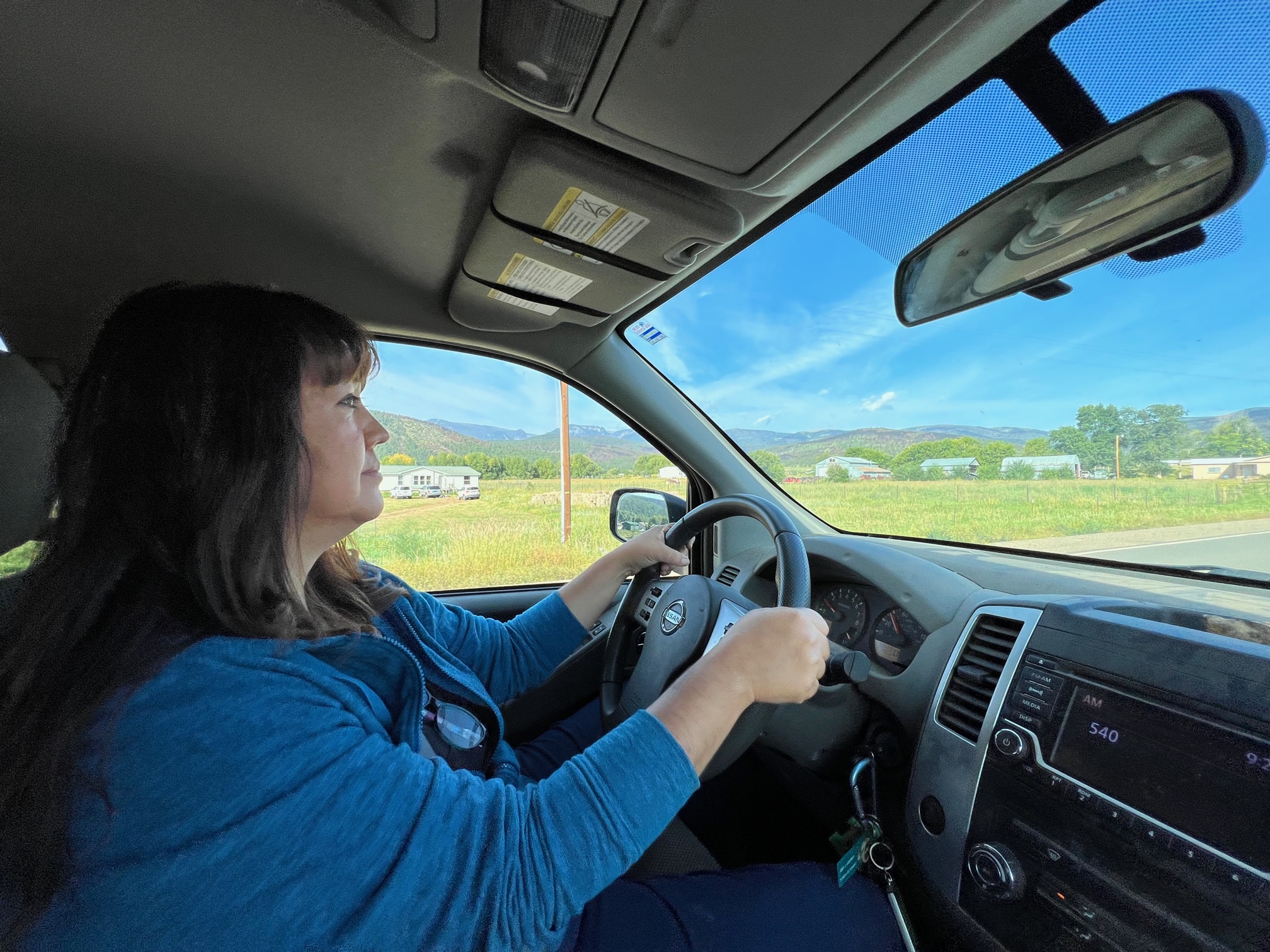
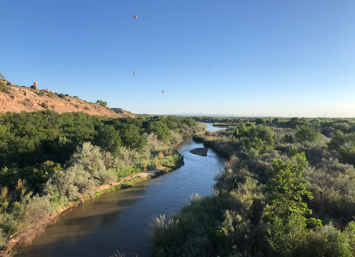
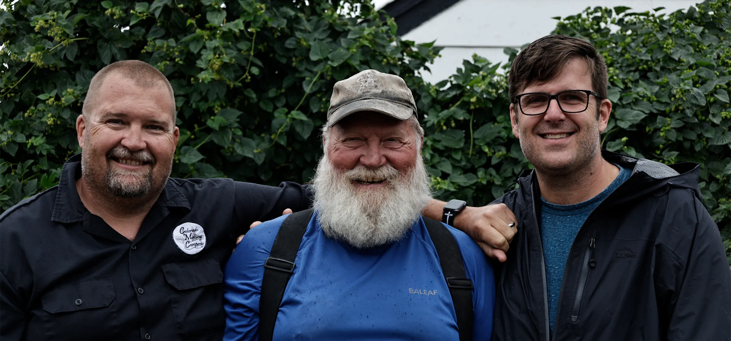
The Rye Resurgence Project in the San Luis Valley supports continued farming, while reducing water use, improving soil health, and helping the community flourish.

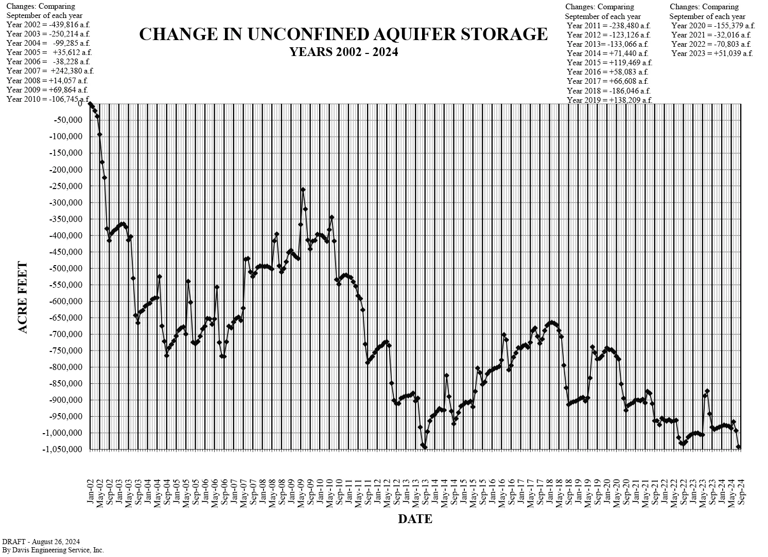
During this time of drought, it is critical that we find ways to use less water without sacrificing economic opportunities. This can help build resilience in the face of shrinking water supplies. Crops, like rye, can use far less waterโ€”up to 40%โ€”than other similar crops like barley or oats.[9] This difference is huge in a region that is trying to conserve water in order to balance Rio Grande water use with supply. Data in 2024 shows the San Luis aquifer at its lowest recorded level in history.[10]

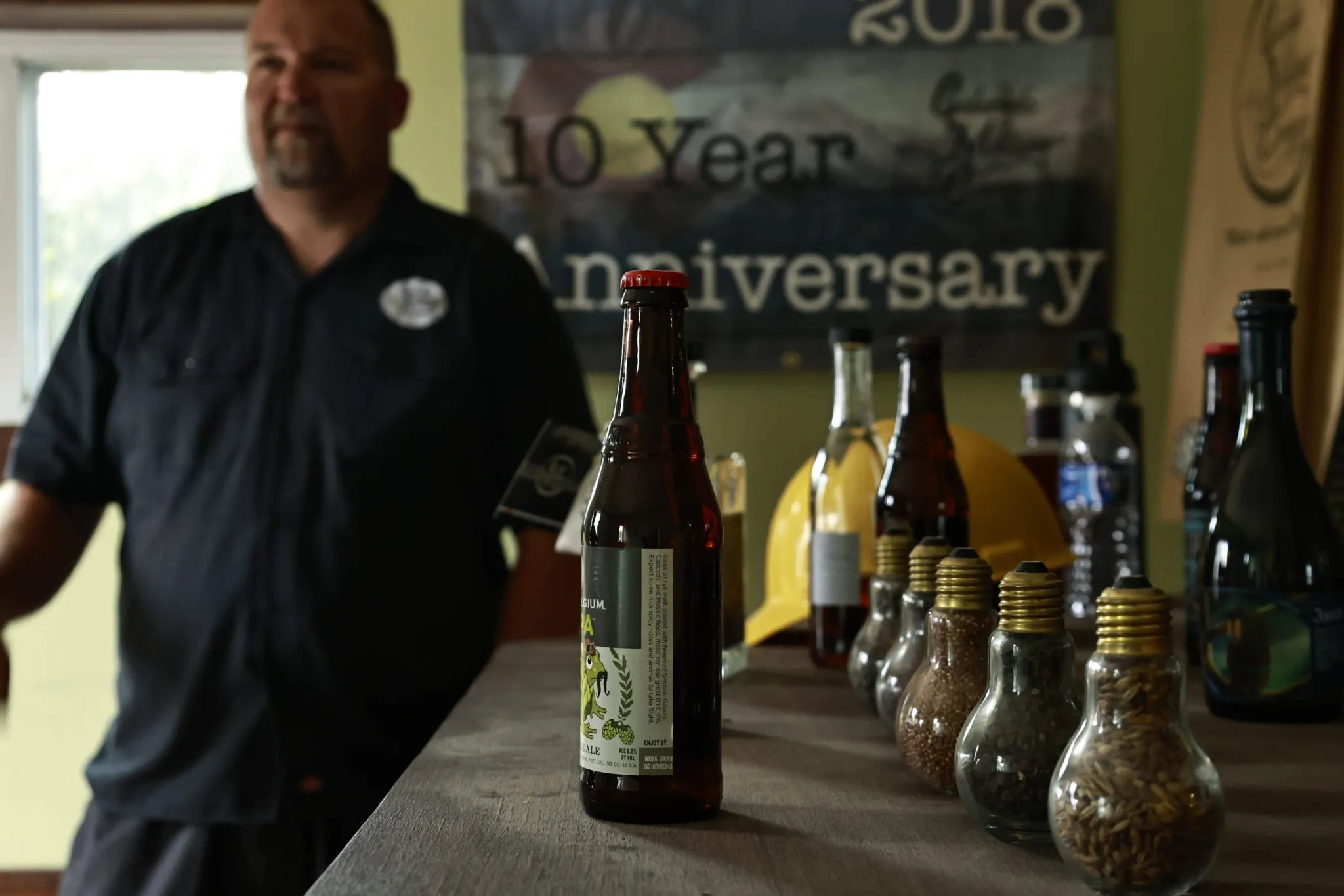
An important element of the Rye Resurgence Project is that it recognizes that switching to crops that require less water will only succeed if there is a market where farmers can sell those new crops at a profit. The project helps build a market for Colorado rye by investing significant effort and resources in marketing, branding materials, and personnel to develop relationships between the growers and the end users of rye such as brewers, distillers, millers, bakers, and consumers.[11]  Building the market for San Luis Valley Resurgence Rye gives farmers an option to reduce their impact, earn a living wage, and support the local community. By keeping farmers farming, the future health of the community will be sustained.

II. Two Cautionary Tales to Avoid in the Future

The above two projects reflect effective strategies for managing water during this challenging time. There are, however, examples that have proven to be ineffective that are important to learn from. I will discuss two such cautionary case studies, highlighting some pitfalls of mismanaging water.

          A. Alfalfa for Saudia Arabia

The growing of alfalfa in Arizona to ship to Saudi Arabia is perhaps the most glaring example of a project whose success comes at the expense of the community in which it occurs.[12] The short story of this project is that Saudi firms bought up 9 square miles of land in Arizona for irrigating and growing alfalfa grass.[13] The firms grew alfalfa in Arizona to export to Saudi Arabia and the United Arab Emirates because they had already drained their own aquifers.[14]

Alfalfa is an incredibly water-intensive crop. Growing it in a desert climate drastically impacts the surrounding communities. The Saudis were using the same amount of water to grow hay just for export as what a million people in the state use for water every year.[15] The Saudis invested a huge amount of water into the crop which they couldnโ€™t grow at home because they donโ€™t have the water. Essentially, this is exporting Arizonaโ€™s water.

By transporting the alfalfa overseas instead of selling it domestically, this also eliminated all future economic returns on that water. If that alfalfa stayed in Arizona, for example, it could have been sold to domestic cattle producers and benefited local communities and businesses. None of those domestic gains were achieved once the alfalfa left our shores.
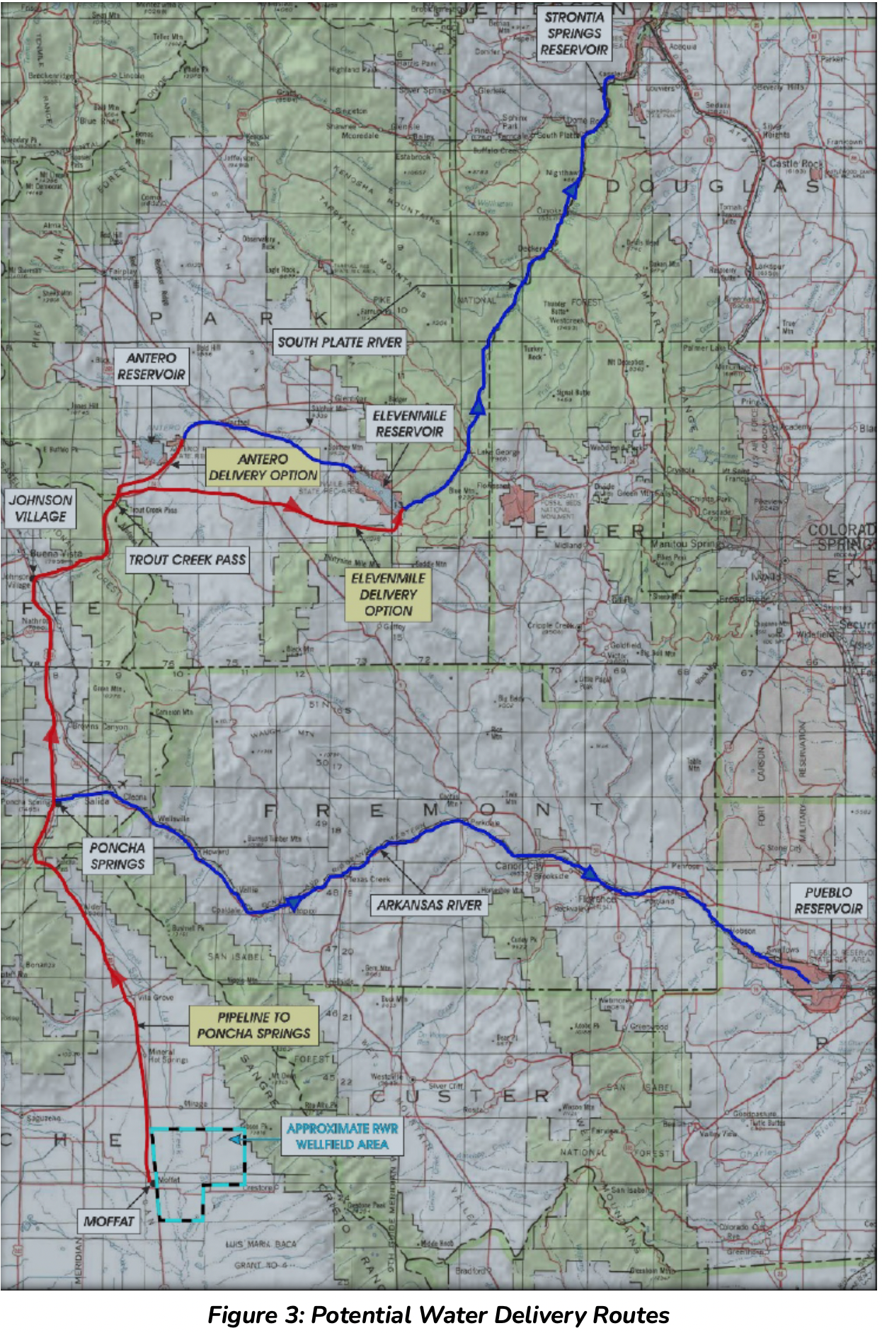
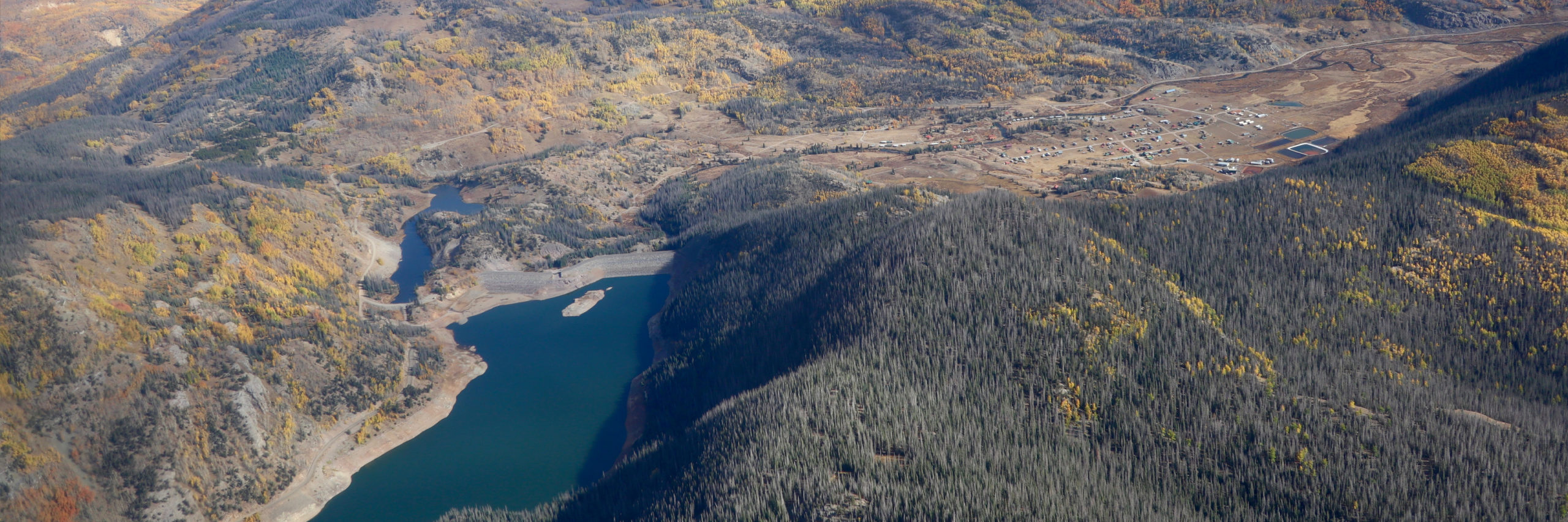
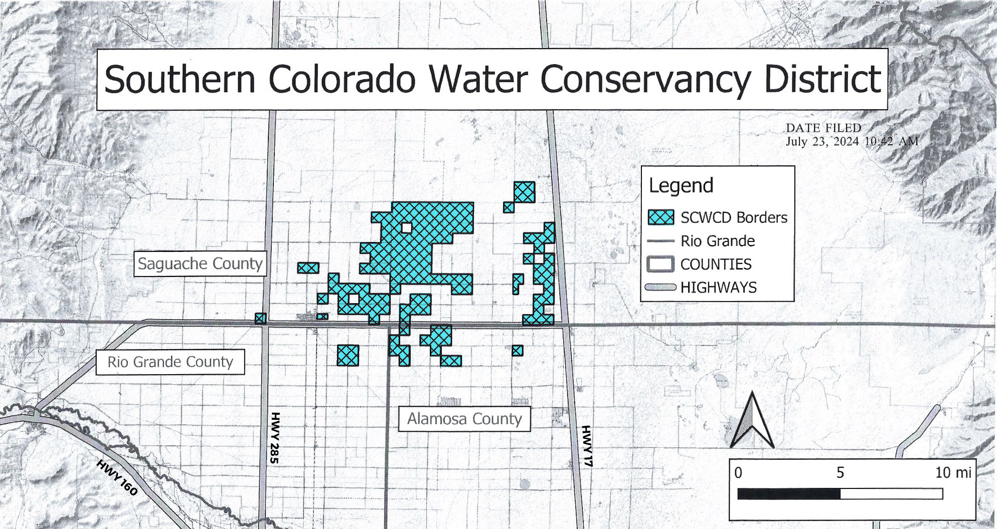
Potential Water Delivery Routes. Since this water will be exported from the San Luis Valley, the water will be fully reusable. In addition to being a renewable water supply, this is an important component of the RWR water supply and delivery plan. Reuse allows first-use water to be used to extinction, which means that this water, after first use, can be reused multiple times. Graphic credit: Renewable Water Resources

B. Buy and Dry Schemes

In Colorado, we have seen before what is now labelled a โ€œbuy and dryโ€ scheme. This scheme involves the sale of relatively all the water from a community, shipping it to a thirsty urban community and destroying a local agricultural economy. That is, in short, the tale of what happened in Crowley County.[16] As captured in Coloradoโ€™s Water Plan, it is an approach that we are committed to avoiding in the future.[17]

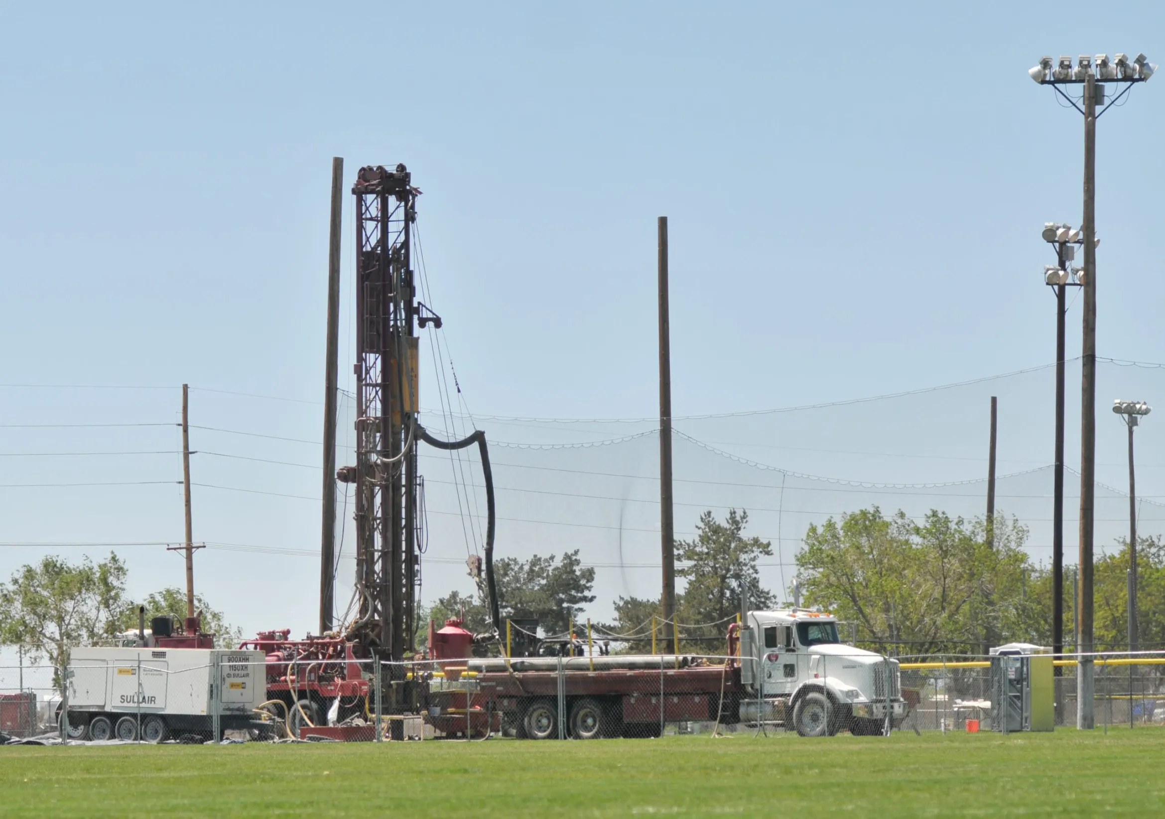
For an example of a buy and dry project now on the table, consider the case of the (improperly named) Renewable Water Resources. That project would buy out wells that are currently used to irrigate lands in the San Luis Valley and, rather than using that water for irrigation and farming, it would be piped to the front range for new suburban houses.[18] This has several direct and indirect negative economic impacts as well as cultural impacts on the San Luis Valley. This project makes one rural community suffer while a suburban community prospers.

In contrast to the Rye Resurgence Project, which invests in farmers to help them adapt to new markets, this project disregards farmers and eliminates the economic driver for their community. Proponents say the water is necessary to ensure other communities have enough water supply to secure their future. But we canโ€™t let ourselves be tricked into believing that economic prosperity or managing our water resources is a zero-sum game.
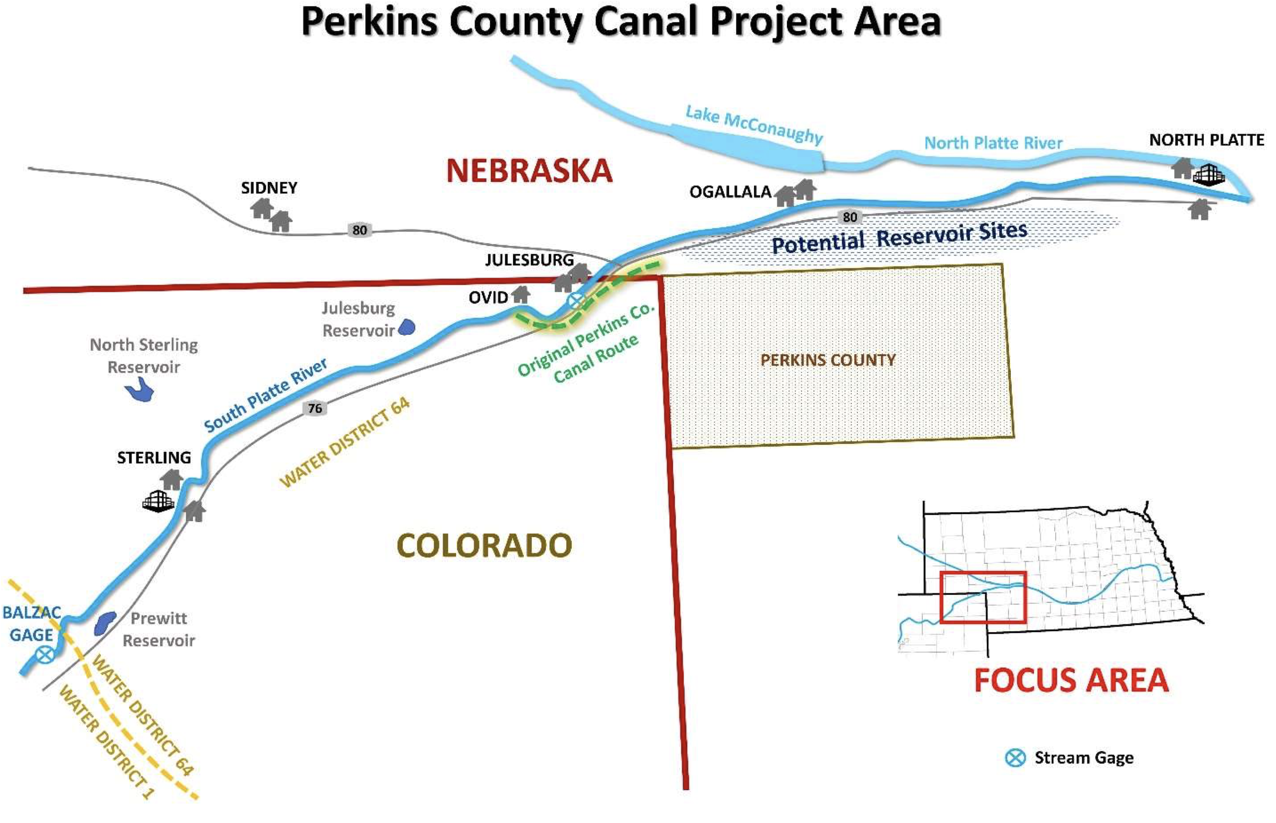
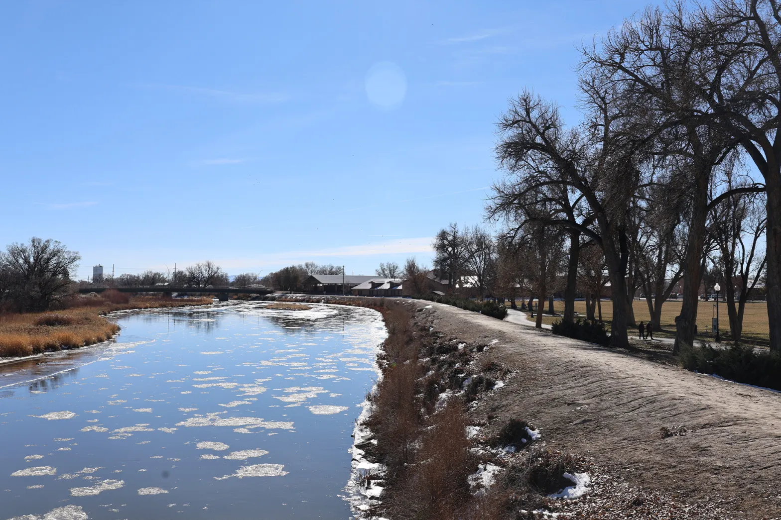
Perkins County Canal Project Area. Credit: Nebraska Department of Natural Resources

C. Perkins County Canal

For another example of approaching our water management challenges as a zero-sum game, take the case of Nebraskaโ€™s proposed Perkins County Canal project. In a zero-sum game, there can be some winners, but at a high cost to others. In this case in particular, there will be many more losers and lots of wasted time and money. Rather than pursue such a costly path, we can find shared goals and interests and build solutions to help achieve those.

Under Nebraskaโ€™s plans, it will invest the time, money, and effort to build a canal to divert water in Colorado for use in Nebraska under the 1923 South Platte River Compact. If Nebraska does that, then Colorado water users will likely build countermeasures to offset impacts of the canal. Under this scenario, both Nebraska and Colorado would end up investing hundreds of millions of dollars, but almost all water users in each state would end up in a position that is no better than they were before Nebraska proposed the canal.

A better approach to the issue is one that recognizes that the agricultural economy and the communities it supports doesnโ€™t observe state boundaries. The economy is regional. Farmers own land in both states. An individual farmer might buy supplies in Nebraska and farm in Colorado. And the reverse is likely true. Durable solutions need to benefit the region and not make the success contingent on the failure of the other. I will continue to do all I can to work towards such a solution.

See Article 7.

III.  The Importance of the Rule of Law in Water Management

As we adapt to changing hydrology and look for flexible and collaborative solutions, it will also be important to stand firm on certain principles. Our success not only relies on our adaptability, but also on a solid foundation of laws that are consistently enforced with predictable results.

Coloradoโ€™s framework for managing water is based on state-level oversight and ultimate responsibility. This is bolstered by significant reliance on regional and local partnerships to facilitate solutions that are tailored to the water supply needs of local communities. The Colorado model prioritizes respect for and collaboration with regional bodies, such as water conservancy and conservation districts, with a norm of deferring to local expertise and solutions whenever possible. Nonetheless, the ultimate responsibility of managing Coloradoโ€™s water and ensuring compliance with compacts, laws, and regulations falls to the State. This is especially true when we talk about compliance with interstate water compacts.

Governor Clarence J. Morley signing Colorado River compact and South Platte River compact bills, Delph Carpenter standing center. Unidentified photographer. Date 1925. Print from Denver Post. From the CSU Water Archives

A. Interstate Compact Compliance

Compliance with Coloradoโ€™s nine interstate water compacts, two international treaties, and three equitable apportionment decrees is exclusively the responsibility of the State. This authority is established by the compact clause of the U.S Constitution that allows States, as sovereigns, to enter into agreements to apportion water between them to avoid conflicts over water.

Once ratified by Congress, interstate compacts become federal law. That does not mean, however, that the federal government controls state water resources. The power to control uses of water is an essential attribute of State sovereignty.[19] When states compact with each other to apportion the waters of interstate streams, those compacts also bind the federal government.[20] As we negotiate or litigate over our interstate compacts, I am dedicated to defending Colorado from federal overreach and protecting Coloradoโ€™s compact apportionments.

To the extent a state fails to comply with its interstate compact obligations, the Stateโ€”and not individual water users, conservation or conservancy districts, or local governmentsโ€”is held solely liable and responsible for complying or possibly paying damages out of the Stateโ€™s General Fund.[21] In 2006, for example, the State was required to pay nearly $35 million in damages and legal costs to Kansas for violating the Arkansas River Compact.[22] When there is a challenge to State actions under the terms of these agreements, it is the State that is on the hook and local and regional entities are precluded from participating as parties to help defend the State in such litigation.[23] That is because interstate water disputes, reserved to the โ€œoriginal and exclusive jurisdictionโ€ of the Supreme Court,[24] necessarily invoke Statesโ€™ sovereignty, with each representing โ€œthe interests and rights of all of her people in a controversy with the other.โ€[25]

Elected officials in charge of managing Coloradoโ€™s water are accountable to taxpayers who, as noted above, will ultimately bear the cost of any failure to comply with interstate compacts. If the State manages water in a way in which constituents do not approve, they are able express their views directly to their elected officials or engage in the election process to have their voices heard. It is critical for the State to retain full authority to administer and distribute the waters of the State arising there to comply with interstate compacts as the sovereign with the exclusive authority to do so.

For a cautionary tale of how a state mismanaged its water consider what happened in Nebraska, when it faced an issue of how to manage its groundwater. In short, Nebraska delegated its regulatory authority over groundwater to local Natural Resource Districts instead of the stateโ€™s Department of Natural Resources.[26] Those local districts represented only the interests of their own water users, and they faced no direct liability for falling out of compact compliance. As a result, the districts failed to make the difficult policy and enforcement decisions necessary for Nebraska to comply with the compact, and Nebraska was forced to pay nearly $6 million in damages to Kansas after the U.S. Supreme Court found that Nebraska had violated the Republican River Compact.[27]

 B. Developing Adaptable and Resilient Strategies for Colorado

Projects like the Maybell Diversion and Rye Resurgence are important to help individuals and communities adapt to variable water supplies. We will also need statewide strategiesโ€”and legal institutionsโ€”to allow those types of water users to occur while ensuring compliance with our interstate compact obligations. Together, we are well positioned to start a broader conversation on what adaptability and resilient strategiesโ€”and what legal toolsโ€”can help us achieve this critical goal.

Stakeholders have started to suggest different possible tools that can enable Colorado to better manage our water in an adaptive and resilient manner. One suggested strategy is to create a statewide conservation program that compensates people who forego use of their water rights, particularly at times of great demands on a particular system. The Rio Grande Conservation District is implementing such a system to protect its groundwater resources, for example.[28]

A second concept that some have suggested is to create a strategic reserve of water that Colorado could release to protect its water users from mandatory curtailments that might otherwise result from a shortage of water to downstream states. Under this model, the state would acquire and manage โ€œslack capacity,โ€ putting the state in position to navigate shortages and times when there is more demand for water than available.

Whatever strategies are ultimately developed, they are sure to be more successful if they can be built and tested before we need them. Given the pressures we are seeing on multiple fronts, the time to develop and test such ideas is now. As we know from lessons from other countries, the stakes are high and adopting an imperfect system can give rise to most unfortunate consequences.[29]

* * *

Our ability to adapt to the scarcity of water in Colorado and reduce uncertainty and unpredictability is critical to ensuring a promising future for our state. As I have explained, the best and most durable solutions will go beyond individual success and will collaborate with other interests to find win-win solutions like the Maybell Diversion and Rye Resurgence Projects. As we adapt to changing hydrology and look for flexible and collaborative solutions, it is also imperative to ground solutions in the rule of law and an admirable system. This is a formidable challenge, but one we can undoubtedly meet in the native land of hope.

[1] https://businessforwater.org/frequently-asked-questions/

[2] The Nature Conservancy, Colorado Year in Review 2024, https://www.nature.org/content/dam/tnc/nature/en/documents/TNC_CO_Year_In_Review_Report_24Final.pdf

[3] Id.

[4] Id.

[5] Id.

[6]https://dnrweblink.state.co.us/cwcbsearch/0/edoc/215967/TheNatureConservancy_MaybellDiversionConstruction_Application.pdf

[7] The Nature Conservancy, supra note 2.

[8] https://coag.gov/blog-post/prepared-remarks-the-imperative-of-investing-in-water-infrastructure-colorado-water-congress-summer-conference-aug-25-2021/

[9] https://ryeresurgence.com/the-project

[10] Id.

[11] Id.

[12]Juana Summers, Amid a water crisis, Arizona is using lots of it to grow alfalfa to export overseas, NPR, August 9, 2023, https://www.npr.org/2023/08/09/1192996975/amid-a-water-crisis-arizona-is-using-lots-of-it-to-grow-alfalfa-to-export-overse

[13] Id.

[14] Id.

[15] Id.

[16] https://www.5280.com/high-dry

[17] https://cwcb.colorado.gov/read-plan

[18]Mark Obmascik, Poll shows deep opposition to RWR water export plan, Alamosa Citizen, June 20, 2022, https://www.alamosacitizen.com/poll-shows-deep-opposition-to-rwr-water-export-plan/

[19] Tarrant Regional Water Dist. v. Herrmann, 569 U.S. 614, 631 (2013).

[20] Texas v. New Mexico, 602 U.S. 943, 962 (2024).

[21] Kansas v. Nebraska, 574 U.S. 445, 459 (2015) (finding local district boards bore no responsibility for complying with compact and assumed no share of the penalties Nebraska would pay for violations).

[22] Kansas v. Colorado, 533 U.S. 1, 20 (2001) (remanding the case to the Special Master for a determination of damages); Fifth and Final Report of Arthur L. Littleworth, Special Master, at 3, Kansas v. Colorado, No. 105 Orig., vol. II (Jan. 31, 2008).

[23] Texas v. New Mexico, 583 U.S. 913 (2017) (denying motions to intervene by local water districts in compact dispute between states).

[24] 28 U.S.C. ยง 1251(a).

[25] Wyoming v. Colorado, 286 U.S. 494, 508-09 (1932); New Jersey v. New York, 345 U.S. 369, 372 (1953); see also South Carolina v. North Carolina, 558 U.S. 256, 267 (1953) (โ€œIn its sovereign capacity, a State represents the interests of its citizens in an original action, the disposition of which binds the citizens.โ€); Nebraska v. Wyoming, 515 U.S. 1, 21 (1995) (โ€œA State is presumed to speak in the best interests of [its] citizens. . . .โ€).

[26] Neb. Rev. Stat. Ann. ยง 46-702 (โ€œThe Legislature also finds that natural resources districts have the legal authority to regulate certain activities and, except as otherwise specifically provided by statute, as local entities are the preferred regulators of activities which may contribute to ground water depletion.โ€).

[27] Kansas v. Nebraska, 574 U.S. 445 (2015).

[28] The Citizen, $3,000 per acre-foot to retire groundwater wells, Alamosa Citizen, March 2, 2023, https://www.alamosacitizen.com/3000-per-acre-foot-to-retire-groundwater-wells/.

[29] https://coag.gov/app/uploads/2021/02/Colorado-Water-Congress-Feb-2021-FINAL.pdf

Colorado River “Beginnings”. Photo: Brent Gardner-Smith/Aspen Journalism

2025 #RioGrande Watch — John Fleck (InkStain.net)

Has Albuquerqueโ€™s Rio Grande already peaked?

Click the link to read the article on the InkStain.net website (John Fleck):

March 13, 2025

Early March is usually when I emerge from my wintry water nerd slumber and begin tracking the rise in my beloved hometown river, Albuquerqueโ€™s Rio Grande.

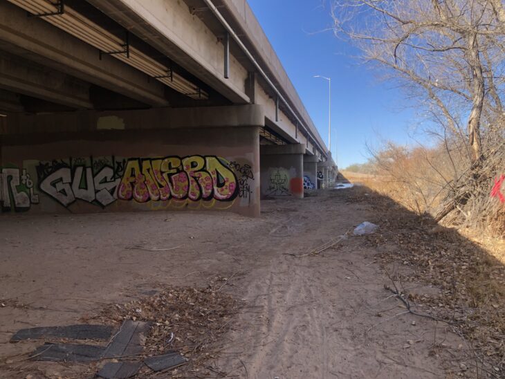
Yesterday morning the core family unit packed sandwiches and went down to the Rio Bravo Bridge, on Albuquerqueโ€™s south side. Itโ€™s a favorite spot because of the graffiti โ€“ the engineers built a lot of canvas for the artists to work with.
Bridge, with art. Photo credit: John Fleck/Inkstain.net

The county crews had recently painted over the graffiti on the bridge abutments, which always means a fun new canvas and a bunch of new art.

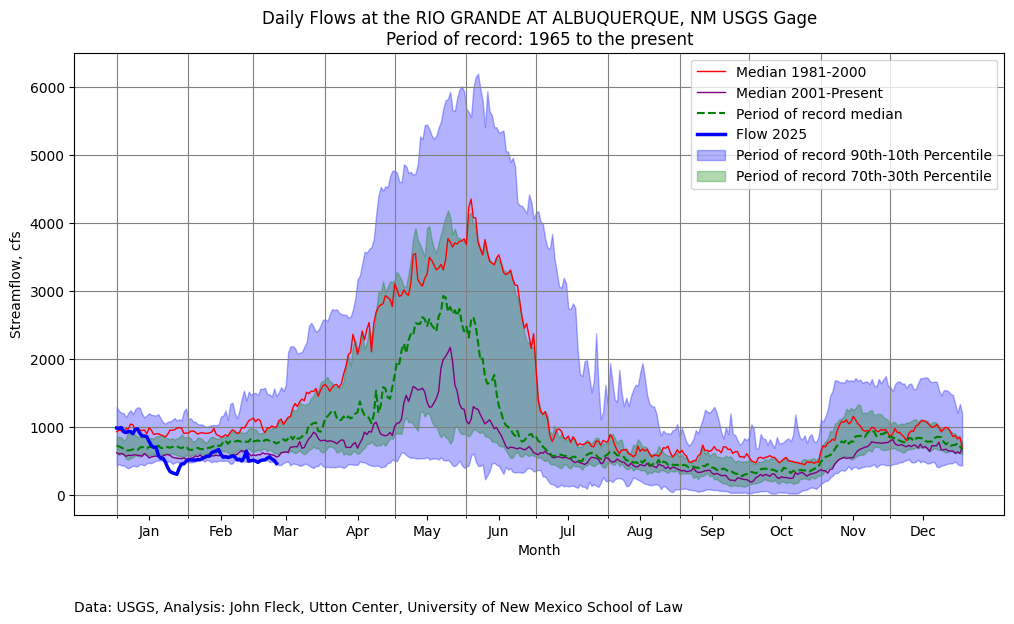
The riverโ€™s low โ€“ at around the 10th percentile on the dry side at the Central Avenue gage, the nearest measurement point upstream of here. I dashed off Tuesdayโ€™s post in a hurry because news, but whatโ€™s about to happen deserves more attention.

One of the deep/fierce discussion underway Iโ€™m having with some smart colleagues is the question of how much our community values a flowing river. One of the reasons weโ€™re arguing, umm, I mean discussing, is that evidence about public attitudes is thin.

Weโ€™re about to have a Rio Grande through Albuquerque substantially drier than weโ€™ve seen since the early 1980s. Before that time, summer drying was common because of community water management choices: larger supplies were diverted into irrigation ditches, leaving the Rio Grande to go dry. The river essentially dried through Albuquerque in eight out of ten years during the 1970s. That began shifting in the 1980s because of wetter climate, but more importantly because of water management choices that reflected a shift in community values.

Rio Grande Silvery Minnow via Wikipedia

Beginning in the 1990s, the federal Endangered Species Act became the water policy driver, keeping water in the riverโ€™s main channel to keep the Rio Grande silvery minnow alive. โ€œThis little fish, that human efforts keep alive,โ€ my Utton Center colleague Rin Tara has written, โ€œis a powerhouse for dictating river flows in the Middle Rio Grande.โ€

Silver Linings

The quote above is from a terrific new paper of Rinโ€™s exploring the history, and legal and policy framework around the silvery minnow and the Endangered Species Act. (Discloure: Rin and I share an office at Utton, which has enabled an ongoing stream of conversation that has immeasurably enriched my thinking about these issues. We should prolly get some microphones and make a podcast.)

For those who care about the Rio Grande (you wouldnโ€™t have read this far if that didnโ€™t include you), the whole paper is worth a read. It is the first time anyone has pulled together in a single narrative the history of the role of the silvery minnow in the last three decades of water management on New Mexicoโ€™s Middle Rio Grande. Rinโ€™s legal scholarship also sheds new light on the way the Endangered Species act functions in practice in a situation like ours โ€“ an effort to keep a species alive in a river far removed from the ecosystem in which the species evolved. This disconnect is at the heart of the challenge posted by the ESA in the third decade of the 21st century. As I said, terrific new paper.

Given the current context โ€“ a river at risk of drying in 2025 โ€“ the challenge to community values around the Rio Grande is something Iโ€™ll be watching closely. Hereโ€™s Rin (โ€œ2028 BiOpโ€ is a new minnow management plan now in development โ€“ read the whole paper, Rin explains):

The question of what those broader values might look like is where the action is, one of those โ€œwe get to determine what kind of apocalypse weโ€™d like to haveโ€ moments.

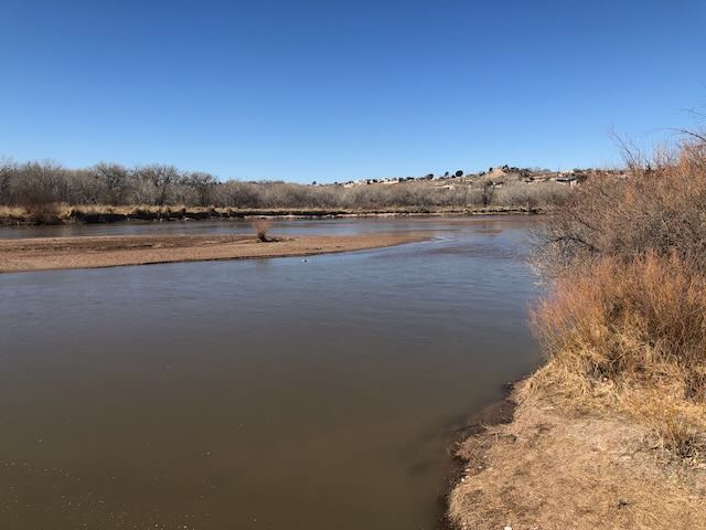
Rio Grande, March 12, 2025. Photo credit: John Fleck/InkStain.net

Big Dog

I rode back out to the river for this morningโ€™s bike ride.(I am trying to ride and picnic more and work less, with mixed results.) The ride took me through downtown and across what used to be swampland to the Rio Grande. What we think of today as โ€œthe river,โ€ the narrow channel snaking through the valley between levees, is a tiny fraction of what the Rio Grande used to be before we decided to build a city here. Even as I acknowledge the loss of the expansive wetlands that used to spread across the valley floor, I also love my city. Both of those things can be true, as is often the case with the most interesting moral tensions.

I stopped at one of my favorite river views to snap a picture for a friend Iโ€™d been texting with who loves the Rio Grande, but has moved to a city on a different (also beloved!) river.

Itโ€™s just above Central Avenue/Route 66. Thereโ€™s a bike trail bridge over the Middle Rio Grande Conservancy Districtโ€™s Central Avenue Wasteway, and when thereโ€™s water you feel like youโ€™re out in the river. The wasteway delivers water from the irrigation system back to the main river channel, and when I was riding by this morning it was flowing at ~40 cubic feet per second. Itโ€™s a popular fishing spot, for both humans and cormorants, though I saw neither this morning taking advantage of the flows.

The journalist in me canโ€™t resist small talk in a place like that. A woman was walking by with a big, beefy, happy dog. I asked if it was OK to pet, and did, though she had to restrain the friendly animal from jumping up on me with his wet, muddy paws. Theyโ€™d walked down from their neighborhood just up the valley, so the pooch could play in the river. One of the weird things about low flow is that it actually makes the river more accessible for picnics and dog play. As it drops, youโ€™ll see people out on the sandbars.

Until, of course, thereโ€™s no water left for frolicking. I assume there were silvery minnows out there in the channel. They cannot know what is coming, nor, frankly, can we.

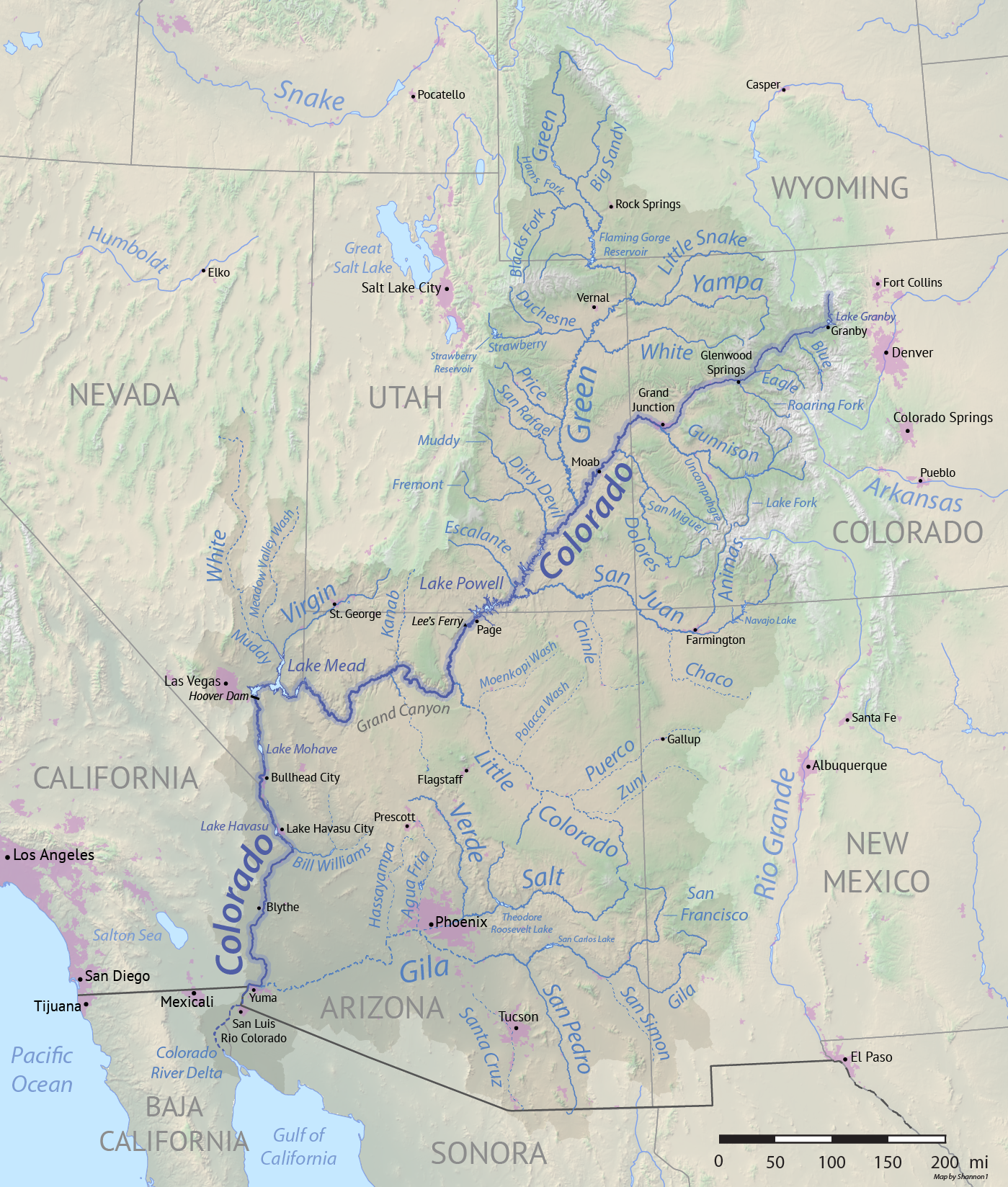
Rio Grande and Pecos River basins. Map credit: By Kmusser – Own work, Elevation data from SRTM, drainage basin from GTOPO [1], U.S. stream from the National Atlas [2], all other features from Vector Map., CC BY-SA 3.0, https://commons.wikimedia.org/w/index.php?curid=11218868

Latest forecast suggests #RioGrande drying through Albuquerque is possible by early June — John Fleck (InkStain.net)

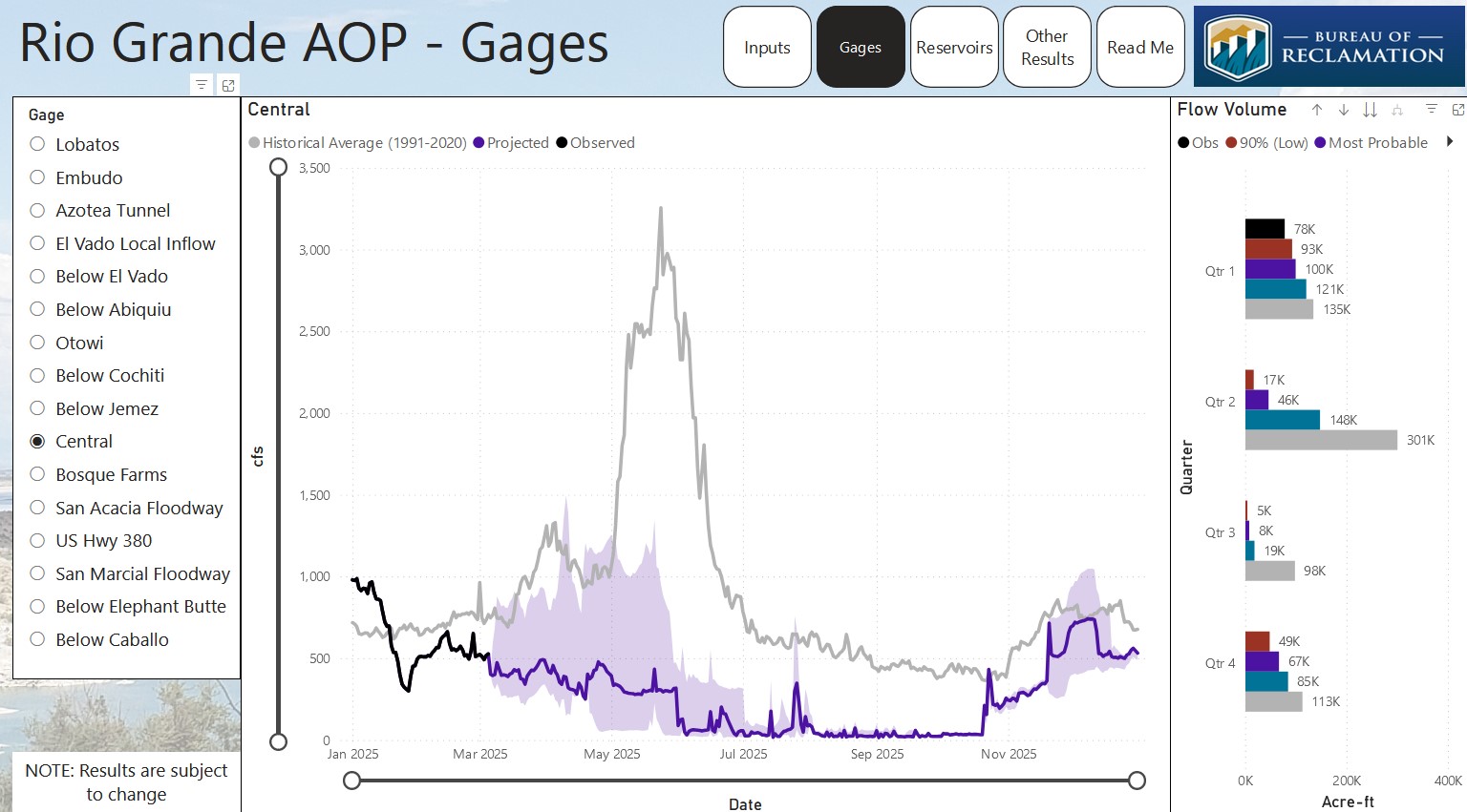
USBR March 2025 Rio Grande runoff forecast.

Click the link to read the article on the InkStain.net website (John Fleck):

March 11, 2025

This weekโ€™s newest U.S. Bureau of Reclamationโ€™s Rio Grande runoff model runs have triggered a string of โ€œwait, what?โ€ conversations this afternoon at the Utton Center.

  • possible drying through Albuquerque as early as June,ย with a good chance of drying even earlier
  • we may already have passed the spring runoff peak
  • irrigation supplies, already short for Middle Rio Grande Conservancy District farmers, will be even shorter

The early March simulations, which are based on the latest snowpack and runoff forecasts, are ratcheting up the anxiety among water managers as they scramble to manage conditions unprecedented in modern Rio Grande management. Looking at the graph above, you can see what a typical year looks like, with flows rising through late may. That black-to-purple line is the most likely flow this year

Even before the new model runs, the Middle Rio Grande Conservancy District was warning valley irrigators that, with little water in storage to supplement dwindling river flows, irrigation supplies would be unreliable by summer. Based on my analysis of the new numbers (danger, Fleck doing math!) that could come a lot sooner. According to Reclamationโ€™s median forecast, we have already seen the runoff peak on the Rio Grande through Albuquerque. (Our 2025 peak so far technically was around 1,000 cfs Jan. 1, but thatโ€™s just moving last yearโ€™s water, rhetoric rather than hydrology.)

We could still have some monsoon rains that temporarily push the river up past the March 8 spring runoff peak of 600 cubic feet per second. But monsoon bursts arenโ€™t enough, in terms of volume of water, to make up for the pitiful snowpack, made more pitiful by the hot dry spring winds that have been eating it away.

The Albuquerque Bernalillo County Water Utility Authority had already been projecting that it would need to shift away from surface water, using groundwater pumps to meet municipal needs, sometime this summer. The Inkstain News Gloom Team will keep an eye on that for yโ€™all.

Westwide SNOTEL basin-filled map March 16, 2025 via the NRCS.

We see the climate change in #NewMexico — Laura Paskus (WritersOnTheRange.org) #ActOnClimate

Click the link to read the article on the Writers on the Range website (Laura Paskus):

March 10, 2025

Here in New Mexico, our growing season has lengthened since the 1970s, even as stream flows have decreased. Fire season starts earlier, lasts longer, and in some years, ignites the forests into record-breaking blazes, like the gargantuan Hermits Peak-Calf Canyon and Black fires in 2022.

If you look at the last century in New Mexico, stretches of higher temperatures have lengthened; heat waves are hotter and nights, consistently warmer.

Rising heat and expanding aridity harm ecosystems and wildlife and hotter days are dangerous for anyone outside, especially people without housing or access to cool spaces. Extreme heat even interacts with certain medications people need for their physical and mental health. 

It should be no surprise that weโ€™re facing another crackly-dry spring, summer, and fall. Fans watching the March 2 Oscars on Albuquerque TV saw flashing red-flag fire warnings. The next day, high winds and dust storms blasted the state; near Deming, a haboob of fast-moving dust shut down highways.

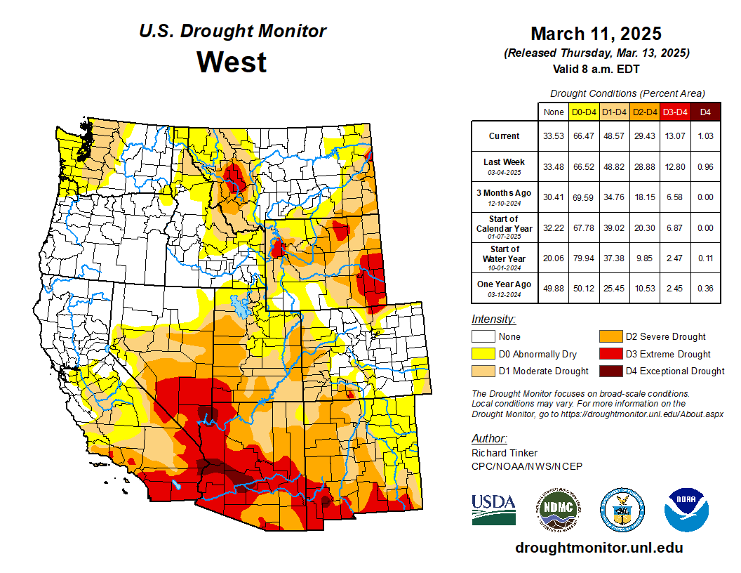
West Drought Monitor map March 11, 2025.

As of early March, 92 percent of New Mexico was experiencing drought, with almost 30 percent of the state in severe to extreme drought, according to the U.S. Drought Monitor.

Arizona is in even worse shape: 100 percent of the state is in drought, with 87 percent in severe to exceptional drought. And the interior Westโ€™s three-month outlook is for warm, dry conditions โ€” especially in Arizona and New Mexico.

Here in New Mexico, the Middle Rio Grande Conservancy Districtโ€”which supplies water for farmsโ€”is warning runoff season will be short and river flows, low. The districtโ€™s leaders are urging farmers to plan for extended periods between irrigation deliveries and say that without summertime monsoons, they will not meet everyoneโ€™s needs this year.

During the 1900sโ€”including during the infamous 1950s drought and earlier in this centuryโ€”armers could often still expect full water allocations in a dry year.

Now, when farmers donโ€™t receive waterโ€”and the Rio Grande dries for long stretchesโ€”itโ€™s not only because there isnโ€™t enough snow melting off the mountains.  Itโ€™s also because consistently dry soils suck up any moisture, making both forests and croplands thirstier.

Not only that, but decades of persistent drought and warming temperatures have desiccated reservoirs along the Rio Grande and its tributary, the Chama River.

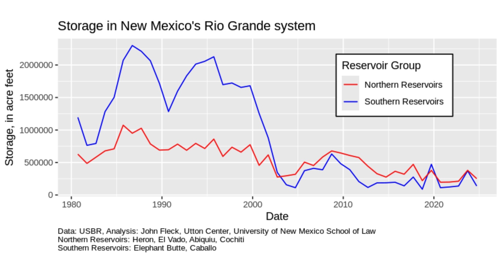
On the Chama River, Heron Reservoir is 14 percent full; its neighbors, El Vado and Abiquiu, are at 14 percent and 51 percent respectively. Further down the watershed, on the Rio Grande in southern New Mexico, Elephant Butte Reservoir is only 13 percent full, and its neighbor, Caballo, nine percent full. 

In New Mexico, some water users, including the irrigation district, rely on water piped from the Colorado River watershed into the Chama and then the Rio Grande. This year, most of that supplemental water wonโ€™t be there.

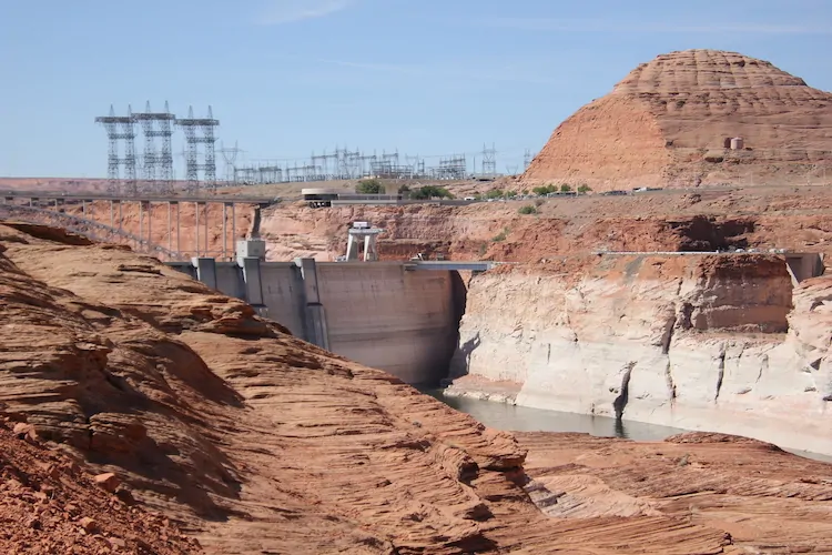
The view upstream on both watersheds is also troubling, especially in Arizona, New Mexico and southern Utah where the snowpack is โ€œbelow to well-below median.โ€ Last month, the Colorado Riverโ€™s two largest reservoirs, Lake Powell and Lake Mead, were 34 percent full, the lowest theyโ€™d been in early February for the last 30 years of records.

Iโ€™m alarmed by many things happening right now, including the disappearance of climate data from federal websites and the gutting of federal workforces and budgets. We need wildland firefighters, scientists, and the staffers who kept our parks and public lands functioning.

But as a reporter who has covered climate change and its impacts in my state for more than two decades, I take the long view along with a local view.

We have known for decades that the planet is steadily warming and that the impacts of climate change would intensify. And we must resist focusing solely on the current chaos of the federal government. [ed. emphasis mine]

Laura Paskus. Photo credit: Writers on the Range

Thereโ€™s never been a better time to become immersed in local politics or organizing, and to hold state and local leaders accountable for action on climate.

We can collaborate on local solutions and work together to better deal with the crises we face. Really, we have no choice.

Laura Paskus is a contributor to Writers on the Range, writersontherange.org, an independent nonprofit dedicated to spurring lively conversation about Western issues She is longtime reporter based in Albuquerque and the author of At the Precipice: New Mexicoโ€™s Changing Climate and Water Bodies.

A Sagebrush Rebel returns to Interior: Karen Budd-Falen has spent her career fighting the agency; Mining Monitor; “Avalanche” comes out from behind the paywall — Jonathan P. Thompson (LandDesk.org)

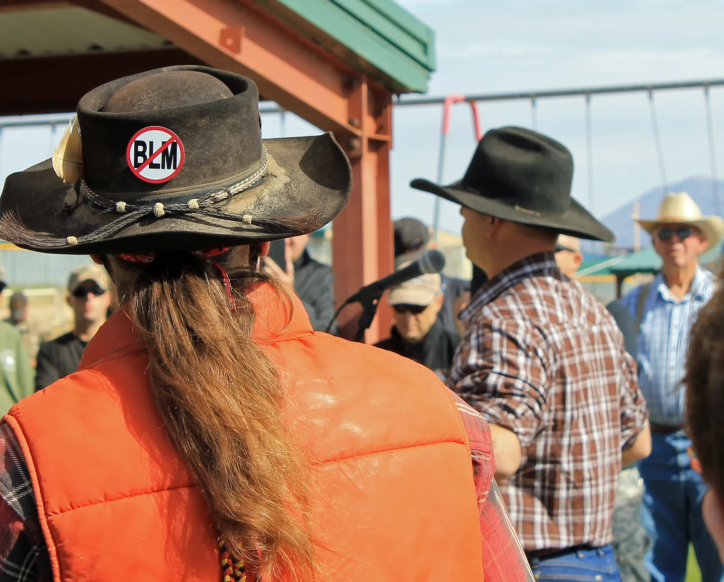
Ryan Bundy speaks at the 2014 Recapture rally to protest federal land management, which took place just days after armed insurrectionists threatened federal officers who had tried to detain Cliven Bundyโ€™s cattle, which had long been grazing on public lands illegally. Karen Budd-Falen โ€” reportedly appointed to be the number three at Interior โ€” represented Bundy years before the standoff, but later condemned his response. Nevertheless, her writings and court cases provided an ideological underpinning for the Bundys and their fellow insurrectionists. Jonathan P. Thompson photo.

Click the link to read the article on The Land Desk website (Jonathan P. Thompson):

March 7, 2025

Interior Secretary Doug Burgum has given another indication of how he plans to oversee public lands with the reported appointment of Karen Budd-Falen, a Wyoming property rights lawyer and rancher, as associate deputy Interior secretary, the departmentโ€™s third in command. This will be Budd-Falenโ€™s third stint at Interior: She worked under James Watt, Ronald Reaganโ€™s notorious Interior secretary, and served as deputy Interior solicitor for wildlife and parks under the first Trump administration. Budd-Falen revealed the appointment to Cowboy State Daily this week, though the administration has yet to announce it.

Budd-Falen has spent much of her five-decade-long career fighting against federal oversight and environmental protections โ€” she has been called an โ€œarchitect of the modern Sagebrush Rebellionโ€ โ€” and is a private property rights extremist (except when they get in the way of public lands grazing).

In 2011, Budd-Falen divulged her core philosophy โ€” and her distorted view of the U.S. Constitution โ€” in a keynote speech to a meeting of Oregon and California county sheriffs, many of who adhered to the โ€œconstitutional sheriffโ€ creed. She told them that โ€œthe foundation for every single right in this country, our freedom of speech, our freedom to vote, our freedom to petition, is all based on the right of ownership of private property.โ€

While this is obviously a messed up interpretation, it is an honest reflection of her worldview, and she has often stuck with it even if it meant going after extractive interests. In the 1990s, for example, Budd-Falen represented the legendary, stalwart Republican-turned-anti-oil-and-gas activist Tweeti Blancett in her attempt to get the Bureau of Land Management to clean up the mess its industry-friendly ways had facilitated on and around her northwest New Mexico ranch. And Budd-Falenโ€™s law firm often worked with landowners to get the best possible deal from energy companies that developed their property.

But more often than not, Budd-Falenโ€™s vision of private property rights extends beyond a landownerโ€™s property lines and onto the public lands and resources โ€” at the expense of the land itself, the wildlife that live there, and the people who rely upon it for other uses.

In a telling article in the Idaho Law Review in 1993, Budd-Falen and her husband, Frank Falen, argued that grazing livestock on public lands was actually a โ€œprivate property rightโ€ protected by the Constitution. If you were to extend this flawed logic to oil and gas and other energy leases and unpatented mining claims, then corporations and individuals would have private property rights on hundreds of millions of acres of public lands. This may sound alarmist, but the fact is, the federal land management agencies often adhere to this belief. Once an oil and gas lease is issued, for example, a BLM field office is unlikely to deny a drilling permit for the lease, since doing so would be violating the companyโ€™s private property rights. Who needs public land transfers when this sort of de facto privatization is commonplace?

Many of Budd-Falenโ€™s cases relied on a similar argument: That private property rights can apply to public resources. She defended Andrew VanDenBerg, for example, who bulldozed a road across the Whitehead Gulch Wilderness Study Area in Coloradoโ€™s San Juan Mountains to access his mining claim โ€” just one of many times she wielded RS-2477, the 160-year-old statute, to try to keep roads across public lands open to motorized travel and bulldozers. She represented big landowners who felt that they had the right to kill more big game โ€” a public resource โ€” than the law allowed, because they owned more acreage.

Budd-Falen was instrumental in crafting a slew of ordinances for Catron County, New Mexico, declaring county authority over federally managed lands and, specifically, grazing allotments. While the ordinances and resolutions focused on land use, they also contained language influenced by the teachings of W. Cleon Skousen, an extreme right-wing author, Mormon theologian, and founder of the National Center for Constitutional Studies, nรฉe the Freeman Institute, known for its bestselling pocket-size versions of the US Constitution.

The ordinances were โ€œabout the legal authority of county governments and the legal rights of local citizens as regards the use of federal and state lands.โ€ They were intended to preserve the โ€œcustoms and cultureโ€ of the rural West, which apparently included livestock operations, mining, logging, and riding motorized vehicles across public lands. And the Catron County commissioners were ready to turn to violence and even civil war to stop, in the words of the ordinance, โ€œfederal and state agentsโ€ that โ€œthreaten the life, liberty, and happiness of the people of Catron County โ€ฆ and present danger to the land and livelihood of every man, woman, and child.โ€ The National Federal Lands Conference, a Utah-based organization launched in the late 1980s by Sagebrush Rebel Bert Smith, a contemporary and philosophical collaborator of Skousenโ€™s, peddled similar ordinances to other counties around the West.

Budd-Falen has been especially antagonistic toward the Endangered Species Act, often representing clients hoping to reduce the lawโ€™s scope or to water down its enforcement or applicability. In 2013, for instance, she filed an amicus brief in support of People for the Ethical Treatment of Property Ownersโ€™ claim that the ESA should not apply to Utah prairie dogs because the speciesโ€™ range was confined to one state. The property owners lost and the U.S. Supreme Court declined to hear the case.

Occasionally Budd-Falen has veered away from defending property rights, however, if it means keeping cows on public lands. After Bill Clinton designated Grand Staircase-Escalante National Monument in 1996, the Grand Canyon Trust bought out grazing allotments in the monument from willing sellers with the intention of retiring the permits for good. It was a win-win situation, one that allowed ranchers to bring in a pile of cash and maybe retire or move operations to a more cattle-appropriate area, and it protected sensitive areas from the ravages of grazing.

Nevertheless, Kane and Garfield County commissioners didnโ€™t like the deal, mostly because they didnโ€™t like the monument. So they sued to block the permit retirements, in an attempt to undercut the transactions, and Budd-Falen stepped in to represent them. She said she was trying to ensure the survival of the โ€œcowboyโ€™s Western way of life,โ€ apparently even if it was against the cowboysโ€™ own wishes. โ€œI think itโ€™s important to keep ranchers on the land,โ€ she told the Deseret News. She definitely will not do anything to reform public lands grazing during her tenure, but then thatโ€™s no different from any other administration so far, Republican or Democrat.

In the early 1990s Budd-Falen represented a number of southern Nevada ranchers โ€”including Cliven Bundy โ€” in their beef with the feds over grazing in endangered desert tortoise habitat. Budd-Falen was quick to condemn the Bundysโ€™ armed insurrection against the federal government when BLM rangers tried to remove their cows from public lands, where they had been grazing illegally for years. And she also spoke out against the Bundy-led armed takeover of the Malheur National Wildlife Refuge.

Still, one canโ€™t deny that her work and words โ€” often hostile and aimed at environmentalists and federal land agencies โ€” provide an intellectual underpinning for the Bundy worldview. She is an alumni of the Mountain West Legal Foundation, the breeding ground for the Sagebrush Rebellion and Wise Use movement that helped launch the careers of Watt and Gale Norton, the Interior secretary under W. Bush. And in 2007 Budd-Falen told High Country Newsโ€™s Ray Ring that her most important case was when she used RICO, and anti-racketeering law, to go after BLM agents who had cited her client for violating grazing regulations.

Her rhetoric outside the courtroom not only inflames, but also provides justification for those who may be inclined to take up arms against their purported oppressors. She has referred to federal land management agencies as โ€œa dictatorshipโ€ wielding its โ€œbureaucratic power โ€ฆ to take private property and private property rights.โ€ She once made the spurious claim that โ€œthe federal government pays environmental groups to sue the federal government to stop your use of your property.โ€

Seems pretty crazy to put someone like that near the top of a federal land management agency, but then, thatโ€™s par for the course for Trump and company.

The tally at Interior now includes, in addition to Budd-Falen:

  • Interior Secretary Doug Burgum, whoย has close ties to oil tycoon Harold Hamm, and whoย suggestedย using โ€œinhospitable or unoccupiedโ€ public lands to pay down the federal debt.
  • BLM director Kathleen Sgamma,ย an oil and gas industry lobbyistย who has sued the agency she is now tapped to lead.
  • Deputy Interior Secretary Katharine McGregor, who served the same position during the final year of Trumpโ€™s first term, and was most recently the VP of Environmental Services at NextEra Energy in Florida.

โ›๏ธMining Monitor โ›๏ธ

It appears that Trumpโ€™s executive orders are beginning to change the way regional public lands offices operate. Patrick Lohmann with Source NM reports, for example, that Cibola National Forest Service employees โ€” at least the ones that werenโ€™t fired by DOGE โ€” were ordered to prioritize โ€œmission criticalโ€ activities, including reviews of proposed uranium mines, to comply with Trumpโ€™s energy orders.

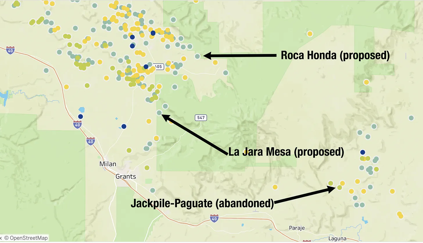
There are currently two proposed uranium mines on the forest, which includes Mount Taylor and surrounding areas near Grants, New Mexico. Energy Fuels โ€” the owner of the Pinyon Plain uranium mine and the White Mesa uranium mill โ€” is looking to develop the Roca Honda mine on about 183 acres. And Laramide Resources wants to build the La Jara Mesa mine. Both projects would be underground, not surface mines, and were originally proposed over a decade ago, but stalled out when uranium prices crashed. Now that prices have increased, the firms have expressed renewed interest.

The dots show abandoned uranium mining and milling sites.

The Grants and Mount Taylor area was ravaged by Cold War-era uranium mining and the wounds from the previous boom continue to fester. That include the remnants of Anaconda Minerals Companyโ€™s Jackpile-Paguate Mine on Laguna Pueblo land, which was once the worldโ€™s largest open-pit uranium mine, producing some 24 million tons of ore.

Miners were exposed to radioactive and toxic heavy metals daily, even spending their lunch breaks sitting on piles of uranium ore. Blasting sent tremors through the puebloโ€™s adobe homes, and a cloud of poisonous dust drifted into the village of Paguate, just 2,000 feet from the mine, coating fruit trees, gardens, corn, and meat that was set out to dry. A toxic plume continued to spread through groundwater aquifers, and the Rio Paguate, a Rio Grande tributary, remains contaminated more than a decade after the facility became a Superfund site, despite millions of dollars in cleanup work. Laguna residents and former mine workers still suffer lingering health problems โ€” cancer, respiratory illnesses and kidney disease โ€” from the mine and its pollution.

Now the feds are saying approving new uranium mines in the same area is โ€œmission critical.โ€

***

In December, the Biden administration began the process of halting new mining claims and mineral leasing for the next 20 years on 165,000 acres in the upper Pecos River watershed west of Santa Fe, New Mexico. This included holding meetings to gather public input on the plan. But the BLM canceled the first such meeting, scheduled for late February, and has not announced a new date, sparking fears that the new administration may be withdrawing plans for a mineral withdrawal.

Rio Grande and Pecos River basins. Map credit: By Kmusser – Own work, Elevation data from SRTM, drainage basin from GTOPO [1], U.S. stream from the National Atlas [2], all other features from Vector Map., CC BY-SA 3.0, https://commons.wikimedia.org/w/index.php?curid=11218868

Included within the acreage are more than 200 active mining claims held by Comexico LLC, a subsidiary of Australia-based New World Resources. For the past several years, Comexico has been working its way through the permitting process to do exploratory drilling at what it calls its Tererro mining project. It has met with stiff resistance from locals and regional advocacy groups, partly because mining has a dark history in the Pecos River watershed. In 1991, a big spring runoff washed contaminated mine and mill waste from a long-defunct mine into the upper Pecos River, killing as many as 100,000 trout. That prompted a multi-year cleanup of various mining sites.

***

๐Ÿ“ธ Parting Shot ๐ŸŽž๏ธ

And now for a special treat, or maybe torture, but either way it might help take your mind off the dismantling of Democracy for a few moments. Itโ€™s my blow-by-blow analysis of the 1978 movie Avalanche, starring Rock Hudson and Mia Farrow. Normally this would be behind a paywall, like all of the other Land Desk archives. But Iโ€™m opening up to everyone for a limited time only in honor of the snowslide-triggering storm that is pounding the San Juans as I write. Enjoy. And, while youโ€™re at it, check out our interactive map of long-lost ski hills in southwest Colorado.

AVALANCHE: A blow-by-blow analysis of the 1978 disaster flick — Jonathan P. Thompson, February 9, 2022

I was drawn in by the close-up winter aerial shots of ridges and peaks of the San Juan Mountainsโ€”Look, thereโ€™s Vestal! I yelled to my non-existent viewing companions as Rock Hudsonโ€™s name flashed on the screen. And Arrow! And Mount Garfield! I kept watching the lost-to-obscurity 1978 disaster film,

Read full story

Monte Vista Crane Festival March 7, 2025 #SanLuisValley

Short video from near Road 8S and CO-15 during the Monte Vista Crane Festival March 7, 2025.
Short video from near Road 8S during the Monte Vista Crane Festival March 7, 2025.

Baby, itโ€™s warm outside: February gave #Alamosa the warmest winter day on record in a series of 60-degree days — AlamosaCitizen.com #RioGrande

Picnic at Cole Park with Beth Wehe and children. Credit: The Citizen

Click the link to read the article on the Alamosa Citizen website:

February 28, 2025

ebruary delivered a series of 60-degree weather days โ€“ seven in all, or a quarter of the month in temperatures more common in May and early June. As such, winter never really took hold.

Now with March in sight, the San Luis Valley and its Rio Grande and Conejos River systems need a bounce in precipitation to avoid heavy curtailment this summer in its agricultural fields and to keep the dust down in general. The Rio Grande at Del Norte was measuring 44 percent of whatโ€™s normal for the end of February, while the Conejos was in better shape at 84 percent of normal flows, according to the latest measurements at Del Norte and Mogote.

The high of 67 on Feb. 3 was the warmest winter day on record at Alamosa, and records were broken throughout western and southern Colorado during that time period, said Russ Schumacher, director of the Colorado Climate Center at CSU-Fort Collins.

Alamosa also has never had a February with as many 60 degree days as 2025. Feb. 2, Feb. 3, Feb. 4, Feb. 6, Feb. 7, Feb. 24 and Feb. 25 all reached 60 or above. New record high temperatures were established for Feb. 2 (63 degrees), Feb. 3 (67 degrees), Feb. 4 (64 degrees) and Feb. 25 (64 degrees). The high of 59 on Feb. 24 also established a new record high, giving the month five days with new daily high temperatures.

โ€œWhen thereโ€™s no snow on the ground like this month, then it gets (and stays) much warmer. This effect is true everywhere, but it is especially important in the Valley because of the high elevation and generally cooler air overall,โ€ Schumacher said.

The warm February lent itself to an early arrival of sandhill cranes and a month of bicycle riding rather than snowboarding. March arrives similar to February, with unseasonably warm temperatures and low odds for moisture.

Even should snow materialize, February was too warm with its 60 degree days for any snowpack conditions to exist. Instead, whatever falls from the skies in March will get soaked up by the thirsty ground and work only to give a brief recharge to the rivers and the natural surface water that flows from the mountains into the Valley floor.

โ€œWhen thereโ€™s no snow on the ground like this month, then it gets (and stays) much warmer. This effect is true everywhere, but it is especially important in the Valley because of the high elevation and generally cooler air overall,โ€ Schumacher said.

The warm February lent itself to an early arrival of sandhill cranes and a month of bicycle riding rather than snowboarding. March arrives similar to February, with unseasonably warm temperatures and low odds for moisture.

Even should snow materialize, February was too warm with its 60 degree days for any snowpack conditions to exist. Instead, whatever falls from the skies in March will get soaked up by the thirsty ground and work only to give a brief recharge to the rivers and the natural surface water that flows from the mountains into the Valley floor.

What does it mean for western water management when the federal government becomes an unreliable partner? — John Fleck (InkStain.net) #RioGrande

Outlet flow at Cochiti Dam in 2002. By U.S. Army Corps of Engineers, Douglas Bailey – U.S. Army Corp of Engineers Digital Visual Library[1]Image description pageDigital Visual Library home page, Public Domain, https://commons.wikimedia.org/w/index.php?curid=1813624

Click the link to read the article on the InkStain.net website (John Fleck):

February 26, 2025

I got a text message yesterday afternoon aboutย this, which is nuts:

Accidentally dumping 8,000 cubic feet per second into a river channel that hasnโ€™t seen that much water since 1985 is a big deal. The gage data suggests the river level rose four feet basically instantaneously.

Iโ€™ve been thinking a lot lately about the stuff the federal government does in water management in the United States that we used to be able to take for granted, like, for example safely operate the dams.

We all love to complain about the federal governmentโ€™s water management work, but the complaints are based on narrow questions and presume a broad societal consensus that thereโ€™s a bunch of stuff the federal government can be reliably counted on to do while we argue over details. Reclamation and the Corps are gonna operate the dams, for example. The details we argue about are at important margins, but theyโ€™re at the margins, based on the presumption that the basic stuff will get done.

Like, for example, spending the money that Congress approved to help us manage shortages in the Colorado River Basin. Which money has now been yanked out from under us by the autocrats who think they know better, as Alex Hager reported yesterday.

I have no idea what happened at Cochiti Dam yesterday, whether the person who made the โ€œprocedural errorโ€ was new because the old timer who knows how to run the dam took the early buyout and bailed. But I do know that is exactly the โ€œwhat ifโ€ scenario I was gonna lay out in a blog post thatโ€™s been percolating in my head about this question of how we in the West go forward in water management when the federal government suddenly becomes an unreliable partner.

I am not saying this because complaining about the stunningly arrogant idiots crashing through the federal government right now is great clickbait. Iโ€™m tired of all the angry clickbait, frankly, which is why I hadnโ€™t written the blog post until today.

My point here is a serious question, not a rhetorical one: What would it mean for us in Western water management if the federal government becomes an unreliable partner? What must we do to prepare? What does that even look like?

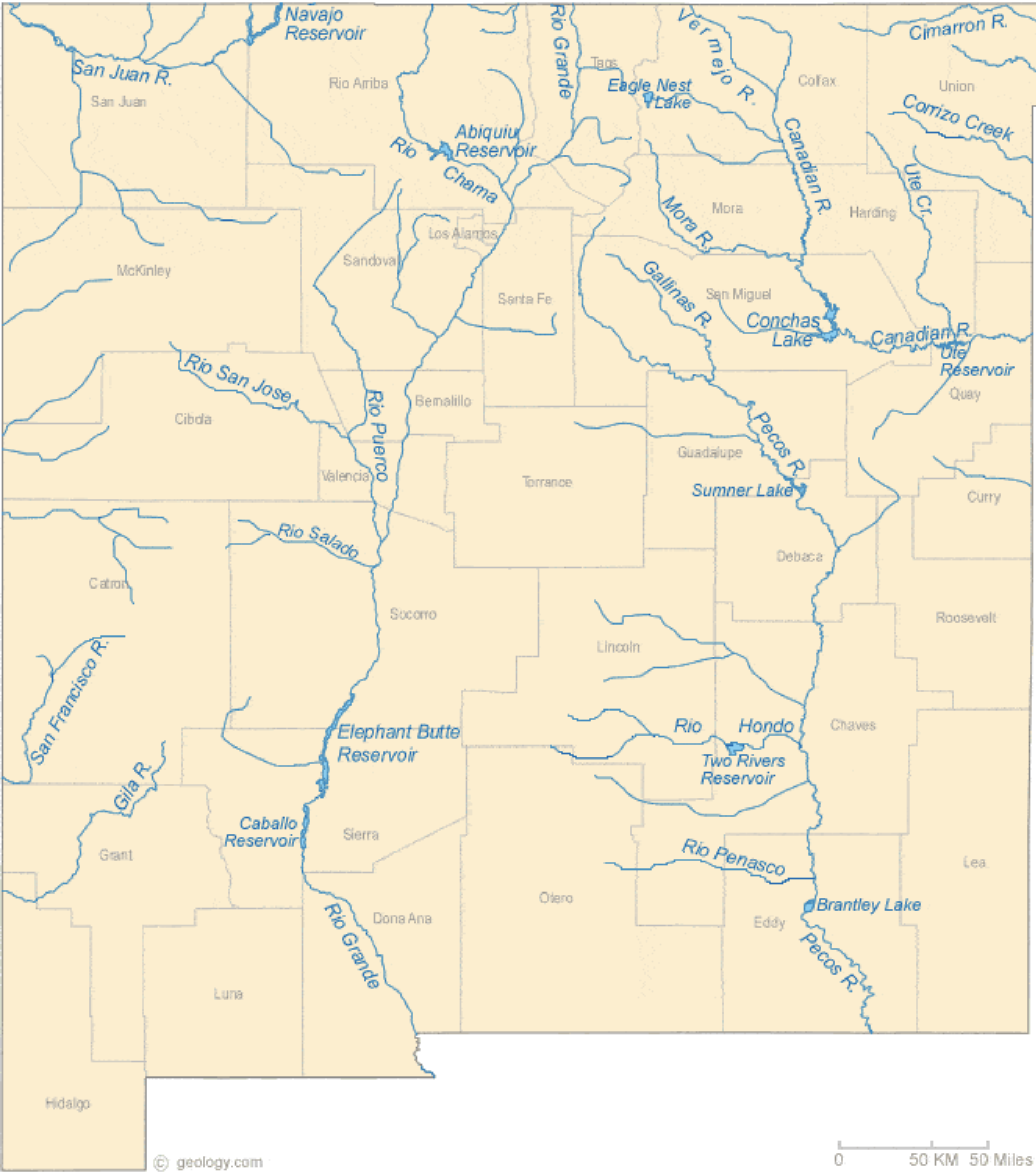
New Mexico Lakes, Rivers and Water Resources via Geology.com.

Rio Grande State of the Basin Symposium — Adams State University Salazar #RioGrande del Norte Center

Click here to register

San Luis Peoplesโ€™ Ditch: Historic acequia in desperate need of repair: #RioGrande Basin Roundtable approves funding requests for Phase I of the rehabilitation project — Evan Arvizu (AlamosaCitizen.com)

Erosion and years of freezing and thawing after more than six decades of use have left the San Luis Peoplesโ€™ Ditch with large cracks in multiple places along the channel. Credit: Mark Obmaskic

Click the link to read the article on the Alamosa Citizen website (Evan Arvizu):

January 24, 2025

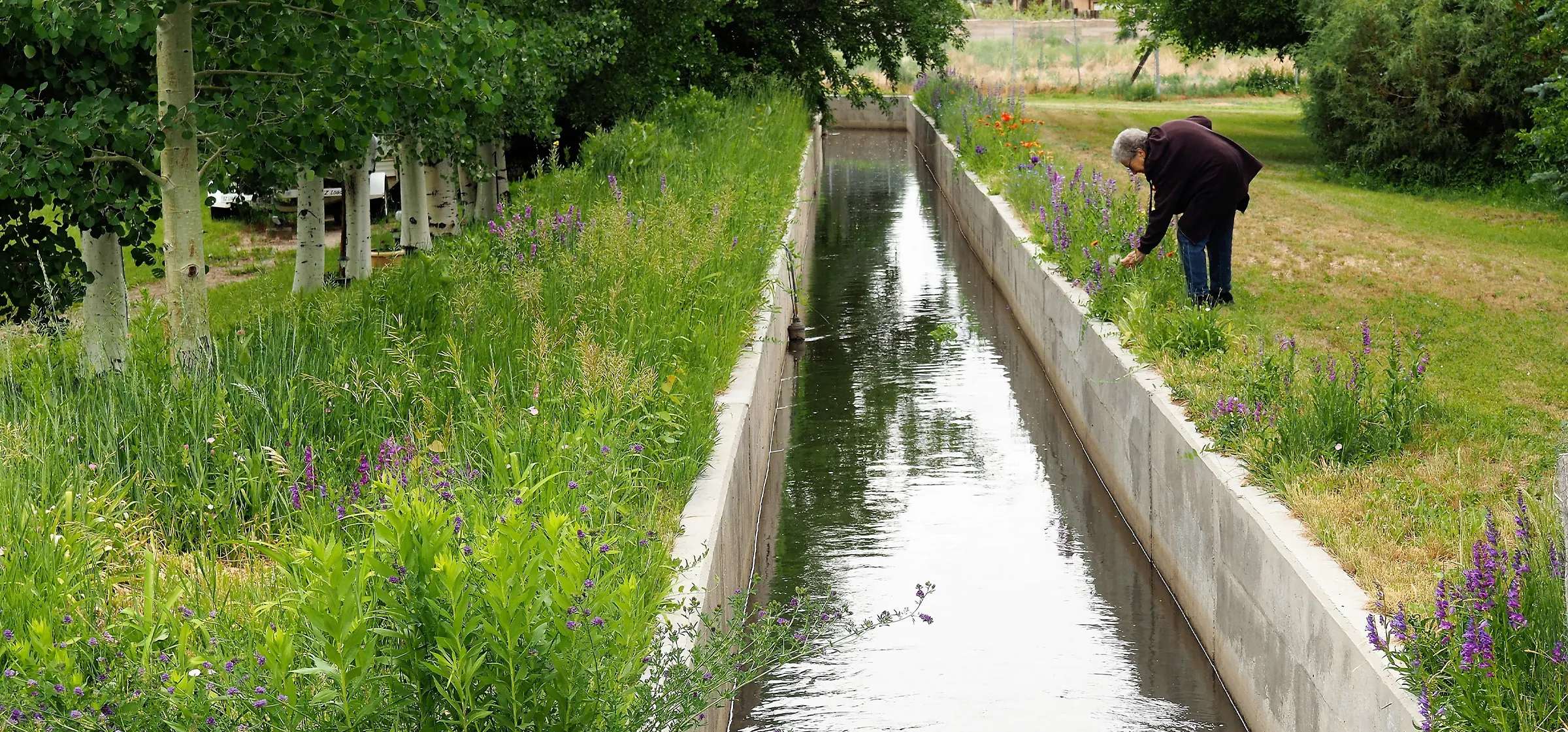
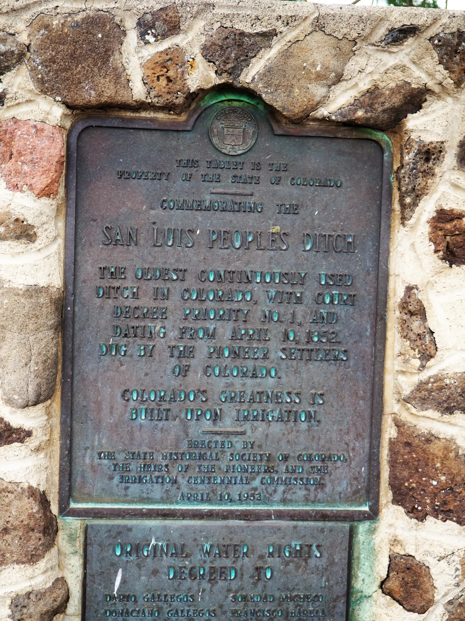
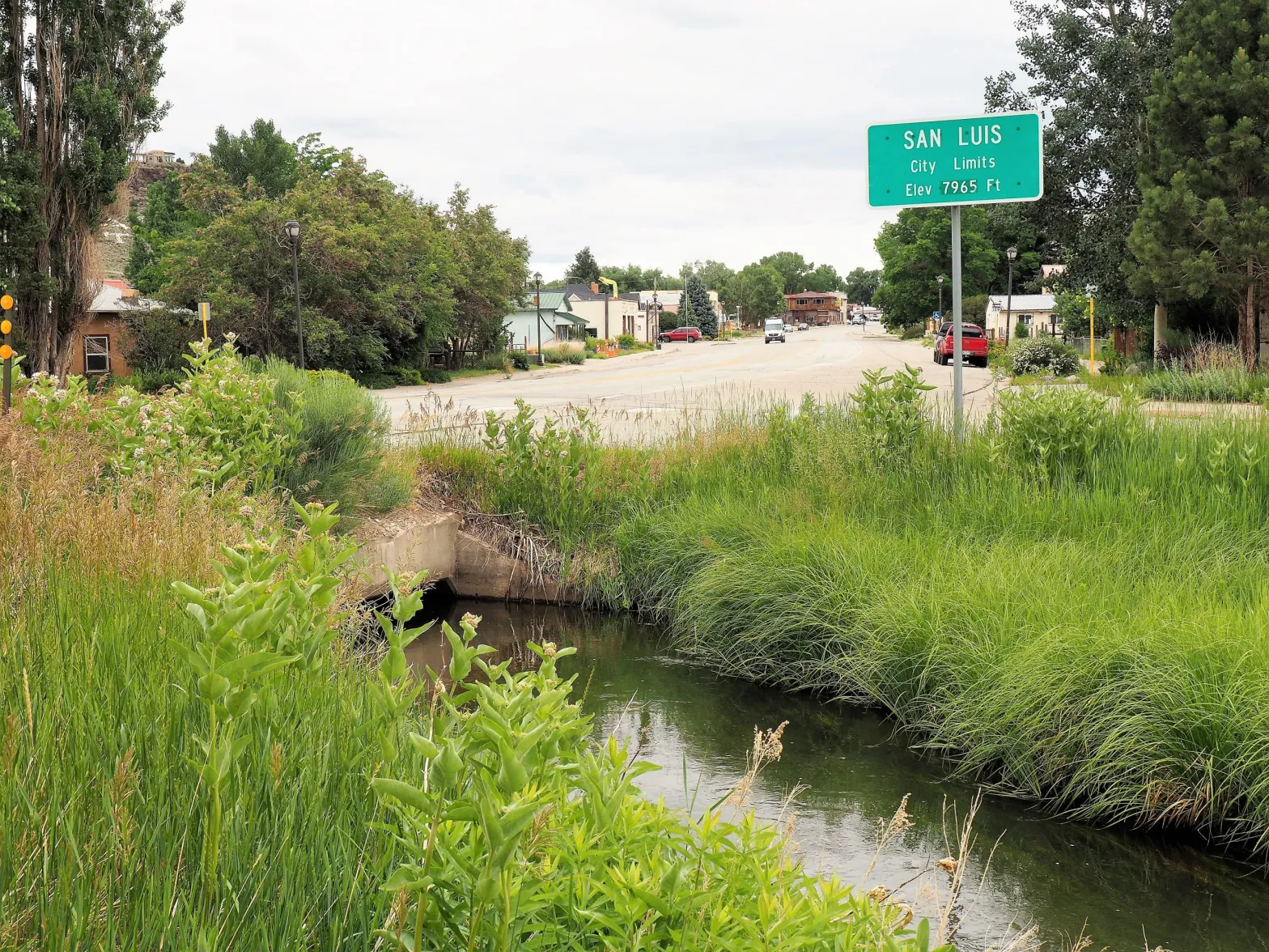
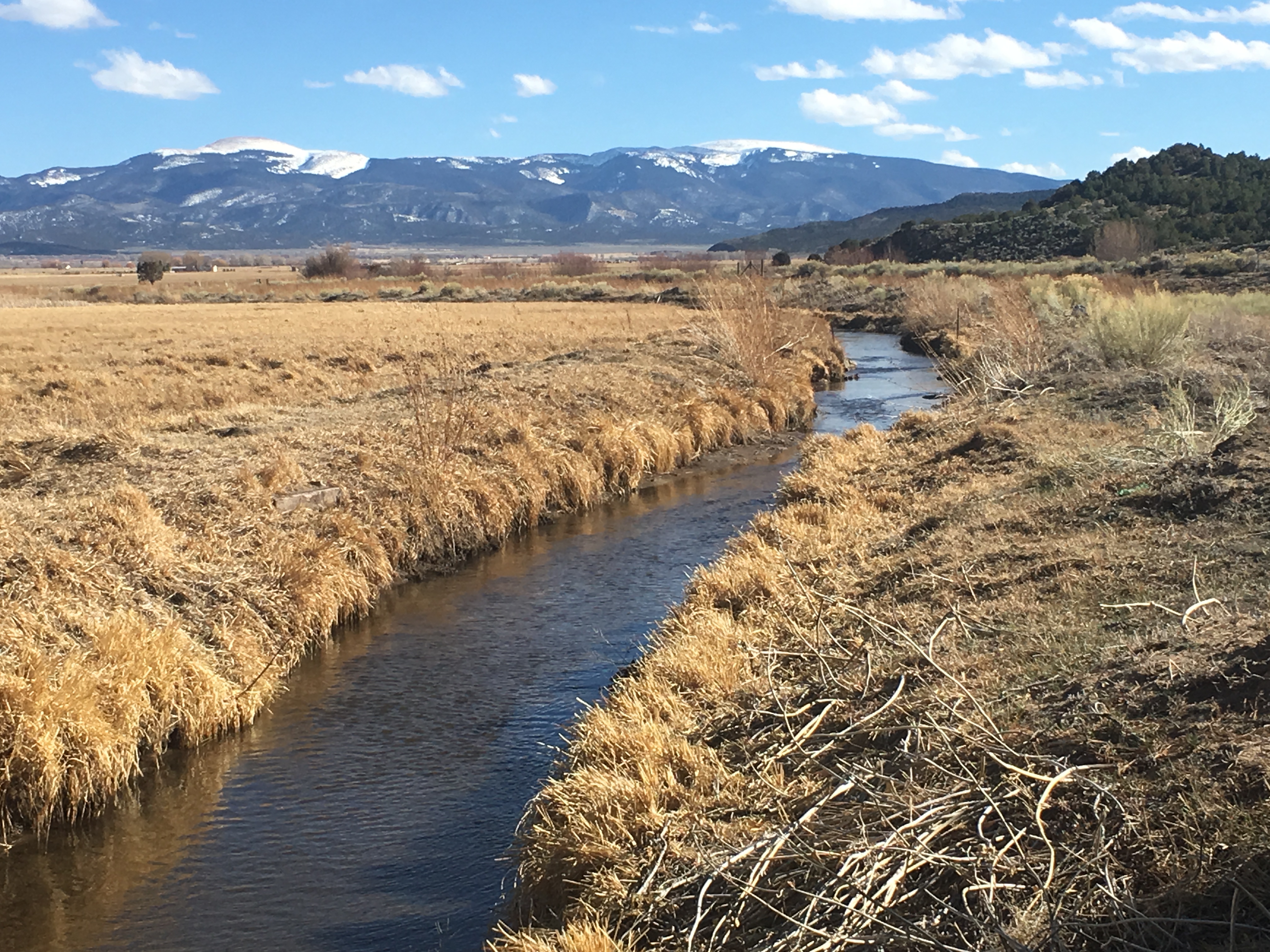
The San Luis Peoplesโ€™ Ditch, an acequia that holds the first adjudicated water rights in the region, granted in 1852, is the oldest continuously used community irrigation ditch in Colorado. The ditch has significant ties to local cultural heritage and a storied past connected to traditional water management practices. Itโ€™s also in desperate need of repairs. 

Years of wear and tear on the channel have resulted in a cracked concrete infrastructure that reduces the efficiency of water transport and harms irrigators. The San Luis Peoplesโ€™ Ditch Rehabilitation Project is working to solve this problem. 

At last weekโ€™s Rio Grande Basin Roundtable meeting, funding for Phase I of the project was approved. Now, sponsors will work to get final approval from the Colorado Water Conservation Board and figure out contracts. If everything goes to plan, all three tasks in Phase I, expected to cost a combined $45,000, will begin in the fall of 2025. 

A marker commemorating The San Luis Peoplesโ€™ Ditch as the oldest continuously used community irrigation ditch in Colorado. Credit: Mark Obmaskic

Originally a shallow hand-dug acequia, the San Luis Peoplesโ€™ Ditch was lined with concrete in the early 1960s to maximize water delivery to the area. It was incorporated in 1967, and currently serves 16 parciantes, affiliated water-users, irrigating more than 2,000 acres of crops like hay and alfalfa. 

Having already lasted more than 60 years, this concrete addition has long outlived the usual expected lifespan of 25 years. Now, erosion from more than six decades of use has left it in urgent need of attention. Years of freezing and thawing has caused large cracks in multiple places along the channel, significantly reducing the amount of water delivered to irrigators. 

Acequias โ€“ gravity-fed, community-managed irrigation systems โ€“ distribute water and snowmelt through hand-dug channels to agricultural fields for both crops and livestock. The acequia system was brought to the southwest United States by farmers emigrating to the San Luis Valley from Mexico. Used in arid landscapes around the world, the practice originated in North Africa to distribute water from rivers to desert valleys. It was brought to Spain by the Moors, and brought to Mexico by the Spaniards during the colonial period. 

Traditionally, acequias function on the idea of communal maintenance and equal water sharing during times of abundance and shortage, overseen by a mayordomo or ditch manager. This structure instills important cultural values centered around collective responsibility and respect for community and the environment. 

The unique, longstanding cultural practices as well as the physical structures of the nearly 1,000 acequias that exist in Colorado and New Mexico today are facing a multitude of threats, including modernization, socio-economic, political, and environmental pressures.

While just one of many factors impacting acequias and agricultural communities in the San Luis Valley, drought and environmental changes that impact water availability are a serious concern. Demand for water already exceeds supply in the region, and drought conditions like increased temperatures continue to intensify such processes as evapotranspiration that decrease accessible irrigation water. The drought that the southwest has experienced in the last two decades is severe, with 2002 being the worst drought on record. Identified by climate scientists and the USDA Climate Hub as a potentially emerging megadrought, itโ€™s been the driest 22-year period in over a thousand years. 

Changing precipitation patterns, even with potential increases in the form of intense rainstorms, put acequia systems at risk due to a lack of major water storage capabilities. Adapting to these changes could mean shifting growing seasons and irrigation schedules. Ultimately, compounding impacts of climate change make maximizing available water even more crucial for irrigators and farmers in the Valley. 

โ€œEvery drop counts as we face these dry times,โ€ said Amber Pacheco, deputy general manager of the Rio Grande Water Conservation District, emphasizing the importance of improving aging infrastructure to lessen water loss. 

Credit: Mark Obmaskic

Phase I of the Rehabilitation Project will get these improvements started. With three main tasks, this phase is focused on surveying and assessing the current conditions of the ditch infrastructure in order to recommend repairs and improvements. 

The first task will encompass a GPS and aerial drone survey, and a component survey of the 3.5 mile ditch. The surveys will check structures, turnouts, piped road crossings, and more, taking note of sections that need to be repaired or upgraded. 

The second task will involve an engineer analyzing the structural integrity of the concrete infrastructure, identifying weak spots and areas most at risk of failure. An evaluation of the hydraulic efficiency will also take place, modeling how the water is moving through the channel to find obstructions or specific structures that are problematic. 

The third task is a comprehensive final report detailing all of the findings, recommending locations for repairs and improvements, and estimating costs for the next phase of the project. It will be used to determine an actionable plan and request funding for the actual concrete replacement. 

The existence of the Peoplesโ€™ Ditch acts as the physical legacy of those who built it hundreds of years ago. Many current users of the ditch are descendants of the original builders, marking generations of connection and rich heritage embedded in the land and acequia system. The San Luis Peoplesโ€™ Ditch Rehabilitation Project aims to enhance the performance and longevity of the ditch while preserving the existing infrastructure and its deep-rooted cultural significance.

Evan Arvizu

Evan Arvizu is an intern with the Rural Journalism Institute of the San Luis Valley. Sheโ€™s a senior at Colorado College majoring in Environmental Anthropology and minoring in Journalism. More by Evan Arvizu

San Luis People’s Ditch March 17, 2018. Photo credit: Greg Hobbs

$24.97 million to support #RioGrande headwaters conservation projects: Federal funding comes in final days of Biden Administration; will support restoration efforts in #Colorado and #NewMexico — #Alamosa Citizen

Rio Grande, looking south near Cole Park. The Alamosa Riverfront Project is among several that received funding last week under the 2022 Inflation Reduction Act. Credit: The Citizen

Click the link to read the article on the Alamosa Citizen website:

January 20, 2025

Conservationists focused on the Rio Grande Basin signal it as an initial win in a battle for federal dollars to address the impacts of drought and the need for a sustainable water supply.

Theyโ€™ve seen how the federal government has kicked into gear to address the same issues on the Colorado River Basin, and have wondered why the Rio Grande Basin largely has been ignored.

Until now. 

The U.S. Department of Interior and Bureau of Reclamation announced last week in the final days of the Biden Administration a $24.97 million award to support water conservation and habitat restoration efforts in the headwaters of the Rio Grande.

Itโ€™s a drop in the bucket compared to the billions that have been awarded to projects on the Colorado River, but itโ€™s a start.

โ€œTodayโ€™s announcement provides a critical down payment that will make the headwaters of the Rio Grande better prepared to handle the ongoing impacts of drought, while supporting state and local efforts to sustainably manage water supplies for future generations,โ€ said Alexander Funk, Director of Water Resources, Theodore Roosevelt Conservation Partnership.

The money came through the 2022 Inflation Reduction Act (IRA) and was among the final announcements by the Biden Administration of funding awarded through the federal legislation. 

The significance of that is nobody in the agriculture, conservation, and water world knows if the incoming Trump Administration will carry on with the Inflation Reduction Act, or if that particular federal legislation and the $369 billion approved by Congress falls to the wayside.

โ€œWeโ€™re shocked we got anything,โ€ said Amber Pacheco of the Rio Grande Water Conservation District and member of the Rio Grande Basin Roundtable. She described a rush at the end to send to the Bureau of Reclamation โ€œshovel-readyโ€ projects that could earn IRA funding.

โ€œIt was a โ€˜quick overnight, send some projects that we can fund,โ€™โ€ said Pacheco.

Rio Grande and Pecos River basins. Map credit: By Kmusser – Own work, Elevation data from SRTM, drainage basin from GTOPO [1], U.S. stream from the National Atlas [2], all other features from Vector Map., CC BY-SA 3.0, https://commons.wikimedia.org/w/index.php?curid=11218868

Out of the award comes funding for a variety of projects in the San Luis Valley as well projects for the middle Rio Grande in New Mexico. Overall, $18 million will go toward Rio Grande Basin projects in Colorado and $7 million for Rio Grande restoration efforts in New Mexico.

The San Luis Valley and Conejos Water Conservancy Districts, the Rio Grande Water Conservation District and the Rio Grande National Forest in southern Colorado are among the eight recipients selected under one cooperative agreement to receive $24.9 million for several drought resiliency activities in the Upper Rio Grande Basin, the Bureau of Reclamation said in announcing the money.

For the Valley, those projects will include the Alamosa Riverfront Restoration project; Rio Grande Reservoir Low Flow Valve; Pine River Weminuche Pass Ditch Turnback Structure; Lower Conejos River Restoration Project; Platoro Reservoir Restoration and Wildfire Risk Mitigation Project โ€“ Phase 1; Saguache Creek Multi-benefit Restoration at Upper Crossing Station; and Rio Grande Confluence Restoration Project, among others.

โ€œThis announcement shows that when Colorado and New Mexico work together, big things can help that benefit fish and wildlife, support local economies, and tackle some of the regionโ€™s most pressing water challenges,โ€ said Funk.

โ€œThe Rio Grande is the underpinning that supports the economic and ecological health of the region. This funding allows conservation partners to critically address and relieve the challenges this habitat and community have experienced from long-term drought and sustainability insecurity,โ€ said Tracy Stephens, senior specialist for riparian connectivity at The National Wildlife Federation. โ€œWe applaud the Bureau of Reclamationโ€™s investment and recognition of the importance of riparian health and habitat connectivity. This funding is an important step forward in a collective effort to achieve well-connected and functional riparian corridors to protect the wellbeing of people, plants, and wildlife in the Upper Rio Grande.โ€

Screen shot from the Vimeo film, “Rio Grande Headwaters Restoration Project: Five Ditches,” https://vimeo.com/364411112

Lousy #RioGrande #snowpack, but the runoff forecast is not as bad as I thought! — John Fleck (InkStain.net)

Click the link to read the article on the InkStain.net website (John Fleck):

January 9, 2025

The January NRCS Rio Grande runoff forecast is lousy: a mid-point forecast of 65 percent of average at Otowi (upstream of Albuquerque) and 37 percent of average at San Marcial (downstream of Albuquerque). Based on the current snowpack, I expected worse. Forecaster Karl Wetlaufer, in the email distributing the numbers, explains:

Wetlaufer also reminds us that thereโ€™s a lot of snowpack season ahead of us. The numbers above are the median forecast. The one-in-ten wettest side (10 percent exceedence) is ~115% of average at Otowi, and the one-in-ten dry (90 percent exceedence) is less than 20% of average.

Colorado Secures $177 Million in Federal Funding for Water Projects — #Colorado Water Conservation Board

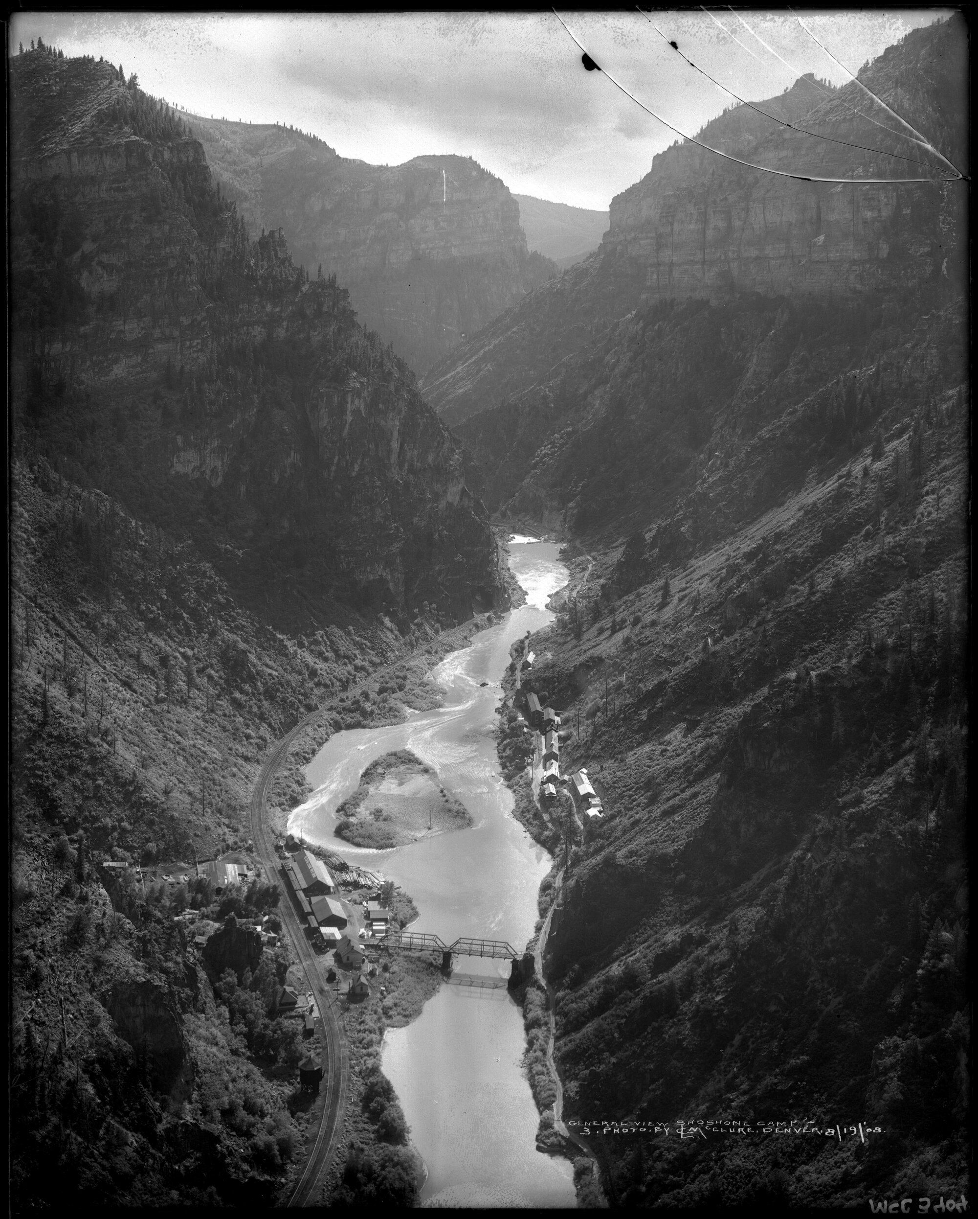
View of Shoshone Hydroelectric Plant construction in Glenwood Canyon (Garfield County) Colorado; shows the Colorado River, the dam, sheds, a footbridge, and the workmen’s camp. Creator: McClure, Louis Charles, 1867-1957. Credit: Denver Public Library Digital Collections

Click the link to read the release on the Colorado Water Conservation Board website:

January 17, 2025โ€”The Bureau of Reclamation announced this week nearly $177 million in funding for water projects in the Upper Rio Grande and Upper Colorado River basins in Colorado. These fundsโ€”awarded from Bucket 2 Environmental Drought Mitigation (B2E) and Inflation Reduction Act programsโ€”will help Colorado better address the impacts to our water supplies and aquatic ecosystems from a hotter, drier future. The Colorado Water Conservation Board (CWCB) shares the excitement of all the organizations receiving fundingโ€”the awards are a testament to their hard work. The CWCB is proud to have supported several of the awardees with matching funds and technical assistance while developing their applications.

โ€œWe are thrilled to see this funding go towards these critical projects in Colorado. We are particularly proud to have played a role in assisting these projects in securing funding through CWCBโ€™s grant programs including our Federal Technical Assistance Grant Program, Projects Bill Grants Program and Wildfire Ready Watershed Grants Program,โ€ said Lauren Ris, CWCB Director. โ€œBy building upon the capacity of our local partners, we provide resources and guidance to navigate complex federal funding processes.โ€

The funded projects span a diverse range of initiatives that deliver impactful outcomes for Colorado communities. CWCB funding supported applications for:

  • Upper Rio Grande Basin Drought Resiliency Activities: CWCB provided a $195,000 Local Capacity Grant to the Rio Grande Headwaters Restoration Foundation, which helped secure aย $24.9 million IRA award through the Bureau of Reclamationโ€™s โ€œOther Basinsโ€ Program. These projects are essential to addressing the long-term drought and water security in the basin.ย 
  • Addressing Drought Mitigation in Southwest Colorado: CWCB provided a $156,706 Local Capacity Grant to the San Juan Resource Conservation and Development Council (in partnership with Southwestern Water Conservation District) which helped secure up to $25.6 million in B2E funding to enhance drought resilience and habitat restoration efforts in southwest Colorado.
  • Orchard Mesa Irrigation District Conveyance Upgrades for 15-Mile Reach Flow Enhancement:ย CWCB provided a $73,250 Local Capacity Grant to Farmers Conservation Alliance (in partnership with Orchard Mesa Irrigation District) which helped secure up to $10.5 million in B2E funding to modernize irrigation systems and improve water efficiency.
  • Shoshone Water Rights Preservation Project:ย CWCB provided a $20 million Projects Bill Grant to the Colorado River Water Conservation District which helped secure up toย $40 million in B2E funding to acquire the Shoshone water right.ย 
  • Drought Resiliency on Western Colorado Conserved Lands:ย CWCB provided a $434,130 Local Capacity Grant to the Colorado River Water Conservation District (in partnership with Shavano Conservation District) which helped secure up to $4.6 million in B2E funding to address drought challenges in western Colorado.
  • Forest Resiliency in the Headwaters of the Colorado: CWCB provided a $93,850 Wildfire Ready Watersheds Grant to Grand County which supported the development of the โ€œGrand County Wildfire Ready Action Plan,โ€ which helped secure up to $32.6 million in multistate B2E funding for wildfire mitigation efforts.

CWCB is committed to continuing to be a partner of communities statewide so that they are best positioned to secure federal funding and implement lasting solutions for Colorado water challenges. The 2024 Federal Technical Assistance Grant cycle is completed, and more information about 2025 applications will be announced this Spring. 

Record precipitation in 2024 gave little relief to irrigators: Most of the water ended up in the soil, not the unconfined aquifer — @AlamosaCitizen #RioGrande #SanLuisValley

Gauging station near Mogote on the Conejos River. Record precipitation did not translate to record river flows. Credit: The Citizen

Click the link to read the article on the Alamosa Citizen website:

January 15, 2025

Alamosa never gets 16 inches of total precipitation in a year. Never. Ever. Except that it did in 2024. 

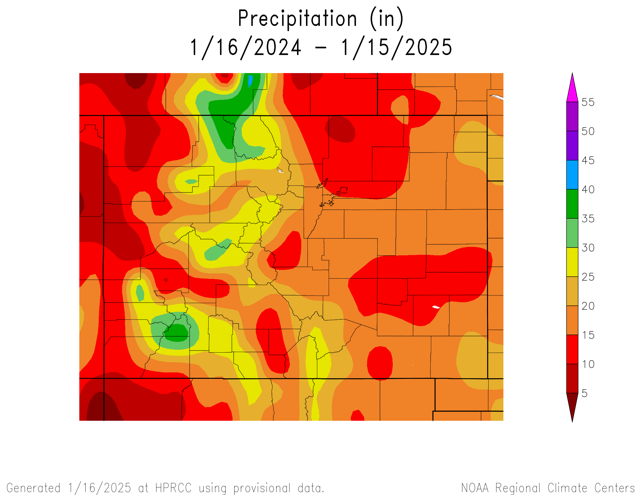
Turns out, 2024 was among the wettest on record across the San Luis Valley going back to 1895, with all six counties registering historic levels of precipitation. Here are the precipitation totals by county, according to data from the NOAA National Centers for Environmental Information:

  • Alamosa County, 16.75 inches
  • Conejos County, 24.29 inches
  • Costilla County, 22.53 inches
  • Mineral County, 32.60 inches
  • Rio Grande County, 19.66 inches
  • Saguache County, 21.86 inches

The headscratching is how so much moisture was realized in a year when the unconfined aquifer of the Upper Rio Grande Basin dropped to near its lowest level, which became problematic for irrigators who are under orders by the state of Colorado to reduce their groundwater pumping to help recover the ailing aquifer.

โ€œTwo things,โ€ said Cleave Simpson, general manager of the Rio Grande Water Conservation District and local hay grower. โ€œWe didnโ€™t have continuous steady snowpack in the winter months that put us in a good position, and then the volume of snow we got was on top of drier conditions last fall where moisture, instead of showing up in a stream, ends up in the ground in soil conditions.

โ€œSo to that end, this year at my farm in October, I get an inch and a half of rain, in October. That never, ever happens. So the hope is then, that nice soil moisture that we got in October will set us up for success.โ€

Craig Cotten, division engineer for the Colorado Division of Water Resources, said the wet 2024 was a boon to local farmers and their efforts to recover the Valleyโ€™s aquifers. What it didnโ€™t do was increase the amount of water stored in reservoirs.

โ€œThe reservoirs in the Rio Grande Basin in Colorado typically store water in winter when the senior priority ditches are shut off. The reservoirs can also store during the irrigation season, but only if there is a significant amount of water in the rivers to serve not only the irrigation ditches but the reservoirs as well,โ€ said Cotten.

โ€œThis typically requires very high river flows, which did not occur in 2024 even with the rain events that were the primary reason for the high precipitation total in 2024. The significant rains in the Rio Grande Basin did increase the river flows, but not enough to get the reservoirs into priority. The increase in reservoir storage in 2024 was about typical of what occurs in an average year.โ€

Without the high levels of precipitation in 2024, the critical unconfined aquifer was in danger of falling to a level of storage nobody was expecting to see after years of irrigators working to reduce their groundwater pumping.

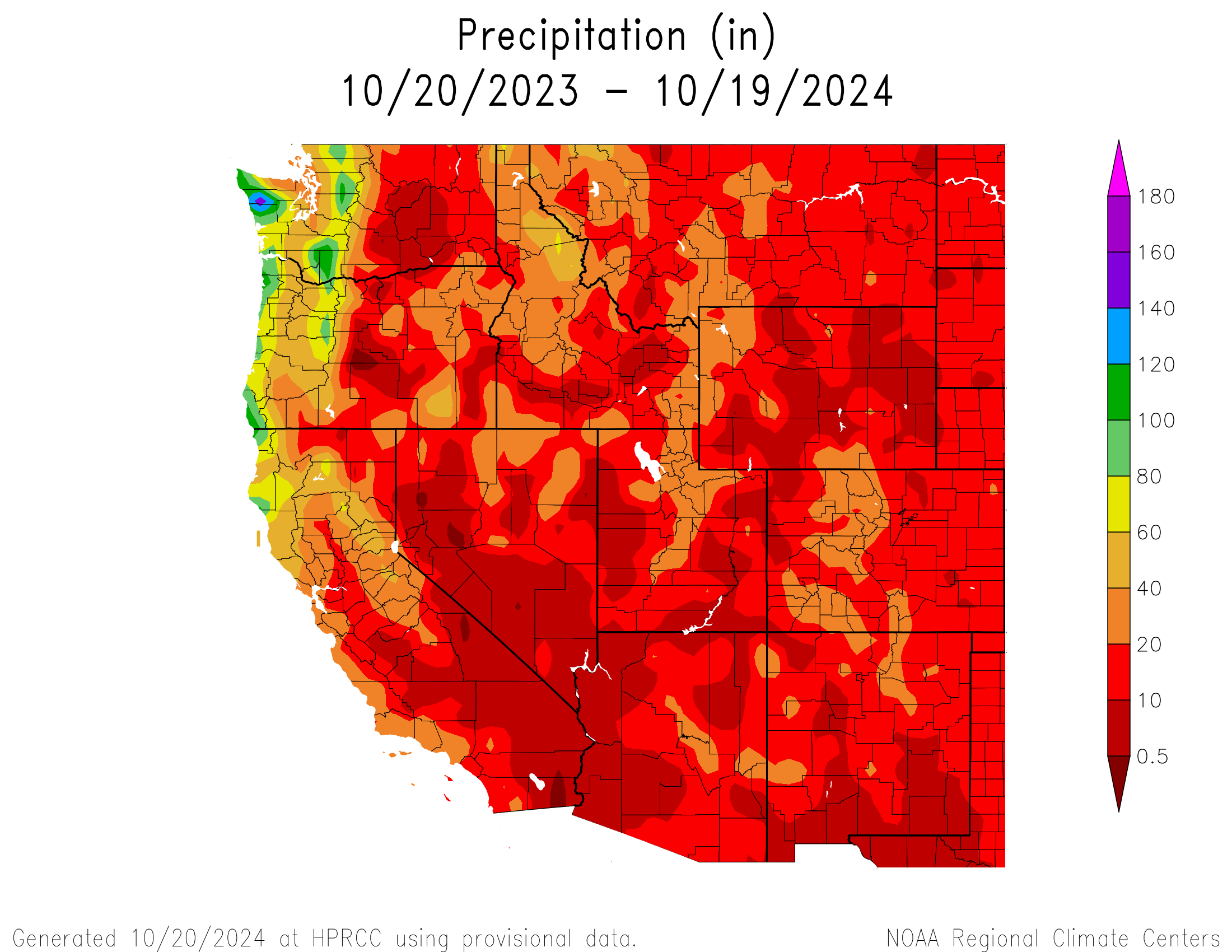
Colorado precipitation for the 12 months ending January 15, 2024. Credit: High Plains Regional Climate Center.

โ€œThe large amount of precipitation in the Rio Grande Basin during the summer of 2024 helped the unconfined aquifer in multiple ways,โ€ said Cotten. โ€œThis precipitation increased the streamflow in the Rio Grande throughout the summer, allowing the ditches and canals to divert more water than they otherwise would have.

โ€œThis increased diversion in turn allowed delivery of a higher amount of water into recharge pits and the aquifer. The precipitation also helped to meet the irrigation needs of the crops, allowing the farmers to not pump their wells as much as they would otherwise.โ€

The hope among local farmers is that the wet fall months of 2024, when October and November delivered more than 11 inches of snow, will translate into an above-average spring runoff and give a boost to surface water coming into the Valley in 2025.

Rio Grande and Pecos River basins. Map credit: By Kmusser – Own work, Elevation data from SRTM, drainage basin from GTOPO [1], U.S. stream from the National Atlas [2], all other features from Vector Map., CC BY-SA 3.0, https://commons.wikimedia.org/w/index.php?curid=11218868

#Colorado #snowpack approaching normal levels — The #PagosaSprings Sun

Click the link to read the article on the Pagosa Springs Sun website (Garrett Fevinger). Here’s an excerpt:

January 9, 2025

As of Jan. 8, the statewide snowpack pack stood at 95 percent of the 30-year median, according to data from the Natural Resources Conservation Service (NRCS) โ€” an improvement from weeks earlier when those levels tracked significant lower.

The San Miguel, Dolores, Animas, and San Juan basins measured to be at 84 percent of its 30-year median snowpack as Individual local levels were slightly lower, with the Upper San Juan area at 73 percent of its median snowpack, the Piedra area at 79 percent, and the Conejos area at 60 percent of its median. As of Jan. 8, 45 inches of snow were measured atop the Wolf Creek summit, which sits at 68 percent of its median snowpack, according to the NRCS.

River flows

The San Juan River was flowing at a rate of 42.9 cubic feet per second (cfs) through Pagosa Springs as of 9 a.m. Wednesday, according to the U.S. Geological Survey. Based on 89 years of water records, the median flow for the same date is 54 cfs, with a record high flow of 112 cfs in 1987. The lowest recorded flow for the date is 28 cfs in 1990.

A dam upgrade left one Colorado section of the #RioGrande dry in the winter. What will it take for water to flow again? Local group says state, irrigation district failed to fulfill promises in project — The #Denver Post

Rio Grande Reservoir release. Photo credit: Rio Grande Basin Roundtable

Click the link to read the article on The Denver Post website (Elise Schmelzer). Here’s an excerpt:

January 5, 2025

The mighty and fabled Rio Grande dwindles to barely a trickle in the winter west of Creede, exposing nearly a mile of rocky riverbed to dry under the weak sun. This section of the river near its headwaters wasnโ€™t supposed to be left dry in the winter, according to environmental groups. A rehabilitation project on the dam that createsย the Rio Grande Reservoirย was billed as an upgrade that would make the river healthier and improve recreation throughout the year. But even four years after the construction project concluded, those promises havenโ€™t materialized. Thatโ€™s because the damโ€™s new valves cannot safely release water during the winter, according to theย Committee for a Healthy Rio Grande, a group formed to push for more water releases from the reservoir for fishing, rafting and environmental health. The irrigation district that operates the dam closes the valves from November through March. The lack of water in the winter kills off aquatic insects and vegetation โ€” the base of the river ecosystemโ€™s food cycle…

A solution may be in the works. After four years, the San Luis Valley Irrigation District โ€” which owns and operates the reservoir โ€” on Dec. 1 applied for state grant money to study how the damโ€™s valves could be modified to work in the winter, said Cole Bedford, the chief operating officer of the Colorado Water Conservation Board

โ€œWe are developing a solution that will safely provide low-flow releases during the winter,โ€ San Luis Valley Irrigation District Superintendent Rob Phillips said in an emailed statement.  โ€œAnd, we look forward to continuing our work with those water users and organizations in the San Luis Valley who have a unique and valued history of working together to find constructive solutions.โ€

The issue is part of a larger challenge: How should Colorado balance the different uses of its water as climate change shrinks supplies and adds volatility to decades-old climate patterns?

The #RioGrande cutthroat trout and the Endangered Species Act — John Fleck (InkStain.net)

Rio Grand Cutthroat distribution 2016. Courtesy New Mexico Department of Game and Fish

Click the link to read the article on the InkStain website (John Fleck):

December 26, 2024

The US Fish and Wildlife Service earlier this month (December 2024) once again declined to list the Rio Grande cutthroat trout as โ€œendangered.โ€

Itโ€™s a native species endangered (in the colloquial sense, not the legal sense) by both anthropogenic habitat changes (warm temperatures, less water, dams and stuff) and non-native immigrant species.

USFWS identified non-native hybridization and competition as the most significant threat, and concluded that collective action by a collaborative effort including federal, state, and tribal governments, along with NGOs, has successfully stabilized the fishโ€™s population since discussion about possible listing first began a quarter century ago.

“The 119 populations are distributed across a wide geographic area, providing sufficient redundancy to reduce the likelihood of large-scale extirpation due to a single catastrophic event. Furthermore, the Rio Grande cutthroat trout Conservation Team has a demonstrated track record of responding to negative events to protect and even expand populations in the aftermath of large-scale changes to streams. Populations cover the breadth of the historical range, ensuring retention of adaptive capacity (i.e., representation) to promote short-term adaption to environmental change. The SSA report describes the uncertainties associated with potential threats and the subspeciesโ€™ response to these potential threats, but the best available information indicates the risk of extinction is low. Therefore, we conclude that the Rio Grande cutthroat trout is not in danger of extinction throughout all of its range and does not meet the definition of an endangered species.”

ESA questions

Iโ€™ve not followed the Rio Grande cutthroat trout saga closely. My primary interest is in its value in highlighting broader issues around the ESA that my Utton Center colleagues and I have been discussing of late.

Collective action

Collective action by a broad coalition of stakeholders before ESA listing seems to have been key in protecting whatโ€™s left of the species and avoiding listing.

Question: Is this driven by a societal environmental value (We love this fish and the ecosystems on which it depends, and want to protect them!) or a desire to avoid the messiness of ESA listing and the resulting land and water management craziness that would result therefrom?

In the new book, we note a clear distinction between these two types of cases in the history of Albuquerqueโ€™s relationship with the Rio Grande: environmental actions growing out of collective community values, and environmental actions driven by statutory (in this case ESA) mandates.

Charisma

Charismatic?

We know that charismatic species get more societal love. (Woe is our diminutive Rio Grande silvery minnow.) The Rio Grande cutthroat trout is charismatically beloved. Does this help explain the energetic collective action weโ€™ve seen?

Loper Bright for the โ€œforeseeable futureโ€

Reading the USFW federal register notice in light of the Supreme Courtโ€™s Loper Bright decision, is interesting. IANAL, but my shorthand for the decision is that the courts no longer must defer to an implementing agencyโ€™s interpretation of ambiguous statutory provisions. Hereโ€™s USFWS in the cutthroat trout decision:

Maybe language like that was always included in USFW Federal register notices? I expect a lot more post-Loper Bright debates about what Congress intended.

Cutthroat trout historic range via Western Trout

New Year #snowpack update: Bold beginning tapers off: But there’s still a lot of snow season left — Jonathan P. Thompson

October snows above Ouray, Colorado. The Red Mountain Pass SNOTEL showed the snowpack to be 103% of normal as of Jan. 2, 2025. Jonathan P. Thompson photo.

Click the link to read the article on the Land Desk website (Jonatan P. Thompson):

January 3, 2025

๐Ÿฅต Aridification Watch ๐Ÿซ

Happy New Year! The Land Desk had a very mellow and relaxing couple of weeks off, and I must admit that Iโ€™m struggling to get back into the old routine. And I sure as heck havenโ€™t gotten used to writing โ€œ2025โ€ yet. Oy.

But no matter what the calendar may say, weโ€™re one-fourth of the way through the 2025 water year, and one-third of the way through meteorological winter.ย That means itโ€™s time for a little snowpack update.

Snowpack levels in the watersheds that feed Lake Powell are just about normal for this time of year, thanks to some late-December storms across the region. But as you can see from 2023 (the purple line), thereโ€™s plenty of time left for it to be a huge snow year โ€” or a downright crappy one if the precipitation suddenly stops. Source: NRCS.

This snow season got off to a rip-roaring start in much of the West, with some substantial high-country snowfall back in October and November. Then, as is often the case, someone turned off the big sky spigot, the clouds cleared, temperatures warmed, and the early season bounty became mid-winter middling to meager. Meanwhile, the high-mountain snow, while not necessarily melting, began โ€œrotting.โ€ That is, it embarked on the metamorphosis from strong, well-bonded snow, to weak, faceted, depth hoar1.

Thatโ€™s a problem, because when another layer of snow falls on top of it, the weak layer is prone to failure, resulting in an avalanche. Sadly, avalanches have taken the lives of four people so far this season, all during the last couple of weeks in December. Two of the fatalities occurred in Utah and one in Nevada, all following a late December storm atop a deep, weak layer. The other one was in Idaho on Dec. 15. Two of the victims were on motorized snowbikes, one was a solo split-boarder, and another was on foot or snowshoes. Last season there were 16 avalanche-related fatalities across the West, all occurring after the first of the year.

Southwestern Colorado got some good dumps in October and November, pushing the snowpack far above average and into the 90th percentile. But a dry December brought snowpack levels down below โ€œnormalโ€ for the 1991-2020 period. Still, this yearโ€™s levels almost mirror 2023โ€™s, when snow season didnโ€™t get going until January. Source: NRCS.

Meanwhile, further south, theย Sonoran Avalanche Centerย hasnโ€™t had much action this season, at least not of the snowy kind. Most of the Southwest has been plagued by a dearth of snowfall โ€” and precipitation in general โ€” following a couple good storms in October and November. Temperatures have also been well above average in the southern lowlands. Phoenix set four daily high-temperature records in December, and the average for the month was a whopping seven degrees above normal; Flagstaff was also far warmer than normal and received nary a drop of rain or snow during all of December. And Las Vegas hasnโ€™t received measurable rainfall since it got a bit damp (.08 inches) in mid-July.

The Salt River watershed in central Arizona has received hardly any snow so far this year and continues to lag far behind the 2023 and 2024 water years. The lack of moisture and unusually high temperatures in December donโ€™t bode well for the regionโ€™s runoff. Source: NRCS.
The Rio Grandeโ€™s headwaters also started out strong, but have dropped below normal.
Things were looking pretty grim in western Wyomingโ€™s Upper Green River watershed until December snows pushed the snowpack almost up to normal for this time of year. The entire state was quite dry last year and itโ€™s looking like the drought will persist there.

This does not bode well for spring streamflows, particularly in the Salt and Gila Rivers. The mountains feeding the Rio Grande also are in need of some good storms to keep that river from going dry this summer.

We can take comfort in the fact that in many places in the West, snow-season doesnโ€™t really arrive until February or March. So this could turn out to be a whopper of a winter yet.

The drought situation a year ago (left) and now (right). While drought has subsided in New Mexico and the Four Corners area, it has intensified dramatically in Wyoming, Montana, parts of Idaho and a swath that follows the lower Colorado River and includes Las Vegas, which has only received .08โ€ of precipitation since April of last year. Source: U.S. Drought Monitor.
For now it looks like thereโ€™s no relief in sight for the Southwest or the Northern Rockies.

๐ŸŒต Public Lands ๐ŸŒฒ

Bidenโ€™s getting busy as he prepares to vacate the White House. The Los Angeles Times reports that he plans to designate the Chuckwalla National Monument on 644,000 acres of federal land in southern California, and the Sรกttรญtla National Monument on 200,000 acres in the northern part of the state near the Oregon border. Thatโ€™s what Iโ€™m talkinโ€™ about, Joe! Now do the lower Dolores!

๐Ÿฆซ Wildlife Watch ๐Ÿฆ…

The soon-to-be Chuckwalla National Monument lies south of and adjacent to Joshua Tree National Park, an area often targeted by utility-scale solar developers. Thatโ€™s the sort of development that will now be banned there. Not only will cultural sites be protected, but also wildlife. A new study found that some of the Southwestโ€™s best sites for solar overlap critical habitat for vulnerable species, including in most of southern California.

***

The U.S. Fish and Wildlife Service is seeking any information on the killing of a gray wolf in Grand County, Colorado, in summer of 2024. The wolf, 2309-OR, was part of the Copper Creek pack that was captured by wildlife officials in August, after members of the pack had made a meal out of local ranchersโ€™ livestock. 2309-OR was in bad condition and perished in captivity; a subsequent investigation found that he died of a gunshot wound. Itโ€™s illegal to kill wolves in Colorado, not to mention immoral and just a horrible thing to do. The Center for Biological Diversity and other conservation organizations are offering a $65,000 reward for information leading to the arrest and conviction of the shooter.


๐Ÿ“ธย Parting Shotย ๐ŸŽž๏ธ

San Francisco Peaks near Flagstaff, Arizona, in mid-November. They had a bit of snow from earlier storms, but havenโ€™t received much since. The Snowslide Canyon SNOTEL site at 9,744 feet in elevation is recording 65% of normal snow water equivalent. Jonathan P. Thompson photo.

1 Andy Gleason, snow nerd extraordinaire, explained it like this after record-high avalanche fatalities during the relatively scant 2021 snow year :

2024 – 2025: Look back, look ahead — @AlamosaCitizen

On Sunday, Dec. 29, the daytime high of 57 degrees in Alamosa established a new record for the date, making December 2024 one of the warmest Decembers this century. | Credit: The Citizen

Click the link to read the article on the Alamosa Citizen website:

December 30. 2024

A mild December caps a year of unusual weather for Alamosa and the greater San Luis Valley. Or maybe itโ€™s just the new normal in a century of changing climates and chaotic weather patterns.

The month of December brought 10 different 50-degree weather days, and an average temperature of 45 degrees โ€“ or 10 degrees above whatโ€™s been historically normal, according to figures from the National Weather Service.

On Sunday, Dec. 29, the daytime high of 57 degrees in Alamosa established a new record for the date, making December 2024 one of the warmest Decembers this century.

The summer and late fall were strange as well this year. Between May and August, the Valley floor received 6.14 inches of rain, making it one of the wettest four-month periods on record this century.

For perspective, the San Luis Valley typically experiences 7 inches of total precipitation and around 30 inches of measurable snow each year. In 2024, Alamosa experienced 11.36 inches of precipitation and 37 inches of snow.

Those late spring and summer rains came off a record amount of total snow in March when 14.5 inches fell, way above the 4 inches of snow that is typical for the month. Indeed, 2024 was a strange, wet weather year.

Yet, the Upper Rio Grande Basin continues to struggle and local irrigators remain under state pressure to reduce their groundwater pumping and retire more fields. In August alarm bells went off for water managers when readings of the unconfined aquifer storage levels shockingly showed the critical aquifer near its lowest measurable point.

โ€œYouโ€™re always under pressure and the sense of urgency is always there,โ€ said Cleave Simpson of the stress farmers and ranchers in the San Luis Valley face to recover the ailing aquifers of the Rio Grande. He works as general manager for the Rio Grande Water Conservation District and represents the Valley and most of southwestern Colorado as a state senator.

In his role as state legislator, Simpson sponsored legislation that resulted in $30 million committed to pay Valley irrigators to retire more groundwater wells to reduce their groundwater pumping. Over the past dozen years, payments made to either temporarily or permanently fallow agricultural fields and reduce the amount of groundwater pumped in the Valley have totaled $100 million, according to figures Simpson cited on this episode of The Valley Pod.

The podcast episode with Simpson looks back on the century and how the new millennium, now 25 years in, has been dominated by the effects of climate change.

U.S. Drought Monitor July 23, 2002.

โ€œFrom climate, in particular, 2002 was this critical moment in time for us. Thatโ€™s when the whole paradigm shifted for the San Luis Valley and Colorado and really the western U.S.,โ€ said Simpson. โ€œThat was the worst drought in our recorded history. The Rio Grande had never seen those kinds of diminished flows, ever, since we started recording it.

โ€œItโ€™s basically since 2002 till today, thatโ€™s 22 years of this drying, this no snow pack, this change in how runoff occurs, and the timing and the volumes.โ€

Simpson and others who closely follow the weather patterns of the San Luis Valley say itโ€™s no longer drought but aridification settling into the soil that the Valley will wrestle with as the 21st century proceeds.

Weโ€™ll see now what 2025 has in store.

Rio Grande and Pecos River basins. Map credit: By Kmusser – Own work, Elevation data from SRTM, drainage basin from GTOPO [1], U.S. stream from the National Atlas [2], all other features from Vector Map., CC BY-SA 3.0, https://commons.wikimedia.org/w/index.php?curid=11218868

#RioGrande cutthroat trout wonโ€™t be on endangered species list — @AlamosaCitizen

Credit: Colorado Parks & Wildlife

Click the link to read the article on the Alamosa Citizen website (Owen Woods):

December 13, 2024

he Rio Grande cutthroat trout, icon of Southern Colorado and New Mexico, after years of fighting for survival with the help of countless human hours, will not find itself on the endangered species list. The U.S. Fish and Wildlife Service recently announced the trout is not in danger of extinction or likely to become so in the foreseeable future, after two and half decades of review and conservation work. 

After completing a final review, the Service concluded that the Rio Grande Cutthroat troutโ€™s current status in the mostly remote water ways of Colorado and New Mexico doesnโ€™t meet the definition of a threatened or endangered species, and wonโ€™t be listed under the Endangered Species Act. 

โ€œCPW staff have worked tirelessly for decades to ensure Rio Grande cutthroat trout continue to persist,โ€ said Matt Nicholl, Colorado Parks and Wildlifeโ€™s assistant director of aquatic wildlife. โ€œThe responsibility of successfully managing this species deeply aligns with our mission, and we are thankful for the continued support and collaboration with all of the partners who have made this announcement possible.โ€

Photo credit: Colorado Parks & Wildlife

Over the course of the past three decades, biologists from Colorado have added 94 populations of pure Rio Grande cutthroats to 239 miles of stream, through chemical reclamations and habitat and connectivity enhancements related to these species.

The Rio Grande cutthroat trout is one of 14 subspecies of cutthroat trout. It lives in mostly remote, mountainous streams in New Mexico and southern Colorado. The fish is a colorful red, orange and yellow, peppered with dark spots. 

Cutthroat trout historic range via Western Trout

Rio Grande cutthroat trout can be found in high-elevation streams and lakes of the Rio Grande, Canadian and Pecos River drainages in Colorado and New Mexico, making it the southern-most cutthroat trout. Currently, the fish only occupies 12 percent of its historic habitat in about 800 miles of streams. Biologists estimate that 127 conservation populations now exist in the two states, and 57 of those populations are considered to be secure.

โ€œThe Rio Grande cutthroat trout has been New Mexicoโ€™s state fish since 1955,โ€ said Amy Lueders, the Serviceโ€™s southwest regional director. โ€œThis fish is extremely important for recreational angling in New Mexico and Colorado and management efforts have focused on population restoration, habitat improvement and research. We are thankful to the Rio Grande Cutthroat Trout Conservation Team because their continued work, along with efforts by other partners, will support the health of both the subspecies and its habitat into the future.โ€

To complete its life cycle, the cutthroat trout needs a network of slow and fast streams with clear, cold, and highly oxygenated water and highly biodiverse streambeds. 

Since 2003, Colorado Parks and Wildlife and multiple partners, including federal agencies, states, tribes, municipalities, non-government organizations and private landowners, have worked to conserve the species and implement long-term management actions to ensure its persistence and survival.

A series of collaborative frameworks of this group was updated in 2013 and again in 2023 with a conservation agreement and conservation strategy that aimed for long-term conservation.

โ€œThis decision is in response to all of our hard work between all of our partners,โ€ said CPW aquatic biologist Estevan Vigil. โ€œThe whole Rio Grande Cutthroat Conservation Team, this is a win for all of us and shows weโ€™re working hard to conserve the species without making that federal protection necessary and that we are making gains for the species. The decision to not list the Rio Grande cutthroat doesnโ€™t mean we can stop. It just means we are on the right track.โ€

The past, present and future threats to the Rio Grande cutthroat trout have been monitored and evaluated closely. The primary factor impacting the survival of the subspecies is the presence of nonnative species of trout, including rainbow trout, brook trout and brown trout. The conservation populations of Rio Grande cutthroat trout, or populations with less than 10 percent genetic introgression from nonnative trout, occupy approximately 12 percent of the speciesโ€™ historical range. Additional threats include habitat loss, reduced habitat connectivity and whirling disease.

Those other fish will outcompete, prey upon and hybridize with Rio Grande cutthroats. As a result, pure populations of Rio Grande cutthroat trout are restricted primarily to headwater streams to avoid an overbearing mix of disease and genetics.  

View the U.S. Fish and Wildlife Serviceโ€™s findings here. 

Credit: Colorado Parks & Wildlife

The trout has had a specialized team focusing on its survival throughout the restoration effort. The Rio Grande Cutthroat Trout Conservation Team is made up of state agencies in New Mexico and Colorado, as well as federal agencies, tribes, and non-government organizations. 

In the past 10 years, the conservation team has conducted 13 population restorations by removing nonnative trout and reintroducing Rio Grande cutthroat trout.

The Rio Grande Cutthroat Trout Conservation Team meets in January each year to coordinate rangewide goals and objectives. Vigil said the team serves to provide checks and balances to each other to make sure holistic goals are met.

โ€œFollowing that meeting, we all go back to the areas we manage and divide and conquer all summer to meet the goals set of conserving this species,โ€ Vigil said. โ€œThrough this shared commitment to collaborate and take actions, the future for this native species is bright throughout the Rio Grande Basin.โ€

The conservation team has conducted 13 reclamation projects to restore the fish to its native streams in the past decade, and additional projects in Colorado will soon lead to further conservation populations.

Recognizing declines, CPW began conservation efforts for this species in the early 1980s. Work included genetic testing, invasive species removal, habitat protection and enhancement, and broodstock development. 

In Colorado, Rio Grande cutthroats are spawned in the wild by CPW biologists and eggs are raised at the Monte Vista Hatchery. Since 2020, CPW has stocked 24 waters with Rio Grande cutthroats raised at the hatchery.

A new conservation population of Rio Grande cutthroat trout was designated in 2023 when a survey revealed multiple age classes of the species following a successful 2015 restoration project on the Roaring Fork drainage upstream of Goose Creek in the Weminuche Wilderness. 

Recent reclamation projects also have been conducted on the North Fork and South Fork of Trinchera Creek, Sand Creek, and Rito Hondo Reservoir, but those populations wonโ€™t count as conservation populations until future surveys reveal multiple age classes of Rio Grande cutthroats.

โ€œWe are continuing to reclaim waters for native cutthroat trout by removing non-native fish and restocking with natives,โ€ Vigil said. โ€œWe have a lot of projects and some in the process of being rebuilt. We know we are making good progress on the conservation of the species, and this is confirmation we are doing our jobs correctly and making progress.โ€

Over the past two years, species experts from CPW have served on the Technical Advisory Team to support USFWS in developing a Species Status Assessment. This included thorough input on early drafts of the assessment and enhancing scientific accuracy and defensibility of this document to support the final decision. 

โ€œCPW biologists played a significant role in the writing of this strategy, which details specific conservation actions and collaborative approaches that will reduce and/or eliminate threats to the long-term viability of the species,โ€ said CPW senior aquatic biologist Jim White. โ€œFollowing this announcement from the USFWS, we look forward to continued partnership with the conservation team as we continue to advance conservation goals for these unique species.โ€

The complexities of a sustainable Subdistrict 1: Groundwater modeling expert discusses the nuances of one-for-one pumping and recovering groundwater levels — @AlamosaCitizen #RioGrande #SanLuisValley

Credit: Rio Grande Water Conservation District

Click the link to read the article on the Alamosa Citizen website:

December 8, 2024

Call it a meeting of the minds โ€“ Willem A. Schreรผder, the CU computer scientist behind the groundwater modeling of the Upper Rio Grande Basin, and a group of San Luis Valley irrigators who are racing against time to reduce groundwater pumping in what state water engineers call โ€œone of the most productive irrigated farming areas in the state.โ€

Schreรผder spent more than an hour at a Dec. 4 meeting with farmers who form the governing board of Subdistrict 1 of the Rio Grande Water Conservation District. They wanted to know if the subdistrictโ€™s upcoming Fourth Plan of Water Management, which calls for irrigators to limit their groundwater pumping to the amount of surface water that naturally flows in, is going to work. 

Itโ€™s called one-for-one pumping, and while the plan has been approved by the Subdistrict 1 board, the Rio Grande Water Conservation District board and the state engineer, it still needs sign off from the state water court, which likely wonโ€™t happen until 2026.

While all the Valleyโ€™s farmers face pressure to reduce groundwater pumping in the face of a changing climate, itโ€™s the crop producers in Subdistrict 1 who are on the clock and under state orders to recover groundwater levels of the unconfined aquifer and maintain a sustainable irrigation water supply by 2031.

Itโ€™s Schreรผderโ€™s mathematicsโ€™ modeling that clues in the Colorado Division of Water Resources to the response the river system and aquifers are having through a steady reduction of groundwater pumping over the past two decades.

Schreรผderโ€™s expert witness testimony explaining the Rio Grande Decision Support System (RGDSS) model has been the subject of state water court proceedings and undoubtedly will be again in upcoming cases.

His session with Subdistrict 1 managers yielded a few insights, notably:

  • The recharge of streams should occur as close to the point of where the groundwater pumping occurred, a problem that has particularly come to light around Saguache Creek and the groundwater pumping that occurs in that area of the Valley.
  • The formation of the newย Southern Colorado Water Conservancy Districtย will complicate the RGDSS model in ways Schreรผder still has to figure out.
  • As much as the RGDSS model can be useful in showing the response of the river to less groundwater pumping, there is always an imbalance even if irrigators are perfectly recharging the same amount as theyโ€™ve pumped out.

What follows is a partial, edited transcript of the conversation to get at some of the more pertinent questions. Jake Burris, president of the Subdistrict 1 board of managers, opened the discussion:

Burris: The first question I would throw at you is, the anchor of the amended plan, should we be successful, is that we would only pump imported water as itโ€™s brought in. Live within our means, sort of speak. If that is the case, is it unreasonable to assume that we would not be generating any new depletions at that point?

Schreรผder: New depletions anywhere, or a particular stream?

Burris: Anywhere, any stream.

Schreรผder:ย So the short answer is โ€˜Noโ€™ in the sense that yes, we probably still will have the depletions, and what it comes down to is that the one-for-one plan essentially is one that deals with an average. So weโ€™re looking at a districtwide or subdistrict-wide average balance, whereas when we talk about stream depletions, weโ€™re talking about time, place, amount. And so itโ€™s very easy to construct a hypothetical situation where if you look at where the pumping occurs and where the recharge occurs, that those recharges in pumping are not exactly coincident and as a result, the distance between where you recharge and where you are pumping basically directs depletions to a particular direction. And so what could very likely occur is that on one stream you actually have an accretion and on another stream you have depletion. So on average you tend to be sort of in balance with the surface network, but the people on the stream that is depleted, are not going to be happy. . .So unless the way that the one-for-one works is that the recharge occurs in exactly the place where the pumping occurs, you likely will have depletions to some streams.โ€

Burris: So itโ€™s not just simply an issue from an administrative standpoint of us utilizing our recharge on an average. Thatโ€™s irrelevant. It is a logistics and timing problem, regardless?

Schreรผder: Thereโ€™s both a temporal and spatial component to that. Think about for example, the depletions to the Rio Grande and Iโ€™m making up numbers here, but just to make the argument easier, letโ€™s say 50 percent of your depletions occur in year one and then 30 percent in year two and 10 percent in years three and four. So itโ€™s front-loaded as far as when the depletions occur, and youโ€™re working on a five-year average and letโ€™s say for those first five years, or first four of the five years, letโ€™s say thereโ€™s negative 25,000 acre-feet of pumping to managed recharge. . .and then in the last year, year five, we basically have a 100,000 acre-feet of pumping in excess of recharge. So because half of that occurs in year one, and the offsets from two years and three years and four years and five years ago are lesser amounts, even though on the five-year average you are in balance, you could have a situation that on the Rio Grande in that first year after the big pumping you do not have an impact. So itโ€™s both the temporal scale at which things happen, as well as the spatial scale. Itโ€™s also a reflection of where did that recharge occur and where did the pumping occur. If you average it out, they donโ€™t fall right on top of each other.

Burris: The way the model then is I guess essentially looking at it for lack of a better way, but from a temporal and spatial standpoint, Sub 1โ€™s aquifer itself is irrelevant. Itโ€™s not looking at it from a form of recharging an aquifer as a whole and recharging for all the wells as a conglomerate. Itโ€™s looking at the individual wells and the areas around each well?

Schreรผder: As far as the model is concerned, yes.

Burris: I think thatโ€™s our big disconnect, or at least I should speak for myself there. The way Sub 1โ€™s structured is with the way the aquifer system is and the way we treat the wells and recharges, itโ€™s in totality. Itโ€™s as a conglomerate, and so you canโ€™t take that perspective in any way to the model?

Schreรผder: Thatโ€™s right? And so thereโ€™s actually three parts to this. The first is as far as Subdistrict 1โ€™s one-for-one is concerned, to a large part thatโ€™s going to address sustainability because what you put in and what you take out balances, that should be sustainable. So thatโ€™s the one part. The other part then, of course, is the groundwater modeling, which tries to figure out just exactly where the spring depletions occur. And then the third part to that is well, we need to calculate these response functions and the response function needs to capture the essential behavior of the model so that we have a simpler way of actually applying the inputs and predict what the depletions are. The problem that we are going to face in the future is that so far the response function approach has actually worked pretty well because what we found is that if you simply look at what the imbalance between pumping and recharge is in the โ€™90s and early 2000s, it did a pretty good job of predicting where the stream depletions would be if all you do is to calculate the net consumptive use and you run it through that function, and then you get the stream depletion prediction. But what if we go one-for-one and the next CU (consumptive use) is zero a lot of time, how are we going to figure out a response function that we can then use to predict what the stream depletion is? 

Burris: It is a possibility to reconsider conceptually how the model is I guess, the framework of the model? Or are we pretty much stuck with how the system is now, if that makes sense?

Schreรผder: I think we are fairly confident in the framework of the model because it is able to reproduce what has happened historically pretty well. The question that weโ€™re struggling with is โ€˜How do we ask the what-if question?โ€™ Had there not been wells or had the wells only operated in a way where the pumping matched the recharge, what would the stream depletions have been? And thatโ€™s a little bit more tricky question that we need to answer now. In the past, because there was always an imbalance between pumping and recharge, it sort of worked out. But if we are actually finding that we are leaving the response function zeros a lot, and if the model does all of the superimposition of individual wells in terms of one answer, and then we average things and we run that sort of the response function, we donโ€™t come up with that same answer, thatโ€™s the problem, right? Thatโ€™s the definition of non-linear. Linear means if you have a function that translates an input to an output, all you have to do is average the inputs and the function will give you the same average on the outputs. Whereas in the non-linear system, if you run the individual items through the function and you then average the results, you donโ€™t get the same answer. And thatโ€™s what we are struggling with. Will we be able to properly linearize that?

Burris: Iโ€™ll throw one more question at you and then Iโ€™ll let somebody else talk. What is the difference in impacts specifically, Iโ€™ll say, to Saguache Creek as far as the model sees them between unconfined wells and confined wells? Is the classification different in the model? Is the impact different, or are those treated the same sort of like we treat them the same in Sub 1?

Schreรผder: Theyโ€™re different in the sense that, because in the confined aquifer you typically have lower storage co-efficients, the columns of depression that accumulate for those tend to spread out wider and faster than they do in the unconfined aquifer. And so since the model basically just stacks all of those on top of each other and then calculates the total, it takes into consideration the fact that confined and unconfined wells behave differently. But as far as, can you tell me exactly how confined wells are, what the total is from confined wells and whatโ€™s the total from the unconfined wells? Iโ€™ve not tried to make that separation. We always just consider it in total because again, this is a non-linear system. So how you evaluate individual wells versus all of the wells in the subdistrict as a whole, if you add up all the individual wells, it doesnโ€™t add up to the total for the subdistrict as a whole. So itโ€™s a little difficult to make that clear distinction between the two.

Credit: Rio Grande Water Conservation District

The seventh iteration of the RGDSS model is being finalized by Schreรผder, which led to this exchange with another of the Subdistrict 1 managers. The conversation also then delved into the new Southern Colorado Water Conservancy District.

Sub1 Board: When will we have, โ€˜This is the final seven version?โ€™ Do we need to take action soon or can we wait a month or two for you to finalize it?

Schreรผder: So I am hoping, we have a meeting on Dec. 17, I think is the date, and Iโ€™m hoping to finalize the model for that, or at least get peopleโ€™s agreement that this is good enough that we should be moving on to the application of the model. So now we start asking the model questions, and itโ€™ll probably be several months if not a year before we go from OK, we now have a modelโ€™ translating that into, do we ask the right question for each zone and then what are the response functions that are coming out of that? So itโ€™s probably going to be at least a year before we have the answer that will apply for the next five or 10 years.

Sub 1 board member, on the Sustainable Water Augmentation Group known as SWAG: SWAG forming their own subdistrict and I guess trying to do it alone, how would you see that changing those fields and their new conservation district now outside of our subdistrict. Would that impact this data set?

Schreรผder: Well, I guess to the extent that they do their own thing, they give us more site-specific information, weโ€™ll try to incorporate that into the model. The difficult thing that we need to figure out is, โ€˜How do we deal with it separate from the rest of Sub 1?โ€™ And thatโ€™s not going to be easy.

Sub 1 board member: Just clipping those wells out of our dataset, youโ€™re saying itโ€™s not just as straightforward as, โ€˜Hey, these ones are closer to Saguache and theyโ€™re no longer in the map.โ€™ Does that help the math?

Schreรผder: Well, and I mean thatโ€™s part of the problem, right, is itโ€™s sort of obvious that yeah, those guys are probably having a bigger impact on Saguache Creek than the rest, but how do we actually run the model in such a way that we can actually quantify that? And thatโ€™s one of the problems that you have an nonlinear system, is if you start breaking it up into lots of little parts, the answer doesnโ€™t sum up to the total and that becomes problematic in terms of how do you figure out what the total impact on the stream is and how to distribute that back to individual people? And itโ€™s something that weโ€™ve worked very hard to avoid, but theyโ€™re sort of forcing our hand and I donโ€™t know exactly what the answers can be.

Sub 1 board member: You mentioned the substantial decrease in pumping over the last 10, 15 years in Subdistrict 1. Is there a scenario where if that were to continue or if wells were continuing to be retired in Sub 1, that that cone of depression would no longer reach Saguache Creek or we would no longer have applications in any scenario?

Schreรผder: Itโ€™s that balance, right, between where the recharge occurs and where the pumping is. So if we basically do one-for-one and we can put the recharge exactly where weโ€™ve pumped, then there should be no net cone of depression. And so thatโ€™s the problem, right? Thereโ€™s always an imbalance, and so even if you are perfectly recharging the same amount as you are pumping, itโ€™s always going to push the cone of depression in one direction.

Jake Burris: I once again will reiterate how appreciative I, and we are, that youโ€™re willing to make the trip down here and talk to us. It was hugely helpful, at least for me, just the general perspective o,f itโ€™s drastically different how we treat Sub 1 and administer it versus how the model sees it, I guess is how Iโ€™ll put it. But we do appreciate you taking the time.

Schreรผder: Well, and again, let me just reiterate. The sustainability requirement, thereโ€™s the modelโ€™s predictions of impact, and then the response functions themselves, and the way that the response functions work right now, by definition, if you had no net CU (consumptive use), there would be no depletion. But thatโ€™s the existing response functions, and thatโ€™s one of the things that we need to figure out at the end of phase seven is, OK that particular model of response function is probably not going to work again. So what are we going to do to fix that?

San Luis Valley Groundwater

400-year-old #NewMexico farm thrives after switch to organic, #solar — Public News Service #RioGrande

New Mexico’s Don Bustos has passed on his organic farming knowledge to more than 225 farmers around the state. (Photo courtesy FarmersMarketInstitute.org)

Click the link to read the article on the Public News Service website (Roz Brown). Here’s an excerpt:

December 2, 2024

A 4.5 acre farm surrounded by New Mexico’s Sangre de Cristo Mountains is where owner Don Bustos fuses centuries of tradition with modern advances to feed local communities.ย  The Santa Cruz Farmย has been in the hands of Bustos’ family for more than 400 years. Working with experts at New Mexico State University, the owner said he gravitated to organic farming long before others adopted such practices.ย  The 68-year-old Bustos said he hasn’t used any major chemicals or pesticides in more than 20 years.

“We do 72 different varieties of produce 12 months a year using nothing but solar energy,” said Bustos. “I grow a lot of the traditional corn, the green chili. We still have our same seed, we still have our same corn seeds, the same melons – and then we got a lot into the specialty crops.”

Bustos said he believes much of his success is due to taking risks, leaning on scientific advances while also adhering to sacred family traditions and ancestral farming practices.ย  In addition to solar power, the farm relies on water from a New Mexico acequia – an ancient irrigation ditch – that flows north through the state.

In addition to farming his land, Bustos spent more than a decade working for the American Friends Service Committee – training other New Mexico farmers how to successfully grow organic produce in the middle of winter. Now, he’s well-known for squash, asparagus, leafy greens and other fresh foods.

#NewMexicoโ€™s acequias outline 2025 legislative priorities: Community ditches need tens of millions in infrastructure funding, representatives say — SourceNM

A diversion on the Mimbres River in southern New Mexico in February 2023. (Photo by Megan Gleason / Source NM)

Click the link to read the article on the SourcNM website (Austin Fisher):

November 29, 2024

After unprecedented disasters, local governments in charge of centuries-old community ditches in New Mexico are asking state lawmakers for tens of millions of dollars more than usual to maintain and rebuild acequias.

The New Mexico Acequia Commission and the New Mexico Acequia Association outlined their joint legislative priorities for the upcoming session last week. 

There are more than 700 acequias across New Mexico, and these irrigation ditches support communities and families rooted in the practice. Some of the ditches are decades, if not hundreds of years old, and the practices are ancient โ€“ as Pueblo peoples used irrigation methods before Spanish colonization. Acequias are often loosely and locally governed, often by volunteers. 

But a rapidly changing climate making water more scarce and disasters like fires and flood increasingly devastating is putting the traditional practices at risk.

Lawmakers in 2003 empowered acequias to approve or deny water transfers without having to go through state officials first, and in 2019 set aside $2.5 million per year to build and maintain irrigation infrastructure.

However, that is not enough, acequia advocates say. According to a rough estimate, in the coming decades, acequias will need about $68 million to maintain or improve their irrigation infrastructure, said Paula Garcia, the executive director for the grassroots Acequia Association.

โ€œWe donโ€™t have complete data on all the infrastructure needs across the state but with that snapshot, Iโ€™m confident the need is in the tens of millions every year,โ€ she said.

There is no one state agency devoted to acequias, instead, thereโ€™s responsibility held across multiple state departments โ€“ including the New Mexico Office of the State Engineer or the New Department of Agriculture. 

Acequias will likely face challenges in getting the funding they need from the Legislatureโ€™s budget hawk, Sen. George Muรฑoz, who chairs the powerful Senate Finance Committee. In September, as state agencies were preparing their budget requests for next year, he called for โ€œa disciplined approachโ€ to spending public money.

Cost sharing for infrastructure, disaster assistance

The acequias are urging lawmakers to give $10 million to the Interstate Stream Commission to help pay for infrastructure repairs, which require local governments to pay a 25% cost-share, Garcia said. Acequias need the state to step in because they do not have the power to tax.

Acequiasโ€™ inability to pay for debris removal has become more urgent since 2022, and resulted in โ€œastonishingโ€ delays in rebuilding acequias destroyed by wildfires, Garcia said. She called for debris removal after flooding to be more institutionalized and not just a reaction to emergencies.

For example, Garciaโ€™s own acequia in Mora County is in its third year without water and wonโ€™t be rebuilt until 2026.

โ€œIt seems like every time we have a disaster, weโ€™re reinventing the wheel,โ€ Garcia said. โ€œItโ€™s not good for our state.โ€

Paula Garcia, director of the New Mexico Acequia Association, drives through the Hermits Peak-Calf Canyon burn scar Sept. 13, 2022. (Photo by Patrick Lohmann / Source NM)

After the Hermits Peak-Calf Canyon fire, the state Department of Transportation quickly hired contractors to remove debris, Garcia. But the debris removal process is uncertain, she said, and not easy to stand up in real time when disaster strikes.

โ€œUnless we figure this out as a state, there are going to be communities that are left behind because they canโ€™t do that cost-share,โ€ Garcia said.

Acequias are supporting the Interstate Stream Commissionโ€™s request to double the Acequia and Community Ditch Infrastructure Fund from $2.5 million per year to $5 million. The fund is used to pay for planning, designing and building irrigation systems or matching funds for other state and federal programs. 

The current $2.5 million alloted is only meeting about half of the requests coming through the program, Garcia said.

While there are state funds for tribal infrastructure and colonias, there is no comparable fund for acequias, said Rep. Susan Herrera (D-Embudo).

These water systems which allow small farming and ranching operations to exist almost entirely rely on volunteers, and they canโ€™t be maintained or fixed using only one-time money, Herrera said. Those volunteers are also getting older and the number of people who can work on a ditch is getting smaller, she said.

โ€œIโ€™ve told my volunteers: if you want to shut down the state, everybody can go on strike in the north and not do water systems for a year. See what happens,โ€ Herrera said.

Settling water rights disputes

The acequias are supporting the New Mexico Department of Agricultureโ€™s request to increase its Acequia and Community Ditch Fund from about $830,000 per year to $1.5 million.

The fund is used to pay for attorneys and experts in determining who has the right to what water. There were a total of $1.3 million in requests for help in the previous fiscal year, according to the acequiasโ€™ presentation.

The acequias are also supporting the State Engineerโ€™s $40 million request to help pay costs resulting from court settlements over water rights, which finalize the oldest water rights in the state held by the Pueblos and also acequiasโ€™ water rights, Garcia said.

Water rights agreements between sovereign nations and American governments must be approved by Congress.

Congress has approved final settlements in four separate cases involving Native nations in New Mexico, and there are still four where Congressional approval is pending but federal legislation has been introduced, according to the acequiasโ€™ presentation.


Other acequia priorities

  • Amend the Community Governance Attorney Act so the state Department of Justice and acequia-serving nonprofits can hire attorneys specializing in land grants, acequias and colonias.
  • Boost funding for community and youth education programming about acequias from $492,000 to $750,000, and codify it into state law.
  • Increase the Acequia Commissionโ€™s annual budget from $88,000 per year to $160,000, which would allow them to hire a full-time worker.
  • Set aside $500,000 for the State Auditorโ€™s Office so they can hire accountants to help acequias audit their finances, rather than requiring the acequias to hire the accountants themselves.

Alamosa Riverfront Project: Harnessing the #RioGrande for recreation: Multi-million dollar plan to improve access and habitat on track for 2026 start — #Alamosa Citizen #SanLuisValley

Rio Grande in Alamosa. Photo Credit: Owen Woods

Click the link to read the article on the Alamosa Citizen website:

November 21, 2024

Alamosa is continuing to piece together its Rio Grande recreation puzzle. With support from the city of Alamosa to pull back the levee to make way for a beach, the Alamosa Riverfront Project is taking a different shape. Support from the city will aid in helping bring the project to completion. 

During a city council meeting earlier in November, councilors recognized that the project aids in the cityโ€™s โ€œActivating the Rio Grande Corridor,โ€ a top priority for the Parks and Recreation Department. 

As the riverโ€™s oxbow loops lazily trickle ever southward to the Gulf of Mexico, deciphering how to ensure people can access the river, how the river can maintain its natural biodiversity, and how to prevent thousands from losing their homes in a โ€œ100-yearโ€ flood make it a daunting and sharp puzzle. 

Proposed changes to levee location and riverfront access Credit: JUB Engineering

The Alamosa Riverfront Project is looking to expand recreation access and improve river restoration from the State Avenue Bridge, upstream of Alamosaโ€™s Cole Park, to the West Side Ditch, downstream of Cole Park. Itโ€™s a multi-million dollar project that, so far, has received overwhelming support from the community, according to project planners and members of the community who showed up at a series of summer community meetings.  

You may be able to take the town from the river, but the river will continue to flow through town. 

The project is looking to connect people back to the Rio Grande, not through adrenaline-pumping white water, but instead by leveraging its natural geographic limitations.

Brian Puccerella, San Luis Valley Great Outdoorโ€™s outdoor recreation manager, has been involved in this project since about 2016. Thatโ€™s when the conversation about expanding access to paddlers, maybe adding a play wave, and just expanding recreation generally started making the rounds. 

The conversation was about โ€œwhat was possible in our stretch of river in town,โ€ Puccerella said. โ€œWe didnโ€™t know the answer to that.โ€ 

An engineering study was funded in 2017 to look at what was possible. 

โ€œThe conclusion,โ€ he laughed, โ€œwas not much. Itโ€™s pretty flat and we donโ€™t have a lot of flow. That doesnโ€™t mean there isnโ€™t going to be recreational improvement.โ€

The study equates Alamosaโ€™s stretch of low-flowing river, less than one mile per foot downhill through town, to a โ€œskinny lake.โ€ 

Puccerella explained that Alamosaโ€™s portion of the river doesnโ€™t have the flows or drops to ever get whitewater, even in a good year. A lot of the water that flows from the mountains into the river is diverted to different systems throughout the San Luis Valley. By the time the river reaches Alamosa, its flows are quite slow. 

What we do have, he said, is flatwater.

Thatโ€™s not a negative, though. โ€œIt creates opportunity for family-friendly recreation.โ€ 

Construction is still a ways out. Alamosans can expect construction to begin sometime around fall 2026. A lot of money still needs to be raised, and a lot can happen between now and then. What planners wonโ€™t have to worry about is the Army Corps of Engineersโ€™ levee recertification. 

Credit: The Alamosa Riverfront Project

BEACHFRONT PROPERTY

When construction is finished, the western levee, the side of the river adjacent to Cole Park, will be pulled back and a highly accessible riverfront beach will be added. Right now thereโ€™s a fairly steep, unfriendly drop to the water. In the future, there will be easy access for everyone. 

The Rio Grande Headwaters Restoration Project is heading up the funding and providing the support to engineers throughout the projectโ€™s timeframe. During the summer, the group held two community feedback meetings to both inform and learn. From those meetings, project planners were able to adjust the plans. 

Final plans will be revealed to the public in early 2025. These preliminary renderings can give us a hint, however. 

โ€œWeโ€™re doing this because this is what the community wanted,โ€ said Cassandra McCuen, program manager for the Rio Grande Headwaters Restoration Project. She called the project โ€œamazing and transformative.โ€ 

McCuen and Puccerella joined Outdoor Citizen podcast host Marty Jones to talk more about the project and provide updates. You can listen to that episode here, or wherever you get your podcasts.

From those community meetings, project planners were able to incorporate community feedback. Two of the most important pieces of feedback for engineers and designers: ensuring as much of the project is ADA accessible as possible, and making sure the river and beachfront are safe. 

Access from Cole Park will be a priority, as it will serve as a kind of hub. The project calls for a few more boat ramps, adding to the two Alamosa currently has. These boat ramps wonโ€™t be for motorboats, but personal watercraft such as paddle boards, tubes, kayaks, and canoes. 

Increasing recreational potential increases recreational safety. Currently, Puccerella and McCuen said, floating south of Cole Park isnโ€™t advised. The West Side Ditch Diversion and the railroad bridge are a bit of a snag of willows, rusty metal, and splintered wood. 

Rio Grande at location of Alamosa Riverfront Project. Photo credit: Owen Woods

INSIDE THE LEVEE

โ€œInside the levee itโ€™s more complicated,โ€ McCuen said. 

When it comes to changing the levee or potentially changing how water flows through town, you answer to the Army Corps of Engineers. 

The Corps is responsible for ensuring that levees donโ€™t fail during a proverbial โ€œhundred-year flood.โ€ Alamosa has a history of regular and devastating flooding. The levee system protects Alamosa proper and East Alamosa. Without a certified levee system, property owners are required to pay for flood insurance. 

The recertification process is still many years out. The riverfront project is just a few years out. McCuen said the city has been an amazing partner in supporting the project. 

With that in mind, project planners were able to meet with the Army Corps of Engineers and provide them with a full rundown of the project, plus the support of the city of Alamosa, and their proposal to pull the levee back. 

McCuen said it was a real point of concern, because the project planners were unsure of how the Corps would react to the projectโ€™s proposal of pulling the levee back and the inner-levee restoration work.

McCuen said they were finally able to meet with the Army Corps in August. During that meeting, the Corps told the project planners they would be willing to work with them, โ€œas long as you do not impact the flows through Alamosa negatively.โ€

Pulling the levee back to make way for a beach wonโ€™t impact flows in a noticeable way.

โ€œOur project has worked seamlessly with the work thatโ€™s gone into levee recertification,โ€ she said. 

Fish species thought to be present at Cole Park, based on CPW fish surveys. Credit: The Alamosa Riverfront Project

FISH PASSAGE

People are not only getting an upgrade, but so are the wildlife. This project is unique and special to Alamosa through both its recreation and restoration efforts. McCuen said the attempt is to improve the natural condition of the Rio Grande through town alongside increasing its recreational value. From the planning phase onward, restoration has been at the forefront of the project. 

In-town restoration work can be complicated due to the levee recertification, but also due to the geographical limitations Puccerella mentioned. The river is extremely confined, McCuen explained. 

Part of that confinement is because the Rio Grande is a very developed river. For example, diverting the Rio Grandeโ€™s flow before it reaches Alamosa creates that low flow prime for paddling and floating, but it also makes the water warm. 

Warm water is bad for the Rio Grandeโ€™s fish. โ€œSuper-duper low flows make the area hot,โ€ McCuen said. So one of the major aspects of the restoration portion is creating a safe, cool fish passage. 

โ€œWe want fish to be able to flow upstream and downstream.โ€ 

The fish passage would simply be deeper channels that fish would use as aquatic highways. Also needed are fish refuges, or backwater habitats that exist along the river to serve as places where native fish can take refuge from non-native carp and pike.

Restoring the Rio Grande will take time and effort, but connecting the people back to the river is a start. 

โ€œWe really wanted to create a project that spoke to the culture of Alamosa, spoke to the community, is something the community wanted, and I think weโ€™re gonna get there because people took time out of their day to be involved in all this,โ€ McCuen said.

Water year ends with below-average river flows: Warmer weather, lack of consistent snowfall continue to pose challenges — @AlamosaCitizen #RioGrande

Sunrise March 10, 2023 Alamosa Colorado with the Rio Grande in the foreground. Photo credit: Chris Lopez/Alamosa Citizen

Click the link to read the article on the Alamosa Citizen website:

November 15, 2024

โ€œNot a great year,โ€ is how Colorado Division of Water Resources Division 3 Engineer Craig Cotten summed up the flows on Rio Grande and Conejos River systems this water year which ended Nov. 1.

The Rio Grande had an estimated annual flow of 485,000 acre-feet or 78 percent of the long-term average, while the Conejos River had 238,000 acre-feet or 79 percent of the long-term average, according to figures Cotten presented this week to Rio Grande Basin Roundtable members.

Under the Rio Grande Compact with New Mexico and Texas, Colorado will be obligated to deliver an estimated 122,500 acre-feet from the Rio Grande and 67,800 acre-feet from Conejos River downstream into New Mexico and its storage at Elephant Butte Reservoir.

โ€œWe are delivering all the water we have in the system to the state line,โ€ Cotten said, noting that with the water year now ended there is 100 percent curtailment on the Rio Grande and Conejos River systems.

Platoro Reservoir. Photo credit: Rio de la Vista

Getting into the fine details of the Rio Grande Compact, Cotten said Colorado is not storing any water from this year at Platoro Reservoir in Conejos County due to Article 7 of the compact. Platoro Reservoir is a post-compact storage reservoir which Colorado canโ€™t utilize this year because storage of a usable water supply at Elephant Butte and Caballo Reservoir in New Mexico has potentially dropped below 400,000 acre-feet.

โ€œArticle 7 of the Compact is in effect and that restricts our ability to store in post-compact reservoirs. So we are not currently storing additional water in Platoro Reservoir,โ€ he said.

The irrigation or water season in the Valley typically runs from April 1 to Nov. 1 and is primarily reliant on snow runoffs in the springtime from the surrounding San Juan and Sangre de Cristo ranges. The runoffs feed into the creeks and streams that come together to form the Rio Grande.

A lack of consistency in snowfalls over the past two decades and the warming of the southern end of Colorado compared to the stateโ€™s northern frontiers has San Luis Valley irrigators constantly working to figure out how to farm and ranch in a climate of aridification.

โ€œThe forecast is for the northern areas to get more snow than the southern areas,โ€ Cotten said in looking at the outlook for 2024-25 winter.

The Colorado Climate Center, at the start of 2024, released a study showing howย โ€œthe greatest warming has been observed over the Southwest and San Luis Valley climate regions.โ€

Conejos River near Antonito August 2019. Photo credit: Allen Best

The future of New Mexicoโ€™s beloved bosque: In a warmer, drier climate, restoration has its limits — @HighCountryNews #RioGrande

Birds and water at Bosque de Apache New Mexico November 9, 2022. Photo credit: Abby Burk

Click the link to read the article on the High Country News website (Anna Marija Helt):

November 1, 2024

Old rope swings hang from even older cottonwoods along the Middle Rio Grande in Albuquerque, New Mexico. The riverside forest, known as the bosque, has long been a shady oasis in the arid valley. โ€œItโ€™s where everyone would go,โ€ said Shelby Bazan, who describes herself as a โ€œborn and raised Burqueรฑa,โ€ or native of Albuquerque. Her father grew up along the river in the โ€™70s, and both her parents remember summers when the river was alive with water and people. 

Myron Armijo, the governor of Santa Ana Pueblo, shares those memories. โ€œThe Rio Grande was our playground,โ€ he said. โ€œOnce we got our chores done, then we would get out there and play, a lot of the time pretty much all day long.โ€ Now, water diversions, development and climate change leave more sections of the river dry each year. โ€œIf you jump, youโ€™re just going to hit the dirt,โ€ said Bazan. Nobody has bothered to replace the old swings.  

Over the past two decades, restoration efforts large and small have removed introduced plants such as tamarisk and Russian olive, which can form impenetrable thickets, replacing them with native cottonwoods, willows and shrubs that support wildlife and are significant to the people with the deepest roots in the valley. โ€œIt means a lot to us, both traditionally, culturally,โ€ Armijo said of the bosque.

But as the region warms โ€” average temperatures since 2000 have been 1.8 to 2 degrees Fahrenheit higher than they were over the previous century โ€” and the once-high water table drops, those who love the bosque have been forced to reconsider what can be realistically restored.

OVER MILLENNIA, the bosqueโ€™s mosaic of plant communities was maintained by a high water table, seasonal flooding and a meandering river channel. โ€œYouโ€™d have grassy meadows, wetlands and understory shrubs over here; young cottonwoods over there; older cottonwoods over here,โ€ said ecologist Kim Eichhorst, director of the community-science-based Bosque Ecosystem Monitoring Program (BEMP). 

By the 1990s, 150 years of water- and land-use decisions had destroyed or degraded much of this historic mosaic. โ€œChannelization, levees to protect communities, impoundments to store water for irrigation purposes โ€” that all changed the river,โ€ said Glenn Harper, whoโ€™s worked for Santa Ana Pueblo for over 25 years and oversees its 142,000 acres of grassland, shrubland and woodland habitat. 

A cottonwood forest in Bosque del Apache National Wildlife Refuge. Credit: Matthew Schmader/Open Space Division

Cottonwoods that germinated in the 1930s and 1940s are now separated from the river and nearing the end of their lifespan. Without the seasonal floods that distributed seeds and nutrient-rich sediment, there are few young cottonwoods to replace them. At the same time, drier, hotter conditions have encouraged introduced plants, not only tamarisk and Russian olive but Siberian elm, Ravenna grass and many others. 

In response, many Middle Rio Grande communities โ€” at Santa Ana and Sandia pueblos, in Albuquerque and elsewhere โ€” began restoration efforts along the river to bring back the bosque. Though much of the initial work was spearheaded and funded by local communities, many of the projects now have government agency support. For example, Albuquerqueโ€™s industrialized South Valley is now home to Valle del Oro National Wildlife Refuge, thanks to a collaboration between the local community and the U.S. Fish and Wildlife Service. Though bosque restoration isnโ€™t the refugeโ€™s sole purpose, it is a part of its plans for the land. 

When Santa Ana Pueblo embarked on its ambitious bosque restoration plan, said Armijo, the tamarisk and Russian olive thickets under the mature cottonwoods were so dense that getting through them on horseback was impossible. After the puebloโ€™s Bosque Restoration Division cleared about 1,500 acres, the bosque began to resemble the open cottonwood forest that pueblo elders remembered from their youth. 

Since then, though, falling groundwater levels have stressed the aging cottonwoods, and many are dying or dead. โ€œClimate change,โ€ said Nathan Schroeder, Santa Ana Puebloโ€™s Restoration Division manager. โ€œThatโ€™s where I feel like the deck keeps getting shuffled.โ€ And because the roots of young trees can no longer reach the water table, the puebloโ€™s original plan for planting new cottonwoods among the old is no longer tenable.

AS CONVENTIONAL restoration approaches become less reliable, advocates are asking how to move forward. โ€œWhat we really need is to recognize what the system can support,โ€ said Eichhorst. Instead of trying to restore the bosque to what it was, she envisions a mix of dryland plants and smaller pockets of โ€œwet-lovingโ€ plants, cottonwoods or otherwise, wherever water is sufficient.  

At the pueblo, the Restoration Division may plant some native drought-tolerant shrubs where it had planned to grow cottonwoods. Farther downstream in Albuquerque, said geographer and herbalist Dara Saville, some of these species are showing up on their own: โ€œNow that the bosque is largely dry โ€ฆ you see the creeping in of plants from the mesa, from the foothills, from these higher, drier areas.โ€ 

Saville, the founder of the nonprofit Yerba Mansa Project (YMP), doesnโ€™t mind shrubs. โ€œTheyโ€™re key components of my concept of restoration, resiliency and ongoingness.โ€ The bosque will continue, she said, but as it changes to adapt to new conditions, tenacious, shrubby plant species will likely become more common. And while shrubs canโ€™t provide a shady refuge for people, they do offer food and shelter to wildlife, and some are sources of traditional foods and medicines. Along the Middle Rio Grande, project staff and volunteers have planted native species, such as yerba mansa, pale wolfberry, golden currant and willow baccharis, all of which have medicinal uses. 

Bazan, who works as a BEMP educator, said nonnative trees are another option: โ€œIf we donโ€™t have the cottonwoods, would you rather have an exotic bosque that has Siberian elm that still provides shade โ€” or would you rather have a native bosque, but of shrubs and dry grassland areas?โ€ Though Siberian elms are classified as โ€œnoxious weedsโ€ in New Mexico, their tolerance for a lower water table and their ability to provide habitat for local species such as porcupine have led restorationists to consider leaving them in place in some areas.

Siberian Elm In mongolia (Gobi desert), a tree Ulmus pumila (Fr). By Tiarescott – TerraNova, le dรฉsert de Gobi, CC BY-SA 3.0, https://commons.wikimedia.org/w/index.php?curid=6795911

While the restoration projects are ecologically and culturally important, there are many competing uses for the Rio Grandeโ€™s water, including irrigation and the demands of an expanding urban population. Although riverside vegetation also uses river water, a new bosque mosaic is expected to use less water than extensive thickets of nonnative trees and shrubs. 

In the pueblo, however, the focus remains on native plants and wildlife. To support young cottonwoods and willows, the restoration division, in partnership with federal agencies, used excavators to lower sections of the riverbank and bring back some limited flooding. The bosque planted in this new floodplain over the past 15-plus years is luring endangered southwestern willow flycatchers, threatened western yellow-billed cuckoos and, according to this yearโ€™s survey, yellow warblers, Harper said. 

No matter its makeup, restoring and maintaining a more resilient bosque ecosystem will require cooperation and long-term maintenance. โ€œIt never ends,โ€ said Harper. Eichhorst is encouraged by the regionโ€™s shared love of the bosque. โ€œIt isnโ€™t something thatโ€™s just an older generation, but itโ€™s something that younger students are actively participating in,โ€ she said. โ€œItโ€™s not hopeless.โ€   

This story is part of High Country Newsโ€™ Conservation Beyond Boundaries project, which is supported by the BAND Foundation. hcn.org/cbb

Part III: #ColoradoRiver Compact curtailment — Allen Best (@BigPivots) #COriver #aridfication

Lake Powell has been about a quarter-full. The snowpack looks strong now, but itโ€™s anybodyโ€™s guess whether there will be enough runoff come April and May to substantially augment the reservoir. May 2022 photo/Allen Best

Click the link to read the article on the Big Pivots website (Allen Best):

October 24, 2024

Colorado River Basin states have scaled back their demands on the river. But agreement about solutions proportionate to the challenge remains distant as the 2025 deadline nears.

The story so far: Andy Mueller, the manager of the Colorado River District, the lead water policy body for 15 counties on the Western Slope of Colorado, used his organizationโ€™s annual seminar this year to call for the state to begin planning for potential curtailments of diversions. The river has delivered far less water in the 21st century than was assumed by delegates of the seven basin states when they drew up the Colorado River Compact in 1922. Might higher flows resume? Very unlikely, given what we know about climate change. See Part I of the series and Part II.

In 2009, I wrote a story for a magazine  about the possible need for curtailment of water diversions in Colorado because of the Colorado River Compact. It may have been the first such story in the popular press, but even in 1951 a legal advisor delivered a memo to state officials on this topic. For a sorting through of the legal issues published in 2012, see: โ€œDoes the Upper Basin have a Delivery Obligation or an Obligation Not to Deplete the Flow of the Colorado River at Lee Ferry?โ€

โ€œHaving a state plan for compact curtailment has been on the table for what seems like forever, likely 2005 to 2007,โ€ said Ken Neubecker. Now semi-retired, he has been carefully watching Colorado River affairs for several decades and has represented several organizations at different times.

Why hasnโ€™t Colorado moved forward with this planning? When I called him to glean his insights, Neubecker shared that he believes itโ€™s because such planning encounters a legal and political minefield.

โ€œItโ€™s not as simple as pre-1922 rights are protected and post-1922 rights are going to be subject to curtailment based on the existing prior appropriation system.โ€

Denver Water’s Moffat Tunnel diversion from the Fraser River to Boulder Creek. Most of water diverted to Coloradoโ€™s Front Range cities from Western Slope rivers and creeks have legal rights junior to the Colorado River compact. Photo/Allen Best

Front Range municipal water providers and many of Coloradoโ€™s agriculture diversions are post-1922 compact. And so are some agricultural rights on the Western Slope.

โ€œI think everybody thinks that well, weโ€™re on the slow-moving train and the cliff is getting closer but itโ€™s not close enough โ€“ and there are other things that we can do to slow the train down.โ€

Taylor Hawes, Colorado River Program director for the Nature Conservancy via Water Education Colorado.

Taylor Hawes, who has been monitoring Colorado River affairs for 27 years, now on behalf of The Nature Conservancy, suspects that Colorado doesnโ€™t want to show its legal hand or even admit the potential need to curtail water use in Colorado. She contends that planning will ultimately provide far more value.

โ€œThe first rule you learn in working with water is that users want certainty. Planning is something we do in every aspect of our lives, and planning is typically considered smart. It need not be scary,โ€ she told Big Pivots. โ€œWe have all learned to plan for the worst and hope for the best.โ€

Colorado can start by creating a task force or some other extension of the state engineerโ€™s office to begin exploring the mechanisms and pathways that will deliver the certainty.

โ€œWe donโ€™t have to have all the answers now,โ€ Hawes said. โ€œAnd just because you start the process for exploring the mechanism to administer compact compliance rules doesnโ€™t mean you implement them. It will give people an understanding of what to expect, how the state is thinking about it.โ€

Rio Grande near Monte Vista. Meeting Coloradoโ€™s commitments that are specified in the compact governing the Rio Grande requires constant juggling of diversions. Photo/Allen Best

Compacts have forced Colorado to curtail diversions in three other river basins: the Arkansas, Republican and Rio Grande. The Rio Grande offers a graphic example of curtailment of water use as necessary to meet compact obligations on a week-by-week basis.

The Republican River case is a more drawn-out process with a longer timeline and a 2030 deadline. In both places, farmers are being paid to remove their land from irrigation. The Colorado General Assembly this year awarded $30 million each to the two basins to bolster funding for compensation.

A study commissioned by the Nature Conservancy that involved interviews with water managers and others in those river basins had this takeaway message: โ€œthe longer (that) actions are delayed to address compact compliance, the less ability local water users have to tailor compliance-related measures to local conditions and needs and reduce their adverse impacts.โ€

In the Arkansas Basin, Colorado had to pay $30 million and water available to irrigators was reduced by one third.

โ€œThatโ€™s the first lesson in how not to do compact compliance: do not wait to be sued because (then you lose) the flexibility to do stuff the right way,โ€ said one unidentified water manager along the Arkansas River.

Neubecker points to another basin, the South Platte. Even in 1967, Colorado legislation recognized a connection between water drawn from wells along the river and flows within the river. The 2002 drought forced the issue, causing Hal Simpson, then the state engineer, to curtail well pumping, creating much anguish.

Ken Neubecker via LinkedIn

Creating a curtailment plan wonโ€™t be easy, Neubecker warns. โ€œIt could easily take 10 years. โ€™Look how long it took to create the Colorado Water Plan. It took a couple years and then we had an update five years later. And that was easy compared to this.โ€

All available evidence suggests the Colorado River Basin states are nowhere near agreement.

In August, Tom Wilmoth provided a perspective from Arizona in a guest opinion published by The Hill under the title of โ€œTime is running out to solve the Colorado River crisis.โ€ As an attorney he has worked for both the Arizona water agency and the Bureau of Reclamation before helping form a law firm in 2008.

โ€œIt has taken 24 years for the problem to crystalize, but less than 24 months remain to develop a solution,โ€ he wrote. โ€œYet there appears to be little urgency in todayโ€™s discussion among the Colorado River Basinโ€™s key players.โ€

Wilmoth said โ€Deferring hard conversations today increases the risk of litigation later.โ€ He, like all others, sees a reasonable chance it would end up before the Supreme Court โ€“ with the risk of the justices appointing a special master to adjudicate the conflict. โ€œIts recent tendency has been to appoint individuals lacking in subject matter expertise, a troubling prospect given the complex issues at play.โ€

The area around Yuma, Ariz., and Californiaโ€™s Imperial Valley provide roughly 95% of the vegetables available at grocery stores in the United States during winter months. February 2017 photo/Allen Best

Monitoring the conversations from Southwest Colorado, Rod Proffitt sees Mueller trying to prepare people in the River District for the challenges ahead.

โ€œI think he has tried to scare people. He is trying to get them prepared to make some sacrifices, and limiting growth is a sacrifice.โ€

Proffitt is a director of the Pagosa Springs-based San Juan Water Conservancy District.

A semi-retired water attorney, Proffitt is also a director of Big Pivots, a 501-c-3 non-profit.

Make no mistake, says Proffitt, more cuts in use must be made โ€“ and they need to be shared, both in the lower basin and in the upper basin. What those cuts need to be, he isnโ€™t sure. Nor do they necessarily need to be the same.

For example, he can imagine cuts that are triggered by lowering reservoir levels. At a certain point, lower basins must reduce their use by X amount and upper basin states by Y amount.

The federal government has mostly offered carrots to the states to reduce consumption, a recognition of the riverโ€™s average 12.4 million acre-feet flows, far short of the flows assumed by the compact. It also has sticks, particularly regarding lower-basin use, but has mostly avoided using its authority. Instead, the lower-basin has reduced use voluntarily, if aided by the federal subsidies.

The Inflation Reduction Act and the Bipartisan Infrastructure Act, have yielded a river of money for projects in the West that broadly seek to improve resiliency in the face of drought and climate change. The seeds have been planted in many places. For example, a recent round of funding produced up to $233 million for the Gila River Indian Community in Arizona for water conservation efforts.

The federal government has also offered incentives to reduce consumption in the upper basin. The System Conservation Pilot Program ran from 2015 to 2018. The 2024 program was funded with $30 million through the Inflation Reduction Act and had hopes for conserving about 66,400 acre-feet.

The federal government, through the Bureau of Reclamation, has clear authority to declared water shortages in the lower basin. It has warned that three million acre-feet less water must be used. The lower-basin argues that the upper basin should share in some of this burden.

Grand Junction has a maze of irrigation canals but the municipal water utility gets water from a creek that flows from the Grand Mesa. Some diversions in Colordo are pre-compact, but many others occurred after 1922. This is a scene from Grand Junction.ย Photo/Allen Best

Should the federal government get out the stick?

โ€œNobody wants to apply vinegar this close to the November election,โ€ said James Eklund when we talked in late September about the stalemate on the river.

Eklund has had a long association with the Colorado River. His own family homesteaded on the Western Slope near Colbran in the 1880s and the ranch is still in the family. He lives in Denver, though, and was an assistant attorney in the state attorney generalโ€™s office in 2009, when I wrote my first story. He later directed the Colorado Water Conservation Board, the lead agency for state policy.

For the last few years Eklund has been on his own, more or less, a water attorney now working for Sherman and Howard, a leading Denver firm, while trying to represent clients with diverse agriculture water rights.

โ€œLitigation is a failure,โ€ he said when I asked him about Muellerโ€™s remarks in Grand Junction. He contends the upper basin must come to the table with more ideas about how to solve the structural imbalance between supplies and demands than it has so far. And this, he said, will involves some pain.

Creating compact curtailment will involve rule-making, though, and that will take time and effort. Echoing Denver Waterโ€™s position, he says it will divert Colorado from the more important and immediate work of helping negotiate solutions.

Eklund suspects an ulterior motive of the River District: to get the state to play its cards on what curtailment could look like so that it can begin jockeying for position.

On the other hand, he believes cutbacks should be premised on two bedrock principles: voluntary and compensated. But Eklund also says that if the situation becomes desperate enough, water will continue to find its way to cities. โ€œThe Front Range is not going to bend its knee to alfalfa plants. Itโ€™s not going to do it.โ€

And then, Coloradoโ€™s Constitution allows municipalities to take water. It requires compensation.

The Bureau of Reclamation has said the same thing in the lower basin. Las Vegas and other cities will not be allowed to dry up.

The Bureau of Reclamation has said that Las Vegas and other cities will not be cut off from water in the Colordo River. . Photo/Allen Best

But what if compact curtailment means making the hard decision about who doesnโ€™t get water and does not get compensated โ€“ people like the farmers near Fort Morgan who, in 2002, had to cease pumping water?

Neubecker characterizes the position of Colorado as one of conflict avoidance. Look at where it got Neville Chamberlain, the British prime minster, in his negotiations with Hitler.

What Colorado must do is prepare for the worst-case scenario. โ€œItโ€™s a doomsday plan,โ€ Neubecker says of compact curtailment. โ€œMake the plan, involve all the people who are going to be effected by the plan, and put it on the shelf โ€“ but not too far back on the shelf, just in case you need itโ€

For now, water levels in the two big reservoirs are holding more or less steady.

Another winter like 2002 could trigger renewed clanging of alarm bells.

John Fleck at Morelos Dam, at start of pulse flow, used 4/4/14 as my new twitter avatar

In New Mexico, Fleck, the author, who also monitors Colorado River matters at his Inkstain blog, rejects the metaphor of the Titanic or the idea that conflict is inevitable. In 2002, California was still using 5.1 million acre-feet from the Colorado River, both for agriculture and to supply the metropolitan areas of Southern California. This was well above the stateโ€™s apportionment of 4.4 million acre-feet. โ€œThe rhetoric was that it will be a disaster to Californiaโ€™s economyโ€ to return to the allocated flows.

California eventually did cut back and it has done just fine. โ€œEverybody would prefer not to do the adaptation, but they have done it just fine. We see that over and over again in community responses to drought in the Western United States,โ€ he said.

Lake Powell currently has filled to 40% of capacity, a marked improvement from February 2023, when the reservoir had fallen to 22% of capacity. Mead is at 36% of capacity. The situation is not as tense as it was two years ago. That could change in the blink of another hot, dry runoff like that in 2002.

Figure 2. Graph showing reservoir storage between 1 January 2023 and 15 October 2024, highlighting the amount of reservoir recovery during each snowmelt season and the amount of reservoir drawdown during intervening periods. Credit: Jack Schmidt/Center for Colorado River Studies

Group of irrigators forming new water conservation district: District would include 77 parcels in three counties, signals push away from Rio Grande Water Conservation District @AlamosaCitizen #RioGrande #SanLuisValley

Credit:ย court documents

Click the link to read the article on the Alamosa Citizen website:

October 26, 2024

A new water conservancy district is taking shape on the western end of the San Luis Valley that will compete for groundwater purchases to keep farms in operation and add to the complicated efforts to restore the underground aquifers of the Upper Rio Grande Basin.

Winding its ways through Colorado Division 3 Water Court is an application from a group of Valley irrigators to form the Southern Colorado Water Conservancy District and Groundwater Management Subdistrict. 

The farming operations that would belong to the new conservancy district would include 77 parcels of irrigated lands with an assessed valuation of $13.3 million, according to documents filed with the application. The parcels show up in Saguache, Rio Grande and Alamosa counties.

The application to form a new conservancy district comes from the same farm operators who formed the Sustainable Water Augmentation Group. Last year, SWAG filed for an alternative augmentation plan in state district water court in effort to avert a groundwater management plan approved by the Rio Grande Water Conservation District and its Subdistrict 1.

In essence, SCWCD has replaced SWAG in the fight for sustainability of farming and ranching in the western end of the Valley. The formation of a new conservancy district also signals a push away for these farm operations from the Rio Grande Water Conservation District and its strategies.

Once operational, Southern Colorado Water Conservancy District will find itself working with the Colorado Division of Water Resources to get its water management plans approved just as the Rio Grande Water Conservation District does for its members.

โ€œAgain, the primary objective of the SCWCD will be to obtain and operate a decreed plan or plans for augmentation, and/or a groundwater management plan, to allow landowners in the District to continue to operate their groundwater wells in accordance with Colorado law,โ€ the group said in its application filed with Division 3 water court.

The next district water court hearing on the application is scheduled in November.

Asier Artaechevarria, Willie Myers and Les Alderete โ€“ all three of whom formed the SWAG board of directors โ€“ would be the initial board of directors steering the Southern Colorado Water Conservancy District, according to court filings.

SCWCD would impose a mill levy tax upon the farms operating within its boundaries to pay for operations and strategy to adhere to the stateโ€™s groundwater pumping rules. The conservancy district would include approximately 250 wells, and the group said it plans to invest another $40 million to obtain approximately another 6,000 acre-feet of water to โ€œachieve and maintain a sustainable water supply.โ€

San Luis Valley Groundwater

Can New Mexicoโ€™s Ancient Water System Survive #ClimateChange? Traditional irrigation canals, or #acequias, could help balance the water supply during droughts โ€” if they are protected — Undark

Santiago Maestas, president of the South Valley Regional Association of Acequias, stands next to the Pajarito acequia in Albuquerque, New Mexico. Visual: Lourdes Medrano for Undark

October 9, 2024 by Lourdes Medrano

Santiago Maestas has grown apples, peaches, and apricots on his New Mexico property for more than five decades. He still cherishes the network of ancient gravity-fed irrigation ditches that deliver the water that keeps his orchard thriving.

Those irrigation ditches, scattered across the state and known as acequias (pronounced ah-SEH-kee-ahs), have endured for hundreds of years. For Maestas and other residents in Albuquerqueโ€™s South Valley, the communal irrigation system is an integral part of life in one of the countryโ€™s most arid regions.

โ€œIt’s what makes the valley green,โ€ said Maestas, walking along a narrow, meandering acequia near his house on a summer morning. โ€œIt provides us with a canopy. It provides us with the ability to continue to grow crops in our backyards.โ€

The water that day flowed through the canal, flirting with the roots of lush, towering trees lining the dirt banks that Maestas strolled. In a small ditch, the gravel bed was dry and covered in weeds, a sight emblematic of dwindling water. Scientists say a lingering drought, warmer springs, and reduced water flow in the Rio Grande will intensify and further test the ancient irrigation systems.

Acequia users like Maestas are part of a collaboratively managed irrigation system that delivers water from ditches to crops and gardens. To cope with an increasingly dry environment, irrigators are already making some adjustments to the waterflow. โ€œWeโ€™re now on a three-week rotation,โ€ he said. โ€œOne day every three weeks, we can deliver water. Earlier in the spring, when the river was full, we could deliver water every two weeks.โ€

Acequia users say the treatment of water as a commodity that can be sold and traded, like gold and silver, goes against the traditional system, which emphasizes shared resources.

As water becomes increasingly scarce in the drought-stricken Southwest, so does competition for the resource. This worries users of New Mexicoโ€™s acequias, which research shows could help offset some effects of climate change as water seeps into the soil, replenishing groundwater that helps balance the water supply during scant rainfall. To safeguard their unique system, irrigators like Maestas are working on adapting to volatile weather, boosting acequias as a sustainable resource, and strengthening legal protections around water rights in a changing environment.

Acequia users say the ever-increasing treatment of water as a commodity that can be sold and traded, like gold and silver, goes against the traditional system, which emphasizes shared resources. The canals that have long sustained people still exist because of their communal bonds and deep connection to land and water, said Jorge Garcia, a South Valley resident. Acequias are a โ€œsystem that carries not only our history, but also our spiritual values.โ€

In a water-stressed place like New Mexico, Garcia said, preserving acequias can ensure a continued supply of clean water for those who depend on it to grow food for their families and for the local community: โ€œWe have to protect the water that we have for future generations.โ€


The use of shared canals and ditches to irrigate New Mexico date to before the arrival of Spanish explorers in late 1500s. When Spanish explorers arrived and expanded their occupation from Mexico into what is now the American Southwest, they built the system of acequias that could deliver water to their established settlements.

โ€œThereโ€™s a distinction between an acequia and a canal and a ditch,โ€ said Josรฉ Rivera, a research scholar who has long studied acequia culture. โ€œAcequia has a connotation about it that it’s both a physical system, just like a canal or just like a ditch. But acequia also means it’s a social organization of irrigators. It’s a community of irrigators.โ€

In other words, acequias refer both to the physical structure and the social institution that governs its use. The irrigation system relies on a network of canals that deliver water from rivers, streams, and springs. Gates open and close so the water can flow into smaller ditches that allow irrigators, also known as parciantes, to flood their land during the growing season. Each acequia functions as a democratic institution that shares water fairly during shortages. A mayordomo, or ditch boss, handles various tasks, including organizing the people, to keep the acequia running smoothly. Three commissioners, or comisionados, provide oversight.

Acequias are a โ€œsystem that carries not only our history, but also our spiritual values.โ€

Rivera calls acequias in New Mexico โ€œan amalgamation of all of these practices and all of these traditions and they came together here.โ€ ( Spaniards inherited the practice, which has Middle Eastern roots, during the Moorish rule in Spain.) According to the New Mexico Acequia Association, today the state has about 700 acequias considered political subdivisions subject to state laws. Meanwhile, neighboring Colorado has around 70 along its southernmost region. Acequias built in other Southwest regions, such as Arizona, before the United States became a nation have long disappeared.

Acequias in New Mexico for the most part still adhere to traditions stemming from old Spanish and Mexican legal systems that emphasize shared benefits and responsibilities, as well as unique Spanish terminology, said Rivera, professor emeritus of community and regional planning at the University of New Mexico.

The historic waterways crisscross urban and rural land, distributing water to thirsty orchards, gardens, and small fields. โ€œUltimately, the way that we use these resources is what has allowed our communities to survive for all these generations,โ€ said Patrick Jaramillo, co-director of the New Mexico Program of the American Friends Service Committee in Albuquerque.

His nonprofit collaborates with those working to protect acequia traditions. โ€œThe acequieros, or the stewards here know that if we keep these practices, our communities will continue,โ€ said Jaramillo, who grew up on an acequia property.

Gates control the flow of water into smaller ditches, providing irrigators with water to flood their land during the growing season. Visual: Lourdes Medrano for Undark

Although the antiquity of acequias affords them certain legal protections, their endurance has not been without struggle. The growth of water users and changing laws that champion water rights as individual property have meant frequent clashes with the communal concept of acequias.

In the early days of modern southwestern settlement, acequia water could not be legally diverted from ditches. Now, parciantes can sell their rights to their share of water even if they keep their land.

โ€œIn the past, water rights could not be transferred outside of the community,โ€ Rivera said. โ€œNow they can. Theyโ€™re bought and sold, like any kind of property. So that’s a major threat.โ€

Acequias increasingly defend their way of life through political activism. Theyโ€™ve adopted bylaws as acequia associations to restore governance abilities as owners of some of the stateโ€™s oldest water rights. Although parciantes have individual water rights, the irrigation system itself is owned and managed collectively as a common property, Rivera said.

Acequia communities have the right to protest proposed water transfers they deem could be detrimental to the function of their system. According to the Acequia Governance Handbook, acequia associations that have not adopted transfer bylaws that give them rights can express concerns in public hearings, but the New Mexico Office of the State Engineer, which regulates water rights, has the final word.

โ€œWe have to protect the water that we have for future generations.โ€

A water transfer diverts water destined for an acequia to a new location, for example. The practice sometimes pits parciantes against parciantes. In the South Valley, people seek water transfers for economic reasons, because theyโ€™re moving, or simply because they have no need to irrigate, Garcia said.

One of the South Valley acequias is now protesting a parcianteโ€™s plan to sell and transfer water rights to a cannabis farm. Protesters argue that the sell-off of too many water rights from an acequia could eventually lead to its collapse. Parciantes also have opposed proposed high-density development they say would impair water resources, including acequias.

Garcia adamantly opposes any development that could jeopardize water rights in acequias. He feels the same about water transfers from parciantes that could deplete water flows in acequias and hurt other irrigators. โ€œThe individual right is conditioned and dependent on the collective right,โ€ he said. โ€œWhy? Because the system is designed to function with gravity. So the more water you take, the less pressure there is, the more difficult it gets to distribute water.โ€

Maestas put it this way: โ€œThereโ€™s not enough water for the city of Albuquerque and the acequias and the farmers.โ€


The surface water that keeps acequias flowing in the South Valley and other traditional irrigation systems across the state originates as winter snowpacks in the Rocky Mountains of southern Colorado. During spring, the snowmelt runoff from the mountainous headwaters of the Rio Grande travels south through New Mexico and then becomes the international boundary between Texas and Mexico.

The water channeled from the river into acequias has kept sustenance farming alive for generations and, over the years, allowed some growers to expand food production in their communities. But decreases in snowpacks causing diminished and variable stream flows are projected to worsen with the higher temperatures of global warming.

โ€œThe acequia communities, theyโ€™re right on the frontline of these changes,โ€ said Caitriana Steele, an associate professor in the department of plant and environmental sciences at New Mexico State University. โ€œTheyโ€™ve got no way to store water, really. The snowpack is their storage.โ€

โ€œThereโ€™s not enough water for the city of Albuquerque and the acequias and the farmers.โ€

Thereโ€™s already evidence that the changes in temperatures are causing the snowmelt that fills acequias to happen earlier in the spring, which complicates irrigation, said Alexander โ€œSamโ€ Fernald, director of the New Mexico State Universityโ€™s New Mexico Water Resources Research Institute. This means depleted flows in the summer, when the demand for water soars.

โ€œWe’re already seeing reduced runoff, and we’re expecting in the near future to have up to 25 percent less runoff,โ€ Fernald said. โ€œWe’re not there yet, but we’re already seeing less runoff for a given snowpack.โ€

Severe weather, including drought and wildfires, and how it could affect the ability of acequias to continue providing water for communities worries many. In 2022, flash flooding damaged several acequias in various parts of the state.

โ€œThe current drought affecting the Southwest United States is probably the worst drought in 1,200 years,โ€ said Tom Swetnam, professor emeritus of dendrochronology at the University of Arizona in Tucson. Tree ring data shows that acequias have withstood similar dry conditions for up to 150 years.

The scientist, who now lives in the New Mexico mountains, said heโ€™s seen firsthand the damage that wildfires can do to the traditional irrigation systems. โ€œThe acequias and the places where they’re catching the water from the rivers get filled up with sediment from post-fire erosion,โ€ he said.

Fernald, who has long studied acequias, said their collaborative nature has factored into their survival during tough weather events over the years. Their water-sharing principles, he said, could continue to help them withstand precarious times to keep irrigating their crops.

Tree ring data shows that acequias have withstood dry conditions similar to today’s drought for up to 150 years.

Although acequias lose a good amount of water to evaporation when they soak crops and gardens through flood irrigation, studies show that their hydrology provides benefits to the environment that may actually help counter the loss. For example, Fernaldโ€™s research found that seepage โ€” which can range from about 7 to more than 50 percent of the flow โ€” recharges the aquifer and eventually returns to the river. โ€œAcequias also provide many benefits for riparian habitats,โ€ he said.

He likened acequias to beaver dams that keep the water in the upper watershed, by spreading it out over fields, and soaking it back into the groundwater. โ€œIt delays its flow downstream, so that’s actually really good for the downstream because there’s water in the river later in the summer,โ€ Fernald said.

For Santiago Maestas, keeping the water flowing to all acequias in the South Valley and across New Mexico is paramount. He cannot fathom a day when the water wonโ€™t run down a ditch to quell the thirst of his orchard, or a neighborโ€™s garden, or a farmer in the northernmost reaches of the state, he said: โ€œThe acequias are the lifeblood of this area.โ€


The 29 square miles that make up the unincorporated South Valley community are home to about 37,600 residents, 82 percent of them Hispanic. Families who have lived on land-grant acequia properties for generations mingle with neighbors who have moved in throughout the years and adopted their communal irrigation traditions that emphasize sharing water when itโ€™s plentiful and rationing it when it’s meager.

In 1973, Maestas moved into his South Valley half-acre property, which included an acequia that carried water to the alfalfa he grew. But the death of the mayordomo left the ditch unattended. It later fell into disrepair, which left Maestas without access to water. Looking for a way to irrigate again, Maestas went on a mission to unlock the time-honored intricacies of the acequia system.

After attending workshops and poring over books on water laws and policy, Maestas discovered that his property came with pre-1907 water rights. That year produced the water code that gives the state the power to control water use and protects water rights established before the date. Such rights are the only ones that can be used without state approval.

Lush greenery surrounds an acequia in the South Valley. Research has shown that acequias can help recharge aquifers, and they also provide many benefits for riparian habitats. โ€œThe acequias are the lifeblood of this area,โ€ said Santiago Maestas. Visual: Lourdes Medrano for Undark

Maestas set out to regain water access and inform longstanding acequia users that claiming pre-1907 water rights leaves no doubt of legal standing as competition for water intensifies. Many South Valley residents were, and still are, unfamiliar with a benefit they may have, he said. Thatโ€™s something Maestas, now as president of the South Valley Regional Association of Acequias, works to change.

Acequias in the South Valley dealt with significant disruption when the Middle Rio Grande Conservancy District created in the 1920s eventually took charge of surface water in the region. Unable to pay the quasi-public agencyโ€™s required taxes for new drains, canals, and other infrastructure, acequia associations faltered amid the changes.

Nonetheless, they never ceased to function as a group of parciantes working for the common good, said Garcia, who also is the executive director of the nonprofit Center for Social Sustainable Systems. He and Maestas have worked for years to revitalize acequias and promote understanding in the values and practices of the longstanding institutions.

The two men and other acequia advocates gather once a month at a local waterway with area residents interested in learning about the agricultural tradition and ongoing efforts to preserve them. In July, a group listened to Maestas talk about the history of the five ancient acequias that run through the South Valley.

โ€œThe whole irrigation system in the South Valley starts here,โ€ Maestas told a circle of people standing in the shade of two imposing cottonwoods on a late morning. In the distance, a thicket of trees tinted the landscape yellow green.

In the past, Maestas said, the spring runoff that feeds the Rio Grande would wash out the earthen ditches and irrigators had to rebuild them every year. โ€œIn many parts of the valley here, the river is actually higher than the valley.โ€

These days, levees built by the conservancy district keep the river from overflowing into the valley. โ€œSo they’re critical and they require federal money because it takes millions of dollars to construct these โ€” more than whatever we could pay with our property tax fees and our water service fees,โ€ Maestas said.

“Without water, we’re not going to be here. And that is something that we’re going to have to reckon with very, very soon.โ€

Among those listening were about a dozen kids who arrived on bikes. They were part of Story Riders, a bicycling program that offers cultural and environmental education for youth. The group was riding along the acequias daily, documenting the status of South Valley ditches in a report they planned to share with the conservancy district, said program manager Marco Sandoval.

The program works to connect youths with New Mexican culture and acequias are a significant part of it, Sandoval said. โ€œWater is an important issue here,” he added. “Without water, we’re not going to be here. And that is something that we’re going to have to reckon with very, very soon.โ€ Todayโ€™s youths could one day help preserve acequias as a sustainable system that can still grow crops and help improve food security in a harsher environment, Garcia said, and with the effects of climate change expected to worsen, โ€œthe right thing to do is to get closer to natural systems and acequias give us that opportunity.โ€

In the meantime, Maestas expects to keep doing his part to protect acequias. โ€œBasically, this is our legacy,โ€ he said. โ€œIt’s our role now to be the stewards of the acequias.โ€


This story was supported in part by The Water Desk at the University of Colorado Boulderโ€™s Center for Environmental Journalism.

This article was originally published on Undark. Read the original article.

Part I: #ColoradoRiver Compact curtailments? Manager of Western Slope Colorado River District contends #Colorado should begin planning for potential curtailment of diversions. State official says first things first — Allen Best (@BigPivots) #COriver #aridification

Colorado River headwaters-marker. Photo credit: Allen Best/Big Pivots

Click the link to read the article on the Big Pivots website (Allen Best):

October 20, 2024

Andy Mueller, the general manager of the Colorado River District, delivered a strong message at the organizationโ€™s annual seminar in September. It was time, he declared, for Colorado to plan for potential curtailment of Colorado River diversions as necessary to comply with the compact governing the river among the seven basin states.

Colorado transmountain diversions via the State Engineer’s office

Compact curtailment, sometimes described as a compact call, means that those with water rights junior to or filed since the Colorado River Compact of 1922 would be vulnerable to having no water. That could potentially include most of Coloradoโ€™s Front Range cities, which get roughly half of their water from the Colorado River and its tributaries. It could also include some towns and cities on the Western Slope and even some farmers and ranchers on the Western Slope as well as some ag users reliant upon transmountain diversions.

The precise trigger for such a call, reduced flows to lower-basin states, is open to argument. An ambiguous clause in the compact could be hotly debated, and likely will be, if river flows continue to decline. Mueller spoke of legal saber rattling by lower basin states.

This is not entirely a new subject. Colorado has been talking about the potential for compact curtailment for about 20 years but has not pursued it. The state government disputes the immediate need. What almost everyone can agree upon, however, is that it will be foolish to assume that the near-average or better river flows of the last two years will prevail.

Reservoir levels in the basin have been sagging for most of the 21st century. Most dramatic was the runoff in 2002 when the river yielded only 3.8 million acre-feet. Delegates of the seven basin states who had gathered near Santa Fe in 1922 to apportion the river assumed average flows of at least five times that much.

“New plot using the nClimGrid data, which is a better source than PRISM for long-term trends. Of course, the combined reservoir contents increase from last year, but the increase is less than 2011 and looks puny compared to the โ€˜holeโ€™ in the reservoirs. The blue Loess lines subtly change. Last year those lines ended pointing downwards. This year they end flat-ish. 2023 temps were still above the 20th century average, although close. Another interesting aspect is that the 20C Mean and 21C Mean lines on the individual plots really donโ€™t change much. Finally, the 2023 Natural Flows are almost exactly equal to 2019. (17.678 maf vs 17.672 maf). For all the hoopla about how this was record-setting year, the fact is that this year was significantly less than 2011 (20.159 maf) and no different than 2019” — Brad Udall

Flows in 2003 and 2004 were only marginally better. Slowly, there was acceptance of extended drought unknown in the 20th century. In 2017, a study by Brad Udall and Jonathon Overpeck identified warming temperatures as just as important as drought in explaining the declines. They called it aridification.

By May 2022, the situation looked grim at Powell, the reservoir that the upper basin uses to fulfill its commitment to lower basin states as specified by the compact to the lower-basin states. Water levels had receded so much that tracks laid into the canyon wall to construct Glen Canyon Dam emerged. They had been underwater since the reservoir began filling in the mid-1960s.

It might have worsened. Modeling evaluated the risk of Powell having too little water to generate electricity by the next year. Some talked about potential for the reservoir to have too little water to pass any downstream, what is called dead storage.

Snow fell in prodigious quantities in the winter of 2022-2023 in Steamboat Springs andย  some other locations along the headwaters of the Colorado River and its tributaries, temporarily averting crisis on the Colorado River.ย Photo/Allen Best

Instead of further decline, snow fell in prodigious quantities during the next winter of 2022-2023 across parts of Colorado, which is responsible for 55% of total flows in the river, as well as in Wyoming and other upstream locations. Stock fences were entirely buried in some places of the Yampa Valley.

The runoff that resulted was the third-best in the Colorado River in the 21st century. Five more consecutive runoffs of the same magnitude would fill Powell and all the other reservoirs in the Colorado River Basin, according to Utah State Universityโ€™s Jack Schmidt.

What if, instead of epochal snows in the Rockies, pitiful runoffs parallel to those of 2002 to 2004 return?

โ€œLetโ€™s hope for the best and plan for the worst,โ€ Mueller said at the seminar in Grand Junction held by the River District. The Glenwood Springs-based district โ€” its official title is the Colorado River Water Conservation District โ€” was created in 1938 to represent the interests of 15 of the 20 counties on the Colorado River drainage.

Several people who heard Muellerโ€™s remarks applauded them. Colorado, they say, should not wait until the very last minute before devising a strategy. Curtailing water use will be a very difficult and lengthy process. Better to get on it now.

But there is also another level to the discussion, one of moral and ethical questions, according to one long-time Colorado Rive observer

โ€œHow do we, as a community of two nations, seven states and Mexico, and 30 sovereigns (Native American tribes) โ€” how do we come together to recognize that this is a shared resource, and climate change is changing the resource. We need to understand how to collaboratively share the resource in a way that will be necessary to live in a climate-altered world,โ€ says John Fleck, an Albuquerque-based author of several books, including โ€œWater is for Fighting Over: And Other Myths about Water in the West.โ€

Colorado and other upper basin states, he observes, are saying itโ€™s not their problem because they have met their commitments.

โ€That is morally wrong to me,โ€ he said in an interview. As a practical matter, itโ€™s also โ€œseems really dumbโ€ because in the political and legal system the upper basin states are unlikely to win that argument in a drier 21st century. โ€œThat just ainโ€™t gonna work.โ€

The Colorado River Compact of 1922 apportions waters between the upper and lower basins. Lee Ferry, just a few miles below Glen Canyon, along the Utah-Arizona border, divides the two. Water from the river is also exported outside the basin to agricultureal areas of eastern Colorado and cities of the Front Range as well as southern California, Albuquerque and other places. Map credit: AGU

The 1922 compact apportioned 7.5 million acre-feet for the upper basin states โ€“ Colorado as well as New Mexico, Utah and Wyoming โ€” and 7.5 million acre-feet for the three lower basin states of Arizona, California and Nevada. The compact assumed deliveries to Mexico would be required by a future compact, and they also realized significant evaporation. Altogether, they assumed more than 20 million acre-feet flows in the river. That has rarely happened.

The debated clause is called the โ€œnon-depletion obligation.โ€ It says the upper basin states must allow river flows of 75 million acre-feet over a rolling 10-year average at Lee Ferry. Lee Ferry is in Arizona, just below Glen Canyon and a few miles above the Grand Canyon.

Coloradoโ€™s position is two-fold. It argues that the lower basin overuse remains the primary problem coupled with climate change. And Colorado and its siblings in the upper basin didnโ€™t create either.

โ€œWe take the position that we are not the cause of trending lower flows over the past 20 years,โ€ said Jason Ullman, the state water engineer in a statement from the Colorado Department of Water Resources in response to a query by Big Pivots. โ€œClimate change and aridification impact snowpack and soil moisture, which in turn reduce flows into the Colorado.โ€

Colorado and other upper-basin states altogether use between 3.5 and 4.5 million acre-feet annually compared to roughly 10 million acre-feet by the lower-basin states.

Denver Water, which provides water for the city and many of its suburbs, warns that compact curtailment planning might distract Colorado from negotiations with other states.ย Photo/Allen Best

โ€œThis is why Colorado believes that the responsibility to bring the river back into balance primarily lies with the lower basin and the need to bring uses within their compact apportionment with a plan to use less during times of shortage,โ€ Ullman said.

Mueller, in his remarks at Grand Junction, didnโ€™t disagree with that stance. But he insisted that Colorado needs to prepare a backup plan if the state must releases more water downstream, forcing the curtailment of its diversions.

โ€œI think the best thing our state can do is, while continuing to make a very good case that weโ€™re not the cause of this and that climate change is causing it, we need to be prepared in the event it occurs,โ€ said Mueller

River District directors had recently asked Ullmann to โ€œplease get moving with compact curtailment rules,โ€ he said.

The state needs to come up with the โ€œright funds, have the right personnel, and get moving with our compact curtailment rules,โ€ said Mueller.

This, he added, should not be seen as a sign of weakness by Colorado in the interstate negotiations, but rather as a sign โ€œthat weโ€™re smart, that weโ€™re helping our water users and our communities plan for the future.โ€

Colorado and other basin states are in the midst of negotiating new guidelines that govern operation of the two big reservoirs, Mead and Powell. The first set of guidelines were adopted by the states and the Bureau of Reclamation in 2007.

The regulations were abetted by the  drought contingency plan, which brought cuts in water use to the lower basin and new water management tools to the upper basin.

The 2007 guidelines expire at the end of 2026. The states must come up with a new agreement that recognizes the shifted realities by the end of 2025.

Lake Powell was at 22% of capacity in May 2022 when this photograph was taken, revealing a ledge near the dam that had been used to construct Glen Canyon Dam. Photo/Allen Best
Lake Powell was at 22% of capacity in May 2022 a few weeks prior, a track used in that construction emerged from the receding waters, the first time it had been above water since Powell filled in the 1960s.ย Photo/Allen Best

State government does not absolutely reject the need for compact compliance rules, but the statement attributed to Ullman cites these negotiations.

โ€œIt would be imprudent to undertake any rule-making for compact compliance without knowing the terms of any seven-state consensus regarding operating guidelines that includes releases from Powell. Therefore, it is the position of the state engineer that undertaking compact compliance rule-making now would be premature.โ€

That sounds like no. But thereโ€™s more.

The state engineer has the exclusive authority to make and enforce regulations that enable Colorado to meet its compact commitments.

โ€œColorado recognizes that the first critical step in being able to administer to the compact, if necessary, is the ability to accurately measure diversions,โ€ said Ullman in the written statement. โ€œThe state engineer is pursuing measurement rules for diversions to establish accuracy standards and better define where measurement is necessary. The goals of this effort include increasing the consistency of water right measurement so that Colorado sends only what is required to maintain compact compliance and not more.โ€

How much Colorado might have to curtail would depend upon findings of the Upper Colorado River Commission, which is governed by a 1948 compact.

The state engineer has adopted rules for one of the four water divisions on the Western Slope, and work is progressing in a second district. The engineer plans to also adopt measurement rules in the other two districts.

What do the big Front Range diverters with post-compact water rights have to say?

Denver Water’s entire collection system. Image credit: Denver Water.

Denver Water falls in line behind the state position. It has major diversions from the Colorado River tributaries in Grand and Summit counties.

โ€œWe recognize interest from some in rules for compact administration, but itโ€™s very important that this effort be undertaken at the right time, with thoughtful collaboration among water interests statewide. We know that the State Engineer laid out a potential process a few years ago, with the first step being a focus on measurement rules. If and when it becomes necessary to take further action, we trust the State Engineer to so do. In the meantime, we think itโ€™s critical that states, including Colorado, should keep their focus on the post-2026 guidelines being negotiated now, and not be distracted during a process of the greatest importance to Coloradoโ€™s future.โ€

Northern Water, operator of the Colorado Big-Thompson diversions from the Colorado River headwaters in Grand County, says it will defer to the state. โ€œNorthern Waterย looks to the State of Colorado as the leader on matters related to interstate water agreements,โ€ said public information officer Jeff Stahla.

Map of the Colorado River drainage basin, created using USGS data. By Shannon1 – Own work, CC BY-SA 4.0, https://commons.wikimedia.org/w/index.php?curid=65868008

Monday Briefing — @AlamosaCitizen #SanLuisValley #RioGrande

From email from the Alamosa Citizen:

October 21, 2024

Wet and dry 

In the case of the Upper Rio Grande Basin, two conflicting conditions can both be true at once. On one hand, the year has brought much more rain than is typical. With more than an inch of rain over the weekend, the San Luis Valley has seen more than 10 inches of total precipitation so far in 2024, or 3 inches above whatโ€™s normal, according to the National Weather Service. On the other hand, low snowpack in the San Juans and Sangre de Cristos from a winter ago left Valley farmers with less than a normal water year for irrigation. On May 6, the Rio Grande Basin had half of the typical snowpack, according to the Colorado Climate Center, and we know theย unconfined aquifer relied on by so many irrigators remains a major problem. The state currently has a five percent curtailment on groundwater wells in the San Luis Valley. In calculating its downstream water obligations to New Mexico under the Rio Grande Compact, Colorado is anticipating the Rio Grande to finish the irrigation season at 78 percent of whatโ€™s normal for flows and 80 percent on the Conejos River, according to Craig Cotten, division engineer for the Colorado Division of Water Resources.

San Luis Valley Groundwater

New conservancy district forms

Winding its way through Colorado Division 3 Water Court is an application from a group of Valley irrigators to form the Southern Colorado Water Conservancy District and Groundwater Management Subdistrict. The initial board of directors would be Art Artaechevarria, William Meyers, and Les Alderete, according to the application submitted to state water court in Alamosa. The formation of a new water conservancy district will allow the group of farmers to manage their own affairs when it comes to meeting Coloradoโ€™s rules governing groundwater pumping in the San Luis Valley. Like the Rio Grande Water Conservation District and its subdistrict formations, the new SOCO Water Conservancy District would impose a mill levy tax upon the farms operating within it to pay for its operations and strategy to adhere to the stateโ€™s groundwater pumping rules. The Southern Colorado Water Conservancy District has membership among farmers in Saguache, Rio Grande and Alamosa counties. The new water conservancy district will include approximately 250 wells, and in its application it tells the water court that the subdistrict plans to obtain approximately 6,000 acre-feet to augment depletions from wells and estimates it will cost $40 million to obtain the water. Thereโ€™s a lot more to this developing water story. More in the coming week.

Rio Grande and Pecos River basins. Map credit: By Kmusser – Own work, Elevation data from SRTM, drainage basin from GTOPO [1], U.S. stream from the National Atlas [2], all other features from Vector Map., CC BY-SA 3.0, https://commons.wikimedia.org/w/index.php?curid=11218868

Hearing this week on Rio Grande Compact case

The decade-long Rio Grande Compact case of Texas v. New Mexico and Colorado will have a hearing before retired Chief Judge D. Brooks Smith on Wednesday, Oct. 23, in Denver. Smith, who retired as chief judge of the U.S. Third Circuit Court of Appeals in 2021, was appointed new Special Master in the case by the U.S. Supreme Court in July. The appointment came after the U.S. Supreme Court agreed with the U.S. Department of Interior and denied a consent decree that the states had negotiated which would have settled the case. Smith now takes over the case and is expected to set a course of action during the hearing this week.

Happy New Water Year, #NewMexico! — John Fleck (InkStain.net)

Bouncing along the bottom. Credit: John Fleck/InkStain

Click the link to read the article on the InkStain website (John Fleck):

October 4, 2024

Sept. 30 marks the end of the โ€œwater year,โ€ an accounting milestone that gives us an opportunity to take stock.

The change in total water storage year-over-year is one way to do this, to help understand if we took more water out of the reservoirs than the climate put in. The graph above is actually based on Sept. 20 year-over-year (the Reclamation data updates lag a bit), but itโ€™s enough to give us a feel for two things.

First, weโ€™ve seen no real reversal of the long term pattern โ€“ a huge reduction in storage in the early 21st century, and then basically dragged the bottom of the reservoirs ever since.

Second, on a shorter one- or two-year time scale, total storage is down ~350,000 acre feet at the end of water year 2024 compared to the end of 2023. Over a two-year time scale, we basically burned through the bonus water from a wet 2023 and are back where we were at the end of 2022.

Rio Grande flow this year at Otowi in north-central New Mexico has been 63 percent of the period of record mean, going back to the late 1800s.

New Mexico Lakes, Rivers and Water Resources via Geology.com.

Despite years of retiring wells, unconfined aquifer shows little sign of bouncing back: Strategy comes under question as August reading shows aquifer at its lowest storage level — @AlamosaCitizen #RioGrande

Sunset September 10, 2024 in the San Luis Valley. Photo credit: Alamosa Citizen

Click the link to read the article on the Alamosa Citizen website:

September 21, 2024

hen the state of Colorado created the Groundwater Compact Compliance Fund with $30 million earmarked for recovering the aquifers of the Upper Rio Grande Basin, there was an intention to steer a good portion of the money toward irrigators working in Subdistrict 1 of the Rio Grande Water Conservation District.

Whether the strategy will work is under question. Last monthโ€™s reading of the unconfined aquifer storage levels shockingly showed it at its lowest point, despite millions in tax dollars that have been spent to retire groundwater wells.

San Luis Valley Groundwater

The motivation behind Senate Bill 22-028 was to use state tax dollars to continue to dry out farming fields located in the most productive area of the San Luis Valley because thatโ€™s where the depleted unconfined aquifer of the Upper Rio Grande Basin runs through. For the past two decades the state Division of Water Resources has been working with Rio Grande Water Conservation District and the farmers and ranchers who operate in Subdistrict 1 to reduce the amount of groundwater they pump each growing season to help recover the struggling aquifer.

The 2022 state senate bill would bring new money into the effort. Of the $30 million allocated from Groundwater Compact Compliance Fund to the Upper Rio Grande Basin, nearly $14 million has been directed to retire 44 more groundwater wells in Subdistrict 1, with more money likely to come to further the strategy.

The state monitors the amount of groundwater pumped with flow meters tied to center pivot sprinklers which water the fields. The meter reading will tell the farm operator how many acre-feet of water theyโ€™ve used during the irrigation season, and each fall figures from those flow meters are reported to the state.

The assumption has been that by reducing the amount of groundwater pumped from the unconfined aquifer, the aquifer would recharge over time. Over the past decade, it appeared the strategy had validity with the aquifer at times showing a bounce back.

Then came the reading from this August which showed the unconfined aquifer storage near its lowest level, and state and local water managers found themselves scratching their heads in disbelief and frustration.

โ€œIt is disappointing to see that the aquifer has dropped lower this year. We had hoped to see an increase in aquifer levels, but another lower-than-average river flow year meant that less water was available to recharge the aquifers,โ€ said Craig Cotten, the state division water engineer in the San Luis Valley. 

The continued decline in unconfined aquifer levels is the reason the state engineer this year approved a new Groundwater Management Plan that is included in the Subdistrict 1 Fourth Amended Plan of Water Management. The plan was more than a year in the making and still needs approval from the state water court to go into effect. That wonโ€™t happen at the earliest until sometime in 2026.

Meanwhile, the clock is ticking.

โ€œIt is very concerning, especially given that Subdistrict #1, under its current plan, has just seven more years in which to recover the unconfined aquifer to a sustainable level. If the aquifer has not recovered by then, and if the subdistrict is still operating under its current Groundwater Management Plan, then the State Engineer will have no choice but to curtail all of the non-exempt wells in this area,โ€ Cotten said.

There are several โ€œifsโ€ in that scenario, all of which should get addressed when the state water court takes up the new Groundwater Management Plan for Subdistrict 1. But again, thatโ€™s not until 2026, and the clock, as Cotten mentions, is ticking.

Amber Pacheco, deputy general manager for the Rio Grande Water Conservation District, said there are 3,614 wells included in the Subdistrict 1 annual replacement plan. The idea that the state would come in and shut those down because farmers couldnโ€™t recover the unconfined aquifer to a sustainable level is the constant worry Subdistrict 1 farm operators work under.

โ€œThere is no specific timeline in which the Subdistrict will meet its objective to reach a Sustainable Water Supply by reaching an Unconfined Aquifer Storage Level between 200,000 and 400,000 acre-feet below that storage level that was calculated to exist on January 1, 1976, but it may be 20 years or less depending on the hydrologic conditions following the period the new plan is implemented,โ€ Pacheco said.

Take a drive down County Rd E or any of the other country roads that cross through Rio Grande and Alamosa counties and youโ€™ll notice the Valleyโ€™s potato harvest in full swing. Take a bit closer look, and in the midst of the harvested fields is a growing amount of agricultural acreage once productive that is now intentionally dried out to save on the groundwater below.

The last days of the potato harvest. Photo credit: The Alamaosa Citizen

With the unconfined aquifer showing little to no bounce back after years of attempted recovery, the expectation is that the western and northern ends of the San Luis Valley will see more dry fields in the growing seasons to come. The money spent through the stateโ€™s Groundwater Compact Compliance Fund to retire more groundwater wells will begin to show up in the 2025, 2026 planting seasons and beyond.

As Cotten said, Subdistrict 1 is โ€œone of the most productive irrigated farming areas in the state.โ€ 

Farming with a struggling aquifer is making it less so.

From The Citizenโ€™s water archives:

Albuquerque Bernalillo County Water Utility Authority unimpressed by Air Force cleanup plan: โ€˜Not includedโ€™ in plan for mitigating 20th-century leak — City Desk Albuquerque Journal

Monitoring wells being drilled near KAFB (Roberto E. Rosales / The Paper.)

Click the link to read the article on the City Desk Albuquerque Journal website (Rodd Cayton):

September 9, 2024

The U.S. Air Force has a plan for cleaning up a decades-old jet fuel spill from a base near Albuquerque.

However, the local water authority said last week that the plan is inadequate, in part because it scales back current remediation efforts and doesnโ€™t mention how the Air Force will address sudden issues.

In 1999, officials discovered a fuel leak, assumed to be more than 24 million gallons, in the jet fuel loading facility at Kirtland Air Force. The leak could be twice the size of the infamous Exxon Valdez oil spill of 1989, according to the Global Atlas of Environmental Justice.

Itโ€™s unclear when the leak โ€“ the largest underground toxic spill in U.S. history โ€“ first occurred, but it had been spilling fuel into the ground for decades by the time it was discovered, according to Kelsey Bicknell, environmental manager at the Albuquerque Bernalillo County Water Utility Authority.

An Air Force report says existing measures have prevented further migration of the fuel contaminants and that officials are regularly taking groundwater samples to ensure that drinking water remains safe both on and off-base.

Bicknell said there are concerns with the way the Air Force plans to go forward, including a lack of forward-looking analysis and the absence of a โ€œtrigger action planโ€ that identifies possible changes and prescribes a response to those changes.

She told the water authorityโ€™s Technical Customer Advisory Committee that the fuel soaked its way through almost 500 feet of soil, and ultimately reached the water table, where rock wouldnโ€™t permit it to drop further. Then, she said, it began to pool underground.

Bicknell said the fuel not only contaminated the groundwater but also released volatile vapor into the nearby atmosphere.

She said the Air Force used a vapor extraction system to clean up more than a half-million gallons of fuel.

โ€œThis was a really successful system,โ€ Bicknell said, adding that the program was shuttered after about a decade.

Bicknell said the Air Force is now using a groundwater pump-and-treat system that targets the dissolved fuel components that have moved away from the source of the leak and area. There are also four extraction wells, brought online between 2015 and 2018; they draw out and treat groundwater.

Bicknell said the Air Force has announced plans to turn off two of the wells. But that was done without input from the water authority and without including the agency in decision-making.

Air Force representatives did not immediately respond to phone and email requests for comment.  

Bicknell said the goal now is to try to get the Air Force to reverse its decision before the wells are shut down. State and federal regulators have jurisdiction over the cleanup plan, she said, but the water authority cannot veto what the Air Force wants to do.

โ€œUltimately, weโ€™re the water carrier, the ones that are impacted,โ€ Bicknell said. โ€œIf the Air Force messes up, it is our source water thatโ€™s impacted, and itโ€™s us that lose out on access to a supply source, so including us in the room and in project discussions and decision-making is something that is paramount.โ€

Giving troublesome beavers a second chance: Translocation program gives them a new home in the #RioGrande National Forest, where their dams help the watershed — @AlamosaCitizen

Credit: Owen Woods

Click the link to read the article on the Alamosa Citizen website (Owen Woods):

August 31, 2024

On a cold, wet Monday morning, hidden away in a tall aspen stand, Rosalee Reese and Connor Born whisper so they donโ€™t disturb the nearby rehabbing bears and bobcats. They walk into a large chain-link enclosure. In one corner sits a stock tank filled with murky water. In the other corner is a den-like structure of hay. A piece of plywood is laid over the top. Reese, Born and two employees of the Frisco Creek animal rehab center use sticks and their wits to corral five beavers into kennels.ย 

Credit: Owen Woods

These beavers are part of the Beaver Translocation Program and are the third group this year to be relocated from the Valley floor to the Rio Grande National Forest. โ€œProblemโ€ or โ€œnuisanceโ€ beavers are more often than not, just killed. When their dam building collides with agriculture or when they are perceived to be displacing water levels or threatening water rights, beavers are seen as pests and are treated as such. The hope is that this program will eventually lead to less conflict and more coexistence.

The future, Reese and Born say, is coexistence. 

From Frisco Creek to Rios de los Piรฑos

The Beaver Translocation Program is a part of the Rio Grande National Forest Wet Meadows Restoration Project. The Rio Grande Headwaters Restoration Project and the Forest Service have partnered on a new pathway for beavers to be placed higher in the mountains where they can have more direct influence on the watersheds and avoid the nuisance label. Projects like these have sprung up over the United States and in Canada, but work really didnโ€™t start in Colorado until about two years ago. 

โ€œThereโ€™s always going to be conflicts on the Valley floor,โ€ said Born, stewardship coordinator for the Rio Grande Headwaters Restoration Program. โ€œI think of this as much a service to irrigators and water rights holders in the Valley as it is a benefit to the forest.โ€ 

Beavers play a vital role in watershed health; their impacts on the environment as a whole are widespread and well-known. However, where beavers excel in some places, they can be real problems in others. Particularly on the Valley floor, where their work and the work of farmers and ranchers collide. 

โ€œIf you have suitable habitat for beaver, youโ€™re going to continue to have problems with beavers,โ€ said Reese, forest fisheries biologist for the Forest Service. โ€œIf we come and trap them out and move them, if you shoot them, the likelihood is that theyโ€™re going to come back at some point.โ€ 

She said that coexistence and making areas resilient against the beavers can โ€œmake your life easier because youโ€™re not going to be dealing with the same issue over and over again. Because youโ€™re not going to be able to eliminate beaver from the Rio Grande Basin.โ€ 

There are ways to create cohabitation, but it takes time and it takes money. The money, though, wonโ€™t come out of the pockets of those in conflict with the beavers. In fact, Born said, the approach is to offer funds to encourage people not to kill nuisance beavers and allow the animals to be relocated.

Credit: Owen Woods

Reese and Born, with two adult beavers, two yearlings and a kit, load into a Forest Service truck and drive the length of the Valley until they are high in the Rio Grande National Forest. For those few hours, the five beavers traveled faster and further than they ever have before. 

Beavers are natureโ€™s engineers, second perhaps only to humans. Yet there is an age-old tension between us and them that has forced us to think differently about what techniques can reduce conflicts and make sure that the Rio Grande National Forestโ€™s watersheds and the Rio Grande stay healthy. 

Overgrazing and drought are two factors at play that threaten watersheds and streams. The  relocated beavers will call the Rios de los Piรฑos home and even though their future is somewhat cloudy, they have been given another shot at life and an opportunity to do their jobs. 

If thereโ€™s enough habitat, theyโ€™ll stay together as a multi-generation family unit. But if thereโ€™s limited food or habitat theyโ€™ll move away. 

At the release site, Reese and Born pull on their waders. Reese comforts the beavers who at this point have huddled into the corners or against the gates of the kennels, eyes wide and hearts racing.

Credit: Owen Woods

Reese and Born tie two ratchet straps around the kennel and thread two wooden poles on either side. They take three trips from the truck to the drop off site, up to their thighs in water, carrying the beavers on makeshift gurneys. 

The summer rains have created a swift and flowing rush of water. 

The three kennels sit side by side. Reese and Born open the gates and coax the beavers with words of encouragement. Nothing happens for a moment. The animals are afraid and a little camera shy. 

The kennels are tipped up and lightly shaken. The first beaver to take a swim is the baby. Then one by one, the other four beavers make their way into the water, where they slide in and slip under the surface. 

And just like that, the job is done. 

Credit: Owen Woods

The Forest

Beavers are considered an Aquatic Focal Species or Aquatic Priority Species. This means biologists and experts can look to them as an indicator of watershed health. 

โ€œSo then we monitor a beaver and do the beaver relocation program as a metric of monitoring our watershed and riparian health and hopefully improving it in areas where we can re-establish them,โ€ Reese said.

The beavers are being introduced to some areas they inhabited 20 to 30 years ago, but were pushed out due to drought or overgrazing, food and habitat pressures, or even simply by being killed.

In the short term, beavers are most threatened by predation, mostly by bears and mountain lions. 

In the long term, besides climate change and overgrazing, human conflict remains the biggest threat to beaver populations. 

Reese said that even when problem beavers are moved up into the mountains, they can still be seen as a problem and killed. And thereโ€™s not really a lot anyone can do about it. 

โ€œTheyโ€™re just getting killed,โ€ she said. โ€œWe have to change peopleโ€™s perspectives on beavers. Humans are going to be one of the major issues for recovering larger beaver populations.โ€ 

Beavers are a protected species in Colorado, but if beavers are damaging property or causing problems to irrigation or agriculture they can be killed under state law.

Not all farmers and ranchers are so eager to kill beavers. Some are quite understanding of beaversโ€™ role in nature, but just donโ€™t want them gunking up agricultural gears. Born said that some landowners who are willing to participate in the relocation program are also willing to wait until next season to have their problem animals removed. 

Understanding beaversโ€™ role in the ecosystem is half the battle. 

However, it doesnโ€™t mean that people like Reese and Born wonโ€™t continue to try and give the watersheds and the beavers another shot. In the national forest, thereโ€™s no shortage of good places for beavers to be left alone to do their work. Particularly in meadows. 

In the meadows that beavers occupy, their dams act like sponges, soaking up water and dispersing it far and wide. Born said, โ€œYou have this whole mini-aquifer of groundwater that if the beaver dam is there is just full. And that sponge is going to help release water longer into the season and keep the river wet. Itโ€™s just the same as the Rio Grande and the aquifers here.โ€ 

Thereโ€™s a direct relationship between beavers and water health. 

Credit: Owen Woods

โ€œIf the stream is cut off or forced to one side of the Valley,โ€ he said, โ€œthat sponge is no longer fully wet so youโ€™re more prone, if thereโ€™s no rainfall or low snowpack, then all of a sudden you lose flows completely or greatly reduced.โ€ 

On the car ride to the Rio Grande National Forest office in Del Norte, Born tells The Citizen that because of this mini-aquifer effect, some people may take it a step further and say that beavers and processed-based restoration have a potential to create a โ€œsecond run off.โ€

โ€œI donโ€™t exactly like that terminology because I think it really overplays the potential,โ€ he said.

Thinking on a stream-by-stream basis, he said, โ€œwe are so, so far from having any kind of meaningful influence on a river like the Rio Grande or Conejos. These are small streams that weโ€™re doing habitat improvements for fish, for riparian habitat, and the groundwater recharge is almost secondary in these projects.โ€ 

On a statewide level, specifically through the Colorado Water Conservation Board, there is an effort to determine the exact influence that beaver structures have on streamflows. 

Born said that would entail installing groundwater transducers and streamflow gauges before and after one of these restoration projects. That has never really occurred in the San Luis Valley before. The hope, he said, is to show that they are either increasing flows or doing very little.

The Valley Floor

Born said no one knows how many beavers live on the Valley floor. It would be a tough number to gauge. He thinks that there are far fewer beavers on the Valley floor than there are up in the national forest. 

However, to give The Citizen an idea of just how often beaver conflicts occur, Born said that a farmer just a few miles upstream from Alamosa killed nearly 70 beavers in 2023. That number is normally around 30 to 40 a year. 

โ€œAlamosa proper might have a lot more beaver conflict if he wasnโ€™t there. Ultimately, you have this philosophical issue of beavers are ecosystem engineers, we are the top ecosystem engineers. Beavers are pretty much number two. Which is really awesome. But we donโ€™t like sharing.โ€

There are ways to create cohabitation. One of those methods is through the use of a โ€œbeaver deceiver.โ€ 

The most common and most frustrating headache beavers cause is building dams up against culverts. Using hog panel fencing, about six or so feet offset from the culvert, the beavers would be able to build a dam around that fence but wouldnโ€™t limit the ability of the culvert to pass water. 

Beaver deceivers arenโ€™t always successful, Born said. โ€œThereโ€™s always going to be a place for trapping and relocating.โ€ He said there are many more beavers on the Valley floor than they are able to deal with, meaning they have to be โ€œpretty choosy.โ€ 

That typically means establishing a priority list and going after the beavers giving people the most trouble and going after the largest colonies.

To do that, youโ€™ve got to have someone who knows how to humanely trap beavers. Their trapper, who works through the USDAโ€™s Animal and Plant Health Inspection Service, works pretty much alone and often has to trap animals other than beavers โ€“ like mountain lions, for example. 

Because there is only one trapper, that priority list is important as the team doesnโ€™t want to waste his time with beavers that arenโ€™t quite a big enough problem. 

Colorado Parks and Wildlife permits trapping beavers for this relocation program from June 1 to Sept. 1, but work doesnโ€™t really kick off until closer to July. The team wants to make sure that the kits are grown enough to be able to survive and to make sure that mothers arenโ€™t pregnant. Due to the Valleyโ€™s limited window of warm days, it leaves about eight weeks to trap, quarantine, and release. 

Credit: Owen Woods

Beavers are good vectors. The Rio Grande Cutthroat trout is a threatened species and is currently seeing a resurgence in the Rio Grandeโ€™s watersheds, but it is a sensitive species, particularly to Whirling Disease. When beavers are taken from one water source to another they have to be quarantined for three days and have their water changed every 24 hours to ensure they wonโ€™t be carrying any diseases with them. 

They are also quarantined to avoid the spread of Chytrid fungal disease, which affects amphibians. 

All of these precautions are taking place because Reese and Born want to see these animals thrive and they want to ensure the health of the environment. Again, beavers are second only to humans in their ecosystem engineering. They are the waterโ€™s guides, and despite their conflict with humans, are a keystone species that we would sorely miss. 

What comes out of this program has yet to be seen, but itโ€™s promising. Whatever data and answers can be drawn will be shared for years to come. 

Even if the success rate is 30 to 50 percent and not every beaver released doesnโ€™t make it, Reese said she still feels โ€œlike the effort weโ€™re putting in is worthwhile for the potential benefits of having more beaver on the landscape.โ€

River advocates say promises broken on state-funded #RioGrande dam safety project — Jerd Smith (Fresh Water News)

Rio Grande Reservoir

Click the link to read the article on the Water Education Colorado website (Jerd Smith):

September 12, 2024

Four years after a high-profile dam restoration project was completed in the scenic headwaters of the Rio Grande, promises to deliver water for fish during the winter and other recreational benefits have not been met, environmental groups charge.

The Rio Grande Reservoir Project was funded by state loans and public grants provided by the Colorado Water Conservation Board, which often bases financing approvals, in part, on a projectโ€™s ability to serve multiple purposes, including water for fish, habitat and kayakers.

โ€œThe Colorado Water Conservation Board โ€ฆ provided $30 million in the form of loans and grants to complete the project,โ€ the CWCB said In aย project updateย posted on its website. โ€œBenefits include: instream flow enhancement; channel maintenance; outdoor recreation opportunities; terrestrial and aquatic wildlife habitat; irrigation, augmentation; and storage to comply with the Rio Grande Compact between Colorado, New Mexico, and Texas.โ€

The public-private project was completed in 2020.

The CWCB declined an interview request for this story, but said in an email that there were no specific conditions in the loans and grants tied to providing environmental benefits.

โ€œCWCB does not have the ability to impose extra terms on the recipients of funds that are not articulated in the funding agreements. In the case of the Rio Grande Reservoir Rehabilitation, the final deliverable was completion of the project,โ€ a spokesperson said.

Still Kevin Terry, southwest program director for Trout Unlimited, said the project would likely never have been funded without assurances that the dam would be operated differently to help the river, including releasing water in the winter to aid the fish and changing the time water is released throughout the summer to keep the river cooler and healthier during prime fishing and kayaking season.

โ€œThere were lots of environmental benefits touted before the Colorado Water Conservation Board and the roundtable,โ€ Terry said,  referring to the Rio Grande Basin Roundtable. The roundtable is one of nine public groups across the stateโ€™s major river basins that help address local water issues and funnel state grants to projects they approve.

The San Luis Valley Irrigation District, which owns and operates the dam, serves farms around Center and has delivered water from the dam since 1912, according to its website. Neither District President Randall Palmgren nor Superintendent Robert Phillips responded to numerous requests for comment.

The district uses the reservoir to store water for irrigators. Trout Unlimited and others arenโ€™t asking for any water, they say, just that existing water that would be released anyway be sent downstream at times that are beneficial to the river.

Screenshot from Google Maps

Among key complaints by environmentalists is that the irrigation company is not allowing water to flow out of the rehabilitated dam during the winter, something that would benefit young fish and allow them to grow larger for the next fishing season.

Terry said the irrigation district has said it canโ€™t deliver that winter water because it is difficult to operate the new equipment in freezing winter weather. But Terry said he doesnโ€™t understand how the project could have been built without the ability to deliver in cold weather, something that occurs routinely in other reservoirs in the valley.

Jim Loud, a Creede resident and avid angler who lives on the river, said he and others are tired of waiting for the river to receive the benefits many believed would have been delivered by now.

โ€œAll we want is to get them to do what they said they were going to do,โ€ said Loud, citing numerous CWCB documents dating back several years outlining the environmental benefits of the project. Loud is part of the Committee for a Healthy Rio Grande.

Rio Grande and Pecos River basins. Map credit: By Kmusser – Own work, Elevation data from SRTM, drainage basin from GTOPO [1], U.S. stream from the National Atlas [2], all other features from Vector Map., CC BY-SA 3.0, https://commons.wikimedia.org/w/index.php?curid=11218868

The old days werenโ€™t fun

The conflict comes as the Rio Grande Basin, which begins high above Creede and flows south to the Gulf of Mexico, continues to struggle with declining aquifer levels due to heavy agricultural use and low stream flows due to drought and climate change. In Colorado, the Rio Grande waters a potato industry that is one of the largest in the nation.

The last days of the potato harvest. Photo credit: The Alamaosa Citizen

Creede local Dale Pizel, who owns a ranch on the river and caters to the fishing community, said river conditions have improved some since the dam was rebuilt. Prior to the project, the irrigation company would routinely dry up the river for weeks during the high summer tourist season to make repairs to the dam.

โ€œThat doesnโ€™t happen anymore,โ€ Pizel said. He too serves on the Rio Grande Basin Roundtable, which also approved some grants for the project.

โ€œI voted for that project knowing it would have environmental benefits, and it did,โ€ Pizel said, because there is no need for the irrigators to dry up the river to repair a failing dam anymore.

Still, he said, if environmental promises are being made publicly, the state needs a better way to make sure they are kept.

Trout Unlimitedโ€™s Terry said for years he was hopeful that the rehabilitated dam would serve as another multiuse storage project in the water-short valley helping farmers and the environment.

โ€œWe are so disappointed in the delivery of what was promised and the lack of the CWCB holding the irrigation district accountable in any way,โ€ he said.

Altering the damโ€™s new equipment so that winter releases can occur will likely require spending about $5 million, according to Terry.

Pizel and others hope a resolution between the farmers and the environmentalists can occur without legal action.

โ€œWe donโ€™t want to start thumping each other in the chest,โ€ Pizel said. โ€œThatโ€™s the way it was in the old days. It was not fun.โ€

More by Jerd Smith

Jerd Smith is editor of Fresh Water News. She can be reached at 720-398-6474, via email at jerd@wateredco.org or @jerd_smith.

Blazing Tuesday sunset. #SanLuisValley #Colorado

Sunset September 10, 2024 in the San Luis Valley. Photo credit: Alamosa Citizen

National Fish & Wildlife Federation Announces $1.5 Million in #Conservation Grants to Help Restore #ColoradoRiver and #RioGrande Headwaters: Grants will conserve headwaters species and their habitats in the Rio Grande and #GilaRiver watersheds #COriver #aridification

Rio Grande. Photo credit: Big River Collective

August 14, 2024

The National Fish and Wildlife Foundation (NFWF) today announced more than $1.5 million in grants to restore, protect and enhance aquatic and riparian species of conservation concern and their habitats in the headwaters of the Colorado River and Rio Grande watersheds. The grants will leverage over $1.8 million in matching contributions for a total conservation impact of more than $3.3 million.ย 

The grants were awarded through the Southwest Rivers Headwaters Fund, a partnership between NFWF and the U.S. Department of Agricultureโ€™s Natural Resource Conservation Service, U.S. Forest Service, U.S. Fish and Wildlife Service, Walton Family Foundation and the Trinchera Blanca Foundation, an affiliate of The Moore Charitable Foundation, founded by Louis Bacon. 

โ€œCommunities in the Southwest have grappled with challenges to the long-term sustainability of their rivers,โ€ said Jeff Trandahl, executive director and CEO of NFWF. โ€œThese grants demonstrate how investments in stream and meadow restoration in our headwaters can increase the climate resiliency of these critical water resources while supporting the Southwestโ€™s many unique fish and wildlife species.โ€

The projects supported by the six grants announced today will address a key strategy for species and habitat restoration in headwaters streams of the Colorado River and Rio Grande: restoring and enhancing riparian and instream habitat.

โ€œConsistent with the intent of the Inflation Reduction Act, the selected restoration projects within the forests, streams and riparian areas of the National Forests in Arizona, New Mexico and southern Colorado are a significant step to maintain and improve riparian and aquatic ecosystems into the future in the face of changing climates,โ€ said Steve Hattenbach, Deputy Regional Forester, USDA Forest Service Southwestern Region. โ€œStreams and riparian areas are key to ensuring sufficient water to maintain the ecological integrity of watersheds that support life in the beautiful Southwest.โ€

NFWFโ€™s Southwest Rivers Program was launched in 2018 to fund projects that improve stream corridors, riparian systems and associated habitats from headwaters to mainstem rivers in the Southwest. Through the Southwest Rivers Headwaters Fund, the program funds projects that produce measurable outcomes for species of conservation concern in the wetlands and riparian corridors of the headwaters regions of major southwestern rivers. In 2022, the Fund expanded from the Rio Grande watershed to include to include priority headwaters watersheds of the Colorado River Basin in Arizona, New Mexico and Utah. 

A complete list of the 2024 grants made through the Southwest Rivers Headwaters Fund is available here. 

Water treaty between #Mexico and U.S. faces biggest test in 80 years — National Public Radio #RioGrande #ColoradoRiver #COriver #aridification

Rio Grande in Albuquerque, Aug. 4, 2023. Photo by John Fleck

Click the link to read the article on the National Public Radio website (Bria Suggs). Here’s an excerpt:

August 16, 2024

Eighty years ago, the United States and Mexico worked out an arrangement to share water from the two major rivers that run through both countries: the Rio Grande and the Colorado. The treaty was created when water wasn’t as scarce as it is now. Water from Mexico flows to Texas’ half-billion-dollar citrus industry and dozens of cities near the border. On the Mexican side, some border states like Baja California and Chihuahua are heavily reliant on the water that comes from the American side of the Colorado River.

Now, those water-sharing systems are facing one of the biggest tests in their history. Mexico is some 265 billion gallons of water behind on its deliveries to the United States. Unpredictable weather patterns due to climate change, growing populations, aging infrastructure and significant water waste have left both countries strapped for water and have escalated tensions along the border. Maria-Elena Giner is the U.S. commissioner of the International Boundary and Water Commission, the binational agency that oversees the 1944 water treaty and settles disputes. Mexico is “at their lowest levels ever” in the treaty’s history, Giner said. The treaty operates in five-year cycles, and the current deadline for deliveries isn’t until October 2025.

But “the question is that they’re so far behind, it will be very difficult, if not statistically impossible, for them to make up that difference,” Giner said…

To address the water scarcity in Texas, officials last year proposed a solution: a treaty “minute,” or amendment, that would allow Mexico to pay water directly to South Texas instead of giving two-thirds to the Mexican state of Tamaulipas first, as currently specified in the treaty. But quenching the thirst in South Texas ahead of its own citizens was likely a nonstarter ahead of Mexico’s presidential election this year. Negotiations on the treaty changes were completed and both countries were set to sign last December, but Mexico has yet to receive official authorization to do so, said Giner, of the International Boundary and Water Commission.

Rio Grande and Pecos River basins. Map credit: By Kmusser – Own work, Elevation data from SRTM, drainage basin from GTOPO [1], U.S. stream from the National Atlas [2], all other features from Vector Map., CC BY-SA 3.0, https://commons.wikimedia.org/w/index.php?curid=11218868

โ€˜Just made it workโ€™: Rye fields take root in heritage farm: Family behind Colorado Malting Company finds world-wide market for its craft malt — @AlamosaCitizen #SanLuisValley #RioGrande

Credit: Owen Woods

Click the link to read the article on the Alamosa Citizen website (Chris Lopez):

August 17, 2024

Spend any time around Jason and Josh Cody and their dad, Wayne, and youโ€™ll quickly appreciate the farming ingenuity that has gone into turning the Colorado Malting Company on County Road 12 into one of Americaโ€™s leading malt providers for craft beers and spirits.

There is a lot to say about the success of Colorado Malting Company and how the Codys were at the forefront of turning their 300 acres of barley, wheat, and rye fields into malt and how they found markets for their value-added ag products in big cities, small towns, and the world around. You can hear Jason Cody tell the story in this episode of The Valley Pod.

Credit: Owen Woods

Itโ€™s a company that can brag about being the first in the United States of America, as Jason likes to say, to craft malt and sell to craft spirits and beer makers. The San Luis Valley Straight Rye Whiskey made by Laws Whiskey House or many of the original New Belgium Beers are testament to that.

The Codys can also say they were founding members of the Craft Maltsters Guild, which now includes hundreds of malt houses around the country and up to 300 members. At one point in its early days, Colorado Malting Company had 187 craft breweries on a waiting list to buy its malt, and Jason and Josh are treated as royalty on their many trips outside the San Luis Valley, including some abroad, to preach the gospel of craft malting and how they figured out a different system to malt with fewer steps from their farm outside of Alamosa.

Credit: Owen Woods
Credit: Owen Woods

But to focus solely on the success and upcoming expansion of Colorado Malting Company would be a disservice to the brilliance of Wayne Cody and his sons and how each has lent his own expertise to the success of the family business, and the hard labor thatโ€™s gone into all.

Itโ€™s a story that has its roots in the Valleyโ€™s dairy industry and the Cody family operating one of those dairy farms up until 1995, when they sold the cows and got out of the business. The story picks up in 2007 when Wayne Cody came into the family house and presented a contract to his mom to sell the farm. Her response: she had $60,000 in savings and could they continue to grow their grain crops and try another year?

โ€œThat was the beginning of the malting company,โ€ Jason Cody said. โ€œSo then the image to consider is me out in that old dairy barn tearing all that stuff out and pulling it out into the driveway and saying, look, thereโ€™s an opportunity.โ€ 

Credit: Owen Woods

The opportunity was figuring out how to make malt to sell into the growing craft brewing industry that was blowing up in big cities around the time Grandma Cody refused to sign the selling papers. So the Codys took the stainless steel dairy tanks and converted them to make finished barley malt.

โ€œJust made it work,โ€ is how Wayne Cody describes the farm conversion from dairy to malting. โ€œYou just go,โ€ he said, standing in another building on the farm that the Codys converted into their malt storage warehouse. 

Wayne Cody suffered a traumatic brain injury in a four-wheeler accident in 2012, and it was a few years after that son Josh relocated with his family to Alamosa. At the time Josh Cody was a professor at Concordia University in Wisconsin. He now serves as the creative director of both the Colorado Malting Company brand and the brand of the Colorado Farm Brewery, which the Codys own and operate alongside the malting company.

Credit: Owen Woods

Josh is also the family brewmaster, responsible for the craft beers on tap at the Colorado Farm Brewery. His latest is a craft rye beer that is light and crisp and flavorful.

The rye grain has come into its own as an ingredient in craft beers and spirits, and the need to grow more rye is what led Jason Cody to the Rio Grande Basin Roundtable this summer. 

The Rio Grande Basin Roundtable is a quasi-government entity that works on water management issues and water-related projects. One of its board members, Heather Dutton, is one of the brains behind the Rye Resurgence Project, which promotes San Luis Valley-grown rye as one of the Valleyโ€™s best sustainable crops for the simple fact rye uses less water to grow and the uniqueness in flavor the grain takes when grown at the Valleyโ€™s high altitude.

Credit: Owen Woods

โ€œThe San Luis Valley has a variety of rye that has been here among the farming community since we think probably the Dutch settlers,โ€ said Jason Cody. โ€œThereโ€™s no name for this variety of rye. Itโ€™s just if you go to buy the seed, they call it โ€˜VNS ryeโ€™, which is โ€˜Variety Not Stated.โ€™

โ€œWhat we found out, and it was all through trial and error and experimentation, was when we grew VNS rye in soil types we have out here, which are much more clay, much higher calcium soil, that the flavors that we were getting in the distillate off of those ryes were different than the flavors that youโ€™d get with other varieties and other soil types.โ€

To meet demand for its rye malts, the Colorado Malting Company will need to grow and harvest 1,700 tons; it currently uses 500 tons of rye. It is that expansion and explanation to area farmers that prompted the Rio Grande Basin Roundtable to approve awarding $111,500 to help with expansion of Colorado Malting Company.

Credit: Owen Woods
Credit: Owen Woods

It was a unique ask of the Rio Grande Basin Roundtable from a private farmer to grow a private business, but one most members of the organization thought was important in its effort to get farmers to grow fewer water-intensive crops and to back an operation that literally is putting San Luis Valley rye on the map.

โ€œYou can taste it most prominently in San Luis Valley rye whiskey, which is because itโ€™s a hundred percent almost our rye and thereโ€™s a specific flavor that weโ€™ve all learned and look for in that rye whiskey now. It wasnโ€™t on purpose, it was just something we discovered,โ€ Jason Cody said.

The companyโ€™s expansion will result in three new buildings on the Cody farm, one to serve as the new malthouse with three automated drum maltings, another as a new warehouse, and a third to serve as a place to clean the grains.

Credit: Owen Woods
Credit: Owen Woods

Speciality smoked malts, including smoked barley for single malt scotch, is the newest twist and the new malthouse will help the Colorado Malting Company meet that demand.

โ€œEverything will change,โ€ said Jason Cody, his dad and brother standing nearby in the existing warehouse which the Codys figure will be converted into a shop to โ€œrepair and build thingsโ€ once the new malthouse with the automated equipment is built.

โ€œWhen Jason and I were boys we played street hockey in here,โ€ said Josh Cody. โ€œMy grandfather used it to hold equipment, my dad and grandfather. They parked the combines and tractors and everything in here in the winter,โ€ said Josh Cody.

Credit: Owen Woods

โ€œIt was filled with Coors barley once,โ€ Wayne Cody said.

The day is getting on and the Colorado Farm Brewery will open for another Friday night in a few hours. The Codys head inside the brewery to sample Joshโ€™s new rye beer and to plan more for the coming expansion of their Colorado Malting Company.

August was a wet month for the #SanLuisValley: our months of precipitation forecast to be followed by dry, warm autumn — @AlamosaCitizen #RioGrande

Great Sand Dunes National Park San Luis Valley. Prairie sunflowers and dunes in warm early morning light, August 27, 2024. With a continued wet summer, flowers are abundant in the park and preserve! Credit: NPS, Patrick Myers

Click the link to read the article on the Alamosa Citizen website:

August 29, 2024

While the rest of the state is melting in heat, Alamosa and the San Luis Valley have been soaking in rain. But thatโ€™s not unusual for August when you look back at this century.

What is unusual is four consecutive months of measurable precipitation, which the Valley has felt this spring and summer going back to the 1.7 inches of rain in May. In fact, 2024 is going down as one of the wettest summers on record since the year 2000. 

Between May and August there has been a total of 6.14 inches of rain on the Upper Rio Grande this year. Two wetter four-month periods were in 2001 when 7.13 inches of rain accumulated between May and August, and 2022 when 7.08 inches of precipitation was measured.

This much rain, particularly in August, can be both a blessing and hindrance to the Valley landscape and way of life. A benefit to the flows of the Upper Rio Grande and overall desert environment; a detriment to the farmer looking to sell hay or barley crops. 

This wet hay isnโ€™t so good for the dairy farmer looking to purchase, and barley grown in this much rain can cause the buying brewery to turn away.

September through November looks like a drying-out period overall with above-seasonal high temperatures. If thatโ€™s the case, a snowy Christmas and New Year will be in order to keep the gains in the Upper Rio Grande from the steady summer rains. 

WET YEARS (May through August)

2001: 7.13 total 4 month total

2022: 7.08 inches 4 month total

2024: 6.14 total 4 month total

2017: 5.68 inches 4 month total

July and August are typically the rainiest months of the year. Hereโ€™s how the two months compare

AUGUST RAIN BY YEAR

2000: 1.02 in.

2001: 3.22 in.

2002: 0.32 in.

2003: 1.26 in.

2004: 0.60 in.

2005: 1.59 in.

2006: 1.08 in.

2007: 0.49 in.

2008: 1.23 in.

2009: 0.70 in.

2010: 0.47 in.

2011: 1.27 in.

2012: 0.50 in.

2013: 2.47 in.

2014: 0.53 in.

2015: 0.50 in.

2016: 2.16 in.

2017: 0.73 in.

2018: 0.64 in.

2019: 0.85 in.

2020: 0.33 in.

2021; 0.10 in.

2022 3.80 in.

2023: 0.39 in.

2024 1.80 in. (through Aug. 28)

JULY RAIN BY YEAR

2000: 0.37 in.

2001: 2.75 in.

2002: 0.84 in.

2003: 0.94 in.

2004: 0.72 in.

2005: 0.17 in.

2006: 2.94 in.

2007: 2.62in.

2008: 0.36 in.

2009: 0.45 in.

2010: 1.03 in.

2011: 0.14 in.

2012: 0.99 in.

2013: 0.80 in.

2014: 1.52 in.

2015: 1.34 in.

2016: 0.31 in. 

2017: 3.52 in. 

2018: 1.05 in. 

2019: 0.89 in. 

2020: 1.58 in. 

2021: 1.14 in. 

2022: 1.62 in. 

2023: 0.01 in. 

2024 0.64 in.

SCOTUS appoints new special master in #Texas v. #NewMexico #RioGrande case — Source NM

A Rio Grande sign at Isleta Blvd. and Interstate 25 on Sept. 7, 2023. The U.S. Supreme Court appointed a new special master to oversee the case, after their June ruling blocking a proposed deal. (Photo by Anna Padilla for Source New Mexico)

Click the link to read the article on the Source NM website (Danielle Prokop):

August 26, 2024

The U.S. Supreme Court appointed a new judge to oversee the Rio Grande water dispute between Texas and New Mexico.

The case will continue on after the high courtโ€™s June ruling dismissed a deal between New Mexico, Colorado and Texas, as five justices sided with objections from the federal government to the deal.

Justices appointed Judge D. Brooks Smith, U.S. Court of Appeals for the Third Circuit from Duncansville, Pennsylvania, to replace federal appeals Judge Michael Melloy as the special master in the case in July.

A special master acts as a trial judge, decides on issues in the case and prepares reports to inform the U.S. Supreme Courtโ€™s ultimate opinions in the case.

Smith, 72, has a long career in law, first starting in private practice and as a prosecutor. He donned the robes in 1984 as both a Court of Common Pleas judge in Blair County, Pennsylvania, and an administrative law judge.

In 1988, he was appointed by President Ronald Regan and confirmed to a federal position for the U.S. District Court for the Western District of Pennsylvania.

In 2002, the Senate confirmed his appointment by the Bush administration to the federal appeals court, where heโ€™s served since.

This is the third special master for the case, called Original No. 141 Texas v. New Mexico and Colorado. 

In a complaint filed in 2013, Texas alleged that pumping in New Mexico below Elephant Butte Reservoir was taking Rio Grande water owed to Texas under a compact from 1939.

That 85-year old document governs the Rio Grandeโ€™s use between Colorado, New Mexico and Texas, and also includes provisions for sending water to Mexico under 1906 treaty obligations and acknowledges regional irrigation districts.

In 2018, the U.S. Supreme Court unanimously ruled to allow the federal government to join the case, accepting the arguments that New Mexicoโ€™s groundwater pumping threatened federal obligations to deliver water to Mexico and two irrigation districts.

After months of negotiations and a partial trial, Colorado, Texas and New Mexico proposed a deal to end the yearslong litigation. The federal government and regional irrigation districts objected to the deal, saying that it imposed unfair obligations and was negotiated without their agreement.

Melloy recommended the court ignore the federal governmentโ€™s objections and approve the stateโ€™s proposed deal.

In June, the high court released a narrow 5-4 ruling siding with the federal governmentโ€™s objections and blocking the stateโ€™s deal.

Itโ€™s unclear what comes next in the case under the new special master, but the parties could return to the negotiation table to hammer out another deal or return to the courtroom.

Rio Grande and Pecos River basins. Map credit: By Kmusser – Own work, Elevation data from SRTM, drainage basin from GTOPO [1], U.S. stream from the National Atlas [2], all other features from Vector Map., CC BY-SA 3.0, https://commons.wikimedia.org/w/index.php?curid=11218868

Messing w/ Maps: #ColoradoRiver Plumbing edition — Jonathan P. Thompson #COriver #aridification

The Central Arizona Project canal passes alfalfa fields and feedlots in La Paz County, Arizona. The fields are irrigated with pumped groundwater, not CAP water. Source: Google Earth.

Click the link to read the article on The Land Desk website (Jonathan P. Thompson):

August 16, 2024

๐Ÿ—บ๏ธ Messing with Maps ๐Ÿงญ

Imagine that youโ€™ve set off for a hike in the desert of western Arizona, hoping to get up high so you can get a view of the juxtaposition of alfalfa fields against the sere, rocky earth. But you somehow get disoriented, the sun reaches its apex and beats down on you, the temperature climbing into the triple digits. The ground temperature becomes so hot you can feel it through the soles of your Hoka running shoes. Your water bottle is empty. Feeling certain you are going to die you pick a direction and stagger in as straight a line as you can manage, rasping for help. And then, just when youโ€™re about to curl up under a rock and surrender, you see, coming straight out of a hillside, a virtual river. It must be a mirage, you think, or a hallucination, you run toward it, climb the fence, and dive into the cool, deep water. 

This is not a fantasy scenario. There is, in fact, a place in the western Arizona desert where a lost traveler could stumble upon a giant canal emerging from the earth.

The Central Arizona Projectโ€™s Mark Wilmer pumping plant at Lake Havasu. The 14 plants on the CAP system push water across more than 300 miles with a vertical gain of 3,000 feet. Moving water requires enormous amounts of power, making the CAP the stateโ€™s largest single electricity user, with annual power bills totaling $60 million to $80 million. Source: Google Earth.
Central Arizona Project canal daylighting at the Buckskin Mountain Tunnel. Source: Google Earth
The outlet of the San Juan Chama Project runs into Willow Creek west of Los Ojos before running into Heron Lake. Source: Google Earth
The Rio Blanco intake for the San Juan-Chama Project, which takes water from three upper San Juan River tributaries and ships it across the Continental Divide to the Chama River watershed and, ultimately, the Rio Grande. Source: Google Earth

Itโ€™s just one of theย crazy plumbing projects along the Colorado Riverย and its tributaries. And they can look pretty weird when you stumble upon them in remote places. Thatโ€™s what happened to me the other day โ€” virtually. I was using Google Earth to chart the 1776 Escalante-Dominguez expeditionโ€™s path when, near Chama, I came across a large volume of water emanating from an arid meadow. After some thought I realized it was the outlet for the San Juan-Chama Project that diverts about 90,000 acre-feet of water annually from three tributaries of the San Juan River, sends it through the Continental Divide via a tunnel, and delivers it to Willow Creek and Heron Reservoir. From there it can be released into the Chama River, which runs into the Rio Grande, which is used by Albuquerque and Santa Fe to supplement groundwater and the shrinking Rio Grande.

The Big Thompson Project sucks water out of the Colorado River near its headwaters and siphons it through the mountains via the Alva Adams Tunnel. The water feeds reservoirs that feed Front Range cities and is used to generate hydropower. Adams tunnel inlet at Grand Lake. Source: Google Earth
The Big Thompson Project sucks water out of the Colorado River near its headwaters and siphons it through the mountains via the Alva Adams Tunnel. The water feeds reservoirs that feed Front Range cities and is used to generate hydropower. Penstocks and powerplant at Flatiron reservoir on the right. Source: Google Earth

These things arenโ€™t only unsettling in a visual way, but in a conceptual way as well. One would expect cities and agricultural zones to rise up around where the water is and to grow according to how much water is locally available. Instead, cities rise up in places of limited water and grow as if there were no limits, importing water (and power and other resources) from far away.ย 

The Julian Hinds pumping station, near Desert Center, California, lifts water from the Colorado River Aqueduct 441 feet as it makes its way toward Los Angeles. Source: Google Earth
The Southern Nevada Water Authority was forced to build a third water intake from Lake Mead that was able to draw water as the reservoir continued to shrink. The pumping plant is pictured. Source: Google Earth

Six tribal water rights settlements for #NewMexico heard on Capitol Hill — Source NM

An aerial view of the Jemez Watershed on June 28, 2024. (Photo by Danielle Prokop / Source NM)

Click the link to read the article on the SourceNM.com website (Danielle Prokop):

July 29, 2024

If approved, the settlements would bring in more than $3.7 billion in federal funds and end decades of water rights litigation

The Navajo Nation president and leaders from Acoma, Ohkay Owingeh and Zuni Pueblos joined tribal leadership from across the nation on Capitol Hill, offering testimony about the benefits of $3.7 billion federal dollars in six proposed water rights settlements across New Mexico.

The deals would settle tribes and Pueblosโ€™ water rights in four New Mexico rivers: the Rio San Josรฉ, the Rio Jemez, Rio Chama and the Zuni River. 

Another bill would also correct technical errors in two previously ratified water rights settlements: Taos Pueblo and the Aamodt settlement Pueblos of Nambรฉ, Pojoaque, Tesuque and San Ildefonso. Finally, a sixth bill would add time and money for the Navajo-Gallup water project to construct drinking water services.

New Mexico representatives presented a record six settlements for Pueblos and tribes at a subcommittee hearing Tuesday, the first step in getting needed Congressional approval to end decades of litigation. Companion proposals from the Senate were heard Friday in the Senate Indian Affairs Committee. Mescalero Apache Tribe President Thora Padilla was introduced to senators with support for the settlements. 

As climate change reshapes the Southwest into something hotter and drier, with more strain on its water resources, approaching water collaboratively means communities have a chance to stay, and tribes can exercise their sovereignty.

In front of House members on Tuesday, Ohkay Owingeh Gov. Larry Phillips Jr. said the settlement of the Ohkay Owingehโ€™s rights on the Rio Chama will offer a means of long-awaited restoration. 

โ€œThe U.S. bulldozed our river, it destroyed our rivers and bosque,โ€ he said. โ€œThis needs to be fixed, the settlement gives us the tools to do that.โ€

Rep. Teresa Leger Fernรกndez (D-N.M.) said tribes and Pueblos gave up certain acreage that they are entitled to, and worked out drought-sharing agreements to benefit everybody in the region.

Leger Fernรกndez sponsored five of the bills, and Rep. Gabe Vazquez (D-N.M.) sponsored a sixth that was heard on Tuesday.

Additionally, she said the funds will enable more infrastructure, bosque restoration and ensuring water rights protections for neighboring acequias. 

Acoma Pueblo Gov. Randall Vicente told the committee that making concessions in the settlement was crucial to preserving water for future generations.

โ€œIt is better to have adequate wet water, than paper rights without a water supply,โ€ he said.

Even if the Pueblo enforced having the oldest water right, Vicente said the Rio San Josรฉโ€™s system is so damaged, it would take decades for water to reach Acoma.

The settlements can help redress the federal governmentโ€™s injustices towards Ohkay Owingeh Pueblo, Phillips said. He pointed to the U.S. Army Corps of Engineers and U.S. Bureau of Reclamationโ€™s channelizing of the Rio Chama and the building of Abiquiu Reservoir in the 1950s, which moved water away from the Pueblo. 

โ€œBoth of these actions resulted in depriving us of our bosque and waters necessary for a proper river,โ€ he said. โ€œWe entered into the settlement in order to protect, preserve our water resources and the bosque.โ€

The loss of water not only impacts the health of Pueblo communities, Phillips said, but it splits people from their lands and means the loss of sacred bodies of water and ceremonies to celebrate them.

Water offers a lifeline to traditional ways and offers prosperity, said Zuni Pueblo Gov. Arden Kucate.

Zuni Pueblo will work to build new drinking water treatment systems and restore waffle garden irrigation practices, a technique used for generations until the turn of the 19th century, when settlers diverted water and clearcut the Zuni River watersheds.

โ€œIt will usher in, what I sincerely believe, will be a new chapter for our tribe, allowing us to protect and sustainably develop our limited water resources, to restore traditional agriculture and facilitate much-needed economic development,โ€ Kucate said about the settlement.

Navajo Nation President Buu Nygren also spoke, celebrating water rights settlements with both New Mexico and Arizona.

Some of the settlement agreements are already two years old.The administration supports all of the New Mexico settlements, said Bryan Newland (Ojibwe), the assistant secretary for Indian Affairs at the U.S. Department of the Interior.

โ€œAny delay in bringing clean, drinkable water to communities is going to harm the people who live in those communities,โ€ Newland said. โ€œWe also know from our experience that these settlements only get more expensive, and implementation only gets more expensive the longer we wait.โ€ 

Tribal water rights are not entirely settled in New Mexico, mostย notably on the Rio Grande, where a federal assessment teamย started addressing water claims issues in 2022. Leger Fernรกndez said she hopes the six water rights settlements in other watersheds will provide a model for collaborative management of water rights on New Mexicoโ€™s largest river.

An aerial view of the Jemez Watershed on June 28, 2024. (Photo by Danielle Prokop / Source NM)

โ€œThese water rights settlements provide the framework for future water rights settlements, which include those involved in Rio Grande,โ€ Leger Fernรกndez said.

Leger Fernรกndez said the moment was still momentous, even if itโ€™s only the first step.

โ€œThereโ€™s never been this many settlements at one time,โ€ she said. โ€œThere has never been a hearing that was this big.โ€

Whatโ€™s the process?

The House Committee on Natural Resources held a legislative hearing on 12 water rights settlements across the U.S. with a projected cost of $12 billion. 

The hearing consisted of testimony from federal agencies and heads of tribal governments. 

The settlements can now head into a process called mark-up and means they can be added to legislative packages moving forward. Both of New Mexicoโ€™s senators sponsored companionate bills.

Itโ€™s just the first step in the process, but Leger Fernรกndez said sheโ€™s looking to face the biggest hurdle of cost head-on. She and members of the Department of the interior testified that continuing to fight court battles will cost the federal government more money, and that waiting isnโ€™t an option.

โ€œThe longer we wait, the more expensive it will be,โ€ she said.

New Mexico Lakes, Rivers and Water Resources via Geology.com.

As the #RioGrande runs dry, South #Texas cities look to alternatives for water — The Texas Tribune

By Berenice Garcia, The Texas Tribune

July 18, 2024

“As the Rio Grande runs dry, South Texas cities look to alternatives for water” was first published by The Texas Tribune, a nonprofit, nonpartisan media organization that informs Texans โ€” and engages with them โ€” about public policy, politics, government and statewide issues.

Subscribe to The Yโ€™all โ€” a weekly dispatch about the people, places and policies defining Texas, produced by Texas Tribune journalists living in communities across the state.


EDINBURG โ€” The Rio Grande is no longer a reliable source of water for South Texas.

Thatโ€™s the sobering conclusion Rio Grande Valley officials are facing as water levels at the international reservoirs that feed into the river remain dangerously low โ€” and a hurricane that could have quenched the area’s thirst turned away from the region as it neared the Texas coast.

Although a high number of storms are forecast this hurricane season, relief is far from guaranteed and as the drought drags on.

For now, the stateโ€™s most southern cities have enough drinking water for residents. However, the regionโ€™s agricultural roots created a system that could jeopardize that supply. Cities here are set up to depend on irrigation districts, which supply untreated waters to farmers, to deliver water that will eventually go to residents. This setup has meant that as river water for farmers has been cut off, the supply of municipal water faces an uncertain future.

This risk has prompted a growing interest among water districts, water corporations and public utilities that supply water to residents across the Valley to look elsewhere for their water needs. But for several small, rural communities that make up a large portion of the Valley, investing millions into upgrading their water treatment methods may still be out of reach.

A new water treatment facility for Edinburg will undoubtedly cost millions of dollars but Tom Reyna, assistant city manager, believes the high initial investment will be worth it in the long run.

“We see the future and we’ve got to find different water alternatives, sources,” Reyna said. “You know how they used to say water is gold? Now it’s platinum.”

For Edinburg, one of the fastest growing cities in the Valley, the need for water will only grow as their population does. While the city hasnโ€™t faced a water supply issue yet, the ongoing water shortage in South Texas combined with the growing population has put local officials on alert for the future of their water supply.

The Falcon and Amistad International reservoirs feed water directly into the Rio Grande. And while water levels have been low, cities and public utilities have instituted water restrictions that limit when residents can use sprinkler systems and prohibits the washing of paved areas.

Cities have priority over agriculture when it comes to water in the reservoirs. Currently, the reservoirs have about 750,000 acre feet of which 225,000 acre feet are reserved for cities.

A resaca near agriculture fields near Los Fresnos, on Wednesday, July 17, 2024. The Rio Grande Valley is facing a drought, greatly affecting farmers in the region.
A former channel of the Rio Grande, or resaca, winds through agriculture fields near Los Fresnos, on Wednesday. The Rio Grande Valley is facing a drought, greatly affecting farmers in the region. Credit: Eddie Gaspar/The Texas Tribune

Of those 225,000 acre feet, each city or public utility or water supply corporation can purchase what are known as โ€œwater rightsโ€ which grants them permission from the state to use that water.

But without water for farming, more and more of the water that they own is being lost just in transporting the water to their facilities and thatโ€™s directly due to the loss of water for farmers.

This relationship with the agriculture industry arose because irrigation districts were created here first. Cities came after and because they used less water, they were set up to depend on irrigation districts.

Water meant for residential use rides atop irrigation water to water treatment plants. Without irrigation water, cities start to use water they already own to push the rest of their water from the river to a water treatment facility. Itโ€™s referred to as โ€œpush water.โ€ Much of that water is lost for this purpose.

When water levels at the reservoirs got dangerously low in in the late 1990s, the average city would only get about 68% of the water it owns because the rest would be used as push water, according to Jim Darling, board member of the Rio Grande Regional Water Authority and chair of the local water planning group, a subset of the Texas Water Development Board.

The board is tasked with managing the stateโ€™s water supply.

Darling, a former McAllen mayor, has been trying to get cities to think of ways to increase their water supply.

As cities try to temper water demand by issuing restrictions on water usage, Darling said public utilities need to think about the drought not just from the standpoint of managing demand but also by increasing supply.

Jim Darling, chair of the Rio Grande Regional Water Planning Group and former mayor of McAllen, points at rivers and tributaries shown on a map at the South McAllen Water Plant, in McAllen, on Monday, July 15, 2024.
Jim Darling, chair of the Rio Grande Regional Water Planning Group and former McAllen mayor, points at rivers and tributaries shown on a map at the South McAllen Water Plant, in McAllen, on Monday. Credit: Eddie Gaspar/The Texas Tribune

Darling has been floating the idea of creating a water bank of push water so that water districts can get by without having to go through the process of obtaining approval from the state for more water.

These discussions have been ongoing with the watermaster from the Texas Commission on Environmental Quality, who ensures compliance with water rights. The talks are still preliminary, but a conversation with the watermasterโ€™s office in early July revealed that three or four of the Valleyโ€™s 27 irrigation districts were out of water.

โ€œSomething needs to be done,โ€ Darling said.

Edinburgโ€™s proposed water plant is still in the early planning stages, but the goal is to stave off water woes by turning their attention to water sources underground.

Their plan is to dig up water from the underground aquifers as well as reuse wastewater. The two sources of water would be blended and treated through reverse osmosis.

Reserve osmosis consists of pushing water through membranes, large cylinders that filter the water. This is done several times until the water is pure and meets drinking water standards set by the Texas Commission on Environmental Quality.

This method isn’t new.

By implementing this practice, Edinburg is following in the footsteps of the North Alamo Water Supply Corporation, a utility that supplies water to eastern Hidalgo County, Willacy County, and northwestern Cameron County.

Filtered groundwater is desalinated through reverse osmosis at the SRWA Brackish Groundwater Treatment Facility in Brownsville, Tx, on Monday, July 15, 2024. The SRWA facility treats water to distribute to its five partners, including the Brownsville Public Utilities Board, its main customer and is seeking funding to expand the facility in order to address the regionโ€™s drought and water shortage.
Filtered groundwater is desalinated through reverse osmosis at the Southmost Regional Water Authority brackish groundwater treatment facility in Brownsville on Monday. The facility treats water to distribute to its five partners, including the Brownsville Public Utilities Board, its main customer and is seeking funding to expand the facility in order to address the regionโ€™s drought and water shortage. Credit: Eddie Gaspar/The Texas Tribune

After the drought in 1998, North Alamo turned to reverse osmosis in the early 2000s.

Their facilities currently treat about 10 million gallons of water per day through reverse osmosis which represents one-third of all the water they treat. The rest is surface water from the river but they aim to switch that split, treating two-thirds through reverse osmosis and have a third of surface water.

“We’ve got that mindset that we have to get away from the river,” said Steven P. Sanchez, general manager of North Alamo. “We have to start going to reverse osmosis.”

Hidalgo County officials are trying to take a more “innovative” approach to the area’s water problems.

In April, county officials touted a proposed regional water supply project, dubbed the Delta Water Reclamation Project, that would capture and treat stormwater to be used as drinking water.

The project, expected to cost $60-70 million, started off as a project to mitigate flooding by drawing water away from a regional drainage system. But now, plans include a water plant that would take daily runoff and treat it through reverse osmosis.

โ€œWe are the first drainage district to do something like this and of course thatโ€™s an exciting thing for us, to be able to do something thatโ€™s so innovative and green,โ€ said Hidalgo County Commissioner David Fuentes who sits on the drainage district board. โ€œBut it comes with a lot of obstacles and a lot of unknowns.โ€

One challenge will be financing the water plant. Drainage districts are limited on the bonds they can issue in exchange for a loan. Obtaining funds from the Texas Water Development Board would also be an uphill battle since a drainage district doesnโ€™t fit the usual metrics that a water supply corporation does.

County leaders made the case for their project before a Texas Senate committee hearing in May on water and agriculture, requesting that legislative leaders direct the water development board to give a higher consideration to projects like theirs or to provide a grant program their project would qualify for.

The county drainage district already completed a pilot test of the project and those results are now under TCEQ for review. They expect TCEQ will give them the green light as well as instructions on how to design the plant and steps they need to take to ensure water quality.

Fuentes said they expect that review to be completed early in the legislative session, which would give them a better idea of what they need to ask legislators for.

If the project becomes a reality, the county would sell to water corporations like North Alamo.

Members of the public listen to Cameron County Judge Eddie Treviรฑo Jr. as he begins to lead a water conservation meeting with various stakeholders across the Rio Grande Valley at the county courthouse on Tuesday, July 16, 2024, in Brownsville, Tx.
Members of the public listen to Cameron County Judge Eddie Treviรฑo Jr. as he begins to lead a water conservation meeting with various stakeholders across the Rio Grande Valley at the county courthouse on Tuesday in Brownsville. Credit: Eddie Gaspar/The Texas Tribune

In Cameron County, located on the east end of the Valley, the Brownsville Public Utilities Board was also motivated by drought conditions to reduce their dependence on the river. With help from their partners in the Southmost Regional Water Authority, the public utilities board spearheaded the construction of a desalination facility that also employs reverse osmosis.

Despite its growing popularity in the Valley, desalination has its drawbacks. The process has faced pushback from environmentalists over the disposal of the concentrated salts and because the process requires a lot of energy.

Southmost and North Alamo hold permits from TCEQ to discharge the concentrate, or reject water, into the Brownsville Ship Channel and a drainage ditch that flows to the Laguna Madre, respectively.

Representatives for both entities said the salinity of the concentrate is less than the salinity of the bodies of water that are receiving that discharge.

โ€œAll the aquatic life thatโ€™s there, the plant life and everything that feeds off that water is not being harmed at all,โ€ Sanchez said. โ€œWe monitor that.โ€

Sanchez said other solutions would be drying beds, a process of evaporating the water into sludge, and injecting the water about 20,000 feet back into the ground.

North Alamo has also made improvements to their energy consumption. In May, the water corporation upgraded their 16-year-old water filtering equipment, reducing the amount of energy used to create the pressure to push the water through their filtration system.

Sanchez said reverse osmosis has also been more efficient for North Alamo.

North Alamo Water Supply Corporation General Manager Steven P. Sanchez at the NAWSC water treatment facility in Edinburg, on Tuesday, July 16, 2024.
North Alamo Water Supply Corporation General Manager Steven P. Sanchez at the NAWSC water treatment facility in Edinburg, on Tuesday. Credit: Eddie Gaspar/The Texas Tribune

Their surface water treatment plant treats about 2.7 million gallons of water daily while the reverse osmosis plant treats 3 million gallons. It’s also become cheaper in the last few years. Treatment of surface water costs them $1.21 per thousand gallons while reverse osmosis costs $0.65 per thousand gallons, according to Sanchez who said RO would still be cheaper even with depreciation.

This wasn’t always the case, he said, but the high cost of chemicals is driven up the cost in treating surface water. But where surface water treatment is cheaper is in the initial cost to establish it.

Sanchez estimated that the initial capital investment for reverse osmosis treatment capable of treating a million gallons per day would conservatively cost about $6-7 million while a surface treatment facility of the same capacity would cost $3-4 million.

Southmostโ€™s plans to double their plantโ€™s capacity would cost an estimated $213 million.

Reyna, the Edinburg assistant city manager, agreed that the initial investment would be the biggest cost for the city but believes it will end up paying for itself.

Not all cities have that as a viable option, though. That initial cost can be an insurmountable hurdle for smaller, rural communities that leaves them unable to invest in solutions. The state could possibly alleviate some of that cost.

During the last legislative session, lawmakers established the Texas Water Fund with a billion dollar investment that will go to a number of financial assistance programs at the Texas Water Development including one that has never had funding before called the Rural Water Assistance Fund.

This will be additional state funding to help rural communities with technical assistance on how to decide what kind of design and what kind of assistance is best for their community. This will help them navigate the process of applying for funding.

Rigoberto Ortaรฑes looks at a rising pool of water, flooding the excavation site, as a crew works on upgrading pipes and valves at a North Alamo Water Supply Corporation water plant in Donna on Thursday, July 18, 2024. In order to increase the amount of water the plant is able to distribute, pipes were upgraded and replaced, connect to the plantโ€™s existing facility with the newly expanded infrastructure.
Rigoberto Ortaรฑes looks at a rising pool of water, flooding the excavation site, as a crew works on upgrading pipes and valves at a North Alamo Water Supply Corporation water plant in Donna on Thursday. The utility company supplies water to eastern Hidalgo County, Willacy County, and northwestern Cameron County. Credit: Eddie Gaspar/The Texas Tribune

Plans for how the water development board will allocate funds to these new financial assistance programs will be released in late July.

Sarah Kirkle, the director of policy and legislative affairs at the Texas Water Conservation Association expects the state will provide interest rate reductions for loans that will be used on expensive projects.

However, the $1 billion allocated to the Texas Water Fund will not get very far.

“The needs for implementing this state water plan are something like $80 billion and those are outdated numbers that we’re looking to update in the new water planning cycle,” Kirkle said, adding that the plan doesn’t include the cost of wastewater or flood infrastructure.

She noted that the cost of water infrastructure is about two or three times what it was before the COVID-19 pandemic because of disruptions in the supply chain and additional federal requirements for federally-funded projects.

Many small communities also don’t have the resources to plan for their needs, Kirkle said, so many of them don’t participate in the water planning process, leaving no one to speak up for them.

“We really need to make sure that as we see additional water scarcity around the state, that our communities are engaged in planning for their needs and understand where they might have risks and where their water might not be reliable,” Kirkle said.

Reporting in the Rio Grande Valley is supported in part by the Methodist Healthcare Ministries of South Texas, Inc.


Big news: director and screenwriter Richard Linklater; NPR President and CEO Katherine Maher; U.S. Rep. Pete Aguilar, D-California; and Luci Baines Johnson will take the stage at The Texas Tribune Festival, Sept. 5โ€“7 in downtown Austin. Buy tickets today!

This article originally appeared in The Texas Tribune at https://www.texastribune.org/2024/07/18/rio-grande-river-drought/.

The Texas Tribune is a member-supported, nonpartisan newsroom informing and engaging Texans on state politics and policy. Learn more at texastribune.org.

Click the link to read the article on the

Albuquerqueโ€™s Aquifer — John Fleck (InkStain.net) #RioGrande #SanJuanRiver

Click the link to read the article on the InkStain website (John Fleck):

I’ve been

a) Playing with Datawrapper as a tool for displaying data here on Inkstain, and

b) Thinking about Albuquerque’s aquifer as bad summer river flows force us back onto groundwater

(City #2, in the North Valley, is one of a quartet of groundwater monitoring wells drilled in the late ’50s as Albuquerque’s population and groundwater pumping began to grow. I use it for big picture attention because it’s reasonably well placed to give a good rough picture of what’s going on, and has a nice long time horizon.)

update:

City Well #2

USGS Groundwater Monitoring Well 350824106375301, better known as Albuquerqueโ€™s โ€œCity Well #2โ€

Map: John Fleck, Utton Center, University of New Mexico School of LawSource: USGSCreated with Datawrapper

Locator map was super easy in Datawrapper.

Three major water trials set for 2026: Cases involve #RioGrande Water Conservation District, local farmers, city of Alamosa — @AlamosaCitizen

Crop circles in the San Luis Valley. Credit: Alamosa Citizen

Click the link to read the article on the Alamosa Citizen website:

July 16, 2024

The biggest water trials facing the Rio Grande Water Conservation District and local farmers are set for 2026.

Peter Ampe, attorney for the Rio Grande Water Conservation District, told board members Tuesday that three major water cases are set for trial in 2026. The cases are:

  • The fourthย Plan of Water Managementย for Subdistrict 1 scheduled for six weeks starting Jan. 2, 2026
  • Sustainable Water Augmentation Group and its proposedย alternative augmentation planย for a group of irrigators in Subdistrict 1 set for a six-week trail starting June 29, 2026
  • The city of Alamosa and its confined aquifer case set for a three-week trial starting on Oct. 19, 2026

Each of the cases is subject to settlement ahead of any trial. Ampe said the city of Alamosaโ€™s case to guarantee itself more water for future expansion has the best chance of agreement before a trial would begin.

The fourth Plan of Water Management for Subdistrict 1 is a key document that outlines future strategies to recover the unconfined aquifer of the Upper Rio Grande Basin. Farmers in the subdistrict, which covers parts of Alamosa County around Mosca-Hooper and Rio Grande County, are under pressure from state water managers to restore the aquifer.

The subdistrictโ€™s updated water management plan has been approved by the state engineer and needs approval from the District 3 Water Court to go into effect.

The alternative augmentation plan proposed by the Sustainable Water Augmentation Group had the start of a water trial in 2023 only to have the trial come to a sudden end when the group withdrew its application. The application withdrawal came after the town of Del Norte terminated an agreement to lease water to the SWAG farmers as a replacement source for groundwater pumping by SWAG members.

Greg Higel, board chair of Rio Grande Water Conservation District, said the board will have to prioritize spending on attorney fees in its annual budgets.

MORE:
 Alamosa Citizen maintains an extensive archive of water stories.

In #NewMexicoโ€™s Middle #RioGrande, the wheels are coming off — John Fleck (InkStain.net)

Construction crews attempt to repair the El Vado dam along the Rio Grande in New Mexico. The federal government has been unable to find a way to stop seepage behind the steel faceplate dam. U.S. Bureau of Reclamation

Click the link to read the article on the InkStain website (John Fleck):

July 15, 2024

Talking to Jake Bittle for his Grist piece on the trials and tribulations of El Vado Dam, he asked me a question I loved: โ€œWhat does this mean in the larger scheme of things?โ€

My answer:

We seem to be living through a grand convergence of aging water infrastructure failure on New Mexicoโ€™s Middle Rio Grande this year.

Weโ€™ve talked in this space before about El Vado โ€“ built in the 1930s, unusable today. But it is only one example among many right now. If we are frank in recognizing that the main Rio Grande channel is a human artifact, dug in its current place and form in the 1950s, the list right now is long. The Flood Control Acts of 1948 (Public Law 80-858) and 1950 (Public Law 81-516) established the Middle Rio Grande Project and assigned the Bureau of Reclamation the job of performing Rio Grande channel maintenance.

Side channels were excavated by the Bureau of Reclamation along the Rio Grande where it passes through the Rhodesโ€™ property to provide habitat for the endangered silvery minnow. (Dustin Armstrong/U.S. Bureau Of Reclamation)

The channel is infrastructure.

And itโ€™s not just human water use that has optimized around the infrastructure. I was very careful in my comment to Jake โ€“ โ€œentire human and natural communitiesโ€ have optimized around the temporal and spatial flow of a century of altered river systems. When we taught together in the UNM Water Resources Program, my friend and collaborator Benjamin Jones spent significant time on the concept of โ€œcoupled human and natural systemsโ€. This is that.

Hereโ€™s my current list, feel free to add your favorites in the comments.

The Rio Chama viewed from US highway 84 between Abiquiรบ, New Mexico, and Abiquiu Dam. By Dicklyon – Own work, CC BY-SA 4.0, https://commons.wikimedia.org/w/index.php?curid=110189310

RIO CHAMA DOWNSTREAM FROM ABIQUIU

The Army Corps of Engineers has had to curtail releases out of Abiquiu Dam on the Rio Chama because sediment has plugged the river. That means decreased flows downstream. Theyโ€™re working like crazy to dig a pilot channel. It is not yet working.

CORRALES SIPHON

The Corrales Siphon, built (like El Vado) in the 1930s as part of the early Middle Rio Grande Conservancy District works is (like El Vado) broken. The district has installed temporary pumps, but with the reduced flows out of the Chama, thereโ€™s not enough water in the Rio Grande to feed the pumps, which means irrigators in Corrales have no water.

LOWER SAN ACACIA REACH

The Rio Grandeโ€™s Lower San Acacia reach, heavily altered by channel reconstruction and management from the 1950s onward, is โ€“ I believe the technical term is โ€œa fucking messโ€. Itโ€™s increasingly difficult to get water through this reach to users downstream who depend on it. Lots more on this situation here.

LOW FLOW LEAK

The Low Flow Conveyance Channel (Yay 1950s engineering!) sprang a kinda big leak the early 1990s. Itโ€™s still leaking, much to the delight of endangered willow flycatchers โ€“ to the human water users not so much.

Southwestern Willow flycatcher

โ€˜We have a state planโ€™: RGWCD works to limit any federal study of #RioGrande: #NewMexico congresswoman renewing push for legislation — @AlamosaCitizen

Rio Grande. Photo credit: Big River Collective

Click the link to read the article on the Alamosa Citizen website:

July 19, 2024

New Mexico Congresswoman Melanie Stansbury and the Rio Grande Water Conservation District are working together on federal legislation that would call for a limited study of the Rio Grande Basin.

The involvement of the Rio Grande Water Conservation District and its attorneys comes after Stansbury attempted a similar push in 2022 when she introduced the Rio Grande Water Security Act. That effort was ultimately doomed after pushback from Colorado and the Rio Grande Water Conservation District.

Now the Rio Grande Water Conservation District is trying to steer Stansbury to focus on New Mexicoโ€™s portion of the Rio Grande only and not draw in Colorado as part of any federal study.

โ€œShe is very determined to introduce federal legislation to call for a study of the Rio Grande. I understand that her real impetus is that she does not feel that enough is being done in New Mexico to aggressively and innovatively manage the water resources within New Mexico,โ€ attorney David Robbins said in remarks this week to board members of Rio Grande Water Conservation District.

โ€œOn behalf of the district and the Valley and the state we have been pursuing an effort to convince the congresswoman and her staff that Colorado doesnโ€™t need federal agencies studying its water resources,โ€ Robbins said.

David Robbins and J.C. Ulrich (Greg Hobbs) at the 2013 Colorado Water Congress Annual Convention

โ€œColorado has already studied its water resources. We have a state water plan, we have all of the plans you could ever want in the form of subdistrict replacement plans, plans of water management in our Valley. We have water court processes and decrees that specifically designate what federal authority exists through the water court system and over water in the Valley, and we donโ€™t intend to compromise one thing if it would have any impact on our obligations.โ€

Stansburyโ€™s office has not responded to calls and emails seeking comment.

Colorado delivers water at the Lobatos Bridge in Conejos County to send downstream into New Mexico to comply with the Rio Grande Compact. New Mexico, in turn, is obligated to deliver water from the Rio Grande to the Texas state line at El Paso.

Stansbury has been successful in securing federal funding to support New Mexicoโ€™s efforts along the middle Rio Grande. She was elected to represent New Mexicoโ€™s 1st Congressional District through a special election in 2021 to replace Deb Haaland, who was confirmed as U.S. interior secretary under President Biden.

Haaland in May announced $60 million in funding for New Mexico and West Texas to address how climate change is affecting the middle Rio Grande. The money was the first disbursement from the Inflation Reduction Act for a basin other than the Colorado River Basin, a fact not lost on conservationists working on Upper Rio Grande Basin projects in Colorado.

The Theodore Roosevelt Conservation Partnership and Colorado Open Lands have identified $400 million in total funding needed to improve water resilience and security on the Upper Rio Grande. The organizations made a funding request of $50 million to the U.S. Bureau of Reclamation through the Inflation Reduction Act but were never given a response to their request.

Alex Funk, director of water resources with the Theodore Roosevelt Conservation Partnership, said the Rio Grande needs its own dedicated federal funding source so that itโ€™s not pitted against the better-known Colorado River Basin to address drought and less water.

โ€œThe Rio Grande, like the Colorado River Basin, has been experiencing long-term drought conditions. Itโ€™s seen huge reduction in its water availability. Everything shows that those flows will continue to get lower and lower where we have several compounding water challenges,โ€ said Funk.

Funk and Sally Weir were recent guests on The Valley Pod and discussed the funding needs for the Rio Grande and their pitch for money to the U.S. Bureau of Reclamation. The Bureau of Reclamation had earmarked $4 billion to address drought mitigation in the Colorado River Basin and other watersheds like the Rio Grande facing comparable levels of drought.

Hereโ€™s a link to the podcast.

Robbins, the attorney for the Rio Grande Water Conservation District, said itโ€™s important that any federal legislation introduced by Stansbury steers clear of involving Colorado and its management of the Rio Grande.

โ€œWe donโ€™t intend to compromise one thing if it would have any impact at all on our obligations at Lobatos. That is what we are going to work by. Weโ€™re not going to change the timing (of water delivery), weโ€™re not going to change the quantity, we are simply going to say โ€˜You got what you got, so you donโ€™t need to study it.โ€™ 

โ€œThatโ€™s very important to me that we take that position because one of the things that the states retained (under the Rio Grande Compact) was the right, which has been recognized for more than a century, to manage the water resources within their boundaries. So I think it is foolishness to get ourselves into a situation where federal agencies are meeting and studying and making recommendations about what is actually your collective responsibility and right to manage.

โ€œIf thatโ€™s what they want to do in New Mexico, fine. Weโ€™re going to work hard to try to be sure that Congress doesnโ€™t provide authority to a separate or new federal agency or commission or committee or whatever it is to come into Colorado and make recommendations about what you have all sweated and argued and arm wrestled over for the past 100 years.โ€โ€˜We have a state planโ€™: RGWCD works to limit any federal study of Rio Grande.

Rio Grande and Pecos River basins. Map credit: By Kmusser – Own work, Elevation data from SRTM, drainage basin from GTOPO [1], U.S. stream from the National Atlas [2], all other features from Vector Map., CC BY-SA 3.0, https://commons.wikimedia.org/w/index.php?curid=11218868

Failure to fix New Mexicoโ€™s #RioGrande delivery shortfall could force drastic water cuts on central #NewMexico — John Fleck (InkStain.net)

Elephant Butte Dam is filled by the Rio Grande and sustains agriculture in the Mesilla Valley of New Mexico. Sarah Tory

Click the link to read the article on the InkStain.net website (John Fleck):

July 5, 2024

Central New Mexicoโ€™s Rio Grande water users are perched on the edge of a dangerous precipice because of our failure to deliver enough water to Elephant Butte Reservoir, according to a June 28, 2024, letter from the New Mexico Office of the State Engineer to the Middle Rio Grande Conservancy District.

Weโ€™re currently 121,500 feet behind in deliveries, up from basically zero six years ago. If our debt rises above 200,000 acre feet, according to the letter:

To be clear, this is separate from the ongoing Texas v. New Mexico litigation on the Lower Rio Grande. This is the scary new Compact threat that Norm Gaume and others have been warning about as the Compact debt creeps inexorably higher.

The full letter is included at the tail end of Mondayโ€™s (7/8/2024) MRGCD board packet, and is on the agenda for a possible discussion at that meeting.